Embed Size (px)
Citation preview
1

2
Voyage preparation

3
Voyage preparationVoyages of whatever length, can be Voyages of whatever length, can be broken down into two major stages.broken down into two major stages.
PREPARATIONPREPARATION
EXECUTIONEXECUTION

4
Voyage preparationIncluded in Included in PREPARATIONPREPARATION is: is:
APPRAISALAPPRAISAL
PLANNINGPLANNING

5
Voyage preparationEXECUTIONEXECUTION of the voyage includes of the voyage includes
ORGANISATIONORGANISATION
MONITORINGMONITORING

6
Voyage preparation 1. Appraisal1. Appraisal
i.e. collection of information and i.e. collection of information and validation of all relevant validation of all relevant informationinformation
2. Planning2. Planningi.e. presentation of all row data i.e. presentation of all row data into information and strategy to into information and strategy to be usedbe used
7
Voyage preparation 3. Executing3. Executing
of tracking, voyage and of tracking, voyage and communication controlcommunication control
4. Monitoring4. Monitoringi.e. ensuring that the voyage plan i.e. ensuring that the voyage plan is being followedis being followed

8
Passage AppraisalPassage Appraisal In all but the smallest of ships, the
Master does not initially prepare the passage plan himself and delegates this responsibility to the Navigating Officer. He will make his intentions clear to that officer . If possible more than one officer should be involved in the planning in order to reduce the possibility of ‘one person error’.

9
Passage Appraisal Passage Appraisal Before any voyage can be embarked Before any voyage can be embarked
upon upon or indeed, any project undertaken, those or indeed, any project undertaken, those controlling the venture need to have a controlling the venture need to have a good idea of the risks involved. The good idea of the risks involved. The appraisal stage of passage planning appraisal stage of passage planning examines these risks. examines these risks.

10
Passage AppraisalPassage Appraisal The appraisal could be considered to The appraisal could be considered to
be the most important part of be the most important part of passage planning as it is at this passage planning as it is at this stage that all pertinent information stage that all pertinent information is gathered and the firm foundation is gathered and the firm foundation for the plan is built. The urge to for the plan is built. The urge to commence planning as soon as commence planning as soon as possible should be resisted. Time possible should be resisted. Time allocated to appraisal will pay allocated to appraisal will pay dividends later.dividends later.

11
Passage AppraisalPassage Appraisal
This must be done in order to assess that the voyage is possible and practicable, for example it is at this stage when it should be determined if there is any tidal window or other restriction; if there are sufficient charts on board; that the Pilot books are available; and are any special publications needed.

12
Passage AppraisalPassage Appraisal INFORMATION SOURCESINFORMATION SOURCES
The Master's decision on the The Master's decision on the overall conduct of the passage overall conduct of the passage will be based upon an appraisal will be based upon an appraisal of the available information. of the available information. Such appraisal will be made by Such appraisal will be made by considering the information from considering the information from sources includingsources including : :

13
Passage AppraisalPassage Appraisal 11 Chart CatalogueChart Catalogue 22 Navigational chartsNavigational charts 33 Ocean Passages for the WorldOcean Passages for the World 44 Routeing charts or pilot chartsRouteing charts or pilot charts 55 Sailing Directions and Pilot BooksSailing Directions and Pilot Books 66 Light ListsLight Lists 77 Tide TablesTide Tables 88 Tidal stream atlasesTidal stream atlases 99 Notices to Mariners (Navareas; Notices to Mariners (Navareas;
HydrolantsHydrolants, , Hydropacs) Hydropacs) 1010 Routeing informationRouteing information

14
Passage AppraisalPassage Appraisal 1111 Radio signal information (including VTS Radio signal information (including VTS
and pilot and pilot service)service) 1212 Climatic information Climatic information 1313 Load-line chart Load-line chart 1414 Distance tablesDistance tables 1515 Electronic navigational systems Electronic navigational systems
informationinformation 1616 Radio and local warnings Radio and local warnings 1717 Owner's and other unpublished sources Owner's and other unpublished sources 1818 Draught of vessel Draught of vessel 1919 Personal experience Personal experience 2020 Mariner's HandbookMariner's Handbook

15
Passage AppraisalPassage Appraisal
16
Passage AppraisalPassage Appraisal

17
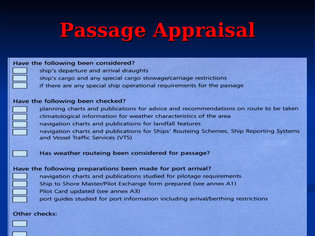
CHECK LIST FOR CHECK LIST FOR APPRAISALAPPRAISAL
Select appropriate largest scale Select appropriate largest scale charts for the passagecharts for the passage
Check that all charts that are going to Check that all charts that are going to be used have been corrected to date be used have been corrected to date from the latest information availablefrom the latest information available
Check that all radio navigational Check that all radio navigational warnings, including Navtex affecting warnings, including Navtex affecting the area have been receivedthe area have been received
18
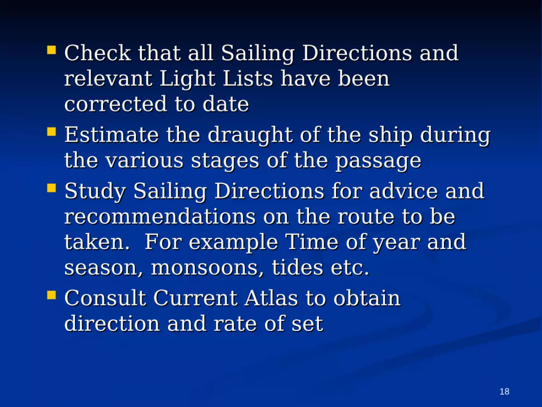
Check that all Sailing Directions and Check that all Sailing Directions and relevant Light Lists have been relevant Light Lists have been corrected to datecorrected to date
Estimate the draught of the ship during Estimate the draught of the ship during the various stages of the passagethe various stages of the passage
Study Sailing Directions for advice and Study Sailing Directions for advice and recommendations on the route to be recommendations on the route to be taken. For example Time of year and taken. For example Time of year and season, monsoons, tides etc.season, monsoons, tides etc.
Consult Current Atlas to obtain Consult Current Atlas to obtain direction and rate of setdirection and rate of set

19
Consult Tide Tables and Tidal Atlas to Consult Tide Tables and Tidal Atlas to obtain times, heights, direction and obtain times, heights, direction and rate of setrate of set
Study climatological information for Study climatological information for weather characteristics of the area. weather characteristics of the area. For example fog, hurricanes, For example fog, hurricanes, monsoons, rain, icebergs etc. monsoons, rain, icebergs etc.
Study charted navigational aids, Study charted navigational aids, coastline characteristics and coastline characteristics and availability and coverage of position availability and coverage of position fixing systems such as Loran C and fixing systems such as Loran C and GPS GPS
20
Check the requirements of Traffic Check the requirements of Traffic separation and Routing schemes can separation and Routing schemes can be metbe met
Consider the volume and flow of traffic Consider the volume and flow of traffic likely to be encountered. For example likely to be encountered. For example in areas such as Dover Strait, Straits in areas such as Dover Strait, Straits of Gibraltar etc.of Gibraltar etc.
Study the manoeuvring characteristics Study the manoeuvring characteristics of the ship to decide upon safe speed of the ship to decide upon safe speed and where appropriate, allowance for and where appropriate, allowance for turning circle at course alteration turning circle at course alteration points i.e. wheel over positionspoints i.e. wheel over positions

21
If a pilot is to be embarked, make a careful If a pilot is to be embarked, make a careful study of the area at the pilot boarding point study of the area at the pilot boarding point for pre-planning any intended manoeuvresfor pre-planning any intended manoeuvres
Where appropriate, study all available port Where appropriate, study all available port information data. E.g A guide to port entryinformation data. E.g A guide to port entry
Check any additional items which may be Check any additional items which may be required by the type of vessel, such as light required by the type of vessel, such as light signals, flag signals, Suez search light that signals, flag signals, Suez search light that may be required for a particular locality or may be required for a particular locality or passagepassage
Be aware of the effects of stowage and type Be aware of the effects of stowage and type of cargo such as deck or dangerous cargoof cargo such as deck or dangerous cargo

22
Passage AppraisalPassage Appraisal
These items are discussed in These items are discussed in some detail below. Only some detail below. Only British and American British and American catalogue numbers are catalogue numbers are quoted. Other, similar, quoted. Other, similar, publications may be available publications may be available from other national sources.from other national sources.

23
Passage AppraisalPassage Appraisal
1 CHART CATALOGUE Published annually by the Hydrographer to the Navy
(British) as NP 131 and by the Defence Mapping Agency
(US) as CATP2VOlU.

24
Passage Appraisal Passage Appraisal ChartsCharts
Many merchant ships carry British charts published by Many merchant ships carry British charts published by the Hydrographer of the Navy. However, there are areas the Hydrographer of the Navy. However, there are areas of the world where the mariner may well be advised to of the world where the mariner may well be advised to consider using locally published charts as well. British consider using locally published charts as well. British Admiralty policy is to chart all British home and most Admiralty policy is to chart all British home and most Commonwealth and some Middle Eastern waters on a Commonwealth and some Middle Eastern waters on a scale sufficient for safe navigation. Elsewhere the policy scale sufficient for safe navigation. Elsewhere the policy is to publish such charts as will enable the mariner to is to publish such charts as will enable the mariner to cross the oceans and proceed along the coasts to reach cross the oceans and proceed along the coasts to reach the approaches to ports. Along many coasts not covered the approaches to ports. Along many coasts not covered in detail by British charts the mariner may find it better in detail by British charts the mariner may find it better to use the charts of the hydrographic office of the to use the charts of the hydrographic office of the relevant country.relevant country.

25
Passage Appraisal Passage Appraisal ChartsCharts
Both US and Canadian regulations Both US and Canadian regulations require that vessels in their waters require that vessels in their waters must carry and usemust carry and use the appropriate the appropriate charts. This means that the vessel's charts. This means that the vessel's chart outfit may not meet the chart outfit may not meet the regulations. Navigators need to regulations. Navigators need to ensure that they have the correct ensure that they have the correct charts.charts.

26
Passage Appraisal Passage Appraisal Charts Charts
Approximately 50 countries are listed as Approximately 50 countries are listed as having established hydrographic offices having established hydrographic offices publishing charts of their national waters. publishing charts of their national waters. Addresses of the agents appointed by such Addresses of the agents appointed by such offices may be obtained from The offices may be obtained from The Catalogue of Agents for the Sale of Charts, Catalogue of Agents for the Sale of Charts, published by the published by the International Hydrographic Bureau,International Hydrographic Bureau, 7 Avenue President J. F. Kennedy, 7 Avenue President J. F. Kennedy, BP 445, MC98011BP 445, MC98011Monaco Cedex, Principaute de Monaco Cedex, Principaute de Monaco.Monaco.

27
Passage Appraisal Passage Appraisal Charts Charts
International standard chart symbols International standard chart symbols and abbreviations allow foreign and abbreviations allow foreign charts to be used with little difficulty charts to be used with little difficulty but care must be taken to establish but care must be taken to establish the chart datums used. the chart datums used.

28
Passage AppraisalPassage Appraisal
OCEAN PASSAGES FOR THE WORLDOCEAN PASSAGES FOR THE WORLD Published by the Published by the
Hydrographer of Hydrographer of the Navy (British) the Navy (British) as NP 136; as NP 136; contains contains information on information on planning ocean planning ocean passages, passages, oceanography and oceanography and currents. currents.
29
Passage AppraisalPassage Appraisal
ROUTEING CHARTS & PILOT CHARTSROUTEING CHARTS & PILOT CHARTS Routeing charts are published by the Routeing charts are published by the
Hydrographer of the Navy (British) as Hydrographer of the Navy (British) as Charts Nos. 5124-8. These are similar to Charts Nos. 5124-8. These are similar to thethe
Pilot Charts published by the Defence Pilot Charts published by the Defence Mapping Agency (USA). Mapping Agency (USA). (see Atlases (see Atlases NVPUBlOS-9 & PILOTl6 and PILOT5S).NVPUBlOS-9 & PILOTl6 and PILOT5S).
Both series give monthly information on Both series give monthly information on ocean routeing, currents, winds and ice ocean routeing, currents, winds and ice limits and various meteorological limits and various meteorological information.information.

30
Passage AppraisalPassage AppraisalSailing Directions and booksSailing Directions and books
British pilot books are published in 74 British pilot books are published in 74 volumes by the Hydrographer of the Navy and volumes by the Hydrographer of the Navy and give worldwide coverage. give worldwide coverage.
Sailing directions are published by the Sailing directions are published by the Defence Mapping Agency (USA) in the series Defence Mapping Agency (USA) in the series SDPUB 121-200. Some of these books are SDPUB 121-200. Some of these books are referred to as Planning Guides giving referred to as Planning Guides giving information essentially the same as the British information essentially the same as the British Ocean Passages for the World, others as Ocean Passages for the World, others as Enroute, giving similar information to the Enroute, giving similar information to the British pilot books. British pilot books.
31
Passage AppraisalPassage Appraisal
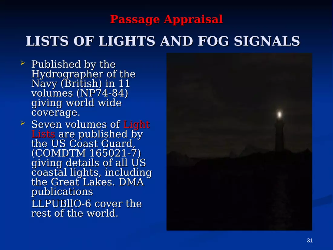
LISTS OF LIGHTS AND FOG SIGNALSLISTS OF LIGHTS AND FOG SIGNALS Published by the Published by the
Hydrographer of the Hydrographer of the Navy (British) in 11 Navy (British) in 11 volumes (NP74-84) volumes (NP74-84) giving world wide giving world wide coverage. coverage.
Seven volumes of Seven volumes of Light Light ListsLists are published by are published by the US Coast Guard, the US Coast Guard, (COMDTM 165021-7) (COMDTM 165021-7) giving details of all US giving details of all US coastal lights, including coastal lights, including the Great Lakes. DMA the Great Lakes. DMA publications publications LLPUBllO-6 cover the LLPUBllO-6 cover the rest of the world. rest of the world.

32
Passage AppraisalPassage AppraisalLISTS OF LIGHTS AND FOG LISTS OF LIGHTS AND FOG
SIGNALSSIGNALS

33
Passage AppraisalPassage Appraisal
TIDE TABLESTIDE TABLES Published by the Hydrographer of the Published by the Hydrographer of the
Navy (British), Navy (British), annually, in three annually, in three volumes, covering the world. Tidal volumes, covering the world. Tidal times and heights may be readily times and heights may be readily obtained by using a computer program obtained by using a computer program published by the British Admiralty published by the British Admiralty (SHM-159A). Worldwide tide tables (SHM-159A). Worldwide tide tables are also published by the US National are also published by the US National Ocean Service (NOSPBTT ). Ocean Service (NOSPBTT ).

34
Passage AppraisalPassage AppraisalTIDAL STREAM ATLASESTIDAL STREAM ATLASES
Published by the Hydrographer of the Navy Published by the Hydrographer of the Navy (British), these atlases cover certain areas (British), these atlases cover certain areas of North West Europe and Hong of North West Europe and Hong Kong.Kong.Tidal current tables are published by the Tidal current tables are published by the US National Ocean Service, covering the US National Ocean Service, covering the Atlantic coast of North America and the Atlantic coast of North America and the Pacific coast of North America and Asia. Pacific coast of North America and Asia. Tidal current charts are published by the Tidal current charts are published by the US National Ocean Service for four major US National Ocean Service for four major
US ports. US ports.

35
Passage AppraisalPassage AppraisalNOTICES TO MARINERSNOTICES TO MARINERS
Notices to Mariners are published in Notices to Mariners are published in weekly editions by both the British weekly editions by both the British and US hydrographic authorities, and US hydrographic authorities, enabling ships to keep their charts enabling ships to keep their charts and other publications up to date. and other publications up to date.

36
Passage AppraisalPassage AppraisalSHIPS' ROUTEINGSHIPS' ROUTEING
Routeing information is also shown on charts and Routeing information is also shown on charts and is included is included in the sailing directions.in the sailing directions. Published by Published by IMO,IMO, this publication gives this publication gives information on all routeing, traffic separation information on all routeing, traffic separation schemes, deep water routes and areas to be schemes, deep water routes and areas to be avoided which have been adopted by avoided which have been adopted by IMOIMO. .

37
Passage AppraisalPassage Appraisal
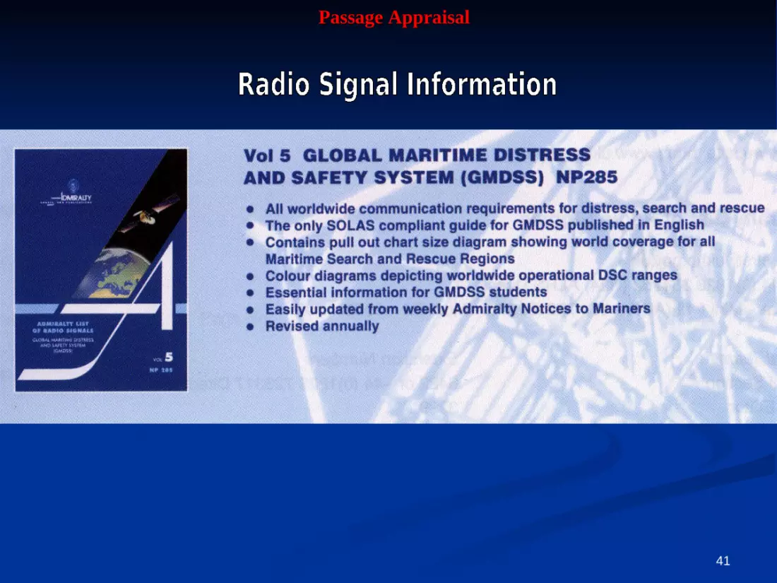
The (British) Admiralty List of Radio The (British) Admiralty List of Radio Signals consists of seven volumes of Signals consists of seven volumes of text and four booklets of diagrams text and four booklets of diagrams covering the following: covering the following:

38
Passage AppraisalPassage Appraisal

39
Passage AppraisalPassage Appraisal

40
Passage AppraisalPassage Appraisal
41
Passage AppraisalPassage Appraisal

42
Passage AppraisalPassage Appraisal

43
Passage AppraisalPassage Appraisal

44
Passage AppraisalPassage Appraisal CLIMATICCLIMATIC INFORMATIONINFORMATION
Climatic information is Climatic information is available from a available from a variety of sources variety of sources including the pilot including the pilot books, pilot charts and books, pilot charts and Ocean Passages Ocean Passages for for the Worldthe World already already mentioned. mentioned.
The British Admiralty The British Admiralty book book Meteorology for Meteorology for MarinersMariners gives further gives further general information. general information.

45
Passage AppraisalPassage AppraisalLOAD LINE CHARTLOAD LINE CHART
Load Line Rules are mandatory and the load Load Line Rules are mandatory and the load line zones are shown in line zones are shown in Ocean Passages for Ocean Passages for the Worldthe World or BA Chart D6083. or BA Chart D6083.
46
Passage AppraisalPassage AppraisalDISTANCE TABLESDISTANCE TABLES
Both Ocean and Coastal Distance Both Ocean and Coastal Distance Tables are available Tables are available from a variety from a variety of sources including British of sources including British Admiralty (NP350) and US DMA Admiralty (NP350) and US DMA publications NVPUBlS1 and publications NVPUBlS1 and NOSSPBPORTSDIST.NOSSPBPORTSDIST.
47
Passage AppraisalPassage AppraisalElectronic navigation system and booksElectronic navigation system and books
Information required will depend Information required will depend upon the systems in use on the upon the systems in use on the particular ship and should have been particular ship and should have been supplied with the equipment.supplied with the equipment.

48
Passage AppraisalPassage AppraisalRadio and local warningsRadio and local warnings
The latest information The latest information available on changes to available on changes to navigation aids, etc., will be navigation aids, etc., will be obtained from radio (including obtained from radio (including Navtext) and local warnings Navtext) and local warnings and must always be made and must always be made available to those responsible available to those responsible for appraisal and planning. for appraisal and planning. Local information is often Local information is often available from the harbour available from the harbour authority. For information on authority. For information on the worldwide navigational the worldwide navigational services and the transmitting services and the transmitting stations see Admiralty List of stations see Admiralty List of Radio Signals Vol 3.Radio Signals Vol 3.

49
Passage AppraisalPassage AppraisalDRAUGHT OF THE SHIPDRAUGHT OF THE SHIP
The anticipated draught The anticipated draught and trim of the ship at and trim of the ship at different stages of the different stages of the passage will need to be passage will need to be known in order to known in order to calculate the under-keel calculate the under-keel clearance when in clearance when in shallow water. The shallow water. The extreme height of the extreme height of the ship above the ship above the waterline, known as the waterline, known as the air draught, may also be air draught, may also be required.required.
50
Passage AppraisalPassage AppraisalOWNER'S AND OTHER SOURCESOWNER'S AND OTHER SOURCES
Supplementary information from the Supplementary information from the vessel's owners should be consulted, vessel's owners should be consulted, when available, as should reports when available, as should reports from otherfrom other vessels, information vessels, information from agents and port authority hand from agents and port authority hand books, regulations and guides to books, regulations and guides to port entry.port entry.

51
Passage AppraisalPassage AppraisalPERSONAL EXPERIENCEPERSONAL EXPERIENCE
The personal experiences of crew The personal experiences of crew members who have been to the members who have been to the anticipated ports and areas may anticipated ports and areas may prove of value.prove of value.

52
Passage AppraisalPassage AppraisalTHE MARINER'S HADBOOKTHE MARINER'S HADBOOK
Published by the Hydrographer of Published by the Hydrographer of the Navy [British), this book the Navy [British), this book contains information of general contains information of general interest to the marinerinterest to the mariner

53
Passage AppraisalPassage Appraisal
Having collected together Having collected together all the relevant information all the relevant information the Master, in consultation the Master, in consultation with his officers, will be with his officers, will be able to make an overall able to make an overall appraisal of the passage.appraisal of the passage.

54
Passage AppraisalPassage Appraisal
OCEAN OCEAN
55
Passage AppraisalPassage Appraisal
When planning ocean passages, the When planning ocean passages, the following should be consulted:following should be consulted:
small scale ocean planning and routeing small scale ocean planning and routeing charts providing information on ocean charts providing information on ocean currents, winds, ice limits etc.;currents, winds, ice limits etc.;
gnomonic projection ocean charts for gnomonic projection ocean charts for plotting great circle routes;plotting great circle routes;
the load line zone chart to ensure that the the load line zone chart to ensure that the Load Line (LL) Rules are complied with;Load Line (LL) Rules are complied with;
charts showing any relevant ships' routeing charts showing any relevant ships' routeing schemes.schemes.

56
Passage AppraisalPassage Appraisal
The passage may be a transoceanic The passage may be a transoceanic route in which case the first route in which case the first consideration will need to be the consideration will need to be the distance between ports, the availability distance between ports, the availability of bunkers and stores, etc.of bunkers and stores, etc.
A great circle is the shortest distance A great circle is the shortest distance but other considerations will need to but other considerations will need to be taken into account.be taken into account.
57
Passage AppraisalPassage Appraisal
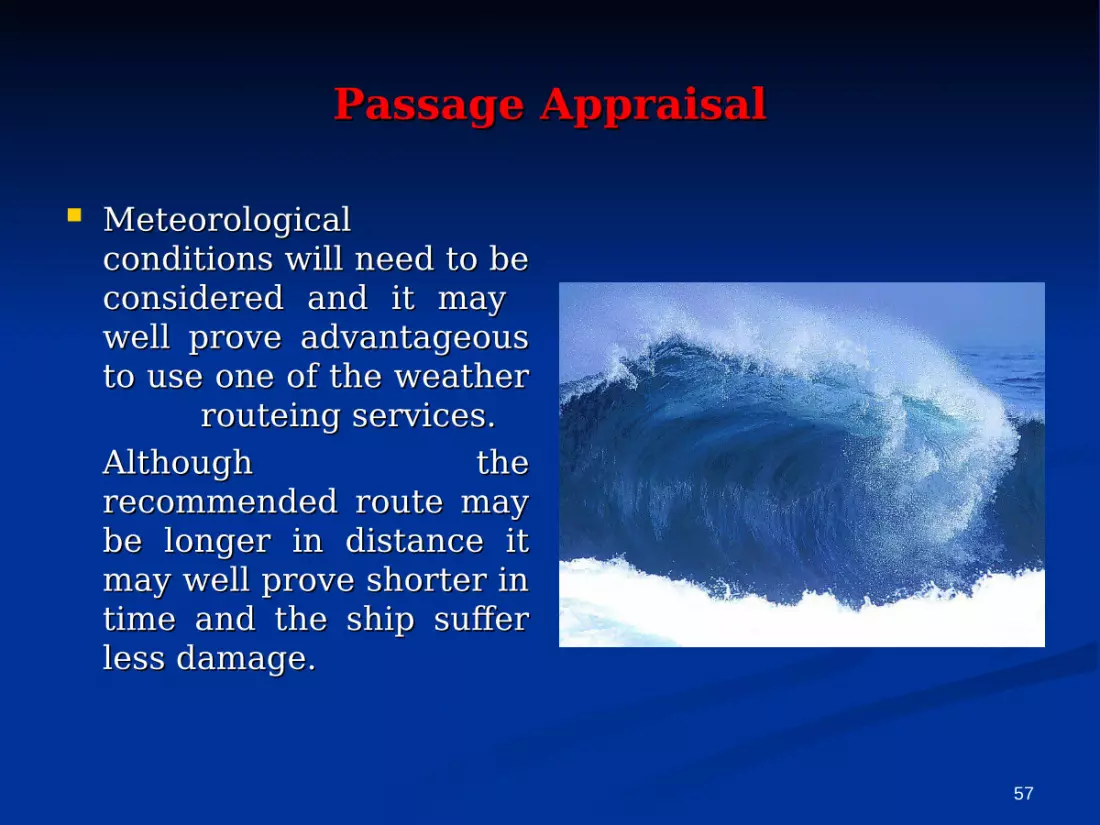
Meteorological Meteorological conditions will need to be conditions will need to be considered and it may considered and it may well prove advantageous well prove advantageous to use one of the weather to use one of the weather
routeing services. routeing services. Although the Although the recommended route may recommended route may be longer in distance it be longer in distance it may well prove shorter in may well prove shorter in time and the ship suffer time and the ship suffer less damage.less damage.

58
Passage AppraisalPassage Appraisal
Favourable ocean currents may offer Favourable ocean currents may offer improved overall passage speeds improved overall passage speeds offsetting any extra distance traveled;offsetting any extra distance traveled;

59
Passage AppraisalPassage Appraisal
Weather systems also need to be considered-e. g., Weather systems also need to be considered-e. g., a ship in the China Sea in summer needs plenty of a ship in the China Sea in summer needs plenty of sea room if it is liable to be involved in a tropical sea room if it is liable to be involved in a tropical revolving storm and a passage in high latitudes revolving storm and a passage in high latitudes may require ice conditions to be considered.may require ice conditions to be considered.

60
Passage AppraisalPassage Appraisal

61
Passage AppraisalPassage Appraisal

62
Passage AppraisalPassage Appraisal
63
Passage AppraisalPassage Appraisal
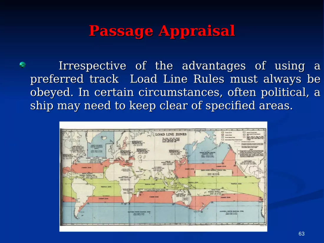
Irrespective of the advantages of using a Irrespective of the advantages of using a preferred track Load Line Rules must always be preferred track Load Line Rules must always be obeyed. In certain circumstances, often political, a obeyed. In certain circumstances, often political, a ship may need to keep clear of specified areas. ship may need to keep clear of specified areas.

64
COASTACOASTALL

65
When the ship is passing through areas When the ship is passing through areas where IMO-adopted traffic separation and where IMO-adopted traffic separation and routeing schemes are in operation, such routeing schemes are in operation, such routeing will have to be followed: In some routeing will have to be followed: In some coastal areas minimum distances off for coastal areas minimum distances off for specified vessels is determined by the specified vessels is determined by the relevant State.relevant State.
Some shipping companies may also Some shipping companies may also specify minimum distance off. specify minimum distance off.
The main consideration at the appraisal The main consideration at the appraisal stage will be to determine the distance stage will be to determine the distance tracks should be laid off coastlines and tracks should be laid off coastlines and dangers. dangers.
66
In archipelagos; it will be necessary to determine which straits and passages are to be used and whether or not pilotage is required. Under certain circumstances it may be preferable to divert around an archipelago.

67
Having made his appraisal of the Having made his appraisal of the intended voyage, whether it isintended voyage, whether it is a-short a-short coastal passage or a major trans ocean coastal passage or a major trans ocean passage, the master will determine his passage, the master will determine his strategy and then delegate one of his strategy and then delegate one of his officers to plan the voyage. On most ships officers to plan the voyage. On most ships this will be the Second Mate, on some a this will be the Second Mate, on some a designated navigating officer, on others designated navigating officer, on others the Master may have to do his own the Master may have to do his own planning. Irrespective of who actually planning. Irrespective of who actually does the planning, it has to be to the does the planning, it has to be to the requirements of the Master, who carries requirements of the Master, who carries the final responsibility for the plan.the final responsibility for the plan.
68
The plan needs to include all eventualities The plan needs to include all eventualities and contingencies. and contingencies. Passage plans are Passage plans are often made from pilot station to pilot often made from pilot station to pilot station but station but IMO Resolution IMO Resolution A.285(VIII), Annex A (v),A.285(VIII), Annex A (v), subsequently subsequently incorporated in the incorporated in the STCW Convention STCW Convention 1978, Regulation II/ 11978, Regulation II/ 1 states: states:
Despite the duties and obligations of Despite the duties and obligations of a pilot, his presence on board does a pilot, his presence on board does not relieve the officer in charge of the not relieve the officer in charge of the watch watch from his duties and from his duties and obligations for the safety of the ship.obligations for the safety of the ship.
69
This makes it quite clear that it is This makes it quite clear that it is necessary to plan from berth to necessary to plan from berth to berth even though it is anticipated berth even though it is anticipated that there will that there will be be a pilot a pilot conducting the vessel at certain conducting the vessel at certain stages of the voyage.stages of the voyage.