Embed Size (px)
Citation preview
Padma Kumara WithanaProvincial Surveyor GeneralSurvey Department of Sri LankaTel No: 0094552222037E-Mail : [email protected]
SURVEY DEPARTMENTOF SRI LANKA
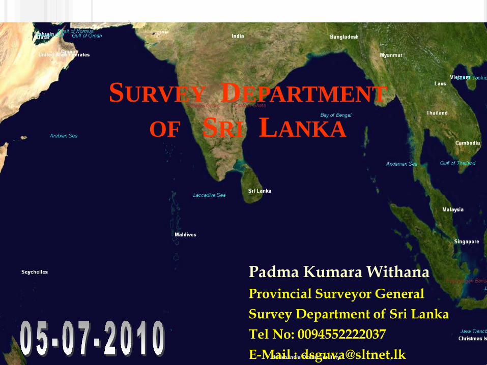
SRI LANKA FALLS BETWEENLAT 5° 55′ AND 9° 51′ LON 79° 41′ AND 81° 53′
º
3
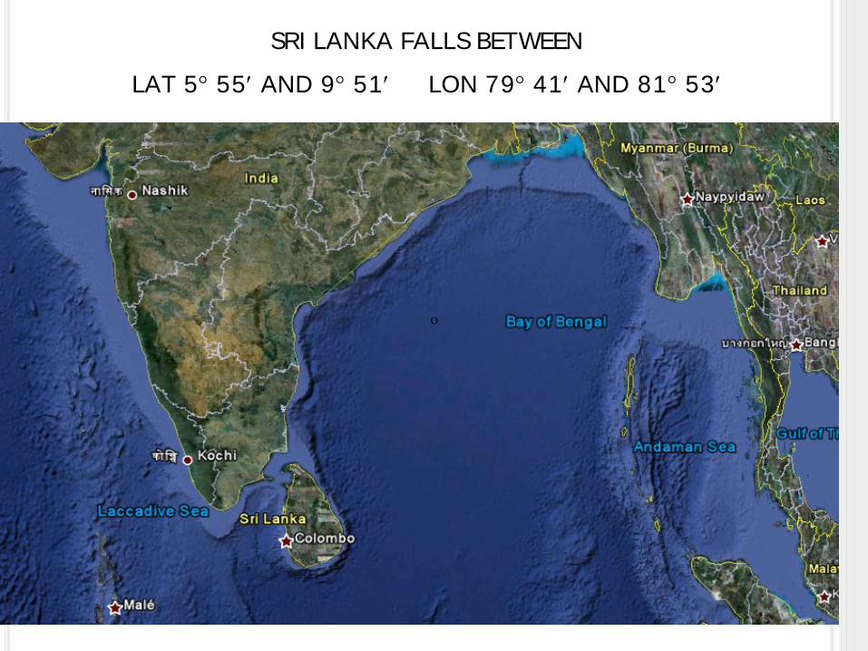
Established in 2nd August 1800 -Oldest Govt. Dept. in Sri Lanka

4
VISION
“ The Leader of Land Information Right through”

5
MISSION
Our mission is to provide high quality land information
products and services through professionally qualified and
dedicated personnel.

6
SURVEY ACT
The Surveyor General has powers under the Survey Act No.17 of 2002, Article 2(k) to receive, store, reproduce and distribute topographic,
cadastral and derived maps, remote sensed data, aerial photographs and other surveying and mapping documents.

TOPOGRAPHIC MAPS IN SRI LANKA
8
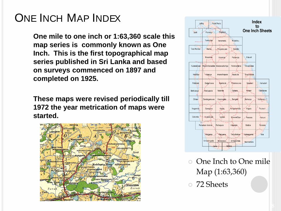
ONE INCH MAP INDEX
One Inch to One mile Map (1:63,360)
72 Sheets
One mile to one inch or 1:63,360 scale this map series is commonly known as One Inch. This is the first topographical map series published in Sri Lanka and based on surveys commenced on 1897 and completed on 1925.
These maps were revised periodically till 1972 the year metrication of maps were started.
9
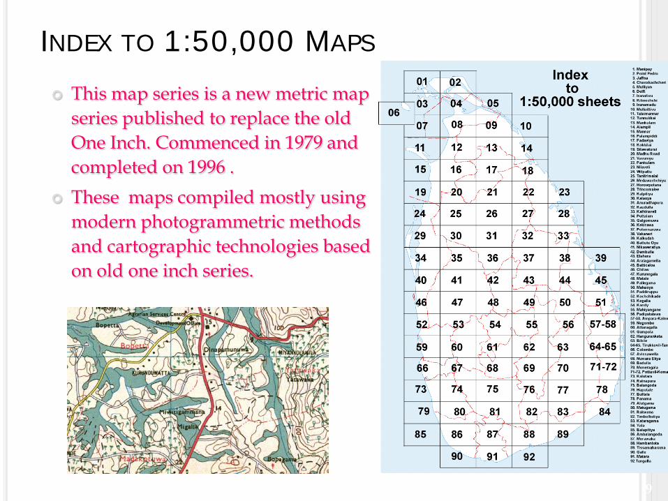
INDEX TO 1:50,000 MAPS
This map series is a new metric map series published to replace the old One Inch. Commenced in 1979 and completed on 1996 .
These maps compiled mostly using modern photogrammetric methods and cartographic technologies based on old one inch series.
10
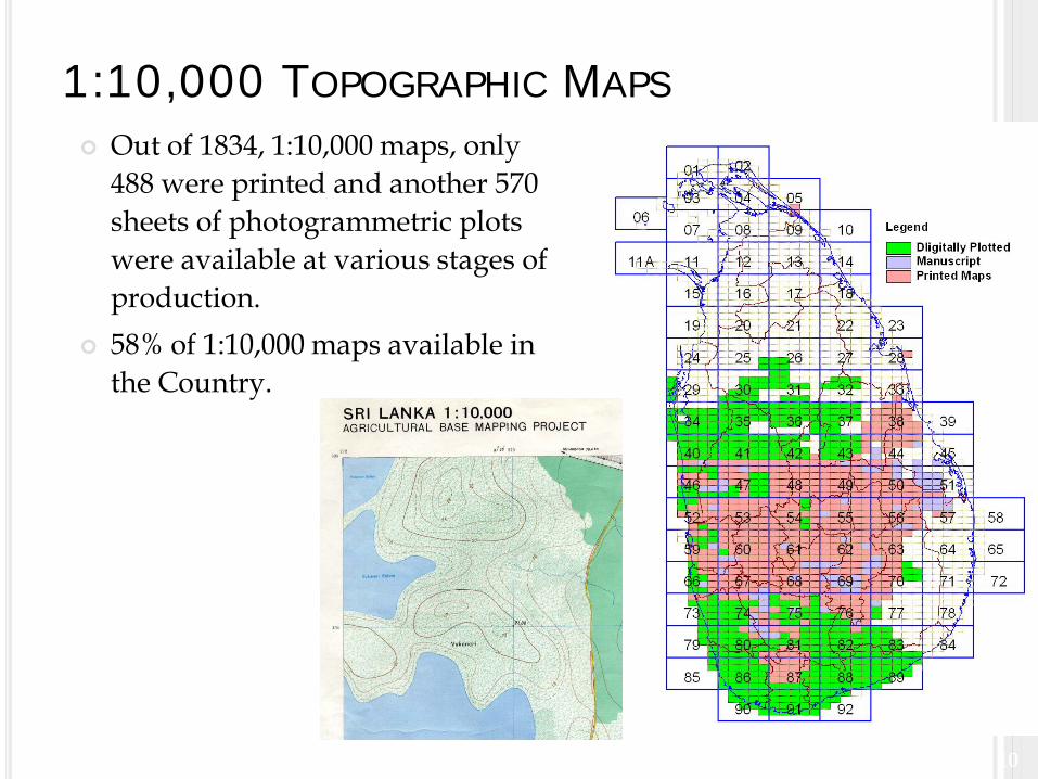
1:10,000 TOPOGRAPHIC MAPS Out of 1834, 1:10,000 maps, only
488 were printed and another 570 sheets of photogrammetric plots were available at various stages of production.
58% of 1:10,000 maps available in the Country.
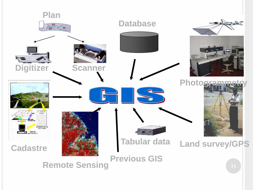
11Previous GIS
PlanDatabase
Digitizer
Photogrammetry
Remote Sensing
Land survey/GPS
Scanner
Tabular dataCadastre
12
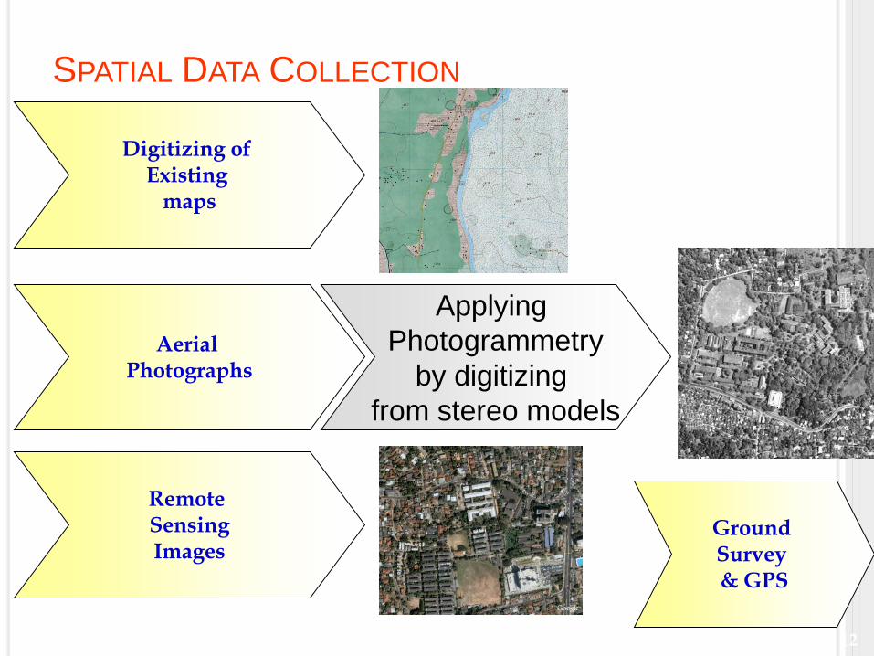
SPATIAL DATA COLLECTION
Digitizing of Existing
maps
Applying Photogrammetry
by digitizing from stereo models
Remote SensingImages
Aerial Photographs
Ground Survey & GPS
13
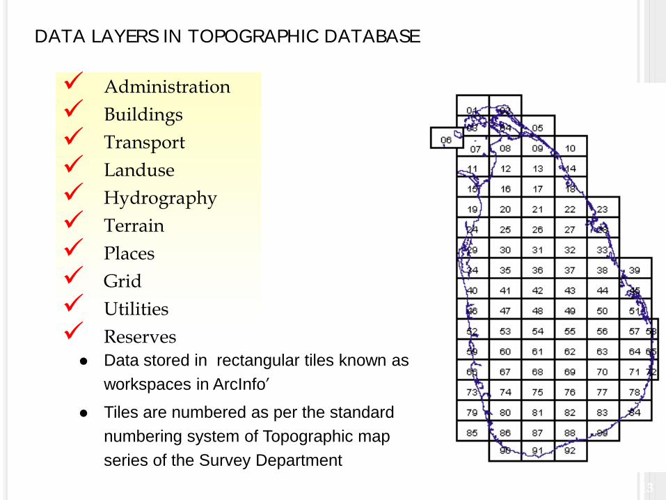
DATA LAYERS IN TOPOGRAPHIC DATABASE
Administration Buildings Transport Landuse Hydrography Terrain Places Grid Utilities Reserves Data stored in rectangular tiles known as
workspaces in ArcInfo’ Tiles are numbered as per the standard
numbering system of Topographic map series of the Survey Department
14
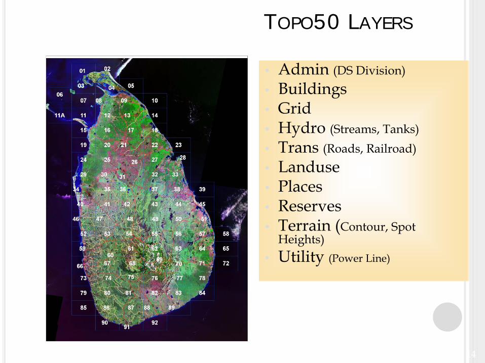
TOPO50 LAYERS
• Admin (DS Division)• Buildings• Grid• Hydro (Streams, Tanks)• Trans (Roads, Railroad)• Landuse• Places• Reserves• Terrain (Contour, Spot
Heights)• Utility (Power Line)
15
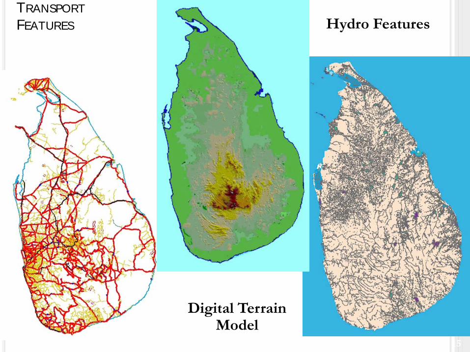
TRANSPORTFEATURES
Digital Terrain Model
Hydro Features
16
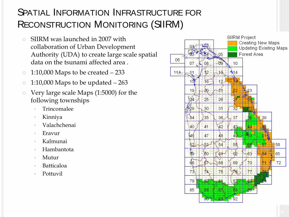
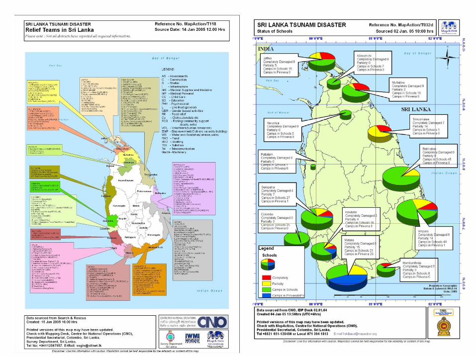
SPATIAL INFORMATION INFRASTRUCTURE FORRECONSTRUCTION MONITORING (SIIRM) SIIRM was launched in 2007 with
collaboration of Urban Development Authority (UDA) to create large scale spatial data on the tsunami affected area .
1:10,000 Maps to be created – 233 1:10,000 Maps to be updated – 263 Very large scale Maps (1:5000) for the
following townships Trincomalee Kinniya Valachchenai Eravur Kalmunai Hambantota Mutur Batticaloa Pottuvil
17
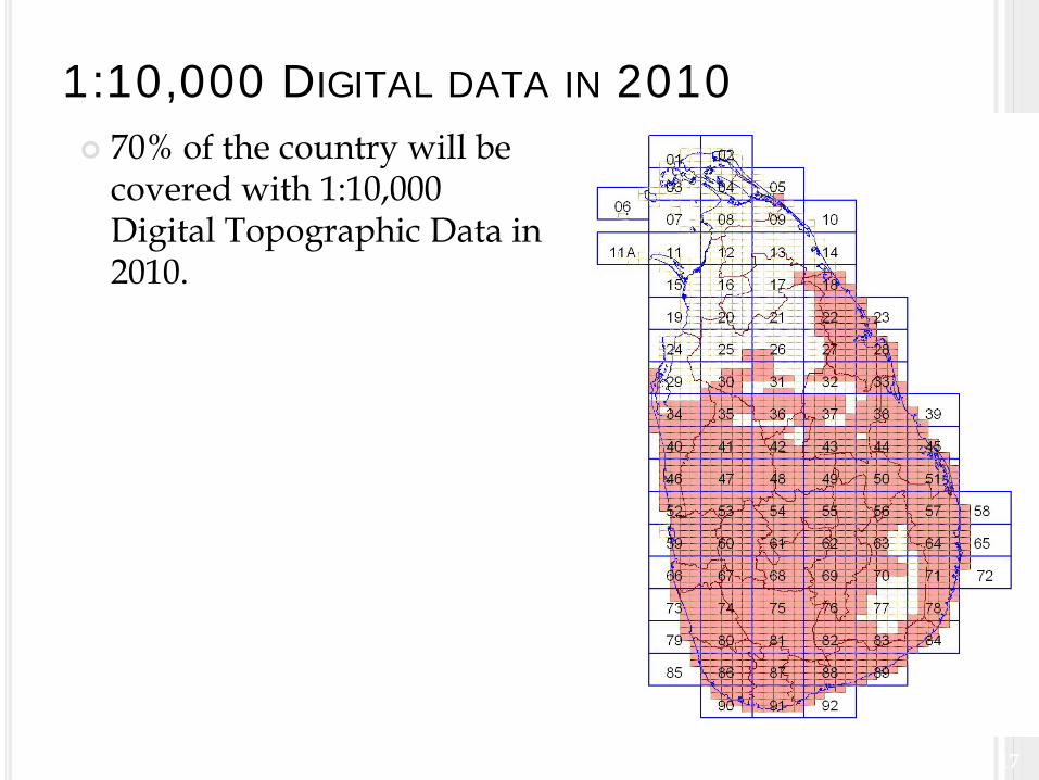
1:10,000 DIGITAL DATA IN 2010 70% of the country will be
covered with 1:10,000 Digital Topographic Data in 2010.
18Topographic Database
Updating
1: 50,000 Topographic Map Updating
By using ALOS (Advanced Land Observing Satellite Data) – PRISM (2.5m) Data
19
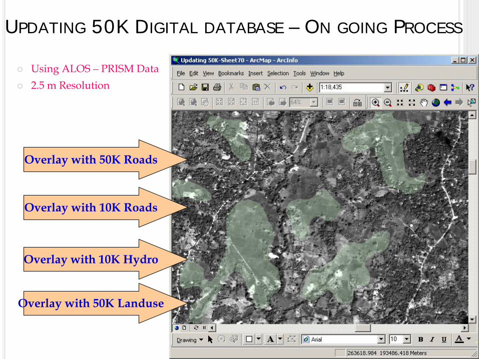
UPDATING 50K DIGITAL DATABASE – ON GOING PROCESS
Using ALOS – PRISM Data 2.5 m Resolution
Overlay with 50K Roads
Overlay with 10K Roads
Overlay with 10K Hydro
Overlay with 50K Landuse
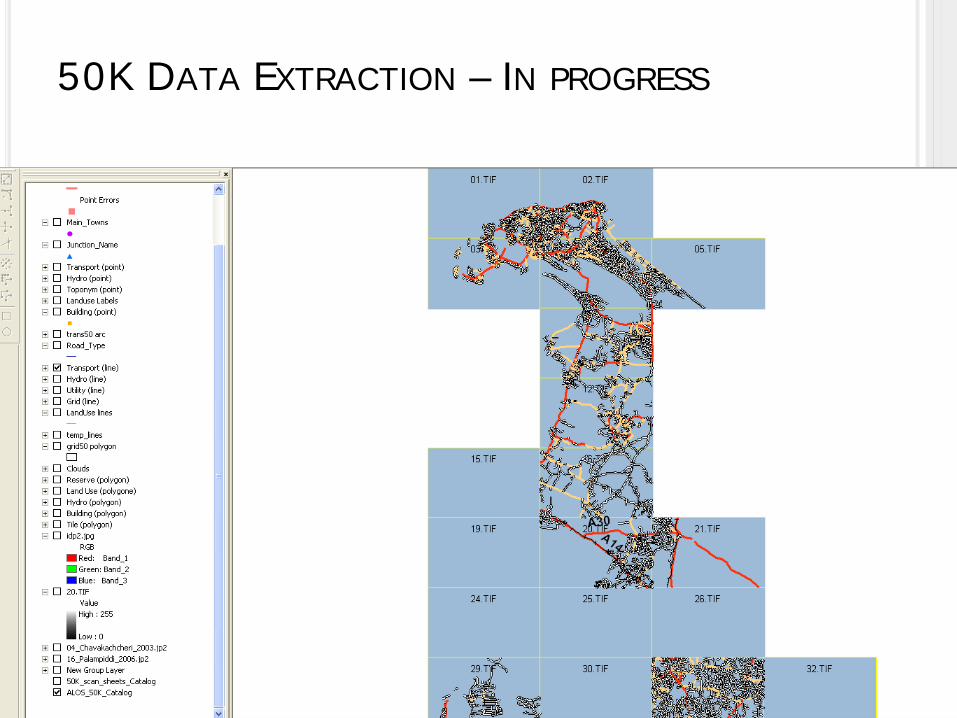
50K DATA EXTRACTION – IN PROGRESS
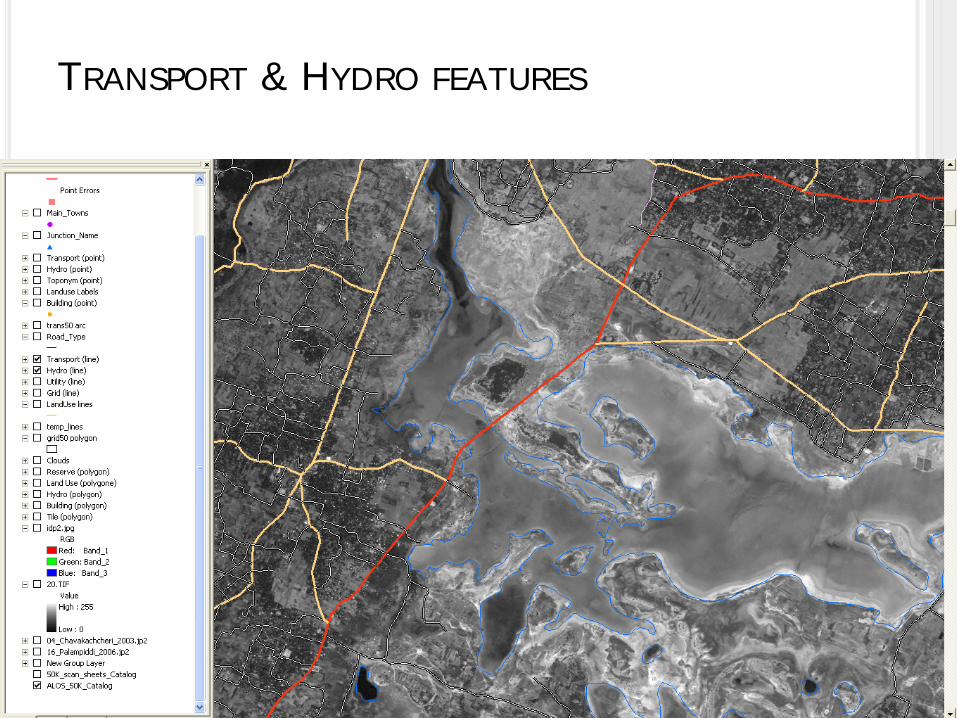
TRANSPORT & HYDRO FEATURES
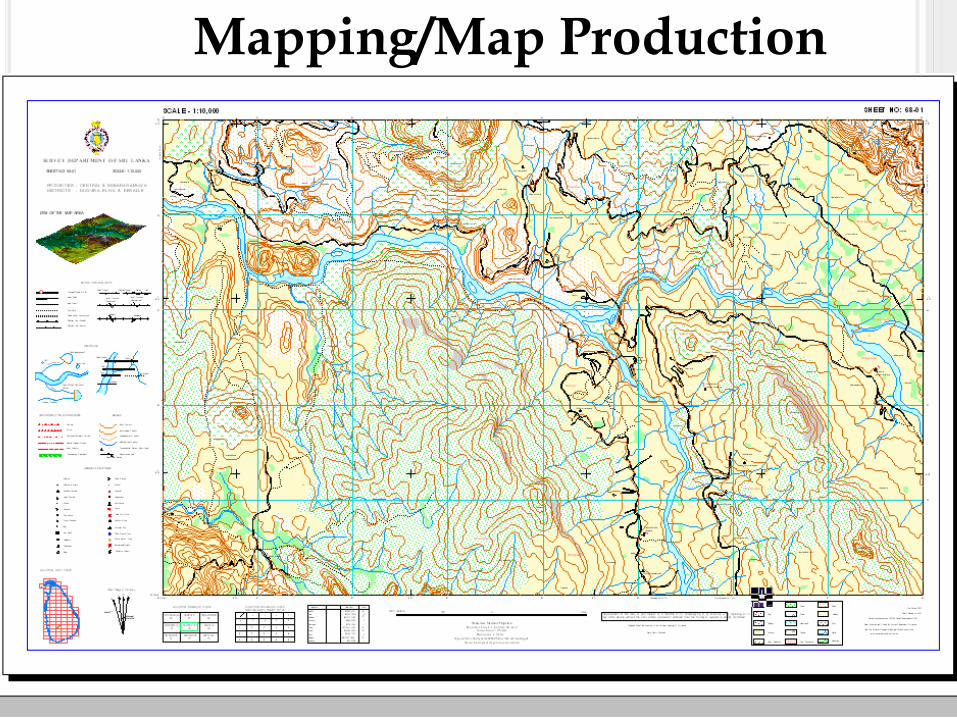
22Mapping/Map Production
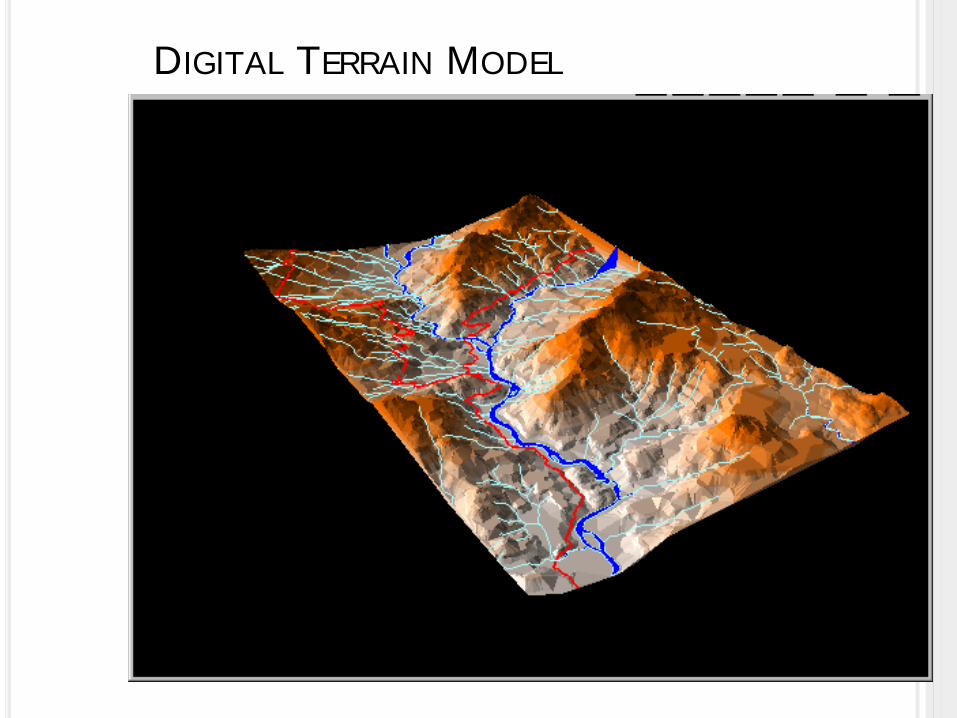
23DIGITAL TERRAIN MODEL
24

25
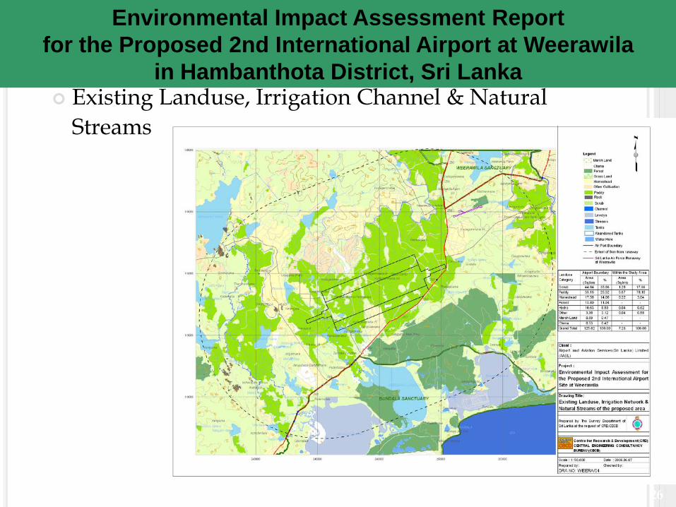
Alternative Sites & Obstacle limitation surface
Proposed 2nd International Airport at Weerawilain Hambanthota District, Sri Lanka - EIA
26
Existing Landuse, Irrigation Channel & Natural Streams
Environmental Impact Assessment Reportfor the Proposed 2nd International Airport at Weerawila
in Hambanthota District, Sri Lanka
27
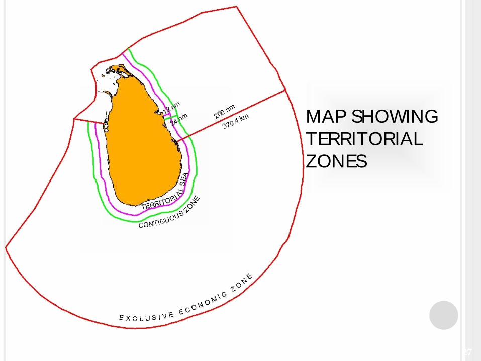
MAP SHOWING TERRITORIAL ZONES
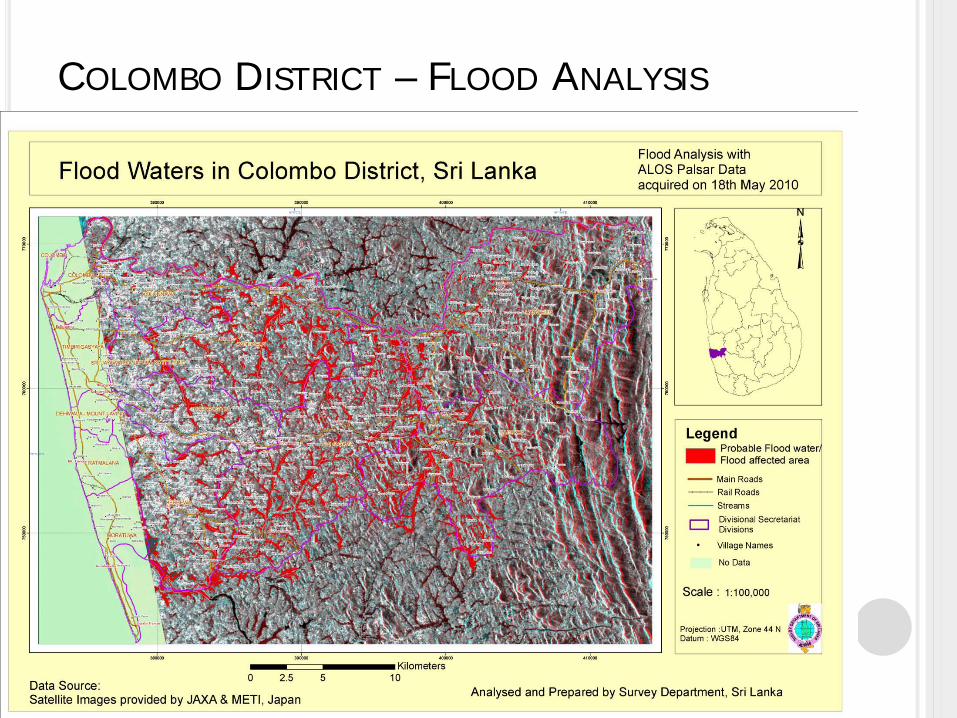
COLOMBO DISTRICT – FLOOD ANALYSIS
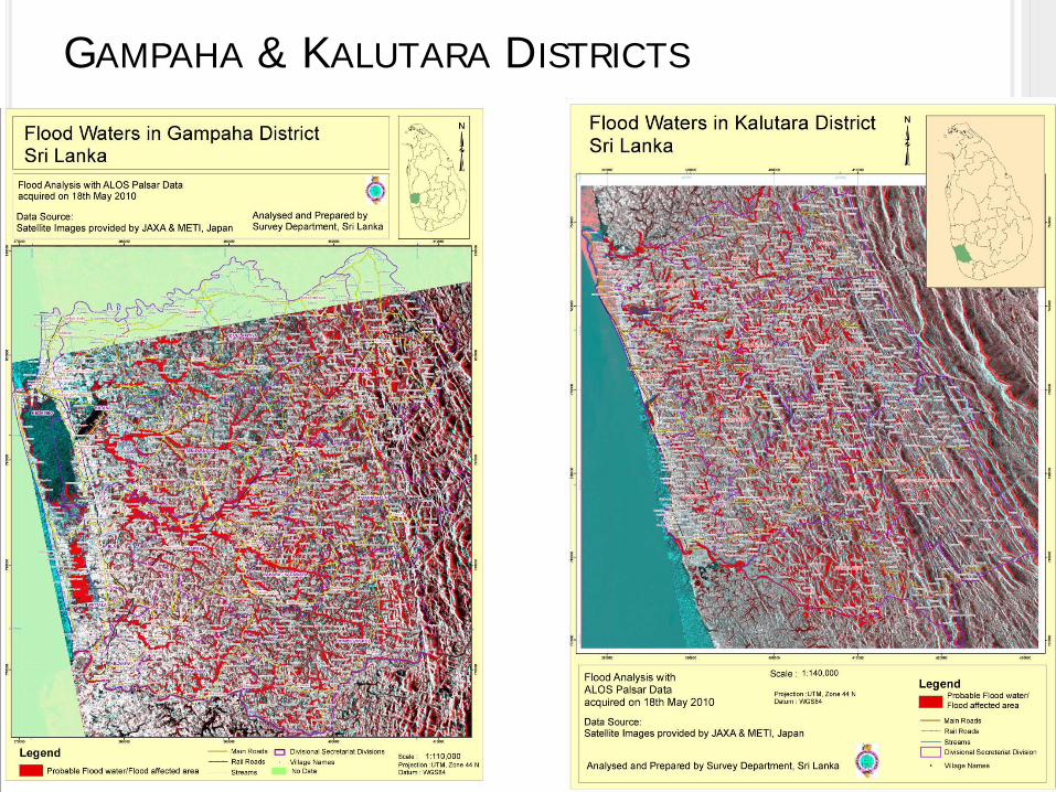
GAMPAHA & KALUTARA DISTRICTS