Embed Size (px)
Citation preview
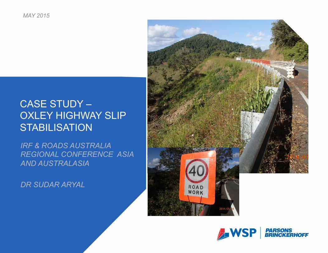
MAY 2015
IRF & ROADS AUSTRALIA REGIONAL CONFERENCE ASIA AND AUSTRALASIA DR SUDAR ARYAL
CASE STUDY – OXLEY HIGHWAY SLIP STABILISATION

LOCATION – STOPPING BAY, OXLEY HIGHWAY 2
Tamworth
Armidale Nambucca Heads
Kempsey
Port Macquarie
The site Stopping Bay
CONTENT OF PRESENTATION 3
! Project overview
! Project/design requirements
! Site conditions, challenges, design
! Progress in construction
! Conclusion
! Questions
Tamworth
Armidale
Nambucca Heads
Kempsey
Port Macquarie
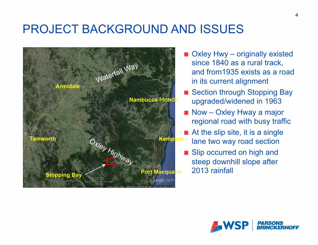
PROJECT BACKGROUND AND ISSUES 4
Stopping Bay
! Oxley Hwy – originally existed since 1840 as a rural track, and from1935 exists as a road in its current alignment
! Section through Stopping Bay upgraded/widened in 1963
! Now – Oxley Hway a major regional road with busy traffic
! At the slip site, it is a single lane two way road section
! Slip occurred on high and steep downhill slope after 2013 rainfall
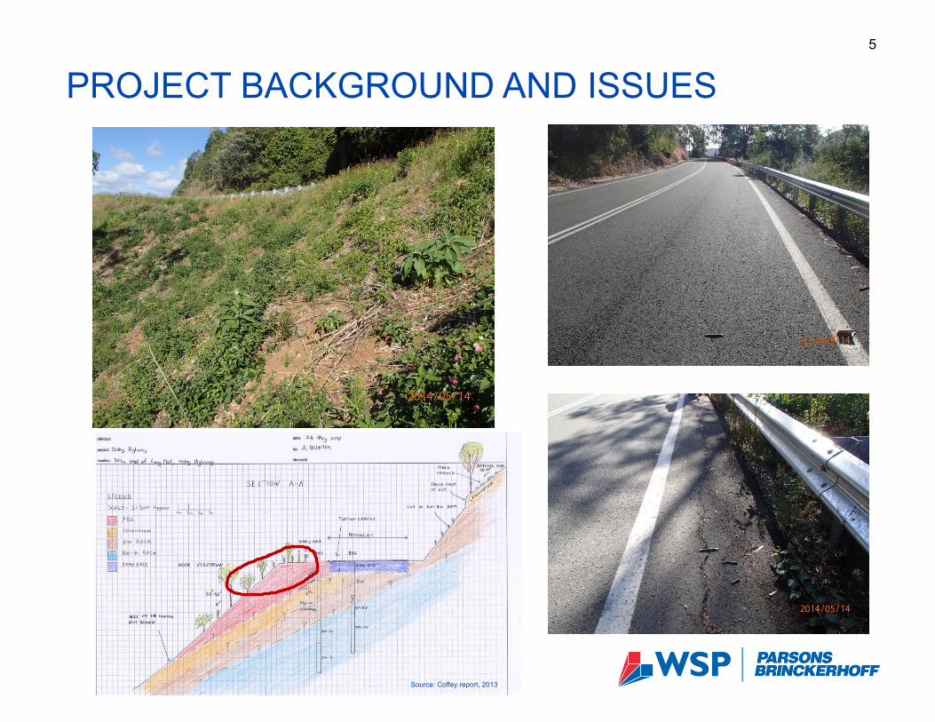
PROJECT BACKGROUND AND ISSUES 5
Source: Coffey report, 2013
PROJECT/DESIGN REQUIREMENTS 6
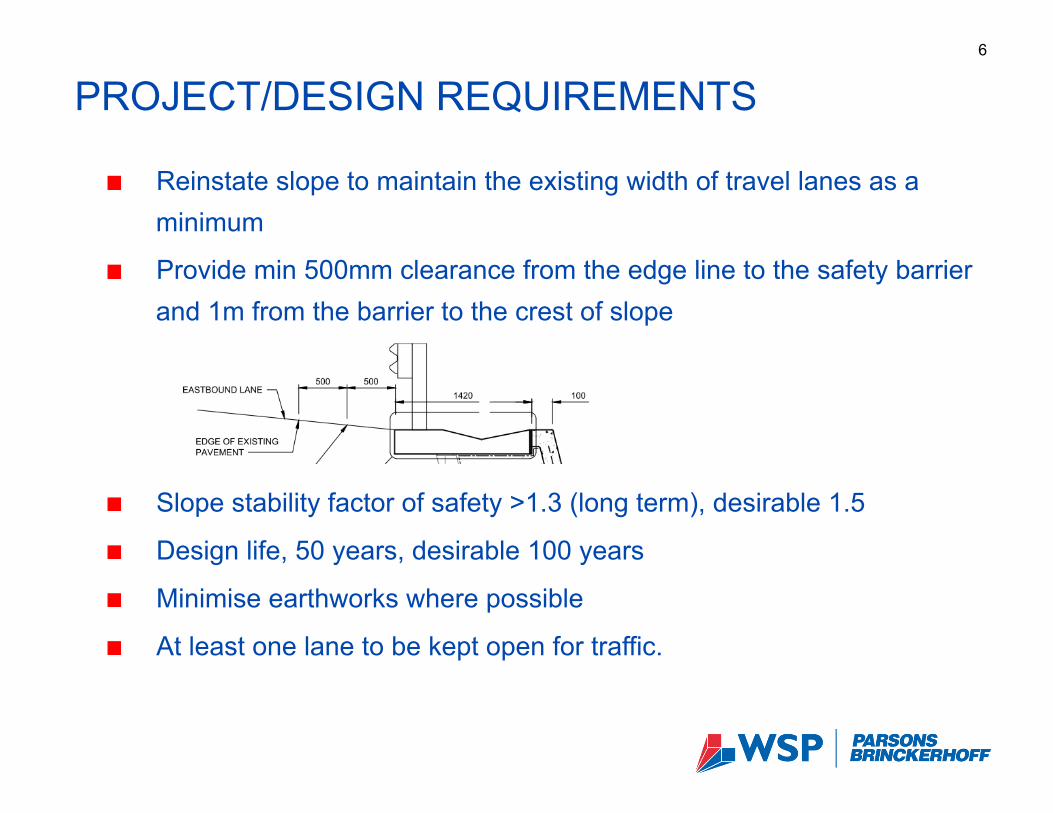
! Reinstate slope to maintain the existing width of travel lanes as a minimum
! Provide min 500mm clearance from the edge line to the safety barrier and 1m from the barrier to the crest of slope
! Slope stability factor of safety >1.3 (long term), desirable 1.5
! Design life, 50 years, desirable 100 years
! Minimise earthworks where possible
! At least one lane to be kept open for traffic.
SITE CONDITIONS 7
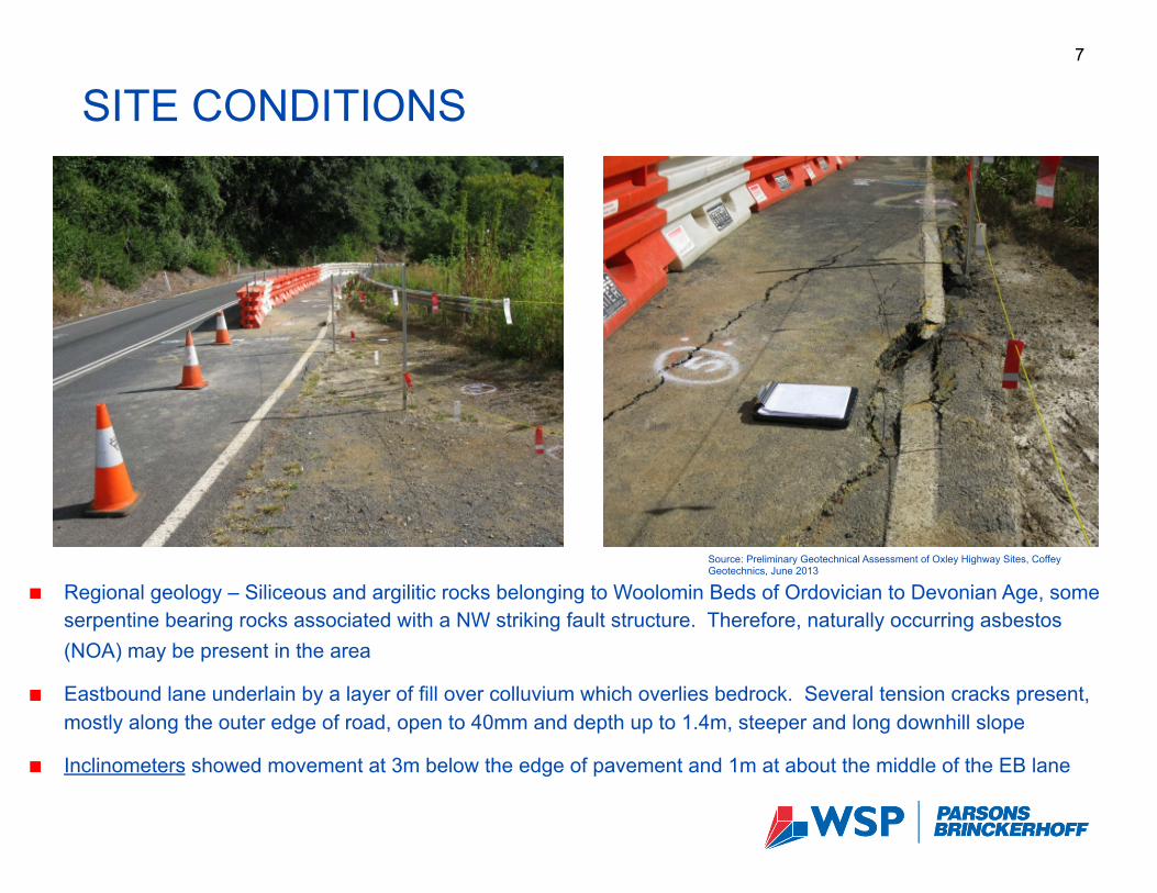
! Regional geology – Siliceous and argilitic rocks belonging to Woolomin Beds of Ordovician to Devonian Age, some serpentine bearing rocks associated with a NW striking fault structure. Therefore, naturally occurring asbestos (NOA) may be present in the area
! Eastbound lane underlain by a layer of fill over colluvium which overlies bedrock. Several tension cracks present, mostly along the outer edge of road, open to 40mm and depth up to 1.4m, steeper and long downhill slope
! Inclinometers showed movement at 3m below the edge of pavement and 1m at about the middle of the EB lane
Source: Preliminary Geotechnical Assessment of Oxley Highway Sites, Coffey Geotechnics, June 2013
SITE CONDITIONS 8
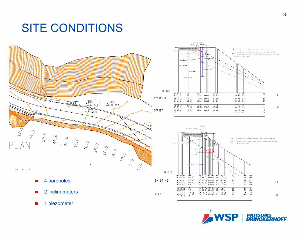
! 4 boreholes
! 2 inclinometers
! 1 piezometer
DESIGN CONSTRAINTS AND CHALLENGES 9
! Side cut with steep high cut batter on one side and steep long (>10m) downslope on the other side limiting access to the slope for construction works without significant earthworks
! Established trees and vegetation on the slope ! Single carriageway divided road with traffic flow in both direction ! Narrow road sections requiring lane widening to maintain the standard lane width
where required ! Regional arterial road busy with traffic with no alternative viable detour options,
hence, no possibility for complete closure for the road for construction ! Traffic management issues during construction ! Limited space for construction works and facilities during construction ! Constraints on type and size of construction plant due to limited space and
requirement to maintain traffic flow at all times ! Possible presence of naturally occurring asbestos (NOA).
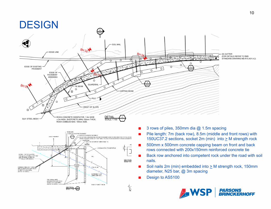
DESIGN 10
! 3 rows of piles, 350mm dia @ 1.5m spacing ! Pile length: 7m (back row), 8.5m (middle and front rows) with
150UC37.2 sections, socket 2m (min) into > M strength rock ! 500mm x 500mm concrete capping beam on front and back
rows connected with 200x150mm reinforced concrete tie ! Back row anchored into competent rock under the road with soil
nails. ! Soil nails 2m (min) embedded into > M strength rock, 150mm
diameter, N25 bar, @ 3m spacing ! Design to AS5100
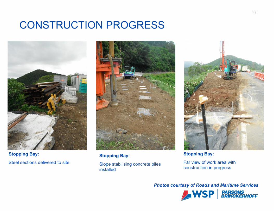
CONSTRUCTION PROGRESS 11
Photos courtesy of Roads and Maritime Services
Stopping Bay:
Slope stabilising concrete piles installed
Stopping Bay:
Steel sections delivered to site
Stopping Bay:
Far view of work area with construction in progress
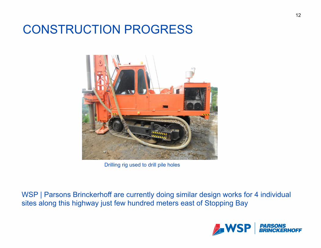
CONSTRUCTION PROGRESS 12
Drilling rig used to drill pile holes
WSP | Parsons Brinckerhoff are currently doing similar design works for 4 individual sites along this highway just few hundred meters east of Stopping Bay
CONCLUSIONS 13
! The design was developed to suit the project requirements and site constraints.
! A number of factors including:
- regular consultations with a prospective contractor,
- close liaison with Roads and Maritime Services at all phases of design development, and
- a rigorous independent review of the design resulted in the most effective and desired design outcomes.
! This project demonstrates the benefits of the adopted interactive design process:
- in achieving design and safety requirements
- in managing whole of life costs while minimising impact on road users.

ACKNOWLEDGEMENTS 14
WSP | Parsons Brinckerhoff would like to thank Roads and Maritime Services for permission to present this project at this conference
THANK YOU!
Thank you
15