Embed Size (px)
Citation preview

BGS cruise to Rockall-Hatton-Faroes region Project 06/02 RRS Charles Darwin CD180
Operations Report
Marine Coastal and Hydrocarbons Programme
Internal Report IR/06/076


BRITISH GEOLOGICAL SURVEY
MARINE COASTAL AND HYDROCARBONS PROGRAMME
INTERNAL REPORT IR/06/076
BGS cruise to Rockall-Hatton-Faroes region Project 06/02 RRS Charles Darwin CD180
Operations Report The National Grid and other Ordnance Survey data are used with the permission of the Controller of Her Majesty’s Stationery Office. Licence No: 100017897/2005.
D. J. Smith
Contributor/editor Keywords
K. Hitchen, H. Stewart, D.G.Wallis Report; Marine; Geophysical, Seismic Reflection; Magnetics, Gravity; Swath; Multibeam; Operations; CD180; BGS06/02; Airgun; Sparker.
Front cover
RRS Charles Darwin, Village Bay, St Kilda.
Bibliographical reference
SMITH, D.J., . 2006. BGS cruise to Rockall-Hatton-Faroes region Project 06/02 RRS Charles Darwin CD180 Operations Report. British Geological Survey Internal Report, IR/06/076. 48pp.
Copyright in materials derived from the British Geological Survey’s work is owned by the Natural Environment Research Council (NERC) and/or the authority that commissioned the work. You may not copy or adapt this publication without first obtaining permission. Contact the BGS Intellectual Property Rights Section, British Geological Survey, Keyworth, e-mail [email protected]. You may quote extracts of a reasonable length without prior permission, provided a full acknowledgement is given of the source of the extract. Maps and diagrams in this book use topography based on Ordnance Survey mapping.
Loanhead, Edinburgh British Geological Survey 2006 © NERC 2006. All rights reserved

The full range of Survey publications is available from the BGS Sales Desks at Nottingham, Edinburgh and London; see contact details below or shop online at www.geologyshop.com
The London Information Office also maintains a reference collection of BGS publications including maps for consultation.
The Survey publishes an annual catalogue of its maps and other publications; this catalogue is available from any of the BGS Sales Desks.
The British Geological Survey carries out the geological survey of Great Britain and Northern Ireland (the latter as an agency service for the government of Northern Ireland), and of the surrounding continental shelf, as well as its basic research projects. It also undertakes programmes of British technical aid in geology in developing countries as arranged by the Department for International Development and other agencies.
The British Geological Survey is a component body of the Natural Environment Research Council.
Marine Operations and Engineering, 2A Nivensknowe Road, Loanhead, Midlothian EH20 9AU
0131-448-2700 Fax 0131-448-2545 e-mail: [email protected]
British Geological Survey offices
BRITISH GEOLOGICAL SURVEY
Keyworth, Nottingham NG12 5GG
0115-936 3241 Fax 0115-936 3488 e-mail: [email protected] www.bgs.ac.uk Shop online at: www.geologyshop.com
Murchison House, West Mains Road, Edinburgh EH9 3LA 0131-667 1000 Fax 0131-668 2683
e-mail: [email protected]
London Information Office at the Natural History Museum (Earth Galleries), Exhibition Road, South Kensington, London SW7 2DE
020-7589 4090 Fax 020-7584 8270 020-7942 5344/45 email: [email protected]
Forde House, Park Five Business Centre, Harrier Way, Sowton, Exeter, Devon EX2 7HU
01392-445271 Fax 01392-445371
Geological Survey of Northern Ireland, Colby House, Stranmillis Court, Belfast BT9 5BF
028-9038 8462 Fax 028-9038 8461
Maclean Building, Crowmarsh Gifford, Wallingford, Oxfordshire OX10 8BB
01491-838800 Fax 01491-692345
Columbus House, Greenmeadow Springs, Tongwynlais, Cardiff, CF15 7NE
029–2052 1962 Fax 029–2052 1963
Parent Body
Natural Environment Research Council, Polaris House, North Star Avenue, Swindon, Wiltshire SN2 1EU
01793-411500 Fax 01793-411501 www.nerc.ac.uk

IR/06/076; Final 1.0 Last modified: 2006/12/19 11:38
Foreword This report covers the operation of last scientific cruise for NERC of the RRS Charles Darwin, CD180, BGS Project 06/02, a regional marine geophysical survey west of Scotland, carried out from 20th May to 9th June 2006. This field operation continues the regional geological mapping in this area that was initiated in 1992 as part of the BGS Rockall Continental Margin Project, but also concentrated on certain specific structures and target areas, which had been identified from previously collected data. The cruise was funded through the BGS Science Budget programme.
Acknowledgements As with any offshore work programme, this project was a team effort, with each and every person playing their full part in the continuous 24-hour operations. A full list of the BGS personnel taking part is included in Appendix 1 and their contribution to the success of the operation is hereby acknowledged. Grateful thanks are also due to Captain Peter Sarjeant, the other officers and crew of the RRS Charles Darwin, the technical support provided by Gareth Knight and colleagues of UKORS and Andy Louch and colleagues of the RSU logistical support, for their efforts and assistance to make this an efficient and smooth operation. Thanks also to Ken Hitchen and for the report review.
i

IR/06/076; Final 1.0 Last modified: 2006/12/19 11:38
Contents
Foreword ......................................................................................................................................... i
Acknowledgements......................................................................................................................... i
Contents.......................................................................................................................................... ii
Summary....................................................................................................................................... iv
1 Introduction ............................................................................................................................ 5
2 Narrative ................................................................................................................................. 5 2.1 Mobilisation.................................................................................................................... 5 2.2 Survey............................................................................................................................. 5
3 Equipment used...................................................................................................................... 8 3.1 Airgun system................................................................................................................. 8 3.2 Sparker system.............................................................................................................. 10 3.3 Gravity Meter ............................................................................................................... 10 3.4 Magnetometer............................................................................................................... 11 3.5 Multibeam..................................................................................................................... 12 3.6 Pinger............................................................................................................................ 12 3.7 Precision Echosounder ................................................................................................. 13
Appendix 1 Ship’s complement............................................................................................ 14
Appendix 2 Summary Daily Log.......................................................................................... 15
Appendix 3 Line Summary Log Sheet................................................................................. 39
Appendix 4 Gravity Base Ties.............................................................................................. 40 Corrected Ship Base............................................................................................................... 40 Calculated Drift ...................................................................................................................... 40
Appendix 5 Time Utilisation Diagrams............................................................................... 43 Time Utilisation in the survey area ........................................................................................ 43 Time Utilisation for total ship time........................................................................................ 43
Abbreviations............................................................................................................................... 44
ii

IR/06/076; Final 1.0 Last modified: 2006/12/19 11:38
PLATES
Plate 1 Deployment of Airguns and 30m hydrophone streamer .................................................... 8
Plate 2 Screen images of Airgun and Sparker data ........................................................................9
Plate 3 Seismic reflection recording layout and hardcopy printer ................................................. 9
Plate 4 Sparkarray and hydrophone 10m hydrophone streamer on an exceptional calm day...... 10
Plate 5 Gravity meter and recording PC .......................................................................................11
Plate 6 Deployment of marine magnetometer ..............................................................................11
Plate 7 Simrad EM12 multibeam recording and processing ........................................................12
Plate 8 PES (port) and Pinger (Starboard) ...................................................................................12
iii
IR/06/076; Final 1.0 Last modified: 2006/12/19 11:38
Summary This report describes the operation for BGS Project 06/02 (Charles Darwin CD180), from the mobilisation on the 18th May, the regional marine geophysical survey west of Scotland, 24th May to 7th June and demobilisation on 9th June.
The operational aims of the survey project were:
• To carry out a planned programme of 1900 km of marine geophysical surveying to link into existing data
The survey was designed to address several geological objectives including:
• Define size/shape of basalt window;
• Identify and/or constrain compressional folds/faults/thrusts
• Investigate the seismo-stratigraphy of the Faroe-Bank Channel with a view to identifying suitable potential borehole location(s).
The above work was completed ahead of schedule, thus allowing high-resolution seismic reflection lines to be run just south of St Kilda and Stanton Bank.
The geophysical techniques employed were high-resolution single channel seismic reflection, (Airgun and Sparker), gravitational field, magnetic field and multibeam bathymetry. All systems were digitally recorded, and in addition, airgun was digitally processed on line.
The vessel utilised was the RRS Charles Darwin Cruise CD180. The vessel provided an excellent platform for the work involved with good laboratory space, working deck space, general facilities and experienced officers and crew.
The main mobilisation took place between the 18th – 19th May 2006, in Falmouth, Cornwall. Operations were conducted over a 15-day period and demobilisation took place on the 9th June in Fairlie on the Clyde Estuary. Weather conditions varied; there were very few excellent days. There was one day lost to weather and lower quality data was accepted for some of the lines.
The survey was extremely productive with the entire planned programme being completed in 11 days. Additional lines were run just south of St Kilda and Stanton Bank, totalling 30 lines and 2183 km of data.
iv

IR/06/076; Final 1.0 Last modified: 2006/12/19 11:38
1 Introduction The British Geological Survey Project 06/02 was a marine geophysical survey (seismic reflection, gravitational field, magnetic field, multibeam bathymetry) covering areas from Rockall, Hatton Bank, the banks south west of the Faroe Islands and the Faroe Bank Channel. The survey was designed to address several geological objectives including:
• Rockall to Hatton Bank: Multibeam only to get full picture from sea-bed to depth (line is coincident with existing BGS seismic collected in 2000 which shows a variety of interesting features).
• Small area on Hatton Bank: Lines across basalt window to define size and shape of window and orientation of fold axes in Mesozoic.
• NW edge of Hatton Bank: Lines across SEA7 sites where video of coral obtained. Lines to investigate if there is relationship between coral growth and geological structure.
• NW edge of Hatton Bank: Lines anticipated to image geological structures some of which might be compressional in origin. Lines cross sea-bed ridges imaged by Spanish 2005 multibeam survey. Origin of ridges unknown (yet).
• Various banks south west of Faroe Islands: Lines designed to investigate the structure of major banks and Wyville-Thomson and Ymir ridges. One line crosses ‘Alpin Dome’ between Rosemary Bank and Bill Bailey’s Bank
• Faroe Bank Channel: Lines mainly to investigate seismic stratigraphy and sediment patterns in Faroe Bank Channel. Also to look for possible future borehole location(s).
• St Kilda: Short high resolution lines were run just south of St Kilda to tie in an existing piston core to existing BGS Deep Tow Boomer line.
• Stanton Bank: High resolution seismic reflection line were run for the MESH project to compliment previously acquired data in 2005 on project BGS 05/05 (CD174).
2 Narrative
2.1 MOBILISATION The mobilisation of the RRS Charles Darwin started on 18th May in Falmouth and went according to plan apart from damage to the sparkarray power cable that occurred whilst the 10ft bangbox container was unloaded from the lorry.
2.2 SURVEY
Saturday 20th May The vessel sailed at 10:00 for the final NERC scientific cruise of the RRS Charles Darwin. The prevailing poor weather, and the forecast received, dictated that the best course for the vessel to reach the starting point of the work programme, Rockall, would be through the Irish Sea. Even by taking this course instead of the Atlantic side of Ireland the sea state was poor and uncomfortable for all. Total power loss to the vessel was experienced at 23:00, cause at the time unknown. Power was restored within 15mins.
v

IR/06/076; Final 1.0 Last modified: 2006/12/19 11:38
Tuesday 23rd
Despite the uncomfortable ride the vessel made good progress arriving SE of Rockall Bank at 07:00. The speed of sound was checked with a sound velocity probe (SVP) to provide a speed of sound through the water column for the multibeam system. This was followed by running lines to check the calibration of the multibeam, heading west up the slope of Rockall Bank. Unfortunately due to the sea state the vessel could not run the reciprocal line down the slope. However a line reciprocal to the down slope line was run back up the slope. Unfortunately the vessel lost total power for the second time in 18 hours, this corrupted the multibeam data and so the check could not be made. By this time the vessel could not make headway due to the increase in swell and wind. The vessel was weathered off. On advice from Gareth Knight, it was decided that further checks would not be attempted to the multibeam, as the calibration was unlikely to be affected from the previous time the multibeam was used.
Wednesday 24th By dawn the sea state and wind speed had improved and allowed line 1, a multibeam only line, to start at the designated point approximately 15 miles south of Rockall. Initially the line was run at a speed of 4 knots due to the sea state. The speed was progressively increased throughout the day to the optimum 8 knots.
Thursday 25th Line 1 was completed in the morning. The airgun, sparker and magnetometer systems were deployed and up and running in an hour and a half in good sea conditions. Lines 2 to 5 were completed meeting the requirement to image a window within the basalt of Hatton Bank. Problems with compressor 2 overheating did not affect the data collection.
Friday 26th Transit to second area of interest on Hatton Bank, lines looking at areas of cold-water coral reefs and geological structures. Lines 6 to 8 are a line running in a generally northerly direction, with small course alterations. On line 10 the vessel had to slow for a time to allow a fishing vessel to pass. By the end of the day part of line 11 had been completed.
Saturday 27th
Continue on line 11 until completed and all equipment recovered just after 07:00. This completed the area around Hatton Bank. The vessel steamed at 10 knots to the start of a transit line across Lousy, Bill Bailey and Faroe Banks collecting additional multibeam on the way. Note data was collected at 10 knots and not the optimal 8 knots. No line number was given to this opportunist line. The vessel stopped 2 miles before the start of line 12 to perform a SVP deployment followed by deployment of the seismic equipment. Line 12 was started at 20:47.
Sunday 28th
In the early hours the wind picked up to 25 knots creating a large following swell, which at times broke onto the deck. The sparker was recovered at 05:30 due to poor data and risk to the equipment, the line continued, without break, with airgun. Although the airgun data quality was affected, the vessel was currently on the top of Lousy Bank with little penetration through the basalt. By 10:00 the wind had eased to 13 knots, though still with a large following swell. The swell had diminished enough by 12:30 to re-deploy the sparker, though the data is not of optimum quality. At 14:46 the deepest (1240m) part of the line between the Lousy and Bill Banks was reached. By 16:30 the wind had quickly moved 180 degrees, directly ahead of the vessel and increased to 30 knots. This caused speed fluctuations with the vessel and poor sparker data due to confused sea. The sparker was recovered. Various weather-induced problems followed, magnetometer cable caught on airgun frame, airgun hydrophone noisy, recovered and checked and the vessel found it hard to maintain the required constant speed. The line continued throughout with short loss of airgun data, while the hydrophone was checked and no sparker data for the times it was recovered to deck.
6

IR/06/076; Final 1.0 Last modified: 2006/12/19 11:38
Monday 29th
Sparker re-deployed in the early hours. At 08:46 the shallowest (88m) part of the Faroe Bank on this line was reached, wind still blowing 16 knots from the north. The line was completed at 20:03 and all equipment was recovered. An SVP was deployed whilst several airguns were changed out, the airgun frame welded up and the sparker trimmed.
Tuesday 30th
By midnight all equipment had been re-deployed and the vessel was turning onto the next line, running SW across the Faroe Bank Channel. Problems with the airgun hydrophone being entangled with the airgun frame resulted in the vessel circling the line. Line 13 was started at 01:54. Wind reduced to 10-15 knots throughout the day, the swell slowly followed. An emergency drill practice was undertaken mid-morning and included a safety quiz. By midnight line 14 was two-thirds completed.
Wednesday 30th
The day started with excellent weather, but by midday the wind had picked up to 17 knots from the south. The day ended approximately two-thirds along line 15 with the wind 15 knots from the southwest.
Thursday 1st
Line 15 continued, just after midnight a loss of air pressure to the airguns was traced to gun 1. This was isolated. Line 16 started late morning, with the wind and swell on the port stern quarter, 20+ knot winds were recorded throughout the day. The data were acceptable though not excellent with the sparker suffering the most.
Friday 2nd
Line 16 continued, the wind moving slowly around to west-southwest and varying in speed with squalls up to 25 knots. The vessel began to suffer from increased rolling throughout the day and consequently degradation in the data quality similar to the previous day. Line 16 finished at around 19:00, the sparker was recovered for trimming and re-deployed, line 17 started in an easterly direction, the swell directly astern.
Saturday 3rd
From midnight the wind ameliorated and the swell followed. During the night it was noticed that the on line airgun printer was failing to print all the shots. This problem continued intermittently for the rest of the survey and could not be specifically traced to either the printer or the CODA system that was sending the data. Line 17 finished at 06:03 and line 18 started immediately after a 45 deg course alteration. The CODA recording system lost the easting navigation input for 3 hours during the morning and the GPS signal produced apparent large jumps in position for an hour in the afternoon. The position recorded on each ping recorded on the CODA cannot be relied upon for this line. Line 18 finished at 15:53 and line 19 started half an hour later in a northerly direction.
Sunday 4th
Line 19 and 20 were completed and line 21 started all in excellent sea conditions.
Monday 5th
Line 21 was completed at 16:18, this completing the original survey plan. All equipment was recovered and the vessel steamed towards a position just south of St Kilda.
Tuesday 6th
Additional time allowed a short excursion around the world heritage site of St Kilda. To use the surplus time available two further work areas were proposed.
• An area just south of St Kilda to run seismic reflection lines across an existing piston core location to tie this into previously run BGS Deep Tow Boomer lines.
• Stanton Bank: To fill in data collected in 2005.
7

IR/06/076; Final 1.0 Last modified: 2006/12/19 11:38
Both these areas required high resolution seismic. Unfortunately no surface tow boomer was on board. The sparker system was adapted to optimise it for high resolution. All tips were made into a line for uniform depth, the power per tip was reduced, flotation was added to try to maintain a tow depth of 0.25 m, the vessel speed was reduced to increase the number of shots per km, the firing interval was reduced from 6 sec to 0.6 sec and the sampling rate and filter frequencies increased.
Work started at the St Kilda area 18:00 and 5 lines (22-26) were completed by 22:00. The equipment run was sparker, PES, pinger and multibeam. The pinger gave good results until the sparker was switched on and obliterated the pinger record. Upon completion all equipment was recovered and the vessel steamed to the next work area at Stanton Bank.
Wednesday 7th
07:30 arrived at Stanton Bank work area. After a short delay waiting for a fishing boat to move away, the first line, 27, was started at 07:54. Four lines (27-30) were completed by 22:00. All equipment was recovered and the vessel steamed towards Fairlie. This concluded the survey.
Thursday 8th
Steaming to Fairlie
Friday 9th
Arrived Fairlie 11:30. Allowed gravity meter to settle before switching off. 14:00 Demob equipment and depart the vessel and travel to Edinburgh.
3 Equipment used
3.1 AIRGUN SYSTEM Source: An array of 5 x 40 cu inch Bolt 600B airguns with waveshape kits and time break solenoids was utilised as the airgun source. Routinely, up to four guns were fired simultaneously, keeping the fifth gun as a ready spare. The number of guns used varied with water depth, with a minimum of 1 being used in the shallower areas. The firing rate varied from 6 – 7 seconds depending on water depth. The airgun array firing synchronisation was achieved by monitoring the time break solenoids and manually adjusting each airgun’s trigger as required. This introduces a short time delay into the system of between 25 and 38 milliseconds and thus the sea-bed return time is not an absolute measurement of depth. A 20ft compressor container belonging to BGS containing two CompAir Reavell type VHP36 compressors supplied the high-pressure air for the airguns. Air was fed from the compressors through the vessel’s internal pipe-work to the aft deck and connected into the BGS airgun control panel.
Plate 1 Deployment of Airguns and 30m-hydrophone streamer
8
IR/06/076; Final 1.0 Last modified: 2006/12/19 11:38
Hydrophone: A 4 channel SIG hydrophone summed to give a single channel 32m active length was utilised as the receiver for the airgun source.
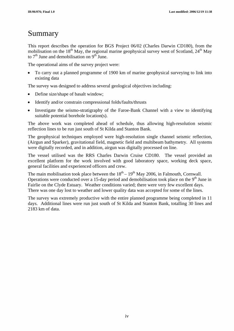
Recording: The BGS CODA DA200, software version 3.9.11.5L(3360) 2005 four-channel digital recording and processing system was utilised to record the raw data. The data were recorded to Flipdisks in CODA format with a sampling frequency of 3kHz, record length of 4 seconds and bandpass filter of 25-800 Hz. The start of recording was delayed in deep water to permit a minimum of 2 seconds of data below the sea-bed. The CODA system also received a navigation data string from the vessels Trimble DGPS system, and logged position, time and date for each shot.
Plate 2 Screen images of Airgun and Sparker data
On line processing: In addition to the recording described above, the CODA system was also used to process the data on-line and produce a real time hard copy output on an Ultra 120 thermal printer. Processes applied were time varied gain (TVG), time varied filtering (TVF) and trace mixing and, in extremely large amplitude sea swell situations, a swell filter. Both TVG and TVF were applied from the sea-bed, which was tracked automatically. A 1.5 sec record length was used for the on-line hard copy, with a delay adjusted to give an optimum record for the water depth.
Plate 3 Seismic reflection recording layout and hardcopy printer
9

IR/06/076; Final 1.0 Last modified: 2006/12/19 11:38
3.2 SPARKER SYSTEM Source: EG&G, nine candle, multi-tip sparkarray with 135 tips was utilised as the sparker source.
High Voltage Power Supply: An Applied Acoustic Engineering CSP2200 capacitor charging unit. This is a single unit, powered from the ship’s 240VAC supply incorporating switchable output energy up to a maximum of 2200 J. Apart from lines 2-5 (1800J) the whole survey was conducted at an output of 2200 J.
Plate 4 Sparkarray and hydrophone 10m hydrophone streamer on an exceptional calm day Hydrophone: A seven channel Teledyne 10m hydrophone, summing on the most part, all channels to give a single output, was utilised as the receiver for the sparker source.
Recording: This utilised the same CODA DA200 four-channel digital recording and processing system as the airgun, with the data recorded on the same file to Flipdisk in CODA format. The data were recorded with a sampling frequency of 5kHz, record length of 1.9 seconds and a bandpass filter of 100-1730 Hz. The start of recording was delayed in deep water to permit a minimum of 1 second of data below the seabed. As with the airgun, position, time and date were recorded with every shot.
On-line processing: The sparker data was processed on line for QA purposes of the recorded data. Processes applied were time varied gain (TVG), time varied filtering (TVF), swell filter (occasionally), and trace mixing. Both TVG and TVF were applied from the sea-bed, which was tracked automatically. A hardcopy output could not be obtained on line as the BGS only has one thermal printer that will operate with the CODA. During long transits and weather downtime hard copies were generated. A 700msec record length was used for the hard copy, with a delay adjusted to give an optimum record in the prevailing water depth. Ideally a second printer would be beneficial on these projects to obtain the on line hardcopies required and as a backup for the only printer.
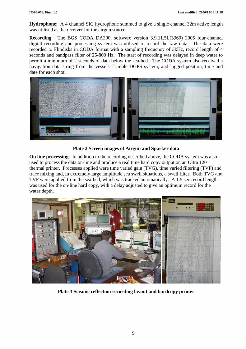
3.3 GRAVITY METER The gravity meter used was a ZLS Corporation UltraSys controlled LaCoste and Romberg sensor serial No. S75 system. This consists of a highly damped, zero-length spring type gravity sensor mounted on a gyro-stabilised platform, together with associated control and recording electronics. The sensor and control electronics were located in the ‘Controlled Temperature Laboratory’ adjacent to the ‘Main Laboratory’, this allowed easy access for observation. It was impractical to mobilise the meter in the vessel’s ‘Gravity Room’ due to access restrictions for
10
IR/06/076; Final 1.0 Last modified: 2006/12/19 11:38
both equipment and cables to main lab. Gravity was measured continuously and the gravity, spring tension and cross coupling correction values were logged at a one second interval in L&R Long Format onto the ship’s logging and processing system and internally in the gravity control computer. Additional backup data storage was achieved through utilising the zip drive incorporated with the gravity control computer. Data were also output to a colour printer for QC purposes. No data processing was carried out on the vessel.
The vessel suffered two complete blackouts during the transit to the work area. This resulted in the meter loosing power and having to be clamped and kept on heat using a battery powered, power supply. At the time of writing it is unknown if these two power blackouts have had an affect on the data, although this felt unlikely. However it was observed that the internal pressure within the meter varied with atmospheric pressure and this should be corrected for using the approximation of 1mGal for every 4Hpa of pressure change. This fault should be repaired before the next cruise.
Plate 5 Gravity meter and recording PC
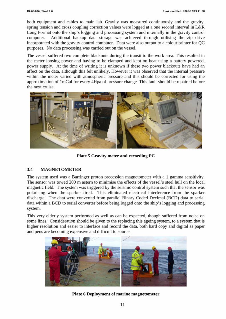
3.4 MAGNETOMETER The system used was a Barringer proton precession magnetometer with a 1 gamma sensitivity. The sensor was towed 200 m astern to minimise the effects of the vessel’s steel hull on the local magnetic field. The system was triggered by the seismic control system such that the sensor was polarising when the sparker fired. This eliminated electrical interference from the sparker discharge. The data were converted from parallel Binary Coded Decimal (BCD) data to serial data within a BCD to serial converter before being logged onto the ship’s logging and processing system.
This very elderly system performed as well as can be expected, though suffered from noise on some lines. Consideration should be given to the replacing this ageing system, to a system that is higher resolution and easier to interface and record the data, both hard copy and digital as paper and pens are becoming expensive and difficult to source.
Plate 6 Deployment of marine magnetometer
11

IR/06/076; Final 1.0 Last modified: 2006/12/19 11:38
3.5 MULTIBEAM The vessel has an elderly deep water Simrad EM12 multibeam system, which was used throughout the survey. Checks of the multibeam calibration were made when the vessel arrived at Rockall Bank. Lines were run up the bank and down on a reciprocal course. Unfortunately the weather was too severe for the vessel to run an accurate reciprocal course. A further line was run back up the slope, however the data was lost when the vessel had a complete blackout. After half a day of attempting to check the calibration of the multibeam system without success, coupled with the poor weather conditions, it was decided, with advice from the multibeam operator on board that no further attempts would be made. The vessel was weathered off for next 12 hours.
Note: The calibration of the multibeam historically has proven to be stable and as such no recalibration was deemed necessary or was planned for this project. The attempted checks of the multibeam calibration were just that, checks.
Several sound velocity profiles were made throughout the survey, Rockall Bank, before the start of line 12 and the Faroe Bank Channel. It was noted that the Faroe Bank Channel had fresh water close to the seabed.
Plate 7 Simrad EM12 multibeam recording and processing
3.6 PINGER
The 3.5kHz pinger is a transducer mounted in a tow fish and was towed over the starboard side. This was controlled by an IOS transceiver with the data recorded on a CodaOctopus360 acquisition system and was part of the standard shipboard equipment. The pinger gave poor sub-bottom records compared with the sparker system and was affected by the sparker especially in the St Kilda and Stanton Bank areas were the sparker was fired at the higher rate of 0.6 sec.
Plate 8 Recovery of PES (port) and Pinger (Starboard)
12

IR/06/076; Final 1.0 Last modified: 2006/12/19 11:38
3.7 PRECISION ECHOSOUNDER The Precision Echosounder (PES) is a 10kHz IOS transducer mounted in a tow fish and deployed off the port side close to amidships. This is controlled by a Simrad EA500 transceiver and display and was compensated for fish height with the depth recorded centrally. Paper printout was only collected for the lines around St Kilda and Stanton Bank.
13

IR/06/076; Final 1.0 Last modified: 2006/12/19 11:38
Appendix 1 Ship’s complement BGS RRS Charles
Darwin
Electronic Engineer- Principal Scientist
Master Dave Smith Peter Sarjeant
Mechanical Engineer Chief Officer Davie Baxter Peter Newton
Mechanical Engineer 2nd Officer Iain Pheasant Kieron Hailes
Marine Geologist 3rd Officer Heather Stewart Katie Rumbold
Student Geologist Chief Engineer Adrian Tuitt John Holt
Electronic Engineer 2nd Engineer Dave Wallis Glynn Collard
Electronic Engineer 3rd Engineer Michael Wilson John Harnett
3rd Engineer David Ardern
Engine Room Petty Officer
John Smyth
Electrical Officer David Holdsworth
UKORS, NOC Chief Petty Officer scientific
Michael Minnock
IT Support Chief Petty Officer Deck Gareth Knight Michael Drayton
Philip Allison Petty Officer Deck
Gerald Cooper Seaman
Stewart Barrett Seaman
Joseph Lambert Seaman
Ford Prefect Seaman
University of Malaga
Ship Catering Manager Paul Lucas
Instituto Espanol Oceangraphie
Marine Geologist Chef Miriam Sayago-Gil Darren Caines
Wilmot Isby Assistant Chef
Jacqueline Paterson Steward
Guardline
Len Phillips Supernumery
14

IR/06/076; Final 1.0 Last modified: 2006/12/19 11:38
Appendix 2 Summary Daily Log All times quoted are GMT
15

IR/06/076; Final 1.0 Last modified: 2006/12/19 11:38
Summary Daily Log
Date: Thursday 18th May 2006
Time
08:30 Arrive vessel, County Warf, Falmouth, start mobilisation
Sparker power cable damaged when 10ft container lifted off lorry
16:45 Depart vessel
Total km of completed lines: 0
Today (hours) Total (hours)
Mob/demob, setting up 8.25 8.25
On line 0.00 0.00
Turning 0.00 0.00
Steaming 0.00 0.00
Weather downtime 0.00 0.00
Equipment downtime 0.00 0.00
Vessel downtime 0.00 0.00
Port 7.25 7.25
16
IR/06/076; Final 1.0 Last modified: 2006/12/19 11:38
Summary Daily Log
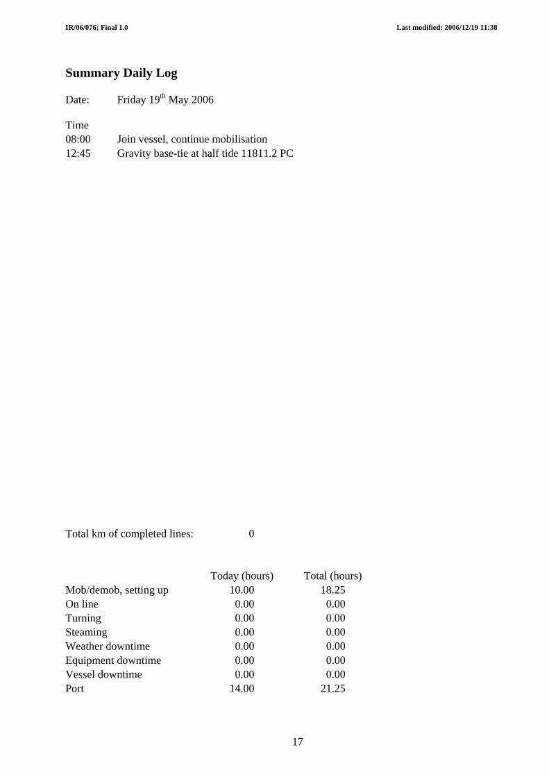
Date: Friday 19th May 2006
Time
08:00 Join vessel, continue mobilisation
12:45 Gravity base-tie at half tide 11811.2 PC
Total km of completed lines: 0
Today (hours) Total (hours)
Mob/demob, setting up 10.00 18.25
On line 0.00 0.00
Turning 0.00 0.00
Steaming 0.00 0.00
Weather downtime 0.00 0.00
Equipment downtime 0.00 0.00
Vessel downtime 0.00 0.00
Port 14.00 21.25
17

IR/06/076; Final 1.0 Last modified: 2006/12/19 11:38
Summary Daily Log
Date: Saturday 20th May 2006
Time 09:00 RRS Charles Darwin departs Falmouth for her last scientific cruise for NERC Weather poor, head up the Irish Sea 15:15 Emergency drill
Total km of completed lines: 0
Today (hours) Total (hours)
Mob/demob, setting up 0.00 18.25 On line 0.00 0.00 Turning 0.00 0.00 Steaming 14.00 14.00 Weather downtime 0.00 0.00 Equipment downtime 0.00 0.00 Vessel downtime 0.00 0.00 Port 10.00 31.25
18
IR/06/076; Final 1.0 Last modified: 2006/12/19 11:38
Summary Daily Log
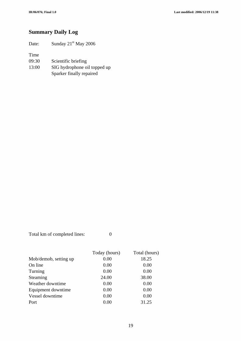
Date: Sunday 21st May 2006
Time 09:30 Scientific briefing 13:00 SIG hydrophone oil topped up Sparker finally repaired
Total km of completed lines: 0
Today (hours) Total (hours)
Mob/demob, setting up 0.00 18.25 On line 0.00 0.00 Turning 0.00 0.00 Steaming 24.00 38.00 Weather downtime 0.00 0.00 Equipment downtime 0.00 0.00 Vessel downtime 0.00 0.00 Port 0.00 31.25
19
IR/06/076; Final 1.0 Last modified: 2006/12/19 11:38
Summary Daily Log
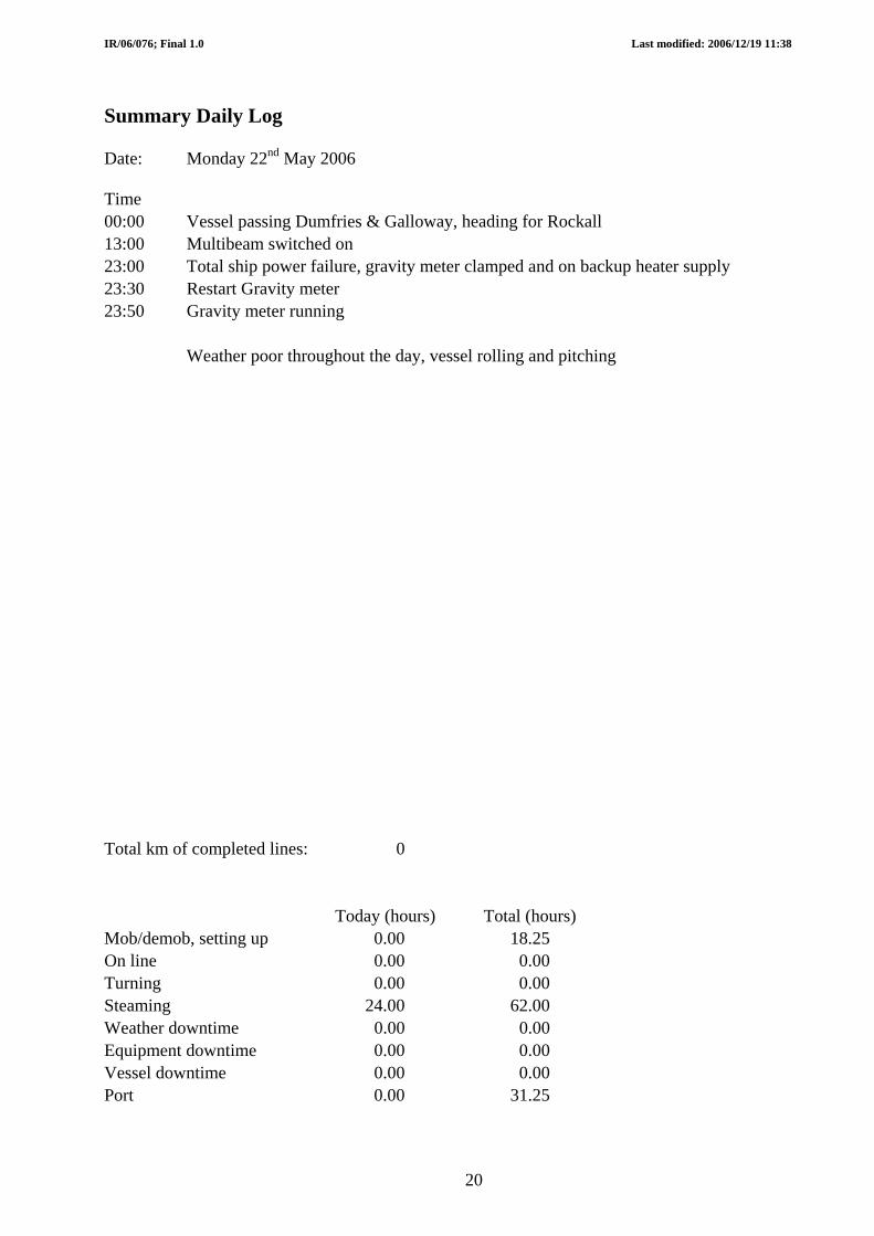
Date: Monday 22nd May 2006
Time 00:00 Vessel passing Dumfries & Galloway, heading for Rockall 13:00 Multibeam switched on 23:00 Total ship power failure, gravity meter clamped and on backup heater supply 23:30 Restart Gravity meter 23:50 Gravity meter running Weather poor throughout the day, vessel rolling and pitching
Total km of completed lines: 0
Today (hours) Total (hours)
Mob/demob, setting up 0.00 18.25 On line 0.00 0.00 Turning 0.00 0.00 Steaming 24.00 62.00 Weather downtime 0.00 0.00 Equipment downtime 0.00 0.00 Vessel downtime 0.00 0.00 Port 0.00 31.25
20

IR/06/076; Final 1.0 Last modified: 2006/12/19 11:38
Summary Daily Log
Date: Tuesday 23rd May 2006
Time 00:00 On passage to survey area 07:15 Hove to and deploy SV probe to obtain sound velocity profile for multibeam Water depth 2066, winching very slow, due to lightweight. 10:43 SV probe on deck 11:50 Run multibeam up slope towards Rockall Bank, dir NW, to check alignment Deploy pinger, weather deteriorating 14:40 Turn vessel and reciprocal line, vessel cannot maintain course due to weather 15:45 Run line back up slope on reciprocal course to previous line, dir NW Wind now gusting 35 knots from NW 16:26 Total ship power failure, vessel pushed beam on, gravity meter clamped 16:32 Vessel power restored, multibeam calibration data lost Vessel cannot make headway in present sea conditions, decide not to rerun checks 16:50 Gravity meter operating
23:59 Vessel heading towards start of first line, but is effectively hove to due to weather conditions
Total km of completed lines: 0
Today (hours) Total (hours)
Mob/demob, setting up 8.75 27.00
On line 0.00 0.00
Turning 0.00 0.00
Steaming 7.25 69.25
Weather downtime 8.00 8.00
Equipment downtime 0.00 0.00
Vessel downtime 0.00 0.00
Port 0.00 31.25
21

IR/06/076; Final 1.0 Last modified: 2006/12/19 11:38
Summary Daily Log
Date: Wednesday 24th May 2006
Time
00:00 Vessel proceeding slowly (2 knots) towards start of K1, sea state poor, 35 knot wind
06:32 SOL1, Dir NW, multibeam, PES only
23:59 On line 1
Total km of completed lines: 0
Today (hours) Total (hours)
Mob/demob, setting up 0.00 27.00
On line 17.50 17.50
Turning 0.00 0.00
Steaming 0.00 69.25
Weather downtime 6.50 14.50
Equipment downtime 0.00 0.00
Vessel downtime 0.00 0.00
Port 0.00 31.25
22

IR/06/076; Final 1.0 Last modified: 2006/12/19 11:38
Summary Daily Log
Date: Thursday 25th May
Time
00:00 On line 1
02:08 Course alteration for final section of line, Dir W-NW deg
03:00 Wind 10 knots, westerly, old swell prevailing
06:53 EOL 1
07:30 Start to deploy airguns
09:00 Airguns, sparker and magnetometer systems deployed
10:09 SOL 2, Dir SE
12:33 EOL 2
13:02 SOL 3, Dir NW
15:10 EOL 3, Air compressor 2 overheating
17:08 SOL 4, Dir SW
17:24 Airgun hydrophone deployed further to maintain depth
19:00 EOL 4
19:17 Compressor 2 shut down, air leak into cooling system
20:26 SOL 5, Dir NE
21:00 Increase in magnetometer noise
22:28 EOL 5, recover sparker for trimming
Total km of completed lines: 367
Today (hours) Total (hours)
Mob/demob, setting up 1.50 28.50
On line 15.50 33.00
Turning 5.00 5.00
Steaming 2.00 71.25
Weather downtime 0.00 14.50
Equipment downtime 0.00 0.00
Vessel downtime 0.00 0.00
Port 0.00 31.25
23
IR/06/076; Final 1.0 Last modified: 2006/12/19 11:38
Summary Daily Log
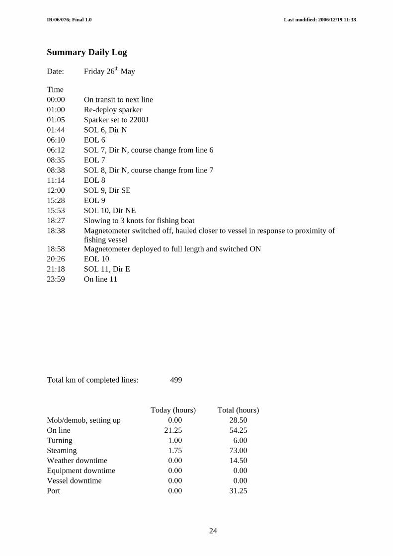
Date: Friday 26th May
Time
00:00 On transit to next line
01:00 Re-deploy sparker
01:05 Sparker set to 2200J
01:44 SOL 6, Dir N
06:10 EOL 6
06:12 SOL 7, Dir N, course change from line 6
08:35 EOL 7
08:38 SOL 8, Dir N, course change from line 7
11:14 EOL 8
12:00 SOL 9, Dir SE
15:28 EOL 9
15:53 SOL 10, Dir NE
18:27 Slowing to 3 knots for fishing boat
18:38 Magnetometer switched off, hauled closer to vessel in response to proximity of fishing vessel
18:58 Magnetometer deployed to full length and switched ON 20:26 EOL 10
21:18 SOL 11, Dir E
23:59 On line 11
Total km of completed lines: 499
Today (hours) Total (hours)
Mob/demob, setting up 0.00 28.50
On line 21.25 54.25
Turning 1.00 6.00
Steaming 1.75 73.00
Weather downtime 0.00 14.50
Equipment downtime 0.00 0.00
Vessel downtime 0.00 0.00
Port 0.00 31.25
24

IR/06/076; Final 1.0 Last modified: 2006/12/19 11:38
Summary Daily Log
Date: Saturday 27th May
Time
00:00 On line 11
06:32 EOL 11,
07:14 All seismic equipment and magnetometer recovered to deck
Steam to next survey area, north-east of Hatton Bank
Repair sparker, one candle not firing, replace candle holder
Drain air compressor storage tank and clean air filter/scrubber
15:30 Arrive 2 miles before next line, recover pinger
15:38 Deploy SVP for multibeam calibration
16:53 SVP on deck
17:00 Pinger deployed
17:05 Power to compressors switched ON, waiting for pressure to build up (cannot operate at the same time as winch) 18:20 Airguns, sparker and magnetometer deployed
18:47 SOL 12, Dir NE
23:59 On line 12
Total km of completed lines: 569
Today (hours) Total (hours)
Mob/demob, setting up 3.75 32.25
On line 11.75 66.00
Turning 0.25 6.25
Steaming 8.25 81.25
Weather downtime 0.00 14.50
Equipment downtime 0.00 0.00
Vessel downtime 0.00 0.00
Port 0.00 31.25
25
IR/06/076; Final 1.0 Last modified: 2006/12/19 11:38
Summary Daily Log
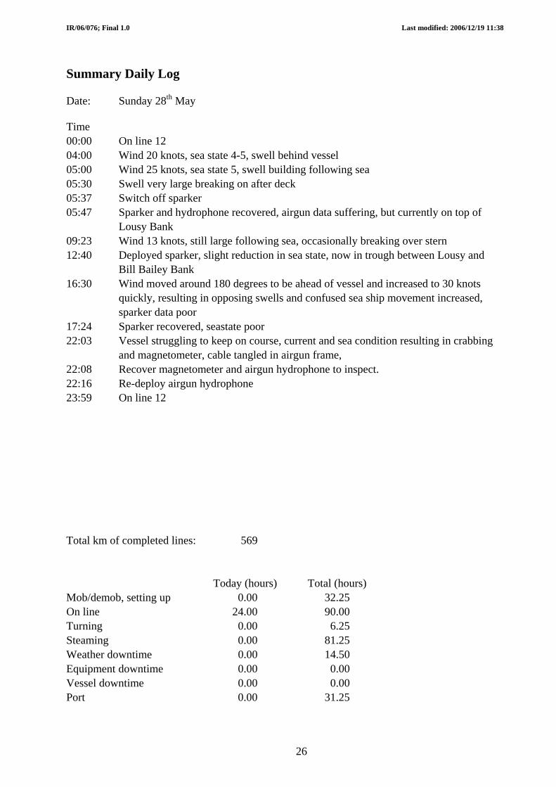
Date: Sunday 28th May
Time
00:00 On line 12
04:00 Wind 20 knots, sea state 4-5, swell behind vessel
05:00 Wind 25 knots, sea state 5, swell building following sea
05:30 Swell very large breaking on after deck
05:37 Switch off sparker
05:47 Sparker and hydrophone recovered, airgun data suffering, but currently on top of Lousy Bank
09:23 Wind 13 knots, still large following sea, occasionally breaking over stern 12:40 Deployed sparker, slight reduction in sea state, now in trough between Lousy and Bill Bailey Bank
16:30 Wind moved around 180 degrees to be ahead of vessel and increased to 30 knots quickly, resulting in opposing swells and confused sea ship movement increased, sparker data poor
17:24 Sparker recovered, seastate poor
22:03 Vessel struggling to keep on course, current and sea condition resulting in crabbing and magnetometer, cable tangled in airgun frame,
22:08 Recover magnetometer and airgun hydrophone to inspect.
22:16 Re-deploy airgun hydrophone
23:59 On line 12
Total km of completed lines: 569
Today (hours) Total (hours)
Mob/demob, setting up 0.00 32.25
On line 24.00 90.00
Turning 0.00 6.25
Steaming 0.00 81.25
Weather downtime 0.00 14.50
Equipment downtime 0.00 0.00
Vessel downtime 0.00 0.00
Port 0.00 31.25
26

IR/06/076; Final 1.0 Last modified: 2006/12/19 11:38
Summary Daily Log
Date: Monday 29th May
Time
00:00 On line 12
01:59 Sparker deployed
02:06 Magnetometer deployed
08:46 Shallowest part of Faros Bank, 88m
Wind N, 16 knots, cold, vessel 60m off-track to starboard
10:50 Vessel off-track 86m to starboard
20:03 EOL 12
20:35 All equipment recovered
Deploy SVP
SVP on deck
Transit to next line
Slow to deploy geophysics equipment
Total km of completed lines: 944
Today (hours) Total (hours)
Mob/demob, setting up 3.00 35.25
On line 20.00 110.00
Turning 0.00 6.25
Steaming 1.00 82.25
Weather downtime 0.00 14.50
Equipment downtime 0.00 0.00
Vessel downtime 0.00 0.00
Port 0.00 31.25
27
IR/06/076; Final 1.0 Last modified: 2006/12/19 11:38
Summary Daily Log
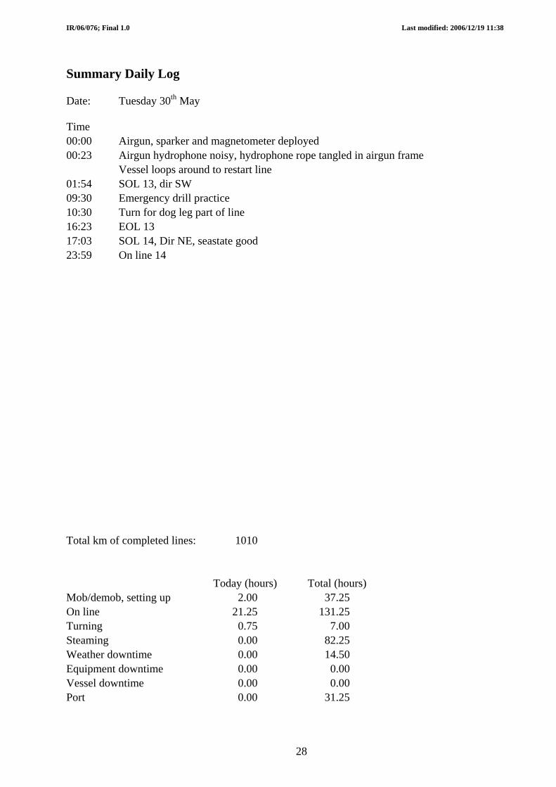
Date: Tuesday 30th May
Time
00:00 Airgun, sparker and magnetometer deployed 00:23 Airgun hydrophone noisy, hydrophone rope tangled in airgun frame Vessel loops around to restart line
01:54 SOL 13, dir SW
09:30 Emergency drill practice
10:30 Turn for dog leg part of line
16:23 EOL 13
17:03 SOL 14, Dir NE, seastate good
23:59 On line 14
Total km of completed lines: 1010
Today (hours) Total (hours)
Mob/demob, setting up 2.00 37.25
On line 21.25 131.25
Turning 0.75 7.00
Steaming 0.00 82.25
Weather downtime 0.00 14.50
Equipment downtime 0.00 0.00
Vessel downtime 0.00 0.00
Port 0.00 31.25
28

IR/06/076; Final 1.0 Last modified: 2006/12/19 11:38
Summary Daily Log
Date: Wednesday 31st May
Time
00:00 On line 14
03:45 EOL 14
03:26 Sparker recovered for trimming
03:44 Sparker deployed
04:46 SOL 15, Dir SW, sea-state good
13:15 Wind increasing, 17 knots, Dir 190, port quarter
15:47 Wind increasing, 23 knots, Dir 190, port quarter, swell increasing
16:40 Vessel finding it difficult to maintain set speed, hydrophones changing depths 17:48 Wind speed falling, 18 knots, swell
20:09 Wind speed falling, 15 knots, swell
23:59 On line 15
Total km of completed lines: 1070
Today (hours) Total (hours)
Mob/demob, setting up 0.00 37.25
On line 23.00 154.25
Turning 1.00 8.00
Steaming 0.00 82.25
Weather downtime 0.00 14.50
Equipment downtime 0.00 0.00
Vessel downtime 0.00 0.00
Port 0.00 31.25
29
IR/06/076; Final 1.0 Last modified: 2006/12/19 11:38
Summary Daily Log
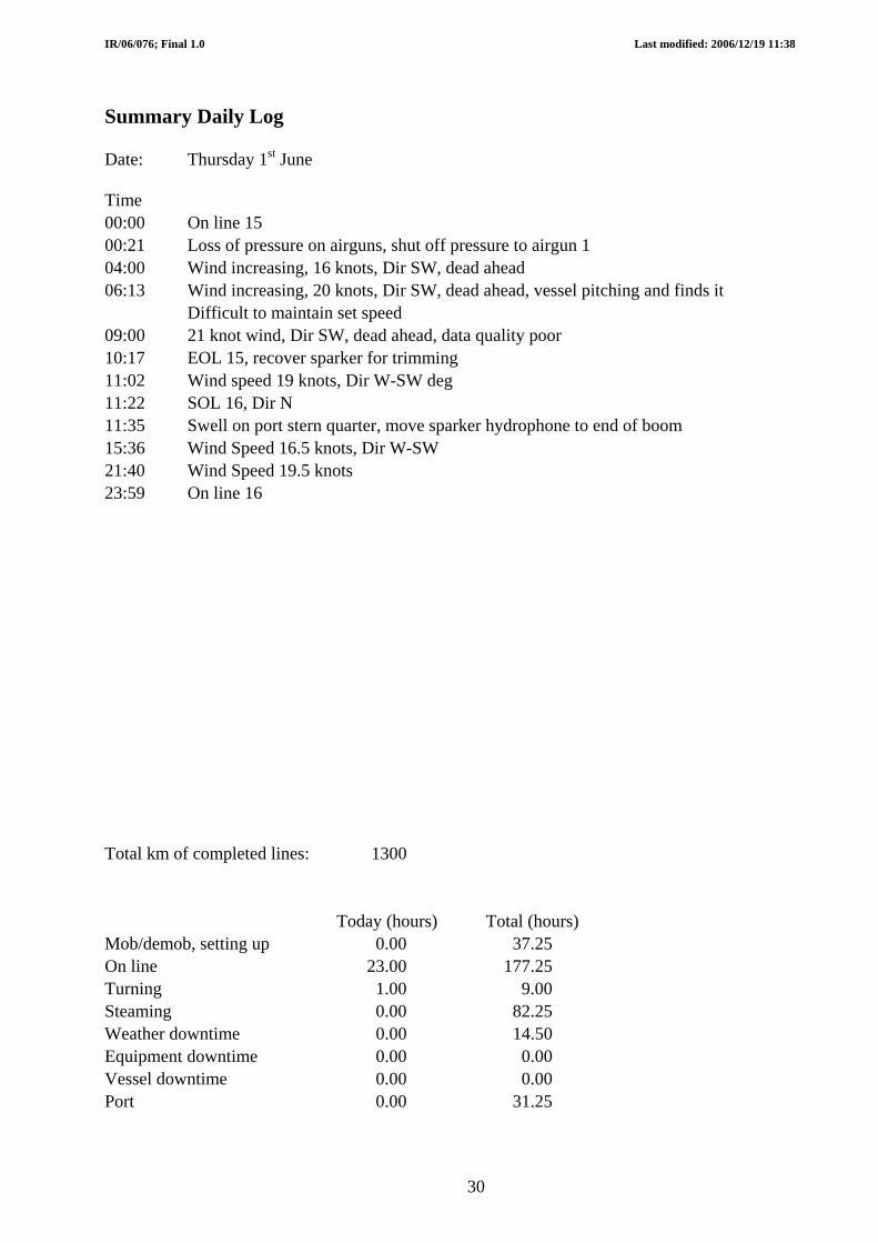
Date: Thursday 1st June
Time
00:00 On line 15
00:21 Loss of pressure on airguns, shut off pressure to airgun 1
04:00 Wind increasing, 16 knots, Dir SW, dead ahead
06:13 Wind increasing, 20 knots, Dir SW, dead ahead, vessel pitching and finds it Difficult to maintain set speed
09:00 21 knot wind, Dir SW, dead ahead, data quality poor
10:17 EOL 15, recover sparker for trimming
11:02 Wind speed 19 knots, Dir W-SW deg
11:22 SOL 16, Dir N
11:35 Swell on port stern quarter, move sparker hydrophone to end of boom 15:36 Wind Speed 16.5 knots, Dir W-SW
21:40 Wind Speed 19.5 knots
23:59 On line 16
Total km of completed lines: 1300
Today (hours) Total (hours)
Mob/demob, setting up 0.00 37.25
On line 23.00 177.25
Turning 1.00 9.00
Steaming 0.00 82.25
Weather downtime 0.00 14.50
Equipment downtime 0.00 0.00
Vessel downtime 0.00 0.00
Port 0.00 31.25
30

IR/06/076; Final 1.0 Last modified: 2006/12/19 11:38
Summary Daily Log
Date: Friday 2nd June
Time
00:00 On line 16
00:48 Wind speed 20 knots, Dir 250 deg
02:10 Wind speed 18 knots, Dir 270 deg
03:49 Sparker recovered on top of Bill Bailey’s Bank and trimmed
04:14 Problems with oil filter of air compressor 2, shut down and reduce number of guns firing
05:10 Compressor back up and running
07:14 Wind speed 20 knots, Dir 265 deg
11:33 Wind speed 18 knots, Dir 282 deg
14:06 Wind speed 21 knots, Dir 280 deg
18:50 Wind speed 18 knots, Dir 290 deg
18:58 EOL 16, recover sparker for trimming
19:24 Sparker deployed
19:44 SOL 17, Dir E
20:20 Bridge position making large jumps
20:31 Ship back on line
22:56 Wind speed 13 knots, Dir 280 deg
23:59 On line 17
Total km of completed lines: 1545
Today (hours) Total (hours)
Mob/demob, setting up 0.00 37.25
On line 22.25 199.50
Turning 1.75 10.75
Steaming 0.00 82.25
Weather downtime 0.00 14.50
Equipment downtime 0.00 0.00
Vessel downtime 0.00 0.00
Port 0.00 31.25
31

IR/06/076; Final 1.0 Last modified: 2006/12/19 11:38
Summary Daily Log
Date: Saturday 3rd June
Time
00:00 On line 17
02:22 On line printer not printing data correctly, missing pings
03:45 Wind speed 13 knots, Dir 307 deg
04:00 Wind speed 11 knots, Dir 307 deg
05:58 Sparker OFF and recovered for trimming
06:01 Start to alter course to next line
06:03 EOL 17
06:16 SOL 18, Dir SE, course alteration complete
06:25 Sparker deployed and ON, Printer not printing correctly
08:40 08:40 to 11:38, lost easting on CODA NAV.
14:50 GPS signal poor, large variations in apparent position
15:20 GPS position stable
15:53 EOL 18, Sparker recovered for trimming
16:13 Sparker deployed
16:21 SOL 19, Dir N
23:59 On line 19
Total km of completed lines: 1712
Today (hours) Total (hours)
Mob/demob, setting up 0.00 37.25
On line 23.50 223.00
Turning 0.50 11.25
Steaming 0.00 82.25
Weather downtime 0.00 14.50
Equipment downtime 0.00 0.00
Vessel downtime 0.00 0.00
Port 0.00 31.25
32

IR/06/076; Final 1.0 Last modified: 2006/12/19 11:38
Summary Daily Log
Date: Sunday 4th June
Time
00:00 On line 19
01:46 EOL 19, recover sparker for trimming
02:10 Deploy Sparker
02:28 SOL 20, Dir SW
20:05 Sparker recovered for trimming
20:21 EOL 20, deploy sparker
20:22 SOL 21, Dir SW
22:20 On line printer missing pings
23:59 On line 21
Total km of completed lines: 1913
Today (hours) Total (hours)
Mob/demob, setting up 0.00 37.25
On line 0.00 223.00
Turning 23.25 34.50
Steaming 0.75 83.00
Weather downtime 0.00 14.50
Equipment downtime 0.00 0.00
Vessel downtime 0.00 0.00
Port 0.00 31.25
33
IR/06/076; Final 1.0 Last modified: 2006/12/19 11:38
Summary Daily Log
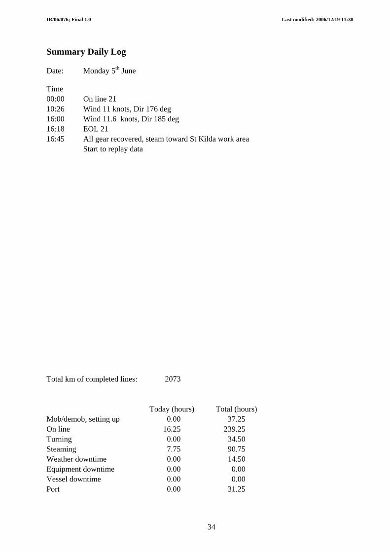
Date: Monday 5th June
Time
00:00 On line 21
10:26 Wind 11 knots, Dir 176 deg
16:00 Wind 11.6 knots, Dir 185 deg
16:18 EOL 21
16:45 All gear recovered, steam toward St Kilda work area
Start to replay data
Total km of completed lines: 2073
Today (hours) Total (hours)
Mob/demob, setting up 0.00 37.25
On line 16.25 239.25
Turning 0.00 34.50
Steaming 7.75 90.75
Weather downtime 0.00 14.50
Equipment downtime 0.00 0.00
Vessel downtime 0.00 0.00
Port 0.00 31.25
34

IR/06/076; Final 1.0 Last modified: 2006/12/19 11:38
Summary Daily Log
Date: Tuesday 6th June
Time
00:00 On transit
10:30 Arrive Village Bay, St Kilda
16:00 Leave St Kilda
18:00 Arrive at St Kilda work area and deploy sparker and hydrophone
18:40 SOL 22, Dir NE
19:06 Cross piston core location, vessel off-track 10m SE of proposed line
19:24 EOL 22
19:50 SOL 23, Dir S
19:58 Cross piston core location, vessel off-track 6.3m W of proposed line
20:11 EOL 23
20:18 SOL 24, Dir N
20:41 EOL 24
20:50 SOL 25, Dir S
21:14 EOL 25
21:44 SOL 26 Dir E
21:56 Cross piston core location, vessel off-track 0.73m N of proposed line
22:04 EOL 26, recover sparker and hydrophone and transit to Stanton Bank 23:59 On transit
Total km of completed lines: 2089
Today (hours) Total (hours)
Mob/demob, setting up 0.50 37.75
On line 6.25 245.50
Turning 1.25 35.75
Steaming 14.00 104.75
Weather downtime 0.00 14.50
Equipment downtime 0.00 0.00
Vessel downtime 0.00 0.00
Port 2.00 33.25
35

IR/06/076; Final 1.0 Last modified: 2006/12/19 11:38
Summary Daily Log
Date: Wednesday 7th June
Time
00:00 Steaming to Stanton Bank
07:30 On site waiting for fishing vessel
Deploy Sparker and hydrophone
07:54 SOL 27, Dir SW
10:18 EOL 27
10:50 SOL 28, Dir NE
12:57 EOL28
13:22 SOL 29, Dir SE
15:10 EOL 29
15:39 SOL 30
22:04 EOL 30, end of survey, recover all equipment
22:20 All equipment recovered, transit to Fairlie
Total km of completed lines: 2183
Today (hours) Total (hours)
Mob/demob, setting up 0.50 38.25
On line 13.00 258.50
Turning 1.50 37.25
Steaming 9.00 113.75
Weather downtime 0.00 14.50
Equipment downtime 0.00 0.00
Vessel downtime 0.00 0.00
Port 0.00 33.25
36

IR/06/076; Final 1.0 Last modified: 2006/12/19 11:38
Summary Daily Log
Date: Thursday 8th June
Time
00:00 Transit to Fairlie
23:59 Transit to Fairlie
Total km of completed lines: 2183
Today (hours) Total (hours)
Mob/demob, setting up 0.00 38.25
On line 0.00 258.50
Turning 0.00 37.25
Steaming 24.00 137.75
Weather downtime 0.00 14.50
Equipment downtime 0.00 0.00
Vessel downtime 0.00 0.00
Port 0.00 33.25
37

IR/06/076; Final 1.0 Last modified: 2006/12/19 11:38
38
Summary Daily Log
Date: Friday 9th June
Time
00:00
10:30 Alongside Fairlie
13:00 Clear of vessel
Total km of completed lines: 2183
Today (hours) Total (hours)
Mob/demob, setting up 2.50 40.75
On line 0.00 258.50
Turning 0.00 37.25
Steaming 10.50 148.25
Weather downtime 0.00 14.50
Equipment downtime 0.00 0.00
Vessel downtime 0.00 0.00
Port 0.00 33.25

IR/06/076; Final 1.0 Last modified: 2006/12/19 11:38
39
British Geological Survey Marine Operations Line Summary Log Sheet 1 of 1 Vessel: RRS Charles Darwin CD180
PROJECT BGS06/02 Area: Rockall-Hatton-Faroes Type: Geophysical Survey
Length Total
No. Dir Date Time Date Time (km) (km) Airgun Sparker Maggy Gravity Pinger PESMulti-beam
1 NW 24.05.06 06:32 25.05.06 06:53 308.00 308.00 X X X X Seastate poor at SOL, good at EOL2 SE 25.05.06 10:09 25.05.06 12:33 15.00 323.00 X X X X X X X Seastate good, ocean swell3 NW 25.05.06 13:02 25.05.06 15:10 15.00 338.00 X X X X X X X Seastate good, ocean swell4 SW 25.05.06 17:08 25.05.06 19:00 15.00 353.00 X X X X X X X Seastate moderate to good, ocean swell5 NE 25.05.06 20:26 25.05.06 22:28 14.00 367.00 X X X X X X X Seastate moderate to good, ocean swell6 N 26.05.06 01:44 26.05.06 06:10 33.50 400.50 X X X X X X X Seastate moderate to good, ocean swell7 N 26.05.06 06:12 26.05.06 08:35 19.00 419.50 X X X X X X X Seastate moderate to good, ocean swell8 N 26.05.06 08:38 26.05.06 11:14 19.00 438.50 X X X X X X X Seastate moderate to good, ocean swell9 SE 26.05.06 12:00 26.05.06 15:28 26.00 464.50 X X X X X X X Seastate moderate to good, ocean swell
10 N 26.05.06 15:53 26.05.06 20:26 35.00 499.50 X X X X X X X Seastate good, ocean swell11 E 26.05.06 21:18 27.05.06 06:32 70.00 569.50 X X X X X X X Seastate good, ocean swell12 NE 27.05.06 18:47 29.05.06 20:03 375.00 944.50 X X X X X X X Seastate variable, moderate to poor13 SW 30.05.06 01:54 30.05.06 16:23 66.00 1010.50 X X X X X X X Seastate variable, moderate, improving14 NE 30.05.06 17:03 31.05.06 03:25 60.00 1070.50 X X X X X X X Seastate good, ocean swell15 SW 31.05.06 04:46 01.06.06 10:17 230.00 1300.50 X X X X X X X Seastate good, ocean swell16 N 01.06.06 11:22 02.06.06 18:58 245.00 1545.50 X X X X X X X Seastate poor, ocean swell deteriorating17 E 02.06.06 19:44 03.06.06 06:03 87.00 1632.50 X X X X X X X Seastate poor, ocean swell improving18 SE 03.06.06 06:16 03.06.06 15:53 80.00 1712.50 X X X X X X X Seastate reasonable, ocean swell, improving19 N 03.06.06 16:21 04.06.06 01:46 70.00 1782.50 X X X X X X X Seastate good, ocean swell20 SW 04.06.06 02:28 04.06.06 20:22 131.00 1913.50 X X X X X X X Seastate good, ocean swell21 SW 04.06.06 20:22 05.06.06 16:18 160.00 2073.50 X X X X X X X Seastate good, little ocean swell22 NE 06.06.06 18:40 06.06.06 19:24 5.10 2078.60 X X X X X Seastate good, little ocean swell23 S 06.06.06 19:50 06.06.06 20:11 2.70 2081.30 X X X X X Seastate good, little ocean swell24 N 06.06.06 20:18 06.06.06 20:41 2.70 2084.00 X X X X X Seastate good, little ocean swell25 S 06.06.06 20:50 06.06.06 21:14 2.70 2086.70 X X X X X Seastate good, little ocean swell26 E 06.06.06 21:44 06.06.06 22:04 2.50 2089.20 X X X X X Seastate good, little ocean swell27 SE 07.06.06 07:54 07.06.06 10:18 15.30 2104.50 X X X X X Seastate good, little ocean swell28 SW 07.06.06 10:50 07.06.06 12:57 14.50 2119.00 X X X X X Seastate good, little ocean swell29 NE 07.06.06 13:22 07.06.06 15:10 14.50 2133.50 X X X X X Seastate good, little ocean swell30 SE 07.06.06 15:39 07.06.06 22:04 50 2183.50 X X X X X Seastate good, little ocean swell
Line Start End
Comments
Equipment run
Appendix 3 Line Summary Log Sheet
IR/06/076; Final 1.0 Last modified: 2006/12/19 11:38
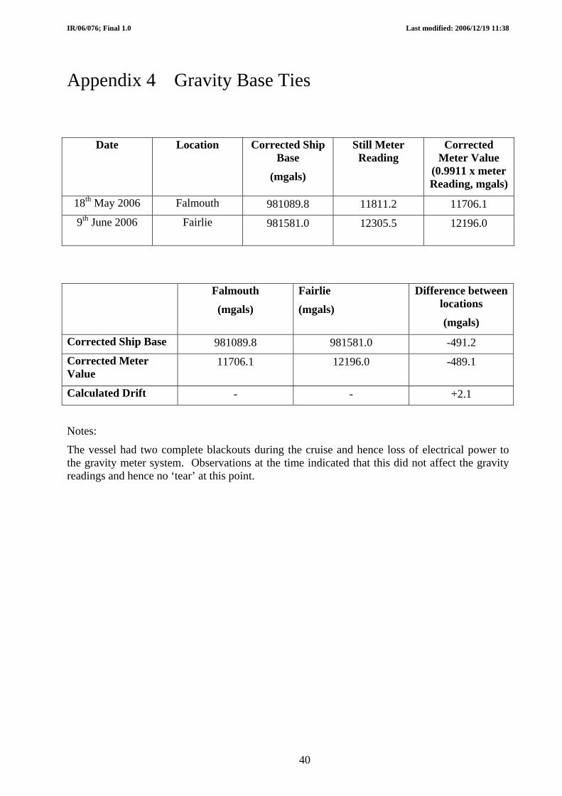
Appendix 4 Gravity Base Ties
Date Location Corrected Ship Base
Still Meter Reading
Corrected Meter Value
(0.9911 x meter Reading, mgals) (mgals)
18th May 2006 Falmouth 981089.8 11811.2 11706.1 9th June 2006 Fairlie 981581.0 12305.5 12196.0
Falmouth Fairlie Difference between locations
(mgals) (mgals) (mgals)
Corrected Ship Base 981089.8 981581.0 -491.2 Corrected Meter Value
11706.1 12196.0 -489.1
Calculated Drift - - +2.1
Notes:
The vessel had two complete blackouts during the cruise and hence loss of electrical power to the gravity meter system. Observations at the time indicated that this did not affect the gravity readings and hence no ‘tear’ at this point.
40

IR/06/076; Final 1.0 Last modified: 2006/12/19 11:38
Name of Ship: RRS Charles Darwin Place: Fairlie, Clyde
Date: 9 June 2006 Julian Day: 160
Gravity Meter Observation Harbour Base Connection Time(GMT) Place Reading Vessel tied up at Fairlie Jetty. Base Station established 02/09/02 for D265
Calculation of Height of Tide Portable Meter calibration Factor (p)
Meter diff. to ship corrected for drift(q) Use Admiralty tide tables. Times GMT. Harbour Station Value 981579.89 Time of Observation 1130 Diff. to ship (p X q) 0
Uncorrected ship base value 981579.89 Interval from High Water
1H10 Free air correction = 0.31 X a (Add) 1.12
All heights in metres Ship base corrected for FA 981581.01 Height of preceding HW or LW
3m0
Bouguer correction for water slab. Pier=0.04b, Wall=0.02b. (Subtract)
-0.02
Corrected ship base value 981581.0 Height of Succeeding HW or LW
0m8 Ship borne Meter Harbour Reading Predicted Tide Range
(d) 2m2
Ship meter cal factor (k) 0.9911
Time (GMT) 1130 Ship borne meter reading 12305.4
Factor for time interval (from curve for standard port).
0.86
FA correction= 0.13b/k (Add) 0.1 FA corrected value 12305.5 Height of Tide above
LW (c) 1m9
Half Tide Range d/2 1m1 Bouguer correction. Pier=0.04b/k. Wall=0.02b/k (Subtract)
-0.02
Height of Tide above MSL = c – d/2 = b
0m8 Corrected Harbour Reading 12305.5
Height of ship base above Waterline (h)
2m80
41

IR/06/076; Final 1.0 Last modified: 2006/12/19 11:38
42
Name of Ship: RRS Charles Darwin Place: Fairlie, Clyde
Date: 9 June 2006 Julian Day: 160
Gravity Meter Observation Harbour Base Connection Time(GMT) Place Reading Vessel tied up at Fairlie Jetty. Base Station established 02/09/02 for D265
Calculation of Height of Tide Portable Meter calibration Factor (p)
Meter diff. to ship corrected for drift(q) Use Admiralty tide tables. Times GMT. Harbour Station Value 981579.89 Time of Observation 1130 Diff. to ship (p X q) 0
Uncorrected ship base value 981579.89 Interval from High Water
1H10 Free air correction = 0.31 X a
(Add) 1.12
All heights in metres Ship base corrected for FA 981581.01 Height of preceding HW or LW
3m0
Bouguer correction for water slab. Pier=0.04b, Wall=0.02b.(Subtract)
-0.02
Corrected ship base value 981581.0 Height of Succeeding HW or LW
0m8 Ship borne Meter Harbour Reading Predicted Tide Range
(d) 2m2
Ship meter cal factor (k) 0.9911
Time (GMT) 1130 Ship borne meter reading 12305.4
Factor for time interval (from curve for standard port).
0.86
FA correction= 0.13b/k (Add) 0.1 FA corrected value 12305.5 Height of Tide above
LW (c) 1m9
Half Tide Range d/2 1m1 Bouguer correction. Pier=0.04b/k. Wall=0.02b/k (Subtract)
-0.02
Height of Tide above MSL = c – d/2 = b
0m8
Height of ship base Corrected Harbour Reading
12305.5

IR/06/076; Final 1.0 Last modified: 2006/12/19 11:38
Appendix 5 Time Utilisation Diagrams
TIME UTILISATION IN THE SURVEY AREA
Time utilisation in the survey areaTurning
8%
Weather downtime3%
Steaming32%
Equipment downtime0%
Vessel downtime0%
On Line57%
TIME UTILISATION FOR TOTAL SHIP TIME
43
Time Utilisation for total ship time
On Line48%
Steaming28%
Turning7%
Weather downtime3%
Vessel downtime0%
Port6% Equipment downtime
0%
Mob/Demob8%

IR/06/076; Final 1.0 Last modified: 2006/12/19 11:38
Abbreviations BCD Binary Coded Decimal
BGS British Geological Survey
EOL End of line
ETS Electronic and Technical Support
GMT Greenwich Mean Time
IT Information Technology
NOC National Oceanographic Centre
PES Precision Echosounder
RSU Research Ship Unit
SVP Sound Velocity Probe
SOL Start of line
TVF Time Varied Filter
TVG Time Varied Gain
UKORS United Kingdom Ocean Research Services
44


![Hatton-williamson 2002 [1296386]](https://img.dokumen.tips/doc/110x75/563dbb3e550346aa9aab7c40/hatton-williamson-2002-1296386.jpg)