Embed Size (px)
Citation preview
City of Virginia Beach Comprehensive Plan – It’s Our Future: A Choice City
November 20, 2018
Military Installations & Support /1-132
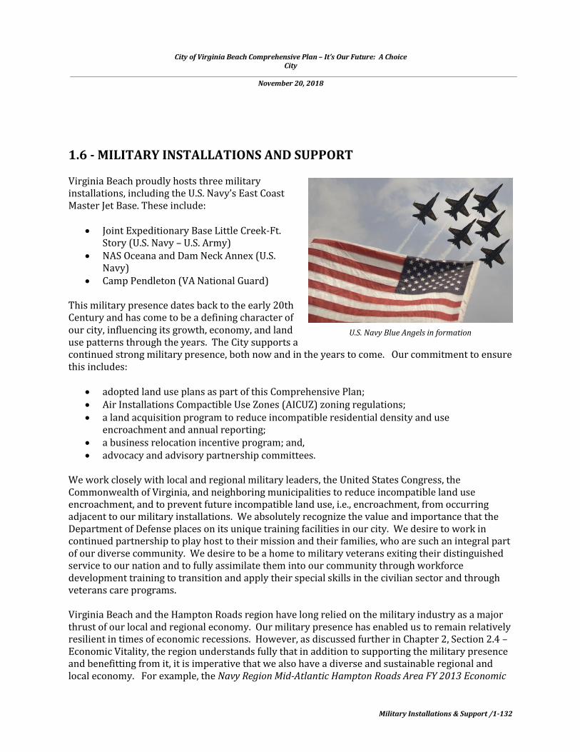
1.6 - MILITARY INSTALLATIONS AND SUPPORT
Virginia Beach proudly hosts three military installations, including the U.S. Navy’s East Coast Master Jet Base. These include:
Joint Expeditionary Base Little Creek-Ft.Story (U.S. Navy – U.S. Army)
NAS Oceana and Dam Neck Annex (U.S.Navy)
Camp Pendleton (VA National Guard)
This military presence dates back to the early 20th Century and has come to be a defining character of our city, influencing its growth, economy, and land use patterns through the years. The City supports a continued strong military presence, both now and in the years to come. Our commitment to ensure this includes:
adopted land use plans as part of this Comprehensive Plan; Air Installations Compactible Use Zones (AICUZ) zoning regulations; a land acquisition program to reduce incompatible residential density and use
encroachment and annual reporting; a business relocation incentive program; and, advocacy and advisory partnership committees.
We work closely with local and regional military leaders, the United States Congress, the Commonwealth of Virginia, and neighboring municipalities to reduce incompatible land use encroachment, and to prevent future incompatible land use, i.e., encroachment, from occurring adjacent to our military installations. We absolutely recognize the value and importance that the Department of Defense places on its unique training facilities in our city. We desire to work in continued partnership to play host to their mission and their families, who are such an integral part of our diverse community. We desire to be a home to military veterans exiting their distinguished service to our nation and to fully assimilate them into our community through workforce development training to transition and apply their special skills in the civilian sector and through veterans care programs.
Virginia Beach and the Hampton Roads region have long relied on the military industry as a major thrust of our local and regional economy. Our military presence has enabled us to remain relatively resilient in times of economic recessions. However, as discussed further in Chapter 2, Section 2.4 – Economic Vitality, the region understands fully that in addition to supporting the military presence and benefitting from it, it is imperative that we also have a diverse and sustainable regional and local economy. For example, the Navy Region Mid-Atlantic Hampton Roads Area FY 2013 Economic
U.S. Navy Blue Angels in formation

City of Virginia Beach Comprehensive Plan – It’s Our Future: A Choice City
November 20, 2018
Military Installations & Support /1-133
Impact Report indicated that the Navy’s direct economic impact on the Hampton Roads area was approximately $9.2 billion, a decrease of approximately $1.8 billion or 16.4% over FY 12’s total of $11 billion. Procurement expenditures decreased from approximately $2.8 billion in FY12 to about $1.3 billion. The Hampton Roads area had an overall decrease of about $1.5 billion in procurement expenditures. Active duty military pay decreased by $306 million; retired and survivors pay increased by $76 million; civilian pay decreased by $54 million; NAF increased by $0.5milllion and contractor pay decreased by $55 million. This reduction in military spending as part of a defense budget reduction has affected Hampton Roads localities and many, if not all, localities in the nation with a military presence. In many cases, just as we are experiencing here locally, this trend is being supplanted by growth in other industries.
THE MILITARY PRESENCE TODAY
Joint Expeditionary Base Little Creek – Ft. Story (JEBLCFS) (U.S. Navy – U.S. Army)1F
ii
JEBLCFS is the largest military employer in the city of Virginia Beach. It is the major East Coast base supporting overseas contingency operations (OCO), with 130 resident commands, including 3 flag officers. The installation consists of 3,947 acres of land and includes 61 piers and 7.6 miles of beachfront, and a total of 126 training sites. As of January 31, 2015, JEBLCFS homeports 24 Navy Auxiliary Ships, the USCGC Vigorous, and 126 small craft. The total base population is 19,179 (Little Creek Base: 16,658; Ft. Story Base: 2,821). Base population growth since September 11, 2001 has been just under 10,000 persons or almost 100%. To accommodate the growing presence, there are now 1,155 base housing units, with 337 units located inside the fence line. Estimated payroll is $1.3B, making a substantial impact on the City’s economy.

City of Virginia Beach Comprehensive Plan – It’s Our Future: A Choice City
November 20, 2018
Military Installations & Support /1-134
Aerial view of Amphibious Base at Joint Expeditionary Base Little Creek-Fort Story (JEBLCFS)
The character of the base has changed since September 11, 2001, becoming more expeditionary in nature. According to base planners, JEBLCFS is becoming the training site of choice for the joint community due to characteristics that are unique to the East Coast. It is recognized as an irreplaceable “National Joint Training Asset,” offering joint logistics over the shore training and a nearly full mission profile for special operations training. Recent trends indicate that more units are conducting training locally, decreasing travel training dollars. Through strong community engagement with City of Virginia Beach leaders and city planners, encroachment is manageable with community support.
Transfers have occurred since the last Comprehensive Plan update in 2009. During 2013-2014, the following operations were relocated:
Navy CYPERFOR and NETWAR Commands (relocated to Suffolk) – due to recurrent floodingassociated with sea level rise impacts.
PCRON/Coastal Patrol Craft (relocated 5th AOR/Mayport, FL) USS Fort McHenry (homeport shift to Mayport, FL)

City of Virginia Beach Comprehensive Plan – It’s Our Future: A Choice City
November 20, 2018
Military Installations & Support /1-135
Base mission growth in the future is anticipated to consist of an increase in Explosive Ordinance Disposal Group 2 Operations; expansion of the Naval Special Warfare and Support Activity footprint; gains in training vessels and equipment; and an increase in training operations/capacity.
LACVs at JEBLCFS
JEBLCFS is a committed steward of its cultural and natural resources, working closely with the City and non-profit organizations to inventory and protect these assets. Some of these include the Cape Henry lighthouses, the original base chapel, the First Landing site, and the various monuments documenting the strategic role that Cape Henry played during the American Revolution and the War of 1812. JEBLCFS has a robust community engagement program, ensuring that it works in partnership in a variety of needs identified as mutually important. These include:
Quarterly meetings with City of Virginia Beach leadership Virginia Beach City Public Schools Virginia Beach Education Association Partners in Reducing Sexual Assault Federal Aviation Administration Hampton Roads Chamber of Commerce Virginia Beach Bayfront Advisory Commission Military Economic Development Advisory Committee Joint Military Services School Liaison Committee Military Child Education Coalition Hampton Roads Planning District Commission Virginia Military Advisory Commission Central Virginia Food Bank USO of Hampton Roads and Central Virginia Armed Services YMCA
Since 2009, City and base planners have developed an “Areas of Interest” map (see next page) and list of land uses of particular interest to the base. These tools assist both parties in determining which proposed uses may be in potential conflict or encroachment with base mission and operations. The Department of Planning & Community Development provides the base Community Planning Liaison Officer (CPLO) an opportunity to review and comment on development applications located in the Areas of Interest, prior to Planning Commission or City Council public hearing. The City’s Public Works and Public Utilities Departments are in routine communications with base planners to inform them about pending infrastructure construction projects (i.e., roadway repair, bridge maintenance, underground utilities work, etc.) in consideration of

City of Virginia Beach Comprehensive Plan – It’s Our Future: A Choice City
November 20, 2018
Military Installations & Support /1-136
personnel mobility along the Shore Drive corridor between the two base areas at Little Creek and Fort Story.

City of Virginia Beach Comprehensive Plan – It’s Our Future: A Choice City
November 20, 2018
Military Installations & Support /1-137
Naval Air Station Oceana and Dam Neck Annex (U.S. Navy) 2F
iii Naval Air Station (NAS) Oceana is the Navy’s only Master Jet Base on the East Coast and supports the training and deployment of the Navy’s Atlantic and Pacific Fleet FA-18 C/D Hornet and FA-18 E/F Super Hornet squadrons. Four carrier air wings (CVWs) are homebased at NAS Oceana and deploy with carrier strike groups embarking from Naval Station Norfolk (NS). Strike Fighter Wing Atlantic, which mans, trains, and equips 18 FA-18 Hornet and Super Hornet squadrons, is also located at NAS Oceana. Naval Auxiliary Landing Field (NALF) Fentress, located 7 miles southwest of NAS Ocean in Chesapeake, Virginia, is equipped to simulate aircraft carrier flight decks and supports training operations by strike fighter squadrons from NAS Oceana.
The Navy employs 17,000 personnel at NAS Oceana, NALF Fentress, and a third installation, NAS Oceana Dam Neck Annex, locally referred to as “Dam Neck.” NAS Oceana generates over $1 billion in payroll, and goods and services annually. The FA-18 C/D Hornet and FA-18 E/F Super Hornet are the predominant aircraft stationed at NAS Oceana and account for the majority of aircraft operations at the airfield. Operations conducted as part of the typical training syllabus for flight crews include departures, arrivals, touch-and-gos, and
NAS Oceana, NALF Fentress, and Interfacility Traffic Area (ITA) Locator Map

City of Virginia Beach Comprehensive Plan – It’s Our Future: A Choice City
November 20, 2018
Military Installations & Support /1-138
Air Wing Homecoming
practice radar approaches. NAS Oceana flight crews also conduct field carrier landing practice (FCLP) at NALF Fentress and training operations in offshore training areas.
Aircraft engine maintenance “run-ups” are primarily conducted in NAS Oceana’s acoustical aircraft facility, known as the “Hush House.” The Hush House enables maintenance personnel to test jet engines that are installed in aircraft in a fully-enclosed building. The noise absorbing materials of the building’s interior, combined with dense exterior walls, eliminate engine noise that would otherwise be heard by neighboring Virginia Beach residents.
NAS Oceana Dam Neck Annex Dam Neck Annex is home to 20 operational, training and support commands. The installation includes 1,919 acres and includes 3.2 miles of coastline along the Atlantic Ocean. It serves as the Navy’s Training Center of Excellence, instructing over 20,000 students annually in over 210 courses of instruction.
Additional training and Navy Fleet support areas include:
Synthetic warfare training to Carrier Strike Group and Amphibious Ready Group Staffs,Warfare Commanders and specified units/commands
24/7/365 Maritime Domain Awareness (MDA) support and vital maritime surveillanceinformation to the Atlantic Fleet
State-of-the-art intelligence training including real world applications
A Memorandum of Understanding has been established between the City of Virginia Beach and the U.S. Navy covering the use of the Dam Neck Annex South Gate for emergency response supporting Sandbridge residents and natural disaster evacuation routing.
Camp Pendleton/State Military Reservation3F
iv
Camp Pendleton/State Military Reservation (SMR) is a Virginia Army National Guard facility located just south of the main resort area of Virginia Beach. The facility was originally laid out on approximately 400 acres in 1911 with construction beginning in 1912. Today, SMR occupies approximately 300 acres with an additional 27 acres leased from the federal government.
SMR is defined by the intact landscape created by the dominant building type, World War II-era temporary buildings, and the examples of earlier 20th century military and residential building

City of Virginia Beach Comprehensive Plan – It’s Our Future: A Choice City
November 20, 2018
Military Installations & Support /1-139
types. The post is buffered from the public streets by extensive trees and landscaping, in addition to the required security fencing along the perimeter. The Guard currently leases a number of the buildings, particularly the WWII barracks, to various military and civilian agencies.
The first major building campaign after WWI was the construction of the REDHORSE facilities (1990s) at the north end of Regimental Camp #1 and south of Warehouse Road. The 203rd REDHORSE Flight unit is a construction and repair unit for the Virginia Air National Guard and their headquarters is located at SMR. A memorial is located in this area to honor the airmen from REDHORSE who were killed in an airplane accident returning from training in March 2001. Additional construction projects executed during the late 1990s include an armory at the corner of General Booth Boulevard and Birdneck Road.
Development pressure from the City led to the transfer of some SMR parcels of land from the Guard to the City during the 1990s. These parcels included acreage beyond the original cantonment area of SMR. As a result, the boundaries of SMR incorporate all the land (with the exception of a small tract south of Lake Christine leaded from the federal government) between General Booth Boulevard, Birdneck Road, Rifle Range Road, the Atlantic Ocean, and the Croatan neighborhood. A 14.94-acre
parcel of land just west of Headquarters Loop along the property boundary at General Booth Boulevard has been leased to the City for use as a parking lot by the Virginia Aquarium.
Despite the few intrusions to the original plan and subsequent configuration of Camp Pendleton/State Military Reservation, the integrity of both the architectural resources and cantonment features dating from 1912-1945 have remained intact and well preserved. As a result, the Camp Pendleton/State Military Reservation Historic District was listed on the Virginia Landmarks Register in June 2004 and on the National Register of Historic Places in September 2005 as the City’s first and only, to date, state and national register historic districts.
AIR INSTALLATIONS COMPATIBILITY USE ZONES (AICUZ) AND LOCAL LAND USE PLANNING
The chief sources of noise at an airfield are maintenance run-ups and flight operations. Data on both sources of noise is incorporated into NOISEMAP, the DOD-approved computer model that projects noise impacts around military airfields, to develop a graphic depiction of noise exposure. Noise exposure is assessed for AICUZ purposes using the day-night average sound level (DNL) noise metric. The DNL is depicted graphically as a noise contour that connects points of equal noise value.
The AICUZ Program divides noise exposure into three categories, known as noise zones. Noise zones 1 through 3 are developed based on the DNL, and each noise zone has associated land use
Barracks at Camp Pendleton

City of Virginia Beach Comprehensive Plan – It’s Our Future: A Choice City
November 20, 2018
Military Installations & Support /1-140
control recommendations. The noise zones provide the community and planning organizations with a necessary tool to plan compatible development near airfields. The noise zones for NAS Oceana and NALF Fentress are the noise zones presented in the 2005 Joint Land Use Study (JLUS) http://www.hrpdcva.gov/uploads/docs/1JLUSExecSumm--Final.pdf
While the likelihood of an aircraft mishap occurring is remote, the Navy identifies areas of accident potential based on historical data from aircraft mishaps, known as Accident Potential Zones (APZs), to assist in land use planning. The Navy recommends that certain land uses that concentrate large numbers of people—apartments, churches, and schools—be constructed outside APZs. Historical data show that most aircraft mishaps occur on or near the runway, diminishing in likelihood with distance from the runway. APZs follow departure, arrival, and pattern flight tracks and are based, in part, on the number of operations conducted for specific flight tracks. The three standard APZs, in order of accident potential are the clear zone, APZ 1 and APZ 2. Thus, an accident is more likely to occur in the clear zone than in APZ 1 or 2, and is more likely to occur in APZ 1 than APZ 2. The APZs for NAS Oceana and NALF Fentress are the APZs presented in the 2005 JLUS Planning Map. These APZs illustrate the dominant flight tracks currently flown at each airfield.
A composite noise contour and APZ map has been developed and overlaid on an aerial photograph to show the AICUZ footprint for both NAS Oceana and NALF Fentress. The AICUZ footprint shows
NAS Oceana portion of 2005 JLUS Planning Map
City of Virginia Beach Comprehensive Plan – It’s Our Future: A Choice City
November 20, 2018
Military Installations & Support /1-141
the minimum acceptable area within which land use controls are recommended to protect the public health, safety, and welfare and preserve the defense flying mission. The AICUZ footprint for NAS Oceana and NALF Fentress and the related land use planning accomplishments and Navy recommendations are fundamental tools for the continued success of the compatible land use planning model that has been in place in the Hampton Roads region of the last several years. In addition, an updated analysis of the number of people within the existing AICUZ footprint was conducted. Using census block-level population data and the boundaries of the AICUZ footprint, it is estimated that approximately 153,320 people live within the existing AICUZ contour. Recognizing the need to balance community growth with the Navy’s mission, the Cities of Virginia Beach and Chesapeake have partnered with the Navy to develop various interrelated programs and initiatives to guide and control growth in the AICUZ footprint. These programs and initiatives, which in most cases began during development of the Hampton Roads JLUS through the Hampton Roads Planning District Commission in 2004 and 2005, have already lessened the Navy’s operational impacts on adjacent land, while simultaneously easing pressure on the Navy’s defense flying mission. Control over land use and development in areas neighboring the airfields ultimately is the responsibility of local governments. The Navy, through its AICUZ Program, encourages local governments to plan for compatible development. Accordingly, City of Virginia Beach land use planning documents and zoning regulations identify existing and future land use and zoning in areas in the AICUZ footprint. For example, the City prepared and adopted the APZ-1/CZ Master Plan (www.vbgov.com/Planning) in April 2005, as an amendment to the City’s Comprehensive Plan. This plan inventoried existing land use conditions within the NAS Oceana Clear Zone and APZ-1. Using public meetings for stakeholder input, the plan recommends future planned land use in the Clear Zone and APZ-1, noting both compatible and incompatible land uses (refer to the APZ-1/Clear Zones Locater Map and Future Planned Land Use maps on the following pages). The Lynnhaven SGA, Hilltop SGA, and Resort Area SGA Master Plans, adopted as amendments to the Comprehensive Plan, also recognize the AICUZ footprint and recommend future land uses accordingly. In addition, the City adopted the Interfacility Traffic Area (ITA) & Vicinity Master Plan (www.vbgov.com/Planning), as an amendment to the Comprehensive Plan, orginially in 2011. This plan guides future land use and development in Virginia Beach within the high noise zone contours between NAS Oceana and NALF Fentress, and is further described in Chapter 1, Section1.4 - Princess Anne Commons & Transition Area of this Policy Document. An updated version of that plan was adopted by the City Council in 2017. The update was necessary due to the significant increase in land in the ITA purchased by the City as part of the program to support operations at NAS Oceana. The City’s AICUZ Overlay Ordinance regulates land use. AICUZ “Subareas” have also been designated by the City of Virginia Beach to correspond to high noise contours. Each of these subareas has associated land use density policies and use restrictions. The AICUZ areas and SubAreas are illustrated on the maps on the following pages.

City of Virginia Beach Comprehensive Plan – It’s Our Future: A Choice City
November 20, 2018
Military Installations & Support /1-142

City of Virginia Beach Comprehensive Plan – It’s Our Future: A Choice City
November 20, 2018
Military Installations & Support /1-143

City of Virginia Beach Comprehensive Plan – It’s Our Future: A Choice City
November 20, 2018
Military Installations & Support /1-144

City of Virginia Beach Comprehensive Plan – It’s Our Future: A Choice City
November 20, 2018
Military Installations & Support /1-145

City of Virginia Beach Comprehensive Plan – It’s Our Future: A Choice City
November 20, 2018
Military Installations & Support /1-146
SPECIAL ECONOMIC GROWTH AREAS (SEGAs)
The City has designated 4 Special Economic Growth Area (SEGAs) on the Comprehensive Plan’s “Planned Land Use Map,” which are described in greater detail in Chapter 2, Section 2.4 - Economic Vitality. SEGAs are viewed as special areas with significant economic value and growth potential, with a primary consideration being adjacency to NAS Oceana or within the Interfacility Traffic Area high noise overflight zone. The City supports development and redevelopment of this area consistent with the City’s AICUZ Ordinance provisions and the City’s economic growth strategy.
Three SEGAs were initially designated in the 2009 Comprehensive Plan:
1. SEGA 1 – East Oceana2. SEGA 2 – West Oceana3. SEGA 3 – South Oceana
In 2011, when the Interfacility Traffic Area (ITA) & Vicinity Plan was adopted as an amendment to the Comprehensive Plan Policy Document, SEGA 4 – Princess Anne Commons was subsequently designated. The recommendations pertaining to SEGA 4 – Princess Anne are derived from the ITA & Vicinity Master Plan.
CITY-NAVY COOPERATION
The City’s APZ-1 Ordinance (adopted December 2005 and revised to include Clear Zones) amended the City’s Zoning Ordinance to prohibit all uses in APZ-1 and Clear Zones that are incompatible with OPNAV Instruction 11010.36B (the “OPNAV Instruction”). The APZ-1 Ordinance renders existing uses non-conforming but not incompatible, and requires all new development or redevelopment to be consistent with the OPNAV Instruction. As an exception, the Ordinance allows incompatible uses or structures as a replacement of the same use or structure, if the replacements use or structure is of equal or lesser density or intensity than the original use or structure. Where application of the APZ-1 Ordinance leaves property without a reasonable use, the APZ-1/Clear Zone Use and Acquisition Plan is intended to direct reuse, rezoning. The acquisition plan focuses on voluntary purchases of pre-existing, nonconforming properties within the APZ-1/Clear Zone that have been devalued by use restrictions, and/or whose owners desire to relocate such uses outside of the APZ-1/Clear Zones. The Plan also includes the voluntary acquisition of ITA and Rural Area AICUZ properties, as well as a program to manage and/or dispose of acquired properties in all acquisition areas. Through June 2014, the City acquired or contracted to acquire 758 residential dwelling units and 63 commercial units in APZ-1 and the Clear Zone. 4F
v
The City-Navy Joint Review Process Group (JRP) informs the Planning Commission and City Council whether qualifying discretionary proposals, such as rezonings and conditional use permits, meet the requirements of the AICUZ Overlay Ordinance. The JRP meets as needed when rezoning applications are received by the City and consists of the following members:
• City Planning & Community Development Department Staff (JRP Coordination)• City Attorney’s Office• Director of Planning & Community Development

City of Virginia Beach Comprehensive Plan – It’s Our Future: A Choice City
November 20, 2018
Military Installations & Support /1-147
• Zoning Administrator• NAS Oceana Planning Liaison• NAS Oceana AICUZ Program Manager
The Department of Planning & Community Development routes all discretionary review applications within the “Area of Interest” map to JEB Little Creek-Ft. Story and to NAS Oceana within AICUZ zones to their respective base Community Planning Liaison Officer (CPLO). The CPLO’s review comments are included in City staff reports to the Planning Commission.
The City’s YesOceana! Program was developed by the Department of Economic Development to meet the requirements of the Defense Base Closure and Realignment (BRAC) Commission to protect our citizens and keep NAS Oceana in Virginia Beach. This innovative program consists of zoning ordinances and economic incentives to foster the conversion of nonconforming businesses in the APZ-1 into conforming ones, and relocating ones that cannot be converted to another part of Virginia Beach. Program incentives include relocation
assistance and BPOL Tax reduction. Not only does this approach accomplish necessary rollback, it ensures that redevelopment follows sound planning and land use principles and that any new development is of higher quality than what currently exists. For more information about this program, visit www.YesOceana.com.
PARTNERSHIPS
Since 2005, the City has established multiple partnerships with our military partners to advocate for the military presence in our community and associated economic development opportunities.
Military Economic Development Advisory Committee (MEDAC)
MEDAC was established to enhance the coordination with the local military and its various installation tenant commands. Members appointed by Virginia Beach City Council. Committee members are retired senior officers, retired senior enlisted personnel or qualified civilians having experience in the military warfare areas represented by the various local commands. MEDAC has four primary goals:
Outreach to U.S. Navy and other military commands Economic development opportunities Workforce development Virginia Beach military affairs
YesOceana.com Program website

City of Virginia Beach Comprehensive Plan – It’s Our Future: A Choice City
November 20, 2018
Military Installations & Support /1-148
Oceana Land Use Conformity Committee (OLUCC) The City’s Oceana Land Use Conformity Committee makes recommendations to City Council and the Virginia Beach Economic Development Authority on the following matters:
agreements and transactions that further the purposes for which the Committee was created;
zoning and other land use ordinances, including the advisability of adopting new or amended ordinances;
discretionary zoning applications, such as rezoning and conditional use permits; ordinances imposing fees or taxes, including the advisability of adopting new or amended
ordinances; and, staffing and resources necessary, or appropriate, to assist the Committee in the exercise of
its duties.
RECOMMENDED POLICIES
Land uses situated in AICUZs should conform to all adopted plans (e.g., APZ-1/CZ Master Plan, ITA & Vicinity Master Plan, and the Strategic Growth Area Master Plans).
AGENDA FOR FUTURE ACTION RECOMMENDATIONS: Military Installations and Support
NAS Oceana Encroachment Reduction Program Annual Report

City of Virginia Beach Comprehensive Plan – It’s Our Future: A Choice City
November 20, 2018
Military Installations & Support /1-149
Support the mission of the military installations in Virginia Beach. Continue to route to the Community Planning Liaison Officers (CPLOs) all discretionary and by-right development applications within "areas of interest." Work closely with the CPLOs in the review of development applications for "areas of interest" to avoid potentially incompatible uses.
Continue to route to the CPLOs for review all discretionary and by-right development
applications within "areas of interest" to avoid potentially incompatible uses. ENDNOTES ii Joint Expeditionary Base Little Creek-Fort Story. “Major East Coast Base Supporting Overseas Contingency Ops.” Presentation for Planning Department – City of Virginia Beach, January 7, 2015. iii U.S. Department of the Navy. “Air Installations Compatible Use Zones Addendum.” March 2014: ES-2 thru ES-6. iv United States Department of the Interior, National Park Service. “National Register of Historic Places Registration Form: Camp Pendleton/State Military Reservation Historic District.” August 17, 2005. v City of Virginia Beach. NAS Oceana Encroachment Reduction Program – Progress Report: Comprehensive From September 8, 2005 – June 30, 2014: 17.