Embed Size (px)
Citation preview

25 Massachusetts Avenue, NW l Suite 500 l Washington, DC 20001202.393.6226 l fax 202.393.2630 l www.naco.org
A Best Practices Guide
EncouragingCompatible
Land UseBetween Local Governments and Military Installations

Encouraging CompatibleLand Use between
Local Governments and Military Installations
A Best Practices Guide
Produced by the Community Services Division of the County Services Department
April 2007
About NACo – The Voice of America’s Counties
The National Association of Counties (NACo) is the only national organization that represents county governments in the United States. Founded in 1935, NACo provides essential services to the nation’s 3,066 counties. NACo advances issues with a unified voice before the federal government, improves the public’s understanding of county government, assists counties in finding and sharing innovative solutions through education and research, and provides value-added services to save counties and taxpayers money. For more information about NACo, visit www.naco.org.
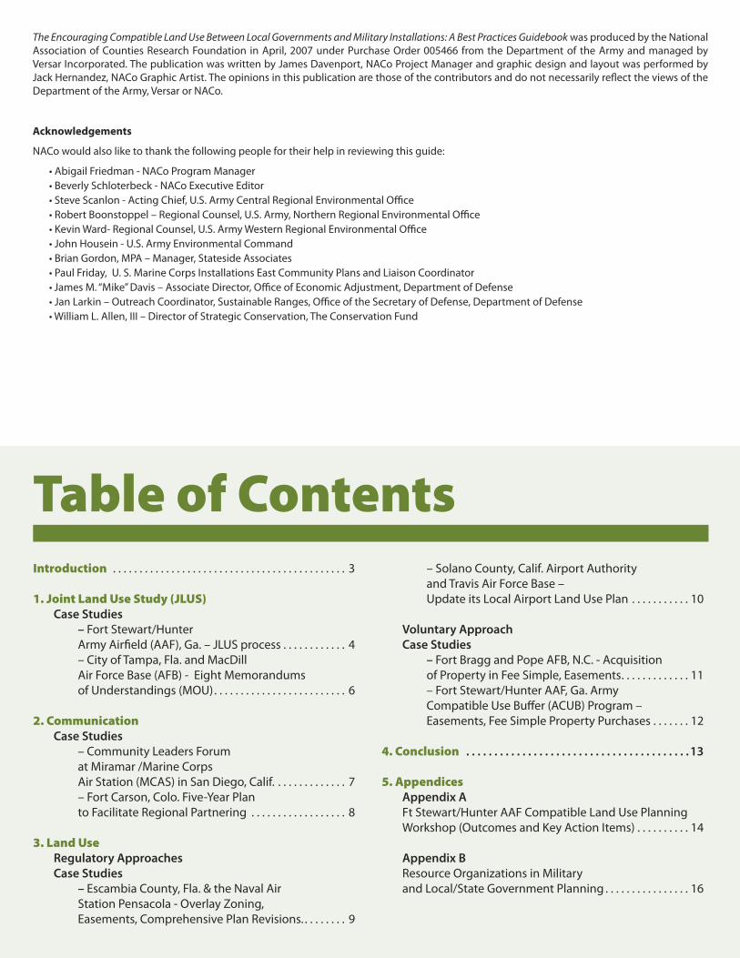
Introduction . . . . . . . . . . . . . . . . . . . . . . . . . . . . . . . . . . . . . . . . . . . . 3
1. Joint Land Use Study (JLUS) Case Studies – Fort Stewart/Hunter Army Airfield (AAF), Ga. – JLUS process . . . . . . . . . . . . 4 – City of Tampa, Fla. and MacDill Air Force Base (AFB) - Eight Memorandums of Understandings (MOU) . . . . . . . . . . . . . . . . . . . . . . . . . 6
2. Communication Case Studies – Community Leaders Forum at Miramar /Marine Corps Air Station (MCAS) in San Diego, Calif. . . . . . . . . . . . . . 7 – Fort Carson, Colo. Five-Year Plan to Facilitate Regional Partnering . . . . . . . . . . . . . . . . . . 8
3. Land Use Regulatory Approaches Case Studies – Escambia County, Fla. & the Naval Air Station Pensacola - Overlay Zoning, Easements, Comprehensive Plan Revisions. . . . . . . . . 9
– Solano County, Calif. Airport Authority and Travis Air Force Base – Update its Local Airport Land Use Plan . . . . . . . . . . . 10
Voluntary Approach Case Studies – Fort Bragg and Pope AFB, N.C. - Acquisition of Property in Fee Simple, Easements . . . . . . . . . . . . . 11 – Fort Stewart/Hunter AAF, Ga. Army Compatible Use Buffer (ACUB) Program – Easements, Fee Simple Property Purchases . . . . . . . 12
4. Conclusion . . . . . . . . . . . . . . . . . . . . . . . . . . . . . . . . . . . . . . . . 13
5. Appendices Appendix A Ft Stewart/Hunter AAF Compatible Land Use Planning Workshop (Outcomes and Key Action Items) . . . . . . . . . . 14
Appendix B Resource Organizations in Military and Local/State Government Planning . . . . . . . . . . . . . . . . 16
Table of Contents
The Encouraging Compatible Land Use Between Local Governments and Military Installations: A Best Practices Guidebook was produced by the National Association of Counties Research Foundation in April, 2007 under Purchase Order 005466 from the Department of the Army and managed by Versar Incorporated. The publication was written by James Davenport, NACo Project Manager and graphic design and layout was performed by Jack Hernandez, NACo Graphic Artist. The opinions in this publication are those of the contributors and do not necessarily reflect the views of the Department of the Army, Versar or NACo.
Acknowledgements
NACo would also like to thank the following people for their help in reviewing this guide:
• Abigail Friedman - NACo Program Manager• Beverly Schloterbeck - NACo Executive Editor• Steve Scanlon - Acting Chief, U.S. Army Central Regional Environmental Office• Robert Boonstoppel – Regional Counsel, U.S. Army, Northern Regional Environmental Office• Kevin Ward- Regional Counsel, U.S. Army Western Regional Environmental Office• John Housein - U.S. Army Environmental Command• Brian Gordon, MPA – Manager, Stateside Associates• Paul Friday, U. S. Marine Corps Installations East Community Plans and Liaison Coordinator• James M. “Mike” Davis – Associate Director, Office of Economic Adjustment, Department of Defense• Jan Larkin – Outreach Coordinator, Sustainable Ranges, Office of the Secretary of Defense, Department of Defense• William L. Allen, III – Director of Strategic Conservation, The Conservation Fund

Introduction
Sustainability of military installations is critical in the preparation of our troops to defend our national interest and protect us well into the future. Though land use is a key component of this equation, protecting and preserving these facilities is not just about compatible land use but also includes focusing on issues such as water, air, solid waste, energy, etc. All of these must be monitored and managed if mutual sustainability is to be achieved.
More information on various sustainable ranges programs and approaches is available at www.denix.osd.mil/denix/Public/Library/Sustain/Ranges/sustainableranges.html.
Local governments are confronted with the competing demands of rapid growth, limited potential for outward expansion,
and striking a balance between economic development and environmental quality. A more recent challenge to local governments has been assessing local economic growth and development impacts and their proxim-ity to existing military facilities.
In the past, military installations were lo-cated mostly in rural, isolated areas in order to avoid potential conflicts between military training and the comfort and safety of the lo-cal citizenry. However, as population growth has expanded outward, development has crept closer to installations causing problems on both sides of the fence line. For instance, Department of Defense (DoD) activities may have adverse effects on neighboring com-munities through noise and dust from mili-tary training activities, and noise and safety concerns from overhead flights of military aircraft.
On the other hand, military training can be compromised by development near an installation border when commercial and resi-dential lighting disrupts night training for the soldiers or parachute training is halted due to development near the drop zone.
The relationship between military instal-lations and surrounding communities has become strongly interrelated, and it is no longer possible for either entity to avoid one another when particular challenges threaten to degrade the relationship. Neither local governments nor installations can afford the costs associated with poor relations. Both need to work collaboratively in order to ad-dress issues that affect the locality’s ability to grow in a prudent manner, enabling it to provide adequate services and quality of life to the local constituency and the military’s ability to adequately train its troops.
If the installation and the local governments are unable to work collaboratively, the instal-lation is more vulnerable to the possibility of being closed and its troops and operations reassigned to other posts. Many people know this as the Base Realignment and Closure pro-cess or (BRAC). The latest round of BRAC was in 2005.
Local government officials, private citizens from the community, and installation leaders
National Association of Counties
Compatible Land Use • 3
and managers need to have a greater under-standing of each other’s issues, future needs, and current planning processes to assess how planning decisions on the part of the military or local government may impact one another.
Incompatible development near the fence line may compromise the installations’ ability to conduct training and operations. However, limiting the local jurisdictions’ ability to devel-op in certain areas may hinder that localities’ ability to set the stage for needed economic development and plan a vision for the future.
The guidebook focuses on approaches or best practices that an installation and sur-rounding communities can implement to initiate land use compatibility. However, it is important to note that the encroachment is-sue can go beyond the fence line; for example one needs to monitor flight routes, special operations/training areas, and outlying fields. Multi-state/regional approaches such as the Southeast Regional Partnership for Planning and Sustainability (SERPPAS) can also provide valuable tools for addressing compatible land uses on a broad scale. Identifying a set of tools from the local to regional, to state, and multi-state domains will provide what is es-sential for success.
This guidebook will describe, through case studies, some of the best practices that will help encourage compatible land use between military installations and the surrounding communities. These best practices are described in four cat-egories:
1. Joint Land Use Studies
2. Communication
3. Land Use – Regulatory Approaches
4. Land Use – Voluntary Approaches
Though each case study focuses on a particular best practice, they contain references to the other best practices categories. A review of the case stud-ies exemplifies how related these best practices are to each other in promoting collaborative land use with the local communities and the military.

1. Joint Land Use Study (JLUS)
National Association of Counties
4 • April 2007
“Our experience with our AICUZ and JLUS documents (land use planning tools) has proven that the only thing worse in these days of BRAC than NOT having a JLUS, is having one but choosing NOT to adhere to it!”
– Tyler HarrisDeputy Community Plans
and Liaison OfficerMarine Corps Air Station
Cherry Point and
Former County Manager,Craven County, N.C.
DoD has four major programs designed to address potential conflicts between military and civilian land uses: The Air In-stallations Compatible Use Zones Program (AICUZ); the Range AICUZ Program; the Operational Noise Management Program (ONMP); and the Compatible Use Program. These programs were developed to identify noise affected areas around installations and to implement cooperative approaches for reducing adverse impacts. These pro-grams are employed by all four branches of the military.
In 1985, the DoD initiated what is now called the Compatible Use Program which oversees the Joint Land Use Study (JLUS) effort to create a participatory, commu-nity-based framework for land use planning around military installations. The goals of the JLUS generally are to:
1. Encourage cooperative planning between the base and community,
2. Foster compatible land use planning,
3. Help implement recommendations to concerns relative to the noise affected areas,
4. Reduce the operational impacts on the adjacent communities, and
5. Provide information and guidance.
Overall, the JLUS process encourages resi-dents, local decision-makers, and installa-tion representatives to study issues of com-patibility in an open forum, balancing both military and civilian interests. From 1985 through 2006, 48 studies were completed including ones at Fort Stewart/Hunter Army Airfield (AAF) and MacDill Air Force Base (AFB). Additionally, local communities are required to match at least ten percent of the total project cost in non-federal funds.
It is important to remember that the JLUS is a working document that sets the stage
for both communities and military installa-tions to move forward in addressing land use compatibility. However, the JLUS would not be a productive document unless there is a process that assures implementation of the recommendations from the study.
About a year after completion of the Fort Stewart/Hunter AAF JLUS, The National Association of Counties (NACo) and The Conservation Fund (TCF) worked in part-nership with the installation and local com-munities to hold a “Collaborative Land Use Workshop” at Fort Stewart (see appendix A). The purpose of the workshop was to set the stage for implementing the recommenda-tions from the JLUS. The workshop was de-veloped as a pilot to help other installations and surrounding communities implement their own JLUS recommendations.
The Fort Stuart/Hunter AAF JLUS was prepared by EDAW in 2005 under contract with the Coastal Georgia Regional Development Council. Cop-ies of the JLUS are available at www.coastalgeorgiardc.org/docs/JLUS_Fi-nal_Report.pdf.
Case Study:Fort Stewart/Hunter AAF
The Fort Stewart/Hunter AAF Military Complex in southeast Georgia consists of an intensive training area supported by an airfield. The post is a relatively flat, coastal landscape of sandy soils, riparian areas, and marshland that falls in portions of six counties—Bryan, Chatham, Evans, Liberty, Long, and Tattnall. The City of Hinesville and Liberty County are adjacent to the training area along the southern boundary of the post. The City of Pembroke and Bryan County surround Fort Stewart to the north. The Cities of Glennville and Richmond Hill lie to the west and east of post boundaries,

“When the policies of a local government are supported by a careful and deliberative Joint Land Use Study of existing and emerging land use patterns, government will be better equipped to make informed decisions concerning compatible land use activity near an active military installation.”
– James M. “Mike” Davis Associate Director
Office of Economic AdjustmentDepartment of Defense
respectively. Hunter AAF is approximately 40 miles east of Hinesville in the City of Savannah and Chatham County, Georgia.
The Army first activated Camp Stewart, an anti-aircraft artillery training center in 1941, adjacent to the 500 residents of the City of Hinesville. Originally a 5,000 acre facility, the installation acquired substantially more land in subsequent years to accommodate the training needs of an entire brigade combat team. The Army acquired the 54,000-acre Hunter AAF from the U.S. Air Force in 1967. Today, the Fort Stewart/Hunter AAF complex is a major land use presence in the region.
The JLUS for Fort Stewart/Hunter AAF was completed in 2005. As with all JLUS efforts, the ultimate goal was to reduce potential land use conflicts, accommodate growth and sustain the regional economy. The DoD, Office of Economic Adjustment funded three-quarters of the study, while participating local jurisdictions supple-mented the initiative with local and re-gional resources.
The JLUS team identified two tiers of participants from jurisdictions either di-rectly adjacent to Fort Stewart/Hunter AAF facilities or within the regional influence of the military installation. The participating stakeholders in the Fort Stewart/Hunter AAF JLUS were organized into two committees:
1. The Policy Committee consisted of local elected officials from each participating jurisdiction and leadership from the installation. The committee was responsible for:
• the overall direction of the JLUS,
• approval of the budget,
• preparation of the study design,
• review of draft and final written reports,
• consideration of policy recommendations, and
• monitoring the implementation of any adopted policies.
2. The Technical Committee consisted of city and county managers, area planners, professional staff; military planners; and representatives from stakeholder organizations such as
chamber of commerce, natural resource protection organizations, etc. The committee was responsible for:
• data collection,
• identifying and studying technical issues, and
• developing recommendations for further consideration by the Policy Committee.
In addition to the Policy and Technical Committee meetings, the JLUS process consisted of a series of public involvement events in jurisdictions around the instal-lation. These meetings gave residents an opportunity to understand the existing issues, review draft land use compatibility tools, and provide input on implementation strategies.
Over 15 recommendations came out of the JLUS study at Fort Stewart/Hunter AAF. Many of these dealt with proposed land use best practices as well as steps to institutional-ize communication between the installation and surrounding counties and cities. One of the goals was to “Sign a Memorandum of Understanding between the Army and all participating jurisdictions at the beginning stages of implementation.”
Historically, such agreements have been a major step forward in bridging the gaps be-tween the installation and the communities. In fact the MOU can take many forms and address particular issues as detailed in the following case study.
National Association of Counties
Compatible Land Use • 5
Fort Stewart Hunter AAF and neighboring counties

National Association of Counties
6 • April 2007
Case Study:City of Tampa, Fla. and MacDill Air Force Base (AFB)
MacDill AFB is located eight miles south of downtown Tampa. Now an operational base, MacDill has about 6,000 airmen and civilians on 5,000 acres, located on the Southwestern tip of the Interbay Peninsula on the west coast of Florida.
The City of Tampa, Fla. and MacDill Air Force Base (AFB) currently have eight MOUs in various phases of implementation. These recommendations were the result of a DoD, Office of Economic Adjustment funded JLUS completed in July 2006. These MOUs cover many key areas including :
Employment: Provides information and programs to facilitate the city’s evaluation of employment for spouses of MacDill officers and enlisted members
Law enforcement: Provides programs to assist MacDill staff in the delivery of public safety and services, serves as an agreement template for the joint use of MacDill’s firing range and associated classroom facilities, and provides reciprocal support in bomb threat situations
Parks: Provides for access along the northern perimeter of the base for the city’s greenway and trail system. Additionally, the city has committed to designating a commemorative memorial park in formal recognition of the base’s importance to the Tampa community
Recreation: Provides for the use of the base for special events and for MacDill’s participation in city recreation programs
Emergency management/disaster preparedness: Provides for mutual aid in the case of emergencies and disasters and participation in joint exercises to ensure successful coordination
Mutual aid agreement: Supplements the emergency management MOU by specifying the type and level of assistance to be provided by each participating entity in the event of a disaster (natural or man-made) that exceeds the capabilities of either entity
Redevelopment: Creates a work group to review legal, fiscal, zoning, and economic requirements and limitations applicable to the private financing and construction of new single- and multi-family housing for military families
Reciprocal explosives-detection canine patrols: Establishes guidelines, procedures, and service requests for assistance in bomb threat situations
The DoD’s Range Sustainment Initiative is pub-lishing a series of primers to provide tools and suggestions for establishing and maintaining ef-fective relationships and partnerships to address the challenges of encroachment.
Two publications were produced in partnership with the International City/County Management Association (ICMA), NACo and DoD:
“Working with Local Governments: A Practical Guide for Installations” available at www.naco.org/techassistance or www.denix.osd.mil/denix/Public/Library/Sustain/Ranges/sustain-ableranges.html
“Understanding and Coordinating with Military Installations: A Resource Guide for Local Governments” is currently under review and will be available in mid-summer, 2007 at the websites listed above.
The eight MOUs are the result of a partnership initia-tive between Tampa and MacDill AFB and demonstrate the two parties’ strong commitment to realizing ef-ficiencies through cooperative efforts and activities. Staffs from both the local government and the instal-lation met regularly throughout the implementation stages of each MOU.
Two individuals, called “partnership initiatives liai-sons,” operate as key points of contact between the installation and local government. A point of contact list for each MOU identifies the individuals at each level responsible for each specific area of expertise. These MOUs established a level of formal and functional com-munication that was critical in developing a successful partnership between the City of Tampa and MacDill AFB.

National Association of Counties
Compatible Land Use • 7
Two-way communication is crucial to successful compatible land use planning. In most cases, local government officials have the authority to pass land use ordinances and strengthen growth planning; and it is vital for installation commanders and mili-tary planners to actively participate in the local and regional planning process. With-out adequate input from the military, local government officials will not have sufficient information to assess the impacts of their growth management and land use decisions on military operations. On the other hand, it is important that the military provide input to local officials so they can, for instance, assess the economic and infrastructural impacts of any major troop deployment to the installation, or be aware of the schedul-ing of prescribed burns at the installation in order to minimize un-controlled wildfire.
A best practice is to institutionalize com-munication and collaboration among stake-holders that goes beyond the limited terms of military leaders and local decision makers. Open communication among the parties can take many forms, but it is important to develop and sustain communication strate-gies and programs that will continue beyond turn over of both military and civic leaders.
As portrayed in the following example, the Commanding Officer can play a key role in facilitating the relationship between an in-stallation and its surrounding communities. While it is imperative that the installation take a proactive approach in working with the civilian community, the Commander sets the example by being proactive and positive. It’s important that the vision of the installation’s outreach program develop a process to update the local communities on:
1. The current and future mission of the installation,
2. On-going proactive environmental stewardship programs, and
3. Economic impacts.
Case Study:Community Leaders Forum at the Miramar/Marine Corps Air Station in San Diego, Calif.
The Naval Air Station (NAS) Miramar served as the Navy’s fighter Master Jet Base for nearly half a century. In 1999, Miramar realigned to a Marine Corps Air Station (MCAS). The following case study reflects Navy policy prior to the arrival of the Ma-rines.
NAS (now MCAS) Miramar covers 24,000 acres in urbanized San Diego. It is bordered by two separate cities and San Diego County property. Impacts from air operations, how-ever, extend well beyond the borders.
Traditional coordination with communi-ties normally involved local leadership, but the Navy recognized a need to open a dia-logue with local neighborhood groups if the Navy was to be a good neighbor. As a result, the Navy established a Community Leaders Forum to open lines of communication with Miramar’s neighbors. The Committee was chaired by the Commanding Officer and staffed by the Community Planning Liaison Officer (CPLO). Also in attendance from the Navy were the Public Affairs Officer (PAO) and a representative from the installation legal office.
The community representatives were from San Diego County and the three near-by cities, Chamber of Commerce, neighbor-hood civic organizations, and other stake-holders. These meetings were conducted quarterly and addressed operations, noise complaints, land use concerns and other relevant topics. Meetings normally kicked off with a mission update from the Com-manding Officer and ended with a round table discussion of issues of interest.
The installation mission benefited from the forum by keeping the community ap-praised on changes in flight operations and provided a ready forum to discuss other issues directly with the Commanding
2. Communication
Most of the information from the case studies was obtained from the follow-ing resources:
“Range Commanders’ Council Sustainability Group – Commander’s Guide Best Practices and Lessons Learned” prepared by Sustain-ability Group Range Commanders Council, February 2006 available at https://wsmrc2vger.wsmr.army.mil/rcc/manuals/Command-ers_Guide/index_best-practices.html, and
“Practical Guide to Compatible Civilian Development Near Military Installations” published by Office of Economic Adjustment in Cooperation with the National Governors Association Center for Best Practices and available at www.oea.gov/oeaweb.nsf/PG?readform.

Officer. This resulted in community support for land use issues that could affect mission sustainability. The mission was constantly in front of the public and this ensured a public understanding of the mission, promoted good will, and reduced noise complaints. Also, allies gained through the forum often provided support to the Navy in other areas.
The CPLO Program is hosted by the na-tional headquarters of the U.S. Marine Corps and most Marine Corps installations across the country have a CPLO in place. The pur-pose of the CPLO is to bridge the gap be-tween multi-state, state, regional, and local communities and the installation.
The actual role varies depending on the specific community involved, but the over-all mission is for the CPLO to work with the local planning agencies and other key enti-ties to address the environmental, cultural, historical and even political issues relevant to sustaining necessary mission and train-ing environments for the base. The CPLO represents the Commanding General at the multi-state/state level and installation’s Commanding Officer at the local commu-nity level.
The CPLO has different duties than a PAO, but still works closely with the PAO and its office to coordinate external outreach related to installation master planning, installation strategic planning, and local and regional planning efforts. The Base Commander provides this person with the “license to operate appropriately” in order to leverage the fact that this position would serve as institutional memory amidst the frequent turnover at the Commander and County Commission levels.
Again, the approach to open communica-tion lines between the military installation and communities can involve a series of best practices including joint use agreements for facilities needed by both the installation and communities, orientation workshops and annual installation tours for newly elected and other officials, and a “Meet the Soldiers” day at local schools. In the case study below, Fort Carson used many actions to open communication as part of a five-year plan to facilitate regional partnering to influence the development, integration,
and implementation of Fort Carson and area sustainability plans by 2030.
Case Study: Fort Carson, Colo.
Fort Carson is located on the south side of the City of Colorado Springs, Colorado, in El Paso County. The installation stretches south along Interstate 25 into Pueblo and Fremont Counties. The training area of Fort Carson is located in the northern part of the installation.
Communication based actions at Fort Carson include among other things:
Fort Carson has an MOU with surrounding counties and municipalities,
Fort Carson representatives attend city and county council meetings to provide feedback to proposed development plans,
Regional planning groups were established to include military and civilian stakeholders,
A joint planning commission, that includes civilian and military representation from Fort Carson and Pinon Canyon Maneuver Site area, was created, and
Standing stakeholder committees exist within the community to address various issues including those related to Fort Carson.
“Military commanders across the country have a unique opportunity to partner with their local communities to proactively meet future land growth management problems. Coordination with community representatives throughout our region has been supportive, educational and progressive.
The goal must be to form a durable partnership that will lead to trust, open communication and cooperation.” ”
– Rear Admiral William French Commander
Navy Region Northwest
National Association of Counties
8 • April 2007
National Association of Counties
Compatible Land Use • 9
“We are fortunate to have an excellent working relationship with the Navy in Kitsap County. By working together on land use and other community issues, we insure the Navy can carry out its mission, the community can prosper economically and all of our citizens are well served.” ...
– The Honorable Chris Endresen, County
CommissionerKitsap County, Wash
It is no surprise that local land use deci-sion making is very controversial. However, it is also no surprise that local land use plan-ning and zoning are among the most cost effective tools to implement appropriate land uses adjacent to a military installation or military training routes.
Public participation and civic involvement is one of the hallmarks of land development in this country. Many stakeholder interests are involved in local land development de-cision making, and local jurisdictions have often involved neighborhood planning groups to attend and actively participate in public hearings and meetings on prospec-tive development projects. Therefore, both the communities and installations will ben-efit when military planners and leaders be-come involved in those decisions, especially pertaining to sites adjacent to the fence line or impacting military operations.
The DoD, Office of Economic Adjustment’s “Practical Guide to Civilian Development” iden-tified and prioritized a number of land use tools to promote land use compatibility, and categorized them in the following areas:
1. Local Regulatory/Administrative Oversight,
2. Zoning and Master Planning,
3. State Support and Legislation,
4. Land Acquisition, and
5. Cooperative Agreements and Compatible Use Buffers.
It is important to consider a broad spec-trum of land-use-based best practices. No one approach will work in all regions across the country.
The next two case studies demonstrate regulatory-oriented land use approaches which include tools such as revisions to current zoning and building codes, com-prehensive plan updates and restrictive easements protecting key military training and operational areas.
Land Use – Regulatory Approach
Case Study:Escambia County, Fla. and the Naval Air Station (NAS) Pensacola
Escambia County is home to the Naval Air Station (NAS) Pensacola - the “birthplace of naval aviation.” In 2002, Escambia County initiated a JLUS process with technical and financial support from the DoD, Office of Economic Adjustment. The study involved NAS Pensacola and outlying airfields.
One of the key reasons for the JLUS study was the development moratorium that the Board of County Commissioners imposed in February 2001 within noise and accident potential zones surrounding NAS Pensaco-la. This was in response to concerns raised by the Navy regarding urban development encroaching too close to the NAS and im-peding its flying mission.
The purpose of the moratorium was to al-low time to sort out the impact of emergent development patterns near the NAS on the Station’s mission and operations. The mora-torium was lifted when the recommenda-tions from the JLUS, described below, were adopted.
The county defined the “Airfield Influence Planning District” (District) as part of the JLUS area of study. This District included the air base and defined accident potential and noise zones through general Navy protocols. It also defined an extended area one mile beyond these accident and noise zones.
The Board of County Commissioners, by legislative amendment to the Escambia County General Plan, established zoning overlay and real estate disclosure districts consistent with the District. As a result, the county was able to update its general plan complementing current land development
3. Land Use

National Association of Counties
10 • April 2007
codes which incorporated JLUS recommendations. These include the following requirements for property within the District:
Sound level reduction is required in building construction based on degree of noise exposure.
Real estate disclosure is required regarding the presence of the NAS and aircraft operations. Disclosure would be required in all listing agreements and in individual marketing materials before execution of a contract for sale or lease.
Avigation (airspace) easements are required as a condition of subdivision approval and/or building permit issuance. This legal agreement between a property owner and Escambia County provides for free and unobstructed flight of aircraft through airspace over property, with the right to create or cause noise, vibrations, odors, vapors, exhaust, smoke, or other effects that may be inherent in aircraft operations.
An amendment to the Escambia County Land Development Code provides a place for the local naval command to participate as a standing ex-officio member of the Escambia County Development Review Committee (DRC). This allows the naval command to participate in the review of all development proposals and plans for land use compatibility, structure height, density, and intensity of use near the NAS.
Unlike the Pensacola example above, the entity de-veloping the local plan and regulations to protect the Travis AFB near San Francisco, California is a regional body, i.e. the airport commission, which has no author-ity of its own to enforce the plan. It requires the local jurisdiction (cities of Fairfield, Vacaville, and Suisun; and Solano County) to adopt land use controls that are consistent with the plan or to override the plan by a two-thirds vote of the governing body.
Case Study:Travis AFB and the Solano County, Calif. Airport Land Use Commission
Travis AFB is located northeast of San Francisco. As required by California state law, the Solano County Airport Land Use Commission (commission) updated the local airport land use plan to implement noise and safety protections and limit incompatible development near the base. The commission viewed the airport plan revision as a way to address political controversy that had been simmering, among adjacent land owners, for
several years with threatened law suits and proposed referendums.
Solano County hired a consultant to update the plan and facilitate necessary community meetings and reviews, and the DoD, Office of Economic Adjustment provided funding assistance for select elements of the study.
On June 13, 2002, the commission adopted the up-dated plan (now called the Travis AFB Land Use Com-patibility Plan). Local jurisdictions in Solano County, which had 180 days to amend their general plans and zoning ordinances or overturn with two-thirds vote, quickly adopted the measures. In fact, the following developments took place:
Fairfield amended its General Plan to designate part of the Wilcox ranch near Travis as part of the “Travis Reserve” or buffer area. This site was previously proposed for intense housing development.
Solano County purchased 1,800 acres of buffer area immediately adjacent to Travis on the east side. This would ensure that in the event the Air Force decides an additional parallel runway is needed, there will be no development to impede building one.
The commission established compatibility zones within the Travis AFB and the Height Review Overlay Zone for any of the airspace protection areas.
Sample deed notices are to be used for real property transactions in sensitive areas near the Travis AFB. They are to be included in parcel maps, tentative maps, or on a final map for subdivision approval.
Currently, local agencies continue to submit major land use actions for review of the commission for compatibility to the revised plan. This effort has been controversial and continues to be today. However, the benefits to be derived from these recommendations, with the purpose to curtail inappropriate development near the fence line and in key operational areas, has been an encouraging sign for the region.

Land Use – Voluntary Approach
The final two case studies focus on ap-proaches related to property purchases, easements and conservation stewardship and cooperative programs. These ap-proaches are mostly voluntary rather than regulatory and directly involve, in most cases, each individual property owner. Ad-ditionally, both examples incorporate ex-tensive federal, state and local partnerships which helped support the conservation efforts in protecting military training op-erations as well as key endangered species, including the red-cockaded woodpecker found at Fort Bragg, North Carolina and Fort Stewart/Hunter AAF, Georgia.
These examples typify the recent devel-opments within the military services be-cause, not surprisingly, many endangered species are using the vast acres of open space on military installations for their habitat. As a result, military services have developed a series of new approaches to address these issues.
Lieutenant Colonel Joe Knott, Army Training Lands Support Officer, stated in a presentation at the April, 2005 Joint Ser-vices Environmental Management Confer-
“ Innovative processes at all levels of government have created new paths for cooperative land use planning and have opened doors for mutually beneficial successes.”
– Colonel Michael P. O’Keefe Commander, US Army
Environmental Command
ence, that the U.S. code “10 U.S.C. §2684a” set the stage for establishing agreements between the military services and local governments and other stakeholder groups to limit encroachment and other constraints on military training, testing, and opera-tions. He listed the following developments, among others, that have taken place across the services and exemplified DoD’s support in this effort:
1. Army and Marines have several conservation-based partnerships and agreements in place,
2. Army implements cooperative agreements with key partnering stakeholders and the stakeholder holds all interest in acquired land,
3. Navy implements a real estate procedure for individual parcels and requires a recordable interest in acquired land,
4. Air Force uses Air Installation Compatible Use Zone (AICUZ) program to protect critical air space, and
5. All services in Hawaii are cooperating with each other and establishing joint solutions to promote conservation on the posts within the state.
In fact, the DoD, Office of Secretary of Defense is providing leadership and supple-mental funding in this area and has received $20 million for buffer project funding in FY’06. These actions support the trend of building a cooperative relationship between the military services and the public and/or private partners that may entail a contribu-tion from the partnering entity.
Case Study:Fort Bragg, N.C.
The U.S. Army, the State of North Carolina, the U.S. Fish and Wildlife Service (USFWS), and The Nature Conservancy (TNC) joined together at Fort Bragg to form the North Carolina Sandhills Preservation Project. The project’s purpose was to develop a plan to protect and conserve the habitat of the endangered red-cockaded woodpecker, the longleaf pine, and other ecosystems in the sandhills area, while also protecting
National Association of Counties
Compatible Land Use • 11

the training and readiness missions at Fort Bragg. Under this plan, the USFWS has acquired lands through purchase or conser-vation easements that could support wood-pecker populations and other endangered, indigenous species.
The areas of concern involved more than 220,000 acres of land managed by state and federal agencies. The goal is to create wildlife habitat corridors for the woodpecker popula-tions running between Fort Bragg and Camp Mackall, 40 miles west of Fort Bragg. This goal consisted of the following steps:
The partnering agency purchases key parcels from willing sellers identified as priority sites in the joint Fort Bragg-Pope Air Force Base JLUS which supported the Sandhills Preservation Project. (Please note that Fort Bragg does not initiate the purchase.)
The partner purchases conservation easements from willing sellers.
The partner enters into cooperative management agreements with private landowners.
Participation in the North Carolina Sandhills Safe Harbor program, which is open to non-federal landowners within an area comprising six counties in the south-central portion of the State (Cumberland, Harnett, Hoke, Moore, Richmond, and Scotland).
Landowners enroll land in the program by agreeing to carry out any of a number of activities beneficial to the woodpecker. These include wise land management and conservation practices to provide good quality foraging habitat; restore the open, park-like pine forest conditions that the woodpecker requires; and enhancing opportunities for nesting and roosting sites.
Management of newly acquired areas by the North Carolina Games Lands Commission, the USFWS, or TNC. Fort Bragg will be able to use the land for training (land navigation, orienteering, and escape and evasion) so long as the activity conducted by the military is consistent with the conservation objectives.
The Army Compatible Use Buffer (ACUB) program was implemented for the purpose of avoiding or limiting encroachment and providing for long-term range sustain-ability at installations. The ACUB program is an important tool because it allows the installation to contribute funds towards an eligible entity acquiring land or interest in land from a willing private land owner and it involves significant cooperation with stakeholders.
It is important to note that the ACUB program is not a land acquisition program to acquire more land for training or testing. Skilled partners broker deals and manage the process in order to avoid the Army having to approach landowners. However, the program does allow the installation to influence incompatible land use and unconstrained development outside of its boundaries. In FY’05, the Office of the Secretary of Defense allotted $6.5 million for the ACUB program and the Army will continue with $10 million starting in FY’06.
Case Study:Fort Stewart/Hunter AAF, Ga.
Fort Stewart is located in the heart of the once vast longleaf pine ecosystem. Today, fewer than three million acres of longleaf forest remain, and less than three percent of this acreage is considered to be in rela-tively natural condition. The rest has been converted to agricultural use, developed, or converted to loblolly pine plantations. Fort Stewart’s live fire training frequently starts forest fires, and military land managers use prescribed fire to reduce wildfire risks. Thus, Fort Stewart supports some of the best remaining examples of longleaf forest. The installation is home to six federally listed species and twenty state listed or federal species of concern.
Through the ACUB program, Fort Stewart and the ACUB partners established the Coastal Georgia Private Lands Initiative. The Initiative will protect approximately 120,000 acres surrounding Fort Stewart using con-servation easements that limit develop-ment and protect sensitive environments. The Initiative also will create a corridor be-tween Hunter AAF and Fort Stewart along
“ It is the responsibility of local political leaders (both public and private) to work closely with the military to assure that development outside the installation fence line or in areas close to military operations, such as landing military aircraft, not in any way hinder that particular operation. If military and civilian leaders fail to work together, BRAC will always be a threat. Fort Stewart and Hunter AAF, like many installations across the country, are a valuable economic asset to the region.”
– Vernon MartinExecutive Director
Coastal Georgia Regional Development Center
National Association of Counties
12 • April 2007
the Forest River and the Ogeechee River. Partners in the ACUB program include The Trust for Public Land, The Georgia Chapter of The Nature Conservancy, and the Geor-gia Land Trust.
Overall, the program establishes cov-enants with private landowners to ensure compatible land use. The program received $3 million for acquisition of ACUB conser-vation easements in FY’05 and the first deal was closed on December 21, 2005.
Both military installations and local gov-ernments face growing challenges related to maintaining compatible land use near the fence line and in areas impacting mili-tary operations.
Incompatible development may com-promise the installation’s singular ability to conduct training and operations. At the same time, limiting the local jurisdiction’s ability to develop in certain areas may hin-der that locality’s ability to prosper. These challenges can result in conflicts between military installations and their surround-ing communities over what constitutes a “compatible” land use, polarized positions on shared issues, and ultimately a lack of trust.
Communities and the local installations have an assortment of best practices they can use to address these issues. Local juris-dictional and installation decision makers can assess communication and land use tools to help both entities strengthen land use compatibility. Enhanced communica-tion combined with tools for compatible land use planning can lead to development of common goals and objectives, help ad-dress possible misunderstandings with surrounding communities, and assist the military in achieving its mission.
“Our country’s soldiers need sustainable air, water and land resources to enable tough, realistic training, and a healthy environment to ensure vibrant communities in which to live. Those needs can only be met if the Army collaborates with our neighbors north, south, east and west of our installations. We must work together to address the land use and related environmental issues confronting all of us today to preserve this important legacy for future generations.”
– Addison D. “Tad” Davis IV Deputy Assistant Secretary
of the Army for Environment, Safety and
Occupational Health
4. Conclusion
National Association of Counties
Compatible Land Use • 13

National Association of Counties
14 • April 2007
Appendix A
Ft Stewart/HAAF Compatible Land Use Planning WorkshopOutcomes and Key Action Items
The National Association of Counties (NACo) and The Conservation Fund (TCF) (project partners) planned and held the Fort Stewart/Hunter AAF Collaborative Land Use Planning Workshop on December 11–12, 2006 at the Fort Stewart Officers Club. The workshop was held with support from the Association County Commis-sioners of Georgia (ACCG); Booz, Allen, Hamilton (BAH); Versar; and Stateside Associates and financial support from the Office of the Secretary of Defense and Depart-ment of the Army. Patrick Field, Consensus Building Institute, facilitated the workshop.
BackgroundThe purpose of the workshop was to identify obsta-
cles and opportunities for implementing recommenda-tions from the Joint Land Use Study (JLUS) completed in 2005; and to develop a communication network that will institutionalize an effective on-going communica-tion process for Fort Stewart/Hunter AAF and its sur-rounding communities. The overall goal was to initiate a process for the communities and the installation to develop and sign an MOU for implementing the JLUS recommendations.
The project partners intend to use the Fort Stewart/Hunter AAF workshop as a model for future workshops to help counties establish collaborative partnerships with their local military installations, no matter how far along they are in developing and implementing their own JLUS.
BarriersThrough the small break-outs, participants identified
a number of barriers to implementing recommenda-tions from the JLUS study. The relationship between the installation and surrounding jurisdictions differ due to the large geographic area and the varying levels of economic impacts (from the installation) on each jurisdiction; the locality’s participation in the JLUS; and its planning and zoning capacity. The participants
identified the need to engage the “right” people within the counties, the municipalities, and the base in the follow-up to the JLUS. The attendees identified many perceptions that needed to be addressed including:
1. Both fear of and complacency about BRAC,
2. General resistance to zoning,
3. Lack of education and knowledge of the installation’s training and operations,
4. Private property rights, and
5. History of base original expansion and related land takings.
Action ItemsThe following action items were recommended to
institutionalize communication and to develop and sustain the program regardless of turnover of both military and civil leaders. These include the (or combi-nation of ) following approaches:
1. Identify a single point of contact on the installation for surrounding communities (or Base Community Liaison),
2. Establish a Base Cross-functional Standing Team to review and respond to development and rezoning near the installation,
3. Develop a Base/County Organization (Model: Fort Benning or Fort Bragg, N.C./Sandhills),
4. Establish a Cross County Advisory Body, and
5. Initiate a Subgroup of local planners and military master planners.
Other recommendations included the following pro-posed actions:
1. Provide support for those counties that ask for it including technical assistance, training, mentoring in planning (e.g., modeling tools developed by DoD),
2. Develop more focused, small area “plans” for JLUS areas of concern with Army assistance,
3. Help interested counties without zoning to institute land use guidelines,
4. Incorporate JLUS recommendations into local regulations where possible,
5. Appendices
National Association of Counties
Compatible Land Use • 15
5. Periodic updates of JLUS,
6. Brief impacted landowners and elected officials on ACUB program and other conservation/financing options for creating buffer lands around Fort Stewart/Hunter AAF
7. Utilize existing linkages more effectively including the Regional Development Councils in the area and the state of Georgia Department of Community Affairs training programs.
Next Steps for RegionThrough the final discussion, participants recom-
mended a similar workshop, no longer than two days in length, be held as a follow-up to the December, 06 forum. The Garrison Commander (or other high ranking official) from the base should attend the entire work-shop along with more military planners. The workshop should focus on the JLUS recommendations, land use tools and specific ways to sustain the communication program regardless of turn over of both military and civil leaders.
Participants also recommended a briefing of work-shop recommendations and next steps for the Garri-son Commanders. They need to understand that if no action is taken after the workshop, relationships with the installation and the surrounding communities will worsen. Additionally, Fort Stewart/Hunter AAF should prepare a recommended action plan indicating the specific actions the installation intends to implement over the next six to twelve month period. Then, within the next two to there months, hold a briefing with workshop participants to review the action plan and revise accordingly based upon comments received.

National Association of Counties
16 • April 2007
Appendix B
Resource Organizations in Military and Local/State Government Planning
APA—American Planning Association 1776 Massachusetts Ave., NWWashington, DC 20036Tel: 202.872.0611Fax: 202.872.0643www.planning.org
TCF—The Conservation Fund1655 N. Fort Myer DriveSuite 1300Arlington, Virginia 22209Tel: 703-525-6300 Fax: 703-525-4610www.conservationfund.org
CSG—Council of State GovernmentsHall of States444 North Capitol Street, NWSuite 401Washington, DC 20001Tel: 202.624.5460Fax: 202.624.5452www.csg.org
ICMA—International City/County Management As-sociation777 North Capitol Street, NESuite 500Washington, DC 20002Tel: 202.289.4262Fax: 202.962.3500www.icma.org
NACO—National Association of Counties25 Massachusetts Ave, NWWashington, DC 20001Tel: 202. 303.6226www.naco.org
NCSL—National Conference of State Legislatures444 North Capitol Street, NWSuite 515Washington, DC 20001Tel: 202.624.5400Fax: 202.737.1069www.ncsl.org
NGA—National Governors AssociationHall of States444 N. Capitol StreetWashington, DC 20001Tel: 202.624.5300www.nga.org
NLC—National League of Cities1301 Pennsylvania Avenue, NW Suite 550Washington, DC 20004Tel: 202.626.3000Fax: 202.626.3043www.nlc.org
U.S. Conference of Mayors1620 Eye Street, NWWashington, DC 20006Tel: 202.293.7330Fax: 202.293.2352www.usmayors.org
AFT—American Farmland Trust1200 18th Street NWWashington, DC 20036Tel: 202.331.7300Fax: 202.659.8339www.farmland.org

25 Massachusetts Avenue, NW l Suite 500 l Washington, DC 20001202.393.6226 l fax 202.393.2630 l www.naco.org
A Best Practices Guide
EncouragingCompatible
Land UseBetween Local Governments and Military Installations