Embed Size (px)
Citation preview

W8“: 1 906:
BY Fxso sn cx A . CO MPANY
Published October, 1 906
1 1 1: m u m “ u n me t,0.O .A.
P R E F A C E
0 country in the world has exercised a morepo ten t influen ce o n the im agination s o f men o r
prese n ted such fascinating problem s fo r so lution to theexplorer as Tibet ; and this influence has been activeamongst all the gen eration s which have exploited thebyeways o f the earth from the days o f H erodotus tothose o f Yo unghusband. It m ay be doubted whethereven n ow the fascination o f Tibetan trave l is dead. But
the glamour o f it has undoubtedly faded som ewhat sin cethe streets o f Lhasa have been trodden by the spurredand booted Englishman and his ruthless hand has
exposed the mystic sham s o f that quain t and squalidcity.
With Lhasa, however, this book has little to do . It
is in tended to illustrate to some exten t the sequence o f
exploration in that great wildern ess o f stony and inho s
p itable altitudes which lie far beyo nd Lhasa, and may
serve inciden tally as a small tribute to the m emory o f
m any great achievem en ts. In compiling a record o f
adven ture so varied as this, n o apology is n ecessary fo r
quoting the works o f the best authorities within reach ,and the sources o f in formation which have been laidunder con tribution (Russian , Am erican , Italian , Indian ,
Fren ch, Swedish , and English) are so n um erous that Ifee l it to be impossib le to do more than presen t the
P R E FA C E
reader with a general b ib liography o f Tibet, and to say
that this work owes something to every authorityquoted.
Fo r the illustration s I am main ly indebted to MajorRyder, Captain Rawling, Lieutenan t Bailey, M. S ib iko fi
'
,
Mr. Littledale , Mr. John Thom son , the Paris Geographical Society, and to the Royal Geographical Society fo rthe use o f their maps.
T. HUNGERFO RD H O LDICH .
C O NT ENT S
CHAPTER I
EarlyTales about Tibet Conformation of Tibetan Plateau
and its Moun tain Barriers Routes in to Tibet North
western Routes Leh, Shipki, and Niti Passes Sikkim
Passes Eastern Routes Ta-chien -ln Routes from
the North
CHAPTER II
Geo logical Evolution— The ChangTang andNorthern Tibet
— Valleys of the Indus and Brahmaputra The Janglam
Trade Route Eastern Tibet The Rivers of China and
Burma The Southern Zon e Climate
CHAPTER III
Short O utline of Tibetan H istory In troduction of Bud
dhisrn Struggleswith ChinaandMongo l In terference
Growth of Lamaism Chin ese Admin istration
CHAPTER IV
The First Recorded Mogul Invasion of Tibet Min a Haidar
’s Story H is Geography Identifi cation of his Route
towards Lhasa
CHAPTER V
Eighteen th Cen tury Explorations Grueber Capuchin
Mo nks Their Mission at Lhasa and their Struggles
Jesuit I n terference Desideri Beligatti Last of the
Mission Van de Putte H is Residence at Lhasa
Paul
CO NTENTS
CHAPTER VIPAc l
Bogle’s Mission and Po licy of Warren Hastings Bogle
’s
Route to Shigatze Description of the Coun try and of
Gyangtse Reception by the Teshu Lama Turner
despatched by Warren Hastings His In terview with
the Infan t Teshu Lama
CHAPTER VII
The Conquest of Tibet by China— Remarkable MilitaryEx
pedition Its Route in to Tibet and the Final Defeat o f
the Gurkhas n ear Katmandu — Thomas Man n ing’s Vis it
to Tibet andLhasa— H is Route through Bhutan Experi
ences with Chin ese Omcials and In terviewwith the Dalai
Lama H is Impress io n s Moorcro ft’s Expedition to
Hundes H is Probable Residence at Lhasa and his Fate
CHAPTER VIII
The Jesuit Missionaries, H ue and Gabet Journ ey from
Man churia to Koko Nor No tes o n Early Christian ity in
Coria — The Mo ngo lian and Chin ese Borderland Fron tier
Farms Mongo lian Customs Trade with China
Lamaism in Western Kan su The Koko Nor and Feast
of Flowers at Kunbum
CHAPTER I!
H ue and Gabet (con tinued) From the Koko Nor to Lhasa
Rockhill and Prjevalski in Northeastern Tibet Rock
hill’s Seco nd Journ ey towards Lhasa and in the Eastern
Valleys of Tibet .
CHAPTER !
Hue and Gabet o n the Post Road to China and in Eastern
Tibet Approaches to the East from the Koko Nor andits Geographical Conn ection with Assam —
.De Rhin s and
Grenard — Needham and Krishna — The Brahmaputra
Valley and the Passes through Bhutan Kin thup’s Ex
plorations and Reports The Methods o f Native Ex
plorers Chandra Das Nain S ing’s Early Journ eys
CONTENTS ix
CHAPTER ! IPas s
Nain S ing’s Surveys in Southern Tibet Krishna Ugyen
— The Exp lorer G. M. N. The Go ld Fields o f Thok
Jalung The Source of the Indus and Brahmaputra
CHAPTER ! II
Western andNorthern Tibet European Explorers DeasyStein The Kuen Lun and Chang Tang WellbyBower Littledale Bo nvalo t Sven H edin Compari
son of Routes from West and North
CHAPTER ! I II
Recen t Expedition to Tibet The Reconnaissance of the
Upper Brahmaputra by Ryder, and the Exploration of a
Part of Western Tibet by Rawling
CHAPTER ! IV
The Approaches to Lhasa The Dalai Lama and H igh State
O ffi cials Feasts and Customs — Temples andPalaces
Folk Lore A Tibetan S tory
CHAPTER ! V
General Summary Sign ifi cance and Value of Approach to
Lhasa from the Northeast Russia’s Position relatively
to Tibet and India — The Value of Eastern and South
eas tern Tibet The Prom ise o f Go ld Necessity of
O pen ing up the Valley of the Brahmaputra
APPENDI! : BIBLIO GRAPHY or Tmn 'r
INDE!

I L LU S TR AT I O N S
Tibet. Co loured MapThe Po tala from the South
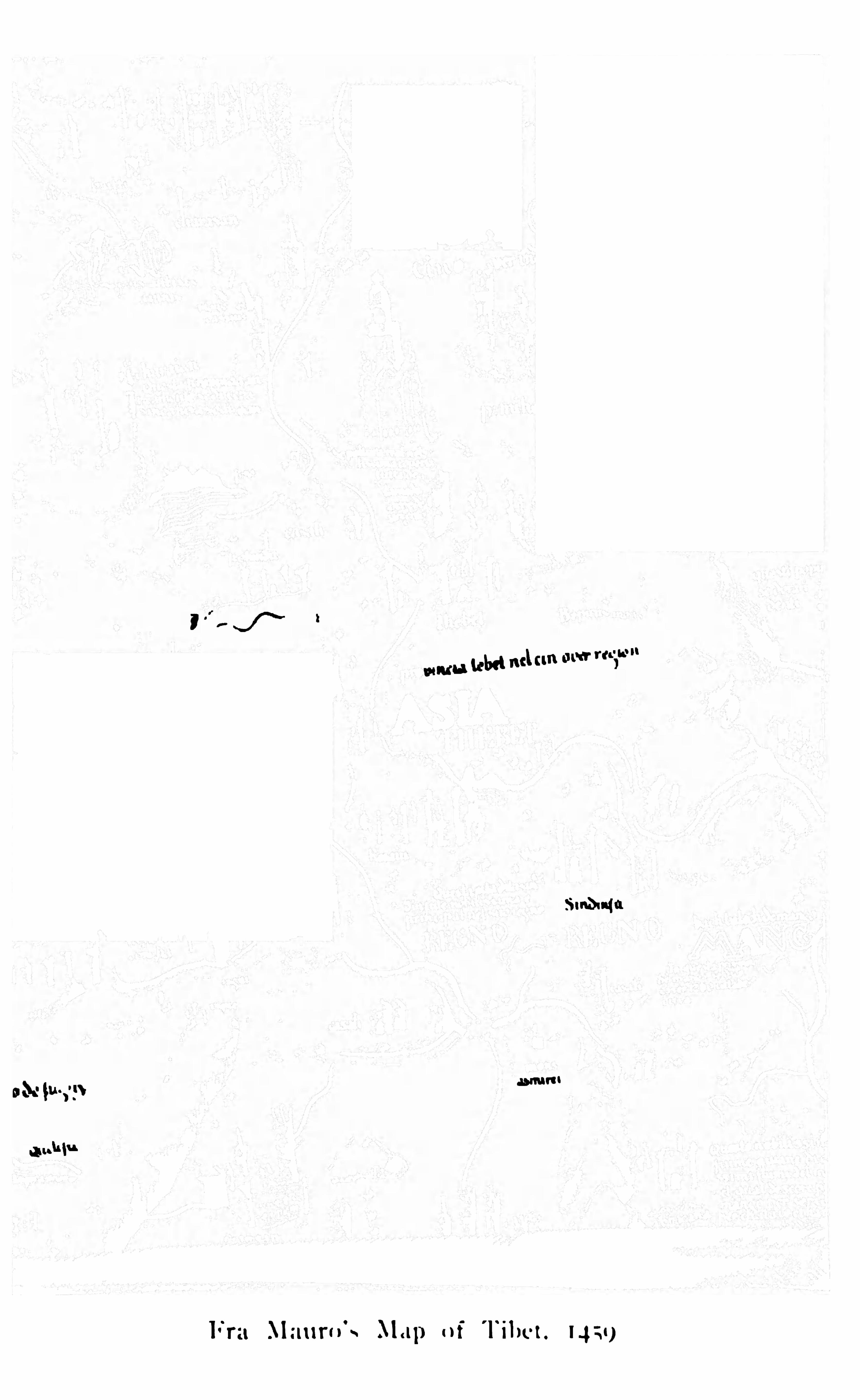
Fra Mauro 8 Map of Tibet, 1 459
Map of Tibet. From Kircher’s China
San lan San po . (Cane Bridge)
ATypical Peak of South Eastern TibetGlacial Lake andMorain e, Chathangta Pass
ATibetan Lhaeham . (Tibetan Princess)
ATibetan Prince. Dungkhor at H ome
Tibet. From D’Anville’s Map of Asia
Tibet. From Klapro th’sMap o fCen tralAsia, 1 830
Van der Putte’s Sketch Map
Tashi Lunpo , from the South
Gen eral Group o f Lamas
Clifl'
Temple where Hue sojourn ed
The Potala in the Seven teen th Century
W. W. Rockhill
A. E. Carey
Jules Leon Dutreuil deRhin sN. M. Prjevalski
Captain Kozlof
Rai BahadurKishen Singh,Milamwal (Krishna)Shigatze, from the Fort looking East
The SouthernWatershed of the Brahmaputra
I L L U S T R AT I O N S
O n the Brahmaputra
Alung Gangri Moun tains
The Late Nain Sing. C. I . E.
ATypical Tibetan Valley
Captain H . H . P. Deasy
CaptainWellbyDr. Sven H edin
Co lonel Bower
St. George Littledale
Major C. H . D. Ryder, R E.
The Gorges of the Brahmaputra above Lhatse
Lhasa Plan of the City

T I BET
TH E MY STER I O U S

TIBET THE MYSTERIO US
CHAPTER I
Early Tales about Tibet Conformation of I ibetau Plateau
and its Moun tain B arriers Routes in to I ibet Nort/i
western Routes Lek Sb ipki, and Niti Passes S ikkim
Passes Eastern Routes Ta-e/iieu-lu Routes from fi re
Nort/i
KROUGH all the ages Tibet has held a paramount po sition amongst those regions o f the
world which have been popularly in vested with aveil of mystery because they are in accessible and
unknown .
Tibet is so isolated, so lo fty, so irresponsive tooutside influen ces, has held herself so far apart fromthe meddling interferen ce of the busy, commercialworld, as to provoke the enterprise of generations o f
speculative geographers, who, accepting omne ign otum pro magn ifi co ,
” have startled the world with smallin stalments of truth surrounded by wide embroiderieso f decorative fancy. O n e of the earliest, i f not quitethe fi rst, of these Tibetan romances dates from thedays of Herodotus, nearly fi ve hundred years befo re our era. When all the writings of the greatFather o f history can be careful ly examined by the
a T I B ET
l ight of modern research, it will be found that h isgeneral accuracy is indisputable. H is knowledge o f
Asiatic geography and his care in collating such evi
dence as may be gathered from the earliest of classicaltravellers’ tales testifi es to the possession by him o f
considerable analytical faculty and discernment. To
one particular tale at any rate he gives a cautiousadmission of probability, but by no means a co rdialassent . It was said that in the extreme northwestof India there ex isted a race of enormous ants, fi erceand powerful
,whose peculiar mission in li fe was the
digging out of gold . Traders, mounted ou'
swi ftcamels, occasion ally succeeded in seizing the goldwhich was accumulated in heaps by these excavatin gants, and then rode rapidly away, pursued by o therferocious guardians of the soil who slew them if theycaught them . Amongst all the ludicrous exaggera
tions of ancient classical tradition relating to India,
this on e story evinces a remarkable tenacity of ex istence. It is repeated in every tale of the East that isto ld by compilers an d adventurers before the days o f
Herodotus, and is only doubtfully regarded by himas pure fi ction. It was n o t until , in recent years, thetrans-Himalayan explorers of the Indian Surveyrecorded their experiences that any light could bethrown on its origin. These explorers, making theirway painfully over the terrifi c altitudes which intervene between India and western Tibet
,reached at
length the gold-mining districts which lie beyond themountains on the great western plains. Here they
T I BET 3
discovered the Tibetan workman delving for gold aftera fashion of his own . The intense cold and the fi ercewinds of the highlands compelled him to grovel on thegro und enfolded in a thick, black blanket, whilst hedug
,or scratched
,painfully and slowly at the alluvial
soil with the end of the fi rst tool available to his hand,which was usually the ho rn of the Tibetan antelope.To all appearance he was a rough imitation of a hugeho rned an t grubbing up the auriferous soil and pilingit in heaps fo r subsequen t washing. Guarded by immen sely powerful dogs (whose ferocity even to thisday is a byword amongst travellers in Tibet ) , he has
pursued his unen viable calling from those very earlydays until now,
hardly improving his processes, making but sl ight impression and shallow indentationsin the soil , and probably leaving behind two -thirds ofthe go ld which it contains. Here, then, accordingto Sir H . Rawlinson , is the solution of the mysterythat surrounded that particular tale ; and it is buton e illustration o f the perceptive faculty po ssessedby Herodotus that he should consider it worthy ofreco rd .
Hardly anything of note concerning Tibet occurs inthe works of mediaeval geographical writers and com
p ilers. The huge, great central upheaval south of theGobi depression extending along the whole length ofthe Himalayas (which form its southern buttress orrevetment through which the great natural staircaseslead upwards to the plateau from the plains) , geologically coeval with the Himalayas of the No rthwest,
T I B ET
but n ewer by coun tless ages than those o f the East,has ever been a barrier against the ever-recurren t tideso f human movemen t southwards. No medie val traderoutes ever crossed Tibet from the no rth. Along thelength of the in terven ing plains of Chinese Turkestanthey ran westward from China till they touched the central barrier ( the Taurus of the Classics ) , which is theea stern wal l of the Pam irs. They then diverged northward, or twisted over the Pamir region to Badakshanand the Oxus, but they ever avoided Tibet. Thecountless tides of Central Asian emigration (Aryans,Skyths, Mongols, when they overflowed intoIndia, passed by way of Badakshan and the HinduKush never across Tibet. N0 Chinese pilgrimseeking kn owledge at the fountain-head in no rthernIndia ever traced his way across the Tibetan uplandsfrom the plains of western China and Kashgar,although he often selected a straighter route than thato f Mongol invaders. Avoiding the cen tral Pam irregion an d Tibet by crossing the Hindu Kush near itsnortheastern base by either the Wakj it or Baroghél
pass, he entered the valleys of Gilgit and Chitral ino rder to make his way over routes incredibly rough anddifi icult to the ancien t Gandhara the seat of all thatwas most sacred to Buddhism in the extreme northwest o f India. The great rolling Tibetan highlandshave thus p layed a most important part in the historyo f Asiatic migration. They have been the naturalbuffer-land between Central Asia and India, covering80wide a space of the northern frontiers of In dia, that
6 T I B ET
The great corrugated uplands of Tibet, seamed w ithridges of high altitude, inhospitable, bleak, and desolate though they be, do n o t in themselves, however,presen t any insurmountable difficulty to geographicalexploration .
The chief obstacles to Tibetan exploration haveever been the mountain barriers which surround theplateau, rather than the plateau itself. These mountain systems o n all sides o f Tibet are massed intoa series of gigantic walls, the ranges and ridges ofwhich are n o t fashion ed as long spurs reaching out
from the highlands and gradually dim inishing in altitude till they fade into the plains below, enclosing longsloping valleys which would answer the purpose oframps or shelving approaches to the heights ; but theyare fo lded range after range in gigantic altitudes
(higher than the ranges o f the plateau ) , forming a
rough but readily recognisable system o f parallel flexures flanking the gen eral edge of the cen tral Tibetanupheaval .Tibet may be described as a huge pear- shaped for
mation,w ith the small end o f the pear attached to the
southeastern corner of the Pamirs at the point wherethe Kashmir hinterland, from the heights of the giantMuztagh range, looks northward over the sources ofthe rivers of Chinese (or eastern ) Turkestan. TheMuztagh range might almost be called the stem o f thepear
,the narrow end of the pear gradually widening
o ut therefrom being appropriately known as LittleTibet . Little Tibet is politically an outlying province
T I B ET 7
of Kashm i r. As the northern side o f the pear- shapedform ation curves boldly eastward it is represented bythe border mountain system s o f Kuen Lun
,Altyn
Tagh,Nan Shan
,etc. , which , following each other in
succession, carry the northern boundary o f Tibet tothe province of Kansu o f China. Where exactlyKansu ends and Tibet begins is a matter rather of con
jecture than political certainty ; but fo r the purposesof description we w ill consider all the country southof the Altyn Tagh and the Nan Shan ranges to beTibet. To the north o f these ranges is the comparatively low- lying region o f Chin ese Turkestan , w ithabundant fertility about its western extrem ity and
along the edges at the foo t of the mountains, and asand-strewn desert in its midst, hiding the remainsof those cities which have been made known to us bythe researches o f Sven Hedin and Stein . Throughoutthe Kuen Lun series o f mountain systems there is acertain structural sim i larity . The main ranges arefolded in vast anticlinals parallel to the edge o f Tibetand to each other, ridge upon ridge, like a series ofwalls. It is n o t to be supposed that the simplicity ofthis description is readily to be recogn ised in the mountain masses themselves. There is the usual complexityo f subsidiary spurs and more or less iso lated massi fs,o f geological faults, and inconceivably rough foothills,which present to the eye the appearance o f mountainfeatures without arrangem en t and without plan.
Nevertheless there is (as there is in the Himalayas)an un derlying structural basis which marks them rather
8 T I B ET
as successive walls of the plateau than as direct extensions from it.The result is extreme irregularity in the main lines
o f drainage which cut their way through passagestransverse to the walls, following the weakest lines ofresistance (or, it may be, retaining a prim eval courseduring the upheaval of the mountain masses ) ti ll theyreach the plains. Not only are the valleys which formthe natural approach to Tibet from the north thusliable to narrow restricted gorges and desperatelyrough intervals where they break acro ss or through aridge, but they are lengthened inordin ately betweenthe plains and the plateau. These main lines of approach (so far as they are kn own ) will be describedhereafter.On the cast, at the broad end o f the pear-shaped
plateau,the mountains of the Kansu border curve
round southward (allowing the head-waters o f theHoang Ho of China to pass through them as theycurve) , and gradually merge into a fairly well-defi n ednorth to south range which fi gures o n the map as Sifan.Here, within the limits of Tibet, there occurs the commen cernen t of a most remarkable orographical feature.Range after range striking outwards from the plateaufollows the same curving course from southeast tosouth , bending in orderly procession like the waves o f
the sea, deepening their valleys and steepening theirsides as they proceed southwards, till the whole southeastern world o f Tibet is but a succession o f mountainwaves whose forest-crested summits gradually reach
T I B ET 9
southwards into Burma. Down the deep troughs ofthese southeastern valleys of Tibet flow the waters ofseveral of the most important rivers of Asia. The Dichu (or Yang tsi) is the outermost, with a course ofeight hundred miles ere it passes the Tibetan frontier.The Mekong, the river of Siam, and the Salwin, one ofthe two great rivers of Burma, l ie within the Yang tsi,and parallel to it . Recent evidence points to the factthat the Irawadi, the next great Burmese river, doesnot rise far, i f at all, within the Tibetan border.It is the contiguity of these intervening ranges, the
diffi culty presen ted by a succession of rugged mountain walls, which proves to be the great barrier betweenTibet and China on the east.But while approach directly from the east is ren
dered almost impossible by this geographical distribution of ridge and valley
,the same distribution rather
favou rs approach from the southeast, i. e .,from the
province of Yunnan in China, or from Burma. Thusthere is a route from Yunnan which takes advantageof the Di chu (Yang tsi) River valley. It is markedby the trade cen tre of Batang.
In more irregular but still recognisable form thecurving structure of the mountain system continuesover the intervening space westwards till it determ inesthe ben d of the river Brahmaputra, which changes itsdirection as it flows from Tibet into Assam ,
and thusrounds o fi , as it were, the eastern end of the Himalayas. The irregular trans-Brahmaputra hills, throughwhich runs a part of the southern boundary of Tibet,
10 T I B ET
are drained by on e or two minor rivers wh ich join theBrahmaputra from the east. They are supposed tobe within the sphere of British po l it ical in fluen ce, butthey are pract ically beyond it, and through thei r valleys, ow ing to the fi erce and irrecon cileable n ature ofthe tribes which peo ple them (Abo rs, Mishmis,no right of way to Tibet has ever been established . Itmay be that eventually it is here that we shall fi nd thatopen doo r which , leading upward by paths indicatedby geographical structure as the easies t, will reach thecultivated lan ds o f eastern Tibet (and ultimately theplateau ) by a route involving no high passes an d no
long detours. The Brahmaputra m arks the natural
gateway of the hills. \Ves tward of the Brahmaputra,to the extrem est po int of the Kashm ir stem o f the pearshaped plateau. are interposed the great Himalayanbarriers, which are perhaps the most effect ive barriersof all .The structural relationship of the Himalayan rangeson the south of Tibet is very similar to that of themountains o n the n orth . Through out their wholelen gth , from the great ben d of the Indus (where thatriver leaves the longitudinal valleys of its upperreaches to break transversely across the ridges as itseeks its way to the plains ) to the great bend of theBrahmaputra (where that river is forced into a curv
ing deflection from its Tibetan channels ) , throughfi fteen hun dred m iles o f mountain s, there runs adom inan t water-parting, o r backbone to the whole system . This is set back from the plains of India at a
1 a T I B ET
ward by separate routes to India. The Brahmaputraflows eastward through southern Tibet til l it is turnedin its course by the eastern walls of the plateau and
forced through the Dihang gorges into upper Assam.
On the north of the Himalayan wall rise the Karakoram and Gangri mountains, which form the immediate escarpmen t of the Tibetan table-land. Behindthe Gangris on the north the lake-studded plateau ofTibet spreads itself out at a height averaging fi fteenthousand feet. Broadly speaking, the double Himalayan wall rests upon the low- lying plains of India,and descends north into the river trough beyond whichrises the Tibetan plateau. Vast glaciers, one of whichis known to be sixty miles in length , move their massesof ice downward to the valleys. The higher rangesbetween India and Tibet are crowned with eternalsnow . They rise in a region of unbroken silence l ikegigantic frosted fortresses, one above another, till theirwhite towers are lost in the sky (W . W. Hunter) .
Yet another river besides the Sutlej , the Karn éli,one of the largest aflluen ts o f the Ganges, breaksthrough the Himalayas between the arms o f the Indusand Brahmaputra. The Karnal i is a Nepalese river,and its upper course is therefore but indifferentlykn own . There is no doubt, However, that its sourcesl ie beyond the Himalayas.
The Indus rises on the slopes of Kailas, the sacredmountain
,the Elysium o r Siva’s Paradise o f ancient
Sanskrit literature. Its long and comparativelystraight course from its source at sixteen thousand
T I B ET 1 3
feet above the sea, through channels running northwestthrough gigantic mountains, is often comparativelyplacid. It flows over broad gravel beds, gatheringstren gth as it flows, fo r fi ve hundred miles ere itplunges into the gorge of Iskardoh
,which is said to
be fourteen thousand feet in sheer depth . The Sutlejrises on the southern slopes of Kailas. It flows nolonger from one of the sacred lakes o f Manasarawar,
famous in Hindu mythology. Aban doning its ancientcradle in Rakhas-Tal
,it now issues from the foothills
of Kailas. It cuts its way from birth through a vastaccumulation of deposits by a deep gully between preci
pices of alluvial soil , and fi nally pierces the Himalayasby a gorge with mountains rising to twenty thousandfeet on either side. This is in the region o f the famo us Shipki pass, where the Tibetan outposts holdthe frontier.The traveller who wishes to traverse the wide desolation of the Tibetan plateau has a considerable choiceof routes . From north , south , east, and west explo rers and adventurers have tackled the problem ofreaching the capital o f the country, Lhasa, and withabout equal want of success. The northern routesfrom the plains of Chinese Turkestan which have beenexp loited by Prjevalski, Sven Hedin, Deasy, Stein,Littledale, Bon valot, and others are distinctly the mostdiffi cult and unprom ising, partly because it is n eces
sary to reach the plains of Kashgar before attemptingthem — and this in itself is n o m ean performance ;partly because these northern routes lead to the wildest
14. T I B ET
and most desolate uplands o f all the desolate fi eldwhich Tibet presents. These are Russian routes, inasmuch as they lead direct from the Russian Asiaticborderland of Chinese Turkestan, and they are longroutes, bristling with all the formidable barriers thata bleak and immensely high mountain system can set
in their way ere the dreary open steppe is attained ataltitudes which are considerably greater than those ofsouthern Tibet. Russia is shut o ff from the capitalof Tibet by natural barriers which are infi nitely greaterthan those which present themselves o n the side ofIndia. Geographically, Lhasa, and all o f Tibet whichholds promise of future civilised development, is withinthe m eshes of the broad network o f hin terland com
mun ication which is cast from India or from China,and never could be attached to a direct n orthern sys
tem by any but the weakest of geographical ties. Thereis nevertheless a bond of religious and comm ercialunion between Russia and Tibet which is maintainedby a much-traversed route on the northeast, a longroute and an important o n e, about which there ismore to be said hereafter.These northern routes will be considered in con
n ection with those explorations which led to theirdiscovery.
From the south Tibet is approached by the Sutlejopening through the Himalayas and by a group ofpasses leading from Kumaon . There are also routesabout which we know little leading direct from Nipal ,but the principal (because the most direct and the
T I B ET 1 5
nearest ) group of trans-Himalayan passes into Tibetare those which traverse the valleys o f Sikkim andBhutan .
On the east one or two routes are well known,amongst them o n e which from prehistoric days hasbeen the main an d the best- trodden route from Chinato Lhasa, i. e .,
that which cuts the boundary at thefrontier station of Ta-chien- ln (Darchendo ) . Thisindeed not only connects Pekin with Lhasa, and ishistorically responsible fo r the great m ovement of theChinese race westward which ended in the conquestof Tibet, but it stretches its length (as will be explainedmore fully ) to Kashmir and India, an d must ran k as
on e of the greatest of Asiatic trade routes.
The routes into Tibet from the northwest divergefrom Leh, the capital o f Ladak, and many a travellerhas started from that quaint Buddhist town in searchof adventure in the trackless Tibetan plateau land.
Ladak is the extreme outlying, uptilted province ofKashmir, and the modern road between Srinagar ( thecapital of Kashmir ) and Leh is a well- laid-out routetwo hundred and forty m i les in length , frequentlytraversed , but involving some formidable passes.
Leaving behind him the sombre shade o f the thick pinewoods of the Sind valley, the traveller encounters themain orographical line of division between Kashmirand Tibet at the point marked by the well-knownZoj i La pass, a pass which is typ ical of m any otherH imalayan passes, where the cutting back of thesouthern stream at its head has tended to obliterate
1 6 T I B ET
the steep slopes of the northern side. A sharp ascen t
of two thousand feet from the south , zigzagging up theface of a precipitous slope, flanking a narrow and steepsided gorge, leads over the pass to an open and ap
pat ently level valley,partly blocked with debris and
talus, where it is diffi cult to determine in which dircetion the stream runs. Approaching it from the Tibctan side, the great traveller Sven Hedin calls it the
worst pass I have ever seen ,” although its altitude (n ot
more than eleven thousand fi ve hundred feet ) is lowcompared with many which he must have previouslyencountered in Tibet. But he crossed it on the 9thof January, when the pass is usually closed by wintersn ow.
Beyond the 2011 La the road drops into the In dusbasin, and is within the limits of Ladak (or LittleTibet ) , which geographically and climatically belongsrather to Tibet than to Kashm ir. Hugging the riverbanks (but one hundred and fi fty feet above it) , itpasses through some of the grandest of trans-Himalayan scenery. Near Leh the Indus is walled in between tremendous precipices, where it has literallycarved a way for itsel f through the mountains. Its
dark green waters flow in tranquil silence throughbroad reaches , or break up in thundering cataractswhere the channel con tracts. Occasionally the sun
l ight fin ds a way through the deep-shadowed clifi ’s
overhanging its southern banks, and then it strikes thesurface into emerald patches, and sends long, slantingshafts into the glistening depths. It is a weird, wild

1 8 T I B ET
La (seventeen thousand six hundred feet ) withinfi fty miles of Leh . Still follow ing the right bankof the Indus for a space, amidst scattered evidencesof the Buddhist faith (kists covered w ith stoneslabs stretching their length fo r hundreds o f feetalong the river side, and repeating with monotonousreiteration the Buddhist formula O m mane padmehum the road diverges suddenly eastward from the
village of Sakti,and climbs the Chang La. It is not
such a formidable pass as its altitude might lead one toexpect
,as the snow is usually less here than o n the outer
Himalayan ranges o f similar al titude. The vapourbearin g curren ts from the southwest lose their moistureon the outer Him alayan heights, where snow is precipitated in vast quantities. Tibet is o n the whole remarkably free from snow . The Chang La is occasional lypassable all through the w in ter
,but it is precipitous and
diffi cult to climb, nothing but blank walls of bare,gray rock
,
”says Sven Hedin . However, he crossed
on the 18th o f December without any mishap. Fromthe pass the road drops eastward to the Shyok valley
(where is Tanksi, w ith its picturesque monastery ofJova perched o n a detached crag) , and then rises overthe intervening eastern water parting, an d drops to thehead of the Pangong Lake. Here comm ences Tibetproper
,and from here the recognised caravan roads
southeast to Rudok, o r by the n o rthern shores of thelake to Gangra, have n o t always been those selected byadventurous explorers for the purpose of crossing theTibetan Chang when they designed to leave their tracks
T I B ET 1 9
on the map of the interior. Here we leave it . Beyondthis point the road to Lhasa is an explorers’ route, ofwhich we po ssess but a scanty descriptive outline,although it is on e of the great highroads of Asia.From Srinagar to the Tibetan frontier it is the bestkn own of all approaches to Tibet .Nex t in order eastward am ongst Himalayan ap
proaches are the Shipki and the Niti routes , which arefamiliar enough to residents in Simla or Naini Tal,but are, nevertheless, but seldom traversed by anyof them . Everyon e who has visited Simla knowsthe highroad to Mahasu and Narkanda. The view o f
the northern mountain s from Narkanda, forty milesfrom Sim la, is the most striking view o f Himalayanscenery that is to be obtained anywhere near Sim la,a town which is not well placed for landscape effects.
The sense o f aston ishm en t in spired by the magn ifi cen twall of snow-capped mountain s towering over theshadowed depths o f the Sutlej valley is in ten sifi ed bythe dramatic suddenness with which a sharp ben d in theroad reveals the vision . So far the great central traderoute to Tibet (which this well-engin eered road wasdesign ed to be ) has on ly carried one along the crestsof subsidiary spurs overlooking east and west, longwaving lines of green and purp le hills spread abroad ininfi nite variety of light and shade, and chequered with
patches of forest and terraced fi eld . The rhododendronsand blue pines and silver oak o f Simla have gradually
given place to fi rs and green oak,and long, straight
stemmed pines standing thickly and darkly in the lower
ac T I B ET
depths ; but there has been n o view of the majesty ofeternal snow and glacier till we reach Narkan da.
At Narkanda on e sudden ly faces a stupendous
range, and looks through a vast space o f the upliftedmountain side, slung, as it were
,midway between
unknown depths below and the bright glory of snowoutlines clear cut against the azure sky abo ve.From Narkanda the road dips into the depths of theSutlej valley, passing under the shadow of giganticpines, thickly burden ed with ferns and moss , ti ll theriver itself is touched and the road commences to clingto it. It then follows the Sutlej valley to the mainpass on the Tibetan frontier at Shipki, but it is nolonger a road of the same class as that which connectsSimla with Narkanda. As a Tibetan trade route theroad is a failure
,but there is a very large local traffi c
upon it, due to the development o f villages and cultivation in the valleys near Simla, which is largelydependent on local means of supply for wood and vegetables. Once in Tibetan territory this route followsthe southeasterly course of the Sutlej to its source nearthe Rakhas-Tal , the westernmost of the twin lakes ofMan asarawar. About midway it passes through theTibetan town of Totling
,where there is a monastery,
and which is a n o t unimportant centre o f road com
mun ication s in connection with the gold fi elds of thewest.Farther east again we fi nd a group of passes con
n ecting Kumaon with Tibet to the north of Almorah,the Mana, N iti, Milam, Darma (Langpya La) , and
T I B ET at
Byan s (Mangchang La) , all forking off from the
upper tributaries of the Alaknanda afi luen t of theGanges. The Man a (eighteen thousand fi ve hundredfeet ) , which is at the head of the Badrinath stream ,
leads directly no rthward to Totling on the Sutlej . Thealtitudes of the Niti and the Milam are n o t well determined, but they cannot be much less than that of theMana on the west. All these passes appear to be overeighteen thousand feet. Across the Milam there isstill some traffi c in gold-dust and borax , which is
brought across the Himalayas on the backs of sheep ,which ( in spite of certain objections on the part of thelamas at Lhasa) still continue to be beasts of burdenin southern Tibet. They travel remarkably well, andkeep thei r con dition under circumstances which would
prove fatal to the condition of mules. They take backto Tibet cooking-uten si ls, pots, pans, and earthenware,but naturally no very bulky merchandise can be trans
ported over the rugged mountain tracks in this way.
The Karnal i , orGo gra, River, rising near the sourceso f the Sutlej and Indus, also affords a trans-Himalayan passage ; but it leads through a maze of mountains to the same focus on which the more westernroutes con verge, and has apparently n o separate tradeoutlet of its own on to the Tibetan plateau. All theseroutes practically centre on the same point, the twinlakes o f Manasarawar in the southern Tibetan districtof Nari Khursam , or Hundes, which lie below thesacred peaks o f Kailas . The great alluvial plain ofNari Khursam divided by the gorge o f the Sutlej
as T I B ET
River is a sort of landing in the Tibetan stai rcase. In
its midst Totling is the chief place of importance, aswe shall see further on . Beyond it are infi nite mazesof mountains still intervening between the landing andthe rugged plateau land , but there are no more Himalayas . The farther mountains are but lofty incidentsof the great central table- land.
About the passes from Nepal to Lhasa we knowexceedingly little, although Nepal was the connectinglink of the Tibetan missions with India in the beginning of the eighteenth century. Nepal still m ain tain sa formal recogn ition o f Chinese suzerainty, and fromKhatmandu there issues a periodic procession of priestsand high military functionaries bearing tribute toPekin. The procession m oves by way o f Lhasa, andstrikes straight into Tibet. Presumably it crosses themain Himalayas by a pass which was used by anIndian explorer in 1867 , who made his way direct fromKhatmandu into the valley o f the Yeru Tsan po (Brahmaputra) , to the well-known monastery of Tadum .
Aided by the disguise of a pigtail and a false bottomto his box of merchandise
,this explorer crossed by
the No-La (sixteen thousand six hundred feet ) , at thehead of a western affluent of the Gandak River o f
Nepal, and thence made a most eventful journeythrough Tibet. It is from such sources that we deriveall our geographical knowledge of the most importantpart of Tibet, i. e .
,the southern districts which lie
immediately no rth of the Himalayas and are wateredby the great Yeru Tsanpo . Doubtless the Gandak
T I B ET 23
affluen ts drain ing down the rugged sides of the mainrange afford opportunities for other passes than thatof the No —La. The Kirong, the Jong-ka- jong
, and theKuti, north of Khatmandu, surm ount the main Him alayan water-parting at po ints which can hardly betwenty-fi ve m i les south of the Yeru Tsanpo . Nepalhas hitherto been a forbidden lan d to Europeans.
Europeans have seen most of Tibet, traversed it fromnorth to so uth and from east to west ; but no European ever m ade close acquaintance with Nepalesetopography until Captain Wood was permitted to fi xthe position of Mount Everest from points of observation near Khatmandu in 1904. It is impo ssible tosay exactly by what passes the Chinese invaded andconquered that coun try. It is, however, certain thatthey must be fairly easy and accessible.The mo st sign ifi cant group of passes leading fromIndia into Tibet is that of Sikkim , connecting thebasins o f the Tista and of the Ammu Chu (river ofAssam ) with the valley of the Tsan po near Lhasa.Two o r three routes into Tibet diverge from ourrailway base at Sil iguri on the eastern frontier. Oneis carried by the mountain railway line to Darj iling ;and from Darj iling as his base the traveller (suchtravellers as Dr. Waddell, Mr. Douglas Freshfi eld, andthe Ben gali pundit
,Chandra Das, etc. ) descends into
the Tista valley, and makes his way by an easily rec
ogn isable , but occasionally difficult, route along theLachen affluen t of the Tista and over the Kamba Laor Kangra pass (sixteen thousand six hundred feet )
24 T I B ET
to Kamba Jong. Kamba Jong is separated from the
trade and religious centre of Shigatze on the Tsanpoby cross-country roads, for the most part n o better andno worse than the ordinary unmade country tracks
passing through the uncu ltivated areas of India, butwith one or two crossings of mountain passes on route.
Or, instead of following up the Lachen aflluen t o f the
Tista,the traveller may take the Lach- lung affluent to
the Donkia pass (eighteen thousand one hundred feet)and strike into the road to Gyangtse. This route, however, involves fi ve o r six crossings of intermediatepasses before reaching Gyangtse, and although such
passes are not form idable, they are obstructive. By
far the most direct route to Gyangtse and Lhasa is thatwhich was followed by the Tibetan mission underColonel Younghusband. From Siliguri a cart roadruns by the Tista valley to Kalimpong, just belowDarj iling, and thence diverges to the n ortheast overa series of ascents and descents for forty- two miles toGnatho ng (twelve thousand feet ) , and on to the
smooth and easy pass called Jelep La, which dividesthe basin of the Tista (o r Sikkim ) from the upperbasin of the Ammo Chu (or Chumbi ) , which is Tibet.At this point only Tibet drives a wedge southward intothe body o f the Himalayas. The valley of the AmmoChu formerly belonged to Bhutan
,but Tibet has re
cen tly asserted the right of occupation, and it is herethat her troublesome intrusions into British territorynecessitated the campaign o f 1888, which succeeded indriving the Tibetan rabble over the Jelep La in to

T I B ET 25
Chumbi, from when ce they came. Chumbi is said tobe a delightful country. It has been called the Engadin e of the Himalayas, and it is doubtless a pleasantoffset to the wintry regions which lie above and beyondit. Pari, in the upper valley, is a town of abo ut threehundred houses, protected by a fort. According to
on e authority, it is abundantly bleak and bare,” being
four thousand feet higher than the Chumbi town
(ten thousand feet ) , and not far below the Tang La
pass, over the principal Himalayan water divide between the Tsanpo and the Ammo Chu. But Hookerdescribes it as an important trade entrepot, where tobacco , fruit, and cloth from Bhutan are found, togetherwith vegetables, cattle, and fi sh. Customs are collectedhere by Tibetan offi cials. The Tang La, above Pari
(fi fteen thousand seven hundred feet ) , is an exceptionally easy pass for the Himalayas . From it northwardthere runs a rivulet which, swelling into a stream andfinally developing into a full-grown river
,flows almost
directly northward through an open and gently roundedplain to Gyangtse and the Yeru Tsanpo . There is nota pass to bar the way n or a serious physical obstacleto conten d with , as far as Gyangtse. It is, par excel
lence,the great cen tral route across the breadth of
southern Tibet, that part of Tibet which, being withinthe Brahmaputra basin
,is in true geographical affi nity
with In dia in spite o f the intervening Himalayan wall.The journey from the Indian frontier to Lhasa maybe made in a fortnight over fairly good country roadsand through tracts Which are partially cultivated.
26 T I B ET
From the north, from Kashgar or the fro ntier ofChinese Turkestan to Lhasa, it is a journ ey ofmonths across a wild and desolate table- land , the horrors o f which have been described to us by Sven Hedin ,Bower
, Prjevalski, and others, presenting an aspect o fTibet which has l ittle in common with the Tibet o fthe upper Brahmaputra .
Whilst the gates o f Tibet have ever been jealouslyguarded against European advance from the west orsouth
,and the wild
,bleak win d- swept plain s and rocky
defi les of the northwest , added to the desolation o f
dreary steppes,stretching in stone- strewn mon otony
fo r hundreds of miles, have effectually hindered theprogress of trade developments in these directionsthrough all historic tim es
,it has n o t been the sam e on
the east or the northeast. From the west, in spite o fall obstacles
,a certain amount of interm ittent trade
has always fi ltered through Leh , or over the passes o f
Kumaon to India, owing chiefly to the fact that goldand borax are easily transportable commodities ; butthe m ain trade of Tibet has always run China-wards.
Gold, even from the extrem e western fi elds near theKashmir border, has been carried in far larger quantities to Pekin, over a distance of three thousand miles,than it ever has to Leh, which is hardly three hundredmiles from the centre o f the western mining districts.
The Sikhs, by way o f Kashm ir, and the Mongols, fromthe north , have alike attempted the conquest o f Tibetwith no substantial commercial profi t ; but the Chinesefrom the east have swamped ‘ the country with m ost
T I B ET 27
practical results. With a loo se and elastic system o f
administration , which leaves both the spiritual andtempo ral governm ent o f Tibet alm ost untouched, andinterferes not at all with the customs of the people, theChinese hold o n Tibet has yet been o f very solid advantage to Chin a . Trade and commerce either follow theflag, or precede it, and most o f the material comfortsand luxuries of the few centres o f sem i- civil isationwhich Tibet possesses are the direct result of Chin esem ilitary en terprise. Tea
,fo r instan ce
, o f a speciallyin ferior quality
,m ade as much from refuse as from
the actual leaf, and cem en ted w ith rice water in to theform of hard unpromising bricks, is imported in im
men se quantities from China, and , strange to say, itfully meets the requiremen ts and the taste o f a peoplewho do not appreciate In dian tea. Nearly all thiseastern trade n ow flows through the o n e cen tre o n theeastern frontier called Darchendo in the older maps, or,more correctly, Ta-chien- ln in the newer on es.
From western and southwestern Chin a the ap
proaches to Ta- chien - ln are through a moun tainousregion by tracks which follow the main courses of theupper aflluen ts of the Yang tsi kiang in the provinceof Ssu-chuan. From the Min river affluen t, whichdrain s a busy and populous cen tre o f Chinese industry,a tributary called the Tung leads upwards to the frontier at Ta-chien- ln ; an other affluent flow ing south ,itself a feeder of the Yalung. defi n es a route which connects Ta-chien- ln w ith the fron tiers o f the province ofYunn an . There are no very high passages ; no enor
as T I B ET
mous altitudes to be dealt with on these two Chin eseroads, which enclose between them a vast moun taintract inhabited by the independent Lo los. They are
routes full of the interest of human activity and ofmagnifi cen t scenery ; and about them one of the mostfascinating stories of travel ever written has been givento the world from the pen of M . E. Colborne Baber,once secretary to the Chinese legation at Pekin . Itis in deed a matter of deep regret that the mysteriousvisions which haunt the mist-clothed Mount Omi atthe junction of the Tung and the Min (to use the Jesuitname for a river which is not known locally as theMin ) are found too far from the borders of Tibet tobe included with due propriety in the stories of Tibetanexploration. There is no enchanted Omi am idst thebleak desolation s of Tibetan highlands. No emanationfrom the aureole of Buddha, seen as a golden sun
like disc en closed in a ring of prismatic colours moreclosely blended than the rainbow,
” ever cheers thehearts of the saints at Lhasa. Omi is Chinese, and butserves to emphasise the fact that of all the roads thatrun to Lhasa, that which approaches from the east iscertainly the most fascinating by reason of the gloryo f its scen ery, i f it is not also the greatest by reasono f its trade.Ta-chien- ln is a picturesque mountain town ,
n ot
more than eight thousand four hundred feet above sealevel, and it constitutes the doo rway into a corner ofTibet which is by far the richest in cultivation
,the
best in climate, and possibly the most productive in
T I B ET 29
mineral wealth . The town lies at the western end ofa very n arrow valley, so narrow indeed that for milestogether it has n o floo r but the path and the torrent,which , after fi fteen miles of cataracts, plunges into theTung atWa-Ssu-Kou ; a mere gorge, in short, betweentwo spurs of the snowy range over which the Che-toroad passes.
” Bower calls Ta-chien- ln a pestilentialspot,
” but this estimate of its salubrity is probablybased more on the well-known want o f sanitationwhich pervades all Asiatic hill towns than o n anyknown condition of climate. Other travellers are moreor less reticent. From Ta-chien- lu the great traderoute rises to the elevation of thirteen thousand fourhundred feet at Litang, between the Di chu and itsTung affluents
,ere descending again to Batang, which
is in the actual valley of the Di chu (or Kin sha, orYang tsi) . Batang is only eighty-o n e hundred feetabove sea level , and from here the Tibetan highroad,crossing a narrow intervening divide
,drops into the
valley of the Nam chu,or Mekong River
,which it
follows to Chiamdo at a high level o n the left bank,where travelling is n o t diffi cult but the people are
given to much thieving. The narrow troughs (ratherthan valleys) which enclose the waters o f the upperYan g tsi, the upper Mekong, and the Giama Nu Chu
(which is now believed to be the upper Salwin River)are amongst the most populous and best-developed valleys o f eastern Tibet. Their contigu ity to the maintrade route and their comparatively low elevation comblue to render them prosperous, and it is here i f any
30 T I B ET
where that the future prospect of economic value in te
gard to m ineral wealth appears to be m o st prom ising.
It is therefore a matter of interest to note that this is apart of Tibet which m ight be reached from In dia withcomparative facility and w ithout encoun terin g a rigorous climate by other routes than those o f China. F01low ing up the Lohit Brahmaputra to the northeastfrom the head o f the valley o f Assam, a forest trackruns fo r o n e hun dred and twenty m iles to Rima, thecapital o f the Zayn l district . From Rima routesdiverge to the northeast and the northwest. Eitherroute must inevitably encounter a high watershed between the basins o f the upper Salw in and the Dibangaffluent of the Brahm aputra, before descending intothe valley of the former river
,and it is probable that
the passes over this interven ing ridge would n o t belower than the fi fteen thousand feet average of theTibetan plateau. But the route would n o t be long,from eighty to one hundred miles from Rim a to theSalwin
,and perhaps seventy more to the China route
near Batang. This is, however, conjecture, for hithertothe irrepressible hostility of the mountain tribespeo pleof Upper Assam has proved an insuperable bar tosuccessful exploration . Between the Brahm aputra andthe Salwin
,across the two hundred miles of in terven
ing mountains,in the hidden depths of which are born
the infant streams which swell the waters of the mightyIrawadi
,no geographer has ever yet penetrated. It
will not always be so . Upper Assam may yet pointthe way from India to northwestern China.
32 T I B ET
(comparatively gen ial ) districts o f the Brahmaputrabasin, wherein are all the great villages and tradecen tres of Tibet. This is the real obstacle, and has everbeen so . No artifi cial efforts o f man will ever contendagainst the giant distribution s of nature in these uplands. The gen eral outl ine o f these distributions willbe dealt with later. At present my object is to provethat the outside fringe of the veil of mystery whichoverhangs Tibet has been li fted on all sides of theplateau. It may well be doubted whether any futureexplorations will reveal to us more important breaksin the bo rder line of mountain wall than those wh ichwe already know. If roads are to be made, we kn owwhere they must be made. It con cerns us now, geo
graphically, to con sider what there is on the plateauwhen once it is reached ; and this we can best do bythe light of such revelations as the Tibetan exp lorersof all nationalities have given us in the records o f
their wanderings from the earl iest ages.
CHAPTER II
Valleys of the I ndus and B rahma) utra Tbe yanglans
Z i'ade Route Eastern Tibet Tbe Rivers of Cbina and
0 unique is the position of Tibet that a shortdescription of its physical characteristics is almost
essen tial to a commehen sion of successive methods ofexploration.
It seems probable that the primeval fo rces which fi rstupheaved this gigantic excrescence on the face of theearth gave it an ax is running from west to east, whichapproxirn ates to the position o f the northern water
partin g or rim of the Indian hydrographic basin.
The p lateau elevation culminates on this central lineat an altitude of seventeen thousand six hundred feetabout the seventy-ninth meridian . From this centralline the uplands slope away on all sides to aboutthirteen thousand feet towards the east and to eleventhousand in the southern zone, i. e., the basin of theYero Tsanpo . A secon dary ax is of upheaval is sometimes recognised in the Kuen Lun mountain system on
the northern edge. Modern Indian geologists are dis
posed to associate the upheaval of Tibet with that ofthe great trans
-Indus table-lands of Baluchistan and
3
34 T I B ET
Afghanistan on the west, w ith the northwestern Himalayas on the south, and the n orthern Burm ese mountain s o n the east ; that is to say, they con sider it tobe very much more recen t than the cen tral portion s ofthe In dian penin sula, o r o f the Himalayas to the n ortheast o f In dia. This conten tion appears to be justifi edby the discovery o f certain form s o f fossi ls in dicatingthe existence o f l i fe which has nowhere been foundin the great highlan d steppes o f the Asiatic con tin en t,or in the broad expan se o f the an cien t beds o f Cen tralIndia . In later ages there must have accum ulated on
these heights a vast superin cumben t mass o f ice and
snow , burying Tibet as effectually as Green land isburied at the presen t m om ent , grin ding down themountain ranges to their presen t comparatively in sign ifi can t level , and spreading the debris o f them in
vast accum ulation s o f detritus over the face o f thetable- lan d .
The nex t process was the recession o f the ice, thegradual w ithdrawal o f glaciers, the form ation o f lakes,— o f lakes in n umerable — which in thei r turn have,fo r the most part , dried up and disappeared
,leaving
traces o f thei r an cien t beds behin d them , spreading farafi eld from the presen t l im ited dim ensions o f suchrelics as remain . There may have been more thano n e o r two glacial epochs, fo r all we kn ow . Thereprobably have been cycles o f accum ulation and disappearan ce ; but it seem s certain that during all theseuntold ages the process o f gradual upheaval has beencontin uous, and with the advance o f scientifi c investi
T I B ET 3 5
g'
ation it wi ll probably be proved to be still in action .
When man made: his fi rst appearan ce we need n o t ask,
but there can be no reasonable doubt that the Tibetanis the latest survival of the an cient Turko-Mongol stockwhich once prevailed through all high Asia. TheTibetan cam e from the northeast in a purely Mongolform
,and later from the southeast, from Burm a
and Assam in the form o f the Tibeto-Burman o f mod
ern ethnology, who aforetime occupied a great part ofnorthern India.The valley of the Brahmaputra, o f the Suban siri,
and of those eastern af’fluen ts o f the Brahmaputra whichare separated from the sources o f the Irawadi on ly bythe n arrow Patkoi range
,were on ce the main aven ues
of approach to Tibet. It is worth n oting that theTibetan himsel f claims descent from the monkey.
The boundary limits o f Tibet and the ways whichcross the surrounding borderlan d o f mountains havealready been indicated. Within the limits o f the recogn ised Tibetan frontier we have three great physicaldivis ions o f vastly elevated plain which it is importan tto distinguish from each other. There is ( 1 ) the greatnorthern plateau flanked by the Kuen Lun and thesteppes of Tsaidam, which we kn ow as the Chang tang
(the Northern Plain This is the region o f highest elevation, to o high and to o cold fo r anything but
pastoral use, where salt lakes are scattered at intervalsamidst vast sterile flats, where grass is scanty and
trees are absolutely wanting. It is sparsely inhabitedby Mongo l ian nomads. Intensely cold (yet occa
36 T I B ET
sionally baked by more than summer heat un der thesummer sun ) , wind-swept, storm -beaten , an d barren ,it is perhaps the most inhospitable region in the Asiaticworld. Its average elevation is about fi fteen thousandfeet above sea level, and above this again rise the crestsof intersecting ridges of rounded outline which seamits surface in every direction, and in crease the altitudeby two thousand o r three thousand feet . Rivers risein the Chang and flow northward through the KuenLun range (and its exten sion s eastward ) to the plain so f Chinese Turkestan ; the Kiria is perhaps the bestknown o f them . Som ewhere o n the southern edge ofthe Chang is the water divide o f In dia. No o n e has
defi n ed its exact geographical po sitio n . Some o f thegigan tic lakes o f Cen tral Tibet may po ssibly be withinthe Indian basin ,
but o f many o f them it is kn own thatthey have n o outlet . These lake regions form thepasture lan ds o f the Bod-
pa n omads.
The Chan g is the true Tibetan bulwark of the Indianfrontier. It is impassable fo r large bodies o f people,and has proved to be almost impassable fo r smallcompanies.
The second physical division o f Tibet in cludes theupper valleys of the In dus and Brahmaputra and theiraflluen ts, some o f which are large rivers, e . g.
,the
Kyichu,on which stands Lhasa. At the parting o f
the waters where the In dus, the Sutlej , and the Brahmaputra divide to the west and east, southern Tibet ishigh (fi fteen thousand fi ve hun dred feet ) ; but forthree hun dred miles to the northwest ( following the
T I B ET 37
Indus) , an d for seven hun dred miles to the southeastand east ( following the Brahmaputra ) , the level gradually diminishes to about thirteen thousand feet nearthe Ladak frontier, and eleven thousand feet on theBrahm aputra, south of Lhasa. There is no suddenfall ; the descent is gradual , an d the great rivers oftenflow in broad shallow reaches over smooth beds. Thisis the land o f the Bodyul, or settled in habitan ts ofTibet. Here are tracts that contain valleys warmenough fo r cultivation ; these the Tibetans call rong
(a ravine or n arrow cleft in a hill ) , which word is more
particularly applicable to the lowest and warmest valleys, which produce crops twice in the year.The al luvial beds in the valleys are composed of
debris of the surrounding rocks, laid out in horizontaldeposi ts, which in course of time have becom e furrowed into gigantic ravines, with a succession of narrow terraces forming steps on each flank . It is on theexistin g lower alluvial beds that cultivation is carriedon in plots which are usually well watered and veryfertile. The sharp needle peaks which are highest ofall and bare of so il , but covered with perpetual snow,
are met with most frequently in tracts of rong, and
the rounded hills coated with grass to altitudes sometim es exceeding sixteen thousand feet in parts ofChang tang. The forest-clad mountain tracts whichare occasionally met with occur chiefly in the rong.
The general direction of hill and mountain chains iseast and west, but northwest and southwest in westernTibet, where they are most irregular, n ortheast and
38 T I B ET
southwest in the province o f U ,and north and south
in eastern Tibet .” Thus writes General Walker (lateSurveyor-General of India) , as the result o f observations made chiefly by the native surveyors of hisdepartmen t .The upper Indus valley con tain s some notable towns,
which are local cen tres of trade, such as Gartok, Demchok
, etc. ,and is n o t devoid o f the so fter beauty o f
lower Him alayan scenery ben eath the stupen dous cliffsand crags o f the ranges stretching n orth o f Kailas.
The Manasarawar lakes and the pasture lan ds whichborder them are the western Tibetan shepherds’ paradise, a paradise set amidst a vast stony wilderness.
In the valley of the upper Brahmaputra, where theyellow glacial streams po ur down from the outer Himalayan wall
,or the clear flow o f currents from the
central lakes join the main stream, there is a graduallyincreasing exten t o f cultivation and human habitation . Fine monasteries ex ist at in tervals, great clusters o f square-corn ered white buildings clinging to
the hillsides overlook the valley between Tadum andShigatze .Although there is n o t a town in Tibet that wouldran k as second class in India, there are im posing collectio n s o f ston e-built, white- faced houses dominatedby ever-prevalent m onastic buildings, which are quiteequal in the scale o f township with the secondarytowns of Afghanistan o r Baluchistan ; and indeed are
n o t unlike the town lets that may be seen clinging tothe spurs o f the Hindu Kush no rth of Kabul . Tadum ,
T I B ET
rim o f the Brahmaputra basin north of Lhasa, the eastern edge of the great central Chang tang forms an
orographical feature which is o f vast importan ce in thephysical conformation o f eastern Asia. Here ariseinnumerable rivulets which gather their infant forcestogether to form the fi rst aflluen ts o f the great riversof China, of Siam, and o f Burma. The HoangH0 (Yellow River ) fi nds its source in the OringNo r lake (o r group o f lakes) to the southeast ofthe great Koko Nor
,and curving eastward and
northward through the country o f the Sifan (thewestern barbarians o f China ) , till it approaches withinon e hundred miles o f the southeastern co rner of theKoko No r, it takes its way as a ful l-grown riverthrough northern China to the Pacifi c. T0 the westo f the sources o f the Yellow River rise those of thenext great river o f Chin a, the Yang tsi kiang. Theposition o f the extremest west o f those sources whichcontribute uninterruptedly to the Di chu (the upperYang tsi) is n o t exactly known ,
but it must be cast ofthe route followed by Sven Hedin in his last adven turous journey into Tibet from the north. It will probably be found about the meridian o f 9 1
° east longitude.Flow ing southeast
,and separated from the upper
Hoang H0 by the Baian-Kara-ulla range,it curves
southward in about the same meridian ( 100° East
L011 . ) that the Hoang H 0 curves northward , admitting o f the rise o f another great river (the Nag-chu)between them . The Nag-chu eventually joins theYang tsi when the latter fi nally assumes its eastern


T I B ET 4 1
course through the width of China to the Pacifi c.Next to the Di-chu the Nam -chu (upper Mekong)starts from this same meridion al divide, but probably from sources n o t so far west as the Di-chu, andfollows a course which throughout Tibetan territoryis almost parallel to that o f the Di- chu . Finally afourth great river, the Salwin, a river o f Burma, isrepresen ted by the Giama-Nu-Chu
,which
,gathering
together many aflluen ts from the highlands to thenortheast o f Lhasa, follows a course parallel to theNam -chu and the Di- chu
,curving gradually southward.
Parallel to the Giami-Nu-Chu (but separated therefrom by a breadth o f from four hun dred to fi ve hundred miles o f mountain s ) is the Brahmaputra River,which bends from its easterly course through so uthernTibet to pass southeastward through Himalayan gatesto the valley o f Assam . This broad in tervening spacebelongs to the Brahmaputra basin . Som e very importan t valleys o f n o great elevation (Poyul, Zayul,etc. ) drain into the Brahmaputra w ithin it, being sep
arated by a lofty divide from the narrow valley o f theGiama-Nu-Chu
, o r Salwin,to the east. It is a very
rem arkable feature in Asiatic orography which thuspresen ts itself . First, the Brahm aputra, main tainingits gen eral characteristic o f a wide basin with im portant aflluen ts converging o n to the m ain stream up tothe point where it em erges in to the plain s o f Assam ;beyond this, overlooking the sources o f these con
verging afi luen ts, a con tain ing moun tain chain , distin ctand apart from the Himalayan system
,rounding o ff
42 T I B ET
the heads of shelving valleys which slo pe westwardsto the Brahmaputra, and dominating an eastern strueture o f enormous parallel mountain folds which en
close between their successive crests the deep troughso i some of the greatest rivers o f Asia .
So close set are the successive ridges and rangeswhich part the Salwin from the Mekon g, and the
Mekong from the Yang tsi, that, at a po int level withthe head o f the Assam valley
,on e hundred miles would
bridge them all . The Irawadi river o f Burma is n ow
supposed to rise to the southeast o f this eastern extension o f the Brahmaputra basin , amongst the wild hillswhich lie between the head of the Assam valley and
Burma.In the future o f Tibetan commercial policy it is
eastern Tibet which will prove to be the most important division
,for it is the division o f Tibet which con
tains the greatest present wealth and the greatestpromise fo r the future . Travellers leaving the coldaltitudes o f the Chang behind them and descendinggradually through the long narrow valleys towards theChinese frontier are never weary o f recounting thedelightful change o f climate and scenery which theyen coun ter. There are m agn ifi cent forest-clad slopesbeneath the snow-clad crests o f the main ridges ; thereare thousan ds o f well-watered, well-cultivated , andwell-populated valleys hidden away amongst the foldso f the main chains. The large and better-kn ownvalleys, such as Darge o n the Di -chu. o r Chiamdo on
the Nam-chu, are prosperous, populous, and priest
T I B ET 43
ridden ; the lesser-kn own valleys, such as Poyul andZayul, are reported to be the centres o f Tibetan artand industry. The who le region is full o f unexploitedmineral wealth, and, like western China, which it so
greatly resembles, is bound to prove eventually animportant factor in the world ’s economy. Two greattrade routes run through this country
,which are sufl'i
cien tly described elsewhere. One (the Janglam ) conneets Lhasa with Ta-chien - ln and China ; the o therfollows approx imately ( in several alternative loops)that line o f water division in which the Chinese riversrise
,and con nects Lhasa with the Koko No r and
Sining fu in the province o f Kansu . Bo th lead toPekin eventually, but the most important at present isthe Ta-chien- ln route, which absorbs the greater partof the Tibetan trade.Before describing in detail the progress of recentTibetan exploration , the reader would do well to recalland fi x in his mind the relative po sition o f certain
geographical (or strategical ) points, which may becalled obligatory points fo r the un derstanding o f thevalue to be attached to in dividual lines of research .
O n the extreme west is Leh, the capital o f the farthestoutlying province of Kashmir — Ladak.
From Leh the southern valley regions of Tibet canbe approached either by passing through Rudok at thesoutheastern extremity o f the Pangong lake o r by
passing up the aflluen ts of the In dus. It is equally
possible to reach the northern Chang from Leh andthus Leh figures as the principal focus, or po int of
44 T I B ET
departure,for those explorers who m ake Kashmir
their base. On the south Tibet is app roached moredirectly either by the Kumaon group o f passes, byNepal
,by Sikkim
,or by Bhutan, the mo st direct route
to the heart of the southern provinces at Lhasa beingby Sikkim an d the valley of Chumbi . On the east itis well to note the po sition of Ta-chien- ln
, the Chinese frontier trading-post. It is by this route thatTibet has been fi n ally conquered, and by this routeTibet n ow m aintains by far the greater part of itstrade connections w ith the outside world . On the
no rtheast the position o f Sin ing fu and the Koko Norregion are o f great political impo rtance. This marksthe lin e o f route between Manchuria and Lhasa via
Mongolia or Ch ina, an d although the Mahommedanrebell ion s have tempo rarily thrown it out of popularity, it is still a great highway o f pilgrimage, — the
chan n el by which Lhasa main tains its supremacy inthe Buddhist world amongst the far-o ff peoples ofMo ngolia and western Chin a. The influence o f Lhasasouthward term inates abruptly at the Himalayan wall.Northward and n ortheastward it reaches to thefarthest lim its o f Asiatic civilisatio n
,and it is to four
hun dred m i llion s o f people in the far East what Meccais to the Mahomm edan world o f the West. On thenorth the bleak deso lation o f the mountain barrierswhich shut o ff the lowlan ds o f Chin ese Turkestan fromthe highlands o f the Chang tang (as well as thebreadth o f the Chang tang itself) admits of no basewhich is ever likely to be of the least importance for

T I BET 4 5
the suppo rt of either po litical, commercial, or militaryen terp rise. It is southern and northeastern Tibet, n otnorthern, with which the world will interest itselfhereafter.
The southern zone of Tibet, which includes the trueBod- land, is divided ‘0 four provinces ; viz. , Narion the west, Kham (otherwise Do Kham ) on the east,and in the centre Tsang (adjoining Nari ) and U
(adjoining Kham ) , these two provinces being knownconjointly as Utsang. A considerable belt o f thecentral country is known as Hor. Nari includesLadak an d Balti , which are n ow part of Kashmir, butwhich are frequently spoken of as Little Tibet
, as wellas the districts o f Kho rsum and Doktho l, the latterbeing conterminous with western Nepal
,and bo th being
under the Lhasa government .Nari has only been partially explored by European
travellers, the upper valleys of the Sutlej and In dus,the Man asarawar lake region, and the sources of theBrahmaputra and Karnali alone being accessible.Eastwards from Nari, the Doktho l country and theUtsan g provinces (economically the most importantin high Tibet ) were origin ally explored by the nativestaff of the Survey o f India ; they have n ow been
partially surveyed by offi cers attached to the Younghusban d mission, and geographically they may besaid to constitute the best-known part of Tibet. Thereare still, however, some importan t valleys watered bytributaries of the Brahmaputra flowing from the eastinto the central channel of the river (where it follows a
T I B ET
southerly course to Assam ) which are an abso luteterra incogn ita so far as their topographical strue
ture is concern ed. The valleys o f upper Zayn l and
Poyul are within the pale o f Tibetan adm in istration .
Lower Zayul is alm ost certain ly outside that pale, andis occupied by in depen den t .d barbarous tribesMaris
,Abo rs, and Mishm is — who acknowledge no
authority. The elevation o f lower Zayn l is n o t morethan four thousan d feet
,and the climate o f these low
lands is so repugn an t to the Tibetan highlan der thatlower Zayul is regarded and utilised as a pen al settlement. We are n ot even absolutely certain that we arecorrect in uniting the Giama-Nu-Chu with the Salwin.
So grea t an authority as Gen eral Walker considers thatthe body o f water contain ed in the Salwin at the farthest north poin t to which it has been explored from theBurmese side is n ot suffi cien t to warrant the in flow ofso large a river as the Giama-Nu-Chu
,and that the
latter is really an afl‘luen t of the Irawadi and n ot of theSalwin. Native reports however make the Giama-NuChu and the Salw in o n e and the sam e river
, and thisis probably correct. We have at any rate some interesting geographical problem s yet to solve in these re
gion s, and they all lie near to our own border.A prevalen t misconception about Tibet is that theclimate is so rigorous and the cold so intense thatEuropean ex istence in the country would be sustainedwith diffi culty. It is true that very severe cold isen countered on the lofty passes leading into Tibet
,
but so far as the southern regions of the plateau are
T I B ET 47
concern ed the valley of the Brahmaputra and theeastern val leys o f affluen ts of the Chinese riversno such ex treme of tem perature is to be feared. Theclimate is dry, and snow seldom lies long in the plainsbeyond the Himalayan barrier. Even in win ter thestreams o f the Brahmaputra basin are n o t alwaysfrozen . Two crops a year are raised on the cultivatedareas of the lower valleys such as Shigatze andGyan gtse, o r in the Kyichu. Clim ate and temperature depen d more o n geographical position than on
mere altitude, and the latitude of the Brahmaputra
valley is low and its po sition sheltered. No vastplains o f sand stretch their length across its flanks tosen d scorching blasts across in summer
,o r the freez
ing winds of the Turkestan shamshir in win ter.Un der norm al circum stan ces the climate of southernTibet (at eleven thousan d fi ve hun dred feet ) is delightful in summ er, when the land is covered withvegetation , stream s flow ing in every valley, and allnature bright, sparkling, and fresh .
” Even in winter,when snow and frost claim the lan d as their own
,there
is general movement throughout the coun try. It isthen that the roads and rivers are ren dered passableby ice to the trade caravan s of the north and east. AtLhasa the mean temperatue observed by In dian sur
veyo rs is thirty- six degrees Fahren heit in Februaryand March , and sixty-o n e in Jun e and July. In theeastern valleys the cl im ate is Him alayan in character,and its degrees o f salubrity are m ore o r less dependenton altitude. I have been cautious in dealing with
T I B ET
map altitudes which have been determined by meansof barometrical observations. N0 such observationsare trustworthy at such elevation s, and they may veryeasily be in error by fi ve hundred feet more or less.We n ow have certain accurately determined trigonometrical results from the observations of MajorRyder, and his assistants with Sir Frank Younghusband’s mission in southern Tibet, where it is nolonger n ecessary to depend too closely on the resultsobtained by native explorers.
CHAPTER III
Sbort O utlin e of Tibetan H istory I n troduction of Budd/list}:
S trug rleswit/z Cbina and Mongol I n terf erence Growth
N uninterrupted tale o f exploration in the wildern ess o f Tibet, devoid (as Tibetan tales m ostly
are) of the stirring in cidents o f person al adven ture,would prove but flat and unprofi table reading if theydid not lead to a position from which we may forma fair estimate o f the present status o f Tibetan n ationality, and make a rough forecast o f the possible futureof Tibet in the world o f political strategy. But itwould take too much space to consider in detail theOpinions expressed by each individual traveller and tocompare their impressions seriatim . It w ill be moreuseful to gather them at once into one collective whole
,
and to give a short summary of the ex isting form of
government in Tibet and of its evolution, before wefollow further the lines o f modern exploration . Weshall at least incidentally explain the position of som eof those Tibetan fun ctionaries with unpronounceablenam es who are so frequen tly referred to in the recordsof Tibetan travel .The history o f Tibet is the history of a country
which, like India, has never lately been able to claim
50 T I B ET
an in tegral nationality amongst the nations o f the
world. Foreign dom ination,either in Mo ngo l or Chi
nese form, is invariably to be recogn ised , an d it needbe n o matter o f surprise to us i f Tibetan traditionspo in t to a fi nal dom in ation which is neither Mongol
n or Chinese, but European . We are indebted to Prinsep , Kosma de Coros, Schlagen tweit, and Sarat Chandra Das fo r the earliest records which may be ealled
historical, including lists o f kings dating from legen
dary begin n ings (about the fi fth cen tury B . c. ) to the
end of the mon archy in 9 14 A . D. Throughout theselegendary beginn ings there runs a sort of traditionalrecogn ition of a dual form of governmen t for Tibet,spiritual and temporal , — a form of administrationakin to that o f Rome, and on e which fi nally foundexpression in Lhasa w ith the evolution of the DalaiLam a and his regent .The abo riginal Tibetans appear to have been a sav
age and warlike people who invaded China and upperBurma with success
,and even dictated term s of peace
to the Chinese governmen t . It was from China thatthe fi rst principles o f civilisation crept across the mountains to Tibet, coincident w ith the introduction ofBuddhism by the young Chinese wife o f the TibetanKing Srong- tsan-gumpo . She was the daughter ofthe Ch inese emperor, and was received in marriageby the king after his successful invasion o f China inthe year 640 A . D . She found a useful ally in the Nepalese wife o f the sam e mon arch , and the two ladiesworked together in harmony to lay the foun dation of

T I B ET 5 1
one of the mighties t religious institution s that the worldhas ever seen . King Srong- tsan-gumpo (convertedto Buddhism by his wife) founded Lhasa, and Lhasahas ever since been the pivot of Buddhist thoughtand Buddhist faith for all eastern Asia. It has beenas the holy of holies, the dwelling o f the ark of thecovenant
,to one- third of the human race. It is so
still. If ever Englan d aspires to be a Buddhist powershe must reckon fi rst w ith Lhasa .
The Buddhism then in troduced in to Tibet was sup
ported by books and relies collected from India, andtwo great monasteries (Labrang and Rin poche ) werefoun ded. But Indian Buddhism had long lost thegrand simplicity of fi rst principles. This had disappeared with the invasion o f the Huns about thebegin nin g of our era. Fa Hian (the Chinese traveller) found the doctrines of the Great Vehicle
(sometimes called the Skythic form of Buddhism ) infull force at Peshawur in the fi fth cen tury A . D.
Saints and angels sprang in to existen ce, and grewand flourished till the Buddhist sky was full o f them
(says Prof. Rhys Davids) . Then the an imism of thebarbarous Huns was revived , w ith debasing beliefsin charm s and ceremonies. The Tantra system ,
whichwas started at Peshawur in the sixth cen tury A . D .
was nothing better than witchcraft and sorcery. TheBuddhism o f Tibet thus partly derived from In dia didnot supplant the older forms o f Tibetan demon ologytill King Kir Song de Tsan reign ed over the land
(A. D. 740 It was then that true religion was
52 T I B ET
acknowledged by ecclesiastical historian s to be fi rmlyestablished, and the Samye monastery was founded tocontain the books collected from India. King KirSong de Tsan is reckoned in Buddhist reco rds to bethe most i llustrious and the most pious monarch whoever reign ed over Tibet . It is worth noting that theson o f this king was one of the greatest socialists inhistory. He enacted that all men should be equal ; becompelled the rich to share their riches with the poor ;he favoured an absolutely equal distribution of all thecom forts and conditions o f l i fe. This was indeed theattainmen t o f a high ideal — but it did not answer.In a very short time his people by the natural forceof personal idiosyn crasy returned to their former condition o f inequality, and after repes ting the experi
men t three times he gave it up. The wise men ofTibet said it was due to a survival of inequality inmethods of ex istence during former lives.
In the early years o f the ninth century a severestruggle with Chin a took place, and theres fter,
throughout a period of intricate history, struggleswith Mongols from the north and with China on thees st were periodic. Nothing stands out very clearlyafter the break up of the Tibetan monarchy into fourprovincial kingdoms abo ut the end of the tenth century
,un til the arrival o f the celebrated Indian Bud
dhist Atisba, who settled in the great lamaserai ofThoding in Ngari . He introduced books and education and some o f the elements o f astronomical sciencein 1026, and he was probably the fi rst of the great
T I B ET 53
priests whose authority became paramoun t in the
coun try . He put the whole Tantra system into thebackground and resorted again to fi rst principles .
For three hundred years a purer form o f Buddhismmaintained its ground, whilst priests and lamas multiplied exceedingly, until the Mogul Emperor KublaiKhan (son of Genghis Khan ) in vested the high priestof the red-cap sect with sovereign power over thethirteen provinces of U and Tsang (which compriseTIb et proper ) , together with Kham and Amdo, in1252 . This was a complimen tary exchange for thekindly o ffi ces of the abbot in crown ing him emperorof the widest empire the world has ever seen . For
four centuries more the lamas o f the Sakya monasteryremained Spiritual rulers of Tibet, temporal authoritybeing exercised by regents whom they appoin ted .
Meanwhile a new and powerful sect had arisen inTibet. Modern lamaism (defi ned by Prof. RhysDavids as the union of ethical and metaphysicalidea s with a hierarchal system and temporal sovereign ty at Lhasa may be said to have been foundedby the great reform er Tsong kapa (the Luther ofTibet ) in 1 390. By 1 4 10 there were three huge monasterios and thirty thousand disciples to testify to theactivity o f the reform ation . In all respects Tsongkapa appealed to fi rst principles, following Atisha, and
plea ding for the t e—establishment o f ancient customs.
It was he who founded the custom of an annual weekof fasting and prayer in which churchmen and laymenalike take part, and which is described by the Jesuit
54 T I B ET
missionary H ue. He never disputed the autho rity ofthe red-cap Sakya lamas. H is sect is known to thisday as the yellow or orange sect, from thecolour o f the robes its disciples wear. By the middleof the fi fteen th cen tury the yellow caps were paramount, an d a dual spiritual authority was establishedover Tibet at Lhasa and Tashilumpo.
When the Mongol dynasty of China ceased , that ofthe Mings yet further en larged the authority of theTibetan rulers and recogn ised the chief lamas. Thefailing power of the Mings in China favoured the
in terferen ce o f the Mongols in Tibetan afi'
airs again,and a Tartar invasion occurred in the m iddle of theseventeen th century, which partially ended the Sakyared-cap rule and established that of the rising yellowcaps. The fi fth o f the grand lamas of the reform edfaith appears to have been a man of great strength ofcharacter and much diplomatic abil ity. According toWaddell he made excellent use of the opportunityafl’orded by the incident o f the Tartar irruption, andwith the assistance o f the Tartar prince wrested thetemporal authority out o f the hands of the red-caps,and established himself as the fi rst Dalai (or Tale)Lama o f Tibet, practically uniting in his person theoffi ces of high priest and king, although a Tartarprince was nominally in stalled as king at Lhasa. Theword Dalai appears to be merely the Mongolianrendering of his name (Vast as the Ocean ) .
He then set about establishing for him self and hissuccessors a divin e origin , based on a book o f reve
T I B ET 5 5
lation s which he discovered , proving that allgrand lamas were incarnations o f the Great KingSrong- tsan-
gumpo , and enforcing his claim s and hiscreed with such strong measures that the Jesuit m issionary Grueber calls him devilish God the Fatherwho puts to death such as refuse to adore him . Hehowever recogn ised the Grand Lam a o f Tashilumpo
(Shigatze ) as the rein carnation o f a pseudo-Buddha,
second only to himself in Spiritual sign ifi cance, and
thus founded the present recogn ised system o f a dualspiritual rule in Tibet. The theory o f rein carn ationin in fan t form was n o t introduced in to practice tilllater, and it was the cause of so much frictio n betweenrival sects as to lead to an other Tartar invasion in17 1 7 , when Lhasa was taken by storm .
Then the Emperor of Chin a in tervened with a
powerful army. He ejected the Tartars,establ ished
the succession of the Dalai Lama by re-births, and curtailed his power at the same tim e. Two Am bans (o rAmbassadors) were then appointed , w ith a Chin amanas regent or king. The king was murdered by theDalai Lama in 1 727 , and the inevitable Chin ese re
prisals in cluded the transfer of temporal power toa “ mayor of the palace,
”o n e Miwang, o f whom we
shall hear more from the Capuchin fathers of theTibetan missions, whom he befriended fo r years. Amassacre of the Chinese in 1 749 led to another punitive expedition (which will be referred to later ) , andfrom this time Ch inese in fluence has been paramountin Tibet, until it was discredited by the late war. Lat
55 T I B ET
terly the presen t Dalai Lama, assisted by the young
national party, has Openly defi ed Chin ese authorityand has declared him sel f pro-Russian .
We may note here that the present Dalai Lam a isthe thirteenth in succession ; that he has reached themature age of thirty (his four predecessors havingdied o r disappeared about the age of eighteen ) ;and that he shows every disposition to follow the dietates of a headstrong will under Russian influence.There is a popular saying in Lhasa, referred to byon e of the native explorers o f the Indian Survey fortyyears ago, that the thirteenth Dalai Lama will be thelast.Briefly we may indicate the chief features of pres en tTibetan administration.
The Ambans appointed by China are respon siblefor the foreign and mil itary government of the country, leaving civil and rel igious administration in thehands of the Tibetans. They are appo inted for threeyears only. Subordinate to them at Lhasa and Shi
gatze are two chief commandants and two paymastersof the Chinese army. These, with three subordinatecommanders at Lhasa, Shigatze, and Dingri (on theNepal frontier ) , and three non-commissioned oflicers
complete the entire administrative staff of China. Itis not a large one. The whole force O f Chinese troopsin the country does n ot exceed forty-fi ve hundred men ,distributed between Lhasa, Shigatze, and the Nepalesefrontier. The chief civil authority in Tibet is in vestedin the head o f the Tibetan hierarchy, the Dalai
58 T I B ET
religious element in the Tibetan go vern m en t. The
Nomokhan rules with the help o f a co un cil of five
ministers representing the fi nancial, j udicial, revenue,
and home departments, with a lama fo r ecclesiasticalaffairs. The four provinces, Nari , U , Tsang, and
Kham,are each under a Kablon, or govern or, assisted
by a competent staff. Outside these provinces are
several minor kings, or Gyalpos, and within themthere are four principalities directly under Chineseauthority . These are Dyag and Chim on the east,Tashilumpo
,and Sakya Kongma to the southwest of
Tashilumpo. In the east the principalities of Dargeand Ta-chien- ln (amongst others) are more or less
directly under the control of China. The remarkablefeature about this form of government is the mainten an ce o f Chin ese authority throughout so vast a
country w ith the assistance o f so small a m ilitaryforce. Chin a was ti ll lately nominally dominanteverywhere, holding the keys of all importan t positions in Tibet, and regulating all important appo intments. Lately the authority o f the Amban has beenset aside without diffi culty when convenient to the
Tibetan rulers to dispense with it. Tibet has assumed
power and prestige o f China ; and doubtless Chin esediplomacy sometimes fi nds it convenient to shift therespon sibility o f action on to Tibetan shoulders whenever such action might jeopardise her friendly relationswith foreign powers whom she has reason to respect.


T I B ET 59
Such a governm en t presents unusual diffi culties topolitical negotiation. A nebulous responsibil ity in thecouncils of Tibet has hitherto baffled o ur efforts at establishing a defi nite bas is fo r the opening of trade andfree intercourse with the rich and promising valleys o fsouthern and eastern Tibet. The Tibetan governmenthas throughout all historical negotiations treated theIndian government with the contempt which is alwaysshown by the sem i-barbarous and ign orant tribespeopleof the Indian frontier towards a power whose reluc
tance to use force is attributed to weakness. We mayperhaps hope for a stronger position in future, but itwill depend o n some outward and visible S ign o f our
authority at Lhasa.
CHAPTER IV
dar’s S tory H is Goograpby Iden tification of bis Route
SLAM has never made much impression on Tibet.Sweep ing past its northern hills into High Asia, or
through the western passes into Hindustan , the bannersof Mahomed left Tibet almost un visited. And yetthere has been no lack of determined effort to establish Islamism in these elevated strongholds. We havein the excellent translation by Ney Elias o f the Tarikhi-Rashidi a history written by on e Mirza Haidar,the Mogul cousin of the Turko-Mogul EmperorBaber (who established the Mogul dynasty in India)a very authentic account o f the conquest of Little
Tibet (i. e., Ladak ) in the sixteenth century A . D.,and
the extension o f that conquest into Kashmir. Th ismay be reckoned the beginning of modern Tibetanexploration , and is well worth a reference in this bookfor its geographical indications. The history con cernsthe doings o f a branch o f the Mogul Khans who separated themselves early in the fourteenth century fromthe main branch of the Chagatai
,which was then the
ruling (albeit a declining) power in Tran soxian a, andconsidering the disorder which reigned among the
T I B ET 6 1
leading fam ilies, thei r constant movements throughcountries which had no defi nite boundaries, and theinfi nite complications resulting from intermarriage, itis a very clear exposition of the events o f the times o fwhich it treats
,i. e.
,the commencement o f the six
teen th century . Mirza Haidar was but one of the classwho made history in those days, a roving adven
turer, or soldier of fortune, exposed to all the vicissitudes of the times . Neither as a writer n o r as aso ldier was he comparable to his inimitable cousinBaber (afterwards Emperor of India ) , but he is notaltogether unjustifi ed in his claim to be considereda master of verse-making and of epistolary style at atime when literature was the study of every well-bredMogu l gentleman.
Whilst quite a boy he was raised to high positionby his kinsman Sultan Said Khan, whom he servedfor n ineteen years as a soldier ; commencing in 1 527
with a successful expedition against the Kaflirs O f
Bolor (which then included Hunza, Gilgit, and Chi tral) . He followed with a less successful incursioninto Badakshan ; and it was n ot till 1 53 1 that heundertook his most important service for Sultan SaidKhan . This was, fi rst, the invasion o f Little Tibet,or Ladak , then O f Kashmir and Baltistan , and fi nallyof Tibet proper, i. e ., the Tibet of our modern maps.The excuse for a wanton attack on Ladak was theusual one. There was much paganism in that country,and the Khan, animated by a love Of Islam and adesire to carry on ho ly wars, was anx ious to smite
62 T I B ET
the infi del. This was n o t the fi rst tim e that Ladak hadbeen invaded by the Mussalman hordes of the north,but we know very little about the earlier records.None of them made much impression ; nor did eventhe successful advance O f Mirza Haidar. The Ladakihas fallen, like the Kashmiri, under the Hindu yokeo f the Dogra since then, but he still preserves his conn ection with Lhasa in all religious and social matters.
It is at any rate clear that such northern routes as
ex ist were well enough kn own in those days. SultanSaid in striking south from Kashgar was apparentlyinclined to follow the Kiria-Polu route from Khotan,and to cross the western extremity of Tibet to Leh.
This indicates that this was a recognised route then,and it is sign ifi cant that this is the direct route to thewestern gold-fi elds of Tibet, which centre to the no rthof the upper Indus, som e three hundred miles to thesoutheast of Leh . But Mirza Haidar knew what thenorthern steppes (the Aksai Chin ) were like, and dissuaded Sultan Said from attempting to cross a cornerof Tibet which has since proved fatal to more than oneexpedition. The advancing force crossed the Karakorum by the usual trade route between Leh and Kash
gar ; and it is a matter of surprise that any force
(mobile as the Mogul troops undoubtedly were)should have been able to invade Ladak by such anelevated, bleak, inhospitable route as that whichstretches its length across that dreary space betweenthe two towns. The invasion was entirely successful.The talons of Islam seizing the hands of in fi delity,
64 T I B ET
which is of some value. It is from his writings, for
instance, that we can defi n e the limits of the ancientkingdom of Bolor, which for centuries has been the
despair o f the geographical compilers. But whendealing with Tibet he is unsatisfactory. He puts thedistance between Leh and Lhasa at one hundred and
sixty marches. The confi guration o f mountain and
valley and the opportunities for a route through suchhighlands as those o f southern Tibet could n ot havediffered largely then from those which obtain at present. The same physical diffi culties faced the travellerof the sixteenth century as would face the traveller ofthe twentieth . The route must have been determinedby the same distribution o f mountain ridge and rivercourse, and o n that route certain obligatory pointsex ist which must have defi ned the position o f the chieftrade and religious cen tres just as they defi ne themstill. Four hundred years have modifi ed or changed thenames (Tibetan names are n ot easi ly tran scribed atany time) , but the sites o f the principal towns in thevalleys o f the upper Indus and Brahm aputra cannothave shifted far. The fi rst place o f impo rtance reachedwas called Barmang. Here sheep were captured
,and
the Champa peo ple ( i. e .,the settlers in the valley)
were plun dered o f their goods and horses. I can fi ndno trace of Barmang in modern maps, and as there isno men tion o f a fortress, it is possible that it was nomore than what it is described to be, i. e.,
a suitablepasture land for a halt . The next place is Khardun.
I see no reason why this should not be the modern

T I B ET 65
Khardam , a l ittle to the south of the Manasarawar
lakes, near the sources of the Sutlej and Brahmaputra.Next he men tions a place called Luk Liuk or LukLanuk ( there are other variants o f the name) as beinghalf way to Ursang (which is clearly Lhasa, Lhasabeing the capital o f the Utsang province) , and he associates it with a fortress near a great lake on e hun dredand sixty miles in circumference. Ney El ias identifi esth is place with Man asarawar on account of the en ormous size of the lake, and from the fact that on e o f
the two Manasarawar lakes is called the Tso Lanak .
But there are diffi culties in the way of accepting thisiden tifi cation . In the fi rst place, we should have to
give up Khardam , for Khardam is too close to thelake to coincide with the narrative ; and in the nextplace, we should fi n d ourselves nowhere near to thehalf-way point between Leh and Lhasa . About sucha matter as this Mirza Haidar would be likely to befairly correct. The length o f marches no doubt variedconsiderably (as they would vary to-day ) , but theaverage over a long distan ce would remain fairly constan t. About half way we fi nd the main road approachthe Brahmaputra at a point where the monastery o f
Likeche overlooks the river, nearly opposite Tadum .
This more nearly corresponds to Mirza H aidar’
s de
scription o f the castle on the shores o f the lake, butraises the objection that it is a river and n o t a lakewhich is so commanded . But his estimate o f the sizeof the lake (one hundred and sixty miles in circumferen ce) is so vastly in excess of the size o f the Mana
5
66 T I B ET
sarawar lakes (even putting the two together andal lowing fo r the very probable extent of desiccationwhich has occurred in the last four hundred years) asto throw some doubt on his accuracy in describing itas a lake at all. The river widens greatly at this po int,and flows with a broad and placid surface, and it ishere navigated by Tibetan boats. Looking east andwest it would appear limitless, even as an en ormouslake might appear.Finally he records that with an attenuated force of
ninety mounted men (the rest o f the horses havingdied of damgiri) he succeeded in reaching and pillaging a place called Askabrak. There is nothing inmodern maps answering to this name, but there is on lyon e place of importance which would give opportun ityfor the capture o f valuable booty anywhere near theposition assign ed to it by Mirza Haidar (i. e.
,eight
marches from Lhasa) , and that place is Shigatze. Itis
,however, impo ssible to arrive at any certainty in the
identifi cation o f this early record o f Tibetan invasion.
The loss of his horses decided him to return from thispoint, wherever it may have been , and he retired apparently unmolested
,overtaking the remn an ts o f his force
on their way back and forming a rendezvous at Guga.There is no diffi culty about iden ti fying Guga as Gartokon the upper Indus, about eighteen marches (according to the narrative) from Maryul or Leh . The nameGiugh La is still preserved in the pass which crossesthe fi rst range north of Gartok o n the way to themining district o f Thok Jalung. The expedition fai led
T I B ET 67
in its object, but it was n o t altogether disastrous.
There had been but little fi ghting, and that little hadbeen near the commencem ent o f the raid at Barm ang,against a force of three thousand men sent by aHindu Rai
,
” who are said to have fought with shortknives . This, as Ney Elias points out, appears to havebeen a Nepalese force armed with kukris (the nationalweapon of the Gurkha ) and n o t a Tibetan force . Butthe fi ght was severe, and Mirza Haidar lost a braveyoun g brother
,who was cut to pieces so completely
that each separate part o f his cuirass and coat was inthe possession o f some infi del .” The people o f Guga,with true Tibetan complacen ce, received the brokenand battered remains o f the frostbitten and starvingforce with all hospitality . They fed them and keptthem , and fi nally assisted Mirza Haidar to raise a freshforce with which to harry the western districts o f theirown country. This is the earliest authentic recordof any expedition into the southern regions o f Tibetwhich can be said to be productive of geographicalin formation .
CHAPTER V
E iglsteen tb Cen tury E xp loration s Grueber Cap uebin
N estimating the position which Lhasa holds as
o n e of the great centres o f the religious world,it is necessary to recogn ise the sign ifi cance of her religious affi nity with Mongolia. The sort of afl‘in ity
which is based on community o f faith bridges overgeographical space as nothing else bridges it. AcrossMongolia
,from Manchuria to the northeastern border
of Tibet,there intervenes a good thousand miles of
more or less diffi cult and desert country ; but this thousand miles is but a step when the way is a pilgrims’ way,and faces are set towards Lhasa as the centre of reli
gious light. No power paramount in Mongolia wouldexperience much diffi culty in reaching out its fi ngersto the indefi nite fringe of Tibetan bo rderland indieated by Tsaidam and the Koko Nor region. Theacceptance of such a power by Mongolia would be aspiritual introduction to Tibet, and with such anintroduction geographical distances and physical difficulties would be found to disappear with marvellousrapidity.
T I B ET 69
Mon go lia has assimilated Buddhism from a veryearly period . Mongol power in China was fi rst brokenby a Buddhist lama, who founded the Ming dynasty ofChina in 1 35 5 A. D. Subsequently we fi nd that a notedMongol chief, Altan Khan, embraced Buddhism aboutthe year 1 570, and as the result o f his successful raidsinto Tibet he brought lamaist prisoners to the north,who introduced lamaism to the Tum ed branch of hisrace. He received at his court o n e Bogda Sodn amGyam tso Khutuktu, a notable lama o f high degree,who is n ow represented by o n e o f the great leaders o f
the Buddhist hierarchy who resides at Urga in northern Mongolia under the shadow o f the Russian dom ination . In the beginning O f the seventeen th cen turyMongolia was honoured by the selection o f a DalaiLama from amongst her infants, and by the time thatthe Ming dyn asty was replaced by the Man chu , andthe O rdus Mongol tribes were established in the loopof the Hoang H O River under the suzerainty o f China,the power o f the Buddhist lama had grown paramount. Probably there is at this time more realhonest devotion to the faith o f Buddhism amongstthe rough and scattered herdsmen o f the Mongoliansteppes than there is in all Tibet put together. TouchLhasa, and all Mongolia to the borders o f Manchuriawill certainly respond.
Mongol expeditions into Tibet from the northeasthave been constant through all Asiatic history ; but thereis l ittle detailed record o f them, n o r do they add muchto our geographical knowledge. Trustworthy n arra
70 T I BET
tive of Tibetan exploration (other than military expeditions) comm en ces only with the seventeen th cen tury.
Friar Odoric of Porden one is said to have reachedLhasa from Cathay in 1 328, and there appears to besubstantial reason fo r believing that he really was thefi rst European to cross Tibet o f whom we have anyrecord . But authentic information regarding his journey is unobtainable, and we must content ourselveswith according him the honour o f be ing fi rst in theTibetan fi eld. The great Marco Polo never reallyentered Tibet at all
,although he crossed the Pamirs.
In the seventeenth century the fi rst great traveller ofwhom we have authentic record (and whose adven
tures have been published in at least fi ve Europeanlanguages) was the Jesuit father Antonio de Andrada.But the story o f his travels as we possess it at presentis unsatisfactory in m any particulars. The letterswritten in 1 626 to his superior
,the Jesuit General
Mutio Vitelleschi , give but scanty and confused detailsof a journey which apparen tly terminated at Tsaparang on the river Sutlej . It is diffi cult to reconcile theaccount o f his explorations beyond the Man asarawar
lake to Rudok , and thence to Cathay and back, eitherwith the topography o f the Tibetan highlands, or withthe ex igencies of time that would be required for sucha journey. In spite o f his hitherto prom inent positionas a pioneer in the fi eld o f Asiatic geography
, An
tonio de Andrada must be regarded as but a doubtfulauthority .
The next recorded exploration in Tibet is that of
7a T I B ET
Grueber originally occupied the position of mathematical assistan t to the Court of Pekin , but after thedeath of the fi rst emperor of the Manchu dynasty(February, 166 1 ) he was recalled to receive in structions from the General of the Order at Rome,
” DeDorville being chosen to accompany him. Macao,which pointed the usual route between Europe and
Pekin, was then under blockade by the Dutch, andGrueber was instructed to discover a new route overland. As a matter of fact, he followed a very old one
( the same, or nearly the same, which will be described at length in the narrative of the Jesuits H ue
and Gabet ) , one which has through all historictimes conn ected Pekin with the Chinese frontier townof Sining in ,
and which , passing the great blue lakeof northeastern Tibet ( the Koko Nor) , traverses thesuccessive moun tain ridges o f the Kuen Lun system ,
and surmounting the Tang- la prominence, drops intothe basin of the upper Brahmaputra. It is a long road
(with several alternative loops) , and a road whichbristles with physical difficulties ; but it is one of thegreat pilgrim roads o f the world, and it connects, andhas always connected, Lhasa more surely with Pekinand Manchuria than any ex isting route has hithertolinked Lhasa with India. A comparison of ex istingrecords shows that Grueber reached Baran tola ( theTartar name for Lhasa ) in about three months fromSining fu, and that he adopted a westerly route, passingsouth of the Koko Nor before traversing the rangesbo rdering Tsaidam . This was then regarded as a
T I B ET 73
new route, in contradistinction to an old routerunning more directly southwards from Sining in viathe lacustrine sources of the Hoang Ho River. Recentexplorations however tend to prove that there aremany routes between Sining in and Lhasa. SinceHue and Gabet succeeded in reaching Lhasa by muchthe sam e route which had been adopted by Grueber,several modern travellers have crossed the ranges southof Tsaidam, and have attempted to reach Lhasa eitherby the old route (via the sources of the Hoang Ho)or by those more westerly routes which either directlytraverse the Tang- la divide or flank it on the west. Itseems probable that the most direct and the most ftcquently traversed route is that followed by H ue andGabet in the winter tim e, when the afliuen ts of theMu ussu (or Di-chu ) are frozen, and presen t no se
rion s obstacle. At Lhasa Grueber took observationsfor latitude (which he places about half a degree toofar so uth ) , and made Sketches which have been reproduced by Kircher. He also set about the discovery ofa new route to India. From Lhasa to India was ajourney of one or two months (Grueber speaks o f onemonth
,but Kircher makes it two, which is the more
probable i f Agra was the terminus) , crossing a highrange (Langur ) at four days
’ journey from Lhasa.Herr Tron n ier identifi es this with the Himalayas generally ; but it will probably be safe to assume that it isthe range which borders the Yero Tsanpo o n thesouth (now known as the Kambar ) , on the directhighroad to Gyangtse, or to Nepal via Shigatze.
74 T I B ET
From Kuti , on the Nepal frontier, they reached thecapital, Khatmandu, in eleven days (Tron n ier) . Herethey were well received ; and it is one of the mostinteresting facts about this early connection betweenLhasa and India that Nepal , equally with Tibet, wasopen, n o t only to European travellers, but to Christianmissionaries, who established at Patan (near Khatmandu ) a mission which for many years form ed aconnecting link between Christian centres in Lhasaand India. From Nepal Grueber’s journey has beentraced by Markham through Mo lihari ( then a Mogultown on the Indian frontier ) to Patna, Dinapur, Benares, and Agra, where De Do rville died, aged onlythirty- nine years. The two travellers reached Agrain March, 1662 (having crossed the Himalayas at theworst time O f the year ) ; and as they started fromPekin in April
,166 1 , the journey had taken them
exactly eleven months, as Grueber him self states.
Grueber’
s observations for latitude in India exhibita general mean error of abo ut —
30’
(o r half a degree) ,and i f we attribute this error to a defect in his in strument, and apply a corresponding correction to all hisobservations, the results are neither discordant n o r inaccurate
,considering the nature o f the in strument he
used , an astrolabe with certain attachm ents new tothe science of those times. Grueber
’
s journey throughTibet must ever be reckoned a remarkable geographicalachievement. Now that the gen eral trumpery nature ofLhasa ’s mysteries is fully recogn ised, it is well to berem inded by his story that two centuries and a hal f ago
76 T I B ET
o f the Roman Catho l ic bishop of Pekin ) , and in touchwith certain Christians, who were in all p robabilityremnants of those Nestorian Christian commun itiesof mediaeval times which once spread far and widethroughout the highlands o f central Asia ; but it wasnot till 1 708 that four Capuchin friars started fromNepal (having founded the mission station near Khatmandu ) and boldly made their way via Gyangtse toLhasa. O n e o f the four was Father Orazio dellaPenna. Here they were well enough received, andthey set about their work humbly and inoffensively,meeting w ith n o great success. But the en terprise wasn o t well supported. The missionaries were reducedalmost to starvation , and maintained their ex istenceby writing begging letters to their brethren at variousstations. In 1 7 1 I the m ission was perforce abandoned,and the whole body o f Tibetan and Nepalese m issionaries were concentrated at the French settlem entof Chandem ago re in India. Subsequent representations made at Rom e, however, by Father Dominico dcFano were successful , and the mission was revived.
Twelve priests were allocated to the Tibetan mission,of whom four were to be at Lhasa, two at Drogu
gn e in the province o f Takpo, two in Nepal , and therest at Chandem ago re and Patna. Once again didOrazio della Penna return to the scene o f his formerlabours. This was early in 1 7 1 5 , and from that timetill July , 1 733 , the solitary little outpost o f the greatarmy o f Roman Catholic m issions maintained its
chequered ex istence, in constant danger from the hos
T I B ET 7 7
tility of the lamas, and the intermittent superstitionsof the people, who were ever ready to attribute anydisaster that occurred in their city to the devices ofthe missionaries. Yet it was under the protection ofthe Gyalpo (Miwang) and of the Grand Lama, whoissued permissive decrees in its favour, stamped on
yellow satin, with the confi rmatory seal o f the CelestialEmpero r. Ten years after the t e-establishment of them ission a little church and mission house were com
pleted, and at the opening ceremony eleven Christians
(chiefly natives of Nepal ) were present. DellaPenn a states that the new establishment was even vis
ited by the Grand Lama O f Lhasa, and he furtherasserts that on leaving their house the holy man ex
claim ed,Your God is in truth a great God. But the
old trouble arising from want o f fi n ancial suppo rt wasever with them , and the Jesuit community was everagainst them . In 1 729 starvation once again con
fronted the workers, o f whom two only were left inTibet
,namely, Orazio della Penna and Gioachino da
San Anatolia.” It appears that the Gyalpo actuallyoffered to provide for them , and suggested that theyshould charge medical fees for such practice as theyhad among the people. This suggestion was declinedon principle. The missionaries would not receivecharity from non-Christians.
Between 1 729 and 1 733 political troubles superven ed , and the enmity o f the priestly and magicianclasses was renewed . Della Penn a’s health (aftertwen ty years of missionary work in Tibet ) began to
78 TI B ET
give away,and he was fi n ally persuaded by his com
panion to leave Lhasa for Nepal . At Khatm andu hewas promptly imprison ed , but he was subsequentlyreleased , and for two years m ore (after being joinedby Father Gioachino) he carried o n m issio n work inNepal under comparatively favourable auspices ; forthe king
,who had fi rst imprison ed him ,
afterwardsgave the missionaries co n siderable en couragem en tfrom political motives. The Capuchin fathers of theso -called Tibetan m ission had by this tim e beenreduced to three
,not o n e o f whom was really fi t
fo r active service. Driven to desperation, Oraziodella Pen n a set out fo r Rom e to plead his owncause and outwit the tacit foes o f the m ission , — theJesuits. H is modest reco rd o f work accomplishedduring twenty-fi ve years o f service in cluded the baptism o f infants, and a small company o f Christianconverts (Nepalese, Tibetans, and Chinese) , numbering about forty in all . It was a scan ty harvest, butnevertheless it roused the jealousy of the Jesuit Order,who urged their claim to the Tibetan fi eld on thegrounds o f priority in exploration . The decision ofthe Vatican was eventually given against them ,
butn o t before the Jesuits had despatched an agent o f theirown to enquire into the working of the Capuchinmissions and to discredit them as far as possible. Thisagent was Ippolito Desideri , who thus fi rst appears onthe fi eld as a Tibetan explorer. Desideri entered Tibetby Ladak, and, as he was som ething o f an observer anda writer, we have some most interesting records from
80 T I B ET
Tibet for fi ve years, until he was o rdered home byPope Clement in 1 72 1 . Meanwhile he had shown
much more geographical enterprise than the worthyCapuchin missionaries, for he had visited many of themost in terestin g places in southeastern Tibet. Whenhe arrived in Rome he at once drew up the claim ofthe Jesuits for precedence in Tibet, being opposed byFelice da Montecchio
,who advocated the cause of the
Capuchins. Finally judgm ent was given ( in 1 732 ) in
favour o f the latter,and Shortly afterwards Desideri
died , it is suggested , from chagrin at the resultof the decision ; but this seem s hardly probable, ifDesideri
'
s character is to be estimated from his own
friendly relations with the Capuchin fathers duringhis stay at Lhasa.Fo r seven years ( from 1 733 to 1 740) the Lhasa
mission was abandoned , n o t a Capuchin monk beingleft in Tibet o r ( latterly ) in Nepal . But the representation s made at Rome by that valiant o ld missionaryDella Penna at last had effect , and the Pope himself was interested in the revival o f the mission . In
1 738 Orazio della Penna and nine Capuchin brethrenstarted for the East , hearing with them presents fromthe Pope o f Rome to the Dalai Lama . Am ongst themwas Cassiano Beligatti da Macerata, who subsequentlyproved him self to be the most literary
,i f not the most
capable. member of the whole Tibetan mission. It isfrom his pen that we get by far the most interestingn arrative o f the journeys o f the Capuchin missionaries,and the most detailed accounts of the manners and
T I B ET 81
customs of the peo p le, albeit we get but little valuable
geographical info rm ation. The story as told by Sandberg is taken from the Revista Geografi ca Italiana,
”
Floren ce, 1902 . The party reached Patna in Decemher, 1 739, and there picked up the veteran Gioachino,with whom they continued the journey to Nepal . Solittle do we know even now o f the Nepal approaches ,that Beligatti
’
s narrative o f on e hundred and sixtyfour years ago would still be o f real geographical valuecould we only identify the places he m en tions en route .
But this is impossible. At Khatm an du (n ow thecapital of Nepal
,then a provincial town ) they re
mained till the rainy season o f 1 740 had passed, whenit is said the king suffered them to depart
,
”and they
started northeastward for Lhasa. Their journ ey seem sto have been painfully slow . It is indeed diffi cult toaccount for the time that was taken over its successivestages , unless we assume that the party (n ow reducedto seven ) was occupied w ith missionary work as theywen t. There is n o diffi culty in follow ing their routethrough Kuti (the frontier town o f Nepal , throughwhich all merchandise passes even n ow) to the valleyof Dingri , the great monastery o f Sakya Jong, andGyangt se, which they reached on December 24, 1 740,
having left Khatmandu o n October 1 .
Beligatti’
s description o f methods o f travel ; of themiseries experienced at high elevations ; o f the obstinacy of the mule drivers ; the pig-headedness o f thelocal authorities ; the inten se cold ( it was winter ) ;the wan t of fuel ; and o f hospitality on the part of
6
8a T I B ET
Tibetans gen erally, might apply to the Tibet of today. Nothing appears to move in Tibet, and Beligatti
’
s
experiences would be those o f any modern Europeanwho trod the same route n ow. It is a narrative ofmore than passing interest, and must have del ightedthe heart o f its discoverer, Signor Magn aghi, who
found it in the B iblioteca Comun ale at Macerata (Beligatti ’s native town ) a year o r two ago .
Beligatti’
s description o f Gyangtse might have beenwritten by the special co rrespon den t with Sir FrankYounghusband
’
s mission ; but there is added theretoan account o f a certain weird Tibetan ceremony whichn o member o f the late m ission ever had the O ppor
tun ity o f witnessing. It was the burning o f ii turma
(the torma sacrifi ce ) on the fourth or fi fth day of thenew moon.
From the fusileers who headed the procession, tothe cymbal and tambourine beating monks, the choirmaster,
” the medicine man ,the dancing Ngaramba
who danced like lunatics the pantom im ic hats,the incense-bearers, and the turm a itself, we have thewhole grotesque Show vividly depicted. The turmawas a cone o f paste tricked out with coloured butter,which was fi nally deposited on a tripod in front of thetemple. Here rites were perform ed before it
,and
grain Offered to it ; hymns were sung, and furtherin vocations and libations poured forth.
Finally it was kicked over by the Ngaramba ; thefusileers discharged their blunderbusses, and the ceremony broke up con fusamente e senz ’ ordine
.
”And
yet som e o f the worthy Catholic fathers have traced
84 T I B ET
sight into the inn er life of Tibet at least a cen tury anda half earl ier than that obtained by the agen cy of ourown native explorers, which were regarded as alto
gether new to the world when they were fi rst published.
The general accuracy of his narrative has been mostfully con fi rmed by these later reports, and it is cer
tain ly extraordinary that for so long a period afterthe fi nal collapse of the Tibetan mission such a veilof ign orance should have again been drawn over Lhasaand its people as that which has lately been disturbedby a mission of a very different nature. Amongstother ceremonies he describes the procession at theMoulam festival (which is offi cially recogn ised as aperiod o f prayer lasting twenty-three days, but whichis in reality a time o f licence and excitem en t ) , duringwhich many of the most weird and fantastic performan ces fo r which Tibet is famous are rehearsed in fullest pantomime. It commenced on the sixth day of thenew year (i. e.,
2 1 st o f February , in Beligatti’
s
time, and the Capuchins were enabled to watch the
proceedings through their intimacy with that somewhat disreputable personage,
” the father o f the thenDalai Lama, whose home overlooked the great squarewhere the Central Temple and the Labrang buildingsare situated. In Short, throughout his narrative theworthy father is much more concerned with thestrange processions and the extraordinary antics ofthe Tibetan priesthood than he is with the records ofhis own mission about which he tells us very littlein deed . It appears, however, that the veteran Father
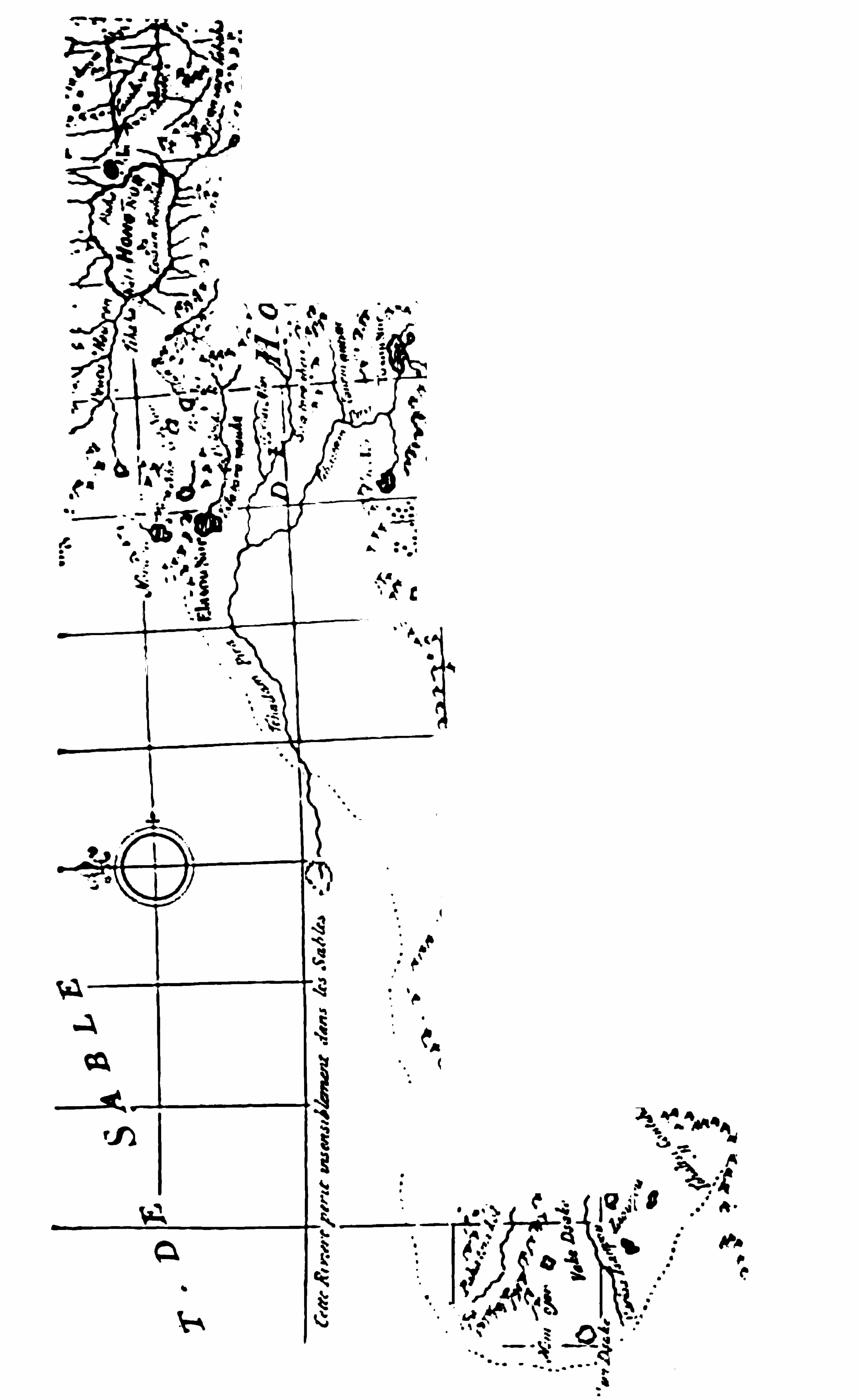

86 T I B ET
al ly, the king having granted them perm ission topreach only on condition that they should declare theTibetan religion to abound in goodness and perfection
,they determ ined to start even at once.” The sad
little party of three reached the mission hospice at
Patan (Khatmandu ) in Nepal on the 4th of Jun e.
Six weeks later the broken-hearted o ld chief DellaPenna breathed his last. He was sixty- fi ve years o ld,
and he had laboured to the end . He rests in a littleChristian cemetery which once ex isted at Khatmandu,but now is absolutely unrecogn isable. No t even the
site of it is known . The mission in Nepal lasted till1 768, and disappeared at the time of the Gurkharevolution . Beligatti died in 1 785 at Macerata, his
birthplace. The o ld hero Orazio della Penna ( l ikeLivingstone) rests in peace on the fi eld of battle.Geographically we learn little from the investiga
tions of the Capuchin monks. The early outlines o f
Tibetan geography were fi lled in , but very indifferentlycompared to those of early history. Under in struction from the Jesuits the lam as of Tibet acquired a
rough idea Of map-making and surveying, and theyset about after their fashion, providing a general map
of the whole country fo r the Emperor Kang-he o f
China. Rough and inaccurate as these early maps are,they are Of considerable value as fi rst maps. Fromthe data preserved in them D ’
Anville’
s Atlas was published in 1 733 , and they still formed the basis for themapping Of Tibet when Klaproth issued his map in1824 ; but there is not much in them beyond rough


88 T I B ET
stood in the East. Not on ly Tibet, but the frontiercoun tries of In dia on the northwest, Afghan istan , Per
sia, and Baluchistan , were equally open to the Euro
pea n adven turer, who obtained someth ing more thanmere formal right of way as a foreigner in the coun
try. He was received with courtesy and hospitality.
The objection to the incursion of “ foreign devils is
comparatively modern. Two hundred years ago thesame freedom was accorded to the European to treadthe forbidden lands of the East, as we ourselves haveever Offered to the Asiatic in the West.Van de Putte remained in Lhasa apparently as anhonoured guest, and when he fi nally adopted the co stume of a mandarin and accompanied a deputationof lamas to the Co urt of Pekin , he was apparen tly as
well received in China as he had been in Tibet. Theroute he took was afterwards followed by the AbbéH ue, and will be described further on. O n his returnto Lhasa he was regarded almost as a saint, on accountof the purity of his l i fe. He subsequently recrossedthe Himalayas, an d reached India in time to be an eyewitness o f the sack of Delhi by Nadir Shah . N0 mo rethrilling story of travel and adventure could be toldthan that which would record the experiences of thisobservant Dutchman, i f only there was a story to tell.But unfortunately the accumulation of notes and manuscripts which contained the history of his wanderingswas destroyed at his death . He died in Batavia, whenon his way home in 1 745 , and he desired in his willthat all his papers (which had been written in a cypher
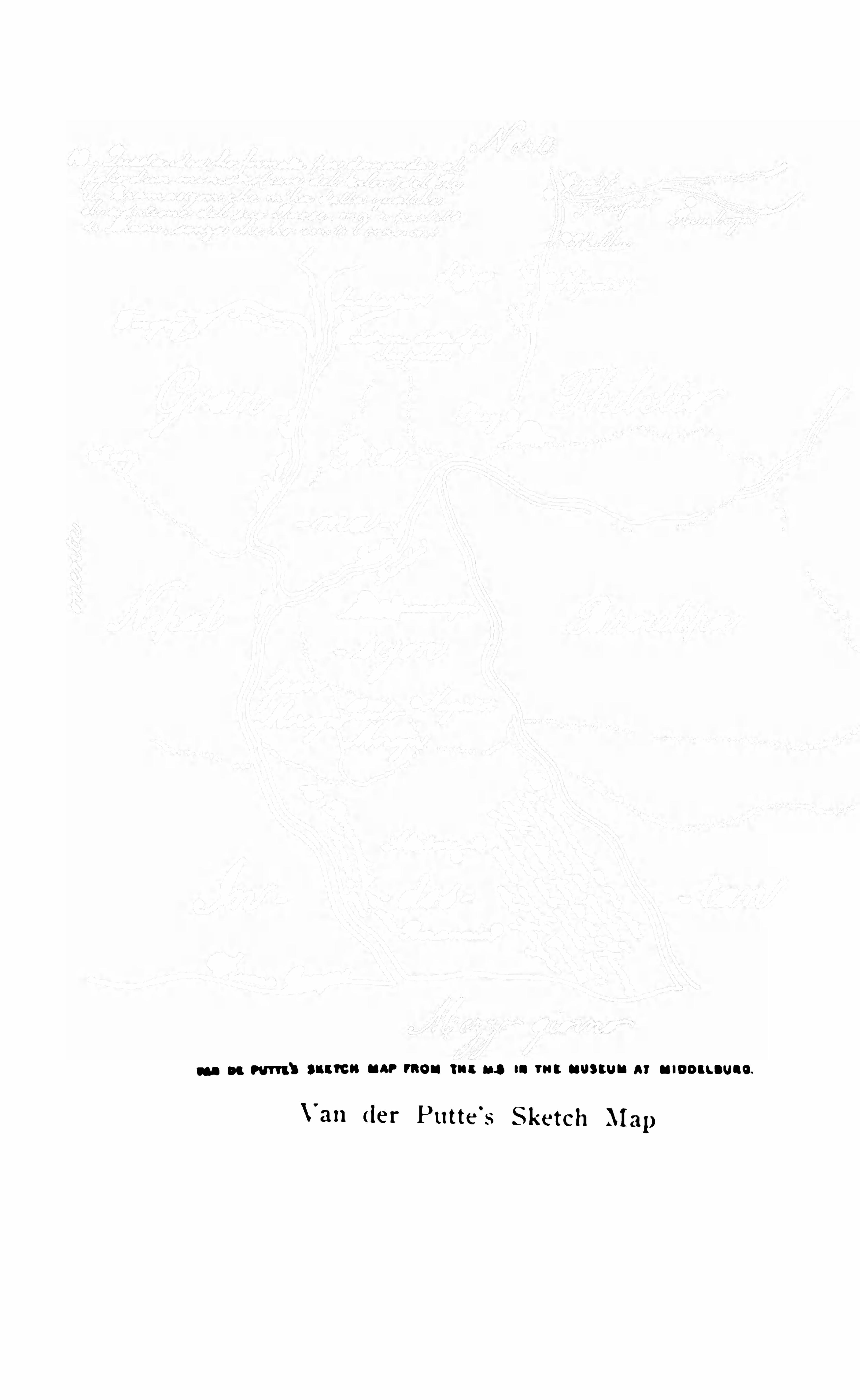
CHAPTER VI
Bogle’s Mission and Polity of Warren H astings Bogk
’s
Route to Sbigatze D escription of tbe Coun try and ofGyang
'tse Reception by tlze Tesbu Lama Turner ele
vate/led by Warren H astings H is I n terview wit/i tbe
I nfan t Teslin Lama
HE fi rst English mission to Tibet was in 1 774,
when George Bogle,a Bengal civil ian, was
deputed by Warren Hastings to visit the capitals ofBhutan and Tibet with a view of opening up friendlyrelations and promoting trade between Bhutan andIndia . No happier selection Of an envoy could havebeen made
,for Bogle carried out his mission with tact
and determination,and established a basis for mutual
understanding between India and those countries o f
her northern bo rderland which Should have been lasting
,and should have ended in the establishment of
free intercommunication . But the enlightened policyof Warren Hastings has never been popular in India,and this important Sphere Of British in fluence has beenforgotten for a full century. The seeds o f a goodunderstanding which were sown by Bogle never sprangto full maturity, and, indeed , so deeply did the shadowof forgetfulness close over his proceedings that it waswith some diffi culty, and only by patient referen ce to
T I B ET 9 1
journals, offi cial despatches, and private corresponden ce, that Markham rescued the records from obscurityand published an account of the mission in 1876.
From his account we learn that Bogle (accompaniedby Dr. Hamilton ) followed the same route from India,via Buxa and Punaka (the capital of Bhutan ) to Tibet,that was subsequently attempted in 1865 by a Britishforce which failed to penetrate farther than a fewmarches into the Himalayas.
The Parchu affluent of the Chinchu River leads up
wards to the dividing line between Bhutan and Tibetfrom Paro, the capital o f western Bhutan . The passis certainly not a diffi cult one, but we have n o recordof its exact height . From the pass the road drops intothe upper valley of the Ammo Chu , leading to Pari
(or Pari- jong) , where our troops with Younghus
band ’s mission were quartered. This po sition is
abundantly bare,bleak
,and uncomfortable,
”says
Bogle. From Pari (or Phari ) fort feet )the ascent runs northward to the main water parting where the Tang la feet ) marks the passage across the backbone o f the eastern Himalayas.
Bogle says little or nothing about this crossing, whichapparently was not formidable enough to attract hisattention. Almost overshadowing the pass is the giantChumulari, a magnifi cent snow-bound peak, which everformed the central point o f interest in the restrictedBhutan ese landscape during the campaign Of 1865
66. One of the lines of advance into Bhutan duringthat campaign followed the route taken by Bogle,
92 T I B ET
above which towers the cloud-wreathed peak ofChumulari.
Bogle’s mission to Tflx t is of pecul iar in terest fortwo reasons : First, because he is one o f the fewEnglishmen who have lived in the country and associated suflicien tly long with Tibetans to become an
authority on the idiosyn crasies and characteristics ofthe peop le. Bogle was an excellen t observer, and possessed the rare faculty of adapting him self to the manners and habits of his hosts, as well as the capabil ity ofsharing something of their outlook on the world outside Tibet, appreciating their views and to a certainextent sympathising with them . Seldom indeed , inthese later days, does any explorer ever study the moralattitude of a strange branch of human ity with suchpatien ce, or with the advantage of so close a contactas that po ssessed by Bogle. To this day, after a hundred and thirty years, he is to us the fi rst and bestEnglish authority on the inner social life of the people,
- a li fe which is essential ly the same now as it wasa hundred and thirty years ago. Secondly, Bogle
’
s
route from the head of the Chumbi valley to Gyangtsehas become familiar in connection with ColonelYounghusband
’
s mission, for it is the route which thatmission followed.
Markham ’
s Tibet gives so good a summary ofthe events and circumstances o f Bogle’s mission that itis hardly necessary to do more than refer to a few o f
its main features. The plains of Tibet,over which he
passed, after crossing the Tibetan frontier, are de
94 T I B ET
mile march ; and yet Bogle found his servants so tiredthat they had to be brought home on peasants’
backs. The names of places are not to be dependedo n over such a length of time as has elapsed S inceBogle’s and Turner ’s missions. Mo reo ver, Boglefound the whole country devastated as far as Gyangtse,but he does n o t say to what this was due. He had toprocure cow- tailed bullocks for his followers toride, and thereby offended their Hindu prejudices.
By cow- tailed bullocks we may presume that theordinary bullock o f the country is indicated in contradistinction to the bushy- tailed yak. Our road nextday led us along the banks o f the lake called Sham chuPelling. It is fed by a large min eral stream whichissues out o f the side of a moun tain and extends abouteighteen miles from north to south . It was half frozenover and well stocked with w ild ducks and geese. Wealso met with some hares and a flock o f antelopes,besides a herd of wild an imals called kyang,
” resembling an ass. A stream o f water falls from theSham chu into the Calo chu Lake, which ex tends aboutten miles east and west, and another stream runs fromit northward. This is the Kalwa- tso of modern maps,near which stands the town of Kalwa Shar. We keptclose to this stream for several days ; it falls into theTsanpu Shigatze, turning many miles on its way.
”
There are also several bridges on this river,but very
different from the wooden ones we met with amongthe mountains. They are walls, with breaks or openings, to let the water through , which are covered with
T I B ET 95
planks or large flags . All this gives a very fair ideaof the n atu re of the long, narrow curving valley of theNyang chu , wh ich connects the pass of Tang la (atthe head o f the Chum bi valley ) with Shigatze on theYeru Tsan po . It falls gradually and gen tly to theTsanpo (upper Brahmaputra ) , Offering no obstaclesto the movem en ts of troops. Bare and desolate in thelate autumn and winter, it has clearly always beencultivable to some extent in summer, when the greencrops which subsequently furnish grain fo r the millsmust give a very different aspect to the scenery. Thereis indeed nothing more remarkable in the way o f contrast than the bare dust-covered yellow plains o f thehighlands adjoining India in the w inter and the almostbrilliant effect o f luxuriant cultivation in summer. Itis the same in Baluchistan as it is in Tibet in spite ofthe great difference in altitude. Kanmur (Khangmar )is the most important point on the route, for there are
good houses at Khangmar with a caravanserai and atemple. Also there were a few willows in Bogle’s timewhich may still survive as the fi rst trees en counteredafter leaving the Chumbi valley. There is a crossroute to Lhasa from Khangmar which is shorter thanthe Gyangt se route, but it involves several formidable
passes . After passing Khangmar there is a distinctimprovement in the character of the country. The altitude falls to thirteen thousand fi ve hundred feet, andthe river is made use of fo r irrigation. The valleywidens, evidences of cultivation are abun dant, and hotSprings burst from the ground some three and a half

96 T I B ET
miles beyond the town . It was here that Bogle lodged
in a house which had lately changed its in habitan ts.Of fi fteen persons who formerly lived in it every one
had died last year of the small-pox .
” At Dudukpai
(poss ibly the Changra of modern maps) Bogle re
marks the cheerful aspect of the village scenery,wi llows planted all about , and the people busy building and stacking their straw and singing at theirwork Twenty- four miles from Khangmar is thetown o f Gyangtse (modern ) , or Gian su (Bogle andTurner ) , a large town standing on the right bank o f
the Nyang chu,in a broad and open valley full of white
walled villages , and comm anded by a castle picturesquely clinging to the face and summ it of a steepand lofty rock above the river. Gyangt se is abouto n e hundred miles from Phari jong, in the upperChumbi valley
,and can be readily reached in fi ve or
six marches . The town climbs the hill slopes, thehouses be ing ranged around the central market-place,and is en closed w ithin a wall said to be on e and a halfmiles in circumferen ce. Above it towers the famousmonastery , the Palkho r Cho ide, built after the fashionof a pagoda in nine storeys. According to information obtained from Tibetan sources by the Rev.Graham Sandberg, Gyangtse is a trade cen tre forTibetan horses, dried and fresh mutton, butter, barley,radishes, and coarse cloths, the staple product of theplace. There are Nepalese shops and Chinese restanrants, and accommodation fo r travellers in the temple.The garrison includes four hundred badly armed
98 T I B ET
Bogle did n ot l ive in days o f scientifi c exp loration ,and his records are wanting in geographical exactness.But i f he did not excel as a geographer, he has givenus a knowledge o f Tibetan social li fe and customswhich is as charming as it is original . Instead o f thethick-headed obstinacy and pertinacious interferencewith all freedom of action which we are apt to associate w ith Tibetan lamaistic methods, Bogle found thepeople friendly, cheery , easily accessible, good tempered,and always willing to entertain o r assist him . Men
and women alike — he made friends with them all.
At one tim e he is the offi cial guest of the Teshu Lama,the second great religious dignitary in the land . Atanother he is entertaining Tibetan girls in his ownquarters, or joining the young relatives of the greathigh priest in hunting the musk deer o r shootingpartridges, an amusement in which those young people indulged only when they were far enough fromthe paternal eye. But wherever he is there is alwaysthe same friendly interest in all that he heard or saw,
and the same rare faculty o f Observation from thelocal point o f view . Consequen tly n o other writer hasgiven us SO useful an insight into the inwardness ofTibetan ex isten ce. NO native Indian explo rer, however shrewd, is capable o f entering into the Spirit ofEuropean enquiry as regards Asiatics. He cannotknow o r understand what it is that we want to know.
He is in fact faced with exactly the sam e diffi cultythat besets the European who wishes to explain 01
describe Europe to the Asiatic.


100 T I B ET
across his shoulders. He threw aside all the awful
part of his character as Go d’s vice- regen t throughall the eastern countries of Asia,
” and behaved withthe greatest freedom and affability. H is complexionwas fair, he was incl ined to be fat, and his age wasabout forty ; and he is described as intelligent, l iberal ,and humane. But Bogle go t n o further with hisnegotiations than the Teshu Lama. At Lhasa the DalaiLama was an in fan t , and the temporal power was inthe hands of the Greshub Rimboche
'
, who beinganx ious to secure suprem e authority fo r himself andhis family after him ,
and being entirely adverse toFringies (whom he accuses o f being “ fond ofwar
,and
,after insinuating themselves into a country,
raising disturbances and making themselves masters o fadvised the Teshu Lama to fi nd some method
of sending Bogle back,either o n account o f the vio
lence of the small-pox or any other pretence . Thesame authority blocked the way to Turn er subse
quently, so that no fully accredited trade mission everreally reached Lhasa . Bogle returned from Tibet inJune, 1 775 , with the object o f conducting furthernegotiations at Pekin . Dr. Hamilton, who accompaniedhim o n this fi rst mission, was subsequently appointedto conduct a mission to Bhutan, which country hevisited twice, and thus maintained to a certain exten tthe open door for Tibetan trade.Warren Hastings determined to keep up the intercourse w ith Tibet so well inaugurated by Bogle
, and
in 1 779 again appointed him as envoy to Tibet. But
T I B ET 101
news reached India that the Tes hu Lama proposed tovisit Pekin . He actually made the journ ey, and sacrificed his l i fe in his efforts to promote a good understandin g between China and India, for he died atPekin of small-pox. Not long after his dea th hisEnglish friend Bogle died at Calcutta.
Warren Hastings, however , persevered in his policy,and with the reappearance of the Teshu Lama in infantform he arranged another mission under CaptainSam uel Turner, which started by the old Buxa routethrough Bhutan in the summer of 1 783 . Turner’s m ission added but little to our knowledge o f southern Tibet.He followed more o r less directly in the foo tsteps ofBogle, but instead o f diverging so uth o f Shigatze tothe Tsanpo , he continued his route to Shigatze (orrather to Tashilumpo ) where the reincarnated TeshuLam a was conveyed in state from Nam ling. The chiefpoint o f interest in his narrative is that which concern shis interview with the small personage who now rep
res ented the Teshu Lama, and the cordial receptionwhich awaited him from the relatives o f the late highpriest testi fying to the popularity and succes s of Bogle.Markham thus describes his interview with the holyinfant, whose regent and adviser were Chanzu Cusho
(the brother of the late lama ) and 5 0pm Chumbo,
his cup-bearer, bo th o f whom are frequently m entioned
by Bogle. The interview took place at Terpaling,
about two m iles south of the great Tashilumpo mon
astery. The princely child , then aged eighteen months,was seated on a throne, with his father and mo ther
102 T I B ET
standing on his left hand. Having been informedthat though un able to Speak he could understand,Turner said that the governor-general, on receivingnews o f his decease in China, was overwhelm ed withgrief and sorrow, an d con tinued to lament his absen cefrom the world until the cloud that had overcast thehappin ess o f this n ation was dispelled by his reappearance ; and then , i f possible. a greater degree o f joyhad taken place than he had experien ced of grief onreceiving the fi rst mourn ful news. The governoran xiously wished that he m ight long contin ue to illumin e the world by his presence, and was hopeful thatthe friendship which formerly subsisted between themwould n o t be demolished, but rather that it m ightbecom e greater than before ; and that by his continuing to show kin dness to my coun trym en
, there m ightbe an extensive communication between his votariesand the depen dan ts o f the British n ation . The infant looked steadily at the British envoy with theappearance of much attention , and n odded with re
peated but slow motions o f the head, as though heunderstood every wo rd. He was silent and sedate ;his whole attention was directed to the envoy
,and he
conducted himself with astonishing dign ity and decorum . He was o ne of the han dsomest children Captain Turner had ever seen , and he grew up to be anable and devout ruler, delighting the Tibetans withhis presen ce fo r many years, and dying at a good old
age. Turn er returned to In dia in the sprin g of 1874,and the following year India lo st Warren Hastings.
CHAPTER VII
pedition I ts Route in to Tibet and the Final Ddeat of theGurhhas near Katinandu Thomas Mann ing
's Visit to
Lan a H is Imp ressions Moorcrof t’s Exp edition to
UCH was the last offi cial m ission to Tibet ere thatof Younghusband took the fi eld. It was sho rtly
followed by the occupation of Nepal by the Gurkhas,and during the stormy times which followed on theHimalayan frontier the passes from India becam e perman en tly closed.
The fi nal conquest o f Tibet by China marked anepoch in Asiatic history, but the story of so remarkable and important an achievement is altogether beyond the scope of this work . Troubles with Chinadid n o t end, however, with the subjugation of Tibet,and therewas at lea st on e Chinese expedition (directed,
it is true, rather against Nepal than Tibet ) which isof such special interest as i llustrating the militarypossibilities of the eastern and most direct routebetween Pekin and Lhasa via Ta-chien- ln , that a
brief referen ce to it wi ll probably do more to dissi
pate the many mistaken notions which ex ist about
T I B ET 105
Tibetan invasions than any record of individualexp loration.
The murder of the Gyalpo , in 1 749 ( thirty yearsafter the Chinese conquest ) , by the Chinese Ambas
(or Ambans) led to a general rising and massacre ofthe Ch inese and a fi nal retaliatory expedition fromChina
,which completely restored Chinese ascen dancy.
The readiness with which such an expedition wasorganised and led across the Chinese border into theheart of the Bod-yul of Tibet, and its success, is oneof the most interesting features in Tibetan history.
Mongols, Sikhs, and Gurkhas have alike made thesame venture and failed . It still rests with the Chineseto claim the proud position of having reduced by forceof arms what may be justly termed the most inaccessible country in the world.
The Capuchin friars left Tibet about 1 760,and took
refuge in Nepal ; and it was about this period that theconquest of Nepal by the hardy mountaineers of theGurkha tribe was effected . Originally recru ited toassist in settling internal disturbances at the capital,they soon made themselves masters of the country bysheer hard fi ghting and the terror that their frightfulatrocities inspired . From the time that the GurkhaPrithi Narayan was installed on the throne of Nepaluntil now , the gates of that country have been closedto India
,and a trade that was once flourishing has
been almost annihilated.
In 1 792 (after the missions o f Bogle and Turnerto Tibet) the Gurkhas , inspired by the lust o f loo t,
106 T I B ET
invaded Tibet. An expedition which n um bered eigh
teen thousan d men crossed the Kuti pass ( 140 m ilesfrom Khatman du ) and advanced with great rapidityon Tashilum po (Shigatze ) , which was distan t another2 5 7 m iles. They captu red the city an d loo ted the
palace. The cowardly Tibetan s fled in a pan ic. The
in fan t Teshu Lam a was carried o ff to Lhasa, and
Chin es e assistan ce was at once invoked to repel theinvas ion. Then followed o n e o f the mo st remarkable retributions that the world has ever seen. Overthe gigan tic m oun tains and snowbound passes of
eastern Tibet a force of n o less than seven ty thousandChines e was led in two columns by General Sand F0in to the elevated regions o f the plateau . The Gurkhas rapidly retreated to a position n ear their frontier,called Tengri Maidan . Here the fi rst battle wasfought, and they were completely defeated. The Kutipost was captured after a second fight, and the Chinese advanced by way of Kirong (on one of the chiefrivers of Nepal ) to Khatmandu. Their artillery con
sisted o f light fi eld guns made of leather, which fi reda few roun ds and then burst. The Gurkhas had noguns, and they made their last stand o n the riverbanks at Tadi just above Nayako t, abo ut twenty milesfrom Khatman du . To appreciate the position it mustbe remembered that this unwieldy force of seventythousand Chin ese had marched across one o f the mostdiffi cult mountain districts in the world fo r 800 m ilesfrom their own fron tier before reaching Lhasa. Theyhad then advanced at least another 400 miles over
T I B ET
as these that great generals prove their right and titleto the con fi dence which their country has bestowedupon them . Sand Fo was a great general , an d he roseto the occasion . He turned his leather guns on to therear of his own wavering troops, and drove them andthe Gurkhas in front o f them in o n e comprehensivesweep into the river. The Chinese trampled overfriend and foe alike, and they speedily sacked Khatmandu. Oriental m ethods o f treating the vanquished
(especially Mongol m ethods ) are usually distinguishedby deeds of the most ingenious and repulsive barbarity.Even the Gurkha o f to— day is not gentle with a foe.But ingenious as he is in his m ethods of savage re
prisal, he is probably m ore than equalled by the Chinaman . Khatmandu has never forgotten the lesso n thatwas learned at that blood-stain ed tim e. Every fi veyears a deputation proceeds from Nepal through Lhasato Pekin , and there offers tribute at the foot o f theChin ese throne.Such at leas t is the story as cu lled from the lips o f
an ancien t Gurkha oflicial by Mr . Brian Hodgson, andas reto ld by Sir Clem ents Markham in his Tibet.There may be other ways o f accounting for the defeatof the valiant Gurkha by the Chin aman o f the eighteen th century than those narrated by this ancientGurkha warrior ; but the fact rem ains, as a marvellousrecord o f Chin ese persistency, that Nepal was utterlysubjugated by the Ch inese at a distance o f somemiles ( stretching across a solid barrier of mountains)from their base. It is a useful commentary, fi rst , on
T I B ET 109
the usual statem ents of Tibetan accessibility, and, secondly, on the usual criticisms applied to the Chineseso ldier.During the progress of the Chinese retaliatory
peditio n we declined to assist the Gurkhas, and the
Chinese had all along been watching with jealous sus
pleion our attempts to establish diplomatic relationswith Tibet . Thus we soon lo st all the good effects o f
the missions of Warren Hastings. The Chinese closedall passes into Tibet to Indian natives , and establishedmilitary posts along the trans-Him alayan frontier. TheGurkhas despised us. The inevitable result was a warwith Nepal (which lasted from 1814 to thefinal occupation of Sikkim (afgr the advance ofO chterlo ny and the capitulation of the Nepalese ) , andthe Opening up o f the diflicult Sikkim passes intosouthern Tibet ; but the interposition o f British authority in Sikkim led to n o amicable relations with theBhutan. We have never been able to effect muchwith that country. Pem berton’s m ission in 1838 ledto the acquisition of much useful information aboutthe passes ; but the unstable con dition o f the governmen t, the perpetual feud between the Tongso Pen loof the East and the Paro Pen lo of the West ( the twolocal governors) , and the absence of real authority inthe hands of the Deb Rajah and the Dharma Rajah
(the two elected chiefs ) , appears to be chronic, In spiteof the fact that the Dharma Rajah is the perpetualincarn ation of the Deity. The same uncertainty inthe tempo ral administration ex isted when in 1865
-66
1 10 T I B ET
ano ther campaign was undertaken in the interests of
peace on the Assam border. Now the passes throughBhutan which were used by Bogle and Turn er are nolonger open to Englishm en.
It cannot be other than a matter of su rprise thatat a tim e when our relations with Nepal and Chinawere about at their worst in the troubled times beforethe occupation of Sikkim , the o n e sol itary Englishman who has ever reached Lhasa (so far as we knowfor certain ) Should have started on an unoffi cial venture to study China in her most remote dependency,Tibet. Thomas Manning was an independent gentleman
,a friend o f Charles Lamb, and an unaccredited
traveller, who had been a resident in Canton for asuffi cien t tim e to pick up a rudimentary knowledge ofChinese. He had also a certain amount of medicaltraining which (whether rudimentary o r otherwise )enabled him to rank as a physician amongst Chinesesubj ects. In September
,181 1 , he crossed the north
east frontier by a route to the west of the Buxa routethrough Bhutan
,which had been followed by his
predecessors (kn own as the Laki Duar route) , to Paroand Parijo ng. No European has followed Mann ing’sroute either before or since
,and it is unfortunate that
he has left no record o f it which is of the slightestgeographical interest. It is indeed m uch to be re
gretted that this one English traveller, who ,of all
the many who have attempted the feat of enteringLhasa, is the only one successful
, Should be in mostessential respects a bad traveller and a worse observer.
1 1 2 T I BET
lasted for some tim e , and there seems to be n o im
mediate prospect of a change . Like Bogle and Turner,he was struck with the generally chcerful and well—to
do aspect of the coun try about Gyangtse after pass ingthrough the deso late stretch of elevated plateau, bare
o f vegetation and swept clean by the wind. which liesnorthward of the Himalayan water—
partin g. H is routeto Gyangtse was the route of the previous m issions,but from Gyangtse (where he parted with his Chinesegen eral ) he was for some inexplicable rea son able toprocure an inv itation from the regen t to v isit Lhasa.For a descript ion of the further section of his routebetween Gyangtse and Lhasa it would be quite uselessto refer to Man ning
'
s records. It must be taken fromthose of later explorers (natives o f India ) , who haveca refully described this 1 50 miles o f road , and it isof passing interest just n ow inasmuch as the experiences of the late Tibetan mission include it in theirreco rds.
The following accoun t of the route to Lhasa is
derived from native so urces o f info rmation . At fi rstthe road is good , but it rapidly merges into a merecountry track running through cultivation which isabundan t. Abo ut eleven miles from Gyangtse it fo llows the course of a hill torren t running through asteep and narrow valley . Crossing a bridge at Kudung and passing the village of Gyari-dom, the fi rststage Gobshi (the Four Gates is reached at theend of a fi fteen -mile march . Gobshi is a comparatively large village, standing amidst poplars and wil
T I B ET 1 13
lows and possessing a mill house and a bridge. Astage of nineteen miles connects Gobshi with the poststation of Ralung Sampa, where there is a Chinesestage master with a large and comfortable resthouse for travellers. The track passes through villages at intervals, but involves the passage of a narrowdefi le and the fording o f the river at a point calledSheto i. Monasteries are o f course much in evidencealong a frequented trade route such as this. FromRalung Sampa to the pretty little village of Dzarais a seventeen-mile march . Near the post-station o f
Ralung Sampa is the m onastery of Ralung Thil, theheadquarters of the Red Cap Buddhist sect to whichall the people of Bhutan belong. The forward routenow involves much steep ground , and the frequentcrossing o f streams half fro zen with slippery blocksof ice, besides the passage o f a sixteen-thousand- feet
pass the Kharo la the highest point betweenChumbi and Lhasa. Below the pass, south of it, isa long stony plain scantily supplied with grass, wherethe black huts o f the Dokpa herdsmen are pitchedand herds of yak fi nd their living. It is calledWomathang, or the Milky plain.
” At this elevation glaciers are encountered , and the whole lan dscapeis win d-dried , bleak, and barren . The ascent to thepass is easy, but the eastern descent to Dzara is steepand rapid. Dzara boasts a bad post-house and littlebesides no forage and no fuel, but there are scattered grass patches beyond where yak and sheep cangraze. The road now runs for six or seven m iles
8
1 1 4. T I B ET
through a series of gorges o r defi les with a rapidlydescending grade till it opens out o n the vast stonyplain which stretches to Nangartse Jong and the greatScorpion Lake — the Yamdok tso . Fifteen miles
separate Dzara from Nangartse Jong. RoughlyNangartse may be reckoned at seventy miles fromGyangt se, Lhasa being about eighty m iles to the northeast o f Nangartse . The route so far presents no veryform idable difl‘iculties, although it is often narrow andsteep and involves the crossing o f the Kharo la. O n
ward to Lhasa it is a rough coun try track followingthe western shores o f the Yamdok Lake to about itsextreme northern point
,and then striking o ff across
the plain that interven es between the lake and themountain ridge which overlo oks the deep valley of theTsan po . All this part o f Tibet has been described bythe native surveyors who have visited it , and by Manning, as extremely picturesque. Nangartse stands twohundred feet above the blue waters o f the ScorpionLake (the latter being thirteen thousand nin e hundredfeet above sea) , facing the strange mountain forms o fthe peninsula which , jutting out no rthward into thelake, Spreads itself into the form of a central , circular,and alm ost insular mountain m ass, which itsel f enclosesa m inor lake. The deep, dark , mysterious waters of
the smaller depression are kn own to the peo ple as
the Dumo tso , or Demon Lake. The great Samdingmonastery overlooks the weird depths of the Dumotso from a hill about three m iles east o f NangartseJong. The presiding abbess of this mon astery is a
1 1 6 T I B ET
cultivation , and then again taking to mountain tracksand winding over the face o f precipitous slopes witha rushing torrent below ; but the grace and beauty ofvegetation has been wanting. In the valley of theTsan po dense clumps of bush border the river and fi llthe dells ; orchards of peach and walnut trees clusterthickly round the white walls o f the villages ; w indswept sand drifts into dunes by the river-side, andlow down about the foot of the pass the wild roseblossoms, whilst brambles, fi r-trees, and rhododendronsmake what show they can .
The ancient suspension bridge which spans the rivernear the monastery o f Peuchen Chu Wori is a relic o fantiquity and of former trade developmen ts in Tibet,o f which it is diffi cult to obtain a history. Said tohave been constructed four hundred and seventy yearsago , i t certainly did credit to the highland engineerswho were responsible for it . Two chains (deeplyrusted with age ) about four feet apart support a roadway of narrow planking which is supported fromthem by loops of rope. The extremities of the chainsare about seventy feet above the river. In the centreit sags to about fi fty feet . No one uses the bridgenow-a-days (or has used it fo r the last twenty years) ,but the main stays o f the bridge, the massive masonrychortens w ithin which the chains are anchored tologs built into the masonry , are said to be soundenough , and it is but the roadway which is lacking.
The passage Of the river is effected by ferries. Twoclasses o f boats o f the crudest construction are used.
T I B ET 1 1 7
The lighter leather-covered coracles (ko -a) are
used for casual passengers, the larger woo den boats
(shingi tru ) carry horses, cattle, and m erchandise.They have been described by on e n ative traveller asshallow wooden boxes about twenty feet long by
eight broad . The junction o f the Kyichu ( the riverof happin ess ) with the Tsan po is about three mileseast of the ferry . After leaving the Tsanpo ,
theLhasa road ascen ds the valley o f the Kyichu affluen t,fi rst passing over the marsh lands o f the delta wherethere are scattered villages and townlets belted withwillows and poplars. San d and gravel plains alternate with patches o f rich cultivation where peas, beans,and white mustard make a variety in the landscapeduring the season o f flowers
,until , beyond the village
o f Jang to i, the road again takes to the rocky bankso f the immediate river-side and runs a chequeredcourse (a part o f which is known as the Gaglam , or“
path o f hindrance to the historic village of Nethang the last stage ere reachin g Lhasa. Nethangpossesses the historical interest of being the placewhere the great Buddhist missionary from India,Atisha, died. The village stan ds in a beauti ful valley,but is n o t itsel f beauti ful The road passes througha dirty village street flanked by houses of two orthree storeys, mostly of a mean and fi lthy exterior.A large number of pack ponies and donkeys are keptby the inhabitants to be let out by the dozen or so totravellers.” says Mr . Sandberg. After Nethang the
whole country appears to bloom into luxuriance. Irri
1 1 8 T I B ET
gated cultivation rather interferes with the traffi c alongthe route ; grass lands, houses, garden s, and fruitorchards are passed in succession fo r several miles,when once again the stone dusted gravel plain of
Tibet is encountered . But here at last is Lhasa insight. Fourteen miles away the palace of the Dalailama the Potala can be seen glinting in the sun .
Crossing an impo rtant ston e bridge one hundred andeighty feet long over the Thi Chu affluent of the Kyichu River at the village of To ilung, and traversing apopulous tract o f w illow-planted cultivation , the greathighway between India and Lhasa strikes the fi rsteviden ce o f the ex istence o f the sacred city in theghastly debris of its Slaughter yard, where hundredso f sheep, goats, and yak are daily Slain fo r the consumption o f the town . Bones and horn s are heapedup by the road- S ide and around a foul blood-stainedtank . Sloping upwards from these repulsive relics arethe spurs of the wooded hill o n which stands the greatDaipang Monastery, which is said to provide aecommodatio n for seventy-seven hundred inm ates. Here,doubtless, in the leading monastic establishment o f
Lhasa are inculcated those Buddhist tenets which prohibit the taking of l ife. Groves of poplars and walnuts now close in the road which ends at the westerngateway o f Lhasa.
Such , briefly, is the road onward from Gyangtse toLhasa untrodden by any Englishm an save Manninghitherto, but now fam i l iar to European foo tsteps. Itis n o t a road which would be written down as pass
1 20 T I B ET
great oppo rtunity for the acquisition of a knowledgeof Tibet and of Tibetan affairs such as never hasoccurred since the days of Van de Putte, but Manningwas n o t the man to make use o f it. Had Masson , forinstance, been there instead of Manning, the resultswould have been very different . He did what hecould
,however, to make the acquaintance of Tibetan
and Chinese dign itaries who might be helpful to him.
He polished up a pair o f old brass candlesticks whichwere not his own property (they belonged to the Honourable East India Company ) , and adding them totwo wax candles
, some pieces o f cloth , and a few silvercoins, he made them presentable as an offering to theGrand Lama. He also po ssessed a bottle of someancien t form of scent (Smith
’
s laven der water ) whichwas added to the offering. The bo ttle was brokenduring the p rocess of presentation, and the streamletsof scent imparted a new character to the pervadinges sen ce o f burnt sandal wood which permeated thesacred presence chamber . But he saw the Grand Lamaand made his katesi,
” touching the ground threetimes with my head to the Grand Lama and on ce tothe Ti-mu- fu .
” He presented his clean-shaved headfor the lama to lay his hands upon , and then sat on acushion not far from the lama’s throne to partake ofsuchi .” It was mo st excellent, and I meant to havemended my draught and emptied the cup , but it waswhipped away suddenly, befo re I was aware of it.”
This was a temporary grievance, but the effect waseffaced by his impression o f the Grand Lama, which
T I B ET 1 2 1
is really interesting. The lama ’s beautiful face andmanner engrossed almost all my atten tion . He wasat that time about seven years old ; had the simple andunaffected manners o f a well-educated princely child.
H is face was, I thought, poetically and affectinglybeauti ful . He was of a gay and cheerful disposition,his beauti ful mouth perpetually unbending into agraceful smile, which illumined his whole countenance.Sometimes, particularly when he had looked at me,his smile almost approached to a gentle laugh . Nodoubt my grim beard and spectacles som ewhat excitedhis risibility, though I have afterwards, at the NewYear ’s festival , seen him smile and unbend freely,while sitting myself unobserved in a corner, an d watching his reception of various persons, and the notice hetook of the strange variety of surrounding objects.
”
Man ning asked for books respecting the Buddhistreligion and the history of Tibet
,together with a
lama who could instruct him and talk Chinese. H is
request was only partially complied with , but hereceived a part of the Buddhist ritual . He adds : Iwas extremely affected by this interview with the lama.I could have wept through strangen ess o f sensation .
I was absorbed in reflections when I go t home.”
There is undoubtedly some strange fascination aboutthis child presen ce which embodies the very spirit o fBuddhist mysticism . All who have experienced itspeak of it with deep reverence. Something of thespirit o f mysterious awe and irresistible attractionwhich drew the w ise men from the East to the foot of
1 22 T I B ET
the cradle at Bethlehem inspires the modern devoteewho toils painfully up the steps and ladders of thePotala to receive the child blessing above. We o f theWestwho honour thew isem en should appreciate the devo tion of the cl imbing pilgrim . Manning had not theopportunity o f enquiry such as has been given to latervisitors to Lhasa, and he tells us l ittle of the l ife o f thepeop le in the sacred city. Incidentally we gather thatthe Tibetan o f Lhasa is hospitable, cheerful, and con
tented, civil to strangers, appreciative o f kindness , andhe generally fi gures as a law-abiding and good citizen.
The m anners o f the women are affable and friendly,but when Manning writes o f pretty faces wefeel that his long absence from higher civilisation musthave quickened his susceptibilities. Beauty of featureis doubtless n o t altogether in compatible with dirt
(the Tibetan m en and wom en never wash their faces) ,but the fi nal charm of an unsullied complex ion mustsurely be wanting. It is Bogle, I think, who tells ofan infant Tibetan which was washed fo r his benefi t,that he m ight judge of the gen eral complex ion o f theTibetan skin
,which otherw ise there was n o po ssibility
of observing. The ch ild scream ed and struggled tosuch a degree as nearly to bring o n convulsions, andthe experiment was a failure. Manning was n o t struckwith the town, although the palace exceeded his expec
tatio n s. There is nothing striking,nothing pleasing
in its appearance. The habitations are begrimed withdirt and smut. The avenues are full o f dogs, some
growling and gnawing bits o f hide which lie about in

T I B ET 1 23
profusion and em it a charnel-house smell ; otherslimping and looking l ivid ; others ulcerated ; others
starved and dying, and peeked at by ravens ; somedead and preyed upon . In short, everything seemsmean and gloomy, and excites the idea of somethingun real. Even the mirth and laughter of the inhabitants I thought dreamy and ghostly .
” Manning leftLhasa on the l gth o f April , and reached Kuch Beharon the l o th o f June on his return journey to India.Almost contemporary with Manning’s journey to
Lhasa was the fi rst exploration undertaken intoHun des on the southwestern Tibetan border by a
civilian of the Indian Civil Service named Moorcroft.He obtained permission to cross the Himalayas bythe Niti pass n orth o f Almora, and to visit the Manasarawar Lakes w ith the object o f making a survey o fthe country at the foot o f Kailas, and o f procuringsamples of the famous wool of which Kashmir Shawlsare made. After crossing the Shangki (or Niti ) passhe travelled for about ten days, till he reached thecammng station o f Daba o n the upper Sutlej . Herehe was very well received (Moorcroft being disguisedas a merchan t ) , and was allowed to proceed to Gartokon the Indus. Gartok was then but an encampmentof black hair tents, a village o f herdsmen who hereten ded enormous flocks o f goat and sheep. On the
sth o f August he reached Manasarawar, which wasthen observed to consist o f two lakes divided by anelevated isthmus. The eastern lake was fi fteen mileslong and eleven broad, enclosed by a magnifi cent
1 24 T I B ET
entourage of rugged hills. Moorcroft failed to notethe connection between the two lakes, the existen ceof which was subsequently established by the twoStracheys. This journ ey in itself is only remarkableas an early venture across the Almora passes intoHundes. Many travellers and sportsmen have sincefollowed in Moorcroft’s footsteps, but Moorcroft
’
s
name is chiefly remarkable for the story told by theAbbe' Hue (whose adventures will be narrated elsewhere ) o f his hearing the nam e in Lhasa, and of hisbeing told that an Englishman o f that name had livedin that city from the years 1826 to 1838 ; that he wasassassinated o n his way back to India via Ladak.somewhere in Nari Kho rsum . The murderers werecaught by the Lhasa people and Moorcroft’s propertyrescued . Am ongst his papers were found maps andplans o f Lhasa and Tibet. The story is too circumstan tial to be ignored . All we know for certain isthat Moo rcroft made a second journey to Kashgarand Turkestan in company with a German namedTrebek , and that in 1825 information was receivedfrom Trebek that Moo rcroft had died between Balkhand Bukhara. This story was always regarded withsuspicion in India. and consequently Hue’s information was received as credible from the day that hepublished it , all the more so that the Tibetan description o f the Englishman who resided in Lhasa andmade surveys tallied very fairly well with what weknow of Moo rcroft.
1 26 T I B ET
in British or Russian pay have been there and havehad their say about the holy city ; but the Asiaticmind lacks imagination, and hardly grasps the trendand aim o f European enquiry. That which is too
familiar to the Asiatic to require comment is oftenjust the point which m ost usefully illustrates somespecial characteristic o f a people ; and when Asiaticsdeal with the physical aspects o f a country, the wholelandscape around them is apt to become CO IO U I ed withthe drab tints o f their own weary-minded sen sation sas they toil bravely through the monotonous taskwhich has been comm itted to their care. Consequently,a very peculiar value is to be attached to the story ofthose Europeans who , in days later than Van de Putteor Manning
,n o t only reached Lhasa and lived there,
but have left a most interesting record of their ex
perien ces in a book which is written with vivacity andintell igence and never lacks the interest o f personaladventure. M . H ue was a Jesuit m issionary, who wasappointed about the year 1840 to a Mongolian m ission centre which still m aintained a precarious existen ce o n the northern borderland of China. He passedthrough Canton on his way to Pekin during the warwhich was then progressing between England andChina
,and whilst the foreign er was yet specially oh
nox ious to the Chinese nation. A French Lazaristpriest le venerable Perboyre,
” was about th is timepublicly executed at Canton, and it was apparentlyunder his auspices that M . H ue made his fi rst venturein the mission ary fi eld. He claims that the Catholic
T I B ET 1 27
missionaries were the only Europeans who then daredto cross the provinces o f China ; and he was probablyjustifi ed in his claim . Christianity o n the Mongolianborders o f China fi fty years ago was but a faint reflex o f the widespread form o f Christian faith whichprevailed throughout so great an extent o f High Asiaduring the middle ages. Without ascribing muchvalue to the mediaeval traditions which invested thesemi-mystical Prester John with a halo of religiousromance and represen ted him as combining in o n e
person the high offices of priest and king over thevast empire o f the Kara Khitai , and at the same tim ecrediting him w ith un told victories over the invadingpowers o f Islam , there can be n o doubt that as lateas the middle of the tenth cen tury Nestorian Christian ity prevailed in Central Asia to an extent whichis hardly realised in the twen tieth . Whether or noGur Khan , emperor of the Kara Khitai in 1 1 50 is
to be identifi ed with the mystical Prester John is stilla matter o f conjecture. Eviden ces o f his Christian ityare obscure
,but it is an historical fact that the
daughter o f the last o f his race was a Christian, andthat she married Kushluk Khan , the king o f the greatTartar clan Naim an . There is some ground for supposing that the whole Naiman tribe was once Christian. Traces o f the Christian ritual are still to berecognised in the marriage custom s of that tribe andamongst the nomadic people o f the Pam irs to thisday. Christian relics have been unearthed from theruins o f some o f the buried cities o f Chinese Turkes
1 28 T I B ET
tan,and it seems probable that the Nesto rian form
of Christian faith , which fi rst spread through Persia,
exten ded eventually right across Central Asia throughTartary to China and Japan , where (we have recen tlybeen to ld ) there were more than a million Ch ristiansat the period when Japan adopted the form and
methods o f Chin ese civilisation . In the early yearsof the fourteen th cen tury we fi nd Kuluk Khan treating w ith favourable consideration John of Montecorvino , the archbishop o f Pekin ,
who was engagedin as fi erce a dispute with the Nestorian Christianleaders o f his day as that which divided Dominicansand Jesuits three centuries later in Chin a. The fi rstChinese em peror of the Ming dynasty who defeatedthe Mo ngols and drove them back beyond the GreatWall was a Buddhist priest , and from his time onwardsystematic assaults o f Islam and Buddhism combinedappear to have prevailed against Asiatic Christianity.
We learn little o f this from Hue’ s narrative, but hestates that the Pekin m ission flourished under the
earlier em perors O f the Manchu dynasty , and that itwas chiefly owing to the precaution s of Kia King,the fi fth empero r , that the Christian s o f China werescattered and driven in to Mongolian territory . The
vicar apostolic of Mongolia fi xed his residence at SiWang, and it was he who deputed H ue (with one
companion , Gabet ) to visit Tibet in the interests ofChristian m issions.
The Catho lic community in Mongolia was still holding its own bravely in the middle o f the last cen tury.
1 30 T I B ET
any commercial point o f view. It is well to the easto f the routes taken by Sven Hedin, Bon valo t, andothers, but it includes a part at least of that traversedby Rockhill
,about whom there w ill be more to say
later on . It is well to remember at this period o f
our history that whereas the possession o f the plainso f Chinese Turkestan , and t he occupation of Kashgar,Khotan
,etc .
,would assist l ittle o r nothing towards
a systematic extension of Russian influence into Tibet,owing to the nature o f the intervening country, theright o f way through Mongolia from Man churia toKoko No r and the occupation o f that region (which isgeographically about as far from Lhasa as is Kho tan )might conceivably prove most useful .The route from Koko Nor to Lhasa is, and has beenthrough all historic ages, a recogn ised commercialroute. This is my excuse, at any rate, for enteringrather more fully into Hue ’s narrative o f this preliminary journey through Mongolia from the borderso f Manchuria than the limits o f this work would otherwise justify.
There were n o half measures about H ue. Headopted the dress of the Tibetan lama
,the yellow
gown and cap, shaving his head and conforming rigidly to all the little social forms and ceremonies whichthe code o f Chinese manners so strictly enforces. Hestarted with his companion Gabet o n his adventurousjourn ey, n o t only prepared to see a strange land and
live amongst a strange people, but to l ive as theylived ; to look on the Mongolian world from the point
T I BET 13 1
of view afforded by the tent doo r o f the nomad , sharing their sympathies and their prejudices as he sharedtheir dwellings and their food . He pilo ted the littlecaravan acro ss the wide steppes on horseback , whilsthis fellow m issionary Gabet rode a camel, and theiron e Tartar retainer, m oun ted on a black m ule, ledthe baggagers.
” Ow ing to his intimate knowledgeo f the language o f the country he was able to makehimself at hom e either in camp o r city, and he hasconsequen tly illustrated the hom e life o f the bo rderpeo ple o f Mongo lia — Chinese and Tartar alike as
n o o n e else has been able to illustrate it befo re o r since.Starting southwest o n the road to Do lan No r, hestruck at once into the desolate plains which stretchaway from the foothills o f the southern Kinghan
Moun tain s constituting the territory o f O un io t.”
According to H ue there was a tim e (n o t far distant )when this part o f the Chin ese bo rderlan d was forestcovered, inhabited, and rich in cultivation . About them iddle o f the seven teenth century the Ch inese swarmedinto it, destroyed the forests, and spread general devastation through the land
,reducing it to its present
condition . Defo restation has led to a total change o fcliIn ate ( it is som ewhat strange to fi nd a Jesuit m issio n ary o f the middle o f the last century supportingsuch a theory ) , and the terrifi c black sto rm s whichn ow sweep acro ss it un checked carry periodic destruction with them ,
fi lling the air with dust and sand andswamping w ide areas w ith rain flood . Hail storms o f
extraordinary vio lence are frequent. We have Hue’s
1 32 T I B ET
tes timony to the fact that hail ston es weighing two
poun ds frequen tly descen d on the hard baked earth
such ston es as can on ly be broken in p ieces with axes.
This is below, and to the ea st of, the cen tral Kinghansystem , which is part of the orographic backbon e ofAsia. But we beg leave to doubt whether the blackburan of eastern Mongo lia difi ers essen tially fromthat which is en countered further south on the Changplains of northern Tibet, which has been so graphicallydescribed by Sven Hedin. Desiccation and the resulting deforestation is not the work of man in highAsia. Whatever may be the ultimate cause of the
gradual changes in the physical conditions of the contin en t which have led to these recurren t changes ofclimate which can be marked by geologic investigations, they belong to a group of natural phenomenawhich are not even yet fully un derstood. ThroughoutAsia such changes are to be noted perhaps morereadily than in any other continent ; but they are thecommon heritage of the whole changeable world. Hue
had not proceeded far before he mounted the greatcen tral plateau spreading southward from the Kinghan, and from this point he commences a daily narrative of his journey, which is full of interest and by nomeans devoid of humour. The great wide-Spreadingplains or steppes, the long eternally-windin g track
(which there was no difl‘iculty whatever in following,for it was often a cart track ) , the periodic hunt forwater, the scattered clusters of nomadic kibitkas
(or felt tents) which comprise the Tartar villages
1 34. T I B ET
be the most l ively and the most into lerable. Uncivilised travellers, however, do n o t min d it .The conven ience o f possessing a tent of their own
which they could make use o f whenever the laws ofhospitality did n o t enfo rce their company w ith fellowtravellers was greatly appreciated by the Abbe'. The
best o f his time was passed in the wildern ess, when ,free from the wearisom e intimacy o f the sarai , Huewas left with the w ide world of nature around him,
l istening to those Spirits of earth and air which Tartarimagination has conjured from the unknown
,o r en
gaged in his own fam i liar form s o f ritual and prayer.But H ue was essentially a man o f warm sympathies,a good story-teller , and a goo d companion ; so he neverm issed an opportun ity o f attending any Tartar function which m ight afford him foo d fo r amusement orfo r reflection
,even though his efforts to distribute a
few ideas o f the grace and beauty o f the Christianfaith am ongst his compan io n s generally met with no
response. He was presen t once at a singu lar operation which aim ed at casting the devil out of a man ;this was n ew to him ,
and had the merit o f beingperfectly successful . Every form of sickness in Tartary is attributed to som e special Tchutgour, or
demon , who fo sters it. Consequently the only medicalpractitioners in Mongolia are the lamas. They prescribe m edicines o r remedies, always composed of
vegetable matter pulverised and made up into the formo f a pill . Mineral specifi cs count fo r nothing with thelama m edicine man
, and i f vegetable ingredients fail,
T I B ET 13 5
that also is n o t of much consequen ce. The name ofthe remedy is then written o n paper, rolled up andmashed w ith Saliva
,and adm inistered in the sam e
fo rm as a veritable dose, with precisely the same effect .After m edical treatm en t prayers are said, strictlycon formable to the quality o f the devil to be exorcised If the sick man is a poor man , the Tchut
gour obviously is o f n o great accoun t ; he is but adiablotin
,
”and a sim ple exorcism is usually suffi cient
for him . But if the S ick man is rich , leS choses vonttout différemm en t. The devil is o f a certaintypowerful and terrible, a bad spirit wo rthy o f greatconsideration . It is n o t decen t that he should makehis ex it as i f he were a m ere diablotin he is sup
plied with good clothes, a hat, boots, and, withal, ayoung and vigorous horse to ride ; and it may happen
( in the case o f a very rich patien t ) that the devil maintain s a troop o f servitors, all o f whom must be suppliedwith moun ts. The ceremony o f exorcism fi n ally com
men ces. Many lamas are in vited, and prayers arecon tin ued fo r seven o r eight days w ithout interm issionuntil such tim e as the lamas are assured that the devilhas disappeared, — that is to say, until they have exhan sted the resources o f the family on which they live.If au bout du compte the man dies, that only showshow well the prayers have been recited . It is truethat the sick man is dead ; but he will lose nothing bythat . He will transm igrate into a better state with ayet larger fortune at his comman d . Huc was presentat a ceremony where the devil was actually represented
136 T I B ET
by a dummy mannequin which was set uprightin the family tent. After a frightful m us ical orgieand much lamaistic ritual
,with prayers and incanta
tions and terrifi c din, ending with a wild dan ce of theentire assembly round the tent, the chief lama set fireto the mannequin,
” who was then seized by les
hommes noirs (i. e., the lay members of the as
sembly) , and carried out into the prairie to burn . Thelamas meanwhile sat in the tent and chanted theirprayers gravely and solemnly. When the brave destroyers of the mannequin returned, the chantsceased and gave way to joyous congratulations. Thefamily formed a procession, — the hom es noirsfi rst, then the sick man supported by two relatives,then eight or ten lamas
,and they all marched to the
sound of their épouvantable musique as far as aneighbouring tent, where the sick man was to remainfor some days. After this bizarre treatment, saysHue, the sick man was entirely cured . The devil wasthe devil of intermittent fever, and he returned nomore.Incidentally we learn something of the naturalaspects o f the country through which the miss ionaries
passed, but we do n ot gain much in the way ofgeographical information. It was not all desolatewilderness that spread itself between the intermittentcities of the route. We hear of wild roses and goosebcrries, and, when once the plateau land had beenreached, of wide forest reserves especially sacred tothe imperial chase. As they ascen ded to the uplands
1 38 T I BET
map ) and Kuku Khoto, which he passed on route to
Tibet, is full of the lively interest of person al adventure. Narrow disreputable streets , so full of pitfallsand clogged with mud as to make the passage of
cam els through them a process o f probable shipwreckand disaster ; a crowded township full of the lowestclass o f Ch inese traders, who were , however, distin
guished fo r a most remarkable code o f sl imy politen ess ; fi fth-class restaurants and overflowing pawn shopssurrounded by a sea o f insanitary fi l th , combined toproduce an impression which required the wild, freesweep of the black buran of the open plains to washout of the mind and memory. Between the two townsthe travellers crossed the great Russian po rt and caravan road to Pekin which links the capital city of Chinawith the southern Shores o f Lake Baikal . It is about
900 m iles from Pekin to the Russian frontier,and
would involve rather more than miles of l ine tocon nect the two by rail . Of that miles some 250o r 300 would run amongst the moun tains which framein the Baikal depression . The rest would be more orless of a surface line across the Mongolian steppes.
After passing Kuku Khoto, o ur travel lers adopted thedirect route to Sining- fu and the Koko No r
,which
crosses the great northern bend o f the Hoang Ho
(Yellow River ) , and this proved to be the most serious o f the difl‘iculties which they encountered. The
Hoang H o was in flood , and days were spent in floundering through the flood- ridden plains o n either bankof the river before the actual crossing was effected.
T I B ET 1 39
But this was only rendered necessary by the limit o ftime and expen diture which the m ission aries had impo sed o n them selves fo r the main tenance of their adventure
,and which precluded the lengthy detour which
would have been en tailed by roun ding the northernloop of the H oango Ho. On the whole the route wasevidently a well- trodden and comparatively easy com
mercial road . Imm ense caravan s were met withstrings of camels exten ding for m iles in length . Carts,too
,were a feature o f the road traffi c ; n o form idable
passes were en coun tered ; and it m ay be accepted thatthe road from Pekin to Sin ing o n the Tibetan fron tieris a fairly practicable o n e fo r all classes o f con veyance .
The one great obstacle is the Hoang H0, and that maypossibly be turn ed o r navigated.
There is so much direct an alogy between the nomad
peoples north and south o f the Tibetan border that acomparison between their methods o f li fe and meansof subsistence would reveal n o great difference. Chinese brick tea is the un iversal drink
,and whether it
fi nds its way by Ta-chien- ln direct across the easternTibetan bo rder, or through the fron tier Chin ese town sinto the Mongolian plain s, it appears to be preciselyof the same quality. Huc describes the brick tea o f
Kuku Khoto in almost the sam e terms as Little describes that o f Ta- chien- ln (Darchendo ) . It is made upof big leaves and twigs, the refuse, in fact, o f the teaindustry. It is hardened into cakes or bricks by theliberal use of rice water, and is fi nally prepared forconsumption with butter and salt. Neither Bhutia
,
140 T I BET
Tibetan , or Tartar will use any other, and no effortto introduce the tea of civilisation into these vast teaconsuming areas has had the slightest success so far.
The Tartars, however, seem to prefer milk to butterwith their tea. There is no accounting for the tasteinduced by education and custom. The Russian prefers lime- juice or jam ; the Persian takes his tea withso much sugar as to render it nauseo us to Europeans.The habitations of Tartar and Tibetan nomads is thesame in all essential particulars, as we may fi nd inTurkm an villages on the Oxus, or in Kirghiz encampments o n the Pamirs. It is common to all the wandering peo ples of Asia, and the construction is the samewhether it is called kibitka,
” yurt, or aul .”The
felt rugs stretched over the circular lattice frameworkwith the roun ded roof and the upper aperture for thtchimney
,the division o f the interior to screen o ff thc
apartment of the wom en folk ; the domestic irn plem en ts, reeking o f butter and mutton grease , the anti
quated arms, and the pungent smoke, are to be founcin all o f them ; and in all of them that nameless es
sence o f ran cid grease and unwashed humanity, whiclHuc calls the odeur empyreumatique,
” permeatingthe in terior with an atmosphere that can be felt. Th!atmospheric oppression o f a late second-class metropolitan railway carriage som etim es conjured up a fainreminiscence o f it.The extraordinary influence of Lhasa as the cen tn
of the Buddhist faith over the whole of eastern Asi:was brought hom e to the missionaries wherever the}
T I B ET
return home, preferring the smaller fi eld o f labour
which offers itse l f in the scattered co lo n ies o f the
prairies or steppes. There they live a life which is
more free and independent than that o f the Buddhistuniversities. Sometimes they live in the bosom of
their own families, occupied,like other Tartars, in
sheep farming. They prefer the li fe of the nomad tothe rules of the monastery and the daily repet ition of
prayers . These lamas are n o more religious (saysHuc ) than the red or yellow garments which theywear. A second class of lama neither remain in thelamaserais n o r with their families. They are vagabonds o n the face o f the earth . They live like birds,which roost nowhere in particular. Impelled by somesecret nomadic instinct
,they start on their travels for
the simple sake o f moving, to traverse the road, tochange their scenery. They travel from lamaserai tolamaserai , stopping en route at all the pastoral tentsthey meet
,ever assured o f the welcome accorded by
the rule of Tartar hospitality. They walk in withoutceremony and seat themselves by the fi re , and whilstthey drink the tea which is offered them , they recountwith vast pride the number o f districts they have visited. If they wish to stay the night, they just stretchthemselves out like dogs in a handy corner , and sleepsoundly till morn ing. At dawn, before starting on
their vagabond voyage, they take count of the weatherand the prospect , turn ing their heads from side toside comme pour interroger les vents Then theystart, without defi nite aim o r object, with their heads


144 T I B ET
has his cow and his ho rsq and is g'enerally a sheep
own er. Most lamaserais are endowed either locallyby the royalties of the district, or else by the imperialtreasury . At certain seaso ns the reven ues thus paid
in to the establishm en t are distributed amongst the
lamas according to their stan din g in the hierarchy.
But no lama is ever rich. H is money is spen t as soon
as he gets it. He will visit the nearest Chinese town,and swagger in fi n e clothes so lon g as his ma n y or
his stock w ill last. After a month or two his m y
will be gone and his fi n e clothes will be found in whatM . Huc frequently refers to as the Mon t-de-Piété.
This appears to be perhaps the most flourishing can
m ercial establishmen t of all Chinese fron tier towns.It is the equivalen t of the pawnshop. The fi ne clothesremain there, however, and the lama returns neither
sadder n or wiser to his habitual disregard o f the first
principles of economy.It is always an interesting question what proportion
of the entire male population of Mongolia and Tibet
are lamas by profession. Huc estimates their proportion at on e-third, but it is a l ittle doubtful whether heincludes both men and women in the term popula
tion.
” Probably he means men only ; but con sideringthat in nearly every Tartar fam i ly all the so ns, with theexception of the eldest, are lamas, this proportion seemssmall . There is n o question of inclination about it.The parents o f the fam ily decide for the children , and
the latter gradually accustom them selves to their vocation, and usually end by acquiring a certain exalta

1 46 T I B ET
lent,until , after crossing the great wall , they gradually
dri fted into more deserted tracts ere they encoun teredthe sandhills o f Alechan . So far as the route throughKan su to the Koko No r is concerned, there is obvi
o usly nothing in it to prevent the movem ent of a considerable force. It is o n the whole cultivated , wellsupplied,
and flat. Between the Yellow River and theKoko No r the great wall is crossed three tim es. The
Abbé Huc is careful to explain that between the greatwall , as seen near Pekin , and the great wall o f theseoutlying western provinces o f China, there is a verygreat difl‘eren ce. Built (o r commenced ) about theyear 2 14 A . D. ,
it is suppo sed to have taken ten yearsto build, and it was doubtless a gigantic work fromwhatever po int o f view it is exam ined . But the so lidmasonry co n struction o f Pekin is n o t foun d in the
far West , where it is n o t always a solid masonry, andfrequently nothing but mud.
Where our travellers fi rst crossed it after leavingthe Yellow River it was in ruins. They were on one
of the great Asiatic trade routes which runs westwardfrom China through Tsaidam in no rtheastern Tibet toChaklik and Lob Nor
,and then ce passes to Khotan
which is probably the Ili referred to by Huc as the
boum e from whence n o Chinese ex ile returns. Something o f the nature o f the w idespread pest o f brigandage which prevails all through high Tibet and the
borderland o f China may be gathered from a curiousexperience of these two m issionaries. They were
given their choice o f inns or sarais in which to put up
T I B ET 1 47
fo r the night , the difl‘eren ce between these varioushotels being chiefly in their cost. There were innswhere they “ fought and inns where they did n o t
fi ght . The latter were the cheaper o f the two classes.
Here they received travellers ho spitably, but n o guarantee fo r security . I f the brigan ds cam e
,so much
the worse fo r the resident travellers if they could n o t
defen d them selves. At inns where they fought therewas n o satisfactory guarantee either ; but the defenceo f the position again st brigands was n o t left to thetravellers only . The pe0p1e o f the in n un dertook tomake the best fight that they could un der the circumstances ; but travellers must o f course pay fo r thepo ssibility o f such a casual engagem ent being renderednecessary, and the ho tels were dear in consequence.
Huc describes the people o f western Kansu as beingfar more Tartar, o r Tibetan ,
in their social characteristics than Chin ese . He calls them religious and hos
pitable , but inquisitive. They co uld n o t divine thenationality o f the Frenchman . They knew that theywere n o t diables m arin s ” (English ) , because they hadneither red hair n o r blue eyes, and , moreover, theycould ride, and it was well known that the sea devilscould do nothing o f the sort . All the sam e , Huc encountered a Buddha vivant who could talk Englishand Russian , and was apparently much grieved at hiswant of knowledge o f French . The reverend Abbéis nothing if n o t a loyal Frenchman , and a profoundhater o f the English an d all their ways. The pleasureo f his ultimate voyage to his sunny home in France
T I B ET
was much marred by the prevailing eviden ce o f Britishoccupation, which seemed to him to stretch from the
English Channel to India as indeed it really did.Huc observed a slight alteration in the m ethod of
warming the kang, or cen tral platform , o f the housesin western Kansu from the Tartar fashion o f the
steppes. The kan g in on e form or an other seems to
be an institution which is indigenous to all high Asia.An analogous method o f warming the actual floo r (nota raised platform ) by flues is to be foun d in Korea.A m ethod which is but another variation is common inAfghanistan
,where a “ charpoy ”
,or raised dais on
legs is placed in the centre o f the room with a brazierof live charcoal beneath . The guests sit roun d it, andarasai or felt rug is then spread over the tab le andcarried across the legs o f the sitters aroun d. If it isproperly tucked in, it is astonishing what a powerof heat this therm al bath arrangement is capableof evolving. In western Kansu the kang, instead of
receiving currents o f hot air beneath derived from the
stoves used for cooking, has the heat gen erator placeddirectly ben eath its boards, where a judicious admixture of fumier
”
(powdered horse-dung ?) and livecharcoal is so spread about and arranged as to startthe warming process from all points at once.
Sining fu is described as an imm en se town with butfew inhabitants, but the surroundings appear to befertile, cultivated , and picturesque, with villages, hills,and streams forming a distinctly Chinese lan dscaperather than a Tibetan one. Not far to the south is the
T I B ET 1 49
great lamaserai of Kunbum , and here our missionariesmade the fi rst stand for their faith and en deavouredto start a Christian propaganda. Three months were
passed in Kunbum ere moving farther on the way toTibet, and it is doubtful i f this would not have servedthe good Abbé as a permanent resting-place and acentre for the diffusion of Christian teaching and en
lightenmen t, but for the dress regulations of themonastery, with which the reverend pilgrims wereunable to comply. Some of the religious customsof the lamahood are graphically described by Huc,and are well worth a reference. The great Kunbummonastery is a borderland feature of Tibet, situatedon the wild mountains which lie southeast of the KokoNor Lake
,the summits of which overlook the upper
tributaries of the Hoang H o . Here are gathered
pilgrims in countless numbers from every part o f Buddhist Asia. There is not a day in all the year unmarked by the adven t or departure of strangers fromTartary or Tibet. The monastery is chiefly famousfor the religious festivals which are held three or fourtimes during the year, which are celebrated with suchpomp and solemnity that n o t even Lhasa itself canboast of such impressive Buddhist functions. Amongstthem that which is called the feast of flowers,
” whichtakes place on the fi fteen th day of the fi rst month , ismost famous. For weeks beforehand the influx o f
pious pilgrims commences, and for days nothing isheard but discussions apropos to the fete. The ravishing beauty of the flowers is the theme of every
1 50 T I BET
tm gue. The m-mac . th e Bean x Arts’
fie is a
little da zbt fui to whax 0mm : me Abbé refers ln t )
se lf awaited with impatim oe the explan ztion o f thb
magn ifi cm t exhibition o f flowers in an all but flon r
lese land. The explanation was simple. Such flowers
as there were were made of butter, and the wln le
exh ibition was but a so rt of waxwo rk sbow in whidl
butter to ok the place o f wax. S ix lam as disting'uisbdl
fo r their art istic skill were em ployed in the prepara
tion o f this quaint museum o f art , which in cluded represen tation s of men and things in as n ea rly a naturalform as they could be made to assume. O n e master
mind , o r chief, directed the artists who man ipulatedthe raw material into the des ired fo rm . He furthersuperintended the subsequent co lour effects which wereas impo rtant as those o f des ign . On the day of thefete enormous crowds assembled . The grave and
serious air o f religious ex istence which usually sur
rounded the monastery , en veloping it with an atmosphere of saintly grace and mystery disappeared , anda little host of tents sprung up around o n the mountainslopes. On the fourteenth day the usual pilgrimagearound the monastery took place. The great crowd ofslowly moving pilgrims, prostrating themselves at eachpace they took, and repeating the Buddhist formulawith each prostration, affected the Abbé greatly. He
saw amongst them Tartars moving w ith fi rm and
heavy mien, but applying themselves withal to the
1 52 T I B ET
tic efforts o f the lamas had resulted in the productionof works of art such as could hardly have been antici
pated in a country where nature lends little aid to
the imagination . They consisted chiefly o f bas reliefsof colossal size, representing incidents in the historyof Buddh ism. The fi gures were living and an imatedin expression, the pose natural, and the draperiesarranged w ith grace and ease. It was even possibleto distinguish the nature of the material thus repre
sented in butter, especially the furs an d skins, whichthe Abbe' declares to have been so well reproduced thatit was necessary to touch them in order to feel assuredthat they were n ot real. The fi gure o f Buddha, whereit appeared
, was full o f majestic grace and beauty,represented with Caucasian features true to the ac
cepted type which historically declares him to havebeen light in colour
,w ith a pink and white complex ion,
wide Open eyes,prominent nose, and long undulating
wavy hair. All other fi gures were Tartar or Mongolianin type, but it was easy to distinguish Tibetan, Tartar,Chinese, o r Si - fan (eastern Tibetan nomads) by theirpeculiarities of feature
,an d to differen tiate between
them . Hindus and Negros were also represented and
attracted much attention from the crowd . The represen tation s o f human types were surrounded with deco rative design s which included animals and flowers ;the whole exhibition being remarkable for fi del ity ofexpression and colour.Whilst we must make allowances for the impres
sion produced on the mind o f the Abbé, which might
T I B ET 1 53
be due to his long separation from civilised cen tres ofart, and the savage and wild nature o f his surroundings, we possess quite suflicien t evidence of the artisticcapabilities o f the Tibetans in their quaint and originalworks in copper and bronze to assure us that the instinct for design is very highly developed amongstthem . Rougher and more crude than that of China
,
there is nevertheless a strength and a breadth in thequality of Tibetan design which places it in a positionunique amongst Orien tal art work ; and we need n o t
discount the vivid description o f the Abbé too severely.
We must remember, too , that he had n o opportunityof judging the quality of Buddhist design from thefamous examples which ex ist in India. He had nevervisited the Peshawar valley, Benares, o r Sanchi , andconsequently he was unprepared for the developmentswhich certainly were derived in the fi rst instance fromIndia. The one feature o f this singular exhibitionwhich seem s altogether unaccountable is the in troduction of a variety o f natural colour. Tibetans arecolourists without doubt, but thei r scale is lim ited.
Red and yellow ,black and white
,pretty nearly com
plete the list o f primary colour effects which theyemploy, and in what way these could be modifi ed andintermingled so as to produce anything approachingto the natural beauty o f floral colouration in such amaterial as butter it is hard to imagine. However,we m ust accept the reverend traveller’s description ofthe exhibition with such reservations as we fi nd n eces
sary for our own faith in his general truthfulness, and
1 54 T I B ET
we shall find far less diffi culty in real is ing his sensa
tions as the fete proceeded. A theatrical representation (all in butter) in front o f one of the temples didnot amuse him ; it struck him as incongruous ; butthe arrival of the Grand Lama of Kunbum , precededby a vast concourse of priests and much noise oftrumpets and cinques marines,
” in terested him
greatly. The Grand Lam a was middle- aged , fat , andcommon looking
,but his clothes were superb. He
carried a yellow mitre on his head , a long baton ”
in the form o f a cross in his right hand , and hisshoulders were covered with a mantle of violet taf
fetas, which rendered his whole appearance singularly like that of a Roman Catholic bishop . Huc doesn o t fail to remark maliciously that as this Grand Lamasurveyed the dign ifi ed and well-proportioned figureso f the butter Buddhas, he must have been struck withhis own modern degeneracy from the original type.When he had made his tour o f the butter exhibition,he returned to his palace . With the exception o f the
Tartars (always the most devout and religious-mindedof Central Asiatic commun ities) few in the crowd paidmuch attention to his movements ; but his departurewas the signal fo r the comm encement of one o f thoseorgies, or carnivals, fo r which Tibet is famous all overthe world. Out o f the howl ing and gesticulating crowdthe Abbé and his companion s were extracted by theirfaithful atten dan t with som e diffi culty
,glad enough to
escape from the risk atten ding further developmen ts.They returned to their lodgings
,and by the following
1 56 T I B ET
tradition when collated with the known fact o f the
present m igrations of Lake Lop Nor ; and it po ssibly
points to a geograph ical fact that the Koko Nor iso f comparatively recen t o rigin. The Koko Nor wasoriginally known to the Chinese as Si-Hai (westernsea) , but they n ow call it S ing-Hai (blue lake) . In
H ue’s time (i. e., fi fty years ago ) it was said to beo ne hundred leagues in circumference, but it is probably desiccating and diminishing, like all other Tibetanlakes. Its waters are salt as the sea, and subject (Hue
again) to tides like the sea. This n ow is kn own tobe the normal con dition o f all great bodies of water,but the phenomen on is not precisely the same as thato f ocean tides, n or is i t due to the same causes. Arocky and barren island in the Koko No r is the per
petual home of some twenty lamas, who live a l i feo f silent contemplation and cannot be reached fromthe mainland excepting at those periods when the lakeis covered with ice. South of Koko Nor is the distriet o f Am do
,occupied by nomadic pastoral Tibetan
tribes, and here the cultivated and luxuriant fringeo f western China comes to an end. Amdo is a re
gion o f wild and savage mountain scenery, the typ icalscenery of northern Tibet, and from this point onwardto Lhasa Huc has a n ew and very different tale to tello f the varied adventures of the two plucky missionaries , who, after a vain effort to establish Christianityin Kunbum , moved southwards to Lhasa.
CHAPTER I!
E ye and Gabet (contin ued From flee Koko Nor to M ara
Rock/u?! and Prj evalski in Nortlteartem Tedd Rock/tilt”:
Samuel youm ey towardrM ara and in the Eastern Valley:
qf M
BAVING Kunbum after a three months’ residen ce, where the missionaries found themselves
unable to comply with the regulations of the lamaseraiin the matter o f dress, but were otherwise under nosort of compulsion, they took up their quarters temporarily at Tchogorto n (n o t marked in any modernmap ) , which cannot be far from Kunbum , as it iscalled, the country residence o f the Faculté de medicin ,
and a single day’s march was suffi cient to bring themthere. As, however, it was necessary to cross a mountain and descend into a wide valley, it is probable thatMessrs. Huc and Gabet were still in the mountainssouth of Koko Nor. It was the month of May, butthere was little appearance o f spring about the valley.The lamas ’ homes were situated at the foot of a barrenhill , but shaded by trees which were the resort ofthousands o f crows. Little irrigation rivulets meandered through the flats, and in the distance were theblack ten ts of the Si- fan with troops of goats around.
On the summit of a rocky hill adjacent, lived fi ve re
1 58 T I B ET
ligieux contemplati fs, like eagles in an inaccessiblenest . Some of them had excavated their own cavesin the rocks ; some had built for them selves cells ofwood ,
“fixed to the hillside l ike swallows’ nests.
”
These saintly hermits, l iving a life of eternal contemplatio n apart from the world, were frequentlyencoun tered, and exercised the mind o f the Abbé considerably. What was it that engaged their thoughts?
What were they eternally contemplating ? He com
plains with som e bitterness that they none of themseemed to know. They lived that li fe because they hadread in their books that saintlinesswas acquired thereby ;just as certain well- intentioned Chinese Buddhists livenear the summit o f a mountain pass in order to acquiremerit by feeding passers-by, or even as certain Alpinemonks exercise the rites o f hospitality to much thesame purpose. For the rest, they were a quiet, sensible,peaceable folk nullement farouche,
” and often rendered assistan ce to the missionaries. Their stay atTchogorton was not for long. Lhasa was the fi rstobjective
,and between them and Lhasa lay nearly
one thousand m i les of most difficult and most inhos
pitable country. We must, however, concede that theroute followed by the missionaries is probably the bestof all the northern routes to Lhasa. Littledale, SvenHedin, Bo n valot, Rockhill , Prjevalski, and othershave crossed the Tibetan border from the north
, but
always in small parties, with a light company and littleimpedimenta. The two Jesuit missionaries aecom
pan ied a huge caravan which they en countered on its
1 60 T I B ET
ously late in the yea r for such a journ ey in such altitudes , but the very fact that Tibetans face the mountain ous North at all seasons of the year leads to theinference that it is regarded as an open road, and thatin favourable seasons it may present n o very formidable diffi culties.
Huc made a four days’ march from Tchogorton toKoko Nor, where he picked up some useful ethnographical information in the tents of the Mongolnomads. All Tibet is infested w ith brigands, butnowhere do they flourish w ith such vigour as amongstthe Si- fan Tibetans in the neighbourhood of Koko Nor;there they are known under the generic name of K010,and they still keep the whole country in terror of theirdepredations. As an ethnographical designation, Hucmaintains that the well-known name Kalm uk,
”ap
plied to certain Tartar or Mongolian tribes , is un recogn ised in high Asia. He failed to identify any peopleunder that name. He found, however, a small subdivision o f the great Kolo fraternity (Tibetan in
origin ) called Kolo-Kalmuk , who possess no lands oftheir own . They are a comparatively insignifi can tsection of the Ko lo hordes. If this is so , the nameKalmuk has certainly attained a signifi cance in geo
graphical records which it is not entitled to bear.For about a month the missionaries remained withthe Tartar shepherds of the Koko Nor plains, shiftingcamp from tim e to time for fear of brigan ds. It wasn o t till the end of October that the ambassador arrived,and with him a number of Mongolian caravan s which
T I B ET 1 61
had seized th is opportunity of making the journey toLhasa in fo rce. Once every three years a politicalmission visits Pekin from Lhasa and returns. At onetime this mission was annual, but the annual embassywas abandoned after the Grand Lama who fi lled thepo st of ambassador had once been stolen, and oncebeen slain , by the brigands en route. Now the missionmoves in force, and of late years has passed along itsway in peace ; but it is always the brigands neverthe passes or the rivers that are the terror of thepilgrims of the Tibetan embassy. The company whichthe missionaries joined for the journey to Lhasa musthave been suffi ciently remarkable. H ue estimates thenumber of men composing it at two thousan d, withfi fteen thousand yaks, twelve thousand horses, and as
many camels. The Tchanak Kampo (or ambassador ) travelled in a litter carried between two mules.
The mounted men were all well armed, and preparedto defend this unwieldy assemblage from the Ko lobrigands. The time of the year was late autumn,verging on winter, and the road to Lhasa was intersected with ranges of vast altitude
,and with immen se
stretches of plateau land devoid of vegetation, scouredby terrifi c winds, and petrifi ed by inten se co ld andbiting frost. Yet there seems to have been no hesitation in taking the road, and it is tolerably clear thatwhether this is or is not the same route which wasfollowed by Prjevalski, it is a well known and verymuch trodden route. On the I sth of November theyleft the magn ifi cen t pasture land of Koko Nor
r
an d,
1 62 T I B ET
passed into the windswept valley of Tsaidam . The
pastoral country extended northwest from Koko Norfo r about eleven days’ march
,during which they
crossed the Puhain G01 (Buhain GO 1) , flowing fromthe Nan Shan mountains on the north , and subse
quen tly the Toulain G01 — both shallow rivers, butcovered with ice. After passing the latter river theystruck southwards into Tsaidam , and at on ce the
promised charm of an ideal march through a lan d ofplenty and luxury was rudely destroyed. Thencefor
ward they had the typ ical characteristics of northernTibet before them ,
arid,boundless wastes of stony
upland , streaked with yet more barren rocks an d ridgeswhich occasionally rise to the eminence of mountainranges and bar their southern tracts with in conceivably rough and diffi cult passes . They were to the westof Koko No r, and almost due north of Lhasa, havingmade a considerable detour to avoid cro ssing the
range immediately south of Koko Nor. Huc, at anyrate
,says nothing of crossing any pass into Tsaidam .
The Tsaidam valley is not high to feet)but it is inconceivably bleak and inhospitable
,and
is only occupied by rough Mongol nomads whotalk a guttural language which the Abbé could notunderstand .
Only two days were occupied in crossing the valleyere encountering the pestilential heights of BourhanBota. The Burkhan Buddha range ( to give it itsmodern name) is a portion only of the moun tainsystem ” which parts the lower steppelands of
1 64 T I B ET
M. Gabet lost his nose and cars from frostbite, andsubsequently became so desperately affected by the
severity of the co ld that his l ife was despaired of.
The everlasting prevalence of gales of wind in sucha temperature was the one feature which made thecold so unendurable. This country, according to Huc,was the border of Tibet proper, and from this point,accordingly
,all the Mongol and Tartar escort returned.
Winter was well advanced now, and the demons ofsnow , wind , and cold were set loo se on the caravanw ith a fury which seemed to increase from day to
day. The Abbé describes this part of Tibet as le
pays lo plus affreux qu ’on puisse imaginer.” The anim als died fi rst, and were left on the road where theyfell ; then men began to drop out , and there is a
gruesome tale of a lama found sitting frozen on arock by the wayside. Early in December they reachedthe foothills of the Bayen Kharat (Baian Kara ula) ,which separates the sources o f the Hoang Ho, or Yellow River, from those of the Di chu, or Yang tsi. Huc
says that he crossed this range not far from the sourcesof the Hoang Ho
,which was on his left about two
days’ journey. This would be in about 94°
30’ east
longitude (by Walker’
s map ) , and he was then closeto the route followed subsequently byWellby, runningnorth of the range and parallel to it
,i f
,by source
of the Hoang H o ,” he refers to its remotest source in
the mountains.
The subsequent account of a lake from which waterwas procured in abundance appears to supp o rt this
T I B ET 1 65
view, and it is the most obviously direct route southward to Lhasa. Here the climatic conditions weresomewhat better, and, be ing n ow on a well- troddenpilgrim route following the Di chu valley, plen ty ofthe usual fuel in the shape of argols was found.
Crossing the Di chu (or Mur ussu, as it is called nearits source) , an extraordinary Spectacle presented itself.A herd of yak had endeavoured to pass the riverwhilst it was in the process o f freezing, and had beenfrozen in, caught in the grip of the ice and retainedthere with just their heads above the river surface.They appea red as i f they were still swimming, butthey must have been frozen for a considerable time.After leaving the Di chu valley the caravan brokeup into troops for the convenience of camp ing, andthe missionaries having camels (which are much fasterover a road than yaks) proceeded ahead with the fi rst
party moving. The next two or three weeks broughtbut the repetition of their previous experiences of theintense m isery of an ice- cold, northerly gale perpetually acting on their half- frozen bodies. More thanforty of the party died of cold ere they crossed theplateau commen cing at Tangla. The ascen t to thesemountains is described by Hue as a gradual rise, stepby step, over successive ridges which formed a vastamphitheatre ; and it lasted six days. It was aboutthis part of their route that they enco untered Kolobrigands for the fi rst time, but there was an apparentbond of union between certain of their own party andthe brigand company which saved them from disaster.
1 66 T I B ET
The brigands indeed seemed to have behaved with allthe courtly grace and consideration which we usuallyassociate with the best traditions of the early Britishhighwaym an . For twelve days the party was ocenpied in crossing the plateau of Tangla
,which Hue
believed to be the highest part of Tibet. The altitudeis generally about feet above sea,
the pass itselfbeing about This is geographically the mostimportant water divide of Tibet. From the Tanglamountain crest northern afliuen ts wind their way tothe Mur ussu, the upper Yang tsi. From the plateaulan d southward meandering streams collect to form the
head o f the Giama Nu Chu , which we believe to beidentical with the Salw in River of Burma ; and somewhere between the two
,a little further to the east,
are born the infant sources o f the Mekong. Risingand fall ing between and feet
,the moun
tain uplands from which these rivers flow extend witha general falling grade to its southern edge. In spiteo f its altitude, the crossing of this wide expanse ofupland did n o t prove to be nearly as trying as the
previous experiences further north. The air was stilland the atmosphere clear. M . Gabet rapidly recovered
(contrary to the prognostications o f the lamahood) ,
and,excepting for a continuance of intense cold (it
was n ow the depth o f winter) , and the absence of
fodder for the animals, the journey would have beenendurable. The winter snow was hard frozen underfoot, and the stiff spikes o f such yellow herbage as
existed, incapable o f nourishment, cracked between the
1 68 T I B ET
is more than feet above sea level,
Abbe' must clearly be a little wrongestimate o f descent from the Tanglaquite possible that the head of the Nusouth as this po int. South of Na Ptchu
is described as so rocky and diflicult that mmels llldto be exchanged for donkeys. Snow and ice seemed
"
to have gradually disappeared. Five days’ march funNa Ptchu, at Pampou (which, on accoun t of ill
contiguity to Lhasa, is generally looked upon as it:
suburb) , there was apparently no snow, and only tln
edges of the stream and canals were fringed with it:This at the end of January.
Pampou is a well cultivated plain, wi th n eat white
washed farmhouses standin g about at intervals, wellshaded with trees, on the terraced hillsides. But it
cannot stand at less than feet above sea level,
and the absen ce of rigorous cold at such an elevation
in January proves that Lhasa is abnormally situated
as regards temperature. The valley o f the Tsanpo
(or upper Brahmaputra) is obviously much warmerthan any kn own region in the same latitude, and at
the same altitude in the Himalayas. Indeed we knowit to be so from the testimony of subsequent travellers.The people were friendly and hosp itable, and appeared
to possess that charm o f happy-mindedness which isa distinguishing characteristic of most Tibetans. But
one more pass remained to be surmounted beforereaching Lhasa, and (according to Huc) it was as
bad as the worst they had encountered. O n the 29th


1 70 T I B ET
it is probably the best-trodden route of any which endin the Tibetan capital excepting the more direct Chinese route via Ta—chien- ln and Batang. We shall seesubsequently that it is the only route from the norththat can bring Russia into practical communicationwith southern Tibet . The po ssession of Manchuriawould undoubtedly carry with it a possibi lity of comm ercial enterprise along that line ; it is therefore amatter of rather exceptional interest to examine itspo ssibilities by the light o f explorations subsequentto those o f the Jesuit missionaries.
Two travellers only can be said to have added muchto our knowledge o f the eastern edge of the Tibetanplateau ; on e an American Rockhill ; the other a
Russian — Prjevalski. The latter was the fi rst greatpractical geographer to teach us the real nature of theorography of northern Tibet. It was Prjevalski whofi rst discovered the connection ex isting between the
Nan Shan mountain range to the north o f Koko Norand the Altyn Tagh
,which latter range forms an inter
mediate link in the great buttress of the Tibetanplateau which thus stretches from the Muztagh or
Karakoram mountains to the frontiers o f China ino n e unbroken line o f vast elevation parting the Tibetanuplands from the Turkestan lowlands. During hisjourney o f 1879
— 80 Prjevalski explored southwardfrom Saitu (or Sha-chan ) , the well-known Chinesefrontier station o n the eastern edge o f Chinese Turkestan , crossing the Altyn Tagh at the point of junction with the Nan Shan ,
and then skirted along the
T I B ET 1 7 1
eastern l im i ts o f the Tsaidam depression till he bitoff the head of the Baian gol River about the samepo int to the southwest of Koko Nor that presenteditsel f to the Abbe' and his pilgrim company. But hedid not immediately cross the Burkhan Buddha andthe Shuga ranges by the pilgrim route. He bore awaywestward along the foot of the Burkhan Buddha bythe defi le o f the Nomokhan go], and crossing the Burkhan an d Shuga mountains on comparatively easyterms by a pass feet, entered a remarkablevalley seventy miles long, which formed a naturalcauseway between two ranges. He crossed the rangeto the south (which he calls Marco Polo ran ge, butwhich appears to be a mountain extension westwardso f the Baian Kara ula ) and reached the elevatedplateau land wherein the great Yang tsi (under various nam es — the best known o f which are Mur ussuand Di chu ) takes its rise. He crossed the mostnortherly affluen t o f the Yang tsi som ewhere midwaybetween Hue’s route and Rockhill’s , and pursued asouthwesterly course towards the Koko Shili (anotherbranch westwards of the Baian Kara ula ) which laylike a wall in front of him . Crossing the Koko Shili
,
which rises about feet above the plainfeet above sea) w ith diffi culty, and without a guide,Prjevalski found himself on a plain feet abovesea
,studded with lakelets set in a sandy soil which sup
ported a scanty vegetation including both alpine andsteppe floral forms. The Dumburé was the next rangepresenting itself, which must have been crossed close to
1 72 T I B ET
the pilgrim route, but was found to be flanked by halffrozen marshes which presented great difliculty to the
travellers. At the foot of the southern slopes of theDumburé they hit o ff the pilgrim route of Huc andmust have crossed the main aflluen t o f the Yang tsialmost at the same point. The Mur ussu was thenonly two and a half feet deep, with ice which wouldnot bear the weight of a loaded animal. Here sicknessand privation had begun to tell severely on the party,and the baggage had to be decreased on acco unt of theloss of animals ; but still , with the great swell ing uplandof the Tangla before them , they determined to pushon . The Tangla upheaval is only feet above thelevel o f the Mur ussu on the north, or of the Sang chu
(Giama Nu Chu Salwin ) on the south, yet theascent was eighty m i les long, and the descent fi fty.
Thus,”
says Delmar Morgan, the Tangla mightbe easily crossed by a railroad.
” If the Tangla stoodalone perhaps it might . Huc, however, describes thedescent as sharp and severe. The Tangla is the crowning orographical feature of eastern Tibet. East andwest o f the pilgrim route it concentrates into welldefi n ed masses o f great elevation crowned with per
petual snow. The route across it, followed by thepilgrims, is a natural depression which is not foundelsewhere. Rockhill
’
s route southward turned the
range by a detour far to the west. On the fi fth day oftheir descent from the Tangla the Russian partyreached the Sang chu feet) , where they en
countered the fi rst black ten ts of nomadic Tibetan s, and
1 74 T I B ET
storms of terrifi c violence in spring,all these things
place northern Tibet outside the category o f possibletheatres fo r military expeditions involving the marcho f arm ies, o r even for the rapid advance of commercialdevelopment. We know that in spite of all thesephysical difliculties trade between Pekin and Lhasais a busy and flourishing institution ; but it can maintain only a chequered ex istence so far as northernTibet is concerned . We m ust look to the East forfurther avenues o f comm ercial traffic with China. Bad
as they may be, they would seem to be better than thisManchurian route from the northeast. Before following the venerable Abbe' eastward from Lhasa, however, it w ill be convenient to turn to the records of
another great traveller from the northeast, who com
bin ed the vigorous determ ination o f a born explorerwith the ripe kn owledge of an Oriental scholar. Rockhill is very much more than a scientifi c adventurer.H is knowledge o f the Chinese and Tibetan languagesplaces him almo st in a line w ith Huc as an authorityat fi rst hand on the subject o f the religion an d literature of the country . No other European has, of
course, enjoyed the opportunity of the Jesuit missionaries for that social intercourse and intimate relationship with the priestly peoples o f western China and
Tibet which must m ake them for ever the best possibleexponents of all that co n cerns the inwardness ofTibeto -Chinese existence . They stand in relation tothe Mongolian , Tartar, and Tibetan as Burto n stoodto the Arab, the interpreters o f native ph ilosophy

T I B ET 1 7 5
of li fe and its surroundings to the European mind.
I f they fail somewhat as students of geography theystand unrivalled as students of humanity ; and noteven Rockhill , with the learning of an Orientalist andthe discriminating eye o f the geographer combined,can tell us so much of the Tibetan as Huc, though hemay tell us much more o f Tibet.On his second journ ey to Tibet Rockhill left Pekin
in December, and practically followed the route takenby the missionaries forty- six years earlier to theChinese frontier at Sining fu,
east of Koko Nor. Hepassed through Kalgan to Kweihwa and maintainsthe general accuracy of Hue ’s description of thattown . The inhabitants (all Chinese) are abo ut asrascally and depraved a lot as I have ever seen in
China. The town is dirty and ill built .” The tradebetween Kweihwa and Chinese Turkestan is describedas insignifi cant. Crossing the Yellow River at Dugei
( important o n account of its soda works) he foun dhimself amongst the J imgar Mongols, the easternmostof the seven Ordos tribes. The Ordos country is nowsettled by Chinese from Shensi , who rent the land fromthe Mongols. Recrossing the Yellow River, he traversed the desert sandy waste o f Alashan, where
“ travelis rendered diflicult by the innumerable holes dug overthe face of the country by licorice diggers,
” varied byspaces of soft sand, irrigation ditches, willow brush,and alkaline bog.
” Perpetually sweeping over all wasthe everlasting w ind . He made a short halt at N ingahsia-fu to engage carts to Lanchan . This city has
1 76 T I B ET
been iden tifi ed as the Egrigaia of Marco P010, and isa great centre for rug (or carn let making. Theplains beyond, for a distan ce o f 1 75 milea , co nsistedo f drifting sand alternating with alkalin e marshea and
patches of mixed loess and gravel. Chinese en terprise has converted this un promising plain into one ofthe most fertile districts of the province.” Wheat andrice an d fruit in abundance, with all manner of vegetables, are so ld in the bustl ing villages.
” Passingthrough Lan chan ,
Rockhill adhered to a form er routeof his through the H isho valley to Hsining (Sin ingfu ) , from which place he made for Lasar (Kunbum ) ,where the Jesuit missionaries had remained so long,and where there were exceptionally good oppo rtun itiesfor making preparations for the journey o nward in toTibet. So far Rockhill only con fi rms the Abbé ’s story.So far there appears to be no essential difliculty aboutthis Chinese frontier route from Pekin. It is Tibetanaltitudes which form the real obstacle to commun ica
tion with Lhasa. Before start ing on the diflicult anddangerous quest of Lhasa, Rockhill ( like Prjevalski)crossed the Nan Shan range and visited the val ley ofthe Hoang Ho, or Yellow River, which at this po in tis barely fi fty miles south of the Koko Nor. Here hemade an interesting discovery. He found a co lony ofKargan Tibetans who had mostly become convertedto Islam by the con tiguity of a tribe of Salar Turkmans who had no written tradition of their migrationin to China, but maintained that their adven t datedfrom abo ut the middle of the fourteen th cen tury.
1 78 T I B ET
for travel between the Pamirs and Chin a. To one
item of equipmen t for his venture Rockhill failed togive proper attention
,viz. , shoes fo r the bag
gage animals,and he was severely handicapped in
consequence. Not a remnant of his transport reachedthe joum ey
’
s end.
Once more crossing the Koko Nor range, Rockhillstruck almost due west across the basin o f the Wayen
(Baian ) . The country is an undulating plateau,bo unded by low hills running east and west . To the‘
southwest, in the direction of the Yellow River, wecould see
,a hundred miles away, snow-clad peaks
rising above the bare reddish maze o f the mountains.
Not a tree,n o t a shrub anywhere ; here and there a
black tent and a little flock of sheep huddling togetherto escape the fi erce, incessant west w ind . This is thecountry of the Panaka or Pan akasum , who ,
com ingfrom the south of the Yellow River, have w ithin thelast fi fty years dispossessed the Mongol owners of theland, driving them back towards the bogs and desertwastes of the Tsaidam . It is a magnifi cent pastureland, but poorly watered except at the foot of themountains. From the Wayan No r we could see
the mountains which mark the famous Gork goldfi elds, from which the Yellow River and the Threedays’ desert separated us. Discovered in 1888,
theyyielded to the Chinese who flocked to them over tenthousand ounces o f gold in less than two years ; butnow they are abandoned , the primitive methods ofthe gold washers being only rern un erative with the
T I B ET 1 79
richest gravel . Passing through the valley of theH uyuyang River (which may possibly be an affluentof the Hoang Ho ) , Rockhil l struck southwest fo r theWahon La Pass, over the mountains separating thebasin of the H uyuyang from the Tsaidam basin. This
( late in March ) proved to be an exceptionally difficultsnow-covered pass. It was apparently not the sameas that crossed by Hue’s company , who took a morenortherly route from the Koko No r into Tsaidam .
Both authorities agree about the richness of the pasturage found in the undulating uplands south of KokoNor and east o f Tsaidam .
From the Wahon La he dropped into an affluent ofthe Yellow River called Tsahan Ossu
,which flows
“ through the mountains from Tsaidam on the northeast ” Four days’ march along this valley broughthim to the head of a small southern feeder of theTsahan Ossu, and he m en tions a pass (Koko-Kutulit is stran ge to fi nd the Persian word Kutul orKotal so far east ) where were cedars and junipersand a fi n e grass val ley. He rem ained in the valley o f
the Baian G0] at Shang, till the end of April , beforeresuming his j ourn ey to Tsaidam . Shan g is n o t farfrom the spot where Huc crossed the Baian G01, beforeascending the Burkhan Buddha range.On ce in the Tsaidam basin Rockhill continued tofo llow the northern flank of the mountains which arekn own under various local nam es (Burkhan Buddha,Ho Shili, Tokai , but which form the northernridge of the Kuen Lun extension eastward. He
1 80 T I B ET
crossed the routes of Huc and Prjevalski, where theystrike southwards over these mountains, taking a morewesterly pass, which followed the Naichi GO 1.He reached the Naichi Go l on the 1 1 th of May, after
a horrible journey through the morass an d shiftingsands which flank the moun tains (where, however, hefound excellent grass) , and made his fi nal dispo sitionsfo r entering Tibet. The Naichi Go l turns the westernflank of the Burkhan Buddha and Shuga ranges
(which unite a little to the east o f it ) , and this cer
tain ly would appear to present an easier route thanthat of the pilgrims’ highroad to Lhasa, which negotiates both these ranges at points of formidable altitudes, but which, on the other hand, avo ids the terribleTsaidam swamps. Rockhill crossed the range at thehead of the Naichi Gol some thirty miles west o fPrjevalski
’
s and Carey ’s route, and from this pointacross the intervening lateral valley to the Koko Shilirange ; across the next lateral valley to the Dungburerange ; and again from the Dungbure range over theelevated steppes of the upper Yang tsi (Mur ussu or
Di chu ) to within sight o f the Tangla upheaval . Rockhill was not far west o f the routes of Prjevalski,Carey, Sven Hedin , or of the pilgrims of H uc
’
s adven
tures, who se route was, and is, the recognised highroad to Lhasa. Once south of the mountain systemwhich represents the Kuen Lun extension
,the succes
sive ranges encountered on the route southward,
e.,
the Koko Shili , the Dungbure, and other lateral rangesrun ning more or less east and west between the Kuen
1 82 T I B ET
Grazing was better here than in the north, but theweather was bad, the wind so violent, the snowstormsso frequent and severe, that we could make but littleheadway.
” Throughout the journey across this highplateau I was surprised to fi nd so few sn owpeaks. No
chain except the Dangla rose much abo ve the sn owl ine, which my observations fixed at about seven teenthousand feet above sea level , nor do I believe thatI saw on the who le journ ey through Tibet a singleglacier
,though there was much nevé on the Dan gla
and other chains further south . Abo ut the head ofthe Mur ussu ( the river ) the country was mostly oflim eston e form ation
,the grazing good , and game
plen tiful . There were even primroses here and there.Until we reached the tents of the Namru Tibetansin July, it changed in n o appreciable way. The soilwas san dy o r alkaline, o r l imestone, or gran itic formation, but for ever our route was over low b ills or downbroad val leys w ith just enough grass to keep our
animals from dying, and fuel so scarce that we couldbarely fi nd enough yak droppings to make our kettleboil . Keep ing westerly along the base of the Dangla,Rockhill reached the great central plateau kn own as
Naktsang,” and here he considered that he had
reached the true boundaries of Tibet . North of thishe calls the lan d a n o -man ’s lan d,
” the hom e o f theGo lok (Kolo o f Huc ) and kindred brigand tribes.
About two days’ march north of the Tengri NorLake , and the same distance west o f the Amdo tso.Rockhill
’
s route southwards (and his provisions also)
T I B ET 1 83
came to an end. He had been starving for two orthree days when he fi rst fell in with Tibetan tents andencountered signs o f in habited country. He was hereclearly very close to Bon valo t’s route from the north,i f not actually on it ; but he could get n o farthersouth . By the sam e marvellous system o f intell igencewhich invariably keeps the Lhasa officials well inform ed of the approach of travellers from the north,and which frustrated the in tentions o f Bo nvalot, Littledale, Sven Hedin, and others
,the m ovements o f the
American had all been recorded, and there was a guardon the northern passes awaiting his arrival . The usualnegotiations with obstinate Tibetan oflicials ended inthe usual way. Rockhill was told to go back on his
own foo tsteps and retrace his way to the north . Theutmost concession that he was able to obtain waspermission to work his way out of Tibet eastwardsinstead of northwards
,and to make his ex it by the
better known trade route of Chiamdo and Ta- chien- ln .
This,however
,from the geographical point of view,
was not altogether a disadvan tage. We know prettywell what lay between Rockhill and Lhasa, and we areby no means without good records o f Lhasa itself, butwe kn ew nothing of that province which appears tobe under special Chinese jurisdiction, called Jyade, andwe should have continued to kn ow nothing but forRockhill
’
s detour through it o n the way to China.First striking no rtheast back again towards theDangla (o r Tangla ) , he turned southeast from the footof those uplands, and fo llowed the main valley o f the
1 84 T I B ET
Giama Nu Chu (Salwin ) basin , by a route runn ing
north of that river, through a rough and moun tainouscountry, till he reached eastward the meridian o f 96
°
E. L. He then crossed from the upper Salwin basinin to that of theNam chu (or upper Mekong) by a trackwhich appears to be the main trade route from Lhasafollowed by Huc, and which joins Rockhill
’
s route inthe upper Salwin valley, and so reached the n eighbourhood of Chiamdo on the upper Mekong. He didnot see Chiamdo , he was held off by oflicious
'local
magi strates and compelled to pursue his journ ey tothe Tibetan frontier at Ta-chien -lu by the regular Lhasaroute, the road which possesses Chinese posts and resthouses at intervals. Whilst in Namru discussing futuremovements with the Lhasa authorities he was welltreated. I had been supplied daily with every delicacy of the Tibetan cuisine sour milk, clotted cream,
tsamba, mutton, and buttered tea which our longfast prevented us for days from enjoying ; and theDeba had made me many presen ts, amongst others ago od saddle pony ; and now I left with an esco rt often soldiers, resplendent in purple gowns, high, widebrimmed, summer hats, and all their many silvermounted arms and accoutrements. The incessant rain
(July) acting on soft gravelly soil and bog renderedall the fi rst part of their journey distressingly uncom
fortable and difficult, and so lid ground was not metwith till the party crossed the regular Lhasa routefrom Kunbum (which was followed by Huc) n earNagchuka. Rockhill
’
s Tibetan escort had return ed to
1 86 T I B ET
ciable way from most of the Tibetan tribes leadinga sem i-pasto ral l i fe.” The clothes o f both sexescon sist in a single gown with a high collar ; in win terof sheepskin, in summer of pulo (n ative cloth) ;violet for the men, blue for the women. Sometimesthey also wear a light shirt of silk (buré ) with a highred collar. Boots with cloth tops fastened below the
knee by broad garters complete this picturesque thoughrather clum sy dress. The women wear their hair ina great number of l ittle plaits
,falling over the shoul
ders l ike a cloak and reaching below the waist. Downthe middle o f the back is fixed a broad band of red,green, and other co loured stuffs, on which they sew
any ornam ental knick-knack they may own .
” So farreaching is fashion in the Asiatic highlands that womenmay be seen very sim ilarly dressed sitting in rows atthe annual fair at Sipi , near Simla, waiting for matrimonial engagem ents. Their clumsy ornaments of
silver and turquoise are a source o f much competitionam ongst the smarter ladies of Sim la so ciety. The
valley o f the Upper Salwin was fairly well peopled.
We passed,every mile o r two , clusters of tents, near
which were herds o f Yak and little flocks of sheepand go ats Here
, o n Augu st 18th, at a village onthe Z echu (one of the northern afiiuen ts o f the upperSalw in) , Rockhill foun d him self to be on Bower’sroute by the unm istakable evidence o f a receipt forforage which had been given to the head man of thevillage by that traveller o n December
, 189 1 . Here,too, Rockhill gathered som e interesting information
T I B ET 1 37
about the wild country immediately to the south, lyingbetween the upper Salwin and the Brahmaputra, nearits bend. Poyul is an absolutely unexplored part ofTibet, yet it appears to be o n e of the richest. Themountains o f northern Poyul are inhabited by a lawless race o f herdsm en
,but southern Poyul is said to
be warm and fertile, and to offer such attractions thata number o f Chinese soldiers deserted to this districtin former tim es and settled there, with the result thatthere is n ow a thriving trade in blankets, baskets,si lver and ironwork, red pepper, and remarkably fi n ewheat flour. As will be seen from more modern re
ports,there can be little doubt that the basin o f the
Brahmaputra about its great bend southward fromTibet is full of most prom ising country. Poyul is
practically indepen dent.As the elevation o f the upper Salwin (the GiamaNu Chu ) lowered , the scenery changed from Tibetanto Himalayan , and gradually becam e strikingly beauti ful. Crossing into the Tsechu valley (an affluen t o fthe Salwin ) , Rockhill reached Riwoche , with its beauti ful temple and picturesque situation
,at the foot o f
steep forest-covered mountains, between which windsthe broad
,swi ft river, here spanned by a substantial
bridge o f huge pine logs,and in two days more
(August 24 ) reached a Chinese post station. Avoiding Chiamdo (under compulsion ) , he followed theChinese trade route to Batang ; at fi rst over steepand high m ountain s, then down a valley coveredwith most beautiful pine- trees, their branches draped
1 88 T I B ET
in long cobweb-like moss of light yellow and brighto range ; with pheasants in the underwood, and bears,leopards, and wolves in the forests above ; followingn ext a valley of great beauty, in which I foundn early every variety of tree and wild fruit kn own to
Tibet, cedars, junipers, cypress, pines, and maples,plum and apple trees, cherry and apricot, raspberries,both the orange and red varieties, strawberries, andcurrants.
” This part of the journey was full ofHimalayan characteristics. At Batang Rockhill foundbut little trade
,only two small Chinese fi rms doing
business. The bulk of the trade is in the Lamas’
hands, who prefer the pawnbroker’
s business and lendmoney to the Chinese soldiers. This is exactly whatBower says of them . He learnt with aston ishmen tthat the bulk of the Lhasa-Chinese trade fromTa-chien - lu followed the route through Horba andDarge countries, which he had explored in 1889, in
stead of the m ore direct Chiamdo road ; but it appearsthat there were serious war operations in progress atLitang (between Batang and Ta-chien -ln ) which mighthave diverted the trade for a time. The northernroute, however, possesses material advantages over theChinese post road in spite of its ci rcuitous character.The latter fi rst rises from Ta-chien-ln feet ) overthe divide separating the Ssechu from the Nagchu
feet ) , then drops to Nagchuka feet) ,next rises to the Litang uplands feet) , dropsto Batang on the Di chu, crosses the divide
(about feet ) into the valley of the Chiamdo
1 90 T I B ET
tributaries of the great rivers ( the Yellow River, theYang tsi
,the Mekong, and Salwin ) take their rise.
Its altitude cannot be much less than that of theTangla
,farther west. It is said that offi cial obstrue
tions to trade are less heavy by this route, and thatthere is good pasturage throughout , but the fact thatsuch a detour northwards should be preferred to the
Junglam says much for the diffi cult character of thelatter.
CHAPTER !
H ue and Gabet on Me Post Road to Celina and in Eastern
TMet Approach : to Me Ea tf rom Me Koko Nor and it:
Geograp/u'
e'
al C(mneetion wiM Assam D e E1:in: and
Grenard M ed/1am and Kris/bra 27x Brafimaputra
Valley and Me Passe: Mroug/z Bfi utan K t'
nMup’
r Exp lo
ration : and Reports 27mMethods of Native Exp lorer:
Cfi aadra D ar Nair: S ing’: Early f oam y:
OR an account in detail of the official road ( the
Junglam ) between Lhasa and the Chinese frontier at Ta-chien- ln , we are still dependent on the Abbe
'
Huc if we wish for European authority . The Abbe'
left Lhasa under compulsion,but it was a retreat with
honour, and a very differen t experien ce from that of hisnorthern travels. He had no tent to pitch
,no baggage
animals to ten d and guard, no diffi culty but thatof keeping on good terms with his fellow-travellers.
Chief of the party was a Chinese mandarin of greatmagnifi cence, haughty and insolen t in the presen ce ofTibetans, but most insign ifi cant when faced with an
oflicial superior, who was entitled Pacifi cation des
royaumes. He had the good sense to look well afterhis European fellow-travellers who had been speciallycon fi ded to his care, and, on the whole, he fulfi lled histrust satisfactorily.
1 92 T I B ET
Some o f the most in teresting pages o f H uc’
s narrative
deal with the mann ers o f the Chin ese in in tercourse
with the Tibetan s, and the social spirit o f fraternitywhich prevailed amongst the latter. The little touches
of human sympathy, the humour and the shrewd perception which underlie the sto ry to ld in the book, showthe Abbe’ to have been a man of warm feelings and
good heart, one who thoroughly app reciated the
value of good fellowship and mutual understandingbetween fellow-travellers of whatever degree. He
only harden s when he has anything to say about England. The English were to him as to the Chin ese,marine devils,
” capable of no good thing. Fromn o other writer on Tibetan life do we get so muchinsight into Tibetan character and the mutual relationsbetween themselves and their conquerors. The restof the company was composed of escort , and returningtraders taking advantage of the offi cial journey to
China ; with them all the missionaries were o n equallygood terms.
The river o f Lhasa,the Kyichu , flows from the
east and the valley of it affords the best opportunityfor a route eastward . Fo r a couple of days travellingwas easy and pleasant , following the well-cultivatedriverain, but for the next fi ve or six days Huc describes the Junglam as passing through a labyrin thof mountains. It then strikes the upper course of
the same river ( this is, I think, doubtful) u itturns no rth to avoid the bend o f the Brahmaputra
(Tsanpo ) , which here makes a loop northward ere
1 94 T I BET
about three feet two inches in height, an d weighs abouttwo hundred po unds. The horn s ( two ) are short.
roun dish , ringed more than hal f way, tapering, and
curved backwards,with po ints inclining outwards, and
measuring about ten inches This generally answersto H uc
’
s description of the licorne,” with the excep
tion,of course
,of the remarkable feature indicated by
a single horn .
They crossed the watershed o f Lha- ri ( the spiritmountain , which can only be the Tola la of the Indianexplorers, feet ) with some diffi culty, owing tothe depth o f snow . The passage o f it affords the Abbéan opportunity for some thrilling details. He wasapparently much surprised to fi nd a glacier o n the
northern flank o f the mountain , at the foot o f whichwas the town o f Lha- ri . The travellers had no sooneraccomplished the feat o f crossing the pass of the greatspirit m ountain than they were faced with anotherpass, called by Huc Chor Koa la. This must be theArcha-La o f Walker’s m ap . However, it proved tobe less form idable than the previous pass, but the general altitude o f the route from this point was ex tremelygreat. There is a legend o f a m utiny of Chinesetroops at the top of the Archa-La, where they successfully threaten ed their o ffi cers with instant destructionunless they were prom ised more pay. The legen d, atany rate, indicates that it is over this most remarkablemilitary route that the Chinese armies have passedto and fro. Probably there is n o other military routein the world to compare to it for altitude. The pas
T I B ET 1 95
sage o f the Alps by Napoleon, o r of the Andes by SanMartin , was child
’
s play compared to it. For somedays they followed a comparatively level road overthese huge elevations (which almost overlook thevalley of the Brahm aputra ) until the descent into thevalley of a southerly affluent o f the Giama Nu Chu wasbefore them . The horrors of this descent seem to haveimpressed the pious missionary m ore than any whichpreceded it. He dare n o t dismount, so nous recom
mandam es notre ames a Dieu,” and feeling une sueur
glace’ e ruisseler de tous n o s m embres,” arrived at the
bottom safely, without , apparently, the loss o f a singlebaggage animal . From Alan- to Alachiago ) , atthe foot of the pass, to the village of Lang-tsi-Koung'
was but a day ’s march over the slopes of a pine-cladvalley. There they were face to face with a newperil . The passage o f the Tanda watershed was befo rethem , and it was pronounced by experts to be impassable from the depth o f snow which covered it. H ue
would have been very well content to remain wherehe was in the town of Lang-tsi-Koung, where thequaintness o f the habitations, and of the people interested him greatly. He could occupy him self withprayers, chess, and promen ade.
” But an offi cialmission to China was n o t to be delayed by such a trifleas snow. Spring was n owwell advanced ; Lhasa hadbeen left in March amidst the usual spring downpour ,and probably the dreaded Tanda was about as deepunder snow as it could well be at any tim e o f the year.A month o r so of delay would have improved their
1 96 T I B ET
prospects o f crossing. The Tanda is probably the passentered in Walker ’s map as Nub Gang La, the secondn ame being derived from the exp lorations of nativesurveyors.
However, by making use of the yaks to force a
passage through the snow for three days previous totheir start, the mission accomplished the passage o f
the pass without any greater diffi culty than was causedby its form idable altitude. We have no authentic datafor its height
,but it is probably n o t less than seven teen
thousand feet. Between the Tanda pass and the Chinese post o f Barilang the route runs through a plainof suflicien t m agnitude to be called locally the widestin Tibet.” There was, however, yet another pass tobe surmounted
,which Huc calls the Dchak—La . It
did not prove to be form idable, and probably onlycrossed a southern spur flanking the Giama Nu Chu,which valley the party was n ow following. The roadwas now fairly good as far as Chobando (Shobandoo f Walker’s map) . Two long and diflicult days’ journey from Shoban do brought them to the banks of theSuk— chu Giama Nu Chu Salwin ) , which wascrossed without accident in spite o f the bridge havingbroken down. They were then confronted with thefamousWa-ho plateau
,which
,according to Walker,
marks the divide between the Giama Nu Chu and anaflluen t of the sam e river from the north. On thesumm it of theWa-ho is a lake, and by the borderso f it dwells the spirit o f the mountain in the form ofa gigantic toad which is seldom seen but very fre
1 98 T I B ET
reach ing the Chiamdo valley. It is, however, to benoted that the lower course o f this affluent and itsjunction with the main river is on ly shown in do ttedlines. This mean s that it is doubtful. So it may
possibly join the Mekong and not the Salwin. It isalso to be noted that there is a pass called the DjaLa (susp iciously like the Dchak La of Hue) , markedin Walker’s map far to the north of Shobando. Itis impossible, however, to bring this pass withinHuc
’
s itin erary. It clearly belongs to a more northerly route.Before parting with such an enterprising, devoted,
entertaining, and (on the whole) truthful exp lorer asthe Jesuit missionary, it is as well to reckon up whathe has told us of the Junglam (the great offi cial highroad between Lhasa and China) , so far as that sectionof it is concerned which links Chiamdo with Lhasa.Huc makes the distance
'
750 miles. This is, ofcourse, an exaggeration. Measured directly, i t hardlyamounts to
‘
500, and by the same measurement theonward route to Ta-chien - ln amounts to another 400.
Taking Walker’s estimate of 930 miles (derived fromthe route reports of native surveyors) as fairly ap
prox imate fo r the total length of the Junglam fromLhasa to the Chinese frontier, it is probably about
550 miles in length , including all divergences. Hucdescribes at least six formidable passes, any one o f
which must be considerably higher than Mt. Blanc.Between Chiamdo and Ta-chien- lu there are at leastfive more of equal difliculty, bes ides a multitude of
aoo T I B ET
Further than this, it brings a strong geographicall ight to bear on the political problems which besetTibetan national ex isten ce. Bad as are the approachesto Lhasa from China on the east, and northeast, theyare even surpassed in diffi culties by those directly fromthe north, or from the west, as we shall see. It is onlyfrom the south from Chumbi, and from Indiathat Lhasa is easily reachable. Only one formidablepass (the Tangla ) , which is high, bleak, windswept,and occas ionally dan gerous (but which is not steep) ,separates the Chumbi valley from the Tibetan highlands. Between the Tangla and Gyangtse, there isno formidable divide to cross, and the routes whichwe have already described , one of which was followedby the late mission to Lhasa, include two diffi cultpasses only between Gyangtse and Lhasa.Amongst those travellers who have contributed val
uahle additions to our knowledge of eastern Tibetangeography, the luckless Frenchman Dutreuil De Rhinstakes a prominent place by reason o f the excellenttopography which, with the able assistan ce of M . Fer
nand Gren ard, he was able to secure. The hurriedjourney of his compatriot Bonvalo t, who was accom
pan ied by Prince Henri d’
O rléan s, resulted in no verysatisfactory additions to the map of Tibet. No persistent effort was made to secure good observations, orto keep a record such as would certainly indicate thedirection of their route, or the precise position of theirhalting-places ; but their success in crossing Tibet wasundoubted
, andit inspired De Rhins to attempt a sim
T I B ET 201
ilat en terprise. De Rhins and Grenard left Cherchenin Chinese Turkestan on the I st of September, 1893,
and struck across a new an d un explored pass throughthe Akka Tagh. Then comm en ced the dreary monotony of northern Tibetan travel through wide desolatevalleys, with blue lakes scattered at intervals ; acrossstormy uplands and rocky snow-boun d passes with thesame forbidding aspect of desolation, and the sameeternal silen ce around them , that have left so deep an
impression on the minds of all who have faced thedesolation of the Chang wilderness. It is this monoton ous tone of weary desolation which leaves so l ittleto tell of the features of northern Tibet . For hundredsof miles there is no change, no life, no movementbut for the furious rushing wind . The mournfulness and the melancholy of it seem to permeate thestory of every explorer who writes. Three months ofthis un inviting experience brought the travellers to theTengri Nor, and here they were but a week
’
s marchfrom Lhasa. After Bonvalo t, they were the fi rstEuropeans to touch the shores of this lake since thedays of Huc. Here the usual Lhasa deputation metthem with the usual apologies and excuses for stopping their further route. There was no incivility.
There was but the usual shifting of responsibility fromthe shoulders of the Chinese members of the missionto those of the barbarous Tibetans, and from the
Tibetans back again to the obstructive and stiff-neckedChinese. Either Tibetan en voys or Chinese wouldhave been equally delighted to welcome the fo reign ers
202 T I B ET
at Lhasa, but for the impossible attitude assum ed bythe other, so they said. It was but a saniple of Tibetanpolicy in larger matters than those affecting the progress of an exploring party. So they turned northwardas Bower, Littledale , Rockhill, and Bonvalo t had toturn, and set their faces for the Chinese frontier atSining fu. As far as Nagchu they were but followingthe usual Mongol pilgrim and caravan route, whichwas traversed previously by Huc, although they separated and reached that point by different roads inorder to embrace a w ider fi eld of observation . FromNagchu (which they reached on the a7th of January,1894, and where they remain ed until early in March )they left the direct pilgrim road and struck into thenorthern trade route between Lhasa and Batang, eastward. This apparen tly was unin ten tional, for they subsequently made a long (and as it proved a fatal ) detourin order to regain the direct road to Sining ; but itwas then that they made what was, from the geographical point o f view, the most in teresting discoveries oftheir journey. After crossing four most formidableranges and losing the last o f thei r camels in thesn ow-blocked passes, they reached the most southerlyaffluen t of the Yang tsi kiang n ear its source. Theywere then in territory inhabited by Tibetans of theBon religion, who were more or less hostile to the
lamahood of Lhasa and professed themselves to befriendly to travellers o n that account. On the 8thof April they crossed the Dzan ag
- lung-mung pass, andfound themselves in the region o f the sources of the
204 T I B ET
and it is clear the Jyekundo is a place to be avoidedby those who wish to journey in peace through theheart of eastern Tibet . Unfortunately it is a mostimportant cen tre for supplies and tran spo rt , and isnot easi ly passed by. It is doubtful whether De Rhinspossessed the requisite combination of tact and fi rm
ness which has carried other Tibetan exp lo rers so far
afi eld. It is true that he obtained all that was abso
lutely necessary to en able him to make a start n orthward for Sining, and that he succeeded in makingo n e day’s march from Jyekundo in safety. The dawno f next day heralded disaster. The rain poured downin torren ts. The travellers lost their way, and fi n allyhit o ff a wayside village nam ed Thom Bundo, wherethey secured a very rough shelter under the roo f of asurly Tibetan
,who was at fi rst but l ittle incl ined to
receive them . On Jun e 3 the weather cleared and a
bright sun shine tempted them on ce again on to therough and dangerous moun tain paths which lead northward to the Chinese fron tier. There had been troublethe previous day, owing to the theft of two of the baggage animals, and there were ominous signs of thecoming tragedy in the air even before they started. Itappears that the route ran for some distan ce, skirtingthe side o f a stream on the oppo site banks of whicha straggling line o f low- roofed houses and wallsafforded cover fo r a flanking fi re o n the party as itadvanced . It was n o t lo ng before the shoo ting com
men ced. Tibetans are as a rule such am azingly badmarksmen that it can only be accoun ted as a most
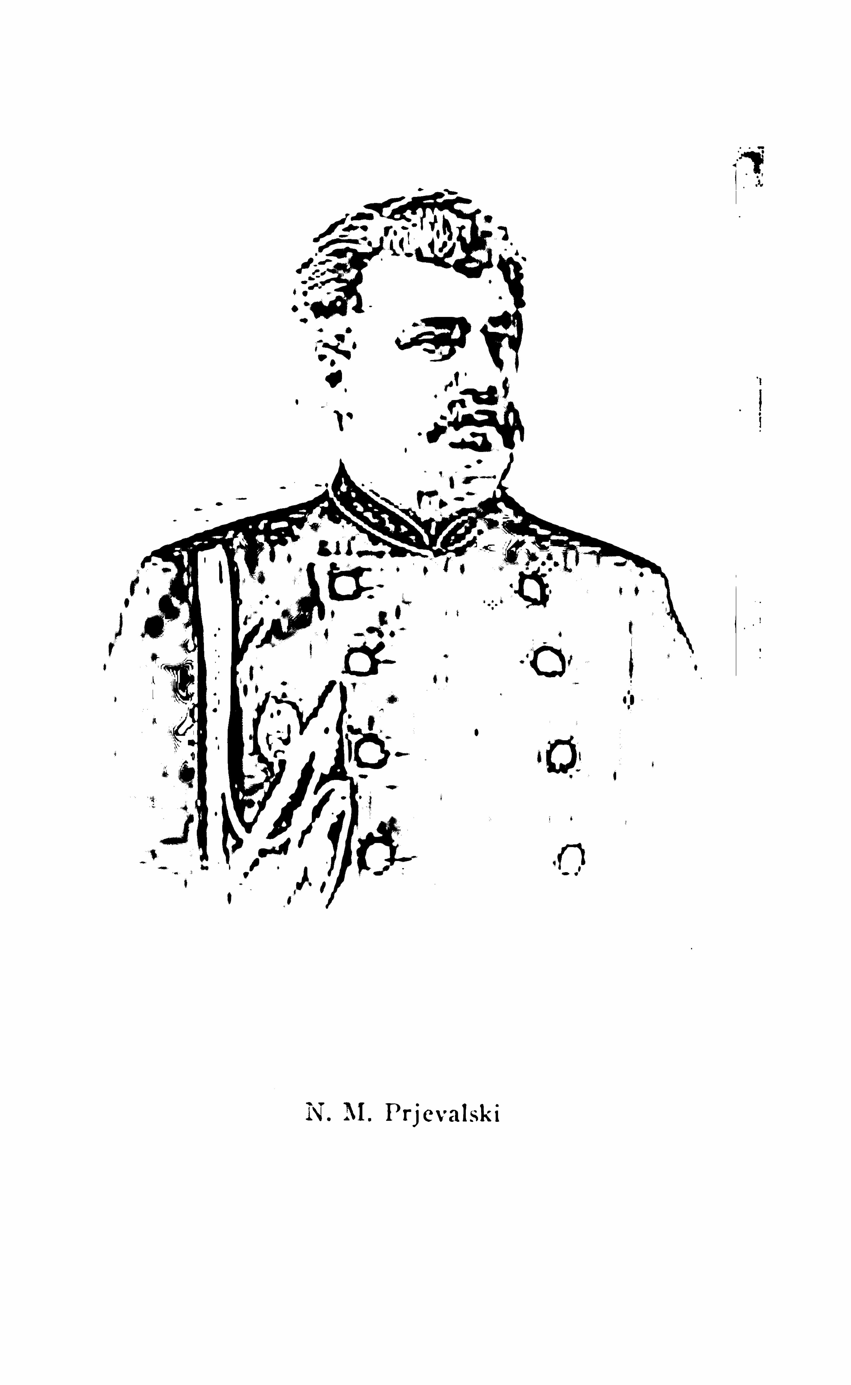

206 T I B ET
It was in northeastern Tibet in 1898 that the Dutchmissionary Rijnhart met with a fate s imilar to thatof De Rhin s. This brave mission ary co nceived itpossible to reach Lhasa w ith his wife and child fromthe Chinese frontier by passing east of the Koko Norwithout an y suitable escort. The little party did
actually reach the Dza-chu affluent of the Mekong.
Here it is believed that Rijn hart was murdered bynom ads, from whom he requested food and assistance.At any rate
,he never returned from their tents. His
wi fe, who was a lady doctor, subsequently aecom
plished a march of three hundred an d fi fty miles toTa- chien - lu,
the frontier town o f Sechuan ,all alone,
and fi n ally wro te an in teresting account of her travels.Expeditions of this nature, however, do n o t throw
much n ew l ight on the geography of Tibet.The scientifi c expeditions of the assistants o f the
great explorer Prjevalski, however, which were carried out after his death , notably those of Roborovski,have indeed added immense material value to our general knowledge o f the topographical con formation ,geology, botany, etc. , of the northeastern fro ntier ofthe plateau. Russian explorers were, in fact, con tinuously busy along the Tibetan frontier between the
years 1889 and 1894, but thei r explorations seldomoverlapped the northern bo rderland southward. Prjevalski alone attempted to penetrate to Lhasa. The
Koko No r steppes, Tsaidam, and the ranges north andsouth of the great blue lake, have been most thoroughly m apped by Russian surveyors, and the Russian
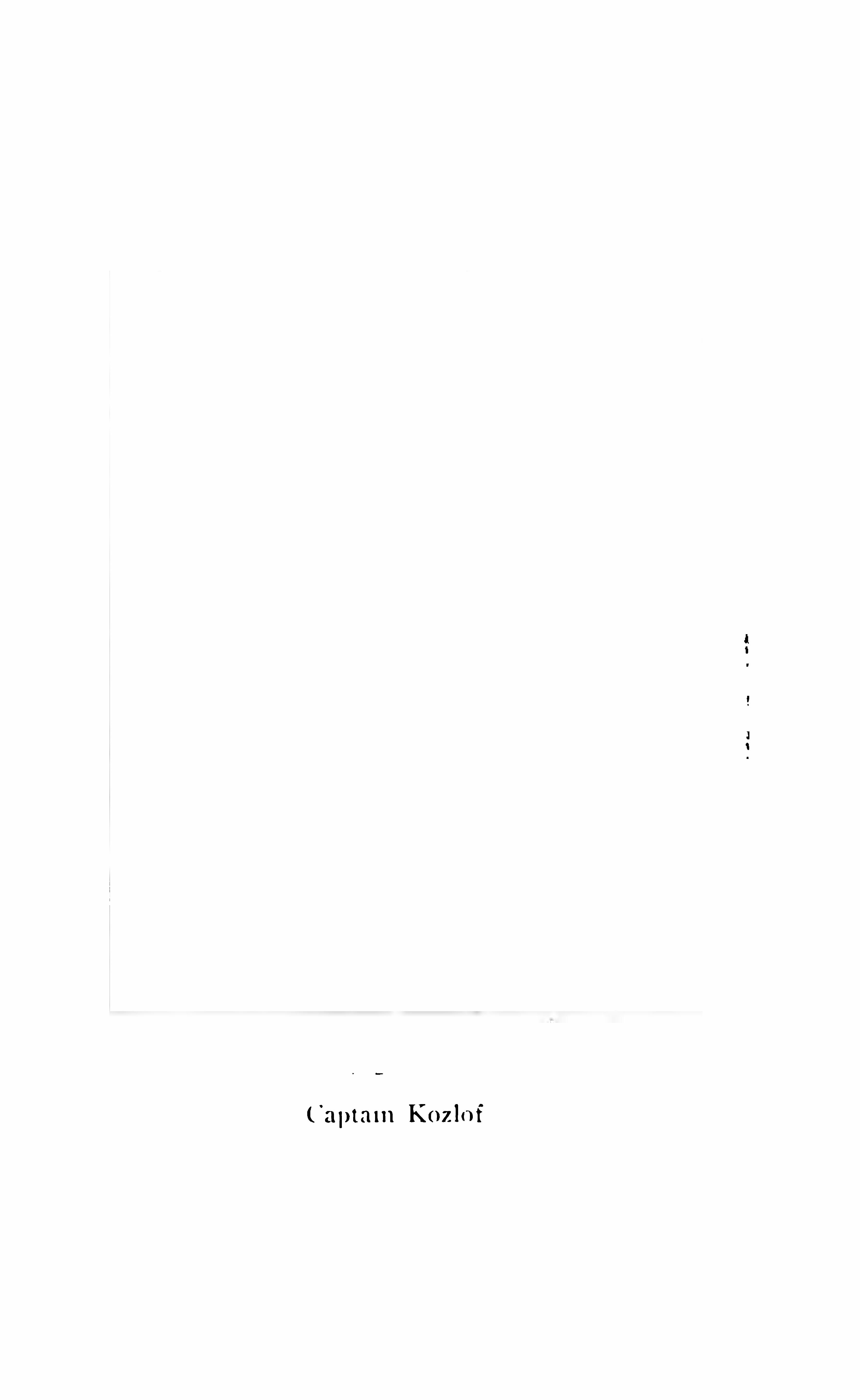

208 T I B ET
ing them from the Koko Nor. The Koko Nor region,at present regarded as an insignifi cant geographicalfeature a sort of waste hinterland to Tibet properand the home o f the worst robbers in Asia, will
some day rise to importan ce as the subject o f politicalcontroversy is it Tibetan, or is it Mongolian ?We have enough before us in these records to
indicate the general character of eastern Tibet, and to
guide us to some conclusions as to the possible futuredevelopm ent of those long curving valleys of the greatrivers of China, Siam , and Burma, which con stituteits m ain features . Undoubtedly much of the wealtho f Tibet lies in them, wealth which is n ot on lyrepresented by somewhat crude but original arts and
manufactures, but by immense mineral value. The
possibility of gold production w i ll be dealt with else
where. Here we on ly wish to point out the bearing ofthe geographical features which we are considering on
Tibetan policy. One important feature to note is thatthe geographical remoteness and inaccessibility of
Lhasa is not repeated in the case of the towns and villages of eastern Tibet. There is n o vast diffi culty inapproaching these eastern valleys from the Koko Norregion, itself closely adjoining the Kansu province ofChina. About the Sipan country, which embraces thesources of the Hoang H o , we do not know very much ;it appears to be a wild wilderness of mountain s ; butthe route from the Koko Nor district to the head ofthe Hoang Ho and hence southward into the valley ofYang tsi (Di chu ) about Jyekundo has been fre


2 10 T I B ET
to test the gen eral character o f the in terven ing highlands, and to prove the possibil ity o f establishing arigh t of way. Only 200 or 300 m iles (possibly less)separate British Indian territory from the lowerreaches (and therefore the richer an d m ore productive reaches) o f these same valleys, an d over that 200m iles no foot o f European has ever trod at all. Thevalley o f the main Brahmaputra stream leads directlyup to that region o f Poyul which is described by Rockhill as such a land of promise. The shorter valley ofthe Dibang taps the same country on the south . The
Lob it stretches upward and eastward, po inting the
direct route to Batang from the head of the Assamvalley, and indicates the most direct route to Sechuanand the upper Yang tsi basin. Some of its shorteraffluents drain Zayul and other valleys which lie easto f the Brahmaputra bend and run parallel to it, aboutwhich we know only what native explorers have toldus. This is all close to our frontier ; but we have neverproperly exploited it, and it is not surprising that ourenterprise, when balan ced in the scale with that ofRussia, should be found so wanting as to induce thetheory amongst our fron tier neighbours that we areafraid to venture. Possibly our improved relationswith Tibet may lead to exploration of the Brahmaputra bend, but it must be remembered that, so far asthe Assam borderland is concerned, the Lhasa hierarchy po ssesses very little influence in these easternhills.
From such inform ation as that enterprising trav
T I B ET 2 1 1
eller and Tibetan scholar, ColonelWaddell , has beenable to obtain , it might appear that the actual valley ofthe Brahmaputra itself affords as little opportunity forroad-making as do those of the Indus and Sutlej ,where these rivers part the Himalayas to make theirway to the plains o f India. It may be interesting,therefore, to note what the experien ces of our nativeexplo rers have been in these same districts, an ticipating to a certain extent the record o f their great achievem ents in southern Tibet . The explorer Krishna, who sem arvellous adventures in Tibet and Mongolia wouldfi ll an en tertaining volume o f travel , and to whom weowe the only plan of the city of Lhasa which we possessed before the late mission reached that city, oncetraversed the highlands between Batang and a po into n the Lohit River called Rim a, which is about onehundred and fi fty miles from Sadiya in upper Assam .
An enterprising political ofl‘icer (Mr. Needham ) in thewinter o f 1885
— 86 explored the Lob it valley routeas far as Rima in lower Zayn l, and (with his com
panion Captain Molesworth and three policemen ) isthe only European who has penetrated far into theMishmi country . Thus between Krishna and Needham we have the whole route illustrated from Assamto the Chinese frontier. Krishn a was himsel f unableto reach Assam through the on e hundred miles o f
intervening frontier hills from Rima. He was com
pelled to turn northwest from Rima, and has thusgiven us another instructive route running parallelto the Brahmaputra, on the eastern side of its southerly
2 1 2 T I B ET
bend, and joining the official Junglam ro u te at Shobando, about which place we have hea rd from Huc
Needham ’
s journey was most adven turo us, and fullyillustrates the extreme hostil ity of those tribes whichare more immediately contiguous to our own frontier.
It is not amongst the more remote peoples , but amongstthose who have the most constant an d direct commun ication with o s, who trade daily across our borders andknowwell their own way into British territory, that hostility m ostly lies. It is precisely the same thing on thenorthwestern border
,where the Ghilzai povindah
, who
trades through the passes into India, and traverses thepeninsula through the length and breadth of it
,is pre
cisely the most determ ined opponent to any reciprocalmovem ent from the side o f India into his own coun try.
Krishna was afraid to venture alone through the
Mishmi band o f hills, although he was within a weeko f Assam and had already spent three years o f travelin the northern countries. He preferred to go roundby Lhasa. However, his route report from Ta-chien-lnand Batang to Rim a is most instructive. BetweenTa-chien- ln (which he reached from the north by Rockhill ’s route from Jyekun do through Darge ) and Ba
tang he was o n the regular post road, and his routesurvey sufl‘icien tly illustrates its difficult character. He
followed this road to the crossing of the Chiamdo
(Mekong) River, and then struck southwards throughDayul to the next great river, the Giama Nu Chu orSalw in. Crossing by a rope bridge feet abovesea) he then zigzagged his way, fi rst up a small aflluent
2 1 4 T I B ET
communication as yet un opened, and even unexplored,which in the course of time
, as the commercial worlddevelops and the necessi ties of international commu
n icatio n become too pressing to be longer set asidein favour of political inaction, will inevitably becomel inks in the world ’s highways. One such certainlyappears to exist at the present time in the Dihong,or Brahmaputra, valley, which links together two greatcommercial highways, i. e . , the Tsan po ,
or upperBrahmaputra, and Assam, or lower Brahmaputra. Itis only lately (comparatively lately) that it has beenproved that the two valleys contain section s o f one
and the same river, and the record of how th is factwas ascertained is certainly one of the most interesting in geographical story. The Tsanpo has beenfollowed down from its source eastward through thecentral valley of southern Tibet by various exp lorersof the Indian survey, although I do not kn ow that anyEuropean has actually followed its banks to the pointwhere it fi rst loops itself northward and then strikessouth through the mountains to the head of the Assamvalley. Some forty miles to the southeast of Lhasathere stands the great Samye monastery, n ear theriver
, and the road thereto is a much traversed route.Ten miles further is a ferry across the river near thetown of Chetang, at eleven thousand fi ve hundred feetabove sea level . Chetang is important, for there isa trade route due southward from Chetang acrosseastern Bhutan to Tawang (a frontier market townnot far from the Assam border) which might appear
T I B ET 2 1 5
to be a m ost convenient route fo r reaching India. Itis not so , however. Between Chetang and Tawang areat least four considerable passes, and Tawang itself isone o f those trade marts which it is impossible toreach from India o n account o f the fi erce hosti lity o f
its barbarous guardians. I have already told howKrishna
,in descending from the Zayul country down
the Lob it River,en coun tered obstacles at Rima near
the Indian border,which prevented him from reach
ing Assam by that route, and turn ed him back to
Lhasa. Tawang is much n earer to In dia than is Rima,but it is equally impossible to the ordin ary traveller.A third trade m arket o f much more geographical sign ifi cance than either Tawang in southern Bhutan , orRima in the Mishm i country, is Miri Padam ,
in thehills o f the Abor tribe. Miri Padam is actually withintwo days’ reach of the Assam valley, — thirty-fi ve m i lesfairly easy route. It is near
,i f n o t on, the Brahma
putra River. It is a central market town fo r dealersfrom the northwest , northeast , and south
,and yet it
is even more unreachable than either Tawang o r Rima.The old pundit Nain Sing traversed the route betweenTawang and Assam . The plucky political oflicer
Needham reached Rima at the risk o f his l ife, butno explorer, either native or European, has evercrossed that thirty-fi ve miles of intervening hills which
part Miri Padam from the Assam frontier. Miri Padam is the key to the whole valley o f the Brahmaputrafrom its great bend in m eridian 94 east longitudeto its debouchment into Assam . Between Chetang,
2 1 6 T I B ET
on the Tsanpo , fi fty miles southeast o f Lhasa, and
Miri Padam,we know all about the river, although
we have no exacter survey of it than co uld be madeunder most diflicult circumstances by one of the nativeemployees of the Indian survey. H is tale belongsrightly to the chapter on Indian exploration in Tibet ;but as we are dealing now with eastern Tibet and theways thither, we must include this (the probable highway o f the future) amongst them . It is certainly a
rem arkable testimony to the extreme caution withwhich the Indian governm ent approaches any questiono f transfrontier exploitation that through all the yearsof our occupation of Assam n o determined effortshould have been made to place the independent tribespe0p1e o f the Assam border in a position which ad
m itted our right to visit their country as equal to theirown right to visit ours fo r purposes of trade. Rus
sian offi cers are rather fond of saying that were England in Russia’s place she would have had a warmweather port for her navy a century ago. It is probably true ; but it is certain ly equally true that hadRussia been in England ’s position in India
,there would
have been a right o f way, i f not a failway, up the
Brahmaputra valley long ere this.K B (or Kin thup ) was a native of Sikkim, who
had been trained in the Indian survey departm en t asan explorer, and who had already done a good dealo f useful work for his government, when he wasselected in 1880 by Captain Harman, R.E. (o n e ofthe foremost o f Indian frontier geographers) to as
2 1 8 T I B ET
is a well-trodden route passing from village toto the market town of Miri Padam . O n the
or southern, bank o f the river there are also
some following the river pretty closely through ao f large villages, of which one, Pema Ko ichunabove the falls
,is the capital of the district, and
striking inland to hill settlements and mona:But on the right bank there appears to be n o
ticable route past the falls any more than on tlThe road on the left crosses to the right ban lbridge below the falls, and from that point ithrough cultivation and villages at intervalsleast another forty miles. But we have no recits further con nection with Miri Padam , wt
approached apparently from the right bankKin thup
'
s description o f the valley, its cultz'
(which included rice, cotton, and fruit ) , its 1
teries and sacred places, and the wild andpeople inhabiting the Abor country, is deeplyesting. The roads are apparently such as are
found throughout Bhutan,o r the eastern Him
mere tracks rising over successive spurs, andping again into the flats on the river border, pras do the majority o f native tracks in all mcregions. The region o f the falls below Gyaldong appears to present the chief break in thetinuity. The falls are very sacred
,and the bor
many a devout pilgrimage. Clouds o f misty spt
into the clear atmosphere above them, and i t
that a rainbow ever span s the valley. Tho:
T I B ET 2 1 9
have se en the valleys of Bhutan ( the Tista and theMonas ) can well imagine the wild magn ifi cence o f
Brahm aputra valley scenery where the river roundsthe Him alayas on the east . A den se sub- tropicaljungle
,rich with every variety of tree fern and
bamboo, stretches up the hillsides to the limits o f
more open spacing, and a more stunted growth ofrhododendron and oak . Towering above all are theetern al sn ows and the everlasting silence of the icefi elds. But there is nothing form idable (so far as
we can tell ) in this route . The grades seem to beeasy
,and the villages on the flats have often a mile
of valley between themselves and the stream . Thereare no high passes to surmoun t. It is a gradual risefrom the plains o f Assam 500 feet ) to the highlandso f Lhasa ( 1 feet ) , and in those good times whenthe last rel ics o f savage barbarism shall give place tothat in terchange o f commercial rights which is, afterall, the best gu aran tee o f in tern ation al peace (a guaran tee founded o n mutual in terest) , it will be realisedthat this is the natural highway from In dia to Tibetand western China, and we shall have a Tibetanbranch o f the Assam railway, and a spacious hotelfo r sightseers and sportsm en at the falls. This pros
pect is n o t more vision ary than twenty-fi ve years agowas that o f a modern hotel at the Victoria Falls o f
the Zambesi ; or the splen did establ ishm ents whichwill soon overlook the falls o f Iguazu on the Parana
,
in South America. But the people o f the Old Worldmove slowly, and it may be long yet ere we can ex
220 T I B ET
tend our route from India to the highlands of easternAsia.Meanwhile we have only to record our ignorance.Perhaps not one geographer in twen ty has ever heardo f this approach to Tibet
, and even n ow we have noaccurate survey of it. Kin thup could not make onefor reasons which will be explained. I have said thatthe tightest place o f all in the valley is undoubtedlythat which narrows to the falls a few miles belowSindong. Beyond the monastery o f Pema Koi ChungKin thup and his companion could not pro ceed on theright bank , so they retraced their steps in o rder tostrike the river on the left bank below the falls ; aconsiderable detour had to be made, which passedthrough the provincial town o f Tongjuk jong, somefi fteen miles to the northeast of the point of the riverbend. Here was a Jongpen , a Tibetan official of somedignity
,and here was Kin thup sold ( l iterally sold) by
the Chinese lama, who returned to his own country,selling the Indian survey department at the same timeas Kin thup .
On the a4th o f May, 1881 , the lama left Kin thup inthis strange plight, and it was not till the 7th of March,1882 ,
that the latter succeeded in making his escapefrom dom estic drudgery, which was little suited to hisfancy. Constantly crossing and re—crossing the river,sometimes o n o n e bank and sometimes on the other,the explorer (who had lost most of his instruments)continued his journey southward. Such bridges as
ex ist are described as composed of a single rope with
222 T I B ET
Tsari . Tsari is the chief town of a district south ofthe Brahmaputra an d not far from Chetan g on thatriver. It was important, because it proved that thereis a direct route from the Brahmaputra valley at
Marpung to Lhasa without following the river. He
returned once more from Lhasa by another route.Following the China route to Giambo, he struck off
southeast through the Kongbu valley (where he founda rich soil and big villages ) to the Brahm aputra, andagain made his way to his old friend the lama at PemaKo ichen . For nearly a year more he continued inservice, andwas then set free by his master, who com
plimen ted him o n his devoutness as a goo d pilgrim.
Making his way to Bepung he found his logs , and atlast started them floating down the stream ; but alas,too late. The gallant Harm an had died meanwhile
( l iterally worn out by his own unresting energy ) , andthe logs floated unmarked and unowned into the broadbo som o f the great river of Assam. But the purposethey were to serve was attained in another way. Withalmost pathetic devotion to his work, the explorerturned southward to see i f he could not reach Indiahimself by the river route. All that we know of thevalley has been gleaned from his remarkable experi
ences. He reached a place called O hlet, n o t far fromMiri Padam , and there his career was stopped by theobstinate and pigheaded persisten ce o f local savageoflicials who allow no strange tracks to be made overtheir road to India. There was no special difl‘icultyin reaching this point, but he was now beyond the
T I B ET 223
indefi nite boundary of Tibet, in the land of semi-nakedsavages
,albeit these same savages knew very well how
to trade with India. There is no open door where theyare concerned . Just as Krishna had been turned backfrom Rima
, so was Kin thup turn ed from Miri Padam.
Once again had he to retrace his steps to Lhasa en
route for Darj il ing, where he fi n ally arrived afterfurther vicissitudes in November, 1884, four yearsafter he set out o n his quest . This is but one instanceout of many of the strange persistency with which thenative explorer will stick to his work . Tim e is nothingto him
,and the sam e characteristic o f dogged obsti
nacy which distinguishes the Mongolian character ingeneral
,and the Tibetan in particular
,has been turned
to most excellent account by those who train explorersfor Asiatic research in India. With the exception ofthe thirty-fi ve miles o r so intervening between Assamand the central mart (a very considerable on e) ofMiri Padam , the course o f the Brahmaputra has beentraced from its source to India, and as far as the greatbend southwards it is kn own n o t to on e but to severalIndian surveyors. It is impossible to follow theirexperiences in detail . We can but take an instance ortwo here and there of the unravelment of some spe
cially complicated geographical kn ot.So far we have been dealing with eastern Tibet ;
we will n ow take a cursory glance at the course ofthose explorations beyond the Himalayas which occu
pied much of the latter end of the nineteenth century,
and which have resulted in the map of Tibet as it is
224. T I B ET
now presen ted to us. This map (usually attributed toGeneral Walker, R. E., Surveyor-Gen eral of India)has been corrected up to 1899, and although far from
perfect, there is very little indeed that could be addedto it since that date. It will be apparent at a glancethat we know a great deal more of so uthern Tibet
(that part of Tibet which it is most useful that weshould know) than we know of the central and northern Chang- tang. But the blank spaces o f the map toa certain extent indicate blank spaces in nature. Thereis really little that is important that we can kn ow aboutthe northern Chang- tang. It is, in a sense, o n e o f thebest explored parts of Tibet. A whole company ofdistingu ished European explorers (as will be hereafternarrated ) have struck into that blank space from the
west and the north, and on e reason why it is n o t fi lledup with topographical details is the wan t o f suchdetails, at any rate the want of features sufficien tlymarked to render them important in a map on so smalla scale.On the other han d, in the south, where we find a
fairly good show of topography, not a single Europeanhas ventured far since the days .
.
o f Huc to the date ofthe Younghusbandmission. The mapping, as we haveit, is ahn ost entirely the result of native exp lorationin geographical interests. About the middle o f lastcentury the work of trans-Himalayan exploration wastaken seriously in hand. General Walker
, Basevi.
Mon tgomerie, Trotter, Tanner, Woodthorpe, and Harman are a few o f the names of those who supported
226 T I B ET
edge o f the Brahmaputra valley as we possessedbefore the late mission . No European has assistedthem excepting so far as the surveyors of the Himalayas have fi xed for them by triangulation a n umberof the remote peaks (even including points in the KuenLun north of Tibet ) which have been their guidingpoints in the fi eld, and references by means o f whichthe fi nal record of their own surveys has been piecedtogether. Various have been the artifi ces wherebythese explorers have effected their purpose. In stru
ments have been concealed beneath the false bo ttomso f boxes co n taining merchandise and tea. Their dailyrecords of distance and bearings have been written inverse, and recited as a Buddhist poem. Then clo theshave been made useful by a dozen different devices,and in their hands these pious pilgrims have carriedtheir Buddhist rosaries, counting their paces and dropping a bead as every one hundred or one thousandhas been completed . For Himalayan work they havebeen mostly m en of the hills, Gurkhas, Tibetan s, lamas
of Sikkim or Bhutan . Elsewhere on the frontiers o f
India they have been less of explorers and more o f
survey specialists,good topographers, drawn (o ften )
from the ranks o f the Indian army, but always speciallyadapted by their nation ality for the region wh ich theyhave been instructed to map . It is quite a mistake tosuppose that we know no thing about Tibet and Lhasa.
We knew almost as much as could be told by any traveller many years ago , and there is nothing new in someof the tales which we have recen tly heard. O n e excep


228 T I B ET
One of the earliest was also one of the best, for itopened up to us a new era in trans-Him alayan knowledge. It revealed for the fi rst time som ething of thenature of that central watershed which separates therivers of the no rth
,the upper Indus, an d the upper
Brahmaputra, from each other, or rather from the in
terven ing lake land which gives birth to the Sutlej .Pundit Nain Sing was a schoo lmaster in Kumaou
when he fi rst mastered the rudiments of exploratorysurveying, and no explorer who ever l ived made betteruse o f his knowledge. H is fi rst Tibetan venture wasas early as 1865 , and his point of departure was Khatman du, the capital of Nepal . The frontier town ofNepal , o n the direct route to Tibet, is Kirong, a townwhere there is always jealous guard kept on the Tibetanroad by Chinese offi cials. The governor of Kirongdetected weak po ints in the story to ld by the pundit,and absolutely declined to let him pass. Other routesacross the Himalayas to the Manasarawar lakes weretried, and found to be impracticable. The punditchanged his disgu ise — added a pigtail and adoptedthe role of a Ladaki, and then made friends witha m erchant who bo rrowed m oney o f him and failedto keep his promise to see him across the bo rder. Butby luck the m erchant’s relations proved better menthan the merchant himsel f. The pundit (Nain Sing,to call him by his right name) managed to persuadethem that he was an honest trader, and escaping theinquisitive scrutiny o f the Governor o f Kirong
,he
fi nally succeeded ( in August, 1865 ) in crossing the
T I B ET 229
boundary, and reached Tadam on the BmM aputra.
Tadam is a well known halting place on the greatroad (the sam e Junglam which we have followed eastof Lhasa ) between Ladak and China, where thereis a great monastery. Here he feign ed sickness, andstayed behind his party, for he was travelling in thewrong direction for Lhasa, and here he had the goodluck to fall in with a bona fide Ladaki merchant fromKashmir, who took him with him eastwards to thetown of Janglache. From this point to Shigatze
(eighty-five miles) the great river is navigable forthe Tibetan wicker-and-skin craft which they callboats, and it is usually by river rather than by roadthat this part of the journ ey is accomplished. Thismethod of progression, however, would not suit aroute survey, and Nain Sing stuck to the road. Fromthe end of October to the 22d of December the partyremained at Shigatze, where Nain Sing interviewedthe Grand Lama of the Tashilunpo monastery, whichlies about half a mile to the southwest of the city.
It is worth recording that the Lama, in 1865 , was a
boy of eleven , who did not evince any extra in telli
gen ce. From Sh igatze the Junglam ceases to followthe river, but runs south to Gyangtse, which p lace istherefore on the Chinese highroad.
In the middle of December they crossed the
Kharola mountains and passed by the Yamdokcho
(or Scorpion) Lake, where Nain Sing nearly fi nishedhis career at the hands of robbers. This was thefi rst view that was ever obtained of the topography
230 T I B ET
of that lake and its surroundings.
‘ Nain Sing naturally, from his point of view, suppo rted the Chineselegend of a large island in the centre, with hills ris
ing to two thousand or three thousand fee t above thelake level . We know now that it is not an islandbut a peninsula connected on the so uthwest of thelake with the mainland. For some years after NainSing’s visit to Lhasa the theory of the central islandwas maintained , although Captain Mon tgomerie (NainSing’s instructor ) was always sceptical on the subject.Crossing the Khambala mountain pass, Nain Sing descended rapidly into the valley of the Brahmaputraat Khambabarche. Thence by boat to Chusul village,and from Chusul, following the Kyichu , he reachedLhasa on the l o th o f January , 1866. This fi rst modernjourney o f a British subject to Lhasa was performedin the m iddle o f w inter, and it is remarkable in manyways. Nain Sing’s description of Lhasa is full ofinterest, nor have any very essential additions everbeen made to it by subsequent native visitors. AtLhasa, however, his disgu ise was penetrated by twoKashm iris, who kept his secret well , — and he hadthe additional bad luck to encounter the Govern or ofKirong. He was in great straits, too, for money, andaltogether he was than kful when his merchant friendswere ready to return to Ladak in April . They re
ceived him as a m em ber o f their company with muchcordiality. The pundit was a favourite wherever he
1 All this co un tryhas n owbeen scien tifi eallymapped bythe surveyorso f the late mission .
232 T I B ET
bet ) , with each tenth bead a little larger than the
others. The prayer-wheel was made to cover obser
vation s with the prismatic compass fo r bearings, whilstthe rosary checked o ff the paces by hundreds as he
went. Latitudes were taken with a sextan t, and pre
sented some diffi culty. The artifi cial horizon was markwith mercury placed in the ordinary wooden bowl,which every Tibetan carries. These bowls are mark
of very hard wood (not grown in Tibet ) , and salm
times are highly ornamented, and fetch large mmThe prayer-wheel was found to be exempt from ex
amination by custom -house or other offi cials. This
immunity led to the introduction of a special form of
prayer-wheel (containing a compass)proper survey equipment under circumstances whereprayer-wheels were recogn ised. There were graduallyadopted other devices also, which all tended to simplify
the work o f the trans-Himalayan explorer, if not to
aid his devotions. This fi rst trip over the Tibetanborder resulted in a route survey of twelve hundrulmiles, defi ning the mountain route from Khatmanduto Tadum , and the great China road from GM
(o n the Indus) to Lhasa, and fi x ing the course 95
the Brahmaputra from its source to its junction withthe Kyichu . It is a notable record in the an nals of
Tibetan exploration, fo r the work done was excellent
throughout. The subsequent survey by Major Ryderconfi rms its gen eral accuracy.

234 T I B ET
den tly furnishes the chief water supply. A ll this upper
part of the river (above the junction o f the ChartaTsanpo ) is known to the people of Nari and Ladakas Tam jan Khamba (horse
’
s mouth ) , and the first
point where road and river meet is at the Tamjanstage. Here, on 7th June, Nain Sing found the riverwas much swollen, its current rapid, and its watersturbid . The surroundings were wild and desolate.Only small patches of cultivation ex isted in the immediate neighbourhood of the successive stages. Thereis nothing attractive or promising abo ut this part ofthe valley. Two or three great affluen ts swirl downfrom the central lake district on the north
,between
Tam jan an d the Charta Tsan po junction, which iseighty m iles below the great Tadum monastery
,a well
known halting place o n the river. All these northerntributaries bring down clear water with them ,
andsome of them are o f considerable size. For anotherhundred m i les or so the road and the river separate,touching again near Janglache, a large market town
feet above sea. From Janglache to Shigatze
(eighty m iles) the river is navigable. Near Janglache (about twenty miles below it ) an enormoustributary flows in from the north called Raka Tsanpo ,which is not shown o n the map, but of which the
course has been traced for a considerable distance.‘
Judging from the great size of these northerntributaries, and the number of them, there certainly
1 Majo r Ryder’s survey shows this river to rise close to the Brahma
putra, and to flowfo r about a hundred and fi ftymiles parallel to it.
T I B ET 23 5
seems good reason fo r supposing that part of thecentral lake district lies within the Brahmaputrabasin . There is no other way o f accounting for theirvolume. The southern tributaries from the Himalayan glacier are comparatively insignifi cant. TheCharta Tsan po from the north, to which we have referred, was two hundred paces wide in the month o f
May, at which time of the year it was but very slightlyfrozen , with ice clinging to its edges. Nain Sing continn ed his survey by road from Janglache to Shigatze,crossing a fair- sized southern tributary. At Shigatzethe river and road meet again . Here is the junctionwith the Nyangchu from Gyangtse , the river whichhas been followed by the late expedition from theTibetan fron tier to Gyangt se . As already explained,the post road leaves the river at Shigatze
,passing
southward through Gyangt se over the in terveningmountains to Khambabarche, Chushul , and Lhasa .
Between Shigatze and Khambabarche the Tibetan s saythat the river is too rapid fo r bo ats, and in deed navi
gation with Tibetan craft seem s to be rather perilousanywhere. Captain Mon tgom erie reckons from NainSing’s m easurem ents that the Brahmaputra at Tadum 1
( just below the jun ction of its fi rst great tributary )must be one half w ider than the Ganges at Hardwar.The main river below this point is n ever fordable
, n or
are the tributaries from the no rth during summer.
!There is n o t a single wooden bridge over the upperBrahmaputra, and n o twig, rope , o r cane bridge either.
1 Tradurn in Ryder’
s map.
236 T I B ET
Iron suspen sion bridges have been made at Janglache
and elsewhere, but they are all dangerous to use and
the Tibetans prefer Navigation at feetabove sea is unique, a st be regarded as a recordfor the world. Lake Titicaca, on the bo rders of Peruand Bolivia, which is systematically navigated , is only
feet above sea, but there navigation is well developed. Mon tgomerie, after a very careful estimate ofthe volume of the many affluents, and a comparison ofNain Sing’s observations with those of Turner, reckonsthe discharge of the river just below its junction withtheLhasa River (Kyi—chu) to be about cubicfeet per second in the low season, or about seventimes that o f the Ganges at Hardwar (where the riverleaves the Himalayas) under sim i lar conditions. Prac
tically, then, it is to Nain Sing that we must accordthe credit of proving that the Brahmaputra o f Tibet isthe sam e river as the Brahmaputra of Assam , for noother river channel issuing southwards, to the east ofthe Himalayas, contains this amount of water. Taking it fo r all in all the val ley of the Brahmaputra aboveShigatze affords fairly easy opportunity for travellingbetween Kashmir and Lhasa. The grea t rolling stonedusted plains, in which the road often loses itself, present n o great physical obstacle. There are no passeseast o f the Mariam La till after passing Gyan gtse ; butthere is a lamentable want of grass or fo rage foranimals. There are a few large towns, abo ut whicha very fair spread of agriculture is maintained ; butthe large towns (strikingly picturesque, with dominat

T I B ET 237
ing mon asteries and white lines of stone-built dwellings climbing the slopes of hills) are at long intervals,and the o rdinary post towns on the great trunk roadare not equal to any greater demand than that o f apassing caravan . Nevertheless a considerable amountof traffic yea rly passes along that road, and it is on e
to be reckoned amongst the world’s great trade highways. The altitude is nowhere excessive ; it is oftensubj ect to unpleasant warmth as well as rigorous cold .
We shall have to refer to Nain Sing’s journeys again ;but meanwhile it will be well to turn our attention tothe western end of this China road (the Janglam )within that part of Tibet which is watered by theupper Indus, and which is n o t really of much lessimpo rtance than is the long lateral valley of the Brahmaputra. Nearly coincident with the despatch ofNain Sing on the Brahmaputra quest was that o f otherexplorers to the upper Indus, who left with in structions to seek out the source of the river
,and to report
on the gold mines. A glance at the map at oncereveals the main features of southwestern Tibet.From the remarkable hydrographic centre which isin dicated by the Manasarawar lake system, and thegreat group of sacred peaks to the northwest dominated by Kailas, the Indus starts westward to Ladakthe Sutlej starts southwest to jo in the Indus in theplains of India ; and one of the largest affluents ofthe Ganges starts southeastward for the Bay of Bengal.The bleak and desolate district of Nari Khorsum ,
through which flows the Sutlej , as well as the eastern
238 T I BET
branches of the In dus, were not kn own to us fiftyyears ago. The veteran explorer, Richard Strachey(afterwards presiden t of the Royal Geographical Society) , and his bro ther Hen ry were the fi rst actuallyto demonstrate the physical characteristics of the country surrounding Manasarawar, although Moo rcroftand Hydar H earsey had crossed the Himalayas in181 2 , whilst other surveyors (notably Godwin Austen )fi rst approached the Tibetan fron tier from the Kashmirdependency of Ladak, and, after fixing the positionof the great Kailas with many o ther peaks to thenorth , mapped the region of the Pangon g Lake on
the Tibetan bo rder. Traders passed to and fro acrossthe Kumaon group o f passes to Gartok on the Indus,and Totling on the Sutlej
,or else made their way by
Shipki to Nari Khorsum , but nothing like systematicexploration of these regions was attempted until Mont
gomerie took the matter in hand with his gallant bandof trans-Himalayan explorers. The pundit Nain Singand his companions had already visited the tradingcentre
,Gartok
,in 1867 , when he was detailed with
two other explorers to work northward into the upperIndus valleys, in order to connect Gartok with the
regular Ladak surveys, and to explore the region ofthe gold and salt m ines. In June, 1867 , they startedfrom Badrinath and made their way by the Manapass feet ) , north of that place, into the Sutlejvalley. The Chinese officials o n the frontier had giventhe usual amount o f trouble . From thei r lofty elevation in the Himalayas they had looked down on the

T I B ET 239
plains o f Hindustan , and had condescended to adm itthat the country was fi t to trade with. They declaredthe pass open, and they set about searching the baggage o f all traders as they passed to make certain o f
their bon a fi do character. However, in this instancethey missed the explorers’ instrum ents, and the littleband go t over safely. [At Totling they crossed theSutlej by a remarkable iron bridge o f seventy-six feetspan suspended forty feet above the water, and thenpassed over the watershed between the Sutlej and theIndus by the Bogola feet ) , contin uing overthe Gugt ila feet ) to a vast desolate plateau, thehome of antelope and multitudinous wild 40l Yetanother pass had to be negotiated before they droppedinto an eastern affluent of the Indus and encountereda Tibetan camp. Here they nearly came to grief.The head man n o t only disbel ieved their story, whichrep resented them to be harm less Bisahari traders, buthe actually pointed out with great accuracy who theyreally were ! Nain Sing, however, was equal to theoccasion: He was a m an o f extraordinary nerve as
well as o f great powers of persuasion. Bribery helpedhim through the difficulty,
and with his smooth tongueand an open hand he managed to get leave for himself to proceed , and at the same time detached oneof his survey companions on a separate exploration.
The third pundit had had enough o f it, and he wasleft behind.
Making a long march to avoid further complication s, Nain Sing found himself at the foot o f the
240 T I B ET
Chomorang la feet ) , the last pass which separated him from the gold-fi elds ; but the sn ow fell soheavily (even in August) that it was three or fourdays before he cou ld push his way acro ss and descendupon those historic diggings which have p roved sucha source of wealth through untold ages. Here at
last was Thok Jalung. The miners’ cam p was pitchedin a broad, deso late, red plain, and the sound of singing cam e from the midst of it to greet the pundit ashe approached. The miners and their famil ies in thosedays ( the Thok Jalung mines have since been deserted)were a happy-hearted people. The head of the mineswas, however, most suspicious, and n o t even a lettero f introduction which the wily pundit had extractedfrom the last suspicious head man , or a p resen t ofthe best Indian tobacco, soothed his objection s, untilcoral ornaments were displayed to his wife. Thesewere irresistible, and although the pundit had to drivea very bad bargain in his role as trader with theseLhasa officials in the matter of ladies’ outfi t, he succeeded in winning his way with them,
and establishing himself as the friend of the family. Never washis power of ingratiation shown to such advantage,for the result is a graphic description of these remarkable Tibetan mines such as no other explorer has everbeen capable o f attaining. In a wide expanse of redbrown upland the black tents o f the Tibetan minerswere massed without order or arrangement. Aroundthe plain were bare and desolate mountains, with snowon their summits at the time of the pundit’s visit
,and
242 T I B ET
handled spades) and throwing out the earth to eitherside. A small stream was introduced into the goldpit (diverted from the neighbouring hills) and used
for washing. The water was dammed up with a
sloping channel of escape. A cloth was spread at
the bottom o f the channel, and kept in po sition by anumber of stones, which made the bo ttom lumpy and
uneven. One man sprinkled earth over the channel,whilst a second drove down the water by means of
a leather bag. The lighter soil was carried away, butthe gold sediment remained deposited in the unevenplaces
,collected in the cloth. The yield of gold was
large and the fi nds occasionally heavy. The punditsaw one nugget which be estimated to be about twopounds weight. The diggers maintained that theycould always tell at once when the soil containedgold . All round Thok Jalung ( indeed all the way toLhasa across the Chang) are the rem nants of ancientgold m ines n ow disused and abandoned. Thok Jalungitself is n ow exhausted. The gold industry in that
part of Tibet seems to have been incapable of surviving the enormous taxes imposed by the Chinese. Mostof the miners hail from the Chung province aroundShigatze. In spite of the intense cold the diggers preferred the winter for work, as the excavations stoodso much better under the action of frost. The coldis m uch intensifi ed by wind, and the tents of the diggers were generally pitched seven or eight feet belowthe ground level for shelter. Throughout these ele
vated regions the nomad inhab itants usual ly sleep
T I B ET 243
whilst resting on their knees and elbows, with all theclothes they can get piled on to their backs ; and insom e parts of western Tibet they have been observedto work at their digging
, scratching up the soil intoheaps, in much the same attitude . It was this, andthe probable use that they made of antelope hornsas instruments for scratching the soil , that originatedthe ancien t fable of gold-digging ants protected bydogs to which Herodotus alludes.
The gold-digging industry must be inconceivablyancient in the western part of Tibet. Ancient m inesex ist in numbers to the east of Thok Jalung andthroughout the Chang ; to the northeast of the AruTso ( lake) there are many square m i les o f alluvial diggings, which are worked even n ow. The gold o f theJalung mines was conveyed to Pekin by regular oflicial caravans which visited the fi elds every year forthis purpose until the m ines were abandoned. Theseparticular mines may have lasted some twenty-fi veyears, or possibly rather more, before they weredefi nitely left as unprofi table. The climate and altitude proved no obstacle to working them .
In spite of the desolate nature o f the surroundinghills there is a great deal of coarse grass to be found,and enorm ous tr00ps o f wild animals
,but no wood
or timber. Water, too ,
is n o t very abundant . It ismore probable that the mines were closed on accountof the heavy imports levied on the m iners than for anyother reason . There is quartz in the neighbourhood ;the surrounding hills are decorated w ith the mystic
244 T I B E T
sen ten ce O m-mane-padme hum , p icked out in whitequartz stones and repeated on every po in t of vantagein the lan dscape. At the time of Nain S ing’s visit
( 1867 ) gold was worth thirty rupees per oun ce in thecamp. This visit to the gold workings of ThokJalun g was most useful, for we get therefrom the
only authentic account of Tibetan processes of go ldworking which we possess. The methods employedat Thok Jalung are the methods employed throughoutthe Tibetan highlands, and we see at once how veryelementary they are. The gold which from time immemorial has enriched the Pekin treasury, and which,in smaller quantities, has found its way to India andto Kashgar, is all obtained from alluv ial so il. Thereis no deep mining (i. e., no shaft sinkin g) to be foundin any of the thousands of disused workings whichare scattered over the surface of the Chang. The goldhas all been taken from alluvial, or surface, soil, andit has all been washed out by the very crudest ofwashing processes. At a moderate computation theremust have been as much go ld left behind on the surface o f the land as has ever been put into the market,and it can only require the appl ication of scientificmethods to make it available. But it is impossiblewithout scientifi c examination to decide whether it isthere in paying quantities, estimated by the cost ofworking in such a country and such a climate. The
Tibetan miner represents cheap labour. It is notorious that he never grows rich, in fact he oftenstarves ; but that again is no criterion o f the value of
246 T I B ET
Pundit No. 2 was a tall and powerfully built man,and he was well able to defen d himself o therwise, onone occasion at least, he would have been murderedo n the banks of the Indus. So far we are indebted tothese plucky agents of Mon tgomerie for all we knowof
the districts of Maj in, Bongtho l, and for most of NariKhorsum .
Between Sikkim and Lhasa, and northward to theTengri Nor Lake, it will be apparent from the mapthat we have more complete topography than wepossess elsewhere to fi ll up the map of Tibet, and forthis we are indebted to a large number o f nativeexplorers. Lhasa has been frequently visited . Thebest map which we possess of it is that made by thatgrand explorer, Krishna (A . whose performancesfully equal those of the pundit Nain Sing, and who carried his route surveys so far afi eld that he anticipatednearly all the subsequent efforts of European adven
turers. He traversed much of the ground which hasbeen more recently (and perhaps more fu lly) illustrated by Prjevalski, Rockhill , and others, and a fullexamination of his work is unnecessary here. We haveal ready referred to a small section of it in southeastern Tibet. Perhaps the most useful additions toour knowledge of this (by far the most important)region to us have been from the work of the explorerG. M . who mapped the Brahmaputra from the
meridian of Lhasa to its great bend ; and o f the lamaU . G. (or Ugyen ) , who worked with the BengaliChandra Das between the passes north of Sikkim and
T I B ET
Lhasa . Chandra Das (as I have pointed out ) is himself no surveyor, but the lama Ugyen not only com
pleted a very large amount of useful work on anindependent excursion , but has added a good deal of interesting detail to the accounts of Lhasa given by NainSing in the fi rst instance, and by Krishna and ChandraDas subsequently . As I compiled his reports for him ,
I do not hesitate to say that there is much valuablematerial in them which has never yet seen the light.The lama ( l ike Chandra Das ) was an employee o f theBengal educational department, but he joined theheadquarters of the Indian Survey for technical instruction under Colonel Tanner. He entered Tibet bythe Donkhya la,
west of the Tangla ( the pass used bythe late expedition in the summer of and fi rsttravelled westward to Khamba jong, now well knownas the fi rst advanced post of the Tibetan mission, ino rder to secure his footing with the local oflicials.
During this journey he was accompanied by hiswife, and he found that it was much easier to maintain his role of a pilgrim under such conditions. FromKhamba jong he retraced his steps to the Tha sangmonastery (south of Bam tso ) , and then struck outnorthwest for Gyangt se. This part of his journey isinteresting, as it illustrates a second route from theSikkim frontier to Gyangtse
,parallel to that taken by
our force following the valley of the Nyangchu, butseparated therefrom by an interven ing watershed tothe east . In some respects it appears to be a betterroute
,more thickly inhabited, and very full of local
248 T I B ET
interest in the matter of monasteries and rock-cutcaves, about which Ugyen has man y curio us and childish legends to relate, legends, however, which are
not at all more childish than those which may be heardany day in more civil ised cen tres . O pen gravellyp lains and a fair amoun t of barley cultivation are thechief features of this n ew route, which includes the
crossing of three m in or spurs from the watershed onthe east, and fi nally of the pass across the watersheditself, from whence Gyangtse may be seen surroundedby o rchards and gardens across an interven ing wasteo f gravel plain. The pass is the Pongong Lafeet ) , and is described as very diflicult. Cro ssing theNyangchu by a stone-built bridge three hundred
paces in length, Ugyen visited the old temple of Gyangtse. It is nin e storeys high and octagon al in shapeO n each storey in succession he found eight chapels orsacred p laces, corresponding to the sides o f the building. At the top there were images or cylindricalfi gures.
” The roof is covered with plates of mixedcopper and gold, and from it are suspen ded bellsattached to chains. From here he could overlook themarket-place with its busy crowds. Gyangtse has nowbeen made fam iliar to us in the pages of our illustratedjournals.
On the 24th of August he left Gyangtse and followed the course of the Nyangchu towards Shigatze.
This part of his journey lies through a valley alreadydescribed ; but Ugyen adds more positive inform ationabout the exten t of cultivation in it. Con tin uous vil
250 T I B ET
patien tly with him The lam a (Ugyen ) was theharassed and hard-working surveyo r ; the Babu thelight-hearted observer. Of the two the lama wentfurthest. But we owe much to the Babu for hisdescription of the social li fe and customs of the pe0p1e.He describes a black-hat dance which took place atTashilumpo in presence of the Gran d Lm a withmuch more graphic power than he describes the placeitself. We are, however, on well trodden ground at
Tashilumpo and Shigatze, and we must move farther.In August, 1883 , the lama continued his surveys alongthe southern banks of the Brahmaputra, passingthrough well-cultivated and well-populated country,with sweet valleys reaching from the southern mountains down to the river banks, to Tagh- tu-ka, wherethere is a ferry and where the river valley road praetically ceases. At the junction of the Rongchu hestruck o ff southwest and followed that river to thegreat Yamdok tso , o r Palki lake. In the Ro ngchuvalley he found many celebrated monasteries, of whichthe Rong cham chen is perhaps the chief. It is a cultivated and well-peopled valley, — one of the o ases ”
of Tibet . Nothing in the story of Tibetan explorationappeals more strongly to the imagination than hissubsequent account o f his survey of the Yamdok tso .
The weather was unpropitious ; thick mists envelopedthe mountain sides and hung over the surface o f thewater ; from the western shores of this vast lake amountainous peninsula projects northeastward into it,connected w ith the mainland by two arms which them
T I B ET 25 1
selves enclose a second and smaller lak e called theDuma tso . One of these arms is a precip itous mountainridge called the Tag La, the sloping sides of whichdescen d so sharply to the water’s edge as to bar allaccess to the peninsula. The other arm forms an accessible link between the grass lands about Nagartse andthe towering mountains which are the central featureof the projecting mass. They are margined, however,with a cultivated border dotted with fi shing villages,fringing the purple sides of the hills with green, anddividing them from the deep, blue waters of the lake.Hidden in the dark recesses of the mountains is thesecret hermitage of Padna Sambhava. Ugyen madehis way right roun d the peninsula
,meeting with hos
pitality from the pe0p1e after much questioning and aboisterous reception on the part of the huge Tibetandogs. Footsore and weary
,he reached Samding on
the 29th of August, after losing his way and riskinghis li fe amongst the rocky passages which overhungthe Duma tso . The Duma tso impressed him mightily ;its deep, still waters embosomed amongst terrifi c cliffsand precipices the silen ce which hung over the stu
pendon s crags encircling it, broken only by the rushand roar of falling masses which ever and an on thundered down the mountain sides into the depths of thelake ; the legen ds of the demons and genii who inbahited the lake, and whose good will was daily propitiated by the pe0p1e living around, all these thingsreduced him to a condition of superstitious awe andreverence to which his usually phlegm atic nature was
2 52 T I B ET
a stranger. The level of the Dum a tso is fi ve hundred
feet higher than that of the Yamdok tso feet),and it is said to be gradually rising . There is no apparent outlet, and the landslips to which Ugyen refers
must in time sensibly affect the lake level, so there is
a probability of truth in the suggestion . The supersti
tious inhabitants believe in an even tual o verflowwhichwill destroy all human life ; hence their dread o f the
lake and their constant endeavours to live o n good termswith its presiding demons. The belief in the change
of lake levels seems to pervade all Tibet , and is combin ed with strange legends of their shifting character.
There can be n o doubt that the level varies con siderably in the course of years, and that Lob Nor is not
the only lake which will even tually be proved to shiftits position as the ages pass.
From the Yamdok tso Ugyen struck off southwards
to explore another lake, the Pho Mo Chang Tangtso , which presented a strong co n trast to the
gloomy grandeur of the Yamdok tso . To the southeast he could see ( from the Yeh La) the sn owy peaksof Kulba Kangri and Menda piercing the vault of
heaven like the dazzling Spires of crystal chhortens
(a chho rten being a solid masonry building of pagodaform , frequently embellished with a gilt ball and crescen t at the top, enclosing certain religious books and
stone engraved prayers which are placed in a recessin the interior) whilst the lake was surrounded by anarray of magn ifi cent peaks such as my eyes neverbefore beheld .
” “ There is a belt of gen tle Slopes
T I B ET
round the lake, dotted with Dokpa ten ts ; a s;
plateau exten ds to the northeast of it, along whiroad to Manda La lay.
” The name Pho mo (mafemale ) is derived from two islands near theeastern shores. The people about here are ofgol ian race (Hor dokpa and Sog dokpa ) buare comparatively civilised. Crossing the Man
feet ) after leaving the lake, from the prof U he passed into the Lhobrak country. TheLhobrak valley is well cultivated. Barley, peastard, wheat, and rape crops were all abundant.too, are great monasteries and the shrine of aGuru built upon the ancient model of the NaMonastery in Magadha. The shrine is surreby groves of poplar, and contains importan tamongst others a stuffed horse of great sanebut the lama’s story abo ut the horse must be leftmany of his inimitable folklore tales) to anothc
torian.
Ugyen was now on the borders of Bhutan, ahas much to say about the trade routes be
that country and Lhasa. Crossing the Tum L;
(after leaving the Lhobrak valley by a 501
affluen t ) he reached the grassy plateau whiclbosoms the sacred cave of Tong tso Pama lingdescribes this as a beautiful flat country whichsloped up to the foot of the mountains, carpeterexquisite verdure and lovely flowers and busldifferent shrubs.
” At the head of the lake is themonastery from which, looking to the southea
254 T I B ET
view embraced the crystal surface o f the thrice holylake flanked by a range of bil lowy m o un tains, overtopped in the distance by the lo fty sn ows of KulbaKangri,
” which with their snow-clad peaks standingin picturesque array, resemble (to compare great thingswith small ) the Buddhist prayer-offering called Torma.
To the north of Kulba Kangri is the dome- like peakcalled Kulhas Cham,
that is, his wife ; o n her sidesstand exalted the sublime peaks Chen rezi, Lo nchen ,
Latho i Kar ( the hoary-headed minister ) as also Gartoi , Namgyal, and others. In her front is the pinnacleof Dsam balairi. Who shall say that the Mongolmind has lost its mediaeval capacity for poetic impression ? The couplets with which the Emperor Babarinterlines his inimitable Memoirs,
” or those whichenliven the pages of his cousin Mirza Haidar, are nota bit more poetic in their imaginings than the simileswhich the Lama Ugyen draws from the abundantsources of nature. Descending again into the Lhobrakvalley
,he followed it to its junction with a large afflu
ent from the northeast called the Tam shul. Near thejunction is the great monastery of Lha Kang jong(9800 feet ) . In this part of his journey he speaks ofspacious flats and beauti ful parterres adjoining the
river ; of large villages, monasteries, stone bridgesover the river, and terraced cultivation . The valley isreckoned the most populated and fertile valley inTibet.” It was harvest time when the lama passedalong it, and the air was full of the song of the reapers.He crossed both the Lhobrak and the Tamshul by mag
256 T I B ET
did n ot kn ow where to lay his head. The Yarlungvalley is famous throughout Tibet. A rich damp so il,with abundant crops, flower garden s around the monasteries, temples, and Mendo ngs ,
” must have beenin pleasant contrast to the sterility of the Tigu tso
p lateau ; but the lama tells us little about the natureo f the cultivation or of the architectural beauties ofthe Yarlung valley
,and only dwells on the richn ess
and importance of one temple at Kha Chung Na,which was built as a protection against the ghosts ofcertain men who were murdered there many yearsago, and which decl ine to leave the neighbourhood.
The valley of the Yarlung must be very rich and
abundan tly fruitful, or it could hardly support thenumber of monasteries which Ugyen foun d there, thelegen ds and traditions of which he is never weary ofrelating. The copper and gilt images with which theyare fi lled struck him forcibly. Here again are traditions of severe floods which have depopulated and laidwaste the valley. At Chetang he was on well troddenground, but he adds a few details about the placeswhich are interesting. Wheat and meat soup are soldin Mahommedan shops here. Pork is especially cheap,three annas being the price of a pig
’
s head. Radishes,earrots, and yak
’
s flesh is also abundan t. The Mabommedan s inter-marry with the Tibetans, but the formof marriage is, I suspect, wanting in ritual. FromChetang to Lhasa the lama worked his way systematically, hiding his instrum ents at night, but makingon the whole a very effective survey. He was co n
T I B E T 257
stan tly on Krishna’
s tracks, and on those of other ex
plorers, so that we have several authorities for all this
part of our Tibetan mapping. Incidentally in his narrative are many quaint stories o f Tibetan manners andcustoms which show the freedom accorded to womenin Tibet. He was constantly indebted to the kindnessof the gentler sex for shelter and food, and he relateson one occasion that, having experienced an undign ifi edrepulse from a Tibetan gen tleman , he accidentally metthe man ’s daughter- in - law soon afterwards and relatedthe occurren ce to her with a good many un compli
mentary remarks about her relative. The girl laughed,and took him straight back to the house, and treatedhim with marked respect and consideration. She wasvery fair, and Ugyen records his impression that afair skin always covers a soft heart.Working along the northern bank of the Brahma
putra to the great Samye monastery (most celebratedof all in Tibet ) , he tells o f scenery that must rivalthat o f Kashmir, woods and gardens and, above all ,excellent roads “ l ike the roads o f Darj iling.
” Theeighth book o f his adventures is full o f queer legendsabout the Sangri Kha Ma monastery, and about DansaTil, which is overshadowed by a hill covered withzypress trees, every one of which sprung from the hairof a saint. The monastery of Ngaritatsang alsoattracted his atten tion, with its surroundings o f housesand garden s, streams and trees, now tinted and brightened with the touch of early October. The Samyemonastery is literally enveloped in legen ds some of
1 7
258 T I B ET
which as touch ing the rise and early progress ofBuddhism are interesting. Here there is a large imageof Sakya Muni in gold and brass, ten feet high, andmany sacred treasures. The legends and sto ries re
lated by the lama are of course of varied character ;some are but the record of childish superstition s ; someare fairly authentic history ; and some are very re
markable repetitions of old-world tales and folk-loregathered in Lhasa, which are of much more thanpassing interest for they clearly indicate the possibility that many of the Eastern fables (such , for instance, as the Arabian Nights stories) may have hadtheir origin in the farther East in Tibet, Mongolia,or China rather than in Arabia. N0 one yet hasmade any use of them, or even properly examin edthem . Samye is about 1 1 ,500 feet above sea. A wallof paces encloses the religious edifi ces ( includinga temple ) and four large monasteries besides smallones. The roof of the temple is gold and copper andits construction regarded as miraculous.
” In all
Tibet,”says the lama, there is n o place so celebrated
as Samye, and throughout Tibet and Sikkim there isnot a man who does not worship Samye Gyalpo , thegreat god en shrined in its temple.The lama experien ced some difliculty in re entering
Lhasa. A solitary wayfarer on foo t runs no l ittlerisk from the number of savage dogs which prowlaround the city-walls feeding on offal and humancorpses . He had to supply himself with bones anddelicacies such as dogs love in order to win his way
260 T I B ET
n o great ascen t or descen t, but st i ll p resen ting difliculties which are not to be found in th e valley of theNyangchu below them . A part o f the district traversed is reckoned to be the coldest in Tibet, and inOctober the lama suffered considerably from the in
tense fi erce winds and the biting frosts of the bleakbare plains. There is, however, a fair amoun t of
grass to be found in the upland valleys to the east ofthe Nyangchu, although there are periods when thepasses remain snow-bo und for weeks together. It canin n o sense be reckoned a better military route betweenLhasa and our frontier than the circuitous road whichpasses through Gyangtse, but at certain seasons o f the
year it might prove to be a useful altern ative. The
Horpa herdsmen o f this part o f Tibet claim a Mon
go l ian origin and consider them selves superior to theTibetan .
With the lama’s return via Chumbi to Darj ilingthere closed o n e o f the most useful and o n e o f the
best records o f Tibetan travel ever made by an agento f the Indian Survey. The short description o f itherein given by n o means includes the full extent ofit, and to the greater m ass of inform ation obtained itis hardly possible even to refer. It is through the
lama, and m en l ike the lama, that we have obtainedour knowledge o f western and southern Tibet ; thatis to say, we owe to them all that we know of thatpart of Tibet wh ich it most concerns us that we shouldknow as being n o t only contiguous to our frontier,but beyond any comparison the richest and most valu
T I B ET 261
able part of the coun try. For this reason I have givensome space to these explorations and for anotherreason also. These men do not write for themselves.
They send in useful reports, it is true ; but their reports get no further than the docket stage. It is un
fortunate in the interests of the public which concernsitself about Tibet (a very small public indeed ) thatthe best and most important o f all the stirring recordsof that remarkable country have never yet seen thelight of publication . The one native who has writtenon his own account (the Bengali , Chandra Das) hasnothing to say about the country at large. He confi nes himself to Lhasa and its neighbourhood, and
even there he is on well trodden ground.
CHAPTER ! II
iron of Route: f romWm and NorM
HERE is a useful geographical corner of Tibetto be studied which lies just beyond the wall
of the Himalayas, stretching northwest and southeastfrom the central lakes of Manasarawar (Tso Moban gand Tso Lagang ) . On to this narrow stretch ofhighland known as Nari Kho rsum , or Hundes , whichincludes the valley of the Sutlej flowing northwest,and the valley of the Karnal i (afterwards the Gogra)flowing southeast,‘ there converges a whole series ofHimalayan passes , o f which the Shipki from Simla,the Niti at the head of the Alakn anda (a Gangesaffluent ) , and the Milam at the head of the Sarda, are
perhaps the best known . They all attain great altitudes, and none o f them are open for more than afew months o f the year ( 1 5th of June to 1 5 th ofOctober) . Nevertheless, over these heights there passesto and fro a considerable amount of trade between
Neither of these rivers takes its source from the ManasarawarLakes. The former channel of the Sutlej River from Tso Lagang
(Raka Tel) is nowdry.
264 T I B ET
Banares, who died on the banks of the lake some thousands of years ago.The trading town of Gartok , n ow o pen by treaty
to foreign trade, on the upper Indus, to which we havealready alluded, is the chief town o f a len gthy provincewhich extends from Rudok o n the Pangong Lake tothe sources of the Brahm aputra and Karnali . Wildand apparently desolate as this region is, it is by no
means destitute o f wealth .
The H un ias are o f Tartar origin, with m any of theleading characteristics of that race. They are n o t pre
possessing in appearance. The life they lead o n thosesublime heights has wrinkled them exceedingly, theold people being especially hideous. But they are allrich after their fashion
,owning large flocks of sheep
and herds of cattle and goats, which latter are the celebrated breed kn own as shawl goats. The gold whichfi nds its way to India was once brought chiefly fromthe Thok Jalung fi elds and is still found in the Sutlejvalley, and on the edges o f the Manasarawar lakes.
Borax and salt are abundant, but borax has becomelately almo st a drug in the market. Pushm is the
chief export n ow, and (curiously enough ) tea, whichcomes from Lhasa, and is carried into India even as
far as Amritsar. There is a strong prejudice againstIndian tea amongst the natives o f the Tibetan border,wh ich is o f course carefully kept alive by the Chineseo fficials. Much o f all th is Himalayan h interland hasbeen surveyed by European ofl‘icers of the Indian Survey department, working from Himalayan stations,
T I B ET 265
and explorations further no rth have been pushedthrough by Mon tgomerie
’
s staff of native explorers.
Rawling and Ryder have lately completed a valuablegeographical survey of all this country, from Gartokon the Indus to the sources of the Brahmaputra, andfrom those sources to the city of Lhasa. British ex
plorers have passed into Tibet eastward from Leh frequently, but till lately they have kept north of theBrahmaputra valley. It is with the experiences ofsome of these that we now have to deal. They mustbe dealt with shortly, chiefly from want of space, butalso because the great cen tral and northern theatre oftheir researches is not nearly so important to Britishinterests as is the southern ground o f Tibet. Bower,Littledale,Wellby, and Sven Hedin all have reachedfar into Tibet, sometimes crossing each other
’
s tracks,som etimes wandering in the footsteps of the nativeexplorers ; and all have made Splendid additions toour knowledge o f the great Chang Tang. Deasy andStein have worked in the north and northwest, andthese two gentlemen (with Bower ) have added thoroughly sound and scientifi c geography to our mapping,working on scien tifi c methods and employing nativesurveyors on their staff . It cannot be too stronglyurged that the employm ent o f professional assistanceis the real way to amass consistent and homogeneo usmap information . No traveller responsible for thewelfare of a mixed caravan o f European s and nativescan possibly spare the necessary time fo r the patientdrudgery of survey duty ( i f he would make the most
266 T I B ET
o f his oppo rtun ities) in addition to those o f his com
mand. The work of such a scien tifi c observer as thegreat traveller, Sven Hedin, stands perhaps un rivalledin the annals of geographical research, but it may besurmised that even this great exp lorer would have beenthankful enough to have been spared some of the moreor less mechanical drudgery of constant observation sand records by the employment of a trustworthy and
well trained assistant.Leh has always been a favourite position for the fi rsttake o ff into the wild regions of Tibet. At Leh thereis a permanen t political resident, for it is the farthestoutpost of the Kashm ir state ; and there is a goodbazaar and fair opportunity for careful equipmen t.But immediately beyond Leh the traveller faces a form idable mountain barrier and must accept the difficulties o f a snow-bound pass at the very outset of histravels. The Chang la has, however, never presen tedsuch physical obstacles to advance as has the carefulwatch of the Chinese outposts on the frontier ; and thedifficulties of the pass have never been greatly dwelt onby explorers. Once over the Chang the Pangong Lakedepression opens out into a long southeasterly plain ,
with the Tibetan market town o f Rudok at its southeastern extremity picturesquely clinging to the mountain Sides and dominated by an imposing red and whitemon astery. Many travellers and sportsmen have beento Rudok, but few succeed in penetrating further. An
alternative route on to the elevated Chang Tang of
Central Tibet avoids Rudok and passes over some

T I B ET 267
difficult ground at the northern end of the lake,
when ce it emerges straight on to the wide wildernessof the north central highlands
,crossing the Kashmir
frontier at the Lanak la and skirting the southernborders of that inexpressibly dreary region the AksaiChin. By this route, turning northwards, the head ofthe Keria River can be reached , and the Polu route toChinese Turkestan. It was opened up by the explorations of Deasy. Avoiding the northerly bend, andproceeding straight eastward, we have the route ofWellby to Tsaidam and Koko Nor, and between itand the Kuen Lun, some of the many Tibetan detoursof Sven Hedin, which , with Stein
’
s useful topography,gives us a very fair idea of that long strip of northernChang Tang, which for desolate steril ity and gen eralunproductiveness is probably unmatched in the worldby any other region which is not actual desert. Itis, however, exceedingly interesting to us to knowthe quality of these Tibetan uplands which lie betweenthe lowlands of Chinese Turkestan and the comparatively depressed basin of the Brahmaputra . Theyform the great obstacle to advance from the north,and the records of those travellers who have vis
ited them is our gu arantee for its impracticablecharacter.Captain Deasy was a cavalry officer of the BritishArmy who combined in his own person many of themost essential qualifi cation s of a good explorer. Animated by the true spirit o f adventure, possessed o f
great determination, excellent physique, and a thor
268 T I B ET
ough appreciation of scien tifi c methods o f wo rking, hehas always, whether traversing Tibetan wilds or making motor reco rds in more civil ised co untries, beencompletely successful in carrying thro ugh the programm e laid out for accomplishment. He was in thenorthwest o f Tibet and on the plateau of Aksai Chinin the summer of 1896 (fi nding the Lanak La atfeet free from snow in June ) , accompanied by Mr.
Arn old Pike. On this occasion he succeeded in sur
veying about miles o f Tibetan territory, and
in connecting his work by triangulation with the Indiansurveys. Captain Deasy attached a native surveyor tohis party as topographer. The general characteristicsof this northwestern corn er o f Tibet are those o f drearydesolate plains intersected with ranges of hills which,without rising much above the plains, are o f great absolute altitude . The country is by no means entirelydestitute o f either grass or water, but long weary dayswere passed w ithout fi nding either. Nomads were frequently met w ith
,and they were invariably useless as
guides. Great obstruction was caused by the Rudokofficials. In spite o f the physical difficulties en coun
tered, inten se cold , want of water, terrifi c wind, andgeneral desolation, the country would not havebeen impracticable for travelling but for the obstruetiven ess of the people encountered . They were allinstructed from Lhasa, and it was impo ssible to obtaineither guides o r information. Nevertheless, a veryremarkably accurate addition was made to our knowledge o f Chang topography, although Deasy
’
s caravan
270 T I B ET
a broad, soft, al luvial wilderness o f hi ll and valleyrelieved by the drab green of the stun ted burtsé scrub,with gravel plains interspersed ; an occas io nal spread of
good graz ing (and the grass, like that of the Pamirs, isof excellent quality when it does occur ) , an d starredallover its surface with the blue mirrors of innumerablesalt lakes, each lake being a Space of water surroundedby an intensely saline border of soft mud . Vast herdsof wild antelope, kyang, and yak (w ith cam els farthereast ) roam through these plains, and their droppingsare the salvation of travellers in the matter of fuel.Deasy fi nally returned to Leh by the route he had
previously followed ; but before bidding adieu to thewild scenery of the northern borderlands, he made amost successful exploration of the upper YarkandRiver, and linked in his surveys with those o f the
Pamirs, executed during the Russo -Afghan boundarysettlement in those altitudes. Here he was assisted byRam Singh, who had proved his quality as an explor
atory surveyor with Bower previously.
Dr. Stein ’s work in the north of Tibet is comparatively recent . H is original quest was the discovery ofcertain ancien t town sites which have long been buriedin the sands of the Takla Makan desert north of Tibet ;but inciden tally he has given us most valuable additional topographical information about the Kuen Lunmountains, carrying out a systematic survey of a portion o f that range to the east o f Deasy
’
s wo rk, andbasing his maps (w ith the assistance of a native surveyor) on a scientifi c series of initial observations.
T I B ET 27 1
These two British explorers have done a great dealto clear away some of the mists which overhung thosefar northern mountains. The physical conform ationof them is accurately defi ned in so many parts that wecan well conjecture what the structure of the wholemay be. The magnifi cent work of Dr. Sven Hedinyet still more recently will add further detail when
published in extenso ; so that we now have a veryfair idea of the nature o f the flanking wall of theTibetan highland which faces the northern plains evenas the Himalayas face India on the south .
It is clear that the Kuen Lun may be crossed at frequen t points in its length . The narrow valleys leadingup from the Turkestan lowlands appear to s10pe up
wards with comparatively gentle grades to the crest ;and the latter presents depressions in its long, sinuousline, involving far less of precipitous ascent throughrugged defi les than is common on the Indian frontier,or the Himalayan backbone. Sven Hedin’s researches,together with those of Bonvalo t and Littledale (whohave both crossed the Kuen Lun from north to south ) ,have confi rmed our impressions of the general geographical character of the borderland to the northeastof Tibet, as now represen ted in our maps. The mainwater-parting, or divide, of the Kuen Lun extendseast and west, closely hugging the parallel of 36
° northlatitude from east longitude through 20 degrees,till it merges into the long ridge and valley system ofthe Chin ese borderland . But it does not face the Gobidepression (or Chinese Turkestan ) farther than about
272 T I B ET
84° east longitude, where a broad platea u o f
what less elevation than the Chang open s outward o f it, gradually widening towards the eas
this plateau is itself bounded by moun tain
(Altyn Tagh, Nan Shan, which face thdepression , hedging in the gigantic upland bthemselves and the extension o f the Kuen Luthis lower steppe are the wind-swept basinsAchik Kul
,Prjevalski
’
s valley o f the w inds,”t
desert o f Tsaidam , and other subordinate lakeamongst which we may reckon the Kokc
depression.
This is n ot recognised as a political part ofbut it would be difficult to assign it to any otheernmen t. It is a land which owns n o law, and
hom e o f the Golok (o r Kolo ) robber bands.
Prjevalski and Rockhill (to whom we havereferred ) , as authorities o f this singularly un att
corner o f the elevated world, we have the recc
Sven Hedin, and further evidence from Littled:Bo n valo t. Sven Hedin has crossed the mc
regions between the Chinese Turkestan depressithe elevated Chang Tang oftener than any otheeller o f whom we have record, and he has i lluthe conformation o f the eastern extension o f the
Lun w ith much accuracy o f detail . In o n e
earlier wanderings in the northern Tibetan 1land, he crossed the Kuen Lun divide southTsaidam steppes, and once again south of Clat the eastern end o f the Takla Makan det
274 T I B ET
Chang Tang from west to m t was m ade by CaptainWellby and Lieutenant Malco lm in 1 896.
crossed the Lanak La,working eas
in the month of May,and, in sp i te
culties and obstructions of thecontinued their journey (keep ingtween 35
° and 36° of north latitude ,
emerged from Tibet at the Koko No r an d the C lint
frontier town of Sining. This is the o n ly recordwe
have of a direct east and west route through what hl lgen erally been reckoned the worst part o f the ClawTang. A native surveyor accom panied them , so that
we have a certain amount of topograph ical detail oftheir route. It was an almost desperate adven ture
Their guides deserted them at the outset ; the districtthey traversed was barren , grassless, and waterless
Salt lakes innumerable were found , but very little fra ilwater. Nearly every day for two mon ths water hadto be found by digging at the end o f the day
’
s march.
By the en d of June only sixteen out o f thirty-n ine of
their transport animals were left, and they had to
march o n foot. It is a little remarkable that they
should complain o f the great heat by day, but the
summer mid-day heat is referred to by many travellers in Tibet. With the thermom eter reading 105
°
Fahrenheit in the sun by day, there were sometimes
18° or 20° of frost at night. O n the 2d o f August
all their men deserted except their body servan ts, tak
ing w ith them the last twen ty poun ds o f flour. The
deserters, however, turned up again at the en d of two

276 T I B E T
lantWellby. Sun -baked and sto rm - swep t, frozen and
roasted by turn s, we have all the usua l cl im atic conditions of Asiatic plateau land from the Pamirs toBaluchistan ; whilst the gen eral distribution of thewide treeless plains, and the monoto ny o f an endlessridge and furrow system leaves little to describe andis almost a weariness to the imagination .
We w ill now take a cursory glance at the resultsof four exp loratory expeditions, al l of which had onegreat objective before them, viz ., the holy Buddhistcity o f Lhasa . Bower, Littledale, Sven Hedin, and
Bo nvalot ( in addition to Rockhill, to whom we havealready referred ) all started on the same quest, allarrived within a short measurable distance of theirgoal , and were all beaten fi nally, n ot by the physicaldiffi culties of the deso late regions which they traversed, but by the pig-headed obstinacy of the Tibetanoffi cial . Captain Bower , l ike Deasy andWellby, wasa cavalry offi cer. He was attached to an Indian regiment when he fi rst formulated his programme forreaching Lhasa from Leh . Possessed of great determination and magn ifi cent physique, he had furtherthe advantages o f a most unusual experience in therough travelling o f the northern hinterlan d of India.It was Bower who ran to earth the murderer ofDalgleish . It was Bower who fi rst astonished the
world o f Oriental scholars with the birch-bark manuscript dug out o f the Turkestan desert near Kashgar,which proved to be one of the most ancient manuscripts in the world, and has set scientists exploring
T I B ET 277
and working in the same direction ever since. Hetook with him a companion (Dr. Thorold ) and anative surveyor the same Ram Singh who subse
quently did good service w ith Deasy, but who wasthen in his infancy as a trained topographer. Nevertheless he did promising work even in those earlydays. The party left Leh in 189 1 , crossed the LanakLa on July 3 , and succeeded in avoiding the Rudoko fi icials. Keeping east, they crossed another pass
(Mangtza, feet ) , which presented little difficu lty , and continued at a high altitude (Bower reckon ed this to be the highest part o f the Chang) tillthey reached the Horpa Cho , which lake is probablythe highest in the world feet ) . From therefor many weeks Bower maintained a southeasterlytrek through the Khampa country, inhabited by the
Tibetan Dokpa, or nomads.
Bower was well to the north of the route which hadbeen followed between Leh and Lhasa by the pun ditNain Sing in 1874 (to which I have made n o reference,since it was subsequently traversed by Littledale) , asit was his intention to explore the northern regions,rather than the lake district which borders the Brahmaputra basin. Like other travellers he found lakesinnumerable, but almost invariably salt, and obviouslydesiccating and contracting. Fresh water was scarce,but the party never failed to fi n d it on the surface asthey proceeded (without guides and with recurrentarguments with the Dokpas) to make their way Lhasawards. There is a refreshing contrast in Bower’s nar
278 T I B ET
rative to the mon otonous tale of wi ld,barren sterility
which Wellby relates. Wild an im als existed in incredible numbers. The indigo-blue lakes were oftenfrin ged with grass. Wild- fowl, gulls, bar-headedgeese, and brahmini ducks (sheldrake) were abundant wherever a fresh-water affluen t occu rred, and
wild yak , Tibetan antelope, kyan g, and gazelle werealways in sight during that part of their m arch whichcentred in Aru Cho. For weeks they passed througha country where the valleys were wide and open ,the hills rounded,
” with snow peak s showing beyondthem to the south . It was by no means a deserted ornaturally an inhospitable country until they ap
proached the enormous lake which fi gures o n our mapas Zilling Sining) tso . Constant collisions occurredwth the nomads en route, but on n o occas ion was itnecessary to resort to actual physical force. We have,on the whole, a n o t unpleasing vision of these Horuplands presen ted to us by Bower. He tells his storywith soldierly brevity, but it is not diffi cult to distinguish, between the reco rd of long weary and thirstymarches, a country which presents a favourable contrast to the blank sterility of the more northern plains.
It is obviously greener, with mo re frequent grassoases , more of the interest of human occupation, moreof a sportsman
’
s country, and , in spite of its greataltitude, a country which in summer must be attraetive. The deep-blue lakes set l ike jewels in the depressions o f nature’s swelling downs and ro unded hills,the far-away lines of snow-capped mountains, and the
280 T I BET
Littledale and Bonvalot are two o ther distinguished
explorers who from the north have m ade gallan t at
tempts to reach Lhasa, and who have in deed succeeded
in pen etrating farther south than any o ther traveller.
Both of them reached the Tengri No r, an d Littledalemust have been well within sight o f the hills whichimmediately enclose the sacred city. Littledale crossed
the Altyn Tagh, and the northern moun tains by the
open ing of the Cherchen River. Bon valo t trava sed
the same mountain band farther east, from a point
east of the Lob Nor lake system in Chinese Turka tan,and made tracks southward which canno t be very far
removed from those of Sven Hedin during his last
great journey. But there has always been a littlediffi culty about placing Bo nvalot
’
s route in its right
position . He was not alone ( for he was accompan iedby that distinguished Anglophobe, Prince H en ri d
’
O r
le'ans, one of the most enterprising of Eastern explor
ers) , yet there was not the accuracy o f observation
wh ich is necessary to secure really valuable geo
graphical results in these days, such, for in stance, asdistinguishes the topographical work o f Bonvalot
’
s ill
starred compatriot Dutreu il de Rhins, or the splendid
achievements of Sven Hedin. However, Bon valot hasadded valuable descriptive accounts o f the northern
Chang to those of Littledale and Sven H edin . It will
be en ough , however, i f we refer in sho rt detail to thedescriptions o f Littledale. and (subsequen tly) o f Sven
Hedin , to prove, i f proo f be needed, the abso lute wasteand sterility o f those bleak , wind-swept highlands


282 T I B ET
They did not even kn ow when they had reached theAkka Tagh . The unutterably barren deso lation of thiscountry is its prominent characteristic. Baggage animals began rapidly to succumb befo re the TibetanChang was reached. Even south o f the Akka Taghthere is the same monotonous tale of the perpetualcrossing o f comparatively low ridges, which provedto be more than the weaken ed animals could surmountIt is the frightful scarcity of water and grass in thesesalt- impregn ated regions which invariably proves the
greatest diffi culty. The repetition of the ridge and
furrow conformation of Tibet in this region which isevidenced by the repetition of low passes, seems topo int to a surface orography in that part of the Changdiffering from that of the western regions (AksaiChin ) surveyed by Deasy. The successive folds appearto be in approx imate parallelism to the main chainsof the Akka Tagh and Altyn Tagh . Th is is indeedprecisely what we should expect to fi nd. Littledale
’
s
observations o n the class o f country here encounteredare most interesting. The pass o f the Akka Tagh wassteep and long, and then we found ourselves at lasto n the Tibetan plateau
,having lakes and low moun
tains to the south as far as could be seen , and to thenorth the high ranges o f the Akka Tagh
,with fine
glaciers and snow-fi elds.
” Some o f the Akka Taghpeaks hereabouts were estimated to be feethigh . This great upshoot o f the earth ’s surface,which from its elevation and size deserves , in its central part, far more than the Pamirs, the n am e Roof
T I B ET 283
of the world,’ may be considered to commen ce in the
west with the Pamirs, where, however, its physicalcharacter differs in some parts from the central orTibetan po rtion , which again bears little resemblanceto its eastern continuation on the con fi nes of China.On the Pamirs we fi nd a high mountainous countrywhere the rivers are fairly large and rapid, the valleysare precipitous ; in other parts where the streams areunimportant
,the coun try is more undulating in char
acter, and the lakes are, with some notable exceptions,fresh. The Tibetan plateau proper, which probablyhas an average of quite feet in excess of thePamirs, has , in its northern parts especially, a verysmall rainfall ; and in the absen ce o f rivers the drainage o f the country fi nds its way into on e or other ofthe innumerable lakes, which, having n o outlet, aresalt. Except in the volcanic country, the valleys arebroad and Open .
This, then , explains the gen eral character of thenorthern Chang, which gradually improves southwardtill it reaches a point where the southwest monsoon isfelt, and where the greater rainfall induces more grassand a warmer cl imate. Between 36
°
50’ and 33
°
50’
north latitude the path of these adven turers ran
through a volcanic country, numerous undoubted volcanoes being visible, but in spite of the constant succession of short ridges which they encountered wenever saw on e single continuous mountain range tillwe came south of the Tengri Nor.” After leavingCherchen in April, it was n ot till June that men were
284. T I B ET
met with, when they struck the fi rst Tibetan en campment of nomad herdsmen. With in fi n i te precautionand trouble they succeeded in evading detection formany days. They passed the Zilling tso (Garing tsoof Bower ) on the east, and, hitting o ff a line of excellent grass country, they gradually restored the condition o f the exhausted remnants o f their transport.Nearing the Tengri Nor, they fi nally collided with theTibetans, and their onward movem en ts subsequentlywere impeded by every device known to Tibetanobstructiveness. Entreaties and threats on the part ofthe Lhasa officials were of no avail . The party heldon at great risk to themselves till they reached themagn ifi cent range of Ninchen Tangla, south of TengriNor a succession of snow-clad peaks an d glacierspartially hidden in clouds and vapour, which addedto their size and grandeur, while above all toweredthe great peak o f Chareman i, feet (probablyidentical with the Chimuran of the “ lama surveymap of It seems possible that the determination to proceed which was shown by these travellerswould after all have ended in Lhasa but for the
alarming illness o f Mrs. Littledale. They were perforce obliged to make their way back to the Britishfrontier as rapidly as possible. They were probablywithin fi fty miles of the holy city when they turned.
The route over the central Chang to Ladak was praetically the same as that traversed earlier by our oldfriend Nain Sing, south of Bower
’
s route, and prob
ably near the northern rim of the Brahmaputra basin.
286 T I B ET
for transpo rt a suffi cien t indieation o f the differen ce in the nature of the mountain barriers of thenorth from those of the Himalayas. H e crassed a
subsidiary range called the Akato Tagh, to the northwest o f the Gass Lake, by an easy do uble pass,
”
and he describes the southern flank of this range as arepetition, in po int of orographical relief, o f the northern flank o f the Altyn Tagh, pointing to the inferencethat it is the southern edge of a width of plateaubetween these two bounding ranges, an d he thus dispo ses o f that connecting range running northeastwardsfrom the eastern end o f the Chaman Tagh of Walker’smap (the Illvo Tj im en of Sven Hedin ) , which is
obviously conjectural, and out of line with the truetopographical con fi guration of this borderland. No
great diffi culty beset him so far. The pest o f fliesand mosquitoes, which are in this part of Asia a terrible drawback to the comfort o f travell ing, and thecutting force of the driving whirlwinds of dri ft-sandwere the special plagues of the season . Gravelly formations alternated with Kavir depo sits of argillaceous mud which must be a very fair equivalentfo r the Kavir of Persia. Near Lake Gassfeet ) , where there is tamarisk jungle and water, SvenHedin established a sort of depot for his subsequentoperations, and from that centre conducted his explorations in Tibet .Leaving Temerlik and the salt lake of Gaz Kul, and
strik ing so utheast, he passed from the zone of vegetation over hard, barren , gravelly ground with patches
T I B ET 287
of reeds and rushes near the fresh-water pools. Ap
proaching the Tj imen Tagh (the Tsaidam range ofWalker’s map ) they passed through a transversebreach in the northern face of that range, deeplytrenched between gravel and shingle terraces twentyfi ve feet high.” Later they encountered granite.Slowly making their way upward over the broad flankso f the Tj imen Tagh Chimen in the letterpress andTj imen in his map ) , Sven Hedin encountered snowin July when camped near the summit, and a tem perature o f 23
° Fahrenheit at night. The Chimen (Tsaidam o f Walker ) differs from the northern parallelranges of the Altyn Tagh system in its conditions ofclimate and conformation. It is Alp ine in character,moist, and ful l o f vegetation ( instead of being bareand barren ) , with rounded, weather-beaten features.
Two other parallel ranges (the Ara Tagh and theKalta-alagan ) , with broad latitudinal valleys in tervening, were crossed before Sven Hedin reached thebasin of the Ajig Kum Kul . These valleys (Kayir )are but successive steps on the staircase which leadsto the Tibetan plateau . North of Chimen Tagh the
plain level is less than feet above sea. TheKayir is feet, the pass over the Ara Taghbeing only feet. Another high valley separatesthe Ara Tagh from the Kalta Alagan which rises to
feet. Stretches of sand characterised the p lainat the southern foot of the Kalta Alagan, at an altitude of feet, and here were kulans (wild asses) ,marmots, and hares. Gnats again abounded, and the
288 T I B ET
temperature rose to 68° Fahrenheit. Far 06 in the
southeast were gigantic mountain masses covered withsnow eviden tly the peaks of the Arka (Akka ) Tagh,or Kuen Lun . Leaving the Aj ig Kum Kul lake system on the west, Sven Hedin trekked due south overthe intervening plateau wilderness to the Arka Tagh,meeting with granite ridges and secondary passes en
route with varying vicissitudes of rain, snow, and sun
shine. Here they met the orongo an telope, and onthe night o f the 2d of August the thermometer fellto 22
° Fahren heit.Like Littledale, Sven Hedin found it a weary pro
cess of ascen t and descent to reach the true backboneof the Arka Tagh. He fi nally crossed it almost on the
90° east longitude meridian by a flattened saddle w ith
a slow gradual ascent strewn with black, slaty debrisleading to the summit at feet. In his map hegives the name Koko Shil i to this part of the ArkaTagh ; Walker places the Koko Shili far to the south.Sven Hedin was n ow on the same part o f the Tibetan
plateau that he had previously visited, but he did notpen etrate on this occasion much farther south . Thereis nothing very attractive about this part of Tibet
, but
the spirit of the explorer was within him : Althoughwe led the lives o f dogs in this country, which was asdesolate as the moon is supposed to be, yet we reapedmore than an equivalen t reward in the discoveries and
observations which we made from day to day. It wasa delicious feeling to know that we were the fi rst
human beings to tread these mountains, where there
290 T I B ET
horses ’ feet, and undulated befo re them as though itwere an india-rubber sheet.”
From this region of lakes and morass which have allthe characteristics of a land which has o n ly recentlyemerged from under an ice cap, Sven Hedin turnednorthward and retraced his way with many vicissi
tudes and the loss of one of his party to Temerlik, bya route which lay about two degrees west of the onehe had taken on their southern journey . Arriving latein October, he imm ediately laid his plans for furtherexplorations, which resulted in his magn ifi cent successas the exponen t of the ancien t topography of the LobNor region , and o f the physical and social conditionsof life that must have ex isted during medie val agesin the desert regions adjoining.
It was n o t till April , 1 90 1 , that he foun d himself atCharklik facing the Altyn Tagh again, with arrangements complete fo r a more southern extension of hisprevious reconnaissance in the hope o f reaching Lhasa.
He assumed the disguise of a lama for the purpose,and he took with his company a Tibetan lam a o f the
red sect. Following up the Charklik River intothe gorges of the mountains, by an exceedingly roughand diffi cult way, Sven Hedin crossed the Altyn Taghin May, and reached the western end of the Aj ig KumKul about the beginning of June. The water-partingo f the Altyn Tagh at the head of the Charklik was
feet, and the pass was quite easy and gen tle.”
At the Km Kul Sven Hedin was joined by his camelcaravan, which had not followed the trail through the
T I B ET 291
gorges of the Charklik. From the lake he strucksouthward, making fresh tracks as far as po ssible,eastward of his own return route of the previous year,and of the routes of Littledale and Dutreuil de Rhins,and westward of that o f Bon valot. Then fo llows theold record of wading through the muddy flats of theKum basin, and the frightful toil o f pushing throughthe swampy glens and valleys leading up to the crestsof the transverse ridges, a conform ation which is inmany respects remarkably similar to that of the saltsho r by
-paths in the glens of the Turkestan Chol.We need n o t follow Sven Hedin in detail through theweary wilderness which lay south of the Arka Taghtill he reached the Zill ing tso ,
which the reader willrecollect was the terminus of Bower’s route Lhasawards. The character of it may well be gathered fromwhat we have already written. Gradually improvingsouthwards, where the widely scattered tents of thenomads become more frequen t , it is never in this parto f the Chang absolutely destitute o f susten ance.Generally speak ing, the region was perfectly barren ,
except for a few small patches of hard, sharp, yellowblades, one or two inches high . This was called grass.
I would not advise any one who was wearing summerclothing to fling himself down on grass of that description for a siesta, for it was as hard as whalebone, and
pierced like a needle through even thick clothes.
Even at midsummer the low hills about the Arka Taghare sheeted with ice. The gen eral level of the plateauis between and feet.
292 T I B ET
Long before Sven Hedin (who had assumed the
role and the dress o f a Mongolian p i lgrim ) reached theZill ing tso , news of his coming reached Lhasa. He
was given away probably by the Mo ngo lian pilgrimswho left Charklik a little later than himself, or by thefi rst yak hunters he en countered south of the ArkaTagh . It does n ot matter which . Southeast of thegreat lake and about hal f way between that lake andthe Tengri Nor he was brought to a stand by thearmed Opposition o f a Tibetan crowd, and a fi nal interview with Kamba Bombo the governor of Nagchudecided his fate. He was sent back under an escortto the Kashmir frontier at Ladak, over what was
practically the same route as that of Littledale and
Nain Sing. The Nagchu governor was a man ofabout forty, small and pale, and his dress was tastefuland elegant. After removing a red Spanish cloak,he stood forth , arrayed in a suit of yellow silk, withwide arms, and a little, blue Chinese sku ll cap. H is
feet were en cased in Mongolian boo ts o f green velvet.In a word, he was magn ifi cent.
” He was decided,however, and he made it abundantly clear that therewas nothing for it but to return . H is Tibetan escortwere almost equally magn ifi cent with himself. Theycarried their swords in handsome silver-mounted scabbards decorated with corals and turquoises ; silver
gavo s or cases for burkhan s,’ that is, l ittle images
of Buddha ; bracelets and rosaries ; and in the longplaits o f their hair various parti-coloured ornamen ts,in a word , they were decked out in the hand
CHAPTER ! III
B ra/im pu re: by Ryder, andMe Exf loration of a P art ofWeslem N et by Rowling
HE record of the Tibetan expedition to Lhasa
under Colonel Younghusband, which practi
cal ly commenced in the autumn of 1 903 and lastedmore than a year, can hardly be included in a work
which deals with the adven tures and vicissitudes o f
exploration. Volumes have been written about it, an dsome of the charming and instructive chapters whichhave illustrated Lhasa have made that sacred cityalmost as familiar to the public as any contin en taltown. But such works are inten ded to appeal to the
popular imagination , and deal more with the outwardand passing presentation of their subject than withhistorical detai l or social institutions. It is very satisfactory to fi nd that on the whole the impressions produced by previous explorers have been confi rmed bythese later experiences. The way to Lhasa fromDarj iling is but a short way and touches but a smal lfraction of the vast regions of Tibet . Explo rers
’
work, whether as studies on topography, history, o r
social economics, has been amplifi ed and co rrected inmany details over this restricted area by the observers
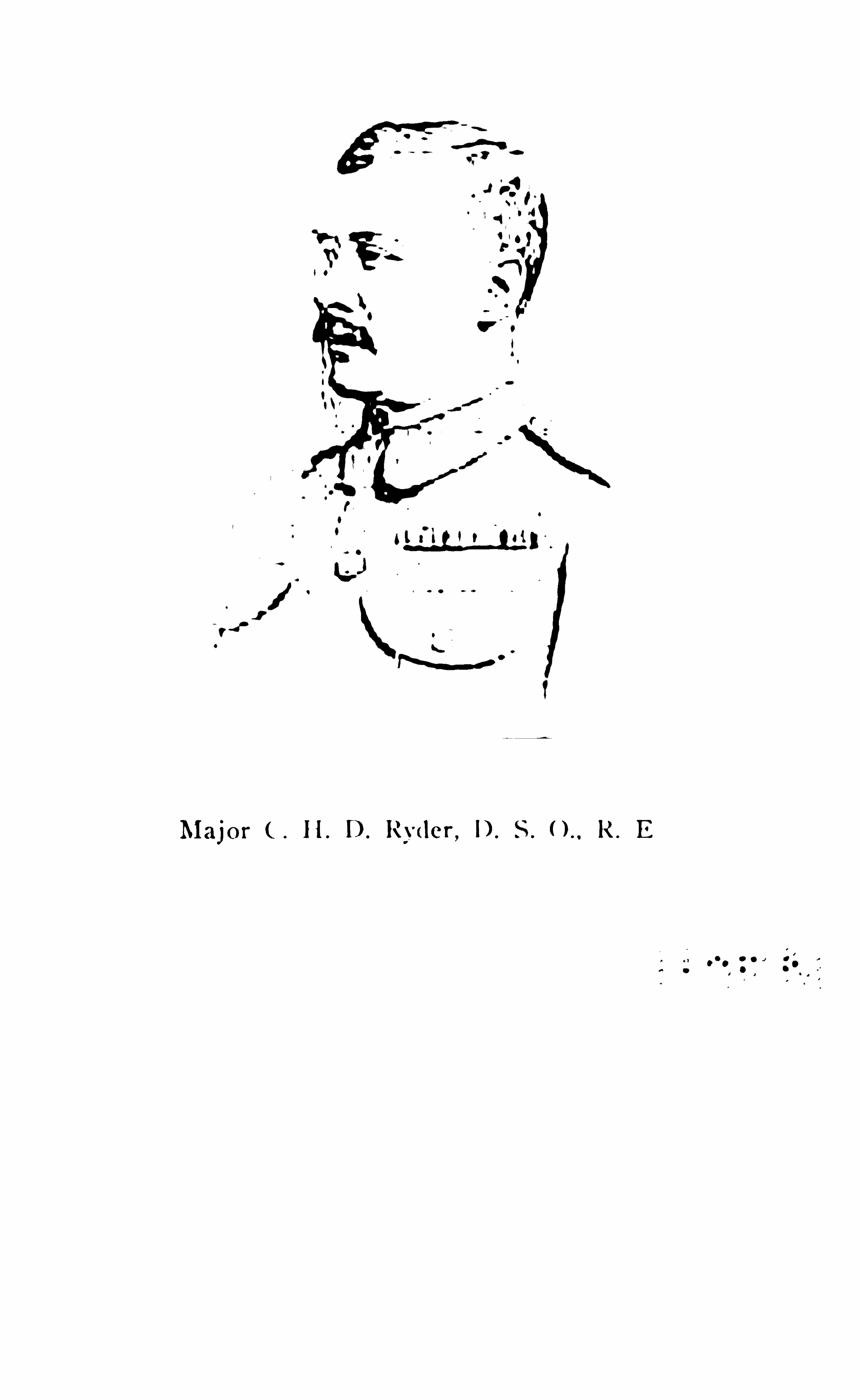

296 T I B ET
farther and farther from the edge of the Indian borderland in to the cold wildern ess of the north. It was a
grand opportunity for un ravelling certain geographical problems on scien tifi c principles which couldhardly be so lved by the restricted methods o f the
weary single-handed n ative explorer making his coldand cheerless way from point to po int of the Tibetanhinterland , always in un certainty and o ften in danger.
If Captain Ryder had proved nothing more than that
there are no higher peaks than Mt. Everest to the
north of Nepal, that alone would have been wellworth the journ ey ; but he has gone far towards
answering several questions which arise when the
northern water-parting the great divide betweenIndia and cen tral Tibet is under discussion. It seems
unlikely that he has established the position o f that
dividing line between the cen tral lake region and the
Brahmaputra basin, on e of the m ost importan t geo
graphical features in Asia, and he has certain ly set
at rest the controversy as to the connection of the twinlakes of Manasarawar, proving that the conn ection
existed even as Strachey maintained, and that theselakes are no longer the source of the Sutlej River.
This expedition (which included Captain Wood and
Lieutenant Bailey ) was suffi cien tly strong to make acomplete examination of all those alternative routesfollowing the Brahmaputra valley from its source toShigatze which constitute a link in the Janglam orgreat trade route from Leh to Ch ina. Starting fromShigatze on the 7th of September, the party reached
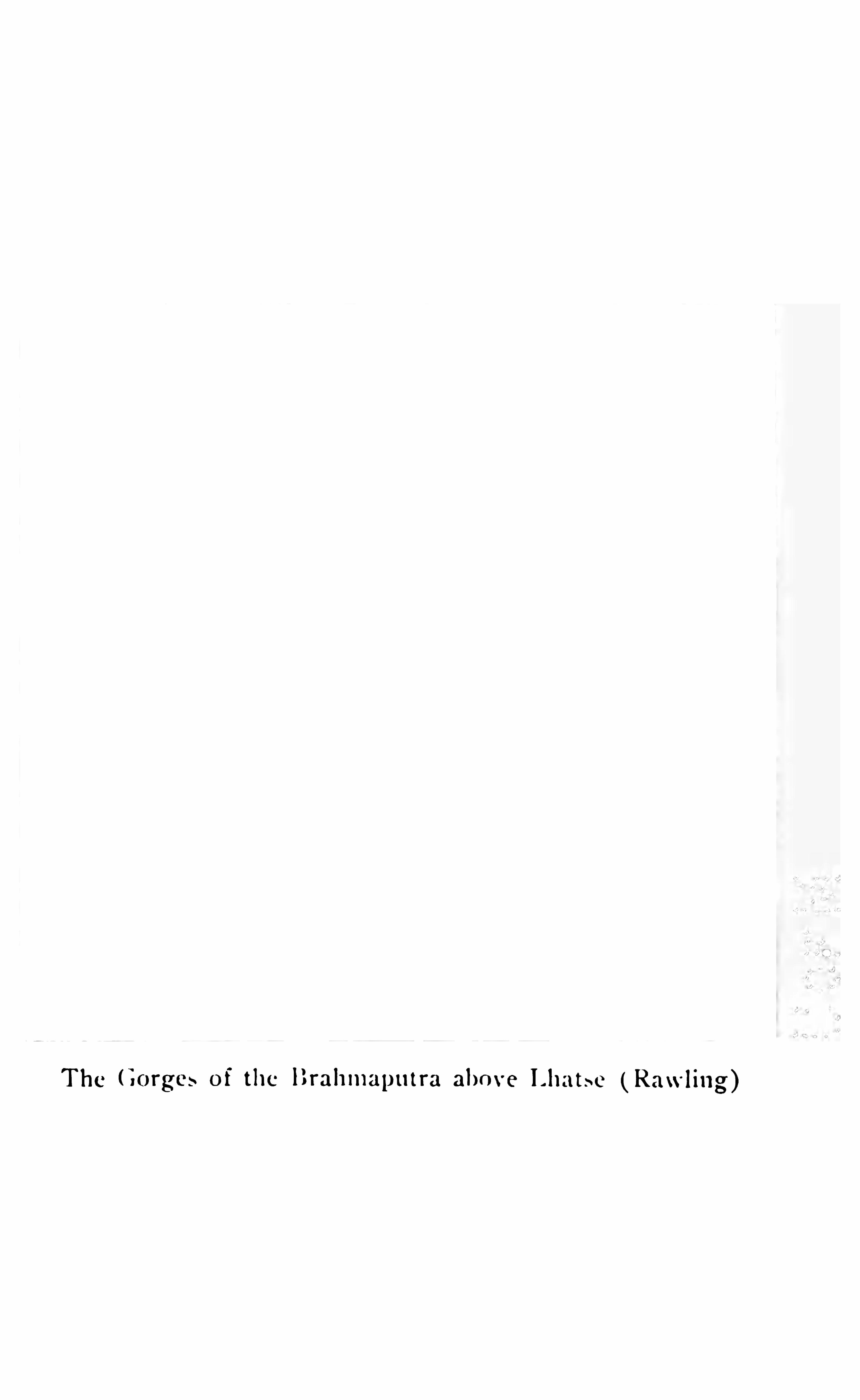

298 T I BET
making full use of the data furnished by Deasy’
swork.
as well as of the provisions which that offi cer had
thoughtfully left behind him for the ben efi t of futureexplorers. It was a very notable perfo rman ce. Cap
tain Rawling’s excellent map illustrates a coun try of
vast elevation, seamed as to its surface with an irreg
ular form ation of comparatively low ridges (some
to feet above the valleys) en closing nar
rowspaces forrn ing a confused system of self-con taineddrainage areas. One of the most remarkable featuresin this vast scene of dreary desolation was the exten
sive area o f gold mines which they encoun tered.
There was abundant eviden ce of a gold-min ing iadustry sti ll in ex istence which must have employed
large numbers of people ; the shallow pits stretched
for miles, and the water run s and dams were elm
and sharp .
”
Indeed at every step almost of this even tful journeythe explorer acquired fresh eviden ce of the extract
dinary richness o f the alluvial so il of the plateau
in gold and borax. Nor was the coun try that
they traversed during the summer months absolutelydevoid of charm . Rich so il and abundant grass werefrequently a feature which gladdened their eyes ;
game was extraordinarily abundant, and the scenery
possessed the varied features o f wide-spread lake andovershadow ing mountain peak, an association whichalways len ds beauty to a landscape. The lakes wereobviously diminishing in volume, and in on e case at
least there seemed to be evidence that a lake once salt


CHAPTER ! IV
M i en — A M 8100
OW that our m ission to Tibet has return ed to
the Indian border we kn ow ( i f we did not
know before) how very little there is in Lhasa to jus
tify that mystic fascin ation which has som ehow orother exercised so powerfu l an influen ce on Europeanminds. The veil has been torn aside an d the naked
city has been revealed in all its weird barbari ty. It isin truth a scattered, unkempt, an d ill regulated town,full of impurit ies, infested with savage dogs, obscen epigs, and night prowlers, revell ing in man y most unholy institutions. But there is a singu larity about itsbarbarous ways ; a quaint inconsequen ce in man y ofits most sacred functions (bringing them peri louslyclose to the realm of pantomime ) which exhibit Lhasaas a most ex traordinary feature in the study o f As iaticdevelopmen ts, one quite apart from anything thatwe can recognise elsewhere. The policy of the Tibetanhierarchy is inscrutable. Beyond a pigheaded determ ination to ign ore the inevitable, and to admit no Englishman within the walls o f the sacred city, it is diffi cultto discern any settled plan of political action . From
T I B ET 30 1
Lhasa itself we get no sign, and with the departureof the mission the gates of Lhasa are closed again as
fast as ever. N0 voice will reach us across the Himalayan wall . We shall hardly kn ow how the disturbedrelations between Tibet and China will readjust themselves ; n or can we tell whether the mild influencewhich we have left behind us will really out-balancethe more dominant overshadowing of Russia o r not.In short, we have left n o represen tative in Lhasa, andno information which we can obtain through localchannels will be in any way trustworthy.
But for the purpose of framing an idea of its appearance as a city and o f its functions as the centre o f avast religious institution we have plenty of material.Approaching Lhasa from the west over the widegravelly plains which border the Kyichu,
the fi rst viewof the town seems to be striking enough. ChandraDas describes his sensations when the city fi rst greetedhis eyes . He had
, passed Cheri (the great slaughterhouse beyond the city-walls) and the wooded hill whereon stands the Debung monastery with its 7700 priests,and he had left behind him a dark red temple ofChinese design with gi lt spire which is kn own as
Nachung-chos-Kyong,” when at a turn of the road
the whole city stood displayed before us at the en dof an aven ue o f gn arled trees, the rays of the settingsun falling on its gilded domes. It was a superbsight the like o f which I have never seen. O n our leftwas Potala with its lofty buildings and gilt roof ;before us, surrounded by a green meadow, lay the town
302 T I B ET
with its tower-l ike whitewashed houses and Chinesebuildings with roofs of blue glazed t iles . Long festoons of inscribed and painted rags hung from one
building to another waving in the breeze.” BeyondDaru (at the foot of the Debung mo nastery hill ) theroad had run for a while through a marsh overgrownwith rank grass, numerous ditches drained the waterin to the river
,and at the northeast end of the marsh
we could distinguish the famous monastery of SeraBeyond a high sand embankment on our left was the
park and palace of Norbu linga, and the beautifulgrove of Kemai tsal, in the midst of which stands the
palace of Lhalu, the father of the last Dalai lama.”
A referen ce to the plan of Lhasa which was madeby the explorer Krishna (on which Colonel Waddellhas introduced further information derived from nativesources ) will show the general disposition of the cityand its surroundings. The potala, or hill, on whichstands the Dalai Lama ’s palace is a very remarkablefeature when viewed from the west against the background o f grey distant hills, with irregular massesof whitewashed Tibetan buildings clustering around itsfoot . The main body of the city, however, is at somedistance east o f the palace. A very effective photograph o f the Potala was obtained by a member ofone of the late Nepalese missions to Pekin passingthrough Lhasa, and it illustrates the curious lines ofTibeto -Chinese architecture very clearly.
The explorers Nain Sing and Ugyen were obligedboth of them to exercise considerable caution in ap
304 T I B ET
ministers to the Empero r of China, and if neces saryhe can have them removed from omoe. Such ao
thority, if it remain s valid, certain ly gives China an
effective con trol over Lhasa. The process o f selectingthe in fan t who represents the reincarnation o f a deceascd Dalai Lama is said by Nain Sing to be kept asecret from the people of Lhasa, but his accoun t doesnot differ materially from that which o ther writersnarrate. Until 1860 (acco rding to Chan dra Das ) therightful rein carnation of the defunct lama was determined by the use o f the go lden jar,
”in wh ich were
placed the names of infants born about the time
(within a month , acco rding to Nain Sing) o f thedeath o f the Dalai Lama, and the choice of his successordetermined by lot. It was on ly after reaching yearsof discretion that the ceremony took place of selectingthe property of the late Lama from amongst an as
so rtmen t o f articles of all descriptions placed beforehim . But in 187 5 (according to Rockhill and Ugyen )a new method was introduced after consulting theNachung chos gyong oracle. The discovery of the reincarn ation was to be entrusted to a monk o f the purestmorals ; and only the oracle could discover such a monk.
After a monk o f suffi cien t saintliness had been discovered by the oracle, he was instructed to seek for the reincarnation near Khong-
po , a little to the east of Lhasa.
A vision and a voice directed him to the lake of Choskhor, and on the crystal surface of that lake he saw the
future grand lama seated as a babe on his mo ther’slap . On his way back from the lake to Khong-po
T I B ET 305
he en countered in the house of a respectable andwealthy family the realisation of his vision. The
infant whom he recognised as having been thus re
vealed in the lake was taken to Lhasa and there he isnow installed as the Lord o f speech, the mighty oceanof w isdom ,
”— the Dalai Lama. This newer system
seems to have been due to some misgivings on thepart o f the priestly hierarchy at Lhasa as to the sentiments entertained by a late Dalai lama towards his advisory council . It was feared that his spirit mightinfluence the drawing o f the lot which was to indicatehis successor, and that the selection might prove unpropitious. Whether the new system of selection isto remain a permanent institution and to be regardedhereafter as constitutional remains to be seen.
So much has been written about Lhasa that it willperhaps be better to adhere to the general descriptionof the place which is given by the later explorerUgyen , and which generally confi rm s the records ofthe earlier explorer Nain Sing. Ugyen , it will be remembered, accompanied Chandra Das o n his expedition , but he also visited Lhasa on his own accountsubsequently, and has added many unpublished detailsto those which have been previously collected and co llated. H is description at least po ssesses the merit o fabsolute originality. After his explorations o f theBhutan borderland (when he return ed by the Yalungvalley to that o f the Tsan po ) , Ugyen passed muchof his time in visiting monasteries and in squaringmatters with his conscience for acting as a British ex
20
306 T I BET
plorer in the land of the lamas. H e fi nally crossed theTsanpo Brahmaputra ) near the mouth o f the Theb
valley and visited the monastery at Dorjethag . At
this point the river is about 800 yards wide and very
full of fi sh.
” From Dorjethag there is a road n orth
ward leading to Lhasa over the Tungo la, and thisroad the lam a ( forgetful of the promises made whena prisoner at Lhas Kang Jong) determin ed to fol
low. The road was good enough as far as Phurin ;
then open gravel plains covered with thorny bushsuperven ed. He crossed the Tungo la at feet,where was a flattish open grass plain at the summit ;beyond the plain was a secondary pass, from which thecity of Lhasa can be seen as in a looking-
glass.”
The descent on the northern side was steep for somedistance, after which the grade becomes easy. Ugyen
crossed the Kyichu on the 9th o f October ( 1883 )where the river is 500 yards broad, by a ferry underthe guidance o f boatrn en who were so drunk as nearlyto upset the boat. From the north bank he made hisway through marshy ground till he reached the outercircular road o f the city . It was here that it was so
necessary to move circum spectly on accoun t o f thegangs o f savage corpse-eating dogs which in fest thepurlieus of Lhasa. After a chequered n ight’s experience he found refuge, and an old friend, in the
Daphung monastery. In his search for lodgings beencountered a Chinese sergeant, who suspected him
and gave information which led to his property beingsearched. However his Mongolian friend the Dingpon

T I B ET 307
stood by him ,and fi nally introduced him to the
Nepalese agen t in Lhasa , who received him withcourtesy and atten tion , but greeted him with the sign ifi can t query H owdo you do ?
” in English ! However,Ugyen established his position in Lhasa, and com
men ced a systematic survey o f the town under covero f an umbrella.
” We may as well add that the re
sults were n o t so successful as those o f Krishna, whosemap we give. It is well to note that in all these proceedings (as in subsequen t preparation s o f his re
ports ) Ugyen was much assisted by his w i fe. Ugyenconfi rms the accuracy o f Chandra Das
’
statementsabout the formation o f the Tibetan government. Hestates that the Desi Gyalpo , the regent or King o f
Tibet,who ranks as second only to the Dalai Lama at
Lhasa, may be elected from amongst the grand lamasof on e o f the four great lings o r monasteries, i. e .
,
Tsechok ling, Chenmo i ling,
Kun dul ling, and Tengalling. These spiritual chiefs ( for the institution o f
Desi as the secular ruler o f Tibet apparently lapsedas long ago as the year 1 680,
when the Mongoliansretired from interference w ith the governmen t ) areall incarnations o f on e o r other of the previous rulersof Tibetan history , and are apparen tly embodimentso f both secular and religious wisdom . The regen t inUgyen
’
s time was from Kundul ling, and is describedas young, pious, and generous-minded , and as be
ing kind to the people.” H is periodic tours in thecountry were always notable fo r the evidences o f his
popularity which they led to. A previous regent (of
308 T I B ET
whom the grand lama of Chen-moi ling was an incarnation ) was a poor settler in Tibet who became a monkon the Sera monastery by the lucky accident o f adream which led him on the right way to promotion.This is the regent to whom the Tibetans still ascribethe regeneration of Lhasa morals by processes whichone cann ot describe. According to Ugyen every partof a Tibetan woman ’s dress, her striped petticoat, herheaddress, even the discolouration of her face, is asignifi cant reminder of the pains and pen alties atten dingany lapse from the path of virtue. He says that theChinese Amban is under the authority of the Regen t,and that under the Amban are four Shapchi ; underthem again are seventy-three Tsidungs, and severalKahdungs (secretaries) who work in court under theShapchi lama. Chandra Das gives a somewhat differen t account of the administrative staff. He placesthe council of fi ve Kahlon s next to the Regen t assistedby on e Kahdung only and one Tsipon .
’ The Jongpons, or district offi cers, and Depon s, or militarychiefs, rank next ; whilst seventy- three pundits are retain ed at the principal monastery o f the Dalai lama to
pray for the prosperity of the kingdom and the longlife of the Gyalpo . N0 state undertakings can be in itiated without consulting the Nechung-Chos-Kyongthe great oracle of Mongolian origin all o f whoseutterances are inspired.
O n the second day of the fi rst month o f each yearthis oracle prophesies the events of the year to come.H is consultin g fee is about fi ve rupees, and as private
3 10 T I B ET
object of the repetition is indicated by the fact thatthe monks receive a reward for their exertions at therate of eight annas per volum e. Both authoritiesagree that the ground procession and display of idolsbefore the Machindranath temple takes place on the1 sth day o f the New Year. On the 29th day o f thefi rst month a strange ceremony takes place, for ananalogy to which o n e must turn to Jewish histo ry. O n
that day a man is selected who is called the Logon
gyalpo (o r carrier o f on e year’
s ill luck ) who becomesa sort o f scapegoat fo r the sins o f the peo ple, and ishunted through the streets and market-place of Lhasainto the desert country towards the Samye monastery.
For a week previously he perambulates Lhasa as aso rt o f clown w ith his face painted half black andhalf white. and is permitted extraordinary l icense.He helps himself to what he wants at purely nominalprices, and as he wanders through the streets he shakesa black yak ’s tail over the heads o f the people, thustransferring from them to himself the full measure oftheir ill luck. Nain Sing says that this ceremony takesplace at the end o f the second month , and furtherstates that the Jaln o
'
s authority, after lapsing fortwenty- four days at the end o f the fi rst twenty-threedays o f anarchy ( for that is what his rule represen ts ) ,is then resumed fo r ten days more, and that this ceremony ends it . Ugyen also maintains that the expulsio n o f the Logon scapegoat from the city concludesthese strange proceedings. but makes the Jaln o
’
s au
tho rity last fo r on e and a half months. It is to lerably
T I B ET 3 1 1
clear that for at least six weeks Lhasa is very muchin the hands o f the mob. Previously to his expulsionfrom the town the Logon plays an apparent game ofchance by throwing dice with the Jaln o (according toNain Sing) . Offi cially it is an open question which o fthe two is to undergo ex ile. Practically the matter issettled by the fact (according to Ugyen ) that the
Jaln o’
s dice carry nothing but sixes o n all their faces,whilst the Logon is supplied with ordinary cubes.
Anyhow the Logon invariably loses o n the throw , aftera pompous offi cial announcement that if he w in s heand the Jaln o will change places. Ugyen maintainsthat the Jaln o does n o t appear in this ceremony andthat the game is played between the Logon and theGrand Lama o f the Chang-chup- ling. It is n o t amatter o f much consequence . The Logon remains thescapegoat. Then he receives certain presents from thegovernment a white horse, a white dog, a whitebird , with other smaller gifts o f provisions and offerings from the people. Fin ally he is hunted out o f thetown amidst the yells o f the mob towards the Samyemonastery, where he may ( i f he survives his treatmentat the hands of the pe0p1e ) be accommodated in theLhakang, or dead house . He is privileged to remainin this sanctuary for seven days. He then retreatsfor another week to Chethang. Again he moves o n toLhoka, where he remains for fi ve or six months. Helives as an outcast and outlaw, but he is privileged tocommit any crime. He may murder or rob withoutpunishment. I believe that, as a matter o f fact, the
3 1 2 T I B ET
wretched scapegoat seldom survives long en ough to
exercise his privileges. Amongst all the weird cus
toms o f Lhasa devil dances, in cantations, and the
general atmosphere of religious pantomime thisappears to be the most strange. It would be in teresting to trace its derivation .
Every temple, every building of note in Lhasa hasbeen described by Indian explorers, but there is amonotony in the repetition of temple properties and
the magnifi cence of idols and their decorations whichis hardly worth imitating. The customs and fashionso f the peo ple (which are far more interestin g) are
only alluded to casually, even in the pages of ChandraDas
’
narrative ; for the native mind always experi
en ces some difliculty in realising that that which isfamiliar to itself is precisely that which requires mostcareful illustration for the enlightenmen t of the European public. We really kn ow very little either ofTibetan ethnography or o f those social surroundingso f the various communities which are the distinctivecharacteristic of the various nationalities representedamongst the people o f the great plateau land. Methodsof disposing of the dead (probably from the repulsiveprominence which is given to them ) are, however,gen erally referred to. There are two burial-places inLhasa. The larger of the two is to the northeast ofthe town called Raga and the other is near a templewithin the walls o f Lhasa. Dead bodies are laid on alarge flat stone, on which places for the limbs havebeen roughly hollowed out, with their faces to the sky
3 14 T I B ET
magnifi cence from all that he had heard about thefamous shrine. Heaps o f relics and a few holyimages shut in behind an iron latt ice were all thatthe temple contained of Special interest, and a small
gi lt dome built in Chinese style was the only expression of the form of architecture which general ly leadsto such magnifi cen t effects. The ideal Splendour ofthe temples and mon asteries of Tibet is no doubt muchexaggerated by Buddhist pilgrims, owing to the religion s impressions produced in their minds as theywander o n pilgrimages from one temple to another,amidst scenes o f unusual sterility and wildness . Thedevotee gradually forgets what he has seen elsewhere,whilst he is ever endeavouring to real ise the impressions acquired in his infan cy o f the glories of hisancient faith . But it is n ot quite the same thing withthe sceptical Bengali , who measures the magn ifi cen ceo f these outward and visible signs o f a faith whichdoes not appeal to him from a standard which is morenearly European .
Our special pilgrim,Ugyen, visited all the holy
places in Lhasa, but he was in constant peril o f detection and did n o t move about freely. Chandra Daswas able to devote much more leisure and more carefulattention on the details o f the principal points of interest, and is consequently a better authority even thanthe Buddhist lama. The Jo Kang, however, the greatcentral temple o r cathedral , which forms such a prominent feature
'
in the view of the city as seen from theneighbourhood of the Potala, did certainly appeal to
T I B ET 3 1 5
Chandra Das. He calls it magn ifi cent ; and it is notdiffi cult to conceive that w ith its dominan ce over thesurrounding town, the height o f its massive walls andthe constant Shimmer and movement of the bannerswith which it is encompassed make it impressive.In fro n t o f it is a tall flag-po le, at the base of whichhang two yak- tails some in scriptions, and a numbero f yaks ’ and sheep s horn s. In the propylon o f thechief temple
,the heavy wooden pillars of which are
three to four feet in circumference , and about twelvefeet high , upwards o f a hundred monks were makingprostrations before the image of the Lord (Jovo ) on
a throne facing the west , when Chandra Das wasthere. This famous image o f the Buddha, kn own as
Jovo rin po che is said to have been made in Magadha
during the lifetime o f the great teacher. Visvakarma
is supposed to have made it under the gu idance o f the
god In dra, o f an alloy o f the fi ve precious substances ,god, si lver, zin c, iron ,
an d copper , and the fi ve precion s celestial substan ces,
” probably diamon ds, rubies.
lapis- lazuli , emeralds, and“indran ila.
” When thePrincess Konjo, a relative o f the Emperor Taitsung,
was given in marriage to the King o f Tibet, she
brought this image with her. The image is li fe sizeand exquisitely modelled, and represents a handsomeyoung prince . The crown on its head is said to bethe gift o f Tsong Khapa , the great reformer.
” Onthe four sides o f it were gilt pillars with dragonsturned round them , supporting a canopy. On one sideof the image o f Buddha is that of Matreya, and on
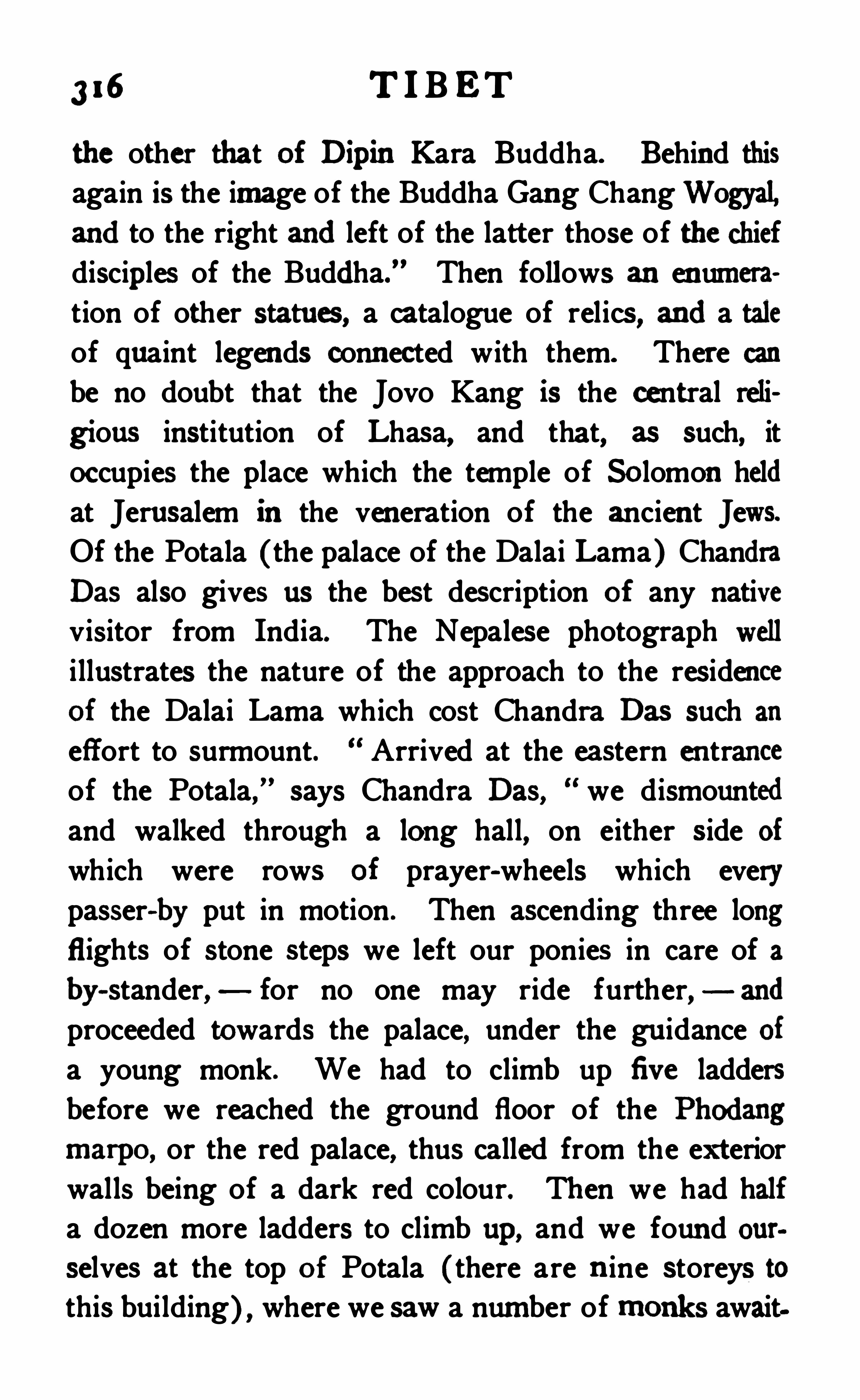
3 1 6 T I B ET
the other that o f Dipin Kara Buddha. Behind thisagain is the image of the Buddha Gan g ChangWogyal,and to the right and left of the latter those of the chiefdiscip les of the Buddha.
” Then follows an en umeration of other statues, a catalogue of relics, and a taleof quaint legen ds conn ected with them. There canbe no doubt that the Jovo Kang is the central reli
gions institution of Lhasa, and that, as such, itoccupies the place which the temple of So lomon heldat Jerusalem in the ven eration of the ancien t Jews.Of the Potala (the palace of the Dalai Lama ) ChandraDas also gives us the best description o f any nativevisitor from India. The Nepalese photograph welli llustrates the nature of the approach to the residenceo f the Dalai Lama which cost Chandra Das such an
effort to surmount. Arrived at the eastern en tranceof the Potala,
”says Chandra Das, we dismounted
and walked through a long hall, on either side of
which were rows o f prayer-wheels which everypasser-by put in motion . Then ascending three longflights of stone steps we left our ponies in care of aby
-stander, for no one may ride further,
and
proceeded towards the palace, under the gu idance ofa young monk. We had to climb up fi ve laddersbefore we reached the ground floor of the Phodangmarpo , or the red palace, thus called from the exteriorwalls being of a dark red colour. Then we had halfa dozen more ladders to climb up, and we foun d ourselves at the top o f Potala (there are n ine storeys tothis building) , where we saw a number of m o nks await
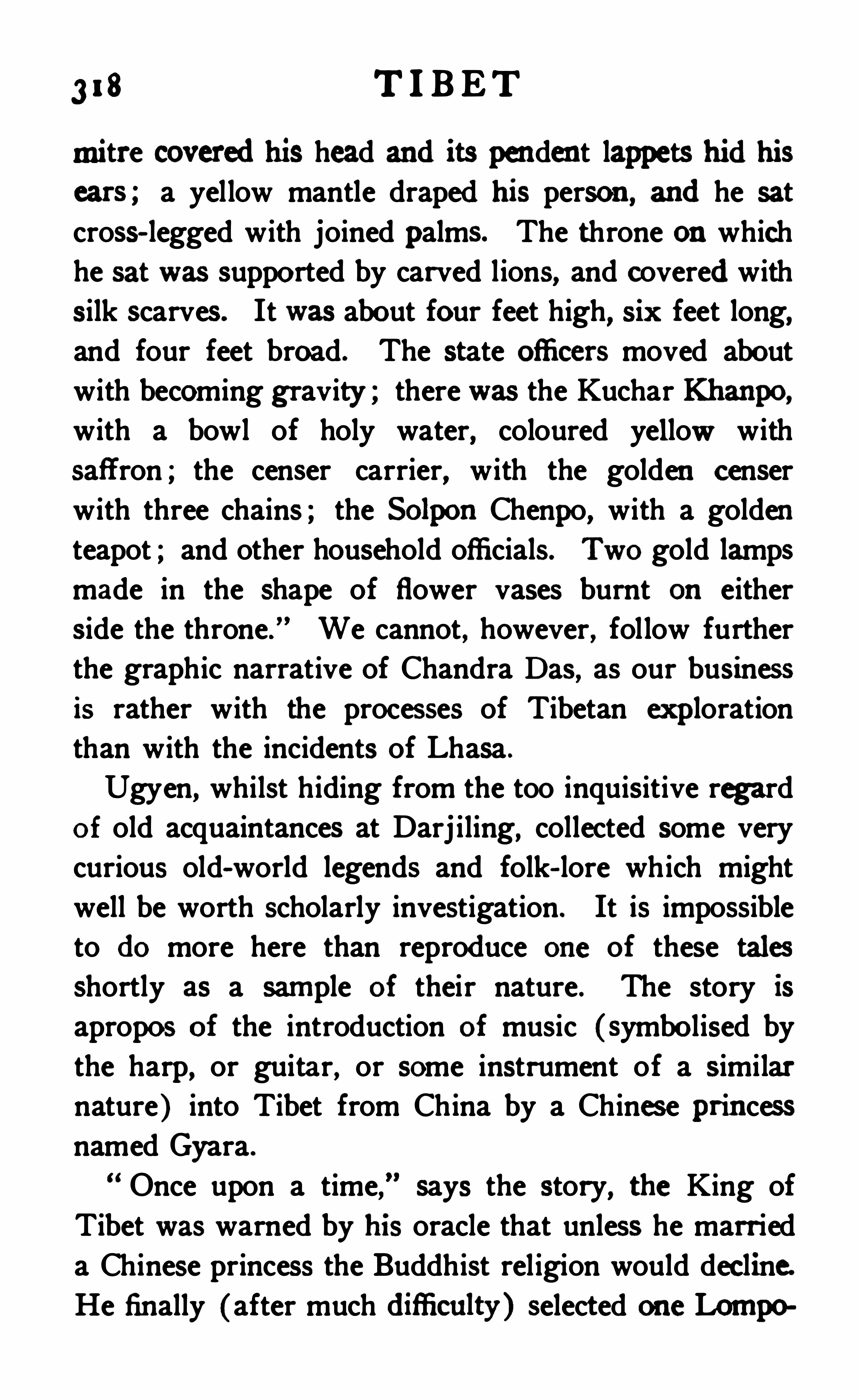
3 1 8 T I B ET
mitre covered his head and its pen den t lappets hid hiscars ; a yellow mantle draped his person , and he satcross- legged with joined palms. The throne on whichhe sat was suppo rted by carved lions, and covered withsilk scarves. It was abo ut four feet high, six feet long,and four feet broad. The state oflicers moved aboutwith becoming gravity ; there was the Kuchar Khanpo ,
with a bowl of holy water, coloured yellow withsaffron ; the censer carrier, with the golden censerwith three chains ; the So lpo n Chenpo, with a goldenteapot ; and other household offi cials. Two gold lampsmade in the shape of flower vases burnt on eitherside the throne. We cannot, however, follow furtherthe graphic narrative of Chandra Das, as our businessis rather with the processes of Tibetan exp lorationthan with the incidents of Lhasa .
Ugyen, whilst hiding from the too inquisitive regardo f old acquaintances at Darj iling, collected some verycurious old-world legends and folk- lore which mightwell be worth scholarly investigation. It is impossibleto do more here than reproduce on e of these talesshortly as a sam ple o f their nature. The story isapropo s o f the introduction o f music (symbo lised bythe harp, or guitar, or some instrument of a similarnature) into Tibet from China by a Chinese prin cessnamed Gyara.
Once upon a time, says the story, the King ofTibet was warned by his oracle that unless he marrieda Chinese princess the Buddhist religion would decline.He fi n ally (after much difliculty) selected on e Lompo
T I B ET 3 1 9
gara as his ambassador on the delicate mission o f soeuring the hand o f the Emperor of Ch ina
’
s only daughter .But Lompogara on his arrival in China (after adventures too numerous to recount ) found three or fourcompetitors in the fi eld, amongst whom were the Kingof Persia and the King o f India . Miraculous feats ofstrength and of arms were set by the emperor to therepresentatives o f these different suitors to perform ;in all of which Lompogara was triumphantly suc
cessful through the strength granted him by his
Tibetan gods. Amongst other marvellous performan ces he claimed the princess by his success inrecognising her amidst two thousand o f the mostbeautiful girls in China. Advised by an old womanwith whom he lodged, he boldly selected the ugliest.Now this is a distinct departure from the ordinarycourse of Eastern story and indicates originality. Suchdetails o f the story as those which represent the princess as consulting her own looking-glass in order toobtain a vision of the bridegroom have a more familiarring. The glass fi rst told a flattering tale, but when itfi nally presented her suitor as an ugly old man she brokeit to pieces. Mention is made too o f a book which wasonce the great Chinese oracle, called Kabtsi thamo.All that we do or say is found out in that book . Inthat book even the lice that are on the body o f a man
(surely this is quite Tibetan !) and the leaves and
fruits of trees are also found out in that book ,
”says the
lama in his quaint English . But the book could not tellthe king by what magic art Lompogara had divined
3 2° T I B ET
the iden tity of the princess. H e accordingly threw
it into the fi re. Throughout these Tibetan tales thereis a curious con tempt expressed (or at least in timated)for household oracles. At the end of the story theprincess (who had throughout been in communicationwith her lover by means of a carrier p igeon ) stolethe household gods, the image of Sakya Mun i andthe image of J itsun Dolma Sungj in , an d went offto Tibet ; n o t with the ambassador who had been sen tto claim her, but with his assistant. Lompogara was
detained for two years in China by the orders of theChinese emperor, for the purpose of raising up descen dan ts as acute as himself. At last he escaped bymean s of a subtle device and returned to Tibet. Herehe found the princess still waiting for the king (whowas more interested in a new Nepalese wife than inany Chinese princess) , and it was during this periodof waiting and of lamentation that She introduced theharp. By means of her skill as a musician she fi n allygained the king’s attentions. Thus all ends happily,except that the Nepalese wife subsequently disputed thematernity o f the child that was born to Gyara, and theking as arbitrator was unable to decide. He leftthe question to the boy himself to settle, but althoughthe boy gave a strictly impartial decision ( for he saidthat he belonged to both ) , he had on e eye knocked outby the en raged Nepalese woman who claimed en tire
possession of him , and thus satisfactorily proved thatshe was not his mother. Students of eastern legendsan d tales will at once recognise several po in ts of
CHAPTER ! V
General Summary S ign ifi cance and Value of App en d to
M ara from tire Nortbeart Russia’
s Position relatively to
Tibet and I ndia The Value of Eastem and South eastern
l ibel Nae Promire of Gold M eerrity of Open ing up the
Valley of tire B rabmaputra
HE gradual progress of Tibetan exp loration
(more especially the researches of the Indiannative surveyo rs)have revealed to us the value of Tibetas regards its po l itical and commercial relationship toIndia. Politically, this huge mass of elevated hintenland is as much of a guardian buffer to the northernapproaches to India as ever it was. N0 means havebeen discovered by which the barren, dry, and stormswept wastes of the northern Chang can be bridgedso as to evolve a practicable highroad across them .
Their stony desolation, amidst which water is scarcelyto be found , and fuel only to be obtained by grace o fgood luck and much searching, presents a barrier o fat least fi ve hundred miles between the inhabited depression o f Chinese Turkestan and that of the upperBrahmaputra fi ve hundred m i les of steril ity at anelevation where many men would fi nd it impo ssible tol ive. Too much stress Should n o t be laid on theobstacle presented by in tersecting ridges and ranges,
T I B ET 323
which are not relatively high and which have neverproved to be insuperable obstacles to advance, althoughthe whole surface o f the Chang is seam ed w ith them .
It is the absence o f good water and shelter whichplaces the possibility o f crossing these wastes w ithany great company o f people beyond the category o f
human po ssibility . It has always been so . No Mon
golian o r Chinese host has ever swept southwardsacross the Kuen Lun into the comparatively rich andfertile valleys o f the Brahm aputra basin by any lin eo f route west o f that m eridion al water-parting fromwhich the Chinese rivers spring.
Similarly from the west . No explo rer has yet discovered a route to Lhasa which could by any stretcho f imagination be called practicable fo r m i l itary purposes. We know much about the Janglém , the commercial road between Leh and Lhasa , and we knowthat of two military expeditions which have attemptedto follow this road , neither could record any substan
tial success, although neither met with any substantialopposition . But when we examine the value o f Tibetas a buffer from aggression from the northeast andeast , we are faced w ith other possibilities. From thedays o f Huc to those o f Rockhill and De Rhins andKrishna , travellers have made their way with n o dithculties greater than those which beset ordinary travelin out- o f- the-way places between China and that landof n o -man ’s occupation which lies west o f the KokoNor. The Koko No r region is indeed but an outlying
province o f the Chinese Empire , with which in tercom
3 24 T I B ET
mun ication is habitually maintained. From the KokoNor region southward it is true that we have still thewidth of the Chang to cross ere we reach the Brahma
putra wider and yet more elevated here than it isfurther west, for we are touching that central dividewhere the small sources of all the great rivers flowingcast are found. B uc ’s account of his journey is enoughto prove that in winter, at any rate, the difliculties ofthis route must be most formidable. But in Spite ofsuch diffi culties, it is a well-trodden route on whichthe feet o f thousands of pilgrims press annually, andby which m uch Chinese trade fi nds its way to Lhasa.No t only in small companies of two and three do theMongolian s of the northern steppes m ake their way toLhasa by this road
,they come and go in great com
panics , and it cannot be set aside as a highway to beign ored, either from the po litical or commercial point ofview, whatever may be its value fo r military purposes.
From the east again we kn ow that Tibet has beeninvaded and conquered, and that armies have passedand repassed by a regularly maintained line of routewhich forms the recognised highway between Lhasaand Pekin. The southern approaches are in our own
hands. It is only to the east and northeast that wehave to look for any possible scheme of expansion oradvance, such as might peril our position in India asthe dominant power in this Indian hinterlan d — theupper Brahmaputra valley. On the direct east liesChina. To the northeast is China again, and a wild,irregular border coun try over which China possesses
326 T I B ET
represen tative of the Buddhist Church to many mil
lions o f Buddhists who dwell aroun d him . Russia is
already a great Buddhist power in Asia ; and She is
geographically nearer to the cen tre and foun tain of thefaith which so strongly influen ces nearly a th i rd ofthe world ’s inhabitants than we are in either Burmaor Ceylon. Russia in Man churia would be but theprelude to Russia on the borders of Tibet, holdingin her hands those pilgrim avenues to Lhasa whichstart from the Koko Nor. With Russia fi rm ly es tablished in Manchuria, ean we doubt that in a very fewyea rs’ time we should have all the pastoral wastearound Koko Nor (now recogn ised as no-man
’
s land )permanently occupied ?But Russia, overlooking the northeastern frontier
of Tibet, would be almost as far removed from thepo ssibility o f active aggression against India as ever.She would no more dream of crossing ea stern Tibetthan she would of crossing the Chang from the northwith any aggressive scheme against the Indian frontier ; but she would occupy a very central positionindeed in the Buddhist world ; she would enormouslyincrease the weight of her political influen ce in Asia, andshe would obviously dominate the Tibetan trade whichtrends vastly more Chinawards than towards India.
The impo rtance of Tibet as a factor in the greatworld of commerce is perhaps hardly to be estimatedat its exact worth . We can only hazard a guess at it.Our explorers have sufiicien tly proved that the com
mercial wealth of the country cen tres itself in the
T I B ET 3 27
southern and eastern valleys, and the recent expedition has confi rmed their views. In the south we havea small amount of gold, borax ,
salt,and goat’s hair
(or pushm ) in the upper Indus valley and NariKhorsum , which fi nds its way to Leh, or over theKumaon passes . From the markets o f the Brahmaputra valley (Shigatze , Gyangtse, and Lhasa ) an in sign ifi can t trade dribbles to Bengal by the Sikkim andAssam routes, which includes silver, musk , wool ,horses (o r pon ies ) , yaks
’ tails,etc . , in return for piece
goods ; but taking it fo r all in all , our trade withTibet is ridiculously small , and would probably befairly represented by an estimate o f perannum . Doubtless it could be increased . Wool, fo rinstance, is capable o f large developmen t in Tibet, andit is possible (but n o t probable ) that the oppositiono f the Chinese offi cials to the introduction o f Indiantea might be overcome ; in which case an immensefi eld would at once be opened up to India . At presen t,however , it is idle to hope fo r such a radical changein the con servative tastes o f the Tibetan pe0p1e as anappreciation o f Indian tea . They like it in bricks,coarse and strong, big- leaved and black, and theCh inese mode o f preparation is hardly suitable to themore refi ned qualities of the Indian growth.
Trade with China, however, with the provincesof Kansu, Sechuan , and Yunnan, is on quite anotherfoo ting. The chief trade depots, or central marts,between China and Tibet are Sining fu , east of KokoNor
, and Ta- chien-lu, on the eastern frontier. The
3 28 T I B ET
fo rmer is the commercial en trepot for Mon goliantrade, and the latter for Sechuan . The position ofthese towns has already been discussed. Other important trade centres are Li Kiang in the south
, on
the right bank of the Yang tsi River,and Tali-fu,
which distribute Tibetan trade in Yunnan. Thereare, in fact, innumerable trade marts of more or lesssignifi cance which deal direct with those valleys o f
eastern Tibet which (we once again po int out ) includeby far the wealthiest districts o f the country. It isin those eastern valleys
,of which we kn ow so little,
that the centres of Tibetan art and manufacture, aswell as the richest agricultural districts, are to befound. Darge and Chiamdo ,
Zayul and Poyul, withtheir thousand hidden valleys
,are all districts where
a comparatively thriving population develops the indigenous produce o f the country in peace and conten tmen t. The value of the Tibetan trade with Ch in a isn o t to be estimated by the light o f any available statistics but it cannot be less than several millions. Ifthe enterprises of commerce admit o f strategical combin ation s, then we can clearly indicate Jyekundo onthe Dichu River (the upper Yang tsi) as the strategiccen tre for the dominance o f this trade and Jye
kundo is the next step southward from Sining fu andthe Koko Nor. These few brief considerations of the
geographical distribution of Tibetan trade will beenough to indicate that the channels of Tibetan commerce are far more eastward and northward thansouthward towards India. In a word, Manchuria

330 T I B ET
the gold-mining processes which were in full force at
Jhalung, about two hundred miles from the Ladak frontier, twenty-fi ve years ago. He repo rted that the minesthere were seldom more than tren ches from twentyfi ve to thirty feet deep, the gold being roughly washedout o f the alluvial soil which was workable with Spades.Littledale tells of the remains of many such superfi cialmines which he found abandoned on the road betweenLhasa and Ladak. Rawling found mines extendingover many miles o f country, which appear to be stillworked. Gold is said to be found in quantities nearthe Man asarawar Lake. Prjevalski records that inthe north o f Tibet gold is very plenti ful , and that theTungut diggers went n o deeper than two or three feet ;“nevertheless they shewed us whole handfuls o f gold,in lumps as big as peas, and twice or thrice as big.
”
Mr. W. Mesny (R . G. S . Proceedings, Vol . VII. p.
however, questions the accuracy of Prjevalski’
s
deductions from what he saw, and maintain s that goldin the Koko Nor region is almost invariably foundunder a pebble bed of twenty feet in thickness, restingin n uggets (varying in size from a turnip seed to a pea)on a bed o f hard rock ; and that the diggers seen byPrjevalski m ust have been washing in the o ld bed o f
a lake o r river. Rockhill refers to the celebratedGork min es south o f this region ; and there isabundant evidence o f the ex isten ce o f free gold in allthe upper valleys o f the Chinese rivers within thelimits o f eastern Tibet and on the borders of the Karn
province. Bower notes the extreme cheapness of gold
T I B ET 33 !
at Litang,near Batang and, fi nally there is the cer
tainty that whatever gold may have been extractedfrom Tibetan soil by such crude processes as explorershave witnessed, there must be at least as much leftbehind. There can be no doubt that Tibet is a greatnatural treasure-house o f gold ; but its mineral wealthis by no means confi ned to gold . Silver, copper, lead,i ron, and mercury are all found (and worked ) insoutheastern Tibet. Agate, borax , and salt are alsoamongst its products. Musk, of course, is a prominentfeature in Tibetan trade, and there are vast possibilities in the forests of timber which ex ist in southeastern and eastern Tibet. Thus we see that there isquite enough o f material value in Tibet to make itan objective to commercial enterprise.Tibet po ssesses great natural resources, and theseresources are chiefly developed in the south , in thebasins o f the Indus and Brahmaputra , and in the east,in the valleys o f the great Chinese rivers which risein the plateau and flow southeastward , skirting India.The entrance to these val leys is in the hands of anystrong power settled in the northeastern com er ofTibet , the Koko Nor region , and it is this rather thanthe doubtful advantage o f the pilgrim route to Lhasawhich makes the Koko Nor and the adjoining Chinesefrontier town of Sining fu signifi cant, i f n o t important.But Russia is no longer the dom inating power in
Man churia. The Japanese have decided that, and theway from Manchuria to Tibet is no longer open to her.
It is from the direction of Urga, i f from an ywhere,
33 3 T I B ET
however, that fo r many a long year to com e the shadowwill be removed. The true geograph ical hin terlandofIndia beyond the H imdayan snows, the valleys of theIndus and Brahmaputra (our own rivers) are quitenear to us, quite reachable, i f we choo se to make themso , and one of the fi rst and most effective methods ofasserting our determ ination to safeguard the glaciso f India’
s n orthern barrier of defence is to open up then earest and readiest approaches across or through themain ramparts.
The road to southern Tibet tapping the most usefulcommercial aven ues is that which has been adoptedby our mission un der Colonel Younghusband the
ro ute which passes up the valley o f Chumbi to Phari,and thence to Gyangtse by the Tang la pass. This wemay fairly hope will n ever be closed again . It is thehighro ad con necting Darj iling and Ben gal with Lhasa.
But this is not the only important route into Tibet,not even the mo st impo rtant i f we regard it from the
purely commercial po int of view.
What we want is an Open road through countrymore promising than Chumbi , encountering no form idable passes, no high altitudes, until the en d deboucheson to the Tibetan plateau ; one which rises by gentle
grades over comparatively easy slopes . There is onlyone such road rendered possible by geographical confi guration , and that is the road which follows the
course of the Brahmaputra from the valley of Assamto the Kyichu and Lhasa. The routes through Bhu
334 T I B ET
Samding can on ly be outflanked by a tu rn ing roadin volving a con siderable detour. Westward o f the
ba rd to Lhasa the nature of the valley is suffi cien tlywell kn own and has been suffi cien tly described. Thereis nothing so far which can be reckoned as a formidablo obstacle to the en gin eering of a road un less it bethe falls near Samding. On the whole ( regarded as
a Himalayan road ) , it would probably prove an easier
problan to deal with than is usual in the category ofmountain road-making ; but a further and moredetailed exploration of the valley is urgently required.
Nor can we pass over the impo rtan ce of a thoroughlyaccurate route survey of the connecting link betwearSadya, in Assam , and Ta-chien - ln , the Chinese frontiertown on the Tibetan border which dominates theroad to the rich province o f Sechuan and the Yangtsivalley . Assam is parted from China by about 500miles o f hill country o n this line of connection , thedirect distance being con sidered less. Batang in Tibetmay be placed at 300 miles from Sadya. From theexplorations of Needham and Krishna we know something o f the nature of this 300 miles of in tervaringhills. From a dozen different sources we know all
about the route between Batang and Ta-chien-ln ; and itis obvious that the chief difliculties of the route are concen trated in the latter section, which is already the greatrecognised trade route between Lhasa and Pekin andhas been so since the Mahommedan rebell ion discountedthe value of the route via Koko Nor and Sining.
I am no commercial prophet, but it appears to me
T I B ET 33 5
that it would surely open up a splendid vista of futuretrade activity to India if on e at least of her presentgreat commercial highways (the river Brahmaputra)were extended into the heart o f the richest com er ofTibet o n on e side, an d to the borders of one of therichest provinces of China on the other. We may set
as ide our nervousness about Russia here ; n o m ilitaryopening could be afforded by the development o f suchroutes as these
,excepting to Chinese enterprise ; and
marvellous as have been the feats of the Chinese informer years, such performances are not l ikely to berepeated . The extension o f Russian in fluence froma Manchurian base through Mongolia to Tibet, andalong the bo rderland of western China, has bearchecked by Japan for a tim e, but we must expect thatthe pressure induced by the laws of nation al expansionwill still remain, and we must look fo r a revival of thatcomm ercial rivalry in these region s of the far Eastas soon as Russia can regain her pos ition in Asiaticprestige and influence.What is it that bars the way to the establishment
of a line o f commercial traflic both along the Brahmaputra and northeastwards to China ? Nothing but ourown oflicial indispo sition to advance o n e S ingle stepbeyon d our Indian frontier that can be by any possibility avoided . In order to break through the obstinatedetermination of the frontier people immediately ad
joining our o wn bo rder, which prevents a stranger
(whether native or European ) from setting foo t intheir hills, and impels than to retain in their own
336 T I B ET
hands the mon opo ly of the route between their trademarts (close to our frontier ) and In dia, we should
probably require a small expedition . These tribes whobar the way are neither Tibetan nor Assamese ; theirorigin an d ethnographical extract io n is conjectural,and they are in social ethics , in mann ers and customs,amongst the most irreclaimable savages in the world.
We have no influence with Abors or Mishm is ; Tibetanpriesthood does not touch tha n, o r affect tha n in anyway. The Christian missionary cannot reach them.
They are but hal f-clothed abo rigines o f those jungleswhich they infest, and which they are determined tokeep to themselves. Above all, they are pro foundlyimpressed with the notion that we are afraid of themJust as the Tibetans laughed aloud at the idea thatthey could not overwhehn or expel the British mission
(even after the affair at Guru ) i f they chose, so dothese savages dan ce their war dances on their own wildhills and proclaim to the mountains that we dare notcross their frontier. Such action on their part is, ofitself, no reason for our interferen ce, but there may beother reason s of which they know no thing which mayfin ally make it imperative that we shou ld move freelythrough their country, whilst still leaving than as independent as are the Afridis or Swatis who dwell oneither S ide our road to the Khaibar and Chitral. Pos
sibly it will not be long before such act ion is recogn isedas essential to the progress of Indian trade.
33s BIBLI O GRAPH Y o r T IBET
H ue , E . R .
Recollections of a Journ ey through Tartary, Tibet, and China during1844
-46. 2 vo ls. 1852 .
Prjevalski, Gen . N. M .
Mongolia, the Tangut Coun try, and the Solitudes of Northern TibetTranslated by E. DelmarMorgan , with In troductio n andNotes byC01. Henry Yule. 2 vo ls . London , 1876.
Markham , S ir C . R .
Narratives of the Missio n o f George Bogle to Tibet, and of the Journey of Thomas Mann ing to Lhasa. (Second Edition .) Map andplates . 1879.
Mon tgom erie, Capt. T. 0.
Report of a Route-Survey made by Pundit from Nepal to Lhasa, and
thence through the UpperValley o f the Brahmaputra to its Source.
(Journ al of the RoyalGeographical Society, Vo l. 38. Map.
Repo rt of the Trans-Himalayan Exploratio ns during 1867 . (Journalo f the Royal Geographical Society, Vo l. 39.
Narrative of an Exploratio n o f the Namcbo , o r Tengri Nur Lake , inGreat Tibet, made by a Native Explo rer, during 187 1 - 72. (Journal of the Royal Geographical Society, Vo l. 45 . 187 Map .
Jo urn ey to Shigatze in Tibet and return by Dingri-Maidan in to No
paul in 187 1 , by the Native Explorer No . 9. (Journal of the
Royal Geographical Society, Vo l. 45. 187 Map .
Extracts from an Explorer’sNarrative o f his Jo urn ey from Pitoragarh,
in Kumaon , via Jum la to Tadum and back, alo ng the Kali Gandakto British Territory. (Journal of the Royal Geographical Society,Vo l. 45. 187
Report on the Trans-Himalayan Explorations in Co n nection with theGreat Trigon ometrical Survey of India during 187 1 . Folio.
Map . Debra Dun , 1872.
H en n essy, J . B . N.
Repo rt o n the Explo rations in Great Tibet and Mo ngolia, made byA.
-K., in 1879-82, in co n n ection with the Trigo nometrical Branch,
Survey of India. Plan . Fo lio . Dehra Dun , 1884.
Walker, Gen . J. T.
Four Years’
Joum eyings thro ugh Great Tibet, by o n e of the Trans
Himalayan Explo rers (A. K.) o f the Survey o f India. (Proceedings o f the Royal Geographical Society, Vo l. 7 . Map .
Explo ratio n of the Great San po River of Tibet during 1877 , in co nnec
tio n with the operation s o f the Survey o f India. (Proceedings ofthe Asiatic Society of Bengal. Map .
Desgodin s , C . K .
Le Thibet d'aprés la Co rrespo ndance des Missionaires. (Seco nd Editio n .) Map . Paris, 1885.
Report on Exploratio ns in Nepal and Thibet by Explorer M.-II.
(Seaso n 1885 Map . Fo lio . Debra Dun , 1887 .
B IBLIOGRAPH Y O F TI BET 339
Chandra Das , Sarat.
Narrative of a Jo urn ey to Lhasa in 1881-82. Map . Folio . Calcutta,1885 .
Journey to Lhasa and Cen tral Tibet. Edited by the H on.W.W.
Rockhill. Maps and illustrations. 1902. Neweditio n . 1904.
Report o n the Exploratio ns of Lama Scrap Gyatsho , 1856-68; Ex
plorer K.-P., 1880-84 ; Lama U . G.. 1883 ; Explorer R.N., 1885
86 ; Explorer P. A., 1885
-86 ; in Sikkim, Bhutan , and Tibet.Maps . Fo lio . Debra Dun , 1889.
Prj evalski, Gen . N. M .
Fourth Journ ey to Cen tral Asia, 1883-85. (In Russian .) St. Peters
burg, 1888.
Morgan , E. Delmar. Prjevalski’s Journ eys and Discoveries in Cen
m 1 Asia. (Proceedings re 0. 8. April,Ro borovski, V .
Progress of the Russian Expeditio n to Cen tral Asia under Co lo nel
Pievtsofi . (Proceedings R.G. S . N. 1890
Bon valot, G.
De Paris an Tonkin 1 travers le Tibet inconnu. Map and illustrations .
Paris , 1892.
Bower, Capt. H .
Diary of a Journey across Tibet. Maps and illustrations. Calcutta,1893.
(Pievtso f.) Mo rgan , E. Delmar.
The Pievtsof Expeditio n and M. Bogdancvitch’s Surveys. (R. G. 8.
Jo urnal, I I.Rockh ill,W.W.
The Land o f the Lanas : No tes of a Journey through China, Mongolia, and Tibe t. Maps and illustratio n s. 1891 .
Diary o f a Jo urn ey through Mo ngo lia and Tibet in 1891 and 1892.
Map and illustrations . Washington , 1894.Littledale , S t . Geo rge R .
A Journey across Tibet, from No rth to South, andWest to Ladak.
(R. G. 8. Jo urnal, vol. 7. Maps.The Cen tral Asian Expeditio n of Captain Robo rovski and LieutenantKozlo ff'. (R. G. S . Journal. August,
Dutreu il, de Rh in s , J .-L.
Mission Scien tifi que dans la Haute Asie, 1890-9 5. 3 vols. Mapsand plates. Paris, 1897-98.
Wellby, Capt. M . C .
Through Unknown Tibet. Maps and illustrations . 1898.
Deasy, Capt. H . H . P.
In Tibet and Chinese Turkestan . Map and illustrations . 1901 .
340 B IBL I O GRAPH Y O F T I BET
Beligatti, Cassian o .
Relazio n e Inedita di un Viaggio ai Tibet. (A. Magnaghi.) (Revista
Geografi ca Italians . VI I I, 1901 . I ! ,
Rijnhart, Susie Carson .
With the Tibetans in Ten t and Temple . Narrative of Four Years’
Residen ce o n the Tibetan Border, and of a Journ ey in to the FarIn terior. Illustration s. Edin burgh and London , 1901 .
Kos lo fi, Cap t. P. K .
The Russian Tibet Expedition, 1899-1901 . (R. G. S . ! I! .) Mapand illustration s. 1902.
Sandberg, Graham .
An Itineraryof the Route from Sikkim to Lhasa, togetherwith a Planof the Capital of Tibet and a NewMap of the Route from YamdokLake to Lhasa. Calcutta. 1901 .
The Explo ratio n o f Tibet. I ts History and Particulars from 1623 to
1904. Map and plan . Calcutta, 1904.
Tsyb iko if, G. T.
Lhasa and Cen tral Tibet. (Translated from the Russian . ) (Smithaon ian Repo rt,
Gren ard, F .
Tibe t : The Coun try and its Inhabitan ts. Translated by A. Teixeirade Mattos . Lo ndon , 1904.
Hedin , Sven .
Through Asia. 2 vo ls. Maps and illustrations . 1898.
Cen tral Asia and Tibet ; towards the Ho ly City of Lassa. 2 vo ls.Maps and illustrations. 1903.
S tein , M . Aurel.
Sand-buried Ruin s of Kho tan . Personal Narrative o f a Jonrney ofArchaeo logical and Geographical Exploration in Chinese Turkestan . Lo ndon , 1903.
Laun ay, Adrien .
Société des Missio n s, Etrangeres. Histo ire de la Mission du Tibet.2 vo ls . Lille and Paris
Gren ard, F .
Tibet : The Co un try and its Inhabitan ts. Map . 1 904.
Waddell , L. A .
The Buddhism of Tibet or Lamaism . Illustratio ns. 1895.
Waddell, Lieut -Co l. L . A .
Lhasa and its Mysteries , with a Record of the '
tio n of 1Maps and illustratio n s. 1905,
m 903- 1904.

I ND E !
A
Abors, 10, 2 1 5, 2 18, 336
Achik Kul, 272, 273Afghan istan (rec also Russo-Ai
ghan ).34.88. u s. 148Afridis, 336
Agate.33!
Agra. 7x. 73.74Aias (Aj lg) Kum Kul, 273, 287 ,ass. 290
Akato Tagh Moun tains, 286Akka Tagh Mo un tains, 273, 281 ,282, 288, 291 , 292
Aksai (Aksan ) Chin , 62, 268, 269,282
Alachiago , 195Alaknanda River, 21 , 262
Alan -to , 195Alechan (Alashan ), 1 46, 1 75Alexander the Great, 199Almora Pass, 1 23, 1 24Almorah, 263Alps. 19sAltan Khan , 69Altyn Tagh Moun tains, 7 , 163, 1 70,272, 273, 280, 281 , 282, 285, 286,287. 29°
Ambans , 55, 56, 58, 83, 105, 185,
303. 308
Amdo , 53, 1 5 1 , 1 56, 279Amdo Tso Lake , 182Ammu Chu River, 23, 24, 91
Amritsar, 264Andes Moun tain s, 195Andrada, An to n io
'de, 70
An telope, 94, 1 73, 270, 278, 289An telope (Orongo), 288
Ara Tagh Moun tains , 287
Archa La (m ChorKoa La)ArkaTagh (m Akka Tagh)Art (Tibetan ), 1 53Am Tso Lake, 243Arun River, 89Aryans, 4Asia Mino r, 75Askabrak, 66
Assam, 9, 30, 42, 207 , 210, 2 1 1 2 1 32 16, 2 19, 222 a n ew333 . 334
Assam (Upper), ‘3Atdrs , 193Austen , Godwin , 238Avatar, 57Ayi La Pass, 297
B
Baber (o r Babar), Emperor, 61 , 254Baber, E. Co lborne, 28
Badakshan , 4Badrinath , 2 1 , 238
Baian G01 (rec Puhain )Baian Kara Ulla (Bayen Kharat)Moun tains, 40, 164, 1 7 1 , 181
Baikul Lake, 1 38Bailey, Lieutenan t 296Baltistan , 61 , 63Baluchistan , 33, 88, 95, 276Bamtso , 247Banares (rec Benares)Baran to la, 37 (re: Lhasa)Barilang, 196
Barmang, 64, 67Baroghel Pass, 4Basevie, 224Batang. 91 291 39: ‘701 1874 89202, 207 , 210, 2 1 3, 331 , 334
Batavia, 88
Baxa, 333
Ban ares.74. x53Bengal.93. 247.33 :
Bengal, Bayof, 237Bepung, 222
Berliner Zeitschrift, Der, 7 1
Bho tias, 263Bhutan , 1 5, 44, 9 1 , 1 10, 2 14, 21 5,2 18, 226. 253, 305 , 332
Bhutanese, 193Bhutia,
”139
Billi di (rec Penna Della)Bin bo Lamas, 185Binbo religio n , 1 77 , 185, 186
Birch bark M.S ., 276
Bisaharis, 267Black Buran ,
"the, 133
Black-hat dance , 250
Boats , 1 1 5, 1 16
Bod-land, 45Bod-pa nomads, 36
Bod-yul, 37, 105Bogda S odnam Gyamtso Khutuk
tu, 69Bogdo , the, 325Bogle, George, 90, 91 , 92
- 100, 105,1 10, 1 1 2, 1 22, 249 Calcutta, 101
Bogo la Pass, 239 Calo Chu (Kalwa Tso ) River,
Bokhara, 7 5 94
Bo livia, 236 Camels, 285Bo lo r, 61 , 64 Can ton , 1 10, 1 26, 1 69
Bo n religio n , 202 Capuchins, 55, 7 5, 76, 78, 79,80, 83,Bo ngtho l, 246 84, 86, 105
Bo nvalo t Mo un tain , 1 3, 31 , 1 30, Carey, 3 1 , 180
1 58, 183, 200, 201 , 202, 27 1 , 276, Cathay, S, 70
280, 285 , 291 Ceylon , 326
Bo rax, 2 1 , 26, 245 , 263, 264. 33 1 Chagatai, 60
Bourhan Bo ta (rec Burkhan Chajo ling Monastery, 57Buddha) Chak lik, 1 46
Bower, Captain , 26, 188, 245, 265, Chaksan Chori, 1 1 5270, 276
— 279, 284, 291 , 330. Chameu Tagh (rec Chimen
Brahmaputra River, 9, 10, 35 , 36, Tagh)40. 4 1 . 47. 64. 6s. 66. Chamom s laa. 240
187 , 207 , 2 13- 21 9, 222, 223, 226, Champa people, 64
328. 3 32. 233 235. 236. 245.246.264. 265. 267. 284. 285.296.
306. 322. 324. 325.
335Brahmaputra, Lo bit, River, 30Bridges , 197, 220, 236, 239, 255Brigands, 1 37 . 16 1 , 165, 229, 272
Britain , British, 102, 109, 1 1 1,1 26,
137 , 1 47. 193 . 307. 265 393Buddha, 28
Buddha Gang ChangWogyal, 316“Buddha Vivan t,” 147Buddhism , 4, 18, 50, 5 1 , 69, 1 18,1 2 1 , 258, 325
Buhain Go l (m Puhain )Bundo , 205Bure, 186
Burial places, 31 2, 31 3BurKapa. 63Burkhan Buddha (Bo urkhan Bota)Mo un tains, 162, 1 63, 17 1 , 179,
180
Burma.8.9.42. 166. 208. 326
Burto n , S ir Richard, 1 74Byan s (Mangohang) Pass, 21Buxa, 91 , 1 10
346 IND EX
Deer, 1 73Deforestation , 131
Delhi, 88
Demchok, 38
Dem ijong (rec Sikkim )Demo n Lake (m Duma Tso )Desherigpag. 97Desi Gyalpo , 307Desideri Ippo lito , 76, 79, 80Devilworship (rat Shaman ism)Dharma Rajah, 109Dihang. 3°
Di Chu (Mur ussu) River, 9, 29,
73. 164. 165. 166. x7 1 . 172.
182, 188, 189, 203, 207, 328
Dihang, 1 2, 2 1o
Dihong River, 2 14Dinapur, 74, 93Dingpon ,
”the , 306
D ingri , 56, 81
Dipo n Kara Buddha, 3 16Dogra, 62
Dogs, 3, 1 22, 241 , 25 1 , 255, 258,
306. 3 13001192 253. 277. 279. 285Doktho l, 45Do lan (Do lon o r Tolon ) Nor, 13 1 ,1 38
Dom inicans , 1 28
Donkia (Donkhya La) Pass, 24,
247Dorje Pagmo , the, 83, 1 1 5Dorjethag Monastery, 306D
’
O rleans, Prince Hen ri, 200,
Dorville , Albert de, 7 1 , 72, 74Drosugn e.
”76
Dsam balairi Mo un tain , 254Dudukpai (Changra), 96Dug La Pass, 259Duma (Dumo ) Tso Lake (Demo nLake ), 1 14, 25 1 , 252
Dumburé (Dungbure) Moun tains ,1 7 1 , 1 72, 180
Dyag. 58
D22 chu River, 203, 206
Dzanag-lung
-mung Pass, 202
East India Company, 1 19, 1 20Egrigaia. 1 7 5Europe , routes to , 7 1 , 72, 75Everest, Moun t, 1 1 , 296Exploration ofTibet, the , 75
Fa Hian , 5 1
Fan o , Father Domin ico de, 76
Fauna, 1 73Feast of Flowers,
”1 49, 1 50, 1 55
Ferries, 1 16
Fletcher, Mr.W. A. L., 281
Flora, 1 73France, French, 147 , 1 5 1
Freshfi eld, Dr., 23, 227Freyre.Manoel. 79
G. M. N., 246
Gabet Moun tain , 72, 73, 1 28,13 1 , 1 57 , 163, 166, 109
Galdan . S7Gandhara, 4Ganges River, 235, 236, 237Gangra, 18
Gangri Mo un tains, 1 2Gat ingTso (m Z illing Tso )Gartoi Moun tain s, 254Gartok (Gaza). 38. 66. 67 1 23.232. 238. 264. 265. 295 .
Gartok, Nain Sing at, 238
Garwhal, 263Gaz (Gass ) Lake, 286Gazelle , 278
Genghis Khan , 53Ghalaring Cho River, 245Ghilzai povindah , 21 2Gisms-Nu-Chu River, 4 1 , 46, 166,1 72, 184, 187 , 195, 196, 197 , 2 1 2,2 13
I ND EX
Glaciers, 1 2, 34, 233Gn atho ng, 24Goats , 186, 264Gobi, 3Gogra River (so: Karnali)Go ld, go ld-fi eld, 2 1 , 26, 1 78, 240,
245. 263. 264. 298. 329. m33 1
Go ld-min ing, 2, 3Go lo , Go lok (see Ko lo )Go rk gold-fi elds, 1 78
Grand Lamas (see also Kunbum ,
Chang-chup-ling, Galdan ), 57 ,120. 3 18
Great Vehicle,” the, 5 1Green land, 34Grenard, M . Ferdinand, 200-205Greshub Rimbochc, 100
Grueber, Johann es, 55, 7 1- 75Guga (see Gartok)Gugtila Pass , 239GurKhan , Emperor, 1 27Gurkhas , 67 , 104, 106- 108, 226
Gurla Mandhata Moun tain , 263Gyala Sindong. 2 1 7 . 2 18
Gyalpos (Nom okhan ) (see also
Desi Gyalpo Logo n Gyalpo ), 58.77.83, 105. 303. 307
-309
Gyangtse. 24, 252 391 47 1 73 1 79782. 92.96. 1 1 2. zoo , 23s.236. 247 .248. 259. 295. 327. 332
Gyangtse , temple at, 248, 259Gyara, Princess, 3 18
-32 1
Hamilton , Dr., 91 , 100
2351 344Hares , 287Hargreaves, Lieutenan t, 297Harman , Captain R. E. 216, 22 1 ,
222, 224Hastings ,Warren , 90, 99, 100, 101 ,102, 109
H e Chung, 1 29
347
Hermi 1
Herodg’usfg, 2, 3, 243Himalayas, the, 3, 9, 10, 1 1 , 21 .
3 5.74.91. 1 33, 07. 193, 3 ‘1 : “ 3.223 , 228
Hindu Kush River, 4, 38Hindu Rai.” 67Hindus, 1 52Hindustan , 239Hoang H o (Yellow River) River,8. 3 1. 69. 73. 138. 139. 145.146. 164. 1 7s. 176.x78.279.
Hodgso n , Mr. Brian , 108
H or dokpa, 253Horpa herdsmen , 260Horpa Cho Lake, 1 77H o shili Moun tain s , 1 79Hsin ing (see Sin ing fu)H uc, Abbe, 54, 72, 1 26, 1 28
169, 1 7 1- 1 76, 1 79- 182, 184, 189,
I91- I98, 3 791 38's 2932 323
H uc’
s Narrative , 1 29- 169Hundes (Nari Khorsun ), 2 1 , 1 23,1 24. 237 , 246. zen.26:
H un ias , 263Huns, 5 1Hun ter,W.W., 1 2
Hunza, 61Hyder H earsey, 238
Iguazu Falls, 2 19Ili, 146
Illvo Chimen , (see Chimen Tagh)India, Indian Go vernmen t, 5, 72,
74. 1 9 5. "8. 1 53, 299. 2m.
2 19, 344. 33 2. 339» 33h 333India, routes to , 2 1 5, 260
Indian Survey, 2, 38, 45 , 56, 216,23 32 247 1 2a .
269.299 322
Indus River, 10, 1 1 , 1 2, 16, 36, 62,64. 1 33. 337. 233. 332. 233. 337.
348
239. 245. 264. 265. 297. 33 1.
333
Irawadi River, 9.35.42
Islam (sss Mahommedan ism)Ispahan , 87
I
Jalngo Lama (so: Shalngo)Janglache.39.229 233. 235Janglam (see Junglam )Jang Toi, 1 1 7Japan , Japan ese , 128, 293, 33 1Jayade (see Jyade)Jelep La Pass , 24Jerusalem , 3 16
Jesuits. 70. 7 1. 72.77. 78. 86.1 77
Jews, 3 10Jhaluns. 33°Jibu,” 263
J imgar Mo ngo ls (see Mongols )Jitsun Dolma Sungjin , 320
J O (JO VO ) Khang. 303.3 14-317Jo ng-Ka-Jo ng Pass, 23Jongs, 2 1 7Jovo rinpoche, 31 5
Junglam (Janglam , Changlam) , 39,189- 192, 198, 229, 237 , 296
Jyade, Province of, 183, 185 , 189Jyekundo , 189, 203, 208, 2 1 2, 328
K
K. P. (see Kin thup )Kabtsi thamo , 3 1 9Kabul, Kohistan o f, 5Kahdung, 308
Kahlons, 308
Kailas, sacred mo untain of, 1 2,38, 1 23, 237 , 263Kalgan , 1 75Kalimpo ng, 24Kalmuks (see also Ko lo ), 160Kalon , the, 83Kalta Alagan Mo un tains, 287
I ND EX
Kalwa Shar, 94Kalwa tso (m Calo Chu)Kam, Pro vince o f, 330
Kamba Bombo , the, 293Kamba Jong, 24Kam ba la (see Kangra)Kambar Moun tain s , 73Kanchin junga Mo un tains, 1 1Kang-he, Empero r, 86Kangra (Kamba) la Pass, 23, 83Kanmur (Khangur), 95Kan su, Province o f, 8, 145, 146,148. 208. 327Karachi, 5Kara Khitai. the, 1 27Karakoran (Karakurum , Murtagh)Moun tains, 1 2, 62, 1 70Kargan Tibetan s , 1 76Karnali (Gogra) River, 1 2, 21 , 262,264Kashgar, 4, 1 3, 62, 1 24, 130, 244,276. 329
Kashmasha cho Kyang. 309Kashmir, 6, 26, 43, 60, 61 et seq.
,
79. 193. 257. 266. 267. 292.329Katesi,
”1 20
Kavir, 286Kayir, 287Keria River, (sat Kiria)Kha Chung na Temple, 256Khaibar, 336Kham. Province of. 39. 4s. 5358
Khambabarche , 230, 235Khamba jong, 247Khamba La, 1 1 5Khampa Coun try, the , 277Khangur (see Kanmur)Khardam (Khardum ) , 64. 65Kharo La (Kharo la) Moun tains,"31 "41 2392 3 59Khatag,
”3 1 7
Khatmandu, 22, 74- 78, 81 , 86, 106108, 228, 232
Kho ng-po , 304Khorsum , 45Kho tan , 62, 130, 146
350 I ND EX
1 25, 130, 140, 1 55 sf sq ., 161 , 168
st say, 1 73 d sq ., 180, 181 , 184,189, 191 , 198, 200, 206 st sq .
,
222. 226. 242. 27 5. 276.393- 295 300
-33 1 » 333
-337 333
Lhasa, described by Nain Sing
(g. u ) , 230 ; Krishna’
s Plan of,
21 1 ; Ughen at, 258
Lhasa Highlands, 2 19Lhobrak, 253, 255Lhoka, 3 1 1Liao H o River, 1 37Liao Tung Gulf, 1 37Licorn e (un icorn ), 193, 194Likeche Mo nastery, 65Li Kiang. 328Litang.39. 33!Litang Uplands , 188Littledale, 1 3, 1 58, 183, 202, 245,265. 27 1 . 276. 277. 289 -284. 288.391. 394. 330
Littledale, Mrs., 281 , 284Lob Nor Lake, 146, 252, 280, 281 ,
Logo n Gyalpos, 3 10-3 1 2Lobit Brahmaputra River (sssBrahmaputra)Lo los, 28Lompogara, 3 18. 319Lo nchen Mo un tain , 254Lop Nor Lake, 1 55Loumma Ri Moun tain s, 193LowNor, 285Luk Luik (Lanuk), 65Lung Mung River, 203
Macao , 72Macerata, 82Macerata, da (see Beligatti)Machindranath Temple, 310Magadha.Magn aghi, S ign o r, 82Mahommedan ism , Mahommedan s
44, 60, 62, 256
Majin , 246
Mahras , 75Malcolm. li eutenan t, 274Mans Pass, 20, 21 , 238Manasarawar Lakes (Darchan ),1 3, 21 , 38, 65, 223, 228, 233, 237.338: 363 2 363» 396 33°
Manchu Dyn asty, 72, 1 28Manchuria. 44. 68. 72. 1 29. up .
269. 209. 325. 326. 328. 33 1 .335Manda la lay, 253Mangchang (m Byans )Man n ing, Thomas, 1 10, 1 1 1 , 1 12
,
1 18- 123, 1 25, 126
Maps (see D'An ville , Indian Sur
vey, Moorcroft, Rawling,Walker,Deasy.Ugyen )Marco Po lo , 70, 1 76Marco Po lo Mo un ta in s , 1 7 1Mariam La Pass, 39, 79, 233, 236
Markham , SirClemen ts , 74, 89, 91 ,
92, 101 , 108, 1 1 1
Marmo ts, 287Marpung, 22 1 , 222
Maryul (sss Leh)Masson , 1 20Matreya, 3 1 5Mekong (see also Nam Chu
River), 166, 184, 189, 198, 203,206, 2 1 2, 2 1 3Menda Mo un tain , 252Mendo ngs ,
”256
Mercury, 331Mesny, Mr.W., 330
Midwang (so: Miwang)Milam Pass, 20, 2 1 , 262
Min River, 27, 28Min ers, 240Ming Dynasty, 69. 1 28Miri Padam ,
2 1 5. 2 18, 222, 223Mirza Haidar, 60 at W., 199,3 54Mishmi Hills, 2 1 2Mishm is, 10, 336Mission aries, 74 ct sq ., 336
Miwans (Midwang). Kins. ss.77.85Mo lan , the, 309
I ND EX
Mo lesworth, Captain , 21 1Molinari. 74Monas Valley, 209Mongo lia.Mo ngo ls. 4. s. 26. 35.
502 53 2 54 57 » 691 108, ‘382 ‘3021 32, 138, 144, 160, 164, 169, 1 78,t”! 207 1 Z I I , 2331 253 7 3541 2581260, 292, 306, 323 a say.
Mo ngo ls. Jimgar. t 75Mon t Blanc, 107 , 198
Mont de Piété,”144
Mon tecchio , Felice da, 8o
Mo n tecorvino , J ohn o f, 128
Mo n tgomerie, Captain , 224, 230,235 236. 265Moorcro ft, 1 23, 1 24, 238Moorcro ft
’s map , 1 24
Morgan , Delmar, 1 72Mo ulam , the.84Muru Mo nastery, 303Mur Ussu River (see Bichu River)Musk, 33 1Mussalmans, 62, 63
N
Nachung (Nechung) chos-Kyong,301 .304. 308.309Nadir Shah, 88Nagartse, 83Nagartse jo ng, 259Nagchu, 292Nag-Chu River, 40Nagchuka, 184, 188Naichi Go l, 180Naiman , clan of. 1 27 , 1 29Nain i Tal, 19Nain S ing, pundit, 21 5, 228-241 ,244- 247. 249. 277. 285.
Q 3 309» 3 10, 339Nain Sing
’
s measuremen ts, 235Naktsang,
”182
Nalendra Monastery, 253Nam-chu (upper Mekong) River,41. 184. 289Namgyal Mountain, 254
35 I
Odoric o f Pordeuoua.70
O fi cials, Tibetan , 183, 184, 201 ,
255.as.O hlet, 222
NM “ ! 97Namru, 184Namru Tibetans, 182Nankin , 169Nan Shan River, 170Nan Shan Mountains, 7 , 1 70, 176,272
Napoleon , 195Na Ptchu, 167 , 168Nari Khorsun , Khursan (so: H un
des)Narkanda, 19, 20Nat chu, 173Native explorers, 1 25, 1 26, 224
Navigation in high altitudes , 236
Nayako t, 106Needham, Mr., 21 1 , 21 5, 216, 334Negroes, 1 52
Nepalese, 22, 23, 44, 45. 55 » 67 » 73274. 76. 78. 80. 81. 86. 104. ms108, 109, 228, 296, 307 , 320
Nestorians, 76, 1 27, 1 28Nethang, 1 1 7NewYear’s festival, 1 21Ney Elias.60.65.67
Ngaritatsang, 257Ngenda-Tchai, 197Ninchen Tangla Moun tains, 284Ninghia, 145Ning-hsia-fu, 1 75Niti (Shangki) Pass, 19, 1 23, 26sNo -La Pass, 22, 23Nomokhan (see Gyalpos)Nomokhan Gol, 1 7 1Nub Gang La Pass, 1¢Nyang Chu River, 95, flNyi Chu River, 1 18
3 5 2
O miMoun tain , 28Omelet . 39 1.398. 309.319.330
Ordos Tribes, 175Oring Nor Lake, 40O ui, Lama of, 1 55a Qulah,
”I93
O un io t, 1 31
Oxus River, 4, 140
P
Pacifi c Ocean , 181
Pacifi es tion des Royaumes,”191
Padna Sambhava Hermitage, 25 1Pain o n , 97Palka Lake (so: Yamdok tso )Palkhor Cho ide Mo nastery.96Pam irs , the , 4, 1 3 72 140, ‘771270, 276, 282, 283
Pampo u, 168
Panaka (Panakasum), 1 78Panchen Lama, 249Panchen Rimpoche (we GrandLama). 57
Pango ng Lake, 13. 43 333» 345264, 266
ParanaRiver, 219Parchu River, 91
Pari (Phari). 25.91.96.332Parijo ng, 1 10, 1 1 1Paris, 1 5 1
Para, 1 10
Paro Pendo , 109Pawn. 74.86
Pekin , 63. 72, 74, 88, 100, 108, 126,169. 1 74. 1 7s. 243. 244.
3344 339Pekin , Tibetan mission to , 161
Pema Ko i Chung (Koichung,Kaichen, or Koi Ching), 2 18,
Pemberto n’s mission , 109
Pen na, della. Orazio di Billi, 7578, 80, 85.86
Peuchen Chu Wori Monastery,1 16
Parboyrs, 1 26
I NDEX
Pen is. Fen ian . 7s 88. 149 . x45.‘99Peru, 236
Peshawar, 5 1 , 1 53Petko i Moun tains, 35Phari (see Pari)Phodang Marpo , the , 3 16
Pho Mo Chang Tang Tso la ke,3 53 , 259
Pike, Mr. Arn o ld, 268
Pilgrims, 149, 1 50,Po lu (so: also Kiria Po lu), 267 , 269Pongong la Pass, 248
Port Arthur, 137Po tala, the, 57 , 87 , 1 18, 1 22, 169.
39 1 . 302.3 14. 326.3 1 7Po tala, the, described by Chandra
(q. a ).Poyul.4 1.43.46
Prayer-wheels, 231 , 232
Prester John , 1 27Prinsep. 5°
Prithi Navayan , 105Prjevalski, 1 3, 26, 31 , 1 58, 1 59, 161 ,1 70. 172. x73. 1 76 280. 206.246.373.33°
Puhain (Bahsin , Baian ) Go l River,166. 17 2. 1 78. 1 79Pulo ,
”186
Ri ca. 31 2
Rm bu v
Raka Tsanpo River, 234Rakhas Tal (Ram a-brads ), 13,20
Ralung Sampa, 1 1 3Ralung Thil Monastery, 1 13Ramoché Monastery, 303, 313Ram S ing, 270.277
Ravana-hrada (sss Rakhas Tal )Rawling, Captain , 245, 265, 295297- 299.33°
3 54
Sindi Chogyul Falls, 21 7Sing Hui (Si Hal ) Lake, 156Sh ins (ii-h int ) in.43.72.73.138.B9» 145. 148. 17s. 376. 202. 204.307 . 374, 325 337 . 333. 33b 3 4
Sin ing tso (m Zilling tso )Sipan Coun try, the , 208
Sipi, 186Sitan , 1 5 1
Siva’s Paradise. 1 2
SiWang. 1 28Skyths. 4. 5 l
Smyrna.7sSog dokpa, 253So lomon , 3 16
So lpau (Sopou ) Chumbo , 99, 101 .3 18
S ro ng tsan (btsan ) gumpo , King,5 1 » 55 3 13
S tein , 7, 3 1 , 265, 267 , 270, 299S trachey Bro thers, 224S trachey, Richard, 238, 296
S ubansiri River, 35Sudak Mingmar. 24 1Suge t Pass, 63Sui -chu River, 196
Suspensio n bridges , 1 16Sutlej River, 1 1 , 14, 19
-21 ,
1 23, 21 1 , 237- 239, 262, 296, 297
Sven Hedin , Dr., 16,
3 1 . 1 33 ‘55o 1 58 '59.180, 183, 265
- 267 , 27 1 , 27 2, 275,276, 280, 285
- 293Sven Hedin ’s 1890 expeditio n .285
- 29 1
S ven Hedin 's Records, 293Swatis, 336Swiss, 1 77
T
Ta-chien-ln (Darchendo ), 27 , 28,
139.
183, 191 , 198,
279» 325 33 7. 334
Tadi, 106, 107Tadam (Tadam , Tradum ), 38, 65,228, 232
Taitsung, Empero r, 3 13, 315Takla Makan Desert, 270Tai t» . 76
Tali-(u. 338
Tamjin Khamba, 234Tamshul.River. 3 54.255Tangialing Monas tery, 57Tune In (Da sh ) Pm . 25. 91.
165, 166, 1 72, 180, 181 , 182, 1
185, 190, 200, 247
Tanhsi Monastery, 18
Tan tramm the. 5 1 . 53“Tarikh-i-Rashidi,
”the, 60
Tartars. 54. H 7 . 29. x34. 137.
144. 1 50, 1 54. 164Tashigang. 79Tashigompa Mo nas tery, 203Tashilumpo , 55, 58, 101 , 106,
325Tashilumpo Monastery, 229Taurus, Moun t, 4Tawang, 333Taylor, Miss, 189Tchanak Karn po ,
”the , 161
Tchogorton , 1 57 rfi , 1 59, 160
“311mm ."‘34
Tea. 37 . 139. 364.337Temerlik, 286.mTens“ fi ns Now .307Tengri Maidan , 106Tengri Nor Lake, 167 , 188, 201Te rpaling, 101
Tesha Lama, 97 , 98, 101 , 106Teuna (recTun n o )
Tba sing Mons ter-
y, 295Theb, 306
Thi Chu. 1 18
Thoding Monastery, 52Thok Jalung (Jaling) mines ,240
-245Thom Bundo , 204, 205Three Daya
’ Desert, 1 78