Embed Size (px)
Citation preview

AN ECOREGIONAL PLAN FOR THEBAHAMIAN ARCHIPELAGO
By
Kathleen Sullivan Sealey, Barbara Brunnick, Stefan Harzen,Corene Luton, Vanessa Nero and Lester Flowers
Copyright © 2002. Kathleen Sullivan Sealey, Barbara Brunnick, Stefan Harzen. No part of this document may bereproduced in any form, or by an electronic, mechanical or other means,
without permission in writing from the publisher.
For further information contact:
Dr. Kathleen Sullivan-SealeyUniversity of MiamiDept. of BiologyP.O. Box 249118Coral Gables, FL 33124
An Ecoregional Plan for the Bahamian ArchipelagoKathleen Sullivan Sealey, Barbara Brunnick, Stefan Harzen, Corene Luton, Vanessa Nero and Lester Flowers
ISBN 0-9726543-9-9
Published by the Taras Oceanographic Foundation, Jupiter, Florida.Contact: [email protected]
Cover design by Barbara Brunnick. Layout and design by Stefan Harzen
Edited by Stefan Harzen and Kathleen Sullivan-Sealey
Except for the following, all photographs by the authors.J. Bendon, p64; A. Burns, pp40, 44; P. Ebling, p56; E. Freid, pp13, 17, 22 bottom, 132 bottom, 135, 136 bottom, 137, 139,140, 143, 145 bottom, 146, 154 bottom, 155 top; G. Gerber, p67; W. Hayes, p75, 79; C. Knapp, pp71, 73; L. Manfredi, p59;NASA, p158 left; Shedd Aquarium, p105; D. Sottolano, pp78, 153 bottom, 154 top, 155 bottom; Wild Dolphin Project, pp32,159 right, 160 left, 161 left, 162 right, 165; and Unknown Source, p52.
FOREWORD
The Nature Conservancy (TNC) has been engaged in biodiversity conservation projects in the Bahamianarchipelago since 1993. A review of marine conservation priorities for the entire western hemisphere, consideredThe Bahamas, the Turks and Caicos Islands, along with the Silver and Navidad Banks, as one ecoregion withunique biodiversity value and conservation status. In an effort to build partnerships with local and regionalstakeholders and research institutions, and to establish long-term conservation goals throughout the Bahamianarchipelago, TNC launched The Bahamas Country Program in 2000.
Through the University of Miami, the Nature Conservancy has been investing in research projects focusing onmarine park management, threatened species and coastal conservation in The Bahamas. To better understand thedistribution and threats to biological diversity within the entire Bahamian Archipelago, TNC, in partnership withthe University of Miami, initiated an ecoregional planning process in 2001. Planning at a landscape scale is acritical part of the Nature Conservancy “conservation action through science” philosophy.
The here presented “Ecoregional Conservation Plan of the Bahama Archipelago” is not a final product, butrepresents a work in progress. The compendium of data and analysis is contained in text, tables, graphs and maps,available on Compact Disk (CD) and, continuously updated, on the web site at http://islands.bio.miami.edu.
Funding for this project came from The Nature Conservancy, with important contributions from members of theWest Virginia and Florida chapters. The University provided additional support for Dr. Sealey’s time and researchfacilities. The United States Geological Survey (USGS) provided funding and technical assistance through theirCaribbean Vegetation Mapping Initiative. We are especially thankful to Dr. Kathleen Sullivan Sealey, Dr. BarbaraJ. Brunnick, Dr. Stefan E. Harzen, Vanessa Nero, Corene Luton and Steve Davidson for the time and effort thatwent into this project, to which many scientists; researcher and experts contributed invaluable information. Aspecial thanks to Dr. Sealey and Mr. Lester Flowers for forging a partnership through this project that will lead toa Center for Environmental Studies at the College of the Bahamas.
Many Nature Conservancy staff contributed valuable technical and management support, including Gina Green,Dan Campbell, Leslie Hatton, Christopher Kernan, Judy Lembke, Christa Mehard, Alejandro Quintero, RogerSayre, Aleksandra Stankovic, John Tschirky and Lynn Wilson.
Dr. Georgina Bustamante Paul HardySenior Marine Ecologist Acting Director, Bahamas ProgramThe Nature Conservancy The Nature Conservancy
ACKNOWLEDGEMENTS
The wish to thank our three contributing authors Mark Chiappone, Steve Davidson and Neil Sealey for theirinvaluable contributions to this report. We would also like to express our appreciation to the United StatesGeological Survey EROS Data Center (USGS) for providing us with satellite imagery through the CaribbeanVegetation Mapping Initiative, and especially Mike Coan for his generous support in working with the habitatclassification models. We are thankful of Ethan Freid, Melissa Greco and Emile Milgrim who helped in variousstages of this project, and the advice and expertise of David Lee.
Both the University of Miami and The Nature Conservancy provided funding for this project, and we thankthe Nature Conservancy Project Manager, Dr. Georgina Bustamante, for her contributions. Finally, we wouldlike to recognize the academic and administrative support staff at the Department of Biology at UM for theirsupport.
PROJECT OVERVIEW
This Ecoregional Plan for the Bahamian archipelago was prepared under the auspices of the Nature Conservancyby an interdisciplinary team of specialists representing the University of Miami, Wild Dolphin Project, BlueDolphin Research, National GIS Center in Nassau, the Bahamas Department of Fisheries, and the College of theBahamas. The scope of the 13 months project included planning, data research and review, and regular meetingswith additional experts.
This Ecoregional Plan provides a landscape-scale approach to natural resource management and conservation.The chain of islands and shallow-water banks of the archipelago falls under the jurisdiction of three countries: theCommonwealth of The Bahamas, the Turks and Caicos Islands and the Dominican Republic.
The central tasks of this project comprised (i) the identification of conservation targets that included bothnatural communities and species, (ii) the compilation of existing data on these targets, including the mapping ofspecies’ and communities’ occurrence, abundance and population viability, (iii) the identification of conservationgoals based on data review and interviews with professionals and experts with specific and local knowledge, and(iv) the development of conservation strategies, sites and priorities, and (v) the organization of a core planningteam and regional experts to review available information and develop the ecoregional plan for futureimplementation. It must be understood, that this Plan can only be effective if it is supported and properly executedby all stakeholders in the region.
We compiled and catalogued existing information on individual species, natural communities and uniquefeatures of the archipelago, such as Blue Holes. Ultimately, we chose 15 targets as focal points for futureconservation efforts that promote, and if protected, will preserve large parts of the natural processes that shape themarine and/or terrestrial environment in the archipelago. For each target we developed conservation goals andstrategies based on the review of available information and consultation with local and foreign experts. We alsoproduced an atlas of maps and spatial data sets that present the distribution of each target, based on historical andcurrent research efforts. Critical conservation strategies, including geographical preferences, were identified foreach target as well.
A major challenge to landscape-scale conservation is the classification of natural communities, and identifyingkey physical and environmental processes determining patterns of biological diversity. Priority sites were chosenbased on a classification system of the banks throughout the archipelago. Twenty-three bank systems were dividedinto 5 types based on energy exposure and island geography. In addition there is a significant latitudinal gradientto the banks, covering 6 degrees of latitude. Northern islands tend to be larger and wetter than their southerncounterparts.
Conservation planning needs to encompass areas no smaller that individual bank systems. The priority-settinganalysis combined all target viability scores to rank the bank systems within the five types. Obvious gaps ininformation exist for the Island-Occupied Banks and Fully-Exposed Banks. The ranking process can be updatedas more information about these areas becomes available. Currently, there are only a limited number of conservationprograms in place, and they are mostly directly toward a few of the island systems and bank types.
A total of seven bank systems are listed as high priority sites for conservation. These include the WesternGreat Bahama Banks (Andros and the Biminis), Caicos Bank, Exuma Cays, San Salvador, Cay Sal, SouthernGreet Bahama Banks (Ragged Islands), Turks Islands and the Western Little Bahama Banks (Grant Bahama). Acomprehensive conservation program would need to address a broad spectrum of conservation strategies fromlow-impact development with advanced wastewater treatments to national parks and protected areas. At thistime there are limited conservation actions on only a few of the bank systems and bank types. Island-occupiedbanks and fully exposed banks are largely unprotected. The strategies for conservation for all of the targets move
beyond protected areas to the challenge of changing attitudes about tourism, island development and use ofnatural resources. The biological diversity of the Bahamian archipelago today suffers from the ‘tragedy of thecommons’; species and natural community types are widely distributed in a fragile ecology. An integrated SiteConservation Plan for bank systems will need to include community participation, outreach programs, long-termdevelopment goals and restrictions, as well as a network of reserves and protected areas.
A comprehensive ecoregional plan helps to address three problems identified by Bahamians in past forumsand interviews as obstacles to abatement of the threats to natural resources.
Many people believe that there is a lack of information or a lack of accessible information on the status andoccurrence of resources. The data compilation needs to be done with user groups, including both government andnon-government audiences.
In addition, there has not been an organized network of government and non-government organizations thathave jurisdiction or authority for terrestrial and coastal resources. The planning process could establish a resourcemanagement network within countries to be used for future data dissemination and coordination of programs.
Last but not least, there are not individuals and organizations supported within the Bahamas to maintain anddisseminate resource management information. Although some groups like the Bahamas National Trust have aprivate library, this information is not available to a wide audience of people for management and educationpurposes. More importantly, an archipelago-wide compilation of natural resource information has never beenattempted; this type of data atlas would be invaluable for current discussions of protected areas and environmentalpolicy legislation.
The final product, the Bahamian Archipelago Ecoregional Plan, includes not only the final written documentspresented herein, but also dynamic electronic data sets that can be used as tools for future conservation siteplanning and implementation. In addition, much of the information can be viewed on a website(www.islands.bio.miami.edu), maintained at the University of Miami as part of an ongoing collaboration with theCollege of the Bahamas. Comments, input, and updates, can be communicated via the website.

TABLE OF CONTENT
Page
Foreword iAcknowledgements iiProject Overview iiiTable of Contents vList of Tables ixList of Figures x
I. INTRODUCTION 15
II. CONSERVATION TARGET DESCRIPTIONSAND GOALS 17
1. Introduction to Landscape-Scale Conservation 17
2. Ecoregional Planning 18
3. Terrestrial targets 19
4. Marine targets 21
5. Target Descriptions 23
5.1. Community Targets 23
5.1.1. Beach strand 235.1.2. Dry Evergreen Formation (Coppice) 285.1.3. Pineland (Pineyard) 325.1.4. Freshwater and Coastal Wetlands 36
5.2. Target Species 43
5.2.1. Atlantic Spotted Dolphin 435.2.2. Green turtle 505.2.3. Hawksbill turtle 575.2.4. Audubon’s shearwater 645.2.5. West Indian Flamingo 685.2.6. White-crowned pigeon 715.2.7. Rock Iguanas 75
5.2.7.1. Bartsch’s rock iguana 775.2.7.2. Turks and Caicos rock iguana 795.2.7.3. Allen’s Cay rock iguana 815.2.7.4. Andros Island rock iguana 835.2.7.5. Exuma Island rock iguana 855.2.7.6. Acklins rock iguana 875.2.7.7. San Salvador rock iguana 895.2.7.8. White Cay rock iguana 91
5.2.8. Nassau Grouper 945.2.9. Spiny lobster 1025.2.10. Acroporid Corals 1105.2.11. Queen conch 118
III. OVERVIEW OF THE CLASSIFICATION OFENVIRONMENTS 129
1. Introduction 129
1.1 The Geography of the Bank and Island Systems 131
2. Classification of Natural Communities: Uplands 138
2.1. Introduction 138
2.2. Overview of Caribbean vegetation Classification Effort 138
2.3. Standardized Terminology for Classifying Vegetation 139
2.4. Vegetation Formations Occurring in the Bahamas 144
3. Classification of Natural Communities: Wetlands 160
3.1. Introduction 160
3.2. Classification System 161
3.3. Wetland Systems in the Bahamian Archipelago 162
3.3.1. Estuarine System 1623.3.2. Lacustrine System 1633.3.3. Palustrine System (Ponds) 164
4. Classification of Natural Communities: The Coastal Zone 166
4.1. Classification System 166
4.1.1. Classes 166
4.1.1.1. High Energy Soft Sediment Coastal Zones 1664.1.1.2. Low Energy Soft Sediment Coastal Zones 1674.1.1.3. High Energy Consolidated Sediment Coastal Zones 1684.1.1.4. Low Energy Consolidated Sediment Coastal Zones 168
4.1.2. Threats to Coastal Zones 169
5. Classification of Natural Communities: Marine 170
IV. LAND COVER MAPPING OF THEBAHAMIAN ARCHIPELAGO 183
1. Introduction 183
2. Methodology 183
2.1. Selection of Images 183
2.2. Import and Calibration of Scenes 185
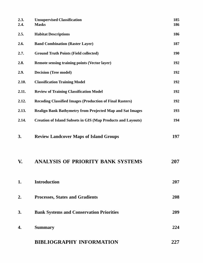
2.3. Unsupervised Classification 1852.4. Masks 186
2.5. Habitat Descriptions 186
2.6. Band Combination (Raster Layer) 187
2.7. Ground Truth Points (Field collected) 190
2.8. Remote sensing training points (Vector layer) 192
2.9. Decision (Tree model) 192
2.10. Classification Training Model 192
2.11. Review of Training Classification Model 192
2.12. Recoding Classified Images (Production of Final Rasters) 192
2.13. Realign Bank Bathymetry from Projected Map and Sat Images 193
2.14. Creation of Island Subsets in GIS (Map Products and Layouts) 194
3. Review Landcover Maps of Island Groups 197
V. ANALYSIS OF PRIORITY BANK SYSTEMS 207
1. Introduction 207
2. Processes, States and Gradients 208
3. Bank Systems and Conservation Priorities 209
4. Summary 224
BIBLIOGRAPHY INFORMATION 227
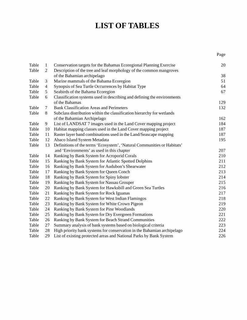
LIST OF TABLES
Page
Table 1 Conservation targets for the Bahamas Ecoregional Planning Exercise 20Table 2 Description of the tree and leaf morphology of the common mangroves
of the Bahamian archipelago 38Table 3 Marine mammals of the Bahama Ecoregion 51Table 4 Synopsis of Sea Turtle Occurrences by Habitat Type 64Table 5 Seabirds of the Bahama Ecoregion 67Table 6 Classification systems used in describing and defining the environments
of the Bahamas 129Table 7 Bank Classification Areas and Perimeters 132Table 8 Subclass distribution within the classification hierarchy for wetlands
of the Bahamian Archipelago 162Table 9 List of LANDSAT 7 images used in the Land Cover mapping project 184Table 10 Habitat mapping classes used in the Land Cover mapping project 187Table 11 Raster layer band combinations used in the Land/Seascape mapping 187Table 12 Abaco Island System Metadata 195Table 13 Definitions of the terms ‘Ecosystem’, ‘Natural Communities or Habitats’
and ‘Environments’ as used in this chapter 207Table 14 Ranking by Bank System for Acroporid Corals 210Table 15 Ranking by Bank System for Atlantic Spotted Dolphins 211Table 16 Ranking by Bank System for Audubon’s Shearwater 212Table 17 Ranking by Bank System for Queen Conch 213Table 18 Ranking by Bank System for Spiny lobster 214Table 19 Ranking by Bank System for Nassau Grouper 215Table 20 Ranking by Bank System for Hawksbill and Green Sea Turtles 216Table 21 Ranking by Bank System for Rock Iguanas 217Table 22 Ranking by Bank System for West Indian Flamingos 218Table 23 Ranking by Bank System for White Crown Pigeon 219Table 24 Ranking by Bank System for Pine Woodlands 220Table 25 Ranking by Bank System for Dry Evergreen Formations 221Table 26 Ranking by Bank System for Beach Strand Communities 222Table 27 Summary analysis of bank systems based on biological criteria 223Table 28 High priority bank systems for conservation in the Bahamian archipelago 224Table 29 List of existing protected areas and National Parks by Bank System 226
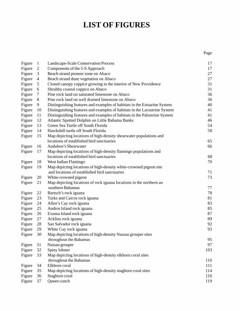
LIST OF FIGURES
Page
Figure 1 Landscape-Scale Conservation Process 17Figure 2 Components of the 5-S Approach 17Figure 3 Beach strand pioneer zone on Abaco 27Figure 4 Beach strand dune vegetation on Abaco 27Figure 5 Closed canopy coppice growing in the interior of New Providence 31Figure 6 Shrubby coastal coppice on Abaco 31Figure 7 Pine rock land on saturated limestone on Abaco 36Figure 8 Pine rock land on well drained limestone on Abaco 36Figure 9 Distinguishing features and examples of habitats in the Estuarine System 40Figure 10 Distinguishing features and examples of habitats in the Lacustrine System 41Figure 11 Distinguishing features and examples of habitats in the Palustrine System 41Figure 12 Atlantic Spotted Dolphin on Little Bahama Banks 46Figure 13 Green Sea Turtle off South Florida 54Figure 14 Hawksbill turtle off South Florida 58Figure 15 Map depicting locations of high-density shearwater populations and
locations of established bird sanctuaries 65Figure 16 Audubon’s Shearwater 66Figure 17 Map depicting locations of high-density flamingo populations and
locations of established bird sanctuaries 68Figure 18 West Indian Flamingo 70Figure 19 Map depicting locations of high-density white-crowned pigeon site
and locations of established bird sanctuaries 71Figure 20 White-crowned pigeon 73Figure 21 Map depicting locations of rock iguana locations in the northern an
southern Bahamas 77Figure 22 Bartsch’s rock iguana 78Figure 23 Turks and Caicos rock iguana 81Figure 24 Allen’s Cay rock iguana 83Figure 25 Andros Island rock iguana 85Figure 26 Exuma Island rock iguana 87Figure 27 Acklins rock iguana 89Figure 28 San Salvador rock iguana 92Figure 29 White Cay rock iguana 93Figure 30 Map depicting locations of high-density Nassau grouper sites
throughout the Bahamas 95Figure 31 Nassau grouper 97Figure 32 Spiny lobster 103Figure 33 Map depicting locations of high-density elkhorn coral sites
throughout the Bahamas 110Figure 34 Elkhorn coral 111Figure 35 Map depicting locations of high-density staghorn coral sites 114Figure 36 Staghorn coral 116Figure 37 Queen conch 119
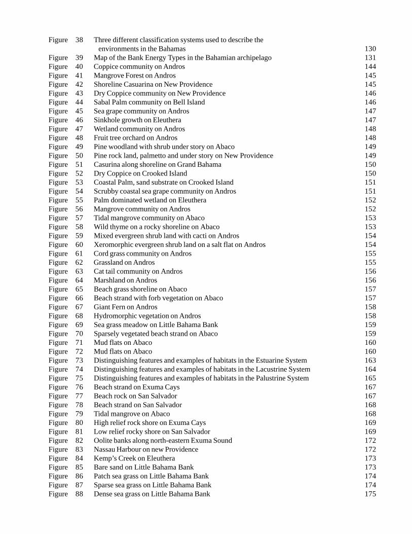
Figure 38 Three different classification systems used to describe the environments in the Bahamas 130
Figure 39 Map of the Bank Energy Types in the Bahamian archipelago 131Figure 40 Coppice community on Andros 144Figure 41 Mangrove Forest on Andros 145Figure 42 Shoreline Casuarina on New Providence 145Figure 43 Dry Coppice community on New Providence 146Figure 44 Sabal Palm community on Bell Island 146Figure 45 Sea grape community on Andros 147Figure 46 Sinkhole growth on Eleuthera 147Figure 47 Wetland community on Andros 148Figure 48 Fruit tree orchard on Andros 148Figure 49 Pine woodland with shrub under story on Abaco 149Figure 50 Pine rock land, palmetto and under story on New Providence 149Figure 51 Casurina along shoreline on Grand Bahama 150Figure 52 Dry Coppice on Crooked Island 150Figure 53 Coastal Palm, sand substrate on Crooked Island 151Figure 54 Scrubby coastal sea grape community on Andros 151Figure 55 Palm dominated wetland on Eleuthera 152Figure 56 Mangrove community on Andros 152Figure 57 Tidal mangrove community on Abaco 153Figure 58 Wild thyme on a rocky shoreline on Abaco 153Figure 59 Mixed evergreen shrub land with cacti on Andros 154Figure 60 Xeromorphic evergreen shrub land on a salt flat on Andros 154Figure 61 Cord grass community on Andros 155Figure 62 Grassland on Andros 155Figure 63 Cat tail community on Andros 156Figure 64 Marshland on Andros 156Figure 65 Beach grass shoreline on Abaco 157Figure 66 Beach strand with forb vegetation on Abaco 157Figure 67 Giant Fern on Andros 158Figure 68 Hydromorphic vegetation on Andros 158Figure 69 Sea grass meadow on Little Bahama Bank 159Figure 70 Sparsely vegetated beach strand on Abaco 159Figure 71 Mud flats on Abaco 160Figure 72 Mud flats on Abaco 160Figure 73 Distinguishing features and examples of habitats in the Estuarine System 163Figure 74 Distinguishing features and examples of habitats in the Lacustrine System 164Figure 75 Distinguishing features and examples of habitats in the Palustrine System 165Figure 76 Beach strand on Exuma Cays 167Figure 77 Beach rock on San Salvador 167Figure 78 Beach strand on San Salvador 168Figure 79 Tidal mangrove on Abaco 168Figure 80 High relief rock shore on Exuma Cays 169Figure 81 Low relief rocky shore on San Salvador 169Figure 82 Oolite banks along north-eastern Exuma Sound 172Figure 83 Nassau Harbour on new Providence 172Figure 84 Kemp’s Creek on Eleuthera 173Figure 85 Bare sand on Little Bahama Bank 173Figure 86 Patch sea grass on Little Bahama Bank 174Figure 87 Sparse sea grass on Little Bahama Bank 174Figure 88 Dense sea grass on Little Bahama Bank 175
Figure 89 Bare patch reef on Yellow Banks 175Figure 90 Near shore patch reef, Exuma 176Figure 91 Channel reef on Little Bahama Bank 176Figure 92 Platform margin fringe reef, Exuma 177Figure 93 Barrier reef at Andros 178Figure 94 Algae dominated channel reef on Little Bahama Bank 178Figure 95 Octo-coral-sponge dominated channel reef on Little Bahama Bank 179Figure 96 Platform margin on Little Bahama Bank 179Figure 97 Near shore hard bottom, Exuma 180Figure 98 Deep reef habitat, Andros 181Figure 99 LANDSAT 7 scenes from paths 13 and 14, rows 41-44 pasted
together in one image 185Figure 100 False colour of marine and terrestrial habitat classifications of the Abaco Islands 186Figure 101 Examples of how different band combinations in the raster layer can be use
to highlight different characteristics 188Figure 102 Aerial image used to verify and recode marine habitat classification
near New Providence 188Figure 103 Colour scheme used for landcover mapping 189Figure 104 Collecting waypoint information from a marine habitat designation 191Figure 105 False colour classification of marine and terrestrial habitat classifications
of Andros and New Providence Islands 191Figure 106 LandSat7 images of western Little Bahama Bank 194Figure 107 Three map layouts used to illustrate the satellite imagery and false colour
composites of land and sea 196Figure 108 Composite of final landcover maps for Abaco 198Figure 109 Composite of final landcover maps for Andros 200Figure 110 Composite of final seafloor cover maps for Abaco 203Figure 111 Land and sea flootr cover for New Providence Island 205
15
I. INTRODUCTION
Over the past decade, scientists and resourcemanagers have realized that the maintenance ofbiodiversity and the conservation of natural resourcesmust go beyond the protection of species or uniqueenvironmental features. Consequently, ‘landscapeconservation initiatives’ have been developed toemphasize the conservation at multiple levels ofbiological organization and recognizes that conservationshould not be constrained by geo-political boundaries.
The Nature Conservancy (TNC) has met thischallenge by adopting a landscape planning initiative,called ‘ecoregional planning’, which is based on aclassification of landscapes (and seascapes) into‘Ecoregions’. The ecoregional planning process,described in ‘The Geography of Hope’ (TNC, 2000),proceeds in five steps: mapping, defining conservationtargets, establishing status and extend of targets, definingconservation goals, and setting priorities. Ecoregionshave been identified as reasonably cohesive ecologicalunits for conservation and management planning(Dinerstein et al., 1995; Bailey 1998). They can bebroadly defined as relatively large areas of land andwater that contain geographically distinct assemblagesof natural communities (Dinerstein et al., 1995).
The required diligent and vigorous process fordefining Ecoregion includes the identification andcompilation of data on the ecology and distribution ofconservation targets, on both the species and habitatlevel (Groves et al., 2000). Other conservation criteriainclude the biological importance, and threats andstresses that can be identified, measured and mitigated.The overall objective is to develop and implement aconservation plan, which identifies species, patterns andprocesses that need to be preserved, managed, andrestored, in order to represent the entire diversity of theEcoregion with viable populations, communities andecosystems. The ecoregional plan should also providebackground information and the justification forinitiating conservation action at specific sites within theEcoregion.
The islands of the Bahamas, and Turks and Caicos,represent such an Ecoregion. The archipelago, with itsunique geological features and pristine conditions ofshallow banks and island, represents a singleinterconnected system of land and water and is
exceptionally well suited for biodiversity conservationplanning. Consisting of 1,700 islands and cays, thearchipelago stretches over 2,000 km from LittleBahamas Bank in the northwest, to Silver Bank in thesoutheast. The primary significance is in the extent andquality of the carbonate island system as a whole,including communities such as the dry evergreen forests,pine rock land, mangrove wetlands, blue holes, and coralreefs. The region is home to thriving populations ofmarine species and communities that are threatened, orhave been overexploited in the wider Caribbean. Thearchipelago also supports important terrestrial speciesand communities, including the endemic Bahama parrot,the rare migrating Kirtland’s warbler, and populationsof rock iguanas that are highly threatened in theCaribbean.
Biological diversity in the archipelago spans boththe terrestrial and marine environments. While thedestruction of coastal vegetation and wetlandsassociated with unmanaged development is obvious, thephysical loss of ecological function in marine habitatsdue to damaged seabed is keenly connected toinappropriate development as well. The decline inenvironmental health is apparent with the occurrenceof benthic algal blooms in near shore marine habitatsrelated to sewage either dumped directly into waterwaysor leeched from septic systems built improperly or tooclose to the coast. This continuous process, along withover fishing, reduces the abundance of important marineorganisms, particularly corals, queen conch, spinylobster, and fishes.
The main challenge to conservation of marinebiodiversity in the Caribbean is not just limited to thedeep basins and shallow bank systems of the widerCaribbean, which encompasses a vast marine area (4.31million km2), but also the fact that the area is borderedby 36 nations (Ottenwalder, 1996). Many of the smallerisland nations of the insular Caribbean depend upon thehealth and beauty of the combined terrestrial and marineenvironments to sustain their local economies andcultural identities.
The extent and status of Bahamian natural resourcesoffers a unique opportunity to develop cost-effectiveconservation programs aimed at preserving a largefunctioning ecological system, before excessive humandevelopment has had an impact. Only a handful of thesmall islands are occupied, with the larger populationcentred in Nassau on New Providence, and Freeport onGrand Bahama Island. Increasingly however, portionsof the Bahamian archipelago are experiencing threats
16
similar to those faced by coastal areas throughout theworld, with development promoting economicprosperity, while an unfortunately weak legislation failsto protect resources. And although the BahamianGovernment has granted protected status to severalcritical areas, there is insufficient infrastructure ortechnical capacity to minimize environmental threatsin the Bahamas as well as the Turks and Caicos. Withoutaddressing these concerns, the entire archipelago willexperience negative changes in water quality,destruction of critical habitats, and the extinction ofspecies.
Within the Bahamian archipelago, there are twonational jurisdictions and several non-governmental and/or regional initiatives involved in resource protectionand management. Therefore, the abatement ofconservation threats in the Bahamas and the Turks andCaicos will require a combination of efforts initiatedwithin the archipelago by government and non-government organizations, including resourcemanagement, education, and strong coastal stewardshipprograms which will monitor the data required to setenvironmental standards. The Bahama Ecoregion Plan(BEP) provides a much-needed comprehensive overviewand a common database for the coordination of thesevarious protection efforts.
A team of specialists from various disciplines,generally following the guidelines and standardsestablished by TNC, prepared the Bahama EcoregionPlan, which summarizes and synthesizes the bestinformation available. It provides comprehensive mapsand database tools that will be useful to wide audiencesinterested in the implementation of conservation,education, outreach, and management programs. In theprocess, team members participated in conferences,workshops, and meetings designed to compile hard-to-access information from ongoing efforts carried out by133 foreign research permit holders and many non-governmental organizations in the Bahama archipelago.
A total of four community targets, and eleven targetspecies were selected to effectively represent (andprotect) all important species and communities. Foreach of these targets we generally provide a descriptionand information on distribution, population status,ecology and natural history, habitat and associatedspecies. In addition, we identified existing threats,information gaps, research needs, and conservationgoals. Last but not least, we provide contact informationand a selected bibliography.
Furthermore, we reviewed specific habitat types thatare relevant to the archipelago. From a long list of very
distinct and elaborate potential habitat descriptions, bothmarine and terrestrial, a Bahama specific list waseventually developed to include those environments thatwere mappable and discernable from the LandSatimages. This list was representational of all importantcommunities and species in the Bahamas and Turks andCaicos.
The geology, topography and climate of the Bankand Island Systems, as well as four natural communities(uplands, wetlands, coastal zone and marine) aredescribed in detail. These habitats were mapped usingground truth data, collected by team members and otherexperts in the field, and remote sensing techniques froma series of LandSat7 images. The entire archipelagowas classified to measure percentage of each habitatalong with human altered terrain, mapping the habitatseach target requires to survive.
The here presented Ecoregion Plan is a tool that notonly includes a current assessment of terrestrial andmarine resources in the Bahama Archipelago, but alsoinitiates a process of consensus building for clearlyarticulated goals and strategies for fifteen well-definedconservation targets.
17
1. Introduction to Landscape-Scale Conservation
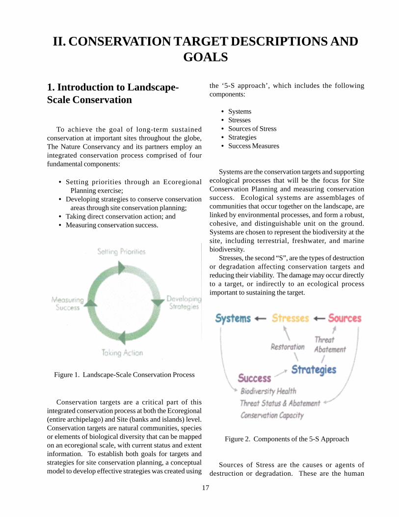
To achieve the goal of long-term sustainedconservation at important sites throughout the globe,The Nature Conservancy and its partners employ anintegrated conservation process comprised of fourfundamental components:
• Setting priorities through an EcoregionalPlanning exercise;
• Developing strategies to conserve conservationareas through site conservation planning;
• Taking direct conservation action; and• Measuring conservation success.
Figure 1. Landscape-Scale Conservation Process
Conservation targets are a critical part of thisintegrated conservation process at both the Ecoregional(entire archipelago) and Site (banks and islands) level.Conservation targets are natural communities, speciesor elements of biological diversity that can be mappedon an ecoregional scale, with current status and extentinformation. To establish both goals for targets andstrategies for site conservation planning, a conceptualmodel to develop effective strategies was created using
the ‘5-S approach’, which includes the followingcomponents:
• Systems• Stresses• Sources of Stress• Strategies• Success Measures
Systems are the conservation targets and supportingecological processes that will be the focus for SiteConservation Planning and measuring conservationsuccess. Ecological systems are assemblages ofcommunities that occur together on the landscape, arelinked by environmental processes, and form a robust,cohesive, and distinguishable unit on the ground.Systems are chosen to represent the biodiversity at thesite, including terrestrial, freshwater, and marinebiodiversity.
Stresses, the second “S”, are the types of destructionor degradation affecting conservation targets andreducing their viability. The damage may occur directlyto a target, or indirectly to an ecological processimportant to sustaining the target.
Figure 2. Components of the 5-S Approach
Sources of Stress are the causes or agents ofdestruction or degradation. These are the human
II. CONSERVATION TARGET DESCRIPTIONS ANDGOALS
18
activities, typically uses of land, water or other naturalresources, which cause the stresses. Each stress has atleast one source, while stresses often have multiplesources. The Conservancy’s approach is to focus uponthose proximate sources of stress that can be abated withpractical strategies. Some sources of stress are ongoingor ‘active’; others may be historical. With historicalsources, the stresses can persist even in the absence ofan active source such as disruptions to a wetland’shydrology that persist long after the drainage of thewetland has ceased.
The assessment of Systems, Stresses, and Sources ofstress leads to a listing of critical threats for aconservation area. Based on the identified criticalthreats, both ecoregional planning and site planningteams develop conservation strategies.
Strategies are the broad action paths necessary toabate critical threats and enhance the viability ofconservation targets, and have two broad objectives:
• Threat abatement: eliminate active sources ofstress (subsequent reduction in stress andincrease in viability);
• Ecological Management and Restoration:directly eliminate stress and enhance viability.
The Nature Conservancy defines conservationsuccess of a conservation area as the long-termabatement of critical threats and the sustainedmaintenance or enhancement of biodiversity health. TheConservancy has developed Success measures to monitorbiodiversity health and threat level. The measure ofsuccess is derived from the overall viability ofconservation targets at a conservation area. The entirelandscape-scale conservation process is long-term andoften entails a long-term (decades) commitment tomanagement, monitoring and research.
2. Ecoregional Planning
The initial step in the landscape-scale conservationprocess is developing an ecoregional plan. Ecoregionalplanning begins with the selection of conservationtargets. It is generally advantageous to select communityand ecosystem targets (ecosystem as used here refers tocharacteristic assemblages of plants and animals),because this approach addresses habitat diversity andecosystem processes, as opposed to a focus solely on
single-species management. The approach assumes thatrepresentation of habitats will also protect arepresentation of the diversity of species (Beck &Odaya, 2001). Conservation targets represented byspecies can be useful for conservation planning,assuming that there is a relative wealth of informationon basic life history parameters, geographic distribution,habitat requirements, and population abundanceestimates (Zacharias & Roff, 2001). However, thechallenges with using species targets include a paucityof information on distribution, abundance, andpopulation trends, especially for coastal and marinespecies. Many conservation-planning exercises usehabitat types as surrogates, hypothesized to provide ahigh probability of harbouring species on the target list.For example, the Bahamas Ecoregional Plan includesfive terrestrial habitat or community targets,encompassing inland, inland wetland, and coastalwetland habitat types.
The focal point of the ecoregional planning processfor the Bahamian archipelago is the identification ofconservation targets that is, those species, naturalcommunities, and unique features important to theecology and conservation, sustainability and economy,and/or culture of the archipelago. A working hypothesisof the ecoregional planning process is that if theconservation targets are ‘protected’, this will, in effect,preserve large parts of the natural processes shaping themarine and terrestrial environments. The ecoregionalplan discusses conservation targets in two ways. First,for each target, the description, taxonomy (if applicable),geographic distribution, current status, ecology/lifehistory, associated species, and supporting literature areprovided (summarized below). This informationprovides the framework for assessing the conservationgoals and strategies for each target. In essence, this isan analysis of existing information to determine what itwill take in the form of conservation planning toconserve, in perpetuity, the population or habitatstructure of conservation targets, whether they bespecies, subspecies, habitat types, or unique features.Selection of conservation targets for the BahamasEcoregional Plan focused on five main criteria:
• There is perceived degradation or a threatenedstatus for the target, whether from habitatdestruction or overexploitation, for example;
• Chosen targets can serve as umbrella species forhabitat conservation;
• Sufficient information is available to map thestatus and extent of a target;
• The selection of targets should represent at least
19
a partial accounting of CITES (Convention onInternational Trade in Endangered Species ofWild Fauna and Flora) listed species. Forexample, species listed in CITES Appendices Ior II that occur in Bahamian archipelago includeflamingos (Phoenicopteridae) and the greenturtle (Chelonia mydas); and
• The targets, whether terrestrial or marine, shouldrepresent economically or socioculturallyimportant feature.
Conservation goals for each target are developed andprovide the focal point for conservation planning. Aconservation goal is the number (population size orhabitat area) that must be preserved to protect the fullrange of diversity within an ecoregion. For example,the ecoregional plan for the northern Gulf of Mexicocontains both habitat and species targets (Beck & Odaya,2001). Habitat refers to the area used by a species,with modifiers added to identify the particular habitatsused by a plant or animal. Habitat targets include seagrass beds, tidal fresh grass, oyster bars/reefs, octocoral-sponge hard-bottom, tidal flats, beaches and sand bars,and tidal fresh marsh, while species targets for thisecoregional plan were the dwarf seahorse, manatee,fringed pipefish, Gulf sturgeon, and Kemp’s Ridleyturtle. Unfortunately, the rationale for setting specificconservation goals for targets is not well developed,especially for marine species and habitats. A furtherchallenge is the difficulty in obtaining basic informationon population abundance and trends. For the northernGulf of Mexico plan, for example, it was assumed thatthe number of collection records for a sub region (bay)was related to the size of the population in a bay (Beck& Odaya, 2001). Another guideline for goal setting forthe marine environment is the inclusion of 20% ofcoastal and marine habitats in no-fishing areas (NRC,1999). This is only one guideline and does not implythat a list of priority sites cannot be greater.
Conservation target descriptions for the BahamasEcoregional Plan were completed with a format similarto CITES documents. Each of the targets is summarizedin the following pages. Sections covered for eachdescription in the final ecoregional plan will include:
• Distribution – giving a broad overview of whatis known about where this target is foundworldwide and in the Bahamian archipelago;
• Status of populations in the wild – with specificdata, a worldwide health of the target isoutlined;
• Ecology and natural history – the life cycle;• Current conservation programs – efforts in place
that are addressing the threats;• Information gaps and research needs – areas of
concern that warrant additional research and/or conservation efforts; and
• Conservation goals and strategies – desiredoutcomes of efforts and methods to achievespecified goals.
Digital imagery of each target is also integrated inthe descriptions. Photographs taken in the field thatshow the target in healthy condition were obtained fromvarious sources.
3. Terrestrial targets
Communities/habitat types:Dry evergreen forest (coppice): a closed-tree canopy
habitat harbouring a diversity of trees and herbaceousplants; few virgin forest areas left in the Bahamianarchipelago; important habitat for many threatenedspecies, including the white-crown pigeon, Bahamaparrot, and West Indian iguana; threatened byagriculture, development, timber harvesting, soilerosion, and invasion of exotic plants.
Pineland (pine rocklands): pine woodlands restrictedto four northern Bahamian islands and the Turks andCaicos; important fire climax community, restricted toareas with open or low shrub/scrub that are periodicallyburned; important habitat for migratory and residentbirds, including Kirtland’s warbler and the Bahamaparrot, as well as the West Indian rock iguana; threatenedby timber production and invasion of exotic plants.
Blue holes/inland wetlands: Unique cave systemsthat support endemic fauna and microbial communities.
Beach strand: type of shrubland or herbaceousvegetation that occurs along the shoreline with a sandsubstrate; used by various marine turtle species fornesting; important for preservation of dune systems;relatively small habitat area; threatened bydevelopment, sand mining, and invasion of exoticspecies.
20
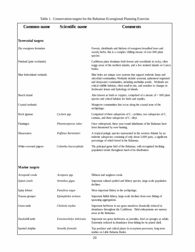
Table 1. Conservation targets for the Bahamas Ecoregional Planning Exercise
emannommoC emancifitneicS stnemmoC
stegratlairtserreT
noitamrofneergreveyrD dnaseertfaeldaorbneergrevefostekcihtdnasdnalburhs,stseroFtnalp006revofociasomgnitfihs'xelpmocasisiht,sbrehydoow
.'seiceps
)sdnalkcorenip(dnaleniP netfo,ykcornisdnaldoowdnastserofhtobetanimodsenipnaebbiraCsociaCnosdnalsidetalosiwefadna,sdnalsinrehtronehtfosaerayggos
.sknab
sdnaltewdnalni/seloheulB dnaanuafcimednetroppustahtsmetsysevaceuqinueraseloheulBdetategevlaremehpe,lanosaesedulcnisdnalteW;seitinummoclaiborcim
erasdnalteW.sdnopenilaihcnagnidulcni,seitinummocretawpeeddnanisegnahcotevitisnesdna,ezisnillamsnetfo,statibahefildliwlacitirc
.sdnalsifoygolordyhdnasesnelretawhserf
dnartshcaeB tnalp006>fociasomafodesirpmoc,ecippocrohsubsanwonkoslA.selitperdnasdribrofstatibahlacitircdnaseiceps
sdnaltewlatsaoC ehtfoenozlatsaocehtgnolaruccotahtseitinummocevorgnaM.ogalepihcra
sanaugikcoR .ppsarulcyC .Cfoseicepsbusowt,arulhcyc.CfoseicepsbuseerhtfodesirpmoC.iyelir.Cfoseicepsbuseerhtdna,atanirac
sognimalF rebursuretpocineohP evahsamahaBehtfostnatibahnidnuor-raeyeseht,daerpsediwecnO.gnitnuh-revoybdenetaerhtneeb
sretawraehS ireinimrehlsuniffuP naybcitnaltAnretsewehtnidetneserperseicepscigaleplaciportAtnacifingisa,sriap000,5tuobaylnofognitsisnocseicepsbuscimedne
.samahaBehtnideerbhcihwfoegatnecrep
noegipdenworc-etihW alahpecocuelabmuloC gninilceddezingocerhtiw,samahaBehtfodribemaglapicnirpehT.noitubirtsidstifohcumtuohguorhtsdnertnoitalupop
stegrateniraM
slarocdiroporcA .ppsaroporcA .slarocnrohgatsdnanrohklE
hcnocneeuQ sagigsubmortS noitalupopelacs-egral,seicepsyrehsifdnalobmyslarutluctnatropmI.senilced
retsbolynipS sugrasurilunaP .ogalepihcraehtniyrehsiftnatropmitsoM
repuorguassaN sutairtssulehpenipE fognihsifrevomorfsenilcedelacs-egral,yrehsifhsifniftnatropmI.snoitagerggagninwaps
eltrutneerG sadymainolehC nidecuderyllacitsardswodaemssargaesnierovibrehtnatropmIyresrunerastnemyabmeladiT.naebbiraCehttuohguorhtecnadnuba
.samahaBehtnisaera
eltrutllibskwaH atacirbmisylehcomoterE .stludasasegnopsnodeef,selinevujsaserovibrehssargaestnatropmI.llehsdezirpstirofgnihsifmorfecnadnubanidecuderylemertxE
nihploddettopS silatnorfallenetS mret-gnol,sessecorpmetsysocenireyalplacitircdnarotaderppoT.sknaBamahaBelttiLnoseiduts
21
Coastal wetlands: Mangrove communities that occuralong the coastal zone of the archipelago.
Vertebrates:West Indian rock iguana (Cyclura spp.): composed
of eight species that inhabit tropical dry forests and PineBarrens; all three species, including eight subspecies,occur in the Bahamian archipelago. Many subspeciesexhibit high endemism with narrow geographic rangesfor many subspecies, including distributions restrictedto particular islands. Estimated population sizes of somesubspecies range in the hundreds of individuals or fewer.Rock iguanas are important seed dispersers for manyplants. Principal threats include predation by exoticspecies, loss of habitat, and illegal hunting andsmuggling. All extant species are considered by IUCNto be endangered or vulnerable to human disturbance,and all species are listed as CITES Appendix 1. In theBahamas, rock iguanas are protected under the 1968Wild Animals Protection Act.
Flamingos (Phoenicopterus ruber): year-roundresident of the Bahamas, particularly at Lake Rosa onGreat Inagua; thrives in saline lagoons and coastalestuaries, where they filter-feed upon organically richdetritus, as well as unicellular algae, small insect larvae,crustaceans, molluscs, and certain seeds.
Shearwaters (Puffinus lherminieri): total populationof only 5,000 pairs in the Western Atlantic. Audubon’sshearwaters are found in tropical and sub-tropicalclimates. A large majority of shearwaters breed in theBahamas, the largest breeding colonies occur on LongCay and the Allen’s Cay group.
White-crowned pigeon (Columba leucocephala):common, year-round resident of the Bahamas,dependent upon mangrove forests, pinelands, andwoodlands; highly gregarious arboreal bird, occur inlarge flocks in the western Bahamas during the winter.These birds are frugivores and important seed disperserin seasonal deciduous forests. Populations have declineddramatically, principally from hunting, habitat loss, andintroduction of predators. Considered threatened orendangered throughout much of its range, with decliningpopulation trends documented in the Bahamas.
4. Marine targets
Invertebrates:Staghorn coral (Acropora cervicornis): one of three
species in the genus in the wider Caribbean Atlanticwidely distributed in the Bahamian archipelago.Formerly a ubiquitous element of coral reefs, decimatedthroughout much of its range beginning in the 1970sprincipally from white band disease, storm damage, andlocal human disturbances.
Elkhorn coral (Acropora palmata): one of threebranching coral species in the genus in the widerCaribbean, widely distributed, including the Bahamasand Turks and Caicos. Once a ubiquitous componentof many wider Caribbean reefs, but have suffered large-scale population declines since the 1970s. Elkhorn coralis the principal frame builder of reef flat and reef crestenvironments in most coral reef ecosystems, providinghigh topographic complexity for a diversity of otherfauna. Although the causes of population declines arenot fully understood, the loss of this importantconstructional component has resulted in a phase shiftof many wider Caribbean reefs from coral dominanceto algal dominance.
Queen conch (Strombus gigas): distributedthroughout the tropical northwestern Atlantic. Severestock depletion in many localities, added to AppendixII of CITES, the implementation of a temporaryCaribbean-wide moratorium on conch fishing untilstocks can recover has been advocated. As an importantherbivore and detritivore in shallow-water communities,the queen conch has a complex life history involvingmultiple habitat types.
Spiny lobster (Panulirus argus): distributedthroughout the tropical northwestern Atlantic, highexploitation in many localities, most economicallyimportant fishery in the Bahamian archipelago. It is animportant detritivore and invertebrate predator, uses avariety of benthic habitats during its demersal life stages.
Vertebrates:Nassau grouper (Epinephelus striatus): most
important finfish fishery in the Bahamas; historicallyabundant throughout the tropical western Atlantic;severe stock depletion in most localities; now mostlyconsidered commercially extinct, principally fromoverexploitation of spawning aggregations; consideredvulnerable to exploitation because of life history
22
characteristics such as slow growth, large adult size,delayed reproduction, generally small home range size,and aggregated spawning behaviour; utilizes a varietyof benthic habitats during demersal life stages; importanttop-level predator in subtropical and tropical marineecosystems.
Hawksbill turtle (Eretmochelys imbricata): pantropical distribution; preference for tropical beaches fornesting; use open-water, demersal, and coastal habitatsduring the life cycle; important sea grass foragers asjuveniles and spongivores as adults; threatened bycommercial fisheries, debris ingestion, and habitatdegradation.
Green turtle (Chelonia mydas): distributedthroughout the tropical oceans; prefers tropical beachesfor nesting; uses both open-ocean and demersal habitatsduring the life cycle; uses tidal embayments in theBahamas as nursery habitats; important herbivore in seagrass beds; threatened by commercial fisheries, debrisingestion, and habitat degradation.
Spotted dolphin (Stenella frontalis): endemic to theAtlantic ocean, where it inhabits the tropical, sub-tropical and warm temperate areas of the western NorthAtlantic, Caribbean, Gulf of Mexico, South America,West Africa, and the Azores; principal threats to thisspecies are pollution and habitat degradation,recreational fishing, and human interaction
In addition to providing conservation targetinformation following the above-described format,supplementary relevant information has also beenincluded throughout this document. Tables showing theoccurrences of marine mammals, sea turtles, and seabirdshave been placed at the end of the Atlantic spotteddolphin, Hawksbill turtle, and Audubon’s Shearwatertarget descriptions, respectively. These tables elucidatethe distributional patterns of each animal group, basedupon the habitat or bank type. Additionally, CITESlists and explanations can be found at the end of thisdocument (see Appendix). The lists have been revisedfrom original CITES Annex II and CITES Annex IIIspecies lists so that they contain only those species thatoccur in the Bahamian Archipelago.
23
5. Target Descriptions
5.1. Community Targets
5.1.1. Beach strand
DescriptionCommunity classification based upon Areces et al. (1999):
Class: Shrub landClass: Herbaceous
Subclass: Evergreen shrub landSubclass: Perennial graminoid vegetation
Group: Subtropical broad-leaved evergreen shrub landGroup 1: Subtropical grasslandGroup 2: Subtropical perennial forb vegetation
Subgroup: Natural/semi-naturalSubgroup: Natural/semi-natural
Formation: Subtropical broad-leaved evergreen shrub landFormation 1: Medium-tall sod subtropical grasslandFormation 2: Low subtropical perennial forb vegetation
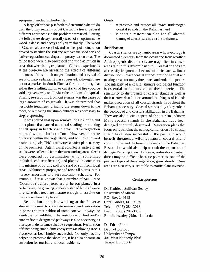
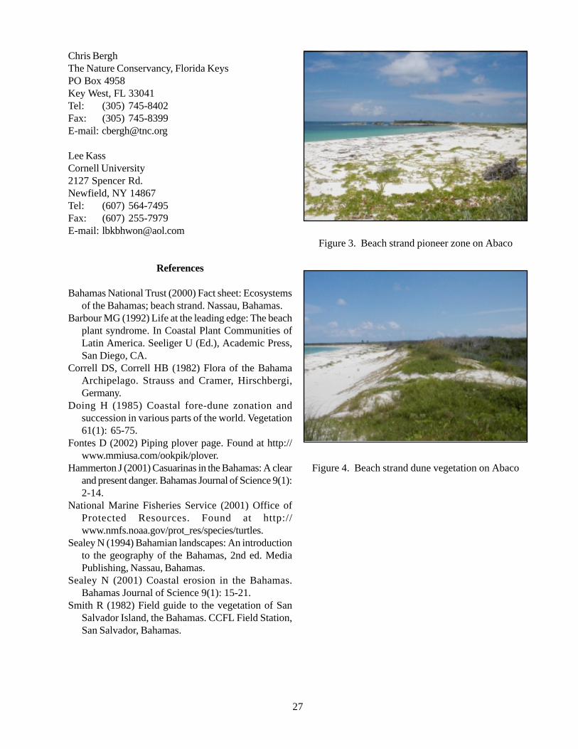
Beach strand is, in part, a vegetation community inclusive of a series of formations (shrub, herb/vine, and herb/shrub alliances) that all occur along the shoreline with a sand substrate. Beach strand formations begin above thehigh tide mark where plants have begun to colonize the sand. Typically a herb/vine alliance occurs nearest theocean where loose, shifting sand and occasional flooding does not support larger, shrubby plants. Shrub and herb/shrub alliances commonly occur farther back from the shoreline in “fixed dune” areas (Bahamas National Trust,2000), where plants have stabilized the substrate with their roots. Variation in species composition takes placewithin and between these formations. Additional variation is seen due to differences in the physical structure ofthe landscape, which are caused by differences in the level of energy applied to the coastal zone by localoceanographic conditions, wind, and storm events. These environmental effects produce the common low relief(< 3-5 m) dunes that occur throughout the Bahamian archipelago, as well as the less common high-relief (>5 m)dunes that are known to occur in portions of the Exuma Cays, San Salvador, and East Caicos.
DistributionBeach strand is found on all major islands in the Bahamian archipelago, especially on east-facing shores and
where offshore reef or small islands, or rocky headlands, protect the shoreline from wave action and allow sand toaccumulate. Sand can also accumulate on low-relief coastlines exposed to high-energy oceanographic conditionswhere an ‘upstream’ source of sand is present. Beach strand vegetation formations occur both at the shoreline andinland on beach-associated dune systems.
Status of beach strandBeach strand is a widespread habitat throughout the Bahama archipelago, though it is often compromised by
direct or indirect human activity. For example, beach strand on New Providence has been severely eroded as aresult of development close to the shoreline as well as heavy beach use. Beach strand areas throughout thearchipelago have been degraded through the invasion of non-native Casuarina trees. Many beach strand areas oninhabited and uninhabited islands also suffer from the build-up of marine debris along the shoreline.
Ecology and natural historyDune systems are most common on eastern shores of the islands, as the prevailing winds are from the east
(Sealey, 2001). Dunes originate from beach sand, and are formed as wind carries dry sand inland (Sealey, 1994).
24
The primary accumulation of sand that is colonized byplants is known as the fore dune (Barbour, 1992). Themain dune, which supports a greater variety of plants,accumulates as sand is carried by the wind past the foredune. Dune areas provide plants with protection fromsalt spray, wind, and wash over, as well as with a sourceof moisture (large dunes are known to hold significantamounts of fresh water (Sealey, 1994)). Because ofstabilization of the substrate, protection afforded bydunes, and overall decline in stresses to plants, speciesabundance changes and species richness often increasesfrom the fore dune inland (Barbour, 1992; Doing, 1985).
There are additional distinctions between beachstrand locations in terms of the class of dominantvegetation. The two main recognized classes ofvegetation are shrub land and herbaceous. Primarilyherb/vine alliances are found at the leading edge of allbeach strands in the Bahamas. Plants in this pioneerzone are halophytic (salt tolerant) and grow low to theground. Common plants to this area are the vinesCanavalia obtusifolia and Ipomea pes-caprae and thesucculents Batis maritime and Sesuviumportulacastrum (Correll & Correll, 1982, BahamasNational Trust, 2000). A variety of vegetation alliancescan occur beyond the fore dune, depending, among otherthings, on the level of exposure to wind and otherelements. Perennial graminoid vegetation commonlyoccurs in this area and is often dominated by Sea Oat(Uniola paniculata). Dense stands of just Uniolapaniculata can form, but will typically occur togetherwith shrubs and other graminoids. These grassy zonesare usually crisscrossed with vines, such as Ipomeaviolacea, and low growing forbs including Ambrosiahispida and Canavalia rosea (Smith, 1982). Manygrassy zones are inter-dispersed with clumps of shrubs,with shrubs occasionally becoming the dominantvegetation type. Some areas beyond the fore dunesupport chiefly shrubby vegetation with an underlyingherbaceous component. With the introduction ofCasuarina to the Bahamas, an additional non-naturalforest class can be recognized. This non-native anddetrimental species (Hammerton, 2001) is now commonin numerous coastal areas of the Bahamas.
HabitatBeach strand habitat is always composed of a sand
substrate, which, as mentioned earlier, is loose andshifting near the shoreline and stabilized in inland areascovered by plants. Physical elements of the beach strandare harsh; plants that grow near the shore must toleratebright sun, wind, salt spray and a lack of moisture. Saltspray, and perhaps fire rarely, maintains coastal strand
and prevents it from succeeding to coastal coppice,which is a vegetation type dominated by shrubs or shorttrees. In southeast Florida and possibly on some of thenorthern Bahamas islands, rare frosts also maintainstrand from succeeding to coppice.
Associated speciesHawksbill turtles (Eretmochelys imbricata) nest in
beach strand areas on islands and mainland throughoutthe Caribbean and subtropical Pacific and Indian Oceans(NMFS, 2001). Loggerhead turtles (Caretta caretta)and Green turtles (Chelonia mydas) also use grassy,sparse beach strand areas for nesting grounds during thesummer months, and are known to nest in the Bahamaand Turks and Caicos Islands. The endangered pipingplover (Charadrius melodus) winters on islands in theBahama archipelago, and uses beach strand areas to feedand find shelter.
ThreatsMajor threats to beach strand communities include
physical impacts from development, invasion of exotic/invasive species, damage to vegetative cover, and sandmining. In the Bahamas, many of the larger islands haveundergone substantial development along stretches ofthe shoreline. Direct development completely destroysthe beach strand and dune system, and often leads toproblems with erosion of the beach itself. For example,if a structure of any sort is built directly upon theshoreline, the long-shore or lateral drift of sand will beobstructed, causing a lack of sand and consequenterosion by wave action on the leeward side of thestructure.
Additionally, as development takes place there istypically an associated invasion of exotic plant speciessuch as Casuarina and Scaevola. These exotic speciesquickly colonize disturbed areas, and out-compete thenatural vegetation. These non-natives do not stabilizesand on beach strand or dune systems as well as nativeplants, especially during storms and high tides. Areasthat have been invaded by Casuarina are known to havetheir plant species diversity reduced from an average of25 - 35 species to less than 5 species (Austin, 1978).Casuarina is particularly damaging to the dune becausedune plants are intolerant of shade. In addition,Casuarina reduces salt spray, which then can lead tosuccession to coppice by plants that would not normallygrow within the spray zone.
Another major threat to the dune system is damageto the vegetation that holds the dune sand in place.Often, dunes of popular beaches suffer heavy pedestrianand automobile traffic, resulting in destruction of the
25
dune vegetation. Without vegetation to hold the sandin place, dunes will quickly erode in the wind. Manyexamples of this dune erosion can be seen on NewProvidence and Paradise Island (Sealey, 1994).
Sand mining, or the practice of taking sand fromdunes, beaches and bays causes loss of natural beachstrand areas and the protection that they provide toinland areas. Sand is widely used in construction, andthe least expensive way to get sand is to take it frombeaches and dunes. This has been a problem particularlyin Freeport, North Andros and the Exumas (Sealey,2001). Sand mining destroys both the primary body ofthe dune, or beach, and its vegetation, leading to furthererosion after the initial damage. Loss of dunes thatprotect developed inland areas can lead to propertydamage during severe weather. In addition, a commonpractice to replace onshore mining of sand is offshoredredging. If dredging of sand occurs in areas thatnaturally replenish beaches, the beaches may eventuallydiminish. This is exactly what happened in MontaguBay, where dredging for construction sand, along withplacement of a seawall along the beach, has resulted inthe loss of the beach itself (Sealey, 2001).
Current conservation programsSeveral national parks protect coastlines in the
Bahamas, including beach strand areas. Pelican CaysLand and Sea Park, on the west side of Abaco,encompasses a 2100-acre area, some of which is beachstrand. Conception Island National Park protects anisland (also of 2,100 acres) that contains many miles ofbeach strand. Additional protected beach strand canbe found within Tilloo Cay National Reserve, LuCayanNational Park, Peterson Cay National Park, and ExumaCays Land and Sea Park. Existing legislation protectsbeach strand from mining in some areas, such as nearFreeport, Grand Bahama, where mining of sand canresult in prosecution.
Information gaps and research needsSpecies distributions among beach strands, and
especially among islands, differ in their composition.As species lists do not exist for most beach strand areas,species compositions are usually inferred from a generallist. Documentation is needed on the effects of nearshore development and sand mining. Also, informationis needed about the effects of offshore dredging of areasthat might supply sand to beaches. No studies to datehave described the successional stages of beach strandthat have been invaded by species of Scavoela orCasuarina.All of this information is necessary for the development
of both sound management practices and protectivelegislation for beach strand.
Blowing Rocks Preserve: A Model Approach toBeach Strand Restoration
In dealing with coastal degradation and/or erosionin the Bahamas, lessons can be learned from similarissues experienced along the coastline of South Florida.The geology and topography of Florida is very similarto that of the Bahamas, as land in both places is madeup of exposed, low-lying carbonate deposits.Degradation of coastlines in South Florida has takenplace in much the same way as it is currently occurringin the Bahamas. Coastal development and invasionsby Casuarina trees have been (and in many cases stillare) prevalent issues along much of the Florida coastline.To prevent further degradation and erosion ofcompromised shorelines, some measure of restorationis essential. Successful restoration is achieved whenfunction is returned to the natural shoreline ecosystem.One success story in beach strand/shoreline restorationcan be found at The Nature Conservancy’s BlowingRocks Preserve, on Jupiter Island, Florida.
When The Nature Conservancy (TNC) acquired the73 acres on Jupiter Island in 1969, the majority of thearea was covered with non-native plants, especiallyCasuarina trees. Plans to begin a large-scale restorationof the area began with looking at historical aerial imagesto determine what vegetation types occurred and wherethey occurred within current Preserve boundaries. Theimages were also used to examine changes in vegetationover time, and to assess causes of change. With thisinformation, staff at TNC created a map of the preserveshowing coverage of the different types of vegetationthat could be achieved through restoration. This map,which reflected historical vegetation coverage as wellas permanent changes to the landscape that had occurredsince, became a basis for restoration goals.
Concurrently, stewards of the preserve began arigorous program to remove invasive plants. The helpof the community was enlisted in this program.Volunteers were sought by passing out flyers advertisingthe need for weekend help in removing invasive species.The initial volunteer response was tremendous, however,too much time was allotted to overseeing volunteers thatPreserve staff opted to target individual volunteers ratherthan to continue supervising large groups. Currentindividual volunteers in the non-native plant removalprogram have a higher level of safety training, allowingthe use of more advanced and effective removal
26
equipment, including herbicides.A large effort was put forth to determine what to do
with the bulky remains of cut Casuarina trees. Severaldifferent approaches to this problem were tried. Lettingthe felled trees decay naturally was not an option as thewood is dense and decays only very slowly. The woodof Casuarina burns very hot, and on-the-spot incinerationproved to sterilize the soil and remove the seed bank ofnative vegetation, causing a temporary barren area. Thefelled trees were also processed and used as mulch inareas that were being re-planted. Current experimentsat the preserve are assessing the effects of differentthickness of this mulch on germination and survival ofseeds of native plants. It was suggested, although thereis not a market in South Florida for the product, thateither the resulting mulch or cut stacks of firewood besold or given away to alleviate the problem of disposal.Finally, re-sprouting from cut stumps was the cause oflarge amounts of re-growth. It was determined thatherbicide treatment, grinding the stump down to theroots, or removing the stump entirely was necessary tostop re-sprouting.
It was found that upon removal of Casuarina andother plants that caused unnatural shading or blockingof salt spray in beach strand areas, native vegetationreturned without further effort. However, to creatediversity within the vegetation, and to move towardrestoration goals, TNC staff started a native plant nurseryon the premises. Again using volunteers, native plantseeds were collected from the surrounding area. Seedswere prepared for germination (which sometimesincluded seed scarification) and planted in containersin a mixture of potting soil and sand or soil from localareas. Volunteers propagate and raise all plants in thisnursery according to a set restoration schedule. Forexample, if it is known that a number of Sea Grape(Coccoloba uvifera) trees are to be out planted in acertain area, the growing process is started far in advanceto ensure that trees are mature enough to survive ontheir own when out planted.
Restoration biologists working at the Preservestressed the need to complete removal and restorationin phases so that habitat of some sort will always beavailable for wildlife. The restriction of foot and/orauto traffic to designated pathways is also necessary, asthis type of disturbance destroys vegetation. Restorationof functioning strand/dune ecosystems at Blowing RocksPreserve has been highly successful. Not only has thishelped to preserve the shoreline, it has also become anattraction for tourists and local residents.
Goals• To preserve and protect all intact, undamaged
coastal strands in the Bahamas; and• To enact a restoration plan for all altered/
damaged coastal strands in the Bahamas.
JustificationCoastal strands are dynamic areas whose ecology is
dominated by energy from the ocean and from weather.Anthropogenic disturbances are magnified in coastalareas due to this dynamic nature. Coastal strands arealso easily fragmented because of their narrow, lineardistribution. Intact coastal strands provide habitat andnesting areas for many threatened and endemic species.The integrity of a coastal strand’s ecological functionis essential to the survival of these species. Thesensitivity to disturbance of coastal stands as well astheir narrow distribution around the fringes of islandsmakes protection of all coastal strands throughout theBahamas necessary. Coastal strands play a key role inthe geology of and coastal stabilization in the Bahamas.They are also a vital aspect of the tourism industry.Many coastal strands in the Bahamas have beendamaged or entirely destroyed. Restoration plans thatfocus on rebuilding the ecological function of a coastalstrand have been successful in the past, and wouldbenefit threatened wildlife, natural coastal strandcommunities and the tourism industry in the Bahamas.Restoration would also help to curb the expansion ofdamaged/eroding areas. However, restoration of inlanddunes may be difficult because palmettos, one of theprimary types of dune vegetation, grow slowly. Duneareas are also very susceptible to exotic plant invasion.
Contact persons
Dr. Kathleen Sullivan-SealeyUniversity of MiamiP.O. Box 249118Coral Gables, FL 33124Tel: (305) 284-3013Fax: (305) 284-3039E-mail: [email protected]
Dr. Ethan FreidDept. of BiologyUniversity of Tampa401 West Kennedy Blvd.Tampa, FL 33606
27
Chris BerghThe Nature Conservancy, Florida KeysPO Box 4958Key West, FL 33041Tel: (305) 745-8402Fax: (305) 745-8399E-mail: [email protected]
Lee KassCornell University2127 Spencer Rd.Newfield, NY 14867Tel: (607) 564-7495Fax: (607) 255-7979E-mail: [email protected]
References
Bahamas National Trust (2000) Fact sheet: Ecosystemsof the Bahamas; beach strand. Nassau, Bahamas.
Barbour MG (1992) Life at the leading edge: The beachplant syndrome. In Coastal Plant Communities ofLatin America. Seeliger U (Ed.), Academic Press,San Diego, CA.
Correll DS, Correll HB (1982) Flora of the BahamaArchipelago. Strauss and Cramer, Hirschbergi,Germany.
Doing H (1985) Coastal fore-dune zonation andsuccession in various parts of the world. Vegetation61(1): 65-75.
Fontes D (2002) Piping plover page. Found at http://www.mmiusa.com/ookpik/plover.
Hammerton J (2001) Casuarinas in the Bahamas: A clearand present danger. Bahamas Journal of Science 9(1):2-14.
National Marine Fisheries Service (2001) Office ofProtected Resources. Found at http://www.nmfs.noaa.gov/prot_res/species/turtles.
Sealey N (1994) Bahamian landscapes: An introductionto the geography of the Bahamas, 2nd ed. MediaPublishing, Nassau, Bahamas.
Sealey N (2001) Coastal erosion in the Bahamas.Bahamas Journal of Science 9(1): 15-21.
Smith R (1982) Field guide to the vegetation of SanSalvador Island, the Bahamas. CCFL Field Station,San Salvador, Bahamas.
Figure 3. Beach strand pioneer zone on Abaco
Figure 4. Beach strand dune vegetation on Abaco
28
5.1.2. Dry Evergreen Formation (Coppice)
DescriptionCommunity classification based upon Areces et al. (1999)
Class: Closed tree canopyClass: Open tree canopy
Subclass: Evergreen forestSubclass: Evergreen woodlandSubclass: Evergreen shrub land
Group: Subtropical seasonal evergreen forestGroup: Subtropical broad-leaved woodlandGroup: Subtropical broad-leaved shrub land
Subgroup: Natural/semi-naturalFormation: Many formation types exist (see Vegetation Classification document)
Dry evergreen formation or coppice harbours a diversity of trees, shrubs and herbaceous plants that, dependingon the location and history of disturbance, differs in its composition. The dry evergreen formation communitiesare found in several different habitat types throughout the Bahamian archipelago. They consist mostly of hardwoodtrees and shrubs, with the dominant vegetation type differing in each locality. The herbaceous component ofthese formations is often small, as coppice vegetation characteristically grows close together, creating a heavilyshaded under story. Relative canopy heights of dry evergreen formation in the Bahamas are greater in inlandareas of the larger northern and central islands. The vegetation toward the drier, southern extent of the archipelagotends to be scrubbier (Smith & Vankat, 1992), both due to limited access to fresh water and proximity to theocean.
DistributionDry evergreen formations occur on all major islands in the Bahamian archipelago. These coppice formations
occur both in sandy and organic soils underlain by oolitic limestone, which is often protruding from the soilsurface. They range from just beyond the shoreline throughout the interior of all islands, especially in elevatedareas. The location and type of coppice depends on the physical landscape and the hydraulic regime as well asthe land use history. Dry evergreen formations growing on elevated islands in pine woodlands are affected by thefire history of those areas.
Status of populations in the wildThe different types of dry evergreen formations are common throughout the Bahama archipelago. Much of the
existing inland coppice is thought to be secondary or even tertiary growth (Bahamas National Trust, 2000) due tohistoric clearing and/or utilization of many of the coppice trees. Consequently, the canopy heights of mostcoppice areas in the Bahamas are probably lower than they have been in the past. Virgin forest can only be foundon Little Inagua (Bahamas National Trust, 2000), where the tallest trees reach up to 25 m in height (Correll &Correll, 1982). On inhabited islands, coppice is often fragmented due to either agricultural clearing or development.
Ecology and natural historyDepending on locality, dry evergreen formation can be divided into two separate types. Dry evergreen formations
that grow inland from beach dune or coastal rock areas usually occur on sand or rock substrate that affordsrelatively little moisture or nutrients. Plants that grow in this coastal broadleaf evergreen woodland community,or coastal coppice, are hardier and are sometimes interspersed less densely, leaving a slightly open canopy.Coastal coppice is also shrubbier in terms of species composition and canopy height than other coppice areas.Many of the same species that occupy the beach strand (see target description) can be found in the coastal coppice(Ford, 1997). Trees that are common to coastal coppice include the sea grape (Coccoloba uvifera), Acacia(Acacia choriophylla), wild dilly (Manilkara bahamensis), poisonwood (Metopium toxiferum), silver thatchpalm (Coccothrinax argentata), beefwood (Guapira discolor), and less commonly, mahogany (Swieteniamahagonia) (Correll & Correll, 1982; Smith, 1982). Also found in coastal coppices are many endemic epiphytes,
29
mainly species of Encyclia, Epidendrum, and Tillandsia(Correll & Correll, 1982).
Coppice in the interior of the islands with substantialfresh water lenses is generally taller, denser, and has aclosed canopy. This type of coppice is often referred toas ‘blackland’ coppice or high coppice (Northrop, 1902;Correll & Correll, 1982; Smith, 1982; Ford, 1997), thelatter because it is found on ridges or elevated inlandareas. Depending on the elevation in which this type ofdry evergreen formation is found, the canopy height canbe shorter or taller, with taller canopies occurring inmore elevated areas (Sauleda & Adams, 1979; Eshbaugh& Wilson, 1990; Smith & Vankat, 1992). Blacklandcoppice has an oolitic limestone substrate with organicsoil development in many areas. Weathering of thelimestone creates a pitted terrain. Sinkholes, some upto 7 m diameter and depth, are common in the blackland coppice. Species of Coccoloba as well asMetopium toxiferum are among the most common inblack land coppice. Butter bough (Exothea paniculata),gumbo-limbo (Bursera simaruba), and ficus (Ficusspp.) are also among the many species of dominant trees(Smith, 1982; Correll & Correll, 1982; Smith & Vankat,1992). Trees that are valued for their wood, such asmahogany and horseflesh (Lysiloma sabicu), are lesscommon than in previous times due to over harvesting.Important under story plants include wild coffee(Psychotria ligustrifolia), box briar (Randia aculeata),and Cat’s claw (Pithecellobium bahamense).
HabitatCoastal flats with sandy or rocky soil are usually
covered by broadleaf evergreen woodland or shrub land.In dune systems, coastal coppice often occurs on theinland side of the main dune or in the troughs betweendunes. Headlands and rocky shorelines may supportthin, shrubby coppice beginning a few meters beyondthe high tide line. Inland coppice grows in a variety ofhabitats, often upon elevated tracts of land. It is oftenreferred to as black land coppice due to the dark soilthat is a product of the breakdown of organic matter inthe forest. Inland coppice often surrounds mangrovecommunities and blue holes, or is found as elevatedislands in pine forests. Sinkholes are commonthroughout the inland coppice habitat.
Associated SpeciesDry evergreen formations harbour plant alliances that
are important to many threatened species. The whitecrown pigeon (Columba leucocephala), also known asthe blue pigeon, bald pate, and white head, and theBahama parrot (Amazonia leucocephala) are known to
nest in the treetops of the black land coppice, and alsofeed on the fruits of many tree species. The Bahamaparrot, or Bahama Amazon (Amazonia leucocephalavar. bahamensis), is restricted to the pine woodlandsand the evergreen broadleaf coppice on the southernend of Abaco Island and on Great Inagua (Keith &Gnam, 2000). The population of Bahama parrots thatinhabit Abaco nests in the sinkholes within dry evergreenformations. The Bahama boa constrictor, as well as somespecies of West Indian iguana (Cyclura spp.), occur incoppice areas. A few rare species of orchids can befound only in the high coppice on particular islands inthe Bahamas. The Turk’s cap (Melocactus intortus), aspecies of cactus, grows in dry, rocky areas of sparsecoppice, as well as in open rock flats and rocky slopes(Correll & Correll, 1982). This cactus occurs in thelower islands of the Bahamian archipelago, includingthe Samana Cays, Crooked Island, Acklin’s Island,Mayaguana, Little Inagua, Great Inagua, and throughoutthe Turk’s and Caicos Islands (Correll & Correll, 1982).Dry evergreen formation also provides habitat for themany species of migratory birds that winter in theBahamas.
ThreatsThe principal threats to coppice habitats in the
Bahamian archipelago are agriculture, development,timber harvesting and browsing ungulates. Agriculturehas been the main threat to coppice since the time ofthe Arawak Indians (1000-1500 AD) in the Bahamas(Byrne, 1980). Because soil accumulates in coppice,especially black land coppice, it is a suitable place foragriculture and has long been cleared through bothcutting and fire. It has been noted by Byrnes (1980)that because of the unstable island habitat (due tohurricanes, fires, etc.), many coppice species haveevolved a ‘pioneer species’ nature, and thus disturbedcoppice is able to regenerate quickly. However, repeateddisturbance, as well as current agricultural practices inwhich the limestone is ground into a rocky soil or‘ripped’ to expose soil beneath a crust (Sealey, 1994),can significantly alter the composition of coppice plantspecies. In addition, as more invasive, non-native plantsbecome established in the Bahamas they will likelysuccessfully compete with native plants in disturbedsites.
Commercial and residential development is also amajor threat to coppice areas. During the 1950s and1960s, the population growth rate of the Bahamasincreased dramatically (Sealey, 1990), and the ensuingdevelopment affected many of the major islands in theBahamian archipelago. Development practices have
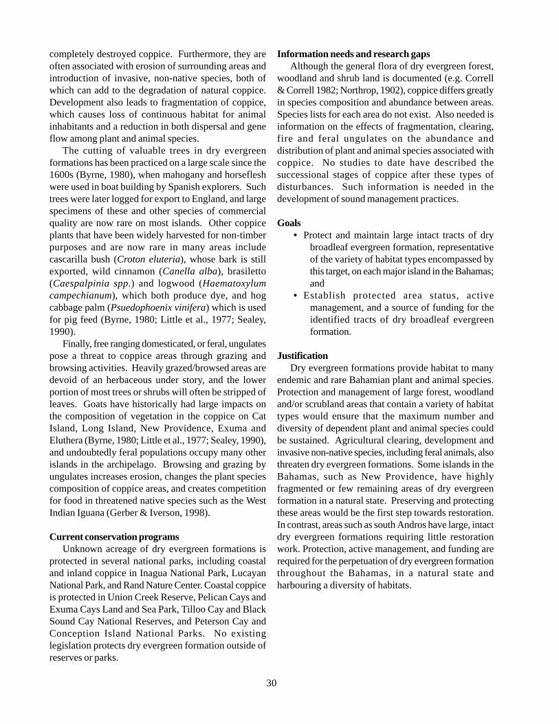
30
completely destroyed coppice. Furthermore, they areoften associated with erosion of surrounding areas andintroduction of invasive, non-native species, both ofwhich can add to the degradation of natural coppice.Development also leads to fragmentation of coppice,which causes loss of continuous habitat for animalinhabitants and a reduction in both dispersal and geneflow among plant and animal species.
The cutting of valuable trees in dry evergreenformations has been practiced on a large scale since the1600s (Byrne, 1980), when mahogany and horsefleshwere used in boat building by Spanish explorers. Suchtrees were later logged for export to England, and largespecimens of these and other species of commercialquality are now rare on most islands. Other coppiceplants that have been widely harvested for non-timberpurposes and are now rare in many areas includecascarilla bush (Croton eluteria), whose bark is stillexported, wild cinnamon (Canella alba), brasiletto(Caespalpinia spp.) and logwood (Haematoxylumcampechianum), which both produce dye, and hogcabbage palm (Psuedophoenix vinifera) which is usedfor pig feed (Byrne, 1980; Little et al., 1977; Sealey,1990).
Finally, free ranging domesticated, or feral, ungulatespose a threat to coppice areas through grazing andbrowsing activities. Heavily grazed/browsed areas aredevoid of an herbaceous under story, and the lowerportion of most trees or shrubs will often be stripped ofleaves. Goats have historically had large impacts onthe composition of vegetation in the coppice on CatIsland, Long Island, New Providence, Exuma andEluthera (Byrne, 1980; Little et al., 1977; Sealey, 1990),and undoubtedly feral populations occupy many otherislands in the archipelago. Browsing and grazing byungulates increases erosion, changes the plant speciescomposition of coppice areas, and creates competitionfor food in threatened native species such as the WestIndian Iguana (Gerber & Iverson, 1998).
Current conservation programsUnknown acreage of dry evergreen formations is
protected in several national parks, including coastaland inland coppice in Inagua National Park, LucayanNational Park, and Rand Nature Center. Coastal coppiceis protected in Union Creek Reserve, Pelican Cays andExuma Cays Land and Sea Park, Tilloo Cay and BlackSound Cay National Reserves, and Peterson Cay andConception Island National Parks. No existinglegislation protects dry evergreen formation outside ofreserves or parks.
Information needs and research gapsAlthough the general flora of dry evergreen forest,
woodland and shrub land is documented (e.g. Correll& Correll 1982; Northrop, 1902), coppice differs greatlyin species composition and abundance between areas.Species lists for each area do not exist. Also needed isinformation on the effects of fragmentation, clearing,fire and feral ungulates on the abundance anddistribution of plant and animal species associated withcoppice. No studies to date have described thesuccessional stages of coppice after these types ofdisturbances. Such information is needed in thedevelopment of sound management practices.
Goals• Protect and maintain large intact tracts of dry
broadleaf evergreen formation, representativeof the variety of habitat types encompassed bythis target, on each major island in the Bahamas;and
• Establish protected area status, activemanagement, and a source of funding for theidentified tracts of dry broadleaf evergreenformation.
JustificationDry evergreen formations provide habitat to many
endemic and rare Bahamian plant and animal species.Protection and management of large forest, woodlandand/or scrubland areas that contain a variety of habitattypes would ensure that the maximum number anddiversity of dependent plant and animal species couldbe sustained. Agricultural clearing, development andinvasive non-native species, including feral animals, alsothreaten dry evergreen formations. Some islands in theBahamas, such as New Providence, have highlyfragmented or few remaining areas of dry evergreenformation in a natural state. Preserving and protectingthese areas would be the first step towards restoration.In contrast, areas such as south Andros have large, intactdry evergreen formations requiring little restorationwork. Protection, active management, and funding arerequired for the perpetuation of dry evergreen formationthroughout the Bahamas, in a natural state andharbouring a diversity of habitats.
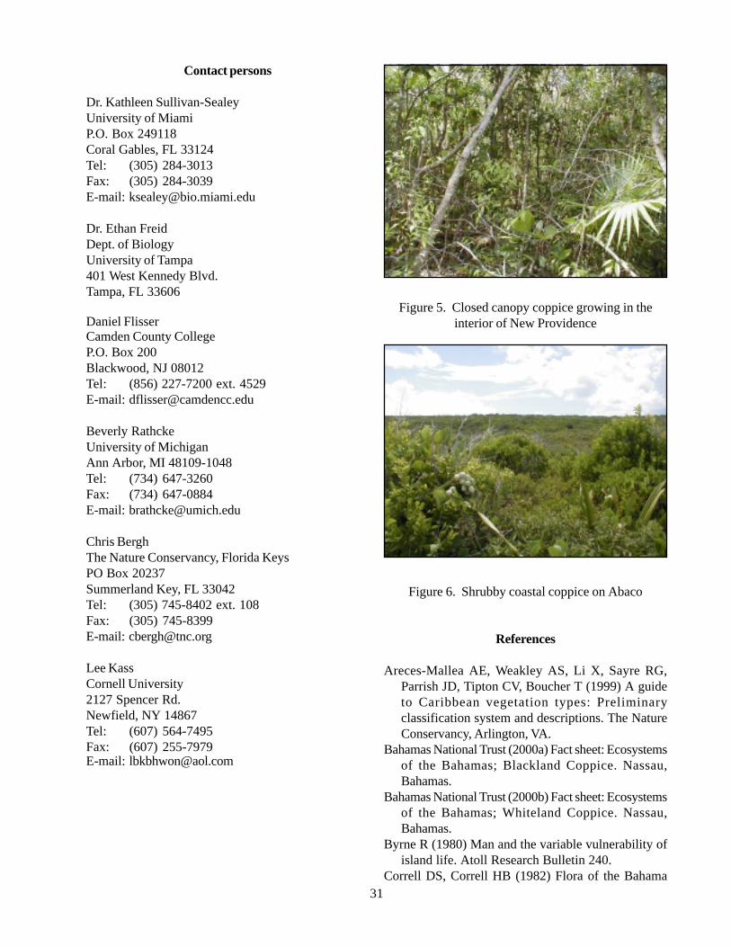
31
Contact persons
Dr. Kathleen Sullivan-SealeyUniversity of MiamiP.O. Box 249118Coral Gables, FL 33124Tel: (305) 284-3013Fax: (305) 284-3039E-mail: [email protected]
Dr. Ethan FreidDept. of BiologyUniversity of Tampa401 West Kennedy Blvd.Tampa, FL 33606
Daniel FlisserCamden County CollegeP.O. Box 200Blackwood, NJ 08012Tel: (856) 227-7200 ext. 4529E-mail: [email protected]
Beverly RathckeUniversity of MichiganAnn Arbor, MI 48109-1048Tel: (734) 647-3260Fax: (734) 647-0884E-mail: [email protected]
Chris BerghThe Nature Conservancy, Florida KeysPO Box 20237Summerland Key, FL 33042Tel: (305) 745-8402 ext. 108Fax: (305) 745-8399E-mail: [email protected]
Lee KassCornell University2127 Spencer Rd.Newfield, NY 14867Tel: (607) 564-7495Fax: (607) 255-7979E-mail: [email protected]
Figure 5. Closed canopy coppice growing in theinterior of New Providence
Figure 6. Shrubby coastal coppice on Abaco
References
Areces-Mallea AE, Weakley AS, Li X, Sayre RG,Parrish JD, Tipton CV, Boucher T (1999) A guideto Caribbean vegetation types: Preliminaryclassification system and descriptions. The NatureConservancy, Arlington, VA.
Bahamas National Trust (2000a) Fact sheet: Ecosystemsof the Bahamas; Blackland Coppice. Nassau,Bahamas.
Bahamas National Trust (2000b) Fact sheet: Ecosystemsof the Bahamas; Whiteland Coppice. Nassau,Bahamas.
Byrne R (1980) Man and the variable vulnerability ofisland life. Atoll Research Bulletin 240.
Correll DS, Correll HB (1982) Flora of the Bahama
32
Archipelago. Strauss and Cramer, Hirschbergi, Germany.Eshbaugh WH, Wilson TK (1990) The tropical flora of Andros Island Bahamas: Observations and notes. In
Proceedings of the 3rd Symposium on the Botany of the Bahamas. Smith R (Ed.), Bahamian Field Station,San Salvador, Bahamas.
Ford K (1997) A description of the ecological communities of North Andros. Bahamas Journal of Science 5(1):29-33.
Hammerton J (2001) Casuarinas in the Bahamas: A clear and present danger. Bahamas Journal of Science 9(1):2-14.
Keith JO, Gnam R (2000) Bahama parrots and feral cats on Abaco. Bahamas Journal of Science. 7(2): 20-26.Northrop AR (1902) Flora of New Providence and Andros. Memoirs of the Torrey Botanical Club 12:1-98Sauleda RP, Adams RM (1979) Epiphytic orchids of North Andros. The Bahamas Naturalist 4: 25-33.Sealey N (1990) The Bahamas today. Macmillan Education, London.Sealey N (1994) Bahamian Landscapes: An introduction to the geography of the Bahamas, 2nd ed. Media
Publishing, Nassau, Bahamas.Smith R (1982) Field guide to the vegetation of San Salvador Island, the Bahamas. CCFL Field Station, San
Salvador, Bahamas.Smith IK, Vankat JL (1992) Dry evergreen formation (coppice) communities of North Andros Island, Bahamas.
Bulletin of the Torrey Botanical Club 119(2): 181-191.
5.1.3. Pineland (Pine yard)
DescriptionClassification following Areces et al. (1999):
Class: WoodlandSubclass: Evergreen woodland
Group: Subtropical needle leavedSubgroup: Natural/Semi-natural
Formation: Pinus caribea var. bahamensis
The Pinus caribea var. bahamensis woodland alliance occurs on four northern Bahamian Islands (Abaco,Andros, Grand Bahamas, New Providence) and in the Turks and Caicos Islands. Also called pine rock land orpine barren, the substrate upon which the woodland is found is heavily pitted oolitic limestone, usually with littlesoil present. An open primary canopy that is formed by stands of Pinus caribea var. bahamensis, which is asubspecies of Caribbean pine endemic to the Bahamas, characterizes pine woodlands. Trees typically occur 3 mto 7 m apart (Northrop, 1902; Emlen, 1977) and give approximately 50% to 60 % canopy cover. Mature pinescan reach between 20 m and 30 m in height and have a maximum trunk diameter of 1.5 m (Northrop, 1902;Correll & Correll, 1982). Low branches are rare; branches are found high on the trunk due to both the growthform of these pines and the pruning action of fire. The upper canopy consists of opposite, spreading branches thatcan be seen bearing 9 cm to 14 cm cones year round.
Because periodic fires clear the under story of pine woodland, there is no significant sub canopy above theshrub layer. The shrub layer is 1-2 meters high and consists of broad leaf evergreens with an underlying herbaceouslayer. Shrubby plants in the pine woodland can be patchy, with open areas or can form a dense, impassable layer.Substantial diversity is found within the shrub and herbaceous layers, with 189 plant species having been cited asto occurring in this alliance (Northrop, 1902; Correll & Correll, 1982; Eshbaugh & Wilson, 1990; Frazer, 1993).Diversity is also seen in the types of woodland that occur. According to the dominant shrub layer and the basichydrology of the area, three different associations of pine woodland have been described (Areces et al., 1999;Freid, 2001; Correll & Correll, 1982).
33
DistributionThere are three varieties of Pinus caribea that occur
in the greater Caribbean region: Honduran, Caribbean,and Bahamian. Pinus caribea var. bahamensis isendemic to the Bahamian Islands. Large stands occuron Grand Bahama, Abaco, Andros and New Providence,as well as the Caicos Islands, where it forms expansivewoodlands on North Caicos, Grand Caicos, and PineCay (Correll & Correll, 1982), and scattered populationson other islands of the Turks and Caicos (Northrop,1902; Correll & Correll, 1982). Pinelands alsohistorically occurred on the Berry Islands (Sealey, 1990).
Status of populations in the wildMuch of the pine woodland in the Bahamas occurs
on Crown Lands. As of 1974, a total of 373,677 acresof pineland exist on Crown Lands (Henry, 1974) onAbaco, New Providence, Grand Bahama and Andros.A current census would probably show less acreage.While the tracts of pineland reported are somewhatintact they encompass many separate woodlands ondifferent parts of the islands. No degree of fragmentationof these woodlands has been reported. Clear cuttingbetween 1957 and 1975 (Henry, 1974) has resulted inpinelands with little variance in age class structure.There is also additional, usually fragmented acreage ofpineland not encompassed by Crown Lands.
Ecology and natural historyPine woodlands of the Bahamas, similar to those in
South Florida and elsewhere in the Caribbean, arerecognized as ‘fire climax’ communities. The bark ofPinus caribea is multi-layered and thick, and acts tokeep the tree’s cambium from reaching a lethaltemperature threshold. Pinus caribea is a lightdemanding species. Without periodic (3-7 years onaverage) fires to clear out undergrowth, pine seedlingswould not receive sufficient light or nutrients to survive(Sealey, 1990). In areas of the pineland that have notbeen subjected to recent fires (> 15 years) there is atransition to dry broadleaf evergreen forest, woodland,and shrub land with a remnant over story of pine trees(Eshbaugh & Wilson, 1990). Annual fires are knownto keep the diversity of the under story at a minimum.
In low lying areas that accumulate ephemeral freshwater ponds, as well as areas in which the subterraneanfresh water lens is near to the surface, the under storyshrub layer is dominated by Sabal palmetto. Othercommon species that are found in the shrub layer in lowpine woodlands are Metopium toxiferum, Byrsonimalucida, Lantana involucratea, Bourreria ovata andThrinax morrisii (Eshbaugh & Wilson, 1990). Among
the numerous vines and herbs that occur in the understory herbaceous layer are Rajania hastate, Smilaxariculata, S. havanensis, S. laurifolia, Ipomoeamicrodactyla, Centrosema virginiana, Rhabdadeniabiflora, Dichromena colorata, Eustachys petraea, andAndropogon spp. (Correll & Correll, 1982; Eshbaugh& Wilson, 1990). Additional variation in low pinewoodland occurs in areas of Northern Andros. Therethe relative nearness of the fresh water lens to the surfacestunts the growth of Pinus caribea var. bahamensis,creating pygmy woodland with a broadleaf andherbaceous under story that is both reduced in diversityand density (Freid, 2001 personal observation).
Wet and dry pinelands are often inter-dispersed andshare many of the same species, although the dominantspecies change depending on the proximity of water. Inupland areas that are better drained the under story isusually dominated either by the palms Coccothrinaxargentata and Thrinax morrissii, or by poisonwood(Metopium toxiferum) (Correll & Correll, 1982; Areceset al., 1999; Eshbaugh & Wilson, 1990). Other speciesthat occur more commonly in dry pinelands are Petitiadomingensis, Acacia choriophylla, Cordiabahamensis, Turnera ulmifolia, Veronia bahamensis,Dichromena colorata, Hypericum hypericoides,Duranta repens, Tetrazygia bicolor, Chiococcaparvifolia, Linum bahamesis, and Cassia lineata(Correll & Correll, 1982; Eshbaugh & Wilson, 1990).Two species of note are Bletia purpurea (purple orchid)and Pteridium aquilinum (bracken fern), both of whichare common in the dry pineland. Also found in the drypineland is the cycad Zamia integrifolia, which is theexclusive host plant of the small and rare Atalahairstreak butterfly.
An additional association can be recognized asoccurring on Abaco in areas of the pine forests in whichthe fire regime has been unnaturally altered to occur ona yearly basis. In these areas shrubby broadleafevergreen species are not able to re-establish, and theweedy fern Pteridium aquilinum has become thedominant under story species, forming an impenetrablethicket (Freid, 2001 personal observation).
HabitatIn general, pine woodlands occur in well-drained or
freshwater-saturated limestone rock lands of ooliticorigin. The limestone is usually heavily pitted, withsinkholes often present. Pine woodlands can occur ona thin layer of soil or no soil at all. Because of the needfor high light intensity, they are only able to establish inareas with low or open shrub/scrub that are periodicallyburned. Pine woodlands can be re-established in thinly
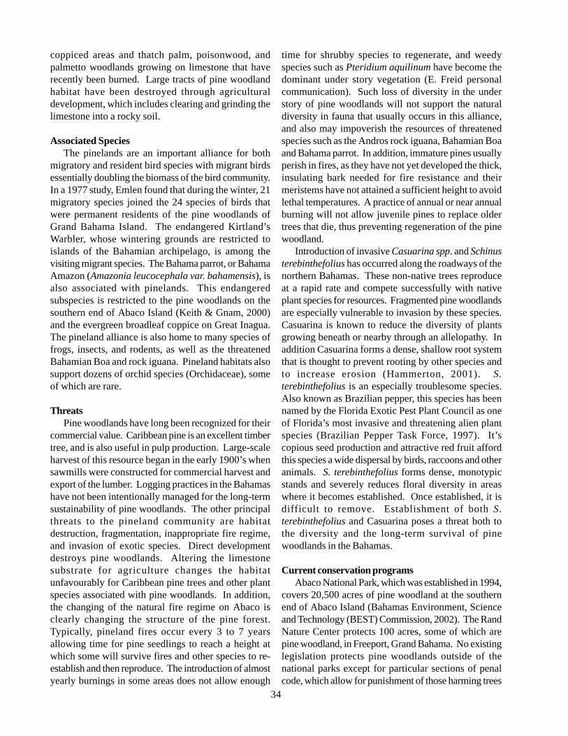
34
coppiced areas and thatch palm, poisonwood, andpalmetto woodlands growing on limestone that haverecently been burned. Large tracts of pine woodlandhabitat have been destroyed through agriculturaldevelopment, which includes clearing and grinding thelimestone into a rocky soil.
Associated SpeciesThe pinelands are an important alliance for both
migratory and resident bird species with migrant birdsessentially doubling the biomass of the bird community.In a 1977 study, Emlen found that during the winter, 21migratory species joined the 24 species of birds thatwere permanent residents of the pine woodlands ofGrand Bahama Island. The endangered Kirtland’sWarbler, whose wintering grounds are restricted toislands of the Bahamian archipelago, is among thevisiting migrant species. The Bahama parrot, or BahamaAmazon (Amazonia leucocephala var. bahamensis), isalso associated with pinelands. This endangeredsubspecies is restricted to the pine woodlands on thesouthern end of Abaco Island (Keith & Gnam, 2000)and the evergreen broadleaf coppice on Great Inagua.The pineland alliance is also home to many species offrogs, insects, and rodents, as well as the threatenedBahamian Boa and rock iguana. Pineland habitats alsosupport dozens of orchid species (Orchidaceae), someof which are rare.
ThreatsPine woodlands have long been recognized for their
commercial value. Caribbean pine is an excellent timbertree, and is also useful in pulp production. Large-scaleharvest of this resource began in the early 1900’s whensawmills were constructed for commercial harvest andexport of the lumber. Logging practices in the Bahamashave not been intentionally managed for the long-termsustainability of pine woodlands. The other principalthreats to the pineland community are habitatdestruction, fragmentation, inappropriate fire regime,and invasion of exotic species. Direct developmentdestroys pine woodlands. Altering the limestonesubstrate for agriculture changes the habitatunfavourably for Caribbean pine trees and other plantspecies associated with pine woodlands. In addition,the changing of the natural fire regime on Abaco isclearly changing the structure of the pine forest.Typically, pineland fires occur every 3 to 7 yearsallowing time for pine seedlings to reach a height atwhich some will survive fires and other species to re-establish and then reproduce. The introduction of almostyearly burnings in some areas does not allow enough
time for shrubby species to regenerate, and weedyspecies such as Pteridium aquilinum have become thedominant under story vegetation (E. Freid personalcommunication). Such loss of diversity in the understory of pine woodlands will not support the naturaldiversity in fauna that usually occurs in this alliance,and also may impoverish the resources of threatenedspecies such as the Andros rock iguana, Bahamian Boaand Bahama parrot. In addition, immature pines usuallyperish in fires, as they have not yet developed the thick,insulating bark needed for fire resistance and theirmeristems have not attained a sufficient height to avoidlethal temperatures. A practice of annual or near annualburning will not allow juvenile pines to replace oldertrees that die, thus preventing regeneration of the pinewoodland.
Introduction of invasive Casuarina spp. and Schinusterebinthefolius has occurred along the roadways of thenorthern Bahamas. These non-native trees reproduceat a rapid rate and compete successfully with nativeplant species for resources. Fragmented pine woodlandsare especially vulnerable to invasion by these species.Casuarina is known to reduce the diversity of plantsgrowing beneath or nearby through an allelopathy. Inaddition Casuarina forms a dense, shallow root systemthat is thought to prevent rooting by other species andto increase erosion (Hammerton, 2001). S.terebinthefolius is an especially troublesome species.Also known as Brazilian pepper, this species has beennamed by the Florida Exotic Pest Plant Council as oneof Florida’s most invasive and threatening alien plantspecies (Brazilian Pepper Task Force, 1997). It’scopious seed production and attractive red fruit affordthis species a wide dispersal by birds, raccoons and otheranimals. S. terebinthefolius forms dense, monotypicstands and severely reduces floral diversity in areaswhere it becomes established. Once established, it isdifficult to remove. Establishment of both S.terebinthefolius and Casuarina poses a threat both tothe diversity and the long-term survival of pinewoodlands in the Bahamas.
Current conservation programsAbaco National Park, which was established in 1994,
covers 20,500 acres of pine woodland at the southernend of Abaco Island (Bahamas Environment, Scienceand Technology (BEST) Commission, 2002). The RandNature Center protects 100 acres, some of which arepine woodland, in Freeport, Grand Bahama. No existinglegislation protects pine woodlands outside of thenational parks except for particular sections of penalcode, which allow for punishment of those harming trees
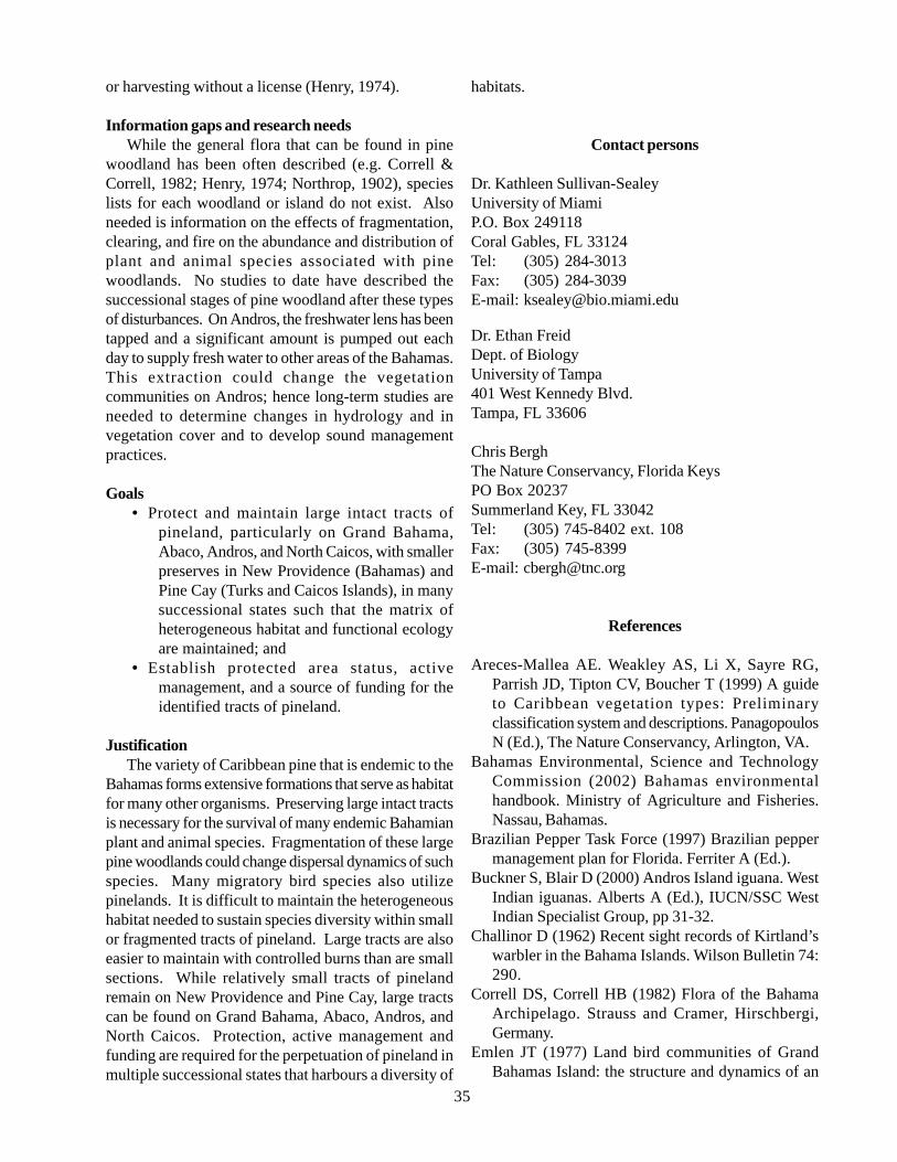
35
or harvesting without a license (Henry, 1974).
Information gaps and research needsWhile the general flora that can be found in pine
woodland has been often described (e.g. Correll &Correll, 1982; Henry, 1974; Northrop, 1902), specieslists for each woodland or island do not exist. Alsoneeded is information on the effects of fragmentation,clearing, and fire on the abundance and distribution ofplant and animal species associated with pinewoodlands. No studies to date have described thesuccessional stages of pine woodland after these typesof disturbances. On Andros, the freshwater lens has beentapped and a significant amount is pumped out eachday to supply fresh water to other areas of the Bahamas.This extraction could change the vegetationcommunities on Andros; hence long-term studies areneeded to determine changes in hydrology and invegetation cover and to develop sound managementpractices.
Goals• Protect and maintain large intact tracts of
pineland, particularly on Grand Bahama,Abaco, Andros, and North Caicos, with smallerpreserves in New Providence (Bahamas) andPine Cay (Turks and Caicos Islands), in manysuccessional states such that the matrix ofheterogeneous habitat and functional ecologyare maintained; and
• Establish protected area status, activemanagement, and a source of funding for theidentified tracts of pineland.
JustificationThe variety of Caribbean pine that is endemic to the
Bahamas forms extensive formations that serve as habitatfor many other organisms. Preserving large intact tractsis necessary for the survival of many endemic Bahamianplant and animal species. Fragmentation of these largepine woodlands could change dispersal dynamics of suchspecies. Many migratory bird species also utilizepinelands. It is difficult to maintain the heterogeneoushabitat needed to sustain species diversity within smallor fragmented tracts of pineland. Large tracts are alsoeasier to maintain with controlled burns than are smallsections. While relatively small tracts of pinelandremain on New Providence and Pine Cay, large tractscan be found on Grand Bahama, Abaco, Andros, andNorth Caicos. Protection, active management andfunding are required for the perpetuation of pineland inmultiple successional states that harbours a diversity of
habitats.
Contact persons
Dr. Kathleen Sullivan-SealeyUniversity of MiamiP.O. Box 249118Coral Gables, FL 33124Tel: (305) 284-3013Fax: (305) 284-3039E-mail: [email protected]
Dr. Ethan FreidDept. of BiologyUniversity of Tampa401 West Kennedy Blvd.Tampa, FL 33606
Chris BerghThe Nature Conservancy, Florida KeysPO Box 20237Summerland Key, FL 33042Tel: (305) 745-8402 ext. 108Fax: (305) 745-8399E-mail: [email protected]
References
Areces-Mallea AE. Weakley AS, Li X, Sayre RG,Parrish JD, Tipton CV, Boucher T (1999) A guideto Caribbean vegetation types: Preliminaryclassification system and descriptions. PanagopoulosN (Ed.), The Nature Conservancy, Arlington, VA.
Bahamas Environmental, Science and TechnologyCommission (2002) Bahamas environmentalhandbook. Ministry of Agriculture and Fisheries.Nassau, Bahamas.
Brazilian Pepper Task Force (1997) Brazilian peppermanagement plan for Florida. Ferriter A (Ed.).
Buckner S, Blair D (2000) Andros Island iguana. WestIndian iguanas. Alberts A (Ed.), IUCN/SSC WestIndian Specialist Group, pp 31-32.
Challinor D (1962) Recent sight records of Kirtland’swarbler in the Bahama Islands. Wilson Bulletin 74:290.
Correll DS, Correll HB (1982) Flora of the BahamaArchipelago. Strauss and Cramer, Hirschbergi,Germany.
Emlen JT (1977) Land bird communities of GrandBahamas Island: the structure and dynamics of an
36
avifauna. Ornithological Monographs No. 24.Eshbaugh WH, Wilson TK (1990) The tropical flora of
Andros Island Bahamas: Observations and notes. InProceedings of the Third Symposium on the Botanyof the Bahamas. Smith R (Ed.), Bahamian FieldStation, San Salvador, Bahamas.
Frazer AM, Eshbaugh WH (1993) Ecology and floristiccomposition of the herbaceous vine and lianaassemblages of pineland and coppice communitiesof North Andros Island, Bahamas. American Journalof Botany 80(6): 67.
Freid E (2001) Personal communication.Hammerton J (2001) Casuarinas in the Bahamas: A clear
and present danger. Bahamas Journal of Science 9(1):2-14.
Henry PWT (1974) The pine forests of the Bahamas.Land Resource Study No.16. Land ResourcesDivision, Overseas Development Administration,England.
Lee DS, Walsh-McGehee M, Haney JC (1997) Ahistory, biology and re-evaluation of the Kirtland’swarbler habitat in the Bahamas. Bahamas Journal ofScience 4(2): 19-29.
Keith JO, Gnam R (2000) Bahama parrots and feralcats on Abaco. Bahamas Journal of Science 7(2):20-26.
Mayfield H (1960) The Kirtland’s warbler. CranbookInstitute of Science, Bloomfield Hills, MI.
Northrop AR (1902) Flora of New Providence andAndros. Memoirs of the Torrey Botanical Club 12:1-98.
Radabaugh BE (1974) Kirtland’s warbler and itsBahama wintering grounds. Wilson Bulletin 86: 374-383.
Raffaele H, Wiley J, Garrido O, Keith A, Raffaele J(1998) A guide to the birds of the West Indies.Princeton University Press. Princeton, NJ.
Sealey N (1990) The Bahamas today. MacmillanEducation, London.
Figure 7. Pine rock land on saturated limestoneon Andros
Figure 8. Pine rock land on well-drained limestoneon Abaco
5.1.4. Freshwater and Coastal WetlandsMangrove swamps, anchialine ponds, marshes,ephemeral ponds
DescriptionWetlands are, in general terms, lands where
saturation with water is the dominant factor determiningthe nature of soil development and the types of plantand animal communities living in the soil and on itssurface. Over the years, numerous classifications ofwetlands and deepwater habitats have been developed(Stewart & Kantrud, 1971; Golet & Larson, 1974;Jeglum et al., 1974; Odum et al., 1974; Zoltai et al.,1975; Millar, 1976). In the most commonly used
37
classification system (Cowardin et al. 1979), wetlandsmust have one or more of the following three attributes:
• At least periodically, the land supportspredominantly hydrophytes;
• The substrate is predominantly undrained hydricsoil, and
• The substrate is non-soil and is saturated withwater or covered by shallow water at some timeduring the year.
Wetlands of the Bahamian archipelago include inthree systems:
Estuarine Systems, characterized by coastal wetlands,mangroves, mangrove creeks and ponds influenced bytidal regimes, and elevated salinities (brackish to marineto hyper saline conditions).Lacustrine Systems, consisting of large lakes and pondsthat have minimal tidal influence, and are mostlyfreshwater. This includes large blue holes and anchialineponds. In the Bahamas, most of these systems haveunderlying saltwater beneath the freshwater lens. Thesewetlands are characterized by open (deepwater) habitats.Palustrine Systems, comprising small ponds, marshesand swamps with emergent wetland vegetation. Thisincludes sable palm wetlands, buttonwood swamps orlow-lying seasonal or ephemeral wetlands.
Coastal wetlands are characterized as estuarinesystems, and are the largest group of wetlands by areaand extent of occurrence in the Bahamian archipelago.Like all wetlands, coastal wetlands are sometimes easyto recognize, but can also be very difficult to distinguishfrom uplands. Coastal wetlands can occur in areas withstanding water, tidal water, or only periodic or seasonalflooding. The carbonate rock geology of the Bahamianarchipelago is porous and permeable. There is salt waterunderneath islands with a layer of less dense fresh water“floating” on top. This creates unusual inland brackishponds, tidally-influences blue holes and extensiveseasonal wetland environments. There is a critical needfor a comprehensive wetlands inventory of the entirearchipelago to identify and characterize the range ofwetlands throughout the islands.
The most important coastal wetlands in thearchipelago are the mangrove communities. Mangrovesare among the most common coastal wetlands and veryproductive natural systems. The mixing of nutrients fromland and sea produces huge amounts of organic matter,
of which only fish and invertebrates directly consume asmall fraction. In fact, bacteria decompose most of thisorganic matter, producing an organic soup that feedsorganisms such as amphipods, shrimp, crabs, snails,shellfish and finfish.
The term ‘mangrove’ is ambiguous in its meaning.On one hand, it refers to a type of halophilic (salt-loving)plant. The mangroves, as plant species, are a large,diverse group that have hit upon a common solution forinhabiting saline soils. Mangrove forests and shrub landsdominate tropical and subtropical coastlines around theworld. The term ‘Mangrove’ is also used to refer to acommunity of plants and animals living in tidal swampforests. Their distribution is influenced by: climate (i.e.temperature and rainfall), salinity and tidal range,substrate and underlying geology, and wave energy.Mangrove communities were defined as having one offour vegetation structures: shrub lands, scrub thickets,woodlands or true forests (see vegetation classificationfor a detailed description of mangrove vegetationclassification). Vegetation structure is determined bythe dominant strata of the community, which includesan assessment of both the height of the plants and thearea of ground covered by the canopy.
Abiotic factors such as tidal range, coastalmorphology, wave energy and rainfall determine theextent of mangrove communities, as well as distinctivezonation from deep water to upland communities.Mangroves, even red mangroves can grow well in freshwater, but may not be found there because of seeddispersal mechanisms or because of competition withother plants. Mangrove communities also take a varietyof topographic forms, based on the geology, hydrology,and biology of the area. The major types of mangrovecommunities found in the Bahamas are described:
Over wash Mangrove forestsThese are often isolated islands or mud banksthat are frequently over washed by tidalcurrents. All species of mangroves may bepresent, but the red mangroves will dominatearound the perimeter of the island (mostseaward). Eventually these over wash forestsmay trap enough sediment for other coastalplants to become established.
Fringe Mangrove forestsMangroves can form a relatively thin fringealong waterways. A steeply sloping shorelinecan cause zonation to be compressed into arelatively narrow area.
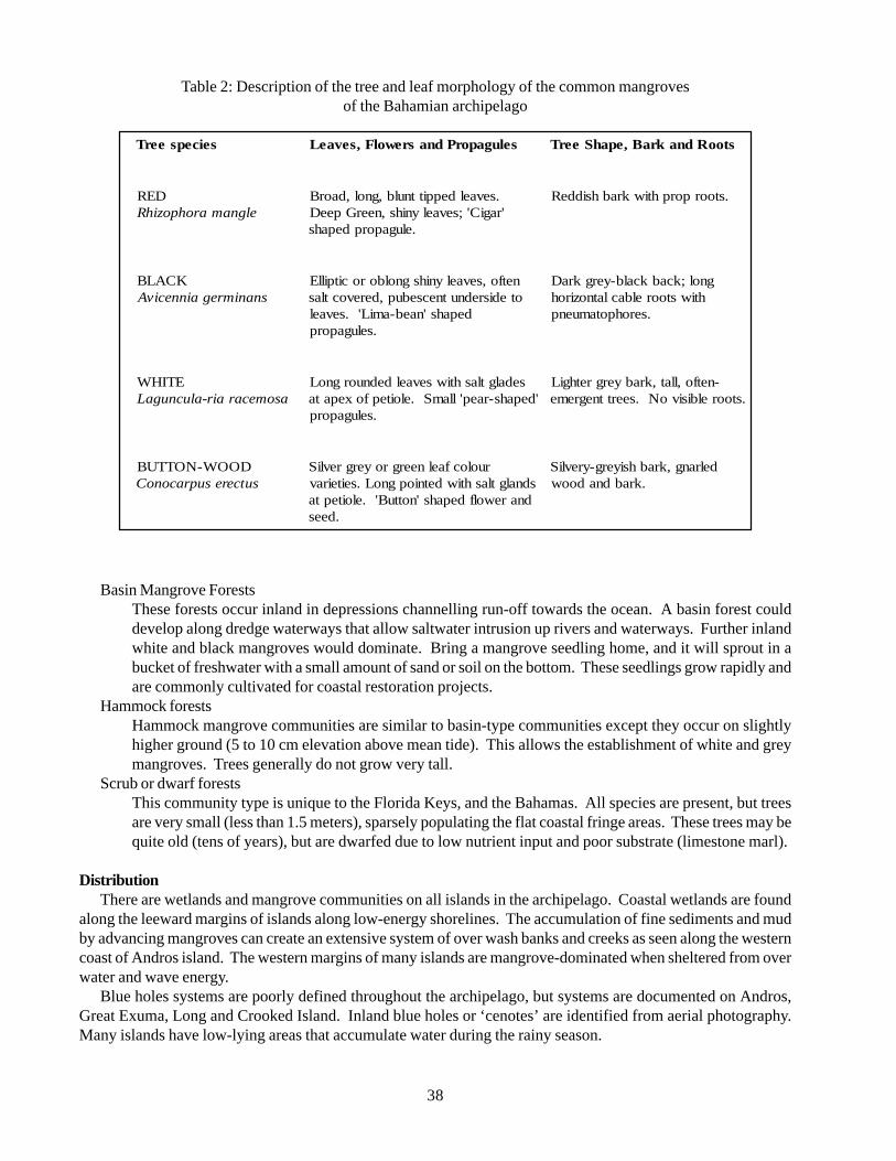
38
Table 2: Description of the tree and leaf morphology of the common mangrovesof the Bahamian archipelago
Basin Mangrove ForestsThese forests occur inland in depressions channelling run-off towards the ocean. A basin forest coulddevelop along dredge waterways that allow saltwater intrusion up rivers and waterways. Further inlandwhite and black mangroves would dominate. Bring a mangrove seedling home, and it will sprout in abucket of freshwater with a small amount of sand or soil on the bottom. These seedlings grow rapidly andare commonly cultivated for coastal restoration projects.
Hammock forestsHammock mangrove communities are similar to basin-type communities except they occur on slightlyhigher ground (5 to 10 cm elevation above mean tide). This allows the establishment of white and greymangroves. Trees generally do not grow very tall.
Scrub or dwarf forestsThis community type is unique to the Florida Keys, and the Bahamas. All species are present, but treesare very small (less than 1.5 meters), sparsely populating the flat coastal fringe areas. These trees may bequite old (tens of years), but are dwarfed due to low nutrient input and poor substrate (limestone marl).
DistributionThere are wetlands and mangrove communities on all islands in the archipelago. Coastal wetlands are found
along the leeward margins of islands along low-energy shorelines. The accumulation of fine sediments and mudby advancing mangroves can create an extensive system of over wash banks and creeks as seen along the westerncoast of Andros island. The western margins of many islands are mangrove-dominated when sheltered from overwater and wave energy.
Blue holes systems are poorly defined throughout the archipelago, but systems are documented on Andros,Great Exuma, Long and Crooked Island. Inland blue holes or ‘cenotes’ are identified from aerial photography.Many islands have low-lying areas that accumulate water during the rainy season.
seicepseerT selugaporPdnasrewolF,sevaeL stooRdnakraB,epahSeerT
DERelgnamarohpozihR
.sevaeldeppittnulb,gnol,daorB'ragiC';sevaelynihs,neerGpeeD
.elugaporpdepahs
.stoorporphtiwkrabhsiddeR
KCALBsnanimregainnecivA
netfo,sevaelynihsgnolborocitpillEotedisrednutnecsebup,derevoctlas
depahs'naeb-amiL'.sevael.selugaporp
gnol;kcabkcalb-yergkraDhtiwstoorelbaclatnoziroh
.serohpotamuenp
ETIHWasomecarair-alucnugaL
sedalgtlashtiwsevaeldednuorgnoL'depahs-raep'llamS.eloitepfoxepata
.selugaporp
-netfo,llat,krabyergrethgiL.stoorelbisivoN.seerttnegreme
DOOW-NOTTUBsutceresupraconoC
ruolocfaelneergroyergrevliSsdnalgtlashtiwdetniopgnoL.seiteirav
dnarewolfdepahs'nottuB'.eloitepta.dees
delrang,krabhsiyerg-yrevliS.krabdnadoow
39
Ecology and natural historyWetlands are essential breeding, rearing, and feeding
grounds for many species of fish and wildlife. Theyalso play a significant role in flood protection andpollution control.
Coastal wetlands are among the most productiveecosystems in the world, comparable to tropical rainforests and coral reefs. Because of their abundance ofnutrients, and a high primary productivity they serve asbiological nurseries for many other species, includingaquatic plants, fish, shellfish, insects, amphibians, birds,and mammals, providing food as well as shelter andprotection from predators. Furthermore, coastalwetlands filter sediment and chemicals, thus reducingthe amount of pollution that washes into bays and theocean.
Mangroves are important to both transient andpermanent inhabitants. Rising and falling tides moveboth the organic soup and small feeding organismsbetween the salt marsh and adjacent coastal waters. Theabundance of small habitats within a salt marsh allowsfor numerous organisms to hide from predators, feedwithout expending much energy, grow faster, and raiseyoung. In addition to the transient organisms, mangrovesshelter species that may spend their entire life in thesalt marsh; killifish take refuge in small salt marsh ponds,fiddler crabs hide in burrows, and mussels close theirshells and await the next flood tide.
Over 75 percent of the fish caught commercially,and 80-90 percent of fish caught recreationally inhabitmangroves and mangrove creeks at one time or another.Mangroves were once considered a trash tree, andremoved to make room for marinas, and other coastaldevelopments. In mangrove communities, much of theprimary production is exported to other coastalcommunities that are related in function and energy flowin the coastal ecosystem. Many animals do not feeddirectly on the mangrove leaves. Microbial action isimportant in transforming the leaf energy fromhard-to-digest cellulose to more usable organicmolecules (proteins, simple sugars or fatty acids).
In locations where mangroves have been present forsome time and low wave energy and depositionalconditions persist, high amounts of peat soil formationand deposition will occur. Peat soils are formed throughan accumulation of partially decomposed woody orfibrous plant matter under reducing conditions. Thispeat soil formation is driven by the productivity andsubsequent decomposition of large amounts of plantmatter (litter fall: i.e. leaves, wood, propagules, andflowers).
Although there is a large quantity of leaves producedby mangroves, much of the organic matter produced maybe moved out of the coastal plant community. In thedescription of community types, it is obvious that somecommunities will have a greater loss or export ofnutrients. The dwarf or scrub communities do not storelarge amounts of nutrients because of a sparse settlingof trees and high flushing rates (daily tidal flooding withstrong currents). The larger and more developed themangrove forest, the greater its ability to accumulateand store important nutrients in order to fuel production.Your observations should comment on the storage,biomass and productivity of the community.
HabitatWetland habitat is described based on a classification
system developed by the Fish and Wildlife Service(Cowardin et al., 1979). The Bahamian archipelagoincludes estuarine, lacustrine systems and palustrinesystems. Blue Holes present a unique component oflacustrine systems. The boundary between ‘wetland’and ‘deepwater’ habitat in the lacustrine system is about2 meters; ‘deepwater’ habitats refers to the lack ofemergent vegetation, which can be both a function ofwater depth and tidal currents (Welch, 1952; Zhadin &Gerd, 1963; Sculthorpe, 1967).
The estuarine system (see Figure 9, Ref. Cowardinet al., 1979) consists of deepwater tidal habitats andadjacent tidal wetlands that are usually semi-enclosedby land but have open, partly obstructed, or sporadicaccess to the open ocean, and in which ocean water isat least occasionally diluted by freshwater runoff fromthe land. In the Bahamas, the connection to open oceanmay be maintained through a subterranean connectionto the ocean, or storm wash-over of adjacent dunes. Oneor more of the following forces affects estuarine waterregimes and water chemistry: oceanic tides,precipitation, and freshwater runoff from land areas,evaporation, and wind. The salinity may be periodicallyincreased above that of the open ocean by evaporation.Along some low-energy coastlines there is appreciabledilution of seawater with rainfall and storms.
In terms of wave action, estuaries are generallyconsidered to be low-energy systems (Chapman 1977:2).For an extended discussion of estuaries and lagoons,see Lauff (1967).
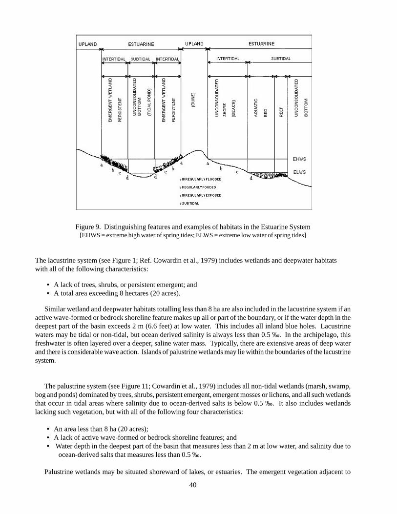
40
Figure 9. Distinguishing features and examples of habitats in the Estuarine System[EHWS = extreme high water of spring tides; ELWS = extreme low water of spring tides]
The lacustrine system (see Figure 1; Ref. Cowardin et al., 1979) includes wetlands and deepwater habitatswith all of the following characteristics:
• A lack of trees, shrubs, or persistent emergent; and• A total area exceeding 8 hectares (20 acres).
Similar wetland and deepwater habitats totalling less than 8 ha are also included in the lacustrine system if anactive wave-formed or bedrock shoreline feature makes up all or part of the boundary, or if the water depth in thedeepest part of the basin exceeds 2 m (6.6 feet) at low water. This includes all inland blue holes. Lacustrinewaters may be tidal or non-tidal, but ocean derived salinity is always less than 0.5 ‰. In the archipelago, thisfreshwater is often layered over a deeper, saline water mass. Typically, there are extensive areas of deep waterand there is considerable wave action. Islands of palustrine wetlands may lie within the boundaries of the lacustrinesystem.
The palustrine system (see Figure 11; Cowardin et al., 1979) includes all non-tidal wetlands (marsh, swamp,bog and ponds) dominated by trees, shrubs, persistent emergent, emergent mosses or lichens, and all such wetlandsthat occur in tidal areas where salinity due to ocean-derived salts is below 0.5 ‰. It also includes wetlandslacking such vegetation, but with all of the following four characteristics:
• An area less than 8 ha (20 acres);• A lack of active wave-formed or bedrock shoreline features; and• Water depth in the deepest part of the basin that measures less than 2 m at low water, and salinity due to
ocean-derived salts that measures less than 0.5 ‰.
Palustrine wetlands may be situated shoreward of lakes, or estuaries. The emergent vegetation adjacent to
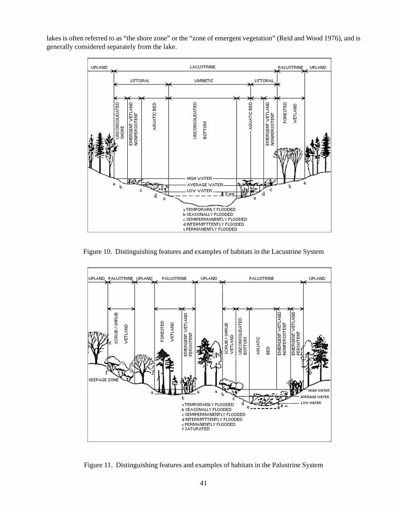
41
lakes is often referred to as “the shore zone” or the “zone of emergent vegetation” (Reid and Wood 1976), and isgenerally considered separately from the lake.
Figure 10. Distinguishing features and examples of habitats in the Lacustrine System
Figure 11. Distinguishing features and examples of habitats in the Palustrine System
42
Associated Species (see other target descriptions fordetails)
White-crowned PigeonsWest Indian FlamingosWest Indian Whistling DuckThere are likely a large number of endemic species inthe Blue holes and anchialine pond systems. Theseenvironments represent the greatest concentration ofspecies endemism in the archipelago.
ThreatsMany factors are responsible for coastal wetland loss.
Historically, coastal wetlands were drained and usedfor development and marina access. More recently,coastal wetlands have been filled or dredged for roads,houses, golf courses, marinas, and tourism development.Even wetlands that are not actually filled or dredgedare becoming degraded due to pollution, changes inwater flows, and invasion by weeds or other non-nativeplants and animals. Coastal wetland losses can bedirectly traced to population pressures and other humanchanges occurring along the coast. Coastal wetlandscan and do move inland with rising sea level, but indeveloped areas, roads, houses, parking lots, and otherhuman structures interfere with this natural migrationof coastal habitats. In many places, artificial seawallskeep rising water levels back for a time and coastalwetlands become submerged, eventually dying anderoding away.
Current conservation programsThere is a growing concern for the protection of
coastal wetlands, particularly tidal creek and pondsystems. Restoration efforts to restore flow to tidalcreeks have been critical to protected coastal wetlands,especially on New Providence island.
Information Gaps and Research NeedsIncreasing national and international recognition of
these functions has intensified the need for reliableinformation on the status and extent of wetlandresources. A national wetland inventory for thearchipelago is desperately needed both to capture thebiological diversity of these habitats, and betterunderstand the ecology of wetlands related to islandhydrology and water resources.
Conservation GoalsBased on report by Garcia (1998):
• Better resolve of conflicts among competitiveuses and users of wetland habitats;
• Increase the collaboration betweenconservationists, developers and communities;and
• Account for the economic, cultural andenvironmental value of wetlands.
Based on a report by Higgins and Lammert (NatureConservancy Background):
• Compilation and analysis of wetland-related datato direct conservation and developmentplanning;
• Development of tools and data management andanalysis tools;
• Development of a standard hierarchicalframework for classifying wetlands; and
• Providing a standardized conservation rankingsystem and preliminary ranks for wetlands(aquatic communities) to guide identificationand planning for high-priority wetlands(freshwater communities).
Contact persons
Dr. Stefan HarzenThe Taras Oceanographic Foundation5905 Stonewood CourtTel: (561) 743-7683Fax: (561) 748-0794E-mail: [email protected]
Kathleen Sullivan-Sealey, Ph.D.University of MiamiP.O. Box 249118Coral Gables, FL 33124Tel: (305) 284-3013Fax: (305) 284-3039E-mail: [email protected]
References
Areces-Mallea AE. Weakley AS, Li X, Sayre RG,Parrish JD, Tipton CV, Boucher T (1999). A guideto Caribbean vegetation types: Preliminaryclassification system and descriptions. PanagopoulosN (Ed.), The Nature Conservancy, Arlington, VA.
Bucher, Enrique, G. Castro and V. Floris (1996).Integration of Freshwater Ecosystem Conservationinto a Comprehensive Water Resources Management
43
Strategy for Latin America and the Caribbean. Draft.IDB/WWF. Washington, DC.
Garcia, Luis E. (1998). Integrated Water ResourcesManagement in Latin America and the Caribbean.Technical Study. IDB. No.ENV-123. Washington,DC.
Carter, M., L. Burns, T. Cavinder, K Dugger, P. Fore, DHicks H. Revells and T. Schmidt. 1973. Ecosystemanalysis of the Big Cypress Swamp and Estuaries.U.S. Environmental Protection Agency, Region IV.South Florida Ecological Study. EPA 904/9-74-002.
Cintron-Molero, G. and Y. Schaeffer-Novelli. 1992.Ecology and management of new world mangroves.p 234-258 in: U. Seeliger (ed.). Coastal plantcommunities of Latin America. Academic Press, SanDiego.
Cowardin, L.M., V. Carter, F. Golet and E. LaRoe.1979. Classification of wetlands and deepwaterhabitats of the United States. U.S. Fish and WildlifeService FWS/OBS-79/31. 103 pp.
Dethier, M. 1992. Classifying marine and estuarinenatural communities: an alternative to the Cowardinsystem. Natural Areas Journal 12 (2):90-100.
Hicks, D.B. and L. A. Burns. 1975. Mangrove metabolicresponse to alterations of natural freshwater drainagein southwestern Florida estuaries. p. 238 - 255 inG. Walsh, S. Snedacker and H. Teas (Eds).Proceedings of the International Symposium on thebiology and management of mangroves. Univ. ofFlorida, Gainesville.
Lugo, A.E. and S.C. Snedaker. 1974. The ecology ofmangroves. Annual Review of Ecology andSystematics 5:39-64.
Lugo, A. M. Sell and S. Snedaker. 1976. Mangroveecosystem analysis. Pages 113-145 in B. C. Patton(Ed). Systems analysis and simulation in ecology.Academic Press, New York.
Miller, P.C. 1972. Bioclimate, leaf temperature, andprimary production in red mangrove canopies insouth Florida. Ecology 53: 22-45.
026+.community profile. U.S. Fish and WildlifeService, Office of Biological Services. Washington,D.C. FWS/OBS-81/24. 144 pp.
Ross, M., J. O’Brien and L. FLynn. 1992. Ecologicalclassification of Florida Keys terrestrial habitats.Ecosystems Studies; Department of Scientific andPolicy research, National Audubon Society,Tavernier, Fl. 35 pp.
Odum, W.E., J.C. Zieman, and E.J. Heald. 1973. Theimportance of vascular plant detritus to estuaries,pp. 91 - 114. In: Proc. 2nd Coastal marsh and EstuaryManagement Symposium, Baton Rouge, Louisiana.
Ogden, J.C. and E.H. Gladfelter (eds). 1983. Coralreefs, seagrass beds, and mangroves: their interactionin the coastal zones of the Caribbean. UNESCOReports in Marine Science, 23. 133 pp.
Thayer, G.W., H. Stuart, W.J. Kenworthy, J.F. Ustach,and A.B. Hall. 1978. Habitat values of salt marshes,mangroves, and seagrasses for aquatic organisms.Wetland Functions and Values: The State of OurUnderstanding. Amer. Water Res. Assoc. Nov.1978.
Voss, G.L. 1976. Seashore life of Florida andCaribbean. Banyan Books, Inc., Miami, Florida.199 pp.
Woelkerling, W.J. 1976. Sedimenta V — South Floridabenthic marine algae: key and comments. RosenstielSchool of Marine and Atmospheric Science,University of Miami, Florida. 145 pp.
5.2. Target Species
5.2.1. Atlantic Spotted Dolphin (Stenella frontalis)
DescriptionPhylum Vertebrata
Class MammaliaOrder Odontoceti
Family Delphinidae
The Atlantic spotted dolphin (Stenella frontalis)belongs to the Family Delphinidae, or true dolphins,which comprises 32 species (Leatherwood and Reeves1983; Klinowska 1991). The spotted dolphin sharesthat family with other more familiar species, includingthe common dolphin (Delphinus delphis), the bottlenosedolphin (Tursiops truncatus), the spinner dolphin(Stenella longirostris), and the killer whale (Orcinusorca). The Atlantic spotted dolphin is one of five speciesin the Genus Stenella: the spinner dolphin (S.longirostris), the pantropical spotted dolphin (S.attenuata), the clymene dolphin (S. clymene), and thestriped dolphin (S. coeruleoalba).
Generally, spotted dolphins have a moderately longbeak, a tall, falcate dorsal fin, and a slightly noticeablekeel, especially in large adult males (May, 1990;Klinowska, 1991). The coloration of the Atlanticspotted dolphin is complex. Individuals have a distinctcape, from dark to brownish grey in colour, which isnarrow on the forehead and dips low below the dorsalfin into a saddle-like formation. The pigmentation of
44
the spotted dolphin develops with maturation, withnewborn calves having no spots. The intensity and onsetof spotting varies geographically, but typically spotsappear before the onset of puberty. Patterns are uniqueto each individual and are suitable as markers for photo-identification (Perrin, 1969; Klinowska, 1991; Herzing,1997).
DistributionThe Atlantic spotted dolphin is endemic to the
Atlantic Ocean. It is known to inhabit the tropical, sub-tropical and warm temperate areas of the western NorthAtlantic, Caribbean, Gulf of Mexico, South America,West Africa, and the Azores (Klinowska, 1991; Steineret al., 1998). Spotted dolphins are believed to occur inboth coastal and pelagic communities (Klinowska,1991).
Status of populations in the wildOpportunistic sightings have been reported for the
tropical and sub-tropical waters of the Atlantic, but thewider population status of this species is unknown. Thevast majority of what is known has been discovered fromlong-term studies in the northern Bahamas. The singularnature of the Bahamian marine environment providesthe only opportunity to study and gain insight into thenatural history, population dynamics and habitatutilization of this unique species. Although highlyrepresented in marine mammal surveys of the Gulf ofMexico, the species is under-represented in strandingrecords, suggesting the existence of a significant offshorepopulation, which awaits further studies. This speciesremains the target of small harpoon fisheries in theCaribbean and western Atlantic.
Ecology and natural historyAtlantic spotted dolphins (of both sexes) reach
approximately 2.2 m in length and are born atapproximately 80 cm to 90 cm (Leatherwood & Reeves,1983). In the Bahamas, the onset of sexual maturityranges from 8 to 15 years for females, but no figuresavailable for males. Females may have offspring insubsequent years if the calf is lost, but generally have acalf every three years. Gestation is estimated to lastfrom 11 to 13 months for the pantropical species and isconsidered to be similar for the Atlantic spotted dolphins(Perrin et al., 1976; Herzing, 1997). The life spanextends beyond 35 years (Herzing, 1997; Herzing &Brunnick, 1997).
Atlantic spotted dolphins are known to have avariable diet (Klinowska, 1991). Specimens strandedon the U.S. East Coast were found to have fish, squid,
or a combination of both in their stomachs. The stomachcontents included otoliths from two varieties of sea trout(Cynoscion spp. and Stentomuschrysops spp.), a herringspecies (Anchoa spp.), conger eels (Family Congridae),cod (Family Gadidae), and sea robins (FamilyTriglidae). Stomach contents from animals capturedoff the northern Florida coast contained cephalopodbeaks (Klinowska, 1991). In the Bahamas, spotteddolphins have been observed using echolocation whileforaging on burrowing species living on the sandy banks.Known prey includes flounder (Family Bothidae),lizardfish (Family Synodontidae), wrasses (FamilyLabridae), blennies (Family Tripterygiidae), clinids(Family Clinidae), and conger eels (Herzing, 1996;Herzing & Johnson, 1997). Nocturnal observationsindicate that spotted dolphins also forage on flying fishes(Family Exocetidae) and squid (Family Loliginidae) indeeper water (Matlack & Herzing, 1995; Herzing &Johnson, 1997).
HabitatAtlantic spotted and bottlenose dolphins are among thetop predators in the ecosystem of the Bahamas, and playa significant role in maintaining a balanced ecosystemwithin the archipelago. Together with other cetaceans,they can serve as biological indicators of the health ofthe entire ecosystem and the processes that connect itwith the adjacent larger bodies comprising the Gulf ofMexico and the Atlantic Ocean. The Bahamianarchipelago consists of a series of shallow banks nestledin the warm waters of the Sargasso Sea, between theGulf Stream and Atlantic Ocean, where water can reachdepths over 500 m. In shallow areas, water depths varyfrom 1 m to 20 m, and increase northward.
The banks are thick, submerged platforms ofcalcareous rocks, and represent the remains of ancientreefs covered by centuries of sedimentation. The bottomtopography is variable depending primarily uponexposure to wave and wind energy. The bottom is mostlybare sand with patches of turtle grass (Thalassiatestudinum), but also includes platform reefs and rockyareas (Rossbach 1997). While in appearance the banksmay seem deserted, they are actually inhabited by anabundance and variety of life forms includingcrustaceans, shellfish, sea turtles, sharks and, of course,bottlenose and spotted dolphins. The sandy bottom ishome to a variety of burrowing species. An extensivevariety of tropical fish can be found swimming aroundpatch reef and sea grass-dominated areas. Of the sharkspecies observed on the banks, the nurse shark is a filterfeeder that poses no threat, but the hammerhead, bull,and tiger sharks are known predators of the dolphins in
45
the Bahamas (Brunnick, 2000).Dolphins are known to prey upon several species on
the banks, as well as in adjacent deeper water. Thebanks provide protected areas ideal for reproduction andchild-care, while also serving as a specific foragingplatform suitable for pregnant females, cow/calf pairs,and juveniles. The clear waters and narrow watercolumn also allow for increased protection from sharksduring periods of time.
Associated SpeciesBottlenose dolphin (Tursiops truncatus)
ThreatsAtlantic spotted dolphins are killed in small harpoon
fisheries in the Caribbean and off St. Vincent and theAzores. All efforts to successfully keep this species incaptivity have failed. The principal threats to thisspecies are pollution and habitat degradation,recreational fishing, and human interaction. Both waterquality and boat traffic have a significant impact onhabitat utilization by dolphins as well (Leatherwood &Reeves, 1982; Odell, 1975).
The mass dolphin die-off in 1987-88, where severalhundred bottlenose dolphins died on the eastern coastof the U.S., was related to an algae toxin by one group(Geraci, 1989) and to high levels of organochlorinesand other pollutants found in the carcasses by another(Kuehl et al., 1991). High levels of contamination ofCHC’s, PCB’s, and DDT have been found in differenttissues of a variety of marine mammals speciesworldwide, including the bottlenose dolphin (Holden,1978; Risebrough, 1978; O’Shea et al., 1980; Gaskin,1982; Wagemann & Muir, 1984; Cockcroft et al., 1989).The toxic effects of these compounds are difficult toassess, but because marine mammals lack many of theenzymes necessary to metabolise these compounds, theeffects on these long-lived animals are increasinglyrecognized. High concentrations of PCBs and DDTare implicated in reproductive abnormalities, as well asreduced blood testosterone levels and survival rates(Duinker et al., 1979; Reijnders, 1986; Subramanianet al., 1987). The concentration of residues is closelycorrelated with age until the animal reaches sexualmaturity. While males continue to accumulate residuesthroughout their lives, females show a decline inresidues, attributed to offloading during pregnancy(Gaskin et al., 1983; Tanabe et al., 1988). Evidencesuggests that upwards of 80% or 90% of the residueload of a female bottlenose dolphin may be passed to afirst-born calf, which is expected to have a significantimpact of its survival (Cockcroft et al., 1989).
More recently, diseases of the autoimmune system,such as the Moribilli virus, are also considered apotential threat to dolphins (Lipscomb & Kennedy,1994). Rawson et al. (1991) reported anthracosis orthe deposit of carbon in mediastinal lymph nodes, inbottlenose dolphins from the Florida west coast. Theirresults indicate that the impact of air pollution on marinemammals inhabiting coastal waters may be more severethan commonly expected.
Most cetaceans, including the spotted and bottlenosedolphins, use acoustic means to detect prey (Ljungbladet al., 1977; Würsig & Würsig, 1979). Therefore,excessive noise levels can potentially have a seriousimpact on the well-being of the animals, both physicallyand socially (Myrberg, 1978).
Sport fishing appears to have a fatal attraction to thedolphins. Often attracted by bait and debris, dolphinshave been fatally entangled in microfilament, ingestedhooks and lures, and severely injured in propellers.Human interaction in the form of organized ‘swim withthe dolphins’ programs also presents a potential hazardand risk to both humans and dolphins in the wild. Moreand more people are seeking out close encounters withwild dolphins by closely approaching, petting, feeding,and/or swimming with the animals. Although dolphinsappear ‘friendly’, wild animals always present a dangerand can cause bodily harm to swimmers if harassed. TheNational Marine Fisheries Service (1994) also reportsthat repeated exposure to humans and human activitiesplaces the animals at greater risk of injury and deathdue to vandalism, increased interactions with vesselsand fishing activities, and ingestion of inappropriate orcontaminated foods. They have concluded that feedingwild dolphins is proximately and ultimately harmful andintrusion from well-meaning, but misguided tourists canimpede or alter foraging strategies, reproductive success,and/or other natural dolphin behaviour (NMFS, 1994).
Current conservation programsAlthough the Atlantic spotted dolphin in the
Bahamas is a top predator and critical player of the eco-system, provides unique research opportunities and isthe primary target of swim-with-the-dolphin expeditions,they are not the focus of any conservation program atthis time.
Information gaps and research needsCurrent population size and dynamics, including
genetics and distribution in the Bahamas are stillunknown, as is the longevity and much of the naturalhistory. Feeding, foraging habits and habitat utilizationare just beginning to emerge and require further
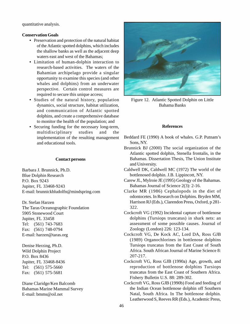
46
quantitative analysis.
Conservation Goals• Preservation and protection of the natural habitat
of the Atlantic spotted dolphins, which includesthe shallow banks as well as the adjacent deepwaters east and west of the Bahamas;
• Limitation of human-dolphin interaction toresearch-based activities. The waters of theBahamian archipelago provide a singularopportunity to examine this species (and otherwhales and dolphins) from an underwaterperspective. Certain control measures arerequired to secure this unique access;
• Studies of the natural history, populationdynamics, social structure, habitat utilization,and communication of Atlantic spotteddolphins, and create a comprehensive databaseto monitor the health of the population; and
• Securing funding for the necessary long-term,multidisciplinary studies and theimplementation of the resulting managementand educational tools.
Contact persons
Barbara J. Brunnick, Ph.D.Blue Dolphin ResearchP.O. Box 9243Jupiter, FL 33468-9243E-mail: [email protected]
Dr. Stefan HarzenThe Taras Oceanographic Foundation5905 Stonewood CourtJupiter, FL 33458Tel: (561) 743-7683Fax: (561) 748-0794E-mail: [email protected]
Denise Herzing, Ph.D.Wild Dolphin ProjectP.O. Box 8436Jupiter, FL 33468-8436Tel: (561) 575-5660Fax: (561) 575-5681
Diane Claridge/Ken BalcombBahamas Marine Mammal SurveyE-mail: [email protected]
Figure 12. Atlantic Spotted Dolphin on LittleBahama Banks
References
Beddard FE (1990) A book of whales. G.P. Putnam’sSons, NY.
Brunnick BJ (2000) The social organization of theAtlantic spotted dolphin, Stenella frontalis, in theBahamas. Dissertation Thesis, The Union Instituteand University.
Caldwell DK, Caldwell MC (1972) The world of thebottlenosed dolphin. J.B. Lippincott, NY.
Carew JL, Mylroie JE (1995) Geology of the Bahamas.Bahamas Journal of Science 2(3): 2-16.
Clarke MR (1986) Cephalopods in the diet ofodontocetes. In Research on Dolphins. Bryden MM,Harrison RJ (Eds.), Clarendon Press, Oxford, p 281-322.
Cockcroft VG (1992) Incidental capture of bottlenosedolphins (Tursiops truncatus) in shark nets: anassessment of some possible causes. Journal ofZoology (London) 226: 123-134.
Cockcroft VG, De Kock AC, Lord DA, Ross GJB(1989) Organochlorines in bottlenose dolphinsTursiops truncatus from the East Coast of SouthAfrica. South African Journal of Marine Science 8:207-217.
Cockcroft VG, Ross GJB (1990a) Age, growth, andreproduction of bottlenose dolphins Tursiopstruncatus from the East Coast of Southern Africa.Fishery Bulletin U.S. 88: 289-302.
Cockcroft VG, Ross GJB (1990b) Food and feeding ofthe Indian Ocean bottlenose dolphin off SouthernNatal, South Africa. In The bottlenose dolphin.Leatherwood S, Reeves RR (Eds.), Academic Press,
47
San Diego, p 295-308.Cockcroft VG, Ross GJB, Peddemors VM, Borchers
DL (1992) Estimates of abundance andundercounting of bottlenose dolphins off northernNatal, South Africa. South Africa Tyskr Natuurnav22(4): 102-109.
Collet A (1981) Biologie du dauphin communDelphinus delphis L. en Atlantique Nord-Est.Dissertation Thesis, University of Poitiers.
Corkeron PJ, Bryden MM, Hedstrom KE (1990)Feeding by bottlenose dolphins in association withtrawling operations in Moreton Bay, Australia. InThe bottlenose dolphin. Leatherwood S, Reeves RR(Eds.), Academic Press, San Diego, p 329-336.
Desportes G (1985) La nutrition des Odontocetes enAtlantique Nord-Est. Dissertation Thesis, Universityof Poitiers.
Dudinski KM (1996) Communication and behaviour inthe Atlantic spotted dolphins (Stenella frontalis):relationship between vocal and behaviouralactivities. Dissertation Thesis, Texas A&MUniversity, College Station.
Duffield D, Ridgway SH, Cornell LH (1983)Hematology distinguishes coastal and offshore formsof dolphins (Tursiops). Canadian Journal of Zoology61(4): 930-933.
Duinker JC, Hillebrand MTJ, Nolting RF (1979)Organochlorines and metals in harbour seals (DutchWadden Sea). Marine Pollution Bulletin 10: 360-364.
Felix F (1994) Ecology of the coastal bottlenose dolphinTursiops truncatus in the Gulf of Guayaquil, Ecuador.In Investigations on Cetacea, Volume XXV. PilleriG (Ed.), Bern.
Fitch JE, Brownell J (1968) Fish otholits in cetaceanstomachs and their importance in interpreting feedinghabits. Journal of the Fisheries Research Board ofCanada 25: 2561-2574.
Gaskin DE (1982) The ecology of whales and dolphins.Heinemann, London and Portsmouth, NewHampshire.
Gaskin DE, Holdrinet M, Frank R (1983)Polychlorinated biphenyls in harbour porpoisesPhocoena phocoena (L.) from the Bay of Fundy,Canada and adjacent waters, with some informationon chlordane and hexachlorobenzene levels. Archsenviron.Contamin.Toxicol. 12:pp. 211-219.
Geraci JR (1989) Final report to National MarineFisheries Service and U.S. Office of Naval Researchand Marine Mammal Commission. Wildlife DiseaseSection, Department of Pathology, Ontario VetinaryCollege, University of Guelph, Guelph, Ontario.
Goodall RNP, Galeazzi AR (1985) A review of the foodhabits of the small cetaceans of the Antarctic andSub-Antarctic. In Antarctic nutrient cycles. SiegfriedWR, Condy PR, Laws RM (Eds.), Springer Verlag,Berlin, p 566-572.
Gunter G (1942) Contributions to the natural history ofthe bottlenose dolphin, Tursiops truncatus(Montague), on the Texas coast, with particularreference to food habits. Journal of Mammalogy 23:267-276.
Gunter G (1954) Mammals of the Gulf of Mexico. InGulf of Mexico: Its origin, waters, and marine life.Fisheries Bulletin U.S. 55: 543-551.
Gurevich VS (1977) Post-natal behaviour of an Atlanticbottlenosed dolphin calf (Tursiops truncatus,Montagu) born at Sea World. In Breeding dolphins:Present status, suggestions for the future. RidgwaySH, Benirschke K (Eds.), U.S. Marine MammalCommission Report, Washington DC, 308 p.
Harrison RJ, Brownell RL, Boice RC (1972)Reproduction and gonadal appearances in someOdontocetes. In Functional anatomy of marinemammals. Harrison RJ (Ed.), Academic Press, NY,p 361-429.
Harzen S (1989) Zum Vorkommen und zur raum-zeitlichen Aktivität des Grossen Tümmlers, Tursiopstruncatus (Montagu, 1821) im Mündungsgebiet desSado, Portugal. Master’s Thesis, University ofBielefeld, Germany.
Harzen S (1995) Behaviour and social ecology of thebottlenose dolphin, Tursiops truncatus, in the Sadoestuary, Portugal. Dissertation Thesis, University ofBielefeld.
Hersh SL, Duffield DA (1990) Distinction betweenNorthwest Atlantic offshore and coastal bottlenosedolphins based on hemoglobin profile andmorphometry. In The bottlenose dolphin.Leatherwood S, Reeves RR (Eds.), Academic Press,San Diego, p 129-139.
Herzing DL (1996) Vocalizations and associatedunderwater behavior of free-ranging Atlantic spotteddolphin (Stenella frontalis) and bottlenose dolphins(Tursiops truncatus). Aquatic Mammals 22(2): 61-79.
Herzing DL (1997) The life history of free-rangingAtlantic spotted dolphins (Stenella frontalis): ageclasses, colour phases, and female reproduction.Marine Mammal Science 13(4): 576-595.
Herzing DL, Brunnick BJ (1997) Coefficients ofassociation of reproductively active female spotteddolphins (Stenella frontalis). Aquatic Mammals23(3): 155-162.
48
Herzing DL, Johnson CM (1997) Interspecificinteraction between Atlantic spotted dolphin(Stenella frontalis) and bottlenose dolphins (Tursiopstruncatus) in the Bahamas, 1985-1995. AquaticMammals 23(2): 85-99.
Hohn AA (1990) Reading between the lines: analysisof age estimation in dolphins. In The bottlenosedolphin. Leatherwood S, Reeves RR (Eds.),Academic Press, San Diego, p 575-585.
Holden AV (1978) Pollutants and seals - a review.Mammal Review 8: 53-66.
Irvine AB, Scott MD, Wells RS, Kaufmann JH (1981)Movement and activities of the Atlantic bottlenosedolphin, Tursiops truncatus, near Sarasota, Florida.Fishery Bulletin U.S. 79: 671-688.
Jenkins JT (1932) Whales and modern whaling.H.F.&G.Witherby, London.
Kaiya Z, Weijuan Q (1985) Distribution of the dolphinsof the Genus Tursiops in the China Seas. AquaticMammals 11(1): 16-19.
Kleinenberg SE (1938) Quelques donnees surl’alimantation de Tursiops truncatus fabr. dans la MerNoire. Bull Soc Nat Moscou 47: 406-413.
Klinowska M (1991) Dolphins, porpoises and whalesof the world. IUCN, Gland and Cambridge, p 157-171.
Klinowska M, Brown S (1986) A review of Dolphinaria.Department of the Environment, London, 247 p.
Kuehl D, Haebler R, Potter C (1991) Chemical residuesin dolphins from the U.S. Atlantic Coast includingAtlantic bottlenose obtained during the 1987/88mass mortality. Chemosphere 22: 1071-1084.
Lear RJ, Bryden MM (1980) A study of the bottlenosedolphin Tursiops truncatus in Eastern AustralianWaters. Australian National Parks and WildlifeService Canberra, Occasional Paper 4.
Leatherwood S (1975) Some observations of feedingbehaviour of bottlenose dolphins (Tursiops truncatus)in the northern Gulf of Mexico and (Tursiops cf. T.gilli) off Southern California, Baja California andNayarit, Mexico. Marine Fisheries Review 37: 10-16.
Leatherwood S, Caldwell DK, Winn HE (1976) Thewhales, dolphins and porpoises of the western NorthAtlantic: a guide to their identification. NOAATechnical Report NMFS Circular 396, 176 p.
Leatherwood S, Reeves RR (1978) Porpoises anddolphins. In Marine mammals of eastern NorthPacific and Arctic waters. Haley D (Ed.), PacificSearch Press, Seattle, p 97-111.
Leatherwood S, Reeves RR (1982) Bottlenose dolphinTursiops truncatus and other toothed cetaceans. In
Wild mammals of North America: Biology,management and economics, Volume 1. ChapmanJA, Feldhamer GA (Eds.), Johns Hopkins UniversityPress, Baltimore, p 369-414.
Leatherwood S, Reeves RR (1983) Abundance ofbottlenose dolphins in Corpus Christi Bay and coastalsouthern Texas. Contributions in Marine Science 26:179-199.
Lipscomb TP, Kennedy S (1994) An outbreak ofmorbillivirus in Atlantic bottlenose dolphins of theGulf of Mexico. Proceedings of the 8th AnnualConference of the European Cetacean Society,March 2-5, 1994. Montpellier, France, p 207.
Ljungblad DK, Leatherwood S, Johnson RA, MitchellED, Awbrey FT (1977) Echolocation signals of wildPacific bottlenose dolphins, Tursiops sp. SecondConference on the Biology of Marine Mammals,December 12-15, 1977. San Diego, CA, p 36.
May J (1990) The Greenpeace book of dolphins.Century Editions, London.
Matlack NM, Herzing DL (1995) Observations ofnocturnal feeding by Atlantic spotted dolphinsStenella frontalis. Eleventh Biennial Conference onthe Biology of Marine Mammals, December 14-18,1991. Orlando, FL, p 74.
Mc Bride AF, Kritzler H (1951) Observations onpregnancy, parturition and postnatal behaviour in thebottlenose dolphin. Journal of Mammalogy 32: 251-266.
Mead JG (1975) Preliminary report on the former netfisheries for Tursiops truncatus in western NorthAtlantic. Journal of the Fisheries Research Board ofCanada 32: 1155-1162.
Mitchell ED (1975) Review of the biology and fisheriesfor smaller cetaceans. Report of the meeting onsmaller cetaceans, International WhalingCommission. Journal of the Fisheries Research Boardof Canada 32: 875-1242.
Myrberg AA (1978) Ocean noise and the behaviour ofmarine animals: Relationships and implications. InThe effect of noise on wildlife. Fletcher JL, BusnelRG (Eds.), Academic Press, NY, p 169-208.
Myrick AC, Cornell LH (1990) Calibrating dentallayers in captive bottlenose dolphins from serialtetracycline labels and tooth extractions. In Thebottlenose dolphin. Leatherwood S, Reeves RR(Eds.), Academic Press, San Diego, p 587-608.
National Marine Fisheries Service (NMFS) (1994)Report to Congress on results of feeding wilddolphins: 1989-1994.
Odell DK (1975) Status and aspects of the life historyof the bottlenose dolphin, Tursiops truncatus, in
49
Florida. Journal of the Fisheries Research Board ofCanada 32: 1055-1058.
Odell DK, Reynolds JE (1980) Abundance of thebottlenose dolphin, Tursiops truncatus, on the westcoast of Florida. U.S. Dept.Commerce, NTISPublication PB80-197650, 47p.
O’Shea TJ, Brownell RL, Clark DR, Walker WA, GayML, Lamot TG (1980) Organochlorine pollutantsin small cetaceans from the Pacific and SouthAtlantic Oceans, November 1968-June 1976.Pesticides Monitoring Journal 14(2): 35-46.
Perrin WF (1969) Colour patterns of the eastern Pacificspotted porpoise Stenella graffmani Lönnberg(Cetacea, Delphinidae). Zoologica 54(4): 135-141.
Perrin WF, Coe JM, Zweifel JR (1976) Growth andreproduction of spotted porpoise, Stenella attenuatain the offshore eastern tropical Pacific. FisheryBulletin U.S. 74(2): 229-269.
Perrin WF, Myrick AC (1980) Age determination oftoothed whales and sirenians. In Report of theInternational Whale Commission, Special Issue 3,Cambridge, p 229.
Perrin WF, Reilly SB (1984) Reproductive parametersof dolphins and small whales of the familyDelphinidae. Reports of the International WhalingCommission (special issue) 6: 97-133.
Prescott JH (1977) Comments of captive births ofTursiops truncatus at marineland of the Pacific(1957-1972). In Breeding dolphins: present status,suggestions for the future. Ridgway SH, BenirschkeK (Eds.), U.S. Marine Mammal Commission,Washington DC, p 71-76.
Rawson AJ, Anderson HF, Patton GW (1991)Anthracosis in the Atlantic bottlenose dolphin(Tursiops truncatus). Marine Mammal Science 7(4):413-416.
Reijnders PJH (1986) Reproductive failure in commonseals feeding on fish from polluted waters. Nature324: 456-457.
Ridgway S, Reddy M, Kamolnick T, Skaar D, Curry C(1991) Calorie consumption of growing adult,pregnant, and lactating Tursiops. IAAAM. Abstract.
Risebrough RW (1978) Pollutants in marine mammals:literature review and recommendations for research.National Technical Information Service, U.S.Department of Commerce PB 290728, 64 p.
Ross GJB (1977) The taxonomy of bottlenose dolphinsTursiops species in South African waters, with noteson their biology. Annals of the Cape ProvincialMuseums, Natural History 11(9): 135-194.
Ross GJB (1984) The smaller cetaceans of the southeastcoast of southern Africa. Annals of the Cape
Provincial Museums, Natural History 15(2): 173-410.
Ross GJB, Cockcroft VG (1990) Comments onAustralian bottlenose dolphins and the taxonomicstatus of Tursiops aduncus (Ehrenberg, 1832). In Thebottlenose dolphin. Leatherwood S, Reeves RR(Eds.), Academic Press, San Diego, p 101-128.
Ross GJB, Cockcroft VG, Butterworth DS (1987)Offshore distribution of bottlenosed dolphins in Natalcoastal waters and Algoa Bay, eastern Cape. SouthAfrica Tydskr Dierk 22(1): 50-56.
Ross GJB, Cockcroft VG, Melton DA, Butterworth DS(1989) Population estimates for bottlenose dolphinsTursiops truncatus in Natal and Transkei Waters.South African Journal of Marine Science 8: 119-129.
Rossbach KA (1997) Distinguishing inshore andoffshore communities of bottlenose dolphins(Tursiops truncatus) near Grand Bahama island,Bahamas. M.S. Thesis, Oregon State University.
Rossbach KA, Herzing DL (1997) Underwaterobservations of benthic-feeding bottlenose dolphins(Tursiops truncatus) near Grand Bahama island,Bahamas. Marine Mammal Science 13(3): 499-503.
Saayman GS, Tayler CK (1977) Observations on thesexual behaviour of Indian Ocean bottlenoseddolphins (Tursiops aduncus). In Breeding dolphins:Present status, suggestions for the future. RidgwaySH, Benirschke K (Eds.), Report MMC-76-07, U.S.Marine Mammal Commission, Washington DC, p113-129.
Saayman GS, Tayler CK, Bower D (1973) Diurnalactivity cycles in captive and free-ranging IndianOcean bottlenose dolphins (Tursiops aduncusEhrenburg). Behaviour 44: 212-233.
Schlais JF (1984) Thieving dolphins. A growing problemin Hawaii’s fisheries. Sea Frontiers 30(5): 293-298.
Scott HH, Lord CE (1918) Studies of Tasmaniancetacea. Part III Tursiops tursio, Southern form.Papers and Proceedings of the Royal Society ofTasmania, p 96-109.
Sergeant DE, Caldwell DK, Caldwell MC (1973) Age,growth and maturity of bottlenosed dolphins(Tursiops truncatus) from north-east Florida. Journalof the Fisheries Research Board of Canada 30: 1009-1011.
Shane SH (1980) Occurrence, movements, anddistribution of bottlenose dolphin, Tursiops truncatus,in southern Texas. Fishery Bulletin U.S. 78(3): 593-601.
Shane SH (1987) The Behavioural ecology of thebottlenose dolphin. Dissertation Thesis, University

50
of California, Santa Cruz.Shane S, Schmidly DJ (1978) Population biology of
Atlantic bottlenosed dolphins, Tursiops truncatus, inthe Aransas Pass area of Texas. Contract Report tothe U.S. Marine Mammal Committee, NationalTechnical Information Service, Washington DC.
Steiner L, Gordon J, Beer CJ (1998) Marine mammalsof the Azores. World Marine Mammal ScienceConference, January 20-24, Monte Carlo, Monaco,p 128.
Subramanian AN, Tanabe S, Tatsukawa R, Saito S,Miyasaki N (1987) Reduction in the testosteronelevel by PCBs and DDE in Dall’s porpoises of thenorthwestern North Pacific. Marine PollutionBulletin 18(12): 643-646.
Tanabe S, Watanabe S, Kan H, Tatsukawa R (1988)Capacity and mode of PCB metabolism in smallcetaceans. Marine Mammal Science 4(2): 103-124.
Tavolga MC (1966) Behaviour of the bottlenose dolphin(Tursiops truncatus): Social interactions in a captivecolony. In Whales, dolphins and porpoises. NorrisKS (Ed.), University of California Press, LosAngeles, p 718-730.
True FW (1891) Observations on the life history of thebottlenose porpoise. U.S. National MuseumProceedings 1890: 197-203.
UNCED (1992) Report from the United NationsConference on Environment and Development, 70p.
Wagemann R, Muir DCG (1984) Concentrations ofheavy metals and organochlorines in marinemammals of northern waters: overview andevaluation. Canadian Technical Report of Fisheriesand Aquatic Sciences 1279, 97 p.
Walker WA (1981) Geographical variation inmorphology and biology of bottlenose dolphins(Tursiops) in the eastern North Pacific. NMFS/SWFSC Administrative Report LJ-81-03C,17p.
Wells RS, Irvine AB, Scott MD (1980) The socialecology of inshore odontocetes. In Cetaceanbehaviour. Herman LM (Ed.), Wiley, NY, p 263-318.
Würsig B (1986) Delphinid foraging strategies. InDolphin cognition and behaviour: A comparativeapproach. Schusterman RJ, Thomas JA, Wood FG(Eds.), Lawrence Erlbaum Associates, London, p347-360.
Würsig B, Würsig M (1977) The photographicdetermination of group size, composition andstability of coastal porpoises (Tursiops truncatus).Science 198: 755-756.
Würsig B, Würsig M (1979) Behaviour and ecology of
bottlenose dolphin, Tursiops truncatus, in the SouthAtlantic. Fisheries Bulletin U.S. 77: 399-412.
References Table 3
Corkeron, P., 1988. Distribution and Ecology. In:Whales, Dolphins, and Porpoises (Harrison, R., andBryden, M.M. eds). Pp.84-98. IntercontinentalPublishing Corporation Limited. London.
Klinowska, M., 1991. Dolphins, Porpoises, and Whales.The IUCN Red Data Book. 428p. IUCN, Gland,Switzerland.
Martin, A.D., 1990. Whales and Dolphins. 192 pp.Portland House, New York, New York.Rice, D.W.,1998. Marine Mammals of the World, Systematicsand Distribution. The Society of Marine Mammalogyspecial Publication Number 4. 231p.
5.2.2. Green turtle (Chelonia mydas)
DescriptionPhylum Vertebrata
Class ReptiliaOrder Chelonia
Family Cheloniidae
The green turtle is a member of the FamilyCheloniidae (Lutz & Musick, 1997). Anatomicalfeatures include an extensively roofed skull with well-developed rhamphothecae, extremeties in form ofnonretractile flippers, forelimbs equipped with highlyelongated digits firmly bound together by connectivetissue and a shell covered with horny scutes, variable innumber but generally including five vertebras (Lutz &Musick, 1997). Adults can reach 350 lbs and 100 cmin carapace length.
DistributionGreen turtles occur in tropical oceans around the
world and prefer tropical beaches for nesting. Juvenilesmay be resident in tropical or subtropical developmentalhabitats for years, as long as the seasonal temperatureremains stable. Green turtles may utilize continentalforaging areas in temperate latitudes (to about 48º N)during the summer, but must return to subtropicallatitudes in winter to avoid cold stunning (Lutz &Musick, 1997).
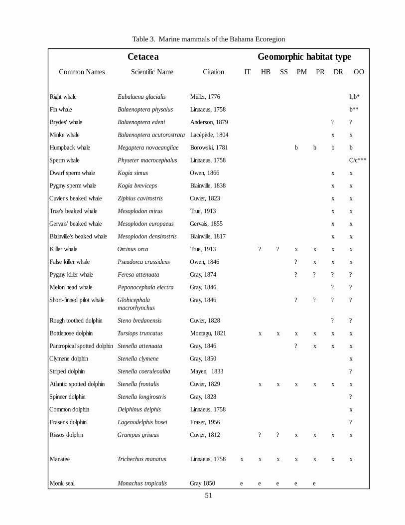
51
Table 3. Marine mammals of the Bahama Ecoregion
aecateC epyttatibahcihpromoeG
semaNnommoC emaNcifitneicS noitatiC TI BH SS MP RP RD OO
elahwthgiR silaicalganealabuE 6771,rellüM *b,h
elahwniF sulasyhparetponealaB 8571,sueanniL **b
elahw'sedyrB inedearetponealaB 9781,nosrednA ? ?
elahwekniM atartsorotucaaretponealaB 4081,edèpécaL x x
elahwkcabpmuH eailgnaeavonaretpageM 1871,iksworoB b b b b
elahwmrepS sulahpecorcamretesyhP 8571,sueanniL ***c/C
elahwmrepsfrawD sumisaigoK 6681,newO x x
elahwmrepsymgyP speciverbaigoK 8381,ellivnialB x x
elahwdekaebs'reivuC sirtsorivacsuihpiZ 3281,reivuC x x
elahwdekaebs'eurT surimnodolposeM 3191,eurT x x
elahwdekaeb'siavreG sueaporuenodolposeM 5581,siavreG x x
elahwdekaebs'ellivnialB sirtsorisnednodolposeM 7181,ellivnialB x x
elahwrelliK acrosunicrO 3191,eurT ? ? x x x x
elahwrellikeslaF snedissarcacroduesP 6481,newO ? x x x
elahwrellikymgyP ataunettaasereF 4781,yarG ? ? ? ?
elahwdaehnoleM artcelealahpeconopeP 6481,yarG ? ?
elahwtolipdennif-trohS alahpecibolGsuhcnyhrorcam
6481,yarG ? ? ? ?
nihploddehtoothguoR sisnenaderbonetS 8281,reivuC ? ?
nihplodesonelttoB sutacnurtspoisruT 1281,ugatnoM x x x x x x
nihploddettopslaciportnaP ataunettaallenetS 6481,yarG ? x x x
nihplodenemylC enemylcallenetS 0581,yarG x
nihploddepirtS ablaoelureocallenetS 3381,neyaM ?
nihploddettopscitnaltA silatnorfallenetS 9281,reivuC x x x x x x
nihplodrennipS sirtsorignolallenetS 8281,yarG ?
nihplodnommoC sihpledsunihpleD 8571,sueanniL x
nihplods'resarF iesohsihpledonegaL 6591,resarF ?
nihplodsossiR suesirgsupmarG 2181,reivuC ? ? x x x x
eetanaM sutanamsuhcehcirT 8571,sueanniL x x x x x x x
laesknoM silaciportsuhcanoM 0581yarG e e e e e
52
Status of populations in the wildAssessment of marine turtle populations is very
difficult. Attention is focused on nests and nestingfemales. Because females rarely nest every year, butusually at two, three, or four year intervals, and becauseit is not possible to determine what proportion of thetotal mature female population is at the nest beach inany given year, population estimates are typically notprecise. This is further complicated by the fact thatnesting numbers on individual beaches can show extremevariation from one year to another. In a good year over10,000 females may nest on Europa, and up to 80,000at Raine Island (Australia); these appear to be the onlystable populations not heavily exploited (Groombridge& Luxmoore, 1989; Groombridge, 1982).
Ecology and natural historyUpon entering the sea, green turtle hatchlings
actively swim offshore for at least 24 hours (Frick, 1976;Ireland et al., 1978; Wyneken & Salmon, 1992).Thereafter, hatchlings rest at night, but continue to swimactively during the day (Wyneken & Salmon, 1992;Lohmann et al., 1996; Wyneken, 1996). Young turtlesare believed to be passively transported from the GulfStream across the North Atlantic to the East Atlantic,where they drift south past the Azores to the CanaryIslands and eventually return to the western Atlanticvia the north equatorial current (Witham, 1980). Thestudies of Carr (1987) and Walker (1994) suggest thatyoung green turtles inhabit open ocean biotopes and,according to Bjorndal (1985), are omnivorous eventhough they appear to have a strong tendency tocarnivory.
Several studies have shown that juveniles recruit todemersal developmental habitats at about 30 cm to 40cm in size (Balazs, 1982; Keinath & Musick, 1991;Bjorndal & Bolton, 1995). The summer developmentalhabitat in the western Atlantic includes estuarine watersas far north as Long Island Sound, and south throughoutthe tropics (Henwood & Ogren, 1987; Keinath &Musick, 1991; Morreale & Standora, 1992; Epperly etal., 1994). Off the Florida east coast, juveniles occuron polyachaete reefs and, as they become larger, on seagrass beds in the Indian River Lagoon (Gusemann andEhrhart 1990). In the Bahamas, tidal embaymentsappear to serve as important developmental habitats forjuveniles (Bjorndal & Bolton, 1996). Immigration tothe Bahamas, Columbia, Cuba, Dominican Republic,Nicaragua, Panama and Venezuela is also documented(Bjorndal & Bolton, 1996).
At the time green turtles enter the benthic foragingareas they shift to herbivorous diet, which consists
primarily of sea grass and algae. In the Caribbean, thesea grass Thalassia testudinum is the primary diet speciesfor the green turtle (Bjorndal, 1980; 1982). Mortimer(1976) found that T. testudinum comprised 87% of thedry mass of stomach contents from turtles captured onforaging grounds off the Caribbean coast of Nicaragua.The diet of green turtles studied in Florida consisted ofsea grasses (Syringodium filiforme and Halodulewrightii) and red and green algae (Mendonça, 1983).However, individuals are also known to feed uponjellyfish, salps, and sponges (Mortimer, 1981; 1982).An herbivorous diet has important consequences for thelife history parameters and survival outlook of greenturtles. Green turtles have a significant effect on thenutrient cycling and community structure of their seagrass foraging habitats.
HabitatGreen turtles use oceanic habitats as nursery areas
and coral reefs and sea grass beds during older juvenileand adult life stages. Oceanic convergence zones andmajor gyre systems represent important habitat for seaturtles. They are attracted to floating seaweed wherethey may hide and feed for long periods of time. Dueto the low primary production of these areas (productiveup welling areas are the exception), they provideprotection from predatory fishes and sea birds.Loggerheads utilize the ocean nurseries much longerand to a greater size, and seem well adapted to longperiods of opportunistic feeding on a great variety ofprey items (Bjorndal, 1990). Older juvenile and adultgreen turtles recruit to more productive demersaldevelopmental habitats at a relatively small size.
Because of their relatively specialized diet, greenturtles may be attracted to structured habitats, such asreefs, which also provide protection from sharks andlarge teleosts predators. Green turtles in the Caribbeanestablish grazing plots in pastures of the sea grassThalassia testudinum that can vary from 10 m to 100m and may be maintained for up to two years. Throughthis process of continuous re-cropping, the green turtlediet increases in protein content while becoming lowerin lignin (short leafs contain less lignin). Grazing onalgae on coral reefs is expected to significantly impactthe percent cover by algae in these ecosystems (Bjorndal,1980).
Associated SpeciesLoggerhead turtle (Caretta caretta)Leatherback turtle (Dermochelys coriacea)Kemp’s ridley (Lepidochelys kempi)
53
ThreatsThe principal threats to sea turtles are commercial
fisheries, debris ingestion, and habitat degradation.Commercial fisheries have a serious impact on sea turtlemortality through incidental capture (NRC, 1990) anddirect competition between humans and sea turtles forthe same food source (Pauly & Christensen, 1995).Destructive human practices include the use of dynamiteor bleach in coral reef areas, and the use of bottom trawlsin benthic communities. The often sub-lethal effects offood limitation resulting from such competition mayreduce productivity of populations by lowering growthrates, delaying the onset of sexual maturity and reducingreproductive output. In addition, sea turtles, especiallythe green and hawksbill turtles, have come underimmense pressure from the trade of meat and shells.
Debris ingestion is another serious problem,especially for the young pelagic stage turtles inhabitingthe convergence zones in which floating debris, such asplastics, synthetic fibres, tar and many other becomeconcentrated. Small amounts of debris can kill a seaturtle. Effects on gut function as a result of plastic orlatex ingestion include a decline in blood glucose levels,interference in gut lipid metabolism and gasaccumulation in the large intestine, resulting in a lossof buoyancy control (reviewed in Balazs, 1985).
The third major threat to sea turtles is habitatdegradation caused by human activities. For example,scarring of sea grass beds from anchoring or propellerscan seriously reduce the standing crop and productivityof sea grasses for long periods of time (Williams, 1988).Inappropriate land management practices often lead tothe deposition of silt on coral reefs, rocky bottomhabitats, and sea grass beds and decrease the amount offoraging habitat available to sea turtles (Lutz & Musick,1997).
Current conservation programsThe green turtle is listed as endangered by the
International Union for the Conservation of Nature.Under the U.S. Endangered Species Act of 1973, thegreen turtle was listed as threatened except for thebreeding populations in Florida and on the Pacific coastof Mexico, where it is listed as Endangered. Cheloniamydas is listed on Appendix I of the Convention onInternational Trade in Endangered Species of WildFauna and Flora (CITES). Appendix I listing requiresthat trade in the taxon and its products is subject to strictregulation by ratifying states and international trade forprimarily commercial purposes is forbidden. Althoughgreen turtles are nominally protected by legislation inmuch of the range, in many areas the legislation is
inadequately enforced. Some nesting beaches fall withinNational Parks or Nature Reserves and are accordedvarying degrees of protection. The species breed incaptivity, but large-scale closed-cycle captive breedinghas not yet been demonstrated to be possible.
Information gaps and research needsTotal population estimates for the green turtle are
unavailable, and trends are particularly difficult to assessbecause of wide year-to-year fluctuations in numbersof nesting females, difficulties of conducting researchon early life stages and the long generation time. Presentestimates range from 200 to 1,100 females nesting onU.S. beaches. The number of nests has increased onHutchinson Island, Florida, over the period 1971 - 1989,although nesting levels have been low on other nestingbeaches. Populations in Surinam, and Tortuguero, CostaRica, may be stable, but there is insufficient data forother areas to confirm a trend. The recovery team forthe green turtle concluded that the species status hasnot improved appreciably since it was listed endangered1979 (Groombridge & Luxmoore, 1989; Groombridge,1982).
Conservation Goals• Preservation and protection of the natural habitats
of the green turtle, especially the nestingbeaches and developmental habitats, includingestuarine waters and tidal embayments;
• Minimization of the hunting of turtles and tradeof products until scientific data providesreliable assessment of sustainable harvest;
• Studies of the natural history and migration, andcreation of a comprehensive database to monitorthe health of the turtle populations as well astheir impact on demersal developmental andbenthic foraging habitats; and
• Securing funding for the necessary long-term,multidisciplinary studies and the resultingmanagement and educational tools. The slowmaturation period for marine turtles can maskthe effects of exploitation and conservationefforts; therefore long-term research programsare essential.
JustificationActive management strategies to protect vital marine
turtle habitats could include the creation of marinesanctuaries or coastal and near-shore ocean park reservesin the Bahamas. Since sea turtles are migratory andpass through the jurisdictions of many countries,international cooperation and regional agreements on
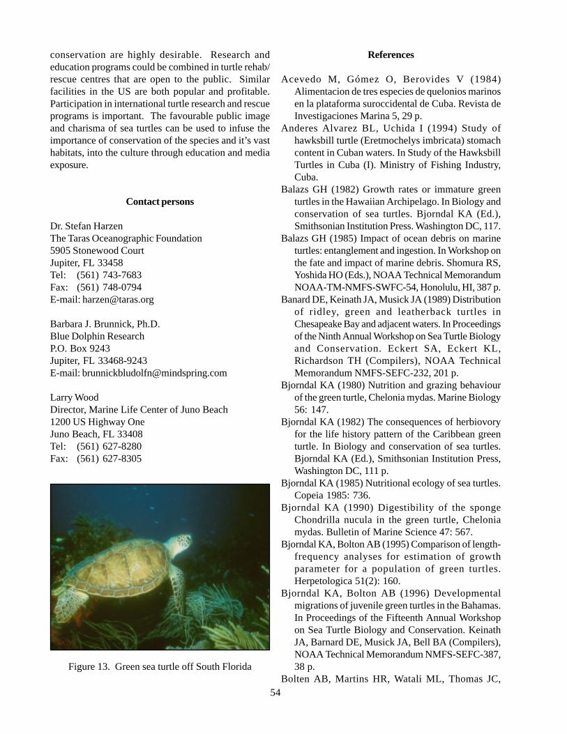
54
conservation are highly desirable. Research andeducation programs could be combined in turtle rehab/rescue centres that are open to the public. Similarfacilities in the US are both popular and profitable.Participation in international turtle research and rescueprograms is important. The favourable public imageand charisma of sea turtles can be used to infuse theimportance of conservation of the species and it’s vasthabitats, into the culture through education and mediaexposure.
Contact persons
Dr. Stefan HarzenThe Taras Oceanographic Foundation5905 Stonewood CourtJupiter, FL 33458Tel: (561) 743-7683Fax: (561) 748-0794E-mail: [email protected]
Barbara J. Brunnick, Ph.D.Blue Dolphin ResearchP.O. Box 9243Jupiter, FL 33468-9243E-mail: [email protected]
Larry WoodDirector, Marine Life Center of Juno Beach1200 US Highway OneJuno Beach, FL 33408Tel: (561) 627-8280Fax: (561) 627-8305
Figure 13. Green sea turtle off South Florida
References
Acevedo M, Gómez O, Berovides V (1984)Alimentacion de tres especies de quelonios marinosen la plataforma suroccidental de Cuba. Revista deInvestigaciones Marina 5, 29 p.
Anderes Alvarez BL, Uchida I (1994) Study ofhawksbill turtle (Eretmochelys imbricata) stomachcontent in Cuban waters. In Study of the HawksbillTurtles in Cuba (I). Ministry of Fishing Industry,Cuba.
Balazs GH (1982) Growth rates or immature greenturtles in the Hawaiian Archipelago. In Biology andconservation of sea turtles. Bjorndal KA (Ed.),Smithsonian Institution Press. Washington DC, 117.
Balazs GH (1985) Impact of ocean debris on marineturtles: entanglement and ingestion. In Workshop onthe fate and impact of marine debris. Shomura RS,Yoshida HO (Eds.), NOAA Technical MemorandumNOAA-TM-NMFS-SWFC-54, Honolulu, HI, 387 p.
Banard DE, Keinath JA, Musick JA (1989) Distributionof ridley, green and leatherback turtles inChesapeake Bay and adjacent waters. In Proceedingsof the Ninth Annual Workshop on Sea Turtle Biologyand Conservation. Eckert SA, Eckert KL,Richardson TH (Compilers), NOAA TechnicalMemorandum NMFS-SEFC-232, 201 p.
Bjorndal KA (1980) Nutrition and grazing behaviourof the green turtle, Chelonia mydas. Marine Biology56: 147.
Bjorndal KA (1982) The consequences of herbiovoryfor the life history pattern of the Caribbean greenturtle. In Biology and conservation of sea turtles.Bjorndal KA (Ed.), Smithsonian Institution Press,Washington DC, 111 p.
Bjorndal KA (1985) Nutritional ecology of sea turtles.Copeia 1985: 736.
Bjorndal KA (1990) Digestibility of the spongeChondrilla nucula in the green turtle, Cheloniamydas. Bulletin of Marine Science 47: 567.
Bjorndal KA, Bolton AB (1995) Comparison of length-frequency analyses for estimation of growthparameter for a population of green turtles.Herpetologica 51(2): 160.
Bjorndal KA, Bolton AB (1996) Developmentalmigrations of juvenile green turtles in the Bahamas.In Proceedings of the Fifteenth Annual Workshopon Sea Turtle Biology and Conservation. KeinathJA, Barnard DE, Musick JA, Bell BA (Compilers),NOAA Technical Memorandum NMFS-SEFC-387,38 p.
Bolten AB, Martins HR, Watali ML, Thomas JC,
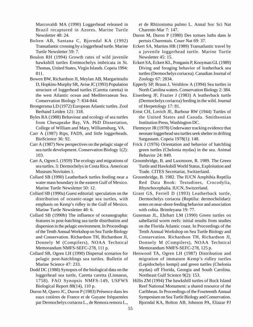
55
Marcovaldi MA (1990) Loggerhead released inBrazil recaptured in Azores. Marine TurtleNewsletter 48: 24.
Bolten AB, Santana C, Bjorndal KA (1992)Transatlantic crossing by a loggerhead turtle. MarineTurtle Newsletter 59: 7.
Boulon RH (1994) Growth rates of wild juvenilehawksbill turtles Eretmochelys imbricata in St.Thomas, United States, Virgin Islands. Copeia 1994:811.
Bowen BW, Richardson JI, Meylan AB, MargaritoulisD, Hopkins-Murphy SR, Avise JC (1993) Populationstructure of loggerhead turtles (Caretta caretta) inthe west Atlantic ocean and Mediterranean Sea.Conservation Biology 7: 834-844.
Brongersma LD (1972) European Atlantic turtles. ZoolBerhand Leiden 121: 318.
Byles RA (1988) Behaviour and ecology of sea turtlesfrom Chesapeake Bay, VA. PhD Dissertation,College of William and Mary, Williamsburg, VA.
Carr A (1987) Rips, FADS, and little loggerheads.BioScience 36: 92.
Carr A (1987) New perspectives on the pelagic stage ofsea turtle development. Conservation Biology 1(2):103.
Carr A, Ogren L (1959) The ecology and migrations ofsea turtles. 3: Dermochelys in Costa Rica. AmericanMuseum Novitates 1.
Collard SB (1990) Leatherback turtles feeding near awater mass boundary in the eastern Gulf of Mexico.Marine Turtle Newsletter 50: 12.
Collard SB (1990a) Guest editorial: speculation on thedistribution of oceanic-stage sea turtles, withemphasis on Kemp’s ridley in the Gulf of Mexico.Marine Turtle Newsletter 48: 6.
Collard SB (1990b) The influence of oceanographicfeatures in post-hatching sea turtle distribution anddispersion in the pelagic environment. In Proceedingsof the Tenth Annual Workshop on Sea Turtle Biologyand Conservation. Richardson TH, Richardson JI,Donnely M (Compilers), NOAA TechnicalMemorandum NMFS-SEFC-278, 111 p.
Collard SB, Ogren LH (1990) Dispersal scenarios forpelagic post-hatchlings sea turtles. Bulletin ofMarine Science 47: 233.
Dodd DC (1988) Synopsis of the biological data on theloggerhead sea turtle, Caretta caretta (Linnaeus,1758). FAO Synopsis NMFS-149, USFWSBiological Report 88(14), 110 p.
Duron M, Quero JC, Duron P (1983) Présence dans leseaux cotières de France et de Guyane fréquentéespar Dermochelys coriacea L., de Remora remora L.,
et de Rhizostoma pulmo L. Annal Soc Sci NatCharente-Mar 7: 147.
Duron M, Duron P (1980) Des tortues luths dans lepertuis Charentais. Courr Nat 69: 37.
Eckert SA, Martins HR (1989) Transatlantic travel bya juvenile loggerhead turtle. Marine TurtleNewsletter 45: 15.
Eckert SA, Eckert KL, Ponganis P, Kooyman GL (1989)Diving and foraging behavior of leatherback seaturtles (Dermochelys coriacea). Canadian Journal ofZoology 67: 2834.
Epperly SP, Braun J, Veishlow A (1994) Sea turtles inNorth Carolina waters. Conservation Biology 2: 384.
Eisenberg JF, Frazier J (1983) A leatherback turtle(Dermochelys coriacea) feeding in the wild. Journalof Herpetology 17: 81.
Ernst CH, Lovich JE, Barbour RW (1944) Turtles ofthe United States and Canada. SmithsonianInstitution Press, Washington DC.
Fletmeyer JR (1978) Underwater tracking evidence thatneonate loggerhead sea turtles seek shelter in driftingSargassum. Copeia 1978(1): 148.
Frick J (1976) Orientation and behavior of hatchlinggreen turtles (Chelonia mydas) in the sea. AnimalBehavior 24: 849.
Groombridge, B. and Luxmoore, R. 1989. The GreenTurtle and Hawksbill World Status, Exploitation andTrade. CITES Secretariat, Switzerland.
Groombridge, B. 1982. The IUCN Amphibia ReptiliaRed Data Book: Testudines, Crocodylia,Rhynchocephalia. IUCN, Switzerland.
Grant GS, Ferrell D (1993) Leatherback turtle,Dermochelys coriacea (Reptilia: dermochelidae):notes on near-shore feeding behavior and associationwith cobia. Brimleyana 19: 77.
Guseman JL, Ehrhart LM (1990) Green turtles onsabellariid worm reefs: initial results from studieson the Florida Atlantic coast. In Proceedings of theTenth Annual Workshop on Sea Turtle Biology andConservation. Richardson TH, Richardson JI,Donnely M (Compilers), NOAA TechnicalMemorandum NMFS-SEFC-278, 125 p.
Henwood TA, Ogren LH (1987) Distribution andmigration of immature Kemp’s ridley turtles(Lepidochelys kempi) and green turtles (Cheloniamydas) off Florida, Georgia and South Carolina.Northeast Gulf Science 9(2): 153.
Hillis ZM (1994) The hawksbill turtles of Buck IslandReef National Monument: a shared resource of theCaribbean. In Proceedings of the Fourteenth AnnualSymposium on Sea Turtle Biology and Conservation.Bjorndal KA, Bolton AB, Johnson PA, Eliazar PJ
56
(Compilers), NOAA Technical MemorandumNMFS-SEFSC-351, 59 p.
Hoffman W, Fritts TH (1982) Sea turtle distributionalong the boundary of the Gulf Stream Current offeastern Florida. Herpetologica 38: 405.
Ireland LC, Frick JA, Wingate DB (1978) Nighttimeorientation of hatchling green turtles (Cheloniamydas) in the open ocean. In Animal migration,navigation, and homing. Schmidt-Koenig K, KeetonWJ (Eds.), Springer Verlag, NY, 420 p.
Keinath JA, Musick JA (1991) Atlantic green turtleChelonia mydas (Linnaeus). In Virginia’s endangeredspecies. Terwilliger K (Coordinator), McDonald andWoodward, Blacksburg, VA, 448 p.
Keinath JA, Musick JA, Byles RA (1987) Aspects ofthe biology of Virginia’s sea turtles: 1979-1986.Virginia Journal of Science 38(4): 329.
Klinger RC, Musick JA (1995) Age and growth ofloggerhead turtles (Caretta caretta) from ChesapeakeBay. Copeia 1995(1): 204.
Lazell JD (1980a) New England waters: critical habitatfor marine turtles. Copeia 1980: 290.
Lazell JD (1980b) This broken archipelago: Cape Codand the Islands, amphibians and reptiles. DemeterPress, NY, 260 p.
Leary TR (1957) A schooling of leatherback turtles,Dermochelys coriacea coriacea, on the Texas coast.Copeia 1957: 232.
Lee DS, Palmer WM (1981) Records of leatherbackturtles, Dermochelys coriacea (Linnaeus) and othermarine turtles in North Carolina waters. Brimleyana5: 95.
Limpus CJ (1991) Puberty and first breeding in Carettacaretta. NOAA Technical Memorandum NMFS-SEFC-278, 81-3.
Limpus CJ, Couper PJ, Reed MA (1994) The greenturtle Chelonia mydas in Queensland: Populationstructure in a warm temperate feeding area. Mem.Queensl. Mus. 35(1): 139.
Lohmann KJ, Witherington BE, Lohmann CM, SalmonM (1997) Orientation, navigation and natal beachhoming in sea turtles. In Biology of sea Turtles. LutzP, Musick JA (Eds.), CRC Press, Boca Raton, p 107-136.
Lutcavage M, Lutz PL (1986) Metabolic rate and foodenergy requirements of the leatherback sea turtle,Dermochelys coriacea. Copeia 1986: 796.
Lutz PL, Musick JA (1997) The biology of sea turtles.Marine Science Series, CRC Press, Boca Raton, 432p.
Manzella SA, Fontaine CT (1988) Loggerhead sea turtletravels from Padre Island, Texas to the mouth of the
Adriatic Sea. Marine Turtle Newsletter 42: 7.Marquéz R (1994) Synopsis of biological data on the
Kemp’s ridley turtle Lepidochelys kempi (Garman,1880). NOAA Technical Memorandum NMFS-SEFSC-343, 91 p.
Mellgren JR, Morra M, Bushong M, Harkins S, KrumkeV (1994) Habitat selection in three species of captivesea turtle hatchlings. In Proceedings of theFourteenth Annual Symposium on Sea TurtleBiology and Conservation. Bjorndal KA, Bolton AB,Johnson PA, Eliazar PJ (Compilers), NOAATechnical Memorandum NMFS-SEFSC-351, 259 p.
Mellgren RG, Mann MA (1996) Comparative Behaviorof hatchling sea turtles. In Proceedings of theFifteenth Annual Workshop on Sea Turtle Biologyand Conservation. Keinath JA, Barnard DE, MusickJA, Bell BA (Compilers), NOAA TechnicalMemorandum NMFS-SEFC-387, 202p.
Mendonca MT (1983) Movement and feeding ecologyof immature green turtles (Chelonia mydas) in aFlorida lagoon. Copeia 1013.
Meylan AB (1998) Feeding ecology of the hawksbillturtle (Eretmochelys imbricata): Spongivory as afeeding niche in the coral reef community.Unpublished thesis, University of Florida,Gainesville.
Meylan AB (1988) Spongivory in hawksbill turtles: adiet of glass. Science 239: 393.
Morreale SJ, Standora EA (1992) Occurrence,movement and behavior of the Kemp’s ridley andother sea turtles in New York waters. Journal ofHerpetology 26: 301.
Morreale SJ, Meylan A, Sadove S, Standora E (1992)Annual occurrence and winter mortality of marineturtles in New York waters. Journal of Herpetology26: 301.
Mortimer JA (1976) Observations on the feedingecology on the green turtle, Chelonia mydas, in theWestern Caribbean. Unpublished Thesis, Universityof Florida, Gainesville.
Mortimer JA (1981) The feeding ecology of the WestCaribbean green turtle (Chelonia mydas) inNicaragua. Biotropica 13: 49.
Mortimer JA (1982) Feeding ecology of sea turtles. InBiology and conservation of sea turtles. BjorndalKA (Ed.), Smithsonian Institution Press, WashingtonDC, 103.
Musick JA (1988) The sea turtles of Virginia, 2ndrevised edition. Virginia Sea Grant Program, VirginiaInstitute of Marine Science, Gloucester Point, VA.
NRC (National Research Council) (1990) Decline ofthe Sea Turtles: Causes and Prevention. National
57
Academy Press. Washington DC.NMFS and U.S. Fish and Wildlife Service. 1993.
Recovery plan for hawksbill turtles in the U.S.Caribbean Sea, Atlantic Ocean, and Gulf of Mexico.NMFS. St. Petersburg.
Ogren LH (1989) Distribution of juvenile and subadultKemp’s ridley turtles: preliminary results from the1984-1987 surveys. In Proceedings of the 1stInternational Symposium on Kemp’s Ridley sea turtlebiology, conservation and management. CaillouetCW, Landry AM (Eds.), Sea Grant College Program,Galveston, TX, 116.
Ogren L, McVea C (1982) Apparent hibernation by seaturtles in North American waters. In Biology andconservation of sea turtles. Bjorndal KA (Ed.),Smithsonian Institution Press. Washington DC, p127.
Paladino FV, O’Connor MP, Spotila JR (1990)Metabolism of leatherback turtles, gigantothermy,and thermoregulation of dinosaurs. Nature 344: 959.
Pauly D, Christensen V (1995) Primary productionrequired to sustain global fisheries. Nature 374: 255.
Richardson JI, McGillivary R (1991) Post-hatchingloggerhead turtles eat insects in Sargassumcommunity. Marine Turtle Newsletter 55: 2.
Shaver DJ (1991) Feeding ecology of wild and head-started Kemp’s ridley sea turtle, Lepidochelyskempii, in New York waters. Fishery Bulletin U.S.92: 26.
Shoop CR, Kenney RD (1992) Seasonal distributionand abundances of loggerhead and leatherback seaturtles in waters of the northeastern United States.Herpetological Monographs 6: 43.
Smith WG (1968) A neonate Atlantic loggerhead turtle,Caretta caretta, captured at sea. Copeia 4: 880.
USFWS (U.S. Fish and Wildlife Service and Nationalmarine Fisheries Service. 1992. Recovery Plan forthe Kemp’s Ridley sea turtle (Lepidochelys kempii).National Marine Fisheries Service. St. Petersburg,FL.
Walker TA (1994) Post-hatchling dispersal of sea turtles.In Proceedings of the Australian Marine TurtleConservation Workshop. Queensland, Australia.
Williams SL (1988) Thalassia testudinum productivityand grazing by green turtles in a highly disturbedseagrass bed. Marine Biology 98: 447.
Witham RM (1980) The ‘lost years’ question in youngsea turtles. American Zoologist 20: 525.
Witherington BE (1994) Some ‘lost year’ turtles found.In Proceedings of the 13th Annual Symposium onSea Turtle Biology and Conservation. Schroeder BA,Witherington HE (compilers), NOAA Technical
Memorandum NMFS-SEFSC-341, 192 p.Witzell WN (1983) Synopsis of the biological data on
the Hawksbill turtle Eretmochelys imbricata(Linnaeus, 1766). FAO Fisheries Synopsis 137, 78p.
Wyneken J, Salmon M (1992) Frenzy and post-frenzyswimming activity in loggerhead, green andleatherback hatchling sea turtles. Copeia, 478p.
Wyneken J (1997) Sea turtle locomotion: mechanisms,behavior and energetics. In Biology of sea turtles.Lutz P, Musick JA (Eds), CRC Press, Boca Raton, p165-198.
5.2.3. Hawksbill turtle (Eretmochelys imbricata)
DescriptionPhylum Vertebrata
Class ReptiliaOrder Chelonia
Family Cheloniidae
The Hawksbill turtle belongs to the familyCheloniidae (Lutz & Musick, 1997). Anatomicalfeatures include an extensively roofed skull with well-developed rhamphothecae, extremeties in form ofnonretractile flippers, forelimbs equipped with highlyelongated digits firmly bound together by connectivetissue and a shell covered with horny scutes, variable innumber but generally including five vertebras (Lutz &Musick, 1997). Adults can reach 150 lbs and 80 cm incarapace length.
Hawksbills nest solitarily, mostly on islands (Witzell,1983). The fledglings move immediately into the seaand juveniles are found in great numbers in open ocean,pelagic habitat, in close association with Sargassum(Carr, 1987). It is not fully understood whether theyhave the shortest pelagic state of all sea turtles, or recruitdirectly to demersal developmental habitats on coralreefs or mangrove flats. In the Virgin Islands, juvenilesare reported to recruit to the demersal coral reef habitatat a length of 20 cm to 25 cm (Boulon, 1994). It ispresumed that they recruit to the neritic developmentalhabitat at a smaller size than either loggerhead or greenturtle, probably at the age of 1 year to 3 years. Theirdevelopmental habitats include shallow coral reefs withwater depth of less than 20 m, and mangrove estuariesrich in sponges, their principal food (Witzell, 1983;Meylan, 1988).
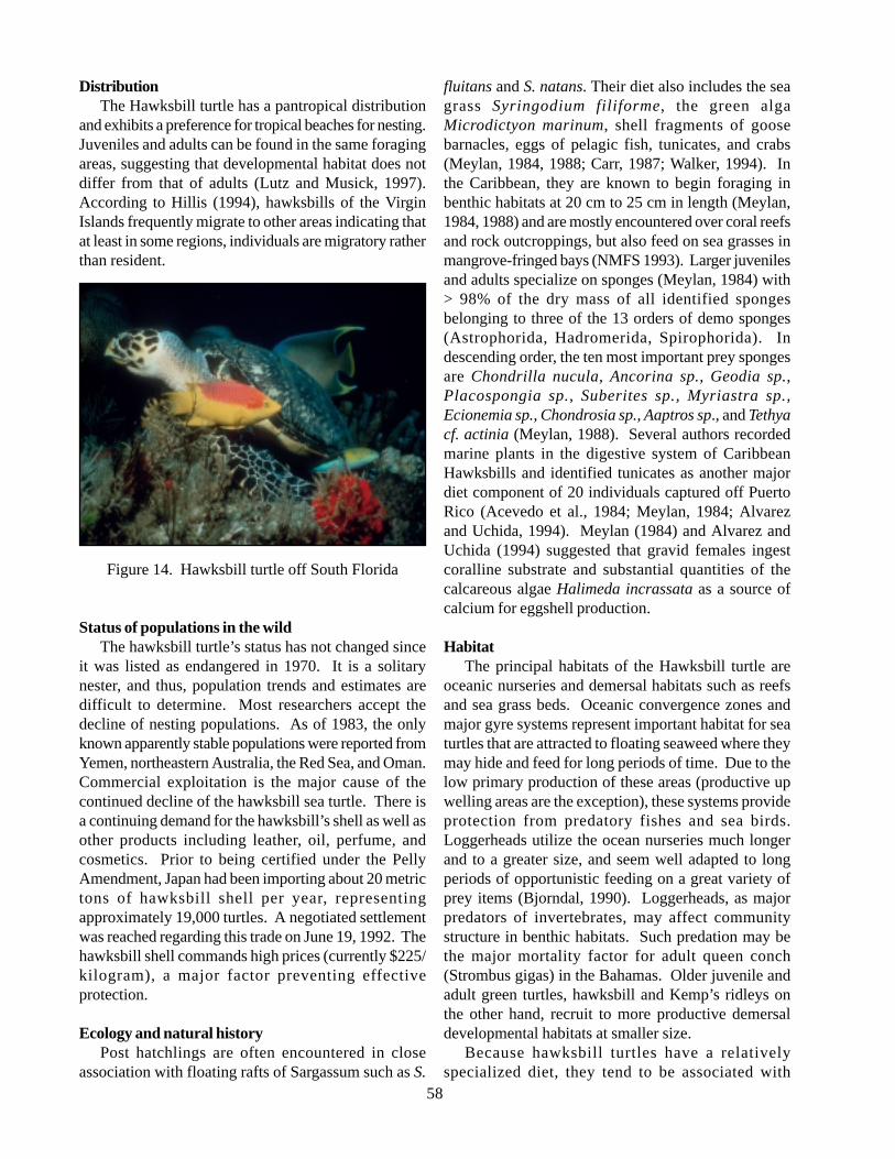
58
DistributionThe Hawksbill turtle has a pantropical distribution
and exhibits a preference for tropical beaches for nesting.Juveniles and adults can be found in the same foragingareas, suggesting that developmental habitat does notdiffer from that of adults (Lutz and Musick, 1997).According to Hillis (1994), hawksbills of the VirginIslands frequently migrate to other areas indicating thatat least in some regions, individuals are migratory ratherthan resident.
Figure 14. Hawksbill turtle off South Florida
Status of populations in the wildThe hawksbill turtle’s status has not changed since
it was listed as endangered in 1970. It is a solitarynester, and thus, population trends and estimates aredifficult to determine. Most researchers accept thedecline of nesting populations. As of 1983, the onlyknown apparently stable populations were reported fromYemen, northeastern Australia, the Red Sea, and Oman.Commercial exploitation is the major cause of thecontinued decline of the hawksbill sea turtle. There isa continuing demand for the hawksbill’s shell as well asother products including leather, oil, perfume, andcosmetics. Prior to being certified under the PellyAmendment, Japan had been importing about 20 metrictons of hawksbill shell per year, representingapproximately 19,000 turtles. A negotiated settlementwas reached regarding this trade on June 19, 1992. Thehawksbill shell commands high prices (currently $225/kilogram), a major factor preventing effectiveprotection.
Ecology and natural historyPost hatchlings are often encountered in close
association with floating rafts of Sargassum such as S.
fluitans and S. natans. Their diet also includes the seagrass Syringodium filiforme, the green algaMicrodictyon marinum, shell fragments of goosebarnacles, eggs of pelagic fish, tunicates, and crabs(Meylan, 1984, 1988; Carr, 1987; Walker, 1994). Inthe Caribbean, they are known to begin foraging inbenthic habitats at 20 cm to 25 cm in length (Meylan,1984, 1988) and are mostly encountered over coral reefsand rock outcroppings, but also feed on sea grasses inmangrove-fringed bays (NMFS 1993). Larger juvenilesand adults specialize on sponges (Meylan, 1984) with> 98% of the dry mass of all identified spongesbelonging to three of the 13 orders of demo sponges(Astrophorida, Hadromerida, Spirophorida). Indescending order, the ten most important prey spongesare Chondrilla nucula, Ancorina sp., Geodia sp.,Placospongia sp., Suberites sp., Myriastra sp.,Ecionemia sp., Chondrosia sp., Aaptros sp., and Tethyacf. actinia (Meylan, 1988). Several authors recordedmarine plants in the digestive system of CaribbeanHawksbills and identified tunicates as another majordiet component of 20 individuals captured off PuertoRico (Acevedo et al., 1984; Meylan, 1984; Alvarezand Uchida, 1994). Meylan (1984) and Alvarez andUchida (1994) suggested that gravid females ingestcoralline substrate and substantial quantities of thecalcareous algae Halimeda incrassata as a source ofcalcium for eggshell production.
HabitatThe principal habitats of the Hawksbill turtle are
oceanic nurseries and demersal habitats such as reefsand sea grass beds. Oceanic convergence zones andmajor gyre systems represent important habitat for seaturtles that are attracted to floating seaweed where theymay hide and feed for long periods of time. Due to thelow primary production of these areas (productive upwelling areas are the exception), these systems provideprotection from predatory fishes and sea birds.Loggerheads utilize the ocean nurseries much longerand to a greater size, and seem well adapted to longperiods of opportunistic feeding on a great variety ofprey items (Bjorndal, 1990). Loggerheads, as majorpredators of invertebrates, may affect communitystructure in benthic habitats. Such predation may bethe major mortality factor for adult queen conch(Strombus gigas) in the Bahamas. Older juvenile andadult green turtles, hawksbill and Kemp’s ridleys onthe other hand, recruit to more productive demersaldevelopmental habitats at smaller size.
Because hawksbill turtles have a relativelyspecialized diet, they tend to be associated with
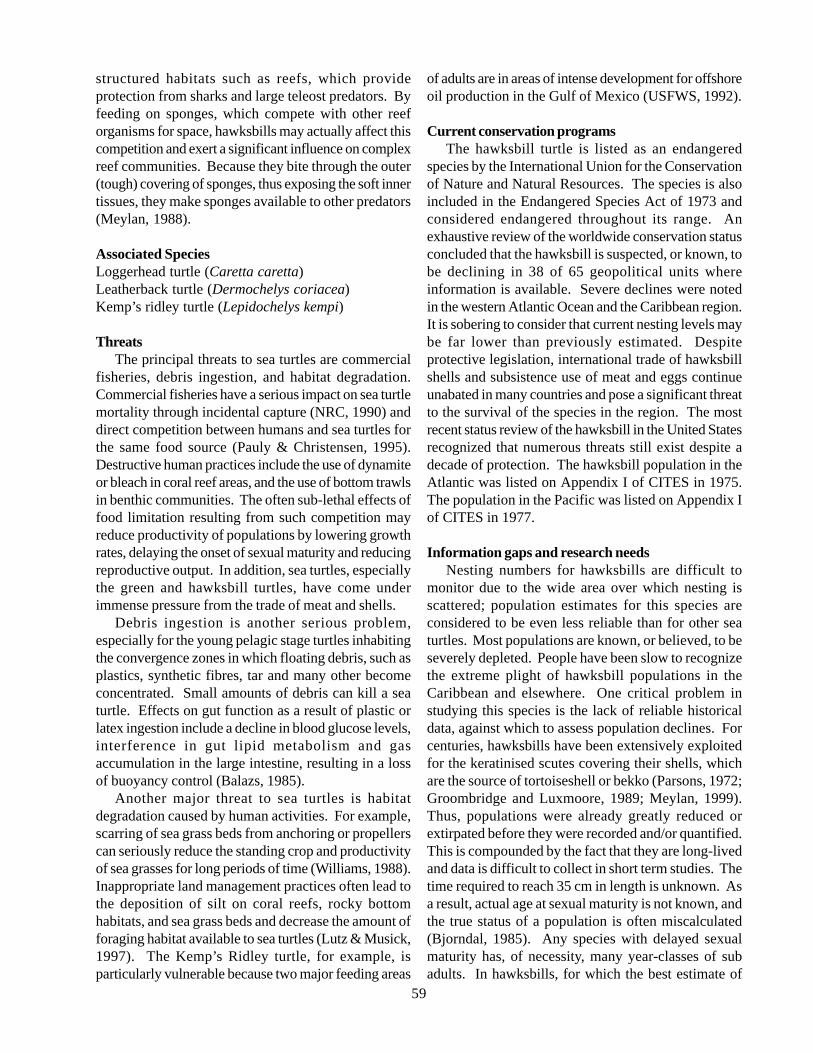
59
structured habitats such as reefs, which provideprotection from sharks and large teleost predators. Byfeeding on sponges, which compete with other reeforganisms for space, hawksbills may actually affect thiscompetition and exert a significant influence on complexreef communities. Because they bite through the outer(tough) covering of sponges, thus exposing the soft innertissues, they make sponges available to other predators(Meylan, 1988).
Associated SpeciesLoggerhead turtle (Caretta caretta)Leatherback turtle (Dermochelys coriacea)Kemp’s ridley turtle (Lepidochelys kempi)
ThreatsThe principal threats to sea turtles are commercial
fisheries, debris ingestion, and habitat degradation.Commercial fisheries have a serious impact on sea turtlemortality through incidental capture (NRC, 1990) anddirect competition between humans and sea turtles forthe same food source (Pauly & Christensen, 1995).Destructive human practices include the use of dynamiteor bleach in coral reef areas, and the use of bottom trawlsin benthic communities. The often sub-lethal effects offood limitation resulting from such competition mayreduce productivity of populations by lowering growthrates, delaying the onset of sexual maturity and reducingreproductive output. In addition, sea turtles, especiallythe green and hawksbill turtles, have come underimmense pressure from the trade of meat and shells.
Debris ingestion is another serious problem,especially for the young pelagic stage turtles inhabitingthe convergence zones in which floating debris, such asplastics, synthetic fibres, tar and many other becomeconcentrated. Small amounts of debris can kill a seaturtle. Effects on gut function as a result of plastic orlatex ingestion include a decline in blood glucose levels,interference in gut lipid metabolism and gasaccumulation in the large intestine, resulting in a lossof buoyancy control (Balazs, 1985).
Another major threat to sea turtles is habitatdegradation caused by human activities. For example,scarring of sea grass beds from anchoring or propellerscan seriously reduce the standing crop and productivityof sea grasses for long periods of time (Williams, 1988).Inappropriate land management practices often lead tothe deposition of silt on coral reefs, rocky bottomhabitats, and sea grass beds and decrease the amount offoraging habitat available to sea turtles (Lutz & Musick,1997). The Kemp’s Ridley turtle, for example, isparticularly vulnerable because two major feeding areas
of adults are in areas of intense development for offshoreoil production in the Gulf of Mexico (USFWS, 1992).
Current conservation programsThe hawksbill turtle is listed as an endangered
species by the International Union for the Conservationof Nature and Natural Resources. The species is alsoincluded in the Endangered Species Act of 1973 andconsidered endangered throughout its range. Anexhaustive review of the worldwide conservation statusconcluded that the hawksbill is suspected, or known, tobe declining in 38 of 65 geopolitical units whereinformation is available. Severe declines were notedin the western Atlantic Ocean and the Caribbean region.It is sobering to consider that current nesting levels maybe far lower than previously estimated. Despiteprotective legislation, international trade of hawksbillshells and subsistence use of meat and eggs continueunabated in many countries and pose a significant threatto the survival of the species in the region. The mostrecent status review of the hawksbill in the United Statesrecognized that numerous threats still exist despite adecade of protection. The hawksbill population in theAtlantic was listed on Appendix I of CITES in 1975.The population in the Pacific was listed on Appendix Iof CITES in 1977.
Information gaps and research needsNesting numbers for hawksbills are difficult to
monitor due to the wide area over which nesting isscattered; population estimates for this species areconsidered to be even less reliable than for other seaturtles. Most populations are known, or believed, to beseverely depleted. People have been slow to recognizethe extreme plight of hawksbill populations in theCaribbean and elsewhere. One critical problem instudying this species is the lack of reliable historicaldata, against which to assess population declines. Forcenturies, hawksbills have been extensively exploitedfor the keratinised scutes covering their shells, whichare the source of tortoiseshell or bekko (Parsons, 1972;Groombridge and Luxmoore, 1989; Meylan, 1999).Thus, populations were already greatly reduced orextirpated before they were recorded and/or quantified.This is compounded by the fact that they are long-livedand data is difficult to collect in short term studies. Thetime required to reach 35 cm in length is unknown. Asa result, actual age at sexual maturity is not known, andthe true status of a population is often miscalculated(Bjorndal, 1985). Any species with delayed sexualmaturity has, of necessity, many year-classes of subadults. In hawksbills, for which the best estimate of
60
sexual maturity is about 20 to 40 years (Chaloupka &Limpus, 1997; Crouse, 1999), even a small populationof adult hawksbills will have a relatively large numberof juveniles in the 20 to 40 age classes of sub adults.These are not ‘excess’ turtles that can be removed fromthe population without affecting population status; theyare the minimum number required to sustain a smallbreeding population. Thus, the number of turtles in aregion often belies the true status of the population andcan give a perception of population stability that doesnot reflect reality (Bjorndal, 1999).
Justification• Preservation and protection of the natural habitats
of the hawksbill turtle, especially the nestingbeaches and developmental habitats on coralreefs and mangrove flats;
• Minimization of the hunting of turtles and tradeof products until scientific data providesreliable assessment of sustainable harvest;
• Studies of the natural history and migration, andcreation of a comprehensive database to monitorthe health of the turtle populations as well astheir impact reefs (sponge beds) and mangroveflats; and
• Securing funding for the necessary long-term,multidisciplinary studies and the resultingmanagement and educational tools. The slowmaturation period for marine turtles can maskthe effects of exploitation and conservationefforts; therefore long-term research programsare essential.
StrategiesActive management strategies to protect vital marine
turtle habitats could include the creation of marinesanctuaries or coastal and near-shore ocean park reservesin the Bahamas. Since sea turtles a migratory and passthrough the jurisdictions of many countries, internationalcooperation and regional agreements on conservationare highly desirable.
Research and education programs could be combinedin turtle rehab/rescue centres that are open to the public.Similar facilities in the US are both popular andprofitable. Participation in international turtle researchand rescue programs is important. The favourable publicimage and charisma of sea turtles can be used to infusethe importance of conservation of the species and it’svast habitats into the culture through education andmedia exposure.
Contact persons
Barbara J. Brunnick, Ph.D.Blue Dolphin ResearchP.O. Box 9243Jupiter, FL 33468-9243E-mail: [email protected]
Dr. Stefan HarzenThe Taras Oceanographic Foundation5905 Stonewood CourtJupiter, FL 33458Tel: (561) 743-7683Fax: (561) 748-0794E-mail: [email protected]
Larry WoodDirector, Marine Life Center of Juno Beach1200 US Highway OneJuno Beach, FL 33408Tel: (561) 627-8280Fax: (561) 627-8305
References
Acevedo M, Gómez O, Berovides V (1984)Alimentacion de tres especies de quelonios marinosen la plataforma suroccidental de Cuba. Revista deInvestigaciones Marina 5, 29 p.
Anderes Alvarez BL, Uchida I (1994) Study ofhawksbill turtle (Eretmochelys imbricata) stomachcontent in Cuban waters. In Study of the HawksbillTurtles in Cuba (I). Ministry of Fishing Industry,Cuba.
Balazs GH (1982) Growth rates or immature greenturtles in the Hawaiian Archipelago. In Biology andconservation of sea turtles. Bjorndal KA (Ed.),Smithsonian Institution Press. Washington DC, 117.
Balazs GH (1985) Impact of ocean debris on marineturtles: entanglement and ingestion. In Workshop onthe fate and impact of marine debris. Shomura RS,Yoshida HO (Eds.), NOAA Technical MemorandumNOAA-TM-NMFS-SWFC-54, Honolulu, HI, 387 p.
Banard DE, Keinath JA, Musick JA (1989) Distributionof ridley, green and leatherback turtles inChesapeake Bay and adjacent waters. In Proceedingsof the Ninth Annual Workshop on Sea Turtle Biologyand Conservation. Eckert SA, Eckert KL,Richardson TH (Compilers), NOAA TechnicalMemorandum NMFS-SEFC-232, 201p.
Bjorndal, K. A. 1999. Conservation of Hawksbill Sea
61
Turtles: Perceptions and Realities. ChelonianConservation and Biology 3(2):174-176.
Bjorndal, K.A. (1980) Nutrition and grazing behaviorof the green turtle, Chelonia mydas. Marine Biology56: 147.
Bjorndal KA (1982) The consequences of herbiovoryfor the life history pattern of the Caribbean greenturtle. In Biology and conservation of sea turtles.Bjorndal KA (Ed.), Smithsonian Institution Press,Washington DC, 111 p.
Bjorndal KA (1985) Nutritional ecology of sea turtles.Copeia 1985: 736.
Bjorndal KA (1990) Digestibility of the spongeChondrilla nucula in the green turtle, Cheloniamydas. Bulletin of Marine Science 47: 567.
Bjorndal KA, Bolton AB (1995) Comparison of length-frequency analyses for estimation of growthparameter for a population of green turtles.Herpetologica 51(2): 160.
Bjorndal KA, Bolton AB (1996) Developmentalmigrations of juvenile green turtles in the Bahamas.In Proceedings of the Fifteenth Annual Workshopon Sea Turtle Biology and Conservation. KeinathJA, Barnard DE, Musick JA, Bell BA (Compilers),NOAA Technical Memorandum NMFS-SEFC-387,38 p.
Bolten AB, Martins HR, Watali ML, Thomas JC,Marcovaldi MA (1990) Loggerhead released inBrazil recaptured in Azores. Marine TurtleNewsletter 48: 24.
Bolten AB, Santana C, Bjorndal KA (1992)Transatlantic crossing by a loggerhead turtle. MarineTurtle Newsletter 59: 7.
Boulon RH (1994) Growth rates of wild juvenilehawksbill turtles Eretmochelys imbricata in St.Thomas, United States, Virgin Islands. Copeia 1994:811.
Bowen BW, Richardson JI, Meylan AB, MargaritoulisD, Hopkins-Murphy SR, Avise JC (1993) Populationstructure of loggerhead turtles (Caretta caretta) inthe west Atlantic ocean and Mediterranean Sea.Conservation Biology 7: 834-844.
Brongersma LD (1972) European Atlantic turtles. ZoolBerhand Leiden 121: 318.
Byles RA (1988) Behavior and ecology of sea turtlesfrom Chesapeake Bay, VA. PhD Dissertation,College of William and Mary, Williamsburg, VA.
Carr A (1987) Rips, FADS, and little loggerheads.BioScience 36: 92.
Carr A (1987) New perspectives on the pelagic stage ofsea turtle development. Conservation Biology 1(2):103.
Carr A, Ogren L (1959) The ecology and migrations ofsea turtles. 3: Dermochelys in Costa Rica. AmericanMuseum Novitates 1.
Chaloupka, M.Y., and Limpus, C.J. 1997. Robuststatistical modelling of hawksbill sea turtle growthrates (southern Great Barrier Reef). Marine EcologyProgress Series 146:1-8.
Collard SB (1990) Leatherback turtles feeding near awatermass boundary in the eastern Gulf of Mexico.Marine Turtle Newsletter 50: 12.
Collard SB (1990a) Guest editorial: speculation on thedistribution of oceanic-stage sea turtles, withemphasis on Kemp’s ridley in the Gulf of Mexico.Marine Turtle Newsletter 48: 6.
Collard SB (1990b) The influence of oceanographicfeatures in post-hatching sea turtle distribution anddispersion in the pelagic environment. In Proceedingsof the Tenth Annual Workshop on Sea Turtle Biologyand Conservation. Richardson TH, Richardson JI,Donnely M (Compilers), NOAA TechnicalMemorandum NMFS-SEFC-278, 111 p.
Collard SB, Ogren LH (1990) Dispersal scenarios forpelagic post-hatchlings sea turtles. Bulletin ofMarine Science 47: 233.
Crouse, D. 1999. Population modeling and implicationsfor Caribbean hawksbill sea turtle management.Chelonian Conservation and Biology 3(2):185-188.
Dodd DC (1988) Synopsis of the biological data on theloggerhead sea turtle, Caretta caretta (Linnaeus,1758). FAO Synopsis NMFS-149, USFWSBiological Report 88(14), 110 p.
Duron M, Quero JC, Duron P (1983) Présence dans leseaux cotières de France et de Guyane fréquentéespar Dermochelys coriacea L., de Remora remora L.,et de Rhizostoma pulmo L. Annal Soc Sci NatCharente-Mar 7: 147.
Duron M, Duron P (1980) Des tortues luths dans lepertuis Charentais. Courr Nat 69: 37.
Eckert SA, Martins HR (1989) Transatlantic travel bya juvenile loggerhead turtle. Marine TurtleNewsletter 45: 15.
Eckert SA, Eckert KL, Ponganis P, Kooyman GL (1989)Diving and foraging behavior of leatherback seaturtles (Dermochelys coriacea). Canadian Journal ofZoology 67: 2834.
Epperly SP, Braun J, Veishlow A (1994) Sea turtles inNorth Carolina waters. Conservation Biology 2: 384.
Eisenberg JF, Frazier J (1983) A leatherback turtle(Dermochelys coriacea) feeding in the wild. Journalof Herpetology 17: 81.
Ernst CH, Lovich JE, Barbour RW (1944) Turtles ofthe United States and Canada. Smithsonian
62
Institution Press, Washington DC.Fletmeyer JR (1978) Underwater tracking evidence that
neonate loggerhead sea turtles seek shelter in driftingSargassum. Copeia 1978(1): 148.
Frick J (1976) Orientation and behavior of hatchlinggreen turtles (Chelonia mydas) in the sea. AnimalBehavior 24: 849.
Groombridge, B., and Luxmoore, R. 1989. The GreenTurtle and Hawksbill (Reptilia: Cheloniidae): WorldStatus, Exploitation and Trade. Lausanne,Switzerland: CITES Secretariat, 601 pp.
Grant GS, Ferrell D (1993) Leatherback turtle,Dermochelys coriacea (Reptilia: dermochelidae):notes on near-shore feeding behavior and associationwith cobia. Brimleyana 19: 77.
Guseman JL, Ehrhart LM (1990) Green turtles onsabellariid worm reefs: initial results from studieson the Florida Atlantic coast. In Proceedings of theTenth Annual Workshop on Sea Turtle Biology andConservation. Richardson TH, Richardson JI,Donnely M (Compilers), NOAA TechnicalMemorandum NMFS-SEFC-278, 125 p.
Henwood TA, Ogren LH (1987) Distribution andmigration of immature Kemp’s ridley turtles(Lepidochelys kempi) and green turtles (Cheloniamydas) off Florida, Georgia and South Carolina.Northeast Gulf Science 9(2): 153.
Hillis ZM (1994) The hawksbill turtles of Buck IslandReef National Monument: a shared resource of theCaribbean. In Proceedings of the Fourteenth AnnualSymposium on Sea Turtle Biology and Conservation.Bjorndal KA, Bolton AB, Johnson PA, Eliazar PJ(Compilers), NOAA Technical MemorandumNMFS-SEFSC-351, 59 p.
Hoffman W, Fritts TH (1982) Sea turtle distributionalong the boundary of the Gulf Stream Current offeastern Florida. Herpetologica 38: 405.
Ireland LC, Frick JA, Wingate DB (1978) Nighttimeorientation of hatchling green turtles (Cheloniamydas) in the open ocean. In Animal migration,navigation, and homing. Schmidt-Koenig K, KeetonWJ (Eds.), Springer Verlag, NY, 420 p.
Keinath JA, Musick JA (1991) Atlantic green turtleChelonia mydas (Linnaeus). In Virginia’s endangeredspecies. Terwilliger K (Coordinator), McDonald andWoodward, Blacksburg, VA, 448 p.
Keinath JA, Musick JA, Byles RA (1987) Aspects ofthe biology of Virginia’s sea turtles: 1979-1986.Virginia Journal of Science 38(4): 329.
Klinger RC, Musick JA (1995) Age and growth ofloggerhead turtles (Caretta caretta) from ChesapeakeBay. Copeia 1995(1): 204.
Lazell JD (1980a) New England waters: critical habitatfor marine turtles. Copeia 1980: 290.
Lazell JD (1980b) This broken archipelago: Cape Codand the Islands, amphibians and reptiles. DemeterPress, NY, 260 p.
Leary TR (1957) A schooling of leatherback turtles,Dermochelys coriacea coriacea, on the Texas coast.Copeia 1957: 232.
Lee DS, Palmer WM (1981) Records of leatherbackturtles, Dermochelys coriacea (Linnaeus) and othermarine turtles in North Carolina waters. Brimleyana5: 95.
Limpus CJ (1991) Puberty and first breeding in Carettacaretta. NOAA Technical Memorandum NMFS-SEFC-278, 81-3.
Limpus CJ, Couper PJ, Reed MA (1994) The greenturtle Chelonia mydas in Queensland: Populationstructure in a warm temperate feeding area. Mem.Queensl. Mus. 35(1): 139.
Lohmann KJ, Witherington BE, Lohmann CM, SalmonM (1997) Orientation, navigation and natal beachhoming in sea turtles. In Biology of sea Turtles. LutzP, Musick JA (Eds.), CRC Press, Boca Raton, p 107-136.
Lutcavage M, Lutz PL (1986) Metabolic rate and foodenergy requirements of the leatherback sea turtle,Dermochelys coriacea. Copeia 1986: 796.
Lutz PL, Musick JA (1997) The biology of sea turtles.Marine Science Series, CRC Press, Boca Raton, 432p.
Manzella SA, Fontaine CT (1988) Loggerhead sea turtletravels from Padre Island, Texas to the mouth of theAdriatic Sea. Marine Turtle Newsletter 42: 7.
Marquéz R (1994) Synopsis of biological data on theKemp’s ridley turtle Lepidochelys kempi (Garman,1880). NOAA Technical Memorandum NMFS-SEFSC-343, 91 p.
Mellgren JR, Morra M, Bushong M, Harkins S, KrumkeV (1994) Habitat selection in three species of captivesea turtle hatchlings. In Proceedings of theFourteenth Annual Symposium on Sea TurtleBiology and Conservation. Bjorndal KA, Bolton AB,Johnson PA, Eliazar PJ (Compilers), NOAATechnical Memorandum NMFS-SEFSC-351, 259 p.
Mellgren RG, Mann MA (1996) Comparative Behaviorof hatchling sea turtles. In Proceedings of theFifteenth Annual Workshop on Sea Turtle Biologyand Conservation. Keinath JA, Barnard DE, MusickJA, Bell BA (Compilers), NOAA TechnicalMemorandum NMFS-SEFC-387, 202.
Mendonca MT (1983) Movement and feeding ecologyof immature green turtles (Chelonia mydas) in a
63
Florida lagoon. Copeia 1013.Meylan AB (1998) Feeding ecology of the hawksbill
turtle (Eretmochelys imbricata): Spongivory as afeeding niche in the coral reef community.Unpublished thesis, University of Florida,Gainesville.
Meylan AB (1988) Spongivory in hawksbill turtles: adiet of glass. Science 239: 393.
Meylan, A.B. 1999. Status of the hawksbill turtle(Eretmochelys imbricata) in the Caribbean region.Chelonian Conservation and Biology 3(2):177-184.
Morreale SJ, Standora EA (1992) Occurrence,movement and behavior of the Kemp’s ridley andother sea turtles in New York waters. Journal ofHerpetology 26: 301.
Morreale SJ, Meylan A, Sadove S, Standora E (1992)Annual occurrence and winter mortality of marineturtles in New York waters. Journal of Herpetology26: 301.
Mortimer JA (1976) Observations on the feedingecology on the green turtle, Chelonia mydas, in theWestern Caribbean. Unpublished Thesis, Universityof Florida, Gainesville.
Mortimer JA (1981) The feeding ecology of the WestCaribbean green turtle (Chelonia mydas) inNicaragua. Biotropica 13: 49.
Mortimer JA (1982) Feeding ecology of sea turtles. InBiology and conservation of sea turtles. BjorndalKA (Ed.), Smithsonian Institution Press, WashingtonDC, 103.
Musick JA (1988) The sea turtles of Virginia, 2ndrevised edition. Virginia Sea Grant Program, VirginiaInstitute of Marine Science, Gloucester Point, VA.
NRC (National Research Council) (1990) Decline ofthe Sea Turtles: Causes and Prevention. NationalAcademy Press. Washington DC.
NMFS and U.S. Fish and Wildlife Service. 1993.Recovery plan for hawksbill turtles in the U.S.Caribbean Sea, Atlantic Ocean, and Gulf of Mexico.NMFS. St. Petersburg.
Ogren LH (1989) Distribution of juvenile and subadultKemp’s ridley turtles: preliminary results from the1984-1987 surveys. In Proceedings of the 1stInternational Symposium on Kemp’s Ridley sea turtlebiology, conservation and management. CaillouetCW, Landry AM (Eds.), Sea Grant College Program,Galveston, TX, 116.
Ogren L, McVea C (1982) Apparent hibernation by seaturtles in North American waters. In Biology andconservation of sea turtles. Bjorndal KA (Ed.),Smithsonian Institution Press. Washington DC, p127.
Paladino FV, O’Connor MP, Spotila JR (1990)Metabolism of leatherback turtles, gigantothermy,and thermoregulation of dinosaurs. Nature 344: 959.
Parsons, J.J. 1972. The hawksbill turtle and the tortoiseshell trade. In: Etudes de geographie tropicaleoffertes a Peirre Gourou. Mouton Paris La Haye,pp. 45-60.
Pauly D, Christensen V (1995) Primary productionrequired to sustain global fisheries. Nature 374: 255.
Richardson JI, McGillivary R (1991) Post-hatchingloggerhead turtles eat insects in Sargassumcommunity. Marine Turtle Newsletter 55: 2.
Shaver DJ (1991) Feeding ecology of wild and head-started Kemp’s ridley sea turtle, Lepidochelyskempii, in New York waters. Fishery Bulletin U.S.92: 26.
Shoop CR, Kenney RD (1992) Seasonal distributionand abundances of loggerhead and leatherback seaturtles in waters of the northeastern United States.Herpetological Monographs 6: 43.
Smith WG (1968) A neonate Atlantic loggerhead turtle,Caretta caretta, captured at sea. Copeia 4: 880.
USFWS (U.S. Fish and Wildlife Service and Nationalmarine Fisheries Service. 1992. Recovery Plan forthe Kemp’s Ridley sea turtle (Lepidochelys kempii).National Marine Fisheries Service. St. Petersburg,FL.
Walker TA (1994) Post-hatchling dispersal of sea turtles.In Proceedings of the Australian Marine TurtleConservation Workshop. Queensland, Australia.
Williams SL (1988) Thalassia testudinum productivityand grazing by green turtles in a highly disturbedseagrass bed. Marine Biology 98: 447.
Witham RM (1980) The ‘lost years’ question in youngsea turtles. American Zoologist 20: 525.
Witherington BE (1994) Some ‘lost year’ turtles found.In Proceedings of the 13th Annual Symposium onSea Turtle Biology and Conservation. Schroeder BA,Witherington HE (compilers), NOAA TechnicalMemorandum NMFS-SEFSC-341, 192 p.
Witzell WN (1983) Synopsis of the biological data onthe Hawksbill turtle Eretmochelys imbricata(Linnaeus, 1766). FAO Fisheries Synopsis 137, 78p.
Wyneken J, Salmon M (1992) Frenzy and post-frenzyswimming activity in loggerhead, green andleatherback hatchling sea turtles. Copeia, 478.
Wyneken J (1997) Sea turtle locomotion: mechanisms,behavior and energetics. In Biology of sea turtles.Lutz P, Musick JA (Eds), CRC Press, Boca Raton, p165-198.
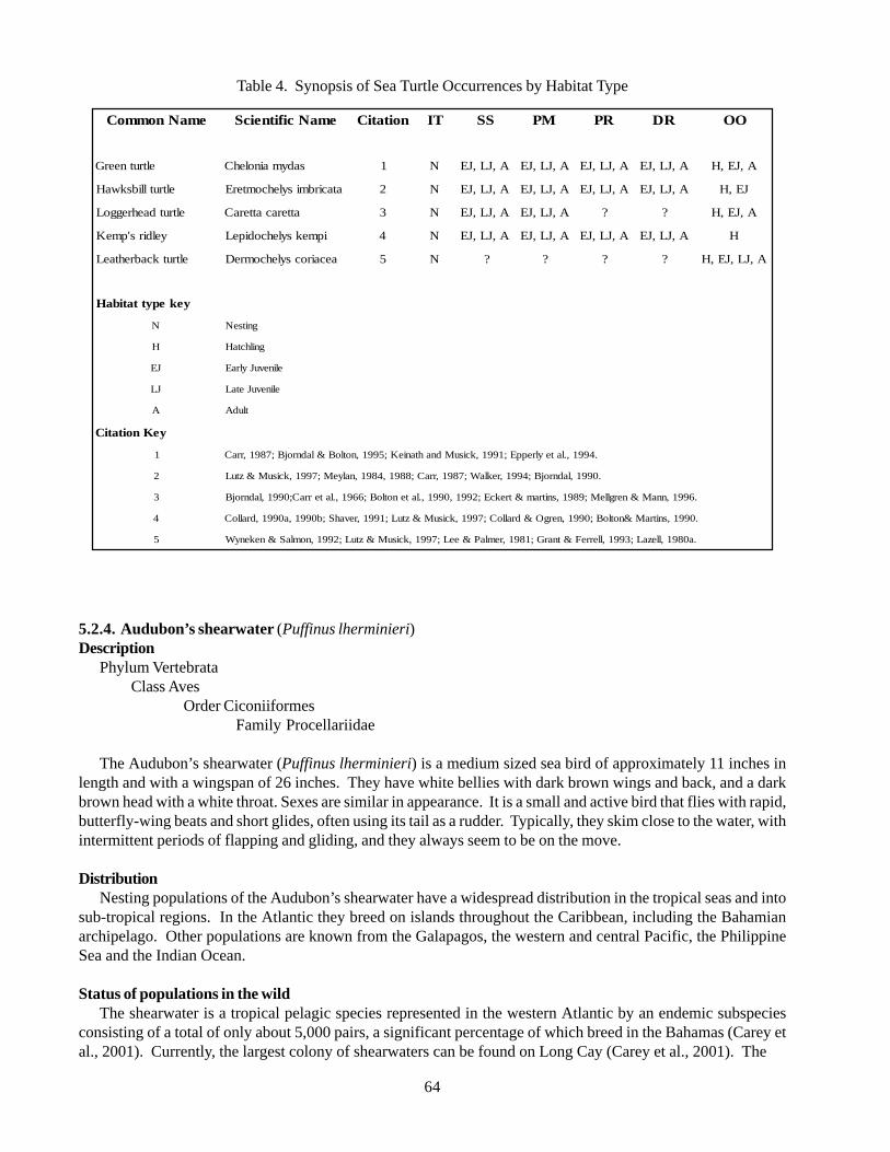
64
Table 4. Synopsis of Sea Turtle Occurrences by Habitat Type
5.2.4. Audubon’s shearwater (Puffinus lherminieri)Description
Phylum VertebrataClass Aves
Order CiconiiformesFamily Procellariidae
The Audubon’s shearwater (Puffinus lherminieri) is a medium sized sea bird of approximately 11 inches inlength and with a wingspan of 26 inches. They have white bellies with dark brown wings and back, and a darkbrown head with a white throat. Sexes are similar in appearance. It is a small and active bird that flies with rapid,butterfly-wing beats and short glides, often using its tail as a rudder. Typically, they skim close to the water, withintermittent periods of flapping and gliding, and they always seem to be on the move.
DistributionNesting populations of the Audubon’s shearwater have a widespread distribution in the tropical seas and into
sub-tropical regions. In the Atlantic they breed on islands throughout the Caribbean, including the Bahamianarchipelago. Other populations are known from the Galapagos, the western and central Pacific, the PhilippineSea and the Indian Ocean.
Status of populations in the wildThe shearwater is a tropical pelagic species represented in the western Atlantic by an endemic subspecies
consisting of a total of only about 5,000 pairs, a significant percentage of which breed in the Bahamas (Carey etal., 2001). Currently, the largest colony of shearwaters can be found on Long Cay (Carey et al., 2001). The
emaNnommoC emaNcifitneicS noitatiC TI SS MP RP RD OO
eltrutneerG sadymainolehC 1 N A,JL,JE A,JL,JE A,JL,JE A,JL,JE A,JE,H
eltrutllibskwaH atacirbmisylehcomterE 2 N A,JL,JE A,JL,JE A,JL,JE A,JL,JE JE,H
eltrutdaehreggoL atteracatteraC 3 N A,JL,JE A,JL,JE ? ? A,JE,H
yeldirs'pmeK ipmeksylehcodipeL 4 N A,JL,JE A,JL,JE A,JL,JE A,JL,JE H
eltrutkcabrehtaeL aecairocsylehcomreD 5 N ? ? ? ? A,JL,JE,H
yekepyttatibaH
N gnitseN
H gnilhctaH
JE elinevuJylraE
JL elinevuJetaL
A tludA
yeKnoitatiC
1 .4991,.lateylreppE;1991,kcisuMdnahtanieK;5991,notloB&ladnrojB;7891,rraC
2 .0991,ladnrojB;4991,reklaW;7891,rraC;8891,4891,nalyeM;7991,kcisuM&ztuL
3 .6991,nnaM&nerglleM;9891,snitram&trekcE;2991,0991,.latenotloB;6691,.laterraC;0991,ladnrojB
4 .0991,snitraM¬loB;0991,nergO&dralloC;7991,kcisuM&ztuL;1991,revahS;b0991,a0991,dralloC
5 .a0891,llezaL;3991,llerreF&tnarG;1891,remlaP&eeL;7991,kcisuM&ztuL;2991,nomlaS&nekenyW
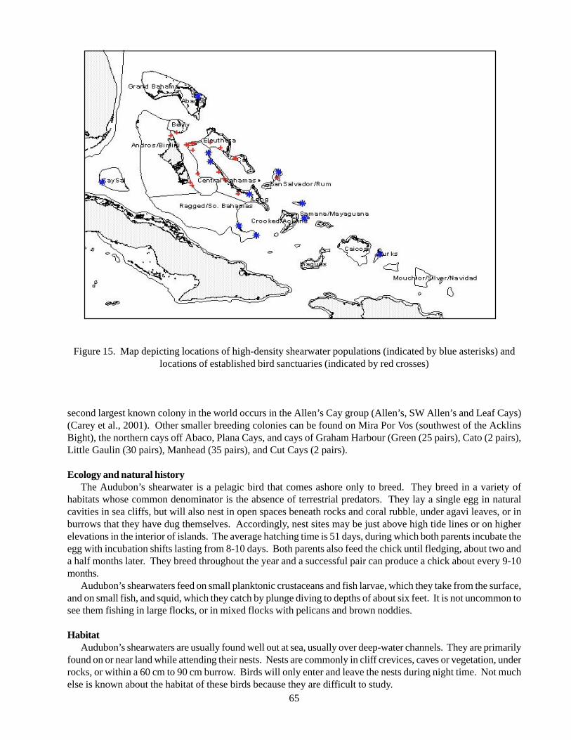
65
Figure 15. Map depicting locations of high-density shearwater populations (indicated by blue asterisks) andlocations of established bird sanctuaries (indicated by red crosses)
second largest known colony in the world occurs in the Allen’s Cay group (Allen’s, SW Allen’s and Leaf Cays)(Carey et al., 2001). Other smaller breeding colonies can be found on Mira Por Vos (southwest of the AcklinsBight), the northern cays off Abaco, Plana Cays, and cays of Graham Harbour (Green (25 pairs), Cato (2 pairs),Little Gaulin (30 pairs), Manhead (35 pairs), and Cut Cays (2 pairs).
Ecology and natural historyThe Audubon’s shearwater is a pelagic bird that comes ashore only to breed. They breed in a variety of
habitats whose common denominator is the absence of terrestrial predators. They lay a single egg in naturalcavities in sea cliffs, but will also nest in open spaces beneath rocks and coral rubble, under agavi leaves, or inburrows that they have dug themselves. Accordingly, nest sites may be just above high tide lines or on higherelevations in the interior of islands. The average hatching time is 51 days, during which both parents incubate theegg with incubation shifts lasting from 8-10 days. Both parents also feed the chick until fledging, about two anda half months later. They breed throughout the year and a successful pair can produce a chick about every 9-10months.
Audubon’s shearwaters feed on small planktonic crustaceans and fish larvae, which they take from the surface,and on small fish, and squid, which they catch by plunge diving to depths of about six feet. It is not uncommon tosee them fishing in large flocks, or in mixed flocks with pelicans and brown noddies.
HabitatAudubon’s shearwaters are usually found well out at sea, usually over deep-water channels. They are primarily
found on or near land while attending their nests. Nests are commonly in cliff crevices, caves or vegetation, underrocks, or within a 60 cm to 90 cm burrow. Birds will only enter and leave the nests during night time. Not muchelse is known about the habitat of these birds because they are difficult to study.
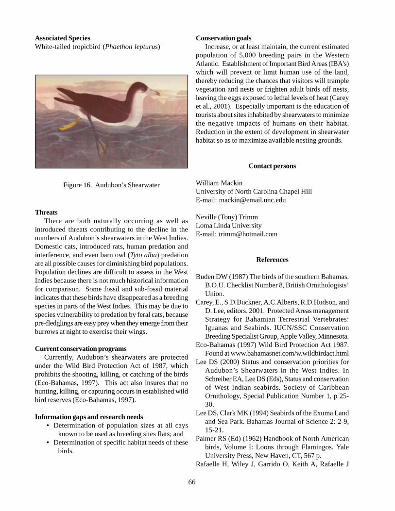
66
Associated SpeciesWhite-tailed tropicbird (Phaethon lepturus)
Figure 16. Audubon’s Shearwater
ThreatsThere are both naturally occurring as well as
introduced threats contributing to the decline in thenumbers of Audubon’s shearwaters in the West Indies.Domestic cats, introduced rats, human predation andinterference, and even barn owl (Tyto alba) predationare all possible causes for diminishing bird populations.Population declines are difficult to assess in the WestIndies because there is not much historical informationfor comparison. Some fossil and sub-fossil materialindicates that these birds have disappeared as a breedingspecies in parts of the West Indies. This may be due tospecies vulnerability to predation by feral cats, becausepre-fledglings are easy prey when they emerge from theirburrows at night to exercise their wings.
Current conservation programsCurrently, Audubon’s shearwaters are protected
under the Wild Bird Protection Act of 1987, whichprohibits the shooting, killing, or catching of the birds(Eco-Bahamas, 1997). This act also insures that nohunting, killing, or capturing occurs in established wildbird reserves (Eco-Bahamas, 1997).
Information gaps and research needs• Determination of population sizes at all cays
known to be used as breeding sites flats; and• Determination of specific habitat needs of these
birds.
Conservation goalsIncrease, or at least maintain, the current estimated
population of 5,000 breeding pairs in the WesternAtlantic. Establishment of Important Bird Areas (IBA’s)which will prevent or limit human use of the land,thereby reducing the chances that visitors will tramplevegetation and nests or frighten adult birds off nests,leaving the eggs exposed to lethal levels of heat (Careyet al., 2001). Especially important is the education oftourists about sites inhabited by shearwaters to minimizethe negative impacts of humans on their habitat.Reduction in the extent of development in shearwaterhabitat so as to maximize available nesting grounds.
Contact persons
William MackinUniversity of North Carolina Chapel HillE-mail: [email protected]
Neville (Tony) TrimmLoma Linda UniversityE-mail: [email protected]
References
Buden DW (1987) The birds of the southern Bahamas.B.O.U. Checklist Number 8, British Ornithologists’Union.
Carey, E., S.D.Buckner, A.C.Alberts, R.D.Hudson, andD. Lee, editors. 2001. Protected Areas managementStrategy for Bahamian Terrestrial Vertebrates:Iguanas and Seabirds. IUCN/SSC ConservationBreeding Specialist Group, Apple Valley, Minnesota.
Eco-Bahamas (1997) Wild Bird Protection Act 1987.Found at www.bahamasnet.com/w.wildbirdact.html
Lee DS (2000) Status and conservation priorities forAudubon’s Shearwaters in the West Indies. InSchreiber EA, Lee DS (Eds), Status and conservationof West Indian seabirds. Society of CaribbeanOrnithology, Special Publication Number 1, p 25-30.
Lee DS, Clark MK (1994) Seabirds of the Exuma Landand Sea Park. Bahamas Journal of Science 2: 2-9,15-21.
Palmer RS (Ed) (1962) Handbook of North Americanbirds, Volume I: Loons through Flamingos. YaleUniversity Press, New Haven, CT, 567 p.
Rafaelle H, Wiley J, Garrido O, Keith A, Rafaelle J
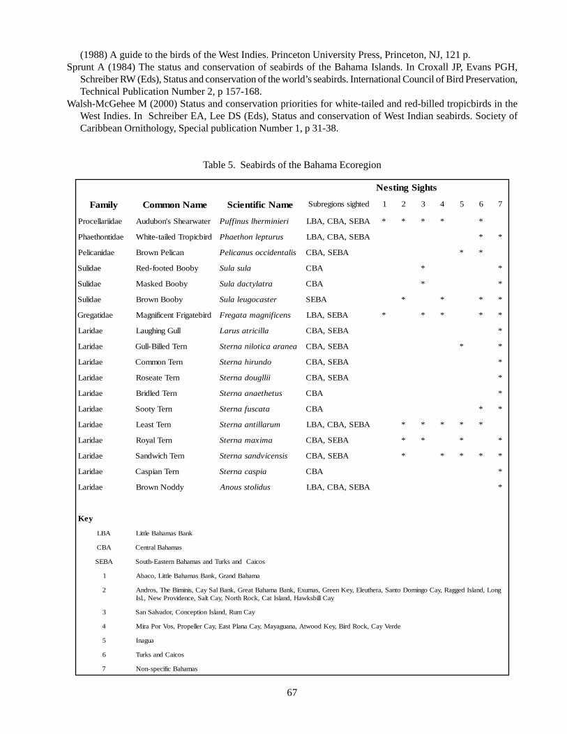
67
(1988) A guide to the birds of the West Indies. Princeton University Press, Princeton, NJ, 121 p.Sprunt A (1984) The status and conservation of seabirds of the Bahama Islands. In Croxall JP, Evans PGH,
Schreiber RW (Eds), Status and conservation of the world’s seabirds. International Council of Bird Preservation,Technical Publication Number 2, p 157-168.
Walsh-McGehee M (2000) Status and conservation priorities for white-tailed and red-billed tropicbirds in theWest Indies. In Schreiber EA, Lee DS (Eds), Status and conservation of West Indian seabirds. Society ofCaribbean Ornithology, Special publication Number 1, p 31-38.
Table 5. Seabirds of the Bahama Ecoregion
sthgiSgnitseN
ylimaF emaNnommoC emaNcifitneicS dethgissnoigerbuS 1 2 3 4 5 6 7
eadiirallecorP retawraehSs'nobuduA ireinimrehlsuniffuP ABES,ABC,ABL * * * * *
eaditnohteahP dribciporTdeliat-etihW surutpelnohteahP ABES,ABC,ABL * *
eadinacileP nacilePnworB silatnediccosunacileP ABES,ABC * *
eadiluS ybooBdetoof-deR alusaluS ABC * *
eadiluS ybooBdeksaM artalytcadaluS ABC * *
eadiluS ybooBnworB retsacoguelaluS ABES * * * *
eaditagerG dribetagirFtnecifingaM snecifingamatagerF ABES,ABL * * * * *
eadiraL lluGgnihguaL allicirtasuraL ABES,ABC *
eadiraL nreTdelliB-lluG aenaraacitolinanretS ABES,ABC * *
eadiraL nreTnommoC odnurihanretS ABES,ABC *
eadiraL nreTetaesoR iillguodanretS ABES,ABC *
eadiraL nreTdeldirB sutehteanaanretS ABC *
eadiraL nreTytooS atacsufanretS ABC * *
eadiraL nreTtsaeL murallitnaanretS ABES,ABC,ABL * * * * *
eadiraL nreTlayoR amixamanretS ABES,ABC * * * *
eadiraL nreThciwdnaS sisnecivdnasanretS ABES,ABC * * * * *
eadiraL nreTnaipsaC aipsacanretS ABC *
eadiraL yddoNnworB sudilotssuonA ABES,ABC,ABL *
yeK
ABL knaBsamahaBelttiL
ABC samahaBlartneC
ABES sociaCdnaskruTdnasamahaBnretsaE-htuoS
1 amahaBdnarG,knaBsamahaBelttiL,ocabA
2 gnoL,dnalsIdeggaR,yaCognimoDotnaS,arehtuelE,yeKneerG,samuxE,knaBamahaBtaerG,knaBlaSyaC,sinimiBehT,sordnAyaCllibskwaH,dnalsItaC,kcoRhtroN,yaCtlaS,ecnedivorPweN,.lsI
3 yaCmuR,dnalsInoitpecnoC,rodavlaSnaS
4 edreVyaC,kcoRdriB,yeKdoowtA,anaugayaM,yaCanalPtsaE,yaCrelleporP,soVroPariM
5 auganI
6 sociaCdnaskruT
7 samahaBcificeps-noN
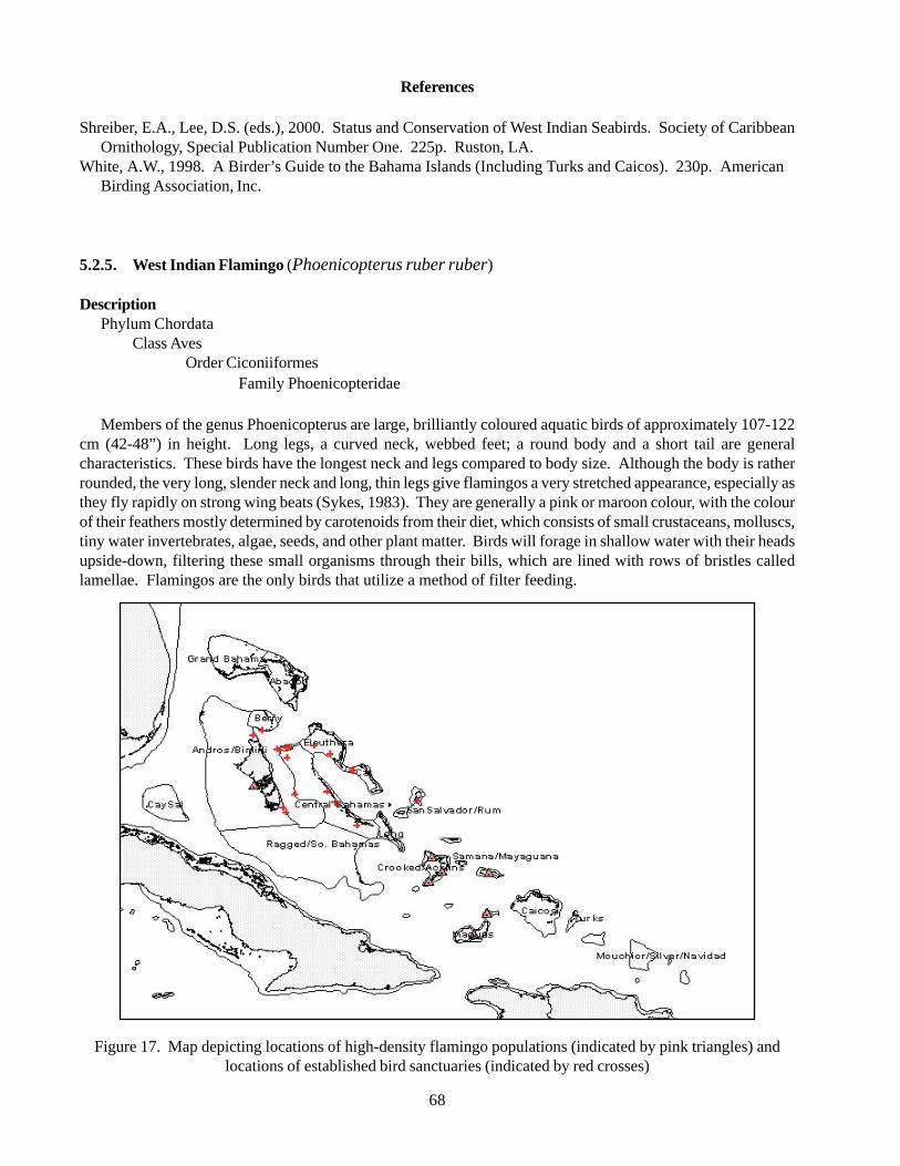
68
References
Shreiber, E.A., Lee, D.S. (eds.), 2000. Status and Conservation of West Indian Seabirds. Society of CaribbeanOrnithology, Special Publication Number One. 225p. Ruston, LA.
White, A.W., 1998. A Birder’s Guide to the Bahama Islands (Including Turks and Caicos). 230p. AmericanBirding Association, Inc.
5.2.5. West Indian Flamingo (Phoenicopterus ruber ruber)
DescriptionPhylum Chordata
Class AvesOrder Ciconiiformes
Family Phoenicopteridae
Members of the genus Phoenicopterus are large, brilliantly coloured aquatic birds of approximately 107-122cm (42-48”) in height. Long legs, a curved neck, webbed feet; a round body and a short tail are generalcharacteristics. These birds have the longest neck and legs compared to body size. Although the body is ratherrounded, the very long, slender neck and long, thin legs give flamingos a very stretched appearance, especially asthey fly rapidly on strong wing beats (Sykes, 1983). They are generally a pink or maroon colour, with the colourof their feathers mostly determined by carotenoids from their diet, which consists of small crustaceans, molluscs,tiny water invertebrates, algae, seeds, and other plant matter. Birds will forage in shallow water with their headsupside-down, filtering these small organisms through their bills, which are lined with rows of bristles calledlamellae. Flamingos are the only birds that utilize a method of filter feeding.
Figure 17. Map depicting locations of high-density flamingo populations (indicated by pink triangles) andlocations of established bird sanctuaries (indicated by red crosses)
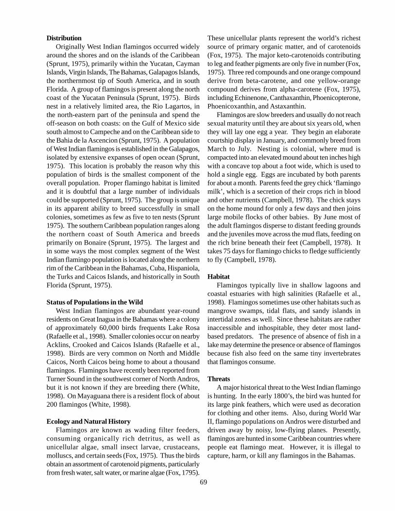
69
DistributionOriginally West Indian flamingos occurred widely
around the shores and on the islands of the Caribbean(Sprunt, 1975), primarily within the Yucatan, CaymanIslands, Virgin Islands, The Bahamas, Galapagos Islands,the northernmost tip of South America, and in southFlorida. A group of flamingos is present along the northcoast of the Yucatan Peninsula (Sprunt, 1975). Birdsnest in a relatively limited area, the Rio Lagartos, inthe north-eastern part of the peninsula and spend theoff-season on both coasts: on the Gulf of Mexico sidesouth almost to Campeche and on the Caribbean side tothe Bahia de la Ascencion (Sprunt, 1975). A populationof West Indian flamingos is established in the Galapagos,isolated by extensive expanses of open ocean (Sprunt,1975). This location is probably the reason why thispopulation of birds is the smallest component of theoverall population. Proper flamingo habitat is limitedand it is doubtful that a large number of individualscould be supported (Sprunt, 1975). The group is uniquein its apparent ability to breed successfully in smallcolonies, sometimes as few as five to ten nests (Sprunt1975). The southern Caribbean population ranges alongthe northern coast of South America and breedsprimarily on Bonaire (Sprunt, 1975). The largest andin some ways the most complex segment of the WestIndian flamingo population is located along the northernrim of the Caribbean in the Bahamas, Cuba, Hispaniola,the Turks and Caicos Islands, and historically in SouthFlorida (Sprunt, 1975).
Status of Populations in the WildWest Indian flamingos are abundant year-round
residents on Great Inagua in the Bahamas where a colonyof approximately 60,000 birds frequents Lake Rosa(Rafaelle et al., 1998). Smaller colonies occur on nearbyAcklins, Crooked and Caicos Islands (Rafaelle et al.,1998). Birds are very common on North and MiddleCaicos, North Caicos being home to about a thousandflamingos. Flamingos have recently been reported fromTurner Sound in the southwest corner of North Andros,but it is not known if they are breeding there (White,1998). On Mayaguana there is a resident flock of about200 flamingos (White, 1998).
Ecology and Natural HistoryFlamingos are known as wading filter feeders,
consuming organically rich detritus, as well asunicellular algae, small insect larvae, crustaceans,molluscs, and certain seeds (Fox, 1975). Thus the birdsobtain an assortment of carotenoid pigments, particularlyfrom fresh water, salt water, or marine algae (Fox, 1795).
These unicellular plants represent the world’s richestsource of primary organic matter, and of carotenoids(Fox, 1975). The major keto-carotenoids contributingto leg and feather pigments are only five in number (Fox,1975). Three red compounds and one orange compoundderive from beta-carotene, and one yellow-orangecompound derives from alpha-carotene (Fox, 1975),including Echinenone, Canthaxanthin, Phoenicopterone,Phoenicoxanthin, and Astaxanthin.
Flamingos are slow breeders and usually do not reachsexual maturity until they are about six years old, whenthey will lay one egg a year. They begin an elaboratecourtship display in January, and commonly breed fromMarch to July. Nesting is colonial, where mud iscompacted into an elevated mound about ten inches highwith a concave top about a foot wide, which is used tohold a single egg. Eggs are incubated by both parentsfor about a month. Parents feed the grey chick ‘flamingomilk’, which is a secretion of their crops rich in bloodand other nutrients (Campbell, 1978). The chick stayson the home mound for only a few days and then joinslarge mobile flocks of other babies. By June most ofthe adult flamingos disperse to distant feeding groundsand the juveniles move across the mud flats, feeding onthe rich brine beneath their feet (Campbell, 1978). Ittakes 75 days for flamingo chicks to fledge sufficientlyto fly (Campbell, 1978).
HabitatFlamingos typically live in shallow lagoons and
coastal estuaries with high salinities (Rafaelle et al.,1998). Flamingos sometimes use other habitats such asmangrove swamps, tidal flats, and sandy islands inintertidal zones as well. Since these habitats are ratherinaccessible and inhospitable, they deter most land-based predators. The presence of absence of fish in alake may determine the presence or absence of flamingosbecause fish also feed on the same tiny invertebratesthat flamingos consume.
ThreatsA major historical threat to the West Indian flamingo
is hunting. In the early 1800’s, the bird was hunted forits large pink feathers, which were used as decorationfor clothing and other items. Also, during World WarII, flamingo populations on Andros were disturbed anddriven away by noisy, low-flying planes. Presently,flamingos are hunted in some Caribbean countries wherepeople eat flamingo meat. However, it is illegal tocapture, harm, or kill any flamingos in the Bahamas.
70
Figure 18. West Indian Flamingo
Current Conservation ProgramsNo species of flamingo is listed as endangered under
the U.S. Endangered Species Act, but some are listedas near threatened. The West Indian Flamingo is listedin Appendix II of the Convention on International Tradeof Endangered Species of Wild Flora and Fauna(CITES). The Appendix lists species that are in needof protection and are considered to be threatened orlikely to become endangered if trade is not regulated.The West Indian Flamingo is also protected under theU.S. Migratory Bird Treaty Act of 1918, whichimplements various treaties and conventions betweenthe U.S., Canada, Mexico, Japan, and the former SovietUnion. The act inhibits taking, killing or possessingmigratory birds. In 1905 the National Audubon Societyasked the Bahamas government to provide legalprotection for the flamingos, and the governmentresponded by passing the Wild Birds Protection Act(White, 1998). An initial effort to save the flamingobreeding colonies on Andros failed in the 1950’s, despitethe courageous efforts of the wardens who stayed at theirposts through several hurricanes (White, 1998). In 1951the National Audubon Society began a research programon flamingos in the West Indies. The largest breedingpopulation was found on Great Inagua, at which time agroup of Bahamians and others, including the AudubonSociety, founded the Society for the Protection of theFlamingo (White, 1998). In 1959 the government andthe society agreed to the terms for a 99-year lease onmuch of the land on Great Inagua, and the BahamasNational Trust Act was passed (White, 1998). Soonthereafter the Society for the Protection of the Flamingojoined the trust, and in 1964 boundaries and other details
for Inagua National Park were finalized (White, 1998).The dedication of the rangers on Great Inagua and thesupport of the Bahamian government and the BahamasNational Trust are the principal factors that have enabledthe flamingo flocks to grow from fewer than 10,000birds to over 60,000 birds (White, 1998).
Information Gaps and Research NeedsDetermination of the status of flamingos on Andros;
determine if the birds are breeding there.
GoalsIncrease, or at least maintain, the current population
of these once abundant birds. Total population estimatesshould not drop below 60,000 individuals, althoughnumbers greater than this are preferred. Establishmentof Important Bird Areas (IBA’s) which will prevent orlimit human use of the land, thereby reducing thechances that visitors will interfere with flamingo feedingand nesting grounds. Especially important is theeducation of tourists about sites inhabited by flamingosso as to minimize negative impacts of humans on thehabitat. Strengthening of the enforcement of the lawsthat prohibit hunting of flamingos.
Contact Persons
Vanessa NeroDepartment of BiologyUniversity of MiamiCoral Gables, FL 33124Tel: (305) 284-3013E-mail: [email protected]
References
Campbell, D.G. 1978. The Ephemeral Islands A NaturalHistory of the Bahamas. MacMillan Publishers Ltd.London and Basingstoke.
Rafaelle, H., Wiley, J., Garrido, O., Keith, A., Rafaelle,J. 1988. A Guide to the Birds of The West Indies.Princeton University Press. Princeton, NJ.
Sprunt, A., Fox, D.L 1975., in International FlamingoSymposium. Kean, J, Duplaix, N. (Eds.) T. & A.D.Poyser, Berhamsted [Eng.].
Sykes, P.W. in The Audubon Society Master Guide toBirding Vol. 1. Farrand, J. (Ed.) Alfred A. KnopfInc., New York.
White, A.W. 1998. A Birders Guide to the BahamaIslands. American Birding Association, Inc.
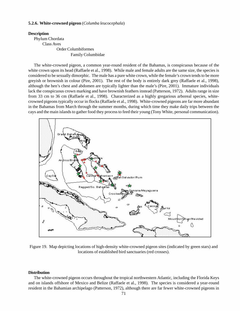
71
5.2.6. White-crowned pigeon (Columba leucocephala)
DescriptionPhylum Chordata
Class AvesOrder Columbiformes
Family Columbidae
The white-crowned pigeon, a common year-round resident of the Bahamas, is conspicuous because of thewhite crown upon its head (Raffaele et al., 1998). While male and female adults are the same size, the species isconsidered to be sexually dimorphic. The male has a pure white crown, while the female’s crown tends to be moregreyish or brownish in colour (Pire, 2001). The rest of the body is entirely dark grey (Raffaele et al., 1998),although the hen’s chest and abdomen are typically lighter than the male’s (Pire, 2001). Immature individualslack the conspicuous crown marking and have brownish feathers instead (Patterson, 1972). Adults range in sizefrom 33 cm to 36 cm (Raffaele et al., 1998). Characterized as a highly gregarious arboreal species, white-crowned pigeons typically occur in flocks (Raffaele et al., 1998). White-crowned pigeons are far more abundantin the Bahamas from March through the summer months, during which time they make daily trips between thecays and the main islands to gather food they process to feed their young (Tony White, personal communication).
Figure 19. Map depicting locations of high-density white-crowned pigeon sites (indicated by green stars) andlocations of established bird sanctuaries (red crosses).
DistributionThe white-crowned pigeon occurs throughout the tropical northwestern Atlantic, including the Florida Keys
and on islands offshore of Mexico and Belize (Raffaele et al., 1998). The species is considered a year-roundresident in the Bahamian archipelago (Patterson, 1972), although there are far fewer white-crowned pigeons in
72
the Bahamas in winter than in summer (Tony White,personal communication). Within the Bahamas, thepigeon can be found on New Providence, North andSouth Bimini, the Berry Islands, Eleuthera, the Exumas,Cat Island, San Salvador, Long Island, the RaggedIslands, Acklins, Mayaguana, and Cay Sal (White,1998). Some of the biggest colonies of white-crownedpigeons from the Bahamas have been observed offEleuthera (Tony White, personal communication).Specific locales of large colonies include Big GreenCay, Finley Cay, Joulters Cay, Schooner Cays,Deadman’s Cay, Goat Cay, Duck Cay, Samana Cay, andRed Shank Cay (White, 1998). Within the Turks andCaicos, the white-crowned pigeon is commonly seen onthe island of Providenciales (White, 1998). The bird isalso common in Cuba, Jamaica, and Antigua. White-crowned pigeons are locally common on Hispaniola,Puerto Rico, the Virgin Islands, San Andres, andProvidencia, but are uncommon in the Cayman Islands,Anguilla, and St. Bartholemy. This species is rare onSt. Martin, Guadeloupe, and the Lesser Antilles southto the Grenadines (Raffaele et al., 1998).
Status of populations in the wildAlthough the white-crowned pigeon was historically
abundant throughout most of its range, the species hasdeclined dramatically, and is now threatened due to avariety of factors, namely habitat loss, severe over-hunting, harvesting of nestlings for food, andintroduction of predators (Raffaele et al., 1998). Thewhite-crowned pigeon is currently listed as threatenedby the State of Florida, and is considered threatened orendangered throughout much of its range (Bancroft etal. 2000). Declining population trends are recognizedfor the Bahamas, Cuba, Haiti, Dominican Republic,Puerto Rico, U.S. and British Virgin Islands, Anguilla,St. Martin, and Nicaragua (Strong et al., 1991). In 1976,the Bahamian population was estimated at 80,000breeding birds, although it is possible that this numberhas risen since then (White, 1998). Once hunting seasonbegins, the number of white-crowned pigeons dropsrapidly, as surviving birds leave the area (Tony White,personal communication).
Ecology and natural historyWhite-crowned pigeons breed primarily from March
to August, but nesting seasons can differ among areasdepending upon the extent of local food supply (Raffaeleet al., 1998). After the breeding season, the birds maymigrate from cooler locations (e.g. Florida Keys)eastward to the Caribbean and especially the Bahamianarchipelago (Strong & Bancroft, 1994). White-crowned
pigeons are typically colonial nesters (Raffaele et al.,1998), but they do not nest with or near other colonialspecies (USGS, 1998). White-crowned pigeons buildflimsy twig nests in mangroves, dry scrub, or in largetrees in residential or commercial developments(Raffaele et al., 1998). Both males and femalesparticipate in nest building, but males perform themajority of the gathering and delivering of material tothe nest site (Wiley & Wiley, 1979). The nest-buildingmaterial is usually gathered from trees (not from theground) that are close to the nest site (Wiley & Wiley,1979). Nests are created on top of cacti, bushes, ormangroves and are rarely found low to the ground orover water (USGS, 1998). The pigeons aremonogamous, with males attending the nest from mid-morning though early evening and females staying withthe nest throughout the night (Wiley & Wiley, 1979).
White-crowned pigeons lay a clutch of two glossywhite eggs (Raffaele et al., 1998), with the second eggbeing laid approximately 24 hours to 36 hours after thefirst (Pire, 2001). Each egg hatches two weeks after ithas been laid (Pire, 2001). Incidences of nest predationtend to increase as the nesting season progresses, andpredator success increases as the extent of parentalattendance at the nest decreases (Wiley & Wiley 1979).White-crowned nestlings demonstrate threat displays,including violent head thrusts, bill clicking, and hissing,but it is the defence mechanisms of the supervising adultthat are more effective in minimizing juvenile mortality(Wiley & Wiley, 1979). Common predators of thewhite-crowned pigeon nestlings include the pearly-eyedthrasher, red-tailed hawk, and brown rats. Othersuspected predators include red-winged blackbirds,laughing gulls, American crows, Virginia opossum, andbobcats (Strong et al., 1991). Recently, the raccoon(Procyon lotor) was observed to be a nest predator(Strong et al., 1991). Raccoons are the only predatorsobserved to have a significant influence on nestingdistribution of the white-crowned pigeon (Strong et al.,1991).
The newly hatched young do not leave the nest foranother two weeks after hatching (Pire, 2001). Youngbirds may travel more than 20 km from the nest duringthe first ten days of dispersal (Strong & Bancroft, 1994).Post-fledgling dispersal may be a form of facultativemigration, in which the young continue to move awayfrom the natal site until they encounter a site withadequate food supplies. This process allow for thecompletion of the post-juvenile molt or to add fatreserves prior to migration (Strong & Bancroft, 1994).The exact mechanisms of habitat selection during post-fledgling dispersal are unknown, but it is suspected that
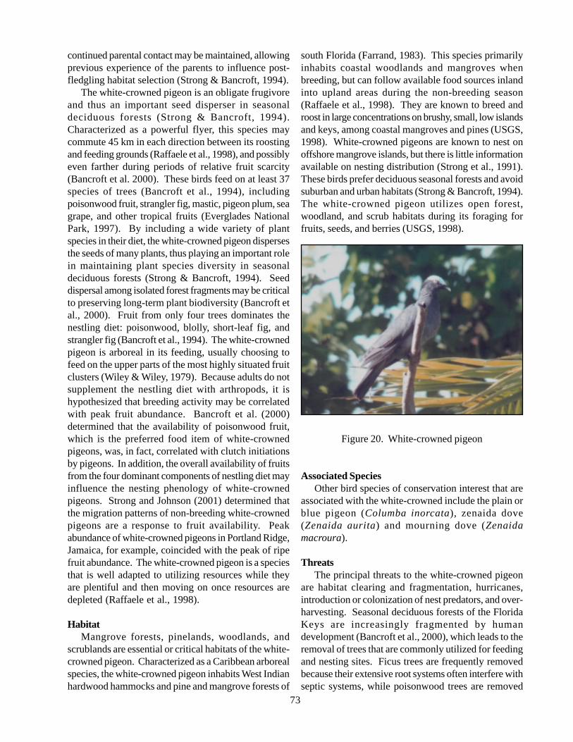
73
continued parental contact may be maintained, allowingprevious experience of the parents to influence post-fledgling habitat selection (Strong & Bancroft, 1994).
The white-crowned pigeon is an obligate frugivoreand thus an important seed disperser in seasonaldeciduous forests (Strong & Bancroft, 1994).Characterized as a powerful flyer, this species maycommute 45 km in each direction between its roostingand feeding grounds (Raffaele et al., 1998), and possiblyeven farther during periods of relative fruit scarcity(Bancroft et al. 2000). These birds feed on at least 37species of trees (Bancroft et al., 1994), includingpoisonwood fruit, strangler fig, mastic, pigeon plum, seagrape, and other tropical fruits (Everglades NationalPark, 1997). By including a wide variety of plantspecies in their diet, the white-crowned pigeon dispersesthe seeds of many plants, thus playing an important rolein maintaining plant species diversity in seasonaldeciduous forests (Strong & Bancroft, 1994). Seeddispersal among isolated forest fragments may be criticalto preserving long-term plant biodiversity (Bancroft etal., 2000). Fruit from only four trees dominates thenestling diet: poisonwood, blolly, short-leaf fig, andstrangler fig (Bancroft et al., 1994). The white-crownedpigeon is arboreal in its feeding, usually choosing tofeed on the upper parts of the most highly situated fruitclusters (Wiley & Wiley, 1979). Because adults do notsupplement the nestling diet with arthropods, it ishypothesized that breeding activity may be correlatedwith peak fruit abundance. Bancroft et al. (2000)determined that the availability of poisonwood fruit,which is the preferred food item of white-crownedpigeons, was, in fact, correlated with clutch initiationsby pigeons. In addition, the overall availability of fruitsfrom the four dominant components of nestling diet mayinfluence the nesting phenology of white-crownedpigeons. Strong and Johnson (2001) determined thatthe migration patterns of non-breeding white-crownedpigeons are a response to fruit availability. Peakabundance of white-crowned pigeons in Portland Ridge,Jamaica, for example, coincided with the peak of ripefruit abundance. The white-crowned pigeon is a speciesthat is well adapted to utilizing resources while theyare plentiful and then moving on once resources aredepleted (Raffaele et al., 1998).
HabitatMangrove forests, pinelands, woodlands, and
scrublands are essential or critical habitats of the white-crowned pigeon. Characterized as a Caribbean arborealspecies, the white-crowned pigeon inhabits West Indianhardwood hammocks and pine and mangrove forests of
south Florida (Farrand, 1983). This species primarilyinhabits coastal woodlands and mangroves whenbreeding, but can follow available food sources inlandinto upland areas during the non-breeding season(Raffaele et al., 1998). They are known to breed androost in large concentrations on brushy, small, low islandsand keys, among coastal mangroves and pines (USGS,1998). White-crowned pigeons are known to nest onoffshore mangrove islands, but there is little informationavailable on nesting distribution (Strong et al., 1991).These birds prefer deciduous seasonal forests and avoidsuburban and urban habitats (Strong & Bancroft, 1994).The white-crowned pigeon utilizes open forest,woodland, and scrub habitats during its foraging forfruits, seeds, and berries (USGS, 1998).
Figure 20. White-crowned pigeon
Associated SpeciesOther bird species of conservation interest that are
associated with the white-crowned include the plain orblue pigeon (Columba inorcata), zenaida dove(Zenaida aurita) and mourning dove (Zenaidamacroura).
ThreatsThe principal threats to the white-crowned pigeon
are habitat clearing and fragmentation, hurricanes,introduction or colonization of nest predators, and over-harvesting. Seasonal deciduous forests of the FloridaKeys are increasingly fragmented by humandevelopment (Bancroft et al., 2000), which leads to theremoval of trees that are commonly utilized for feedingand nesting sites. Ficus trees are frequently removedbecause their extensive root systems often interfere withseptic systems, while poisonwood trees are removed
74
because their sap causes contact dermatitis in humans(Bancroft et al., 2000). Continued loss of such criticalforaging habitat and important food sources can haveserious long-term implications for the persistence ofwhite-crowned pigeons. Current protection has allowedthe population to increase in southern Florida, but rapidclearing and development of tropical hardwood forestsis still a concern (Strong et al., 1991).
The White-crowned pigeon is the principal game birdof the Bahamas. By the early 1970s, there was concernabout the large numbers of pigeons hunted, andprotective measures were taken with regard to theprotection of the breeding cays (Patterson, 1972).Reductions in population numbers are directlyattributable to severe hunting pressure on Bahamian andother Caribbean nesting grounds (Everglades NationalPark, 1997). Tighter controls on hunting activities hasstopped the shooting during the breeding season andreversed the decline in the pigeon’s population, whichis now slowly recovering from the adverse effects ofover hunting (White, 1998).
The introduction or colonization of predators affectsthe breeding distribution of white-crowned pigeons.Studies as early as 1942 reported that raccooncolonization of a mangrove island in Florida Bay causedabandonment of the white-crowned pigeon nesting sites(Strong et al., 1991). Studies in the Florida Keysillustrate that the nesting sites were not detected in areaswhere opossums or bobcats were observed, and nestswere rare on sites where raccoons were observed (Stronget al., 1991). Raccoon-inhabited sites only had amaximum of seven nests per key, suggesting thatraccoons at least limit the distribution of high-densitynesting areas (Strong et al., 1991). The sympatricoccurrences of raccoons and white-crowned pigeons areindicative of recent raccoon invasion, and the expansionof raccoons to more locations could make additionalsites unsuitable for nesting (Strong et al., 1991).
Destructive storm events, such as hurricanes, areadditional threats to the white-crowned pigeon and theiressential habitats (Fleming, 2001).
Current conservation programsThe Bahamas National Trust, established in 1959,
manages the country’s National Parks, historicpreservation, conservation education, policy planning,and research protecting the indigenous species of TheBahamas, including the white-crowned pigeon (Eco-Bahamas, 1999). The Wild Bird Protection Act of 1987established a closed season for white crowned pigeons,which lasts from March 1 to September 28, during whichit is illegal to kill, capture, or have in one’s possession a
protected bird unless it can be proven that it was takenin season (Eco-Bahamas, 1997). This act ensures thatonly Bahamian citizens, permanent residents, licensedforeigners, and those who have resided in The Bahamasfor a continuous 90-day period may hunt in the Bahamas,while setting a bag limit of 50 wild birds within oneday and a total of 200 birds at any one time (Eco-Bahamas, 1997). Additionally, several wild birdreserves have been established on various islandsthroughout the country, in which it is illegal to hunt,kill or capture wild birds (Eco-Bahamas, 1997).Penalties for those who commit an offence include fines,imprisonment, and forfeit of equipment and vehiclesused in committing the illegal act. To help enforce thelaw, a reward is provided to those who provideinformation leading to the conviction of the offender(Eco-Bahamas, 1997).
Information gaps and research needsThe development of effective management plans for
this species may depend upon a thorough understandingof the relationship between resource availability andbreeding patterns (Bancroft et al. 2000). Continuedmonitoring to determine the annual variation in use ofvarious sites by white-crowned pigeons is necessary(Strong and Johnson 2001). Estimates of the populationson several islands do not exist, and population sizedetermination should be a priority. Also, studiesinvestigating the exact mechanisms of habitat selectionduring post fledging dispersal are unknown.
GoalsMaintain a wild population with a minimum size of
100,000 individuals.
JustificationIt is known that the white-crowned pigeon is suffering
from many anthropogenic effects and that the populationcontinues to decline. Based on past censuses, this goalis reasonable and realistic. It is necessary to takemeasures to protect the critical habitat of the white-crowned pigeon because increased developmentcontinues to fragment the habitat and degrade theconditions of the habitat. The white-crowned pigeonmay be particularly prone to extinction because of thedifficulty in protecting refuges of adequate size for theselarge, mobile frugivores.
75
Contact persons
G. Thomas BancroftThe Wilderness Society1615 M Street N.W., Suite 100Washington, D.C. 20036, USAE-mail: [email protected]
Matthew D. JohnsonDept. of Ecology and Evolutionary BiologyTulane University310 Dinwiddie HallNew Orleans, LA 70118, USAorDepartment of WildlifeHumboldt State UniversityArcata, CA 95521, USA
Richard J. SawickiNational Audubon Society115 Indian Mound TrailTavernier, FL 33070 USAorArchbold Biological StationP.O. Box 2057Lake Placid, FL 33862, USA
Allan M. StrongDept. of Ecology and Evolutionary BiologyTulane University, 310 Dinwiddie HallNew Orleans, LA 70118, USAorUniversity of Vermont, School of Natural ResourcesAiken CenterBurlington, VT 05405, USAE-mail: [email protected]
References
Bancroft GT, Bowman R, Sawicki RJ (2000) Rainfall,fruiting phenology, and the nesting season of white-crowned pigeons in the upper Florida Keys. The Auk117(2): 416-426.
Eco-Bahamas (1997) Wild Bird Protection Act 1987.Found at www.bahamasnet.com/w.wildbirdact.html
Eco-Bahamas (1999) Parks of the Bahamas. Found atwww.bahamasnet.com/w.ecoparks.html
Everglades National Park (1997) White-crownedpigeon. Found at www.nps.gov/ever/eco/pigeon.html
Farrand J (Ed.) (1983) The Audubon Society masterguide to birding. Alfred A. Knopf, NY.
Fleming TH (2001) Potential research in the Bahamas:Ecological interactions between Bahamian trees andshrubs and their pollinators, seed dispersers, and seedpredators. Unpublished manuscript, University ofMiami, Coral Gables, FL.
Patterson A (1972) Birds of the Bahamas. DurrellPublications.
Pire J (2001) The white-crowned pigeon.Found at: www.internationaldovesociety.com/Articles/white%20crown%20pigeon.htm
Raffaele H, Wiley J, Garrido O, Keith A, Raffaele J(1998) A guide to the birds of the West Indies.Princeton University Press, Princeton, NJ.
Strong AM, Bancroft GT (1994) Post-fledgling dispersalof white-crowned pigeons: Implications forconservation of deciduous seasonal forests.Conservation Biology 8: 770-779.
Strong AM, Johnson MD (2001) Exploitation of aseasonal resource by nonbreeding plain and white-crowned pigeons: implications for conservation oftropical dry forests. Wilson Bulletin 113(1): 73-77.
Strong AM, Sawicki RJ, Bancroft GT (1991) Effectsof predator presence on the nesting distribution ofwhite-crowned pigeons in Florida Bay. WilsonBulletin 103(3): 415-425.
Strong AM, Sawicki RJ, Bancroft GT (1994) Estimatingwhite-crowned pigeon population size from flight-line counts. Journal of Wildlife Management 58 (1):156-162.
USGS (United States Geological Survey) (1998) Forestand rangeland birds of the United States, naturalhistory and habitat use of white-crowned pigeonColumba leucocephala. Found atwww.npwrc.usgs.gov/resource/1998/forest/species/coluleuc.htm
White AW (1998) A birder’s guide to the BahamasIslands (Including Turks and Caicos). AmericanBirding Association.
Wiley JW, Wiley BN (1979) The biology of the white-crowned pigeon. Wildlife Monographs 64: 1-54.
5.2.7. Rock Iguanas
Description – CycluraGeneral Information about the genus
The Genus Cyclura is composed of eight species ofWest Indian rock iguanas that inhabit tropical dry forestsand pine barrens throughout the Greater Antilles andthe Bahamas (Alberts et al., 1997). Cyclura is a distinctlineage that is not closely related to any other iguanine
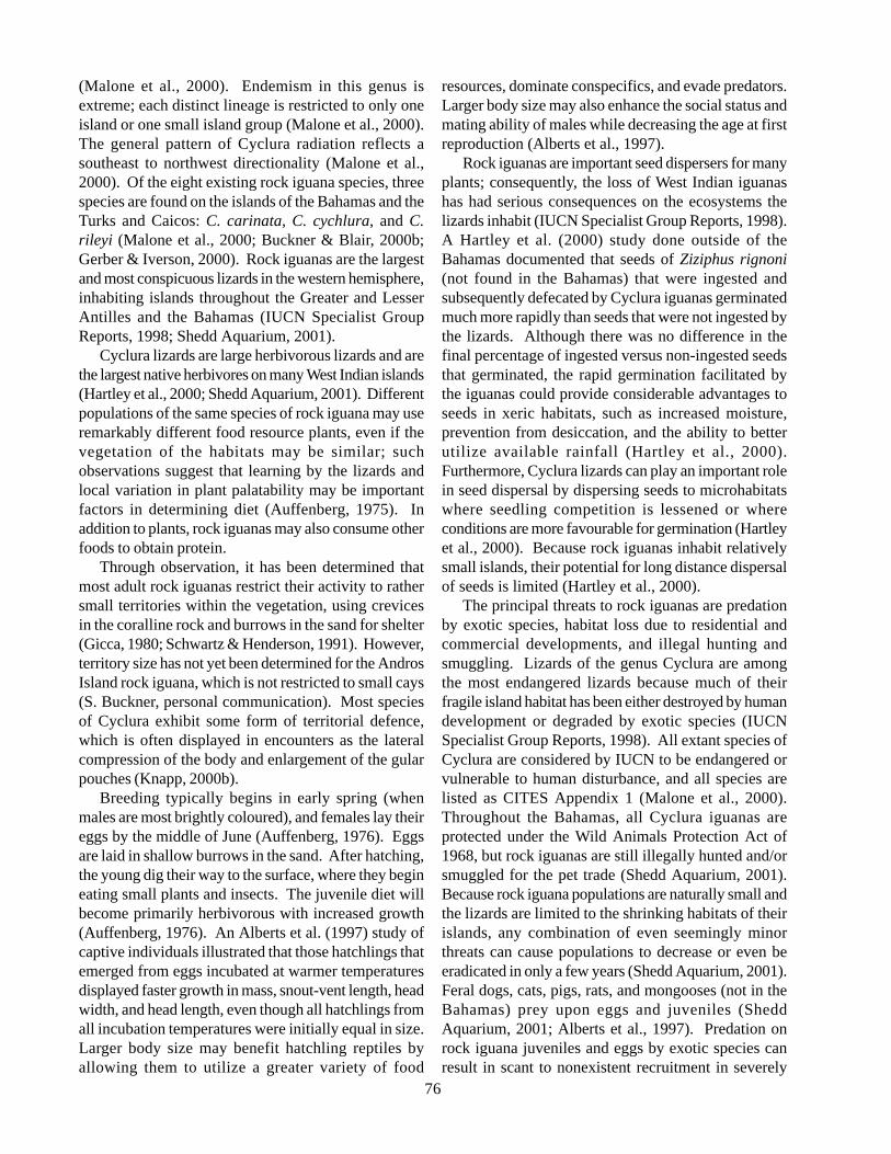
76
(Malone et al., 2000). Endemism in this genus isextreme; each distinct lineage is restricted to only oneisland or one small island group (Malone et al., 2000).The general pattern of Cyclura radiation reflects asoutheast to northwest directionality (Malone et al.,2000). Of the eight existing rock iguana species, threespecies are found on the islands of the Bahamas and theTurks and Caicos: C. carinata, C. cychlura, and C.rileyi (Malone et al., 2000; Buckner & Blair, 2000b;Gerber & Iverson, 2000). Rock iguanas are the largestand most conspicuous lizards in the western hemisphere,inhabiting islands throughout the Greater and LesserAntilles and the Bahamas (IUCN Specialist GroupReports, 1998; Shedd Aquarium, 2001).
Cyclura lizards are large herbivorous lizards and arethe largest native herbivores on many West Indian islands(Hartley et al., 2000; Shedd Aquarium, 2001). Differentpopulations of the same species of rock iguana may useremarkably different food resource plants, even if thevegetation of the habitats may be similar; suchobservations suggest that learning by the lizards andlocal variation in plant palatability may be importantfactors in determining diet (Auffenberg, 1975). Inaddition to plants, rock iguanas may also consume otherfoods to obtain protein.
Through observation, it has been determined thatmost adult rock iguanas restrict their activity to rathersmall territories within the vegetation, using crevicesin the coralline rock and burrows in the sand for shelter(Gicca, 1980; Schwartz & Henderson, 1991). However,territory size has not yet been determined for the AndrosIsland rock iguana, which is not restricted to small cays(S. Buckner, personal communication). Most speciesof Cyclura exhibit some form of territorial defence,which is often displayed in encounters as the lateralcompression of the body and enlargement of the gularpouches (Knapp, 2000b).
Breeding typically begins in early spring (whenmales are most brightly coloured), and females lay theireggs by the middle of June (Auffenberg, 1976). Eggsare laid in shallow burrows in the sand. After hatching,the young dig their way to the surface, where they begineating small plants and insects. The juvenile diet willbecome primarily herbivorous with increased growth(Auffenberg, 1976). An Alberts et al. (1997) study ofcaptive individuals illustrated that those hatchlings thatemerged from eggs incubated at warmer temperaturesdisplayed faster growth in mass, snout-vent length, headwidth, and head length, even though all hatchlings fromall incubation temperatures were initially equal in size.Larger body size may benefit hatchling reptiles byallowing them to utilize a greater variety of food
resources, dominate conspecifics, and evade predators.Larger body size may also enhance the social status andmating ability of males while decreasing the age at firstreproduction (Alberts et al., 1997).
Rock iguanas are important seed dispersers for manyplants; consequently, the loss of West Indian iguanashas had serious consequences on the ecosystems thelizards inhabit (IUCN Specialist Group Reports, 1998).A Hartley et al. (2000) study done outside of theBahamas documented that seeds of Ziziphus rignoni(not found in the Bahamas) that were ingested andsubsequently defecated by Cyclura iguanas germinatedmuch more rapidly than seeds that were not ingested bythe lizards. Although there was no difference in thefinal percentage of ingested versus non-ingested seedsthat germinated, the rapid germination facilitated bythe iguanas could provide considerable advantages toseeds in xeric habitats, such as increased moisture,prevention from desiccation, and the ability to betterutilize available rainfall (Hartley et al., 2000).Furthermore, Cyclura lizards can play an important rolein seed dispersal by dispersing seeds to microhabitatswhere seedling competition is lessened or whereconditions are more favourable for germination (Hartleyet al., 2000). Because rock iguanas inhabit relativelysmall islands, their potential for long distance dispersalof seeds is limited (Hartley et al., 2000).
The principal threats to rock iguanas are predationby exotic species, habitat loss due to residential andcommercial developments, and illegal hunting andsmuggling. Lizards of the genus Cyclura are amongthe most endangered lizards because much of theirfragile island habitat has been either destroyed by humandevelopment or degraded by exotic species (IUCNSpecialist Group Reports, 1998). All extant species ofCyclura are considered by IUCN to be endangered orvulnerable to human disturbance, and all species arelisted as CITES Appendix 1 (Malone et al., 2000).Throughout the Bahamas, all Cyclura iguanas areprotected under the Wild Animals Protection Act of1968, but rock iguanas are still illegally hunted and/orsmuggled for the pet trade (Shedd Aquarium, 2001).Because rock iguana populations are naturally small andthe lizards are limited to the shrinking habitats of theirislands, any combination of even seemingly minorthreats can cause populations to decrease or even beeradicated in only a few years (Shedd Aquarium, 2001).Feral dogs, cats, pigs, rats, and mongooses (not in theBahamas) prey upon eggs and juveniles (SheddAquarium, 2001; Alberts et al., 1997). Predation onrock iguana juveniles and eggs by exotic species canresult in scant to nonexistent recruitment in severely
77
impacted populations (Alberts et al., 1997). Humans may pose as one of the biggest threats; in a small survey,Knapp et al. (1999) found that almost every Bahamian resident of Andros Island that they interviewed had eateniguana. Other than man, the only likely natural predators of Cyclura are sea gulls, ospreys, Alsophus sp.snakes,and herons (Gicca, 1980 and Knapp, personal communication).
A serious problem facing the success of rock iguana conservation attempts stems from the fact that individualsthat have been removed from the Bahamas cannot be reintroduced back into the Bahamas. The potential tointroduce exotic pathogens into native natural populations thorough release of captive individuals is widelyrecognized, thereby making repatriation highly unfeasible (Hudson, 2002). Reptiles can harbour an array ofpathogens, but the ability to screen for those pathogens that are dangerous is crude at best; for this reason, manyresearchers have stressed the importance of developing pre-release health screening protocols and methods (Hudson,2002). Because of the complications involving disease transmission from reintroduced individuals to nativepopulations, conservation strategies must address steps to prevent illegal poaching and smuggling out of theBahamas.
Figure 21. Map depicting locations of rock iguana location (indicated by red crosses) in the southern Bahamas
5.2.7.1. Bartsch’s rock iguana (Cyclura carinata bartschi)
DescriptionPhylum Chordata
Class ReptiliaOrder Squamata
Suborder SauriaFamily Iguanidae
Subfamily Iguninae
Bartsch’s iguana is greenish to brownish-grey, with a yellow dorsal crest, although the body colour is somewhat
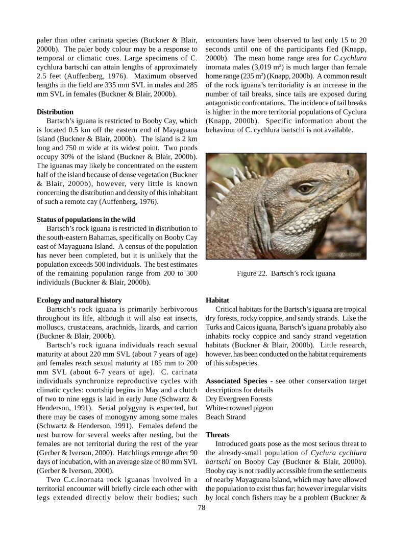
78
paler than other carinata species (Buckner & Blair,2000b). The paler body colour may be a response totemporal or climatic cues. Large specimens of C.cychlura bartschi can attain lengths of approximately2.5 feet (Auffenberg, 1976). Maximum observedlengths in the field are 335 mm SVL in males and 285mm SVL in females (Buckner & Blair, 2000b).
DistributionBartsch’s iguana is restricted to Booby Cay, which
is located 0.5 km off the eastern end of MayaguanaIsland (Buckner & Blair, 2000b). The island is 2 kmlong and 750 m wide at its widest point. Two pondsoccupy 30% of the island (Buckner & Blair, 2000b).The iguanas may likely be concentrated on the easternhalf of the island because of dense vegetation (Buckner& Blair, 2000b), however, very little is knownconcerning the distribution and density of this inhabitantof such a remote cay (Auffenberg, 1976).
Status of populations in the wildBartsch’s rock iguana is restricted in distribution to
the south-eastern Bahamas, specifically on Booby Cayeast of Mayaguana Island. A census of the populationhas never been completed, but it is unlikely that thepopulation exceeds 500 individuals. The best estimatesof the remaining population range from 200 to 300individuals (Buckner & Blair, 2000b).
Ecology and natural historyBartsch’s rock iguana is primarily herbivorous
throughout its life, although it will also eat insects,molluscs, crustaceans, arachnids, lizards, and carrion(Buckner & Blair, 2000b).
Bartsch’s rock iguana individuals reach sexualmaturity at about 220 mm SVL (about 7 years of age)and females reach sexual maturity at 185 mm to 200mm SVL (about 6-7 years of age). C. carinataindividuals synchronize reproductive cycles withclimatic cycles: courtship begins in May and a clutchof two to nine eggs is laid in early June (Schwartz &Henderson, 1991). Serial polygyny is expected, butthere may be cases of monogyny among some males(Schwartz & Henderson, 1991). Females defend thenest burrow for several weeks after nesting, but thefemales are not territorial during the rest of the year(Gerber & Iverson, 2000). Hatchlings emerge after 90days of incubation, with an average size of 80 mm SVL(Gerber & Iverson, 2000).
Two C.c.inornata rock iguanas involved in aterritorial encounter will briefly circle each other withlegs extended directly below their bodies; such
encounters have been observed to last only 15 to 20seconds until one of the participants fled (Knapp,2000b). The mean home range area for C.cychlurainornata males (3,019 m2) is much larger than femalehome range (235 m2) (Knapp, 2000b). A common resultof the rock iguana’s territoriality is an increase in thenumber of tail breaks, since tails are exposed duringantagonistic confrontations. The incidence of tail breaksis higher in the more territorial populations of Cyclura(Knapp, 2000b). Specific information about thebehaviour of C. cychlura bartschi is not available.
Figure 22. Bartsch’s rock iguana
HabitatCritical habitats for the Bartsch’s iguana are tropical
dry forests, rocky coppice, and sandy strands. Like theTurks and Caicos iguana, Bartsch’s iguana probably alsoinhabits rocky coppice and sandy strand vegetationhabitats (Buckner & Blair, 2000b). Little research,however, has been conducted on the habitat requirementsof this subspecies.
Associated Species - see other conservation targetdescriptions for detailsDry Evergreen ForestsWhite-crowned pigeonBeach Strand
ThreatsIntroduced goats pose as the most serious threat to
the already-small population of Cyclura cychlurabartschi on Booby Cay (Buckner & Blair, 2000b).Booby cay is not readily accessible from the settlementsof nearby Mayaguana Island, which may have allowedthe population to exist thus far; however irregular visitsby local conch fishers may be a problem (Buckner &
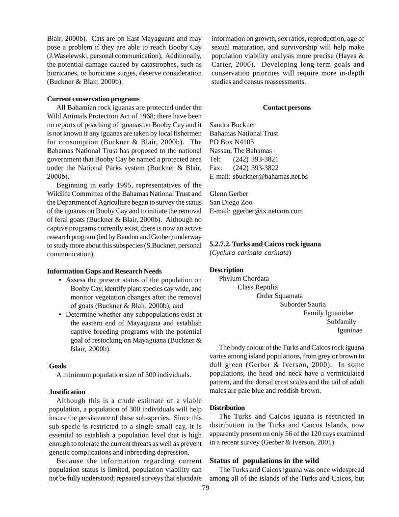
79
Blair, 2000b). Cats are on East Mayaguana and maypose a problem if they are able to reach Booby Cay(J.Waselewski, personal communication). Additionally,the potential damage caused by catastrophes, such ashurricanes, or hurricane surges, deserve consideration(Buckner & Blair, 2000b).
Current conservation programsAll Bahamian rock iguanas are protected under the
Wild Animals Protection Act of 1968; there have beenno reports of poaching of iguanas on Booby Cay and itis not known if any iguanas are taken by local fishermenfor consumption (Buckner & Blair, 2000b). TheBahamas National Trust has proposed to the nationalgovernment that Booby Cay be named a protected areaunder the National Parks system (Buckner & Blair,2000b).
Beginning in early 1995, representatives of theWildlife Committee of the Bahamas National Trust andthe Department of Agriculture began to survey the statusof the iguanas on Booby Cay and to initiate the removalof feral goats (Buckner & Blair, 2000b). Although nocaptive programs currently exist, there is now an activeresearch program (led by Bendon and Gerber) underwayto study more about this subspecies (S.Buckner, personalcommunication).
Information Gaps and Research Needs• Assess the present status of the population on
Booby Cay, identify plant species cay wide, andmonitor vegetation changes after the removalof goats (Buckner & Blair, 2000b); and
• Determine whether any subpopulations exist atthe eastern end of Mayaguana and establishcaptive breeding programs with the potentialgoal of restocking on Mayaguana (Buckner &Blair, 2000b).
GoalsA minimum population size of 300 individuals.
JustificationAlthough this is a crude estimate of a viable
population, a population of 300 individuals will helpinsure the persistence of these sub-species. Since thissub-specie is restricted to a single small cay, it isessential to establish a population level that is highenough to tolerate the current threats as well as preventgenetic complications and inbreeding depression.
Because the information regarding currentpopulation status is limited, population viability cannot be fully understood; repeated surveys that elucidate
information on growth, sex ratios, reproduction, age ofsexual maturation, and survivorship will help makepopulation viability analysis more precise (Hayes &Carter, 2000). Developing long-term goals andconservation priorities will require more in-depthstudies and census reassessments.
Contact persons
Sandra BucknerBahamas National TrustPO Box N4105Nassau, The BahamasTel: (242) 393-3821Fax: (242) 393-3822E-mail: [email protected]
Glenn GerberSan Diego ZooE-mail: [email protected]
5.2.7.2. Turks and Caicos rock iguana(Cyclura carinata carinata)
DescriptionPhylum Chordata
Class ReptiliaOrder Squamata
Suborder SauriaFamily Iguanidae
Subfamily Iguninae
The body colour of the Turks and Caicos rock iguanavaries among island populations, from grey or brown todull green (Gerber & Iverson, 2000). In somepopulations, the head and neck have a vermiculatedpattern, and the dorsal crest scales and the tail of adultmales are pale blue and reddish-brown.
DistributionThe Turks and Caicos iguana is restricted in
distribution to the Turks and Caicos Islands, nowapparently present on only 56 of the 120 cays examinedin a recent survey (Gerber & Iverson, 2001).
Status of populations in the wildThe Turks and Caicos iguana was once widespread
among all of the islands of the Turks and Caicos, but

80
the subspecies has been extirpated from many areas,including many of the larger islands (Gerber & Iverson,2000). A 1995 survey resulted in iguana sightings on56 of 120 cays examined, with an estimated remainingadult population of 30,000 individuals (Gerber &Iverson, 2000). Five of the 56 cays known to beinhabited by C. cychlura carinata comprise half of thearea inhabited by the subspecies, but current densitiesat these sites are considerably low (Gerber & Iverson,2000).
Ecology and natural historyThe Turks and Caicos iguana eats the fruits, flowers,
and leaves of at least 58 plant species, but may alsooccasionally consume insects, molluscs, arachnids,lizards, and carrion (Gerber & Iverson, 2000). Strumpfia(bay cedar) is the single most important food item inthe diet during the first year of life (Iverson, 1979).During the winter months, when cooler, drier conditionscause plants to stop their production of fruits and flowers,the Turks and Caicos iguana becomes an obligatefoliovore (Iverson, 1979).
The Turks and Caicos iguana exhibits sexuallydimorphic body size, and size also varies among islands(Gerber & Iverson, 2000). Females tend to be shorterin length than males (Norton & Clarke, 1992). Thelargest recorded male and female are from Pine Cay onthe west side of Caicos Bank, measuring 360 mm SVLand 290 mm SVL, respectively (Gerber & Iverson,2000). Juvenile growth rate averages 19.2 mm SVLper year, while adults grow between 2 and 17 mm SVLper year (Iverson, 1979).
Individuals reach sexual maturity at about 220 mmSVL (about 7 years of age) and females reach sexualmaturity at 185-200 mm SVL (about 6-7 years of age).Individuals synchronize reproductive cycles withclimatic cycles: courtship begins in May and a clutchof two to nine eggs is laid in early June (Schwartz &Henderson, 1991). Serial polygyny is expected, butthere may be cases of monogyny among some males.Females defend the nest burrow for several weeks afternesting, although the females are not territorial duringthe rest of the year (Gerber & Iverson, 2000). Hatchlingsemerge after 90 days of incubation, with an averagesize of 80 mm SVL (Gerber & Iverson, 2000).
Adult male C.c.carinata iguanas are territorial year-round, apparently to guarantee access to food andfemales (Gerber & Iverson, 2000). Dominant males havelarger home ranges (averaging 1,590 m2) than dosubordinate males, whose home ranges average 1,260m2 (Schwartz & Henderson, 1991). Female home rangesaverage 980 m2 (Iverson, 1979).
HabitatCritical habitats for the Turks and Caicos rock iguana
are tropical dry forests, rocky coppice, sandy strands,and, less commonly, pine barrens. Cyclura carinatacarinata is most commonly found in rocky coppice andsandy strand vegetation habitats (Gerber & Iverson,2000). This subspecies requires a sandy habitat fornesting. It spends the nights in burrows it has dug or innatural retreats under rocks (Gerber & Iverson, 2000).Individuals generally avoid lower areas with thicker soilsdue to the proximity of the water table to the surfaceand their inability to dig through root mass (Iverson,1979). During feeding, the herbivorous Turks andCaicos rock iguana utilizes both arboreal and terrestrialresources to obtain fruits, flowers, and leaves (Gerber& Iverson, 2000).
Associated Species - see other conservation targetdescriptions for detailsPine forestsDry Evergreen ForestsWhite-crowned pigeonBeach Strand
ThreatsThe principal threats to the Turks and Caicos rock
iguana are predation by exotic species, habitat loss fromresidential and commercial development, and illegalhunting and smuggling.
The introduction of mammals, especially dogs andcats, constitutes the biggest threat to the Turks andCaicos iguana (Gerber & Iverson, 2000). Ferallivestock, such as goats, cows, donkeys, and horses, arealso a threat because they compete for food plants, altervegetation composition of habitats, and trample the softsubstrates that iguanas use for burrows and nests (Gerber& Iverson, 2000). The effects of feral animals are welldocumented: a population of approximately 5,000 C.cychlura carinata individuals was nearly extirpated inonly three years following the introduction of thesepredators, and, furthermore, iguanas were found on onlyfive of 26 islands with cats or livestock on them (Gerber& Iverson, 2000). Loss of habitat may also be at leastpartially responsible for the decline in the populationof the subspecies (Norton & Clarke, 1992). Humansinhabit eight of the larger islands of the Turks andCaicos, and considerable habitat has been lost to tourismdevelopments (Gerber & Iverson, 2000). Additionally,periodic hunting of iguanas for food does occur (Norton& Clarke, 1992), and international trade, which isillegal, most likely continues (Gerber & Iverson, 2000).
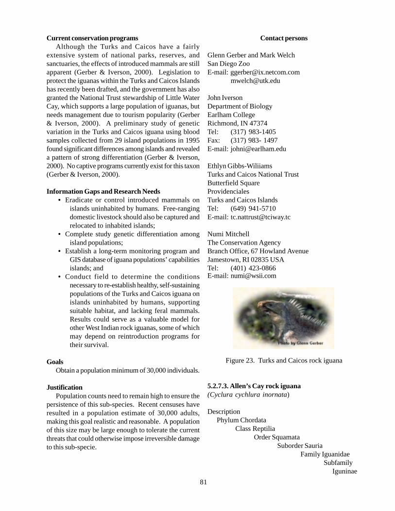
81
Current conservation programsAlthough the Turks and Caicos have a fairly
extensive system of national parks, reserves, andsanctuaries, the effects of introduced mammals are stillapparent (Gerber & Iverson, 2000). Legislation toprotect the iguanas within the Turks and Caicos Islandshas recently been drafted, and the government has alsogranted the National Trust stewardship of Little WaterCay, which supports a large population of iguanas, butneeds management due to tourism popularity (Gerber& Iverson, 2000). A preliminary study of geneticvariation in the Turks and Caicos iguana using bloodsamples collected from 29 island populations in 1995found significant differences among islands and revealeda pattern of strong differentiation (Gerber & Iverson,2000). No captive programs currently exist for this taxon(Gerber & Iverson, 2000).
Information Gaps and Research Needs• Eradicate or control introduced mammals on
islands uninhabited by humans. Free-rangingdomestic livestock should also be captured andrelocated to inhabited islands;
• Complete study genetic differentiation amongisland populations;
• Establish a long-term monitoring program andGIS database of iguana populations’ capabilitiesislands; and
• Conduct field to determine the conditionsnecessary to re-establish healthy, self-sustainingpopulations of the Turks and Caicos iguana onislands uninhabited by humans, supportingsuitable habitat, and lacking feral mammals.Results could serve as a valuable model forother West Indian rock iguanas, some of whichmay depend on reintroduction programs fortheir survival.
GoalsObtain a population minimum of 30,000 individuals.
JustificationPopulation counts need to remain high to ensure the
persistence of this sub-species. Recent censuses haveresulted in a population estimate of 30,000 adults,making this goal realistic and reasonable. A populationof this size may be large enough to tolerate the currentthreats that could otherwise impose irreversible damageto this sub-specie.
Contact persons
Glenn Gerber and Mark WelchSan Diego ZooE-mail: [email protected]
John IversonDepartment of BiologyEarlham CollegeRichmond, IN 47374Tel: (317) 983-1405Fax: (317) 983- 1497E-mail: [email protected]
Ethlyn Gibbs-WiliiamsTurks and Caicos National TrustButterfield SquareProvidencialesTurks and Caicos IslandsTel: (649) 941-5710E-mail: [email protected]
Numi MitchellThe Conservation AgencyBranch Office, 67 Howland AvenueJamestown, RI 02835 USATel: (401) 423-0866E-mail: [email protected]
Figure 23. Turks and Caicos rock iguana
5.2.7.3. Allen’s Cay rock iguana(Cyclura cychlura inornata)
DescriptionPhylum Chordata
Class ReptiliaOrder Squamata
Suborder SauriaFamily Iguanidae
Subfamily Iguninae
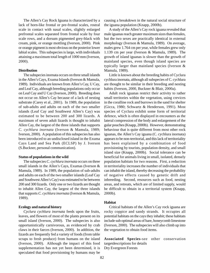
82
The Allen’s Cay Rock Iguana is characterized by alack of horn-like frontal or pre-frontal scales, rostralscale in contact with nasal scales, slightly enlargedprefrontal scales separated from frontal scale by fourscale rows, and a dorsum pigmented grey-black withcream, pink, or orange mottling (Iverson, 2000). Pinkor orange pigment is most obvious on the posterior lowerlabial scales. This subspecies is large, with individualsattaining a maximum total length of 1000 mm (Iverson,2000).
DistributionThe subspecies inornata occurs on three small islands
in the Allen’s Cays, Exuma Islands (Iverson & Mamula,1989). Individuals are known from Allen’s Cay, U Cay,and Leaf Cay, although breeding populations only occuron Leaf Cay and U Cay (Iverson, 2000). Breeding doesnot occur on Allen’s Cay because of a lack of nestingsubstrate (Carey et al., 2001). In 1989, the populationof sub-adults and adults on each of the two smallerislands (Leaf Cay and Southwest Allen’s Cay) wasestimated to be between 200 and 300 lizards. Amaximum of seven adult lizards is thought to inhabitAllen Cay, the largest of the three islands that supportsC. cychlura inornata (Iverson & Mamula, 1989;Iverson, 2000). A population of this subspecies has alsobeen introduced to an undisclosed island in the ExumaCays Land and Sea Park (ECLSP) by J. Iverson(S.Buckner, personal communication).
Status of populations in the wildThe subspecies C. cychlura inornata occurs on three
small islands in the Allen’s Cays, Exumas (Iverson &Mamula, 1989). In 1989, the population of sub-adultsand adults on each of the two smaller islands (Leaf Cayand Southwest Allen’s Cay) was estimated to be between200 and 300 lizards. Only one or two lizards are thoughtto inhabit Allen Cay, the largest of the three islandsthat supports C. cychlura inornata (Iverson & Mamula,1989).
Ecology and natural historyCyclura cychlura inornata feeds upon the fruits,
leaves, and flowers of most of the plants present on itssmall island (Iverson, 2000). The subspecies is alsoopportunistically carnivorous, as evidenced by crabclaws in their faeces (Iverson, 2000). In addition, thelizards are frequently fed a variety of foods (from tablescraps to fresh produce) from humans on the island(Iverson, 2000). Although the impact of this foodsupplementation has not yet been determined, it isspeculated that food provisioning by humans may be
causing a breakdown in the natural social structure ofthe iguana population (Knapp, 2000b).
A study of the Allen’s Cay rock iguana revealed thatmale iguanas reach greater maximum sizes than females,but the two sexes are practically identical in externalmorphology (Iverson & Mamula, 1989). On average,males grew 1.764 cm per year, while females grew only1.139 cm per year (Iverson & Mamula, 1989). Thegrowth of island iguanas is slower than the growth ofmainland species, even though island species aretypically larger than mainland species (Iverson &Mamula, 1989).
Little is known about the breeding habits of Cycluracychlura inornata, although all subspecies of C. cychluraare thought to be similar in their breeding and nestinghabits (Iverson, 2000, Buckner & Blair, 2000a).
Adult rock iguanas restrict their activity to rathersmall territories within the vegetation, using crevicesin the coralline rock and burrows in the sand for shelter(Gicca, 1980; Schwartz & Henderson, 1991). Mostspecies of Cyclura exhibit some form of territorialdefence, which is often displayed in encounters as thelateral compression of the body and enlargement of thegular pouches (Knapp, 2000b). However, demonstratingbehaviour that is quite different from most other rockiguanas, the Allen’s Cay iguana (C. cychlura inornata)appears to be non-territorial, and this lack of territorialityhas been explained by a combination of foodprovisioning by tourists, population density, and smallisland size (Knapp, 2000b). Social tolerance can bebeneficial for animals living in small, isolated, denselypopulation habitats for two reasons. First, a reductionin territoriality increases the number of individuals thatcan inhabit the island, thereby decreasing the probabilityof negative effects caused by genetic drift andinbreeding. Second, resources such as food, nestingareas, and retreats, which are of limited supply, wouldbe difficult to obtain in a territorial system (Knapp,2000b).
HabitatCritical habitats of the Allen’s Cay rock iguana are
rocky coppice and sandy strands. It occupies allpotential habitats on the cays they inhabit; these habitatsinclude sub optimal areas of bare, honeycomb limestone(Iverson, 2000). The subspecies will also climb up intothe vegetation to obtain food items.
Associated Species-see other conservationtargetdescriptions for detailsDry Evergreen Forests
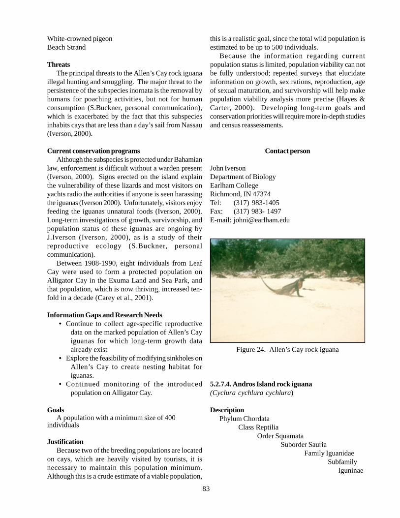
83
White-crowned pigeonBeach Strand
ThreatsThe principal threats to the Allen’s Cay rock iguana
illegal hunting and smuggling. The major threat to thepersistence of the subspecies inornata is the removal byhumans for poaching activities, but not for humanconsumption (S.Buckner, personal communication),which is exacerbated by the fact that this subspeciesinhabits cays that are less than a day’s sail from Nassau(Iverson, 2000).
Current conservation programsAlthough the subspecies is protected under Bahamian
law, enforcement is difficult without a warden present(Iverson, 2000). Signs erected on the island explainthe vulnerability of these lizards and most visitors onyachts radio the authorities if anyone is seen harassingthe iguanas (Iverson 2000). Unfortunately, visitors enjoyfeeding the iguanas unnatural foods (Iverson, 2000).Long-term investigations of growth, survivorship, andpopulation status of these iguanas are ongoing byJ.Iverson (Iverson, 2000), as is a study of theirreproductive ecology (S.Buckner, personalcommunication).
Between 1988-1990, eight individuals from LeafCay were used to form a protected population onAlligator Cay in the Exuma Land and Sea Park, andthat population, which is now thriving, increased ten-fold in a decade (Carey et al., 2001).
Information Gaps and Research Needs• Continue to collect age-specific reproductive
data on the marked population of Allen’s Cayiguanas for which long-term growth dataalready exist
• Explore the feasibility of modifying sinkholes onAllen’s Cay to create nesting habitat foriguanas.
• Continued monitoring of the introducedpopulation on Alligator Cay.
GoalsA population with a minimum size of 400
individuals
JustificationBecause two of the breeding populations are located
on cays, which are heavily visited by tourists, it isnecessary to maintain this population minimum.Although this is a crude estimate of a viable population,
this is a realistic goal, since the total wild population isestimated to be up to 500 individuals.
Because the information regarding currentpopulation status is limited, population viability can notbe fully understood; repeated surveys that elucidateinformation on growth, sex rations, reproduction, ageof sexual maturation, and survivorship will help makepopulation viability analysis more precise (Hayes &Carter, 2000). Developing long-term goals andconservation priorities will require more in-depth studiesand census reassessments.
Contact person
John IversonDepartment of BiologyEarlham CollegeRichmond, IN 47374Tel: (317) 983-1405Fax: (317) 983- 1497E-mail: [email protected]
Figure 24. Allen’s Cay rock iguana
5.2.7.4. Andros Island rock iguana(Cyclura cychlura cychlura)
DescriptionPhylum Chordata
Class ReptiliaOrder Squamata
Suborder SauriaFamily Iguanidae
Subfamily Iguninae
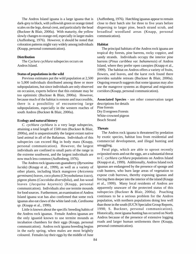
84
The Andros Island iguana is a large iguana that isdark-grey to black, with yellowish green or orange tintedscales on the legs, dorsal crest, and particularly the head(Buckner & Blair, 2000a). With maturity, the yellowslowly changes to orange-red, especially in larger males(Auffenberg, 1976). However, it should be noted thatcoloration patterns might vary widely among individuals(Knapp, personal communication).
DistributionThe Cyclura cychlura subspecies occurs on
Andros Island.
Status of populations in the wildPrevious estimates put the wild population at 2,500
to 5,000 individuals distributed among three or moresubpopulations, but since individuals are only observedon occasion, experts believe that this estimate may betoo optimistic (Buckner & Blair, 2000a). However,because much of the habitat is remote and inaccessible,there is a possibility of encountering largesubpopulations, especially in the western reaches ofsouth Andros (Buckner & Blair, 2000a).
Ecology and natural historyC. cychlura cychlura is a very large subspecies,
attaining a total length of 1500 mm (Buckner & Blair,2000a), and is unquestionably the largest extant nativeland animal in all of the Bahamas. Individuals of thissubspecies can exceed 8kg in body mass (Knapp,personal communication). However, the largestindividuals are confined to small parts of the range inthe extreme southwest, and the largest individuals arenow much less common (Auffenberg, 1976).
The Andros rock iguana eats guanaberry (Byrsonimalucida) (Knapp et al., 1999), as well as a variety ofother plants, including black mangrove (Avicenniagerminans) leaves, coco plums (Chrysobalanus icaco),pigeon plums (Coccoloba diversifolia), and Joe-woodleaves (Jacquina keyensis) (Knapp, personalcommunication). Individuals also use termite moundsfor food sources. Furthermore, an examination of AndrosIsland iguana scat has also confirmed that some rockiguanas also eat claws of the white land crab, Cardisomasp. (Knapp et al., 1999).
Little is known about the specific breeding habits ofthe Andros rock iguanas. Female Andros iguanas arethe only iguanid known to use termite mounds asincubation chambers for their eggs (Knapp, personalcommunication). Andros rock iguana breeding beginsin the early spring, when males are most brightlycoloured. Females lay their eggs by the middle of June
(Auffenberg, 1976). Hatchling iguanas appear to remainclose to their hatch site for three to five years beforedispersing to larger pine, beach strand scrub, andbroadleaf woodland areas (Knapp, personalcommunication).
HabitatThe principal habitats of the Andros rock iguana are
tropical dry forests, pine barrens, rocky coppice, andsandy strands. Individuals occupy the interior pinebarrens (Pinus caribbea var. bahamensis) of AndrosIsland, where they prefer open canopies (Knapp et al.,1999). The habitat on Andros offers a variety of fruits,flowers, and leaves, and the karst rock found thereprovides suitable retreats (Buckner & Blair, 2000a).Ongoing research suggests that some iguanas may alsouse the mangrove systems as dispersal and migrationcorridors (Knapp, personal communication).
Associated Species - see other conservation targetdescriptions for detailsPine forestsDry Evergreen ForestsWhite-crowned pigeonBeach Strand
ThreatsThe Andros rock iguana is threatened by predation
by exotic species, habitat loss from residential andcommercial development, and illegal hunting andsmuggling.
Feral pigs, which are able to uproot recentlyoviposited nests and eat the eggs, are a substantial threatto C. cychlura cychlura populations on Andros Island(Knapp et al., 1999). Additionally, Andros Island rockiguanas are endangered by the presence of sponge andcrab hunters, who burn large areas of vegetation toexpose crab burrows, thereby exposing iguanas andforcing them deeper into the interior of the island (Knappet al., 1999). Many local residents of Andros areapparently unaware of the protected status of thissubspecies (Buckner & Blair, 2000a). Poachingcontinues to be a serious problem for the Androspopulation, with northern populations doing less wellthan those in the south (IUCN Specialist Group Reports,1998; S. Buckner, personal communication).Historically, most iguana hunting has occurred on NorthAndros because of the presence of extensive loggingroads and larger human settlements there (Knapp,personal communication).
85
Current conservation programsThe subspecies is protected under the Wild Animals
Protection Act of 1968, but no areas have beenspecifically designated for the protection of iguanas onAndros, and no specific conservation programs are inplace (Buckner & Blair, 2000a). There are currentlyno captive programs for this subspecies (Buckner &Blair, 2000a), and the old individual that was once heldat Ardastra Gardens and Zoo has recently died (S.Buckner, personal communication). Attempts to breeda large male held captive by a private resident of SouthAndros have resulted in the death of at least two otheriguanas (Buckner & Blair, 2000a).
Information Gaps and Research Needs• Determine the status of the population and its
range, including the existence of viablesubpopulations on South Andros exist;
• Conduct ecological studies and collect naturalhistory data, ideally with the involvement oflocal residents iguanas;
• Establish captive breeding programs; and• Institute control measures for introduced species.
GoalsMaintain a population minimum of 4,000
individuals.
JustificationAlthough this is a crude estimate of a viable
population, this is a very reasonable and realistic goal.Because the information regarding current populationstatus is limited, population viability can not be fullyunderstood; repeated surveys that elucidate informationon growth, sex rations, reproduction, age of sexualmaturation, and survivorship will help make populationviability analysis more precise (Hayes & Carter, 2000).Developing long-term goals and conservation prioritieswill require more in-depth studies and censusreassessments.
Contact persons
Sandra BucknerBahamas National TrustPO Box N4105Nassau, The BahamasTel: (242) 393-3821Fax: (242) 393-3822E-mail: [email protected]
Charles KnappJohn G. Shedd Aquarium1200 S. Lake Shore DriveChicago, IL 60605E-mail: [email protected]
David BlairCyclura Research CenterPMB #510, 970 West Valley ParkwayEscondido, CA 92025Tel: (760) 746-5422Fax: (760) 746-1732E-mail: [email protected]
Figure 25. Andros Island rock iguana
5.2.7.5. Exuma Island rock iguana(Cyclura cychlura figginsi)
DescriptionPhylum Chordata
Class ReptiliaOrder Squamata
Suborder SauriaFamily Iguanidae
Subfamily Iguninae
The subspecies figginsi is conspicuously differentfrom other subspecies in that individuals havesupranasals usually separated by a small, azygous scaleand two pairs of prefrontals, the posterior pair of whichis greatly enlarged (Knapp, 2000a). Coloration isvariable between populations on different cays, rangingfrom dull grey to dull black. The subspecies figginsi isoften regarded as the smallest of the three subspecies ofcychlura, however, Knapp (2000a) recorded maximum
86
sizes of 470 mm SVL.
DistributionThe subspecies figginsi inhabits small cays in the
central and southern Exuma chain (Knapp, 2000b). Theseven cays that are occupied by the subspecies are BitterGuana, Gaulin Cays, White Bay, Noddy, North Adderly,Leaf Cay, and Guana Cay, although the population isconcentrated in White Bay, Noddy, North Adderly, andLeaf Cays (Knapp, 2000a).
Status of populations in the wildThe total figginsi population is estimated to be 1,000
to 1,200 lizards (Knapp, 2000a). Although many ofthe subpopulations appear relatively stable, some arestill in need of monitoring (Knapp, 2000a).
Ecology and natural historyCyclura cychlura figginsi is an arboreal and
terrestrial feeder. Preferred food items are the flowers,fruits, young buds, and leaves of Rachicallis americana,Reynosia septentrionalis, Strumpfia maritima,Jacquinia keyensis, Erithalis fruticosa, Coccolobauvifera, Coccothrinax argentata, Eugenia axillaries,Suriana maritima, and the rotting fruit of Casasiaclisiifolia (Knapp, 2000a). This subspecies is alsocoprophagous, actively foraging for the faeces of thezenaida dove and the white-crowned pigeon (Knapp,2000a).
Individuals of the subspecies figginsi have beenobserved to nest on Guana Cay; females dig a nestburrow approximately 61 cm long and 8 cm to 13 cmdeep (Knapp, 2000a). Gravid females will activelydefend an incomplete tunnel from conspecifics, but stopsdefence behaviours after oviposition (Knapp, 2000a).Limited excavations of nest chambers have revealedclutches of three eggs.
Adult rock iguanas restrict their activity to rathersmall territories within the vegetation, using crevicesin the coralline rock and burrows in the sand for shelter(Gicca, 1980; Schwartz & Henderson, 1991). Mostspecies of Cyclura exhibit some form of territorialdefence, which is often displayed in encounters as thelateral compression of the body and enlargement of thegular pouches (Knapp, 2000b). However, the ExumaIsland iguana exhibits an unusual social system for thegenus, showing neither a territorial or hierarchicalbehaviour (Knapp, 2000a). Adults have been observedbasking in large aggregations without evidence ofaggression towards conspecifics, although occasionalassertive and/or challenge displays may occur at times,usually only because of space violation or sex
recognition (Knapp, 2000a).
HabitatCritical habitats of the Exuma Island rock iguana
are tropical dry forests, rocky coppice, and sandystrands. Cyclura cychlura figginsi, found on the centraland southern cays of the Exumas, utilizes a variety ofhabitats, such as sandy beaches, xeric limestone devoidof vegetation, and vegetated areas with or without sandor rock substrate (Knapp, 2000a). This subspecies alsoutilizes trees, as it is both a terrestrial and arborealfeeder.
Associated Species - see other conservation targetdescriptions for detailsDry Evergreen ForestsWhite-crowned pigeonBeach Strand
ThreatsThe principal threats to the Exuma Cays rock iguana
are predation by exotic species, habitat loss through fromresidential and commercial developments, and illegalhunting and smuggling.
Populations of Cyclura cychlura figginsi appear tobe healthy, but the populations on Bitter Guana andWhite Bay Cays are currently threatened by huntingpressure and tourism development (Shedd Aquarium,2001). Goats are now present on Gaulin Cay (Knapp,personal communication). Predation by dogs may becontributing considerably to the population decline, andthe presence of feral rats is also thought to be negativelyaffecting the population (Knapp, 2000a). Additionally,interviews with Bahamian yachtsmen confirm thatiguanas are hunted as a food source (Knapp, 2000a).
Current conservation programsAll Bahamian rock iguanas are protected under the WildAnimals Protection Act of 1968 (Knapp, 2000a).C.Knapp is continuing field studies to assess the currentpopulations and to better define the geographicdistribution of the subspecies (Knapp, 2000a). Bloodsamples are being collected from each study populationto establish genetic profiles from each cay (Knapp,2000a). As part of a mitigation agreement with an islandowner wishing to sell the island, Knapp also recentlytranslocated 16 individuals from Leaf Cay to PastureCay in the Exuma Cays Land and Sea Park (C.Knapp,personal communication). The translocated individualsare doing fine, and Leaf Cay has now been turned overto the Bahamas National Trust (S.Buckner, personalcommunication). Potential threats unique to each cay

87
are being documented in order to provide the Bahamiangovernment with information that will aid in settingconservation policies (Knapp, 2000a). The BahamasNational Trust has erected signs on Gaulin Cay notifyingthe public of the protected status of the iguanas. TheBahamian government currently does not recognize anynon-Bahamian captive breeding programs, althoughunsanctioned breeding of these iguanas is apparentlyoccurring in the United States (Knapp, 2000a).
Information Gaps and Research Needs• Determine the status of the population throughout
its range;• Examine the possibility of translocation to other
suitable cays;• Carry out genetic studies on all populations;• Conduct ecological, behavioural, and natural
history studies on each population; and• Establish a captive breeding program.
GoalsMaintain a population whose minimum size is 1,000
individuals
JustificationAlthough this is a crude estimate of a viable
population, this is a realistic goal, since the currentpopulation is estimated to be between 1,000 and 2,000individuals.
Because the information regarding currentpopulation status is limited, population viability can notbe fully understood; repeated surveys that elucidateinformation on growth, sex rations, reproduction, ageof sexual maturation, and survivorship will help makepopulation viability analysis more precise (Hayes &Carter, 2000). Developing long-term goals andconservation priorities will require more in-depth studiesand census reassessments.
Contact persons
Charles KnappJohn G. Shedd Aquarium1200 South Lake Shore DriveChicago, IL 60605 USATel: (312) 939-2426Fax: (312) 939-8069E-mail: [email protected]
Sandra BucknerBahamas National TrustPO Box N4105Nassau, The BahamasTel: (242) 393-3821Fax: (242) 393-3822E-mail: [email protected]
Figure 26. Exuma Island rock iguana
5.2.7.6. Acklins rock iguana(Cyclura rileyi nuchalis)
DescriptionPhylum Chordata
Class ReptiliaOrder Squamata
Suborder SauriaFamily Iguanidae
Subfamily Iguninae
The Acklins rock iguana is strikingly handsome,resembling the San Salvador iguana, with orange/yellowhighlights on a darker grey to brown background (Hayes& Montanucci, 2000). These individuals demonstratesexual dimorphism, with females averaging only 89%of the male SVL and 69% of male body mass; they alsodemonstrate head size dimorphism between the sexes,the cause of which is not yet determined (Carter &Hayes, in press).
DistributionThe Acklins iguana occurs naturally only on Fish
Cay and North Cay in the Acklins Bight, with the totalpopulation estimated to be between 12,500 and 18,800individuals (Hayes et al., in press). In addition, a smallpopulation of five individuals has been introduced to a
88
small (3.3ha) cay of the Exuma Cays Land and Sea Park(ECLSP) (Carter & Hayes, in press).
Status of populations in the wildThe Acklins iguana occurs naturally only on Fish
Cay and North Cay in the Acklins Bight, with the totalpopulation estimated to be 18,000 or more individuals,which is much higher than original estimates of 400-600 individuals (Hayes et al., in press). Currently, thesex ratio appears to be 1:1, and each age group isadequately represented (Hayes et al., in press). Thetranslocated population in the ECLSP has grown to atleast 300 iguanas (Hayes et al., in press).
Ecology and natural historyLittle specific information about breeding and
nesting of Cyclura cychlura nuchalis is available, assome experts have noted that essentially nothing hasbeen published about the ecology or natural history ofthe subspecies (Hayes, 2000b). However, much workis currently underway, and should reveal some muchneeded information soon (S.Buckner, personalcommunication).
Male C. rileyi nuchalis iguanas are highly territorial(Hayes & Montanucci, 2000). Males have beenobserved in jousting matches involving open-mouthedterritorial displays, and they will chase other males outof their defended areas. Scars resulting from bite markshave been observed, and these scars most likelyaccumulate during these aggressive encounters (Hayes& Montanucci, 2000). Hayes et al. (in press A) haveestimated home ranges for gravid and non-gravidfemales to be 2,047m2 and 397m2, respectively.
The mating system appears to be polygynous, (malesmating with multiple females), but may even bepolygamous (both sexes have multiple partners) (Hayeset al., in press). Because of competition among malesfor access to females, common strategies seem to mate-guarding and forced copulations (Hayes et al., in press).Nests on North Cay were widely distributed, and femaleshave been observed defending their nests (Hayes et al.,in press). Observations of one nest have revealed aclutch size of two to five eggs, with an average value of3.1 (Hayes et al., in press).
HabitatThe principal habitats used by the Acklins iguana
are presumably tropical dry forests, rocky coppice, andsand strands. The specific habitat requirements of thissubspecies have only recently been adequately evaluated(S.Buckner, personal communication).
Associated Species- see other conservation targetdescriptions for detailsDry Evergreen ForestsWhite-crowned pigeonBeach Strand
ThreatsThe principal threats to the Acklins rock iguana are
predation by exotic species, habitat loss from residentialand commercial development and increased sea level,and illegal hunting and smuggling (Hayes et al., inpress). C. rileyi nuchalis populations are not exposedto feral pests in their habitat, but the introduced ECLSPpopulation is threatened by the introduction of hutia(Geocapromys ingrahami) on an adjacent cay that maybe affecting nearby vegetation (Hayes & Montanucci,2000; S.Buckner, personal communication).Furthermore, with only five founder animals, geneticheterozygosity may be compromised (Hayes &Montanucci, 2000). The potential for illegal poachingof this subspecies remains a threat on all cays where itis found (Hayes & Montanucci, 2000).
Current conservation programsW. Hayes and R. Carter are currently evaluating the
body size and genetic relationships among threepopulations (Hayes & Montanucci, 2000). Theyobtained blood samples and measurements from theiguanas and evaluated their status on a 1996 visit toAcklins Bight (Hayes & Montanucci, 2000).
Information Gaps and Research Needs• Accurately census the three extant populations
to determine population size;• Assess current threats to each population,
controlling introduced hutia if they shouldbecome a problem;
• Explore the potential for restocking vacant caysin the Acklins Bight with iguanas;
• Conduct genetic studies similar to those beingcarried out for the San Salvador iguana, payingspecial attention to the introduced population;and
• Determine reliable estimates of minimum viablepopulation and minimum viable area neededto sustain the species.
GoalsMaintain a population with a minimum size of
18,000 individuals.
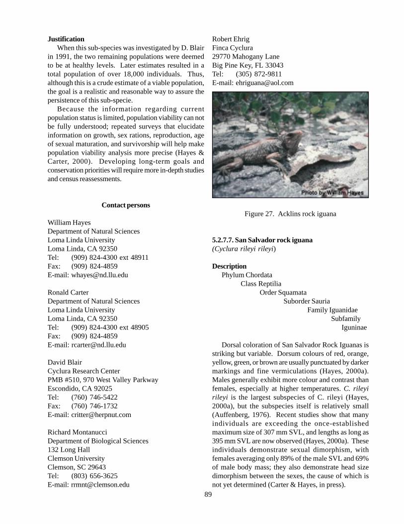
89
JustificationWhen this sub-species was investigated by D. Blair
in 1991, the two remaining populations were deemedto be at healthy levels. Later estimates resulted in atotal population of over 18,000 individuals. Thus,although this is a crude estimate of a viable population,the goal is a realistic and reasonable way to assure thepersistence of this sub-specie.
Because the information regarding currentpopulation status is limited, population viability can notbe fully understood; repeated surveys that elucidateinformation on growth, sex rations, reproduction, ageof sexual maturation, and survivorship will help makepopulation viability analysis more precise (Hayes &Carter, 2000). Developing long-term goals andconservation priorities will require more in-depth studiesand census reassessments.
Contact persons
William HayesDepartment of Natural SciencesLoma Linda UniversityLoma Linda, CA 92350Tel: (909) 824-4300 ext 48911Fax: (909) 824-4859E-mail: [email protected]
Ronald CarterDepartment of Natural SciencesLoma Linda UniversityLoma Linda, CA 92350Tel: (909) 824-4300 ext 48905Fax: (909) 824-4859E-mail: [email protected]
David BlairCyclura Research CenterPMB #510, 970 West Valley ParkwayEscondido, CA 92025Tel: (760) 746-5422Fax: (760) 746-1732E-mail: [email protected]
Richard MontanucciDepartment of Biological Sciences132 Long HallClemson UniversityClemson, SC 29643Tel: (803) 656-3625E-mail: [email protected]
Robert EhrigFinca Cyclura29770 Mahogany LaneBig Pine Key, FL 33043Tel: (305) 872-9811E-mail: [email protected]
Figure 27. Acklins rock iguana
5.2.7.7. San Salvador rock iguana(Cyclura rileyi rileyi)
DescriptionPhylum Chordata
Class ReptiliaOrder Squamata
Suborder SauriaFamily Iguanidae
Subfamily Iguninae
Dorsal coloration of San Salvador Rock Iguanas isstriking but variable. Dorsum colours of red, orange,yellow, green, or brown are usually punctuated by darkermarkings and fine vermiculations (Hayes, 2000a).Males generally exhibit more colour and contrast thanfemales, especially at higher temperatures. C. rileyirileyi is the largest subspecies of C. rileyi (Hayes,2000a), but the subspecies itself is relatively small(Auffenberg, 1976). Recent studies show that manyindividuals are exceeding the once-establishedmaximum size of 307 mm SVL, and lengths as long as395 mm SVL are now observed (Hayes, 2000a). Theseindividuals demonstrate sexual dimorphism, withfemales averaging only 89% of the male SVL and 69%of male body mass; they also demonstrate head sizedimorphism between the sexes, the cause of which isnot yet determined (Carter & Hayes, in press).
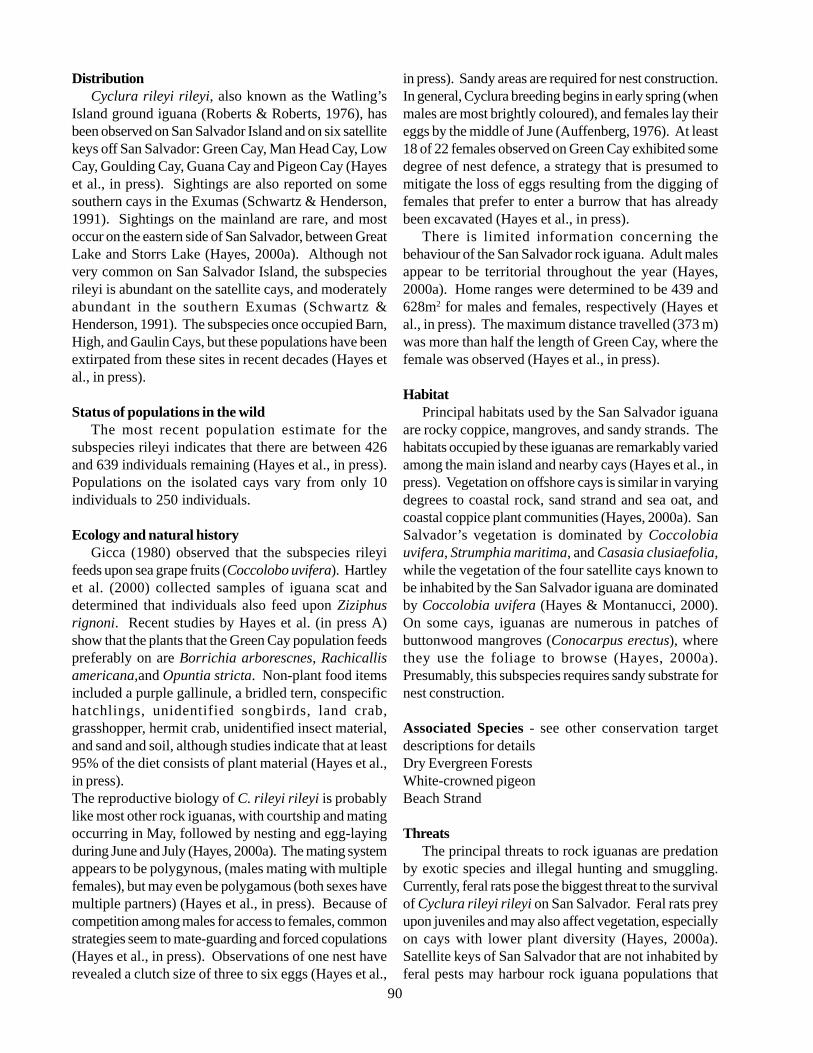
90
DistributionCyclura rileyi rileyi, also known as the Watling’s
Island ground iguana (Roberts & Roberts, 1976), hasbeen observed on San Salvador Island and on six satellitekeys off San Salvador: Green Cay, Man Head Cay, LowCay, Goulding Cay, Guana Cay and Pigeon Cay (Hayeset al., in press). Sightings are also reported on somesouthern cays in the Exumas (Schwartz & Henderson,1991). Sightings on the mainland are rare, and mostoccur on the eastern side of San Salvador, between GreatLake and Storrs Lake (Hayes, 2000a). Although notvery common on San Salvador Island, the subspeciesrileyi is abundant on the satellite cays, and moderatelyabundant in the southern Exumas (Schwartz &Henderson, 1991). The subspecies once occupied Barn,High, and Gaulin Cays, but these populations have beenextirpated from these sites in recent decades (Hayes etal., in press).
Status of populations in the wildThe most recent population estimate for the
subspecies rileyi indicates that there are between 426and 639 individuals remaining (Hayes et al., in press).Populations on the isolated cays vary from only 10individuals to 250 individuals.
Ecology and natural historyGicca (1980) observed that the subspecies rileyi
feeds upon sea grape fruits (Coccolobo uvifera). Hartleyet al. (2000) collected samples of iguana scat anddetermined that individuals also feed upon Ziziphusrignoni. Recent studies by Hayes et al. (in press A)show that the plants that the Green Cay population feedspreferably on are Borrichia arborescnes, Rachicallisamericana,and Opuntia stricta. Non-plant food itemsincluded a purple gallinule, a bridled tern, conspecifichatchlings, unidentified songbirds, land crab,grasshopper, hermit crab, unidentified insect material,and sand and soil, although studies indicate that at least95% of the diet consists of plant material (Hayes et al.,in press).The reproductive biology of C. rileyi rileyi is probablylike most other rock iguanas, with courtship and matingoccurring in May, followed by nesting and egg-layingduring June and July (Hayes, 2000a). The mating systemappears to be polygynous, (males mating with multiplefemales), but may even be polygamous (both sexes havemultiple partners) (Hayes et al., in press). Because ofcompetition among males for access to females, commonstrategies seem to mate-guarding and forced copulations(Hayes et al., in press). Observations of one nest haverevealed a clutch size of three to six eggs (Hayes et al.,
in press). Sandy areas are required for nest construction.In general, Cyclura breeding begins in early spring (whenmales are most brightly coloured), and females lay theireggs by the middle of June (Auffenberg, 1976). At least18 of 22 females observed on Green Cay exhibited somedegree of nest defence, a strategy that is presumed tomitigate the loss of eggs resulting from the digging offemales that prefer to enter a burrow that has alreadybeen excavated (Hayes et al., in press).
There is limited information concerning thebehaviour of the San Salvador rock iguana. Adult malesappear to be territorial throughout the year (Hayes,2000a). Home ranges were determined to be 439 and628m2 for males and females, respectively (Hayes etal., in press). The maximum distance travelled (373 m)was more than half the length of Green Cay, where thefemale was observed (Hayes et al., in press).
HabitatPrincipal habitats used by the San Salvador iguana
are rocky coppice, mangroves, and sandy strands. Thehabitats occupied by these iguanas are remarkably variedamong the main island and nearby cays (Hayes et al., inpress). Vegetation on offshore cays is similar in varyingdegrees to coastal rock, sand strand and sea oat, andcoastal coppice plant communities (Hayes, 2000a). SanSalvador’s vegetation is dominated by Coccolobiauvifera, Strumphia maritima, and Casasia clusiaefolia,while the vegetation of the four satellite cays known tobe inhabited by the San Salvador iguana are dominatedby Coccolobia uvifera (Hayes & Montanucci, 2000).On some cays, iguanas are numerous in patches ofbuttonwood mangroves (Conocarpus erectus), wherethey use the foliage to browse (Hayes, 2000a).Presumably, this subspecies requires sandy substrate fornest construction.
Associated Species - see other conservation targetdescriptions for detailsDry Evergreen ForestsWhite-crowned pigeonBeach Strand
ThreatsThe principal threats to rock iguanas are predation
by exotic species and illegal hunting and smuggling.Currently, feral rats pose the biggest threat to the survivalof Cyclura rileyi rileyi on San Salvador. Feral rats preyupon juveniles and may also affect vegetation, especiallyon cays with lower plant diversity (Hayes, 2000a).Satellite keys of San Salvador that are not inhabited byferal pests may harbour rock iguana populations that
91
are the last remaining members of the gene pool in theentire world (Gicca, 1980). Additionally, theintroduction of a moth, Cactoblastis cactorum, to theWest Indies has proven to have devastating effects onthe subspecies because the moth larvae destroy theprickly-pear cacti, which serve as an important iguanafood source (Hayes, 2000a). As with other populationsof rock iguanas, the subspecies rileyi is also vulnerableto the negative impacts of human development and feralcats and dogs (Hayes, 2000a). 1999’s Hurricane Floydhas also proven to be a threat to these iguanas, as itinflicted substantial damage to the nesting habitat ofGreen Cay (Hayes et al., in press). Direct human impactmay also be a threat, since tourists frequently visit someof the cays inhabited by this subspecies from the nearbyClubMed Resort, as well as students from the GeraceResearch Center (Hayes et al., in press). These visitorscan potentially trample nests and leave dangerous food-related debris, such as plastic wrap, on the cays (Hayeset al., in press).
Current conservation programsPresently, W.Hayes and R.Carter are collecting
baseline data on all populations of C.rileyi to aidconservation management decisions (Hayes, 2000a).Initial efforts involve population surveys, assessment ofthreats to survival, and genetic sampling (Hayes 2000a).Genetic analyses are essential to resolve the taxonomicidentities of the nominate taxa, to assess the degree ofdivergence among individual populations, and toevaluate heterozygosity (which may reveal inbreedingdepression) (Hayes, 2000a). Further steps includeconcentrated searches for isolated colonies on themainland and on the southernmost lakes, as well asreintroductions of iguanas to previously inhabited cays(Hayes, 2000a). At present, no legal breeding programsexist outside of the Bahamas (Hayes, 2000a). TheBahamian government has wisely refused to issue exportpermits for any rock iguana taxa, but Ardastra Gardensin Nassau currently holds two juveniles and plans toimplement an in situ program (Hayes, 2000a). A publicrelations campaign is planned to heighten awareness andappreciation among island residents for their endemiciguana (Hayes, 2000a).
Information gaps and Research need• Continue to sample and survey individual
populations on an annual or biannual basis;• Eradicate rats on infested cays;• Monitor the impact of the Cactoblastis moths
and rats on vegetation; and• Determine reliable estimates of minimum viable
population and minimum viable area neededto sustain the species conditions.
GoalsMaintain a total population with a minimum size
of 600 individuals.
JustificationThis subspecies includes populations on isolated cays
that number as few as 10 individuals to as many as 250.In all cases, the populations are small enough that evena seemingly minor threat can incur irreversible damage.Although this is a crude estimate of a viable population,it is estimated that the total population is most likelyless than 1,000, and recent censuses suggest that up to639 individuals remain, so this goal is realistic.Maintaining the population above 600 individuals mayhelp this sub-species tolerate the current threats as wellas prevent genetic complications and inbreedingdepression. Hayes et al. (in press A) have noted thatthe lack of significant gene flow between cays may be asignificant threat to this subspecies.
Because the information regarding currentpopulation status is limited, population viability can notbe fully understood; repeated surveys that elucidateinformation on growth, sex rations, reproduction, ageof sexual maturation, and survivorship will help makepopulation viability analysis more precise (Hayes andCarter 2000). Developing long-term goals andconservation priorities will require more in-depth studiesand census reassessments.
Contact persons
William HayesDepartment of Natural SciencesLoma Linda UniversityLoma Linda, CA 92350Tel: (909) 824-4300 ext 48911Fax: (909) 824-4859E-mail: [email protected]
Ronald CarterDepartment of Natural SciencesLoma Linda UniversityLoma Linda, CA 92350Tel: (909) 824-4300 ext 48905Fax: (909) 824-4859E-mail: [email protected]
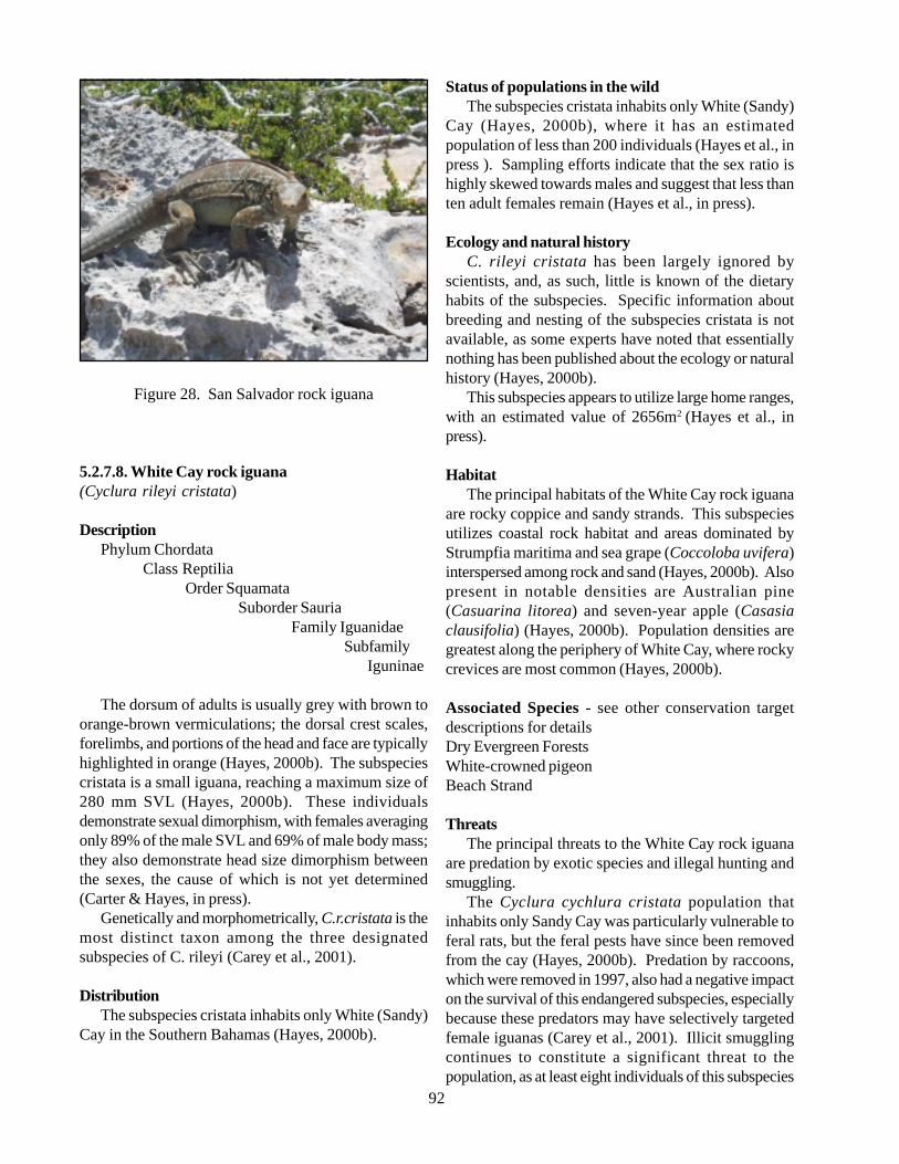
92
Figure 28. San Salvador rock iguana
5.2.7.8. White Cay rock iguana(Cyclura rileyi cristata)
DescriptionPhylum Chordata
Class ReptiliaOrder Squamata
Suborder SauriaFamily Iguanidae
Subfamily Iguninae
The dorsum of adults is usually grey with brown toorange-brown vermiculations; the dorsal crest scales,forelimbs, and portions of the head and face are typicallyhighlighted in orange (Hayes, 2000b). The subspeciescristata is a small iguana, reaching a maximum size of280 mm SVL (Hayes, 2000b). These individualsdemonstrate sexual dimorphism, with females averagingonly 89% of the male SVL and 69% of male body mass;they also demonstrate head size dimorphism betweenthe sexes, the cause of which is not yet determined(Carter & Hayes, in press).
Genetically and morphometrically, C.r.cristata is themost distinct taxon among the three designatedsubspecies of C. rileyi (Carey et al., 2001).
DistributionThe subspecies cristata inhabits only White (Sandy)
Cay in the Southern Bahamas (Hayes, 2000b).
Status of populations in the wildThe subspecies cristata inhabits only White (Sandy)
Cay (Hayes, 2000b), where it has an estimatedpopulation of less than 200 individuals (Hayes et al., inpress ). Sampling efforts indicate that the sex ratio ishighly skewed towards males and suggest that less thanten adult females remain (Hayes et al., in press).
Ecology and natural historyC. rileyi cristata has been largely ignored by
scientists, and, as such, little is known of the dietaryhabits of the subspecies. Specific information aboutbreeding and nesting of the subspecies cristata is notavailable, as some experts have noted that essentiallynothing has been published about the ecology or naturalhistory (Hayes, 2000b).
This subspecies appears to utilize large home ranges,with an estimated value of 2656m2 (Hayes et al., inpress).
HabitatThe principal habitats of the White Cay rock iguana
are rocky coppice and sandy strands. This subspeciesutilizes coastal rock habitat and areas dominated byStrumpfia maritima and sea grape (Coccoloba uvifera)interspersed among rock and sand (Hayes, 2000b). Alsopresent in notable densities are Australian pine(Casuarina litorea) and seven-year apple (Casasiaclausifolia) (Hayes, 2000b). Population densities aregreatest along the periphery of White Cay, where rockycrevices are most common (Hayes, 2000b).
Associated Species - see other conservation targetdescriptions for detailsDry Evergreen ForestsWhite-crowned pigeonBeach Strand
ThreatsThe principal threats to the White Cay rock iguana
are predation by exotic species and illegal hunting andsmuggling.
The Cyclura cychlura cristata population thatinhabits only Sandy Cay was particularly vulnerable toferal rats, but the feral pests have since been removedfrom the cay (Hayes, 2000b). Predation by raccoons,which were removed in 1997, also had a negative impacton the survival of this endangered subspecies, especiallybecause these predators may have selectively targetedfemale iguanas (Carey et al., 2001). Illicit smugglingcontinues to constitute a significant threat to thepopulation, as at least eight individuals of this subspecies
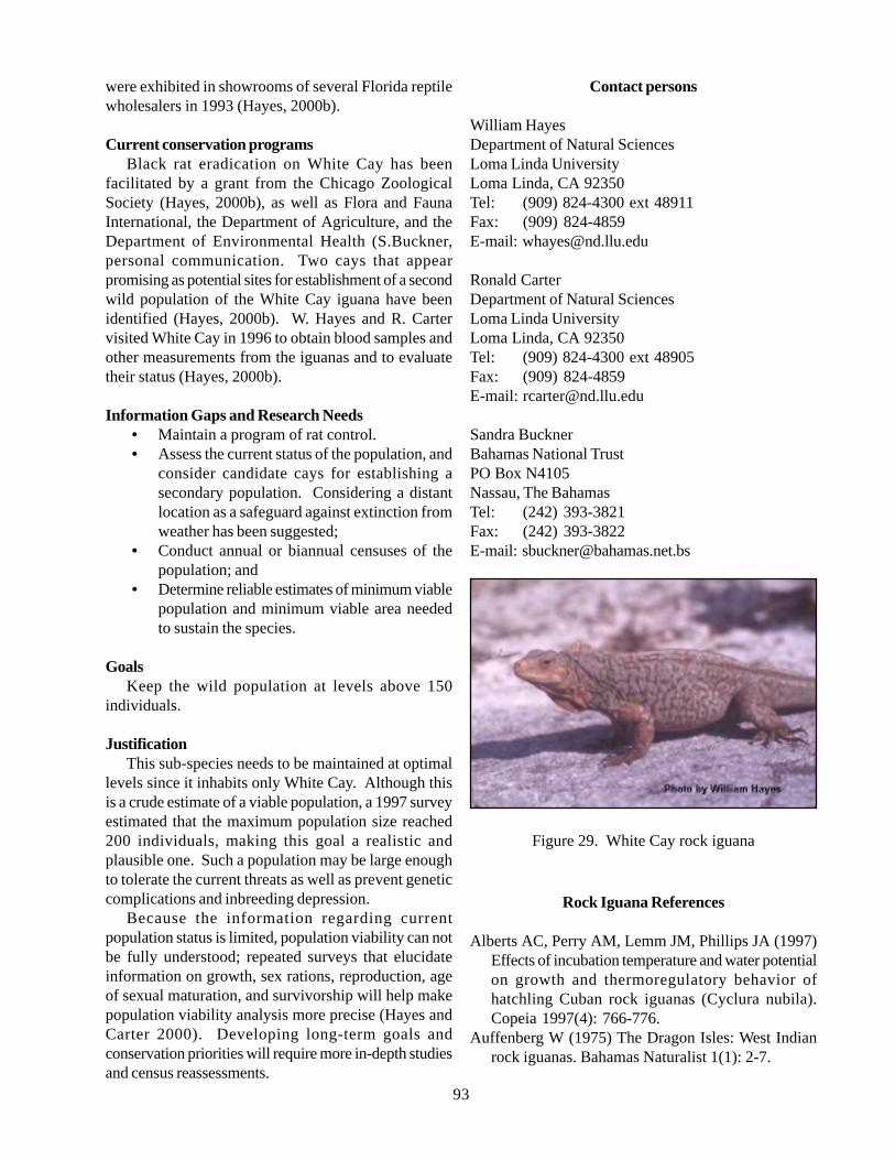
93
were exhibited in showrooms of several Florida reptilewholesalers in 1993 (Hayes, 2000b).
Current conservation programsBlack rat eradication on White Cay has been
facilitated by a grant from the Chicago ZoologicalSociety (Hayes, 2000b), as well as Flora and FaunaInternational, the Department of Agriculture, and theDepartment of Environmental Health (S.Buckner,personal communication. Two cays that appearpromising as potential sites for establishment of a secondwild population of the White Cay iguana have beenidentified (Hayes, 2000b). W. Hayes and R. Cartervisited White Cay in 1996 to obtain blood samples andother measurements from the iguanas and to evaluatetheir status (Hayes, 2000b).
Information Gaps and Research Needs• Maintain a program of rat control.• Assess the current status of the population, and
consider candidate cays for establishing asecondary population. Considering a distantlocation as a safeguard against extinction fromweather has been suggested;
• Conduct annual or biannual censuses of thepopulation; and
• Determine reliable estimates of minimum viablepopulation and minimum viable area neededto sustain the species.
GoalsKeep the wild population at levels above 150
individuals.
JustificationThis sub-species needs to be maintained at optimal
levels since it inhabits only White Cay. Although thisis a crude estimate of a viable population, a 1997 surveyestimated that the maximum population size reached200 individuals, making this goal a realistic andplausible one. Such a population may be large enoughto tolerate the current threats as well as prevent geneticcomplications and inbreeding depression.
Because the information regarding currentpopulation status is limited, population viability can notbe fully understood; repeated surveys that elucidateinformation on growth, sex rations, reproduction, ageof sexual maturation, and survivorship will help makepopulation viability analysis more precise (Hayes andCarter 2000). Developing long-term goals andconservation priorities will require more in-depth studiesand census reassessments.
Contact persons
William HayesDepartment of Natural SciencesLoma Linda UniversityLoma Linda, CA 92350Tel: (909) 824-4300 ext 48911Fax: (909) 824-4859E-mail: [email protected]
Ronald CarterDepartment of Natural SciencesLoma Linda UniversityLoma Linda, CA 92350Tel: (909) 824-4300 ext 48905Fax: (909) 824-4859E-mail: [email protected]
Sandra BucknerBahamas National TrustPO Box N4105Nassau, The BahamasTel: (242) 393-3821Fax: (242) 393-3822E-mail: [email protected]
Figure 29. White Cay rock iguana
Rock Iguana References
Alberts AC, Perry AM, Lemm JM, Phillips JA (1997)Effects of incubation temperature and water potentialon growth and thermoregulatory behavior ofhatchling Cuban rock iguanas (Cyclura nubila).Copeia 1997(4): 766-776.
Auffenberg W (1975) The Dragon Isles: West Indianrock iguanas. Bahamas Naturalist 1(1): 2-7.
94
Auffenberg W (1976) Bahamas rock iguanas, part two.Bahamas Naturalist Volume 2(1): 9-16.
Buckner S, Blair D (2000b) Bartsch’s iguana. In WestIndian iguanas, Alberts A (Ed.), IUCN/SSC WestIndian Specialist Group, p 18-19.
Carter, R.L and W.K.Hayes. In press . Conservation ofan Endangered Bahamian Rock Iguana II.Morphological Variation and ConservationPriorities. In Alberts, Ac, R.L.Carter, W.K.Hayes,and E.P.Martins (Eds), Biology and Conservationof Iguanas. University of California Press, Berkley.
Gerber G, Iverson J (2000) Turks and Caicos iguana. InWest Indian iguanas, Alberts A (Ed.), IUCN/SSCWest Indian Specialist Group, p 15-17.
Gicca D (1980) The status and distribution of Cyclurar. rileyi (Reptilia: Iguanidae): A Bahamian rockiguana. Caribbean Journal of Science 16(1-4): 9-11.
Hartley LM, Glor RE, Sproston AL, Powell R,Parmerlee JS (2000) Germination rates of seedsconsumed by two species of rock iguanas (Cycluraspp.) in the Dominican Republic. Caribbean Journalof Science 36(1-2): 149-151.
Hayes W (2000) San Salvador iguana. In West Indianiguanas, Alberts A (Ed.), IUCN/SSC West IndianSpecialist Group, p 56-59.
Hayes W and Carter R. 2000. Population Monitoring.In West Indian iguanas, Alberts A (Ed.), IUCN/SSCWest Indian Specialist Group, pp.79-80.
Hayes, W.K., R.L.Carter, S.Cyril, and B.Thornton. Inpress , Conservation of an Endangered BahamianRock Iguana I Population Assessments, HabitatRestoration, and Behavioral Ecology. In Alberts, Ac,R.L.Carter, W.K.Hayes, and E.P.Martins (Eds),Biology and Conservation of Iguanas. University ofCalifornia Press, Berkley.
Hudson, R. 2002. Reintroduction Guidelines. IUCNIguana Specialist Group. Found at http://www.iucn-isg.org/actionplan/ch3/reintroduction.php
IUCN Specialist Group Reports (1998) West Indianiguana specialist group. Found at www.iucn.org/themes/ssc/species/spec30/reports/13iguana.htm
Iverson JB (2000) Allen’s Cay iguana. In West Indianiguanas, Alberts A (Ed.), IUCN/SSC West IndianSpecialist Group, p 34-36.
Iverson JB, Mamula MR (1989) Natural growth in theBahamian rock iguana Cyclura cychlura. Copeia1989(2): 502-505.
Knapp C, Buckner S, Feldman A, Roth L (1999) Statusupdate and empirical field observations of the Androsrock iguana, Cyclura cychlura cychlura. BahamasJournal of Science 7(1): 1-5.
Knapp CR (2000a) Exuma Island iguana. In West Indian
iguanas. Alberts A (Ed.), IUCN/SSC West IndianSpecialist Group, p 32-34.
Knapp CR (2000b) Home range and intraspecificinteractions of a translocated iguana Population(Cyclura cychlura inornata Barbour and Noble).Caribbean Journal of Science 36(3-4): 250-257.
Malone CL, Wheeler T, Taylor JF, Davis SK (2000)Phylogeography of the Caribbean rock iguana(Cyclura): Implications for conservation and insightson the biogeographic history of the West Indies.Molecular Phylogenetics and Evolution 17(2): 269-279.
Norton RL, Clarke NV (1992) Notes on the rock iguana(Cyclura carinata) of the Caicos Islands. FloridaField Naturalist 20(2): 45-46.
Roberts MF, Roberts MD (1976) All about iguanas.T.F.H Publications, Neptune City, NJ.
Schwartz A, Henderson RW (1991) Amphibians andreptiles of the West Indies. University of FloridaPress, Gainesville, FL.
Shedd Aquarium (2001) Conservation field andbreeding research West Indian rock iguana. Foundat www.sheddnet.org/con_internat_02.html
5.2.8. Nassau Grouper (Epinephelus striatus)
DescriptionPhylum Chordata
Class OsteichthyesFamily Serranidae
Subfamily Epinephelinae
The Nassau grouper is a moderate-sized species withlarge eyes, small scales, and a robust body (Smith, 1971).The nostrils are sub equal, the posterior slightly enlarged,and the vertical fins are rounded. The Nassau grouperis distinguished from other species by the third spine ofthe dorsal fin, which is longer than the second is. Thepelvic fins are shorter than the pectoral fins and areinserted below or behind the ventral end of the pectoralfin base. The inter-radial membranes are deeply notchedbetween the spines and the third dorsal spine is longerthan the second is. A dark saddle is present on the caudalpeduncle and a single or double row of small black spotsis present below and behind the eye. The body has fivedark vertical bars. The Nassau grouper is most closelyrelated to Epinephelus guttatus and E. morio (Smith,1971). The species name striatus means provided withstripes. Individuals can attain a maximum length of 1.2
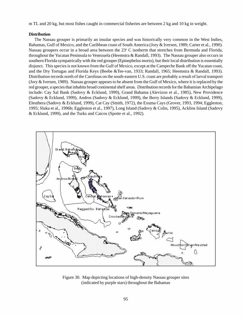
95
m TL and 20 kg, but most fishes caught in commercial fisheries are between 2 kg and 10 kg in weight.
DistributionThe Nassau grouper is primarily an insular species and was historically very common in the West Indies,
Bahamas, Gulf of Mexico, and the Caribbean coast of South America (Jory & Iversen, 1989; Carter et al., 1990).Nassau groupers occur in a broad area between the 23o C isotherm that stretches from Bermuda and Florida,throughout the Yucatan Peninsula to Venezuela (Heemstra & Randall, 1993). The Nassau grouper also occurs insouthern Florida sympatrically with the red grouper (Epinephelus morio), but their local distribution is essentiallydisjunct. This species is not known from the Gulf of Mexico, except at the Campeche Bank off the Yucatan coast,and the Dry Tortugas and Florida Keys (Beebe &Tee-van, 1933; Randall, 1965; Heemstra & Randall, 1993).Distribution records north of the Carolinas on the south-eastern U.S. coast are probably a result of larval transport(Jory & Iversen, 1989). Nassau grouper appears to be absent from the Gulf of Mexico, where it is replaced by thered grouper, a species that inhabits broad continental shelf areas. Distribution records for the Bahamian Archipelagoinclude: Cay Sal Bank (Sadovy & Ecklund, 1999), Grand Bahama (Alevizon et al., 1985), New Providence(Sadovy & Ecklund, 1999), Andros (Sadovy & Ecklund, 1999), the Berry Islands (Sadovy & Ecklund, 1999),Eleuthera (Sadovy & Ecklund, 1999), Cat Cay (Smith, 1972), the Exuma Cays (Grover, 1993, 1994; Eggleston,1995; Sluka et al., 1996b; Eggleston et al., 1997), Long Island (Sadovy & Colin, 1995), Acklins Island (Sadovy& Ecklund, 1999), and the Turks and Caicos (Spotte et al., 1992).
Figure 30. Map depicting locations of high-density Nassau grouper sites(indicated by purple stars) throughout the Bahamas
96
Status of populations in the wildDeclines in abundance, size, fishery landings, and
spawning aggregations since the 1950s are apparent forthe Nassau grouper throughout its range, particularly inintensively fished areas of the insular Caribbean(Sadovy, 1990). At least one-fifth of documentedspawning aggregations have apparently disappeared overthe past two decades, probably the direct result offishing. Intense fishing of spawning aggregations in theU.S. Virgin Islands prior to 1980 led to commercialextinction, including the total loss of spawningaggregations south of St. Thomas and on Lang Banknortheast of St. Croix (Olsen & LaPlace, 1978; Beets& Friedlander, 1992). A precipitous decline occurredin commercial landings in Bermuda from over 33 tonsin 1975 to < 2 tons in 1981, with no evidence ofsubsequent recovery as of the mid-1990s. The declineis due to the over fishing of spawning aggregations withfish pots (Luckhurst, 1996). Currently, about 60 to 80spawning aggregations are known or suspected in thewider Caribbean, of which many are located in theBahamian Archipelago (Sadovy & Ecklund, 1999).Spawning aggregation sites include Andros, the BerryIslands, Bimini, New Providence, Ragged Island, LongIsland, Cat Island, Acklins, Eleuthera, Exuma Cays, andCay Sal Bank. Of these, declines in aggregation sizeand landings have been noted for Andros and LongIsland sites.
Nassau grouper were historically common inBermuda, the Florida Keys, and the West Indies andwere considered a common food fish (Henshall, 1891;Randall, 1965; Starck, 1968; Bohnsack, 1990). Currentpopulation levels are low and the species is now rareand considered commercially extinct in the U.S. VirginIslands, Puerto Rico, Jamaica, and Bermuda (Beebe &Tee-van, 1933; Olsen & LaPlace, 1978; Thompson &Munro, 1983; Bortone et al., 1986; Beets & Friedlander,1992). This species is present, but not common in theNetherlands Antilles (Nagelkerken, 1981a,b) and onlyobserved in no-fishing zones (Polunin & Roberts, 1993)and very infrequently in the Lesser Antilles (Gobert,1990). Historically, Nassau grouper was one of the mostcommon groupers east of the Gulf Stream (Smith, 1971).Nassau groupers are less abundant in the Florida Keysthan the central Bahamas, potentially indicative ofgreater fishing pressure (Sluka et al., 1994; Sluka &Sullivan, 1996b, 1998). Prior to 1980, Nassau grouperwas common in the U.S. South Atlantic, including theFlorida Keys (Starck, 1968), but are now consideredextremely rare because of fishing (Huntsman et al.,1990). This species is considered moderately commonin shallow-water coral reef environments in the Turks
and Caicos Islands (Spotte et al., 1992) and washistorically abundant on shallow reefs near GrandBahama Island (Alevizon et al., 1985). In Belize, from1972-84, this and other grouper species constituted thesecond most commonly caught and most valuable marinefishes. Local Belizean fishermen landed in excess of100,000 lbs. annually in the 1950s, but less than 30,000lbs. by 1986. The Nassau grouper catch in Belizedecreased in size since the 1920s. Males comprise 25%of the population, but comprise 37% of the populationelsewhere (Carter et al., 1993). Off the Bay Islands,Honduras, a spawning aggregation declined fromintensive fishing (Fine, 1990). Aggregation size andspawning period both decreased off the southern coastof Quintana Roo, Mexico during the last two decades(Aguilar-Perera, 1990; Aguilar-Perera & Aguilar-Davila, 1996).
Ecology and natural historyNassau groupers are important top-level, resident
predators in coral reef environments. The species ischaracterized as an unspecialised and opportunisticcarnivore, feeding on a variety of crustaceans and fishes(Scaridae, Labridae, Pomacentridae, Holocentridae,Lutjanidae, and Haemulidae). Crustaceans dominatethe diet of smaller individuals, while fish are morecommon in stomach contents of larger individuals(Randall, 1965). Feeding is generally most active atdawn and dusk (Randall, 1965). The main diet ofjuvenile Nassau grouper (21.0-27.1 mm) isdinoflagellates by number and fish larvae by volume(Greenwood, 1991; Grover, 1993, 1994). Largejuveniles feed mainly on crabs and fishes (Heck &Weinstein, 1989).
The Nassau grouper life history is characterized byslow growth, large adult size, delayed reproduction,protogyny, low natural mortality, and site-specificaggregated spawning (Sullivan & de Garine, 1990;Sadovy, 1990; Colin, 1992; Sadovy & Colin, 1995;Domeier & Colin, 1997). Nassau grouper can reach atleast 100 cm total length and weigh up to 25 kg (Jory &Iversen, 1989, Heemstra & Randall, 1993). Individualsmay live for 20 years, attaining sexual maturity at 50cm TL (1.87 kg) or 5 years of age (Sadovy, 1990).Females change to males at a size of 30-80 cm TL (Jory& Iversen, 1989). Growth rates of individuals measuring175-250 mm, 251-325 mm, and 326-450 mm TL are4.55 mm/month, 3.5 mm/month, and 1.92 mm/month,respectively (Randall, 1961). Because fecundityincreases exponentially as a function of weight (Olsen& LaPlace, 1978), fishing of spawning aggregations canlead to increases in the female to male ratio, potentially
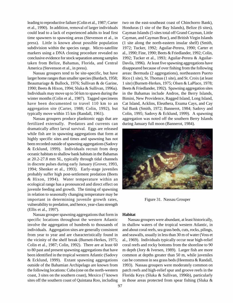
97
leading to reproductive failure (Colin et al., 1987; Carteret al., 1990). In addition, removal of larger individualscould lead to a lack of experienced adults to lead firsttime spawners to spawning areas (Stevenson et al., inpress). Little is known about possible populationsubdivision within the species range. Micro-satellitemarkers using a DNA cloning procedure revealed noconclusive evidence for stock separation among samplestaken from Belize, Bahamas, Florida, and CentralAmerica (Stevenson et al., in press).
Nassau groupers tend to be site-specific, but havelarger home ranges than smaller species (Bardach, 1958;Beaumariage & Bullock, 1976; Sullivan & de Garine,1990; Beets & Hixon, 1994; Sluka & Sullivan, 1996a).Individuals may move up to 50 km to spawn during thewinter months (Colin et al., 1987). Tagged specimenshave been documented to travel 110 km to anaggregation site (Carter, 1988; Colin, 1992), buttypically move within 15 km (Randall, 1961).
Nassau groupers produce planktonic eggs that arefertilized externally. Predators and currents candramatically affect larval survival. Eggs are releasedwhile fish are in spawning aggregations that form athighly specific sites and times and spawning has notbeen recorded outside of spawning aggregations (Sadovy& Ecklund, 1999). Individuals recruit from deepoceanic habitats to shallow bank habitats in the Bahamasat 20.2-27.8 mm SL, typically through tidal channelsin discrete pulses during early January (Grover, 1993,1994; Shenker et al., 1993). Early-stage juvenilesprobably suffer high post-settlement predation (Beets& Hixon, 1994). Water temperature within anecological range has a pronounced and direct effect onjuvenile feeding and growth. The timing of spawningin relation to seasonally changing temperature may beimportant in determining juvenile growth rates,vulnerability to predation, and hence, year-class strength(Ellis et al., 1997).
Nassau grouper spawning aggregations that form inspecific locations throughout the western Atlanticinvolve the aggregation of hundreds to thousands ofindividuals. Aggregation sites are generally consistentfrom year to year and are characteristically found inthe vicinity of the shelf break (Burnett-Herkes, 1975;Colin et al., 1987; Colin, 1992). There are at least 60to 80 past and present spawning aggregations that havebeen identified in the tropical western Atlantic (Sadovy& Ecklund, 1999). Extant spawning aggregationsoutside of the Bahamian Archipelago are known fromthe following locations: Cuba (one on the north-westerncoast, 3 sites on the southern coast), Mexico (7 knownsites off the southern coast of Quintana Roo, including
two on the east-southeast coast of Chinchorro Bank),Honduras (1 site of the Bay Islands), Belize (6 sites),Cayman Islands (5 sites total off Grand Cayman, LittleCayman, and Cayman Brac), and British Virgin Islands(1 site along the north-eastern insular shelf) (Smith,1972; Tucker, 1992; Aguilar-Perera, 1990; Carter etal., 1990; Fine, 1990; Beets & Friedlander, 1992; Colin,1992; Tucker et al., 1993; Aguilar-Perera & Aguilar-Davila, 1996). At least five spawning aggregations havedisappeared because of over fishing from the followingareas: Bermuda (2 aggregations), northeastern PuertoRico (1 site), St. Thomas (1 site), and St. Croix (at least1 site) (Burnett-Herkes, 1975; Olsen & LaPlace, 1978;Beets & Friedlander, 1992). Spawning aggregation sitesin the Bahamas include Andros, the Berry Islands,Bimini, New Providence, Ragged Island, Long Island,Cat Island, Acklins, Eleuthera, Exuma Cays, and CaySal Bank (Smith, 1972; Bannerot, 1984; Sadovy andColin, 1995; Sadovy & Ecklund, 1999). A spawningaggregation was noted off the southern Berry Islandsduring January full moon (Bannerot, 1984).
Figure 31. Nassau Grouper
HabitatNassau groupers were abundant, at least historically,
in shallow waters of the tropical western Atlantic, inand about coral reefs, sea grass beds, cuts, rocks, pilings,and seawalls, usually in less than 30 m of water (Voss etal., 1969). Individuals typically occur near high-reliefcoral reefs and rocky bottoms from the shoreline to 90m depth (Jory & Iversen, 1989). Larger fish are morecommon at depths greater than 50 m, while juvenilescan be common in sea grass beds (Heemstra & Randall,1993). Nassau groupers were moderately common onpatch reefs and high-relief spur and groove reefs in theFlorida Keys (Sluka & Sullivan, 1996b), particularlyin those areas protected from spear fishing (Sluka &
98
Sullivan, 1998). Juveniles can be prevalent on shallow-water patch reefs and appear to migrate to deeper,offshore reefs with size (Carr & Hixon, 1995; Sluka etal., 1996b; Sluka & Sullivan, 1998). In the Exuma Cays,Nassau groupers were abundant in shallow-water (1-20m) patch reefs, low-relief hard-bottom, channel reefs,and high-relief fringing reefs (Sluka et al., 1996a). Inother areas, Nassau groupers occur on patch reefs andfore reef zones from 4-12 m depth in Puerto Rico andthe Bahamas, especially in areas with high relief(Alevizon et al., 1985; Turingan & Acosta, 1990; Carr& Hixon, 1995). Nassau groupers also occur on outercontinental shelf bank habitats at 45-50 m depth in thenorth-western Gulf of Mexico (Rezak et al., 1985) andlarge adults were historically common in the U.S. SouthAtlantic at 50 m to 80 m depth (Huntsman et al., 1990).
Important nursery habitats for Nassau groupers areshallow-water sites with coral clumps covered withmacro algae. Post-settlement fishes reside exclusivelywithin algal-covered coral clumps; early juveniles (6-15 cm TL) reside outside of and adjacent to algal-covered clumps; and larger juveniles exhibit anontogenetic habitat shift from coral-coral clumps topatch reef habitats at a size of 12 cm to 15 cm TL duringthe late summer and early fall in the Bahamas(Eggleston, 1995). Spawning aggregations during thewinter months (November-February) in the tropicalwestern Atlantic occur in particular habitats. Off thesouthern coast of Quintana Roo, Mexico, spawningadults occur at 6 m to 35 m depth on fore reef habitatsin mainland and offshore bank areas consisting of sandinterspersed with hard-bottom or rocky outcrops(Aguilar-Perera, 1990). Spawning aggregations alsooccur on the edges of banks (29-38 m) over a low-reliefhard-bottom (Smith, 1972) and near promontories orends of island shelves (Tucker, 1992; Tucker et al.,1993). Many aggregation sites have turbulent currentsand upwards of 3 m to 5 m of vertical relief at 25 m to30 m depth (Colin et al., 1987; Colin, 1992).
ThreatsNassau groupers are threatened principally by fishing
throughout the tropical western Atlantic, particularlyduring the formation of winter spawning aggregations(Sadovy, 1990). Evidence of over fishing includesdeclines in abundance and size, decreases in numberand weight of catch, declines in catch per unit, and lossof spawning aggregations (Heemstra & Randall, 1993).Fishing of spawning aggregations has severelythreatened the viability of the species in particularlocations (Olsen & LaPlace, 1978; Aguilar-Perera,1990; Fine, 1990; Luckhurst, 1996). The introduction
of spear guns in the 1960s led to sharp declines inaggregations size and number and some aggregationsare still fished using hook-and-line, spear guns, and gillnets (Aguilar-Perera & Aguilar-Davila, 1996). Nassaugrouper catches in most areas often yield only immature(< 40 cm TL) individuals. In Belize, individuals aremainly fished with hand lines, spear guns, and fish potsthroughout the year; however, most fishing occurs oneto two weeks during the formation of spawningaggregations (Carter, 1988; Carter et al., 1990). Despitean 11-year moratorium on fishing in the Florida Keys,Nassau groupers are considered over fished based uponspawning potential ratio below 30% (Ault et al., 1998).Nassau grouper was considered a candidate coastalspecies for the U.S. Endangered Species List in 1992and is being considered for protected species status inBermuda. Over fishing for at least 20 years has raisedconcerns that the species could become locally orcommercially extinct range-wide (Sadovy & Ecklund,1999).
Critical conservation initiativesThere are few, if any, spawning aggregations
protected in the tropical western Atlantic (Sadovy,1990). Protected from all forms of the fishing the ExumaCays Land and Sea Park, central Bahamas, since 1986.Populations are more abundant in shallow-water reefhabitats than in similar environments of the Florida Keys(Sluka et al., 1994) and significantly greater density,size, biomass, and reproductive output compared toadjacent fished areas (Sluka et al., 1996b, 1997).Minimum size regulations are in effect in the Bahamas.
Information gaps and research needsMore research into the species population dynamics
and reproductive biology is needed. A greaterunderstanding of reproductive biology would greatlyfacilitate stock management. There is a need to knowwhether most annual reproduction occurs at spawningaggregations and the geographic location and durationof significant aggregations. There is also a need to knowhow aggregation fishing is likely to affect courtship orspawning behaviour. Relatively little is knownconcerning the minimum size of sexual maturationrelative to the size of entry into the fishery. It is alsonot known to what extent individuals recruit locally orfrom larvae from up-current and/or off-island locations.Little is known concerning the characteristics neitherof critical juvenile habitat nor of the principal settlementperiods (Sadovy, 1990).
More detailed inventories on the species distributionand abundance are needed. There is a paucity of data
99
region-wide for tracking stock history and assessingstock status. Aggregation catches and annual landings(recreational and commercial), including catch per uniteffort, sex ratios, and sizes, should be collected. Thereis a need to standardize and improve data collectionprotocols and also to identify major data gaps.Information on the condition of stocks is patchy andlargely incomplete (Sadovy, 1990). Long-term landingsand catch per unit effort are available from only a fewwestern Atlantic locations.
Conservation goalsTarget densities for particular habitat types are the
best available information for establishing populationgoals of the Nassau grouper. For the BahamianArchipelago, target density ranges are 100-115individuals/ha for patch reefs, 40-50 individuals/ha forchannel reefs, 30-40 individuals/ha for fringing reefs,and 20-30 individuals/ha for windward, low-relief hard-bottom. These estimates are based upon surveys during1995 in the Exuma Cays, including surveys in the ExumaCays Land and Sea Park, a marine reserve closed tofishing since 1958 (Sluka et al., 1996b). Sex ratiosshould not differ from unity (1:1 male to female) inrelatively undisturbed populations (Sadovy & Ecklund,1999). Spawning stock biomass should be maintainedabove a minimum of 30% - that is, stocks should bemaintained at 30% of their virgin spawning stockbiomass.
Contact persons
Kathleen Sullivan-Sealey, Ph.D.University of MiamiP.O. Box 249118Coral Gables, FL 33124Tel: (305) 284-3013Fax: (305) 284-3039E-mail: [email protected]
Ann-Marie EcklundNational Marine Fisheries ServiceSoutheast Fisheries Science Center75 Virginia Beach DriveMiami, FL 33149, USA
David EgglestonNorth Carolina State UniversityDepartment of Marine, Earth and AtmosphericSciencesBox 8208, Raleigh, NC 27695, USAE-mail: [email protected]
References
Aguilar-Perera A (1990) Preliminary observations ofthe spawning aggregation of Nassau grouper,Epinephelus striatus, at Mahahual, Quintana Roo,Mexico. Proceedings of the Gulf and CaribbeanFisheries Institute 43: 112-122.
Aguilar-Perera A, Aguilar-Davila W (1996) A spawningaggregation of Nassau grouper Epinephelus striatus(Pisces: Serranidae) in the Mexican Caribbean.Environmental Biology of Fishes 45: 351-361.
Alevizon W, Richardson R, Pitts P, Serviss G (1985)Coral zonation and patterns of community structurein Bahamian reef fishes. Bulletin of Marine Science36: 304-318.
Ault JS, Bohnsack JA, Meester GA (1998) Aretrospective (1979-1996) multispecies assessmentof coral reef fish stocks in the Florida Keys. FisheryBulletin 96: 395-414.
Bardach JE (1958) On the movements of certainBermuda reef fishes. Ecology 39: 139-145.
Beaumariage DS, Bullock LH (1976) Biologicalresearch on snappers and groupers as related tofishery management requirements. In Proceedings:colloquium on snapper-grouper fishery resources ofthe western central Atlantic Ocean. Bullis HR, JonesAC (Eds.), Florida Sea Grant Program ReportNumber 17, p 86-94.
Beebe W, Tee-van J (1933) Field book of the shore fishesof Bermuda and the West Indies. Dover Publications,NY, 337 p.
Beets J (1993) Long-term monitoring of fisheries inVirgin Islands National Park: Chapter 1. Baselinedata, 1988-1992, with emphasis on the impact ofHurricane Hugo. U.S. National Park ServiceTechnical Report VINP 1/93, 17 p.
Beets J, Friedlander A (1992) Stock analysis andmanagement strategies for red hind, Epinephelusguttatus, in the U.S. Virgin Islands. Proceedings ofthe Gulf and Caribbean Fisheries Institute 42: 66-79.
Beets J, Hixon MA (1994) Distribution, persistence,and growth of groupers (Pisces: Serranidae) onartificial and natural patch reefs in the Virgin Islands.Bulletin of Marine Science 55: 470-483.
Bohnsack JA (1990) Black and Nassau grouper fisherytrends. Unpublished manuscript, NOAA/NMFS,Southeast Fisheries Center, Miami, FL, 20 p.
Bohnsack JA, Harper DE, McClellan DB (1994)Fisheries trends from Monroe County, Florida.Bulletin of Marine Science 43: 982-1018.
Bortone SA, Hastings RW, Oglesby JL (1986)
100
Quantification of reef fish assemblages: Acomparison of several in situ techniques. NortheastGulf Science 8: 1-21.
Burnett-Herkes J (1975) Contribution to the biology ofthe red hind Epinephelus guttatus, a commerciallyimportant serranid fish from the tropical westernAtlantic. Unpublished Dissertation, University ofMiami, Coral Gables, FL, 154 p.
Carr MH, Hixon MA (1995) Predation effects on earlypost-settlement survivorship of coral-reef fishes.Marine Ecology Progress Series 124: 31-42.
Carter HJ (1988) Grouper sex in Belize. Natural History(October): 60-69.
Carter J, Marrow GJ, Pryor V (1990) Aspects of theecology and reproduction of Nassau grouper,Epinephelus striatus, off the coast of Belize, CentralAmerica. Proceedings of the Gulf and CaribbeanFisheries Institute 43: 65-111.
Colin PL (1992) Reproduction of the Nassau grouper,Epinephelus striatus (Pisces: Serranidae), and itsrelationship to environmental conditions.Environmental Biology of Fishes 34: 357-377.
Colin PL, Shapiro DY, Weiler D (1987) Aspects of thereproduction of two groupers, Epinephelus guttatusand E. striatus in the West Indies. Bulletin of MarineScience 40: 220-230.
Domeier ML, Colin PL (1997) Tropical reef fishspawning aggregations: Defined and reviewed.Bulletin of Marine Science 60: 698-726.
Eggleston DB (1995) Recruitment in Nassau grouperEpinephelus striatus: post-settlement abundance,microhabitat features, and ontogenetic habitat shifts.Marine Ecology Progress Series 124: 9-22.
Ellis SC, Watanabe WO, Ellis EP (1997) Temperatureeffects on feed utilization and growth ofpostsettlement Nassau grouper. Transactions of theAmerican Fisheries Society 126: 309-315.
FAO (1993) Marine fishery resources of the Antilles:Lesser Antilles, Puerto Rico and Hispaniola,Jamaica, Cuba. FAO Fisheries Technical PaperNumber 326, 235 p.
Fine JC (1990) Groupers in love. Sea Frontiers (January-February): 42-45.
Gobert B (1990) Preliminary analysis of the exploitationof groupers in Martinique. Proceedings of the Gulfand Caribbean Fisheries Institute 43: 446-455.
Greenfield DW, Thomerson JE (1997) Fishes of thecontinental waters of Belize. University Press ofFlorida, Gainesville, FL, 311 p.
Greenwood CB (1991) Distribution and feeding habitsof larval Epinepheline groupers in Exuma Sound,Bahamas. Unpublished Dissertation, Florida Institute
of Technology, Melbourne, FL, 61 p.Grover JJ (1993) Trophic ecology of pelagic early-
juvenile Nassau grouper, Epinephelus striatus, duringan early phase of recruitment into demersal habitats.Bulletin of Marine Science 53: 1117-1125.
Grover JJ (1994) Feeding habits of early-juvenileNassau grouper. Bahamas Journal of Science 2: 22-27.
Heck KL, Weinstein MP (1989) Feeding habits ofjuvenile reef fishes associated with Panamanianseagrass meadows. Bulletin of Marine Science 45:629-636.
Heemstra PC, Randall JE (1993) FAO speciescatalogue, Volume 16: Groupers of the world. FAOFisheries Synopsis No. 125, Food and AgricultureOrganization of the United Nations, Rome, 382 p.
Henshall JA (1891) Report upon a collection of fishesmade in southern Florida during 1889. Bulletin ofthe U.S. Fisheries Commission 91: 371-389.
Hoese HD, Moore RH (1998) Fishes of the Gulf ofMexico. Texas, Louisiana, and adjacent waters, 2ndedition. Texas A&M University Press, CollegeStation, TX, 422 p.
Huntsman GR, Potts J, Mays RW (1990) A preliminaryassessment of the populations of seven species ofgrouper (Serranidae, Epinephelinae) in the westernAtlantic Ocean from Cape Hatteras, North Carolinato the Dry Tortugas, Florida. Proceedings of the Gulfand Caribbean Fisheries Institute 43: 193-213.
Jones RS, Thompson MJ (1978) Comparison of Floridareef fish assemblages using a rapid visual technique.Bulletin of Marine Science 28: 159-172.
Jory DE, Iversen ES (1989) Species profiles: Lifehistories and environmental requirements of coastalfishes and invertebrates (South Florida). Black, red,and Nassau groupers. Biological Report 82(11.110),TR EL-82-4, U.S. Fish and Wildlife Service andArmy Corps of Engineers, 21 p.
Luckhurst BE (1996) Trends in commercial fisherylandings of groupers and snappers in Bermuda from1975 to 1992 and associated fishery managementissues. In Biology, fisheries and culture of tropicalgroupers and snappers. Arreguin-Sanchez F, MunroJL, Balgos MC, Pauly D (Eds.), ICLARMConference Proceedings 48, p 277-288.
Naglelkerken W (1981a) Distribution of the groupersand snappers of the Netherlands Antilles.Proceedings of the Fourth International Coral ReefSymposium 2: 479-484.
Nagelkerken W (1981b) The groupers and snappers ofthe Netherlands Antilles. Publications of theFoundation for Scientific Research in Surinam and
101
the Netherlands Antilles No. 107, 77 p.Olsen DA, LaPlace JA (1978) A study of a Virgin Islands
grouper fishery based on a breeding aggregation.Proceedings of the Gulf and Caribbean FisheriesInstitute 31: 130-144.
Polunin NVC, Roberts CM (1993) Greater biomass andvalue of target coral-reef fishes in two smallCaribbean marine reserves. Marine Ecology ProgressSeries 100: 167-176.
Randall JE (1961) Tagging reef fishes in the VirginIslands. Proceedings of the Gulf and CaribbeanFisheries Institute 14: 201-241.
Randall JE (1965) Food habits of the Nassau grouper(Epinephelus striatus). Association of Island MarineLabs of the Caribbean 6: 13-16.
Rezak R, Bright TJ, McGrail DW (1985) Reefs andbanks of the northwestern Gulf of Mexico: Theirgeological, biological, and physical dynamics.Wiley, NY, 259 p.
Roe RB (1976) Distribution of snappers and groupersin the Gulf of Mexico and Caribbean Sea asdetermined from exploratory fishing data. InProceedings: colloquium on snapper- grouper fisheryresources of the western central Atlantic Ocean.Bullis HR, Jones AC (Eds.), Florida Sea GrantReport Number 17, p 129-164.
Sadovy Y (1990) Grouper stocks of the western centralAtlantic: The need for management and managementneeds. Proceedings of the Gulf and CaribbeanFisheries Institute 43: 43-64.
Sadovy Y (1993) The case of the disappearing grouper:Epinephelus striatus, the Nassau grouper, in theCaribbean and western Atlantic. Proceedings of theGulf and Caribbean Fisheries Institute 45.
Sadovy Y, Colin PL (1995) Sexual development andsexuality in the Nassau grouper. Journal of FishBiology 46: 961-976.
Sadovy Y, Ecklund A (1999) Synopsis of biological dataon the Nassau grouper, Epinephelus striatus (Bloch,1792), and the jewfish, E. itajara (Lichtenstein,1822). NOAA Technical Report NMFS 146, Seattle,WA, 65 p.
Shenker JM, Maddox ED, Wishinski E, Pearl A,Thorrold SR, Smith N (1993) Onshore transport ofsettlement-stage Nassau grouper Epinephelus striatusand other fishes in Exuma Sound, Bahamas. MarineEcology Progress Series 98: 31-43.
Sluka R, Chiappone M, Sullivan KM (1994)Comparison of juvenile grouper populations insouthern Florida and the central Bahamas. Bulletinof Marine Science 54: 871-880.
Sluka R, Chiappone M, Sullivan KM (1996a) Habitat
preferences of groupers in the Exuma Cays. BahamasJournal of Science 4: 8-14.
Sluka R, Chiappone M, Sullivan KM, Wright R (1998)The benefits of a marine fishery reserve for Nassaugrouper Epinephelus striatus in the central Bahamas.Proceedings of the Eighth International Coral ReefSymposium 2: 1961-1964.
Sluka R, Chiappone M, Sullivan KM, Wright R (1996b)Habitat and life in the Exuma Cays, the Bahamas:The status of groupers and coral reefs in the northerncays. Media Publishing, Nassau, Bahamas, 83 p.
Sluka R, Sullivan KM (1996a) Daily activity patternsof groupers in the Exuma Cays Land and Sea Park.Bahamas Journal of Science 3: 17-22.
Sluka, R. and Sullivan, K.M. 1996b. The influence ofhabitat on the size distribution of groupers in theupper Florida Keys. Environmental Biology of Fishes47: 177-189.
Sluka, R.D. and Sullivan, K.M. 1998. The influence ofspear fishing on species composition and size ofgroupers in the upper Florida Keys. Fishery Bulletin96: 388-392.
Smith CL (1971) A revision of the American groupers:Epinephelus and allied genera. Bulletin of theAmerican Museum of Natural History 146, 241 p.
Smith CL (1972) A spawning aggregation of Nassaugrouper, Epinephelus striatus (Bloch). Transactionsof the American Fisheries Society 2: 257-261.
Sobel, J. 1996. Marine reserves: Necessary tools forbiodiversity conservation? Global Biodiversity 6: 8-18.
Spotte S, Bubucis PM, Adams G (1992) Diurnaloccupancy of crevices and overhangs by fishes onthe Caicos Bank, Turks and Caicos Islands, BritishWest Indies. Bulletin of Marine Science 51: 66-82.
Starck WA (1968) A list of fishes of Alligator Reef,Florida with comments on the nature of the Floridareef fish fauna. Undersea Biology 1: 5-36.
Stevenson DE, Chapman RW, Sedberry GR (in press)Stock identification in Nassau grouper, Epinephelusstriatus, using microsatellite DNA analysis.Proceedings of the Gulf and Caribbean FisheriesInstitute 50.
Stone RB, Pratt HL, Parker RO, Davis GE (1979) Acomparison of fish populations on an artificial andnatural reef in the Florida Keys. Marine FisheriesReview 41: 1-11.
Sullivan KM, de Garine M (1990) Energetics of juvenileEpinephelus groupers: Impact of summertemperatures and activity patterns on growth rates.Proceedings of the Gulf and Caribbean FisheriesInstitute 43: 148-167.
102
Tabb DC, Manning RB (1961) A checklist of the floraand fauna of northern Florida Bay and adjacentbrackish waters of the Florida mainland collectedduring the period July, 1957 through September,1960. Bulletin of Marine Science of the Gulf andCaribbean 11: 552-649.
Thompson R, Munro JL (1983) The biology, ecologyand bionomics of the hinds and groupers, Serranidae.In Caribbean coral reef fishery resources, 2nd ed.Munro JL (Ed.), International Center for Living andAquatic Resources Management, Manila,Philippines, p 59-81.
Tucker JW (1992) Spawning and development of Nassaugrouper at Grand Cayman. Proceedings of the Gulfand Caribbean Fisheries Institute 42: 275.
Tucker JW, Bush PG, Slaybaugh ST (1993)Reproductive patterns of Cayman Islands Nassaugrouper (Epinephelus striatus) populations. Bulletinof Marine Science 52: 961-969.
Turingan RG, Acosta AB (1990) An analysis of the fishassemblages on a coral patch reef in Puerto Rico.Proceedings of the Gulf and Caribbean FisheriesInstitute 43: 242-259.
Voss GL, Bayer FM, Robins CR, Gomon M, LaRoe ET(1969) The marine ecology of the Biscayne NationalMonument. A report to the National Park Service,Department of Interior. Institute of Marine andAtmospheric Sciences, University of Miami, FL, 169p.
5.2.9. Spiny lobster (Panulirus argus)
DescriptionPhylum Arthropoda
Class CrustaceaOrder Decapoda
Family Palinuridae
Approximately 35 species of lobsters (Crustacea,Decapoda) in six families occur worldwide, commonlycalled rock lobster, Caribbean spiny lobster, West Indianspiny lobster, and Florida spiny lobster (Moe, 1991).The Caribbean spiny lobster (Panulirus argus) is aubiquitous inhabitant of subtropical and tropicalCaribbean environments, highly valued as a source offood, revenue, and recreational value (Lipcius & Cobb,1993). The spiny lobster is one of the largest marineinvertebrate species inhabiting shallow-waterenvironments, capable of attaining a size greater thanone meter in total length and an age of 15 to 20 years
(Moe, 1991). Spiny lobsters are critical links in themarine food web and are a key predator of variousbenthic invertebrates, and conversely, important preyof large predators. Spiny lobsters prey upon a diverseassemblage of epifaunal and infaunal species such asmolluscs, smaller crustaceans, echinoderms, andpolyachaete worms, in addition to algae and detritus.Adults may travel up to 300 m during the night to feed.
DistributionThe Caribbean spiny lobster (Panulirus argus), of
the Family Palinuridae, is one of three species in thegenus that occurs in the wider Caribbean. The speciesis distributed from Brazil, the Caribbean Sea, Bermuda,and south Florida to North Carolina, including the Gulfof Mexico (Moore, 1962; Lyons, 1981).
Status of populations in the wildSpiny lobsters are or once were ubiquitous inhabitants
of wider Caribbean shallow-water environments, andin many locations are still highly valued as a source offood and revenue (Lipcius & Cobb, 1993). In the widerCaribbean, including the Bahamian Archipelago, spinylobsters support some of the largest commercial fisheries,while also sustaining smaller scale artisan fisheries forlocal consumption and sale on remote islands, as wellas locally important sport fisheries (Davis, 1977; Davis& Dodrill, 1989). Lobster fishing has been importantin the wider Caribbean since at least the 1800s (Davis,1981b) and is now the most economically valuablefishery in the Bahamian Archipelago (Richards &Bohnsack, 1990; Cruz et al., 1991; Puga et al., 1991).In many countries, the spiny lobster fishery is fullyexploited or over-fished, with evidence of changes infishing effort, catch per unit effort, and economic return(Haughton & King, 1989; Puga et al., 1991). Some ofthe major obstacles to lobster management include toomuch fishing effort and hence low economic return,illegal harvest, mortality and increased injury,ineffective regulations such as inappropriate minimumsize, and inadequate fishery statistics (Beardsley et al.,1975; Davis, 1980; Davis & Dodrill, 1980; Cruz et al.,1995). Because the absolute duration of the larval phaseis not known, it is difficult to identify management orstock units (Menzies & Kerrigan, 1978, 1980; Farmeret al., 1986). Stock-recruitment relationships are poorlyunderstood and cannot be managed, optimal larvalproduction is not guaranteed, and uncertaintiesregarding stock origin are major management obstacles(Davis, 1980; Menzies & Kerrigan, 1980; Lyons, 1986).Intense spiny lobster fishing is known to have severaldirect and indirect effects on populations, including
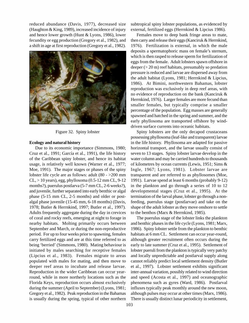
103
reduced abundance (Davis, 1977), decreased size(Haughton & King, 1989), increased incidence of injuryand hence lower growth (Hunt & Lyons, 1986), lowerfecundity or egg production (Gregory et al., 1982), anda shift in age at first reproduction (Gregory et al., 1982).
Figure 32. Spiny lobster
Ecology and natural historyDue to its economic importance (Simmons, 1980;
Cruz et al., 1991; García et al., 1991), the life historyof the Caribbean spiny lobster, and hence its habitatusage, is relatively well known (Warner et al., 1977;Moe, 1991). The major stages or phases of the spinylobster life cycle are as follows: adult (80 - >200 mmCL, > 10 years), egg, phyllosoma (0.5-12 mm CL, 9-12months?), puerulus postlarva (5-7 mm CL, 2-6 weeks?),and juvenile, further separated into early benthic or algalphase (5-15 mm CL, 2-5 months) and older or post-algal phase juvenile (15-45 mm, 6-18 months) (Davis,1978; Butler & Herrnkind, 1997; Butler et al., 1997).Adults frequently aggregate during the day in crevicesof coral and rocky reefs, emerging at night to forage innearby habitats. Molting primarily occurs betweenSeptember and March, or during the non-reproductiveperiod. For up to four weeks prior to spawning, femalescarry fertilized eggs and are at this time referred to asbeing ‘berried’ (Simmons, 1980). Mating behaviour isinitiated by males searching for receptive females(Lipcius et al., 1983). Females migrate to areaspopulated with males for mating, and then move todeeper reef areas to incubate and release larvae.Reproduction in the wider Caribbean can occur year-round, while in more northerly locations such as theFlorida Keys, reproduction occurs almost exclusivelyduring the summer (April to September) (Lyons, 1981;Gregory et al., 1982). Peak reproduction in the Bahamasis usually during the spring, typical of other northern
subtropical spiny lobster populations, as evidenced byexternal, fertilized eggs (Herrnkind & Lipcius 1986).
Females move to deep bank fringe areas to mate,then carry and release their eggs (Kanciruk & Herrnkind,1976). Fertilization is external, in which the maledeposits a spermatophoric mass on female’s sternum,which is then rasped to release sperm for fertilization ofeggs from the female. Adult lobsters spawn offshore indeeper (> 20 m) reef habitats, presumably so predationpressure is reduced and larvae are dispersed away fromthe adult habitat (Lyons, 1981; Herrnkind & Lipcius,1986). At Bimini, northwestern Bahamas, lobsterreproduction was exclusively in deep reef areas, withno evidence of reproduction on the bank (Kanciruk &Herrnkind, 1976). Larger females are more fecund thansmaller females, but typically comprise a smallerpercentage of the population. Egg masses are generallyspawned and hatched in the spring and summer, and theearly phyllosoma are transported offshore by wind-driven surface currents into oceanic habitats.
Spiny lobsters are the only decapod crustaceanspossessing phyllosoma (leaf-like and transparent) larvaein the life history. Phyllosoma are adapted for passivehorizontal transport, and the larvae usually consist ofseven to 13 stages. Spiny lobster larvae develop in thewater column and may be carried hundreds to thousandsof kilometres by ocean currents (Lewis, 1951; Sims &Ingle, 1967; Lyons, 1981). Lobster larvae aretransparent and are referred to as phyllosomes (Moe,1991). Larvae spend at least 6 months (probably 9-12)in the plankton and go through a series of 10 to 12developmental stages (Cruz et al., 1995). At thetermination of the larval phase, lobster go through a non-feeding, puerulus stage (postlarvae) and take on theshape of the adult lobster as they move onshore to settleto the benthos (Marx & Herrnkind, 1985).
The puerulus stage of the lobster links the planktonand benthic phases in the life cycle (Lyons, 1981; Marx,1986). Spiny lobster settle from the plankton to benthichabitats at 6 mm CL. Settlement can occur year-round,although greater recruitment often occurs during theearly to late summer (Cruz et al., 1995). Settlement oflobster pueruli from the plankton is typically very patchyand locally unpredictable and postlarval supply alongcannot reliably predict local settlement density (Butleret al., 1997). Lobster settlement exhibits significantinter-annual variation, possibly related to wind directionand speed (Acosta et al., 1997) and oceanographicphenomena such as gyres (Ward, 1986). Postlarvalinfluxes typically peak monthly around the new moon,although pulses may occur at other times (Marx, 1986).There is usually distinct lunar periodicity in settlement,
104
which generally occurs during the new moon and firstquarter (Heatwole et al., 1987; Acosta et al., 1997). Inthe Florida Keys, the annual peak in postlarvalabundance usually occurs during March (Acosta et al.,1997). Lobster pueruli settle in architecturally complexhabitats such as algal-covered hard-bottom (Marx &Herrnkind, 1985) and can occur both inshore andoffshore (Heatwole et al., 1987). Upon arrival into nearshore habitats, lobster metamorphose in benthic habitatscovered with macro algae and go through a series ofmolts in nursery areas for up to 1.5 to 2 years (Lipcius& Herrnkind, 1982; Lyons, 1986). In nursery habitats,small lobsters (6-17 mm CL) inhabit clumps of algae,particularly the red algae Laurencia intricata and L.poitei, and feed upon several invertebrate groups(gastropods, isopods, amphipods, polychaetes) (Marx &Herrnkind, 1985; Herrera et al., 1991). Juveniles alsouse sponges or urchins for shelter (Khandker, 1964;Davis, 1971). Shelter is generally a limiting resourcefor juveniles in sea grass beds (Lipcius & Cobb, 1993).In south Florida, the most productive sites in the nurseryarea of Florida Bay have abundant red macro algae as asettlement substrate and numerous sponges as a benthicjuvenile shelter (Herrnkind & Butler, 1994). There isvery high post-settlement mortality (upwards of 97%)the year following settlement from the plankton(Herrnkind & Butler, 1994), mainly due to predationon small juveniles (Butler & Herrnkind, 1997).Predators of juvenile lobster include octopus, crabs,snappers, and grunts (Moe, 1991; Eggleston et al.,1997). Lobster pueruli remain for a few months invegetation, where they are sheltered from predators andhave abundant prey (Butler et al., 1997). The preferencefor settlement habitats is mediated by their structuralcomplexity and not by food availability, althoughenvironmental conditions such as temperature extremesand salinity fluctuations can affect postlarval survival(Field & Butler, 1994).
Two ecologically distinct phases are recognized forjuvenile spiny lobsters: an early benthic phase (recentlysettled) and a later benthic phase. Early benthic phasejuveniles (< 15 mm CL) are found in habitats similar tothe recently settled puerulus. At the later benthic phase(15-20 mm CL), juvenile lobsters move out of algalclumps to small crevices in algal-covered rock rubble,then eventually become gregarious with larger juvenilesin dens formed by rocky outcrops, coral heads, sponges,limestone solution holes, and undercut banks of sea grassbeds. Juveniles prefer dens with shaded cover andmultiple den openings, as well as proximity to food andan appropriate scaling between shelter size and bodysize. Shelter is a limiting resource in sea grass beds for
juveniles, not food availability, as evidenced byexperiments using artificial shelters at Lee StockingIsland (Eggleston & Lipcius, 1990; Eggleston et al.,1990). When lobsters are abundant, smaller spinylobsters prefer to reside in large shelters with largeconspecifics, rather than solitarily in small sheltersscaled to their body size (Eggleston & Lipcius, 1992).If lobster abundance is low, small lobsters prefer to residein small shelters that are scaled to body size. Asjuveniles become larger, they depart to reef areas forbreeding.
During the juvenile and adult stages, spiny lobstersmay make random movements among habitats, as wellas long-distance migrations (Davis & Dodrill, 1980;Lyons et al., 1981; Gregory & Labisky, 1986). In theBahamian Archipelago, especially in the westernBahamas, juvenile and adult spiny lobsters may makesingle file migrations from shallower bank to deeperfringe habitats. The migrations are annual events thatoccur in the fall after strong north-eastern storms andare known to occur near Bimini, Abaco, Grand BahamaIsland, Andros Island, and Eleuthera (Herrnkind &Cummings, 1964; Kanciruk & Herrnkind, 1978).Migrations consist of single-file chains or queues ofdozens to thousands of lobsters moving from shallow,sand bottom to deeper water, often to > 30 m depth.Both female and male lobsters partake in the migrations,but females are not egg bearing (Herrnkind &Cummings, 1964; Herrnkind, 1969). The direction ofmigration appears to be characteristic for a givenpopulation. For example, migrations observed in Biminimove southwest from bank to deeper fringe habitats inthe western Bahamas (Herrnkind, 1969), and theindividual lobsters originate from shallow areas east ofBimini (Kanciruk & Herrnkind, 1978). The possiblereasons for this behaviour include attainment of betterfeeding grounds, attainment of maximum shelter formolting, local dispersal, and/or reduction of populationpressure (Herrnkind, 1969). Autumnal storms arecorrelated with the mass migrations, and the triggeringmechanism may be a storm-induced decline in watertemperature (Kanciruk & Herrnkind, 1978).
HabitatThe spiny lobster is complex and requires three
distinct habitats: coral reef and offshore hard-bottom,open ocean, and shallow vegetated coastal areas (Butler& Herrnkind, 1997). A very difficult managementobjective for the spiny lobster is to ensure that juvenilenursery areas and adult or reproductive habitats are notadversely impacted by human activities (Davis, 1981a).Juvenile and adult spiny lobsters used a diversity of
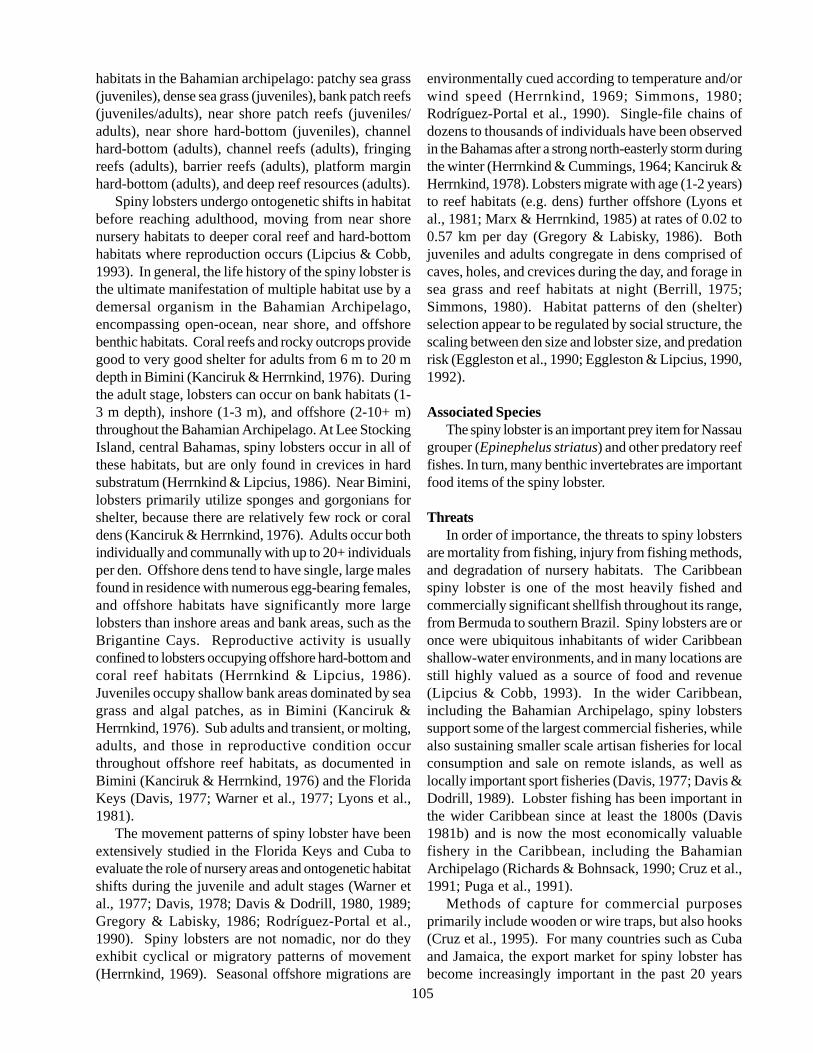
105
habitats in the Bahamian archipelago: patchy sea grass(juveniles), dense sea grass (juveniles), bank patch reefs(juveniles/adults), near shore patch reefs (juveniles/adults), near shore hard-bottom (juveniles), channelhard-bottom (adults), channel reefs (adults), fringingreefs (adults), barrier reefs (adults), platform marginhard-bottom (adults), and deep reef resources (adults).
Spiny lobsters undergo ontogenetic shifts in habitatbefore reaching adulthood, moving from near shorenursery habitats to deeper coral reef and hard-bottomhabitats where reproduction occurs (Lipcius & Cobb,1993). In general, the life history of the spiny lobster isthe ultimate manifestation of multiple habitat use by ademersal organism in the Bahamian Archipelago,encompassing open-ocean, near shore, and offshorebenthic habitats. Coral reefs and rocky outcrops providegood to very good shelter for adults from 6 m to 20 mdepth in Bimini (Kanciruk & Herrnkind, 1976). Duringthe adult stage, lobsters can occur on bank habitats (1-3 m depth), inshore (1-3 m), and offshore (2-10+ m)throughout the Bahamian Archipelago. At Lee StockingIsland, central Bahamas, spiny lobsters occur in all ofthese habitats, but are only found in crevices in hardsubstratum (Herrnkind & Lipcius, 1986). Near Bimini,lobsters primarily utilize sponges and gorgonians forshelter, because there are relatively few rock or coraldens (Kanciruk & Herrnkind, 1976). Adults occur bothindividually and communally with up to 20+ individualsper den. Offshore dens tend to have single, large malesfound in residence with numerous egg-bearing females,and offshore habitats have significantly more largelobsters than inshore areas and bank areas, such as theBrigantine Cays. Reproductive activity is usuallyconfined to lobsters occupying offshore hard-bottom andcoral reef habitats (Herrnkind & Lipcius, 1986).Juveniles occupy shallow bank areas dominated by seagrass and algal patches, as in Bimini (Kanciruk &Herrnkind, 1976). Sub adults and transient, or molting,adults, and those in reproductive condition occurthroughout offshore reef habitats, as documented inBimini (Kanciruk & Herrnkind, 1976) and the FloridaKeys (Davis, 1977; Warner et al., 1977; Lyons et al.,1981).
The movement patterns of spiny lobster have beenextensively studied in the Florida Keys and Cuba toevaluate the role of nursery areas and ontogenetic habitatshifts during the juvenile and adult stages (Warner etal., 1977; Davis, 1978; Davis & Dodrill, 1980, 1989;Gregory & Labisky, 1986; Rodríguez-Portal et al.,1990). Spiny lobsters are not nomadic, nor do theyexhibit cyclical or migratory patterns of movement(Herrnkind, 1969). Seasonal offshore migrations are
environmentally cued according to temperature and/orwind speed (Herrnkind, 1969; Simmons, 1980;Rodríguez-Portal et al., 1990). Single-file chains ofdozens to thousands of individuals have been observedin the Bahamas after a strong north-easterly storm duringthe winter (Herrnkind & Cummings, 1964; Kanciruk &Herrnkind, 1978). Lobsters migrate with age (1-2 years)to reef habitats (e.g. dens) further offshore (Lyons etal., 1981; Marx & Herrnkind, 1985) at rates of 0.02 to0.57 km per day (Gregory & Labisky, 1986). Bothjuveniles and adults congregate in dens comprised ofcaves, holes, and crevices during the day, and forage insea grass and reef habitats at night (Berrill, 1975;Simmons, 1980). Habitat patterns of den (shelter)selection appear to be regulated by social structure, thescaling between den size and lobster size, and predationrisk (Eggleston et al., 1990; Eggleston & Lipcius, 1990,1992).
Associated SpeciesThe spiny lobster is an important prey item for Nassau
grouper (Epinephelus striatus) and other predatory reeffishes. In turn, many benthic invertebrates are importantfood items of the spiny lobster.
ThreatsIn order of importance, the threats to spiny lobsters
are mortality from fishing, injury from fishing methods,and degradation of nursery habitats. The Caribbeanspiny lobster is one of the most heavily fished andcommercially significant shellfish throughout its range,from Bermuda to southern Brazil. Spiny lobsters are oronce were ubiquitous inhabitants of wider Caribbeanshallow-water environments, and in many locations arestill highly valued as a source of food and revenue(Lipcius & Cobb, 1993). In the wider Caribbean,including the Bahamian Archipelago, spiny lobsterssupport some of the largest commercial fisheries, whilealso sustaining smaller scale artisan fisheries for localconsumption and sale on remote islands, as well aslocally important sport fisheries (Davis, 1977; Davis &Dodrill, 1989). Lobster fishing has been important inthe wider Caribbean since at least the 1800s (Davis1981b) and is now the most economically valuablefishery in the Caribbean, including the BahamianArchipelago (Richards & Bohnsack, 1990; Cruz et al.,1991; Puga et al., 1991).
Methods of capture for commercial purposesprimarily include wooden or wire traps, but also hooks(Cruz et al., 1995). For many countries such as Cubaand Jamaica, the export market for spiny lobster hasbecome increasingly important in the past 20 years
106
(Haughton & Shaul, 1986; Cruz et al., 1991). In manyareas, the spiny lobster fishery is fully exploited or over-fished, with evidence of changes in fishing effort, catchper unit effort, and economic return (Haughton & King,1989; Puga et al., 1991). This pattern is particularlyevident in the Florida Keys, where the fishery has beenfully exploited and overcapitalised for at least twodecades (Beardsley et al., 1975; Austin, 1981), resultingin the annual removal of 95% to 99% of all legal-size(76 mm CL) individuals (Davis, 1981b). The minimumsize at maturity for spiny lobster is generally consideredto be 80 to 95 mm CL (Cruz et al., 1991), but intensefishing can reduce the minimum size at maturity(Gregory et al., 1982). An important aspect of spinylobster reproductive biology is the relationship betweensize and fecundity (egg production), illustrating thepotential problems of fishing the largest, and hence mostfecund, individuals in a population (Cruz et al., 1991).In the Bahamas, spiny lobster fishing is prohibited fromApril 1 to July 31, the period of maximum reproduction.The minimum size is 3 ¼ in carapace length (8.3 cm)and 5 ½ in tail length (14 cm), and it is illegal to takefemales with eggs.
The spiny lobster fishery is heavily managed in manywider Caribbean areas, with regulations pertaining togear restrictions, seasonal closures, area closures (nurseryareas), and minimum size (Davis, 1980; Zuboy et al.,1980; Cruz et al., 1991, 1995). Some of the majorobstacles to lobster management include too muchfishing effort and hence low economic return, illegalharvest, mortality and increased injury, ineffectiveregulations such as inappropriate minimum size, andinadequate fishery statistics (Beardsley et al., 1975;Davis, 1980; Davis and Dodrill, 1980; Cruz et al.,1995). Because the absolute duration of the larval phaseis not known, it is difficult to identify management orstock units (Menzies & Kerrigan, 1978, 1980; Farmeret al., 1986). Stock-recruitment relationships are poorlyunderstood and cannot be managed, optimal larvalproduction is not guaranteed, and uncertaintiesregarding stock origin are major management obstacles(Davis, 1980; Menzies & Kerrigan, 1980; Lyons, 1986).Intense spiny lobster fishing is known to have severaldirect and indirect effects on populations, includingreduced abundance (Davis, 1977), decreased size(Haughton & King, 1989), increased incidence of injuryand hence lower growth (Hunt & Lyons, 1986), lowerfecundity or egg production (Gregory et al., 1982), anda shift in age at first reproduction (Gregory et al., 1982).Spiny lobsters use several benthic habitat types frompost-settlement through adult stages (i.e. ontogenetichabitat shifts). Therefore, degradation of near shore
habitats from human activities can prove detrimental tofisheries production (Davis, 1980). Juvenile lobstersprefer clear water in algae and sponge-dominatedhabitats close to shore. Dredge-and-fill activitiesassociated with coastline development, for example,often result in increased sedimentation in near shorehabitats. Heavily silted habitats affect the settlementand survival of lobster postlarvae, presumably byaffecting prey abundance (Herrnkind et al., 1988).Water quality degradation from land-based pollutionsources may also potentially affect recruitment of lobsterinto near shore habitats, since excess nutrients may causechanges in algal composition upon which postlarval andjuvenile life are dependent.
Information gaps and research needs• Accurate catch and effort and length-frequency
data, as well as dockside value by trip and areaof capture (Davis 1975);
• Development of efficient recruitment indicesfor predicting future catch levels (Lipcius andCobb 1993);
• Restrictions upon catch and effort through sizelimits, catch quotas or seasons, no-fishing zones;and
• Stock recruitment relationships, specifically theorigin of larval recruitment.
Conservation goalsLarval stage• Exuma Sound provides long-term retention of
larvae, resulting in a closed population bothecologically and genetically (Lipcius & Cobb,1993). This has implications for theconservation of spawning stock biomass in thecentral Bahamas; and
• Postlarvae need architecturally complexhabitats such as red algae of the GenusLaurencia (Marx & Herrnkind, 1985).
Juvenile stage• Small juveniles require large clumps of red
algae in bank habitats (Herrnkind & Lipcius,1986; Lipcius & Cobb, 1993). This habitatprovides food and refuge until 17 mm, whenindividuals move to dens in hard substrate areas(Marx & Herrnkind, 1985; Herrnkind et al.,1988);
• Juveniles require shallow bank areas dominatedby sea grass and algal patches (Herrnkind &Lipcius, 1986); and
• Lee Stocking Island probably represents a poorrecruitment area. No extensive nursery areas
107
exist in the Exumas.Adult stage• The Little and Great Bahama Banks support
an immense lobster population (Kanciruk &Herrnkind, 1976);
• Sub adult transient or molting lobstersseasonally occupy fringe of offshore islands,while large adults occur throughout offshorereefs (Herrnkind & Lipcius, 1986);
• Larger lobsters occur offshore andreproductively active females may only occuroffshore (Herrnkind & Lipcius, 1986),occupying crevices in hard substrate (singly andcommunally up to 20+ per den);
• Reproductive stocks are limited to deep-waterareas; and
• Female fecundity is a power function of size;that is, larger females, which comprise a smallerpercentage of the population, are more fecundas a group than smaller, sexually mature females(Kanciruk & Herrnkind, 1976).
Population targets are available in terms of male tofemale sex ratios and length-frequency characteristics.For bank habitats in the Bahamas, historical surveysrevealed a population comprised of 46% females, witha mean carapace length of 81.5 mm for females and86.8 mm for males (Kanciruk & Herrnkind, 1976). Onfringing reefs at 8 to 15 m depth, historical populationswere 54% female, with a mean carapace length of 80mm for females and 88 mm for males. On deep reefs ofthe Bahamas, 55% to 63% of the population should befemale, of which 91-95% of the females should besexually mature. Mean carapace length targets are 82.8-86.7 mm for females and 91.1-97.8 mm for males indeep reef areas. A protected population in the DryTortugas, Florida yielded a mean carapace length of101 mm, with a modal size class of 95-100 mm CL(Warner et al., 1977). In the Lee Stocking Island area,including the Brigantine Cays, Herrnkind and Lipcius(1986) recorded a mean size of juveniles in bank habitatsof 75.7 mm. Inshore areas and channels yielded a meansize of 80.8 mm. Offshore areas, including fringingreefs and hard-bottom habitats, yielded mean sizes of114.4-120.3 mm for males and 98.5-106.2 mm forfemales.
Contact persons
Mark ButlerDepartment of Biological SciencesOld Dominion UniversityNorfolk, VA 23529, USA
References
Acosta CA, Matthews TR, Butler MJ (1997)Temporal patterns and transport processes inrecruitment of spiny lobster (Panulirus argus)postlarvae to south Florida. Marine Biology 129:79-85.
Austin CB (1981) Difficulties of limiting entry intothe overcapitalised Florida spiny lobster fishery.Proceedings of the Gulf and Caribbean FisheriesInstitute 33: 184-200.
Beardsley GL, Costello TJ, Davis GE, Jones AC,Simmons DC (1975) The Florida spiny lobsterfishery: A white paper. Florida Scientist 38: 144-149.
Berrill M (1975) Gregarious behavior of juveniles ofthe spiny lobster, Panulirus argus (Crustacea:Decapoda). Bulletin of Marine Science 25: 515-522.
Butler MJ, Herrnkind WF (1997) A test ofrecruitment limitation and the potential forartificial enhancement of spiny lobster (Panulirusargus) populations in Florida. Canadian Journal ofFisheries and Aquatic Science 54: 452-463.
Butler MJ, Herrnkind WF, Hunt JH (1997) Factorsaffecting the recruitment of juvenile Caribbeanspiny lobsters dwelling in macroalgae. Bulletin ofMarine Science 61: 3-19.
Cruz R, de León ME, Puga R (1995) Prediction ofcommercial catches of the spiny lobster Panulirusargus in the Gulf of Batananó, Cuba. Crustaceana68: 238-244.
Cruz R, de Sotomayor ME, Puga R (1991) Impactoen el manejo de la pesqueria de langosta(Panulirus argus) en el archipiélago Cubano.Revista Investigaciones Marinas 12: 246-253.
Davis GE (1971) Aggregations of spiny sea urchins,Diadema antillarum, as shelter for young spinylobsters, Panulirus argus. Transactions of theAmerican Fisheries Society 100: 586-587.
Davis GE (1977) Effects of recreational harvest on aspiny lobster, Panulirus argus, population. Bulletinof Marine Science 27: 223-236.
Davis GE (1978) Management recommendations for
108
juvenile spiny lobsters, Panulirus argus inBiscayne National Monument, Florida. Report M-530, National Park Service, Everglades NationalPark, South Florida Research Center, Homestead,FL, 32 p.
Davis GE (1980) Juvenile spiny lobster managementor how to make the most of what you get. MarineFisheries 5: 57-59.
Davis GE (1981a) On the role of underwater parksand sanctuaries in the management of coastalresources in the south-eastern United States.Environmental Conservation 8: 67-70.
Davis GE, Dodrill JW (1980) Marine parks andsanctuaries for spiny lobster fisheries management.Proceedings of the Gulf and Caribbean FisheriesInstitute 32: 194-207.
Davis GE, Dodrill JW (1989) Recreational fisheryand population dynamics of spiny lobster,Panulirus argus, in Florida Bay, EvergladesNational Park, 1977-1980. Bulletin of MarineScience 44: 78-88.
Davis JC (1981b) Proposed fishery management ofspiny lobster (Panulirus argus) for the south-eastern United States. Proceedings of the Gulf andCaribbean Fisheries Institute 33: 201-206.
Eggleston DB, Lipcius RN (1990) The dynamics ofden selection in the Caribbean spiny lobster undervariable predation risk, sociality, and shelter size.Proceedings of the Gulf and Caribbean FisheriesInstitute 43: 648-668.
Eggleston DB, Lipcius RN (1992) Shelter selectionby spiny lobster under variable predation risk,social conditions, and shelter size. Ecology 73:992-1011.
Eggleston DB, Lipcius RN, Grover JJ (1997)Predation and shelter-size effects on coral reef fishand spiny lobster prey. Marine Ecology ProgressSeries 149: 43-59.
Eggleston DB, Lipcius RN, Miller DL, Coba-CetinaL (1990) Shelter scaling regulates survival ofjuvenile Caribbean spiny lobster Panulirus argus.Marine Ecology Progress Series 62: 79-88.
Farmer MW, Ward JA, Luckhurst BE (1986)Development of spiny lobster (Panulirus argus)phyllosoma larvae in the plankton near Bermuda.Proceedings of the Gulf and Caribbean FisheriesInstitute 39: 289-301.
Field JM, Butler MJ (1994) The influence oftemperature, salinity, and postlarval transport onthe distribution of juvenile spiny lobsters,Panulirus argus (Latreille, 1804), in Florida Bay.Crustaceana 67: 26-45.
García C, Hernández B, Baisre J, Cruz R (1991)Factores climáticos en las pesquerías Cubanas delangosta (Panulirus argus): Su relación con lasmigraciones masivas. Revista InvestigacionesMarinas 12: 131-139.
Gregory DR, Labisky RF (1986) Movements of thespiny lobster Panulirus argus in south Florida.Canadian Journal of Fisheries and AquaticSciences 43: 2228-2234.
Gregory DR, Labisky RF, Combs CL (1982)Reproductive dynamics of the spiny lobsterPanulirus argus in south Florida. Transactions ofthe American Fisheries Society 111: 575-584.
Haughton M, King DPF (1989) Stock assessment ofthe spiny lobster (Panulirus argus) in Jamaican.Proceedings of the Gulf and Caribbean FisheriesInstitute 42: 119-126.
Haughton M, Shaul W (1986) Estimation of growthparameters for the spiny lobster (Panulirus argus)in Jamaican waters. Proceedings of the Gulf andCaribbean Fisheries Institute 39: 279-288.
Heatwole DW, Hunt JH, Blonder BI (1987) Offshorerecruitment of postlarval spiny lobster (Panulirusargus) at Looe Key Reef, Florida. Proceedings ofthe Gulf and Caribbean Fisheries Institute 40:429-433.
Herrera A, Ibarzábal D, Foyo J, Espinosa J, Brito R,González G, Díaz G y Arrinda C (1991)Alimentación natural de la langosta Panulirusargus en la region de los Indios (Plataforma SW deCuba) y su relación con el bentos. RevistaInvestigaciones Marinas 12: 172-182.
Herrnkind WF (1969) Queuing behavior of spinylobsters. Science 164: 1425-1427.
Herrnkind WF, Butler MJ (1994) Settlement of spinylobster, Panulirus argus (Latreille, 1804), inFlorida: Pattern without predictability?Crustaceana 67: 46-64.
Herrnkind WF, Butler MJ, Tankersley RA (1988) Theeffects of siltation on recruitment of spiny lobsters,Panulirus argus. Fishery Bulletin 86: 331-338.
Herrnkind WF, Cummings WC (1964) Single filemigrations of the spiny lobster, Panulirus argus(Latreille). Bulletin of Marine Science of the Gulfand Caribbean 14: 123-125.
Herrnkind WF, Lipcius RN (1986) Habitat use andpopulation biology of Bahamian spiny lobster.Proceedings of the Gulf and Caribbean FisheriesInstitute 39: 265-278.
Hunt JH, Lyons WG (1986) Factors affecting growthand maturation of spiny lobsters, Panulirus argus,in the Florida Keys. Canadian Journal of Fisheries
109
and Aquatic Sciences 43: 2243-2247.Kanciruk P, Herrnkind W (1976) Autumnal
reproduction in Panulirus argus at Bimini,Bahamas. Bulletin of Marine Science 26: 417-432.
Kanciruk P, Herrnkind W (1978) Mass migration ofspiny lobster, Panulirus argus (Crustacea:Palinuridae): Behavior and environmentalcorrelates. Bulletin of Marine Science 28: 601-623.
Khandker NA (1964) Sponge as shelter for youngspiny lobsters. Transactions of the AmericanFisheries Society 93: 204.
Lewis JB (1951) The phyllosoma larvae of the spinylobster Panulirus argus. Bulletin of MarineScience of the Gulf and Caribbean 1: 89-103.
Lipcius RN, Cobb JS (1993) Fishery ecology of thepalinurid lobsters with relevance to the Caribbeanspiny lobster. Bahamas Journal of Science 1: 16-27.
Lipcius RN, Edwards ML, Herrnkind WF, WatermanSA (1983) In situ mating behavior of the spinylobster Panulirus argus. Journal of CrustaceanBiology 3: 217-222.
Lipcius RN, Herrnkind WF (1982) Molt cyclealterationsin behavior, feeding and diel rhythms ofa decapod crustacean, the spiny lobster Panulirusargus. Marine Biology 68: 241-252.
Lipcius RN, Stockhausen WT, Eggleston DB, MarshallLS, Hickey B (1997) Hydrodynamic decoupling ofrecruitment, habitat quality and adult abundance inthe Caribbean spiny lobster: source-sink dynamics?Australian Journal of Marine and FreshwaterResearch 48: 807-815.
Lyons WG (1981) Possible sources of Florida’s spinylobster population. Proceedings of the Gulf andCaribbean Fisheries Institute 33: 253-266.
Lyons WG (1986) Problems and perspectivesregarding recruitment of spiny lobster, Panulirusargus, to the south Florida fishery. CanadianJournal of Fisheries and Aquatic Sciences 43:2099-2106.
Lyons WG, Barber DG, Foster SM, Kennedy FS,Milano GR (1981) The spiny lobster, Panulirusargus, in the middle and upper Florida Keys:Population structure, seasonal dynamics, andreproduction. Florida Marine ResearchPublications 38: 1-45.
Marx JM (1986) Settlement of spiny lobster,Panulirus argus, pueruli in south Florida: Anevaluation from two perspectives. CanadianJournal of Fisheries and Aquatic Sciences 43:2221-2227.
Marx JM, Herrnkind WF (1985) Macroalgae(Rhodophyta: Laurencia spp.) as habitat for youngjuvenile spiny lobsters, Panulirus argus. Bulletin ofMarine Science 36: 423-431.
Menzies RA, Kerrigan JM (1978) Implications ofspiny lobster recruitment patterns of the Caribbean– A biochemical genetic approach. Proceedings ofthe Gulf and Caribbean Fisheries Institute 31:164-178.
Menzies RA, Kerrigan JM (1980) The larvalrecruitment problem of the spiny lobster. MarineFisheries 5: 42-46.
Moe MA (1991) Lobsters: Florida, Bahamas, theCaribbean. Green Turtle Publications, Plantation,FL, 510 p.
Moore DR (1962) Notes on the distribution of thespiny lobster Panulirus in Florida and the Gulf ofMéxico. Crustaceana 3: 318-319.
Puga R, de León ME, Cruz R (1991) Evaluación dela pesquería de langosta espinosa Panulirus argusen Cuba. Revista Investigaciones Marinas 12:286-292.
Richards WJ, Bohnsack JA (1990) The CaribbeanSea: A large marine ecosystem in crisis. In: Largemarine ecosystems: Patterns, processes and yields.Sherman K, Alexander LM, Gold BD (Eds.),AAAS, Washington, DC, p 44-53.
Simmons DC (1980) Review of the Florida spinylobster fishery. Marine Fisheries 5: 37-42.
Sims HW, Ingle RM (1967) Caribbean recruitment ofFlorida’s spiny lobster population. QuarterlyJournal of the Florida Academy of Sciences 29:207-242.
Ward J (1986) Patterns of settlement of spiny lobster(Panulirus argus) post larvae at Bermuda.Proceedings of the Gulf and Caribbean FisheriesInstitute 39: 255-264.
Warner RE, Combs CL, Gregory DR (1977)Biological studies of the spiny lobster, Panulirusargus (Decapoda; Palinuridae), in south Florida.Proceedings of the Gulf and Caribbean FisheriesInstitute 29: 166-183.
Zuboy JR, Jones AC, Costello TJ (1980) Lobstermanagement under the Fishery Conservation andManagement Act. Marine Fisheries 5: 50-52.
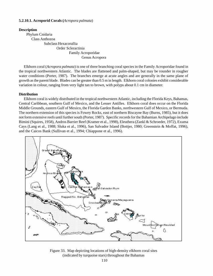
110
5.2.10.1. Acroporid Corals (Acropora palmata)
DescriptionPhylum Cnidaria
Class AnthozoaSubclass Hexacorallia
Order ScleractiniaFamily Acroporidae
Genus Acropora
Elkhorn coral (Acropora palmata) is one of three branching coral species in the Family Acroporidae found inthe tropical northwestern Atlantic. The blades are flattened and palm-shaped, but may be rounder in rougherwater conditions (Porter, 1987). The branches emerge at acute angles and are generally in the same plane ofgrowth as the parent blade. Blades can be greater than 0.5 m in length. Elkhorn coral colonies exhibit considerablevariation in colour, ranging from very light tan to brown, with polyps about 0.1 cm in diameter.
DistributionElkhorn coral is widely distributed in the tropical northwestern Atlantic, including the Florida Keys, Bahamas,
Central Caribbean, southern Gulf of Mexico, and the Lesser Antilles. Elkhorn coral does occur on the FloridaMiddle Grounds, eastern Gulf of Mexico, the Florida Garden Banks, northwestern Gulf of Mexico, or Bermuda.The northern extension of this species is Fowey Rocks, east of northern Biscayne Bay (Burns, 1985), but it doesnot form extensive reefs until further south (Porter, 1987). Specific records for the Bahamian Archipelago includeBimini (Squires, 1958), Andros Barrier Reef (Kramer et al., 1998), Eleuthera (Zankl & Schroeder, 1972), ExumaCays (Lang et al., 1988; Sluka et al., 1996), San Salvador Island (Bottjer, 1980; Greenstein & Moffat, 1996),and the Caicos Bank (Sullivan et al., 1994; Chiappone et al., 1996).
Figure 33. Map depicting locations of high-density elkhorn coral sites(indicated by turquoise stars) throughout the Bahamas
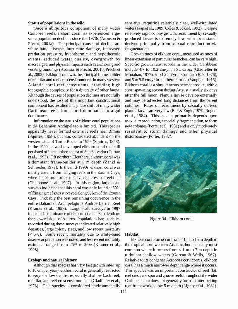
111
Status of populations in the wildOnce a ubiquitous component of many wider
Caribbean reefs, elkhorn coral has experienced large-scale population declines since the 1970s (Aronson &Precht, 2001a). The principal causes of decline arewhite-band disease, hurricane damage, increasedpredation pressure, hypothermic and hypothermicevents, reduced water quality, overgrowth bymacroalgae, and physical impacts such as anchoring andvessel groundings (Aronson & Precht, 2001b; Precht etal., 2002). Elkhorn coral was the principal frame builderof reef flat and reef crest environments in many westernAtlantic coral reef ecosystems, providing hightopographic complexity for a diversity of other fauna.Although the causes of population declines are not fullyunderstood, the loss of this important constructionalcomponent has resulted in a phase shift of many widerCaribbean reefs from coral dominance to algaldominance.
Information on the status of elkhorn coral populationsin the Bahamian Archipelago is limited. This speciesapparently never formed extensive reefs near Bimini(Squires, 1958), but was considered abundant on thewestern side of Turtle Rocks in 1956 (Squires, 1958).In the 1990s, a well-developed elkhorn coral reef stillpersisted off the northern coast of San Salvador (Curranet al., 1993). Off northern Eleuthera, elkhorn coral wasa dominant frame-builder at 3 m depth (Zankl &Schroeder, 1972). In the mid-1990s, elkhorn coral wasmostly absent from fringing reefs in the Exuma Cays,where it does not form extensive reef crests or reef flats(Chiappone et al., 1997). In this region, large-scalesurveys indicated that this coral was only found at 30%of fringing reef sites surveyed along 90 km of the ExumaCays. Probably the best remaining occurrence in theentire Bahamian Archipelago is Andros Barrier Reef(Kramer et al., 1998). Large-scale surveys in 1997indicated a dominance of elkhorn coral at 3 m depth onthe seaward slope of Andros. Population characteristicsrecorded during these surveys indicated relatively highdensities, large colony sizes, and low recent mortality(< 5%). Some recent mortality due to white-banddisease or predation was noted, and less recent mortalityestimates ranged from 25% to 56% (Kramer et al.,1998).
Ecology and natural historyAlthough this species has very fast growth rates (up
to 10 cm per year), elkhorn coral is generally restrictedto very shallow depths, especially shallow back reef,reef flat, and reef crest environments (Gladfelter et al.,1978). This species is considered environmentally
sensitive, requiring relatively clear, well-circulatedwater (Jaap et al., 1989; Coles & Jokiel, 1992). Despiterelatively rapid colony growth, recruitment by sexuallyproduced larvae is extremely low, with local standsderived principally from asexual reproduction viafragmentation.
Growth rates of elkhorn coral, measured as rates oflinear extension of particular branches, can be very high.Specific growth rate records in the wider Caribbeaninclude 4.7 to 10.2 cm/yr in St. Croix (Gladfelter &Monahan, 1977), 6 to 10 cm/yr in Curacao (Bak, 1976),and 5 to 9.5 cm/yr in southern Florida (Vaughan, 1915).Elkhorn coral is a simultaneous hermaphrodite, with ashort spawning season during August, usually six daysafter the full moon. Planula larvae develop externallyand may be advected long distances from the parentcolonies. Rates of recruitment by sexually derivedplanula larvae are very low (Bak & Engle, 1979; Rogerset al., 1984). This species primarily depends uponasexual reproduction, especially fragmentation, to formnew colonies (Porter et al., 1981) and is only moderatelyresistant to storm damage and other physicaldisturbances (Porter, 1987).
Figure 34. Elkhorn coral
HabitatElkhorn coral can occur from < 1 m to 15 m depth in
the tropical northwestern Atlantic, but is usually mostcommon where it occurs from < 1 m to 7 m depth inturbulent shallow waters (Goreau & Wells, 1967).Relative to its congener Acropora cervicornis, elkhorncoral has a much narrower depth range where it occurs.This species was an important constructor of reef flat,reef crest, and spur and groove reefs throughout the widerCaribbean, but does not generally form an interlockingreef framework below 5 m depth (Lighty et al., 1982).
112
Relative to the expansive, shallow-water marine areaof the Bahamian Archipelago, elkhorn coral ischaracterized by a very restricted habitat distributionin the region, even more so than its congener. In general,elkhorn coral is primarily restricted to the leeward andmarginal sides of islands in the Bahamian Archipelago(Adey, 1978) and is principally distributed on reefs,except for isolated occurrences in channels. It does notform extensive reefs near Bimini (Squires, 1958). Inthe Exuma Cays, the absence of reef crest developmentby elkhorn coral is likely related to wave energyconditions and/or sediment transport from bank tooceanic environments (Sluka et al., 1996). This speciesis primarily restricted to the leeward and marginal sidesof islands in the Bahamas (Adey, 1978), where it formsa reef framework from 1 m to 3 m depth such as GrandBahama Island (Alevizon et al., 1985). Specific habitatoccurrences for elkhorn coral in the BahamianArchipelago are as follows. In Bimini, historicalobservations from shallow-water areas only yielded oneoccurrence from the western side of Turtle Rocks(Squires, 1958). On the Andros Barrier Reef, this coralis abundant at 3 m depth (Kramer et al., 1998). Thisspecies is also the dominant frame-builder at 1 m to 3m depth on the inner shelf platform on the northern sideof Eleuthera (Zankl & Schroeder, 1972). In the ExumaCays, central Bahamas, elkhorn coral is relatively rareand patchily distributed on the windward, platformmargin, and does not form extensive reef flat or reefcrest structures (Chiappone et al., 1997b). In theExumas, this coral may occur in channel reefs andfringing reefs, but is relatively rare (Chiappone et al.,1997a). At San Salvador Island, elkhorn coral wasdocumented near shore on a reef crest north of Graham’sHarbour (Bottjer, 1980), as well as offshore of the south-western end of the island (Greenstein & Moffat, 1996).On the Caicos Bank, this coral may occur incidentallyin channel reefs (Chiappone et al., 1996), but does notform extensive reef flat or reef crest structures on thewindward margin (Sullivan et al., 1994).
Associated SpeciesElkhorn coral was formerly a key structural
component of western Atlantic reefs that contributedsubstantially to coral reef accretion and frameworkdevelopment (Precht et al., 2002). Large, uprightcolonies provide critical habitat for a diversity of reeffishes and benthic invertebrates. Major predators ofelkhorn coral include damselfishes (Pomacentridae), thepolyachaete bristle worm (Hermodice caruncullata),and the coral-shell gastropod (Coralliophilaabbreviata).
ThreatsPollution or water quality changes and physical
impacts from habitat destruction/habitat loss are theprincipal anthropogenic threats to elkhorn coral.Because of its relatively delicate skeleton compared tomassive, boulder-shaped corals, elkhorn coral isespecially susceptible to physical impacts such asanchoring and vessel groundings, but also water qualitydegradation. Large-scale, Caribbean-wide populationdeclines began during the 1970s and continued into the1990s in most reef systems (Precht et al., 2002). Theprincipal cause of decline was white band disease(Aronson & Precht, 2001b), reaching epidemicproportions in St. Croix and south Florida (Gladfelter,1982; Jaap, 1984). Other causes of mortality includealgal tumours from damselfish predation and gastropodpredators. Records of white-band disease prevalencein the Bahamian Archipelago include Andros BarrierReef during the 1980s, New Providence during the1980s, and San Salvador during the 1980s (Ritchie &Smith, 1998; Aronson & Precht, 2001b). Elkhorn coralis also very susceptible to environmental changes suchas hypothermic events, manifested in relatively highrates of tissue bleaching or loss of zooxanthellae (Shinn,1976; Porter et al., 1982; Lang et al., 1988).
Information gaps and research needs• Stock recruitment patterns, specifically the
relationship between local reproduction andrecruitment;
• Recovery patterns on major reef systems; and• Causes of continued mortality in populations,
particularly with respect to white-band disease.
Contact persons
Phil KramerDivision of Marine Geology and GeophysicsRosenstiel School of Marine and Atmospheric ScienceUniversity of Miami4600 Rickenbacker CausewayMiami, FL 33149
References
Adey WH (1978) Coral reef morph genesis: Amultidimensional model. Science 202: 831-837.
Alevizon W, Richardson R, Pitts P, Serviss G (1985)Coral zonation and patterns of community structurein Bahamian reef fishes. Bulletin of Marine Science
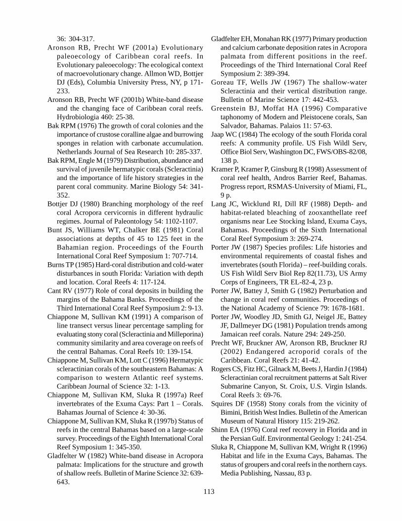
113
36: 304-317.Aronson RB, Precht WF (2001a) Evolutionary
paleoecology of Caribbean coral reefs. InEvolutionary paleoecology: The ecological contextof macroevolutionary change. Allmon WD, BottjerDJ (Eds), Columbia University Press, NY, p 171-233.
Aronson RB, Precht WF (2001b) White-band diseaseand the changing face of Caribbean coral reefs.Hydrobiologia 460: 25-38.
Bak RPM (1976) The growth of coral colonies and theimportance of crustose coralline algae and burrowingsponges in relation with carbonate accumulation.Netherlands Journal of Sea Research 10: 285-337.
Bak RPM, Engle M (1979) Distribution, abundance andsurvival of juvenile hermatypic corals (Scleractinia)and the importance of life history strategies in theparent coral community. Marine Biology 54: 341-352.
Bottjer DJ (1980) Branching morphology of the reefcoral Acropora cervicornis in different hydraulicregimes. Journal of Paleontology 54: 1102-1107.
Bunt JS, Williams WT, Chalker BE (1981) Coralassociations at depths of 45 to 125 feet in theBahamian region. Proceedings of the FourthInternational Coral Reef Symposium 1: 707-714.
Burns TP (1985) Hard-coral distribution and cold-waterdisturbances in south Florida: Variation with depthand location. Coral Reefs 4: 117-124.
Cant RV (1977) Role of coral deposits in building themargins of the Bahama Banks. Proceedings of theThird International Coral Reef Symposium 2: 9-13.
Chiappone M, Sullivan KM (1991) A comparison ofline transect versus linear percentage sampling forevaluating stony coral (Scleractinia and Milleporina)community similarity and area coverage on reefs ofthe central Bahamas. Coral Reefs 10: 139-154.
Chiappone M, Sullivan KM, Lott C (1996) Hermatypicscleractinian corals of the southeastern Bahamas: Acomparison to western Atlantic reef systems.Caribbean Journal of Science 32: 1-13.
Chiappone M, Sullivan KM, Sluka R (1997a) Reefinvertebrates of the Exuma Cays: Part 1 – Corals.Bahamas Journal of Science 4: 30-36.
Chiappone M, Sullivan KM, Sluka R (1997b) Status ofreefs in the central Bahamas based on a large-scalesurvey. Proceedings of the Eighth International CoralReef Symposium 1: 345-350.
Gladfelter W (1982) White-band disease in Acroporapalmata: Implications for the structure and growthof shallow reefs. Bulletin of Marine Science 32: 639-643.
Gladfelter EH, Monahan RK (1977) Primary productionand calcium carbonate deposition rates in Acroporapalmata from different positions in the reef.Proceedings of the Third International Coral ReefSymposium 2: 389-394.
Goreau TF, Wells JW (1967) The shallow-waterScleractinia and their vertical distribution range.Bulletin of Marine Science 17: 442-453.
Greenstein BJ, Moffat HA (1996) Comparativetaphonomy of Modern and Pleistocene corals, SanSalvador, Bahamas. Palaios 11: 57-63.
Jaap WC (1984) The ecology of the south Florida coralreefs: A community profile. US Fish Wildl Serv,Office Biol Serv, Washington DC, FWS/OBS-82/08,138 p.
Kramer P, Kramer P, Ginsburg R (1998) Assessment ofcoral reef health, Andros Barrier Reef, Bahamas.Progress report, RSMAS-University of Miami, FL,9 p.
Lang JC, Wicklund RI, Dill RF (1988) Depth- andhabitat-related bleaching of zooxanthellate reeforganisms near Lee Stocking Island, Exuma Cays,Bahamas. Proceedings of the Sixth InternationalCoral Reef Symposium 3: 269-274.
Porter JW (1987) Species profiles: Life histories andenvironmental requirements of coastal fishes andinvertebrates (south Florida) – reef-building corals.US Fish Wildl Serv Biol Rep 82(11.73), US ArmyCorps of Engineers, TR EL-82-4, 23 p.
Porter JW, Battey J, Smith G (1982) Perturbation andchange in coral reef communities. Proceedings ofthe National Academy of Science 79: 1678-1681.
Porter JW, Woodley JD, Smith GJ, Neigel JE, BatteyJF, Dallmeyer DG (1981) Population trends amongJamaican reef corals. Nature 294: 249-250.
Precht WF, Bruckner AW, Aronson RB, Bruckner RJ(2002) Endangered acroporid corals of theCaribbean. Coral Reefs 21: 41-42.
Rogers CS, Fitz HC, Gilnack M, Beets J, Hardin J (1984)Scleractinian coral recruitment patterns at Salt RiverSubmarine Canyon, St. Croix, U.S. Virgin Islands.Coral Reefs 3: 69-76.
Squires DF (1958) Stony corals from the vicinity ofBimini, British West Indies. Bulletin of the AmericanMuseum of Natural History 115: 219-262.
Shinn EA (1976) Coral reef recovery in Florida and inthe Persian Gulf. Environmental Geology 1: 241-254.
Sluka R, Chiappone M, Sullivan KM, Wright R (1996)Habitat and life in the Exuma Cays, Bahamas. Thestatus of groupers and coral reefs in the northern cays.Media Publishing, Nassau, 83 p.
114
Squires DF (1958) Stony corals from the vicinity of Bimini, British West Indies. Bulletin of the American Museumof Natural History 115: 215-262.
Sullivan KM, Chiappone M (1992) A comparison of belt quadrat and species presence and absence sampling forevaluating stony coral (Scleractinia and Milleporina) and sponge species patterning on patch reefs of the centralBahamas. Bulletin of Marine Science 50: 464-488.
Sullivan KM, Chiappone M, Lott C (1994) Abundance patterns of stony corals on platform margin reefs of theCaicos Bank. Bahamas Journal of Science 1: 2-11.
Vaughan TW (1915) The geological significance of the growth-rate of the Floridian and Bahaman shoal-watercorals. Journal of the Washington Academy of Sciences 5: 591-600.
Zankl H, Schroeder JH (1972) Interaction of genetic processes in Holocene reefs off North Eleuthera Island,Bahamas. Geologische Rundschau 61: 520-541.
5.2.10.2. Acroporid Corals (Acropora cervivornis)
DescriptionPhylum Cnidaria
Class AnthozoaSubclass Hexacorallia
Order ScleractiniaFamily Acroporidae
Staghorn coral is one of three coral species in the Family Acroporidae distributed in the tropical northwesternAtlantic. Staghorn coral is a branching coral, with thin cylindrical branches that commonly show several ordersof branching (Bottjer, 1980).
Figure 35. Map depicting locations of high-density staghorn coral sites(indicated by pink stars) throughout the Bahamas
115
Each blade emerges at right angles, and generally in adifferent plane of growth from most of the other blades.Colonies are usually brownish-yellow and relativelyuniform in colour, with polyps about 0.1 cm in diameter.
DistributionStaghorn coral is widely distributed in the tropical
northwestern Atlantic, including the Bahamianarchipelago, southeastern Florida and the Florida Keys,the southern Gulf of Mexico, the Central Caribbean,and the Lesser Antilles. Isolated colonies occur at 16m to 30 m depth as far north as Palm Beach, Florida,but do not form interlocking frameworks (Goldberg,1973). Staghorn coral is absent from the Florida MiddleGrounds, eastern Gulf of Mexico, the Florida GardenBanks, the northwestern Gulf of Mexico, and Bermuda,principally due to low winter temperatures (Porter,1987). Distribution records for the Bahamianarchipelago include Bimini (Smith, 1971), AndrosBarrier Reef (Kramer et al., 1998), Exuma Cays (Langet al., 1988; Chiappone & Sullivan, 1991; Sullivan &Chiappone, 1992; Chiappone et al., 1997a), SanSalvador Island (Bottjer, 1980; Curran et al., 1993),Hogsty Reef (Milliman, 1967a), and the Caicos Bank,Turks and Caicos Islands (Sullivan et al., 1994;Chiappone et al., 1996).
Status of populations in the wildFormerly a ubiquitous element of wider Caribbean
coral reef ecosystems, staghorn coral has been decimatedthroughout much of its range beginning in the 1970s(reviewed in Aronson & Precht, 2001a). The principalcauses of this demise are white band disease, a pathogenwith a still unknown etiology and cause (Aronson &Precht, 2001b), storm damage, predation, and some localhuman disturbances such as water quality and physicalimpacts from anchoring and vessel groundings. Studiesin the Bahamian archipelago mirror wider Caribbeandeclines since the 1970s. On the leeward coast of SanSalvador (Telephone Pole Reef), staghorn coral wasvirtually absent by 1992, despite dominating the reefin 1983 (Curran et al., 1993). In a large-scale study ofthe Exuma Cays, staghorn coral was only present at sevenof 17 fringing reefs surveyed along 90 km of thearchipelago (Chiappone et al., 1997). On deeper (> 10m) spur and groove reefs, mean percent cover by staghorncoral was < 2% at all sites surveyed. Historical surveyson the eastern platform margin of the Caicos Bank,south-eastern Bahamas, also indicated low coverage bystaghorn coral (Sullivan et al., 1994; Chiappone et al.,1996). Probably the last reef system with any substantialareas of this species is Andros Barrier Reef, where
staghorn coral occurs at 3 m depth on the seaward slope(Kramer et al., 1998).
Ecology and natural historyStaghorn coral is among the most rapidly growing
corals in the world, with a range in annual linearextension of 10 cm to 27 cm (Porter, 1987). Growthrate estimates for specific localities include 5-10 cm/yrin the Dry Tortugas and upper Florida Keys (Vaughan,1915; Shinn, 1966) and 5.9-10 cm in St. Croix, USVirgin Islands (Gladfelter et al., 1978). This speciesprincipally relies upon photosynthesis for nutrition.Despite high growth rates, staghorn coral are poorlyresistant to storm damage and other forms of physicaldisturbance (Porter, 1987). The life history of staghorncoral, like most corals, consists of essentially two stages:a sessile stage of juvenile and parental colonies and adispersive larval stage. Staghorn coral is a simultaneoushermaphrodite, with a short spawning season duringAugust, which usually occurs six days after the fullmoon. Larval development is external and recruitmentby sexually derived planula larvae is typically low (Bak& Engel, 1979; Rogers et al., 1984). Although it is oneof the fastest growing reef corals in the wider Caribbean(5 to 27 cm/yr. linear extension), staghorn coral has lowrates of sexually produced planula, and colonies areeasily damaged (Shinn, 1976; Gladfelter et al., 1978).Once established in a particular area, staghorn coralprincipally depends upon asexual reproduction viafragmentation to propagate new colonies (Porter et al.,1981). Important predators of staghorn coral includethe fire worm (Hermodice caruncullata) and themollusc Coralliophila abbreviata (Dustan, 1977;Tunnicliffe, 1983). Staghorn coral is highly susceptibleto tissue bleaching from hyperthermic events, but is alsosensitive to lower temperatures associated with coldfronts (Shinn, 1976; Porter et al., 1982) andsedimentation (Kendall et al., 1985).
HabitatStaghorn coral is distributed from < 1 m to 30 m
depth, but usually occurs from 3 m to 20 m depth onwider Caribbean fringing and barrier reef systems(Goreau & Wells, 1967). Staghorn coral usually occursat its greatest abundance in zones deeper than itscongener (Acropora palmata), often referred to as themixed zone or terrace zone, but the species may also beabundant in back reef environments and lagoon patchreefs.
Relative to the expansive, shallow-water marine areaof the Bahamian archipelago, staghorn coral ischaracterized by a very restricted habitat distribution
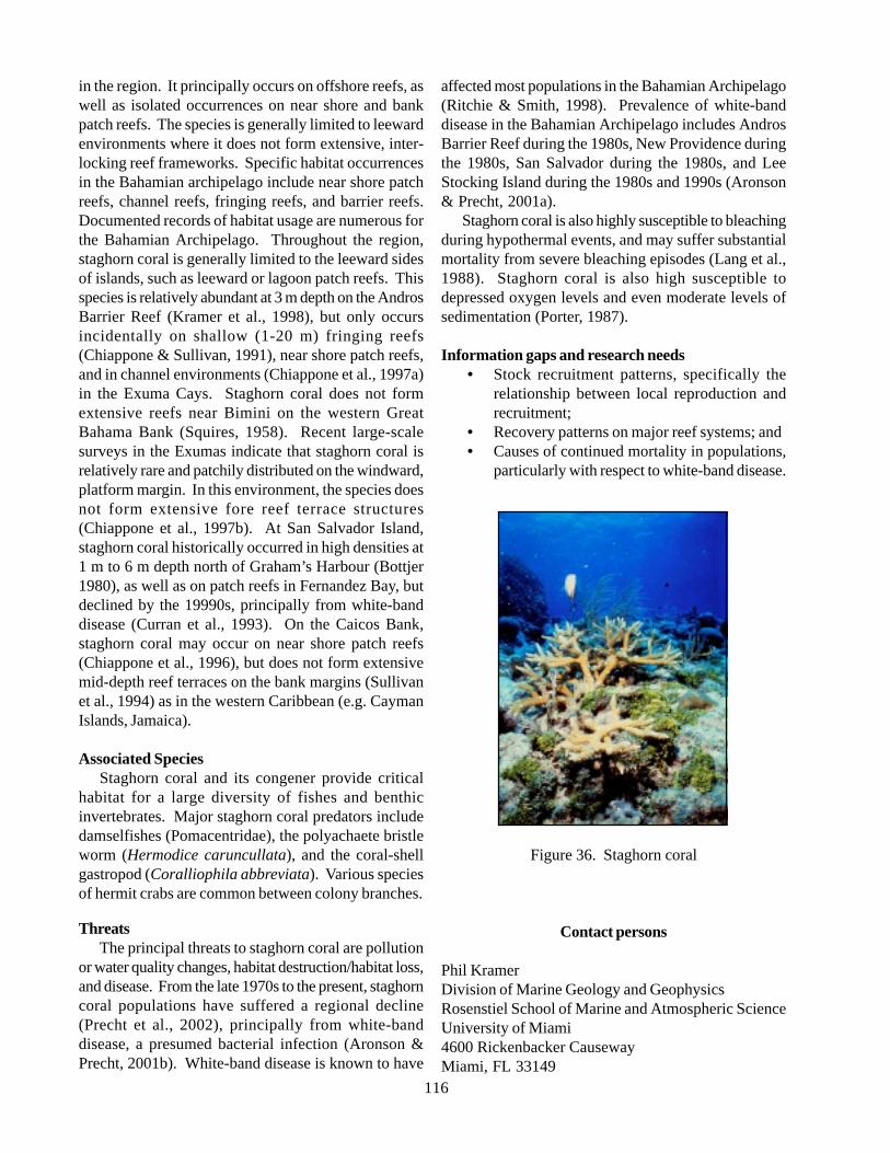
116
in the region. It principally occurs on offshore reefs, aswell as isolated occurrences on near shore and bankpatch reefs. The species is generally limited to leewardenvironments where it does not form extensive, inter-locking reef frameworks. Specific habitat occurrencesin the Bahamian archipelago include near shore patchreefs, channel reefs, fringing reefs, and barrier reefs.Documented records of habitat usage are numerous forthe Bahamian Archipelago. Throughout the region,staghorn coral is generally limited to the leeward sidesof islands, such as leeward or lagoon patch reefs. Thisspecies is relatively abundant at 3 m depth on the AndrosBarrier Reef (Kramer et al., 1998), but only occursincidentally on shallow (1-20 m) fringing reefs(Chiappone & Sullivan, 1991), near shore patch reefs,and in channel environments (Chiappone et al., 1997a)in the Exuma Cays. Staghorn coral does not formextensive reefs near Bimini on the western GreatBahama Bank (Squires, 1958). Recent large-scalesurveys in the Exumas indicate that staghorn coral isrelatively rare and patchily distributed on the windward,platform margin. In this environment, the species doesnot form extensive fore reef terrace structures(Chiappone et al., 1997b). At San Salvador Island,staghorn coral historically occurred in high densities at1 m to 6 m depth north of Graham’s Harbour (Bottjer1980), as well as on patch reefs in Fernandez Bay, butdeclined by the 19990s, principally from white-banddisease (Curran et al., 1993). On the Caicos Bank,staghorn coral may occur on near shore patch reefs(Chiappone et al., 1996), but does not form extensivemid-depth reef terraces on the bank margins (Sullivanet al., 1994) as in the western Caribbean (e.g. CaymanIslands, Jamaica).
Associated SpeciesStaghorn coral and its congener provide critical
habitat for a large diversity of fishes and benthicinvertebrates. Major staghorn coral predators includedamselfishes (Pomacentridae), the polyachaete bristleworm (Hermodice caruncullata), and the coral-shellgastropod (Coralliophila abbreviata). Various speciesof hermit crabs are common between colony branches.
ThreatsThe principal threats to staghorn coral are pollution
or water quality changes, habitat destruction/habitat loss,and disease. From the late 1970s to the present, staghorncoral populations have suffered a regional decline(Precht et al., 2002), principally from white-banddisease, a presumed bacterial infection (Aronson &Precht, 2001b). White-band disease is known to have
affected most populations in the Bahamian Archipelago(Ritchie & Smith, 1998). Prevalence of white-banddisease in the Bahamian Archipelago includes AndrosBarrier Reef during the 1980s, New Providence duringthe 1980s, San Salvador during the 1980s, and LeeStocking Island during the 1980s and 1990s (Aronson& Precht, 2001a).
Staghorn coral is also highly susceptible to bleachingduring hypothermal events, and may suffer substantialmortality from severe bleaching episodes (Lang et al.,1988). Staghorn coral is also high susceptible todepressed oxygen levels and even moderate levels ofsedimentation (Porter, 1987).
Information gaps and research needs• Stock recruitment patterns, specifically the
relationship between local reproduction andrecruitment;
• Recovery patterns on major reef systems; and• Causes of continued mortality in populations,
particularly with respect to white-band disease.
Figure 36. Staghorn coral
Contact persons
Phil KramerDivision of Marine Geology and GeophysicsRosenstiel School of Marine and Atmospheric ScienceUniversity of Miami4600 Rickenbacker CausewayMiami, FL 33149
117
References
Aronson RB, Precht WF (2001a) Evolutionarypaleoecology of Caribbean coral reefs. InEvolutionary paleoecology: The ecological contextof macroevolutionary change. Allmon WD, BottjerDJ (Eds), Columbia University Press, NY, p 171-233.
Aronson RB, Precht WF (2001b) White-band diseaseand the changing face of Caribbean coral reefs.Hydrobiologia 460: 25-38.
Bak RPM, Engle M (1979) Distribution, abundance andsurvival of juvenile hermatypic corals (Scleractinia)and the importance of life history strategies in theparent coral community. Marine Biology 54: 341-352.
Bottjer DJ (1980) Branching morphology of the reefcoral Acropora cervicornis in different hydraulicregimes. Journal of Paleontology 54: 1102-1107.
Bunt JS, Williams WT, Chalker BE (1981) Coralassociations at depths of 45 to 125 feet in theBahamian region. Proceedings of the FourthInternational Coral Reef Symposium 1: 707-714.
Cant RV (1977) Role of coral deposits in building themargins of the Bahama Banks. Proceedings of theThird International Coral Reef Symposium 2: 9-13.
Chiappone M, Sullivan KM (1991) A comparison ofline transect versus linear percentage sampling forevaluating stony coral (Scleractinia and Milleporina)community similarity and area coverage on reefs ofthe central Bahamas. Coral Reefs 10: 139-154.
Chiappone M, Sullivan KM, Lott C (1996) Hermatypicscleractinian corals of the southeastern Bahamas: Acomparison to western Atlantic reef systems.Caribbean Journal of Science 32: 1-13.
Chiappone M, Sullivan KM, Sluka R (1997a) Reefinvertebrates of the Exuma Cays: Part 1 – Corals.Bahamas Journal of Science 4: 30-36.
Chiappone M, Sullivan KM, Sluka R (1997b) Status ofreefs in the central Bahamas based on a large-scalesurvey. Proceedings of the Eighth International CoralReef Symposium 1: 345-350.
Curran HA, Smith DP, Meigs LC, Pufall AE, Greer ML(1993) The health and short-term change of two coralpatch reefs, Fernandez Bay, Sand Salvador Island,Bahamas. In Colloquium on global aspects of coralreefs – Health, hazards, and history. University ofMiami, FL, p F1-F7.
Dustan P (1977) Vitality of reef coral populations offKey Largo, Florida: Recruitment and mortality.Environmental Geology 2: 51-58.
Gladfelter EH, Monahan RK, Gladfelter WB (1978)
Growth rates of five reef-building corals in thenortheastern Caribbean. Bulletin of Marine Science28: 728-734.
Goldberg WM (1973) The ecology of the coral-octocoral community of the southeast Florida coast:Geomorphology, species composition, and zonation.Bulletin of Marine Science 23: 465-488.
Goreau TF, Wells JW (1967) The shallow-waterScleractinia and their vertical distribution range.Bulletin of Marine Science 17: 442-453.
Greenstein BJ, Moffat HA (1996) Comparativetaphonomy of Modern and Pleistocene corals, SanSalvador, Bahamas. Palaios 11: 57-63.
Kendall JJ, Powell EN, Connor SJ, Bright TJ, ZastrowCE (1985) Effects of turbidity on calcification rate,protein concentration, and the free amino acid poolof the coral Acropora cervicornis. Marine Biology87: 33-46.
Kramer P, Kramer P, Ginsburg R (1998) Assessment ofcoral reef health, Andros Barrier Reef, Bahamas.Progress report, RSMAS-University of Miami, FL,9 p.
Lang JC, Wicklund RI, Dill RF (1988) Depth- andhabitat-related bleaching of zooxanthellate reeforganisms near Lee Stocking Island, Exuma Cays,Bahamas. Proceedings of the Sixth InternationalCoral Reef Symposium 3: 269-274.
Porter JW (1987) Species profiles: Life histories andenvironmental requirements of coastal fishes andinvertebrates (south Florida) – reef-building corals.US Fish Wildl Serv Biol Rep 82(11.73), US ArmyCorps of Engineers, TR EL-82-4, 23 p.
Porter JW, Battey J, Smith G (1982) Perturbation andchange in coral reef communities. Proceedings ofthe National Academy of Science 79: 1678-1681.
Porter JW, Woodley JD, Smith GJ, Neigel JE, BatteyJF, Dallmeyer DG (1981) Population trends amongJamaican reef corals. Nature 294: 249-250.
Precht WF, Bruckner AW, Aronson RB, Bruckner RJ(2002) Endangered acroporid corals of theCaribbean. Coral Reefs 21: 41-42.
Ritchie KB, Smith GW (1998) Type II white-banddisease. Revista de Biological Tropical 46(Supplement 5): 199-203.
Rogers CS, Fitz HC, Gilnack M, Beets J, Hardin J (1984)Scleractinian coral recruitment patterns at Salt RiverSubmarine Canyon, St. Croix, U.S. Virgin Islands.Coral Reefs 3: 69-76.
Shinn EA (1966) Coral growth-rate: An environmentalindicator. Journal of Paleontology 40: 233-240.
Shinn EA (1976) Coral reef recovery in Florida and inthe Persian Gulf. Environmental Geology 1: 241-254.
118
Sluka R, Chiappone M, Sullivan KM, Wright R (1996)Habitat and life in the Exuma Cays, Bahamas. Thestatus of groupers and coral reefs in the northern cays.Media Publishing, Nassau, 83 p.
Squires DF (1958) Stony corals from the vicinity ofBimini, British West Indies. Bulletin of the AmericanMuseum of Natural History 115: 215-262.
Sullivan KM, Chiappone M (1992) A comparison of beltquadrat and species presence and absence samplingfor evaluating stony coral (Scleractinia andMilleporina) and sponge species patterning on patchreefs of the central Bahamas. Bulletin of MarineScience 50: 464-488.
Sullivan KM, Chiappone M, Lott C (1994) Abundancepatterns of stony corals on platform margin reefs ofthe Caicos Bank. Bahamas Journal of Science 1: 2-11.
Tunnicliffe V (1981) Breakage and propagation of thestony coral Acropora cervicornis. Proceedings of theNational Academy of Sciences 78: 2427-2431.
Vaughan TW (1915) The geological significance of thegrowth-rate of the Floridian and Bahaman shoal-water corals. Journal of the Washington Academyof Sciences 5: 591-600.
Zankl H, Schroeder JH (1972) Interaction of geneticprocesses in Holocene reefs off North EleutheraIsland, Bahamas. Geologische Rundschau 61: 520-541.
5.2.11. Queen conch (Strombas gigas)
DescriptionPhylum Mollusca
Class GastropodaOrder Archaeogastropoda
Family Strombidae
The queen conch is one of six species of molluscs inthe Family Strombidae found in the wider Caribbean.The queen conch is distinguished from other strombidspecies by its large size (up to 300 mm shell length, > 3kg in weight) and deep pink colour of the aperture(Randall, 1964). Anatomical descriptions are providedin Little (1965). The snout of the queen conch is longand extremely extensible. From the base of the snoutrise two eyestalks. The entire head region is mottled inblack and yellow and the eyes are large with a blackiris. The queen conch foot is large and powerful,coloured brown with white spots and markings.
DistributionThe queen conch is distributed throughout the
tropical northwestern Atlantic, including Bermuda,Bahamas, Florida Keys, Greater and Lesser Antilles,and the Caribbean coasts of Central and South America(Brownell & Stevely, 1981). Throughout its range,queen conch is known by a variety of names, includingbotuto or guarura (Venezuela), cambombia (Panama),carrucho (Puerto Rico), cobo (Cuba), caracol (Mexicoand Colombia), and lambí (Hispaniola).
Status of populations in the wildThe queen conch is still heavily fished in many
locations (Richards & Bohnsack, 1990; Appeldoorn,1994) and signs of over fishing are prevalent throughoutthe wider Caribbean (Adams, 1970; Siddall, 1984;Appeldoorn et al., 1987; Berg & Olsen, 1989). Theuse of SCUBA and hookah, combined with the increaseddemand, high market value, ease of capture, andaggregated behavior, have led to severe stock depletionin many localities (Brownell & Stevely, 1981; Hunt,1987; Appeldoorn, 1994; Coulston et al., 1985).Ineffective enforcement and protection in nurserygrounds has led to over-exploitation of juveniles (Ferrer& Alcolado, 1994; Rodríguez & Posada, 1994). Smallcoastal shelf areas (lower production) except in Belize,the Bahamas, and the Turks and Caicos naturally limitpotential conch production (Appeldoorn, 1994; Ninnes,1994). Market demand and the increased economicvalue of conch meat have driven over fishing(Appeldoorn, 1987).
In the Bahamian Archipelago, stocks have beendepleted in some areas of the Bahamas, especially nearBimini, New Providence, and Grand Bahama Island(Robertson, 1959). Major fishing grounds includeAbaco, Andros, Eleuthera, and the Exuma Cays.Evidence of decline in conch landings in some areas ofthe Bahamas was apparent by the late 1970s (Brownell& Stevely, 1981). During 1983-84, a large-scale surveyon the Little and Great Bahama Banks indicateddensities of 367kg/km2 and 131 kg/km2, respectively(Higgs, 1985). Fisheries analysis suggested that thepotential yield for the Little Bahama Bank was between152 and 263 kg/km2 and 54 to 93 kg/km2 for the GreatBahama Bank. Reported landings for 1982 representedonly 6-7% of the minimum yield estimates (Higgs,1985).
By the 1980s, adults were no longer found in shallowwater where they were once abundant in the southernExuma Cays, although large aggregations still occur,such as those near Children’s Bay Cay (Wicklund etal., 1987). As of the early 1980s, adults in the southern

119
Exumas were in relatively deep water (> 6 m) in channelswith high concentrations of sea grass and offshore onsand relict coral reef outcroppings (Wicklund et al.,1987). Extant aggregations with densities up to 196juveniles/100 m2 were still present in the 1980s in theBerry Islands near Bird Cay, but their present status isunknown (Iversen et al., 1987). A large, persistentaggregation normally more than 10 ha in area occurs inthe Adderly tidal flow field west of Lee Stocking Island(Stoner & Ray, 1993a). As of 1991, the following conchaggregations, defined as concentrations of conch 80-140 mm long in densities of at least one individual per10 m2, were identified in a large-scale study by Stonerand Ray (1993b):
• Normans Cay-Wax Cay inlet: 65.15 ha, with70% of all conch in one large aggregation;
• Wax Cay-Little Wax Cay inlet: 192.17 ha, with99% of all conch in two large aggregations;
• Shroud Cay-Hawksbill Cay inlet: 10.92 ha,comprising nine small aggregations within 1.5km of the inlet;
• Warderick Wells-Hall’s Pond Cay inlet: 124.50ha, with 64% in two large aggregations;
• Pasture Cay-O’Brien Cay-Bells Cay inlet:53.89 ha, with 73% in one large aggregation;and
• Little Bells Cay-Compass Cay inlet: 252 ha,with 99% in three large aggregations.
Stoner and Ray (1993b) estimated that there werebetween 0.5-2.0 million juvenile conch between southWarderick Wells and the southern boundary of the parkin the early 1990s.
The Turks and Caicos, especially on the CaicosBank, has supported conch fishing for at least 350 years(Ninnes, 1994l; Stager & Chen, 1996). In the Turksand Caicos, an important fishery for conch has existedsince the late 1800s, initially to supply dried conch meatto Haiti (Brownell & Stevely, 1981). Nearly 3 millionconchs were being exported from the Caicos Bank bythe mid-1970s (Hesse, 1979). Exportations from theCaicos Bank through Miami, Florida, increased from6,590 kg during 1975 to 26,280 kg during 1978(Brownell & Stevely, 1981). Sustained landings wereevident in the early 1990s, but there was some indicationof over fishing due to low catch per unit effort (Ninnes,1994). Informal conversations with conch fishermenfrom South Caicos in 1992 revealed a widespreadperception that conch catch per unit effort had declined(Stager & Chen, 1996). The perception is that conch
size has decreased. Comparisons with shells embeddedin beach rock near Middleton Cay indicate thatexceptionally large individuals are less numerous inrecent middens (Stager & Chen, 1996).
Figure 37. Queen Conch
Ecology and natural historyQueen conchs play an important ecological role in
marine benthic communities, feeding principally upondead or detrital remains of sea grasses, sea grassepiphytes, and macroalgae, as well as appreciableamounts of sand (Randall, 1964; Berg, 1975; Hensen,1984). Conchs greatly affect the benthic communitystructure of sea grass meadows, especially the abundanceof detritus and algae (Stoner, 1989), as well as theabundance and types of invertebrates in the community.Experimental studies in the southern Exuma Cays foundthat conch grazing has an important effect on theabundance of sea grass detritus (Stoner et al., 1995). Inturn, areas devoid of conch show greater densities ofmacro fauna such as free-living amphipods and ostracodsdue to greater detritus. Major predators of juvenileconchs (Iversen et al., 1986), as determined from surveysin the Berry Islands during 1980-83, include a diversityof invertebrates and vertebrates. In the Berry Islands,tulip snails (Fasciolaria tulipa) were the most importantgastropod predator. The giant hermit crab (Petrochirusdiogenes) and spiny lobster (Panulirus argus) areprobably the most important crustacean predators. Smallcrabs (Xanthidae, Majidae, Portunidae, Paguridae) areprobably active predators on young-of-the-year conchs,while the cushion star (Oreaster reticulatus) is animportant scavenger. Predators on larger conchs includespotted eagle rays (Aetobatis narinari), southernstingrays (Dasyatis americana), lemon sharks(Negaprion brevirostris), permit (Trachinotusfalcatus), bonefish (Albula vulpes), and loggerheadturtles (Caretta caretta) (Randall, 1964; Berg, 1975;Iversen et al., 1986).
The life history of the queen conch can be dividedinto larval, juvenile, and adult stages. Adults typically

120
occur in deeper hard-bottom and sandy habitats from10 m to 30 m depth (D’Asaro, 1965; Berg et al., 1992b;Stoner & Schwarte, 1994). Deep-water adultpopulations are an important source of larvae to down-current areas (Coulston et al., 1985; Stoner & Ray,1996a). Adults reach sexual maturity at 3 to 3.5 yearsof age and can live up to six or more years (Brownell &Stevely, 1981; Coulston et al., 1985) and thus may havea reproductive span of 2 to 2.5 years (Berg, 1976).Sexual maturity occurs after a few months of lipformation (Stoner et al., 1992). Fertilization is internaland initial copulation may occur several weeks prior tospawning (D’Asaro, 1965). The spawning season isconcentrated during the warmer months (also longerphotoperiod), but may occur year-round in somelocations (Brownell & Stevely, 1981). In the southernExuma Cays, the reproductive season extends from mid-April to early October (Stoner et al., 1992). In the Turksand Caicos, the egg-laying season occurs from lateMarch to early September, with a distinct seasonalvariation in the number of eggs produced (Davis et al.,1984). Female conch may spawn several times duringthe reproductive season (Stoner et al., 1996). Eggmasses are deposited by females in clean, calcareoussand (low organic content), but may also be depositedin sea grass beds (Robertson, 1959; Brownell, 1977).Egg masses are produced over a 24-36 hour period andmay contain 300,000 to 500,000 eggs (D’Asaro, 1965).
Conch larvae or veligers emerge or hatch from theegg masses after five days and begin their life in theplankton (D’Asaro, 1965). Conch veligers areplanktotrophic, exhibit positive photo taxis (Barile etal. 1994), feed upon zooplankton, and may remain inthe water column for 75 days, but typically settle innursery habitats within 60 days of hatching (D’Asaro,1965; Davis et al., 1993; Posada & Appeldoorn, 1994).Larval development is greatly influenced by temperatureand the supply of phytoplankton upon which the larvaefeed (Brownell & Stevely, 1981; Stoner, 1997). Ifconditions are suitable, larvae can settle to benthichabitats as quickly as 17 to 22 days after hatching, butmay remain in the plankton for up to two months (Posada& Appeldoorn, 1994; Stoner, 1997). Larvae arecompetent to metamorphose 18 to 26 days after hatching(Davis et al., 1993). Usually within five days ofsettlement, veligers undergo metamorphosis in whichthe proboscis develops and the velar lobes disappear.Larval conch require a cue to initiate settlement andmetamorphosis, and are capable of undergoingmetamorphosis during a short competence period of sixdays (Davis, 1994). An earlier study demonstrated thatthe green alga Batophora oersetedi, a food source of
juvenile conch, induced the highest percentage ofmetamorphosis in veligers in the laboratory (Davis &Stoner, 1994). The most effective inducers tometamorphosis are associated with red algae (Laurenciapoitei) and epiphytes found on turtle grass detritus(Boettcher & Targett, 1996).
Upon settlement from the plankton, early juvenilequeen conchs (20-50 mm SL) inhabit shallow, non-vegetated habitats where they burrow in sand duringthe day and surface at night (Sandt & Stoner, 1993).Early juveniles are usually buried in sand down to 20cm (Iversen et al. 1986), possibly to avoid predators(Brownell & Stevely, 1981; Coulston et al., 1985). Astudy in the Berry Islands showed a significant positivecorrelation between survival rates and burial for conch3.5 cm to 22.0 cm shell length (Iversen et al., 1989).Juveniles can suffer high mortality from predation (4-63% annually) (Alcolado, 1976), primarily fromcrustaceans such as xanthid crabs (Appeldoorn &Ballantine, 1982; Appeldoorn, 1985a). In the BerryIslands, significant differences in burial activity withthe tidal cycle were noted, with more conch buried onhigh tides than on low tides, possibly due to increasedpredator activity (Iversen et al., 1987). Mortality ratesof conch decrease exponentially with age until the onsetof sexual maturity (Appeldoorn 1988). Juveniles oneto two years old (8-14 cm SL) make ontogenetic habitatshifts, by moving from non-vegetated zones to deeper,adjacent sea grass beds (Sandt & Stoner, 1993).Although juveniles prefer moderate to dense sea grassbeds in relatively shallow water (< 10 m), nursery areascan also comprise shallow algal flats or deep submergedbanks (Stoner, 1997). Growth rates parallel temperaturetrends during the year (Alcolado, 1976; Appeldoorn,1985a), with the highest growth (0.4-1.2 cm/month)during May to October (Alcolado, 1976; Iversen et al.,1987). At 2.5-3 years of age, conchs cease to buildtheir shell in a spiral fashion and start to build the flaringlip. Home ranges for conchs vary from 1,000 m2 for10-13 cm SL individuals, 2,500-5,000 m2 for 13-16cm SL individuals, to even larger ranges above 17 cmSL (Randall 1964, Hesse 1979). Age and lengthrelationships are as follows: 1 year old = 7.6-10.8 cmSL, 2 years of age = 12.6-17.0 cm SL, and 3 years ofage = 18.0-20.5 cm SL (Berg, 1976; Brownell, 1977).
One feature of juvenile queen conch is their tendencyto form large (> 100 ha), dense (0.2-2 conch/m2), andrecurrent aggregations (Stoner & Ray 1993a, reviewedin Stoner, 1997b). Aggregations are common in areaswith significant tidal circulation, shallow depth (1.5-4m), moderate to dense sea grass coverage, and high algalproductivity (Stoner & Waite, 1990; Stoner et al., 1996;
121
Jones, 1996) and may contain 100,000 juveniles asdocumented in the Exuma Cays (Stoner & Lally, 1994;Stoner et al., 1996). Field experiments show that thoseareas with similar depth, sediment, and plant abundancedo not provide equivalent food and refuge for queenconch (Stoner, 1994; Jones, 1996). Juvenileaggregations are usually limited to a few particular sitesin seemingly uniform sea grass beds, reflecting watercirculation and the production of certain species ofmacroalgae that juveniles graze upon (Hesse, 1979;Stoner & Ray, 1993b, Stoner et al., 1994). In theBahamas, juvenile queen conch aggregations typicallyoccur within 2-4 km of tidal inlets (Stoner & Ray,1993b) and are present year-round (Stoner & Lally,1994). These aggregations, however, may comprise less< 1% of the available sea grass habitat, reflecting spatialvariations in larval recruitment or habitat suitability(Jones, 1996; Stoner, 1997). High-density aggregationsmay serve to reduce predation or disperse naturalmortality (Iversen et al., 1986; Stoner & Sandt, 1991;Stoner & Ray, 1993a). Movement patterns of juvenilesare related to seasonal changes and episodic storms, andmay function to reduce mortality from predation orefficiently utilize food resources (Hesse, 1979; Lipciuset al., 1987). Juvenile aggregations may also shiftposition from year to year (Stoner & Lally, 1994).Several studies provide evidence that conch activelyselect among habitats (Sandt & Stoner, 1993). Researchhas shown that conch density and biomass increasedirectly with sea grass cover, sea grass shoot density,and macroalgae productivity, up to an optimal level,and that juveniles are much more selective than adultsin the choice of habitat (Stoner & Waite, 1990).
HabitatQueen conchs are distributed from 1 m to 76 m depth,
but usually occur shallower than 30 m to 40 m depth(Randall, 1964; Stoner & Schwarte, 1994). Specificbenthic habitats in the Bahamian archipelago inhabitedby queen conch include bare sand (newly settledjuveniles), patchy sea grass (juveniles/adults), dense seagrass (juveniles/adults), channel hard-bottom (adults),and platform margin hard-bottom (adults) (Stoner &Waite, 1990; Sandt & Stoner, 1993). A review ofresearch on queen conch biology and ecology in theCaribbean is provided in Siddall (1984) and Stoner(1997). Queen conchs prefer sandy and hard substrateswith algae and sea grasses and specifically preferintermediate densities of turtle grass (Randall, 1964;Stoner & Waite, 1990). They also occur on gravel, coralrubble, or beach rock bottoms (Friedlander et al., 1994;Appeldoorn, 1997). The limited depth distribution of
conch is probably related to the amount of lightnecessary to support plant growth. Juveniles exhibit astrong preference for intermediate densities of turtlegrass (Stoner & Waite, 1990, Stoner & Sandt, 1991).Adults, on the other hand, show less habitat specificity.In the Exuma Cays, adults are mostly found in deeperwater close to tidal inlets or on the platform marginbordering Exuma Sound to 20 m depth (Stoner & Ray,1993b). Spawning habitats are typically at 15 to 23 mdepth on carbonate sand partially covered by a thin algalmat adjacent to deeper reefs (Wicklund et al., 1987).In the Berry Islands, adults with flared lips almostwithout exception occur in deeper (> 3 m) water (Iversenet al., 1987).
Smaller juvenile conchs (< 10 cm) occur on shallow(< 1 m) tidal flats, mostly on sandy bottoms withdepressions (Iversen et al., 1987). Larger juveniles areusually found associated with cays having tidal flats,available food (micro algae and detritus), beaches witha gradual slope, and good water circulation. Theapparent preference of juvenile queen conchs for sparsesea grass communities is likely a function of foodavailability and predator avoidance (Stoner & Waite,1990; Ray et al., 1994b). Sparse sea grass habitatspresumably provide the necessary detritus, high algalproduction, and structural complexity needed for foodresources and refuge from predators (Stoner et al., 1994;Ray et al., 1994b). Queen conch density and biomassincrease directly with increasing macrophyte cover upto an optimal level of moderate sea grass density (608-864 shoots/m2), as determined in earlier experiments inthe southern Exuma Cays (Stoner & Waite, 1990; Stoner& Sandt, 1991). Up to this optimal level, conch densityand biomass are closely correlated with sea grass anddetritus biomass, depth, and especially shoot density.Juvenile aggregations in the Exuma Cays, defined as alarge group of conch with > 0.2 individuals/m2, typicallyoccur 2.5 to 5 km from Exuma Sounds in regions ofhigh algal productivity (Stoner & Ray, 1993a).Aggregations are associated with areas flushed on everytide with clean oceanic water (Stoner & Ray, 1993b).Aggregations are typically arranged in long (15 to 200m), narrow (1 to 3 m) bands, which lie across the axis ofthe tidal current and persist for several months (Stoner& Lally, 1994). Large aggregations tend to be associatedwith inlet systems that have deep passes and lesslandmass to block water flow. They tend to be orientedwith the axis of the tidal flow field and are usuallylocated on the shallow (2-4 m) bank side of islands inmoderate density sea grass meadows with a sand bar(unstable ooid shoal) nearby (Wicklund et al., 1987).
122
Associated SpeciesJuvenile and adult queen conchs are a primarily
source of food for a diversity of invertebrates andvertebrates in shallow-water tropical environments(Randall, 1964; Berg, 1975; Iversen et al., 1986). Majorpredators of juveniles include tulip snails (Fasciolariatulipa), the giant hermit crab (Petrochirus diogenes),spiny lobster (Panulirus argus), smaller crabs(Xanthidae, Majidae, Portunidae, Paguridae), andcushion stars (Oreaster reticulatus). Important largerpredators include spotted eagle rays (Aetobatisnarinari), southern stingrays (Dasyatis americana),lemon sharks (Negaprion brevirostris), permit(Trachinotus falcatus), bonefish (Albula vulpes), andloggerhead turtles (Caretta caretta).
ThreatsThe principal threats to queen conch populations in
the Bahamian archipelago and elsewhere in the widerCaribbean are over fishing, water quality degradationin nursery habitats, and physical impacts to sea grasshabitats. An economic and cultural symbol of the widerCaribbean, the queen conch has supported subsistence,artisanal fisheries and more recently commercialfisheries throughout much of its range (Siddall, 1984).Populations of queen conch have been exploited for atleast 500 years in the wider Caribbean, first in pre-Columbian times by tribal groups such as the Lucayanand Taino Indians, then as a commercial fishery tosupport local and foreign demand (Brownell & Stevely,1981; Appeldoorn, 1997). Conch are valued as a proteinsource, second only to finfish in many native diets, andwere also used historically as bait in lobster fisheries.The queen conch fishery represents the second mostvaluable fishery after the spiny lobster, both in theCaribbean (Richards & Bohnsack, 1990) and in theBahamas (Stoner, 1997a). In 1990, the economic valueof queen conch taken from the Caribbean region wasestimated at US$40 million (Appeldoorn, 1994). Queenconchs are fished using poles or conch hooks from sailingsloops (Bermuda, Bahamas, Turks and Caicos), freediving (Colombia, Dominican Republic, Turks andCaicos, Venezuela), hookah (compressor) and SCUBA(Bahamas, Dominican Republic). Fishing for queenconch in the Bahamas is restricted primarily to freediving, but there is some use of hookah or compressorsystems. In the Bahamas, conch may be taken only ifthey have a well-formed lip, representing individualsat least 3.5 to 4 years of age. In many countries conchare consumed locally. Most of the harvest catches fromthe Turks and Caicos is exported to the United Statesas frozen meat (Ninnes, 1994). In addition to the meat,
the colourful shell is often sold for ornamental purposesand was once used in the manufacture of lime andporcelain (Randall, 1964).The queen conch is still heavily fished in many locations(Richards & Bohnsack, 1990; Appeldoorn, 1994) andsigns of over fishing were evident by the mid-1970s(Adams, 1970; Siddall, 1984; Appeldoorn et al., 1987;Berg & Olsen, 1989). In the Bahamian Archipelago,stocks have been depleted in some areas of the Bahamas,especially near Bimini, New Providence, and GrandBahama Island (Robertson, 1959). The use of SCUBAand hookah, combined with the increased demand, highmarket value, ease of capture, and aggregated behavior,have led to severe stock depletion in many localities(Brownell & Stevely, 1981; Hunt, 1987; Appeldoorn,1994; Coulston et al., 1985). Ineffective enforcementand protection in nursery grounds has led to over-exploitation of juveniles (Ferrer & Alcolado, 1994;Rodríguez & Posada, 1994). Small coastal shelf areas(lower production) except in Belize, the Bahamas, andthe Turks and Caicos naturally limit potential conchproduction (Appeldoorn, 1994; Ninnes, 1994). Also,the removal of conch at a size (marketable size is 18-19 cm SL) before sexual maturity (18-27 cm SL) canreduce reproductively viable individuals (Berg, 1976).Degradation of nursery habitats from coastaldevelopment can affect larval settlement and juvenilesurvival (Friedlander et al., 1994; Appeldoorn, 1997).
Finally, market demand and the increased economicvalue of conch meat have driven over fishing(Appeldoorn, 1987). Exceptions to this trend are areaswith low fishing pressure, alternative employmentopportunities, or effective management (Appeldoorn,1994). Regulations imposed to protect, conserve, orrestore conch stocks include closed seasons (Belize,Grenada, US Virgin Islands), minimum size (Bahamas,Belize, Cuba, US Virgin Islands), catch quotas (Mexico,US Virgin Islands), gear restrictions such as a ban onthe use of SCUBA (Colombia, Martinique), exportlimitations and sale of undersized shells (Bahamas,Belize, US Virgin Islands), and temporary or permanentclosures (Bermuda, Florida Keys, Cuba, Belize, USVirgin Islands, Venezuela) (Hunt, 1987; Chavez, 1990;Appeldoorn, 1994; Beets & Appeldoorn, 1994). In areasprotected from conch fishing, populations showsignificantly greater densities of adults, juveniles, andlarvae (Ray et al., 1994a; Rodríguez & Posada, 1994;Stoner & Ray, 1996a). As a result of severe over-fishingthroughout much of its range, queen conch wasconsidered commercially threatened worldwide in 1983,and in 1992, it was added to Appendix II of the
123
Convention on International Trade in EndangeredSpecies (CITES). Fisheries are now closed seasonallyor for multi-year periods in Venezuela, Colombia,Belize, Mexico, Cuba, Florida Keys, Bermuda, and theUS Virgin Islands. Despite closures in the Florida Keys(since 1985) and Bermuda (since 1978), stocks havenot recovered (Appeldoorn 1994, Berg and Glazer1995). Some scientists have called for theimplementation of a temporary Caribbean-widemoratorium on conch fishing until stocks can recover(Orlando Mora, 1994).
Recently, water quality degradation has beenimplicated in the reproductive failure of near shorestocks in locations such as the Florida Keys (Glazer &Quintero, 1998). In laboratory studies, growth rates anddensities of conch larvae over a 7-year period wereenhanced by ozonation of water, which increases theoxidation-reduction potential (ORP) of seawater. LowORP is indicative of increased eutrophication.Eutrophication may be negatively affecting conchreproductive potential in near shore waters of the FloridaKeys. Conch reportedly used to spawn in near shorewaters. Recent histological examinations indicatedeficits in the condition of gonads of near shore animalscompared of offshore counterparts. There is no evidenceof near shore reproduction in the Florida Keys since1987 (McCarthy et al., in press). Reciprocal transplantsindicated failure of near shore conch to spawn, whileoffshore conch transplanted closer to shore exhibitedreduced frequencies of mating and spawning.
Current conservation programsAs a result of severe over-fishing throughout much
of its range, queen conch was considered commerciallythreatened worldwide in 1983, and, in 1992, it wasadded to Appendix II of the Convention on InternationalTrade in Endangered Species (CITES). Fisheries arenow closed seasonally or for multi-year periods inVenezuela, Colombia, Belize, Mexico, Cuba, FloridaKeys, Bermuda, and the US Virgin Islands. Despiteclosures in the Florida Keys (since 1985) and Bermuda(since 1978), stocks have not recovered (Berg et al.,1992b; Appeldoorn, 1994; Berg & Glazer, 1995). Theimplementation of a temporary Caribbean-widemoratorium on conch fishing until stocks can recoverhas been advocated (Orlando Mora, 1994).
Existing legislation• Existing legislation prohibits the export of
conch meat from the Bahamas, but not from theTurks and Caicos, where one of the largestexport fisheries for conch still persists;
• Conch products in the Bahamas may beexported under special license (Higgs, 1985);and
• In the Bahamas, it is illegal to take or sell conchthat do not have a well-formed lip on the shell(Higgs, 1985).
Management strategies need to be markedly differentif the source of recruits is local rather than pandemic(i.e. the origin of the recruits) (Glazer & Berg, 1995).
Information gaps and research needsData are needed on the recruitment of juveniles into
nursery areas and information on the factors necessaryfor the survival of the youngest conch (Wicklund et al.,1987; Stoner et al., 1992). There is only sparseinformation on conch predators and the impact of foodavailability on populations. Long-term monitoring dataon density and population trends are needed, but thiswill be challenging because of the highly aggregateddistribution of the species and the high variancesassociated with population estimates (Glazer & Berg,1994). Besides fishing impacts, little is knownconcerning the effects of other anthropogenic activitieson various life stages.
Conservation goalsLarvae (recruitment areas)
• Pelagic conch veligers spend 18 to 40 days inthe water column 18-40 days prior to settlementand the density of larvae exhibits a directcorrelation with the percentage of femalescopulating and egg-laying at any one site(Stoner et al., 1992); and
• Water quality degradation in close proximityto spawning sites could affect larval survival,as is suspected in the Florida Keys (Glazer &Quintero, 1998).
Juveniles (nursery areas)• Juveniles congregate in shallow areas adjacent
to cays with strong currents (Iversen et al., 1987)and most are located in shallow sea grasshabitats (Stoner et al., 1992);
• Early juveniles primarily inhabit shallowunvegetated zones where they burrow into thesediment during the day (Sandt & Stoner,1993);
• Conch one to two years of age (80-140 mm SL)move to adjacent, deeper sea grass beds (Sandt& Stoner, 1993);
• Most juveniles on the northern Great BahamaBank (northern) are concentrated (0.2-2 conch/
124
m2) in large aggregations (to > 100 ha in surfacearea) in relatively few locations (Stoner & Ray,1993a). Juvenile aggregations in the ExumaCays occur 2.5-5 km from Exuma Sound inregions of high algal productivity, associatedwith vast areas flushed by tides andcharacterized by shallow depth (2-3.5 m) andsea grass meadows of intermediate biomass(Iversen et al., 1987; Stoner & Waite, 1990;Stoner et al., 1994);
• Aggregations are elliptical in shape, with thelong axis oriented parallel to tidal currents.Such aggregations may only occupy a fractionof the total amount of habitat that is optimalfor feeding and growth (Stoner & Ray, 1993a).In general, the large-scale boundaries of conchnursery areas are set by specific physical andbiological conditions such as circulation, depth,sea grass shoot density, and food production(Stoner & Ray, 1993a);
• Juvenile queen conch require adequate foodavailability, good water quality, and bottomsediments suitable to allow the youngest conchto bury and avoid predation (Iversen et al.,1989);
• Juvenile aggregations in the Exuma Cays areprobably critical for recruitment into thenorthern Great Bahama Bank (Wicklund et al.,1987); and
• Target juvenile/adult density in bank habitatsof 4.93-10.09 individuals/100 m2, as recordedduring 1974-1975 on the eastern Caicos Bank(Hesse, 1979).
Adults (reproductive phase)• The densities of adult conchs in the Exuma Cays
occur at 10 m to 18 m depth on the platformmargin (Stoner et al. 1992, Stoner and Schwarte1994);
• Adults are very rare below 25 m and few arepresently found shallower than 10 m, principallydue to fishing pressure (Stoner and Schwarte1994);
• The most important sources for deep-waterstocks are small, near shore nurseries on islandshelves, probably the primary source for queenconch in the Exumas Cays (Stoner and Schwarte1994); and
• A critical substrate for egg-laying is clean,carbonate sand with coarse grain size (Stoneret al. 1992).
Average densities for Little Bahama Bank and Great
Bahama Bank during 1983-84 was 28.50 conch/ha and20.79 conch/ha, respectively (Smith and van Nierop1984)
JustificationMarine protected areas
• Marine protected areas, particularly thosedesign to encapsulate both bank and offshorehabitats containing conch, afford the protectionof juvenile nursery areas and reproductivestocks (Stoner and Ray 1996a).
Mariculture• The use of mariculture to enhance depleted
stocks has been proposed by numerousinvestigators, but the practicality of thisapproach has yet to be demonstrated (Davis etal. 1985, Glazer and Berg 1995). Decliningcatch rates have led to increase interest inmariculture techniques (Iversen et al. 1989);
• Heterozygosity may be advantageous, thus highmortality reported for field-released, hatchery-reared juveniles may be selection forheterozygosity and may be unavoidable (Glazerand Berg 1994);
• The Caicos Conch Farm was established in1983 to facilitate mass production of conchlarvae, veliger culturing, and rearing of post-larval juveniles (Davis et al. 1985);
• Knowledge of the factors affecting conchsurvival are critical if mariculture techniquesare to succeed (Iversen et al. 1989). Predationis probably the most important source ofmortality on stocks of > 1 year old juveniles(Iversen et al. 1986) and survival of hatchery-reared small conch (2-7 cm in shell length) hasbeen extremely low (Iversen et al. 1986).Previous studies suggest juvenile conch shouldbe released at a minimum size of 75-90 mm(Ray et al. 1994) and that wild conch havegreater survival than hatchery-rearedindividuals (Stoner and Davis 1994);
• Previous attempts at conch mariculture havegenerally been met with high hatchery costs,lack of dependable mass-rearing techniques,high predation on young released in the wild,and slow growth of penned conchs (Iversen etal. 1987, Stoner and Davis 1994); and
• Factors to consider in stock-enhancementendeavours include the optimum time to releaseyoung juveniles, size at release, habitat intowhich outplants are released, lunar phase,
125
density of outplants, presence of wild conch,and seed-stock condition.
Contact persons
Megan DavisHarbor Branch Oceanographic Institution5600 Old Dixie HighwayFort Pierce, FL 34946
Robert GlazerFlorida Fish and Wildlife Conservation CommissionFlorida Marine Research Institute2796 Overseas Highway, Suite 119Marathon, FL 33050
Allan StonerNOAA National Marine Fisheries ServiceNortheast Fisheries Science Center74 Magruder RoadHighlands, NJ 07732E-mail: [email protected]
References
Alcolado PM (1976) Crecimiento, variacionesmorfologicas de la concha y algunas datos biologicosdel cobo Strombus gigas L. (Mollusca,Mesograstropoda). Academia Ciencias de Cuba,Instituto de Oceanologia, Serie Oceanologica 34, 36p.
Appeldoorn RS (1985a) Growth, mortality anddispersion of juvenile, laboratory-reared conchs,Strombus gigas and S. costatus, released at anoffshore site. Bulletin of Marine Science 37: 785-793.
Appeldoorn RS (1985b) Practical considerations in theassessment of queen conch fisheries and populationdynamics. Proceedings of the Gulf and CaribbeanFisheries Institute 38: 307-324.
Appeldoorn RS (1987) History and recent status of thePuerto Rican conch fishery. Proceedings of the Gulfand Caribbean Fisheries Institute 40: 267-282.
Appeldoorn RS (1988) Ontogenetic changes in naturalmortality rate of queen conch, Strombus gigas(Mollusca: Mesogastropoda). Bulletin of MarineScience 42: 159-165.
Appeldoorn RS (1994) Queen conch management andresearch: Status, needs and priorities. In Queen conchbiology, fisheries and mariculture. Appeldoorn RS,
Rodríguez Q (Eds.), Fundación Científica LosRoques, Caracas, Venezuela, p 301-319.
Appeldoorn RS (1997) The fisheries for the queenconch, Strombus gigas, mangrove oyster, Crassostrearhizophorae, and other shelled mollusks of PuertoRico. In The history, present condition, and futureof the molluscan fisheries of North and CentralAmerica and Europe. Volume 1: Atlantic and Gulfcoasts. MacKenzie CL, Burrell VG, Rosenfield A,Hobart WL (Eds.), NOAA Technical MemorandumNMFS 127, U.S. Department of Commerce, Seattle,WA, p 223-234.
Appeldoorn RS, Ballantine DL (1982) Field release ofcultured queen conch in Puerto Rico: Implicationsfor stock restoration. Proceedings of the Gulf andCaribbean Fisheries Institute 35: 89-98.
Barile PJ, Stoner AW, Young CM (1994) Phototaxisand vertical migration of the queen conch (Strombusgigas Linne) veliger larvae. Journal of ExperimentalMarine Biology and Ecology 183: 147-162.
Beets J, Appeldoorn RS (1994) Queen conchmanagement in the U.S. Virgin Islands. In Queenconch biology, fisheries and mariculture. AppeldoornRS, Rodríguez Q (Eds.), Fundación Científica LosRoques, Caracas, Venezuela, p 61-66.
Berg CJ (1975) Behavior and ecology of conch(Superfamily Strombacea) on a deep subtidal algalplain. Bulletin of Marine Science 25: 307-317.
Berg CJ (1976) Growth of the queen conch Strombusgigas, with a discussion of the practicality of itsmariculture. Marine Biology 34: 191-199.
Berg CJ, Couper F, Nisbet K, Ward J (1992a) Stockassessment of queen conch, Strombus gigas, andharbour conch, S. costatus, in Bermuda. Proceedingsof the Gulf and Caribbean Fisheries Institute 41: 433-438.
Berg CJ, Glazer RA (1995) Stock assessment of a largemarine gastropod (Strombus gigas) using randomizedand stratified towed-diver censusing. ICES MarineScience Symposia 199: 247-258.
Berg CJ, Glazer R, Carr J, Krieger J, Acton S (1992b)Status of the queen conch, Strombus gigas, in Floridawaters. Proceedings of the Gulf and CaribbeanFisheries Institute 41: 439-443.
Boettcher AA, Targett NM (1996) Induction ofmetamorphosis in queen conch, Strombus gigasLinnaeus, larvae by cues associated with red algaefrom their nursery grounds. Journal of ExperimentalMarine Biology and Ecology 196: 29-52.
Brownell WN (1977) Reproduction, laboratory culture,and growth of Strombus gigas, S. costatus and S.pugilus in Los Roques, Venezuela. Bulletin of Marine
126
Science 27: 668-680.Brownell WN, Stevely JM (1981) The biology, fisheries,
and management of the queen conch, Strombus gigas.Marine Fisheries Review 43: 1-12.
Chavez EA (1990) An assessment of the queen conch(Strombus gigas) stock of Chinchorro Bank, México.Proceedings of the Gulf and Caribbean FisheriesInstitute 43: 487-497.
Colin PL (1995) Surface currents in Exuma Sound,Bahamas and adjacent areas with reference topotential larval transport. Bull. Mar. Sci. 56: 48-57.
Coulston ML, Berey RW, Dempsey AC, Odum P (1985)Assessment of the queen conch (Strombus gigas)population and predation studies of hatchery rearedjuveniles in Salt River Canyon, St. Croix, U.S. VirginIslands. Proceedings of the Gulf and CaribbeanFisheries Institute 38: 294-306.
D’Asaro CN (1965) Organogenesis, development, andmetamorphosis in the queen conch, Strombus gigas,with notes on breeding habitats. Bulletin of MarineScience 15: 359-416.
Davis M (1994) Short-term competence in larvae ofqueen conch (Strombus gigas Linne): shifts inbehavior, morphology and metamorphic response.Marine Ecology Progress Series 104: 101-108.
Davis M, Bolton CA, Stoner AW (1993) A comparisonof larval development, growth, and shell morphologyin three Caribbean Strombus species. Veliger 36:236-244.
Davis M, Mitchell BA, Brown JL (1984) Breedingbehavior of the queen conch Strombus gigas Linneheld in a natural closed habitat. Journal of ShellfishResearch 4: 17-21.
Davis M, Stoner AW (1994) Trophic cues inducemetamorphosis of queen conch larvae (Strombusgigas Linnaeus). Journal of Experimental MarineBiology and Ecology 180: 83-102.
Ferrer LT, Alcolado PM (1994) Panorámica actual delStrombus gigas en Cuba. In Queen conch biology,fisheries and mariculture. Appeldoorn RS, RodríguezQ (Eds.), Fundación Científica Los Roques, Caracas,Venezuela, p 73-78.
Friedlander A, Appeldoorn RS, Beets J (1994) Spatialand temporal variations in stock abundance of queenconch, Strombus gigas, in the U.S. Virgin Islands. InQueen conch biology, fisheries and mariculture.Appeldoorn RS, Rodríguez Q (Eds.), FundaciónCientífica Los Roques, Caracas, Venezuela, p 51-60.
Glazer RA, Berg CJ (1994) Queen conch research inFlorida: An overview. In Queen conch biology,fisheries and mariculture. Appeldoorn RS, Rodríguez
Q (Eds.), Fundación Científica Los Roques, Caracas,Venezuela, p 79-95.
Glazer RA, Quintero I (1998) Observations on thesensitivity of queen conch to water quality:Implications for coastal development. Proceedingsof the Gulf and Caribbean Fisheries Institute 50: 78-93.
Hensen R (1984) Food availability and feedingpreference of the queen conch (Strombus gigas,Linne) collected from natural habitats. Journal ofShellfish Research 4: 91.
Hesse KO (1979) Movement and migration of the queenconch, Strombus gigas, in the Turks and CaicosIslands. Bulletin of Marine Science 29: 303-311.
Higgs C (1985) Current status of queen conch (Strombusgigas) stocks and fisheries regulations in theBahamas. Proceedings of the Gulf and CaribbeanFisheries Institute 38: 377.
Hunt JH (1987) Status of the queen conch (Strombusgigas) management in the Florida Keys, U.S.A.Proceedings of the Gulf and Caribbean FisheriesInstitute 38: 376.
Iversen ES, Jory DE, Bannerot SP (1986) Predation onqueen conchs, Strombus gigas, in the Bahamas.Bulletin of Marine Science 39: 61-75.
Iversen ES, Rutherford ES, Bannerot SP, Jory DE (1987)Biological data on Berry Islands (Bahamas) queenconchs, Strombus gigas, with mariculture andfisheries management implications. Fishery Bulletin85: 299-310.
Jones RL (1996) Spatial analysis of ecological andphysical features associated with the distribution ofqueen conch, Strombus gigas, nursery habitats. M.S.Thesis, Florida Institute of Technology, Melbourne,FL, 98 p.
McCarthy KJ, Bartels CT, Darcy MC, Delgado GA,Glazer RA (in press) Preliminary observations ofreproductive failure in nearshore queen conch(Strombus gigas) in the Florida Keys. Proceedingsof the Gulf and Caribbean Fisheries Institute 53.
Mitton JB, Berg CJ, Orr KS (1989) Population structure,larval dispersal, and gene flow in the queen conch,Strombus gigas, of the Caribbean. BiologicalBulletin 177: 356-362.
Ninnes C (1994) A review of Turks and Caicos Islandsfisheries for Strombus gigas L. In Queen conchbiology, fisheries and mariculture. Appeldoorn RS,Rodríguez Q (Eds.), Fundación Científica LosRoques, Caracas, Venezuela, p 67-72.
Orlando Mora L (1994) Análisis de la pesquería delcaracol pala (Strombus gigas L.) en Colombia. InQueen conch biology, fisheries and mariculture.
127
Appeldoorn RS, Rodríguez Q (Eds.), FundaciónCientífica Los Roques, Caracas, Venezuela, p 137-144.
Posada J, Appeldoorn RS (1994) Preliminaryobservations on the distribution of Strombus larvaein the Eastern Caribbean. In Queen conch biology,fisheries and mariculture. Appeldoorn RS, RodríguezQ (Eds.), Fundación Científica Los Roques, Caracas,Venezuela, p 191-199.
Randall JE (1964) Contributions to the biology of thequeen conch Strombus gigas. Bulletin of MarineScience of the Gulf and Caribbean 14: 246-295.
Ray M, Stoner AW, Jones R (1994a) Adult queen conchdistribution in the Exuma Cays Land and Sea Parknear Warderick Wells. Technical report to theBahamas National Trust. Caribbean MarineResearch Center, Vero Beach, FL, 15 p.
Ray M, Stoner AW, O’Connell SM (1994b) Size-specific predation of juvenile queen conch, Strombusgigas: implications for stock enhancement.Aquaculture 128: 79-88.
Ray-Culp M, Davis M, Stoner AW (1997) Themicropredators of settling and newly settled queenconch (Strombus gigas Linnaeus). Journal ofShellfish Research 16: 423-428.
Richards WJ, Bohnsack JA (1990) The Caribbean Sea:A large marine ecosystem in crisis. In Large marineecosystems: Patterns, processes and yields. ShermanK, Alexander LM, Gold BD (Eds.), AAAS,Washington DC, p 44-53.
Robertson R (1959) Observations on the spawn andveligers of conchs (Strombus) in the Bahamas.Proceedings of the Malacological Society of London33: 164-170.
Rodríguez B, Posada J (1994) Revisión historica de lapesquería del botuto o guarura (Strombus gigas L.)y el alcance de su programa de manejo en el ParqueNacional Archipíelago de los Roques, Venezuela.In Queen conch biology, fisheries and mariculture.Appeldoorn RS, Rodríguez Q (Eds.), FundaciónCientífica Los Roques, Caracas, Venezuela, p 13-24.
Sandt VJ, Stoner AW (1993) Ontogenetic shift in habitatby early juvenile queen conch, Strombus gigas:Patterns and potential mechanisms. Fishery Bulletin91: 516-525.
Siddall SE (1984) Synopsis of recent research on thequeen conch Strombus gigas Linne. Journal ofShellfish Research 4: 1-3.
Smith GB, van Nierop M (1984) Distribution,abundance, and potential yield of shallow-waterfishery resources of the Little and Great Bahama
Banks. In UNDP/FAO Fisheries DevelopmentProject BHA/82/002, p 1-78.
Stager JC, Chen V (1996) Fossil evidence of shell lengthdecline in queen conch (Strombus gigas L.) atMiddleton Cay, Turks and Caicos Islands, BritishWest Indies. Caribbean Journal of Science 32: 14-20.
Stoner AW (1989) Density dependent growth and thegrazing effects of juvenile queen conch (Strombusgigas L.) in a tropical seagrass meadows. Journal ofExperimental Marine Biology and Ecology 130:119-127.
Stoner AW (1994) Significance of habitat and stockpre-testing for enhancement of natural fisheries:experimental analyses with queen conch, Strombusgigas. Journal of the World Aquaculture Society 25:155-164.
Stoner AW (1997a) Shell middens as indicators of long-term distributional pattern in Strombus gigas, a heavilyexploited marine gastropod. Bull. Mar. Sci. 61: 559-570.
Stoner AW (1997b) The status of queen conch, Strombusgigas, research in the Caribbean. Marine FisheriesReview 59: 14-22.
Stoner AW, Davis M (1994) Experimental outplantingof juvenile queen conch, Strombus gigas: Comparisonof wild and hatchery-reared stocks. Fishery Bulletin92: 390-411.
Stoner AW, Davis M (1997) Abundance and distributionof queen conch veligers (Strombus gigas Linne) inthe central Bahamas. II. Vertical patterns in nearshoreand deep-water habitats. Journal of ShellfishResearch 16: 19-29.
Stoner AW, Lally J (1994) High-density aggregation inqueen conch Strombus gigas: Formation, patterns,and ecological significance. Marine EcologyProgress Series 106: 73-84.
Stoner AW, Lin J, Hanisak MD (1997) Relationshipsbetween seagrass bed characteristics and juvenilequeen conch (Strombus gigas Linne) abundance inthe Bahamas. Journal of Shellfish Research 14: 315-323.
Stoner AW, O’Connell SM (1994) Concentrations ofqueen conch larvae in the Exuma Cays Land and SeaPark: Preliminary study – 1993. A report to theBahamas National Trust. Caribbean Marine ResearchCenter, Vero Beach, FL, 9 p.
Stoner, A.W., P.A. Pitts and R.A. Armstrong. 1994.Interaction of physical and biological factors in thelarge-scale distribution of juvenile queen conch inseagrass meadows. Bulletin of Marine Science 58:217-233.
128
Stoner AW, Ray M (1993a) Aggregation dynamics injuvenile queen conch (Strombus gigas): Populationstructure, mortality, growth, and migration. MarineBiology 116: 571-582.
Stoner AW, Ray M (1993b) Queen conch nurserydistribution in and around the Exuma Cays Land andSea Park. Technical report to the Bahamas NationalTrust. Caribbean Marine Research Center, VeroBeach, FL, 9 p.
Stoner AW, Ray M (1996a) Queen conch, Strombusgigas, in fished and unfished locations of theBahamas: Effects of a marine fishery reserve onadults, juveniles, and larval production. FisheryBulletin 94: 551-565.
Stoner AW, Ray M (1996b) Shell remains provide cluesto historical distribution and abundance patterns ina large seagrass-associated gastropod (Strombusgigas). Marine Ecology Progress Series 135: 101-108.
Stoner AW, Ray M, O’Connell SM (1998) Settlementand recruitment of queen conch, Strombus gigas, inseagrass meadows: Associations with habitat andmicropredators. Fishery Bulletin 96: 885-899.
Stoner AW, Ray M, Waite JM (1995) Effects of a largeherbivorous gastropod on macrofaunal communitiesin tropical seagrass meadows. Marine EcologyProgress Series 121: 125-137.
Stoner AW, Sandt VJ, Boidron-Metairon IF (1992)Seasonality in reproductive activity and larvalabundance of queen conch Strombus gigas. FisheryBulletin 90: 161-170.
Stoner AW, Schwarte KC (1994) Queen conch,Strombus gigas, reproductive stocks in the centralBahamas: Distribution and probable sources. FisheryBulletin 92: 171-179.
Stoner AW, Waite JM (1990) Distribution and behaviorof queen conch, Strombus gigas, relative to seagrassstanding crop. Fishery Bulletin 88: 573-585.
Torres Rosado ZA (1987) Distribution of twomesogastropods, the queen conch, Strombus gigasLinnaeus, and the milk conch, Strombus costatusGmelin, in La Parguera, Lajas, Puerto Rico. M.S.Thesis, University of Puerto Rico, Mayaguez, PR,37 p.
Weil E, Laughlin R (1984) Biology, populationdynamics, and reproduction of the queen conch,Strombus gigas Linne, in the Archipelago de losRoques National Park. Journal of Shellfish Research4: 45-62.
Wood RS, Olsen DA (1983) Application of biologicalknowledge to the management of the Virgin Islandsconch fishery. Proceedings of the Gulf and CaribbeanFisheries Institute 35: 112-121.
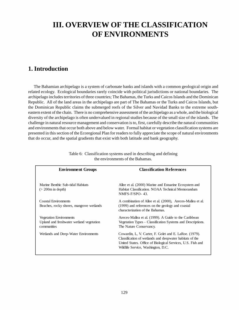
129
III. OVERVIEW OF THE CLASSIFICATIONOF ENVIRONMENTS
1. Introduction
The Bahamian archipelago is a system of carbonate banks and islands with a common geological origin andrelated ecology. Ecological boundaries rarely coincide with political jurisdictions or national boundaries. Thearchipelago includes territories of three countries; The Bahamas, the Turks and Caicos Islands and the DominicanRepublic. All of the land areas in the archipelago are part of The Bahamas or the Turks and Caicos Islands, butthe Dominican Republic claims the submerged reefs of the Silver and Navidad Banks to the extreme south-eastern extent of the chain. There is no comprehensive assessment of the archipelago as a whole, and the biologicaldiversity of the archipelago is often undervalued in regional studies because of the small size of the islands. Thechallenge in natural resource management and conservation is to, first, carefully describe the natural communitiesand environments that occur both above and below water. Formal habitat or vegetation classification systems arepresented in this section of the Ecoregional Plan for readers to fully appreciate the scope of natural environmentsthat do occur, and the spatial gradients that exist with both latitude and bank geography.
Table 6: Classification systems used in describing and definingthe environments of the Bahamas.
spuorGtnemnorivnE secnerefeRnoitacifissalC
statibaHladit-buScihtneBeniraM)htpednim002>(
dnametsysocEenirautsEdnaeniraM)0002(.lateeellAmudnaromeMlacinhceTAAON.noitacifissalCtatibaH
.34-OPS/F-SFMN
stnemnorivnElatsaoCsdnaltewevorgnam,serohsykcor,sehcaeB
.lateaellaM-secerA,)0002(.lateeellAfonoitanibmocAlatsaocdnaygoloegehtnosecnereferdna)9991(
.samahaBehtfonoitaziretcarahc
stnemnorivnEnoitategeVnoitategevdnaltewretawhserfdnadnalpU
seitinummoc
naebbiraCehtotediuGA.)9991(.lateaellaM-secerA.snoitpircseDdnasmetsySnoitacifissalC-sepyTnoitategeV
.ycnavresnoCerutaNehT
stnemnorivnEretaW-peeDdnasdnalteW .)9791(.eoRaL.EdnateloG.F,retraC.V,L,nidrawoCehtfostatibahretawpeeddnasdnaltewfonoitacifissalC
dnahsiF.S.U,secivreSlacigoloiBfoeciffO.setatSdetinU.C.D,notgnihsaW,ecivreSefildliW
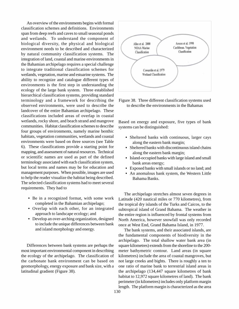
130
An overview of the environments begins with formalclassification schemes and definitions. Environmentsspan from deep reefs and caves to small seasonal pondsand wetlands. To understand the component ofbiological diversity, the physical and biologicalenvironment needs to be described and characterizedby natural community classification systems. Theintegration of land, coastal and marine environments inthe Bahamian archipelago requires a special challengeto integrate traditional classification schemes forwetlands, vegetation, marine and estuarine systems. Theability to recognize and catalogue different types ofenvironments is the first step in understanding theecology of the large bank system. Three establishedhierarchical classification systems, providing standardterminology and a framework for describing theobserved environments, were used to describe thelandcover of the entire Bahamian archipelago. Theseclassifications included areas of overlap in coastalwetlands, rocky shore, and beach strand and mangrovecommunities. Habitat classification schemes to describefour groups of environments, namely marine benthichabitats, vegetation communities, wetlands and coastalenvironments were based on three sources (see Table6). These classifications provide a starting point formapping, and assessment of natural resources. Technicalor scientific names are used as part of the definedterminology associated with each classification system,but local terms and names may be for education andmanagement purposes. When possible, images are usedto help the reader visualize the habitat being described.The selected classification systems had to meet severalrequirements. They had to
• Be in a recognized format, with some workcompleted in the Bahamian archipelago;
• Overlap with each other, for an integratedapproach to landscape ecology; and
• Develop an over-arching organization, designedto include the unique differences between bankand island morphology and energy.
Differences between bank systems are perhaps themost important environmental component in describingthe ecology of the archipelago. The classification ofthe carbonate bank environment can be based ongeomorphology, energy exposure and bank size, with alatitudinal gradient (Figure 38).
Figure 38. Three different classification systems usedto describe the environments in the Bahamas
Based on energy and exposure, five types of banksystems can be distinguished:
• Sheltered banks with continuous, larger caysalong the eastern bank margin;
• Sheltered banks with discontinuous island chainsalong the eastern bank margin;
• Island-occupied banks with large island and smallbank areas energy;
• Exposed banks with small islands or no land; and• An anomalous bank system, the Western Little
Bahama Banks.
The archipelago stretches almost seven degrees inLatitude (420 nautical miles or 770 kilometres), fromthe tropical dry islands of the Turks and Caicos, to thesubtropical island of Grand Bahama. The weather inthe entire region is influenced by frontal systems fromNorth America, however snowfall was only recordedonce at West End, Grand Bahama Island, in 1977.
The bank systems, and their associated islands, arethe fundamental components of biodiversity in thearchipelago. The total shallow water bank area (insquare kilometres) extends from the shoreline to the 200-meter bathymetric contour. Land areas (in squarekilometres) include the area of coastal mangroves, butnot large creeks and bights. There is roughly a ten toone ratio of marine bank to terrestrial island areas inthe archipelago (134,447 square kilometres of bankhabitat to 12,972 square kilometres of land). The bankperimeter (in kilometres) includes only platform marginlength. The platform margin is characterized as the area
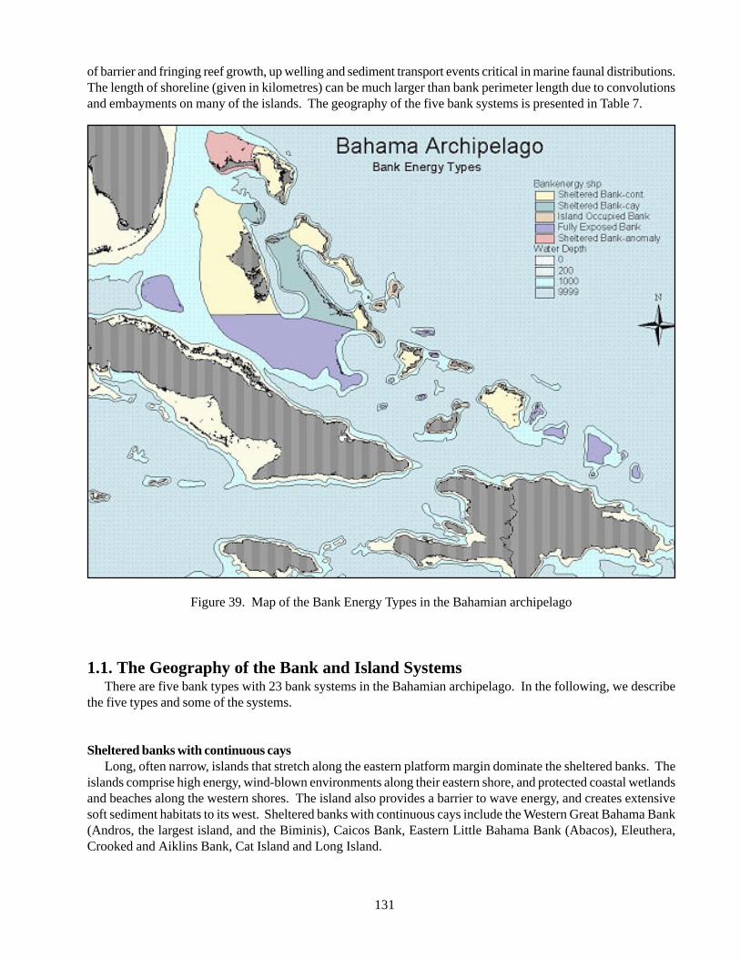
131
of barrier and fringing reef growth, up welling and sediment transport events critical in marine faunal distributions.The length of shoreline (given in kilometres) can be much larger than bank perimeter length due to convolutionsand embayments on many of the islands. The geography of the five bank systems is presented in Table 7.
Figure 39. Map of the Bank Energy Types in the Bahamian archipelago
1.1. The Geography of the Bank and Island SystemsThere are five bank types with 23 bank systems in the Bahamian archipelago. In the following, we describe
the five types and some of the systems.
Sheltered banks with continuous caysLong, often narrow, islands that stretch along the eastern platform margin dominate the sheltered banks. The
islands comprise high energy, wind-blown environments along their eastern shore, and protected coastal wetlandsand beaches along the western shores. The island also provides a barrier to wave energy, and creates extensivesoft sediment habitats to its west. Sheltered banks with continuous cays include the Western Great Bahama Bank(Andros, the largest island, and the Biminis), Caicos Bank, Eastern Little Bahama Bank (Abacos), Eleuthera,Crooked and Aiklins Bank, Cat Island and Long Island.
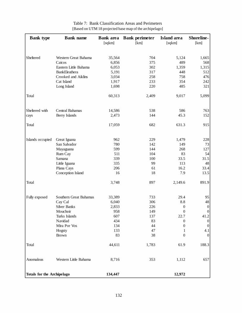
132
Table 7: Bank Classification Areas and Perimeters[Based on UTM 18 projected base map of the archipelago]
epytknaB emanknaB aeraknaB]mkqs[
retemirepknaB]mk[
aeradnalsI]mkqs[
-enilerohS]mk[
deretlehS
latoT
amahaBtaerGnretseWsociaC
amahaBelttiLnretsaEarehtuelEknaB
snilkiAdnadekoorCdnalsItaC
dnalsIgnoL
465,53658,6350,6191,5430,3719,1896,1
313,06
407573203713852332022
904,2
421,5984953,1844857453584
710,9
566,1865513,1215674242123
990,5
htiwderetlehSsyac
latoT
samahaBlartneCsdnalsIyrreB
685,41374,2
950,71
835441
286
6853.54
3.136
367251
519
deipuccosdnalsI
latoT
anaugItaerGrodavlaSnaS
anaugayaMyaCmuR
anamaSanaugIelttiL
syaCanalPdnalsInoitpecnoC
26908799511593353360261
847,3
922241441401001991681
798
974,1941862385.333112.619.7
6.941,2
82237721455.13844.335.31
9.198
desopxeylluF
latoT
samahaBtaerGnrehtuoSlaCyaC
sknaBrevliSriohcuoM
sdnalsIskruTdadivaN
soVroPariMytsgoHnworB
983,33040,6338,285970643443133138
116,44
33760362294173138447483
387,1
4.928.8007.220010
9.16
5984002.14001.40
3.881
suolamonA amahaBelttiLnretseW 617,8 353 211,1 756
ogalepihcrAehtrofslatoT 744,431 279,21
133
Western Great BahamaThe western Great Bahama bank includes the largest
island (Andros) and bank area. Andros and the Biminisinclude important island environments. Andros is byfar the largest Bahamian island, although this issomewhat misleading, as it comprises a number ofseparate islands. For this reason the area described hereas North Andros is limited to the contiguous territorystretching from Morgan’s Bluff to Behring Point. Theremainder, described as South Andros, comprises aconsiderable number of separate islands separated by alarge number of bights and creeks.
North AndrosDespite being considered a single island, North
Andros nevertheless has a high percentage of completelyor partially enclosed water bodies. These include anumber of lengthy tidal creeks, which, although theydo not separate the landmass, create quite an impedimentto free movement along the populated east coast. Bestknown of these are Fresh Creek, Stafford Creek andStaniel Creek.
Although North Andros has a well-defined coastalridge, which reaches just over 30.5 meters, and exceeds18.3 meters at many locations north of Fresh Creek, itis similar in origin and structure to Grand Bahama.South of Fresh Creek the landscape is less distinguishedwith fewer creeks, lower relief, and smaller lakes. Apartfrom the east coast, little of North Andros exceeds 6meters in altitude. The interior is flat and heavilyforested with Caribbean Pine. About halfway acrossthe island forested areas give way to extensivemangroves as the water table reaches the surface, andeventually even this landscape is reduced to extensivemud flats that account for about one third of the landarea. Here, the marine influence is often overwhelming,with complete inundation during storms being on record,a condition we find on West Abaco as well.
It has been reported that in one winter in the 1970s apond in North Andros froze over, certainly a rare eventfor the Bahamas. North Andros is sufficiently close tothe North American continent to be chilled by cold airmasses in winter, and as such has a more extreme winterthan nearby New Providence further east. In addition,its considerable land mass allows for radiative coolingduring the night to a greater extent than any other island,most of which are narrow and easily penetrated by warm,moist oceanic winds. Similarly fog is not uncommoneither.
The eastern shores of Andros are exposed to thealmost continuous NE Trade winds blowing year round,but is quite sheltered inland. In the summer, excessive
heating inland leads to considerable convection and thecreation of thunderstorms. These reach sufficient heightthat they can be seen from Nassau, and they add to therainfall total for the island. North Andros receives some152.4 centimetres of rain a year, which helps sustainthe by far largest reservoirs of fresh water in the country.One of these lenses is known to have a central thicknessin excess of 30.5 meters.
Most of the areas located more than two feet belowthe water table support Caribbean Pine Forest, whichwas extensively logged until the 1970s. In the far north,several commercial farms were established in the1960s,and North Andros continues to be a major farming areatoday.
No account of Andros would be complete withoutmentioning its remarkable blue holes. Over 100 of thesehave been identified on land and in the sea, with depthsexceeding 121.9 meters in a few cases. Blue holes arethe present expressions of large solution holes datingback to the Pleistocene and have been widely researchedfor evidence of past sea levels.
South AndrosThis section of Andros is defined as all those islands
south of the North Bight, namely Big Wood Cay,Mangrove Cay and South Andros, plus all adjacentsmaller islands and cays. Like in North Andros thereare many creeks that penetrate far inland, notably DeepCreek and Little Creek. More striking, however, arethe numerous islands 1.5 to 4.6 meters above sea levelcreated by the channels and their numerous branches,known as North Bight, Middle Bight and South Bight.These broad, shallow channels are navigable by smallboat all the way through to the Great Bahama Bank.The area is noted for its sponge fishing, and the Bightscontain a number of blue holes.
Mangrove Cay and South Andros proper aresubstantial islands with permanent settlements. LikeNorth Andros, they have a coastal ridge, reaching 27.4meters in height. The interior is flat, forested, and gradesinto marls on the west coast. The total land area is,however, substantially less than in North Andros.
The main characteristic of the east coast is a strikingfault line running just inland from the shoreline, clearlyvisible from South Bight south to Mars Bay, where itcontinues offshore. This probably accounts for therelative straightness of the coast, and is also the locationfor many elongated blue holes along its line. The faultseems to be in the nature of a cleft related to slippage ofthe bank edge along this part of the tongue of the Ocean.
With the exception of settlements along the coast,
134
this entire area is probably the largest, unexplored andleast known part of the Bahamas.
The Kemp’s Bay meteorological station in SouthAndros recorded an annual average of only 89.9centimetres of rain for the period 1978-90, and this partof Andros is clearly drier and warmer in winter thanNorth Andros. Otherwise summer temperatures aresimilar, and the Trade Winds reach the east coastthroughout the year.
Bimini IslandsThe cays and islands of the Bimini chain are unusual
in that they are located on the lee side of a major bank.Altogether there are about ten small islands, but onlyNorth and South Bimini and Cat Cay are of any size.This is the result of the limited wind and wave actionfrom the west across the Gulf Stream.
Most of North Bimini is a thin ridge reaching about6 meters in elevation, although quite steep despite itslow height, and this is the occupied area. To the northand west the land is without hills, and the western sectionis exclusively very low land, wetland and tidal creeks.The limited dry land in this area is the remains of acomplex spit, although the large eastern limb is wellformed and active at the present time.
South Bimini has developed rather differently,consisting of a similar low ridge facing the FloridaStraits. But in this case it is backed by a mile or so ofextensive wetland, and then by rock land, the total beingsome four miles of a very flat topography.
The rainfall reflects the northern location andaverages 112 centimetres per year. Being well to thewest on the Great Bahama Bank, it is not especiallyexposed to the NE trade winds, but is vulnerable to coldair masses from the nearby Florida peninsula throughoutthe winter months, resulting in quite variable weatherconditions during that season.
North Bimini is essentially cleared of all vegetationapart form the uninhabited western sector, which ismostly mangrove swamp, although invasive casuarinasoccupy much of the drier ground. South Bimini iscleared of vegetation in the west, with much of thewetland having been reclaimed. It is still home toextensive broadleaf woodland, fairly luxurious as a resultof the heavier rainfall, but vulnerable to salt waterintrusion.
Eastern Little Bahama BankGrand Bahama Island is anomalous in its orientation
in the archipelago. The island extends along thesouthwestern margin of Little Bahama Bank and covers1,112 km2. Grand Bahama has extensive mangrove
wetlands along the northern and eastern margins of theisland. Most of the development in the cities of Freeportand Lucaya occur along the southern coast, an areadominated by pine woodlands with coastal strand andbeaches.
EleutheraThis is a typical long narrow Atlantic margin island,
measuring about 144.8 kilometres in length, and rarelyexceeding 4.8 kilometres in width. The largestlandmasses and widest areas of the island are in thenorth and south, which also hold the largest water lenses,and to a lesser extent in the south, between Tarpum Bayand Rock Sound. Most of the island is narrow, withhills, especially in the north where there is a breach atGlass Window. Between Glass Window and SavannahSound the island has substantial cliffs on both shorelines.The geological structure in this area is a series ofoverlapping fossil sand dunes forming a low table andfrequently exceeding 30.5 meters in height. The highestpoint is 51.2 meters. Notably outlying islands, usuallydetached ridges, include Russell Island/St George’sIsland (Spanish Wells), Current Island, Harbour Islandand Windermere Island, all of which are inhabited. Low-lying rock land is limited in extent, but most evident inNorth Eleuthera, the name given to the triangular areanorth of the Glass Window, around Tarpum Bay, and inthe far south.
The island forms the north-eastern extremity of theGreat Bahamas Bank, and has a strongly erodingcoastline, with some evidence for bank margin collapsein the recent geological past, notably at Glass Windowwhere the scalloped margin suggests bank margin retreat.The karstified surface limestone is generally sufficientlyyoung to be scarified for agricultural purposes, and theisland has been significantly transformed by earlyplantation settlers, and later by subsistence farmers.Even today, Eleuthera is an important agriculturalproducer with several large commercial farms.
Being in the northern part of the Bahamas, Eleutherahas a distinct mild winter season and is affected by coldfronts from North America. This also increases theamount of rain in an otherwise dry season. However,total annual rain averages amount to only 127centimetres at Rock Sound. Being on the Atlanticfringe, Eleuthera is in the direct path of the NortheastTrade Winds, which blow steadily year round, althoughthey take on a more southerly (E-SE) orientation insummer. Summers are hot and relatively wet with mostof the rain falling as heavy showers, or from tropicalstorm or hurricane activity. Eleuthera is in a higherhurricane risk zone than the southern Bahamas and was
135
struck by both Andrew and Floyd in recent years.
Long IslandLong Island is the southernmost of the trio of Atlantic
islands on the edge of Great Bahama Bank, and sharesmany characteristics with its neighbours to the north.The entire length of the island is dominated by a ridgewith rolling hills, often exceeding 30 meters in height,with a maximum of 54 meters. The complex ridge ismost consistent along the eastern shores, but there aremany sections where hills span the entire width of theisland. The northern and southern extremities terminatein cliffs at Cape Santa Maria and Cabo Verderespectively, and there are many cliffs along the easterncoast. The western coast does have some unusualfeatures however, most notably the extensive wetlandsalong the southern half of the island. The most northernof these is known as Grand Pa’s Channel, and abandonedsalt works occupies a large part of the southern area.Numerous canals and dykes serving these salt workshave altered much of this landscape.
A somewhat exceptional feature of Long Island isthe presence of two substantial cave systems. All islandshave caves, this being a normal consequence of karsterosion, but Salt Pond Cave and the Cartwright Cavein central Long Island are among the two largest in theBahamas.
The largest flatland areas are in the vicinity ofDeadman’s Cay and Grays, and further north aroundSimms. Past and present farming has altered much ofthe vegetation.
Being further south Long Island is relatively dry withan average rainfall of around 89 centimetres per year.While the dryness was the reason for the solar saltoperations, occasional tropical storms and hurricanescreated severe flooding leading to the demise of thesalt operations and serious restrictions on agriculture.Temperatures are tropical all the year round withexposure to NE Trade Winds accounting for theextensive modern sand dunes along most of the easternshores. Vegetation is generally broad-leaved tropicalhardwood with extensive mangroves along the westernshores.
Sheltered banks with discontinuous caysSome eastern margins of the banks are made up of
island chains. The Exumas, with their chain of smallislands, are unique in the archipelago with channelhabitats and creeks between the islands. The banksystems allow water to move on and off the banksthrough these channels, and create unique oolitic banksand bars. The Exuma and Berry island chains represent
this bany type. New Providence Island falls into thisbank type. The most populated island is near theplatform margin, with many smaller cays nearby, andstrong tidal currents sweeping around the island inchannels. For New Providence, this setting provides astrong “cleaning” effect of removing land-based sourcesof pollution from waters adjacent to the capital, Nassau.
Central BahamasGreat Exuma, together with its southern extension,
Little Exuma, is a fairly small island similar in size toNew Providence and San Salvador, but lacking theircompactness of shape. Exuma lies on the southern halfof the Great Bahamas Bank, and owes its existence toExuma Sound, across which the NE Trade Winds blowto create the hilly ridges, which are the basis of theisland, except in the west.
The outermost ridge, the youngest, forms mostlyislands off the eastern shore, such as Stocking Island,which in turn creates Elizabeth Harbour in its lee. Thisridge is responsible for most of the Exuma Cays, andLittle Exuma, which are joined to its neighbour by acauseway. A second complex dune structure is the basisfor most of the eastern shore of Great Exuma, and reachesover 30 meters in several places, although this island isneither as high nor as hilly as its Atlantic counterpartsfurther east.
As a result of its generally greater amount of lowland,this island supports a fair amount of agriculture,including an unusual area of reclaimed freshwatermarshland. Unlike the three Atlantic Islands, also onthe Great Bahama Bank, but more like Abaco in thenorth, the fringing islands provide shelter for the coast,and settlement is concentrated along the eastern shores.
Rainfall in the Exumas is close to 102 centimetresper year on average, a bit more than the easterly islandsin this latitude. This is accounted for by its closerproximity to the US and winter frontal systems, and itswider landmass, which allows convection cells todevelop and rain to fall on the island rather than offshore.The Atlantic islands often see similar cells producingrain over the sea to the west of them. Despite this, LittleExuma in the far south is much drier and supports saltpans that are still productive.
Temperatures are not as extreme as in the northernBahamas, but overall the Exumas experience tropicalsummers and warm winters. Extensive broadleafwoodland exists, but since this area was a majordestination for Loyalist plantation farmers, extensivecutting has removed all the original growth. Landclearance, for farming and speculative development, hasalso reduced even secondary growth, but despite this
136
there is a widespread vegetational cover over the island,which includes extensive wetland in the west, as wellas significant wetland areas in the north of the islandimmediately behind the ridge land.
Island occupied banks
Great and Little InaguaGreat Inagua is the largest of the southern islands,
roughly similar in size to Abaco and Grand Bahama.Being so far south, the dominant wind direction is moreeasterly and southerly due to the orientation of the NETrades in summer, and the fact that Inagua occupies itsown bank. Ridges line the eastern and southern coasts,reaching over 30 meters in several places, and alsooccupy the central part of the north coast. The rest ofthe island is extremely flat and lakes, of which the largestis Lake Rosa, occupy large parts of it. Little of this areais more than five feet above sea level.
Little Inagua is a substantial (79 square kilometres)but uninhabited outlier on this bank, quite hilly aroundits shoreline, and heavily forested. It was declared aNational Park in its entirety in 2002. Great Inagua isalso largely uninhabited, despite a substantial settlementin the far southwest at Matthew Town. The mainattraction of this island has been its natural salt lakes,which have been raked for salt for centuries, first innatural saltpans south of Matthew Town, but for the last50 years the main production has been from a giantmanmade solar salt system laid out over the westernhalf of Lake Rosa. This area is quite different from thenatural wetland elsewhere, partly because of thecauseways and dykes that control the movement ofwater, but also because of the increased salinity. Theeastern half, which is part of a National Park, retains itsoriginal character, and is noted for its large flocks ofWest Indian Flamingos.
This is one of the driest islands in the whole regionwith an average annual rainfall of just 66 centimetres,hence the survival of the salt works. These semi-aridconditions, combined with the pervasive NE TradeWinds, have led to the development of xerophyticvegetation over much of the island. On the somewhatwetter ridges the stunted broadleaf woodland has beendescribed as a ‘bonsai forest’.
Being well below the Tropic of Cancer, the Inaguaislands have hot summers and winters, the maindifference being in the higher humidity of summer,which brings most of the limited rainfall, and clouds ofmosquitoes. January is the coolest month and averagesabout 75F, while August Averages 83F, the average
range of 8F being the smallest in the Bahamas (NewProvidence range is 15F).
San Salvador IslandWith 101.3 square kilometres, this island is
somewhat similar in size to New Providence, and alsofairly compact in shape. In all other respects it is quitedifferent from its northern counterpart; it is the soleoccupant of its bank and the most easterly of the centralBahamian Islands.
The higher ground, maximum elevation 37 meters,is composed of arcuate ridges clearly identifiable in allparts of the island. These ridges have led to theformation of a large number of lakes, arcuate in shapeas they are trapped between the curving ridges. Togetherthese ridges occupy about half of the inland surface.Away from the ridges there are extensive areas of lesshilly rock land, and the east coast is an almost continuousbeach flanked by a modern dune behind which a numberof lakes, often hyper saline, are trapped. An unusualfeature is Pigeon Creek in the south, providing limitedsmall boat access well inland. Research suggests thatStorr’s Lake to the north of Pigeon Creek, and someother smaller lakes, were also creeks that havesubsequently had their outlets silted up.
Three-quarters of the island is surrounded by afringing reef, creating a large natural harbour in thenorth. There are a number of offshore cays in the northand south, some of which contribute to the northernharbour. This is the most studied island in the Bahamasand excellent detailed accounts of its geology exist.
With a rainfall averaging 90 centimetres per year,San Salvador is a bit wetter than its northern neighbours,and this may be accounted for by its shape, and theextensive water bodies inland, both conducive toconvection currents. It is also more exposed to oceanicforces and receives additional rain from passing tropicalstorms, although this is not a regular feature.
Temperatures are normal for the central Bahamas,but exposure to weather from all points of the compassmakes the island rather windier than for instance Exuma.The NE Trade Winds are strong and relativelyuninterrupted apart from high-pressure systemstravelling south in winter, when a northwesterly wind iscommon.
The island was among the earliest inhabited and,although abandoned by the Lucayans and Spanishexplorers, planters who created a number of large cottonestates resettled it. Much of the vegetation was clearedfor this purpose, but otherwise the island is now well-wooded and only parts of the coastal fringe are farmedon a casual basis.
137
Rum CayRum Cay is about half the size of its neighbour San
Salvador, which lies about 40 kilometres to thenortheast. It occupies its own bank, and like sanSalvador is comprised of multiple ridges that occupyall parts of the island.
Ridges reaching over 30 meters line the north, south,and east coasts, and parts of the interior, notably in thecentre. Elsewhere there is low-lying swampy groundbetween the hills, but only one significant lake, LakeGeorge, close to east coast. The Port Nelson Salt Lakein the southeast is actually open to the sea and tidal, buteven bigger than Lake George and almost entirelylandlocked. As its name implies, this area has beenused for salt raking, a practice still undertaken in recenttimes. There are many ponds scattered throughout theinterior, most notably in the south centre where severallarge ponds follow the line of prominent accurate ridgesreminiscent of San Salvador. The only settlement isadjacent to the salt ponds.
Being on an isolated bank the climate is essentiallythe same as San Salvador’s, and the island is wellvegetated. There have been few settlement in recentyears. The original plantations are limited to thesouthern areas.
Mangrove swamps are common inland around theponds and in depressions, and especially along thewestern edge of Lake George, but like all the islands onisolated banks there is little coastal wetland.
Fully exposed banksFully exposed or submerged banks in the archipelago
present unique habitats. Islands, if present are small,and persist along the platform margins (e.g. Cay Saland Ragged Islands). The bank ecology is dominatedby ocean processes and up welling.
The anomalous bank system
Grand BahamaGrand Bahama shares the Little Bahama Bank with
Abaco, but unlike that island it is very flat, the highestpoint being just 20.7 meters above sea level. It alsolacks the long ridges that characterize most other islands,and even small cays. This is to a large extent due to itslocation along the southern margin of the Little BahamaBank, where it is sheltered from the prevailing NE TradeWinds and winter northerlies. Only the gentler south-eastern winds of summer have created land from the
sea at the edge of this bank, and initially the island waslittle more than a series of low-lying cays. In this respectit has a lot in common with Andros, and the Joultercays are probably proto-island masses of this type. Tothe east, the sequence of about eight large cays stretchingfrom McLean’s Town to East End Point are relicts ofwhat the rest of the island must have once looked like.
The topography is unusual, lacking even a lowcoastal ridge. The shoreline is often swampy, and thehigher elevations of 6-9 meters are scattered inland tocreate a very gently undulating plain. Thesediscontinuous minor swells in the surface represent theearlier dry land of the original cays, and there is stillmuch evidence of the former separating creeks in stripsof wetland, and even creeks such as Hawksbill Creek,now much altered by the creation of Freeport Harbour.
The northern part of the island, especially in themiddle, is always less than ten feet above sea level andgrades into marshland and scattered cays, some quitelarge and even inhabited, notably Water Cay. Theapparent spit of land terminating in West End isextremely low and rarely exceeds 3 meters.
The northerly location of Grand Bahama ensures amore marked winter-summer regime, and greaterrainfall, than the islands to the south. Annual rainfallaverages 152.4 centimetres. The winter months aremarkedly cooler than elsewhere in the Bahamas, thisbeing the only island ever recording falling snow!During the passage of cold fronts temperatures in the40s are not uncommon, but once summer has set in thetemperatures are little different than elsewhere in theBahamas.
The extent of level land and higher rainfall hasensured the development of large water lenses, andassociated with these, extensive Caribbean Pine forests.Many were logged in the 20th century but were left torecuperate since the 1970’s. Abundant water and thelogging industry led to the establishment of a new townin the 1960’s and today Freeport/Lucaya is the secondlargest city of the Bahamas. The flat topographyfacilitated the construction of numerous sub-divisionswith canals, and marinas, which at the same timeprovided much needed landfill material.
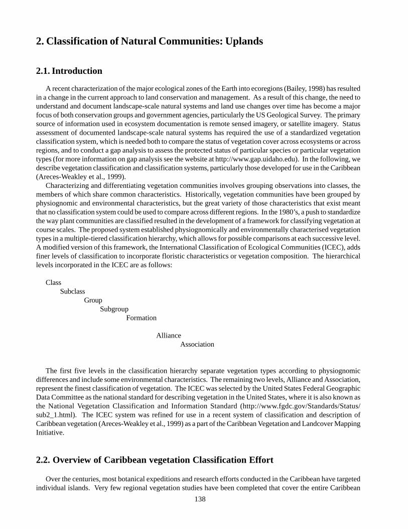
138
2. Classification of Natural Communities: Uplands
2.1. Introduction
A recent characterization of the major ecological zones of the Earth into ecoregions (Bailey, 1998) has resultedin a change in the current approach to land conservation and management. As a result of this change, the need tounderstand and document landscape-scale natural systems and land use changes over time has become a majorfocus of both conservation groups and government agencies, particularly the US Geological Survey. The primarysource of information used in ecosystem documentation is remote sensed imagery, or satellite imagery. Statusassessment of documented landscape-scale natural systems has required the use of a standardized vegetationclassification system, which is needed both to compare the status of vegetation cover across ecosystems or acrossregions, and to conduct a gap analysis to assess the protected status of particular species or particular vegetationtypes (for more information on gap analysis see the website at http://www.gap.uidaho.edu). In the following, wedescribe vegetation classification and classification systems, particularly those developed for use in the Caribbean(Areces-Weakley et al., 1999).
Characterizing and differentiating vegetation communities involves grouping observations into classes, themembers of which share common characteristics. Historically, vegetation communities have been grouped byphysiognomic and environmental characteristics, but the great variety of those characteristics that exist meantthat no classification system could be used to compare across different regions. In the 1980’s, a push to standardizethe way plant communities are classified resulted in the development of a framework for classifying vegetation atcourse scales. The proposed system established physiognomically and environmentally characterised vegetationtypes in a multiple-tiered classification hierarchy, which allows for possible comparisons at each successive level.A modified version of this framework, the International Classification of Ecological Communities (ICEC), addsfiner levels of classification to incorporate floristic characteristics or vegetation composition. The hierarchicallevels incorporated in the ICEC are as follows:
ClassSubclass
Group Subgroup
Formation
AllianceAssociation
The first five levels in the classification hierarchy separate vegetation types according to physiognomicdifferences and include some environmental characteristics. The remaining two levels, Alliance and Association,represent the finest classification of vegetation. The ICEC was selected by the United States Federal GeographicData Committee as the national standard for describing vegetation in the United States, where it is also known asthe National Vegetation Classification and Information Standard (http://www.fgdc.gov/Standards/Status/sub2_1.html). The ICEC system was refined for use in a recent system of classification and description ofCaribbean vegetation (Areces-Weakley et al., 1999) as a part of the Caribbean Vegetation and Landcover MappingInitiative.
2.2. Overview of Caribbean vegetation Classification Effort
Over the centuries, most botanical expeditions and research efforts conducted in the Caribbean have targetedindividual islands. Very few regional vegetation studies have been completed that cover the entire Caribbean
139
archipelago and are sufficiently detailed to be ofpractical value in the assessment of vegetationcommunity status and distribution. Various systems ofclassification have however, been proposed for thevegetation of a few groups of Caribbean islands, or forindividual islands themselves. None of these havesufficient detail to prove useful for landscapes with thehigh variability and degree of endemism that exists inthe Caribbean. Neither do they provide theclassification structure needed for assessments ofconservation status or distribution of vegetation types.
Accurate and up-to-date land cover/vegetationinformation is essential for conservation andmanagement of natural resources and biodiversity. TheCaribbean Vegetation and Landcover MappingInitiative, which is a result of collaboration between TheNature Conservancy, the International Institute ofTropical Forestry, the US Forest Service, EROS DataCenter, and the US Geological Survey, developed partlyout of concern for the lack of such information in theCaribbean. The purpose of this initiative is to producevegetation/land cover maps for the islands of theCaribbean based on satellite imagery and other remotesensed data, and to produce a standardized vegetationclassification system for the greater Caribbean region.To date, a region-wide standard vegetation classificationsystem and a preliminary atlas of existing vegetation/landcover maps for the region have been completed.Here we use a subset of the Caribbean vegetationclassification system in describing vegetationcommunities of the Bahamas at the formation level.
2.3. Standardized Terminology forClassifying Vegetation
The following terms and definitions, adapted from ‘AGuide to Caribbean Vegetation Types; ClassificationSystems and Descriptions’ (Areces-Weakley et al.,1999), are used in the International Classification ofEcological Communities (ICEC). We include thisglossary here, prior to presentation of the classificationsystem, to simplify understanding of the vegetationdescriptions for the Bahamian Archipelago.
Assemblages - Vegetative communities composed ofseveral to many different species of plants that assemblethemselves based on specific site conditions and thepresence of seed. Plants that occur along a rockyshoreline in the Bahamas are considered an assemblage.
Association - The finest level of the classificationstandard. The association is a physiognomically uniformgroup of vegetation stands that share one or morediagnostic (dominant, differential, indicator, orcharacter) over story and under story species. Theseelements occur as repeatable patterns of assemblagesacross the landscape, and are generally found undersimilar habitat conditions. (the association refers toexisting vegetation, not a potential vegetation type). Aseaside community dominated by sea oats (Uniolapaniculata) is considered an association in the Bahamas.
Brackish - Tidal water with a salinity of 0.5-30 partsper thousand.
Broad-leaved - A plant with leaves that have welldefined leaf blades and are relatively wide in outline(shape) as opposed to needle-like or linear; leaf area istypically greater than 500 square millimetres or 1 squareinch. Examples of broad-leaved plants in the Bahamasare Sabal palm (Sabal palmetto) and Pigeon Plum(Coccoloba diversifolia).
Canopy Cover - The proportion of ground, usuallyexpressed as a percentage that is occupied by theperpendicular projection down on to it of the aerial partsof the vegetation or the species under consideration.The additive cover of multiple strata or species mayexceed 100%.
Classification - The grouping of similar types (in thiscase - vegetation) according to criteria (in this case -physiognomic and floristic), which are consideredsignificant for this purpose. The rules for classificationmust be clarified prior to identification of the typeswithin the classification standard. The classificationmethods should be clear, precise, where possiblequantitative, and based upon objective criteria, so thatthe outcome would be the same whoever performs thedefinition (or description). Classification necessarilyinvolves definition of class boundaries (UNEP/FAO,1995).
Closed Tree Canopy - A class of vegetation that isdominated by trees with interlocking crowns (generallyforming 60-100% canopy cover). A closed tree canopycan be found in many coppice communities in theBahamas.
Cover - The area of ground covered by the verticalprojection of the aerial parts of plants of one or morespecies.
140
Cover Type - A designation based upon the plant species forming a plurality of composition within a given area(e.g., Mangrove-Buttonwood).
Deciduous - A woody plant that seasonally loses all of its leaves and becomes temporarily bare-stemmed. Anexample of a deciduous tree in the Bahamas: Mahogany (Swietenia mahagoni).
Deciduous Cover - Vegetation classes where 75% or more of the diagnostic vegetation is made up of tree or shrubspecies that shed foliage simultaneously in response to environmental conditions.
Division - This is the first level in the classification standard separating Earth cover into either vegetated or non-vegetated categories (see also Order).
Dominance - The extent to which a given species or life form predominates in a community because of its size,abundance or cover, and affects the fitness of associated species. Dominance is interpreted in two different waysfor vegetation classification purposes:Where one or more vegetation strata (life form) covers greater than 25% (represented by the —— line), the lifeform greater than 25% which constitutes the uppermost canopy is referred to as the dominant life form.
100% 25% 0%|————————————————————|------------------------|
Where no vegetation life form covers greater than 25% (represented by the - - - line), the life form with thehighest percent canopy cover is referred to as the dominant life form. In the case of a ‘tie’, the upper canopy willbe referred to as the dominant life form.
100% 25% 0%|- - - - - - - - - - - - - - - - - - - - - - - - - - - - - - - -- - - - |———————|
Dominant - An organism, group of organisms, or taxon that by its size, abundance, or coverage exerts considerableinfluence upon an association’s biotic (such as structure and function) and abiotic (such as shade and relativehumidity) conditions. Mangrove communities are often dominant along low energy, low profile shorelines in theBahamas.
Drought Deciduous - Vegetation in which the leaves drop in response to annual environmental conditionscharacterized by drought. Applied to vegetation from climates with seasonal drought and little cold-seasoninfluence (tropical-subtropical). In the Bahamas, the season characterized by drought is late winter.
Dwarf Shrubland - A class of vegetation dominated by a life form of shrubs and/or trees under 0.5 m tall. Thesetypes generally have greater than 25% cover of dwarf shrubs and less than 25% cover of trees and shrubs. Herbsand non-vascular plants may be present at any cover value. Dwarf shrub lands are associated with wind-exposedrocky shorelines in the Bahamas.
Dwarf Shrubs - Multi-stemmed woody plants with a life form at a height of less than 0.5 m due either to geneticor environmental constraints.
Evergreen- A plant that has green leaves all year round; or a plant that, in xeric habitats, has green stems or trunksand never produces leaves. Examples in the Bahamas are the Caribbean pine tree Pinus caribaea var. bahamensisand the Turk’s cap cactus Melocactus intortuous.
141
Evergreen Cover - Vegetation classes where 75% ormore of the diagnostic vegetation consists of trees orshrubs having leaves all year. Canopy is never withoutgreen foliage. Palm or pine-dominated associations areevergreen.
Forb - A broad-leaved herbaceous plant. Ipomoea pes-caprae or goat’s foot vine is one Bahamian forb.
Forest - A class of vegetation defined by areasdominated by trees generally greater than 5 m tall withindividual crowns interlocking. Tree canopy coverageis at 100%. Other vegetation classes may be present atany coverage in the under story. Forests are found ininland areas on islands that hold significant freshwaterlenses in the Bahamas.
Formation - A level in the classification based onecological groupings of vegetation units with broadlydefined environmental and additional physiognomicfactors in common. This level is subject to revision asthe vegetation alliances and associations are organizedunder the upper levels of the hierarchy. Differentvariables are applied to this hierarchical level in thesparsely vegetated class.
Fresh Water - Water with a salinity of less than 0.5parts per thousand.
Graminoid - Grasses and grass-like plants, includingsedges and rushes.
Grassland - Vegetation dominated by perennialgraminoid plants. Shorelines dominated by sea oats areconsidered grasslands.
Hemi-sclerophyllous - A plant with stiff, firm, leatheryleaves that retain their rigidity during wilting; forexample, sea grape (Coccoloba uvifera).
Herb - A vascular plant without significant woody tissueabove or at the ground; an annual, biennial, or perennialplant lacking significant thickening by secondary woodygrowth. Herbs can be feras grasses, grass-like plants, orforbs.
Herbaceous - A class of vegetation dominated by non-woody plants known as herbs. Herbs generally form atleast 25% cover. Trees, shrub and dwarf shrub generallyhave less than 25% cover. In rare cases, herbaceouscover exceeds the combined cover of trees, shrubs, dwarfshrubs, and non-vascular plants and is less than 25%
cover. Height classes for the graminoids are short (<0.5m), medium-tall (0.5-1 m) and tall (>1 m). Heightclasses for the forbs are low (<1 m) and tall (>1 m). Forboth graminoids and forbs, the height classes aremeasured when the inflorescences are fully developed.
Hydrophyte - A plant that has evolved adaptations tolive in aquatic or very wet habitats, e.g., cattail (Typhadomingensis).
Hydromorphous Herbs - Herbaceous plants structurallyadapted for life in water-dominated or aquatic habitats,e.g., cattail (Typha domingensis).
Lowland - A large land area with vegetation reflectinglimits set by regional climate and soil/site conditions;an area where elevation is not the primary gradientaffecting vegetation zonation. In the Bahamas, due tothe proximity of the water table, small elevationaldifferences may separate lowland vegetation from othervegetation.
Mixed Evergreen-deciduous - Vegetation in whichevergreen and deciduous species each generallycontribute 25-75% to the total canopy cover.
Mixed Evergreen Deciduous Cover - A class ofvegetation types where trees (or shrubs) are the dominantlife form and neither deciduous nor evergreen speciesrepresent more than 75% of cover present.
Natural/Semi-natural - Areas dominated by native orestablished vegetation that has not been cultivated ortreated with any annual management or manipulationregime. In cases where it cannot be assessed whetherthe vegetation was planted or cultivated by humans, thevegetation is considered ‘Natural/Semi-Natural’.
Needle-leaved - A plant with slender, elongated leaves;or leaf-like structures. For example, Caribbean pinetrees (Pinus caribaea var. bahamensis).
Open Tree Canopy - A class of vegetation typesdominated by trees with crowns not touching, generallyforming 25-60% cover. Pine rock lands have an opentree canopy.
Order - This is the next level in the hierarchy underDivision. The Orders within the Vegetated Divisionare generally defined by dominant life form (tree, shrub,dwarf shrub, herbaceous, or non-vascular).
142
Perennial - Plant species with a life cycle thatcharacteristically lasts more than two growing seasonsand persist for several years.
Physiognomic Class - A level in the classificationhierarchy defined by the relative percent canopy coverof the tree, shrub, dwarf shrub, herb, and nonvascularlife form in the uppermost strata during the peak of thegrowing season.
Physiognomic Group - A level in the classificationdefined by a combination of climate, leaf morphology,and leaf phenology. Different variables are applied tothis hierarchical level in the sparsely vegetated class.
Physiognomic Subclass - A level in the classificationdetermined by the predominant leaf phenology of classesdefined by tree, shrub, or dwarf shrub stratum (evergreen,deciduous, mixed evergreen-deciduous), and theaverage vegetation height for the herbaceous stratum(tall, medium, short). Different variables are applied tothis hierarchical level in the sparsely vegetated class.
Physiognomy - The structure and life form of a plantcommunity.
Plantations - Areas dominated by trees planted withgenerally consistent row and plant spacing. Stands areplanted for the purpose of producing a crop of timber orother products. Examples include planted pine orpapaya stands.
Planted/Cultivated - Areas dominated with vegetationthat has been planted in its current location by humansand/or is treated with annual tillage, modifiedconservation tillage, or other intensive management ormanipulation. This includes: vegetation planted in built-up settings, for recreation, erosion control, or aestheticpurposes, all areas used for the production of crops ofany kind, orchards, vineyards, or tree plantations. Incases where one cannot assess whether it was plantedby humans (e.g., some mature forests), the vegetation isconsidered ‘natural/semi-natural’.
Saltwater - Water with a salinity of greater than 30 partsper thousand.
Saturated - Surface water is seldom present, butsubstrate is saturated to the surface for extended periodsduring the growing season. Equivalent to Cowardin’s(1979) ‘Saturated’ modifier. Pine rock lands with palmunder stories grow on saturated limestone.
Scrub - Vegetation dominated by shrubs, includingthickets. Scrub is common on undeveloped, elevatedcoastlines in the Bahamas.
Seasonal - Showing periodicity related to the seasons;applied to vegetation exhibiting pronounced seasonalperiodicity marked by conspicuous physiognomicchanges.
Seasonally Flooded - Surface water is present forextended periods during the growing season, but isabsent by the end of the growing season in most years.The water table after flooding ceases is variable,extending from saturated to a water table well belowthe ground surface. Includes Cowardin’s (1979)Seasonal, Seasonal-Saturated, and Seasonal WellDrained modifiers. Some palm-dominated communitiesin the Bahamas are seasonally flooded.
Semi-deciduous Vegetation - Associations (tropical andsubtropical) in which most of the upper canopy treesare drought-deciduous and many of the under story treesand shrubs are evergreen. Layers do not always separatethe evergreen and deciduous woody plants.
Semi-evergreen Vegetation - Associations in whichevergreen and deciduous species each generallycontribute 25-75% of total tree cover; specifically, thisterm refers to tropical and subtropical vegetation inwhich most of the upper canopy trees are evergreenmixed with drought-deciduous trees.
Semi-permanently Flooded - Surface waters persiststhroughout growing season in most years except duringperiods of drought. Land surface is normally saturatedwhen water level drops below soil surface. IncludesCowardin’s (1979) ‘Intermittently Exposed’ and ‘Semi-permanently Flooded’ modifiers. In the Bahamas thisrefers to fresh or brackish-water flooded depressions.
Shrubland - A class of vegetation defined by areasdominated by shrubs greater than 0.5 m tall withindividuals or clumps not touching to interlocking.Shrub canopy cover is greater than 25% while tree coveris less than 25%.
Shrubs - Woody plants greater than 0.5 m in height thatgenerally exhibit several erect, spreading, or prostratestems; and have a bushy appearance. In instances wherelife form cannot be determined, woody plants greaterthan 0.5 m in height, but less than 5 m in height will beconsidered shrubs.
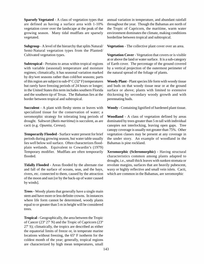
143
Sparsely Vegetated - A class of vegetation types thatare defined as having a surface area with 1-10%vegetation cover over the landscape at the peak of thegrowing season. Many tidal mudflats are sparselyvegetated.
Subgroup - A level of the hierarchy that splits Natural/Semi-Natural vegetation types from the Planted/Cultivated vegetation types.
Subtropical - Pertains to areas within tropical regionswith variable (seasonal) temperature and moistureregimes; climatically, it has seasonal variation markedby dry/wet seasons rather than cold/hot seasons; partsof this region are subject to sub-0º C (32º F) temperaturesbut rarely have freezing periods of 24 hours or longer;in the United States this term includes southern Floridaand the southern tip of Texas. The Bahamas lies at theborder between tropical and subtropical.
Succulent - A plant with fleshy stems or leaves withspecialized tissue for the conservation of water; axeromorphic strategy for tolerating long periods ofdrought. Saltwort (Batis maritima) is succulent, as arecacti (e.g. Opuntia, Cereus).
Temporarily Flooded - Surface water present for briefperiods during growing season, but water table usuallylies well below soil surface. Often characterizes flood-plain wetlands. Equivalent to Cowardin’s (1979)Temporary modifier. Mudflats are often temporarilyflooded.
Tidally Flooded - Areas flooded by the alternate riseand fall of the surface of oceans, seas, and the bays,rivers, etc. connected to them, caused by the attractionof the moon and sun [or by the back-up of water causedby winds].
Trees - Woody plants that generally have a single mainstem and have more or less definite crowns. In instanceswhere life form cannot be determined, woody plantsequal to or greater than 5 m in height will be consideredtrees.
Tropical - Geographically, the area between the Tropicof Cancer (23º 27' N) and the Tropic of Capricorn (23º27' S); climatically, the tropics are described as eitherthe equatorial limits of freeze or, in temperate marinelocations without freezing, the 65º F isotherm for thecoldest month of the year; generally, tropical regionsare characterized by high mean temperatures, small
annual variation in temperature, and abundant rainfallthroughout the year. Though the Bahamas are north ofthe Tropic of Capricorn, the maritime, warm waterenvironment dominates the climate, making conditionsborderline between tropical and subtropical.
Vegetation - The collective plant cover over an area.
Vegetation Cover - Vegetation that covers or is visibleat or above the land or water surface. It is a sub-categoryof Earth cover. The percentage of the ground coveredby a vertical projection of the outermost perimeter ofthe natural spread of the foliage of plants.
Woody Plant - Plant species life form with woody tissueand buds on that woody tissue near or at the groundsurface or above; plants with limited to extensivethickening by secondary woody growth and withperennating buds.
Woody - Containing lignified of hardened plant tissue.
Woodland - A class of vegetation defined by areasdominated by trees greater than 5 m tall with individualcanopies not interlocking, leaving open gaps. Treecanopy coverage is usually not greater than 75%. Othervegetation classes may be present at any coverage inthe under story. An example of woodland in theBahamas is pine rockland.
Xeromorphic (Scleromorphic) - Having structuralcharacteristics common among plants adapted todrought, i.e., small thick leaves with sunken stomata orrevolute margins, surfaces that are heavily pubescent,waxy or highly reflective and small vein islets. Cacti,which are common in the Bahamas, are xeromorphic
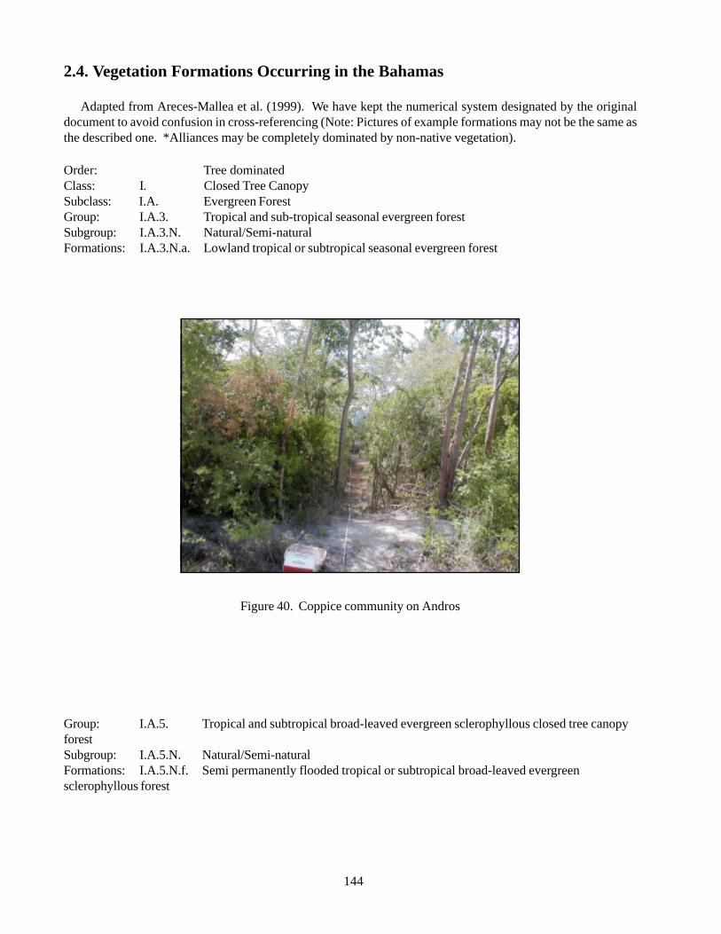
144
2.4. Vegetation Formations Occurring in the Bahamas
Adapted from Areces-Mallea et al. (1999). We have kept the numerical system designated by the originaldocument to avoid confusion in cross-referencing (Note: Pictures of example formations may not be the same asthe described one. *Alliances may be completely dominated by non-native vegetation).
Order: Tree dominatedClass: I. Closed Tree CanopySubclass: I.A. Evergreen ForestGroup: I.A.3. Tropical and sub-tropical seasonal evergreen forestSubgroup: I.A.3.N. Natural/Semi-naturalFormations: I.A.3.N.a. Lowland tropical or subtropical seasonal evergreen forest
Figure 40. Coppice community on Andros
Group: I.A.5. Tropical and subtropical broad-leaved evergreen sclerophyllous closed tree canopyforestSubgroup: I.A.5.N. Natural/Semi-naturalFormations: I.A.5.N.f. Semi permanently flooded tropical or subtropical broad-leaved evergreensclerophyllous forest
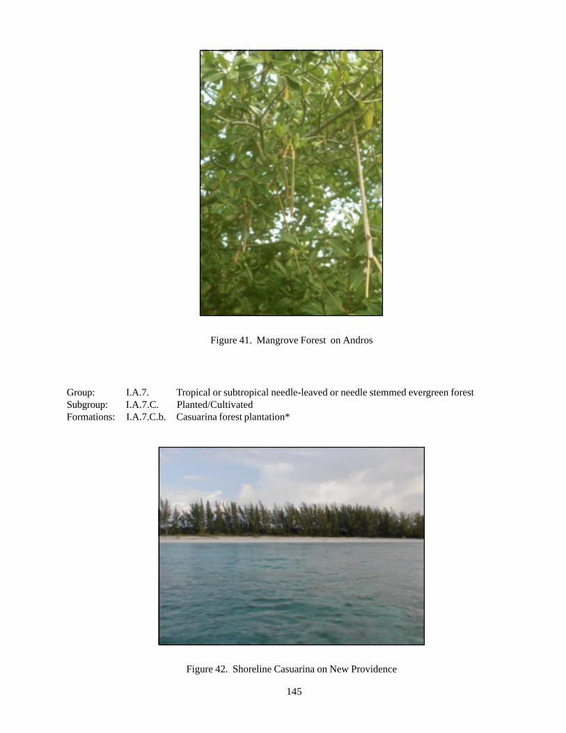
145
Figure 41. Mangrove Forest on Andros
Group: I.A.7. Tropical or subtropical needle-leaved or needle stemmed evergreen forestSubgroup: I.A.7.C. Planted/CultivatedFormations: I.A.7.C.b. Casuarina forest plantation*
Figure 42. Shoreline Casuarina on New Providence
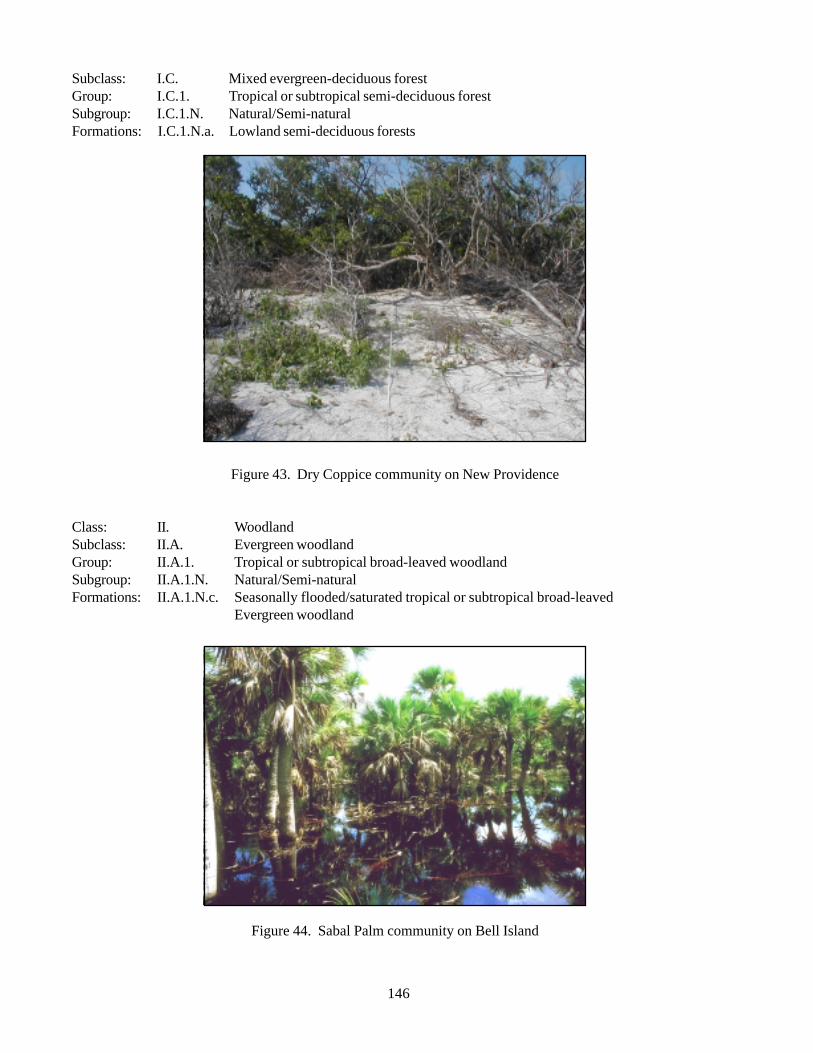
146
Subclass: I.C. Mixed evergreen-deciduous forestGroup: I.C.1. Tropical or subtropical semi-deciduous forestSubgroup: I.C.1.N. Natural/Semi-naturalFormations: I.C.1.N.a. Lowland semi-deciduous forests
Figure 43. Dry Coppice community on New Providence
Class: II. WoodlandSubclass: II.A. Evergreen woodlandGroup: II.A.1. Tropical or subtropical broad-leaved woodlandSubgroup: II.A.1.N. Natural/Semi-naturalFormations: II.A.1.N.c. Seasonally flooded/saturated tropical or subtropical broad-leaved
Evergreen woodland
Figure 44. Sabal Palm community on Bell Island
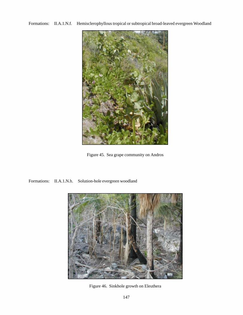
147
Formations: II.A.1.N.f. Hemisclerophyllous tropical or subtropical broad-leaved evergreen Woodland
Figure 45. Sea grape community on Andros
Formations: II.A.1.N.h. Solution-hole evergreen woodland
Figure 46. Sinkhole growth on Eleuthera
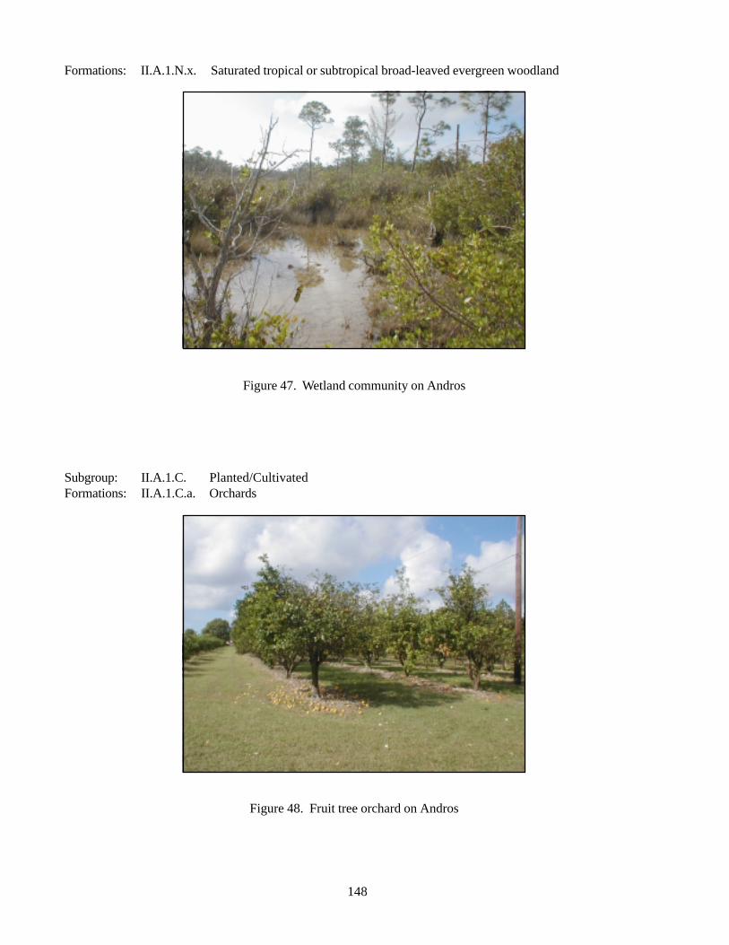
148
Formations: II.A.1.N.x. Saturated tropical or subtropical broad-leaved evergreen woodland
Figure 47. Wetland community on Andros
Subgroup: II.A.1.C. Planted/CultivatedFormations: II.A.1.C.a. Orchards
Figure 48. Fruit tree orchard on Andros
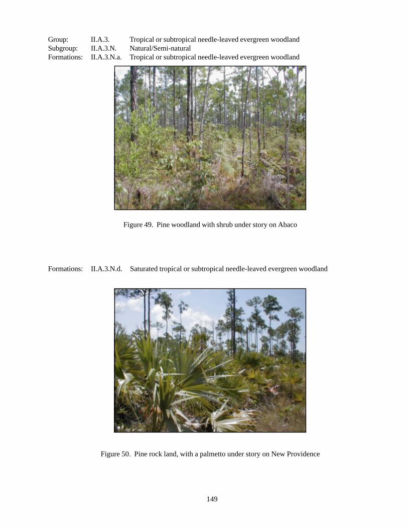
149
Group: II.A.3. Tropical or subtropical needle-leaved evergreen woodlandSubgroup: II.A.3.N. Natural/Semi-naturalFormations: II.A.3.N.a. Tropical or subtropical needle-leaved evergreen woodland
Figure 49. Pine woodland with shrub under story on Abaco
Formations: II.A.3.N.d. Saturated tropical or subtropical needle-leaved evergreen woodland
Figure 50. Pine rock land, with a palmetto under story on New Providence
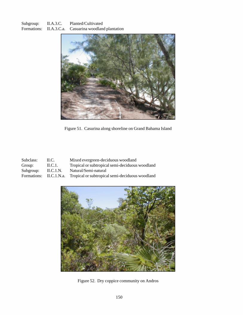
150
Subgroup: II.A.3.C. Planted/CultivatedFormations: II.A.3.C.a. Casuarina woodland plantation
Figure 51. Casurina along shoreline on Grand Bahama Island
Subclass: II.C. Mixed evergreen-deciduous woodlandGroup: II.C.1. Tropical or subtropical semi-deciduous woodlandSubgroup: II.C.1.N. Natural/Semi-naturalFormations: II.C.1.N.a. Tropical or subtropical semi-deciduous woodland
Figure 52. Dry coppice community on Andros
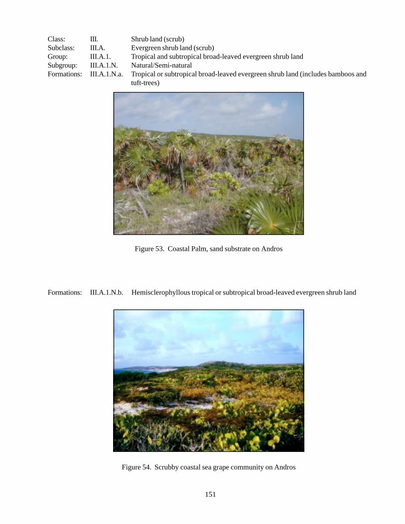
151
Class: III. Shrub land (scrub)Subclass: III.A. Evergreen shrub land (scrub)Group: III.A.1. Tropical and subtropical broad-leaved evergreen shrub landSubgroup: III.A.1.N. Natural/Semi-naturalFormations: III.A.1.N.a. Tropical or subtropical broad-leaved evergreen shrub land (includes bamboos and
tuft-trees)
Figure 53. Coastal Palm, sand substrate on Andros
Formations: III.A.1.N.b. Hemisclerophyllous tropical or subtropical broad-leaved evergreen shrub land
Figure 54. Scrubby coastal sea grape community on Andros
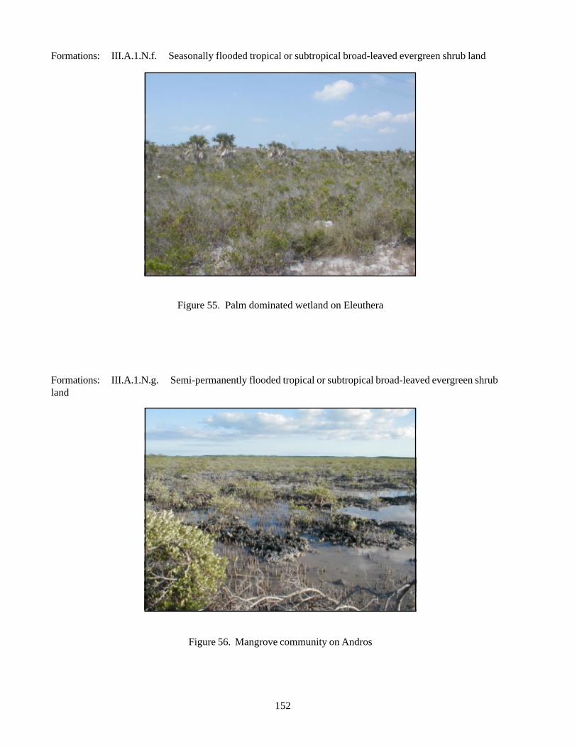
152
Formations: III.A.1.N.f. Seasonally flooded tropical or subtropical broad-leaved evergreen shrub land
Figure 55. Palm dominated wetland on Eleuthera
Formations: III.A.1.N.g. Semi-permanently flooded tropical or subtropical broad-leaved evergreen shrubland
Figure 56. Mangrove community on Andros

153
Formations: III.A.1.N.h. Tidally flooded tropical or subtropical broad-leaved evergreen shrub land
Figure 57. Tidal mangrove community on Abaco
Group: III.A.4. Microphyllous evergreen shrub landSubgroup: III.A.4.N. Natural/Semi-naturalFormations: III.A.4.N.a. Lowland microphyllous evergreen shrub land
Figure 58. Wild thyme (Rachicallis americana) on a rocky shoreline on Andros
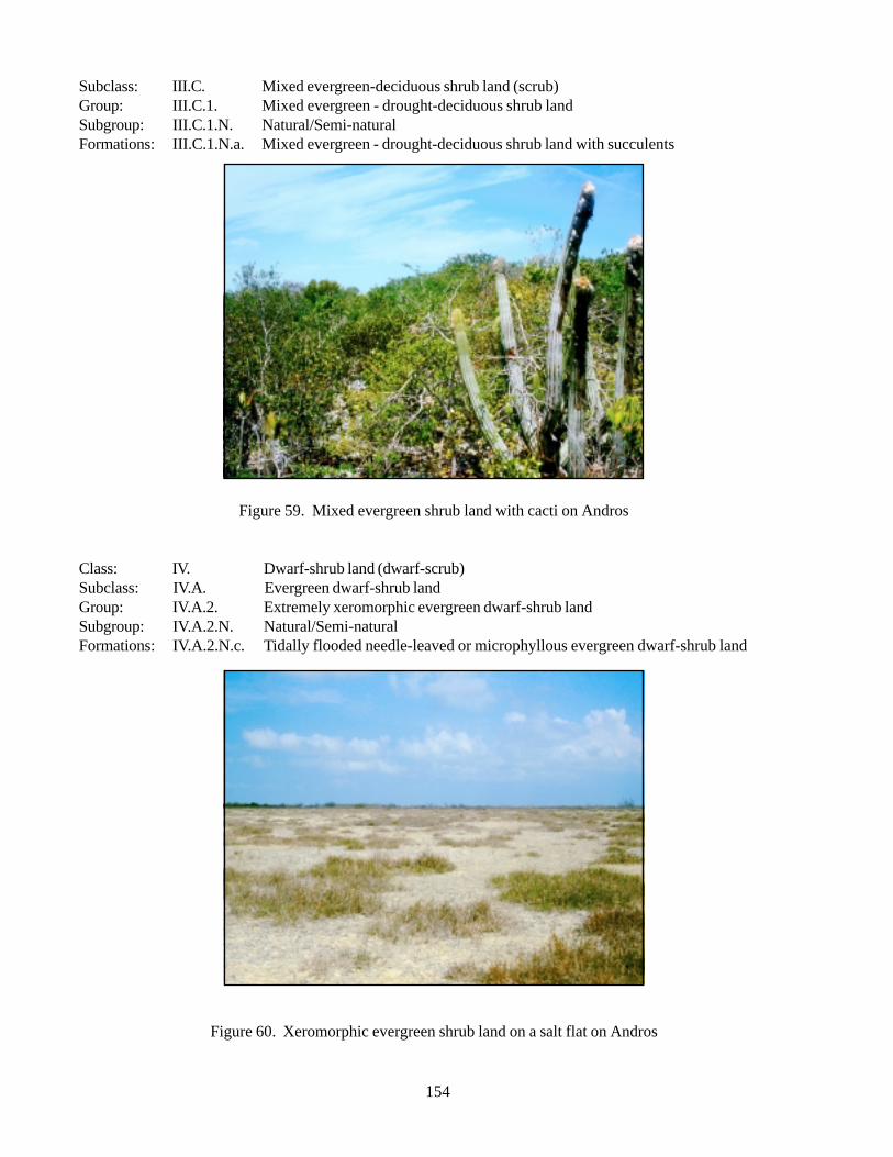
154
Subclass: III.C. Mixed evergreen-deciduous shrub land (scrub)Group: III.C.1. Mixed evergreen - drought-deciduous shrub landSubgroup: III.C.1.N. Natural/Semi-naturalFormations: III.C.1.N.a. Mixed evergreen - drought-deciduous shrub land with succulents
Figure 59. Mixed evergreen shrub land with cacti on Andros
Class: IV. Dwarf-shrub land (dwarf-scrub)Subclass: IV.A. Evergreen dwarf-shrub landGroup: IV.A.2. Extremely xeromorphic evergreen dwarf-shrub landSubgroup: IV.A.2.N. Natural/Semi-naturalFormations: IV.A.2.N.c. Tidally flooded needle-leaved or microphyllous evergreen dwarf-shrub land
Figure 60. Xeromorphic evergreen shrub land on a salt flat on Andros
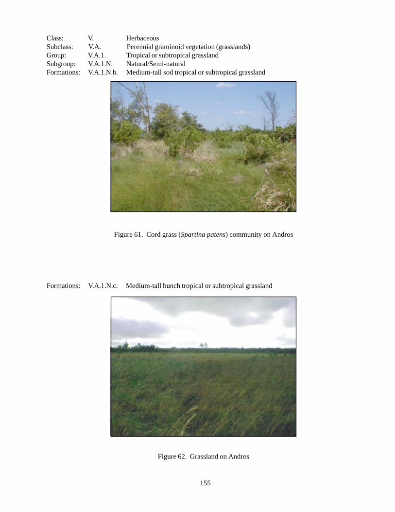
155
Class: V. HerbaceousSubclass: V.A. Perennial graminoid vegetation (grasslands)Group: V.A.1. Tropical or subtropical grasslandSubgroup: V.A.1.N. Natural/Semi-naturalFormations: V.A.1.N.b. Medium-tall sod tropical or subtropical grassland
Figure 61. Cord grass (Spartina patens) community on Andros
Formations: V.A.1.N.c. Medium-tall bunch tropical or subtropical grassland
Figure 62. Grassland on Andros
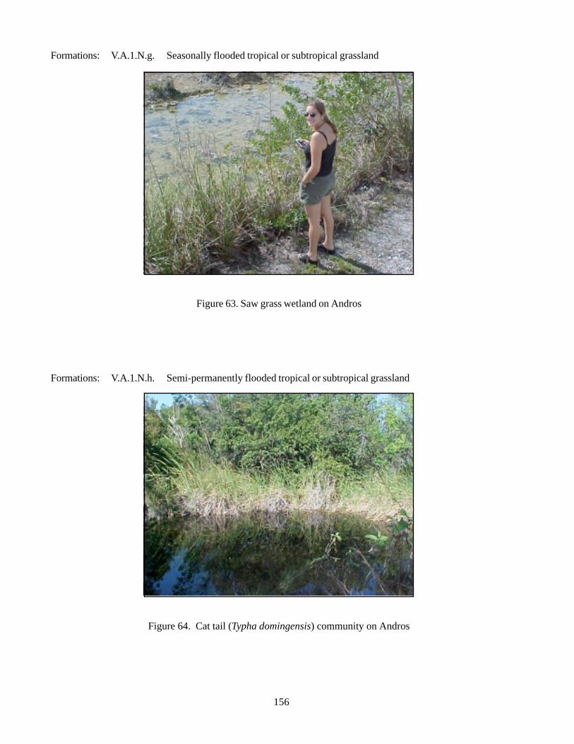
156
Formations: V.A.1.N.g. Seasonally flooded tropical or subtropical grassland
Figure 63. Saw grass wetland on Andros
Formations: V.A.1.N.h. Semi-permanently flooded tropical or subtropical grassland
Figure 64. Cat tail (Typha domingensis) community on Andros
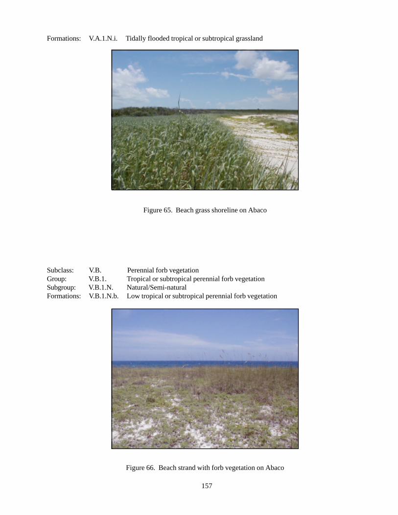
157
Formations: V.A.1.N.i. Tidally flooded tropical or subtropical grassland
Figure 65. Beach grass shoreline on Abaco
Subclass: V.B. Perennial forb vegetationGroup: V.B.1. Tropical or subtropical perennial forb vegetationSubgroup: V.B.1.N. Natural/Semi-naturalFormations: V.B.1.N.b. Low tropical or subtropical perennial forb vegetation
Figure 66. Beach strand with forb vegetation on Abaco
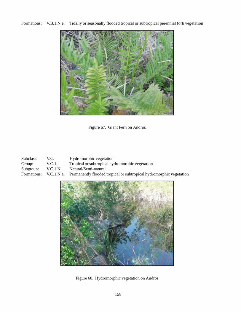
158
Formations: V.B.1.N.e. Tidally or seasonally flooded tropical or subtropical perennial forb vegetation
Figure 67. Giant Fern on Andros
Subclass: V.C. Hydromorphic vegetationGroup: V.C.1. Tropical or subtropical hydromorphic vegetationSubgroup: V.C.1.N. Natural/Semi-naturalFormations: V.C.1.N.a. Permanently flooded tropical or subtropical hydromorphic vegetation
Figure 68. Hydromorphic vegetation on Andros
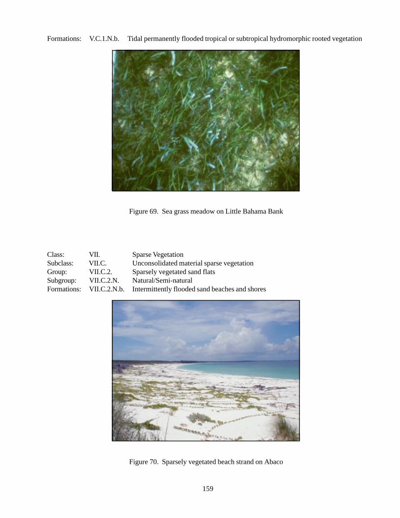
159
Formations: V.C.1.N.b. Tidal permanently flooded tropical or subtropical hydromorphic rooted vegetation
Figure 69. Sea grass meadow on Little Bahama Bank
Class: VII. Sparse VegetationSubclass: VII.C. Unconsolidated material sparse vegetationGroup: VII.C.2. Sparsely vegetated sand flatsSubgroup: VII.C.2.N. Natural/Semi-naturalFormations: VII.C.2.N.b. Intermittently flooded sand beaches and shores
Figure 70. Sparsely vegetated beach strand on Abaco
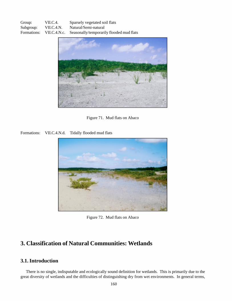
160
Group: VII.C.4. Sparsely vegetated soil flatsSubgroup: VII.C.4.N. Natural/Semi-naturalFormations: VII.C.4.N.c. Seasonally/temporarily flooded mud flats
Figure 71. Mud flats on Abaco
Formations: VII.C.4.N.d. Tidally flooded mud flats
Figure 72. Mud flats on Abaco
3. Classification of Natural Communities: Wetlands
3.1. Introduction
There is no single, indisputable and ecologically sound definition for wetlands. This is primarily due to thegreat diversity of wetlands and the difficulties of distinguishing dry from wet environments. In general terms,
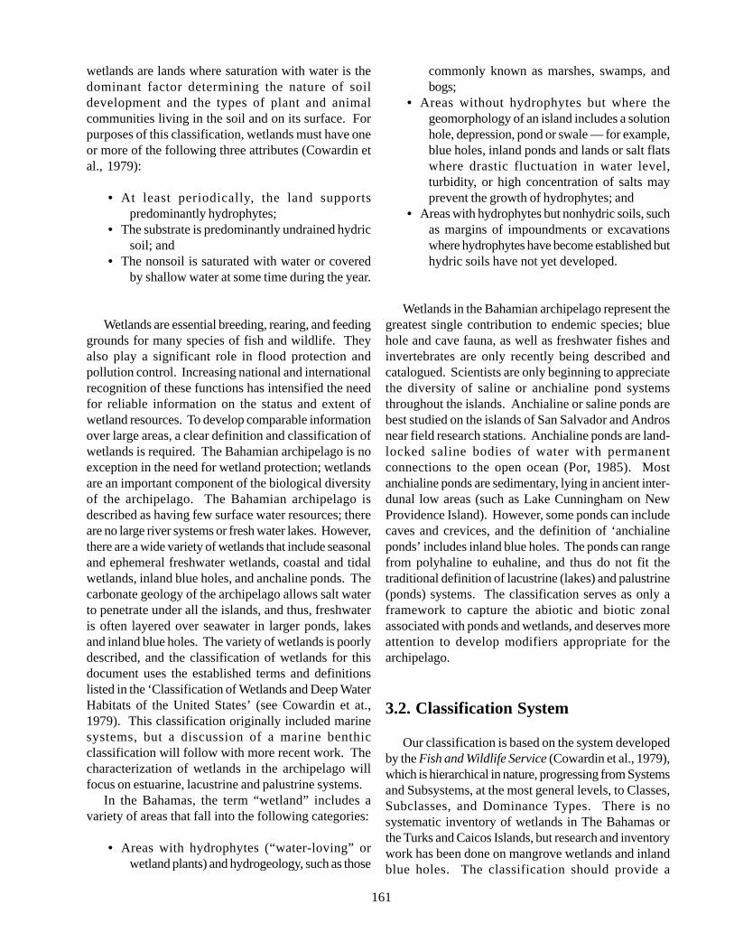
161
wetlands are lands where saturation with water is thedominant factor determining the nature of soildevelopment and the types of plant and animalcommunities living in the soil and on its surface. Forpurposes of this classification, wetlands must have oneor more of the following three attributes (Cowardin etal., 1979):
• At least periodically, the land supportspredominantly hydrophytes;
• The substrate is predominantly undrained hydricsoil; and
• The nonsoil is saturated with water or coveredby shallow water at some time during the year.
Wetlands are essential breeding, rearing, and feedinggrounds for many species of fish and wildlife. Theyalso play a significant role in flood protection andpollution control. Increasing national and internationalrecognition of these functions has intensified the needfor reliable information on the status and extent ofwetland resources. To develop comparable informationover large areas, a clear definition and classification ofwetlands is required. The Bahamian archipelago is noexception in the need for wetland protection; wetlandsare an important component of the biological diversityof the archipelago. The Bahamian archipelago isdescribed as having few surface water resources; thereare no large river systems or fresh water lakes. However,there are a wide variety of wetlands that include seasonaland ephemeral freshwater wetlands, coastal and tidalwetlands, inland blue holes, and anchaline ponds. Thecarbonate geology of the archipelago allows salt waterto penetrate under all the islands, and thus, freshwateris often layered over seawater in larger ponds, lakesand inland blue holes. The variety of wetlands is poorlydescribed, and the classification of wetlands for thisdocument uses the established terms and definitionslisted in the ‘Classification of Wetlands and Deep WaterHabitats of the United States’ (see Cowardin et at.,1979). This classification originally included marinesystems, but a discussion of a marine benthicclassification will follow with more recent work. Thecharacterization of wetlands in the archipelago willfocus on estuarine, lacustrine and palustrine systems.
In the Bahamas, the term “wetland” includes avariety of areas that fall into the following categories:
• Areas with hydrophytes (“water-loving” orwetland plants) and hydrogeology, such as those
commonly known as marshes, swamps, andbogs;
• Areas without hydrophytes but where thegeomorphology of an island includes a solutionhole, depression, pond or swale — for example,blue holes, inland ponds and lands or salt flatswhere drastic fluctuation in water level,turbidity, or high concentration of salts mayprevent the growth of hydrophytes; and
• Areas with hydrophytes but nonhydric soils, suchas margins of impoundments or excavationswhere hydrophytes have become established buthydric soils have not yet developed.
Wetlands in the Bahamian archipelago represent thegreatest single contribution to endemic species; bluehole and cave fauna, as well as freshwater fishes andinvertebrates are only recently being described andcatalogued. Scientists are only beginning to appreciatethe diversity of saline or anchialine pond systemsthroughout the islands. Anchialine or saline ponds arebest studied on the islands of San Salvador and Androsnear field research stations. Anchialine ponds are land-locked saline bodies of water with permanentconnections to the open ocean (Por, 1985). Mostanchialine ponds are sedimentary, lying in ancient inter-dunal low areas (such as Lake Cunningham on NewProvidence Island). However, some ponds can includecaves and crevices, and the definition of ‘anchialineponds’ includes inland blue holes. The ponds can rangefrom polyhaline to euhaline, and thus do not fit thetraditional definition of lacustrine (lakes) and palustrine(ponds) systems. The classification serves as only aframework to capture the abiotic and biotic zonalassociated with ponds and wetlands, and deserves moreattention to develop modifiers appropriate for thearchipelago.
3.2. Classification System
Our classification is based on the system developedby the Fish and Wildlife Service (Cowardin et al., 1979),which is hierarchical in nature, progressing from Systemsand Subsystems, at the most general levels, to Classes,Subclasses, and Dominance Types. There is nosystematic inventory of wetlands in The Bahamas orthe Turks and Caicos Islands, but research and inventorywork has been done on mangrove wetlands and inlandblue holes. The classification should provide a
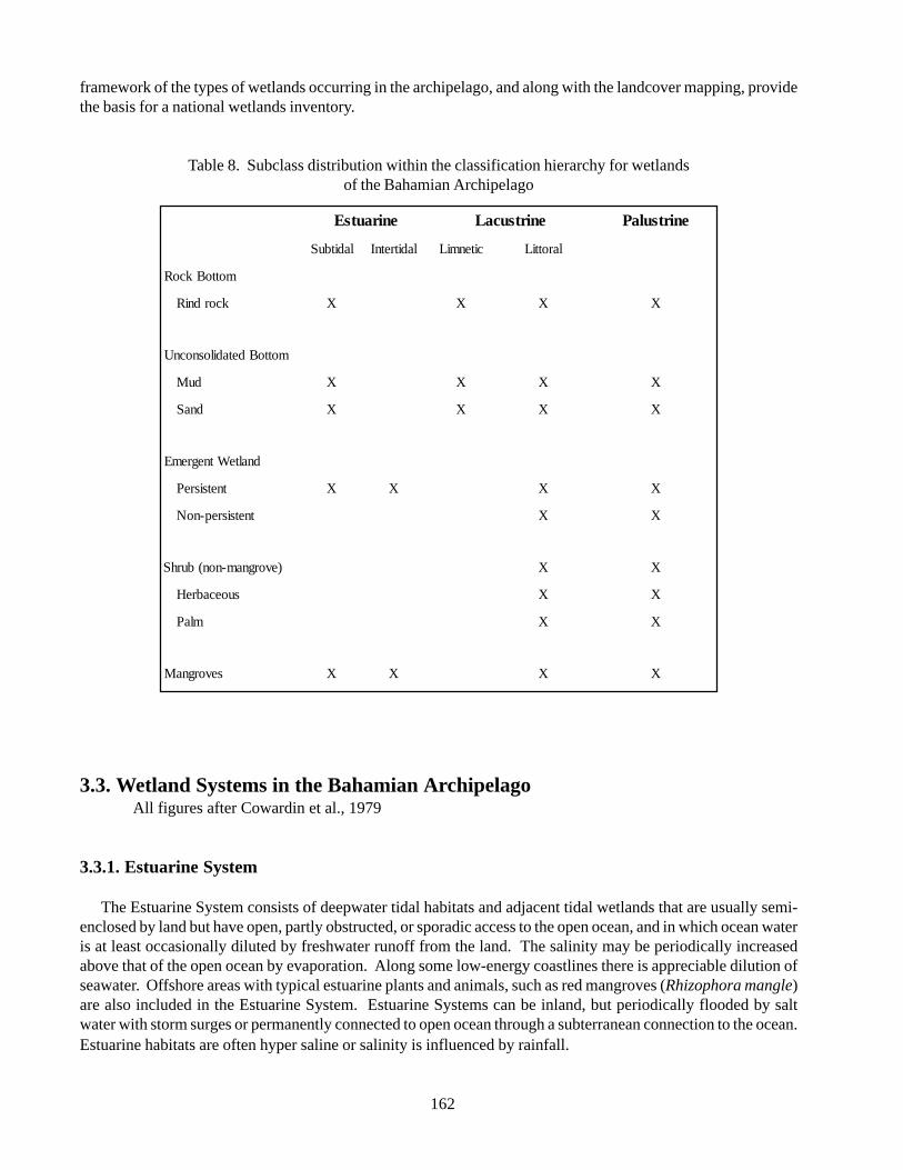
162
framework of the types of wetlands occurring in the archipelago, and along with the landcover mapping, providethe basis for a national wetlands inventory.
Table 8. Subclass distribution within the classification hierarchy for wetlandsof the Bahamian Archipelago
3.3. Wetland Systems in the Bahamian ArchipelagoAll figures after Cowardin et al., 1979
3.3.1. Estuarine System
The Estuarine System consists of deepwater tidal habitats and adjacent tidal wetlands that are usually semi-enclosed by land but have open, partly obstructed, or sporadic access to the open ocean, and in which ocean wateris at least occasionally diluted by freshwater runoff from the land. The salinity may be periodically increasedabove that of the open ocean by evaporation. Along some low-energy coastlines there is appreciable dilution ofseawater. Offshore areas with typical estuarine plants and animals, such as red mangroves (Rhizophora mangle)are also included in the Estuarine System. Estuarine Systems can be inland, but periodically flooded by saltwater with storm surges or permanently connected to open ocean through a subterranean connection to the ocean.Estuarine habitats are often hyper saline or salinity is influenced by rainfall.
enirautsE enirtsucaL enirtsulaP
laditbuS laditretnI citenmiL larottiL
mottoBkcoR
kcordniR X X X X
mottoBdetadilosnocnU
duM X X X X
dnaS X X X X
dnalteWtnegremE
tnetsisreP X X X X
tnetsisrep-noN X X
)evorgnam-non(burhS X X
suoecabreH X X
mlaP X X
sevorgnaM X X X X
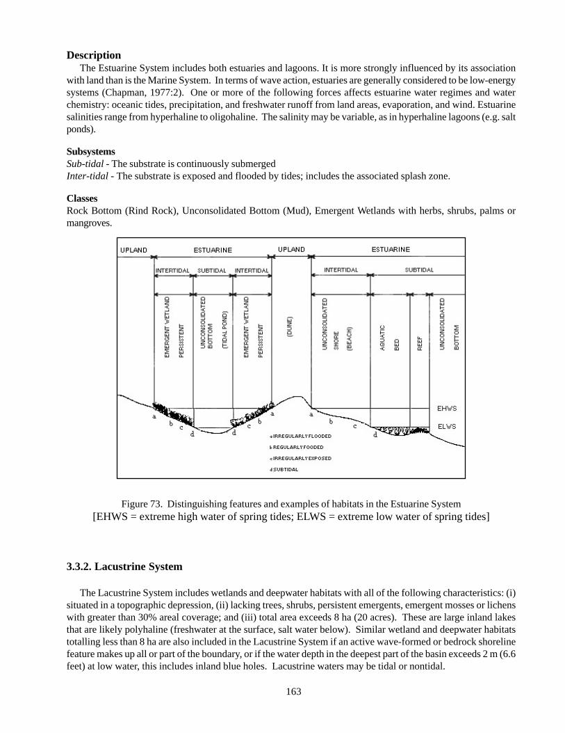
163
DescriptionThe Estuarine System includes both estuaries and lagoons. It is more strongly influenced by its association
with land than is the Marine System. In terms of wave action, estuaries are generally considered to be low-energysystems (Chapman, 1977:2). One or more of the following forces affects estuarine water regimes and waterchemistry: oceanic tides, precipitation, and freshwater runoff from land areas, evaporation, and wind. Estuarinesalinities range from hyperhaline to oligohaline. The salinity may be variable, as in hyperhaline lagoons (e.g. saltponds).
SubsystemsSub-tidal - The substrate is continuously submergedInter-tidal - The substrate is exposed and flooded by tides; includes the associated splash zone.
ClassesRock Bottom (Rind Rock), Unconsolidated Bottom (Mud), Emergent Wetlands with herbs, shrubs, palms ormangroves.
Figure 73. Distinguishing features and examples of habitats in the Estuarine System[EHWS = extreme high water of spring tides; ELWS = extreme low water of spring tides]
3.3.2. Lacustrine System
The Lacustrine System includes wetlands and deepwater habitats with all of the following characteristics: (i)situated in a topographic depression, (ii) lacking trees, shrubs, persistent emergents, emergent mosses or lichenswith greater than 30% areal coverage; and (iii) total area exceeds 8 ha (20 acres). These are large inland lakesthat are likely polyhaline (freshwater at the surface, salt water below). Similar wetland and deepwater habitatstotalling less than 8 ha are also included in the Lacustrine System if an active wave-formed or bedrock shorelinefeature makes up all or part of the boundary, or if the water depth in the deepest part of the basin exceeds 2 m (6.6feet) at low water, this includes inland blue holes. Lacustrine waters may be tidal or nontidal.
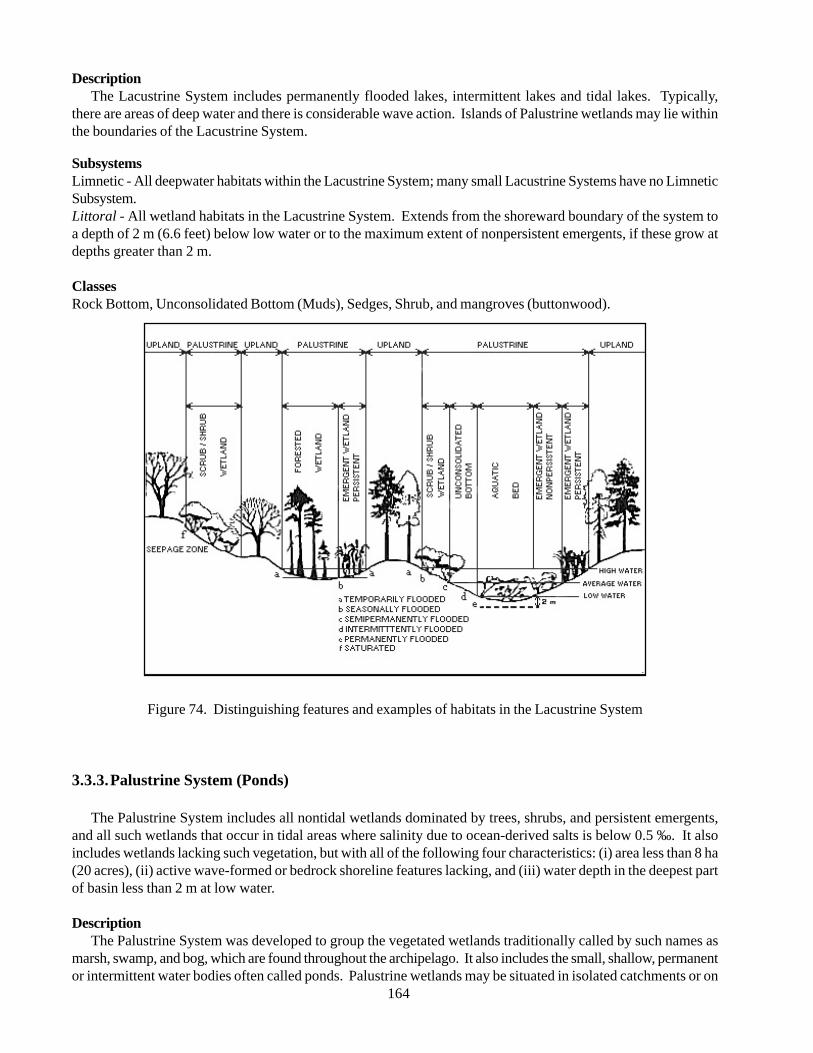
164
DescriptionThe Lacustrine System includes permanently flooded lakes, intermittent lakes and tidal lakes. Typically,
there are areas of deep water and there is considerable wave action. Islands of Palustrine wetlands may lie withinthe boundaries of the Lacustrine System.
SubsystemsLimnetic - All deepwater habitats within the Lacustrine System; many small Lacustrine Systems have no LimneticSubsystem.Littoral - All wetland habitats in the Lacustrine System. Extends from the shoreward boundary of the system toa depth of 2 m (6.6 feet) below low water or to the maximum extent of nonpersistent emergents, if these grow atdepths greater than 2 m.
ClassesRock Bottom, Unconsolidated Bottom (Muds), Sedges, Shrub, and mangroves (buttonwood).
Figure 74. Distinguishing features and examples of habitats in the Lacustrine System
3.3.3.Palustrine System (Ponds)
The Palustrine System includes all nontidal wetlands dominated by trees, shrubs, and persistent emergents,and all such wetlands that occur in tidal areas where salinity due to ocean-derived salts is below 0.5 ‰. It alsoincludes wetlands lacking such vegetation, but with all of the following four characteristics: (i) area less than 8 ha(20 acres), (ii) active wave-formed or bedrock shoreline features lacking, and (iii) water depth in the deepest partof basin less than 2 m at low water.
DescriptionThe Palustrine System was developed to group the vegetated wetlands traditionally called by such names as
marsh, swamp, and bog, which are found throughout the archipelago. It also includes the small, shallow, permanentor intermittent water bodies often called ponds. Palustrine wetlands may be situated in isolated catchments or on
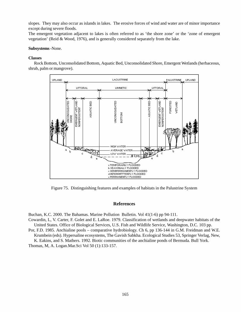
165
slopes. They may also occur as islands in lakes. The erosive forces of wind and water are of minor importanceexcept during severe floods.The emergent vegetation adjacent to lakes is often referred to as ‘the shore zone’ or the ‘zone of emergentvegetation’ (Reid & Wood, 1976), and is generally considered separately from the lake.
Subsystems -None.
ClassesRock Bottom, Unconsolidated Bottom, Aquatic Bed, Unconsolidated Shore, Emergent Wetlands (herbaceous,
shrub, palm or mangrove).
Figure 75. Distinguishing features and examples of habitats in the Palustrine System
References
Buchan, K.C. 2000. The Bahamas. Marine Pollution Bulletin. Vol 41(1-6) pp 94-111.Cowardin, L, V. Carter, F. Golet and E. LaRoe. 1979. Classification of wetlands and deepwater habitats of the
United States. Office of Biological Services, U.S. Fish and Wildlife Service, Washington, D.C. 103 pp.Por, F.D. 1985. Anchialine pools – comparative hydrobiology. Ch 6, pp 136-144 in G.M. Freidman and W.E.
Krumbein (eds). Hypersaline ecosystems, The Gavish Sabkha. Ecological Studies 53, Springer Verlag, New,K. Eakins, and S. Mathers. 1992. Biotic communities of the anchialine ponds of Bermuda. Bull York.
Thomas, M, A. Logan.Mar.Sci Vol 50 (1):133-157.
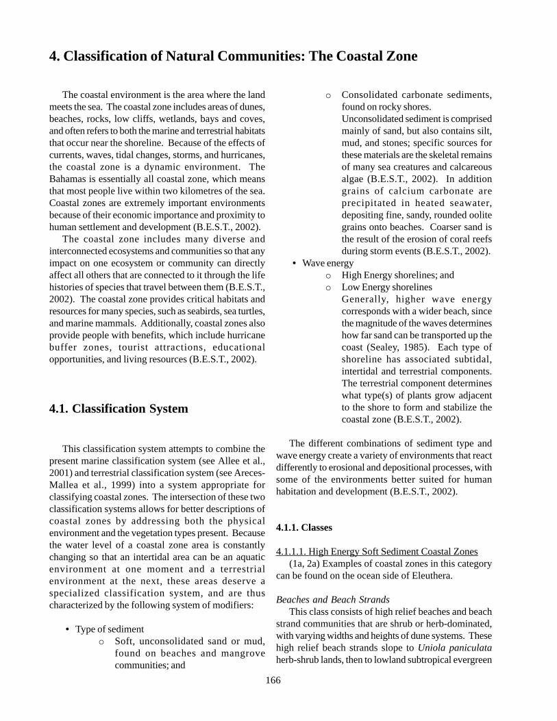
166
The coastal environment is the area where the landmeets the sea. The coastal zone includes areas of dunes,beaches, rocks, low cliffs, wetlands, bays and coves,and often refers to both the marine and terrestrial habitatsthat occur near the shoreline. Because of the effects ofcurrents, waves, tidal changes, storms, and hurricanes,the coastal zone is a dynamic environment. TheBahamas is essentially all coastal zone, which meansthat most people live within two kilometres of the sea.Coastal zones are extremely important environmentsbecause of their economic importance and proximity tohuman settlement and development (B.E.S.T., 2002).
The coastal zone includes many diverse andinterconnected ecosystems and communities so that anyimpact on one ecosystem or community can directlyaffect all others that are connected to it through the lifehistories of species that travel between them (B.E.S.T.,2002). The coastal zone provides critical habitats andresources for many species, such as seabirds, sea turtles,and marine mammals. Additionally, coastal zones alsoprovide people with benefits, which include hurricanebuffer zones, tourist attractions, educationalopportunities, and living resources (B.E.S.T., 2002).
4.1. Classification System
This classification system attempts to combine thepresent marine classification system (see Allee et al.,2001) and terrestrial classification system (see Areces-Mallea et al., 1999) into a system appropriate forclassifying coastal zones. The intersection of these twoclassification systems allows for better descriptions ofcoastal zones by addressing both the physicalenvironment and the vegetation types present. Becausethe water level of a coastal zone area is constantlychanging so that an intertidal area can be an aquaticenvironment at one moment and a terrestrialenvironment at the next, these areas deserve aspecialized classification system, and are thuscharacterized by the following system of modifiers:
• Type of sedimento Soft, unconsolidated sand or mud,
found on beaches and mangrovecommunities; and
o Consolidated carbonate sediments,found on rocky shores.Unconsolidated sediment is comprisedmainly of sand, but also contains silt,mud, and stones; specific sources forthese materials are the skeletal remainsof many sea creatures and calcareousalgae (B.E.S.T., 2002). In additiongrains of calcium carbonate areprecipitated in heated seawater,depositing fine, sandy, rounded oolitegrains onto beaches. Coarser sand isthe result of the erosion of coral reefsduring storm events (B.E.S.T., 2002).
• Wave energyo High Energy shorelines; ando Low Energy shorelines
Generally, higher wave energycorresponds with a wider beach, sincethe magnitude of the waves determineshow far sand can be transported up thecoast (Sealey, 1985). Each type ofshoreline has associated subtidal,intertidal and terrestrial components.The terrestrial component determineswhat type(s) of plants grow adjacentto the shore to form and stabilize thecoastal zone (B.E.S.T., 2002).
The different combinations of sediment type andwave energy create a variety of environments that reactdifferently to erosional and depositional processes, withsome of the environments better suited for humanhabitation and development (B.E.S.T., 2002).
4.1.1. Classes
4.1.1.1. High Energy Soft Sediment Coastal Zones(1a, 2a) Examples of coastal zones in this category
can be found on the ocean side of Eleuthera.
Beaches and Beach StrandsThis class consists of high relief beaches and beach
strand communities that are shrub or herb-dominated,with varying widths and heights of dune systems. Thesehigh relief beach strands slope to Uniola paniculataherb-shrub lands, then to lowland subtropical evergreen
4. Classification of Natural Communities: The Coastal Zone
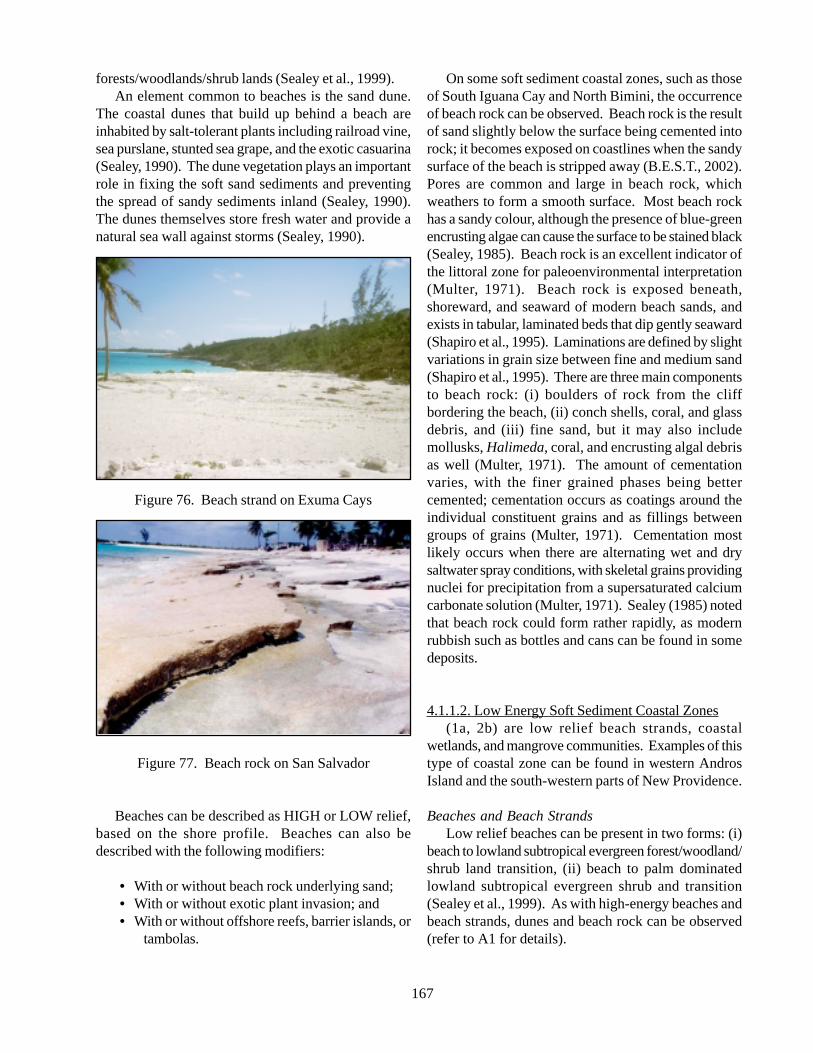
167
forests/woodlands/shrub lands (Sealey et al., 1999).An element common to beaches is the sand dune.
The coastal dunes that build up behind a beach areinhabited by salt-tolerant plants including railroad vine,sea purslane, stunted sea grape, and the exotic casuarina(Sealey, 1990). The dune vegetation plays an importantrole in fixing the soft sand sediments and preventingthe spread of sandy sediments inland (Sealey, 1990).The dunes themselves store fresh water and provide anatural sea wall against storms (Sealey, 1990).
Figure 76. Beach strand on Exuma Cays
Figure 77. Beach rock on San Salvador
Beaches can be described as HIGH or LOW relief,based on the shore profile. Beaches can also bedescribed with the following modifiers:
• With or without beach rock underlying sand;• With or without exotic plant invasion; and• With or without offshore reefs, barrier islands, or
tambolas.
On some soft sediment coastal zones, such as thoseof South Iguana Cay and North Bimini, the occurrenceof beach rock can be observed. Beach rock is the resultof sand slightly below the surface being cemented intorock; it becomes exposed on coastlines when the sandysurface of the beach is stripped away (B.E.S.T., 2002).Pores are common and large in beach rock, whichweathers to form a smooth surface. Most beach rockhas a sandy colour, although the presence of blue-greenencrusting algae can cause the surface to be stained black(Sealey, 1985). Beach rock is an excellent indicator ofthe littoral zone for paleoenvironmental interpretation(Multer, 1971). Beach rock is exposed beneath,shoreward, and seaward of modern beach sands, andexists in tabular, laminated beds that dip gently seaward(Shapiro et al., 1995). Laminations are defined by slightvariations in grain size between fine and medium sand(Shapiro et al., 1995). There are three main componentsto beach rock: (i) boulders of rock from the cliffbordering the beach, (ii) conch shells, coral, and glassdebris, and (iii) fine sand, but it may also includemollusks, Halimeda, coral, and encrusting algal debrisas well (Multer, 1971). The amount of cementationvaries, with the finer grained phases being bettercemented; cementation occurs as coatings around theindividual constituent grains and as fillings betweengroups of grains (Multer, 1971). Cementation mostlikely occurs when there are alternating wet and drysaltwater spray conditions, with skeletal grains providingnuclei for precipitation from a supersaturated calciumcarbonate solution (Multer, 1971). Sealey (1985) notedthat beach rock could form rather rapidly, as modernrubbish such as bottles and cans can be found in somedeposits.
4.1.1.2. Low Energy Soft Sediment Coastal Zones(1a, 2b) are low relief beach strands, coastal
wetlands, and mangrove communities. Examples of thistype of coastal zone can be found in western AndrosIsland and the south-western parts of New Providence.
Beaches and Beach StrandsLow relief beaches can be present in two forms: (i)
beach to lowland subtropical evergreen forest/woodland/shrub land transition, (ii) beach to palm dominatedlowland subtropical evergreen shrub and transition(Sealey et al., 1999). As with high-energy beaches andbeach strands, dunes and beach rock can be observed(refer to A1 for details).
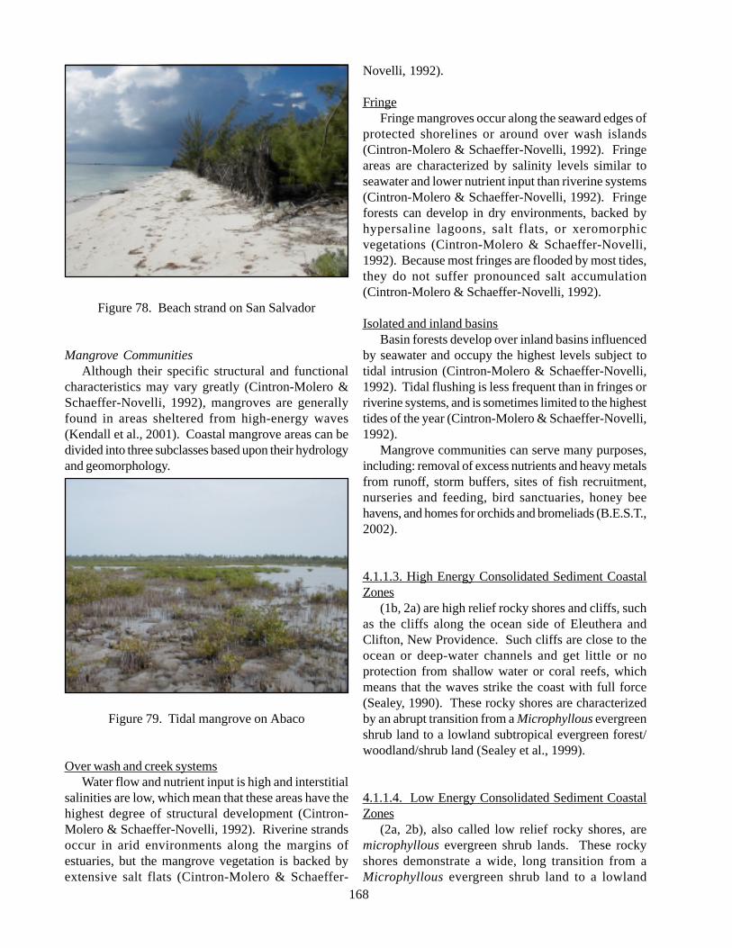
168
Figure 78. Beach strand on San Salvador
Mangrove CommunitiesAlthough their specific structural and functional
characteristics may vary greatly (Cintron-Molero &Schaeffer-Novelli, 1992), mangroves are generallyfound in areas sheltered from high-energy waves(Kendall et al., 2001). Coastal mangrove areas can bedivided into three subclasses based upon their hydrologyand geomorphology.
Figure 79. Tidal mangrove on Abaco
Over wash and creek systemsWater flow and nutrient input is high and interstitial
salinities are low, which mean that these areas have thehighest degree of structural development (Cintron-Molero & Schaeffer-Novelli, 1992). Riverine strandsoccur in arid environments along the margins ofestuaries, but the mangrove vegetation is backed byextensive salt flats (Cintron-Molero & Schaeffer-
Novelli, 1992).
FringeFringe mangroves occur along the seaward edges of
protected shorelines or around over wash islands(Cintron-Molero & Schaeffer-Novelli, 1992). Fringeareas are characterized by salinity levels similar toseawater and lower nutrient input than riverine systems(Cintron-Molero & Schaeffer-Novelli, 1992). Fringeforests can develop in dry environments, backed byhypersaline lagoons, salt flats, or xeromorphicvegetations (Cintron-Molero & Schaeffer-Novelli,1992). Because most fringes are flooded by most tides,they do not suffer pronounced salt accumulation(Cintron-Molero & Schaeffer-Novelli, 1992).
Isolated and inland basinsBasin forests develop over inland basins influenced
by seawater and occupy the highest levels subject totidal intrusion (Cintron-Molero & Schaeffer-Novelli,1992). Tidal flushing is less frequent than in fringes orriverine systems, and is sometimes limited to the highesttides of the year (Cintron-Molero & Schaeffer-Novelli,1992).
Mangrove communities can serve many purposes,including: removal of excess nutrients and heavy metalsfrom runoff, storm buffers, sites of fish recruitment,nurseries and feeding, bird sanctuaries, honey beehavens, and homes for orchids and bromeliads (B.E.S.T.,2002).
4.1.1.3. High Energy Consolidated Sediment CoastalZones
(1b, 2a) are high relief rocky shores and cliffs, suchas the cliffs along the ocean side of Eleuthera andClifton, New Providence. Such cliffs are close to theocean or deep-water channels and get little or noprotection from shallow water or coral reefs, whichmeans that the waves strike the coast with full force(Sealey, 1990). These rocky shores are characterizedby an abrupt transition from a Microphyllous evergreenshrub land to a lowland subtropical evergreen forest/woodland/shrub land (Sealey et al., 1999).
4.1.1.4. Low Energy Consolidated Sediment CoastalZones
(2a, 2b), also called low relief rocky shores, aremicrophyllous evergreen shrub lands. These rockyshores demonstrate a wide, long transition from aMicrophyllous evergreen shrub land to a lowland
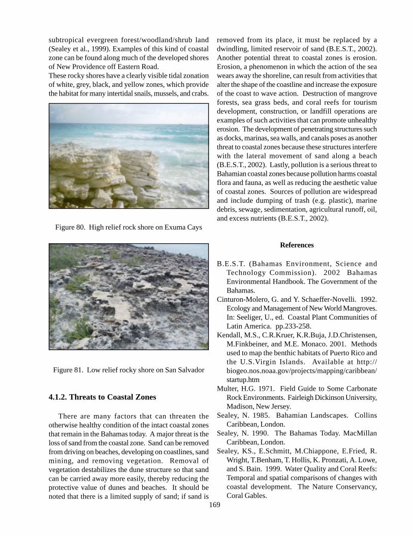
169
subtropical evergreen forest/woodland/shrub land(Sealey et al., 1999). Examples of this kind of coastalzone can be found along much of the developed shoresof New Providence off Eastern Road.These rocky shores have a clearly visible tidal zonationof white, grey, black, and yellow zones, which providethe habitat for many intertidal snails, mussels, and crabs.
Figure 80. High relief rock shore on Exuma Cays
Figure 81. Low relief rocky shore on San Salvador
4.1.2. Threats to Coastal Zones
There are many factors that can threaten theotherwise healthy condition of the intact coastal zonesthat remain in the Bahamas today. A major threat is theloss of sand from the coastal zone. Sand can be removedfrom driving on beaches, developing on coastlines, sandmining, and removing vegetation. Removal ofvegetation destabilizes the dune structure so that sandcan be carried away more easily, thereby reducing theprotective value of dunes and beaches. It should benoted that there is a limited supply of sand; if sand is
removed from its place, it must be replaced by adwindling, limited reservoir of sand (B.E.S.T., 2002).Another potential threat to coastal zones is erosion.Erosion, a phenomenon in which the action of the seawears away the shoreline, can result from activities thatalter the shape of the coastline and increase the exposureof the coast to wave action. Destruction of mangroveforests, sea grass beds, and coral reefs for tourismdevelopment, construction, or landfill operations areexamples of such activities that can promote unhealthyerosion. The development of penetrating structures suchas docks, marinas, sea walls, and canals poses as anotherthreat to coastal zones because these structures interferewith the lateral movement of sand along a beach(B.E.S.T., 2002). Lastly, pollution is a serious threat toBahamian coastal zones because pollution harms coastalflora and fauna, as well as reducing the aesthetic valueof coastal zones. Sources of pollution are widespreadand include dumping of trash (e.g. plastic), marinedebris, sewage, sedimentation, agricultural runoff, oil,and excess nutrients (B.E.S.T., 2002).
References
B.E.S.T. (Bahamas Environment, Science andTechnology Commission). 2002 BahamasEnvironmental Handbook. The Government of theBahamas.
Cinturon-Molero, G. and Y. Schaeffer-Novelli. 1992.Ecology and Management of New World Mangroves.In: Seeliger, U., ed. Coastal Plant Communities ofLatin America. pp.233-258.
Kendall, M.S., C.R.Kruer, K.R.Buja, J.D.Christensen,M.Finkbeiner, and M.E. Monaco. 2001. Methodsused to map the benthic habitats of Puerto Rico andthe U.S.Virgin Islands. Available at http://biogeo.nos.noaa.gov/projects/mapping/caribbean/startup.htm
Multer, H.G. 1971. Field Guide to Some CarbonateRock Environments. Fairleigh Dickinson University,Madison, New Jersey.
Sealey, N. 1985. Bahamian Landscapes. CollinsCaribbean, London.
Sealey, N. 1990. The Bahamas Today. MacMillanCaribbean, London.
Sealey, KS., E.Schmitt, M.Chiappone, E.Fried, R.Wright, T.Benham, T. Hollis, K. Pronzati, A. Lowe,and S. Bain. 1999. Water Quality and Coral Reefs:Temporal and spatial comparisons of changes withcoastal development. The Nature Conservancy,Coral Gables.
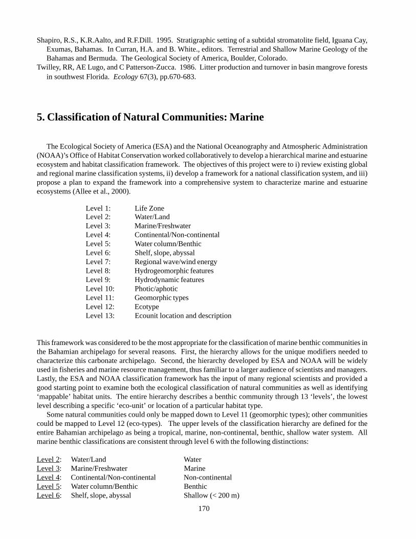
170
Shapiro, R.S., K.R.Aalto, and R.F.Dill. 1995. Stratigraphic setting of a subtidal stromatolite field, Iguana Cay,Exumas, Bahamas. In Curran, H.A. and B. White., editors. Terrestrial and Shallow Marine Geology of theBahamas and Bermuda. The Geological Society of America, Boulder, Colorado.
Twilley, RR, AE Lugo, and C Patterson-Zucca. 1986. Litter production and turnover in basin mangrove forestsin southwest Florida. Ecology 67(3), pp.670-683.
5. Classification of Natural Communities: Marine
The Ecological Society of America (ESA) and the National Oceanography and Atmospheric Administration(NOAA)’s Office of Habitat Conservation worked collaboratively to develop a hierarchical marine and estuarineecosystem and habitat classification framework. The objectives of this project were to i) review existing globaland regional marine classification systems, ii) develop a framework for a national classification system, and iii)propose a plan to expand the framework into a comprehensive system to characterize marine and estuarineecosystems (Allee et al., 2000).
Level 1: Life ZoneLevel 2: Water/LandLevel 3: Marine/FreshwaterLevel 4: Continental/Non-continentalLevel 5: Water column/BenthicLevel 6: Shelf, slope, abyssalLevel 7: Regional wave/wind energyLevel 8: Hydrogeomorphic featuresLevel 9: Hydrodynamic featuresLevel 10: Photic/aphoticLevel 11: Geomorphic typesLevel 12: EcotypeLevel 13: Ecounit location and description
This framework was considered to be the most appropriate for the classification of marine benthic communities inthe Bahamian archipelago for several reasons. First, the hierarchy allows for the unique modifiers needed tocharacterize this carbonate archipelago. Second, the hierarchy developed by ESA and NOAA will be widelyused in fisheries and marine resource management, thus familiar to a larger audience of scientists and managers.Lastly, the ESA and NOAA classification framework has the input of many regional scientists and provided agood starting point to examine both the ecological classification of natural communities as well as identifying‘mappable’ habitat units. The entire hierarchy describes a benthic community through 13 ‘levels’, the lowestlevel describing a specific ‘eco-unit’ or location of a particular habitat type.
Some natural communities could only be mapped down to Level 11 (geomorphic types); other communitiescould be mapped to Level 12 (eco-types). The upper levels of the classification hierarchy are defined for theentire Bahamian archipelago as being a tropical, marine, non-continental, benthic, shallow water system. Allmarine benthic classifications are consistent through level 6 with the following distinctions:
Level 2: Water/Land WaterLevel 3: Marine/Freshwater MarineLevel 4: Continental/Non-continental Non-continentalLevel 5: Water column/Benthic BenthicLevel 6: Shelf, slope, abyssal Shallow (< 200 m)
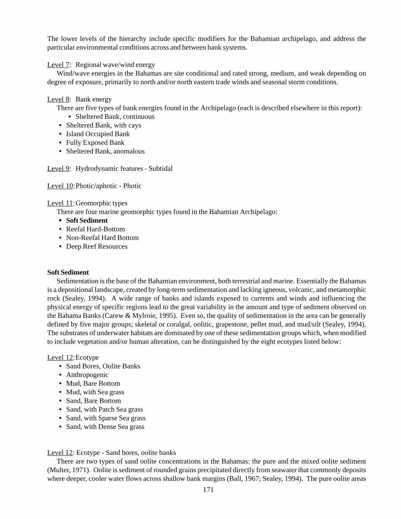
171
The lower levels of the hierarchy include specific modifiers for the Bahamian archipelago, and address theparticular environmental conditions across and between bank systems.
Level 7: Regional wave/wind energyWind/wave energies in the Bahamas are site conditional and rated strong, medium, and weak depending on
degree of exposure, primarily to north and/or north eastern trade winds and seasonal storm conditions.
Level 8: Bank energyThere are five types of bank energies found in the Archipelago (each is described elsewhere in this report):
• Sheltered Bank, continuous• Sheltered Bank, with cays• Island Occupied Bank• Fully Exposed Bank• Sheltered Bank, anomalous
Level 9: Hydrodynamic features - Subtidal
Level 10:Photic/aphotic - Photic
Level 11:Geomorphic typesThere are four marine geomorphic types found in the Bahamian Archipelago:••••• Soft Sediment• Reefal Hard-Bottom• Non-Reefal Hard Bottom• Deep Reef Resources
Soft SedimentSedimentation is the base of the Bahamian environment, both terrestrial and marine. Essentially the Bahamas
is a depositional landscape, created by long-term sedimentation and lacking igneous, volcanic, and metamorphicrock (Sealey, 1994). A wide range of banks and islands exposed to currents and winds and influencing thephysical energy of specific regions lead to the great variability in the amount and type of sediment observed onthe Bahama Banks (Carew & Mylroie, 1995). Even so, the quality of sedimentation in the area can be generallydefined by five major groups; skeletal or coralgal, oolitic, grapestone, pellet mud, and mud/silt (Sealey, 1994).The substrates of underwater habitats are dominated by one of these sedimentation groups which, when modifiedto include vegetation and/or human alteration, can be distinguished by the eight ecotypes listed below:
Level 12:Ecotype• Sand Bores, Oolite Banks• Anthropogenic• Mud, Bare Bottom• Mud, with Sea grass• Sand, Bare Bottom• Sand, with Patch Sea grass• Sand, with Sparse Sea grass• Sand, with Dense Sea grass
Level 12: Ecotype - Sand bores, oolite banksThere are two types of sand oolite concentrations in the Bahamas: the pure and the mixed oolite sediment
(Multer, 1971). Oolite is sediment of rounded grains precipitated directly from seawater that commonly depositswhere deeper, cooler water flows across shallow bank margins (Ball, 1967; Sealey, 1994). The pure oolite areas
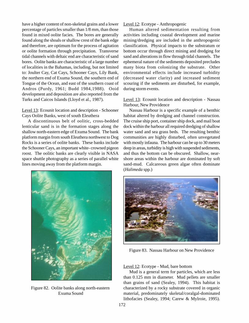
172
have a higher content of non-skeletal grains and a lowerpercentage of particles smaller than 1/8 mm, than thosefound in mixed oolite facies. The bores are generallyfound along the shoals or shallow crest of the bank edgeand therefore, are optimum for the process of agitationor oolite formation through precipitation. Transversetidal channels with deltaic end are characteristic of sandbores. Oolite banks are characteristic of a large numberof localities in the Bahamas, including, but not limitedto: Joulter Cay, Cat Cays, Schooner Cays, Lily Bank,the northern end of Exuma Sound, the southern end ofTongue of the Ocean, and east of the southern coast ofAndros (Purdy, 1961; Budd 1984,1988). Ooiddevelopment and deposition are also reported from theTurks and Caicos Islands (Lloyd et al., 1987).
Level 13: Ecounit location and description - SchoonerCays Oolite Banks, west of south Eleuthera
A discontinuous belt of oolitic, cross-beddedlenticular sand is in the formation stages along theshallow north-eastern edge of Exuma Sound. The bankplatform margin from south Eleuthera northwest to DogRocks is a series of oolite banks. These banks includethe Schooner Cays, an important white- crowned pigeonroost. The oolitic banks are clearly visible in NASAspace shuttle photography as a series of parallel whitelines moving away from the platform margin.
Figure 82. Oolite banks along north-eastern Exuma Sound
Level 12: Ecotype - AnthropogenicHuman altered sedimentation resulting from
activities including coastal development and marinemining/dredging are included in the anthropogenicclassification. Physical impacts to the substratum orbottom occur through direct mining and dredging forsand and alterations in flow through tidal channels. Theephemeral nature of the sediments deposited precludesmany biota from colonizing the substrate. Otherenvironmental effects include increased turbidity(decreased water clarity) and increased sedimentscouring if the sediments are disturbed, for example,during storm events.
Level 13: Ecounit location and description - NassauHarbour, New Providence
Nassau Harbour is a specific example of a benthichabitat altered by dredging and channel construction.The cruise ship port, container ship dock, and mail boatdock within the harbour all required dredging of shallowwater sand and sea grass beds. The resulting benthiccommunities are highly disturbed, often unvegetatedwith mostly infauna. The harbour can be up to 30 metersdeep in areas, turbidity is high with suspended sediments,and thus the bottom can be obscured. Shallow, near-shore areas within the harbour are dominated by softsand-mud. Calcareous green algae often dominate(Halimeda spp.)
Figure 83. Nassau Harbour on New Providence
Level 12: Ecotype - Mud, bare bottomMud is a general term for particles, which are less
than 0.125 mm in diameter. Mud pellets are smallerthan grains of sand (Sealey, 1994). This habitat ischaracterized by a rocky substrate covered in organicmaterial, predominately skeletal/coralgal-dominatedlithofacies (Sealey, 1994; Carew & Mylroie, 1995).
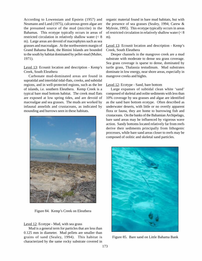
173
According to Lowenstam and Epstein (1957) andNeumann and Land (1975), calcareous green algae arethe presumed source of the mud (micrite) in theBahamas. This ecotype typically occurs in areas ofrestricted circulation in relatively shallow water (< 8m). Large areas are devoid of macrophytes such as seagrasses and macroalgae. At the northwestern margin ofGrand Bahama Bank, the Bimini Islands are boundedto the south by habitat dominated by pellet-mud (Multer,1971).
Level 13: Ecounit location and description - Kemp’sCreek, South Eleuthera
Carbonate mud-dominated areas are found insupratidal and intertidal tidal-flats, creeks, and subtidalregions, and in well-protected regions, such as the leeof islands, i.e. southern Eleuthera. Kemp Creek is atypical bare mud bottom habitat. The creek mud flatsare exposed at low spring tides, and are devoid ofmacroalgae and sea grasses. The muds are worked byinfaunal annelids and crustaceans, as indicated bymounding and burrows seen in these habitats.
Figure 84. Kemp’s Creek on Eleuthera
Level 12: Ecotype - Mud, with sea grassMud is a general term for particles that are less than
0.125 mm in diameter. Mud pellets are smaller thangrains of sand (Sealey, 1994). This habitat ischaracterized by the same rocky substrate covered in
organic material found in bare mud habitats, but withthe presence of sea grasses (Sealey, 1994; Carew &Mylroie, 1995). This ecotype typically occurs in areasof restricted circulation in relatively shallow water (< 8m).
Level 13: Ecounit location and description - Kemp’sCreek, South Eleuthera
Deeper channels in the mangrove creek are a mudsubstrate with moderate to dense sea grass coverage.Sea grass coverage is sparse to dense, dominated byturtle grass, Thalassia testudinum. Mud substratesdominate in low energy, near shore areas, especially inmangrove creeks and bights.
Level 12: Ecotype - Sand, bare bottomLarge expanses of subtidal clean white ‘sand’
composed of skeletal and oolite sediments with less than10% coverage by sea grasses and algae are identifiedas the sand bare bottom ecotype. Often described asunderwater deserts, with little or no overtly apparentflora or fauna, they are home to burrowing fish andcrustaceans. On the banks of the Bahamian Archipelago,bare sand areas may be influenced by vigorous waveaction. Sandy bottoms located relatively far from reefsderive their sediments principally from lithogenicprocesses, while bare sand areas closer to reefs may becomposed of oolitic and skeletal sand particles.
Figure 85. Bare sand on Little Bahama Bank
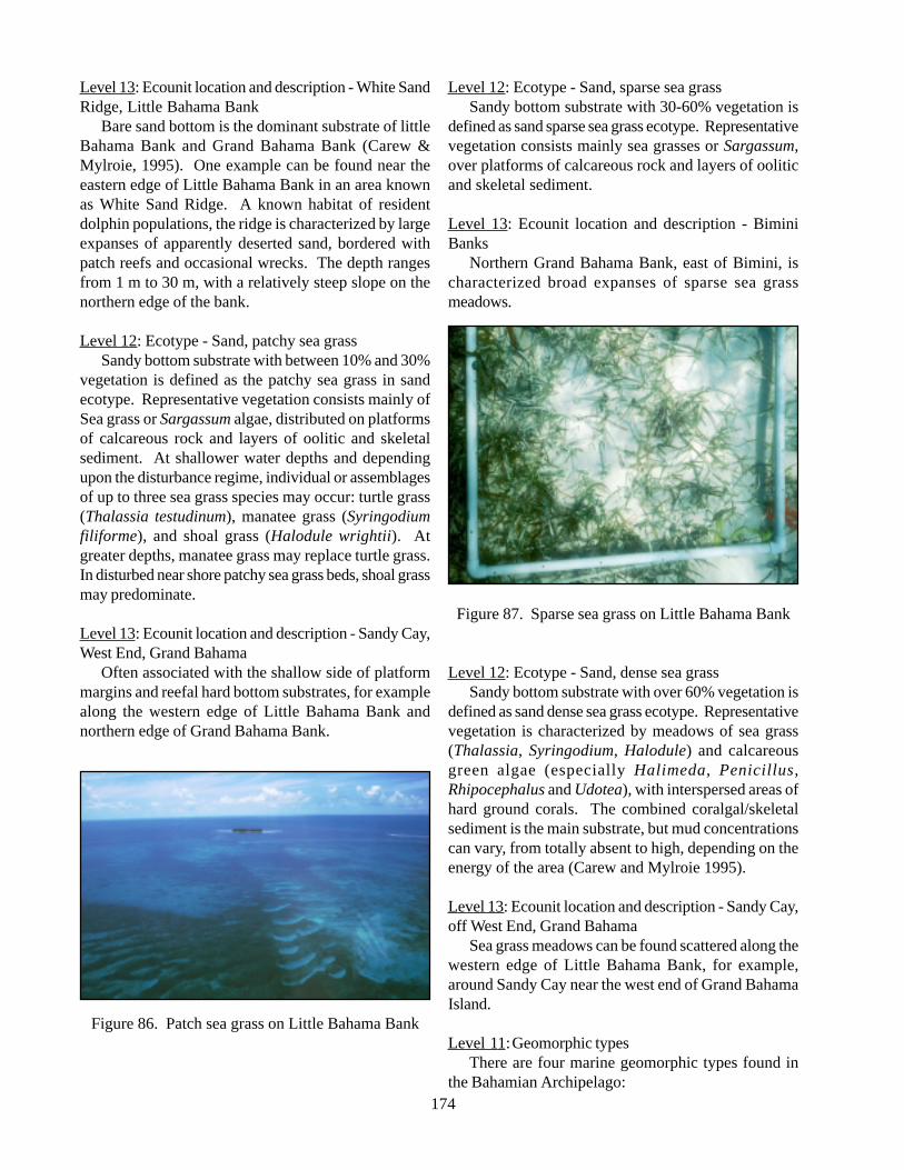
174
Level 13: Ecounit location and description - White SandRidge, Little Bahama Bank
Bare sand bottom is the dominant substrate of littleBahama Bank and Grand Bahama Bank (Carew &Mylroie, 1995). One example can be found near theeastern edge of Little Bahama Bank in an area knownas White Sand Ridge. A known habitat of residentdolphin populations, the ridge is characterized by largeexpanses of apparently deserted sand, bordered withpatch reefs and occasional wrecks. The depth rangesfrom 1 m to 30 m, with a relatively steep slope on thenorthern edge of the bank.
Level 12: Ecotype - Sand, patchy sea grassSandy bottom substrate with between 10% and 30%
vegetation is defined as the patchy sea grass in sandecotype. Representative vegetation consists mainly ofSea grass or Sargassum algae, distributed on platformsof calcareous rock and layers of oolitic and skeletalsediment. At shallower water depths and dependingupon the disturbance regime, individual or assemblagesof up to three sea grass species may occur: turtle grass(Thalassia testudinum), manatee grass (Syringodiumfiliforme), and shoal grass (Halodule wrightii). Atgreater depths, manatee grass may replace turtle grass.In disturbed near shore patchy sea grass beds, shoal grassmay predominate.
Level 13: Ecounit location and description - Sandy Cay,West End, Grand Bahama
Often associated with the shallow side of platformmargins and reefal hard bottom substrates, for examplealong the western edge of Little Bahama Bank andnorthern edge of Grand Bahama Bank.
Figure 86. Patch sea grass on Little Bahama Bank
Level 12: Ecotype - Sand, sparse sea grassSandy bottom substrate with 30-60% vegetation is
defined as sand sparse sea grass ecotype. Representativevegetation consists mainly sea grasses or Sargassum,over platforms of calcareous rock and layers of ooliticand skeletal sediment.
Level 13: Ecounit location and description - BiminiBanks
Northern Grand Bahama Bank, east of Bimini, ischaracterized broad expanses of sparse sea grassmeadows.
Figure 87. Sparse sea grass on Little Bahama Bank
Level 12: Ecotype - Sand, dense sea grassSandy bottom substrate with over 60% vegetation is
defined as sand dense sea grass ecotype. Representativevegetation is characterized by meadows of sea grass(Thalassia, Syringodium, Halodule) and calcareousgreen algae (especially Halimeda, Penicillus,Rhipocephalus and Udotea), with interspersed areas ofhard ground corals. The combined coralgal/skeletalsediment is the main substrate, but mud concentrationscan vary, from totally absent to high, depending on theenergy of the area (Carew and Mylroie 1995).
Level 13: Ecounit location and description - Sandy Cay,off West End, Grand Bahama
Sea grass meadows can be found scattered along thewestern edge of Little Bahama Bank, for example,around Sandy Cay near the west end of Grand BahamaIsland.
Level 11:Geomorphic typesThere are four marine geomorphic types found in
the Bahamian Archipelago:
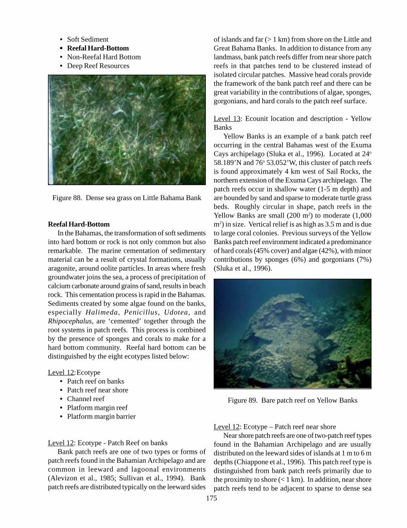
175
• Soft Sediment••••• Reefal Hard-Bottom• Non-Reefal Hard Bottom• Deep Reef Resources
Figure 88. Dense sea grass on Little Bahama Bank
Reefal Hard-BottomIn the Bahamas, the transformation of soft sediments
into hard bottom or rock is not only common but alsoremarkable. The marine cementation of sedimentarymaterial can be a result of crystal formations, usuallyaragonite, around oolite particles. In areas where freshgroundwater joins the sea, a process of precipitation ofcalcium carbonate around grains of sand, results in beachrock. This cementation process is rapid in the Bahamas.Sediments created by some algae found on the banks,especially Halimeda, Penicillus , Udotea, andRhipocephalus, are ‘cemented’ together through theroot systems in patch reefs. This process is combinedby the presence of sponges and corals to make for ahard bottom community. Reefal hard bottom can bedistinguished by the eight ecotypes listed below:
Level 12:Ecotype• Patch reef on banks• Patch reef near shore• Channel reef• Platform margin reef• Platform margin barrier
Level 12: Ecotype - Patch Reef on banksBank patch reefs are one of two types or forms of
patch reefs found in the Bahamian Archipelago and arecommon in leeward and lagoonal environments(Alevizon et al., 1985; Sullivan et al., 1994). Bankpatch reefs are distributed typically on the leeward sides
of islands and far (> 1 km) from shore on the Little andGreat Bahama Banks. In addition to distance from anylandmass, bank patch reefs differ from near shore patchreefs in that patches tend to be clustered instead ofisolated circular patches. Massive head corals providethe framework of the bank patch reef and there can begreat variability in the contributions of algae, sponges,gorgonians, and hard corals to the patch reef surface.
Level 13: Ecounit location and description - YellowBanks
Yellow Banks is an example of a bank patch reefoccurring in the central Bahamas west of the ExumaCays archipelago (Sluka et al., 1996). Located at 24o
58.189’N and 76o 53.052’W, this cluster of patch reefsis found approximately 4 km west of Sail Rocks, thenorthern extension of the Exuma Cays archipelago. Thepatch reefs occur in shallow water (1-5 m depth) andare bounded by sand and sparse to moderate turtle grassbeds. Roughly circular in shape, patch reefs in theYellow Banks are small (200 m2) to moderate (1,000m2) in size. Vertical relief is as high as 3.5 m and is dueto large coral colonies. Previous surveys of the YellowBanks patch reef environment indicated a predominanceof hard corals (45% cover) and algae (42%), with minorcontributions by sponges (6%) and gorgonians (7%)(Sluka et al., 1996).
Figure 89. Bare patch reef on Yellow Banks
Level 12: Ecotype – Patch reef near shoreNear shore patch reefs are one of two-patch reef types
found in the Bahamian Archipelago and are usuallydistributed on the leeward sides of islands at 1 m to 6 mdepths (Chiappone et al., 1996). This patch reef type isdistinguished from bank patch reefs primarily due tothe proximity to shore (< 1 km). In addition, near shorepatch reefs tend to be adjacent to sparse to dense sea
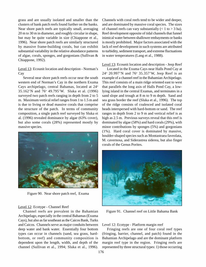
176
grass and are usually isolated and smaller than theclusters of bank patch reefs found further on the banks.Near shore patch reefs are typically small, averaging20 m to 30 m in diameter, and roughly circular in shape,but may be quite variable in size (Chiappone et al.,1996). Near shore patch reefs are similarly structuredby massive frame-building corals, but can exhibitsubstantial variability in the relative abundance patternsof algae, corals, sponges, and gorgonians (Sullivan &Chiappone, 1992).
Level 13: Ecounit location and description - Norman’sCay
Several near shore patch reefs occur near the southwestern end of Norman’s Cay in the northern ExumaCays archipelago, central Bahamas, located at 24o
35.162’N and 76o 49.795’W. Sluka et al. (1996)surveyed two patch reefs ranging in depth from 2 to 5m. Maximum vertical relief ranges from 1 to 1.5 m andis due to living or dead massive corals that comprisethe structure of the patch. In terms of communitycomposition, a single patch reef surveyed by Sluka etal. (1996) revealed dominance by algae (63% cover),but also some corals (28%) represented mostly bymassive species.
Figure 90. Near shore patch reef, Exuma
Level 12: Ecotype - Channel ReefChannel reefs are prevalent in the Bahamian
Archipelago, especially in the central Bahamas (ExumaCays), but also as far southeast as the Caicos Bank, Turksand Caicos. Channels serve as major conduits betweendeep water and bank water. Essentially four bottomtypes can occur in channels (sand, sea grass, hard-bottom, or reef) and community composition isdependent upon the length, width, and depth of thechannel (Sullivan et al., 1994; Sluka et al., 1996).
Channels with coral reefs tend to be wider and deeper,and are dominated by massive coral species. The sizesof channel reefs can vary substantially (< 1 to > 3 ha).Reef development opposite of tidal channels that funnelinimical water between shallower embayments or banksis mostly prohibited. Major factors associated with thelack of reef development in such systems are attributedto turbidity, sediment transport, and extreme fluctuationsin water temperatures (Lang et al., 1988).
Level 13: Ecounit location and description - Jeep ReefLocated in the Exuma Cays near Halls Pond Cay at
24o 20.997’N and 76o 35.357’W, Jeep Reef is anexample of a channel reef in the Bahamian Archipelago.This reef consists of a main ridge oriented east to westthat parallels the long axis of Halls Pond Cay, a low-lying island in the central Exumas, and terminates in asand slope and trough at 8 m to 9 m depth. Sand andsea grass border the reef (Sluka et al., 1996). The topof the ridge consists of coalesced and isolated coralheads interspersed with hard-bottom or sand. The reefranges in depth from 2 to 9 m and vertical relief is ashigh as 2.5 m. Previous surveys reveal that this reef isdominated by algae (58%) and hard corals (29%), withminor contributions by sponges (5%) and gorgonians(1%). Hard coral cover is dominated by massive,boulder-shaped species such as Montastraea faveolata,M. cavernosa, and Siderastrea siderea, but also fingercorals of the Genus Porites.
Figure 91. Channel reef on Little Bahama Bank
Level 12: Ecotype - Platform margin reefFringing reefs are one of four coral reef types
(fringing, barrier, channel, and patch) found in theBahamian Archipelago and are the dominant platformmargin reef type in the region. Fringing reefs arerepresented by three structural types: 1) those occurring
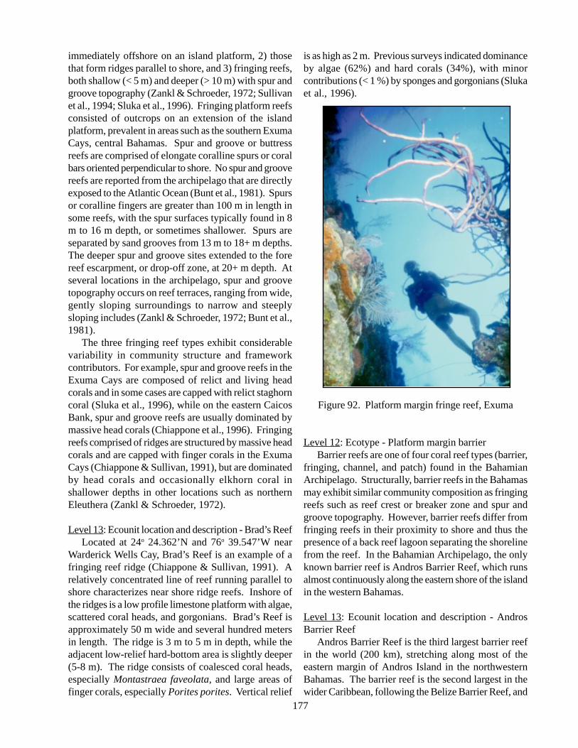
177
immediately offshore on an island platform, 2) thosethat form ridges parallel to shore, and 3) fringing reefs,both shallow (< 5 m) and deeper (> 10 m) with spur andgroove topography (Zankl & Schroeder, 1972; Sullivanet al., 1994; Sluka et al., 1996). Fringing platform reefsconsisted of outcrops on an extension of the islandplatform, prevalent in areas such as the southern ExumaCays, central Bahamas. Spur and groove or buttressreefs are comprised of elongate coralline spurs or coralbars oriented perpendicular to shore. No spur and groovereefs are reported from the archipelago that are directlyexposed to the Atlantic Ocean (Bunt et al., 1981). Spursor coralline fingers are greater than 100 m in length insome reefs, with the spur surfaces typically found in 8m to 16 m depth, or sometimes shallower. Spurs areseparated by sand grooves from 13 m to 18+ m depths.The deeper spur and groove sites extended to the forereef escarpment, or drop-off zone, at 20+ m depth. Atseveral locations in the archipelago, spur and groovetopography occurs on reef terraces, ranging from wide,gently sloping surroundings to narrow and steeplysloping includes (Zankl & Schroeder, 1972; Bunt et al.,1981).
The three fringing reef types exhibit considerablevariability in community structure and frameworkcontributors. For example, spur and groove reefs in theExuma Cays are composed of relict and living headcorals and in some cases are capped with relict staghorncoral (Sluka et al., 1996), while on the eastern CaicosBank, spur and groove reefs are usually dominated bymassive head corals (Chiappone et al., 1996). Fringingreefs comprised of ridges are structured by massive headcorals and are capped with finger corals in the ExumaCays (Chiappone & Sullivan, 1991), but are dominatedby head corals and occasionally elkhorn coral inshallower depths in other locations such as northernEleuthera (Zankl & Schroeder, 1972).
Level 13: Ecounit location and description - Brad’s ReefLocated at 24o 24.362’N and 76o 39.547’W near
Warderick Wells Cay, Brad’s Reef is an example of afringing reef ridge (Chiappone & Sullivan, 1991). Arelatively concentrated line of reef running parallel toshore characterizes near shore ridge reefs. Inshore ofthe ridges is a low profile limestone platform with algae,scattered coral heads, and gorgonians. Brad’s Reef isapproximately 50 m wide and several hundred metersin length. The ridge is 3 m to 5 m in depth, while theadjacent low-relief hard-bottom area is slightly deeper(5-8 m). The ridge consists of coalesced coral heads,especially Montastraea faveolata, and large areas offinger corals, especially Porites porites. Vertical relief
is as high as 2 m. Previous surveys indicated dominanceby algae (62%) and hard corals (34%), with minorcontributions (< 1 %) by sponges and gorgonians (Slukaet al., 1996).
Figure 92. Platform margin fringe reef, Exuma
Level 12: Ecotype - Platform margin barrierBarrier reefs are one of four coral reef types (barrier,
fringing, channel, and patch) found in the BahamianArchipelago. Structurally, barrier reefs in the Bahamasmay exhibit similar community composition as fringingreefs such as reef crest or breaker zone and spur andgroove topography. However, barrier reefs differ fromfringing reefs in their proximity to shore and thus thepresence of a back reef lagoon separating the shorelinefrom the reef. In the Bahamian Archipelago, the onlyknown barrier reef is Andros Barrier Reef, which runsalmost continuously along the eastern shore of the islandin the western Bahamas.
Level 13: Ecounit location and description - AndrosBarrier Reef
Andros Barrier Reef is the third largest barrier reefin the world (200 km), stretching along most of theeastern margin of Andros Island in the northwesternBahamas. The barrier reef is the second largest in thewider Caribbean, following the Belize Barrier Reef, and
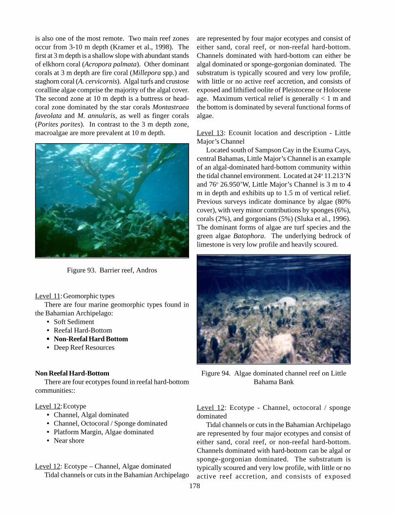
178
is also one of the most remote. Two main reef zonesoccur from 3-10 m depth (Kramer et al., 1998). Thefirst at 3 m depth is a shallow slope with abundant standsof elkhorn coral (Acropora palmata). Other dominantcorals at 3 m depth are fire coral (Millepora spp.) andstaghorn coral (A. cervicornis). Algal turfs and crustosecoralline algae comprise the majority of the algal cover.The second zone at 10 m depth is a buttress or head-coral zone dominated by the star corals Montastraeafaveolata and M. annularis, as well as finger corals(Porites porites). In contrast to the 3 m depth zone,macroalgae are more prevalent at 10 m depth.
Figure 93. Barrier reef, Andros
Level 11:Geomorphic typesThere are four marine geomorphic types found in
the Bahamian Archipelago:• Soft Sediment• Reefal Hard-Bottom••••• Non-Reefal Hard Bottom• Deep Reef Resources
Non Reefal Hard-BottomThere are four ecotypes found in reefal hard-bottom
communities::
Level 12:Ecotype• Channel, Algal dominated• Channel, Octocoral / Sponge dominated• Platform Margin, Algae dominated• Near shore
Level 12: Ecotype – Channel, Algae dominatedTidal channels or cuts in the Bahamian Archipelago
are represented by four major ecotypes and consist ofeither sand, coral reef, or non-reefal hard-bottom.Channels dominated with hard-bottom can either bealgal dominated or sponge-gorgonian dominated. Thesubstratum is typically scoured and very low profile,with little or no active reef accretion, and consists ofexposed and lithified oolite of Pleistocene or Holoceneage. Maximum vertical relief is generally < 1 m andthe bottom is dominated by several functional forms ofalgae.
Level 13: Ecounit location and description - LittleMajor’s Channel
Located south of Sampson Cay in the Exuma Cays,central Bahamas, Little Major’s Channel is an exampleof an algal-dominated hard-bottom community withinthe tidal channel environment. Located at 24o 11.213’Nand 76o 26.950’W, Little Major’s Channel is 3 m to 4m in depth and exhibits up to 1.5 m of vertical relief.Previous surveys indicate dominance by algae (80%cover), with very minor contributions by sponges (6%),corals (2%), and gorgonians (5%) (Sluka et al., 1996).The dominant forms of algae are turf species and thegreen algae Batophora. The underlying bedrock oflimestone is very low profile and heavily scoured.
Figure 94. Algae dominated channel reef on LittleBahama Bank
Level 12: Ecotype - Channel, octocoral / spongedominated
Tidal channels or cuts in the Bahamian Archipelagoare represented by four major ecotypes and consist ofeither sand, coral reef, or non-reefal hard-bottom.Channels dominated with hard-bottom can be algal orsponge-gorgonian dominated. The substratum istypically scoured and very low profile, with little or noactive reef accretion, and consists of exposed
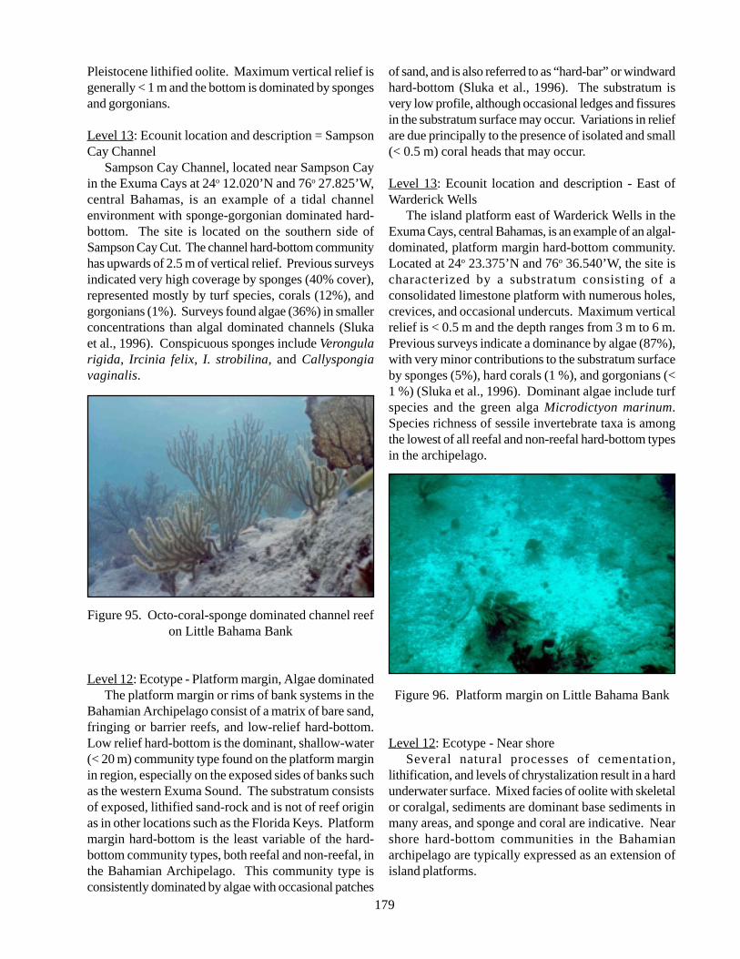
179
Pleistocene lithified oolite. Maximum vertical relief isgenerally < 1 m and the bottom is dominated by spongesand gorgonians.
Level 13: Ecounit location and description = SampsonCay Channel
Sampson Cay Channel, located near Sampson Cayin the Exuma Cays at 24o 12.020’N and 76o 27.825’W,central Bahamas, is an example of a tidal channelenvironment with sponge-gorgonian dominated hard-bottom. The site is located on the southern side ofSampson Cay Cut. The channel hard-bottom communityhas upwards of 2.5 m of vertical relief. Previous surveysindicated very high coverage by sponges (40% cover),represented mostly by turf species, corals (12%), andgorgonians (1%). Surveys found algae (36%) in smallerconcentrations than algal dominated channels (Slukaet al., 1996). Conspicuous sponges include Verongularigida, Ircinia felix, I. strobilina, and Callyspongiavaginalis.
Figure 95. Octo-coral-sponge dominated channel reefon Little Bahama Bank
Level 12: Ecotype - Platform margin, Algae dominatedThe platform margin or rims of bank systems in the
Bahamian Archipelago consist of a matrix of bare sand,fringing or barrier reefs, and low-relief hard-bottom.Low relief hard-bottom is the dominant, shallow-water(< 20 m) community type found on the platform marginin region, especially on the exposed sides of banks suchas the western Exuma Sound. The substratum consistsof exposed, lithified sand-rock and is not of reef originas in other locations such as the Florida Keys. Platformmargin hard-bottom is the least variable of the hard-bottom community types, both reefal and non-reefal, inthe Bahamian Archipelago. This community type isconsistently dominated by algae with occasional patches
of sand, and is also referred to as “hard-bar” or windwardhard-bottom (Sluka et al., 1996). The substratum isvery low profile, although occasional ledges and fissuresin the substratum surface may occur. Variations in reliefare due principally to the presence of isolated and small(< 0.5 m) coral heads that may occur.
Level 13: Ecounit location and description - East ofWarderick Wells
The island platform east of Warderick Wells in theExuma Cays, central Bahamas, is an example of an algal-dominated, platform margin hard-bottom community.Located at 24o 23.375’N and 76o 36.540’W, the site ischaracterized by a substratum consisting of aconsolidated limestone platform with numerous holes,crevices, and occasional undercuts. Maximum verticalrelief is < 0.5 m and the depth ranges from 3 m to 6 m.Previous surveys indicate a dominance by algae (87%),with very minor contributions to the substratum surfaceby sponges (5%), hard corals (1 %), and gorgonians (<1 %) (Sluka et al., 1996). Dominant algae include turfspecies and the green alga Microdictyon marinum.Species richness of sessile invertebrate taxa is amongthe lowest of all reefal and non-reefal hard-bottom typesin the archipelago.
Figure 96. Platform margin on Little Bahama Bank
Level 12: Ecotype - Near shoreSeveral natural processes of cementation,
lithification, and levels of chrystalization result in a hardunderwater surface. Mixed facies of oolite with skeletalor coralgal, sediments are dominant base sediments inmany areas, and sponge and coral are indicative. Nearshore hard-bottom communities in the Bahamianarchipelago are typically expressed as an extension ofisland platforms.
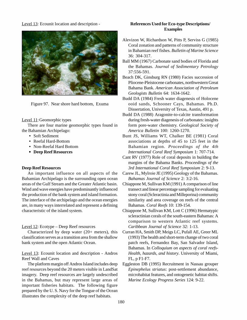
180
Level 13: Ecounit location and description -
Figure 97. Near shore hard bottom, Exuma
Level 11:Geomorphic typesThere are four marine geomorphic types found in
the Bahamian Archipelago:• Soft Sediment• Reefal Hard-Bottom• Non-Reefal Hard Bottom••••• Deep Reef Resources
Deep Reef ResourcesAn important influence on all aspects of the
Bahamian Archipelago is the surrounding open oceanareas of the Gulf Stream and the Greater Atlantic basin.Wind and wave energies have predominantly influencedthe production of the bank system and island formation.The interface of the archipelago and the ocean energiesare, in many ways interrelated and represent a definingcharacteristic of the island system.
Level 12: Ecotype – Deep Reef resourcesCharacterized by deep water (20+ meters), this
classification serves as a transition area from the shallowbank system and the open Atlantic Ocean.
Level 13: Ecounit location and description - AndrosReef Wall and Caves
The platform margin off Andros Island includes deepreef resources beyond the 20 meters visible in LandSatimagery. Deep reef resources are largely undescribedin the Bahamas, but may represent large areas ofimportant fisheries habitats. The following figureprepared by the U. S. Navy for the Tongue of the Oceanillustrates the complexity of the deep reef habitats.
References Used for Eco-type Descriptions/Examples
Alevizon W, Richardson W, Pitts P, Serviss G (1985)Coral zonation and patterns of community structurein Bahamian reef fishes. Bulletin of Marine Science36: 304-317.
Ball MM (1967) Carbonate sand bodies of Florida andthe Bahamas. Journal of Sedimentary Petrology37:556-591.
Beach DK, Ginsburg RN (1980) Facies succession ofPliocene-Pleistocene carbonates, northwestern GreatBahama Bank. American Association of PetroleumGeologists Bulletin 64: 1634-1642.
Budd DA (1984) Fresh water diagenesis of Holoceneooid sands, Schooner Cays, Bahamas. Ph.D.Dissertation, University of Texas, Austin, 491 p.
Budd DA (1988) Aragonite-to-calcite transformationduring fresh-water diagenesis of carbonates: insightsform pore-water chemistry. Geological Society ofAmerica Bulletin 100: 1260-1270.
Bunt JS, Williams WT, Chalker BE (1981) Coralassociations at depths of 45 to 125 feet in theBahamian region. Proceedings of the 4thInternational Coral Reef Symposium 1: 707-714.
Cant RV (1977) Role of coral deposits in building themargins of the Bahama Banks. Proceedings of the3rd International Coral Reef Symposium 2: 9-13.
Carew JL, Mylroie JE (1995) Geology of the Bahamas.Bahamas Journal of Science 2: 3:2-16.
Chiappone M, Sullivan KM (1991) A comparison of linetransect and linear percentage sampling for evaluatingstony coral (Scleractinia and Milleporina) communitysimilarity and area coverage on reefs of the centralBahamas. Coral Reefs 10: 139-154.
Chiappone M, Sullivan KM, Lott C (1996) Hermatypicscleractinian corals of the south-eastern Bahamas: Acomparison to western Atlantic reef systems.Caribbean Journal of Science 32: 1-13.
Curran HA, Smith DP, Meigs LC, Pufall AE, Greer ML(1993) The health and short-term change of two coralpatch reefs, Fernandez Bay, San Salvador Island,Bahamas. In Colloquium on aspects of coral reefs-Health, hazards, and history. University of Miami,FL, p F1-F7.
Eggleston DB (1995) Recruitment in Nassau grouperEpinephelus striatus: post-settlement abundance,microhabitat features, and ontogenetic habitat shifts.Marine Ecology Progress Series 124: 9-22.
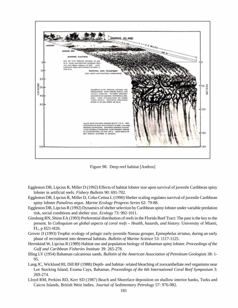
181
Figure 98. Deep reef habitat [Andros]
Eggleston DB, Lipcius R, Miller D (1992) Effects of habitat lobster size upon survival of juvenile Caribbean spinylobster in artificial reefs. Fishery Bulletin 90: 691-702.
Eggleston DB, Lipcius R, Miller D, Coba-Cetina L (1990) Shelter scaling regulates survival of juvenile Caribbeanspiny lobster Panulirus argus. Marine Ecology Progress Series 62: 79-88.
Eggleston DB, Lipcius R (1992) Dynamics of shelter selection by Caribbean spiny lobster under variable predationrisk, social conditions and shelter size. Ecology 73: 992-1011.
Ginsburg RN, Shinn EA (1993) Preferential distribution of reefs in the Florida Reef Tract: The past is the key to thepresent. In Colloquium on global aspects of coral reefs – Health, hazards, and history. University of Miami,FL, p H21-H26.
Grover JJ (1993) Trophic ecology of pelagic early-juvenile Nassau grouper, Epinephelus striatus, during an earlyphase of recruitment into demersal habitats. Bulletin of Marine Science 53: 1117-1125.
Herrnkind W, Lipcius R (1989) Habitat use and population biology of Bahamian spiny lobster. Proceedings of theGulf and Caribbean Fisheries Institute 39: 265-278.
Illing LV (1954) Bahaman calcareous sands. Bulletin of the American Association of Petroleum Geologists 38: 1-95.
Lang JC, Wicklund RI, Dill RF (1988) Depth- and habitat- related bleaching of zooxanthellate reef organisms nearLee Stocking Island, Exuma Cays, Bahamas. Proceedings of the 6th International Coral Reef Symposium 3:269-274.
Lloyd RM, Perkins RD, Kerr SD (1987) Beach and Shoreface deposition on shallow interior banks, Turks andCaicos Islands, British West Indies. Journal of Sedimentary Petrology 57: 976-982.
182
Lowenstam HA, Epstein S (1957) On the origin ofsedimentary aragonite needles of the Great BahamaBank. Journal of Geology 65: 364-375.
Milliman JD (1967a) Carbonate sedimentation on HogstyReef, a Bahamian atoll. Journal of SedimentaryPetrology 37: 658-676.
Milliman JD (1967b) The geomorphology and history ofHogsty Reef, a Bahamian atoll. Bulletin of MarineScience 17: 519-543.
Milliman JD, Freile D, Steinen RP, Wilber RJ (1993)Great Bahama Bank aragonite muds: mostlyinorganically precipitated, mostly exported. Journalof Sedimentary Petrology 63: 589-595.
Neumann AC, Land LS (1975) Sea level events andPleistocene coral ages in the northern Bahamas.Quaternary Research 5: 215-224.
Purdy EG (1961) Bahamian oolite shoals. InGeochemistry of sandstone bodies, James NP,Choquette PW (Eds). American Association ofPetroleum Geologists Bulletin Special Volume, p53-62.
Sealey N (1994) Bahamian Landscapes, anintroduction to the geography of the Bahamas.Media Publishing, Nassau, 128 p.
Sluka R, Chiappone M, Sullivan KM, Wright R (1996)Habitat and life in the Exuma Cays, Bahamas: Thestatus of groupers and coral reefs in the northerncays. Media Publishing, Nassau, 83 p.
Squires DF 1958 Stony corals from the vicinity of Bimini,British West Indies. Bulletin of the American Museumof Natural History 115: 219-262.
Sullivan KM (1991) Guide to the shallow-water marinehabitats and benthic invertebrates of the ExumaCays Land and Sea Park, Bahamas. Sea and SkyFoundation, Coral Gables, FL, 200 p.
Sullivan KM, Chiappone M (1992) A comparison ofbelt quadrat and species presence and absencesampling for evaluating stony coral (Scleractinia andMilleporina) and sponge species patterning on patchreefs of the central Bahamas. Bulletin of MarineScience 50: 464-488.
Sullivan KM, Chiappone M, Lott C (1994) Abundancepatterns of stony corals on platform margin reefs ofthe Caicos Bank. Bahamas Journal of Science 1: 2-11.
Wanless HR, Dravis JJ (1989) Carbonate Environmentsand Sequences of the Caicos Platform: Field TripGuidebook T374, American Geophysical Union,Washington DC, 75 p.
Wiedenmayer F (1977) Shallow-water sponges of thewestern Bahamas. Birkhauser Verlag, Basel, 287 p.
Zankl H, Schroeder JH (1972) Interaction of geneticprocesses in Holocene reefs off North EleutheraIsland, Bahamas. Geologische Rundschau 61: 520-541.
183
IV. LAND COVER MAPPING OF THE BAHAMIANARCHIPELAGO
1. Introduction
The objective of landcover mapping of the Bahamian Archipelago is to characterize both landscapes andshallow seascapes, based on available LANDSAT thematic Mapper (TM) satellite images, other remote senseddata, and a standardized vegetation classification system for the greater Caribbean region, developed by theCaribbean Vegetation and Landcover Mapping Initiative (CVLMI). The major steps undertaken by this initiativeinclude:
• Review of existing vegetation classification efforts;• Convene Caribbean Vegetation Ecology Working Group;• Develop standard classification system for the Caribbean.
The Caribbean Vegetation Classification and Atlas Project has been a key step towards characterizing thenatural vegetation and landcover of the region, island-by-island, based on the newly derived standardized vegetationand classification system. Once the distinct natural vegetation types that occur on Caribbean islands are accuratelyunderstood, described, and mapped in a manner that is accepted and respected by all constituents in the region,the resulting vegetation/land cover maps for the islands of the Caribbean become valuable tools in natural resourcemanagement and conservation.
The Bahamian Archipelago Landcover Mapping Project was conducted in collaboration with The NatureConservancy (TNC), the International Institute of Tropical Forestry (IITF), the US Forest Service, the EROSData Center (EDC), and the United States Geological Service (USGS). It integrates the mapping of vegetation(based on the developed standard vegetation classification system) with the mapping of marine benthic communities,and has relied exclusively on the LANDSAT 7 image analysis methods developed by the EROS data Center(EDC) in Sioux Falls, North Dakota.
2. Methodology
2.1. Selection of Images
Atlas-scale mapping projects require a base map and data source appropriate for the area of coverage. TheBahamian archipelago covers about 400,000 square kilometres of oceans, shallow banks and islands. Mapping atsuch a scale requires imagery that can be manipulated for working over large areas. LANDSAT 7 Images are bestsuited for this project because the imagery is already geo-rectified, facilitating the mapping process. Scenes arerecorded continuously by satellite, circling the globe in predefined paths, which repeat every 16 days. Each pathis divided into rows; therefore, every scene is distinguished by path, row, and date of acquisition. Twenty scenesthat best met the chosen criteria, including limitations in cloud cover, tide, daylight, season, and relation tosignificant weather events, while providing the most complete representation of the entire Bahamian archipelago,were selected from the USGS/EROS website. Some duplicate scenes from the same path and row, but from
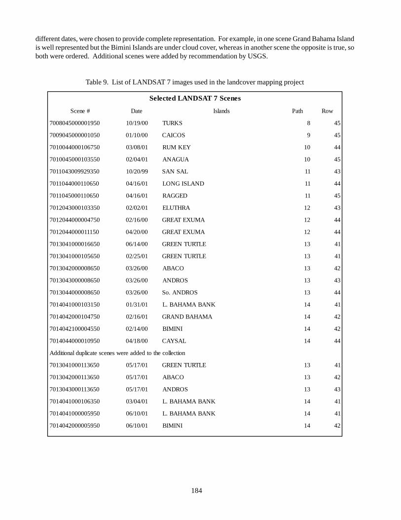
184
different dates, were chosen to provide complete representation. For example, in one scene Grand Bahama Islandis well represented but the Bimini Islands are under cloud cover, whereas in another scene the opposite is true, soboth were ordered. Additional scenes were added by recommendation by USGS.
Table 9. List of LANDSAT 7 images used in the landcover mapping project
senecS7TASDNALdetceleS
#enecS etaD sdnalsI htaP woR
0591000005408007 00/91/01 SKRUT 8 54
0501000005409007 00/01/10 SOCIAC 9 54
0576010004400107 10/80/30 YEKMUR 01 44
0553010005400107 10/40/20 AUGANA 01 54
0539299003401107 99/02/01 LASNAS 11 34
0560110004401107 10/61/40 DNALSIGNOL 11 44
0560110005401107 10/61/40 DEGGAR 11 54
0533010003402107 10/20/20 ARHTULE 21 34
0574000004402107 00/61/20 AMUXETAERG 21 44
0511100004402107 00/02/40 AMUXETAERG 21 44
0566100001403107 00/41/60 ELTRUTNEERG 31 14
0565010001403107 10/52/20 ELTRUTNEERG 31 14
0568000002403107 00/62/30 OCABA 31 24
0568000003403107 00/62/30 SORDNA 31 34
0568000004403107 00/62/30 SORDNA.oS 31 44
0513010001404107 10/13/10 KNABAMAHAB.L 41 14
0574010002404107 10/61/20 AMAHABDNARG 41 24
0554000012404107 00/41/20 INIMIB 41 24
0590100004404107 00/81/40 LASYAC 41 44
noitcellocehtotdeddaerewsenecsetacilpudlanoitiddA
0563110001403107 10/71/50 ELTRUTNEERG 31 14
0563110002403107 10/71/50 OCABA 31 24
0563110003403107 10/71/50 SORDNA 31 34
0536010001404107 10/40/30 KNABAMAHAB.L 41 14
0595000001404107 10/01/60 KNABAMAHAB.L 41 14
0595000002404107 10/01/60 INIMIB 41 24

185
2.2. Import and Calibration of Scenes
Each of the scenes were imported into an ERDAS Image program and given label numbers indicating the path,row, and Julian date of acquisition. Data was requested in the NLAPS format, and 6 band wavelengths wereimported (H1 spectral, H2 Thermal, H3 Pan, and bands 1,5,7, for land) with UTM (x, y), projection and units inmeters, resulting in an image file (.img). Each imported image and associated information from the header file(.gmb), including mapping projection parameters, date and time, UTM zone, orientation, solar spectral irradiancevalues, band wavelength, gains and biases etc. were included in a meta-data file.
Calibration models were provided by the EROS Data Center and applied to each image to correct solarirradiance in the raw NLAPS data. For each image, the sun elevation, along with gain and bias informationprovided from the header file, were entered into the model as function definitions. All images were projected inUTM Zone 18, to correlate with the base map dataset. A copy of each calibration model, and the resultingcalibrated image, were included in the meta-data. The calibrated image was also used in the processing protocol,the result of which was the primary data source for landcover determination.
Figure 99. LANDSAT 7 scenes from paths 13 and 14, rows 41 – 44 pasted together in one image[Note duplicate scene layer over Southern Grand Bahama Island]
2.3. Unsupervised Classification
The unsupervised classification process allows assigning a habitat characteristic to the spectral values of eachpixel in an image. Each calibrated image was run through the ERDAS Image software’s unsupervised classificationfunction, for 25 classes and 75 iterations. Although the classification function can be run with as many as 100
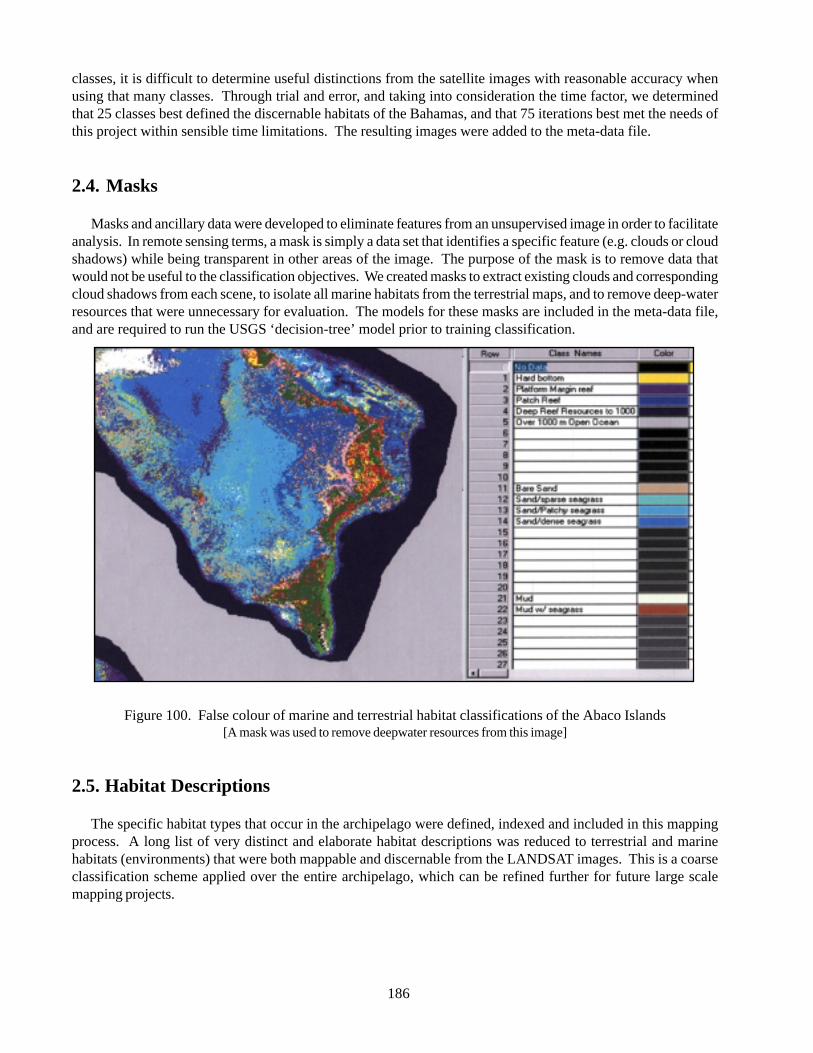
186
classes, it is difficult to determine useful distinctions from the satellite images with reasonable accuracy whenusing that many classes. Through trial and error, and taking into consideration the time factor, we determinedthat 25 classes best defined the discernable habitats of the Bahamas, and that 75 iterations best met the needs ofthis project within sensible time limitations. The resulting images were added to the meta-data file.
2.4. Masks
Masks and ancillary data were developed to eliminate features from an unsupervised image in order to facilitateanalysis. In remote sensing terms, a mask is simply a data set that identifies a specific feature (e.g. clouds or cloudshadows) while being transparent in other areas of the image. The purpose of the mask is to remove data thatwould not be useful to the classification objectives. We created masks to extract existing clouds and correspondingcloud shadows from each scene, to isolate all marine habitats from the terrestrial maps, and to remove deep-waterresources that were unnecessary for evaluation. The models for these masks are included in the meta-data file,and are required to run the USGS ‘decision-tree’ model prior to training classification.
Figure 100. False colour of marine and terrestrial habitat classifications of the Abaco Islands[A mask was used to remove deepwater resources from this image]
2.5. Habitat Descriptions
The specific habitat types that occur in the archipelago were defined, indexed and included in this mappingprocess. A long list of very distinct and elaborate habitat descriptions was reduced to terrestrial and marinehabitats (environments) that were both mappable and discernable from the LANDSAT images. This is a coarseclassification scheme applied over the entire archipelago, which can be refined further for future large scalemapping projects.

187
2.6. Band Combination (Raster Layer)
In the raster layer, changing the band combination representation can provide views that may facilitate viewingand distinguishing different habitats, especially marine versus terrestrial.
Table 10. Habitat mapping classes used in the Bahamian Archipelago Landcover mapping project
Table 11. Raster layer Band Combinations used in the land/seascape mapping
#xednI lairtserreT #xednI eniraM
23 keerC 10 mottobdraH
64 )LAH(epacsdnalderetlanamuH 20 feermroftalP
74 retawevoba-dnaseraB 30 feerhctaP
06 mlaP 40 secruoserretawpeeD
16 sdnaleniP 11 degrembus-dnaseraB
26 ecippoctserofneergreveyrD 21 ssargaesesraps/wdnaS
36 dnartslatsaoC 31 ssargaeshctap/wdnaS
46 dnop/dnalteW 41 ssargaesesned/wdnaS
56 erutlucirgA 12 mottobduM
66 evorgnamesneD 22 ssargaes/wmottobduM
76 evorgnamesrapS
86 supraconoC
07 duolC
17 wodahsduolC
tluafedlanoitnevnoC citsilaeR eniramdooG lairtserreTdooG
deR 4 3 5 6
neerG 3 2 4 4
eulB 2 1 3 2
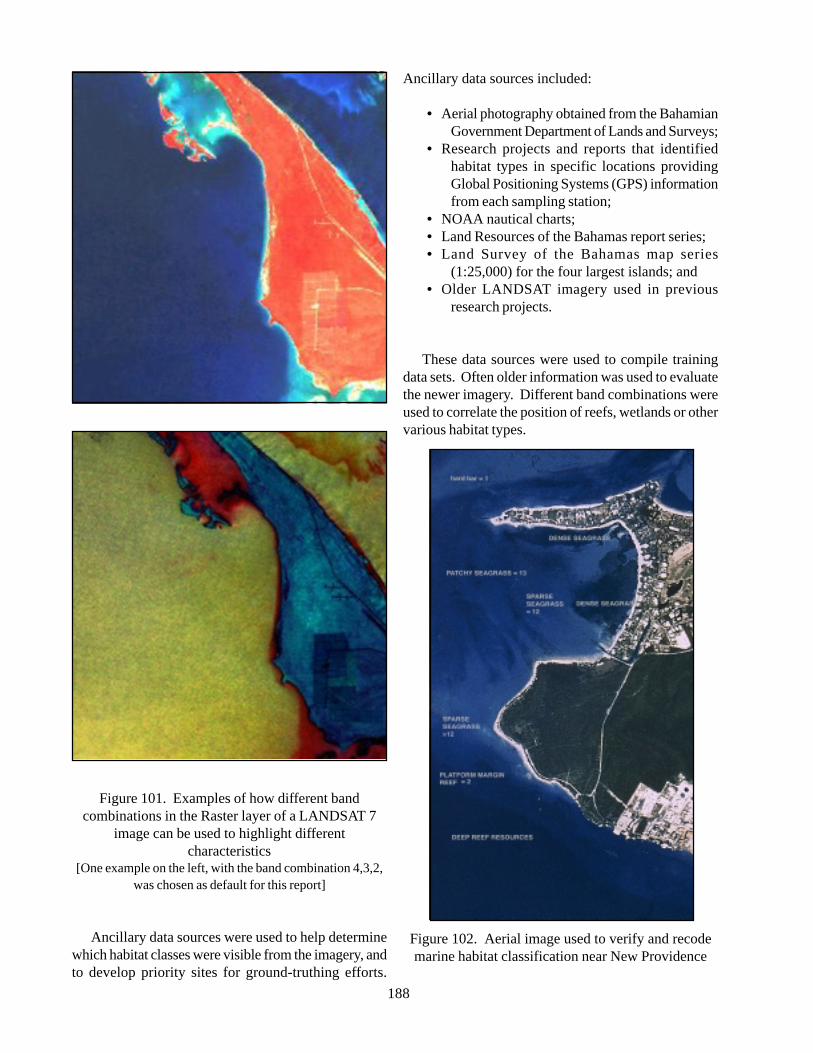
188
Figure 101. Examples of how different bandcombinations in the Raster layer of a LANDSAT 7
image can be used to highlight differentcharacteristics
[One example on the left, with the band combination 4,3,2,was chosen as default for this report]
Ancillary data sources were used to help determinewhich habitat classes were visible from the imagery, andto develop priority sites for ground-truthing efforts.
Ancillary data sources included:
• Aerial photography obtained from the BahamianGovernment Department of Lands and Surveys;
• Research projects and reports that identifiedhabitat types in specific locations providingGlobal Positioning Systems (GPS) informationfrom each sampling station;
• NOAA nautical charts;• Land Resources of the Bahamas report series;• Land Survey of the Bahamas map series
(1:25,000) for the four largest islands; and• Older LANDSAT imagery used in previous
research projects.
These data sources were used to compile trainingdata sets. Often older information was used to evaluatethe newer imagery. Different band combinations wereused to correlate the position of reefs, wetlands or othervarious habitat types.
Figure 102. Aerial image used to verify and recodemarine habitat classification near New Providence
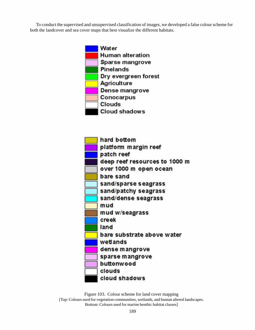
189
To conduct the supervised and unsupervised classification of images, we developed a false colour scheme forboth the landcover and sea cover maps that best visualize the different habitats.
Figure 103. Colour scheme for land cover mapping[Top: Colours used for vegetation communities, wetlands, and human altered landscapes.
Bottom: Colours used for marine benthic habitat classes]
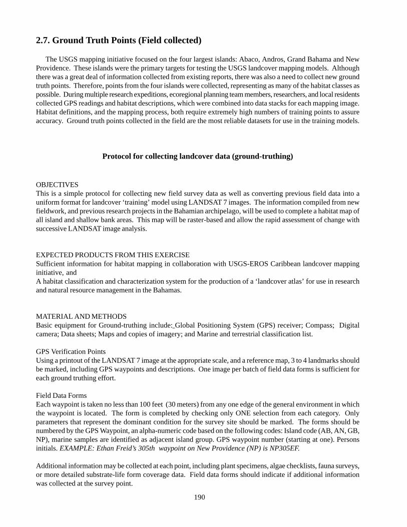
190
2.7. Ground Truth Points (Field collected)
The USGS mapping initiative focused on the four largest islands: Abaco, Andros, Grand Bahama and NewProvidence. These islands were the primary targets for testing the USGS landcover mapping models. Althoughthere was a great deal of information collected from existing reports, there was also a need to collect new groundtruth points. Therefore, points from the four islands were collected, representing as many of the habitat classes aspossible. During multiple research expeditions, ecoregional planning team members, researchers, and local residentscollected GPS readings and habitat descriptions, which were combined into data stacks for each mapping image.Habitat definitions, and the mapping process, both require extremely high numbers of training points to assureaccuracy. Ground truth points collected in the field are the most reliable datasets for use in the training models.
Protocol for collecting landcover data (ground-truthing)
OBJECTIVESThis is a simple protocol for collecting new field survey data as well as converting previous field data into auniform format for landcover ‘training’ model using LANDSAT 7 images. The information compiled from newfieldwork, and previous research projects in the Bahamian archipelago, will be used to complete a habitat map ofall island and shallow bank areas. This map will be raster-based and allow the rapid assessment of change withsuccessive LANDSAT image analysis.
EXPECTED PRODUCTS FROM THIS EXERCISESufficient information for habitat mapping in collaboration with USGS-EROS Caribbean landcover mappinginitiative, andA habitat classification and characterization system for the production of a ‘landcover atlas’ for use in researchand natural resource management in the Bahamas.
MATERIAL AND METHODSBasic equipment for Ground-truthing include: Global Positioning System (GPS) receiver; Compass; Digitalcamera; Data sheets; Maps and copies of imagery; and Marine and terrestrial classification list.
GPS Verification PointsUsing a printout of the LANDSAT 7 image at the appropriate scale, and a reference map, 3 to 4 landmarks shouldbe marked, including GPS waypoints and descriptions. One image per batch of field data forms is sufficient foreach ground truthing effort.
Field Data FormsEach waypoint is taken no less than 100 feet (30 meters) from any one edge of the general environment in whichthe waypoint is located. The form is completed by checking only ONE selection from each category. Onlyparameters that represent the dominant condition for the survey site should be marked. The forms should benumbered by the GPS Waypoint, an alpha-numeric code based on the following codes: Island code (AB, AN, GB,NP), marine samples are identified as adjacent island group. GPS waypoint number (starting at one). Personsinitials. EXAMPLE: Ethan Freid’s 305th waypoint on New Providence (NP) is NP305EF.
Additional information may be collected at each point, including plant specimens, algae checklists, fauna surveys,or more detailed substrate-life form coverage data. Field data forms should indicate if additional informationwas collected at the survey point.
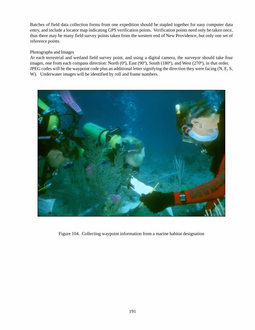
191
Batches of field data collection forms from one expedition should be stapled together for easy computer dataentry, and include a locator map indicating GPS verification points. Verification points need only be taken once,thus there may be many field survey points taken from the western end of New Providence, but only one set ofreference points.
Photographs and ImagesAt each terrestrial and wetland field survey point, and using a digital camera, the surveyor should take fourimages, one from each compass direction: North (0º), East (90º), South (180º), and West (270º), in that order.JPEG codes will be the waypoint code plus an additional letter signifying the direction they were facing (N, E, S,W). Underwater images will be identified by roll and frame numbers.
Figure 104. Collecting waypoint information from a marine habitat designation
192
2.8. Remote sensing training points(Vector layer)
A list of points that represent a specific habitat canalso be generated using remote sensing techniques onthe vector layer of a calibrated image, saved with doubleprecision. With the vector tools icon option on the menubar locked for multiple point selections, the pointselection tool (+) allows for marking multiple points ofa specific habitat directly on the satellite image. Theappropriate point choice requires a review of the image,and information from ancillary source data such as aerialphotographs, input from local residents, and personalexperience. The UTM (x, y) projection information fromthe chosen points is recorded in an attribute list that isexportable into Excel or other database files. Onceattached to habitat designations these training pointsare included in meta-data files. Training points gatheredin this manner were kept separate from field collectedground truth points, and provided vital classificationdata to the model.
2.9. Decision (Tree model)
Each data stack was provided to Mr. Mike Coan ofRaytheon/USGS to be used in the ‘decision-tree’ modelprior to training classification. This process is asupervised process where ground truth points, trainingpoints, and habitat data are aligned into spectralinformation.
2.10. Classification Training Model
Once a suitable decision-tree is completed, it ispossible to run an extensive ‘classification training’model of the unsupervised images. This process convertsspectral information into colour-coded pixelrepresentation of consistent characteristics (definedhabitats) in a scene. The training model is unique foreach date, and it was fortunate that several of theselected scenes from the Bahamas were acquired bysatellite on the same, nearly cloudless, day. Therefore,in the first training model run, unsupervised images ofAbaco, New Providence, Andros, and east GrandBahama were assembled into a single file and classifiedtogether.
2.11. Review of Training ClassificationModel
The resulting training classification image wasreviewed for accuracy and consistency. The inspectionprocess begins by super imposing ground-truthing pointsover a section of the image with known landcover. Oftenthe classified image can be compared to the calibratedimage to detect any problems in the classification. Thisreview can expose situations that require the addition,combination, and/or reassignment, of habitatdistinctions.
During early field expeditions, some habitat typeswere defined by characteristics that are not discernablefrom the satellite and had to be re-addressed. Forinstance, habitats originally defined as residential,recreational, hotel/resort, and business district, werecombined into the single habitat called ‘Human AlteredLandscapes’.
The model characterizes land cover by spectralsignatures, and there was the occasional mistakenclassification of areas with similar signatures. Forexample, white sand beaches (Coastal Strand) and someexposed banks (Bare Sand above water) are both highlyreflective surfaces, and have similar signatures torecently cleared or scarified area, paved parking lotsand construction sites, (Human Altered Landscapes).Some habitat distinctions had subjective aspects thatthe model could not determine. For instance, the benthicmarine habitat ‘Mud with sea grass’ has a similarsignature to the terrestrial class ‘Creek’. Ancillary dataand additional ground truth expeditions were used toidentify and distinguish such areas.
The review ultimately allowed for the detection ofareas where supplemental training points were necessary.Additional field expeditions were scheduled to collectmore ground truth points, and additional training pointlists were complied directly from the vector layers.
2.12. Recoding Classified Images(Production of Final Rasters)
After the inconsistencies discussed above wereaddressed, and the required additional ground truth andremote sensing data collected, it became necessary torecode some parts of the map, including cloud coverand shadow. Section by section, each misclassified pixelwas reassigned the correct classification in the recodingprocess. Recoded images were included in the metadataof the final image.
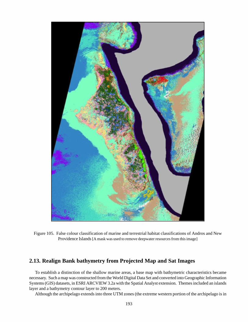
193
Figure 105. False colour classification of marine and terrestrial habitat classifications of Andros and NewProvidence Islands [A mask was used to remove deepwater resources from this image]
2.13. Realign Bank bathymetry from Projected Map and Sat Images
To establish a distinction of the shallow marine areas, a base map with bathymetric characteristics becamenecessary. Such a map was constructed from the World Digital Data Set and converted into Geographic InformationSystems (GIS) datasets, in ESRI ARCVIEW 3.2a with the Spatial Analyst extension. Themes included an islandslayer and a bathymetry contour layer to 200 meters.
Although the archipelago extends into three UTM zones (the extreme western portion of the archipelago is in

194
UTM Zone 19, and east of the Turks Bank is in UTM Zone 17), the majority of the islands are in UTM 18. Basemaps were re-projected into UTM Zone 18, and corrected for distortions in the coastline and platform margins.All images were projected in UTM Zone 18, to correlate with the base map dataset. In ARCVIEW, the base mapwas layered over the unsupervised image, including the need for time-consuming revisions to bank and islandpolygons, resulting in a more accurate representation of bathymetric and island contours including mangrovewetlands and human altered landscape.
Figure 106. LandSat 7 images of western Little Bahama Bank[green line represents outline of Grand Bahama Island, red line represents bathymetry before correction, and blue line
represents corrected bathymetry]
2.14. Creation of Island Subsets in GIS (Map Products and Layouts)
Map layouts were organized by island group with particular focus on the largest islands in the archipelago:Andros, Grand Bahama, Abaco and New Providence. The layouts presented the island subsets at a scale between1:150000 and 1:250000, and separated the land and sea cover maps for easier interpretation.
Three different maps are presented for each location: the unclassified satellite image, and the false colourcomposites of classified terrestrial and seafloor images. The false colour composite maps were prepared usingbands 4, 3, and 2 of the enhanced thematic mapper plus data. Using ArcView 3.2 image analysis software,classifications of individual islands were accomplished with the help of the training model image. Pie charts,associated to each scaled terrestrial layout, provide an easily discernable illustration of habitat type relationshipper island or island group. Metadata tables were maintained containing reference information for each islandsystem.
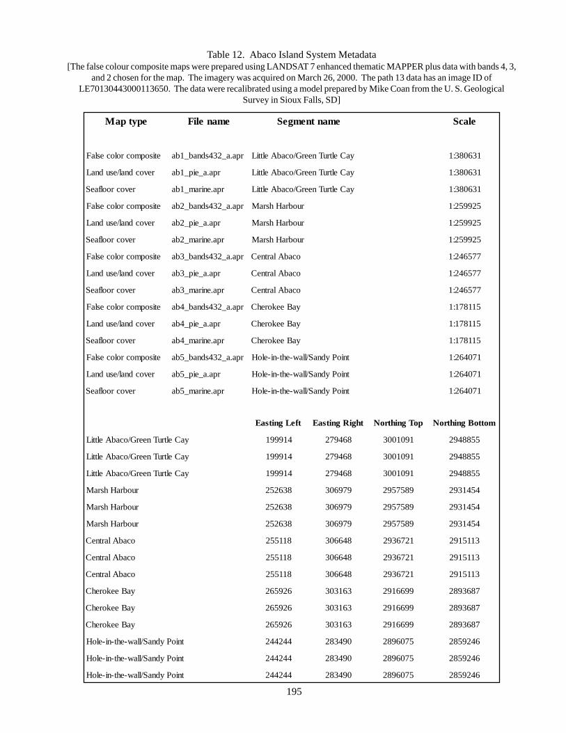
195
Table 12. Abaco Island System Metadata[The false colour composite maps were prepared using LANDSAT 7 enhanced thematic MAPPER plus data with bands 4, 3,
and 2 chosen for the map. The imagery was acquired on March 26, 2000. The path 13 data has an image ID ofLE70130443000113650. The data were recalibrated using a model prepared by Mike Coan from the U. S. Geological
Survey in Sioux Falls, SD]
epytpaM emaneliF emantnemgeS elacS
etisopmocroloceslaF rpa.a_234sdnab_1ba yaCeltruTneerG/ocabAelttiL 136083:1
revocdnal/esudnaL rpa.a_eip_1ba yaCeltruTneerG/ocabAelttiL 136083:1
revocroolfaeS rpa.eniram_1ba yaCeltruTneerG/ocabAelttiL 136083:1
etisopmocroloceslaF rpa.a_234sdnab_2ba ruobraHhsraM 529952:1
revocdnal/esudnaL rpa.a_eip_2ba ruobraHhsraM 529952:1
revocroolfaeS rpa.eniram_2ba ruobraHhsraM 529952:1
etisopmocroloceslaF rpa.a_234sdnab_3ba ocabAlartneC 775642:1
revocdnal/esudnaL rpa.a_eip_3ba ocabAlartneC 775642:1
revocroolfaeS rpa.eniram_3ba ocabAlartneC 775642:1
etisopmocroloceslaF rpa.a_234sdnab_4ba yaBeekorehC 511871:1
revocdnal/esudnaL rpa.a_eip_4ba yaBeekorehC 511871:1
revocroolfaeS rpa.eniram_4ba yaBeekorehC 511871:1
etisopmocroloceslaF rpa.a_234sdnab_5ba tnioPydnaS/llaw-eht-ni-eloH 170462:1
revocdnal/esudnaL rpa.a_eip_5ba tnioPydnaS/llaw-eht-ni-eloH 170462:1
revocroolfaeS rpa.eniram_5ba tnioPydnaS/llaw-eht-ni-eloH 170462:1
tfeLgnitsaE thgiRgnitsaE poTgnihtroN mottoBgnihtroN
yaCeltruTneerG/ocabAelttiL 419991 864972 1901003 5588492
yaCeltruTneerG/ocabAelttiL 419991 864972 1901003 5588492
yaCeltruTneerG/ocabAelttiL 419991 864972 1901003 5588492
ruobraHhsraM 836252 979603 9857592 4541392
ruobraHhsraM 836252 979603 9857592 4541392
ruobraHhsraM 836252 979603 9857592 4541392
ocabAlartneC 811552 846603 1276392 3115192
ocabAlartneC 811552 846603 1276392 3115192
ocabAlartneC 811552 846603 1276392 3115192
yaBeekorehC 629562 361303 9966192 7863982
yaBeekorehC 629562 361303 9966192 7863982
yaBeekorehC 629562 361303 9966192 7863982
tnioPydnaS/llaw-eht-ni-eloH 442442 094382 5706982 6429582
tnioPydnaS/llaw-eht-ni-eloH 442442 094382 5706982 6429582
tnioPydnaS/llaw-eht-ni-eloH 442442 094382 5706982 6429582
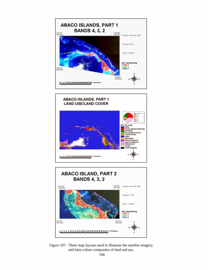
196
Figure 107. Three map layouts used to illustrate the satellite imageryand false colour composites of land and sea.
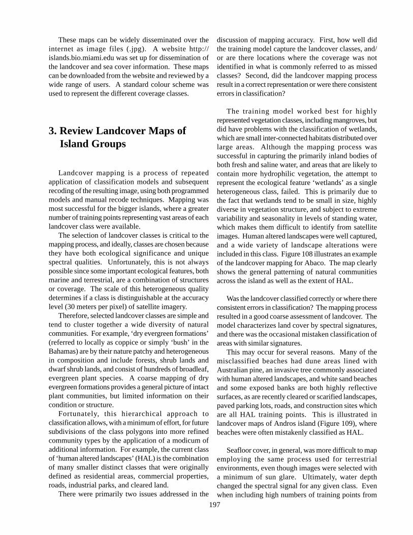
197
These maps can be widely disseminated over theinternet as image files (.jpg). A website http://islands.bio.miami.edu was set up for dissemination ofthe landcover and sea cover information. These mapscan be downloaded from the website and reviewed by awide range of users. A standard colour scheme wasused to represent the different coverage classes.
3. Review Landcover Maps of Island Groups
Landcover mapping is a process of repeatedapplication of classification models and subsequentrecoding of the resulting image, using both programmedmodels and manual recode techniques. Mapping wasmost successful for the bigger islands, where a greaternumber of training points representing vast areas of eachlandcover class were available.
The selection of landcover classes is critical to themapping process, and ideally, classes are chosen becausethey have both ecological significance and uniquespectral qualities. Unfortunately, this is not alwayspossible since some important ecological features, bothmarine and terrestrial, are a combination of structuresor coverage. The scale of this heterogeneous qualitydetermines if a class is distinguishable at the accuracylevel (30 meters per pixel) of satellite imagery.
Therefore, selected landcover classes are simple andtend to cluster together a wide diversity of naturalcommunities. For example, ‘dry evergreen formations’(referred to locally as coppice or simply ‘bush’ in theBahamas) are by their nature patchy and heterogeneousin composition and include forests, shrub lands anddwarf shrub lands, and consist of hundreds of broadleaf,evergreen plant species. A coarse mapping of dryevergreen formations provides a general picture of intactplant communities, but limited information on theircondition or structure.
Fortunately, this hierarchical approach toclassification allows, with a minimum of effort, for futuresubdivisions of the class polygons into more refinedcommunity types by the application of a modicum ofadditional information. For example, the current classof ‘human altered landscapes’ (HAL) is the combinationof many smaller distinct classes that were originallydefined as residential areas, commercial properties,roads, industrial parks, and cleared land.
There were primarily two issues addressed in the
discussion of mapping accuracy. First, how well didthe training model capture the landcover classes, and/or are there locations where the coverage was notidentified in what is commonly referred to as missedclasses? Second, did the landcover mapping processresult in a correct representation or were there consistenterrors in classification?
The training model worked best for highlyrepresented vegetation classes, including mangroves, butdid have problems with the classification of wetlands,which are small inter-connected habitats distributed overlarge areas. Although the mapping process wassuccessful in capturing the primarily inland bodies ofboth fresh and saline water, and areas that are likely tocontain more hydrophilic vegetation, the attempt torepresent the ecological feature ‘wetlands’ as a singleheterogeneous class, failed. This is primarily due tothe fact that wetlands tend to be small in size, highlydiverse in vegetation structure, and subject to extremevariability and seasonality in levels of standing water,which makes them difficult to identify from satelliteimages. Human altered landscapes were well captured,and a wide variety of landscape alterations wereincluded in this class. Figure 108 illustrates an exampleof the landcover mapping for Abaco. The map clearlyshows the general patterning of natural communitiesacross the island as well as the extent of HAL.
Was the landcover classified correctly or where thereconsistent errors in classification? The mapping processresulted in a good coarse assessment of landcover. Themodel characterizes land cover by spectral signatures,and there was the occasional mistaken classification ofareas with similar signatures.
This may occur for several reasons. Many of themisclassified beaches had dune areas lined withAustralian pine, an invasive tree commonly associatedwith human altered landscapes, and white sand beachesand some exposed banks are both highly reflectivesurfaces, as are recently cleared or scarified landscapes,paved parking lots, roads, and construction sites whichare all HAL training points. This is illustrated inlandcover maps of Andros island (Figure 109), wherebeaches were often mistakenly classified as HAL.
Seafloor cover, in general, was more difficult to mapemploying the same process used for terrestrialenvironments, even though images were selected witha minimum of sun glare. Ultimately, water depthchanged the spectral signal for any given class. Evenwhen including high numbers of training points from
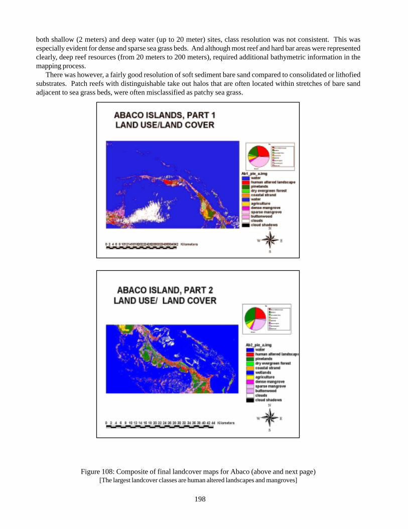
198
both shallow (2 meters) and deep water (up to 20 meter) sites, class resolution was not consistent. This wasespecially evident for dense and sparse sea grass beds. And although most reef and hard bar areas were representedclearly, deep reef resources (from 20 meters to 200 meters), required additional bathymetric information in themapping process.
There was however, a fairly good resolution of soft sediment bare sand compared to consolidated or lithofiedsubstrates. Patch reefs with distinguishable take out halos that are often located within stretches of bare sandadjacent to sea grass beds, were often misclassified as patchy sea grass.
Figure 108: Composite of final landcover maps for Abaco (above and next page)[The largest landcover classes are human altered landscapes and mangroves]
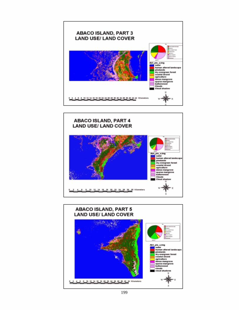
199
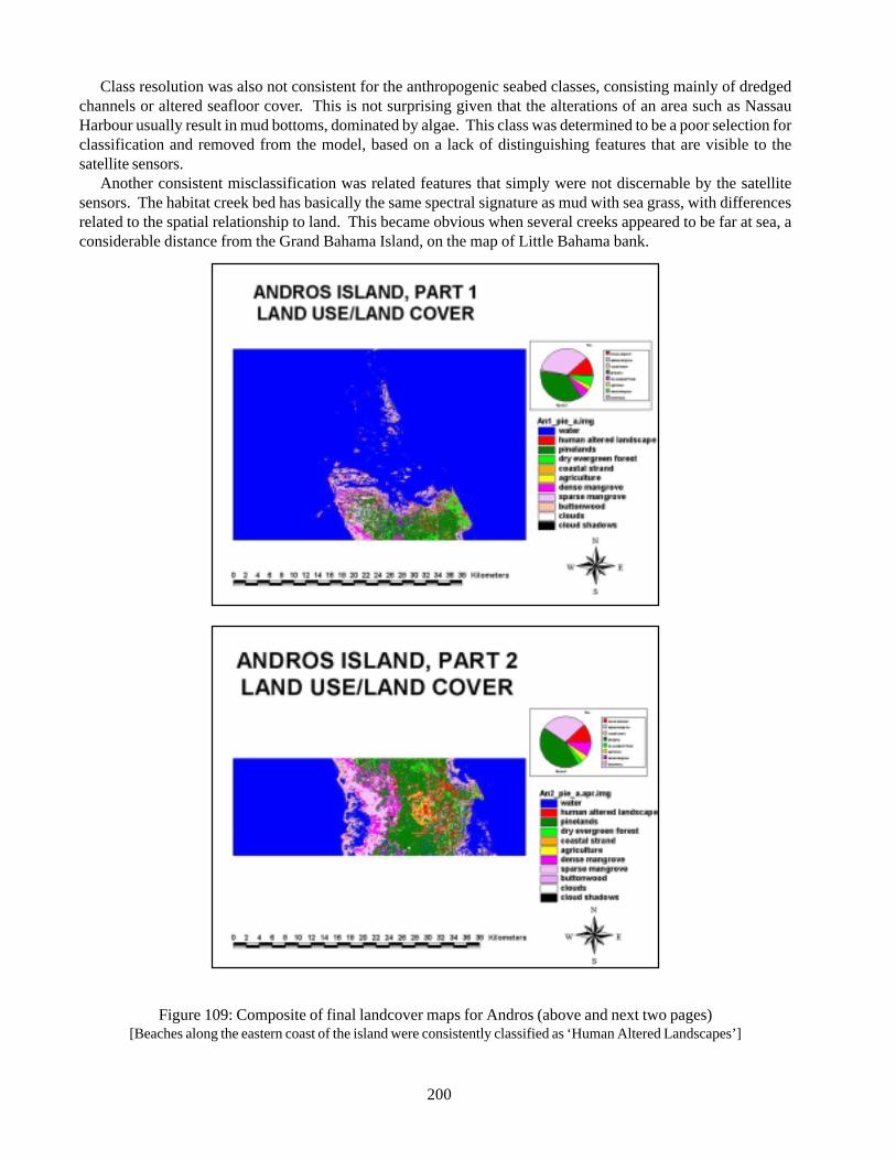
200
Class resolution was also not consistent for the anthropogenic seabed classes, consisting mainly of dredgedchannels or altered seafloor cover. This is not surprising given that the alterations of an area such as NassauHarbour usually result in mud bottoms, dominated by algae. This class was determined to be a poor selection forclassification and removed from the model, based on a lack of distinguishing features that are visible to thesatellite sensors.
Another consistent misclassification was related features that simply were not discernable by the satellitesensors. The habitat creek bed has basically the same spectral signature as mud with sea grass, with differencesrelated to the spatial relationship to land. This became obvious when several creeks appeared to be far at sea, aconsiderable distance from the Grand Bahama Island, on the map of Little Bahama bank.
Figure 109: Composite of final landcover maps for Andros (above and next two pages)[Beaches along the eastern coast of the island were consistently classified as ‘Human Altered Landscapes’]
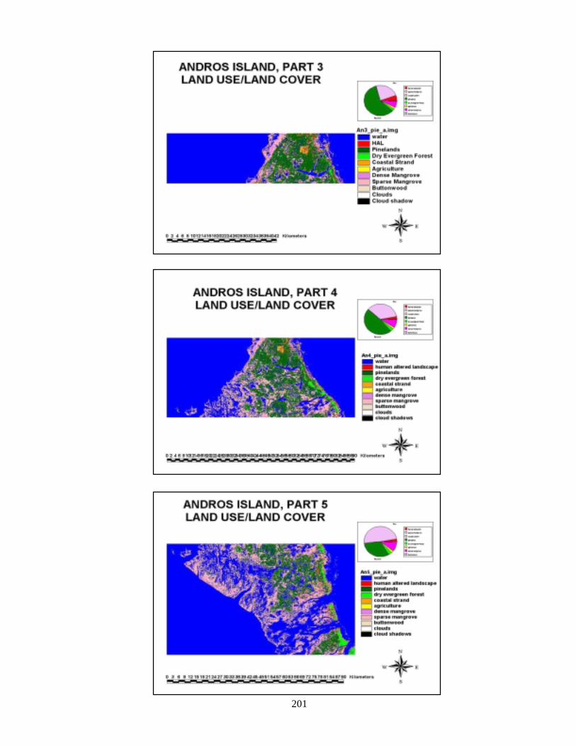
201
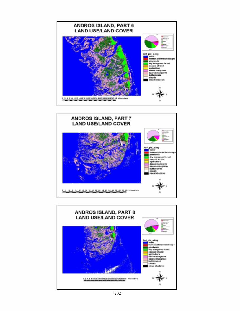
202
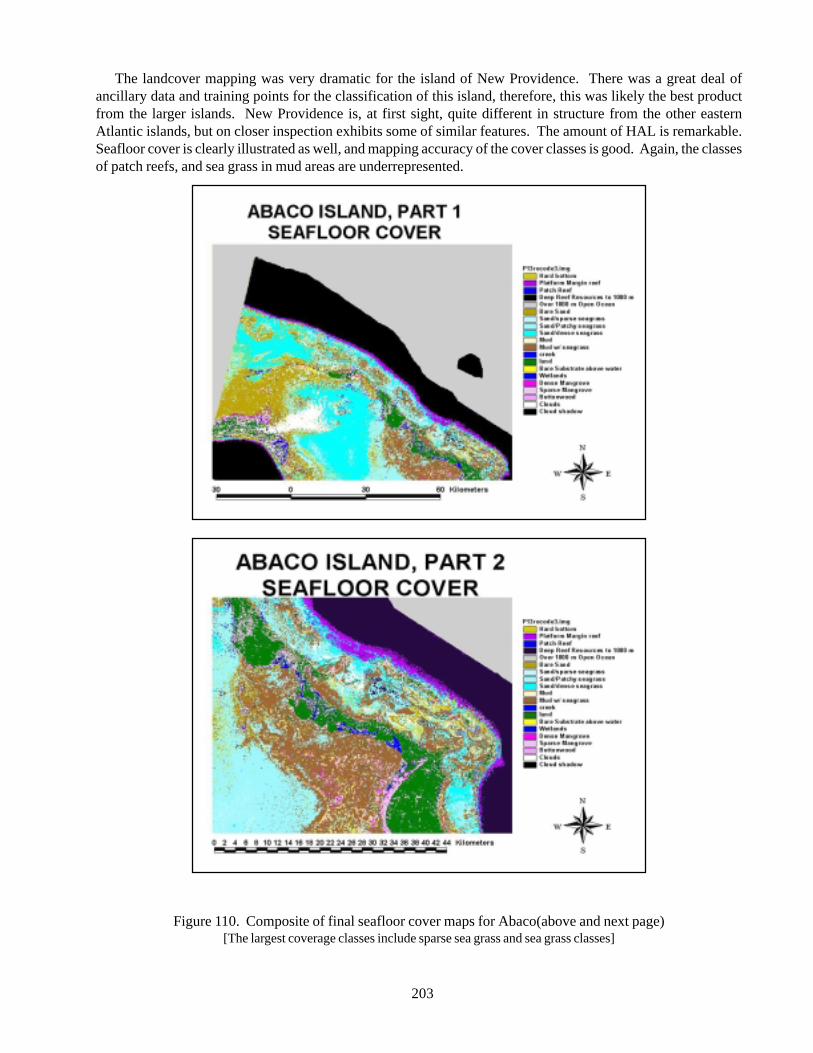
203
The landcover mapping was very dramatic for the island of New Providence. There was a great deal ofancillary data and training points for the classification of this island, therefore, this was likely the best productfrom the larger islands. New Providence is, at first sight, quite different in structure from the other easternAtlantic islands, but on closer inspection exhibits some of similar features. The amount of HAL is remarkable.Seafloor cover is clearly illustrated as well, and mapping accuracy of the cover classes is good. Again, the classesof patch reefs, and sea grass in mud areas are underrepresented.
Figure 110. Composite of final seafloor cover maps for Abaco(above and next page)[The largest coverage classes include sparse sea grass and sea grass classes]
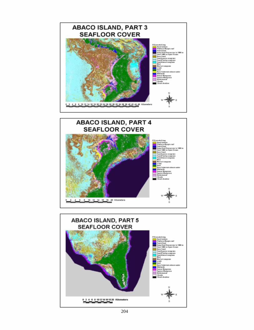
204
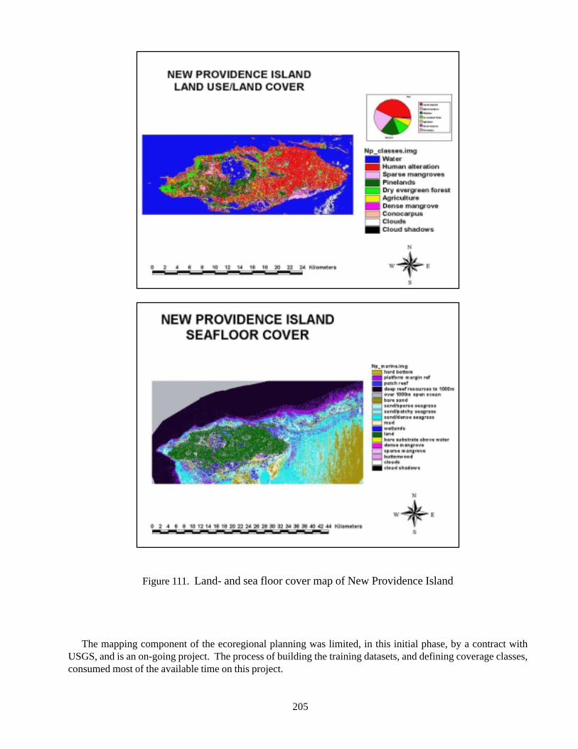
205
Figure 111. Land- and sea floor cover map of New Providence Island
The mapping component of the ecoregional planning was limited, in this initial phase, by a contract withUSGS, and is an on-going project. The process of building the training datasets, and defining coverage classes,consumed most of the available time on this project.
206
References
Driscoll, R.E. et al. 1984. An ecological landclassification framework for the United States.USDA Forest Service, Misc. Pub. 1439. Washington,DC: U.S. Department of Agriculture, Forest Service.
Federal Geographic Data Committee. 1997. Vegetationclassification standard, FGDC-STD-005. Webaddress: http://www.fgdc.gov/publications/documents/standards/standards.html.
Grossman, D. H., D. Faber-Langendoen, A. S. Weakley,M. Anderson, P. Bourgeron, R. Crawford, K. Goodin,S. Landaal, K. Metzler, K. D. Patterson, M. Pyne,M. Reid, and L. Sneddon. 1998. Internationalclassification of ecological communities: terrestrialvegetation of the United States. Volume I. TheNational Vegetation Classification System:development, status, and applications. The NatureConservancy, Arlington, Virginia.
UNESCO. 1973. International Classification andMapping of Vegetation, Series 6, Ecology andConservation. Paris.
B.E.S.T. (Bahamas Environment, Science andTechnology Commission). 2002 BahamasEnvironmental Handbook. The Government of theBahamas.
Cinturon-Molero, G. and Y. Schaeffer-Novelli. 1992.Ecology and Management of New World Mangroves.In: Seeliger, U., ed. Coastal Plant Communities ofLatin America. pp.233-258.
Kendall, M.S., C.R.Kruer, K.R.Buja, J.D.Christensen,M.Finkbeiner, and M.E. Monaco. 2001. Methodsused to map the benthic habitats of Puerto Rico andthe U.S. Virgin Islands. Available at http://biogeo.nos.noaa.gov/projects/mapping/caribbean/startup.htm
Multer, H.G. 1971. Field Guide to Some CarbonateRock Environments. Fairleigh Dickinson University,Madison, New Jersey.
Sealey, N. 1985. Bahamian Landscapes. CollinsCaribbean, London.
Sealey, N. 1990. The Bahamas Today. MacMillanCaribbean, London.
Sealey, KS., E.Schmitt, M.Chiappone, E.Fried, R.Wright, T.Benham, T. Hollis, K. Pronzati, A. Lowe,and S. Bain. 1999. Water Quality and Coral Reefs:Temporal and spatial comparisons of changes withcoastal development. The Nature Conservancy,Coral Gables.
Shapiro, R.S., K.R.Aalto, and R.F.Dill. 1995.Stratigraphic setting of a subtidal stromatolite field,Iguana Cay, Exumas, Bahamas. In Curran, H.A. andB. White., editors. Terrestrial and Shallow MarineGeology of the Bahamas and Bermuda. TheGeological Society of America, Boulder, Colorado.
Twilley, RR, AE Lugo, and C Patterson-Zucca. 1986.Litter production and turnover in basin mangroveforests in southwest Florida. Ecology 67(3), pp.670-683.
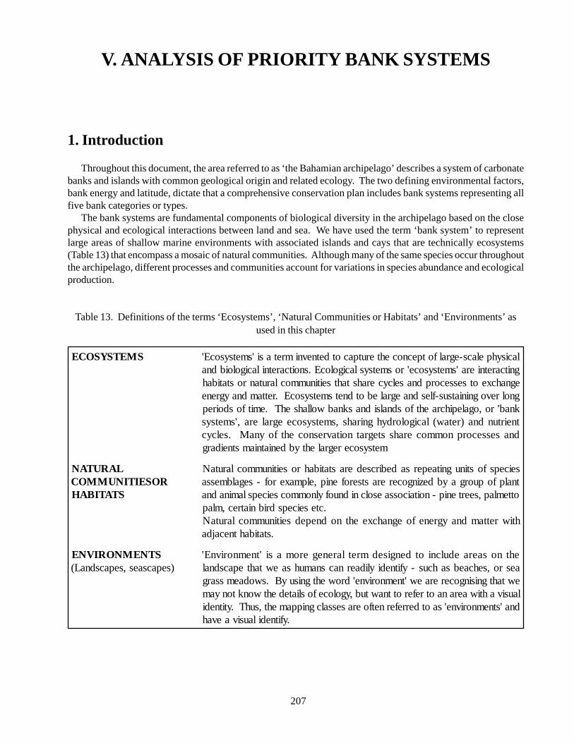
207
V. ANALYSIS OF PRIORITY BANK SYSTEMS
1. Introduction
Throughout this document, the area referred to as ‘the Bahamian archipelago’ describes a system of carbonatebanks and islands with common geological origin and related ecology. The two defining environmental factors,bank energy and latitude, dictate that a comprehensive conservation plan includes bank systems representing allfive bank categories or types.
The bank systems are fundamental components of biological diversity in the archipelago based on the closephysical and ecological interactions between land and sea. We have used the term ‘bank system’ to representlarge areas of shallow marine environments with associated islands and cays that are technically ecosystems(Table 13) that encompass a mosaic of natural communities. Although many of the same species occur throughoutthe archipelago, different processes and communities account for variations in species abundance and ecologicalproduction.
Table 13. Definitions of the terms ‘Ecosystems’, ‘Natural Communities or Habitats’ and ‘Environments’ asused in this chapter
SMETSYSOCE lacisyhpelacs-egralfotpecnocehterutpacotdetnevnimretasi'smetsysocE'gnitcaretniera'smetsysoce'rosmetsyslacigolocE.snoitcaretnilacigoloibdnaegnahcxeotsessecorpdnaselcycerahstahtseitinummoclarutanrostatibahgnolrevogniniatsus-flesdnaegralebotdnetsmetsysocE.rettamdnaygreneknab'ro,ogalepihcraehtfosdnalsidnasknabwollahsehT.emitfosdoireptneirtundna)retaw(lacigolordyhgnirahs,smetsysoceegralera,'smetsysdnasessecorpnommocerahsstegratnoitavresnocehtfoynaM.selcyc
metsysoceregralehtybdeniatniamstneidarg
LARUTANROSEITINUMMOC
STATIBAH
seicepsfostinugnitaepersadebircsederastatibahroseitinummoclarutaNtnalpfopuorgaybdezingocererastserofenip,elpmaxerof-segalbmessa
ottemlap,seertenip-noitaicossaesolcnidnuofylnommocseicepslaminadna.cteseicepsdribniatrec,mlap
htiwrettamdnaygrenefoegnahcxeehtnodnepedseitinummoclarutaN.statibahtnecajda
STNEMNORIVNE)sepacsaes,sepacsdnaL(
ehtnosaeraedulcniotdengisedmretlarenegeromasi'tnemnorivnE'aesro,sehcaebsahcus-yfitnediylidaernacsnamuhsaewtahtepacsdnalewtahtgnisingocereraew'tnemnorivne'drowehtgnisuyB.swodaemssarglausivahtiwaeranaotreferottnawtub,ygolocefosliatedehtwonktonyam
dna'stnemnorivne'saotderrefernetfoerasessalcgnippameht,suhT.ytitnedi.yfitnedilausivaevah
208
Scientists often describe groups of related ecosystemsin areas of similar physical, geological and climaticconditions as ecoregions (see Bailey, 1999). Thisecoregional plan is based on data collected from a widevariety of sources, comprising many areas ofinvestigation. A complete study of the Bahamianarchipelago has yet to be written, however this plan isan attempt to provide a platform of protection for allknown components of biological diversity in thearchipelago. With much of the real estate beingunderwater, and with small low-lying island areasinfluenced by, and vulnerable to, coastal and oceanicprocesses, bank systems are the basic working ‘unit’ forresource management and conservation.
The compilation of information on conservationtargets, and the classification of habitats in, above, andbelow the water, gives us a basis for ranking the banksystems, and establishing some priority sites forconservation actions. Few targets occur on every banksystem, and any landscape scale conservation initiativein the archipelago will be based not on a few sitesselected as parks or protected areas, but on the actionsof the people dependent on this archipelago for theirhomes and livelihood. More important than protectedarea planning is a dramatic change in policies andattitudes on how we live on dry tropical islands. Issuesof sustainable development, endurable resource use,local stewardship, and national capacity for ecologicalmonitoring and management all need to be brought tothe forefront of public awareness and discussion.
2. Processes, States and Gradients
Processes, states and gradients refer to abiotic andbiotic circumstances necessary to maintain andperpetuate the target species or natural communities.The environments on land and sea are arranged inpredictable patterns, controlled by the ‘master variables’of temperature and rainfall, but modified locally bylandforms and vegetation. Landscape-levelconservation initiatives will need to consider the patternsof natural communities, all the way from upland forestsand coastal mangroves to sea grass meadows and deepplatform reefs. A summary of important processes,states, and gradients are summarized in the Appendix(for a review of the ecoregional planning process anddefinitions of these terms, see ‘Designing a Geographyof Hope’, TNC, 2000).
Although the islands of the archipelago represent
only one tenth of the area of the shallow seas, there arehigh levels of diversity and endemism yet to be describedand recorded. The archipelago itself is a mosaic of banksystems, and unique environments; thus many of theconservation targets do not occur on all bank systems,or represent different community alliances orpopulations. For example, coppice, or ‘bush’ in theBahamas, is included as a natural communityconservation target described in the technical term ‘dryevergreen formations’. Dry evergreen formationsactually include many plant associations and alliancesthat evolved in a response to gradients in environmentalconditions such as the decrease in rainfall from north tosouth. Bahamian vegetation is extremely diverse withover 1000 vascular plant species identified. Of these,only some 3-4% are of Bahamian origin (i.e. endemicspecies), but this is generally consistent with the knownrate of evolution of new species on isolated islands. TheBahamas, as a whole, enjoys a distinct flora and faunafrom the rest of the Caribbean. Each island, and moreimportantly each bank system, has assembled its ownparticular mix of the available flora.
Extensive mangroves and creek systems oftendominate the coastal ecology of the islands. Mangrovesusually occur on the western margins of the islands;however on Grand Bahama Island they are found on thenorthern margin. Mangroves can include creeks or basinsystems, with dwarf shrub lands to woodlands to forests.The structure and extent of the mangrove is again uniqueto bank systems. In addition, there are smaller wetlandsdescribed as ‘anchialine ponds’ that also play animportant role in coastal ecology. Many of these pondshave some underground connection to the sea, or arefilled with soft sediments; however they are not blueholes. They can host a variety of unique and unusualcreatures, some endemic to the Bahamas.
The processes that create and maintain theenvironments of the archipelago are described generally,but not specifically for many bank systems. Much ofthe natural history and ecological information compiledto date has not been evaluated on the scale of an entire“bank system”. A comprehensive inventory andassessment program is a vital key step, especially asnew conservation initiatives begin on specific banksystems.
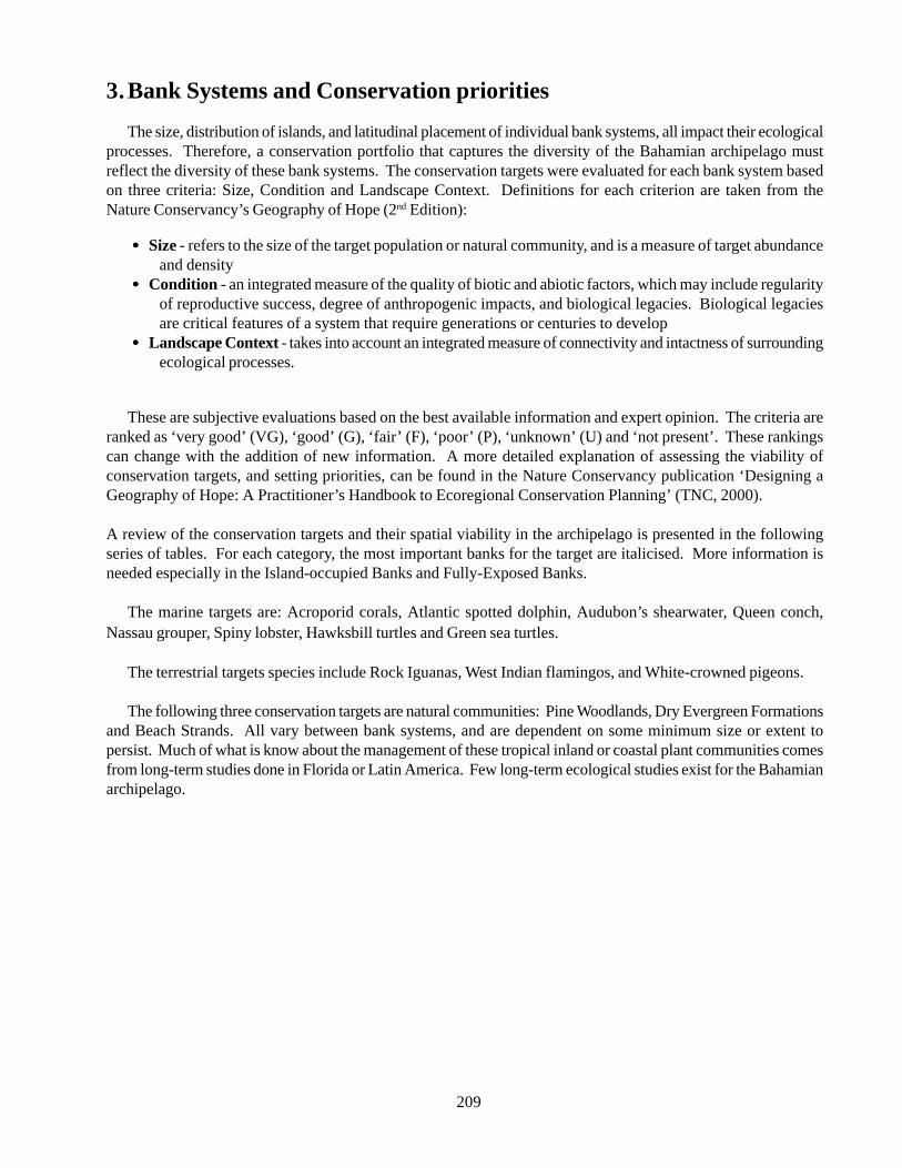
209
3. Bank Systems and Conservation priorities
The size, distribution of islands, and latitudinal placement of individual bank systems, all impact their ecologicalprocesses. Therefore, a conservation portfolio that captures the diversity of the Bahamian archipelago mustreflect the diversity of these bank systems. The conservation targets were evaluated for each bank system basedon three criteria: Size, Condition and Landscape Context. Definitions for each criterion are taken from theNature Conservancy’s Geography of Hope (2nd Edition):
••••• Size - refers to the size of the target population or natural community, and is a measure of target abundanceand density
••••• Condition - an integrated measure of the quality of biotic and abiotic factors, which may include regularityof reproductive success, degree of anthropogenic impacts, and biological legacies. Biological legaciesare critical features of a system that require generations or centuries to develop
••••• Landscape Context - takes into account an integrated measure of connectivity and intactness of surroundingecological processes.
These are subjective evaluations based on the best available information and expert opinion. The criteria areranked as ‘very good’ (VG), ‘good’ (G), ‘fair’ (F), ‘poor’ (P), ‘unknown’ (U) and ‘not present’. These rankingscan change with the addition of new information. A more detailed explanation of assessing the viability ofconservation targets, and setting priorities, can be found in the Nature Conservancy publication ‘Designing aGeography of Hope: A Practitioner’s Handbook to Ecoregional Conservation Planning’ (TNC, 2000).
A review of the conservation targets and their spatial viability in the archipelago is presented in the followingseries of tables. For each category, the most important banks for the target are italicised. More information isneeded especially in the Island-occupied Banks and Fully-Exposed Banks.
The marine targets are: Acroporid corals, Atlantic spotted dolphin, Audubon’s shearwater, Queen conch,Nassau grouper, Spiny lobster, Hawksbill turtles and Green sea turtles.
The terrestrial targets species include Rock Iguanas, West Indian flamingos, and White-crowned pigeons.
The following three conservation targets are natural communities: Pine Woodlands, Dry Evergreen Formationsand Beach Strands. All vary between bank systems, and are dependent on some minimum size or extent topersist. Much of what is know about the management of these tropical inland or coastal plant communities comesfrom long-term studies done in Florida or Latin America. Few long-term ecological studies exist for the Bahamianarchipelago.
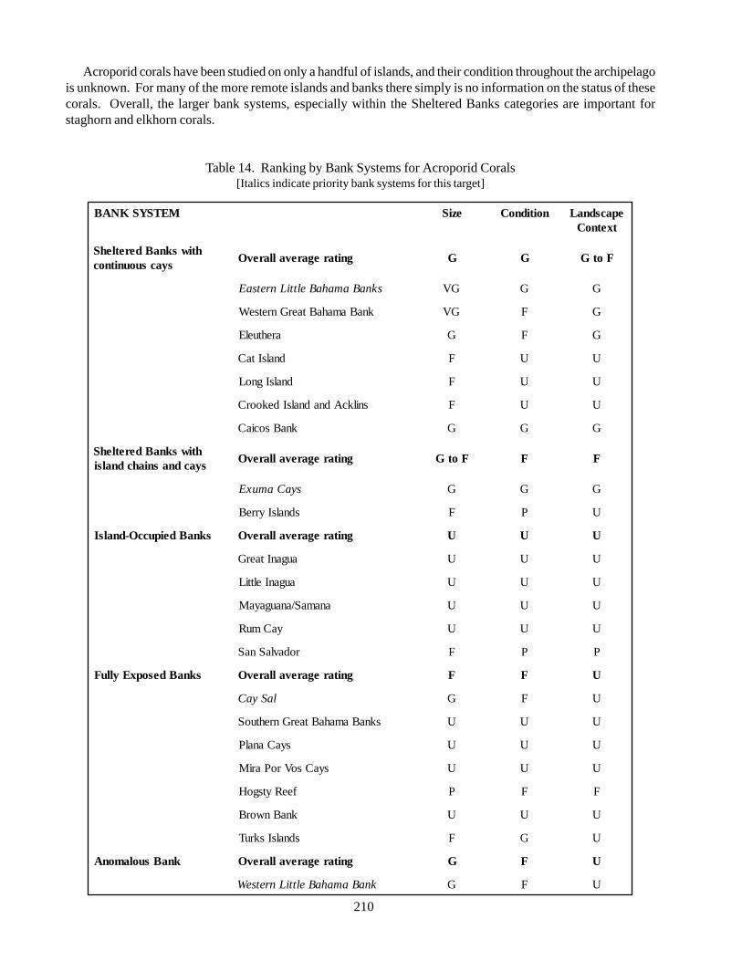
210
Acroporid corals have been studied on only a handful of islands, and their condition throughout the archipelagois unknown. For many of the more remote islands and banks there simply is no information on the status of thesecorals. Overall, the larger bank systems, especially within the Sheltered Banks categories are important forstaghorn and elkhorn corals.
Table 14. Ranking by Bank Systems for Acroporid Corals[Italics indicate priority bank systems for this target]
METSYSKNAB eziS noitidnoC epacsdnaLtxetnoC
htiwsknaBderetlehSsyacsuounitnoc
gnitaregarevallarevO G G FotG
sknaBamahaBelttiLnretsaE GV G G
knaBamahaBtaerGnretseW GV F G
arehtuelE G F G
dnalsItaC F U U
dnalsIgnoL F U U
snilkcAdnadnalsIdekoorC F U U
knaBsociaC G G G
htiwsknaBderetlehSsyacdnasniahcdnalsi
gnitaregarevallarevO FotG F F
syaCamuxE G G G
sdnalsIyrreB F P U
sknaBdeipuccO-dnalsI gnitaregarevallarevO U U U
auganItaerG U U U
auganIelttiL U U U
anamaS/anaugayaM U U U
yaCmuR U U U
rodavlaSnaS F P P
sknaBdesopxEylluF gnitaregarevallarevO F F U
laSyaC G F U
sknaBamahaBtaerGnrehtuoS U U U
syaCanalP U U U
syaCsoVroPariM U U U
feeRytsgoH P F F
knaBnworB U U U
sdnalsIskruT F G U
knaBsuolamonA gnitaregarevallarevO G F U
knaBamahaBelttiLnretseW G F U
211
The Atlantic Spotted Dolphin is restricted in its distribution, likely having specific prey and habitat requirements.Eastern Little Bahama Banks and Western Great Bahama Banks are two sheltered bank systems important to thistarget. Its biology is best known from long-term studies north of Grand Bahama Island, in the Abacos, and nearBimini. These areas appear unique and critical to the spotted dolphin ecology in the archipelago. Much of thesouthern Bahamas has not been inventoried for the numbers and movement of this species.
Table 15. Ranking by Bank System for Atlantic Spotted Dolphins[Italics indicate priority bank systems for this target]
METSYSKNAB eziS noitidnoC epacsdnaLtxetnoC
htiwsknaBderetlehSsyacsuounitnoc
gnitaregarevallarevO G G G
sknaBamahaBelttiLnretsaE G G G
knaBamahaBtaerGnretseW G G G
arehtuelE U U U
dnalsItaC U U U
dnalsIgnoL U U U
snilkcAdnadnalsIdekoorC U U U
knaBsociaC U U U
htiwsknaBderetlehSsyacdnasniahcdnalsi
gnitaregarevallarevO U U U
syaCamuxE U U U
sdnalsIyrreB U U U
sknaBdeipuccO-dnalsI gnitaregarevallarevO U U U
auganItaerG U U U
auganIelttiL U U U
anamaS/anaugayaM
yaCmuR U U U
rodavlaSnaS U U U
sknaBdesopxEylluF gnitaregarevallarevO U U U
laSyaC U U U
sknaBamahaBtaerGnrehtuoS U U U
syaCanalP U U U
syaCsoVroPariM U U U
feeRytsgoH U U U
knaBnworB U U U
sdnalsIskruT U U U
knaBsuolamonA gnitaregarevallarevO GV GV GV
knaBamahaBelttiLnretseW GV GV GV
212
Audubon’s shearwater has been reported on only a few bank systems. The fully exposed bank systems areapparently important in the distribution of this species, and Eastern Little Bahama Bank, Western Bahama Bankand the Exuma Cays appear important for nesting sites. The Audubon’s shearwater is the most restricted target indistribution throughout the archipelago.
Table 16. Ranking by Bank Systems for Audubon’s Shearwaters[Italics indicate priority bank systems for this target]
METSYSKNAB eziS noitidnoC epacsdnaLtxetnoC
htiwsknaBderetlehSsyacsuounitnoc
gnitaregarevallarevO GotF GotF G
sknaBamahaBelttiLnretsaE G G G
knaBamahaBtaerGnretseW tneserpton tneserpton tneserpton
arehtuelE tneserpton tneserpton tneserpton
dnalsItaC F F G
dnalsIgnoL tneserpton tneserpton tneserpton
snilkcAdnadnalsIdekoorC tneserpton tneserpton tneserpton
knaBsociaC tneserpton tneserpton tneserpton
htiwsknaBderetlehSsyacdnasniahcdnalsi
gnitaregarevallarevO GVotG G G
syaCamuxE GV G G
sdnalsIyrreB G G G
sknaBdeipuccO-dnalsI gnitaregarevallarevO GotF G F
auganItaerG tneserpton tneserpton tneserpton
auganIelttiL tneserpton tneserpton tneserpton
anamaS/anaugayaM tneserpton tneserpton tneserpton
yaCmuR tneserpton tneserpton tneserpton
rodavlaSnaS GotF G F
sknaBdesopxEylluF gnitaregarevallarevO G G G
laSyaC G G G
sknaBamahaBtaerGnrehtuoS G G G
syaCanalP GotF G G
syaCsoVroPariM F G G
feeRytsgoH tneserpton tneserpton tneserpton
knaBnworB tneserpton tneserpton tneserpton
sdnalsIskruT F G G
knaBsuolamonA gnitaregarevallarevO tneserpton tneserpton tneserpton
knaBamahaBelttiLnretseW tneserpton tneserpton tneserpton
213
Queen Conch is heavily fished throughout the archipelago. This species is probably less abundant and morevulnerable on island-occupied banks. Recruitment patterns between bank systems are unclear, but this largemollusc is key in maintaining ecological diversity in soft sediment environments. The Queen Conch is potentiallynecessary in maintaining ecological function on all bank systems, and thus, its abundance should be monitoredand maintained archipelago-wide.
Table 17. Ranking by Bank Systems for Queen Conch[Italics indicate priority bank systems for this target]
METSYSKNAB eziS noitidnoC epacsdnaLtxetnoC
htiwsknaBderetlehSsyacsuounitnoc
gnitaregarevallarevO G F F
sknaBamahaBelttiLnretsaE G F F
knaBamahaBtaerGnretseW G G G
arehtuelE G F F
dnalsItaC F F P
dnalsIgnoL G U G
snilkcAdnadnalsIdekoorC F U U
knaBsociaC G G G
htiwsknaBderetlehSsyacdnasniahcdnalsi
gnitaregarevallarevO G G G
syaCamuxE G G GV
sdnalsIyrreB G F F
sknaBdeipuccO-dnalsI gnitaregarevallarevO P U U
auganItaerG P U U
auganIelttiL P U U
anamaS/anaugayaM P U U
yaCmuR P U U
rodavlaSnaS P U U
sknaBdesopxEylluF gnitaregarevallarevO P U U
laSyaC F U P
sknaBamahaBtaerGnrehtuoS G U U
syaCanalP P U U
syaCsoVroPariM P U U
feeRytsgoH P U U
knaBnworB P U U
sdnalsIskruT F U U
knaBsuolamonA gnitaregarevallarevO G F U
knaBamahaBelttiLnretseW G F U

214
Spiny Lobster is a key species in the ecology of hard bottom and coral reef environments. Reproductive ratesare high in healthy populations and, therefore, this species is very responsive to a network of marine reserves andprotected areas. Spiny lobster should be monitored and maintained on all bank systems, both for ecological andeconomic importance.
Table 18. Ranking by Bank Systems for Spiny Lobsters[Italics indicate priority bank systems for this target]
METSYSKNAB eziS noitidnoC epacsdnaLtxetnoC
htiwsknaBderetlehSsyacsuounitnoc
gnitaregarevallarevO G G G
sknaBamahaBelttiLnretsaE G U U
knaBamahaBtaerGnretseW GV GV GV
arehtuelE G F G
dnalsItaC F U F
dnalsIgnoL F U G
snilkcAdnadnalsIdekoorC U U U
knaBsociaC GV G GV
htiwsknaBderetlehSsyacdnasniahcdnalsi
gnitaregarevallarevO G G G
syaCamuxE GV GV GV
sdnalsIyrreB F U U
sknaBdeipuccO-dnalsI gnitaregarevallarevO P U U
auganItaerG P U U
auganIelttiL P U U
anamaS/anaugayaM P U U
yaCmuR P U U
rodavlaSnaS P U U
sknaBdesopxEylluF gnitaregarevallarevO F U U
laSyaC F U U
sknaBamahaBtaerGnrehtuoS G U U
syaCanalP F U U
syaCsoVroPariM F U U
feeRytsgoH F U U
knaBnworB F U U
sdnalsIskruT G U U
knaBsuolamonA gnitaregarevallarevO
knaBamahaBelttiLnretseW G F G
215
Nassau Grouper are a key predator on coral reefs and hard-bottom communities. Their status is dynamic, everchanging with the success of annual reproduction and recruitment processes. The Nassau grouper is relativelylong-lived and slow growing, but faces many threats beyond over-harvesting. Loss of habitat and degradation ofwater quality are known threats to juveniles, but have not been evaluated throughout much of the Bahamianarchipelago. A pattern of fisheries collapses in other areas of the Caribbean suggests that ‘large and healthy’populations on reefs are necessary to sustain the species through annual variability in spawning and recruitmentprocesses. If ‘large and healthy’ translates into the conservation goal of 30 to 40 adult groupers per hectare onwindward fringing reefs, then much of the archipelago falls well below this benchmark. It is possible to fish thisspecies below a critical population level. For The Bahamas and the Turks and Caicos Islands, the need for actionis clearly immediate to reduce harvest of sub-adults and reproductively active adults in spawning aggregations isclearly immediate.
Table 19. Ranking by Bank Systems for Nassau Grouper[Italics indicate priority bank systems for this target]
METSYSKNAB eziS noitidnoC epacsdnaLtxetnoC
htiwsknaBderetlehSsyacsuounitnoc
gnitaregarevallarevO G FotG FotG
sknaBamahaBelttiLnretsaE G F F
knaBamahaBtaerGnretseW GV G G
arehtuelE G F G
dnalsItaC G F F
dnalsIgnoL G G G
snilkcAdnadnalsIdekoorC F U F
knaBsociaC G F G
htiwsknaBderetlehSsyacdnasniahcdnalsi
gnitaregarevallarevO G G G
syaCamuxE GV G G
sdnalsIyrreB F U F
sknaBdeipuccO-dnalsI gnitaregarevallarevO F U U
auganItaerG F U U
auganIelttiL F U U
anamaS/anaugayaM F U U
yaCmuR F U U
rodavlaSnaS F U U
sknaBdesopxEylluF gnitaregarevallarevO F U U
laSyaC G F F
sknaBamahaBtaerGnrehtuoS G U U
syaCanalP F U U
syaCsoVroPariM U U U
feeRytsgoH P U U
knaBnworB U U U
sdnalsIskruT F U U
knaBsuolamonA gnitaregarevallarevO G U U
knaBamahaBelttiLnretseW F F F
216
Sea turtles may be good indicators of the relative health of tropical, shallow water ecological systems.Assessment information is limited, and apart from nesting sites, sea turtles need protection throughout thearchipelago for juvenile and adult foraging habitats. Conservation strategies and actions are needed on both theregional and international level. There are no known priority bank systems for sea turtles. Priority bank systemscould be identified for nesting beaches through a national inventory and assessment exercise. Although researchefforts may be ongoing in the archipelago, maps of nesting sites are rarely available due to concerns that poacherscould use them.
Table 20. Ranking by Bank Systems for Hawksbill and Green Sea Turtles
METSYSKNAB eziS noitidnoC epacsdnaLtxetnoC
htiwsknaBderetlehSsyacsuounitnoc
gnitaregarevallarevO P P P
sknaBamahaBelttiLnretsaE P P P
knaBamahaBtaerGnretseW P P P
arehtuelE P P P
dnalsItaC P P P
dnalsIgnoL P P P
snilkcAdnadnalsIdekoorC P P P
knaBsociaC P P P
htiwsknaBderetlehSsyacdnasniahcdnalsi
gnitaregarevallarevO P P P
syaCamuxE P P P
sdnalsIyrreB P P P
sknaBdeipuccO-dnalsI gnitaregarevallarevO P P P
auganItaerG P P P
auganIelttiL P P P
anamaS/anaugayaM P P P
yaCmuR P P P
rodavlaSnaS P P P
sknaBdesopxEylluF gnitaregarevallarevO P P P
laSyaC P P P
sknaBamahaBtaerGnrehtuoS P P P
syaCanalP P P P
syaCsoVroPariM P P P
feeRytsgoH P P P
knaBnworB P P P
sdnalsIskruT P P P
knaBsuolamonA gnitaregarevallarevO P P P
knaBamahaBelttiLnretseW P P P
217
Rock Iguanas represent one conservation target with a dedicated group of researchers and conservationistsalready monitoring the species. The iguana is assumed to be very important historically in seed dispersal andcoastal ecology of many islands. Current distribution is dramatically reduced to a few fragmented populationsthat require annual inventory and protection. The difficulty and challenges to initiate or boost these populations,by re-introduction techniques, makes each individual all the more valuable. Bank systems with iguana populationsare all considered ‘high priority’.
Table 21. Ranking by Bank Systems for Rock Iguanas[Italics indicate priority bank systems for this target]
METSYSKNAB eziS noitidnoC epacsdnaLtxetnoC
htiwsknaBderetlehSsyacsuounitnoc
gnitaregarevallarevO GV F F
sknaBamahaBelttiLnretsaE tneserpton tneserpton tneserpton
knaBamahaBtaerGnretseW G F F
arehtuelE tneserpton tneserpton tneserpton
dnalsItaC tneserpton tneserpton tneserpton
dnalsIgnoL tneserpton tneserpton tneserpton
snilkcAdnadnalsIdekoorC GV F F
knaBsociaC GV F F
htiwsknaBderetlehSsyacdnasniahcdnalsi
gnitaregarevallarevO GotF F F
syaCamuxE GotF F F
sdnalsIyrreB tneserpton tneserpton tneserpton
sknaBdeipuccO-dnalsI gnitaregarevallarevO P F F
auganItaerG tneserpton tneserpton tneserpton
auganIelttiL tneserpton tneserpton tneserpton
anamaS/anaugayaM P F F
yaCmuR tneserpton tneserpton tneserpton
rodavlaSnaS FotP F F
sknaBdesopxEylluF gnitaregarevallarevO GV F F
laSyaC tneserpton tneserpton tneserpton
sknaBamahaBtaerGnrehtuoS tneserpton tneserpton tneserpton
syaCanalP tneserpton tneserpton tneserpton
syaCsoVroPariM tneserpton tneserpton tneserpton
feeRytsgoH tneserpton tneserpton tneserpton
knaBnworB tneserpton tneserpton tneserpton
sdnalsIskruT GV F F
knaBsuolamonA gnitaregarevallarevO tneserpton tneserpton tneserpton
knaBamahaBelttiLnretseW tneserpton tneserpton tneserpton
218
The West Indian Flamingos like the Rock Iguana is a species with a greatly reduced range within the archipelago.It is unknown just how important Flamingos are in the ecology of inland salt ponds and flats. As numbers ofFlamingos increase, potential habitats decrease through dredge and fill development of wetlands. The prioritybank systems include only those where the Flamingos are reported to exist. There is not enough ecologicalinformation available to base population levels or determine if appropriate habitats are protected archipelago-wide. Flamingos are the national bird of the Bahamas, yet few Bahamians have ever seen the bird outside ofcaptivity.
Table 22. Ranking by Bank Systems for West Indian Flamingos[Italics indicate priority bank systems for this target]
METSYSKNAB eziS noitidnoC epacsdnaLtxetnoC
htiwsknaBderetlehSsyacsuounitnoc
gnitaregarevallarevO G G G
sknaBamahaBelttiLnretsaE tneserpton tneserpton tneserpton
knaBamahaBtaerGnretseW G G F
arehtuelE tneserpton tneserpton tneserpton
dnalsItaC tneserpton tneserpton tneserpton
dnalsIgnoL tneserpton tneserpton tneserpton
snilkcAdnadnalsIdekoorC G G G
knaBsociaC G G G
htiwsknaBderetlehSsyacdnasniahcdnalsi
gnitaregarevallarevO tneserpton tneserpton tneserpton
syaCamuxE tneserpton tneserpton tneserpton
sdnalsIyrreB tneserpton tneserpton tneserpton
sknaBdeipuccO-dnalsI gnitaregarevallarevO G G G
auganItaerG GV G G
auganIelttiL G G G
anamaS/anaugayaM G G G
yaCmuR tneserpton tneserpton tneserpton
rodavlaSnaS tneserpton tneserpton tneserpton
sknaBdesopxEylluF gnitaregarevallarevO F G G
laSyaC tneserpton tneserpton tneserpton
sknaBamahaBtaerGnrehtuoS tneserpton tneserpton tneserpton
syaCanalP tneserpton tneserpton tneserpton
syaCsoVroPariM tneserpton tneserpton tneserpton
feeRytsgoH tneserpton tneserpton tneserpton
knaBnworB tneserpton tneserpton tneserpton
sdnalsIskruT F G G
knaBsuolamonA gnitaregarevallarevO tneserpton tneserpton tneserpton
knaBamahaBelttiLnretseW tneserpton tneserpton tneserpton
219
White-crowned pigeons are protected from hunting on a series of offshore nesting cays and islands. However,these critical habitats are not protected, often privately owned (e.g. the Schooner Cays), and subject to development.Although numbers of white-crowned pigeons have remained stable (with some slow increase in some areas),current populations represent only a fragment of the large flocks that once dominated the landscape. These birdshave not recovered to levels appropriate for their key ecological role in seed dispersal for dry evergreen formations(coppice). Nesting efforts are highly susceptible to stochastic disturbances (such as hurricanes) thus populationsneed to be large, with widely scattered nesting sites. For priority bank systems, the linked roosting and foraginghabitats need to be protected.
Table 23. Ranking by Bank Systems for White Crown Pigeon
METSYSKNAB eziS noitidnoC epacsdnaLtxetnoC
htiwsknaBderetlehSsyacsuounitnoc
gnitaregarevallarevO GV G GotF
sknaBamahaBelttiLnretsaE tneserpton tneserpton tneserpton
knaBamahaBtaerGnretseW GV G F
arehtuelE GV F F
dnalsItaC G G G
dnalsIgnoL GV G F
snilkcAdnadnalsIdekoorC G G G
knaBsociaC GV G G
htiwsknaBderetlehSsyacdnasniahcdnalsi
gnitaregarevallarevO GVotG G F
syaCamuxE GV G F
sdnalsIyrreB G G F
sknaBdeipuccO-dnalsI gnitaregarevallarevO G GotF GotF
auganItaerG tneserpton tneserpton tneserpton
auganIelttiL tneserpton tneserpton tneserpton
anamaS/anaugayaM G G G
yaCmuR tneserpton tneserpton tneserpton
rodavlaSnaS G F F
sknaBdesopxEylluF gnitaregarevallarevO G G GotF
laSyaC G G F
sknaBamahaBtaerGnrehtuoS G G G
syaCanalP U U U
syaCsoVroPariM U U U
feeRytsgoH U U U
knaBnworB U U U
sdnalsIskruT U U U
knaBsuolamonA gnitaregarevallarevO tneserpton tneserpton tneserpton
knaBamahaBelttiLnretseW tneserpton tneserpton tneserpton
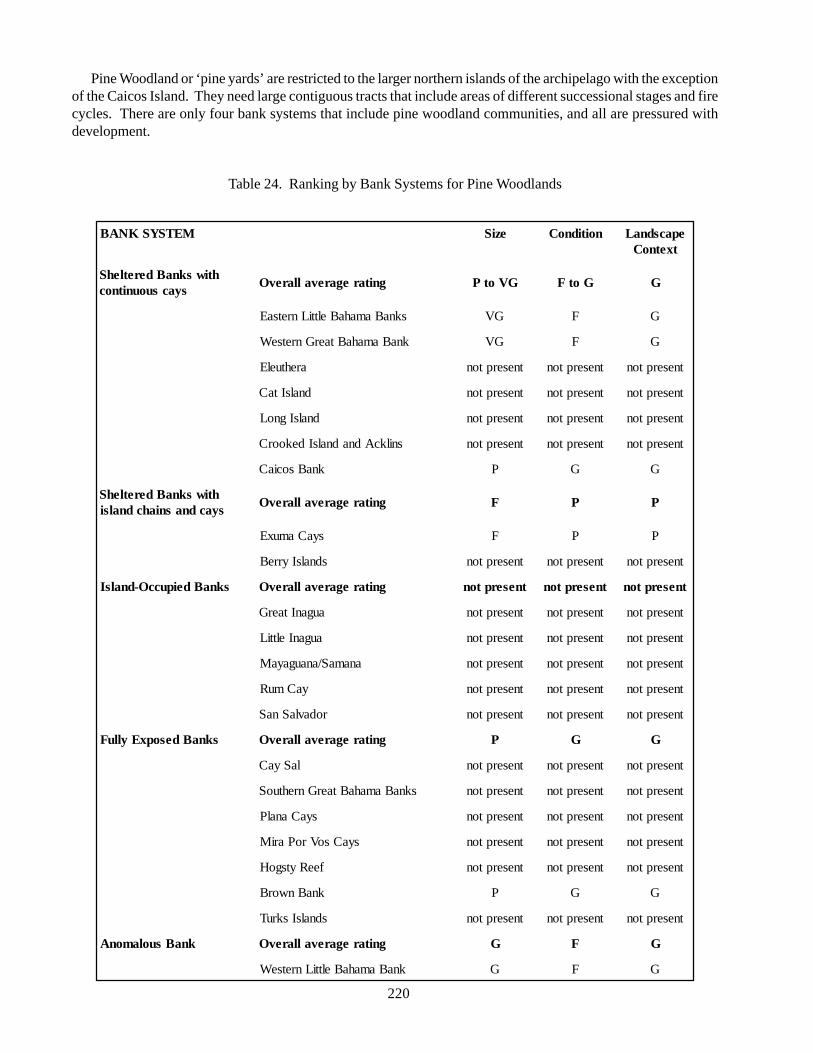
220
Pine Woodland or ‘pine yards’ are restricted to the larger northern islands of the archipelago with the exceptionof the Caicos Island. They need large contiguous tracts that include areas of different successional stages and firecycles. There are only four bank systems that include pine woodland communities, and all are pressured withdevelopment.
Table 24. Ranking by Bank Systems for Pine Woodlands
METSYSKNAB eziS noitidnoC epacsdnaLtxetnoC
htiwsknaBderetlehSsyacsuounitnoc
gnitaregarevallarevO GVotP GotF G
sknaBamahaBelttiLnretsaE GV F G
knaBamahaBtaerGnretseW GV F G
arehtuelE tneserpton tneserpton tneserpton
dnalsItaC tneserpton tneserpton tneserpton
dnalsIgnoL tneserpton tneserpton tneserpton
snilkcAdnadnalsIdekoorC tneserpton tneserpton tneserpton
knaBsociaC P G G
htiwsknaBderetlehSsyacdnasniahcdnalsi
gnitaregarevallarevO F P P
syaCamuxE F P P
sdnalsIyrreB tneserpton tneserpton tneserpton
sknaBdeipuccO-dnalsI gnitaregarevallarevO tneserpton tneserpton tneserpton
auganItaerG tneserpton tneserpton tneserpton
auganIelttiL tneserpton tneserpton tneserpton
anamaS/anaugayaM tneserpton tneserpton tneserpton
yaCmuR tneserpton tneserpton tneserpton
rodavlaSnaS tneserpton tneserpton tneserpton
sknaBdesopxEylluF gnitaregarevallarevO P G G
laSyaC tneserpton tneserpton tneserpton
sknaBamahaBtaerGnrehtuoS tneserpton tneserpton tneserpton
syaCanalP tneserpton tneserpton tneserpton
syaCsoVroPariM tneserpton tneserpton tneserpton
feeRytsgoH tneserpton tneserpton tneserpton
knaBnworB P G G
sdnalsIskruT tneserpton tneserpton tneserpton
knaBsuolamonA gnitaregarevallarevO G F G
knaBamahaBelttiLnretseW G F G
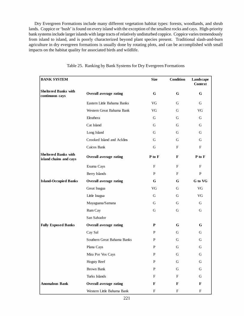
221
Dry Evergreen Formations include many different vegetation habitat types: forests, woodlands, and shrublands. Coppice or ‘bush’ is found on every island with the exception of the smallest rocks and cays. High-prioritybank systems include larger islands with large tracts of relatively undisturbed coppice. Coppice varies tremendouslyfrom island to island, and is poorly characterized beyond plant species present. Traditional slash-and-burnagriculture in dry evergreen formations is usually done by rotating plots, and can be accomplished with smallimpacts on the habitat quality for associated birds and wildlife.
Table 25. Ranking by Bank Systems for Dry Evergreen Formations
METSYSKNAB eziS noitidnoC epacsdnaLtxetnoC
htiwsknaBderetlehSsyacsuounitnoc
gnitaregarevallarevO G G G
sknaBamahaBelttiLnretsaE GV G G
knaBamahaBtaerGnretseW GV G GV
arehtuelE G G G
dnalsItaC G G G
dnalsIgnoL G G G
snilkcAdnadnalsIdekoorC G G G
knaBsociaC G F F
htiwsknaBderetlehSsyacdnasniahcdnalsi
gnitaregarevallarevO FotP F FotP
syaCamuxE F F F
sdnalsIyrreB P F P
sknaBdeipuccO-dnalsI gnitaregarevallarevO G G GVotG
auganItaerG GV G GV
auganIelttiL G G GV
anamaS/anaugayaM G G G
yaCmuR G G G
rodavlaSnaS
sknaBdesopxEylluF gnitaregarevallarevO P G G
laSyaC P G G
sknaBamahaBtaerGnrehtuoS P G G
syaCanalP P G G
syaCsoVroPariM P G G
feeRytsgoH P G G
knaBnworB P G G
sdnalsIskruT F F G
knaBsuolamonA gnitaregarevallarevO F F F
knaBamahaBelttiLnretseW F F F
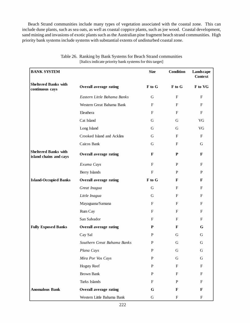
222
Beach Strand communities include many types of vegetation associated with the coastal zone. This caninclude dune plants, such as sea oats, as well as coastal coppice plants, such as joe wood. Coastal development,sand mining and invasions of exotic plants such as the Australian pine fragment beach strand communities. Highpriority bank systems include systems with substantial extents of undisturbed coastal zone.
Table 26. Ranking by Bank Systems for Beach Strand communities[Italics indicate priority bank systems for this target]
METSYSKNAB eziS noitidnoC epacsdnaLtxetnoC
htiwsknaBderetlehSsyacsuounitnoc
gnitaregarevallarevO GotF GotF GVotF
sknaBamahaBelttiLnretsaE G F F
knaBamahaBtaerGnretseW F F F
arehtuelE F F F
dnalsItaC G G GV
dnalsIgnoL G G GV
snilkcAdnadnalsIdekoorC G F F
knaBsociaC G F G
htiwsknaBderetlehSsyacdnasniahcdnalsi
gnitaregarevallarevO F P F
syaCamuxE F P F
sdnalsIyrreB F P P
sknaBdeipuccO-dnalsI gnitaregarevallarevO GotF F F
auganItaerG G F F
auganIelttiL G F F
anamaS/anaugayaM F F F
yaCmuR F F F
rodavlaSnaS F F F
sknaBdesopxEylluF gnitaregarevallarevO P F G
laSyaC P G G
sknaBamahaBtaerGnrehtuoS P G G
syaCanalP P G G
syaCsoVroPariM P G G
feeRytsgoH P F F
knaBnworB P F F
sdnalsIskruT F P F
knaBsuolamonA gnitaregarevallarevO G F F
knaBamahaBelttiLnretseW G F F
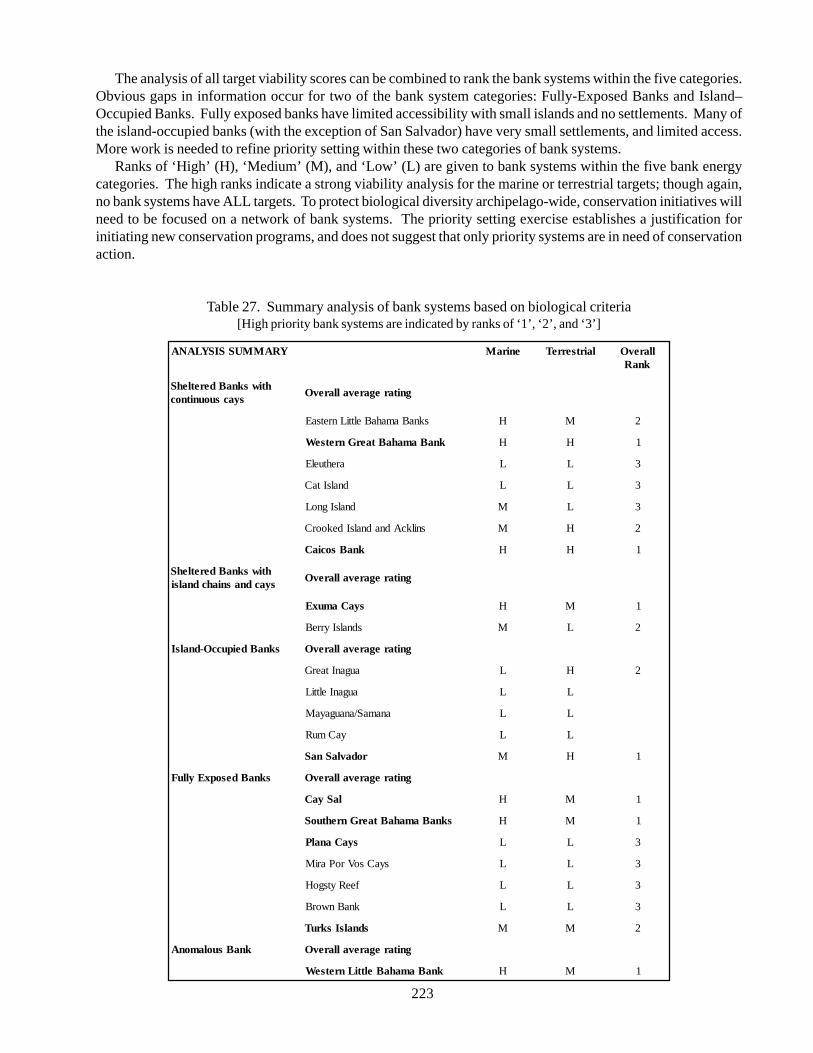
223
The analysis of all target viability scores can be combined to rank the bank systems within the five categories.Obvious gaps in information occur for two of the bank system categories: Fully-Exposed Banks and Island–Occupied Banks. Fully exposed banks have limited accessibility with small islands and no settlements. Many ofthe island-occupied banks (with the exception of San Salvador) have very small settlements, and limited access.More work is needed to refine priority setting within these two categories of bank systems.
Ranks of ‘High’ (H), ‘Medium’ (M), and ‘Low’ (L) are given to bank systems within the five bank energycategories. The high ranks indicate a strong viability analysis for the marine or terrestrial targets; though again,no bank systems have ALL targets. To protect biological diversity archipelago-wide, conservation initiatives willneed to be focused on a network of bank systems. The priority setting exercise establishes a justification forinitiating new conservation programs, and does not suggest that only priority systems are in need of conservationaction.
Table 27. Summary analysis of bank systems based on biological criteria[High priority bank systems are indicated by ranks of ‘1’, ‘2’, and ‘3’]
YRAMMUSSISYLANA eniraM lairtserreT llarevOknaR
htiwsknaBderetlehSsyacsuounitnoc
gnitaregarevallarevO
sknaBamahaBelttiLnretsaE H M 2
knaBamahaBtaerGnretseW H H 1
arehtuelE L L 3
dnalsItaC L L 3
dnalsIgnoL M L 3
snilkcAdnadnalsIdekoorC M H 2
knaBsociaC H H 1
htiwsknaBderetlehSsyacdnasniahcdnalsi
gnitaregarevallarevO
syaCamuxE H M 1
sdnalsIyrreB M L 2
sknaBdeipuccO-dnalsI gnitaregarevallarevO
auganItaerG L H 2
auganIelttiL L L
anamaS/anaugayaM L L
yaCmuR L L
rodavlaSnaS M H 1
sknaBdesopxEylluF gnitaregarevallarevO
laSyaC H M 1
sknaBamahaBtaerGnrehtuoS H M 1
syaCanalP L L 3
syaCsoVroPariM L L 3
feeRytsgoH L L 3
knaBnworB L L 3
sdnalsIskruT M M 2
knaBsuolamonA gnitaregarevallarevO
knaBamahaBelttiLnretseW H M 1
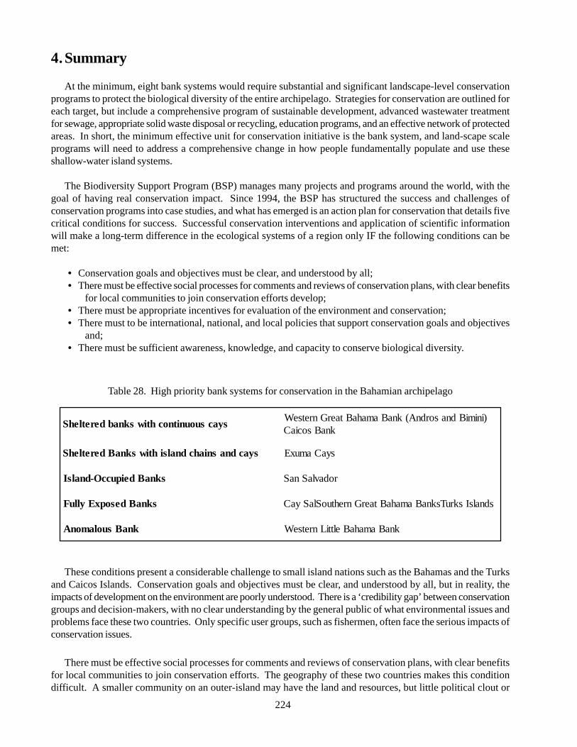
224
4. Summary
At the minimum, eight bank systems would require substantial and significant landscape-level conservationprograms to protect the biological diversity of the entire archipelago. Strategies for conservation are outlined foreach target, but include a comprehensive program of sustainable development, advanced wastewater treatmentfor sewage, appropriate solid waste disposal or recycling, education programs, and an effective network of protectedareas. In short, the minimum effective unit for conservation initiative is the bank system, and land-scape scaleprograms will need to address a comprehensive change in how people fundamentally populate and use theseshallow-water island systems.
The Biodiversity Support Program (BSP) manages many projects and programs around the world, with thegoal of having real conservation impact. Since 1994, the BSP has structured the success and challenges ofconservation programs into case studies, and what has emerged is an action plan for conservation that details fivecritical conditions for success. Successful conservation interventions and application of scientific informationwill make a long-term difference in the ecological systems of a region only IF the following conditions can bemet:
• Conservation goals and objectives must be clear, and understood by all;• There must be effective social processes for comments and reviews of conservation plans, with clear benefits
for local communities to join conservation efforts develop;• There must be appropriate incentives for evaluation of the environment and conservation;• There must to be international, national, and local policies that support conservation goals and objectives
and;• There must be sufficient awareness, knowledge, and capacity to conserve biological diversity.
These conditions present a considerable challenge to small island nations such as the Bahamas and the Turksand Caicos Islands. Conservation goals and objectives must be clear, and understood by all, but in reality, theimpacts of development on the environment are poorly understood. There is a ‘credibility gap’ between conservationgroups and decision-makers, with no clear understanding by the general public of what environmental issues andproblems face these two countries. Only specific user groups, such as fishermen, often face the serious impacts ofconservation issues.
There must be effective social processes for comments and reviews of conservation plans, with clear benefitsfor local communities to join conservation efforts. The geography of these two countries makes this conditiondifficult. A smaller community on an outer-island may have the land and resources, but little political clout or
Table 28. High priority bank systems for conservation in the Bahamian archipelago
syacsuounitnochtiwsknabderetlehS)inimiBdnasordnA(knaBamahaBtaerGnretseW
knaBsociaC
syacdnasniahcdnalsihtiwsknaBderetlehS syaCamuxE
sknaBdeipuccO-dnalsI rodavlaSnaS
sknaBdesopxEylluF sdnalsIskruTsknaBamahaBtaerGnrehtuoSlaSyaC
knaBsuolamonA knaBamahaBelttiLnretseW
225
input to management. There is no public process to review development or even land use plans. Public access toup-to-date and useful information is limited, despite the high education level and independent motivation ofpeople.
There must be appropriate incentives for the evaluation of the environment and conservation. The archipelagohas been poorly managed in terms of natural resources throughout its history. The very nature of a colony was toprovide resources to the mother country, and thus, the landscape is already highly modified despite a low populationdensity. Who pays for the environmental sins of the past? How can a new system of environmental valuation beinitiated? Few Bahamians have travelled through the Caribbean and Latin America to view real environmentaldisasters. Americans flock to the Bahamas to avoid the perceived ‘over-regulation’ of the United States, particularlythe Florida Keys. The loss of Nassau grouper stocks, or disappearance of rock iguanas, has little to no impact onthe day-to-day life of someone living in Nassau or Providenciales.
There need to be international, national, and local policies that support conservation. Conservation issueshave already been brought to national attention in the Bahamas with the controversies on mega-resort developmentsin the Biminis, and the development of Clifton Bluff on New Providence. Already, local communities havestarted the public discussions of the value of the environment, and the future of island communities. A nationaldiscussion needs to ensue on the value of the environment as a national asset, and a vision of what the islands areto become in the future. National interest needs to prevail over the short-term gain of individuals.
Conservation of the Bahamian archipelago involves cooperation between three national jurisdictions: theCommonwealth of The Bahamas, the Turks and Caicos Islands, and the Dominican Republic. Although theDominican Republic only has authority over several small banks at the extreme southern end of the archipelago,the population of this country is in excess of 7 million people. The population alone poses a serious threat to thearchipelago in general in terms of the illegal fishing pressure and immigration pressures (immigration pressuresare significant from both Haiti and the Dominican Republic). Regional (Caribbean-wide) fisheries and economicpolicies will impact conservation initiatives in the Bahamian archipelago.
National capacity for effective conservation programs will include building government capacity and policy,non-government organizations that focus on both advocacy and management issues, as well as a substantial networkfor outreach and education. Outreach and education programs need to span not only schools and traditionaleducational settings, but also make information, access to experts, and technical support, available to communitiesor resource user groups such as fishermen. The single largest long-term problem may be the ability to finance,install, and maintain the appropriate infrastructure for a widely dispersed population. New alternatives in wastemanagement, power generation and sustainable resource use must be explored.
National Parks and protected areas systemsSite protection can be accomplished in many ways throughout the archipelago. All three countries have
designated national parks with varying degrees of management and enforcement. Parks and protected areas areone component of landscape-scale conservation initiatives. The major issues are those of funding, capacity andco-management. A short inspection of the national park system within The Bahamas illustrates the problem inbuilding a comprehensive protected area system in an island archipelago.
The Bahamas National Trust is a non-profit, non-governmental organization that has been given statutoryauthority by The Bahamas Government. Established by the Bahamas National Trust Act in 1959, the Trust has aparliamentary mandate to build and manage the country’s national park system.
Consisting of some 3,300 members, a 21-member council governs the Trust; nine are elected annually fromamong the general membership and six are government representatives. The remaining six are representativesfrom the following institutions – the American Museum of Natural History, the New York Zoological Society(also known as Wildlife Conservation International), the Smithsonian Institution, the National Audubon Society,the United States National Parks Service and the University of Miami’s Rosenstiel School of Marine Science.The council serves in an advisory capacity, and neither receives payment from nor contributes funds to the Trustoutside of private donations. Funding for the Trust’s activities is generated through membership fees, specialfunctions, entrance fees and shop sales.
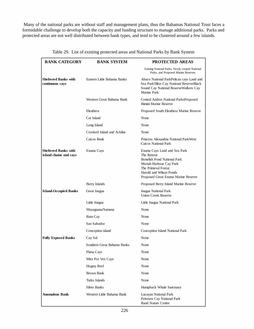
226
Many of the national parks are without staff and management plans, thus the Bahamas National Trust faces aformidable challenge to develop both the capacity and funding structure to manage additional parks. Parks andprotected areas are not well distributed between bank types, and tend to be clustered around a few islands.
Table 29. List of existing protected areas and National Parks by Bank System
YROGETACKNAB METSYSKNAB SAERADETCETORP
lanoitaNdetaercylweN,skraPlanoitaNgnitsixEsevreseReniraMdesoporPdna,skraP
htiwsknaBderetlehSsyacsuounitnoc
sknaBamahaBelttiLnretsaE dnadnaLsyacnacilePkraPlanoitaNocabAkcalBevreseRlanoitaNyaCoolliTkraPaeS
yaCsreklaWevreseRlanoitaNyaCdnuoSkraPeniraM
knaBamahaBtaerGnretseW desoporPskraPlanoitaNsordnAlartneCevreseReniraMinimiB
arehtuelE evreseReniraMarehtuelEhtuoSdesoporP
dnalsItaC enoN
dnalsIgnoL enoN
snilkcAdnadnalsIdekoorC enoN
knaBsociaC tseWkraPlanoitaNairdnaxelAssecnirPkraPlanoitaNsociaC
htiwsknaBderetlehSsyacdnasniahcdnalsi
syaCamuxE kraPaeSdnadnaLsyaCamuxEtaerteRehT
kraPlanoitaNdnoPhsifenoBkraPyaCruobraHhairoM
tseroFlavemirPehTsdnoPnosliWdnadloraH
evreseReniraMamuxEtaerGdesoporP
sdnalsIyrreB evreseReniraMdnalsIyrreBdesoporP
sknaBdeipuccO-dnalsI auganItaerG kraPlanoitaNauganIevreseRkeerCnoinU
auganIelttiL kraPlanoitaNauganIelttiL
anamaS/anaugayaM enoN
yaCmuR enoN
rodavlaSnaS enoN
dnalsinoitpecnoC kraPlanoitaNdnalsInoitpecnoC
sknaBdesopxEylluF laSyaC enoN
sknaBamahaBtaerGnrehtuoS enoN
syaCanalP enoN
syaCsoVroPariM enoN
feeRytsgoH enoN
knaBnworB enoN
sdnalsIskruT enoN
sknaBrevliS yrautcnaSelahWkcabpmuH
knaBsuolamonA knaBamahaBelttiLnretseW kraPlanoitaNnayacuLkraPlanoitaNyaCnesreteP
ertneCerutaNdnaR
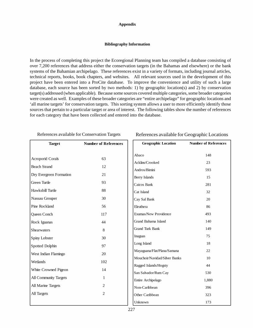
227
References available for Conservation Targets
Appendix
Bibliography Information
In the process of completing this project the Ecoregional Planning team has compiled a database consisting ofover 7,200 references that address either the conservation targets (in the Bahamas and elsewhere) or the banksystems of the Bahamian archipelago. These references exist in a variety of formats, including journal articles,technical reports, books, book chapters, and websites. All relevant sources used in the development of thisproject have been entered into a ProCite database. To improve the convenience and utility of such a largedatabase, each source has been sorted by two methods: 1) by geographic location(s) and 2) by conservationtarget(s) addressed (when applicable). Because some sources covered multiple categories, some broader categorieswere created as well. Examples of these broader categories are “entire archipelago” for geographic locations and‘all marine targets’ for conservation targets. This sorting system allows a user to more efficiently identify thosesources that pertain to a particular target or area of interest. The following tables show the number of referencesfor each category that have been collected and entered into the database.
References available for Geographic Locations
tegraT secnerefeRforebmuN
slaroCdiroporcA 36
dnartShcaeB 21
noitamroFneergrevEyrD 12
eltruTneerG 39
eltruTllibskwaH 88
repuorGuassaN 03
dnalkcoReniP 65
hcnoCneeuQ 711
sanaugIkcoR 44
sretawraehS 8
retsboLynipS 03
nihploDdettopS 79
ognimalFnaidnItseW 02
sdnalteW 201
noegiPdenworCetihW 41
stegraTytinummoCllA 1
stegraTeniraMllA 2
stegraTllA 2
noitacoLcihpargoeG secnerefeRforebmuN
ocabA 841
dekoorC/snilkcA 32
inimiB/sordnA 395
sdnalsIyrreB 51
knaBsociaC 182
dnalsItaC 23
knaBlaSyaC 02
arehtuelE 68
ecnedivorPweN/samuxE 394
dnalsIamahaBdnarG 041
knaBkruTdnarG 941
sauganI 57
dnalsIgnoL 81
anamaS/analP/talF/anaugayaM 22
sknaBrevliS/dadivaN/riohcuoM 01
ytsgoH/sdnalsIdeggaR 44
yaCmuR/rodavlaSnaS 035
ogalepihcrAeritnE 088,1
naebbiraC-noN 693
naebbiraCrehtO 323
nwonknU 371