Embed Size (px)
Citation preview
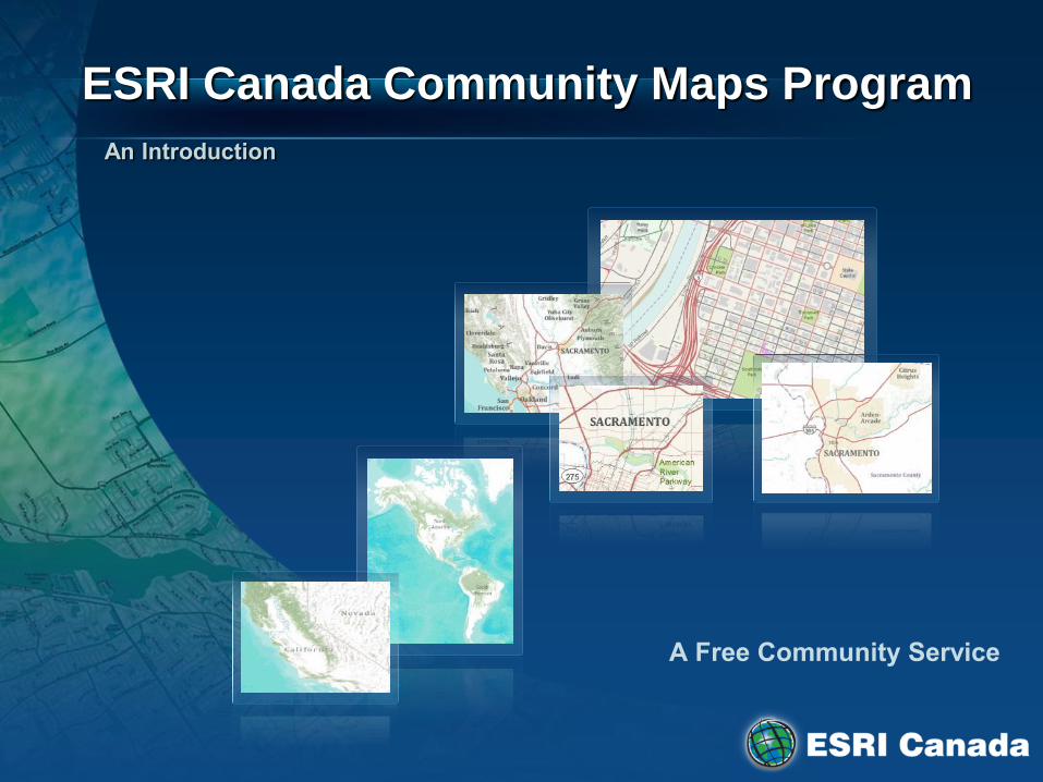
ESRI Canada Community Maps Program
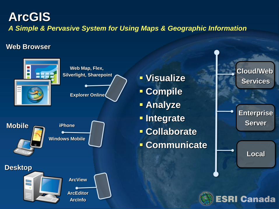
Visualize
Compile
Analyze
Integrate
Collaborate
Communicate
Web Browser
Mobile
Desktop
ArcGIS A Simple & Pervasive System for Using Maps & Geographic Information
ArcView
ArcEditor
ArcInfo
iPhone
Windows Mobile
Web Map, Flex,
Silverlight, Sharepoint
Explorer Online
Cloud/Web
Services
Enterprise
Server
Local
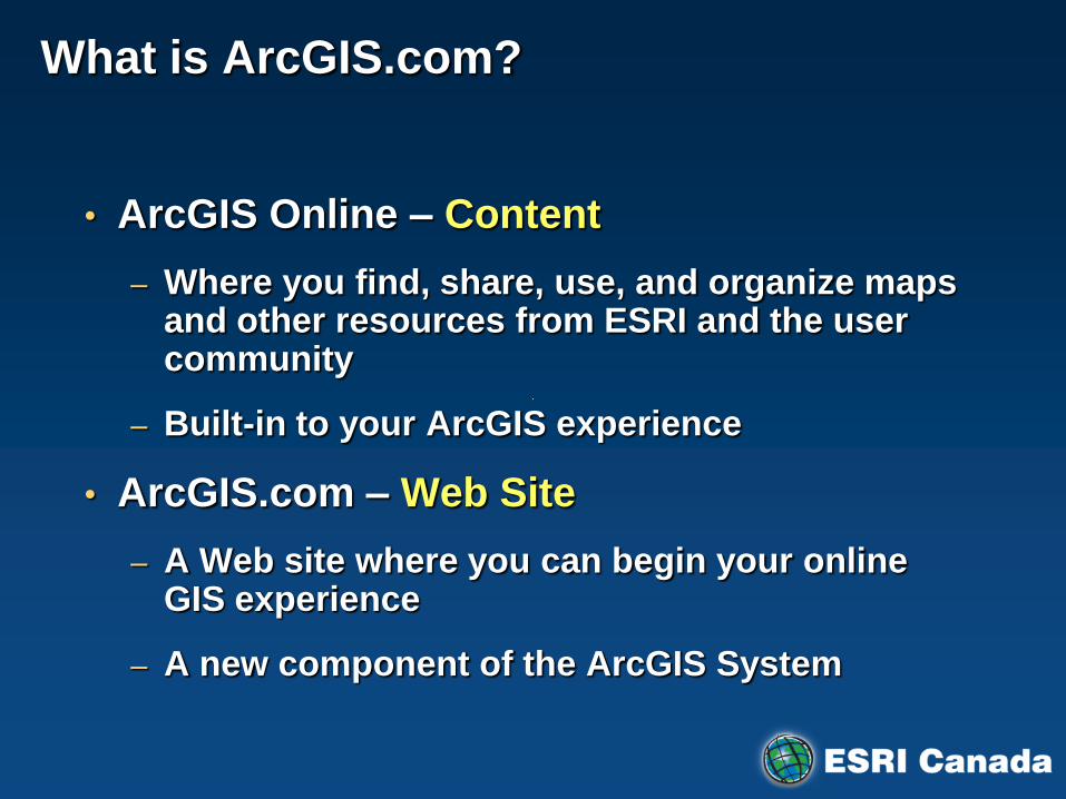
What is ArcGIS.com?
• ArcGIS Online – Content
– Where you find, share, use, and organize maps and other resources from ESRI and the user community
– Built-in to your ArcGIS experience
• ArcGIS.com – Web Site
– A Web site where you can begin your online GIS experience
– A new component of the ArcGIS System

ArcGIS Online Maps Maps built by and for the ArcGIS Community
ESRI Developer Summit 2008
World Street Map
World Imagery Map
World Topographic Map

ArcGIS Online Is a Cloud Based GIS
Supporting Online and on Premise Deployment
Applications
Providing GIS as SaaS . . .
. . . For Individuals, Departments, and the Enterprise
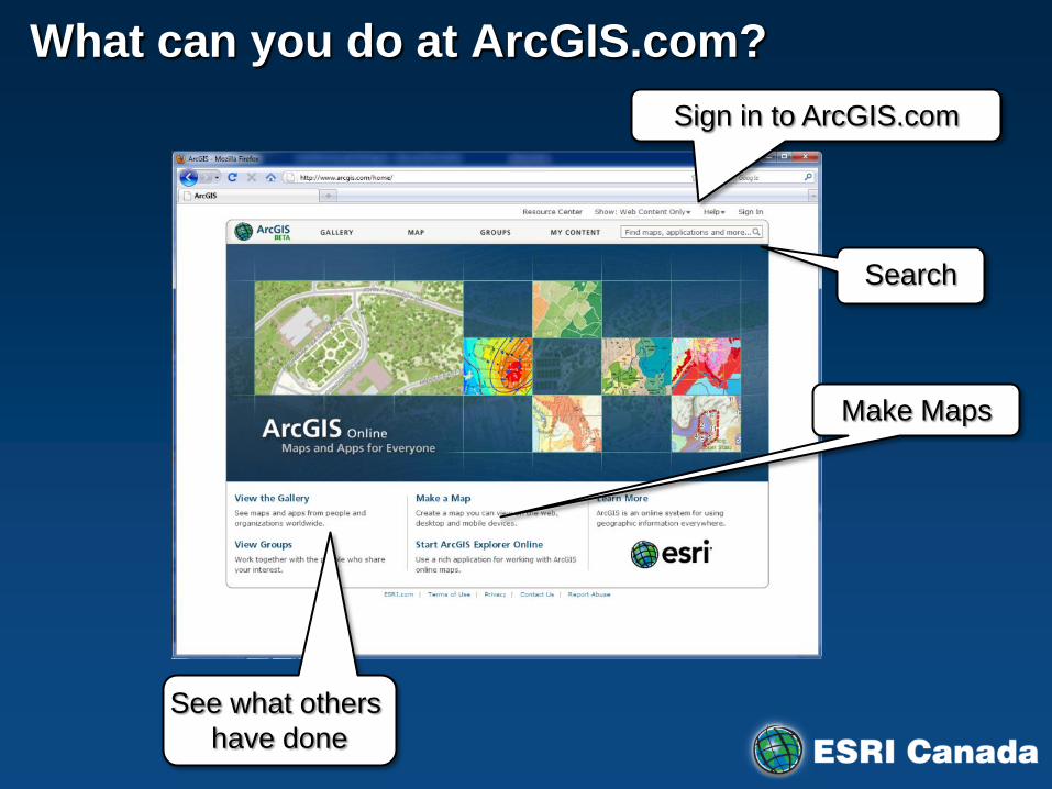
What can you do at ArcGIS.com?
Make Maps
See what others
have done
Search
Sign in to ArcGIS.com
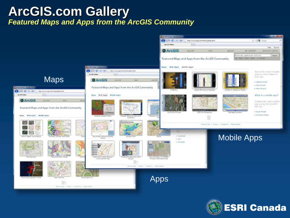
ArcGIS.com Gallery Featured Maps and Apps from the ArcGIS Community
Maps
Mobile Apps
Apps
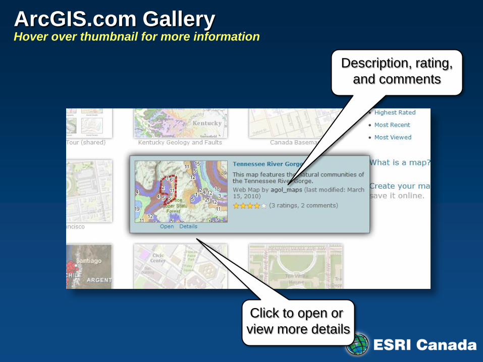
ArcGIS.com Gallery Hover over thumbnail for more information
Click to open or
view more details
Description, rating,
and comments

ArcGIS.com Gallery Map and App Details
Description
Comments
Map Contents with
link to Services Directory
Rating

Make Maps at ArcGIS.com Create and open maps across applications
• Your choice of applications – ArcGIS.com Viewer
– ArcGIS Explorer Online
JavaScript Viewer
Explorer Online
iPhone
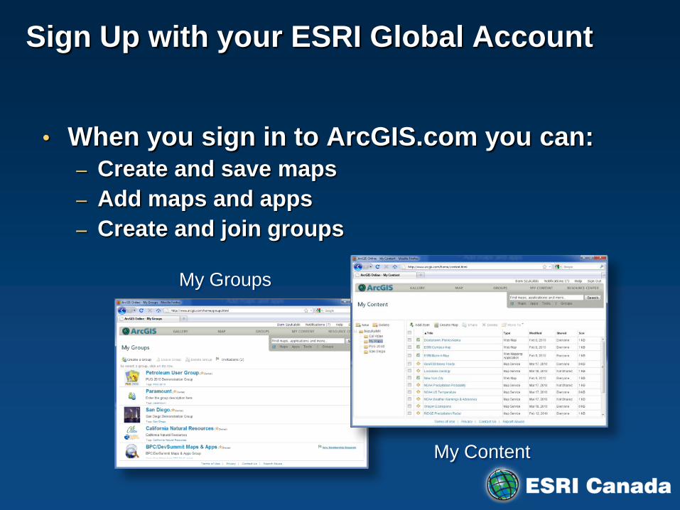
Sign Up with your ESRI Global Account
• When you sign in to ArcGIS.com you can: – Create and save maps
– Add maps and apps
– Create and join groups
My Content
My Groups
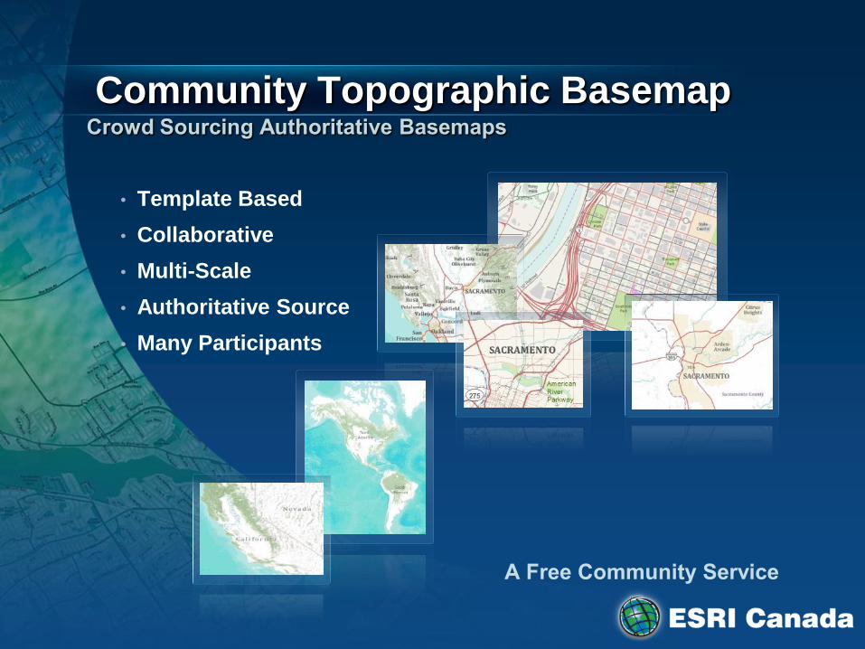
Community Topographic Basemap
• Template Based
• Collaborative
• Multi-Scale
• Authoritative Source
• Many Participants
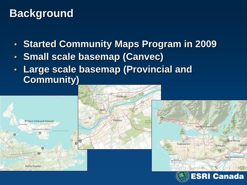
Background
• Started Community Maps Program in 2009
• Small scale basemap (Canvec)
• Large scale basemap (Provincial and Community)

Canadian Community Maps Program
• Authoritative Data for Your Applications
• Consume in ArcGIS Desktop/Server/Online
• High Quality Maps
• Provide Feedback
Toronto
Moncton
Kamloops Nanaimo
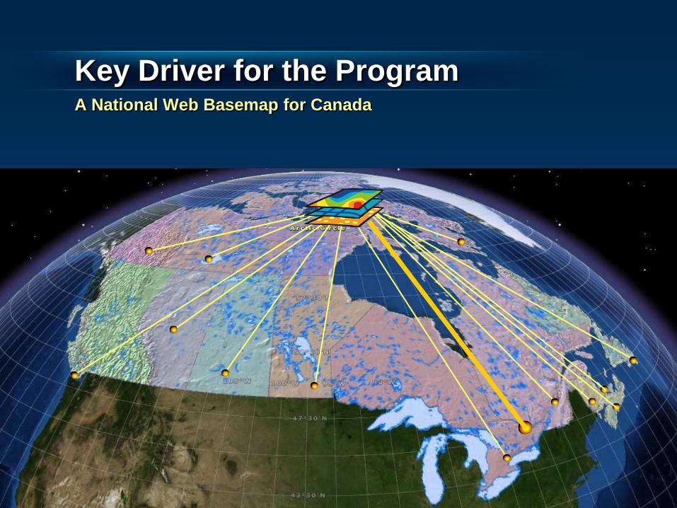
Key Driver for the Program A National Web Basemap for Canada
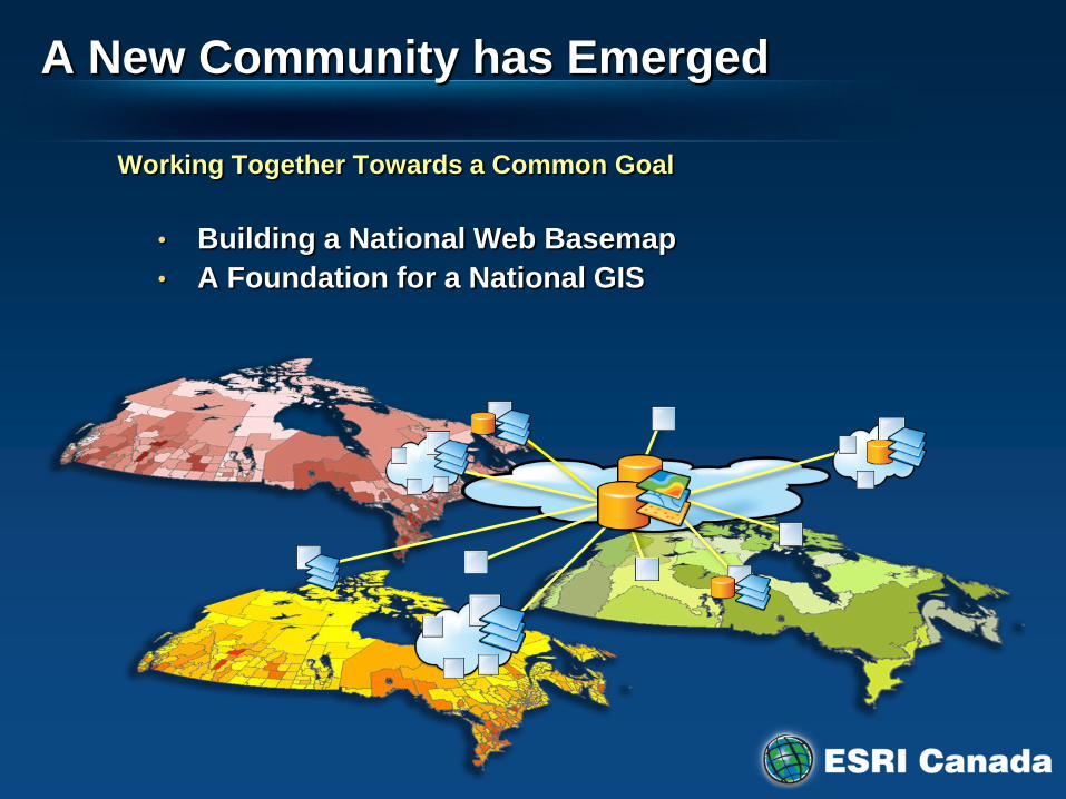
Working Together Towards a Common Goal
• Building a National Web Basemap
• A Foundation for a National GIS
A New Community has Emerged
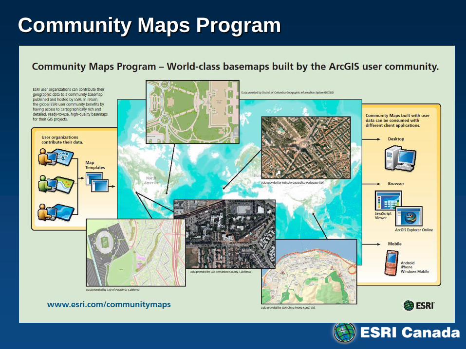
Community Maps Program

Community Maps Program Online Maps using Authoritative, Rich, Local Data Sources
• Community maps hosted by ESRI on ArcGIS Online
• Freely available to ArcGIS users
World Topo Map
Canada
World Imagery
Portugal
World Street Map
Hong Kong
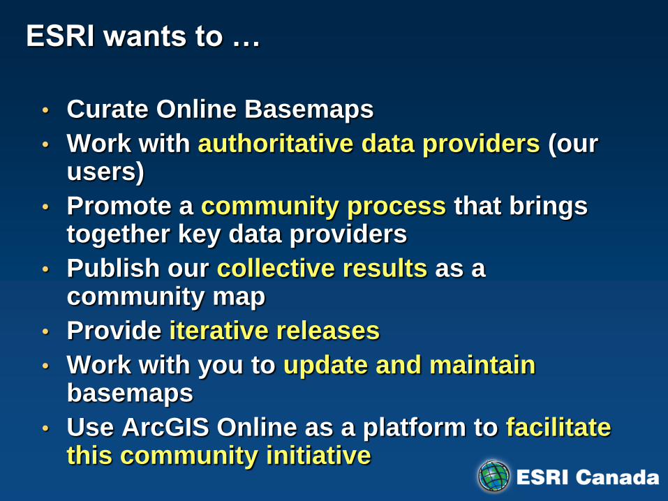
ESRI wants to …
• Curate Online Basemaps
• Work with authoritative data providers (our users)
• Promote a community process that brings together key data providers
• Publish our collective results as a community map
• Provide iterative releases
• Work with you to update and maintain basemaps
• Use ArcGIS Online as a platform to facilitate this community initiative
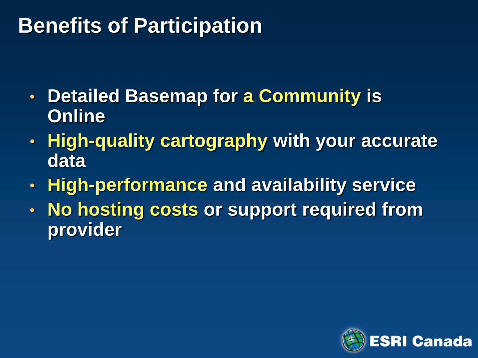
Benefits of Participation
• Detailed Basemap for a Community is Online
• High-quality cartography with your accurate data
• High-performance and availability service
• No hosting costs or support required from provider
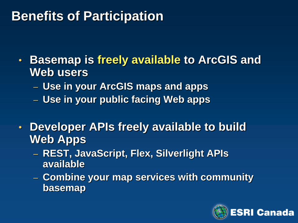
Benefits of Participation
• Basemap is freely available to ArcGIS and Web users – Use in your ArcGIS maps and apps
– Use in your public facing Web apps
• Developer APIs freely available to build Web Apps – REST, JavaScript, Flex, Silverlight APIs
available
– Combine your map services with community basemap

Benefits to Community Participation
• Citation of participant as data provider for its local area – Referenced in online documentation and related
marketing materials
– Promotes the valuable GIS work being performed by participant organizations
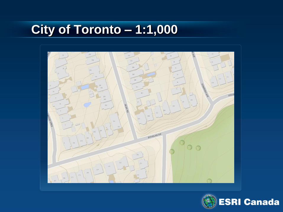
City of Toronto – 1:1,000
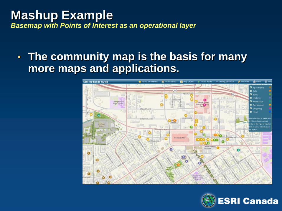
Mashup Example Basemap with Points of Interest as an operational layer
• The community map is the basis for many more maps and applications.

Top 100 Infrastructure Projects
http://top100projects.ca/

Keeping the Community Map Up to Date
Community Map
Exchange
Moncton
Natural
Resources
Canada
(National) 2-Way
Replication
Langley
2-Way
Replication
Toronto
Province
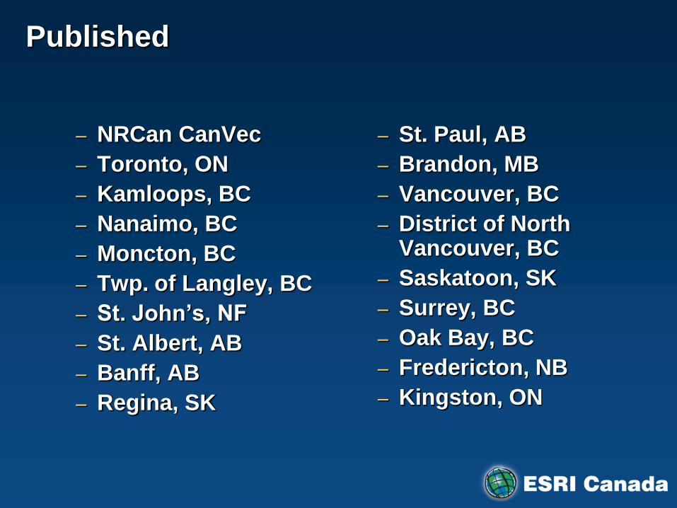
Published
– NRCan CanVec
– Toronto, ON
– Kamloops, BC
– Nanaimo, BC
– Moncton, BC
– Twp. of Langley, BC
– St. John’s, NF
– St. Albert, AB
– Banff, AB
– Regina, SK
– St. Paul, AB
– Brandon, MB
– Vancouver, BC
– District of North Vancouver, BC
– Saskatoon, SK
– Surrey, BC
– Oak Bay, BC
– Fredericton, NB
– Kingston, ON

Processing
– Gatineau, PQ
– Hay River, NWT
– Wood Buffalo, AB
– Brampton, ON
– Cowichan Valley, BC
– Fort St. John, BC
– Morinville, AB
– Prince George, BC
– Thompson-Nicola Regional, BC

Expression of Interest
• Olds College
• Saanich
• Victoriaville
• NWT
• Region of Peel
• University of Ottawa
• Woodstock
• Hamilton
• London
• Oxford County
• Sudbury
• York Region
• Grey County
• Brantford
• Halifax Regional Municipality
• Service Nova Scotia
• Miramichi
• Kenora
• Ville de Rimouski
• Ville de Lévis
• Village of Burns Lake
• Town of Beaumont
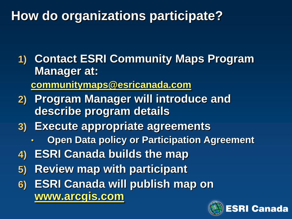
How do organizations participate?
1) Contact ESRI Community Maps Program Manager at:
2) Program Manager will introduce and describe program details
3) Execute appropriate agreements • Open Data policy or Participation Agreement
4) ESRI Canada builds the map
5) Review map with participant
6) ESRI Canada will publish map on www.arcgis.com

To find out more please visit:
http://www.esricanada.com/communitymaps/

Demonstration
Community Maps - ArcGIS Explorer