LO
S A
NG
EL
ES
RIV
ER
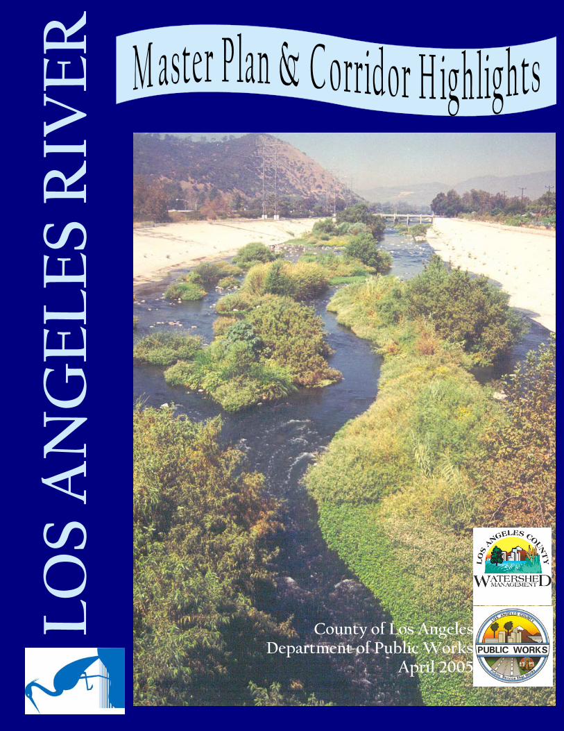
County of Los Angeles Department of Public Works
April 2005
History of the Los Angeles River 3
Los Angeles River Vision 5
Los Angeles River Master Plan Introduction 6
Los Angeles River Highlights: Reaches 1—6 7
Los Angeles River Project Implementation 14
3
Over ten million years ago, the Los Angeles area was submerged in water. The formation of mountain ranges yielded what is now the San Fernando and San Gabriel Valleys. These areas once drained unconstrained run-off into the Los Angeles basin, providing a topography of shrubs, forests, and dense woods. Although Los Angeles County is a semiarid region that re-ceives less than fifteen inches of rain per year, some of the surrounding mountainous areas re-ceive more than forty inches of rain per year. It’s estimated that the earliest human inhabitants occupied the Los Angeles County region over 48,000 years ago and were supported by the waters of the Los Angeles River and its tributaries. The river and its rich plant and animal habitat provided a livelihood for Native American tribes, including the Tongva which have also been referred to as Gabrielino Indians. Over 1000 years ago, the Tongva established a settlement on the banks of the River near where Los Angeles City Hall stands today. They were later designated by missionaries as the Gabrielino for the Mis-sion San Gabriel in Los Angeles County, and included a smaller group, the Fernandeno for the San Fernando Mission in the San Fernando Valley. Gabrielino territory encompassed much of present-day Los Angeles and Orange Counties, including Santa Catalina, as well as parts of San Bernardino and Riverside Counties.
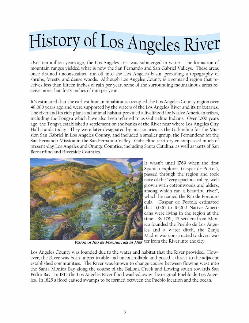
It wasn’t until 1769 when the first Spanish explorer, Gaspar de Portolá, passed through the region and took note of the “very spacious valley, well grown with cottonwoods and alders, among which ran a beautiful river”, which he named the Rio de Porciun-cula. Gaspar de Portolá estimated that 5,000 to 10,000 Native Ameri-cans were living in the region at the time. By 1781, 45 settlers from Mex-ico founded the Pueblo de Los Ange-les and a water ditch, the Zanja Madre, was constructed to divert wa-ter from the River into the city.
Los Angeles County was founded due to the water and habitat that the River provided. How-ever, the River was both unpredictable and uncontrollable and posed a threat to the adjacent established communities. The River was known to change course between flowing west into the Santa Monica Bay along the course of the Ballona Creek and flowing south towards San Pedro Bay. In 1815 the Los Angeles River flood washed away the original Pueblo de Los Ange-les. In 1825 a flood caused swamps to be formed between the Pueblo location and the ocean.
Vision of Rio de Porciuncula in 1769
4
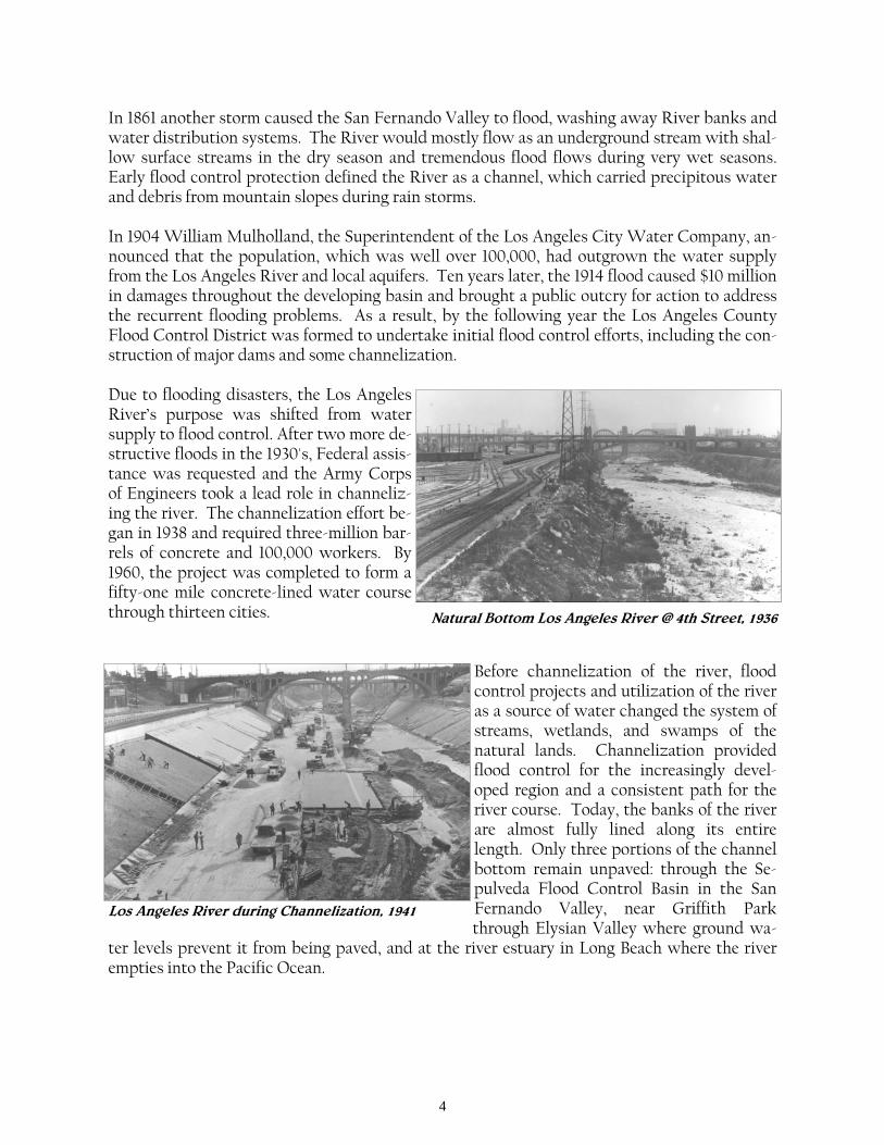
In 1861 another storm caused the San Fernando Valley to flood, washing away River banks and water distribution systems. The River would mostly flow as an underground stream with shal-low surface streams in the dry season and tremendous flood flows during very wet seasons. Early flood control protection defined the River as a channel, which carried precipitous water and debris from mountain slopes during rain storms. In 1904 William Mulholland, the Superintendent of the Los Angeles City Water Company, an-nounced that the population, which was well over 100,000, had outgrown the water supply from the Los Angeles River and local aquifers. Ten years later, the 1914 flood caused $10 million in damages throughout the developing basin and brought a public outcry for action to address the recurrent flooding problems. As a result, by the following year the Los Angeles County Flood Control District was formed to undertake initial flood control efforts, including the con-struction of major dams and some channelization. Due to flooding disasters, the Los Angeles River’s purpose was shifted from water supply to flood control. After two more de-structive floods in the 1930's, Federal assis-tance was requested and the Army Corps of Engineers took a lead role in channeliz-ing the river. The channelization effort be-gan in 1938 and required three-million bar-rels of concrete and 100,000 workers. By 1960, the project was completed to form a fifty-one mile concrete-lined water course through thirteen cities.
Before channelization of the river, flood control projects and utilization of the river as a source of water changed the system of streams, wetlands, and swamps of the natural lands. Channelization provided flood control for the increasingly devel-oped region and a consistent path for the river course. Today, the banks of the river are almost fully lined along its entire length. Only three portions of the channel bottom remain unpaved: through the Se-pulveda Flood Control Basin in the San Fernando Valley, near Griffith Park through Elysian Valley where ground wa-
ter levels prevent it from being paved, and at the river estuary in Long Beach where the river empties into the Pacific Ocean.
Natural Bottom Los Angeles River @ 4th Street, 1936
Los Angeles River during Channelization, 1941
5
In less than a century, the once prominent, life-sustaining river developed into a concrete-lined, debris-carrying eyesore. To enhance the aesthetics of the new flood control systems, the Flood Control District designated $550,000 per year budget, in 1972, towards a Landscape Treatment program until Proposition 13 cut flood control funding by two-thirds. However, by 1977, at least 20 miles of recreational bicycle and equestrian trails had been completed along the Los Angeles River and Rio Hondo Channel (LARIO Trail).
The construction of recreational trails along the River proved to be the first attempt in restoring the river. This restoration interest was fur-thered by the Friends of the Los Angeles River, founded in 1986, who became dedicated to bringing attention to the river and seeking a continuous river greenway from the mountains to the sea. By 1990, wide public interest in the River lead Mayor Tom Bradley to create a Task Force to study ways to increase opportunities along the River and improve the appearance of the River. The Task Force concluded their re-search by recommending that an interagency master plan be prepared for the entire river.
In 1991, the County of Los Angeles Board of Supervisors directed the Departments of Public Works, Regional Planning, and Recreation and Parks to develop a plan that would “complete an analysis of potential compatible uses for the Los Angeles River, and to develop a proposal to coordinate efforts by all interested public and private parties in the planning, financing, and implementation of the restoration efforts”. During the development of this Los Angeles River Master Plan, the County of Los Angeles and various stakeholders realized that due to the adja-cent urban River developments (including factories, studios, homes, and businesses) it would be nearly impossible to restore the river to its natural state, without compromising the struc-tural integrity of the river and reducing flood protection. Instead of proposing a vision for re-moving the River’s concrete, the Los Angeles River Master Plan Advisory Committee formu-lated a vision comprised of enhancing the river corridor with open space and environmental, recreational, economic development, and educational opportunities. By integrating these goals and encouraging compatible developments, the Master Plan set the framework for enhancing the Los Angeles River and Tujunga Wash with the hopes that the River will be an integral re-source for its surrounding communities, as it once was for Los Angeles’ early inhabitants.
Over the years, the vision for the Los Angeles River has been strengthened by various interest groups that have developed studies and plans to expand improvements to other areas that are tributary to the River and to identify opportunities for improving these areas. The City of Los Angeles is currently undertaking a prominent role in revitalizing the River for the River’s 30 miles within the City. Their proposed Revitalization Plan will build on the work of existing River efforts to expand revitalization and economic development opportunities along the River’s adjacent communities.
Los Angeles River Vision, 1996
6
The Los Angeles River has evolved from an uncontrolled, meandering river producing a valu-able source of water for early inhabitants to a major flood control waterway. Today, in addi-tion to flood amenities for the Los Angeles Basin, it offers significant opportunities for recrea-tion and aesthetic improvement for the Los Angeles Metropolitan area. The County of Los Angeles Department of Public Works and other entities have joined in an effort to develop and maintain these resources. In 1991, after much attention to the River, the County of Los Angeles Board of Supervisors directed the Departments of Public Works, Parks and Recreation, and Regional Planning to develop the Los Angeles River Master Plan. The Master Plan, completed and adopted by the Board of Supervisors in 1996, formulated a multi-objective program for the river while recognizing its primary purpose for flood protection. Overall, the Master Plan advocates environmental enhancement, recreational opportunities, and economic development. The Master Plan is overseen by an Advisory Committee of 50 members representing federal, state, city, and local agencies, and environmental and community groups. The Advisory Com-mittee meets on a regular basis, and members are given the opportunity to review proposed projects. Project reviews are also performed by Public Works and the U.S. Army Corps of En-gineers to ensure that the structural integrity of the river is not compromised, before issuing construction permits. The Advisory Committee has also been actively resolving three remain-ing issues with implementation of the Master Plan and subsequent access to the river: long term maintenance, liability, and security. Since the adoption of the Master Plan in 1996, members of the Advisory Committee have com-pleted over $100 million in projects along the River including the development of bikeways, pocket parks, landscaping enhancements, Earth Day events, acquisition of two State parks, and other community and environmental projects. To facilitate further project development, the Advisory Committee developed Sign Guidelines and Landscaping Guidelines and Plan Palettes which were approved, by the County Board of Supervisors, for amendment to the Master Plan in March 2004.
While the Master Plan and its subsequent documents focus on improving the Los Angeles River and Tujunga Wash, the Plan’s goals are applicable to the entire Los Angeles River Water-shed, including the River’s tributaries. In addition, the Advisory Committee recognizes that as experience in project implementation increases, existing planning resources may need to be up-dated to reflect consensus-based recommendations derived by the Master Plan Advisory Com-mittee or other changes in policy.
7


14
15
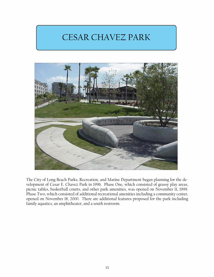
CESAR CHAVEZ PARK
The City of Long Beach Parks, Recreation, and Marine Department began planning for the de-velopment of Cesar E. Chavez Park in 1996. Phase One, which consisted of grassy play areas, picnic tables, basketball courts, and other park amenities, was opened on November 11, 1999. Phase Two, which consisted of additional recreational amenities including a community center, opened on November 18, 2000. There are additional features proposed for the park including family aquatics, an amphitheater, and a south restroom.
16
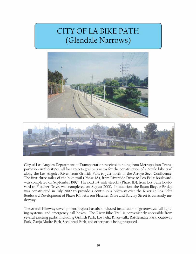
CITY OF LA BIKE PATH (Glendale Narrows)
City of Los Angeles Department of Transportation received funding from Metropolitan Trans-portation Authority’s Call for Projects grants process for the construction of a 7-mile bike trail along the Los Angeles River, from Griffith Park to just north of the Arroyo Seco Confluence. The first three miles of the bike trail (Phase 1A), from Riverside Drive to Los Feliz Boulevard, was completed on September 1997. The next 1.4-mile strecth (Phase 1D), from Los Feliz Boule-vard to Fletcher Drive, was completed on August 2000. In addition, the Baum Bicycle Bridge was constructed in July 2002 to provide a continuous bikeway over the River at Los Feliz Boulevard.Development of Phase 1C, between Fletcher Drive and Barclay Street is currently un-derway. The overall bikeway development project has also included installation of greenways, full light-ing systems, and emergency call boxes. The River Bike Trail is conveniently accessible from several existing parks, including Griffith Park, Los Feliz Riverwalk, Rattlesnake Park, Gateway Park, Zanja Madre Park, Steelhead Park, and other parks being proposed.
17
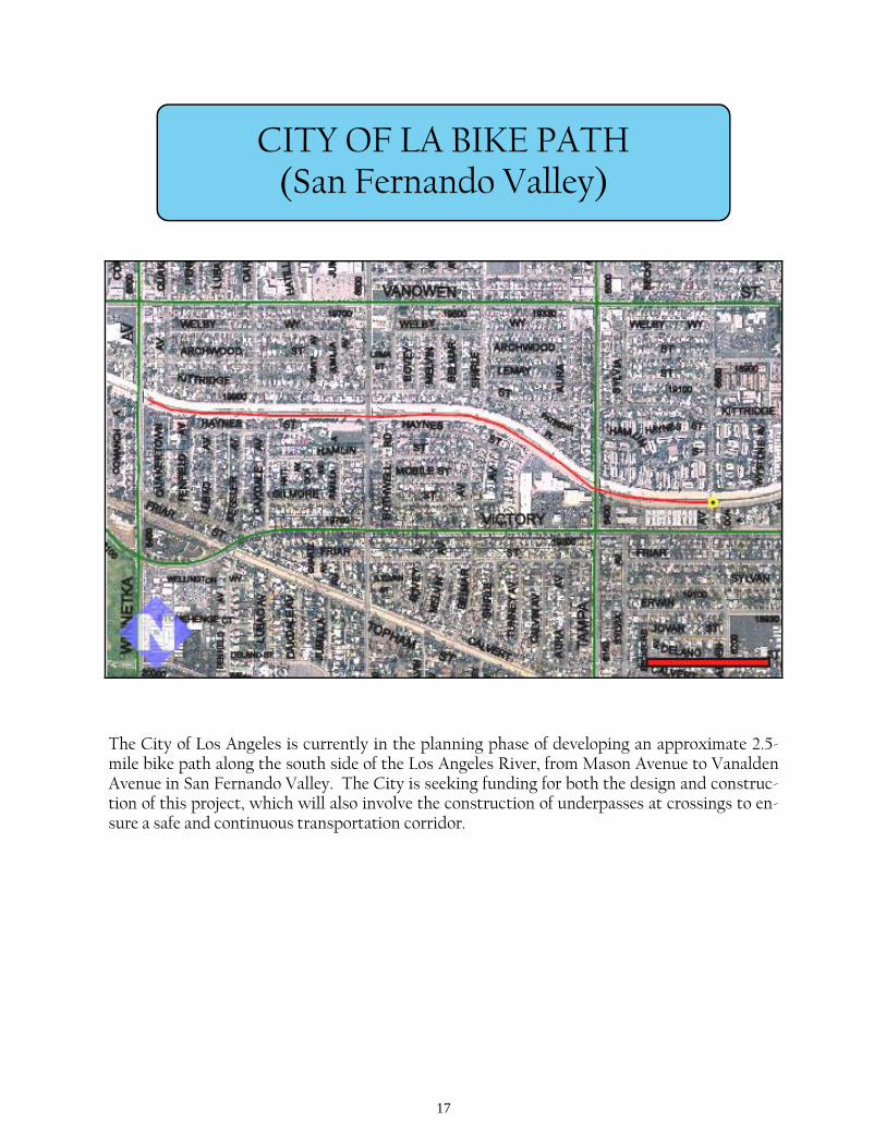
CITY OF LA BIKE PATH (San Fernando Valley)
The City of Los Angeles is currently in the planning phase of developing an approximate 2.5-mile bike path along the south side of the Los Angeles River, from Mason Avenue to Vanalden Avenue in San Fernando Valley. The City is seeking funding for both the design and construc-tion of this project, which will also involve the construction of underpasses at crossings to en-sure a safe and continuous transportation corridor.
18
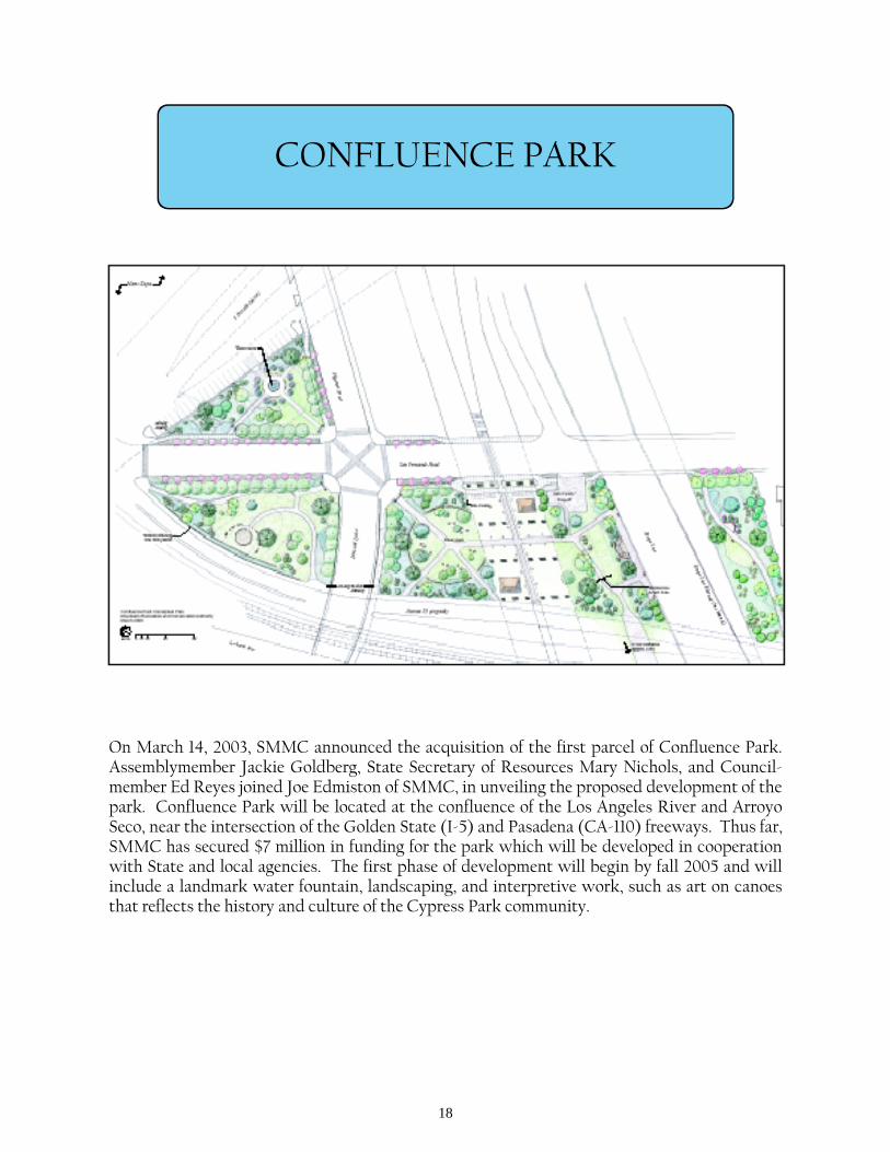
CONFLUENCE PARK
On March 14, 2003, SMMC announced the acquisition of the first parcel of Confluence Park. Assemblymember Jackie Goldberg, State Secretary of Resources Mary Nichols, and Council-member Ed Reyes joined Joe Edmiston of SMMC, in unveiling the proposed development of the park. Confluence Park will be located at the confluence of the Los Angeles River and Arroyo Seco, near the intersection of the Golden State (I-5) and Pasadena (CA-110) freeways. Thus far, SMMC has secured $7 million in funding for the park which will be developed in cooperation with State and local agencies. The first phase of development will begin by fall 2005 and will include a landmark water fountain, landscaping, and interpretive work, such as art on canoes that reflects the history and culture of the Cypress Park community.
19
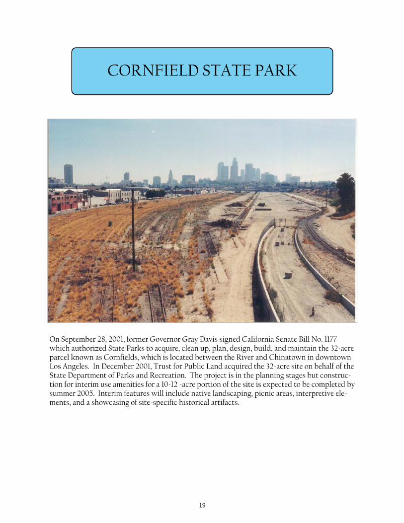
CORNFIELD STATE PARK
On September 28, 2001, former Governor Gray Davis signed California Senate Bill No. 1177 which authorized State Parks to acquire, clean up, plan, design, build, and maintain the 32-acre parcel known as Cornfields, which is located between the River and Chinatown in downtown Los Angeles. In December 2001, Trust for Public Land acquired the 32-acre site on behalf of the State Department of Parks and Recreation. The project is in the planning stages but construc-tion for interim use amenities for a 10-12 -acre portion of the site is expected to be completed by summer 2005. Interim features will include native landscaping, picnic areas, interpretive ele-ments, and a showcasing of site-specific historical artifacts.
20
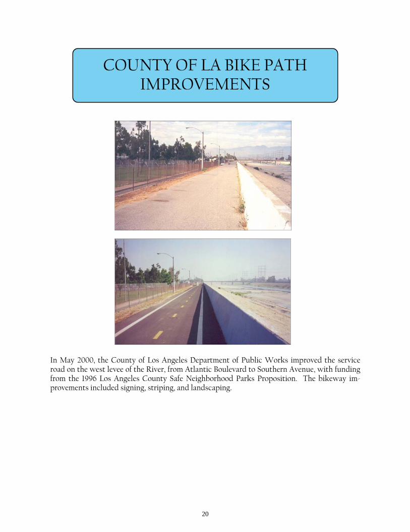
COUNTY OF LA BIKE PATH IMPROVEMENTS
In May 2000, the County of Los Angeles Department of Public Works improved the service road on the west levee of the River, from Atlantic Boulevard to Southern Avenue, with funding from the 1996 Los Angeles County Safe Neighborhood Parks Proposition. The bikeway im-provements included signing, striping, and landscaping.

21
CRYSTAL BIKE PATH IMPROVEMNENTS
On April 2, 2004, North East Trees held an Earth Day event for construction of bikeway im-provements at the Crystal Street entrance to the River bike path off of Fletcher Drive. In ad-dition to landscape improvements, the project will provide parking spaces for bike path users.

22
CUDAHY RIVERFRONT
County Public Works is in the planning phase of developing the proposed project in the City of Cudahy, from Walnut Street to the City boundary line south of Fostoria Street. The project would provide a uniform greenway through native landscaping, benches, and ornamental steel tubular fencing. In conjunction with this project, County of Los Angeles’ Supervisor Molina provided the City of Cudahy funding for the acquisition and development of two parcels along River Road as bike staging areas.
23
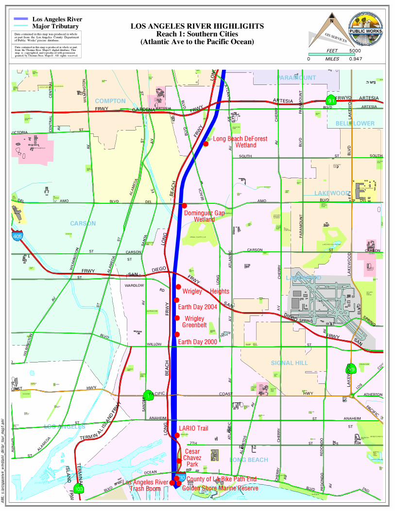
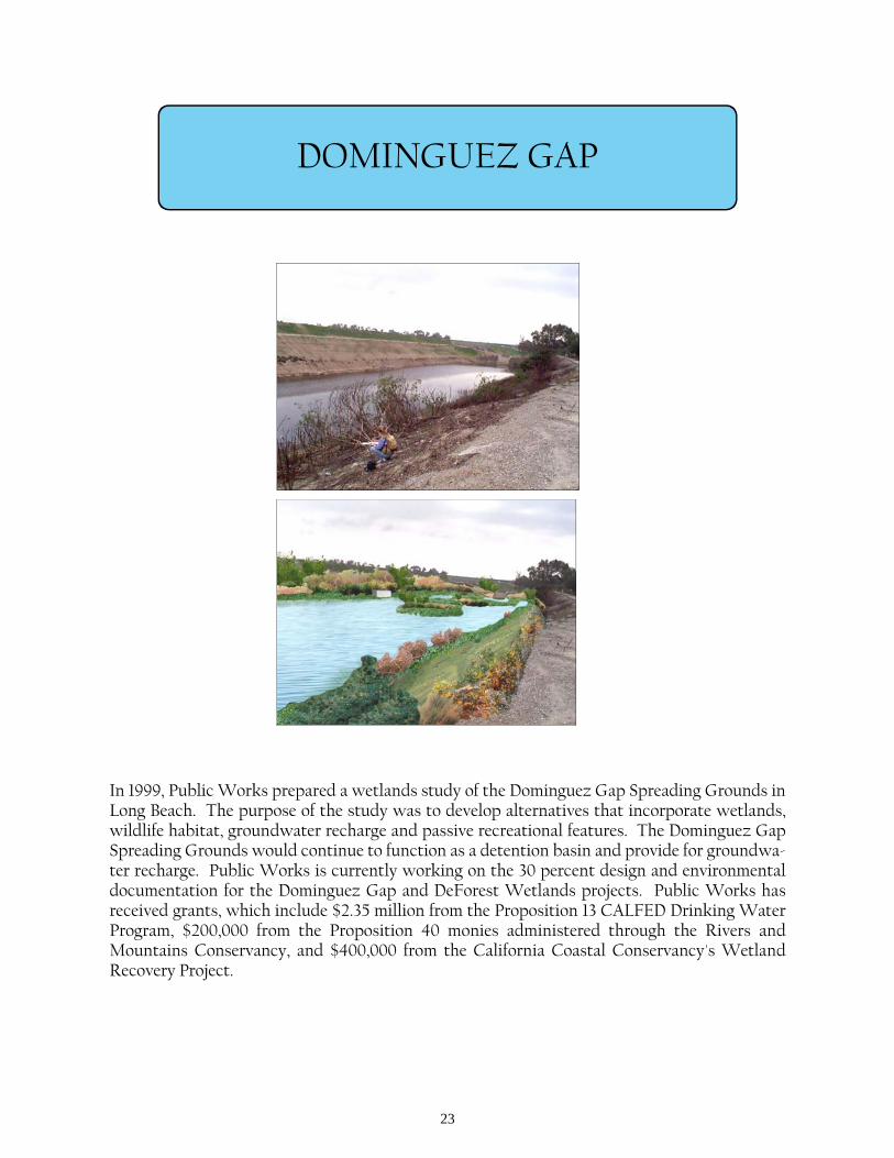
DOMINGUEZ GAP
In 1999, Public Works prepared a wetlands study of the Dominguez Gap Spreading Grounds in Long Beach. The purpose of the study was to develop alternatives that incorporate wetlands, wildlife habitat, groundwater recharge and passive recreational features. The Dominguez Gap Spreading Grounds would continue to function as a detention basin and provide for groundwa-ter recharge. Public Works is currently working on the 30 percent design and environmental documentation for the Dominguez Gap and DeForest Wetlands projects. Public Works has received grants, which include $2.35 million from the Proposition 13 CALFED Drinking Water Program, $200,000 from the Proposition 40 monies administered through the Rivers and Mountains Conservancy, and $400,000 from the California Coastal Conservancy's Wetland Recovery Project.
24
EARTH DAY 1997
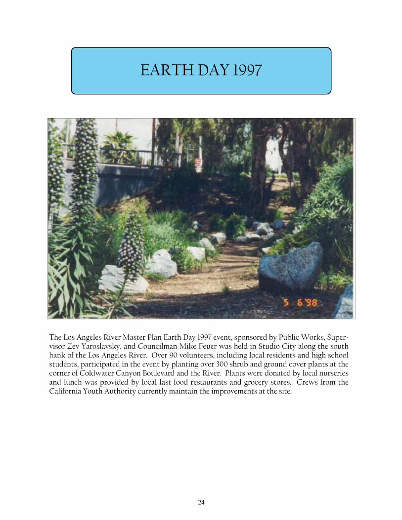
The Los Angeles River Master Plan Earth Day 1997 event, sponsored by Public Works, Super-visor Zev Yaroslavsky, and Councilman Mike Feuer was held in Studio City along the south bank of the Los Angeles River. Over 90 volunteers, including local residents and high school students, participated in the event by planting over 300 shrub and ground cover plants at the corner of Coldwater Canyon Boulevard and the River. Plants were donated by local nurseries and lunch was provided by local fast food restaurants and grocery stores. Crews from the California Youth Authority currently maintain the improvements at the site.
25
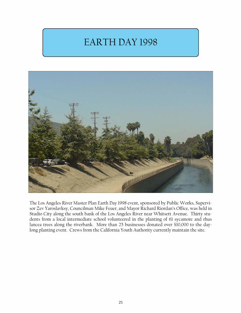
EARTH DAY 1998
The Los Angeles River Master Plan Earth Day 1998 event, sponsored by Public Works, Supervi-sor Zev Yaroslavksy, Councilman Mike Feuer, and Mayor Richard Riordan’s Office, was held in Studio City along the south bank of the Los Angeles River near Whitsett Avenue. Thirty stu-dents from a local intermediate school volunteered in the planting of 61 sycamore and rhus lancea trees along the riverbank. More than 25 businesses donated over $10,000 to the day-long planting event. Crews from the California Youth Authority currently maintain the site.
26
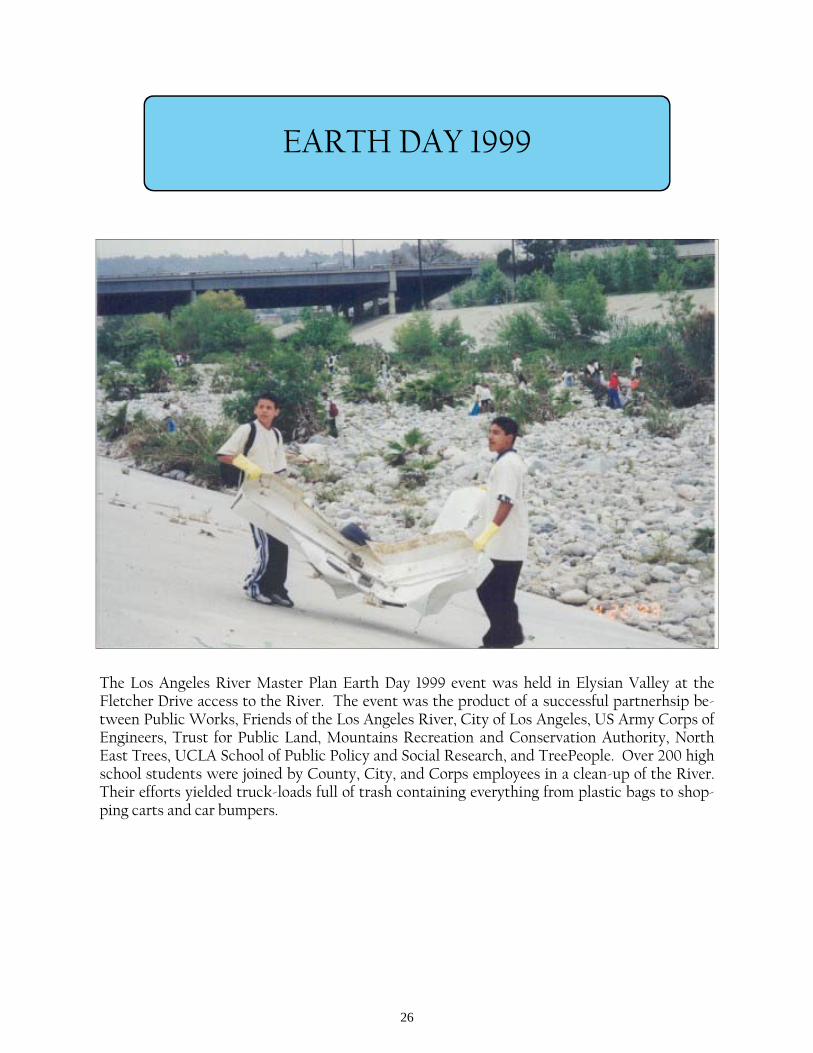
EARTH DAY 1999
The Los Angeles River Master Plan Earth Day 1999 event was held in Elysian Valley at the Fletcher Drive access to the River. The event was the product of a successful partnerhsip be-tween Public Works, Friends of the Los Angeles River, City of Los Angeles, US Army Corps of Engineers, Trust for Public Land, Mountains Recreation and Conservation Authority, North East Trees, UCLA School of Public Policy and Social Research, and TreePeople. Over 200 high school students were joined by County, City, and Corps employees in a clean-up of the River. Their efforts yielded truck-loads full of trash containing everything from plastic bags to shop-ping carts and car bumpers.
27
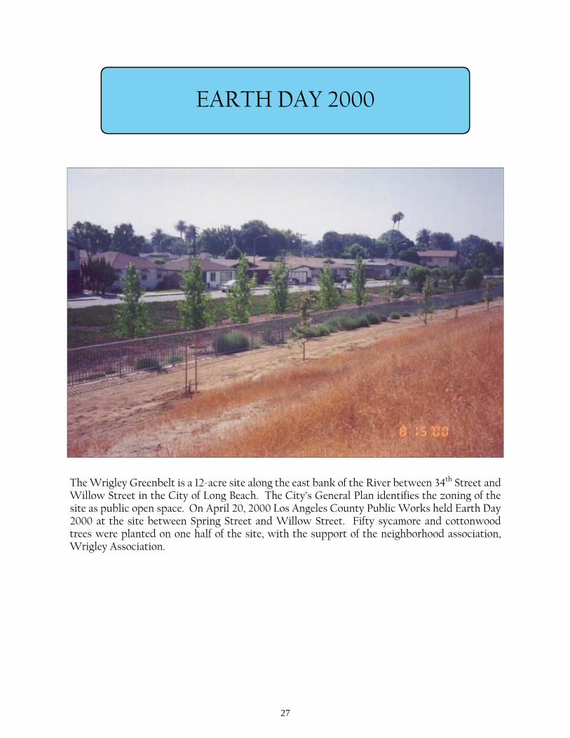
EARTH DAY 2000
The Wrigley Greenbelt is a 12-acre site along the east bank of the River between 34th Street and Willow Street in the City of Long Beach. The City’s General Plan identifies the zoning of the site as public open space. On April 20, 2000 Los Angeles County Public Works held Earth Day 2000 at the site between Spring Street and Willow Street. Fifty sycamore and cottonwood trees were planted on one half of the site, with the support of the neighborhood association, Wrigley Association.
28
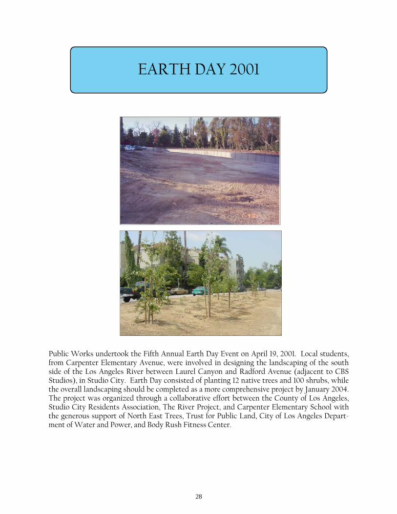
EARTH DAY 2001
Public Works undertook the Fifth Annual Earth Day Event on April 19, 2001. Local students, from Carpenter Elementary Avenue, were involved in designing the landscaping of the south side of the Los Angeles River between Laurel Canyon and Radford Avenue (adjacent to CBS Studios), in Studio City. Earth Day consisted of planting 12 native trees and 100 shrubs, while the overall landscaping should be completed as a more comprehensive project by January 2004. The project was organized through a collaborative effort between the County of Los Angeles, Studio City Residents Association, The River Project, and Carpenter Elementary School with the generous support of North East Trees, Trust for Public Land, City of Los Angeles Depart-ment of Water and Power, and Body Rush Fitness Center.
29
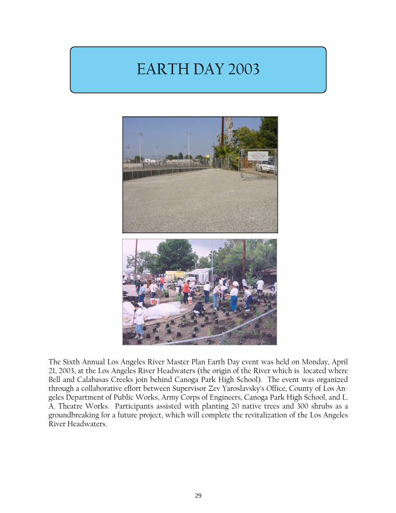
EARTH DAY 2003
The Sixth Annual Los Angeles River Master Plan Earth Day event was held on Monday, April 21, 2003, at the Los Angeles River Headwaters (the origin of the River which is located where Bell and Calabasas Creeks join behind Canoga Park High School). The event was organized through a collaborative effort between Supervisor Zev Yaroslavsky’s Office, County of Los An-geles Department of Public Works, Army Corps of Engineers, Canoga Park High School, and L.A. Theatre Works. Participants assisted with planting 20 native trees and 300 shrubs as a groundbreaking for a future project, which will complete the revitalization of the Los Angeles River Headwaters.
30
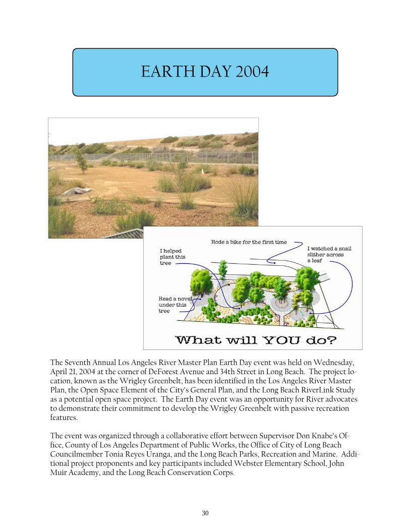
EARTH DAY 2004
The Seventh Annual Los Angeles River Master Plan Earth Day event was held on Wednesday, April 21, 2004 at the corner of DeForest Avenue and 34th Street in Long Beach. The project lo-cation, known as the Wrigley Greenbelt, has been identified in the Los Angeles River Master Plan, the Open Space Element of the City’s General Plan, and the Long Beach RiverLink Study as a potential open space project. The Earth Day event was an opportunity for River advocates to demonstrate their commitment to develop the Wrigley Greenbelt with passive recreation features. The event was organized through a collaborative effort between Supervisor Don Knabe’s Of-fice, County of Los Angeles Department of Public Works, the Office of City of Long Beach Councilmember Tonia Reyes Uranga, and the Long Beach Parks, Recreation and Marine. Addi-tional project proponents and key participants included Webster Elementary School, John Muir Academy, and the Long Beach Conservation Corps.
31
EARTH DAY 2005
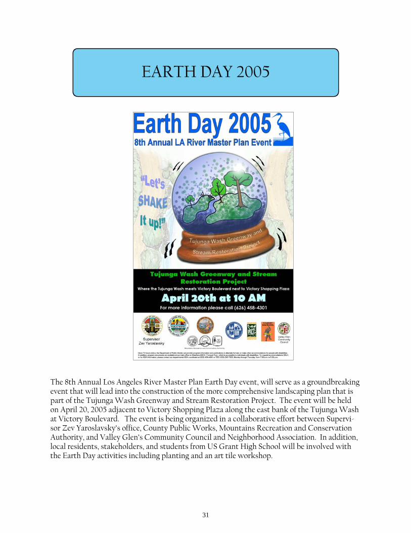
The 8th Annual Los Angeles River Master Plan Earth Day event, will serve as a groundbreaking event that will lead into the construction of the more comprehensive landscaping plan that is part of the Tujunga Wash Greenway and Stream Restoration Project. The event will be held on April 20, 2005 adjacent to Victory Shopping Plaza along the east bank of the Tujunga Wash at Victory Boulevard. The event is being organized in a collaborative effort between Supervi-sor Zev Yaroslavsky’s office, County Public Works, Mountains Recreation and Conservation Authority, and Valley Glen’s Community Council and Neighborhood Association. In addition, local residents, stakeholders, and students from US Grant High School will be involved with the Earth Day activities including planting and an art tile workshop.
32
EGRET PARK
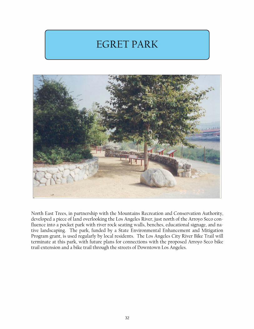
North East Trees, in partnership with the Mountains Recreation and Conservation Authority, developed a piece of land overlooking the Los Angeles River, just north of the Arroyo Seco con-fluence into a pocket park with river rock seating walls, benches, educational signage, and na-tive landscaping. The park, funded by a State Environmental Enhancement and Mitigation Program grant, is used regularly by local residents. The Los Angeles City River Bike Trail will terminate at this park, with future plans for connections with the proposed Arroyo Seco bike trail extension and a bike trail through the streets of Downtown Los Angeles.
33
ELYSIAN VALLEY GATEWAY PARK
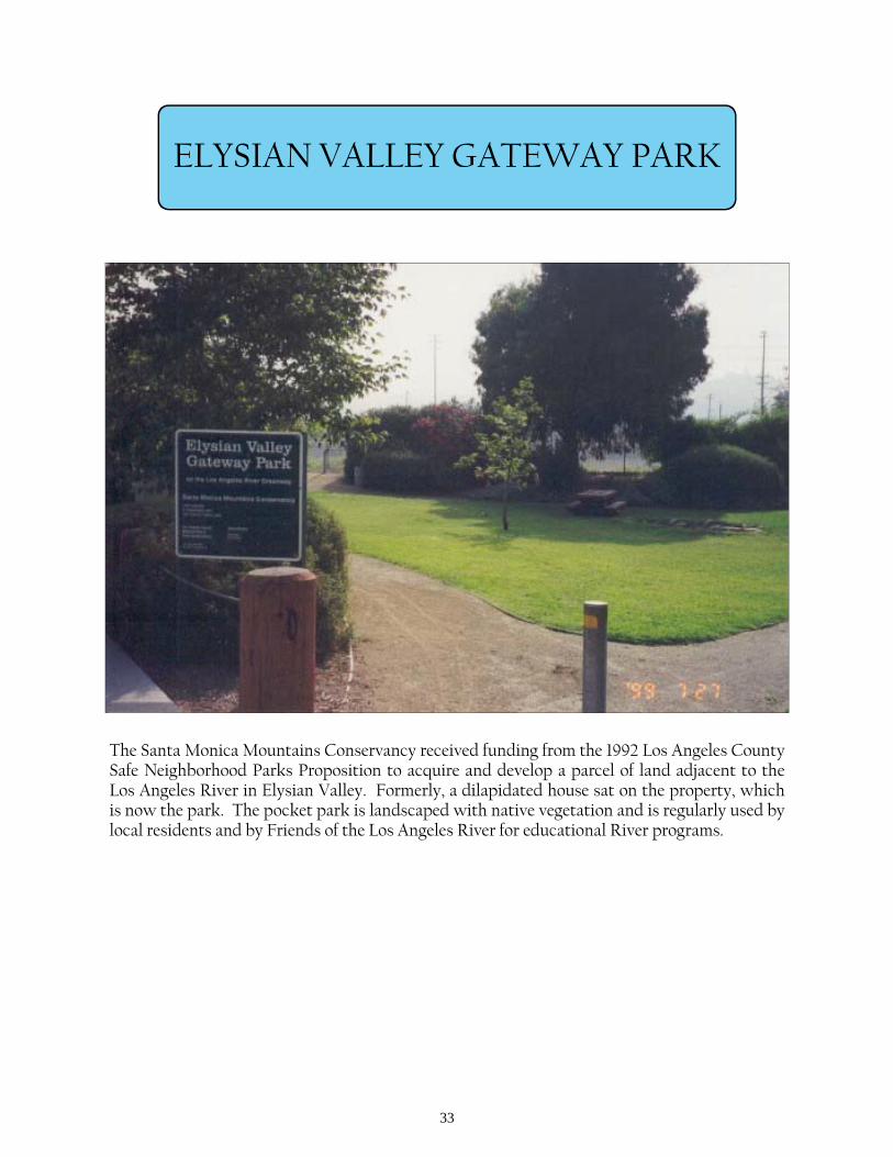
The Santa Monica Mountains Conservancy received funding from the 1992 Los Angeles County Safe Neighborhood Parks Proposition to acquire and develop a parcel of land adjacent to the Los Angeles River in Elysian Valley. Formerly, a dilapidated house sat on the property, which is now the park. The pocket park is landscaped with native vegetation and is regularly used by local residents and by Friends of the Los Angeles River for educational River programs.
34
ELYSIAN VALLEY RIVER ACCESS IMPROVEMENTS
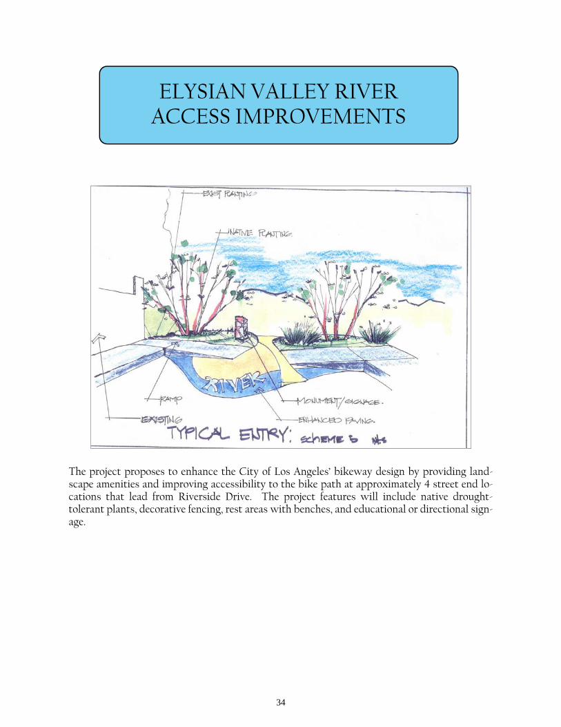
The project proposes to enhance the City of Los Angeles’ bikeway design by providing land-scape amenities and improving accessibility to the bike path at approximately 4 street end lo-cations that lead from Riverside Drive. The project features will include native drought-tolerant plants, decorative fencing, rest areas with benches, and educational or directional sign-age.
35
ERNIE’S WALK
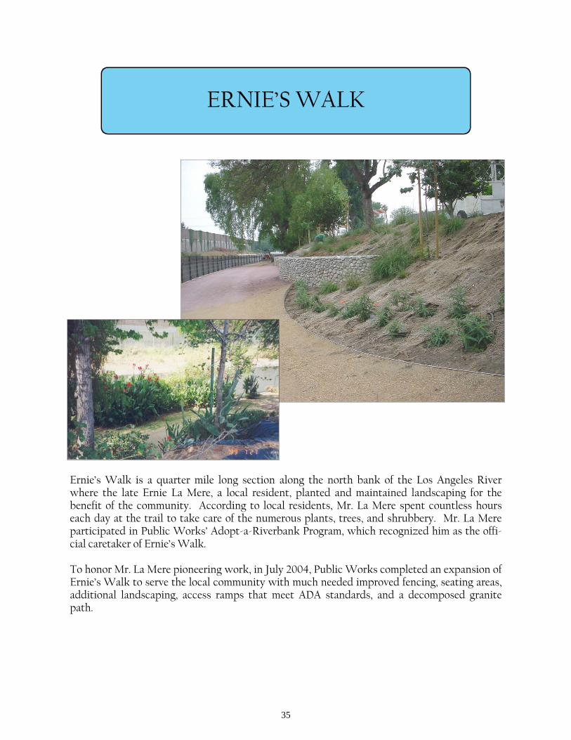
Ernie’s Walk is a quarter mile long section along the north bank of the Los Angeles River where the late Ernie La Mere, a local resident, planted and maintained landscaping for the benefit of the community. According to local residents, Mr. La Mere spent countless hours each day at the trail to take care of the numerous plants, trees, and shrubbery. Mr. La Mere participated in Public Works’ Adopt-a-Riverbank Program, which recognized him as the offi-cial caretaker of Ernie’s Walk. To honor Mr. La Mere pioneering work, in July 2004, Public Works completed an expansion of Ernie’s Walk to serve the local community with much needed improved fencing, seating areas, additional landscaping, access ramps that meet ADA standards, and a decomposed granite path.
36
GOLDEN SHORE MARINE RESERVE
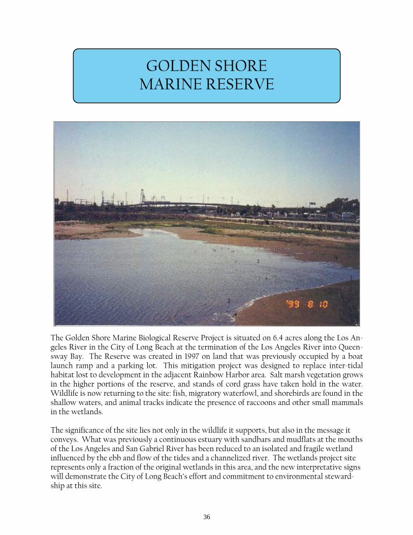
The Golden Shore Marine Biological Reserve Project is situated on 6.4 acres along the Los An-geles River in the City of Long Beach at the termination of the Los Angeles River into Queen-sway Bay. The Reserve was created in 1997 on land that was previously occupied by a boat launch ramp and a parking lot. This mitigation project was designed to replace inter-tidal habitat lost to development in the adjacent Rainbow Harbor area. Salt marsh vegetation grows in the higher portions of the reserve, and stands of cord grass have taken hold in the water. Wildlife is now returning to the site: fish, migratory waterfowl, and shorebirds are found in the shallow waters, and animal tracks indicate the presence of raccoons and other small mammals in the wetlands. The significance of the site lies not only in the wildlife it supports, but also in the message it conveys. What was previously a continuous estuary with sandbars and mudflats at the mouths of the Los Angeles and San Gabriel River has been reduced to an isolated and fragile wetland influenced by the ebb and flow of the tides and a channelized river. The wetlands project site represents only a fraction of the original wetlands in this area, and the new interpretative signs will demonstrate the City of Long Beach’s effort and commitment to environmental steward-ship at this site.

37
HEADWORKS SITE
In January 2004, the Army Corps of Engineers and the Los Angeles Department of Water and Power executed a Feasibility Cost Sharing Agreement to undertake a Feasibility Study for the Headworks site. The Study will evaluate the potential of providing ecosystem restoration for at least 25 of the 43 acres of relatively flat land that is located in the Griffith Park area. The Study would specifically consider the restoration of an urban environment into a more natural ripar-ian habitat and investigate opportunities for recreation and scenic values. The $1.8 million study effort should be complete by spring 2006.
38
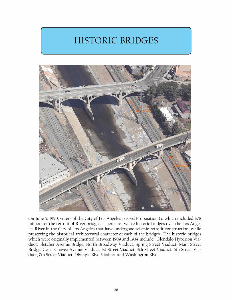
HISTORIC BRIDGES
On June 5, 1990, voters of the City of Los Angeles passed Proposition G, which included $78 million for the retrofit of River bridges. There are twelve historic bridges over the Los Ange-les River in the City of Los Angeles that have undergone seismic retrofit construction, while preserving the historical architectural character of each of the bridges. The historic bridges which were originally implemented between 1909 and 1934 include: Glendale-Hyperion Via-duct, Fletcher Avenue Bridge, North Broadway Viaduct, Spring Street Viaduct, Main Street Bridge, Cesar Chavez Avenue Viaduct, 1st Street Viaduct, 4th Street Viaduct, 6th Street Via-duct, 7th Street Viaduct, Olympic Blvd Viaduct, and Washington Blvd.
Spring St
Broadway

39
JULIA RUSS ASMUS PARK
The City of Bell Gardens completed the construction of the Julia Russ Asmus Park (Jaboneria Shull Park) in August 2000. The $875,000 project was funded through the City, Proposition A, Mountains Recreation and Conservation Authority, and the Regional Park and Open Space District. The park features recreational amenities and will eventually be linked to the Los An-geles River through bikeways and a potential pedestrian/bikeway bridge.
40
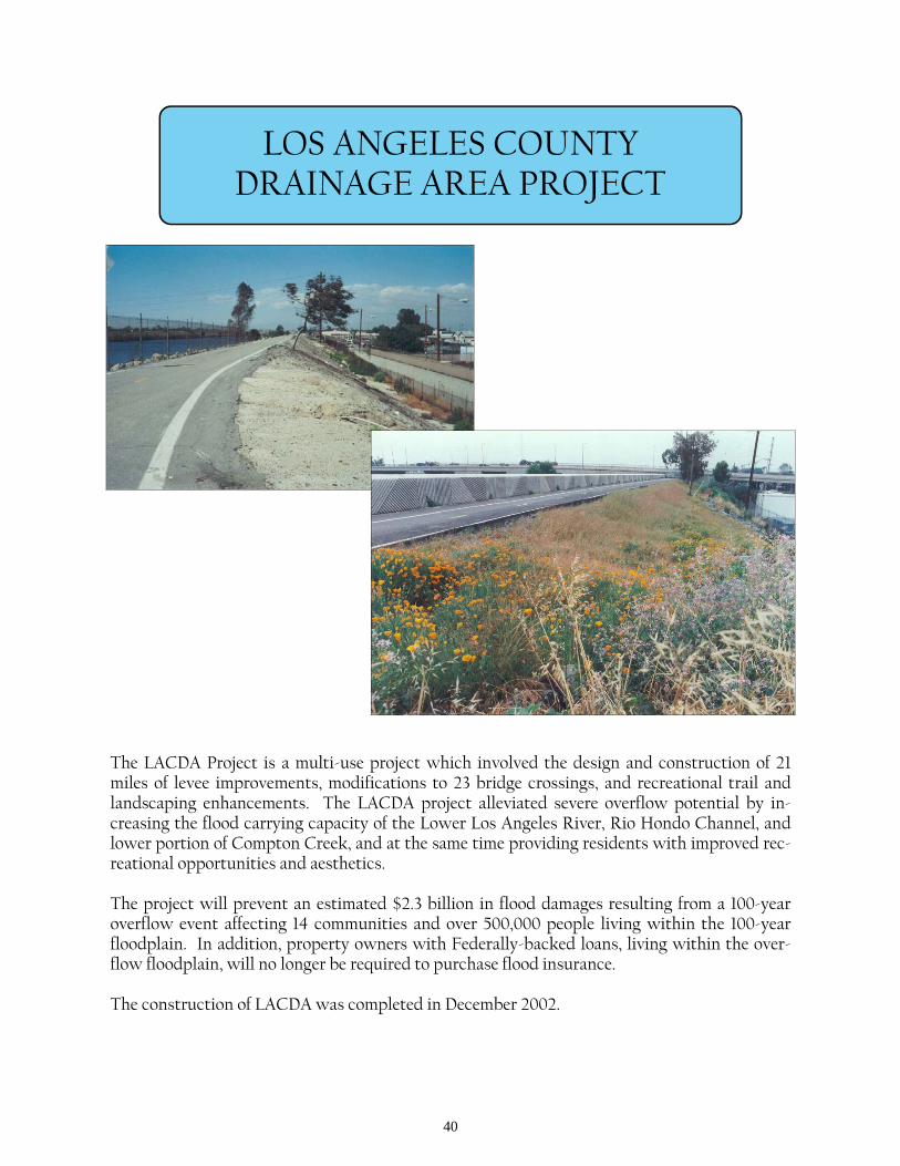
LOS ANGELES COUNTY DRAINAGE AREA PROJECT
The LACDA Project is a multi-use project which involved the design and construction of 21 miles of levee improvements, modifications to 23 bridge crossings, and recreational trail and landscaping enhancements. The LACDA project alleviated severe overflow potential by in-creasing the flood carrying capacity of the Lower Los Angeles River, Rio Hondo Channel, and lower portion of Compton Creek, and at the same time providing residents with improved rec-reational opportunities and aesthetics. The project will prevent an estimated $2.3 billion in flood damages resulting from a 100-year overflow event affecting 14 communities and over 500,000 people living within the 100-year floodplain. In addition, property owners with Federally-backed loans, living within the over-flow floodplain, will no longer be required to purchase flood insurance. The construction of LACDA was completed in December 2002.
41
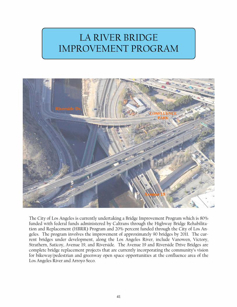
LA RIVER BRIDGE IMPROVEMENT PROGRAM
The City of Los Angeles is currently undertaking a Bridge Improvement Program which is 80% funded with federal funds administered by Caltrans through the Highway Bridge Rehabilita-tion and Replacement (HBRR) Program and 20% percent funded through the City of Los An-geles. The program involves the improvement of approximately 90 bridges by 2011. The cur-rent bridges under development, along the Los Angeles River, include Vanowen, Victory, Strathern, Saticoy, Avenue 19, and Riverside. The Avenue 19 and Riverside Drive Bridges are complete bridge replacement projects that are currently incorporating the community’s vision for bikeway/pedestrian and greenway open space opportunities at the confluence area of the Los Angeles River and Arroyo Seco.
Riverside Dr.
Avenue 19
CONFLUENCE PARK
42
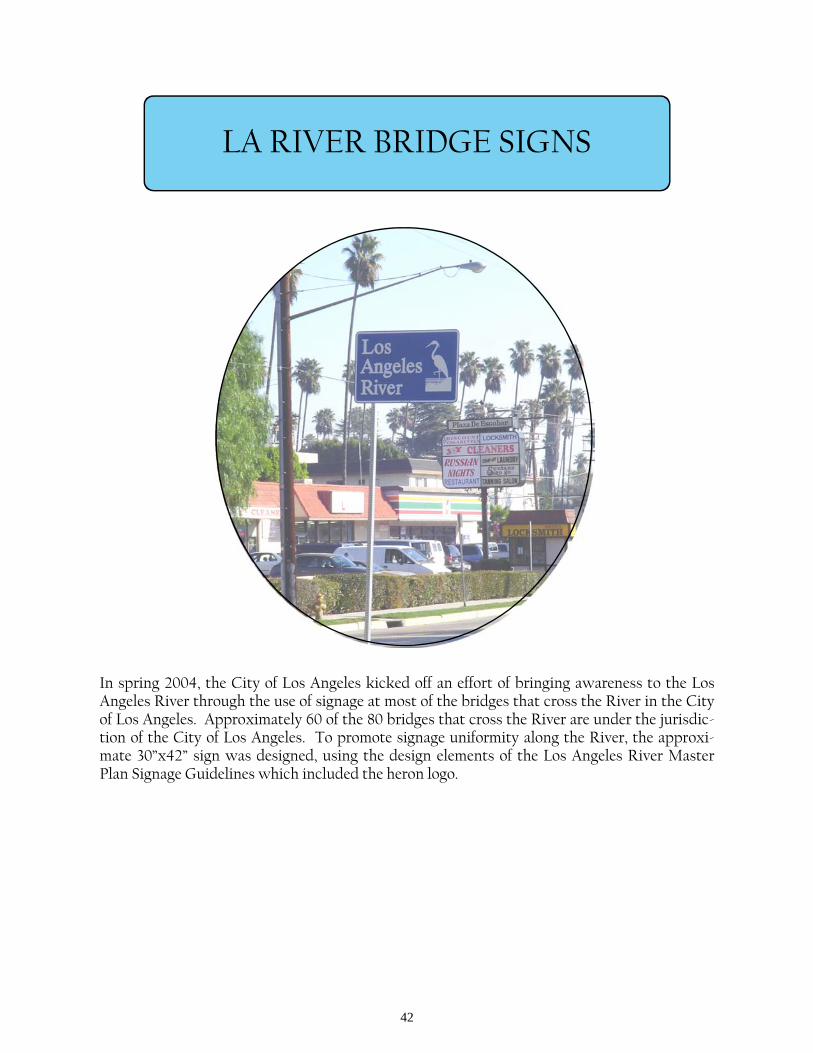
LA RIVER BRIDGE SIGNS
In spring 2004, the City of Los Angeles kicked off an effort of bringing awareness to the Los Angeles River through the use of signage at most of the bridges that cross the River in the City of Los Angeles. Approximately 60 of the 80 bridges that cross the River are under the jurisdic-tion of the City of Los Angeles. To promote signage uniformity along the River, the approxi-mate 30”x42” sign was designed, using the design elements of the Los Angeles River Master Plan Signage Guidelines which included the heron logo.
43
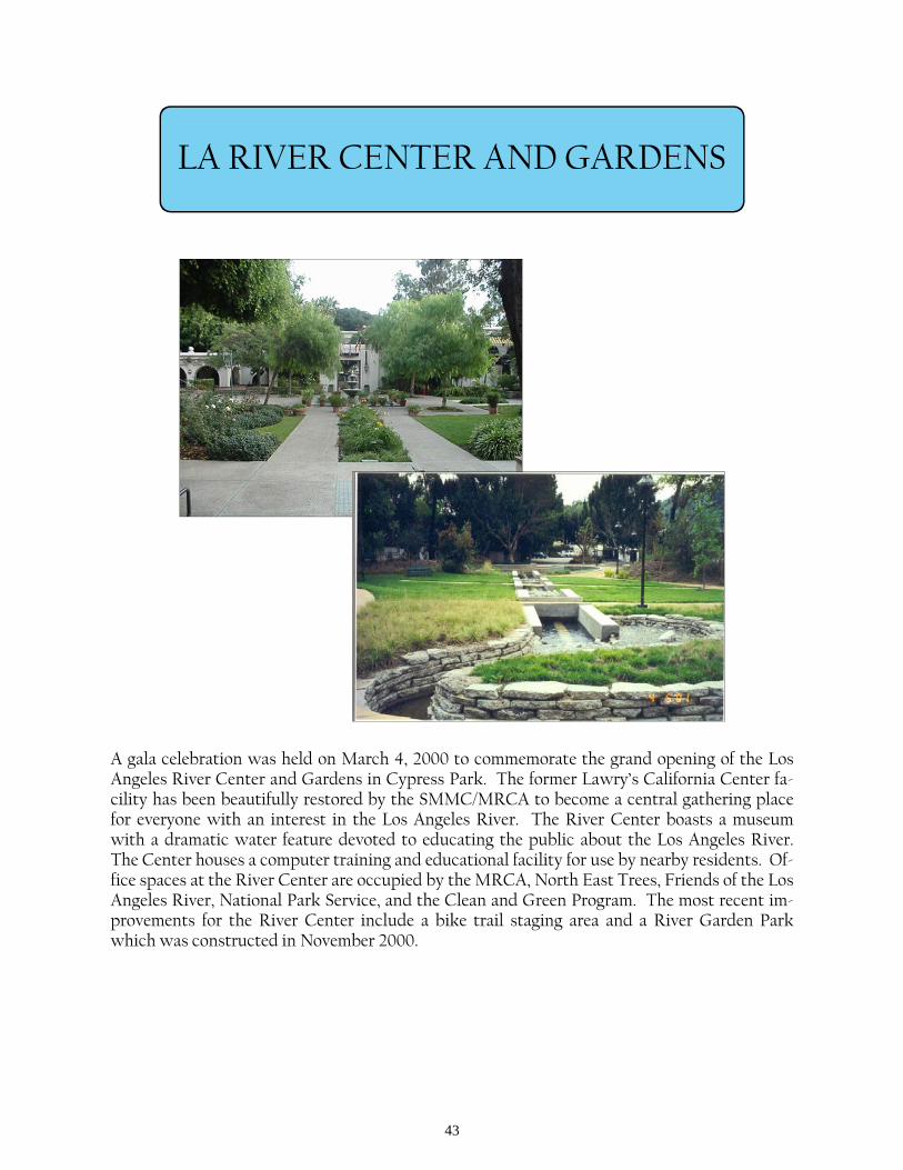
LA RIVER CENTER AND GARDENS
A gala celebration was held on March 4, 2000 to commemorate the grand opening of the Los Angeles River Center and Gardens in Cypress Park. The former Lawry’s California Center fa-cility has been beautifully restored by the SMMC/MRCA to become a central gathering place for everyone with an interest in the Los Angeles River. The River Center boasts a museum with a dramatic water feature devoted to educating the public about the Los Angeles River. The Center houses a computer training and educational facility for use by nearby residents. Of-fice spaces at the River Center are occupied by the MRCA, North East Trees, Friends of the Los Angeles River, National Park Service, and the Clean and Green Program. The most recent im-provements for the River Center include a bike trail staging area and a River Garden Park which was constructed in November 2000.
44
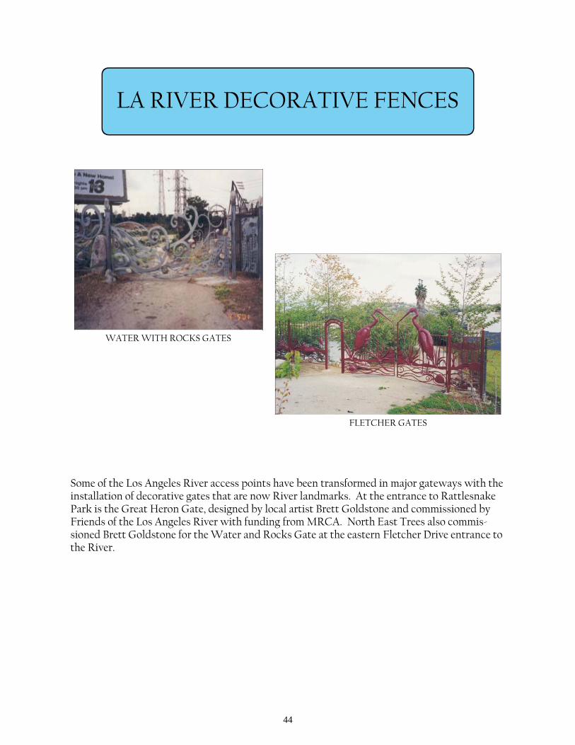
LA RIVER DECORATIVE FENCES
Some of the Los Angeles River access points have been transformed in major gateways with the installation of decorative gates that are now River landmarks. At the entrance to Rattlesnake Park is the Great Heron Gate, designed by local artist Brett Goldstone and commissioned by Friends of the Los Angeles River with funding from MRCA. North East Trees also commis-sioned Brett Goldstone for the Water and Rocks Gate at the eastern Fletcher Drive entrance to the River.
FLETCHER GATES
WATER WITH ROCKS GATES
45
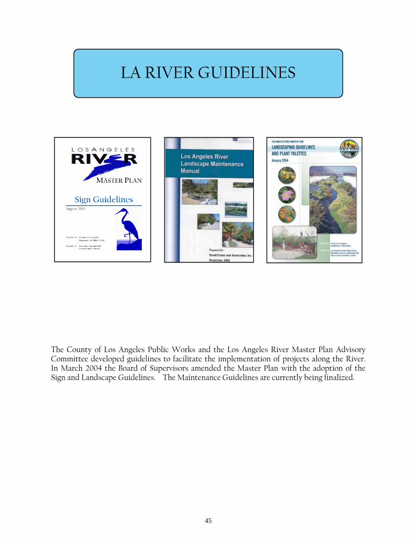
LA RIVER GUIDELINES
The County of Los Angeles Public Works and the Los Angeles River Master Plan Advisory Committee developed guidelines to facilitate the implementation of projects along the River. In March 2004 the Board of Supervisors amended the Master Plan with the adoption of the Sign and Landscape Guidelines. The Maintenance Guidelines are currently being finalized.
46
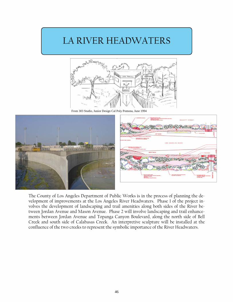
LA RIVER HEADWATERS
The County of Los Angeles Department of Public Works is in the process of planning the de-velopment of improvements at the Los Angeles River Headwaters. Phase 1 of the project in-volves the development of landscaping and trail amenities along both sides of the River be-tween Jordan Avenue and Mason Avenue. Phase 2 will involve landscaping and trail enhance-ments between Jordan Avenue and Topanga Canyon Boulevard, along the north side of Bell Creek and south side of Calabasas Creek. An interpretive sculpture will be installed at the confluence of the two creeks to represent the symbolic importance of the River Headwaters.
From 303 Studio, Junior Design Cal Poly Pomona, June 1994
47
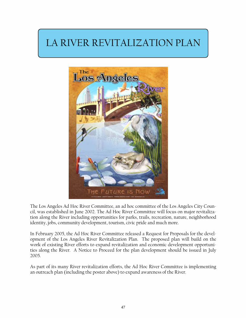
LA RIVER REVITALIZATION PLAN
The Los Angeles Ad Hoc River Committee, an ad hoc committee of the Los Angeles City Coun-cil, was established in June 2002. The Ad Hoc River Committee will focus on major revitaliza-tion along the River including opportunities for parks, trails, recreation, nature, neighborhood identity, jobs, community development, tourism, civic pride and much more. In February 2005, the Ad Hoc River Committee released a Request for Proposals for the devel-opment of the Los Angeles River Revitalization Plan. The proposed plan will build on the work of existing River efforts to expand revitalization and economic development opportuni-ties along the River. A Notice to Proceed for the plan development should be issued in July 2005. As part of its many River revitalization efforts, the Ad Hoc River Committee is implementing an outreach plan (including the poster above) to expand awareness of the River.
48
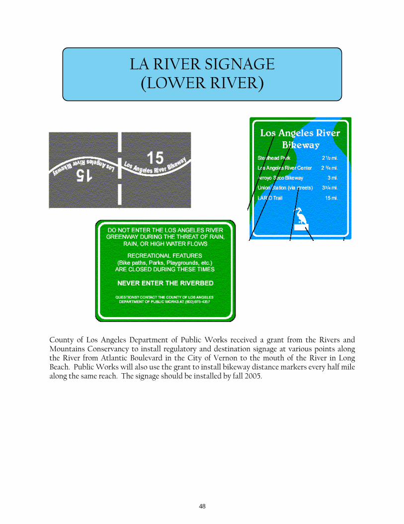
LA RIVER SIGNAGE (LOWER RIVER)
County of Los Angeles Department of Public Works received a grant from the Rivers and Mountains Conservancy to install regulatory and destination signage at various points along the River from Atlantic Boulevard in the City of Vernon to the mouth of the River in Long Beach. Public Works will also use the grant to install bikeway distance markers every half mile along the same reach. The signage should be installed by fall 2005.
49
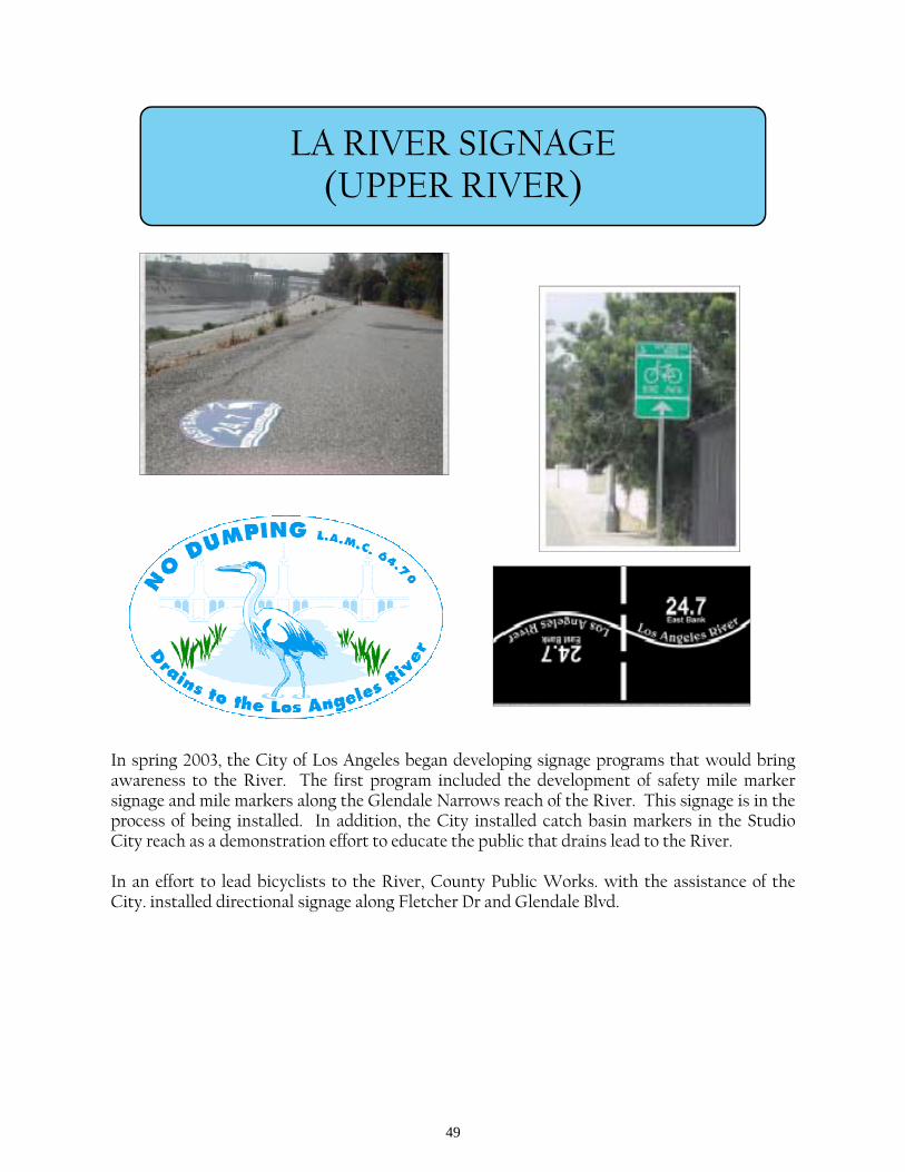
LA RIVER SIGNAGE (UPPER RIVER)
In spring 2003, the City of Los Angeles began developing signage programs that would bring awareness to the River. The first program included the development of safety mile marker signage and mile markers along the Glendale Narrows reach of the River. This signage is in the process of being installed. In addition, the City installed catch basin markers in the Studio City reach as a demonstration effort to educate the public that drains lead to the River. In an effort to lead bicyclists to the River, County Public Works. with the assistance of the City. installed directional signage along Fletcher Dr and Glendale Blvd.
50
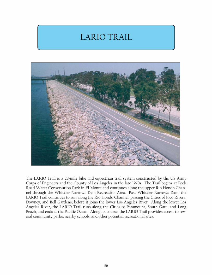
LARIO TRAIL
The LARIO Trail is a 28-mile bike and equestrian trail system constructed by the US Army Corps of Engineers and the County of Los Angeles in the late 1970s. The Trail begins at Peck Road Water Conservation Park in El Monte and continues along the upper Rio Hondo Chan-nel through the Whittier Narrows Dam Recreation Area. Past Whittier Narrows Dam, the LARIO Trail continues to run along the Rio Hondo Channel, passing the Cities of Pico Rivera, Downey, and Bell Gardens, before it joins the lower Los Angeles River. Along the lower Los Angeles River, the LARIO Trail runs along the Cities of Paramount, South Gate, and Long Beach, and ends at the Pacific Ocean. Along its course, the LARIO Trail provides access to sev-eral community parks, nearby schools, and other potential recreational sites.
51
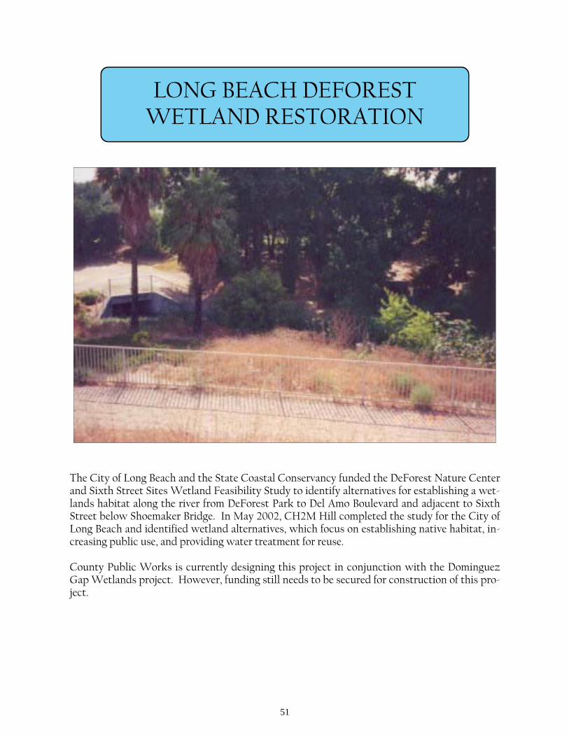
LONG BEACH DEFOREST WETLAND RESTORATION
The City of Long Beach and the State Coastal Conservancy funded the DeForest Nature Center and Sixth Street Sites Wetland Feasibility Study to identify alternatives for establishing a wet-lands habitat along the river from DeForest Park to Del Amo Boulevard and adjacent to Sixth Street below Shoemaker Bridge. In May 2002, CH2M Hill completed the study for the City of Long Beach and identified wetland alternatives, which focus on establishing native habitat, in-creasing public use, and providing water treatment for reuse. County Public Works is currently designing this project in conjunction with the Dominguez Gap Wetlands project. However, funding still needs to be secured for construction of this pro-ject.
52
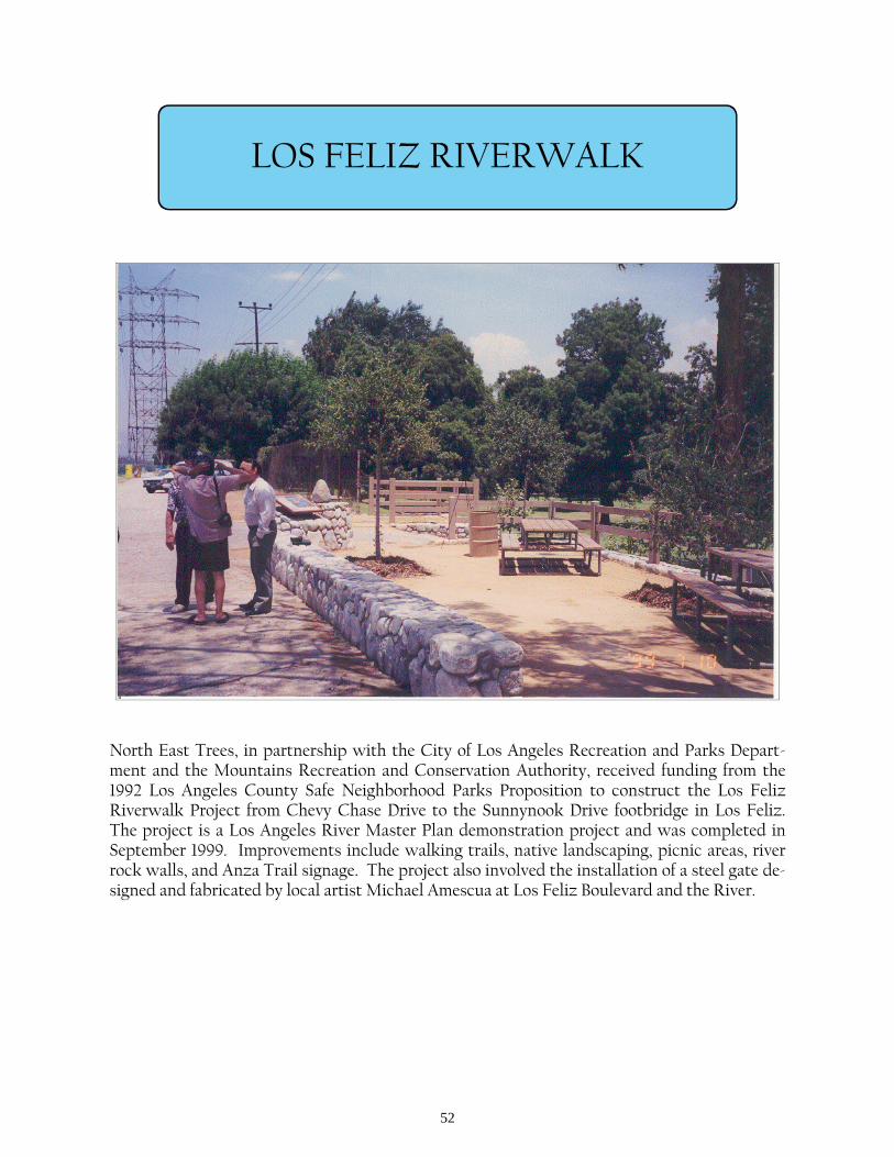
LOS FELIZ RIVERWALK
North East Trees, in partnership with the City of Los Angeles Recreation and Parks Depart-ment and the Mountains Recreation and Conservation Authority, received funding from the 1992 Los Angeles County Safe Neighborhood Parks Proposition to construct the Los Feliz Riverwalk Project from Chevy Chase Drive to the Sunnynook Drive footbridge in Los Feliz. The project is a Los Angeles River Master Plan demonstration project and was completed in September 1999. Improvements include walking trails, native landscaping, picnic areas, river rock walls, and Anza Trail signage. The project also involved the installation of a steel gate de-signed and fabricated by local artist Michael Amescua at Los Feliz Boulevard and the River.
53
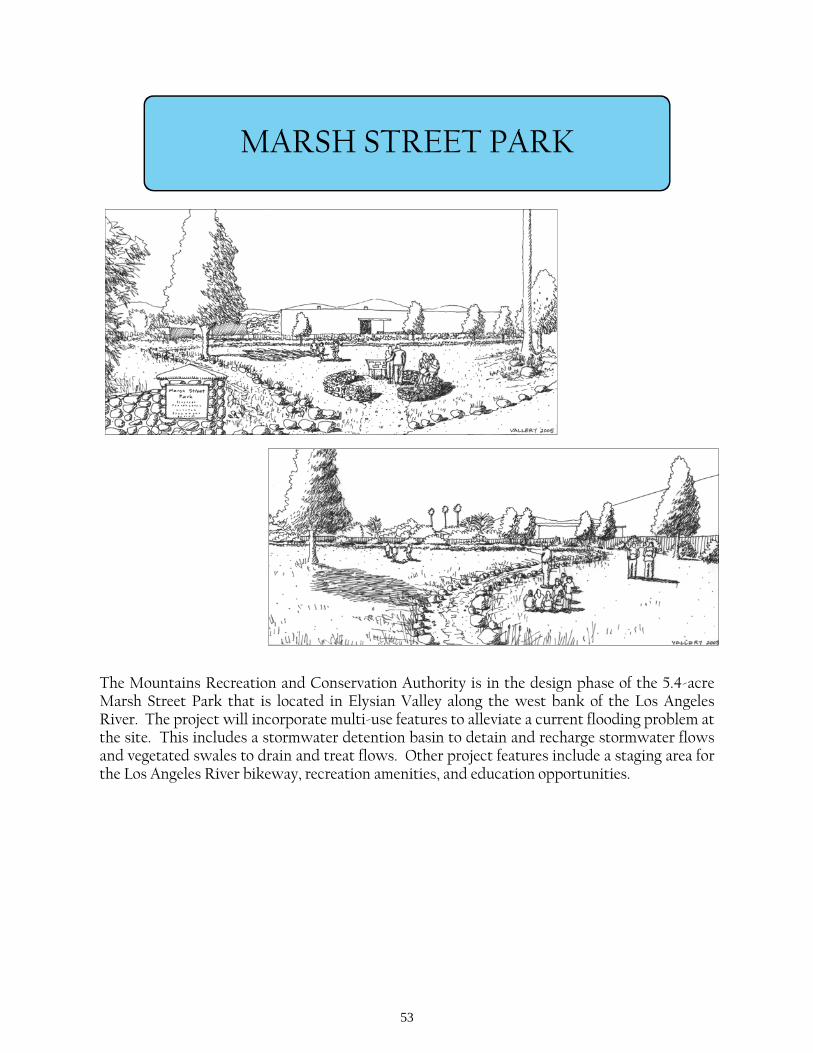
MARSH STREET PARK
The Mountains Recreation and Conservation Authority is in the design phase of the 5.4-acre Marsh Street Park that is located in Elysian Valley along the west bank of the Los Angeles River. The project will incorporate multi-use features to alleviate a current flooding problem at the site. This includes a stormwater detention basin to detain and recharge stormwater flows and vegetated swales to drain and treat flows. Other project features include a staging area for the Los Angeles River bikeway, recreation amenities, and education opportunities.
54
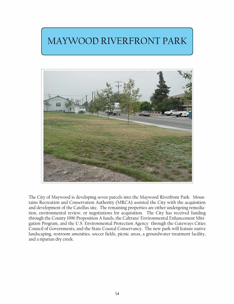
MAYWOOD RIVERFRONT PARK
The City of Maywood is developing seven parcels into the Maywood Riverfront Park. Moun-tains Recreation and Conservation Authority (MRCA) assisted the City with the acquisition and development of the Catellus site. The remaining properties are either undergoing remedia-tion, environmental review, or negotiations for acquisition. The City has received funding through the County 1996 Proposition A funds, the Caltrans’ Environmental Enhancement Miti-gation Program, and the U.S. Environmental Protection Agency through the Gateways Cities Council of Governments, and the State Coastal Conservancy. The new park will feature native landscaping, restroom amenities, soccer fields, picnic areas, a groundwater treatment facility, and a riparian dry creek.
55
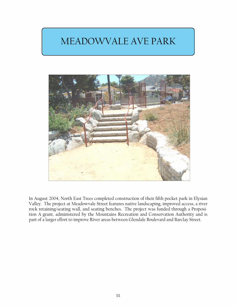
MEADOWVALE AVE PARK
In August 2004, North East Trees completed construction of their fifth pocket park in Elysian Valley. The project at Meadowvale Street features native landscaping, improved access, a river rock retaining/seating wall, and seating benches. The project was funded through a Proposi-tion A grant, administered by the Mountains Recreation and Conservation Authority and is part of a larger effort to improve River areas between Glendale Boulevard and Barclay Street.
56
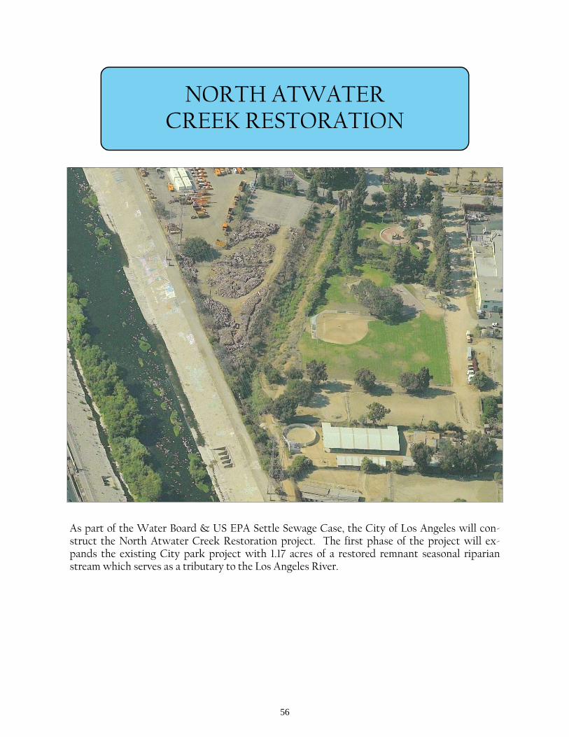
NORTH ATWATER CREEK RESTORATION
As part of the Water Board & US EPA Settle Sewage Case, the City of Los Angeles will con-struct the North Atwater Creek Restoration project. The first phase of the project will ex-pands the existing City park project with 1.17 acres of a restored remnant seasonal riparian stream which serves as a tributary to the Los Angeles River.
57
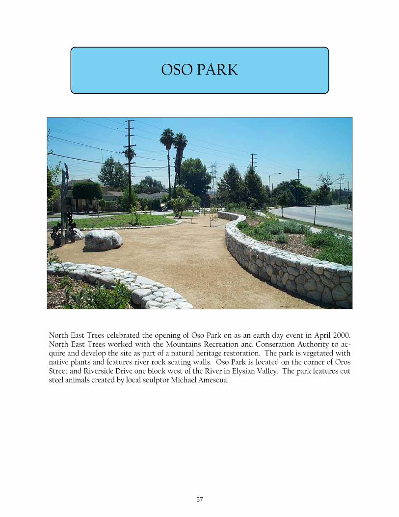
OSO PARK
North East Trees celebrated the opening of Oso Park on as an earth day event in April 2000. North East Trees worked with the Mountains Recreation and Conseration Authority to ac-quire and develop the site as part of a natural heritage restoration. The park is vegetated with native plants and features river rock seating walls. Oso Park is located on the corner of Oros Street and Riverside Drive one block west of the River in Elysian Valley. The park features cut steel animals created by local sculptor Michael Amescua.
58
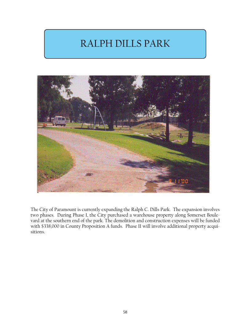
The City of Paramount is currently expanding the Ralph C. Dills Park. The expansion involves two phases. During Phase I, the City purchased a warehouse property along Somerset Boule-vard at the southern end of the park. The demolition and construction expenses will be funded with $338,000 in County Proposition A funds. Phase II will involve additional property acqui-sitions.
RALPH DILLS PARK

59
RICHARD LILLARD OUTDOOR CLASSROOM
On March 22, 2003, SMMC dedicated the completion of the Studio City Outdoor Classroom Project as the Richard Lillard Outdoor Classroom along the south side of the Los Angeles River, at Fulton Avenue. The project complemented the Village Gardener’s Adopt-A-River im-provements and includes improved access to the River trails, native landscaping, interpretive displays, and an outdoor amphitheater.
60
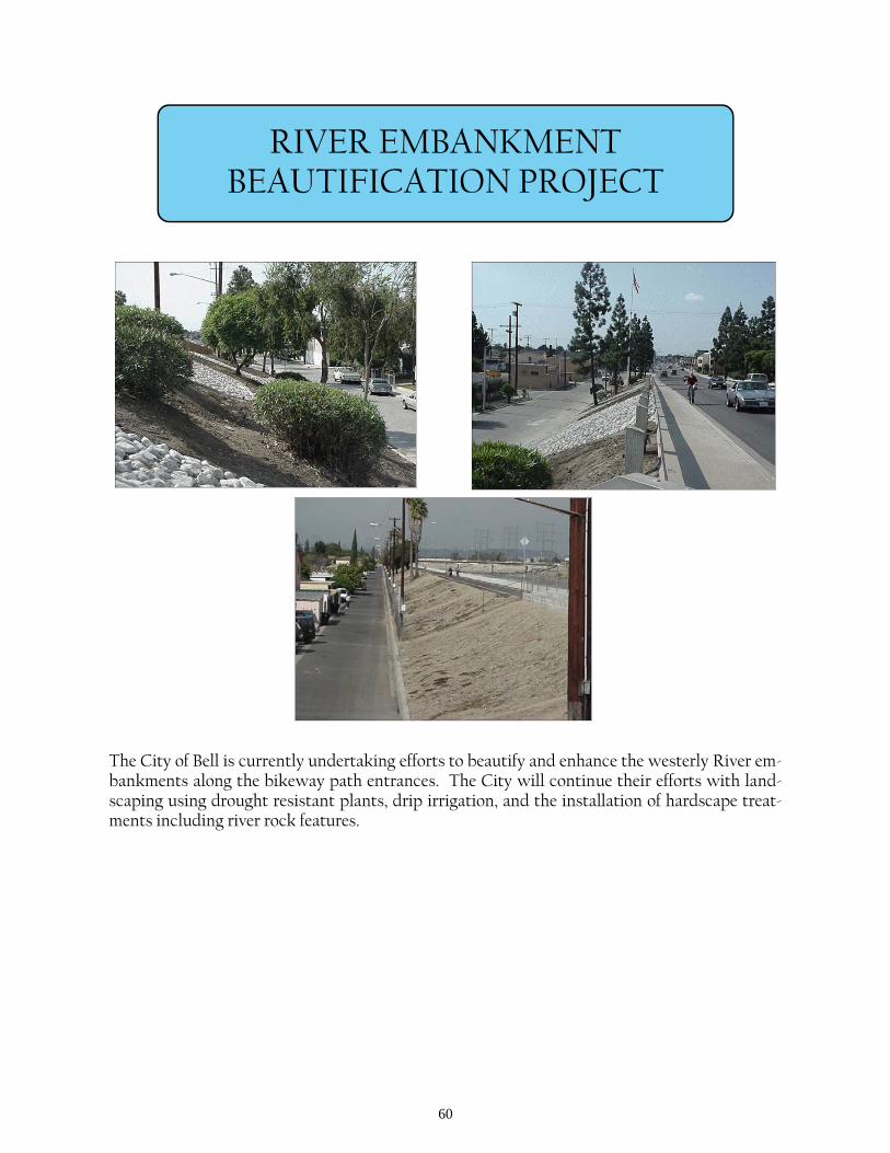
RIVER EMBANKMENT BEAUTIFICATION PROJECT
The City of Bell is currently undertaking efforts to beautify and enhance the westerly River em-bankments along the bikeway path entrances. The City will continue their efforts with land-scaping using drought resistant plants, drip irrigation, and the installation of hardscape treat-ments including river rock features.

61
SOUTHERN AVENUE BIKEWAY IMPROVEMENTS
The City of South Gate completed bikeway improvements to Southern Avenue, leading to the River, and construction of a park at the corner of Atlantic Boulevard and Southern Avenue in August 2000. In the future, the City plans to extend the greening of Southern Avenue (through DWP right-of-way) and constructing a bikeway to connect with the recent improvements and the River.
62
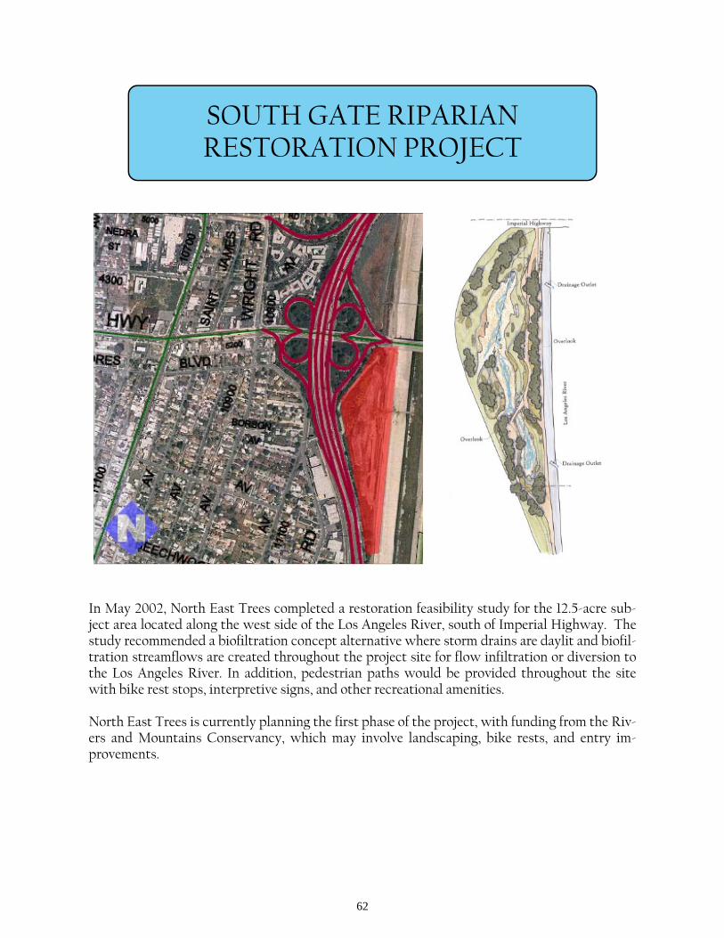
SOUTH GATE RIPARIAN RESTORATION PROJECT
In May 2002, North East Trees completed a restoration feasibility study for the 12.5-acre sub-ject area located along the west side of the Los Angeles River, south of Imperial Highway. The study recommended a biofiltration concept alternative where storm drains are daylit and biofil-tration streamflows are created throughout the project site for flow infiltration or diversion to the Los Angeles River. In addition, pedestrian paths would be provided throughout the site with bike rest stops, interpretive signs, and other recreational amenities. North East Trees is currently planning the first phase of the project, with funding from the Riv-ers and Mountains Conservancy, which may involve landscaping, bike rests, and entry im-provements.
63
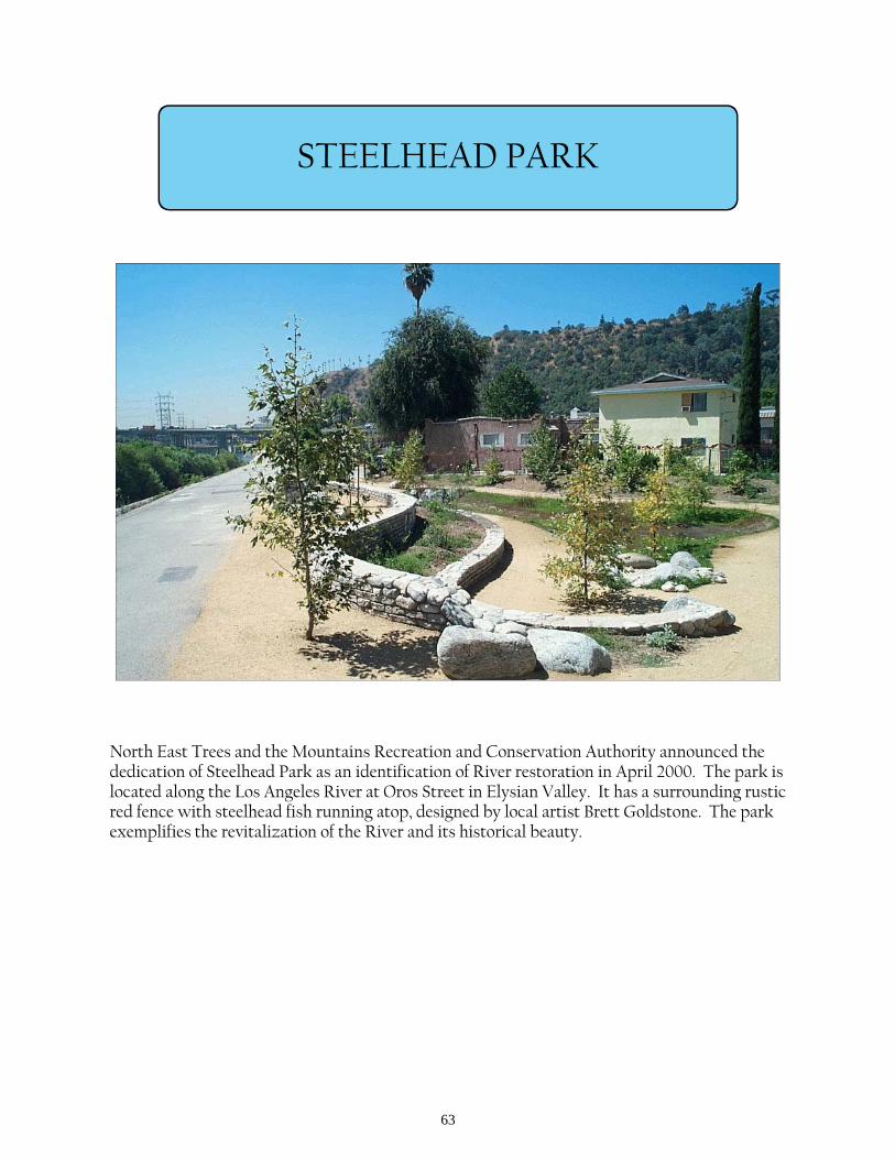
STEELHEAD PARK
North East Trees and the Mountains Recreation and Conservation Authority announced the dedication of Steelhead Park as an identification of River restoration in April 2000. The park is located along the Los Angeles River at Oros Street in Elysian Valley. It has a surrounding rustic red fence with steelhead fish running atop, designed by local artist Brett Goldstone. The park exemplifies the revitalization of the River and its historical beauty.
64
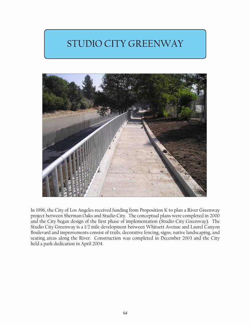
STUDIO CITY GREENWAY
In 1996, the City of Los Angeles received funding from Proposition K to plan a River Greenway project between Sherman Oaks and Studio City. The conceptual plans were completed in 2000 and the City began design of the first phase of implementation (Studio City Greenway). The Studio City Greenway is a 1/2 mile development between Whitsett Avenue and Laurel Canyon Boulevard and improvements consist of trails, decorative fencing, signs, native landscaping, and seating areas along the River. Construction was completed in December 2003 and the City held a park dedication in April 2004.
65
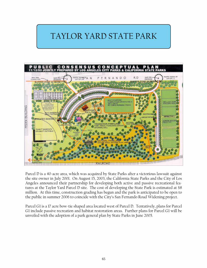
TAYLOR YARD STATE PARK
Parcel D is a 40-acre area, which was acquired by State Parks after a victorious lawsuit against the site owner in July 2001. On August 15, 2003, the California State Parks and the City of Los Angeles announced their partnership for developing both active and passive recreational fea-tures at the Taylor Yard Parcel D site. The cost of developing the State Park is estimated at $8 million. At this time, construction grading has begun and the park is anticipated to be open to the public in summer 2006 to coincide with the City’s San Fernando Road Widening project. Parcel G1 is a 17 acre bow-tie shaped area located west of Parcel D. Tentatively, plans for Parcel G1 include passive recreation and habitat restoration areas. Further plans for Parcel G1 will be unveiled with the adoption of a park general plan by State Parks in June 2005.
66
TUJUNGA WASH GREENWAY
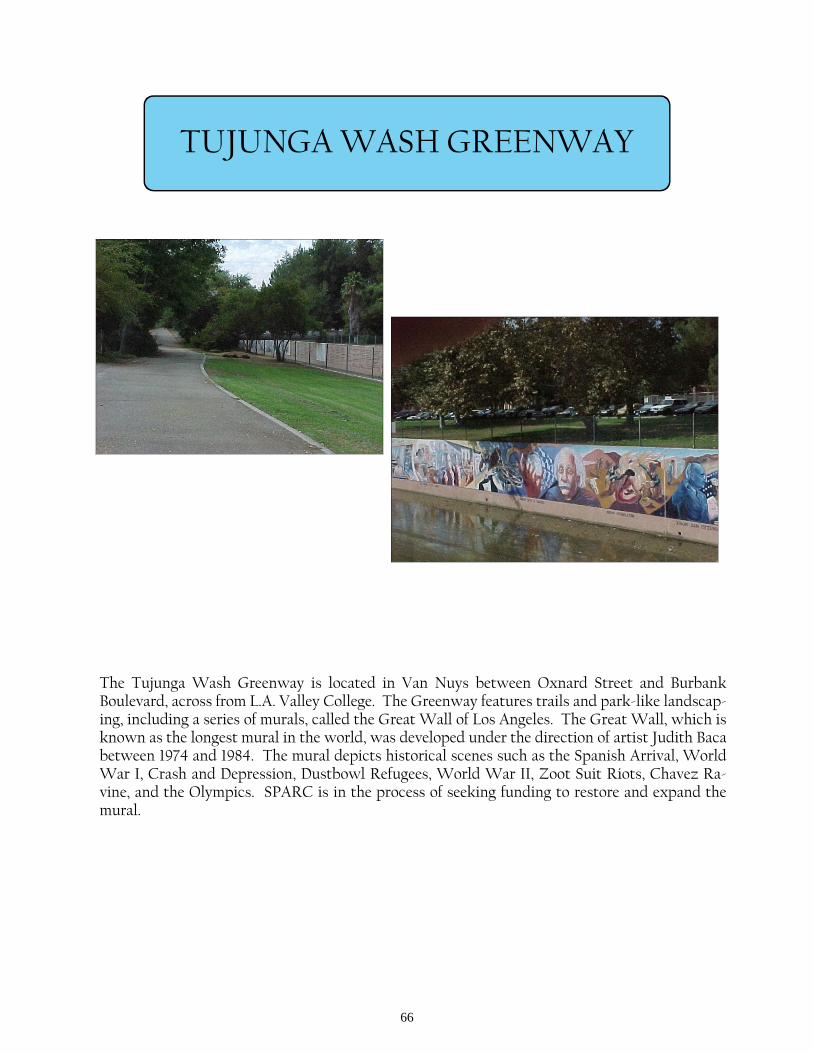
The Tujunga Wash Greenway is located in Van Nuys between Oxnard Street and Burbank Boulevard, across from L.A. Valley College. The Greenway features trails and park-like landscap-ing, including a series of murals, called the Great Wall of Los Angeles. The Great Wall, which is known as the longest mural in the world, was developed under the direction of artist Judith Baca between 1974 and 1984. The mural depicts historical scenes such as the Spanish Arrival, World War I, Crash and Depression, Dustbowl Refugees, World War II, Zoot Suit Riots, Chavez Ra-vine, and the Olympics. SPARC is in the process of seeking funding to restore and expand the mural.
67
TUJUNGA WASH GREENWAY & STREAM RESTORATION PROJECT
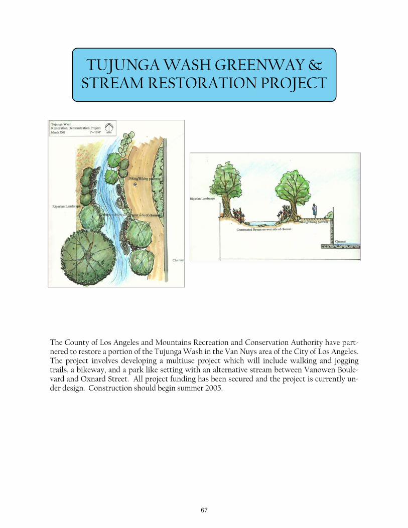
The County of Los Angeles and Mountains Recreation and Conservation Authority have part-nered to restore a portion of the Tujunga Wash in the Van Nuys area of the City of Los Angeles. The project involves developing a multiuse project which will include walking and jogging trails, a bikeway, and a park like setting with an alternative stream between Vanowen Boule-vard and Oxnard Street. All project funding has been secured and the project is currently un-der design. Construction should begin summer 2005.
68
VALLEYHEART GREENWAY
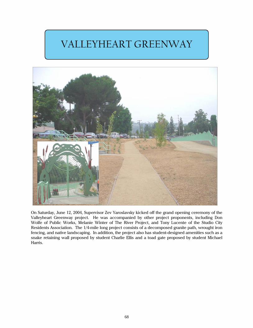
On Saturday, June 12, 2004, Supervisor Zev Yaroslavsky kicked off the grand opening ceremony of the Valleyheart Greenway project. He was accompanied by other project proponents, including Don Wolfe of Public Works, Melanie Winter of The River Project, and Tony Lucente of the Studio City Residents Association. The 1/4-mile long project consists of a decomposed granite path, wrought iron fencing, and native landscaping. In addition, the project also has student-designed amenities such as a snake retaining wall proposed by student Charlie Ellis and a toad gate proposed by student Michael Harris.
69
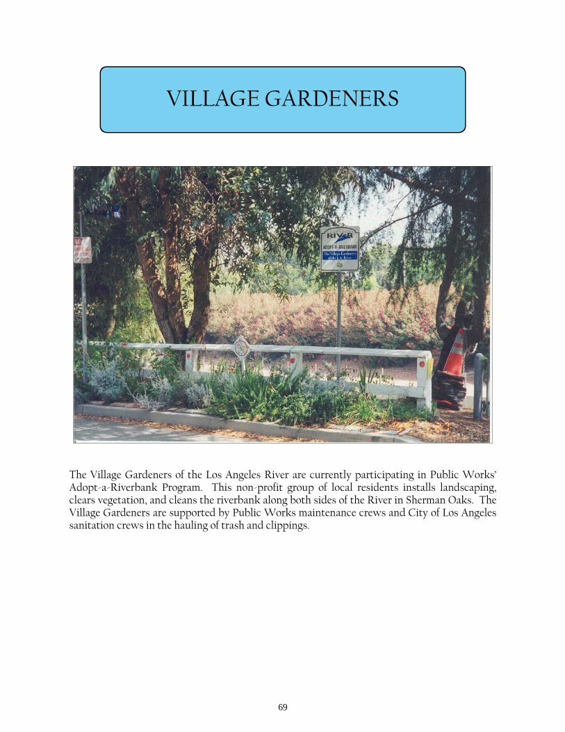
VILLAGE GARDENERS
The Village Gardeners of the Los Angeles River are currently participating in Public Works’ Adopt-a-Riverbank Program. This non-profit group of local residents installs landscaping, clears vegetation, and cleans the riverbank along both sides of the River in Sherman Oaks. The Village Gardeners are supported by Public Works maintenance crews and City of Los Angeles sanitation crews in the hauling of trash and clippings.

70
WRIGLEY GREENBELT
The Wrigley Greenbelt project is located in the City of Long Beach along the east bank of the Los Angeles River between Willow and 34th Streets. The property is approximately one mile long by 75 feet wide and covers nearly 8 acres of land owned by the County of Los Angeles Flood Control District. Currently, the site consists of a barren area with minimal landscaping and groundcover. The Wrigley Greenbelt project will enhance the area by landscaping the site with native plant gardens, a multipurpose trail, picnic tables, benches, drinking fountains, a stormwater runoff swale, calisthenics stations, and information kiosks. The area would also provide a rest area with bike racks for bikers riding along the Los Angeles River (LARIO) bike trail.
71
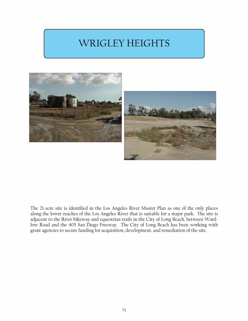
WRIGLEY HEIGHTS
The 21-acre site is identified in the Los Angeles River Master Plan as one of the only places along the lower reaches of the Los Angeles River that is suitable for a major park. The site is adjacent to the River bikeway and equestrian trails in the City of Long Beach, between Ward-low Road and the 405 San Diego Freeway. The City of Long Beach has been working with grant agencies to secure funding for acquisition, development, and remediation of the site.
Recommended