Embed Size (px)
Citation preview

Record No. 1970 / 38002510
Shallow Stratigraphic DrillingSouthern Carpentaria Basin, 1969
by
KG. Grimes* and J. Smart(*Geological Survey of Queensland)
CONNONWEALITH OF AUSTRALIA
PAT! O Nxir ONAL, DEVELOPMENT
ROM ()T MOE281 MUMS, iglia
an @IMMOOGY
BMRRecord1970/38
c.3
SHALLOW STRATIGRAPHIC DRILLING
SOUTHERN CARPENTARIA BASIN, 1969
by
K.G. Grimes and J. Smart
(* Geological Survey of Queensland)
RECORDS 1970/58
Contents
SUMMARY
INTRODUCTION .
LE!
1
1
2
4
78
10
B.M.R. Dobbyn 1.
B.M.R. Dobbyn 2.
B.M.R. Cloncurry 1
B.M.R. Cloncurry 2
B.M.R. Richmond 3
REFERENCES
(Figure 2)
(Figure 3)(Figure 4)
(Figure 5)(Figure 6)
Locality Map^(Figure 1)
The information contained in this report has been obtained bythe Department of National Development as part of the policyof the Commonwealth Government to assist in the explorationand development of mineral resources. It may not be publishedin any form or used in a company prospectus or statement with-out the permission in writing of the Director, Bureau ofMineral Resources, Geology and Geophysics.
. -
SHALLOW STRATIGRAPHIC DRILLING
SOUTHERN CARPENTARIA. J3A.SIN. 19690
SUMMARY
Shallow' stratigraphic drilling was carried out during
1969 in the southern Carpentaria Basin. The pro~am was designed to
supplement surface mapping of poorly exposed units~ to elucidate
certain structural problems and to provide fresh rock for'palaeontol
ogical studies o
Drilling p~oduced useful cores of Allaru Mudstone p Kamileroi
(Toolebuc) Limestone, Blackdown (Wallumbilla) and Gilbert River
Formations 9 and ~o Queen Groupo St~~ctural information in the
vicinity of the Boomarra Ridge was obtained e Preliminary palaeont~
ological studies have aided correlation with the northern EJ:'omanga.
Basin Sequenc8 0
INTRODUCTION
~hallow stratigraphic drilli~g was carried out in conjunction
with field mapping in the s<:lUthern portion of the Carpentaria Ba.sin
during August and SepteI!lber 9 1969, using a Fox 500 rig. (Fig~1) •
. Five h91es were d.I.'illed 9 to a total footage of 2135' 9 with 325' of
coring, average recovery being 85%.
The gen62~1 object of the drilling prog2~e was to provide
stratigraphic information in the southern part of the CarpentaI'ia Basin
as a check on surface mappir~. Specific objectives were~ -
( 1 ) to obtain f:r.'esh lithological samples from unexposed or poorly exposed units o
(2) to ottain fresh material for palynology for comparison with equivalent Cretaceous units to the south9 and for local zoning,
(3) to check thicknesses of units and possible lateral variations, particularly close to basement outcrops or buried ridges.
(4) to test structural hypotheses in selected 8~p~S •

J- K
LOCALITY MAPlAtc' ?
' 30 ' 144°_A.
Burketown• Karumba
K
Normanton
K
.%
:•:::* .-.
:::::
K
Croydon faJ-K 4^.
J-K1111
-)
.^%
•:::Georgetown*.....
.
NIIIIhi■^•
.....
•
.0. DOBBYN^S.H.I.
*DOBBYN
•
1 S.H^
K
.2.
*.*.•
J-K
-.1\11111
-
.....-...^•.•^1:>. CLONCURRY
‘1*
:•.1110
S.H.I.
Julia Creek,,_.........„...e......-.-4-4-•-•,,_,_,...
RICHMOND S.H.3
K
RichmondloncurryMt 'so...^4SEet"•'•:•:::::::::::•:•.••••••.^- CLONCURRY
.*:':::':**:".;:"::;:::::: ..^• •S.H.2.
• ......„.^....^.^. K
160 KILOMETRES• '^•^i
100 MILES
18°
190
20 °
10
Cretaceous mudstone and labile sandstone (with Cainozoic cover)
Jurassic - Cretaceous sandstones
Basement
Strotigraphic hole
Fig.l.To accompcny Record 1970/38 File No 0/A 321

-2-
Despite the limited number of holes drilled, a considerable
amount of useful information was gailed. Good, cores were obtained of .
Allaru Mudstone, Kami]efoi (Tooleouc) Limestone, Blaokdown
and Gilbert River Formations and Eulo Queen Group. Useful sttuctural
information was obtained, particularly from the Dobbyn Scout Holes.
A good section of Gilbert River Formation and Eulo.Qwen Group was
obtained from Richmond 3 for palynological studies.
Logging was. carried out in the field by members of the field
party (K.G. Grimes, G.S.Q. and John Smart, B.M.R.) using a binocular
microscope. Certain cores, in particular those of Kamileroi (Toolebuc)
Limestone and.Gilbert River Formation were re-examined for macro and
micro fossils.
. Naming of the holes is by 1:250,000 sheet areas, i.e. B.M.R.
Dobbyn 2_ refers to the second shallow hole drilled by B.M.R. in the
Dobbyn 1:250,000 sheet area. Localities of the Cloncurry and Dobbyn
holes will be shown on the Preliminary (1970) and Second Editions of
these sheets. The position of,B.M.R. Richmond 30 will not appear on
the First Edition of the 1:250,000 geological map as it is already in
press. Grid references given in the descriptions of individual holes
refer to the.Australian 10,000 yard grid. Approximate locations are
shown in Fig. 1.
B.M.R. Dobbyn 10 (Figure 2)
Position: DOBBYN, Grid Reference 310595, 18 miles N.E. of Kamileroi
Station, 5 miles west of Julia Creek - Normanton road.
Spudded into weathered Allaru Mudstone.
Objectives:- (a) to delimit the northern extent of the BoomarraRidge.
(b) to obtain lithological information in the absenceof surface exposure.
(o) to determine the depth of the Kamileroi Limestoneand obtain core thereof.
(d) to obtain fresh core of Allaru Mudstone, andBlackdown and Gilbert River Formations for palynology.

200.—
300' —
400'-
Hord drilling
500'—
Red, quartzose sand
Brown, medium grey sub/a/Vie silts/one,
soft clayey matrix.
Soft,grey-brown silly muds/one
CORE / 50=60' recovered 5'9"
Grey-brown muds/one, sills/one.
Thin slltstone bands
Grey-brown silty muds/one
Dark grey silly muds/one
(CORE- no recovery)
CORE 2 /70=180' recovered 7' /0"
Dark grey muds/one,slightly silly,
with blocky fracture.
Muds/one as above
Grey-white crystalline limestone,CORE 3 240-250, recovered 6'8/2"a Black calcareous shale with fossils
Dark grey muds/one
CORE 4 300'-- 310' recovered 9'4"
Dark grey silly muds/one, with pyrite
Muds/one as above
CORE 5 400=410' recovered l'9"
Dark grey muds/one
CORE 6 446= 456'recovered /0'
Hord dark grey impure limestone 446'0'= 447'8"
CORE 7 490= 500'recovered 9'/O"
Dark grey mudslone,with thin calcareous bands
showing cone-in-cone structure
Fig.2 B.M.R. DOBBYN ITo accompany Record 1970/38^ E 54/4 /4/,3

-3-
At the time the hole was drilled, ho information regarding
formation thicknesses was abailable in view of subsequent data from
gamma ray logs, it is now evident that it was impossible to achieve
all the objectives in a 500 9 hole.
Drillings Drilled with air to 80 9 at which point the compressor
broke down and drilling was continued with mud. Drilling in the.
mudstones was slowas the formation swells considerably when wet.
No water was encountered.
Resultss 0 9 -100 9 weathered zone of Allaru Mudstones grey brown
siltstone and mudstone, some sandstone. Becoming greyer with depth.
100 9 -235' Allaru Mudstones dark grey silty mudstone with
blocky fracture.
235 9 -256' Kamileroi LimestOnes hard, grey-white crystalline
limestone, 235 9 -238'; remainder foseiliferous black, calcareous shale.
Skwarko.(pers, comm.) reports numerous fragments and tests.
of Inoceramus spp. enensi Core 3 (24ott-250 , on).
AgRs Upper Albian
. Burger (pers, comm.) did not find any pelynomorphs in
Core 3. ,Work on other cores is yet to be done.
256 9 -500 9 Blackdown Formations dark grey silty mudstone
with scattered thin, hard, limey bands, commonly with cone-in-3one
structure.
Basement was not reached and the exact depth to basement .
is uncertain, but assuming the Blackdown Formation to be 500 9 thick,
and the Gilbert River Formation up to 100 9 , basement (the northern end
of the Boomarra Ridge) would be at 8009-8509.

100-
Hard drilling
200-
Hard drilling
0
Hard drilling
300-
0•
4-0
0Li
500 -
400-
Ouortzose sand and grove/
CORE I 30= 40' recovered 7"
CORE 2 40-50' recovered /0'2"
Grey-brown medium sandstone, slightly calcareous and
gypsiferous,grey-brown siltstone,one thin bond of
impure limestone.
Grey mudstone and sills tone
CORE 3 /00=110' recovered 8'4"
Grey silty mudstone, fine laminae, blocky fracture,
calcareous band
Grey, silly muds/one
CORE 4 200= 2/0' recovered 6'9'
Fine laminae, grey silty muds/one,
ammonite fossil
Grey silty muds/oneSome calcareous bands a few inches thick
CORE 5 290=300' recovered 9'9"
Dark grey silty muds/one, with harder bond at
top and at 293'O'-293 / 0"
Dark grey silty muds/one
Fig 3
CORE 6 375=385' recovered 9'9"
O CORE 7 385=395' recovered 8'/O"
Block calcareous shales. Grey-white limestone at
top and at 384'
Dark grey silty mudstone,with some harder
calcareous bonds
CORES 490=500' recovered /0'2"
Dark grey silty muds/one
B.M.R. DOBBYN 2
To accompany Record /970/38^ E54/A/4/4

B.M.R. Dobbn 2. (Figure 3)
Positions- DOBBYN Grid -Reference 328524. 200 yards east of Clonourry-
Normanton road, .on road to Melinda Downs Hs. Spudded into
Allaru Mudstone.
Objectives:- (a) To test the hypothesis that the eastern Margin of the
Boomarra Ridge is a post-Mesozoic fault.
(b) To obtain core of the complete Kamileroi,Limestone
for petrographic and palaeontological studies.
(c) To obtain core of the Gilbert River Formation
To obtain maximum5benefit of the drill's 500' depth limitation,
the hole was sited as close to the p:.,sition of the inferred
fault as possible.
Drillings- Drilled with air to 200'. Water injection was then tried
but compressor capacity was inadequate and drilling was
continued with mud. Formation swelling caused jamming of
the drill , pipes,so much time was spent reaming and condition-
ing the drilling mud. No water was encountered.
Results:- 0'-80 1 . weathered Allaru Mudstone; sandstones and siltstones.
80'-373' Allarujiludstones dark grey silty mudstone, with
blocky fracture. Some siltstone occurs in upper portion.
Scattered calcareous bands up to 3 gave harder drilling.
Core 4 (200' 00"-210' 00") contained at least one species
of Inoceramu 9 indicating Lower Cretaceous age (Skwarko,
pers. coMm.
3731 -395'.Kamileroi Limestones consist of:-
Total thickcess . of • ler.oi Limestone-
210" (not cored)
2'0")
7'3 Cores 6870 g 712) 375'-395
lolon
21'10'
hard grey/White crystalline limestone
hard grey/White crystalline limestone
black calcareous shale, with fossils
hard grey/White crystalline limestone
black calcareous shale with fossils

The lOweT band of crystalline limestone appears to be the
concretionary horizon often seen in outcrop.
395'-500 Blackdown Formaticn2 dark grey silty mudstone,
with some calcareout bands which gave harder drilling.
Bacqement was not reached by this bore, but by comparison with
adjacent waterbores, subsequently logged, it should lie at about 550'
below the Kamileroi Limestone, i.e. at 900'-950!. As basement is around
100' in bores a few miles west, with no outcrop of Kamileroi Limestone
in the vicinity, the presence of a fault is the best interpretation.
Cloncurty_111 (Figure 4)
Position:
CLONCURRY Grid Reference 363482. Ti miles north of Clonagh
homestead, on the side of Clongah Illistrin road. Started in
Cainozoic sediments.
Obiectives:
(a) To obtain structural data on the western margin of the
southern part of the Carpentaria Basin.
(b) To determine the depth and thickness of the ToolebucLimestone.
(c) To obtain lithological and palynological samples ofthe Allaru Mudstone and Wallumbilla Formation.
(d) To attempt to reach basement and determine the presenceor absence of the Gilbert River Formation or itsequivalents.
No reliable dip data were available at the time of drilling
and the hole was sited one and a half miles basinwards of an outcrop
of the Toolebue Limestone to ensure that this formation was penetrated
high in the hole, so as to drill as far as possible below the limestone
in an attempt to reach the Gilbert River Formation and/or basement.

^
-*'a
100-
200-
Red fine-coarse quarizose sand and silt
Brown very fine sand and silt
Brown very fine - fine sand, cloy and silt
Brown coarse quartzose grit and gravel, minor silt
CORE/ 90' - /00' recovered 8' 7"Grey pyritic muds/one
Hord limestone and shale
CORE 2 /90'-200' recovered 8' 10"
Grey pyritic muds/one
0-
Two 6" bands of limestone, at 27/ s and 276'CORE 3 280'-2B8'6" recovered 8'6"Grey pyritic muds/one/' band of cone-in-cone limestone, 287=288'
300-
Grey mudstone
/3" band of hard silty limestone ,385'-3B6'CORE 4 386' - 395' recovered 8'7"
400-
Grey pyritic muds tone
CORE 5^490'- 499'6" recovered 9'0"Interbedded grey muds/one and medium-fineglauconitic guartzoSe sandstone with thin bonds ofclostic limestone
500-
Fig.4.^B.M.R. CLONCURRY I
To accompany Record 1970/38 F54/A2 /24

-6-
Drillings
Drilled with air to 55' at which point water was struck in
the Cainozoic sediments. The supply was very small but was sufficient
to prevent futther drilling with air and the rest of the hole was
drilled with mud. Mudstone was first encountered at 80' and drilling
and coring were slow for the remainder of the hole.
Results:
0°-80 1 Cainozoic sediments: red and brown fine sand and silt
with minor clay. Seven feet of gravel and very coarse sand at the base.
Water was first struck at 55'.
80'-499' Wallumbilla Formation:
80 1 -115' dark grey mudstone with g few belemnite fragments
and blebs of pyrite. Palynomorphs are discussed below.
115'-125' bands of white crystalline limestone and hard
shale.
125'-485' grey pyritic mudstone with thin beds of hard
silty limestone exhibiting cone-in-cone structure. Small and indeterm-
inate shell fragments and a Dental.s....g. were found in core 2 between
193' and 198'10". Some fragments of bivalves and belemnites were found
at 282'. No dating closer than Lower Cretaceous was possible from the
macrofossils (Skwarko pers. cnmm.). Palynomorphs are discussed below.
485'-499' sandy member of the Wallumbilla Formation:
interbedded grey shale and mudstone with soft, grey, medium to fine
grained glauconitic quartzose sandstone, and thin bands of elastic
limestone. The core between 490' and 499' contained a number of
shell fragments too incomplete for identification (Skmarko pers. comm.).
The Toolebuc Limestone was not intercepted owing to a greater
than expected thickness of Cainozoic sediments combined with a low
regional dip. The limestone bed between 115' and 125' is tentatively
placed in the Wallumbilla Formation as the overlying mudstone contains
microfossils regarded by Burger (pers. comm.) as characteristic of the
Ranmoor member of the Wallumbilla Formation (see below). Basement
was not reached and its exact depth is uncertain. The sandstone beds
at the bottom of the hole (485-499) are not considered to be part
of the Gilbert River Formation but are correlated with a thin sandstone
interval found within the Wallumbilla Formation in neighbouring water
bores.
Palynologzs
Palynological.investigations of the cores are being carried
out. Burger (pers, comm.) reports that Core 1 at 99'5" contains micro-
fossils belonging to the ?Kid spore unit Which he considers to be not
younger than the lower Ranmoor, Core 2 at 190'01" contains microfossils
of the Kid spore unit of lower Ranmoor age, and Core 4 at 387'8" containsDin odinium cerviculum which is found in the DoncaSter and Jones Valley
members. All the assemblages are marine.
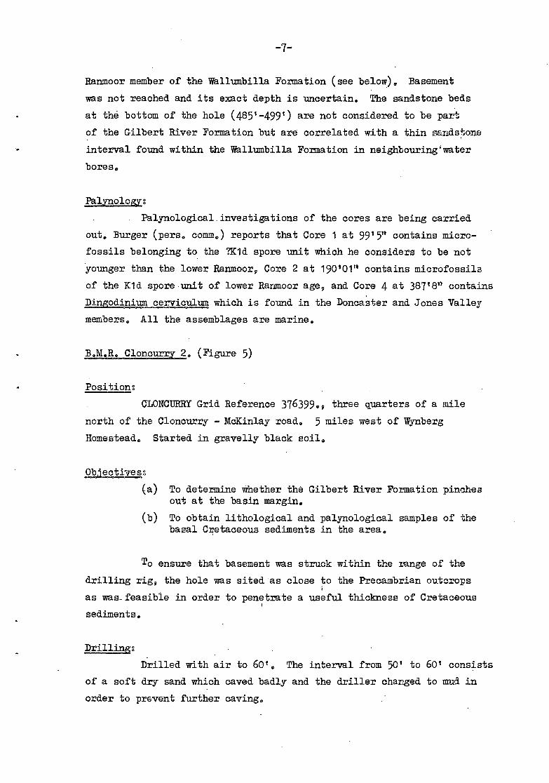
B.M.R. Cloncurry 2. (Figure 5)
Positions
CLONCURRY Grid Reference 376399., three quarters of a mile
north of the Cloncurry - McKinlay road. 5 miles west of Wynberg
Homestead. Started in gravelly black soil.
Objectivess
(a) To determine whether the Gilbert River Formation pinchesout at the basin margin.
(b) To obtain lithological and palynological samples of thebasal Cretaceous sediments in the area.
To ensure that basement was struck within the mange of the
drilling rig, the hole was sited as close to the Precambrian outcrops
as was_feasible in order to penetrate a useful thickness of Cretaceous
sediments.
Drillings
Drilled with air to 60'. The interval from 50' to 60' consists
of a soft dry sand which caved badly and the driller changed to mud in
order to prevent further caving.

0—
Gravelly black soil
Red,yel/ow and brown sandy cloy
Brown medium quartzose sand and-pebbles,2'of gravel at topGreen-brown mudstone and micaceousclay, thin seams of hard while limestoneCORE I 50'--60' recovered3'of hard green quartzose sandstone ontop of soft white medium sandHard mudstone and sandstone 60'- 65'
Soft fine quartzose sandstone
Blue-grey muds/one with lenses ofmedium-fine plauconitic quartzose sandstoneCORE 2 90-100' recovered 99
Grey muds-tone
Grey muds tone with minor sands/one
CORE 3 /30=-132'6" recovered 12"Weathered green chlontic volcanic rockwith quartz veins
100 —
(4)
Fig 5^B.M.R CLONCURRY 2
To accompany Record 1970/38 F 54/A 2/25

-8-
Results:
0-29' Cainozoic sediments: red, brown and yellow sandy
clay and brown sand and gravel.
29 1 -125' Wallumbilla Formation:
29'-48', 19' of weathered green - brown micaceous mud-
stone with thin seams of hard white limestone.
48°-85, 37' of soft, white, fine to medium grained
quartzose sandstone with minor beds of harder mudstone.
85-100', 15' of grey mudstone with bands of glauconitic
quartzose sandstone. Microfossils recovered from Core '2 at 96' are of
spore unit Kl .b-c and 111a0inium cerviculum dinoflagellate zonegenerally found in.the lower half of the Wallumbilla Formation
(Doncaster Member) (Burger, pers. comm.).
100-125', 25'. of grey mudstone with minor sandstone.
125'-140' Precambrian: weathered volcanic rock, with quartz
veins.
No water was struck in the bore. The 37 of quartzose
sandstone is assumed t be within the Wallumbilla Formation as there
is a 40' sequence consisting mainly of mudstone below it. The Gilbert
River Formation appears to be absent and must therefore pinch out to
the east of the stratigraphic hole.
B.M.R. Richmond 30 (Figure 6)
Position:
RICHMOND Grid Reference 679458, 6 miles southeast of Coal-
brook Homestead, beside the Richmond - Stawellton road, Started in
-weathered Wallumbilla Formation
2.1212211mE:(a) To obtain palynological samples for age determination
of the sandstone sequence below the WallumbillaFormation.
(b) To correlate the subsurface sequence with the unitsoutcropping to the north.

c: o
o E .... o
LL
E .Q
E .;!
o 3
c: o
o E .... o
LL
.... a> > Ir
-.... a> .Q
c: o .--o E .... o
LL
o -.J
a> c: o -"' "U c: o
(J)
"U o a> -"' a. E o
I
0- ----
100-
200-
300-
400-
500-
-:-.'~ .. - -. .--o-._'~
.~''::'';'..::s., . .::
.. . - .. '. ,"
. '". -,.:::".
to::'::i.:}; · ;:>{~.;.: .. :: :
..... · .. . ' ... ".',
.... : .... · .". ' .. '
: .... ~"":"'";
Grey-brown weathered mudstone with gypsum crystals
Blue- grey mudstone
Interbedded blue -grey mudstone and light grey fine quartzose sands tone
{
CORE I 90'-100' recovered 9' 0"
Ligh! grey medium to very fine quartzose sandstone, glauconde at the top
Shale band Sandstone as above
{
CORE 2 140'-150' recovered 9'6" Medium - very coarse sandstone with bands of conglomerate Fine quartzose sandstone and shale 2' conglomerate band Medium sandstone and shale
{
Medium -coorse, ond very coarse sondstone with seams of dork shole, cool and siltstone; the sandstone is cross bedded in ports CORE 3 190'- 199'6" recovered 10'2"
White clayey quartzose sandstone with minor shale
{
CORE 4 240'- 255' recovered 5'7" Finely interbedded while fine sandstone and light grey micaceous siltstone
Fine -medium-coarse sandstone with minor shale
{
Fine and very fine grained sandstone
with micaceous partings
CORE5 290'-296' recovered 5'6"
Sandstone with shale and mudstone
Sandstone with minor shale
{CORE 6 340'-350' recovered Medium sandstone with bonds of shale
9'7"
Medium (minor fine and coarse groined) sandstone with bands 0 f s h a Ie
390'-391'
{
CORE 7 Medium -coarse sandstone and siltstone Fine sandstone Band of grit Fine sandstone
recovered 6'9" with minor shale
{
CORE 8 430'- 440' recovered 9' 9" Interbedded medium sandstone and grey brown mudstone
Medium sandstone
Coarse sandstone
{
CORE 9 490'- 499' recovered 8'6" Medium - coarse sandstone and beds of mudstone
Fig.G. B.M.R. RICHMOND 3
To accompany Record 1970/38 F54/A4/5

-9-
The hole was sited to obtain sufficient Wallumbilla cover
to enstre that the top of the sandstone was unweathered and therefore
suitable for palynological sampling.
• Drilled with air to 380°. Water was first struck. at 140'
and the supply increased with depth. The air compressor was unable
to lift the water below 380' and the remainder of the hole was
drilled with mud. It was necessary to thicken the mud periodically
owing to dilution from aquifers.
Resultos
0'-83' Wallumbilla Formation: the upper.50' consists of
grey-brown weathered mudstone with gypsum crystals. The remainder
is composed of fresh blue-grey mudstone.
83 1 -200' Gilbert. River Formation: 117' of light grey,• -
coarse to medium, and fine quar#ose sandstone with polymict conglom-
erate beds, and minor shale and coal beds. Crossbeds are present in
one core. The uppermost 10 is interbedded with dark grey mudstone
and contains minor glauconite. It is probably transitional with
the overlying WallumbillaTormation. Palynological investigations
suggest that the age of this upper part of the formation falls into
the upper Kla and the Klb spore. units, and indicate a marine. enviuon-
ment of deposition (Burger pers. conlm,). No palynological data is
available for the rest of the Formation.
2007390° Loth Formation (Smart et al., in prep.; . Unit
Jb of Vine, 1966): 190 1 of grey and white fine to medium and minor
coarse-grained ouartzose sandstone, finely interbedded with light
grey micaceous siltstone and whale. Palynological determinations
at 240' and 347' - show the formation is in the upper J5-6 spora unit.
390'7500° Hampstead Sandstone (Smart et al., in prep.; .
.Unit Ja of Vine, 1966):. 110-0 of grey, medium to coarse, and fine
grained sandstone, grit, and interbedded grey-brown mudstone. Micro-
fossils belonging to the J5-6 spore unit are present at 4372 (Burger
pers.,omm)

-10-
Basement was not reached, and only the upper part of the
Hampstead Sandstone was penetrated. Based on correlations with sections
to the north, basement is probably at a depth of 750° or greater.
The water. supply. (using air lift by. the rig's compressor)
was estimated at 360 gallons per hour at 215!, 420 g.p.h. at 240',
510 g.p.h. at 340', and 1,300 g.p.h. at 348'. No estimates of supplies
were.made below 380' as mud was used for drilling this section of the
hole.
REFERENCES
SMART, J., INGRAM, J.A., DOUTCH, H.F., and GRIMM, K.G., (in prep.) -
Recent mapping,in the Carpentaria Basin -.new strat-
igraphic names, to appear in Qld Govt Min, J.
VINE, ROIL, 1966 - Recent geological mapping in the northern Eromanga
Basin, Queensland. APEX J. 1966, 110-115;