Embed Size (px)
Citation preview

SYLVAN LAKE INTERMUNICIPAL DEVELOPMENT PLAN ADOPTED: FEBRUARY 11, 2021

LACOMBE ,.-- COUNTY ~
Red Deer County
l! Sylvan Lake

1.0 Introduction........................................................................................................................................1
2.0 Plan Vision and Strategic Guidance.................................................................................................9
3.0 Policy Context and Interpretation..................................................................................................17
4.0 Plan Area............................................................................................................................................21
5.0 Land Use.............................................................................................................................................25
6.0 Environment.......................................................................................................................................33
7.0 Recreation.........................................................................................................................................39
8.0 Infrastructure....................................................................................................................................45
9.0 Shared Municipal Services...............................................................................................................49
10.0 Collaboration and Plan Administration..........................................................................................53
11.0 Implementation.................................................................................................................................6365
Appendix A – Definitions and Acronyms......................................................................................................67
Table of Contents


1.0 Introduction

Sylvan Lake Intermunicipal Development PlanPage 2
Message from the Steering Committee The vision of an Intermunicipal Development Plan for the eight municipalities surrounding Sylvan Lake has been decades in the making. Over the years, we have worked together on many initiatives including water quality and cumulative effects research; a boat launch strategy, and continuously building relationships with one another. The Sylvan Lake Intermunicipal Development Plan is another collaborative effort that we can celebrate together. It will act as a guide for the future.
The Sylvan Lake Intermunicipal Development Plan represents a collective view of the Plan Area, agreement to protecting the environment and balanced development, and maintain a high quality of life for residents. It is a commitment between our municipalities to set consistent development standards that support the future viability of the environment and each community.
The Partner Municipalities respectfully acknowledge that we are situated on Treaty 6 territory, the traditional lands of First Nations and Métis people.
We value the lands that make up our communities; place great importance on being good neighbours; and honour the diversity of our communities. We are not all the same, and through this Sylvan Lake Intermunicipal Development Plan we share best practices and lesson learned through the years. This plan is a milestone on the path. One that we celebrate for its commitments, and will actively use in our relationships going forward.
Steering CommitteeTown of Sylvan Lake - Sean McIntyre, Chair
Red Deer County - Christine Moore, Vice Chair
Lacombe County - Keith Stephenson
Summer Village of Birchcliff - Roger Dufresne
Summer Village of Jarvis Bay - Annabelle Wiseman
Summer Village of Half Moon Bay - Mike Pashak
Summer Village of Norglenwold - Jeff Ludwig
Summer Village of Sunbreaker Cove - Jim Willmon
Technical CommitteeLacombe County - Tim Timmons
Lacombe County - Dale Freitag
Lacombe County - Cajun Paradis
Red Deer County - Curtis Herzberg
Red Deer County - Ron Barr
Summer Village Administration - Tanner Evans
Town of Sylvan Lake - Wally Ferris
Town of Sylvan Lake - Ken Kalirai
Acknowledgments

Page 3Sylvan Lake Intermunicipal Development Plan
1.0 Introduction
1.1 BACKGROUNDThe Sylvan Lake Intermunicipal Development Plan is a collaborative effort of eight municipalities surrounding Sylvan Lake in Central Alberta. The purpose of the Sylvan Lake Intermunicipal Development Plan is to collectively protect the environment and watersheds, enable appropriate development, and support the diversity of municipalities in the Plan Area. The Sylvan Lake Intermunicipal Development Plan meets and / or exceeds the legislative requirements in the Municipal Government Act and includes a framework for on-going collaboration.
The eight municipalities have worked together for decades on issues related to Sylvan Lake. As early as 1986, the eight municipalities adopted by resolution the Sylvan Lake Management Plan which laid out expectations for responsible land use and development around Sylvan Lake, and was updated in 2000, but is not a statutory plan. Subsequent work included the Sylvan Lake Water Quality Assessment and Watershed Management Considerations, 2005; Cumulative Effects Management Plan, Phase 1, 2013 and Phase 2, 2015); and Sylvan Lake Boat Launch Access Strategy, 2016. The eight municipalities continue to participate in the Sylvan Lake Management Committee, which is an advisory committee to the municipal councils, with the purpose of “working together as urban and rural neighbours to maintain the Sylvan Lake Watershed as a pristine lake and watershed”, and to implement the Sylvan Lake Management Plan and other studies undertaken by the Committee.
The intent of the Sylvan Lake Intermunicipal Development Plan is to meet the requirements of the Municipal Government Act, and to replace the Sylvan Lake Management Plan. The original intent of the Sylvan Lake Management Plan was to create
an Intermunicipal Development Plan, but that was not realized at the time. The Intermunicipal Development Plan is a formal, statutory plan and is focused on land-based decisions in the Plan Area (broader than the Sylvan Lake watershed). The Sylvan Lake Intermunicipal Development Plan is focused on setting clear expectations and agreements as to:
• How development will proceed in the Plan Area;
• How the environment will be protected;
• What support services including recreation, infrastructure and programming will be required to accommodate the development; and
• How the Partner Municipalities will continue to work together in the future.
The Sylvan Lake Intermunicipal Development Plan has a twenty-year timeframe and reflects currently expected development conditions around Sylvan Lake. It is a living document that will be updated and adjusted over time to continuously be relevant and reflective of the Plan Area.
The Partner Municipalities involved in the Sylvan Lake Intermunicipal Development Plan include:
• Lacombe County
• Red Deer County
• Summer Village of Birchcliff
• Summer Village of Half Moon Bay
• Summer Village of Jarvis Bay
• Summer Village of Norglenwold
• Summer Village of Sunbreaker Cove
• Town of Sylvan Lake
Sylvan Lake Intermunicipal Development PlanPage 4
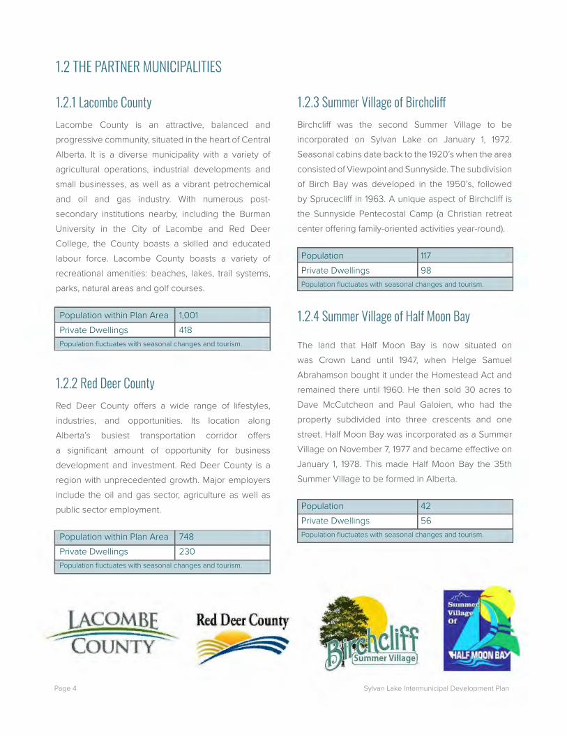
1.2.3 Summer Village of BirchcliffBirchcliff was the second Summer Village to be incorporated on Sylvan Lake on January 1, 1972. Seasonal cabins date back to the 1920’s when the area consisted of Viewpoint and Sunnyside. The subdivision of Birch Bay was developed in the 1950’s, followed by Sprucecliff in 1963. A unique aspect of Birchcliff is the Sunnyside Pentecostal Camp (a Christian retreat center offering family-oriented activities year-round).
Population 117Private Dwellings 98Population fluctuates with seasonal changes and tourism.
1.2.4 Summer Village of Half Moon Bay
The land that Half Moon Bay is now situated on was Crown Land until 1947, when Helge Samuel Abrahamson bought it under the Homestead Act and remained there until 1960. He then sold 30 acres to Dave McCutcheon and Paul Galoien, who had the property subdivided into three crescents and one street. Half Moon Bay was incorporated as a Summer Village on November 7, 1977 and became effective on January 1, 1978. This made Half Moon Bay the 35th Summer Village to be formed in Alberta.
Population 42Private Dwellings 56Population fluctuates with seasonal changes and tourism.
1.2 THE PARTNER MUNICIPALITIES
1.2.1 Lacombe CountyLacombe County is an attractive, balanced and progressive community, situated in the heart of Central Alberta. It is a diverse municipality with a variety of agricultural operations, industrial developments and small businesses, as well as a vibrant petrochemical and oil and gas industry. With numerous post-secondary institutions nearby, including the Burman University in the City of Lacombe and Red Deer College, the County boasts a skilled and educated labour force. Lacombe County boasts a variety of recreational amenities: beaches, lakes, trail systems, parks, natural areas and golf courses.
Population within Plan Area 1,001Private Dwellings 418Population fluctuates with seasonal changes and tourism.
1.2.2 Red Deer CountyRed Deer County offers a wide range of lifestyles, industries, and opportunities. Its location along Alberta’s busiest transportation corridor offers a significant amount of opportunity for business development and investment. Red Deer County is a region with unprecedented growth. Major employers include the oil and gas sector, agriculture as well as public sector employment.
Population within Plan Area 748Private Dwellings 230Population fluctuates with seasonal changes and tourism.

Page 5Sylvan Lake Intermunicipal Development Plan
1.2.5 Summer Village of Jarvis BayThe Summer Village of Jarvis Bay was incorporated on January 1, 1986. Jarvis Bay is a seasonal residential community. Recent years have shown an increase in new residential lots, redevelopment of properties as well as the introduction of municipal services. Jarvis Bay is a residential community that seeks to maintain the quality of life they currently enjoy, for seasonal and permanent residents alike. Its attraction is the recreational and open space atmosphere with basic amenities.
Population 213Private Dwellings 136Population fluctuates with seasonal changes and tourism.
1.2.6 Summer Village of NorglenwoldNorglenwold was the first Summer Village to be created on Sylvan Lake, formed in 1965. Originally the community was very linear developing along the lake from East (Northey Point) to West (Lyle Landing). More recently Sylvan Harbour Estates was developed adjacent to the Town of Sylvan Lake’s Marina Bay estates and the area known as “Last Chance Way” was annexed west of Lyle Landing in 1973. Seasonal cabins date back to the 1920’s and 1930’s. The name Norglenwold was derived from three or four early subdivisions: Nor (Northey Point), Glen (Glen-Innes) and Wold (Whitewold Beach).
Population 273Private Dwellings 211Population fluctuates with seasonal changes and tourism.
1.2.7 Summer Village of Sunbreaker CoveThe name Sunbreaker Cove comes from combining Sunhaven, The Breakers and Glenn’s Cove. Glenn’s Cove was named for an old farmstead that originally was in the vicinity of the present-day village.
Population 81Private Dwellings 240Population fluctuates with seasonal changes and tourism.
1.2.8 Town of Sylvan LakeSylvan Lake is a vibrant lakeside community with a high quality of living that respects the environment, provides diverse economic opportunities, and values efficient, inclusive, and transparent government. Key industry sectors for the Town include tourism, professional scientific technical services, manufacturing, and oil and gas. Sylvan Lakers are very proud of their community, and enjoy access to recreational activities that are unique to a lakeside community.
Population 14,816Private Dwellings 6,567Population fluctuates with seasonal changes and tourism.
*Population and dwelling units data based on:• Existing population from 2016 Census data and
current municipal data for Lacombe County and Red Deer County.
1
- ' JARviSBAY ~_5"qf1~nwold L
Sylvan Lake

Sylvan Lake Intermunicipal Development PlanPage 6
1.3 INTERMUNICIPAL DEVELOPMENT PLAN PROCESSA collaborative approach to creating the Sylvan Lake Intermunicipal Development Plan has been fundamental through all stages. It was initiated by the Partner Municipalities establishing a Steering Committee and identifying the need for an Intermunicipal Development Plan to be adopted by all eight municipalities (Figure 1).
Phase 1: Understanding the Issues
As the project was launched, a project chartering process was undertaken to ensure all members of the Steering Committee and Technical Committee were involved in determining the vision, objectives, scope, outcomes and measures of success, decision-making, communications, engagement strategy and risks and mitigations.
Once the Steering Committee and Technical Committee had confirmed the project charter, scope and plan boundary, background research was undertaken to enable the Sylvan Lake Intermunicipal Development Plan to build on the tremendous work completed in the Plan Area over the years. The background research involved review of over 25 policy or technical documents and resulted in a Background Report outlining key opportunities and constraints.
Engagement was critical in understanding what is most important to the public about development in the Plan Area. Several engagement options were provided including a public open house, online survey and mapping, and stakeholder meetings. Past engagement efforts by the municipalities have indicated that a variety of engagement opportunities is useful, and that online options are some of the most utilized.
Phase 2: Draft Sylvan Lake Intermunicipal
Development Plan
Development of the draft Sylvan Lake Intermunicipal Development Plan was accomplished in a staged approach whereby the background key findings were used to focus the discussion around potential policy for land use, growth, environmental considerations, recreation, transportation, municipal infrastructure, services and facilities, and plan administration. Research was undertaken on how each of these key topics are dealt with by the eight Partner Municipalities, as well as across Alberta with best practices identified. The Technical Committee developed options for consideration by the Steering Committee who provided direction for the creation of draft policy.
The draft Sylvan Lake Intermunicipal Development Plan was prepared based on the Steering Committee’s direction and was subsequently reviewed by the Steering Committee and all administrations for comments.

Page 7Sylvan Lake Intermunicipal Development Plan
Figure 1: Project Process
Phase 3:Finalization
This last project stage was to finalize the Sylvan Lake Intermunicipal Development Plan. Phase 3 involved hosting a Council Education session where all council members of the eight municipalities were invited to attend an information session that provided detailed background on the draft plan. The purpose of this Council Education Session was to equip council members with the appropriate information so that they could speak with members of the public as the second round of engagement unfolded.
Engagement was important to understand if the draft Sylvan Lake Intermunicipal Development Plan addressed the public’s priorities. Outreach and engagement efforts including providing the draft
Sylvan Lake Intermunicipal Development Plan to the public and stakeholders through communications and an updated website, hosting a public open house and online survey. The feedback gathered from the public open house and public survey was used to update the draft plan.
The Technical Committee made recommendations for plan updates and completed the implementation matrix. The Sylvan Lake Intermunicipal Development Plan was prepared based on the Steering Committee’s direction, and the statutory approvals process was undertaken.
PHASE1
UNDERSTANDING THE ISSUES
October 2018 -January 2019
- Project Chartering and Collaborative Decision
Making
- Public and Stakeholder Consultation
- Background Information Review
- Identification of Plan Boundary
PHASE 2
DRAFT SYLVAN LAKE INTERMUNICIPAL
DEVELOPMENT PLAN
February 2019 -September 2019
- Identification of Longterm Growth Areas and Land Uses
- Provision of Transportation Systems
Progrnmming of Municipal lnfrastructuie
- Coordination of Recreation Services
- Coordinat ion of Environmental Issues
Identification of Joint Development Proposal
Review
- Prov1s1on of lntermunic1pal Services and Facilities
PHASE 3
FINALIZATION
October 2019 -April 2021
- Council Education Session
- Draft lntermunicipal Development Plan
Circulation and Open House
- Implementation Plan
- Public Hearing
- Council Readings

Sylvan Lake Intermunicipal Development PlanPage 8

Page 9Sylvan Lake Intermunicipal Development Plan
2.0 Plan Vision and Strategic Guidance

Sylvan Lake Intermunicipal Development PlanPage 10
The Sylvan Lake Intermunicipal Development Plan is an important opportunity to confirm the shared vision for the Plan Area and harmonize development expectations. Centred around Sylvan Lake, this Sylvan Lake Intermunicipal Development Plan will guide future growth and development with the intent of protecting the unique environmental and cultural characteristics.
The Partner Municipalities already work in collaborative relationships to protect the greater good for the area through committees, plans and specific service delivery arrangements including emergency management plans; joint recreation facilities management; and a jointly operated boat launch. The Sylvan Lake Intermunicipal Development Plan builds on these relationships and provides a clear focus on the integrity and stewardship of the watershed that will guide the next 20 years for this area. As a living document, it will continue to reflect ongoing needs for the Plan Area.
2.1 VISIONTo create a fair, equitable and transparent Intermunicipal Development Plan that protects the environmental assets, ensures development supports the region, and honours the diversity and uniqueness of the five summer villages, two counties and one town.
2.2 SHARED VALUESThe Sylvan Lake Intermunicipal Development Plan has been developed based on the following shared values, which have been used to craft the priorities and policies:
• Collaboration and strengthening of relationships towards shared goals;
• Maintaining a high quality of life for residents;
• Protecting the environmental and watershed; features, and recognizing interdependency in these efforts;
• Respecting the autonomy of each municipality’s decision-making;
• Sustainability - for some municipalities it is about sustainable growth, for others sustainability of the current form;
• Efficiency through shared services;
• Agricultural viability; and
• Respective economic development for each partner.
2.0 Plan Vision and Strategic Guide

Page 11Sylvan Lake Intermunicipal Development Plan
2.3 KEY OBJECTIVES• Developing agreement on a common vision.
• Creating an Intermunicipal Development Plan that meets the requirements of the Municipal Government Act and specifically addresses:
ó Balancing future development with environmental objectives;
ó Environmental issues and considerations in the Plan Area;
ó Collaborative processes including proactive community involvement and appropriate dispute resolution;
ó Implementation of the plan considered from the outset; and
ó Provides background on decisions along the way so that tomorrow’s decision makers understand the rationale and how to apply it.
• Focusing the Sylvan Lake Intermunicipal Development Plan on high-level planning policy that doesn’t diminish the authority of existing lower level policy and regulatory responsibilities.
2.4 PROJECT SCOPEFoundational to the Sylvan Lake Intermunicipal Development Plan was the agreement at the beginning of the project on scope. The Partner Municipalities are committed to Sylvan Lake and set out to create a plan that would protect the lake, environmental and watershed features, among the other shared values, within the municipalities’ authority to implement. An Intermunicipal Development Plan can address land-based policies that protect the watershed. Therefore, the Steering Committee agreed that the following items form the basis for the plan:
• Defining an appropriate plan boundary;
• Building on the partners’ approved statutory and regulatory plans as a foundation for all aspects of the plan;
• Identifying development patterns;
• Creating policy for environmental health within the Plan Area; shared infrastructure services, including regional wastewater line; lake access; and recreation services;
• Focusing the plan on creating harmonized development standards; and
• Developing agreed upon next steps through the plan’s implementation, communications, and appropriate dispute resolution policies.
The Sylvan Lake Intermunicipal Development Plan is not:
• A plan for the waterbody of Sylvan Lake itself – lake management does not fall within the munici-palities’ jurisdiction;
• An annexation or amalgamation process;
• A plan that includes specific financing agreements – Intermunicipal Collaboration Frameworks will address finance where appropriate; or
• A plan that considers agricultural management - management practices fall under largely provincial legislation and as such the municipalities will focus only on land use aspects related to agriculture.

Sylvan Lake Intermunicipal Development PlanPage 12
Figure 2: Public Engagement
2.5 PUBLIC ENGAGEMENT AND KEY FINDINGSPublic and stakeholder engagement was completed during Phase 1 and Phase 3 of the Sylvan Lake Intermunicipal Development Plan process to help understand the priorities of people who live, work, and recreate in the area (Figure 2). Engagement activities for the first phase, prior to drafting the Sylvan Lake Intermunicipal Development Plan, were completed in November and December of 2018. Phase 3 engagement was completed in November and December of 2019.
Public Survey:
Phase 1: 61 responses
Phase 3: 103 responses
Public Open House
Phase 1: 59 Participants
Phase 3: 90 Participants
Online Interactive Mapping
Phase 1: 27 ResponsesStakeholder Meeting / Interviews
Phase 1: 11 Participants

Page 13Sylvan Lake Intermunicipal Development Plan
Figure 3: Phase 1 Public Feedback on Environment and Watershed
Phase 1
Phase 1 engagement provided the Steering Committee with a better understanding of what is most important to the public and development in the Plan Area. Several engagement options were provided including a public open house, online survey and mapping, and a stakeholder meeting and interviews (Figure 2). Feedback on the vision and focus areas helped guide the development of the draft Sylvan Lake Intermunicipal Development Plan. Discussions and feedback received was based on existing statutory and regulatory plans; development and growth patterns; environmental health; shared infrastructure services; and transportation.
In Phase 1, respondents were asked about their top priorities for the plan. The feedback (Figure 3) demonstrated a strong interest in protecting the environment and watershed, followed by developing more recreation amenities.
80 % r====-=-=-=-=-=-:::--r--=--=--=--=--=--=--=--=--=--=--=--=--=--=--=--=--=--=--=--=-=-= 70% t 60% ,-------
50% +-----40% +-----30% +-----20%
10%
0%
b" , 'Ii<:'
... .,,,,0
1$' 0◊ 0
,'If <:-' ~e ·0" i,:-""
.;,.~ ?y -~' "' "
,};;' .s,"' ~0 ~ 0
.s,' 'Ii w ,-.o~ ◊~ 0"'
1::--s
.,"' ,.0 1:-0 ~e
o~<f o<:' <ffe .. . o"
❖" l~ ~ ,,fl' 0" b0
• <:-0, r:}0 <:-'- 'Ii&
-~ v
,e ~e ~ -~ ·o"
,__0'li
-~o, , "/>0 1"' ~ <~
1:- ~' {"e ~ 0 o-s' <JS &0 ,s,
~,o :10
~ 'Ii .. ,,..,<f ,0 "o~
"'0 ~,<:-°' ~'Ii -~o, 0"
,.o~ ,s,0 ,,:, • <:-0,
,.e ,.,,.o, .~fl:f ~' -~o,
,f <,_'lio
0'/j 0 ..
~-$,"
,:,< ,f ,,:, ,~ ~

Sylvan Lake Intermunicipal Development PlanPage 14
In the Phase 3 engagement, the trend of protecting environment remained one of the highest themes with support from 14% of comments who identified protecting the environment, water quality and wildlife as important. Many respondents noted the positive impact a formalized boat launch would have on the overall lake health and that closing informal launches would need to occur. There were also comments received related to issues that are not within an Intermunicipal Development Plan’s scope including: concern about invasive species entering the waterways when launching boats into the water and desire for a new controlled boat launch to protect the lake.
2.5.2 TrailsIn Phase 1, trails were identified as an important recreation feature for the area. Results from the public survey show that nearly 65% of respondents support the development of a regional trail around the lake. Attendees at the open house also listed trail development as the top area of focus for the plan. Trails were not a highly commented on aspect of the draft Sylvan Lake Intermunicipal Development Plan with 6% of comments speaking to the trail, and a split in responses (3% for the trail, and 3% against it).
The engagement outcome from Phase 1 aligns with the direction from several existing planning documents. Some opposition to a regional trail has been heard during engagement, with people noting that they do not want increased traffic through their communities, and the lack of room available for a future shoreline trail in some locations. However, the number of supportive comments for a trail is significantly greater than the comments that are not supportive of trails.
Phase 3
Phase 3 engagement included a public open house and public survey (Figure 2) to present and request feedback on the final draft Sylvan Lake Intermunicipal Development Plan. The feedback was used to identify any discrepancies, and refine policies to better reflect the public’s perspectives.
In Phase 3, the overarching main themes, in order of most number of mentions to the survey’s main open ended question, are included in Table 1.
Phase 3 Key Themes Number of Mentions
Support formalized boat launch with desire for a short timeline
24
Lack of support for 30-metre setback on vacant and existing lots
22
Concerns about higher density 19
Support closing informal boat launches / road allowances
18
Protect the environment 17
Table 1: Phase 3 Key Themes
2.5.1 Protection of Environment and WatershedThroughout engagement, the consistent underlying theme has been around the protection of environmental features in the area. The public survey in Phase 1 ranked “protecting the environment and watershed” as the top priority for the Plan Area, with support from over 73% of respondents. Both the stakeholder meeting and public open house also showed significant support for protection of the environment.

Page 15Sylvan Lake Intermunicipal Development Plan
In Phase 3, overall support for the recreation policies was high. Some comments identified concerns with a future trail that should be noted for future reference: environmental impacts of the trail; consideration for which of the Partner Municipalities would be responsible for maintaining the trail; and impacts of the trail on adjacent neighbours.
2.5.3 Motorized Lake AccessThroughout all engagement activities, providing increased boat access to the lake has come up as a consistent theme. Public survey respondents in Phase 1 showed more support for increased non-motorized lake access (45% of respondents supported) than for increased motorized access, which was supported by only 30% of respondents. In Phase 3, the trends remain the same where approximately 12% of comments stressed the importance of developing a formalized boat launch within the Plan Area.
Throughout the engagement, the notion of increased lake access has also come with suggestions to close informal lake accesses and to use formal lake access points as places to regulate lake activities.
2.5.4 Balanced DevelopmentParticipants highlighted the fact that there are distinct communities and development patterns in the area. Based on Phase 1 engagement responses, participants desire the majority of future development to occur within the Town and other currently identified development areas, such as the higher-density nodes indicated in the Sylvan Lake Area Structure Plan (2017) in Lacombe County.
During Phase 3, 10% of comments did not support the Residential policies. Largely the comments are focused on lack of support for higher density near the Summer Villages, or the lake, but with particular emphasis on the lands identified by the Sylvan Lake/Red Deer County Intermunicipal Development Plan. However, the Partner Municipalities agreed to support existing statutory land use plans as a foundational element of the Sylvan Lake Intermunicipal Development Plan.
Overall, there is sentiment that the character of existing communities should be maintained, and that maintaining the general peaceful and quiet nature of the less urbanized parts of the area is important. This includes a general desire to focus commercial development within the Town. Additionally, there has been a consistent theme around balancing development with environmental protection, which is identified as a priority in many of the background plans.
2.5.5 Development SetbacksIn Phase 3, approximately 10% of the comments indicated that the originally proposed 30-metre setback requirements for properties that are already subdivided but are currently vacant were excessive and would render properties undevelopable. This feedback resulted in a change to the setback policies for vacant parcels.

Sylvan Lake Intermunicipal Development PlanPage 16
~ ' - -- .. - .. -;a-- ~ I -- ~

Page 17Sylvan Lake Intermunicipal Development Plan
3.0 Policy Context and Interpretation

Sylvan Lake Intermunicipal Development PlanPage 18
3.1 STATUTORY CONTEXT The Municipal Government Act provides the legislative framework for all Intermunicipal Development Plans in Alberta. The Sylvan Lake Intermunicipal Development Plan complies with the following requirements as stated in the Municipal Government Act (s. 631(8)):
a. Identifying future land uses for the Plan Area;
b. Address environmental matters through a focus on the Sylvan Lake watershed and environmentally significant areas within the Plan Area;
c. Facilitate intermunicipal communication and coordination of planning and development within the Plan Area based on the shared values and policies;
d. Address transportation systems;
e. Address municipal infrastructure requirements and coordination between the partnering municipalities;
f. Collaborate on relevant intermunicipal programs relating to the physical, social and economic development of the Plan Area;
g. Establish direction for joint collaboration on issues beyond the municipal jurisdiction; and
h. Provide administrative provisions for dispute resolution, amendments and repeals.
Furthermore, the Municipal Government Act also requires Intermunicipal Development Plans to be consistent with any approved Regional Plans. The Sylvan Lake Intermunicipal Development Plan is located within the Red Deer Regional Plan area, which
is not yet complete. When the Red Deer Regional Plan has been completed, the Sylvan Lake Intermunicipal Development Plan will be reviewed to ensure consistency. Where any policy conflicts exist, the Sylvan Lake Intermunicipal Development Plan shall be amended.
3.2 RELATIONSHIP OF THE INTERMUNICIPAL DEVELOPMENT PLAN TO OTHER PLANS The Sylvan Lake Intermunicipal Development Plan is a high-level planning document that guides future growth and development. It has been developed based on growth and development needs over the next 20 years including supporting infrastructure and services, as well as environmental sustainability of the watershed. The policies of the Sylvan Lake Intermunicipal Development Plan enable sustainable growth in the Plan Area over the same time horizon.
The Municipal Government Act identifies an Intermunicipal Development Plan as the highest order of municipal statutory plans (Figure 4). As such, all other municipal plans affecting lands within the Sylvan Lake Intermunicipal Development Plan shall be consistent with the policy direction contained herein. The Sylvan Lake Intermunicipal Development Plan has been created to support existing statutory plans (i.e., Municipal Development Plans, Area Structure Plans, and Area Redevelopment Plans) in the study area, and contains reference to these plans where they act as the appropriate level of policy. Future Municipal Development Plans and related Area Structure/Redevelopment Plans will follow the Sylvan Lake Intermunicipal Development Plan policy and provide greater detail policies to implement the vision.
3.0 Policy Context and Interpretation

Page 19Sylvan Lake Intermunicipal Development Plan
The Town of Sylvan Lake and Red Deer County also have a pre-existing Intermunicipal Development Plan within the Plan Area, the Town of Sylvan Lake / Red Deer County Intermunicipal Development Plan (2011). As both plans are of the same statutory order, the policies contained herein shall reflect and support the policies of the Town of Sylvan Lake / Red Deer County Intermunicipal Development Plan (2011), but shall not supersede them. The Sylvan Lake Intermunicipal
Figure 4: Plan Hierarchy
Development Plan focuses eight municipalities on setting consistent standards for development, recreation, and environmental management. The Sylvan Lake / Red Deer County Intermunicipal Development Plan (2011) primarily manages growth around the Town of Sylvan Lake. Where there is overlap between the two plans, the specific policies are intended to support one another, but remain separate statutory plans.
Area Str II ctn re P la 11 Area Re llevel op me nt Pl an Special Studies I
La II d Use Bylaw
Redistricting Sub divisions Development Permits

Sylvan Lake Intermunicipal Development PlanPage 20
3.3 POLICY INTERPRETATIONThe Sylvan Lake Intermunicipal Development Plan uses specific language to indicate the level of support required for each policy. The following words are to be interpreted as follows:
Shall, require, must, or will: explicitly applies to all situations without exception.
Should: always applies to the situation unless it can clearly be identified to the agreement of the Intermunicipal Development Plan Committee, Council or the Approving Authority that in the given situation, the policy is not reasonable, practical or feasible.
May: acknowledges support in principle and indicates that the Intermunicipal Development Plan Committee, Council or the Approving Authority has the discretion to determine the level of compliance that is required.
Encourage: acknowledges support in principle and indicates that the Intermunicipal Development Plan Committee, Council or the Approving Authority will promote, but not require, the implementation of a given policy.
3.4 MAPPING INTERPRETATIONThe maps contained within the Sylvan Lake Intermunicipal Development Plan are intended to provide support and aid the interpretation of the plan’s policies. Boundaries, areas shown, and locations denoted by symbols are approximate and are not intended to define exact locations. Since the maps are not absolute, and will be interpreted as conceptual, the precise location of these boundaries will need to be determined by the relevant Approving Authority at the time of evaluating any proposed development application.

Page 21Sylvan Lake Intermunicipal Development Plan
4.0 Plan Area

Sylvan Lake Intermunicipal Development PlanPage 22
4.0 Plan AreaThe Partner Municipalities all share a connection to Sylvan Lake and its value as an environmental, quality of life, tourism and financial asset. Impacts in one part of the Sylvan Lake watershed affect all municipalities. The main driver for defining the boundary for the Sylvan Lake Intermunicipal Development Plan Area (Plan Area) was to ensure all factors that would influence future development and associated municipal operations were considered. The following criteria were selected to determine the Plan Area (Map 1):
• Sylvan Lake Watershed: The watershed area is a natural delineation for environmental factors that will directly impact the lake into the future. The final Plan Area includes three watersheds: Sylvan Lake, Blindman River and Medicine River.
• Municipal Boundaries: All Partner Municipality boundaries have been included in the plan boundary along with buffers of at least one mile around each boundary. The hamlet of Benalto has been excluded from the Plan Area.
• Town of Sylvan Lake / Red Deer County Intermunicipal Development Plan (2011) Boundary: The Plan Area includes an existing Intermunicipal Development Plan between the Town of Sylvan Lake and Red Deer County. The whole of the Sylvan Lake / Red Deer County Intermunicipal Development Plan (2011) has been included in the Plan Area in order to mitigate potential challenges or inconsistencies that may occur if only a portion were included. These challenges could be related to amendments, enforcement, and public perception/understanding in the case of two separate Intermunicipal Development Plans. As the same order of plans, both plans are considered equally important and address different regional considerations. The Sylvan Lake
Intermunicipal Development Plan focuses eight municipalities on setting consistent standards for development, recreation, and environmental management. The Sylvan Lake / Red Deer County Intermunicipal Development Plan (2011) primarily manages growth around the Town of Sylvan Lake. Where there is overlap between the two plans, the specific policies are intended to support one another, but remain separate statutory plans.
• Sylvan Lake Area Structure Plan (2017) (Lacombe County): The Plan Area of the Sylvan Lake Area Structure Plan outlines the future uses and development of lands within Lacombe County’s boundaries has been included within the Plan Area.
• Transportation Network: The transportation network has been calculated to include key transportation intersections.
• Regional Wastewater Line: The routing of the wastewater line has been included in the Plan Area. The routing alignment of the wastewater line has been sourced from the Sylvan Lake Regional Wastewater Commission 2019 Business Plan.
• Soil Suitability: The Plan Area assessment included soil land suitability; however, soil suitability is consistent across the broader region and did not provide a strong indicator for boundary delineation.
4.1 OBJECTIVEa. To establish the geographical area in which the
Sylvan Lake Intermunicipal Development Plan policies apply.

Page 23Sylvan Lake Intermunicipal Development Plan
4.2 POLICIES4.2.1 The Sylvan Lake Intermunicipal Development
Plan Area (the Plan Area) encompasses all the lands as depicted on Map 2. Lands within the Plan Area boundaries are subject to the Sylvan Lake Intermunicipal Development Plan objectives and policies unless specifically exempted.
Map 1: Plan Boundary Considerations
4.2.2 All boundaries and alignments shown throughout the Sylvan Lake Intermunicipal Development Plan are conceptual in nature. Exact alignments shall be determined in later stages of planning where additional levels of detail can be utilized.
Summer Village of Sunbreaker Cove
Summer Village of Birchcli�
Summer Village of Jarvis Bay
Summer Village of Norglenwold
Town of Sylvan Lake
Summer Village of Half Moon Bay
LEGEND
Sylvan Lake ASP Area
Proposed Norglenwold Annexation Area
Sylvan Lake / Red Deer County IDP Area
Municipal Boundary
Road Network Boundary
Sylvan Lake Watershed
Existing Regional Wastewater Line
IDP Boundary
Proposed Regional Wastewater Line
County Boundary
0 1 2 3 4 Kilometers
11
20
781
11A
---
N
A

Sylvan Lake Intermunicipal Development PlanPage 24
Map 2: Sylvan Lake Intermunicipal Development Plan Boundary
0 1 2 3 4 Kilometers
LEGEND
Municipal Boundary
Proposed Norglenwold Annexation Area
County Boundary
Plan Area
Summer Village of Sunbreaker Cove
Summer Village of Birchcliff
Summer Village of Jarvis Bay
Summer Village of Norglenwold
Town of Sylvan Lake
Summer Village of Half Moon Bay
Red Deer/Lacombe County Boundary
..
N
A
-D

Page 25Sylvan Lake Intermunicipal Development Plan
5.0 Land Use

Sylvan Lake Intermunicipal Development PlanPage 26
5.0 Land UseLand uses within the Plan Area are broad, general categories that speak to the general nature of the activities that are occurring on a portion of land. These uses, or activities, identified in Map 3 are reflective of existing statutory plans and policies for each municipality. Further detail on land uses will refer to those statutory plans.
The Sylvan Lake Intermunicipal Development Plan is based on the Partner Municipality’s existing, approved statutory plans. Therefore, the land use categories reflect the long-term growth projections, and already approved growth plans for the Plan Area.
The land use categories include:
• Developed / Urban Areas which represent the land area defined by existing municipal boundaries and inclusive of all land uses commonly used within that municipality’s developed area;
• Norglenwold Annexation Area depicting the area of land subject to an annexation application;
• Agriculture representing the majority of land in the Plan Area and provides for continued agricultural activity;
• Lower Density Residential is reflective of residential growth in the form of clustered single detached dwellings;
• Residential where residential growth will occur.
In Lacombe County’s Residential areas, the nodes (i.e., circles) on Map 3 are anticipated to be a mix of new townhomes, apartments, and single detached homes, and open space as per the Lacombe County Sylvan Lake Area Structure Plan.
In Red Deer County’s Residential areas, development will be consistent with the Sylvan Lake / Red Deer County Intermunicipal Development Plan (2011) with a minimum density of 13 units per gross developable hectare if developed more intensely than first parcel out farmstead removal subdivision;
• Commercial where areas of higher intensity commercial, retail and office uses will occur; and
• Recreation for areas with significant recreation activities such as camps, provincial parks, or lake access areas.
Industrial uses are only enabled within the Town of Sylvan Lake and therefore are not depicted on Map 3.
5.1 OBJECTIVESa. To reinforce each municipality’s statutory and
regulatory plans and bylaws.
b. To respect environmental features and the watershed.
c. To maintain and support agricultural land uses.
d. To mitigate premature conversion of agricultural land uses to non-agricultural uses.
e. To enable growth and development within defined areas.
f. To provide design standards that will ensure future development is compatible with the current built form.

Page 27Sylvan Lake Intermunicipal Development Plan
Map 3: Future Land Use Map
L
L
Summer Village of Sunbreaker Cove
Summer Village of Birchcliff
Summer Village of Jarvis Bay
Summer Village of Norglenwold
Town of Sylvan Lake
Summer Village of Half Moon Bay
Red Deer/Lacombe County Boundary
LEGEND
0 1 2 3 4 Kilometers
L
LEGEND
Residential
Developed/Urban Areas Proposed Norglenwold Annexation Area
Agriculture
Lower Density Residential
CommercialRecreation
County Boundary
Potential Joint Development Area
Former Land�ll (setback 300m)
Plan Area
L
--- D -
N
A

Sylvan Lake Intermunicipal Development PlanPage 28
5.2 POLICIESAll Areas
5.2.1 All land uses shall be consistent with the areas generally shown in Map 3 and are deemed to be the future land uses unless approved through the appropriate amendment processes.
5.2.2 In addition to the policies below, the policies of each municipality’s Municipal Development Plans, Area Structure Plans, and Land Use Bylaws shall apply if they do not conflict with the Sylvan Lake Intermunicipal Development Plan policies, and / or require a higher standard than the Sylvan Lake Intermunicipal Development Plan.
5.2.3 The land uses identified in Map 3 reflect the primary use of the land. Complementary uses are enabled but subject to the respective statutory and regulatory documents of each municipality.
5.2.4 The policies in the Sylvan Lake / Red Deer County Intermunicipal Development Plan (2011) shall apply.
5.2.5 Subdivision applicants shall be required to dedicate all lands that qualify as Municipal Reserve and Environmental Reserve in accordance with the Municipal Government Act. Environmental Reserve Easements and Conservation Easements may be encouraged where the lands should not be taken as Environmental Reserve or Municipal Reserve (i.e., areas not adjacent to waterbodies, or requiring public access) at the sole discretion of each municipality’s Approving Authority.
5.2.6 The municipalities will work in collaboration with the Alberta Energy Regulator to understand and mitigate for potential impacts between the oil and gas industry and growth.
5.2.7 For all future statutory planning, redesignations and subdivisions in proximity to Highways 11, 11A and 20, the municipalities will work in collaboration with Alberta Transportation to identify any required infrastructure upgrades.
5.2.8 All new multi-lot redesignations and subdivisions shall be preceded by the approval of an Area Structure Plan by the appropriate municipality.
5.2.9 All aspects of the Subdivision and Development Regulation shall be followed including that the subdivision authority shall not approve an application for subdivision for school, hospital, food establishment or residential use within 300 metres (985 feet) of the disposal area of the non-operating landfill site within the Plan Area (s. 13(1)). Additionally, the Nuisance and General Sanitation Regulation under the Public Health Act shall be followed and requires that there be a 450 metre (1,476 feet) setback between a landfill and the location of a water well intended for human consumption. This setback also applies to a communal water system (s. 15(1)).
Page 29Sylvan Lake Intermunicipal Development Plan
Developed / Urban Areas
5.2.10 Policies for land uses within Developed / Urban Areas or developed areas shall be determined by each municipality’s respective Municipal Development Plan and / or Area Structure Plan and / or Area Redevelopment Plan, as applicable.
Proposed Norglenwold Annexation Area
5.2.11 Prior to the Summer Village of Norglenwold’s proposed annexation application being approved, the land use within the Proposed Norglenwold Annexation Area in Map 3 shall be determined by Red Deer County’s Municipal Development Plan (2012).
5.2.12 Should the proposed annexation by the Summer Village of Norglenwold be approved, these lands shall be classified as ‘Developed / Urban Areas’ and subject to those respective policies. Map 3 shall be updated to reflect this change and will be considered an administrative change not requiring a public hearing.
Agriculture
5.2.13 Agricultural land uses shown on Map 3 shall continue to be used for agricultural activities.
5.2.14 Agricultural preservation and subdivision requirements in Lacombe County and Red Deer County shall be consistent with the policies of the respective municipality’s statutory and regulatory plans and bylaws, as applicable, to avoid premature development, conversion, or fragmentation of agricultural lands.
5.2.15 When making decisions on development issues on or adjacent to agricultural lands, both affected municipalities will respect the right of agricultural operators to pursue normal activities associated with extensive agriculture without interference or restriction based on their impact on adjacent uses.
5.2.16 Non-agricultural uses may be allowed within the Agriculture Area identified in Map 3 as per the applicable municipality’s Land Use Bylaw.
5.2.17 Resource extraction projects in accordance with provincial regulations may occur in Rural Policy Area of the Sylvan Lake / Red Deer County Intermunicipal Development Plan (2011) and is subject to the respective policies of said Plan.
5.2.18 New Confined Feeding Operations shall not be permitted within the Confined Feeding Operations Overlay as shown on Map 4.
5.2.19 Agricultural land stewardship grant programs offered by Lacombe County and Red Deer County shall be encouraged for the Plan Area to promote good land management practices and reduce negative impacts on the watershed.

Sylvan Lake Intermunicipal Development PlanPage 30
Lower Density Residential
5.2.20 Residential development within Lower Density Residential areas as shown on Map 3 shall be clustered as per Section 2.5.2 of Lacombe County’s Sylvan Lake Area Structure Plan (2017) with a maximum density of 1 unit per acre (2.5 units per gross developable hectare).
5.2.21 Residential uses adjacent to agricultural areas shall incorporate transition strategies, such as increased setbacks or buffers, to reduce the impact of new residential development on existing agricultural operations. Satisfaction of this policy shall be determined by the applicable municipality’s Approving Authority in consultation with the adjacent municipality through the referral process as per Sections 10.2.17 - 10.2.24.
Residential
5.2.22 Residential development areas as shown on Map 3 shall be mixed residential forms including multi-lot or higher density forms as per Lacombe County’s Sylvan Lake Area Structure Plan (2017), or the Sylvan Lake / Red Deer County Intermunicipal Development Plan (2011), as applicable.
5.2.23 Residential development areas within Lacombe County as shown on Map 3 shall be nodes of development within a 600-metre radius (5-minute walk) from a central public access site and are subject to the policies in Section 2.5.2 of the Sylvan Lake Area Structure Plan (2017) with a maximum density of 2.0 units per acre (4.9 units per gross developable hectare).
5.2.24 Residential development areas within Red Deer County as shown on Map 3 shall be determined by the Sylvan Lake / Red Deer County Intermunicipal Development Plan (2011) which states that development that is more intense than first parcel out farmstead removal subdivision may be allowed prior to annexation and must be a minimum density of 13 units per gross developable hectare (5.3 units per acre). Additional development expectations are identified in the Sylvan Lake / Red Deer County Intermunicipal Development Plan (2011).
5.2.25 Residential uses adjacent to agricultural areas shall incorporate transition strategies, such as increased setbacks or buffers, to reduce the impact of new residential development on existing agricultural operations. Satisfaction of this policy shall be determined by the applicable municipality’s Approving Authority in consultation with the adjacent municipality through the referral process as per Sections 10.2.17 - 10.2.24.
5.2.26 Residential land uses are subject to the referral process as outlined in Sections 10.2.17 - 10.2.24 and as such appropriate boundary conditions will be considered through site design; community engagement discussions; and the intermunicipal referral process.

Page 31Sylvan Lake Intermunicipal Development Plan
Commercial
5.2.27 Commercial, retail, or office activities shall be limited to the Commercial areas as shown on Map 3 and shall be subject to the requirements of the Lacombe County’s Sylvan Lake Area Structure Plan (2017), or the Sylvan Lake / Red Deer County Intermunicipal Development Plan (2011), as applicable.
5.2.28 Non-agricultural commercial uses adjacent to agricultural areas shall incorporate transition strategies, such as increased setbacks or buffers, to reduce the impact of new commercial development on existing agricultural operations. Satisfaction of this policy shall be determined by the applicable municipality’s Approving Authority in consultation with the adjacent municipality through the referral process as per Sections 10.2.17 - 10.2.24.
5.2.29 Commercial development located along highways shall be developed to a high-quality aesthetic standard in terms of landscaping; building materiality; and building orientation.
Recreation
5.2.30 Activities occurring in Recreation areas as shown on Map 3 shall be primarily for the purposes of regionally significant public and private recreation and shall respect the long-term environmental integrity and sustainability of the watershed. These areas may require buffers or transition strategies from adjacent lands, at the discretion of the
Approving Authority.
Industrial
5.2.31 Industrial land uses shall be located within the Town of Sylvan Lake. All existing industrial land uses in the other Partner Municipalities shall be enabled as per the respective municipality’s Land Use Bylaw (see policy 5.2.2).
5.2.32 Industrial development located along highways shall be developed to a high-quality aesthetic standard in terms of landscaping; building materiality; and building orientation.
5.2.33 Industrial development located abutting residential or recreation areas shall be developed to a high-quality aesthetic standard in terms of landscaping; building materials; building orientation; and with limited outdoor nuisances.
Potential Joint Development Area
5.2.34 The Potential Joint Development Area is guided by the Sylvan Lake / Red Deer County Intermunicipal Development Plan (2011).

Sylvan Lake Intermunicipal Development PlanPage 32
Proposed Norglenwold Annexation Area
Summer Village of Sunbreaker Cove
Summer Village of Birchcli�
Summer Village of Jarvis Bay
Summer Village of Norglenwold
Town of Sylvan Lake
Summer Village of Half Moon Bay
Red Deer/Lacombe County Boundary
LEGEND
0 1 2 3 4 Kilometers
County Boundary
LEGEND
Con�ned Feeding Operations Overlay
Municipal Boundary
Plan Area
Map 4: Confined Feeding Operation Overlay
IZ2I
-D
N
A

Page 33Sylvan Lake Intermunicipal Development Plan
6.0 Environment
Sylvan Lake Intermunicipal Development PlanPage 34
6.0 EnvironmentThe Plan Area watersheds are significant assets for the Partner Municipalities and a primary component of the Sylvan Lake Intermunicipal Development Plan. All municipalities within the Plan Area are dedicated to the long-term health and sustainability of the lake and surrounding lands. The Sylvan Lake Intermunicipal Development Plan outlines policies for consistent environmental assessments for all development around the lake based on best practices in Alberta. Environmental assessments are the first step in identifying appropriate mitigation strategies that place the long-term viability of environmental features at the centre of development decisions, thereby also ensuring a high quality of life for future residents and users. The following policies reflect that dedication and provide a common method of assessment for all development throughout the Plan Area.
6.1 OBJECTIVESa. To create a unified approach to environmental
management.
b. To protect the long-term health of the watersheds and waterbodies.
c. To balance environmental protection with appropriate development.
6.2 POLICIESEnvironmental Assessments
6.2.1 A Level 1 Preliminary Natural Site Assessment (PNSA) shall be required for all redesignations in the Plan Area as per the requirements listed in 6.2.3.
6.2.2 For redesignation applications that propose only intensification of use on the subject lands of the application, the Level 1 PNSA may be required at the discretion of the Approving Authority as per the requirements listed in 6.2.3.
6.2.3 The PNSA is an initial desktop overview of baseline environmental information and identification of the potential extent of Environmentally Sensitive Areas. The PNSA shall be completed by a qualified professional and shall include, at minimum:
a. Study Area Location (in context of surrounding landscape);
b. Physiographic Description (in context of Natural Regions and Subregions of Alberta);
c. Historical Air Photos (dating to 1950, focus on surface water, wetlands, land use changes);
d. Field Reconnaissance, Sampling and Surveys (landscape characteristics species lists, plan community mapping);
e. Topography (landform classification);
f. Geology (surficial geology classification);

Page 35Sylvan Lake Intermunicipal Development Plan
g. Hydrology (wetland inventory, classification and relative value assignments). Associated map(s) required;
h. Fauna (biodiversity ‘hot spots’, species list of direct and indirect observations, critical breeding/nesting/wintering sites. Associated map(s) required;
i. Soil (characteristics/ description, restricted types, special features). Associated map(s) required; and
j. Conservation recommendations that include:
i. Environmental Reserve/Environmental Reserve Easement;
ii. Municipal Reserve; and
iii. Conservations Easement.
The first level of assessment is a Level 1 Preliminary Natural Site Assessment (PNSA) that may, in the opinion of the qualified professional and the Approving Authority, trigger a Level 2 Environmental Screening (ES), or further, a Level 3 Scoped Biophysical Impact Assessment (Scoped BIA).
Any or all of these levels of assessment may include, based on the opinion of the qualified professional completing the work and the Approving Authority, a monitoring program that addresses environmental monitoring during construction and / or following construction to ensure recovery of sensitive environmental features.
6.2.4 The requirement to proceed to a Level 2 Environmental Screening (ES) shall be determined by the recommendations of the PNSA and / or the Approving Authority. The ES identifies environmental impacts and potential mitigation strategies of a proposed development project including defined boundaries of an Environmentally Significant Area(s). If required, the ES shall include to the satisfaction of the Approving Authority the following considerations in addition to the minimum requirements in 6.2.3:
a. An outline of the rationale for the development project;
b. An exploration of alternatives that have been investigated;
c. A description of the existing environment including the biophysical and socioeconomic elements; and
d. Both short-term and long-term environmental impacts and mitigation measures.
6.2.5 The requirement for a Level 3 Scoped Biophysical Impact Assessment (Scoped BIA) shall be determined by the recommendations of the ES and / or the Approving Authority. A Scoped BIA is a detailed study and review of a development project that predicts, interprets, and evaluates impacts and mitigation measures to avoid, minimize, or compensate for said impacts. If required, the Scoped BIA shall include to the satisfaction of the Approving Authority the following considerations in addition to the minimum requirements in 6.2.3 and 6.2.4:
a. A clear assessment methodology that will lead to mitigation recommendations;
b. Surrounding land uses;

Sylvan Lake Intermunicipal Development PlanPage 36
c. Fish and wildlife;
d. Vegetation (including rare and invasive species);
e. Soils and terrain;
f. Water quantity and quality;
g. Riparian areas and wetlands;
h. Surface drainage; and
i. Aquifers.
Environmentally Significant Areas
6.2.6 For redesignation applications where an Environmentally Sensitive Area is identified, a Level 3 Scope Biophysical Impact Assessment (Scoped BIA) shall be required and shall include the components included in the Level 1 PNSA as per 6.2.3, the Level 2 ES as per 6.2.4, and the Scoped BIA as per 6.2.5. Identification of an Environmentally Sensitive Area may occur through any one or all of the following methods:
a. Provincial data and / or mapping;
b. Municipal data and / or mapping; and / or
c. Any level assessment as per 6.2.3 - 6.2.5 above.
6.2.7 The Partner Municipalities should develop a detailed map identifying Environmentally Significant Areas in the Plan Area based on the following criteria:
a. Areas that contain focal species, species groups and their habitats;
b. Areas of large intact patches of natural vegetation;
c. Areas of connecting habitat and corridors;
d. Areas important for maintaining water quality and quantity;
e. Riparian areas; and
f. Areas of significant cultural, historic, or scenic value.
6.2.7a The Partner Municipalities should develop an interim inventory of Environmentally Significant Areas in the Plan Area when appropriate datasets are available. This interim inventory will consider potential Environmentally Sensitive Areas, wildlife corridors and natural areas. The interim inventory will be constructed using the following databases:
a. Fish and Wildlife Information Management System;
b. Alberta Conservation Information Management System;
c. Agricultural Regions of Alberta Soil Inventory Database;
d. Environmentally Significant Area’s Report and Map;
e. Alberta Wild Species Status Search; and
f. Alberta Merged Wetland Inventory through Alberta’s GeoDiscover Data Authority.
Natural Areas
6.2.8 The Partnering Municipalities should develop one Natural Areas Management Plan for the whole Plan Area that outlines the management intent and direction for Environmentally Sensitive Area’s, natural areas, and wildlife corridors.

Page 37Sylvan Lake Intermunicipal Development Plan
Environmental Reserve and Development
Setbacks from Sylvan Lake
6.2.9 As a condition of subdivision approval, each Partner Municipality shall require a 30 metre Environmental Reserve dedication from the Top of Bank of Sylvan Lake, in accordance with the provisions of the Municipal Government Act. Wherever possible, Environmental Reserve should be linked with Municipal Reserve to create continuous greenways with enhanced public access.
6.2.10 As a requirement of a development permit submission for a vacant parcel or on redevelopment lands, where the development is within 30 metres of the Top of Bank or High Water Mark of Sylvan Lake, a Development Design Plan shall be submitted as part of the permit application and enforced as a condition of approval. Determining which feature (Top of Bank or the High Water Mark of Sylvan Lake) is appropriate will be at the discretion of the Approving Authority. Approval of the Development Design Plan shall be to the Approving Authority’s satisfaction that the design will satisfy the goal of mitigating negative impacts on watershed health.
Environmental Reserve and Development
Setbacks from Sylvan Lake Tributaries
6.2.11 The Partner Municipalities are encouraged to assess and identify specific Development Setbacks for each naturally occurring Sylvan Lake tributary within the Plan Area.
6.2.12 As a condition of subdivision approval, a 30 metre Environmental Reserve shall be provided from all naturally occurring tributaries to Sylvan Lake unless recommended by a qualified professional (as per an environmental assessment identified in 6.2.3 - 6.2.5) to be a greater or lesser Environmental Reserve. Where a different Environmental Reserve is recommended as a result of an Environmental Assessment, that Environmental Reserve shall be applied. The Environmental Reserve shall be measured from Top of Bank of the relevant tributary.
6.2.13 As a requirement of a development permit submission for a vacant parcel or on redevelopment lands, where the development is within 30 metres of the Top of Bank or High Water Mark of any naturally occurring tributary to Sylvan Lake, a Development Design Plan shall be submitted as part of the permit application and enforced as a condition of approval. Determining which feature (Top of Bank or the High Water Mark of Sylvan Lake) is appropriate will be at the discretion of the Approving Authority.Approval of the Development Design Plan shall be to the Approving Authority’s satisfaction that the design will satisfy the goal of mitigating negative impacts on watershed health.
Sylvan Lake Intermunicipal Development PlanPage 38
General Setback Policy
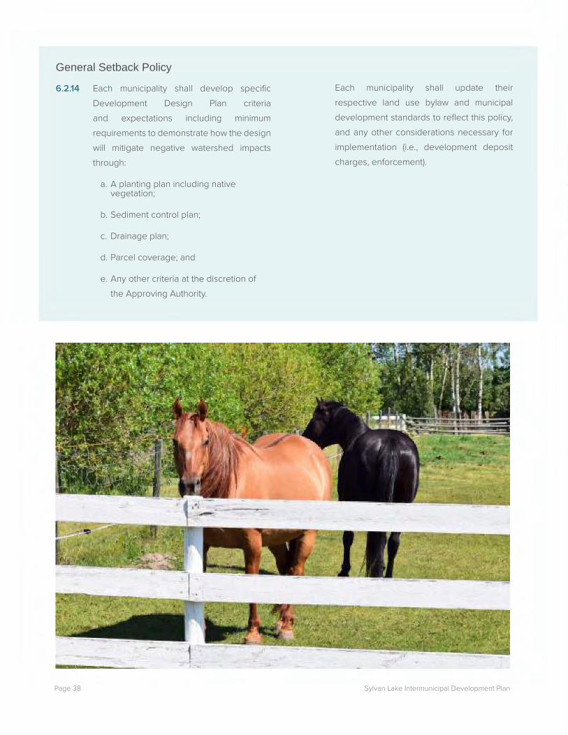
6.2.14 Each municipality shall develop specific Development Design Plan criteria and expectations including minimum requirements to demonstrate how the design will mitigate negative watershed impacts through:
a. A planting plan including native vegetation;
b. Sediment control plan;
c. Drainage plan;
d. Parcel coverage; and
e. Any other criteria at the discretion of the Approving Authority.
Each municipality shall update their respective land use bylaw and municipal development standards to reflect this policy, and any other considerations necessary for implementation (i.e., development deposit charges, enforcement).

Page 39Sylvan Lake Intermunicipal Development Plan
7.0 Recreation
-- - -:--.-"'-::: - ~~--~~
~~{:if~~ - - - ~~ - - ~:::.....--__ -- - --. ~- ---~---
·--

Sylvan Lake Intermunicipal Development PlanPage 40
7.0 RecreationThe Sylvan Lake area is a significant recreation destination in Alberta that is used by millions of tourists every year, especially in the summer. As such, recreation is an important activity in the Plan Area. Planning for additional recreation opportunities and maintenance of existing areas that balance tourism with environmental sustainability of the lake and its watershed are important aspects of this plan.
Regional trails were identified as significantly important through the Sylvan Lake Intermunicipal Development Plan public engagement. Members of the public expressed a desire for regional trails in the Plan Area to provide alternative modes of transportation and additional recreational opportunities. Support was expressed for a future trail to be developed around the whole of Sylvan Lake and connected to trails and pathways within municipal boundaries as well as any additional future regional trails that may be considered. An integrated trail network would enhance the recreation opportunities of the Sylvan Lake area.
While the Sylvan Lake Intermunicipal Development Plan does not address activities specifically on the lake, it does address lake access. Through previous assessments, lake access is a critical consideration for the integrity and stewardship of Sylvan Lake. Feedback from public and stakeholder engagement has demonstrated a desire for additional formal lake access points to responsibly manage access. This will be accomplished by providing additional formal lake access infrastructure in the form of boat launches and limiting informal access (i.e., use of road allowances that end at the lake edge). By accomplishing both the creation of formal lake access and management of informal access points, the demand of current and future lake users to access the lake will be accommodated by providing appropriate facilities. The policies associated with changes to lake access
reflect the shared values between the municipalities; however, implementation of these changes is subject to collaboration with additional stakeholders, specifically the Province of Alberta. As lake access points are typically located at the terminus of public roads, the future use of some locations, and potential closure of others, requires provincial approvals. The Partner Municipalities will collaborate with residents, users, and stakeholders through any future transitions regarding lake access.
7.1 OBJECTIVESa. To balance recreation uses with environmental
protection.
b. To increase recreation opportunities for residents and visitors to the area.
Page 41Sylvan Lake Intermunicipal Development Plan
7.2 POLICIESTrails
7.2.1 The Partner Municipalities should develop a regional trail plan. The regional trail plan will address a variety of active transportation options. Primary consideration will be given to walking, cycling and similar modes of transportation. Regional trails shall not be designed for horseback riding, ATV usage, sledding, or similar activities. Existing proposed alignments documented in the Sylvan Lake Boat Launch Access Strategy for Recreational Lake Access (2016) and Lacombe County’s Sylvan Lake Area Structure Plan (2017) shall be considered for the regional trail plan. The regional trail plan is expected to address:
a. Trail alignment;
b. Trail types / dimensions;
c. Connections beyond the Plan Area particularly connecting to the City of Red Deer and Benalto;
d. An implementation framework;
e. A maintenance strategy; and
f. Stakeholder and public engagement in the creation of the trail plan.
7.2.2 The Partner Municipalities will encourage partnerships and seek grants in collaboration with trail building/management/user groups such as Central Alberta Regional Trail Society, Sylvan Lake Management Committee (SLMC), and Alberta TrailNet.
Recreation Planning
7.2.3 The Partner Municipalities should develop a regional recreation, parks, and open space master plan for the Plan Area with the recommendation that the plan address:
a. Regionally significant facilities, programs and connections; and
b. A collaborative funding model identifying shared costs between the Partner Municipalities to implement recommendations.
Recreational Boat Access
7.2.4 The Partner Municipalities shall undertake a coordinated lake access management plan that will result in:
a. A cost-sharing, benefit-sharing framework;
b. Planning and development of an additional formal motorized boat launch (Policy 7.2.8);
c. Planning and development of a new formal non-motorized boat launch (Policy 7.2.9);
d. Management of informal lake access points by identifying appropriate road allowances for closure and reclamation and obtaining provincial approval (Policy 7.2.10); and
e. Continued engagement with residents, users and stakeholders to develop the lake access management plan.
7.2.5 The lake access management plan may consider boat fueling, as appropriate.

Sylvan Lake Intermunicipal Development PlanPage 42
7.2.6 The cost-sharing, benefit-sharing framework shall consider the development and construction requirements for policies 7.2.8 – 7.2.10 and any off-site impacts or land use changes required for or resulting from these upgrades.
7.2.7 Should a cost-sharing, benefit-sharing framework be established as per 7.2.4, a new formal lake access point will be located at Site 5P from the Sylvan Lake Boat Launch Access Strategy for Recreational Lake Access (2016), Lot OT Plan 162 0291 as shown on Map 5.
7.2.8 Planning and development of Site 5P is expected to include:
a. Design and planning for both motorized and non-motorized lake access point;
b. Detailed design for the site shall be completed including the required studies and / or approvals for construction of the new boat launch;
c. Upgrading of access roads and signage leading from the closest secondary highway to the lake access point; and
d. Potential land use changes to provide appropriate local services to support the lake access point.
7.2.9 Should a cost-sharing, benefit sharing framework be established as per 7.2.4, Site 2F from the Sylvan Lake Boat Launch Access Strategy for Recreational Lake Access (2016), at the terminus of Range Road 23, as shown on Map 5, shall be formally developed as a hand launch boat site for non-motorized crafts only. Access will be managed at Site 2F to continue to provide non-motorized public access and support sufficient emergency egress on the lake as a whole.
7.2.10 Prior to development of either Site 5P or 2F lake access points, the Partner Municipalities shall identify appropriate road allowances to be closed and reclaimed with consideration for lake emergency access; and obtain approval from the Alberta Ministry of Transportation, where appropriate, to close road access for dead-end roads, as per the Sylvan Lake Boat Launch Access Strategy for Recreational Lake Access (2016).

Page 43Sylvan Lake Intermunicipal Development Plan
LEGEND
Municipal Boundary
Proposed Norglenwold Annexation Area
County Boundary
Plan Area
Summer Village of Sunbreaker Cove
Summer Village of Birchcliff
Summer Village of Jarvis Bay
Summer Village of Norglenwold Town of
Sylvan Lake
Summer Village of Half Moon Bay
Red Deer/Lacombe County Boundary
Sylvan Lake
0 1 2 3 4 Kilometers
Site 5P
Site 2F
Township Road 392
Sylvan Lake
Site 5P
Rang
e Roa
d 23View Drive
Site 2F
Map 5: New Boat Launch Sites
• • rfil
-D

Sylvan Lake Intermunicipal Development PlanPage 44

Page 45Sylvan Lake Intermunicipal Development Plan
8.0 Infrastructure

Sylvan Lake Intermunicipal Development PlanPage 46
8.0 InfrastructureWithin the Plan Area there are a variety of different forms and types of development, requiring various infrastructure solutions. The Sylvan Lake Intermunicipal Development Plan provides a common approach and minimum standards for infrastructure that either directly affects Sylvan Lake and its watershed, or that crosses municipal boundaries. Infrastructure in this section includes stormwater management design standards, water and wastewater services including connection requirements to any future regional infrastructure, and transportation standards both for long-term planning and road standards.
8.1 OBJECTIVESa. To realize efficient and economical uses of regional
infrastructure.
b. To develop infrastructure solutions that do not cause negative impacts on the surrounding environment.
c. To facilitate safe and efficient transportation systems.
8.2 POLICIESStormwater Management
8.2.1 Each municipality shall require that any redesignation, subdivision or development applications in areas prone to flooding, as determined by the Approving Authority, provide a confirmation of the 1:100 flood level of the affected river or creek by a qualified professional engineer.
8.2.2 Stormwater management facilities are required for new development or redevelopment, except single-lot residential and development on agricultural lands, and shall remove at a minimum 85% of suspended solids above 75 microns. All stormwater management facility designs will be stamped by a qualified engineer to the satisfaction of the Approving Authority, and are subject to typical municipal inspection processes.
8.2.3 The respective municipality may inspect the construction and maintenance of stormwater management facilities at any time.
8.2.4 All new development excluding single-lot recreation parcels; single-lot residential parcels; and development on agricultural lands shall require stormwater management facilities to meet the following minimum design standards:
• Be a wetland, wet pond, or a dry pond with oil/grit separator;
• Have storage capacity for a 1:100 storm event with a maximum active storage depth of 1.5 metres with 0.6 metres of freeboard;
• Be designed for a 1:500-year storm event where no emergency spillway is available storage; and
• All other design standards as per Alberta Stormwater Management Guidelines (1999).

Page 47Sylvan Lake Intermunicipal Development Plan
The Approving Authority may adjust these standards for redevelopment projects, at their sole discretion, where existing circumstances cannot accommodate these standards.
8.2.5 Joint Erosion and Sediment Control guidelines and targets shall be developed for the Plan Area. All construction projects including development applications and public projects will follow the practices outlined in the Joint Erosion and Sediment Control guidelines and targets. All construction projects with a soil disturbance area greater than 0.4 hectares shall submit an Erosion and Sedimentation Control application with drawings, RULSE calculations and enforcement measures to the satisfaction of the Approving Authority. Individual residential sites, agricultural properties and properties with a soil disturbance of less than 0.4 hectares are exempt from submitting an application but shall follow Best Management Practices (i.e., City of Calgary’s Erosion and Sediment Control Guidelines (2011): Section 8: Erosion and Sediment Control for Small Sites and Section 9: Implementation, Inspection and Maintenance).
Water Servicing
8.2.6 Access to groundwater supply in the Plan Area shall be on a first come, first serve basis.
8.2.7 The Partner Municipalities shall work together on advocacy initiatives in dialogue with the Province of Alberta to encourage proactive, watershed-based groundwater monitoring. Accurate and monitored data would provide the municipalities with appropriate data to consider appropriate development regulations in the future.
8.2.8 New multi-lot and redesignation developments shall assess the availability of groundwater for current and future servicing needs.
8.2.9 The Partner Municipalities will collaborate to develop development charges through off-site levies to fund the regional water supply line when appropriate. A reassessment of timeliness for this collaboration will be a priority during the first review of the Sylvan Lake Intermunicipal Development Plan.
8.2.10 As subdivision and / or development occurs, lands required for future water servicing rights-of-way, as identified through the mutual agreement of the Partner Municipalities, or subsequent studies, shall be protected
Wastewater Servicing
8.2.11 Any new or replacement septic systems on all non-agricultural lots that are less than 4050 square metres (1 acre) or where 60 or more lots serviced by private sewage systems are within a 600 metre radius must be connected to a functional regional wastewater system or be serviced by a private holding tank/communal wastewater system until the functional regional wastewater system is available.
8.2.12 Except for agricultural development, new private sewage systems shall only be permitted on lots greater than 4050 square metres (1 acre) and where no more than 60 lots serviced by private sewage systems are within a 600 metre radius.

Sylvan Lake Intermunicipal Development PlanPage 48
8.2.13 All new private sewage systems shall adhere to all relevant provincial standards including, but not limited to, the Alberta Private Sewage Systems Standard of Practice 2015; Private Sewage Disposal Systems Regulation; the Public Health Act’s Nuisance and General Sanitation Regulation (AR 243/2003, Section 15) as it relates to the location of sewage systems and drinking water wells for human consumption.
8.2.14 When a functioning regional wastewater system is available, connection to the wastewater system shall be required, and/or conversion of all private sewage systems on lands connecting to wastewater system.
8.2.15 As subdivision and / or development occurs, lands required for future wastewater servicing rights-of-way, as identified through the mutual agreement of the Partner Municipalities, or subsequent studies, shall be protected.
Transportation
8.2.16 The Partner Municipalities shall develop a regional Transportation Master Plan to guide future investment and planning initiatives in the Plan Area with collaboration from all local, regional and provincial stakeholders. The regional Transportation Master Plan shall include, but are not limited to:
a. A safety strategy;
b. A truck routing and goods movement strategy;
c. A transit plan;
d. A network plan; and / or
e. An active modes strategy.
8.2.17 The Partner Municipalities shall coordinate construction and maintenance of major transportation infrastructure, including provincial highway intersections, within the Plan Area following the creation of a regional Transportation Master Plan.
8.2.18 All future transportation planning and design shall consider and incorporate road safety principles to reduce the frequency and severity of collisions for all transportation modes.
8.2.19 Transportation Impact Assessments shall be required for all new development and redevelopment projects that are expected to generate a significant amount of traffic, at the discretion of the Approving Authority.
8.2.20 Design and construction of roads within 0.8 kilometres of municipal boundaries shall be coordinated between all municipalities adjacent to said boundary. Road standards shall follow the Alberta Transportation standards.
8.2.21 As subdivision and / or development occurs, lands required for future transportation corridors, as identified through the mutual agreement of the Partner Municipalities, or subsequent studies shall be protected.
8.2.22 The Partner Municipalities should adhere to Transportation Association of Canada’s code of practice for road salt usage.

Page 49Sylvan Lake Intermunicipal Development Plan
9.0 Shared Municipal Services

Sylvan Lake Intermunicipal Development PlanPage 50
Category Services ProvidedEconomic Development The Town of Sylvan Lake, Lacombe County and Red Deer County have
individual economic development strategies and services.
Family and Community Support Services
The Town of Sylvan Lake, and the Summer Villages of Birchliff, Half Moon Bay, Jarvis Bay, Norglenwold, and Sunbreaker Cove share Family and Community Support Services; and Lacombe County and Red Deer County are partnered with other municipalities. Lacombe County is partnered with the City of Lacombe and Red Deer County is partnered with the City of Red Deer.
As part of the Family and Community Support Services programming, the Town of Sylvan Lake offers some housing assistance programming in addition to the Red Deer Housing Authority that operates within the Town of Sylvan Lake.
The Town of Sylvan Lake Family and Community Support Services also offers specific services and programs for youth.
Emergency & Health All the Partner Municipalities are involved in pre-existing emergency management plans. The Joint Emergency Management Plan includes Town of Sylvan Lake and portions of Red Deer County. The Lacombe County Regional Emergency Plan includes Lacombe County and the Summer Villages of Sunbreaker Cove and Birchcliff. The Red Deer Regional Plan includes Red Deer County and the Summer Villages of Norglenwold and Jarvis Bay. The Summer Village of Half Moon Bay has its own emergency plan.
Regarding health services in the Plan Area, the Community Health Centre is located in the Town of Sylvan Lake and serves the whole Plan Area.
Waste Services The primary waste disposal site for the Plan Area is through a waste transfer site located near the Town of Sylvan Lake. Alternate waste transfer sites are located in Lacombe County at NW 34-39-03-W5M (at Rainy Creek Road near Highway 766) or at Bentley, both of which are outside of the Plan Area.
9.0 Shared Municipal Services
Table 2: Shared Municipal Services and Programs
Each Partner Municipality provides a wide range of services for residents, businesses, and visitors in the Plan Area including family and community support services, emergency and health services and recreation and culture services. The delivery models vary between the municipalities and often include intermunicipal arrangements that increase efficiency and leverage costs. The current service
offerings are working for the Partner Municipalities and are expected to support future development and growth in the Plan Area. The intent of the Sylvan Lake Intermunicipal Development Plan is to support those existing arrangements and if necessary, provide an opportunity to enhance service delivery options. The services in Table 2 are provided by the municipalities within the Plan Area.

Page 51Sylvan Lake Intermunicipal Development Plan
Category Services ProvidedRecreation & Culture An inventory of recreation and cultural services in the Plan Area indicated that
most facilities are located in the Town of Sylvan Lake; however, outdoor recre-ation locations are spaced around Sylvan Lake in the various Partner Munici-palities.
A municipal library and a multi-plex recreation centre are located within the Town of Sylvan Lake. Recreation opportunities include 1 pool, 2 arenas, 5 curl-ing rinks, an indoor track, multipurpose rooms, and an indoor play space. With-in the Town of Sylvan Lake, there are also 3 tournament houses.
The Rainy Creek Community Hall at NE 32-39-01-W5M is located in Lacombe County. Red Deer County’s community halls are located just outside the Plan Area.
A formal boat launch and day use area is jointly operated by the Summer Vil-lages of Sunbreaker Cove and Lacombe County. The boat launch is located on Lacombe County lands within the municipal boundaries of the Summer Village of Sunbreaker Cove.
9.1 OBJECTIVESa. To support existing arrangements for delivery of
shared services between Partner Municipalities.
9.2 POLICIES9.2.1 The Partner Municipalities shall continue
to collaborate on economic development, recreation, cultural, emergency and health services initiatives, as appropriate.
9.2.2 The existing intermunicipal arrangements for delivery of recreation, cultural, emergency and health services shall continue to be supported. Amendments to these arrangements will be considered as appropriate by the respective municipalities involved.
9.2.3 Future opportunities for enhanced service delivery may be considered, as deemed appropriate by the respective municipalities.
b. To provide opportunities for enhancing service delivery in the future, if deemed appropriate.

Sylvan Lake Intermunicipal Development PlanPage 52

Page 53Sylvan Lake Intermunicipal Development Plan
10.0 Collaboration and Plan Administration

Sylvan Lake Intermunicipal Development PlanPage 54
Implementation considered from the outset is a key Sylvan Lake Intermunicipal Development Plan objective. Effective implementation is dependent on ongoing and proactive communication and strong relationships between the Partner Municipalities. This section provides clarity on the agreed upon processes, roles and timelines for collaboration in general, the Intermunicipal Development Plan Committee, plan authority, annexation, referrals, plan review and amendment, and dispute resolution.
On-going oversight of the Sylvan Lake Intermunicipal Development Plan is a shared responsibility between the Partner Municipalities. Therefore, an Intermunicipal Development Plan Committee with representatives from all Partner Municipalities will be mandated with the responsibility for Sylvan Lake Intermunicipal Development Plan implementation, monitoring and amendments. The Intermunicipal Development Plan Committee will develop a terms of reference after the adoption of the Sylvan Lake Intermunicipal Development Plan.
10.1 OBJECTIVESa. To provide a framework for on-going collaboration
between the municipalities in the Plan Area.
b. To provide clear processes for addressing disputes, if they arise.
c. To identify appropriate review requirements to ensure the policy direction remains relevant.
10.2 POLICIES Collaboration
10.2.1 The Partner Municipalities shall proactively work together to enhance and improve the Plan Area for the benefit of all parties through ongoing communication, formal and informal discussions, and implementation of this plan to reduce any potential future disputes.
10.2.2 The Partner Municipalities recognize the benefit of proactive and ongoing communications in continuing to support healthy intermunicipal relationships. The Partner Municipalities will communicate new municipal plans, initiatives, data or studies that may affect the Plan Area as appropriate.
10.2.3 Each Partner Municipality shall include a Sylvan Lake Intermunicipal Development Plan overview in their respective post-election Council orientations to continue building understanding of the Sylvan Lake Intermunicipal Development Plan’s value.
10.2.4 All projects undertaken through implementation of the Sylvan Lake Intermunicipal Development Plan will include a shared funding model appropriate to the shared benefit of the project’s outcomes, or other criteria as mutually agreed to. All information created as a result of the implementation projects shall be shared and considered the property of the participating municipalities.
10.0 Collaboration and Plan Administration
Page 55Sylvan Lake Intermunicipal Development Plan
Intermunicipal Development Plan
Committee (IDPC)
10.2.5 An Intermunicipal Development Plan Committee (IDPC) shall be established between the Partner Municipalities.
10.2.6 The Intermunicipal Development Plan Committee shall be comprised of one elected official and one non-voting Administrative staff member from each of the Partner Municipalities. The Intermunicipal Development Plan Committee shall also include a Technical Advisory Committee comprised of administrative staff members from each of the Partner Municipalities.
10.2.7 The Intermunicipal Development Plan Committee shall meet annually or on an as-needed basis to monitor, review, discuss, and / or resolve any issues of mutual interest, or as opportunities arise.
10.2.8 The mandate of the Intermunicipal Development Plan Committee shall include the following:
a. Oversight for the implementation of the Sylvan Lake Intermunicipal Development Plan’s policies and required follow-up studies/plan/initiatives;
b. Monitoring the Sylvan Lake Intermunicipal Development Plan’s progress;
c. Reviewing any proposed amendments to the Sylvan Lake Intermunicipal Development Plan;
d. Reviewing any proposed annexations;
e. Discussing any other joint Sylvan Lake Intermunicipal Development Plan opportunities or issues that may arise;
f. Assisting with the resolution of disputes in accordance with policies 10.2.32 - 10.2.34.
10.2.9 Municipal staff members are encouraged to informally discuss intermunicipal matters and consult with each other on an as-needed basis regardless of the committee agenda or schedule.
Relationship with Other Plans and
Approving Authority
10.2.10 The policies in the Sylvan Lake Intermunicipal Development Plan take precedence over all other municipal statutory plans, including Municipal Development Plans and Area Structure Plans, but is of the same precedence and reinforces the policies in the Sylvan Lake / Red Deer County Intermunicipal Development Plan (2011).
10.2.11 The policies contained in the Sylvan Lake Intermunicipal Development Plan represent minimum standards. If a Partner Municipality has policies in other statutory plans identifying higher standards than the Sylvan Lake Intermunicipal Development Plan policies, the higher standard shall apply.
10.2.12 Each municipality shall act as the Approving Authority within their own municipal boundaries and be responsible for the administration and decisions of all statutory plans, land use bylaws, amendments thereof, subdivision applications and development permit applications as per the Municipal Government Act.

Sylvan Lake Intermunicipal Development PlanPage 56
10.2.13 Where a conflict between the Sylvan Lake Intermunicipal Development Plan and the Sylvan Lake / Red Deer County Intermunicipal Development Plan (2011) occurs, the Approving Authority shall consider the following:
a. Where the considerations of the environment and watershed take precedence, the policies of the Sylvan Lake Intermunicipal Development Plan should take precedence.
b. For all other considerations, the policies of the Sylvan Lake / Red Deer County Intermunicipal Development Plan (2011) should take precedence.
c. Any conflict may be referred to the Intermunicipal Development Plan Committee for direction.
d. Where a conflict requires an amendment to either the Sylvan Lake Intermunicipal Development Plan or the Sylvan Lake / Red Deer County Intermunicipal Development Plan (2011), policies 10.2.29 and 10.2.30 shall apply.
Annexation
10.2.14 Anticipated changes to municipal boundaries should be limited to the lands subject to the annexation request by the Summer Village of Norglenwold to Red Deer County as per Map 3.
10.2.15 Any future expansion of the Town of Sylvan Lake shall be subject to the annexation policies of the Sylvan Lake / Red Deer County Intermunicipal Development Plan (2011).
10.2.16 Any future annexation shall follow provincial requirements as per the Municipal Government Act and the Municipal Government Board Procedure Rules.
Referrals
10.2.17 The referral area shall be the same as the Plan Area as shown in Map 3.
10.2.18 Referrals shall occur for intermunicipal review of all statutory plans, non-statutory plans (i.e. concept plan, outline plan or master plan), land use bylaws, and amendments to each. Disposal of reserves shall be referred to all Partner Municipalities. Any other application the municipality deems appropriate may be referred.
10.2.19 All applications subject to intermunicipal referrals as per 10.2.18 shall be expected to follow appropriate community engagement processes as outlined in each Partner Municipality’s respective Municipal Development Plans, Area Structure Plans, and public engagement policies prior to the intermunicipal referral process.
10.2.20 All referral responses shall be provided within 21 calendar days. If required and by mutual agreement, a review period extension can be established with explicit timelines.
10.2.21 In the spirit of collaboration and alignment of the Sylvan Lake Intermunicipal Development Plan values, proactive communication is encouraged, and referral responses are expected to be provided to continue to build two-way discussions. Municipalities that have received a referral may consider the following questions when preparing comments or add comments on additional intermunicipal matters:

Page 57Sylvan Lake Intermunicipal Development Plan
a. How does the proposed development impact the referral receiving municipality?
b. What buffers or transition strategies are included between agriculture and non-agriculture uses and / or higher density and lower density areas?
c. How does the proposed development impact the environment or the watershed?
d. Are there known environmental concerns that should be considered?
e. Are there regional service delivery and / or infrastructure implications of the proposed development?
f. What Sylvan Lake Intermunicipal Development Plan policies are applicable to the referral comments and why are they important?
10.2.22 Comments received from a responding municipality shall be taken into consideration prior to a decision being rendered.
10.2.23 If no response is received by the referral timeline, lack of response will be deemed no objection.
10.2.24 Changes to referral policies shall require a written and signed memorandum of understanding by all municipalities in the Plan Area, but shall not require a public hearing.
Plan Review and Amendment
10.2.25 The Sylvan Lake Intermunicipal Development Plan shall be reviewed by the Intermunicipal Development Plan Committee within 5 years of adoption and every 5 years thereafter.
10.2.26 Should the Red Deer Regional Plan be adopted prior to the Sylvan Lake Intermunicipal Development Plan review period, the Intermunicipal Development Plan Committee will review any potential impacts and discuss amendments necessary for compliance.
10.2.27 When the Red Deer Regional Plan is adopted the Sylvan Lake Intermunicipal Development Plan shall be reviewed in accordance with the requirements of the Red Deer Regional Plan and the Partner Municipalities may consider adopting the Sylvan Lake Intermunicipal Development Plan as a sub-regional plan, if acceptable to all Partner Municipalities.
10.2.28 Any municipality may propose amendments to the Sylvan Lake Intermunicipal Development Plan at any time, and third-party requests (i.e., landowners) to amend the Sylvan Lake Intermunicipal Development Plan will be considered. Proposed third-party amendments shall be submitted, in writing, to the applicable municipality. The applicable municipality’s Council shall determine whether the amendment will be referred to the Intermunicipal Development Plan Committee. All proposals shall include a rationale for the proposed amendment as well as suggested changes that may be considered by the Intermunicipal Development Plan Committee.
10.2.29 An amendment to the Sylvan Lake Intermunicipal Development Plan has no effect until it is adopted by all Partner Municipalities as per the Municipal

Sylvan Lake Intermunicipal Development PlanPage 58
Government Act.
10.2.30 Upon agreement by the Intermunicipal Development Plan Committee that an amendment be accepted, the Sylvan Lake Intermunicipal Development Plan shall be amended as per the Municipal Government Act. Where the Intermunicipal Development Plan Committee agrees that a signed Memorandum of Understanding is sufficient to address the concerns of a proposal, a formal amendment may not be required.
10.2.31 Should circumstances arise that result in the repeal of the Sylvan Lake Intermunicipal Development Plan, all municipalities shall repeal the Sylvan Lake Intermunicipal Development Plan, and replace it with a new Intermunicipal Development Plan as required
as per the Municipal Government Act.
Dispute Resolution
10.2.32 The Sylvan Lake Intermunicipal Development Plan recognizes that there could be disagreements on the plans and bylaws subject to the referral process, and / or interpretation of this plan, and provides a framework for resolution of such disagreements identified in Table 3 and Figure 5. Key factors built into the Dispute Resolution Process include a standard process with clear roles, communication, and timelines that result in timely resolution.
10.2.33 Where the administration of one municipality disagrees with a statutory plan, non-statutory plan (i.e., concept plan, outline plan or master plan), land use bylaw, and / or amendment to each, or interpretation of the Sylvan Lake Intermunicipal Development Plan, any Partner Municipality may give written notice. Written notice shall be provided to all other Partner Municipalities of the disagreement with a rationale, and initiating the dispute resolution process.
10.2.34 Once a disagreement is identified through a written notice, no further action shall be taken on the application or matter in dispute until resolution of the disagreement has been determined.

Page 59Sylvan Lake Intermunicipal Development Plan
Action Description TimelineStep 1: Issues Identified & Technical Discussions
• Initiating Municipality’s administration provides written notice to the other Partner Municipalities identifying areas of disagreement and requesting negotiation.
14 calendar days
Step 2: Administrative Negotiation
• Meeting hosted between members of the Intermunicipal Development Plan Committee’s Technical Advisory Committee with agenda and minutes.
• Meeting to involve all staff directly relevant to the matter under dispute.
30 calendar days
Step 3: IDPC Negotiation
• Intermunicipal Development Plan Committee meeting hosted specifically to address the matter.
• Meeting to involve all staff directly relevant to the matter under dispute.
• The Intermunicipal Development Plan Committee will determine if all Partner Municipalities shall be actively involved in the dispute resolution process, or if some of the Partner Municipalities shall have observer status.
30 calendar days
Step 4: Request Mediation and Appoint Mediator
• Written request made by the Initiating Municipality to the Intermunicipal Development Plan Committee to identify a mutually agreed upon mediator.
• Appointment of mediator completed.
30 calendar days to appoint mediator
Step 5: Mediation • Initiating Municipality provides the mediator with an outline of the dispute and any agreed statement of facts.
• The mediator will be provided access to all records, document and information that the mediator may reasonably request.
• The municipalities must meet with the mediator as required, and negotiate in good faith.
• The costs of the mediator will be shared equally between the municipalities active in the dispute resolution based on the decision of the Intermunicipal Development Plan Committee.
4 months & 9 months cumulative total from Step 1
Table 3: Dispute Resolution Process

Sylvan Lake Intermunicipal Development PlanPage 60
Action Description TimelineStep 6: Mediation Report
• Initiating Municipality provides a report to the Intermunicipal Development Planning Committee outlining the areas of agreement and no agreement.
21 calendar days
Step 7: Appoint Arbitrator
• Written request made by the Initiating Municipality to the Intermunicipal Development Plan Committee to identify a mutually agreed upon arbitrator.
• Appointment of arbitrator completed.
• Initiating Municipality provides the mediation report to the arbitrator.
30 calendar days to appoint arbitrator
Step 8: Binding Arbitration
• Arbitration to be hosted in accordance with the Arbitration Act.
• The costs of the arbitrator will be shared equally between the municipalities active in the dispute resolution based on the decision of the Intermunicipal Development Plan Committee.
• The arbitration decisions to be provided through an order.
• If the matter is resolved during arbitration, a summary report is required to be provided by the Initiating Municipality to the other Partner Municipalities.
4 months & 9 months cumulative total from Step 1
Step 9: Appeal Process
• If the approving municipality passes a bylaw to implement the proposal, then the Initiating Municipality may appeal that action to the Municipal Government Board under the provisions of Section 690 of the Municipal Government Act.
As per the Municipal Government Act

Page 61Sylvan Lake Intermunicipal Development Plan
Figure 5: Dispute Resolution Process
» If the approving municipality passes a bylaw to implement the proposal, then the Initiating Municipality may appeal that action to the Municipal Government Board under the provisions of Section 690 of the Municipal Government Act.
Step 1: Issues Identified & Technical Discussions
Step 2: Administrative Negotiation
Step 3: IDPC Negotiation
Step 4: Request Mediation and Appoint Mediator
Step 5: Mediation
Step 6: Mediation Report
Step 7:Appoint Arbitrator
Step 8:Binding Arbitration
» Initiating Municipality’s administration provides written notice to the other Partner Municipalities identifying areas of disagreement and requesting negotiation.
» Meeting hosted between members of the Intermunicipal Development Plan Committee’s Technical Advisory Committee with agenda and minutes.
» Meeting to involve all staff directly relevant to the matter under dispute.
» Intermunicipal Development Plan Committee meeting hosted specifically to address the matter.
» Meeting to involve all staff directly relevant to the matter under dispute.
» The Intermunicipal Development Plan Committee will determine if all Partner Municipalities shall be actively involved in the dispute resolution process, or if some of the Partner Municipalities shall have observer status.
» Written request made by the Initiating Municipality to the Intermunicipal Development Plan Committee to identify a mutually agreed upon mediator.
» Appointment of mediator completed.
» Initiating Municipality provides the mediator with an outline of the dispute and any agreed statement of facts.
» The mediator will be provided access to all records, document and information that the mediator may reasonably request.
» The municipalities must meet with the mediator as required, and negotiate in good faith.
» The costs of the mediator will be shared equally between the municipalities active in the dispute resolution based on the decision of the Intermunicipal Development Plan Committee.
» Initiating Municipality provides a report to the Intermunicipal Development Plan Committee outlining the areas of agreement and no agreement.
» Written request made by the Initiating Municipality to the Intermunicipal Development Plan Committee to identify a mutually agreed upon arbitrator.
» Appointment of arbitrator completed.
» Initiating Municipality provides the mediation report to the arbitrator.
» Arbitration to be hosted in accordance with the Arbitration Act.
» The costs of the arbitrator will be shared equally between the municipalities active in the dispute resolution based on the decision of the Intermunicipal Development Plan Committee.
» The arbitration decisions to be provided through an order.
» If the matter is resolved during arbitration, a summary report is required to be provided by the Initiating Municipality to the other Partner Municipalities.
Action Description Timeline
14 Calendar Days
30 Calendar Days
4 Months and 9 Months
Cumulative Total From
Step 1
21 Calendar Days
4 Months and 9 Months
Cumulative Total From
Step 1
30 Calendar Days to appoint
arbitrator
30 Calendar Days
30 Calendar Days to appoint
mediator
As per the Municipal
Government ActStep 9:
Appeal Process

Sylvan Lake Intermunicipal Development PlanPage 62

Page 63Sylvan Lake Intermunicipal Development Plan
11.0 Implementation

Sylvan Lake Intermunicipal Development PlanPage 64
The Sylvan Lake Intermunicipal Development Plan is a broad and high order statutory plan that has achieved significant agreement between the eight municipalities surrounding Sylvan Lake. As a broad plan, it is the first step in committing to development patterns and harmonized development standards. It also identifies where future collaborations are necessary so that more detailed information can inform future planning. Implementation of the policies that direct future work will be necessary to fulfill the plan’s vision over the long term.
11.0 ImplementationThe implementation plan (Table 4) is an assessment of priorities within the plan for follow-up action. Each of these actions will require funding and resources that will need to be determined and confirmed through the municipal budget approval process. For collaborative projects to proceed, the Intermunicipal Development Plan Committee will confirm which projects will be pursued in any given year. All prioritized projects (collaborative and individual municipal) will be subject to municipal budget approvals and development standards in the year of implementation.
Policy Action AccountabilityIndividual Municipalities
Collective Partnership
Limited Partnership
LeadDepartment
Intermunicipal Development Plan Committee (IDPC)
TimelineImmediate (1-2 yrs)
Short (1-10 yrs)
Long (11-20 yrs)
Estimated Resources / Budget RequiredLow ($1-$50K)
Medium ($51-$150k)
High ($151k+)
6.2.7 Environmentally Significant Areas mapping
Collective Partnership
IDPC Long High
6.2.7a Interim Environmentally Significant Areas mapping
Collective Partnership
IDPC Short Medium
6.2.8 Natural Areas Management Plan
Collective Partnership
IDPC Long High
6.2.11 Development of specific Development Setbacks for naturally occurring tributaries
Individual Municipalities
Planning and Engineering
Short Low
6.2.14 Development Design Plan Criteria
Individual Municipalities
Planning and Engineering
Immediate Low
7.2.1 Regional Trail plan Collective Partnership
IDPC Short High
7.2.2 Partnerships and seek grants for trail building/management
All three options IDPC Ongoing Low
7.2.3 Regional Recreation, Parks, Open Space Master Plan
Collective / Limited IDPC Long High
7.2.4 Lake Access Management Plan
Collective Partnership
IDPC Short Medium
Table 4: Implementation Matrix

Page 65Sylvan Lake Intermunicipal Development Plan
Policy Action AccountabilityIndividual Municipalities
Collective Partnership
Limited Partnership
LeadDepartment
Intermunicipal Development Plan Committee (IDPC)
TimelineImmediate (1-2 yrs)
Short (1-10 yrs)
Long (11-20 yrs)
Estimated Resources / Budget RequiredLow ($1-$50K)
Medium ($51-$150k)
High ($151k+)
7.2.7 & 7.2.8
Formal lake access point development - Site 5P
Collective Partnership
IDPC Short High
7.2.9 Formal hand launch boat site for non-motorized crafts only - Site 2F
Collective Partnership
IDPC Short High
7.2.10 Appropriate road allowance closure and reclamation
Individual Municipalities
Engineering Short Medium
8.2.5 Joint erosion and sediment control guidelines
Collective Partnership
Engineering Short Low / Medium
8.2.7 Groundwater advocacy Collective Partnership
IDPC Ongoing Low
8.2.9 Regional water supply line off-site levy / development charges-reassessment of timelines
Limited Partnership
IDPC Short Medium
8.2.16 Regional Transportation Master Plan
Collective Partnership
IDPC Long High
10.2.3 Update council orientations to include content on the Sylvan Lake Intermunicipal Development Plan
Individual Municipalities
Corporate Services / Chief Administrative Officer
Immediate Low
10.2.5 Establish the Intermunicipal Development Plan Committee
Collective Partnership
Corporate Services / Chief Administrative Officer
Immediate Low
Update all statutory plans and Land Use Bylaws to align with the Sylvan Lake Intermunicipal Development Plan
Individual Municipalities
Planning Immediate Low
Update all engineering standards to align with the Sylvan Lake Intermunicipal Development Plan
Individual Municipalities
Engineering Immediate Low

Sylvan Lake Intermunicipal Development PlanPage 66

Page 67Sylvan Lake Intermunicipal Development Plan
APPENDIX ADEFINITIONS AND ACRONYMS

Sylvan Lake Intermunicipal Development PlanPage 68
Appendix A – Definitions and Acronyms
DEFINITIONSApproving Authority: Each respective municipality’s Development Authority and Subdivision Authority as established in the applicable Land Use Bylaw.
Biophysical Impact Assessment: A Level 3 detailed environmental study and review of a development project that predicts, interprets, and evaluates impacts and mitigation measures to avoid, minimize, or compensate for said impacts.
Confined Feeding Operations: The fenced or enclosed land or buildings where livestock are confined for the purpose of growing, sustaining, finishing or breeding by means other than grazing and any other building or structure directly related to that purpose but does not include residences, livestock seasonal feeding and bedding sites, equestrian stables, auction markets, race tracks or exhibition grounds, as regulated under Agricultural Operations Practices Act and Agricultural Operations, Part 2 Matters Regulation.
Development: A change to the current state of the land and / or buildings including a change in intensity, a change in use, and / or a change in grade, but does not include cosmetic changes that do not impact the above listed conditions, such as minor landscaping.
Development Setback: The distance from the boundary of a waterbody (including lakes, watercourses, wetlands as appropriate) to the closest building or structure.
Environmental Reserve: As per the Municipal Government Act, “Subject to section 663 and subsection (2), a subdivision authority may require the owner of a parcel of land that is the subject of a proposed subdivision to provide part of that parcel of land as Environmental Reserve if it consists of (a) a swamp, gully, ravine, coulee or natural drainage course, (b) land that is subject to flooding or is, in the opinion of the subdivision authority, unstable, or (c) a strip of land, not less than 6 metres in width, abutting the bed and shore of any body of water” (Section 664 (1)).”
Environmental Screening: A Level 2 environmental assessment that identifies environmental impacts and potential mitigation strategies of a proposed development project including defined boundaries of an Environmentally Significant Area(s).
High Water Mark: The line that separates the Crown-owned bed and shore of a water body from the adjacent private land is called the legal bank (defined in the Surveys Act). Its location is synonymous with what is commonly known as the ordinary high water mark.
Initiating Municipality: The Municipality(ies) within the group of Partner Municipalities that submits the first formal request in writing.
Page 69Sylvan Lake Intermunicipal Development Plan
Municipal Reserve: As per the Municipal Government Act.
Partner Municipalities: All eight municipalities in the Plan Area including Lacombe County, Red Deer County, the Summer Village of Birchcliff, the Summer Village of Half Moon Bay, the Summer Village of Jarvis Bay, the Summer Village of Norglenwold, the Summer Village of Sunbreaker Cove, and the Town of Sylvan Lake.
Preliminary Natural Site Assessment: A Level 1 desktop environmental assessment that provides an overview of baseline environmental information and identification of the potential extent of Environmentally Sensitive Areas.
Plan Area: The geographical boundary of the Sylvan Lake Intermunicipal Development Plan as illustrated in Map 2 whereby all policies in the Sylvan Lake Intermunicipal Development Plan shall apply unless otherwise stated.
Red Deer Regional Plan: The land use regional plan for the watershed of the Red Deer River as established by the Province of Alberta.
Sylvan Lake Watershed: The land within the Plan Area from which all surface water, waterways and waterbodies drain into Sylvan Lake.
Top of Bank: The transition line between the slope where the grades exceed 15% and the adjacent upland area where the grade is less than 15%.
ACRONYMSBIA: Biophysical Impact Assessment
ES: Environmental Screening
IDPC: Intermunicipal Development Plan Committee
PNSA: Preliminary Natural Site Assessment
SLMC: Sylvan Lake Management Committee