Embed Size (px)
Citation preview

Liberty Alliance Project: Version: 1.0
Liberty ID-SIS Geolocation ServiceSpecificationVersion: 1.0
Editors:Jukka Kainulainen, Nokia CorporationRob Lockhart, IEEE-ISTO
Contributors:David Castellanos, EricssonCorina Grahm, EricssonRachid Oulahal, France Télécom
Abstract:
The Liberty ID-SIS Geolocation (ID-SIS-GL) defines a web service. It offers geolocation information regarding aPrincipal. ID-SIS-GL is an instance of a data oriented identity web service. ID-SIS-GL is using the Liberty ID-WSFData Services Template and readers of this document should be familiar with that as well as the rest of the LibertyID-WSF framework. The geolocation related data is mostly from the Mobile Location Protocol version 3.1 specifiedby the Open Mobile Alliance and readers should be familiar with that also.
Filename: liberty-id-sis-gl-v1.0.pdf
Liberty Alliance Project
1

Liberty Alliance Project: Version: 1.0Liberty ID-SIS Geolocation Service Specification
Notice1
This document has been prepared by Sponsors of the Liberty Alliance. Permission is hereby granted to use the2
document solely for the purpose of implementing the Specification. No rights are granted to prepare derivative3
works of this Specification. Entities seeking permission to reproduce portions of this document for other uses must4
contact the Liberty Alliance to determine whether an appropriate license for such use is available.5
Implementation or use of certain elements of this document may require licenses under third party intellectual6
property rights, including without limitation, patent rights. The Sponsors of and any other contributors to the7
Specification are not and shall not be held responsible in any manner for identifying or failing to identify any or all8
such third party intellectual property rights.This Specification is provided "AS IS," and no participant in the9
Liberty Alliance makes any warranty of any kind, express or implied, including any implied warranties of10
merchantability, non-infringement of third party intellectual property rights, and fitness for a particular11
purpose. Implementers of this Specification are advised to review the Liberty Alliance Project’s website12
(http://www.projectliberty.org/) for information concerning any Necessary Claims Disclosure Notices that have been13
received by the Liberty Alliance Management Board.14
Copyright © 2005-2008 American Express Travel Related Services; Ericsson; France Télécom; The International15
Security, Trust, and Privacy Alliance; Nippon Telegraph and Telephone Corporation; Nokia Corporation; Sun16
Microsystems, Inc.; Symlabs, Inc.; and Vodafone Group Plc. All rights reserved.17
18
Liberty Alliance Project19
Licensing Administrator20
c/o IEEE-ISTO21
445 Hoes Lane22
Piscataway, NJ 08855-1331, USA23
25
Liberty Alliance Project
2
Liberty Alliance Project: Version: 1.0Liberty ID-SIS Geolocation Service Specification
Contents26
1. Overview . . . . . . . . . . . . . . . . . . . . . . . . . . . . . . . . . . . . . . . . . . . . . . . . . . . . . . . . . . . . . . . . . . . . . . . . . . . . . . . . . . . . . . 427
1.1. Notation . . . . . . . . . . . . . . . . . . . . . . . . . . . . . . . . . . . . . . . . . . . . . . . . . . . . . . . . . . . . . . . . . . . . . . . . . . . . . . . . 428
1.2. Time Values . . . . . . . . . . . . . . . . . . . . . . . . . . . . . . . . . . . . . . . . . . . . . . . . . . . . . . . . . . . . . . . . . . . . . . . . . . . . . 529
2. Service Parameters. . . . . . . . . . . . . . . . . . . . . . . . . . . . . . . . . . . . . . . . . . . . . . . . . . . . . . . . . . . . . . . . . . . . . . . . . . . . . . 630
3. Extensions . . . . . . . . . . . . . . . . . . . . . . . . . . . . . . . . . . . . . . . . . . . . . . . . . . . . . . . . . . . . . . . . . . . . . . . . . . . . . . . . . . . . . 931
4. Discovery Option Keywords. . . . . . . . . . . . . . . . . . . . . . . . . . . . . . . . . . . . . . . . . . . . . . . . . . . . . . . . . . . . . . . . . . . . 1032
4.1. Data Availability Discovery Option Keywords. . . . . . . . . . . . . . . . . . . . . . . . . . . . . . . . . . . . . . . . . . . . . 1033
4.2. Other ID-SIS-GL Discovery Option Keywords. . . . . . . . . . . . . . . . . . . . . . . . . . . . . . . . . . . . . . . . . . . . . 1034
4.3. DST Discovery Option Keyword. . . . . . . . . . . . . . . . . . . . . . . . . . . . . . . . . . . . . . . . . . . . . . . . . . . . . . . . . 1135
5. SelectType . . . . . . . . . . . . . . . . . . . . . . . . . . . . . . . . . . . . . . . . . . . . . . . . . . . . . . . . . . . . . . . . . . . . . . . . . . . . . . . . . . 1236
5.1. <eqop> element . . . . . . . . . . . . . . . . . . . . . . . . . . . . . . . . . . . . . . . . . . . . . . . . . . . . . . . . . . . . . . . . . . . . . . . . 1237
5.2. <geo_info> element . . . . . . . . . . . . . . . . . . . . . . . . . . . . . . . . . . . . . . . . . . . . . . . . . . . . . . . . . . . . . . . . . . . 1338
5.2.1.<CoordinateReferenceSystem> element . . . . . . . . . . . . . . . . . . . . . . . . . . . . . . . . . . . . . . . 1339
5.2.2. Elements requesting specific geolocation information. . . . . . . . . . . . . . . . . . . . . . . . . . . . . . . . 1340
5.2.3. The Schema of the<geo_info> Element . . . . . . . . . . . . . . . . . . . . . . . . . . . . . . . . . . . . . . . . . . 1441
5.3. <loc_type> element . . . . . . . . . . . . . . . . . . . . . . . . . . . . . . . . . . . . . . . . . . . . . . . . . . . . . . . . . . . . . . . . . . . 1442
5.4. <prio> element . . . . . . . . . . . . . . . . . . . . . . . . . . . . . . . . . . . . . . . . . . . . . . . . . . . . . . . . . . . . . . . . . . . . . . . . 1543
5.5. <AreaComparison> Element. . . . . . . . . . . . . . . . . . . . . . . . . . . . . . . . . . . . . . . . . . . . . . . . . . . . . . . . . . . . . 1544
5.6. Common Error Handling. . . . . . . . . . . . . . . . . . . . . . . . . . . . . . . . . . . . . . . . . . . . . . . . . . . . . . . . . . . . . . . . 1645
5.7. Modifications . . . . . . . . . . . . . . . . . . . . . . . . . . . . . . . . . . . . . . . . . . . . . . . . . . . . . . . . . . . . . . . . . . . . . . . . . . 1746
6. TriggerType . . . . . . . . . . . . . . . . . . . . . . . . . . . . . . . . . . . . . . . . . . . . . . . . . . . . . . . . . . . . . . . . . . . . . . . . . . . . . . . . .1847
6.1. Change Notifications. . . . . . . . . . . . . . . . . . . . . . . . . . . . . . . . . . . . . . . . . . . . . . . . . . . . . . . . . . . . . . . . . . . . 1848
6.2. Periodic Notifications. . . . . . . . . . . . . . . . . . . . . . . . . . . . . . . . . . . . . . . . . . . . . . . . . . . . . . . . . . . . . . . . . . . 1849
6.3. Notifications Based On Other Events. . . . . . . . . . . . . . . . . . . . . . . . . . . . . . . . . . . . . . . . . . . . . . . . . . . . . .1950
6.4. Area-Based Notifications. . . . . . . . . . . . . . . . . . . . . . . . . . . . . . . . . . . . . . . . . . . . . . . . . . . . . . . . . . . . . . . . 1951
6.5. The Schema for theTriggerType . . . . . . . . . . . . . . . . . . . . . . . . . . . . . . . . . . . . . . . . . . . . . . . . . . . . . . . 2052
6.6. The reason for a notification. . . . . . . . . . . . . . . . . . . . . . . . . . . . . . . . . . . . . . . . . . . . . . . . . . . . . . . . . . . . . 2053
7. Geolocation Information. . . . . . . . . . . . . . . . . . . . . . . . . . . . . . . . . . . . . . . . . . . . . . . . . . . . . . . . . . . . . . . . . . . . . . . .2154
7.1. <time> element . . . . . . . . . . . . . . . . . . . . . . . . . . . . . . . . . . . . . . . . . . . . . . . . . . . . . . . . . . . . . . . . . . . . . . . . 2155
7.2. <CivilData> element . . . . . . . . . . . . . . . . . . . . . . . . . . . . . . . . . . . . . . . . . . . . . . . . . . . . . . . . . . . . . . . . . . 2156
7.3. <shape> element . . . . . . . . . . . . . . . . . . . . . . . . . . . . . . . . . . . . . . . . . . . . . . . . . . . . . . . . . . . . . . . . . . . . . . .2257
7.4. <alt> and<alt_acc> elements . . . . . . . . . . . . . . . . . . . . . . . . . . . . . . . . . . . . . . . . . . . . . . . . . . . . . . . . . 2258
7.5. <speed> element . . . . . . . . . . . . . . . . . . . . . . . . . . . . . . . . . . . . . . . . . . . . . . . . . . . . . . . . . . . . . . . . . . . . . . .2259
7.6. <direction> element . . . . . . . . . . . . . . . . . . . . . . . . . . . . . . . . . . . . . . . . . . . . . . . . . . . . . . . . . . . . . . . . . . 2260
7.7. <Heading> element . . . . . . . . . . . . . . . . . . . . . . . . . . . . . . . . . . . . . . . . . . . . . . . . . . . . . . . . . . . . . . . . . . . . 2361
7.8. <lev_conf> element . . . . . . . . . . . . . . . . . . . . . . . . . . . . . . . . . . . . . . . . . . . . . . . . . . . . . . . . . . . . . . . . . . . 2362
7.9. Emergency service related elements. . . . . . . . . . . . . . . . . . . . . . . . . . . . . . . . . . . . . . . . . . . . . . . . . . . . . . .2363
8. Examples . . . . . . . . . . . . . . . . . . . . . . . . . . . . . . . . . . . . . . . . . . . . . . . . . . . . . . . . . . . . . . . . . . . . . . . . . . . . . . . . . . . . . 2464
9. Schema . . . . . . . . . . . . . . . . . . . . . . . . . . . . . . . . . . . . . . . . . . . . . . . . . . . . . . . . . . . . . . . . . . . . . . . . . . . . . . . . . . . . . . . 2565
10. Abstract WSDL . . . . . . . . . . . . . . . . . . . . . . . . . . . . . . . . . . . . . . . . . . . . . . . . . . . . . . . . . . . . . . . . . . . . . . . . . . . . . . 3166
References . . . . . . . . . . . . . . . . . . . . . . . . . . . . . . . . . . . . . . . . . . . . . . . . . . . . . . . . . . . . . . . . . . . . . . . . . . . . . . . . . . . . . . 3267
Liberty Alliance Project
3

Liberty Alliance Project: Version: 1.0Liberty ID-SIS Geolocation Service Specification
1. Overview68
The Geolocation Service is a Liberty identity service which enables the sharing of the geolocation information of a69
Principal. The Geolocation Service (ID-SIS-GL) uses the protocols provided by the Liberty ID-WSF Data Services70
Template [LibertyDST20] to carry the geolocation requests and responses, This specification must be read together71
with [LibertyDST20]. This specification defines, normatively, how [LibertyDST20] is used in the Geolocation Service72
and what geolocation information and parameters are supported by the Geolocation Service.73
The geolocation information includes the position of a Principal, speed and direction related information, and74
information related to the quality of the position information.75
A Web Service Provider (WSP) hosting an ID-SIS-GL service may support both querying a Principal’s geolocation76
information and subscribing to a Principal’s geolocation information. In special cases, a WSP may also support77
modifying a Principal’s geolocation information through the ID-SIS-GL interface. Usually, a WSP obtains the78
geolocation information by other means than input from a Web Service Consumer (WSC). The information is usually79
calculated by a network or a device.80
For most of the geolocation-specific data and parameters, the definitions in [MLPv3.1] are used. For the corresponding81
XML elements and attributes, the normative semantic definitions are in [MLPv3.1], which is referred to in relevant82
places in this document. In this specification for those XML elements and attributes only, an informative description is83
given about their semantics. If there are any conflicts in those descriptions, the definition from [MLPv3.1] is used. As84
[MLPv3.1] uses DTD and this specification uses W3C XML schema [Schema1], the [XML ] elements and attributes85
used from [MLPv3.1] are rewritten using the W3C XML Schema language in this specification. This specification86
provides the normative type definitions for those elements and attributes. Please note that there are some changes in87
the type definitions when more specific type definitions provided by the XML schema are used.88
In addition to this normative specification, a separate implementation guidelines document is available [Liber-89
tyIDGLGuide]. It provides more information related to the ID-SIS-GL (e.g., it includes comparison to [MLPv3.1]90
and has important privacy notes).91
This specification has four main parts. First, the use of [LibertyDST20] is specified, how different alternatives features92
are used, and the needed parameters are defined. These define what kind of requests ID-SIS-GL supports. After that,93
the supported geolocation-specific parameters and data are defined (i.e., what can be received from a WSP hosting an94
ID-SIS-GL service and what can be sent as possible parameters in requests). After these two parts, some examples are95
shown and the full XML schema and an abstract WSDL for ID-SIS-GL are presented.96
In case of disagreement between this document and any guidelines or XML description, this document is prescriptive.97
Any published errata are incorporated in this document by reference and, as such, are normative.98
1.1. Notation99
This specification uses schema documents conforming to W3C XML Schema (see [Schema1]) and normative text to100
describe the syntax and semantics of XML-encoded protocol messages. Note: Phrases and numbers in brackets [ ]101
refer to other documents; details of these references may be found at the end of this document.102
The key words "MUST," "MUST NOT," "REQUIRED," "SHALL," "SHALL NOT," "SHOULD," "SHOULD NOT,"103
"RECOMMENDED," "MAY," "MAY NOT," and "OPTIONAL" in this specification are to be interpreted as described104
in [RFC2119]: "they MUST only be used where it is actually required for interoperability or to limit behavior which105
has potential for causing harm (e.g., limiting retransmissions)."106
These keywords are thus capitalized when used to specify, unambiguously, requirements over protocol and application107
features and behavior that affect the interoperability and security of implementations. When these words are not108
capitalized, they are meant in their natural-language sense.109
The following namespaces are used in the schema definitions:110
Liberty Alliance Project
4

Liberty Alliance Project: Version: 1.0Liberty ID-SIS Geolocation Service Specification
• The prefixgl: stands for the Liberty ID-SIS Geolocation Service schema namespace (urn:liberty:id-sis-gl:2005-07 ).111
• The prefix xs: stands for the W3C XML schema namespace (http://www.w3.org/2001/XMLSchema )112
[Schema1].113
• The prefixxml: stands for the W3C XML namespace (http://www.w3.org/XML/1998/namespace ) [XML ].114
Please note that the DST schemas [LibertyDST20] included do not define any namespace. Elements from those115
schemas will be in the ID-SIS-GL namespace when used for the ID-SIS-GL.116
This specification uses the following typographical conventions in text:<Element> , <ns:ForeignElement> ,117
attribute , Datatype , andOtherCode .118
Definitions for Liberty-specific terms may be found in [LibertyGlossary].119
1.2. Time Values120
All Liberty time values have the typedateTime , which is built in to the W3C XML Schema Datatypes specification.121
Liberty time values MUST be expressed in UTC form, indicated by a "Z" immediately following the time portion of122
the value.123
Liberty requesters and responders SHOULD NOT rely on other applications supporting time resolution finer than sec-124
onds, as implementations MAY ignore fractional second components specified in timestamp values. Implementations125
MUST NOT generate time instants that specify leap seconds.126
Liberty Alliance Project
5
Liberty Alliance Project: Version: 1.0Liberty ID-SIS Geolocation Service Specification
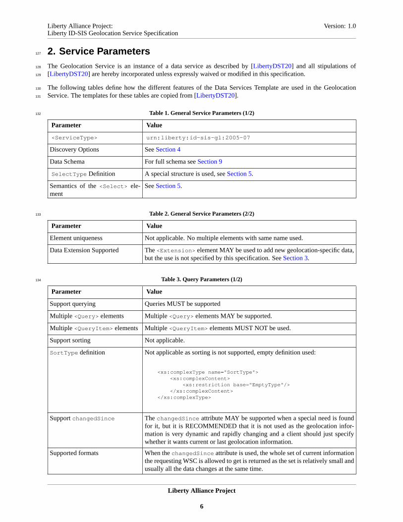
2. Service Parameters127
The Geolocation Service is an instance of a data service as described by [LibertyDST20] and all stipulations of128
[LibertyDST20] are hereby incorporated unless expressly waived or modified in this specification.129
The following tables define how the different features of the Data Services Template are used in the Geolocation130
Service. The templates for these tables are copied from [LibertyDST20].131
Table 1. General Service Parameters (1/2)132
Parameter Value
<ServiceType> urn:liberty:id-sis-gl:2005-07
Discovery Options SeeSection 4
Data Schema For full schema seeSection 9
SelectType Definition A special structure is used, seeSection 5.
Semantics of the<Select> ele-ment
SeeSection 5.
Table 2. General Service Parameters (2/2)133
Parameter Value
Element uniqueness Not applicable. No multiple elements with same name used.
Data Extension Supported The<Extension> element MAY be used to add new geolocation-specific data,but the use is not specified by this specification. SeeSection 3.
Table 3. Query Parameters (1/2)134
Parameter Value
Support querying Queries MUST be supported
Multiple <Query> elements Multiple <Query> elements MAY be supported.
Multiple <QueryItem> elements Multiple <QueryItem> elements MUST NOT be used.
Support sorting Not applicable.
SortType definition Not applicable as sorting is not supported, empty definition used:
<xs:complexType name="SortType"><xs:complexContent>
<xs:restriction base="EmptyType"/></xs:complexContent>
</xs:complexType>
SupportchangedSince ThechangedSince attribute MAY be supported when a special need is foundfor it, but it is RECOMMENDED that it is not used as the geolocation infor-mation is very dynamic and rapidly changing and a client should just specifywhether it wants current or last geolocation information.
Supported formats When thechangedSince attribute is used, the whole set of current informationthe requesting WSC is allowed to get is returned as the set is relatively small andusually all the data changes at the same time.
Liberty Alliance Project
6

Liberty Alliance Project: Version: 1.0Liberty ID-SIS Geolocation Service Specification
Table 4. Query Parameters (2/2)135
Parameter Value
Support includeCommon
Attributes
MUST NOT be supported. Only one common attribute used and a WSP decideswhen to add it.
Support pagination Not applicable. MUST NOT be used.
Support static sets Not applicable. MUST NOT be used.
<Extension> in <Query> The<Extension> element in<Query> MAY be used for new parameters, butthe use is not specified by this specification. SeeSection 3.
Table 5. Modify Parameters136
Parameter Value
Support modification Modifications MAY be supported in special cases. A WSC MUST NOT expectthat in a general case.
Multiple <Modify> elements Multiple <Modify> elements MAY be supported.
Multiple <Modification>
elementsMultiple <Modification> elements MUST NOT be supported.
Support partial success Not applicable as multiple<Modification> elements are not allowed.
SupportnotChangedSince notChangedSince SHOULD NOT be supported.
<Extension> in <Modify> The<Extension> element in<Modify> MAY be used to specify new param-eters, but the use is not specified by this specification. SeeSection 3.
Table 6. Subscribe Parameters (1/2)137
Parameter Value
Support subscribing to notifica-tions
Subscriptions and notifications SHOULD be supported.
Use of the<Subscribe> elementfor modifying and renewing sub-scriptions.
If notification subscriptions are supported, modifying existing subscriptionsMAY be supported, but canceling and renewing MUST be supported.
Multiple <Subscribe> elements Multiple <Subscribe> elements MAY be supported.
Multiple <Subscription>
elementsMultiple <Subscription> elements MAY be supported.
Use of the<NotifyEndedTo> el-ement
The <NotifyEndedTo> element MUST be supported, if end notifications areused.
TypeType definition The<Type> element is not used, so an empty definition is used for it:
<xs:complexType name="TypeType"><xs:complexContent>
<xs:restriction base="EmptyType"/></xs:complexContent>
</xs:complexType>
Liberty Alliance Project
7

Liberty Alliance Project: Version: 1.0Liberty ID-SIS Geolocation Service Specification
Table 7. Subscribe Parameters (2/2)138
Parameter Value
TriggerType definition SeeSection 6for the description and the type definition of the<Trigger>
element.
Start of a subscription If notifications are supported, thestarts attribute MUST be supported.
Subscription expiration Subscription expiration MUST be used.
Use of expires and duration
attributesBoth expires andduration MUST be supported.
Supportexpires==starts The same value for both thestarts and theexpires attribute MUST besupported.
Support zeroduration The value zero MUST be supported for theduration attribute.
<Extension> in <Subscribe> The<Extension> element in<Subscribe> MAY be used for new parameters,but the use is not specified by this specification. SeeSection 3.
Table 8. QuerySubscriptions Parameters139
Parameter Value
Support querying existing sub-scriptions
MAY be supported.
Multiple <QuerySubscriptions>
elementsMultiple <QuerySubscriptions> elements MAY be supported.
<Extension> in <QuerySubscriptions>The<Extension> element in<QuerySubscriptions> MAY be used for newparameters, but the use is not specified by this specification. SeeSection 3.
Table 9. Notify Parameters140
Parameter Value
Support notifications Notifications SHOULD be supported.
Are notifications acknowledged Notifications SHOULD be acknowledged.
<Extension> in <Notify> The<Extension> element in<Notify> MAY be used to pass additional data,but the use is not specified by this specification. SeeSection 3.
Table 10. EndNotify Parameters141
Parameter Value
Support end notifications End notifications MAY be supported.
Are end notifications acknowl-edged
End notifications SHOULD be acknowledged.
<Extension> in <Ended> The<Extension> element in<Ended> MAY be used to pass additional data,but the use is not specified by this specification. SeeSection 3.
Liberty Alliance Project
8

Liberty Alliance Project: Version: 1.0Liberty ID-SIS Geolocation Service Specification
3. Extensions142
The data schema has<Extension> elements which permit arbitrary schema extensions under them. An implemen-143
tation MAY use those<Extension> elements to support data not defined in this specification. That new data MUST144
NOT be in the namespace of the ID-SIS-GL and it MUST be geolocation-related data.145
If an implementation supports new data inside<Extension> elements, it MAY define new discovery option keywords146
for the extended data. New discovery option keywords MAY be specified also for other purposes.147
There are also<Extension> elements inside the parameters for different requests. An implementation MAY use148
those<Extension> elements to support other parameters not defined in this specification. Possible other parameters149
MUST NOT be in the namespace of the ID-SIS-GL.150
Although those<Extension> elements exist in the ID-SIS-GL schema, they are not mentioned in this specification151
when different XML elements are introduced, as the use of those elements is specified in this chapter. The possible152
content for the<Extension> elements SHOULD be specified so that they may also be ignored and such new data153
or features are then just not available or used. A WSC or a WSP, compliant to this specification, MAY ignore those154
<Extension> elements and the other party MUST be prepared for this.155
For a number of elements and attributes, allowed values are enumerated in this specification. New values for those156
elements and attributes may be defined, see [LibertyReg].157
Liberty Alliance Project
9

Liberty Alliance Project: Version: 1.0Liberty ID-SIS Geolocation Service Specification
4. Discovery Option Keywords158
A number of discovery option keywords are defined to be included as<Option> elements in discovery registrations159
and queries, see [LibertyDisco12]. A WSP may choose, which keywords it wants to use, if any, as that is an optional160
feature, but, when used, each keyword MUST be used only for the purpose for which it has been defined.161
4.1. Data Availability Discovery Option Keywords162
A data availability keyword describes what geolocation information might be available related to a Principal. A WSP163
MUST NOT register a discovery option keyword if it does not support the geolocation information to which a keyword164
refers. However, the geolocation information referred to by a keyword which a WSP has registered at a discovery165
service may not be available to a requesting WSC due to permissions or to the results of positioning operations. Also,166
a WSP may not register any keyword even if it supports all geolocation data specified in this document. A WSP MUST167
NOT register a data availability discovery option keyword if it is very likely that the data is not available.168
The table below defines the data availability keywords for ID-SIS-GL. The left column lists the keywords and the right169
column lists the corresponding XML element names. When a keyword is registered at a discovery service, it means170
that the corresponding XML element should be available. See later chapters for definitions of the XML elements171
mentioned in the table.172
Table 11. Data Availability Keywords173
Keyword The data supported
urn:liberty:id-sis-gl:shape <shape>
urn:liberty:id-sis-gl:speed <speed>
urn:liberty:id-sis-gl:direction <direction>
urn:liberty:id-sis-gl:heading <Heading>
urn:liberty:id-sis-gl:alt <alt>
urn:liberty:id-sis-gl:civil-data <CivilData>
4.2. Other ID-SIS-GL Discovery Option Keywords174
A position may be indicated using different coordinate reference systems. A WSP MUST support [WGS-84], but175
it MAY also support other coordinate reference systems, especially the ones used locally in the area a WSP serves.176
A WSP MAY register keywords indicating which other coordinate reference systems it supports in addition to the177
[WGS-84]. Those keywords have the formaturn:liberty:id-sis-gl:srs:xxx wherexxx is replaced by an178
identifier for the supported coordinate reference system using the same format as for thesrsName attribute (e.g.,179
urn:liberty:id-sis-gl:srs:www.epsg.org:#4004 ). (See [MLPv3.1] for the definition of thesrsName180
attribute.)181
Different WSPs may be able to provide the position in different levels of accuracy. A WSP MAY register one of the182
keywords defined in the table below at a discovery service to indicate what level of accuracy it should be able to reach183
for the position of a Principal. Please note that the actual accuracy reached at a specific moment varies based on the184
situation and also through such mechanisms as the use of the<resp_req> element in the request (seeSection 5.1).185
Liberty Alliance Project
10

Liberty Alliance Project: Version: 1.0Liberty ID-SIS Geolocation Service Specification
Table 12. Position Accuracy Keywords186
Keyword Accuracy
urn:liberty:id-sis-gl:accuracy:high Better than 50 meters
urn:liberty:id-sis-gl:accuracy:medium 50-500 meters
urn:liberty:id-sis-gl:accuracy:low Lower than 500 meters
A WSC will often be interested only in the position of a userrelative to some other location (e.g., airport, store, other187
principal) rather than their actual location. A WSP MAY support these requests for relative locations. A reference188
area against which the user’s actual location can be compared is added in a request for a relative location and a WSP189
just returns true or false depending on the comparison result (seeSection 5.5). If a WSP supports requests for relative190
location, it MAY register the following discovery option keywordurn:liberty:id-sis-gl:areacomparison .191
If a WSP supports only relative location queries and no other features like querying actual location, it MAY register192
the following discovery option keywordurn:liberty:id-sis-gl:onlyareacomparison .193
4.3. DST Discovery Option Keyword194
[LibertyDST20] also defines a number of discovery option keywords. The following keywords defined in [Liber-195
tyDST20] MAY be used by a WSP providing ID-SIS-GL service:196
• urn:liberty:dst:extend197
• urn:liberty:dst:can:extend198
• urn:liberty:dst:multipleResources199
• urn:liberty:dst:noModify200
• urn:liberty:dst:noSubscribe201
• urn:liberty:dst:noQuerySubscriptions202
Liberty Alliance Project
11
Liberty Alliance Project: Version: 1.0Liberty ID-SIS Geolocation Service Specification
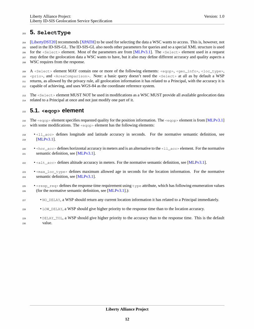
5. SelectType203
[LibertyDST20] recommends [XPATH] to be used for selecting the data a WSC wants to access. This is, however, not204
used in the ID-SIS-GL. The ID-SIS-GL also needs other parameters for queries and so a special XML structure is used205
for the <Select> element. Most of the parameters are from [MLPv3.1]. The <Select> element used in a request206
may define the geolocation data a WSC wants to have, but it also may define different accuracy and quality aspects a207
WSC requires from the response.208
A <Select> element MAY contain one or more of the following elements:<eqop> , <geo_info> , <loc_type> ,209
<prio> , and <AreaComparison> . Note: a basic query doesn’t need the<Select> at all as by default a WSP210
returns, as allowed by the privacy rule, all geolocation information it has related to a Principal, with the accuracy it is211
capable of achieving, and uses WGS-84 as the coordinate reference system.212
The<Select> element MUST NOT be used in modifications as a WSC MUST provide all available geolocation data213
related to a Principal at once and not just modify one part of it.214
5.1. <eqop> element215
The<eqop> element specifies requested quality for the position information. The<eqop> element is from [MLPv3.1]216
with some modifications. The<eqop> element has the following elements:217
• <ll_acc> defines longitude and latitude accuracy in seconds. For the normative semantic definition, see218
[MLPv3.1].219
• <hor_acc> defines horizontal accuracy in meters and is an alternative to the<ll_acc> element. For the normative220
semantic definition, see [MLPv3.1].221
• <alt_acc> defines altitude accuracy in meters. For the normative semantic definition, see [MLPv3.1].222
• <max_loc_type> defines maximum allowed age in seconds for the location information. For the normative223
semantic definition, see [MLPv3.1].224
• <resp_req> defines the response time requirement usingtype attribute, which has following enumeration values225
(for the normative semantic definition, see [MLPv3.1].):226
• NO_DELAY, a WSP should return any current location information it has related to a Principal immediately.227
• LOW_DELAY, a WSP should give higher priority to the response time than to the location accuracy.228
• DELAY_TOL, a WSP should give higher priority to the accuracy than to the response time. This is the default229
value.230
Liberty Alliance Project
12

Liberty Alliance Project: Version: 1.0Liberty ID-SIS Geolocation Service Specification
All the elements inside an<eqop> element are optional as shown by the schema:231
<xs:element name="eqop" minOccurs="0">232
<xs:complexType>233
<xs:sequence>234
<xs:element name="resp_req" minOccurs="0">235
<xs:complexType>236
<xs:attribute name="type" type="xs:string" default="DELAY_TOL"/>237
</xs:complexType>238
</xs:element>239
<xs:choice minOccurs="0">240
<xs:element name="ll_acc" type="xs:float"/>241
<xs:element name="hor_acc" type="xs:float"/>242
</xs:choice>243
<xs:element ref="alt_acc" minOccurs="0"/>244
<xs:element name="max_loc_age" type="xs:integer" minOccurs="0"/>245
<xs:element ref="Extension" minOccurs="0"/>246
</xs:sequence>247
</xs:complexType>248
</xs:element>249
250
If a WSP knows that it can not meet the requirements set by a WSC using any of the elements<ll_acc> , <hor_acc> ,251
<alt_acc> , or <max_loc_age> , it MUST NOT accept the request. For queries, this means that the processing of a252
<QueryItem> element MUST fail and a second levelQopNotAttainable status code SHOULD be used in addition253
to the top levelFailed status code. For subscriptions, this means that a subscription is not accepted if a WSP knows254
that, most probably, it will not meet the requirement in general. The sameQopNotAttainable status code SHOULD255
be used, in addition to the top levelFailed status code, when responding to a subscription request in this kind of256
a case. If a subscription had been accepted earlier, but a WSP, later, can not meet the requirement with individual257
positioning, it SHOULD still send a notification when the defined reasons to send a notification are met and it MUST258
add proper information indicating that the returned position may not meet the requirement (e.g., using the<lev_conf>259
element). The<resp_req> element does not define a hard requirement. It provides guidance concerning how a WSP260
SHOULD handle the request.261
5.2. <geo_info> element262
The <geo_info> element specifies two things: (1) what coordinate reference system should be used and (2) what263
geolocation information the requestor wants. Note that the default coordinate reference system and the only one264
which MUST be supported is [WGS-84], when coordinates are used. A<geo_info> element MUST contain one or265
more of the following elements:<CoordinateReferenceSystem> , <CivilData> , <shape> , <speed> , <alt> ,266
<direction> , and<Heading> .267
5.2.1. <CoordinateReferenceSystem> element268
The <CoordinateReferenceSystem> element defines the coordinate reference system requested to be used in a269
response. For the normative semantic definition of the<CoordinateReferenceSystem> element, see [MLPv3.1].270
A <CoordinateReferenceSystem> element contains an<Identifier> element, which identifies a coordinate271
reference system. The<Identifier> element contains three elements identifying the coordinate reference system.272
The first element is<code> , which is a unique identifier for the coordinate reference system as defined by the authority273
identified by the content of the<codeSpace> second element, which is also inside the<Identifier> element.274
The third element inside the<Identifier> element is the<edition> element, which defines the version of the275
coordinate reference system database managed by the authority defined by the<codeSpace> element.276
If the <CoordinateReferenceSystem> element is used in a request and a WSP does not support the requested277
coordinate reference system, the processing of the request fails and a second levelCrsNotSupported status code278
should be returned in addition to the top level status code. If there is no<CoordinateReferenceSystem> element279
in a request, a WSP MUST use [WGS-84].280
Liberty Alliance Project
13

Liberty Alliance Project: Version: 1.0Liberty ID-SIS Geolocation Service Specification
5.2.2. Elements requesting specific geolocation information281
A <geo_info> element may also contain one or more of the elements<CivilData> , <shape> , <speed> , <alt> ,282
<direction> , and<heading> to indicate that a WSC wants to have exactly those elements.283
A WSP SHOULD return only the requested geolocation information, but, if it does not support the parameters in284
requests, it MAY also return all the geolocation information it has related to a Principal and is allowed to share with the285
requesting WSC, taking into account permissions and privacy policies. If a WSP supports the parameters in requests,286
but does not have all or part of the requested elements available at a time, it is not, in general, an error condition. That287
information is just missing from a response or a notification. If a WSP does not support some requested data at all,288
it SHOULD indicate this with a proper second level status code and return that part of the requested data it has. The289
status codesCivilDataNotSupport , ShapeNotSupported , SpeedNotSupported , AltitudeNotSupported ,290
DirectionNotSupported , andHeadingNotSupported are available for this purpose. Note that there may be291
multiple second level status codes in a response.292
When any of the elements<shape> , <speed> , <alt> , <direction> , or <Heading> are used inside a<geo_info>293
element, that element MUST NOT have any content (e.g., if a WSC wants to have the altitude, it SHOULD use<alt>294
inside the<geo_info> element or it MAY NOT specify any info in general and just expect to get all the geolocation295
information available and allowed). The<CivilData> element MAY contain other elements indicating which parts296
of the civil data a WSC wants to have. These subelements are only used to indicate what data a WSC wants and MUST297
NOT contain anything. For example, if a WSC wants to know in which country and city a Principal is, it may use298
following:299
<geo_info>300
<CivilData>301
<L/>302
<C/>303
</CivilData>304
</geo_info>305
306
5.2.3. The Schema of the <geo_info> Element307
<xs:element name="geoinfo" minOccurs="0">308
<xs:complexType>309
<xs:sequence>310
<xs:element name="CoordinateReferenceSystem" minOccurs="0">311
<xs:complexType>312
<xs:sequence>313
<xs:element name="Identifier">314
<xs:complexType>315
<xs:sequence>316
<xs:element name="code" type="xs:string"/>317
<xs:element name="codeSpace" type="xs:string"/>318
<xs:element name="edition" type="xs:string"/>319
</xs:sequence>320
</xs:complexType>321
</xs:element>322
</xs:sequence>323
</xs:complexType>324
</xs:element>325
<xs:element ref="CivilData" minOccurs="0"/>326
<xs:element ref="shape" minOccurs="0"/>327
<xs:element ref="speed" minOccurs="0"/>328
<xs:element ref="alt" minOccurs="0"/>329
<xs:element ref="direction" minOccurs="0"/>330
<xs:element ref="Heading" minOccurs="0"/>331
<xs:element ref="Extension" minOccurs="0"/>332
</xs:sequence>333
</xs:complexType>334
Liberty Alliance Project
14

Liberty Alliance Project: Version: 1.0Liberty ID-SIS Geolocation Service Specification
</xs:element>335
336
5.3. <loc_type> element337
The <loc_type> element specifies the type of geolocation information a WSC wants to have. For the normative338
semantic definition, see [MLPv3.1]. The <loc_type> element has a type attribute which can have the following339
values:340
• CURRENT, a WSC wants to know the current geolocation information of a Principal. To meet this requirement, a341
WSP must not use geolocation information it knew before the time it received a request. It must obtain the current342
location.343
• LAST, a WSC wants to know the last geolocation information a WSP has.344
• CURRENT_OR_LAST, a WSP should find out the current geolocation information, but, if it can not get it, it may345
also return the latest information it has.346
• INITIAL , this value is related to originating emergency calls and refers to the geolocation information from the347
time an emergency call was set-up.348
The default value isCURRENT. If a WSP can not return the correct type of geolocation information in a response349
to a query, the processing of that<QueryItem> MUST fail and a second levelLocTypeNotAvailable status code350
SHOULD be used in addition to the top level status code. In a subscription request, the valueINITIAL MUST NOT be351
used. For notification subscriptions, usually, only the default valueCURRENTmakes sense and other values SHOULD352
NOT be used.353
5.4. <prio> element354
This element specifies the priority of the request. For the normative definition, see [MLPv3.1]. The<prio> element355
has atype attribute, which can have a value ofNORMALor HIGH. The default value isNORMAL. A WSP SHOULD356
prioritize the requests it is handling concurrently based on the priorities requested. A WSP MAY decide, itself, to357
whom it wants to provide high priority service. A WSP MAY not support different priorities at all and that is not an358
error condition, so it MUST process the request otherwise normally but ignoring the<prio> element.359
5.5. <AreaComparison> Element360
The <AreaComparison> element allows a WSC to ask for the location of a Principal relative to some specified361
location. The<AreaComparison> element contains a reference area in a form of<CivilData> or <shape> . A362
WSP compares this reference area to the location of the specified Principal and returnstrue , if the Principal is within363
the reference area,false , if the Principal is not within the reference area andunknown , if a WSP is not able to364
resolve the case. This way, the actual location of the Principal is not revealed as, by default, the location is not365
returned. The algorithm used to determine whether a Principal is within the specified area or not is out of the scope of366
this specification.367
The true /false /unknown comparison result is returned in a<ComparisonResult> element as the first child368
element of the<Data> element in a response. A WSC may put more than one<AreaComparison> element in369
a request. In that case, each<AreaComparison> element MUST have anitemID attribute and eachitemID370
attribute MUST have a different value compared to otheritemID attributes within the same message. In the371
response message, when multiple<AreaComparison> elements were used in the request, there MUST be one372
<ComparisonResult> element in the response for each<AreaComparison> element in the request. When373
there are multiple<ComparisonResult> elements in one response, each of them MUST have anitemIDRef374
attribute and the value of anitemIDRef attribute MUST be the value of theitemID attribute of the corresponding375
<AreaComparison> element.376
Liberty Alliance Project
15

Liberty Alliance Project: Version: 1.0Liberty ID-SIS Geolocation Service Specification
A WSP might not support the format used for defining the reference area, not recognize the given values377
when <CivilData> is used, the specified reference area might be too small for a WSP to support it, or the378
Principal’s privacy preferences would preclude their location being pinpointed so exactly. In these cases, the379
processing of the<AreaComparison> element MUST fail and a suitable second level status code SHOULD380
be used in addition to the top level status code. If the actual location is requested simultaneously, process-381
ing of that part SHOULD NOT fail if the area comparison fails. The following status codes are defined for382
the mentioned purposes:ShapeNotSupported , SpecifiedShapeNotSupported , CivilDataNotSupported ,383
SpecifiedCivilDataNotRecognised , andTooSmallArea .384
A WSP might not support the<AreaComparison> element at all. In that case, it MUST ignore the whole element,385
SHOULD use the second level status codeAreaComparisonNotSupported in the response, and MUST process the386
request as a normal location query otherwise.387
A normal query without the<AreaComparison> element inside the<Select> element is expected to return normal388
location data as specified by other parameters and processing rules. With the<AreaComparison> element, it is still389
possible to request the normal location data, but a WSC MUST set thereturnLocation attribute totrue inside the390
<AreaComparison> element to indicate that, in addition to the relative location, it wants to get the actual location,391
also. If thereturnLocation attribute is set tofalse , the actual location data MUST NOT be returned, even if392
there are parameters related to a normal query inside the<Select> element. When thereturnLocation attribute393
is set totrue , after processing the relative position request, the WSP MUST process the normal location query as the394
<AreaComparison> element would not exist, e.g., even though for the area comparison a WSC submitted an area as395
<CivilData> , the location should be returned in the format specified in the<geo_info> parameter. Note that, if396
no other parameters than the<AreaComparison> element has been provided inside the<Select> element and the397
returnLocation attribute is set totrue , it is also still a valid query for the actual location as all normal parameters398
are covered by default values and processing rules. Of course, the policies set by the Principal and/or the WSP might399
not allow returning the actual location and only the relative location information is given, if allowed.400
The schema for the<AreaComparison> element:401
<xs:element name="AreaComparison" minOccurs="0" maxOccurs="unbounded">402
<xs:complexType>403
<xs:choice>404
<xs:element ref="CivilData"/>405
<xs:element ref="shape"/>406
<xs:element ref="Extension"/>407
</xs:choice>408
<xs:attribute name="itemID" type="IDType"/>409
<xs:attribute name="returnLocation" type="xs:boolean" default="false"/>410
</xs:complexType>411
</xs:element>412
413
The schema for the<ComparisonResult> element:414
<xs:simpleType name="ComparisonResultType">415
<xs:restriction base="xs:string">416
<xs:enumeration value="true"/>417
<xs:enumeration value="false"/>418
<xs:enumeration value="unknown"/>419
</xs:restriction>420
</xs:simpleType>421
<xs:element name="ComparisonResult">422
<xs:complexType>423
<xs:simpleContent>424
<xs:extension base="ComparisonResultType">425
<xs:attribute name="ItemIDRef" type="IDReferenceType"/>426
</xs:extension>427
</xs:simpleContent>428
</xs:complexType>429
</xs:element>430
431
Liberty Alliance Project
16

Liberty Alliance Project: Version: 1.0Liberty ID-SIS Geolocation Service Specification
5.6. Common Error Handling432
In addition to the error cases described related to different parameters and mentioned in [LibertyDST20], there are433
some more geolocation-specific cases. The following second level status codes are defined for those cases:434
• AbsentSubscriber , in case of a network-based positioning, the user (Principal) is currently not reachable.435
• PositionMethodFailure , a WSP was not able to obtain the position of a Principal.436
• DisallowedByLocalRegulations , the request is disallowed by local regulatory requirements.437
5.7. Modifications438
A WSP providing ID-SIS-GL service usually obtains the geolocation information by other means, but in special439
applications it MAY also support updating the geolocation information through the ID-SIS-GL web service interface it440
provides. When modifications are done using<Modify> , the requesting WSC MUST use only one<Modification>441
element. The<Select> element MUST NOT be used and the<NewData> element MUST contain all current content442
for the <pd> element. It is not allowed to modify only one part. All available information must be from the same443
moment of time.444
Liberty Alliance Project
17

Liberty Alliance Project: Version: 1.0Liberty ID-SIS Geolocation Service Specification
6. TriggerType445
There may be several different reasons triggering notifications. A WSC MUST define in a subscription request what446
should trigger notifications unless basic change notifications are used. This is done using the<Trigger> element in447
subscription requests. The ID-SIS-GL supports the following types of notifications:448
• Notifications are sent when the geolocation information of a Principal changes.449
• Notifications are sent periodically.450
• Notifications are sent based on an event (e.g., when a mobile device a Principal is using and which is used for451
positioning a Principal is connected to a network).452
• Notifications are sent, when the Principal enters or leaves a specified area.453
A WSP may not support notifications at all or it may support only certain type of notifications. Notification may be454
delayed or not sent at all due to privacy reasons.455
6.1. Change Notifications456
The change notifications are the basic notifications supported by [LibertyDST20]. The <Select> element is used457
normally to indicate what data a WSC is interested in. A WSC MAY also define the granularity (i.e., how small458
of a change should trigger a notification). This change is related only to the position (e.g., it is not possible to459
request notifications when the direction has changed by 90 degrees). The change granularity is specified by the460
<Granularity> element, which specifies the granularity in meters.461
<xs:element name="Granularity" type="xs:positiveInteger" minOccurs="0"/>462
463
A WSP MAY NOT support the granularity requested by a WSC. In that case the processing of the subscription request464
MUST fail and the second levelRequestedGranularityNotSupported status code SHOULD be used in addition465
to the top level status code. The minimum granularity supported by a WSP MAY be returned in thecomment attribute466
of the second level<Status> element. When the minimum granularity is returned, thecomment attribute MUST467
contain the text "Minimum granularity XXX meters." where the XXX is replaced with the right value. If a WSC does468
not put a<Trigger> element inside a subscription request, it is requesting a change notification without specifying469
any granularity. In this case, a WSP decides the default granularity to be used. A WSP MAY also implement a470
minimum filtering period during which a new notification is not sent, even if the position change has been big enough.471
A WSP MAY support change notifications without supporting the<Granularity> element in subscription requests.472
If a WSP receives a request containing a<Granularity> element, although it does not support it, the processing of473
that request MUST fail and a second levelGranularityNotSupported status code SHOULD be used in addition to474
the top level status code. If a WSP does not support change notifications in general and it receives a subscription request475
for such, the processing of that request MUST fail and the second levelChangeNotificationsNotSupported476
status code SHOULD be used in addition to the top level status code.477
6.2. Periodic Notifications478
For periodic notifications, a WSC MUST specify the interval in a subscription request. The interval is defined by an479
<Interval> element inside a<Trigger> element.480
<xs:element name="Interval" type="xs:duration" minOccurs="0"/>481
482
If a WSC specifies a too short interval from the point of view of a WSP, a WSP MAY reject the subscription request.483
If a WSP rejects a subscription request for this reason it SHOULD use a second levelTooShortInterval status484
code in addition to the top level status code. It MAY also return the minimum interval in thecomment attribute of the485
second level<Status> element. When the minimum interval is returned, thecomment attribute MUST contain the486
Liberty Alliance Project
18

Liberty Alliance Project: Version: 1.0Liberty ID-SIS Geolocation Service Specification
text "Minimum interval XXX ." where the XXX is replaced with the minimum value using the format specified for487
xs:duration .488
If a WSP supports notifications, but does not support periodic notifications, the processing of a subscription request489
MUST fail and a second levelPeriodicNotificationsNotSupported status code SHOULD be used in addition490
to the top level status code.491
6.3. Notifications Based On Other Events492
A WSP may also support notifications triggered by a defined event. The only event defined at the moment is that493
of a mobile device becoming available to a network. If a WSC wants to get a geolocation notification when the494
mobile device a Principal is using becomes available to a network, it MUST add an<ms_event> element inside495
a <Trigger> element. See [MLPv3.1] for the normative semantic definitions of the<ms_event> element. The496
<ms_event> element MUST have a type attribute for which only the valueMS_AVAIL is defined in this specification497
as inherited from [MLPv3.1].498
<xs:element name="ms_action" minOccurs="0">499
<xs:complexType>500
<xs:attribute name="type" type="xs:string" use="required"/>501
</xs:complexType>502
</xs:element>503
504
If a WSP does not support this type of notification, the processing of the subscription request MUST fail and a second505
level EventNotificationNotSupported status code SHOULD be used in addition to the top level status code.506
6.4. Area-Based Notifications507
A WSC might want to know when a Principal either enters, leaves, or is within a specified area. There is a new element508
defined for this purpose:<ChangeArea> . The actual area is specified either using a<shape> element, which contains509
a geometric shape defining an area, or by using a a<CivilData> element, which contains different elements of an510
address to the level needed to define an area (e.g., country and city). The<ChangeArea> element also contains a511
mandatoryevent attribute to specify what kind of an event related to the specified area should trigger a notification.512
The following values are defined for theevent attribute:ENTERING, LEAVING, andWITHIN.513
<xs:element name="ChangeArea" minOccurs="0" maxOccurs="unbounded">514
<xs:complexType>515
<xs:choice>516
<xs:element ref="CivilData"/>517
<xs:element ref="shape"/>518
<xs:element ref="Extension"/>519
</xs:choice>520
<xs:attribute name="event" type="xs:string" use="required"/>521
</xs:complexType>522
</xs:element>523
524
If a WSP does not support area notifications and it receives a subscription request for such, the processing of that525
subscription request MUST fail and the second levelAreaNotificationsNotSupported status code SHOULD526
be used in addition to the top level status code. A WSP might not support the format used for defining the area,527
not recognize the given values when<CivilData> is used, or the specified area might be too small for a WSP528
to support it. In these cases, the processing of that subscription request MUST fail and a suitable second level529
status code SHOULD be used in addition to the top level status code. The following status codes are defined530
for the mentioned purposes:ShapeNotSupported , SpecifiedShapeNotSupported , CivilDataNotSupported ,531
SpecifiedCivilDataNotRecognised , andTooSmallArea .532
Note that a WSP may send an area notification much later than the actual event happened (e.g., it might not have been533
able to locate a Principal at the time when she entered or left a specified area). In this case, the notification is sent534
Liberty Alliance Project
19

Liberty Alliance Project: Version: 1.0Liberty ID-SIS Geolocation Service Specification
when a WSP becomes aware of that fact. A WSP also may not know about the whole event at all (e.g., a WSC has535
subscribed to get a notification when a Principal enters certain area, but a WSP may not be able to get the geolocation536
information of a Principal while the Principal was inside that specified area).537
6.5. The Schema for the TriggerType538
<xs:complexType name="TriggerType">539
<xs:sequence>540
541
<xs:element name="Granularity" type="xs:positiveInteger" minOccurs="0"/>542
543
<xs:element name="Interval" type="xs:duration" minOccurs="0"/>544
545
<xs:element name="ms_action" minOccurs="0">546
<xs:complexType>547
<xs:attribute name="type" type="xs:string" use="required"/>548
</xs:complexType>549
</xs:element>550
551
<xs:element name="ChangeArea" minOccurs="0" maxOccurs="unbounded">552
<xs:complexType>553
<xs:choice>554
<xs:element ref="CivilData"/>555
<xs:element ref="shape"/>556
<xs:element ref="Extension"/>557
</xs:choice>558
<xs:attribute name="event" type="xs:string" use="required"/>559
</xs:complexType>560
</xs:element>561
562
<xs:element ref="Extension" minOccurs="0"/>563
</xs:sequence>564
</xs:complexType>565
<xs:element name="TriggerReason" type="xs:string"/>566
567
6.6. The reason for a notification568
As with one request, a WSC may subscribe to multiple different types of notifications. A notification message must569
indicate what the reason for the notification was. This is indicated with a<TriggerReason> element inside the570
<Data> element of a notification. The following values are defined for the<TriggerReason> :571
• PERIODIC572
• CHANGE573
• MS-AVAIL574
• ENTERING575
• LEAVING576
• WITHIN577
A WSP MAY support notification types not defined in this specification and there MAY be other reason codes for578
those notifications.579
The<TriggerReason> MUST be before the<pd> element inside the<Data> element in a notification message.580
Liberty Alliance Project
20

Liberty Alliance Project: Version: 1.0Liberty ID-SIS Geolocation Service Specification
7. Geolocation Information581
Responses and notifications contain geolocation information inside<Data> elements provided by [LibertyDST20].582
The geolocation information is always inside a<pd> element. Most of the content of the<pd> element are from583
[MLPv3.1]. A <pd> element has theACCattribute, which is defined in [LibertyDST20]. In ID-SIS-GL, it is used584
to describe how the geolocation information has been obtained (e.g., is it calculated by a network or a device?585
entered by a human?). When the geolocation data is calculated by a network or a device (e.g., GPS), the value586
urn:liberty:dst:acc:challenge SHOULD be used to indicate this. When the data is entered by a human, a587
WSP does not know whether that data was calculated or entered or it does not want or is not allowed to release that588
information. TheACCMUST NOT be used or the valueurn:liberty:dst:acc:unknown MUST be used in such589
cases. All the elements inside the<pd> element as well as theACCattribute are optional as a<pd> element MAY590
have a different content depending, for example, on the request parameters, access rights and privacy policies, and the591
results of the positioning methods at each time.592
The schema for the<pd> element:593
<xs:element name="pd">594
<xs:complexType>595
<xs:sequence>596
<xs:element name="time" type="xs:dateTime" minOccurs="0"/>597
<xs:element ref="CivilData" minOccurs="0"/>598
<xs:element ref="shape" minOccurs="0"/>599
<xs:sequence minOccurs="0">600
<xs:element ref="alt" type="xs:float"/>601
<xs:element ref="alt_acc" type="xs:float" minOccurs="0"/>602
</xs:sequence>603
<xs:element ref="speed" type="xs:float" minOccurs="0"/>604
<xs:element ref="direction" type="xs:float" minOccurs="0"/>605
<xs:element ref="Heading" type="xs:float" minOccurs="0"/>606
<xs:element name="lev_conf" type="xs:float" minOccurs="0"/>607
<xs:element ref="Extension" minOccurs="0"/>608
</xs:sequence>609
<xs:attribute ref="ACC"/>610
</xs:complexType>611
</xs:element>612
613
7.1. <time> element614
The value of the<time> element defines the time when the information contained in a<pd> element was valid (e.g.,615
calculated by a network). See [MLPv3.1] for a normative semantic definition for this element, but please note that the616
type definition in ID-SIS-GL is different as thexs:dateTime is used. A WSP SHOULD always include a<time>617
element in a response or a notification. It is especially important when a WSP is not returning the current geolocation618
information, but the last one it has related to a Principal.619
7.2. <CivilData> element620
The <CivilData> element contains the position of a Principal in the format of a street address. The same format621
used by the<Address> element in the [LibertyIDPP] is used as the base with the exception that only those common622
attributes needed for the localization are used. One new subelement containing the Mobile Network Code is added623
compared to the<Address> element in the [LibertyIDPP]. See [LibertyIDPP] for the definitions of the other elements624
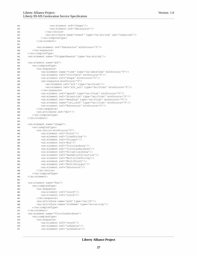
inside the<CivilData> element. Please note that the Mobile Network Code values are country-specific, so it625
SHOULD be used only together with the country code.626
<xs:element name="CivilData" type="CivilDataType"/>627
<xs:complexType name="CivilDataType">628
<xs:sequence>629
<xs:element name="PostalAddress" type="xs:string" minOccurs="0"/>630
<xs:element name="LPostalAddress" type="LocalizedString" minOccurs="0"631
Liberty Alliance Project
21
Liberty Alliance Project: Version: 1.0Liberty ID-SIS Geolocation Service Specification
maxOccurs="unbounded"/>632
<xs:element name="PostalCode" type="xs:string" minOccurs="0"/>633
<xs:element name="L" type="xs:string" minOccurs="0"/>634
<xs:element name="LL" type="LocalizedString" minOccurs="0" maxOccurs="unbounded"/>635
<xs:element name="St" type="xs:string" minOccurs="0"/>636
<xs:element name="LSt" type="LocalizedString" minOccurs="0" maxOccurs="unbounded"/>637
<xs:element name="C" type="xs:string" minOccurs="0"/>638
<xs:element name="MNC" type="xs:string" minOccurs="0"/>639
<xs:element ref="Extension" minOccurs="0"/>640
</xs:sequence>641
</xs:complexType>642
<xs:complexType name="LocalizedString">643
<xs:simpleContent>644
<xs:extension base="xs:string">645
<xs:attribute ref="xml:lang" use="required"/>646
<xs:attribute ref="script"/>647
</xs:extension>648
</xs:simpleContent>649
</xs:complexType>650
651
7.3. <shape> element652
The<shape> element contains the position of a Principal as a geometric shape. The shape is defined by a subelement,653
which is inside a<shape> element. A Principal is somewhere in the area covered by that geometric shape. A WSP654
chooses which shape to use based on the position method it is using. As many WSCs may not be able to utilize all655
the different shapes properly, a WSP SHOULD try to return a shape which is easy for a WSC to use for its purposes656
(e.g., a point). See [MLPv3.1] for the normative semantic definitions as well as for the informative introduction to the657
different shapes.658
<xs:element name="shape">659
<xs:complexType>660
<xs:choice minOccurs="0">661
<xs:element ref="Point"/>662
<xs:element ref="LineString"/>663
<xs:element ref="Polygon"/>664
<xs:element ref="Box"/>665
<xs:element ref="CircularArea"/>666
<xs:element ref="CircularArcArea"/>667
<xs:element ref="EllipticalArea"/>668
<xs:element ref="GeometryCollection"/>669
<xs:element ref="MultiLineString"/>670
<xs:element ref="MultiPoint"/>671
<xs:element ref="MultiPolygon"/>672
<xs:element ref="Extension"/>673
</xs:choice>674
</xs:complexType>675
</xs:element>676
677
7.4. <alt> and <alt_acc> elements678
The <alt> element is used to indicate the altitude of a Principal in meters. See [MLPv3.1] for normative semantic679
definitions of the<alt> element. The altitude is in relation to the ellipsoid of the coordinate reference system used.680
When an<alt> element is included in a response or a notification, the accuracy of that altitude may be described by681
an<alt_acc> element in the same response or notification. The accuracy of an altitude is also reported in meters.682
7.5. <speed> element683
Liberty Alliance Project
22
Liberty Alliance Project: Version: 1.0Liberty ID-SIS Geolocation Service Specification
When the speed of a Principal is returned in a response or a notification, it is reported in meters per second. See684
[MLPv3.1] for normative semantic definitions of the<speed> element.685
7.6. <direction> element686
A <direction> element indicates the direction towards which a Principal is moving. It is reported in degrees (0-360,687
0=360=True North). See [MLPv3.1] for normative semantic definitions of the<direction> element.688
7.7. <Heading> element689
The<heading> is different than the<direction> . The<heading> defines to which direction a Principal is facing,690
so it may be defined also when a Principal is not moving. The<heading> is also reported in degrees (0-360,691
0=360=True North).692
7.8. <lev_conf> element693
The<lev_conf> gives an estimate of the probability that a Principal is located at the area defined by the<shape>694
element returned in the same response or notification. See [MLPv3.1] for normative semantic definitions of the695
<lev_conf> element. When no<shape> element is included in a response or notification, but there is the696
<CivilData> element, the<lev_conf> element estimates the probability that a Principal is located at the area697
defined by the<CivilData> element.698
7.9. Emergency service related elements699
In addition to the position data inside a<pd> element, a response or a notification message MAY also contain one700
or two additional elements when a message is sent to an emergency service. These two elements are the Emergency701
Services Routing Digits<esrd> and the Emergency Services Routing Key<esrk> . See [MLPv3.1] for the definition702
of the semantics of these elements. These elements are added directly under the<Data> element at the same level703
as the<pd> element, when needed. When present, the order MUST be following:<esrd> , <esrk> , and<pd> . A704
WSP MUST know, by other means, when to add these elements in a response or a notification message, as request705
messages do not indicate, specifically, the need for these elements (i.e., a WSP MUST know that a message is related706
to an emergency service/call).707
<xs:element name="esrd">708
<xs:complexType>709
<xs:simpleContent>710
<xs:extension base="xs:string">711
<xs:attribute name="type" type="xs:string"/>712
</xs:extension>713
</xs:simpleContent>714
</xs:complexType>715
</xs:element>716
<xs:element name="esrk">717
<xs:complexType>718
<xs:simpleContent>719
<xs:extension base="xs:string">720
<xs:attribute name="type" type="xs:string"/>721
</xs:extension>722
</xs:simpleContent>723
</xs:complexType>724
</xs:element>725
726
Liberty Alliance Project
23
Liberty Alliance Project: Version: 1.0Liberty ID-SIS Geolocation Service Specification
8. Examples727
The request message to query the location of a user with a number of parameters:728
<gl:Query xlmns:gl="urn:liberty:id-sis-gl:2005-07">729
<gl:ResourceID>http://location.com/659gft565</gl:Resourc eID>730
<gl:QueryItem>731
<gl:Select>732
<gl:eqop>733
<gl:resp_req type="LOW_DELAY"/>734
<gl:hor_acc>1000</gl:hor_acc>735
</gl:eqop>736
<gl:loc_type type="CURRENT_OR_LAST"/>737
<gl:prio type="HIGH"/>738
</gl:Select>739
</gl:QueryItem>740
</gl:Query>741
742
An example response:743
<gl:QueryResponse xlmns:gl="urn:liberty:id-sis-gl:2005- 07">744
<gl:Status code="OK"/>745
<gl:Data>746
<gl:pd>747
<gl:time>2002-06-23-13:44:53 Z</gl:time>748
<gl:shape>749
<gl:CircularArea>750
<gl:coord>751
<gl:x>30 16 28.312N</gl:x>752
<gl:y>45 15 33.431E</gl:y>753
</gl:coord>754
<gl:radius>240</gl:radius>755
</gl:CircularArea>756
</gl:shape>757
</gl:pd>758
</gl:Data>759
</gl:QueryResponse>760
761
Another response example for a case when it was not possible to attain the requested quality of positioning:762
<gl:QueryResponse xlmns:gl="urn:liberty:id-sis-gl:2005- 07">763
<gl:Status code="Failed">764
<gl:Status code="QoPNotAttainable"/>765
</gl:Status>766
</gl:QueryResponse>767
768
In a basic query, no parameters need to be defined to get all of a Principal’s current geolocation information that is769
available and allowed. A request message for this may be simply:770
<gl:Query xlmns:gl="urn:liberty:id-sis-gl:2005-07">771
<gl:ResourceID>http://location.com/659gft565</gl:Resourc eID>772
</gl:Query>773
774
In some cases, there is no need to specify the resource (see [LibertyDST20]), so the request also may be simply:775
<gl:Query xlmns:gl="urn:liberty:id-sis-gl:2005-07"/>776
777
Liberty Alliance Project
24
Liberty Alliance Project: Version: 1.0Liberty ID-SIS Geolocation Service Specification
9. Schema778
<?xml version="1.0" encoding="UTF-8"?>779
<xs:schema780
targetNamespace="urn:liberty: id-sis-gl:2005-07"781
xmlns="urn:liberty:id-sis-gl: 2005-07"782
xmlns:xs="http://www.w3.org/2001/XMLSchem a"783
elementFormDefault="qualified" version="1.0">784
<xs:include schemaLocation="liberty-idwsf-dst-v2.0.xsd"/>785
<xs:include schemaLocation="liberty-idwsf-dst-dt-v2.0.x sd"/>786
787
<xs:complexType name="SortType">788
<xs:complexContent>789
<xs:restriction base="EmptyType"/>790
</xs:complexContent>791
</xs:complexType>792
793
<xs:complexType name="TypeType">794
<xs:complexContent>795
<xs:restriction base="EmptyType"/>796
</xs:complexContent>797
</xs:complexType>798
799
<xs:complexType name="SelectType">800
<xs:sequence>801
802
<xs:element name="AreaComparison" minOccurs="0" maxOccurs="unbounded">803
<xs:complexType>804
<xs:choice>805
<xs:element ref="CivilData"/>806
<xs:element ref="shape"/>807
<xs:element ref="Extension"/>808
</xs:choice>809
<xs:attribute name="itemID" type="IDType"/>810
<xs:attribute name="returnLocation" type="xs:boolean" default="false"/>811
</xs:complexType>812
</xs:element>813
814
<xs:element name="eqop" minOccurs="0">815
<xs:complexType>816
<xs:sequence>817
<xs:element name="resp_req" minOccurs="0">818
<xs:complexType>819
<xs:attribute name="type" type="xs:string" default="DELAY_TOL"/>820
</xs:complexType>821
</xs:element>822
<xs:choice minOccurs="0">823
<xs:element name="ll_acc" type="xs:float"/>824
<xs:element name="hor_acc" type="xs:float"/>825
</xs:choice>826
<xs:element ref="alt_acc" minOccurs="0"/>827
<xs:element name="max_loc_age" type="xs:integer" minOccurs="0"/>828
<xs:element ref="Extension" minOccurs="0"/>829
</xs:sequence>830
</xs:complexType>831
</xs:element>832
833
<xs:element name="geoinfo" minOccurs="0">834
<xs:complexType>835
<xs:sequence>836
<xs:element name="CoordinateReferenceSystem" minOccurs="0">837
<xs:complexType>838
<xs:sequence>839
<xs:element name="Identifier">840
<xs:complexType>841
<xs:sequence>842
<xs:element name="code" type="xs:string"/>843
Liberty Alliance Project
25

Liberty Alliance Project: Version: 1.0Liberty ID-SIS Geolocation Service Specification
<xs:element name="codeSpace" type="xs:string"/>844
<xs:element name="edition" type="xs:string"/>845
</xs:sequence>846
</xs:complexType>847
</xs:element>848
</xs:sequence>849
</xs:complexType>850
</xs:element>851
<xs:element ref="CivilData" minOccurs="0"/>852
<xs:element ref="shape" minOccurs="0"/>853
<xs:element ref="speed" minOccurs="0"/>854
<xs:element ref="alt" minOccurs="0"/>855
<xs:element ref="direction" minOccurs="0"/>856
<xs:element ref="Heading" minOccurs="0"/>857
<xs:element ref="Extension" minOccurs="0"/>858
</xs:sequence>859
</xs:complexType>860
</xs:element>861
862
<xs:element name="loc_type" minOccurs="0">863
<xs:complexType>864
<xs:attribute name="type" type="xs:string" default="CURRENT"/>865
</xs:complexType>866
</xs:element>867
<xs:element name="prio" minOccurs="0">868
<xs:complexType>869
<xs:attribute name="type" type="xs:string" default="NORMAL"/>870
</xs:complexType>871
</xs:element>872
<xs:element ref="Extension" minOccurs="0"/>873
</xs:sequence>874
</xs:complexType>875
876
<xs:simpleType name="ComparisonResultType">877
<xs:restriction base="xs:string">878
<xs:enumeration value="true"/>879
<xs:enumeration value="false"/>880
<xs:enumeration value="unknown"/>881
</xs:restriction>882
</xs:simpleType>883
<xs:element name="ComparisonResult">884
<xs:complexType>885
<xs:simpleContent>886
<xs:extension base="ComparisonResultType">887
<xs:attribute name="ItemIDRef" type="IDReferenceType"/>888
</xs:extension>889
</xs:simpleContent>890
</xs:complexType>891
</xs:element>892
893
<xs:complexType name="TriggerType">894
<xs:sequence>895
896
<xs:element name="Granularity" type="xs:positiveInteger" minOccurs="0"/>897
898
<xs:element name="Interval" type="xs:duration" minOccurs="0"/>899
900
<xs:element name="ms_action" minOccurs="0">901
<xs:complexType>902
<xs:attribute name="type" type="xs:string" use="required"/>903
</xs:complexType>904
</xs:element>905
906
<xs:element name="ChangeArea" minOccurs="0" maxOccurs="unbounded">907
<xs:complexType>908
<xs:choice>909
<xs:element ref="CivilData"/>910
Liberty Alliance Project
26
Liberty Alliance Project: Version: 1.0Liberty ID-SIS Geolocation Service Specification
<xs:element ref="shape"/>911
<xs:element ref="Extension"/>912
</xs:choice>913
<xs:attribute name="event" type="xs:string" use="required"/>914
</xs:complexType>915
</xs:element>916
917
<xs:element ref="Extension" minOccurs="0"/>918
</xs:sequence>919
</xs:complexType>920
<xs:element name="TriggerReason" type="xs:string"/>921
922
<xs:element name="pd">923
<xs:complexType>924
<xs:sequence>925
<xs:element name="time" type="xs:dateTime" minOccurs="0"/>926
<xs:element ref="CivilData" minOccurs="0"/>927
<xs:element ref="shape" minOccurs="0"/>928
<xs:sequence minOccurs="0">929
<xs:element ref="alt" type="xs:float"/>930
<xs:element ref="alt_acc" type="xs:float" minOccurs="0"/>931
</xs:sequence>932
<xs:element ref="speed" type="xs:float" minOccurs="0"/>933
<xs:element ref="direction" type="xs:float" minOccurs="0"/>934
<xs:element ref="Heading" type="xs:float" minOccurs="0"/>935
<xs:element name="lev_conf" type="xs:float" minOccurs="0"/>936
<xs:element ref="Extension" minOccurs="0"/>937
</xs:sequence>938
<xs:attribute ref="ACC"/>939
</xs:complexType>940
</xs:element>941
942
<xs:element name="shape">943
<xs:complexType>944
<xs:choice minOccurs="0">945
<xs:element ref="Point"/>946
<xs:element ref="LineString"/>947
<xs:element ref="Polygon"/>948
<xs:element ref="Box"/>949
<xs:element ref="CircularArea"/>950
<xs:element ref="CircularArcArea"/>951
<xs:element ref="EllipticalArea"/>952
<xs:element ref="GeometryCollection"/>953
<xs:element ref="MultiLineString"/>954
<xs:element ref="MultiPoint"/>955
<xs:element ref="MultiPolygon"/>956
<xs:element ref="Extension"/>957
</xs:choice>958
</xs:complexType>959
</xs:element>960
961
<xs:element name="Box">962
<xs:complexType>963
<xs:sequence>964
<xs:element ref="coord"/>965
<xs:element ref="coord"/>966
</xs:sequence>967
<xs:attribute name="gid" type="xs:ID"/>968
<xs:attribute name="srsName" type="xs:string"/>969
</xs:complexType>970
</xs:element>971
<xs:element name="CircularArcArea">972
<xs:complexType>973
<xs:sequence>974
<xs:element ref="coord"/>975
<xs:element ref="inRadius"/>976
<xs:element ref="outRadius"/>977
Liberty Alliance Project
27

Liberty Alliance Project: Version: 1.0Liberty ID-SIS Geolocation Service Specification
<xs:element ref="startAngle"/>978
<xs:element ref="stopAngle"/>979
<xs:element ref="angularUnit" minOccurs="0"/>980
<xs:element ref="distanceUnit" minOccurs="0"/>981
</xs:sequence>982
<xs:attribute name="gid" type="xs:ID"/>983
<xs:attribute name="srsName" type="xs:string"/>984
</xs:complexType>985
</xs:element>986
<xs:element name="CircularArea">987
<xs:complexType>988
<xs:sequence>989
<xs:element ref="coord"/>990
<xs:element ref="radius"/>991
<xs:element ref="distanceUnit" minOccurs="0"/>992
</xs:sequence>993
<xs:attribute name="gid" type="xs:ID"/>994
<xs:attribute name="srsName" type="xs:string"/>995
</xs:complexType>996
</xs:element>997
<xs:element name="EllipticalArea">998
<xs:complexType>999
<xs:sequence>1000
<xs:element ref="coord"/>1001
<xs:element ref="angle"/>1002
<xs:element ref="semiMajor"/>1003
<xs:element ref="semiMinor"/>1004
<xs:element ref="angularUnit"/>1005
<xs:element ref="distanceUnit" minOccurs="0"/>1006
</xs:sequence>1007
<xs:attribute name="gid" type="xs:ID"/>1008
<xs:attribute name="srsName" type="xs:string"/>1009
</xs:complexType>1010
</xs:element>1011
<xs:element name="GeometryCollection">1012
<xs:complexType>1013
<xs:sequence>1014
<xs:element ref="shape" maxOccurs="unbounded"/>1015
</xs:sequence>1016
<xs:attribute name="gid" type="xs:ID"/>1017
<xs:attribute name="srsName" type="xs:string"/>1018
</xs:complexType>1019
</xs:element>1020
<xs:element name="LineString">1021
<xs:complexType>1022
<xs:sequence>1023
<xs:element ref="coord"/>1024
<xs:element ref="coord" maxOccurs="unbounded"/>1025
</xs:sequence>1026
<xs:attribute name="gid" type="xs:ID"/>1027
<xs:attribute name="srsName" type="xs:string"/>1028
</xs:complexType>1029
</xs:element>1030
<xs:element name="LinearRing">1031
<xs:complexType>1032
<xs:sequence>1033
<xs:element ref="coord" minOccurs="3" maxOccurs="unbounded"/>1034
</xs:sequence>1035
<xs:attribute name="gid" type="xs:ID"/>1036
<xs:attribute name="srsName" type="xs:string"/>1037
</xs:complexType>1038
</xs:element>1039
<xs:element name="MultiLineString">1040
<xs:complexType>1041
<xs:sequence>1042
<xs:element ref="LineString" maxOccurs="unbounded"/>1043
</xs:sequence>1044
Liberty Alliance Project
28
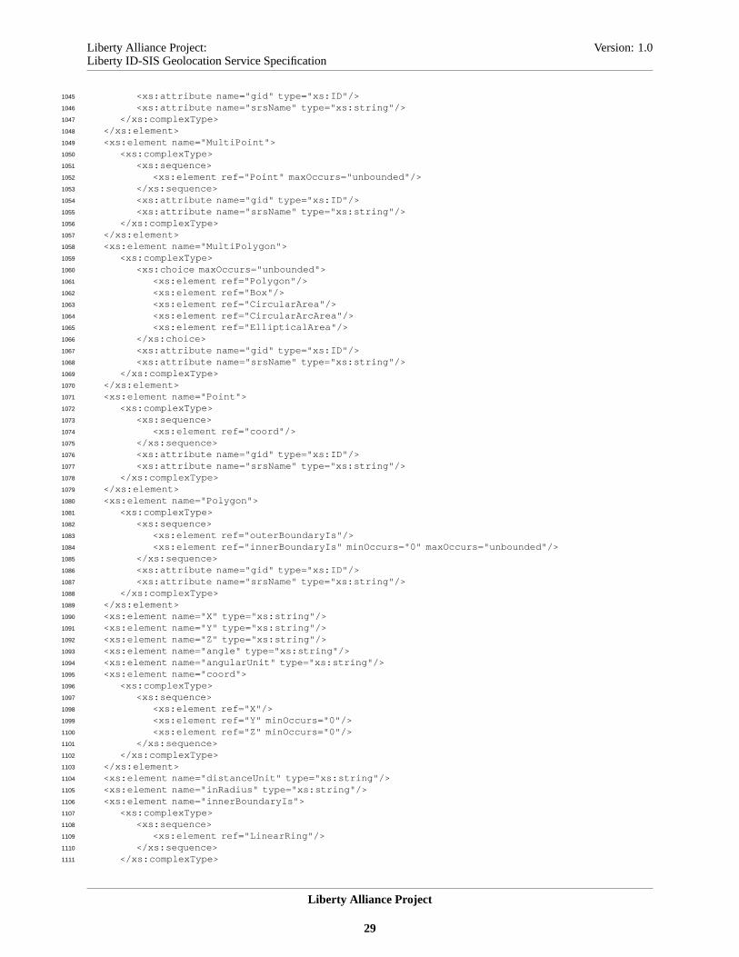
Liberty Alliance Project: Version: 1.0Liberty ID-SIS Geolocation Service Specification
<xs:attribute name="gid" type="xs:ID"/>1045
<xs:attribute name="srsName" type="xs:string"/>1046
</xs:complexType>1047
</xs:element>1048
<xs:element name="MultiPoint">1049
<xs:complexType>1050
<xs:sequence>1051
<xs:element ref="Point" maxOccurs="unbounded"/>1052
</xs:sequence>1053
<xs:attribute name="gid" type="xs:ID"/>1054
<xs:attribute name="srsName" type="xs:string"/>1055
</xs:complexType>1056
</xs:element>1057
<xs:element name="MultiPolygon">1058
<xs:complexType>1059
<xs:choice maxOccurs="unbounded">1060
<xs:element ref="Polygon"/>1061
<xs:element ref="Box"/>1062
<xs:element ref="CircularArea"/>1063
<xs:element ref="CircularArcArea"/>1064
<xs:element ref="EllipticalArea"/>1065
</xs:choice>1066
<xs:attribute name="gid" type="xs:ID"/>1067
<xs:attribute name="srsName" type="xs:string"/>1068
</xs:complexType>1069
</xs:element>1070
<xs:element name="Point">1071
<xs:complexType>1072
<xs:sequence>1073
<xs:element ref="coord"/>1074
</xs:sequence>1075
<xs:attribute name="gid" type="xs:ID"/>1076
<xs:attribute name="srsName" type="xs:string"/>1077
</xs:complexType>1078
</xs:element>1079
<xs:element name="Polygon">1080
<xs:complexType>1081
<xs:sequence>1082
<xs:element ref="outerBoundaryIs"/>1083
<xs:element ref="innerBoundaryIs" minOccurs="0" maxOccurs="unbounded"/>1084
</xs:sequence>1085
<xs:attribute name="gid" type="xs:ID"/>1086
<xs:attribute name="srsName" type="xs:string"/>1087
</xs:complexType>1088
</xs:element>1089
<xs:element name="X" type="xs:string"/>1090
<xs:element name="Y" type="xs:string"/>1091
<xs:element name="Z" type="xs:string"/>1092
<xs:element name="angle" type="xs:string"/>1093
<xs:element name="angularUnit" type="xs:string"/>1094
<xs:element name="coord">1095
<xs:complexType>1096
<xs:sequence>1097
<xs:element ref="X"/>1098
<xs:element ref="Y" minOccurs="0"/>1099
<xs:element ref="Z" minOccurs="0"/>1100
</xs:sequence>1101
</xs:complexType>1102
</xs:element>1103
<xs:element name="distanceUnit" type="xs:string"/>1104
<xs:element name="inRadius" type="xs:string"/>1105
<xs:element name="innerBoundaryIs">1106
<xs:complexType>1107
<xs:sequence>1108
<xs:element ref="LinearRing"/>1109
</xs:sequence>1110
</xs:complexType>1111
Liberty Alliance Project
29
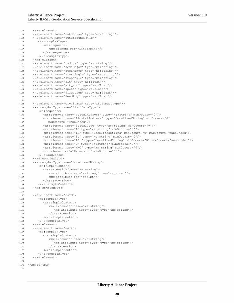
Liberty Alliance Project: Version: 1.0Liberty ID-SIS Geolocation Service Specification
</xs:element>1112
<xs:element name="outRadius" type="xs:string"/>1113
<xs:element name="outerBoundaryIs">1114
<xs:complexType>1115
<xs:sequence>1116
<xs:element ref="LinearRing"/>1117
</xs:sequence>1118
</xs:complexType>1119
</xs:element>1120
<xs:element name="radius" type="xs:string"/>1121
<xs:element name="semiMajor" type="xs:string"/>1122
<xs:element name="semiMinor" type="xs:string"/>1123
<xs:element name="startAngle" type="xs:string"/>1124
<xs:element name="stopAngle" type="xs:string"/>1125
<xs:element name="alt" type="xs:float"/>1126
<xs:element name="alt_acc" type="xs:float"/>1127
<xs:element name="speed" type="xs:float"/>1128
<xs:element name="direction" type="xs:float"/>1129
<xs:element name="Heading" type="xs:float"/>1130
1131
<xs:element name="CivilData" type="CivilDataType"/>1132
<xs:complexType name="CivilDataType">1133
<xs:sequence>1134
<xs:element name="PostalAddress" type="xs:string" minOccurs="0"/>1135
<xs:element name="LPostalAddress" type="LocalizedString" minOccurs="0"1136
maxOccurs="unbounded"/>1137
<xs:element name="PostalCode" type="xs:string" minOccurs="0"/>1138
<xs:element name="L" type="xs:string" minOccurs="0"/>1139
<xs:element name="LL" type="LocalizedString" minOccurs="0" maxOccurs="unbounded"/>1140
<xs:element name="St" type="xs:string" minOccurs="0"/>1141
<xs:element name="LSt" type="LocalizedString" minOccurs="0" maxOccurs="unbounded"/>1142
<xs:element name="C" type="xs:string" minOccurs="0"/>1143
<xs:element name="MNC" type="xs:string" minOccurs="0"/>1144
<xs:element ref="Extension" minOccurs="0"/>1145
</xs:sequence>1146
</xs:complexType>1147
<xs:complexType name="LocalizedString">1148
<xs:simpleContent>1149
<xs:extension base="xs:string">1150
<xs:attribute ref="xml:lang" use="required"/>1151
<xs:attribute ref="script"/>1152
</xs:extension>1153
</xs:simpleContent>1154
</xs:complexType>1155
1156
<xs:element name="esrd">1157
<xs:complexType>1158
<xs:simpleContent>1159
<xs:extension base="xs:string">1160
<xs:attribute name="type" type="xs:string"/>1161
</xs:extension>1162
</xs:simpleContent>1163
</xs:complexType>1164
</xs:element>1165
<xs:element name="esrk">1166
<xs:complexType>1167
<xs:simpleContent>1168
<xs:extension base="xs:string">1169
<xs:attribute name="type" type="xs:string"/>1170
</xs:extension>1171
</xs:simpleContent>1172
</xs:complexType>1173
</xs:element>1174
1175
</xs:schema>1176
1177
Liberty Alliance Project
30
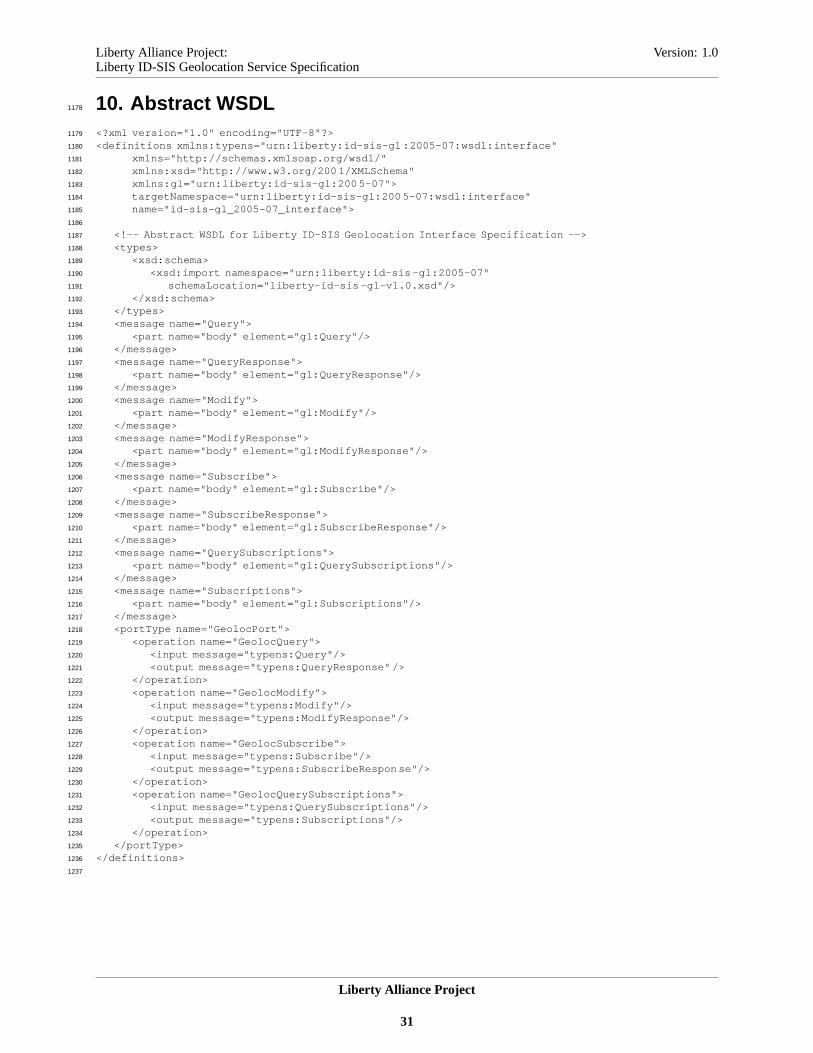
Liberty Alliance Project: Version: 1.0Liberty ID-SIS Geolocation Service Specification
10. Abstract WSDL1178
<?xml version="1.0" encoding="UTF-8"?>1179
<definitions xmlns:typens="urn:liberty:id-sis-gl :2005-07:wsdl:interface"1180
xmlns="http://schemas.xmlsoap.org/wsdl/"1181
xmlns:xsd="http://www.w3.org/200 1/XMLSchema"1182
xmlns:gl="urn:liberty:id-sis-gl:200 5-07">1183
targetNamespace="urn:liberty:id-sis-gl:200 5-07:wsdl:interface"1184
name="id-sis-gl_2005-07_interface">1185
1186
<!-- Abstract WSDL for Liberty ID-SIS Geolocation Interface Specification -->1187
<types>1188
<xsd:schema>1189
<xsd:import namespace="urn:liberty:id-sis -gl:2005-07"1190
schemaLocation="liberty-id-sis -gl-v1.0.xsd"/>1191
</xsd:schema>1192
</types>1193
<message name="Query">1194
<part name="body" element="gl:Query"/>1195
</message>1196
<message name="QueryResponse">1197
<part name="body" element="gl:QueryResponse"/>1198
</message>1199
<message name="Modify">1200
<part name="body" element="gl:Modify"/>1201
</message>1202
<message name="ModifyResponse">1203
<part name="body" element="gl:ModifyResponse"/>1204
</message>1205
<message name="Subscribe">1206
<part name="body" element="gl:Subscribe"/>1207
</message>1208
<message name="SubscribeResponse">1209
<part name="body" element="gl:SubscribeResponse"/>1210
</message>1211
<message name="QuerySubscriptions">1212
<part name="body" element="gl:QuerySubscriptions"/>1213
</message>1214
<message name="Subscriptions">1215
<part name="body" element="gl:Subscriptions"/>1216
</message>1217
<portType name="GeolocPort">1218
<operation name="GeolocQuery">1219
<input message="typens:Query"/>1220
<output message="typens:QueryResponse" />1221
</operation>1222
<operation name="GeolocModify">1223
<input message="typens:Modify"/>1224
<output message="typens:ModifyResponse"/>1225
</operation>1226
<operation name="GeolocSubscribe">1227
<input message="typens:Subscribe"/>1228
<output message="typens:SubscribeRespon se"/>1229
</operation>1230
<operation name="GeolocQuerySubscriptions">1231
<input message="typens:QuerySubscriptions"/>1232
<output message="typens:Subscriptions"/>1233
</operation>1234
</portType>1235
</definitions>1236
1237
Liberty Alliance Project
31

Liberty Alliance Project: Version: 1.0Liberty ID-SIS Geolocation Service Specification
References1238
Normative1239
[LibertyDisco12] Sergent, Jonathan, eds. "Liberty ID-WSF Discovery Service Specification," Version 1.2, Liberty1240
Alliance Project (12 December 2004).http://www.projectliberty.org/specs/1241
[LibertyDST20] Kainulainen, Jukka, Ranganathan, Aravindan, eds. "Liberty ID-WSF Data Services Template1242
Specification," Version 2.0, Liberty Alliance Project (23 March, 2005).http://www.projectliberty.org/specs1243
[LibertyGlossary] Hodges, Jeff, eds. "Liberty Technical Glossary," Version v2.0, Liberty Alliance Project (30 July,1244
2006).http://www.projectliberty.org/specs1245
[LibertyIDPP] Kellomäki, Sampo, Lockhart, Rob, eds. "Liberty ID-SIS Personal Profile Service Specification,"1246
Version 1.1, Liberty Alliance Project (29 September, 2005).http://www.projectliberty.org/specs1247
[LibertyReg] Kemp, John, eds. "Liberty Enumeration Registry Governance," Version 1.1, Liberty Alliance Project (141248
December, 2004).http://www.projectliberty.org/specs1249
[MLPv3.1] "Mobile Location Protocol (MLP) Candidate Version 3.1," Open Mobile Alliance (16 March 2004).1250
http://member.openmobilealliance.org/ftp/public_documents/loc/Permanent_documents/OMA-LIF-MLP-1251
V3_1-20040316-C.zip1252
[RFC2119] S. Bradner "Key words for use in RFCs to Indicate Requirement Levels," RFC 2119, The Internet1253
Engineering Task Force (March 1997).http://www.ietf.org/rfc/rfc2119.txt1254
[Schema1] Thompson, Henry S., Beech, David, Maloney, Murray, Mendelsohn, Noah, eds. (May1255
2001). "XML Schema Part 1: Structures," Recommendation, World Wide Web Consortium1256
http://www.w3.org/TR/2001/REC-xmlschema-1-20010502/1257
[WGS-84] "WGS 84 Implementation Manual, v2.4," (EUROCONTROL), European Organization for the Safety of Air1258
Navigation, (IfEN), Institute of Geodesy and Navigation, eds. World Geodetic System 1984 (12 February,1259
1998).http://www.wgs84.com/files/wgsman24.pdf1260
[XML] Bray, Tim, Paoli, Jean, Sperberg-McQueen, C. M., Maler, Eve, Yergeau, Francois, eds. (04 February 2004).1261
"Extensible Markup Language (XML) 1.0 (Third Edition)," Recommendation, World Wide Web Consortium1262
http://www.w3.org/TR/2004/REC-xml-200402041263
[XPATH] Clark , J., DeRose , S., eds. (16 November 1999). "XML Path Language (XPath) Version 1.0 ,"1264
Recommendation, W3Chttp://www.w3.org/TR/xpath[August 2003].1265
Informative1266
[LibertyIDGLGuide] Grahm, Corina, Castellanos, David, Kainulainen, Jukka, Lockhart, Rob, eds. "Lib-1267
erty ID-SIS Geolocation Service Implementation Guidelines," Version 1.0, (04 August, 2008).1268
http://www.projectliberty.org/specs1269
Liberty Alliance Project
32