Embed Size (px)
Citation preview

GCSE
Geography
8035/3 Paper 3 Geographical applications
Mark scheme
8035
June 2018
Version/Stage: 1.0 Final
Copyright © 2018 AQA and its licensors. All rights reserved.
AQA retains the copyright on all its publications. However, registered schools/colleges for AQA are permitted to copy material from this booklet
for their own internal use, with the following important exception: AQA cannot give permission to schools/colleges to photocopy any material that
is acknowledged to a third party even for internal use within the centre.
Mark schemes are prepared by the Lead Assessment Writer and considered, together with the relevant
questions, by a panel of subject teachers. This mark scheme includes any amendments made at the
standardisation events which all associates participate in and is the scheme which was used by them in
this examination. The standardisation process ensures that the mark scheme covers the students’
responses to questions and that every associate understands and applies it in the same correct way.
As preparation for standardisation each associate analyses a number of students’ scripts. Alternative
answers not already covered by the mark scheme are discussed and legislated for. If, after the
standardisation process, associates encounter unusual answers which have not been raised they are
required to refer these to the Lead Assessment Writer.
It must be stressed that a mark scheme is a working document, in many cases further developed and
expanded on the basis of students’ reactions to a particular paper. Assumptions about future mark
schemes on the basis of one year’s document should be avoided; whilst the guiding principles of
assessment remain constant, details will change, depending on the content of a particular examination
paper.
Further copies of this mark scheme are available from aqa.org.uk

MARK SCHEME – GCSE GEOGRAPHY – 8035/3 – JUNE 2018
3
Point marked questions marking instructions
The mark scheme will state the correct answer or a range of possible answers, although these may not
be exhaustive. It may indicate how a second mark is awarded for a second point or developed idea. It
may give an indication of unacceptable answers. Each mark should be shown by placing a tick where
credit is given. The number of ticks must equal the mark awarded. Do not use crosses to indicate
answers that are incorrect.
Level of response marking instructions
Level of response mark schemes are broken down into levels, each of which has a descriptor. The
descriptor is linked to the Assessment Objective(s) being addressed. The descriptor for the level shows
the average performance for the level.
Before you apply the mark scheme to a student’s answer read through the answer and annotate it (as
instructed) to show the qualities that are being looked for. You can then apply the mark scheme. You
should read the whole answer before awarding marks on levels response questions.
Step 1 Determine a level
Descriptors for the level indicate the different qualities that might be seen in the student’s answer for that
level.
When assigning a level you should look at the overall quality of the answer and not look to pick holes in
small and specific parts of the answer where the student has not performed quite as well as the rest. If
the answer covers different aspects of different levels of the mark scheme you should use a best fit
approach for defining the level and then use the variability of the response to help decide the mark within
the level, ie if the response is predominantly Level 2 with a small amount of Level 3 material it would be
placed in Level 2 but be awarded a mark near the top of the level because of the Level 3 content. For
instance, in a 9 mark question with three levels of response, an answer may demonstrate thorough
knowledge and understanding (AO1 and AO2) but fail to respond to command words such as assess or
evaluate (AO3). The script could still access Level 2 marks. Note that the mark scheme is not
progressive in the sense that students don’t have to fulfil all the requirements of Level 1 in order to
access Level 2.
Step 2 Determine a mark
Once you have assigned a level you need to decide on the mark. The descriptors on how to allocate
marks can help with this. The exemplar materials used during standardisation will also help. There will
generally be an answer in the standardising materials which will correspond with each level of the mark
scheme. This answer will have been awarded a mark by the Lead Examiner. You can compare the
student’s answer with the example to determine if it is the same standard, better or worse than the
example. You can then use this to allocate a mark for the answer based on the Lead Examiner’s mark
on the example.
You may well need to read back through the answer as you apply the mark scheme to clarify points and
assure yourself that the level and the mark are appropriate.

MARK SCHEME – GCSE GEOGRAPHY – 8035/3 – JUNE 2018
4
Indicative content in the mark scheme is provided as a guide for examiners. It is not intended to be
exhaustive and you must credit other valid points. Students do not have to cover all of the points
mentioned in the indicative content to reach the highest level of the mark scheme.
An answer which contains nothing of relevance to the question must be awarded no marks.
Assessment of spelling, punctuation, grammar and use of specialist terminology
(SPaG)
Accuracy of spelling, punctuation, grammar and the use of specialist terminology will be assessed via
the indicated 9 mark questions. In each of these questions, three marks are allocated for SPaG as
follows:
High performance – 3 marks
Intermediate performance – 2 marks
Threshold performance – 1 mark
General guidance
Mark schemes should be applied positively. Examiners should look for qualities to reward rather
than faults to penalise. They are looking to find credit in each response they mark. Unless the
mark scheme specifically states, candidates must never lose marks for incorrect answers.
The full range of marks should be used. Examiners should always award full marks if deserved,
i.e. if the answer matches the mark scheme.
When examiners are in doubt regarding the application of the mark scheme to a candidate’s
response, the team leader must be consulted
Crossed out work should be marked unless the candidate has replaced it with an alternative
response.
Do NOT add ticks to level-marked questions – use the highlight tool/brackets to signify what is
relevant.
Sometimes there are specific “triggers” in the mark scheme that enable higher level marks to be
awarded. For instance, an example or case study may be required for Level 3 if it is stated within
the question.
Where a source, such as a photograph or map, is provided as a stimulus it should be used if
requested in the question, but credit can often be given for inferred as well as direct use of the
source.
Always be consistent – accept the guidelines given in the mark scheme and apply them to every
script
If necessary make comments to support the level awarded and to help clarify a decision you have
made
Examiners should revisit standardise script answers as they apply the mark scheme in order to
confirm that the level and the mark allocated is appropriate to the response provided.
Mark all answers written on the examination paper.
MARK SCHEME – GCSE GEOGRAPHY – 8035/3 – JUNE 2018
5
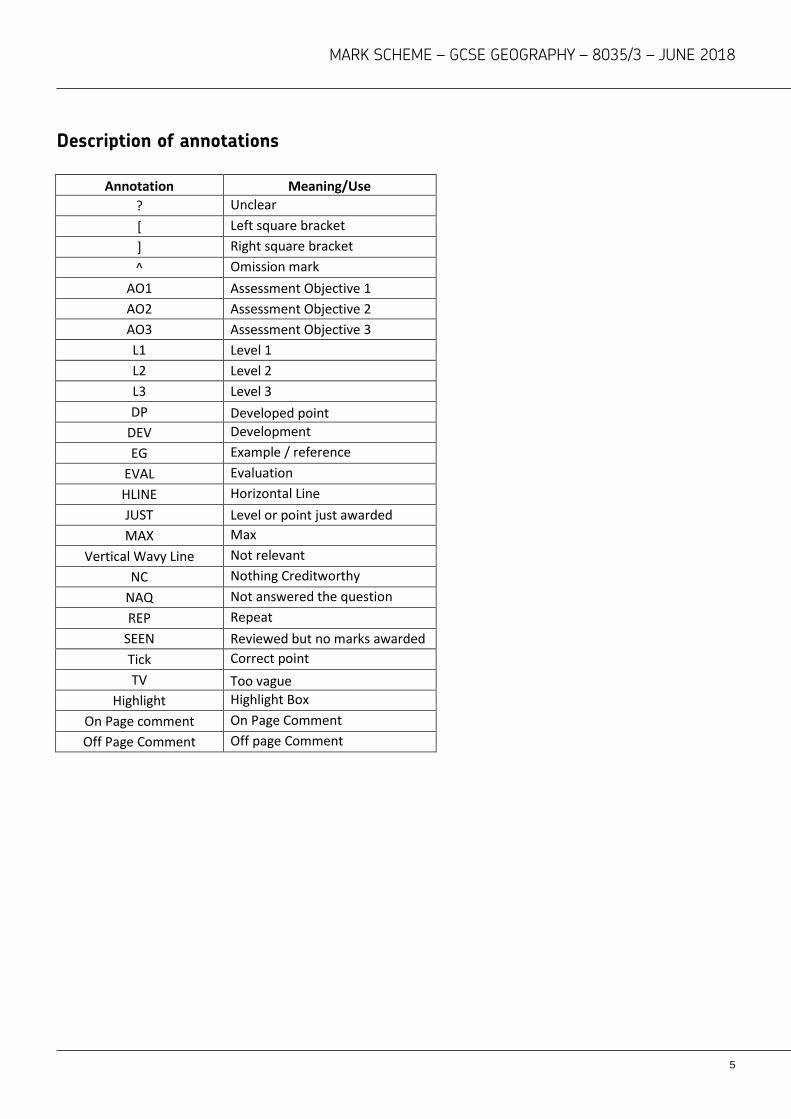
Description of annotations
Annotation Meaning/Use
? Unclear
[ Left square bracket
] Right square bracket
^ Omission mark
AO1 Assessment Objective 1
AO2 Assessment Objective 2
AO3 Assessment Objective 3
L1 Level 1
L2 Level 2
L3 Level 3
DP Developed point
DEV Development
EG Example / reference
EVAL Evaluation
HLINE Horizontal Line
JUST Level or point just awarded
MAX Max
Vertical Wavy Line Not relevant
NC Nothing Creditworthy
NAQ Not answered the question
REP Repeat
SEEN Reviewed but no marks awarded
Tick Correct point
TV Too vague
Highlight Highlight Box
On Page comment On Page Comment
Off Page Comment Off page Comment

MARK SCHEME – GCSE GEOGRAPHY – 8035/3 – JUNE 2018
6
Section A : Issue evaluation
Qu Pt Marking Guidance Total
marks
01 1 Which of the following cities has the highest annual rainfall?
B: Glasgow
1 mark for correct answer.
No mark if more than one answer selected.
AO4 = 1 mark
1
01 2 Give two effects of water stress.
Any two reasonable ideas, expressed as an “effect”. Examples might
include:
water supply/shortage issues
may lead to rationing
reducing water table affects aquifers
too much water removed from rivers affects flow
hosepipe bans makes outside water use difficult
increase in the price of water
effects on vegetation in gardens
problems for farming/growing crops/food shortages/increasing food
prices
effects on angling/fishing
effects on sailing/recreational activities
problems for industrial production/loss of output/jobs
falling levels in reservoirs affects energy supply
need for increasing levels of water management to ensure adequate
supply
damage to environment
health issues
over-extraction of water
AO2 = 2 marks
2

MARK SCHEME – GCSE GEOGRAPHY – 8035/3 – JUNE 2018
7
01 3 ‘Water transfer schemes will be essential to meet the growing demand
for water in the UK.’ Do you agree? Explain your answer.
Level Marks Description
3
(Detailed)
5–6 AO2 Demonstrates a detailed understanding of the challenges of managing the growing demand for water and the different strategies that might be used in order to respond to the growing demand for water. AO3 – Demonstrates detailed application of understanding in evaluating the importance of water transfer schemes.
2 (Clear)
3–4 AO2 – Demonstrates a clear understanding of the challenges of managing the growing demand for water and/or the different strategies that might be used in order to respond to the growing demand for water. AO3 – Demonstrates reasonable application of
understanding in evaluating the importance of water
transfer schemes.
1 (Basic)
1–2 AO2 – Demonstrates a limited understanding of the challenges of managing the growing demand for water AO3 – Demonstrates limited application of understanding in evaluating the importance of water transfer schemes.
0 No relevant content.
Level 3 (detailed) understanding of the debate with evaluative
observations which identify precisely why there may be a need for water transfer schemes and a broad appreciation of alternative strategies to ensure adequate supply.
Level 2 (clear) understanding of debate which identifies that there will
be a need to manage future supply/demand with some evaluation of the need for water transfer schemes and/or some appreciation of the alternative strategies to ensure adequate supply.
Level 1 (basic) understanding of the need for future management with
some reasoning which offers limited reflective observations. No real appreciation of rainfall patterns and demand factors or alternative management strategies. May simply agree/disagree with the statement and make basic points to support the chosen view.
Indicative content
The precipitation map shows clearly that there are considerable
variations in amounts of precipitation across the UK
The major settlements identified on the map suggest that there may be
6

MARK SCHEME – GCSE GEOGRAPHY – 8035/3 – JUNE 2018
8
an imbalance between supply and demand
There are also additional physical factors that might be considered,
such as types/patterns of rainfall and the effect of geology on storage
and the importance of aquifers
In addition to total rainfall amounts the consideration of seasonality is of
fundamental importance in relation to the management of water supply
Part of the debate is the legal obligation that water companies have to
ensure adequate supply and quality
Broader aspects might include observations about how
agricultural/industrial demand may be in areas of lowest rainfall
There are a number of demand based factors identified in the resource,
including population/housing growth and increasing demand created by
growing levels of wealth
Aspects of changing climate are considered, especially in relation to the
reliability of rainfall/ there is an element of “the unknown” suggested
here
There are clearly different potential strategies for managing water
supply, including water transfer schemes/recharge/storage and also
reducing waste and conservation
There is a clear suggestion that satisfying the likely future demand will
not be easily possible without some form of transfer/storage
AO2 = 3 marks, AO3 = 3 marks

MARK SCHEME – GCSE GEOGRAPHY – 8035/3 – JUNE 2018
9
01 4 Suggest why water companies need 25 year plans.
Level Marks Description
3
(Detailed)
5–6 AO3 – Demonstrates detailed evaluation of the reasons why water companies need long term plans in order to manage future demands. AO3 – Analyses the information effectively to identify the factors that need to be considered in relation to long term planning.
2 (Clear)
3–4 AO3 – Demonstrates a clear evaluation of the reasons why water companies need long term plans in order to manage future demands. AO3 – Analyses the information to identify some of the factors that need to be considered in relation to long term planning.
1 (Basic)
1–2 AO3 – Demonstrates a basic evaluation of the reasons why water companies need long term plans in order to manage future demands. AO3 – Analyses the information in a limited way to identify demand factors and tentatively link this to the need for planning.
0 No relevant content.
Level 3 (Detailed) reference to resource(s) to identify and evaluate the
needs for 25 year plans with an appreciation of both supply and demand factors. This includes an understanding that developing supply infrastructure requires planning/time and involves a range of factors.
Level 2 (Clear) reference to resource(s) to identify and evaluate the
needs for 25 year plans with an appreciation of either supply OR demand factors OR some reference to both. Answer may lack balance.
Level 1 (Basic) reference to resource(s) which identify and offer some
tentative (evaluative) observations about the need for 25 year plans. May be largely copied points with limited development.
Indicative content
Water companies have a legal obligation to ensure both quantity and
quality of supply.
Past evidence is used to consider both likely supply and demand in the
future.
The idea of a 25 year plan clearly suggests that there is a longer term
strategy which will reduce the likelihood of shortages.
There are also long term development/planning strategies in relation to
housing/industrial/recreational development and since these factors will
6
MARK SCHEME – GCSE GEOGRAPHY – 8035/3 – JUNE 2018
10
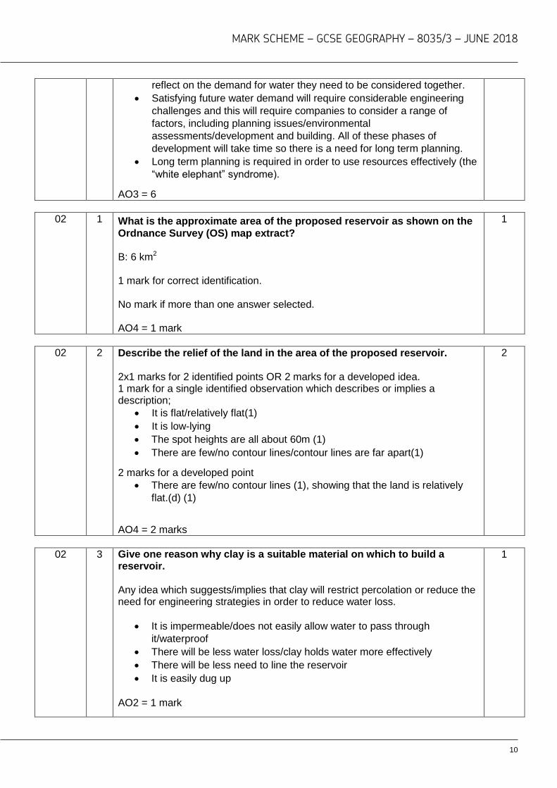
reflect on the demand for water they need to be considered together.
Satisfying future water demand will require considerable engineering
challenges and this will require companies to consider a range of
factors, including planning issues/environmental
assessments/development and building. All of these phases of
development will take time so there is a need for long term planning.
Long term planning is required in order to use resources effectively (the
“white elephant” syndrome).
AO3 = 6
02 1 What is the approximate area of the proposed reservoir as shown on the
Ordnance Survey (OS) map extract? B: 6 km2 1 mark for correct identification. No mark if more than one answer selected. AO4 = 1 mark
1
02 2 Describe the relief of the land in the area of the proposed reservoir. 2x1 marks for 2 identified points OR 2 marks for a developed idea. 1 mark for a single identified observation which describes or implies a description;
It is flat/relatively flat(1)
It is low-lying
The spot heights are all about 60m (1)
There are few/no contour lines/contour lines are far apart(1)
2 marks for a developed point
There are few/no contour lines (1), showing that the land is relatively
flat.(d) (1)
AO4 = 2 marks
2
02 3 Give one reason why clay is a suitable material on which to build a reservoir. Any idea which suggests/implies that clay will restrict percolation or reduce the need for engineering strategies in order to reduce water loss.
It is impermeable/does not easily allow water to pass through
it/waterproof
There will be less water loss/clay holds water more effectively
There will be less need to line the reservoir
It is easily dug up
AO2 = 1 mark
1

MARK SCHEME – GCSE GEOGRAPHY – 8035/3 – JUNE 2018
11
03 1 ‘The physical environment provides opportunities for a range of socio-
economic activities.’ Use Figure 2 and Figure 3 to discuss this
statement.
Level Marks Description
3
(Detailed)
5–6 AO3 – Demonstrates detailed analysis of the importance of the physical environment in providing opportunity for a wide range of social and economic activities. AO4 – Communicates ideas with clarity and good
use of geographical language.
2 (Clear)
3–4 AO3 – Demonstrates clear analysis of the importance of the physical environment in providing opportunity for a range of social and / or economic activities. AO4 – Communicates ideas effectively with some
use of geographical language.
1 (Basic)
1–2 AO3 – Demonstrates limited analysis of the importance of the physical environment in providing opportunity for social and / or economic activities. AO4 – Communicates ideas using basic language.
0 No relevant content.
Level 3 (detailed) use of Figure 2 and Figure 3 which offers developed
and reasoned observations about how the physical environment provides the opportunity for a wide range of socio-economic opportunities. May make links between social/recreational opportunities and economic opportunities (visitor centres/wardens/catering opportunities).
Level 2 (clear) use of Figure 2 and/or Figure 3 which offers reasoned
observations about how the physical environment provides the opportunity for a range of socio-economic opportunities. May not indicate links between social and economic opportunities.
Level 1 (basic) use of Figure 2 and/or Figure 3 which identifies a narrow range (more than one) of the socio-economic opportunities related to areas of countryside/water features. Basic expression of ideas. May be largely copied points with limited development.
Word for word copy from resource – Max 1 mark. The question requires candidates to make appropriate links between content from different parts of the course. Indicative content
6

MARK SCHEME – GCSE GEOGRAPHY – 8035/3 – JUNE 2018
12
The physical environment provides a wide range of economic
opportunities in relation to resource development and use, and also
transportation.
Economic opportunities may be created for both the local area and the
wider economy.
Economic opportunities may be reflected in job opportunities/wealth
creation or specific industrial links. Multiplier possibilities might be
considered.
There are a range of social activities which might be passive or active.
These might be expressed in many ways
(recreational/sporting/creative/educational/environmental).
Social and economic opportunities do not exist in isolation. For instance,
water sports activities are seen as a recreational/social activity but also
provide employment through activity centres/cafes etc.).
Accept observations about negative socio-economic opportunties
AO3 = 3 marks, AO4 = 3 marks
03 2 Do you think that the proposed reservoir development should go ahead?
Use evidence from the resources booklet and your own understanding to
explain your choice.
Level Marks Description
3
(Detailed)
7–9 AO3 – Demonstrates thorough application of knowledge and understanding in evaluating the proposed reservoir development in terms of the socio-economic and environmental impacts. AO3 – Applies knowledge and understanding to make a decision based on a wide range of evidence, making specific links between different elements of the specification. AO4 – Communicates ideas with clarity and good
use of geographical language.
2 (Clear)
4–6 AO3 – Demonstrates reasonable application of knowledge and understanding in evaluating the proposed reservoir development in terms of the socio-economic and/or environmental impacts. AO3 – Applies knowledge and understanding to make a decision based on a reasonable range of evidence, making some links between different elements of the specification. AO4 – Communicates ideas effectively with some
use of geographical language.
1 (Basic)
1–3 AO3 – Demonstrates basic application of knowledge and understanding in evaluating the proposed reservoir development in terms of the socio-
9 + 3
SPaG

MARK SCHEME – GCSE GEOGRAPHY – 8035/3 – JUNE 2018
13
economic and/or environmental impacts. AO3 – Applies knowledge and understanding to make a decision based on a narrow range of evidence, making basic links between different elements of the specification. AO4 – Communicates ideas using basic language.
0 No relevant content.
Level 3 (detailed) use of the resources with a wide range of points
developed (using the range of resources or going beyond the resources) which supports the decision. Offers detailed observations which support the decision OR offers a balanced appreciation of the advantages/disadvantages of the proposed development. Likely to use material from different parts of the resource booklet.
Level 2 (clear) use of the resources with a range of points identified
with some development in order to support the decision. OR clearly considers advantages/disadvantages of the proposed development. May reference other parts of the resource booklet.
Level 1 (basic) use of the resources with a limited number of individual
points identified (largely copied points with limited development) in order to support the decision. OR identifies basic advantages/disadvantages of the proposed development expressed within the resources. May be limited to Figure 3 only.
Indicative content
There is an expectation that candidates will draw on evidence from the
whole of the resource booklet in order to consider broader themes and
potentially bring in wider aspects of their geographical study.
Decision making implies an element of evaluative thinking. This can be
expressed in different ways.
There are strong synoptic links running through the whole exercise
including; elements of physical geography; environmental geography;
social geography and economic geography.
There is a strong link to the idea of the environment as a valuable
resource and an appreciation of the concept of both environmental and
socio-economic sustainability and how these might be linked is implicit
throughout the exercise.
This exercise implies an understanding of the challenges of managing
the security of water supply and the importance of a reliable and cost
effective supply of water.
There is a clear reference to the idea that there may be different ways to
satisfy increasing demand, so this scheme could be seen relative to
other possibilities.
There is a clear element of balancing socio-economic gains and socio-
environmental costs, but there are more complex factors, for example,
the extent to which the development might create wider gains at the cost
of local people.

MARK SCHEME – GCSE GEOGRAPHY – 8035/3 – JUNE 2018
14
The nature of the exercise suggests an element of discussion about the
balance between managing supply and demand. As such there is a
strong element of using conservation and technology to control demand,
which in turn may reflect on the need for large scale developments. The
proposed development is being sold as essentially the only real option;
however opposition groups suggest that there may be other
options/combinations of options.
Part of the discussion may be the extent to which the development
provides the best opportunity to satisfy future water needs or whether a
number of smaller schemes and conservation measures may be more
economically and environmentally suitable.
Candidates may challenge the idea that the development is based on
future predictions (of population/housing based demand and climate
uncertainty) and consider that this data may be unreliable, consequently
leading to a “white elephant” scenario (Kielder Water?).This avenue of
thinking is reasonable in relation to offering a broad ranging evaluative
judgement.
AO3 = 6 marks, AO4 = 3 marks Spelling, punctuation and grammar (SPaG)
High performance
Learners spell and punctuate with consistent accuracy
Learners use rules of grammar with effective control of meaning overall
Learners use a wide range of specialist terms as appropriate
Intermediate performance
Learners spell and punctuate with considerable accuracy
Learners use rules of grammar with general control of meaning overall
Learners use a good range of specialist terms as appropriate
Threshold performance
Learners spell and punctuate with reasonable accuracy
Learners use rules of grammar with some control of meaning and any
errors do not significantly hinder meaning overall
Learners use a limited range of specialist terms as appropriate
No marks awarded
The learner writes nothing
The learner’s response does not relate to the question
The learner’s achievement in SPaG does not reach the threshold performance
level, for example errors in spelling, punctuation and grammar severely hinder
meaning.
3
2
1
0
MARK SCHEME – GCSE GEOGRAPHY – 8035/3 – JUNE 2018
15
Section B: Fieldwork
Qu Pt Marking guidance Total marks
04 1 Complete the map below (Figure 5) to show the origin of visitors to Bournemouth using the following data.
1 mark for correct shading in appropriate region (Yorkshire and the Humber). Must be shown as horizontal lines
AO4 = 1 mark
1
04 2 Describe the pattern shown by Figure 5.
Two basic points OR one developed point (can be an identified point and use of data) Needs reference to the actual map data to provide accurate indicative content
Most come from the southern area (1), particularly the South east, East
Midlands and West Midlands (d)(1)
Fewer come from the northern area (1), particularly Scotland, Wales
and Northern Ireland (d)(1)
Fewest from Wales / Scotland / Northern Ireland (1)
The greater the distance from Bournemouth the smaller the number of
visitors (1)
Higher towards the east of the map (1)
Max 1 mark for lifting data about areas (at least 2) from the key eg 14 % and
more came from the South East, and 5% or less came from Scotland (1)
Allow reference to Figure 4 data.
AO4 = 2 marks
2
04 3(a) Suggest one additional question which could be included on the visitor survey. Credit any valid additional idea that would give a more accurate picture of visitors to Bournemouth Questions might relate to:
Form of transport used to visit Bournemouth
When the visit took place
Time taken to reach Bournemouth
Reason for visit
Length of stay
Type of accommodation
1
MARK SCHEME – GCSE GEOGRAPHY – 8035/3 – JUNE 2018
16
Attractions visited.
Whether you would return
No credit for “where have you come from?”
AO4 = 1 mark
04 3(b) Give one reason why your chosen question might provide useful
information for the visitor survey. Credit any valid reason which is clearly linked to part (a). Ideas might include;
Reliance on public transport
Seasonality
Popularity of different types of accommodation
Relative popularity of different types of facility
AO4 = 1 mark
1
04 4(a) Suggest a more appropriate method for presenting the data shown in Figure 6.
Eg. Bar graph/chart Pie chart AO4 =1 mark
1
04 4(b) Give a reason for your choice.
Link to chosen method
Consists of discrete data/discontinuous data
Gives an accurate number for each month
Easier to identify differences across the year/see each separate set of
data
AO4 = 1 mark
1
04 5 What is the total environmental quality score for the area shown in
Figure 8? 1 mark for correct answer.
plus 2 (+2) /Just “2” is acceptable AO4 = 1 mark
1
MARK SCHEME – GCSE GEOGRAPHY – 8035/3 – JUNE 2018
17
04 6 Suggest one advantage and one disadvantage of using the technique
shown in Figure 8 to measure environmental quality.
Accept any reasonable points, which might include:
Advantage (1 mark)
Easy to read/understand
Quick to complete so a lot of data can be gathered
Does not require any complicated equipment
Could be given out and collected later
Quite easy to calculate and make comparisons
Do not need any particular skills to carry out the data collection
The features that make up the survey could be changed to suit the area
and aim(s) of the enquiry.
Shows strength of opinion
Considers a range of factors
Turns subjective ideas into numerical data
Disadvantage (1 mark)
Not totally clear what the categories mean
Very subjective and based on opinions rather than facts
Some people may not understand the language and simply say
anything
Levels of accuracy – if people are unsure they will tend to give a middle
answer
Comparability (especially if completed by different people)
The range of possibilities is narrow so major differences may not show
up
Requires mathematical skills to calculate/opportunity for mathematical
error
Lacks specificity in relation to the values
Can end up with a narrow range of outcomes
1 mark maximum for directly reversed point eg easy to calculate overall value/
hard to calculate value
AO3 = 2 marks
2

MARK SCHEME – GCSE GEOGRAPHY – 8035/3 – JUNE 2018
18
04 7 Complete the scattergraph for River B by plotting the following data.
One mark for accurately plotting the data Must be plotted where graph lines cross AO4 = 1 mark
1
04 8 Draw a line of best fit on the scattergraph for River B.
Should have bottom left to upper right inclination and be roughly in the centre of the scatter/approximately the same number of points on either side. Line should have a lower gradient than line on River A. Must start at or near bottom left hand point of graph and end at a point between 60cm and 80cm on the vertical. Do not credit line that does not cover range of points (shortened line). Straight line only AO4 = 1 mark
1

MARK SCHEME – GCSE GEOGRAPHY – 8035/3 – JUNE 2018
19
04 9 Compare the relationship between distance from source and depth of river for the two rivers.
Level Marks Description
2 (Clear)
3–4 AO3 – Demonstrates clear application of knowledge and understanding of scattergraphs in interpreting the correlation between river depth and distance from the source. AO4 – Clear reference made to the data shown on
the scattergraph.
1 (Basic)
1–2 AO3 – Demonstrates limited application of knowledge and understanding of scattergraphs in interpreting the correlation between river depth and distance from the source.
AO4 – Some reference made to the data shown
on the scattergraph.
0 No relevant content.
Level 2 (clear) identification of the relationship between river depth and
distance from the source, making some reference to the relative
strength of the relationship. May consider anomalies. Direct use of data
to make clear comparative observations.
Level 1 (basic) identification of the relationship(s) expressed by the
scattergraph(s). Some implied use of data.
Indicative content The command word is ‘compare’ therefore students will need to make reference to both graphs. The levels will reflect the extent to which students are capable of identifying a pattern that indicates a positive correlation whilst appreciating there is a difference in the strength of the relationship between the two graphs.
Answers must apply understanding to the pattern displayed in the
scattergraphs. Answer may refer to:
number of points
pattern of dispersion
degree of clustering around the best fit line
anomalies.
Credit use of data to express relative differences
AO3 = 2 marks, AO4 = 2 marks
4

MARK SCHEME – GCSE GEOGRAPHY – 8035/3 – JUNE 2018
20
05 1 Explain why the chosen location was suitable for the collection of data.
Answer must relate to the title of the physical geography enquiry. Identifies 2 points (2x1) with limited explanation OR offers a developed point with clear reasoning. Answers will be dependent upon the type of investigation being undertaken, but could include some of the following:
accessibility – within walking distance (1), level ground (1), public
access (1), no risks( 1)
safety considerations – away from unstable cliffs (1), water level not
too deep (1), water flow not fast (1)
range of survey points available (1)
Second mark for developed point (clear explanation of single point), eg
Range of survey points available (1) with enough variation within
locality to show changes over distance (d)(1)
Max 1 mark if reference to human geography investigation. Note that there is no credit for the title in itself. Accept a range of titles if appropriate to physical geography. AO3 = 2 marks
2
05 2 Justify one primary data collection method used in your physical geography enquiry. Answer must relate to physical geography enquiry. 1 mark – Identifies data collection method, eg: “a pebble survey was carried out on the beach” 2 marks – Identifies data collection method and offers an appropriate reason, eg: “a pebble count was carried out on the beach (1) to show the location of different sized pebbles” (d)(1) 3 marks – Identifies data collection method and offers a developed reason OR two separate reasons, eg: “a pebble count was carried out on the beach (1) to show the location of different sized pebbles (d)(1) to show the effects of the waves” (d)(1) Credit use of specific fieldwork equipment as part of primary data methodology 1 mark- eg a flow meter was used in the study of the river 2 marks- eg, a flow meter was used in the study of the river (1) to measure the velocity at different points (d) (1) 3 marks eg a flow meter was used in the study of the river (1) to measure the velocity at different points (d) (1) to show how the flow of water varies from source to mouth (d) (1) Max 1 mark if reference to human geography investigation. AO3 = 3 marks
3

MARK SCHEME – GCSE GEOGRAPHY – 8035/3 – JUNE 2018
21
05 3 Explain how one data presentation technique used in your human geography enquiry helped you to interpret the data. Only reference to one human geography data presentation technique required.
Level Marks Description
3
(Detailed)
5–6 AO3 – Demonstrates detailed evaluation of how the data presentation technique helped to interpret the data collected. AO3 – Makes a detailed judgement about how
effective the data presentation technique was in
helping to interpret the data collected.
2 (Clear)
3–4 AO3 – Demonstrates clear evaluation of how the data presentation technique helped to interpret the data collected. AO3 – Makes a clear judgement about how
effective the data presentation technique was in
helping to interpret the data collected.
1 (Basic)
1–2 AO3 – Offers limited evaluation of how the data presentation technique helped to interpret the data collected.
AO3 – Makes a basic judgement about how
effective the data presentation technique was in
helping to interpret the data collected.
0 No relevant content.
Level 3 (detailed). Developed explanation of how the identified
technique aided interpretation (eg made it easier to identify
patterns/examine relationships/identify anomalies).
Level 2 (clear) Some explanation of how the identified technique aided
interpretation.
Level 1 (basic) Limited explanation and possible description of a
technique of data presentation. Some basic reasoning about how the
technique aided interpretation of the data.
Indicative content Any technique of data presentation is acceptable but the technique selected must relate to a human geography fieldwork investigation. The most likely techniques to be used are graphical and cartographical techniques. Numerical
6
MARK SCHEME – GCSE GEOGRAPHY – 8035/3 – JUNE 2018
22
and statistical techniques would also be acceptable.
Description of the techniques may be present but is not required. The focus should be on an explanation of the ways interpretation of the data collected was aided.
Features within the presentation technique will be discussed in terms of
the effectiveness in helping to interpret data.
Sectors of graphs such as pie charts, proportionality applied to data so
that it could be presented on a map to show variation and distribution.
Sectors of bar graphs to help accurately show proportion.
Data plots on scattergraphs to help clearly indicate trends in relationships between variables.
Clusters of colours on maps to help indicate function of urban zones.
Use of median, mean and mode to help provide an average or a measure of central tendency.
Calculation of inter quartile range to help indicate the degree of clustering or spread of values around the median.
Max Level 1 for reference to physical geography data presentation techniques. Note that there is no credit for the title in itself. Accept a range of titles if appropriate to human geography. AO3 = 6 marks

MARK SCHEME – GCSE GEOGRAPHY – 8035/3 – JUNE 2018
23
05 4 For one of your fieldwork enquiries, assess the extent to which the
accuracy of the results and the reliability of the conclusions could be
improved.
Level Marks Description
3
(Detailed)
7–9 AO3 – Demonstrates an effective evaluation of how the investigation could be improved with specific reference to the result(s). AO3 – Demonstrates a detailed evaluation of how the investigation could be improved with specific reference to the conclusion(s).
AO3 – Makes an informed judgement about the extent
to which the results and conclusions could be
improved.
2 (Clear)
4–6 AO3 – Demonstrates a clear evaluation of how the investigation could be improved with specific reference to the result(s).
AO3 – Demonstrates a clear evaluation of how the investigation could be improved with specific reference to the conclusion(s). AO3 – Makes a clear judgement about the extent to
which the results and / or conclusions could be
improved.
1 (Basic)
1–3 AO3 – Demonstrates a basic evaluation of how the investigation could be improved with specific reference to the result(s).
AO3 – Demonstrates a basic evaluation of how the investigation could be improved with specific reference to the conclusion(s). AO3 – Makes a basic judgement about the extent to
which the results and / or conclusions could be
improved.
0 No relevant content.
The levels will reflect the extent to which students’ link improvements in their investigation with an evaluation of their results and conclusions.
Level 3 (detailed) reference to both accuracy of results and reliability of
conclusions which provides an effective evaluation as to how the
investigation could be improved. Coverage of both results and
conclusions. Evidence of results being linked to conclusions.
Level 2 (clear) reference to accuracy of results and/or reliability of
9
+ 3
SPaG

MARK SCHEME – GCSE GEOGRAPHY – 8035/3 – JUNE 2018
24
conclusions which provides a clear evaluation as to how the
investigation could be improved. Some reference to evaluation of
results and/or conclusions with little reference to links between the two.
Level 1 (basic) reference to results and/or conclusions which provides a simple evaluation as to how the investigation could be improved. May consist of isolated points about improvements to results.
Indicative content The command is focused on “assess the extent” so there is an expectation of a relative judgement which is supported by evidence.
Results and conclusion will vary according to the investigation
undertaken.
Results may be evaluated in relation to accuracy, sample sizes,
sampling strategies and variables such as weather conditions that
might have affected the fieldwork activities through which the results
were collected. Any of these factors could compromise the accuracy
and reliability of the results.
The contribution of the results in relation to the overall conclusion
should be evaluated ie the extent to which the results provided suitable
evidence to draw reasoned conclusions.
A judgement about how the investigation could be improved should be
made.
Maximum Level 2 for consideration of one of results or conclusions.
AO3 = 9 marks
Spelling, punctuation and grammar (SPaG) High performance
Learners spell and punctuate with consistent accuracy
Learners use rules of grammar with effective control of meaning overall
Learners use a wide range of specialist terms as appropriate
Intermediate performance
Learners spell and punctuate with considerable accuracy
Learners use rules of grammar with general control of meaning overall
Learners use a good range of specialist terms as appropriate
Threshold performance
Learners spell and punctuate with reasonable accuracy
Learners use rules of grammar with some control of meaning and any
errors do not significantly hinder meaning overall
Learners use a limited range of specialist terms as appropriate
No marks awarded
The learner writes nothing
The learner’s response does not relate to the question
The learner’s achievement in SPaG does not reach the threshold performance
level, for example errors in spelling, punctuation and grammar severely hinder
meaning.
3
2
1
0