Embed Size (px)
Citation preview
Competition Briefing Materials
About the Sponsors
Hines is a privately owned, international real estate firm that has provided the
highest level of quality, service, and value to its clients and investors for more than
50 years.
With a presence in more than 100 cities around the globe and investor relationships with many of the
world's largest financial institutions, Hines has the breadth of experience, the network of expertise, and
the financial strength to assume complex and challenging investment, development, and management
projects. The company has offices in 18 countries, with regional offices in Atlanta, Chicago, Houston
(U.S. headquarters), London (European headquarters), New York, and San Francisco, as well as 58 other
U.S. cities. The Hines portfolio of projects underway, completed, acquired, and managed for third
parties consists of more than 1,145 properties, including skyscrapers, corporate headquarters, mixed‐
use centers, industrial parks, medical facilities, and master‐planned resort and residential communities.
The firm currently controls assets valued at about $23.4 billion.
Since its inception in 1957, Hines has created projects of the highest quality, aesthetic relevance, and
enduring value for its investor partners, clients, and local communities. Working with such notable
architects as Cesar Pelli, Frank Gehry, I.M. Pei, and Philip Johnson, Hines has redefined the way
developers interact with and treat architecture, promoting a balance among function, beauty, and
sustainability and reshaping skylines around the world.
The Urban Land Institute is a 501(c)(3) nonprofit research and education
organization supported by its members. Founded in 1936, the Institute now has more than 30,000
members in 95 countries worldwide, representing the entire spectrum of land use and real estate
development disciplines working in private enterprise and public service.
As the preeminent, multidisciplinary real estate forum, ULI facilitates the open exchange of ideas,
information, and experience among local, national, and international industry leaders and policy makers
dedicated to creating better places.
The mission of the Urban Land Institute is to provide leadership in the responsible use of land and in
creating and sustaining thriving communities worldwide.
Members say ULI is a place where leaders come to grow professionally and personally through sharing,
mentoring, and problem solving. With pride, ULI members commit to the best in land use policy and
practice.
About the Competition
Introduction and Mission
The ULI Gerald D. Hines Student Urban Design Competition, now in its 12th year, offers graduate‐level
students the opportunity to form multidisciplinary teams and engage in a challenging exercise in
responsible land use. Teams of five students, comprising at least three disciplines, have two weeks to
devise a comprehensive design and development program for a real, large‐scale site full of challenges
and opportunities. Submissions consist of large‐format presentation boards that include drawings, site
plans, tables, and market‐feasible financial data. Visit the competition archives to view previous
submissions and learn more about the competition format: udcompetition.org
The Hines Competition is part of ULI’s ongoing effort to raise interest among young people in creating
better communities, improving development patterns, and increasing awareness of the need for
multidisciplinary solutions to development and design challenges. This competition is an ideas
competition; there is no expectation that any of the submitted schemes will be applied to the site. The
winning team receives $50,000 ($5,000 of which goes to the school) and the finalist teams $10,000 each.
Jury
Reflecting the multidisciplinary nature of the competition, ULI selects ten to 12 jurors from diverse
backgrounds to evaluate team submissions, choose four finalists, and ultimately select one winner from
among the finalists. Past juries have included a strategic mix of land use experts, such as developers,
brokers, architects, urban designers, landscape architects, urban planners, and policy officials, among
others. However, there is no official prescription for composition of the jury.
In agreeing to serve as members of the competition jury, the jurors attest that they have reviewed the
competition program and agree to abide by the rules, regulations, and guidelines as stated. Jurors
typically serve in this capacity no more than twice. While ULI strives to select and publicize the jury
roster as soon as possible, there is no guarantee that ULI will disclose the jury composition before the
end of the competition period. Visit the competition website for the latest information about each juror:
udcompetition.org.
Eligibility
ULI invites the participation of teams from accredited educational institutions in the United States and
Canada. Teams must be made up of graduate students pursuing a graduate degree while fully enrolled
for the entire period of the academic period during which the competition is conducted. ULI allows
some part‐time students and fifth‐year bachelor of architecture and bachelor of landscape architecture

students to participate, provided they meet specific eligibility criteria as outlined on the competition
website. Ineligible to compete are members of the jury; the competition advisers; all officials, current
employees, and recent former employees of ULI; the employees, students, and immediate families of
any of the aforementioned parties; and those who ULI deems to present conflicts of interest. All
students from the finalist teams in the 2012 and 2013 competitions are also ineligible.
ULI reserves the right to disqualify teams or to limit the number of teams allowed to participate in the
competition. Teams were notified of their participation status by e‐mail no later than Monday,
December 16, 2013.
Competition Challenge
Background
Nashville, Tennessee, was built densely along the Cumberland River, with its city hall and courthouse
placed in the center of the public square. The state Capitol building was located at the point of highest
elevation, just north of the main commercial area. The street grid applied was somewhat more flexible
in Nashville than in other cities, with varying street widths and an allowance for adaptation, which
permitted the emergence of alleys and narrow streets along and across blocks, resulting in rich urban
fabric.
Nashville 1860
In response to the urban
development challenges faced
by cities after the decades of
disinvestment during the Great
Depression and World War II,
Nashville relied largely on urban
renewal funds following the
Housing Act of 1949 to generate
plans for clearing large swathes
of the city. As part of these
efforts, the public square was
torn down. Along the margins of
the area, a new bridge now
carried six lanes of traffic into a widened Union Street. Residential neighborhoods surrounding the
downtown were cleared and rezoned for industry. Subsequent years of suburbanization left several
areas virtually untouched for decades in downtown and its proximity. Nashville became a notoriously
sprawling region. In 2001, the Nashville metro area was cited as the nation’s most spread out—with the
fewest residents per square mile—in a review of 271 of the largest metropolitan areas in the United
States.
In recent years, several efforts have reversed these trends, including the adoption of a form‐based code
for downtown in 2010. The code acknowledges the current challenges, noting that "while residential
development has thrived in recent years, the creation and enhancement of urban neighborhoods is still
a goal.” In particular, over the past decade the efforts have put the region on the path of reduced
pollution and consumption, anchored by walkable neighborhoods, public transportation, and maximized
efficiency of current roadways.
Nashville has a consolidated city/county government that includes six smaller municipalities in a two‐tier
system. The city of Nashville and Davidson County merged in 1963 as a way for Nashville to start to
address its acknowledged problems of urban sprawl and government inefficiency. The combined entity
is officially known as the Metropolitan Government of Nashville and Davidson County, but is commonly
referred to as Metro Nashville or just Metro. Not including the semi‐independent municipalities, the
population of Nashville was 601,222 in the 2010 census, compared with 626,681 for all Davidson
County, and 1,589,934 for the 13‐county Nashville metropolitan area (the 36th largest in the United
States).
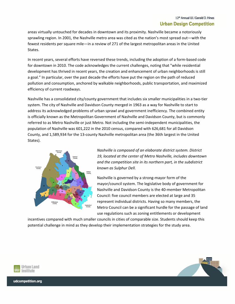
Nashville is composed of an elaborate district system. District
19, located at the center of Metro Nashville, includes downtown
and the competition site in its northern part, in the subdistrict
known as Sulphur Dell.
Nashville is governed by a strong‐mayor form of the
mayor/council system. The legislative body of government for
Nashville and Davidson County is the 40‐member Metropolitan
Council: five council members are elected at large and 35
represent individual districts. Having so many members, the
Metro Council can be a significant hurdle for the passage of land
use regulations such as zoning entitlements or development
incentives compared with much smaller councils in cities of comparable size. Students should keep this
potential challenge in mind as they develop their implementation strategies for the study area.
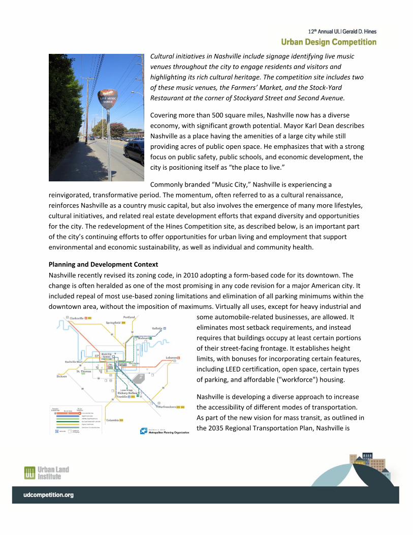
Cultural initiatives in Nashville include signage identifying live music
venues throughout the city to engage residents and visitors and
highlighting its rich cultural heritage. The competition site includes two
of these music venues, the Farmers’ Market, and the Stock‐Yard
Restaurant at the corner of Stockyard Street and Second Avenue.
Covering more than 500 square miles, Nashville now has a diverse
economy, with significant growth potential. Mayor Karl Dean describes
Nashville as a place having the amenities of a large city while still
providing acres of public open space. He emphasizes that with a strong
focus on public safety, public schools, and economic development, the
city is positioning itself as “the place to live.”
Commonly branded “Music City,” Nashville is experiencing a
reinvigorated, transformative period. The momentum, often referred to as a cultural renaissance,
reinforces Nashville as a country music capital, but also involves the emergence of many more lifestyles,
cultural initiatives, and related real estate development efforts that expand diversity and opportunities
for the city. The redevelopment of the Hines Competition site, as described below, is an important part
of the city’s continuing efforts to offer opportunities for urban living and employment that support
environmental and economic sustainability, as well as individual and community health.
Planning and Development Context
Nashville recently revised its zoning code, in 2010 adopting a form‐based code for its downtown. The
change is often heralded as one of the most promising in any code revision for a major American city. It
included repeal of most use‐based zoning limitations and elimination of all parking minimums within the
downtown area, without the imposition of maximums. Virtually all uses, except for heavy industrial and
some automobile‐related businesses, are allowed. It
eliminates most setback requirements, and instead
requires that buildings occupy at least certain portions
of their street‐facing frontage. It establishes height
limits, with bonuses for incorporating certain features,
including LEED certification, open space, certain types
of parking, and affordable ("workforce") housing.
Nashville is developing a diverse approach to increase
the accessibility of different modes of transportation.
As part of the new vision for mass transit, as outlined in
the 2035 Regional Transportation Plan, Nashville is
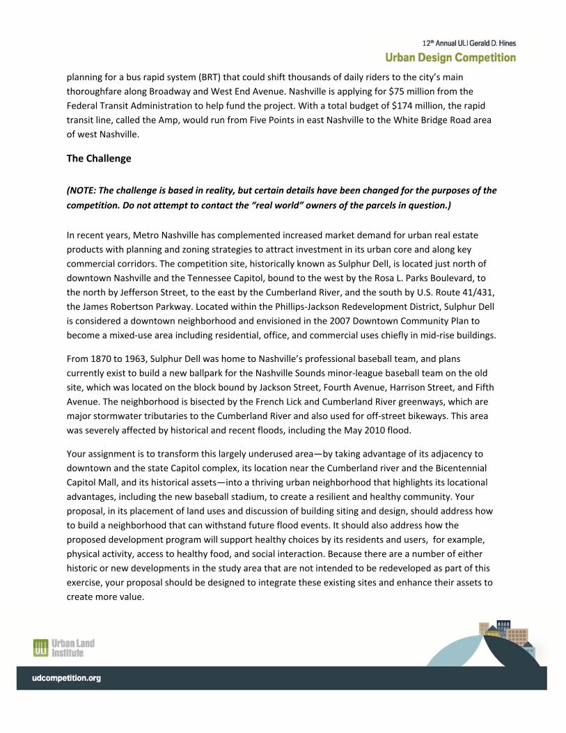
planning for a bus rapid system (BRT) that could shift thousands of daily riders to the city’s main
thoroughfare along Broadway and West End Avenue. Nashville is applying for $75 million from the
Federal Transit Administration to help fund the project. With a total budget of $174 million, the rapid
transit line, called the Amp, would run from Five Points in east Nashville to the White Bridge Road area
of west Nashville.
The Challenge
(NOTE: The challenge is based in reality, but certain details have been changed for the purposes of the
competition. Do not attempt to contact the “real world” owners of the parcels in question.)
In recent years, Metro Nashville has complemented increased market demand for urban real estate
products with planning and zoning strategies to attract investment in its urban core and along key
commercial corridors. The competition site, historically known as Sulphur Dell, is located just north of
downtown Nashville and the Tennessee Capitol, bound to the west by the Rosa L. Parks Boulevard, to
the north by Jefferson Street, to the east by the Cumberland River, and the south by U.S. Route 41/431,
the James Robertson Parkway. Located within the Phillips‐Jackson Redevelopment District, Sulphur Dell
is considered a downtown neighborhood and envisioned in the 2007 Downtown Community Plan to
become a mixed‐use area including residential, office, and commercial uses chiefly in mid‐rise buildings.
From 1870 to 1963, Sulphur Dell was home to Nashville’s professional baseball team, and plans
currently exist to build a new ballpark for the Nashville Sounds minor‐league baseball team on the old
site, which was located on the block bound by Jackson Street, Fourth Avenue, Harrison Street, and Fifth
Avenue. The neighborhood is bisected by the French Lick and Cumberland River greenways, which are
major stormwater tributaries to the Cumberland River and also used for off‐street bikeways. This area
was severely affected by historical and recent floods, including the May 2010 flood.
Your assignment is to transform this largely underused area—by taking advantage of its adjacency to
downtown and the state Capitol complex, its location near the Cumberland river and the Bicentennial
Capitol Mall, and its historical assets—into a thriving urban neighborhood that highlights its locational
advantages, including the new baseball stadium, to create a resilient and healthy community. Your
proposal, in its placement of land uses and discussion of building siting and design, should address how
to build a neighborhood that can withstand future flood events. It should also address how the
proposed development program will support healthy choices by its residents and users, for example,
physical activity, access to healthy food, and social interaction. Because there are a number of either
historic or new developments in the study area that are not intended to be redeveloped as part of this
exercise, your proposal should be designed to integrate these existing sites and enhance their assets to
create more value.
The competition site offers an opportunity to demonstrate that health—in all its dimensions—is a core
component of thriving communities. The owners are asking you, as master developer, for a proposal
that includes an understanding of the market and nonmarket factors at play in building healthy places
and of the value proposition of building and operating in health‐promoting ways.
ULI Ten Principles for Building Healthy Places
1. Put People First
Individuals are more likely to be active in a community designed around their needs.
2. Recognize the Economic Value
Healthy places can create enhanced economic value for both the private and public sectors.
3. Empower Champions for Health
Every movement needs its champions.
4. Energize Shared Spaces
Public gathering places have a direct, positive impact on human health.
5. Make Healthy Choices Easy
Communities should make the healthy choice the one that is SAFE—safe, accessible, fun, and easy.
6. Ensure Equitable Access
Many segments of the population would benefit from better access to services, amenities, and
opportunities.
7. Mix It Up
A variety of land uses, building types, and public spaces can be used to improve physical and social activity.
8. Embrace Unique Character
Places that are different, unusual, or unique can be helpful in promoting physical activity.
9. Promote Access to Healthy Food
Because diet affects human health, access to healthy food should be a considered as part of any
development proposal.
10. Make It Active
Urban design can be employed to create an active community.
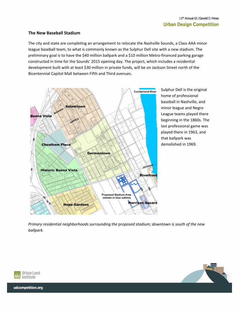
The New Baseball Stadium
The city and state are completing an arrangement to relocate the Nashville Sounds, a Class AAA minor
league baseball team, to what is commonly known as the Sulphur Dell site with a new stadium. The
preliminary goal is to have the $40 million ballpark and a $10 million Metro‐financed parking garage
constructed in time for the Sounds’ 2015 opening day. The project, which includes a residential
development built with at least $30 million in private funds, will be on Jackson Street north of the
Bicentennial Capitol Mall between Fifth and Third avenues.
Sulphur Dell is the original
home of professional
baseball in Nashville, and
minor league and Negro
League teams played there
beginning in the 1860s. The
last professional game was
played there in 1963, and
that ballpark was
demolished in 1969.
Primary residential neighborhoods surrounding the proposed stadium; downtown is south of the new
ballpark.
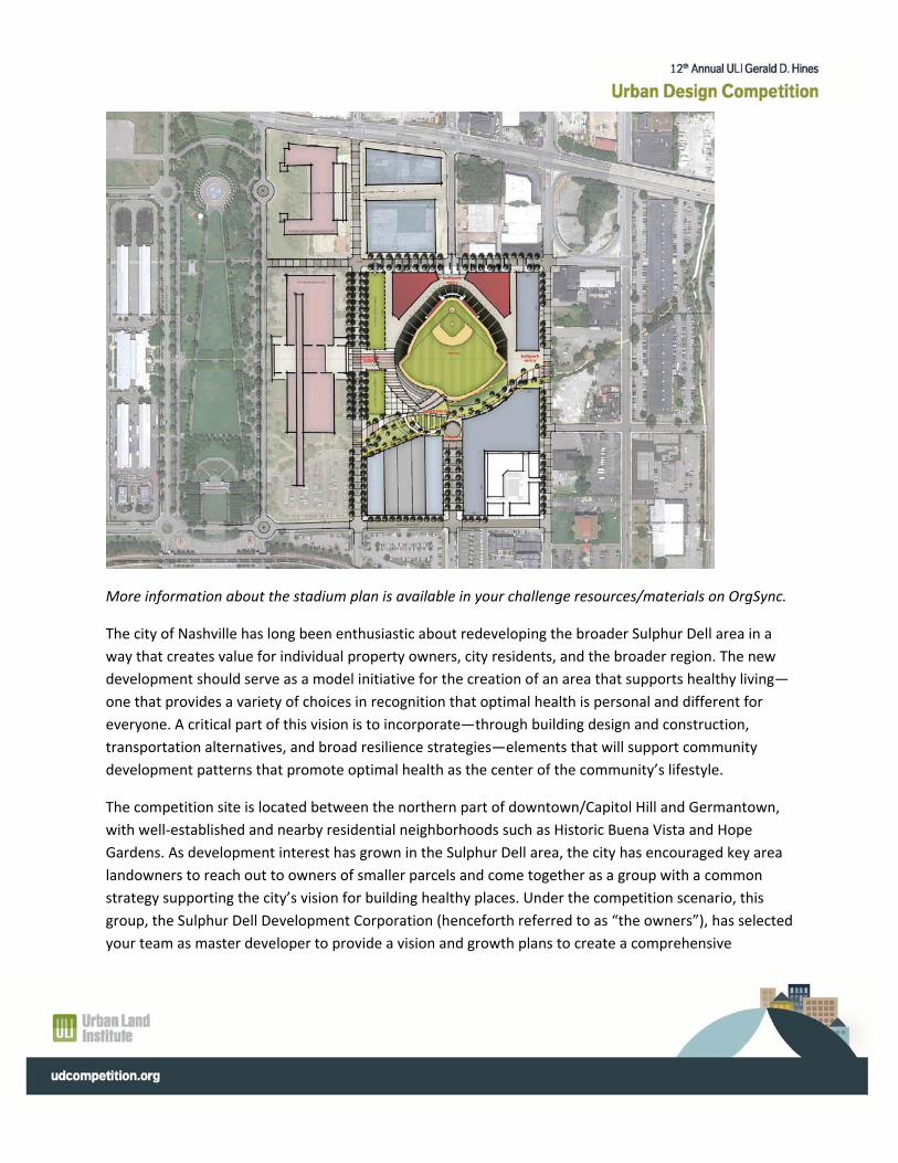
More information about the stadium plan is available in your challenge resources/materials on OrgSync.
The city of Nashville has long been enthusiastic about redeveloping the broader Sulphur Dell area in a
way that creates value for individual property owners, city residents, and the broader region. The new
development should serve as a model initiative for the creation of an area that supports healthy living—
one that provides a variety of choices in recognition that optimal health is personal and different for
everyone. A critical part of this vision is to incorporate—through building design and construction,
transportation alternatives, and broad resilience strategies—elements that will support community
development patterns that promote optimal health as the center of the community’s lifestyle.
The competition site is located between the northern part of downtown/Capitol Hill and Germantown,
with well‐established and nearby residential neighborhoods such as Historic Buena Vista and Hope
Gardens. As development interest has grown in the Sulphur Dell area, the city has encouraged key area
landowners to reach out to owners of smaller parcels and come together as a group with a common
strategy supporting the city’s vision for building healthy places. Under the competition scenario, this
group, the Sulphur Dell Development Corporation (henceforth referred to as “the owners”), has selected
your team as master developer to provide a vision and growth plans to create a comprehensive
environment that is programmed, designed, built, and operated with all the elements necessary to
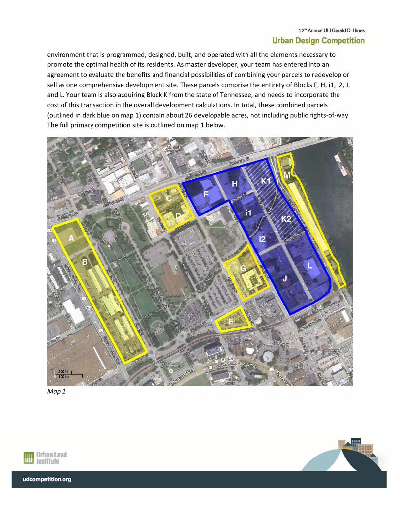
promote the optimal health of its residents. As master developer, your team has entered into an
agreement to evaluate the benefits and financial possibilities of combining your parcels to redevelop or
sell as one comprehensive development site. These parcels comprise the entirety of Blocks F, H, i1, i2, J,
and L. Your team is also acquiring Block K from the state of Tennessee, and needs to incorporate the
cost of this transaction in the overall development calculations. In total, these combined parcels
(outlined in dark blue on map 1) contain about 26 developable acres, not including public rights‐of‐way.
The full primary competition site is outlined on map 1 below.
Map 1
As part of your challenge you have been given a detailed block‐by‐block diagram, included in your
resources/materials in OrgSync, with information about each parcel within the blocks referenced above,
including their area and assessed value.
You may also choose to acquire and develop land in certain blocks outside of the primary study area if
this will further your design and development vision. Your team has been tasked with providing the
current value of the property should they pursue one of the options to expand the site. These additional
areas are outlined in yellow on map 1. Some of these parcels have existing buildings that could be
retained or repurposed, but several are vacant or used for surface parking. Blocks C, D, and G—a
combined area of about 3.8 noncontiguous acres—are reserved for private redevelopment as part of
the new stadium redevelopment project. It is worth noting that block G contains a well‐established
apartment building complex and accounts for about 1.6 acres.
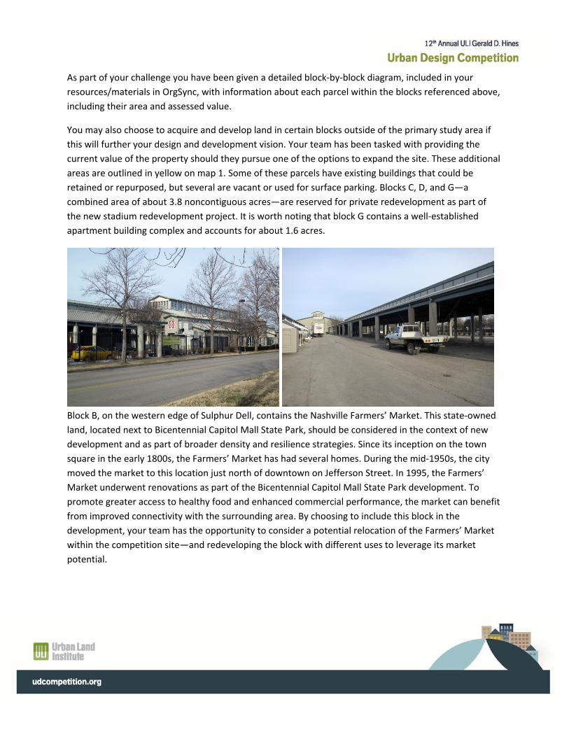
Block B, on the western edge of Sulphur Dell, contains the Nashville Farmers’ Market. This state‐owned
land, located next to Bicentennial Capitol Mall State Park, should be considered in the context of new
development and as part of broader density and resilience strategies. Since its inception on the town
square in the early 1800s, the Farmers’ Market has had several homes. During the mid‐1950s, the city
moved the market to this location just north of downtown on Jefferson Street. In 1995, the Farmers’
Market underwent renovations as part of the Bicentennial Capitol Mall State Park development. To
promote greater access to healthy food and enhanced commercial performance, the market can benefit
from improved connectivity with the surrounding area. By choosing to include this block in the
development, your team has the opportunity to consider a potential relocation of the Farmers’ Market
within the competition site—and redeveloping the block with different uses to leverage its market
potential.
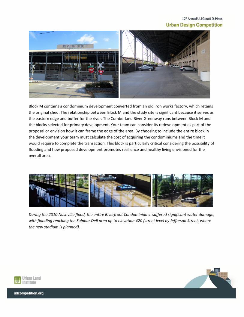
Block M contains a condominium development converted from an old iron works factory, which retains
the original shed. The relationship between Block M and the study site is significant because it serves as
the eastern edge and buffer for the river. The Cumberland River Greenway runs between Block M and
the blocks selected for primary development. Your team can consider its redevelopment as part of the
proposal or envision how it can frame the edge of the area. By choosing to include the entire block in
the development your team must calculate the cost of acquiring the condominiums and the time it
would require to complete the transaction. This block is particularly critical considering the possibility of
flooding and how proposed development promotes resilience and healthy living envisioned for the
overall area.
During the 2010 Nashville flood, the entire Riverfront Condominiums suffered significant water damage,
with flooding reaching the Sulphur Dell area up to elevation 420 (street level by Jefferson Street, where
the new stadium is planned).
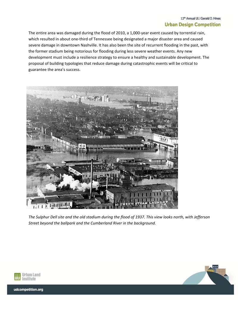
The entire area was damaged during the flood of 2010, a 1,000‐year event caused by torrential rain,
which resulted in about one‐third of Tennessee being designated a major disaster area and caused
severe damage in downtown Nashville. It has also been the site of recurrent flooding in the past, with
the former stadium being notorious for flooding during less severe weather events. Any new
development must include a resilience strategy to ensure a healthy and sustainable development. The
proposal of building typologies that reduce damage during catastrophic events will be critical to
guarantee the area’s success.
The Sulphur Dell site and the old stadium during the flood of 1937. This view looks north, with Jefferson
Street beyond the ballpark and the Cumberland River in the background.

Map 2
Your proposed development must provide a return that meets or exceeds the income currently
generated by the existing properties. The proposal also should be able to serve as a catalyst for further
redevelopment in the broad area that will enhance the value of the owners’ original investment. For this
reason, the owners have also asked that you develop a broad visioning plan for the larger study area,
indicated in red on map 2, which specifically frames the competition site as an active connector and
destination between downtown and Germantown, encouraging further redevelopment and enhancing
overall value.
As part of the vision for a healthy‐living district, Metro Nashville requires that your proposal integrate
with different transportation modes in the area. The study area is bisected by the Music City Bikeway,
completed in 2012, connecting the Cumberland River Greenway to Bicentennial Mall. The 26‐mile
bicycle route through Nashville uses the greenway systems, roads with bike lanes, and roads with
wayfinding systems to get from the Percy Priest Dam to Percy Warner Park. Plans for the proposed
stadium embrace the layout of the structure as a defining edge on its southern side. The Sulphur Dell
springs from which the area gets its name are located at the bikeway’s intersection with Fourth Street.
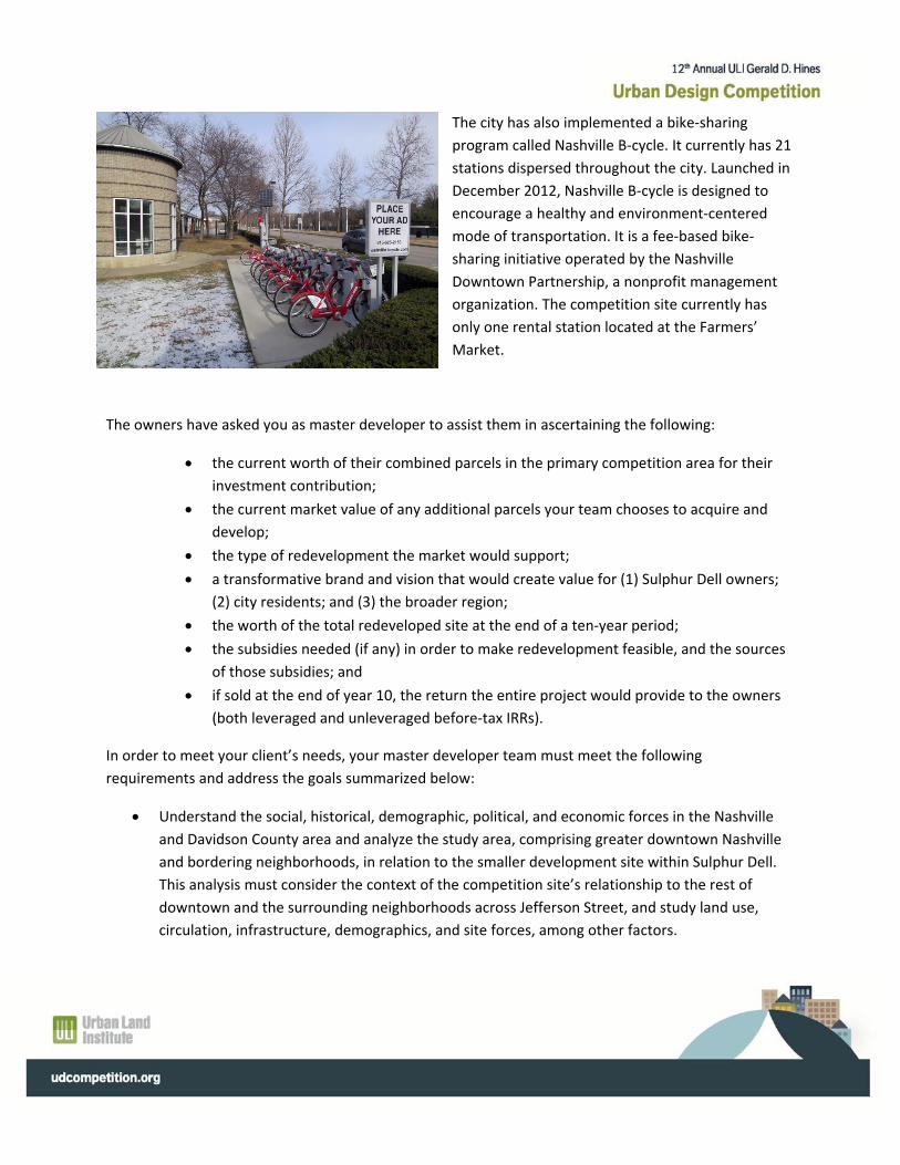
The city has also implemented a bike‐sharing
program called Nashville B‐cycle. It currently has 21
stations dispersed throughout the city. Launched in
December 2012, Nashville B‐cycle is designed to
encourage a healthy and environment‐centered
mode of transportation. It is a fee‐based bike‐
sharing initiative operated by the Nashville
Downtown Partnership, a nonprofit management
organization. The competition site currently has
only one rental station located at the Farmers’
Market.
The owners have asked you as master developer to assist them in ascertaining the following:
the current worth of their combined parcels in the primary competition area for their
investment contribution;
the current market value of any additional parcels your team chooses to acquire and
develop;
the type of redevelopment the market would support;
a transformative brand and vision that would create value for (1) Sulphur Dell owners;
(2) city residents; and (3) the broader region;
the worth of the total redeveloped site at the end of a ten‐year period;
the subsidies needed (if any) in order to make redevelopment feasible, and the sources
of those subsidies; and
if sold at the end of year 10, the return the entire project would provide to the owners
(both leveraged and unleveraged before‐tax IRRs).
In order to meet your client’s needs, your master developer team must meet the following
requirements and address the goals summarized below:
Understand the social, historical, demographic, political, and economic forces in the Nashville
and Davidson County area and analyze the study area, comprising greater downtown Nashville
and bordering neighborhoods, in relation to the smaller development site within Sulphur Dell.
This analysis must consider the context of the competition site’s relationship to the rest of
downtown and the surrounding neighborhoods across Jefferson Street, and study land use,
circulation, infrastructure, demographics, and site forces, among other factors.
Propose a master land use plan for the development site that includes but is not limited to land
and building uses, blocks, streets, transit lines, and connectivity.
Propose an urban design schedule for the competition site that addresses overall design
characteristics, as well as addresses building typology, architecture, and sustainability.
Propose a market‐feasible development program and financial pro forma for the development
site that takes into account phasing, as well as a ten‐year hold. This development program must
address overall competition challenge questions and objectives and, more specifically, provide
market‐driven assumptions and feasible sources of financing and subsidies, if applicable.
Identify all phasing within the development site and detail a concept design for all development
components within the ten‐year hold. The details should include, but not be limited to, building
footprints, streetscapes, elevations, sections, and renderings showing the intended
characteristics of your development proposal. You only need to depict details for what gets built
over the course of the ten‐year phase. For pads (either improved or unimproved) that are not
fully developed, you do not need to show details, but you do need to account for them visually.
Include any elements related to promoting healthy communities in your concept designs.
Assumptions
To address the needs of your clients and create a feasible and compelling plan, your team must adhere
to the following assumptions.
1. Zoning: The site falls under the Downtown Code. The largely form‐based document outlines the
requirements for the area in the “Sulphur Dell Subdistrict: Building Regulations.” A copy is
available in the OrgSync resources section.
2. Bonus Height Program: Metro Nashville offers the opportunity to increase height and density
through the Bonus Height Program (BHP) in downtown in exchange for contribution to specified
elements. Metro is encouraging the use of this bonus on the site when possible to generate
Leadership in Energy and Environmental Design (LEED) certification of individual buildings,
certification under the LEED for Neighborhood Development program, and provision of pervious
surfaces, publicly accessible open space, workforce housing, civil support space, upper‐level
garage liners, and underground parking. The owners have requested that the developer explore
using this incentive without compromising the return on investment. The Downtown Code
offers detailed information about its use and is available in the OrgSync resources section.
3. Open space and natural systems: Nashville has introduced an ambitious open‐space plan as
part of its healthy living strategy. The plan estimates that obesity‐related conditions cost area
residents $255 million annually and highlights how few places provide easy access to the
outdoors. Only about 3 percent of Davidson County is parkland today, even as the area
population grew by 10 percent over the past decade. The 2010 flood, which killed ten people
and cost roughly $2 billion, underscores the need to better protect floodplains and buffer
waterways that feed the Cumberland River. The Nashville Open Space Plan, which is included in
your resources materials, offers guidelines and strategies for preserving and creating open space
that should be considered for use in the proposed competition site and the area at large.
4. Workforce housing: A minimum of 10 percent of new residential product, both for sale and
rental, must be affordable/workforce units for low‐ to moderate‐income households (earning up
to 120 percent of area median income). The units should have two or more bedrooms and be
dispersed throughout the project. These requirements apply to every phase of development.
You must consider how the Bonus Height Program relates to workforce housing. When used in
this context, 50 percent of the additional stories have to be dedicated to workforce housing.
Additional details are available in the OrgSync resources section.
5. Stadium plan: You are not permitted to make modifications to the existing stadium plan. In your
detailed proposal, only address those parcels/blocks specifically indicated on the Parcel Key
Map. In your larger vision plan, you may indicate future development beyond your specific site,
but you must assume that the stadium plan will remain as is.
6. Complete neighborhoods: As part of its thinking around building healthy places, Metro
Nashville prioritizes mixed‐use and mixed‐income development that respects the scale of
surrounding neighborhoods. Any development that fails to address these two concepts will not
achieve formal entitlement approval or stakeholder buy‐in. The property owners very much
value being “good citizens” and want to ensure that any development they engage in will help
the city, region, and surrounding neighborhoods meet their objectives.
7. Rights‐of‐way and circulation patterns: You may choose to close and create public streets
within your development site. If you close a public right‐of‐way and develop the space, you need
to buy the land from the city at fair market value. You may also change circulation patterns. The
regulating plan outlines a fixed‐street hierarchy for Sulphur Dell. Changes to these designations
will affect the different density allowed in them and its potential under the Bonus Height
Program.
8. Construction costs: Use the cost tables generated by Reed Construction Data
(www.reedconstructiondata.com/rsmeans/models/) to estimate your construction costs.
Assume you are using union labor, and be sure to visit the “Models by State” section for each
type of building to get specific estimates for Tennessee.
(www.reedconstructiondata.com/regions/tennessee/)
9. Redevelopment tools: Part of the study area is located in the Capitol Hill Redevelopment
District, administered by the Metropolitan Development and Housing Agency. This designation
will allow for the use of certain redevelopment tools, such as tax increment financing (TIF).
Historically, Nashville has used TIFs to finance individual projects rather than districtwide
infrastructure to support development. You are encouraged to think about the latter approach
as part of your financing plan, if relevant. It is incumbent to address all the available
development tools to help finance your proposal beyond just TIF.
10. Utilities: You may relocate all local distribution lines for power, gas, water, and communications
at the developer’s expense, based on utility company standard pricing. You may not move
stormwater and sewer infrastructure.
11. Real property taxes: For the purposes of this competition, use 4.5 percent as the property tax
rate for the entire development period.
12. Inflation rate: All costs are subject to an inflation rate compounded at 3 percent per year.
13. Market‐feasible costs and pricing: Although we have created a fictitious scenario, you need to
meet the expectations of your clients and come up with a financially feasible plan for the site.
Unless we give you a cost or an assumption, you need to come up with a market‐appropriate
amount that you can justify in your pro forma (e.g., current sales price for land in the area,
market rents for various uses, project costs, etc.). If you find that your development program
requires subsidy, the subsidy amount should be realistic and from a viable source.
14. Demolition and remediation costs: For the purposes of this competition, use $1.75 per square
foot as the cost to demolish and remediate your parcels. Though some blocks within the site
have larger buildings and some consist of surface parking, assume that this cost applies across
the board to the entire site. For example, for the purposes of this competition, it would cost the
same to demolish a surface parking lot or a two‐story building that covers the same area.
15. Infrastructure costs: You must account for all new public infrastructure costs, but they need not
be charged against project costs unless you are using said infrastructure to achieve a building
premium. Infrastructure on private parcels must be charged to project costs. You must
determine what you think is the market‐appropriate rate for infrastructure costs.
16. Property owners: For the purposes of the competition, we have identified the property owners
engaged in the partnership as “the owners,” and all who own land that you may choose to
acquire as simply “developable parcel.” Instead of referring to the “real world” owner of each
parcel, we ask that you use these generic identifiers to refer to them throughout your proposal.
17. Identification of parcels: You have been given a PDF document titled “Parcel Key Map,” which
contains an aerial photo with a letter assigned (A to J) to each block you have been asked to
address. The second page of this document contains block‐by‐block information about each
parcel. To refer to a specific parcel in your competition entry, use the following convention:
Letter‐Number. So, if you were to refer to the parcel that has been assigned the number 3 on
block F, that parcel should be identified as Parcel F‐3.
18. Historic preservation: The site includes historic properties on Blocks F and i‐2. You may choose
to keep these buildings and propose a new use for them, but you may not demolish the
buildings or alter their exterior.
19. Start of development: Year 0 (planning, entitlements, etc.) is 2014–2015, and the start year—
the first year you may begin construction or actual redevelopment—is 2016.
Presentation Guidelines
Criteria for Judging
The jury will select four finalists that it deems as having best satisfied the combination of criteria as
outlined in the competition challenge and described below. At the jury’s discretion, an unspecified
number of honorable mentions will be named for outstanding submissions in one or more of these
criteria.
Specifically, proposals should respond to the following requirements:
1. Integrate planning and design decisions with economic feasibility, including market‐level returns
on investment for private investors and lenders:
(a) public investments in infrastructure and public facilities should have clear value for
the owners;
(b) your development proposal and planning and design concepts should support and
reinforce both public planning goals and financial returns for the owners; and
2. Demonstrate awareness of design issues contributing to a workable, livable, sustainable
configuration of development that supports healthy living and resilience strategies as specified
earlier.
3. Demonstrate attention to factors affecting the risks and feasibility of the project, including:
(a) development and construction costs;
(b) future expenses and revenues from operations and land sales; and
(c) the effect of project phasing on risks and feasibility.
4. Work together as a team: A primary goal of this competition is to provide a means and
demonstration of integrating real estate and allied disciplines. The jury will take into account
how successfully your team is able to work together, as evidenced in the work product of your
team.
While the jury may not ignore any of the above criteria, they may, if they wish, use additional criteria in
making their final decisions.
The jurors will also rely on their knowledge and intuition based on their expertise and experiences in
land use. ULI strives to conduct a thorough, fair, and rigorous jury evaluation process, yet teams need to
consider the realistic constraints on and limitations of the jury. As a general rule, teams should make
their presentations as clear and easy to understand as possible given the large number of submissions
and the limited time the jury has to review them. The jurors ULI selects are leaders in their fields and
generously donate their time to the Hines Competition. Jurors will not have endless hours to delve into
every detail of the proposals, nor will they provide copious feedback commonly found in an academic
setting. Just as in the real world in which developers and designers have a finite window in which to sell
themselves, your team should strive to make a good first impression by packaging your solution in a
compelling and succinct fashion.
Presentation Requirements
The presentation rules have been developed to ensure that the jury will have sufficient information to
effectively evaluate and compare individual solutions for the competition stage. Effective presentation
of your solution is crucial for success; your submission may have great content, but if your proposal is

not clear, it will not sell itself well. This is important because the jury will have to review and evaluate a
large number of solutions in a relatively short time. Disregarding presentation requirements and
guidelines may place your team at a disadvantage. The presentation requirements are developed for the
benefit of the competitors as well as the jurors. Detailed descriptions of the required presentation
elements follow.
3 Presentation boards
One 11" x 17" sheet containing the pro forma.
One 11" x 17" sheet containing a supplementary pro forma (OPTIONAL).
One 11" x 17" sheet with two narrative summaries of no more than 500 words each. One must
summarize your overall design and development plan. The second must summarize your
financing plan.
One 11" x 17" sheet displaying a copy of your site plan. You may choose to display a less detailed
version than what appears on your presentation boards to increase legibility.
The core presentation must consist of:
• Three unmounted 24"x36" sheets for the urban design scheme. You can choose to
format these visually as one continuous presentation or as stand‐alone sheets as depicted
below. They should not be arranged to stack vertically.
Board Arrangement Option 1
Sheet Sheet Sheet
One Two Three
Board Arrangement Option 2
Sheet Sheet Sheet
One Two Three
Graphic techniques used are at the discretion of the competitors. Scale drawings should include a
graphic scale and an arrow indicating north. Any sections that appear on your presentation boards must
also include a graphic scale. Any presentation materials beyond what is detailed above will not be
considered by the jury.
Your presentation boards should incorporate limited statements describing site design and development
concepts; public infrastructure within the site, including circulation and open space; investments; and
market options and strategies. Text—in the form of charts, graphs, matrices, spreadsheets, timelines,
etc.—should analyze the costs for infrastructure, buildings, open space, and the value that they will
create. Drawings—in the form of plans, sketches, and collages—should describe the massing, scale, and
other design concepts for the public and private realms. Any “big ideas” should be represented
graphically, and if text is included, should be limited to labels, call‐outs, and such.
Maps, plans, and drawings may be at any scale, but the scale you have chosen to use should be clearly
indicated. All submissions should include the following five general elements: (1) planning context and
analysis, (2) master land use plan, (3) urban design, (4) site‐specific illustrations, and (5) development
schedule and finances.
The details of these elements are left up to you, but below are some more detailed guidelines. Other
elements that you feel are needed to tell your story can also be included, but you are limited to the core
presentation elements described above.
1. Planning context and analysis
This should be illustrated with an overall annotated plan and/or diagram drawn at a scale that describes
overall patterns and concepts for regional issues the team considers relevant. These might include, for
example:
(a) land use;
(b) circulation (pedestrian, vehicular, transit, bicycle, etc.);
(c) open space;
(d) environmental and sustainability considerations;
(e) image and character of the area;
(f) social and economic concerns;
(g) community planning and infrastructure concepts; and
(h) private‐sector development concepts.
2. Master land use plan
The land use planning drawings must show:
(a) land and building uses;
(b) blocks and streets;
(c) location of transit line(s) and stops/terminals;
(d) other public infrastructure;
(e) connections to neighboring blocks; and
(f) general concepts for landscape and open space.
Note: Use APA’s Activity‐Based Classification Standards for color coding. For mixed uses, use a technique
such as cross‐hatching to signify overlapping uses.
3. Urban design
The urban design for your development site must show:
(a) transit and other infrastructure;
(b) greenways and open spaces;
(c) paths, bikeways, pedestrian connections, and other means of access to the neighborhood;
(d) environmental, sustainability, and aesthetic values;
(e) resilience strategies; and
(f) at least one each of: three‐dimensional view (perspective/axonometric), plans, sections, and
relevant details.
4. Site‐specific illustrations of new development
Your presentation should include annotated drawings similar to a concept design that zoom in on the
site. This content might include plans, elevations, sections, and other renderings, all emphasizing the
public‐space components, connections, and interrelationships within the project and to the
neighborhood beyond the project. The phases should be clearly identified, but you only need to provide
detailed illustrations for what your team actually develops within the two phases. Undeveloped pads
must be accounted for, but you do not need to draw them in detail.
Pro Forma
As part of your presentation requirements, you must submit an 11" x 17" sheet comprising a
development pro forma in executive summary form using the pro forma summary document provided
by ULI. This same sheet must be submitted electronically in its original, editable Excel format.
You are encouraged to provide your own summary should you build your pro forma using your own
template. If your team chooses to use a different template, you still must submit the ULI‐provided
summary sheet filled in with your own data. The summary pro forma that every team must complete
has been formatted to a single 11" x 17" sheet. If you build your own model and provide a supplemental
summary based on that model, it must also be formatted to fit a single 11" x 17" sheet.

The jury will first examine the ULI‐provided summary sheet because it gives the jury all the pertinent
financial information it needs to evaluate your development’s finances, and then it will evaluate your
supplemental form if applicable. Your supplemental pro forma sheet from your model (if you do not use
the ULI template) must be clear and easy for the jurors to understand. If there are questionable costs,
assumptions, and estimates, the jury will view your worksheets that were used to derive the summary,
but your summary board should be easy to read and speak for itself. All totals on this summary sheet
will be used only to verify that they support your proposal and that they display an internal logic.
Note: you do not need to fill in information about a product type if it is not part of your development
program.
ULI has also provided your team with a set of more detailed pro forma templates. Note that these
worksheets in “Development Pro Forma.xls” are not fully interlinked and the cells do not contain
formulas. If you use this pro forma file, which is adapted from the ULI publication Mixed‐Use
Development Handbook, Second Edition (2003), you must familiarize yourself with its logic and internal
relationships and build your own cell linkages and worksheets. This generic pro forma is meant to serve
as a guide and a starting point. You may modify the pro forma, add or delete line items (e.g., you may
not have office space in your development program), and create assumptions (e.g., cap rate, NPV
discount rate, vacancy rate, etc.) that your team deems necessary. Or, as stated previously, you may
adapt pro formas you are already familiar with, so long as you still fill in the ULI‐provided summary
sheet.
Whether you adopt the provided pro forma or substitute your own, you must be prepared to justify the
rationale and process behind your financial numbers and assumptions. Save the pro forma workbook as
an Excel file.
Other Supplementary Material
One 11" x 17" sheet with two narrative summaries of no more than 500 words each.
One must summarize your overall design and development plan. The second must
summarize your financing plan.
One 11" x 17" sheet displaying your site plan in a simplified form. While you will likely
choose to include a larger and more detailed site plan as part of your three presentation
boards, we ask that you submit this version so that the jurors can begin reviewing your
scheme in advance.
OPTIONAL: the Hines Competition aims to feature a selection of entries online after the
competition period concludes. If you would like your entry to be displayed online along
with your narrative summaries, please create and submit two 200px x 200px graphic
vignettes from your presentation for display on the web.
Competition Logistics
Schedule
Please refer to the competition website for this information. The website address is udcompetition.org.
Downloading from OrgSync
All documents, including this brief, will be available on the OrgSync site in the “Files” section for
download.
The following list includes all the items available for download from OrgSync and serves as a checklist for
competitors to make sure they have received all the materials.
1. Competition Brief (this document as a PDF file).
2. Pro forma template in Excel.
3. GIS files.
4. Planning and zoning information
5. Plans and reports
6. Maps and other resources
You may download competition materials for distribution only among your team members, faculty
adviser, and professional adviser. All competition materials are to be used for this competition only and
may not be used, copied, or distributed for any other purpose without written permission from ULI.
Submission Process
All the items described above—the three 24" x 36" sheets and the three or four 11" x 17" sheets—
should be submitted both electronically and in a hard‐copy format.
One corner of every sheet must have your team’s six‐digit code displayed. If there are any identifying
marks on any of the sheets that indicate which university has submitted the scheme, the submission
will be discarded and not judged. Please be careful to only use the six‐digit code.
Supplemental diagrams or information not presented directly on the sheets will not be accepted as part
of the presentation and will not be viewed by the jury.
Checklist for Hard‐Copy Submission
1. Three unmounted 24" x 36" presentation sheets.
2. One 11" x 17" sheet with pro forma.
3. One 11" x 17" sheet with supplementary pro forma (OPTIONAL).
4. One 11" x 17" sheet with narrative summaries of both your development/design proposal and
financial plan.
5. One 11" x 17" sheet displaying your site plan
All submissions must be received as one package, addressed to:
Hines Student Urban Design Competition
Urban Land Institute
1025 Thomas Jefferson St., NW, Suite 500 West
Washington, DC 20007
202‐624‐7000
All submissions must be mailed to the above address with a postmark no later than Monday, January 27,
2014. Hand‐delivered submissions must be received before 5:00 p.m. EST on January 27, 2014.
Submissions sent by U.S. Postal Service (USPS), express company, or by private courier service must be
postmarked by the deadline stated in the previous paragraph. Competitors are advised to consider an
express mail service that can guarantee delivery in one or two days. Only properly postmarked
submissions, as described above, that are delivered to ULI before the jury meets will be eligible for
consideration. No notification of receipt by ULI will be sent to competitors; therefore, it is
recommended that materials be sent by registered mail, FedEx, UPS, or other means that allows the
sender to track the status of the materials. Inquiries about deliveries should be addressed to your
chosen delivery service. Neither ULI nor the jury bears any responsibility whatsoever for the safe and
timely delivery of the submissions to ULI.
It is recommended that all materials be sent in one large tube as provided by FedEx, USPS, or UPS, and
not folded. The return address/billing information will be the only part of the submission that contains
identification of the submitting team. There cannot be any identifying mark INSIDE the mailing package
except the six‐digit team code.
Checklist for electronic submission
All files will be submitted via an OrgSync form titled “Entry Submittal.” This form will be accessible in the
“Forms” section of the OrgSync portal on January 13, 2014, the day the competition commences. All
electronic submissions must be received by 11:00 p.m. EST on January 27, 2014.
1. One web‐quality PDF file of your three 24" x 36" presentation sheets (no more than 20 MB).
2. Excel file of your pro forma. If you choose to submit a supplementary pro forma as well, the two
spreadsheets should be tabs in the same Excel file. The Excel file should not be a PDF.
3. 11" x 17" PDF with narrative summaries of both your development/design proposal and
financial plan.
4. 11" x 17" PDF displaying your site plan.
5. OPTIONAL: This year, the Hines Competition will be displaying a selection of entries online after
the competition period concludes. If you would like your entry to be displayed online along with
your narrative summaries, please create and submit two 200px x 200px graphic vignettes from
your presentation for display on the web.
Remember: All items must contain only the self‐defined six‐digit code and no other identifying mark.
Approximately five days after the last day of the competition, an OrgSync message will be sent out to all
participants confirming successful receipt of their entry,
Note: Additional program rules and guidelines for the finalist stage of this competition shall be
announced once the four finalists are selected.
Questions
During the 15‐day competition, teams may send questions in writing via OrgSync to username “uli
udcompetition.” ULI will periodically post questions and answers on the OrgSync site in the News
section. These can be accessed by clicking "News" in the left hand menu, or by selecting the tab "Feed"
on the main page. ULI will notify teams via OrgSync when new questions and answers have been
posted. Please make sure you are monitoring your team email address.
ULI reserves the right to edit submitted questions before posting them on the website. ULI also reserves
the right not to answer all questions posted on the website and not post redundant questions or
remarks deemed inappropriate or irrelevant.
Once you have received these program documents, under no circumstances should there be any
communication regarding the competition, other than in the manner stipulated here, with members of
ULI staff, the nonprofit and public agencies involved, the landowners or employees of the landowners,
consultants who are working or have worked on the project, or the competition jury.
Please: No phone calls to ULI’s headquarters in Washington, D.C.; no phone calls or e‐mails to
competition jurors, Hines, ULI Nashville, the city of Nashville, any of the downtown property owners, or
other associated entities.