Embed Size (px)
Citation preview
MADISON’S CURRENT WEATHERMADISON’S CURRENT WEATHER
Madison Weather at 1000 AM CDT 16 JUL 2002 Updated twice an hour at :05 and :25 Sky/Weather: SUNNY Temperature: 79 F (26 C) Dew Point: 60 F (15 C) Relative Humidity: 52% Wind: SW6 MPH Barometer: 30.13F (1020.3 mb)

ATM OCN 100 Summer 2002ATM OCN 100 Summer 2002 1515
Last 24 hrs in MadisonLast 24 hrs in Madison
FOGFOG

ATM OCN 100 Summer 2002ATM OCN 100 Summer 2002 1616
CURRENT CURRENT VISIBLEVISIBLE
T.S. ArthurT.S. Arthur
Winds: 60 mphWinds: 60 mph

ATM OCN 100 Summer 2002ATM OCN 100 Summer 2002 1717
T.S. ArthurT.S. Arthur
CURRENT IRCURRENT IR

ATM OCN 100 Summer 2002ATM OCN 100 Summer 2002 1919
Current Surface Weather Map Current Surface Weather Map with Isobars (“iso” = equal & “bar” = weight), Fronts and Radarwith Isobars (“iso” = equal & “bar” = weight), Fronts and Radar

ATM OCN 100 Summer 2002ATM OCN 100 Summer 2002 2323
Current Temperatures (Current Temperatures (°°F) & IsothermsF) & Isotherms(“iso” = equal +”therm” = temperature)(“iso” = equal +”therm” = temperature)
ATM OCN 100 Summer 2002ATM OCN 100 Summer 2002 2424
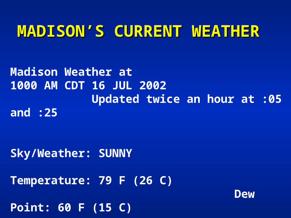
Current Dewpoints Current Dewpoints ((ooF) F)

ATM OCN 100 Summer 2002ATM OCN 100 Summer 2002 2525
IFR – Instrument Flight RulesIFR – Instrument Flight Rules Red Dots: Ceiling < 1000 ft or Visibility < 3 milesRed Dots: Ceiling < 1000 ft or Visibility < 3 miles
ATM OCN 100 Summer 2002ATM OCN 100 Summer 2002 2626
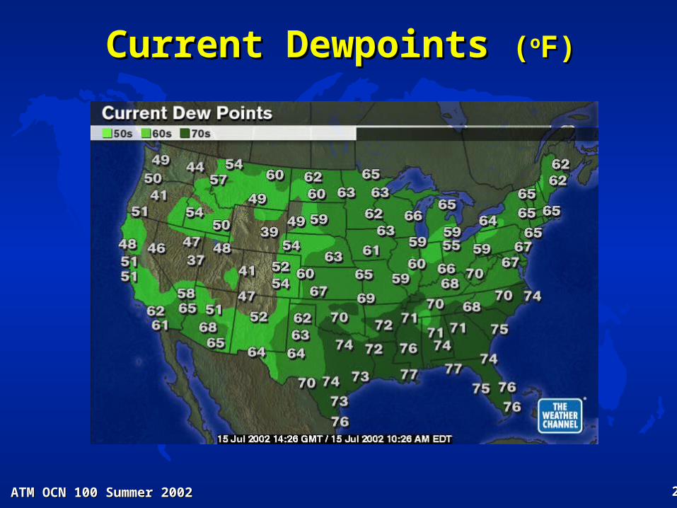
Current Apparent Temperatures Current Apparent Temperatures ((ooF) F)

ATM OCN 100 Summer 2002ATM OCN 100 Summer 2002 2727
Forecast Heat IndicesForecast Heat Indices

ATM OCN 100 Summer 2002ATM OCN 100 Summer 2002 2828
Tomorrow AM Forecast MapTomorrow AM Forecast Map

ATM OCN 100 Summer 2002ATM OCN 100 Summer 2002 2929
AnnouncementsAnnouncements
Homework #3 is due next Thurs. Homework #3 is due next Thurs. 18 July 200218 July 2002
If you have ??, please see me.If you have ??, please see me.

ATM OCN 100 Summer 2002ATM OCN 100 Summer 2002 3030
ATM OCN 100 - Summer 2002 ATM OCN 100 - Summer 2002 LECTURE 12LECTURE 12
CLOUD OBSERVATIONS & CLASSIFICATIONCLOUD OBSERVATIONS & CLASSIFICATION
A.A. INTRODUCTIONINTRODUCTION CLOUDS – SIGNPOSTS IN THE SKY CLOUDS – SIGNPOSTS IN THE SKY
– What can be learned from clouds?What can be learned from clouds?– Is it partly cloudy or partly sunny?Is it partly cloudy or partly sunny?– How are clouds classified?How are clouds classified?
ATM OCN 100 Summer 2002ATM OCN 100 Summer 2002 3131
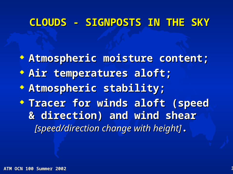
CLOUDS - SIGNPOSTS IN THE SKYCLOUDS - SIGNPOSTS IN THE SKY
Atmospheric moisture content;Atmospheric moisture content; Air temperatures aloft;Air temperatures aloft; Atmospheric stability;Atmospheric stability; Tracer for winds aloft (speed & Tracer for winds aloft (speed &
direction) and wind sheardirection) and wind shear [speed/direction change with height][speed/direction change with height]..

ATM OCN 100 Summer 2002ATM OCN 100 Summer 2002 3232
B. OBSERVATIONAL MEASUREMENTS B. OBSERVATIONAL MEASUREMENTS OF CLOUDSOF CLOUDS
Cloud Amount Cloud Amount oror Sky Cover Sky Cover
– fraction of sky covered by a cloud;fraction of sky covered by a cloud;
– based on visual estimates or based on visual estimates or measurements.measurements.
CONDITION FRACTION of SKY COVERED CLEAR SCATTERED BROKEN OVERCAST
Less than 1/8 2/8 to 4/8 4/8 to 7/8 8/8
ATM OCN 100 Summer 2002ATM OCN 100 Summer 2002 3333
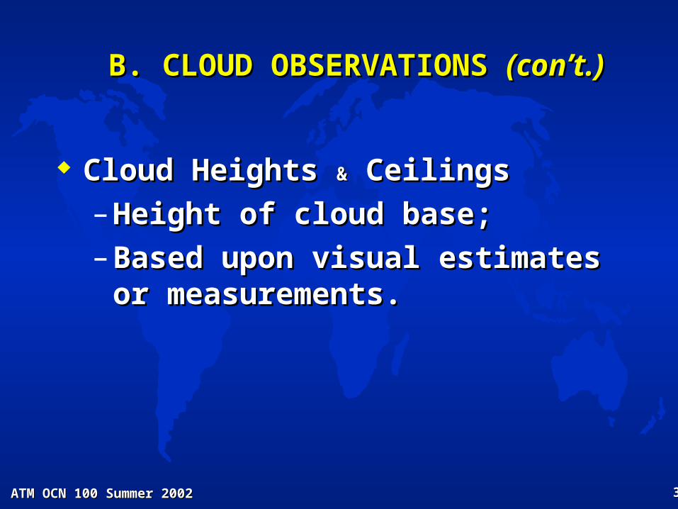
B. CLOUD OBSERVATIONS B. CLOUD OBSERVATIONS (con’t.)(con’t.)
Cloud Heights Cloud Heights && Ceilings Ceilings
– Height of cloud base;Height of cloud base;
– Based upon visual estimates or Based upon visual estimates or measurements.measurements.
ATM OCN 100 Summer 2002ATM OCN 100 Summer 2002 3434
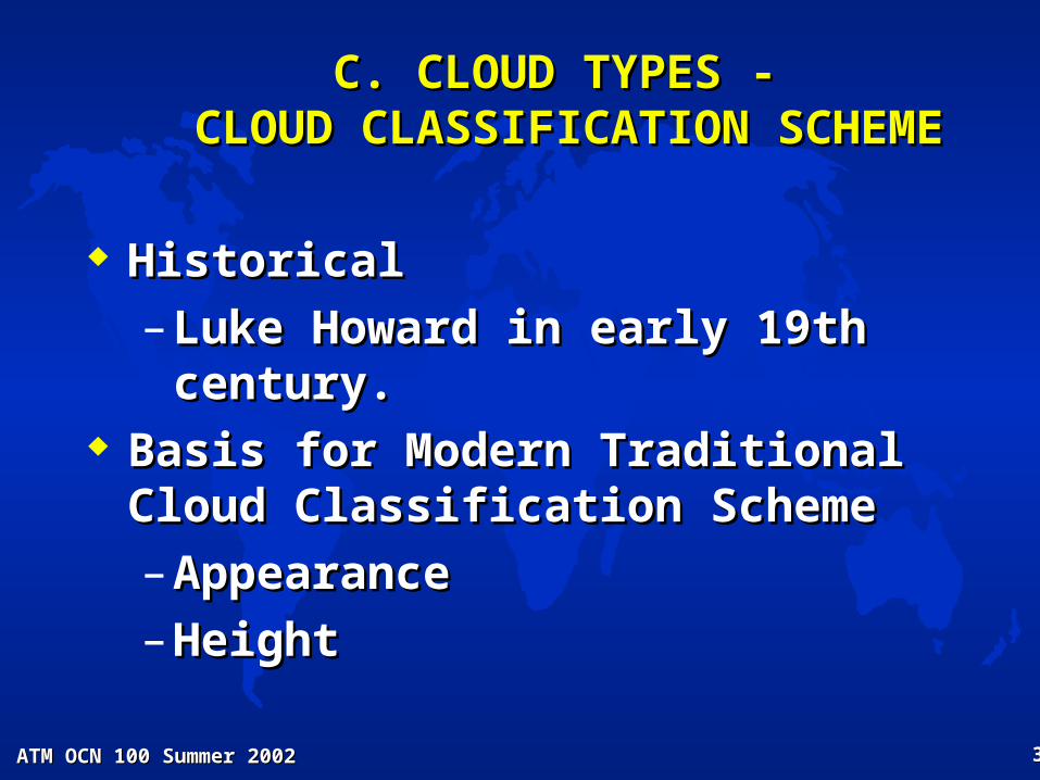
C. CLOUD TYPES -C. CLOUD TYPES - CLOUD CLASSIFICATION SCHEME CLOUD CLASSIFICATION SCHEME
HistoricalHistorical
– Luke Howard in early 19th century.Luke Howard in early 19th century. Basis for Modern Traditional Cloud Basis for Modern Traditional Cloud
Classification SchemeClassification Scheme
– AppearanceAppearance
– HeightHeight

ATM OCN 100 Summer 2002ATM OCN 100 Summer 2002 3535
C. CLOUD CLASSIFICATION SCHEME C. CLOUD CLASSIFICATION SCHEME (con’t.)(con’t.)
The Nature of Cloud TypesThe Nature of Cloud Types
– Layer Layer oror Stratiform Clouds Stratiform CloudsLayer forms indicate gentle uplift.Layer forms indicate gentle uplift.
– Heaped Heaped oror Cumuliform Clouds Cumuliform CloudsPuffy forms indicate vigorous uplift. Puffy forms indicate vigorous uplift.
ATM OCN 100 Summer 2002ATM OCN 100 Summer 2002 3636
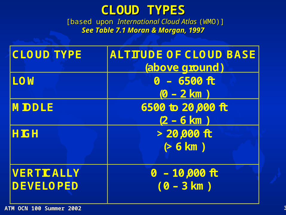
CLOUD TYPESCLOUD TYPES [based upon [based upon International Cloud Atlas International Cloud Atlas (WMO)](WMO)]
See Table 7.1 Moran & Morgan, 1997See Table 7.1 Moran & Morgan, 1997
CLOUD TYPE ALTITUDE OF CLOUD BASE (above ground)
LOW
0 – 6500 ft (0 – 2 km)
MIDDLE
6500 to 20,000 ft (2 – 6 km)
HIGH
> 20,000 ft (> 6 km)
VERTICALLY DEVELOPED
0 – 10,000 ft ( 0 – 3 km)

ATM OCN 100 Summer 2002ATM OCN 100 Summer 2002 3737
HIGH CLOUDSHIGH CLOUDS > 20,000 ft (> 6 km) > 20,000 ft (> 6 km)
“Cold clouds” with ice crystals “Cold clouds” with ice crystals See Table 7.1 Moran & Morgan, 1997See Table 7.1 Moran & Morgan, 1997
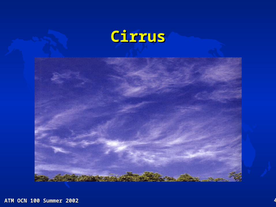
Cirrus (Ci)
Delicate streaks or patches.
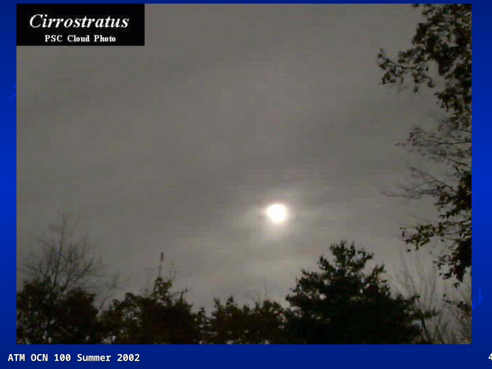
Cirrostratus (Cs)
Transparent thin white sheet or veil.
Cirrocumulus (Cc)
Layer of small white puffs or ripples.

ATM OCN 100 Summer 2002ATM OCN 100 Summer 2002 3838
CirrusCirrus

ATM OCN 100 Summer 2002ATM OCN 100 Summer 2002 3939
CirrusCirrus
ATM OCN 100 Summer 2002ATM OCN 100 Summer 2002 4040
CirrusCirrus
ATM OCN 100 Summer 2002ATM OCN 100 Summer 2002 4141
CirrostratusCirrostratus

ATM OCN 100 Summer 2002ATM OCN 100 Summer 2002 4242
CirrostratusCirrostratus (Cs) (Cs)
Made of a thin, transparent layer of (all ice) high clouds. Halos are common with this cloud type.

ATM OCN 100 Summer 2002ATM OCN 100 Summer 2002 4343
CirrostratusCirrostratus

ATM OCN 100 Summer 2002ATM OCN 100 Summer 2002 4444
CirrocumulusCirrocumulus

ATM OCN 100 Summer 2002ATM OCN 100 Summer 2002 4545
CirrocumulusCirrocumulus

ATM OCN 100 Summer 2002ATM OCN 100 Summer 2002 4646
CirrocumulusCirrocumulus

ATM OCN 100 Summer 2002ATM OCN 100 Summer 2002 4747
CirrocumulusCirrocumulus (Cc) (Cc)
Note the clumpy rows – due to wind shear (also all ice)

ATM OCN 100 Summer 2002ATM OCN 100 Summer 2002 4848
MIDDLE CLOUDSMIDDLE CLOUDS 6500 to 20,000 ft (2 – 6 km) 6500 to 20,000 ft (2 – 6 km)
“Cold clouds” with supercooled water droplets “Cold clouds” with supercooled water droplets See Table 7.1 Moran & Morgan, 1997See Table 7.1 Moran & Morgan, 1997
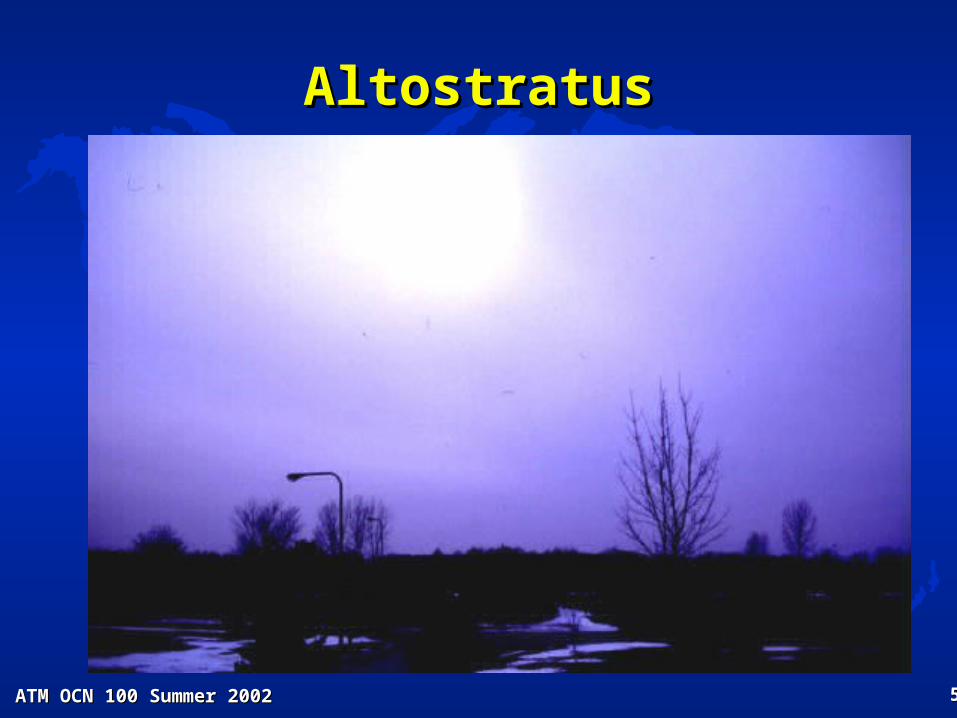
Altostratus (As)
Uniform white or gray sheet or layer.
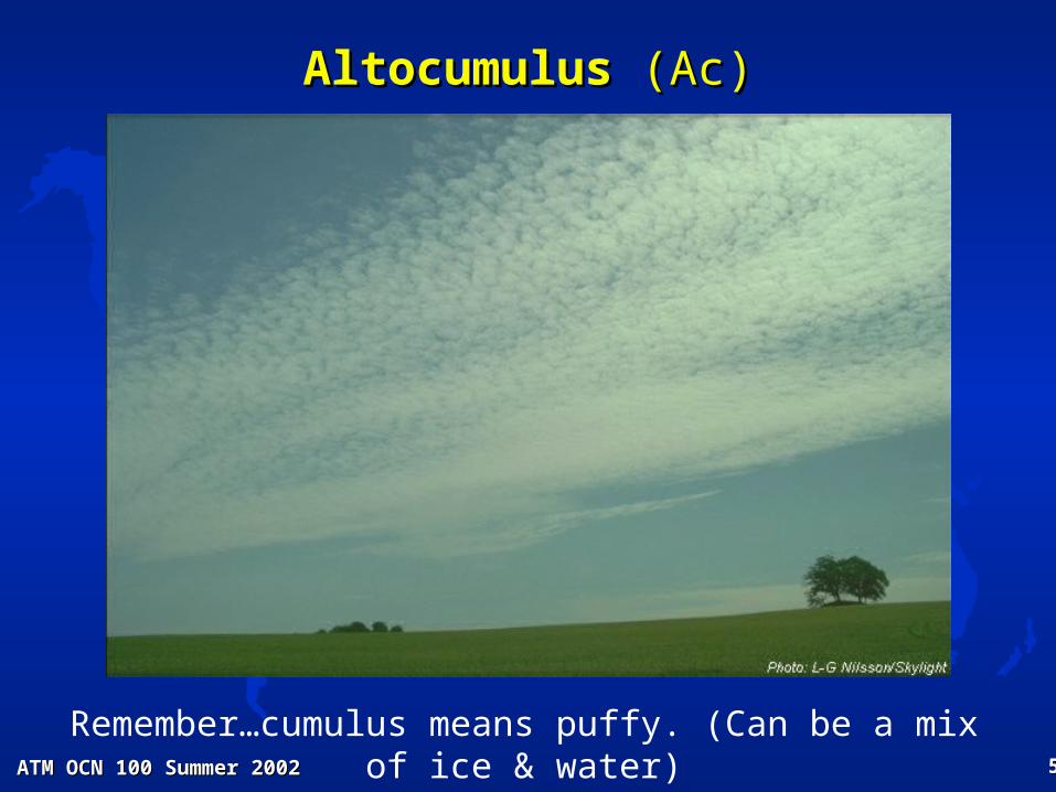
Altocumulus (Ac)
White (or gray) puffs or waves in patches or layers.

ATM OCN 100 Summer 2002ATM OCN 100 Summer 2002 4949
AltocumulusAltocumulus
ATM OCN 100 Summer 2002ATM OCN 100 Summer 2002 5050
AltocumulusAltocumulus (Ac) (Ac)
Remember…cumulus means puffy. (Can be a mix of ice & water)

ATM OCN 100 Summer 2002ATM OCN 100 Summer 2002 5151
AltocumulusAltocumulus
ATM OCN 100 Summer 2002ATM OCN 100 Summer 2002 5252
AltostratusAltostratus

ATM OCN 100 Summer 2002ATM OCN 100 Summer 2002 5353
AltostratusAltostratus

ATM OCN 100 Summer 2002ATM OCN 100 Summer 2002 5454
AltostratusAltostratus
ATM OCN 100 Summer 2002ATM OCN 100 Summer 2002 5555
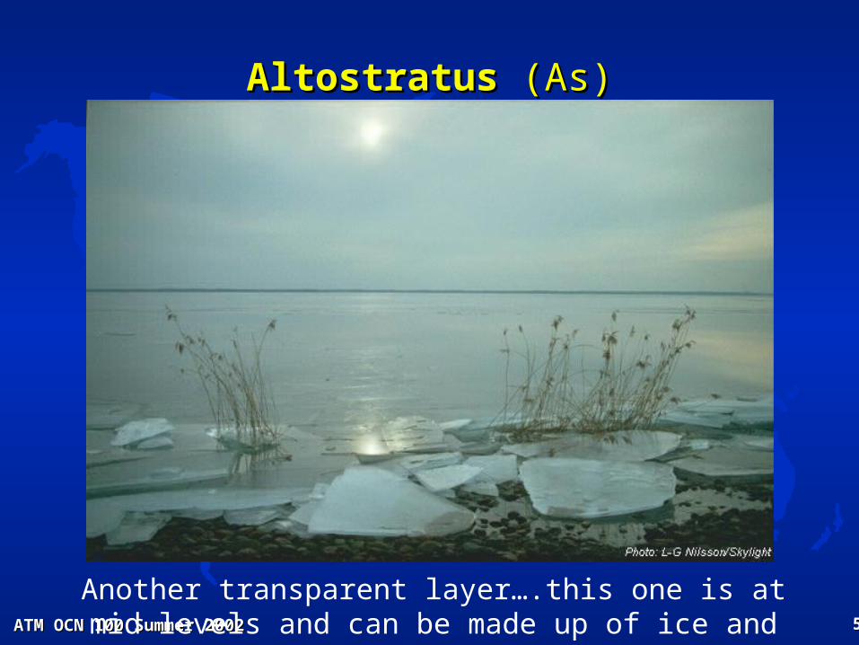
AltostratusAltostratus (As) (As)
Another transparent layer….this one is at mid levels and can be made up of ice and water

ATM OCN 100 Summer 2002ATM OCN 100 Summer 2002 5656
LOW CLOUDSLOW CLOUDS 0 – 6500 ft (0 – 2 km) 0 – 6500 ft (0 – 2 km)
“Warm clouds” with water droplets“Warm clouds” with water droplets See Table 7.1 Moran & Morgan, 1997See Table 7.1 Moran & Morgan, 1997
Stratus (St)
Low uniform gray layer, resembling fog.
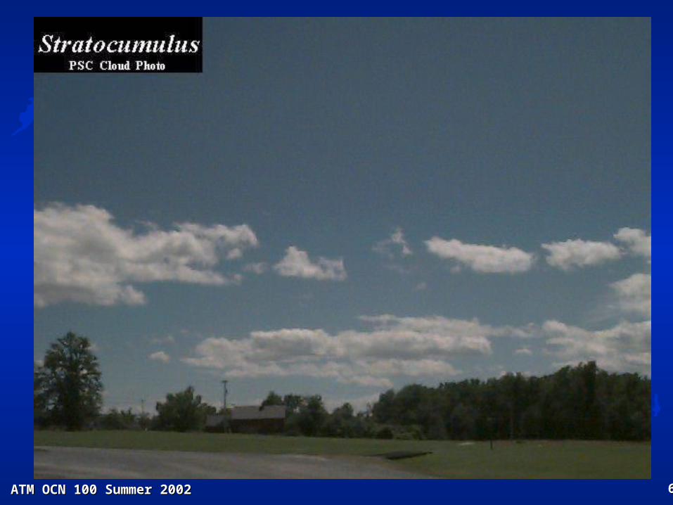
Stratocumulus (Sc)
Patches or layer of large rolls or merged puffs.
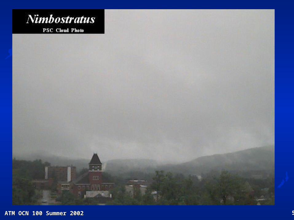
Nimbostratus (Ns) CE
Uniform gray layer from which precipitation is falling.

ATM OCN 100 Summer 2002ATM OCN 100 Summer 2002 5757
StratusStratus

ATM OCN 100 Summer 2002ATM OCN 100 Summer 2002 5858
StratusStratus
ATM OCN 100 Summer 2002ATM OCN 100 Summer 2002 5959
NimbostratusNimbostratus
ATM OCN 100 Summer 2002ATM OCN 100 Summer 2002 6060
StratocumulusStratocumulus
ATM OCN 100 Summer 2002ATM OCN 100 Summer 2002 6161
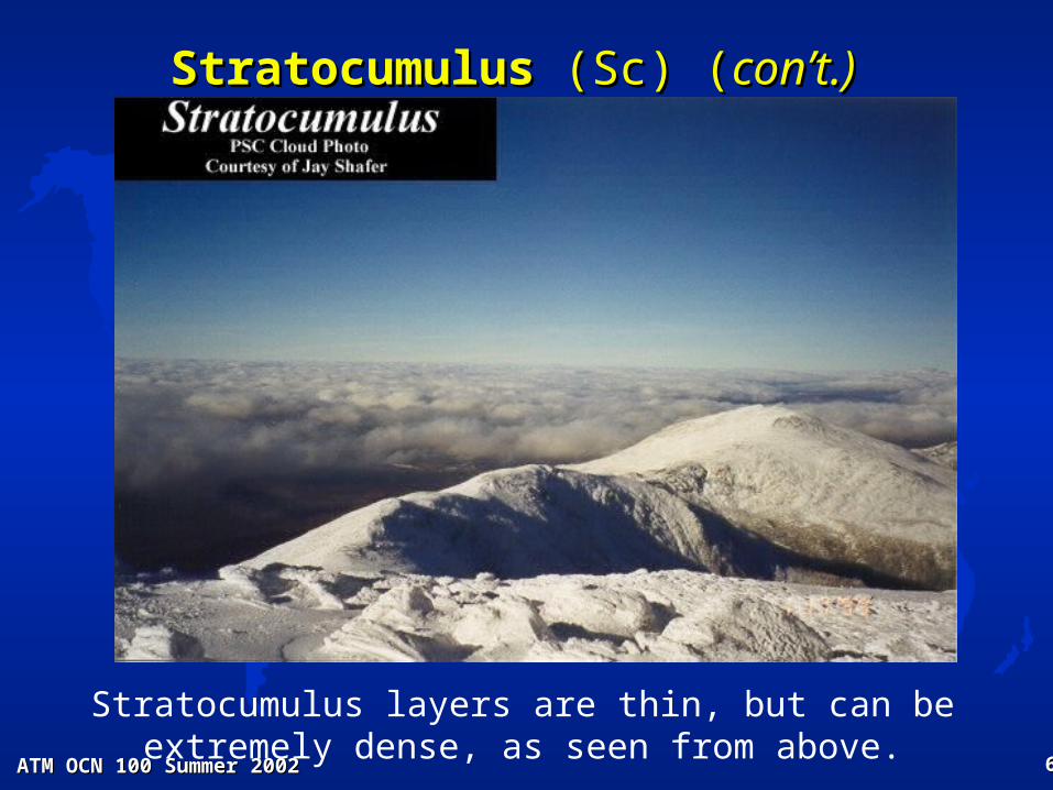
StratocumulusStratocumulus (Sc) ( (Sc) (con’t.)con’t.)
Stratocumulus layers are thin, but can be extremely dense, as seen from above.

ATM OCN 100 Summer 2002ATM OCN 100 Summer 2002 6262
VERTICALLY DEVELOPED CLOUDSVERTICALLY DEVELOPED CLOUDS 0 – 10,000 ft ( 0 – 3 km)0 – 10,000 ft ( 0 – 3 km)
See Table 7.1 Moran & Morgan, 1997See Table 7.1 Moran & Morgan, 1997
Cumulus (Cu)
Detached heaps or puffs with sharp outlines & flat bases, & slight or moderate vertical extent. A “warm cloud” w/ water droplets
Cumulonimbus (Cb)
Large puffy clouds of great vertical extent with smooth or flattened (anvil–shaped) tops, from which showers fall with thunder. A “mixed cloud”
ATM OCN 100 Summer 2002ATM OCN 100 Summer 2002 6363
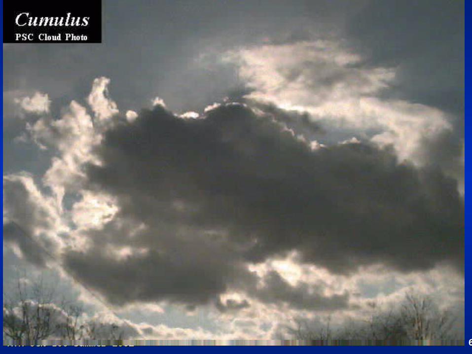
CumulusCumulus
ATM OCN 100 Summer 2002ATM OCN 100 Summer 2002 6464
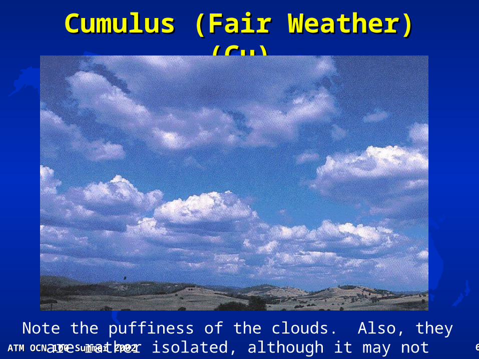
Cumulus (Fair Weather) (Cu)Cumulus (Fair Weather) (Cu)
Note the puffiness of the clouds. Also, they are rather isolated, although it may not appear that way on the horizon.

ATM OCN 100 Summer 2002ATM OCN 100 Summer 2002 6565
CumulonimbusCumulonimbus
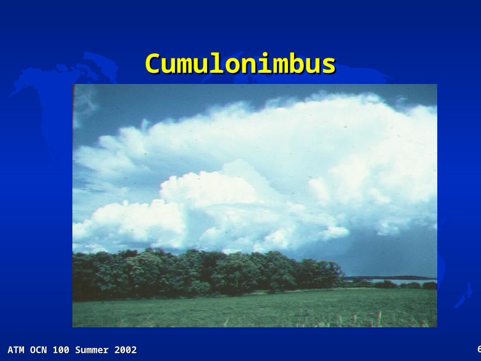
ATM OCN 100 Summer 2002ATM OCN 100 Summer 2002 6666
CumulonimbusCumulonimbus

ATM OCN 100 Summer 2002ATM OCN 100 Summer 2002 6767
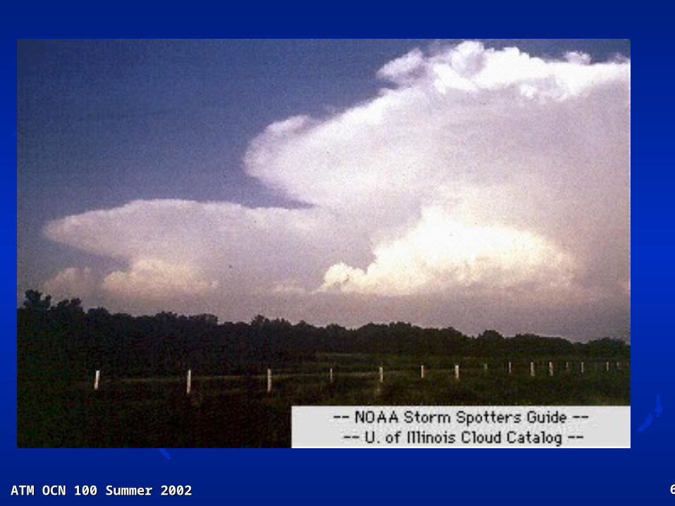
Cumulonimbus (Cb)Cumulonimbus (Cb)
Notice the anvil aloft! This cloud is probably nearly 100 miles away. They are huge!!!
ANVIL
RAIN SHAFT
Approximate tropopause (~ 6 miles high)
ATM OCN 100 Summer 2002ATM OCN 100 Summer 2002 6868
CumulonimbusCumulonimbus

ATM OCN 100 Summer 2002ATM OCN 100 Summer 2002 6969
OTHER SPECIAL CLOUDSOTHER SPECIAL CLOUDSCloud SpeciesCloud Species
See Table 7.2 Moran & Morgan, 1997See Table 7.2 Moran & Morgan, 1997
CUMULUS CONGESTUS
Considerable vertical development. Upper portions do not have a filmy appearance, or anvil top of cumulonimbus clouds
MAMMA or MAMMATUS
Pouch-like protrubrances under anvil top of cumulonimbus clouds
ALTOCUMULUS CASTELLANUS
Mid-level convective clouds, characterized by billowing tops and comparatively high bases, indicative of mid-level instability.
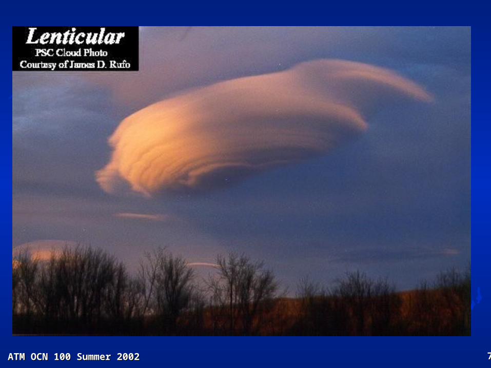
ALTOCUMULUS LENTICULARIS or WAVE CLOUDS
Lens shaped mid-level cloud form resembling a double convex lens especially where air moves over a mountain barrier.

ATM OCN 100 Summer 2002ATM OCN 100 Summer 2002 7070
Cumulus CongestusCumulus Congestus

ATM OCN 100 Summer 2002ATM OCN 100 Summer 2002 7171
Cumulus CongestusCumulus Congestus

ATM OCN 100 Summer 2002ATM OCN 100 Summer 2002 7272
Cumulus CongestusCumulus Congestus
These may be seen in the early afternoon on a humid day. If so, Cumulonimbus will most likely form later in the day.

ATM OCN 100 Summer 2002ATM OCN 100 Summer 2002 7373
MammatusMammatus

ATM OCN 100 Summer 2002ATM OCN 100 Summer 2002 7474
Altocumulus LenticularisAltocumulus Lenticularis

ATM OCN 100 Summer 2002ATM OCN 100 Summer 2002 7575
Mountain Wave CloudsMountain Wave CloudsFig. 7.24 Moran & Morgan (1997)Fig. 7.24 Moran & Morgan (1997)

ATM OCN 100 Summer 2002ATM OCN 100 Summer 2002 7676
Mountain Cap CloudsMountain Cap Clouds
Air can be lifted by the flow against a mountain to form these clouds.
ATM OCN 100 Summer 2002ATM OCN 100 Summer 2002 7777
Altocumulus LenticularisAltocumulus Lenticularis

ATM OCN 100 Summer 2002ATM OCN 100 Summer 2002 7878
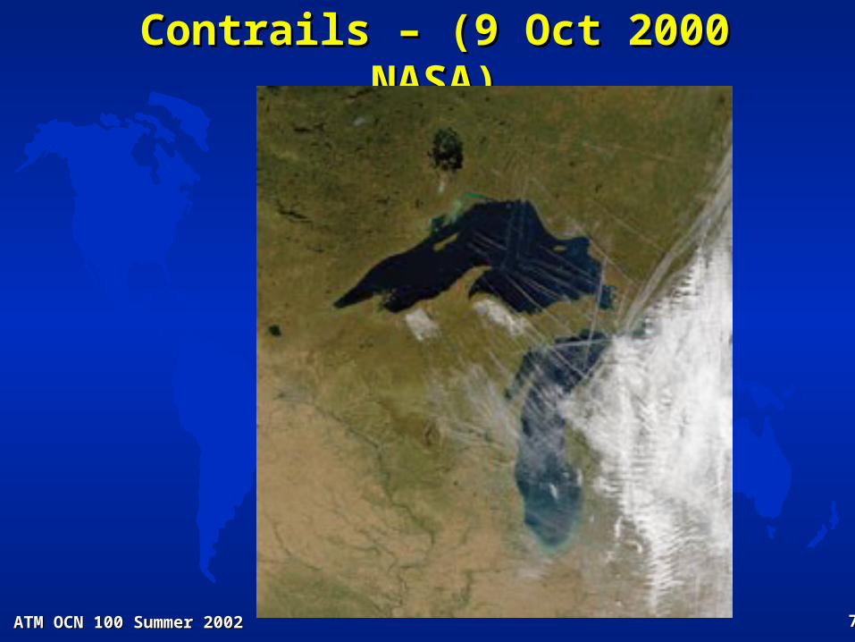
Contrails - Condensation TrailContrails - Condensation Trail
ATM OCN 100 Summer 2002ATM OCN 100 Summer 2002 7979
Contrails – (9 Oct 2000 NASA)Contrails – (9 Oct 2000 NASA)

ATM OCN 100 Summer 2002ATM OCN 100 Summer 2002 8080
C. CLOUD TYPES C. CLOUD TYPES (con’t.)(con’t.)
Cloud Identification AidsCloud Identification Aids
– TextureTexture
– Cloud base estimationCloud base estimation
– Size of featuresSize of features
– Shades of grayShades of gray
– Existence of optical phenomenaExistence of optical phenomena Gallery of Specific Cloud TypesGallery of Specific Cloud Types
ATM OCN 100 Summer 2002ATM OCN 100 Summer 2002 8181
D. CLOUD CLIMATOLOGYD. CLOUD CLIMATOLOGY
Geographical variation of cloudsGeographical variation of clouds Seasonal variation of cloudsSeasonal variation of clouds

ATM OCN 100 Summer 2002ATM OCN 100 Summer 2002 8282
Average Cloudiness -- AnnualAverage Cloudiness -- Annual

ATM OCN 100 Summer 2002ATM OCN 100 Summer 2002 8383
Average Cloudiness -- JulyAverage Cloudiness -- July
ATM OCN 100 Summer 2002ATM OCN 100 Summer 2002 8484
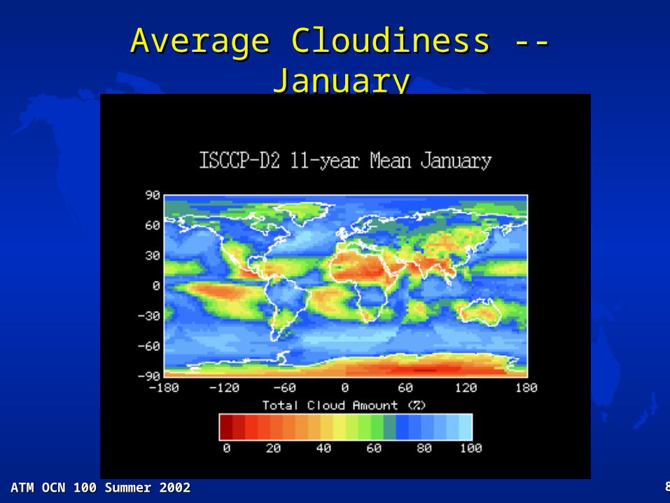
Average Cloudiness -- JanuaryAverage Cloudiness -- January

ATM OCN 100 Summer 2002ATM OCN 100 Summer 2002 8585
REVIEW of CLOUD TYPESREVIEW of CLOUD TYPES [based upon [based upon International Cloud Atlas International Cloud Atlas (WMO)](WMO)]
See Table 7.1 Moran & Morgan, 1997See Table 7.1 Moran & Morgan, 1997
CLOUD TYPE LOW 0 – 6500 ft AGL “warm cloud”
Stratus Stratocumulus Nimbostratus
MIDDLE 6500 - 20,000 ft AGL
Altostratus Altocumulus
HIGH > 20,000 ft AGL “cold cloud”
Cirrus Cirrostratus
Cirrocumulus VERTICALLY DEVELOPED
0 – 10,000 ft AGL
Cumulus Cumulonimbus