Embed Size (px)
Citation preview
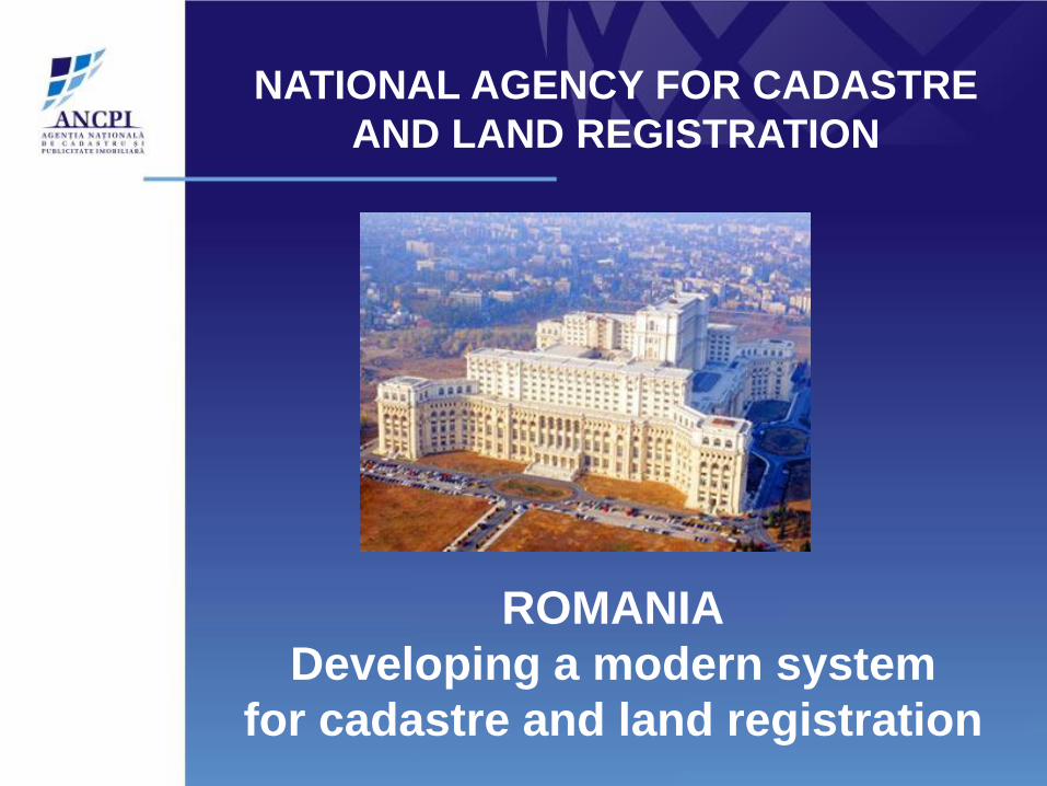
ROMANIA
Developing a modern system
for cadastre and land registration
NATIONAL AGENCY FOR CADASTRE
AND LAND REGISTRATION
•Historical Background
•Institutional organization
•Legal framework
•Registration process in Romania
•ANCPI achievements 2004-2009
•ANCPI and private surveyors
Agenda
26/03/ 2012 Cadastre and Land Registration System
ROMANIA
#3
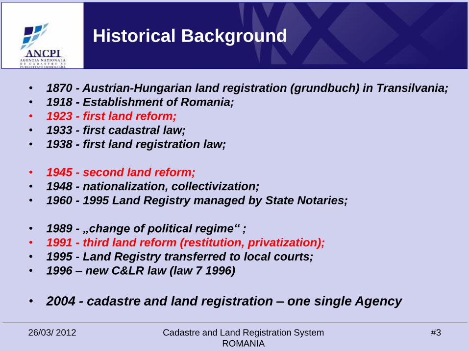
• 1870 - Austrian-Hungarian land registration (grundbuch) in Transilvania;
• 1918 - Establishment of Romania;
• 1923 - first land reform;
• 1933 - first cadastral law;
• 1938 - first land registration law;
• 1945 - second land reform;
• 1948 - nationalization, collectivization;
• 1960 - 1995 Land Registry managed by State Notaries;
• 1989 - „change of political regime“ ;
• 1991 - third land reform (restitution, privatization);
• 1995 - Land Registry transferred to local courts;
• 1996 – new C&LR law (law 7 1996)
• 2004 - cadastre and land registration – one single Agency
Historical Background
26/03/2012 Cadastre and Land Registration System
ROMANIA
#4
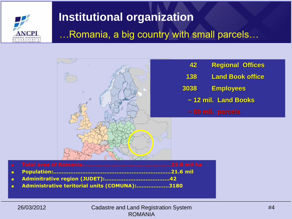
Institutional organization
42 Regional Offices
138 Land Book office
3038 Employees
~ 12 mil. Land Books
~ 60 mil. parcels
Total area of Romania:……………………………………………23.8 mil ha
Population:……………………………………………………………21.6 mil
Adminitrative region (JUDET):…………………………….….42
Administrative teritorial units (COMUNA):……………….3180
…Romania, a big country with small parcels…
26/03/2012 Cadastre and Land Registration System
ROMANIA
#5
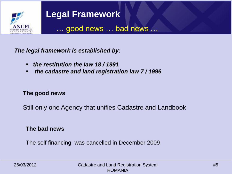
The legal framework is established by:
the restitution the law 18 / 1991
the cadastre and land registration law 7 / 1996
The good news
Still only one Agency that unifies Cadastre and Landbook
The bad news
The self financing was cancelled in December 2009
… good news … bad news …
Legal Framework

26/03/2012 Cadastre and Land Registration System
ROMANIA
#6
Registration before NACLR
…the name of the game: guess the correct order…
CLIENT
26/03/2012 Cadastre and Land Registration System
ROMANIA
#7
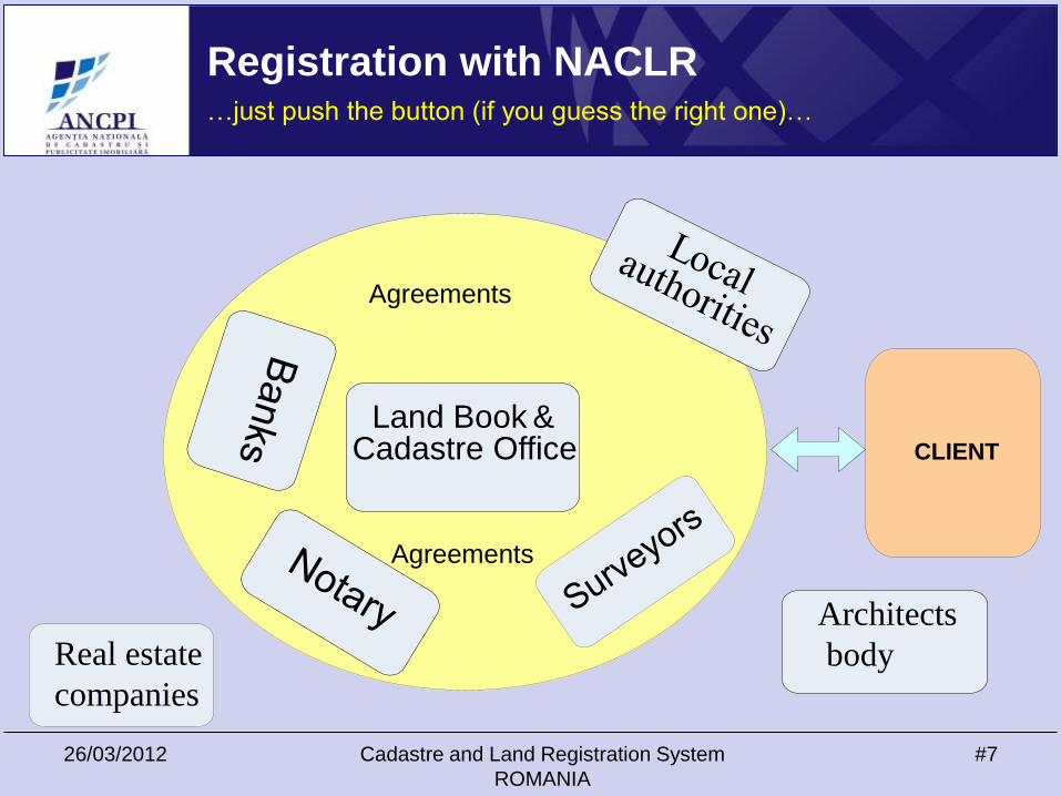
Registration with NACLR…just push the button (if you guess the right one)…
Land Book & Cadastre Office CLIENT
Agreements
Agreements
Architects
bodyReal estate
companies
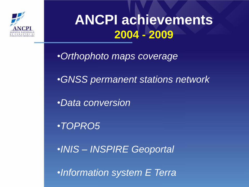
ANCPI achievements2004 - 2009
•Orthophoto maps coverage
•GNSS permanent stations network
•Data conversion
•TOPRO5
•INIS – INSPIRE Geoportal
•Information system E Terra
26/03/2012 Cadastre and Land Registration System
ROMANIA
#9
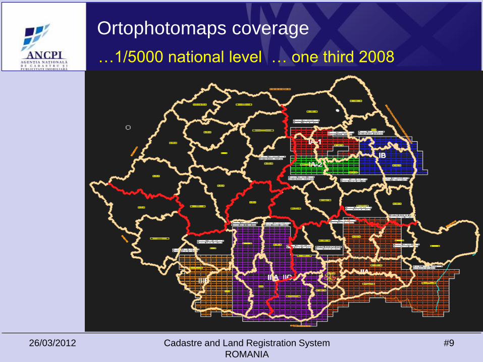
Ortophotomaps coverage
…1/5000 national level … one third 2008
26/03/2012 Cadastre and Land Registration
System ROMANIA
#10
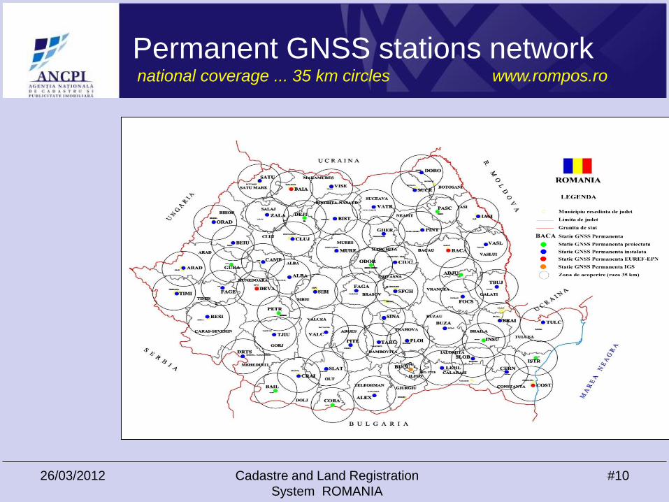
Reţeaua de stații permanente GPSmăsurători ieftine, rapide, integrate la nivel național
Permanent GNSS stations network national coverage ... 35 km circles www.rompos.ro
26/03/2012 Cadastre and Land Registration System
ROMANIA
#11
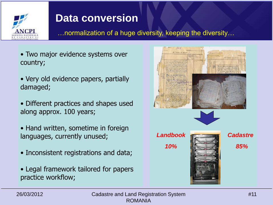
Data conversion
• Two major evidence systems over country;
• Very old evidence papers, partially damaged;
• Different practices and shapes used along approx. 100 years;
• Hand written, sometime in foreign languages, currently unused;
• Inconsistent registrations and data;
• Legal framework tailored for paperspractice workflow;
…normalization of a huge diversity, keeping the diversity…
Landbook
10%
Cadastre
85%
26/03/2012 Cadastre and Land Registration System
ROMANIA
#12
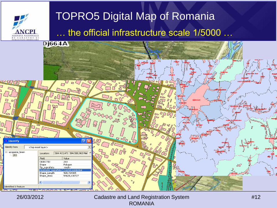
TOPRO5 Digital Map of Romania
… the official infrastructure scale 1/5000 …
26/03/2012 Cadastre and Land Registration System
ROMANIA
#13
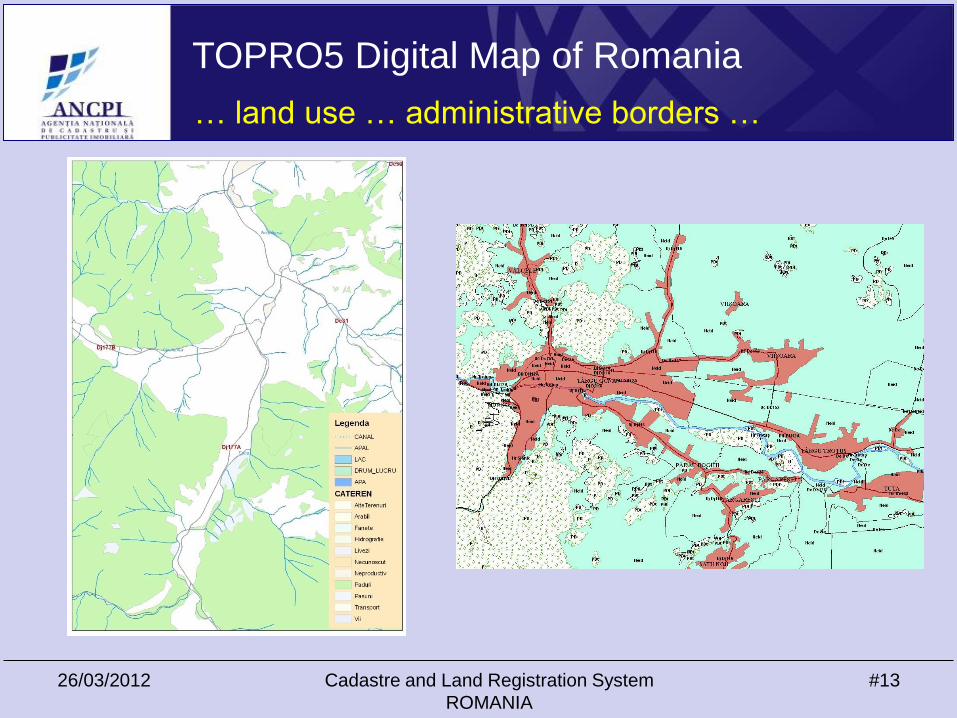
TOPRO5 Digital Map of Romania
… land use … administrative borders …
26/03/2012 Cadastre and Land Registration System
ROMANIA
#14
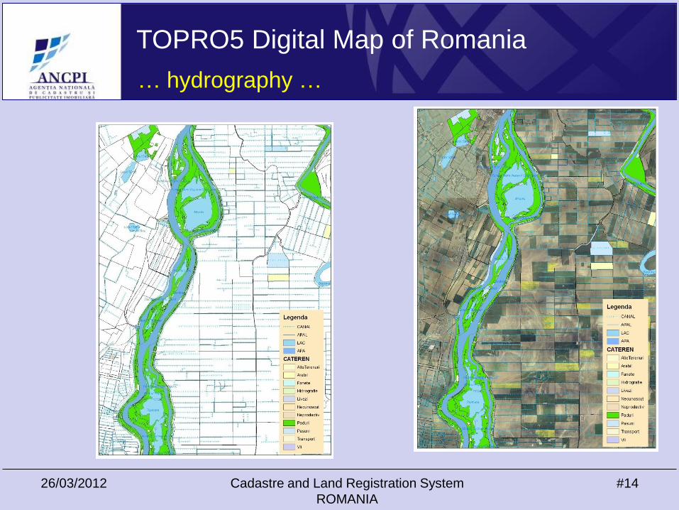
TOPRO5 Digital Map of Romania
… hydrography …
26/03/2012 Cadastre and Land Registration System
ROMANIA
#15
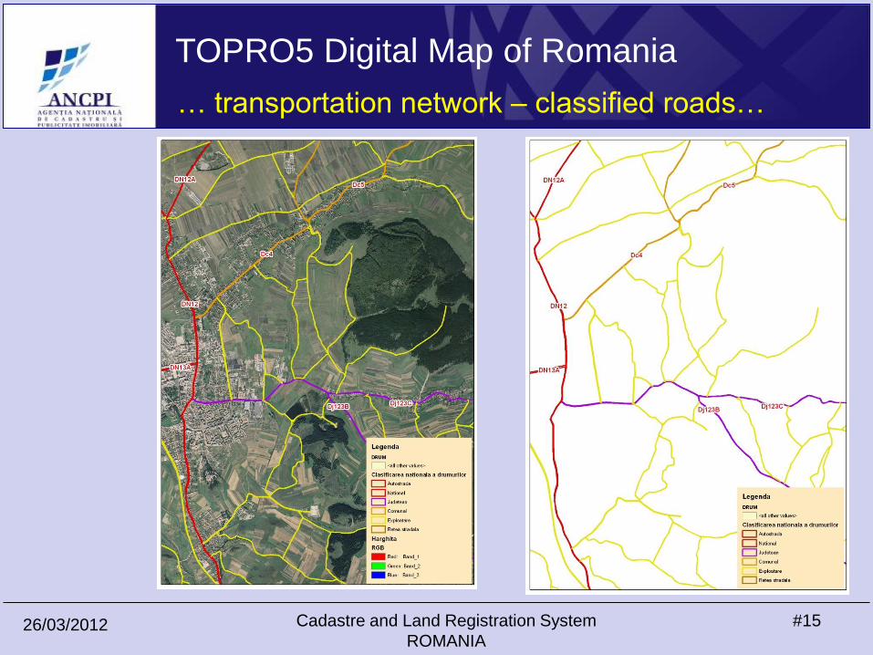
TOPRO5 Digital Map of Romania
… transportation network – classified roads…
26/03/2012 Cadastre and Land Registration System
ROMANIA
#16
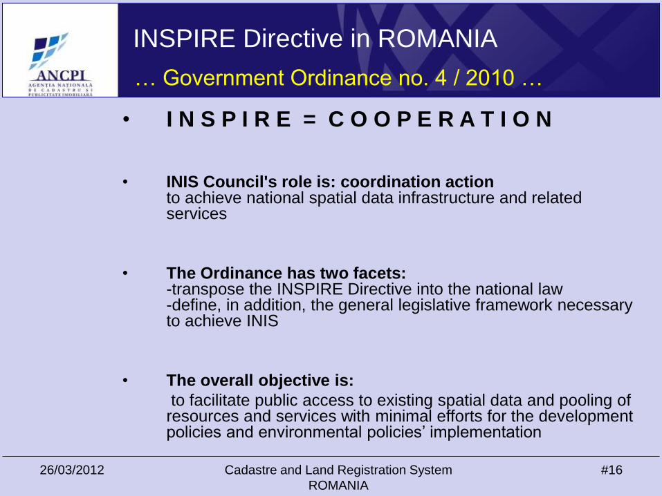
INSPIRE Directive in ROMANIA
… Government Ordinance no. 4 / 2010 …
• I N S P I R E = C O O P E R A T I O N
• INIS Council's role is: coordination actionto achieve national spatial data infrastructure and related services
• The Ordinance has two facets:-transpose the INSPIRE Directive into the national law-define, in addition, the general legislative framework necessary to achieve INIS
• The overall objective is:
to facilitate public access to existing spatial data and pooling of resources and services with minimal efforts for the development policies and environmental policies’ implementation
26/03/2012 Cadastre and Land Registration System
ROMANIA
#17
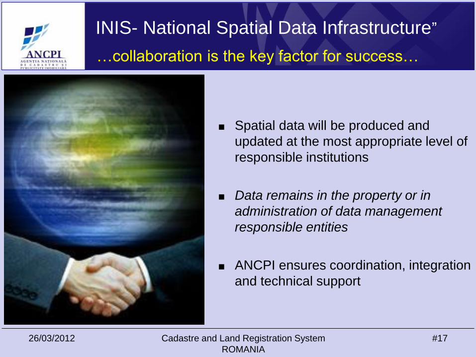
INIS- National Spatial Data Infrastructure”
…collaboration is the key factor for success…
Spatial data will be produced and
updated at the most appropriate level of
responsible institutions
Data remains in the property or in
administration of data management
responsible entities
ANCPI ensures coordination, integration
and technical support
26/03/2012 Cadastre and Land Registration System
ROMANIA
#18
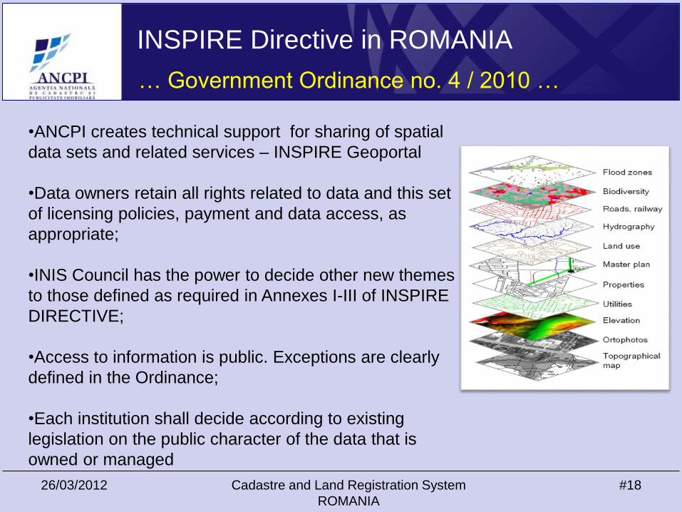
•ANCPI creates technical support for sharing of spatial
data sets and related services – INSPIRE Geoportal
•Data owners retain all rights related to data and this set
of licensing policies, payment and data access, as
appropriate;
•INIS Council has the power to decide other new themes
to those defined as required in Annexes I-III of INSPIRE
DIRECTIVE;
•Access to information is public. Exceptions are clearly
defined in the Ordinance;
•Each institution shall decide according to existing
legislation on the public character of the data that is
owned or managed
INSPIRE Directive in ROMANIA
… Government Ordinance no. 4 / 2010 …
26/03/2012 Cadastre and Land Registration System
ROMANIA
#19
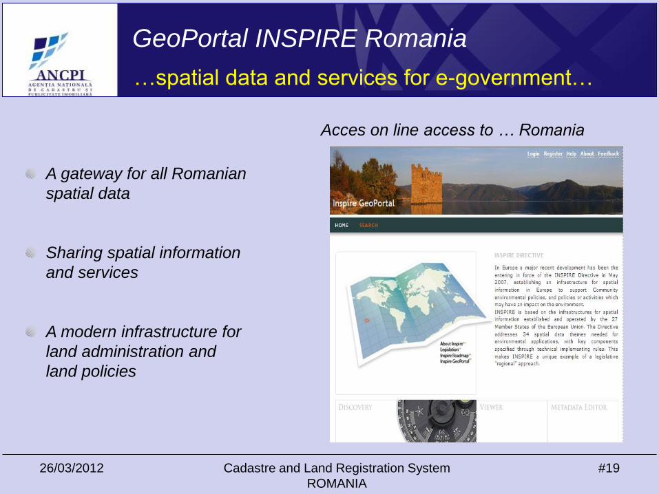
GeoPortal INSPIRE Romania
…spatial data and services for e-government…
Acces on line access to … Romania
A gateway for all Romanian
spatial data
Sharing spatial information
and services
A modern infrastructure for
land administration and
land policies

26/03/2012 Cadastre and Land Registration System
ROMANIA
#20
Financing
Total: 23,6 mil. $
• 18,0 mil.$ World Bank loan;
• 5,6 mil.$ Romanian Government.
Objectives
• National coverage with orthophotomaps;
• Cadastral works;
• Design and implementation of I.T. System;
• Purchase of: equipments, furniture and vehicles;
• Training.
Dream team
Lynn Holstein, Victoria Stanley, Helge Onsrud, John Manthorpe, Peter
Lindbo Larsen and others
World Bank Project –The Project Of General Cadastre and Land Book
26/03/2012 Cadastre and Land Registration System
ROMANIA
#21
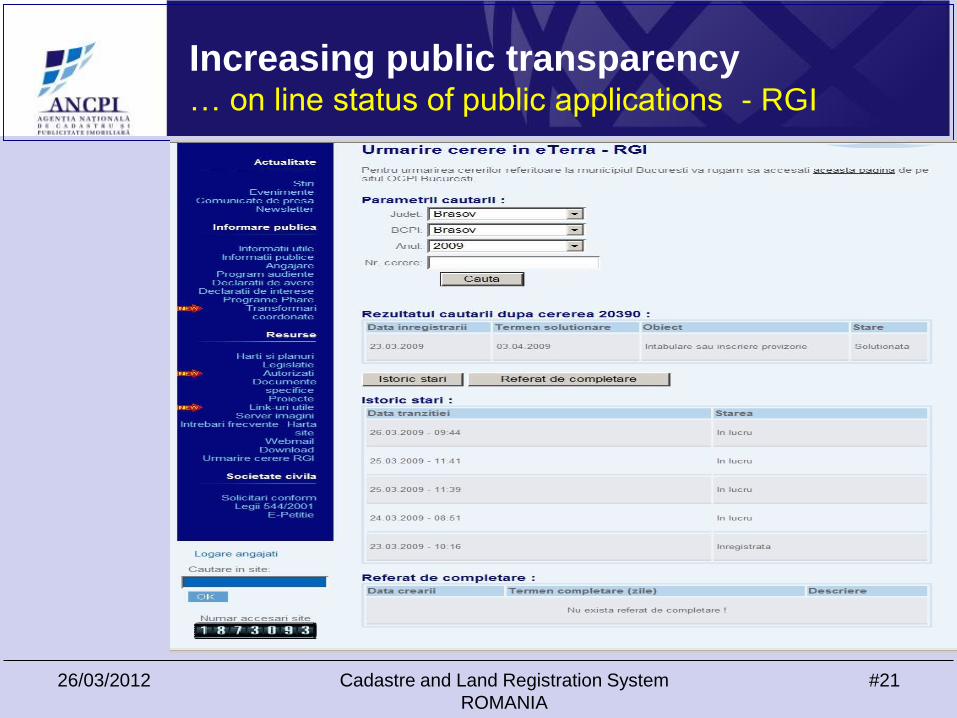
Increasing public transparency… on line status of public applications - RGI

26/03/2012 Cadastre and Land Registration System
ROMANIA
#22
e-Terra IT system – History & achievements
Registrations 4,893,548
Immovables 1,475,612
Transactions 2,576,634
Mortgages 966,185
Sample of plan
Pilot starting sept. 2006;
Improvements 2007-2008;
Rollout starting aug. 2008;
Rollout completed dec. 2009.
Achievements
History
26/03/2012 Cadastre and Land Registration System
ROMANIA
#23
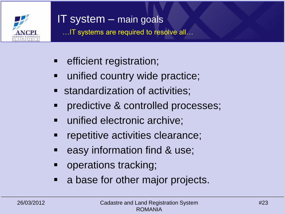
IT system – main goals
efficient registration;
unified country wide practice;
standardization of activities;
predictive & controlled processes;
unified electronic archive;
repetitive activities clearance;
easy information find & use;
operations tracking;
a base for other major projects.
…IT systems are required to resolve all…
26/03/2012 Cadastre and Land Registration System
ROMANIA
#24
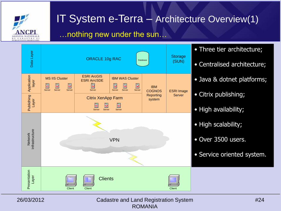
IT System e-Terra – Architecture Overview(1)
VPN
r
ORACLE 10g RAC
IBM
COGNOS
Reporting
system
Clients
Da
ta L
aye
r
MS IIS Cluster
Server Server Server
ESRI ArcGIS
ESRI ArrcSDE
Server
IBM WAS Cluster
Server Server Server ESRI Image
Server
Ap
plic
atio
n
laye
r
Client Client Client
Storage
(SUN)
Pre
se
nta
tio
n
La
ye
rP
ub
lidh
ing
La
ye
r
Ne
two
rk
Infr
astr
uctu
re
Citrix XenApp Farm
Server Server Server
Database
• Three tier architecture;
• Centralised architecture;
• Java & dotnet platforms;
• Citrix publishing;
• High availability;
• High scalability;
• Over 3500 users.
• Service oriented system.
…nothing new under the sun…
26/03/2012 Cadastre and Land Registration System
ROMANIA
#25
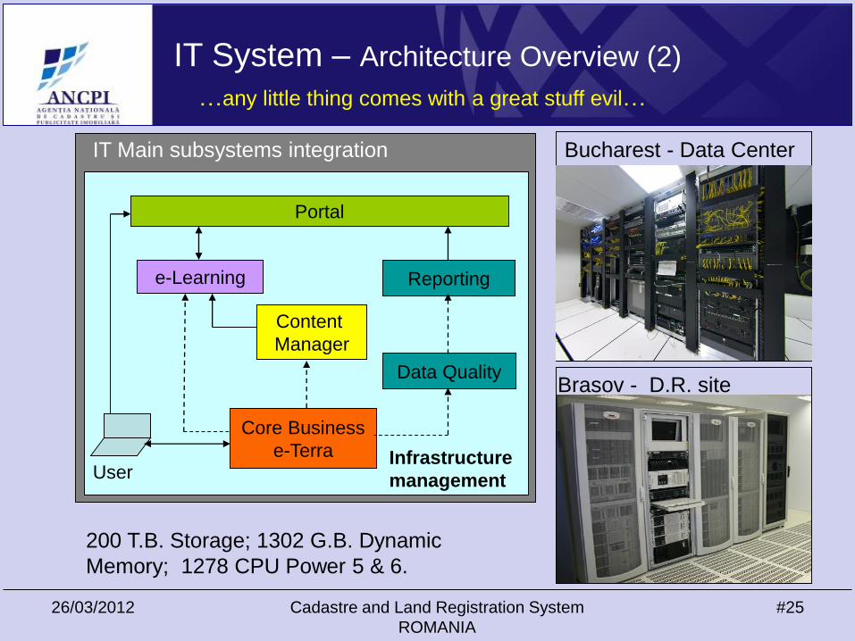
IT System – Architecture Overview (2)
…any little thing comes with a great stuff evil…
Portal
e-Learning Reporting
Content
Manager
Data Quality
Core Business
e-TerraUser
IT Main subsystems integration Bucharest - Data Center
Brasov - D.R. site
Infrastructure
management
200 T.B. Storage; 1302 G.B. Dynamic
Memory; 1278 CPU Power 5 & 6.
26/03/2012 Cadastre and Land Registration System
ROMANIA
#26
IT system Issues - “changing people mentality”
• Changing employees’ behavior;
• Huge effort for training without interruption of services supply;
• Management of “collision” between different cultures
(technical & juridical) working in one integrated system;
• Management of relations with professional groups (notaries,
surveyors, banks, etc.);
• New activities requested such as helpdesk, business support, etc.
…we agree the change only if completely missing…
26/03/2012 Cadastre and Land Registration System
ROMANIA
#27
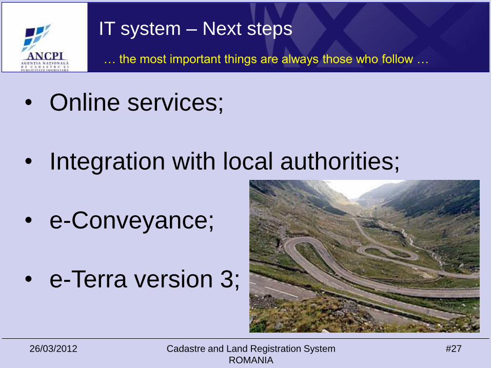
IT system – Next steps
… the most important things are always those who follow …
• Online services;
• Integration with local authorities;
• e-Conveyance;
• e-Terra version 3;

26/03/2012 Cadastre and Land Registration System
ROMANIA
#28
Licensed surveyors - 5000
…2011 distribution…
26/03/2012 Cadastre and Land Registration System
ROMANIA
#29
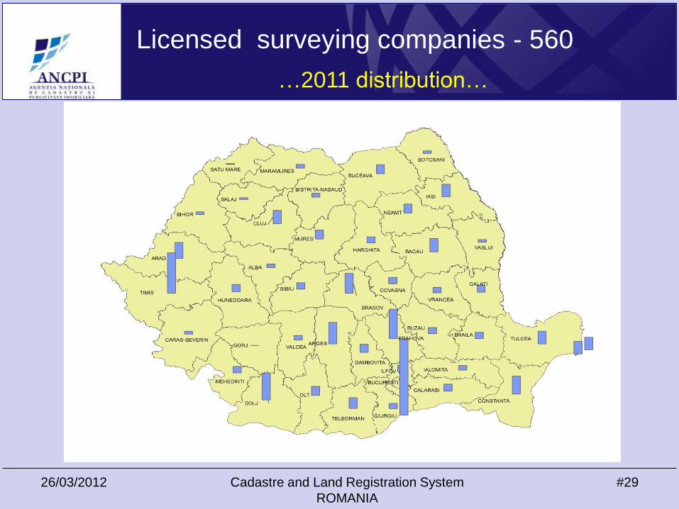
Licensed surveying companies - 560
…2011 distribution…
26/03/2012 Cadastre and Land Registration System
ROMANIA
#30
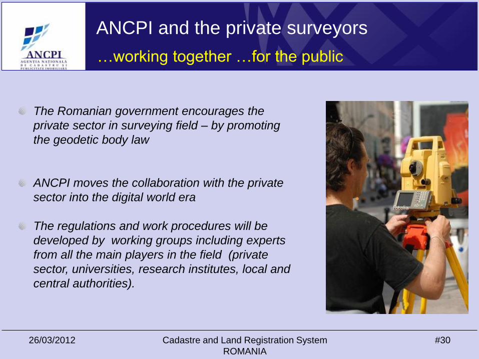
ANCPI and the private surveyors
…working together …for the public
The Romanian government encourages the
private sector in surveying field – by promoting
the geodetic body law
ANCPI moves the collaboration with the private
sector into the digital world era
The regulations and work procedures will be
developed by working groups including experts
from all the main players in the field (private
sector, universities, research institutes, local and
central authorities).

Thank you!