Embed Size (px)
Citation preview
International Archives of Photogrammetry, Remote Sensing and Spatial Information Sciences, Vol. XXXVIII, Part 5
Commission V Symposium, Newcastle upon Tyne, UK. 2010
55
AUTOMATION IN 3D RECONSTRUCTION:
RESULTS ON DIFFERENT KINDS OF CLOSE-RANGE BLOCKS
L. Barazzetti*, F. Remondino**, M. Scaioni*
* Politecnico di Milano, Department of Building Engineering Science and Technology, Milan, Italy
E-mail: (luigi.barazzetti, marco.scaioni)@polimi.it, Web: http://www.best.polimi.it
** 3D Optical Metrology Unit, Bruno Kessler Foundation, Trento, Italy
E-mail: [email protected], Web: http://3dom.fbk.eu
Commission V, WG V/4
KEY WORDS: 3D Modelling, Automation, Calibration, Orientation, Matching, Surface Reconstruction
ABSTRACT:
Automation in 3D reconstruction involves mainly two tasks: (i) image orientation and (ii) 3D scene reconstruction. Nowadays,
automation in (i) can be considered solved for aerial photogrammetric projects, but a general and commercial solution is still
pending in case of close-range image blocks. Here, the complexity and diversity of the network geometry make the automatic
identification of the image correspondences a challenging task. In this paper we present a methodology to automatically orient a set
of targetless close-range images taken with a calibrated camera and the following creation of 3D models with a multi-image
matching algorithm. Several real cases, comprehending free-form objects (e.g. bas-relieves, decorations, etc.), building facades and
images taken with UAVs are reported and discussed. Lastly, some preliminary results on a methodology for markerless camera
calibration are presented.
1. INTRODUCTION
Automatic 3D reconstruction of scenes and objects from images
or range data is still an open research topic. Some applications
are demanding Photosynth-like results (Snavely et al., 2008;
Agarwal et al., 2009) while many others are seeking highly
detailed, accurate, complete, metric and photo-realistic 3D
models (Levoy et al., 2000; Gruen et al., 2005; Remondino et
al., 2009). 3D models can be generated with reality-based or
computer graphics methods. Reality-based approaches use real
measurements and data for the geometric and appearance
modelling of the surveyed scene. The actual great challenges in
3D modelling applications are: (i) the selection of the correct
platform and sensor, (ii) the identification of the appropriate
measurement and modelling procedure, (iii) the design of the
right production workflow, (iv) the achievement of a final result
in accordance with all the given initial technical specifications
and (v) the possibility to fluently display and interact with the
final 3D model. The most used reality-based techniques are
photogrammetry and laser scanning, based respectively on
passive or active optical sensors. Their integration is also
providing for very good 3D modelling results in terms of
completeness, accuracy and photo-realism (Stamos et al., 2008;
El-Hakim et al., 2008; Guidi et al., 2009), in particular in the
case of large and complex sites. Image-based techniques are
generally preferred in the case of lost objects, large monuments
or architectures with regular geometric shapes, low-budget
projects, good skill of the working team, time or location
constraints for data acquisition and processing. Images contain
all the information useful to derive the 3D shape of the surveyed
scene as well as its graphical appearance (texture).
Generally the fundamental steps for an image-based 3D
geometric reconstruction of a scene using close-range images
are: (1) camera calibration, (2) image orientation and (3) 3D
scene restitution. Nowadays all these steps can be performed in
a fully automated way, with the level of automation as a
function of the quality and accuracy of the final 3D model. The
complexity and diversity of the image network geometry in
close-range applications, with possible wide baselines,
convergent images, illumination changes, moving objects,
occlusions, variations in resolution and overlap, makes the
automated identification of tie points and 3D surface
reconstruction procedures more complex than in standard aerial
photogrammetry.
The paper presents a methodology for the automated orientation
of image blocks acquired with calibrated cameras and the
successive object 3D reconstruction. The identification of the
image correspondences is performed with a feature-based
approach within an implemented software named ATiPE
(Automatic Tie Point Extraction). The surface reconstruction is
instead achieved with a multi-image matching approach
implemented within the CLORAMA software. Many tests have
been performed in order to validate the methodology on
different datasets of images acquired with SLR or consumer
grade digital cameras.
2. THE PROPOSED 3D RECONSTRUCTION PIPELINE
2.1 Image Orientation
2.1.1 Related works. Since some years, different
commercial solutions utilise coded-targets for the automated
camera calibration and image orientation phases (e.g. Cronk et
al., 2006). Targets are automatically recognised, measured and
labelled to solve the identification of the image correspondences
before the bundle adjustment solution. This approach becomes
very useful and practical for camera calibration, but in many
surveys, targets cannot be used or applied on the object to
derive the exterior orientation parameters automatically.
Therefore, the detection of the image correspondences is carried
out with interactive measurements performed by an operator.
Automated methods for tie points identification were presented
in Läbe and Förstner (2006), Remondino and Ressl (2006) and
Barazzetti et al. (2009), but a commercial solution for close-
range images is still pending.
International Archives of Photogrammetry, Remote Sensing and Spatial Information Sciences, Vol. XXXVIII, Part 5
Commission V Symposium, Newcastle upon Tyne, UK. 2010
56
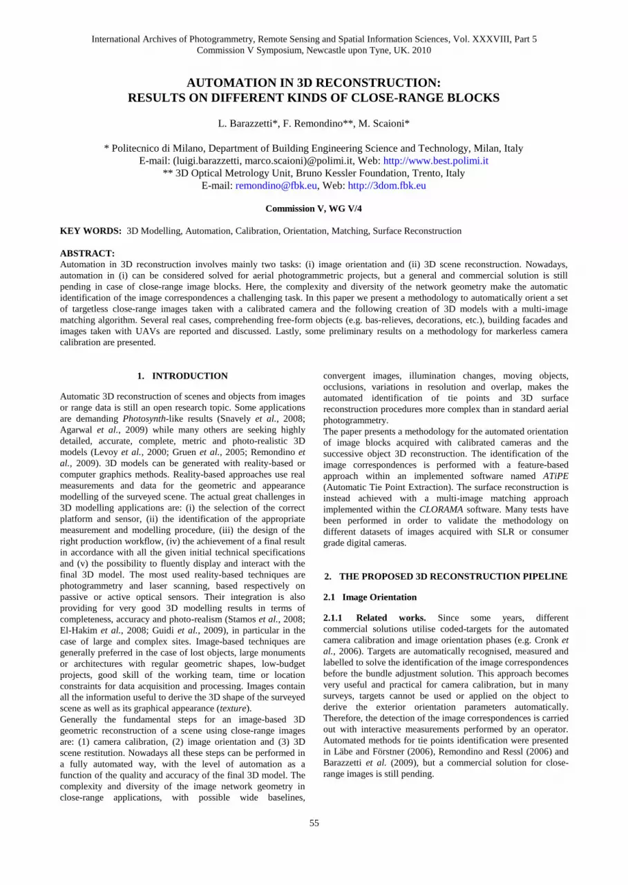
a) b) c)
d) e) f)
Fig. 1. Examples of close-range blocks oriented using ATiPE to automatically extract the necessary image correspondences.
Some approaches try to solve at the same time for interior and
exterior orientation parameters, leading to the well known
Structure from Motion (SfM) approach. However, such methods
(Pollefeys and Van Gool, 2002; Hao and Meyer, 2003; Nister,
2004; Vergauwen and Van Gool, 2006) generally have a scarce
accuracy for photogrammetric surveys. Recently the SfM
concept has made great improvements, with the capability to
automatically orient huge numbers of images, notwithstanding
that the achievable 3D reconstructions are useful mainly for
visualization, object-based navigation, annotation transfer or
image browsing purpose. Two well-known packages are
Bundler (or its graphical version Photosynth; Snavely et al.,
2008) and Samantha (Farenzena et al., 2009). The former is the
implementation of the current state-of-the-art procedures for
sequential SfM applications, the latter appears even faster
because of the introduction of a local bundle adjustment
procedure.
2.1.2 ATiPE methodology. The developed methodology for
Automate Tie Points Extraction (ATiPE) is distinguished from
previous works for its flexibility, completeness of the achieved
sparse point clouds and capability to process different types of
images and block configurations. The robust detection of
correspondences is achieved by combining the accuracy of
traditional photogrammetric methods with the automation of
Computer Vision approaches. The implemented feature
matching strategies, coupled with an initial network geometry
analysis (called visibility map), allow a computational time of
few hours for image blocks composed of several tenth of large
resolution images (more than 20 Mpx), used at their original
size. A comparison between ATiPE and the state-of-the-art
Photo Tourism (e.g. Bundler or Photosynth) is given in Table 1.
The innovative aspects of ATiPE are:
effectiveness on a large variety of unorganized and
fairly large pinhole camera image datasets;
capability to work with high resolution images;
accurate image measurements based on the Least
Squares Matching (LSM);
combination of feature-based and area-based
operators;
strategies to derive a uniform distribution of tie points
in the images;
extension to spherical (Barazzetti et al., 2010a) and
multispectral (Barazzetti et al., 2010b) images.
Photo Tourism ATIPE
Purpose CV Applications Photogrammetric
Surveys
Kind of Images Pinhole Images Pinhole & Spherical
Images
Number of images Huge (>10 000) Limited (a few
hundreds)
Varying cameras Yes Yes (if calibrated)
Image size Low resolution
(compression)
High resolution with a
coarse-to-fine approach
Image enhancement None Yes (Wallis filter)
Network geometry
Sparse block
Ad-hoc procedures for
sparse blocks or
sequences
Visibility
information
None Yes
Accuracy No guarantee Yes
Speed Fast Slow
Camera calibration EXIF EXIF or Interior with
additional parameters
Matching operators SIFT SIFT – SURF - FAST
Detector comparison kd-tree Quadratic or kd-tree
Outlier rejection F/E matrix +
robust estimators
F/E matrix or
homography
F/E estimation 8-points 7-points
Robust method RANSAC LMedS - RANSAC -
MAPSAC
Image coordinates
refining
None LSM
Additional image
points
None Multi-image corner-
based matching
Tie points reduction None Yes
Tie points uniform
distribution
None Yes
Table 1. Comparison of the Photo-Tourism approach (Bundler -
Photosynth) and ATiPE.
A typical elaboration with ATiPE comprehends the following
steps:
1) Generation of the visibility map. An initial network geometry
analysis is carried out to roughly understand which are the
connections between the images. The map is produced either

International Archives of Photogrammetry, Remote Sensing and Spatial Information Sciences, Vol. XXXVIII, Part 5
Commission V Symposium, Newcastle upon Tyne, UK. 2010
57
using available GPS/INS data (e.g. in case of UAV images) or
with a very quick run of the entire ATiPE procedure on very
low resolution images.
2) Feature detection. Features are extracted with the SIFT
(Lowe, 2004) or with the SURF (Bay et al., 2008) operator.
3) Pairwise feature matching. Homologous points are found by
simply comparing the descriptors of the points extracted at stage
(2). Two strategies can be used: (i) a quadratic matching
procedure which ensures a good robustness but is
computationally very expensive (O(n2)), as all image
combinations must be investigated; (ii) a kd-tree procedure
(Beis and Lowe, 1997) based on the Approximate Nearest
Neighbours (ANN) (Arya et al., 1998) and the Fast Library for
Approximate Nearest Neighbours (FLANN) (Muja and Lowe,
2009) libraries. Table 2 reports some results of the two
implemented strategies to compare feature descriptors and
extract homologous points. Both automated strategies for the
comparison of the feature descriptors retrieve a sufficient
number of image correspondences although some mismatches
are often still present. To remove these outliers, a linear
formulation and retrieval of the relative orientation (or epipolar
constraint) encapsulated in the essential (E) or fundamental (F)
matrix is used. The solution E (or F) is sought with robust
techniques (RANSAC, LMedS or MAPSAC are available) to
face the presence of outliers.
kd-tree quadratic Image
size
Features
image1
Features
image 2
Matched
features
Time
(s)
Matched
features
Time
(s)
640×480 1391 1405 262 2 328 3
1500×1004 5636 5017 349 6 419 19
2816×2112 23080 22806 1204 39 1690 465
3072×2304 21343 20691 2018 59 2936 698
4500×3000 83729 87471 19336 162 27772 7900
5616×3744 94208 127359 25968 339 34230 22580
Table 2. Comparison between quadratic- and “kd-tree”-based matching
strategies.
4) Image concatenation. Once the correspondences between
image pairs are robustly extracted the method tries to link all the
images together. Different strategies are followed according to
the block structure: for ordered image sequences (Fig. 1 a,b,c)
the whole sequence is divided into n-2 triplets in order to
determine the correspondences inside each triplet. After the
single triplet matching, the image coordinates of consecutives
triplets are compared among them to match the correspondences
along the whole sequence. In the case of closed circuits the
method can create an additional triplet to correctly close the
sequence. This method has a linear computational cost O(n)
with respect to the number of images. For unordered sets of
images (Fig. 1 d,e,f) it is necessary to check all possible image
pair combinations to determine the ones sharing sufficient
correspondences. Therefore each image must be compared with
all the others, leading to a high computational cost O(n2). For
this reason, the use of the visibility map is recommended.
5) Image coordinates refinement. The image coordinates of
homologous points extracted using operators like SIFT or
SURF generally do not allow the derivation of highly accurate
orientation results. Therefore to improve the location accuracy
of the image coordinates a LSM refining is applied to full
resolution images. In the case of widely separated and
convergent images, the descriptor values can be even used as
initial approximation of the LSM parameters (Remondino and
Ressl, 2006). A successive improvement is achieved using the
FAST operator (Rosten and Drummond, 2006) which
demonstrated to quickly extract a large number of corners under
a higher repeatability compared to SIFT and SURF, with also a
better distribution in the images and a higher accuracy of the
final sparse geometry (Jazayeri and Fraser, 2010).
6) Reduction and regularization of tie point distribution. High
resolution images picturing objects with a good texture
generally generate a huge number of image correspondences,
which are very often not uniformly distributed in the images.
This can cause low accuracy results and very long processing
time. Therefore, each image is divided into rectangular cells
where only the features with the largest multiplicity are used. A
significant reduction of the correspondences (even more than
100 times) is achieved, preserving the accuracy of the final
product. Secondly, as the features are generally random-
distributed in the images without a uniform distribution (Fig. 2),
the method improves also the geometric distribution of the
correspondences. Consequently, the quality of the final results
is increased in terms of geometric distribution of tie points and
reduction of both processing time and computational cost.
Fig. 2. Random and non-uniform distribution of the features extracted
with SIFT (above). Derived uniform distribution of the correspondences
obtained with the proposed approach (below).
The typical output of ATiPE contains the pixel coordinates of
all the homologous points, which can be then imported and
used for image orientation and sparse geometry reconstruction
in most commercial photogrammetric software (e.g. Australis,
iWitness, iWitnessPro, Leica Photogrammetry Suite,
PhotoModeler, Bundler).
2.2 Scene reconstruction
After the image orientation achieved coupling the output of
ATiPE with any bundle adjustment solution, according to the
imaged scene and contents, a fully automated or interactive 3D
reconstruction of the scene is performed. For architectural
structures with well defined and repeated geometric primitives
(e.g. buildings), interactive methods are still more powerful and
reliable than automated surface reconstruction algorithms. On
the other hand, in the case of free-form objects, like bas-
relieves, decorations, ornaments, statues, dense and detailed
point clouds are more useful. The recent developments in
automated image correlation (Furukawa and Ponce, 2007;
Goesele et al., 2007) have shown the great potentialities of the
approach, with 3D results very similar to active sensors
(Remondino et al., 2008).
In our methodology, the CLORAMA procedure was employed
for the generation of accurate and dense point clouds from
oriented images. CLORAMA implements a multi-image
matching technique based on the Multi-Photo Geometrically
Constrained (MPGC) concept of Gruen and Baltsavias (1988).
The matching algorithm was originally developed by Zhang and
Gruen (2004) and then adapted and extended to terrestrial
convergent images (Remondino et al., 2008). Now the software
(CLORAMA) is offered by the ETH Zurich spin-off 4DiXplorer
(www.4dixplorer.com).
International Archives of Photogrammetry, Remote Sensing and Spatial Information Sciences, Vol. XXXVIII, Part 5
Commission V Symposium, Newcastle upon Tyne, UK. 2010
58
The derived dense point clouds are then converted into
structured mesh using commercial packages. The surface model
is automatically textured using the known camera parameters
and one or multiple images. In the image overlapping areas,
blending is performed to get seamless texture and photo-
realistic results.
3. EXPERIMENTS
3.1 3D modeling of free-form objects
The developed methodology was tested with several free-form
objects obtaining satisfactory results in terms of accuracy and
completeness of the achieved reconstructions. This kind of
objects normally have a good texture for the preliminary
feature-based matching and the following surface reconstruction
phase. Some results are shown in figures 3 and 4, where the
whole elaboration time took around 3 hours for each object.
Fig. 3. A surface model (shown in color-shaded and textured mode)
was derived in approximately 3 hours from a sequence of 8 images.
Fig. 4. Automated 3D reconstruction of a marble bass-relief (ca 1.5 m
width) modelled from 5 images. The dense matching of CLORAMA
produced a DSM with a 1 mm grid resolution and ca 2.3 million
points.
3.2 Architectural reconstruction
Although the exterior orientation parameters of a set of images
used for the 3D restitution of architectures can be computed
fully automatically, the successive automatic 3D metric
restitution of building facades or complex architectures is still a
challenging task. Hence most of the 3D reconstructions are
done with interactive measurements (Patias et al., 2008). In
fact, interactive methods still remain the best approach as
several elementary surfaces or solids can be grouped together to
create 3D models of the object. Fully automated procedures
normally produce dense 3D point clouds useful mainly for
visualization purposes at small or medium scale but are not
ideal for detailed surveying or architectural drawings.
The reported procedure was tested with the main façade of the
Sanctuary of Re (Valle Vigezzo, Italy). The survey was carried
out with a calibrated SLR Nikon D700 camera with a 20 mm
lens. 13 images were taken and then oriented in a few minutes
using the SURF operator and a kd-tree search (Fig. 5). We
verified that the geometry of the building façade, with several
repetitive elements and symmetries, generated some outliers
during the descriptor-based matching of the SURF keypoints.
This unwanted effect was also found for other building facades,
demonstrating a potential limit for an automated matching
procedure. Robust estimators used to derive the E or F matrix
work with image pairs, therefore mismatches lying on the
epipolar line cannot be rejected. However, the use of a robust
photogrammetric bundle solution helped to remove the
mismatches using rejection criteria and the combined use of
several images per point. Furthermore, the number of images
was reduced of 50% (7 images) to check the performances of
ATiPE. Lastly, an additional reduction (4 images) was applied.
Even in this case, with larger baselines, the orientation of the
images could be computed fully automatically.
After the image orientation, the interactive restitution of the
architectural façade took almost one day to derive the textured
model shown in Fig. 5.
13 images 7 images 4 images
Sigma naught (px) 0.69 0.62 0.90
RMS (px) 0.74 0.63 0.81
3D points 2,852 875 42
Table 3. Some results in the case of a progressive image reduction.
Fig. 5. A sanctuary façade and the camera poses with the sparse 3D
point cloud (above). At the bottom the produced geometric 3D model
of the church façade is shown.
3.3 ATiPE for typical SfM projects
The automated orientation procedure was also tested on large
data sets of images acquired with calibrated consumer digital
cameras. In figures 6 and 7 the results on “Piazza del

International Archives of Photogrammetry, Remote Sensing and Spatial Information Sciences, Vol. XXXVIII, Part 5
Commission V Symposium, Newcastle upon Tyne, UK. 2010
59
Fig. 6. The “Piazza del Campidoglio” sequence, made up of 52 images.
The bundle adjustment derived a sparse point cloud of ca 11,800 3D
points.
Fig. 7. The “Piazza Navona” sequence, with 92 images automatically
oriented in 5 hours deriving a sparse point cloud of ca 18500 3D points.
At the bottom, the orientation results achieved using Photosynth: the
adjustment diverged and failed to close the sequence.
Campidoglio” and “Piazza Navona” (Rome, Italy) are shown,
while Table 4 reports the main characteristics of the two large
image blocks. The “Piazza Navona” sequence was also oriented
using Photosynth, which produced the network shown at the
bottom of figure 7. In this case the adjustment diverged and was
not able to close the sequence with a result far away from the
correct solution.
For the 3D reconstruction of the buildings in the figures,
interactive procedures would be the best approach in order to
produce complete and detailed architectural 3D models.
Piazza del
Campidoglio
Piazza
Navona
# images 52 92
Image resolution 4,416×3,312 px 4,000×3,000 px
3D tie points 11,772 18,489
Final RMS 1.20 px 0.79 px
Table 4. Main characteristics of the two large datasets oriented using
ATiPE to automatically extract the image correspondences.
3.4 3D modeling from UAV images
The developed methodology is also useful for the analysis and
automated orientation of images taken with mini-helicopters.
The case studies considered in this section are two UAV flights
over the archaeological area of Copan (Honduras). The images
were taken with a calibrated 12 Mpx SLR camera and the
blocks have a regular geometry with several strips.
The first image block (Fig. 8) is composed of 70 images over
the East Court of the site. The block was elaborated with the
SIFT operator and a kd-tree search removing the outliers with
the MAPSAC approach. An initial visibility map was created
using low resolution images to reduce the number of image
combinations. The feature-based matching phase provided more
than 57,000 image points, which were then used to determine
the exterior orientation parameters. The free-network bundle
solution gave an RMS of 3.4 μm (pixel size is 5.5 μm) and
27,548 3D points. 122 points were considered as outliers and
automatically rejected. After the procedure for image point
reduction, ATiPE provided 6,498 points and the new bundle
solution gave an RMS of 3.1 μm, with 1,127 3D points and
only 23 outlier. As can be seen, there is no loss of precision and
the elaboration became much faster.
Fig. 8. A mosaic over the East Court (left) and the oriented image
block composed of 70 UAV images. .
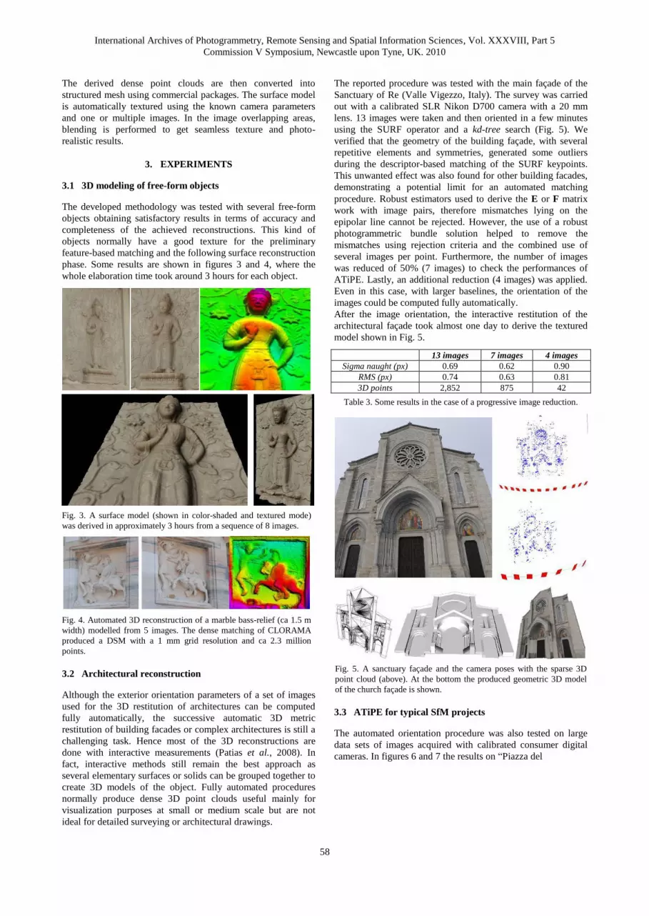
The second image block (Fig. 9) is composed of 18 images over
the Main Plaza. The photogrammetric bundle solution provided
a final RMS equal to 0.49 px and 12,090 3D points. For some
archaeological structures and for documentation and
visualization purposes, an automated 3D reconstruction of some
International Archives of Photogrammetry, Remote Sensing and Spatial Information Sciences, Vol. XXXVIII, Part 5
Commission V Symposium, Newcastle upon Tyne, UK. 2010
60
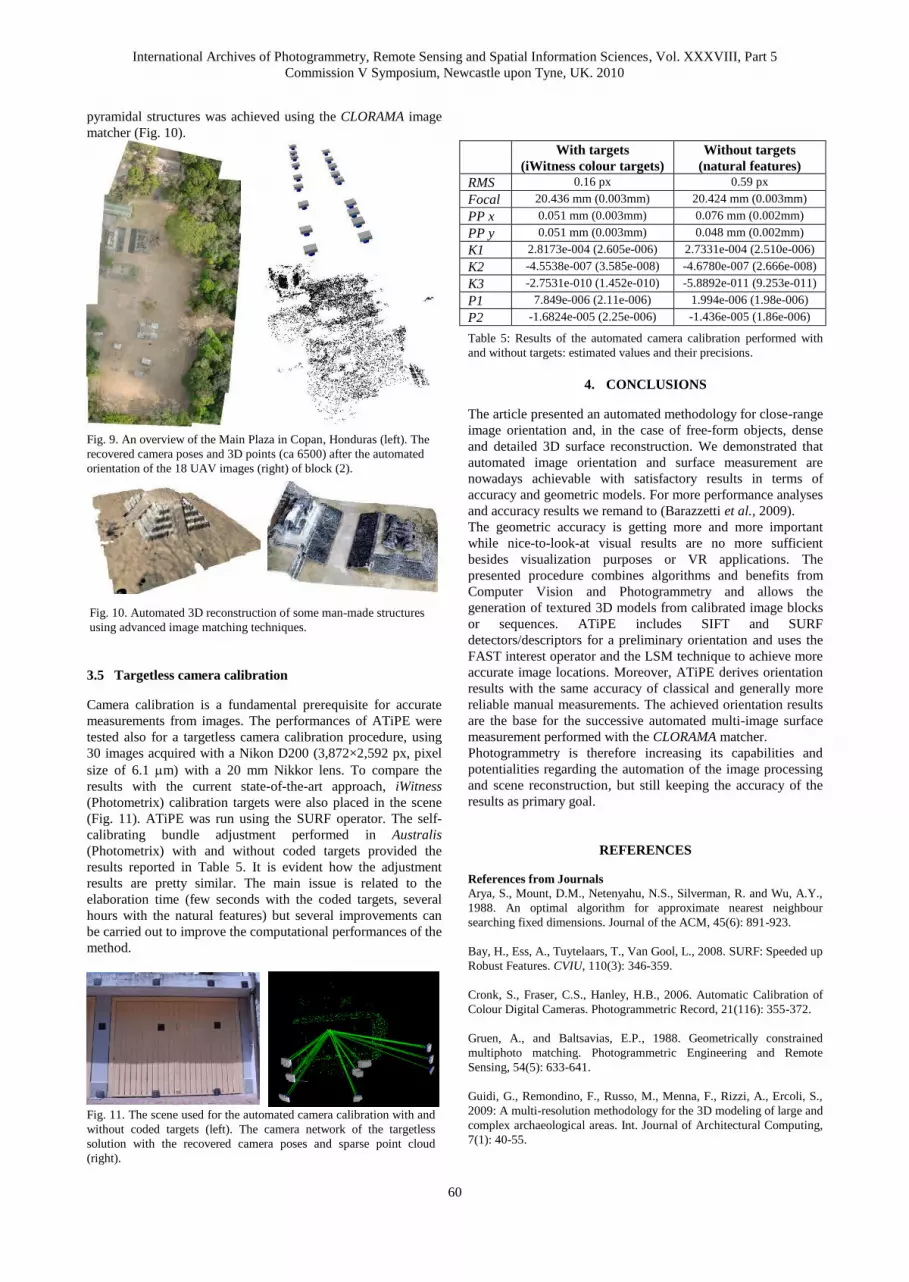
pyramidal structures was achieved using the CLORAMA image
matcher (Fig. 10).
Fig. 9. An overview of the Main Plaza in Copan, Honduras (left). The
recovered camera poses and 3D points (ca 6500) after the automated
orientation of the 18 UAV images (right) of block (2).
Fig. 10. Automated 3D reconstruction of some man-made structures
using advanced image matching techniques.
3.5 Targetless camera calibration
Camera calibration is a fundamental prerequisite for accurate
measurements from images. The performances of ATiPE were
tested also for a targetless camera calibration procedure, using
30 images acquired with a Nikon D200 (3,872×2,592 px, pixel
size of 6.1 m) with a 20 mm Nikkor lens. To compare the
results with the current state-of-the-art approach, iWitness
(Photometrix) calibration targets were also placed in the scene
(Fig. 11). ATiPE was run using the SURF operator. The self-
calibrating bundle adjustment performed in Australis
(Photometrix) with and without coded targets provided the
results reported in Table 5. It is evident how the adjustment
results are pretty similar. The main issue is related to the
elaboration time (few seconds with the coded targets, several
hours with the natural features) but several improvements can
be carried out to improve the computational performances of the
method.
Fig. 11. The scene used for the automated camera calibration with and
without coded targets (left). The camera network of the targetless
solution with the recovered camera poses and sparse point cloud
(right).
With targets
(iWitness colour targets)
Without targets
(natural features)
RMS 0.16 px 0.59 px
Focal 20.436 mm (0.003mm) 20.424 mm (0.003mm)
PP x 0.051 mm (0.003mm) 0.076 mm (0.002mm)
PP y 0.051 mm (0.003mm) 0.048 mm (0.002mm)
K1 2.8173e-004 (2.605e-006) 2.7331e-004 (2.510e-006)
K2 -4.5538e-007 (3.585e-008) -4.6780e-007 (2.666e-008)
K3 -2.7531e-010 (1.452e-010) -5.8892e-011 (9.253e-011)
P1 7.849e-006 (2.11e-006) 1.994e-006 (1.98e-006)
P2 -1.6824e-005 (2.25e-006) -1.436e-005 (1.86e-006)
Table 5: Results of the automated camera calibration performed with
and without targets: estimated values and their precisions.
4. CONCLUSIONS
The article presented an automated methodology for close-range
image orientation and, in the case of free-form objects, dense
and detailed 3D surface reconstruction. We demonstrated that
automated image orientation and surface measurement are
nowadays achievable with satisfactory results in terms of
accuracy and geometric models. For more performance analyses
and accuracy results we remand to (Barazzetti et al., 2009).
The geometric accuracy is getting more and more important
while nice-to-look-at visual results are no more sufficient
besides visualization purposes or VR applications. The
presented procedure combines algorithms and benefits from
Computer Vision and Photogrammetry and allows the
generation of textured 3D models from calibrated image blocks
or sequences. ATiPE includes SIFT and SURF
detectors/descriptors for a preliminary orientation and uses the
FAST interest operator and the LSM technique to achieve more
accurate image locations. Moreover, ATiPE derives orientation
results with the same accuracy of classical and generally more
reliable manual measurements. The achieved orientation results
are the base for the successive automated multi-image surface
measurement performed with the CLORAMA matcher.
Photogrammetry is therefore increasing its capabilities and
potentialities regarding the automation of the image processing
and scene reconstruction, but still keeping the accuracy of the
results as primary goal.
REFERENCES
References from Journals
Arya, S., Mount, D.M., Netenyahu, N.S., Silverman, R. and Wu, A.Y.,
1988. An optimal algorithm for approximate nearest neighbour
searching fixed dimensions. Journal of the ACM, 45(6): 891-923.
Bay, H., Ess, A., Tuytelaars, T., Van Gool, L., 2008. SURF: Speeded up
Robust Features. CVIU, 110(3): 346-359.
Cronk, S., Fraser, C.S., Hanley, H.B., 2006. Automatic Calibration of
Colour Digital Cameras. Photogrammetric Record, 21(116): 355-372.
Gruen, A., and Baltsavias, E.P., 1988. Geometrically constrained
multiphoto matching. Photogrammetric Engineering and Remote
Sensing, 54(5): 633-641.
Guidi, G., Remondino, F., Russo, M., Menna, F., Rizzi, A., Ercoli, S.,
2009: A multi-resolution methodology for the 3D modeling of large and
complex archaeological areas. Int. Journal of Architectural Computing,
7(1): 40-55.
International Archives of Photogrammetry, Remote Sensing and Spatial Information Sciences, Vol. XXXVIII, Part 5
Commission V Symposium, Newcastle upon Tyne, UK. 2010
61
Jazayeri, I. and Fraser, C., 2010: Interest operators for feature-based
matching in close range photogrammetry. The Photogrammetric
Record, 25(129): 24-41.
Lowe, D., 2004: Distinctive image features from scale-invariant
keypoints. Int. Journal of Computer Vision, 60(2): 91-110.
Pollefeys, M., Van Gool, L., 2002: From images to 3D models.
Communications of the ACM, 45(7): 50-55
Remondino, F., El-Hakim, S., Gruen, A., Zhang, L., 2008: Turning
Images into 3-D Models - Development and performance analysis of
image matching for detailed surface reconstruction of heritage objects.
IEEE Signal Processing Magazine, 25(4): 55-65.
Snavely, S.M., Seitz, R., Szelinski, R., 2008: Modelling the world from
internet photo collections. Int. Journal of Computer Vision, 80(2): 189-
210.
Stamos, I., Liu, L., Chen, C., Woldberg, G., Yu, G. And Zokai, S.,
2008: Integrating automated range registration with multiview geometry
for photorealistic modelling of large-scale scenes. Int. Journal of
Computer Vision, 78(2-3): 237-260.
Vergauwen, M., Van Gool, L.J, 2006: Web-based reconstruction
service. Machine Vision and Applications, 17(6): 411-426.
References from Other Literature
Agarwal, S., Snavely, N., Simon, I., Seitz, S.M., Szeliski, R., 2009:
Building Rome in a Day. Proc. ICCV 2009, Kyoto, Japan.
Barazzetti, L. Remondino, F., Scaioni, M., 2009: Combined use of
photogrammetric and computer vision techniques for fully automated
and accurate 3D modeling of terrestrial objects. Videometrics, Range
Imaging and Applications X, Proc. of SPIE Optics+Photonics, Vol.
7447, 2-3 August, San Diego, CA, USA.
Barazzetti, L., Remondino, F., Scaioni, M., Lo Brutto, M., Rizzi. A.,
Brumana, R., 2010: Geometric and radiometric analysis of paintings.
International Archives of the Photogrammetry, Remote Sensing and
Spatial Information Sciences, Vol. 39(5), Newcastle, UK (in press).
Beis, J. and Lowe, D., 1997: Shape indexing using approximate nearest
neighbour search in high dimensional spaces. Proceedings of Computer
Vision and Pattern Recognition, pp. 1000-1006.
El-Hakim, S., Beraldin, J.-A., Remondino, F., Picard, M., Cournoyer,
L., Baltsavias, M., 2008: Using terrestrial laser scanning and digital
images for the 3D modelling of the Erechteion, Acropolis of Athens.
Proc. of "Digital Media and its Applications in Cultural Heritage"
(DMACH) Conference, pp. 3-16, Amman, Jordan.
Farenzena, M., Fusiello, A., Gherardi, R., 2009: Structure and Motion
pipeline on a hierchical cluster tree. Proc. of IEEE 3DIM Conference,
Kyoto, Japan.
Furukawa, Y., Ponce, J., 2007: Accurate, Dense, and Robust Multi-
View Stereopsis. Proc. CVPR 2007.
Goesele, M., Snavely, N., Curless, R., Hoppe, H. And Seitz, S.M.,
2007: Multi-view stereo for community photo collections. Proc. ICCV
2007, Rio de Janeiro, Brazil.
Gruen, A., Remondino, F., Zhang, L., 2005: The Bamiyan project:
multi-resolution image-based modeling. In Recording, Modeling and
Visualization of Cultural Heritage. E.Baltsavias, A.Gruen, L.Van Gool,
M. Pateraki (Eds), Taylor & Francis / Balkema, 2005, ISBN 0-415-
39208-X, pp. 45-54.
Hao, X., Mayer, H., 2003: Orientation and auto-calibration of image
triplets and sequences. International Archives of the Photogrammetry,
Remote Sensing and Spatial Information Sciences, 34(3-W8): 73-78.
Läbe, T., Förstner,W., 2006. Automatic relative orientation of images.
Proceedings of the 5th Turkish-German Joint Geodetic Days, Berlin,
Germany.
Levoy, M., Pulli, K., Curless, B., Rusinkiewicz, S., Koller, D., Pereira,
L., Ginzton, M. Anderson, S., Davis, J., Ginsberg, J., Shade, J., Fulk,
D., 2000: The digital michelangelo project: 3d scanning of large
statues. SIGGRAPH Computer Graphics Proceedings, pp. 131-144.
Muja, M. and Lowe, D., 2009. Fast approximate nearest neighbours
with automatic algorithm configuration. International Conference on
Computer Vision Theory and Applications (VISAPP’09), 10 pp.
Nister, D., 2004. Automatic passive recovery of 3D from images and
video. In: proc. of the 2nd IEEE Int. Symp. on “3D data processing,
visualization and transmission”, pp. 438-445.
Patias P. Grussenmeyer P., Hanke K., 2008: Applications in cultural
heritage documentation. In “Advances in Photogrammetry, Remote
Sensing and Spatial Information Sciences”, 2008 ISPRS Congress
Book, 7, pp. 363-384.
Remondino, F., Ressl, C., 2006: Overview and experience in automated
markerless image orientation. IAPRSSIS, 36(3): 248-254.
Remondino, F., El-Hakim, S., Girardi, S., Rizzi, A., Benedetti, S. And
Gonzo, L., 2009: 3D Virtual reconstruction and visualization of
complex architectures - The 3D-ARCH project. International Archives
of the Photogrammetry, Remote Sensing and Spatial Information
Sciences, Vol. 38(5/W1), Trento, Italy (on CD-Rom).
Rosten, E. and Drummond, T., 2006: Machine learning for high-speed
corner detection. Proceedings of the European Conference on Computer
Vision, Graz, Austria, pp. 430-443.
Zhang, L. and Gruen, A., 2004: Automatic DSM generation from linear
array imagery data. International Archives of the Photogrammetry,
Remote Sensing and Spatial Information Sciences, 35(3), pp. 128-133.