Embed Size (px)
Citation preview

GEO-MARINE TECHNOLOGY, INC. A Geological, Geophysical, and Hydrographic Survey Consultancy
CCOOMMPPAANNYY PPRROOFFIILLEE OOUURR MMIISSSSIIOONN AANNDD TTRRAADDEE

GEO-MARINE TECHNOLOGY, INC. A Geological, Geophysical, and Hydrographic Survey Consultancy
OUR MISSION:: We few, professional scientists strive to support the objectives of our marine energy and telecommunications clients with cooperation, innovation and integrity, and to provide them with products and services that exceed their expectations in both quality and judgment.
OUR TRADE:: The consultancy of Geo-Marine Technology, Inc. specializes in Marine Survey Services and Desktop Study production for all types of offshore construction and exploration projects. We use state-of-the-art computerized technologies, in-house programming and published information sources to provide superior geological and geophysical data interpretations and reports.
Headed by Mr. John L. Rietman and Mr. Beau Pallister, Geo-Marine Technology has more than 40 years of experience in analyzing and interpreting geological and geophysical data. Our highly knowledgeable scientists are proficient at completing Offshore Survey Projects and Desktop Studies from the ground up. This capability improves our efficiency and helps keep our clients’ projects under budget. With Geo-Marine Technology, your success is our success.

GEO-MARINE TECHNOLOGY, INC. A Geological, Geophysical, and Hydrographic Survey Consultancy
MMAARRIINNEE SSUURRVVEEYY SSEERRVVIICCEESS OOFFFFSSHHOORREE SSUUPPPPOORRTT,, DDAATTAA AANNAALLYYSSIISS AANNDD RREEPPOORRTTIINNGG
*Image courtesy of Williamson and Associates
GEO-MARINE TECHNOLOGY, INC. A Geological, Geophysical, and Hydrographic Survey Consultancy
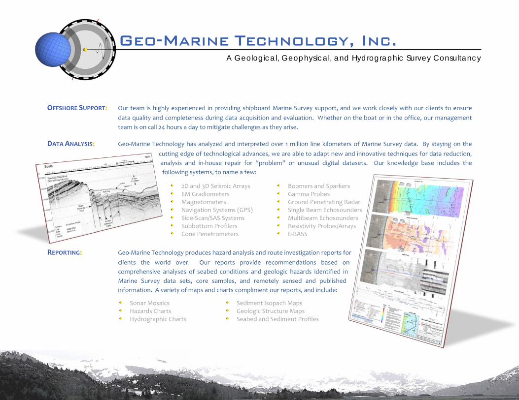
OFFSHORE SUPPORT:: Our team is highly experienced in providing shipboard Marine Survey support, and we work closely with our clients to ensure data quality and completeness during data acquisition and evaluation. Whether on the boat or in the office, our management team is on call 24 hours a day to mitigate challenges as they arise.
DATA ANALYSIS:: Geo-Marine Technology has analyzed and interpreted over 1 million line kilometers of Marine Survey data. By staying on the cutting edge of technological advances, we are able to adapt new and innovative techniques for data reduction, analysis and in-house repair for “problem” or unusual digital datasets. Our knowledge base includes the following systems, to name a few:
REPORTING:: Geo-Marine Technology produces hazard analysis and route investigation reports for
clients the world over. Our reports provide recommendations based on comprehensive analyses of seabed conditions and geologic hazards identified in Marine Survey data sets, core samples, and remotely sensed and published information. A variety of maps and charts compliment our reports, and include:
Sonar Mosaics Sediment Isopach Maps Hazards Charts Geologic Structure Maps Hydrographic Charts Seabed and Sediment Profiles
2D and 3D Seismic Arrays Boomers and Sparkers EM Gradiometers Gamma Probes Magnetometers Ground Penetrating Radar Navigation Systems (GPS) Single Beam Echosounders Side-Scan/SAS Systems Multibeam Echosounders Subbottom Profilers Resistivity Probes/Arrays Cone Penetrometers E-BASS
GEO-MARINE TECHNOLOGY, INC. A Geological, Geophysical, and Hydrographic Survey Consultancy
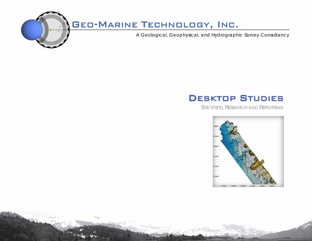
DDEESSKKTTOOPP SSTTUUDDIIEESS SSIITTEE VVIISSIITTSS,, RREESSEEAARRCCHH AANNDD RREEPPOORRTTIINNGG

GEO-MARINE TECHNOLOGY, INC. A Geological, Geophysical, and Hydrographic Survey Consultancy
SITE VISITS:: Geo-Marine Technology’s experienced personnel have performed site visits in many countries – including Panama, Japan, Trinidad and others – to assess the feasibility and associated hazards of potential landfall locations.
RESEARCH:: Desktop Studies are an integral component of potential offshore
construction projects. At first order, our research assesses potential natural and anthropomorphic hazards of a given study area by compiling and synthesizing all available data addressing the following concerns:
REPORTING:: Each proposed offshore construction project is unique, so the format of our Desktop Studies is highly adaptable in order to best meet the needs of our clients. Every report we produce provides specific recommendations based on the salient aspects of our data analyses and research of the study area. Comprehensive and clear figures and charts summarize such considerations, which commonly include:
Bathymetry Human Impacts Oceanography Permitting Meteorology Geology Archaeology Climatology
Storm Frequency Sea Surface Temperatures Slope Steepness Seafloor Temperatures Local Fishing Practices Wind and Swell Vectors Shipping Lanes Protected Areas Existing Cable/Pipelines Maritime Boundaries

GEO-MARINE TECHNOLOGY, INC. A Geological, Geophysical, and Hydrographic Survey Consultancy
WWHHAATT WWEE DDEELLIIVVEERR QQUUAALLIITTYY,, IINNTTEEGGRRIITTYY AANNDD EEXXPPEERRIIEENNCCEE

GEO-MARINE TECHNOLOGY, INC. A Geological, Geophysical, and Hydrographic Survey Consultancy
QUALITY:: Our products meet or exceed the guidelines established by the International Hydrographic Organization (IHO), the International Cable Protection Committee (ICPC, 2011) and the United Kingdom Offshore Operators Association (UKOOA, 2008), and comply with the reporting requirements set forth by the Bureau of Ocean Energy Management, Regulation and Enforcement (BOEMRE) in NTLs 98-20, 06-P01, 2008-05 and 2007-G01 for hazards and archaeological surveys. Our reports are produced in DOC(X) and PDF formats, and are available in electronic files and hard copies. Charts are produced in DWG and PDF formats, and come with fully-attributed, Makai-compatible electronic files.
INTEGRITY:: Our products reflect the highest ethical standards for data analysis and interpretation, and our reputation reflects our commitment to those standards. We will use every means at our disposal to extract meaning from a data set, but we will not propose any conclusion or recommendation we cannot defend.
EXPERIENCE:: Geo-Marine Technology has successfully produced over 1000 hazard-analysis and route-investigation reports for nearly two hundred reputable clients in 25 countries. Some of our more frequent clients include the following, and we invite you to ask any of them about their experience with us.

GEO-MARINE TECHNOLOGY, INC. A Geological, Geophysical, and Hydrographic Survey Consultancy
CCOONNTTAACCTT UUSS IINNFFOORRMMAATTIIOONN AANNDD EEMMPPLLOOYYEEEESS

GEO-MARINE TECHNOLOGY, INC. A Geological, Geophysical, and Hydrographic Survey Consultancy
INFORMATION:: Our office is one of several in a converted early-1900’s brick-and-timber mercantile warehouse in the heart of Missoula, Montana.
PERSONNEL:: In addition to a number of support staff, the chief constituents of the Geo-Marine Technology team are:
Mr. John L. Rietman Mr. Beau Pallister Mr. Matt Zunker President Vice President Operations Director Geologist/Geophysicist Geologist/Geophysicist Geologist/Geophysicist [email protected] [email protected] [email protected] Profile Profile Profile Résumé Résumé Résumé
• Suite 12 725 West Alder Street Missoula, MT 59802
USA
Phone: 406.721.1599 Fax: 406.721.1599
E-mail:: [email protected]