M E M O I R S
UP THE
G E O L O G I CA L SURV E Y
I ND I A .

M E M O I RS
0 , I 'l l
GE OL OG I CAL SURVE Y
I D I A .
VOL. XVI .
n m ea s n DY ODDS]! 0 ? II I! BI CI LLI I‘CY THE GOVERNOR G BI‘ I RAL O , I NDI A
I II COUNCI L.
CALCUTTA
f l IN‘
I'
l D 1 0 ! TB ! UOYI I I‘U I I‘T O ' INDIA.
BOLD A’
I‘ rm:
GEOLOG ICAL SURVEY OPPICE.OI
’
I'ICB OR BUI’BBIN
‘
I‘BNDENT OP GOVERNI IBN
'
I’
PRINTING ,
AND BY ALL BOOKBELLERB.
momma . 1 11 1311 1 1 3 1 1 a co.
I DOOOL x x x .

CO N T E N T S .
Am . l .- Ou tile Geologica l Str u cture of Me Ea stern Coa st f rom La ti
tu de 1 5°
s or t/board to Mas u lip ah m,by R. BRUCE
Geologica l Su rvey of I nd ia .
Cn sm n I .—
.Introductory
I I . -‘
I'
he Gneiss ic or Metamorphic Series
1 —The Sch is tose areas2.—The G ran itoid areas8.
-I ntrn s ive rocks in the Gneiss ic area
a .—Trap dykes and intru s ions
b .—G ran ite vein s
c.—Fels ite veins
d .—Qu artz veins
I I I .—Thc Kadapa Ser ies1 V.—The Upper Gondwsns Ser ies
V.—Cu ddalore (Rajs hmnndry) Sandstones
VL—The I a teritic RocksVIL—The Allu v ialDepos its
VI I I .—Soils and Su b-aer ialDepos its
I L —Economic Gorilogy
An '
r . 2.—Tle Gneiss and Trans ition Rock ,
and otller Forma tions of tile
Nellore p ortion of tile Ca rnatie, by W I LLIA I I K ING, B.A ., Dep u ty
Snp eri nlendeu i (lf ad ras ) , Geological Su rvey of I nd ia .
Pee l .PART I .
Cam u s I .—GeneralDescr iption
I I .—Phys icalGeology

M E M O I R S
0 1" THE
G E O L O G I CA L SURV E Y
I ND I A .


M E M O I RS
0 ? r u n
VOL. XVI .
m u s n s n DT 0 ! II I. “M LI NOY TH! GOVI RNOR G I N I RAL O I I NDIA
IN COUNCI L.
CALCUTTA
PR INTED 3 0 ! TB ! GOV I I NI I NT O I I NDIA.
lOLD AT TH!
s nowmen s u av s r or n cs ,
OPPIOE OP SUPEBINTBNDI NT OP GOVERNI SNT PRINT ING ,
AND BY ALL DOOIIBBIL EBS.
Len non . 1 11 131 11 1 11 1 1 1 : co.
I DOOOL x x x .

CALCUTTAOPTI C! OF TH E SDPRB INT ENDRNT OP GOV I BNM BNT PRI NTI NG .
1 880 .

CO N T E N T S .
ART. 1 .—Ou tlie Geologica l Stru ctu re of Me Eastern Coast f rom Lati
tu de 1 5°
nor t/lroard to Ma s u lipotam, by R. BRUCE Foo'rs ,
Geologica l Su rvey of I nd ia .
On sm n I .—Introdu ctory
I I .—The Gneiss ic or Metamorphic Series
1 .—The Sch istose areas
2.—The G ran itoid areas
3 .-I ntru s ive rocks in the Gneis s ic area
a .—Trap dylres and intru s ion s
b .—G ran ite veins
e .—Fels ite vein s
d .—Qu artz veins
I I I .—The s s pa Ser ies
IV .—The Upper Gondwdna Ser ies
V.- Cuddalore (Rajshmu ndry) Sandstones
V I -The Lateritic Roch
VI L—The Allu v ialDepos its
W IL—Soils and Su b-ad rialDeposits
IX.—Economic Geology
An '
r . 2.—Tle G’
neiss and Trans ition Rocks , and ot/ler Formation s of tile
Nellore p ortion of tile Ca rna tic, by W ILLIAM K ING, B.A ., .Dep u ty
Sup eri ntend ent (Mad ras ) , Geological Su rvey of I ndia .
PART I .
CHAPTER I .— GeneralDescr iption
I I .—Phys icalGeology
PAa s .
PART I I .
CHAPTER I I I .—The Gneiss ic Ser ies
The Schistose Gneis ses
IV.—The Tran s ition Ser ies
V .—G ran itic and Trappean Rocks
VL—Other Formation s
1 .—RajmahalPlan t Beds
2.—Cu ddalore Sand stones
3 .—Later itic Depos its
4.—Recent Depos its
VI I —Nellore Copper Workings
A II 'I'. 3 .—1 7£e Upp er Gondwénas and older f orma tions Coas ta l
Region of tile Goddvar i Distr ict, by WI LLI AM K ING , B .A.,
Super intend en t (Madras ) , Geologica l Su r vey of I nd ia .
Clu m n I .—GeneralDescription
I L—G neis s and Lower GondwdnaI I I .—Upper Gondwanas
IV.-Deccan Trap Series
V.—Cuddalore San dstones
VI .-Economic Geology


M E M O I R S
OF THB
G E O L O G I CA L SURVE Y
I ND I A .

I N D I A .
VOL. XVI , Pr . 1 .
l ! ounn cs n cn m cr m eovn s os cu s s“. o s I NDIA
I N cons cn .
CALCUTTA
r u n-n son a s norm -r or nu ns .
scan Ar m
GEOLOG ICAL SURVEY OPTICS ,
OPTICS O! SUPERINTENDRNT OF GOVERNMENT PRINT ING ,
AND BY ALL BOOKBBLLB“.
LONDON : r a i‘
mm a co.
MDOOOLX I I L
MEMOIRS
OF THE
GEOLOGICAL SURVEY OF INDIA.
ON r an GnomO IcAI . Sr auc'rna s or r u n EAs 'rs aN Cos s r n on LA'rIr u ns
1 5°
Noa'
ram an r o MAsnI.I r 11'r1u I ,
l by R. Bau cs Foor s , Geo
logical Su rvey of I nd ia .
CONT
Cum s : L—In trodnctcry.
IL—The Gneissic or Metamorphic
l. The Schis tose areas .
2. The Granitoid areas .
8 Intru s ive rocks in the
[IL—The s s ps Ser ies .
CHAPTER L—INTRODUCI'ORY.
The region to be descr ibed in these pages is inclu ded in fou r sheets
of the Atlas of I ndia, viz, Nos . 75, 76, 95, and the extreme sou th
wes t corner of sheet 94. The topographical structure of the area dealt
with is ex tremely s imple. I t is a more inclined plane sloping gently
‘ Ms sulips tsm is in ls tituds 1 6°
twenty miles es st of the Kistns : of the s res nnd er
descr iption that portion between the Kistn s and the Goddvs ri, on sheet 95 of the Ind ian
Atlas. conta ins only delts ic slluv ium, and In s hem omitted in the accompanying sketchN P.
Memoirs of the Geological Survey of Ind is , Vol. XVI, Art. I .
E NT S.
Gu An s n IV.—Tbe Upper Gondwdns Series .
V.-The Cuddalore (Rdjs hmu ndry)
sands tones .
VI .—Tho Later itic Rocks .VIL—The Allu vialDepos its .
VI I I . -Soils and t aér is l Depos its .
2 rooms : GEOLOG I CAL sr aucrvns or r u n EASTERN COAs'r .
eas tward from the foot of the Eastern Ghdts to the Bay of Bengal, an d
d iv ersified only by scattered hills , or grou ps of hills , of no real impor t
ance geograph ically con s idered . The d rainage is efiected in the north ern
part by the Kistna r iv er , in the sou thern and cen tral parts by a number
of small r iv ers r u n n ing mostly in shallowv alleys .
Fiscally the area is div ided between the Kistns.l and Nellore dis tr icts ,the n orthern part belonging to the former , the sou thern to the la tter
collectorate .
The geological stru ctu re of this area is almost as simple as the topographical. The wes tern part of the area is occu piedby a broad band or zone of ancient crystallin e
rocks belonging to the gn eiss ic ser ies , the eastern part is formed of the
mar ine and flu viatile allu v ia , while the in termediate part (spea kingroughly) is occupied by a ban d of patches of sedimentary rocks of twoages , both Older than the allu v ial formations .
Of these three band s the gneis s ic and the allu vial are by far the most
Rocks form threem timportant in poin t of ex ten t, the former hav ing
”n“ its greatest width in the sou thern , the latter in the
northern part of the area . The aggregate area of the other two
ser ies of rocks abov e allu ded to , which represent the Later itic and the
Upper Gondwsna series , is small when compared with the gneis sic
and allu v ial areas .
The geology of the Eas tern Ghdts will n ot be tou ched u pon in this
memoir , as they have already been described in suficient detail in Mr .
King’s memoir on the Kadapa and Karnul rocks ,” of which the
sev eral ranges of mou n tain s an d h ills forming the easte rn mou n tain
barr ier in this part of the pen insu la are composed .
Geological str ucture.
1 The K istns distr ict, as nowcons titu ted , inclu des the old collector-ate of G u ntd r and
the sou thern part of the old Mas ulipatam collecto rate, the northern talaqs of which were
added to the Godhvar i dis tr ict.
2Memoirs of the Geological Su rvey of Ind ia, Vol. VIII . In this memoir Mr . King
has embod ied the res u lts of the examination of the Kadapa and Karnullrocks by himself, the
late Mr . Cha rles E . Oldham, and Mr . R. B. Foote.
( 2 )
IN'rs onnc
'
ronv . 3
Of the detached mou nta in s and hills wh ich occu r scattered at inter
vals over the inclin ed plan e below the Ghfits , thefollowing are mos t important, taking them from
sou th-west to north-eas t
I . The Byrawnd i Konds ,l capped by an ou tlier of the s s ps quartzites ; from
to high.
2 . The Goguls ps lli hills .
3 . The Picher ln Konda,
4. The Kan agir i (Ku nn igherry) Dru g hills , to
5. The Pod ile (Pondells h ) hills ,6 . The Chends lu r b ill,
7. The Chimakurt i hills ,8 . The Kondavid u h ills ,
Of less importance geographically are the Chnnd i (Soondy) hills , in thes outh-easte rn corner of the gneiss ic area, bu t they are of far greater
geological in teres t than most of the loftier masses . Kotappa Konda,sou th of NarasaraOpett, a noted place of pilgrimage, is a bold mou n tain0 11 3 mass of granitoid gn eis s , high . Lastly may be mentionedthe Bellam Konda, another gran ite gneis s hill or feet high,remarkable for its fin e shape, and crown ed by an Old native fort of greats trength . A large n umber of b ills , includ ing the Kanagir i Drug hills
a nd sev eral others of con s iderable height, have been en tirely omitted fromthe Atlas Sheet 76, which thu s represents the Kanagir i taluq as flat,
in s tead of very hilly.
Of the rivers there is little to be said ; their headwaters rise mostly
n’dm ph’.
in the east s ide of the Vellikondas . This is the case
with the sou thern r ivers , the Man -ern’(M u n Air) ,
the Pal-er u (PallAir) , and the Mns i-er u (Mooshee) , an d also with the
Chillmlu rpad u riv er in the northern part of the area . The G nndla
kamma, which d rains the cen tral part of the a rea , ris es beyon d that
range, in the Nana-malls ”(Black-mou n ta ins ); while the Kis tna tou chesthe area only with its very lowest reaches .
Kond s is the Telugu word for mou ntain or hill.
Eru (air ) is Telugu for r iver .
Thewa tern range of the Eastern Ob'
s t barrier, the Vellikou ds s being the eas tern
( 3 )
4 mor e : GEOLOGICAL s'rnnc
'rnns or r u n EASTERN CcAs
'r .
E x cept the Kistn a all these rivers receiv e their principal su pply fromthe n orth-east monsoon rain s ; bu t the sou th-wes t mon soon rain s appea rto be heav ier than in the latitu de of Mad ras . The north-eas t mon soon
is , on the con trary, lighter in this part of the pen in su la than f u rther tothe sou th . Owing to the greater width of the pen ins u la, the westerlywinds acqu ire a cons iderably higher temperature than at Madras , and
begin to blowearlier in the season .
The several geological formations occu rring in the area u n der con
s ideration may be conv en iently grou ped as follows ,in descend ing order
7 . Soils and su ba’
e°
r ial depos its .
Recent 6. Allu v ia,marine and finv iatile ,
5. Later itic, sand and gravels.
Tertiary 4. Cuddalore (Rtjahmu nd ry) sands tones and conglomerates ,Puvnlu r and Chebrole sandstones .
Mes ozoic 8. Upper GondwdnsSer ies .
Vemdvaram shales .
2. s s ps Series .
1 . Gneiss ic, or Metamorphic Ser ies , and intru s ive rocks inclu dedin it.
In describing these severalformations , itwillbe best to take them accord .
ing to their respectiv e ages in ascend ing order .
Before pas s ing to their deta iled description , it will however , be wellto giv e a fewnotes on the geological informationthat had been collected and published prior to the
Previous obser ver s.
geological su rv ey.
The earliest known geological note s on ou r area are those published byDr . Heyne
I in 1 8141, in the maps accompanyingwhich he attempts to show roughly and partially
the geological situ ation of the cou ntry. His geographical bas is
Dr . Reyna,
l Tracts , his torical and statistical, on I ndia, by Benjamin Reyna, su m. i s &c.
Natu ralist on the Establishmen t of Fort St. George, London 1 81 4. Of the two maps givthe am1. a : themore correct in its delineation of the ri vers and mou ntains along on.
m tern coast.
( 4 )
m onom er . 5
being a very h perfect one detracts greatly from the valu e of his obser
vation s on the eastern coast. The greater part of the cou ntry he shows
to be covered by cotton -soil, through wh ich protr ude hill ranges of
syen ite, basalt, gneis s , mica slate and clay slate.
He failed to recogn ize the geological d istinction of age between the
gneiss and ov erlying rockThe notes wh ich have most reference to our area are those in Tract
X I V, which gives a short description of Buggelconda h ill, near I nn a
conda , in the G u ntu r Cinca r, a hillwhich then and s ince has by manybeen held to be an ex tinct v olcan ic cone, in some way con nected with
the frequ ent earthquake shocks which then and n ow still agitate the
Ongole cou ntry. He descr ibes the highly hornblend ic rock as a bas alt,bu t in all other respects his descr iption of the h ill, in which he cou ld
trace no sign of v olcan ic action , is good . The earthqu ake shocks seemto have been both more frequ ent and more severe at the beginn ing of
the centu ry than of late years .
He disposes also of the idea that, I nnaconda (Vinukonda) hill is of
v olcan ic origin .
In Tract IV he talks abou t minor ranges gi ven ofi by the Eastern
Ghfits , which with v ery little interru ption or v ar iation of their con sti
tuents approach the eas te rn ocean not far from Ongole to these
ranges belong several remarkable b ills , as the Chicola ,l celebrated forthe frequ ent ea rthqu akes originating at it and spread ing ov er the
cou ntry ; and the Ongole hill, which seems to influ ence the compas s in an
uncommon degree .
”
This statement is perfectly wrong as to the extens ion of the ranges
eas twa rd . No su ch ranges ex is t ; the d ifieren t hill ridges which are
dotted abou t are qu ite u nconnected , and in every case hav e a more or
les s northerly s trike, as shown in the accompanying map and owing to
this the changes in petrological characte r are ma rked and frequ ent.Dr . Hey ne
’
s error is accou n table for only by reason of h'
m rapid rate of
P Chim ku rti mountain .
( 5 )
6 room : s nowmen . s'rauc'rm or r u n s s s rmm coas'
r .
travelling and by his having been misled by the v ery incorre c t m a p s
which alone then ex is ted .
O f the sev eral localities he men tion s where copper ores ex is t , n o n e
appear to lie within the limits of this memoir : Agn igu ndala, or A g n icondalah (as he calls it) , lies among the Kad apa rocks Ganypitta b , a n d
probably alsoTer rapally in the Pan n u r Pamu r ) pergunn ah , are am ong
the small copper mines (now worked ou t) lying within the lim i ts o f
sheet 77. These are descr ibed in the first of a series of papers on th e
mineral resou rces of Sou thern Ind ia pu blished by Capta in Newbold inthe sev enth volume of the RoyalAs iatic Society’s Jou rnal, p. 1 51 .
Benza’s Notes , chiefly geological, of a jou rney through the North er n
Circar s , commence at Masu lipatam beyon d theKistn a, and treat entirely of the cou n try to th e
northward . Newbold ’s Notes , principally geological, across the Pen insu la of Sou thern Indi a, from Kistn apatam to
Honawar ,” ju s t skirt the sou thern edge of sh eet
76 of the I nd ian Atlas ; whils t the same au thor’s n otes on the road f rom
Masu lipatam to Goa 3 treat of the cou ntry between the coast and Hyd erabad , north of the Kis tn a r iv er .
The n ex t reference is to be fou n d in a paper by the au thor , on the
d istribution of stone implemen ts in Sou thern
I ndia, read before the GeologicalSociety of Lon donin 1 8 The occu rrence of ii nplemen t-bearing grav els at considerableelevation s in the neighbou rhood of Pému r and at Nan danav anam,
at foot of the northern end of the Vellakonda range,was men tioned , and
the s itu ation of the bed s illu strated by a section comparing their pos itionwith that of laterite beds in the Madras area held to be of the same
age. Some of these obser v ation s were repu blished in the au thor’
s
memoir of the Geology of the M ad ra s area .
‘
I Had . Jour . Lit. Sci., V, p 43 .
Jou rn . As . Soc., Bengal, 1 845, XIV, p. 898.
Id . 1 844. XI I I . p . 984.
Qu art. Jou rn , Geol. Soc., London , Vol. XXIV, 1 888, p . 486.
Mom. Geol. Survey of Ind ia, Vol. X, p. 52.
( 6 )
Dr . Benza.
Captain Newbold.
Mr . B. B . Foote.
FOUI'E ! GEOLOGICAL STRUCTURE OF THE EASTERN COAST.
while in the northern it is entirely wan ting, and the prevalent str ik e of
the rocks is more nearly vertical to the pres en t coas t lin e than pa r a llelto it. Petrologically there are many importan t difierences between the
Dif erenm f rom south gneis s ic rocks of ou r present area and those of the
em 8mm“”ck“gneis s ic districts abov e alluded to . The facies of
the northern gneiss ics is n ewer than that of the sou thern rocks th ey
have, on the whole, been less metamorphosed , bu t more dis tu rbed by
flex u res , or else the way in which the distu rbing forces afiected them has
left more distinct traces .
The most str iking petrological difierence, and that which espec iallyNewer fad “ of giv es r ise to the n ewer -looking facies of the
“f i ber " Su i” n orthern gn eis s ics , is the presen ce of n ume rou s
importan t beds of qu artzite in terstratified with the older-looking highlycrys talline var ieties . These qu artzites are so singu larly like the typ icalbed s of Kadapa qu artzites , occu rring in the overlying Kadapa sys tem
in the Vellakonda s and as ou tliers capping gneis s hills , su ch as the
Bairawu di Konda and (ou ts ide the limits ) the Udayaghiri and Ror iai
Konda , that they immed iately s ugges ted the idea of their being really
members of the newer series , let down into tifiir presen t pos ition sby a series of remarkable parallel longitu din al fau lts . I t was on lyafter long-contin u ed exploration of their relation s that the con v iction
forced itself u pon me that they were tr u ly members of the gneis s ic
system . My reas on s f or arriv ing at this conclu s ion will be stated
f u rther on .
Another poin t of d ifierence is the greater dev elopment, in proporti onto the general area, of highly micaceou s and chloritic schists in the north
ern area , which for conv enience I will call the Kistn a-Nellore area .
A third poin t of difierence may be obser ved in the large development of syen ite-g'neiss, of mu ch more in ten sely hornblendic form than
is common anywhere in the more sou thern parts allu ded to.
Fou rth]y may be mentioned the occu rrence of con siderable beds of
mica schist highly charged with stau rolite and kyan ite crystals , a rock( 3 )
cri s i ssrc on a r ranoarmc ssa rs s .9
as yet qu ite u nknown among the sou thern gneiss ics . These miner
als occu r together in some of the beds , in others they are fou ndseparately.
Mu ch as the su b-div ision of this vas t series of rocks wou ld bedes irable, if it cou ld be carried ou t safely, the
d iv is ion of gneiss ic series resu lts of the su r vey would not in this cas e justifyit at present, as the general stratigraphical rela
tions of the pr incipalgroups of strata were not as certained with sufli
cient certa in ty, owing partly to the distu rbed and broken character of
the strata, partly to the great extent and thickness of s uperficial deposits , and partly also the limited time which could be devoted to thework.
In the absence of organ ic remain s the su b-div is ion of a great ser ies of
rocks mu s t be bas ed on well dete rmined relations whether of infra or
s u pra pos ition of the several members of such series , and where s uch
rela tions cann ot be ascertained , as in the case in qu estion, no s ub-divis ionshou ld be attempted . A mu ch closer su rvey than that nowca rr ied ou t,
and laid down on better maps of much larger scale, would very likelysu pply many of the data n ow wan ting to correlate the difieren t rock
grou ps (to u se this term in a merely geographical sen se) .At present as the relative pos itions of the principal grou ps remain
to a great extent u ndetermined, it makes bu t little difierence in what
ord er they are cons idered , bu t for convenience in describing it may
be as well to take them in a geographical order from sou th west to
north-east.
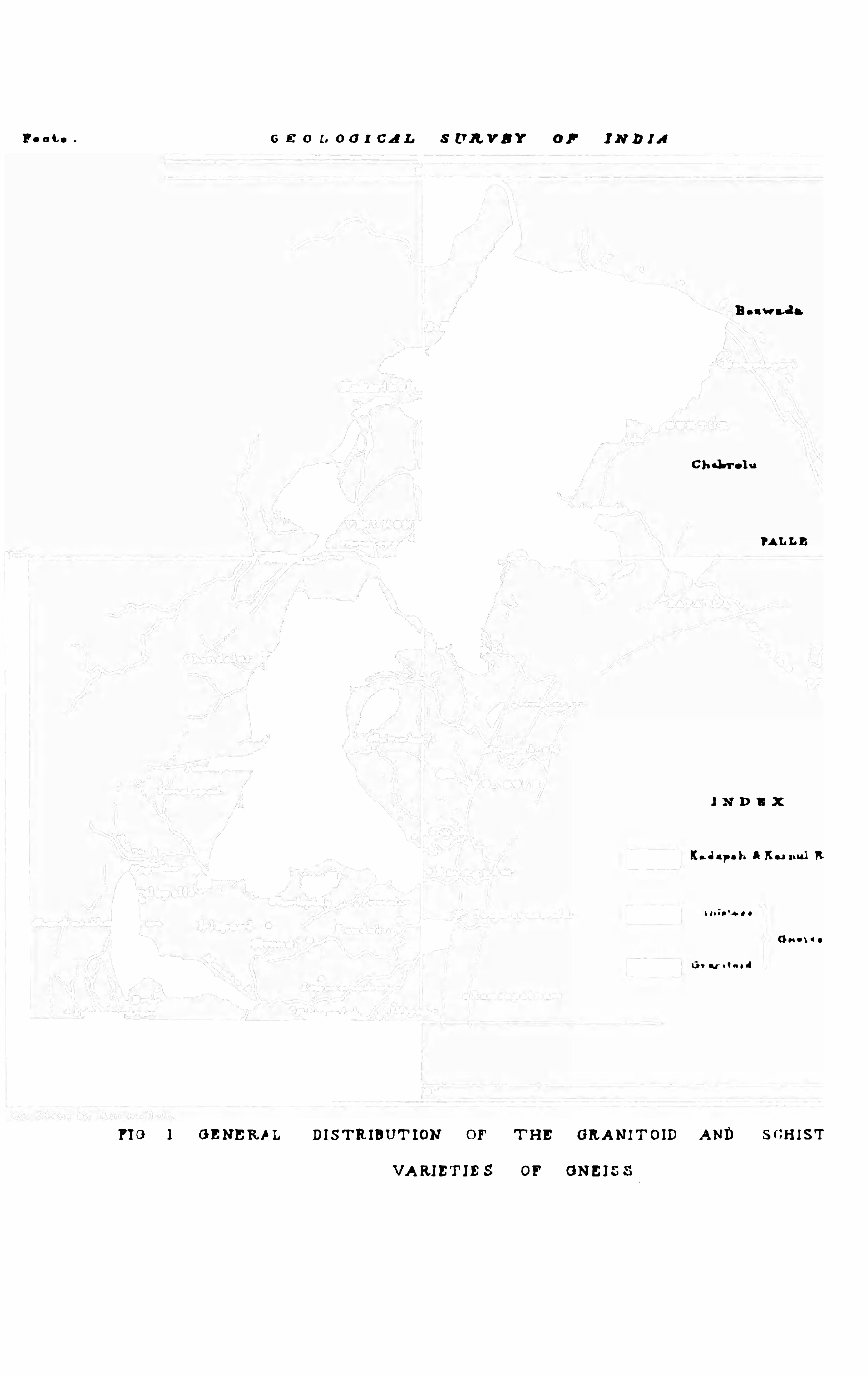
Although the gneiss ic rocks are not saf ely div is ible in to groupsbased on well-determined stratigraphical pos itions ,
«ifiy flmfififi they can easily be clas sed in two d iv is ions ,M a d m a m
marked by great petrological difierences . These
two grou ps are the Sci is tos e an d the Gran itoid. They occu r d istr ibu tedin several bands , of which fou r are prin cipal ones and equally d iv ided between the two groups . The bands which are shown in the annexed sketchmap,fig. 1 , follow, on the whole, a north-east-by-north to sou th-west-by
sou th direction bu t the axes of the granitoid bands are by no means( 9 )
FOOTE t GEOLOGICAL STRUCTURE OF THE EASTERN COAST.
everywhere coincidentwith the strike of the bedding, and appear to be
axes of areas of ex tra metamorphism. The larger of the two principal
granite gneis s bands occupies the centre of the gneiss ic area , an d
The fou r granitoidex tends from a little sou th of the Paler u in Nellore
“m e “a““4“9'mn district up to and h yond the Kistna . The
smaller or western band extend s from the Kistna sou th-westward to
the Gu ndlakamma riv er close to V inukonda, its western margin beingov erlaid by the Kadapa rocks ; bu t it is exposed in v arious inliers which
willbe separately referred to fu rther on .
Two other areas of gran itoid gneiss of les ser bu t still considerables ize occu r , the one in the extr eme sou th-west corn er of the gneis s region
described in thes e pages , the other pretty nearly in the centre of thisregion . The former may be convenien tly called
u m nna Chimaku rti the Chand ra Sekha rapu ram1area, after the large
v illage situ ated near its centre , and the latter the
Chimaku rti area, af ter the Chimakur ti mou ntain which forms it. Be
sides these larger granitoid areas there are several qu ite small ones
scattered here and there through the schistose a reas , bu t they are not
very well defined and of no special importance ; only a fewof these will
have to be men tioned separately.
The schistose rock-area is div ided , except at its sou thern end , in to
m u m “ “d two great bands , by the main band or area of the
gran itoid gneis s . The eastern of these bands ,which extends northward from 1 5
°
1 5'
to 1 6°
north latitu de, con sists
mainly of hornblendic v ar ieties of gneis s ; the western , on the con
trary, con sists mainly of micaceou s beds and associated qu artzites ,bu t inclu des some hornblend ic beds in its sou thern part beyond theG u ndlakamma river . The ea stern schistose band contain s also a few
qu artzite beds , and in sev eral detached groups a number of beds of magnetic iron , some of which are of considerable richness and poss ibly offu tu re importance economically.
Chandra Shakrapoorum of sheet 76.
1 0 l
sca rsros s s ums . 1 1
The bou ndarim between the two rock varieties are in every case
Bon nd afi“ of mobscu re ; where seen in close prox imity, they pas s
in defined in to each other by hardly perceptible gradation ,as might be expected of rocks of which some pa rts have from v ar iou s
and as yet u nexpla ined cau ses u ndergon e more ex treme metamorphismthan others . Within the gran ito id a reas , d ifleren t beds ha ve u nder
gone v arying degrees of metamorphism ; and in some, indeed in manycases , this wou ld appear to have been influenced by the tex tu re of
the rock, for it wou ld seem very probable that the metamorphismhas advanced d irectly in proportion to the coarsenes s of the or igin al
mate rials of which the old sed imen ta ry rock was composed . This sug
ges ts the idea that these areas of extra , or apparently ex tra, metamorphismmay hav e been cau sed in part, if not entirely, by the pecu lia r dis tr ibu tionof the coarser sedimen tary mater ials of which these rocks were originally
formed . The pecu liar ity of s u ch dis tribu tion mu s t hav e depended on
the strength and direction of the cu rren ts then in action, and on the
natu re of the materials yielded by the yet older rocks then u ndergoing
d en udation . The hypothesis that the gran itoid areas coincide with'
areas
of depos ition of coarse sedimen ts , helps to explain the difficu lties (which
wou ld otherwise be hard to deal with) in accou nting for the occu rrence
of small isolated patches of gran ito id rocks among the tru e schists , and
s imilarly of schis tose beds within the gran itoid areas .
1 .—Tu z Sca rsross Au r as .
Beginn ing, as before pmpos ed , in the sou th-west corner of our area,
we find at foot of the Vellakonda mou n tain s , in latitu de 1 5° north, a v ery
wild mgged tract of coun try mad e u p of mica schists , with a fewbed s of
qu artzite.
To the wes t th is mica schis t appears to be u nderlaid by the newer
m m “who“.Kadapa rocks ; bu t this appearance is du e to a
fault.grea t line of fau lt by which the you nger rocks
have been thrown down, so that they abu t against the gneiss ic beds .
( 1 1 )
1 9. room : GEOLOG ICAL sr au c'r cns or ru n EASTERN coAsr .
This fau lt, howev er , does n ot everywhere form the bou ndary betweenthe gneis s and the Kadapa rocks in th is corner , as after followi n gthe fau lt for abou t 25miles northward , the bou n dary line d iverges f r omit and follows the eas tern s ide of a patch of the basement bed s of th eKadapa series, which here rests on the gneis s ic mica sch is t.
l Fu r th e r
north, however, the faulted boundary recu rs and extends with o n ly
one break u p to the Kistna.The most westerly set of mica sch ist beds, which may be ca lled
the G otlabailu (G otlabyloo) series , forms several low bu t very ro u gh
ju ngle-cov ered ridges which coin cide with th e
str ike of the bedding. The qu artzite beds abo v e
referred to ru n in a line n early north and sou th through the cen tre
Sim mpm m qm _of the mica schist area . The qu artzite becom es
it“ in places so micaceou s as to pa ss into true m icaschis ts . These bed s may be conveniently called the Sitarampu ram(Sheetarampoorum) qu artzites .
The second set of mica schists forms the base of the Bairawu d i
Ba iraWndi Konda Konda , a cons iderablemou nta in mas s capped by the" hi““t i“ largest and most importa nt ou tlier of the Kad aparocks eastward of the Vellakon da mou n tains . The mica schists a re
well seen along its flanks , and the u ncon formsbility of the two
rock ser ies is very con spicu ou sly displayed in the great ravine at
the sou th end of the mou n ta in , after which the series may be su itablyn amed the Bairawudi Konda sch is t series . The prevalent colou rs
of these sch is ts are dark green ish-grey and a dull d irty yellowis hbrown
Gotlabailu mica schists .
Qu artz v eins of small bu t irregular thicknes s are ex tremely n umeroushere as in most mica schists , and the s u rface is ex ten s iv ely and thicklycovered with qu artz debris , which f requ en tly hides the rocks ov er
'
a large
ex ten t of grou nd.
1 The f au lt is apparently con tinu ou s along the base of [the Vellalrond s s , the westerns ide of the patch of bas ement bed s being itself faulted unconf ormably agains t younger
bed s of the same ser ies .
( 1 2 )
sca rsross: arm s . 1 8
A cou ple of miles eastward of the Bairawu di Konda the mica schists
a w n“, qu a .“ d ip u nder a narrowband of qu artzites ( the Chennampalle qu artzites ) separating them from the
most wes terly band of granitoid gneis s which I have above called
the Chandra Sekharapu ram band . Eastward of this gneis s again lies
another set of qu artzites wh ich hav e a wes terly dip , and appear to formwith the former a synclinal bas in , in clu ding the gran itoid rocks . Eas t
of th is second quartzite band comes in an ex tens iv e ser ies of schis tose
beds , mainly micaceou s, which may reasonably be regarded as the
representativ es of the great mica schist series forming the base of the
Bairawudi Konda . These eastern mica schists occupy a wide valley
we. “m of 1m ,in wh ich lies the v illage of I ru r (Eroor) , afterwhich this v alley and the schist ser ies may be
con venien tly called . The s u rface of the schists is greatly hidden bylarge spread s of cotton-soil
.
in variou s parts of the valley. To the
northward from the sou thern boun dary of ou r area, and which r ises into
ridges of con s iderable height (500’-60 nea r I r u r (Eroor ) and near
Gogulapalle .
This quartzite ridge, which I will des ignate as the Gogu lapalle(Gogoolpnlly) ridges , represen ts very probably the Sittrampu ram
quartzite ridge fir st referred to, toward s which it dips . It is in its
pm“”m m i“ tu rn underlaid by another schistose series Which
inclu des locally several other sets of quar tzite
bed s . To this schistose series the name of Famu r ser ies may be
appmpriately given f rom the importan t v illage of that name lyingsome f our miles nor th-east of I r u r . The stratigraphical relation
of the sev eral qu artzite ridges and sch ist valleys ju s t named seems
clear, within the region occu pied by the head waters of the Marr-em ;
bu t northward of Gogulapalle and eastward of Fému r , the exten sion
of these sev eral rock ser ies cannot be followed with any certa in ty ,
The contin u ity of the formations is in terru pted, mainly by great1 3
1 4 s cor e : GEOLOG ICAL s'rauc
'
ru as or we m sr smv coas'
t .
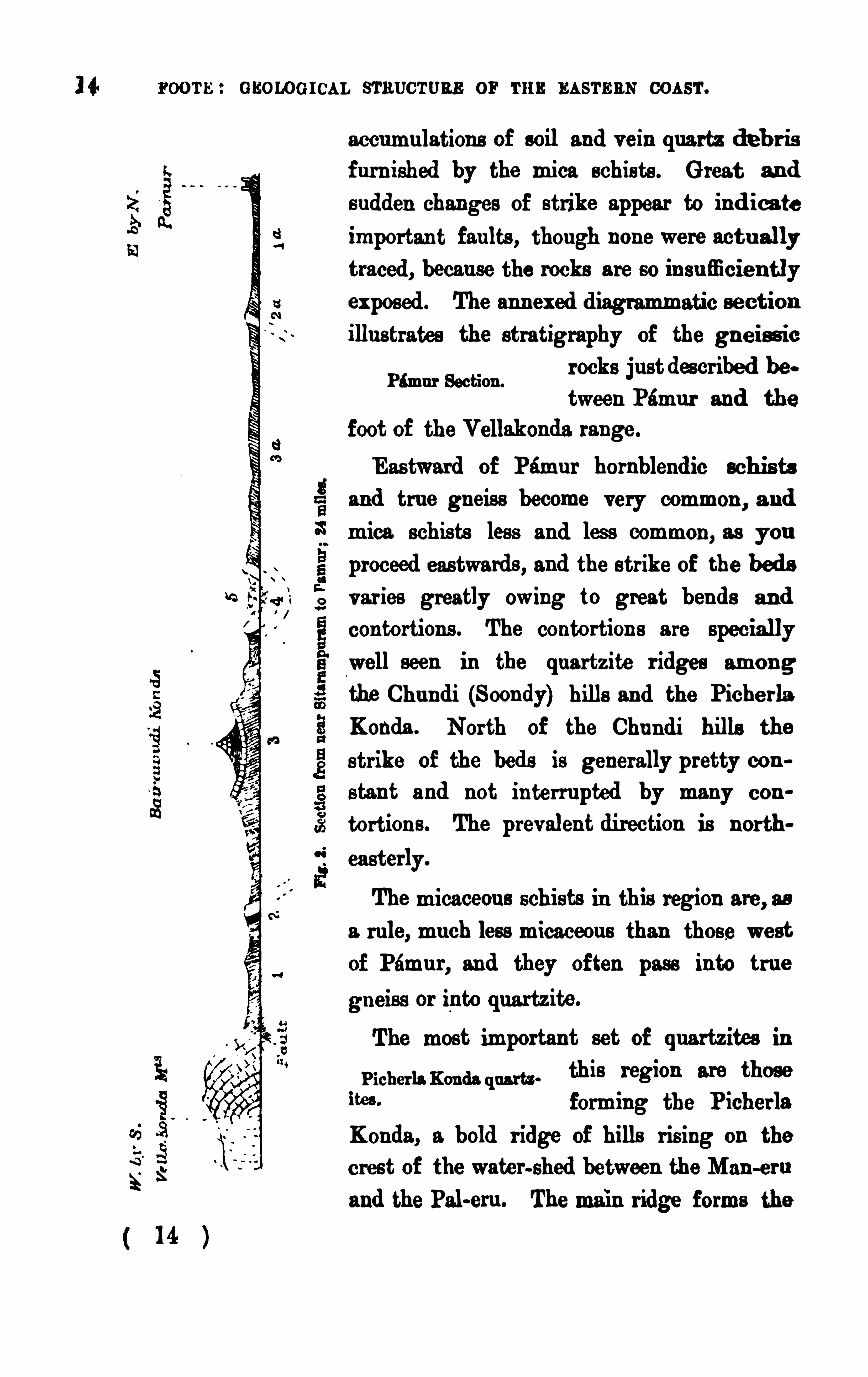
accumu lations of soil and v ein quartz d eb r isf u rn ished by the mica schists . G reat a nd
s u dden changes of strike appear to ind ica teimportan t fau lts , though non e were actu allytraced , becau se the rocks are so in su fficien tlyex pos ed . The ann ex ed d iagrammatic section
illu s trates the stratigraphy of the gn e is s ic
rocks ju st descr ibed between Pému r and the
foot of the Vellakonda range .
Eas tward of Pamu r hornblend ic schis ts
and tru e gneiss become very common, a nd
Famu r Section .
mica schis ts les s and less common , as you
proceed eas twards , and the s tr ike of the bedsvar ies greatly owing to great bends an d
con tortions . The contortion s a re speciallywell seen in the qu artzite r idges amon g
the Chu ndi (Soondy) hills an d the Piche rlaKonda . North of the Chu ndi hills the
s tr ike of the beds is generally pretty cons tan t and not in terru pted by many con
tortiou s . The prev alent direction is north
easterly.
The micaceou s schists in this region are, as
a rule, mu ch less micaceou s than those west
of Pému r , and they often pass in to tru e
gneis s or in to qua rtzite .
The most immrtant set of quartzites in
Picherla Konda (law . this region are those
“9" forming the P icherla
Konda , a bold r idge of bills ris ing on the
cres t of the water-shed between the Man -ern
and the Pal-em . The main ridge forms the
1 6 r oom : s s onos rcu . sr nu cru ns or r a n am as s cos s'r .
shrines in that region . I t is one of the most pictu resqu e spots in th e
n orthern half of the Nellore district, some of the great mas ses o f
mica schist hav ing fallen over and lying abou t in wild con fus ion in te rspersed with trees and bu ild ings . The great numbers of crystals whichcrowd the rock give it a very rough su rface.
The stau rolite crystals are generally of large size, 2 to 3 inches longby l} to l} in width, bu t both larger and smaller s izes are met with .
The large crystals are almost in variably of coarse te x tu re and mu ch
covered with a film of mica which conceals the tru e colou r . Some of
the smaller crystals have a fair amou n t of lu stre , and are of dullblackishred or redd ish-brown colou r . Twin crystals forming tru e crosses and
diagonal (St. And rew’s) crosses are common , especially at the Mala
konda, bu t not often of good shape. Along the west s ide of the
Malakonda r idge and also at Kotapalle, two and a
half miles n orth-west-by-north of Chu ndi , the su rface is thickly strewn with the prisms weathered ou t. I n var iou s damp
spots the weathered crys tals get covered with a shin ing ferruginou s coating and pas s grad ually in to a species of late ritic concretion , as do also
some richly ferruginou s garnets in other parts of the gneiss coun try.
The kyan ite was seen only in the Malakonda beds , in which the crystalline mas ses are nearly as n umerou s as the stau rolite prisms .
The stau rolite crystals were met with in two other localities , one in
the r idge forming the extreme sou th point of the
Chu ndi hills westward of Lingasamu dram v illage,
the other , a lowhill, abou t two miles sou th-westof Picherlakonda Trigonometrical station . In
the former case, the crystals are rather small and not numerou s
in the latter they are la rge and v ery numerou s , and the general appear .an ce of the rock agrees with that occu r ring at Kottapalle n ear Chu ndi,except in the absence of kyan ite .
Several of the quartzitic beds in the Chundi hills are locally richin tou rmaline crystals . I n a thin bed on the
crest of the ridge west of Chu ndi, the rather
Of Lingasamudram.
Near Picherla Konda.
Tou rmaline in quartzite.
( 1 6 )
scu rsmsr. anu s . 1 7
micaceou s quartzite is crammed with prisms , mostly min u te, of blacktou rmalin e. This is well seen where the ridge is crossed by the footpathlead ing direct from Chu ndi to Ramalingapu ram . A s imilar bed occu rs
on the cas t flank of the hill wes t of Lingasamud ram,close to the
s ta u rolite bed already referred to abov e . Close by another bed contain s
very large coa rs e crys tals of equally black tou rmaline , sev erallarge lumpsof which were brought to me by a nativ e u nder the impress ion it
was coal.
Among the mos t noteworthy members of the schistose grou p areMamietic in “ m l the ferruginou s beds ; these are of two kinds , the“9m m" ”hi" M ’ magnetic iron bed s and the hmmatite schis t beds .
The former , thou gh n ot so r ich as the great magnetite beds in Salem
d is tr ict, &c ., are yet deserv ing of mu ch attention , both stratigraphically
and indu str ially ; bu t the remarks to be made on their indu str ial importance will be reserved for the chapter treating on the economically im.
portant geological featu res . Of the he matite schists only one examplewas met with which willbe refer red to more f ully fu rther on . All the
more important magnetic iron bed s of the gn eis sic series belong to the
eastern schis tose band bu t several are fou nd occu rr ing in ou tliers
away from the main band , the inte rven ing space being occupied by the
Two grou ps of m g. newer sed imenta ry formation s . They occu r ia two
232° i
s:“it;gm: pr incipalgrou ps which I propose to call the Ongole
h mm Grou ps and the G u ndlakamma grou ps respectively, the
former occu rr ing near the town of Ongole, and the latter lying en tirely inthe lower pa rt of the valley of the G u n dlakamma riv er . Only one small
bed was met with , which from its pos ition cou ld not be as s igned to these
grou ps ; this occu rs in a small inlier of gn eiss on the left bank of
the Man-ern, 3 miles sou th-west of Singu raza Konda travellers ’
bungalow on the great north tru nk road . This magnetite bed formsa low rocky r idge r is ing ou t of the allu v ium and
later itic shingle, and kn own locally as the Shinampu di Tippa . The bed is of cons iderable thickn es s , abou t three-qua rtersof a mile long, and moderately rich in iron .
3 1 7 l
1 8 room : enoroe rcu . smu cruns or r u n m sr s as cos s r.
Fifteen miles to the north of Shinampu di (Sanampoody) Tipps lie
Ongole grou p of iron the most sou therly members of the Ongole grou pof magnetic iron beds , cons isting of fou r beds
forming a strong anticlin al cu r ve rou n d and thr ough the mas s of the
Komled u bed Konijedu (Conjadoo) hills . The other member s
are the magnetite bed s which form the main mass of the Ongole hills ,
and those forming the Parnametta hill, 4 miles nor th-west-by-west of
Ongole. A glance at the map will show that, although separated f romeach other by con s iderable distances , the pos ition of these three sets , or
s ub-grou ps , of magnetite beds , relatively to each other , is s u ch as
inev itably to su gges t a di rect connection between two of them,if
n ot between all th ree. The strong petrological resemblance of the
beds themselves and of the in termediate gneis s ic beds , as well as
the near correspondence in n umber of bed s , leads me to regard the
Parnametta and Ongole beds as merely the ex ten s ions of the great
Kon ijedu cu rv e, the Farmmetta beds corresponding with the northern ,
the Ongole with the north-eastern arm of the great anticlinal cu r ve.
A v ery trifling bend in the str ike of the two arms of the cu r ve wou ld
cause the ex ten sion of the beds , now masked by overlying later itic
and allu vial depos its , to coincide with the Par nametta and Ongolebeds . I t is , however , poss ible that the Ongole and Parnametta beds
may form the arms of an other cu r ve (parallel to the Kon ijedu cu r v e),
the apex of which is h idden by the n ewer formations . I regard the
first M ption as the more probable, and the more so as the Par
n ametta beds resemble the Kon ijedu bed s more clos ely than the Ongole
The Komjed u grou p cons ists of fou r pr incipal beds , of which the
two u pper ones are the r ichest. They are fa irlyr ich as compared with
.
the most important of the
great magnetite beds in Salem d istrict. The same may be said of
the Ongole and Parnametta beds ; they do not, however, appear to
have been worked for iron ores , though largely u sed as rough bu ild
ing stone.
1 8
sca rsros s arm s . 1 9
The number of bed s at Ongole is five principal ones , though sev en
might be cou nted if two which con tain thin
gneiss ic partings be regarded as fou r several beds .
The dip of the beds is from 40°
to 55°
sou th-sou th-eas'terly. As at Konijed u ,the s ou thern bed s are the richest ; they form the lowridge abu tting on
the high road close to the shrine and Math of some Pir of great local
sanctity. The northern beds ,which form the Trigonometr icalstation hill,are mu ch les s rich in iron . TheMath hillbeds are fairly typicalmagneticiron beds , in which the magnetite occur s in discontin u ou s granular lamina ,
interstratified between gran ular quartz lamina , which are generallystained of a redd ish or brown ish colou r where weather ing ha s takenplace to any ex ten t. The unweathered rock is generally of a pu rplish orblackish-grey colou r . The non-ferruginou s bands separating the d ifierentmagnetite beds both here and at Konijedu cons ist of a qu artzo-felspathicgran ite gn eis s , in some places coarsely gran itoid in textu re, bu t showingin others a te xtu re resembling woody fibre , which might for brevity bedescr ibed as xyloid .
”
The Parnametta beds are fou r or five in n umber, hav e a westerlyd ip of abou t and show signs of hav ing u nder
gone mu ch greater distu rbance than the other
sets of beds to the eas t and sou th. A n umber of rude cleavage planesrender the in terpretation of the s tratification by no means easy or
Ongole iron beds .
Parnsmctta iron beds .
The G u ndlakamma grou p of magnetite beds con s ists of fou r sub
Gm m M groups , separated from each other except in one
case, by cons iderable d is tances , and showing n o
features of special resemblance on which to base any comparison betweenthem. Still their general pos ition , with reference to the adjoiningmembers of the gneis s ic ser ies and to the general str ike of the beddingin that tract of cou ntry, indicates that they may very probably belongto one and the same horizon , though now broken into detached portions ;it is qu ite probable too that they may be representatives of the Ongole
( 1 9 >
20 r oom : GEOLOGI CAL smuc'
ru aa or m m amas coasr .
Of the fou r su b-groups , the sou thernmost, which lies close to the
v illage of Bumpalle, is the most important by far .
Two thick beds , separated by a rather gran itoid
gneis s , here form a great part of a con siderable hill. They appea r to beconnected with the magnetite beds in the Tammaveram hill 2 miles
to the n orth-north-west ; bu t thiek soil and talu s accumu lation s cov er
the‘
ou tcrops of the beds for abou t a mile intermed iately . Three bedsare here seen . They are v iolently contorted , and appear to be cu t ofi bya fau lt to the eas t ; to the west and north they d isappear u nder the
allu v ial depos its of the r iv er v alley.
Bu rapalle beds .
Abou t a mile and a half to the n orth -n orth-west is a n other magn etic
iron bed which forms a small bu t v ery rocky h illjus t west of the v illage of Man ikesv aram (M au
n ikeswar um) This bed , which forms a v ery acu te bend at the n orth
end of the hill, is exposed for little more than a mile in length, its ends
d isappear ing u nder the soil. I t is u nderla id by mass iv e banded homblendio gneis s , an d apparently ov erlaid by pink gran itoid gneis s , bu tthe contact with the latter is not seen , there being a con siderable spacebetween them in which n o rock is exposed . This forms the second su b
grou p of the G u ndlakamma grou p.
The third su b-group con s is ts of fiv e beds , which form the main
ridges of two hills a cou ple of miles n orth of
Addanki . Three of these, which are moderatelyr ich in parts only, form the Singir ikonda, a h ill r is ing abou t 400 feet onthe east s ide of the great north tru nk road . The beds dip cast at a high
angle . I n the lower hillwest of the road are apparen tly two bed s , bu t
Man ikesva ram beds .
Singirikonda beds.
their lie is v ery obscu re, and they may poss ibly represen t bu t one bed
crumpled into an acu te synclinal trough .
Abou t 4 miles n or th-west-by-north of the Singirikonda grou p liesanother small grou p of fou r rather u n importantbeds ; their relation s to each other are not clear , the
two northern beds ru nn ing at right angles to the strike of the two
s ou thern ones . I f , as the map s uggests , they are parts of a great cur ve,20 l
sca rs rosn mu s . 21
the two northern ones have probably been in verted by fau lting of the
strata . These beds form the Vemparala grou p.
To the eas tward of the G u ndlakamma magnetite bed s , the band ofschistose gneis s is greatly encroached u pon by the gran itoid gneiss band ,leav ing but a very nar rowbelt of the former between the granito id bandand the you nger sed imen tary rocks fringing the coas t. The schists
occu pying this nar rowbelt are mainly hornblend ic, bu t are of no specialinterest.
Two or three rather poor bed s of magnetic iron occu r within the
limits of the granite gneis s band wes t of the G u ndlakamma, to the eas t
of Pu r imetla (Pooreemetta ) tank, abou t 4 miles west of the last-men
tioned set of beds n ea r Vemparala . Bu t for their ex ceptional pos ition ,thes e beds ofier nothing of any in te rest.
I t was men tioned above (page 1 7) that one instance had been noted
3 m m“, “hm w of the occu r re nce of hwmatitic schist in the gneis s ic(“W t
region . This was seen in the Chu nd i hills , wes t
of the v illage of Polenau e Cheru v u , where sev eral hematitic beds occu r
as sociated with a great thickness of micaceou s clay and fiaggy schists .
One or two of the hematitic beds are r ich, the remainder poor and of no
importance . Their northern and sou thern exten s ions are lost s ight of in
the exten s ive low ju ngle which covers all the r idges in that qu arter .
Before conclu d ing ou r references to the eastern schistose band , wemu st cons ider three other sets of quartzite bedswhich belong to it. Two of these are as sociated
with the Chimaku rti ou tlier of trappoid, or inten sely hornblend ic,gran ite gneiss abov e referred to (page and lap rou n d it as if u nder
lying it conformably and forming the walls of a s u rrou nd ing syn clinalellipse . Of the real in fra -pos ition of these qu artzites to the hornblend icbeds , there can be no dou bt on the wes te rn s ide of the Ch imaku rti hills ,
bu t on the sou th-eastern and northern s ides the qu artzites are not seen ,
bu t are either wan ting or obscu r ed by talu s depos its . They showwell forabou t 4 miles on the eastern side of the ellipse, bu t are in v erted at
21 l
22 mor e : GEOLOG ICAL smu c'ruan or r u n s asrm com .
the sou thern ex tremity of the hilly r idge they there form. I f con tin u ou s,
these bed s wou ld hav e to be con s idered as of one and the sam e s et .
The third bed is seen in a tiny inlier in the allu v ium of th e M an—ern ,5 miles sou th of Kanduk u r . I t form s b u t a small
rocky hillock abu tting on the ban d o f th e great
Mas sév aram tank, bu t is worthy of special notice, as bein g p er f ectlydifieren t from the ordinary qu artzites of this region . The r ock is a v eryglas sy large-grained qu artzite of delicate pale aquamarine-gr een , bandedwith deep pu rple. The pu rple bands occu r in discontin u ou s lamina ,
looking mu ch like so many stain s . I f cu t an d polished it wou ld be astone of qu ite extraordinary beau ty for decorativ e pu rposes . The hill
is formed by a bos s on the ou tcrop of a bed which has a steep d ip to the
east-by-sou th . An other mas s of qu artzite of glas sy tex tu r e a n d paleaquamar ine-green was noted in the ju ngle near Balls Venh tap u r, on
the west s ide of the Picherlakonda qu ar tzite cu rve.
Among the less common forms of schistose gneiss to be men tion ed are
Tale“, chloritic the talcose and chloritic beds,which occu r in v ariou s
“mt" parts of the schistose a rea, bu t especially in the
western schistose band . Nowhere, howev er, do they form an importan t
featu re . The greates t development of the talcose rocks is to be seen
near the head waters of theMu shi r iver , immed iately eas t of the bou ndaryof the Kadapa rocks , and at the v illages of Gazu lapalle (G azoolapu lly)Chinna Managu ndum, and Sou tapalem They occu r in con s iderablequantity also to the n orth of the Mu s i riv er , between Chend alu r hilland the Kadapa bou ndary . Talcose rocks were also observed to the
west of Vin n ukonda , near the v illages of Bharatapu ram and Nadd igudda.
The rocks are generally talcose schists . A coarse gr itty variety Of talcose
gneis s occu rs along the bou ndary of the Kad apa bas in near Chittapu ramto the northward of Vinnu konda .
Chlor itic schis ts are fou nd chiefly in the sou thern part of the schistosearea, near the v illages Of Narapareddypu lly and Malareddypu lly, 8 or
9 miles s ou th-west-by-sou th of Kan igir i. They here occu py the placethat shou ld be filled by the ex ten sion of the western branch Of the
22
24 room : GEOLOGICAL sr nu cru nn or m EASTERN coas'r.
th ick depos it Of red soilwhich ov erlies it. Traces of a s imilar limes tone
were also noted to the sou th-west and east of I rslagu n dum, a v illag e
about 2 miles to the west-by-north . Both thes e bed s belong to the
weste rn schis tos e band .
A small bu t v ery remarkable bed of impu re crystalline limes ton eoccu r s at Pu n ugodu (Poon oogodoo) on the r ight
ban k of the small Makera r iv er 5 miles eas t-by
north of Kan igiri . The bed forms an anticlinal s em icircular cu r v e
abou t 200 yard s in length , the dip trend ing f rom west to n ear lysou th-east, and the bed being from 6 to perhaps 1 0 feet in thickn es s .
I n the pu rer parts of the bed the limeston e is of blu ish or green is h
white colou r , bu t with it are interbed ded many thick chert-like lamin a of
a reddish mineral mu ch resembling calderite (mas s iv e garnet) . I n
parts of the bed these lamina greatly exceed the limestone in qu an tity ,With cleaveland ite and and in others , especially near the base, the calca
ep idm ‘
reon a lamina d is appear altogether . At the bas e
the bed is v ery epidotic—epidote forming to a great ex ten t the lamina
between the h ighly s iliciou s limes ton e . Rather higher u p the chert-like
lamina cons ist of a mix tu re of epidote (approaching to pistacite) an dcalder ite . Near the sou thern end of the cu rve some of the parting-8
At Pu n ugod u .
hav e a perfectly gran itoid tex tu re , and look mu ch like smallgran ite ve in s
in jected between the planes of depos ition ; probably they are merelyr es u lts of metamorphism . The two ends of the cu rv e te rmin ate abr u ptly,as if faulted against the adjoin ing gran itoid gneiss bu t the ju nction istoo Obscu re to speak with certainty as to the fa u lts . NO eas tward ex ten
s ion of the bed s can be mad e ou t either in the bed of the riv er or on its
left bank . A couple of miles down the r iver I Observ ed several large
blocks of epidotic rock, doubtfully in s ite , in the bed of the r iver
close to the r ight bank oppos ite Paths G arlapetta . I n tex tu re and
lu s tre the epidotic mass strongly resembled a green fels ite . They also
resembled , though not v ery closely, the epidotic bas e of the Pu nugodu
bed . I hav e seen n o limes tone elsewhere which resembles the Pa n agod abed, bu t calderite was found in con nection with crystallin e lime
24 l
scn rsross AREAS. 25
s tone in the case of a smallbed of that rock at Kalpatti, in Tr ichinopolyd istrict ‘.
A graphitic gneiss was noted in one place within ou r gneis sic area .
This place is s itu ated at the n orthern end of the
rocky r idge sou th-eas t of Amrav ati (Umarawu tty)close to the v illage of Peddamadu r and a mile sou th of the Kistnar iv er . The gn eiss which con tains the graphite in form of spangles is ad ecomposed qua rtzose rock.
The las t v ariety of gn eiss ic rockwhich demands ou r special attentionis one occu rring only in the ex treme north-eas tern
corner of ou r gneiss ic area ; bu t it there occu rs in
cons iderable beds , and forms the main mas s of the grou p of hills on the
right bank of the Kistna, Opposite Bezwada . This variety of gn eiss is
a rather fine-grained qu a rtzo-micaceou s felspathic schist, containing
several accessory minerals , chief of which are garnets of small size,
bu t occu rring in great n umbers , and a reddish-brown felspar , forming
Graphite.
Ba ws da grou p.
small quasi-nodu lar aggregations , is also of common occu rrence in the
schis t. The schist weathers con s iderably at the su rface and becomesthere of a rather powdery tex tu re, or else coats itself with a close highlypolished su rface very like serpentin e in appearance. This serpen tinou smineral Often shows variou s colou rs , and is then of con s iderable beau ty .
I t is well seen on top of the westernmost r idge, sou th of the famou sOld Bu ddhis t v ihara at Undavilli,’ also on the Mangalagiri hill.
The bed s forming the Sitanagram and Undav illi ridges are con tin u ed
acros s the r iver and form the Bezwada hills , in which they are also
Hem. Gaol. Survey of Ind ia, Vol. W. p. 275.
”Th is very in teres ting relic of the Buddhist per iod is cut into th is singular schistose
rock at the north -western s ide of the ex tremity of the h igh ridge. close to the edge of the
allu v ium. and abou t half a mile from the ri ght bank of the K is tns . The excavation was
madewithou t any re ference to the str ike of the rock.which it cu ts d iagonally ; owing to th isthe weather sction on the dets ched pills rs , b e , “ been mu cb greater than had they been
cu t squ s rs to the pls nes of bedd ing .
The bu semen t story of the vihs ra hs s ls tely beca u pos sd by the very m fin
excavations proposed to, and car r ied ou t for , Governmen t by Hr . Robert Bowel], ll. 0 . 8.
An exten s ive rubbish heap had previously hidden great part of the front of the vihara.
( 25 )
26 mor e : GEOLOG ICAL sr nocr uas or r u n sAs-rs ns CoAs-r.
character istically displayed . They are so very distinct petrologicallyfrom any other members of the gneis sic ser ies known to the geological
s u r veyors in Sou thern I nd ia, that they shou ld be recogn ised as a
well-marked sub-grou p, to which Mr . King, Depu ty Su perintenden t,Geological Su rvey of I nd ia, and I , have given the name of Bezwad a
Series , after the small bu t important town of that name where the
Kistn a is dammed back by the anicu t, or weir, which forces the wate rto flowinto the series of great irrigation canals trav ers ing the Delta .
The an icu t is bu ilt of the ston e qu arried at the sou th and north ends
of the Bezwada and Sitanagaram r idges respectively, between which thean icu t is s ituated .
At a cu rsory glance mu ch of the stone u sed might be mistaken for
a coarse and mu ch weathered qu artzo-felspathic grit, bu t closer inspec
tion shows its truly metamorphic characte r , and moderately weathered
I n the sou thern half of Sitanagaram ridge the beds showa dip of 65°
close to the bank of the canal leading to Kommamu r . In the Undav alli r idge the beds appear to have a rather higher d ip, which increasesto as mu ch as from 70
°
to 80°
in the eastern spu r of the Mangalagiri
hill, in which the beds make an acu te cu rve, fromn orth by 5° 6° eas t, to east-by-north . The eastern
limb of this great cu rve disappears after a cou rse of abou t 1 } miles u nderthe allu v ium of the delta . The greatest elevation of the Bezwada
gonometrical station on the summithaving an elevation of 889 feet abov esea level. As seen from this point the several ridges and hills
forming the highest poin ts of the Bezwada series showa very remark
ably level ou tline, as if the flat tops, speaking approx imately, were
m of m , de a plain did once exist appears qu ite certain from
the Kistna,where he fou nd this featu re largely developed . The remark
ably lev el character of the r idge tops , and their near approx imation in23 l
sca rs'ross Anu s . 27
height, are v ery noticeable f rOm the s ummits of the granite gneiss hills ,fu rther west. Despite this u n iformity of shape, the combination of hills
with the large spread s of water in the Kis tna renders the neighbou rhoodof Bezwada decidedly pictu resqu e ; especially so are the v iews from thetop of Mangalagiri and the Undavilli ridge .
The connection between the Bezwada series and the ad join ing gran ite
gnies s to the west and sou th-west has not been made ou t, no section
having been fou nd showing them in contact, or even in moderate proxin ity. As seen on the r ight bank of the Kis tua, they appear to overlie
the granite gneiss , and they certainly present a newer facies , as if they
Con s iderable beds of qu artzite are associated with the Bezwada bedsin the main ridge north of the Kistns , bu t not a trace of them was
n oted on the sou th of the river, and I think the qu artzite mu s t have
passed into the micaceo-felspathic schist, as it so Often pas ses , in the
We mu s t nowretu rn to the western band of the schis tose gneis ses ,
The “mm ”m which includes the northern ex tens ions of the
several micaceou s , hornblendic, s u d qu artzosebands described above as forming the v ar iou s ridges and v alleys lyingbetween Pamu r and the eastern base of the Vellakondas .
The band of granitoid gneiss to which I gav e the name of the
Chandra Sekharapu ram band , disappears to the northward of the v illage
of Immedesheru vu , u nder the allu v ium of the Pal-ern and the thick
spread Of red sandy soil, s tretching away to the north-east. The rocks
which then come into s ight north of the red soil plain all belong to
the schistose group, which then occu pies the whole area between the
we“on !” mlofty gramte gnei ss mam a of the Ramgrrr (Kan .
northern ex tension of the Vellakondas . Mica schist is the predomi
nan t form of schis t in this region, and n ext to it qu artzite, whichforms many long and important hill ridges . Homblendic schis ts are
27 l
2 8 room GEOLOG ICAL sr nu crm or r u n EAe aN mm .
bu t rarely seen here, though so common in the'
custem sebiston
band . The mica schist giv es r ise to only three hill grou ps of any importance ; they are, the grou p of bills sou th of Mogalu r (Mogulloor) the
Kodn ikonda sou th-west of Narrava Gopalpu r , and the great hill northeast Of Nandana Marrila (Nu ndana Mor rala) . E xcept where hi lly,very little rock is seen in this qu arter, the greater part of the cou n try
being cov ered with red sandy soil of great thickn es s . I t is only in wellsection s that the softer schistose beds are, as a r ule, seen exposed , for then ullahs do n ot cu t deeply enough into the s u rface to expose the
u nderlying rock .
As alr eady stated above (page no connection cou ld be traced with
any certainty between the schistose rocks Of thewestern band northwa rdof G ogu lapalle and those sou thward of that place ; therewou ld therefore,be n o u se in making mere specu lations as to any poss ible equ ivalencyof sev eral s imilar beds , even of the most remarkable of the qu artzites .
Very little can therefore be said of theses chis tose rocks , for they presentno special featu res of interest, either geologically or econ omically .
The several quar tzite bed s may be traced of ten for many miles ,showing little change in min eral condition ; bu t they then d isappear,.the ridges dying down gen tly u nder the s u rface soil, owing to the
thinn ing ou t of the hard bands , or the grad uation of the whole bed from
hard qu artzite into a soft micaceou s rock.
I t will be seen by themap that an important band of qu artzite extendsfrom the valley of the Pal-ern u p to and beyond the M u s i (Mooshee)r iver ; they are then lost s ight of bu t abou t 4 miles to the n ortheast another v ery remarkable set of qu artzites forms the mas s of
the great Chendalu r hill. They in their tu rn are followed a cou ple ofmiles fu rther north by other qu artzites in the Ubiahpalliam hills . These
two last groups of qu artzites are remarkable for being the most northerlydevelopmen t of this variety of rock in this region , and f or the peculiarpos itions they occu py . with reference to the other adjacent members ofthe gneis sic system.
28 l
sca rsross a rm s . 29
The quartzite beds of Chendalar bill are so str ikingly like those
Cha dd " bin gm .of the newer Kadapa rocks , that, bu t for theexis tence of the great band of u nqu estionably
gneis s ic qu artzites abov e referred to , I shou ld hav e u nhes itatinglymappedChendalu r hill as an ou tlier of Kadapa rocks . As it is , I look u pon theChendalu r quartzites as belonging to the gneis s , bu twith a lingering
feeling of doubt, d ue, perhaps , to my hav ing, when I fir st v is ited Chandalu r hill, been strongly prepossessed in fav ou r of its Kadapa age from itsappearance as seen from thewest and sou th-west. The quartzites are wellexposed in a grand clifl at the sou th-western end of the ridge,
land the
clifi recalls , though on a smaller scale, many of the grand precipices ,scarping the Nagar i mou n ta ins and the sou thern parts of the Vella
konda range .
The Chendalu r quartzites are seen to rest, at the northern end of
the ridge , on gran ite gneiss , to which they appear conformable ; to thewest they appear to dip con formably u nder a bed of iron grey qu artzosegneiss while at the sou th-western end of the ridge the quartzites d ip,also in apparent conformity, under the hornblendic bed s close to the
village of Bu ndevaleganla . Viewed as a whole, the Chendalu r hill
appea rs to be the sou thern extremity of a narrow and mu ch conto rted
an ticlinal ellipse. The beds have a quaqu aversd ou tward dip on all
s ides bu t the north . I failed in tracing any signs of fa ulting, whichmus t exist supposing the anticlinal ellipse to be an ou tlier of the Kadapa
In tercalated between the qu artzites on the back of the anticlin al is
a thick bed of slaty argillaceou s schist, which being mu ch softe r thanthe quartzites has been deeply eroded, and has thu s given rise to the
formation of a smallbu t deep valley in part of the hillmas s .
‘ As s sen from a distanee from the west and es st. the ou tlisr cf the sou ther n md of
Chendalu r ridge presents a most s tr iking likenes s to a gigantic hippopotamu s standing half
immm ed in watsr s nd lookiug sou th. This resemblance to an animal does not s ppes r to
potamu s.
29
30 room : GEOLOGICAL smucr unr. or m e EASTERN coasr .
The quartzite beds.
in the Ubiahpolliam mu form likewis e an
Ubiahpolliamh in qman ticlinal ellipse ; they are overlaid conf ormably
”it“ by hornblendic schists . No conn ection cou ld be
traced between these and the Chendalur quartzites ; and , u nless the
respectiv e position s of the two sets has been afiected by faults hidden bythe intervening thick spread of red soil, the Ubiahpolliam bed s underlie
the others at a con siderable depth .
The predomin antly micaceou s character of the schists noted to the
Chum of cm of sou thward of the M u si-ern is not continu ed n orth
of that river : n umerou s hornblendic beds n ow
come in , and by the time the G un dlakamma valley is reached, to thesou th of Vinukondas , the two v arieties seem to be equ ally common .
Northward of the G u ndlakamma riv er.the schistose band widens greatly,
and makes a trend to the n orth-east, thereby maintain ing a general
degree of parallelism with the bou ndary of the Kad apa rocks . To the
north.
and east of NarsaraoPett (Atlar Narasaraopetta) the contin u
ation of the schistose band is greatly obscu red by the extensive and
u nbroken spread s of cotton soil which cover the face of the cou n try
generally ; and ere it reaches the banks of the Kistna to the west
of Amravati, it has dimin ished to a str ip of only a couple of miles in
of gneis s contain ing epidote in the form of pistacitewere n oticed near Naras aropett the one at
Pamidipadu , 4 or 5 miles north of the town , the
other at Rav ipad u , 3 miles to the north-west. Epidote is bu t rarelyfou nd in this region , though by no means an u ncommon mineral in more
sou therly parts , in Sou th Arcot for example.
Epidotic gneiss .
Hash im“4°
sou th-east of Sattenapalle. Very little is seen of
the bed , wh ich crops out a little to the north-wes t of the v illage, and
is by no mean s a r ich one.
3 0 l
82 rooms : GEOLOG I CAL sr nu cr u as or r u n s As'rnaN GOAs
'r .
cou n try eas t of Kan igiri, the Chimaku rti mou n tain , the grea t s p read
of hornblend ic, mostly trappoid, gn eis s around Pothalramu r ( Poo th
kamoor) a very s imilar trappoid spread forming the Bogalako n d a an d
ad join ing hills , the Kotappakonda and the Ramaku r hills . A n o the r
area of in ten sely hornblend ic bed s is fou nd to the north of G u n tfir , in
the Lam, Tad ikonda, and Nir ukonda hills . The micaceou s variety occu r s
Areas of predominance p rin cipally in the Kan igir i and Pod ile hills , als o in
°f ”ck" the group of low hills on the border of the Da r is i
and Vin u konda taluqs , and in the Vin u konda hills . I n the Kon d a v id uhi lls and in those lying between G un tu r and Amravati the two v a r ieties
occu r together in abou t equalproportion s .
The epidotic v ar iety forms the mas s of the Bellamkonda in S a tten
apalle taluq,and occu rs also in the lower h ills ex
tend ing n orthward towards the Kis tna . E p id otic
gneiss occu rs also in the inlier nor th of Vin ukonda, at a place half -waybetween Sar ikondapalem and Vaddagu n ta .
The mos t characteristic display of the gran ite gneis s in its s cen ic
featu res takes place in the Kan igiri and Pod ile h ills ,and in the granitoid area arou nd the Bellamkon d a,
in the ex treme north of ou r area . I n these localities are n umerou s ex
amples of blocky stru ctur e,whole hills appearing bu ilt up of loose
mas ses with slightly rou nded angles . Perhaps the finest examfl e of
this is fu rnished by the Kanigir i Drug hill.
The gran itoid characters are rather les s pronou nced in the Kondav id uh ills, the bedding hav ing on the whole been lessobliterated than in the gran ito id tracts last men
tioned . They form the most pictu resqu e grou p of hills throughou t theG u n ti
’
i r-Ongole region , especially as seen fr om the north-wes t or sou th
west. They mu st, howev er, yield the palm to the Kondapilly hills , immediately north of the Kistna, which appear to be formed of an ex tens ionof the same ser ies of bed s . The Konda vidu hills con s is t of two principalr idges , which do not correspond with the great lines of bedding, bu t
32
Epidotic granite gn eiss .
Scenery.
The Kond avidu hills .
GnAe rn Anu s . 83
seem due to a system of jointing l nea r the middle of thewestern ridge,
which is rather the lower , stands the well known old d rug, or hill fort,nowan exten siv e bu t most pictu resqu e ru in wellworthy of a long v is it
by every lover of grand rock scenery.
The western slopes of both ridges are mu ch more precipitou s than theeastern on es . The highest summit, called Sheikh Adam ks Paha r, af te ra Mu s su lman saint whose tomb stands close to the summit, attains the
height of feet above sea -level.’ In some of the hollows near the
summit there remain a fewpatches of thick ju ngle, showing that thepresent barrennes s of the hills is due to human agency, and not to any
barrenness of the soil.
I t is noteworthy that the three principal hillfas tnesses in this qu arterhav e been bu ilt on the granitoid hills they are
Kondav id u , ju st described, BellamKonda, and Ran igiri. Of the three, Bellam Konda Drdg was mu ch the strongest by pos ition , as it occu pies the whole summit of the mountain , whose flanks arevery precipitou s . Like Kondav idu it is v ery pictu resqu e, and commandsa most interesting view over the singu larly faulted and broken eastern
bou ndary of the Kadapa rocks . I f the great northern peak of the
Bellamkonda cou ld be made acce ssible so as to get an unbroken v iewof
the Kadapa boundary u p to the Kistna., it would afiord to the stratigraphicalgeologis t a panorama worthy of a long pilgrimage.
Kan igiri Drug is formed by the fortification of the crests of two highr idges enclos ing a narrow v alley ru nn ing north-east in its northern , and
south-eas t in its sou thern half. Very little remains of the old bu ildingsexcept a couple of gates at the northern and south-wes tern ends , but
in Olden times itwas a place of great note , and the object of a good deal
Bellam Konda Drfig.
‘ The tims at my dispon lm anfortnns telywmnch cu rh iled by a sc iom fllna a ths t
I was obliged to fa ego the pln snre of climbing to ths highu t poinh on the hilla from
which alone the ra l rels tion of ths bsdding and join ting on s large scale could be msds
ou t.
”This is the height accord ing to the measu remen t made by the ofieers of the Reven us
Survey Departmen t. The old Tr igonometr icalSur vey
0 38
3 4, r ooms : GEOLOG ICAL s rnu cr u rm or m nAsr nnN mm .
of fighting. The u pper part of the central v alley lies in the str ike of the
bedding. The ex tent to which the sou thern peak 1 has been cu t u p byjointing is qu ite extraord inary, an d the nativ es say the peak is inacces s iblefrom its extreme ruggedn ess . This statemen t is probably based more on
their fear s of some leopards which inhabit the caves on the hill, than u ponthe real in access ibility.
The mos t importan t and con spicuou s mass Of the hornblendic v arietyis the Chimaku rti mou n tain . As already men
tioned , the hornblendic rock here forms a great
elliptical area, 8 miles in length and nearly 5 across its greates t
width . The sou thern half of this ellipse is occu pied by the mou n tainand its rocky spu rs , which ex tend some distance in to the northern half.At the ex treme north end are two con s iderable and very mgged hillsformed of the same in tens ely black rock. The whole mou n tain is verybare, and bu t little soil ex is ts for v egetation to be poss ible, and the u s ual
native recklessnes s has denu ded the slopes of what little wood might
grow there if any attempt at cons erv ation were made. Despite thebarenes s of the mountain , the bedding of the rocks is not easy to makeou t, it being v ery obscu re to begin with, and also mu ch concealed by the
great mas ses of loose and confu sedly tumbled blocks which cover mu ch
of the s ummits and slopes . I t is best seen by descending some dis ta nce
on the n orthern side of the summit, to where a good v iewis obtainedof the great northern spu rs . The sou thern elliptical cu rv e is distin ctlytraceable here, though v ery obscu re on the sou thern slopes . The rock isa coarse hornblendo-felspathic, and apparen tly qu artzless , compou n d of
dark greyish-black colou r weathering to absolu te black . The north-east
faces of the v ariou s s ummits are all coated with grey and white lichens ,du e doubtless to the efiect of the north-east monsoon . The highest
s ummit, on which is a Trigonometrical Station , attains the height of
Chimaku rti mou ntain .
I was unfortu nately u nable to get a gu ide to show the way to the s ummit, which
mu st command a noble panorama, and had not the time to seek a path for mys elf through the
bewild er ing chaos of large blocks amongst which no track can be made ou t fr om below. I
think the s ummit would certainly be reachable f rom the north side.
34
Gm rro rn Anu s . 85
feet above sea-level, and commands a v ery extens ive and fine v iew
over both sea and land .
l
The bedding of the rock in the northern hills is obscu re in theex treme, bu t there can be no dou bt as to the pos ition of the u nderlyingband of qu artzites so well displayed in the low r idge sou th of Rams
chandrapu ram.
The decompos ition of this in tensely hornblendic rock giv es rise to
the formation of mu ch grav el]y kankar (concretionary tu fa) a great
thickness of which is to be seen near the bu nd of the upper of the two
large ta nks stand ing within the northern apex of the synclinal bas in .
The Chimaku rti mou ntain is a great solid -looking mass , and possessesbu t fewelemen ts of the pictu resqu e as seen from a distance. I t looks
bes t from the sou th n ea r Chillamkur . I ‘rom the north or north-east
the concentr ic arrangement of the dark central mass of hornblend ic
soil covering the small area Of approximately level grou nd close to the
summit is of dark, nearly black, colou r, a true humu s in fact, and its
existence proves that the mou ntain was formerly very much betterwooded than now.
Tore, or isolated blocks formed by the action of atmospher ic agencieson ro cks having a large spheroidal str uctu re, or
much ou t u p by system of join ting, are commonenough throughou t the gran itoid areas abov e refer red to, but none of
very remarkable size or boldnes s of ou tline were noted, and in these
respects they are greatly in f er ior to the tors of other gran itoid regions ,
e.y ., the neighbou rhood of Adoni, in Bellary d istrict, or the granitoid
‘ If the Gove rnment scheme of creating s new collectm'ats, with Ongole s s its
chief town , be carried out the Chimaku rh’
mou nta in will probably before loug be bu ilt
u pon and u sed as a sanitar ium. Though not of great height, dwellers on the summit,where there is plenty of room for sever al hou ses at an elevation of feet.wou ld pro
bably be ou t of res eh of the terr ibly hot land wind . The absence of all ju ngle and the
complete isolation of the mou ntain will also most likely prevent the formation of all
malar ia . The only real difl cu lty at first will be about the water -s u pply .
( 35 )
86 mor e : GEOLOGICAL smucrm or r u n EASTERN COAs-r .
cou n try arou nd and sou th of G ingi fort, in Sou th Arcot, 8m. Only one
grou p of tors in the Nellore-Kistna cou ntry has impressed itself on my
memory, and that through its grotesqu e shape . This grou p,which whens een from the sou th by morn ing light has a most striking resemblanceto a huge elephant charging a gigantic tortoise from behind , lies a few
score yards ofi the path lead ing from Nakri Kallu , on the great tr unk
r oad , to G u ndlapalle, 4 miles to the north-west, and abou t half -waybetween the two places . It belongs to the western granitoid band .
Of the small ou tliers of gran ito id gneis s which, as before mentioned ,occu r here and there within the limits of the
schistose gneiss bands , only one needs Specialmention ; it forms a lowrocky hill close to Yiku ru , 3 miles west-sou th-westof Naramraopeth. The rock here is a very typical porphyr itic varietyof r ich pu rplish grey colou r, which might be qu arried and con verted into
a v ery handsome bu ilding ston e. The enclosed crys tals are prisms of
grey felspar imbedded in a hornblendO-felspathic matr ix of darker colou r .
The dark black vari ety of hornblend ic gran ite gn eiss which I haveTrappoidth p h i“ described GS trappoid, occu rs mostly in the central
part of ou r area, and chiefly in two patches north
of the Chimaku rti moun tain , the larger lying to the east of Potha
kamu r , in Dar isi talu q, the smaller some miles to the north, on
the lef t bank of the G u ndlakamma, and running u p to and including
the Bogala Konda, the repu ted centre of the n umerou s slight earth
qu ake shocks that are exper ienced in the Ongole coun try.
The typical trappoid rock shows nothing bu t hornblende and felspar,in a crystalline mas s of v arying degrees of coarsenes s . Quartz is veryrarely seen in it. The colou r ranges from dark blackish-grey to almost
absolu te black . Weathered su rfaces are often absolu tely black, and therock, when seen in detached mas ses not large enough to show the bed.
ding, is n ot distingu ishable from bedded hornblendic trap.
This Is markedly the case at the eastern end of the Pothakamu r
trappoid area above named , especially in the
masses of rock seen abou t a mile to the north of
Porphyritic rock at
( 35 )
GuANIrorn AEEAS. 3 7
Thalur . Fu rther wes t, on the higher grou nd between Potbakamu r
and Mu llamu r , where huge su rfaces of rock are ex posed , the beddingbecomes appare nt, and a fewrather les s granitoid beds are interstratified
with the u ltra-crystalline beds . NO section was met with showing this
trappoid rock in actu al contact with other v ar ieties of granitoid gneiss ,
or with the schistose rock ; bu t nothing was seen suggestiv e of wan t of
conformability with the closely ad join ing bed s . The tr u e character of
the trappoidth rock is best seen in the Bogala
Konda, or Cha rcoal hill,”
so called from its
in ten sely black colou r . This in tense blackness , added to its nearly con icalshape, and its su pposed association with the slight earthquakes so frequ ent in the region arou nd Ongole, has giv en rise to the idea that it is a
volca n ic cone . The hill itself presents , however , no s igns of volcan ic
action . The s ummit is d iv ided by an irregu lar saddle in to three u nequ aldivis ion s , the western being between 1 00 and 200 feet the higher . The
summit cons is ts of a huge chaotic accumulation of blocks roughlyrou nded at the edges by weathering, from among which spring a few
stu nted trees of the fig tribe. The bedding of the great band of
hornblendic rock ou t of which the Bogala Konda r ises can be very
d istinctly seen from the top, and traced by the eye for sev eral miles
sou thward . Petrologically these beds are identical in appearance withthe Pothakamu r bed s , and they are v ery probably an ex tension of the
same, though the actual connection was not traced .
On the eastern s ide of the Bogala Konda are cons iderable acros s ,
to u se a term familiar in the English lake district ; the fallen blocksappear to form as it were streams down the sides of the h ill. Many ofthe blocks are so loosely perched that a very small impulse, such as the
slightest shock of an earthquake, would sufiice to overthrow them ;
and to the frequ ency of earthqu akes in this region may safely beas cribed the extreme confu sion of the blocks on the s ummit, between thepresent pos ition of the vast majority of which and the d irection of the
great joint planes to which they primarily owed their ex istence, n o con
nection can now be traced . This cause has probably also afiected the
3 7
The Begals Konda.
88 room : GEOLOG ICAL s'rnu cr u as or m s m am a COAs
'r .
loose blocks on .the summits of the Chimaku rti moun tain in a n ea rly
equ al degree, the majority of the blocks being of v ery mod erate size.
The great con fu sion ex isting among the fallen blocks on the flanks of
the sou th peak of theKanigiri hills already refer red to (page 84) is d oubtless also ia a meas u re du e to this earthqu ake action ; bu t from th e v as tly
greater average size of the blocks , they wou ld only be aflected by v iolent
shocks , which are of mu ch rarer occu r rence .
The dip of the bedd ing of the Bogala Konda trappoid bed s appears
to be easterly, bu t is v ery obscure. A bed of ord inary horn blend ic
gran ite gneis s close to th e western base of the hill has however a
very dis tinct sou th-easterly dip.
l
I only exper ienced one earthqu ake shock while working in the
G u n tur-Ongole cou n try, and that certainly did n ot emanate from the
Bogala Konda cen tre. I t was on the morning of the l 1 th March 1 807,
abou t. 7 miles west of Vinukonda and l7miles west of the Bogala Konda.
The shock cau sed a distinct tremor of the grou nd , travelling from north
east to sou th-west, and was accompan ied by a lou d rumbling noise, las tingsev eral seconds . Frequ ent slight shocks have been noticed by the Oficials
and other res iden ts at Ongole.
Beds of equally trappoid hornblendic gneiss occur at a few other
Yanekepad , l2 miles west of Ongole ; and again 8 or I 0 miles fu rthersou th-west, near Za rlapalem, on the path from Peddakandla Grunts to
Tangella , and near the latte r place. These latter beds are in tercalated
with beds of quartzose gneiss rolling in small anticlinals and synclinals .
Similar trappoid beds , stro ngly s imulating con temporary trapflows in theirappearance, occu r also north and wes t of Tangella and east of Byans
palem. Two other examples of in tensely trappoid hornblend ic rocks are
worth mentioning. Both occu r in the valley of the Man -er n, the larger
an d more impor tant forming the Enemerla hill,
8 miles east of Pému r, the smaller forming a
Bogals Ronda is probably between and feet high, and extremely steep on all
sides. I went u p the sou th-west side and found it a very stifl climb, especially over the
( 3 3 )
40 room : GEOLOG ICAL sr au cr u s E or r u n EAs'rEnN COAs
'r .
Kadapa series came the second period of great east-to-west p r es s u re,
which crumpled the eas tern half of the Kad apa bas in in to huge sy n clin alsand anticlin als , sev eral of which are locally inv erted . These u p h ea v ed
and contorted strata were in their tu rn exposed to denu ding ag en cies ,
and u nderwent cons iderable was te before the series of rocks, called by
M r . King 1 the Karnul series , began to be depos ited . The com p letion
of this series was followed by another period of distu rbance a n d u p
heaval, du ring which most probably a great f ractu re of the earth ’s cr u s t
took place a little to the east of the line of greatest contor tion o f the
Kadapa rocks . This fractu re formed the set of faults nowseen to ex ist
along the greater parts of the eas tern bou nda ry of the Kad apa ba s in ,
and coinciding nearly everywhere with the eastern foot of the Vellalron darange.
This fr acturewas accompanied by great displacement of the rock s oneither s ide, and those on the eastern s ide were greatly u pheav ed . S u b
sequ ently to this , denu ding agencies attacked the u praised area with
intense energy and remov ed the su perincumbent Kadapa rocks almost
entirely, leav ing in our area only a few ou tliers , namely, the Bairawudi Konda quartzites and slates , and the same set of beds in the
u nconformable patch east of the great fault at foot of the Gali K onda
(Qanly Conda) in the sou th, and the Biravallipaya and Atchammapett
faulted domes 3 in the north-east. To the sou th of ou r area are the
v ery striking ou tliers forming the Udayagiri Drug and the K oris e
Konda. The Yerra Konda and Du rgamma Konda, still fu rther to thesou th, are dou btf ully of Kadapa age. None of these gives any clue
as to the limit of the former eastward ex tension of the Kadapa basinover the crystallin e rocks .
1 The names of s spa and Karnul ser ies were given by Mr . King of the Geological
Su r vey of Ind ia to the two great seri es of su bmetamorphic rocks occu rring in the Madras
‘ The northern end of the eastern bou ndary of the Kadapa bas in is charscter-ised by
a s ingular ser ies of elliptical anticlinal domes , six in number , extending f rom Vinu kondanearly u p to the Kistna. The two northern ones are tr ue ou tliers faulted into the gnei
on all sides .
( 40 )
am mom m as . 41
The members of the gneiss ic series are generally too coarse in textu re
9M! d a m in to show tru e slaty cleav age well; moreover , it
S's-m“generally coincides with the edges of the planes
of depos ition , and is therefore eas ily ov erlooked . For these reasons bu t
the mica schis ts 7 miles to the north of Pamu r , and the slaty schists
on the back of the Chendalur anticlinal (see page 29) bu t neither of
Singular resu ltof cleavthese are of any special interest. A case of some
in terest, of cleav age in a qu artzite bed,was observedin thewestern arm of the synclinal cu rve formed by the beds which makeu p the Picherla Konda (see page 1 4) I n this case one of the lowest of
thes e beds (a little to the sou th of the v illage of Balls Venkatapu r) ,which has an east-to-west strike with northerly dip, is at the point
featu res ; bu t as it ex tends wes tward it becomes cu t up by vertical
cleavage planes 1 , which become more and more numerou s westward ,and are lined with a film of grayish mica ; the quantity of mica
increas ing with the number of cleavage planes, till, ju st as the spu rs inks down u nder the local allu v ium of the adjoin ing nulls , the rockis almost an absolu te mica schist. The inte rmediate gradations were
instructive, showing the progressive changes dependent on a v ery peculiar form of metamorphism. The half-way gradation had a strong
general resemblance to a coarse blotchy porphyritic gneiss , whichno one who had not seen the gradu al change would be in clined to
regard as the poss ible ou tcome of extra-metamorphic action on a tr ue
A great showof cleavage of clayey mica schists may be seen in theNandana Harr ila hills north of Kan igiri . I n this case the cleavage
‘ They might be mistaken for join ting where they first bsgin to show, bu t a little
f urthc wo t thq bem h r too nm to be regards d u mythiug but cln n ge plam
( 41 )
42 roar s GEOLOGICAL smu cm s or r u n EASTERN coa s'r .
3 .—INTRUSIVE ROCKS IN r a n GNE I SSIC AREA.
Allthe intru sive rocks occu r ring within the gneis sic area be in g , as far
as at presen t known , of greater age than the overlying Kad a p a rockswhich they are nowhere seen to penetrate, it will be conv eni en t to con
s ider them before proceeding fu rther . The in tru s ive rock s s een are
referable to the following fou r grou ps : (a) Trap dykes and in tr u s ions ;
(6) G ranite veins ; (6) Felsite vein s ; (d) Quartz veins .
a . Trap dykes cad intrus ions .
Rar ity of mppmof Sou thern Ind ia, the G u n tI
’
I r-Ongole area is
m “remarkable for the ex tremely small n umber of
tr appean in tru sions that have taken place in it. Not only is the n umberof su ch intr u sions small, bu t they are mostly of v ery small size, and inevery way of extremely small importance geologically. One ex ception
may perhaps be made, but in this cas e the really trappean character of
the rock is v ery dou btful; it relates to the black hornblendic mas s of the
Enemerla hill east of Pamu r, already described above (see pageFrom its isolated pos ition this mass s uggests the idea that it is in tr udedamong the highlyfschistose beds which su rroun d it ; bu t u n for tun atelythe contact between the two could not be traced . The petr ologicalcharacters Of the mass are so extremely like some of the other highlyhornblendic metamorphic bed s, that they do not afiord, withou t special
chemical or micrOGOOpical analysis , suficient ev idence safely to decidetheir exact n atu re. The same remarks apply, though in les ser degree, tothe equ ally doubtful hornblendic rocks of the I anakotai hill occu rring
6 miles to the east-by-north, near the v illage of Ayawarpalle.
All the other u nquestionably trappean intru s ion s occu r in the formof tru e dykes . The greatest number of these
occu r in the gran itoid gneiss region arou nd the
Bellam Konda, in the Kistna valley. A fewoccu r in the lower part ofthe G u ndlakamma v alley, and a smallgroup in the upper valley Of the
42
Dykes .
m au sm aocx s m r u n GNEISSIC u s e. 43
Mu s i r iver ; the remain ing few are scattered abou t here and there at
very great distances from each other . The dykes are all dioritic in
character , and many of them, especially in the northern grou p, distinctlyporphyritic, showing numerou s whitish felspar crystals . The diorite
is mostly blu eish or green ish black in colou r . Exception s to this rule arethe dykes occu rring at Ongole (on the Trigonometrical Station hill),and Neputlapadu , 3 miles east of the sou thern end Of Chimaku rtimoun tain . The former is of green ish
-whitish grey colou r, the latter ofa pu rplish-blackish grey.
The majority of the dykes may be ref erred to two systems , depend
M m wm m ,ing u pon the d irection of their str ike, one of
these systems hav ing a cou rs e from north-1 5°-west
to sou th-l5°-east, the other run n ing north-east-by
-east to sou th-west
All these dykes were intr uded prior to the depos ition of the Kadaparocks .
6. Gran ite veins .
G ran ite v eins , except of v ery small size, are not at allcommon in the
gneiss ic area , and none were met with of any immrtance either froms ize or specialgeological inte res t.
Some small v eins Of qu artzo-micaceou s granite traversing the
schis tose gneis s ics to the sou th-west of Kambaldinna , in the cen tral partof the v alley of the Man -er n (river ) , conta in smallgarnets and prisms oftou rmaline. Tou rmaline occu rs also in granite v eins sou th-east of
Petlu r ( 1 8 miles sou th-west-by -wes t Of Ongole) . The to u rmaline occu rs
here in some qu antity, and good prisms are obta inable. Hemihedral
crystals are not common , and the colou r of the tou rmaline is alwaysblack. A gran ite v ein containing u nu s u ally large crystals of orthoclase
felspar was Observed in the bottom of the great tank west of Kondapy,
at its upper end . Well shaped prisms of very pale fles h colou r , 4 to 6or 8 inches long and proportionately th ick, were n oticed, bu t were
mostly too mu ch cleaved to be ex tr icable withou t breaking u p into small
( 43 )
44 mor e : GEOLOGICAL sr nuc'runs or r u n nAs
'mnN COAs'
r .
Small irregular gran ite v eins Of pale pink colou r and coarsely crysta l
line tex tu re are common in the micaceou s and hornblendic sch i s ts sou th
east Of the Ch imaku rti mou ntain s , bu t they Ofier no points o f special
interest.
c.-Fek ite veins .
A small series Of hard v ein -like bands of light colou red rock , hav ing
con s iderable resemblance extern ally to qu artzite, traverse the hor n blendic
gneiss sou th-west Of Pothakamu r (Poothkam0 0 r of sheet 7
These v eins—for su ch they u ndoubtedly are—as they cu t acrom the
beds of gneiss at an angle of cons ist of compact fels ite of paleblu ish-grey colour , weathering a v ery pale cream colou r . The f r eshlybroken su rfaces Of u nweathered parts Of the rock show here an d there
s ection s of flesh-colou red crys tals of felspar . The v eins are small, being
Only 3 to 4 feet thick, and exposed only in short lengths . They occu r
over a tract abou t 2 miles long by a mile in width , which they traversein a north-east to sou th-west direction . Though tolerably n umerou s , thev eins form an incons picuou s featu re in the landscape, an d might be eas ilypas sed by u nnoticed .
No other occu r rence of fels ite rocks was Observed in the G u n tdr
Ongole regio n .
d .—Qua t te veins .
Quartz veins are n umerou s only in parts of the gneis s ic area,the gran ite v eins and trap dykes of this region , they are, with bu t fewex ception s, Of v ery small importance and size. The most remarkableexception is a cons iderable mas s of quartz on the sou th s ide Of the faulted
sou thern bou ndary Of the anticlinal ellipse westOf Nekarikallu , at a spot clos e to the intersec
tion of the meridian of 80°
east longitu de by a parallel drawn in latitude1 6
°
20'
north. Though cov ering a large su rface, the relati on s of the
quartz to the fau lt are obscu red by debris and soil, and it does not show
any Characteristics Of being a fault rock, as might very wellbe inferredfrom its pos ition .
44
At Nakar ikallu .
xAnArA sain t s . 45
The other quartz v ein s to be noticed occu r mostly a little sou th Of
V inu konda, n ear the v illages Of Ayanavolu , Payidipadn , and Env aran . At the two latter v illages
the quartz v eins ru n d ue nor th and sou th . They are traceable only forshort d istances . I n the extreme sou th of the gneiss ic area n umerou s
large north and sou th veins occu r in the schistose gneiss Of Dukan u r
hill, abou t 4 miles east-sou th-east Of Pimu r . M inu te v eins , s u ch as
characterize many mica schis ts and kindred rocks, occu r in immense
n umber , es pecially in the sou therly parts of the gneis s ic area , and oftengive rise to prodigiou s accumulations of debris , by which the whole
su rface of considerable tracts of cou n try is almost perfectly masked .
Su ch is notably the case in the tract between Fému r and the Palm
Sou th Of Vinukonda .
NO quartz v ein s were seen containing sulphides Of iron, &c. or any
other in dications of the presence of gold .
Some small v eins Of milky-white quartz traversing the garnetiferou shornblend ic and micaceou s schists east of Bianapalle (on the banks and
in the bed Of the little Maker u river, which r is es among the sou thern
spu rs Of the Podile moun ta in ) are wonderfu lly charged with minu te
dodecahedrons of brownish-red garnet.
CHAPTER Ill—THE KADAPA SERIES.
As suming the numerou s qu artzite beds occu r ring within the gneis s ic
area to be really members of that Older metamorphic series , the
newer or Kadapa series is bu t v ery slightly represen ted within ou r
presen t limits , and only in the shape Of a fewpatches , mostly ou tliers ,fou r Of which only requ ire special.notice, hav ing already been pa rtiallydealt with in my notes 1 included in and appended to Mr . King’s memoiron the Kadapa and Karn ul series .
a l a-Oirs of the Geological Su rvey of India, Vol. v i i i , pp. 3 1 3 a m .
45
46 room GEOLOG ICAL STRUCTURE or r nE EASTERN COAs'
r .
The firs t ou tlier to be n oticed is that capping the Bairawud i K onda ,
B’
wu di Konda ou tin the extreme sou th wes t corn er Of o u r gn eis s
lier area, where it forms a v ery cons picu ou s ob ject , as itr ises in to a con s iderable mou n tain , su rrou nded in most pla ces by
clifiy sca rp. The ou tlier forms a small synclinal bas in , ou t o f the
middle Of which rises a gre at ma ss of coarse micaceou s and chlor itic
schis ts , capped by a higher set Of qu artzites , forming the h ighes t
s ummit.
The lower quartzites rest with great u nconformity on the u ptu r n ed
edges Of a great series of mica schi st beds . They are doubtless a n or thern
ex tens ion of the great beds capping the Udayaghiri , a few miles to
the sou th ; bu t there has been an appreciable th in n ing ou t of the
qu artzites between the two moun tain s , an d the ch i c Of the n orthern
mou ntain are mu ch infer ior in height and beau ty to those which re n d ered
Udayaghiri su ch a famou s stronghold in former ages .
The relation s Of the Bairawu di Konda beds to those exposed in themain mas s Of the Vellakonda range have been illu strated in a section
given in Mr . King’s memoir (l. c., page The lower quartzites Of
the ou tlier correspond to the Cheyair grou p Of the series in to which Mr .
King div ided the Kadapa formation of that region .
l
The lower qu artzites occu r in thick beds Of whitish or bufiy colou r .
At the northern end of the mou n tain they are mu ch conto rted,
and the synclinal fold they form is beau tifu lly shown in a fine
v er tical clifi more than 1 00 feet high, at the sou thern end of a
deep and very pictu resqu e rav in e open ing northward toward s the
village Of Kothapalle . Du r ing the ra iny season a small stream fallsover this clifi 9
, abov e which comes a cons iderable thickn ess of chloritic
Memoirs Of the Geological Su rvey of India, Vol. VII I, p . 1 26.
2 Several small rock temples, probably of Bu ddh ist or igin , have been cu t in the mica
sch iet on the fl owof the spu r on the western s ide of the rav ine, and a f ewsmall n iches on
the face of the qu artzite clifi ; they are nowsacred to Konabairu rn devs , the deity of the
waterfall
POOTR : GEOLOG ICAL STRUCTURE OF THE EASTERN COAST .
The next ou tlier Of the Kadapas requ iring mention in th e s e p ages
occu rs 85miles to the north-eas t-by-no r th of the
last-named one. I t is one posses s ing con s id erablein terest on accou nt Of its remarkable stratigraphical pos ition , th e p ecu
liarity Of which cons is ts in the mas s being an elliptical anticlin al d omelet down among the gneis s ic bed s by a series Of fau lts , b y which
it has been cu t in to an elongated rather ir regular hexagon a l a rea,
whose major ax is extends abou t 7 miles northe ast-by-n or th , the
min or meas u ring abou t 5 miles from north-west—by-west to sou th -e as t
by-eas t.
The top of the dome has been mu ch den u ded , and the qu a r tzitesand other rocks cu t away so mu ch in the centre Of the ellipse, tha t theu nderlying gran itoid gneiss has been exposed in a n arrow longit u d in al
v alley, in which stands the hamlet Of Biravallipaya . The d ome is
made u p Of fou r pr incipal quartzite beds , which are separated f rom each
other by three bands Of slate. Here, as elsewhere, wherever the bas e
ment Of the Kadapa rocks is seen , it is formed by a qu artzite . As
seen from the sou th-west, the l pe of the hills is character ized by the
bare su rface of one Of the qu artzite beds dipping sou th-west at
angle of and which presents very mu ch the appea rance of a glacis
lead ing u p to the walls Of a great fort. The dip of the beds on the
sou th-eas t and east s ide Of the dome is from 46°
to showing the
anticlinal to be an un symmetr ical cu rve. The highest remain ing part
of the dome, which lies near the northern end, attain s the elev ation Of
feet ov er sea -level and is crown ed by a tnigonometrical station .
None Of the beds exposed in this Biravallipaya dome could be id en tified
with the beds forming the easte rn part of the Nakarikalln elliptical an ti.
clinal, thou gh they are separated by so small a distance.
A s imilarly faulted dome forms the ou tlier wes t Of Atchammapetta,and abou t 5 miles sou th-west-by-sou th Of Ch in
tapilly, on the Kistna river . I n this case the
Ou t-lier has a r udely trapezoidal figu re in plan , the greatest lengthof side being abou t 1 } miles . I t forms a low broad -backed hill, of
48
outliers.
u rn s s onnwj m sna res . 49
which the greater part of the su rface is bare quartzite, of brown and
drab colonrs ,with a qu aqu aversal dip . The apex of the dome lies consider
ably westvmrd of the tru e centre. Though cu t into by a deep rav ineon the north side, the arch of the dome is not cut through, and the u nder
lyingg
neis s is not seen . No point of actual con tact with the gneiss ic
rocks is seen , bu t to the north of the dome is a large dyke of dioritic trapof the gneissic series of dyke which is older than the Kadapa system.
North of this dyke is another ou tlier , also a domoid anticlinal, bu t of
mu ch smaller size, being only abou t mile long by wide, bu t cons ist
ing of blu ish-drab and grey qu artzites , u nlike any of the beds seen inthe greater dome. These two fau lted anticlinal ou tliers complete thelist of ou tliers of Kadapa age sou th of the Kis tna.
cm rr s a xv .—'r
'
n s UPPER eonnwm s seams.
The formations belonging to this very interesting and importantdiv is ion of the mesozoic rocks occu r in n umerous patches , mostly of smalls ize, lying, with a few exceptions , along the eastern bou ndary of the
gn eiss ic area and dipping u nder the you nger laterific and allu v ial
formations . The exceptions are a few inliers s ituated within the area
of the younger formations These, with the exception of two inliers on
the wes tern border of the Kis tna delta near G u ntnir , are of tr ifling
importance. Cou nting large and smallpatches , they number twenty-fou r ,of which two poss ibly may be cons idered rather donbtf u l, being referredto this series solely becau se of their pos ition . These will be refer red toagain
fu rther on . Bed des the patches which were of s uficient s ize
to be mapped , there are many other small exposu res of these Gondwénarocks in wells and water-cou rses , showing that they are really much
more exten s iv ely developed than they appear to be on the map . I f
the alluv ium cou ld be removed, the Gondwi na beds wou ld showa su rfaceseveral hundred square miles greater in exten t than that which they now
1 ) 49
50 room : s nowmen . sr s ncrnns or r u n m m mm .
exhibit. For convenience in describing the several patches , they may
1 . The Kandnlrur (Cnndacoor of sheet 76) group .
pan-mud into tou r group 2. The Ongole group.
0 I3 . The Vem‘varam-Bndav tida grou p.
Of these, the Vemav aram-Bndavtda grou p is by far the most extensive ,
the most div ersified in petrological featu res, and the richest in organic
remains .
I n the Kaud ukm group I inclu de the variou s patches in the valleys
of the Vnppu t-eru and Man -er n, and those occur ring within or border
ing the Kandulmr laterite area ; also a small ou tlying patch, a mile
east of I lavara (Yellavu rra of sheet 1 1 miles n orth-north-west of
The Ongole group con sists of two patches and several small exposu resof shales abou t 6 miles west of Ongole town .
The Vemdvaram-Bu davéda gimp inclu des all the patches lyingbetween the G u ndlakamma and the Perachn r riv er . Of six patches ,fou r are of imwrtance ; these are the Vemdvaram, Bu davada , Idnpnla
pad u , and Pému r patches , called af ter the geologically most importantv illages s itu ated on them.
The G-md iff gram) cons ists of three patches , two of which are of con
s iderable s ize ; the Tangellamudi and Chebrolu (Behbraln of sheet 95)
patches lie in the allu vium of the Kistna delta to the sou th-east of
G nntnir . The third, of small extent, lies within a laterite area, 1 5
miles sou th-west of G untlir . Bes ides these, there are a n umber of exposu res through the lateritic deposits ju st allu ded to, and als o through thatoccu rr ing at G u nttir itself.
The most sou therly of these fou r grou ps, the Kandulmr group, is
m m a m group.composed of a con s iderable n umber of small and
stated , in the valleys of the Man -ern and Vnpput-eru , or bordering the
50
nrm s onnn m m u s . 51
Kanduku r later ite area, with exception of a small patch which lies 1 1
miles north-north-west of Kandulmr, and a little east of the village of
Ils vara (Yellavn rra of sheet The group cons ists of thirteen separate
patches , all bu t three being very limited in extent. Of these three
the most southerly lies on the 1 5th parallelof n orth latitude, close to thevillage of Chinna Latarapy, on the right bank of
the Vuppnt-er u . I t covers only abou t 8 square
miles of su rface, bu t is dou btless connected below the alluv ium and
lateritic beds with other smaller patches which occu r at small distances
to the north , east, and west. The well-sections sou th of Chinna h tarapy
lam-spy patch.
pebbly near their base, which rests on the gneiss . The beds hav e a
mined .
Tra ces of gritty or conglomeratic sandstone beds , in the shape of
patches too small to be mapped , are found dotted here and there over
thergnein inlier east of Chinna f ratm py, and showthe contact between
the two rock-ser ies very distinctly. Many of the patches are only afewinches across . The sandstone is composed of gneissic debris , chieflyquartzose in character.
At the wes tern ex trm ity of the western bank at Chinna In tarapy,
a dip of 2°
to 3°to the north-west-by-north .
Sou th-west of Chinna Latarapy, at the v illage of Ramnaikenpett,
are to be seen ; in one well-section they are
exposed to a depth of 1 6 feet, and showa dip of 7°
to 8°
to north-north
west or north-by-west. In the nu llab fesding the Bumnaikenpett h uh,
52 room : s nonoercs r. sr ano'rm or r u n m s
'rxan com .
These beds roll abou t a good deal, and are locally often obscu re, besidesshowing false-bedding, bu t the general dip is westerly at a low angle.
A large mas s of s ilicified wood was obser ved in one of the beds at the
top of the series , bu t no other foss ils were found in this section .
A couple of miles sou th-west—by-west from Ramaaickenp ett, at
the. v illage of Pedda Pamidi (Pedda Powen ny),
drab fr iable sandstones are exposed to a depth of
1 5-1 6 feet in well-sections , u nd er several feet of kankar and la teritic
grav el. Separated from these section s by abou t half a mile of allu v ium,
is a fair section exposed in the right bank of the Vnppnt-eru , at its
junction with the Mu tialpad nulls . The su ccession of beds is not
very clear owing to the broken natu re of the bank and to thewan t of
defin ition of the several beds wh ich hav e a tendency to gradu ate one
into the other . The beds , which have a general north-weste rly dip,n ever exceeding 8
°
and generally much less , succeed each other in
the following order
Sand stone, shsly, 1 ndian red and drs b 1'
Ditto. drab 1’
d 8"to 0’ 1 0
’
Ditto, ditto in parta, mottled red s nd browu sr to 8’
8’
to 4’
Some 6 miles to eastward of this last section is a low rocky blufi,cons isting of coarse gritty conglomerate and sand
stones , r is ing ont of a ju ngly plain and lapped
of Rtjmahal rocks resting on gneiss , which shows a very little distanceto the sou th the conglomerate and sands tones are of no great thickness ,
52
nr rna ooxnwm s snares . 53
probably not more than , if as mu ch as , 50 feet. Resting on the sur face ofthe sandstones are concretionary fragments of pu rple clayey sandstone,containing plant remains of Ra
’jmahal age, nowworn in to pebbles , and
belonging to the lateritic gravels . Fu rther north, 3 or 4 miles east,
of Chinna Laterapy, s imilar washed-u p pu rple plant sands tones form a
cons iderable proportion of the lateritic gravel resting on thegneiss . From
s imilar pu rplegr it and hemati tic sandstone pebbles in the laterite gravel,unqu estionable Rajmahtl plant rema ins were obtained to the sou th-east ofRazpalem, 3 or 4 miles north of the Peddav aram blnfi ju st described .
Among the plant remains here fou nd was part of a frond of P tiloplylls m
To the northward of the Chinna Lata rapy patch of Bajmahfl s are
several section s of plant beds , chiefly sands tone, tobe seen in the Mogallu r n ulls , and in the bed of
the Man-ern east of Mogallnr . I n the latter case, the fr iable brownmicaceou s sands tone yielded parts of broad Ptilopfiyllam fronds . This
plant bed is overla id apparently by the v ariou s sandstone and shale bedsseen in the principal section in the Mogallnr n u lls which present thefollowing series in descending order, the beds hav ing a general dip of
f rom 7°
to 1 0°
to the south-sou th-east
Sandstona brownJris ble
to 3"
Sands tone bm with grey and red shs ly
Ditto. M y, grey and rd
Ditto, M y. grey and red
( 53 )
54 r oom : osoLoorcu . s'rau c
'rnns or r u n ream s coxsr .
Three miles to the north-east of the r iver-side section , plant bedsagain seen in well-sections at the sou th end of the
v illage of G udlu r . The beds here consis t of sof t
drab micaceous shaly sand stone, with numerou s fragmentary plan tremains in horizon tal beds divided by kanks r partings . Only on e
iden tifiable fossilwas obtained here, a small fragment of a Dictyozars ik e.
A well-section n orth of two small ru ined pagodas shows s imilar sandstone ,with shaly par-tings of chocolate colou r contain ing obscu re fragments of
plan ts in great abu ndance. The beds dip north-by-east at from 1 5°
to
From 1 0 to 20 feet of the plant beds are v is ible above the water in thesev eral wells in which they are exposed . The su rface is obscu red by a
are found u nder the laterite to the sou th-west of
mahi l age. This completes the enumeration of exposu res of R6irocks sou th of the Man -ern . There is a greatdegree of rewmblanee in
petrological and lithological characters between these beds and those seenin the Alicur and Pyauu r areas of the Rdjmthal s er ies west of M sdras
,
‘
the predominant featu re in both cases being the soft and unconsolidated
condition of the greater part of the con stitu ent depos its .
To the northward of this r iver the firs t inlier of plan t beds is met
North of Mame” .
with at Kalamalla (Calamd la) , bu t it is a verysmall and u nimportant one. The beds seen in the
north bank and bed of the river consis t of drab and grayish-brownsandstones of moderate hardness, occu pying a nearly hor izontal pos ition . The dip, if there be any, is slightly sou therly. No foss ils werefou nd , but the lithological resemblance to the more s ou thern beds and
are equally of Rajmahtl age.
Fr iable micaceou s sandstones of reddish-brown and greyd rsb colou rs
form a min iatu re clifi 5’
7' high on the sou th bank
of the la rge nu lls at Polenan epalem, 7 miles
See Memoirs of the Geological Su rvey of India, Vol. X.54
66 more : s nowmen . srancrnns or r u n EASTERN com .
Un fortunately no section could be fou nd throwing any light on the rela
tion of this kankar bed to either the under or ov erlying depos its .
The natu re of the small shells collected , whether marine or fre shwater, has yet to be determined by comparison ; they were of -too small
a size and incon spicu ou s a character to be safely determined ofi-hand .
were foun d on a well heap in the field abou t three
fou rths of a mile north-west of Kandu ku r, and a few yards 05 thepathlead ing to Kovu r . These were associated with fragmentary plan tremains . The beds seen in v ariou s well-sections , or their debris exhibitedin the was te-heaps , shows the prev alent character of the rock to be drabor brownish-bufiy sandy shales , or shaly sandstones with reddish lamina .
These rocks , whatever their character , are largely composed of scales of
Westward of Kandukur the Rajmahal rocks are seen in well-sections ,“4 and a fewvery shallow su rface section s at sev eral
Yedl
and Yedlu rpad . Shaly micaceou s sandstone from a well ju st w t of
the former v illage showed ju st d istingu ishable traces of Ptilop lyllsm.
This sandstone contain s bu t few plant remains , and those few are very
fragmen ta ry. A well-section at Yedlu rpad shows abou t 20 feet inthickness of drab shaly sandstone contain ing n umerou s concretionary
su rfaces , white and porcellanoid in appearance, and striated like a fine
slickens ide. Some concretions ry masses also had their whole exterior
covered with this glistening su r face . This quas i-porcellanoid su rface is
du e to the presence of a film, as a ru le of extreme thinness , of calcareo
argillaceou s mater ial. Though porcellan ic in appea rance, the bright
Eastward of Kandu ku r , chocolate-colou red shales were observed in theditch by the s ide of the new high road leading
from Kanduku r to the great north tru nk road at
Singarayskonda, at a distance of abou t 3 miles from the former
53
East of Kenduku r .
u rn s nonav au a s s nrs s . 57
place ; and in a well-section close to sou th of the road which leads
from the tru nk road to the sea at Voolapalem, a section of pu rple andwhite mottled gritty shales , some 1 2 feet thick, may be seen . No
distinct traces of plants could be mad e ou t in either locality ; bu t the
shales have a very strong re semblance to other unmis takably Rajmahfilbeds , as , for example, those of which traces in the lateritic gravel,
at and to the sou th of the v illage of RaZpalem,were ref erred to abov e,
page 53 .
The one member of the Kanduku r grou p of patches of s mahfl beds
mm mlying northward of the Falern occu rs a mile east
ward of I lavara (Yellav u r ra) 1 0miles north-north
west of Kanduku r . Here, in the bed of the large n ullah flowing east
ward into the Mu s i river , and in several smallgnli ies open ing in to it fromthe sou th, are to be seen beds of micaceou s sands tone overlaid by gritsand shales with clayey bands , all dipping sou thward at angles v aryingfrom 5
°
to or else rolling abou t. Another s imilar series of a ndstones
and shales , apparent]y u nderlying the above-men tioned beds , occu r on thenorthern bank of the n u llah, and on the banks of a small tr ibu ta ryfrom the north . One bed of sandstone low down in the series , exposedin the gu lly immed iately west of the little hamlet of Netivaripolem (nots hown in the map), con tain s a few rather large bu t mu ch weathered
boulders of gneiss , reminding one of the bou lders so common in some of
the bed s at the base of the plant-bearing series in Trichinopoly distri ct.I n the bed of the large n ullah a little eas t of the bou lder bed the sand
stones are v ery coarse and gritty ; they roll abou t a good deal, bu t thegeneral d ip is low sou th-sou th-westerly. The shaly beds in the more
westerly gu llies yielded a very few plant remain s of the most frag.
mental-y kind, bu t only after long-continued search. The most recog.
nies hle specimen seemed to be part of themid-r ib of a Ptilop iylls m frond .
This small patch of plant beds appears to owe its contin u ance to the fact
the fu ll force of the eros ive agencies which have so greatly aflected the
Bi jmahtl beds over a large part of this particular region .
57
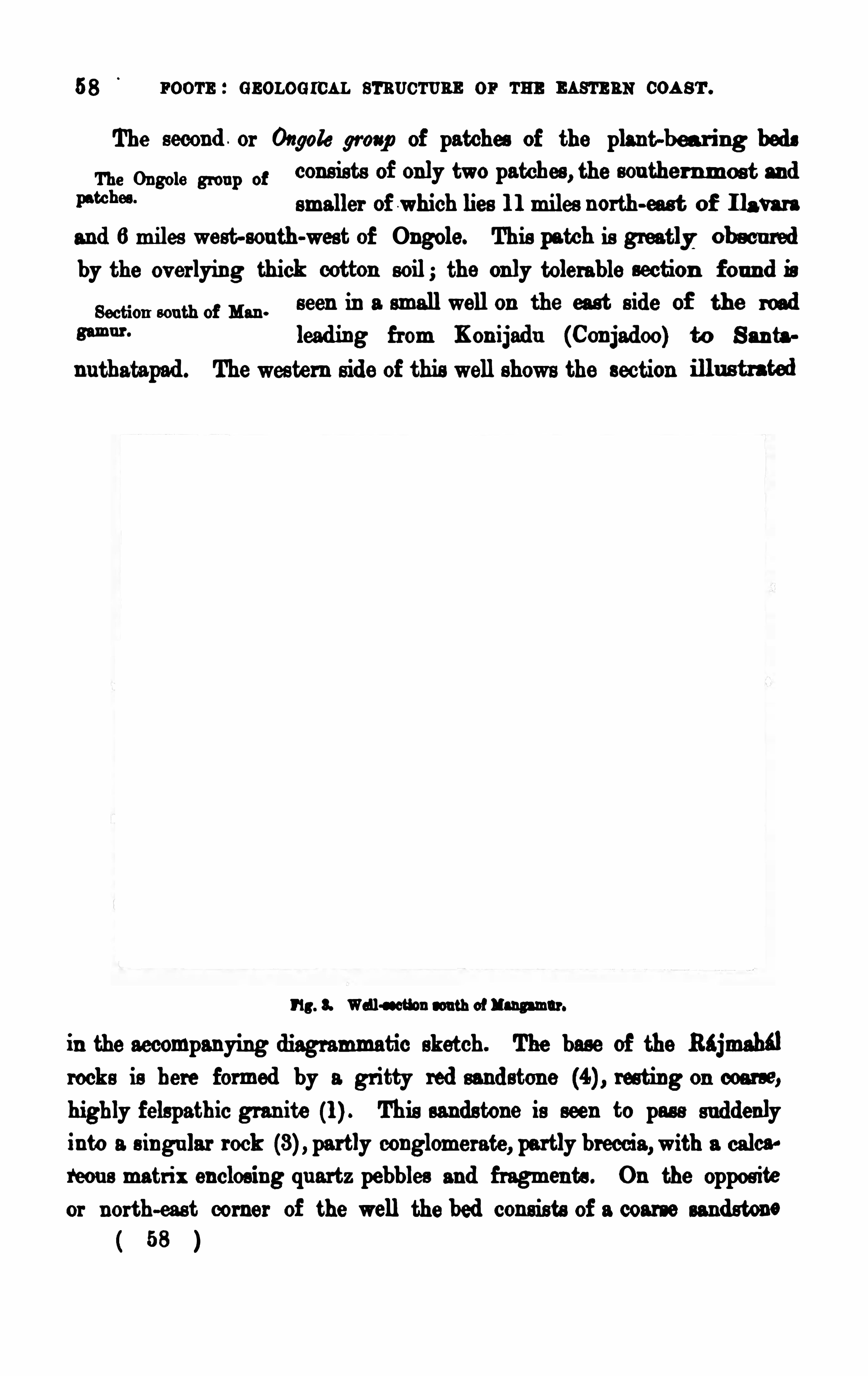
58 poor-s : GEOLOG ICAL sr s vcr s rm or m mam as coa s'
r .
The second . or Ongole group of patches of the plant-bea r ing bedsThe Ongole group of
consists of only two patches , the sou ther nmos t and
PW !“smaller of which lies 1 1 miles north-eas t of 1 1 a
and 6 miles west-sou th-west of Ongole. This patch is greatly; obmu red
by the ov erlying thick cotton soil; the only tolerable section f ou n d is
Section sou th of Mm .
seen in a smallwell on the east s ide of the road
8m “ lead ing from Kon ijadu (Conjadoo) to San ta
nu thatapad . The weste rn side of this well shows the section
1 13 . 8. Wall-ssctlon sou th of l angamnr.
in the accompanying diagrammatic sketch. The base of the Rajmahfl
rocks is here formed by a gr itty red sandstone res ting on coarse,
highly felspathic gran ite (l) This sandstone is seen to pas s su ddenlyinto a s ingu lar rock partly conglomerate, partly breccia,with a calca!
reou s matrix enclos ing qu artz pebbles and fragments . On the oppos iteor north-eas t corner of the well the bed consists of a coarse sandstone
53 l
s pu n oonnwm a sna i l s . 59
conglomerate, with some enclosed white quartz pebbles of large size,
by whitish shales (5) mu ch mixed up with hau lter, which may be traced
with d ificulty for a fevv hu ndred yards northward , and are then com
pletely hidden by cotton soil, which ex tends u p to and far beyond thev illage of Mangamu r (M u ngamoor) . In some well-sections sou th of
the v illage, bufiy brown sandy shales hav e been cu t through under a
bed of kanka rry later itic gravel. Thes e shales establish the connection
with some plant-bearing sandy shaly clays of drab-bufi colou r which are
M on a m p mexpossd near the hesd of a small stream a little to
the north-west of the small hamlet called Kama
pattewaripalem (Kaumaypu tty-v areepully) The plant remains are
u nfortu nately very fragmenta ry ; bu t amongst them I recogn ised a small
part of a Ph'
lq lhaa f rond ; u nderlying the shaly clays , of which a
thicknes s of 4 or 6 feet is seen, is a coarse friable micaceous sand stone
Rather more than a mile to the north of this section very simila r
bu t?and brown friable shales and sandstones show
in the road d rains and in various ballast pits , andin a fewwells of! the Ongole-Kambam high read , both on the slopeswestward to the Santa Nu thalaps d valley, and on the high ground to
the eastward . The s u rface of the shales is thickly covered by yellow
deeply into the greatly weathered su rface of the
shale beds , not only here, bu t also in ma ny other
s ections , somuch so that the yellowcolou r of the kankar always led me to
Yellowh nkar overly
extend north-eastward and northward from the high road down to the
v illage of Yendlu r , where th ey dis appear u nder the great allu vial flat
formed by the Mu digondi and G undlakamma rivers .
The high grou nd sou th of the high road was , at the time of my
v is it, covered by a very s ingular concretionary
calcareo-ferru ginous sands tone, of ten of jaspi
59
60 room : cs oworcn m s c'
ruas or m m u m com .
deou s textu re, the reddish yellowmass being largely permeated bymin u tes iliciou s v einlets and threads of lighter colou r . No organic remain s cou ld
be traced in this strange bed , nor could its relation s with the typical
plant bed s near-by be seen , owing to the great dev elopment of cottonsoil arou nd it. All that can be said of it is that it lay u n conformablyon the . gneiss . When I fir st v is ited it in May 1 875, it was beinglargely worked as revetmen t material for su ndry tanks and wells ; andby December of the same year I fou nd that bu t very little remained to
A spread of allu v ium, of 7 miles in width, lies between the
The yw am 3 m sou thernmost point of the Yendlu r patch of the
mm . 0 1 180 10 grou p of plant beds and the nearest ex
kammposu re of equ ivalent rocks belonging to the
Vemavaram grou p which occu rs on the north side of the G u ndlakamma
r iver at Gazulapadu , abou t a mile north -east of the travellers’ bungalow
at Velampalle (Valumpully)The G azulapad u section , which can only be seen when the r iver i s
qu ite low, shows very sandy kankarry clay, u nderlaid by orange and
brown rather friable sands tone and grits , pebbly gr its , and coarse conglomerate, all apparently part of one large variable bed . The conglomerate
contains fragmen ts of an old later ite ; and a number of boulders of an
The boulders are from 1 8 to 20 inches in diameter, and are themselves
su rrounded by the overlying allu v ium, which here forms a con s iderable
The sandstones and grit bed can be traced all along the base of theallu v ial clifis from Gazulapad u to Kirtipad u (Keerteepau doo) where it ishidden by a sandbank ; bu t it re-appears again in the nex t reach of the
river in the northern bank, and can be followed till nearly oppos iteNandipad u (N undeepau doo) when it disappears .
G rey or brown sandy shales—true plan t shales
shown , by means of well-sections both east and west of Nidamanu r ,
to occu r belowthe thick cotton soilwhich there forms the s u rface. They60
nr r s a cos nws rm sna res . 6 1
have also been tu rned u p from a deep well sunk at Kavu rupalem
(Cavoororpalliam), 2 miles north-east of Nidaman u r . Both these placeslie within limits of the Vemi varam patch, the most imwrtant and mos tinteresting expos u re of the Rajmahi l rocks in the G u ntur-Ongolecoun try ; bu t before proceed ing to the f ull description of the rocks here
met with, it will be better to refer briefly to three small and importantpatches lying at bu t smalld istances .
These are, firstly, the Bolav eram patch lying to the wes t, and the
he. BolaNagalupalapad u (Nagooloopalapau dod) and Cha
m n
c ulavad and
kfinfl p dm0 . du lavad u patches lying respectiv ely to the sou th
eas t and south-eas t-by-sou th .
The su r face of the Bolaveram patch is en tirely covered by the characte ris tic yellowkanlrar referred to as accompaying the plan t shales in the
Yendlu r and other more sou therly patches .
The Chadulvada and Nagalu palapad u patches are exposed only insolita ry sections , the former m the bed of a tank a mile and a half east
These two patches of shale are separated from each other by a greatu nbroken spread of cotton soil u nderlaid by a low ridge of gneiss bu t
the cotton soil is so thick and con tin uou s , that it is imposs ible to drawany bou nda ry lines between the u nderlying rocks .
Of all the represen tativ es of the Rajmahal rocks sou th of the Kistna,
are the most inte res ting and notewor thy, as theyconta in a larger number of both an imal and vegetable remain s , mostly inbeau tiful preservation , than any other beds met with elsewhere. The
pres ence among the animal remains of Coplalqmdc and Belin da -slats
es tablish the marine nature of the depos it beyond controversy .
The village of Vem‘varam, close to which these plant-bearingmar ine beds are exposed , lies 1 4 miles north-eas t-by-north of Ongole,and 8 miles inland from the coast, on the eastern slope of a low bare
( 61 )
62 FOOTE : GEOLOG ICAL STRUCTURE 0 1 TH] EASTERN COAST.
r idge of hard shale about three-qu arters of a milein length. The strike of the r idge is north-by
sou th it dies down u nder the great spread of
cotton soil which locally covers the coast allu
v ium. To the sou thwest it s inks into a lowneck
of groun d by which it is connected with a low
Uppu Gu am.m
the village of Uppu G undu r
(OOppco Goon door) , which also cons is ts of bedsof hard shale, which are nea rly ev erywhere base
and devoid of soil and v egetation . The two hills
form a pen in sula ju tting in to the great allu v ial
plain . To the west the r idge is join ed by a low
neck with the western half of the Vemi varam
patch .
The section given below shows the position of
the beds seen in the cen tral part of the Vemtiva
The beds shown in th is section , which coin
cides with a low depre sa'
on
cross ing the shale r idge a
little to the north-west of the v illage, follow indescending order as below
8 . su es. pu rplis h.
7 . Do., bu tfy .
6. Do ., softish, brown , white , and pu rple.
5. Do., hard ,with red and brown sands tone partings .
4. Do do ., pu tly daggy, with sandstone partings,
Details of section .
3 . Do thin , daggy. rather ha rd , bu d and wh ite,
fish bed .
2. Do., sandy, mottled .
1 . Sandstone, shaly, buny.
64 r oom : s now men . s'rnuc
'rnns or THB
'
nas'
rm coa s'r .
I twas the discovery°
of this Eryon on a loose piece of shale that led
me to look for the pecu liar and , till then , u nobserved bed it m u s t have
come from ; by excavating I procu red many of the finest and m os t im
portant specimens collected at Vemavaram, inclu ding nearly all th e fish
a s tely not be foun d, though most carefully searched for .
By some mistake or other, Dr . Feistmantel has u n fortun ately des
cribed the Eryon as hav ing been obtained from the Sripermatu r grou pwest of Madras , a ser ies of beds which probably represent a rather h igherhorizon than at the Vemfiv aram shales . The error of locality is con s iderable, as the two placcs are rather more than 200 miles apart . The
remarkable lithological similar ity between the typical Sripermatu r and
Vemavaram shales mu st have contribu ted not a little to the pos sibility of
s u ch a mistake hav ing been made .
The highest known member of the Vemtvaram group is a hard,
coarse, white shale, breaking in to large flaggy masses (which, as already
The beds .mentioned , are largely qu arried to the sou th of the
fossils , cons is ting of u ndetermin able stalks of plants , of bivalve shells
allied to Leda, and of thin shelled Ammonites , too much flattened by
coarse shales occu r to the sou th-eas t of the Vemavaram section first
described , andwould, if that section were extended su fficiently to the east,be seen to lie above, and probably immediately u pon , the pu rplish shales
No. 8, though it is pos sible that a small thickness of finer grain edwhitish
shales might in terv ene.
Very s imilar coarse flaggy shales form a thick bed exposed in n umer
w M ‘ i' 3“ little more than a mile north of Vemi varam r idge.
They are v ery likely a contin u ation of the Vomi
v aram flags , the only difierence they showbeing in colou r , which is not
pu re white, bu t white var iegated with delicate bands of red, pink, mau ve,64 l
u r r s a conov an seams . 65
pu rple, and occas ionally orange, arranged concentrically, and presentingsu rfaces of no little beau ty of colou r . The form of
those pattern s on the shale vary cons iderably, asthey are generally confined between the limits of a set of joints to whichthe concentric cur ves show a clear relation . Some examples
'
were
noticed several feet in diameter, others only a few inches , bu t these
latte r were generally independent of any visible joints . NO Ammonites
were fou nd in the Ra zpu di bed, bu t the other
foss ils agreed with those from the Vemtvaram
flags , m d, like them, are ill-preserved, many being blu rred by an
incrustation of extremely min u te quartz crystals . Fragmen ts of Die
tyozara ites and Ptilofl yllm were the only recognizable plants metwith
Th eir colou r .
Foss ils found a Baspudi.
In their mode of preservation and condition of occu rrence, the Vomi
matu r . In the great major ity of specimens the impremions or cu ts arestained of some colou r difierent to that of the enclosing shale.
The colou r,which is generally some shade of red or pu rple.more rarely
r u n. vm m black or brown , is in most cases confined to the
organ ismwhich, for that reason , contrasts s tronglywith the matrix . The plan t remains are all fragmentary, many of themvery mu ch so, showing that they mu st hav e been washed ou t to sea as
torn-off leav es or fronds , bu t speedily embedded , as they show no
m a “0, msigns of decay. The shells are frequently crushed
tion and it indie-tion. by press u re super vening after they were bu riedin the mud , bu t v ery few show s ign s of prev iou s inju ry, and in a
v ery large percentage the two valves of the pelecypodou s shells
remain in Oppos ition , showing that the liv ing animal had not been
that the shales were depos ited in a rather shallow tranqu il sea .
a 65
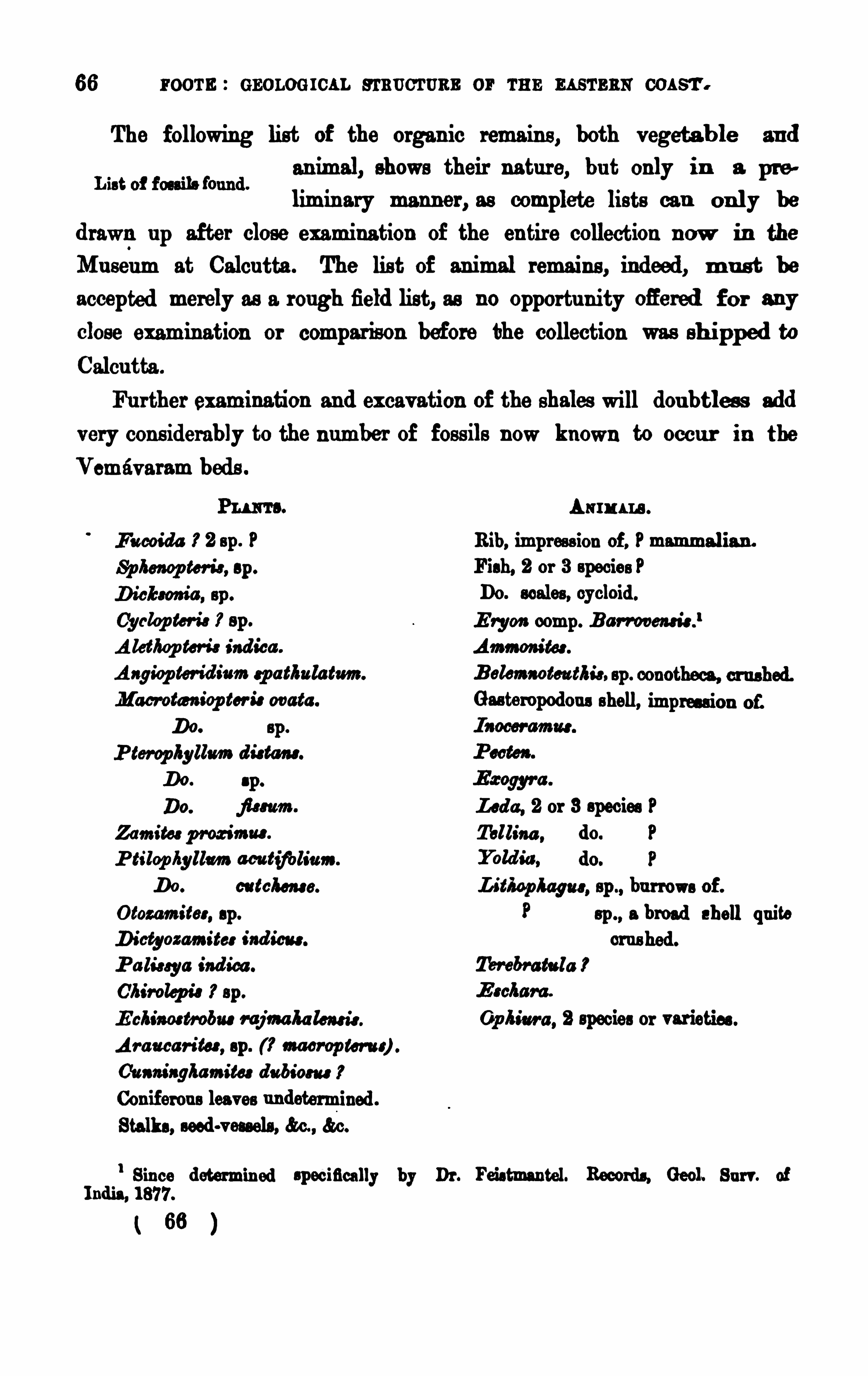
66 room : GEOLOG ICAL s rnoc'rs as or r u n m s
'rs ns
The following list of the organ ic remains , both v egeta b le an d
an imal, shows their natur e, bu t only in a pr e
limin ary manner , as complete lists can on ly be
d rawn u p after close examination of the en tire collection n ow in the
Mu seum at Calcu tta . The lis t of animal remains , indeed , m u s t be
accepted merely as a rough field list, as no opportu n ity Oflered f o r any
close examination or comparison before the collection was shi pped to
Calcu tta .
Fu rther examination and excav ation of the shales will dou btles s add
very cons iderably to the n umber of fos s ils n ow known to occu r in the
Vernav aram beds .
F u coida 3’ 2 sp . PSp heaop ter is , sp .
cyclop tor is sp .
A la /lep ton } ind ica .
Angiop ter id ium sp a tlmlatmn .
M acrotcs a iop tor i: ovata .
Do. sp .
P terop hyllm d iatom.
Do. sp.
Led a , 2 or 3 species PZamitor pmz imus . Tellina , do. PP tilop hyllm acu tifols
'
u as .
Do. catch er s . Lit/UPWW . sp ., bu rrows of .
Otozamitcr , sp. sp ., a broad shell qu ite
Dictyozamiter ind icate. crus hed .
P a lis sya ind ies . M M tu la P
Chirolep is 3’sp .
E chim trobu s r ajma ha lemis .Op him . 2 species or var ieties .
Ar a u ca r ites , sp. macrop ter u r) .
C'u am'
agkamita d u biou s
Con iferou s leaves u ndetermined .
Stalks , seed-vessels , &c., &c.
l Since determin ed specifically by Dr . Feistmantel. Records. Geol. Bu rr . ofI nd ia, 1 877.
( 63 )
Asm ara .
Rib, impres s ion of , P mammalian .
F ish, 2 or 3 species PDO . scales , cycloid .
E rgo» comp. B ar rooeas is .
‘
Ammom’
tos .
UPPER GONDWANA SERI ES .
T heft-lcetera includes at least three more u ndetermined plants of whosebotan ical afin ities I was in doubt, bu t cou ld obtain no solu tion fromthe books of reference at my command . The stalk-like remain s also
probably inclu de sev eral species yet to be determined , as they show
cons iderable v ar iety of marking and branching.
Though s imilar in gen eral appearance to the Vemavaram bed s , theUppu G u nd u r beds d ifier in being gen erally v erypoor in fos s ils . The most importa n t fos s ils fou nd
here were a fewAmmon ites of small s ize, bu t u n fortu nately they a re
L'
ppn Gu nd u r beds .
too mu ch cru shed for specific dete rmination . Owing to the grea t sheet
of cotton -soil between the two hillocks , the real relation ship between thes everal beds compos ing them cannot be determined pos itiv ely, bu t the
p robability is , the Uppu G u nd u r bed s overlie the Vemi varam shales .
As before men tioned (page the coarse fiaggy ammon itiferou s shale
exposed in small qu a rries between the two hillocks mu s t be looked u pon
as a sou thern ex tens ion of the Ra zpu di flaggy bed s . The beds on the
bill are in parts horizon tal to the nor th-eas t and eas t they dip corres
pondingly, and they also make a slight roll to the wes t. They are more
mas s ive than the beds on Vemrivaram ridge .
To the wes t of Vemavaram r idge, cotton -soil cov ers ev erythingthickly, till the grou nd rises again beyond the old Mad ras -G u n trir road .
Barely perceptible traces of the plan t-beds are seen eas tward of
Kallagumta . A little gr itty sands tone is seen at
K ista razpalem, bu t at Pyind ipad sandy shales and
f riable sandstones are cu t through in several well-sections . NO fos s ils
were seen in these bed s , which are u nderla id to the nor th-wes twa rd bybrown gr itty sands tones , which showclose to the bou ndary of the gneis s ,on which they dou btless rest.
Sou th of Pyind ipnd tank is a band of hard gr itty sands tone extend
Annwd h m rpd ming f rom the ea st end of the An na v allawarpalem
“W m " “4“m tank n orth-eas twa rd n early to K is ta razpalcm.
No fo s s ils were seen in this sand s tone,which is of va rying colou rs , ranging67
Shales at Pyindipad .
68 more : GEOLOG ICAL su mm er or r n r. u s'
rs as cou rt.
from dark blackish-brown to grey or drab. I t re sts u pon the granito id
gneis s close to Kallagumta v illage . Sou th of the hard sands tone, a n d
probably ov erlying them, come soft fr iable gr itty s andstones and sh aly
clays . The latter are of dr ab colou r , the former orange to reddish o r
M t.rm in “my drab, and fu ll ‘
of impress ions , in bright rod, o f
clays .
pin n u la of a small v ariety of Dictyozamites id eas are most common ly
recogn izable, Ptilopfiyllum acu tzf oh'
um being also presen t, bu t much les scommon . The d ip of these beds is westerly from 3
°
to A little
f urther sou th still are coppery-red mottled sandy clays , with orange
to reddi sh-brown gritty sandstone, lying close to, or actu ally on th e
gneis s .
A shallowallu v ial v alley, nearly 2 miles acrom, div ides the Vomi
varam patch from the next northern patch, whichlies aroun d the v illage of Nu cherlapalle (Noocherla
pally) . The beds here seen in well-sections are white and mottled shales ,
v ery like theVemi varam r idge beds ; bu t, u nlike these, they are very poorin fos sils, a long search only yielding a single specimen —a thin , broad ,biv alv e shell, cru shed flat by pres s u re, of a species very common at Vomi
varam. The beds showa d ip of from 1 0° to to east-by-sou th . Sandy
shales are seen in a smallfield well, about a mile to the wes tward, am to
The next patch Of Rajmahal rocks, proceeding northward , is the
Bu davada (Boodhawadah ) the sou thern point of
which lies 8 miles to the north-north-east,
near Gangavaram where shaly bufi sandstone is s een in well-sections
west an d sou th-eas t of the v illage. Similar shaly sand stones and sandyshales begin to appear in smallfield sections as the v illage of Bndav i da
is approached from the sou th, and in the bottom of a tank lately con
su l, M an , d stru cted abou t half a mile eas t-by-south of th e
main v illage. Here a few score square yard s of
shales were to be seen when the tank bottom was d ry they are u nder
la id by, or in tercalated with, friable soft sand stone, also of whitish to63 l
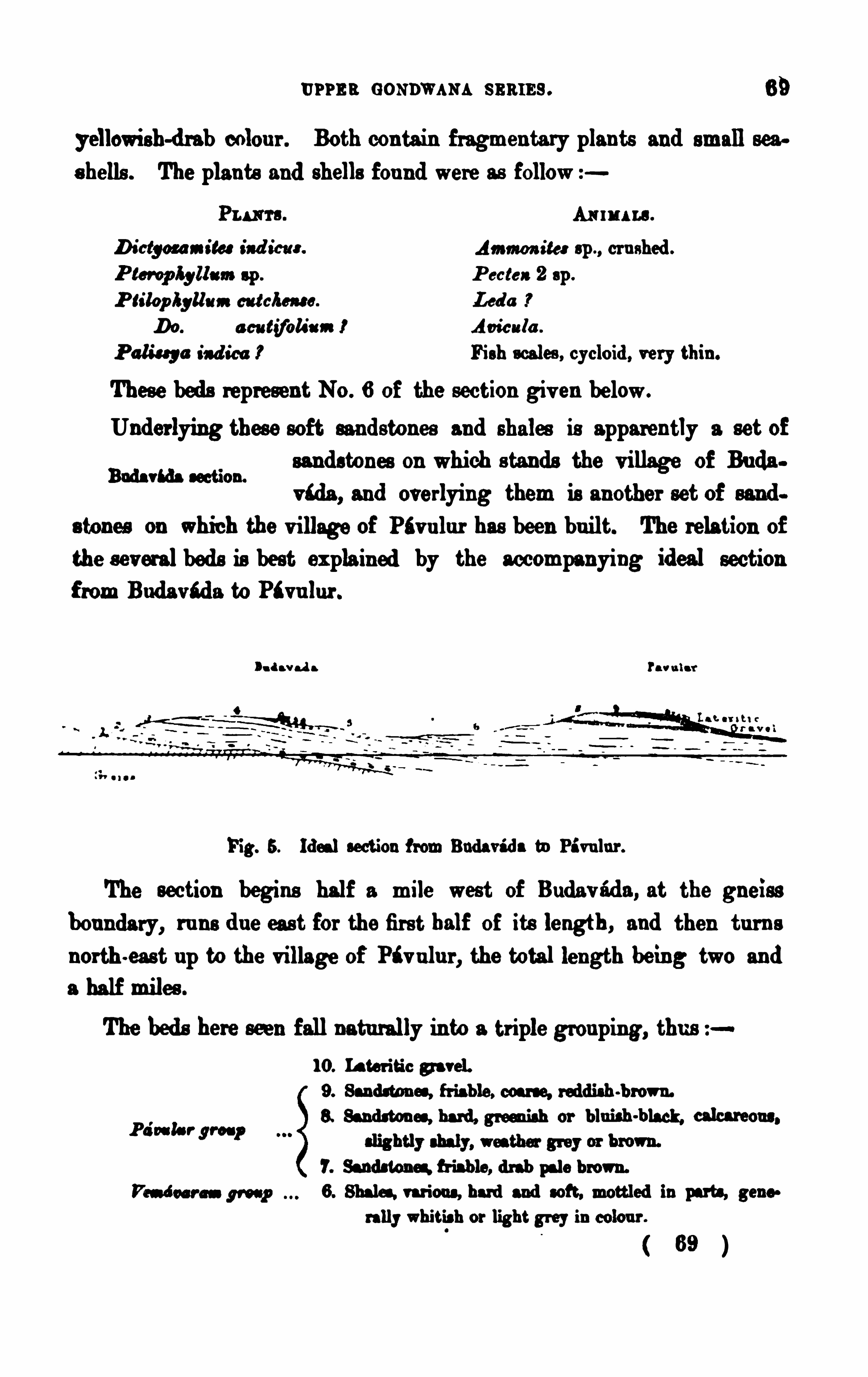
u r r s s GONDWANA s nares . 69
yellowish-drab colou r . Both conta in fragmen tary plants and small seep
s hells . The plants and shells fou nd were as follow
Pu ma. Arm u na.
D ictgm ra ita ind ict“. Ammon ia : sp ., cr u shed .
P cctea 2 sp .
P lilop lyllmn catches“. Led a
Do. a cu tifcls'
am I Acicu la .
P alisq a ind icts P Fish scales , cycloid , very thin .
These beds represent No . 6 of the section giv en below.
Underlying thes e soft sandstones and shales is apparently a set Of
sandstones on which s tands the v illage Of Bu da
v‘da , and overlying them is another set of sand
s tones On which the v illage of Pfiv u lur has been bu ilt. The relation of
the s everalbeds is best expla ined by the accompanying ideal section
f rom Buda v i da to Ptvu lu r .
Buds vtda section.
Da d a v ad a Pawu la r'
Fig. 5. Ideal section f rom Budav i d a tn Pi vu lu r .
The section begins half a mile west of Budav ad a , at the gneiss
bou ndary, ru ns d u e cas t for the firs t half of its length , and then tu rn s
north -east up to the v illage of Pi v ulu r , the total length being two and
a half miles .
The bed s here seen fall naturally into a triple grou ping, thu s1 0 . Later itic g avel.
9. Sandsumes , fr iable, coars e, reddish-brown.
blu ish -h calcareP a
'
ss la r gr oup8. Sand ston es , hard , green ish or lack, one.
7. Sand stone; fr iable, drab pale brown.
F’s-d u r ess W 6. Shales. var ious , hard and soft, mottled in parts, gene
rally whitis h or light grey in colou r .
69 l
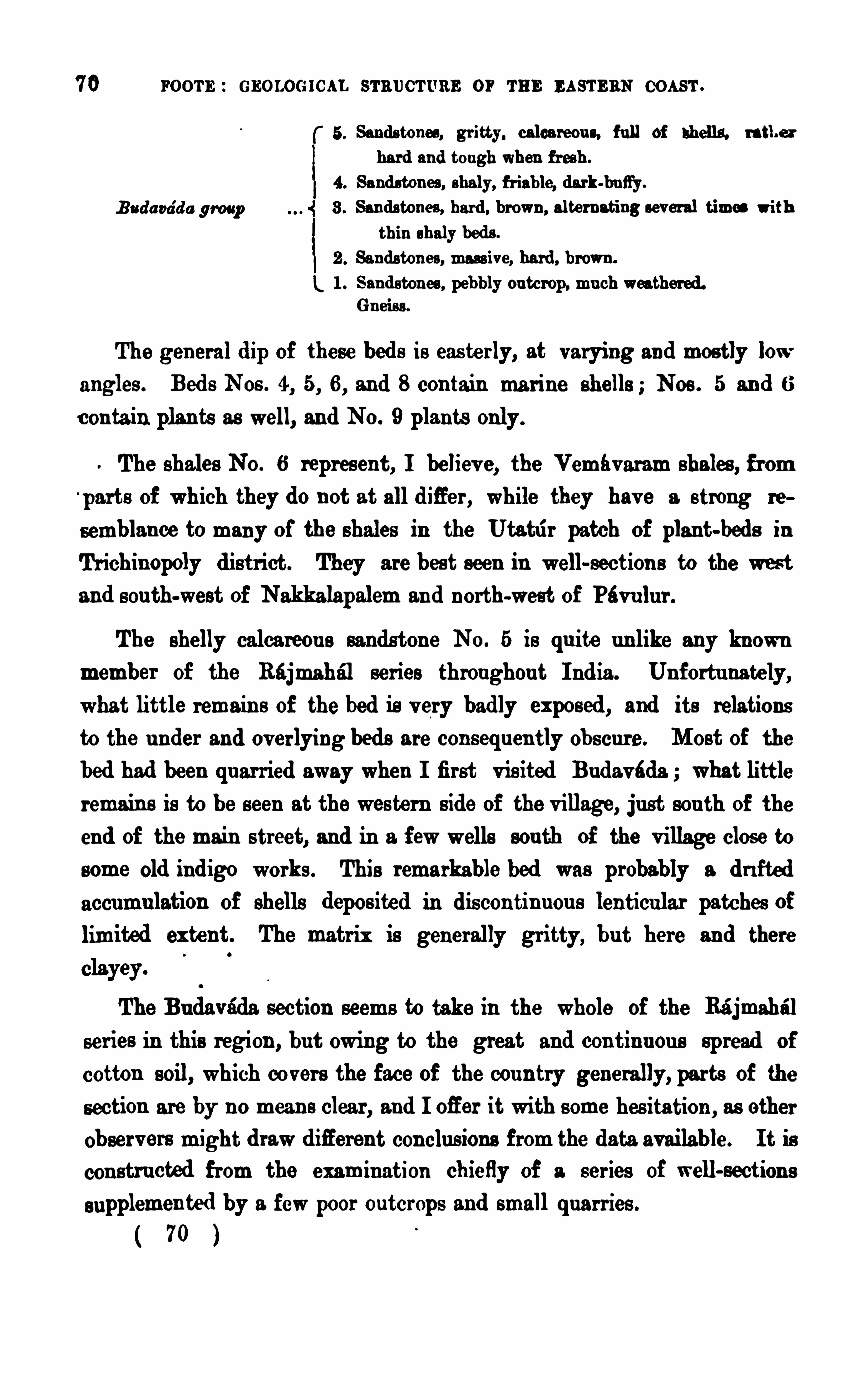
70 FOOTE : GEOLOG ICAL sr a ucr u ns or THE EAs'
rEnN COAST .
B a da ea’
d a group
The gen eral d ip of these bed s is eas terly, at varying and mostly lowangles . Bed s Nos . 4, 5, 6, and 8 contain ma rine shells ; Nos . 5 an d 6
con ta in plan ts as well, an d NO . 9 plants only.
The shales No . 6 repres en t, I believ e, the Vemtv aram shales , f rom
parts of which they do not at all difier , while they hav e a s trong re
semblance to many of the shales in the Utatrir patch of plant-beds inTr ichinopoly district. They are best seen in well-section s to the westand sou th-west of Nakkalapalem an d north-west of Pévu lu r .
The shelly calca reou s sandston e NO . 5 is qu ite u n like any knownmember of the Rajmahal ser ies throughou t I ndia . Un fortu na tely,what little remain s of the bed is v ery badly exposed , and its relations
to the u nder and ov erlying beds are con sequ en tly Ob scu re. Most of the
bed had been qu ar ried away when I fir st v is ited Bu davéda ; what little
remain s is to be seen at the wes tern s ide of the v illage, ju st sou th of the
end of the main s treet, and in a fewwells sou th of the v illage close to
some Old ind igo works . This remarkable bed was probably a d r i fte d
accumu lation of shells depos ited in dis con tin u ou s len ticu lar patches oflimited ex tent. The matrix is generally gr itty, bu t here and there
The Bu davada section seems to take in the whole of the Ra'
jmahr’
rl
series in this region , bu t owing to the great and con tin u ou s spread of
cotton soil, which covers the face of the cou n try generally, parts of the
section are by n o mean s clear , and I ofier it with s ome hes itation , as other
observ ers might drawd ifleren t con clu s ions from the data available. I t is
con stru cted from the examination chiefly of a ser ies of well-section s
supplemen ted by a fewpoor ou tcrops and small qu arr ies .
( 70 )
Sands tones , gr itty, calca reou s, f u ll of shells . rathe r
ha rd and tough when fr esh .
Sand stones , shaly, fr iable, dark-ba tty .
Sands tones , hard , brown , alternating several times with
thin shaly beds .
Sands ton es , mass ive, hard , b rown .
San ds tones , pebbly ou tcrop, mu ch weather ed .G neis s .
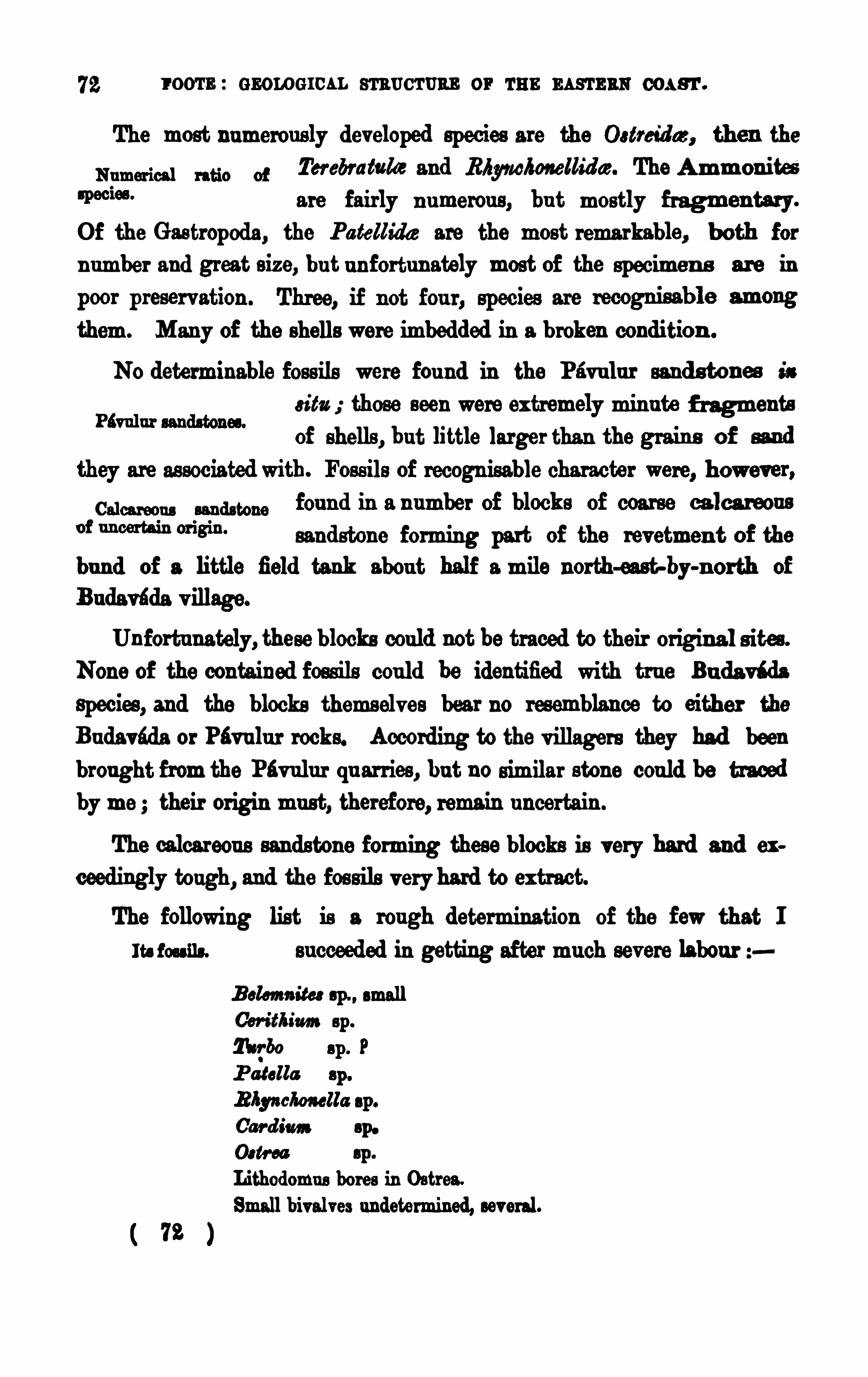
I OOTE : GEOLOG ICAL STRUCTURE OF THE EASTERN COAST.
The most numerous ly developed species are the Ostreid az, then the
Numer ic“ " 50 of Ter ebratake and Rfiyrwkorwllidaz. The Ammon ites
are fairly n umerous , bu t mostly fragmen tary.
Of the Gastropoda, the Patellidae are the most remarkable, both for
n umber and great s ize, bu t u n for t u n ately most of the specimen s ar e in
them. M any of the shells were imbedded in a broken condition .
NO determinable foss ils were fou nd in the Pavu lu r sand s ton es is
s its those seen were ex tremely min u te f ragmentsof shells , but little larger than the grain s of sand
they are as sociated with. Foss ils of recogn isable character were, however ,calm “, m am“ fou nd in a n umber of blocks of coarse calca reous
°f “m “is“ sandstone forming part of the revetmen t of the
bu d of a little field tank abou t half a mile north-east by-n orth of
Budavada v illage.
Unfortu nately, these blocks could not be traced to their original s ites .
None of the contained foss ils could be identified with tru e Bu da v i da
Species , and the blocks themselves bear no resemblance to either the
Budavada or Psvulu r rocks. According to the v illagers they had beenbrought from the Pév ulu r qu arries, bu t no similar stone could be traced
by me ; their origin mu st, therefore, remain u ncertain .
The calcareou s sandstone forming these blocks is very hard and ex
ceedingly tough, and the fos sils v ery hard to ex tract.The following list is a rough determination of the few that I
It. foss ils. su cceeded in getting after mu ch severe labou r
B elcmm'
tes sp., small
Car d im sp.
Och-ea sp .
Lithodomus bores in Ostrea.
Small bivalves undetermined, several.
( 72 )
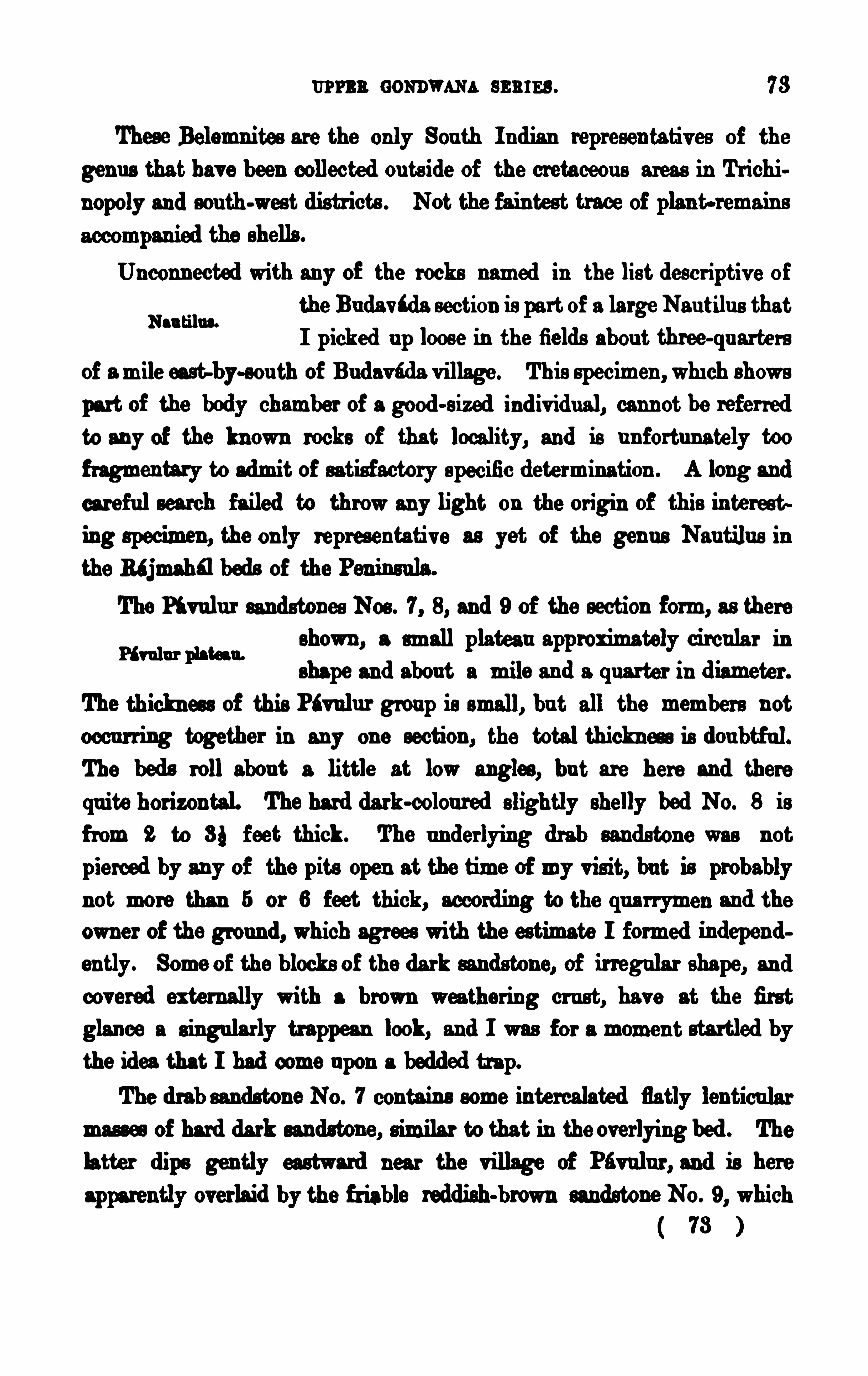
u rn s oommma ss u rs s . 78
These Belemnites are the only Sou th I ndian representatives of the
genu s that have been collected ou ts ide of the cretaceou s areas in Tr ichi
now and sou th-west districts . Not the faintest trace of plant-remain s
Unconn ected with any of the rocks named in the list descriptiv e of
the Budavtda section is part of a large Nau tilu s thatI picked u p loose in the fields abou t three-qu arte rs
of a mile east-by-sou th of Budavfida v illage . This specimen ,whi ch shows
part of the body chamber of a good-s ized ind iv idu al, cannot be refer redto any of the kn own rocks of that locality, and is u n fortu nately toofragmen tary to admit of satisfactory specific determination . A long and
careful search failed to throwany light on the origin of this in terest
ing specimen , the only representative as yet of the gen u s Nau tilu s in
the R‘jmahfl beds of the Peninsula.
The Ptvulu r sandstones Nos . 7, 8, and 9 of the section form, as there
shown , a small plateau approximately circula r inshape and abou t a mile and a qu arter in d iameter .
The thicknes s of this Ptvulu r group is small, bu t all the members n ot
occu rring together in any one section , the total thickn ess is dou btf ul.The beds roll abou t a little at low angles, bu t are here and there
qu ite horizontal. The hard dark-colou red slightly shelly bed No. 8 is
f rom 2 to 8} feet thick . The underlying drab sandstone was not
pierced by any of the pits Open at the time of my vis it, bu t is probablynot more than 5 or 6 feet thick, accord ing to the qu arrymen and the
owner of the ground, which agrees with the estimate I formed independen tly. Some of the blocks of the dark sandstone, of irregular shape, andcov ered externally with a brown weathering cr u st, have at the first
glance a s ingularly trappean look, and I was for a momen t startled bythe idea that I had come u pon a bedded trap.The drab sandstone No. 7 contain s some intercalated fiat]y lenticu lar
mas ses of hard dark sandstone, similar to that in the overlying bed . The
latter dips gently eastward near the village of Pévulu r , and is here
apparently overlaid by the friable reddish-brown sandstone NO. 9, which
73
Nau tilu s.
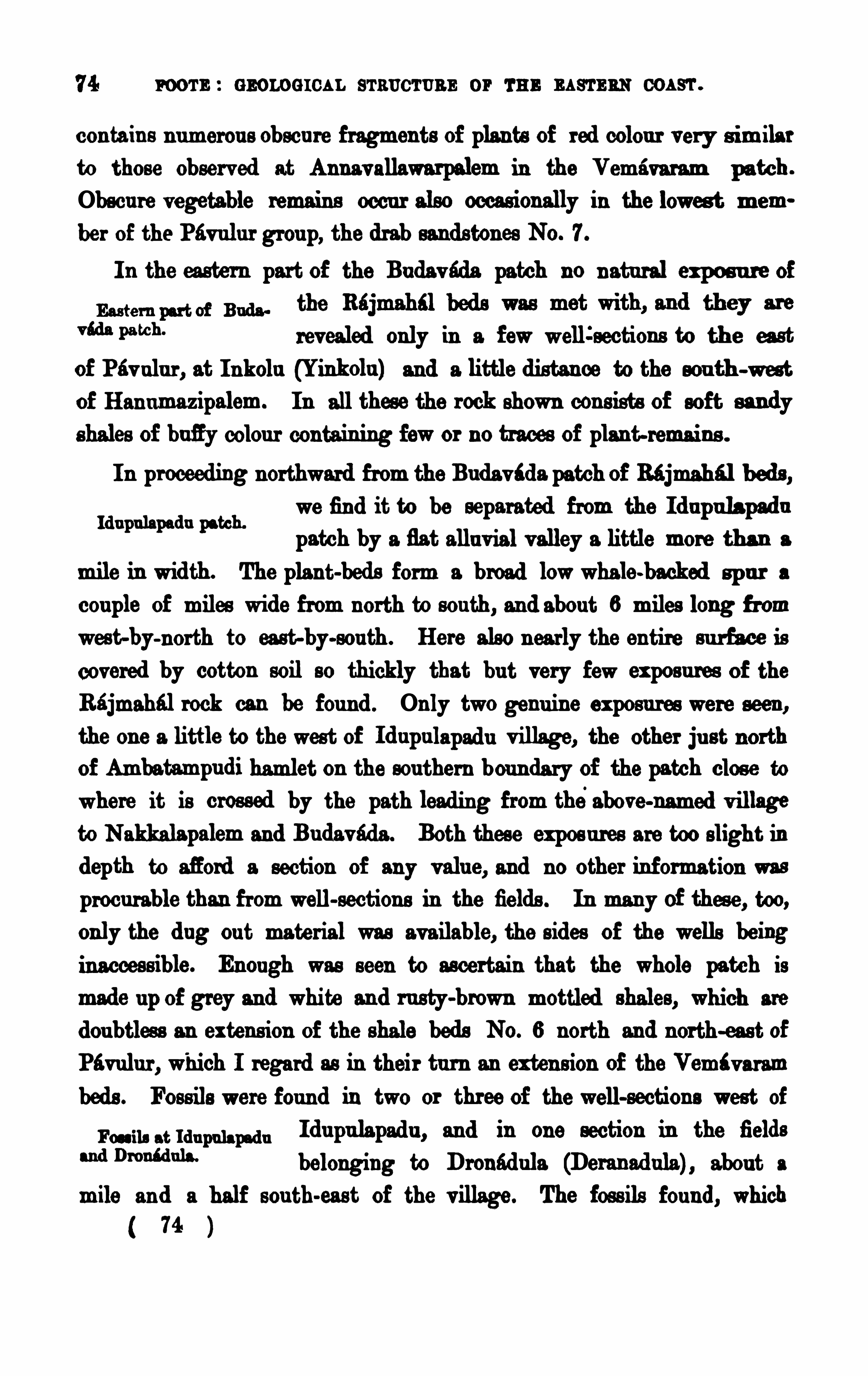
74 room : GEOLOGICAL s'rs ucr u ns or r u n m s
'rs as com .
con tain s n umerou s obscu re fragments of plants of red colou r very s imilar
to those obser ved at Annav allawarpalem in the Vemavaram patch .
Obscu re vegetable remain s occu r also occasionally in the lowes t mem
ber of the Pavulu r grou p, the drab sandston es NO. 7.
I n the easter n part of the Bu dav éda patch no n atural expos u re of
“a“Pa tch“ revealed only in a fewwelli sections to th e east
of Pav alu r , at I u kola (Yinkolu ) and a little dis tance to the sou th -west
of Han umazipalem. In all these the rock shown con s ists of soft san dyshales of bufiy colou r contain ing fewor no traces of plan t-remains .
I n proceeding northward from the Budav i da patch of Rajmahal beds ,we find it to be separated from the Id upulapad u
patch by a fis t allu v ial v alley a little more than a
mile in width . The plant-beds form a broad lowwhale-backed sp u r a
cou ple of miles wide from north to sou th, an d abou t 6 miles long f romwest-by-north to east-by-sou th . Here also n early the entire su rface is
covered by cotton soil so thickly that bu t very few exposu res of theRajmahal rock can be fou nd . Only two genu ine exposu res were seen ,
the one a little to the west of Id upu lapadu v illage, the other ju st northof Ambatamwdi hamlet on the sou thern bou ndary of the patch clos e to
where it is crossed by the path leading from theabove-named v illage
to Nakkalapalem and Bu davada . Both these expos u res are too slight in
depth to sfiord a section of any v alu e, and no other in formation was
procu rable than from well-sections in the fields . In many Of thes e, too,only the d ug ou t material was available, the sides of the wells beinginacces s ible. Enough was seen to ascertain that the whole patch is
made u p of grey and white an d ru sty-brown mottled shales , which are
dou btless an extens ion of the shale beds NO. 6 north and north-eas t of
Pavu lu r , which I regard as in their tu rn an exten s ion of the Vemi v aram
beds . Foss ils were fou nd in two or three of the well-sections wes t of
Fu n, atmu pmp d u I du pu lapadu , an d in one section in the fields
“4”mm“ belonging to Dronad ula (Deranad ula) abou t a
mile an d a half sou th-east of the v illage. The foss ils fou nd, which74
Idu pu lapadu patch.
76 room : GEOLOG ICAL sr au c'ronr or wa s EASTERN COAST .
of Pu nu r , where mottled shales , precisely s imilar to those occu rr ing to
the sou th-eas t of Dronadu la and west of I d u pu la
pad u , have been cu t in to abou t a cou ple of feet,
and u sed in strengthen ing the tank mu d . A cu rsory examina tion of
these shales , which are moderately rich in organ ic remain s , yielded
Pan u r tank section .
Prams .
Ad am II
P tilop loyllum a ca t'
y‘
olium. Yold ia Imi nu te.
P ter op kyllm sp .
West of the v illage the shales become more sandy in character and
appear to pass in to , or are replaced (u nderlaid ) byfr iable sandstones which mu st rest u pon the
gneis s . Bufi'
y friable sand stones are exposed , but
v ery badly, in well sections in the n orthern lobe of the Pu n u r patch, atthe v illages of Gannav aram and Yanamadu li
Shales replaced
The Gannav aram sandstone contain s a great qu an tity of highly decomposed granite gn eis s , and is very clayey. I n the n orth-eastern lobesof the patch , bufiy fr iable shaly sandstones are ex posed under thickcotton . soil, and some lateritic gravel in severalwell-section s between thev illages of Zagarlamu di and Tan uhu divar ipalem
The Pu n u r shales ex tend f ully a mile and a half north-eastward of theexposu re in the tank bottom ju st referred to , and have been tu rned up
in the ba nd of a small tank by the side of the road to Polu r . Whitestifi mottled fine-grained sandy shales have also been cu t into in making
the bund s of the tanks at Vankoelupadu and Nu talapadu in the eastern
lobe of the Punu r patch .
Northward of the Pu nu r patch comes a spread of allu v ium which
hides all the Rajmahal rocks for a distance of
1 1 or 1 2 miles . The first patch of the ju ri ssic beds to be fou nd here occu rs at KOpparu , which stands at the
northern end of a pen ins ula-like spu r of slightlyK h .opps ru pm
raised grou nd stretching sou th from the sou thernend of the Kondav id u hills .
76
The Guntfir group.
u r r s n GONDWANA scan . 77
The beds here exposed in variou s wells are sandy shales and thick
bedded friable bufiy sands tones , apparently con tain ing no organ ic remain s .
Similar friable sand stones occu r (also in well sections ) u n der later itic
gravel a little to the east and north-east of Karchola (Kartibola) That
these bed s and others as sociated wi th them ex tend fu rther eas tward
u nder the allu v ium is proved by the fact that s imilar beds , typical sandyshales , and white and mos tly mottled clayey shales are penetratedby the deeper wells s u n k through the ov erlying thick cotton soil
and lateritic and kankarry beds at Gorizagolugu ntapalem and at
Ra v ipad u , lying respectively 2} and 4} miles
eas t-north-eas tof KOppar u . These section s indicate
the ju nction of these beds with s imilar beds in the two Rajmahfl
inliers of Chebrolu and Tangellamu di, on the western border of the
Kistna delta .
Retu rn ing to the wes tward we shallfind pale bufiy shaly s ands tone
and sandy shales u nderlying lateritic gravel at Chin a Kondrapad u , 1 0
miles sou th-west of G u n tri r.
The next sections of Rajmahsl beds to be noticed occu r at G u nttir
its elf, where coarse, fr iable, gritty, pebbly sand
stones are expos ed in variou s well-sections in the
western part of the town . These gritty beds cons is t entirely of gneissdebris . The best section is afiorded by an old u nwalled bowrie (squareM an. a n “and well) close to the north gate of the compou ndW“ belonging to the Ju dge’s house. Abou t 1 2 feet offriable gritty sandstone of extreme coarseness , locally qu ite a conglo
merate, and penetrated by large numbers of kankar vein s r unn ing
in variou s sets , is here seen . One chief set of these kanka r veins
appears to ind icate the true d ip of the otherwise u ns tratified bed . The
d ip, if it be thu s really ind icated as su pposed , is sou th-easte rly at
a lowangle. No s igns of any organ ism could be seen . A similar bu t
much deeper and totally inaccess ible section is to be seen close byin a large well s unk by Mr . John Rohde, o.s .
,when Judge of
G untdr .
Shales a Ravipad u, s o.
( 77 )
78 r oom : GEOLOG ICAL STRUCTURE or THE EASTERN coasr .
Similar gr itty sand s ton e was tu rned ou t in small qu antity from the
bottom of the mu nicipal filtering tank at the north end of the great
ir r igation reservoir known as the Black Tank.
Separated from the G u n tur sections by a band of allu v ium v aryingfrom St to 9} miles in width are the two Rajmahal inliers , already
Chebrolu and Tm ], referred to sev eral times , of Chebroln and Tan
l‘m‘fl i inliers .
gellamu di. These two in liers form a low bu t
well-marked r idge ru n n ing 1 4} miles through the allu v ial flat in a
v ery n early du e n orth-eas t-to-sou th-west d irection , with only one breakthrough which flows the G u n tur n ullah , which falls in to the Old
Tungabhad ra,”the mos t wes terly branch of the Kis tna in the delta .
The ridge has an av erage width of abou t 2 miles,roughly speaking.
I t is the more con spicu ou s f rom being generally covered with red
sandy soil, which con tras ts strongly with the dark black r egu r which
cov ers the s u rrou nding allu v ium flat.
Here, as elsewhere in th is region , n o satisf actory section is to be
No good sections to befou nd showing the relation of the v a riou s rocks
compos ing the inliers , and con s iderable u ncertaintyex ists abou t their stratigraph ical pos ition .
A fr iable gritty sand s ton e, in many respects a good deal like theG u n tur beds , is exposed in a n ewwell to the sou th
west of Kolakalu r , at the extreme n orth end of the
Tangellamu d i inlier . The relation of this to the redd ish and pu rplish ,hard , gritty sandstones at Tangellamu di, and the soft and pu rple mottledsand ston es at Kazipett (Khabampeta) is qu ite problematic, and there areno in termed iate section s to throw light on this poin t
,for , in the three
qu arter mile distance between Kazipett and Kolakalu r and the 2} miles
between the latter place and Tangellamu di qu arr ies there is room for a
v ar iety of changes of pos ition . Similarly, in the Chebrolu inlier it is
qu ite dou btfulwhether the hard sands ton es forming the northern half ofthe in lier lie u nder or over the soft shaly beds forming the sou thern half.I n this case, however, I was able to form the conclu s ion that the hard
73
80 room : GEOLOG ICAL sr nnc'rnas or r an as s
-runs com .
(Mu tn u r) is approached, where a number of well-sections show the
I n a well ea st of the road to Chebrolu and a little to the north of
Mu tlu r the following section is seen :
3 . Sandstone, friable, bufl'
2. Sandy clay }6 feet.1 . Clay white (slightly mottled yellow, red and dark-grey).
The white clay is chiefly below the water-level. The beds appear tod ip eas t
-by-north , at
On the highest grou nd more to the north of the v illage, severalwells
showrather friable gritty sands tones of pale mottled bufi pink and pu r
plish colou rs ; lateritic gravel 2’-5
'
thick rests u pon these.
To the west and south-west of the v illage the sandstones have a
sou therly dip, and the thicknes s of the la teritic gravel overlying them increas es u p to 8 or 1 0 feet. None of the beds at Mu tlu r yielded any
foss ils , though they were carefu lly examined .
The last case of rocks that might poss ibly be referred to the Bi jmahal series mu st now be men tioned . I t occu rs
end of the Bezwada anicu t, and 3 miles east-by-north of Mangalagir i,
where a very smallpatch of coarse conglomerate, resting on the gneis s ,
disappears eas tward under the allu v ium of the delta . This conglomerate
con s ists of pebbles of quartz, some of gneis s and a few of quartzite,u n ited by a lateritic matr ix showing true vermicular cav ities , where the
in clu ded pebbles are not v ery n umerou s . The bed dips at from 8° to 5°
to eas t, and abou t 3 0 feet in thickness of it is exposed . No fos sils wereseen in it, so its age can only be inferred on other grounds . On petrological grou nds it is not assignable to the Rajmahal beds , though its
from the ordinary lateritic formations of the su rrounding cou ntry, nor is
there any stratigraphical connection with close]y adjoin ing lateritic
30 l
u r r s n aos nwm s m m . 81
gravelwhich contain s chipped stone implements . The great coarsenes s
of this conglomerate and its s tratigraphical pos ition both u n ite in s ug
geeting that it may be of the age of the immensely coarse Rajahmundryconglomerates , recogn ized by Mr . King as equ ivalents of the Cuddaloresandstones . The only dificulty in regarding the I ppatam congio
merate as represen tative of the Rajahmu ndry bed s, lies in the con
s iderable distance between the two formations withou t any intermediate
I t will hav e been seen in the foregoing page that the beds whichmay, with good reason , be regarded as extens ion s
rm u
gnfipxm:of the Vemavaram grou p can be traced northward
from Vemavaram for a distance of more than 20
miles , and the evidence of the foss ils obtained at Buda vada, Dronadu la,
and Panu r qu ite confirms the ded uction made on stratigraphical andpetrologicalgrounds . Beyond this poin t petrological resemblance is theonly gu ide in correlating the d ifieren t grou ps of Rajmahal rocks thathave been metwith in the G u ntri r cou ntry. The petr ological resemblancesto the sou thern rocks found in these northerly patches ju stify the
ass umption that the tr iple su b-div ision fou nd to hold good in the sou th
may reasonably be extended to the north . The sandston es of Kartichola and Kopparu and the gritty bed s of G u n tdr, may be fairly classedwith the sandstones of Annavallawarpolliam Bu davtda , Pan u r, and
Gannavaram ; while the shales of Rav ipadu , Gorizagolugu ntapalem, and
Mu tlu r represent the Vem‘v aram shales , and the pu rple sandstones of
Chebrolu and Tangellamudi represen t the dark sandstones of the
Pav ulu r grou p.The Upper Gondwana beds occu rr ing north of the Kistna have been
comm on of Gun tri rs imilarly div ided by Mr . King (Record s Geological
Ongole stigma with Sur vey of I nd ia, Vol. X, page 56 1 877) in toM “ w
three s ub-divisions called respectively the
( 81 )
82 r oom : GEOLOG ICAL sraucr u na or Ta r m sr rmwcoas 'r .
Whether this tr iple grouping willfit in with the triple d ivis ion mad eou t by me in the Upper Gondwanas south Of the
Kis tna, remains to be seen when all the foss ilsfrom both regions have been fully worked out ; bu t I think it h verydoubtf ul. From the preliminary examination of the fos sils , Mr . Kingand Dr . Feistman tel incline to con s ider the Ragav apu ram shales as the
equ ivalents of both the Vemavaram grou p Of the G u nter-Ongole regionand the Sripermatu r grou p of the Madras region . Dr . Feis tmantel
regards the Ragav apu ram beds as equ ivalents also of the Utatur plan tbeds of the Trichin ipoly d istrict.
My present v iew on this su bject is , that the Vem‘varam shales are
n ot ex actly the equ iv alents Of the Sripermatnr grou p, and therefore also
not ex actly equ ivalent to the Ragavapu ram shales , bu t are of rather
greater age, and represent the G olapilli grou p, and m y tlscrqfore be
r egarded as m marine equ ivalents of tile typ ical Rhym e?beds ofBengal. Dr . Feis tmantel has , in his description Of the flora of the Golapilli beds , in the Palmontologia I ndica,1 stated his belief that the Utatfir ,Sripermatu r , and Ragav apu ram plant-beds are you nger than the tru e Rajmahal bed s . He grou ps the Vemtvaram shales in the same categorybu t at the time he sta ted this , he was , owing to an u nlu cky confu sion of
the collection s from Sripermatu r and Vemtvaram, under the impres s ion ,strongly su pported by the s imilarity of the two sets of shales , that bothcame from the same region .
Not practicable.
Ju dging the case by the ev idence of the foss il plan t-remain s, it
appears to me that the Vemavaram shales showa facies d istinctly olderthan that of the Sripermatur grou p, an d con tain a greater n umber of
characteris tically Rajmah61 plan ts than do any of the other plant-bedaiathe pen insu la , M r . King
’s Golapilli s andston es excepted . This view is
commfimn of v emé.
borne ou t by a compar ison of the Golapilli plants
iii.“ end Goh pilli fot as compa red with those Obta ined f rom the Vemri
v aram shales . The list of Golapilli plan ts I take
l Ser . I I , 3 , p. 3 .
32 l
84 room : GEOLOG ICAL m um s or r u n. as s-ram: oos s'r .
Golapilli beds . I f the large Macrota niop terida are wanting at V ema
v aram, per contra we have a far larger dev elopment of the pre-emin en tlyRajmahal gen u s Dictyozamits: than at. Golapilli or anywhere els e ou t
of the Rajmahal hills . The Vemévaram Dictyozafirites may have to
yield the palm in point of mere s ize to some of the specimen s f romAmrapu ra, in the Rajmahdl hills , figured by Oldham and Morris in plateXXIV of Series I I of the Palmontologia I ndies ; bu t sev eral of the
fronds I collected (at Vemavaram) were in ev ery other respect fa r moreperfect, and qu ite as beau ti fu lly preserved . Although I cannot acceptDr . Feistmantel
’s and M r . King
’s v iews , that the Vemavaram shales
are the exact equ ivalents of the Bagavapu ram and Sripermatur shales ,
I qu ite agree to their idea Of the equ iv alency of the two las t named
grou ps , and regard them as younger than both the Golapilli and Vernav aram beds .
The most character istic plants of the Sripermatu r grou p are F lilo
p kyllum acu tifoliam and catcfim e, and a conifer that agrees with n one
as yet figur ed from the typical Rajmahal beds . Asgiop ter id ims ap ath
latter» is also a by no mean s u ncommon plant at Sripermatur , and it can .
not be reasonably con tended that the Sripermatu r and Vemavaramgroupsagree in the facies of the fossil plants they contain, bu t rather that theydifier cons iderably, more so, indeed, than do the Vemévaram an d the
Utatrir plant-beds .
No div is ion of the members of the Rtjmahal beds in the Ongole and
cnm aa v .—cnnns noaa (s u mm on ) SANDSTONES.
The rocks to which the abov e title is applicable, if they occu r at all
1“ 0°
bu t to a v ery small ex tent, and only in one spot,
close to the Kistna . This one spot lies near the v illage of I ppatarn,
4} miles sou th-by-east of the Sitanagaram end of the great an icu t.
Here occurs a small patch of immensely coarse conglomerate, with
84 l
LATERITI C BOOKS.
a lateritic matrix , which conglomerate has already been referred to
and descr ibed when treating of the Upper Gondwtna rocks (see page
As there stated , nothing bu t specula tion can be ad vanced as to the real
pos ition of the small patch of conglomerate which difiers so greatlyfrom all the other formation s within the area of this memoir
,no
clear ev idence, whether pale ontological or stratigraphical, being avail
able. The petrological ev idence amounts to a mere probability, bu t a
very reasonable one, that this patch of conglomerate may be an outlier
of the once far more widely ex tended Rajahmundry conglomerates .
These conglomerates are regarded by M r . King as northern equ ivalentsof the grou p established in the sou th by Mr . H . F . Blanford , as theCuddalore Sandstone.
‘
CHAPTER VL—TBB LATERITIC ROCKS.
The formations that have to be grouped u nder the above headingcover a not incons iderable space in the G un ter-Ongole region , bu t theyare mos tly thin su perficial depos its, and really of small importance,bu t that in parts they give character to the general su rface of the
cou ntry. As already mentioned, they form part of the band of sed i
men tary rock which generally lies between the old gneissic rocks and
the recent coast allu v ium. I n addition to the areas shown in the map,this group mu st include su nd ry patches and remnants of patches of
in variou s parts over the su r face of the Older rocks , especially thegneiss . From their exceedingly irregular (ragged) shape and want of
be satis factorily mapped , bu t their presence has been indicated on the
Atlas maps , either by writing the word s shingle or“grave or by
a special mode of marking ; on the reduced skeleton map attached to
1 Memoirs Gaol. Su rv . India, Vol. IV, p. 1 66.
85 l
86 room : s nowmen . s'
rnu cr uns or r u n s as'rs ns cos a
'r .
In their geological age all these depos its belong to the recen t period ,M amie rock, of m,
hav ing been formed s ince man ‘s ad vent u pon earth,w““8“ as prov ed in many cases by their conta ining tr acesof man
’s hand iwork, in the shape of chipped stone implements of
palmolitb ic types . Wherev er s uch implements were fou nd , beds of
shingle and gravel were also fou nd , or traces of their having once
ex isted there, or at no great dis tance.
By far the greatest dev elopmen t of lateritic depos its and implementiferou s gravels occu rs in the sou thern part of ou r
area . Ou t of five pr in cipal areas of lateritic rock,fou r lie sou th of the G u ndlakamma r iv er ; the fifth lim nearly 50
miles fu rther northward , and forms an appendage as it were to the sou theas tern flank of the Kondavidu hill range.
These pr incipal lateritic areas may be conven iently called after thechief places s tand ing on or n ear to them, and beginn ing in the sou th,
we find - 1 , the Ramapatam (Ramiapu tnum) area ; 2, the Kanduku r
(Cu ndacoor) area ; 3 , the Dev agu dur (Davagoodoor ) area ; 4, the Ongolearea ; and 5, the Kopparu area. Bes ides these larger areas there are
su ndry small deta ched patches or ou tliers, and a cons iderable number of
fri nges su r rou nding the older rocks , especially the va riou s patches of theRajmahalrocks . The shapes of the larger areas as wellas of the fringingpatches are so varied and complicated that it wou ld be u seless to waste
time in a hopeless attempt to descr ibe what can only really be learn t byinspection of the map . A br ief description of the petrological featu resof the principal areas and patches mapped and u nmapped mu st
s u ffice.
l The Edmp a tau am lies between the sea at Rtmapatam and
the allu v ial valley of the Man-em and its lower
tribu taries . A little to the n orth-wes t of the
town the laterite approaches within a mile of the sea . I t forms a
low u nd ulating plateau largely cov ered with thorny scru b ju ngle.
The lateritic formations are generally very ferruginou s , whether they
be sands , grav els , or conglomerates . The gravelly form covers by far36
Div ided into five areas .
The Mmapatam area.
88 room : GEOLOG ICAL m u cru an or rm: mam as coasr .
the spreads which cap the low gneis s hills at and around Singi raya
Konda , a noted temple ju st 0 3 the great north road a cou ple of miles
n orth of the ford over the Man-eru .
The sandy forms of the lateritic formations are specially well seento the west and sou th-west of Kanduku r and arou nd Poku r , 6 miles fu rther sou th-west. The sands , especially near the latter place, are intensely
Shingle bed at M“, glaze. G ravel and shingle beds , often of extreme
Pm“4” coarsenes s , are very common ly met with, e.g., nea r
Malapalle (Malapally) west of Singaraya Konda , n ear Anantasagaram,
wes t and north-west of Kanduku r, at‘
Kondasamu d ram (Condasamo
d rum) , Sakévaram (Sacawarum) and Kalamalla (Galamu lla) , v illages
from 8 to 1 0 miles sou th-westward of Kanduku r . At some of these
places as Anantfisagamm and Kondasamu dram the shingle is partlyconglomerated by a late ritic cement, bu t at the others , and especially at
Malapalle, the shingle is qu ite loose . At Malapalle the shingle bed is
v ery remarkable for its ex tent, which is between 3 and 4 squ are miles ,and for its great coarsenes s . I t cons ists mainly of rolled v ein qu artz,bu t contains also numerou s large pebbles of gneiss and quartzite. The
thicknes s of the bed may be es timated safely at from 20 to 3 0 feet. I n
many parts the name of boulders wou ld be almost a better definition of
the wetor-worn masses than the te rm shingle. The fer ruginou s elementis en tirely wanting here, and the prevalent colou r is white .
Mu ch of the su rface of the Kanduku r area is cov ered by thick cotton
soil. The weste rnmos t exten sion of the later itics u p the valley of the Paleru shows mainly coarse shingle beds with little or no ferruginou smatter .
3 . Tbs Devagadu f area—Here the deposits , which are almost entirely
of graveland shingle, are greatly obscu red by cottonThe Den d area.
sorl, and no sections worthmention weremet wi th .
area . The shingle beds are most exposed along the n orthern side of the
area between Venkanapalem and Ilavarra (Yellavu rra) On the south
83 l
u r s ar'rrc aocxs . 89
s ide of the area, at Kattambadipalem (a hamlet not shown in the map),
3 miles west of Devagudu r (Davagoodoor ) the shingle bed appearsto rest u pon a bed of saline clay which in that case mu st be reckoned asof lateritic age, for it certa inly does not belong to the Ri jmahal series .
The section is , howev er, obscu re, and the grey clays may really be partof the r iver allu v ium and the overlying shingle merely a washed -up bed .
4. fi e Ongole cram—The characteristic ferr uginou s element of
typical late r itic beds te—appears again in this area,
owing doubtles s to the presence of rich magnetic
iron beds in the adjoin ing gneis s rocks of the Konijed u , Parnametta, andOngole hills . The western and northern half of the area is entirelycovered with thick cotton soil, bu t the sou thern half is occu pied by brightred soilresting on lateritic gravel of v ery ferruginou s character contain
ing chips and pebbles of quartzite.
The later ite in the western part of the area, where seen , is always
grav elly in character ; bu t the coarse shingle so common i n the Deva
gudu r and Kandalru r areas is here fou nd no more .
seen in a fewwell-sections , the general su rface of
the country being thickly cov ered by cotton soil.
The laterite , which rests u pon Rajmahd beds , extends eastward u nder theallu v ium as far as Ravipadu and doubtless beyond, bu t the allu vium,
which is pu re cotton soil, then becomes too thick to be pierced by thev illage wells , or rather the water level of the cou ntry is reached beforethe cotton soil is traversed .
Of the smaller areas , patches , or ou tliers of later itic rock, and of thefr inging beds , bu t little of special interest can be recorded. The few
Kopparu area.
tim in geom phical sequence from sou th to north. The fir st in ord er
is the Parlapalle (Parlapu lly) patch, lying sou th1 p ick
of the Vu ppu t-eru and u nder the parallelof 1 5°
overlaid by kankarry clay and v ery red sandy soil, which becomes89 l
90 room : GEOLOG ICAL sr aucr s nn or r u n m s'
rsmr coa st .
cov ered with cotton soil on the higher grou nd to the sou th . Both th is
patch and the Rtmapatam area are shown on the map as ex tending sou th
beyond the limits of sheet 76 ; this is correct, bu t the ex tens ion is for
a very short d is tance only, as the gneis s ic rocks appear rapidly with ther ise of the grou nd .
Proceeding n orth to the v alley Of the M u s i (Mooshee) river , the
three small patches nea r An nakarlapu di (Un nakarlapood'
y) Maddalu r
(M uddaloor) and Chilikipad cons is t Of coarse shingle, bu t are mu ch
obscu red by cotton soil.
The Amanabrolu (Ammanabroloo) laterite area, 9 miles north-eas t
ward Of Ongole, forms a low flat down , which
is qu ite bars of vegetation oppos ite SowtapalemI t con sis ts generally of lateritic gravel, bu t a tru e conglomerate with
inclu ded qu artzite and gneiss pebbles, and numerou s fragmen ts of the
Rajmahfl rocks , occu rs in the sou thern slopes . To the v est and north
everything gets soon covered u p by thick cotton soil.
The fr inging beds arou nd the Rtjmahdl patches Of Budavada, l’
dupu
lapada , and Pi nu r , and the smallou tlier at Parachu r , on the old Mad ras
G u nttir road, all cons ist of h teritic gravelmu ch mix ed with and obscu redby cotton soil. I t is only here and there over small su rfaces that the bed s
are conglomeratic and consolidated .
The laterite at G untur is par tly grav elly, partly conglomeratic, thelatter variety being best seen to the sou th-east ofthe town , close to the allu vial boundary. In the
town the laterite rests on soft gritty sands tone of Ri jmahfil age, bu t tothe west and north-wes t it overlaps on to the gneis s . The patch of
gneiss which ru ns up from near G untrir to the bank of the Kistn a. is
Amanabrolu patch .
Gu ntur later ite.
The two 3 .6i in lie rs in the allu v ial spread adjoining the
Kistna delta to the eas t of G u ntiir both show extens ive fr ingesof lateritic gravel. The northern or Tangellamudi inlier is fr ingednearly all rou nd . The sou thern or Chebrolu inlier is fr inged
larly in its northern half and at its extreme sou thern point. The
9o
FOOTE : GEOLOG ICAL STRUCTURE OF THE EASTERN COAST.
Cons iderable spreads of coarse grav el and shingle, the ruins as it
were of once ex isting beds , remain scattered ov er the gneiss to the north
and west of Maddalu r (Mu ddaloor) in the valley of the Mu s i-ern .
The most westerly poin t n orth of latitude 1 5°
at which I found im
plements in this region is Ramiapalle (Ramiahpully) 23 miles north
west-by-north of Pimu r , where cons iderable traces remain of a formerexten s ive development of lateritic beds in the shape Of lateritic grav els
The su rface of this tract, and in deed Of the whole area.
drain ed bythe headwate rs of the Pal-er n , is mu ch covered an d obscu red by drif ts ofbright red blown sand , which will be again referred to f u rther on .
The last shingle bed to be men tioned occu rs far north of all the
other s at the v illage of Angulu r Agranaram,9 miles north of Vinn
konda . Here a highly kankarry shingle of gneiss and quartzitecon tains many rude, and some good , palaeolithic imPlemen ts .
A strong petrological resemblance exists between many of the
non
shin
gles to and the equ ally non -ferrugin ous Conjeveram gra
C°°J°vm m gmv els of the Madras area,
1 bu t they (the northern
beds ) are not restr icted to one particu lar tract, as are the sou thern ones ,
an d there is no reason to look u pon them as in any way distinct fromthe ferruginous beds , their mineral character only excepted .
CHAPTER VIL—THE ALLU'
VIAL DEPOSITS.
described in this memoir, as it includes the major part Of the delta of
allu v ial depos its , so the examination they u nderwent was necwsarilyqu ite cu rsory, but that was enough to give an idea of their general
‘800 Memoirs Gaol. Burr . India, Vol. x. p. 41 .
92
ALLuv u L ns rosrrs . 93
character . They mu st be grou ped as of two great ch as es , marine and
freshwate r, the marine inclu d ing the brackishwater e stu ar ine formations .
um,” M a t“ ,Bu t fewdata have been collected to showhow far
inland from the present coast line mar ine allu v ia
ex ist. The most recent in formation on this subject was obtained du ring the extens ion of the Kommamu r canal, which starts from the
sou thern end of the Bezwada anicu t to meet the Eas t Coas t canal n ow
known as the Buckingham canal. The beds cu t thro ugh in excavating
this canal in the sou thern part Of the Bapatla taluq were largelymarine, as shown by n umerou s subfoss il shells exposed. A small collec
tion of these’ shows the following species
H am , sp. Tim-italic.
P la es aa p lums“.
Nation , sp. ( 1't m u s ed .
Thesewere obtained at Santaravu r , in dark grey clay as sociated withconsiderable qu antifies of selenite crystals in large complicated macles ,which were fou nd a great sou rce of discomfort to the coolies , by cu tting
their bare feet. The shells are mostly in excellent preservation .
The f u rthest point inland atwhich mar in e beds are pos itively knownm f u n. fm to occu r is at, Golabapilli in the G u divada talu q,
a place a little ou ts ide the northern limits of
the map illu strating this Memoir , and lying at a d istance Of abou t 20miles from the nearest point on the coas t. Foss ils were here Obtained byM r . Peters, C. E ., D. P .W. Among them were a good -s ized crab, a sbellof the genu s Mach-a (R) and a branch of Nullipore. Thes e foss ils also
were found in a blu ish-grey clay ; u n fortunately no detailed in formationconcerning them had been noted, and the section fromwhich they wereobtained had been filled u p again .
I am indehts d for this concctiomu wen u for much cou rtm s and kind asd stanm in
other ways , to l ajor (nowLien -Colonel) Basted. E .E..who was Super-inta rding Engineer
of the Kish a and Godf n fi mngu dufiug the fims as mn eying in that nd ghbou rhood.
( 93 )
94 r oom : GEOLOG ICAL s'
rauc'rnnn or wa s nAsrm COAST .
From the materials thrown u p in to a. dyke near the light-home at
s um s,“shells f rom Mas u lipatam, a con siderable n umber of s ubfos sil
“M inn “ shells were collected by me. The following is an
in complete lis t of the genera Obta ined from the sandy clay
Py r azu s . A r ea , 3 sp.
Cu ltsllu s .
Soles .
M a ctr a .
P irate s .
Os tm , 3 or 4 sp.
The sWM py flats near the coast abou nd in shell-fish those within
tidal influ ence showbrackish-water forms , as Polars ides , and those fu r
ther inland pu rely fresh-water forms , as Palad ins and Plan ar-bis , some
times in en ormou s number .
The eastern part of the delta has a s andy su rface ; the weste rn partis cov ered with dark black washed u p regu r (cotton soil) . The bou n daryline between the two runs thr ough Weeyoor in a north-easterly directionMy attention was drawn to this by Limi t -Colonel Has ted , R .E . , who also
informed me that this bou ndary is distinctly marked for a long d istance,the wes tern edge of the sand s forming a slightly elevated ridge acrosscou n try. It wou ld be very interesting to ascerta in whether this d is
position of the sand s depends in any way on wind action , or ca n be
connected with the great tid al waves which hav e at long inte r vals
devastated the delta , as in the terrible cylcone of l864, when the sea
water r u shed in land f or a distance of ov er 1 5miles .
Con s iderable changes have taken place in the form of the coast line
within the memory of liv ing men . There is a marked di fference
between the lines laid down by the s u rv eyors from whose s u rvey sheet
95was compiled and the lines ascertain ed a few years s ince by the
Officers of the M ad ras Re ven u e Su rvey . As might be expected , thedelta is ad vancing on the sea, and wou ld do so mu ch fas ter bu t for thev ery powerfu l coas t cu rren ts which flowu p or down accord ing to whether
94 l
96 room : GEOLOGICAL smucr uan or r u n m rm coas'
t .
Fu rther up the r iver the banks become clifls , and continue so gener
Hm?“ hon.
“ at.m t river . Abou t half a mile eas t Of the v illage of
“p“mmm“M “ Velampalle (Valumpully ) where the great n orthtr unk road crosses the Gu ndlakamma, the gritty allu v ial sand clifis
were found to con tain human bones imbedded at v ery cons iderabledepth s belowthe present su rface—d epths so great as qu ite to precludethe idea that the bones might be con nected with any recen t, or quasirecent, bu rial. The first bone fou nd was a lower jaw imbedded in an
u ndistu rbed bed of loamy sand 1 8 or 20 feet below the present surface.
This fin d set me looking for more, and I su cceeded in finding others im
bedded in equ ally u ndistu rbed sands at depths from 1 6 to 1 8 feet belowthepresent su rface. The other bones consisted of a scapula, femur , tibia,fibula ,humeru s, uln a, radiu s, and a fewdoubtfu l fragments belonging to more
than one, and probably to three indiv idu als . The bones present a rather
recen t as pect, no infiltration Of mineralmatter hav ing taken place . They
owed their position in the allu v ium doubtless to flood action at a periodwhen the Gu ndlakamma was forming the great flat it now cu ts deeplyinto, and flowed at a lev el of from 80 to 85 feet higher than at
present, or was s ubject to floods of vas tly greater magn itu de thanthose nowoccu rring. Thin beds of gritty s ilt are intercalated with thesandy loam both belowand above the sites of the bones , an d in them are
n umerou s Un ios and Mela a ia s of the same species as nowlive in the r iver .
The allu v ium of the small rivers drain ing the cou ntry between the
rive““ 1 mm "Of washed-u p cotton soil, though sand , sandy loam,
The streams draining the great cotton soil tract lying north and west
of the Kondav idu hills form remarkably distinct and str iking alluv ial
flats along their cou rses , and, as might be expected, these flats showhardlyanything bu t washed-u p cotton soil.
The river s ide clifis frequ ently showbeds of the da rk redd ish-brownclay u nderlying the top bed Of washed u p regu r . This may be seen in
96 l
ALLUVIAL ns rosxr s . 97
all the r ivers . Un fortu nately no organ ic remain s were fou nd in any of
these lower clays .
The alluvium of the Man -ern (Mun Air) is by far the most sandy41mm of a ,
of all the smaller r ivers , a fact qu ite in keepingwith the gen eral character Of the area drained
by it, which show les s regu r than do the bas in s of the other rivers .
M uch of the red sand covering the flats near the jun ction of the Man -e rn
an d its principal branch, the Vu ppu t-eru , is washed-u p later itic sand , andso red in colou r as to make it v ery d iflicult in many places to distingu ishthe bou ndary between it and the tru e later itic sands . At G u ndlapalem,
as at v ariou s other places along the lower reaches of the river , the banksare high, and cu t into small clifl s showing red-brown loamy sands 20 to
30 feet in thickness .
I n the upper part of its valley theMan-ern cu ts through two large flats
of a very kankarry qua rtzite shingle, qu ite u nlikethe reddish loamy allu v ium the river is now forming
on a small scale in a few spots above local barr iers of gneiss . These flats
are mentioned here as the shingles might, from their s itu ation , v ery eas ilybe taken for Old r iv er allu v ia bu t the probability is they are really Of
lateritic age, and implements were fou nd on the su rface of the u pper flat.
Thes e cm, which have already been referred to (page are s itu ated
to the north and east of Pamnr , at Chintalapalem, near Kothapalle and
Mu pad respectively.
The allu v ium at the junction Of the valleys of the Pal-ern and M u s i
cm is largely sandy, bu t higher u p the v alleys Of both rivers cotton soil
Shingle flats .
CHAPTER VIII—SOILS AND SUB-AERIAL DEPOSITS.
Three clas ses Of soils are met with in theNellore Kistn a cou ntry—theblack, red, and white ; bu t of these only the two firs t are of any import
M b,“ of " d“a ance. The black soil, cotton soil, or regu r , covers the
largest s u rface, and predominates in the northern
97 l
98 r oom : GEOLOG ICAL sr au c'runs or r u n s a sr s nn com .
and eas tern parts Of ou r areas ; the red soil, or 161, preva ils over th e
sou thern and weste rn parts , bu t is also to be seen almost ev erywherearou nd the bases of bills , or where the grou nd is v ery broken . I t is th e
direct produ ct of decompos ition Of ferruginou s rocks . Cotton soil, on th e
con trary, is an indirect produ ct, as it contains a mu ch larger admix tu re oforgan ic matter . I ts great development over s u ch large areas may in all
probability be attribu ted to the former ex is tence Of la rge and thick forests ,
and to the former prevalence of a moister climate than now ex ists .
Cotton soil an old The cotton soil was the humu s formed in s uch
forests . I t overlies all the formation s Of these
region s indiscr iminately, bu t yet shows no sign s of aqu eou s depositionexcept in the man ifestly washed up beds in the allu v ial bas ins . Much
of the regu r , howev er , which lies on the s u r face of the river and coast
allu v ia was formed in s ite as a humu s ; at least this appears to be theonly explanation of its occu rrence ov er su ch ex tensive su rfaces in theabsence of all traces of any tran sporta tion by water and deposition as a
The sub-aerial depos its metwith can allbe referred to two clas ses , the
resu lts of chemical and Of mechan ical action —theformer inclu ding all the tu fas (kankar, the
latter represen ted by the blown sands .
The tu fas , in clu ding all the numerou s forms of kankar , are met withpretty well ev erywhere and in ev ery formati on as
foreign bod ies introdu ced as products of decompo
aition or by infiltration . The commonest form of kankar is the gravelly
Tu ft s .
ankar .“m u“°f kthe base of nearly every cotton soil throughou t
the cou ntry, and which plays so large a part in so many Of the less ferra
ginou s gravels of lateritic ages as already poin ted ou t. I t is needles to
specify any examples of a formation of su ch ex ceedingly wide distribution and common occu r rence .
I nfiltration kankar which fills the joint clefts , and all poss ible cracks
and crann ies in the older rocks, and which in inn umerable cases cements
( 98 )
POOTE : GEOLOG ICAL STRUCTURE OF THE EASTERN COAST .
The sheets Of this tu fa ,which is v ery hard , close-grained , and of yellowish white colou r , showa lenticu larly concretionary
At Kov u r .
age, bu t the section is too poor to showthe real relation of the beds . I t
is the den sest and most mas s ive tu fa I am acqu ain ted with, and bu t for
its concretionary stru ctu r e, I shou ld regard it as a sedimentary limestone,in which case it wou ld dou btles s belong to the Rfljmah‘l series .
BLOWN Su ms .
These Atollan accumu lation s are more commonly developed in thesou thern part of ou r area than in any other
equ ally large d istrict that I am acqu ain ted with.
But though so commonly met with, they are mostly of very moderatedimens ion s , and, except in a fewcases , Of no particu lar interest .
Three sets of blown sands may be recogn ized : lolly, the coast d u nes and
flats ; 9adly, the riv er-s ide du n es ; and fi r-city, the inland du nes u ncon
nected with any riv er beds .
Of the coast du nes bu t v ery little need be said ; those lying between Ramapatam and the sou thernmost part ofthe Kistna Collectorate attain to no height, though
the spreads Of loose sand are Often more than a mile across . Of thosein the Kistna. d istrict only a very small part in the extreme sou th, atPedda and Chinna Gan jam, and those immediately to the north-east
of Masulipatam, were v is ited . The rema inder were for the present leftu ntouched , bu t they had already been mapped by the ofics rs of the
Madras Revenu e Su rvey, whose represen tation of them has been adopd
and shown in the map accompanying th is Memoir . I t was con s idered
u nneces sary to devote to geological featu res of such v ery minor importance the con siderable period of time that would have been requ is ite totravel over s uch a difficu lt cou ntry as the sandy and swampy sea edge Of
the delta of the Kis tna. The sand hills at Chinna Ganjam and near
1 00
Blown Sands .
Coas t dunes .
sou s AND su n -A im“. ns rosn's . 1 0 1
Masu lipatam attain in parts a height of from 3 0 to n early 50 feet, and
where overgrown with pandan u s bu shes , cashew-n u t trees , and other sand
loving plants , giv e r ise to pictu resqu e peeps one wou ld hardly expectamong sand du nes . A belt of Palmyra palms (Boracm flabellzf ormic)
accompan ies the coast sands with hardly a break. Themoving of the sand s
eas ily be checked by p lan ting cas uar inas , or the trees named abov e .
Small sand-hills are often to be seen at the bands of the difieren t
smaller riv ers , where long reaches of sand , dry
du ring the greate r part of the year, are ex posedto the strong land winds . Several of the larger are shown on the map,
bu t many were seen too small to be mapped . Some of these river-s ide
dun es are troublesome, as the sand advances from them over the fields
and covers them inju riou sly. No attempts appear to be made to plan tthese small du nes to fix the sand . The self-sown lpomea (bin dweed) andwild grass are practically insuficient to s tay the ad vance.
The inland du nes are a featu re which is rarely seen in other partsInland du n u of red of the cou ntry. Those to be seen in this region
are fou nd in the u pper part of the Pal-ern valley,eas t and sou th-east of Nandananam (Nundanawon um) That they
are not riv er-side du n es is clear from their pos itions , and from the factthat the sand in the river beds is d rab or grayish, while the sand hillsare bright red , almost scarlet when seen ata little distance in strong
s un light. The best-defined and mos t striking is that of Narrava
Gupalpu r , at the northern ex tremity of the Kodn i Konda ridge .
This sandhill is 4} miles long, and generally about s qu arter of a
River-d ds du nes .
clay s u fficien t in parts to make the whole bindinto a tolerably compact mass ,—not so compact, though, bu t that itcr umbles down u nder one
’
s feet. Another well-defined red du ne'
occu rs
at Kondaredd ipalle (Condareddypu lly) abou t 5 miles to the north-east .
Sev eral other accumu lations , of equ ally red colou r , occu r to the west ofHan umantapad and near Chinna Gollapalle, and others also to the westof the Kodn i Konda, near Nandan anam, Ramapalle, and Pondhova . To
1 01
GEOLOG ICAL STRUCTURE OF THE EASTERN COAST .
the east of Han uman tapad are two or three v iv idly red hillocks piledu p again st the s ide of pale qu artzite hills , and making a s tr iking
As seen from the top of the qu artzite r idge west of Kondaredd ipalle,
the whole of the great flat v alley of Nandan anamin the corner between the Kodn i Konda an d the
bend of the Vellakonda range, is seen to be covered by soil of the mostin tense red colou r—the reddest tract of cou ntry I can recall to mind .
The derivation of the red ingredient is a problem to be solv ed ; the
great richness in iron of the local soil does not agree with the character
of the s u rroun ding older rocks so far as they are seen . Both the mic:
schists of the gneiss ic series and the qu artzites and slate of the Kadapa
Nandananam valley .
material came from elsewhere, and I believe it will be fou nd that therewas once a large development of later itic beds in this old bay, remnantsof which remain in
the sandy red soil of Nandananam at Ramapalle and Pondhov ah, the
red sand s themselv es being detritu s of parts of the formerly moreex tens ive bed s . This rednes s of the soil is confined to the basin of the
Pal-ern, and is not s een on , or north of , the water-shed between it and
the Mu s i am .
they resemble the terais of Tin nevelly district, bu t are brighter in
( 1 02 )
POOTE : GEOLOG ICAL STRUCTURE OF THE EASTERN COAST .
of the d iscov ery of the fu rther occu rrence of the ore in any really v aluablequ an tity and the pas t ex perience of copper-min ing in Nellor e dis tr ict
is so extremely un f avou rable, that it is hard to an ticipate that any valu
able lode or pocket is likely to be fou nd . Sev eral natives were said to
be prospectin g in that n eighbou rhood at the time of my v is it (in
I fear they would be most gr ievou sly disappointed .
G arnet sand is collected by the nativ es and sold in the bazaars,” a
Garnet M d an d mm.
s ubstitu te for emery, bu t they seem u n acqu a inted
rollte substitu tes for with the fact that stau rolite , of which an immenseemery.
hills for the mere trou ble of picking it u p, is a material of s u per ior hardnes s to common garnet. Even in the Eu ropean markets the v alue ofstau rolite in that respect appears to be unknown , probably becau seh itherto u n tr ied .
The su pply of lime is abu ndant, most of it being obta in ed frombu rnt kankar , except on the coast, where recent
and su b-fos sil shells are collected : the n ativ es do
not appear to hav e had recou rse as yet to any of the crystallin e limestones.
Lima.
'1 he selen ite occu r ring in the marin e bed s along the newcan almight
be worth collecting, “ there is an increas ing
deman d for plaster-of -par is in Mad ras, and the
specimens of it sen t me by Lieu tem n t-Colonel Has ted , R .E ., are cer
tainly far larger and pu rer than those d ug from corresponding marineclays in the neighbou rhood of Madras .
The architectu ral inclinations of the Telugu people being very smallas compared with those of the Tamil people, there
very few fin e bu ildings of any kind by whichto judge of the beau ty or adaptability of the va riou s rock v arieties
for bu ild ing or decorative pu rposes . Most of the stone bu ildings
to be seen are coars e and ru de in their constr uction : this remark
applies emphatically to nearly ev ery modern stru ctu re . Good carving
and elegance of des ign is to be seen in the few
remains of Jain or Bu ddhist architectu re to be
Selen its gypsum.
Building stones .
Native car ving at Am
( 1 04 )
acorwmc s lower . 1 05
found here and there. Foremost among these are a fewcarved slabs
derived from the old Buddhist Tops at Amrav ati. The materials these
slabs are carved ou t of is Paln‘d limeston e, a sub-crystalline or crystal
speaking not belonging to this area.
Car ved fragmen ts of the red Tangelamu di sandstone, derived from
some Jain temple, are to be seen in Kondav iduDrug, bu ilt into the walls of the north-eas tern
gate, and contrasting strongly with the remainder of the gneiss-bu iltwalls . The sands tone, some pieces of which bear inscr iptions , has wornwall, and shows bu t little weather action .
Two gems of carved and polished stonework are to be seen at Amin
bodu , north of Kondavidu , and 1 0 miles west
of Gu n tiir . Both are small teml of Jain
or igin ; the northern of the two has once u pon a time been converted intoa Mu ssulman bu ild ing by the constru ction of mau resque arches of roughstone between the rou nd and highly polished stone pillars . The other
is a lowHindu temple standing imms ingly on a bold mass of gran ite
gneiss . The sou thern doorway is su rmou nted by a very elegantly car vedportico, while to the east another very elegant portico shelters a
recessed shr in e beau tifully cu t ou t of dark green stone, a tr ue d iorits
apparen tly, to which a very high polish has been given. The pillars inthe smaller temple appear to be of the same stone, and are equally meri.toriou s specimens of stone-cu tting and polishing.
The only special branch of indu stry con nected with ston e that is now
Stone w ,“ in . pu rsu ed in the Nellore-Kistna cou ntry, is the
“WW manu factu re of stone wheels for agricu ltu ral car ts
of difierent sorts and shapes . This indu stry is followed at several
v illages near the bou ndary of ths schis toss area, east of the Podile
hill.
The stone u sed for this , to European ideas so s ingular form of indu stry,is allquarried in the Kuchu pudi (Koochoopoody) hill, or And rakonda, abold precipitou s mass of gran ite gneiss , 800 to 900 feet high, lying 3
u 1 05
Kondavid u .
1 08 rooms : GEOLOGICAL sr auc'ru as or r a re m amas co s a'
r.
miles east of the south end of the Podile mou ntain . The r ock is a
grey or pinkish-grey homogeneou sly bedded form of granite gn eim, the
felspathic ingredient predominating a little over the quartz, an d bothvery mu ch over the mica .
The mas ses to be con verted in to wheels are broken ou t with wedge
in r ude squ ares , which are first d re s sed in to octagons or han g-on e, th ese
are then raised and set on end , and kept u p while worked till complete.
The wheels are generally perfect diam,in the plane of bedd ing, all bu t the
box , which is kept nearly three times as thick as the per iphera l pa rts .
I n a few cases I have elsewhere seen lens iform wheels . The h ole for
the axle is drilled from both sides , till a thin diaphragm only r ema in s ,
which is then caref ully broken ou t. Occas ionally the sides of the wheelsare ornamented with elegant scroll patterns .
The cost of the wheels in creases very largely in proportion to theirsize, which is measured in spans and finger-breadths from the cen tr e to
the circumference. A pair of wheels of three span s and fou r fingerbread ths semi-diameter will cost 8 rupees , a pair of fou r span s s emi
diameter 1 0 ru pees , and a pair of five spans semi-d iameter not les s than20, owing to the increased difficu lty of getting the large-s ized blocks . A
large pair of wheels is two months ’ work for one stone-cu tter . These
wheels are said to be v ery du rable, unles s exposed to su dden collis ion
with rocks , and their du rability is said to improve with time : a pair of
large wheels equ al to a bu rden of one candy in the first year, will beartwo candies in the second .
The Ku chnpu di quarries occupy 80 stone-cu tters , and tu rn ou t about1 00 pair of wheels in the year, and neighbou ring v illages s u pply a smaller
n umber , in addition to gneiss troughs , cu rry-stones , &c.
The stone-wheel indu s try ex is ts also, accord ing to the Ku chupudi
people atDskerekonda near Daris i,where a s imilar bu t rather paler granite
gneis s is worked . I had no opportu n ity of examin ing this latter quarry.
Bu t little u s e is or has been made, except as rough bu ilding-stone, ofthemany very hands ome varieties of gran ite gneiss thatmight be qu arriedat very many places in the granitoid areas , Kondav idu especially. The
l06


M E M O I R S
OF THE
G E O L O G I CA L SURV E Y
I ND I A.


MEMO I R S
OF THE
G E OLO G I CAL SURVE Y OF I NDI A .
Tn s G n s rss AND Ta s u s ri rox Rocx s , AND cr a s s Foau s r rox s or w e
N s twa s PO RT ION or w e Cs a s s r rc, by Wrt u s u KwO , B .A .,
Dep u /y Sup er intenden t (Mad ra s ) Geological Su rvey qf I nd ia .
P A RT I
CHAPTER I .—GENERAL DESCRIPTION.
The selection of a fitting title for this memoir has been beset with
mu ch difficu lty, for the cou n try, the geology of which is abou t to bedescr ibed , is not defin ed by any political or natur al bou ndaries , ex cept on
two s ides, while it includes portions of three d is tr icts in the Mad
Pres idency ; neither is there any special f ormation or series typicallydisplayed in the area, su fficien tly so at least to be thoroughly worthy of
sepa rate treatment. Still, as the mos t prevalentand con spicu ou s rocks a re of the crystalline series ,
and the relation s between this and the tran s ition series a re more f re
qu en tly d isplayed within this pa rt of the Nello re Dis trict than in any
I ntrodu ctory.
other portion of the Carnatic, thes e forma tions are selected as the more
particula r theme of this work. The n od es op erand i of the G eologica l
Su rvey is likewise largely accou ntable for the pres entation of s u ch an
u ndefined area, for at the time when it was ex amined , the grou ping of
the va riou s rock sys tems of I nd ia was s till in abeyancc, an d the a reas for
s u rvey were chosen pa rtly accord ing to the sheets of the I nd ian Atlas .
I t is in this way that other portions of the Ca rnatic have been already1 09
“t' IDOlfl o f the Ge ological Su rvey o f Ind ia , Vol. XVI , Art. 2 .
2 u rns : mmon : roa r ros or r u n CARNATIC.
reported on , s u ch as the Mad ras and Kistua regions ,l which tie on to the
northern and sou thern edges of the present area .
The examination of this grou nd was originally taken u p by the lateM r . Charles E . Oldham and myself in 1 861 while following out the
tran s ition rocks of the Cu ddapah district ; bu t the pu blication of the
geology of more important areas, and the death of ou r colleagu e, who
wou ld most likely have written thi s memoir , have delayed the descriptionof this cou n try u ntil now. Dr . Oldham deferred any memoir u n til there
might be an Opportun ity of rev is iting that portion of the d is tr ict in
which the complicawd and obscu re relations of the Cuddapah rocks andthe gneis s are d isplayed , bu t as there has been no chance of this with
the red uced n umber of the su rvey party in this pres idency, and thiscondition being likely to continu e, I have been requ ested to prepa re thistreatise from the observ ations and notes then recorded .
The cou n try so introdu ced to the reader is a compact more or less
“ a m ““amabou t the 1 3° 20 ' and 1 4° 59' parallels of north as .
tude, with the Bay of Bengal on its eas tern side and that portion of the
Eastern Ghfits called the Veligondas as its wes tern edge : it includes
rather more than the sou thern half of the Nellore district and portions
of the northern edges of those of Madras and North Arcot.
There is only one large town of importance, namely, the zillah station
of Nellore, bu t two other smaller and pu rely native towns , res idences of
the Chief s or great zemindam Venkatagir i and Kalahésti (Calastry),
mark respectively the western and sou th-western par ts of the field . It
is traversed by two immrtant rivers , the Pennér and Swarnamukhi, the
Tom “dwmm n iu ,preper basins of wh ich lie, howev er, to the west
ward of the Eastern Ghats . Commu n ication is
efiected by the great northern tru nk road , and this is connected at
Nellore and Gudur with the western d istricts of Cu ddapah and North
Arcot by two less important road s cross ing the Eastern t ts at the
Horn. 0 0 01. Surv . of Ind ia, Vols . X and XVI , pt. 1 .
Also Vellacondas , Yellacondas, and Vellicou das .
1 1 0 )

KING : NELLORE PORTION 0? THE CARNATI C.
cocoan u t and palmy ra palms , so characteristic of the Comma ndel, is
here much diminished in bread th and lu x u r iance, becoming very narrow
and poor at the northern end of the area,—a f eatu re which is p erhapsattr ibu table to some exten t to the d iminishing width of the sandydepos its of the coast. At all even ts , the palmyra is in mu ch greater
force towards the Pulicat lake, where also the belt of sand -h ills is
widest.
The people are principallyTeloogoos , in fact the sou thern edge of the armmay be roughly con s idered as the bou ndary betweenthe Teloogoo and Tamil-speaking races . There is
also a remnan t of an aboriginal race, sometimes called Yanad is , dwelling
in an d abou t the is land of Sr iharikota, where there is a good dealof
was te ju ngle-land . I ndeed , it is a strange featu re of this par t of the
Carnatic that one may here meet, within s u ch clos e prox imity to Mad ras ,
a tr ibe of people wh ich still retain s some of the manners and cu s toms of
a v ery primitive section of the human race, to s u ch an exten t that an
iron ar row-head is treasu red by them as a rare thing, the points of their
wooden arrows are hardened by char ring, and they are in the habit ofobtain ing fire by friction of wood, although fire is procu rable at v illages
close by .
M ineral resou rces are fewand fa r between , bu t some of these, s u ch as
the copper ores , have not as yet u ndergon e all the
inves tigation that their indication s entitle them
to . Bu ild ing-ston e from the gneiss is often conv en ien tly s ituated andof fir st-rate qu ality, bu t that most eas ily and cheaply worked is thelaterite, wh ich came in well for the tru nk road , and again i n the ir riga
tion works on the Pen nér n ear Nellore. Some crystalline limestone occursas sociated with micaceou s and quartzose schists , bu t it is not su itable forthe manu factu re of lime, the common kankar or calca reou s travertine
being the general sou rce for mortar . There is , however , a special store ofthis material in the seams of su b-foss il shells to be fou nd a short d istance
inland from the coast back-waters and at a small depth from the
The people.
Min eral resou rces .
s u rface
GENERAL DESCRIPTION.0
T he frequ ent occu rrence of the prod u cts of felspathic decompos itionoficrs sou rces for the ex traction of salt, sod a, an d saltpetre, an d for the
man u factu re of bangle glas s ; bu t these operation s are really on ly spasmod ic,natives , as a rule, seldom man u factu ring more than is su ficient for local
u se. The extraction of salt from the lagoon waters is , on the other hand ,
an ex ten s ive and profitable indu s try, and this is nea rly altogether in the
hands of G overnmen t. There are good ind ications of fairly r ich copperores on the northern edge of the field , bu t in s pite of many cos tlyattempts which have been mad e within the las t fifty yea rs to work them,
the resu lts hav e hitherto been ru inou s .
I ron has never been ex ten s ively smelted , only a few f u rnaces beingworked at allregu larly, though there is a str ong ru n of iron bed s in thesou thern part of the field . Diamonds are said to hav e been fou nd , bu treliable in formation cou ld nev er be obta in ed on th is poin t, n either wereany traces of old workings ever met with . There is , howev er , a p r imd
f ad e expectation that those gems shou ld be fou nd nea r the mou th of the
Pen nér gorge, this being the only fu nn el through which any debr is ofthe d iamond-bea ring depos its cou ld be ca r ried f rom the Cu ddapah or
Kc ru ccld is trict, where diamonds are worked ,’ or were formerly fou ndat no great dis tan ce u p the r iver . The conclu s ion is , that if f ew stones
a re or were obta ined so mu ch higher u p the rivers, then fewer, or noneat all, cou ld be expected to occu r below the gorge . However , there are
old diamond workings in the Kistna d is trict, in the north-eas t prolongation of the Eas te rn G hats , which appear to hav e been in tr u e Cu dd apahs trata , an d not merely in beds of the newer Ku rnool rocks , as is moregenerally the case and as the Veligondas are of Cu ddapah beds , it mayafter all be that diamonds hav e been fou nd to the seaward of these
mou nta in s . Other minerals , sometimes of u se to the jeweller or lapidary,s u ch as garnets , rock crystal, amethyst, and the pretty blu e kyan ite , arenot u n frequen t, bu t these are n ever good enough to be of any particu larvalu e . M ica is sometimes obta inable in moderately-s ized plates largeenough to be used for smallwall-lights and other decorative pu rposes .
See Mom. Gaol. Su rv . of Ind ia , Vol. V II I .
1 1 3
6 KING : r umou r: roan on or we en s u re .
The prev iou s literatu re tou ching on any geological points of in terest
in th is part of the Carnatic is v ery slight , and
indeed this is only what might be expected , there
being little to attract the attention of the mere amateu r or oficial
traveller whose ben t may be scientific. That once indefatigable ex plorer ,
Captain Newbold, has , however , left the traces of h is footsteps here as
elsewhere ov er Sou thern I ndia in notes of a trav erse across the Veligondas,
and of an ex amination of the s ite of the old copper mines of the N ellore
d is trict ; bu t these are v ery short, and do n ot en ter into mu ch detail.
Dr . Benjamin Heyn e (1 800) also refers to the copper mines in his Tractson I nd ia, bu t not at any length, at leas t as regard s the old mines of this
area . I n 1 836, M r . James Prin sep, the then Assay Maste r of the
Calcu tta M int, examined specimen s of the Nellore copper ores , and a
report of his resu lts is given in the Mad ras Jou rnal of Literatu re and
Science.l I n that year als o, ColonelMenticth, of the Mad ras Engin eers ,
published an accou n t of his trip to the Kambfik Droogfl bu t there isnoth ing str ictly geological in this paper . A fu rther v is it ( 1 889) was
made by Captain J . A . Smith to the same range, bu t more f or the
pu rpose of ascertain ing its height, there being at that time an en qu iryas to the availability of this little hill-range as a sanitarium for Mad ras .
8
I n 1 857 the qu estion of the ex iste nce of coal, which u sed to tro ubleMadras for many years , was reviv ed by M r . G . Powell, As s istan t Engi
neer, who reported on the appearance of coal at Nellore .
‘ The mineral
so brought to notice was solar-l and since then u p to within the last
fewyears , schorl has done d u ty for coal several times, not only here, bu talso in the Kistna and Godhvari dis tricts . M r . J. A . C. Boswell’s ex
hau stive Manual of the Nellore d is trict appeared in 1 878 and it com
pletes the history of the literatu re so far . The geological chapter in it
was su pplied in part by Charles E . Oldham, and in the mineralogical
chapter there is a full history of the copper workings , as well as much
in formation on the little iron ore obtained in the district .
Vol. I I I , Old Ser ies , p. 1 54.
9 Mad ras Jou rn . Lit. and Sci ., Vol. IV, 0 . S., p . 1 84.
3 Madras Jou rn . Lit. and Sci Vol. IX, 0 . S. , p . 81 1 .
Mad ras Jou r n . Lit. and Sci ., Vol. XVI lI , 0 . S., p 29 1 .
( 1 1 4 )
Prev iou s literatu re .
8 K ING : Na na pou r ron or w e manu re .
upland ; and these are wellmarked in the presen t area by the wid e beltof pla in s and the western barr ier of the Veligonda mou ntains , which are
at the same time geologically d istinct, the former being of gneis s , co v ered
u p in a scattered way (more per fectly towa rds the coas t) by later f o rmation s , wh ile the western hillwall. is of the hardes t rocks of the Tran s itionor Cu ddapah series . The pla in s are
, howev er , mu ch d ivers ified by low
hills and r idges in their middle portion , and by ou tliers of the mo u n tainwall and other lower ranges lying to the sou th-eas t, they themselves having at the same time an easy slope upto the bas e, or rather u p to a g reat
talu s of debris collected at the base of the western hills . The low
cou ntry pr 0 per seldom ris es more than 1 50 feet abov e the sea , bu t the
talu s , which is often more than 4 miles in wid th , sometimes atta in s a
height of 250 feet. The Veligon das have an av erage height of a bou tfeet, the peaks of Pen chalakonda and Nagwaram being at least
over feet. The immed iate ou tlier of Udayagir i is said to befeet high, and the larger one of Kambék Droog, on the sou thern edge
of the field , is abou t f eet. The Veligon das presen t a gen erallysteep face to the sea, bu t this is v ery mu ch scored by deep v alleys and
rav ines , and is even ou t r ight through by the Pen nér river at the Somis illa
gorge. There are some v ery fine clifiy headlands , especially to the
n orth of this gorge, and the sou thern ou tlying Rambak Droog and the
smaller K i lahasti range are even more precipitou s . To the north of the
Pennér the Ba rguma Konda ou tlier difiers f rom the res t in hav ing a long
sloping back to the seaward , wh ile its mu ch s teeper face is to the
westward ; an d Udayagiri Droog is a con spicu ou s platea u with lofty andnearly perpend icular edges .
The carv ing ou t of the great plain and step of mou ntain wallwasev idently in the greatest meas u re the worlr of
marine den u dation , though s ubsequ ent atmosphericand r iver degrad ation , following on pos s ibly more than one elevation
above the sea , and later lev ellings up by the depos ition of n ewer forma
tion s , hav e almost entirely obliterated all trace of this . The marked
d is tinction between plain and wall is at the same time in part d ue to the1 1 6
Bowformed .
r n r s rcs t GEOLOG Y .9
very d ifl'cren t constitu tion and du rability of the rocks compos ing each ,
wh ile eros ion mu s t hav e been con s iderably facilitated by a sys tem of f au lts
occu r ring along the bou ndary and had it not been for the v ery u n as s ailable con s titu tion of the Velingonda rocks , it is qu ite pos s ible that th is
part of the Carnatic might have been n ea rly as broad as it is in the
Mad ras and North Arcot d istricts , over which the trans ition series does
n ot appea r to have ever extended mu ch f u r ther than the Naggery and
Namaveram hills . As it is , the belt of hard s trata withstood the slow
wea ring of the sea, and it n ow remain s as perhaps the mos t clearlymarked and abru pt step between the lowland and u pland on the eas te rn
s ide of the Pen insu la .
The proces s of ca rv ing ou t hav inggon e on in both the tran s ition rocksof the step an d the gneiss of the plains , it mu st
have taken place after the period of the formerand before the depos ition of any later series on the plain below the ghtts .
The only evidence bea r ing on the latte r poin t in this area is , that the
Ju rass ic plan t shales far ou t on the pla in s and near the coast show bed sconta in ing what I take to be pebbles of tran s ition or Cu ddapah qu artzites . The u pper G on dwana beds do, however , lie on the gn eis s and close
u p u nder the Kambtk Droog ou tlier of the ghflts in the Mad ras d istrict :
hence the step and pla in mu st have been in ex is tence at the lates t in earlymesozoic times .
As regard s minor orographic fea tu res , the northern half of the
mm .om pmc f“,
cou n try is marked by many ridges an d some rockamm '
m ateri als -like mass es of small elev ation , su ch as
the Narasimhakonda ridge to the wes t of Nellore and the Bu ch iredd i
palem hill north of the Pennér,the sou thern half hav ing only lowand
broad hill mas ses . The ridges which are the most characteristic of the
smaller elevation s are attribu table to the greater frequ ency of bands ofcrystallin e qu artzites among the gneiss series of the midd le grou nd, theinterv ening softer schistose strata hav ing been worn down to the lowergeneral lev el of the plain s ; and the more rou nded and les s conspicu ou sdetached hills owe their form to some large masses of trap associatedwith horn blend ic rocks .
( 1 1 7 )
1 0 xmc : NELLoaa roar ron or r u n CARNATI C.
A mu ch les s con spicu ou s elev ation as compared with thos e described ,The low plateau s of bu t still remarkable and worthy of atten tion as
“mcm" being contin u ed with tolerable d istinctnem along
nearly the whole of the Coromandel, is a narrowand v ery lowplateaur idge of sand stones , with a lateritic cover ing r unning generally north a ndsou th at from 1 0 to 20 miles inland from the sea shore, and which cor
respond s with or is an exten s ion of the Red Hills of Mad ras , Pondicherry,
Cuddalore, and Samulcottah, in the Godévari district. Here, however,it is perhaps better defined than in any other equ al length of the coast
line, wh ile it preserves a tolerably u niform level su rface seldom varying
mu ch between 40 and 70 feet abov e the sea on its higher or western
s ide . The edges are well defin ed, particu larly on the western side, by a
slight s teep sl0pe, or else a lowscarp, and sometimes even by fair headland s giv ing a clear look-ou t over the inter ren ing low cou ntry towards
the mou ntain wall, whereas the eastern side is dis tinguished by the flatallu v ial deposits shoring u p along the v ery gentle seaward slope.
This plateau ridge marks what may be cons idered the last permanen tu pheav al of the Coromandel; bu t the v iews of
the Su rv ey d ifier as to the per iod when this may
hav e taken place. M r . Foote is inclined to cons ider that it took placedu ring the human period, since he has foun d stone imflements of humanman u factu re which he cons iders were embedded in the laterite cappingthe sou thern portion of this ridge in the Mad ras distr ict, hav ing beend ropped by their owners in the waters then cover ing the cou ntry . I too
fou nd the same kinds of implements embedded in a later itoid deposit, bu tit certainly appeared to me then , and still does so, safer to look on thes e
as hav ing been cemen ted with other debris by ferrugin ou s waters u nder
ord inary atmospheric exposu re, and that these weapon s were dropped on
dry land or in fresh waters , that land being possibly more cov ered with
ju ngle and water mu ch after the style of the sou thern coast of Ceylon ,wherean an alogou s rock to laterite, locally called cabook,” is still beingformed . The sandstones of this ridge being of pres umably early tertiaryage, the last elev ation of the Carnatic mu st be of later times , bu t I
think it is yet doubtfulwhether we can fix it so late as the human period .
1 1 8
Age of .
1 2 s u re : NELLORE r oarmN or r u n CARNATIC.
actu ally belonging to the a rea are not of mu ch importan ce . The Pen nér
receives only the waters of a few small s treams,pr ior to which it comes
s u ddenly on the field with a n early completed cou rse through the clean
cu t pas s 1 in the Veligondas , then ce flowing n early d ue eas t to the s ea in
the shortest lin e it cou ld take past Nellore .
The Swarn amukhi, thou gh mu ch smaller,is s till a la rge river as com
pared with others in the d is tr ict, and it br ings down a large v olume o f
water , many of its bes t feed er s being in the neighbou rhood of the Ch it
tfir hills . I t is also from th is s ide of the cou ntry that s ome of the bes ta ffl u en ts of thePennér fetch its waters . The Swarn amu khi follows a mu ch
more irregu lar cou rse to the sea , an d does not showthat decided general
easte rly trend as it approaches the coast, wh ich is a marked featu re inthe Pennér and the other large r iv er s of Sou thern I ndia . I t also en ters
the cou ntry by a wide Open valley, and only meets its later allu v ia l
banks at a fewmiles from the sea . The other stream worthy of note is
the Kandlér u , the larger afflu en t of which rises in the Veligondas behindthe Venkatagir i and d fir cou n try an d meets it in the allu v ial flat of
coastal depos its near Glider, whence it flows to , and enters the sea by,
the large back-water at K r is tapatn am. To the nor th of the Pen nér ,
there are only two small r iv ers flowing d irect to the s ea , which at flood
times break the sand barrier to the eas tward of Allu r at Thulipallem,
and again near Ju v ilad inne
The noticeable featu re in the cou rse of the Pen nér is that it passes
The p mage of the r ight through or acros s thewestern mou ntain wall,’
Pen n“3 ‘ ‘h" 3M“ hav ing worn its way downwards in to the trans i.
tion rocks cov ering the greater part of the Cu ddapah d is trict to the
l 80 sudd enly and with su ch a gather ing do the waters of this large r iver r ise at the
gorge, that the flood waters have occas ionally been r epor ted as reaching the an icu t at
Nellore bef ore the runners can s ignal that preparation shou ld be made at Nellore to meet
the flood .It is as well to notice the mistaken , though ofto repeated , v iewthat this and other
great rivers , s u ch as the Godav ar i, f u rther north , have absolu te cu t through what are
now, in point of fact, walls of mou nta in s , some or f eet in height. whereas thewall or bas in is merely one of the r es u lts of the r iver d enu d ation of the area of varied
and sof ter strata behind the less des tr u ctible band of mou ntain rocks .
( 1 20 )
r n r s rcan csomor . 1 3
depth of at leas t feet, thu s leav ing a deep, though wide, u pwa rdsloping V-shaped pass or go rge of abou t 2 miles in length through theEas tern G hflts .
The late Dr . Oldham long ago commu nicated the v iew that the gm t
Apmfimm m of drainage basin s of I nd ia were on the large scale" m marked ou t and ex is ted as drainage bas ins at the
enormou sly d is tan t period which marked the commencement of the depos itiou of what we nowcall the G ondwana formation , and he con s idered
the Penhér valley as one of thes e larger bas in s , though no traces nowex is t,
and perhaps nev er d id, in its v alley of any G ondwana s trata . There are,
it is tru e, the patches of Rai (j u ras s ic) shales occu rring ou t on the
plain s towards the coas t, to the north and sou th of the r iv er , bu t these
do not neces sar ily bear on the ngo of its bas in . I have, howev er, alreadyshown howthe plain s and ghat s tep of the Commandel probably ex is tedin ea rly mesozoic times , and this , taken in conn ection with the occu rrence
of the plant-remain s , seems to favou r the v iew that the Pen nér v alleywasthen in ex istence also. This is , I th ink, all that can be safely said of the
age of the Penner v alley in reference to Dr . Oldham’s generalization ,
though as regard s the marking ou t of that v alley in the Cu ddapah d istrict and in the eas te rn portion of the Bellary d istrict cov ered by thesame trans ition rocks , it is poss ible to conceive a mu ch earlier time, fol
lowing almos t immed iately on the elev ation of these s u pposedly v eryearly pale ozoic rocks .
The Penner has a narrowstrip of alluv ium along either bank as f arback as the Somas illa pas s or gorge, bu t the firs tspread ing ou t of its deltaic depos its occu rs at San
gam. There is , howev er, really v ery little of a fair delta at the mou th
of th is r iver, for it does not su b-d iv ide in to two or more s treams u ntil
within abou t 1 0 miles of the seashore, a featu re which seems to me to
i nd icate that the allu v ial depos its mu st after all be greatly eroded , and
that we ha ve here only a portion of the original delta . The Swarn a
mukhi and the Kandléru have nea rly as large depos its of allu v ium spreadou t arou nd their mou ths , and they join with the Pcnnér and the other
1 21
The delta of the Penner .
1 4 xmo : Hu man common or we en s u re .
small streams in having formed the great u nbroken stretch of allu v ium
here lying along the whole coast. The cou r ses of these riv ers in their
allu v ial flats all trend to the north-east, or with the prev alent cu rrentsalong the coast.
The mos t remarkable featu re of the coast connected with the allu v ial
Thew e“w e and deposits is the ex tensive, bu t very shallow,hollow
“5“is“ of the Pu licat Lake, which has only on e small
s tream flowing into it near Sullirpet, while the Namaveram r iver at the
extreme sou th and keeps it open to the em . One way of accou nting for
the ex istence of lagoon s su ch as the present, is that a hollow mu s t have
been left in the contigu ou s allu v iums of two r iv ers which was even tuallylapped round by their ou tspreading and rising depos its , though still keptopen by minor streams flowing into it. Su ch is apparently the con ditionof things which went on in the formation of the Colair Lake between theG odav ar i and Kistna deltas . Bu t in the case of the Pulicat Lake
there is no su ch evident leav ing of a hollow between the great r ivers ,
though the suggestion that this is an analogou s case to that of the Oclair
la ke is more valid if we s u ppose that a con s iderable area of allu v ial land
has possibly been removed from the eastern s ide, and that the Swa rna
mukhi and Palar (in the Madras district) may have been the grea t allu
v ial distr ibu tors to the north and south.The small ex tent and shortnes s of the delta of the Pennér when
con sidered with regard to the length an d d rainage area of this large
riv er and the generally even width of the allu vial belt along the coast,seem to point also to the former ex istence of allu v ial land considerablyto the eas tward of the presen t coast line. It is to be noted that though
s ix great r ivers , v ia , the Cau very, Pennar, Palér, Pennér, Kistna, and
Godavari, flow ou t on the Coromandel, yet only three of these have
decided and ex tens ive deltas ; the nex t largest, the Peunér, hav ing only avery small one as proportioned to its importance, in fact, as I s u ppose,a red u ced delta , while seaward shoals are prev alent along the adjacentcoas t
, especially at Armogamor 1 and opposite Ramiapatam and Ongolef u rther to the north .
The “shoal is abou t 1 0 miles long, the shallowest part is l!fathoms ; and it lies
from 3 } to 5!miles east-by-north of the light-house.
”—Ma s u a l of the Nellor' Distr ict.1 22
1 6 ru n s : NELLoar. roar ron or r u n ca am r rc.
So far, the d istribu tion and s u cces s ion of the d ifierent rOck grou ps
Los s ”gum.“m u sedare clear ; bu t there a re other ir regular d iatri ba
m iw tion s of dou btful strata , the mos t importan t of
which have really so long delayed the pu blish ing of this memoir , as
Dr . Oldham was never qu ite s atisfied whether in these we had not either
a n ewer grou p among the gneis ses or whether they were really on lymore highly altered Cu ddapahs . These strata are still qu artzites likethose of the Cuddapah beds , bu t they have, as shown in the map, a
s omewhat ir regu lar d iagonal lie across the gn eiss field , and a re involved
among schistose gn eis ses . Hence it was su rmised that thes e schistose
gneis ses themselves might be af ter all only altered Cuddapahs .
O f mu ch les s importan ce is a series of patches of ferruginou s or
lateritic conglomerates and breccias scattered at wide in tervals all over
the field , and forming a skin on the later ite and san ds tone belt of
Nellore. These belong to M r . Foote’s comprehen s ive group of ‘Lateritic
d epos its .
’l
A well-defined belt of su baerial rocks lies immediately along the
easter n bas e of the Veligondas , forming a series of great heaps of talu s
debris d eriv ed from the des tru ction of the strata forming the mou nta inWall. Man ifes tly mu ch of this band of angu lar and s ub-angular debrismu st be as recen t as any depos its in the field for its formation is s till
going on ; bu t in many places it mu st be con s idered as coeval with the
lateritic depos its or fer ruginou s conglomerate and breccia patches mention ed in the las t paragraph . So mu ch as is seen of it mu st be ess en
tially recent, ranging at any rate from the lateritic depos its u p to the
presen t time ; bu t it would be an in teres ting problem to decide for
the whole length, breadth, and thicknes s of this talu s , whether it mayn ot be to a great ex tent a beach depos it wh ich was even in proces s of
formation d u r ing mu ch of the mesozoic period .
Morn. Geo]. Su r v. of Ind ia. Vol. X, pt. 1 Vol. XI I , pt. 1 ; Vol. XVI, pt. 1 .
( M )
r n s cx s xs s rc scams . 1 ?
P A R T I I .
CHAPTER I I I .—THE GNEISSIC SERIES.
Generally ov er Sou thern I ndia , the gneis s is rather a crystallineThe New,“
.p eim aggregate of minerals than a foliated or sch istose
m en “) “mm rock and so man ifest is th is absence of foliation ,that the rock is stillmore u s u ally spoken of as gran ite . However , there
is perhaps in th is part of the Carnatic a greater display of the moreschistose var ieties of the rock, or ev en the more ev iden t laminated res ults
of sedimen tation , than in many other parts of the M adr as Pres idency.
While many class ifications or groupings of the difieren t gneisses are
The m u m ma“m. pos s ible, looking at their d ifierenws of con stitu tion ,w“ 3m“ stru ctu re, and modes of occu rrence, there is one
v ery broad distinction apparen t in Sou thern I ndia in the mas siv e and
the schistose gn eis ses , the latte r being n ecess ar ily foliated , while theformer are only partially so ; a v ery important and ex ten s iv e section beingscarcely d is tingu ishable as a foliated rock at all, it being only admis s ibleinto the grea t family of gneisses on accou nt of its banded or apparen tlybedded character d isplayed ov er very la rge areas , in con trad is tinction l
to the in tru siv e or exotic cond ition attached to the recogn ition of gran ites .
In the present immatu re cond ition of the su r vey of the crystallines in Sou th I nd ia,
a geograph ical class ification of the gneisses is not withou t its ad vantages if only as a means
of sepa rating and recogn is ing the many gneisses already included u nder s uch gener al
grou ps as gran itic, syen i toid , or hornblen dic, and in this viewI have long held that the
mass ive granitoid red gneiss might be dis tingu ished as the Bellary or Mysore, or better as
the M a Gh‘t gn eiss , s ince it is remarkably p revalent in the upland of Sou ther n Ind ia. its
easter n confine f rom the Pali r to the K istna being almost continu ou s with the edge of the
ghi ts. It is typ ically developed . as far as my own knowledge goes . in the wester n parts ofNorth Arcot, in the Cuddapah sub-d iv is ion , in the eas ter n part of the Bellary distr ict, in
the Ku r nool dis trict, and thence all over the eas tern por tion of the Hyder abad Terr itory
and a f u rther term of Nilgir i or mounta in gneiss for
foliated rock compos ing the higher r ange of the Penins ula and Ceylon . Ther e are. of
cou rse. p ave objections to su ch a class ification . bu t it is pu t forward as a con ven ient one,and in any cas e the f act still remains that there are s uch marked gneis s grou ps, and thatthey are geographically separable.
a 1 25 J
1 8 xmc : NELLORE eon-n on or r u n CABNA'I’I O.
Th is general su b-d iv is ion of the crystallines is qu ite clear in the northern
part of the Carnatic : in the sou th-west corn er of the presen t field , thatis , in the Venkatagiri and Kalahfisti cou ntry, the rock is a hard mass iv e
granu la r crystalline gneiss , of pale-flesh and grey colou rs ,with little or nofoliation , while on the other hand schistos e gneis ses are in great force all
over the middle of thefield, in eas tern Kalahasti and the taluqs of G ridfir ,Nellore, Rapfir, Kav ali, and Udayagiri .
These gneisses also appear to be associated in a fairly serial order,
thou gh , as is u su ally the case in Sou th India ,
no good bou ndaries are recognisable, the change
f rom on e to the other gro u p or s u b-division , often within a narrowwidth ,
being n early always grad u al. Su ch want of defin ition would neces sarilyoccu r between the more h ighly gran itoid or irregular crystalline aggro
gates an d the less d istinctly foliated masses , the metamorphic action
hav ing been presumably more in tens e in these rocks : bu t as themore andmore d istinctly foliated gneis ses are met with, as here and fu rther northin the Kis tna. and Godav ar i d istricts , it seems to me that bou ndar ies arebecoming more ev iden t, and will u ltimately be recogn isable down sou th
when more time can be devoted to the examination of these rocks .
A d is tingui shing featu re of the Nellore gneis ses is that they do not
The mou ntain “oi”n umber among them a good representative of
of Sou thern Ind ia not the mas s iv e grey syen itoid or hornblendic rockr epresen ted .
which is so pers isten t in the mou ntain ranges of
South Ind ia, and which shows in dimin ishing force nearly as fa r north
as Madras , bu t which, by its absence here, may perhaps be ind icative of amu ch more immrtant separation of the gneis ses of Venkatagir i and
G lidri r than is ev iden t in the field .
The Nellore foliated rocks may then be con s idered u nder the great
A ch u iflm ion e, the su b-div is ion s of the Massive and the Bel icia“Nellore gneisses . Gu in ea
4. M icaceou s , talcose, and hornblk
endic schists , with f ew
qu artz-schists or qu artz
-rec s
s . Foliated gneisses , with f requ ent quartz-schists or
“mm ““m u“
qu artz-rocks
2 . G rey gneis s (sometimes porphyr ito id )1 . Red gran itoid gneis s
( 1 26 )
Su ccefi on of these.
Mas srva G s arss s s .
20 ru n s : NELLORE PORTI ON or r u n CARNATIC.
gneiss . This is, howev er , allthat can be safely said at presen t, for unless
the Observ er is acquainted by v ery long and carefu l su r veying with thegneis s of both region s , his compar ison of their rocks can on ly be very
gen eral. The one great character istic or featu re of the older Scottish and
Lewis ian gneiss is its per s isten t tran s v erse strike to that of the su perincumben tgneiss , the most absolu te condition of u nconformity bu t this
can not be cited as ex is ting among the Madras crystalline ser ies for , as far
as we yet know, there is n o marked deviation of str ike in any of the
gneisses , and the Cu ddapah rocks , however u ncon formable thev may beto their su bjacent crystallines , hav e always v ery mu ch the same str ike.
Hen ce in this on e particu lar poin t the compa rison of the Mad ras gneisses
with those of Scotlan d loses mu ch of its sign ificance .
I n the following more detailed description Of the rocks , that of thecou n try n orth of the Pen nér is taken from the progres s reports leftby Charles E . Oldham, while that of the cou ntry sou th Of the
r iver is main ly from my own work, though here also a good part wass u rveyed by my colleagu e.
Tile red mas sive or gran i toid gr am—The mas s iv e red gneis s , or
The mm ivo gm“ of gran itoid form, occu pies bu t a small portion of the
the sm m mukh "
s ou th-west corner Of the field along the v alley ofthe Swarn amukh i and northward s pas t Venkatagiri, whence it is traceablewes tward right into the u plan d of North Arcot and Cu ddapah . I ts east
ern edge is illdefined , bu t itmay be con s idered to r u n from belowBatanaikKonda in a cu rv ing north-north-west lin e, a short distance to the west
of KalahAsti and Venkatagir i, after which it pass es u nder , or becomes thefloor Of , the Tran s ition Series , only showing again very slightly to then orth of the Pen nér .
This gneiss is generally a close-grained aggregate of quartz and felspar
(orthoclase, Oligoclase and a little albite) hornblende being often scarcelyd iscern ible, wh ile mica is even more rare. I t is thu s v ery like a binary
gran ite, only it is perhaps more generally smooth and rou nded on its
weathered su rfaces than the gran ite occas ionally travers ing it, the latte rbeing v ery Often more dis tinctly and largely crystallized (felspar eas ily
1 28
r s s GNE ISSIC srmr s . .2 1
r ecogn isable) , or again very fin e-grained and then sharp and smooth in
i ts ou tlines and su rfaces . The qu artz is of white colou r , in two forms ,
dull and amorphou s or glas sy, while the fels par is gen erally of palefles h-colou r, or occas ionally of a d u llwhi te, the rock itself being es sentiallyof a pale redd ish colou r . I t is v ery hard an d compact, and requ iresmost laboriou s ch iselling when be ing d res sed , bu t is e as ily hewn in tolarge blocks by wedge splitting, a practice which is or was 9verycommon , for wherev er there is a mou n d or h ill of this gneis s ,
there a re often old tren ches whose s ides show the holes originallycu t for the reception of the large iron wedges . I t is this v ar iety of
gneis s which Often est gives the f acile-mou tonne'
e-like form to manyo f the hills , an d in th is featu re1 it an swers somewhat to the dome
gneis s of the northern area of the Bengal gneis s . Foliation is v eryfa in t, bu t what can be mad e ou t in the Venkatagiri country is generally north-sou th in its direction and v ertical : here also s ign s of bed
d ing are rare. Perhaps along the sou thern edge of the field, on the
r ight bank Of the Swarnamukhi, the rock wou ld be con s idered more
like gneis s , for here there is occasion ally dis tinct and wavy foliation .
Join ting is dev eloped at wide interv als in the rock generally inn orth-n orth-east to sou th-sou th-west and east-by-north towest-by-sou th
d irection s , the latter hav ing the lower d ip 60° —75° sou thward .
G ran itic and trappean in tr u s ion s are n ot common , or rather theyar e n ot often v is ible here owing to the area beingin part a r iver v alley and mu ch cov ered u p by
s u perficial depos its . Dykes of compact and porphyr itic greenstone arehowev er Often v is ible in the Swarnamu khi v alley, particu la rly on the left
ba nk at Kirkambédi and thence eastward and westward on the r ight
s ide of the v alley. Eastward of Pud i (on the railway ju s t sou th of
map) there are again many east-wes t dykes of greens tone, this localitybeing jus t on the eastern edge of a v ery remarkable and exten s ive
development Of trappean in tru s ion s in that part of North Arcot. In
the banks of the large n ala abou t 3 or 4 miles eas tward of K irkam
Manu al of the Geology of Ind ia. p . 20 .
G ran itic and trappean
( 1 29 )
22 xms : mmon mar rowor r u n CARNATIC.
badi there are frequ ent ou tcrops of gran itoid gneis s mu ch ou t u p byn umerou s easterly and westerly small gran u lar v eins Of white quartzwith pale yellow-
green pistacite. I rregu la r str ings of white qu ar tz,
sometimes tolerably straight bu t Oftener cu rv ed and branching, are common in this gneis s .
.The gr ey ma ss ive gotcha—TO the eas tward Of the bou n dary indicat
The m y 8nd ” of ed as s tr iking a short dis tan ce westward of Ki lahas ti and Venkatagiri, hornblendic strings and
n ests begin to show in the red gneiss , and hornblendic foliated r ocks
crop ou t Of the wide-spread su perficial coverings of this part of the cou ntry , afte r wh ich the prevalen t rock is a grey gneiss . This is in point offact all that can be said Of the change from one v ariety to the other of
the ma s s ive gneis s es , though there is n o dou bt that to the right or leftof this v agu e line, or rather ex tremely narrow in terval, the rocks are
decidedly d ifierent in stru ctu re and cons titu tion . The dip of the two
is eas tward, their lie being very often v ertical : so that in serial
order , the grey gn eiss is apparently abov e or you nger than the red
gneis s .
The grey gneiss forms a band of from 1 0 to 20 miles in width,alongs ide the red gran ito id rocks as far north as Rtpur , after which its
cou rse is broken by the interven tion of trans ition rocks , while there are
s u dden alterations in the rocks Of the band its elf . The gen eral north
n orth-wes t r u n of the str ike at the same timc ca rries this band u nder
the strata of the Veligondas , and the ou tcrop north of the Pennér is onlyv ery narrow.
Wh ile working at this div ision I was fa in to cons ider it a syen itoid
A cer tain liken?“ togneiss in con trad istinction to the gran itoid rock,
the mas s iv e gnei ss Of
from its being occas ionally hke the syemtoxd rockof the N ilgiris and other mou nta in ranges of Sou thern Ind ia ; bu t it is
here more generally a foliated rock, and thu s perhaps rather to be
r anged with the foliated gneiss of the low coun try of Coimbato re and
Salem.
( 1 80 )
24 mm : NELLoan Poa r rON or r u n CARNAT IC.
North of the Swarnamu khi there is a very m‘
arked belt of the same
Br eaks in continu ity porphyr itoid and , now, rather pasty gneis s ru nn ing°f “t i“
north-west of Katcheroo to the Kyoor tank for abread th of nearly 4 miles , ia wh ich pos ition , howev er , and with whichd imen sion s it cannot be said to be qu ite con tin u ou s with the wider
spread of ou tcrops in the Kélah tisti and Rambak area ; n either are there
any fair ind ications par tly owing to the wide cov er ing depos its of the
r iver—Of any cu rv ing rou nd in the str ike Of the foliation of the K i lahés tiou tcrops as towards a con tr action in to the Kétcheroo width . Con trae
tion and ev en d isplacement mu s t, howev er , I think, hav e taken place, forthere certainly are eviden ces of s u ch in the Kflahi sti ridge and in the
cu r iou s narrow s tr ip of detrital qu artzites of Pillamér u to the north which
has ev iden tly been wedged in here in a most abnormalway among the
gneisses .
Beyond , or to the north Of the Rapti r tr ibu tary of the Sa idapu ram
The por phyr itoid belt riv er , the KatcherOO-Kyoor belt Of grey gneisschange““hm““Pa" either d ies ou t altogether or becomes so mu ch
altered or changed , or replaced by igneou s -looking rocks , as n ot to befairly recogn is able. The mas s of the rock is a pasty-looking aggregate
of hornblende,with a little qu a rtz an d f elspar , and is more of a porphyr itic syen ite, bu t toward s Bodanapali it becomes even more compact andpasty, and then looks more like a grey bedded trap, thou gh it is stillfullof little masses Of grey felspa r , and s u ch rock is f ou nd ex tend ing into
the bay of qu artzite hills between Gelacaptid and Bodanapali.
For a fewmiles f u rther north there are on ly slight traces of a. s ome
I nterr u ption. ofm g.what s imilar rock, the cou ntry being f or the most
ti“ M k" “d fau lting“ part of abnormally placed qua rtzites Of the Cu d .
dapahs among micaceou s and hornblend ic s chis ts mu ch traversed by awest-north-wes t to east-sou th-eas t system of trap dykes ; bu t beyondthis point, though there is still grea t s imilar ity of con stitu tion in fu rtherou tcrops in the r idges ex tending f rom Su damu lla pas t Pan umu rti, I don ot feel ju stified in carrying this member of the grey gneis ses . There
is every ev idence that a strong fau lt r u n s acros s this part of the cou ntryeast-north-east from Ri pti r , by which the continu ity of theVenkatagiri
1 82
r a n s smss rc snares . 25
Sa idapu ram strata is broken , for to the north Of this line the grey
gn eisses are fou n d more to the westward ru nn ing close u p alongside the
talu s Of qu artzite debris below the Veligondas and so filling u p most Of
the n arrow v alley ex tending n orth from Kapui r to the Penn ér, wh ile theschisto se belt of gneisses n ex t to be des cribed has also been th rown moreto the wes tward .
Ta n Scn rs ros s G n s rs ss s .
A tolerably close bou ndary can be d rawn between this grou p andthe mas s iv e gneis ses from the sou thern edge Of the area u p to
Rapfir , bu t thence to the Pennér the ju nction is cov ered u p or Oh
scu red , the trans ition ser ies likewise coming in to ju xta-pos ition with it,while both are s o cru shed and metamorphosed that it is ex tremely dimcult, if not qu ite imposs ible, to say exactly to what ser ies they belong,and it is clear that both have been con temporaneou s ly altered .
At this bou ndary the lie of the sch istose gneis ses is with that of
the Mass iv e Ser ies , namely, with a high dip to the
eas tward and hav ing a general north-north-west to
sou th-sou th-east strike ; bu t after a short d istance eastward the dip
is soon rev ersed , and nearly all ov er the rest of the crystalline area the
beds are dipping westward at generally high angles or are v ertical,
while the str ike becomes more d ue north and sou th and is on ly in v eryrare cases ever to the eas t of north.
Change in the d ip.
This sub-d iv ision cons is ts in great part of hbrnblend ic, micaceou s ,talcose, or chlor itic schists , or well-foliated or
L i thology.lammated an d more mas si ve gnei ss es wi th v aryi ng
proportions of qu a rtz, felspar , hornblende, an d mica ; wh ile there are
very many s ubord inate bed s of laminated qu artz-rock or qu artz-schis t
approaching v ery closely to detrital qu artzites .
A fairly d istinct band of more eminently schistose rock occu pies theAnm u, ”m,“ wes tern edge of the field , the schists being talcose,
chlor itic, and micaceou s , with frequ ent intercalations of hornblendic bands , throu ghou twhich is d issemin ated a tremeu
l?3
26 xmc : n s ntons ros'rrON or r e s cu n r rc.
dou s deal of qu artz in the form Of ir regu lar segregations and very ind istin ct v ein s . The micaceou s and talcose forms occu r in greatest forceon the right bank Of the Pen nér , between Kalu vaya and Thflagapu r ,
whence they ru n to the sou th-east as a narrowing bu t tolerably d istin ctset of strata as far as Saidapu ram. Abou t halfway down the sou thern
cou rse of these, and on their western s ide, come hornblen dic schists , occas ionally mas s ive (coarsely crys talline with radiated assemblages of
short n eedles of hornblend e) , bu t mainly schistos e and acicu lar, and
these grad u ally in creas e in width and pers is tence down to the Swarna
mu khi To the n orth of the Penner the hornblend ic and more highlyschistose bands are n ot qu ite so d istin ct, though they are traceable as
s u ch for some short di stance on toward s Udayagiri .
Eas tward of a lin e d rawn from the latter v illage past Yarabali onthe Pennér through Tummu latalupliru to Ojili
on the Swarn amu khi, the rocks become grad uallycoarser and more d istinctly bedded , though there are still frequ en tin tercalation s of fine mica schists with a more quartzose constitu tion ,
with separate beds of qu artz-rock or qu artz-schist.
Abou t Saidapu ram and Tummu latulapfiru there is a strong r un of
Gamofifm “ band , garnetiferou s strata, and this is traceable at inter
v als r ight u p to the northern edge of the sheet,
where also are as sociated cu priferou s schists well known as the copperbeds of the Nellore d istr ict. The gamete in these beds are sometimesqu ite remarkable in their s ize, beau ty of crystallization , and n umber .
Toward s the line of Nellore and Gudfir , a f ew thin ou tcrops Of more
mas s ive grey gneiss es Of qu artz f elspar and homblen de occu r , an d these are, if anything, in greater
force to the northwa rd on the other s ide of the Pen nér n ear Bu chireddi
palem, where thi s rock has been qu arr ied for the newpagoda at Nellore.
With this exception , howev er , there are n o strong or d is tinct representativ es here of the more mas sive gneisses of the Medras , Sou th Arcot, and
Tr ichin opoli dis tricts , which are more apparen tly represented , howeverpoorly, by the Kalahésti ou tcrops Of the mas s iv e crystallines .
1 34,
Les s schistose band .
Ridges of massive
28 KING : NELLORE PORT I ON or r u n CABNA‘
I'
IC.
The d ifficu lty indeed was at las t to decide what we shou ld con s ider
as qu artzites of the one ser ies or the other, for
g nieb ing th ese f rom thd it was soon fou nd ou t that along the ou ter edge
of the tran s ition r ocks recogn isable, Cu ddapahs trata are as sociated with the gneis ses in a most obscu re way , ev en to
their hav ing apparently been wedged or let in as thin s tr ips among
the gn eisses . M r . C. E . Oldham appears to hav e relied principally on
the micaceou s con stitu tion and the cleaved character Of the bed s in the
gn eis s , thou gh su ch characters are common enough among the man i
featly detrital qu artzites well in to the interior of the Cu ddapah area . I
myself was rather gu ided by the u n toward pos itions Of fairly r ippled andpebbly beds in my recogn ition of them as tran s ition s trata , and by thecon tin u ance of s tr ike with the gneis s for tolerable d is tances , or as
sociation with hornblend ic bed s , as d is tingu ish ing f eatu res of the
gn eis s qua rtzites ; though ev en with these gu ides I was con tin u allyth rown ou t by the knowledge that the d ifieren t qu artz
ites cou ld
be qu ite eas ily thrown together by fau lting among the hornblend icrocks , as in fact is of ten the case with them between Kalu v aya and
Paremkonda .
The s u cces s ion or changes in the s ubord in ate qu artzites may, however ,L ithology .na d is tr i be perhaps best shown by the following deta ils
bu ti‘m'tak en in the cou n try wes tward of the town of
Nellore ; an d the same style of bed s is traceable to the north Of the
Pennér and in the Swarn amu khi region , though in this latter direction
they are mu ch , and eventu ally completely, covered up by s uperficiald epos its .
To the west of Nellore, in the rather pictu resqu e ridges of Naras imhakonda , there is a strong development of thick bed sof qu artz-rock among sch istose gneis ses . Here the
r ock is a mass ive pale-b rown or white, occas ionally ferr u ginou s , u su allyvery coar se granu lar cr
ystalline aggregate of qu artz, sometimes not at
all u nlike a v ein qu artz . Still it is n ot so mass ive bu t that there
The Nam imhakonda
rm: s rss rc seams . 29
by mica . There are coarser and finer beds , but no approach to a
dense fine-grained qu artzite , and in the less coarse beds lamination
is recogn isable ; though , on the whole, the sedimen ta ry origin is onlyman if est in the d istin ctly and for long d istances bedded character of
the rock among the other gneisses . The debris of these beds scattered
over the flats below the r idges is qu ite as peculiar as the rock itself ,
being a sort of sharp grav el of glassy qu artz. This Naras imhakonda
qu artz-wok is eas ily recognisable all ov er the d istr ict. To the west
of these ridges are fu rther beds of this rou gh qu a rtz -rock, which show
better to the north-west at Tarndipali as they drop down to the Pennér
allu v ium . The beds here are s till of the same character as those of
Na ras imhakonda, v ery coar se, crysta lline, glas sy, and laminated . Still
goingwest, a strong ban d Of frequ en t ou t-crops and ridges of quartz .
rock ru ns from Su ripalem on the right bank of the Penner, sou th and
sou th-east through Nandiwai, Lingumpilly, and Davan avamu r to the
Kandleru valley, which still possess generally the cha racter of the Naras imhakonda rock, bu t hav e frequ en t in tercalations of finer and more
compact strata . This band is the eastern arm of a fan-like or div ergent
strike of the foliated gneis ses which commences at and spread s nor thward f rom Ingoort, and it will be seen fu rther on how the rocks v aryin the wes tern arm.
I n this the Ingoort neighbou rhood , the first r idge west Of Lin .
m e, m d compu te, gumpillyl is of v ariou s styles of quartz-rock, f r om
“ma“ ‘M l“M the very coarsely crystalline to the more compact
granu lar , amongwhich are lenticu la r seams Of schistose hornblendic beds .
There are compact grey and yellowish qu artzites , looking like strings of
v ein qu artz, ru nn ing in the bedding, and, again , coarsely crystalline
gran ular rock like that of Naras imhakonda. Abou t a mile fu rther wes t
the main or h ighest ridge forming the wes tern s ide of the Ingoort
n u cleu s is almost en tirely made u p of thick beds of pale grey an d
greenis h quartz-rock or qu artzite , a qu artzite which more and more
Among tho r idges wes t of Lingumpilly there is a poor ou tcrop of beds of grey
crysta lline limestone str iking north-north-wcstwith a vertical d ip .
1 3 7
3 0 K ING : NELLORE PORTION or T11 11 CARNATIC.
res embles the dense and fine gran ular rock of the Trans ition Seri es .
At the highest poin t Of the ridge these are nearly v erti cal, and show
f aint traces of r ipplings . To the west of Ingoort, frequ en t beds of
qu artz-rock, with micaceou s partings and laminm,
occu r among garnetiferou s hornblendic sch is ts .
The northern end of the Lingumpilly ridge is composed of beds of al
mos t pu re white or blu ish-white coarse crystalline gran ular qu a rtzrock with scales of s ilv ery mica r u nning through it. I n a low r idge
abou t 2 miles north-east of Lingumpilly, the reare beds of a beau tiful blu ish-green semi-tr an s
lu cen t saccharine qu artz-rock. The western bran ch of the I ngoort diver
gen ce ru ns u p an d meets the Pennér abou t Patapad , where at the n or th
end of Ulav apali tank are beds of granu lar-crystallin e grey a nd
bu ff qu artz-rock, less coarse than that of Narsimhakonda, bu t n ot so
compact as ord in ary Cu ddapah qu artzites . I n the same neighbou rhood ,Prilacole r idge consis ts Of beds Of slightly micaceou s qu artzites , mu ch
con torted in the strike of the bedding. Near the bottom of the ridge
on the eas te rn side, there are some thick beds of compact dark-blu is h
grey qu artzite, and the same beds appear , bu t riddled with strings Of
white qu artz, at the foot of the Mdmadfiru ridge . This las t r idge r u n s
r ight up to the Pennér alluv ium, and is made u p of su ccess iv e beds of
flaggy micaceou s quartzose gneis s , micaceou s and talcose schist, and
qu artz-rock.
As the rocks are now examined wes tward , the quartz-rocks, or rather
more generally qu artzites , become mu ch more f requ en t in th inner band swith thinn er beds or even flags ; while the proper gneisses are be
coming more fin ely schistose and less quartzos e as the more decided
band of fine schists is approached At the same time, there is a greater
Epidotif erou s 0 , pk . f requ ency of trappean and trappoid ou tcrops ac
m ‘m qm 'm ’“companied by a marked occu rrence of epidote or
pistacite through the strata , the quartzites occas ionally being qu itegreen
-colou red from the amou nt Of this mineral d is tr ibu ted through them.
Sou thward of Drisur there is a n arrow and r ugged little ridge
1 88
Micaceous .
3 2 ru n s : NELLons m ar rowor r u n m anu re .
Shamu dtha, abou t 4 miles d u e sou th of Saidapu ram and at the nor th en d
of the tank , there is a r idge of highly micaceou s qua rtz-rock, the
bedd ing str iking n orth -north-east to sou th-sou th -wes t, an d the dip bein gan u n du lating or rolling one. The mas s ive qu artz-rock is occas ionallyweathered in to what appea rs to have been a coarse conglomerate of b ig
qu artz pebbles with their longer ax es in the direction of the strike. Thes e
lenticu lar rou n ded mas ses are thickly coated with s ilvery mica , which is
s tringed ou t as it were along the laminae ; close by and eas t of the quar tzrock there is a schis t in which the mica preponderates ov er the qu artz toan en ormou s ex ten t, and beyond these are dark-green chlorite s chis ts . I
th ink th is can hardly be cons idered a conglomerate, particu la rly as to the
n orth , in the same line, compact qu a rtzites occu r of a clear conglomeratic
con stitu tion . I t is more probably a cas eof micaceou s qu artz-rock showinga very exaggerated form of segregation of the qu ar tz in ru de spindleshaped mas ses
—ju s t as the qu a rtz in ordinary coarse micaceou s schis ts isoften fou nd ass embled in small len til-shaped mass es—arou nd which the
mica is gathered and ru ns thence in the lamina of the rock.
The or iginal condition of the quartz-rock or qu artz-schist beds is oftenshown in theweathered ou tcrops , a v ery good d isplay occu rr ing in the
bed of the nala ru nn ing pas t t anapu rti some 6 miles north of Bdad r,
where the section giv es a ser ies of sch ists an d shales of pale-green , grey.
ish-green , and dark-green colou rs , with grey, yellow, an d yellowish-redsandy shales , the latter being merely weathered quartz-schis ts a nd
exactly like recent s an dy shales .
Thu s fa r, I think, it is fairly clear that there is a gradation in the
A gradation in thequ ar tz-schists from the exces s ively coar se beds of
m i““id ‘mt' Naras imhakonda th rough more and more compactbed s to the s ugary and then thewaxy form of qu artzite, an d even to fa irlyr ippled and pebbly beds , though coarse granu lar crystallin e forms arestillmetwith here and there with the dens er s trata .
However , this grad ation r u n s closer in the neighbou rhood of the
bou ndary between the crys tallines and the trans ition s eries ; and here
I mu s t allowthe great di fficu lty there is in distingu ishing the qu artzites1 40
r u n onnls s xc sna res . 3 3
of one or the other series ,while to some ex ten tmy discr imination has beenmore gu ided by the exper ience ga ined whileworking ov er s u ch rocks in thefield . I t is a well-known fact, as may be fu lly ex emplified in the ex
perience of some of my colleagu es , over the G ondwana grou ps for ins ta nce, that one can very often tellto which members certa in v ery s imilarlooking rocks belong, withou t being able to ex plain why he so recogn ises
them ; and it was thu s with both M r . Oldham and myself after sometime among the rocks of this field . There are certain ou tcrops of qu artzites which we were n ot able to d iscriminate, and which poss ibly nevercan be relegated with certain ty to on e or other series ; bu t these are either
on or v ery close to my approx imate bou ndary, and they are so smallas
to hav e little or no efiect on the main div is ion .
A very cu r iou s band of qu artzose rocks , already slightly n oticed ,
The m m qm ,occu rs ju s t eas t of the bou ndary, among the
hornblende schi sts , which are highly cha rged with
epidote , either in a min u te way so as to giv e them a green colou r : or with
the min s ral scattered through them in the lamination or irregu larly, likethe garnets in a garn etiferou s schis t, when also the bed s sometimes
s a m e the appearance of a v es icu lar igneou s rock, the epidote hav ingwea thered ou tleav ing small cav ities . These qu artzites occu r as a narrow
band among the sch istose acicu la r hornblende rocks and traps of the more
fin ely schistose crystallmes ru nn ing through Dasdr n ea rly toTrimq , and
aga in—poss ibly by a throw—fu rther to the eas tward of the latter v illage
from Thocapalem sou th-eas tward . This form of quartzite is of ten so
hard and compact that it looks almos t like a jaspideou s rock, and in my
notes I find it often referred to as jaspery qu ar tzite . I t occu rs
frequ ently in the schistose gneis ses between Yarabali and the bou ndaryat K rilu v aya, and thence sou thwards as far as the Kandléru r iv er , always
associated With hornblende sch is ts and occas ionally with what I can notcons ider as other than s trong intru s iv e sheets of d iorite bu t they are ingreates t force in some low r idges extend ing from Di s ti r pas t Tumoy ,where also there is a great deal of extravasated trap. Again to the sou th
of Thocapalcm, on the Tfiramu lla stream abou t Chinapalem and wes tward
c 1 4 1
3 4. xmo : m u ons re s-n on or wa s CARNATIC.
of that v illage, pis tacite quartzites ar e also common , bu t always as s ociatedwith schistos e and mass ive hornblende strata, while there is also a fu r ther
dev elopmen t of the trappean intru sion s , this part of the field being ju s t ator n ear the sou th-western ex tremity of the greater trappean dev elopment
yet to be detailed as extending diagonally across the Swarnamukhi-Kandléru cou ntry. Certainly the pistacitic cha racter of the qu artzite band seemed tome to be intimately connected with the stronger development of iatru sive trap along this particular lin e of cou ntry ; bu t there are featu res
again st this v iew, such as that the quartzites of both series alongside or
on the trappean dev elopment of the Swarnamukhi-Kandléru cou ntry
are not charged with epidote, nor are those above and belowthe traps withintermediate pistacitic band ; extending south from Kaluvaya. The
more probable v iewis that we have here a set of quartzites charged withan accessory mineral in a s imilar way to that of the gamefiferou s
quartzites and schists a little fu rther to the east, the association of them
with the traps being merely a coincidence.
To the south of , or on the r ight bank of the Swarnamukhi, the schis t
I ron -ston equartz-schists .the occu rrence of a rather str
ong dovelopmemt
ou tburst, and are probably, though now broken across and displaceda continuation of the Di stir ser ies . The proper iron-stone band is
on thewest s ide of the r idges extending from Tremlmare, where, however, the coun try is flat and the ou tcrop of the beds is only seen in
the flat ground below the tank of that v illage. The rocks on the
western s ide of the iron-s tone band are all hidden by allu v ial and
su perficial depom'
ts , bu t on the eastern sid e there is a broad belt ofthe hornblendic schists touching on the great northern high road, and
the more acicular form of the hornblende rock is again to the eas t of thisband abou t Ri sanu r and Cocaram.
1 42
3 6 ru ns : nat ions ronr ron or r u n en s u re .
the northern developmen t which has been den u ded f rom the Vekatagiri
interv al. The mate rial of these reefs is n early always wh ite qu artz,mu ch
cleaved and fis su red , giv ing v ery sharp an d acu te -angled debri s in long
fragmen ts and splin ter s . There is often a good deal of schis tose talc an d
chlorite fragmen ts d istr ibu ted through the v ein s an d small str ings or
min u te specks of micaceou s iron ore a re common . I only s awthe fain tes ttraces of green ca rbonate of copper , or of copper pyr ites , in the qu artza s sociated with themass ive traps between Yarabali and Kalu v aya ; bu t, aswill be s een fu rther on , it is rather in th e traps thems elves that the ores
of copper occu r in this d istrict.
CHAPTER IV.—THE TRANSITION SERI ES.
Cu nm r xx Fea t u res .
This series occupies on ly a v ery smallportion of the cou n try,fas com
pared with the gn eis s area, while it can be defin ed very s imply as a set
of qu artzite s an d slaty beds belonging to th ree or more grou ps of the
Cu ddapah formation . Full details of this Mad ras member of the tran
s ition rocks are given in the Memoir l devoted to its description, theclas s ification or grou ping therein laid down being as follows , in
descend ing order4. Kistna grou p .
8. Nu llamallay grou p.
2. Cheyair grou p .
1 . Pau pugnee grou p.
Cr nm r s u rom 'rron
The lowest of these grou ps is not, as far as is known , represented in
0
The Cum”, grou p,the present area , bu t the s trata of Kambah Droog,
" 1 “m“m“the Kalahas ti ranges , and the Veligondas as far
north as the parallel of Venkatagiri, are of the Cheyair group . A f u rther
reach of the Veligondas , as far as Rapur, is made u p of s u cceeding bedsof the N u llamallay qu artzites and slates , and the rest of this range
represen ts the Kistna grou p. The eas tward ou tliers of this range and
l Mom. Geol. Su rv . India, Vol. VI I I, p . L
1 4-4
r a n r am s rr ron sna res . 3 7
some small ou tcrops in the lowcou ntry are of u ndecided age, bu t theymay be of the Cheyair and N u llamallay grou ps .
No foss ils hav e as yet been d is cov ered in these rocks , or in theirrepresen tatives in other parts of I n d ia , so that the
little that is defin itely known of their pos s ible age
is on ly ascertainable f rom their stratigraphical relation s . I n this field itself
they are n ot d irectly as sociated with any other formation s , bu t in the
Cu ddapah dis trict they are u ncon formably overlaid by the Ku rnool series ,which is again u n foss iliferou s . I n the ad jacent Mad ras d istrict they
a re,I think
, d irectly overlaid by the u pper G ondwén a beds ; and in this
a rea, these beds , or the plant shales , con tain pebbles of the Cuddapahrocks . I n the Godav ar i d is trict, the repres entatives of the Ku rnool and
Cuddapah ser ies are each overlaid by the oldest fos siliferou s rocks of Penin s ular I nd ia
,namely, the Talchirs , which a re s u pposed to be of u pper
pale ozoic age ; hence the Cu ddapah ser ies mu s t be very low pala ozoic
rocks , if not mu ch older . I n ou r I nd ian clas s ification , the Cv nm r an s ,
Gwanrons of Central I ndia, and the Ka u nors of the interior Deccan , are
prov is ionally ranged together as u pper tran s ition rocks .
Age of series .
I n this region the rocks of the ser ies a re either qu artzites or clayslates , the former being the more prevalent, and
giv ing the grand clifis and scarps so characteris tic
of the above hill ranges . Kamk Droog may be said to cons is t almost
en tirely of qu artzites , though in its sou thern portion its base is of gneis s ,capped , however, by a good thicknes s of qu artzite sands tones and con
glomerates . The Kalahtis ti range, though ma inly of thick bed s of qu ar tzites , still shows many band s of coarse clay-slates . The Veligondas , u p
to Venkatagir i, con s is t of some v ery decided and thick beds of clayslates among still preponderating quar tzites , the range of h ills be ingthu s broken u p in to many long v alleys and some con spicu ou s r idges and
ou ts tan d ing clifiy masses , s u ch as Venkatagiri Droog an d Koyamon
Konda . The strike of these beds r u ns n orth-north-wes t, and , as the range
of hills bends more northerly, these with their eas tward d ip grad uallybecome hidden u nder
,or a re s u cceeded by, the fu rther higher grou ps of
1 4-5
38 ru ns m u ons rox'rron or r u n er as u re .
qu artzites in the res t of the Veligonda range. From d li t northwards ,
the range r u n s with the str ike of the beds , and is almost entirely made
u p of tremendou s thicknes ses of qu artzite s trata, giv ing the more regularvertically fu rrowed wall of this part of the mou n tains of which Penchalakonda is one of the highes t poin ts . To the north of the Pennér theVeli
gondas are still mainly of qu artzite strata,bu t with many bands of
slaty beds .
Ex cept in the case of the sou thern end of the Kambah Droog, thesemas ses of tran s ition strata, however lofty theymay be, are always cu t or den uded down to the
av erage level of the gneis s fioor, bu t to the north of the Pennér , as in the
Udayagiri Yerakonda and Dargad ev i Konda, the qu artzites are cappingthe gn eiss either at a lofty elevation feet) , or on the long l pe of
the hills , and so forming a back on the gneis s mass . In fact, f or this
pa rt of the field at least,there are, in these hills , u nmis ta kable bottom
beds at fully feet above the level of the ju nction of the gneis s and
s ub-metamorphic rocks a few miles to the wes tward . The Udayagir iou tlier is the only perfectly natu ral one in the d istrict, lying, as it does ,
with clean cu t clifiy edges , on a denu ded floor of gn eis s ; and the Kambtk
Droog is the next most perfect. I n all other cases the bou ndaries of thetrans ition rocks are ill-defined with the s trata dipping at high angles or
faulted aga inst the adjacen t rocks .
So far there is no dou bt as to the rocks being of the Cuddapah formObmm n u b." of ation , and their lie presents little dificu lty to the
ti” “fl“observer , bu t other patches and ou tlying strips of
qu artzite s are met with, which are so altered in their characte r and
appearance, and so placed in relation to the older crystallines , or so a n
u su ally s itu ated themselves , as to hav e rendered the ranging of them in
their proper ser ies a matter of con s iderable perplex ity an d dimculty .
These may be best con sidered u nder the head ings of the Pillaméru ,Kandra, and Gelacapéd -Kalnvéya areas , and also in this order starting
from the Kambak and Kalahasti ranges , f rom wh ich the first is onlyseparated by a short in terval of river deposits .
I n Kambak Droog the lie of the strata is in accordance with its1 4-6
Relation to the gneis s .
4-0 K ING : NELLORE PORT ION or r u n CARNATIC.
the bed s of the Cu ddapah formation . They are, howev er , mu ch altered
and squ eezed , being cleav ed and join ted in to cru de slates and flags ofte n
hav ing a rudely fibrou s str u ctu re resembling that of fos s ilwood , wh ilethe pebbles and shingle of the conglomerates are apparen tly elongated
in the d irection of the strike .
Th is strip is ev idently isola ted among the gneisses and lying withthem for part of the ou tcrop, bes ides being in line with the Kalahds ti
bed s . This pos ition an d their cru shed-u p characte r wou ld thereforea ppear to poin t to their being s imply a wedged -ih ex tremity of one o f
the fold s of the Kalahasti bed s , and thu s of the Cu ddapah ser ies . I ndeed,
it wou ld scarcely appear necessary to en ter on any d iscu s s ion of the
r elations of these Pillamér u bed s , so ev iden tly are they, on the face ofthe cou n try, a portion of the K51ahés ti strata , were it n ot that theypos s ibly allied to the more pecu liarly-s itu ated rocks of the n ex t area .
Abou t 1 0 miles eas t-north-eas t of Pillaméru ,isolated masses of
qu a rtzite sand stones and conglomerates occu r inThe Kand ra area.
most abnormal pos i tion s i n an d on a great on t
bu rst of trap rocks forming the grou p of lowhills near the village o f
Kend ra . The following n otes will show the ex traordin arily con fu sedas sociation of strata, and fu rther details will be fou nd in the chapteron igneou s rocks .
On one of the lowhills to thewest of Chillamanchen there is a fragmen tal mas s of qu artzites , ev iden tly of the Cu ddapah series , con s is ting
of blu e and grey conglomerates and breccias , the pebbles of which are all
of qu artz. On the north s ide of the ou tcrop the bed s have been mu ch
squ eezed , the longer axes of the pebbles being with the s trata . Themain
mas s of the hill is of mas s iv e trap withou t any defin ite form or lie . The
ou tcrop of qu artzites is a broken cu r ve on the t0 p of the con ical hill,
giv ing rather the appea rance of the lip of a crate r , bu t the strike of the
bed s is not with the cu rv e. The bed s are dipping west-north-west into
the trap, those on the top of the eas tern slope at 1 0° or so, and those on
the western s ide at abou t This cu riou s cu rv ed fragment of Cudda
pahs presents the appearance of lying on and being su nk into the trap:1 48
m s r aws r rrou seams . 41
as though the mass had been torn u p by and floated on the igneou s rock .
I t is n ot a remnant of depos ition on the trap, though it at firs t s ightlooks like this , bu t is cu t 05 across the strike by the intr uded rock .
Bufi and blu e waxy quartzites occu r again in and on the long r idge to
the west-north-west of Bon agu dapolliam str iking north-north-wes t and
d ipping v ertically into the trap of the sou th-west s ide of the ridge. The
main backbone of the ridge is of these qu artzites , bu t they are cros sedby very large trap dykes in west-by-north or wes t-n orth-wes t direction s .
The sou th-wes t end of the r idge is n ea rly altogether of compact, occasionally fiaggy, bufi and grey waxy qu a r tzites str ikingwes t-by-north or
west-north-wes t with a d ip of 70°
or 80°
sou thward s , lying on a great
mas s of trap belowwhich are hornblend ic an d qu artzose schists of the
gneiss ser ies s tr iking north-north-west and d ipping irregu larly .
The sou ther n end of the low r idge d u e eas t of Kendra is of mas s iv e
trap, twisted bed s of qu artzite s imilar to those of Chillamanchen beingon its north s ide . I n pas s ing from the trap to the qu artzites I cros sed a
hete rogen eou s mas s of ou tcrops of hornblend ic schis ts (or schistose trap)and qu artzites withou t any appearance of parallelism between them .
The idea giv en is rather that of broken ou tcrops of the qu artzites withthe intermed iate gaps filled in by a schis tose trap rock.
A low ridge lying between Kandra and Thimmasamfidr um is par tlymade u p of coarse grey qu artzites trav ersed by or lying among dykes ofmas s iv e compact trap, bu t the relation s of the rocks is mu ch obscu red bythe enormou s amou n t of qu ar tzite debris , for which reason also the
direction of the dykes can not be made ou t. The falses bcdded qu artzitesandston es are contorted , bu t hav e a general cast-wes t s trike . At the
eastern end of the r idge abou t north-north-west of Kand ra the bed s arewholly cu t off by a great dykc of aphan ite ru nn ing wes t-by-sou th to
eas t-by-north .
The sou thern end of the Kanakand royan r idge, con s isting of two
detached hills , is a great mas s or plex u s of trap dykes , with an eas towest
band of vertical qu artzite s trata . The smaller hill sou th-wes t of Con
dagdnta is part of a great dykc, hav ing on its sou th s ide a broad ish band1 49
42 mm : m uons roar ron or r u n en s u re .
of false-bedded qu artzites striking east-west. Quartzites are lying on the
top of the ridge in among the trap . At the easte rn end of the r idge,
abou t d ue west of Thimmasamfidrum tank, trap shows all rou n d the
abru pt slope, the qu artzites being distinctly s ituated on the top. Fu rther
down the slope, however , there is a wide spread of greenstone, jointed inlozenges , north-west to sou th-east, and north-east to sou th-west, en clos
ing or embracing, as it were, bands of quartzitewhich appear bu rnt in tothe igneou s rock .
M r . Oldham writes of this region The hill of Kanakandroyan
consists almost exclu s ively of trap, hard close-grained, rather amorphou s ,hav ing mu ch the appearance of being bedded , str iking north-west to
sou th-east and dipping generally at a v ery lowangle to sou th-west, with
a ten dency to break up pentagonally. Along the ridge, a little quartzite
is seen , n early continuou s , only the highest poin t being free from it. I t
caps the r idge, apparently lying on the trap which in some large piecesmay be seen un ited to it, the trap below and the qu artzite above
,both
s omewhat altered , the trap being close to the contact, more earthy, and
the qu artzite morefiinty .
Proceeding northwards from this las t ridge acros s the valley of the
Venkatagir i r iv er, trap ridges are again met with on which are twof urther long str ips of Cuddapah qu artzites .
I n allthese cases the qu artzites are intimately as sociated with the
bas ic igneou s rocks and entirely separated from any gneiss . The resem
blance to strata of the Cu ddapah trans itions is perfect, while they arenot like any qu artzites of the crystallines . In the latter, it is tru e, the
approach to ord inary compact and waxy beds of the newer series is very
close, bu t there are no su ch d is tinct conglomerates, and fa ir obliquelylaminated beds are rare. The d ifiicu lty was to accou nt for the present
beds being in su ch u nu sual pos ition , and the only conclu s ion we could
m a n “of fold income to at the time of ou r su rvey was that they
valved among and m eet are the remains of an ou tlying strip or portion of“M With in “
a compound anticlinalwhich formerly extended inthis d irection from the area next to be noticed , that of G elaeapad and
1 50
4 1. xmo : NELLORE ronr xox or r u n CARNA'
PIC.
The s ou ther n ex tremity of the ma in area of the Cu ddapahs , in the
Sou thern en d of Cu dVeligon das , is d is tinctly fau lted , the in ten s ity o f
d“P Mfield the d isplacemen t hav ing increased eas tward s f rom
K irkambad i, while the u pthrow to the sou th is shown in the Kalahas ti
h ills Bata n a ik Konda a nd Kambak Droog in the present a rea , and Nag-
gory
Nose Nagwaram hilland other s in the Mad ras area , mos t of which ha v e
sca rped cappings of bottom qu ar tz ites looking to the sou th , at elev ation s
of over feet. The tr u e d irection of th is K irkambéd i line or lines
of d is tu rbance could n ot, howev er , be as certa ined all that could be
dete rmin ed being that the th row ranged more or les s eas t and west, if
anything rather to the north of cas t, that is , very mu ch in lin e with
the northern end of the Kalahas ti r idge an d the cou rse of the
r iv er . Hence it is pos s ible that minor d is tu rban ces in the same diree
tion , with other s along the strike of the s trata, combined with the ex traord ina ry ou tbu rs t of ign eou s rocks , were in strumen tal in br inging abou t.the u ntoward pos ition of these ou tlier s and the h ighly altered cond ition
of their rocks .
Following these Kand ra r idges of trap and hornblend ic rocks byGelacapad
-Ki lu vtysPotagfin ta , a broken lin e of qu artzite ou tcrops lead son to the G elacapad -Kalu vaya a rea , wh ich d ifiers
f rom that of Ken d ra in the as socia ted igneou s rocks , being dykes and
in te rbedded intru s ions in stead of gen erally indefinable masses . Qu artzites
a re s till prev alent, bu t there are now s ome clay-slates , and the whole are
mu ch more highly altered , of ten to su ch an ex tent that they are ha rdlyd is tingu ishable f rom bed s of the schis tose gn eiss .
The G elaeapad por tion of the area is an irregu lar grou p of qu artzitehills in th ree arms stretching from the v illage, wes t to Bodanapali, sou th
east to Raspolliam, and northward pas t Tfimoy . Smaller ridges rise u p on
either s ide among schistose gn eis ses , bu t the bay to the sou th betweenRaspolliam and Bodanapali is of trappoid rocks , apparen tly bedded n orth
by-west with an eas tward d ip , among pasty-looking syen itoid gneis s .
I t was u tterly impos s ible in s u ch a ju ngle-cov ered cou n try as th is is
to make ou t clea rly how the qu artzite s are lying with regard to the
m s m n srrrorz snares . 45
schists and traps alongs ide of them,bu t they are certainly not seen to
lie natu rally on the gn eis ses f rom and at which
they are dipping as itwere along lines of f au lting,
tho ugh the general ou tlin es of the bou ndar ies seem to be cu rv ed . The
s ou thern en d is cu t off in grea t part by the eas t-north-eas t lin e of fau lt
str iking ou t f rom the Veligondas a t Rapdr . To the wes t of the patchthe hornblend ic schistose rocks of the pla in and the small ridges of qu arts ites are mu ch tra versed by wes t-by-n orth to eas t-by
-sou th dykes of
greens tone, and the main r idge its elf is u nderla id in part and cu t by thesame rock . The eas t s ide is again bordered , with an inter val of gran i
toid and schis tose rocks , by a strong r idge of quartzite breccias and con
glomcrates towards G ov indapu lly, beyond wh ich are schistose gneis ses
with many in te rcalated small flows of trap and band s of qu artz-schisthard ly to be d istingu ished f rom Cu ddapah quartzite . These quartz-schistsare, however , ess en tially micaceou s , and are mu ch charged with epidotein little separate as semblages of crys tals , or in min u te pa rticleswhen the rock is of a green colou r . These qu artzites are d ipping at var i
ou s angles to the eastward , and strike with the cu rve of the two sou thern
r idges , making a bifu rcation rou nd the bay of gn eis s and traps to thesou th .
The Tumoy arm is not contin u ed acros s the Tummalatulapfir u stream,
bu t the smaller qua rtzite ridges to the wes t of it are traceable northwards v ery nearly to the n ex t strong ou tcrop of tran s ition bed s ex tend
ing as a nar row cu rv ed r idge from Parcmkonda to Kalu vaya, while thesesmaller r idges and the sou thern end of the Parcmkonda r idge are flankedon the western s ide by a strong band of gneiss and gran itoid rock. The
smaller r idges are, however , in many cases so doubtfu lly either of crys
tallin es or trans ition strata , that I have thought it bes t to rank them as
of the former series , thu s leav ing a gap between the Gelacapad and
Parcmkonda ou tcrops .
From the latter place to Kalu vaya the ou tcrop is v ery decided , thebed s of the ridge being good qu a rtzite sands ton es and conglomerates of
unmistakable Cu ddapah facies , lying with an eas tward d ip again s t
1 58
46 s u re : mu o ns serm on or r u n en s u re .
sch is ts and gran itoid rocks which are also dipping eastwa rd on their sea
ward edge . To all appearance, this ridge might be one of a set
of quartzites in the schis tose gneis ses were it
n ew n ot that I think there is some s ign of gen eral u h
conformity of the beds on the schists to the wes twa rd , and that the
schists on the eastern s ide do not follow the regula r and marked cu rv e
of the r idge beds . I t will also be seen directly how, in the prolongationof thes e bed s beyond the Pennés, good ev idence of u ncon formitynoted by Charles Oldham.
There mu st be a cu r ved lin e of fau lt ru n ning along the eas tern edge
Fau lted m m how .of this r idge, though all direct ev idence of s u ch
is concealed beneath su perficial depos its . The
cru shed-up cu rve in the middle of the ridge length , the altered condition
of the beds thems elves , the enormous qu an tity of qu artz collected in
lamination and cleav age fiss ures all over an d in the neighbou rhood of the
r idge, are all poin ts in favou r of this v iew.
Abou t the middle length of the r idge, where there is a sha rp bend inthe str ike of the bed s , the qu artzites a re compactflint-e and mu ch
'
trav ersed by s tr ings of white
quartz s ilv ered with mica and tale. The lower beds forming the backof the r idge are coarser ; and with them are some th in ou tcrops of trap.
Fu rther north towards the great tank , flin t-like or jaspideou s greenqu artzites are frequ ent, and the in tru sive traps are tremendou sly dev eloped in a main sheet cropping u p down the valley between the n ow
widened and dou ble r idge and in two other smaller ones . These extra
v asated traps continue northwards to the Pennér , bu t not always betweenthe same beds , for , though I could never find them
above or belowwell-marked ou tcrops , the large one of the v alley appear .
ing to hav e passed u p over the highest quartzites as it is seen u nder the
v illage of Kalu v éya, which is ou ts ide or to the eastward of the quar tziteou tcrops . At the same time, there are many similar ou tcrops run
n ing with the sch ists on the eas tern s ide of the ridge . Some of the
1 51,
48 K ING : s ermons rou r ros or m s CARNATIC.
deb r is on th is s ide of the hills . Their str ike n ew trend s in to the Veli
gondas , f rom wh ich, however , they mu s t be cu t ofi by fau lts , there be ingn o ou tcrop of bottom bed s cor respond ing to them in the range . The
Udayagiri plateau may be a portion of the same hand , bu t even so, it is
detached f rom it by a wide in terv al and by tremen dous displacements ,being, as it is , a den u ded cap of nearly fiat strata at an elev ation of abou t
feet over the lev el of any qu artzite bou ndary to the sou th or wes t.
M r . Oldham wrote of these r idges and hills n orth of the Pennér, and
some of h is notes are particu larly interesting as giv ing in stances of
con formity of the qu artzites on the gn eis s , even in the Dargad ev i Konda ,the rocks of which are u ndoubtedly contin u ed in the Kalu vaya ridge.
He also shows that these qu a rtzites a re overlying not only the schistose
gn eis s , bu t that they ex tended on to the mas s ive gn eis s , a nar rowstr ipof which crops ou t here.
The Veligondas thems elves con s ist for the most part of quartzitesThe Cu ddapahs in the (conglomerates an d sands tones of all kinds and
“Rp m!““m3“ colou rs ) in great thicknes ses as sociated with fewerand thin ner band s of clay-slates , micaceou s and talcose slates , and still
fewer schistose beds, all of which are dipping generally to the eastward,
bu t with many u ndu lations and some red uplication . The eastern edge of
the range is fringed for the greater part of its length by a talu s of debris
Fau lted again“ the of good width , wh ich conceals the main eas tern
bou n da ry of the Cuddapah formation , though the
n ewer and older rocks are at times traceable towith in v ery close prox imity.
I n all s u ch cases , howev er , the indication s are that the bou ndary mu st
be an abru pt one and fau lted to a great ex ten t. The beds dip con stantlyat high angles at the gneiss and have a cr u shed appearan ce, and the
s erial order of the rock grou ps seems to ju s tify the conclu s ion that there
mu st be great thicknes ses of qu artzites and slates fau lted immediatelywest of and belowthe level of the ad jacen t gneis s .
The bou ndar ies striking westward and northward f rom Yi rapet, at
the sou thern end of the range, are certainly fau lted , the down throw insidethese lines being at leas t feet at the v illage, whence it decreased
1 56
r u n TRANSITION seams . 49
westward s towards Kirkambédi . The great eas tward break mu s t r u n
north-north-wes t fromYdrapet to abou t the parallelof Koss i Konda,whenit tu rn s more northerly and continu es s till faulted, for it is ru nn ing at
a good angle acros s the well-marked strike of the beds to the pa rallelof Nagwaram hill. Hence, bu t nowwith the strike, there mu st still be
a faulted line ru nn ing north o by-west to the parallel of Répdr, there
being too narrow a space between the qu artzites and the gneiss to allow
of any sudden thin ning ou t of su ch a thick series of rocks as is d isplayedin the sections to the westward . At Rapti r there is a wide and veryabru pt abu tment of the ends of the tran s ition strata again st the gn eis s
at right angles to the more general lines of fractu re, on either s ide of
which the olderjand newer ser ies approach v ery closely. From the same
town , the bou ndary again ru ns north-north-west, bu t not always with
the straightness ass umed to be pecu liar to a faulted edge, u p to the
Pennér. Northward s from this river , the bou ndary is more cu rved , the
gneiss and qu artzites still, howev er , r u n n ing so close that a n atu ral
boundary s eems ou t of the question , and this is only more clearly ind ios ted by the featu res already described in the accou nt of the ou tliers to
the cast of this part of the range.
The rocks of the Veligondu have been described in the memoir on
m m o, m van.the Cuddapah formation , and as they are of little
in terest petrologically, being merely recu rring and
succeed ing, from sou th to north, bands of qu artzites and slates , it wou ldbe mere repetition to refer at greater length to them in this paper thanhas been already done. The qu artz ites are everywhere seen to be true
sed imentary beds , great spread s of r ippled sands tones being frequ ent all
over this range, and their sands tone or conglomeratic character, if not
seen at once, as is often the case in the wonderfu lly compact and denserocks is soon ev ident where they are weathered . The clayey beds , onthe other hand , hav e ass umed more of a schistose character than is u s u al
in the rest of the Cu ddapah area , strong bands of rus ty-brown and da rkgreen talcose and chloritic schists being common in the portion of the
range sou th of Ri pti r , which are traceable to the wes tward into eas v
n 1 57
50 xme : NELLOR I ronr ros or ru n er as u re.
lying clay-slates ; and their alte red condition is plainly attr ibu table tothe great cru shing and folding displayed in nearly ev ery cross gully orgorge in the mou ntain wall.
Throughou t this descr iption of the metamorphic and sub-metamor
C. E . Oldham’s notes phic rocks , I have availed myself largely of the
°n a ”M k““m" °f a ”note s and field maps of the late Charles Oldham,
referr ing to the sou thern half of the field ; bu t as
I myself only tou ched very slightly on the cou n try n orth of the Pennér,
I think it bes t to giv e his remarks on that area in eczema
The rocks to be noticed are throughou t of the metamorphic class ,with exceptions to be noticed hereaf ter, and may be generally describedas alternating bands of hornblende schists , micaceou s talcose s ch ists ,
gneiss (proper) , and quartz-rocks—an inten sely quartzose gneis s . This
quartz-rock forms a v ery marked featu re of the cou ntry—many, indeedthe great majority of the small ridges and hills , cons is ting largely or
ex clu s ively of it—owing, doubtless , to its great hard ness and con sequ entpower of re sisting den u dation and atmospheric action .
There are, however, as n oticed hereafter , s ome instanws near the
ghdts of a qu artz-rock of another series , overlying and u nconformablyov erlying these older metamorphic rocks .
I n going across the cou ntry wes tward from the coast to the line
of the ghfits , we first rise,
from the allu vial deposits and sand s ov er a
scarped r idge of laterite n early contin u ou s from the riv er to the north of
the sheet, and descending on thewest, frequ en tly over well-marked scarpsand blufl s of 20 to 40 feet, find ou rselves in the region of metamorphicrocks , which extend thence in u ninterru pted success ion to the ghfits in
a ser ies of rolling beds .
Locally gran ite and qu artz veins are numerou s, bu t small. There
is cons iderable v ariety in these metamorphic rocks . Typical gneis s , ofcompact su bstance, is comparatively poorly represen ted , though it occu rsin several places , and is in some of these largely qu arried for bu ildingpu rposes , as , for ins tance, near Boochareddypalliam (a large v illage abou t1 2 miles north-west of Nellore) , where on the north of the v illage a
close-gra ined compact gran itoid gneiss occu rs in con s iderable quan tities ,1 58
52 ru s e : Nh h re s s s e rm on or r u n e r as u re .
series with nearly or qu ite the same strike and in some pa rts almos t coineident in d ip . And it is only by observ ing that in par ts of the hill these
Cu ddapah rocks overlie the metamorph ic ser ies at a v ery d ifierent angle,
that their general u ncon formability can be satis factor ily established .
A somewhat s imilar case is seen in Oodagher ry (Udayagiri) hillfu rther north , where the lowd ip of the bed s of qu artzite wh ich cap the
h ill,sometimes almost exactly coincides with that of the rolling contorted
beds of talcose and micaceou s sch is ts and sla tes , which form the mas s of
the hill, while this qu artzite, although as I th ink generally, even in
small specimen s , d is tingu ishable, frequ en tly so closely resembles qu a rtzrock occu r r ing in band s in the lower metamorphic rocks , that it rendersthe d is tinction between the two at firs t s ight d imcu lt and doubtfu l.
G enerally, howev er , as abov e n oticed‘Jhe qu a rtz-rock of the lowerser ies , or metamorph ic rocks proper , con ta in s min u te grains or scales o f
mica , which in s ome specimens are very clearly s een and appear to formextremely thin layers in the rock (sometimes well seen on a slightlyweather-worn s u r face) , bu t in other specimens are so min u te as to be ha rd lyobser vable .
Here also, as in the other in s tance cited near Bomaram, though
apparent corrformability ex is ts locally, the general u ncon formability istolerably d is tinct. I n both these cases , the capping qu ar tzites form a fine
precipitous sca rp, which in Oed aghcrry h ill is of abou t 200 feet in height,and almos t ver tical and wall-like . I n Boma ram hill there is a mu ch
greater thickness of these bed s , probably 400 feet, appea ring on the
sou thern face of the hill, and forming a rema rkably fine precipitou s blufi,
a mos t con spicu ou s object as the trav eller approaches f rom the westward .
“I n smaller h ills north-eas t of Clru u clru lu r I fou n d a th in cappingof qu a rtz ite lying ov er micaceou s and hornblend ic sch is ts
, the s tr ike ofboth locally exactly the same ; the u pper bed s d ipping at lower angles
and in places the schis ts u nderneath vertical.
I n a small ridge sou th of G ov indapu lly , n early d u e wes t of Mu s ta
fapu ram, I note micaceou s and qu a rtzo-micaceeus schis ts dipping at
70°
to 75°
to cas t-by-north , capped by qu artzites which d ip in the same
160
Tu n TRANSITION s na res . 53
d irection , bu t at mu ch lower angles (25°
to The lowes t bed of
these qu artzites is here a coarse conglomerate, con ta in ing n umerou s peb
bles of qu artz of con s iderable s ize, 6 inches and more in length , of a
flattened oval form, the longer ax is always being in the dire ction of the
s trike of the bed s . Above this is a hard grey qu artzite, and locally,lying rather in broken d isconnected patches, not forming any con tin u ou s
bed, are some pieces of slates very like some of those occu r r ing in
the Cuddapah ser ies .
’
Proceed ing fu rther north, ou ts ide the line of the Ghats , a low r idge
exte nds from sou th-cas t to north of the v illage of Chebolu , composed ofquartzites capping the schis tose beds . Close to Chabolu are seen qu artzofelspathic gneiss and micaceou s and talcose sch ists and some hornblendes chis ts , s tr iking north 5
°
to 1 5° wes t, twisted and rolling, bu t d ipping
generally at a rather high angle to eas t 1 0°
to 1 5°
north . The qua rtzitesabove dip at lower angles , bu t in the same generald irection . The lowes t
bed is a conglomerate, a siliceou s and s iliceo-talcose matrix , inclu d ing
pebbles of qua rtz of con s iderable s ize . I have noted this bed as v erys imilar to that seen near Gov indapu lly, bu t the u ncon formability not so
well marke d. The ridge s tretches almost exactly in the d irection of the
There is also a thin capping of quartzite, partly conglomeratic,
seen lying on the small hills north-west of Kothapu lla and sou th of
Ann umpu lla. Here there is very little seen , only a few feet cover ing thetop and eastern slopes of the h ill. The rock beneath here is a rather
mass ive typical gneis s .
As regard s the characte r of the metamorph ic rocks generally in th ispa rt of ou r area , there is little to be sa id of mu ch in terest or n ovelty .
As remarked above, typicalmas s ive gneis s is bu t feebly represented . A
band of some cons iderable bre ad th, generally mas s ive and gran ito id , withind istin ct bedd ing or lamination , ex tends along the eas t of the Ghfits
from the Pennér to the northern edge of the sheet, with a bread th of
2 or 3 and ev en 4 miles , v arying somewhat in character . I n the
sou thern portion of this , near Gev iu dapu lly, &c., hornblend ic and mica
1 6 1
54. ru ns : NELLORE roar ron or THE CARNATIC.
ccou s band s occas ionally appear , bu t the mas s of the gneis s is mu ch less
sch is to se and more mas s iv e, and has mu ch more the characte r of typical
gneis s than the rocks fu rther east, and it is almost en tirely withou t then umerou s bands of qu artz -rock wh ich form so marked a featu re through
ou t the remainder of this north -east qu arter of the sheet. The n orthern
portion of this band is ev en more mas s iv e and gran itoid , and from wes tof Beejumpu lla to n ear the north edge of the sheet there are from 3
to 4 miles in breadth of a v ery mas siv e gran itoid gneiss , forming hills
of con s iderable s ize, the lamination or bedding of which is frequ entlyv ery ind istinct, and in deed , except in the mas s , or where con s iderable
s u rfaces are exposed , often not recogn isable at all. I t is n ot, however,v ery largely er markedly crystallin e . I t is almost en tirely dev oid of
schis tose bed s . Only in one or two places did I notice some micaceou s
schistose band s in it.I n sev eral other places , indeed almos t everywhere throughou t this
area, occas ion al, bu t gen erally v ery narrowband s of more typicalgn eiss ,
altern ate with the hornblendic and micaceou s schis ts and qu artz-rockwhich form the main portion of the rocks , bu t none of them are of sumcien t importance to requ ire special notice .
The remainder of th is portion of the sheet (north-eas t qu arter) is madeu p of a ser ies of alternating band s of hornblendic,mica , and talcose sch is ts ,an d qu artz-rock. The bands of the last-mention ed, as abov e observ ed ,form a very marked featu re th roughou t this part of the cou n try. A large
propor tion of the small r idges and h ills which vary the otherwise ra ther
monotonous level grou ndcon s is t either principally or ex clu s iv ely of this
rock, which is a h ighly crystallin e qu artz-rock, commonly grey or whitishin colou r , bu t often weathering somewhat brown or redd ish . I t bearsa v ery close resemblance to many of the very hard and crystalline qu artzite s of the Cu ddapah series , perhaps more specially to s ome of the bands
capping the h ills along the Eastern Ghats , e.g.,in the Budvail Talu q
,
I t may , however, be gen erally d istingu ished from these by some char
acteristic peculiar ities . The pres ence of minu te scales of mica can
generally be detected , although they read ily escape notice, and a re com
mou ly clearly seen only on the s u rfaces of the laminae or thin ner beds .
1 62
a,
56 e o z NELLORE r onr ros or r u n manu re.
an inch in d iameter to les s than 5th of an inch . I noticed in one or two
places in qu artzo-mieaceeu s schists , mica appearing to replace ga rnets ,
hav ing at leas t assumed their crystalline form.
CHAPTER V.—GRANITIC AND TRAPPEAN ROCKS.
The mas s ive metamorphic rocks of the Kélahas ti and Venkatagiriregion s are only slightly marked by seams of hard binary gran ite of
pin k and wh ite felspar and d u ll grey qu artz ru nn ing with and acros s
the foliation bu t the gneis s is so frequ ently gran itoid itself, that it isd ifficult to decide whether these are really in tru s ive or that they are
mere segregatien s .
The mos t noticeable development of gran ite is , however , among the
“3° Ogili and ed“,foliated gneisses , and here again the reefs are
gran ite. nearly always ru nn ing with the foliation , so thatthey mu st
,if they are igneou s , be con s idered ex travasated veins , though
they also appeared to me to be the resu lt of segregation . These occu r
on or alongs ide themain northern road between Ogili and G ridri r as a verycrowded system'
ru nn ing generally in a north-n orth-west to s ou th-sou th
east d irection among homblendic,micaceou s , and qu artzose schis ts . From
G ridrir n orthward s gran ite is frequ ent at in tervals all along this beltof gneis s r ight u p to the northern edge of the field . The rock is mainlya vcry coarse bin ary aggregate of qu artz and felspar (ortheclas e) the
ord inary tern ary form with mica (mu scov ite) being, howev er, frequ entat places .
At the Calingula or weir of the Karevadu tank, the micaceou s and
hornblendic gneiss is intruded on by veins , 8 or 4 feet wide, of
coa rsely crystallized gran ite which r u n between the beds and along the
eas t-west join ts . The rock in this n eighbou rhood is of flesh-colou red
I fou nd it d ificult to represent the re efs of Gdddr granite on the map as they are so
n umerous and yet not large enou gh to allowof their being separately mapped on the 4-inch
scale. I have theref ore delineated bands in one colou r , wh ich are to be cons id er ed as areas
of stronger deve10 pmen t. In the same way I have represen ted areas of trappean ou tbu rs t
in one colou r, though the real condition of things is often a conf used plexu s of dykesand trap masses among hornblende schists .
( wt )
GRAN ITIC AND TRAPPEAN ROCKS.
felspar blu ish-white quartz and light-brown s ilvery mica , la rgely crystallis ed and charged with gamete. I t often ass umes the form of
graph ic gran ite . The gran ite v ein s do not often con ta in garnets , or
indeed any foreign minerals , bu t the as sociation with garnetiferou s
sch ists is remarkable . I n one in stance abou t a mile and half east of
a amulla (on the sou thern tr ibu tary of the Kandle'
ru ) there is a s tr ing
of tou rmalin e and garnet crys tals occu r ring in on e of the larger gran ite
ree fs , the gamete of the adjacen t schists being la rge and p erfect dodecabed ron s . Every now an d then along the road f rom Ogili to Gddur
there are frequ en t ou tcrops of this gran ite, the road metal hav ing beenobtained from decomposed mas ses on either side, and sometimes the
mica is so strong that the road and the adjacen t fields shine ou t in thes un light. At the ju nction of the Madras and Dugarazupatam roads ,
the plates of mica are 8 or 4 in ches in diameter .
The commonest igneou s rocks in the d istrict are greenstones or
rock. in dod iorite s , which are, however , more particularly de
d efined ou t v eloped in the Ki nd ra and G elacapad areas alreadyspecialised on accou nt of their quartzite ou tcrops .
These trap rocks may be v ery con ven ien tly class ified in th0 presentconnection as defin ite and ill-defined ou tbu rsts the former being, ofcou rse, the well-marked dykes and in tr u s ive sheets ,while the latter are
ir regular masses of obscu re origin , often presenting the characteristics of
both dykes and sheets , bu t of great exten t as compared with the tr ue and
bu rsts .
A fewlarge dykes occu r in the sou th-west corner of the field , which arethe dyings-ou t of a tremendou s development in the
Sou th Arcot cou n try. They are striking either
west-by-sou th to east-by-north, or abou t east-wes t, and others run north
west or again nearly with the general str ike of the foliation . The rockis u s ual]y a heavy massive somewhat coarse-granular diorite of dark-greenor nearly black colou rs , and it is occasionally porphyritic with largecrystals of pale-green felspar . I n the Swarnamu khi valley, to the east
sou th-east of K irkumbad i fort, there is a large west-by-sou th to east-by1 65
Dykes in the gneiss .
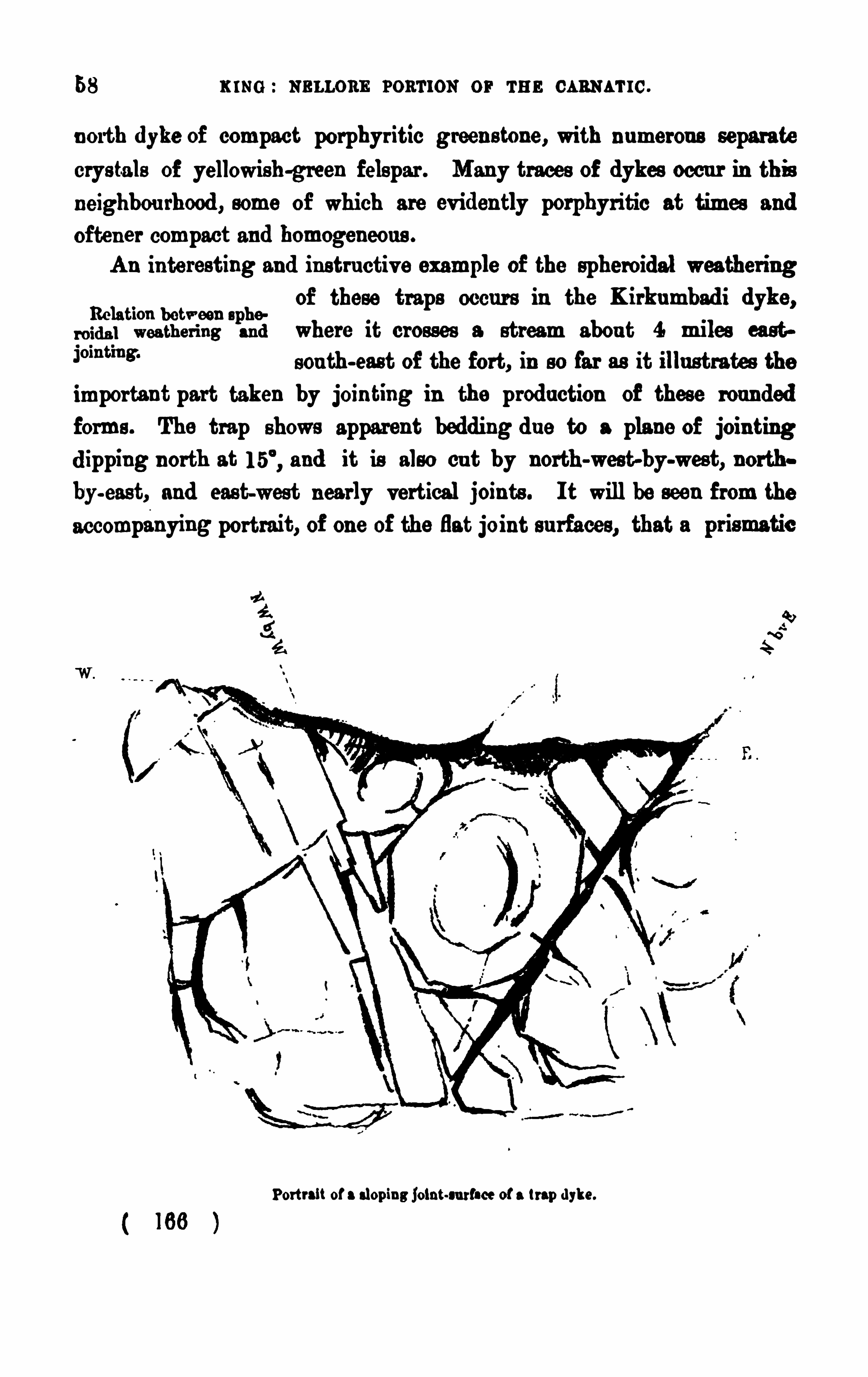
58 K ING : m u ons pormon or THE CARNATIC.
n orth dykc of compact porphyr itic green s tone, with n umerou s separatecrys tals of yellowish-green felspar . Many traces of dykes occu r in th isneighbou rhood , some of which are ev iden tly porphyritic at times and
often er compact and homogeneou s .
An interesting and ins tru ctiv e example of the spheroidal weather ingof these traps o ccu r s in the K irkumbad i dykc,
Relation between apho
roidal weather ing and where it crosses a stream abou t 4 miles eas t
Jomtmg‘
sou th-east of the fort, in so far as it illu strates the
importan t part taken by join ting in the production of these rou nded
forms . The trap shows apparent bedding du e to a plane of join tingd ipping north at and it is also cu t by north-west-by-west, north
by-east, and east-west nearly vertical join ts . I t will be seen from the
accompanying portrait, of one of the flat joint su rfaces,
Portrait of a slop ing joint-su rface of a trap dykc.
K ING : NELLORE PORTION OF THE CARNAT IC.
The Paremkonda-Kalu vaya ri dges are also intru ded on by sheets
In tr u s ive trap, of p a,
of d ior ite which for a good part of their length
”emkm da'
appear to be contemporaneou s . However , on fol
lowing them ou t they are seen to vary mu ch in thickness , swelling ou t
ev ery now and then , while they die ou t and are s ucceeded in the striketoo su ddenly by other s imilar ou tcrops abov e and below the adjacentqu artzites to be contemporan eou s flows . They commence thinly in the
sharp cu rve n orth-west of Parcmkond a, and then rapidly increase inthickn es s towards and u nder Kalu vaya . I t is of cou rse dificu lt to re
cogn ise in generally altered strata any effects produ ced by s u ch intru sion s ,bu t the qu artzites in their v icin ity are certainly jaspery or fiinty, an
u ncommon con dition of these bed s , and they and the traps themselvesare epidotiferou s .
To the sou th of G elacapad , there is again an u nmistakable region
1m m ou tbu rsts of of flows an d ill-defined ou tbu rs ts of bas ic rocks ,mPo which, though probably part and parcel of one
great igneou s developmen t, is certainly d isconnected from that of Parcm
kon da, either by an area of milder action , or , as I prefer to th ink, by an
actu al break along the Répfir line ofO
fau lting. I hav e represen ted this
sou thern area as con tin u ou s by the Potagfrnta r idges‘on to Ki ndra in
the map, and there is ev ery reas on to con s ider that it is so in fact, bu t a
good part of it is covered u p by the su perficial depos its of the Venkata
gi ri r iv er .
At first sight, the Kendra or Kana-Kondroyan b ills seem to be
wholly of trap , like the remain s of a great pro
tru ded mas s of v olcan ic rock ; bu t on examin ation
they are fou nd to be really of mass iv e hornblendic an d chlorito-horn
blendic rock, ex tens iv ely trav ersed by dykes and irregu lar masses of trap,runn ing mainly in north-west to sou th-eas t, east-west, and eas t-by-north
to west-by-sou th directions , the whole occupying a wide belt thinn ing ou t
TheKand ra ou tburst.
The Potagunta r idges were examined by Charies Oldham, and he seems to have con
s ider ed that they, on the whole, cons is ted more of mass ive and schistose hornblend ic strata .
with fewer trap dykes and d ioritic mas ses .
( we )
GRANlTlC AND TllAPPltAN ROCKS .
to the north wes t and cu t off abruptly to the sou th-eas t nea r Chillaman
chen . At the north-eas t end the traps hav e more of a bedded look, and
f rom this poin t the in ter -bedded or ex trav asated character of the ou t
crops becomes more ev iden t as the Parcmkonda ridges are neared . The
hills immed iately wes t of Kand ra showmore frequ ently the dykc formof in tru sion , while the Chillamanchen hills are so devoid of any dyke-likedev elopmen t, except on their flanks , that they lookmore like a great mas sor centre of ou tbu rs t. Immed iately wes t of the latte r v illage, the small
grou p of da rk-colou red moderately-rou nded hills con s is ts in the main of a
dense blu e-black aphan itic green stone, which weathers of a dark red
brown colou r , occas ionally in to large rou n ded masses , or in to an earthyrock s peckled with little rou nded masses of d u ll ca rbonate of lime. On
the west s ide of the main hill there is a broad dykc striking eas t-by
north to west-by-sou th th rough the rest of the trap and across a narrow
band of qu artz-rock and talc sch ist,wh ich is also in among the traps andhas a nor th-west strike (the strike of the Cu ddapah qu a rtzites on the
top of the con e is nea rly north-sou th) . Armenpad i, abou t 8 milesnorth-north-west, is a compact fine-grained blu e-black aphan ite, theridge to the n orth-west being also composed of coarser trap weather inginto great rou nded mas ses . Kand ra v illage is on trap which ca n be
traced , as sociated with hornblend ic schis ts , thence to Vendod u ; and
northward s from the latter v illage the path to Vadachcrla pas ses over a
series of hornblendic schists traversed by, and in terbedded as it werewith
t raps in the same way as in the Krind ra valley. The schis ts are con
to rted , bu t str ike generally north-north-wes t.The dykes in tersect each other both here an d in the Rsptir cou ntry,
bu t withou t giv ing any ind ication s of d ifierent per iod s of in tru s ionboth those acros s and with the strike of the cou ntry rocks appeared tobelong to the same ou tbu rs ts .
The obscu re as sociation of the traps with the cou n try rocks is to beseen on the western edge of the Kand ra area . On the Vizinagram s ide,
highly con to rted bed s of micaceou s and hor nblend ic schis ts , with frequ en tsmall seams of gran ite and small trap dykes , border the trap mas s of thehill. The strike of the schis ts is north-north-wes t with v ariou s d ips ,
1 69
62 K ING : NELLORE Ponr ron o r THE cann u la .
bu t close on the trap the con torted beds are strong, with a wes t-by-sou th
to eas t-by-north s trike . The western s ide of the r idge is a great ma s s
of east-by-sou th to west-by-n orth dykes trav ers ing mas sive hornblend ictalcose and chlor itic rocks and micaceou s schis ts , hav ing a n orth -wes t to
sou th-ea st s tr ike, the traps being, however , gre atly in the ascendan t . The
dykes are gen erally of a mas s iv e coarse dark-brown ish-green d ior ite ,
which weathers into a coarse earthy fer r u gin ou s rock, wh ile others aga in
are more of an aphan ite . The h ighest part of the r idge is en tirelyof mass ive and coars ely weathered trap, ex tend ing ov er many hu nd redsqu a re yard s . Along the sou th s ide of the ridge the character and
appearance of the rocks v ary mu ch. F ir s t, the trap forming the
s ummit is a mas s iv e well-crystallized rock of a dark-grey n ea rlyblack colou r of hornblende and felspar , through which r u n large,
p robably segregated , strings of den se blu e-black rock . Nex t, the
rock becomes more felspathic with the hornblende, showing in large
crys tals , or often er in small as semblages of rad iating n eedles , giv ing the
weathered su rf ace a starred appea rance . Th is syen itoid characte r of the
rock ex tends u p to the Vendod u tan k . Vendod u its elf is on coarselycrystallized gran itoid gn eis s , perhaps rather a gran ite , a great band of
which pas ses along this s ide of the range pas tVizinagram and Armenpédu .
Nea r these v illages a band of coarse qu a rtzo-felspathic rock, ha v ing a
somewhat lamin ated stru ctu re, and inclu ding angu lar fragmen ts of
horn blend ic schis t. ex tends in a nor th-north-wes t to s ou th-sou th-east
di rection . The rock is v ery coar sely crystallized and is riddled with
n umerou s str ings of qu artz. To the eastward of this there is a band of
mas siv e acicu lar hornblend ic rock, and east of th is again is more gran itic
rock, after which come the schists with gran itic str ings and small trapdykes abov e n oticed as border ing the trappean ridge . There are no cases
of actu al contact the base of the hills being always covered with debr isof the rocks above, or else by the soils wh ich r u n close u p to the trapsof the hillmasses .
( 1 70 )
OTHER FORMATION8 .
CHAPTER VI .-OTHER FORMATION8 .
(l) . -Rsm .mar. PLANT Bans .
The merest traces of some plant shales of this ser ies were discoveredby Charles Oldham on the northern edge of this area, which he afterward scarried on in to the Kistna District,where they hav e since been thoroughlyworked ou t and reported on by M r . Foote .
‘ I ndeed , itwas after all byu m h e?
the meres t chan ce that the first indications of these“md' m ' m “I" " 6 Rajmahal plant shales were fou nd in the debris
thrown ou t of some wells which had pierced the laterite and sand stone
plateau s of Nellore an d Ri vali . I myself fou nd pale-yellow and bnfi
clayey and sandy shales , v ery similar to those of the plant-beds of theTrichin opoly district, bu t nn foss ilif erou s , at three localities—Chrimu ru
gunta, abou t 6 miles sou th-sou th-west of Nellore ; Kalavakonda , 7 mileseas t-sou th-east of G lid iir , and at Shengapetta , 1 7 miles north-north-east
of Nellore, all in well-excavation s . Abou t the same time I heard fromOldham of his hav ing fou nd fos siliferou s shales of the same kind , and
thu s it became ev ident thatthe Trichinopoly and Madras belt of Rairocks ex tended nearly all along the Carnatic. Oldham s ubsequ entlyfou nd many little patches , so small that they can only be represented
very generally in the map attached to this memoir , and concerning
which be fu rn ished the following notes in 1 862-68
In the north-east qu arter sheet, in the Ri v ali Talnq of the Nellore
distr ict, I hav e discovered and secu red some specimen s of plant remain s
The sandston e and shales in which they occur are confined, as far
as I cou ld determine themwithin the limits of sheet 77, to a few squaremiles west and nor th-west of the town of Ri vali. I have noticed them
close to the v illages of Timmasamrid rum, Kfin Korepolliam, Bamanja
pu ram, Comy Mu tumarpolliam, and Sod awaram. Beds of'
s imilar charac
‘Mem. Gaol. Su rv . of Ind ia, Vol.XVl, part I .
1 7 1
64 K ING : NELLORE pou r ron or r u n CARNATIC.
tcr appear in two or three other places , from which, however , I did n ot
su cceed in procu r ing any specimen s .
I first noticed these beds close to Ramanjapu ram, where a v ery poor
section is ex posed in a bowry (or well) . Here I noticed abou t 8 feet
of a coars e u n consolidated felspath ic san dstone, with n umerou s small
s cales of mica , lying horizontally u nder abou t 2 feet of pisolitic kanker ;a red lateritic soil covers this to a depth of 8 feet, with a thin
layer of vegetable mould on the su rface. Here I cou ld detect only
traces of stems . For some d istance east of Ramanjapooram, frag.
ments of s imilar sand stones appear thrown u p from bowr ies and in
tank bu n ds , bu t the beds are certa inly n ot con tinu ou s , as abou t 1
mile wes t of Sodawaram a v ery hard quartzose gneis s appea rs in s its ,
str iking north-north-west with a high d ip to west-sou th-west. The sand
s tones re-appear on the wes t of the v illage of Sodawaram, where abou t 1 0
feet of them are seen in a well. The lower part a green ish-yellow
felspathic grit, with scales of mica, with some pink and pu rplish bands
ru n n ing th rough them ; the u pper portion is finer and more compact,
slightly ferr uginou s . I n this locality again I fou nd only indefin ite stem
markings , an d cou ld secu re n o good specimen s . Th is also is apparen tly
only a small patch of these sand stones , as immediately on entering the
v illage of Sodawaram,qu artzo-micaeeou s gn eis s appears , and on the
eas t of the v illage qu artzo-hornblendic gneiss and hornblend ic schists ,
an d the sandstones , as far as I could find, do not re-appear in this
direction .
North-west of Raman japooram, in smallstream cou rses and bowries
close to Corny, s imilar sands tones appear ; I fin d I hav e n oted them as
coarse sand stone, green ish-yellow,
with pin k bands , in dat-rolling bed s .
Ku nku r of n o great thic
knes s overlying them,n o rock seen u n derneath
bu t gn eiss and hornblendic schis ts thrown u p from bowr ies close by, no
defin ite remains . I n the stream n orth-east of Corny a v ery little s imilar
sands tone is seen . From this eastward the stream ru n s through banks
of soil of some thickness , no rock appearing ; bu t close to Mootoomor
polliam,in three or fou r bowries , from 1 5 to 20 feet of sand stone appear
in level beds , qu artzose and felspath ic with scales of mica . Some finer
( 1 72 )
66 mm : NELLORE common or rm: cs am r rc.
5mile, where I obs erved a coars ish ferruginou s sandstone, with some fin eyellowish band s , v ery little of them being seen ,
chiefly from small bowr ies .
In some of these finer band s I fou nd traces of plan ts which I con s idereds u flicien t to iden tify the bed s as being the same as the plan t -bear ingsandstones seen elsewhere .
The weathered su rface of a qu artzo-felspathic gn eiss in a small hill
sou th of G u tergu lly presen ts s uch a remarkable s imilarity to thes e bed sclose by, that it seems hard ly pos s ible to avoid the remark that the materials of which they are formed might have been readily deriv ed from the
rock in the immediate n eighbou rhood .
Lying on the s ides of this small hill in large masses is an ex tremelycoar se conglomerate , the matrix of which is n ot u n like some of the more
f er ruginou s bands of the san ds ton es . I cou ld not trace its conn ection
with these sand stones . The pebbles which it con ta ins , many of whichare of cons iderable s ize (6 inches and mo re in diameter) , are all, as fa r as I
88W, Of qu artz-rock, or in ten sely qu artzose gn eis s , rou nded and wate re
worn . Poss ibly it may hav e been a beach depos it of the plan t-bed age ,
bu t though I cou ld obtain n o d is tinct !
proof, I shou ld in clin e to con s ider
it more recen t.
The only other localitydawaram (ju s t ou ts ide the Of Chel
lum of the map . Sou th-east of the v illage a coa t
grit, in parts pebbly and almost conglomeratic
a well-marked blu ff of 25 to 80 feet, trending n
rou nd east of Nu rsapu ram, in which d irection and
palem,it d imin ishes in height and ceases to be a
d ies ou t in a laterite pebbly depos it thin ly spreadrocks . Close to Peddawaram (sheet in the lo
v illage, yellow micaceou s sand stones , which I
plant-bearing series , are seen in a howry, bu t
remains were proou rable . I was u nabwith the la teritic grit, which, however , f rom its pos ition , mu s t be at a
h igher lev el, and have probably ov erlaid the sand stones , and been here
d en u ded , leav ing the ex is ting scarp, rou nd the bas e of which all rock is1 74
or ns a roaru'
rron s . 67
obscu red by a sandy allu v ial soil, in which is d ug the bowry showing
the sands tones .
I n pieces of ferrugin ou s sandstones in the tank-ba u d of Cotapali,
I found specimens of plants (Ta s iop ter is and grassy s tems) bu t I cou ld
not trace the rock with certainty to its site. The s tone, howev er , was
said to have been brought from the north near Peddawaram,a nd I
hav e little dou bt that it was so, as it wou ld be themost conven ient placefrom which to obtain the stone.
”
This Peddawaram patch is referred to by M r . Foote in his memoir l
on the Kistna d istrict as belonging to his Ku ndaku r group of the
Rajmahal ou tliers ; and it is qu ite ev iden t that the areas ju s t descr ibedmu st be cons idered as belonging to the same grou p.
—Cu nns noan Sanns rox r s .
The belt of rocks belonging to this grou p extend ing along the Nellore
coas t is to all appea rance rather one of laterite and lateritic depos its thana set of sand stones an swering to those near Cu ddalore and Pond icherry,to which M r . H . F . Blanford gav e the name of the group. However ,in the many wells s u nk in it and at certa in poin ts along the wes tern
edge, thereis n o doubt of the ex is tence of s imilar sandstones ; and as
in the Tan jore, Trich inopoly, Cuddalore, and Mad ras areas no fa ir separation of the late r itic pa rt of the ou tc rops from the arenaceou s portionhas yet been d iscriminated, I take it that these plateau s of the Nellore
d istrict are s till es sentially of Cuddalore grits , though they are u ndou bt.
par en t; in dis tin edly in places overla id by a skin of lateritic breeh
'
a r thaeras and conglomerates which mu s t be con s idered
as belonging to comparatively recent depos its , or to M r . Foote’s group o f
Lateritic depos its . At the same time it is necessary to s tate that I donot (nor indeed d id Oldham) go with M r . Foote altogether in h is d is
crimination of these depos its , as will be seen on a compar ison of the
map of this memoir with h is map of the ad jacent Nellore and Kis tnah
area, wherein he does not showany Cu ddalore sands tones at the s ou thern
edge near Ramiapatnam. We ca rried these rocks f rom the Red Hills of
1 75
68 K ING : neurons poar ron or THE ca ax s r rc.
M adras in to the presen t area , and so followed them ou t u p to Ramia
patnam withou t meeting with any good ev idence to show that the grou p
had ceased or become ov erlapped by another d istin ct group . Foote's s epara
tion of the later itic depos its was certainly later than ou r s u rv ey of this
part of the Nellore d istr ict ; b u t ev en n ow, a fte r a carefu l s tu dy of my
n otes then taken , and after hav ing seen the f u rther ex ten s ion of these
s and ston es and their later itic character in the G oda v a r i d is trict,I do not
see any f air reas on f o r altering ou r opin ion rega rd ing the northern end
of the Nellore patches .
G ood section s in these Cu ddalore sand stones a re ex tremely rare, the
h igher western edges being rou nded of and cov ered with a ferr uginou s
coating indeed , this s u rface of the plateau s is always weathered in to a
late ritic.
or fer ru ginou s rock for some depth , the tru e grits and con
glomerates showing of ten the u s u al later itic featu res of tubiform and
cellular cav ities , s cabrou s s u rfaces , and a pellety or pisolitic s tru ctu re .
Well-section s are generally the only ones in which an idea can be obtainedof the rocks forming this pa rt of the series .
The general character of the area is,that the patches form
ing the belt are es sentially lateritic, with on ly rare ex pos u res of
gr its an d conglomerates u p to Nellore, beyond which poin t the morear enaceou s con stitu tion is prev alen t.
The later ite or more later itic portion of the plateau s is u ndou btedlydetrital, bu t in two localities where there are flat
wea thered topped hills r ising ov er the general level of the
laterite cou n try , there is s trong ev idence that their cappings may be of
ferr uginou sly decomposed gneis s s imu lating laterite , af ter the fashion of
the later itoid ex pos u res on the Shev aroys , Nilgiris , or on the wes t
coas t at Calicu t and on the sou thern coas t of Ceylon . These s ingu la r
h ills are n ea r Ras an u r, between the Swarn amu kh i and the Su lu rpet r iver ,and aga in at G u ru llu r , on the lef t bank of the f orme r r iv er , at some
1 2 miles f rom the coa s t . The la tter hill is abou t 1 50 feet high , and
ris es ou t of the s u r rou nd ing later itic cou n try , bu t its slopes a re partly of
gneiss , while the capping is later itic . The la ter itic cha racte r descen d s
these s lopes irregu la rly, an d the foliation is con tinu ed in to the later itic
( 1 76 )
70 xms : NELLORE ron'rrou or m s m an u re .
is worn ou t, leav ing the shelv ing lateritic grit and conglomerate . The
u pper bed s are h ighly ferruginou s and ind u rated . The Nellore section s
disclose ir regu larly-deposited beds of yellowish -red and mottled fer ru
ginou s clays , partly concretion ary. There is not mu ch pisolitic lateritehere it is merely a tolerably hard fer ruginou s gritty clay, mu ch piercedwith small v ermicu lar cav ities , an d there are traces of sands tone-likebed s or ferruginou s clays fu ll of min u te angu lar pieces of qu artz . Awaysou th of Nellore toward s Su rv apali , the rock is more mas sive and even
pis olitic, like the laterite of the Trich inOpoly and Tan jore dis tricts , or isoften a conglomerate with rou n ded fragments of qu artzite .
The patches n orth of Nellore have a greate r resemblance to the
More m ay to nor th Cu ddalore s ands tones of Sou th Arcot and Tan jore ,°f mum“ in that they showas sociated gr its and san ds tones .
At Kov u r the laterite is v ery gr itty, pas s ing dis tinctly into regu la r gr its
and sands tones . The following section is exposed in a deep well closeto Kovu r —Uppermost a bed, abou t 1 5 feet in thicknes s , of mottled
reddish-yellowand brown clayey and sandy later ite, mu ch pierced withv ermiform holes . Belowthis is a mu ch coarser bed of clayey grits , withv ery thin layer s of semi-angu lar pebbles and grav el of qu artz. Th is
bed is ex tremely coarse and pierced with large v ermiform tubes . Aver
age thickness abou t 1 0 feet. The thickn ess of the lower bed is concealedby the wate r of the well it is a compact clayey gr it, ir regularly pittedand honey-combed , bu t withou t s u ch decided tubes as are seen in the
upper bed s .
Charles Oldham describes another locality Detached f rom the
main body of the la ter ite north-wes t of Chellum, where ju st sou th of
Peddawarum (a v illage ou ts ide the northern edge of sheet 77) is a v erymarked promontory or blufi of coarse ferruginou s grits , conglomeratic
at base, pas s ing u pward s into a pebbly laterite and capped by da rk redbrown later ite, more clayey and more closely resembling the typicallater ite of the wes t coast and els ewhere. Of this more typical later itethere is bu t a thin capping, and the mass of the headland is of a markedlygr it-like cha racter .
”
This blnfi or headland is referred to by Foote in his Kistna memei1 78
cr a s s ro au a'
n os s . 7 1
a s being of Ra jmahal sand stones ; bu t, as will be seen in this extract,a nd aga in in those already given on the Rajmahal patches , Oldham is ,
I think, decided in his opin ion that the grits and conglomerates formingit are of the Cu ddalore sand ston es .
-La 'rnn r
'
r 1c Dnros r rs .
The u pper s u rface of the Cu ddalore sands tone plateau s is of ten
cov ered by a thin skin of fe rru ginou s or lateritic
breccias and conglomerates , which is ev idently amuch n ewer depos it than the laterite of the sands ton e grou p, and which
is also as clearly the res ult of rain -wash and other suba'
e'
r ial in flu ences .
I t is properly a ferr uginou sly-cemented debris , and is sometimes obv iou slythe weathered or altered s u rface of the cou ntry-rock, whether this begn eiss or recent sandstones . Not only is it formed or spread ou t over
the surface of the Nellore plateau s,bu t it is fou nd in scatte red patches
all ov er the cou ntry, particu larly at the base of the Kalahasti ranges
and in the plains lying below the s ou thern por tion of the Veligondas .
Several small patches were also n oticed by Oldham in the cou n try north
of the Pen nér, some of which are shown in the map . Thes e ou tlyingpatches are fou nd to merge by thin seams of gravel and pisolitic ru bblein to the heavy recen t clayey gravels so frequ en t all over the Carnatic andin the Cu ddapah bas in , which I wou ld call the implemen t-bear ing gravelsfrom ou r hav ing d iscovered in them the palm lithic quartzite implementss o well known in the Mad ras Pres idency . The d iscov ery of these implemen ts was mad e ju st after I had lef t this Nellore cou ntry and taken u p
the northern edge of the Mad ras sheet,so that we have had no fu r ther
opportu n ity of ascertain ing their occu rrence in the cou ntry u nder descrip
tion ; bu t from the fact of ou r hav ing fou nd them nearly ev erywhereelse on this coast in these lateritic depos its and in the gravels , it is highly
probable that they do occur in the present area . Some years late rM r . Foote fou nd several implements of this type along the northern
edge of this area, the occu rrence of which he records in the Kis tnamemoir .
1 79
72 u s e NELnos s ron'rron or rm: m anu re .
I have already referred to the two lowplateau hills of Rasan u r and
A mum , of the fem .G u ru lu r or Kota in the sou thern or Swarnamu kh i
f’
JXZ‘
ifimfi
’
ifiZlfii-m part of the field , as being capped by laterite,which
I take to be decomposed gn eiss , and to belong to
this s ub-div is ion of the recen t depos its . There are other , bu t v ery small,elevated patches of the same kind occu rr ing among the Potagu nta and
G elacapad r idges , which are ev en more obv iou sly the res u lt of the decompos ition of trappoid and hornblendic rocks ,wh ich giv e qu ite suficien t ironto allow of this form of ox id ization and con sequ en t cementation . The
Résan u r and Kota hills are themselves of hornblen d ic rocks , and close byis the v ery s trong and remarkable ou tcrop of iron s tone schists which no
doubt were the sou rce of mu ch of the ferrugin ou s matter dis tr ibu tedthrough the Cu ddalore sand ston es of this part of the Coromandel, and
which, in its ex ces s here, may hav e given the grou p the decidedly morelateritic aspect and constitution which it presents .
The fer ruginou s con stitu tion is also fou nd to ex tend in to the great
talu s of qu artzite debris , and shingle spread along the bas e of the Veli
gondas and the other hillmas ses ; in fact in the Kalahas ti grou p an d
abou t Yarepet and the Venkatagi ri cou ntry, the pass age of a portion of
the talu s debris into good later itic conglomerate and breccia is veryev ident. A con s iderable portion of the talu s depos its mu st therefore beinclu ded in th is s u b-grou p, though I think it is qu ite clear that this
talu s mu st have been in proces s of formation long before this per iod ,while it is still receiv ing incremen ts of mater ial from the moun tain-wall
by the cu r iou s s tream-like strings of debris wh ich tail u p some of the
s teepes t gu llies or fu r rows , an d down wh ich the debris is slowly andimperceptibly descending.
(4)—Rncnnr Ds rosrrs .
The most important of these are the allu v iums and blown sand s ,
there being no v ery marked display of particu lar soils . Of the formera kind of d istinction can be recognised between those of the riv ers and
those of the back-waters or lagoons .
1 80
74 ru n s : NELLORE PORTION or r u n caau u rc .
Och-cd .
P la cen ta p la centa .
P ectea . 1 1am“ w k”)Ar ea g m
‘P Sa ngu iaola r ia d ip hoc.
Soles .
D ip lod on ta , 3 sp .
Ca r d ita imbr ica ta .
Venu e cor .
Cylherea meta .
Dor ia n , 3 sp .
Tap es , 2 sp . B a la mu .
North of Allu r (beyond the Pennér), s u b-fos s ils of the same speciesare common , bu t not in su ch n umbers as at Tada .
There are also thin seams of in du rated sand with recent shells occu r
r ing at in tervals along the coas t at the depth of a foot or so beneath thesu rface, and fragmen ts of su ch a depos it, apparently thrown u p by thewav es , may often be seen along the s ea-shore. I observ ed these more
particularly at Sriharikota, abou t a mile east of Ba ind u ru , where a shal
low pool had been dug in the sandy allu v ium, and at the bottom of this
is a layer of indu rated sand , with remains of Area , Oy rena , Ste. Aga in ,
on the shore here, at the fishing v illage, are fragments of a recent shellysand s ton e scatte red abou t the beach . At this point the sea is cu tting
in to the ban k, ex posin g a clifi of 4 or 5 feet in sa ndy allu vium,bu t
I cou ld not find the ou tcrop of in du rated sand .
The allu v ium of the rivers is v ery variou s . Those of the Pennér
are pale sandy depos its , with more of the brownand humic soils than occu r in the depos its of the
streams to the sou th . Along the banks of this r iver there are only veryn arrow str ips of allu v ium,
with an occas ional han d u p the tr ibu ta rystreams . Ou t in the delta spread , there is generally pale-grey sandy alluv ium,
with good thicknes ses of dark-brown and redd ish-brown soils with
a mix tu re of lateritic sand and grav el. For the Kandléru , which flows ou t
to the sea at Kis tnapatam,there is v ery little of the pale sandy depos its
1 82
River alluv ium.
o'rrrrrrr ronn ar ron s . 75
except above G dd ri r, all seen below that place being of an es tua rine
character . The Swarnamu khi v alley is s trongest in the pale-colou red sandydepos its , a wide spread of which lies behind the line of Cu ddalore sand
s tone ridges .
The u su al str ip of blown sand s fr inging the Coromandel is rather
narrow in this field , poss ibly in grea t measu re on
accou nt of the mois ter north-east wind not beingpowerful enough to ca rry the sand far inlan d , while the dr ier wes terlywind s carry mu ch of it back aga in to the sea . I ex amined most of the
coast line du ring the hot mon ths (April, May , Ju ne, and Ju ly) , when itwas ev ident that the sand is being con stantly blown eastward , the shore
being qu ite hazy with the stream of san d , which rose abou t 2 feet overthe su rface of the grou nd . There is generally a thin sandy str ip of
abou t 2 or 3 miles in width which becomes heaped u p in low u ndu lation s ,
or is often a rranged in long n arrowbelts with interven ing str ips of allu v ium of dried u p back
-wate rs . I n the dry weather mos t of these in ter
ven ing str ips are qu ite d ry, or hav e a shallowchannel open to the tide .
The mos t notable example of this str ip arrangemen t occu rs in Srihar i
kota island, or the land lying between the sea and the Pulicat Lake, and
again to the east of Kav ali, 84 miles n orth of Nellore .
Blown lands .
The more typical blown sandhills or du nes occu r at a poin t on the
coast abou t I4 miles sou the as t-br east of Nellore, at Strinav asarow
Chatram, abou t 1 8 miles du e eas t of G rid ii r, and generally along the shoreof Sriharikota . I n the first case, the shore belt of sand toward s Toolypoliemis a regu lar tumbled sea of sandhills ranged in long waves having a
north-north-eas t to sou th-sou th-west str ike, sloping up gently bu t qu icklyfrom the eastward and dropping down to the wes tward by steep slopes .
Along the northern edge of this spread there is a dense barr ier of screw
pin es and palmyra palms , and here the hills drop down to the green -award ,ju st like a freshly-tipped railway bank, from a height of 30 or 40 feet.The su rfaws of the dun es were beau tifu lly r ippled with an eas t-northe as t
to wes t-sou th-west str ike. Bes ides these fresher-looking accumu lation s,
there are gras s-grown r idges a little fu rther inland , ex tend ing ou t as fa r
1 83
76 xms : s au n as roar rou or rm: m anu re.
wes t as Gondlapoliern . At the Toolypoliem end , the ridges becomes eparated by gras sy bays which tail in from the sou th
, and abou there are many in s tances of palmyras being half-bu r ied in the sand .
I n the n eighbou rhood of Strin av asarowChatram at the month of the
Swarn amu khi, the s andhills are aga in v ery d is tinct and wellmarked ,bu t are more s eparated from each other than those of Toolypoliem. There ,
the du nes ru n up to 1 8 or 20 feet in height, hav ing generally a sou th
s ou th-west to north-n orth-eas t s trike, and they stretch a good way in land ,
often half-bu rying the palmyra palms .The nar row nor thern spit of Sr ihar ikota is marked by long du nes
along the Pulicat shore line, th is part of the isla nd being comparativ ely free f rom jungle, except on the lake s ide, where the sand ha s beenpiled u p . The r idges are all s triking north-n orth-west to s ou th-s ou th
cas t, a change from the u su al lie, which is perhaps d ue to the trend of
the coast, here fu lly exposed to the n or th-east winds , while mu ch of the
s and is sheltered from the sou therly wind s by the thick and h igh ju ngleof the wider part of the island . The highest ridges , f rom 30 to 40 feet
,
occu r between Sholindu ru and Celindar Chattram,and they seem to be
only prevented from ov erwhelming the v illage of Sholindu ru by the
large tree ju ngle close by, many of the trees and sh rubs of which are
half-bu ried already. For the rest of Srihar ikota, the belt of sandhills
widen s ou tmuch, and is at times ru n in to di stin ct and well-formed r idges ,
hav ing the north-n orth-west to sou th-sou th-east d irection , and oftenru n n ing u p to 1 5 and 80 feet in height. East of Titu petta , abou t halfway to the shore, the du nes are, some of them, abou t 3 0 feet high, ru nn ing along the coast in the u s u al north-nor th-wes t to sou th-sou the ast
d irection . These hills are topped with scru b jungle and have their steeps lope still to the west.
( 1 84 )
78 xmo : mmon eon-n on or r u n ca s u ar rc.
not prepared to en cou rage the hopeles s v iew generally taken of the
ev idences that have been brought to light by the old workers . In
my experience of native workings , I hav e always fou nd , with the
exception of the old gold workings in Wynad , where the men had to
deal with an u n dulating cou ntry eas ily d rained , that the min es hav enev er been carried to any depth nor to any ex ten t, as may be eas ilyconceived where the means of getting rid of water, or the s u pplyingof air, were not available. I do not mean to u rge the oft—iad ifficulty or despair—suggested n ecess ity for going deeper in mines to
obtain a better resu lt, though of cou rs e the wealth may be at a great
depth ; bu t I qu estion whether any of these old n ative mines are ever
beyond 60 feet in depth , or that the galleries run more than three tims s
that length . Again , the fact of the place hav ing been tried u nder
Eu ropean hand s and at a great expenditu re of money withou t su ccess ispoor evidence of the cond ition of a min ing region in I nd ia, for it is even
nowdi fficu lt to obtain competen t and steady hands , or ev en , if they be
admin istration of s u ch work. From all I could ever learn of the workingof the Nellore mines , these obstacles to progres s seem to have occu rred inthe most exemplary mann er . Themoney seems to have been at hand ; bu tneither Colon el Ou chterlony nor his brother James, nor Mes srs . Hart and
Simpson s eem to hav e been capable of carrying on or organ is ing the
admin is trative part of the a ffair ; while solitu de, s ickness , and d ru nkennes swere too mu ch for the miners .
The localities appear to be principally with in the ou tlying zemindari
lands of Kalahas ti . Those v isited by Mr . Oldham are at and in the
Occu r rence of this on neighbou rhood of G arimanipen ta (G u nn ipen ta) onat G‘fim nim t" the northern edge of the sheet, and within some
24; miles of the western h ills . The specimen s he produ ced were prin cipallycopper glance in ir regu lar mas ses , with strings of malachite occu rring
in mas s iv e earthy trap and in hornblende schists . They were all fromthe heaps of debris thrown ou t of the excavations which had been madenear the v illage . The traps appear to occu r as in tru sive sheets wa n ing
1 86
s au n as cor r aa wonxmcs . 79
with the schists , bu t the ore in the latter is in nests or strings ru n n ing
with the foliation , and nothing is known as to the lie of the irregula r
mas ses in the traps , these all being from debris .
The late st in formation regard ing these occu rrences—and they do not
I‘ M “pum a“, of giv e mu ch more clu e to the ex tent of ore or its lie
n " 5m m“ has been obtained by M r . Lavelle,lan en thu siastic
and energetic ex plorer , though perhaps too apt to take a florid v iew of
h is finds .
The v illages ex amin ed by M r . Lav elle are nearly all in the neighbou rhood of G ar iman ipen ta , and the specimen s obtained by h im hav e
been examined by my colleagu e, M r . M allet, whose notes I also append .
M r . Lavelle wr ites
I arr ived at G u rumanapettah on the 8th November , and com
menced prospecting for copper nex tmorn ing, and was s u ccessful in find ingsome good samples f rom several water-cou rses . M any lodes are to be
seen in ou tcrop .
On the morning of the l0th I started with three gangs of coolies
to examine the lodes , so as to determine which to commence work on .
I commen ced on a lode 1 mile sou th-eas t from the v illage, and
opened on the highes t po int of onten g as the weather looked mon soony,and as I was abou t to work in open pits , in the event of ra in and my
working on the d ip of the lode wou ld flood me ou t.
I commenced work by marking ou t 60 feet along the line of reef,and 22 feet on the d ip .
The ou tcrop being v ery poor , led me to believe I wou ld hav e to gosome depth before meeting with ore fit to send to Mad ras , bu t was
agreeably su rprised to find the ore getting r icher at every foot of s inking, and at 5 feet from the su rface the ore had improved so mu ch that
I began to stack it for despatch to Mad ras . I contin u ed the sinking on
the wes t end of the trench to 9 feet deep and 20 feet long to east. The
bea ring of this lode is from ou tcrop along the line of reef, andcan be traced for a long way in ou tcrop .
These notes have been placed at my disposal by gen tlemen for and with whom
Ur . Lar clle is carrying ou t min ing explorations .
1 87 )
80 ru n s : m amas PORTION or w e en s u re .
The d ip is 68°
sou th the cou ntry rock is mica '
sla te an d decom
posed ; the lodes have a cas ing of laminated trap and the ore is fou nd inqu artz reef, the trap forming the head and foot wall.
The as say of the ore from this reef made by Richardson 8: Co ., of
London , was 282th per cent. pu re cOpper .
The thicknes s of this reef is abou t 2 feet 7 inches where I workedon it, bu t I hav e reas on to believ e, from two blows of qu artz to the westof my working, that the reef is mu ch larger than where I cu t it ; bu t,
as I have abov e stated , it would not do for me to Open on it where I
was likely to get a rise of water , an d the object of my v is it to the field
was merely to see if the reef wou ld pay, so as we might arrange for
them with the Rajah of Calas try, in whose grou nd they are ; and
fu rther I knewtha t by sending ore from ou tcrop and 9 feet men of
practical experience in England wou ld be able to form a v ery good ideaas towhat wou ld be the v alue of the lodes in depth.
After satisfying myself as to the lode contin u ing in depth, I r ippedu p some 55 feet along its line to eas t, to prove its continu ing in that
d irection , and to get its tru e bear ings .
After satisfying myself on those points , I abandoned this lode.
The ore is very easily got, an d you can ju dge from the followingstatement what the cost of rais ing a ton will be
Commenced work on 1 1 th coolies
1 2th
Water r is ing fast, 9 feet ; lath
Tou r.
Work doneOpened u p (llSX82x 9) cubic f eet, th rough Mommbo or decomposed gnei s s. baled
water , and took ou t ore to the weight of 7 or 8 tons , bes ides poor ou tc rop, down to 6 f eet .
f or Rs . 27-8-0 or removed cubic f eet of grou nd f or the above sum.
These figu res will se rve as a data for making a rough calcu lation as
to the cost of rais ing ore . The general rema rks will giv e a data to
calculate from as to cos t of ca r riage, smelting , &c.
No . 2 Lode.
On the 1 4th I prospected and d iscovered a second lode in ou tcrop,
abou t a mile f rom the v illage to the east. As on the firs t lode, I com
1 88
82 amo z m mxx ponr ron or r u n en s u re.
d ug great holes and fou nd itwou ld not pay, and I mu st say no amou n t
of copper wou ld pay the way they went to workOne of those old workings is to the north of the v illage and in hard
trap (or compact) , and some thou sand s of cu bic yards were blas ted tofollow the lode on the d ip .
I n ev ery attempt mad e at min ing in those field s , the s u rface wasonly scratched , an d no attempt mad e at s inking .
Those copper lodes mu s t have been known to the n atives , bu t theyd id n ot con s ider them su fficien tly r ich to work.
The field known as the copper-bearing cou n try and worked by then ativ es ’lies to the north , in the Rajah of Vencatagher ry
’s ter r itory .
Very large old workings are to be fou nd in the v icin ity of G organpu lly, abou t 3 0 miles to north of G u raman apettah . Some of those old
workings are carr ied down 1 00 feet, and several hu ndr ed feet long .
The old mines in the Ven catagherry te rritory and near Go rganpu lly
were v igorou sly worked for the Nabob of the Carnatic, and the ore
smelted and sent to his palace or gu n factory before the year 1 780, bu tas British arms tr iumphed
,those as all other mines in I ndia declin ed ,
and on the as s umption of any terr itory by the British, min ing entirelyceased , an d n ow the nativ es will endeavou r to lead Eu ropean s as tray, asto the whereabou ts of allmin es , es pecially the Brahmins ; and the on lypeople information can be got f rom,
is the working clas s .
Gmoral remarks .
The copper zone or belt r u n s nearly north and sou th along a v alleybou nded on the west by the Doranal range of moun ta ins , and on the
east by a ser ies of smallou tlayers or range of lowhills . A belt of ju ngleof several miles long an d 1 2 miles wide d iv ides the field from the new
canal, which is abou t 20 miles from the field . From th is ju ngle, char
coal can be had at a very low rate, and on the wes t near Gorganpu lly,
large timber for min ing pu rposes , and charcoal from the same fores t, arev ery cheap. Cartage is scarce, as no road s ru n through the field , bu t
along the coas t, road cartage is plen tifu l, and as the cou n try is favou rableto road -making in being very stony and no heavy allu v ial depos its , the
1 90
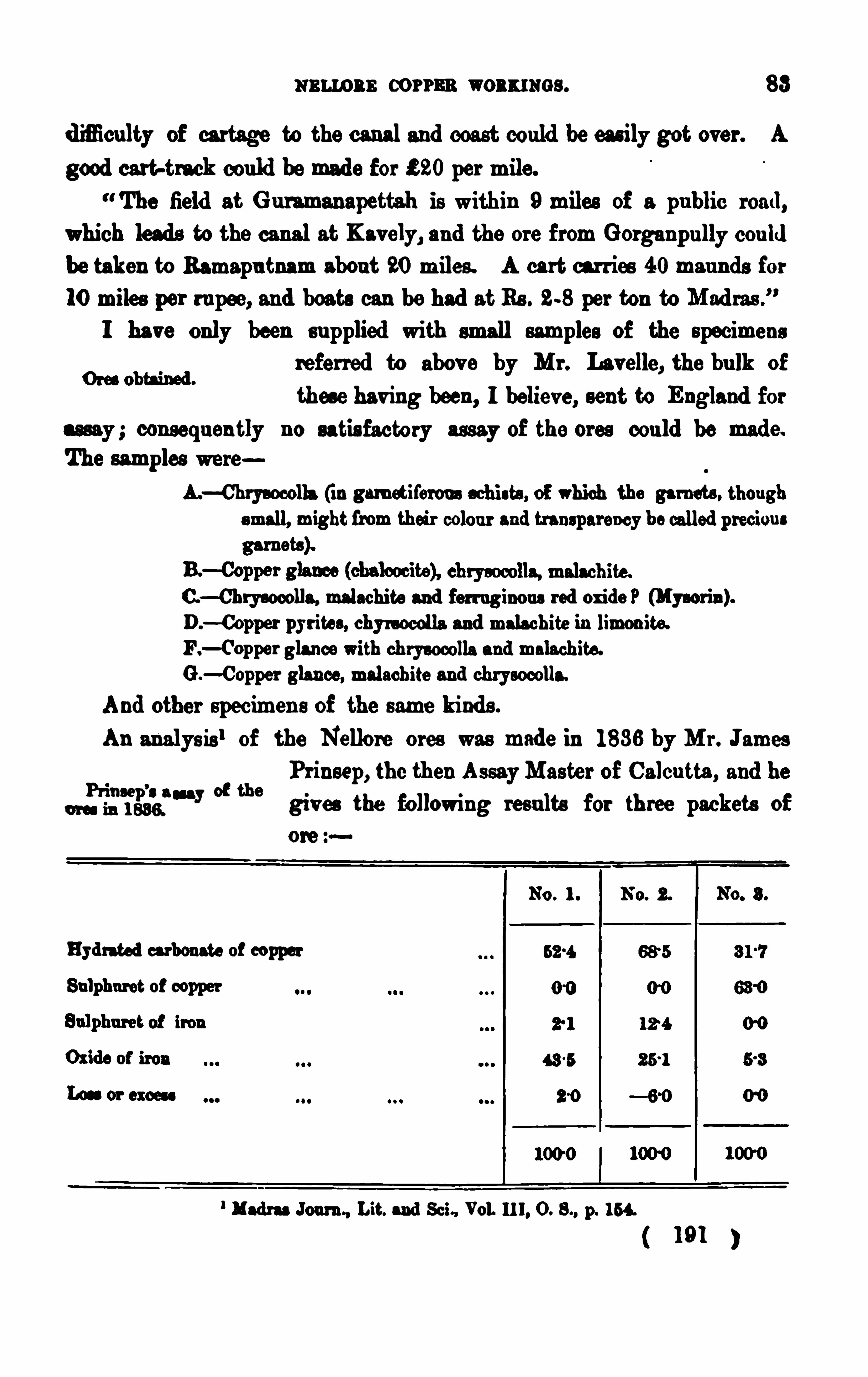
m amas corms woxxmcs . 83
d ifliculty of cartage to the canal and coast could be eas ily got over . A
good cart-track cou ld be made for £ 20 per mile.
The field at G u ramanapettah is within 9 miles of a pu blic road ,
which leads to the can al at Kavely, and the ore from Gorganpu lly cou ld
be taken to Ramapa tnam abou t 20 miles . A cart carr ies 40 mau nds for
1 0 miles per ru pee, and boats can be had at Rs . 28 per ton to Mad ras .
”
I have only been su pplied with small samples of the specimensreferred to abov e by M r . Lavelle, the bu lk of
these hav ing been , I believe, sent to England forassay ; consequ en tly no satis factory assay of the ores cou ld be made.
The M ples were
A.—Chrys ocolla (in garn etiferou s s chists , of which the garnets , thou gh
small, might from their colou r and transparency be called preciou s
C.—Chrysocolla, malachite and ferr uginou s red oxide P (My-aria ).
D.—Copper pyr ites , chyrnocolla and malachite in limon ite.
F . glance with ch rys ocolla and malachite.
G .—Copper glance, malachite and chrysocolla.
And other specimen s of the same kind s .
An analys is ‘ of the Nellore ores was made in 1 836 by M r . JamesPr in sep, the then As sayMas ter of Calcu tta , and he
“ES P”?
“ y °t thegiv es the following resu lts for th ree packets of
ore
No . I . No. 2.
Hyd rated carbonate of copper
Sulphu ret of copper
Madras Journ , Lit. and Sci” Vol. 1 1 1 , O. S., p. 1 54.
1 91
84 nu ts : mu o ns man or: or ru n en s u re.
He says fu rther : Mr . Kerr, who has since vis ited the whole of themin ing dis tr ict and examined all the formations and the old works
with great care, states that the former excav ation s are of prod igiou fl
magn itu de, many of them occu pying several hund red feet squ are, andhavi ng a depth of 50 or 60 feet. The matrix rock and rubbish are now
accumu lated in three en ormou s tanks ( 3 ban ks) bu t on clearing
them away the mou ths of the galleries ex tending into the rocks were
d iscovered : blocks of the ore hav e been u sed to mend the v illage tank atG u raman ipenta, and Mr . Kerr imagin es that any quantity of the r ichestore may be obtained at a trifling expense and within a hundred feet of
the su rface. E x tens ive hills formed of lumps of ferruginou s slag, n ewcov ered with vegetation, point ou t the s ituation of the ancient smelting
hou ses .
The r ichest ore of the three is at the s ame timc the most abu ndan t,and promises to yield the safest retu rn , as it ru n s in u nbroken v ein s .
This ore is a combin ation of carbonate and sulph u ret, the former intermixed with the latter , bu t readily dis tingu ishable from it, as the
s ulphu ret is crystallized and has the grey metac lu s tre of galen a . The
specific gravity of this one is 7, being in termediate between that ofthe carbonate, 3 -2, and the su lphu ret,The his tory of the Nellore copper min es is given in Mr . Boswell’s
Manu al of the d is trict ; and I here take theHistory of the copper
liberty of appen ding the following ex tracts from
“I n 1 801 , copper ore was discov ered in this district. M r . J. B.
Travers , Collector, in letter to Board , dated 7th Jan u ary 1 803 , s ubmittedproposal from Captain Ashton for working the copper ore then latelyd iscov ered , in theWestern Pollums . The v ein first d iscovered was near
a v illage (Yerrapilly) and appeared to have been exhau s ted from ex .
cav ation s in the v icin ity. The inhabitants said that copper had beenmade there in former times ; they kn ew from trad ition and nothing
more.
Su bsequ ently very ex tens ive v eins were fou nd in the neighbou rhood1 92
86 K ING : s au n as mar rowor r u n manu re .
and long res iden t in the di strict, su pplied fu rther in formation for this
M anu al, of wh ich the following is an ex tract
The ore is r ich in metal, some specimen s hav ing yielded 75 percen t., bu t imbedded in a v ery hard matr ix dificu lt to be worked . I t is
fou nd in la rge and smallmasses of qu atrz, and , so f ar as I h av e beeninformed , n o con tin u ou s vein has ever been d iscov ered . All the specimen s that I have seen have had a more or les s roun ded s u rface, in d icating their hav ing been s ubjected to the action of water , and rolled
poss ibly in former times from a con s iderable d is tance .
Deceiv ed by the abu ndance Of the ore lying on or near the su rface
a nd by old ex cavation s , and the tradition s of nativ es tha t at some
f ormer per iod copper mines had been worked , sev eral en te rpr is ing iad iv idu als , d u r ing the first half of the presen t centu ry , expend ed a great
deal of money in prelimina ry min ing Operation s , bu t do n ot s eem to
h ave car ried them on a v ery ex ten s iv e scale, Or to hav e brou ght much
scien tific kn owledge to bear u pon them . M r . Ashton , Capta in Kerr ,and Mr . Fondclair , I believ e ru ined themselves in their v a in search,
and Mr . Hart at a later d ate expended u pward s of a lakh of r upeeswith a s imila r resu lt. M r . James Ouchterlony, in or abou t the yea r 1 840 ,
u nder the s u perinten dence Of an ex per ienced Corn ish miner , whom he
brought ou t to the cou n try for the pu rpose, sank one or more shaftsn ear the river at G u rman ipenta, bu t he metwith no more s u ccess than
h is pred ecessors . Mr . O uchterlony’s brother (the late Colon el O u ch
terlony, of the Mad ras E ngineer s ) in 1 84 1 or 1 842 printed for pr iv atecircu lation a pamphlet, illu strated by d rawings Of variou s specimen s of
ore that hav e been fou n d . I n it he gave a detailed accou n t of what
had been done by his brother and his predecessors , and I believ e hearr ived at the conclu s ion that fu rther explorations would be a vain waste
of money and inev itably lead to disappoin tmen t.”
( 1 94 )

M E M O I R S
0! THE
G E OL O G I CAL SURVE Y
I ND I A .

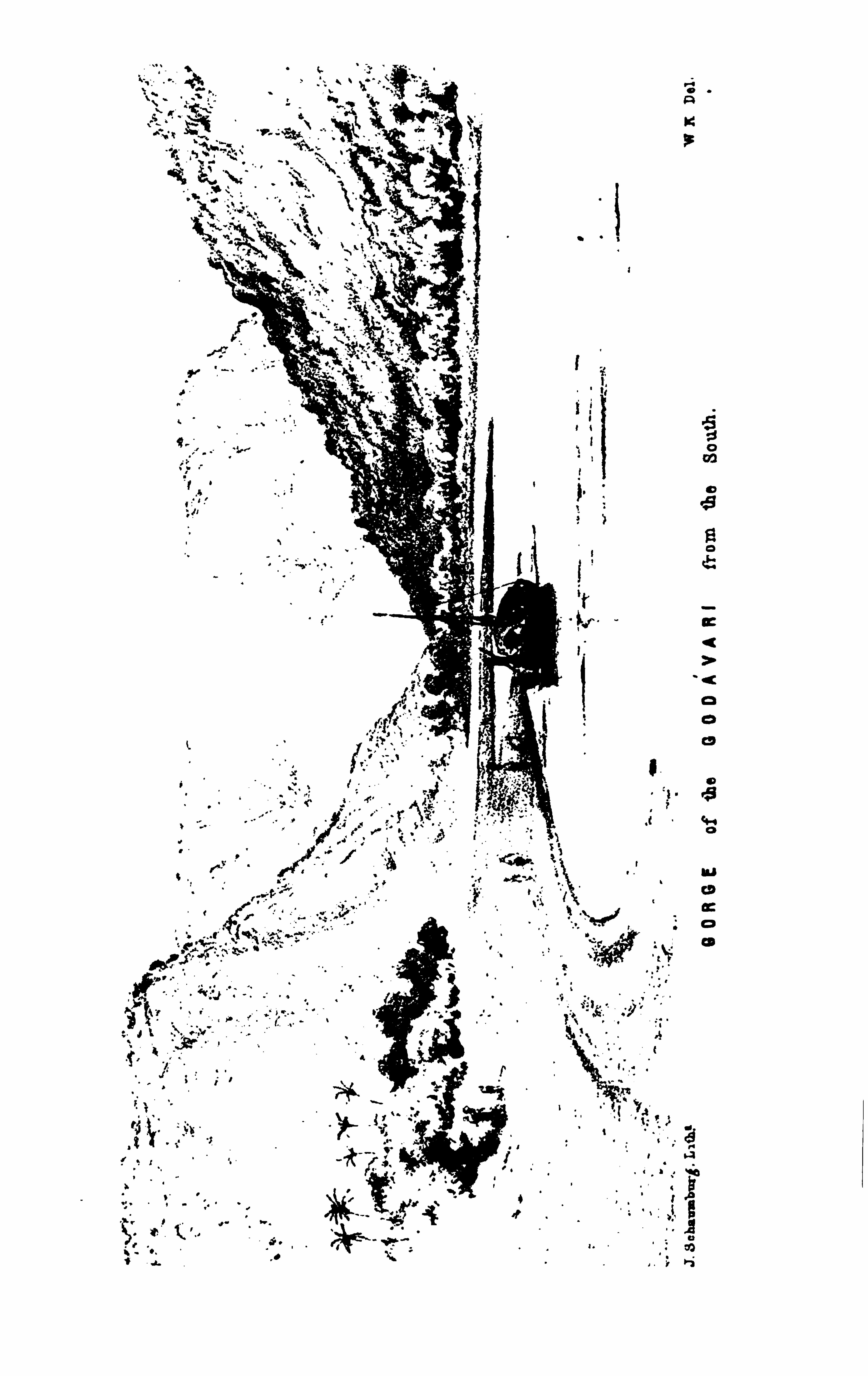
M E M O I R S
OF THE
G E O LO G I CAL SURVE Y OF I NDI A .
Ta r. Ur r nn GONDWANAS AND OTHER. FORMAT IONS or THE COASTAL RaO ION
o r THa G ODIWARI D ISTRICT . By W I LLI AM K ING , B . A ., Dep u tySup er intendent (Mad ras ) , Geological Su rvey of Ind ia .
CHAPTER I .- GENERAL DESCRIPTION.
I ntrodaclory .-The great tract of G ondwana rocks occu pying the
lower half of the G od i var i v alley is very con v eniently and ad v an tageou slyd iv is ible in to two areas , which are separable, phys ically, by that portionof the Eas tern Ghfits sometimes called the G olgonda range of mou n tain s ,
and , geologically, in that the u pper d iv is ion of this formation is in greatpart of mar in e origin to the sou th of the h ills wh ile there are on ly r iv er
and lacu s tr in e members of the series in the u pper pa rt of the v alley.
The por tion below the G hats , or , in other word s , the coastal region ,
also cor responds to what is called , in local pa rlance, the lower div is ion of
the Godav ari d is trict ; and this is the area treated of in the presen tMemoir .
The principal formation to be descr ibed is thu s a part, though inmany respects a very importan t part, of its dev elopmen t on the Coro
mandel or Eas tern Coas t in the patches already ex amin ed or described ‘
See Parts 1 and 2 of this Volume, and Vols . IV, Parts 1 and 2, X, Part 1 , Memoirs
Geo]. Su n . of Ind ia ; also Records , Geol. Su rv . of India, Vols . p . 1 1 , XI, p. 3 49, XII ,
p . 1 87.
1 95
Memoirs of the Geological Su rvey of India. Vol. XVI , Art. 8 .
2 K ING : COASTAL RRO ION or THE GODAVARI DI STRI CT .
by the Su r v ey, as ex tend ing thu s far n orthward s from the Tr ichinopolydi s trict, th rou gh Sr iperumbu dar (Sripermatu r) the Nellore area , and so
u p to the Kis tn a .
The other f ormation s to be n oticed were n ea rly all known , more or
les s , long before the ex amination of the cou n try was taken u p by theSu r v ey ; this region hav ing been ren dered clas s ic grou nd by s everal ofthe pion eer s of I n dian geology, more especially throu gh the res earches
of the late Rev d . M r . Hislop in to the relation s of the in ter-trappean fos s il beds in the n eighbou rhood Of Rajahmu n d ry. I t was , how
ev er, reser ved f or my colleagu e, M r . W . T . Blanf ord , to trace the
G on dwan a ser ies down the v alley of the great r iver from the Central
Prov in ces in the year 1 87 1 ; an d in 1 873 I had the good for tu n e to
discr iminate some grou ps of the u pper d iv is ion of this formation , as also
some in fra-trappean bed s , to in crease the roll already made ou t by u n official Observ ers .
L iter a tu re.—The work of thes e latter explorers commences as far
back as 1 81 4, when the Tracts , Histor ical an d Statis tical, on I nd ia of
Dr . Benjamin Heyn e appeared . These con ta in many references to thispart of the pen in s u la which are ex tremely in teresting, and they shall
be du ly noticed in the following pages , as they may happen to bear onthe rocks or formations u n der descr iption .
1 I n 1 83 0, H . H . Voysey ,
Su rgeon and G eologist to the G reat Trigonometr ical Su rv ey, travelledov er the western edge of this area , and his reports were s u bsequ en tlycollected an d pu blished in the Jou rnal of the Bengal As iatic Society.
2
He refers to the diamon d mines at M u léli, n ear Ellore, which ev en as fa r
back as that time were n ot being worked . He also n oted that the
s ands ton e tract, n owknown as of G ondwan a age, was traceable all down
the Pranhita-G odavar i v alley into the Ellore cou n try . I n 1 835, when the
I “act I I I , p . 92, s t seg.—Accou n t of the d iamon d min es of Ind ia. Tract XI I ,
p 21 2—Accou nt of the method of smelting ir on in the Northern Circa rs . Tr act XI I] ,
p. 224—Accou n t of the iron works at Ramanakapetta. Tract XV, p . 23 0—Cur soryobservation s mad e d u r ing a tou r f rom Bezwad a to Timmer icotta . Tract XVI I
, p . 247
—Ob ser vation s made on a tou r f rom Samu lcotah to Hyder abad . Tract XVII I, p . 280—Ab r ief accou n t of the Circar s on the Coas t of Or is sa .
Vol. 1 1 1 , pp . 298 an d 392
1 96
4 KING COASTAL 3 2 6 1 0 1! or m e GODAVARI DI STRICT .
he had no techn ical knowledge wh ich cou ld hav e enabled him to give
reliable details , and Ben za’s observation s were in some respects inaccu rate
thu s the relation s of the bed s are not correctly s tated , and some
er roneou s conclu sions were drawn therefrom which shall be n oticed in
their proper place.Tap oyrapfiy .
—The cou ntry u nder description has s omewhat a lozengeshaped ou tlin e, with its longer d iagonal s tr iking east-nor th -east f rom
the neighbou rhood of Bezvéd a , on the Kis tn a, to a point on the
sea-coast, abou t 45miles sou th -wes t of Vizagapatam . From this poin tthe shore forms on e edge, r u nn ing still sou th-west to abou t the 1 6° 20’
parallel of north latitu de, which parallel, again , is the sou thern edge of
the field . The two other s ides , n amely, those on the north and north
wes t, meet in that part Of the E astern G hfits cu lminating at over
feet in the Kau rkonda and Papakonda range, which is here crossed
by the gran d gorge of the Godav ari .The la rger an d centraltown is Rajahmu nd ryi n ex t comes Coconada
l the
sea-port and zillah s tation , an d the minor town s are Bezvada and Ellore.
Pay/s isa lgeograp lly .—The cou ntry is mainly low-lying and allu v ial,
more than half Of it con s is ting of the delta ic depos its of the Godavari
and a portion of those of the Kistn a, and this is to the n or th-eas t
join ed on to a wide s tretch of the allu v iums of the minor streams on the
edge of the Vizagapatam d is tr ict. From th is flat there is then a gra
du al r is e wh ich is broken by many small h ills and grou ps of these, moreespecially in the Ramps cou n try, u n til the greater mas ses of the Kau r .konda-Papakonda range a re reached .
The u n iform lev elof the grea t allu v ial plain is broken by a large ou tlier of gen tly r is ing grou nd , an island as it were inthe allu v ium,
at either end of which lie the town s
I have accented the name her e. thou gh it is not marked so in the ofl cial lis t, the
pr oper name being Kak indda (the place of crows) . Of cou rse, It mu s t he often rather d im.
cu lt for str anger s to tellhowthese Ind ian names shou ld be pronou nced ; and a s tory to this
afl oat Is told of a ch ild of a f ormer collector of the place, who was rather taken aback onen ter ing school in England at find ing h imself cor rected in his p ronu n cia tion of the name
of the town in which he was born , which the master improved into Cocanad a , as though itwere related to ou r pos ses s ion in Amer ica .
( 1 98 )
G s aAL DESCRIPTION. 5
of Réjahmu nd ry and Samalkét (Samu lcottah) and again , bu t in an ex
tremely smaller way, there are a fewelevation s in the north -eas t pla in , asnea r Pithapu ram and Ayaparaz-Kotapili, or s till n earer to the r is ing land ,
th e v ery pictu resqu e grou p of tolerably high gneis s bosses in the allu v ial
bay of Lingumwrra . At the Bezvdda en d there are also a few s imilar
allu v ium s u r rou nded hilly mas ses , two of which,on either bank of the
K is tna , hav e been join ed together by th e great dam there bu ilt across theriv er and giv ing a head to the splend id sys tem Of can als d is tribu tedover its d elta . Indeed , at the remote period when this great allu v ial
pla in was occu pied by the sea , the then G odav ari coast mu st ha ve beeneminen tly v aried in its con tou r , f rom the Bezvéda is lan ds in the Kis tnabay pas t the la rge is land on which the pleas ant bu ngalows abov eDowlaishweram now stand , and so by the many cu rv ing bays of K irlump iidi, Trin i, &c. , right up to the Dolph in ’
s Nose an d n umerou s other fine
hilly masses in the neighbou rhood of Vizagapatam : a very different styleof scen ery to that nowexhibited along the lowand u n in teres ting shores
of the Coromandel.
From th is old coas t line the coun try in the middle area rises v erygrad u ally by long-backed s an dstone hills which
d rop down again in lowparallel esca rpments facingnorth-westward , and beyond these there is f u rther low-lying bu t broken
grou nd , marked more particu la rly by the Chin talpfid i h ills . I n the
Bezv éda area the cou n try is still v ery flat, bu t there are s ev erallowhills
and r idges ris ing ou t of it su ch as the grou ps arou nd Augerpali andthe larger mas ses of VellatI
’
I r and Kon dapilli . O ver the n orth-ea stern
cou n try, low hillocks r ise immed iately from the edge of the allu v ial
pla in hav ing a long an d qu ite even slope to the sou th-eas t and a mu ch
steeper fall to the north -west and these a re s u cceeded by rather fiat
topped r idges , rapidly in creas ing in n umber and height towa rd s the morehilly Ramps cou ntry.
The important loca l r iv er s are the Tammilér , flowing pas t Ellore in tothe Kolér lake ; the Yera Kalwa , d ra in ing mu ch
of the cou n try below the Kau rkonda or Bison
1 99
Rivers .
6 KING : CO tS'
l‘
AI. REG ION or THE GODAVARI DI STR ICT .
Ra nge ; and the Eléru , G olgon da , and Pand‘ru r ivers in the Ramps and
V izagapatam area ; bu t the cou n try is cu t right across by the waters ofthe great Godavari river which hav e been collected behind and far to
the north-westward of the Eas tern G hfits through which the famou s
gorge or defile pas ses (See plates 1 andThe mou ntain pas sage of th is river is a deep and tortu ou s trench,
with a V-shaped section Of abou t 1 2 miles
in length , of which 4 miles in the m iddle may
be said to be the proper gorge, the river being here abou t 300 yard swide,l while the mou n tain spu rs r is e more abruptly to a heigh t of over
feet. Here the river is more like a loch or fiord lying among
lofty mou nta in s , and it is of ten d iflieult, as one is floating along, to
gu es s where any ou tlet can be,specially when the lofty fia t-topped
Bison Hill is in fron t (See Plate Bu t the wonder of th is river
pas s is , as to howand why it shou ld have been cu t down th rou gh this
f eet high range of crys talline rocks , when to all appeara nce ther iver might hav e pu rs u ed its cou rse th rou gh the more eas ily-womsand s tone of the low water shed“to the sou th-wes t, near Ashwaraopetwhere the great gap (cros sed by the K istn a) in the con tin u ity of the
Eastern G hats commences .
The Godi var i gorge.
Mr . Vau sta veren , lately res id en t engineer on theUpper Gdd i var i, inf orms me that the
nar rowest part of the gorge is 832 feet acres s ; the deepest sou nd ing taken by h im was
1 2 1 f eet, with a bottom of sof t blackish clay, the shallowest parts being 63 f eet. The
bottom toward s the s ides is v ery u n even an d rocky, bu t the mid-chan nel is pretty even .
An oth er name f or the Kau rkon da b ill, overlooking the r ight bank of'
the r iver , said
to be over f eet in height, and on e of the few spots in th is part of the Pres idency still
f requ en ted by b ison . An attempt was made several year s ago to u tilise th is plateau as a
san ita r ium f or the menemployed on the works at Dowla ishweram, bu t it was fou nd to be
f ever ish , and the s u pply of water was poor .
3 I h ave n ot been able to ob tain the level of th is water-shed abov e the sea, but it can
s ca rcely be more than 200 f eet. The cou n try is wonder f ully flat a t the shed and awaydown on either s id e of it ; in f act, it appea r ed to me that the height can ha rd ly be so mu ch
a s th is . At any rate, there is a trad ition (told me by Mr . Van staver en of Damagdd em
on the God dva r i, formerly Execu tive Engineer a t that place) among the people that the
God i va r i was very many yea r s ago so pond ed u p behind its gorge in a grea t flood , that itswaters actu ally poured over th is water -shed ! Th is appeared so amazing a phenomenon that
we cou ld hard ly believe it. However , su bs equ en tly whenworking at the Beddad anolcoal-field
( 200 )

GENERAL DESCRIPTI ON.
Of cou rse, the obviou s v iew of the cas e is , that the Ghfits and the
great valley of Bhad rachalam behin d them hav eall grown with the den u dation of this part of the
river , which commenced to eat its way into the earth as the u ppers u rface (or thereabou ts ) of the Ptipakonda range rose ou t of the sea ;
bu t s till there is the great d iflieu lty that the field of harder rocks shou ldhave been attacked rather than the sand s tone area to the sou th-west.
A reference to any good map of I nd ia will show that the Godzivari
for some 80 miles before reaching the gorge, and in the n eighbou rhood of its passage from the san d stones to the gneis s area , follows a
remarkable bend n early at right angles to the gen erally sou th-sou th-east
Its history.
cou rse it has pu rs u ed for over 1 00 miles between Sironcha and Bhad ra
chalam. At the same time, this area , or the mou n ta in region of Papakonda, and the lower ing h ills between it and the allu v ialflat of the coas t,exhibit plateau and bevelled s u rfaces wh ich are the remain s of an old
on the sou th side of the shed , Mr . Van staveren made f u rther enqu ir ies among the oldest ia
hab itants of the neighbou rhood , when he obta ined confirmatory ev id ence. It appears that
ther e hav e been th ree well-ascertained great flood ings of the God i var i, namely, in the yea r s
1 81 8, 1 849, and 1 861 , the earliest of wh ich was tr emendou sly h igh , and people are
said to have been carr ied 0 3 by it on the Nizam’s s ide of the cou n try. Mr . Vansta ver en
asked a man inciden tally if he cou ld point ou t h ow f ar the water s of 1 86 1 approached
within the neighbou rhood of the water -shed ; the man poin ted ou t a v illage n ot far f rom
the northern edge of the d iv ide . On th is, Mr . Vans taveren is inclined to think that it isqu ite poss ible that the greater flood of 1 81 8 mu st have really ov e rflowed and ca r r ied the
Godi var i water into the valley of the Yerakalwa. M r . Van stav eren , who has perhaps had
mor e practical exper ience of the G odavari r iv er than mos t men , say s that the water r isesZin
the gorge at least 1 00 f eet in heavy flood time. Colonel Beatty, the Distr ict Engineer in
1 878, in an swer to some sa qu ir ies I made rega rd ing the river , says , the d epth of the r iver
in the gorge has nev er , so far as I kn ow, been caref u lly r ecord ed . In summer , when there
is no perceptible cu r rent, the d epth is su ppos ed to be abou t 80 f eet, and in max imum flood sit is su pposed the wa ter r ises 1 00 feet over s ummer level. so that there wou ld then be abou t
1 80 f eet at the gorge.
” Hence on my su ppos ition of the height of the Ashwaraopet d iv ide,
the water wou ld have to r is e in the gorge at leas t 70 f eet h igher before it cou ld poss ibly flow
in to the Yerakalwa v alley . Howev er , this is little mor e than gu es s-work, and theref ore
the trad ition mu st b e let stand f or what it is worth u n til the height of the water -shed is
obta ined . The people ar e dou btles s given to exaggeration in many th ings ; f or in sta nce ,
they migh t ha v e a tr ad ition of a grea t flood that ov erwhelmed a cou n tles s n umbe r of
people, bu t they wou ld hard ly take the trouble to in ven t a story of s uch a phenomenon
as that those wate rs flowed over a pa rticu lar water -shed .
( 20 1 )

8 KING : COASTAL REG ION or Ta s comm a : msr a tcr.
marine plain n ow hav ing a gen tle slope of two or three degrees to the
sou th-eas t, the elevation of which plain above the sea wou ld appear tohav e commen ced at the en d of the ju ras s ic pe r iod .
I wou ld v en tu re to sugges t that th is tren d ing of the r iv er so much
more to the eastward may be attr ibu ted to an elevation of the land with
an in itial slope s u ch as is presen ted by the presen t s u rface configu ration
of the hilly cou n try ; while concu r ren tly with this elevation , the denu ding power of the riv er wou ld be grad u ally d irected to and kept workingin the harder crys talline rocks .
This abr upt swerv e in the river’s cou rse was more particu la rly
brought to my n otice by the late Dr . Oldham in con nection with com
pond ing dev iation s f rom their gen eral or av erage cou rs es in the Kistnanear Ku rn ool, the Pennér n ear Cu ddapah , an d the Cau v ery at Ker ii r ,
wh ich he seemed in clin ed to think ind icated a period of physical changeof cons iderable importan ce in the geological his tory of the pen ins u la .
Fu rther stu dy of these r ivers an d of the rocks trav ersed by them mayhelp to develop this generalisation bu t so fa r the cou rse of the G ods
v a ri below Bhad réchalam does appear to be one of the ma rks of a
middle mesozoic per iod of great change in the eas tern coas t of I ndia .
The allu v ial banks on either side of the gorge between the hill
Delta branches of Go spu rs , a re left as a well-marked ter race fu lly 70 or“m 'i ' 80 feet over the lev el of the d ry-weather waters .
Below it, or n ear Polawaram , the allu v ium begin s to spread ou t widelyon either s ide, the flood waters being newkept back by artificial banksall the way down to the commen cemen t of the delta at Dowlaishweram
,
a fewmiles belowwhich town the r iv er bif u rcates , the Gowtémi bran chgoing ofi towa rd s the n or thern mou th at Hope I sland , while the Vas is tabranch flows in the d irection of Bendamti rla u ka an d aga in bifu rcate s ,giv ing on e ou tlet n ear the latter place and the other and larger near
Nar sapiir .
The delta waters hav e now for many year s been dis tr ibu ted by a
magn ificen t system of nav igable and ir rigation8 stem of irr i ati on .y g
canals ov er the great allu v ial plam , and are ev en
202
1 0 K ING : COASTAL REG ION o r THE GODAVARI DI STRICT .
near Akid bu twhen the Tammilér is in flood , there is then a cu rrent ou t.
ward s . As the dry weather comes on this ou tlet is closed and as mu ch
water as pos s ible is retain ed for ir rigation , &c., along the shores . Occa
s ion ally , as in the year 1 875, the Tammilér comes down with great forceand flood s the cou n try all rou nd E llor e . I n that year the banks of thecan al, wh ich is here below s u rface lev el, had to be cu t to allow of the
water being car ried off partly by it, the r iv er waterway u nder the
aqu ed u ct n ot being su fficien t for the ofi-flow.
Su ch are the more ev iden t phys ical featu res of the cou ntry, bu t a
f u r ther remarkable on e, an d n ot so paten t to the cas u al obser ver , is a
certa in bev elling ofi, or tr u ncation , of man y of the hills and r idges in to
ps eu do-plateau from the smaller elevation s along the edge of the
allu v ial plain ev en u p to the loftier mas ses of the Ea stern G hdts at
the r iv er gorge ; all which bevelled s u rfaces appear to hav e beenpor tion s of on e great and ancient plain which has s ince been den u dedTr aces of an old an d cu t in to, in fact, the remnan ts of a deeply
mm “ den u ded old mar in e floor . I n the Rajahmu n dryV izagapatam area , the b ills hav e all very mu ch the s ame gen tle an d
even sleping su rfaces had ing u p ou t of the allu v ial flats , while the hills
an d r idges a little f u rther inlan d have their s ummits bev elled 0 3 in
what appears to be the same plane. This is a marked featu re of the
h ills abou t K irlumpu d i an d Bendapu di, and I n oted it at the time of my
s u rv ey as a strange one . Subsequ en tly, in working over the cou ntry tothe n orth of Rajahmu nd ry, abou t Korakonda and Nagumpali, I wasagain s tru ck by the cu riou s plan ed -OE aspect of most of the h ills , theirtops all appea ring to lie in a plane of gen tle sou th -sou th-eas t slope
wh ich shou ld meet the flat-topped B ison h ill in the G hAts . The same
featu re is seen , thou gh les s v iv idly, in the Yern agudem an d Ellore
cou n try, from the low hills n ear G litslla to the h igher grou p n ea r
Ch in talptidi . Again , towa rd s Bezvéada , in the n umerou s h ills abou tN lizv id , Au gerpali, N lina Stalum, and Bezvada itself , there is the same
lie of the hill an d r idge tops in a generally sou th-easterly sloping plane,d isplayed in a remarkably clear man ner .
204
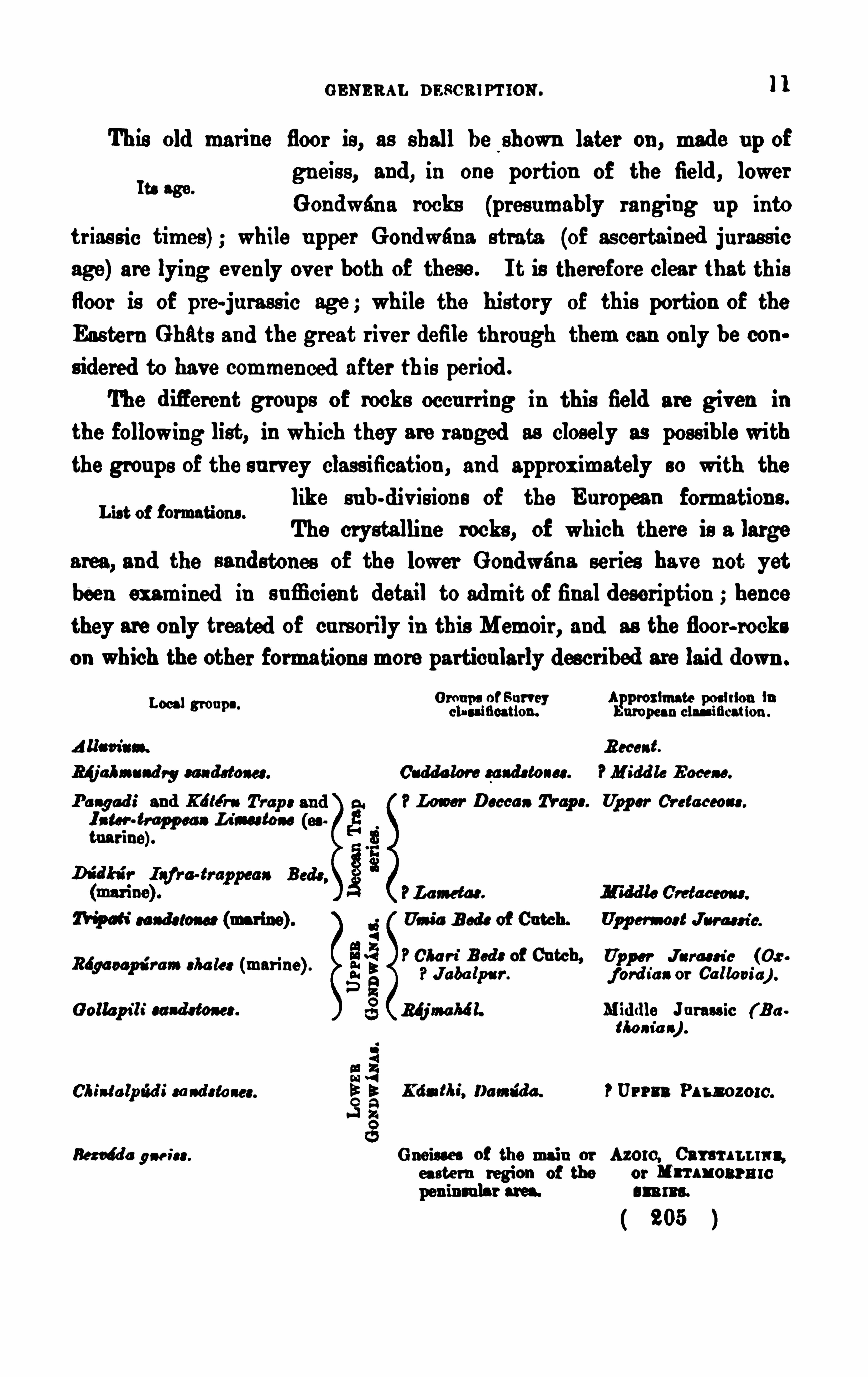
GENERAL nascmr 'rmN .1 1
This old marine floor is, as shall be shown later on , made u p of
gn eis s , and , in one portion of the field , lower
G on dwan a rocks (presumably ranging u p in to
tr ias sic times ) ; while u pper Gondwan a strata (of ascertained ju ras s icage) are lying evenly ov er both of these . I t is therefore clear that th is
floor is of pre-ju rass ic age ; wh ile the history of this portion of the
Eas tern Ghats and the great r iver defile through them can only be considered to have commenced a fter th is per iod .
The d ifieren t grou ps of rocks occu r ring in this field are given in
the following list, in wh ich they are ranged as closely as poss ible withthe grou ps of the s u rvey clas s ification , an d approx imately so with the
like s u b-div is ion s of the E u ropean formation s .
The crystalline rocks , of which there is a large
area, and the s and stones of the lower G ondwana series have n ot yet
been examined in s u fficien t detail to admit of final description hence
they are only treated of cu rs orily in this Memoir , and as the floor-rockson which the other formations more particu larly described are laid down .
Its age.
Lis t of f ormations .
Local G rou p s of Su rvey App roximate p os ition incla ss ification . Eu ropean clan-meation .
ARam'
s“. Recent.
Blj al n s nd ry sa nds tones . Cu dda lore sa nds tones . M idd le E ocene.
P a ngod i and Lon er Decca n Tr ap s . Upp er Cr etaceou .
I n tar trapp ea n L ia-a tonetna r ine).
W e“sands tone: (mar ine) .
Riga oap tir am cha let (mar ine) .
G ollap ila'
s ands tones .
S3Cb iu lalp tid i sa nd s to nes . Eg Kd n fl u
'
, Dami da . PUP?“ Pa r-1 0 20 1 0 .
“5
W e gne is s . Gneiu es of the main or Azoro, Cat ar i n a“.
ea stern region of the or Mn ax onrmc
s u ms .
( 205 )
Urns éa
Sc
Lam .
Us u'
a B od s of Ca tch.
POla f-i B ed: of Catch,Ja ba lp s r .
M ata/06 1.
Upp er Ju ra s s ic (0 :j ord a
’
a n or Ga lle r i a) .
M id dle Ju rass ic ( E uMa n ia c) .
1 2 K ING : COASTAL RROION or THE GODAVARI DISTRICT .
CHAPTER I I .
—GNEISS AND LOWER GONDWANA ROCKS.
Ti e Bezmida gneis s .—Notwiths tan d ing the more rapid and general
s u rvey Of the area Of crys talline rocks , en ough was Observ ed of them to
ju stify the recogn ition of a pa rticular va riety or s ub-d iv is ion which
other obser vers bes ides myself had noticed , more especially in the
n eighbou rhood of Bezvada and on the V izagapatam coast . It might
be called ma rc/iz'
sonite gn eis s from the cha racter is tic form Of felsparen terin g so largely in to its compos ition , which mineral was , however ,ev entu ally recogn ised by my colleagu e, F . R. Mallet, in the specimenswhich were sen t u p to him for determin ation at Calcu tta .
Dr . Heyn e noticed the garn etiferou s and felspathic con stitu tion Of
Prev iou s knowledgethe rock and its tenden cy to weather of a da rk
Of or even nearly black colou r ; wr iting of it : Vein s
Of felspar Often ru n th rough this rock in Obliqu e or horizontal d irection .
Su ch v ein s are mu ch harder than the felspar, which enters as a cons titu
en t in to the rock. The felspar is white , foliated , and appears , whenin large pieces , tran sv ersely striated . I t is u ncommonly soft, and is
en tirely d is in tegrated when long ex posed to the air .
”1 Dr . P . M . Benza
descr ibes ,”bu t n ot in mu ch detail, the garnetic gneiss Of Bezvada, and
he saw it again at Tdni and other places in the Vizagapatam d istrict
the felspar is specialised as albite or cleavland ite, and its beau tifu lscarletred colou r is n oticed . He also refers to th e eas ily-weathered character ofthe rock. Captain Newbold wrote The gn eis s compris ing the ridge
of Bezwada is garnetiferous , cleavland ite often replaces the common
felspar , and renders the gneis s liable to decay. I t conta ins la rge v eins
of qu artz and is in ter sected by green -stone dykes , the presence of which
may ser ve to accou n t for the d is tortion obs erv able in its s trata .
”
A decided band of this garnetiferou s felspathic gneiss edges the
Exte nt and relation a, allu v ium and older aqu eou s rocks r ight across the
“h“ 8m“ field , from the Kistna d istrict in to that Of Vizaga
0p . cit. p . “act XV, p . 280 .
Op . cit. p . 45.
206
1 4. KING : COASTAL REG ION or THE GoDAv ARI DI STRICT.
or ev en fibrou s and then somewhat s ilky, though it is n ev er qu ite a
sch is t, or aga in tolerably ma s s ive . Sometimes the felspar predomin atesto s u ch an ex ten t that there are seams and even thick bed s of what mightbe called a felspar rock, the mu rch is on ite being then mas s iv e and gran ular .
At other times , the rock is more like a gran ite with the f els pa r inlargish crystalline mas ses ; bu t u s u ally when gran itoid , it is a coars e
gran u lar aggregate of felspar , les s qu a rtz, and a little mica . Garnets
are v ery f requ en tly d is tribu ted through it, of ten to s u ch an ex ten t that
it may be called a garnetiferou s gneiss , as at Bezv éda wher e the rockis of ten crowded with small crys tals of br ight red an d pu rple colou rs
which are on ly wan ting in s ize to render them beau tif u l and v alu ables ton es . Here also, an d in the Au gu rpali cou ntry, there is a good deal of
graphite thinly scattered throu gh the rock, giv ing at times graphite
s ch is ts or mas siv e graph itic rockwith the graph ite in min u te scales .The felspar is generally redd ish or a pale s almon colou r wea thering
lighter , bu t it is frequ en tly of a decided red, even rosy-red , an d then , on
wellworn and smoothed s u rfaces it has somewhat the look of rhodon ite
while it has n early always a fin e pearly s ilvery or br ight bronze sheen .
When weathered , the gneis s often presen ts , particu larly in the Vizagapatam cou n try, the mos t s ta r tling imita tions Of ferr u gin ou s sand s tone,
the gar n ets being so crowded together that there is a d ifficu lty in recog
a is ing them as s eparate mas s es af ter they are decomposed . E ven long
before I took u p work in this d is tr ict, and at the time I was re-ar rangingthe specimen s in the M ad ras mu seum, my attention had been d rawn to
specimen s f rom Bezwada which were all labelled sand s ton es,
’and yet
were Obv iou s ly part and parcelof other f ragments from the same qu arrieswhich were unweathered ga rnetif erous gneis s .
Kamt/i i sandstones—The rema in ing rocks of the floor a re b rown ferruginou s , and v ar iegated felspath ic sands tones of this grou p of the lowerG ondwana formation , which are s trongly developed in the h ill cou n tryto the ea s t of Chin talp tidi whence they stretched away northward s in to
the eas tern portion Of the Nizam’s domin ion s border ing the right bank
o f the G odavar i r iver .
208
LOWER GONDWANAS. 1 5
Mr . W. T. Blanford firs t iden tified these bed s in this d is tr ict, hav ingh eed do“ f rom traced them down from their typical area at
ca m“v mw" Kamthi in the Cen tral Prov inces , and he descr ibesthem as frequ en tly v a riegated in a pecu liar and characte ris tic man ner .
They are as sociated with n umerou s hard band s Of fer r uginou s grit andcompact red and yellow shale . I n one in s ta nce sand s tone was foun dwith a pecu liar semi-v itreou s tex tu re, which is v ery cha racter is tic of
some bed s in Chan da and Berér . All these characters lead u nmis takablyto the con clu s ion that these rocks a re the repres entatives of the Kamthibed s of Nagpu r and Chan da
’’1
At the same time , nea rly half a centu ry before either he or I workeda t these bed s , it had been poin ted ou t by Voysey’ that sandstones
were traceable all the way down the G od ziv ar i v alley f rom the Centra l
Prov in ces in to the coastal region Of Ellore.
These sandstones occupy an Old hollow in the gneiss , and are occa
Lie and as sociation with s iou ally mu ch more ir regu la r and u nd ulating in
their lie than the bed s Of the u pper d iv is ion Of the
series overlying them, thou gh , along the n orthern ou tcrop of the latter
rocks , they lie eas ier and appear at times to be almos t con formablewith them . Like the res t of the gneis s cou n try, the groun d occu piedby them is now at places v ery broken and ir regu lar , as in the Ch in
talpud i hills , where the cu rved and grad u ally as sumed n orth -wes t s tr ike,n igher an d u n d u lating d ip, and great th ickn es s of var ied beds
, giv e
v ery d ifieren t con tou rs and l pes to those of the low long-backedranges with north-wes te rn sca rps of little height Of the gen tly d ippings trata of the u pper G ondwana bed s bord er ing the delta ic pla in s . I t
will be shown f u r ther on that the belt of thes e latter rocks lies ev enlyOv er these san ds ton es , an d is so con tin u ed on to the gneis s to the eas t
and west of them or , in other word s , that they are lying on a tolerablyeven plan e of both crystallines and Kamthi s and s tones . The Chin tal
pud i hills do not,as f ar as I remember, show any of the u nmis takable
Rec. Geo]. Su r v . of In d ia IV, p . 49, ci s eq., 1 87L
3 Jou r . As . Soc Bengal, Vol. IL , 1 83 3 , p . 400 .
( 200 )
1 6 K ING : COASTAL REG ION or r u n GODAVARI D ISTRICT .
flatly-den u ded s u rfaces so cha racte r istic of many of the h ills in the
gn eis s cou n try ; bu t these cou ld hardly be expected to hav e been p reserv ed among s u ch eas ily worn rocks , ev en if , which is barely pos s ible,any of the Old u pper s u rface remain in these bills .
The fos s il plan ts determin ing the age of thes e bed s were Obta ined byFos s ils and their local. Blan ford at Somava ram,
sou th of N liz v id , and at
we"K u n lacher u
,1 6 miles n orth Of E llore ; fronds of
Glossop tori: at the former locality and Vertebra r t'a at the la tter . I s u b
sequ en tly Obtain ed Vertebrar i a also at Somava ram,a nd other v egetable
remain s f rom fine pale dovw olomed compact shales a short dis tance
sou th -eas t of the v illage at the bottom of a low scarped hill be low s oft
coarse felspathic sands ton es . On the wes t s ide and to the s ou th of the
v illage there ar e many wells , the debr is f rom which con s is t Of s o ft wh iteand yellow clayey s and s tones very coars e-grain ed , an d in thes e were
many fin e specimen s Of Gloaaop tofis , Ste .
The n u mber Of foss ils from the Ku nlacher u locality was increasedby finer specimens Of Vertebra r ia , Glos swter ia, and P ly/lattices . F rag
men ts Of the fir s t plant occu r close to the v illage in a thick bed of
compact splin tery clayey sands ton e, bu t the proper foss il locality is atthe bas e Of the G u t,
’a small con ical hill abou t 1 00 feet high to the
wes t Of the v illage. On the eas t s ide of thi s b ill a tolerably fair sectionis exposed , all the res t of the slepes being cov ered with thick ju ngle .
At the base, abou t 1 0 feet Of v ery coar se Open -tex tu red f elspathics ands tones s u cceeded by 1 0 feet more Of hard , v ery
Ass ocxation of fos s ilsslIghtly calca reou s fin e clayey sands ton es with
fos s ils , ov er which come 20 feet of coarse bed s like those’
at the bottom.
Nex t come 6 feet of splin tery s iliciou s bed s , overla id by 40 f eet of thecoarse felspathic beds : all topped by a capping of n early 20 feet o f hards emi-v itreou s ferru ginou s pu rple and brown s and s tones and pebble bed sbelonging to theUpper G on dwanas . The bed s ar e d ipping abou t 5° eas tward s . The fos s iliferou s bau d n ear the base is thu s
a . G los sop ter t'
s seam
b. Ver tebra r ia
c. Splin tery calcareou s clayey bed
2 1 0

1 8 K ING : COASTAL REG ION or TIIE GoDAv ARI DI STRICT .
third of this length of ou tcrop in the middle of the field ; and this is againoverlapped by the higher one which ex tends from the Tammilér or
Ellore r iver to within a shor t d is tance of the Godav ari . The latte r is
also, as f ar as can be made ou t, con tin u ed on the Rajahmu nd ry-V izagapatam s ide Of the cou ntry, bu t withou t any as sociation with other sand
stones , where it lies d irectly on the gneis s .
The three su b-divis ion s are fos s iliferou s at rare in te rvals the lower
Foss ils .only showing v egetable remain s , whereas the othertwo giv e mar in e an imals , one of them als o hav ing
a f ewas sociated plan ts . The G ollapili san ds ton es , with their typicallyRajmaha' l flora , hav e giv en on e of the most defin itegeological hor izons
on the Coroman del, wh ile the Bdgav apuram shales and Tr ipati san d s tones
are brought in to correlation by their mar ine fos s ils , the former with thepreviou sly-known fos s iliferou s patches of shales fu rther s ou th in the
Nellore-Kis tna area and at Sriper umbudur (Sripermatu r) n ear M ad ras ,
and the latter with the Umia beds of Cu tch .
Gollap ili Sa nds toncs .—Abou t 1 2 miles wes t Of Ellore, the large
v illage of G ollapili s tan ds on a series of da rk-brown and yellowishred sands tones gr its and conglomerates wh ich hav e yielded numerou s
plan t r emain s of Réjmahél age . At the n orthern edge of the field ,
near Somav aram,these s an d s ton es are lying on and ov erlap, other
coarser b u t sof ter and more v ari-colou red felspathic sandsto n es and
sandy shales of Kfimthi age, with the character is tic glossop ten'
c and
vertebra ria .
The foss ils of these Ra'jmahalbed s were fou nd only at a fewlocalitieslate in the progres s of the s u rvey ; and as there is
Of ten a v ery close resemblance between these sand
stones and those of the Kamthis , it was thu s some time before I was ableto s epa rate this grou p from the larger area of rocks which W. T . Blanford
had approx imately sketched in as of the latter series du r ing his prelimi
n ary trav erse between Nuzv id and Ellore .
l The complete collection was
finally determined by Dr . Feis tman tel, the palaeon tologist of the Su rvey,Records , Geol. Sur v . of India.Vol. IV, p . 49 ; V., p . 23 .
21 2
UPPER GONDWANAS. 1 9
and s ubsequ en tly described by him in the Palmontologia I nd ies ,l from
which the following lis t of fos s ils is extracted
Frmcr s .
1 . Au thop ten'
s ind i es , O . M .
2 . Pecop fen'
s macroea rp a , O. M .
8 . Aag iop ter id iam oas is . Sch imp .
4. Aagiop ten‘
d ia s s sp a tba la tm . Sehimp .
CYCADEACEE .
a. Zam .
PtaOp kyllam m tg’
folism, Mor r .
D itto ea teltm e, Mor r .
D ictyozasa its s ( ad ieu , Fstm.
Pa r aphyllsm m n is iaaum, Oldh .
D itto ea r ts r t’
a aas s, Oldh .
Di:to d is tans , Morr .
Wi lliamson“gigas , (k n .
Cos rr ra n .
1 8. Pa lis sya eonf er ta. O. M . sp .
1 4. D itto i nd ies . O. M . sp.
1 5. Chen'
solep is comp . m as te r-i, Sch imp .
1 6. A r a a ca n'
tss s teer-0pm , Fstm.
With regard to this flora , Feistman tel says : Taking the flora of theRtjmahdlgrou p in the Rdjmahfil b ills as it has been partly descr ibed byMess r s . Oldham an d Mor ris , and lately conclu ded bymyself (Pa l. I nd iea ,1 876, con tin ., Pl. 3 6-48, pp . 53-1 1 0) as typical of that group, we find
the flora of G ollapili to be a pu re representative of it on the sou th-east
ern coas t of India .
”
This local flora con tains most of the typical Rajmahaplan ts , the man ner of preserv ation only being difieren t. While in theRajmahfil hills , the rock containing the fossils is almost throughou
of very hard cons istence, and mostly of pale colou r , the plan ts nea
Flora of the Gondw‘na System, Vol. I , p. 1 68 s t seq
20 KING : COASTAL REG ION or r u n CODAVARI DI sTRIC'r
G ollap ili are preser ved in a fine-grained sand stone of red-brown colou r ;
th is rock is totally difierent from the former one, and yet belongs to thes ame grou p and in clu des the same fos s ils .
”
The Filices are not very f requ en t, bu t all that occu r bear exactlythe Rajmahal character .’
As well as in the Rajmahalgrou p of the Rajmahal hills , also hereat G611apili, the Cyeadeaeeware v ery well repres ented, ex cept the gen u sOyead ites bu t we find frequ en t Ptilofl lylla u and P ump /131 1 1 1 5112 Dic
tyozamiles , Oldh ., also occu rs .”
Remain s of con iferou s plan ts were fou nd also pretty ab u ndantlyn ear Gollapili, as is gen erally the ease in the u pper portion of the G ond
wana system.
”
The plant remains were nearly all fou nd near Ravacherla an d Bur s
a localities and v ancha , 6 miles wes t of Gollapili, in softish brownand pu rple sandstones , there forming th ree low
and s ou th-eas tward sloping ter races with low searps to the north-west
ward . These beds are v ery n ear the bottom of the series—in fact ju stabov e a thin set of bottom bed s , the v illage of Rav aeherla itself beingon the garnetiferou s or Bezvada gneiss . Other, bu t very f ragmentary,remains were fou nd fu rther n orth, arou nd M Iis u n Ii r, in a set of softmicaceou s shales and flags of mu ch finer textu re than the Rav ach erla
beds , which are even lower in the series , there hav ing been a thicken ing
ou t of the s trata towards N u zv id . Gollapili Is on still higher beds , bu tit is the largest and most important v illage In the field hence its name
has been giv en to this group.
The grou p is not of mu ch th ickness , seldom at its thickest morethan 3 00 feet. At the Gollapili end , the beds arelying in a shallow basou alway, with a low ris e to
the north-westward ; and from this area they are con tinu ed to the eas t
n orth-east in a long ou tcrop at the foot of the scarps , str iking past Tandkalpudi, Tripati, and Ragavapuram to BimI
’
IlIi, some 5 miles from the
right bank of the Godavar i, where they die ou t altogether an d are over
lapped by the Tr ipati sandston es .
2 1 4
Thickness.
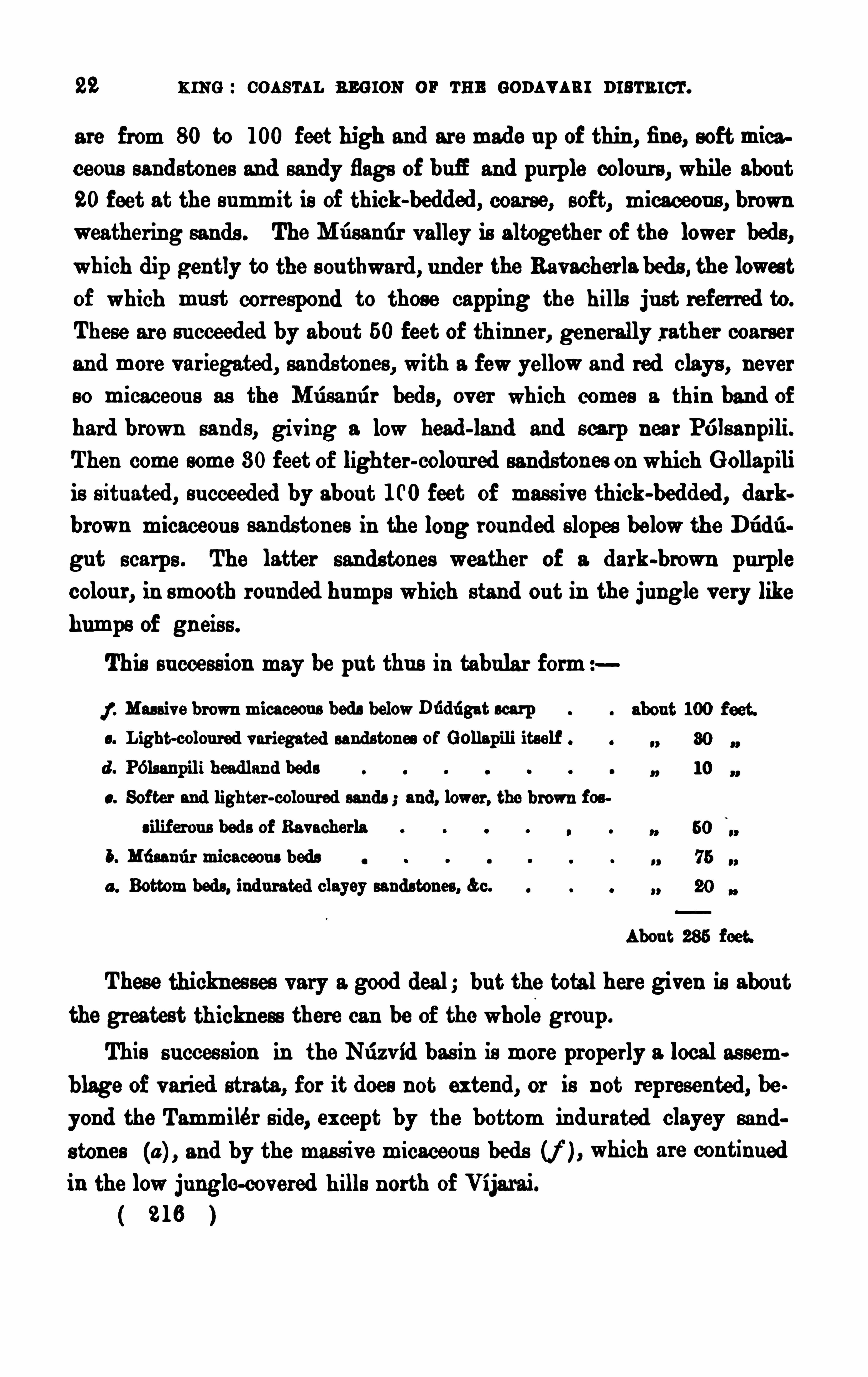
22 KING : COASTAL REG ION or TE E GoDAvARI DI STRICT .
are from 80 to 1 00 feet high and are made u p of thin , fine, soft micaceou s sand stones and san dy flags Of bufi and pu rple colou rs , while abou t20 feet at the summit is of thick-bedded , coarse, soft, micaceou s , brownweather ing sands . The M usamir v alley is altogether of the lower beds ,which dip gently to the sou thward , u n der the Rav acherla bed s , the lowestof which mu st correspond to those capping the hills ju st referr ed to .
These are s u cceeded by abou t 50 feet of thinn er, gen erally rather coarser
an d more v ar iegated , sandstones , with a fewyellowan d red clays , nev er
so micaceou s as the Musamir bed s , ov er wh ich comes a thin band ofhard brown san d s, giv ing a low head-land and scarp nea r Pélsanpili.
Then come some 80 feet Of lighter-colou r ed sandsto n es on which G ollapili
is s itu ated , s u cceeded by abou t 1 00 feet of mas s ive thick-bedded , darkbrown micaceou s san dston es in the long rou nded slopes belowthe DI
’
Id I'
I
gu t scarps . The latter s an dstones wea ther of a dark-brown pu rplecolou r, in smooth rou nded humps which stand ou t in the ju ngle v ery likehumps of gn eis s .
This su ccess ion may be pu t thu s in tabular form
f . Mas siv e brown micaceou s bed s belowDfidugat sca rp
Light-colou red var iegated sands tones of Gollapili itself
d . P61sanpili headlan d bed s
s . Sof ter and lighter -colou red sands and, lower , the b rown fos
s ilif erou s bed s of Ra vacherla
5. Md sami r micaceou s beds
a . Bottom beds , ind u rated clayey sandstones , &c.
Abou t 285 f eet.
These thicknes ses v ary a good deal; bu t the total here given is abou tthe greatest th ickness there can be Of the whole grou p.
This s u cces s ion in the Nuzv id bas in is more properly 2. local as semblage of v ar ied strata, f or it does not extend , or is not represented , be
yond the Tammilér Side, ex cept by the bottom indu rated clayey sand
s ton es (a ) , and by the mas sive micaceou s bed s (f ) , which are con tinu ed
in the low ju ngle-covered h ills n orth Of Vijarai.
21 6
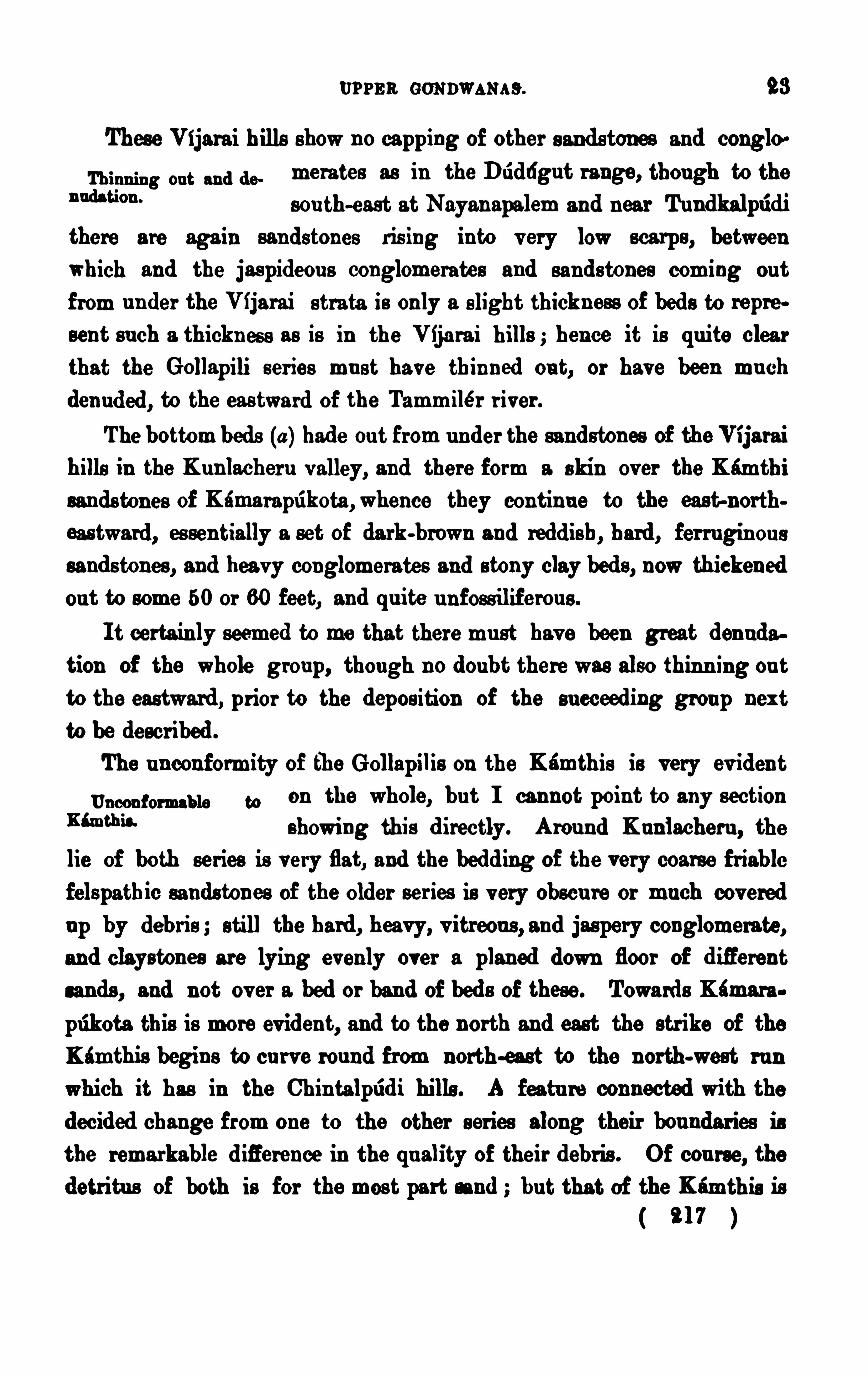
UPPER GONDWANAS . 23
These V ijarai h ills Shown o capping of other sand stones and conglo
Th inn ing ou t and de metates as in the Diiddgu t range, thou gh to the
“a m“sou th-east at Nayan apalem and near Tu ndkalpfidi
there are again sandstones ris ing in to v ery low scarps , betweenwhich and the jaspideou s conglomerate s and sandstones coming ou t
from u n der the V ijarai s trata is only a slight thickness of bed s to repre
sen t su ch a thickn es s as is in the V ija ra i hills hence it is qu ite clear
that the Gollapili series mu s t have thin ned ou t, or have been mu chden u ded , to the eas twa rd of the Tammilér r iver .
The bottom beds (a ) hade ou t f rom u n der the sand stones of the Vijarai
hills in the Ku nlacheru v alley, an d there form a skin over the Kamthisands ton es of Kéma rapukota ,whence they con tin u e to the east-north
eas tward , es sen tially a set of dark-brown and redd ish, hard , fer ru gin ou ssand s tones , an d hea vy conglomerates and s tony clay bed s , now thickenedou t to some 50 or 60 feet, and qu ite u n foss iliferou s .
I t certain ly seemed to me that there mu st hav e been great den u da
tion of the whole grou p, though n o doubt there was also thinn ing ou t
to the eas tward , prior to the depos ition of the su cceeding grou p nex t
to be descr ibed .
The u ncon formity of th e Gollapilis on the Kamthis is v ery ev iden t
u ncon fom m, a, on the whole, bu t I cannot point to any section
“W eshowing this d irectly. Arou nd K u nlacheru , the
lie of both series is v ery flat, and the bedd ing of the very coarse friablefelspathic sands ton es of the older ser ies is v ery obscu re or mu ch cov ered
u p by debris ; still the hard , heavy, v itreou s , and jaspery conglomerate,and clayston es are lying evenly over a planed down floor of d ifierent
san ds , and not ov er a bed or band of bed s of these . Towards Kimara .
pukota this is more ev ident, and to the north and east the str ike of the
Kimthis begin s to cu rv e rou nd from north-ea st to the north-west ru n
which it has in the Chin talpridi hills . A featu re connected with the
decided change from one to the other s eries along their bou ndar ies isthe remarkable d ifierence in the qu ality of their debris . Of cou rse
, the
detritu s of both is for the mos t part sand bu t that of the Kamthis is
21 7
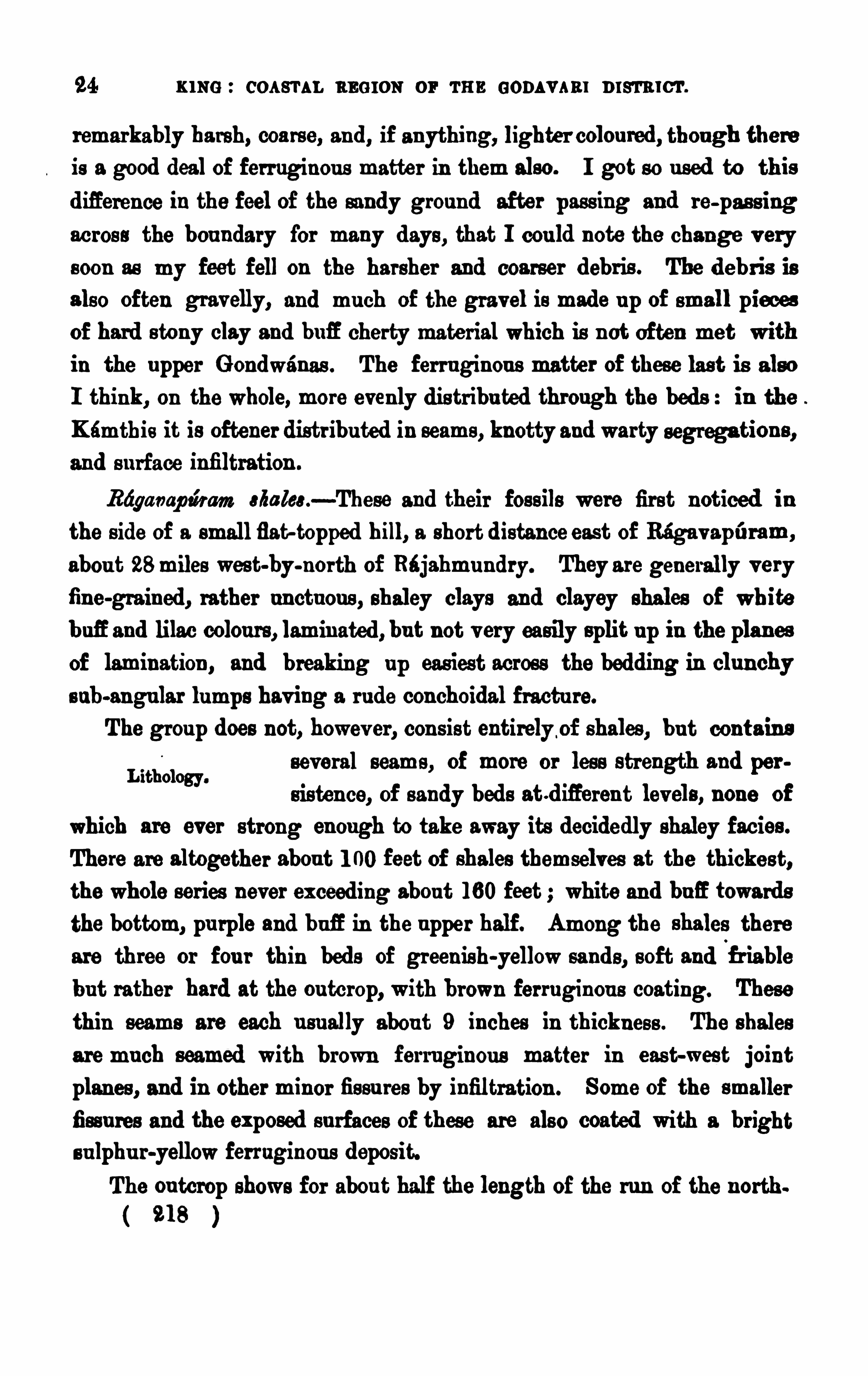
24 KING : COASTAL REG ION or TE E GODAVARI DISTRICT.
remarkably ha rsh, coa rse, an d , if anything, lighter colou red , thou gh thereis a good deal of ferruginou s matter in them also. I got s o u s ed to th is
d ifference in the feel of the sandy grou nd after pass ing an d re-pas s ingacros s the bou ndary for many d ays , that I cou ld n ote the change v erys oon as my feet fell on the harsher and coarser debr is . The d ebr is isalso often gravelly, and mu ch Of the grav el is mad e u p of small piecesof hard s tony clay and bufi cherty materialwhich is n ot Often met within the u pper G ondwanas . The fer ru ginou s matter of these las t is als o
I think, on the whole, more evenly d is tr ibu ted through the bed s : in theKamthis it is oftener distr ibu ted in seams , knotty and warty segrega tion s ,and s u rface infiltration .
Rdganap zimm Mis h a—These and their fos s ils were fir st noticed in
the s ide of a smallflat-topped b ill, a short d istance east of Ragav ap t'
rram ,
abou t 28miles west-by-north of Rdjahmu ndry. They are generally v eryfin e-gra ined , rather u nctu ou s , shaley clays and clayey shales of white
b ufiand lilac colou rs , lamin ated , bu t not v ery easily split u p in the planesof lamination , and breaking u p easiest across the bedding in clu nchy
s ub-angu lar lumps hav ing a r u de conchoidal fractu re.
The grou p does not, howev er, con s is t entirely of shales , bu t contain s
several seams , Of more or les s strength and per
s isten ce, of sandy bed s atd ifieren t lev els , none Of
which are ever strong enough to take away its decidedly shaley facies .
There are altogether abou t 1 00 feet of shales themselves at the thickes t,the whole series never ex ceed ing abou t 1 60 feet ; white an d buE towardsthe bottom, pu rple and bufi in the u pper half. Among the shales there
are three or fou r thin beds of green ish-yellow sa nd s , soft and f r iablebu t rather hard at the ou tcrop, with brown ferruginou s coating. These
thin seams are each u su ally abou t 9 inches in thicknes s . The shales
are mu ch seamed with brown f erruginou s matter in eas t-wes t jointplanes , and in other minor fis su res by infiltration . Some of the smaller
fiss u res and the exposed s u rfaces of these are als o coated with a br ights u lphu r-yellowferruginou s deposit.The ou tcrop shows for abou t half the length of the run of the n orth
21 8
Lithology.
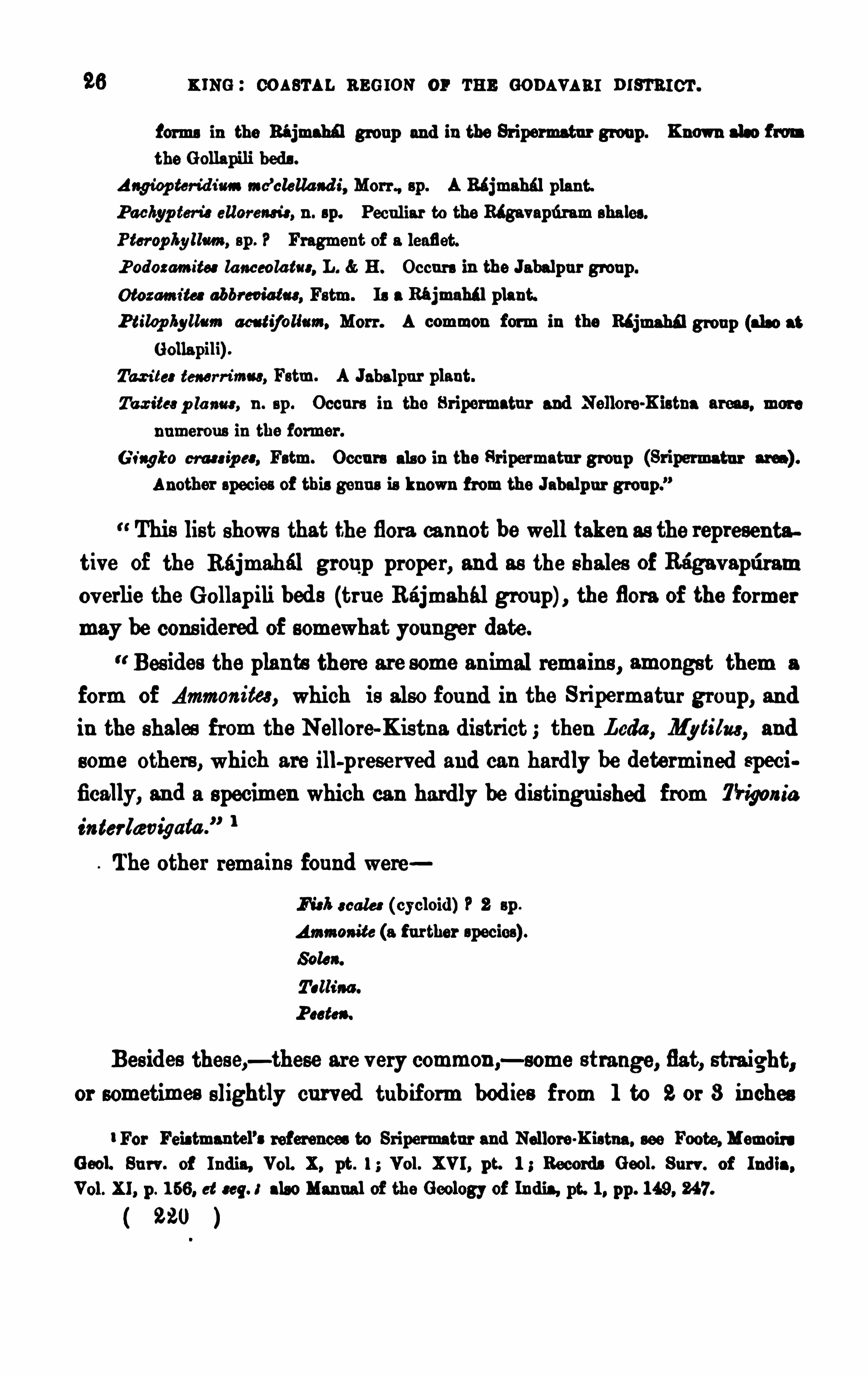
K ING : COASTAL REG ION OF THE GODAVARI DISTRICT.
forms in the Bi jmahfl grou p and in the Sr ipermatu r grou p . Known also f rom
the G ollapili beds .
Angiop ter id imn mc’clella ad i, Mom , sp . A Rajmahal plan t.
P achyp tem ellor ens r‘
c, n . sp. Pecu liar to the Ragavapd ram shales .
Pter op hy llm , sp . P Fragment of a leaflet.P odozamites la nceola tuc, L. H. Occu rs in the Jabalpu r group .
Otozamz'
ta abbr eviatu s , Fstm. I s a 1 thi plant.
P tiwp hylls m aes tij olis m, Mor r . A common f orm in the R6i grou p (also at
Golla pili) .
Tao-its: tm r n‘
mu s , Fstm. A Jabalpu r plant.
Ta z ites p la nar , n . sp . Occu rs in the Sr ipermatu r and Nellore-Kistna areas , more
numerou s in the former .
G ingko em s ip es , Fstm. Occu rs als o in the Sr ipermatu r grou p (Sr ipermatu r area) .
Another species of this genu s is known f rom the Jabalp u r grou p .
”
This list shows that the flora cannot be well taken as the represen tative of the Rajmahal group proper , and as the shales of Ragav aptiram
ov erlie the Gollap ili bed s (tru e Rajmahal grou p) , the flora of the formermay be cons idered of s omewhat you nger date.
Bes ides the plants there are some an imal remains , amongs t them a
form of Ammon itea, which is also fou nd in the Sripermatu r grou p, andin the shales from the Nellore-Kistn a d istrict then Leda , Mytilus , and
s ome others , which are ill-preserv ed and can hardly be determined speci .fically, an d a specimen which can hardly be d is tingu ished from Tr igom
'
a
in terlwv igata .
” 1
The other remain s fou nd were
fl ak scale: (cycloid ) 2 sp .
Ammoa ite (a f u r ther species) .
Soles .
P as te».
Bes ides thes e,—these are v ery common ,—some s trange, flat, straight,
or sometimes slightly cu rved tubif orm bod ies from 1 to 2 or 3 inches
For Feis tmantel’s ref erences to Sr ipermatu r and Nellore-K istna . see Foote, Memoirs
Gaol. Su rv . of Ind ia, Vol. X, pt . 1 Vol. XVI , pt. 1 ; Records G aol. Su r v . of Ind ia ,
Vol. XI , p . 1 66. et seq. 3 also Manual of the Geology of In dia, pt. 1 , pp . 1 49, 247.
( 220 )
u r r s a aonnwam s .97
in length and a qu arte r of an inch broad , tapering slightly fromone end to the other , hav ing v ery nar row closely-packed fold s or plication s trans verse to their length, abou twhich folds n umerou s foraminiferaare impacted .
There is no en clos ing case to these bod ies , and from their form theyappear to me to be of the n atu re of ex cremen titiou s d ischarges of some
The su ccess ion of s trata , ex posed on the north s ide of the ou tlyinghill nea r Ri gav apli ram, is as follows
At the bottom of the slope and s ome d istance ou t from it, the u nderlying dark-brown and nearly black ferr uginou ssandstones and conglomerates of the G ollap ili
grou p form a narrow te rrace. Then all is obscu red by the debris fromthe shales and sandstones of the hill for a good width indeed I do not
think the ju nction is anywhere clearly exposed along the foot of the
whole range of these lowhills .
G ood meas u rements cou ld n ot be made on su ch broken slopes , thelocal slipping hav ing been very strong on this b ill
s ide, bu t the following approx imate thicknes sesare giv en . The lower half (abou t 60 feet) of the hill is of fin e white andb ufl shales , which towards the t0p become coar ser and more sandy . At
40 feet there is afos s iliferou s zon e abou t 6 feet thick, wi th green ishyellow sandy seams conta in ing the smaller of the two Am anda and
nearly all the other shells n amed .
A tolerably pers is tent seam, abou t 1 foot thick, of ha rd sands tone
s u cceeds the 60 feet of shales , and over this come redd ish and brown ishsandy shales , with Ptilq /lyllum, &c., Tallinn , and the larger Ammon ia , for
abou t 3 feet .
Next come abou t 53 feet of pale (brown weathering) v ery fine san dyshales , which again towards the top become coarser, more sandy and
rough to the tou ch, with pu rple spots and blotches , in the middle of
which are occas ional Leda , Proteu s and the tubiform bodies with foramin ifera .
Ord er of strata.
Thick hand s of shales .
( 22 1 )
28 KING : COASTAL REG I ON or r u n comm a: n ts'
rn i cr .
Ov er these are 3 0 feet of lighter-colou red (n early wh ite) , pu rple
blotched fer r ugin ou s s andy shales , hav ing 4 or 5 feet of s of twhite clayeyshales at the top .
On the top of these is a 3 feet band of ferru ginou s da rk-brownred yellow an d pu rple sands and clays , with
seams of flat ov al clay-iron ston e con cretion s
and irregu lar segregation s hav ing v ery hard an d f err uginou s cores ,
which is again s u cceed ed by 1 0 feet of the soft white clayey shales .
This clay-iron ston e ban d is fairly pers iste nt throughou t the shale
expos u re.
Abou t 4 feet of softis h irregu larly v es icu lar lateritoid clayey sand
stones then su cceed the soft white shales , and are in their tu rn cappedby the semi-v itreou s grav elly bed s of the Tr ipati grou p.
The d ip is v ery low, s eldom more than 5°
to 8°
to the sou th -east .
This su cces s ion is seen for some d istan ce rou nd the slopes toward sUnn amalanka an d to the sou th of Ragav apti ram. Sou th -westward s , in
the d irection of Komera , the clay-iron ston e band is s trongly dev eloped ,thou gh the whole grou p is grad ually becomi ng thin ner , and the
Clay-iron stone band .
slopes are prof u sely cov ered with fragments of the concretion s s ome
of which are v ery large, 3 to 6 feet long. The shell of thes e is
generally of in n umerable fine concentric lamin ae of.
brown , yellow,red and pu rple colou rs , the core being of a br illian t red colou r, or,
a s often , d ark pu rple ; many fragments being also seamed with in
filtration s of gyps um. I failed to fin d any organ ism in them. The
iron s tone ban d is con tin u ed to the west-sou th -westward , beyond the
limit of the shale member of the grou p u nder the Tr ipati sand s tone of
Davanavérgtidem .
A fu rther good expos u re of this grou p, though the shales are not n ow
Secti on below Tr ipatiso well dev eloped , occu rs in the slopes below the
”am" scarps of Tripati, which a re v ery mu ch covered
u p by the debris from the sandstones and i ron s tone band abov e. The
following section is mad e u p from meas u remen ts taken not v ery d istan tfrom each other , commencing at a pot
-hole in the small na la a short
222
3 0 u s e coas r a r. s cams or m aons v aal r i s-rarer .
ginou s s an dstones and conglomerates which it wou ld be v ery diflicu lt tod istingu ish from each other , thou gh it d id appear to me that belowTripati they are lying on an u ndulating su rface of these—not neces
sar ily a den u ded one—which is overlapped by d iEerent beds of the lower
part of the group, bu t still to s u ch an ex tent that this cou ld not be called
a case of local false bedd ing.
The grou p is, howev er, remarkable in its lithologicalcon s titu tion , andis thu s eminen tly separable from the u nderlyings andston e ser ies , irrespectiv e of its mu ch smaller
ex tent ; and this character or condition ofiers grou nd for the con clu s ion
that a decided inter v al of time mu st have in tervened between its depoaition and the con clu s ion of the period of sand stone formation . The
material depos ited and the remains of an imal life are altogether d ifierent
to those of the lower grou p, though there are s till two of the vegetableforms common to both .
The in tervalmay repres en t a per iod of gradu al depres s ion , d u ringwh ich the area became too d istan t from the
ti“ °f 8mm“reced ing shore line to be within the range of
coars e arenaceou s depos ition su ch as had been depos ited in the Rajmahi lperiod . Under these newcond ition s , the bottom was then more likely tobe cov ered by the finer sed iment only, contain ing shell remains with a
pelagic facies generally making up the Rtgavapfiram s trata , the few
plan t remain s hav ing been floated ou t to sea .
M p u ti sand s tonec.—The very low scarped edge crown ing the sou th
western sIOpes of the Tr ipati range is made u p of these beds , and theirou tcrop is continu ed , bu t with a les s con stan t lithologic facies , to the
r ight and left, dropping down to the hollows of the s treams cross ing
the range, and ris ing u p again in les s elev ated prominences u ntil it
fin ally shores u p again s t the G u talla gneis s r idges on the r ight bank of
the G od i v ari, or s inks down u nder the narrow allu v ial strip of the
Tammilér to the north-n orth-wes t of Ellore.
There are many places where this grou p of s ands tones is well and
conspicu ou sly developed , bu t a good and n otable headland of them
294 l
u r r s n oos nwm as . 3 1
ov erhangs the well-known temple of Tripati, l some 23 miles north-eas t ofEllore an d 28 west-by-sou th of Rajahmu n d ry ; an d the n ame of the
grou p is so taken .
I n no section is there a fair idea giv en of thethicknes s of the series ,
the scarp only showing some 40 or 50 feet at
the most of the lowes t strata . From the scarp
there is a long slowdown to the sou th-eas t, on which little can be learn t
of the u pper bed s ; bu t wells are s u nk at two or three poin ts , to a
depth sometimes of nea rly 70 feet, and thes e do not appear ever to havetou ched the lowest or sca rp beds , so that at a rou gh calcu lation the
whole thickness cannot be taken at more than 1 50 feet, if indeed it can
be so much, and from personal observation I can only write 0 3 1 20 feetof th is .
The lie of the bed s is from 5° to 1 0° sou th-east ; perhaps they may, onthe whole, dip slightly more to the eas tward of this
an d may be flatter than the Ragavapr'
rram beds .The lower portion , or the scarp bed s , are often sca rcely to be d is tin
Lithology m a " we“, gu ished from the bottom Gollapili beds ; indeed , itmay also be said that they are frequ en tly ju st
as u nd is tiu gu ishable f rom the mu ch newer Rajahmu nd ry sands to nes .
Th ickn ess .
They are es sen tially a set of dark-brown and redd ish sands tones , gravel
beds , and conglomerates , with bands of highly ind u rated or v itr eou s
s iliceo-argillaceou s beds of the same kind and concretionary clay-iron .
stones . They are rather softer and more v ar ied in colou r towards the
bottom,becoming hard er and more ferr uginou s h igher u p ; and it is
these harder bed s which make u p a good deal of the Nu llacherla and
Yernagridem cou ntry lead ing down to the delta lands . M uch of the
hardnes s of the u plan d rocks is , however , du e in great part to weather.ing, these heavy fer ru gin ou s sandston es an d conglomerates having a
wonderfu l tendency to as sume a later itoid character on exposed s u r faces .
This is Ch in na , or the‘smaller Tr ipati, and only inf er ior as a place of p ilgr imag.
to the more famou s and larger Tr ipati, in Nor th Arcot, the mos t sacred temples of which are
above a far grander scarp of qua rtzites of the u pper trans ition scr im—Sac Memoirs Gaol.
Bu r-v . of Ind ia, Vol. Vi n . PP. 1 77. 1 79.
( 225 )
3 2 xmo : coa sr u . armor: or we oom v aa r nrsr n rcr .
Nevertheless , there are u ndou bted hard and v itreou s bands and bedswh ich owe their indu ration and jaspery condi tion to other than mere
weather ing forces , wh ich are properly character is tic of the grou p.
Su ch is the style an d cond ition of the first 40 feet of the group inthe greater part of the length of the ou tcrop, that is , between Dévanawargridem an d Yadav ol. Beyond the latter place the beds are generallysofter and freer ferruginou s san d ston es , still of the u su al dark-brown an d
redd ish colou rs . To the sou th-west of Daivan awérgudem there i s qu itea change in the characte r of the beds , which will be referred to imme
d iately .
Abov e the scarp beds is a set of somewhat sof ter and more v ariegated
freer s an d s ton es which are only kn own by the few wells betweenUnnamalanka and Yernagr
’
xdem .
A few poor an d u n recogn is able v egetable remain s , su ch as foss ilwood , probably con iferou s, were all that cou ld be fou nd ; and these are
always in the softer bed s between Yr'rd av ol and An n adav aru pad .
To the sou th-west of Dav an awérgfidem, the hard fer ru gin ou s or
Variations in members scarp beds thin ou t u nder the low sca rp to the
°f Emu!” sou th of Tu ndkalpfid i, and are v ery little separatedfrom the heavy fer rugin ou s bed s of the G ollapilis , which are here locally
the G u t bed s of Sanashi and K u nlacher u and they are more or lessrecogn isable as far as the left bank of the Tammiléru . The u ppersofter v ar iegated bed s are replaced by a set of strata in the scarpwhich are qu ite diflerent to the us u al s tyle of beds in the three grou ps ,with the exception of some of the Ku nlacheru beds , the reeem
blance to wh ich is su ch that W. T . Blanf ord l was v ery natu rally inthe preliminary s u rv ey led to s u ppose that they belonged to the Kamthiser ies .
These newbeds begin to show in the ju ngle to the west of Dav anawi rgtidem,
sou th of Tripati. Yellowish-brown laminated felspathicsand stone, the san d fine or n ot eas ily distingu ishable, more properlya fine clayey san ds ton e with frequ ent seams of white clayey fragmen ts
Rec. Geol. Su rv . of Ind ia, Vols . IV, p . 49, V, p . 23 .
226
84 x mc coa s'ru . neu ron or r u n GODAVARI man n er .
and Tu ndkalp ridi scarps is that they have not as yet yielded any recog
Viu s 'm m 0 0m m r iver banks limits their identification with other
sands ton es in the field . However , some 24 miles away to the north
eas t of Ri jahm u n dry, at Jaggampet, coarse fer ruginou s san ds ton es and
conglomerates are lying d irectly over a mping floor of gneis s and
beyond this , smaller and smaller patches of these occu r n ear Kirlampridi,Ayaparaz Kotapili, Paid ikon da, and to the eas t of the Sr irampr
’
rram, one
of which has yielded fos s ils of Umia (Su rv ey classification ) or u pperju rass ic age . These s andstones are, in many respects , very like thoseof either the G ollapili , 1 h pa ti , or even the Rajahmu ndry zon es but
they are, on the whole, more like Tr ipati beds , and their u pper ju ras sicage favou rs this cor relation of them.
At Ayaparaz Kotapili (24 miles n orth-east of Cocan tda , and 4 miles
p an ama-ou , beds of eas t Of Bendapudi, on the Rajahmun dry-V izaga
Ayapardz-Kotapili. patam road ), a low r idge r ises ou t Of the allu v ial
flat on the sou th side of the v illage . This is of gneis s ov erlaid by verycoarse fer ruginou s in du rated clays and conglomerates , which a re suc
ceeded by a set of fine thick and thin-bedded grey and pu rple sand s , witha fewclay-i rou ston s concretions , conta in ing a f ew foss il shells .
The beds are d ipping abou t 8°—1 0° sou th -sou th-west, and the r idge
may be about 40 feet high at the eastern end .
The fos s il bed is thin , a coars ish soft mu ddy sand stone of a pu rplecolor , ferruginou s , fu ll of fragments of shells , which, from their fer ru
gin ou s cons titu tion , break u p v ery eas ily an d fall to du st. I t ru ns
along abou t half-way u p the r idge between pale yellow and bud , and
pale pu rplish sands , s oft an d fine-grained , largely made u p of con cre
tionary mas ses with hard pu rple sandy cores . Occas ionally, fos sils are
seen on a hard brown s u rface of some of the sands tone beds .
The finer an d more compact bed s are ov erlaid by very coarse-grained
hard ferr uginou s sandstones Of little rou nded particles of clea r semi
translucent quar tz, with occas ional small pebbles of white qu ar tz and
clay
u r r s a cos swarms . 35
I obta ined the following fos s ils , wh ich were hastily determin ed bythe late Dr . Stolickza ju s t before he lef t Calcu ttaon his ill-fated jou rney to Yarkand
Ma r ine foss ils .
Tr igoa r'
a m tr icosa (X l-au ral,
m et M il wood , con ifero u s .
Dr . Stoliczka considered that these foss ils showed their beds to be“m os t iw ie the equ ivalen t of the Umia beds in Cu tch, which
are of u ppermos t ju ras s ic age : and s ince, on phy
s ics l and litholog icalgrou nds , it seems very probable that these beds areon the same hor izon as the proper Tripati beds , it is for the presentpres umable that this grou p is of like age.
We have thu s , as representatives of the Upper G ondwtna series on
this part of the Madras coas t, three grou ps of
rocks clearly dis tingu ishable from each other bytheir s u perpos ition , lithological constitu tion , and fos s il remains , thoughthey are n ot so clearly separable by u ndou bted denu dation , the str ati
graphical breaks showing, rather, inte rv als of ord inary depress ion and
elevation .
At the same time, had there been no fos s il remains , I do thinkthat the lithological difl
'
erenccs and the d ifiereu t extent of the th ree
grou ps wou ld have attracted more notice than W. T. Blan forvdl is
inclined to s u ppose, for we had already become acqu ainted to the
s ou th with the patches of shales at Sr iperumbud u r (Sripermatur) ,and in the Tr ichinopoly, Nellore, and Kistna districh ; while I do not
myself recollect any case of so d is tinct a set of beds in all the v ast area
of Kamthis ex tend ing from Chin ti lptid i right u p the valley of the
Godavari to the Central Prov inces . On lithological grou nds alone,
Su l anud of the fl eob gy of h d ia p lw.
General conclu s ions .
( 229 )
86 u s e : cos s'ru . m oron or r u n s om vam msm c
'r .
I shou ld have di s tingu ished the present beds as three grou ps in the
area between the God i v ar i and the Tammilér and I should cer tamlyhav e been inclin ed to look on the whole series as very pos s ibly represen ted by some of the Rajmah i l bed s to the sou th .
The wan t of ev idence as to strong stratigraphical breaks , though a
great los s, is , as will be seen late r on , common more or les s to the whole
series of formation s in this area , from the Ri jmahals of Gollapili u p to
and inclu ding the Rajahmu ndry sandstones , which represen t a periodranging from, say, middle mesozoic times u p to middle eooene ; for there
is no greater show of u n conformity—except by ov erlap—between theTripati san dstones , the in f ratrappean s , the traps an d in te rtrappeans
an d the Rajahmu ndry beds , than there is between the grou ps now in
There is, however , the lithological d ifierencs , there is also ov erlap,and , as I have endeavou red to show, there is some grou nd for looking on
the Ragav apuram shales as ov erlying an u n ev enly worn s u rface of theG ollapili grou p—in fact, that the latter are perhaps more separable fromthe former than these are from the Tripati beds .
The fos s il ev idence, as far as it goes , is tolerably decis ive as to theseparation of the groups . Only two plants of the Gollapili beds occu r
in the Baga vaptiram shales ; an d there is the entirely n ew featu re of
these shales being d is tingu ished by a mar ine fau na . Of cou rse, it isqu ite pos s ible that the Gollapili beds may hav e been depos ited in salt
water , or r ather , close to the shore ; bu t cons iderable changes mu st have
taken place in the area of that sea and the ad join ing land before theshales and their pelagic remains cou ld hav e been deposited . In the
su cceeding grou p there are no recogn isable plant remains ; bu t its reptesentativ e at :Ayaparaz-Kotapili is remarkably d is tinct in the facies ofits fau na, wh ich has two fos s ils , IHgom
’
a ventr icosa (very common ) an d
T. sm ei, which are common to the Umia beds of Ku tch ; and its beds ,like those at the easte rn ex tremity of the Tr ipati ou tcrop, are lyingdirectly on the gneiss .
( 23 0 )
3 8 mm : COASTAL neu ron or m s eons v s a r n rm rcr .
the rocks , f u rther than that the trap is of the same kind as that he had
observed in the Deccan .
However , this region had not long to wait after this for thoroughscien tific treatmen t, for in 1 855—1 860 the Rev .
Mes s rs . Hislop and Hu nter issu ed papers l treatingincidentally of this region .
Hislop’8 las t paper is mainly taken u p with the traps an d intertrappeans in the n eighbou rhood of Nagpur bu t there is a good descr iptionof the Pu ngad i an d Kétéru rocks , an d nearly all the fos s ils whichhav e been foun d u p to this time in the inte rtrappean bed s are describedand figu red . He is strongly of opin ion that the trap u nderlying thelimes tones is newer than that abov e,—in fact that it is an in tr u s iv e sheet ;and I mu s t say that, though he d id n ot see the rocks here, there is rathermore apparen t ev idence abou t them for this v iew than what he ofiers forthe Nagpur ou tcrops . O f the age of the G odav ar i rocks and their
fos s ils , he says , From all these facts , I am disposed to dedu ce the
in feren ce that ou r intertrappean or s u btrappean depos its belong to thelower eocen e ; and this may be tru e for the intertrappean beds , at anyrate, thou gh, as will be seen fu rther on , there is some ev idence towards
ranging them rather lower than th is in the geological scale, ev en to the
pos s ibility of their being of in termed iate age between the secon dary andtertiary per iods ; while the in fra-trappean bed s appear to hav e u ppercretaceou s a ffinities .
The su cces s ion of rocks in the whole series of traps and foss ili
ferou s bed s in the Pu ngadi region , where it is
Worked ou t by Hislop .
Grou ip “8also most perfect, 1 s , i n descendmg order
Basalts
I nter -tr appea n .
Foss iliferou s limestones and calcareou s sands tones I nfra -tr app ea n .
At Katern , there are only the u pper an d lower traps ,with an inter
med iate band of foss iliferou s beds .
Qu art. Jou rn . Geol. Soc Lond ., Vols . X, p . 1 665 XI , p. 865 and XVI , pp . 1 64—1 66.
23 2
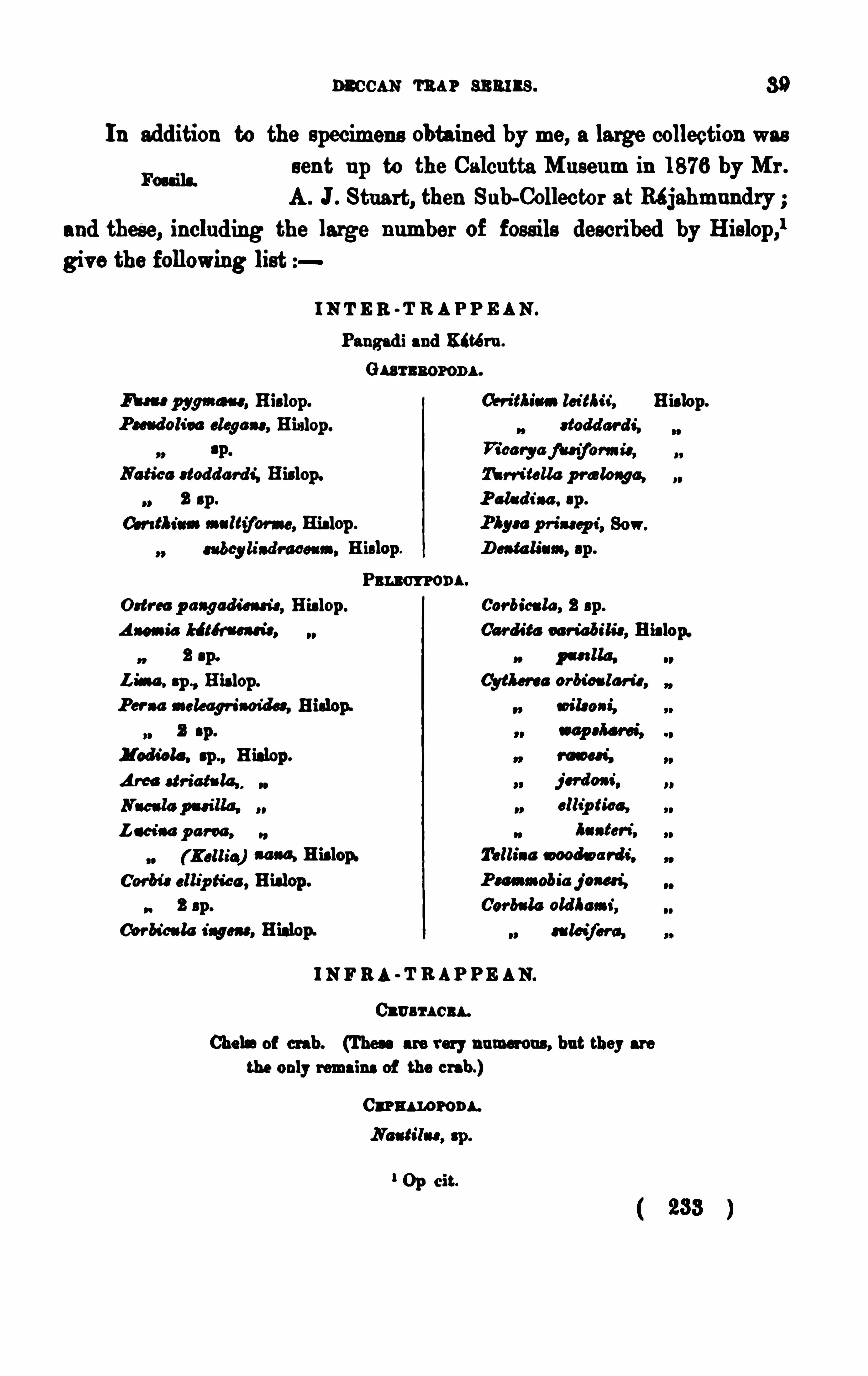
Deccan ra n sn ai l s . 3 9
In add ition to the specimen s obta ined by me, a large collection wassen t u p to the Calcu tta M u seum in 1 876 by M r .
A . J . Stu a rt, then Su b-Collector at Réjahmu ndryand these, includ ing the large n umber of foss ils described by Hislop,l
giv e the following list
Fos s ils .
I N T E R -T R A P P E AN .
Pu ngad i and K‘td ru .
G u r s aor on a .
M y r n a“. Hislop . cer ium.lci'
tbu , Hislop.
P seudoli ra sloga ns , His lop . s tod d ar d s'
,
rs 'P
Notice s todd a rd s'
, Hislop. Ti n -i talic p r a lo aga ,
2 sp . P ala d i n . sp .
Con fl icts .ma ltifom , Hislop .
Da h lia“, sp .
Pr u m on s .
Od o-ca p a agads'
an is , His lop . Cor bica la , 2 sp .
A nemia “ti t-s u d s , Car din u r ia bs'
h'
s , Hislop.
2 sp. p as i lla .
Lis sa . sp ., His lop. Cytlm a or bc’
oa lan’
s ,
Pcr aa mek agfiaoidcs , Hislop. soils os s'
,
2 s p .
I od id e , sp ., Hislop .
Am str ict-lg ,
L ar is a p om ,
( Kellie) am Hislop»
Coo-bis ellip ti ca , Hislop .
2 sp .
Cor bicu la ingot», Hislop.
I N F RA -T B AP P E AN.
Cl e an er s .
Che]. of crab. (Thes e are very n umerou s , bu t they are
the only remains of the crab .)
Car n s norona .
Op cit.
m os t,
j s r dos i ,clls
'
p ts’
ca ,
ha s ten }
Tallinn moodwa rd s'
.
P sm s oobia j an d ,
Gar b-la old hms a’
,
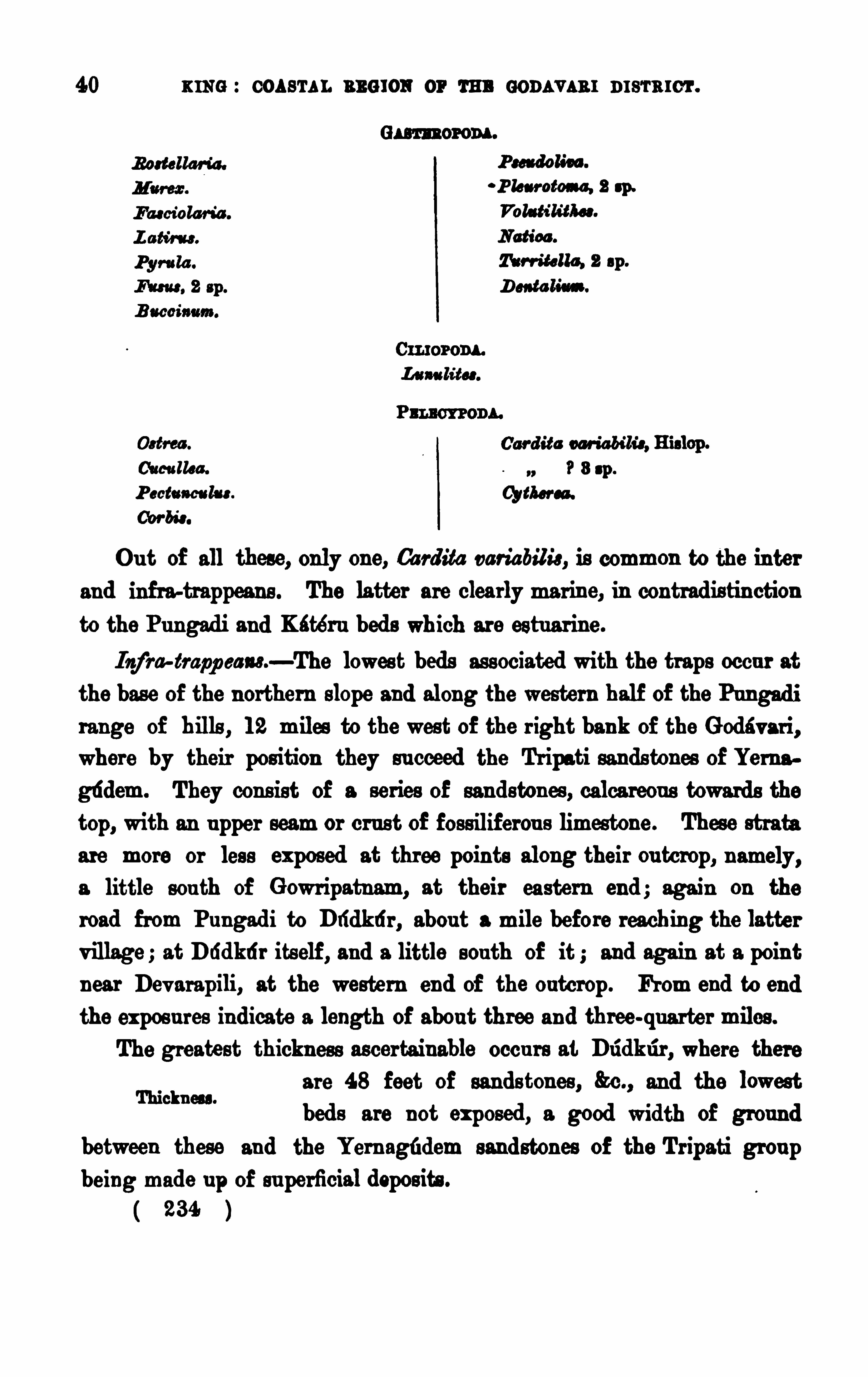
40 KING : cos e'ra r. n ews or m aonav s a r ms
'rmcr .
P h an toms , 2 sp.
Notices .
“M a lta, 2 sp .
(Monaco.
P ectum lns .
Cbr bs'
s .
Ou t of all these, only one, Ca rdita variabilis , is common to the in ter
and infra-trappeans . The latter are clearly marine, in contradis tin ction
to the Pu ngad i and Kater n bed s wh ich are estu ar ine .
Iogf‘
ra trapp cans—The lowes t beds as s ociated with the traps occu r at
the bas e of the northern slope and along the western half of the Pungad i
range of b ills , 1 2 miles to the west of the r ight bank of the G odav ar i,where by their pos ition they su cceed the Tripati sands tones of Yernagtidem. They con s ist of a series of san dstones , calcareou s towards the
t0p, with an u pper seam or cru s t of fos s iliferou s limestone . These strata
are more or les s exposed at three points along their ou tcrop, n amely,a little sou th of G owripatnam, at their eastern end ; again on the
road from Pu ngad i to Dlidkti r , abou t a mile before reaching the latter
v illage ; at Dddkdr its elf, and a little sou th of it ; and again at a poin tnear Dev arapili, at the western end of the outcrop. From and to end
the expos u res in dicate a length of abou t three an d three-qu arte r miles .
The greatest thickness ascertaiu able occu rs at Dddkr‘
ir , where there
are 48 feet of sands tones , &c., an d the lowest
bed s are not exposed , a good width of grou nd
between these and the Yern agfidem sand ston es of the Tripati grou pbeing made u p of su perficial depos its .
234
Thickness .
42 K ING : COASTAL REG ION o r rm: s om v am nrs'rarc'r .
the more fr iable seam below. The greatest showOf b s s ils was , how
ev er , Obtained from the G owr ipatn am ou tcrop, andit was here that the fragmen ts of Nau tilu s and the
allele Of the cr ab we re fou nd . The large blocks seen in the small
temple and cfiabu tra at Dridkri r were dou btless Obtain ed from the ou t
crops toward s Gowr ipatnam, for I cou ld see no thick enough beds forthem anywhere near the v illage .
The d ip of the beds is at 5° 1 0°
sou th -east, or east-s ou the as t ; the
more prev alen t being abou tThere is no s ign Of any alteration of these bed s by the s u perincum
Apparently u n affected bent trap ; they are good ord in ary rough san dy
by s u per incumbeu t trap .limes tones .
Regard ing the age Of these bed s , they are certainly , for this region ,
Relation to Deccan Older than the trap series, on ly it is n ot at all
“Pm i“clear to what portion Of th is ser ies these flows Of
the eas te rn coas tal region belong ; and they appear to hav e been den u dedbefore the trap was pOu red ou t in deed , as far as the gen erally mas s ivecond ition Of the trap goes , the su rface over which they were pou red mayhav e been d ry land ; at any rate , it cou ld hardly hav e been the bottomof the sea in wh ich the shells nowpreserved in the rock lived . I t will
also be seen later on that the non -parallelism of these bed s with the ov erlying trap and their intermed iate fos s ilif erou s band , and the overlap Of
Fos s ils .
these, are again st the two being v ery closely con nected grou ps of a ser ies .
The major ity Of the fos s ils are su ch as are u su ally con s idered as of
ter tiary age, par ticu larly the Gas teropoda bu t the
prev alent Tu r r itella appears to be v ery close to
T. d isp assa , Stol., a cretaceou s species f rom the Ar iyalrir beds Of the
Tr ichinopoly d istrict. 1 The Volu tih'
t/les is v ery like Volata tors ion ,
Desh .,which is a Calcaire G ros s ier species .
There is a strong resemblance, lithologically, between these beds andthos e Of the Lameta grou p, as descr ibed by thelate I . G . Med licott for the typ ical locality on
Cretaceou s Fau na of Sou thern Ind ia, Vol. ll.
ass
Cretaceou s amn ities .
Besemblancc to Lametas .
BROCAR m ar seams . 43
the Narbada r iv er, and in the accou n ts giv en of other localities Of this
grou p by s u bsequ en t writers .“ The pos ition of these beds , u ndern eath
the trap, which is , I think, not per fectly con formable to them, bu t sumciently separated from them by ov erlap and by denu dation , is also in
favou r Of these Dudkdr bed s being a mar in e represen tativ e Of this grou p.
Mr . W. T. Blanford has already discu s s ed“the relations and age Of
these bed s , regard ing which he says , after a briefdescr iption of them and their foss ils : the most
abu ndan t Of which is a Ts rr iiclla , appa ren tly iden tical with T. d isp erse
of the cretaceou s Ariald r grou p . I f not identical, the two species arev ery clos ely allied . A Na u tilu s , abou t fifteen Ga sterop oda , and eleven
M ellibra acfiia ta accompany the T wri lella bu t not a s ingle speciesexcept Ts rr itella d isp osed , has been recogn ized as identical either with
the cretaceou s beds of Sou thern I nd ia or with the eocene fos s ils of the
n ummu litic grou p. The collections hav e n ot, however , been s uficien tly
compared to en able the species to be dete rmined with any cer tain ty.
Only on e s ingle species , too, Ca rdita variabilis , has been recogn ized as
occu rring also 1 n the overlying in te rtrappean bed . Although the whole
facies is tertiary , there 1 s a remarkable absen ce Of characteris tic genera,
and the chief dis tin ction from the cretaceou s fau na of the u pper bedsin Sou thern I nd ia is s imply the wan t of any marked cretaceou s form.
The fau na is d is tinctly mar ine.
I t is difficu lt to say whether this bed shou ld be referred to the
Lameta grou p or n ot. The mineral cha racter is s imilar, b u t allknownLameta ou tcrops are so d is tant that the iden tifica tion is somewhat
dou btful. The d is tinction s between the fos s ils of the Baigh beds and
those Of the inf ratrappean s of Drid lni r and Pu ngad i appear too greatto be attribu ted solely to the ex is tence of a land bar rier between thetwo areas ; it is d ifficu lt to su ppose that the two formations can be of
the same geological age, and the dificu lty cons equen tly arises that, if the
V iews of W.T. Blanford .
44 KING : OoAsr AL REG ION or r u n GODAvAa r nrsrmcr .
Lameta beds represent the Bégh grou p, they are probably more ancien t
than the Pu ngad i in fr atrappean s . Still the balance Of ev idence is ratherin favou r Of referr ing the latter to cretaceou s timcs than to tertia ry.
They may be Of intermed iate age.
Trap s and intertr app eam .—The Dtidktir beds are overlaid by coarse
compact blackish -green bas alts , which atta in a
thickn es s of n early 200 feet and ex tend f ar to
the eas t and west, lapping on to the gn eis s in the one case and the Tr ipati
sand ston es in the other . Abou t half way u p this thicknes s Of traps ,there is a thin ban d Of fos s iliferou s limes ton es bu t this does n ot alwayslie in the middle Of them, or parallel to the s trike Of the Dtidktir bed swhich have the greates t th ickn es s Of trap on them at their eas tern end ,
while there is again another thicken ing ou t Of the traps at the wes tern
ex tremity Of the field to the sou th-sou th -west Of Dev arapili. At Dud
kdr there are only some 27 feet Of trap between the Tu r r itd la lime.
ston e and the in tertrappean han d ; while at the road crossing fu rthereast there mu s t be a thicknes s Of 40 feet at leas t below the seam of
limestone as it pas ses rou nd the spu rs in the d irection Of Pu ngad i.
I n the v alley sou th-sou th-west Of Gowr ipatnam, the band Of inter
trappean limestone is abou t 4 feet thick ; and to the eas t of this , it thins
d own to 2 feet in the d irection of Pungad i. Toward s Dlidkti r it thicken sou t to 8 or 1 0 feet. The seam is gen erally of two or three or more bedsm en u . and c o
the rock being v ery Often a compact crystallinelogy o
slightly magn es ian limeston e of white, pink and
Overlap the inf r atrap
grey or greyish-green colou rs , bu t often er grey ; at other times it is v erycoarsely crystallized and fibrou s in ban ds and seams of alternating crystallized and fibrou s stru ctu re with pearly lu s tre, or Often , r u dely n odu lar
and concretion ary with a rad iating fibrou s stru ctu re . Then again the
r ock is les s crystallized , Or d u ll compact, or soft and friable. All these
d ifieren t stru ctu res and cond ition s are of cou r se on the weathered ou t
crop, Or in the qu arries where it is pres umed that the more generallycrystalline character of the rocks becomes changed by expos u re ; and
they a re so ir regularly d istribu ted th rough the thickn es s that it is qu ite23 8
sp .
Cor bis ellip tica , H islop .
Ca r d ita va r ia bilis , H is lop .
( IQ/ti er ed , s p .
These are all per fect specimen s , an d there is a fair n umber of each
of them ; Oatrea , Lima , Modiola , an d Corbicu la hav ing only been p re
v iou sly kn own f rom these bed s . These specimen s were principally gotou t Of the qu arr ied lumps Of rock wh ich had been carted from the line ofqu arr ies at the head of the shallow v alley sou th Of G owr ipatnam and
laid down n ear the trav ellers’ bu ngalow at Pu ngad i : the rock hadbecome somewhat weathered by being there lef t lying ou t in heaps , an dthu s the shells were ex posed and easier kn ocked ou t. There is no dou bt,howev er , that they are all from thes e in tertrappean bed s ; the one thingn ot known is their relativ e pos ition in these beds , thou gh some clu e is
giv en to this in the accou nt I hav e giv en of‘
the f ew shells obtained
On the Rajahmu ndry s ide, or left bank of the G odavar i, and abou t2 miles along the road to Korekonda, there is
a lowheadland of basalt overlooking the allu v ial
flat to the n orth , at the base Of wh ich a long line Of qu ar ries has beens u nk in beds Of yellow and bud limes tone . These qu ar r ies are in the
form Of a long trench which h as been u n fortu na tely filled u p in great
part by the d iscarded debris Of the calca reou s rocks , so that the bottomOf the ou tcrop is always covered u p , an d I do not th ink a clear ex pos u reof the ju n ction between the lowest bed s and the u nd erlying trap hasever been noted . However, in a small stream bed (nala ) at th e n orth
east en d Of the qu ar ries , the u n derlying basalt is ex posed at only a
94 0
Ki téru ou tcrop.
DECCAN TRAP SERI ES .
few feet lower down than the limes tones . On the other hand , the
contact of the u pper bed s and the overlying trap is Often clea rly exposed .
Fos s ils are not v ery eas ily got ou t from the ex posed su rfaces , nor aremany to be s een , except when the qu arr ies are re-0pen ed at the end of
the rain s and when the ou tcrop and the d ebris thrown ou t d u ring the
prev iou s working seas on hav e had some time to weather .
Between this ou tcrop and the v illage Of Kétér u (half a mile to the
T“ 30m dou bt wes t), a f u rther trench has been opened u p in
m y °f a ““m W ‘d ‘ limestones which appear to belong to an other and
lower band ; bu t th is is not s u fficien tly clear , as the dip is v ery low in
both ban ds , while the second of these is rather to the sou th-wes t of the
first, so that by the mere flatn ess of lie it is pos s ible that the latter maybe a con tinu ation of the former . I think myself that there are two
sepa rate hand s , becau se the rocks d ifier in some respects , an d n o foss ilsare known from the wes tern ou tcrop. The n ativ es (and the v iews of
qu ar rymen who hav e worked f rom their childhood at these beds are
n ot to be lightly thrown as ide) say that the two ou tcrops belong to one
and the same han d . One thing is clear -the western ou tcrop is alsou nderlaid by trap.
The limestones of the band n earer Katern are on thewhole mu ch
more crystalline than the rocks in the fos s ilif erou s ban d .
The trap, both abov e and belowthe limestone bands , is a da rk-greenor greyish compact basalt, v ery much weatheredall over the ou tcrops and wellin belowthe su rface .
I t has a s trong tendency to s eparate in rou n ded ma s ses and blocks , withrudely concentric lamina su r rou nding cores of the solid unweathered
rock ; an d so mu ch is this the case that it has been fou n d very d ifiicultto obta in blocks large en ough for the ir rigation and canal works in the
d istrict. There is an indis tinct sort Of lamin ation parallel with the
s trike of the in te rtrappean beds when v ertical s u rfaces are exposed , asnear the qu arr ies ; bu t there is no thick en ough exposu re anywhere on
the slopes , either here or in the Pu ngad i field , to showany s u ch beddedlie as is developed among the traps Of the Deccan proper
48 xms : com a . ans ION or r u n conavu u nrs'rmc'
r .
There is occas ionally a good deal of s ilica segregated thr ough both
u pper and lower band s , in the form of calcedony agate common opaland rock crystal in amygdala and geodes , and large mas ses of calc-sparare common ; bu t all these aremore frequ ent in the Pu ngadi field , wherethe expos u res are v astly larger .
In the face of the Katern quarries , the trap, when least weathere d,is a compact dark-brown ish-green earthy rock separating in r u de
s ub-angular masses with large s ub-conchoidal faces . The bottom edge
of the u pper trap is weathered for a few inches of a yellowcolou r ;
it is also amygdaloidal with small kernels of dark oliv e-green clayeymatter , the v esicula rity being strong for 8 or 4 inches and then rapidlydis appear ing.
The contact of the limes tones with the u nderlying trap is , as alreadyobserv ed , n ot exposed .
There are abou t 1 00 feet of the u pper traps , which are again ov erlaid
by the Rajahmu nd ry sandsto nes ; the thickn ess of the s u bjacent band isu nknown , bu t the s tream chann el at the north-east end of the quarriesshows from 40 to 50 feet of them.
The in termediate band of limes tones is , when best seen , from 1 2 to
1 4 feet ih thickness ; bu t it thin s ou t to the nor theas t and is n ot fou nd at wha t ought to be its
point of ou tcrop on the Korekonda road . I t con s ists of beds of varyingthickness , non e of which a re con s tan t for any length ; bu t the followingis the arrangement of beds generally met with, in descend ing ord er
1 . Dark chocolate-brown and green ish clayey mud.—8 or 9 inches .
2 , Dirty greenish foss ilifer ous calcareous mu d , hardening somewhat on exposure .
- A fewinches, to a foot or more in thickness .
3 , Earthy, clayey, brownish and pals-coloured limes tone ; with occas ionalfoss ils .
pearly-grey, brown , and reddish dolomite.
—6 to 8 f eet.
All these, except the foss ilif erous mu d , may be fou nd more or less24s
50 K ING : COASTAL REG ION OF THE GODAVARI DISTR ICT .
s u per in cumbent trap do not appear to be altered at all; and the firs t
idea that strikes on e is that for which H islop con tend s , namely, tha tthe alteration mu st hav e been produ ced by the u n derlying trap, or
(to pu t it more correctly) this is the v iewHislop takes of the s ituation
n ear Nagpur , and he ind irectly ex tend s it to the Rajahmu n d ry a rea ,
thou gh it mu st be remembered that he n ev er sawthe latter .
A v ery importan t poin t here is , that if the traps between the
Cm aga in st “new,
in f ratrappean bed s an d the in ter trappean zone
tion. were in tr u ded , they might be ex pected to havealtered the con tact bed s equ ally abov e an d below; bu t there is n o more
s ign of their hav ing altered the su bjacent bed s than there is of the u ppermos t trap hav ing altered the fos s iliferou s layers on wh ich it was pou red .
Again , it seems to me that any d irect alteration by the t raps mayI nflu ence of weather hav e been completely obliterated by wea thering,
in s “ an d th is wou ld accou nt for the u n alte red lookof the in fratrappean s , and of the u pper portion of the in te rtrappeanlimes tones .
The real facts of the case appear to me to be, that the con d ition ofalteration f rom below u pwa rds is only apparen t, and du e n early altogetherto the v ar ied con stitu tion of the bed s , while the metamorphic action of
the su per incumbent traps was n ot v ery s trong. The gen eral con stitu
t ion of the bed s in the foss iliferou s ou tcrop atKatern is , that the lower beds are mo re
calcareou s , while the u pper bed s are les s and les s pu re, or a re more and
more clayey, u n til in the topmos t bed s they are calcareou s mu ds . In the
Pu ngad i ou tcrop the clayey band s are r arer , an d there is , as fa r as I cou ld
Explanation .
see, no representative of the mu ddier bed s ; and as a con sequ ence, thealteration or the degree of crystallization is more per s is ten t throughou t
thewhole th icknes s , there being s till, however , a more pu rely calcareou s
con s titu tion in the lower bed s . At the same time, throughou t the two
ou tcrops , there is a good deal of ta iling in of the limestone bed s among
the more clayey ones , an d thu s , at places ,we find the crys talline character
wav ing ir regu larly up and down the series .
244
Deccan r an s eams . 51
The late M r . J. G . Medlicott, long ago,1 discu ssed the v iew of
Applm t“a n ti?“of Hislop as to the probability of the in tertrappeanm i““m“In“ beds of the Cen tral Prov inces hav ing been in v adedand altered by a s u bjacen t sheet of trap ; an d in the area ex amined
by him he shows v ery good ev idence again s t this v iew, pr incipally thatin ev ery case with in ou r experience , the sed imen ta ry bed s hav e been
depos ited tranqu illy on the p revious ly indu rated and moreover p reviou s ly
i n unda ted su rf ace of the trap r ock and in several cases a la rge portionof the mate r ial con s titu ting these sed imentary bed s is derived from the
debris of the trap flows themselves Unfortu nately, the section s at
Pangodi or Katéru do not giv e s u ch clea r v iews of the condition of the
s ubjacent trap ; nor d id I see a case of any inclu s ion of mate rial deriv ed
f rom it . On the other han d , though Medlicott is qu ite as d ecided in
his remarks as to the altered cond ition of the sed imentary bed s betweenthe two traps being from above downwards , s till he giv es a section
illu s trating the exceptional dev elopments of the in te rtrappean rocks, that
is , dev elopments in which the alter ation is v ar iable, or is d is tribu tedthrough the bed s in the oppos ite d irection to that u s u ally obtain ing,or again , when there is no appa ren t alte ration at all; which section , on
comparison with the deta ils abov e giv en , will showwha t a strong resem
blance there is between the cond ition s of the rocks in this exceptionalcase and those more general ones in the Katern an d Pu ngad i ou tcrops .
Concern ing th is section ', he says It is exposed in one of the
glans of the Gorchu tta v alley, a fewmiles from the v illage of Singwa r ra .
I n descend ing order
30 to 40 feet of s u b-column ar trap, showing well a concentric s tructu re.
3 f eet to 6 inches of dov e-colou red grey ea rthy limes ton e, contain ing many shells .
This bed ,wh ich v a r ies (as stated ) con s iderably in thicknes s , does not seem to
hav e been ev en slightly influenced by the s u perincumbent ba salt. I t res ts
on
6 to 7 feet of a mass which is made u p of irregu la r lenticu la r patches dy ing
ou t an d replacing each other , and wh ich d iffer from each other as follows
a ) .—A gr ey limes tone, somewhat like the bed above, bu t is more earthy ,
1 860. Morn . G aol. Bu rv . of Ind ia , Vol. I I , p . 208.
Mom. Geol. Su r v . of In d ia. Vol. I I, pp . 203 -20 4.
( 245 )

K ING : COASTAL REG ION OF THE GODAVARI DI STRICT.
Lameta bed s represen t the Bagh grou p, they are probably more ancient
than the Pu ngad i inf ratrappean s . Still the balance of ev id ence is ratherin favou r of referring the latter to cretaceou s times than to tertiary.
They may be of in termed iate age.
Trap s and intertr app oam .—The Dddkti r beds are ov erlaid by coarse
Overlap the H u mp.compact blackish -green bas alts , which attain a
thickn es s of nearly 200 feet an d ex tend f ar to
the east and west, lapping on to the gn eiss in the on e case and the Tripati
san dstones in the other . Abou t half way u p this thicknes s of traps ,there is a thin ban d of fos silif erou s limes tones ; bu t this does n ot alwayslie in the middle of them, or parallel to the s trike of the Dddkti r bedswhich have the greatest thickn ess of trap on them at their eas tern end ,
wh ile there is aga in an other thicken ing ou t of the traps at the wes tern
ex tremity of the field to the sou th-sou th-west of Devarapili. At Ddd
kti r there are only some 27 feet of trap between the Tu n -italic lime.
stone and the in tertrappean hand ; while at the road cross ing fu rthereas t there mu s t he a thicknes s of 40 feet at least below the seam of
limestone as it pas ses rou nd the spu rs in the d irection of Pu ngad i.
I n the valley sou th-sou th-wes t of Gowr ipatn am, the ban d of inte r
trappean limes tone is abou t 4 feet thick ; and to the eas t of this , it thins
down to 2 feet in the d irection of Pu ngad i . Toward s Dddkri r it thicken sou t to 8 or 1 0 feet. The seam is gen erally of two or three or more bed sn ich e” “d litho the rock being v ery often a compact crystalline
slightly magnes ian limeston e of white, pink and
grey or grayish-green colou rs , bu t often er grey at other times it is v erycoarsely crystallized and fibrou s in band s and seams of alternating crystallized and fibrou s stru ctu re with pearly lu s tre, or often , ru dely nodular
and concretionary with a radiating fibrou s stru ctu re . Then again the
r ock is les s crystallized , or du ll compact, or soft and friable . All these
difieren t s tr u ctu res and cond ition s are of cou rse on the weathered ou t
crop, or in the qu arries where it is pres umed that the more generallycrystalline character of the rocks becomes changed by expos u re ; and
they a re so ir regu larly d is tribu ted through the thicknes s that it is qu ite23 8
54 ru n s : oox s'
ru . REG ION or m e conx v s a r nrs'mrc
'r .
can not be con s idered as v ery characteristic of age. They were comparedby Mr . Hislop with the n ummu litic fau n a of Western I ndia ; bu t, as
he poin ts ou t, n o forms appear to be identical, and althou gh Na tica
dolium, Tur r itella afin is , and an u nnamed Cor itki um fou nd in the tertiaries of Sind an d Catch , resemble N . stodda rd i, 71 pm longa , and C. s tod
da r d i, the in tertrappean forms are more closely allied to the cretaceou s
N . (Mammilla ) ca rna tica , T. elicita , and Can'
t/Hum vegans than to the
eocen e Species men tion ed 1 ; and other forms might eas ily be shown to be
afli ned to those occu r ring in the cretaceou s rocks of Sou thern I nd ia .
I n the case of Tu r r i/ella pm longa an d T. elicita , the afin ity is v ery great.
The shell called Vica rya f u s if ormis appears not to be really congener ic
with V. ver neu illi, the type of the gen u s“; and the latter has nowbeen
fou nd to be m iocen e, not eocen e. On the whole, it may be safely asserted
that n o ter tiary alliances of any v alu e hav e been detected amongst the
in tertrappean Rajahmu nd ry fos s ils , and that their relation s a re rather
with the u pper cretaceou s rocks of Sou thern I nd ia, although the con
a cetica is n ot strong.
”
CHAPTER V.—CUDDALORE SANDSTONES.
Ra'
j a/imu nd fy Bods .- Both at P u ngad i and close to Rajahmu nd ry
, the
u ppermost trap is ov erlaid by a series of redd ish sandston es and conglo
met ates , which in other parts of the field ex tend far ov er the gneiss ic,
ju rass ic, an d Rajmahal rocks . As far as is known , they are en tirelyu n foss ilifercu s , and thu s their age is only to be made ou t from the factthat they ev iden tly are s trongly u n conformable by overlap on the trappean ser ies .
They bear a wonderfu l resemblance to the Cud dalore sa nds ton e of
the Carnatic, and in fact mu s t be cons idered as represen tativ es of these.
i When Mr . Hislop wrote, the Sou th I nd ian cretaceou s fos s ils had not been des
cribed .
3 Th is was pointed ou t by Mr . H . M . Jenkin s , Q. I . G . S. , 1 864, p . 58. He also
(p . 65) su gges ted that the Sind beds conta in ing Vicary a wer e newer than eocene,—a
views ince con firmed .
”
( 248 )
cu nn u o as sm u sr cn s s . 55
They form fou r patches of slightly-elevated and somewha t hilly
grou nd on the edge of the deltaic allu v iums , which may be con s idered
E xten t .na mode of u nder the n ames of the Rajahmu nd ry-Samalkot,“cum n u '
the Pu ngad i, the Pentlam (fu rther to the sou th
west) , and the Ddddgu t (sou th of Ellore) patches being s epa rated fromone another by the G od i vari, Yera-kalwa, and Tammilér rivers .
Each of these patches r ises gen tly to the north in lowplateau form,
seldom atta in ing an elevation of more than 250 feet above the sea . I n the
larger area , or that of Rajahmu nd ry-Samalkot, there are a few small
flat-topped hills in the in terior , as to the north-wes t of the latte r town ,along the n orthern edge, and again at the western end where the
sand ston es face the G odev ar i in some low scarped hills and plateau swhich
”ru n down to the r iv er bank in low spu rs at s ahmu nd ry and
Dowlaishweram . The hills n ear the latte r place hav e been long knownfor their stone, which was qu a r r ied and ru n down into the river for the
great a n icu t or dam wh ich here s tretches from bank to bank (with an
in te rmed iate 1am or is land ) for a length of more than 2 miles acros s
the riv er .
The general s u cces s ion of beds in the ma in areas is , lowes t, exceed
ingly coarse and harsh red and pinkish hard conglo
merates and sand stones , felspathic, s uch as may be
seen in the r iver face of the town of Rajahmu nd ry, and away n orth-eas ttoward s Katéru or along the road to Vizagapatam. I n thi s latter direc
tion , the grou nd is covered to su ch an exten t with the coa rse grav el and
debr is of thes e beds , that clear ings had to be made for the fewgood
rid ing grou nd s in the n eighbou rhood . Sev eral wells hav e been su nkthrough thes e sa ndsto n es , grav els , and heavy conglomerates , as at the
Cen tral Jail, on the northern edge of ou tcrop, the deepes t of which is91 feet, bu twithou t piercing the series ; so that the re are at leas t 1 00 feetof these coarse bed s over the traps of Kétéru .
Succession and lithology.
Over thes e coars e beds come yellow-brown and redd ish fr iable clayeysands with , u ppermost, white (pu rple mottled ) and red soapy clays ,rather hard and mu ch given to breaking u p in ir regular f ragmen ts .
249
56 u s e : cos s'
ru . neu ron or m e com vm r DI STRICT .
With these u pper clays are seams of brown and pink fer ruginou s sands ton es . There may be 1 50 feet of these less compact s and s and clays ,as mad e ou t from the plateau hill sou th -eas t of Rajahmu nd ry.
These are s u cceeded by heavy an d coarse dark-brown , nea rly black,th ick-bedded s an dston es , occas ionally qu ite v itreou s an d n ot u nlike qu artzites . The coarser beds are made u p of fin e angu lar grain s of clea r
glas sy qu a r tz , d irty qu artz, and jasper clay-iron ston e, cemen ted by darkbrown perox ide of iron . With these are also seams of hard scabrou s(lateritoid weathering) fer ruginou s s andy indu rated clays . I t is in this
band that the Dowla ishweram qu ar r ies have been worked , an d it formsthe cappings of s ome of the small plateau hills eas t and sou th-eas t of
Rajahmu nd ry. The long sou th-eas t SIOpes of the qu ar ry h ill n or th
east of Dowla ishweram are mad e u p of brown ferr u ginou s sandy indurated clay beds . The thickn ess of the band is , at the greatest, abou t3 0 or 40 feet.
O ver this , again , was a fu rther good th ickn es s of white and pu rplemottled an d red s oapy clays , with brown and pink s and , which onlyremains n ow as ou tlying h ills and plateau s eas t of Dowla ishweram , as
at Razfl ii bill, 850 . On the top of this bill there are soft f r iablepale-brown coarse ferruginou s s and stones . The long sou therly slopingplateau s ,with headlan d s to the n orth , in the d irection of Ku ddum
,hav e,
in ad d ition to this capping of sands ton es , another of later itic sands tone
or later ite, which may, howev er , be of somewhat late r age.
We hav e, thu s for the Rajahmu n d ry s ands tones at their thickest,the following series in descending ord er
4. Upper white an d red clays and sands , with capping of soft
redd ish and brown sand stones , abou t 1 00 feet.
3 . Thick bedded b rown , occas ion ally qu artzitic, f erru ginou s
sandstones of Dowlaishweram hills , about
2. I ntermed iate s oft soapy clays and thin .bedded fr iable sand
stones
1 . Heavy conglomerates and red dish felspathic sands tones of
RAjahmu ndry town
( 250 )
58 xme : COASTAL neu ron or r u n con s vxnr n rsr arc'
r .
Tripati san d s tones . On the whole, howev er , they an swer best, by theircon s titu tion and pos ition , to the lower beds of the pres en t grou p.The old d iamond mines of M u léli on the sou th-wes t edge of this
patch were partly worked in these san dstones .
The lie of the Rajahmu nd ry beds is at a v ery lowangle to the sou th
sou th -ea st, a t abou t 5° or so ; occas ion ally they are n early horizon tal.At Dowlaishweram,
there is a good dealof u ndu lation and v ariou s dippingon the qu arry hill, accompan ied by s trong alteration of the beds almostto the con d ition of qu artzites , ev iden tly the res u lt in great pa rt of localsqu eezing an d fau lting. The d ip is on the whole, that is , ov er the whole
field , r ather more to the sou thward of ou t than is the case with the
beds in the trappean series .
The u ncon formability and overlap of this set of sand stones on the
Deccan traps ar e after allmu ch more decided than thos e ex isting betweenthe ages of in fra and intertrappean depos its , showing that it mu s t be eonsidered as belonging to a series of mu ch later age, or that it is u ndoubtedlyof the tertiary sys tem,
and pos sibly of middle eocene age. We are thu s
able to giv e the Cu ddalore sandstones , which wer e only known in theirown field to be post-cretaceou s , a rather more defin ite pos ition , thoughwe mu s t s till wait for that fu rther ev id ence which shall probably beded u ced f rom the occu rren ce of tertia ry fos s iliferou s s trata kn own to
be as sociated with the laterite , or , pos s ibly, sand stones of th is pres en tser ies in the n eighbou rhood of Qu ilcu on the western coast.l
CHAPTER VL—ECONOMIC GEOLOGY.
Bu ild ing clones ,Q's—Beyond the occu rrence of very good bu ild ingstones , su ch as those obtained from the d ifiereu t sand stone groups andthe trappean series , and the limestones associated with thes e, wh ich hav e
been v ery largely u s ed for mortar , there is little of economic in terest
in this par t of the Godav ar i district, as far as the dev elopmen t of other
See Manual of the Geology of Ind ia, Part I , pp . 837-3 38
259.
BCONOH I C GEOLOGY.
mineral resou rces is concern ed . At the same time, the sand ston es of
Ped dav egi, Tu ndkalpdd i, and Jén ampet (n orth-north-west of Ellore) are
worthy of special n otice . That o f the firs t locality is a tolerably compact even -grained rock, in good thick beds , eas ily worked , and, like
mos t red sand s ton es in I nd ia, given to ha rden ing cons iderably on expos u re,though in the la tter proces s of change its u sual br illian t red colou r is
given to fade or tu rn brown , an d thu s the stone is not so well adaptedfor ex ternal orn amen tation . The fin er and more br illian tly v ermilion
red va riety is on e of the hand somest stones I have seen in I nd ia, and
it wou ld be well worth carrying great d istances , as by the canalwhichis close by , for inte riors . The more u sefu l stone is , however , the buE
granu lar felspathic rock of the Tu ndkalpfid i s carp, which appea rs to
be of perfect d u rability it certainly exceed s in this respect a ny gneissof this part of the d istrict. The old pillars of many small temples inthe neighbou rhood have become, in a sort of a way, porcelan ized on
their s u rfaces , the matrix or hard clayey med ium enclos ing the quartzgran u les hav ing become glazed over , while the latter s ta nd ou t a little
ov er the su rface giv ing a rough bu t s till rou nded somewhat saecaharoid
su rface to the s to ne . The old u n u sed blocks lying abou t near the qua -rig.at Janampet are weathered and hardened in the same way, and theyare sa id to hav e lain there from time immemorial, the pagoda for whichthey were in tended nev er hav ing been completed .
Su ch are the specialities among the sand stones ; bu t good s tone is
to be obta ined in many other places all over the sandsto ne area . Thu s ,
n ear Peddapliram in the Samalkot area, there is v ery good bu ild ingmate rial in what appea rs to be the same hand of beds in the E lijah.
mundry sand ston es which has been n ea rly worked out at Dowlaishweram.
Diam d r ad iu m—A far greater in terest attaches itself, however ,to the sand s tones of one particu lar part of the distr ict, namely, thosenear Mu léli (to the west of Ellore) which are reported to have yieldedd iamond s . There is n o doubt that these sandsto nes of the lowplateauabov e the v illage hav e been broken u p and searched for d iamond s , as
hav e also the recen t deposits in the valley below; bu t they are not
253
60 K ING : COASTAL ans rou or r u n s om v an r msrmc'r .
worked now, nor are they thought of in this way ; ju st as very manyof the d iamond-min ing localities in the Cu ddapah , Ku r n ool, and Kis tnad istricts are n ow qu ite d eserted . Still, in all these other places of
m in ing or was hing with which I am acqu ainted , the works h av e beeneither on known d iamond -bearing rocks or in allu v ial depos its pres umably derived f rom and in the n eighbou rhood of them.
At M u léli, the old workings are either in v ery pebbly s andston es of
the Dtid tigu t range, wh ich are n ot known as d iamond -bear ing in any
other part of I nd ia,or are in s u perficial depos its collected below the range
and pres umably con s is ting f or the mos t part of the debr is of these sand
s ton es . There is of cou r se no reason why d iamond s shou ld n ot occu r in
these bed s jus t as well as they occu r in sands tones (qu ar tzites ) of the
v astly more an cient Banaganpili grou p of the KURNOOL r omwr rou‘
in deed these v ery s an d s ton es abov e M u léli are most likely in part mad eu p of the debr is of these Ku rnool rocks ; b u t the fitf u lnes s of com
pos ition of su ch reformed and derived rocks , and their d i fficu lty of beingworked as compa red with allu v ial patches , on ly make the chan ces of
su cces sfu l working poorer . At any rate, whatev er may have been the
produ ctiv en ess of the M u léli mines in old days , they are now in a
state of desertion , an d hav e been s o for at leas t half a cen tu ry.
I myself only saw, by the n umerou s old pits d ug over the flat-beddedsan dstones to the n orth of the v illage, both in the Rajahmu nd ry sands tones of the Dud ligu t range an d in the Géllapili bed s u n derneath, and
by the r u in s of old washing troughs and sorting floors , that d iamond s
had been sought for and probably fou nd . Bu t I believ e also that manyof the pits were, on the other han d , du g for iron ore, s u ch search beings till in progres s at the time of my v is it.
Dr . Heyn e gives , in his third tract, an accou nt of the d iamond
min es at M u léli (M allav illy) which, howev er , en ters into little detail,
an d is really s ubord inate to a des cription of those of Cu ddapah and Ku r .
n ool. Accord ing to h im , the M u léli workings seem to hav e been mainly
‘ See Mom. Geol. Su rv . of I nd ia, Vol. V, pt. 1 .
Op . cit, p . 92.
( 254 )
62 K ING : COASTAL s s s ros or r u n GODAVARI mar a re't .
ores , or s u ch as are exposed to weathering or detrital in flu ences , an d theseare the r ed and brown perox ides in man ageable f ragmen ts , with often
small cores of the grey or micaceou s iron ore .
The places where I have noticed iron f u rn aces are in the san dstone
region between the Yera-Kalwa and Tammilér r iv ers,or in the Pen tlam
patch of Réjahmu n d ry and other sand ston es n ear N u llacherla, and
fu rther n orth at Komera in the Tripati scarps . There are also others
in the N tizv id area,
at Ramakapéta and Somavaram ; and Heyn edescribes another locd ity at Latchmipu ram in the Pu ngadi patch of
sands tones .
Ti e Pen tlam a r ea —Some of the bed s in this field are, as alreadynoticed , h ighly fer ruginou s an d mu ch banded with clay-irons tone con
creticu s , &c ., and the debr is of these, as well as the beds themselv es,
are worked and r udely smelted at Ma rillam iidi , Jaganatgtidem, and
Débcherla . At the firs t place the ore u sed is a d ark-brown and pu rpleclay-ironstone, which occu rs in small lumps in a laterito id gra v el on the
sou th s ide of the v illage at a depth of abou t 1 5 feet,whence they are
d u g u p by the people f rom shaf ts , at the bottom of which they gru babou t for a few f eet . The f u rnaces of this part of the cou n try are
somewhat d ifierent f rom those I hav e seen in Sou thern I nd ia , in so far
as they are n ot complete tru ncate cones , bu t on ly half completed,so
that on e s ide of the in ter ior chamber is left cpen when the f u rn ace isn ot in u se . At ev ery smelting ,
this cpen s ide of the chamber is closed
u p by a th in slightly-cu rved wall of clay plates or slabs lu ted together
with wet clay ; this s ide of the fu rnace being flat,wh ile all rou nd
the bed of the chamber there is a backing of 2 to 8 feet. A con ical
chimn ey of abou t a foot in length is placed over the top of the chamber ,and on th is again is placed a broken half of a cou n try chatty or earthen
ware pot, throu gh which a hole has been broken , s o as to act partly asa f u nn el for the readier throwing in of the ore and fu el. At one
s ide of the fu rn ace there is a hollow hav ing a small commu n ication
with the floor of the fu rnace, and through this the slag or cinder is
d rawn 05 f rom time to time . Af ter the smelting the wall is br oken256
s conomc cs omor . 63
down and the bloom removed . At this place there were two fu rnacesand forges at work , and only one at Jaganatgtidem.
At G opallaptiram, a cou ple of miles to the sou th, the ore is obtainedfrom pu rple an d brown ferruginou s sandstones occu rring in 6-inch beds .
The Komera ore is a red and brown , rather yellowish, clay-ironstoneobtained from the sand stone bed s toward s Tripati . Here I had an
oppor tun ity of seeing on e of the blooms d rawn . The clay wall in thef ron t part of the chamber was broken down and carried ofi in large
pieces (to be u sed aga in ), and the bu rn ing charcoal raked ou t, when a
man pou nded the pas ty—bu t still, on the s u rface, in a state of slow
ebu llition—mass of metal at the bottom of the fu r nace for a fewsecond s
with a heavy wooden mallet. Then a huge pa ir of iron to ngs was
brou ght forward and rammed , or rather chopped down , here and thereon the mas s of metal, du r ing which time it hardened su fficien tly toallowof one arm of the tongs being lowered down the s ide of the pit
when the bloom was clasped , hau led ou t, and carried 05 to a small
pit or hollow in the grou nd lined with charcoal du s t. The pa rtiallyflaming mass was n owheav ily beaten over its u pper s u r face (the old
u nder-s u rface on the fu rnace floor ) for some time with wooden
mallets , after which it was left to cool, though a lot of old slag and
cinder was piled u p arou nd it, bu t not over it, wh ile a red ocolcu red
dross from the floor of the fu rnace was ladled over the u pper su rf ace.
After abou t 1 0 minu tes the bloom was then pa rtially split u p bywedge hammers ,which lef t three deep clefts in on e s ide . The blooms arelarger than those of Sou thern I nd ia , and are sa id to be abou t 2 ma u nds
(Mad ras ), or 80 lbs ., in weight, and of the value of 4 r u pees when handed
ov er to the con tractors . Two fu rnaces were at work here, and the
meas u remen ts of each of these were z—height, withou t chimney, 4 feet ;bredd th across the fron t, 5 to 4 f eet, tapering wid th from fron t to back,4 to 8 feet, tapering, the front being n early v ertical. The chamber isabou t I t feet in d iameter widen ing to the floor which is abou t 2 feet ;and the whole is su rmoun ted by a taperi ng chimney with fu nnel top of
abou t 2 feet high .
257
64 amo z COASTAL REG ION or r u n com v aa r man ner .
I n the Nfizv id region , there were only three fu rn aces at work at
Ramakapéta, an d two at Somav a ram the ore being obtained from the
debr is of. the bottom bed s of the G ollapili sand ston es .
The old iron working at Lu tchmipti ram ,where I was told smelting
is still pu r su ed in a small way, is so well described by Heyn e in h istract on the s u bject, that I take the liberty of reprod u cing the greaterpart of it here, as it will ad d cons iderably to the fewdeta ils I hav e beenable t o collect d u r ing my hu rr ied v is its to these iron v illages , most of
which I on ly came on by chance an d while hasten ing to more importan twork .
Abou t the end of the mon th of Ju ne 1 794, when the thermometer
s tood at I set ou t from Vu ppada , for
Letchemporam , a small v illage in the Polaveram
d is trict. Th is v illage lies abou t 1 4 miles sou th-wes t f rom Rajah
Dr . B eyn e’
s accou n t.
mu n d ry . I fou nd the people in this v illage ex tremely willing to show
a nd explain to me ev erything concer n ing their iron works .
The iron -smelters themselv es are a poor set of people, an d obligedto plou gh the land for their s u bs is tence d u r ing the wet seas on , and workas smelters on ly d u r ing the hottest pa rt of the year . The fines t and
mildest seas on they employ in cu tting wood in the hills , in bu rn ing char
coal, and , after these occu pation s a re over,in recov er ing their health at
home ; for, bes ides their repeated ex perien ce that ev ery one con tracts
the fev er d u ring his stay among the ju ngle, we hav e only to observ etheir s ickly look and their whole appearance, to be con v inced that their
accou n ts are correct. To this circums ta n ce, together with the n eces s itythey are u n der of cu ltiv ating the grou n d for a part of the yea r, we mayas cr ibe the u nprodu ctivenes s of their labou r as man u f actu rer s of iron . Yet
the iron wh ich they prod u ce is cons idered as the finest in every respectf or tools , razors , etc. Hen ce the demand for it is great, and the n umberof workmen mis erably small, for the min er s , smelte rs , wood -cu tters , and
labou rer s , all u n ited together , do not exceed eight or n ine men .
Ston es con tain ing iron ore in cons iderable qu antity are found everyOp . cit., p . 21 8.
258
66 ru n s : COASTAL REG ION or r u n conx vx ar ms 'rmc'r .
fou nd wh ich would yield a charcoal that wou ld answer the pu rpose s ufi
cien tly well bu t u nlu ckily all the ju ngle in the neighbou rhood of thev illage con s ists of v ery small bru shwood .
Thes e smelting-works , however , notwithstanding their d iminu tiv e
scale, attract the attention of every cu r iou s observer, on accou nt of the
s implicity of ev ery part of the proces s and the goodness of the ironobtained .
The f u rn ace con s is ts of a small semi-circular mu d wall, v ery mu chresembling in shape the half of a hen ’
s egg div ided longitu d in ally, withthe larges t end u ppermost. The wall is bu ilt of clay or mu d . From
the apex to the base is u s u ally 4; feet, while its greates t bread th is3 feet 9 in ches . The extern al and con v ex su rface has on on e of its
s ides , at the bottom ,an excavation ser v ing to receive the scor im, which
are let ou t through a hole in the bottom.
The intern al s u rface of this mu d wall is plain , except a semi-cironlar ex cav ation throu ghou t its middle part, commencing at the apexand termin ating in a circu la r hole in the grou nd , wh ich is I t} feet deep,and as mu ch in diameter . Th is part correspond s with the squ are cav ityin E u ropean fu rnaces , in which the iron is collected .
The u s e of th is semi-circular ex cav ation will be u nders tood bycon s ider ing the temporary part which is destroyed every day after the
smelting is fin ished . I t is a th in , conv ex , semi-circular wall, and is to
complete a circu lar hole with the ex cavation in the perman ent part ofthe f u rn ace. I t is con s tru cted in the following man ner —At 5 o’
clockin the ev en ing, the hole in the grou nd is clean ed from the as hes and the
remainder of the las t smelting, and its bottom and s ides coated with
powdered charcoalmois tened with a little water . At the bottom, to the
r ight hand , is a small circu lar hole for letting 0 3 the scorim. This hole
mu st also be clean ed , and then stopped u p with some moisten ed clay.
Charcoal is then thrown in to the hole an d placed in s u ch a man n er that
the apex of the heap to u ches the margin of the hole Oppos ite to thepr incipal work, and another heap Of pou nded ore is so placed on the
oppos ite s ide that the middle of the hole is left an empty space. These
260
s conou rc GEOLOGY . 67
two heaps are dis tan t f rom each other at the apex abou t a foot, at the
bottom abou t an inch . Th is is done in order to rest on the charcoal a
kind of fu n nel-formed chan nel for the admis s ion Of the stream of air
prod uced by the con stant action of the bellows . The ex ternal apertu reof the fu nn el receiv ing the n ozzle of the bellows is in breadth 5 or6 in ches . Clay is then pu t u pon it, which serv es both to fix it and to
form the firs t layer of clay that con s titu te s the temporary pa rt of the
fu rnace . This par t is not to be thicker than 2 inches , and it decreasesin th ickn es s the higher it advances . The f u nn el itself is made of a
mix tu re of clay an d hu sks Of r ice ; and prev iou s to its application ishardened by fire, and then made firmer in its pos ition by a coat of clayla id ov er it.
The f u n nel being fix ed in this man n er , the wall is ra ised , becominggrad u ally thinn er , so that when it arrives at the middle part, it does notex ceed the th icknes s of an inch . Then a bu rn t s tone of the same
th icknes s , from 1 0 to 1 2 in ches high and from 8 to 9 broad , is fix edu pon it, so that it inclines to the oppos ite s ide, the circle becomingnarrower the higher it r ises . This stone is connected with the principalwall by mean s ofmu d . I n this mann er the circle is completed ; some
holes of 2 inches squ are being left, one or two on each s ide. On the
stone itself is placed a second stone of the same kind and shape, bu tsmaller, and fixed in the same man ner . I ts apex is on a lev elwith the
top of the Oppos ite or principal part of the f u rnace. The top of the
f urnace now serves as the bas is for a cone, the u se of which is s uficientlyobviou s .
This cone is 1 2 inches long . I ts u nder-aper tu re res ts on the
top of the fu rnace, where its breadth is 1 4 inches . At its u pperpart or apex its diameter is 7 inches . To facilitate the in trod uctionof charcoal and ore in to the f u rnace, the cone is crowned with a large
cu tcher ie pot, the bottom of wh ich is broken ou t, and thu s serves not
only to fac ilitate the in trodu ction of f u el, etc . bu t is s upposed of much
con sequ ence as the representa tion of a swamy.
I t has been already stated that some charcoal and ore had been261
68 e o z COASTAL nnGrON or m e GODAVAa r nrsr nrc'r.
placed at the bottom of the fu rn ace, and that the f u n nel for conv eyingthe wind was placed u pon this heap. Some lighted cha rcoal is pu t
before the open ing of the f u n nel, and the whole cav ity is then filled
with charcoal,and th is is con tin u ed as the wall ad vances in height, the
charcoal serv ing as a s u ppor t to it, for it is so th in that it wou ld not be
able to s u ppor t its own weight. Within the holes left on each s ide of
the ston es, which con s titu te the middle part of the fu rnace, some ligh ted
charcoal is also placed .
“The u nder part Of the cone is also filled with charcoal. Then a
small ba sket of ore is thrown u pon it,an d u pon th is likewise some
lighted cha rcoal is placed . Fin ally, the whole cav ity is filled u p to the
top with charcoal.
M atter s are allowed to rema in in this state till 5 o’clock nex t
morn ing, when two pair Of bellows are applied to the apertu re Of thef u n n el, adapted for the in sertion of the n ozzles ; each pair of bellows isworked by on e man . The sev eral v en t-holes in the s id e of the fu r n ace
are s topped u p with a mix tu re of clay an d sand . The bellows are thenworked withou t in termis s ion , an d an in tens e degree Of heat is soon
prod u ced .
The ore is th rown in by small qu antities at a time, in small basketswhich do not hold abov e th ree or fou r pou n ds ; an d for ev ery basketf u lof ore two basketfu ls of charcoal are added . A s the cha rcoal bu rn s theore gradu ally s inks downward s , and at las t the melted iron and scor iaa
make their way to the bottom . The great Object of the workmen is tos u pply the requ is ite qu an tity of charcoal and ore, and they con tin u e
their ad dition s tillwith in a little of the time when the red u ced iron is
taken ou t Of the fu rnace.
A hole was left r eady at the bottom to be open ed occas ion ally inorder to permit the scor iw to ru n ou t. This is done regu larly ev erysecond hou r , or s ix times d u ring the whole operation . They pierce theclay which s tops the pas sage with a pointed iron , s u ffer the liqu id scor ire
to ru n ou t and then secu re the hole as before with clay . The cracksprodu ced by the in ten se heat in the ex terior thin wall they take ca re to
( 262 )
Recommended