Embed Size (px)
Citation preview
ROURKELA, ORISSA
Suraj PotdarSonam M. Pathan
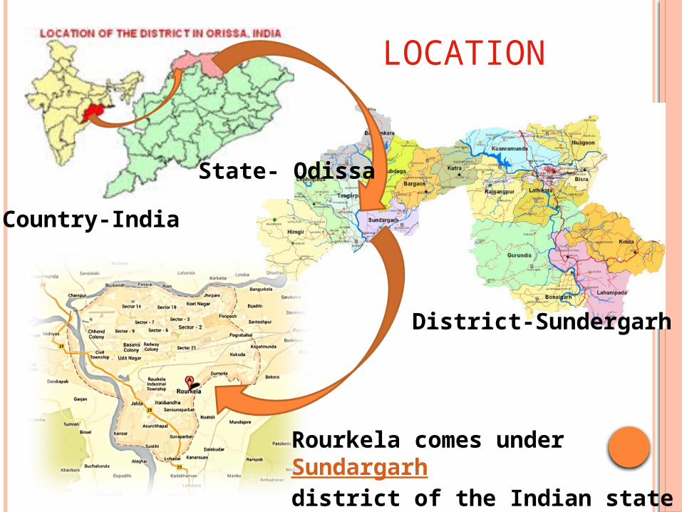
District-Sundergarh
Country-India
State- Odissa
Rourkela comes under Sundargarh district of the Indian state of Odisha
LOCATION
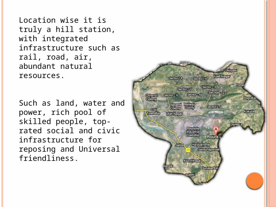
Location wise it is truly a hill station, with integrated infrastructure such as rail, road, air, abundant natural resources.
Such as land, water and power, rich pool of skilled people, top-rated social and civic infrastructure for reposing and Universal friendliness.
These factors have attracted many industrialists outside the state to choose Rourkela as their destination.
The geographical location is another blessing.
In history it has never faced any sort of natural calamity whatsoever, except some heavy rainfall.
ROAD AND RAILWAY CONNECTION
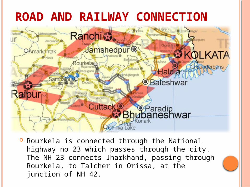
Rourkela is connected through the National highway no 23 which passes through the city. The NH 23 connects Jharkhand, passing through Rourkela, to Talcher in Orissa, at the junction of NH 42.
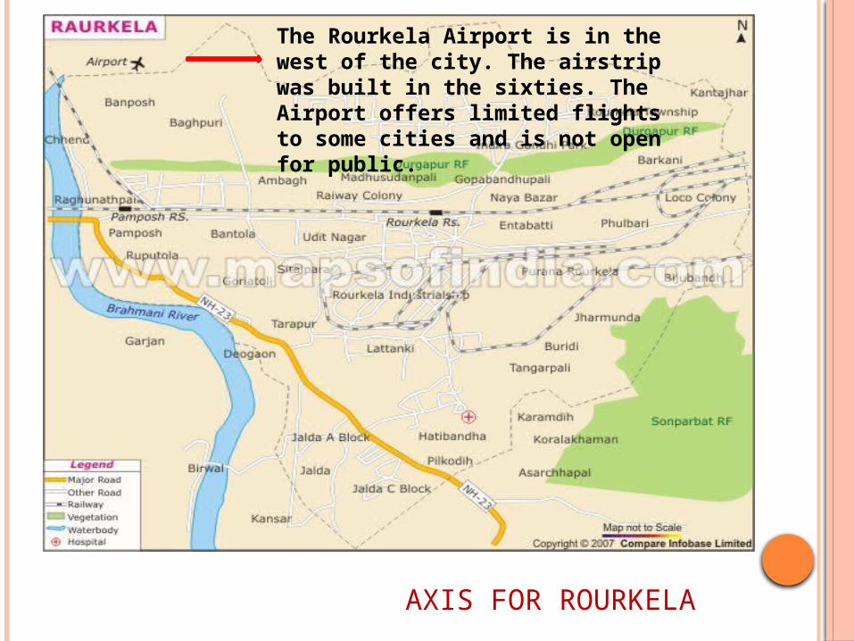
The Rourkela Airport is in the west of the city. The airstrip was built in the sixties. The Airport offers limited flights to some cities and is not open for public.
AXIS FOR ROURKELA
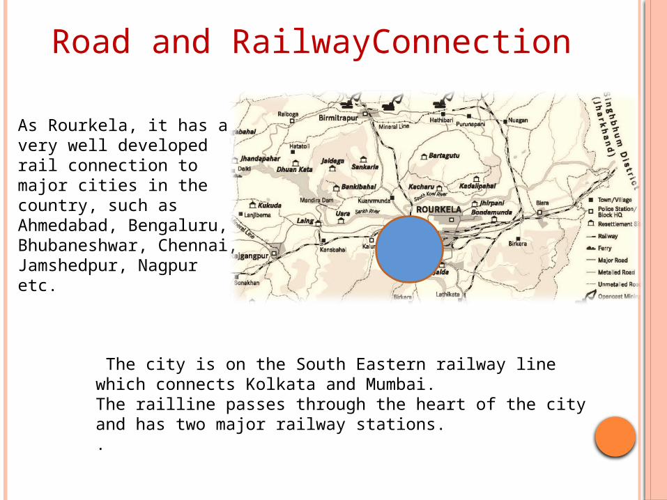
As Rourkela, it has a very well developed rail connection to major cities in the country, such as Ahmedabad, Bengaluru, Bhubaneshwar, Chennai, Jamshedpur, Nagpur etc.
Road and RailwayConnection
The city is on the South Eastern railway line which connects Kolkata and Mumbai. The railline passes through the heart of the city and has two major railway stations. .
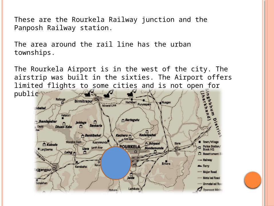
These are the Rourkela Railway junction and the Panposh Railway station.
The area around the rail line has the urban townships.
The Rourkela Airport is in the west of the city. The airstrip was built in the sixties. The Airport offers limited flights to some cities and is not open for public
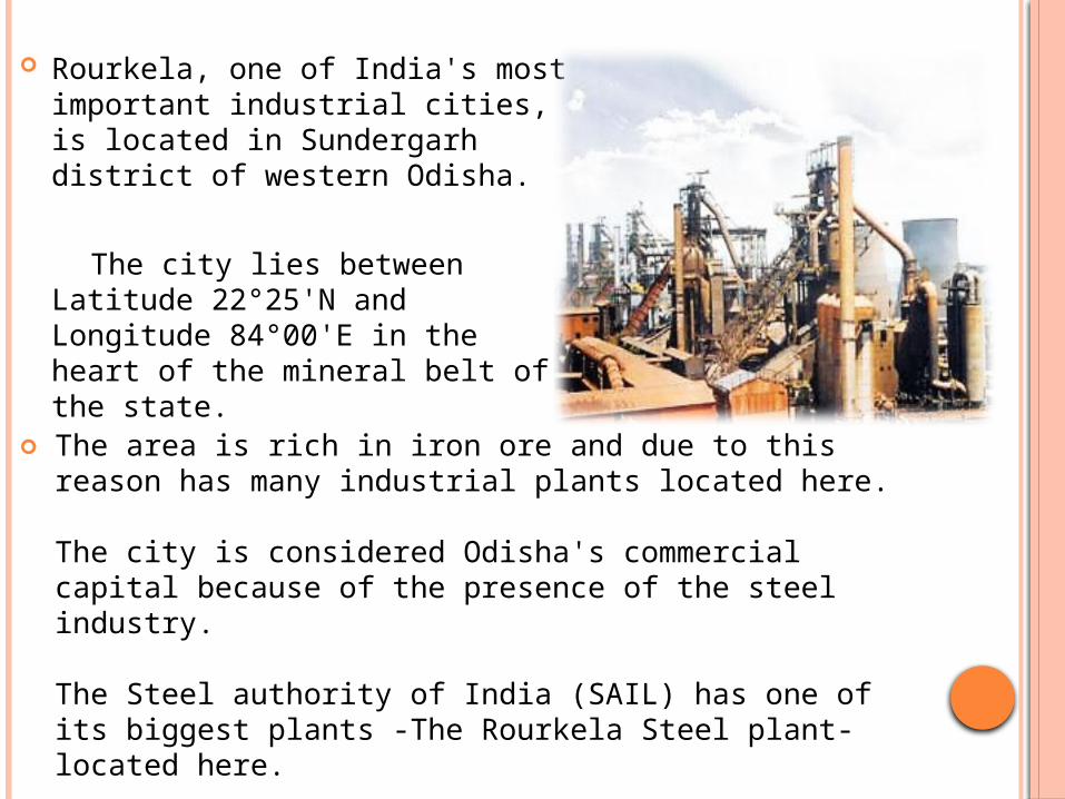
Rourkela, one of India's most important industrial cities, is located in Sundergarh district of western Odisha.
The city lies between Latitude 22°25'N and Longitude 84°00'E in the heart of the mineral belt of the state.
The area is rich in iron ore and due to this reason has many industrial plants located here.
The city is considered Odisha's commercial capital because of the presence of the steel industry.
The Steel authority of India (SAIL) has one of its biggest plants -The Rourkela Steel plant- located here.
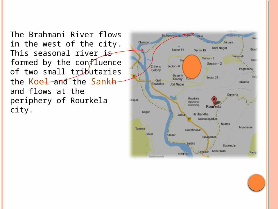
The Brahmani River flows in the west of the city. This seasonal river is formed by the confluence of two small tributaries the Koel and the Sankh and flows at the periphery of Rourkela city.
Parts of the Rourkela city developed after the setting up of the Rourkela steel plant here.
The old Rourkela area or Purana Rourkela including Entabatti and Phulbari is the older part of the city .
The new parts of the city are Pamposh, Rourkela Township, and Ambagh.
The inhabited urban areas are Udit Nagar, Pamposh, Aam Bagh, Railway Colony, and the Industrial Estate or strip.
South Rourkela is predominantly rural in areas such as Jalda , Lathikanta, Pikodih, Tangarpali, Tarapur.
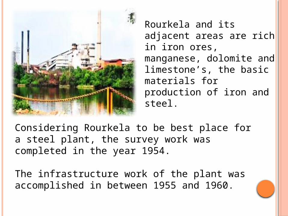
Rourkela and its adjacent areas are rich in iron ores, manganese, dolomite and limestone’s, the basic materials for production of iron and steel.
Considering Rourkela to be best place for a steel plant, the survey work was completed in the year 1954.
The infrastructure work of the plant was accomplished in between 1955 and 1960.
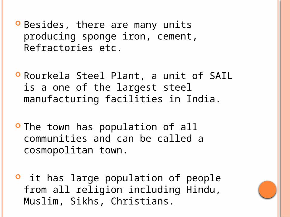
Besides, there are many units producing sponge iron, cement, Refractories etc.
Rourkela Steel Plant, a unit of SAIL is a one of the largest steel manufacturing facilities in India.
The town has population of all communities and can be called a cosmopolitan town.
it has large population of people from all religion including Hindu, Muslim, Sikhs, Christians.
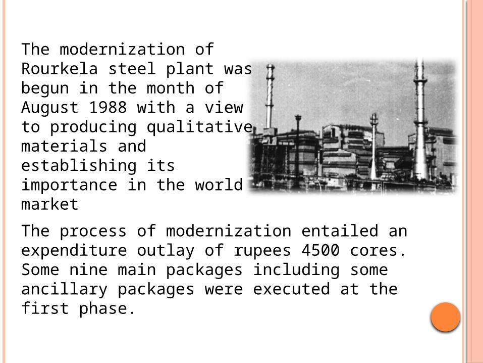
The process of modernization entailed an expenditure outlay of rupees 4500 cores. Some nine main packages including some ancillary packages were executed at the first phase.
The modernization of Rourkela steel plant was begun in the month of August 1988 with a view to producing qualitative materials and establishing its importance in the world market
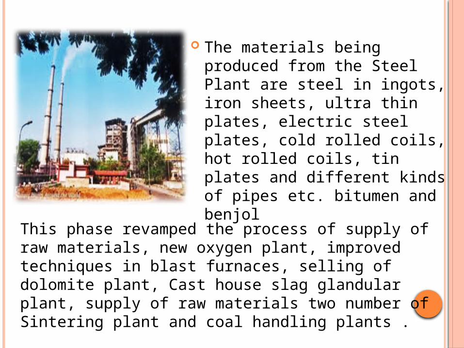
The materials being produced from the Steel Plant are steel in ingots, iron sheets, ultra thin plates, electric steel plates, cold rolled coils, hot rolled coils, tin plates and different kinds of pipes etc. bitumen and benjol
This phase revamped the process of supply of raw materials, new oxygen plant, improved techniques in blast furnaces, selling of dolomite plant, Cast house slag glandular plant, supply of raw materials two number of Sintering plant and coal handling plants .
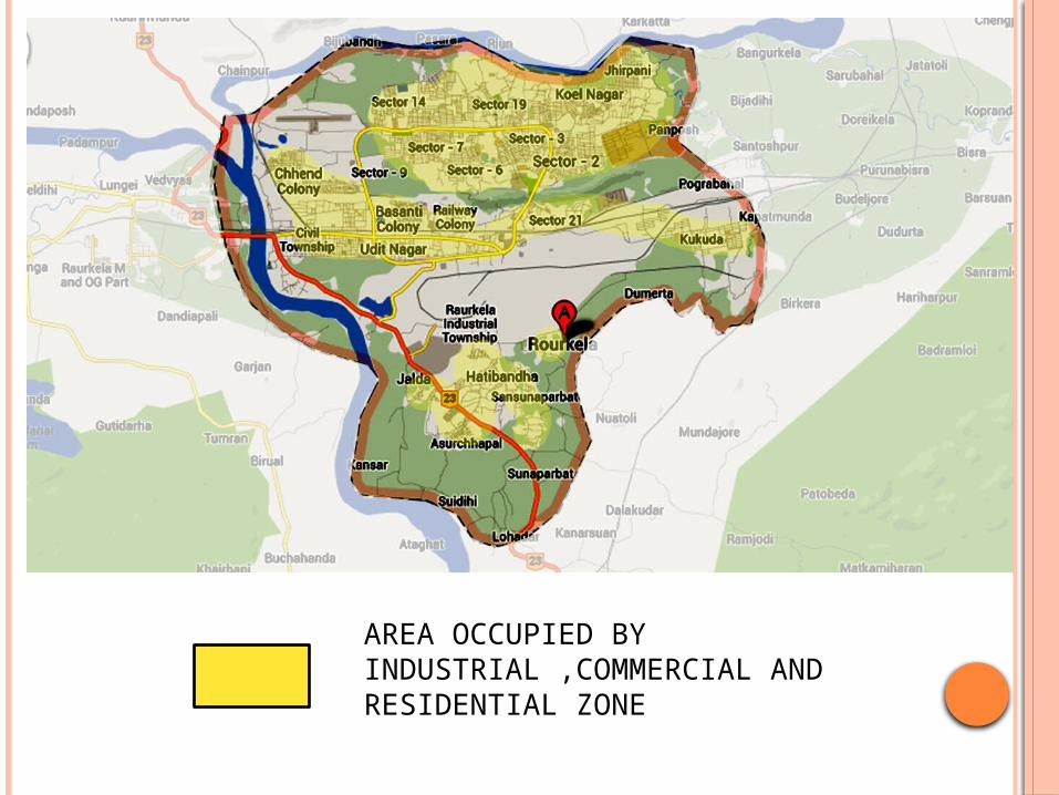
AREA OCCUPIED BY INDUSTRIAL ,COMMERCIAL AND RESIDENTIAL ZONE
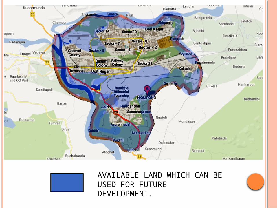
AVAILABLE LAND WHICH CAN BE USED FOR FUTURE DEVELOPMENT.
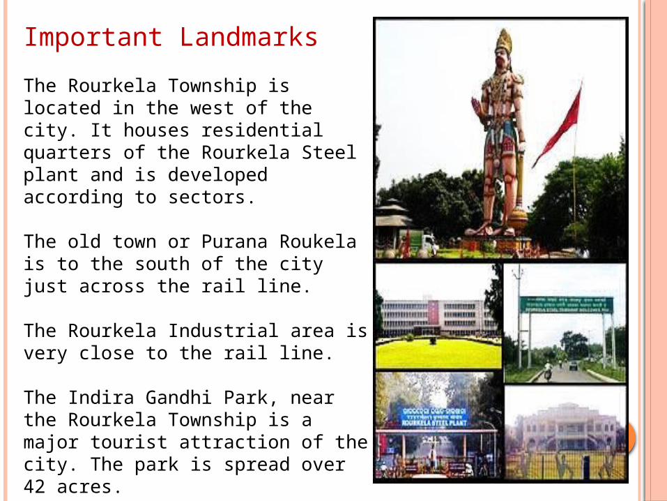
Important Landmarks
The Rourkela Township is located in the west of the city. It houses residential quarters of the Rourkela Steel plant and is developed according to sectors.
The old town or Purana Roukela is to the south of the city just across the rail line.
The Rourkela Industrial area is very close to the rail line.
The Indira Gandhi Park, near the Rourkela Township is a major tourist attraction of the city. The park is spread over 42 acres.
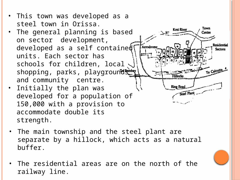
• This town was developed as a steel town in Orissa.
• The general planning is based on sector development, developed as a self contained units. Each sector has schools for children, local shopping, parks, playgrounds and community centre.
• Initially the plan was developed for a population of 150,000 with a provision to accommodate double its strength.
• The main township and the steel plant are separate by a hillock, which acts as a natural buffer.
• The residential areas are on the north of the railway line.
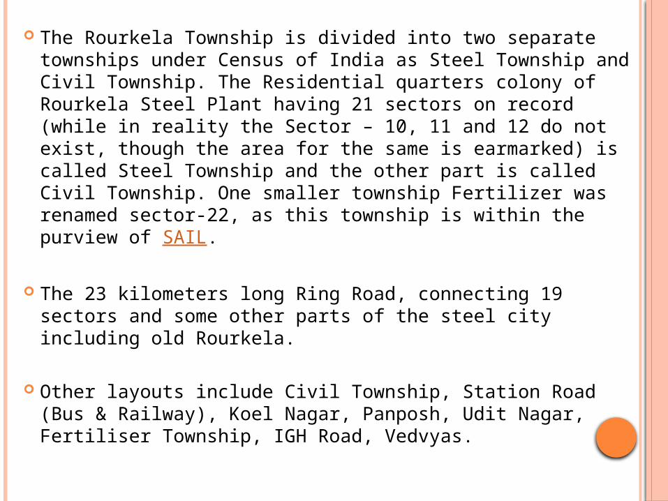
The Rourkela Township is divided into two separate townships under Census of India as Steel Township and Civil Township. The Residential quarters colony of Rourkela Steel Plant having 21 sectors on record (while in reality the Sector – 10, 11 and 12 do not exist, though the area for the same is earmarked) is called Steel Township and the other part is called Civil Township. One smaller township Fertilizer was renamed sector-22, as this township is within the purview of SAIL.
The 23 kilometers long Ring Road, connecting 19 sectors and some other parts of the steel city including old Rourkela.
Other layouts include Civil Township, Station Road (Bus & Railway), Koel Nagar, Panposh, Udit Nagar, Fertiliser Township, IGH Road, Vedvyas.
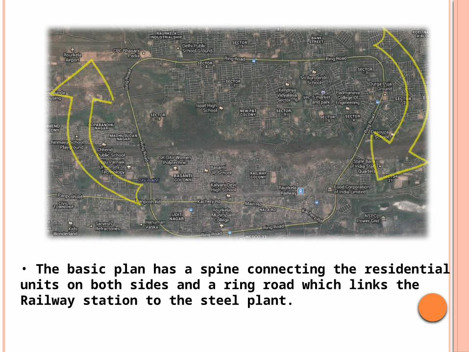
• The basic plan has a spine connecting the residential units on both sides and a ring road which links the Railway station to the steel plant.
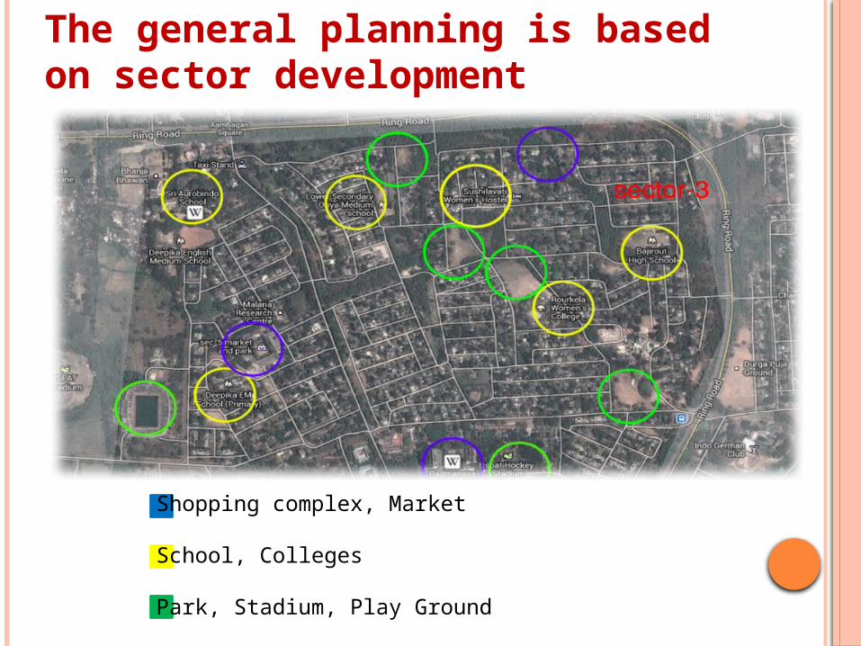
Shopping complex, Market
School, Colleges
Park, Stadium, Play Ground
The general planning is based on sector development
CONCLUSIONSThere is a difference between forced rapid changeand gradual change through an evolutionary process.
Evolutionary changes - that enable a societyto perceive the incoming change, to understandits consequences, to accept and to welcome it -are desirable. The imposed and rapid changeswhich mostly are caused by industrialisation anda rapid modernisation process, throw the societyinto chaos: The Adivasis are not ready for thatand also are not welcome in this process.
This destroys the society, breaks its social fabric, its economic strength, its moral strength, the spiritual as well as the political life, and ultimately the overall ethnic characteristics.
For these reasons, the Adivasi societies all overthe world have been opposing such processes. It is, therefore, necessary that the indigenous communities are to be completely associated in the decision making process, so that they are aware.