Embed Size (px)
Citation preview

World Geography and Culture(SS 105A)
Victor Rea Oribe

Which of these places represents the REAL WORLD?
All of them, plus many, many more.
Is the World Your Elephant?An old South Asian tale tells how four blind scholars decided to study an elephant.
The first scholar bumped into the elephant’s tusk. “Oh ho” he said “An Elephant is like a spear.
“No,” the second scholar replied, feeling its trunk. “It is clearly like a snake.”
The third scholar felt the elephant’s leg and said, “You are wrong. It is exactly like a tree.”
Finally, the fourth one grabbed its tail. “This creature,” he said, “is definitely like a rope.”

Each of these so-called scholars was partly right. But all of them were wrong.
They had mistaken a part of the elephant for the whole thing.
Some people make the same mistake about the world.
They think the whole earth is like the places where they live.
But the world is a combination of many places. Some are hot others are cold; some are filled with green trees, others are sea of sand; some are crowded others are empty.

What is Geography?
Geography comes from a Greek work, Geo and
Graphia (geographia).
literary means “description of the Earth”
first used by the Greek scholar Eratosthenes in the 3rd century B.C.E.
it is best summed up as the “study of the Earth as the home of humankind.”

Geography
modern academic discipline of geography has its roots in the Greek and Roman civilization and emerged from that classical tradition through the Scientific Revolution in Europe.
The National Geographic Society commissioned a team of geographers to identify the core features of the discipline of geography.

Six Essential Elements of Geography
1. The World in Spatial Terms• Geography studies the
relationships between people, places, and environments by mapping information about them into a spatial context.
2. Places and Regions• The identities and lives of
individuals and people are rooted in particular places and in human construct called region.

Six Essential Elements of Geography
3. Physical System• Physical processes shape the
Earth’s surface and interact with plants and animal life to create, sustain, and modify ecosystem
4. Human System • People are central to geography;
human activities, settlements, and structures help shape the earth’s surface, and human compete for control of the earth’s surface.
Six Essential Elements of Geography
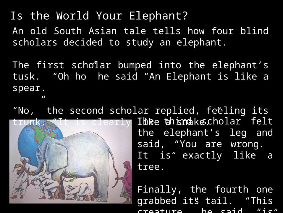
5. Environment and Society • The physical environment is
influenced by the ways in which human societies value and use the earth’s physical features and processes.
6. Uses of Geography • Knowledge of geography enables
people to develop an understanding of the relationships between people, places, and environments over time
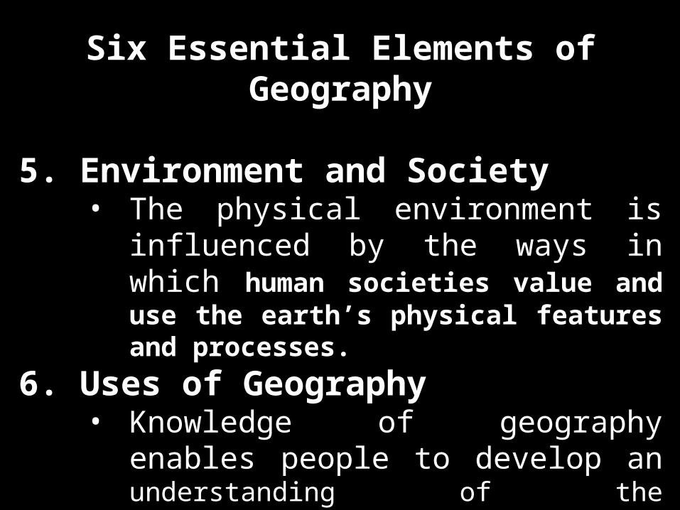
Major Branches of Geography1. Physical Geography
• It includes the natural environmental processes across Earth’s surface that result in the distribution of climate varieties, plant ecologies, soil type, mountain formation, and river action, among other pattern.
2. Human Geography• The study of the distribution of
people and their activities (economics, cultures, politics, and urban changes)

Major Branches
of Geography
Assignment # 1
Find the meaning of
each sciences

Describe you place of birth using the 5 themes of geography.
Assignment # 2
Name: Place of Birth:Course: Country:Time: Province:Date: Town:
Describe the place of your birth using the 5 themes of Geography.1. Location (relative and absolute)2. Relationship3. Place4. Region 5. Movement
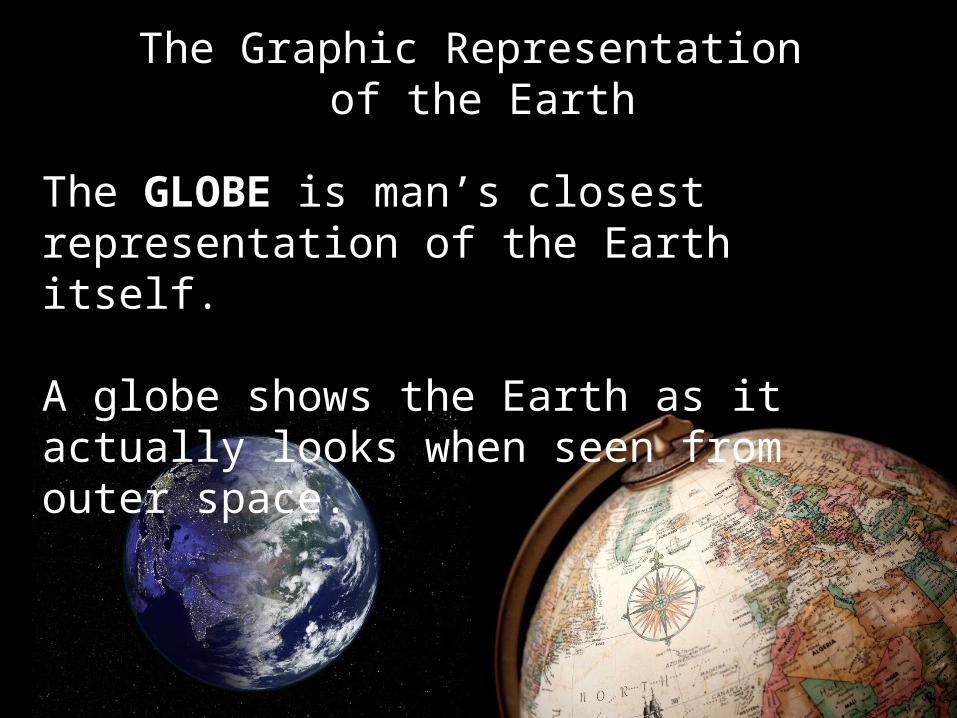
The Graphic Representation of the Earth
The GLOBE is man’s closest representation of the Earth itself.
A globe shows the Earth as it actually looks when seen from outer space.

The Lines in the Globe
Meridians (Lines of Longitude) The North-South lines on the
surface of a globe, running from pole to pole.
Meridians are used to measure distance or to plot a position east or west of a line of reference known as the PRIME MERIDIAN

By international agreement, Prime Meridian is the line that passes through Greenwich, England and is numbered 0.
The East and West position or distance measured therefrom is known as LONGITUDE and expressed in degrees (0 ) of fraction
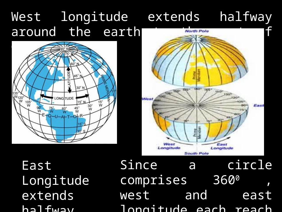
West longitude extends halfway around the earth to the west of Greenwich.
East Longitude extends halfway around the east
Since a circle comprises 3600 , west and east longitude each reach from 0 to 180 degrees.
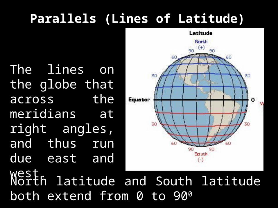
Parallels (Lines of Latitude)
The lines on the globe that across the meridians at right angles, and thus run due east and west.North latitude and South latitude both extend from 0 to 900
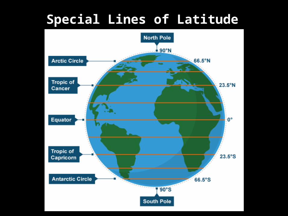
Special Lines of Latitude

Located at 23.44 0 north of the Equator.
It marks the northernmost limit of the sun’s direct vertical rays and this occurs on June 23, also called SUMMER SOLSTICE, in the Northern Hemisphere.
The Tropic of Cancer

The Tropic of Capricorn
Located at 23.440 south of the equator.
It marks the southernmost limit of the sun’s intense vertical rays and this condition occurs on December 21, making the WINTER SOLSTICE in the Northern Hemisphere.

The Arctic Circle
June 22, in which the sun at sometimes during the year does not rise or set or a period of 24 hours or more.
Located at 66.560 North of the equator.
It marks the limit of the sun’s tangential rays in both hemisphere on two occasions – June 22 and December 22.

The Antarctic Circle
Located at 66.560 South of the equator.
It marks the limit of the sun’s tangential rays in both hemisphere on two occasions – June 22 and December 22, in which the sun at sometimes during the year does not rise or set or a period of 24 hours or more.


The Global Grid System A system of lines used to find the location of
any place on the surface of the earth.
It is made up of two sets of lines lines of latitude – runs in an east-west
direction lines of longitude – runs in a north-
south direction
The grid enables one to determine positions or locations, east and west of the prime meridian, and north and south of the equator.

To draw the lines of the grid system on a globe or map, starting point or point of reference is necessary.
The NORTH POLE and SOUTH POLE are the two important point of reference.
Halfway between the poles is the equator. It encircles the earth and divides into two
equal parts or hemisphere.


Assignment # 3
Name: Place of Birth:Course: Country:Time: Province:Date: Town:
1. Make an illustration (drawing, handwritten, short bond paper) of a globe.
2. Identify in the illustration the important lines in the globe.
3. Make a short description or explanations of each line. (not more than 20 words)
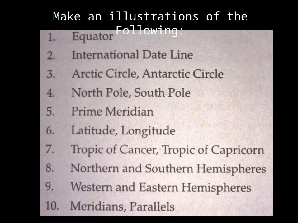
Make an illustrations of the Following:
5. 2.
3.
7.
6.
4.
8.
1. 9.
10
11
12 13
14
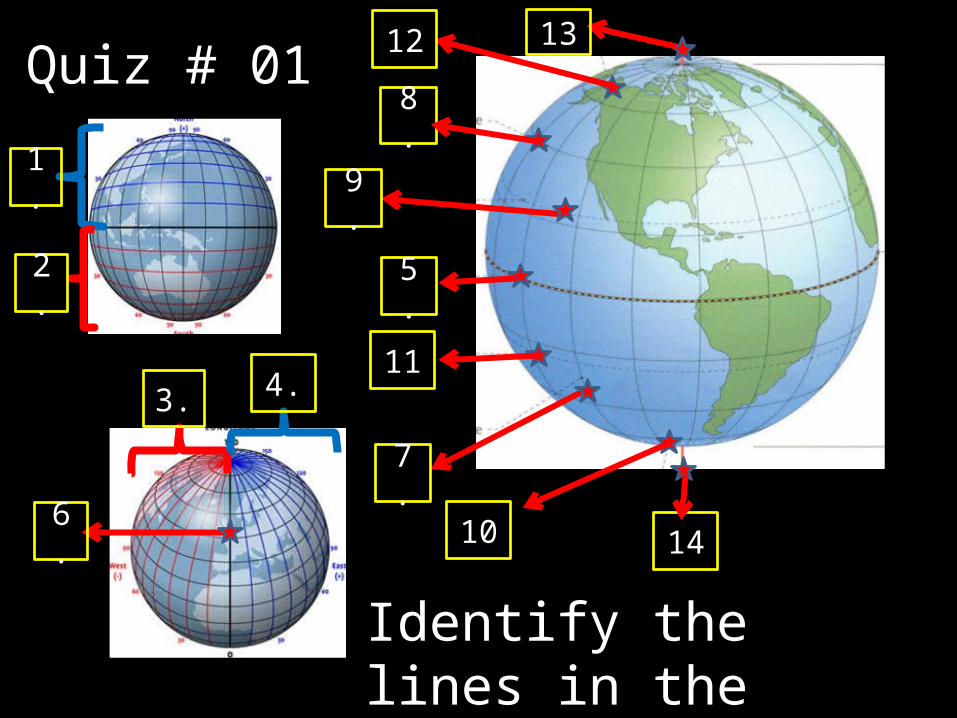
Quiz # 01
Identify the lines in the globe.

1. Answer:1. Northern Hemisphere2. Southern Hemisphere3. Western Hemisphere4. Southern Hemisphere5. Equator6. Prime Meridian7. Line of longitude8. Line of latitude9. Tropic of cancer10.Antarctic circle11.Tropic of Capricorn12.Arctic circle13.North pole14.South pole15.International Date Line
15

The Location of Specific Places The grid system has been
devised to locate places on the face of the Earth.
The latitude and longitude of a place is known as its ABSOLUTE LOCATION.
For Example, the Philippines, absolute location is between 40 23’ and 210 25’ North Latitude and between 1160 and 1270 East longitude.
No other place on the earth’s surface has the same latitude and longitude
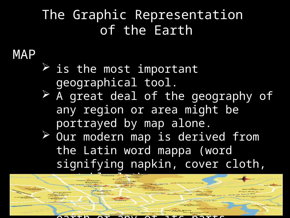
The Graphic Representation of the Earth
MAP is the most important geographical
tool. A great deal of the geography of any
region or area might be portrayed by map alone.
Our modern map is derived from the Latin word mappa (word signifying napkin, cover cloth, or tablecloth.
Just like a covercloth, so does a map provide coverage for the earth or any of its parts

MAP is used in reference to the earth, is a representation of all or a
portion of the earth, drawn to scale and usually on a
plane or flat surface.
The Graphic Representation of the Earth

Types of Maps
1. Political Map
maps emphasizing man-made or cultural features such as the boundaries and location of nations, states, provinces, countries and cities.
Types of Maps
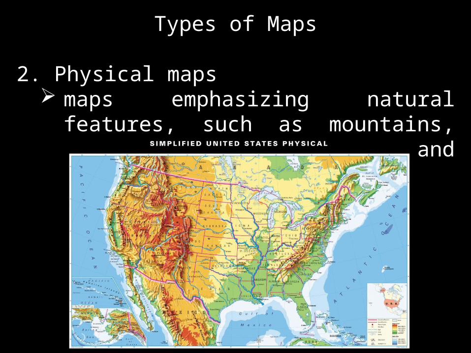
2. Physical maps maps emphasizing natural features,
such as mountains, plains, rivers, lakes, and seacoast.

Types of Maps2. General Purpose maps
a combination of physical and political maps.

Types of Maps
3. Thematic maps It is used for special
purposes. A map that shows only one or
few kinds of information. It is classified into:
Physical thematic Cultural thematic
Types of Maps
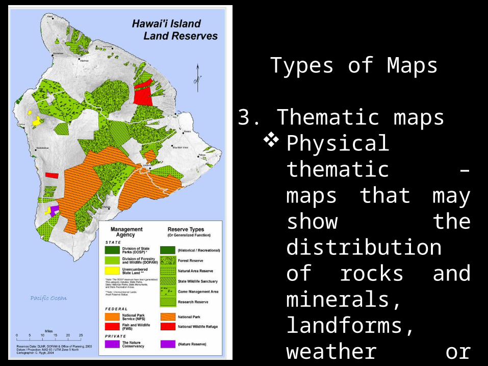
3. Thematic maps Physical
thematic – maps that may show the distribution of rocks and minerals, landforms, weather or climate, vegetation, soils, etc.

Types of Maps3. Thematic maps
Cultural thematic – maps that may show the distribution of population, language, religion, land use, transportation, or manufacturing.
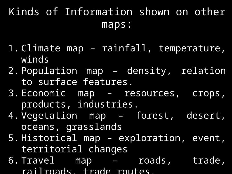
Kinds of Information shown on other maps:
1. Climate map – rainfall, temperature, winds2. Population map – density, relation to
surface features.3. Economic map – resources, crops,
products, industries.4. Vegetation map – forest, desert, oceans,
grasslands5. Historical map – exploration, event,
territorial changes6. Travel map – roads, trade, railroads, trade
routes.7. Ocean map – tides, current, low or deep
oceans8. Community map – streets, buildings,
agencies, harbors9. Special map – parks, monuments, school,
churches.

Map EssentialsIn order to fulfill the full purpose of a map completely, it must possess certain essentials. These are:
1. Title 2. Legends 3. Scale 4. Directions 5. Latitude and Longitude

Map Essentials1. Title
A title of a map tells briefly what a map is all about.
The title must be clearly visible and should indicate the map’s subject matter.

Map Essentials2. Map Legend
The legend or the key refer to the explanation to the symbols used on a map for the physical and cultural features that are indicated.
Some of the map symbols commonly used are: Pictorial – easiest
to understand Dots Lines Color and shading shapes

Map Essentials3. Map Scale Is the relationship or ration between linear
measurement on a map and its corresponding true distance on the earth’s surface.
It is a device that will allow one to measure distance and compute the area.
In what ever form it appears, scale means Scale = distance on the map ÷ distance in nature
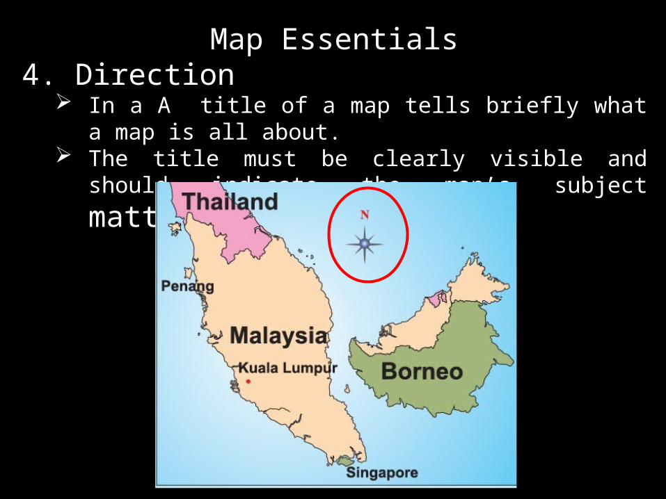
Map Essentials4. Direction
In a A title of a map tells briefly what a map is all about.
The title must be clearly visible and should
indicate the map’s subject matter.

Map Essentials
5. Latitude and Longitude
Lines drawn by convention over the earth’s surface in order to indicate directions and locations of an area.
They are the parallels and meridians, that intersect each other and are together referred to as the map grid.

Assignment # 3
Name: Place of Birth:Course: Country:Time: Province:Date: Town:
1. Draw a map (political and physical map, handwritten, short bond paper) of the province of your birth.
2. Use the map essential in making your map.
3. Make a short description or explanations of your map. (not more than 50 words)
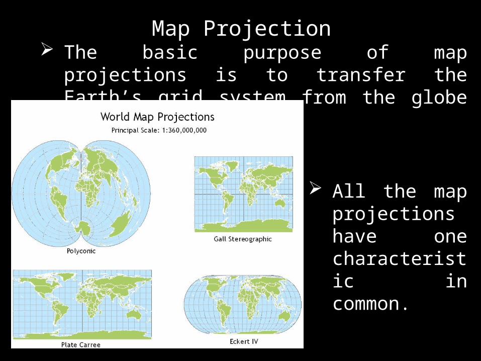
Map Projection The basic purpose of map projections is to
transfer the Earth’s grid system from the globe to map.
All the map projections have one characteristic in common.

Classification of Map Projections according to the type of surface.

Assignment # 4
Name: Time/Day:Course: Date:
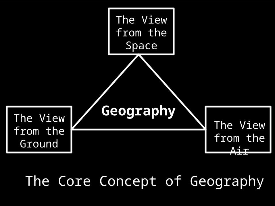
Geography
The Core Concept of Geography
The View from the Space
The View from the
Air
The View from the Ground
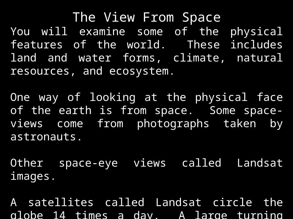
The View From SpaceYou will examine some of the physical features of the world. These includes land and water forms, climate, natural resources, and ecosystem.
One way of looking at the physical face of the earth is from space. Some space-views come from photographs taken by astronauts.
Other space-eye views called Landsat images.
A satellites called Landsat circle the globe 14 times a day. A large turning mirror captures light reflected from strips of the earth’s surface. The is sends the light to four sensor machine inside the satellite.


The View From the AIRYou will learn how the environment affects people. And, in turn you will see how people affect the environment.
From air, you see where people build cities and work for living. And you can see how they connect themselves to other places and people.
Aerial photography is one of the tools geographers use to look at earth from above.
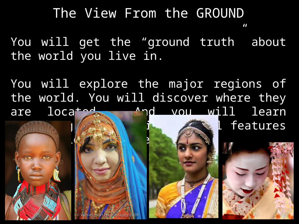
The View From the GROUND
You will get the “ground truth” about the world you live in.
You will explore the major regions of the world. You will discover where they are located. And you will learn something about their physical features and people’s culture.


The Earth as Viewed From Space
The Solar System
The solar system consists of the sun and eight planets revolving around it.

The nine planets that revolve round the sun following the elliptical orbits are each held in its path by a fine balance of two opposing forces (a) gravitational force (b) centrifugal force.
The sun exert gravitational force on the other member of the solar system – the gravitational attraction or gravity

The law of gravitation states that “any particles of matter attract each other with a force directly proportional to the product of their masses and inversely proportional to the square of the distance between them.”
This means that if two heavenly bodies are big and near each other, the gravitational pull between them is strong.

The sun has a mass many times greater than that of any of the planets, it exercises strong attraction upon them and thus retains them within the system of which the sun is the center.

What will happen if the gravitational attraction of the sun were the only force in the universe?
The sun would draw all the planets into its center and eventually destroy them.
CENTRIFUGAL FORCE – the tendency of any moving bodies to fly away from any center of rotation.
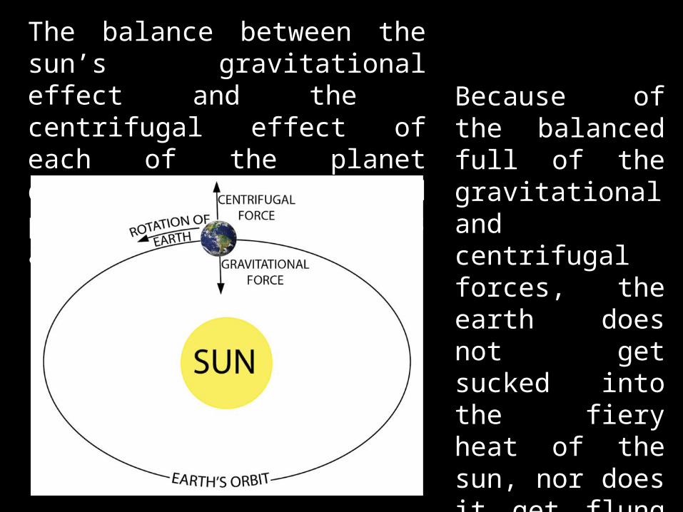
The balance between the sun’s gravitational effect and the centrifugal effect of each of the planet determine the detailed path that each follows around the sun.
Because of the balanced full of the gravitational and centrifugal forces, the earth does not get sucked into the fiery heat of the sun, nor does it get flung into the dark and cold void of space.
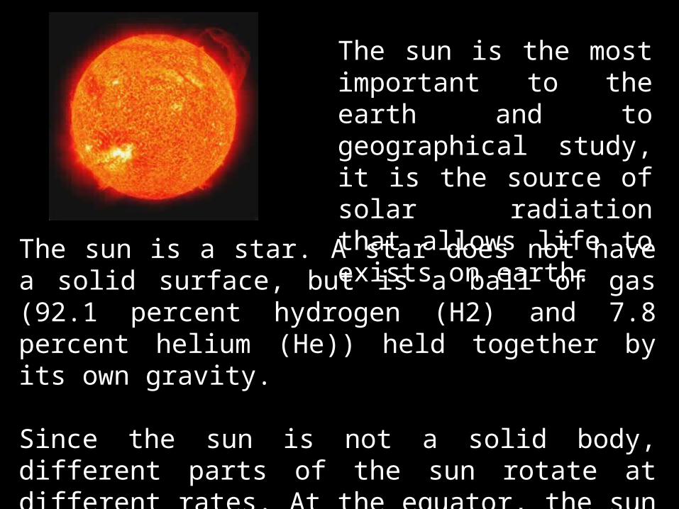
The sun is a star. A star does not have a solid surface, but is a ball of gas (92.1 percent hydrogen (H2) and 7.8 percent helium (He)) held together by its own gravity.
Since the sun is not a solid body, different parts of the sun rotate at different rates. At the equator, the sun spins once about every 25 Earth days, but at its poles the sun rotates once on its axis every 36 days.
The sun is the most important to the earth and to geographical study, it is the source of solar radiation that allows life to exists on earth.

The sun is the center of our solar system and makes up 99.8% of the mass of the entire solar system.
The sun is orbited by eight planets, at least five dwarf planets, tens of thousands of asteroids, and hundreds of thousands to three trillion comets and icy bodies.
The temperature at the sun's core is about 15 million degrees Celsius (27 million degrees Fahrenheit).

The Planet Earth also called the world and, less frequently,
Gaia (Greek Earth Goddess). is the third planet from the Sun. is the densest planet in the Solar System. is the largest of the Solar System's four
terrestrial planets. is the only astronomical object known to
accommodate life. The earliest life on Earth arose at least 3.5
billion years ago. is currently home to 10–14 million species
of life. According to evidence from radiometric
dating and other sources, Earth was formed about 4.54 billion years ago.
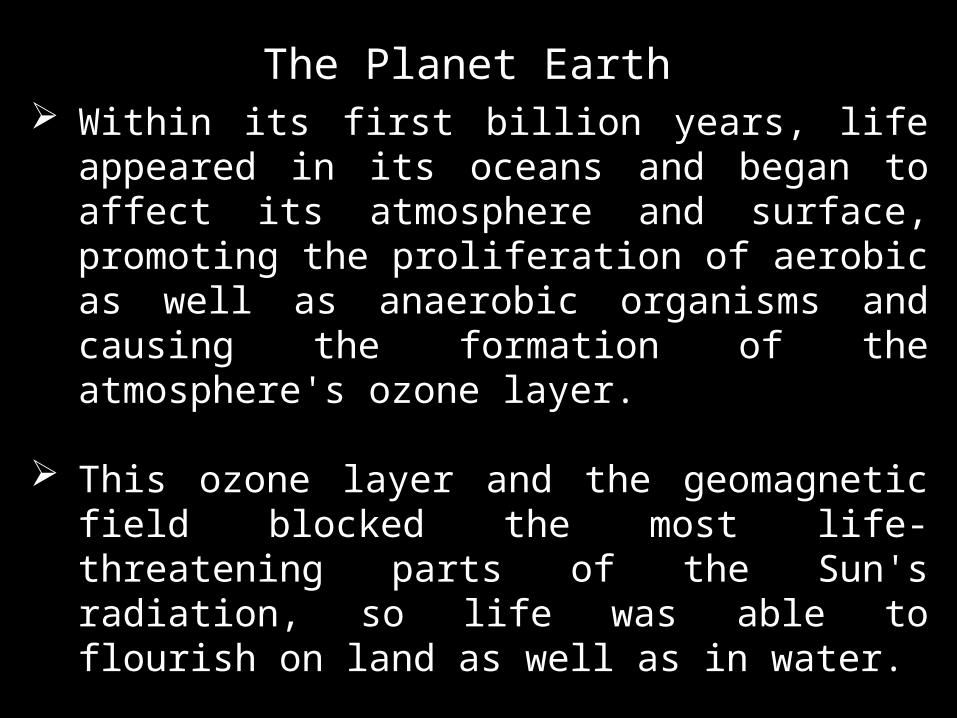
Within its first billion years, life appeared in its oceans and began to affect its atmosphere and surface, promoting the proliferation of aerobic as well as anaerobic organisms and causing the formation of the atmosphere's ozone layer.
This ozone layer and the geomagnetic field blocked the most life-threatening parts of the Sun's radiation, so life was able to flourish on land as well as in water.
the combination of Earth's distance from the Sun, its physical properties and its geological history have allowed life to thrive and evolve.
The Planet Earth

The Size and Shape of the Earth The shape of Earth approximates an oblate
spheroid, a sphere flattened along the axis from pole to pole such that there is a bulge around the equator.
This bulge results from the rotation of Earth, and causes the diameter at the equator to be 43 kilometres (27 mi) larger than the pole-to-pole diameter.

Chemical Composition of the Earth Earth's mass is approximately 5.97×1024 kg
(5,970 yg). It is composed mostly of iron (32.1%), oxygen (30.1%), silicon (15.1%), magnesium (13.9%), sulfur (2.9%), nickel (1.8%), calcium (1.5%), and aluminum (1.4%), with the remaining 1.2% consisting of trace amounts of other elements.
Due to mass segregation, the core region is believed to be primarily composed of iron (88.8%), with smaller amounts of nickel (5.8%), sulfur (4.5%), and less than 1% trace elements

Movement of the Earth

1. Rotation
The main consequences of Earth’s rotation are day and night.Earth’s rotation has become a standard method of measuring time because it is so dependable and easy to use.

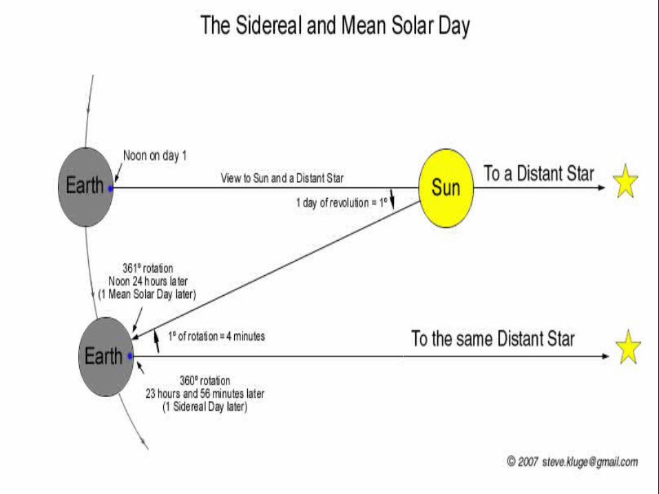
Earth’s rotation is measured in two ways, making two kinds of days.1) Mean Solar Day
The time interval from one noon to the next, which averages about 24 hours.Noon is when the Sun has reached its zenith (highest point in the sky).

2) Sidereal (sider=star, at=pertaining to) dayIs the time it takes for Earth to make one complete rotation (3600) with respect to a star other than our sun.The sidereal day is measured by the time required for a star to reappear at the identical position in the sky.The sidereal day has a period of 23 hours, 56 minutes, and four seconds, which is almost four minutes shorter than the mean solar day.This difference results because the directions to distant stars changes only infinitesimally, whereas the direction to the Sun changes by almost 1 degree each day.

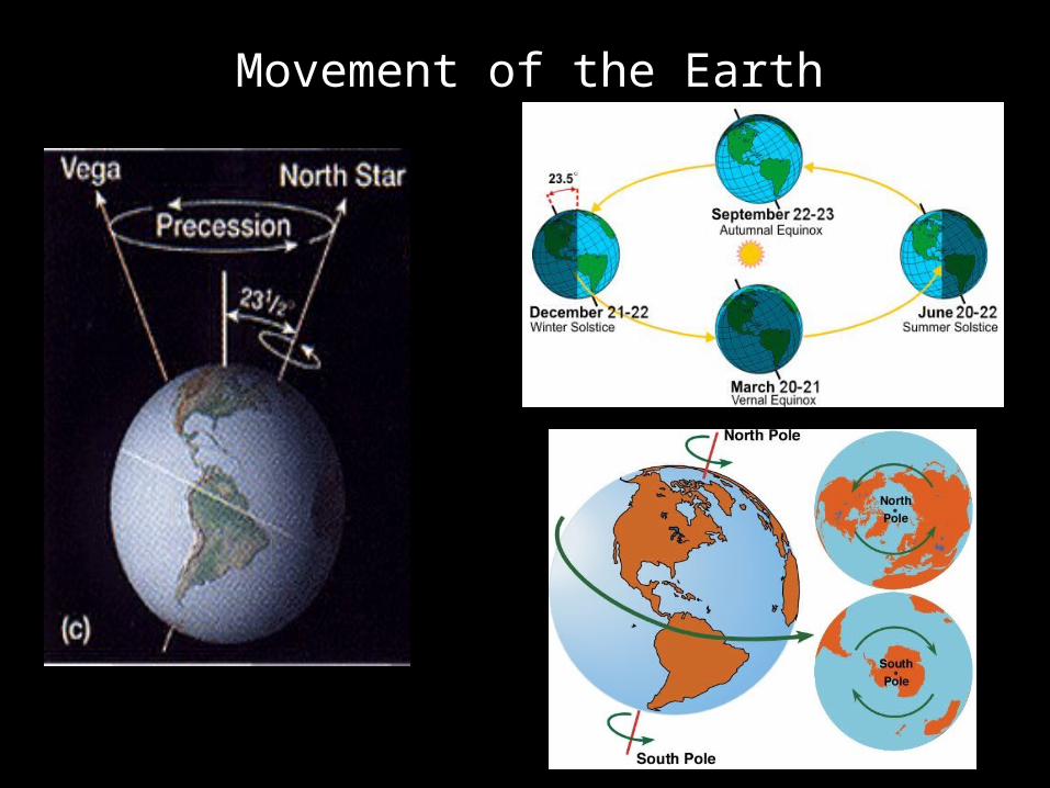
2. Revolution
Earth revolves around the Sun in an elliptical orbit at an average speed of 107, 000 km per hour.
Its average distance from the sun is 150 million km.
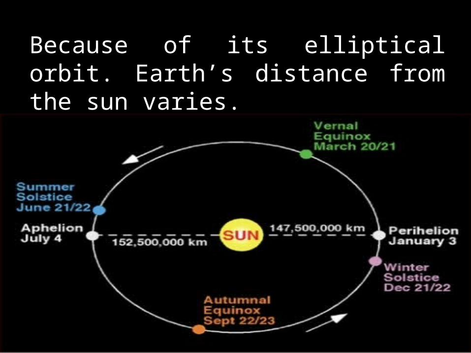
Because of its elliptical orbit. Earth’s distance from the sun varies.
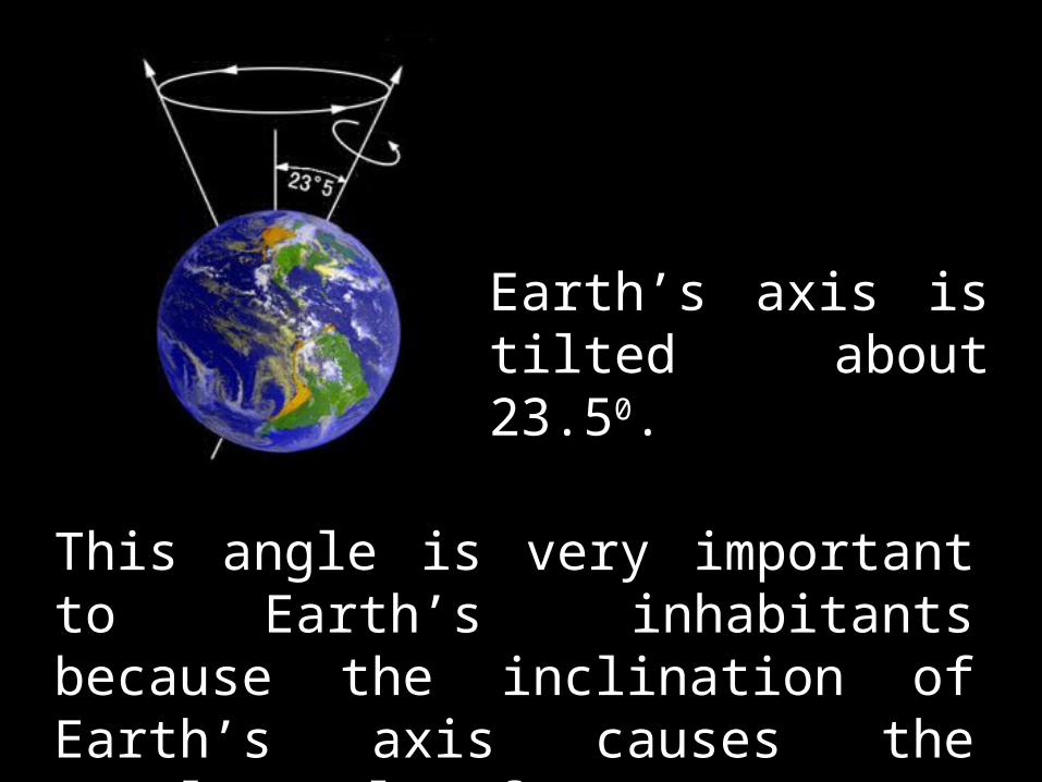
Earth’s axis is tilted about 23.50.
This angle is very important to Earth’s inhabitants because the inclination of Earth’s axis causes the yearly cycle of seasons.


3. Precession
A very slow movement of the Earth is called axial precession.

Although Earth’s axis maintains approximately the same angle of tilt, the direction in which the axis point continually changes. As a result, the axis traces a circle in the sky.

At present time, the axis points toward the bright star Polaris. In AD 14,000, it will point toward the bright star Vega, which will then be the North Star for about a thousand years or so. The period of precession is 26,000 years.By the year 28,000, Polaris will once again be the North Star.
Precession has only a minor effect on the season because Earth’s angle of tilt changes slightly.


Time Determination
In 1883, an international system was set up to standardized time measurement. According to the system, the earth is divided into 24 equal segments called ZONES.

Each new day is born at the 180th meridian, or the International Date Line.
The center of bordering time zones are 15 degrees of longitude apart.
Clocks in a time zone are set to the local time at the center of the time zones.
The boundaries of the time zones vary according to local boundaries so that cities or towns are not split into different zones.

The creation of the International Date Line (IDL) eliminated problems on time.
The IDL is the place where one calendar day ends and the next begins.
The IDL is an imaginary line located at 180 degrees longitude.
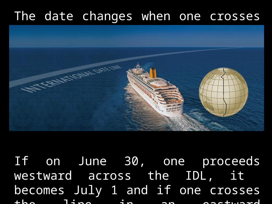
The date changes when one crosses the line (IDL)
If on June 30, one proceeds westward across the IDL, it becomes July 1 and if one crosses the line in an eastward direction, the date automatically becomes June 30

One adds a day crossing the line going to west and subtracts a day in crossing the line going east.

QUIZ
World Geography and Culture
SS105A
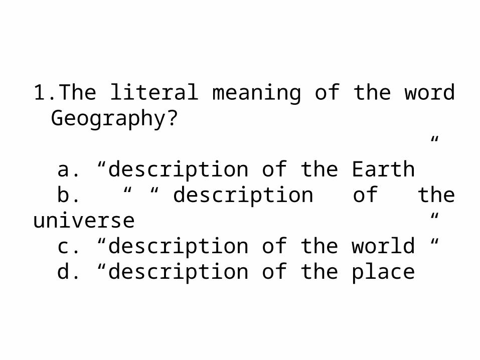
1.The literal meaning of the word Geography?
a. “description of the Earth”b. “ description of the universe”c. “description of the world”d. “description of the place”

2. The best definition for geographya. “study of the Earth as the
home of humankind.”b. “study of the earth and the
universe”c. “study of the earth and its
places”d. “study of the earth and its
people”
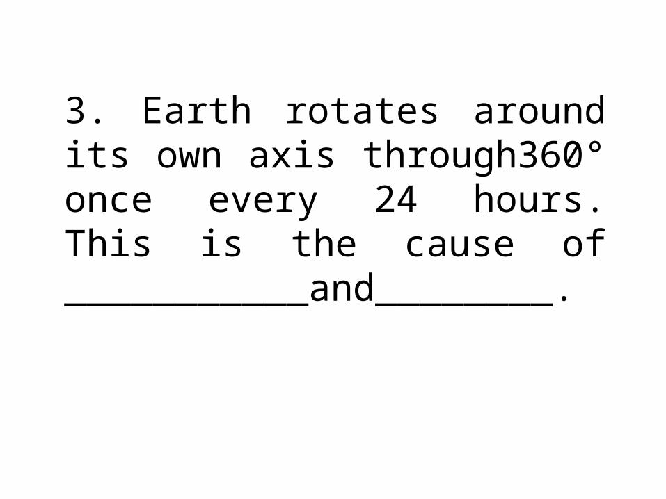
3. Earth rotates around its own axis through360° once every 24 hours. This is the cause of ___________and________.

The Earth's polar axis tilts at an angle of 4.____________ with its orbital plane around the sun. This 5. _________is responsible for the climate changes and the seasons experienced on Earth.

6. We experience______ in the Northern Hemisphere when the Earth is on that part of its orbit where the Northern Hemisphere is oriented more toward the Sun
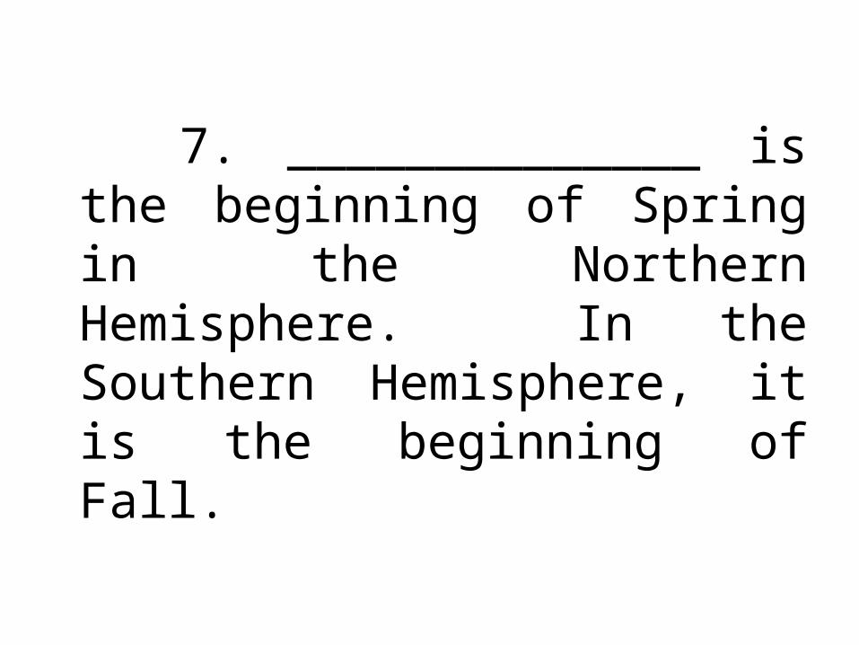
7. ______________ is the beginning of Spring in the Northern Hemisphere. In the Southern Hemisphere, it is the beginning of Fall.

If you live in the Northern Hemisphere, (8)__________ is the vernal or spring equinox, and (9)__________is the autumnal equinox.
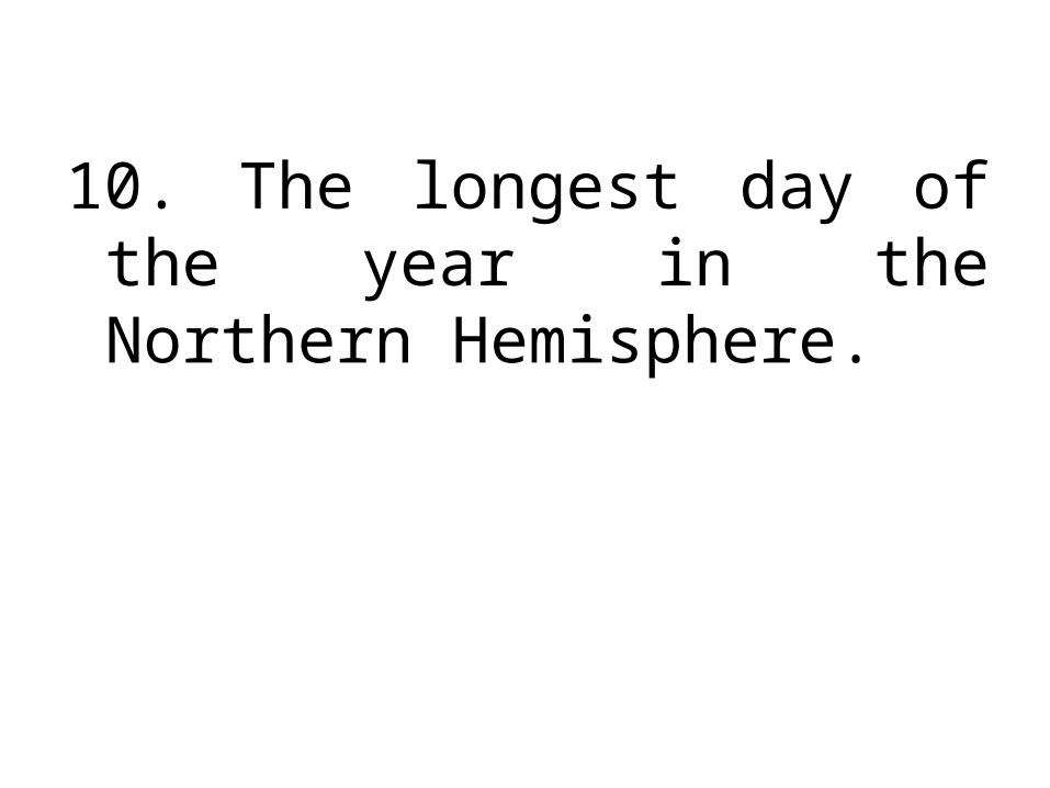
10. The longest day of the year in the Northern Hemisphere.

On or about December 22, the noontime sun shines directly over the Tropic of (11)__________. It is the farthest point south where the sun ever shines directly overhead.
In the Northern Hemisphere, it is the (12)__________ day of sunlight. It marks the beginning of winter. This time of year is known as the
(13) __________
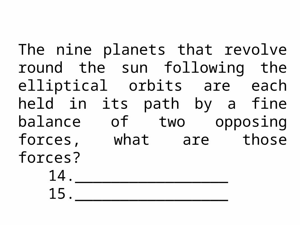
The nine planets that revolve round the sun following the elliptical orbits are each held in its path by a fine balance of two opposing forces, what are those forces?
14._________________15._________________

16. The tendency of any moving bodies to fly away from any center of rotation.

The four terrestrial planets (in order from the sun)17.18.1920.
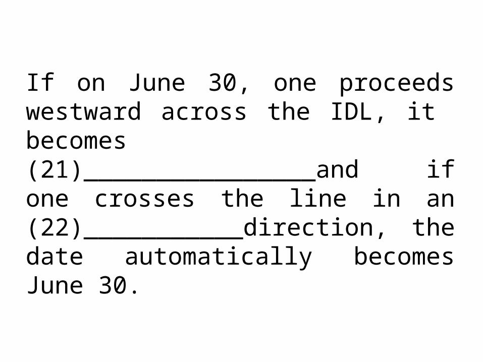
If on June 30, one proceeds westward across the IDL, it becomes (21)________________and if one crosses the line in an (22)___________direction, the date automatically becomes June 30.

The Motion of the planet Earth23. 24.25.

Answer

1.The literal meaning of the word Geography?
a. “description of the Earth”b. “ description of the universe”c. “description of the world”d. “description of the place”

2. The best definition for geographya. “study of the Earth as the
home of humankind.”b. “study of the earth and the
universe”c. “study of the earth and its
places”d. “study of the earth and its
people”

3. Earth rotates around its own axis through360° once every 24 hours. This is the cause of Day and Night_.
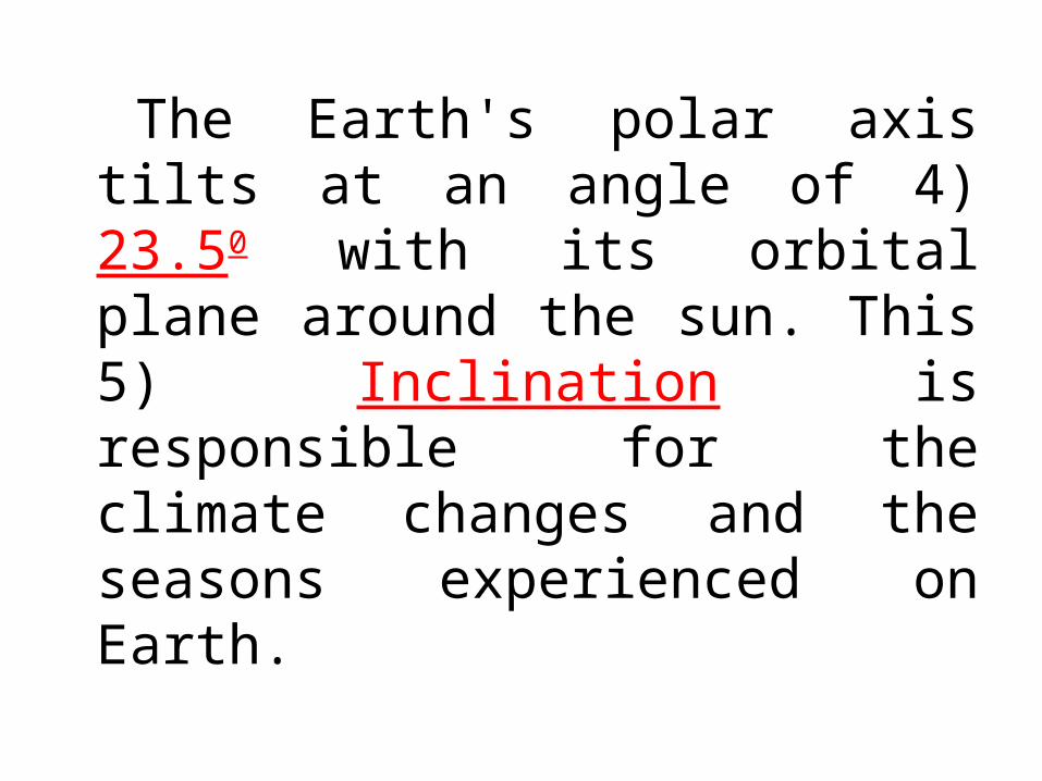
The Earth's polar axis tilts at an angle of 4) 23.50 with its orbital plane around the sun. This 5) Inclination is responsible for the climate changes and the seasons experienced on Earth.

6. We experience Summer in the Northern Hemisphere when the Earth is on that part of its orbit where the Northern Hemisphere is oriented more toward the Sun
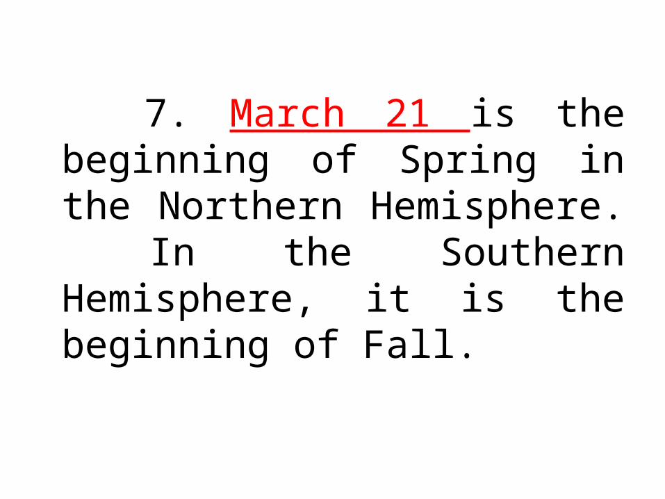
7. March 21 is the beginning of Spring in the Northern Hemisphere. In the Southern Hemisphere, it is the beginning of Fall.

If you live in the Northern Hemisphere, (8)March 21 is the vernal or spring equinox, and (9)Sept. 22-23 is the autumnal equinox.

10. The longest day of the year in the Northern Hemisphere.
June 21

On or about December 22, the noontime sun shines directly over the Tropic of (11) Capricorn . It is the farthest point south where the sun ever shines directly overhead.
In the Northern Hemisphere, it is the (12) Shortest day of sunlight. It marks the beginning of winter. This time of year is known as the
(13) Winter solstice

The nine planets that revolve round the sun following the elliptical orbits are each held in its path by a fine balance of two opposing forces, what are those forces? 14. gravitational force 15. centrifugal force

16. The tendency of any moving bodies to fly away from any center of rotation.
CENTRIFUGAL FORCE

The four terrestrial planets (in order from the sun)17. Mercury18. Venus19. Earth20. Mars
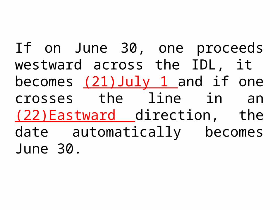
If on June 30, one proceeds westward across the IDL, it becomes (21)July 1 and if one crosses the line in an (22)Eastward direction, the date automatically becomes June 30.

The Motion of the planet Earth23. Rotation24. Revolution25. Precession