Embed Size (px)
Citation preview

The Regional Municipality of York’s Mid and High Rise Development Process and Implementation Guide | February 2017

York Region Mid and High Rise Development Process and Implementation Guide

| iYork Region Mid and High Rise Development Process and Implementation Guide
Tab
le o
f C
on
ten
ts |
Pag
e O
ne
Table of Contents1.0 Introduction 12.0 Policy Context 23.0 Pre-Submission Site Concept Development Planning 3 3.1 When does the Region need to be consulted? 3
4.0 Site Planning and Design 4 4.1 Transit-Oriented Design 4
4.2 Regional Road Widening Requirements 5
4.3 Regional Road Access Requirements 6
4.4 Source Water Protection 7 4.4.1 For Lands within Wellhead Protection Area-Q (Recharge Management Area) or a Significant Groundwater Recharge Area 7 4.4.2 For Lands within Wellhead Protection Areas A, B or C 7
5.0 Timing and Scheduling of Development 9 5.1 Land Conveyances and Environmental Issues 9 5.2 Viva Rapidway Construction 10 5.3 Transportation Capacity 12 5.4 Water and Wastewater Infrastructure and Capacity 13
6.0 Site Plan Approval Process 14 6.1 Pre-Submission Consultation 14 6.2 Submission Requirements 14 6.3 Review and Approval Process 14 6.3.1 Site Plan Review 15 6.3.2 In-Principle Approval 15 6.3.3 Engineering Approval 16 6.3.4 Site Plan Agreement 17
7.0 Land Conveyances 18 7.1 Environmental Condition 20 7.2 Submission Requirements 20 7.2.1 First Submission Requirements 20 7.2.2 Prior To Engineering Approval 21 7.2.3 Prior to the Execution of the Site Plan Agreement 22
8.0 Financial Requirements 24 8.1 Review Fees 24 8.2 Security Deposit 24 8.3 Insurance Certificate 26
9.0 Drawing and Submission Standards 27 9.1 Minimum Drawing Standards 27 9.2 Submission Standards 27
10.0 Access and Transportation Capacity 28 10.1 Guiding Principles 28 10.2 Submission Requirements 29 10.2.1 Transportation Impact Study 29 10.2.2 Transportation Demand Management Plan 30 10.2.3 Access Design and Detail Plans 31
11.0 Transportation Infrastructure Improvements 32

| ii York Region Mid and High Rise Development Process and Implementation Guide
Tab
le o
f C
on
ten
ts |
Pag
e Tw
o
12.0 Site Servicing Design 33 12.1 General Principles 33 12.2 Sanitary Sewer 33 12.2.1 Guiding Principles 33 12.2.2 Design Guidelines and Standards 34 12.3 Storm Sewers 35 12.3.1 Guiding Principles 35 12.3.2 Design Guidelines and Standards 35 12.4 Watermains 36 12.4.1 Guiding Principles 36 12.4.2 Design Guidelines and Standards 37 12.5 Submission Requirements 37 12.5.1 Functional Servicing Report 37 12.5.2 Site Servicing And Details Plan 38 12.6 Connections to Regional York Durham Sewage System 39
13.0 Site Grading Design 40 13.1 Design Guidelines and Standards 40 13.2 Submission Requirements 41 13.2.1 Site Grading Details and Plans 41
14.0 Tie-Back Shoring/Caisson System 42 14.1 Guidelines and Standards 42 14.2 Submission Requirements 42
15.0 Site Excavation 43 15.1 Guiding Principles 43 15.2 Guidelines and Standards 43 15.3 Submission Requirements 43 15.3.1 Geotechnical Report 43 15.3.2 Excavation Layout and Profile Plan 44
16.0 Landscape/Streetscape Design 45 16.1 Guiding Principles 45 16.2 Guidelines and Standards 45 16.3 Submission Requirements 46 16.3.1 Landscape Plans and Details 46 16.3.2 Street Tree Planting and Detail Plans 46 16.3.3 Street Tree Inventory and Preservation Plan 46 16.3.4 Shade and Shadow Study 46
17.0 Construction Site Management 47 17.1 Guiding Principles 47 17.2 Submission Requirements 47 17.2.1 Construction Site Management Plan 47 17.2.2 Construction Management Report 48
18.0 Traffic Management 49 18.1 Guiding Principles 49 18.2 Submission Requirements 50
19.0 Erosion and Sediment Control 51 19.1 Guiding Principles 51 19.2 Guidelines and Standards 51 19.3 Submission Requirements 51

| iiiYork Region Mid and High Rise Development Process and Implementation Guide
Tab
le o
f C
on
ten
ts |
Pag
e T
hre
e
20.0 Crane Swing 52 20.1 Guiding Principles 52 20.2 Submission Requirements 52
21.0 Temporary and Permanent Dewatering 53 21.1 Guiding Principles 53 21.2 Guidelines and Standards 53 21.3 Submission Requirements 54 21.3.1 Hydrogeological Report 54 21.3.2 Dewatering Discharge Plan 54 21.3.3 Confirmation that a Dewatering Application has been made 54
22.0 Hoarding and Fencing 55 22.1 Guiding Principles 55 22.2 Guidelines and Standards 55 22.3 Submission Requirements 55
23.0 Utilities 56 23.1 Guiding Principles 56 23.2 Guidelines and Standards 57 23.3 Submission Requirements 5724.0 Permits 58 24.1 Road Occupancy Permits 58 24.2 Encroachment Permits 58 24.2.1 Process 59 24.2.2 Submission Requirements 59 24.3 Dewatering Discharge Permit 59
25.0 Source Water Protection 60 25.1 Sites Located in a Wellhead Protection Area (WHPA) 60 25.1.1 Submission Requirements 60 25.1.1.1 Dewatering Plan 60 25.1.1.2 Source Water Impact Assessment and Mitigation Plans 61 25.1.1.3 Section 59 Notice (Source Protection Permit) 61 25.2 Site Located in Wellhead Protection Area Q 61 25.2.1 Submission Requirements 63 25.3 Site Located In Highly Vulnerable Aquifer (HVA) 63 25.3.1 Submission Requirements 63 25.3.1.1 Contaminant Management Plan 63 25.4 Sites Located in an Area Of Concern (AOC) 64 25.5 Information and Database Resources 64 25.5.1 Comprehensive Geological and Water Resources Database 64 25.5.2 Groundwater Flow Models 65 25.5.3 York Region Water Quality and Quantity Databases 65 25.5.4 Other Relevant Data 65
Contact Information 66 The Regional Municipality of York 66 Corporate Services Department 66 Development Engineering Section 66 Transportation Services Department 66 Environmental Services Department 66 Legal Services Department 67 Finance Department 67 Access York 67

| iv York Region Mid and High Rise Development Process and Implementation Guide
Tab
le o
f C
on
ten
ts |
Pag
e Fo
ur
Other Agencies 67 Smart Commute - North Toronto, Vaughan 67 Lake Simcoe Region Conservation Authority 67 Toronto Region Conservation Authority 67
Glossary 69Appendix 73 Appendix A - Submission Requirements 75
Appendix B - Site Plan Process Flow Chart 77
Appendix C - Site Plan Process Flow Chart 78
Appendix D - Template Reliance Letter 79
Appendix E - Template Statutory Declaration 80
Appendix F - York Region Security Release and Reduction Requirements 81

| 1York Region Mid and High Rise Development Process and Implementation Guide
Sec
tio
n 1
| In
tro
du
ctio
n
1.0 IntroductionA transformation is underway in York Region. Our commitment to city building and creating compact, mixed use and transit-oriented communities can be seen across the Region, and particularly within the four urban centres and the transportation corridors that link them (centres and corridors). Tools, including this guide, will help support intensification and the development of compact, mixed use and high density developments. This guide presents guiding principles, standards and checklists to be used during the planning and engineering process to improve clarity and the quality of submissions for mid and high rise development. This document is not an urban design manual, but a guide to help you navigate the Regional development planning and engineering implementation and approvals process.

| 2 York Region Mid and High Rise Development Process and Implementation Guide
Sec
tio
n 2
| P
olic
y C
on
text
2.0 Policy Context
Regional and Provincial planning policies provide a framework and direction for the sustainable management of growth and development within York Region. The provincial Growth Plan requires that a minimum of 40 per cent of all new residential development will occur within the built-up area. The York Region Official Plan (2010) conforms to this intensification target. York Region anticipates approximately 90,720 residential units will be constructed within the existing built boundary by 2031. The Region’s centres and corridors will be the focus for much of this intensification.
The four Regional centres (Markham Centre, Newmarket Centre, Richmond Hill/Langstaff Gateway, and Vaughan Metropolitan Centre) are planned as the highest and most intense concentrations of development within the Region. Together with the Regional corridors (Highway 7, Yonge Street and portions of Davis Drive and Green Lane), these areas are evolving into highly active urban areas, served by vivaNext bus rapid transit.
Local official plans aim to create attractive and vibrant places for people to live, work and play. They build upon the policies of the province and York Region and provide further direction on creating diverse and compact neighbourhoods to maximize infrastructure delivery and services. In addition, many local municipalities have developed urban design guidelines that are based on their own intensification strategies. Both the local official plan and any applicable local urban design guidelines should be consulted in the planning and engineering design stages.
As the Region and our local municipalities continue to grow and intensify, it is important that our standards and requirements reflect this new and increasingly urban context.

| 3York Region Mid and High Rise Development Process and Implementation Guide
Sec
tio
n 3
| P
re-S
ub
mis
sio
n S
ite C
on
cep
t D
evel
op
men
t P
lan
nin
g
3.0 Pre-Submission Site Concept Development Planning
Prior to developing a Site Plan concept, the Developer is strongly advised to first consult with the Region, the local municipality and other commenting agencies such as the Toronto and Region Conservation Authority (TRCA), Lake Simcoe and Region Conservation Authority (LSRCA), and the Ministry of Transportation Ontario (MTO). Typically, the Region is invited to formal pre-submission meetings (e.g., Pre-Application Consultation meetings in Vaughan or Development Application Review Committee meetings in Richmond Hill). At these meetings, the Region will advise the Developer on issues that could affect the design of their site (e.g., road widening requirements, access, water resource protection), as well as the timing and scheduling of the development project (e.g., servicing constraints, traffic capacity constraints, coordination with Regional infrastructure improvement projects). In addition, the Region will also provide information on the approval process and submission requirements at the various stages of the approval process.
The Developer is welcome to consult with Regional staff at any time before or after a pre-submission meeting to discuss specific issues or concerns. The sooner an issue can be identified, discussed and resolved, the smoother and faster the approval process will be.
3.1 When does the Region need to be consulted?The local municipality’s Planning Department will circulate all mid and high rise development Site Plan applications to the Region, regardless of their location. The extent of the Region’s involvement in the approval process will depend on:
• whether the development site is located adjacent to a Regional road (See Map 1 of the York Region Official Plan (YROP) 2010) or a Regional water/ wastewater servicing easement • whether the development site is located on a vivaNext Ravpidway corridor (See vivaNext Project Map) • whether the development site is located in a Wellhead Protection Area (WHPA) (See Map 6 of YROP 2010) or an area of Highly Vulnerable Aquifer (HVA) (see Map 14 of YROP 2010) • potential impacts of development traffic on the Regional transportation system • potential impacts on Regional water and wastewater servicing infrastructure and capacity • conformity with York Region Official Plan policies and the Region’s Transit-Oriented Development Guidelines.

| 4 York Region Mid and High Rise Development Process and Implementation Guide
Sec
tio
n 4
| Si
te P
lan
nin
g a
nd
Des
ign
4.0 Site Planning and DesignFrom a Regional perspective, this section and Figure 1 highlight some of the most important issues to consider during the initial planning and conceptual design of the development. Failure to consider these issues early in the planning process can result in significant revisions to development concepts, as well as significant delays to the overall Site Plan approval process.
Figure 1: Issues to Consider for Site Planning, Layout and Design
4.1 Transit-Oriented DesignThe overall Site Plan concept will be reviewed by the Region, in concert with local municipal urban design staff where necessary, to ensure that the development will support and advance transit-oriented and pedestrian-friendly communities. This is especially important on Regional corridors where the Region has invested heavily in high-order rapid transit infrastructure. The Developer should therefore consult York Region’s Transit-Oriented Development Guidelines early on in the development planning stage to avoid potential redesigns.
Figure 2 shows the Transit-Oriented Development (TOD) implementation checklist the Developer should refer to at various stages in the development process.

| 5York Region Mid and High Rise Development Process and Implementation Guide
Sec
tio
n 4
| Si
te P
lan
nin
g a
nd
Des
ign
Figure 2: Transit-Oriented Design Implementation Checklist
t r a n s i t - o r i e n t e d d e v e l o p m e n t g u i d e l i n e s
C I T Y - B U I L D I N G A N D S U P P O R T I N G T R A N S I T T H R O U G H G O O D D E S I G N
18
T O D I M P L E M E N T A T I O N C H E C K L I S T
Using the TOD approaches outlined in this document at various stages in the planning, design and development process willhelp to advance transit-supportive, pedestrian-friendly communities. This "checklist" can help assess how well a policy or project incorporates some of the essential TOD elements.
PEDESTRIANS❏ easy, safe access for people in wheelchairs, etc.❏ shelter from wind, rain, etc. (ie. covered walkways, etc.)❏ essential, service-related uses are located at street-level
PARKING❏ pedestrian walkway provided to/from building❏ parking structure above and/or below grade❏ surface parking provided in side or rear of building❏ existing parking design accommodates future
phases of development❏ site-specific/reduced parking standards❏ priority parking for carpooling❏ parking facilities shared with adjoining properties
LAND-USE❏ a mix of uses/activities provided❏ includes employment-generating uses❏ transit is available at first phase of development❏ infill/intensification opportunities
BUILT-FORM❏ building is compact, and makes effective use of site❏ building is oriented to the street❏ building fits will into surrounding area—scale, design
and height are appropriate
CONNECTIONS❏ sidewalks and buildings are linked to transit stops❏ lighting, sidewalks, street furniture etc. are provided for
all planned walkways and along roads❏ minimize walking distances
IMPLEMENTATION❏ related planning applications and approvals (ie. zoning)
reflect innovative approaches to TOD (ie. reduced parking standards, enhanced landscaping, etc.)
❏ harmonize lighting, sidewalks and road improvements within Rights-of-Way (ROW)
❏ Travel Demand Management initiatives and relatedprograms (ie. carpooling, etc.) integrated into design
4.2 Regional Road Widening Requirements
Based on Section 41 (8)(c) of the Planning Act and the York Region Official Plan (2010), the Region can require, as a condition of Site Plan approval, that the Developer convey to the Region a road widening. For more information, see Sections 7.2.30, 7.2.31, and 7.2.40 to 7.2.52 of the York Region Official Plan (2010).
The Developer should, from the onset, consider the extent of the road widening that the Region will require in order to ensure that: • All municipal setbacks, as per the applicable zoning by-law, shall be measured from the widened right-of-way limit • No portion of the building structure, above or below ground, or associated footings and construction shoring system shall encroach within the Regional right-of-way, including daylighting triangles.

| 6 York Region Mid and High Rise Development Process and Implementation Guide
Sec
tio
n 4
| Si
te P
lan
nin
g a
nd
Des
ign
If the development site is located adjacent to a vivaNext Rapidway corridor, then the Region may, in addition to a road widening, also require the conveyance of Permanent Limited Interest (PLI), and/or five year Temporary Limited Interest (TLI) easements. Such easements could have a significant impact on the development construction schedule. Please see Section 5.2 for more information.
If, due to the timing of the development, the Region will not be able to obtain the widenings and easements through the Site Plan application process in time for the Rapidway’s construction, the Region will obtain them through expropriation, in accordance with the Expropriations Act.
It is important to remember that in cases of expropriation (either before or during the Site Plan application), the Region will only obtain the widenings and easements that are required for the construction of the Rapidway, which could be less than the Official Plan requirement. During the concurrent or subsequent Site Plan application the Region will then obtain the balance of the road widening in order to achieve the full Official Plan requirement. In such cases, the Owner will still be required to comply with the Region’s requirements for Environmental Site Assessment documentation as described in Section 7.2.1.2.
4.3 Regional Road Access Requirements
In general, the Region’s overall aim is to reduce the number of vehicular accesses to Regional roads. If the site is located adjacent to a Regional road, early in the site planning process, the Developer should consider the following questions which could have a direct impact on the design of the site and the positioning of buildings and other infrastructure:
• Will the Region permit a direct access to the Regional road? • If direct access is permitted, what conditions and/or restrictions will the Region impose, and what is the Region’s desired location for the access? • Does the desired access meet the Region’s Access Design Guidelines? • Is there an opportunity to share access with adjacent properties?
The Region is not obliged to maintain an existing access in the location and manner in which it may have been previously used. The Region may require that the existing access be removed (closed), or moved to a different location, and/or may impose restrictions and conditions on it.
See Section 10 for information on when the Region could permit a direct access to a Regional road and the conditions of approval that the Region could potentially impose on a permitted access.
The design of all permitted accesses to a Regional road shall comply with the guidelines referenced in Section 10.2.3.

| 7York Region Mid and High Rise Development Process and Implementation Guide
Sec
tio
n 4
| Si
te P
lan
nin
g a
nd
Des
ign
4.4 Source Water Protection
Early in the development process, the Developer should determine if the site is located within a Regional Wellhead Protection Area (Q, A, B, C or D) or in an area of Highly Vulnerable Aquifer (HVA) or Significant Groundwater Recharge Area (SGRA) or Area of Concern (AOC) and contact the Region’s Risk Management Office for further guidance and direction. Mapping of Regional vulnerable areas is available online.
All development in York Region is subject to provisions of the: • The Clean Water Act, 2006 and Source Water Protection Plans made under it: - South Georgian Bay Lake Simcoe Source Water Protection Plan (See Map for Source Protection Region boundaries) or, - Credit Valley, Toronto and Region and Central Lake Ontario Source Protection Plan (See Map for Source Protection Region boundaries)
• Sections 7.3.35 to 7.3.52 of the York Region Official Plan (2010)
The purpose of the Clean Water Act, 2006 is to protect existing and future sources of drinking water. The Act empowers specified groups to manage existing threats and prevent new threats from becoming significant, and it is the intention of the Region to work with proponents of development applications to ensure their sites are developed and operated in a way that meets the requirements of the Act now and in the future. Using this type of approach will help protect the drinking water supply and reduce the impacts on proponents that could occur if risk management takes place later in the development process.
4.4.1 For Lands within Wellhead Protection Area-Q (Recharge Management Area) or a Significant Groundwater Recharge Area
If a development is located within the WHPA-Q or a Significant Groundwater Recharge Area, it is subject to select water quantity policies contained in the York Region Official Plan, South Georgian Bay Lake Simcoe and Credit Valley, Toronto and Region and Central Lake Ontario Source Protection Plans, depending on the location of the development site. Please contact LSRCA and TRCA planning staff or the Region’s Water Resources Section for more information on any requirements.
4.4.2 For Lands within Wellhead Protection Areas A, B or C
If the proposed development is in Wellhead Protection Areas A, B or C, the Clean Water Act, 2006 (the Act) grants the Region’s Risk Management Office powers under Part IV of the Act which include prohibiting and restricting development land use and activities that are or could be classified as “significant drinking water threats.”
For this reason, when the proposed development is located in Wellhead Protection Areas A, B or C, the Act requires the Developer to submit an application to obtain a Section 59 Notice from the Region’s Risk Management Office for the proposed development prior to filing a development application with the local municipality.

| 8 York Region Mid and High Rise Development Process and Implementation Guide
Sec
tio
n 4
| Si
te P
lan
nin
g a
nd
Des
ign
The following list sets out some of the activities that may be prohibited or restricted by the policies in the applicable Source Protection Plan: • Above grade storage and handling of liquid fuel in amounts over 2,500 litres; • Below grade storage and handling of liquid fuel in amounts over 250 litres; • Septic systems or holding tanks; • Handling and storage of chemicals such as organic solvents and dense non-aqueous phase liquids; • Handling and storage of liquid waste from a business; and • Waste storage and disposal.
When the proposed development is located in Wellhead Protection Areas A, B or C, the Act requires the Developer to submit an application to obtain a Section 59 Notice from the Region’s Risk Management Office for the proposed development prior to filing a development application with the local municipality.
Section 25 provides more detail on the submission requirements for mid and high rise developments within a Wellhead Protection Area. The Region recommends that the Developer contact the Risk Management Office as early as possible in the development process to receive guidance on detailed submission requirements and potential restrictions on activities in vulnerable areas. Please note that, in some cases, conditions imposed by the Region could impact the scope of the proposed development. For example, in areas with a high groundwater table, there could be requirements for a detailed dewatering plan.
If the proposed development is in Wellhead Protection Areas A, B, C or D, under the Regional Official Plan, a Source Water Impact Assessment and Mitigation Plan (SWIAMP) may be required in specified circumstances to develop a plan to manage risk of potential impacts associated with activities related to certain land uses. These activities could occur as a result of new land uses involving activities that may contaminate municipal groundwater supplies or threaten the quantity of water available in the municipal groundwater supplies.
Source Water Impact Assessment and Mitigation Plans and Risk Management Plans should be prepared by a hydrogeologist that is a licensed Professional Geoscientist or exempted Professional Engineer as set out in the Professional Geoscientists Act of Ontario.
For more information, please contact York Region’s Risk Management Office at 1-877-464-9675, extension 73000 or at [email protected].

| 9York Region Mid and High Rise Development Process and Implementation Guide
Sec
tio
n 5
| T
imin
g a
nd
Sch
edu
ling
of
Dev
elo
pm
ent
5.0 Timing and Scheduling of DevelopmentThere are a number of issues and factors in the mid and high rise development application review process that can impact the timing and scheduling of a development project, as outlined in Figure 3. Understanding these issues ahead of time will help avoid costly delays to any development project.
Figure 3: Factors and Issues Affecting Development Timing and Scheduling
5.1 Land Conveyances and Environmental IssuesPrior to the execution of the Site Plan Agreement, and therefore prior to the issuance of a full Building Permit by the local municipality, the Region requires the full conveyance of all road widening and easement requirements free and clear of all costs and encumbrances. Note that in some cases, especially for developments situated on vivaNext Rapidway corridors, the conveyance of road widenings and/or easements may be required prior to Engineering Approval and prior to the issuance of Conditional Building Permits by the local municipality.
However, the Region must be satisfied the land is clean and that the Developer has complied with all applicable Regional requirements regarding the environmental condition of the land to be conveyed to the Region, prior to the Region accepting the conveyance of road widenings and/or easements. At a minimum, a Phase 1 Environmental Site Assessment (ESA) must be completed in general accordance with O. Reg. 153/04 for the site, with a particular focus on the lands to be conveyed to the Region. The Phase 1 Environmental Site Assessment must be satisfactory to the Region and must be dated within two years of the date of the conveyance. It should be noted that if the Phase 1 ESA identifies or contains potential concerns, further work may be required, including carrying out a Phase 2 ESA and remediating the contaminated lands. Section 7 contains more information about the Region’s land conveyance process.
With due consideration to the environmental condition of the site, the Developer should factor into the development schedule the time it will take to conduct the required environmental studies, to remediate the site if necessary, and to monitor the site.
| 10 York Region Mid and High Rise Development Process and Implementation Guide
Sec
tio
n 5
| T
imin
g a
nd
Sch
edu
ling
of
Dev
elo
pm
ent
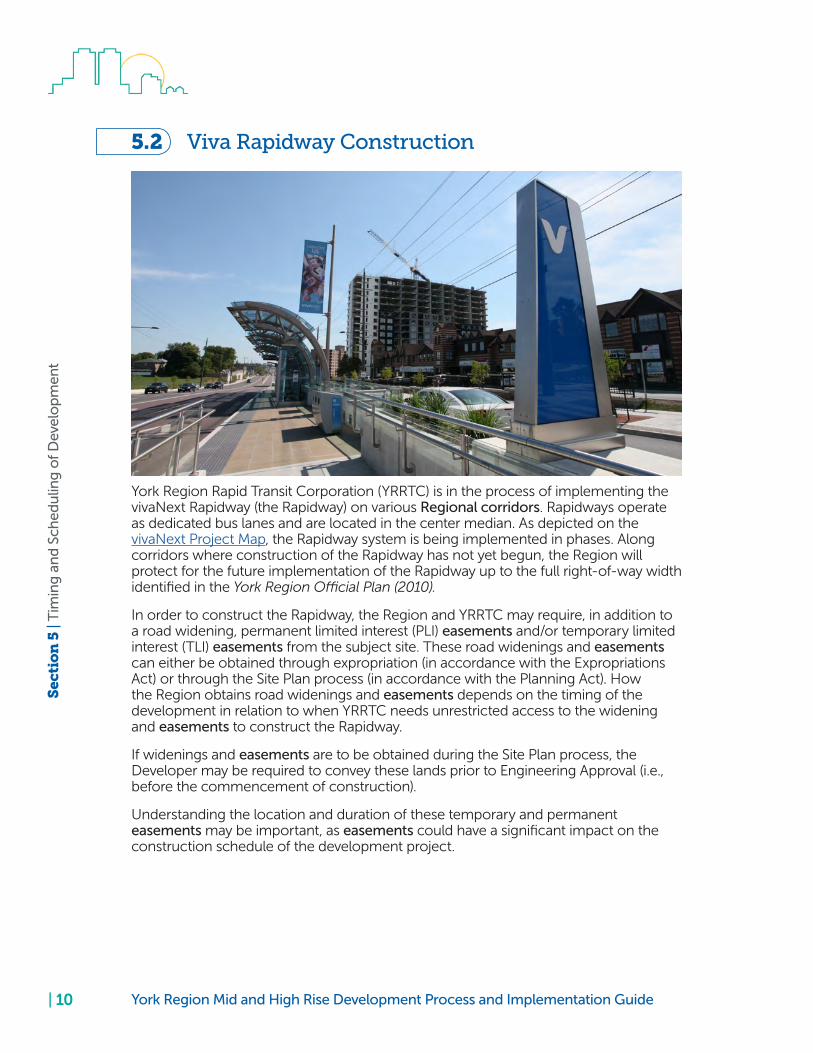
5.2 Viva Rapidway Construction
York Region Rapid Transit Corporation (YRRTC) is in the process of implementing the vivaNext Rapidway (the Rapidway) on various Regional corridors. Rapidways operate as dedicated bus lanes and are located in the center median. As depicted on the vivaNext Project Map, the Rapidway system is being implemented in phases. Along corridors where construction of the Rapidway has not yet begun, the Region will protect for the future implementation of the Rapidway up to the full right-of-way width identified in the York Region Official Plan (2010).
In order to construct the Rapidway, the Region and YRRTC may require, in addition to a road widening, permanent limited interest (PLI) easements and/or temporary limited interest (TLI) easements from the subject site. These road widenings and easements can either be obtained through expropriation (in accordance with the Expropriations Act) or through the Site Plan process (in accordance with the Planning Act). How the Region obtains road widenings and easements depends on the timing of the development in relation to when YRRTC needs unrestricted access to the widening and easements to construct the Rapidway.
If widenings and easements are to be obtained during the Site Plan process, the Developer may be required to convey these lands prior to Engineering Approval (i.e., before the commencement of construction).
Understanding the location and duration of these temporary and permanent easements may be important, as easements could have a significant impact on the construction schedule of the development project.

| 11York Region Mid and High Rise Development Process and Implementation Guide
Sec
tio
n 5
| T
imin
g a
nd
Sch
edu
ling
of
Dev
elo
pm
ent
For example, excavation, hoarding/fencing, construction staging, installation of services, and any other works within the ultimate Regional right-of-way and easements will only be permitted if the Developer can demonstrate and agree to enter into an Encroachment Agreement with the Region to this effect, that: • all such works will be completed, and grades restored to YRRTC’s satisfaction, and • all encroachments will be removed prior to the date that YRRTC requires unrestricted access for the purpose of constructing the Rapidway.
Any permanent development-related works within the easements (e.g., subgrade parking structure, buildings) will require prior consent of the YRRTC and the Region and will only be considered on a case by case basis. If permitted, such work shall be completed in accordance with conditions of an Encroachment Agreement. In such an Encroachment Agreement, the Owner will agree to complete the approved works and to restore site grades to match Rapidway grades by a specified date. The Owner shall also agree to be responsible for any costs incurred by YRRTC if the Owner fails to meet the conditions of the Encroachment Agreement.
For any Encroachment Agreement, the Region will take securities from the Developer if the Developer fails to meet the conditions of the Agreement resulting in delays and additional cost to the Rapidway project.
If the Developer wants to start with development works within the easements after the commencement of Rapidway construction, the Developer needs the authorization of the Region and YRRTC to work within the easements. Any approved works must be coordinated with YRRTC based on the following principles:
1. If development works within the Regional right-of-way or easements result in a co-ordination conflict with construction of the Rapidway, the Developer shall co-ordinate said construction with YRRTC and its contractors in accordance with the requirements of the Occupational Health and Safety Act.
2. As a result of constructor coordination issues within the Regional right-of-way or easements, YRRTC may need to construct some or all of the development related works within the Regional right-of-way or easements, on behalf of the Developer. The costs associated with such development related works undertaken by YRRTC are the sole responsibility of the Developer.
3. Within the right-of-way and easements, Rapidway construction works take priority over development-related works. Should a conflict arise, resulting in work stoppage or delays or any losses suffered by the Developer, the Developer would agree that it shall not initiate any suit or action against the Region or YRRTC arising from such delay, including, but not limited to, delays, injurious affection, or business losses. The Developer will however be liable for all losses suffered by YRRTC.

| 12 York Region Mid and High Rise Development Process and Implementation Guide
Sec
tio
n 5
| T
imin
g a
nd
Sch
edu
ling
of
Dev
elo
pm
ent
The Developer should carefully coordinate the development and construction schedule of the Site with YRRTC’s construction schedule. For example, if part of the building, above and/or below ground, is situated within an easement that is required by YRRTC and these works cannot be completed prior to YRRTC requiring unrestricted access to the easement, then the development could face significant delays.
5.3 Transportation Capacity If transportation studies show that existing transportation infrastructure has insufficient capacity to accommodate traffic generated by the proposed development, the Region may require specific phasing and staging requirements, as well as Holding provisions, as part of the approval of an Official Plan Amendment and/or Zoning Bylaw Amendment applications until sufficient capacity is available in the transportation network.
The Region’s 10-year Capital Improvement Program identifies the Regional roads and intersections that are earmarked for capacity improvements over the next 10 years.

| 13York Region Mid and High Rise Development Process and Implementation Guide
Sec
tio
n 5
| T
imin
g a
nd
Sch
edu
ling
of
Dev
elo
pm
ent
Should the Developer wish to have a Holding provision lifted in order to proceed with the development prior to the Region implementing the required roadway capacity improvements, the developer could apply to the Region to implement the required infrastructure improvements as part of the development application. Approved works may be eligible for a Development Charge Credit in accordance with the Region’s Development Charge Credit Policy. Please note that the improvements must be approved by the Region for a Development Charge Credit prior to the start of construction.
5.4 Water and Wastewater Infrastructure and Capacity Direct connections to Regional water and wastewater infrastructure from a development project are not permitted. Certain connections may be allowed if they are recommended as part of a Master Environmental Servicing Plan (MESP) in order to serve a larger community area, and are planned to be owned and maintained by the local municipality.
In the event that local municipal water and wastewater infrastructure do not have the capacity to service the site, the Developer either has to wait until capacity becomes available, or come to an agreement with the local municipality to upgrade local systems in order to accommodate the development.
Prior to the execution of a Site Plan Agreement, the Region will require the Developer to provide written confirmation from the local municipality that the local Council has approved sufficient water and wastewater servicing allocation for the development.

| 14 York Region Mid and High Rise Development Process and Implementation Guide
Sec
tio
n 6
| Si
te P
lan
Ap
pro
val P
roce
ss
6.0 Site Plan Approval Process
A good understanding of the Region’s Site Plan submission requirements and key milestones in the approval process, as depicted in Figure 4, can help the development avoid proposal review and approval delays.
Figure 4: Key Considerations for the Regional Site Plan Approval Process
6.1 Pre-Submission ConsultationThe Site Plan application process with the Region starts when the local municipality invites Regional staff to attend pre-submission meetings, or to comment on a pre-submission request. The Region will then advise the Developer on:
• Regional road widening requirements • Potential access restrictions • Other issues of significance that could impact the Site Plan application • The Region’s Site Plan approval process • Submission requirements • Key Regional staff contacts
6.2 Submission RequirementsAppendix A identifies the Region’s typical submission requirements to process a mid and high rise development application. It also shows at which stage in the process the Region expects initial and final submissions. Failure to follow this submission guideline could delay the Site Plan review and ultimately the approval process.
Complete, quality submissions are the fastest route toapproval.
6.3 Review and Approval ProcessAppendix B shows a detailed flowchart of the Regional site plan approval process, from the pre-submission consultation meeting to the execution of the Site Plan Agreement, when a Site Plan Agreement with the Region is required. Appendix C provides a flowchart for situations when a Site Plan Agreement with the Region is not required.

| 15York Region Mid and High Rise Development Process and Implementation Guide
Sec
tio
n 6
| Si
te P
lan
Ap
pro
val P
roce
ss
As outlined in Figure 5, after receiving the First Submission from the local municipality, there are four key milestones in the Regional Site Plan approval process. Depending on the scope and complexity of the development, some steps in the process may be skipped. For example, it is possible, depending on the quality of the submission, that the Region may issue In-Principle Approval immediately after receiving the First Submission. If the Developer is willing to meet all the Site Plan Agreement conditions (including the conveyance of road widenings), prior to when Engineering Approval is required, the Region will still issue the Engineering Approval and then proceed to the execution of the Site Plan Agreement. If a Site Plan Agreement is not required, the final milestone is Engineering Approval.
Figure 5: Key Milestones in the Regional Site Plan Approval Process
6.3.1 Site Plan Review
After reviewing the First Submission, the Region will either:
1. Provide notice to the Developer, through the local municipality, that the Site Plan submission is incomplete or premature, or
2. Provide Site Plan review comments, mark-ups and outstanding requirements for obtaining In-Principle Approval.
6.3.2 In-Principle Approval
In-Principle Approval is the Region’s endorsement of the Site Plan application. This is not to be confused with Site Plan endorsement by the local municipal Council. Typically, the local municipal Planning staff will only recommend to Council a Site Plan’s endorsement after receiving endorsement (i.e. In-Principle Approval) from the Region. There are differences between how each local municipality’s Site Plan approval process works and how the Region’s process works.
If the Site Plan Application is submitted with a concurrent Official Plan Amendment and Zoning Bylaw Amendment application, and the Region does not support the Official Plan Amendment and/or rezoning application, the Site Plan application will be deemed premature.

| 16 York Region Mid and High Rise Development Process and Implementation Guide
Sec
tio
n 6
| Si
te P
lan
Ap
pro
val P
roce
ss
The Region will issue In-Principle Approval of the Site Plan application once it is satisfied that: • All plans and drawings show the existing and final right-of-way limits • The building footprints are in their final location • There are no permanent, above or below ground encroachments • The correct manner of vehicular access is shown in the desired location • There are no significant groundwater, grading, servicing, or other construction/constructability issues
When providing the In-Principle Approval, the Region will also provide: • Site Plan review comments and mark-ups • Outstanding requirements for Engineering Approval/Site Plan Agreement • Draft Encroachment Agreement/Permit, if required
6.3.3 Engineering Approval
Engineering Approval is the Region’s authorization that the Developer can commence development works within, or that encroach onto, the Regional right-of-way and easements, provided corresponding on-site works are permitted by the local municipality.
The Region will issue Engineering Approval once it is in receipt of: • Executed Encroachment Agreement(s) (if required) • Final Site Plan, Civil and Electrical Engineering Drawings and Reports (Appendix A explains which drawings and reports are required prior to Engineering approval) • Full Review Fee, Insurance Certificate and Security Deposit • A Construction Management Plan • A detailed Traffic Management Plan • Approved Phase 1 ESA and Phase 2 ESA reports, • Approved Remediation Report and Plans (if required) • Any other executed agreements as may be deemed necessary
The Developer requires an Engineering Approval from the Region to: • Construct a construction access from a Regional road • Place hoarding/fencing on the Regional right-of-way • Excavate into the Regional right of-way • Erect a crane that swings over the Regional right-of-way • Implement a tie-back shoring system that encroaches into the Regional right-of-way • Obtain a Road Occupancy Permit in order to undertake any work of any kind within the Regional right-of-way
Engineering Approval and a
Road Occupancy Permit are needed before right-of-way
work begins
Note: Any Conditional Building Permit issued by the local municipality does not authorize the Developer to construct a construction access, to undertake works within the Regional right-of-way, or to commence on-site excavation in a manner that will require tie-back shoring and hoarding to encroaching on/into the Regional right-of-way, without an Engineering Approval and a Road Occupancy Permit from the Region.

| 17York Region Mid and High Rise Development Process and Implementation Guide
Sec
tio
n 6
| Si
te P
lan
Ap
pro
val P
roce
ss
6.3.4 Site Plan Agreement
Generally, the Region will enter into, or be party to, a Site Plan Agreement, under the following circumstances:
• Conveyance of property and/or easements to the Region is required • Restrictions and conditions are placed on access to the site from the Regional road • Any other conditions or matters that the Region needs to secure or that need to be put on Title
The Site Plan Agreement must be executed by the legal owner of the site before the local municipality issues a full Building Permit.
Depending on the local municipality in which the development site is located, the Site Plan Agreement will either be a bi-party agreement (between the Owner and the Region), or a tri-party agreement (between the Owner, the Local Municipality and the Region). Table 1 describes the type of agreement required by municipality.
Table 1: Site Plan Agreement Type by Municipality
For a local municipality with which the Region has bi-party Site Plan Agreements, the Developer should have an executed Site Plan Agreement with the Region prior to the issuance of a full Building Permit by the local municipality.
Appendix A lists all the requirements that the Developer must satisfy before the Region executes the Site Plan Agreement. Obtaining Engineering Approval will satisfy most of these requirements. In most cases, the only outstanding requirements will be revising the Encroachment Permit/Agreement (if required), submitting the Record of Site Condition (if required), and conveying the required road widening and easements (if any) to the Region free and clear of all encumbrances.
For applications where road widening and easements are conveyed prior to when Engineering Approval is required, the Region will still issue Engineering Approval and then proceed to the execution of the Site Plan Agreement.
The Region will register the Site Plan Agreement on title.

| 18 York Region Mid and High Rise Development Process and Implementation Guide
Sec
tio
n 7
| La
nd
Co
nve
yan
ces
7.0 Land Conveyances
Under the Planning Act, the Region can require, as a condition of Site Plan Approval, that the developer convey to the Region a road widening free of costs, provided that such road widening is described in an Official Plan. Where a development application is located at an intersection, the Region may also require the conveyance of cuts, fills, turn lanes and/or daylight triangle(s) in addition to the road widening.
The Region’s policy with respect to land conveyances as part of development applications is contained in Sections 7.2.30, 7.2.31, and 7.2.47 to 7.2.52 of the York Region Official Plan (2010), while Map 12 depicts the maximum road allowance widths the Region is protecting for along Regional roads.
Figure 6 shows how to determine the centerline in the construction of the road. The centerline of construction is the line that runs midway between the edges of the outer through lanes (excluding right turn lanes). It is not necessarily the midpoint between the existing right-of-way limits.
Figure 6: Determining the centerline in the construction of a road

| 19York Region Mid and High Rise Development Process and Implementation Guide
Sec
tio
n 7
| La
nd
Co
nve
yan
ces
Excerpt from the York Region Official Plan (2010)
7.2.47 That the planned street widths shown in Map 12 represent the maximum street widths required under this Plan and include the Region’s transportation and transit requirements for vehicle lanes, turning lanes, intersections, sidewalks, bicycle lanes, high-occupancy-vehicle lanes, public transit lanes and transit facilities (including shelters but not necessarily including those facilities referenced in policy 7.2.31 of this Plan), boulevards, landscaping and public streetscape enhancements. Notwithstanding the above, additional widths may be required for elements such as sight triangles, cuts, fills and extra turn lanes.
7.2.49 That as a condition of the approval of a development application, landowners may be required to provide land at no expense to the Region for street widenings based on the following principles, and in accordance with the Planning Act:
a) that land will be conveyed to the Region for street widenings, sight triangles, cuts, fills, and extra turn lanes required as a result of new growth and development, changes in use that generate significant traffic volumes, or additions that substantially increase the size or usability of buildings or structures;
b) that in general, street widenings shall be taken equally from the centre line of the street; however unequal or reduced widenings may be required where constraints or unique conditions such as topographic features, historic buildings or other cultural heritage resources such as archaeological features, significant environmental concerns or other unique conditions necessitate taking a greater widening or the total widening on one side of the existing street right-of-way; and
c) that additional land may also be required to construct future grade separations where there is an existing at-grade crossing of a Regional street and a railway line.
7.2.50 That notwithstanding policy 7.2.49.b of this Plan, where a street widening results in a greater requirement for land on one side of the centre line of the right-of-way, which extends beyond the road allowance width identified on Map 12 or as confirmed through application of policy 7.2.49 (assuming an equal distribution of that planned width from the existing right-of-way centre line), and if the constraint is the result of existing or approved development, man-made physical obstructions which cannot reasonably be relocated, or other development related constraint the Region will, unless otherwise agreed to, compensate the landowner for those lands in excess of the planned road allowance limit.

| 20 York Region Mid and High Rise Development Process and Implementation Guide
Sec
tio
n 7
| La
nd
Co
nve
yan
ces
7.1 Environmental Condition
Lands to be conveyed to the Region should be free and clear of all contamination. To ensure the lands to be conveyed are free of contamination, the Region requires the Developer to undertake an Environmental Site Assessment according to Ontario Regulation (O. Reg.) 153/04. Failure to complete the environmental assessment in the manner outlined in this Section will result in a delay of the conveyance and ultimately the completion of the development approval process which could affect the timing of construction.
If the Developer’s Environmental Site Assessment identifies contamination that exceeds the applicable full depth generic site condition standards (Environmental Protection Act, O. Reg. 153/04, as amended) or the presence of a substance or material that contravenes applicable environmental laws, the Developer is required to discuss remediation strategies for the lands with Region staff.
Figure 7 outlines the process flow for the clearance of Environmental Conditions and land conveyance to the Region.
Figure 7: Clearance of Environmental Conditions and Land Conveyance Process Flow Chart
7.2 Submission RequirementsThe following subsections highlight the submission requirements for any application where a road widening requirement has been identified.
7.2.1 First Submission Requirements
7.2.1.1 A Legal Survey Plan
The Legal Survey Plan must show the centerline of construction of the Regional road, existing property lines, easements and reserves. Figure 6 shows how to determine the centerline of construction.

| 21York Region Mid and High Rise Development Process and Implementation Guide
Sec
tio
n 7
| La
nd
Co
nve
yan
ces
7.2.1.2 Environmental Site Assessment Documentation
The Developer, at their cost, is required to submit to the Region a Phase 1 Environmental Site Assessment (ESA) which must be:
• Prepared by the Developer’s Environmental Consultant (Qualified Professional) in general accordance with the requirements of O. Reg. 153/04, as amended; • For the entirety of Developer’s lands that are the subject of the application and including all lands to be conveyed to the Region; • Less than two years old as of the actual date the lands are conveyed to the Region. For phased developments, updates to the Phase 1 ESA or a new Phase 1 ESA may be required; and • Satisfactory to the Region.
If the Phase 1 ESA recommends further work or investigation, the Region requires the additional investigation(s) and report(s) to be completed in general accordance with the requirements of O. Reg. 153/04, as amended.
The Region, in its sole discretion, may require further study, investigation, assessment and delineation, at the Developer’s cost, to determine whether any remedial or other action is required regardless of the findings or conclusions of the Phase 1 ESA.
7.2.2 Prior To Engineering Approval
7.2.2.1 Draft Reference Plan
The Developer must prepare and submit for review and approval a Draft Reference Plan. The Draft Reference Plan must identify the parts to be conveyed to the Region.
7.2.2.2 Deposited Reference Plan
Once the Region has advised the Developer that it has reviewed and approved the Draft Reference Plan, the Developer will be advised to deposit the Reference Plan to the Land Registry Office and to provide a copy of the final Reference Plan (R-plan) to the Region.
7.2.2.3 Approved Environmental Site Assessment Documentation
Prior to Engineering Approval, the Region must have received, reviewed and approved satisfactory Environmental Site Assessment report(s), and a statement of reliance such as a Reliance Letter, as outlined in Section 7.2.2.4.
7.2.2.4 Region’s Reliance on the Environmental Site Assessment
The Developer’s Environmental Consultant(s) must provide the Region with reliance on the Phase 1 ESA and any subsequent environmental documentation either by a written reliance statement expressly contained in the reports/ documentation, or in a separate Reliance Letter addressed to the Region.

| 22 York Region Mid and High Rise Development Process and Implementation Guide
Sec
tio
n 7
| La
nd
Co
nve
yan
ces
Any statement of reliance or separate Reliance Letter is subject to the Region’s review and the terms and conditions of the reliance extended (including any wording seeking to limit liability) must be satisfactory to the Region. See Appendix D for the Region’s template Reliance Letter.
7.2.2.5 Remediation Strategy
Prior to Engineering Approval, and in the event that the Environmental Site Assessment undertaken identifies contamination that exceeds applicable remediation standards, or the presence of a substance or material otherwise contravenes applicable environmental laws, a remediation strategy must be approved by the Region.
7.2.3 Prior to the Execution of the Site Plan Agreement
7.2.3.1 Record of Site Condition
If a Record of Site Condition (RSC) is required by the local municipality as per O. Reg. 153/04, as amended, the Region will require a copy of the final RSC along with the Ministry of the Environment and Climate Change’s acknowledgment letter confirming that the RSC was filed on the Environmental Site Registry prior to the conveyance of the lands to the Region.
7.2.3.2 Statutory Declaration
The Developer will also provide the Region’s Development Engineering Section with a certified written statement from the Developer or the Developer’s authorized representative that no contaminant, pollutant, waste of any nature, hazardous substance, toxic substance, dangerous goods, or other substance or material defined or regulated under applicable environmental laws is present at, on, in or under lands to be conveyed to the Region (including soils, substrata, surface water and groundwater, as applicable):
(i) at the time of conveyance, at a level or concentration that exceeds the Environmental Protection Act O. Reg. 153/04 (as amended) full depth generic site condition standards applicable to the intended use of such lands by the Region or any other remediation standards published or administered by governmental authorities applicable to the intended land use; and (ii) in such a manner, condition or state, or is emanating or migrating from such lands in a way, that would contravene applicable environmental laws.
See Appendix E for the Region’s template Statutory Declaration.
7.2.3.3 Conveyance of the Road Widening
All lands being conveyed to the Region must be granted free and clear except for permitted encumbrances, which may include the following:
1. Any easements acceptable to the Region, and 2. Subdivision and Site Plan Agreements.

| 23York Region Mid and High Rise Development Process and Implementation Guide
Sec
tio
n 7
| La
nd
Co
nve
yan
ces
In order to fulfill the Region’s conditions for road widenings and reserves, the Developer’s lawyer should follow the procedures outlined below:
1. Provide the Region’s Legal Services Branch with the following: a) Two copies of the reference plan describing the lands to be conveyed to the Region; b) Full copies of all easements or encumbrances affecting the lands being conveyed to the Region; c) A draft of the transfer in favour of The Regional Municipality of York. This should be forwarded electronically to the Region’s Legal Services Branch; and d) A draft certificate of title disclosing any qualifications as to title, including encumbrances that cannot be discharged on registration.
2. The Region’s Legal Services Branch will: a) Co-ordinate with the Development Engineering Section in Corporate Services to confirm that the plan is satisfactory; b) Indicate which, if any, qualifications as to title are acceptable; and c) Review and sign the transfer (including Land Transfer Tax Act affidavit) for completeness and release.
3. The Developer’s lawyer will attend to registration and forward to the Legal Services Branch the receipted transfer and the executed certificate of title in the prescribed form.
4. The Legal Services Branch will advise the Transportation Services Department that the conveyance of lands to the Region has been satisfactorily completed.

| 24 York Region Mid and High Rise Development Process and Implementation Guide
Sec
tio
n 8
| Fi
nan
cial
Req
uir
emen
ts
8.0 Financial Requirements
8.1 Review FeesTable 2 shows the different fees that may be required during the Site Plan Approval process of mid and high rise development applications.
Table 2: Development Review Fees Applicable to Mid and High Rise Development Applications
Prior to Engineering Approval, the Developer shall submit a detailed cost estimate of all works to be undertaken within the Regional right-of-way, including landscaping, hoarding, grading, servicing and access construction so the Region can determine the total review fee.
All fees shall be provided to the Region in the form of a certified cheque payable to “The Regional Municipality of York.”
8.2 Security DepositPrior to Engineering Approval, the Developer must provide to the Region a security deposit in the form of a Certified Cheque or Letter of Credit, to the satisfaction of the Commissioner of Finance, in an amount sufficient to cover the costs of the required works within the Regional right-of-way, to secure for the transfer of land, the execution of the encroachment agreement, and the provision of noise attenuation and transit related features on private property.

| 25York Region Mid and High Rise Development Process and Implementation Guide
Sec
tio
n 8
| Fi
nan
cial
Req
uir
emen
ts
The Security will be retained as a guarantee of good workmanship within the Regional road allowance, to:
• Ensure timely progress and completion of construction, • Rectify any construction damages, • Satisfy liens, claims, fees, and • Ensure that the road surface and ditches are kept clear of dust, mud and refuse.
Reductions in Letters of Credit, to a minimum of 15 per cent, may be authorized once the following has occurred:
• The York Region Security Reduction list of requirements (See Appendix F) has been submitted to the Construction Coordinator, • A site inspection has been carried out, • Any required lands have been conveyed to the Region, • The solicitor’s certificate of title for the conveyance has been submitted to the Region, and • The encroachment agreement has been executed.
The reduced balance will then be retained for a period of two years for maintenance and lien claim purposes.
Prior to releasing any securities, the Region will require release of holdback requirements to be submitted, including the Owner providing a statutory declaration of payment of all outstanding invoices. Where noise wall, window and/or oversized forced air mechanical systems are required, these features shall be certified by a professional engineer to have been installed as specified by the approved Noise Study and in conformance with the Ministry of Environment and Climate Change guidelines. Also, prior to releasing any securities, the Region must conduct a final inspection. If the Region issues a deficiency list after the final inspection, the Developer shall rectify the deficiencies within a maximum period of ninety (90) days of non-winter weather. If the Developer fails to rectify the deficiencies within this period, then the Region may draw upon any or all of the remaining securities to rectify the deficiencies once this period has passed.
The Regional Municipality of York will carry out any work deemed necessary at the Developer’s expense if such requirements are not carried out within 24 hours of notice being given to the Consulting Engineer or Developer or without any notice if, in the opinion of the Commissioner of Transportation Services, it is required immediately. In the event that the Region must rectify any deficiencies, make any remedies or carry out the cleanup of roads to remove mud, dust, refuse or debris, the Region will charge the Developer, for each occurrence, a minimum of $1,000 or twice the actual cost to perform the work, whichever is greater.
Developers who elect to submit a Letter of Credit as their guarantee shall advise their lending institution that the Regional Municipality of York’s Standard Documentation for Letters of Credit will be used.

| 26 York Region Mid and High Rise Development Process and Implementation Guide
Sec
tio
n 8
| Fi
nan
cial
Req
uir
emen
ts
8.3 Insurance Certificate
Prior to Engineering Approval, the Owner of the property must submit to the Region a certificate of insurance, completed to the satisfaction of the Region’s Manager, Insurance and Risk Section, naming The Regional Municipality of York as an additional insured with respect to the Commercial General Liability policy.
The Owner shall maintain the insurance in effect until all site works have been completed, or as long as a permitted encroachment continues, and accepted by the Region, for a liability insurance amount of not less than $5,000,000 per occurrence. Further, the Owner shall indemnify the Region against, and hold the Region harmless from, any and all liability for damages on account of injury to persons or damage to property resulting from or arising out of or in any way connected with the presence of the Owner, its servants, agents or employees, and persons duly authorized by the Owner, on the site or right-of-way and shall reimburse the Region for all costs, expenses and any loss incurred by it in consequence of any claims, demands and causes of action which may be brought against it arising out of the presence of the Owner, its servants, agents or employees, and persons duly authorized by the Owner, on the site or right-of-way. The certificate of insurance will also confirm Non-Owned Automobile Liability and Owned Automobile Liability Insurance for limits of not less than $2,000,000 per occurrence for each.
This certificate of insurance shall contain a clause that the policy shall be automatically extended in one year increments, until all site works have been completed, or for as long as a permitted encroachment continues, and accepted by the Region, and that 30 days written notification be given to the Region by registered mail if this policy is to be cancelled or if coverage is reduced.
Confirmation of WSIB coverage or in its place (in the event that participation in Workers Compensation is not required or has been opted out of) confirmation of Employer’s Liability in an amount not less than $2,000,000 per occurrence, is required.

| 27York Region Mid and High Rise Development Process and Implementation Guide
Sec
tio
n 9
| D
raw
ing
an
d S
ub
mis
sio
n S
tan
dar
ds
9.0 Drawing and Submission Standards
9.1 Minimum Drawing StandardsEvery plan/drawing submitted in support of a Site Plan application shall be at least 24 inches by 48 inches in size, and:
• Show the Title, Legend and Key Plan • Contain a scale in the metric system • Contain a north arrow • Include the stamp, date and signature of Professional Engineer registered in Ontario • Use different line types to distinguish between existing and proposed elements (e.g. curbs, sewers, trees etc.) • Show and label existing and ultimate (after road widening) property lines, easements and reserves • Show the location of the proposed access(es)
In addition to the above requirements, the Site Plan drawing must show:
• The maximum building footprint (inclusive of balconies, canopies and awnings) and the limits of the underground parking structure • The location of existing accesses on the Regional road adjacent to, and opposite to, the proposed site access(es) • The location of the centerline of construction of the Regional road • Distance measurements between the centerline of construction of the Regional road and the existing property line
9.2 Submission StandardsThe Region requires a minimum of:
• Two (2) copies of each drawing — folded in Letter or Legal size • Two (2) copies of each report • A PDF file (digital copy) of each drawing and report
Digital files can either be submitted on a disc or portable drive, or by providing the Region with a link to a FTP site or download site (e.g., Dropbox).
In some instances, such as for sites located on vivaNext Rapidway corridors, the Region may require, in addition to PDF files, certain files in AutoCAD format. When AutoCAD files are being requested by the Region, all AutoCAD files must be geo-referenced to NAD 83 (CSRS) Zone 17N UTM.
Please submit folded plans for all site plan applications. Rolled plans will no longer be accepted.

| 28 York Region Mid and High Rise Development Process and Implementation Guide
Sec
tio
n 1
0 |
Acc
ess
and
Tra
nsp
ort
atio
n C
apac
ity
10.0 Access and Transportation Capacity
10.1 Guiding Principles i) According to the Region’s Access Design Guidelines, direct access to a Regional road can only be permitted under the following conditions:
• The subject site is landlocked, and shared access with neighbouring sites is not feasible • The subject site has unique land constraints that preclude access via a local street, such as environmental, historical or archaeological features, insufficient lot depth, gradient or minimal frontage onto a local road • Local street or alternative access creates unacceptable traffic operations (as defined by the Region), on or in close proximity to a Regional road or Provincial highway • Alternative access, such as a joint driveway and cross access system, cannot be established or planned
ii) Regional consent for a direct access to a Regional road could be conditional on one or more of the following conditions:
• Access constructed in a location as directed by the Region • Only certain movements permitted e.g. to right-in/right-out movements only • That the access connects to an internal local road and that the Developer agrees in the Site Plan Agreement to do nothing to prevent future unrestricted use by the public • That the access is shared with adjacent landowners – either immediately, or in the future upon the redevelopment of adjacent lands • The Developer implementing traffic signals at the access at its own cost • The Developer constructing turning lanes as may be required at its own cost • The Developer constructing or extending a median island in order to enforce a movement restriction at its own cost
iii) The Site Plan design should, to the extent possible, make provision for the continuous flow-through circulation for York Region Transit (YRT)/Viva’s Mobility Plus specialized vehicles within the property. Since a mid and high rise development could become a destination for residents/visitors with disabilities, provisions for passenger boarding and disembarkation should be provided at/near the primary entrance of the facility. Internal driveways and designated pick-up areas should be identified and designed to facilitate movement and circulation of Mobility Plus smaller buses/vehicles. Due to safety concerns, the Mobility Plus fleet will not maneuver in reverse direction.
iv) The Site Plan design should make provision for Accessibility for Ontarians with Disabilities Act (AODA) compliant concrete pedestrian access connections from the building entrances to the sidewalk along the Regional road, and where required, to transit stations/stops along the Regional road.

| 29York Region Mid and High Rise Development Process and Implementation Guide
Sec
tio
n 1
0 |
Acc
ess
and
Tra
nsp
ort
atio
n C
apac
ity
v) York Region Transit (YRT) may require that the Developer implement transit stops and as part of the Site Plan development – at certain locations and to the specifications determined by the YRT.
vi) To address capacity constraints in the Regional transportation system, the Region may require, as a condition of Site Plan Approval, that the Developer undertake road widening and intersection improvements as recommended in an approved Transportation Impact Study.
vii) The Developer will be required to implement measures to encourage and promote future residents to use non-auto modes of transportation.
10.2 Submission RequirementsPrior to Engineering Approval the Developer must submit, to the Region’s satisfaction, the documentations described below:
10.2.1 Transportation Impact Study
The Transportation Impact Study (TIS) should generally be in accordance with the Region’s Transportation Mobility Plan Guidelines for Development Applications (2016).
The Transportation Impact Study should satisfy the Region that:
• The Regional transportation system has the capacity to accommodate proposed development traffic. • The Development plan provide for appropriate mitigation measures, in the event that there are capacity constraints in the Regional transportation system. • The access location proposed by the Developer will not result in safety and/or operational challenges to Regional road and future site traffic. • That appropriate turning lanes will be implemented in conjunction with access, in accordance with the Region’s Road Design Guideline warrants for left-turn and right-turn lanes. • Where traffic signals are proposed, that traffic signal warrants are met.
Upon review of the TIS, the Region may, at its discretion require further studies to be conducted including, but not limited to, delay studies, gap studies, micro-simulation, and queuing studies.
It is strongly advised that the transportation consultant consults with Regional staff prior to commencing the study to confirm its scope and terms of reference. The TIS should form part of the First Submission.

| 30 York Region Mid and High Rise Development Process and Implementation Guide
Sec
tio
n 1
0 |
Acc
ess
and
Tra
nsp
ort
atio
n C
apac
ity
10.2.2 Transportation Demand Management Plan
A Transportation Demand Management (TDM) plan shall be prepared to support active transportation and transit, and to reduce the number of vehicle trips to/from the proposed development. The TDM should be either part of the TIS or can be submitted as a standalone document. The TDM plan shall include but not limited to the following measures:
i) A checklist that identifies the programs/measures, associated costs, the applicant’s responsibility and specific actions to carry out the TDM implementation and monitoring; ii) Carefully planned, safe, illuminated and convenient pedestrian walkways and sidewalks linking the building to bus stops and transit stations/terminals; iii) Plans shall be provided showing AODA compliant pedestrian connections between the building entrances and sidewalks and transit infrastructure on the Regional road; iv) A drawing shall be provided to illustrate the locations of the cycling facilities and connections to adjacent developments and roadways; v) Plans shall be provided showing that Mobility Plus vehicles can be accommodated; vi) Where appropriate, install adequate signage for pedestrians, including directions to nearest transit stops and terminals; vii) Provide high quality pedestrian amenities such as benches and garbage receptacles; viii) If applicable, contact Smart Commute North Toronto, Vaughan, and enter into an agreement with them. Smart Commute can provide carpool parking implementation support, information material, on site outreach and events, promotion, and ongoing monitoring; and ix) The study shall also look into measures that would reduce vehicle emissions such as electric charging stations available for vehicles that run on electric power. The conduits could be installed during construction and the charging units installed as needed.

| 31York Region Mid and High Rise Development Process and Implementation Guide
Sec
tio
n 1
0 |
Acc
ess
and
Tra
nsp
ort
atio
n C
apac
ity
10.2.3 Access Design and Detail Plans
The Developer shall provide plans to satisfy the Region that any permitted access to a Regional road will be constructed to comply with the specific design guidelines and AODA standards identified in Table 3. These plans should also contain a reference to the applicable standard drawing/guideline and be replicated on an applicable Details Plan.Table 3: Design Guidelines and AODA Standards for Access to Regional Road
To access the Regional Road Design Guidelines and Standards (RDGS) containing AODA Standards identified in Table 3, please visit the Region’s Construction Design Guidelines and Standards on York.ca. Technical drawings governing AODA compliant access construction can be found in Appendix I of the Road Design Guidelines and Standards.

| 32 York Region Mid and High Rise Development Process and Implementation Guide
Sec
tio
n 1
1 | T
ran
spo
rtat
ion
Infr
astr
uct
ure
Imp
rove
men
ts
11.0 Transportation Infrastructure Improvements In the event the approved Transportation Impact Study recommends implementation of access and/or Regional transportation infrastructure improvements (e.g., access turning lanes, road widening, traffic signal installation), the Developer must submit, prior to Engineering Approval, an Engineering Design, and where required, an Electrical and Pavement Marking Design, that comply with the following Regional design standards and specifications:
• Section 16: Standard Development Construction Practices for Work on Regional Roads • Section 6: York Region Road Design Guidelines — Electrical and Traffic Signal Design requirements • Section 8.1: York Region Road Design Guidelines — Civil Design Elements and Requirements – Intersections • Section 8.8: York Region Road Design Guidelines — Civil Design Elements and Requirements – Driveways and Entrances
Prior to detailed design, preferably with the First Submission, it is recommended that the Developer submit only a functional design to give Development Engineering staff the opportunity to review and approve the geometry before the Developer commits further resources towards a more detailed design.
In the event that an Electrical and Pavement Marking Design submission is required, the process is outlined in Figure 8.
Figure 8: Electrical and Pavement Marking Design Submission Process

| 33York Region Mid and High Rise Development Process and Implementation Guide
Sec
tio
n 1
2 | S
ite S
ervi
cin
g D
esig
n
12.0 Site Servicing Design
12.1 General Principles i) For sites located on a future vivaNext Rapidway corridor, or on a Regional road scheduled for widening in the Region’s 10-Year Capital Improvement Program, existing services and utilities (e.g., water mains, sanitary sewers, storm sewers, hydro lines) may be upgraded and/or relocated during the construction of the project. Therefore, depending on the timing of the development project relative to the road widening project, the site’s servicing design may have to be based on the ultimate design and location of services.
ii) For sites located on a future vivaNext Rapidway corridor, the development’s servicing design will also be reviewed by the York Region Rapid Transit Corporation (YRRTC) staff, their Engineers and the Contractor’s engineers. Normally these additional layers of review will add time to the duration of the Region’s site plan review process. Upon request, and after signing a Non- Disclosure Agreement (NDA), YRRTC will provide to the Developer, in AutoCAD format, the most recent servicing, and grading design of the Rapidway adjacent to the development site. It is advised that the Developer requests and considers this information prior to the First Submission. Prior to Engineering Approval, the Region will require written confirmation from YRRTC that they have reviewed, and are satisfied with the proposed development’s servicing design.
12.2 Sanitary Sewer
12.2.1 Guiding Principles
i) Direct wastewater connections to Regional infrastructure, i.e., sanitary trunk sewers, will only be permitted if such connections are recommended in an approved MESP to serve not only the development site but a larger community.
ii) Any sewer that connects to the Regional system, or any non-lateral connections within the Regional right-of-way, or sewers that cross under and through the Regional roadway must be owned and maintained by the local municipality.

| 34 York Region Mid and High Rise Development Process and Implementation Guide
Sec
tio
n 1
2 | S
ite S
ervi
cin
g D
esig
n
Please contact the Capacity Monitoring and Development Approval Section for a copy of the Region’s Wastewater Ownership Delineation Guidelines to understand where Regional ownership starts for various types of connections to Regional wastewater infrastructure.
iii) After obtaining permission for a direct wastewater connection, the Developer is advised to meet with the Region’s Environmental Services Department to obtain further detailed guidance on how to design and construct the connection.
Watertight manhole covers are mandatory. York Region and its nine local municipalities are committed to reducing extraneous flows within their wastewater collection systems.
12.2.2 Design Guidelines and Standards
i) If permitted, new sanitary sewers should connect to the Region’s sanitary sewer system at an existing manhole, to the extent possible. ii) If a connection to an existing manhole is not feasible, then the Developer shall construct a new manhole to Regional specifications at a location directed by the Region. iii) Where the distance between the invert of the inlet and outlet exceeds three meters, a vortex drop structure will be required. iv) With the exception of permitted lateral connections, private sewers, manholes and other appurtenances must be located on private or local municipal property only. v) Connections to local municipal sanitary sewer infrastructure within the Region’s road allowance shall be implemented in accordance with local municipal design criteria and standards. vi) Notwithstanding local municipal standards, within the Regional right-of-way the minimum vertical pipe cover shall be 2.1 meters. If these depths are not attainable, then insulation shall be provided according to OPSD 1109.030. vii) Notwithstanding local municipal standards, sanitary sewer manhole covers within the road allowance shall be watertight and in compliance with OPSD 401.030. viii) The horizontal clearance between a sanitary sewer and any watermain shall not be less than 2.5 meters. ix) Where a sanitary sewer crosses over or under a watermain the minimum separation shall be 0.5 meters. x) Any sanitary sewer crossing the Regional right-of-way shall be installed within a sleeve and grouted under the travelled way. xi) If any sewer under the Regional road is installed by directional drilling, a sleeve is not required. xii) Trenches within the travelled portion of the Regional road shall be backfilled with unshrinkable fill (0.4 MPa after 21 days).

| 35York Region Mid and High Rise Development Process and Implementation Guide
Sec
tio
n 1
2 | S
ite S
ervi
cin
g D
esig
n
12.3 Storm Sewers
12.3.1 Guiding Principles
i) It is the Developer’s responsibility to satisfy the Region’s and local municipalities’ design criteria, as well as Conservation Authorities and provincial regulations. ii) The proposed development should integrate Low Impact Development techniques to manage stormwater flow and infiltration on-site at the design and construction stages. The Developer should consult the Conservation Authorities on this matter in the early stages of project planning and design.
Low Impact Development techniques help achieve water balance. Contact your conservation authority to learn more.
iii) The proposed development is to be designed and constructed in such a way that any post-development flows will not negatively impact any existing Regional infrastructure, and that the development itself is not affected by existing/proposed stormwater flows within the Regional road allowance. iv) On-site quantity and quality controls are required to be in place to ensure that the post-development flows being discharged to the Regional stormwater infrastructure are limited to the pre-development flows, and that the quality of the storm flows complies with current Ministry of the Environment and Climate Change (MOECC) standards. v) It is the developer’s responsibility to direct the flows from the new development to the local municipality’s system first, prior to considering use of the Regional system. If the use of the Regional infrastructure as part of the stormwater management system is deemed necessary, the Region requires that all post-development flows discharging from the development onto a Regional right-of-way be controlled to pre-development conditions.
12.3.2 Design Guidelines and Standards
i) When connecting to a Regional storm sewer infrastructure the Developer shall satisfy the Region in the Stormwater Management Report that the on-site stormwater management system has been designed to ensure that post- development flows into the Regional storm sewer system will not exceed pre-development flows based on: • Initial inlet time (Tc) of 15 minutes minimum (or calculated for larger sites) • The Region’s IDF curves • Minimum orifice tube size = 75 mm ii) The on-site storm sewer system shall be designed to have sufficient capacity: • Minor system to convey minimum five (5) year storm or as per the local municipality’s design criteria • Major system to convey up to 100-year storm iii) The proposed major overland flow drainage routes shall be shown on the Grading Plans.

| 36 York Region Mid and High Rise Development Process and Implementation Guide
Sec
tio
n 1
2 | S
ite S
ervi
cin
g D
esig
n
iv) The on-site storm water management system shall be designed to contain the 100-year storm event on the site without any overland flow onto the Regional right-of-way. v) Ponding limits shall be shown on the Grading Plans. vi) No private sewers, catchbasins, manholes, storage tanks, oil-grit separators, orifice tubes or other appurtenances shall be located within the ultimate Regional right-of-way. vii) When, after a road widening, existing catchbasins, manholes, storage tanks, oil-grit separators or other appurtenances encroach onto the ultimate right-of- way, these shall be removed and/or relocated to private property. viii) Prior to discharging into a Regional stormwater management system, the post-development flows must have been treated for quality control in accordance with the latest Ministry of the Environment and Climate Change’s (MOECC) Stormwater Management Planning and Design Manual. The Developer shall satisfy the Region that the proposed quality control meets the Enhanced Protection level of 80 per cent removal of suspended solids. ix) A direct connection to a Regional sewer (i.e., not using a manhole) can only be considered where the Regional sewer is more than 900 mm in diameter. At smaller sizes, connections will only be permitted at existing structures (e.g., catchbasins and manholes). x) Direct connections to an existing Regional storm sewer shall comply with OPSD 708.010. xi) Where a connection is proposed to an existing catchbasin, the Region may require, such catchbasin to be removed and replaced with a new catchbasin or manhole. xii) New manholes shall be made of pre-cast concrete and shall comply with the applicable OPSD standard depending on the type and diameter of the manhole. xiii) Storm sewer manhole covers shall comply with OPSD 401.010. xiv) Where the distance between the invert of the inlet and outlet exceeds 0.6 meters, a drop structure will be required in compliance with OPSD 1003.010. xv) Notwithstanding local municipal standards, within the Regional right-of-way, the minimum vertical pipe cover shall be 1.2 meters. If these depths are not attainable, then insulation shall be provided according to OPSD 1109.030. xvi) The horizontal clearance between a storm sewer and any watermain shall not be less than 2.5 meters. xvii) Where a storm sewer crosses over or under a watermain, the minimum separation shall be 0.5 meters.
12.4 Watermains
12.4.1 Guiding Principles
i) Direct watermain connections to Regional infrastructure, i.e., trunk watermains, will only be permitted if such connections are recommended in an approved MESP to serve, not only the development site, but a larger community.
ii) Any watermain that connects to the Regional system, or any non-lateral

| 37York Region Mid and High Rise Development Process and Implementation Guide
Sec
tio
n 1
2 | S
ite S
ervi
cin
g D
esig
n
connections within the Regional right-of-way, or watermains that cross under and through the Regional roadway must be owned and maintained by the local municipality.
iii) After obtaining permission for a direct watermain connection, the Developer is advised to meet with the Region’s Environmental Services department to obtain further detailed guidance on how to design and construct the connection.
12.4.2 Design Guidelines and Standards
i) If permitted, any connection to a Regional watermain shall be designed to the satisfaction of the Region’s Capacity Monitoring and Development Approval Section.
ii) No chambers, water meters, valve boxes, connections and other appurtenances shall be located within the ultimate Regional right-of-way.
iii) When, after a road widening, existing chambers, water meters, valve boxes and other appurtenances encroach onto the ultimate right-of-way, these shall be removed and relocated to private property.
iv) Watermains and their connections to local municipal water supply infrastructure located within the Region’s road allowance shall be implemented in accordance with local municipal design criteria and standards.
v) Notwithstanding local municipal standards, within the Regional right-of-way, the minimum vertical pipe cover shall be 2.1 meters. If these depths are not attainable, then insulation shall be provided according to OPSD 1109.030.
vi) Where a watermain crosses underneath the pavement of a Regional road, the watermain shall be a PVC pipe installed within a sleeve and grouted.
vii) If the watermain is constructed by directional drilling, a sleeve is required.
viii) Horizontal clearance between a watermain and a storm or sanitary sewer shall not be less than 2.5 meters.
ix) Where a watermain crosses over or under a sanitary or storm sewer, the minimum separation shall be 0.5 meters.
x) A longitudinal watermain shall ideally be installed at a five (5) meter offset from the property line.
12.5 Submission Requirements
12.5.1 Functional Servicing Report
The purpose of a Functional Servicing Report (FSR) is to demonstrate how the proposed development is going to be serviced. It should be prepared to support the development application. The Functional Servicing Report (FSR) shall mainly include stormwater management, sanitary and water supply servicing, but may also include grading and development phasing in relation to site servicing. The FSR must be prepared, stamped, dated and signed by a Professional Engineer in Ontario, and should include the following information or documentations, as a minimum:
i) Number of proposed units and population.

| 38 York Region Mid and High Rise Development Process and Implementation Guide
Sec
tio
n 1
2 | S
ite S
ervi
cin
g D
esig
n
ii) Existing sanitary and storm sewers, and watermain that the proposed development is connecting to, with ownership (i.e., municipal or regional) clearly identified.
iii) Proposed watermain and sanitary and storm sewer layouts, with flow directions.
iv) Confirmation that there is capacity in the downstream municipal sewers/pumping stations that the development relies on.
v) Wastewater flows generated by the development.
vi) Pre- and post-sanitary and stormwater drainage area plans, including external areas.
vii) Details on proposed connections to the water source (including Pressure District), and proposed wastewater outlets (e.g., Regional or local).
viii) Water demand calculations.
ix) Confirmation that the proposed watermain network within the development is adequate to provide standard fire flows/pressures.
x) Confirmation that post-development storm flows into the Regional storm sewer system will not exceed
xii) Details of on-site stormwater quality and quantity control measures.
xiii) Orifice tube calculations for stormwater control.
xiv) Grading of site and feasibility of servicing.
xv) Phasing of development, if any.
12.5.2 Site Servicing And Details Plan
Site Servicing and Details Plans should show within the ultimate road allowance:
i) The location of all existing services, utilities, manholes, catchbasins, valves, valve chambers, underground storage tanks, oil-grit separators and other appurtenances in dashed, shaded, or faint lines.
ii) The location of all proposed services, connections, manholes, catchbasins, valves, valve chambers, underground storage tanks, oil-grit separators and other appurtenances in solid, bold lines.
iii) Invert elevations, size, length, grade, direction of flow and material for proposed storm and sanitary sewers.
iv) Design details and specifications of joints and connections to existing services, manholes and catchbasins.
v) Design details and specifications of drop- and vortex structures, if required.
vi) Design details and specifications of all proposed manholes, covers, catchbasins, and grates including top elevations.
vii) Design details and specifications of quantity control (e.g., orifice pipes, storage tanks) and quality control (e.g., oil-grit separators).
viii) The size and material for each proposed watermain.
ix) Plan and profile details through each service connection in 1:50 scale from the ultimate property line to the connection point, showing actual elevations,

| 39York Region Mid and High Rise Development Process and Implementation Guide
Sec
tio
n 1
2 | S
ite S
ervi
cin
g D
esig
n
obtained through Subsurface Utility Engineering Level A (SUE QL-A) investigations for all services and utilities that is crossed by the proposed installation.
x) References to, and copies of, applicable Local, Regional, and OPSD design standards.
xi) Details on method of installation — e.g., open cut/excavation, micro-tunneling, jack-and-bore, directional drilling.
xii) Locations, dimensions and details of boring pits (if any).
12.6 Connections to Regional York Durham Sewage SystemIn the event connections are made to the Regional York Durham Sewage System (YDSS), a detailed civil engineering design submission, to the Region’s satisfaction, will be required prior to Engineering Approval.

| 40 York Region Mid and High Rise Development Process and Implementation Guide
Sec
tio
n 1
3 | S
ite G
rad
ing
Des
ign
13.0 Site Grading Design
13.1 Design Guidelines and Standards i) The Site should be graded to contain the 100-year storm on the site and to prevent unauthorized stormwater overflow onto the Region’s right-of-way.
ii) The Developer shall grade the site and the boulevard such that elevations along the ultimate lot line be at 2 to 4 per cent above the existing top of curb elevations, or the future top of curb elevations, where this information is known.
iii) At no point shall the boulevard slope exceed 6 per cent or be below per cent.
iv) The Developer shall be responsible for adjusting/relocating manholes, sidewalls, utilities, and other features within the Regional right-of-way that may be impacted by grading within the Regional right-of-way
v) Underground and overhead utilities and services must meet the minimum vertical clearance requirements.
vi) Stairs, ramps, retaining walls and their footings shall not encroach onto the ultimate Regional right-of-way
vii) As elevation changes around the bases of Regional street trees may be detrimental to the trees, the Developer shall consult with Development Engineering prior to submitting the Site Plan application. In consultation with the Regional Forestry/Streetscaping staff, Development Engineering will advise the Developer on how to proceed.
viii) For sites located on an existing or future vivaNext Rapidway corridor the Developer shall coordinate the site’s grading design with the grading design of the Rapidway adjacent to the site. Upon request, and after signing a Non-Disclosure Agreement (NDA), YRRTC will provide to the Developer, in AutoCAD format, the most recent grading design of the Rapidway adjacent to the development site. It is advised that the Developer requests and consider this information prior to the First Submission. Prior to Engineering Approval, the Region will require written confirmation from YYRTC that they have reviewed, and are satisfied with the proposed development’s grading design.

| 41York Region Mid and High Rise Development Process and Implementation Guide
Sec
tio
n 1
3 | S
ite G
rad
ing
Des
ign
13.2 Submission Requirements
13.2.1 Site Grading Details and PlansThe Site Grading Design Plans should show: i) In shaded, dashed or faint lines, the location of existing culverts, retaining walls, curbs, sidewalks, sidewalk connections, bus pads and shelters, traffic signal infrastructure (control boxes, poles and hand wells), utility poles, catchbasins, hydrants, utility boxes, Regional street trees, property lines and any other fixed permanent features in the boulevard. ii) Geodetic elevations at the base of every existing retaining wall, utility pole, hydrant, utility box and tree within the boulevard between the curb and the future property line. iii) Geodetic elevations at the top of existing sidewalks, curbs, retaining walls, catchbasins, stairs and hand wells within the boulevard between the curb and the future property line. iv) Geodetic elevations along the existing center line of construction of the Regional road and property lines. v) In solid lines, the location of proposed retaining walls, stairs, curbs, sidewalks and sidewalk connections. vi) Proposed geodetic elevations along the ultimate property line. vii) Details of adjustments required to hand wells, utility pole bases, utility boxes, hydrants, tree bases, catchbasins due to changes in boulevard elevations. viii) Within the boulevard, arrows with percent (%) slope (between 2 to 6) from ultimate property line to final curb location. ix) Directional arrows with percent (%) slope along all sidewalks and sidewalk connections. x) Where information is available, the location and top elevations of future roadway curbs. xi) Arrows showing major overland flow routes. xii) In gray shading, the extent of a 100-year storm ponding including the water level elevation. xiii) Cross-sections between the building face and the centerline in the construction of the Regional road at 20 meters intervals along the entire frontage of the abutting Regional road. xiv) Design details and specifications of accesses to the Regional road. xv) Plan and profile through each permitted roadway access.
A Sample Cross-section Drawing between the Building Face and Centerline in the Construction of the Regional Road

| 42 York Region Mid and High Rise Development Process and Implementation Guide
Sec
tio
n 1
4 |
Tie
-Bac
k Sh
ori
ng
/Cai
sso
n S
yste
m
14.0 Tie-Back Shoring/Caisson System
14.1 Guidelines and Standards i) The walls of an excavation adjacent to a Regional road shall have a support system that complies with Sections 235, 236, 237, 238, 239 and 241 of O. Reg. 213/91.
ii) No tie-back or caisson shoring system shall be installed adjacent to the Regional right-of-way without the prior approval of the Region and the execution of an Encroachment Agreement with the Region.
iii) A tie-back or caisson shoring system will not be permitted where the anchors could interfere or impact Regional infrastructure, such as deep sanitary sewers and watermains, whether they be located in the Regional right-of-way or in a permanent easement.
iv) The Developer shall be responsible for any damage caused to Regional infrastructure as a result of the installation and subsequent performance of the tie-back shoring or caisson system
v) Where tie-backs or caissons cross the ultimate lot line they must be at an elevation no less than 3 meters below finished ground elevation.
vi) Tie-backs must have at least one (1) metre vertical/horizontal clearance from any utilities/services within the Regional right-of-way.
vii) Upon the recommendation of a certified geotechnical engineer, the Region may permit the tie-back cables to remain in a stressed state after completion of the development. Otherwise, tie-back cables must be destressed.
14.2 Submission RequirementsPrior to Engineering Approval, the Developer must submit, to the Region’s satisfaction:
i) Shoring Layout and Profile Plans a. The Layout plan shall show the location and limits of each anchor and caisson irrespective of whether they encroach onto the existing or future Regional right-of-way or not.
b. The Layout and Profile plans shall show the horizontal and vertical location of all sub-surface infrastructure and utilities.
c. The Profile plan shall show representative cross-sections along the Regional street frontage.
d. The profiles/cross-sections shall show lithology/soil types and groundwater table elevations (i.e., typical borehole log data).
Sample drawing of a Tie-back system

| 43York Region Mid and High Rise Development Process and Implementation Guide
Sec
tio
n 1
5 | S
ie E
xcav
atio
n
15.0 Site Excavation
15.1 Guiding Principles i) Where feasible, the Region could permit excavation to encroach onto the existing or future Regional right-of-way subject to the Developer obtaining an Encroachment Permit from the Region.
ii) No excavation shall be undertaken adjacent to, or within, the Region’s current and future right-of-way without the approval of the Region and the execution of an Encroachment Permit with the Region, if applicable.
15.2 Guidelines and Standards i) In the absence of any other support systems, the excavation slopes shall not exceed the limits for the applicable soil type (as defined in Section 226(1) of O. Reg. 213/91) as detailed in Section 234(2) of O. Reg. 213/91.
ii) Where maximum slope limits are exceeded, the Developer’s geotechnical engineer shall provide a letter certifying that the walls of the excavation are sufficiently stable that no member of the public, workers or Regional infrastructure will be endangered if no support system is used.
iii) Protective fencing/hoarding shall be provided in compliance with O. Reg. 213/91 s. 64 and O. Reg. 213/91 s. 65 (See Section 22).
15.3 Submission RequirementsPrior to Engineering Approval, the Developer must submit, to the Region’s satisfaction, a geotechnical report, and an excavation layout and profile plan.
15.3.1 Geotechnical ReportThe geotechnical report shall include the following as minimum:
• Stamp, dated and signed by a Registered Profession Engineer in Ontario.
• Identify the applicable soil type as defined in Section 226(1) of O. Reg. 213/91.
• Provides support for the excavation slopes not in compliance with Section 226(1) of O. Reg. 213/91.
• Show borehole logs, including soil types and groundwater levels.
• Provide slope stability analysis.
• Provide compaction and engineered fill analysis, if required.
• Details on slope inspection processes and schedules.

| 44 York Region Mid and High Rise Development Process and Implementation Guide
Sec
tio
n 1
5 | S
ie E
xcav
atio
n
15.3.2 Excavation Layout and Profile PlanThe excavation layout and profile plan shall include the following as minimum:
• Layout Plan shall show extent of excavation along the Regional road frontage.
• Layout and Profile Plans shall show the horizontal and vertical locations of Regional or local infrastructure (e.g., sidewalks), services (sewers and watermains) and utilities (Enbridge, Bell, Rogers, etc.) that could be affected by the excavation.
• Details on protecting and/or relocating affected services and utilities.
• Location and details of hoarding/fencing.
• Profiles/cross-sections showing groundwater table, if any.
• Profile Plan shall show representative cross-sections along the Regional road frontage.

| 45York Region Mid and High Rise Development Process and Implementation Guide
Sec
tio
n 1
6 |
Lan
dsc
ape/
Srte
etsc
ape
Des
ign
16.0 Landscape/Streetscape Design
16.1 Guiding Principles i) Landscaping and streetscaping, with the exception of sod and Regional Street trees, will only be permitted within the Regional right-of-way where the Owner or the local municipality is willing to maintain the landscaping by entering into a Maintenance and Encroachment Agreement with the Region.
ii) Permanent, or substantial semi- permanent streetscaping features, including but not limited to pylon signs, stairs, ramps, awnings, and patios, will not be permitted to encroach within the Regional right-of-way.
iii) Prior to developing the Streetscape design, the Developer is advised to consult with the local municipality and the Region to determine which local and Regional Streetscape Master Plan, if any, applies to the Regional corridor. The streetscape design shall then comply with the applicable Master Plan.
iv) On vivaNext Rapidway corridors (see vivaNext Project Map), the Developer will be responsible for streetscaping within the Regional right-of-way between the back of curb and the ultimate property line, and such streetscaping should complement the VIVA streetscape design.
v) Where the removal of existing Regional street trees cannot be avoided, all efforts shall be made to provide compensation in the form of new plantings incorporated into the overall landscape design.
16.2 Guidelines and Standards i) Landscaping and Streetscaping within the Regional right-of-way shall comply with the Region’s Streetscape Policy, Streetscape Design Review Manual and the Streetscape Details and Specifications within the Region’s Transportation Services Construction Design Guidelines and Standards, Road Design Guidelines and Standards.
ii) Landscaping within a daylight triangle must comply with the Region’s Sight Triangle Manual.

| 46 York Region Mid and High Rise Development Process and Implementation Guide
Sec
tio
n 1
6 |
Lan
dsc
ape/
Srte
etsc
ape
Des
ign
iii) All unit paving within the Regional right-of-way must be installed on a concrete cradle as per the applicable standards shown within the Region’s Transportation Services Construction Design Guidelines and Standards, Road Design Guidelines and Standards.
iv) Tree Planting and Protection Plans shall conform to the Region’s Street Tree Preservation and Planting Design Guidelines.
16.3 Submission Requirements
16.3.1 Landscape Plans and DetailsThe Region’s requirements for Landscape and Detail Plans are outlined in the Region’s Streetscape Design Review Manual.
16.3.2 Street Tree Planting and Detail PlansIf the Developer is required to plant trees within the road allowance as part of the proposed development, then the Developer shall submit, with the First Submission, a Regional Street Tree Planting Plan with details. The requirements for these plans are outlined in the Region’s Street Tree Preservation and Planting Design Guidelines.
16.3.3 Street Tree Inventory and Preservation PlanWhere existing Regional Street trees will be impacted, or are at risk of being impacted, by on-site works such a grading, excavation, or streetscaping, the Developer shall prepare and submit a Street Tree Inventory and Preservation Plan in accordance with the Street Tree Preservation and Planting Design Guidelines.
16.3.4 Shade and Shadow StudyIn the event the building structures will cast shadows onto the road allowance where there are existing street trees or proposed street trees, the Developer shall submit a Shade and Shadow Study, prior to Engineering Approval.

| 47York Region Mid and High Rise Development Process and Implementation Guide
Sec
tio
n 1
7 | C
on
stru
ctio
n S
ite M
anag
emen
t
17.0 Construction Site Management
17.1 Guiding Principles i) Construction trailers and amenity structures must be situated on private property unless the Owner has a valid Encroachment Permit issued by the Region.
ii) No construction materials are permitted to be stored/stockpiled within the Regional right-of-way unless the Owner has a valid Encroachment Permit issued by the Region.
iii) Trades, and other construction staff, may not park work or personal vehicles within the Regional right-of-way.
iv) Construction vehicles (e.g., dump trucks, concrete trucks) may not queue/stop within a live traffic lane on the Regional road while waiting to enter the site.
v) Construction vehicles shall only enter or exit the work site from an approved construction access.
vi) Short term lane closures for the purpose of loading or offloading materials will require a Road Occupancy Permit and will typically only be permitted between 9:30 a.m. and 3:30 p.m. Any lane closures permitted during peak traffic periods are subject to payment of a lane-closure fee.
17.2 Submission RequirementsPrior to Engineering Approval, the Developer must submit, to the Region’s satisfaction a Construction Site Management Plan and a Construction Management Report.
17.2.1 Construction Site Management Plan
The Construction Site Management Plan shall show:
i) Details and location of protective hoarding and fencing (see Section 22).
ii) Details and location of gates and their swing paths.
iii) Details and location of construction accesses (see Section 19).
iv) Details and location of site trailer and other amenity structures (e.g., portable toilets).
v) Location and boundaries of areas for storing and stockpiling construction materials and vehicles.
vi) Location of cranes and their swing limits (boom and load).
vii) Location of concrete and dump truck staging areas.

| 48 York Region Mid and High Rise Development Process and Implementation Guide
Sec
tio
n 1
7 | C
on
stru
ctio
n S
ite M
anag
emen
t
viii. Detail and location of groundwater discharge treatment facilities.
If the Site is proposed to be developed in phases, then a Site Management Plan will be required for each phase of construction.
17.2.2 Construction Management Report
In addition to local municipal requirements, the Construction Management Report should, as a minimum, provide information on:
i) Measures to ensure trades and construction staff do not park personal vehicles illegally within the right-of-way of Regional and local streets.
ii) Measures to ensure that construction vehicles do not stop or queue within a live lane of a Regional road.
iii) Details on truck haul routes and potential impacts of truck movements on Regional and local transportation infrastructure.
iv) Construction phasing staging plan and schedule.
v) How compliance with local noise By-laws will be achieved.

| 49York Region Mid and High Rise Development Process and Implementation Guide
Sec
tio
n 1
8 |
Traffi
c M
anag
emen
t
18.0 Traffic ManagementPrior to Engineering Approval, the Developer shall submit a comprehensive Traffic and Pedestrian Management Plan satisfying the requirements below.
18.1 Guiding Principles i) All lanes of traffic shall be maintained in each direction. The exception will be that during working hours the temporary closure of a lane will be permitted when controlled by qualified flag persons, in accordance with Occupational Health and Safety Act (OHSA) Regulations for construction projects. Unless otherwise noted, a temporary lane closure shall take place only between 9:30 a.m. and 3:30 p.m. on week-days. All equipment, including signage and traffic control devices, must be set up or removed respecting these hours.
ii) The Developer shall make all efforts to complete the works within the Regional road allowance as quickly as possible.
iii) All of the Contractor’s operations and activities shall be in accordance with the most current version of the Ontario Traffic Manual (OTM), Book 7 (Temporary Conditions). “Traffic Control Persons” shall be as defined in Book 7 of the Ontario Traffic Manual, in accordance with OHSA Regulations for Construction Projects.
iv) The Contractor shall schedule the work so that there will be no open excavation adjacent to a lane carrying traffic overnight or on non-working days, except where a traffic barrier designed to restrain errant vehicles is located between the traffic and the excavation. Materials shall not be stored within four (4) metres of the traveled portion of any road.
v) Access shall be maintained at all times to all businesses and residences that have access to the Regional road.
vi) Prior to undertaking any of the work in an approved Traffic Management Plan, the Developer must first obtain a Road Occupancy Permit from the Region.
vii) The Contractor shall locate all signal equipment (loops, conduit, handwells, etc.) affected by the works before construction commences. Any vehicle detection loops impacted by either grinding or open cutting must be reported to the Region’s Traffic Signal Operations Section.
viii) The Regional road shall be kept open to through traffic at all times and maintained with a minimum of one lane of traffic in each direction at all times. The work shall be undertaken in a logical sequence throughout the construction period. When the day’s work is completed, normal traffic flow in each direction shall be resumed unless approved otherwise in writing.

| 50 York Region Mid and High Rise Development Process and Implementation Guide
Sec
tio
n 1
8 |
Traffi
c M
anag
emen
t
ix) Proper traffic control shall be maintained at all times during construction, including removal and application of pavement markings as necessary to maintain vehicular traffic in their designated lanes. The Contractor will be responsible for providing, maintaining and relocating where necessary, sufficient signs, delineators, barricades, lights, flashers, etc., and for providing Traffic Control Persons (TCP’s) and/or police officers as required, so that motorists and pedestrians are properly directed to ensure safety.
x) Layouts for signing temporary lane closures for construction stages are to be in accordance with the OTM Book 7. Pressure sensitive tape is not to be used for temporary markings. Existing lane markings are to be removed by grinding and temporary lane markings painted. At the completion of the project, temporary lane markings must be removed by grinding and permanent lane markings reinstated by painting.
xi) All trenches constructed in the existing roadways shall be restored to match the existing road structure. Restoration shall be completed within twenty four hours of the completion of the trench. Where the trench is constructed in stages and there is a delay between them, restoration shall be done in stages and completed not more than twenty four hours after the completion of each stage. At other times, the roadway trench is to be plated, recessed flush to surface, and all lanes of traffic opened.
xii) It is the responsibility of the Contractor to ensure that all signs affected by winter road maintenance are reinstated, cleaned and/or replaced in a timely manner. All traffic control devices and signage must be maintained in their proper location, cleaned, weighted down by sandbag only and maintained throughout the duration of the work. Regional forces will not reinstate temporary signage displaced by winter maintenance operations.
xiii) Safe pedestrian access must be maintained at all times by the Developer’s contractors. Safe passage for all pedestrians, including pedestrians with disabilities (blind, hearing impaired, in wheelchairs, etc.), must be ensured by the Developer’s contractors.
18.2 Submission Requirements i) The developer shall prepare and submit a detailed Traffic Management Plan for review and approval. The Traffic Management Plan shall address all the requirements outlined in Section 18.1.
ii) This is to be accompanied by Staging Plans for the control of through traffic for the project and, where applicable, details for the safe passage of pedestrians through the construction area.
iii) A Traffic Protection Plan for worker safety is also required as indicated in the OHSA.
The Region will not issue a Road Occupancy Permit nor give Engineering Approval without an approved Traffic Management Plan.

| 51York Region Mid and High Rise Development Process and Implementation Guide
Sec
tio
n 1
9 |
Ero
sio
n a
nd
Sed
imen
t C
on
tro
l
19.0 Erosion and Sediment Control
19.1 Guiding Principles i) If at any time prior to Engineering Approval, construction vehicles need to access the site from an existing or new access to a Regional road, the Developer must first obtain Construction Access approval, and a Road Occupancy Permit from the Region. ii) The Developer shall implement all erosion and sediment control (ESC) measures deemed necessary by the Region to control the tracking/movement of silt, dirt and mud onto the Regional right-of-way and into the Region’s storm sewer system. iii) Prior to the start of construction, all Regional storm sewers shall be inspected using a CCTV camera and DVD video, and an Inspection Report shall be provided before and after construction. iv) The Developer must ensure that the actual vertical separation between the access’ grade and overhead low voltage cables is adequate in accordance with 2012 Building Code Compendium 3.2.5.6 Access Route Design requirements. v) While the construction access is in use, the Developer must ensure that it is regularly inspected and cleaned.
19.2 Guidelines and Standards i) Any construction access onto a Regional road must have a construction mud mat that complies with Regional guideline DS-217, unless otherwise agreed to by the Region. ii) All catchbasins on the Regional road within downstream of a construction access must be fitted with a Silt Sack. iii) Sediment control fences shall be installed on private property and should comply with OPSD 219.130. iv) At any construction access the actual vertical separation between the access’ grade and overhead low voltage cables shall be in accordance with the 2012 Building Code Compendium 3.2.5.6 Access Route Design and with an overhead clearance not less than five metres.
19.3 Submission RequirementsPrior to Engineering Approval, the Developer shall submit, to the Region’s satisfaction, an Erosion and Sediment Control Plan/s showing:
i) Location and dimensions of construction mud-mat. ii) Reference to Regional standard DS-217. iii) Location and details of advance warning signs. iv) Location of manholes and catchbasins that will have silt protection. v) Details and specifications of Silt-Sacks. vi) Vertical separation between access grade and low voltage cables. vii) Location and details of erosion and sediment control measures, including fences. viii) Reference to OPSD 219.130. ix) Notes to contractor on erosion and sediment control measures, including silt-sack, silt fences and construction mud mat

| 52 York Region Mid and High Rise Development Process and Implementation Guide
Sec
tio
n 2
0 |
Cra
ne
Swin
g
20.0 Crane Swing
20.1 Guiding Principles i) No swing of a crane’s boom shall be permitted over the Regional right-of-way without the approval of the Region and the execution of an Encroachment Agreement with the Region
ii) A load shall not be permitted to swing over the Regional right-of-way
20.2 Submission RequirementsPrior to Engineering Approval the Developer shall submit a Crane Swing Plan, or Construction Management Plan, to the Region’s satisfaction, that shows:
• Location of cranes
• Details on the type of cranes
• Limits of boom and load swings
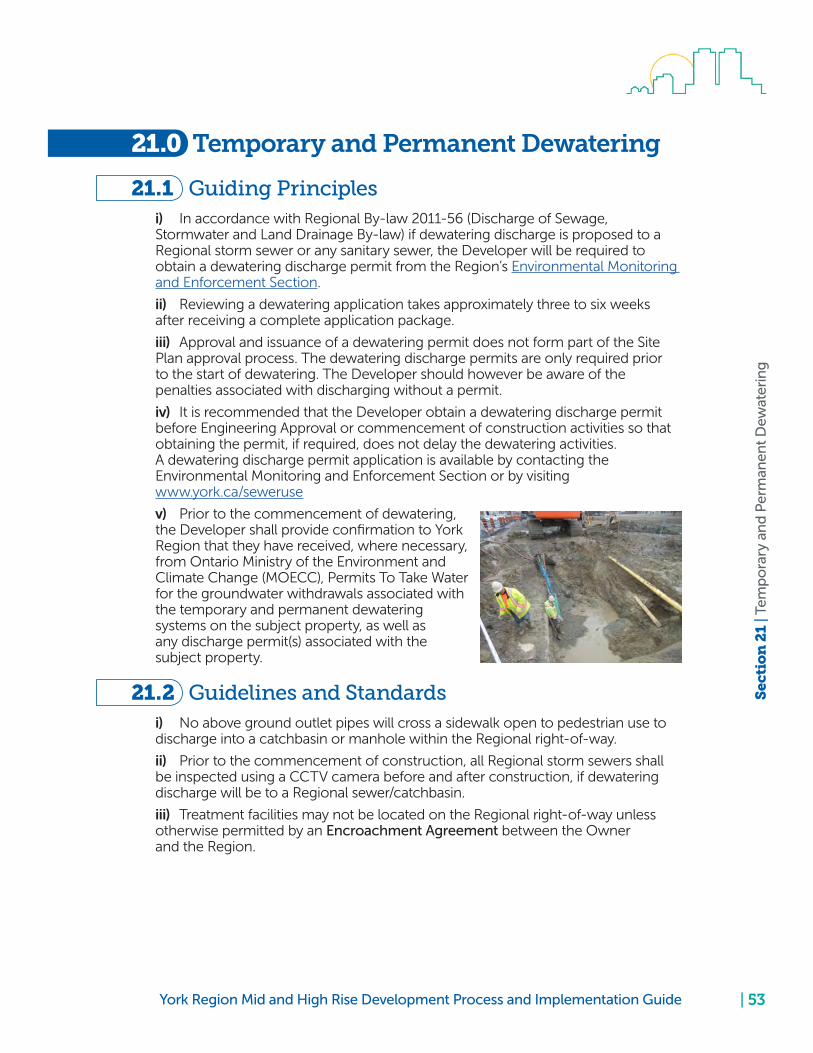
| 53York Region Mid and High Rise Development Process and Implementation Guide
Sec
tio
n 2
1 | T
emp
ora
ry a
nd
Per
man
ent
Dew
ater
ing
21.0 Temporary and Permanent Dewatering
21.1 Guiding Principles i) In accordance with Regional By-law 2011-56 (Discharge of Sewage, Stormwater and Land Drainage By-law) if dewatering discharge is proposed to a Regional storm sewer or any sanitary sewer, the Developer will be required to obtain a dewatering discharge permit from the Region’s Environmental Monitoring and Enforcement Section.
ii) Reviewing a dewatering application takes approximately three to six weeks after receiving a complete application package.
iii) Approval and issuance of a dewatering permit does not form part of the Site Plan approval process. The dewatering discharge permits are only required prior to the start of dewatering. The Developer should however be aware of the penalties associated with discharging without a permit.
iv) It is recommended that the Developer obtain a dewatering discharge permit before Engineering Approval or commencement of construction activities so that obtaining the permit, if required, does not delay the dewatering activities. A dewatering discharge permit application is available by contacting the Environmental Monitoring and Enforcement Section or by visiting www.york.ca/seweruse
v) Prior to the commencement of dewatering, the Developer shall provide confirmation to York Region that they have received, where necessary, from Ontario Ministry of the Environment and Climate Change (MOECC), Permits To Take Water for the groundwater withdrawals associated with the temporary and permanent dewatering systems on the subject property, as well as any discharge permit(s) associated with the subject property.
21.2 Guidelines and Standards i) No above ground outlet pipes will cross a sidewalk open to pedestrian use to discharge into a catchbasin or manhole within the Regional right-of-way.
ii) Prior to the commencement of construction, all Regional storm sewers shall be inspected using a CCTV camera before and after construction, if dewatering discharge will be to a Regional sewer/catchbasin.
iii) Treatment facilities may not be located on the Regional right-of-way unless otherwise permitted by an Encroachment Agreement between the Owner and the Region.

| 54 York Region Mid and High Rise Development Process and Implementation Guide
Sec
tio
n 2
1 | T
emp
ora
ry a
nd
Per
man
ent
Dew
ater
ing
21.3 Submission RequirementsAlthough the issuance of a dewatering permit does not form part the Site Plan Approval process, the Region’s Development Engineering Section must be satisfied that the Developer has completed the required preparatory work in order to apply for a Dewatering Discharge Permit. Therefore, prior to Engineering Approval, the Developer shall submit, to the satisfaction of the Region, a Hydrogeological Report, a Dewatering Discharge Plan and confirm a Dewatering application has been submitted to the Region’s Environmental Services Department.
21.3.1 Hydrogeological Report
The Hydrogeological Report should contain information required in a complete Dewatering Discharge Permit application. This will include (but may not be limited to):
• Dewatering discharge pumping rate, volumes and duration of pumping
• Chemical analysis results of dewatering discharge
For more information please contact the Region’s Environmental Monitoring and Enforcement Section.
21.3.2 Dewatering Discharge Plan
The Dewatering Discharge Plan must show:
i) Location (e.g., manhole, ditch, catchbasin, treatment facility) to which ground- and storm-water will be discharged to.
ii) Details on any treatment facilities (e.g., sedimentation tank).
iii) Details of inlet, piping arrangement and outlet discharge.
21.3.3 Confirmation that a Dewatering Application has been made
The Developer shall submit documentation confirming that a dewatering application has been made to the Region’s Environmental Monitoring and Enforcement Section prior to Engineering Approval.

| 55York Region Mid and High Rise Development Process and Implementation Guide
Sec
tio
n 2
2 | H
oar
din
g a
nd
Fen
cin
g
22.0 Hoarding and Fencing
22.1 Guiding Principles i) No hoarding or fencing shall be permitted within the Regional right-of-way without the approval of the Region and the execution of an Encroachment Permit with the Region.
22.2 Guidelines and Standards i) Unless otherwise permitted, gates shall not swing onto the Regional right-of-way.
ii) Hoarding/fencing shall be designed and implemented to withstand adverse weather conditions without falling over.
iii) All hoarding and fencing within the Regional right-of-way shall comply with O. Reg. 213/91 s. 64 and O. Reg. 213/91 s. 65.
22.3 Submission RequirementsPrior to Engineering Approval, the Developer must submit, to the Region’s satisfaction, Hoarding and Fencing Plans that show:
i) Location of hoarding and fencing with stabilization plan.
ii) Location of gates and their swing paths.
iii) Hoarding and fencing construction details (e.g., dimensions, materials, installation).

| 56 York Region Mid and High Rise Development Process and Implementation Guide
Sec
tio
n 2
3 | U
tilit
ies
23.0 Utilities
23.1 Guiding Principles i) Any excavation, drilling or tunneling within the Regional right-of-way requires the Developer to first conduct a Subsurface Utility Engineering Level B (SUE QL-B) investigation. This means that utility information must be obtained through the application of appropriate surface geophysical methods to determine the existence and approximate location of subsurface utilities.
ii) If, upon review of the site plan submission, it becomes apparent that site development work may conflict with a utility, the Region may require a further Subsurface Utility Engineering Level A (SUE QL-A) investigation to be conducted. This means that precise horizontal and vertical location of utilities should be obtained by the actual exposure and subsequent survey of subsurface utilities at expected points of conflict.
iii) The results of the SUE QL-B and SUE QL-A investigations should be depicted on the servicing plan and profile drawings, grading plan and profile drawings, landscape drawings and any other drawings where development works may conflict with subsurface utilities.
Locate all your utilities up front and prevent surprises in the field.
A sample Subsurface Utility Engineering (SUE) investigation drawing
iv) In the event that a utility needs to be relocated as a result of development works, the Developer must follow the process as outlined in the Utility Relocation Process Chart. The Owner shall also contact the Region’s Corridor Control and Safety Section for specific information regarding the Process Chart, and utilities location and investigation.
v) Prior to Engineering Approval, the Developer shall confirm, to the satisfaction of the Region, that the proposed development can meet the hydro authority’s requirements for clearance between the building and electrical transmission poles situated within the Regional right-of-way, when implemented in accordance with Regional standards and practices, and considering the future location of transmission poles along vivaNext Rapidway and other Regional road widening

| 57York Region Mid and High Rise Development Process and Implementation Guide
Sec
tio
n 2
3 | U
tilit
ies
projects. If the clearance requirements provided by the electrical authority cannot be met, the Developer shall, at their own expense, implement a solution to provide the appropriate clearances to the satisfaction of the Region.
vi) The Developer must review, or ensure that any consultants retained by the Developer, review, at an early stage, the applicable authority’s minimum vertical clearances for aerial cable systems (See OPSD 2245.020) and their minimum spacing and cover requirements. The Developer shall be entirely responsible for making any adjustments or relocations, if necessary, prior to the commencement of any construction.
vii) The Developer must be aware that on vivaNext Rapidway corridors and other Regional road widening projects, the horizontal and/or vertical locations of existing utilities are likely to change. It may therefore be necessary for site plan designs to be based on the future location of utilities, not on their current locations.
23.2 Guidelines and StandardsThe Developer can consult the following guidelines and standards for additional information to support utility investigations, relocation and other related activities:
• Standard Guideline for the Collection and Depiction of Existing Subsurface Utility Data, CI/ASCE 38-02
• York Region Utility Relocation Process Chart
• 2012 Building Code Compendium 3.2.5.6 Access Route Design
• Standard Development Construction Practices for Work on Regional Roads
23.3 Submission RequirementsPrior to Engineering Approval, the Development must submit, to the Region’s satisfaction, the following documents:
i) A Site Servicing Plan or individual Utility Plan showing the location of all utilities where such utilities may conflict with servicing and/or other infrastructure for the proposed development.
ii) If requested, the Developer shall submit a Utility Plan depicting the results of the SUE QL-B and SUE QL-A investigations undertaken as part of the site plan application.
No locates are to be left to subcontractors in the field.

| 58 York Region Mid and High Rise Development Process and Implementation Guide
Sec
tio
n 2
4 |
Per
mit
s
24.0 Permits
24.1 Road Occupancy PermitsPrior to commencing any work on the Regional right-of-way, including but not limited to constriction access, installation of hoarding and fencing, utility investigations, grading, excavation, etc., the Developer must obtain, at its own cost, a Road Occupancy Permit from the Region’s Corridor Control and Safety Section. To obtain a Road Occupancy Permit, the Developer shall submit the following documentation, at a minimum, to the Corridor Control and Safety Section for review and/or approval:
• A copy of the Engineering Approval letter issued by Development Engineering
• A completed Road Occupancy Permit application • Insurance Certificate approved by the Region • An approved Traffic and Pedestrian Management Plan • A Traffic Protection Plan for worker safety in accordance with the requirements of the Occupational Health and Safety Act • 24 hour contactsAfter receiving the Road Occupancy Permit, it is the responsibility of the Developer or the Consultant responsible for administering the construction works to notify the Region’s Development Construction Coordinator for a pre-construction meeting prior to any construction within the Regional road allowance. The Developer shall abide by the conditions of the Road Occupancy Permit and approved Engineering drawings for the duration of the project.
24.2 Encroachment PermitsFor any encroachment permitted onto a Regional road allowance, the Developer is required to first obtain an Encroachment Permit from the Region’s Development Engineering Section prior to implementing the encroachment, or upon the conveyance of a road widening that would result in an existing feature becoming an encroachment. The types of encroachments permitted typically include, but are not limited to:
• Enhanced streetscaping (planters, unit paving, street furniture, plantings, decorative lighting, etc.)
• Tie-back anchors • Excavation • Fencing and hoarding • Crane swing • Signs
By signing the Encroachment Permit, the Owner acknowledges that it shall remove the encroachment(s), at its own expense, by the termination date specified in the Permit, or within a specified period after receiving written notice from the Region. The Owner also acknowledges that should the Owner fail to remove the Encroachment by the termination date or within the specified period, the Region may take all reasonable steps to remove the Encroachment and the Owner shall reimburse the Region for all costs incurred.

| 59York Region Mid and High Rise Development Process and Implementation Guide
Sec
tio
n 2
4 |
Per
mit
s
24.2.1 Process
When, during the Site Plan review process, it becomes apparent that the Owner will require an Encroachment Permit, the Region will start preparing the Encroachment Permit and get it ready for execution at the appropriate time. The submission requirements to finalize an Encroachment Permit are outlined below. Once the permit is ready for execution, the Region will send an executable copy of the Permit to the Owner. The Owner then has to print four copies on legal sized paper, sign each copy and return them to the Region. A Regional representative will then sign all four copies and return one fully executed copy to the Owner.
24.2.2 Submission Requirements
a. A Certificate of Insurance
b. A certified cheque made payable to The Regional Municipality of York representing Community Planning and Development Services’ fee required for permitting the encroachment as set out in Bylaw No. 2010-15. Please refer to Section 8.1.
c. A registerable legal description of the Region’s lands upon which the Owner intends to encroach (include copy of Parcel Register (PIN) and Block Map)
d. The registered Owner’s name and a registerable legal description of its lands (include copy of Parcel Register (PIN) and Block Map)
e. A drawing clearly showing the encroachment (i.e., encroaching item(s) and extent of encroachment within Regional road allowance)
24.3 Dewatering Discharge PermitIn accordance with Regional By-law 2011-56 (Discharge of Sewage, Stormwater and Land Drainage By-law) if dewatering discharge is proposed to a Regional storm sewer or any sanitary sewer, the Developer will be required to obtain a dewatering discharge permit from the Region’s Environmental Monitoring and Enforcement Section. For additional information, please refer to Section 21.

| 60 York Region Mid and High Rise Development Process and Implementation Guide
Sec
tio
n 2
5 | S
ou
rce
Wat
er P
rote
ctio
n
25.0 Source Water Protection
25.1 Sites Located in a Wellhead Protection Area (WHPA)Please see yorkmaps.ca or Map 6 of YROP 2010 for the different Wellhead Protection Areas (WHPAs) in the Region.
If the site is within a WHPA for York Region’s municipal drinking water wells, construction activities, such as deep excavation (typically associated with underground parking and installation of water, sanitary and stormwater services) that may require significant dewatering or groundwater depressurization, have the potential to interfere with the quantity of groundwater available for municipal supply.
25.1.1 Submission Requirements
25.1.1.1 Dewatering Plan
The Developer may be required to submit a Dewatering Plan when the proposed mid and high rise development is situated in a Wellhead Protection Area (WHPA). A Dewatering Plan that will examine existing and proposed ground water levels in relation to the proposed development, underground construction, servicing infrastructure and shall include but not be limited to: expected dewatering discharge rate; quality, location, and zone of influence of dewatering and assess impacts on regional; water supply wells from a qualified Hydrogeologist ( Professional Geoscientist (P. Geo.) or Professional Engineer (P. Eng.)) satisfactory to the Risk Management Official.

| 61York Region Mid and High Rise Development Process and Implementation Guide
Sec
tio
n 2
5 | S
ou
rce
Wat
er P
rote
ctio
n
The York Region Sewer Use Bylaw Section should be contacted for a dewatering discharge permit, and if required, and the Ministry of Environment and Climate Change should be contacted for a Permit To Take Water (PTTW).
25.1.1.2 Source Water Impact Assessment and Mitigation Plans
All proposed developments in Wellhead Protection Areas A, B, C and D are subject to Regional Official Plan Polices which may require a Source Water Impact Assessment and Mitigation Plan (SWIAMP) to be completed for review and approval by the Water Resources Section. The guidance document for a SWIAMP can be found at york.ca/protectingwater
The SWIAMP Report should be prepared by a hydrogeologist that is a licensed Professional Geoscientist or Professional Engineer.
25.1.1.3 Section 59 Notice (Source Protection Permit)
If the proposed mid and high rise development is located within WHPA-A, B or C and has fuel oil storage or a commercial component (mixed use), the Developer will be required to obtain a Section 59 Notice from the Risk Management Office as part of a complete planning application. A planning or building permit application cannot be deemed complete until the Section 59 Notice is received by the local municipality. For more information, please contact the Region’s Risk Management Office.
25.2 Site Located in Wellhead Protection Area QIf a site is located in Wellhead Protection Area Q (WHPA-Q) area as per Figure 9, then water quantity policies contained in the South Georgian Bay Lake Simcoe (SGBLS) and Credit Valley, Toronto and Region and Central Lake Ontario (CTC) source protection plans apply to the development.

| 62 York Region Mid and High Rise Development Process and Implementation Guide
Sec
tio
n 2
5 | S
ou
rce
Wat
er P
rote
ctio
n
Figure 9: Source Water Protection Vulnerable Areas

| 63York Region Mid and High Rise Development Process and Implementation Guide
Sec
tio
n 2
5 | S
ou
rce
Wat
er P
rote
ctio
n
There are two prescribed threats under the Clean Water Act that relate to water quantity.
1) Prescribed Threat 19 — An activity that takes water from an aquifer without returning the water to the same aquifer or surface water body.
• In the SGBLS source protection region, the following competing water use policies apply: DEMD-1, DEMD-2, DEMD-3, DEMD-4, LUP-9, LUP-10, EDU-4, INCENT-1, INCENT-2
• In the CTC source protection region, the following competing water use policies apply: DEM-1, DEM-2
2) Prescribed Threat 20 – An activity that reduces recharge to an aquifer
• In the SGBLS source protection region, the following policies related to recharge apply: LUP-11, LUP-12, LUP-13 and LUP-15.
• In the CTC source protection region, the following policyrelated to recharge applies: REC-1
Please refer to the SGBLS or CTC source protection plans and the associated explanatory documents for further detail related to the above listed policies (visit ourwatershed.ca and ctcswp.ca).
In general, the demand policies require developments within the WHPA-Q area that require a Permit To Take Water (PTTW) to have an assessment from the Ministry of Environment and Climate Change (MOECC) of the water taking for its potential impact on municipal water supplies. Also, the recharge policies generally state that major developments must maintain pre-development groundwater infiltration rates, as demonstrated by a water balance study.
25.2.1 Submission Requirements
The Region does not have any submission requirements with respect to WHPA-Q sites as it is dealt with by local municipalities and the Conservation Authorities.
25.3 Site Located In Highly Vulnerable Aquifer (HVA) The mapping at york.ca/SPMap can be used to determine if the site is located within a Highly Vulnerable Aquifer (HVA).
25.3.1 Submission Requirements
For sites located in a HVA, the submission requirements are below. The Developer is advised to consult with the Region’s Water Resources Section prior to undertaking these studies and reports.
25.3.1.1 Contaminant Management Plan
If the proposed development is within a Highly Vulnerable Aquifer (HVA) area under the Clean Water Act and involves the manufacturing, handling and/ or storage of bulk fuels and/or chemicals (e.g., fuel for back-up generator), a Contaminant Management Plan (CMP) is required. Please contact the Water Resources Section for more information.

| 64 York Region Mid and High Rise Development Process and Implementation Guide
Sec
tio
n 2
5 | S
ou
rce
Wat
er P
rote
ctio
n
25.4 Sites Located in an Area Of Concern (AOC)In Richmond Hill and Vaughan, there are areas of high water table and artesian aquifer conditions. This could have geotechnical implications with respect to construction activities including, but not limited to, dewatering (short-term or long-term, temporary or permanent), foundation construction, and building stability. The Developer should contact the Water Resources Section to determine if their site could be in an AOC.
In Areas of Concern, a dewatering plan is required to examine any high water table conditions and confined artesian aquifer conditions, and manages any potential impacts to the development.
In these areas, geotechnical and hydrogeological investigations should take into account the possibility that groundwater levels may currently be depressed at some sites (for example, due to the Region’s long-term groundwater control system operating at Major Mackenzie Drive and Essex Road (Richmond Hill), and other third party permanent dewatering systems in the area) when assessing the site. Because a new development should not rely on the influence of nearby third party dewatering systems in its geotechnical and hydrogeological studies, any assessment must account for third party dewatering systems in the surrounding area.
With respect to the on-site dewatering, York Region staff are concerned about the potential flowing, artesian conditions that may be present on some sites in AOC. York Region recommends the proponent investigate the soil and groundwater conditions well below the elevation of any sub levels (i.e., basements, sump pump depths) since past experience has indicated that removing the soils responsible for confining the underlying artesian aquifer can lead to flooding of the excavation with groundwater.
25.5 Information and Database ResourcesThe Developer should contact York Region’s Water Resources Section for additional information and support with the above data sources.
25.5.1 Comprehensive Geological and Water Resources Database
The Region, along with other local municipalities and Conservation Authorities, participate in the Oak Ridges Moraine Groundwater Program (oakridgeswater.ca), established in 2001 to support the protection and management of groundwater resources. The program builds, maintains and provides partner agencies with regional geological and hydrogeologic data for ongoing groundwater studies and management initiatives. The database contains an extensive amount of information that can be used for a variety of hydrogeologic assessments (i.e., dewatering and depressurization) including water well and borehole data, geological and hydrogeological interpretations, groundwater level data, Permit To Take Water records, surface water data and climate data.

| 65York Region Mid and High Rise Development Process and Implementation Guide
Sec
tio
n 2
5 | S
ou
rce
Wat
er P
rote
ctio
n
25.5.2 Groundwater Flow Models
Groundwater models provide a representation of groundwater flow systems and can be used to investigate how a groundwater system might respond to changes, such as land use, pumping (i.e., dewatering) or climate changes. Through the Oak Ridges Moraine Groundwater Program and Source Water Protection, the Region has developed flow models for various purposes that can be utilized to evaluate potential stresses to groundwater and surface water systems. These models could be beneficial in assessments that need to predict impacts from large development activities.
25.5.3 York Region Water Quality and Quantity Databases
The Region collects and maintains an extensive dataset on water quality, water quantity and water levels from regionally-owned infrastructure such as monitoring wells, production wells and climate stations.
25.5.4 Other Relevant Data
Data from other agencies are also available. This includes topographic or other maps, geological maps, borehole and geophysical data from agencies such as the Ontario Geological Survey and Geological Survey of Canada.

| 66 York Region Mid and High Rise Development Process and Implementation Guide
Co
nta
ct I
nfo
rmat
ion
| P
age
On
e
Contact Information
The Regional Municipality of York
Corporate Services Department
Development Engineering Section
Manager, Development Engineering 17250 Yonge Street, Newmarket, ON L3Y 6Z1 1-877-464-9675
Transportation Services Department
Regional Corridor Control and Safety Section
Manager, Corridor Control and Safety 90 Bales Drive East, East Gwillimbury, ON L0G 1V0 1-877-464-9675 Ext. 75700 [email protected]
Traffic Signal Operations Section
Manager, Traffic Signal Operations 90 Bales Drive East, East Gwillimbury, ON L0G 1V0 1-877-464-9675 Ext. 75200 [email protected]
Transportation Planning Section
Manager, Transportation Planning 17250 Yonge Street Newmarket, ON L3Y 6Z1 1-877-464-9675 Ext. 75000
Environmental Services Department
Capacity Monitoring and Development Approval Section
Manager, Capacity Monitoring and Development Approval 17250 Yonge Street, Newmarket, ON L3Y 6Z1 1-877-464-9675 Ext. 73000
Environmental Monitoring and Enforcement Section, Sewer Use Bylaw Section, Dewatering Discharge Permit
Program Manager, Monitoring and Enforcement 380 Bayview Parkway, Newmarket, ON L3Y 4W3 1-877-464-9675 Ext. 73000 [email protected]

| 67York Region Mid and High Rise Development Process and Implementation Guide
Co
nta
ct I
nfo
rmat
ion
| P
age
Two
Risk Management Office and Water Resource Section
Manager, Water Resources & Risk Management Official 17250 Yonge Street, Newmarket, ON L3Y 6Z1 1-877-464-9675 Ext. 73000 [email protected]
Legal Services Department
Legal Services Branch
Planning and Development Law Clerk 17250 Yonge Street, Newmarket, ON L3Y 6Z1 1-877-464-9675 Ext. 71423
Finance Department
Insurance and Risk Section
Manager, Insurance and Risk Section 17250 Yonge Street, Newmarket, ON L3Y 6Z1 1-877-464-9675
Access York
Hours of operation: Monday to Friday: 8:30 a.m. to 4:30 p.m. Phone: 1-877-464-9675 TTY: 1-866-512-6228 or 905-895-4293 (for deaf and hearing impaired) [email protected]
Other Agencies
Smart Commute - North Toronto, Vaughan
45 Sheppard Ave. E., Suite 411, Toronto, ON M2N 5W9 647-539-8576 [email protected]
Lake Simcoe Region Conservation Authority
120 Bayview Parkway, Newmarket, ON L3Y 3W3 Permits & Regulations 1-800-465-0437 [email protected]
Toronto Region Conservation Authority
101 Exchange Avenue, Vaughan, ON L4K 5R6 Planning and Development 416-661-6600 Ext. 5271 or 5221 planning&[email protected]

| 68 York Region Mid and High Rise Development Process and Implementation Guide
Co
nta
ct I
nfo
rmat
ion
| P
age
Th
ree

| 69York Region Mid and High Rise Development Process and Implementation Guide
Glo
ssar
y |
Ph
rase
s an
d W
ord
s
Glossary

| 70 York Region Mid and High Rise Development Process and Implementation Guide
Glo
ssar
y |
Pag
e O
ne
Glossary
10-Year Capital Improvement ProgramA Program which represents York Region’s requirements to maintain the existing transportation infrastructure and provide new infrastructure and facilities to follow the direction of the Transportation Master Plan.
Access Design GuidelinesA Regional document that contains guidelines for the control, positioning and design of accesses to any Regional road.
Accessibility for Ontarians with Disabilities Act (AODA) StandardsApplicable standards of accessibility specified in the Accessibility for Ontarians with Disabilities Act, 2005 (AODA).
Development Charge CreditFinancial credit given towards a development charge in exchange for work that builds Regional infrastructure for which a development charge is imposed under the Regional Municipality of York Development Charge By-law.
EasementAn interest in land owned by another person, consisting of the right to use or control the land, or an area above or below it, for a specific limited purpose. Such an interest can be of limited duration (temporary limited interest easement) or permanent (permanent limited interest easement).
Encroachment Any type of vegetation, man-made object or item of personal/owner’s property which exists wholly upon, or extends from a person’s/owner’s premise onto, public lands, including any aerial, surface or subsurface encroachments, which can either be of a temporary or a permanent nature.
Encroachment AgreementA legal and binding agreement between the Region and a property owner whose property abuts Regional property which permits the property owner to have an encroachment on Regional property.
Environmental Site AssessmentAn investigation to determine the environmental condition of a site or property according to Ontario Regulation 152/04 (as amended), including a Phase 1 Environmental Site Assessment and a Phase 2 Environmental Site Assessment.
Highly Vulnerable Aquifer (HVA)An aquifer that can be easily changed or affected by contamination from both human activities and natural processes as a result of (a) its intrinsic susceptibility, as a function of the thickness and permeability of overlaying layers, or (b) by preferential pathways to the aquifer.

| 71York Region Mid and High Rise Development Process and Implementation Guide
Glo
ssar
y |
Pag
e Tw
o
In-Principle ApprovalAn approval of the development concept that assume that the Developer will be able to meet all the requirements for full Site Plan approval.
IntensificationThe development of a property, site or area at a higher density than currently exists through:
a. redevelopment, including the use of brownfield sites; b. the development of vacant and/or underutilitized lots within previously developed areas; c. infill development; or, d. the expansion or conversion of existing buildings.
Master and Environmental Servicing Plan (MESP)A comprehensive technical analysis intended to address the delineation and protection of key natural heritage, key hydrologic features and natural hazards; provincial requirements relative to water resources and endangered species, threatened species and special concern species; municipal servicing in the context of urban development; and compliance with higher order subwatershed/secondary/official plans where applicable.
Ministry of Environment and Climate Change StandardsDesign standards, guidelines and manuals issued by the Ministry of the Environment and Climate Change for the design of sewage works, storm sewer systems, and drinking water systems in Ontario (e.g., relating to the minimum vertical and horizontal separation between watermain services and sewers (sanitary and storm)).
Non-Disclosure AgreementA legal contract between a Developer and the Region in which the Developer agrees not to disclose certain confidential information received from the Region to any other party.
Occupational Health and Safety Act (OHSA) RegulationsRegulations in the Ontario’s Occupational Health and Safety Act, 1990 (as amended).
Ontario Provincial Standard Drawing (OPSD) Design StandardsOntario Provincial Standard Drawing (design standards) developed by the Ontario Ministry of Transportation for the design and construction of roads and public works in Ontario.
Regional CorridorA priority travel corridor supported by rapid transit services that provide connections to the Regional Centres and other centres throughout the GTA.
Reliance LetterA legal letter provided by a qualified environmental professional that allows another party to rely on the contents of an Environmental Site Assessment report.

| 72 York Region Mid and High Rise Development Process and Implementation Guide
Glo
ssar
y |
Pag
e T
hre
e
Road Design Guidelines and Standards (RDGS) A Regional document that contains guidelines and standards for the design and construction of Regional roadway infrastructure.
Road Occupancy PermitA Permit issued by the Region permitting the holder to occupy Regional right-of-way for the purpose of undertaking any approved works.
Statutory DeclarationA declaration by the Owner, made under Oath, that no contaminant, pollutant, waste of any nature, hazardous substance, toxic substance, dangerous good, or other substance or material defined or regulated under applicable environmental laws is present at, on, in or under lands to be conveyed to York Region (including soils, substrata, surface water and groundwater as applicable) at the time of conveyance, at a level or concentration that exceeds applicable standards in the Environmental Protection Act O. Reg. 153/04 (as amended).
Transportation Impact StudyA study that demonstrates the anticipated impacts of development generated traffic on the adjacent transportation system and how these impacts can be mitigated and addressed in a manner that is consistent with the objectives of the Region.
Transportation Mobility Plan Guidelines for Development ApplicationsA Regional document that contains guidelines for the preparation of Transportation Impact studies.
Travel Demand Management PlanA plan consisting of strategies and policies to reduce travel demand (specifically that of single-occupancy private vehicles) by shifting it to alternative modes of transportation, or by redistributing it in space or in time.
vivaNext Rapidway CorridorsRegional transportation corridors where special travel lanes have been, or will be constructed in the median of the roadway for exclusive use by transit vehicles.

| 73York Region Mid and High Rise Development Process and Implementation Guide
Ap
pen
dix
| A
th
rou
gh
F Appendix

| 74 York Region Mid and High Rise Development Process and Implementation Guide
Ap
pen
dix
| A
th
rou
gh
F

| 75York Region Mid and High Rise Development Process and Implementation Guide
Ap
pen
dix
A |
Sub
mis
sio
n R
equ
irem
ents
A Appendix A - Submission Requirements

| 76 York Region Mid and High Rise Development Process and Implementation Guide
Ap
pen
dix
A |
Sub
mis
sio
n R
equ
irem
ents

York Region Mid and High Rise Development Process and Implementation Guide | 77
Ap
pen
dix
B |
Hig
h R
ise
Dev
elo
pm
ent
Site
Pla
n A
pp
rova
l Pro
cess
wit
h S
ite P
lan
Ag
reem
ent
B Appendix B - Site Plan Process Flow Chart
High Rise Development Site Plan Approval Process with Site Plan Agreement

York Region Mid and High Rise Development Process and Implementation Guide
Ap
pen
dix
C |
Hig
h R
ise
Dev
elo
pm
ent
Site
Pla
n A
pp
rova
l Pro
cess
wit
h N
o S
ite P
lan
Ag
reem
ent
| 78
C Appendix C - Site Plan Process Flow Chart
High Rise Development Site Plan Approval Process with No Site Plan Agreement

| 79York Region Mid and High Rise Development Process and Implementation Guide
Ap
pen
dix
D |
Tem
pla
te R
elia
nce
Let
ter
D Appendix D - Template Reliance Letter

| 80 York Region Mid and High Rise Development Process and Implementation Guide
Ap
pen
dix
E |
Tem
pla
te S
tatu
tory
Dec
lara
tio
n
E Appendix E - Template Statutory Declaration

| 81York Region Mid and High Rise Development Process and Implementation Guide
Ap
pen
ix F
| Yo
rk R
egio
n S
ecu
rity
Rel
ease
an
d R
edu
ctio
n R
equ
irem
ents
F Appendix F - York Region Security Release and Reduction Requirements
Security Reduction Requirements
Prior to authorizing the reduction of any securities, an inspection must be carried out and all other Regional requirements must be satisfied. Any reduction leaving a balance will then be retained for a period of two years for maintenance and lien claim purposes. Below is a list of requirements that may be required as part of a security reduction request:
• Letter of request from the Owner/Developer or designated Consultant/ Applicant to reduce the security
• Letter of certification from the Consultant certifying that the works are completed as per the approved “as built” drawings. Video DVD and inspection report of all sewers newly constructed within the Regional road allowance
• Soils Consultant final report including material testing, analysis and compaction results, if applicable
• Owner’s signed Statutory Declaration
• Copy of the Certificate of Substantial Performance, if applicable
• Two copies of “As Built” record drawings to be submitted from the Consultant and folded to 8.5 x 14”. Rolled drawing submissions will not be accepted
• Ontario Land Surveyor’s certificate certifying that all survey monuments have been verified or replaced and no encroachments of features/signs/stairs/steps and other structures pertain to the development frontage
• Landscape Architect certificate certifying all landscaping have been verified in the field and constructed as per the approved landscape drawings
• A letter of certification is required from a certified professional engineer to certify that the noise attenuation features installed meet the approved noise study and conform to the Ministry of Environment and Climate Change guidelines and Region’s noise policy, if applicable
• Confirmation that lands have been conveyed, environmental conditions cleared and site plan agreement fully executed, if applicable
Electronic copies of all above documents in PDF format. Electronic documents shall be submitted via email, disc or portable drive to the appropriate Regional Construction Coordinator. Piecemeal submissions will not be accepted.

| 82 York Region Mid and High Rise Development Process and Implementation Guide
Ap
pen
ix F
| Yo
rk R
egio
n S
ecu
rity
Rel
ease
an
d R
edu
ctio
n R
equ
irem
ents
Security Release Requirements
Prior to authorizing the release of any remaining securities, a final inspection must be carried out. If the Region issues a deficiency list after the final inspection, the owner shall rectify the deficiencies within a maximum period of 90 days of non-winter weather. If the owner fails to rectify the deficiencies within this period, then the Region may draw upon any or all of the remaining securities once this period has passed. Below is a list of requirements to obtain a security release:
• Letter of Request from Owner/Developer or designated Consultant/Applicant to release the final security
• Owner’s signed Statutory Declaration
Release of security may be subject to final clearance from other Regional Branches.

York Region Mid and High Rise Development Process and Implementation Guide

160
70_
02
02
20
17