Embed Size (px)
Citation preview
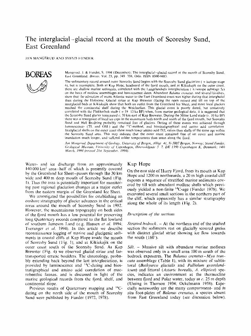
The interglacial- glacial record at the mouth of Scoresby Sund, East Greenland JAN MANGEKUD A N D W E N D F U N D E R
Mangci-id. J . & Funder, S. 1994 (Deccmber): The interglacial-glacial record at the mouth of Scoresby Sund. East Greenland. Bori'u.~, Vol. 23, pp. 349 358. Oslo. ISSN 0300-9483.
The sedimentary record around outer Scorcsby Sund begins with the Scorcsby Sund glaciation ( z isotope stage (I), but is incomplete. Both at Kap Hope, hcadward of the fjord rnuuth, and at Kikiakajik on the outer coast. Ihcrc arc shallow marine scdiments, correlated with thc Langelandselv interglaciatiun ( z isotope suhstagc Sc) on the basis of niollu emhlages and luminescence dates. Abundant Btrlonrrs crcnuru.7. and several bivalves. show that thc advcction o f warm Atlantic watcr to the East Greenland c w s t was higher during that interglacial than during the Ilolocenc. Glacial striae at Kap Hrcwster (lacing the open ocean) and till on top of the interglacial beds at Kikiakajik show that both an outlct from the Greenland Icc Sheet, and more local glaciers reached the continental shelf during the Wcichsclian. This glacial event is poorly dated. but tentatively correlated with thc Flakkerhuk stade ( = 19 15 ka BP) when, from marine geological data, i t is suggested that thc Scoresby Sund glacicr terminated c. 30 km east of Kap Brewster. During the Milne Land stade (c. 10 ka BP) there was a resurgence of local ice caps in the mountains both north and south of the I'jord mouth, hut Scorcsby Sund and Hall Bredning probably remained free of glaciers. Dating of these events was achieved through Iuniincsccnce- (TL and OSL) and the I4C-method. and biostratigraphical and amino acid correliitioii Interglaciiil shells on thc outer coast show much lower amino acid D/L ratios than shells of the same age within the Scoresby Sund area. This may indicate that the outer coast remained free of ice covcr and marine inundation much longer, arid sullered colder temperatures than areas along the fjord. .Itin MtiiIpvwI. Deptrrltnoit of'Gpo1og.r. Uniorr.sit,v uf' B e r g ~ n , Allhgt. 41, N-5007 Bergen. Norivtry; Suentl Fun&, (;rt)fogictrl Mi{,wmi, C h i j i w ~ s i ~ y of C'upi~nhrrgcn. @.~teri~olifgrrtl~~ 5 7, D K - 13.50 Copiiliitgiw K , Denmrirk: 14111 Mtrrcli, 1994 (rci:i,vrtl 21st Siqitonihrr., 1994).
BOREAS
Water- and ice discharge from an approximately 140 000 km' area-half of which is presently covered by the Greenland Ice Sheet-passes through the 30 km wide and 400 m deep mouth of Scoresby Sund (Fig. I ) . Thus the area is potentially important for monitor- ing past regional glaciation changes at a major outlct from the eastern margin of the Greenland Ice Sheet.
We investigated the possibilities for cstablishing an onshore slratigraphy of glacier advances in the critical areas around the mouth of Scoresby Sund in 1992. However, thc mountainous topography on both sides of the fjord mouth has a low potential for preserving long Quaternary records compared to the flat lowland of southern Janieson Land (e.g. Hansen et ul. 1994; Tveranger rt a/ . 1994). In this articlc we describe rcconniassance logging of niarine and glacigenic sedi- ments in coastal cliffs at Kap Hope inside the mouth of Scoresby Siind (Fig. I ) , and at Kikiakajik on the outer coast south of the Scoresby Sund. At Kap Brewster (Fig. 4) we observed glacial striae and far- transported erratic boulders. The chronology, proba- bly extending back beyond the last interglaciation, is provided by luminescence and ''C-dating and bios- tratigraphical and amino acid correlation of mac- robenthic faunas, and is discussed in light of the marine geological records from the fjord, shelf, and continental slope.
Previous results of Quaternary mapping and I4C- dating on the north side of the mouth of Scoresby Sund were published by Funder (1972, 1978).
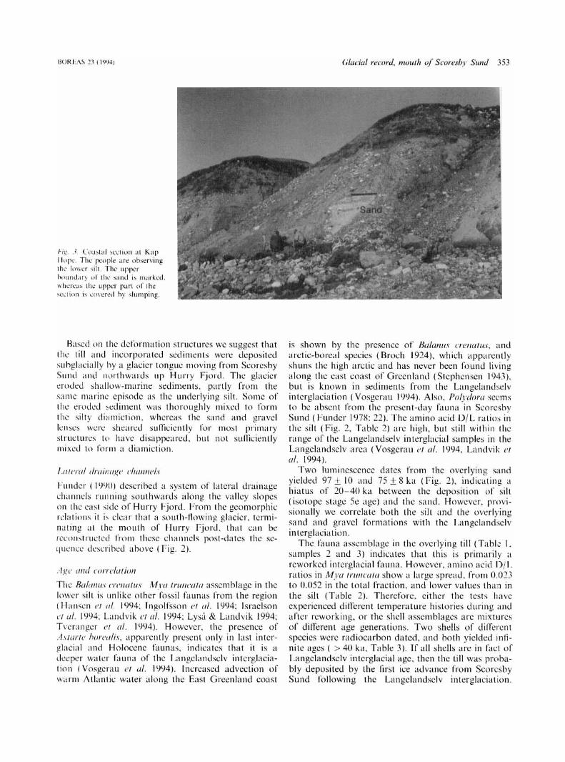
Kap Hope On the east side of Hurry Fjord, from its mouth at Kap Hope and 1200 m northwards, a 20 m high coastal cliff exposes a sequence of stratified marine sediments cov- ered by till with abundant mollusc shells which previ- ously yielded a non-finite I4C-agc (Funder 1978). We excavated several small scctions in the northern part of the cliff, which apparently has a similar stratigraphy along the whole of its length (Fig. 2).
Striated hidrock. - At the northern end of the studied section the scdiments rest on glacially scoured gneiss with distinct glacial striae showing ice flow towards the south (160 ).
SiZt. - Massive silt with abundant marine molluscs was observed only in a small area 100 m south of the bedrock exposures. The Bulunus crenutus -Myu i run - cuta assemblage (Table l) , with its mixture of sublit- toral (Buthyurca glacialis and Pulliolum greenlund- icum) and littoral (Asfarfe borealis, A . ellij2tit.u) spe- cies, indicates an environment at the thermocline between fjord and Polar water, today at c. 25 m depth (Ussing in Thorson 1934; Ockelmann 1958). Espe- cially noteworthy are the many compartment- and in situ foot-plates of Bulunus crenutus, a species absent from East Greenland today (see discussion below).

I G a
LEGEND Tertiary basalts
... .... ............ ......... ............... .................... ............................. .......................... ............. Kap Brewster ................... moraine
............................ .......................... .............. ............... ..............
Jurassic sediments H Hurry Fjord
Triassic sediments Crystalline and metamorphic rocks
o o o o o ~ Devonian to
bccli-ock map ol' the Scorcsby Sund arw. hurrd on Hetirikscn ( 1986). The Kap Rrewstcr tlloraiilc is plotied according to (1994).
The silt i s interpreted as ii marine bioturbatcd sedi- ment. deposited during a period when the relative sea level was some tens of nicters higher than the present.
S t / d There is ii sharp boundary between the silt and the ovcrlying sand, probably an crosional uncon- forniity. N o fossils were found in the 3 m thick sand
unit where the beds dip at a low angcl wcstwards towards the fjord (Fig. 3). Thc beds are well sorted and plane-laminated. with occasional ripple laniina- tion and gravel lenses ii few meters wide and between 0.1 and I rn thick. The bcdding is probably storm- wave induced, and the sand is intcrprcted 11s ii
shoreface deposit.

BOR€AS 2 3 (1994) Gluciul history of interior Junieson Land 35 I
m a.s.1. 19
3 A A A
15 I I 10
5
2 \
1 Bedrock
Units
Glacial drainage channels above the section
Till and incorporated sediments
Sandy gravel
Gravel and well rounded boulders
Sand
Silt
Glacial striae on bedrock
~
Interpretation
Glacier flowing out Hurry Fjord
Ice movement from Scoresby Sund Glacier flowing up Hurry Fjord
Transgression
Beach
Shore-face
Off -shore
:ier flowing out Hurrv Fiord
Dating ka BP
C-14 : >42 >40
Luminescence :
97~10 R-93002 : 7548
R-93001:
Amino acid D/L ratio
0.036?0.005 0.024&0.002 0.052 0.023
0.074&0.0 15
LEGEND: Strike, N is up / Direction of glaciotectonic deformation
C Molluscs a Angle of dip
c--2 Shear banding Shell fragments
Fig. 2. ('amposite stratigraphy at Kap Itope. with indication of glacial meltwater channels on the mountain side above the section. I.um~nc.\ccnce dating sample R-931001 is from sand. I n l above the silt. and sample R-931002 is from sand I m above the former sample. 1-urther details on the luminescence dates arc given in Mejdahl & Funder (1994). Details for "C-dates and amino acid D/l. ratios are given in Tables 2 and 3 respectively.
Grailel t i t id rrdl-rounded houldcrs. - This 4 m thick unit can be traced along most of the cliff and con- sists of long foresets, bcdded parallel to the present coastline and dipping c. 15 towards the west (Fig.
2 ) . Some beds consist of well-rounded boulders 10- 20 cm in diameter, and beds with 1 - 15 cm rounded stones are common. This extremely coarse-grained sediment is interpreted as beach foresets.
352 Per. Miillrr c i (11. BOREAS 23 (1994)
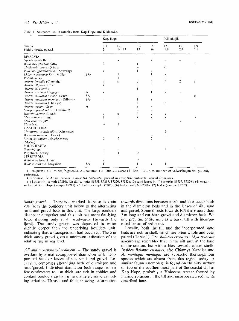
T[rh/c I . Macrobcnllios i n samples from Kap Ilopc and Kikiakajik. __ - . -~ -.
Kap Hopc Kikiakaji k
Sample ( 1 ) ( 2) (3) (4 ) ( 5 ) ( 6 ) ( 7 ) Field altitude. m a.s.1. 2 14-17 IS 16 I .Y 2.4 3 . I - --
3 - 3 2
c
C
c
Sutrcl,. , q r ~ i w / . - There is a marked decrcasc in grain s i x from the bouldery unit below to the alternating sand and gravcl beds in this unit . Thc large boulders disappear altogcthcr and this unit has more flat-lying bcds. dipping only c. 4 westwards (towards the fjord). Thc sandy gravel wiis depositcd in watcr slightly decpcr than the underlying bouldery unit , indicating that ii transgression had occurred. The 5 m thick sandy gravel givcs a minimum indication of thc relative rise in sea Icvcl.
Till trtitl iticwporutctl seclirnent. - The sandy gravel is overlnin by a matrix-supported diamicton with incor- porated beds or lenses of silt. sand and gravel. Lo- cally. i t comprises alternating beds of diamicton and sund/gravcl. Individual diamicton beds range from a few centimeters to 1 m thick, are rich in cobbles and contain boulders up to 1 m in diameter, some exhibit- ing striation. Thrusts and folds showing deformation
towards directions between north and east occur both i n the diamicton beds and in the lcnscs of silt, sand and gravel. Some thrusts towards N N E are more than 2 m long and cut both gravel and diamicton bcds. We interpret the entire unit as a basal till with incorpo- rated lenses of sediment.
Locally. both the till and the incorporated sand beds are rich in shell, which are often whole and cvcn paired (Table 1 ). The Btrlunus cwtiutus - MJYI trirncrrtu asscniblagc rcscmbles that in the silt unit at the base of the section, but with a bias towards robust shells. Resides f3crluriu.s cwnutus. also Chlamys islandica and A . niottrtrgui rnorifugui are subarctic thermophilous species which are absent from this region today. A similar fauna assemblage is found on the silty surface on top of the southernmost part of the coastal clifr a t Kap Hope, probably a Holocene tcrrace formed by marine abrasion in thc till and incorporated sediments described here.
BOREAS 13 (IWJ) 354 h i 1 Mongrricti ond .%end Fundcr
7irhle 2, Aniino acid D/L ( D-alloisoleucine/L-isoleu~inc) ratios in Mytr ~ r u ) w [ i / ( i shells from sections at Kap llope and Kikiakajik.
Sample
K \I' I IOPI x55.51
87211)
x721x
x72 I x X7210
K I K I 4 K A J I K x720s
S7206
Total Free hydrolysate fraction n
BAL-2995
HAL-2994
BAL-3003A
HA I .-3003H BAL-2993 HAI.-3002
RAL-2291
HAL-2997
0.036 ~ 0 . 0 0 5 0 . 3 x f 0.020 6
0.024 * 0.002 0.198 * 0.020 6
0.0.52 0.301 2
0.023 0.175 2 0.074 + 0.01 s 0.436 + 0.03 I 12
Comments ..
3 valves from diamicton above saiid
3 valves from 75 cm thick sand
I valve I'rom diamicton bclow
I viilve from siinie sample 6 valves from lower silt i n section B.
range in total I'raction: 0.0sx 0 . I07
lens in section B.
gravcl bcd i n diamicton
R7219.
0.022 i 0.007 ND*/0.14 6 3
o.07 I * n.00) ND*/O. I6 6 3
valves from bcd b. Only one analysis showed cpimerifation i n the free fraction. valves from hcd h. In the free liuction two arialyrcs S ~ I U H . C ' ~
non-detectable epimeriLatiori
Howcvcr, the DjI, ratios apparently indicate that some shells are younger. Thus the till could alternatively be associatcd with the last glacial muximum.
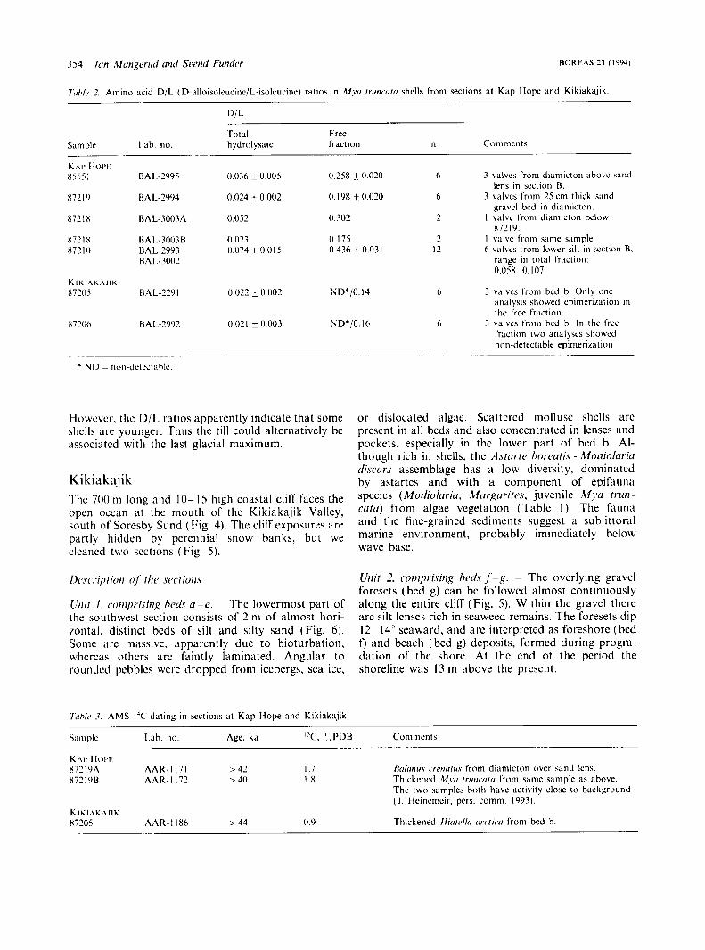
K i k i a k aj i k Thc 700 ni long and 10- 15 high coastal cliff faces the open ocean at the mouth of thc Kikiaka.jik Valley, south of Soresby Sund (Fig. 4). The cliff exposures are partly hidden by perennial snow banks, but we cleaned two sections (Fig. 5 ) .
Dc8script ion 01' t h 1 1 srctiot1.v
L'tiit 1 . (~otiiprisiti,q hcdq u -e . The lowermost part of the southwest section consists of 2 ni of almost hori- mntal. distinct beds of silt and silty sand (Fig. 6). Some itre mitssive. apparently due to bioturbation, whcrcas others arc faintly laminated. Angular to roundcd pebbles were dropped from icebergs, sea ice.
7irhk .?. A M S "C-dating in sections at Knp Hope and Kikiakajik
or dislocated algae. Scattered mollusc shells are present in all beds and also concentrated in lenses and pockets, especially in the lower part of bed b. Al- though rich in shells, the A.strirli> horcdis - Modioluriu di.scors assemblage has a low diversity, dominated by astartes and with a component of epif. ciiina species (Modiolririu. Murgurites, juvenile Mj*a truI1- c m ) from algae vegetation (Table 1 ). The fiii1nii and the fine-grained sediments suggest a sublittoral marine environment, probably immediately bclow wave base.
Uiiit 2. cor,iprisitig hrrls f - g . - The overlying gravel forescts (bed g) can be followed almost continuously along the entire cliff (Fig. 5 ) . Within the gravel there are silt lenses rich in seaweed remains. The foresels dip 12 14 seaward, and are interpreted as foreshore (bed t) and beach (bed g) deposits, formed during progra- dation of the shore. At the end of the period the shoreline WLIS 13 m above the present.
Siinlplc [.ah. no. Age. ka I 'C, ",,,,"Dl3 Commcnts . ~ .... . ~-
K \ I ' I low X72l9A AAR-I 171 > 42 I .7 H(J/WIII.V ~'rctiti/u.s from diamicton over sand lens. X 72 1 OB AAR- I I71 > 40 I .x Thickened M ~ t r / rw ico lo from same sample as above.
The two samples both have activity closc to background ( J . Heinemcir, pcrs. comm. 1993).
K I E I A K A J I K x m s AAR-l I86 >44 0.9 Thickened flicucdlr rrrc,/ic.tr from bed h.

Glacial striae . Approximate western boundary for crystalline erratics.
0 4km
Contour interval 200m -
Fi,q. -1. K;rp Brewster and Kikiakajik. with glacial striae.
Uni/ 3. bed 11. - On top of the section a diamicton is exposed continuously along the cliff. I t is sandy and matrix-supported with numerous striated boulders. mainly local basalt. I t is interpreted as basal ti l l .
F;,g. 5. Stratigraphy at Kikiakajik. For location. see Fig. 4. The luminescence date (R-93100.1) is from sand from bed f: further details are given in Mqdahl & Funder ( 1994). Details for amino acid DjI. ratios and 'T'-dates are given in Tahles 3 and 3 respectively.
deposited by a glacier flowing down the valley from the NW and into the sea. Whether the glacier was overflowing from a major ice stream in Scoresby Sund, or a local glacier descending from the moun- tains in the hinterland cannot be determined with certainty; however, considering the topography and present glaciation pattern the latter interpretation seems most likely. This is supported by the very local provenance (basalts) of the boulders in the till, where only two long-transported, crystalline boulders were seen along the entire section.
Corrdution and iige
As noted above, faunas rich in AsturtP horeulis arc a characteristic of sediments from the Langelandselv interglaciation along the coast of Jameson Land, and correlation with these beds is also suggested by a TL-date of 132 10 ka for bed f (Fig. 5), and by a single fragment of Eulunus crenutus in the fauna (see discussion above). On the other hand, amino acid D/L ratios are low (Table 2). and in fact comparable to Holocene ratios elsewhere in the region (Rogn- valdsson & Sejrup 1992). However, AMS dating of one individual of Hiutt4lu circlicu yielded a non-finite age of > 44 ka BP (Table 3). Therefore, since both faunal correlation and luminescence dating point to a last interglacial age, the very low rate of amino acid epinierization can best be explained by colder diage-
sw 4 600-700m * NE
m a.s.1.
356 Jut1 Mungrrud und Svend Funder BOREAS 23 ( IYY4)
Fig. 6. Scdiments in the lower part of the southwest scction. Kikiakajik. The spade is I m long.
nctic temperatures, indicating that this coastal area has csciipcd the warming effects of glacier cover and marine inundation, and the terrain surface has suffered lower tenipcraturcs than the Scoresby Sund area to the north. The age and duration of the glacier advance (bed h ) that did override the sediments are poorly known, except that it should have been of Weichselian age.
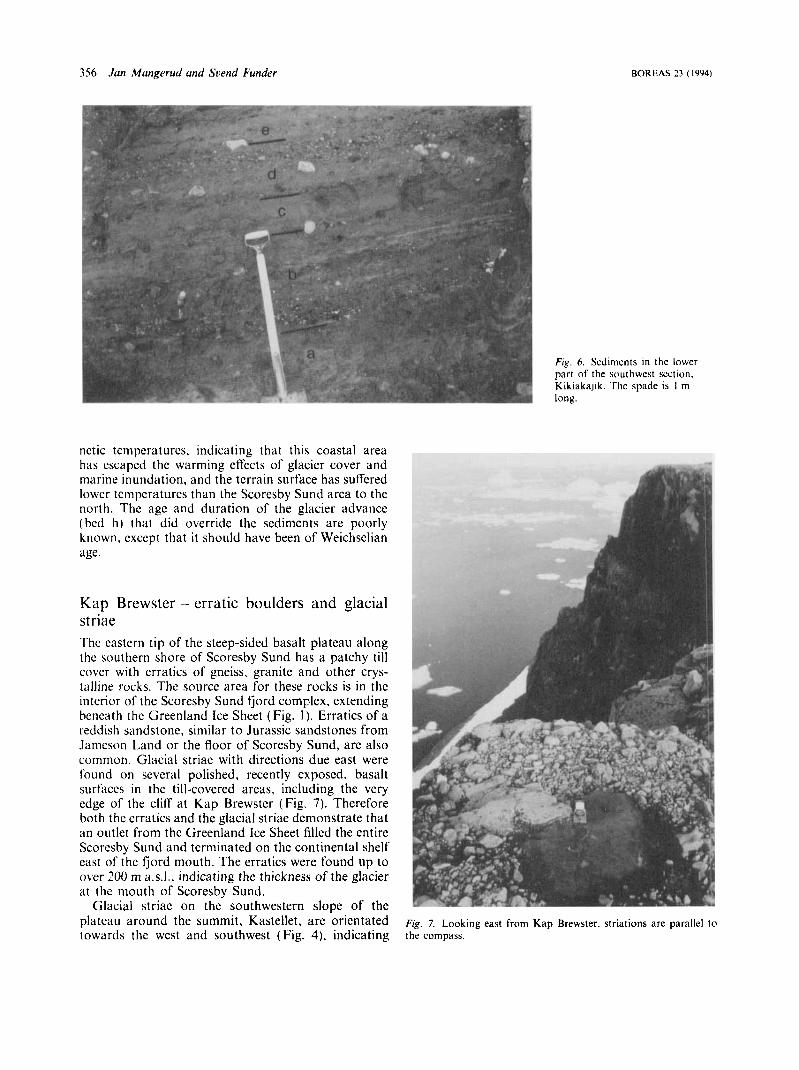
Kap Brewster - erratic boulders and glacial striae The eastern tip of the steep-sided basalt plateau along thc southern shore of Scoresby Sund has a patchy till cover with erratics of gneiss, granite and other crys- lulline rocks. The source area for these rocks is in the interior of the Scoresby Sund fjord complex, extending beneath the Greenland Ice Sheet (Fig. I ) . Erratics of a reddish sandstone, similar to Jurassic sandstones from Jamcson Land or the floor of Scoresby Sund. are also common. Glacial striae with directions due east were found on several polished, recently exposed. basalt surfaces i n the till-covered areas, including the very edge of the clifr at Kap Brewster (Fig. 7). Therefore both the erratics and the glacial striae demonstrate that an outlet from the Greenland Ice Sheet filled the entire Scoresby Sund and terminated on the continental shelf east of the fjord mouth. The erratics were found up to over 200 m a.s.l., indicating the thickness of the glacier at the mouth of Scoresby Sund.
Glacial striae on the southwestern slope of the plateau around the summit, Kastellet, arc orientated towarcls the west and southwest (Fig. 4), indicating
~ i g . 7. Looking east from Kap Brewster. striations are parallel to the compass.

R O R t 4 S 27 ( I Y Y 4 ) Glriciril record, niouth of Scoreshy Sund 3 5 1
that a local ice cap existed on the plateau at c. 300 m. with outlets flowing down its western flank into Scoresby Sund. The higher part of this plateau is now occupied by perennial snow.
Glaciations and environmental history
I.un~dunrtsrli: intorgluciution
Compared with the southern coast of Jameson Land, the sedimentary records at Kap Hope and Kikiakajik are incomplete. A t both sites there was an ice-free period. correlated with the Langelandselv interglacia- tion ( =isotope substage 5c) on the basis of mac- robenthic faunas and for Kikiakajik also by a luminescence date. However, the younger interstadials described at Jameson Land (Funder rt al. 1994; Land- vik c r (11. 1994; Tveranger ('I ul. 1994) are missing.
The lower silt at Kap Hope (Fig. 2) was deposited when the sea level was more than 25 m above the present. showing that at the beginning of the Langc- landselv interglaciation the area was isostatically depressed. At this stage the advection of warm Atlantic water was higher than during the Holocene, as shown by the abundancy of Bulurius crrntitus. The progradation during the uplift phase was followed by a transgression, and relative sea level rose to at least 15 m above the present at Kap Hope (Fig. 2). This prob-ably correlates with the 13 m high shore- line at Kikiakajik (Fig. 5). Macrobenthos are absent in the sandy- gravelly sediments at Kap Hope. but sand with subarctic thermophilous bi- valves. reworked into the younger till, indicates that oceanographic conditions remained warmer than those of the Holocene during the time of low sea level (Table I ) .
Tlir puttorti of gluciution
The present glaciation pattern around Scoresby Sund is complex. and was probably so during the main glaciations also. The outlet glaciers from the Green- land Ice Sheet presently terminate more than 200 km up fjord from the mouth of Scoresby Sund (Fig. I ) . However, three times during the Weichselian the ice sheet expanded so that a major ice stream flowed out Scoresby Sund and reached at least the mouth of Hurry Fjord (Landvik rt al. 1994; Lysf & Landvik 1994; Tveranger c't cil. 1994). One of these events is recorded in the till on top of the section at Kap Hope, as an ice flow up Hurry Fjord.
East of Hurry Fjord there are rugged coastal moun- tains presently supporting glaciers. During periods with lower equilibrium lines, these glaciers would ex- pand. The glacial striae beneath the section at Kap Hope indicate a glacier flowing down Hurry Fjord.
The striated bedrock is directly overlain by deep-water sediments from (probably the beginning of) the last interglacial, and we therefore conclude that the striae were formed during the deglaciation of the Scoresby Sund glaciation (isotope stage 6). Funder (1990) mapped glacial meltwater channels which show that also the last glaciation ended with ice flowing down Hurry Fjord. The till in the section at Kap Hope, mentioned above, shows that at some time between these two events the ice flowed in the opposite direc- tion: the Scoresby Sund glacier flowed up through the mouth of Hurry Fjord.
South of Scoresby Sund there are presently heavily glaciated basalt plateaux (Fig. l ) , which were certainly accumulation centers also during glaciations. We con- cluded that the till at Kikiakajik was most likely deposited by an outlet glacier from these plateaux. Glacial straie demonstrate that a local glacier existed on the small plateau around Kastellet at a late stage (Fig. 4). probably during the Milne Land Stade (see below). We also assume that outflow from glaciers on the plateaux caused the Scoresby Sund fjord glacier to be higher on the south than on the north flank during periods when a outlet glacier from the Greenland Ice Sheet filled the fjord.
Thc Itis, gluciul nicrsiniuni, thr Flclkkerhuk stack
Seismic studies have shown that a more than 175 m thick and 25 km wide sediment accumulation, the Kap Brewster moraine. extends across the mouth of Scoresby Sund (Fig. 1 ) (Dowdeswell et al. 1994). On the shelf in front of the moraine there is a thick succession of Quaternary and Neogene sediments (1,arsen 1984. 1990), whereas thc fjord basin generally has only a thin ( < 10m) veneer of Holocene sedi- ments on Mesozoic bedrock, showing that pre-existing sediments were removed by glacier erosion during the Late Weichselian (Marienfeld 1991). Dowdeswell r t al. ( 1994) proposed that this advance terminated on the Kap Brewster moraine. Increased sediment flux rates on the shelf slope indicate proximity of a glacier front between 19 and 15 ka (Nam et al., in press). This event probably coincides in approximate age and duration with the Flakkerhuk stade and the formation of the Kap Brewster moraine.
Both the freshness of the glacial striae described on Kap Brewster, and the altitude of the glacier surface reconstructed from the erratics and striae, well above 200 m a.s.l., suggest a correlation with the Kap Brew- ster moraine. However, in the Hesteelv area, just west of Hurry Fjord, Tveranger et al. (1994) concluded that the last ice advance down Scoresby Sund did not overrun the Flakkerhuk ridge. around 100 m a.s.1. We postulate that the explanation of this apparent conflict is that the Scoresby Sund glacier was considerably higher on the south than on the north side, as dis- cussed above.

The till at Kikiakajik showa that a glacier flowed down the vallcy and into the sea, some time after the last interglacial (Figs. 4 and 5). Thc local provenance of the boulders in this arca shows that apparently there was no overflow from the Scoresby Sund glacier to Kikiakr4jik during thc Wcichsclian. Thc evidences f r o m Kap Rrewster and Kikiakajik thcrcfore suggest that the Ihkke rhuk glacier inipingcd against the steep south coast of Scoresby Sund, up to somewhcrc he- twccn 300 and 400111 above thc present sca level.
After the Langclandsclv interglacialion, there is evi- dence for only one major glaciation phase when a glacicr- tongue moved from Scoresby Sund and up Hurry Fjord. As discussed above, this was possibly during the Flakkcrhuk stadc.
7’iw Miltic* I .o t i t l s t t r t k ~
The youngcst glacicr advancc in IIurry Fjord is rcflccted by marginal meltwater channcls and moruines from a local glacier moving down the fjord ( 1;utider 1972). The dcglaciation was completed before (’. 9.8 ka. a s shown by radiocarbon dates of niarinc t a u n u and limnic sediments at thc hcad of thc fjord, and the advancc is correlated with the Milne Land stadc (c. 10.4 c. 9.4 ka, Fiinder 1978). Seismic studics havc shown submarine moraines and icc proximal laminated sedinicnts in thc shallow Hurry Fjord basin. which wcrc interpreted tentatively as rcccssional moraines from this event (Dowdeswcll PI (11. 1994).
We dcscribcd striac that indicate that a local ice cap existed around Kastcllet, c. 300 ni a.s.1. (Fig. 4). Scdi- nient corm otT this coast show a sudden increase in basaltic rocks at c. 10 ka (Miirienfeld 1991), ~ 1 d this increase probably dates this local ice cap to thc ttmc oT the Miltic I.and stadc. Further west, submarine moraines and glacial deposits in Vikingebugt indicate resurgence of local glaciers, probably at Ihc same time ( I)owdcs\vcll V / t / l . 1994).
.4( kiutit h ( q o i i / t w / . \ . . Ole Bciinikc and Anctte Killnian assisted H i t l i the licld w o r k at Kap Ilope. The figures were drafted hy Jane 1:llingsen and Else 11. I.icr. lldwai-d I . King improved the English I;ingu;igc. ‘l‘lic rcsiilts tiavc been discussed with friends in the I’ONAM project. Thi, work was linancially supported hy The Rchcurch (‘ouncil o f Norway and The Danish Research Council. lhib article is i i contrihutioii to the 1:uropcan Science Foundation pi-ogi;ini- l’oliir Kortli Atlantic Margins. Late Cenozoic Evolution (I’OSAM).
Re fi. rences Hrocli, I { . 1924: C‘iri-ipcdia lhoracia von Norwcgen und dern S o r -
wcg i bc tic ii N o rd nice re . I ’irlc./i.sktr~.s,scl.,I\ c p , / , s S/ir// icv 1. Ma / C I I ro - /i,sX -,V~i/riri.rrc,,lsktrpPli,~ k’lrr.s.vc 1 7. I
Dowdcswcll. J . A,. I;cniclni~~nn-Scbeii. G.. Whittington. R. J . & Marienfcld. P. 1994: The Late Quaternary sedimentary record i n Scoreshy Sund. East Greenland. H o r c w 2.3. 294- 310.
Funder. S. 1977: Kcmiirks on the Quaternary geology of Jarncson L.snd and adjacent arcas. Scorcsby Sund. East Greenland. Grolrig- /c,cil .Srirr.c,,i. ( I / G r c ~ t ~ l r / t ~ ( l . Rc>pi)r/ 48. 93
I7 I. Oslo.
98.
Funder. S. 197X: Holocene stratigraphy and vegetation history in the Scoresby Sund area. East Greenland. C;eo/o,qiw/ Surrey of G r w n - lcmtl. BuIle1in 129, 66 pp.
Fundcr. S. 1990: De.ccriprrr,r / c z . v r lo Qu(i/eriuir!. i m p q / ’ Gr~~i~iiIc/m/ /:.5UU,000, .%orr.sh~~ Suiid. . c / i w r /2. Gronlaiids Geological Survey of Greenland. 24 pp. Copcnhagen.
under. S . . Hjort. C. & Landvik. J . Y. 1991: Quaternary stratigraphy of Janicson Land a lirst approximation. In Mollcr. I).. Iljorl. C. & Ingolfsson. 0. (eds.) : Preliminary report on the I’ONAM licldwork in Jarneson Land and Scoreshy Sund. East Grccl.ind. 1. l iNDQIIA R c p i r / 3.7. I7 I 176.
under, S.. Hjort. C. & Landvik. J. Y . 1994: The last glacial cycles in East Greenland, an overview. Borczr.~ 2.3, 2x3 793.
lanscn, L. A,. Jorgensrn. M. E.. Ilouniark-Nielscn. M. & Kronborg. C. 1994: Late Pleistocene stratigraphy and depositional cnvii-on- nients of the Fynselv iirca. Jamcson Land. East Greenland. / ? ~ J w ~ ~ . s 2.7. 385--391.
1 lenri kscn. N . 1986: ~;rolo,qic~trl t m i p o/ Grcwilcrrrd /:.5flfl 00. Slircr 12. Sc.orc,.vhi, Siind. Diwriprirv /OBI curd in t ip . 24pp. Geological Sur\cy of Greenland. Copenhagen.
Ingolfsson. 0.. 1.ysr“. A , . Fundcr. S.. Miillcr. 1’. & Bjiirck. S. 1994: The [.ate Quaternary glacial history o f the central west coast or Janicson Land. East Grceland. B1wc~i.s 2.7. 447 458.
Israclson. C.. Funder. S. & Kelly. M. 1994: The Auccllaclvstade at Aucellaelv; the first Weichselian glacier advitncc i n Scoreshy Sund. East Greenland. Horcw.s 2.7. 424 431.
.andvik. J . Y.. Lysd. A,. l’under. S. & Kelly. M . 1004: ‘l‘hc llcmiiii1 and Weichselian stratigraphy o f the L,angclandsclv arca. Janicson Land. East Greenland. Horcwc 2.7, 411- 423,
.;irsen. 11. c‘. 1004: Geology o f the Eiist Greenland shelf. h i Spencer. A . M. ( cd. ) : I’c,/rolcw/n GcwlogJ, oj / / I ( , %or / / / f < L i r r i p ( i / l ,\ft/r,yir/, 329 339. Norwegian Petroleum Society. Stavangcr.
.arsen. I I . C. 1990: The E:.ast Greenland shelf. 111 Granti A,. Johnson. L. & Swccney. J . I:. (cds) : 7 % ~ , lr/ic. O w c i t i Rc,g/oii, I85 210. Geological Society of America. The Geology of North America
Lysa, A. & Landvik. J. 1994: The lower Jyllandsel\ hucccsbion: evidence for three Weichselian ice advances over coastal J;tmcson 1.and. Rorcwr 2.1. 431-446.
Maricnlcld 1’. 1991: llolozine Sediincntationsentwicklung ini Scoreshy Sund. Ost-Gronland. Hrri(~l iro :iir Poltir/or.sc~/~iolg Yh. I62 PP.
Mejdnhl. V.. Shlukov. A . 1 . . Shakhovcts. S. A.. Voskovskxqa. L. T. & I.yashcnko. H . G. 1992: The clfccl o f shallow traps: ;I postible source of error in TL dating of sediments. A t i ( . i c w ~ 7.1. I f ) . 12 25 .
Mcjdahl. V. & Fundcr. S. 1994: 12uniincsccncc dating o f Late Qu;itern;iry sedinicnts from East Greenland. Boreris 2.3. 525 535.
Nani. S.-I . . Stein. K., Grobc. 11. t ltubherten. 11. ( in pres5): Iiite Quaternary stable isotope records and gl;icialjintcrglnci;il chaiigcs in sediment composition at the E a s ~ Grccnl:tnd continental margin.
Ockclmann. K. 1958: The ;.oology of East Greenland. Marine larnellihranchiata. hli~tlcic/t~/.ccr om (iri1t11(111tI 122 (I). I 256.
Riignvaldsson. F. & Sejrup. H.-1’. 1002: Amino acid ratios in molluscs from raised mil-inc dcposilr. Jarncson Land. East Greenland. In Mcrllcr. P.. l l jor t . C. & Ingolfsson, 0. (eds.): Preliminary report on the 1’0SAM lieldwork in Janieson I.and and Scoreshy Sund. East Greeland. [ . U N D Q ~ 1 , 4 K c y o r i .73. 11 5 274.
Stephensen. K. 1943: T h e Zoology of East Greenland. Murinc ostracoda, parasitic arid semiparasitic cocepoda and cirripedia.
Thorson. G . 1934: Contributions to the aninial ecology 01 the Scoresby Sound Ijord complex ( Eaat Grccland). Mctklc4,/.sci. O I I I
Gr~i i lont l 100 (3). 68 pp. Tverangcr. J.. tloumark-Niclsen. M.. Lcwherg. K . & Mangerud. J .
1994: Eemian Weichselian stratigraphy of the Flakkcrhuk ridge. southern Jameson Land. East Greenland. Borcws 2.7. 359 384.
Vosgerau. H.. t-under S., Kelly. M.. Knudsen. K . L... Kronhorg. C.. Madsen. 11. B. & Sejrup. 11. P. 1994: Palacocnvironrncnt and changes in relative sen level dui-ing the last interglaciation 31
1,angelandselv. J;imesoii Land. East Greenland. H1)rcw.v -73, 398 41 I .
Ml / r i l l t , ~ i 1 ~ ~ 1 1 0 , q . l ~ .
.Meclclclel.Yc~r Ol?I Gr(~/llrrll~/ 121 (9). 24 pp.