Embed Size (px)
Citation preview
NASA/TMm2000-209891, Vol. 86
Technical Report Series on theBoreal Ecosystem-Atmosphere Study (BOREAS)
Forrest G. Hall, Editor
Volume 86
BOREAS Level-0 ER-2
Navigation Data
Richard Strub, Raytheon ITSS
Roseanne Dominguez, ATAC, Inc., NASA Ames Research Center, Moffett Field, California
Jeffrey A. Newcomer, Raytheon ITSS, NASA Goddard Space Flight Center, Greenbelt, Maryland
National Aeronautics and
Space Administration
Goddard Space Flight Center
Greenbelt, Maryland 20771
September 2000
https://ntrs.nasa.gov/search.jsp?R=20010021966 2020-07-19T02:57:46+00:00Z

The NASA STI Program Office ... in Profile
Since its founding, NASA has been dedicated to
the advancement of aeronautics and spacescience. The NASA Scientific and Technical
Information (STI) Program Office plays a key
part in helping NASA maintain this importantrole.
The NASA STI Program Office is operated by
Langley Research Center, the lead center forNASA's scientific and technical information. The
NASA STI Program Office provides access to
the NASA STI Database, the largest collection of
aeronautical and space science STI in the world.
The Program Office is also NASA's institutional
mechanism for disseminating the results of its
research and development activities. These
results are published by NASA in the NASA STI
Report Series, which includes the following
report types:
• TECHNICAL PUBLICATION. Reports of
completed research or a major significant
phase of research that present the results of
NASA programs and include extensive data or
theoretical analysis. Includes compilations of
significant scientific and technical data and
information deemed to be of continuing
reference value. NASA's counterpart of
peer-reviewed formal professional papers but
has less stringent limitations on manuscript
length and extent of graphic presentations.
• TECHNICAL MEMORANDUM. Scientific
and technical findings that are preliminary or
of specialized interest, e.g., quick release
reports, working papers, and bibliographiesthat contain minimal annotation. Does not
contain extensive analysis.
• CONTRACTOR REPORT. Scientific and
technical findings by NASA-sponsored
contractors and grantees.
CONFERENCE PUBLICATION. Collected
papers from scientific and technical
conferences, symposia, seminars, or other
meetings sponsored or cosponsored by NASA.
SPECIAL PUBLICATION. Scientific, techni-cal, or historical information from NASA
programs, projects, and mission, often con-
cerned with subjects having substantial publicinterest.
TECHNICAL TRANSLATION.
English-language translations of foreign scien-
tific and technical material pertinent to NASA'smission.
Specialized services that complement the STI
Program Office's diverse offerings include creat-
ing custom thesauri, building customized data-
bases, organizing and publishing research results...
even providing videos.
For more information about the NASA STI Pro-
grain Office, see the following:
Access the NASA STI Program Home Page at
http://www, sti.nasa.gov/STI-homepage.html
E-mail your question via the Internet to
help@ sti.nasa.gov
Fax your question to the NASA Access Help
Desk at (301) 621-0134
• Telephone the NASA Access Help Desk at
(301) 621-0390
Write to:
NASA Access Help Desk
NASA Center for AeroSpace Information7121 Standard Drive
Hanover, MD 21076-1320

NASA/TMm2000-209891, Vol. 86
Technical Report Series on theBoreal Ecosystem-Atmosphere Study (BOREAS)
Forrest G. Hall, Editor
Volume 86
BOREAS Level-0 ER-2
Navigation Data
Richard Strub, Raytheon ITSS
Roseanne Dominguez, ATAC, Inc., NASA Ames Research Center, Moffett Field, California
Jeffrey A. Newcomer, Raytheon ITSS, NASA Goddard Space Flight Center, Greenbelt, Maryland
National Aeronautics and
Space Administration
Goddard Space Flight Center
Greenbelt, Maryland 20771
September 2000

NASA Center for AeroSpace Information7121 Standard Drive
Hanover, MD 21076-1320Price Code: A17
Available from:
National Technical Information Service
5285 Port Royal RoadSpringfield, VA 22161
Price Code: A10

BOREAS Level-0 ER-2 Navigation Data
Richard Strub, Roseanne Dominguez, Jeffrey A. Newcomer
Summary
The BOREAS Staff Science effort covered those activities that were BOREAS community-levelactivities or required uniform data collection procedures across sites and time. These activities includedthe acquisition, processing, and archiving of aircraft navigation/attitude data to complement the digitalimage data. The level-0 ER-2 navigation data files contain aircraft attitude and position informationacquired during the digital image and photographic data collection missions. Temporally, the data wereacquired from April to September 1994. Data were recorded at intervals of 5 seconds. The data arestored in tabular ASCII files.
Note that the level-0 ER-2 navigation data are not contained on the BOREAS CD-ROM set. Aninventory listing file is supplied on the CD-ROM to inform users of the data that were collected. SeeSection 15 for information about how to acquire actual level-0 ER-2 navigation data.
Table of Contents
1) Data Set Overview2) Investigator(s)3) Theory of Measurements4) Equipment5) Data Acquisition Methods6) Observations7) Data Description8) Data Organization9) Data Manipulations10) Errors11) Notes12) Application of the Data Set13) Future Modifications and Plans14) Software15) Data Access16) Output Products and Availability17) References18) Glossary of Terms19) List of Acronyms20) Document Information
1. Data Set Overview
1.1 Data Set Identification
BOREAS Level-0 ER-2 Navigation Data
1.2 Data Set Introduction
The BOReal Ecosystem-Atmosphere Study (BOREAS) Staff Science effort covered those activitiesthat were BOREAS community-level activities or required uniform data collection procedures acrosssites and time. These activities included the acquisition, processing, and archiving of aircraftnavigation/attitude data to complement the digital image data.
Page 1

1.3 Objective/Purpose
The ER-2 navigation data set consists of navigation parameters gathered by the aircraft's onboardsystems in support of the payload instruments. The purpose of the data is to provide general aircraftpositioning information and aircraft attitude information during data collection activities.
1.4 Summary of Parameters
The data include times and georeferencing information that can be used to determine temporal andspatial coordinates associated with each measurement collected from the onboard instruments.
1.5 Discussion
The ER-2 navigation data set consists of navigation parameters gathered by the aircraft's onboardsystems in support of the payload instruments. It includes times and georeferencing information thatcan be used to determine temporal and spatial coordinates associated with each measurement collectedfrom the above instruments.
1.6 Related Data Sets
BOREAS Level-0 ER-2 Aerial PhotographyBOREAS Level-0 AOCI Imagery: Digital Counts in BIL FormatBOREAS Level-0 Daedalus TMS Imagery: Digital Counts in BIL FormatBOREAS RSS- 18 Level- 1B AVIRIS Imagery: At-sensor Radiance in BIL Format
2. Investigator(s)
2.1 Investigator(s) Name and TitleBOREAS Staff" Science
2.2 Title of InvestigationBOREAS Staff Science Aircraft Data Acquisition Program
2.3 Contact Information
Contact 1:
Jeffrey S. MyersAircraft Data and Sensor FacilitiesNASA Ames Research Center
MS 240-6 (Bldg. 240, Rm. 219)Moffett Field, CA 94035-1000(415) 604-6253(415) 604-4987 (fax)jmyers@ arc .nasa .gov
Contact 2:
Jeffrey A. NewcomerRaytheon ITSSCode 923NASA GSFC
Greenbelt, MD 20771(301) 286-7858(301) 286-0239 (fax)Jeffrey.Newcomer@ gsfc.nasa.gov
Page 2

3. Theory of Measurements
The National Aeronautics and Space Administration (NASA) at Ames Research Center (ARC)maintains a variety of aircraft and sensor systems dedicated to support of remote sensing research.Among these is the Lockheed ER-2 (U-2R). The ER-2 has carried the Moderate-Resolution ImagingSpectrometer (MODIS) Airborne Simulator (MAS), the Multispectral Atmospheric Mapping Sensor(MAMS), the Airborne Visible and Infrared Imaging Spectrometer (AVIRIS), the Thematic MapperSimulator (TMS), the Airborne Ocean Color Imager (AOCI), and the Thermal Infrared MultispectralScanner (TIMS). For the BOREAS project, the TMS, AOCI, and AVIRIS sensors flew aboard theER-2.
Navigation parameters provided by the Litton LTN-92 Inertial Navigation System (INS) includeslatitude/longitude, altitude, air speed, pitch, roll, heading, wind speed and direction, and static airtemperature. The data were recorded in 5-second intervals.
4. Equipment
4.1 Sensor/Instrument Description
4.1.1 Collection Environment
The INS on the ER-2 is a Litton LTN-92. The LTN-92 comprises three separate units: the InertialNavigation Unit (INU), the Control/Display Unit (CDU), and the Mode Select Unit (MSU). Three28-cm ring laser gyros and a triad of force rebalanced accelerometers make up the LTN-92'sinstrument cluster. The system accepts Area Navigation (RNAV), Global Positioning System (GPS),or manual position updates, plus INS mixing for improved performance. The Litton Web site(http://www.littoncorp.com/html/newsflash/06 14 97.htm) can be referenced for more information.
The system operates by sensing accelerations from a gyro-stabilized, all-attitude platform. Thisinformation is integrated by a digital computer to provide an indication of present position (latitude andlongitude), attitude data (pitch and roll), and course line computation referenced to great circle routes.The ER-2 has no room for auxiliary personnel; the LTN-92 INU, the instrument control panel, and thetemperature and pressure units are directly connected to the data recorder in the payload area.
4.1.2 Source/Platform
The NASA ER-2 is a high-altitude, single-pilot aircraft based at ARC in Moffett Field, CA, and isdeployed globally in support of a variety of atmospheric research projects. It has a maximum altitudeof 70,000 feet (21 kin), a range of 3,000 nautical miles, a maximum flight duration of 8 hours(nominal 6.5 hours), and a top speed of 410 knots true air speed. The aircraft accommodates about2,700 pounds of payload and offers the following science support systems:
• Inertial navigation• Satellite NBS Time Code receiver
• Navigation data recording system• Real-time telemetry data link
4.1.3 Source/Platform Mission Objectives
For BOREAS, the primary ER-2 mission objective was to collect various Earth surface data incoordination with satellite overpasses for data verification and integration studies. A secondaryobjective was to collect data at key times when the satellites were not within range of specific sites. TheER-2 was based in Spokane, WA, and could be deployed from there to take advantage of anticipatedgood data collection conditions. The navigation data provide in-flight geographic location and attitudeinformation for the onboard sensors.
Page 3

4.1.4 Key VariablesThekeyparametersusedby BOREASInformationSystem(BORIS)staffandinvestigatorsare
geographiclocation,time,platformattitude,altitude,aircraftpitchandroll, andtemperatureinproximityto theaircraft.
4.1.5 Principles of OperationTheINS on theER-2operatesby sensingaccelerationsfrom agyro-stabilized,all-attitude
platform.This informationis integratedby adigital computerto provideanindicationof presentposition(latitudeandlongitude),attitudedata(pitchandroll), andcourselinecomputationreferencedto greatcircleroutes.
4.1.6 Sensor/Instrument Measurement Geometry
Aboard the ER-2, navigation parameters are recorded at 5-second intervals. The data bufferservicing the navigation recorder samples the particular parameter between records, but is preciselycorrect only at some point between records. Each parametric measurement is recorded as a count in a16-bit word; consequently, the conversion of that count to an engineering unit defines the precision.The precision of each measurement is tabulated below.
Parameter Precision
Julian Date
Time
Latitude
Longitude
N-S Velocity
E-W Velocity
True Heading
Ground Speed
Vertical Velocity
Altitude
True Air Speed
Pitch
Roll
Computed:
Ground Speed
Wind Speed
Wind Direction
Vertical Velocity
Climb Angle
Air Temperature
One day
One second
0.33 minutes of angle
0.33 minutes of angle
0 .1 knot
0 1 knot
0 00
0 1
0 O2
2 92
0 01
0 00
0 00
(2002.6 feet)
(2002.6 feet)
54932 degrees of an angle
knot
5 feet/second
749 feet (pressure altitude)
52588 knot
54932 degrees of an angle
54932 degrees of an angle
0 nautical mile per
0 nautical mile per
0 degree
0 foot per second
0 degree
1 degree centigrade
hour
hour
The accuracy of the X-Y-Z position as recorded by the navigation system is limited by thefrequency and accuracy of the Tactical Air Navigation (TACAN)-based updates to the inertial systemand the accuracy of the recorded altitude. In the conterminous United States, updates occur frequentlyand are based on strong relative geometry because of the density of TACAN stations, resulting inerrors of less than 0.1 nautical mile in X and Y (less error than the precision of the recording system).Altitude is based on barometric pressure with standard pressure defined as 29.92 inches of mercury.Consequently, the actual altitude above mean sea level will vary with current atmospheric conditionsand the actual altitude above terrain with the terrain elevation.
Page 4
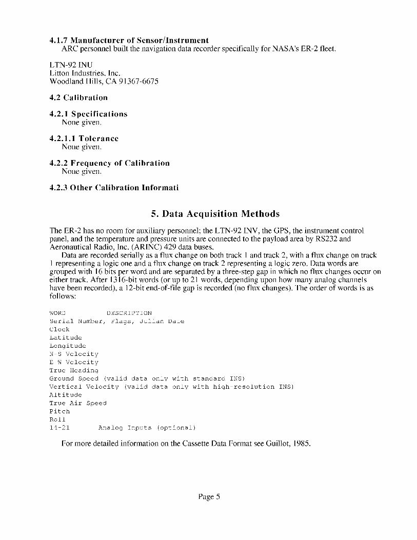
4.1.7 Manufacturer of Sensor/InstrumentARCpersonnelbuilt thenavigationdatarecorderspecificallyfor NASA'sER-2fleet.
LTN-92 INULitton Industries,Inc.WoodlandHills, CA 91367-6675
4.2 Calibration
4.2.1 Specifications
None given.
4.2.1.1 Tolerance
None given.
4.2.2 Frequency of Calibration
None given.
4.2.3 Other Calibration Informati
5. Data Acquisition Methods
The ER-2 has no room for auxiliary personnel; the LTN-92 INV, the GPS, the instrument controlpanel, and the temperature and pressure units are connected to the payload area by RS232 andAeronautical Radio, Inc. (ARINC) 429 data buses.
Data are recorded serially as a flux change on both track 1 and track 2, with a flux change on track1 representing a logic one and a flux change on track 2 representing a logic zero. Data words aregrouped with 16 bits per word and are separated by a three-step gap in which no flux changes occur oneither track. After 1316-bit words (or up to 21 words, depending upon how many analog channelshave been recorded), a 12-bit end-of-file gap is recorded (no flux changes). The order of words is asfollows:
WORD DESCRIPTION
Serial Number, Flags, Julian Date
Clock
Latitude
Longitude
N-S Velocity
E-W Velocity
True Heading
Ground Speed valid data
Vertical Velocity (valid
Altitude
True Air Speed
Pitch
Roll
14-21 Analog Inputs (optional)
only with
data only
standard INS)
with high-resolution INS)
For more detailed information on the Cassette Data Format see Guillot, 1985.
Page 5

6. Observations
6.1 Data Notes
None. Pertinent in-flight comments are recorded in the digital data records.
6.2 Field Notes
Flight summary reports and verbal records on videotapes are available from the ER-2 flights.
7. Data Description
7.1 Spatial Characteristics
7.1.1 Spatial Coverage
The BOREAS level-0 ER-2 navigation data were collected primarily as the ER-2 flew over portionsof the Southern Study Area (SSA) and the Northern Study Area (NSA) during its image dataacquisition missions. The SSA and the NSA are located in the southwest and northeast portions of theoverall BOREAS region. Some navigation data exist in the data set that cover the BOREAS transectarea between the SSA and NSA and areas outside the BOREAS region.
The North American Datum of 1983 (NAD83) corner coordinates of the SSA are:
Latitude Longitude
Northwest 54.321 N 106.228 W
Northeast 54.225 N 104.237 W
Southwest 53.515 N 106.321 W
Southeast 53.420 N 104.368 W
The NAD83 corner coordinates of the NSA are:
Latitude Longitude
Northwest 56.249 N 98.825 W
Northeast 56.083 N 97.234 W
Southwest 55.542 N 99.045 W
Southeast 55.379 N 97.489 W
7.1.2 Spatial Coverage MapNot available.
7.1.3 Spatial Resolution
Spatial resolution is not strictly applicable to ER-2 navigational data. The sampling rate for eachportion of the navigation data can be combined with aircraft position, speed, and altitude to derive aspatial component for each data sample. However, because of the 5-second duration between eachnavigation parameter, interpolating the navigation data to specific lines in the image data may havelimited usefulness.
7.1.4 Projection
The BOREAS level-0 ER-2 navigation data contain latitude and longitude coordinates in theparameter set. Although the latitude and longitude coordinates could be used to calculate coordinatesfor any map projection, BORIS staff" did not assess their accuracy and therefore cannot make anystatements about their validity.
Page 6

7.1.5 Grid Description
Not applicable.
7.2 Temporal Characteristics
7.2.1 Temporal Coverage
The data were collected during BOREAS' Focused Field Campaign (FFC) and three IntensiveField Campaigns (IFCs), covering the period from 19-Apr-1994 through 17-Sep-1994. The ER-2collected various image data sets over the BOREAS sites in 1996, but no navigation data weredelivered to BORIS.
7.2.2 Temporal Coverage MapIFC# Dates
FFC-T 16-Apr-1994
IFC-I 23-May-1994
IFC-2 21-Jui-1994
IFC-3 08-Sep-1994
-- 20-Apr-1994
-- 08-Jun-1994
-- 08-Aug-1994
-- 17-Sep-1994
7.2.3 Temporal Resolution
All of the parameters in the navigation data were collected at intervals of 5 seconds.
7.3 Data Characteristics
7.3.1 Parameter/Variable
A listing of the navigation data file parameters is given in Section 8.2. The parameters contained inthe inventory listing file on the CD-ROM are:
Column Name
SPATIAL COVERAGE
DATE OBS
START TIME
END TIME
ER2 MISSION ID
CRTFCN CODE
7.3.2 Variable Description/Definition
A detailed description of the navigation data parameters is given in Section 8.2. The parameters inthe CD-ROM inventory listing are:
Column Name Description
SPATIAL COVERAGE The general term used to denote the spatial area
over which the data were collected.
DATE OBS The date on which the data were collected.
START TIME The starting Greenwich Mean Time (GMT) for the
data collected.
END TIME The ending Greenwich Mean Time (GMT) for the
data collected.
ER2 MISSION ID The mission identifier assigned to the ER2
mission in the form of YY-DDD where YY is the last
two digits of the fiscal year, and DDD is the
deployment number. An example would be 94-120.
Page 7

CRTFCN CODE The BOREAS certification level of the data.
Examples are CPI (Checked by PI), CGR (Certified
by Group), PRE (Preliminary), and CPI-??? (CPI
but questionable).
7.3.3 Unit of Measurement
A detailed description of the navigation data parameter units is given in Section 8.2. Themeasurement units for the parameters contained in the inventory listing file on the CD-ROM are:
Column Name Units
SPATIAL COVERAGE [none]
DATE OBS [DD-MON-YY]
START TIME [HHMM GMT]
END TIME [HHMM GMT]
ER2 MISSION ID [none]
CRTFCN CODE [none]
7.3.4 Data Source
A detailed description of the navigation data files and their content is given in Section 8.2. Thesources of the parameter values contained in the inventory listing file on the CD-ROM are:
Column Name Data Source
SPATIAL COVERAGE
DATE OBS
START TIME
END TIME
ER2 MISSION ID
CRTFCN CODE
[Constant software parameter value]
[Navigation data files]
[Navigation data files]
[Navigation data files]
[ER2 mission information]
[Constant data base value]
7.3.5 Data Range
The range of values for the parameters in the actual navigation data files was not tabulated. Thefollowing table gives information about the parameter values found in the inventory table on theCD-ROM.
Minimum Maximum Missng Unrel Below Data
Data Data Data Data Detect Not
Column Name Value Value Value Value Limit Cllctd
SPATIAL COVERAGE N/A N/A None None None None
DATE OBS 19-APR-94 17-SEP-94 None None None None
START TIME 1310 1630 None None None None
END TIME 1920 2215 None None None None
ER2 MISSION ID 94-079 94-143 None None None None
CRTFCN CODE PRE PRE None None None None
Minimum Data Value -- The minimum value found in the column.
Maximum Data Value -- The maximum value found in the column.
Missng Data Value -- The value that indicates missing data. This is used to
indicate that an attempt was made to determine the
parameter value, but the attempt was unsuccessful.
Unrel Data Value -- The value that indicates unreliable data. This is used
to indicate an attempt was made to determine the
parameter value, but the value was deemed to be
Page 8

Below Detect Limit --
Data Not Cllctd --
unreliable by the analysis personnel.
The value that indicates parameter values below the
instruments detection limits. This is used to
indicate that an attempt was made to determine the
parameter value, but the analysis personnel determined
that the parameter value was below the detection
limit of the instrumentation.
This value indicates that no attempt was made to
determine the parameter value. This usually
indicates that BORIS combined several similar but
not identical data sets into the same data base table
but this particular science team did not
measure that parameter.
Blank
N/A
None
-- Indicates that blank spaces are used to denote that type of value.
-- Indicates that the value is not applicable to the respective column.
-- Indicates that no values of that sort were found in the column.
7.4 Sample Data Record
A sample data record for the level-0 ER-2 navigation data is not available here. The following arethe records from the level-0 ER-2 navigation data inventory table on the CD-ROM:
SPATIAL COVERAGE,DATE OBS,START TIME,END TIME,ER2 MISSION ID,CRTFCN CODEm
SSA',I9-APR-94,1630
NSA',20-APR-94,1555
TRANSECT',20-APR-94
NSA',28-APR-94,1445
TRANSECT',28-APR-94
NSA',08-JUN-94,1345
TRANSECT',08-JUN-94
SSA',21-JUL-94,1500
NSA',04-AUG-94,1310
SSA',04-AUG-94,1310
TRANSECT',04-AUG-94
NSA',08-AUG-94,1314
SSA',08-AUG-94,1314
TRANSECT',08-AUG-94
SSA',I6-SEP-94,1500
NSA',I7-SEP-94,1355
TRANSECT',I7-SEP-94
SSA',I7-SEP-94,1355
m m m
2215, '94-079', 'PRE'
2155, '94-080', 'PRE'
1555,2155, '94-080', 'PRE'
2050, '94-082', 'PRE'
1445,2050, '94-082', 'PRE'
1945, '94-i02', 'PRE'
1345,1945, '94-i02', 'PRE'
2040, '94-120', 'PRE'
1920, '94-123', 'PRE'
1920, '94-123', 'PRE'
1310,1920, '94-123', 'PRE'
1937, '94-124', 'PRE'
1937, '94-124', 'PRE'
1314,1937, '94-124', 'PRE'
2100, '94-142', 'PRE'
2005, '94-143', 'PRE'
1355,2005, '94-143', 'PRE'
2005, '94-143', 'PRE'
8. Data Organization
8.1 Data GranularityThe smallest unit of level-0 ER-2 navigation data is all the ER-2 navigation information collected
during the ER-2 flights over the BOREAS areas. All nine of the data files are in a single tar file on asingle tape for distribution.
8.2 Data Format(s)The CD-ROM inventory listing file consists of numerical and character fields of varying length
separated by commas. The character fields are enclosed with single apostrophe marks. There are no
Page 9

spacesbetweenthefields.Thedataarecontainedin a singletarfile andafterextraction(tar-xvf) canbeseencorrectlyif
unblockedusingablock sizeof 150.(ddif=in_fn ibs=150cbs=150obs=150conv=unblockof=out_fn).
FLIGHT 94-079
FLIGHT 94-080
FLIGHT 94-082
FLIGHT 94-102
FLIGHT 94-120
FLIGHT 94-123
FLIGHT 94-124
FLIGHT 94-142
FLIGHT 94-143
DATE 19-APR-94 16:30
DATE 20-APR-94
DATE 28-APR-94
DATE 08-JUN-94
DATE 21-JUL-94
DATE 04-AUG-94
DATE 08-AUG-94
DATE 16-SEP-94
DATE 17-SEP-94
15:55
14:45
13:45
15:00
13:10
13:14
15:00
13:55
Each data file contmns a header record that is formatted as described in the following table:
U2/USER PLUS DIGITIZED ANALOG VALUES
HEADER INFORMATION
CHARACTERS CONTENTS
RECORD 1
2 - 7
9 - 14
17 - 20
22 - 29
32 - 34
36 - 38
41 - 47
49 - 56
59 - 62
64 - 71
82 - i01
103
104 - 200
"FLIGHT"
The flight identifier, which consists of the last two digits of
the fiscal year, a dash, and a three-digit unique number that
identifies the flight within the fiscal year (e.g., 92-001)
"DATE"
The date of the flight at liftoff, in the form MM/DD/YY, where
MM gives the number of the month
DD gives the day
YY gives the last two digits of the current year
"A/C"
Tail number of the aircraft (706, 708, or 709
"TAKEOFF"
The takeoff time, in the form HH:MM/DD, where
HH gives the hour (24-hour clock)
MM gives the minute
DD gives the day of the month at takeoff
"LAND"
The landing time, in the same form as "TAKEOFF " except that
DD gives the day of the month at landing
"RECORDER UNIT NUMBER"
ID number of the navigation data recorder
Blank
RECORDS 2 - 5 Title that serves to label the contents of the data records.
NOTE: Characters not explicitly mentioned here are filled with blanks; i.e.,
the American Standard Code for Information Interchange (ASCII) code for
"space."
(END of Table E-6A)
Page 10

The data part of each file is formatted as described in the following table:
U2/USER PLUS DIGITIZED ANALOG VALUES
DATA RECORD FORMAT
(English Units)
CHARACTER CONTENTS
02 - 12
15
(GOES)
18 - 25
18
19 - 20
21
22 - 25
27 - 35
27
28 - 30
31
32 - 35
37 - 41
42
45 - 47
49 - 53
55 - 59
61 - 66
67 - 72
74 - 77
79 - 82
85 - 87
94 - 96
i00 - 103
107 - 109
113 - 116
The time and day in the form HH:MM:SS/DD, where
HH gives the hour (24-hour clock)
MM gives the minute
SS gives the second
DD gives the day of the month
Time source indicator
"G .... from Geostationary Operational Environmental Satellite
Latitude,
h
DD
MM.t
-- Internal time source
hHH:MM.t, as follows:
-- hemisphere, "N" for northern, or "S" for southern
-- Degrees of latitude
-- separator between degrees and minutes
-- Minutes and tenths of minutes of latitude
(with a decimal point)
Longitude, hDDD:MM.t, as follows:
h -- hemisphere, "W" for western, or "E" for eastern
DDD -- Degrees of longitude
: -- separator between degrees and minutes
MM.t -- Minutes and tenths of minutes of longitude
(with a decimal point)
Altitude, in feet (from 0 - 70000)
"space" if below 70,000 feet, or
"+" if over 70,000 feet, (if over 70,000 feet, the
altitude (37-41) will contain 70000)
True air speed, in nautical miles per hour
Aircraft pitch, in degrees, given to tenths (with a decimal
point); positive indicates nose up
Aircraft roll, in degrees, given to tenths (with a decimal
point; positive indicates right roll; (i.e., right wing down)
True heading, in degrees, given to tenths (with a decimal
Point); zero degrees indicates north, positive to the
east of north (90 indicates due east; 180 indicates
south; and 270 indicates west)
North-South velocity, in nautical miles per hour
East-West velocity, in nautical miles per hour
Vertical velocity, in feet per second
Ground speed, in nautical miles per hour
Computed ground speed, in nautical miles per hour (square
root of the sum of the squares of the north-south and
east-west velocities)
Computed wind speed, in nautical miles per second (the vector
difference of the true air speed and true heading and
north-south and east-west velocities
Computed wind direction, in degrees from north (clockwise is
positive)
Computed vertical velocity (in feet per second) computed
Page 11

from the altitude difference and time difference
between consecutive records
122 - 124 Computed angle of attack (degrees); i.e., arcsine (vertical
velocity divided by ground speed)
134 - 138 Static air temperature in degrees C, computed from the first
digitized analog value, if recorded
9. Data Manipulations
9.1 FormulaeNone.
9.1.1 Derivation Techniques and AlgorithmsNone.
9.2 Data Processing Sequence
9.2.1 Processing StepsBORIS staff processed the level-0 ER-2 navigation data by extracting pertinent header information
from the navigation file and loading the online data base with needed information.
9.2.2 Processing ChangesARC applied no special or additional processing to the ER-2 navigation data from BOREAS.
9.3 Calculations
9.3.1 Special Corrections/AdjustmentsARC made no special adjustments or offsets to the data.
9.3.2 Calculated Variables
ARC made no special adjustments or offsets to the data.
9.4 Graphs and PlotsNone.
10. Errors
10.1 Sources of Error
The data buffer servicing the navigation recorder samples the particular parameter between records,but is precisely correct only at some point between records. Each parametric measurement is recordedas a count in a 16-bit word; consequently the conversion of that count to an engineering unit definesthe precision.
10.2 Quality Assessml0.2.1 Data Validation by Source
Data distribution to NASA ARC occurs at the conclusion of the deployment. Data tapes arepresented in total for documentation and archive. Data evaluation consists primarily of identifyingcomponent failure (i.e., radar altitude, GPS values, and pressure measurements).
10.2.2 Confidence Level/Accuracy Judgment
The quality of the data is judged to be good.
Page 12

10.2.3 Measurement Error for ParametersSee Sections 4.1.6 and 8.2.
10.2.4 Additional Quality Assessments
BORIS staff imported selected navigation files into a spreadsheet and graphed the values to checkfor reasonableness.
10.2.5 Data Verification by Data Center
BORIS staff reviewed the contents of the data files for consistency and used portions of theinformation to inventory and describe the data in the relational data base.
11. Notes
11.1 Limitations of the DataNone.
11.2 Known Problems with the DataNone.
11.3 Usage GuidanceThe tar file should be copied from tape to disk. All nine ASCII files are contained in a single tar file
and should be extracted (tar -xvf filename). Each file should then be placed into 150-byte records. Thiscan be accomplished by the UNIX command dd:
dd if=nav.94-123 of=filename ibs= 150 cbs= 150 obs= 150 conv=unblock
The files will then appear as 19 ASCII columns with a 5-line header.
11.4 Other Relevant Information
Not applicable.
12. Application of the Data Set
The ER2 navigation data could be used: 1) To possibly improve the positional location of the aircraftscanner data and 2) As inputs to software for automated geometric and geographic correction of theaircraft scanner data. As a word of caution, the accuracy and precision of these data are not as wellknown as those from the C130 aircraft and in addition, it is not known if the frequency of navigationobservations is sufficient to properly correct distortions in the scanner data.
13. Future Modifications and Plans
No modification is planned for the ER-2 navigation data currently logged in the BORIS data base.
14. Software
14.1 Software Description
The UNIX dd command is useful in placing the new-line characters in the correct place so that theASCII file appears correctly. See Section 11.3. BORIS staff developed software to extract neededinformation from the data files and inventory the ER-2 navigation data in the relational data base.
Page 13
14.2 Software Access
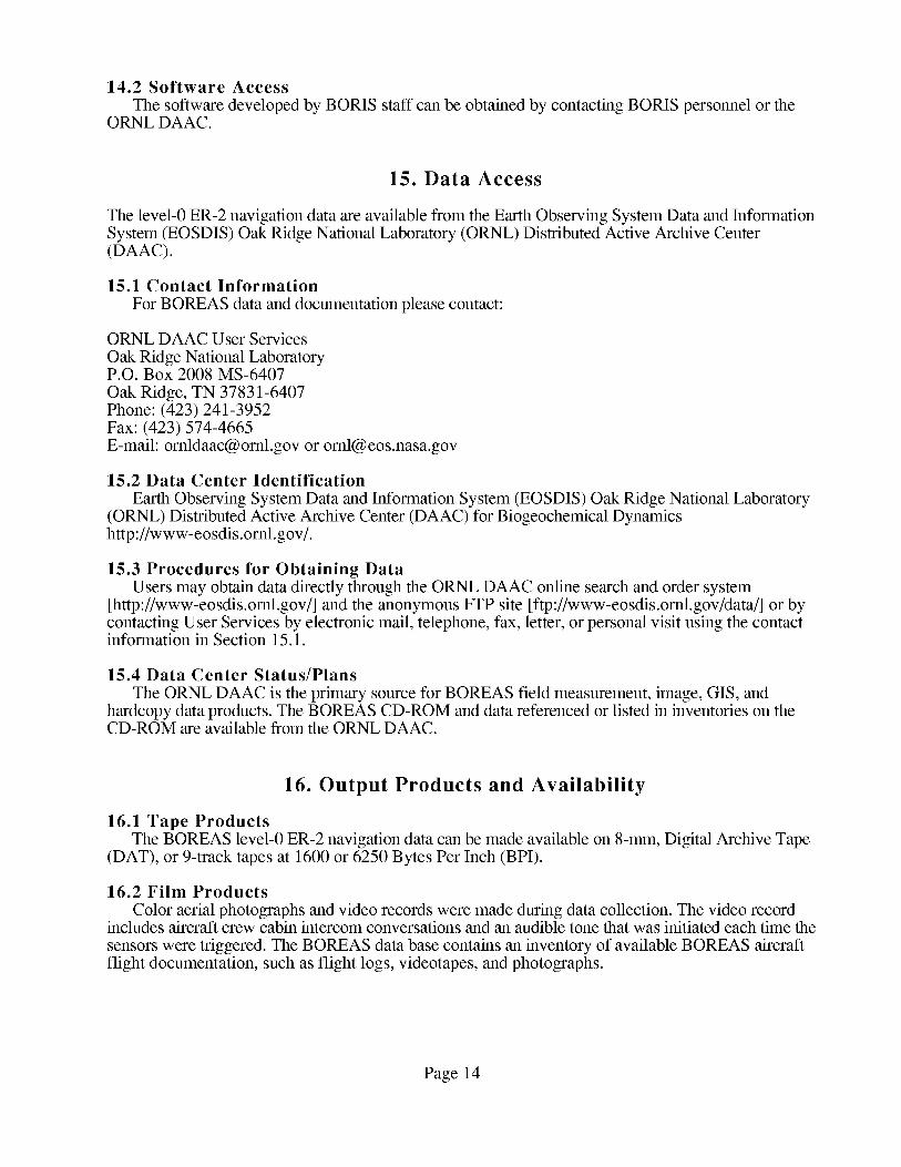
The software developed by BORIS staff can be obtained by contacting BORIS personnel or theORNL DAAC.
15. Data Access
The level-0 ER-2 navigation data are available from the Earth Observing System Data and InformationSystem (EOSDIS) Oak Ridge National Laboratory (ORNL) Distributed Active Archive Center(DAAC).
15.1 Contact Information
For BOREAS data and documentation please contact:
ORNL DAAC User Services
Oak Ridge National LaboratoryP.O. Box 2008 MS-6407
Oak Ridge, TN 37831-6407Phone: (423) 241-3952Fax: (423) 574-4665E-mail: [email protected] or [email protected]
15.2 Data Center Identification
Earth Observing System Data and Information System (EOSDIS) Oak Ridge National Laboratory(ORNL) Distributed Active Archive Center (DAAC) for Biogeochemical Dynamicshttp://www-eosdis.ornl.gov/.
15.3 Procedures for Obtaining DataUsers may obtain data directly through the ORNL DAAC online search and order system
[http://www-eosdis.ornl.gov/] and the anonymous FTP site [ftp://www-eosdis.ornl.gov/data/] or bycontacting User Services by electronic mail, telephone, fax, letter, or personal visit using the contactinformation in Section 15.1.
15.4 Data Center Status/Plans
The ORNL DAAC is the primary source for BOREAS field measurement, image, GIS, andhardcopy data products. The BOREAS CD-ROM and data referenced or listed in inventories on theCD-ROM are available from the ORNL DAAC.
16. Output Products and Availability
16.1 Tape Products
The BOREAS level-0 ER-2 navigation data can be made available on 8-mm, Digital Archive Tape(DAT), or 9-track tapes at 1600 or 6250 Bytes Per Inch (BPI).
16.2 Film Products
Color aerial photographs and video records were made during data collection. The video recordincludes aircraft crew cabin intercom conversations and an audible tone that was initiated each time the
sensors were triggered. The BOREAS data base contains an inventory of available BOREAS aircraftflight documentation, such as flight logs, videotapes, and photographs.
Page 14

16.3 Other Products
Although the inventory is contained on the BOREAS CD-ROM set, the actual level-0 ER-2navigation data are not. See Section 15 for information about how to obtain the data.
17. References
17.1 Platform/Sensor/Instrument/Data Processing DocumentationEkstrand, R.E. and D. Wolf. 6 May 1992. INSPLOT.
Guillot, D. 1 April 1985. Cassette Data Format for the U-2 navigation recorder.
17.2 Journal Articles and Study ReportsNewcomer, J., D. Landis, S. Conrad, S. Curd, K. Huemmrich, D. Knapp, A. Morrell, J. Nickeson,A. Papagno, D. Rinker, R. Strub, T. Twine, F. Hall, and P. Sellers, eds. 2000. Collected Data of TheBoreal Ecosystem-Atmosphere Study. NASA. CD-ROM.
Sellers, P. and F. Hall. 1994. Boreal Ecosystem-Atmosphere Study: Experiment Plan. Version1994-3.0, NASA BOREAS Report (EXPLAN 94).
Sellers, P. and F. Hall. 1996. Boreal Ecosystem-Atmosphere Study: Experiment Plan. Version1996-2.0, NASA BOREAS Report (EXPLAN 96).
Sellers, P., F. Hall, and K.F. Huemmrich. 1996. Boreal Ecosystem-Atmosphere Study: 1994Operations. NASA BOREAS Report (OPS DOC 94).
Sellers, P., F. Hall, and K.F. Huemmrich. 1997. Boreal Ecosystem-Atmosphere Study: 1996Operations. NASA BOREAS Report (OPS DOC 96).
Sellers, P., F. Hall, H. Margolis, B. Kelly, D. Baldocchi, G. den Hartog, J. Cihlar, M.G. Ryan, B.Goodison, P. Crill, K.J. Ranson, D. Lettenmaier, and D.E. Wickland. 1995. The borealecosystem-atmosphere study (BOREAS): an overview and early results from the 1994 field year.Bulletin of the American Meteorological Society. 76(9): 1549-1577.
Sellers, P.J., F.G. Hall, R.D. Kelly, A. Black, D. Baldocchi, J. Berry, M. Ryan, K.J. Ranson, P.M.Crill, D.P. Lettenmaier, H. Margolis, J. Cihlar, J. Newcomer, D. Fitzjarrald, P.G. Jarvis, S.T.Gower, D. Halliwell, D. Williams, B. Goodison, D.E. Wickland, and F.E. Guertin. 1997. BOREASin 1997: Experiment Overview, Scientific Results and Future Directions. Journal of GeophysicalResearch 102(D24): 28,731-28,770.
17.3 Arehive/DBMS Usage DocumentationNone.
None.
18. Glossary of Terms
Page 15

A/D
AOCI
ARC
ARINC
ASAS
ASCII
AVIRIS
BIL
BOREAS
BORIS
BPI
CCT
CD-ROM
CDU
DAAC
DAT
EOS
EOSDIS
FFC
FFC-T
GIS
GMT
GPS
GSFC
HTML
IFC
INS
INU
MAMS
MAS
MODIS
MSU
NAD83
NASA
NBS
NSA
ORNL
PANP
PRT-5
RNAV
RSS
S/D
SCSI
SGI
SSA
TACAN
TAS
TIMS
TMS
URL
19. List of Acronyms
- Analog-digital
- Airborne Ocean Color Imager
- Ames Research Center
- Aeronautical Radio, Inc.
- Advanced Solid-State Array Spectroradiometer
- American Standard Code for Information Interchange
- Airborne Visible and Infrared Imaging Spectrometer
- Band Interleaved by Line
- BOReal Ecosystem-Atmosphere Study
- BOREAS Information System
- Bytes Per Inch
- Computer Compatible Tape
- Compact Disk-Read-Only Memory
- Control/Display Unit
- Distributed Active Archive Center
- Digital Archive Tape
- Earth Observing System
- EOS Data and Information System
- Focused Field Campaign
- Focused Field Campaign - Thaw
- Geographic Information System
- Greenwich Mean Time
- Global Positioning System
- Goddard Space Flight Center
- HyperText Markup Language
- Intensive Field Campaign
- Inertial Navigation System
- Inertial Navigation Unit
- Multispectral Atmospheric Mapping Sensor
- MODS Airborne Simulator
- Moderate-Resolution Imaging Spectrometer
- Mode Select Unit
- North American Datum of 1983
- National Aeronautics and Space Administration
- National Bureau of Standards
- Northern Study Area
- Oak Ridge National Laboratory
- Prince Albert National Park
- Precision Radiation Thermometer
- Area Navigation
- Remote Sensing Science
- synchro-digital
- Small Computer Serial Interface
- Silicon Graphics IRIX
- Southern Study Area
- Tactical Air Navigation
- True Air Speed
- Thermal Infrared Multispectral Scanner
- Thematic Mapper Simulator
- Uniform Resource Locator
Page 16
20. Document Information
20.1 Document Revision Date(s)Written: 10-Mar- 1998
Last Updated: 08-Jun- 1999
20.2 Document Review Date(s)BORIS Review: 17-Mar-1998Science Review:
20.3 Document ID
20.4 Citation
When using these data, please include the following acknowledgment as well as citations ofrelevant papers in Section 17.2:
The BOREAS level-0 ER-2 navigation data were collected and processed from the original aircrafttapes by personnel of the Medium Altitude Aircraft Branch at NASA ARC. BORIS staff reviewed,repackaged, and documented the data received from ARC into the current product. The contributionsof ARC and BORIS staff to enhancing and checking this data set are greatly appreciated.
Also, cite the BOREAS CD-ROM set as:Newcomer, J., D. Landis, S. Conrad, S. Curd, K. Huemmrich, D. Knapp, A. Morrell, J.
Nickeson, A. Papagno, D. Rinker, R. Strub, T. Twine, F. Hall, and P. Sellers, eds. Collected Data ofThe Boreal Ecosystem-Atmosphere Study. NASA. CD-ROM. NASA, 2000.
20.5 Document Curator
20.6 Document URL
Page 17
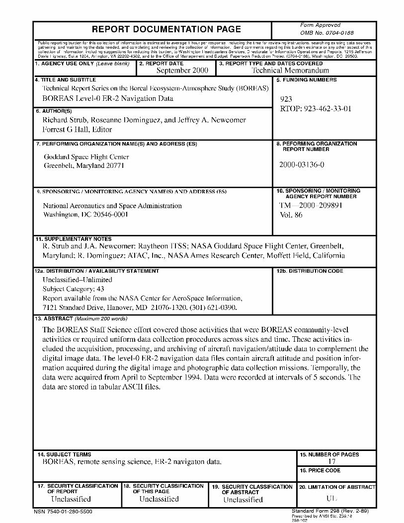
REPORT DOCUMENTATION PAGE FormApprovedOMB No. 0704-0188
Public reporting burden for this collection of informationis estimated to average 1 hour per response, including the time for reviewing instructions, searching existing data sources,gathering and maintaining the data needed, and completing and reviewing the collection of information. Send comments regarding this burden estimate or any other aspect of thiscollection of information, including suggestions for reducing this burden, to Washington Headquarters Services, Directorate for Information Operations and Reports, 1215 JeffersonDavis Highway, Suite 1204, Arlington, VA 22202-4302, and to the Office of Management and Budget, Paperwork Reduction Project (0704-0188), Washington, DC 20503.
1. AGENCY USE ONLY (Leave blank) 2. REPORT DATE 3. REPORT TYPE AND DATES COVERED
September 2000 Technical Memorandum4. TITLE AND SUBTITLE 5. FUNDING NUMBERS
Technical Report Series on the Boreal Ecosystem-Atmosphere Study (BOREAS)
BOREAS Level-0 ER-2 Navigation Data 923
6. AUTHOR(S) RTOP: 923-462-33-01
Richard Strub, Roseanne Dominguez, and Jeffrey A. Newcomer
Forrest G Hall, Editor
7. PERFORMING ORGANIZATION NAME(S) AND ADDRESS (ES)
Goddard Space Flight Center
Greenbelt, Maryland 20771
9. SPONSORING / MONITORING AGENCY NAME(S) AND ADDRESS (ES)
National Aeronautics and Space Administration
Washington, DC 20546-0001
8. PEFORMING ORGANIZATIONREPORT NUMBER
2000-03136-0
10. SPONSORING / MONITORING
AGENCY REPORT NUMBER
TM--2000-209891
Vol. 86
11. SUPPLEMENTARY NOTES
R. Strub and J.A. Newcomer: Raytheon ITSS; NASA Goddard Space Flight Center, Greenbelt,
Maryland; R. Dominguez: ATAC, Inc., NASA Ames Research Center, Moffett Field, California
12a. DISTRIBUTION / AVAILABILITY STATEMENT
Unclassifie_Unlimited
Subject Category: 43
Report available from the NASA Center for AeroSpace Information,
7121 Standard Drive, Hanover, MD 21076-1320. (301) 621-0390.
12b. DISTRIBUTION CODE
13. ABSTRACT (Maximum 200 words)
The BOREAS Staff Science effort covered those activities that were BOREAS community-level
activities or required uniform data collection procedures across sites and time. These activities in-
cluded the acquisition, processing, and archiving of aircraft navigation/attitude data to complement the
digital image data. The level-0 ER-2 navigation data files contain aircraft attitude and position infor-
mation acquired during the digital image and photographic data collection missions. Temporally, the
data were acquired from April to September 1994. Data were recorded at intervals of 5 seconds. Thedata are stored in tabular ASCII files.
14. SUBJECT TERMS
BOREAS, remote sensing science, ER-2 navigaton data.
17. SECURITY CLASSIFICATIONOF REPORT
Unclassified
NSN 7540-01-280-5500
18. SECURITY CLASSIFICATIONOF THIS PAGE
Unclassified
19. SECURITY CLASSIFICATIONOF ABSTRACT
Unclassified
15. NUMBER OF PAGES
1'716. PRICE CODE
20. LIMITATION OF ABSTRACT
UL
Standard Form 298 (Rev. 2-89)Prescribed by ANSI Std. Z39.18298-102


![Boreas AHU [TR]](https://img.dokumen.tips/doc/110x75/589d79831a28ab69538b5849/boreas-ahu-tr.jpg)