Embed Size (px)
Citation preview

STATE OF HAWAIʻI OFFICE OF PLANNING
TECHNICAL ASSISTANCE MEMORANDUM
TAM‐2013‐1: Priority guidelines and principles to promote sustainability Page 1
TAM – 2016 – 1
ISSUED: 08-01-2016
AUTHORITIES:
State Planning, Hawaii Revised Statutes (HRS) Chapter 225M; Hawaii State Planning Act, HRS Chapter 226; Hawaii Land Use Law, HRS Chapter 205; Aeronautics, HRS Chapter 261; Airport Zoning Act, HRS Chapter 262
SUBJECT: Federal Aviation Administration (FAA) Order 5190.6B
The Office of Planning provides technical assistance to state and county agencies in administering the statewide planning system.1 This technical advisory discusses an FAA Order which may impact the use of land adjacent to or in the immediate vicinity of Hawaii’s airports.
Background
Pursuant to FAA Order 5190.6B2: “20.1. Background. Land use planning is an important tool in ensuring that land adjacent to, or in the immediate vicinity of, the airport is consistent with activities and purposes compatible with normal airport operations, including aircraft landing and takeoff. Ensuring compatible land use near federally obligated airports is an important responsibility and an issue of federal interest. In effect since 1964, Grant Assurance 21, Compatible Land Use, implementing Title 49 United States Code (U.S.C.) § 47107(a)(10), requires, in part, that the sponsor:” “…take appropriate action, to the extent reasonable, including the adoption of zoning laws, to restrict the use of land adjacent to or in the immediate vicinity of the airport to activities and purposes compatible with normal airport operations, including landing and takeoff of aircraft. In addition, if the project is for noise compatibility program implementation, it will not cause or permit any change in land use, within its jurisdiction, that will reduce its compatibility, with respect to the airport, of the noise compatibility program measures upon which federal funds have been expended.” There are a number of sources that can assist an airport sponsor in dealing with
noise, obstructions, and other incompatible land uses. These include, but are not limited to:
1 HRS §§ 225M-2(b), 226-53(10).
2 https://www.faa.gov/airports/resources/publications/orders/compliance_5190_6/media/5190_6b_chap20.pdf

TAM‐2016‐1: Federal Aviation Administration (FAA) Order 5190.6B Page 2
a. Hazardous Wildlife Attractants on or Near Airports, AC 150/5200-33B, August 28, 2007.3
b. Construction or Establishment of Landfills near Public Airports, AC 150/5200-34A, January 26, 2006.
c. Federal and State Coordination of Environmental Reviews for Airport Improvement Projects. (RTF format) – Joint Review by Federal Aviation Administration and National Association of State Aviation Officials (NASAO), issued March 2002.4
d. Land Use Compatibility and Airports, a Guide for Effective Land Use Planning (PDF format), issued by the FAA Office of Environment and Energy.5
e. Compatible Land Use Planning Initiative (PDF format), 63 Fed. Reg. 27876, May 21, 1998.6
f. A Model Zoning Ordinance to Limit Height of Objects Around Airports, Advisory Circular (AC) 150/5190-4A.
g. Glint/Glare Hazards, Airport Airspace Analysis (iOE/AAA), Combined Federal Regulation CFR Part 77 (e-CFR format) – Current as of December 15, 2015 (same as obstruction process below).
h. Obstruction Evaluation/Airport Airspace Analysis (iOE/AAA), Combined Federal Regulation CFR Part 77 (e-CFR format) – Current as of December 15, 2015.
i. Avigation and Noise Easements – Permitting agencies shall ensure that all permits issued to projects near airports are compatible with avigation easement agreements between the State of Hawaii Department of Transportation, Airports Division (DOT-A) and property owners. These easements grant the DOT-A the right of flight of aircrafts, the safe operations of airports, and acceptance of certain noise levels and other phenomena associated with the airport. The right to flight includes the prevention of wildlife hazard through appropriate mitigation and monitoring. In all land-use zone changes, this easement is required and must satisfy DOT-A requirements.
3 http://www.faa.gov/documentLibrary/media/advisory_circular/150-5200-33B/150_5200_33b.pdf 4 https://www.faa.gov/airports/resources/publications/reports/environmental/media/eis-faa-nasao-report.pdf 5 http://www.faa.gov/about/office_org/headquarters_offices/apl/noise_emissions/planning_toolkit/media/ III.B.pdf 6 https://www.gpo.gov/fdsys/pkg/FR-1998-05-21/pdf/98-13577.pdf
TAM‐2016‐1: Federal Aviation Administration (FAA) Order 5190.6B Page 3
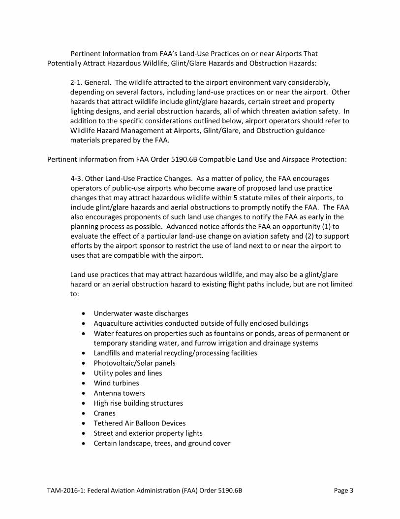
Pertinent Information from FAA’s Land-Use Practices on or near Airports That Potentially Attract Hazardous Wildlife, Glint/Glare Hazards and Obstruction Hazards:
2-1. General. The wildlife attracted to the airport environment vary considerably, depending on several factors, including land-use practices on or near the airport. Other hazards that attract wildlife include glint/glare hazards, certain street and property lighting designs, and aerial obstruction hazards, all of which threaten aviation safety. In addition to the specific considerations outlined below, airport operators should refer to Wildlife Hazard Management at Airports, Glint/Glare, and Obstruction guidance materials prepared by the FAA.
Pertinent Information from FAA Order 5190.6B Compatible Land Use and Airspace Protection: 4-3. Other Land-Use Practice Changes. As a matter of policy, the FAA encourages operators of public-use airports who become aware of proposed land use practice changes that may attract hazardous wildlife within 5 statute miles of their airports, to include glint/glare hazards and aerial obstructions to promptly notify the FAA. The FAA also encourages proponents of such land use changes to notify the FAA as early in the planning process as possible. Advanced notice affords the FAA an opportunity (1) to evaluate the effect of a particular land-use change on aviation safety and (2) to support efforts by the airport sponsor to restrict the use of land next to or near the airport to uses that are compatible with the airport. Land use practices that may attract hazardous wildlife, and may also be a glint/glare hazard or an aerial obstruction hazard to existing flight paths include, but are not limited to:
Underwater waste discharges
Aquaculture activities conducted outside of fully enclosed buildings
Water features on properties such as fountains or ponds, areas of permanent or temporary standing water, and furrow irrigation and drainage systems
Landfills and material recycling/processing facilities
Photovoltaic/Solar panels
Utility poles and lines
Wind turbines
Antenna towers
High rise building structures
Cranes
Tethered Air Balloon Devices
Street and exterior property lights
Certain landscape, trees, and ground cover

TAM‐2016‐1: Federal Aviation Administration (FAA) Order 5190.6B Page 4
4-3.a. Airports that have received Federal grant-in-aid assistance are required by their grant assurances to take appropriate actions to restrict the use of land next to or near the airport to uses that are compatible with normal airport operations. The FAA recommends that airport operators to the extent practicable oppose off-airport land-use changes or practices within the separations identified in Sections 1-2 through 1-4 that may attract hazardous wildlife, and/or be glint/glare, and/or obstruction hazards. Failure to do so may lead to noncompliance with applicable grant assurances. The FAA will not approve the placement of airport development projects pertaining to aircraft movement in the vicinity of hazardous wildlife attractants, or where glint/glare and/or obstruction hazards exist without appropriate mitigating measures. Increasing the intensity of wildlife control efforts is not a substitute for eliminating or reducing a proposed wildlife hazard, nor is the placement adjustments to mitigate glint/glare and obstruction hazards. Airport operators should identify hazardous wildlife, glint/glare, and obstruction hazards during any planning process for new airport development projects. Pertinent Information from FAA 14 Code of Federal Regulation Part 77 Safe, Efficient
Use and Preservation of the Navigable Airspace: 7460-1 Notice of Proposed Construction or Alteration – Requirement to file §77.9 Construction or alteration requiring notice. If requested by the FAA, or if you propose any of the following types of construction or alteration, you must file notice with the FAA of: (a) Any construction or alteration that is more than 200 ft. above ground level (AGL) at
its site. (b) Any construction or alteration that exceeds an imaginary surface extending outward
and upward at any of the following slopes: (1) 100 to 1 for a horizontal distance of 20,000 ft. from the nearest point of the
nearest runway of each airport described in paragraph (d) of this section with its longest runway more than 3,200 ft. in actual length, excluding heliports.
(2) 50 to 1 for a horizontal distance of 10,000 ft. from the nearest point of the nearest runway of each airport described in paragraph (d) of this section with its longest runway no more than 3,200 ft. in actual length, excluding heliports.
(3) 25 to 1 for a horizontal distance of 5,000 ft. from the nearest point of the nearest landing and takeoff area of each heliport described in paragraph (d) of this section.
(c) Any highway, railroad, or other traverse way for mobile objects, of a height which, if adjusted upward 17 feet for an Interstate Highway that is part of the National System of Military and Interstate Highways where overcrossings are designed for a minimum of 17 feet vertical distance, 15 feet for any other public roadway, 10 feet or the height of the highest mobile object that would normally traverse the road, whichever is greater, for a private road, 23 feet for a railroad, and for a waterway or any other traverse way not previously mentioned, an amount equal to the height of
TAM‐2016‐1: Federal Aviation Administration (FAA) Order 5190.6B Page 5
the highest mobile object that would normally traverse it, would exceed a standard of paragraph (a) or (b) of this section.
NOTE (a) You must submit this form at least 45 days before the start date of the proposed
construction or alteration or the date an application for a construction permit is filed, whichever is earliest.
(b) If you propose construction or alteration that is also subject to the licensing requirements of the Federal Communications Commission (FCC), you must submit notice to the FAA on or before the date that the application is filed with the FCC.
(c) If you propose construction or alteration to an existing structure that exceeds 2,000 ft. in height above ground level (AGL), the FAA presumes it to be a hazard to air navigation that results in an inefficient use of airspace. You must include details explaining both why the proposal would not constitute a hazard to air navigation and why it would not cause an inefficient use of airspace.
(d) The 45-day advance notice requirement is waived if immediate construction or alteration is required because of an emergency involving essential public services, public health, or public safety. You may provide notice to the FAA by any available, expeditious means. You must file a completed FAA Form 7460–1 within 5 days of the initial notice to the FAA. Outside normal business hours, the nearest flight service station will accept emergency notices.
(e) There is a Notice Criteria Tool on https://oeaaa.faa.gov/oeaaa/external/gisTools/gisAction.jsp?action=showNoNoticeRequiredToolForm on the left margin of the webpage. It is free and will help to determine if proposed structures need to filed for aeronautical review.
Photovoltaic and Solar Farms concerns about hazards to safe air navigation from: 1. Potential glare and glint caused by parabolic troughs and heliostats that might cause
temporary loss of vision to pilots on arrival or departure, or to Air Traffic Control personnel in the control tower.
2. Electromagnetic interference with on-and off-airport radar systems that may pick up a false signal from the metal components of the mirrors with impacts that can vary based on solar tracking activity.
3. Physical penetrations of navigable airspace from power towers that extend into Part 77 imaginary surfaces, terminal instrument procedures (TERPS) surfaces, or the path of radio emitting navigational aids.
4. Thermal plumes emitted by the power tower that produce unexpected upward moving air columns into navigable air space.
5. Use your discretion to evaluate the proposed footprint to be developed. If the footprint is approaching 1 acre, have the proponent submit a 7460-1. If its within 3 nautical miles of an airport, have them submit a 7460-1.

TAM‐2016‐1: Federal Aviation Administration (FAA) Order 5190.6B Page 6
Wind Farms concerns about hazards to safe air navigation from: 1. Create false targets and impacts FAA long radar capabilities. 2. Height of structures and propellers. 3. Any wind farm proposal needs to have the proponent submit a 7460-1.
Application
The State of Hawaiʻi Department of Transportation, Airports Division (DOT-A) discourages such land uses that may attract hazardous wildlife within five (5) statute miles of airport boundaries, pursuant to FAA Advisory Circular 150/5200-33B, (August 28, 2007). Attached are maps depicting the five (5) statute miles from airports in the State of Hawaiʻi, including glint/glare hazards pursuant to Federal Aviation Administration Notice of Interim Policy dated October 23, 2013 and aerial obstruction to existing flight paths pursuant to Combined Federal Regulation CFR Part 77 (e-CFR format) – Current as of December 15,2015.
State, county, and federal agencies who have jurisdiction over areas within five (5) statute miles of airport boundaries and have permit authority over future land uses that may attract hazardous wildlife shall consider FAA Advisory Circular 150/5200-33B, including glint/glare hazards and aerial obstruction(s) to existing flight paths in accordance with the FAA Obstruction Evaluation/Airport Airspace Analysis (iOE/AAA), Combined Federal Regulation CFR Part 77 in their decision making on plans and permits, Consultation with the DOT-A (Airport Operations) shall be performed at the earliest time where a future land use that may attract hazardous wildlife, glint/glare hazard or aerial obstruction(s) is proposed. Agencies should inform applicants of permits or approvals of such proposed land uses to consult with the DOT-A (Airport Operations) as soon as possible, pursuant to the Airport Zoning Act HRS Chapter 262. Where applicable, when a land-owner petitions the State of Hawaii Land Use Commission (LUC) with a request for a land use district boundary amendment, the State will propose an LUC condition requiring an avigation and noise easement be granted to DOT-A and the terms of the easement must meet the requirements of the DOT-A, including mitigation to minimize potential wildlife hazards to aircrafts and airport operations. In cases where the respective counties are the authority for land use district boundary amendments (petitions under fifteen (15) acres), the respective counties should contact DOT-A for any requirements of an avigation and noise easement.

TAM‐2016‐1: Federal Aviation Administration (FAA) Order 5190.6B Page 7
When a landowner in the vicinity of the airport pursues redevelopment of a property, the landowner must grant an avigation and noise easement to the DOT-A to ensure compatible land use in the vicinity of the airport. The terms of the easement must satisfy DOT-A requirements. Grant of avigation and noise easements to DOT-A is necessary for the safety of air transportation which is a public benefit. State, County, and Federal regulatory and service agencies that work with any aspect of the conditions identified in an avigation and noise easement must take appropriate actions and incorporate the DOT-A avigation easement requirements in their decisions.
Office of Planning Phone: (808) 587-2846 State of Hawaiʻi Web: planning.hawaii.gov P.O. Box 2359 Honolulu, HI 96804 Department of Transportation Phone: (808) 838-8810 Airports Division State of Hawaiʻi 400 Rodgers Boulevard, Suite 700 Honolulu, HI 96819-1880
Note: A Technical Assistance Memorandum (TAM) is an informational statement of the law, regulations, or policies. It is accurate on the date issued. Subsequent changes in the law or regulations, judicial decisions, or changes in policies could affect the validity of the information presented in a TAM.

HonoluluInternational
Airport
HiloInternationalAirport
Kona InternationalAirport atKeahole
Kahului Airport
DillinghamAirfield
HanaAirport
KapaluaAirport
LanaiAirport
LihueAirport
KalaupapaAirport
Molokai Airport
UpoluAirport
PortAllenAirport
KalaeloaAirport
Waimea-KohalaAirport
KauaiNiihauOahu
Molokai
Lanai
Kahoolawe
Maui
Hawaii
0 50 10025 Miles
This map was produced by the Office ofPlanning (OP) for planning purposes.It should not be used for boundary inter-pretations or other spatial analysis beyondthe limitations of the data. Informationregarding compilation dates and accuracy ofthe data presented can be obtained from OP.Map No.: 20151014-01-DKMap Date: 10/14/15Sources:DOT Airports: State of Hawaii, DOT, 2014.
State of Hawaii5 Statute Mile Buffer Around Airport
State DOT Airports

Lihue Airport
Port AllenAirport
Kauai County5 Statute Mile Buffer Around Airport
State DOT Airports
This map was produced by the Office ofPlanning (OP) for planning purposes.It should not be used for boundary inter-pretations or other spatial analysis beyondthe limitations of the data. Informationregarding compilation dates and accuracy ofthe data presented can be obtained from OP.Map No.: 20151014-01-DKMap Date: 10/14/15Sources:DOT Airports: State of Hawaii, DOT, 2014.
0 5 102.5 Miles

HonoluluInternationalAirport
DillinghamAirfield
KalaeloaAirport
This map was produced by the Office ofPlanning (OP) for planning purposes.It should not be used for boundary inter-pretations or other spatial analysis beyondthe limitations of the data. Informationregarding compilation dates and accuracy ofthe data presented can be obtained from OP.Map No.: 20151014-01-DKMap Date: 10/14/15Sources:DOT Airports: State of Hawaii, DOT, 2014.
Honolulu County5 Statute Mile Buffer Around Airport
State DOT Airports
0 5 102.5 Miles

KahuluiAirport
Hana Airport
KapaluaAirport
Lanai Airport
KalaupapaAirport
MolokaiAirport
0 5 102.5 Miles
Maui County5 Statute Mile Buffer Around Airport
State DOT Airports
This map was produced by the Office ofPlanning (OP) for planning purposes.It should not be used for boundary inter-pretations or other spatial analysis beyondthe limitations of the data. Informationregarding compilation dates and accuracy ofthe data presented can be obtained from OP.Map No.: 20151014-01-DKMap Date: 10/14/15Sources:DOT Airports: State of Hawaii, DOT, 2014.

HiloInternational
Airport
Kona InternationalAirport at Keahole
UpoluAirport
Waimea-KohalaAirport
This map was produced by the Office ofPlanning (OP) for planning purposes.It should not be used for boundary inter-pretations or other spatial analysis beyondthe limitations of the data. Informationregarding compilation dates and accuracy ofthe data presented can be obtained from OP.Map No.: 20151014-01-DKMap Date: 10/14/15Sources:DOT Airports: State of Hawaii, DOT, 2014.
Hawaii County5 Statute Mile Buffer Around Airport
State DOT Airports
0 10 205 Miles