Embed Size (px)
Citation preview

1
Space Research Today No. 198 COSPAR’s Information Bulletin April 2017 Contents
Message from the Editor 2 A Forum for Discussion 3 COSPAR News 4 In Memoriam 4 Neil Gehrels (1952-2017) 4 Research Highlights 5 News in Brief 19 Space News 19 Space Snapshots 22 Awards 25 Meetings 25 Meetings of Interest to COSPAR 25
Meeting Announcements 28 Meeting Reports 28 Letters to the Editor 34 Publications 35 Advances in Space Research (ASR): Top
Reviewers of 2016 35 Submissions to Space Research Today 40 Launch list 41
Catching Cassini’s call (see page 23)
COSPAR Visting Fellow Saat Mubarrok with his advisor at Scripps, Dr Janet Sprintall (see page 29)

2
Message from the Editor
I was invited to take on the role of General Editor for SRT (though it was known as the COSPAR Information Bulletin at the time), by the then President of COSPAR, Sir Ian Axford in 1991. One of the things that he encouraged was a drive to make what was a rather dry information booklet into something with more appeal, perhaps more about the people in COSPAR, and even some humour. He positively encouraged my suggestion to include cartoons, for example, and the plan was not just to print meeting reports and lists,
but also relevant space news and images. The human side was catered for, ultimately, by the COSPAR Community section.
We have come a long way since 1991, and SRT has been a great witness to the numerous advances in our field—many of which we could only have dreamed of. Our modern world with its rapid communication and thirst for bite-sized news items and updates, combined with the fast-moving developments of space business these days, means that SRT has had to change, to meet our current needs. This has influenced the introduction of the Snapshots, the Forum sections and the news sections, for example. However, we are always open to new suggestions and ideas for improving SRT, to cater for the needs of the wider community. Perhaps it is as simple as making changes to the regular section structure, or maybe there are ideas out there about novel items we could incorporate into the journal. Please send your suggestions to any of the editorial team.
Richard Harrison
General Editor
__________________________________________________________________________________

3
A Forum for Discussion
pace exploration has provided great contributions to the advancement of scientific knowledge about our solar system and our planet. Exploring beyond Earth’s limits requires building very large collaborations of scientists, technicians and many others, often at an international level, to
focus diverse efforts towards a unique goal. Space science is truly a powerful example of international cooperation for a greater purpose.
The aim of COSPAR is to promote scientific research in space and encourage the open availability of scientific results for the global advancement of knowledge in the space sector. This aligns with the objectives of the United Nations Office for Outer Space Affairs (UNOOSA): facilitating access to space data and space technology for all of humankind and promoting the peaceful uses and exploration of outer space. COSPAR and UNOOSA are natural partners in this sense.
UNOOSA is currently preparing to celebrate the fiftieth anniversary of the first United Nations Conference on the Exploration and Peaceful Uses of Outer Space with UNISPACE+50, a special segment of the June 2018 session of the Committee on the Peaceful Uses of Outer Space. This will be an opportunity for the international community to shape the future of global space cooperation. One of the expected outcomes of UNISPACE+50 is “Space2030”, a new framework for space governance for the benefit and development of humanity. Space2030 will support the use of space as a tool for the achievement of the Sustainable Development Goals. We want to make sure that space technology and applications are used to bring concrete benefits to all of humankind.
Space2030 will be built upon four pillars:
- Space accessibility: all communities using and benefitting from space technologies.
- Space diplomacy: building and strengthening international cooperation in space activities.
- Space economy: development of space-derived economic benefits.
- Space society: evolution of society and societal benefits stemming from space-related activities.
One of UNOOSA’s aims for the UNISPACE+50 process and the future of space is to include more of the broader space community. We aim to involve all stakeholders in this new concept of space governance so that space stays sustainable and is safeguarded for current and future generations.
On behalf of UNOOSA, I am delighted to acknowledge and thank COSPAR for collaborating with UNOOSA in the lead up to UNISPACE+50. The scientific community can bring many insights about space and our planet to contribute to this process, as well as promote the value of shared scientific research for both addressing global challenges and considering the future of global space cooperation. At UNOOSA we believe that science can be a positive agent for sustainable development, and we value COSPAR’s contribution to making space, as well as its resources, accessible and functional for all humankind. www.unoosa.org/oosa/en/ourwork/unispaceplus50
Simonetta di Pippo (Director, UNOOSA) UNISPACE+50
S

4
COSPAR News Cyprus Adheres to COSPAR On 12 December 2016 Cyprus became the newest member, joining COSPAR with the Cyprus Space Exploration Organisation (www.spaceexploration.org.cy) as the national scientific institute. The COSPAR community extends a warm welcome.
In Memoriam
Neil Gehrels (1952-2017)
Neil was a gentleman, a generous person and a scientist. He was always positive whenever he was approached by a student, colleague or lay person along his travels, when climbing, or in his everyday life.
He initiated his science activity making use of Voyager data and discovering, with Ed Stone, energetic O and S nuclei in the Jovian magnetosphere, producing the Jovian aurorae. Before moving to NASA, Goddard Space Flight Center, he developed a method for using Poisson statistics in astronomical data analysis. Soon after he was involved in high-energy astrophysics for experimental work, observ-ation and theory. He was project scientist for the NASA Compton Gamma Ray Observatory revealing, among many other results, two classes of gamma-ray AGN (with C. Dermer)
and a new population of mid-latitude high-energy gamma-ray sources with CGRO. He then contributed to the ESA INTEGRAL observatory as US mission scientist with a very active role in designing the instrument for gamma-ray spectroscopy and tuning the scientific programme. But his most noted role was certainly his leadership of the NASA Swift gamma-ray burst observatory as Principal Investigator: the results from this mission are so many that it is difficult to select a few, as it rewrote all aspects of gamma-ray bursts. It is also worth mentioning the beginning of “time domain astronomy” and the unprecedented 5,000 targets of opportunity observations performed over 10 years. He contributed to the development of the NASA Fermi mission as Deputy Project Scientist. More recently, he contributed to the JDEM and WFIRST mission concepts as project leader in order to greatly expand our understanding of dark energy, exoplanets and galaxy evolution. He was Chief of the Astroparticle Physics Laboratory at NASA/GSFC College Park, Professor of Astronomy at the University of Maryland, and Adjunct Professor of Astronomy and Astrophysics at Penn State, and mentored and supervised graduate students and post docs. He received many honours and awards, not least of which was the COSPAR Harrie Massey Award in 2012. He was member and chair of many committees, including Chair of COSPAR Scientific E, COSPAR, (2006-2012).
At the beginning of 2001 I had the privilege of working with him, side-by-side in the framework of the COSPAR Working Group on the “Future of Space Astronomy”. We had fun and a great time trying, with the other WG members, to foresee a possible roadmap, by definition not biased by our own scientific interests. Again, Neil was a gentlemen and he was always aiming for the best for “Science” and for the “Astronomical community” at large. He was a lighthouse for the whole WG activity.
We have all lost a leading scientist, I have lost a friend.
[By Pietro Ubertini, IAPS/INAF, Rome, Italy]

5
3rd COSPAR SYMPOSIUM on Jeju Island, South Korea,
18-22 September 2017
www.cospar2017.org//
Research Highlights The Imaging X-ray Polarimetry Explorer (IXPE): An Overview [By Martin C. Weisskopf (NASA, MSFC), Brian D. Ramsey, Paolo Soffitta, Ronaldo Bellazzini, Enrico Costa, Stephen L. O’Dell, Allyn Tennant, Herman Marshall, Fabio Muleri, Jeffery Kolodziejczak, Roger W. Romani, Giorgio Matt, Victoria Kaspi, Ronald Elsner, L. Baldini, A. Brez, N. Bucciantini, E.
Churazov, S. Citrano, E. Del Monte, N. Di Lalla, I. Donnarumma, M. Dovčiak, Y. Evangelista, S. Fabiani, R. Goosmann, S. Gunji, V. Karas, M. Kuss, L. Latronico, A. Manfreda, F. Marin, M. Minuti, N. Omodei, L. Pacciani, G. Pavlov, M. Pesce-Rollins, P.-O. Petrucci, M. Pinchera, J. Poutanen, M. Razzano, A. Rubini, M. Salvati, C. Sgrò, F. Spada, G. Spandre, L. Stella, R. Sunyaev, R. Taverna, R. Turolla, K. Wu, S. Zane, D. Zanetti]
The Imaging X-ray Explorer (IXPE) will be the next in the line of NASA’s Small Explorer Missions. The mission allows, for the first time imaging X-ray polarimetry with sufficient sensitivity to study approximately 50 X-ray sources per year of observing. The most unique feature of this mission provides image-resolved polarization measurements for a significant number of extended objects such as supernova remnants and pulsar wind nebulae.
Figure 1. Cartoon showing the major elements of the IXPE once the solar arrays and the Mirror Module Assemblies are deployed on orbit. The overall length of the deployed IXPE is approximately 5 m. Other features include shields mounted to the front of the MMAs to prevent off-axis flux from entering the collimated detectors and the Tip, Tilt, Rotate mechanism (TTR), allowing adjustments if there is any boom deployment offset beyond specifications. There are star-trackers both forward and aft. A metrology system monitors detector-MMA alignment.

6
The imaging capability will also be exploited to accomplish a unique study of our galactic centre to understand if SGR-A* was substantially more active several hundred years ago. The sensitivity allows one to perform the first polarization map of the bright active galaxy Cen-A.
The mission involves a partnership with the Italian Space Agency and NASA with the Italian partners providing the polarization-sensitive X-ray detectors and the use of the ground station at Malindi. The IAPS/INAF in Rome and INFN in Pisa and Turin will lead the details for the detector development. Ball Aerospace, in Boulder Colorado, will build the spacecraft and perform systems integration. NASA’s Marshall Space Flight Center leads
the programmes and will supply the X-ray telescopes, use its facilities to perform end-to-end X-ray calibration and provide the Science Operations Centre. Mission operations will be conducted at the Laboratory for Atmospheric Physics (LASP), also in Boulder, Colorado.
Description
Figure 1 illustrates the main features of IXPE once fully deployed on-orbit. IXPE is comprised of three identical X-ray mirror module assemblies with three accompanying polarization-sensitive detectors. The detectors exploit the fact that the direction of the photoelectron emitted from the K-shell during photoionization depends on the direction of the polarization vector.
Figure 2. Right: schematic of the polarization-sensitive detector. Left: Example of a track produced in the detector gas by the primary photoelectron.
The principle of operation of the detector is shown in Figure 2 i. The particular approach has been invented and developed in Italy. Salient details of the optics and the detectors, which operate most efficiently in the 2.0-8.0 keV band, are shown in Tables 1 and 2 respectively.
IXPE is planned to be launched in late 2020 from Kwajalein into a 540-km circular equatorial orbit, IXPE will perform (typically) days-long point-and-stare observations of known targets.
Capabilities
Polarization uniquely probes physical anisotropies—ordered magnetic fields, aspheric matter distributions, or general relativistic coupling to black-hole spin—that are not otherwise measurable. Hence, IXPE complements other investigations in high-energy astrophysics by adding an important and relatively unexplored dimension to the parameter space for investigating cosmic X-ray sources and processes and for using extreme astrophysical environments as laboratories for

7
Table 1. MMA properties
Table 2. The polarization-sensitive detectors
fundamental physics. Here we mention a few of the pioneering experiments that may be performed with IXPE.
Black Hole Spin A number of theoretical calculations with ever increasing fidelity have shown that the energy dependence of the polarization from a micro-quasar in an accretion-dominated state is tied to the spin of the black hole ii. See Figure 3. Simply stated this is because scattering polarizes the asymmetric thermal disk emission and this polarization vector rotates as it propagates
through the Kerr metric. The rotation is greatest at small r and thus the hot inner disk emission vectors are rotated with respect to the lower energy outskirts. Figure 4 shows the result of a simulation of a 200-ksec IXPE observation of GRX1915+105. With knowledge of the disk orientation one can measure dimensionless spin parameter, a, to the following accuracies depending on the actual spin: a=0.50±0.04; 0.900±0.008; 0.99800±0.00003.

8
Figure 3. Polarization degree (left) as a function of energy for a 200 ksec observation of GRX1915+105. (Right) Position angle as a function of energy. Solid lines are best fits to the simulated data for various values of the spin parameter. Dashed lines indicate models for other values of the spin parameter (Adapted from Dovčiak et al.iii).
Figure 4 and Table 3. The Cen A field blurred to IXPE resolution. The average IXPE Half Power Diameter across the field is indicated to the lower left of the figure and as is one of two ULX’s in the full field.. The minimum detectable polarization (see text) for the circled regions and a 1.5Msec observation is listed in the table to the right.
The Cen A field The figure shows a portion of the IXPE field-of-view that encompasses Cen A and illustrates one of the many benefits of imaging. Not only may one attempt to perform the first image-resolved polarimetry on extra galactic source, but one can avoid source confusion and begin to study the polarization of two ultra-luminous-X-ray
(ULX) sources in the IXPE field-of-view. (The other ULX is to the SW and on the detector but beyond the 6 arc min square region shown in the figure.) In the accompany table to Figure 4, we list the Minimum Detectable Polarization (MDP) from various regions. The MDP is the degree of polarization independent of the position angle that only has a 1% probability of

9
being due to a statistical fluke.
Conclusion
The two previous examples are only some of the experiments that may be performed with IXPE. There are many ground-breaking examples including measuring the polarization of the X-ray flux from the molecular clouds in the vicinity of SGR A* to determine of it was the source of the radiation and hence, much brighter, several hundred years ago iv v vi vi. The IXPE Team has initiated a www site at https://wwwastro.msfc.nasa.gov/ixpe/ where, from time to time, information will be posted, included tools to estimate fluxes and MDP.
References i. “Photoelectric X-ray Polarimetry with Gas
Pixel Detectors” by: Bellazzini, Ronaldo; Brez, Alessandro; Costa, Enrico; et al. 2nd International Conference on Frontiers in Diagnostic Technologies (FDT), Frascati, Italy, Nov. 28-30, 2011 Sponsor(s): Italian Agency Energy New Technol & Sustainable Dev (ENEA); Italian Inst. Nucl. Phys (INFN) and Nuclear Instruments & Methods in Physics Research Section A: Accelerators, Spectrometers, Detectors and Associated Equipment, Vol. 720, Pages: 173-177, 21 Aug. 2013 and references therein.
ii. Dovčiak, M., Muleri, F., Goosmann, R. W., Karas, V., & Matt, G. 2008, MNRAS, 391, 32
iii. Dovčiak, M., Muleri, F., Goosmann, R. W., Karas, V., & Matt, G. 2008, MNRAS, 391, 32
iv. Sunyaev, R., Markevitch, M., & Pavlinsky, M. 1993, ApJ, 407, 606
v. Koyama, K., Maeda, Y., Sonobe, T., Takeshima, T., Tanaka, Y., & Yamauchi, S. 1996, PASJ, 48, 249
vi. Churazov E., Sunyaev R. A., & Sazonov S., 2002, MNRAS, 330, 817
vii. Marin, F., Karas, V., Kunneriath, D., & Muleri, F. 2014, MNRAS, 441, 3170
About the Author
Martin C. Weisskopf
Dr. Martin C. Weisskopf is project scientist for NASA's Chandra X-ray Observatory and the senior scientist for X-ray astronomy in the Space Science Office at the Marshall Center. He earned a bachelor's degree in physics in 1964 from Oberlin College, Ohio, and a doctorate in physics in 1969 from Brandeis University, Massachusetts. He joined NASA as a senior X-ray astronomer in 1977 after nine years teaching at Columbia University in New York City, where he performed many pioneering experiments in X-ray astronomy. He is a fellow of the American Physical Society and of the International Society for Optical Engineering (SPIE). He is also a member of the American Association for the Advancement of Science, the International Astronomical Union, the scientific research society known as Sigma Xi, the Phi Beta Kappa national honor society and the American Astronomical Society and its High-Energy Astrophysics Division. The author or co-author of over 300 publications, he has received numerous awards and accolades from NASA, academia and professional societies.

10
Mission for Super-Low Earth Orbit, SLATS [By M. Sasaki (JAXA)]
Japan is taking up the challenge of expanding the region of space activities to super-low Earth orbit where we have never utilized remote sensing missions. It is hoped that missions from super-low Earth orbit will bring us higher performance such as higher imager resolution, higher SAR signal quality, and significant cost reduction. JAXA, the Japan
Aerospace Exploration Agency, is developing a demonstration satellite, the Super-Low Altitude Test Satellite (“SLATS”), in order to investigate technologies for missions on super-low Earth orbit.
1. Significance of Super-Low Earth Orbit
We believe that technology for missions in super-low Earth orbit between 200 km and 300 km altitude will provide a valuable new capability for satellite missions.
Figure 1. Concept of Super-Low-Altitude Satellite
Figure 2. Advantages of Super-Low Altitude Satellite

11
In a super-low Earth orbit it is possible to achieve higher imager resolution, and higher SAR and LIDAR signal quality. Imager resolution is directly proportional to altitude of orbit. SAR signal quality is inversely proportional to the cube of the orbital altitude. LIDAR signal quality is inversely proportional to the square of the orbital altitude.
Where the same performance is required, as from higher-altitude satellites, it is possible to achieve size reduction of sensors and satellites. As a result, significant cost reduction is certainly expected.
In super-low Earth orbits, air drag increases exponentially, for example air drag of 250 km altitude is approximately 1,000 times greater
than that of around 800 km altitude where remote sensing missions are generally operated. The satellite needs 1,000 times the amount of fuel for conventional hydrazine thrusters which produce a specific impulse of around 200 seconds in order to maintain orbit altitude. Therefore, we chose ion engine technology which produces a specific impulse of 3,000 seconds. Additionally our concept for maintaining super-low Earth orbit includes compensation of major air drag by optimizing the satellite shape and increasing the accuracy of mathematical models of air drag.
Ion engine technology enables us not only to compensate for air drag but also allows us the ability to enable orbit transfer.
Figure 3.1. Illustration of SLATS in orbit
We can select global observations or fixed-point (fixed longitudes) observations by operating only one satellite in specific orbits. In the case of global observations, the satellite operates at an altitude of 324 km, in a Sun-synchronous quasi recurrent orbit in a 5-day cycle. In the case of fixed-point observations, the satellite operates at an altitude of 268 km,
also in a Sun-synchronous orbit, (transferring down, 56 km from the ‘global’ orbit case). The satellite passes over the same places on the Earth every day. We can observe our target place more frequently and precisely because of nadir-view observation.
We believe that there is significant added value

12
that would be enabled by the technologies of missions for super-low Earth orbit.
2. Task of Utilizing Super-Low Earth Orbit
Super-low Earth orbit is not normally used for remote sensing missions because of several problems such as significant air drag, high density of atomic oxygen, narrow swath and short communication time to ground stations. We will take measures to resolve these problems in order to enhance the value of super-low Earth orbits.
(1) Degradation of orbit prediction accuracy
Accuracy of mathematical air drag models will be improved by correlation methods or data assimilation methods based on on-orbit demonstration data from SLATS. The result of this will be reflected in new aerodynamic design and the propulsion design for next generation satellites.
(2) Degradation of satellite surface materials
JAXA has developed atomic oxygen protective coatings for spacecraft surfaces such as polysiloxane block polyimide, named BSF-30. The atomic oxygen protective coatings and materials will be adopted in next generation satellites based on SLATS in-orbit demonstration data.
(3) Short communication time to ground stations
The efficient use of communication resources will be achieved by on-board planning methods for observing a target on the Earth and on-board processing methods for rejecting automatically unusable data such as images of cloudy weather.
(4) Instability of system design architecture
The required advanced mission instru-mentation may need more power resources than ordinary instruments. The spacecraft system can adapt large solar arrays to provide the power required, but this, in turn, can cause stronger air drag. The system will need high power electric propulsion to maintain the required orbit. As a result, this can lead to a vicious cycle of increasing power
consumption, making it impossible to complete the system design. Therefore, down-sizing and power-saving equipment have to be developed thoroughly.
3. The SLATS Mission
The in-orbital image and outline of the SLATS mission are shown in Figure 3.1 and Table 3.1, respectively.
3.1 Demonstration in Super-Low Earth Orbit
The SLATS orbit transition profile is shown in Figure 3.2.
After SLATS is injected at 530 km altitude by the H-2A launch vehicle, it transfers to 400 km altitude by using its hydrazine thrusters. It then transfers from 400 km to 268 km altitude by using its own air drag, taking approximately a year.
Items Specifications
Mission Demonstration on super low Earth orbit
Atomic oxygen monitoring
High resolution optical imaging
Size 2.5 m roll × 5.2 m pitch × 1.5 m yaw
Launch mass
400 kg
Elec. power 1174 W at EOL
Design life More than 2 years
Mission orbit
Between 268 km and 180 km
Launch H-2A Launch Vehicle in 2017 Table 3.1. Outline of SLATS
The spacecraft will transfer between orbital altitudes (268 km, 250 km, 240 km, 230 km and 220 km) in a step-by-step manner, by means of only ion engine propulsion. At 180 km altitude it is able to maintain the orbit with

13
the ion engine and hydrazine thrusters together.
We have developed the required aerodynamic coefficient database by carrying out Free-molecular analysis and Direct Simulation Monte Carlo computations based on the precise CAD model of the satellite. Also, we carried out a hypersonic rarefied wind tunnel experiment using a scale model of SLATS for verification of some simulation results. The orbit prediction of SLATS will be conducted by using the database and NRMSISE-00 atmosphere model. Furthermore, we will
improve the accuracy of aerodynamic prediction by estimating the orbit difference between the orbit prediction and acquired GPS data.
3.2 Atomic Oxygen Monitoring
The Atomic oxygen MOnitor, named AMO, comprises two instruments: Atomic Oxygen Fluence Sensor (AOFS) will obtain Atomic Oxygen (AO) environment data in the SLATS orbit, while the Materials Degradation Monitor (MDM) will observe the degradation of candidate materials for super low Earth orbit missions in the future.
Figure 3.2. Orbital transition profile of SLATS
An outline of SLATS’ AMO equipment and its pictures are shown respectively in Table 3.2 and Figure 3.3.
AOFS measures the number of collisions involving AO colliding with eight sensor heads in/on satellite. The number of collisions involving AO is calculated based on the
minute mass change accompanying AO and corroding a substance. A sensor head installs a thermoelectric quartz crystal microbalance (TQCM) which quantitatively measures minute mass loss of substance adhering to the crystal electrode surface.
The number of AO collisions is measured

14
using the mass loss phenomenon, whereby a polyimide coating is applied to the crystal oscillator electrode side of TQCM, following a reaction with AO. Since the amount of erosion at the time of one oxygen atom colliding with polyimide has data as “reaction efficiency
Items Specifications
Mission Atomic oxygen fluence sensor
Materials degradation monitor
Resolution of accuracy
Less than 8.0 E14 atoms/cm2Hz
Accuracy of fluence
Less than 20 % of full scale
Material sample
MLI Application:
Atomic Oxygen Protective
Coating/Polyimide(UPILEX-R)/Al.
Polysiloxane Block Polyimide (BSF-
30)/Al.
UV Protective Coating/Polysiloxane
Block Polyimide (BSF-30) /Al.
ITO Coating/Polyimide (Kapton)/Al Beta cloth/Al.
Cable application:
Expanded PTFE.
ETFE.
OSR Application:
ITO Coating/FEP Film (5mil)/Ag.
FEP Film (1mil) /Ag.
FEP Film (5mil) /Ag.
Monitor camera
CCD camera
307,200 pixels Table 3.2 Outline of SLATS’ AMO
[3x10-24cm3/atom]”, AO fluence can be calculated by the polyimide coating mass loss,
which was measured by TQCM. The sensor head using such polyimide as a material to be eroded has been established as a proven system within the JAXA AO irradiation facility.
The TQCM detector is carried in a position which can measure the number of AO collisions based on the satellite’s direction of movement. MDM evaluates material degradation based on an AO collision in the satellite’s direction of movement.
The mount sample shown in Table 3.2 comprises two kinds of electric wire cables exposed on a solar panel and eight kinds of thermal control materials used for the external surface of the satellite body. They are selected to focus on those considered potentially usable for future satellites and to evaluate AO tolerance.
Figure 3.3. Atomic Oxygen Monitor. Top: AOFS sensor head; bottom: Material sample of MDM

15
The outcome based on the flight data will be fed back to the design and test requirements of external exposure material selection for future satellites, after our evaluation of ground test data and flight data of the satellite.
3.3 High Resolution Optical Imaging
The outline and images of the SLATS optical imager are shown respectively in Table 3.3 and Figure 3.4.
The imager element of the mission is to demonstrate higher resolution on super-low Earth orbit than that at usual altitudes. Since large disturbances from air drag and the thrust of the ion engine act on the satellite body and solar panels on the super-low Earth orbit, we evaluate the difference of orbit data between predictions and results, and the relation between the disturbance and quality of optical images.
Items Specifications
Mission Demonstration of imaging from super low Earth orbit
Telescope Cassegrain type and compensation lens
Wave length 0.48 – 0.7 µm
Diameter of effective aperture
0.2 m
FOV 9.1 mrad
Mass 19.8 kg
Table 3.3. Outline of SLATS Imager
The outcome based on the flight data will be fed back to imager design, attitude and orbit control subsystem and satellite planning ground system for future satellites.
4. Next Generation Satellites
We consider next generation satellites on super-low Earth orbit, which will be utilized for remote sensing missions such as high-
resolution imagers, high-quality SAR and LIDAR. Figure 4.1 shows the advantages of remote sensing missions on super-low Earth orbit. We aim to achieve higher performance, smaller size and lower cost of sensor instruments, and also to reduce the launch cost.
The future vision of super-low altitude satellites following SLATS is several kinds of remote sensing satellites which may enable short revisit cycling. Sun-synchronous recurrent orbit only exists at 268 km altitude in all super-low Earth orbits. A satellite in such an orbit can pass over and observe just the same locations from the same off-nadir angle at the same time every day. If however global observation is required, it will transfer to higher altitude, for example 324 km quasi recurrent orbit in a 5-day cycle.
Figure 3.4. SLATS Optical imager. Top: Sensor head; bottom: Electronics
4.1 High-resolution Imagers and High-quality SAR
Remote sensing is one of the tools to solve problems of wide area disaster. High resolution imagers and high-quality SARs are suitable

16
Figure 4.1 Advantages of Super Low Earth Orbit
instruments for disaster monitoring and prevention, by collaborating with other larger satellites to observe a wide area.
Figure 4.2 shows a satellite which has an optical imager with 30 cm effective aperture diameter telescope to achieve 50 cm ground sampling distance from lower altitude.
Figure 4.2 Illustration of optical imager satellite
For precise observation, the orbit and attitude
control for turbulence and short exposure times related to high resolution requirements are problems to be solved. Key devices are accelerators to measure air drag and tunable thrusts of electric propulsion equivalent to the resistance, a long life propulsion system to enhance the merits of cost reduction, and high sensitivity optical CMOS or CCD detectors.
Wide frequency bandwidth required for high resolution SAR observations is available at X and Ku-band, 1.2 GHz and 500 MHz respectively. The antenna size of high frequency will be smaller than that of L-band because of larger antenna gain. Table 4.1 shows the key parameters of super low altitude Ku-SAR satellite.
There is no big difference in the backscatter characteristics at the ground surface between X and Ku-band frequency according to the result of simultaneous airborne-SAR experiments using both bands. Compared to the bandwidth of the L-band 85 MHz (range resolution 3 m), it has advantages to clarify the contour of artificial structure with high reflection characteristics, like ships. In case of rainfall, ambiguity images including ghosting and rain

17
attenuation of backscattering are negligible in the Ku-band.
Items Specifications
Orbit altitude
300 km
Frequency 13.5 GHz (Ku-band)
Bandwidth 500 MHz(max)
Antenna size
3.0 m(Az)×1.5 m(El)
Resolution 1.5 m(Az)×1.0 m(Rg)
Swath 10 km (Stripmap)
NESZ < -23 dB (Stripmap)
Power Peak: 1.4 kW, average: 140 W
(duty 10%) Table 4.1. Ku-SAR satellite key parameters
X and Ku-band SAR for the practical use is effective for the super low altitude mission by the means of compensation for lowered S/N according to the wide bandwidth. There is no need to consider the noise effect of the ionosphere above the satellite for quality improvement. Satellites will be a small cross-sectional shape and Active Phased Array Antenna (APAA) and electrical beam steering is suitable for the SAR instruments to reduce air-drag. Figure 4.3 shows an image of super-low altitude SAR satellite in a Dawn-Dusk orbit.
Candidates for launchers are Enhanced Epsilon rockets delivering more than 590 kg in a Sun-synchronous orbit to 500 km from which satellites move to a lower orbit, or H3 rockets for multiple satellites launched at the same time.
4.2 Doppler Wind LIDAR
Among various types of LIDAR such as altimeter or Mie-scattering etc., the Doppler
Figure 4.3. Illustration of SAR satellite
Wind LIDAR provides new wind observation tools for weather forecasting. Global and vertical wind speed observation is required by the WMO (World Meteorological Organ-ization) for the improvement of weather forecasting (WMO, 2012). Table 4.2 shows satellite LIDAR wind speed measurement requirements by the WMO.
Wind speed
precision
Vertical
resolution
Tropopause 16-20 km
<3 m/s 2 km
Upper Troposphere
2-16 km <2 m/s 1 km
Lower Troposphere
0-2 km <1-2 m/s 0.5 km
Table 4.2. Doppler Wind LIDAR satellite measure-ment requirements
Moreover, monitoring and predicting aerosols, air pollutants and volcano ash can minimize disasters that affect people’s lives, prevent respiratory disease and secure safe aircraft operation.
The Doppler Wind LIDAR observes the frequency difference between the transmission and reception of a laser reflected by aerosol or

18
air molecules. The laser wavelength, infrared or ultraviolet, varies depending on the reflection particles, μm-size aerosol or nm-size air molecules, respectively. From super-low altitude observation, the required laser power is lower than other satellites and technological feasibility will be increased. The super low altitude Doppler Wind LIDAR satellite which observes line-of-sight direction of the Doppler wind vector is shown in Figure 4.4.
Figure 4.4 Doppler Wind LIDAR satellite image
4.3 In-situ observation at super low altitude
The ionosphere, where super-low altitude satellites orbit has an influence on our daily life, such as with potential impacts on the GNSS navigation of aircraft. Measurements of air density by accelerator, plasma density and velocity by plasma probe and composition (e.g. atomic oxygen (AO)) by mass spectrometer are useful not only for satellite operations but also science or methods to analyse trace elements related to phenomena near the ground like global warming. The observation period with super-low altitude satellites is longer than that of experiments with sounding rockets.
4.4 Perspectives for future SLATS series
Future super low altitude satellite missions will be studied based on the development results of SLATS. The Imager and SAR will contribute to disaster area monitoring and Doppler Wind LIDAR will contribute to weather forecasting.
It is effective to summarize the results and lessons learned of SLATS development into new design standards of new satellites which navigate in super low Earth orbit regions, including re-entry vehicles or micro-satellites from the International Space Station.
References
Atomic Oxygen Monitor System on Board a Super–Low-Altitude Test Satellite, IAC-12-D5.3.11, Yugo Kimoto et al.
WMO, WIGOS WMO Integrated Global Observing System; Final Report of the Fifth WMO Workshop on the Impact of Various Observing Systems on Numerical Weather Prediction, Technical Report 2012-1, 2012.
About the Author
Masonori Sasaki
Masonori Sasaki joined NASDA (former organization of JAXA) in 1990. At JAXA he has engaged in the spacecraft development of the Communications and Broadcasting Engineering Test Satellites (COMETS) as well as eight Earth observing satellites. He has been the project manager of SLATS project since October 2014.

19
News in Brief International Council for Science (ICSU) Calls on the Government of the United States to Rescind the Executive Order “Protecting the Nation from Foreign Terrorist Entry into the United States” (ICSU release, 31 January 2017)
Joining many national and international organizations, the International Council for Science (ICSU) calls on the government of the United States of America to rescind the Executive Order “Protecting the Nation from Foreign Terrorist Entry into the United States,” which is effectively banning entry to the United States for citizens of seven countries.
In the opinion of the Council, the Order is inappropriately broad in its scope and unfairly targets individuals based on their origin, putting it into violation of the Principle of Universality of Science, enshrined in the Council’s statutes. It is also concerned about the negative effects the Order will have on the freedom of scientific exchange among scientists and students of science worldwide, resulting in negative impacts on the progress of science, and impeding societies around the globe from benefitting from this progress.
As the world’s leading non-governmental international scientific organization, the Council promotes the Universality of Science on the basis that science is a common human endeavour that transcends national boundaries and is to be shared by all people. It believes that scientific progress results from global exchange of ideas, data, research materials and understanding of the work of others.
In advocating the free and responsible practice of science, ICSU promotes equitable oppor-tunities for access to science and its benefits, and opposes discrimination based on such factors as ethnic origin, religion, citizenship, language, political or other opinion, sex, gender identity, sexual orientation, disability, or age. The Council believes that the complex
problems of our world can only be solved through international dialogue, collaboration and the sharing and exchange of ideas and research findings.
Statute 5 of the International Council for Science (ICSU) states: The Principle of Universality (freedom and responsibility) of Science: the free and responsible practice of science is fundamental to scientific advance-ment and human and environmental well-being. Such practice, in all its aspects, requires freedom of movement, association, expression and communication for scientists, as well as equitable access to data, information, and other resources for research. It requires respons-ibility at all levels to carry out and comm-unicate scientific work with integrity, respect, fairness, trustworthiness, and transparency, recognising its benefits and possible harms.
Space News PSLV-C37 Successfully Launches 104 Satellites in a Single Flight (ISRO release, 15 February 2017)
In its thirty ninth flight ISRO's Polar Satellite Launch Vehicle (PSLV-C37) successfully launched the 714-kg Cartosat-2 series satellite along with 103 co-passenger satellites on the morning of 15 February 2017 from Satish Dhawan Space Centre SHAR, Sriharikota. This is PSLV’s 38th consecutively successful mission. The total weight of the 104 satellites carried on-board was 1,378 kg.
PSLV-C37 lifted off at 09:28 (IST), as planned, from the first launch pad. After a flight of 16 minutes 48 seconds, the satellites achieved a polar sun synchronous orbit of 506 km inclined at an angle of 97.46° to the equator (very close to the intended orbit) and in the succeeding 12 minutes all 104 satellites successfully separated from the PSLV fourth stage in a predetermined sequence beginning with Cartosat-2 series satellite, followed by INS-1 and INS-2. The total number of Indian satellites launched by PSLV now stands at 46.

20
PSLV-C37 lift-off (Image credit: ISRO)
After separation, the two solar arrays of Cartosat-2 series satellite were deployed automatically and ISRO's Telemetry, Tracking and Command Network (ISTRAC) at Bangalore took over the control of the satellite. In the coming days, the satellite will be brought to its final operational configuration following which it will begin to provide remote sensing services using its panchromatic (black and white) and multispectral (colour) cameras.
Of the co-passenger satellites carried, two are technology demonstration satellites from India weighing 8.4 kg (INS-1) and 9.7 kg (INS-2).
The remaining 101 co-passenger satellites were international customer satellites from USA (96), the Netherlands (1), Switzerland (1), Israel (1), Kazakhstan (1) and UAE (1).
NASA Selects Two Missions to Explore the Early Solar System (NASA release, 4 January 2017)
NASA has selected two missions that have the potential to open new windows on one of the earliest eras in the history of our solar system–a time less than 10 million years after the birth of our sun. The missions, known as Lucy and Psyche, were chosen from five finalists and will proceed to mission formulation, with the goal of launching in 2021 and 2023, respectively.
“Lucy will visit a target-rich environment of
Jupiter’s mysterious Trojan asteroids, while Psyche will study a unique metal asteroid that’s never been visited before,” said Thomas Zurbuchen, associate administrator for NASA’s Science Mission Directorate in Washington. “This is what Discovery Program missions are all about–boldly going to places we’ve never been to enable ground-breaking science.”
An artist’s conception of the Lucy spacecraft flying by the Trojan Eurybates–one of the six diverse and scientifically important Trojans to be studied (Image credits: SwRI and SSL/Peter Rubin)
Lucy, a robotic spacecraft, is scheduled to launch in October 2021, slated to arrive at its first destination, a main belt asteroid, in 2025. From 2027 to 2033, Lucy will explore six Jupiter Trojan asteroids. These asteroids are trapped by Jupiter’s gravity in two swarms that share the planet’s orbit, one leading and one trailing Jupiter in its 12-year circuit around the sun. The Trojans are thought to be relics of a much earlier era in the history of the solar system, and may have formed far beyond Jupiter’s current orbit.
Lucy will build on the success of NASA’s New Horizons mission to Pluto and the Kuiper Belt, using newer versions of the RALPH and LORRI science instruments that helped enable the mission’s achievements. Several members of the Lucy mission team also are veterans of the New Horizons mission. Lucy also will build on the success of the OSIRIS-REx mission to asteroid Bennu, with the OTES instrument and several members of the OSIRIS-REx team.
The Psyche mission will explore one of the most intriguing targets in the main asteroid belt, a giant metal asteroid known as 16 Psyche, about three times farther away from the sun than is the Earth. This asteroid

21
measures about 130 miles (210 km) in diameter and, unlike most other asteroids that are rocky or icy bodies, is thought to be comprised mostly of metallic iron and nickel, similar to Earth’s core. Scientists wonder whether Psyche could be an exposed core of an early planet that could have been as large as Mars, but which lost its rocky outer layers due to a number of violent collisions billions of years ago. The mission will help scientists understand how planets and other bodies separated into their layers–including cores, mantles and crusts–early in their histories.
“This is an opportunity to explore a new type of world–not one of rock or ice, but of metal,” said Psyche Principal Investigator Lindy Elkins-Tanton of Arizona State University in Tempe. “16 Psyche is the only known object of its kind in the solar system, and this is the only way humans will ever visit a core. We learn about inner space by visiting outer space.”
Psyche, also a robotic mission, is targeted to launch in October of 2023, arriving at the asteroid in 2030, following an Earth gravity assist spacecraft manoeuver in 2024 and a Mars flyby in 2025.
Planetary Moons Formed By Giant Impacts Outside Our Solar System Could Be Detected By Kepler (Planetary Science Institute release, 14 February 2017)
NASA’s Kepler observatory should be able to detect planetary moons–yet to be discovered–formed by far-away planetary collisions outside our solar system, research from the Planetary Science Institute shows.
The Kepler spacecraft has discovered thousands of exoplanets, but has not yet detected definitive signs of moons–exomoons–orbiting them.
A pair of papers authored by Amy Barr, a senior scientist at PSI, describes how exomoons large enough to be detected by
Kepler could form. Barr’s paper, “Formation of Massive Rocky Exomoons by Giant Impact” appearing in the Monthly Notices of the Royal Astronomical Society, looks at the formation of moons via giant impacts around rocky extrasolar planets.
“Our results are the first to demonstrate the masses of the moons that could form in the varied set of impact conditions possible within exoplanetary systems,” said Barr. “Most importantly, we have shown that it is possible to form exomoons with masses above the theoretical detection limits of the ongoing hunt for exomoons with Kepler survey, moons of more than a tenth of an Earth mass.”
This research used hydro-dynamical simu-lations to determine how much material is launched into orbit by the collision of two rocky exoplanets. Similar simulations have been used to study the origin of Earth’s Moon. “These outcomes are broadly similar to the moon-forming impact, but when two super-earths collide, the disk is much hotter and more massive,” said Barr. The simulations were performed in collaboration with Megan Bruck Syal of Lawrence Livermore National Laboratory.
A second paper, “Formation of Exomoons: A Solar System Perspective” appearing in Astronomical Review, describes how large exomoons could form by co-accretion around growing gas giant planets, or by processes that did not operate in our solar system. In this paper, Barr describes what is known about the formation of planetary moons in our solar system, and how those theories might apply to the formation of exomoons.
“Some of the old theories about the formation of Earth’s moon, for example, fission, could operate in other solar systems,” said Barr. “With new observatories coming online soon, this is a good time to revisit some of the old ideas, and see if we might be able to predict how common exomoons might be, and what it would take to detect them.”

22
Space SnapshotsLaunch of Japanese Mission ERG
[from JAXA releases, December 2016]
(Image credit: JAXA)
JAXA successfully launched the second Epsilon Launch Vehicle carrying the ERG satellite for exploration of Energisation and Radiation in Geospace on 20 December 2016 from the Uchinoura Space Center. The first satellite signal was received in the Santiago Ground Station, Chile, at 8:37 p.m. (JST). ERG aims to elucidate how highly charged electrons are generated and vanish repeatedly along with space storms caused by the disturbance of solar wind caused by space storms, and how space storms are developed. JAXA named ERG "ARASE" as it starts a new journey to the Van Allen radiation belts, in the Earth's inner magnetosphere, where energetic charged particles are trapped. "ARASE", Japanese for a river raging with rough white water, is a fitting description for the journey ahead. Also, the Arase River runs through the Kagoshima area, where JAXA's Uchinoura Space Center is located.
: JAXA)

23
Catching Cassini’s Call
[ESA release, 13 January 2017]
(Image credit: ESA)
ESA’s sensitive tracking antennas at New Norcia, Western Australia, and Malargüe, Argentina, are being called in to help with crucial observations during Cassini’s last months in orbit. Between December 2016 and July 2017 ESA ground stations will work with NASA’s Deep Space Network to record radio signals sent by Cassini across 1.6 bn km, helping scientists study Saturn’s atmosphere and rings, recording signals that have crossed or bounced off Saturn’s atmosphere or rings. Variations in strength and frequency contain information on the composition, state and structure of whatever they have passed through. Tiny wobbles in Cassini’s orbit due to the varying pull of gravity can be teased from the signals, building our understanding of the planet’s interior. The first three recording passes involving ESA stations were in December, with two more in January. Twenty more deep-space link-ups are scheduled. Some recording contacts will last over 10 hours, requiring technically complex handovers of the signal between the ESA and NASA station. “Supporting Cassini radio science for the mission’s Grand Finale requires not only teamwork at ESA, but also deep collaboration between the agencies,” says ESA’s Thomas Beck, responsible for ground station services.

24
Juno Mission to Remain in Current Orbit
[NASA release, 17 February 2017]
(Image credit: NASA/JPL-Caltech/SwRI/MSSS/John Landino)
NASA’s Juno spacecraft soared directly over Jupiter’s south pole when JunoCam acquired this image on 2 February 2017 from 62,800 miles (101,000 km) altitude above the cloud tops. This image was processed by citizen scientist John Landino: the enhanced colour version highlights the bright high clouds and numerous meandering oval storms. Juno will remain in its current 53-day orbit for the remainder of the mission, allowing it to accomplish its science goals, while avoiding the risk of a previously-planned engine firing that would have reduced the spacecraft’s orbital period to 14 days.
[NASA release, 17 February 2017]
(Image credit: NASA/JPL-Caltech/SwRI/MSSS/John Landino)

25
Awards Annual Geographical Society Awards Barbara Ryan an Honorary Fellowship Barbara Ryan has been selected to receive the American Geographical Society Honorary Fellowship. The certificate of honour was presented on 18 November 2016 during the Society’s annual Fall Symposium at Columbia University. Honorary Fellowships are bestowed on individuals who have made significant contributions to the field of geography. Many of the Honorary Fellows are some of the most recognized names in geographical and exploration history.
Ms. Barbara Ryan is the Secretariat Director of the intergovernmental Group on Earth Observations (GEO) in Geneva Switzerland. Under Ryan’s leadership, millions of satellite images and other Earth observation data have been made available to the general public at no charge. This open-sourced sharing of data has allowed scientists, planners and policy makers to make better-informed decisions on problems that transcend political boundaries.
Her work addresses critical issues in agriculture, biodiversity, climate change, disaster planning, energy, health and water. In 1974, Ryan joined the United States Geological Survey (USGS). As an associate director for geography at the USGS, she was responsible for the agency’s remote sensing, geography and civilian mapping programmes, including the Landsat satellites. She is currently a member of COSPAR’s Scientific Advisory Committee (CSAC).
STFC RAL Space Chief Scientist Recognised in RAS Annual Awards for Astronomy and Geophysics In its annual awards the Royal Astronomical Society (RAS) have named Professor Richard Harrison, Chief Scientist at STFC RAL Space,
as the recipient of the Service Award for Geophysics in recognition of his long and substantial contribution to the field. The medal is to be awarded at the National Astronomy Meeting in Hull in July.
Professor Harrison who is Chief Scientist at STFC RAL Space has had a long and distinguished career spanning over 37 years. Richard has been an influential member of the UK solar, heliospheric and space physics communities, as well as holding pivotal roles on many leading solar space missions. A Principal Investigator (PI) on the SOHO and STEREO missions for many years, Professor Harrison has always been praised for his ‘hands-on’ approach to his work and his dedication. He has been a PI of space instrumentation, in flight, continuously for over 21 years.
Currently, he is a core member of the STFC Science Board and he holds honorary visiting professorship positions at the universities of Aberystwyth, St. Andrews and Imperial College, London. He is also General Editor of Space Research Today.
Meetings Meetings of Interest to COSPAR [Meetings organized or sponsored by COSPAR are shown in bold face.]
18-21 April 2017 Darmstadt, Germany 7th European Conf. on Space Debris https://conference.sdo.esoc.esa.int/
19-21 April 2017 Zurich, Switzerland 10th EARSeL SIG Workshop on Imaging Spectroscopy www.earsel.org/SIG/IS/workshops/10-IS-Workshop/index.php
23-28 April 2017 Vienna, Austria EGU General Assembly 2017 www.egu2017.eu
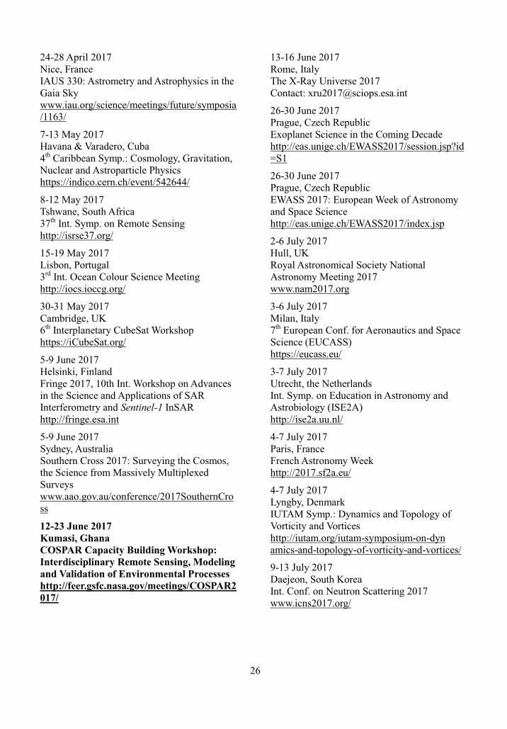
26
24-28 April 2017 Nice, France IAUS 330: Astrometry and Astrophysics in the Gaia Sky www.iau.org/science/meetings/future/symposia/1163/
7-13 May 2017 Havana & Varadero, Cuba 4th Caribbean Symp.: Cosmology, Gravitation, Nuclear and Astroparticle Physics https://indico.cern.ch/event/542644/
8-12 May 2017 Tshwane, South Africa 37th Int. Symp. on Remote Sensing http://isrse37.org/
15-19 May 2017 Lisbon, Portugal 3rd Int. Ocean Colour Science Meeting http://iocs.ioccg.org/
30-31 May 2017 Cambridge, UK 6th Interplanetary CubeSat Workshop https://iCubeSat.org/
5-9 June 2017 Helsinki, Finland Fringe 2017, 10th Int. Workshop on Advances in the Science and Applications of SAR Interferometry and Sentinel-1 InSAR http://fringe.esa.int
5-9 June 2017 Sydney, Australia Southern Cross 2017: Surveying the Cosmos, the Science from Massively Multiplexed Surveys www.aao.gov.au/conference/2017SouthernCross
12-23 June 2017 Kumasi, Ghana COSPAR Capacity Building Workshop: Interdisciplinary Remote Sensing, Modeling and Validation of Environmental Processes http://feer.gsfc.nasa.gov/meetings/COSPAR2017/
13-16 June 2017 Rome, Italy The X-Ray Universe 2017 Contact: [email protected]
26-30 June 2017 Prague, Czech Republic Exoplanet Science in the Coming Decade http://eas.unige.ch/EWASS2017/session.jsp?id=S1
26-30 June 2017 Prague, Czech Republic EWASS 2017: European Week of Astronomy and Space Science http://eas.unige.ch/EWASS2017/index.jsp
2-6 July 2017 Hull, UK Royal Astronomical Society National Astronomy Meeting 2017 www.nam2017.org
3-6 July 2017 Milan, Italy 7th European Conf. for Aeronautics and Space Science (EUCASS) https://eucass.eu/
3-7 July 2017 Utrecht, the Netherlands Int. Symp. on Education in Astronomy and Astrobiology (ISE2A) http://ise2a.uu.nl/
4-7 July 2017 Paris, France French Astronomy Week http://2017.sf2a.eu/
4-7 July 2017 Lyngby, Denmark IUTAM Symp.: Dynamics and Topology of Vorticity and Vortices http://iutam.org/iutam-symposium-on-dyn amics-and-topology-of-vorticity-and-vortices/
9-13 July 2017 Daejeon, South Korea Int. Conf. on Neutron Scattering 2017 www.icns2017.org/

27
9-14 July 2017 Sâo Paulo, Brazil 46th IUPAC World Chemistry Congress www.iupac2017.org
10-15 July 2017 Irkutsk, Russia 2nd VarSITI General Symp. (VarSITI-2017) http://varsiti2017.iszf.irk.ru
12-20 July 2017 Busan, Korea 35th Int. Cosmic Ray conf. www.icrc2017.org/
16-21 July 2017 San Diego, CA, USA 18th Int. Conf. on The Origin of Life www.hou.usra.edu/meetings/issol2017/
17-21 July 2017 Exeter, UK IAU Symp. 335: Space Weather of the Heliosphere, Processes and Forecasts www.iau.org/science/meetings/future/symposia/1190/
30 July-11 August 2017 Benasque, Spain Understanding Cosmological Observations http://benasque.org/general/cgi-bin/years. pl?ano=2017
1-5 August 2017 Rio de Janeiro, Brazil 38th IUPS Congress www.iups.org/congresses/2017-congress/
6-11 August 2017 Singapore 2017 Asia-Oceania Geosciences Soc. 14th Annual Meeting www.asiaoceania.org/society/public.asp?view=up_coming
19-26 August 2017 Montreal, Canada 32nd URSI Gen. Assembly and Scientific Symp. www.ursi.org
21-28 August 2017 Hyderabad, India 24th Congress of Int. Union of Crystallography www.iucr2017.org/
27 Aug.-1 Sept. 2017 Cape Town, South Africa IAPSO - IAMAS - IAGA joint Assembly www.iugg.org/IAGA/iaga_pages/assemblies/iaga_assemblies.htm
4-7 September 2017 Bonn, Germany Int. Conf. on Unmanned Aerial Vehicles 2017 http://uavg17.ipb.uni-bonn.de/
18-22 September 2017 Jeju Island, South Korea 3rd COSPAR Symposium: Small Satellites for Space Research Contact: [email protected]
18-22 September 2017 Wuhan, China ISPRS Geospatial Week 2017 www.isprs.org/
8-13 October 2017 St. Petersburg, Russia CODATA 2017 Conf.: Global Challenges and Data-Driven Science http://codata2017.gcras.ru
15-20 October 2017 Garmisch-Partenkirchen, Germany 7th Int. Fermi Symp. https://fermi.gsfc.nasa.gov/science/mtgs/symposia/2017/
6-17 November 2018 Taoyuan, Taiwan International Reference Ionosphere 2017 Capacity Building Workshop: Improved Real-Time Ionospheric Pre-dictions with COSMIC & other GNSS data https://sites.google.com/view/iri2017workshop-tw/home
14-22 July 2018 Pasadena, CA, USA 42nd COSPAR Scientific Assembly www.cospar-assembly.org
Dates TBC, 2020 Sydney, Australia 43rd COSPAR Scientific Assembly Contact: [email protected]

28
Meeting Announcements The International Symposium on Education in Astronomy and Astrobiology, 3-7 July 2017, Utrecht, the Netherlands The International Symposium on Education in Astronomy and Astrobiology (ISE2A) will be held in Utrecht, The Netherlands on 3-7 July 2017. This international symposium, co-sponsored by the International Astronomical Union (IAU) and the European Astrobiology Campus (EAC, http://astrobiology-campus.eu/), is designed to bring education research in astronomy in general, and in astrobiology in particular, to the professional scientific community.
Education has always played a large role in the field of astrobiology and in part this workshop is a follow-up to the successful International Workshop on Education in Astrobiology (IWEA) held in Höör, Sweden, in 2013 (www.nordicastrobiology.net/IWEA/). On the other hand, education research has seldom been the main subject in IAU events, yet the scientific results from this field have a great potential to improve the teaching and learning of astronomy for students of all ages. New results and research methodologies from the cognitive and learning sciences domains can, however, be of large influence on the work of educators but generally, professional astronomers are not fully aware of the results from astronomy education research.
With this first meeting in astronomy education and in combination with the growing sub-discipline astrobiology, we aim to strengthen both fields through cross teaching collaborations. The symposium is designed specifically to expand awareness of the results of the cognitive and learning sciences, as well as to provide a forum for active scholars in astronomy and astrobiology education.
For more information, see http://ise2a.uu.nl/.
Meeting Reports COSPAR Visiting Fellowship Capacity Building Report, Scripps Institution of Oceanography at University of California, San Diego, November 2016 [By Saat Mubarrok, Mulawarman University, Indonesia]
COSPAR Visiting Fellowship Capacity Building Programme enables young scientists who have been participants at one of the COSPAR Capacity Building workshops to build on skills gained at the workshop.
I took part in the Visiting Fellowship Capacity Building Programme from 4 November to 4 December 2016 which took place at Scripps Institution of Oceanography (SIO), University of California, San Diego (UCSD), one of the oldest and largest centres for ocean and Earth science research, public service, undergraduate and graduate training in the world.
In this programme, there is one orientation activity and three main activities. The first activity was the preparation agenda held by the International Office of the University of California, aimed at visiting scholars, post-doctoral students, researchers, and interns who will conduct research at UCSD so that they are prepared and adapted to the academic atmosphere on campus.
The first main programme activity involved conducting simple research about oceanography with a senior researcher as personal adviser and in this case, the topic of research was Argo Float Data Processing at Makassar Strait. The second programme activity involved visiting the laboratories around SIO, one of them the Argo laboratory, and the Pier, a 100-year-old building with oceanographic and atmospheric instruments, the main and the oldest pier-research building in the world. The last programme activity involved attending some weekly seminars held by the Climate, Atmospheric Sciences, and Physical Oceanography (CASPO) department, one of three programmes of Climate-Ocean-

29
Atmosphere Curricular Groups, besides Geosciences of the Earth, Oceans, and Planets, and Ocean Biosciences.
Figure 1. Dr. Janet Sprintall (right), senior researcher at Scripps Institution of Oceanography and my personal adviser during this programme, with many years experience and knowledge about Makassar Strait
The senior researcher who helped me as personal advisor during this programme was Dr. Janet Sprintall. She is a senior researcher working in the CASPO department whose main research interests are ARLINDO or Indonesia Trough Flow (ITF), El-Nino and El-Nina along Pacific Ocean, and sea-air interaction. Besides that, she is on one of the steering committees for US Research Vessel Revelle that is very active in collecting ocean field data in the Pacific Ocean.
Visiting Laboratories at Scripps Institution of Oceanography
During the programme, there were three laboratories that we visited: the Argo Laboratory, Pier—an off-shore laboratory—and the Center for Marine Biology and Biomedicine. The Argo and Spray Glider Laboratory is where Argo instruments are manufactured, from start to finish, and basic components are produced such as Argo tubes, batteries, processors, temperature sensors, salinity sensors, and depth sensors, to trial-error procedures, completing the Argo float, and planning to deploy at sea. This laboratory also collects salinity, temperature, and depth data and monitoring Argo positions using GPS
and satellite for 24 hours non-stop.
Another instrument that is interesting to see is the Spray Glider. Like Argo, the glider uses a buoyancy mechanism to move in the water, but with a horizontal movement, automatically. While Argo’s battery can last almost five years, the glider’s can only last four months. Figure 2 shows some Argo floats and components in maintenance at Argo Laboratory. Figure 3 shows a Glider ready to be deployed in the San Diego coastal area.
Figure 2 (top) Some Argo float components and (bottom) Dr. Michael McClune (right), senior technician who has monitored, maintained and researched Argo Floats for almost 15 years.
The second laboratory was the Pier (Figure 4), extending almost 300 m from the shore with 8- m legs with attached instruments. This Pier has a number of oceanography and meteorology instruments that measure some parameters continually for 24 hours. It also has meteorology instruments, for example anemometers, thermometers, hygrometers, light meters, rain gauges, etc.

30
Figure 3. Different but with similarities, the Spray Glider uses a buoyancy mechanism to move horizontally while Argo floats move vertically from the surface to deep layers; this Glider can move “freely” for almost four months before it needs to be recharged.
Figure 4. Scripps Beach San Diego with Pier about 300 m from coastal line
Oceanography instruments such as current meters, thermometers, tide gauges, wave gauges, in situ water pumps, etc., are continuously operated. This pier was built in 1916 using wood as its foundation and it has collected water quality data such as pH, density, temperature, brightness conventionally until the present day.
In 1988, the Pier was renovated from wood to concrete slabs and is now standing strong. There are a few small research vessels (for three or four people) that are usually used to deploy off-shore instruments like ADCP and are used by divers for scientific diving.
The third laboratory was the Center for Marine Biology and Biomedicine (CMBB). The main research of this lab is to transform material/natural beings from the ocean such as algae, seaweed, and sea grass into medicine that could replace current medicine. This laboratory also examines ocean ecosystems’ responses to climate change.
Climate, Atmospheric Sciences, and Physical Oceanography (CASPO) Department Weekly Seminar
These hour-long seminars are conducted by CASPO department every Wednesday. During this programme, there were seven seminars held in Neirenberg Hall in the main building of CASPO department. The speakers were invited professors, senior researchers, post-doctoral scholars, or guest lecturers. The speakers usually came from a prestigious school or university specialising in oceanography science. After the seminar, there was free time that was generally used by some participants to ask the speaker a question directly.
Dr. Bobby Arthur, from the University of California, Berkeley, was one of the guest lecturers, and he explained to participants his interest in internal wave energy dissipation at sea-slope area.

31
Figure 5. Temperature and salinity profiles versus depth, represented by pressures in decibars, at Sulawesi Sea; this Argo Float data assumed as representative of West Pacific Ocean water mass characteristics (Source: www.argodatamgt.org/Access-to-data/Argo-data-selection)
Short-term Research on Argo Float Data Processing at Makassar Strait
This research was conducted to see if water mass characteristic change was caused by mixing at Makassar Strait. To understand that, we saw a T-S diagram from Pacific Ocean water mass that flowed through the Makassar Strait and came out at the Indian Ocean. Three places have been observed: Sulawesi Sea, representing the Pacific Ocean water mass; the Makassar Strait or ITF; and the South Java Sea that represented the Indian Ocean water mass.
The comparison method between three T-S diagrams from 2004 until 2016 was used to see
the difference before and after passing through the Makassar Strait.
The programme that was used to plot the T-S diagram was MATLAB and the Argo Float data is free-access and can be downloaded at www.argodatamgt.org/Access-to-data/Argo-data-selection.
There were 18 Argo Float stations with many different profiles vertical in the Sulawesi Sea. The total number of profiles that were good enough to be used as T-S diagrams was 1,138 profiles, from 1 January 2004 to 1 October 2016.

32
Figure 6. Temperature and salinity profiles versus depth (represented by pressures in decibars) at Makassar Strait; this Argo Float data assumed as representative of Indonesian Sea water mass characteristics which have a lot of fresh water input from rivers and strong mixing caused by abrupt bathymetry changed driven tide-induced internal wave (Source: www.argodatamgt.org/Access-to-data/Argo-data-selection)
The minimum temperature value was 2.8°C with 2,000 m depth, and minimum salinity was about 34.32 psu at 300 m thermocline layer depth. Figure 5 shows temperature and salinity profiles between depths in the Sulawesi Sea (Mubarrok and Sprintall, manuscript in preparation).
Different in quantities, Makassar Strait only had four Argo Float stations in the 12 years between 2004 to 2016. The reason was that the west part of Makassar Strait’s shallow bathymetry blocked Argo Float movements, when submerged to 2,000 m depth, from the Pacific Ocean to the Indian Ocean through the Makassar Strait. There were only 119 vertical profiles inside those four Argos. Figure 6
shows temperature and salinity profiles between depths at the Makassar Strait, with salinity minimum about 32 psu and temperature minimum placed at 1,500 m depth, east part of Makassar Strait through Labani Channel. Whereas the South Java Sea has 33 Argo Float stations with 477 salinity and temperature profiles that had not yet been completed or data processed and were estimated to have small range salinity profiles caused by strong mixing and fresh water input from rivers along the coastal area in the Indonesian Seas especially the Makassar Strait (Mubarrok and Sprintall, manuscript in preparation).

33
IAUS 327 Fine Structure and Dynamics of the Solar Atmosphere, 9-14 October 2016, Cartagena, Colombia IAU Symposium 327 entitled Fine Structure and Dynamics of the Solar Atmosphere was the first IAU symposium held in Colombia and took place immediately after the XV Latin American Regional IAU Meeting (LARIM, 2-7 October 2016) and the First Workshop on
Astronomy Beyond the Common Senses for Accessibility and Inclusion (8 October 2016). The venue was the University of Cartagena located within the walled city of Cartagena de Indias.
The main scientific goal of this symposium was to discuss recent results in the processes shaping the structure of the solar atmosphere and driving plasma eruptions and explosive events.
Specific research topics covered by all the different conferences focused on:
� Advances in high-resolution solar observations
� Energy, mass and magnetic flux transport between the convection zone and the outer solar atmosphere
� Multi-scale magnetic reconnection: observations and theories
� Fine-structure of solar flares � Solar-stellar connection
� Fine structure and dynamics of active regions and sunspots
� Energy release and explosive events at the finest spatial and temporal scales
� Structure and dynamics of flux rope formation and eruption
� Wave phenomena and atmospheric dynamics
� Magnetic structure and dynamics of coronal holes and solar wind
� High energies - fine structure (Radio, X and gamma rays)
This symposium brought together researchers,

34
in both theory and observation.
A total of 76 scientists and students (27 female, 49 male) from 19 countries participated in IAUS327. COSPAR was a co-sponsor of the symposium and partially supported participation of students.
Letters to the Editor The following letter illustrates the value of collaboration and donations. A significant collaboration with, or gift to, people without the access to space assets that many of us enjoy, can make a real difference in bringing in communities and in encouraging interest in the sciences. This can only be beneficial to the future of our field. [General Editor].
African Astro-Science Project [from Sohan Jheeta, COSPAR Associate]
In November 2015 Dr. Sohan Jheeta, an independent researcher and science communicator, travelled to Africa to deliver
and instigate the inauguration of two brand-new telescopes (Celestron NexStar Evolution 8 with StarSense AutoAlign), NexImage colourburst cameras and Android tablets. These generous donations were made to Copperbelt University (CBU), Kitwe, Zambia and Chancellor College, University of Malawi, Zomba, as part of his on-going collaboration to further promote and advance the study of astronomy and related sciences in Zambia and Malawi. The telescopes work with a Global Positioning Satellite application so that they can track and identify objects in the sky, which will make learning more fascinating and rewarding, as students can view planets, stars, galaxies and dark molecular clouds, as well as carry out astrophotography and study sun spots. The equipment is being used for educational purposes both by school pupils as well as university students; thus, these telescopes are inspiring young people to pursue scientific studies, progressing their own careers in the sciences and hopefully forging contacts with agencies like NASA and ESA, so that they can become players on the global stage.
Sohan Jheeta with students and staff from Copperbelt University, Zambia

35
To help build on this Dr Jheeta has also made available funds for students and postdocs from developing nations to take part in scientific conferences organised by networks such the International Society for the Study of the Origin of Life (ISSOL), the European Astrobiology Networks Association (EANA), the Astrobiology Society of Britain (ASB) and the Network of Researchers on Horizontal Gene Transfer and the Last Universal Common Ancestor (NoR HGT & LUCA). More information about Dr. Jheeta’s work can be found by visiting www.sohanjheeta.com.
Newton Versus Einstein in 21st Century [from Dileep V. Sathe, COSPAR Associate and retired school teacher, India]
The UK Institute of Physics has made a suggestion that the public can be involved in scientific disputes, like the dispute between Big Bang theory and Steady State theory of the universe, (http://blog.physicsworld.com/2015/ 07/14/settling-scientific-disputes-in-public/). I am therefore interested in involving participants of this event in an unsettled dispute on the nature of the Space-Time Continuum (STC), see my comments dated:30 November 2015 on the following website: http://physicsworld.com/cws/article/multimedia/2015/nov/25/what-is-einsteins-general-theory-of-relativity#comments.
The dispute was between a leading general relativity scientist and a common man from the audience. The common man wanted to know the exact nature of the STC and leader was repeatedly saying Space and Time merge forming STC.
(Left hand image credit: ESA, C.Carreau)
In my opinion, the said dispute is like the dispute between Newton and Einstein because
the common man knows Newton’s laws of motion and the law of universal gravitation, and Einstein’s theory does not have gravitational force but the STC and planets move on it. In addition, we all feel/sense gravitational force at anytime, anywhere but we do not have organs for sensing space and time. That is why we can measure part of space (that is volume) if there is matter occupying that part of space. And, for measurement of time we need a clock. There are some probable questions which Newton can pose to Einstein, only two are given below.
1) Question regarding STC and ghosts: The STC and a ghost are both non-sensible that is why technicians of a horror movie make a ghost using some exotic material or illusion, and teachers of relativity also some flexible material (trampoline) and a sphere to show the warping of STC forming the gravity well. So the question is: Why do physicists believe only in Einstein’s STC BUT NOT in a ghost? Either they should believe in both or they should not believe in both.
2) Need of two photos: The discovery of gravitational waves, reported in February 2016, is based on the ripples caused by incoming wave on the STC. If this is so, then discoverers have to show two photos, one photo of STC, before the arrival of a gravitational wave–that is without ripples—and other photo after the arrival of a wave causing ripples on the STC. But every claim of the last year showed only one photo.
Publications
Advances in Space Research (ASR): Top Reviewers of 2016 Advances in Space Research (ASR), as with any established scientific journal, insists on a rigorous peer-review process to maintain the integrity and quality of its published papers. An essential part of this process is the reviewer, spending his or her time using unique expertise to evaluate the scientific
36
quality of a manuscript and help the Editor make a fair and timely decision.
To further highlight the vital importance of reviewers for ASR quality, the Editors have selected their 10 top reviewers for the year 2016, taking into account criteria such as the number and the quality of the referee reports performed during this year. By publishing the names and short biographies of these selected reviewers in this issue of Space Research Today, we would like to acknowledge their valuable efforts. As an additional token of appreciation, these reviewers are offered an Amazon voucher by Elsevier. Their names will also be acknowledged on the journal homepage of ASR.
We also feel deeply obliged to all ASR reviewers who have contributed this past year who are not mentioned here, and we sincerely thank all of them for bringing the journal up to its current scientific standard.
Pascal Willis, ASR Editor-in-Chief
José Stoop, ASR Publisher (Elsevier)
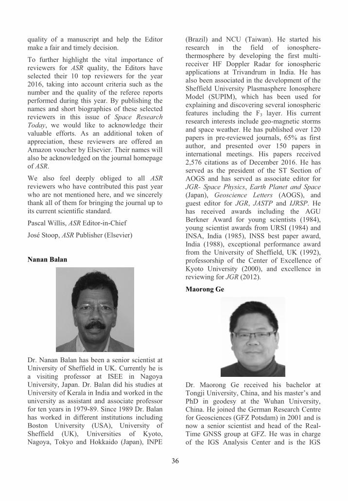
Nanan Balan
Dr. Nanan Balan has been a senior scientist at University of Sheffield in UK. Currently he is a visiting professor at ISEE in Nagoya University, Japan. Dr. Balan did his studies at University of Kerala in India and worked in the university as assistant and associate professor for ten years in 1979-89. Since 1989 Dr. Balan has worked in different institutions including Boston University (USA), University of Sheffield (UK), Universities of Kyoto, Nagoya, Tokyo and Hokkaido (Japan), INPE
(Brazil) and NCU (Taiwan). He started his research in the field of ionosphere-thermosphere by developing the first multi-receiver HF Doppler Radar for ionospheric applications at Trivandrum in India. He has also been associated in the development of the Sheffield University Plasmasphere Ionosphere Model (SUPIM), which has been used for explaining and discovering several ionospheric features including the F3 layer. His current research interests include geo-magnetic storms and space weather. He has published over 120 papers in pre-reviewed journals, 65% as first author, and presented over 150 papers in international meetings. His papers received 2,576 citations as of December 2016. He has served as the president of the ST Section of AOGS and has served as associate editor for JGR- Space Physics, Earth Planet and Space (Japan), Geoscience Letters (AOGS), and guest editor for JGR, JASTP and IJRSP. He has received awards including the AGU Berkner Award for young scientists (1984), young scientist awards from URSI (1984) and INSA, India (1985), INSS best paper award, India (1988), exceptional performance award from the University of Sheffield, UK (1992), professorship of the Center of Excellence of Kyoto University (2000), and excellence in reviewing for JGR (2012).
Maorong Ge
Dr. Maorong Ge received his bachelor at Tongji University, China, and his master’s and PhD in geodesy at the Wuhan University, China. He joined the German Research Centre for Geosciences (GFZ Potsdam) in 2001 and is now a senior scientist and head of the Real-Time GNSS group at GFZ. He was in charge of the IGS Analysis Center and is the IGS

37
Real-time Analysis Center at GFZ. His research interests are GNSS algorithms and software development.
Gerard Gómez
Gerard Gómez received his PhD in mathematics from the Universitat Autònoma de Barcelona (Catalunya) in 1981, under the supervision of Prof. Carles Simó. Since 1988 he has been Full Professor of applied mathematics at the Universitat de Barcelona. He is Associate Editor of Celestial Mechanics and Dynamical Astronomy and member of the Reial Acadèmia de Ciències i Arts de Barcelona. His research areas are celestial mechanics and astrodynamics, and he has been pioneer in the introduction of dynamical systems tools in astrodynamics and their application in several mission design problems
John Bosco Habarulema
John Bosco Habarulema graduated with a PhD in space physics from Rhodes University, South Africa in 2011. His research work involves understanding and modelling the temporal and spatial variations of ionospheric parameters such as electron density, vertical drifts and total electron content (TEC); low latitude ionospheric electrodynamics;
ionospheric storm effects; and monitoring travelling ionospheric disturbances, especially during geomagnetic storm conditions. He is currently a researcher within the Science Research and Applications Group of the South African National Space Agency (SANSA), Hermanus, South Africa. He is passionate about students' training and supervision in space physics.
Amir Khodabandeh
Amir Khodabandeh received his PhD degree (with distinction) in geodesy and global navigation satellite systems (GNSS) from Curtin University, Perth, Australia in 2015. He is currently working as a Research Fellow with the GNSS Research Centre, Curtin University. He is the Chair of the IAG–ICCT Joint Study Group “Multi GNSS Theory and Algorithms” and a member of the IAG Working Group “Ionospheric and Tropospheric Impact on GNSS Positioning.” His research interests include estimation theory, GNSS precise positioning, and GNSS quality control.
Jacek Paziewski
PhD Jacek Paziewski is an assistant professor at the University of Warmia and Mazury
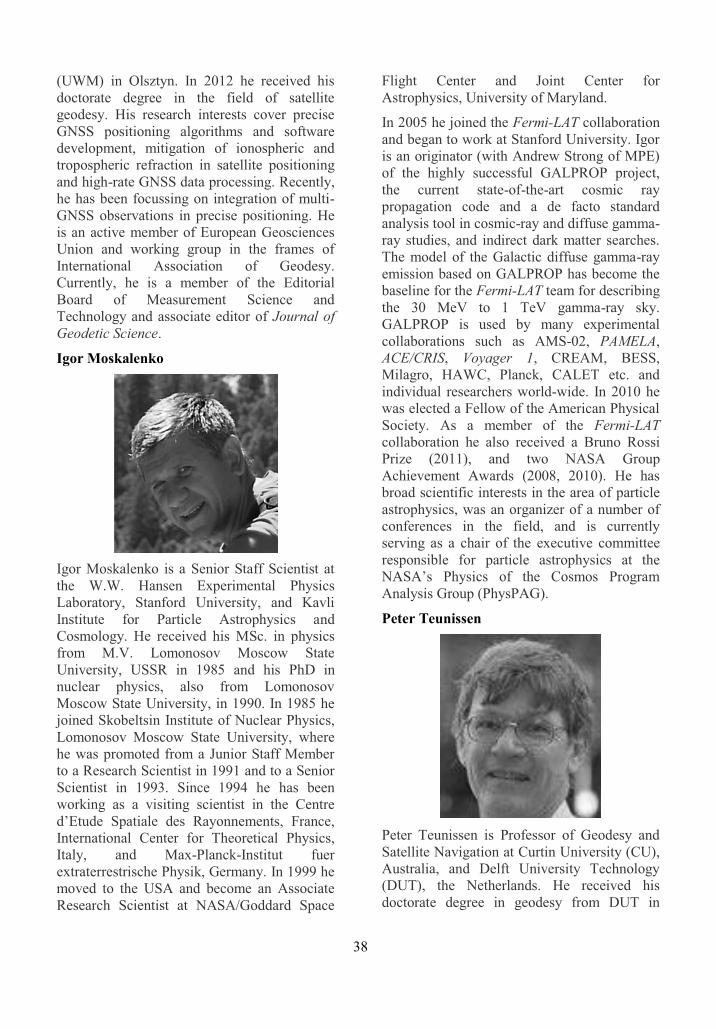
38
(UWM) in Olsztyn. In 2012 he received his doctorate degree in the field of satellite geodesy. His research interests cover precise GNSS positioning algorithms and software development, mitigation of ionospheric and tropospheric refraction in satellite positioning and high-rate GNSS data processing. Recently, he has been focussing on integration of multi-GNSS observations in precise positioning. He is an active member of European Geosciences Union and working group in the frames of International Association of Geodesy. Currently, he is a member of the Editorial Board of Measurement Science and Technology and associate editor of Journal of Geodetic Science.
Igor Moskalenko
Igor Moskalenko is a Senior Staff Scientist at the W.W. Hansen Experimental Physics Laboratory, Stanford University, and Kavli Institute for Particle Astrophysics and Cosmology. He received his MSc. in physics from M.V. Lomonosov Moscow State University, USSR in 1985 and his PhD in nuclear physics, also from Lomonosov Moscow State University, in 1990. In 1985 he joined Skobeltsin Institute of Nuclear Physics, Lomonosov Moscow State University, where he was promoted from a Junior Staff Member to a Research Scientist in 1991 and to a Senior Scientist in 1993. Since 1994 he has been working as a visiting scientist in the Centre d’Etude Spatiale des Rayonnements, France, International Center for Theoretical Physics, Italy, and Max-Planck-Institut fuer extraterrestrische Physik, Germany. In 1999 he moved to the USA and become an Associate Research Scientist at NASA/Goddard Space
Flight Center and Joint Center for Astrophysics, University of Maryland.
In 2005 he joined the Fermi-LAT collaboration and began to work at Stanford University. Igor is an originator (with Andrew Strong of MPE) of the highly successful GALPROP project, the current state-of-the-art cosmic ray propagation code and a de facto standard analysis tool in cosmic-ray and diffuse gamma-ray studies, and indirect dark matter searches. The model of the Galactic diffuse gamma-ray emission based on GALPROP has become the baseline for the Fermi-LAT team for describing the 30 MeV to 1 TeV gamma-ray sky. GALPROP is used by many experimental collaborations such as AMS-02, PAMELA, ACE/CRIS, Voyager 1, CREAM, BESS, Milagro, HAWC, Planck, CALET etc. and individual researchers world-wide. In 2010 he was elected a Fellow of the American Physical Society. As a member of the Fermi-LAT collaboration he also received a Bruno Rossi Prize (2011), and two NASA Group Achievement Awards (2008, 2010). He has broad scientific interests in the area of particle astrophysics, was an organizer of a number of conferences in the field, and is currently serving as a chair of the executive committee responsible for particle astrophysics at the NASA’s Physics of the Cosmos Program Analysis Group (PhysPAG).
Peter Teunissen
Peter Teunissen is Professor of Geodesy and Satellite Navigation at Curtin University (CU), Australia, and Delft University Technology (DUT), the Netherlands. He received his doctorate degree in geodesy from DUT in

39
1985. He is the inventor of the LAMBDA method and has 25 years of experience in the field of satellite navigation. He currently heads CU’s GNSS Research Centre where his team’s research is on developing theory, models and algorithms for high-accuracy geospatial applications of new global and regional satellite navigation systems. The focus is hereby on developing carrier-phase based precise positioning concepts for use in the Australian national positioning infrastructure. He has authored numerous journal papers and various textbooks in his field. He serves on the editorial boards of several journals and he is past Editor-in-Chief of the Journal of Geodesy. He has an Honorary Doctorate from the Chinese Academy of Sciences and is a Fellow of the International Association of Geodesy (IAG), the US Institute of Navigation (ION), the UK Royal Institute of Navigation (RIN) and the Royal Netherlands Academy of Sciences (KNAW).
Yuri I. Yermolaev
Yuri I. Yermolaev is head of the Solar Wind Laboratory in the Space Plasma Department of the Space Research Institute (IKI), Russian Academy of Science (RAS), Moscow, Russia. He graduated from Moscow Institute of Physics and Technology (MIPT), Russia in 1978. He received his PhD degree in experimental physics from IKI, in 1989, and his habilitation (doctor’s degree) in space physics in 2003. He participated in experiments on satellites of Prognoz series, and in space projects Intershock and Interball. His research interests include: solar wind large-scale structures, in particular inter-planetary coronal mass ejections and
compression regions ahead them, corotating interaction regions, and long-term variations; solar wind fine-scale structures, in particular turbulence, discontinues, and shocks; the magnetosphere and its structure and boundaries; and geomagnetic storms. He is member of Scientific Discipline Rep-resentatives of SCOSTEP, member of the Solar-Terrestrial Physics Section of Space Council of RAS, and member of editorial boards of Geomagnetism and Aeronomy, and Solar-Terrestrial Physics journals.
Man-Lian Zhang
Man-Lian Zhang graduated from the Institute of Geophysics & the Graduate School of the Chinese Academy of Sciences (CAS) and got her MSc degree in October 1987, majoring in space physics. She then worked in the same institute for two years before going to Trieste, Italy in 1989 where she had been working until the end of 1997 in the Aeronomy and Radio Propagation Laboratory (ARPL) of the Abdus Salam International Center for Theoretical Physics under Prof. Sandro M. Radicella’s direction. Her research there was mainly related to the study of the ionospheric variability and the modelling of the ionosphere. In the year 2000, she became an associate professor in the ionospheric research group of the Laboratory for Space Weather, Center for Space Sciences and Applied Research, CAS. Since July 2006, she has been working on ionospheric physics in the division of geomagnetism and space physics, at the Institute of Geology and Geophysics, CAS. She is a member of the URSI/COSPAR International Reference Ionosphere (IRI) Working Group. Areas of her current interests

40
include: empirical modelling (experimental data analysis, models validation, regional and global modelling, etc.) on ionospheric and plasmaspheric parameters; variations of the ionosphere-plasmasphere and their responsible mechanisms as well as their effects on satellite navigation and positioning.
Submissions to Space Research Today Anyone may submit an article or news item to SRT and, in the spirit of a bulletin publication, we aim to be as flexible as possible in the submission procedures. Submission should be made in English, by e-mail to any member of the Editorial Team (see inside front cover for contact details).
� Submissions may be made in the following formats:
o E-mail text (especially appropriate for short news or information items)
o Word files with embedded images (in colour or greyscale)
o Other formats can be considered; please contact the editorial team with your request.
� Deadlines: 1 February for the April issue, 1 June for the August issue, and 1 October for the December issue.
The editors will always be pleased to receive the following types of inputs or submissions, among others:
o Research Highlight articles – generally substantial, current review articles that can be expected to be of interest to the general space community, extending to over five pages or so (ca. 1200-1500 words with figures and images – which may be in colour). These submissions should include a brief, one paragraph statement ‘About the Author’ and be accompanied by an image of the author.
o Research Notes – short research announcements, up to three or four pages, with images as appropriate.
o News and Views, and ‘In Brief’ items – short announcements and news items (generally amounting to one page or less).
o In Memoriam submissions – Articles extending to a few pages, including an image, about a significant figure in the COSPAR community.
o Letters to the Editor – up to two or three pages on any subject relevant to COSPAR and space research in general. Meeting announcements, meeting reports and book reviews.
o Space Snapshots: single page submissions, usually of one image, a brief explanation, plus title and authors.
Articles are not refereed, but the decision to publish is the responsibility of the General Editor and his editorial team.
Advances in Space Research Call for Papers, Special Issues: Advances in Technologies, Missions and
Applications of Small Satellites
Deadline: 31 May 2017.
Manuscript submission:
http://ee.elsevier.com/asr

41
Launch list SATELLITE AND SPACE PROBE LAUNCHES (6 August – 28 December 2016)
(The source of information for satellites 2016-048A to 2016-083C is the ESA/ESOC DISCOS database.)
__________________________________________________________________________________ COSPAR Designation Launch Date Launch Site Launch Vehicle Initial Orbital Elements ----------------------------- --------------------------------- --------------------------------------------------- National Name [Life Time] / (Descent Date) Apogee Perigee Incl. Period (km) (km) (deg) (min) _______________________________________________________________________________________________________________________________________________________ 2016-048A 6 August Xichang (CN) Long March (CZ) 3B 35795 35777 4.97 1436.08 Tiantong-1 01 [> 1M yrs] First Chinese geostationary mobile civil communications satellite, supporting a network operated by China Telecom. The satellite was built by CAST and is operated by China Satcom. 2016-049A 9 August Taiyuan (CN) Long March (CZ) 4C 748 737 98.42 99.67 Gao Fen 3 [300 yrs] High resolution radar imaging satellite launched for the state-sponsored program known as the China High-definition Earth Observation System (CHEOS). The satellite will be used for civil applications, including environmental monitoring and disaster warning, according to state media. 2016-050A 14 August Kennedy SC (US) Falcon 9 v1.2 35801 35772 0.03 1436.12 JCSAT 16 [> 1M yrs] Japanese television broadcast satellite for JCSAT, serving as on-orbit spare. 2016-051A 15 August Jiuquan (CN) Long March (CZ) 2D 501 489 97.36 94.53 Mozi hao [6 yrs] Chinese quantum experiment science civil technology satellite to test quantum-entanglement cryptographic communications. 2016-051B 15 August Jiuquan (CN) Long March (CZ) 2D 503 486 97.37 94.52 3Cat-2 [6 yrs] Spanish CubeSat from Universitat Politecnica de Catalunya, with PYCARO GNSS-reflection altimeter, the experimental Start Tracker Mirabelis, and the AMR eLISA magnetometer designed and manufactured at IEEC for ESA's future LISA mission. 2016-051C 15 August Jiuquan (CN) Long March (CZ) 2D 540 217 97.40 92.14 Lixing 1 (19 August) Chinese civil atmospheric research satellite, manoeuvered to very low orbital altitudes. 2016-052A 19 August Kennedy SC (US) Delta 4M+(4,2) 0 0 0.00 0.00 USA 270 [nk] USAF defence space surveillance payload in near-geostationary orbit to study high orbit satellite population. 2016-052B 19 August Kennedy SC (US) Delta 4M+(4,2) 0 0 0.00 0.00 USA 271 [nk] USAF defence space surveillance payload in near-geostationary orbit to study high orbit satellite population. 2016-053A 24 August Guiana SC (FR) Ariane 5ECA 35790 35725 0.06 1434.63 Intelsat IS-36 [> 1M yrs] Backup US commercial communications satellite to IS-20, for video distribution in Africa and Asia, carrying 34 Ku-band and 10 C-band transponders. 2016-053B 24 August Guiana SC (FR) Ariane 5ECA 35878 27997 0.11 1244.03 Intelsat IS-33e [> 1M yrs] Second US Intelsat commercial communications satellite in the Epic series for broadband data relay. It will replace the Intelsat 904 spacecraft at 60° E. It is fitted with more than 70 beams and the equivalent of 269 Ku-band and C-band transponders. 2016-054A 8 September Sriharikota SC (IN) GSLV Mk II 36021 35401 0.13 1432.26 INSAT-3DR [> 1M yrs] INSAT-3DR was developed by ISRO and designed to provide civil meteorological observation and monitoring of land/ocean surfaces.

42
2016-055A 8 September Kennedy SC (US) Atlas V 411 0 0 0.00 0.00 OSIRIS-REx [nk] NASA's Origins, Spectral Interpretation, Resource Identification, Security-Regolith Explorer asteroid sample return mission (OSIRIS-REx), is the first US civil planetary mission to collect a sample of an asteroid and return it to Earth for study. Analysing the sample will help scientists understand the early solar system, as well as the hazards and resources of near-Earth space. In August 2018, OSIRIS-REx's approach to Bennu will begin. The spacecraft will briefly touch the surface of Bennu to retrieve a sample. In March 2021, OSIRIS-REx will begin its return journey to Earth, arriving in September 2023. 2016-056A 13 September Palmachim AFB (IL) Shavit 594 341 142.53 93.97 Ofeq 11 [nk] An Israeli defence reconnaissance satellite featuring an advanced panchromatic camera and possibly a multispectral imaging payload. 1998-067KH 15 September 409 397 51.65 92.64 Flock 2e'-13 [4 yrs] US-based Planet (formerly PlanetLabs) CubeSat with commercial imaging payload. 1998-067KJ 15 September 409 397 51.64 92.64 Flock 2e'-14 [4 yrs] US-based Planet (formerly PlanetLabs) CubeSat with commercial imaging payload. 1998-067KK 15 September 409 398 51.64 92.65 Flock 2e'-16 [4 yrs] US-based Planet (formerly PlanetLabs) CubeSat with commercial imaging payload. 1998-067KL 15 September 408 399 51.65 92.64 Flock 2e'-15 [4 yrs] US-based Planet (formerly PlanetLabs) CubeSat with commercial imaging payload. 1998-067KN 15 September 408 398 51.64 92.63 Flock 2e'-17 [4 yrs] US-based Planet (formerly PlanetLabs) CubeSat with commercial imaging payload. 1998-067KP 15 September 409 398 51.64 92.64 Flock 2e'-20 [4 yrs] US-based Planet (formerly PlanetLabs) CubeSat with commercial imaging payload. 2016-057A 15 September Jiuquan (CN) Long March (CZ) 2F 373 197 42.79 90.23 Tiangong-2 [4 yrs] Tiangong-2 is the second Chinese experimental civil space station. The module will be used for "testing systems and processes for mid-term space stays and refuelling" and will house experiments in medicine and various space-related technologies. 2016-057H 15 September Jiuquan (CN) Long March (CZ) 2F 384 374 42.79 92.14 Banxing-2 [5 yrs] Small Chinese civil technology satellite released by Tiangong-2 to image the complex. 1998-067KM 16 September 408 398 51.64 92.63 Flock 2e'-18 [4 yrs] US-based Planet (formerly PlanetLabs) CubeSat with commercial imaging payload. 2016-058A 16 September Guiana SC (FR) Vega 680 676 98.21 98.31 PeruSat 1 [250 yrs] PeruSat 1 is a Peruvian defence imaging reconnaissance satellite built by Airbus Defence and Space under contract with the Peruvian government from 2014. The satellite is based on the reliable AstroBus-S platform with a mass of 450 kg, equipped with a 1-meter panchromatic imager and a 2-meter imager operating in 4 spectral bands. The satellite will provide high resolution imaging for the Peruvian military forces. 2016-058B 16 September Guiana SC (FR) Vega 502 498 97.41 94.62 SkySat 6 [15 yrs] A US commercial Earth observation satellite by Skybox Imaging, licensed to collect high resolution panchromatic and multispectral images of the Earth. 2016-058C 16 September Guiana SC (FR) Vega 509 498 97.45 94.70 SkySat 7 [15 yrs] A US commercial Earth observation satellite by Skybox Imaging, licensed to collect high resolution panchromatic and multispectral images of the Earth.

43
2016-058D 16 September Guiana SC (FR) Vega 501 501 97.42 94.65 SkySat 4 [15 yrs] A US commercial Earth observation satellite by Skybox Imaging, licensed to collect high resolution panchromatic and multispectral images of the Earth. 2016-058E 16 September Guiana SC (FR) Vega 502 501 97.42 94.65 SkySat 5 [15 yrs] A US commercial Earth observation satellite by Skybox Imaging, licensed to collect high resolution panchromatic and multispectral images of the Earth. 1998-067KQ 17 September 408 398 51.64 92.63 Flock 2e'-19 [4 yrs] US-based Planet (formerly PlanetLabs) CubeSat with commercial imaging payload. 2016-059A 26 September Sriharikota SC (IN) PSLV 720 660 98.27 98.58 Pratham [150 yrs] Pratham is an Indian amateur science satellite developed under a plan to build a fully functional microsatellite in less than three years launched by ISRO (Indian Space Research Organization). It is entirely a student initiative with mentorship provided by ISRO scientists and IIT Bombay Faculty. It has a scatterometer payload to monitor ocean winds 2016-059B 26 September Sriharikota SC (IN) PSLV 705 660 98.20 98.42 PISat [150 yrs] PISat is a low cost Indian amateur imaging nanosatellite, designed and developed at the Crucible of Research and Innovation Laboratory of PESIT (PES Institute of Technology), Bangalore, India. The PISat project actually consists of a consortium of Indian colleges, with the support of ISRO (Indian Space Research Organisation) and IE (Institution of Engineers) of India, to provide a hands-on environment for students in all aspects of satellite building and operations. PISat carries an imaging payload. 2016-059C 26 September Sriharikota SC (IN) PSLV 704 661 98.21 98.41 AlSat-1B [150 yrs] AlSat-1B is based on the SSTL-100 platform, and flies a 24 m multispectral imager and a 12 m panchromatic imager delivering images with a swath width of 140 km. The Algerian civil imaging satellite carries two high speed data recorders and two flash mass memory units capable of recording, managing and storing image data for high speed downlink via S-Band and X-Band transmitters. The Algerian Space Agency ASAL will process the Earth observation data from AlSat-1B for agricultural and resource monitoring, disaster management, land use mapping and urban planning. 2016-059D 26 September Sriharikota SC (IN) PSLV 703 661 98.21 98.41 AlSat-2B [150 yrs] AlSat-2B is an Algerian imaging satellite, integrated in Algeria within the small satellite development centre (UDPS) in Oran. AlSat-2 is equipped with NAOMI (New AstroSat Optical Modular Instrument), a latest-generation payload capable of supplying images with a resolution of 2.5 meters in panchromatic mode and 10 meters in each of four colour bands in multispectral mode. The CNTS, affiliated with the Algerian Space Agency, will be responsible for managing the AlSat-2 programme and operating the satellite system. 2016-059E 26 September Sriharikota SC (IN) PSLV 702 661 98.20 98.40 BlackSky [150 yrs] First US satellite for BlackSky commercial imaging constellation. 2016-059F 26 September Sriharikota SC (IN) PSLV 701 661 98.21 98.39 CanX-7 [150 yrs] CanX-7 is a Canadian demonstration mission involving a nanosatellite that will incorporate a lightweight, compact, deployable drag sail under development at SFL. The mission is funded by Defence R&D Canada (Ottawa), NSERC and COM DEV Ltd. The amateur technology mission will demonstrate the drag sail’s customisability, modularity, stowability and effectiveness at achieving deorbiting. The results will then be used to create a low cost, modular, and customisable deorbiting device for nanosatellites and microsatellites in low Earth orbit, thus alleviating the programmatic and technical risk to space missions when using satellites of this class. 2016-059G 26 September Sriharikota SC (IN) PSLV 699 661 98.20 98.37 AlSat-1N [150 yrs] AlSat-1N, also known as AlSat-Nano, is an Algerian three-unit civil imaging CubeSat built by the Surrey Space Center and operated by the Algerian Space Agency and UK Space Agency for the demonstration of new technologies for use on future small satellite missions. AlSat-1N has been designed and built as part of an education programme given by the Surrey Space Center to Algerian students to gain hands-on experience in the operation of a satellite mission. The UK Space Agency has provided the funds for the design and construction of the platform hardware while ASAL was in charge of final integration, testing and launch acquisition. 2016-059H 26 September Sriharikota SC (IN) PSLV 732 718 98.10 99.31 SCATSAT-1 [150 yrs] SCATSAT-1 is an Indian continuity mission for Oceansat-2 Scatterometer (OCSAT-2) to provide continuity of data required for weather forecasting services, generate wind vector products for weather forecasting, cyclone detection and tracking services to the users. The civil science spacecraft carries the Ku-band OSCAT-2 Scatterometer similar to the OSCAT payload flown onboard Oceansat-2, but features several improvements in hardware and for the onboard signal processor and control software. OCSAT-2 is a pencil beam wind scatterometer operating at Ku-band of 13.515 GHz. The spacecraft is built around standard IMS-2 Bus. The mission life of the satellite is five years. 2016-060A 5 October Guiana SC (FR) Ariane 5ECA 35805 35293 0.12 1424.00 GSAT-18 [> 1M yrs] GSAT-18 is an Indian civil communication satellite which will provide replacement capacity supporting the existing television, telecommunication, Digital Satellite News Gathering (DSNG) and VSAT services in the country. It will also augment and support the existing telecommunication, television, DSNG and VSAT services.

44
2016-060B 5 October Guiana SC (FR) Ariane 5ECA 35853 35832 0.05 1438.98 Sky Muster II [> 1M yrs] Produced by SSL (Space Systems Loral) for operator NBN Co (Australia), Sky Muster II is an Australian commercial communications satellite that will help extend high-speed internet across Australia, including the country’s rural and isolated regions. 2016-061A 16 October Jiuquan (CN) Long March (CZ) 2F 366 334 42.78 91.55 Shenzhou-11 [nk] Shenzhou-11 is a Chinese civil spaceship to deliver two astronauts to Tiangong-2 lab, Commander Jing Haipeng and Pilot Chen Dong. The main objective of the mission is docking with the Tiangong-2 orbital module. After a successful docking, the crew will enter its new orbital house for a residency of 30 days, allowing for a full mission duration of 33 days. Experiments onboard include ultrasound inspection experiments, cardiopulmonary function, samples and plant cultivation, as well as orbital repair experiments. 2016-062A 17 October MARS (US) Antares 230 352 217 51.61 90.22 Cygnus CRS-5 [nk] Cargo is delivered to the station using Orbital ATKs Cygnus commercial spacecraft. The US Cygnus spacecraft consists of two modules: the Service Module (SM) which incorporates the avionics, propulsion and power systems from Orbital ATKs flight-proven LEOStar and GEOStar spacecraft buses; and the Pressurized Cargo Module (PCM) which carries the crew supplies, spares and scientific experiments. 2016-063A 19 October Baikonur (KZ) Soyuz-FG 306 289 51.64 90.48 Soyuz MS-02 [nk] The Russian Soyuz MS-02 civil spacecraft lifted off from the Baikonur Cosmodrome at 08:05 GMT on 19 October to begin a two-day orbital rendezvous with the International Space Station. The Soyuz MS-02 crew will spend a little more than four months aboard the orbital lab working on hundreds of experiments in biology, biotechnology, physical science and Earth science before returning to Earth in late February. As with all Soyuz missions, MS-02 transported three new crewmembers up to the ISS replacing the previous subset of three crewmembers who departed the station as planned back in September. Commanding the Soyuz MS-02 was first-time space flyer Sergey Nikolayevich Ryzhikov, joined by Andrei Borisenko from the Russian Federal Space Agency and NASA astronaut R. Shane Kimbrough. 2016-064A 2 November Tanegashima SC (JP) H-IIA 202 35793 35780 0.01 1436.11 Himawari-9 [> 1M yrs] Japanese government civil weather satellite. 2016-065A 3 November Wenchang (CN) Long March (CZ) 5/YZ 35790 35771 0.82 1435.79 Shi Jian 17 [> 1M yrs] Chinese experimental civil communications satellite. Test payload on first CZ-5 launch. 2016-066A 9 November Jiuquan (CN) Long March (CZ) 11 512 493 97.41 94.68 XPNAV-1 [8 yrs] Chinese civil technology satellite XPNAV-1 (or Maichong Xing Shiyan Weixing) is the world's first dedicated pulsar navigation test satellite, aiming to prove technologies that are needed to take navigation and timing to a stellar level. Pulsar navigation makes use of the ultra-regular X-ray emissions from pulsars for spacecraft navigation which provides great promise for future deep space navigation. 2016-066B 9 November Jiuquan (CN) Long March (CZ) 11 511 492 97.40 94.66 Lishui-1 [7 yrs] Lishui-1 is a 1U Chinese remote sensing commercial imagine CubeSat owned by Zhejiang LiYi Electronic Technology Co. 2016-066D 9 November Jiuquan (CN) Long March (CZ) 11 511 491 97.41 94.65 Xiaoxiang-1 [8 yrs] Xiaoxiang-1 is a 6U Chinese amateur technology CubeSat testing precise attitude control, from the Changsha Gaoxingqu Tianyi Research Institute. 2016-066F 9 November Jiuquan (CN) Long March (CZ) 11 1033 504 98.79 100.23 Pina-2 01 [20 yrs] Chinese commercial technology picosatellite from Beijing Aerospace DFH Co. (details are unknown). 2016-066G 9 November Jiuquan (CN) Long March (CZ) 11 995 503 98.79 99.82 Pina-2 02 [20 yrs] Chinese commercial technology picosatellite from Beijing Aerospace DFH Co. (details are unknown). 2016-067A 11 November Vandenberg AFB (US) Atlas V 401 613 609 97.97 96.93 WorldView-4 [100 yrs] US commercial imaging WorldView-4 (formerly known as GeoEye-2) will provide DigitalGlobe's customers with high resolution and colour imagery to commercial, government and international customers. 2016-067B 11 November Vandenberg AFB (US) Atlas V 401 582 576 97.97 96.26 RAVAN [15 yrs] RAVAN (Radiometer Assessment using Vertically Aligned Nanotubes) is a US civil technology CubeSat by Johns Hopkins APL to demonstrate an instrument to measure Earth's radiation budget.

45
2016-067C 11 November Vandenberg AFB (US) Atlas V 401 581 575 97.98 96.23 CELTEE [15 yrs] CELTEE (CubeSat Enhanced Locator Transponder Evaluation Experiment 1) is a US defence technology CubeSat to demonstrate a transponder for tracking small satellites. 2016-067D 11 November Vandenberg AFB (US) Atlas V 401 585 574 97.98 96.27 Opticube 04 [30 yrs] Opticube 04 is a US 2U passive defence calibration CubeSat by California Polytechnic State University for calibrating ground sensors for orbital debris studies. 2016-067E 11 November Vandenberg AFB (US) Atlas V 401 585 575 97.98 96.28 Aerocube 8D [15 yrs] Aerocube 8D (or IMPACT) is a US commercial technology CubeSat by the Aerospace Corporation, which tests electric propulsion technology, nanotechnology, and solar cell technology. 2016-067F 11 November Vandenberg AFB (US) Atlas V 401 586 576 97.98 96.29 Aerocube 8C [15 yrs] Aerocube 8C (or IMPACT) is a US commercial technology CubeSat by the Aerospace Corporation, which tests electric propulsion technology, nanotechnology, and solar cell technology. 2016-067G 11 November Vandenberg AFB (US) Atlas V 401 585 576 97.98 96.28 Prometheus 2-1 [15 yrs] Prometheus is a US series of CubeSat defence communications satellites developed by LANL. 2016-067H 11 November Vandenberg AFB (US) Atlas V 401 582 572 97.98 96.22 Prometheus 2-3 [15 yrs] Prometheus is a US series of CubeSat defence communications satellites developed by LANL. 2016-068A 11 November Jiuquan (CN) Long March (CZ) 2D 788 759 98.51 100.32 Yunhai 1-01 [800 yrs] First of new generation of Chinese weather satellites built by Shanghai Academy of Spaceflight Technology (SAST). According to the official launch announcement by Chinese state media, the satellite will be used for "observation of atmospheric, marine and space environment, disaster prevention and mitigation, and scientific experiments." 2016-069A 17 November Guiana SC (FR) Ariane 5ES 22906 22879 54.59 830.65 Galileo FOC FM7 [> 1M yrs] European Commission civil navigation satellite, the 15th (FM7, Antonianna) of a total of 30 Galileo S/C. 2016-069B 17 November Guiana SC (FR) Ariane 5ES 22925 22889 54.60 831.28 Galileo FOC FM12 [> 1M yrs] European Commission civil navigation satellite, the 16th (FM12, Lisa) of a total of 30 Galileo S/C. 2016-069C 17 November Guiana SC (FR) Ariane 5ES 22912 22901 54.58 831.24 Galileo FOC FM13 [> 1M yrs] European Commission civil navigation satellite, the 17th (FM13, Kimberley) of a total of 30 Galileo S/C. 2016-069D 17 November Guiana SC (FR) Ariane 5ES 22893 22886 54.53 830.53 Galileo FOC FM14 [> 1M yrs] European Commission civil navigation satellite, the 18th (FM14, Tijmen) of a total of 30 Galileo S/C. 2016-070A 17 November Baikonur (KZ) Soyuz-FG 318 315 51.64 90.87 Soyuz MS-03 [5.9 yrs] Russian civil spaceship carried astronauts to the ISS. 2016-071A 19 November Kennedy SC (US) Atlas V 541 35789 35784 0.04 1436.12 GOES 16 [> 1M yrs] GOES 16 (GOES R) is the first of a new series of US civil geostationary NOAA weather satellites. 2016-072A 22 November Xichang (CN) Long March (CZ) 3C 35793 35778 3.06 1436.07 Tian Lian 1-04 [> 1M yrs] Tian Lian 1-04 is a Chinese civil data relay satellite. 2016-073A 5 December Guiana SC (FR) Vega 684 683 98.12 98.44 Gokturk-1 A [177 yrs] Turkish Defence Ministry high resolution imaging satellite.

46
2016-074A 7 December Sriharikota SC (IN) PSLV-XL 830 814 98.73 ²101.35 Resourcesat-2A [1,000 yrs] Indian civil imaging satellite, replacing ResourceSat-2. 2016-075A 7 December Kennedy SC (US) Delta 4M+(5,4) 44546 26770 0.24 1429.56 USA 272 (WGS SV-8) [nk] USA 272 (WGS Space Vehicle 8) is a US Wideband Global Satcom payload for military communications. 2016-076A 9 December Tanegashima SC (JP) H-IIB 301 188 51.64 89.40 HTV-6 [nk] HTV-6 (or Kounotori 6 gouki) is a Japanese civil cargo ship to deliver supplies to the ISS. 2016-077A 10 December Xichang (CN) Long March (CZ) 3B 35796 35775 0.38 1436.07 Fengyun 4A [> 1M yrs] First satellite in new Fengyun 4 generation of Chinese civil geostationary weather satellites. 2016-078A 15 December Kennedy SC (US) Pegasus XL 538 514 34.98 95.17 CYGNSS FM05 [7 yrs] The US Cyclone Global Navigation Satellite System (CYGNSS) is a civil science space-based system developed by the University of Michigan and Southwest Research Institute with the aim of improving hurricane forecasting by better understanding the interactions between the sea and the air near the core of a storm. The system consists of eight micro-satellites. 2016-078B 15 December Kennedy SC (US) Pegasus XL 534 515 34.96 95.14 CYGNSS FM04 [7 yrs] The US Cyclone Global Navigation Satellite System (CYGNSS) is a civil science space-based system developed by the University of Michigan and Southwest Research Institute with the aim of improving hurricane forecasting by better understanding the interactions between the sea and the air near the core of a storm. The system consists of eight micro-satellites. 2016-078C 15 December Kennedy SC (US) Pegasus XL 534 516 34.97 95.14 CYGNSS FM02 [7 yrs] The US Cyclone Global Navigation Satellite System (CYGNSS) is a civil science space-based system developed by the University of Michigan and Southwest Research Institute with the aim of improving hurricane forecasting by better understanding the interactions between the sea and the air near the core of a storm. The system consists of eight micro-satellites. 2016-078D 15 December Kennedy SC (US) Pegasus XL 537 515 34.97 95.16 CYGNSS FM01 [7 yrs] The US Cyclone Global Navigation Satellite System (CYGNSS) is a civil science space-based system developed by the University of Michigan and Southwest Research Institute with the aim of improving hurricane forecasting by better understanding the interactions between the sea and the air near the core of a storm. The system consists of eight micro-satellites. 2016-078E 15 December Kennedy SC (US) Pegasus XL 538 515 34.96 95.17 CYGNSS FM08 [7 yrs] The US Cyclone Global Navigation Satellite System (CYGNSS) is a civil science space-based system developed by the University of Michigan and Southwest Research Institute with the aim of improving hurricane forecasting by better understanding the interactions between the sea and the air near the core of a storm. The system consists of eight micro-satellites. 2016-078F 15 December Kennedy SC (US) Pegasus XL 528 513 34.99 95.05 CYGNSS FM06 [7 yrs] The US Cyclone Global Navigation Satellite System (CYGNSS) is a civil science space-based system developed by the University of Michigan and Southwest Research Institute with the aim of improving hurricane forecasting by better understanding the interactions between the sea and the air near the core of a storm. The system consists of eight micro-satellites. 2016-078G 15 December Kennedy SC (US) Pegasus XL 566 494 34.88 95.25 CYGNSS FM07 [7 yrs] The US Cyclone Global Navigation Satellite System (CYGNSS) is a civil science space-based system developed by the University of Michigan and Southwest Research Institute with the aim of improving hurricane forecasting by better understanding the interactions between the sea and the air near the core of a storm. The system consists of eight micro-satellites. 2016-078H 15 December Kennedy SC (US) Pegasus XL 575 477 34.82 95.16 CYGNSS FM03 [7 yrs] The US Cyclone Global Navigation Satellite System (CYGNSS) is a civil science space-based system developed by the University of Michigan and Southwest Research Institute with the aim of improving hurricane forecasting by better understanding the interactions between the sea and the air near the core of a storm. The system consists of eight micro-satellites. 2016-079A 18 December Kennedy SC (US) Atlas V 431 35795 35779 0.05 1436.14 Echostar 19 [> 1M yrs] US EchoStar 19 (Jupiter 2) is a commercial high bandwidth communications satellite of the Hughes Network Systems (subsidiary of the EchoStar Corporation). It is based on the SSL-1300 platform by Space Systems/Loral. 2016-080A 20 December Kagoshima SC (JP) Epsilon-2 32188 225 31.39 562.99 Arase [300 yrs] Arase, formerly known as Exploration of energization and Radiation in Geospace (ERG), is Japanese civil scientific satellite to study the Van Allen belts. It was developed by the Institute of Space and Astronautical Science of JAXA. It is based on the SPRINT bus and carries particle, field and plasma wave experiments including 4 plasma wave antennae spanning 30 m.

47
2016-081A 21 December Jiuquan (CN) Long March (CZ) 2D 719 690 98.15 98.88 Tan Weixing [250 yrs] Tan Weixing or TanSat is a Chinese civil science mission to monitor the global CO2 distribution. It carries a carbon dioxide spectrometer for measuring the near-infrared absorption and a Cloud and Aerosol Polarimetry Imager to compensate the CO2 measurement errors. 2016-081B 21 December Jiuquan (CN) Long March (CZ) 2D 720 690 98.16 98.89 Chao fenbianlu [100 yrs] High resolution Chinese civil multispectral imaging satellite. 2016-081C 21 December Jiuquan (CN) Long March (CZ) 2D 725 690 98.16 98.95 SPARK-01 [40 yrs] SPARK-01 is a small Chinese civil satellite with high resolution video imaging built in Shanghai. 2016-081D 21 December Jiuquan (CN) Long March (CZ) 2D 727 691 98.16 98.97 SPARK-02 [40 yrs] SPARK-02 is a small Chinese civil satellite with high resolution video imaging built in Shanghai. 2016-082A 21 December Guiana SC (FR) Ariane 5ECA 35786 35748 0.06 1435.12 JCSAT 15 [> 1M yrs] JCSAT-15 is a Japanese commercial communications satellite designed and manufactured for SKY Perfect JSAT Group by SSL on the SSL 1300 platform. Its payload is composed of Ku band and Ka band transponders. 2016-082B 21 December Guiana SC (FR) Ariane 5ECA 35787 35746 0.08 1435.10 Star One D1 [> 1M yrs] Star One D1 is a Brazilian commercial communications satellite operated by Star One with headquarters in Rio de Janeiro. It was built by Space Systems/Loral (SSL) based on the SSL 1300 satellite bus. 2016-083A 28 December Taiyuan (CN) Long March (CZ) 2D 524 212 97.59 91.92 Gaojing 1 [10 yrs] Gaojing 1, also called SuperView-1, is a Chinese high resolution commercial imaging satellite. 2016-083B 28 December Taiyuan (CN) Long March (CZ) 2D 525 212 97.59 91.92 Gaojing 2 [10 yrs] Gaojing 2, also called SuperView-2, is a Chinese high resolution commercial imaging satellite. 2016-083C 28 December Taiyuan (CN) Long March (CZ) 2D 523 215 97.59 91.93 Bayi Kepu Weixing 1 [0.1 yrs] Bayi Kepu Weixing 1 (BY70-1) is a Chinese 2U CubeSat with an amateur radio payload from the Beijing Bayi School. __________________________________________________________________________________________________________________________________________