Embed Size (px)
Citation preview

Environmental Study Report
7171 1-1
Lower Don River WestRemedial Flood Protection ProjectLower Don River West
Remedial Flood Protection Project
1.0 INTRODUCTION 1.1 Purpose of the Undertaking A Class Environmental Assessment (Class EA) has been undertaken to examine flood protection alternatives, and their environmental effects, to eliminate the flood risk on 210 hectares of land located west of the Lower Don River. These lands are currently located within the Regulatory Floodplain. This study is being conducted in accordance with the Conservation Authority Class EA for Remedial Flood and Erosion Control Projects (Conservation Ontario, 2002) and the Canadian Environmental Assessment Act. 1.2 Study Area Description The Study Area is located along the lower reach of the Don River in the City of Toronto, and encompasses the area within Spill Zone 3 of the Regulatory Floodplain as shown in Figure 1.1.
Within this spill zone, the Regulatory Floodplain extends to the west of the Lower Don River to York Street, and south of Queen Street to the waterfront, as floodwaters can move southward under the embankments at roadway underpasses at Cherry, Parliament, Jarvis, Yonge and Bay Streets. The study area also includes land to the east of the Lower Don River, south of the CN Rail bridge to Lakeshore Blvd. 1.3 Description of the Undertaking The undertaking was selected through a comparison of several flood control alternatives as documented in this Class Environmental Assessment Report. The proposed undertaking involves the following: • a flood protection landform on the west side of
the Don River; • interim flood protection works south of the
CN Rail Kingston Line on the east bank of the
Figure 1.1 – Study Area for the Lower Don River West Remedial Flood Protection Project
SSppiillll ZZoonnee 11
SSppiillll ZZoonnee 22
SSttuuddyy AArreeaa -- SSppiillll ZZoonnee 33

Environmental Study Report
8282 1-2
Lower Don River WestRemedial Flood Protection ProjectLower Don River West
Remedial Flood Protection Project
Don River, consisting of a combination of a retaining wall and dykes;
• an additional span attached to the west
abutment of the existing CN Rail bridge over the Don River;
• continued dredging of the Keating Channel as
per the Keating Channel Environmental Assessment (Acres, 1983) ; and,
• modifications to the existing utility bridge that
is located immediately downstream of the Eastern Ave. crossing of the river.
The components of the undertaking are identified in Figure 1.2. The construction of the Landform will also require the management of contaminated soils
and groundwater, and the relocation of infrastructure, including Bayview Avenue and other utilities, and existing businesses in the area. These issues will be addressed in a separate Class EA (under the Municipal Class EA) as part of the West Don Lands Precinct Plan and through ORC’s and TWRC’s West Don Lands (WDL) Soil and Groundwater Management Strategy (SGMS). 1.4 Rationale for the Undertaking The Lower Don West - Remedial Flood Protection Project is one of the four priority projects of the Toronto Waterfront Revitalization Corporation (TWRC), and is aimed at assisting with the revitalization of the Toronto Waterfront. Currently, there are approximately 440 hectares of land within the Regulatory Floodplain along the Lower Don River, near its outlet to Lake Ontario.
Figure 1.2 – Remedial Flood Protection Project - Component Works

Environmental Study Report
9393 1-3
Lower Don River WestRemedial Flood Protection ProjectLower Don River West
Remedial Flood Protection Project
Since the early 1980s, the Lower Don River floodplain has been identified by the Toronto and Region Conservation Authority (TRCA) as the highest priority flood prone area within its jurisdiction.
The objective of this project is to develop the functional design of a remedial flood protection scheme that will provide permanent protection for Spill Zone 3 (to the west of the Don River), thereby removing the associated 210 hectares of downtown Toronto from the Regulatory Floodplain.
Environmental Study Report
101101 2-1
Lower Don River WestRemedial Flood Protection ProjectLower Don River West
Remedial Flood Protection Project
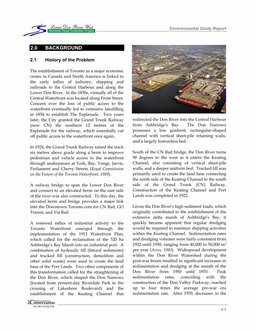
2.0 BACKGROUND 2.1 History of the Problem The establishment of Toronto as a major economic centre in Canada and North America is linked to the early influx of industry, shipping and railroads to the Central Harbour and along the Lower Don River. In the 1830s, virtually all of the Central Waterfront was located along Front Street. Concern over the loss of public access to the waterfront eventually led to extensive lakefilling in 1854 to establish The Esplanade. Two years later, the City granted the Grand Trunk Railway (now CN) the southern 12 metres of the Esplanade for the railway, which essentially cut off public access to the waterfront once again. In 1924, the Grand Trunk Railway raised the track six metres above grade along a berm to improve pedestrian and vehicle access to the waterfront through underpasses at York, Bay, Yonge, Jarvis, Parliament and Cherry Streets (Royal Commission on the Future of the Toronto Waterfront, 1989). A railway bridge to span the Lower Don River and connect to an elevated berm on the east side of the river was also constructed. To this day, the elevated berm and bridge provides a major link into the Downtown Toronto core for CN Rail, GO Transit, and Via Rail. A renewed influx of industrial activity to the Toronto Waterfront emerged through the implementation of the 1912 Waterfront Plan, which called for the reclamation of the 520 ha Ashbridge's Bay Marsh into an industrial port. A combination of hydraulic fill (littoral sediments) and trucked fill (construction, demolition and other solid waste) were used to create the land base of the Port Lands. Two other components of this transformation called for the straightening of the Don River, which shaped the Don Narrows (located from present-day Riverdale Park to the crossing of Lakeshore Boulevard) and the establishment of the Keating Channel that
redirected the Don River into the Central Harbour from Ashbridge's Bay. The Don Narrows possesses a low gradient, rectangular-shaped channel with vertical sheet-pile retaining walls, and a largely featureless bed. South of the CN Rail bridge, the Don River turns 90 degrees to the west as it enters the Keating Channel, also consisting of vertical sheet-pile walls, and a deeper uniform bed. Trucked fill was primarily used to create the land base connecting the north side of the Keating Channel to the south side of the Grand Trunk (CN) Railway. Construction of the Keating Channel and Port Lands was completed in 1922. Given the Don River's high sediment loads, which originally contributed to the establishment of the extensive delta marsh of Ashbridge's Bay, it quickly became apparent that regular dredging would be required to maintain shipping activities within the Keating Channel. Sedimentation rates and dredging volumes were fairly consistent from 1922 until 1950, ranging from 40,000 to 50,000 m3 per year (Acres, 1983). Widespread development within the Don River Watershed during the post-war boom resulted in significant increases in sedimentation and dredging at the mouth of the Don River from 1950 until 1970. Peak sedimentation rates, coinciding with the construction of the Don Valley Parkway, reached up to four times the average pre-war era sedimentation rate. After 1970, decreases in the

Environmental Study Report
112112 2-2
Lower Don River WestRemedial Flood Protection ProjectLower Don River West
Remedial Flood Protection Project
number of new watershed disturbances and improved sediment control structures likely contributed to the decline in sedimentation in the Keating Channel to levels similar to the pre-war era. A reduction in shipping activities within the Keating Channel, combined with restrictions on the open water disposal of dredgate imposed by the International Joint Commission (IJC) in 1974, resulted in a cessation of dredging in the Keating Channel. In the following five to six years, the Keating channel filled with sediment and debris to the point where it became visible under all but high lake levels, resulting in increased flood risk along the Lower Don River. By 1983, it was estimated that 300,000 m3 of sediment had accumulated in the Keating Channel. Prior to approval of the Keating Channel Environmental Assessment (Acres, 1983), emergency measures were taken to remove 150,000 m3 of this material to reduce the flood hazard. Annual dredging and the deposit of dredgate in containment cells at the Leslie Street Spit was initiated in 1987 as part of the Keating Channel Environmental Assessment. From 1987 to 1991, large-scale dredging activities were conducted to remove new and older sediment deposits from the channel. Since 1992, regular dredging has been conducted to remove new sediment deposits in order to maintain the design flood risk stipulated in the Keating Channel Environmental Assessment Study. Sediment deposition rates in the Keating Channel are now similar in magnitude to those prior to the pre-war development boom at approximately 35,000 m3 per year. As part of the Watershed Planning process in 1980, the Lower Don River floodplain was identified by Toronto and Region Conservation Authority (TRCA) as the highest priority flood prone area within its jurisdiction. This ranking was based upon an assessment of the extent of area flooded under the Regulatory Flood, and the risk to life and property that it represents. The
Keating Channel Environmental Assessment Study identified three different Spill Zones for the Lower Don River (Refer to Figure 2.1). These zones are: Zone 1 - The Port Lands, Zone 2 - east of the Don River north of Lake Shore, and Zone 3 - the lands west of the Don River. This Lower Don River West - Remedial Flood Protection Project pertains to Spill Zone 3, which includes the West Don Lands and part of the downtown core of the City. The area at risk due to flooding in Spill Zone 3 includes the 172 hectares of land under the Special Policy Area designation (SPA), and an additional 38 hectares of land that are currently under a Holding Symbol (H) designation (West Don Lands) in the City of Toronto Official Plan. A number of factors contribute to the extent of flooding through Spill Zone 3: • the Lower Don, north of the CN Railway,
flows through a low-lying, non-confining floodplain consisting of deltaic sediments and lakefill; and,
• backwater effects are produced by:
− the CN Rail embankment; − water levels in Lake Ontario; − potential ice jams; and, − low-lying utility and transportation
bridges. In addition to flooding, the soils and groundwater associated with Spill Zone 3 are contaminated by past lakefilling and industrial land use activities. All lands within and adjacent to the potential flood protection works area will first need to be assessed and remediated as required. This component of the project is discussed in Section 5.2.3 of this Report.

Environmental Study Report
123123 2-3
Lower Don River WestRemedial Flood Protection ProjectLower Don River West
Remedial Flood Protection Project
2.2 Overview of Previous Studies The following provides a brief overview of the major studies that were previously conducted relating to the flood protection project for the Lower Don River West, and form the basis for the current study.
i) Keating Channel Environmental Assessment,
prepared for the Metropolitan Toronto and Region Conservation Authority. Acres Consulting Services Ltd., March 1983.
This environmental assessment relates to the needs and consequences of dredging the Keating Channel. The study concludes that with regular maintenance dredging activities, the full hydraulic capacity of the channel would be restored. In combination with a dyking program, this would facilitate the achievement of the flood
protection objectives, as well as, a reduction in the contaminated sediment in the channel. ii) Flood Protection Options for the Ataratiri
Development, prepared for Department of Public Works, City of Toronto. MMM Ltd., January 1991.
This study describes flood protection alternatives for the formerly proposed Ataratiri Development and addresses conditions to which a Special Policy Area (SPA) designation was granted to allow development to proceed. Due to the flow patterns in the spill zones of the Lower Don River, a two-dimensional model, specific to urban floodplain analysis was used. Various flood protection schemes were considered in developing a strategy for protecting the entire Lower Don River floodplain area. The
Figure 2.1 – Regulatory Floodplain along the Lower Don River
SSppiillll ZZoonnee 11
SSppiillll ZZoonnee 22
SSppiillll ZZoonnee 33

Environmental Study Report
134134 2-4
Lower Don River WestRemedial Flood Protection ProjectLower Don River West
Remedial Flood Protection Project
study recommends filling and regrading the study area to drain to Lake Ontario via Cherry Street, in combination with continued full dredging of the Keating Channel. The solution increases residual flood depths east of the Don River and therefore the study recommends the implementation of a Master Plan for the protection of the entire Lower Don River floodplain lands.
iii) Lower Don Lands Strategy Flood Protection and River Regeneration Concepts, Prepared for the Waterfront Regeneration Trust. MMM Ltd., July 1994.
This study describes the integration of flood protection works and river regeneration concepts and recommends an action plan incorporating wetland habitat, naturalization of the Lower Don River and realignment of the mouth, fill on the former Ataratiri lands, and additional flow capacity under the CN Rail embankment. The report recommends that the ‘minimum’ flood protection package be implemented as a first
phase of an overall strategy for flood control for the Lower Don Lands, when development on the former Ataratiri lands proceeds. The ‘minimum’ flood protection package contrasts the ‘ultimate’ flood control package which involves complete implementation of the realignment of the mouth of the Don River.
iv) Scoping and Sensitivity Analysis on Flood Protection Options for West Don Lands Site, Report Prepared for Ontario Realty Corporation. Acres & Associated, July 1996.
This report summarizes a peer review conducted for Ontario Realty Corporation (ORC), evaluating previously proposed flood protection alternatives for the West Don Lands. The primary objective of the study was to ensure that all reasonable alternatives to a berm had been sufficiently considered. The results of this analysis indicated that a berm alternative is the most feasible method of achieving flood protection consistent with the planning objectives, providing sufficient hydraulic capacity in the floodway, and facilitating the creation of open space. v) West Don Lands Flood Protection and Related
Issues Study, prepared for City of Toronto, Ontario Realty Corporation, Toronto and Region Conservation Authority. MMM Ltd., May 2000.
The purpose of this study was to outline flood protection requirements for the West Don Lands in order to facilitate the removal of the Holding designation for the area in the City’s Official Plan. The study advances the proposed flood protection measure to a functional design stage, based on the recommendation from the Acres (1996) report that a berm is the preferred flood protection solution (this study did not consider additional alternatives, but rather focused on addressing outstanding design issues associated with the berm). The study also develops an integrated package of flood protection and river regeneration measures for the area south of the CN tracks that would provide flood protection for the remaining portion of the lands affected by the Regulatory Flood.

Environmental Study Report
145145 2-5
Lower Don River WestRemedial Flood Protection ProjectLower Don River West
Remedial Flood Protection Project
vi) Don River Hydrology Update Final Report, prepared for Toronto and Region Conservation Authority. MMM Ltd, June 2004.
This report documents the refinements made to the hydrologic model for the Don River Watershed. The model, updated from the 1990s, incorporates the following changes: • the use of the Visual OTTHYMO Version 2.0
(VO2) hydrologic model which replaced the outdated HYMO model;
• updated development condition and land use
data for the Don Watershed; and, • calibration and validation of the updated
model to an actual event in May 2000. The calibrated model was used to establish the current design flows for the Don River Watershed that have been adopted for the development of the flood protection alternatives for the Lower Don River West - Remedial Flood Protection Project. Calculated flows are provided for a range from the 2 to 100-year design events, and the Regulatory Flood. The results indicate that the existing 100-year peak flows near the mouth of the Don River have increased by approximately 3% from past modelling of the watershed. For the Regulatory Flood (Hurricane Hazel), the simulations indicate significant increases in flows at several locations throughout the watershed due to recently urbanized catchments in the upper regions of the watershed and updated areal reduction factors, which differ significantly from the reduction factors applied in the previous model update (in the 1990s). A description of the potential impacts of climate change on the hydrology of the Don River watershed was also documented in the report. A thorough discussion of the hydrologic and
hydraulic characteristics of the Lower Don River is provided in Section 4.5 of this Report. 2.3 Conservation Authority Involve-
ment Justification In 1979, floodplain mapping was completed for the Lower Don River and Keating Channel on behalf of the Toronto and Region Conservation Authority. At that time, the modeling results depicted significant flooding under the Regulatory Flood with depths between 3 and 4 metres higher than the ground elevations surrounding the Lower Don River. As previously noted, on the basis of the results, the floodplain of the Lower Don River became recognized as the highest priority flood risk area within the jurisdiction of TRCA. Numerous attempts to address flooding in this area have been made between 1980 and 2000 as components of the following projects: the Keating Channel EA (1983) for TRCA, the 1988 flood study by TRCA, the Ataratiri Project by the City of Toronto, and the West Don Lands Flood Protection and Related Issues Study (2000). Additional hydraulic studies undertaken in relation to these projects have further refined the extent and depth of the floodplain under the Regulatory Flood. However, other than the continued implementation of the Keating Channel EA since the late 1980s (eg. dredging of the Keating Channel and disposal in the Tommy Thompson Park containment cells), each reincarnation of the project has not been carried forward to functional design due to varying economic and political conditions, thereby leaving the 210 hectares of land west of the Lower Don River at risk to flooding. In 2001, the TRCA was identified by the three levels of government as the recipient agency to naturalize the mouth of the Don River and provide flood protection for the entire 440 hectare floodplain (210 hectares to the west and 230 hectares to the east and south) surrounding the Lower Don River and Keating Channel.

Environmental Study Report
156156 2-6
Lower Don River WestRemedial Flood Protection ProjectLower Don River West
Remedial Flood Protection Project
This project was to be undertaken as a component of the Toronto Waterfront Revitalization initiative. In 2003, the TRCA initiated an environmental assessment to develop a functional design for the Lower Don River West Remedial Flood Protection Project (LDRW Project), with the goal of removing the 210 hectares of land west of the Don River from the Regulatory Floodplain. The TRCA is conducting the LDRW Project under the auspices of the Valley and Stream Corridor Management Program (MTRCA, 1994). The goal of this Program is to undertake an integrated valley and stream corridor management program with one objective being to prevent, eliminate or reduce the risk to life and property from flooding. The Plan also has a goal to protect and regenerate the ecological health and integrity of these systems; and to provide opportunities for compatible public use and enjoyment. To facilitate the planning and implementation of
flood control projects related to the Valley and Stream Corridor Management Program, the Conservation Authority Class Environmental Assessment for Remedial Flood and Erosion Control Projects (March 2002) was selected to direct this study and was triggered with the submission of a Notice of Intent, which was filed by the TRCA in March 2003. The Conservation Authority Class EA can be used for "those projects undertaken by Conservation Authorities, which are required to protect human life and property, in previously developed areas, from an impending flood or erosion area". In 1994, Forty Steps to a New Don - the Report of the Don Watershed Task Force recommended three general principles to help guide the vision of a revitalized urban river: i) Protect those components of the watershed
that are healthy;
Figure 2.2 – Floodwater Depths along the Lower Don River for the Regulatory Flood

Environmental Study Report
167167 2-7
Lower Don River WestRemedial Flood Protection ProjectLower Don River West
Remedial Flood Protection Project
ii) Regenerate those components of the watershed that are degraded; and,
iii) Promote community responsibility and
ownership for a healthy Don River. Forty specific steps are outlined in the document in order to achieve this vision. The LDRW Project will help address a number of these steps as follows: Step 5: Keep sewage out of the Don: The long-term plans for CSOs and SSOs that currently flow into the Don River through the proposed area for flood protection works, will be redirected westward to Cherry Street for treatment before being released into Lake Ontario. Servicing relocations and treatment of effluent, however, are beyond the scope of this Environmental Assessment. Step 10: Keep old landfill sites from leaching into groundwater and streams: The entire floodplain surrounding the Don River in this area is composed of landfill materials, some of which is contaminated by past land uses. As part of the design, the LDRW Project will ensure that existing contaminated soils and groundwater do not enter the Don River or get released into air, soils or vegetation. Step 13: Identify the natural ecosystems and species in the watershed: As part of the environmental assessment process, detailed baseline studies have been undertaken to identify the conditions of local ecosystem health and to identify those species that utilize the local habitats. Step 14: Protect and regenerate the natural form and function of the Don’s valley and stream corridors: The LDRW Project will re-establish a confining valley system for the Don River as is found immediately upstream in order to regenerate the hydraulic and ecological function along the Don River corridor.
Step 17: Protect and regenerate lowland forests, meadows and streamside vegetation: As a component of the flood protection components of the LDRW Project, improvements in the quality and function of streamside vegetation communities will be made within this area. Step 21: Enhance the network of green corridors that link natural areas, on the tableland as well as in valley and stream corridors: The LDRW Project will greatly improve the quality of stream corridor habitat, thereby improving the migration of wildlife from Lake Ontario and Tommy Thompson Park, to the headwaters of the Don River. Step 22: Improve the aesthetics of the Don’s natural areas: Landscape design will play a large role in the final park design for the flood protection works to ensure that opportunities to improve the ecological, visual, and recreational components of the environment are maximized. These final park designs are beyond the scope of the Environmental Assessment. Steps 24&25: Provide safe pedestrian access into the Don’s public natural areas & create continuous watershed trails between Lake Ontario and the Oak Ridges Moraine: Trail linkages between neighbouring communities, the waterfront and the Don Watershed will be improved to ensure safe and informative recreation opportunities for the public. Step 26: Accept flooding as a natural process and respect its dangers: The floodplain surrounding the mouth of the Don River has long been recognized as the TRCA’s highest priority area for flood protection. The fundamental objective for this project is to remove the risk of flooding to this large area of Toronto by mitigating the impacts of past development practices (eg. lakefilling, transportation and utility infrastructure, etc) that have increased the extent and degree of flooding.

Environmental Study Report
178178 2-8
Lower Don River WestRemedial Flood Protection ProjectLower Don River West
Remedial Flood Protection Project
Step 28: Honour our cultural heritage throughout the watershed: Landscape design will play a large role in the final park design for the flood protection works to ensure that the industrial and archaeological history of the area is recognized through art, design features, park programming, and displays. These final park designs are beyond the scope of the Environmental Assessment. As is apparent, implementation of the LDRW Project will help meet many of the targets set out in Forty Steps to a New Don (1994). These improvements will likely be documented in the 2006 and 2009 editions of the Don Watershed Report Card, a document released every three years that depicts the state of the environment, and marks and celebrates the progress in the regeneration of the Don Watershed. The Task Force to Bring Back the Don published a report entitled Bringing Back the Don in 1991 that lists numerous targets and goals that would improve the ecological health and public accessibility throughout the Don River at a sub-watershed level. Three of the objectives for the lower Don River included restoring terrestrial habitats, establishing appropriate uses of valleylands and improving access to the valley. Specific recommendations for these two objectives include: replanting valley slopes with native woodlands and meadow species, improvement of access to and along the Don River for cyclists and walkers, and improving connections between the waterfront and the Don River. Flood protection components of the LDRW Project will be evaluated as to their ability to meet these objectives 2.4 Concurrent and Related Studies The Lower Don West-Remedial Flood Protection Project forms part of the overall vision for the Lower Don River. The elimination of the floodplain and the naturalization of the mouth of the Don River is one of the four priority projects being undertaken and/or funded by the Toronto
Waterfront Revitalization Corporation (TWRC) aimed at the revitalization of the City’s waterfront. The Don Mouth Naturalization and Port Lands Flood Protection Project, which is being initiated by TRCA as an Individual Environmental Assessment undertaking will address the floodplain areas in Spill Zones I and 2 and the naturalization of the mouth of river. While the Lower Don River West - Remedial Flood Protection Project will function independently of any other naturalization and flood protection works, it must be compatible with the Don Mouth Naturalization and Port Lands Flood Protection Project and not impose any constraints. For the purposes of discussion, hereinafter these two undertakings will be referred to as the Lower Don Environmental Projects. As part of the initial planning activities by TWRC, precinct plans are being prepared for the West Don Lands and the East Bayfront. The West Don Lands occupy a 32 hectare area between the Don River and Parliament Street to the west, and from the CN Rail line to King Street to the north. The West Don Lands Precinct Plan indicates a mixed residential and commercial land use, with provision for affordable housing and recreational opportunities. The East Bayfront Precinct Plan is a 36 hectare waterfront area that extends south of the CN Rail line between Jarvis and Cherry Street. It is expected to become a community with 6-8,000 units of housing, including affordable housing and related commercial spaces. Both precinct plan lands are situated within the Regulatory Floodplain of the Lower Don River, and are reliant on the construction of the Lower Don River West - Remedial Flood Protection Project for their viability and implementation.

Environmental Study Report
189189 2-9
Lower Don River WestRemedial Flood Protection ProjectLower Don River West
Remedial Flood Protection Project
The West Don Lands Precinct Plan, in particular, is much more integrated with the Lower Don River West - Remedial Flood Protection Project. A centerpiece of this plan is the proposed 7.2 hectare Don River Park, which will be created by the construction of the flood protection landform along the west bank of the river. This green space will extend westward well into the community and form part of a boulevard along Front Street towards the downtown Toronto. The infrastructure servicing strategy (including water, storm sewer, wastewater sewer utilities and roadways) for the West Don Lands Precinct Plan has been developed through the Class Environmental Assessment Master Plan. The servicing concepts developed as part of the Master Plan have been incorporated into the design of the remedial flood protection works. Of
particular importance is the relocation and realignment of Bayview Ave, and the redirection of all storm runoff from the precinct plan area westerly toward Cherry Street, where it will be intercepted and conveyed to Lake Ontario. The remaining undertaking in the area is Commissioners Park, which involves the creation of an approximate 16.6 hectare waterfront park that has been developed by TWRC. The facility will be located in the Portlands, and extend from the south side of the Keating Channel to Commissioners Street. The park is intended as a waterfront landmark, as well as providing active recreational facilities and helping to meet the future needs of the communities in the West Don Lands, the East Bayfront and the Portlands.

Environmental Study Report
191191 3-1
Lower Don River WestRemedial Flood Protection ProjectLower Don River West
Remedial Flood Protection Project
3.0 PUBLIC AND AGENCY CONSULTATION
3.1 Consultation History There have been significant and on-going consultation activities conducted in relation to the Lower Don River and its environs. These past consultation activities are summarized briefly below: i) Ataratiri (West Don Lands) (1991) – In the
planning of the Ataratiri lands, a Neighbourhood Advisory Council (NAC) was established that included a variety of public interests. The role of NAC was to provide advice to City staff. A NAC environmental sub-committee was also created that examined flood risk issue.
ii) Task Force to Bring back the Don (1991) – As
part of this work, ten focus group discussions were held with members of the public. The West Don Lands were examined as part of the Task Force.
iii) Forty Steps to a New Don (1992-1994) –
Extensive consultation was undertaken in the preparation of this Report including public meetings and circulation of the report for comment.
iv) Unlocking Toronto’s Port Lands (Sept. – Dec.
1999) – This public consultation forum dealt with a variety of issues including the naturalization of the mouth of the Don River and flood protection.
v) Obstacles and Opportunities: Realizing the
Potential for the West Don Lands (Nov 1999) – This workshop with local residents, businesses, government agencies and other stakeholders was undertaken to generate ideas and create interest in the redevelopment of the West Don Lands.
vi) Olympic Bid Neighbourhood Working Group
– Consultations were held with various stakeholders regarding potential
developments associated with the Olympic bid.
vii) Wet Weather Flow Master Plan (2000 - 2002)
– Consultation activities were held regarding this study that examined a number of wet weather/environmental related issues.
viii) Toronto’s Central Waterfront Secondary
Plan (2002) – A multitude of meetings and other consultation events were held with various communities regarding the Secondary Plan and the TWRC’s Development Plan and Business Strategy.
ix) West Don Lands Precinct Plan (2003 - 2004)
– A series of consultation events have been held in the development of the West Don Lands Precinct Plan.
x) East Bayfront Precinct Plan (2003 - 2004) – A
series of consultation events have been held in the development of the East Bayfront Precinct Plan.
3.2 Public & Agency Notifications A number of public notices were published in support of this undertaking, including: i) A Notice of Intent was sent to the MOE
Environmental Assessment Branch and Conservation Ontario on March 24, 2003;
Environmental Study Report
202202 3-2
Lower Don River WestRemedial Flood Protection ProjectLower Don River West
Remedial Flood Protection Project
ii) A Notice of Intent was published in the Beaches South Riverdale Mirror on March 28, 2003, the Toronto Star on March 29, 2003 and in the St Lawrence Bulletin in April 2003;
iii) The TRCA website provided project and
public consultation opportunity and updates throughout the study period;
iv) The Public Information Centre (PIC) #1
advertisement was published around January 15, 2004 (depending on the publication) in: The Voice, ETC…News, North York Mirror, Now Magazine;
v) The PIC #1 Notification flyer was available
on January 8, 2004 on the TRCA web site and mailed to 120 people on the mailing list, the Technical Advisory Committee members (60 individuals), local councillors, the local MP and MPP;
vi) The Public Information Centre (PIC) #2
advertisements were published in mid April in: Eye Weekly, Beaches South Riverdale Mirror and Now Magazine;
vii) The PIC #2 Notification flyer was available
on April 20, 2004 on the TRCA web site, was mailed to 140 individuals, emailed to 120 individuals, and sent to Community Liaison Committee members, Technical Advisory Committee members, local councillors, the local MP and MPP;
viii) The PIC #3 advertisement was published
between August 27 and September 10, 2004 in Now Magazine, Eye Weekly, ETC News, Beaches/South Riverdale Mirror, St. Lawrence Community Neighbourhood Bulletin;
ix) The PIC #3 advertisement was available on
August 17, 2004 on the TRCA web site and mailed to 136 people on the mailing list, and sent to Community Liaison Committee members, Technical Advisory Committee members, local councillors, the local MP and MPP; and,
x) Notification on the availability of the Draft Environmental Study Report for review purposes was provided to the members of the TAC and CLC on December 13, 2004. At that time the members of both committees were also advised that the bridge extension option at the CN Rail crossing was emerging as the preferred option.
A notice was send out to all participants at the PICs on January 17, 2005, advising of the availability of this report for review and comment, and also pointing out that the bridge extension option has been adopted. Appropriate notices were also placed in local print media, including: NOW Magazine, ETC….News, The Voice, North York Mirror etc. The document is also available to the public through its posting on the TRCA’s website.
3.3 Information Releases As part of the consultation program, LDRW News publications were released in January 2004, April 2004 and July/August 2004. These newsletters provided basic information about the study, including data updates, and progress to-date and the study schedule. The newsletters were distributed to those on the mailing list (about 120 people), sent to local councillors,

Environmental Study Report
213213 3-3
Lower Don River WestRemedial Flood Protection ProjectLower Don River West
Remedial Flood Protection Project
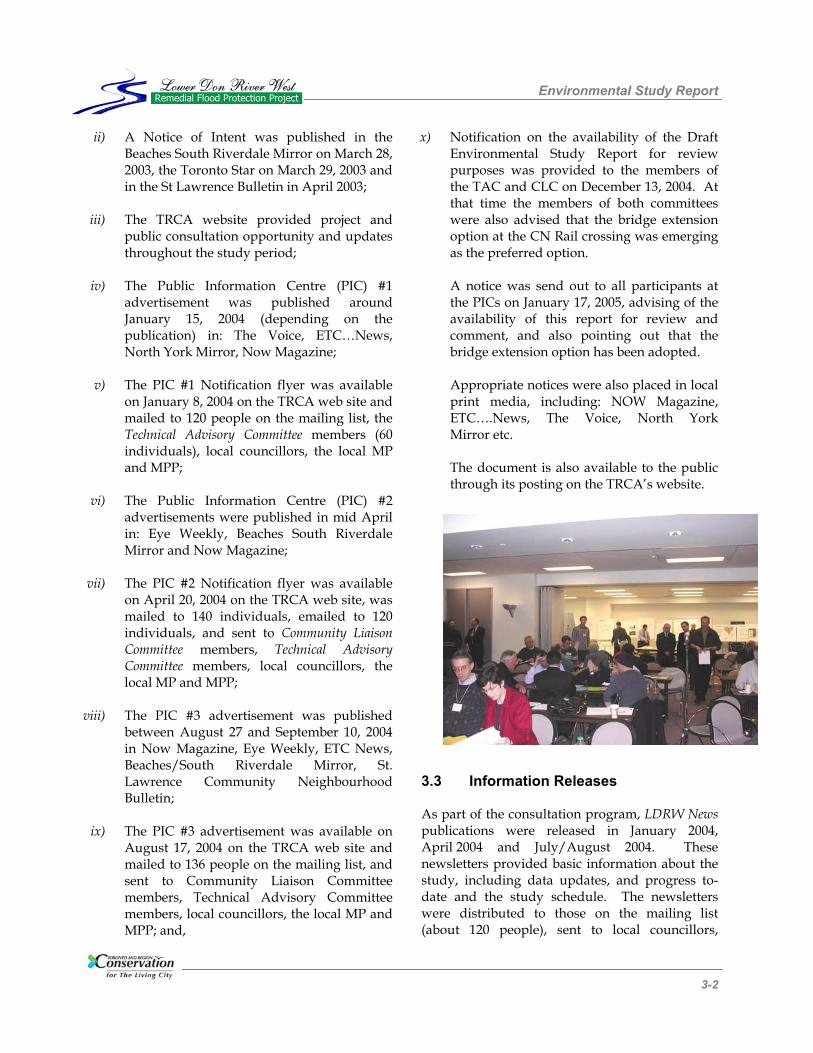
distributed at the PICs, given to CLC and TAC members, sent to First Nation Groups (Mississaugas of New Credit, Ashinabek Nation, Nation of Iroquois and Allied Indians representatives), placed on the TRCA website, and made available at the Paddle the Don event (Newsletter #1). Copies of the newsletters are available in Appendix A. A press release for the third PIC was sent to all media outlets. 3.4 Open Houses/Workshops Three Public Information Centres (PICs) were held as part of this Class Environmental Assessment Study. The first was held on January 19, 2004 at Metro Hall in Toronto. The PIC was advertised as outlined in Section 3.2. Approximately 85 people attended the first PIC. At this event 32 display boards were set up providing information about the study. Copies of the display boards are included in Appendix A. Staff of the TRCA and the Consultant Team were available to answer questions at the PIC. A presentation was given at 7 pm by the TRCA, the Chair of the West Don Lands Committee, and Dillon Consulting, which provided an overview of the project and introduced the proposed flood protection alternatives to be evaluated against the proposed criteria. A copy of the presentation is available in Appendix A. Following the presentation, questions from the group were addressed, and then breakout groups were formed. Within the breakout groups, the participants addressed several questions that were contained in a workbook. Summary notes from all three PICs are also included in Appendix A. Key issues/comments raised by the participants are summarized in Section 3.7. The second PIC was held on April 29, 2004 and was advertised as outlined in Section 3.3. Approximately 25 people attended the second PIC. The event was structured in the same manner as the first PIC, and included some 25 display boards, and a presentation followed by a
question/discussion period. This PIC presented preliminary results of the alternatives evaluation and identified the flood protection landform (initially identified as a “berm”) with culvert and east bank works as the preferred alternative. The focus of the discussion was on this option. Appendix A contains the display boards for the PIC together with the presentation material, the workbook and a summary of the event/ discussions. The third PIC was held on September 21, 2004 and was advertised in a similar manner as the previous two events. Approximately 20 people attended the event and 25 information boards were displayed. The focus of the PIC was on presenting the functional design for the proposed flood protection works. A presentation was made and an opportunity provided for the public to ask questions. Staff of TRCA and the Consulting Study Team were available to answer questions. Participants were provided with a workbook that described the process to date and included several questions intended to prompt comments from the participants. 3.5 Community Liaison Committee A Community Liaison Committee (CLC) was also formed as part of the consultation program. The committee was composed of 19 members of the public representing a variety of resident associations and interest groups. The committee met on four occasions: November 26, 2003, January 5, 2004, April 20, 2004 and September 07, 2004. The purpose of the committee was to help obtain input from public representatives on all aspects of the study including: options to be considered, evaluation criteria and input on the public consultation materials. An additional meeting was held on November 10, 2004 with community representatives from both the CLC and the TAC that had expressed concerns regarding the re-vegetation and landscaping of the flood protection landform. The CLC was formed in accordance with the Conservation Authority Class EA requirements and has assisted throughout the process, in

Environmental Study Report
224224 3-4
Lower Don River WestRemedial Flood Protection ProjectLower Don River West
Remedial Flood Protection Project
particular, by providing feedback on design issues and advice in structuring the Public Information Centre. The Community Liaison Committee included representatives from the following groups: • Citizens for the Old Town; • Cityscape; • Corktown Residents & Business Association; • Don Watershed Regeneration Council; • Food Share; • Gooderham & Worts Neighbourhood
Association; • Mississaugas of the New Credit First Nation; • Port Lands Partnership; • Queen-Broadview BIA; • South East Downtown Economic Redevel-
opment Initiative (SEDERI); • South Riverdale Revitalization Project; • St. Lawrence Neighbourhood Association; • Taddle Creek Watershed Initiative; • Task Force to Bring Back the Don; • Toronto Cycling Committee; and, • West Don Lands Committee. Minutes from the Community Liaison Committee meetings are available in Appendix A. 3.6 Technical Advisory Committee An additional component of the consultation program was the Technical Advisory Committee, which was established to provide technical review assistance as the project progressed. The role of the Technical Advisory Committee included streamlining agency involvement by providing quick access to key individuals and information; assisting in responding to issues raised during the public consultation process; and assisting in the coordination of the Lower Don flood protection project with other projects and initiations in the study area. The Technical Advisory Committee was convened on a total of five occasions, on the following dates: April 8, 2003, August 29, 2003, November 18, 2003, April 13, 2004, and August 5, 2004. The Committee consisted of stakeholders, representatives from various organizations, key
community leaders and technical representatives of all pertinent regulating agencies. Participating agencies and organizations included: • Canada Lands Company; • Canadian Environmental Assessment Agency; • Canadian National Railway; • City of Toronto;
− City Planning; − Commissioner's Office; − Economic Development, Culture &
Tourism; − Parks and Recreation; − Public Health; − Technical Services; − Transportation Services; − Water and Wastewater Services; − Toronto Police (Marine Unit); − Toronto Waterfront Secretariat; − Toronto Economic and Development
Corporation; • Environment Canada; • Fisheries and Oceans Canada; • GO Transit; • Home Depot Canada; • Korex Don Valley Canada; • Ministry of Culture; • Ministry of Environment; • Ministry of Natural Resources; • Ontario Realty Corporation; • Ontario SuperBuild Corporation; • Hydro One (subsequent addition to the TAC); • Public Works and Government Services
Canada; • National Energy Board of Canada; • Toronto Port Authority; • Canadian Pacific Railway; • Toronto Terminus Railway; • Via Rail; • Toronto Waterfront Revitalization
Corporation; • Unilever Canada; • Cityscape; • South Riverdale Community Association; • West Don Lands Committee; and, • Task Force to Bring Back the Don.
Environmental Study Report
235235 3-5
Lower Don River WestRemedial Flood Protection ProjectLower Don River West
Remedial Flood Protection Project
Minutes from the Technical Advisory Committee meetings are available in Appendix A. 3.7 Summary of Issues and Concerns 3.7.1 Public Information Centre No. 1
January 19, 2004 Both the written and verbal concerns raised by the public were summarized by TRCA staff. The summary is included in Appendix A, together with the responses that were provided. The authors of more comprehensive letters submitted by the public were invited to meet and discuss their concerns in person. In general, the feedback pertaining to the first PIC was positive. The main recurring themes of concerns/comments of the public were: • the desire to maximize naturalization, trail
linkages and recreation opportunities with the project;
• the preference for the use of more holistic
approaches that do not require hard engineering (i.e., upstream storage, Wet Weather Flow Management Master Plan solutions, and wetland creation);
• concern that the project activities will increase
flood risk elsewhere; • questions related to transportation and
railways; and, • clarification was requested on the difference in
scope between the Don Mouth Naturalization and Port Lands Flood Protection Project and the current study.
3.7.2 Public Information Centre No. 2
April 29, 2004 The written and verbal comments received from the public were also summarized by TRCA staff for the second Public Open House and the summary is included in Appendix A. In general, positive comments were again received. The main themes of discussions at the second PIC were: • questions asking to clarify the flood protection
landform and culvert specifications; • potential increased flood risk to the Bala
subdivision railbed; • the need to maximize recreation opportunities
on the flood protection landform; • concern that the property belonging to Home
Depot may be subject to increased flooding following the implementation of this project (Correspondence with Home Depot in this regard is attached in Appendix C);
• clarification regarding flood impacts once the
flood protection landform and culverts are in place and the synergy with the naturalization project;
• concerns of climate change increasing the
Regulatory Floodplain; and, • questions regarding the state of the
groundwater/soils investigation in the flood protection landform area.

Environmental Study Report
242242 3-2
Lower Don River WestRemedial Flood Protection ProjectLower Don River West
Remedial Flood Protection Project
3.7.3 Public Information Centre No. 3 September 21, 2004
The comments and concerns raised by the public were again summarized by TRCA staff for the third Public Open House and are included in Appendix A. After a review of the project components and the Class Environmental Assessment process that was followed, details of the functional design were presented. The following items of discussion followed: • questions to distinguish this undertaking from
the Mouth of the Don Naturalization and Portlands Protection Project;
• questions to explain the hydraulic modelling
undertaken and a description of the Regulatory Flood;
• questions regarding the estimated costs and
funding sources for construction and soil management work;
• concerns regarding ownership of the flood
protection works and the need for a suitable landscaping/planting plan; and,
• concerns regarding how to make the
pedestrian underpass friendly to the public. Members of the public, through personal communication to TRCA staff, advised as to their strong preference to have an extension to the existing bridge, as opposed to the culvert structure for access purposes, however, at the time of the public information centres, culverts appeared to be the optimal method for providing additional hydraulic capacity through the CN Railway embankment. 3.7.4 Mississaugas of New Credit First
Nation The Mississaugas resided along the north shore of Lake Ontario, including the Toronto area, prior to colonization by the European settlers.
Given their historical ties to the area, the Mississaugas were extended an invitation to actively participate as a member of the Community Liaison Committee, at the onset of the project. Invitations to join the Community Liaison Committee and all meeting agendas and minutes were also sent to the Ashinabek Nation and the Nation of Iroquois and Allied Nations. No response was ever received from representatives of these two nations. During the initial discussions, the Mississaugas advised of their continuing interest in the area through the Toronto Purchase Specific Claim, which calls for appropriate compensation for the loss of their ancestral lands. The process and steps that the Mississaugas are following in this regard to secure a fair and just settlement is provided in a document entitled Toronto Purchase Specific Claim – Arriving at an Agreement, which is provided in Appendix B. On July 5, 2004, a meeting was held with the Mississaugas’ Band Council to discuss the particulars of the Lower Don River West Remedial Flood Protection Project. The meeting was started with a presentation that covered: • an overview of the need for the project; • the status of the technical and public
evaluation of alternatives; • components of the preliminary preferred
alternative; and, • the anticipated timelines to complete the Class
EA component of the overall project. The key issues raised by the Mississaugas during the ensuing discussions included: • the need to incorporate a recognition of the
ongoing status of the Toronto Purchase Specific Claim into the Environmental Assessment process; and,

Environmental Study Report
253253 3-3
Lower Don River WestRemedial Flood Protection ProjectLower Don River West
Remedial Flood Protection Project
• that sufficient information is provided to allow for meaningful discourse from the Band Council in determining the final preferred alternative, and resulting land uses for the preferred alternative.
The Band Council was advised that the land use planning for the preferred alternative was being determined through the West Don Lands Precinct Planning process with the understanding that specific criteria, to be determined by TRCA and Dillon Consulting, be maintained to ensure that the primary flood protection role is not undermined. 3.7.5 Ontario Mile Corporation Raceway The Ontario Mile Corporation Raceway (OMCR) expressed their long-standing interest to use the West Don Lands to develop a tourist attraction featuring an inexpensive adult leisure destination - a Raceway, Water Show and Slots Project. The flood protection scheme proposed by the OMCR is a series of dykes and retaining walls and a retention basin and concrete spillways. The retention basin would also encompass a music/fountain tourist attraction. The flood protection works would offer protection up to the 100-year level. The OMCR describes the benefits of the proposed entertainment use of land as follows: • no soil penetration, slab on grade which
encapsulates and seals contaminated soil and groundwater;
• employment creation during construction and
operation of the raceway; • year-round tourist attraction and tax revenue
to the City due to public/private partnership; • government regulation of gambling; • minimal infrastructure required;
• flood storage offered on site; and, • land can be leased under current legislation
without the need to purchase. The OMCR expressed concerns regarding the flood protection landform as follows: • open space park lands attract undesirable
behaviour, not acceptable to the surrounding community;
• all costs are borne by taxes, no private input,
concerns regarding funding; • soil contamination may result due to leeching; • possibility of failure exists for storm events in
the 100 to 300-year range, and flash flood conditions can still occur; and,
• few developers, private stakeholders or
academics were in attendance at January 19, 2004 Public Information Centre.
TRCA responses to comments/concerns raised were provided in a series of correspondence. A letter dated August 26, 2004 outlined the reasons why the construction of a concrete channel to contain the Regulatory Flood is an inappropriate method for protecting the City of Toronto from flooding. In a letter dated September 14, 2004, TRCA responded to a number of the issues raised. OMCR’s land use planning concerns were forwarded to Urban Strategies, the project manager for the West Don Lands Precinct Plan. A copy of the correspondence with OMCR is provided in Appendix C.