Embed Size (px)
Citation preview
GISin the
City of Lewiston MaineThe purpose of this slideshow is to provide an overview of the city GIS and how it is used, maintained and accessed in-house as well
as by the public.
Please simply hit your ‘down arrow’ or ‘page down’ key to view each slide
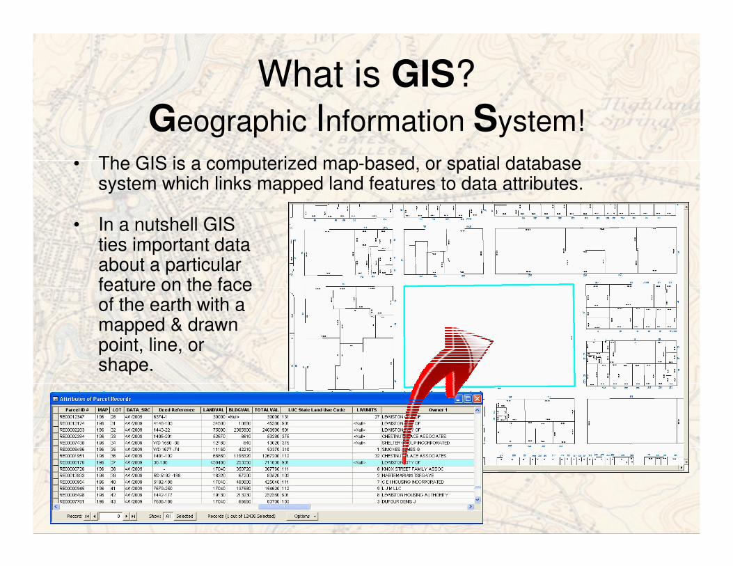
What is GIS?
Geographic Information System!
• The GIS is a computerized map-based, or spatial database system which links mapped land features to data attributes.
• In a nutshell GIS ties important data about a particular feature on the face of the earth with a mapped & drawn point, line, or shape.
GIS in LewistonA Few Facts:
• The city began digital mapping using AutoCAD in ~1990, and began building a GIS in 1996-1997
• Lewiston has had GIS on-line mapping of some form since 2003, (public 2004)
• Lewiston is part of a collaborative GIS effort called AVGIS (Androscoggin Valley GIS), along with City of Auburn, AWSD, and AVCOG
• Parcels, zoning, street pavement, pump stations, parks and dozens of other essential data are mapped and managed with GIS.
• Our GIS serves an important role as the infrastructure inventory, modeling and management system for the drinking water, sewer, and storm utility districts.
• The GIS also serves an equally vital role as the backbone for the city EnerGov land management system.
What are Some Uses of GIS?
• Parcel mapping and revision management
• Tax map and other map atlas sets
• Street pavement, markings, pump stations, parks, pw mowing , plow and sand routes
• Abutter notification and other mailing lists
• Zoning studies and boundary definitions
• Demographic studies
• Inventory reporting required by mandates
• Map and define service and district boundaries
• Crime analysis and incident pin mapping
• Environmental constraints/buffering
• Energy saving studies (i.e. street lights)
• Routing, geocoding
• Planning; environmental, spatial, and demographic factors
• Wetland and other mitigation studies
• Points of interest identification
• School district definition studies and layers
• Local E911 road updates
• “Paperless’ mapping, online maps, network and portable
• Recreational paths and routes
• Conceptual planning
• NPDES and other mitigation plans
• Infrastructure inventory and asset management for the
drinking water, sewer, and storm utility districts layers
• Storm, Sewer, and or Water system modeling
• Stormwater management, watershed, and CSO
management and reporting
• Attribute queries, spatial analysis, modeling of utility
operations
• Transportation planning studies
• Document management & hyper linking to GIS features
• Maps
• Many others!
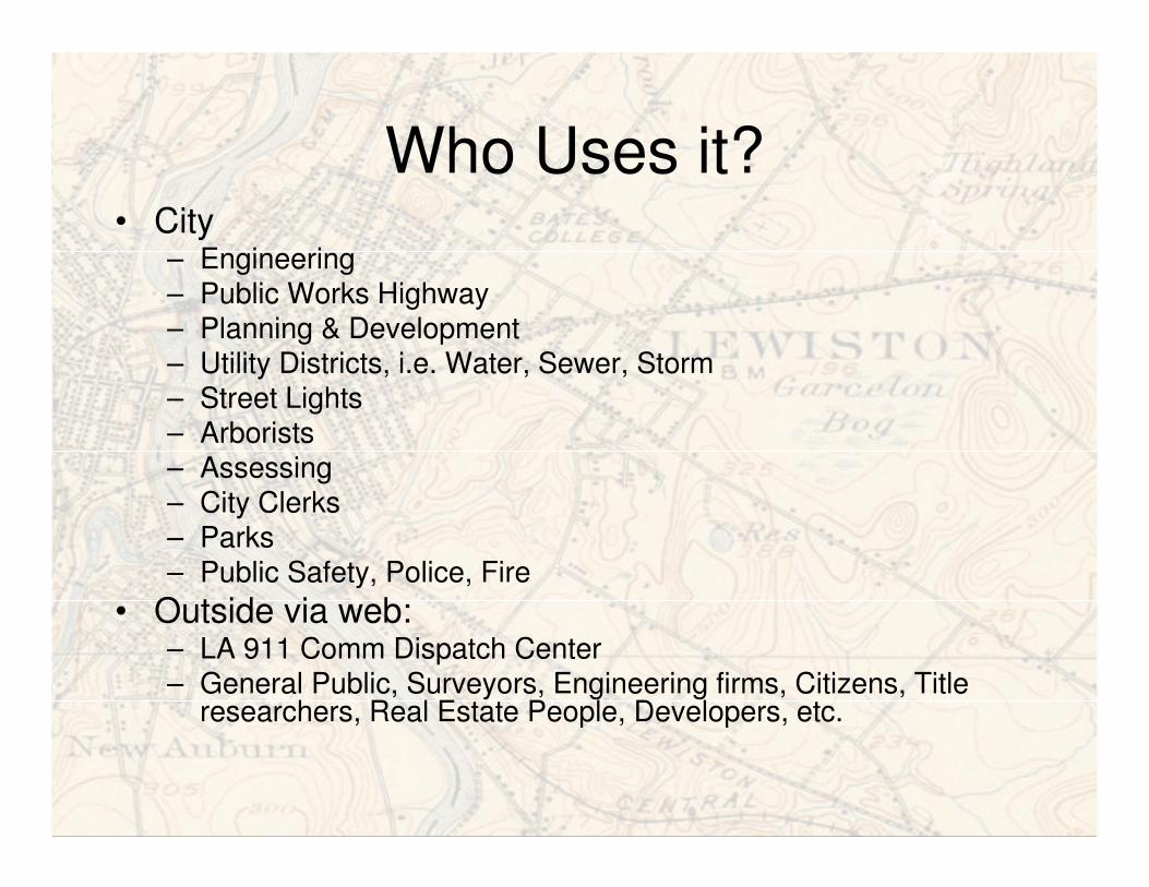
Who Uses it?• City
– Engineering– Public Works Highway– Planning & Development– Utility Districts, i.e. Water, Sewer, Storm– Street Lights– Arborists– Assessing – City Clerks– Parks – Public Safety, Police, Fire
• Outside via web: – LA 911 Comm Dispatch Center– General Public, Surveyors, Engineering firms, Citizens, Title
researchers, Real Estate People, Developers, etc.
Where does the Data and Mapping
Come From?
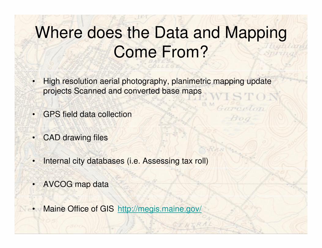
• High resolution aerial photography, planimetric mapping update projects Scanned and converted base maps
• GPS field data collection
• CAD drawing files
• Internal city databases (i.e. Assessing tax roll)
• AVCOG map data
• Maine Office of GIS http://megis.maine.gov/
How is it Maintained?
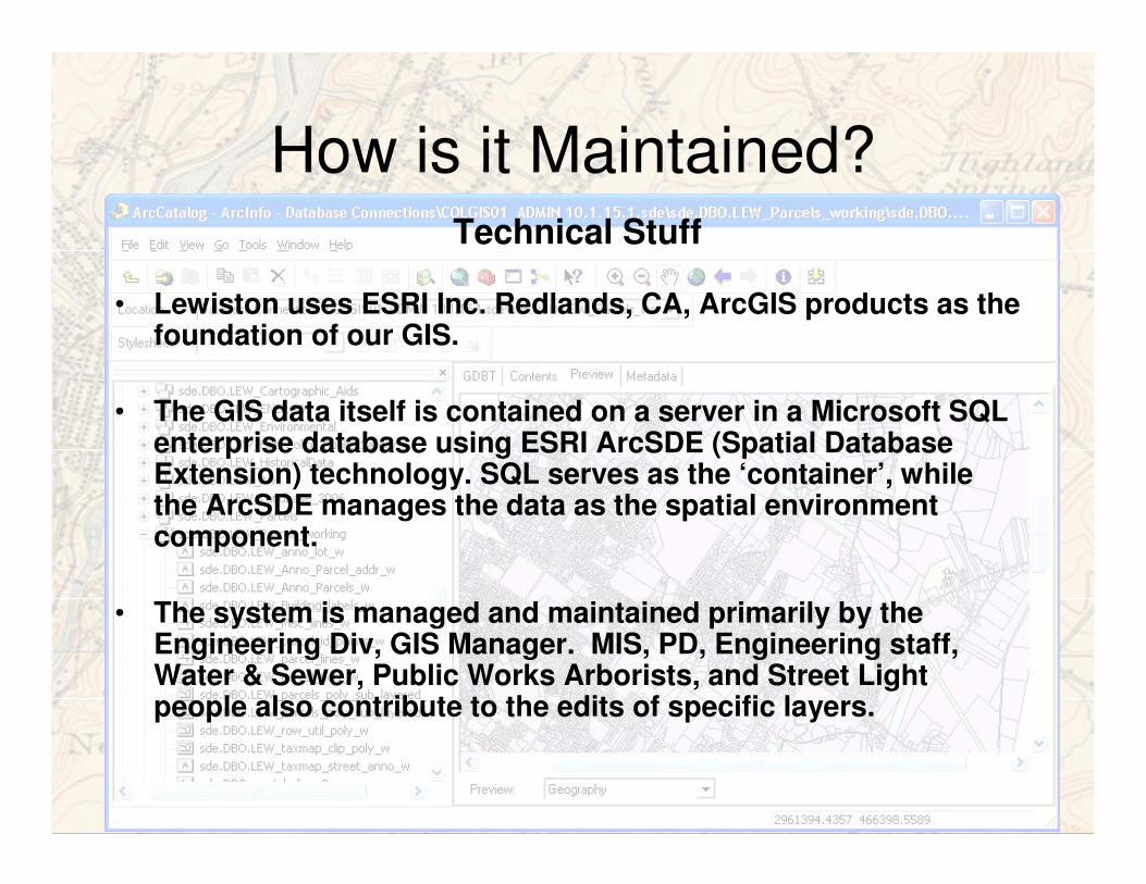
• Lewiston uses ESRI Inc. Redlands, CA, ArcGIS products as the foundation of our GIS.
• The GIS data itself is contained on a server in a Microsoft SQL enterprise database using ESRI ArcSDE (Spatial Database Extension) technology. SQL serves as the ‘container’, while the ArcSDE manages the data as the spatial environment component.
• The system is managed and maintained primarily by the Engineering Div, GIS Manager. MIS, PD, Engineering staff, Water & Sewer, Public Works Arborists, and Street Light people also contribute to the edits of specific layers.
Technical Stuff
How is it Maintained?
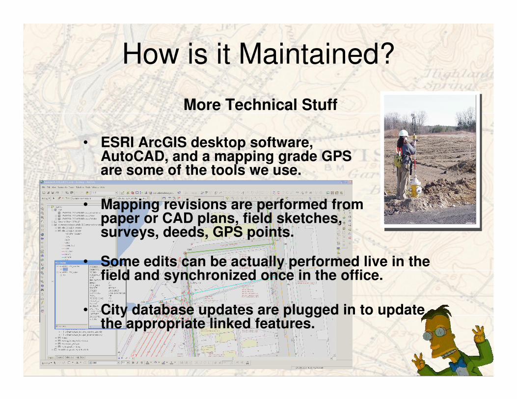
• ESRI ArcGIS desktop software, AutoCAD, and a mapping grade GPS are some of the tools we use.
• Mapping revisions are performed from paper or CAD plans, field sketches, surveys, deeds, GPS points.
More Technical Stuff
• Some edits can be actually performed live in the field and synchronized once in the office.
• City database updates are plugged in to update the appropriate linked features.
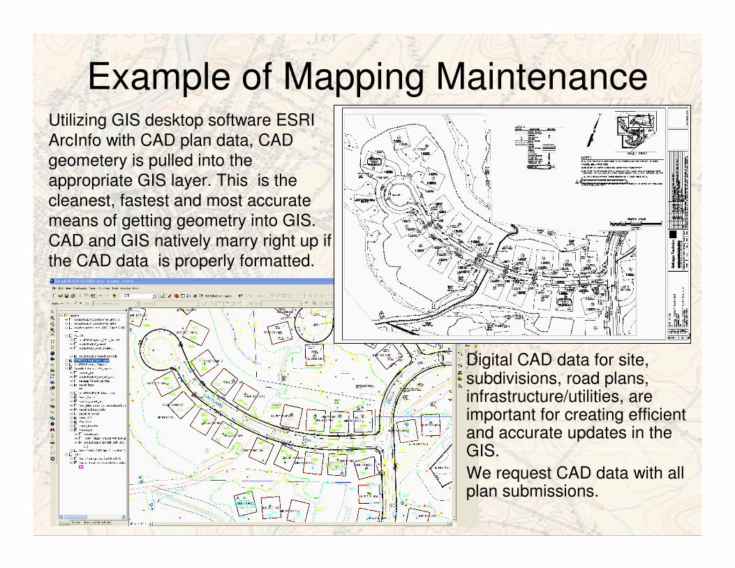
Example of Mapping MaintenanceUtilizing GIS desktop software ESRI
ArcInfo with CAD plan data, CAD
geometery is pulled into the
appropriate GIS layer. This is the
cleanest, fastest and most accurate
means of getting geometry into GIS.
CAD and GIS natively marry right up if
the CAD data is properly formatted.
Digital CAD data for site, subdivisions, road plans, infrastructure/utilities, are important for creating efficient and accurate updates in the GIS.
We request CAD data with all plan submissions.
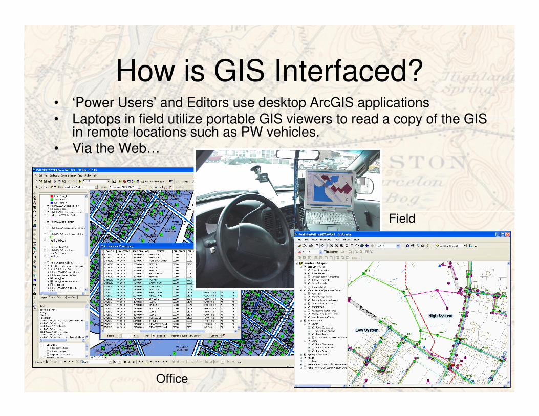
How is GIS Interfaced?• ‘Power Users’ and Editors use desktop ArcGIS applications• Laptops in field utilize portable GIS viewers to read a copy of the GIS
in remote locations such as PW vehicles.• Via the Web…
Office
Field
How is it Accessed from Web?
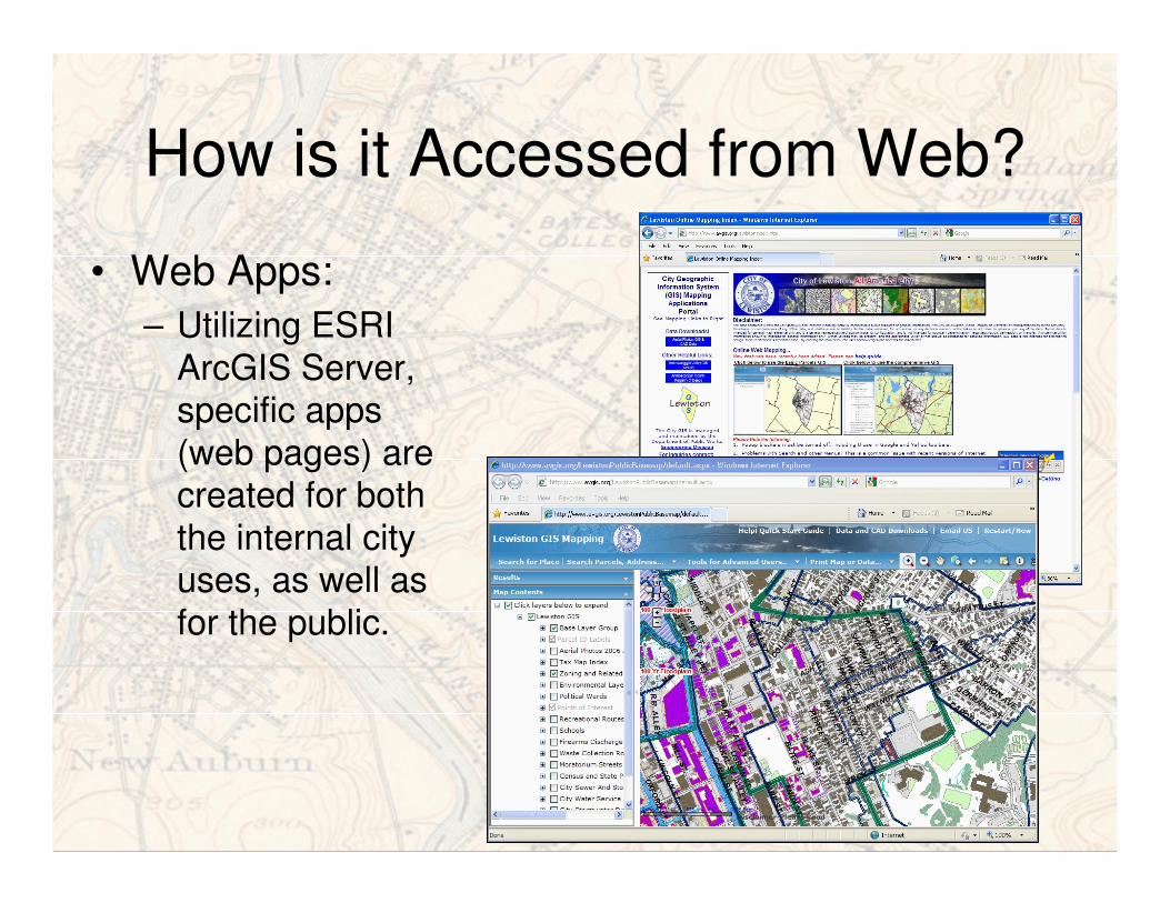
• Web Apps:
– Utilizing ESRI
ArcGIS Server, specific apps
(web pages) are created for both
the internal city uses, as well as
for the public.
Jim WardGIS Manager/Coordinator
City of Lewiston
Department of Public Works
Engineering Division
www.lewistonmaine.gov
I hope this helps provide a good overview and orientation to our City GIS. Please feel free to contact me for additional information.
Thank you!