Embed Size (px)
Citation preview

IHO S-100IHO S-100
2121stst Century Century Framework Data Structure Framework Data Structure for Hydrographic and Related Datafor Hydrographic and Related Data

Last updated Dec 2010
ReferenceReference
““IHO S-100 - IHO S-100 - The New Hydrographic Geospatial Standard The New Hydrographic Geospatial Standard for Marine Data and Informationfor Marine Data and Information” ”
– R. Ward, L. Alexander, B. GreensladeR. Ward, L. Alexander, B. Greenslade
http://www.iho.int/COMMITTEES/CHRIS/TSMAD/S-100_Info_Paper.pdfhttp://www.iho.int/COMMITTEES/CHRIS/TSMAD/S-100_Info_Paper.pdf

Last updated Dec 2010
HistoryHistory
IHO S-57 IHO S-57 -- May 1992 May 1992 Edition 3.0 Edition 3.0 - - November 1996November 1996 Edition 3.1 Edition 3.1 - - November 2000November 2000 ( (currently “active” but “frozen”currently “active” but “frozen”))
– Edition 3.1 Supplement No. 1 - January 2007Edition 3.1 Supplement No. 1 - January 2007 ( (added IMO-requested features for PSSA and ASLadded IMO-requested features for PSSA and ASL) )
– Edition 3.1 Supplement No. 2 - June 2009Edition 3.1 Supplement No. 2 - June 2009 ( (amended ZOC criteria, corrected navaid master-slave relationshipamended ZOC criteria, corrected navaid master-slave relationship) )
S-100 Edition 1.0.0 - S-100 Edition 1.0.0 - January 2010January 2010
Last updated Dec 2010
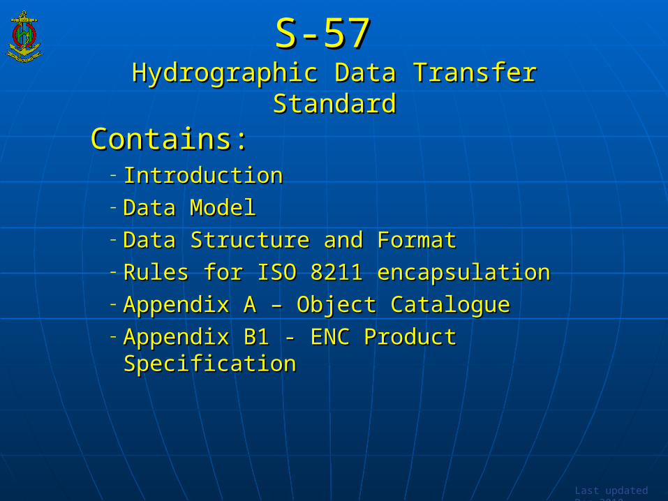
S-57 S-57 Hydrographic Data Transfer StandardHydrographic Data Transfer Standard
Contains:Contains:– IntroductionIntroduction– Data ModelData Model– Data Structure and FormatData Structure and Format– Rules for ISO 8211 encapsulationRules for ISO 8211 encapsulation– Appendix A – Object CatalogueAppendix A – Object Catalogue– Appendix B1 - ENC Product SpecificationAppendix B1 - ENC Product Specification

Last updated Dec 2010
S-57 UsersS-57 Users
– Hydrographic OfficesHydrographic Offices– Electronic Navigational Charts (ENCs)Electronic Navigational Charts (ENCs)
– other communities have S-57 based productsother communities have S-57 based products– Additional Military Layers (AML)Additional Military Layers (AML)– Marine Information Overlay (MIO)Marine Information Overlay (MIO)– Inland ENCInland ENC– [Port ENC][Port ENC]

Last updated Dec 2010
S-57 LimitationsS-57 Limitations
Developed primarily to meet ENC requirement for an Developed primarily to meet ENC requirement for an IMO compliant ECDIS IMO compliant ECDIS
Inflexible maintenance regime Inflexible maintenance regime ((freezingfreezing of editions) of editions)
Cannot support contemporary requirements Cannot support contemporary requirements – gridded bathymetry, time-varying information, etcgridded bathymetry, time-varying information, etc
Data transfer mechanisms are limited Data transfer mechanisms are limited – data model embedded in encapsulation (data model embedded in encapsulation (ISO 8211ISO 8211))

Last updated Dec 2010
Why S-100 ?Why S-100 ?
Join mainstream GISJoin mainstream GIS– maximizes access to COTS software and developmentmaximizes access to COTS software and development
interoperability with other ISO 19100 based profiles interoperability with other ISO 19100 based profiles new components not developed in isolationnew components not developed in isolation easier use of hydro data beyond HOs and ECDIS users easier use of hydro data beyond HOs and ECDIS users
- - coastal zone mapping, security, inundation modeling, …coastal zone mapping, security, inundation modeling, … extensible and active feature catalogue registryextensible and active feature catalogue registry Plug-and-PlayPlug-and-Play updating of data, symbology and software updating of data, symbology and software
enhancementsenhancements

Last updated Dec 2010
S-100 will support :S-100 will support : Imagery and gridded dataImagery and gridded data High-density bathymetryHigh-density bathymetry Seafloor classificationSeafloor classification 3-D and time-varying data (x,y,z and time)3-D and time-varying data (x,y,z and time) Dynamic ECDISDynamic ECDIS MIOsMIOs Marine GISMarine GIS Web-based servicesWeb-based services other maritime data applications …other maritime data applications …

Last updated Dec 2010
S-100S-100 Framework Data Structure Framework Data Structure
for Hydrographic and Related Datafor Hydrographic and Related Data
– broad geospatial framework structurebroad geospatial framework structure– Not specific to ECDIS or chartingNot specific to ECDIS or charting– Capable of accommodating other requirementsCapable of accommodating other requirements– Increasing interest from prospective e-Navigation data Increasing interest from prospective e-Navigation data
providersproviders– Based on ISO 19100 series of geographic standardsBased on ISO 19100 series of geographic standards

S-100 - built on ISO 19100S-100 - built on ISO 19100

Last updated Dec 2010
Naming: Naming: S-57 e4.0 S-57 e4.0 S-100 S-100
S-57 is NOT the ENC Product specificationS-57 is NOT the ENC Product specification S-100 is NOT the ENC Product specificationS-100 is NOT the ENC Product specification
S-57 and S-100 : S-57 and S-100 : genericgeneric framework standards for framework standards for hydrographic and related informationhydrographic and related information

Last updated Dec 2010
Additional ObjectivesAdditional Objectives Content and carrier are independentContent and carrier are independent No need for new versions of product specifications or No need for new versions of product specifications or
system revisionssystem revisions– Plug-and-playPlug-and-play updating updating
Product Feature Catalogs more flexible and capable of Product Feature Catalogs more flexible and capable of expansion expansion – can accommodate future IMO requirementscan accommodate future IMO requirements
Will support emerging ECDIS / e-Navigation Will support emerging ECDIS / e-Navigation requirements requirements – integrated Nautical Publications, Inland & Port ENC Product Specs, etcintegrated Nautical Publications, Inland & Port ENC Product Specs, etc

Last updated Dec 2010
Strong FoundationStrong Foundation Built on established international standards:Built on established international standards:
– ISO /TC211 (130 countries/members)ISO /TC211 (130 countries/members)
LiaisonLiaison– DGIWG (military)DGIWG (military)– OGC (strong industry/web involvement presence)OGC (strong industry/web involvement presence)– SDI (Spatial Data Infrastructure) communitiesSDI (Spatial Data Infrastructure) communities
IHO is hosting the ISO compliant RegistryIHO is hosting the ISO compliant Registry– Contains registers of hydrographic-related information (such as feature Contains registers of hydrographic-related information (such as feature
content dictionaries, data types, metadata, etc)content dictionaries, data types, metadata, etc)

Last updated Dec 2010
S-100 RegistryS-100 Registry
accessible via IHO website: accessible via IHO website: www.iho.intwww.iho.int


Last updated Dec 2010
Registry and RegistersRegistry and Registers
Management procedures in IHO S-99 Management procedures in IHO S-99 Registers organised under “domains” Registers organised under “domains”
– ((hydrographic features, sea ice coverage, nautical publications, Inland ENCs, etchydrographic features, sea ice coverage, nautical publications, Inland ENCs, etc )) Registry open to extension and use by other submitting Registry open to extension and use by other submitting
organizationsorganizations– Submitting organizations propose then regulate their domain Submitting organizations propose then regulate their domain
data - via domain control bodydata - via domain control body– All features tagged with domain “owner”All features tagged with domain “owner”

Last updated Dec 2010
Open ParticipationOpen Participation
Is what you want already in the S-100 registry?Is what you want already in the S-100 registry?– Then use it !Then use it !
Not in the registry ?Not in the registry ?– Then, find or become a submitting organization to :Then, find or become a submitting organization to :
– propose a revisionpropose a revision– propose something newpropose something new– propose to establish a new domainpropose to establish a new domain

ProposeIdentify
NeedDevelop Test Implement Transition
Testing phase
S-57 Active Standard
Stakeholder feedback and collaboration
Retirem
ent D
ate
Implementation phaseS-100
Active Standard
Effective date
S-57 superseded but still valid
Implement
Proposal phase
Development phase
1 Jan 2010
S-100 - StatusS-100 - Status

S-100 will support a greater variety of data sources, products and servicesS-100 will support a greater variety of data sources, products and services

S-100 and Product SpecificationsS-100 and Product Specifications
… … contains all contains all the componentsthe components
to make differentto make different product specifications product specifications
for all types of for all types of hydrographic datahydrographic data
S-101 ENCS-101 ENC
S-103 ??S-103 ??
S-104 ??S-104 ??
S-100S-100
???????????????????????????????????????????????????????????????? ... ... S-10?S-10?……
S-102 ??S-102 ??

Last updated Dec 2010
S-101 – next generation ENCS-101 – next generation ENC
Standard for future Electronic Navigational ChartsStandard for future Electronic Navigational Charts– Based on concepts in S-100Based on concepts in S-100– S-57 ed3.1 data will be usable in S-101 compliant ECDIS S-57 ed3.1 data will be usable in S-101 compliant ECDIS
systemssystems– Will incorporate all the data included in S-57 ENCWill incorporate all the data included in S-57 ENC– Will allow for Will allow for plug and playplug and play updating of data, symbology and updating of data, symbology and
software enhancementssoftware enhancements

Last updated Dec 2010
S-101 Development TimetableS-101 Development Timetable
Establish test datasets and test-bedsEstablish test datasets and test-beds Conduct impact analysisConduct impact analysis
– Production Software (Hydrographic Offices, software Production Software (Hydrographic Offices, software companies)companies)
– OEMsOEMs– End Users – training establishmentsEnd Users – training establishments– Type-approval authoritiesType-approval authorities

ProposeIdentify
NeedDevelop Test Implement Transition
Testing phase Implementation phase Active Standard
Implement
Proposal phase
Development phase
1 Jan 2010
S-101 – under development

Last updated Dec 2010
Migration from S-57 to S-100Migration from S-57 to S-100
Cooperation with all interested parties Cooperation with all interested parties ((workshops, IHO S-100 Discussion Forum, …..workshops, IHO S-100 Discussion Forum, …..))
S-57 ed3.1 will continue to be used for many years even S-57 ed3.1 will continue to be used for many years even after S-100 releaseafter S-100 release
Opportunity to use S-100 based Prod Specs (Opportunity to use S-100 based Prod Specs (e.g. gridded e.g. gridded bathybathy) with S-57 ENC Prod Spec via data overlays) with S-57 ENC Prod Spec via data overlays

Last updated Dec 2010
Impact on S57 e3.1 ENCsImpact on S57 e3.1 ENCs S-101 ENC Product Specification will not come into S-101 ENC Product Specification will not come into
force force until at leastuntil at least 2012 2012 S-101 ENC will sit alongside the existing S-57 e3.1 S-101 ENC will sit alongside the existing S-57 e3.1
ENC Product Specification for some timeENC Product Specification for some time ECDIS equipment which are upgraded to use S-101 ECDIS equipment which are upgraded to use S-101
ENCs ENCs will be able to use will be able to use S-57 e3.1 ENCsS-57 e3.1 ENCs

Last updated Dec 2010
SummarySummaryS-100S-100 Will enable wider use and transfer of hydrographic data Will enable wider use and transfer of hydrographic data
than S-57than S-57 Registry open to extension and use by other submitting Registry open to extension and use by other submitting
organizationsorganizations Will better support new/emerging requirementsWill better support new/emerging requirements Is aligned with a contemporary standard (Is aligned with a contemporary standard (ISO 19100ISO 19100)) Will Will NOTNOT make S-57 ENCs obsolete make S-57 ENCs obsolete Will Will notnot require HO’s to change to S-100 in the near future require HO’s to change to S-100 in the near future

IHO S-100 IHO S-100 The The Universal Hydrographic Data ModelUniversal Hydrographic Data Model