Embed Size (px)
Citation preview

DECLARATION OF COVENANTS, CONDITIONS, EASEMENTS AND RESTRICTIONS FOR HAMPTON PLACE
By
MCDANIEL ROAD DEVELOPLMENT CORPORATION A Georgia Corporation
(“Declarant”)
Dated: May 1, 1992

DECLARATION OF COVENANTS, CONDITIONS, EASEMENTS AND RESTRICTIONS FOR HAMPTON PLACE
TABLE OF CONTENTS
ARTICLE I DEFINITIONS………………………………………………… 1
Section 1 “Association”………………………………………………….. 1 Section 2 “Common Area………………………………………………... 1 Section 3 “Declarant”……………………………………………………. 1 Section 4 “Lot”…………………………………………………………... 2 Section 5 “Owner”……………………………………………………….. 2 Section 6 “Plat”………………………………………………………….. 2 Section 7 “Properties”………………………………………………….... 2 ARTICLE II PROPERTY RIGHTS………………………………………... 2 Section 1 Owners’ Easements of Enjoyment……………………………. 2 Section 2 Delegation of Use…………………………………………….. 3 Section 3 Conveyance of Common Area…………………………….…. 3 Section 4 Maintenance of Other Property………………………………. 4 Section 5 Use of Recreational Facilities by Non-Users……………….... 4 ARTICLE III MEMBERSHIP AND VOTING RIGHTS…………………... 5 Section 1 Membership………………………………………………..… 5 Section 2 Classes of Members………………………………………..… 5 Section 3 Voting Rights upon Annexation……………………………... 6 Section 4 Board of Directors……………………………………………. 6 Section 5 Limitation of Liability; Indemnification…………………...… 6 ARTICLE IV COVENANT FOR MAINTENANCE ASSESSMENTS……. 7 Section 1 Creation of the Lien and Personal Obligation
of Assessments……………………………………………….. 7 Section 2 Purpose of Assessments……………………………………… 7 Section 3 Maximum Annual Assessments……………………………… 7 Section 4 Special Assessments for Capital Improvements……………... 8 Section 5 Notice and Quorum for any Action Authorized Under Sections 3 and 4………………………………………. 8 Section 6 Uniform Rate of Assessment………………………………… 8 Section 7 Date of Commencement of Annual Assessments: Due Dates:…………………………………………………….. 8 Section 8 Contributions by Declarant…………………………………... 8 Section 9 Accumulation of Funds Permitted…………………………… 9 Section 10 Effect of Nonpayment of Assessments: Remedies of the Association………………………………… 9 Section 11 Subordination of the Lien to Mortgages……………………... 9
- i -

Section 12 Exempt Property……………………………………………... 9
Section 13 Individual Assessments………………………………………. 9 ARTICLE V ARCHITECTURAL CONTROL…………………………….. 10 Section 1 Approval of Plans…………………………………………….. 10 Section 2 Disclaimer as to Association Approval………………………. 10 ARTICLE VI GENERAL EASEMENTS, COVENANTS
AND RESTRICTIONS………………………………………. 11 Section 1 Application…………………………………………………… 11 Section 2 Easements…………………………………………………….. 11 Section 3 Restriction of Use…………………………………………….. 11 Section 4 Resubdivision of Property……………………………………. 11 Section 5 Maintenance………………………………………………….. 11 Section 6 General Use Restrictions……………………………………... 12 ARTICLE VII EASEMENTS AND ZONING………………………………. 14 Section 1 Association Easements………………………………………. 14 Section 2 Declarant’s Easements………………………………………. 14 Section 3 Zoning and Private Restrictions……………………………. . 15 ARTICLE VIII INSURANCE……………………………………………….. 15 Section 1 Insurance of Common Area ………………………………… 15 Section 2 Repair or Reconstruction of Common Area………………… 16 Section 3 Allocation of Deductible …………………………………… 16 Section 4 Additional Insurance ……………………………………….. 16 ARTICLE IX GENERAL PROVISIONS ………………………………… 17 Section 1 Enforcement………………………………………………… 17 Section 2 Severability…………………………………………………. 17 Section 3 Duration and Perpetuities…………………………………… 17 Section 4 Amendment ………………………………………………… 18 Section 5 Annexation …………………………………………………. 18 Section 6 No Reverter ………………………………………………… 19 Section 7 Headings……………………………………………………. 19 Section 8 Gender and Number ……………………………………….. 19 Section 9 Notices ……………………………………………………... 19 Section 10 No Rights of Third Parties …………………………………. 20 Section 11 Interpretation ………………………………………………. 20 Section 12 Notice to Mortgagees ……………………………………… 20 Section 13 FHA/VA Approval…………………………………………. 20
- ii -

EXHIBIT “A” Legal Description of Properties ………………………………… 1 - 3 EXHIBIT “B” Legal Description of Certain Common Area …………………… 1 - 3 EXHIBIT “C” Legal Description of Additional Land …………………………. 1 – 8 First Amendment Second Amendment Third Amendment
- iii -

DECLARATION
OF COVENANTS, CONDITIONS, EASEMENTS AND RESTRICTIONS
FOR HAMPTON PLACE
THIS DECLARATION is made on the date hereinafter set forth by MCDANIEL ROAD DEVELOPMENT CORPORATION, a Georgia corporation, hereinafter referred to as “Declarant”.
W I T N E S S E T H:
WHEREAS, Declarant is the owner of certain properties in Land Lots 234, 6th District, and Land Lot 119, 7th District, County of Gwinnett, State of Georgia, which are more particularly described on Exhibit “A” attached hereto and incorporated herein. NOW THEREFORE, Declarant hereby declares that all of the properties described above shall be held, sold and conveyed subject to the following easements, restrictions, covenants, and conditions, which are for the purpose of protecting and enhancing the value and desirability of, and which shall run with, the real property and be binding on all parties having any right, title or interest in the described properties or any part thereof, their heirs, successors and assigns, and shall inure to the benefit of each owner thereof; and each owner of any portion of said properties by acceptance of a deed therefore, whether or not it shall be so expressed in such deed, is deemed to covenant and agree to the same.
ARTICLE I
DEFINITIONS
Section 1. “Association” shall mean and refer to The Owners at Hampton Place, Inc., a Georgia nonprofit corporation, its successors and assigns. Section 2. “Common Area” shall mean all real property (including the improvements thereto) and personal property now or hereafter owned by the Association, or in certain instances over which the Association has been granted an easement or other interest, for the common use and enjoyment or benefit of the Owners and their Lots. On or before July 1, 1992, Declarant shall convey fee simple title to the property described on Exhibit “B” attached hereto and incorporated herein to the Association as Common Area hereunder. Section 3. “Declarant” shall mean and refer to McDaniel Road Development Corporation, a Georgia corporation, its successors and assigns, provided any such successors or assigns shall acquire for the purpose of development or sale all or any portion of the remaining undeveloped or unsold portions of the Properties or of the real property which may be annexed by Declarant without the consent of members, and provided further, in the instrument of conveyance to any such successor or assign, such successor or assign is designated as

“Declarant” hereunder by the grantor of such conveyance, which grantor shall be “Declarant” hereunder at the time of such conveyance; provided, further, upon such designation of successor “Declarant”, all rights and obligations of the former “Declarant” in and to such status as “Declarant” hereunder shall cease, it being understood that as to all of the Properties which are now or hereafter subjected to this Declaration, there shall be only one person or legal entity entitled to exercise the rights and powers of the “Declarant” hereunder at any one time. Section 4. “Lot” shall mean and refer to any subdivided plot of land within the Properties intended for residential use and shown upon the Plat, as the same may now or hereafter be amended by Declarant, expressly excluding the Common Area, but expressly including any plot or plots of land intended for further subdivision by Declarant, which plots of land shall constitute one (1) Lot until so subdivided. Section 5. “Owner” shall mean and refer to the record owner, including Declarant, whether one or more persons or entities, of the fee simple title to any Lot which is a part of the Properties, including contract sellers, but excluding those having such interest merely as security for the performance of an obligation. Section 6. “Plat” shall mean and refer to that certain Final Plat of Phase One Hampton Place prepared by Watts & Browning Engineers, Inc. dated April 15, 1992, and recorded in Plat Book 55, Page 257, Gwinnett County, Georgia records, which Plat is incorporated herein by reference, as the same may be amended by Declarant from time to time in its sole discretion and recorded in the plat records of Gwinnett County, Georgia. Section 7. “Properties” shall mean and refer to that certain real property described on said Exhibit “A” attached hereto, and such additions thereto as may hereafter be brought within the jurisdiction of the Association in accordance with the provisions of Section 5, Article IX, hereof.
ARTICLE II
PROPERTY RIGHTS
Section 1. Owner’s Easements of Enjoyment. Every Owner shall have a right and easement of enjoyment in and to the Common Area which shall be appurtenant to and shall pass with the title to every Lot, subject to the terms and provisions of this Declaration and the Articles of Incorporation and Bylaws of the Association, including, without limitation, the following provisions, the rights and easements for which are hereby granted conveyed, declared and reserved by Declarants:
(a) the right of the Association to promulgate and enforce reasonable guidelines, rules and regulations with respect to the use of any Common Area and the personal conduct of the Owners and their guests thereon, including without limitation, the right to prohibit the use of any lake, detention pond or conservation areas located within the Common Area for recreational purposes;
(b) the right of Declarant and the Association to permit the use of any
- 2 -

Common Area, including, without limitation, any recreational facility situated upon the Common Area, as provided in Section 5 of this Article, by persons other than an Owner and to charge reasonable admission and other fees for such use by such other persons as Declarant and the Association shall determine in its discretion, which fees may be different for different classifications of users but which shall be uniform within each such class;
(c) the right of the Association to suspend the voting rights and right to use of
any recreational facility situated upon any Common Area by an Owner for any period during which any assessment against such Owner’s Lot remains unpaid, and, after notice and hearing, for a period not to exceed sixty (60) days for any infraction of its published rules, regulations or guidelines;
(d) the exclusive right of the Association to improve, maintain and repair the Common Area and to enforce all applicable provisions of valid agreements of the Association relating to the Common Area or any portion thereof;
(e) the right of the Association to grant easements or rights-of-way over, and, with the assent of the Class B member, if any, and the Class A members entitled to cast two-thirds (2/3) of the total votes of the Class A members, to dedicate or transfer all or any part of the Common Area or interests therein, to any public or quasi-public agency or authority or to any utility or cable television system for such purposes and subject to such conditions as may be agreed to by the Association and such grantee, including a provision that such property or interest shall cease to be subject to this Declaration while held by any such agency, authority or utility; provided, however, that if ingress or egress to any Lot is through such Common Area, any such conveyance or encumbrance shall be subject to the Lot Owner’s easement provided in this Declaration. An instrument agreeing to such grant, dedication or transfer, if signed by the Class B member, if any, and the Association, shall be prima facie evidence of such required approval; and
(f) so long as Declarant owns any portion of the Properties or has the right unilaterally to annex additional land to the Properties pursuant to this Declaration, the right and easement of Declarant and Declarant’s agents or assigns to use the Common Area or any improvement thereon or portion thereof, including, without limitation, any clubhouse, without charge, for any purpose relating to the development or sale of any portion of the Properties or the development know as “The Hamptons”, including, without limitation, for general office purposes and promotional functions.
Section 2. Delegation of Use. Any Owner may delegate, in accordance with the Bylaws of the Association, his right of enjoyment to the Common Area to the members of his family, his tenants, or contract purchasers who reside on a Lot. Section 3. Conveyance of Common Area. Declarant may at any time and from time to time convey to the Association or grant easements or other interests to the Association in any real or personal, improved or unimproved property as Declarant may determine to be necessary, proper or desirable for the common use and enjoyment or benefit of the Owners, and such others as Declarant may provide, as Common Area to be maintained by the Association for general purposes or for such specific purposes as Declarant may designate. The Association
- 3 -

shall be obligated hereunder to accept from Declarant all such conveyances or grants of Common Area and to maintain such Common Area, including without limitation, any and all improvements and facilities made or provided by Declarant, in good order and repair. Such Common Area may include, without limitation, recreational facilities, landscaped areas, sign areas, lakes dams, bridges, drainage and detention facilities, roads, natural buffers and conservation areas. Declarant reserves the right and easement to make any and all improvements to any Common Area as Declarant may determine to be necessary, proper or desirable, but Declarant shall have no obligation to repair or to improve in any way any Common Area or any property to be conveyed and accepted as Common Area pursuant to this Section. Notwithstanding any legal presumption to the contrary, the fee title to, and all rights in, any portion of the Properties or other property designated as Common Area or for public use shall be reserved to Declarant until such time as the same shall be expressly granted or conveyed to the Association or to any public body, agency or authority. Section 4. Maintenance of other Property. The Association shall also have the right, but not the obligation, to maintain and provide services for other property not owned by the Association, whether located within or without the boundaries of the Properties, and to enter into easements and covenants to share cost agreements regarding such property where the Board of Directors of the Association has determined that this would benefit the Owners. At the time of the execution of this Declaration, the Properties are burdened and benefited by that certain Declaration of Easements and Covenants to Share Costs by and between Declarant and Edward L. Terry and S. Kent Owings of even date herewith and recorded in the public records of Gwinnett County, Georgia, regarding the Properties and certain properties adjacent to the Properties, pursuant to which declaration the Association has been granted certain easements in other properties as Common Area hereunder, certain easements in certain Common Area here under have been granted to others, and the Association has assumed certain maintenance obligations with respect thereto. Section 5. Use of Recreational Facilities by Non-Owners. (a) Right of Declarant to Grant Right to Use. For so long as Declarant has
the right unilaterally to annex additional land to the Properties, as provided in Article IX, Section 5 hereof, Declarant shall have the unilateral right to grant to persons who are not Owners the right and/or option to use the recreational and other facilities located on any Common Area, as provided in this Section. Declarant may, without limitation, grant such right and/or option to use to non-Owners as a perpetual easement appurtenant to real property so that such rights shall automatically inure to the benefit of both the original grantees and their respective successors-in-title to such real property. Any such right, option and/or easement granted by Declarant to non-owners which extends beyond Declarant’s right to annex additional land to the Properties under this Declaration shall be valid and may not be terminated or modified by the Association, or its Board of Directors, so long as the terms and conditions imposed upon such non-Owners hereunder and by Declarant are complied with. In furtherance thereof, Declarant hereby expressly reserves unto itself and it’s successors, assigns and aforesaid grantees, a non-exclusive, perpetual right, privilege and easement in, upon, over and across all Common Area for the benefit of Declarant and its successors, assigns and aforesaid grantees for the purpose of using the recreational and other facilities thereon. Such right, privilege and easement shall include, without limitation, the right of pedestrian and vehicular access, ingress,
- 4 -

egress and use of the walkways, roads, driveways and parking areas within the Properties. For so long as Declarant has the right unilaterally to annex additional land to the Properties, as provided in this Declaration, Declarant shall have the exclusive right to grant use rights in the Common Area and the recreational facilities thereto to non-Owners, and, thereafter, the Association shall have such exclusive right; provided, however, that so long as required by the Federal Housing Administration or the Veterans Administration, any such grant shall require the prior approval of the Federal Housing Administration or the Veterans Administration. The provisions of this Section shall control, notwithstanding any other provisions to the contrary in this Declaration or in the Articles of Incorporation or Bylaws of the Association.
(b) Exercise of Right to Use. The extent and duration of a non-Owner’s use of the
recreational and other facilities, as provided in this Section, and any fees to be paid by such non-Owner to the Association therefore shall be determined solely by Declarant as set forth in the grant to such non-Owner. Any such fees shall be paid in annual installments to the Association. The amount of such annual installments may be increased each year by the Board of Directors of the Association in the same manner and subject to the same maximum increases as provided in Article IV of this Declaration with respect to the annual assessments hereunder. The exercise by non-Owners of the rights and easements in and to the Common Area shall be subject to the same nondiscriminatory guidelines, rules and regulations applicable to the Owners with respect thereto, including without limitation, the delegation of the right to use to family members, tenants and guests. Declarant shall not be liable for and is hereby held harmless by the Owners and the Association from any failure of a non-Owner to pay any user fee to the Association and from any other action or inaction, including without limitation, negligence of any such non-owner or his delegates. In the case of a breach of any non-Owner’s obligations, the Association shall have the right to suspend the use right of such non-Owner in the same manner as shall be permitted with respect to a breach by an Owner.
ARTICLE III
MEMBERSHIP AND VOTING RIGHTS
Section 1. Membership. Every Owner shall automatically be a member of the Association and shall have voting rights in the Association as provided herein and in the Articles of Incorporation and Bylaws of the Association. Membership shall be appurtenant to and may nor be separated from ownership of any Lot. Section 2. Classes of Members. The Association shall have two classes of voting memberships:
Class A. “Class A members” shall be all Owners, with the exception of the Declarant, and shall be entitled to one (1) vote for each Lot owned. When more than one person or entity holds an interest in any Lot, all such persons and entities shall be members. The vote for such Lot shall be exercised as they determine, but in no event shall more than one vote be cast with respect to any Lot.
Class B. The “Class B member” shall be Declarant and shall be entitled to
- 5 -
three (3) votes for each Lot owned; provided, however, that so long as Declarant has the right to annex additional land to the Properties without the consent of members, pursuant to Section 5, Article IX of this Declaration, in no event shall the Class B member have less than the total number of votes of the Class A member plus one (1); provided further, however, that the Class B membership shall cease and be converted to Class A memberships on the happening of any of the following events, whichever occurs earlier:
(a) when the total votes outstanding in the Class A membership equal
the total votes outstanding in the Class B membership;
(b) the voluntary surrender by Declarant of its Class B membership, which surrender shall be effective upon the delivery of notice thereof to the Association by Declarant; or
(c) July 1, 1997.
Upon the expiration or earlier surrender of the Class B membership, the Association and Declarant shall execute and record an amendment to this Declaration evidencing such expiration or surrender. Section 3. Voting Rights upon Annexation. The proposed development is composed of Lots to be developed in phases which may contain unequal numbers of Lots. Each such phase may be annexed and subjected to this Declaration by an amendment hereto in accordance with the provisions of Section 5, Article IX of this Declaration. Upon the filing of an amendment subjecting any such phase to this Declaration, the total votes outstanding in the Association will be automatically increased in accordance with the formula set forth in Section 2 of this Article III. Section 4. Board of Directors. The affairs of the Association shall be managed by a Board of Directors as set forth in the Bylaws of the Association. Notwithstanding any other language or provision to the contrary in this Declaration, or in the Articles of Incorporation or Bylaws of the Association, Declarant shall have, and hereby retains, the right to appoint and remove any member or members of the Board of Directors of the Association and any officer or officers of the Association until the expiration or surrender of the Class B membership, as provided in Section 2, above, at which time such rights shall automatically pass to the Class A members, including Declarant if Declarant then owns one or more Lots; and a special meeting of the Association shall be called within sixty (60) days thereafter to elect a new Board of Directors. Each Owner by acceptance of a deed or other conveyance of a Lot vests in Declarant such authority to appoint and remove members o the Board of Directors and officers of the Association as provided in this Section. Section 5. Limitation of Liability; Indemnification. The personal liability of the Association’s directors and officers shall be limited as provided in the Articles of Incorporation of the Association. In addition, each director and officer of the Association shall be indemnified and held harmless by the Association, as a common expense of the Association, from any expense, loss or liability by reason of having served as such director or officer, all as set forth in the Bylaws of the Association.
- 6 -

ARTICLE IV
COVENANT FOR MAINTENANCE ASSESSMENTS
Section 1. Creation of the Lien and Personal Obligation of Assessments. The Declarant, for each Lot owned within the Properties, hereby covenants, and each Owner of any Lot, jointly and severally, for himself, his heirs, legal representatives, successors and assigns, by acceptance of a deed or other conveyance therefore, whether or not it shall be so expressed in such deed or other conveyance, is deemed to covenant and agree to pay to the Association: (i) annual assessments and charges, (ii) special assessments for capital improvements, and (iii) individual assessments and charges, any and all such assessments and charges to be established, secured and collected as hereinafter provided. The annual, special and individual assessments, together with interest, charges, costs of collection, and reasonable attorney’s fees, all as provided for herein, shall be a charge on the land and shall be a continuing lien upon the Lot or Lots against which each such assessment is made. Each such assessment, together with interest, charges, costs of collection, and reasonable attorney’s fees, shall also be the joint and several personal obligation of the persons or entitles comprising the Owner of such Lot at the time when the assessment fell due. The personal obligation for delinquent assessments shall survive any sale or transfer of the Lot but shall not pass to such Owners successors in title unless expressly assumed by them. Section 2. Purpose of Assessments. The assessments levied by the Association shall be used exclusively to promote the recreation, health, safety, and welfare of the Owners and residents in the Properties and for the improvement and maintenance of the Common Area, including, without limitation, the following: the enforcement of this Declaration; the payment of taxes, utility bills and insurance premiums on the Common Area; the payment of the operating costs, management fees and administration expenses of the Association; and the funding of any reserve accounts established by the Association. Section 3. Maximum Annual Assessment. Until January 1 of the year immediately following the conveyance of the first Lot to an Owner, the maximum annual assessment shall be Three Hundred Twenty-Five Dollars ($325.00) per Lot.
(a) From and after January 1 of the year immediately following the conveyance of the first Lot to an Owner, the maximum annual assessment may be increased each year not more than ten percent (10%) above the maximum assessment for the previous year without a vote of the membership.
(b) From and after January 1 of the year immediately following the conveyance of
the first Lot to an Owner, the maximum annual assessment may be increased above ten percent (100%) by a vote of the Class B member, if any, and two-thirds (2/3) of the Class A members who are voting in person or by proxy, at a meeting duly called for this purpose at which a quorum is present.
(c) The Board of Directors of the Association may fix the annual assessment at an
amount not in excess of the maximum. For so long as Declarant shall be the Class B member, the annual assessment shall not be
- 7 -

reduced below the amount of the previous year’s annual assessment without the express written approval of Declarant. Section 4. Special Assessments for Capital Improvements. In addition to the annual assessments authorized above, the Association may levy, in any assessment year, a special assessment applicable to that year only for the purpose of defraying, in whole or in part, the cost of any construction, reconstruction, repair or replacement of a capital improvement upon the Common Area, including fixtures and personal property related thereto, provided that any such assessment shall have been approved by a vote of the Class B member, if any, and two-thirds (2/3) of the votes of the Class A members who are voting, in person or by proxy, at a meeting duly called for this purpose at which a quorum is present. Section 5. Notice and Quorum for Any Action Authorized Under Sections 3 and 4. Written notice of any meeting called for the purpose of taking any action authorized under Section 3 or 4 shall be sent to all member not less than fifteen (15) days nor more than sixty (60) days in advance of the meeting. At the first such meeting called, the presence of members or of proxies entitled to cast the votes of the Class B member, if any, and sixty percent (60%) of all the votes of the Class A members shall constitute a quorum. If the required quorum is not present, another meeting may be called subject to the same notice requirement, and the required quorum at the subsequent meeting shall be the Class B member, if any, and one-half (1/2) of the Class A members required for a quorum at the preceding meeting. No such subsequent meeting shall be held more than sixty (60) days following the preceding meeting. Section 6. Uniform Rate of Assessment. Both annual and special assessments must be fixed at a uniform rate for all Lots and may be collected on an annual or monthly basis. Section 7. Date of Commencement of Annual Assessments: Due Dates. The assessments provided for herein shall commence as to each Lot on the later to occur of July 1, 1992 or the date on which said Lot is first improved and occupied for residential purposes. The first annual assessment shall be adjusted according to the number of months remaining in the calendar year. The Board of Directors of the Association shall fix the amount of the annual assessment against each Lot at least fifteen (15) days in advance of each annual assessment due date. Written notice of the annual assessment shall be sent to every Owner subject thereto. The due dates shall be established by the Board of Directors. The Association shall, upon demand, and for a reasonable charge, furnish a certificate signed by an officer of the Association setting forth whether the assessments on a specified Lot have been paid. A properly executed certificate of the Association as to the status of assessments on a Lot is binding upon the Association as of the date of its issuance. Section 8. Contributions by Declarant. Anything in this Declaration to the contrary notwithstanding, for so long as Declarant shall be the Class B member, Declarant shall not be liable for the payment of, and Declarant’s Lots shall not be subject to, any assessments under this Declaration; provided, however, that during said period Declarant shall be obligated to pay any deficit which may exist between the actual operating expense of the Association (excluding any allocations for reserve accounts) and the sum of the annual, special and individual assessments and other amounts collected by the Association. Declarant’s obligation to pay said deficit shall be secured by the lien of the assessments created in this Article IV against all of Declarant’s lots, which lien shall be subordinate as provided in Section 11, hereof.
- 8 -

Section 9. Accumulation of Funds Permitted. The Association shall not be obligated to spend in any calendar year all of the sums collected in such year by way of annual assessments or otherwise, and may carry forward, as surplus, any balances remaining; nor shall the Association be obligated to apply such surplus to the reduction of the amount of the annual assessments in any succeeding year, but may carry forward from year to year such surplus as the Board of Directors of the Association may deem to be desirable for the greater financial security of the Association and the effectuation of its purposes. During any period in which the Association is operating at a deficit, whether or not such deficit is being paid by Declarant, any amounts in any reserve account may be used to reduce such deficit at the discretion of the Board of Directors of the Association. Section 10. Effect of Nonpayment of Assessments: Remedies of the Association. Any assessment not paid on or before the due date shall bear a late charge in the amount of twenty-five dollars ($25.00). Any assessment not paid within thirty (30) days after the due date shall bear interest from the due date at the rate of the lesser of (i) eighteen percent (18%) per annum or such other rate as the Board of Directors of the Association may from time to time establish, or (ii) the maximum rate of interest allowed therefor under the laws of the State of Georgia. If any assessment, interest, cost or other charge is not paid as required by this Declaration, the Association may bring an action at law against the Owner personally obligated to pay the same, or an action to foreclose the lien created by this Declaration against a Lot or Lots subject o the lien, or both, for the purpose of collecting such assessment, interest, costs or other charges, plus any interest thereon and costs of collection, including reasonable attorneys’ fees. No Owner may waive or otherwise escape liability for the assessments provided for herein by non-use of the Common Area or abandonment of his Lot. Section 11. Subordination of the Lien to Mortgages. The lien of the assessments provided for herein shall be subordinate to (i) the lien for real property taxes or other public charges as are by applicable law made superior, and (ii) the lien or security title of any first-in-priority mortgage or deed to secure debt recorded prior to the recordation of any claim of lien as to a particular Lot or Lots. Sale or transfer of any Lot shall not affect the assessment lien. However, the sale or transfer of any Lot pursuant to foreclosure of any such first-in-priority mortgage or deed to secure debt, or any proceeding in lieu thereof, shall extinguish the lien of such assessments as to payments which became due prior to such sale or transfer. No sale or transfer shall relieve such Lot from liability for any assessments thereafter becoming due or from the lien thereof. Mortgagees are not required to collect assessments. Section 12. Exempt Property. All Common Area, all properties dedicated to, and accepted by, or under long term ground lease to any local public or governmental authority, or private or public utility for public use, and all properties owned by a charitable or nonprofit organization exempt from taxation by the laws of the State of Georgia shall be exempt from the assessments created herein, except no land or improvements devoted to dwelling use shall be exempt from said assessments. Section 13. Individual Assessments. The foregoing notwithstanding, the Association shall have the power and right, but not the obligation, in the discretion of the Board of Directors of the Association as it shall deem appropriate, to assess equitably less than all of the Owners for expenses of the Association which benefit less than all of the Lots and to assess any Owner individually for fines or other charges as may be imposed in accordance with the terms of this
- 9 -

Declaration or the Bylaws of the Association, including, without limitation, any fine or charge for maintenance or repair or caused by a violation of or a failure to perform the covenants, conditions and restrictions set forth herein by such Owner . Failure of the Board of Directors to exercise its authority under this Section shall not be grounds for any action against the Association or its Board of Directors and shall not constitute a waiver of the right to exercise such authority in the future. Anything in this Declaration to the contrary notwithstanding, this Declaration shall not impose and shall not be deemed to impose absolute liability upon Owners for acts of family, guests, invitees or licensees for damage to any Common Area or Lot (including improvements) of others; such liability shall be only that for which such Owners are legally responsible under applicable state law.
ARTICLE V
ARCHITECTURAL CONTROL
Section 1. Approval of Plans. No building, fence, wall, driveway or other structure or improvement of any sort shall be commenced, erected or maintained upon the Properties by any Owner other than Declarant, nor shall any exterior addition to or change or alteration thereto be made until plans and specifications showing the nature, kind, shape, height, color, materials, and location of the same, and including, without limitation, a landscaping and erosion control plan when appropriate, shall have been submitted in writing to and approved in writing as to (a) harmony of external design and appearance and location in relation to surrounding structures and topography and (b) compliance with any written guidelines, rules and regulations regarding the same, by the Board of Directors of the Association, or by an architectural committee composed of three (3) or more representatives appointed by said Board. Notwithstanding the foregoing, an Owner may make interior improvements and alterations in or to his residence, which do not affect the exterior appearance thereof, without such approval. In the event said Board, or its designated committee, fails to approve or disapprove such design, appearance and location within thirty (30) days after said plans and specifications have been submitted to it, approval will not be required and this Article will be deemed to have been fully complied with, subject to all other terms and provisions of this Declaration and any written guidelines, rules and regulations promulgated by said Board, or its designated committee, and made available to Owners upon request. The Association may impose and collect a reasonable fee to cover the cost of review of plans and of any inspection performed to insure compliance with this Declaration. Anything in this Declaration to the contrary notwithstanding, for so long as Declarant shall be the Class B member, any approval or consent required or permitted under this Declaration by the Board of Directors of the Association or its designated committee may be granted or denied by Declarant.
Section 2. Disclaimer as to Association Approval. Neither Declarant, the Association, the Board of Directors of the Association, its designated committee nor any of the members of any of the foregoing shall be liable in damage or otherwise to anyone submitting plans and specifications for approval or to any Owner affected by this Declaration by reason of mistake of judgment, negligence or nonfeasance arising out of or in connection with the approval or disapproval or failure to approve or disapprove any plans and specification. Plans and specifications are not reviewed for engineering or structural design or quality of materials, and by approving such plans and specifications, none of the above-named parties assume liability or
- 10 -

responsibility therefor, nor for any defect in any structure constructed from such plans and specifications. Any person who submits plans and specification agrees that it will not bring any action or suit against any of the above-named parties to recover any damages and hereby releases each of the above-named parties and their employees and agents from all claims, demands and causes of action arising out of or in connection with any judgment, negligence or nonfeasance and hereby waives the provisions of any law which provides that a general release does not extend to claims, demands and causes of action not known at the time the release is given.
ARTICLE VI
GENERAL EASEMENTS, COVENANTS AND RESTRICTIONS
Section 1. Application. The easements, covenants and restrictions contained in this Article VI shall pertain and apply to all Lots and to all improvements erected or place thereon. Section 2. Easements. The Properties shall be subject to any and all easements, restrictions and dedications set forth on the Plat, including any amendment thereto. Section 3. Restriction of Use. Lots may be used for single-family residences and single-family residential purposes only and for no other purpose, provided that Declarant may construct and operate a sales office, construction office and/or model home on a Lot or Lots designated by Declarant. Section 4. Resubdivision of Property. No Lot may be split, divided, or subdivided for sale, resale, gift, transfer, or otherwise, except by Declarant, without the prior written approval of the Board of Directors of the Association or its designated committee of the plans and specifications for such split, division or subdivision. Notwithstanding the foregoing, nothing herein shall prevent Declarant or the Owners of any Lots from combining two or more Lots into one Lot for construction of a single-family residence thereon; provided, however, that such combined Lot may not be subdivided thereafter; and, provided further, that the Owner of the residence on such Lot shall be responsible for annual and special assessments based upon the number of Lots combined into one Lot. Section 5. Maintenance. Each Owner shall keep and maintain each Lot and the improvements located thereon, as well as all landscaping located thereon, in a neat and orderly appearance and in good condition and repair, including, but not limited to (i) the repairing and painting (or other appropriate external care) of all structures; (ii) the seeding, watering and mowing of all lawns; and (iii) the pruning and trimming of all trees, hedges, shrubbery and other growth so that the same are not obstructive of a view by motorists or pedestrians of street traffic. Notwithstanding the foregoing, the maintenance required hereunder shall also extend from the boundary of a Lot to the curbing of the right-of-way bordering said Lot, except for that portion of any Lot located within a landscape easement and maintained by the Association. If in the opinion of the Board of Directors of the Association, any Owner shall fail to perform the duties imposed by this Section, then the Board shall give written notice to the Owner to remedy the condition in question, setting forth in reasonable detail the nature of the condition and the specific action or actions needed to be taken to remedy such condition. If the Owner shall fail to take reasonable steps to remedy the condition within thirty (30) days after the mailing of said written notice by certified mail, then the Association may proceed to enforce the provisions
- 11 -
hereof, including, without limitation, the right of abatement set forth in Section 1, Article IX of this Declaration. Guidelines relating to the maintenance of structures and landscaping may be promulgated by the Board of Directors of the Association or its designated committee, which guidelines shall be made available to all Owners upon request. Section 6. General Use Restrictions.
(a) Signs. No signs whatsoever (including but not limited to commercial and similar signs) shall, without the Board of Directors of the Association or its designated committees prior written approval of plans and specifications therefor, be installed, altered or maintained, except by Declarant, on any Lot or on any Common Area, including, without limitation, on any portion of a structure visible from the exterior thereof, except:
(i) such signs as may be required by legal proceedings;
(ii) not more than one “For Sale” or “For Rent” sign, such sign having a
maximum face area of four square feet; provided that such sign may only be displayed in the front yard of a Lot; and, provided, further, that if, at the time of any desired use of such sign, the Association is making “For Sale” or “For Rent” signs available for the use of Owners, the signs made available by the Association must be used; and
(iii) such other signs as may be permitted from time to time by any
written guidelines, rules or regulations promulgated by the Board of Directors of the Association or its designated committee, at its discretion.
(b) Antennae, Etc. No exterior television or radio antennae or satellite dish or
receiver or solar equipment of any sort shall be placed, allowed or maintained upon any portion of a structure or Lot without prior written approval by the Board of Directors of the Association or its designated committee, except as may be permitted from time to time by any written guidelines, rules or regulations promulgated by the Board of Directors of the Association or its designated committee, at its discretion.
(c) Clotheslines, Garbage Cans, Etc. All clotheslines, garbage cans, woodpiles
and other permitted equipment shall be kept screened by adequate planting or fencing so as to conceal them from view by neighboring residences and streets, and may be maintained in the rear yard on a Lot only.
(d) Commercial and Recreational Vehicles and Trailers. No commercial vehicle,
house trailer, mobile home, motor home, recreational vehicle, camper, truck with camper top, boat or boat trailer or like equipment shall be permitted on any Lot on a permanent basis, but shall be allowed on a temporary basis not to exceed forty-eight (48) consecutive hours. Notwithstanding the foregoing, any such vehicles or equipment may be stored on a Lot, provided such vehicle or equipment is kept in a garage and is concealed from view by neighboring residences and streets pursuant to plans and
- 12 -

specifications approved by the Board of Directors of the Association or its designated committee.
(e) Recreational Equipment. Recreational and playground equipment shall be placed or installed only upon the rear yard of a Lot. Basketball goals may be placed adjacent to the driveway, but shall be painted to match the house. No above ground pool shall be allowed.
(f) Animals. No agricultural animals may be kept on any Lot and no animals,
including birds, insects, and reptiles, may be kept on any Lot unless kept thereon solely as household pets and not for commercial purposes. No animal shall be allowed to become a nuisance. No structure for the care, housing or confinement of any animal shall be constructed, placed or altered on any Lot unless plans and specifications for said structure have been approved by the Board of Directors of the Association or its designated committee or are in compliance with any written guidelines, rules or regulations promulgated from time to time by said Board of Directors or committee, at its discretion.
(g) Solid Waste.
(i) No person shall dump, place or allow to accumulate rubbish, garbage or any other form of solid waste on any Lot or on Common Area;
(ii) Except during approved construction and as approved by the
appropriate governmental authority, no person shall burn rubbish, garbage, or any other form of solid waste on any Lot or on Common Area;
(iii) Except for building materials employed during the course of any
approved construction, no lumber, metals, bulk materials or solid waste of any kind shall be kept, stored, or allowed to accumulate on any Lot unless concealed from view by neighboring residences and streets.
(iv) If rubbish, garbage, or any other form of solid waste or recyclable is
to be disposed of by being collected on a regular and recurring basis, containers may be placed in the open on any day that a pickup is to be made, in order to provide access to persons making such pickup. At all other times such containers shall be concealed from view by neighboring residences and streets.
(h) Fences. No chain link or barbed wire fence shall be permitted. No other
fence shall be permitted, except as approved by the Board of Directors of the Association or its designated committee pursuant to Article V, above.
(i) Parking. No vehicle of any type my be parked on any Common Area or on
any private or public street, road or drive within or adjacent to the Properties, except within those areas designated by the board of Directors
- 13 -

of the Association or its designated committee and in accordance with any guidelines rules or regulations promulgated thereby.
(j) Nuisances. No noxious or offensive activity shall be carried on upon any Lot
or Common Area, nor shall anything be done thereof which may be or may become any annoyance or nuisance to the community.
(k) Rules and Regulations. The Board of Directors of the Association, or its
designated committee, may promulgate from time to time such additional, reasonable guidelines, rules or regulations for the use of Lots and/or the Common Area as it shall deem to be appropriate or desirable for the purposes of protecting and enhancing the value and desirability of the Properties, copies of which guidelines, rules or regulations, if any, shall be made available to any Owner upon request.
ARTICLE VII
EASEMENT AND ZONING
Section 1. Association Easements. The Association (for itself and as a agent of the Owners) and its Board of Directors, committees, agent and employees, including without limitation, any manager employed by the Association, shall have non-exclusive easements in, upon, over, under and across the following portions of the Properties for the following purposes and for other reasonable purposes incidental thereto, including, without limitation, access, ingress and egress, which easements shall be Common Area hereunder:
(a) All those certain landscape, no access, detention, drainage, utility, sign, conservation, buffer and other easements and areas within the Properties and shown on the Plat, for the purpose of constructing, installing, improving, operating, using, maintaining and repairing any and all improvements of any sort relating to such easements or areas;
(b) A strip of land ten (10) feet in width running inside and along all the
boundary lines of each Lot for the purpose of underground utilities and drainage; and
(c) All portions of the Properties for the purpose of performing any and all rights or obligations of the Association or its Board of Directors or designated committees under this Declaration or provided by law.
Section 2. Declarant’s Easements. Any provisions or restrictions in this Declaration to the contrary notwithstanding, for so long as Declarant shall own any portion of the Properties, or shall have the right unilaterally to annex additional land to the Properties and this Declaration pursuant to the terms and provisions hereof, Declarant, and its duly authorized representatives, agents, employees and assigns shall have the following rights and easements, which rights and easements shall be subject to the rights and easements of the Owners and the Association set forth in this Declaration:
- 14 -

(a) A non-exclusive right and easement in, upon, over, under and across the Common Area and all Lots for the purpose of constructing residences on the Lots and making such other improvements to the Properties as are contemplated by this Declaration and as Declarant, in its sole discretion, desires, including, without limitation, utilities serving the Properties, any portion thereof, or any adjacent properties, and for the purpose of doing all things reasonably necessary and proper in connection therewith; provided, however, in no event shall Declarant have the obligation to do any of the foregoing; and
(b) A non-exclusive right and easement to install, store, maintain, repair, replace and use from time to time on the Common Area (including without limitation, on or within any improvement thereon), without charge, as well as the right to install, maintain, store, repair, replace and use from time to time on any Lot owned by Declarant, sales, advertising and promotional signs, a sales office, a construction trailer and a business office, together with such other materials, equipment and facilities as in the sole opinion of Declarant may be reasonably required, convenient or incidental to the construction of residences, roads, utilities, recreational facilities, drainage and detention facilities and such other improvements as Declarant shall desire in connection with the development of the Properties and the sale of Lots.
Section 3. Zoning and Private Restrictions. None of the covenants, conditions, restrictions or easements created or imposed by this Declaration shall be construed as permitting any action prohibited by applicable zoning laws or by any other laws, ordinances, rules or regulations of any governmental body having jurisdiction or by private restriction. In the event of any conflict between or among such laws, ordinances, rules or regulations, the covenants, conditions, restrictions or easements created or imposed by this Declaration or such private restrictions, the most restrictive provision shall govern and control.
ARTICLE VIII
INSURANCE
Section 1. Insurance of Common Area. (a) At all times during the term of this Declaration, the Association, its
successors and assigns, shall be required to keep any and all recreational facilities and any other insurable improvements located on the Common Area fully insured by a reputable insurance company authorized to transact business in the State of Georgia with (i) fire, vandalism, malicious mischief and extended coverage insurance in an amount adequate to cover the cost or replacement of such improvements in the event of loss of any and/or all of such improvements, fixtures and contents thereof; and (ii) public liability insurance in such amounts as shall be determined by the Board of Directors of the Association as appropriate for the type of recreational activities which shall be allowed on the Common Area. Any such policies of insurance shall require that the certificate holders and insured be given thirty (30) days prior written notice of any cancellation of such policies, to the extent such provision is available.
- 15 -

(b) Immediately after the damage or destruction by fire or other casualty to all or any portion of any improvement covered by insurance written in the name of the Association, the Board of Directors of the Association or its duly authorized agent shall proceed with the filing and adjustment of all claims arising under such insurance and obtain reliable and detailed estimates of the cost of repair or reconstruction of the damaged or destroyed property. Repair or reconstruction, as used in this Article VIII, means repairing or restoring the property to substantially the same condition and location that existed prior to the fire or other casualty.
Section 2. Repair or Reconstruction of Common Area.
(a) Any damage or destruction of a Common Area shall be repaired or
reconstructed unless, within sixty (60) days after the casualty, members entitled to cast at least seventy-five percent (75%) of the total votes of the Class A members, and the Class B member, if any, shall otherwise agree. If for any reason either the amount of the insurance proceeds to be paid as a result of such damage or destruction, or reliable and detailed estimates of the cost of repair or reconstruction, or both, are not made available to the Association within such period, then the period shall be extended until such information shall be made available; provided, however, such extension shall not exceed one hundred and twenty (120) days. No mortgagee of any Lot shall have the right to participate in the determination of whether damage or destruction shall be repaired or reconstructed.
(b) If the damage or destruction for which the insurance proceeds are paid is to be
repaired or reconstructed and such proceeds are not sufficient to defray the cost thereof, the Board of Directors of the Association shall, without the necessity of a vote of the Association’s members, levy a special assessment. Additional assessments may be made in like manner at any time during or following the completion of any repair or reconstruction. If the funds available from insurance exceed the costs of repair or reconstruction or if the improvements are not repaired or reconstructed, such excess shall be deposited for the benefit of the Association. In the event that it should be determined by the Association in the manner described above that the damage or destruction shall not be repaired or reconstructed and no alternative improvements are authorized, then in that event the property shall be restored to its natural state and maintained as an undeveloped portion of the Properties in a neat and attractive condition.
Section 3. Allocation of Deductible. The deductible for any casualty insurance
policy carried by the Association shall, in the event of damage or destruction, be allocated among the persons who are responsible hereunder for maintenance of the damaged or destroyed property.
Section 4. Additional Insurance. In addition to the coverage described hereinabove,
the Association shall obtain such additional amounts and types of insurance as may be required from time to time, by either the Veterans Administration or the Federal Housing Administration, their successors and assigns, for similar type residential subdivision communities.
- 16 -

ARTICLE IX
GENERAL PROVISIONS Section 1. Enforcement. The Association, or any Owner, shall have the right to enforce, by any proceeding at law or in equity, including, without limitation, by an action for specific performance, all restrictions, conditions, covenants, reservations, liens and charges now or hereafter imposed by the provisions of this Declaration. In addition to all other remedies and not in limitation thereof, after thirty (30) days prior written notice to an Owner of a violation or breach of any provision of this Declaration or of any rules, regulations or guidelines promulgated hereunder, which notice shall set forth in reasonable detail the nature of the violation or breach and the specific action or actions needed to remedy the same, the Association, acting through its agents and employees, shall have the following right of abatement: the right to enter upon any Lot or improvement thereon at all reasonable times and to take any action specified in such notice to remedy such violation or breach, without being deemed to have committed a trespass or wrongful act solely by reason of such entry and actions. The costs and expenses of such entry and actions may be assessed against such Owner and his Lot pursuant to Section 13, Article IV of this Declaration. Failure by the Association or by any Owner to enforce any covenant or restriction herein contained shall in no event be deemed a waiver of the right to do so thereafter in addition, the Board of Directors of the Association or its designated committee shall have the right to grant, in writing, reasonable variances from time to time from the strict application of the provisions or the Declaration, or any rules, regulations or guidelines promulgated hereunder, which variances shall in no event to deemed a waiver of the right to enforce strictly such provisions thereafter provided, however, that all such variances shall be in keeping with the residential character of the Properties. Section 2. Severability. Invalidation of any provision hereof by judgment or court order shall in no wise affect any other provisions which shall remain in full force and effect. Section 3. Duration and Perpetuities. The covenants, conditions, easements, restrictions and other provisions of this Declaration shall run with and bind title to the Properties, shall be binding upon and inure to the benefit of all Owners and their respective heirs, executors, legal representatives, successors and assigns and shall be and remain in effect perpetually to the extent permitted by law. Provided, however, so long as Georgia law limits the period during which covenants restricting lands to certain uses may run, any provisions of this Declaration affected thereby shall run with and bind title to the Properties only so long as permitted by law. Provided further, however, that so long as Georgia law permits the continuation of covenants restricting lands to certain uses beyond the original period of limitation, with respect to the Properties, it shall be the duty of the Board of Directors of the Association, prior to the expiration of the initial or any subsequent period of limitation, to do all things as shall be necessary to accomplish the continuation of the affected provisions of this Declaration, including, without limitation, to prepare all requisite documents, to seek to obtain the consent and execution of such documents by the requisite number of Owners, and to record such documents, together with such other requisite instruments or affidavits, in the requisite records. Pursuant to Georgia Code Annotated Section 44-5-6 (d), the initial period of limitation for covenants restricting lands to certain uses is twenty (20) years and the subsequent periods of continuation are twenty (20) years each, with no limitation on the number of continuations; provided, however, that no such covenant can be renewed after the lapse of time of such initial
- 17 -

period or continuation. Every Owner and grantee of any interest in any real property subject to this Declaration, by acceptance of a deed to or other conveyance therefor, thereby agrees that the provisions of this Declaration may be continued and shall run with and bind title to the Properties as provided hereby. If any of the covenants, conditions, restrictions or other provisions of this Declaration shall be otherwise unlawful, void or voidable for violation of any rule or law against perpetuities, then such provision shall terminate within the time period provided by Georgia Code Annotated Section 44-6-201. Section 4. Amendment.
(a) Amendment by Declarant. For so long as Declarant shall be the Class B member, this Declaration may be amended unilaterally at any time and from time to time by Declarant without the approval of the Owners (i) if such amendment is necessary to bring any provision hereof into compliance with any applicable governmental statute, rule or regulation or judicial determination which shall be in conflict therewith; (ii) if such amendment is necessary to enable any reputable title insurance company to issue title insurance coverage with respect to any portion of the Properties; (iii) if such amendment is required by an institutional or governmental lender, guarantor or purchaser of mortgage loans, including, by way of example and not limitation, the Federal National Mortgage Association, the Federal Home Loan Mortgage Corporation, the Federal Housing Administration and the Veterans Administration, to enable such lender, guarantor or purchaser to make, guarantee or purchase mortgage loans on any portion of the Properties; (iv) if such amendment is necessary to enable any governmental agency or reputable private insurance company to insure mortgage loans on any portion of the Properties; or (v) for the purpose of modifying the size, shape or location of any Common Area; provided, however, any such amendment shall not materially and adversely affect the substantive rights of any Owner or the use of any Common Area for the purposes set forth herein nor shall it adversely affect title to the property of any such Owner without the consent of the affected Owner. In addition, for so long as Declarant shall have the right to annex additional land to the Properties pursuant to Section 5, below, this Declaration may be amended unilaterally at any time and from time to time by Declarant for the purpose of subjecting any portion or portions of such additional land hereto. Each Owner, by acceptance of a deed or other conveyance of a Lot, agrees to be bound by such amendments as are permitted by this Section 4.
(b) Amendments by the Association. In addition to the method of amendment set forth in subsection (a), above, this Declaration may be amended by the approval of members entitled to cast two-thirds (2/3) of the total votes of the Class A members, and the Class B member, if any. Any such amendment must be signed by the Class B member, if any, and the Association, and it must be recorded. Execution of such amendment by the Class B member, if any, and the Association shall be prima facie evidence of the required approval.
Section 5. Annexation.
(a) Additional residential property and Common Area may be annexed to the
- 18 -

Properties if approved by the Class B member, if any, and members entitled to cast two-third (2/3) of the total votes of the Class A members, and an instrument agreeing to such annexation is signed by the Class B member, if any, and the Association as prima facie evidence of such required approval.
(b) Anything in this Declaration to the contrary notwithstanding, additional land within the area described on Exhibit “C” attached hereto and incorporated herein may be annexed to the Properties unilaterally by Declarant, whether or not Declarant shall be the Class B member of the Association at such time, without the consent of members on or before July 1, 1997, provided that, if required by the Federal Housing Administration or the Veteran’s Administration, the Federal Housing Administration or the Veteran’s Administration shall determine that the annexation is in accord with the general plan heretofore approved by them or otherwise consents thereto.
Section 6. No Reverter. No restriction herein is intended to be or shall be construed as, a condition subsequent or as creating a possibility of reverter.
Section 7. Headings. The headings of the Articles and Sections hereof are for convenience only and shall not affect the meaning or interpretation of the contents of this Declaration.
Section 8. Gender and Number. Throughout this Declaration, the masculine gender shall be deemed to include the feminine and neuter, and the singular shall be deemed to include the plural, and visa versa as appropriate.
Section 9. Notices. All amendments, notices, requests, objections, waivers, rejections, agreements, approvals, disapprovals, disclosures or consents of any kind made pursuant to this Declaration, whether made by Declarant, the Association, its Board of Directors or designated committee, an Owner or any other person, shall be in writing. Upon any Owner’s acquisition of a Lot, such Owner shall register with the Association in writing such Owner’s name and address for the purposes of the furnishing of such notices, etc., hereunder and under the Articles of Incorporation and Bylaws of the Association. All such writings shall be deemed to have been duly given or made if delivered personally, mailed by Certified Mail, return receipt requested, with sufficient postage, or delivered by reputable local or overnight courier service, and sent to the following addresses:
Declarant: The address of the principal office of Declarant as reflected in the records of the Secretary of State of the State of Georgia.
Owners: Each Owner’s address as registered with the Association as set forth above, or, in the absence of any such registration, the address of the Lot owned by such Owner.
Any written communication transmitted in accordance with this Section shall be deemed received on the day of delivery if by personal delivery or courier, or on the third (3rd) day following the day such written notice is deposited in the United States mail, as aforesaid. Notice to an Owner as provided in this Section shall constitute notice to all persons and entities constituting such Owner.
- 19 -

Section 10. No Rights of Third Parties. This Declaration shall be recorded in the public real estate records of the Clerk of the Superior Court of Gwinnett County, Georgia, and shall inure to the benefit of Declarant, the Association, the Owners and their respective heirs, legal representatives, successors-in-title, successors and assigns; and by such recording no owner of property not located within the Properties shall have any right, title or interest whatsoever in the Properties or in the operation or continuation thereof or in the enforcement of any of the provisions hereof. Section 11. Interpretation. In all cases, the provisions set forth in this Declaration shall be construed together and given that interpretation or construction which, in the opinion of the Board of Directors of the Association, will best effect the intent of the general plan of development set forth herein. The effective date of this Declaration shall be the date of its filing for record in Gwinnett County, Georgia. This Declaration shall be construed under and in accordance with the laws of the State of Georgia. Section 12. Notice to Mortgagees. Any holder of a first-in-priority mortgage or deed to secure debt encumbering a Lot and recorded in the public records of Gwinnett County, Georgia, who provides written request to the Association, which request shall state the name and address of such holder, shall be entitled to timely written notice of any delinquency in the payment of assessments or charges owned by the Owner of such Lot where such delinquency has continued for a period of sixty (60) days and of any default in the performance by such Owner of any obligation under this Declaration, or the Articles of Incorporation or Bylaws of the Association, which has not been cured within thirty (30) days after notice to such Owner of such default. Section 13. FHA/VA Approval. Anything in this Declaration to the contrary notwithstanding, and so long as required by the Federal Housing Administration or the Veterans Administration, as long as there is a Class B membership, the following actions will require the prior approval of the Federal Housing Administration or the Veterans Administration: Annexation of additional properties, mortgaging of Common Area, dedication of Common Area to public use, and any amendment of this Declaration of Covenants, Conditions and Restrictions. IN WITNESS WHEREOF, the undersigned, being the Declarant herein, has hereunto set its hand and seal this 1st day of May, 1992.
- 20 -

DECLARANT Signed, sealed and delivered the presence of MCDANIEL ROAD DEVELOPMENT in CORPORATION, a Georgia corporation ________________________________ By: ________________________________ Witness Title: E. L. Terry, President ________________________________ Attest: ______________________________ Notary Public Title: S. Kent Owings, V. P. Commission expiration date: (CORPORATE SEAL) (NOTARIAL SEAL)
- 21 -

EXHIBIT “A”
LEGAL DESCRIPTION OF PROPERTIES
# 910404 4/21/92
Description of Property
Phase One – Hampton Place
All that tract or parcel of land lying and being in Land Lot 234 of the 6th District and Land Lot 119 of the 7th District of Gwinnett County, Georgia and being more particularly described as follows: Beginning at the southeast corner of Land Lot 234 of the 6th District (said corner being the common corner of Land Lots 233 & 234 of the 6th District and Land Lots 118 & 119 of the 7th District) and running thence S61°32’38”W along the southeast line of said Land Lot 234 a distance of 1147.61 feet to a point; running thence N28°27’22”W, and departing from the southeast line of Land Lot 234, a distance of 192.95 feet to a point on the southeasterly r/w of Amesbury Way (50’ r/w); running thence southwesterly along the southeasterly r/w of Amesbury Way (50’ r/w) the following courses and distances: S30°32’38”W, 3.19 feet; along the arc of a curve to the right 83.47 feet (said arc having a chord distance of 83.10 feet on a bearing of S39°57’06”W and a radius of 254.18 feet); running thence N36°54’33”W, and departing from the southeasterly r/w of Amesbury Way, a distance of 50.13 feet to a point on the northwesterly r/w of Amesbury Way (50 ’r/w); running thence N41°41’54”W a distance of 144.37 feet to a point; running thence S49°02’38”W a distance of 20.00 feet to a point; running thence N28°27’22”W a distance of 163.41 feet to a point on the southeasterly r/w of Oak Hampton Way (50’r/w); running thence NO4°37’01”W a distance of 52.72 feet to a point on the northwesterly r/w of Oak Hampton Way (50’ r/w) running thence N28°27’22”W a distance of 170.00 feet to a point; running thence N61°32’38”E a distance of 380.00 feet to a point; running thence S50°15’21”E a distance of 162.28 feet to a point on the northwesterly r/w of Oak Hampton Court (50’ r/w); running thence S38°32’07”E a distance of 51.99 feet to a point on the southeasterly r/w of Oak Hampton Court (50’ r/w); running thence S50°44’28”E a distance of 195.92 feet to a point; running thence N30°16’49”E a distance of 163.78 feet to a point; running thence S28°27’22”E a distance of 50.00 feet to a point; running thence N72°09’49”E a distance of 162.79 feet to a point; running thence N61°32’38”E a distance of 80.00 feet to a point; running thence N56°43’34”E a distance of 299.04 feet to a point; running thence N29°21’44”E a distance of 238.95 feet to a point; running thence N12°18’08”E a distance of 57.00 feet to a point; running thence S83°38’57”E a distance of 165.98 feet to a point; running thence S23°20’55”E a distance of 30.41 feet to a point; running thence N66°28’44”E a distance of 50.00 feet to a point; running thence southeasterly along the arc of a curve to the left a distance of 21.08 feet to a point on the northwesterly r/w of Oak Hampton Way (50’ r/w) (said arc having a chord distance of 19.39 feet on a bearing of S63°36’20”E and a radius of 15.00 feet);
EXHIBIT “A” Page 1 of 3

EXHIBIT “A” con’t. Phase One-Hampton Place (cont’d.) running thence northeasterly along the northwesterly r/w of Oak Hampton Way (50’ r/w) and along the arc of a curve to the right a distance of 20.40 feet to a point (said arc having a chord distance of 20.40 feet on a bearing of N78°44’08”E and a radius of 225.00 feet); continuing thence along the northwesterly r/w of Oak Hampton Way (50’r/w) N82°08’06”E a distance of 64.40 feet to a point; running thence N80°24’09”E, and departing from the northwesterly r/w of Oak Hampton Way, a distance of 94.76 feet to a point on the easterly r/w of McDaniel Road (80’r/w); running thence southerly along the easterly r/w of McDaniel Road (80’r/w) the following courses and distances: S08°40’00”E, 156.17 feet; along the arc of a curve to the right a distance of 230.63 feet to the southeast line of Land Lot 119 of the 7th District (said arc having a chord distance of 226.48 feet on a bearing of S10°13’36”W and a radius of 349.71 feet); running thence S58°39’47”W along the southeast line of said Land Lot 119 a distance of 344.84 feet to the point of beginning; said property containing 18.7317 acres. LESS AND EXCEPT, all rights of way dedicated to and accepted by Gwinnett County, Georgia.
EXHIBIT “A” Page 2 of 3

EXHIBIT”A” con’t.
# 910404 4/21/92 TOGETHER WITH:
Description of Property
“Lake Easement” – Hampton Place
All that tract or parcel of land lying and being in Land Lot 119 of the 7th District of Gwinnett County, Georgia and being more particularly described as follows: To reach the point of beginning: commence at the intersection formed by the northwesterly r/w of McDaniel Road (variable r/w) and the southwesterly r/w of GA. Hwy. No. 120 (100’ r/w) and proceed thence southwesterly along the northwesterly r/w of McDaniel Road (variable r/w and 80’ r/w) the following courses and distances: along the arc of a curve to the right 59.69 feet (said arc having a chord distance of 53.74 feet on a bearing of S18°02’49”E and a radius of 38.00 feet); thence S26°57’11”W a distance of 247.08 feet to a point; thence along the arc of a curve to the right 167.70 feet to a point (said arc having a chord distance of 165.48 feet on a bearing of S43°07’39”W and a radius of 297.02 feet); thence S59°18’07”W a distance of 455.78 feet to the point of beginning: from the point of beginning thus established running thence southwesterly along the northwesterly r/w of McDaniel Road (80’ r/w) the following courses and distances: S59°18’07”W a distance of 65.00 feet to a point; thence along the arc of a curve to the left 74.87 feet to a point (said arc having a chord distance of 74.85 feet on a bearing of S56°58’28”W and a radius of 921.57 feet); running thence N55°55’00W, and departing from the northwesterly r/w of McDaniel Road, a distance of 193.56 feet to a point; running thence N45°25’00”E a distance of 99.00 feet to a point; running thence S73°50’00”E a distance of 161.00 feet to a point; running thence S42°17’32”E a distance of 79.97 feet to the northwesterly r/w of McDaniel Road (80’ r/w) and the point of beginning; said easement containing 26,505 sq. ft.
EXHIBIT “A” Page 3 of 3

EXHIBIT “B”
LEGAL DESCRIPTION OF CERTAIN COMMON AREA
#910404 4/22/92
Description of Property
Recreation Area – Hampton Place
All that tract or parcel of land lying and being in Land Lot 119 of the 7th District of Gwinnett County, Georgia and being more particularly described as follow:
Beginning at the intersection formed by the northwesterly r/w of McDaniel Road (80’ r/w) and the southerly r/w of Oak Hampton Way (variable r/w) and running thence southwesterly along the northwesterly r/w of McDaniel Road (80’ r/w) the following courses and distances: S08°40’00”E a distance of 90.53 feet to a point; along the arc of a curve to the right a distance of 302.44 feet to a point (said arc having a chord distance of 286.84 feet on a bearing of S23°27’30”W and a radius of 269.707 feet); thence S55°35’00”W a distance of 113.59 feet to a point; running thence N45°52’33”W, and departing from the northwesterly r/w of McDaniel Road, a distance of 162.44 feet to the southeasterly r/w of Oak Hampton Way (50’ r/w); running thence northeasterly and southeasterly along the southeasterly and southerly r/w of Oak Hampton Way (50’ r/w & variable r/w) the following courses and distances: along the arc of a curve to the left a distance of 75.29 feet (said arc having a chord distance of 75.15 feet on a bearing of N29°17’27”E and a radius of 362.03 feet); thence N23°20’00”E a distance of 149.66 feet to a point; thence along the arc of a curve to the right a distance of 177.15 feet to a point (said arc having a chord distance of 169.68 feet on a bearing of N52°20’00”E and a radius of 175.00 feet); thence N82°08’06”E a distance of 64.14 feet to a point; thence along the arc of a curve to the right a distance of 23.56 feet to the northwesterly r/w of McDaniel Road (80’ r/w) and the point of beginning (said arc having a chord distance of 21.21 feet on a bearing of S53°40’00”E and a radius of 15.00 feet); said area containing 87,219 sq. ft.
EXHIBIT “B”
Page 1 of 3

EXHIBIT “B” con’t.
#910404 4/21/92
Description of Property
“Lake Easement” – Hampton Place
All that tract or parcel of land lying and being in Land Lot 119 of the 7th District of Gwinnett County, Georgia and being more particularly described as follows: To reach the point of beginning: commence at the intersection formed by the northwesterly r/w of McDaniel Road (variable r/w) and the southwesterly r/w of Ga. Hwy. No. 120 (100’ r/w) and proceed thence southwesterly along the northwesterly r/w of McDaniel Road (variable r/w and 80’ r/w) the following courses and distances: along the arc of a curve to the right 59.69 feet (said arc having a chord distance of 53.74 feet on a bearing of S18°02’49”E and a radius of 38.00 feet); thence S26°57’11”W a distance of 247.08 feet to a point; thence along the arc of a curve to the right 167.70 feet to a point (said arc having chord distance of 165.48 feet on a bearing of S43°07’39”W and a radius of 297.02 feet); thence S50°18’07”W a distance of 455.78 feet to the point of beginning: from the point of beginning thus established running thence southwesterly along the northwesterly r/w of McDaniel Road (80’ r/w) the following courses and distances: S59°18’07”W a distance of 65.00 feet to a point; thence along the arc of a curve to the left 74.87 feet to a point (said arc having a chord distance of 74.85 feet on a bearing of S56°58’28”W and a radius of 921.57 feet); running thence N55°55’00”W, and departing from the northwesterly r/w of McDaniel Road, a distance of 193.56 feet to a point; running thence N45°25’00”E a distance of 99.00 feet to a point; running thence S73°50’00”E a distance of 161.00 feet to a point; running thence S42°17’32”E a distance of 79.97 feet to the northwesterly r/w of McDaniel Road (80’ r/w) and the point of beginning; said easement containing 26,505 sq. ft.
EXHIBIT “B” Page 2 of 3
EXHIBIT “B” con’t.
#91040 4/22/92
Description of Property
Detention Area/Common Area – Hampton Place
All that tract or parcel of land lying and being in Land Lot 234 of the 6th District of Gwinnett County, Georgia and being more particularly described as follows: Beginning at a point on the northwesterly r/w of Oak Hampton Way (50’ r/w) a distance of 451.62 feet southeasterly and northeasterly from the intersection formed by the northeasterly r/w of Oak Hampton Way (50’ r/w) and the southeasterly r/w of Oak Hampton Court (variable r/w) and running thence N28°27’22”W a distance of 145.00 feet to a point; running thence N61°32’38”E a distance of 88.25 feet to a point; running thence N30°16’49”E a distance of 70.19 feet to a point; running thence S28°27’22”E a distance of 181.43 feet to a point on the northwesterly r/w of Oak Hampton Way (50’ r/w); running thence S61°32’38”W along the northwesterly r/w of Oak Hampton Way (50’ r/w) a distance of 148.25 feet to the point of beginning; said area containing 22,589 sq. ft.
EXHIBIT “B” Page 3 of 3

EXHIBIT “C”
ADDITIONAL LAND
All that tract or parcel of land lying and being in Land Lot 234, 6th District and Land Lot 119, 7th District, Gwinnett County, Georgia, being more particularly described as follows: BEGINNING at the intersection of the southwesterly right-of-way line of Lawrenceville-Duluth Highway (State Route #120) (80-foot right-of-way) with the southeasterly line of Land Lot 119, 7th District, Gwinnett County; running thence along said Land Lot line South 58° 40’ West a distance of 1459.4 feet to an iron pin placed; continuing thence along said Land Lot line and running South 58° 40’ West a distance of 81.0 feet to an iron pin placed; continuing thence along said Land Lot line and running South 58° 40’ West a distance of 1643.8 feet to an iron pin found at the common intersection of Land Lots 118 and119, 7th Land District of said County and Land Lots 233 and 234, 6th Land District of said County; running thence along the southeasterly line of said Land Lot 234 South 61° 32’ 30” West a distance of 3259.9 feet to an iron pin placed in an old poplar tree at the common intersection of Land Lots 234, 233, 232 and 235, 6th land District, of said County; running thence along the southwesterly line of said Land Lot 234 North 29° 17’ 30” West a distance of 1026.9 feet to a 24” oak tree; running thence along property known as Unit One of Cardinal Lake Estates, Block “A” the following courses and distances:
North 59° 54’ East a distance of 103.7 feet to an iron pin found; North 61° 26’ East a distance of 137.1 feet to an iron pin found; North 59° 57’ 30” East a distance of 857.3 feet to an iron pin found, North 59° 36’ East a distance of 188.0 feet to an iron pin found; North 60° 19’ 30” East a distance of 100.0 feet to an iron pin found; North 61° 55’ East a distance of 100.1 feet to an iron pin found; North 58° 25’ 30” East a distance of 100.0 feet to an iron pin found; North 59° 59” 30” East a distance of 499.5 feet to an iron pin found; North 59° 38’ East a distance of 200.2 feet to an iron pin found; North 59° 57’ East a distance of 751.3 feet to an iron pin found;
EXHIBIT “C” Page 1 of 8

EXIBIT “C” con’t.
running thence along property known as Findley Estates Subdivision, Block “C” and Block “B”, North 60° 09’ East a distance of 1564.1 feet to an iron pin found; running thence along property now or formerly owned by Psyche K. Jackson North 60° 10’ 30” East a distance of 1102.0 feet to an iron pin placed in the southwesterly right-of-way line of said Lawrenceville-Duluth Highway; running thence along said right-of-way line South 63° 03’ East a distance of 877.0 feet to a concrete right-of-way monument; continuing thence along said right-of-way line and running along the arc of a curve to the left (which arc has a chord distance of 387.33 feet on a bearing of South 69° 52’ East) a distance of 389.1 feet to the Point of Beginning, said tract or parcel of land containing 148.41 acres as shown on a plat of survey entitled “Survey for Corners Development Company” by A. W. Browning, R.L.S. No. 490, of Watts & Browning, dated April 23, 1981, as last revised June 23, 1981.
EXHIBIT “C” Page 2 of 8

EXHIBIT “C” con.t
#910404 4/21/92 LESS AND EXCEPT:
Description of Property
Phase One – Hampton Place
All that tract or parcel of land lying and being in Land Lot 234 of the 6th District and Land Lot 119 of the 7th District of Gwinnett County, Georgia and being more particularly described as follows: Beginning at the southeast corner of Land Lot 234 of the 6th District (said corner being the common corner of Land Lots 233 & 234 of the 6th District and Land Lots 118 & 119 of the 7th District) and running thence S61°32’38”W along the southeast line of said Land Lot 234 a distance of 1147.61 feet to a point; running thence N28°27’22”W, and departing from the southeast line of Land Lot 234, a distance of 192.95 feet to a point on the southeasterly r/w of Amesbury Way (50’ r/w); running thence southwesterly along the southeasterly r/w of Amesbury Way (50’ r/w) the following courses and distances: S30°32’38”W, 3.19 feet; along the arc of a curve to the right 83.47 feet (said arc having a chord distance of 83.10 feet on a bearing of S39°57’06”W and a radius of 254.18 feet); running thence N36°54’33”W, and departing from the southeasterly r/w of Amesbury Way, a distance of 50.13 feet to a point on the northwesterly r/w of Amesbury Way (50’ r/w); running thence N41°41’54”W a distance of 144.37 feet to a point; running thence S49°02’38”W a distance of 20.00 feet to a point; running thence N28°27’22”W a distance of 163.41 feet to a point on the southeasterly r/w of Oak Hampton Way (50’ r/w); running thence N04°37’01”W a distance of 52.72 feet to a point on the northwesterly r/w of Oak Hampton Way (50’ r/w); running thence N28°27’22”W a distance of 170.00 feet to a point; running thence N61°32’38”E a distance of 380.00 feet to a point; running thence S50°15’21”E a distance of 162.28 feet to a point on the northwesterly r/w of Oak Hampton Court (50’ r/w); running thence S38°32’07”E a distance of 51.99 feet to a point on the southeasterly r/w of Oak Hampton Court (50’ r/w); running thence S50°44’28”E a distance of 195.92 feet to a point; running thence N30°16’49”E a distance of 163.78 feet to a point; running thence S28°27’22”E a distance of 50.00 feet to a point; running thence N72°09’49”E a distance 162.79 feet to a point; running thence N61°32’38”E a distance of 80.00 feet to a point; running thence N56°43’34”E a distance of 299.04 feet to a point; running thence N29°21’44”E a distance of 238.95 feet to a point; running thence N12°118’08”E a distance of 57.00 feet to a point; running thence S83°38’57”E a distance of 165.98 feet to a point; running thence S23°20’55”E a distance of 30.41 feet to a point; running thence N66’28’44”E a distance of 50.00 feet to a point; running thence southeasterly along the arc of a curve to the left a distance of 21.08 feet to a point on the northwesterly r/w of Oak Hampton Way (50’ r/w) (said arc having a chord distance of 19.39 feet on a bearing of S63°36’20”E and a radius of 15.00 feet); running thence northeasterly
EXHIBIT “C”
Page 3 of 8
EXHIBIT “C” con.t
Phase One-Hampton Place (cont.d.) along the northwesterly r/w of Oak Hampton Way (50’ r/w) and along the arc of a curve to the right a distance of 20.40 feet to a point (said arc having a chord distance of 20.40 feet on a bearing of N78°44’08”E and a radius of 225.00 feet); continuing thence along the northwesterly r/w of Oak Hampton Way (50’ r/w) N82°08’06”E a distance of 64.40 feet to a point; running thence N80°24’09”E, and departing from the northwesterly r/w of Oak Hampton Way, a distance of 94.76 feet to a point on the easterly r//w of McDaniel Road (80’ r/w); running thence southerly along the easterly r/w of McDaniel Road (80’ r/w) the following courses and distances. S08°40’00”E, 156.17 feet; along the arc of a curve to the right a distance of 230.63 feet to a southeast line of Land Lot 119 of the 7th District (said arc having a chord distance of 226.48 feet on a bearing of S10°13’36”W and a radius of 349.71 feet); running thence S58°39’47”W along the southeast line of said Land Lot 119 a distance of 344.84 feet to the point of beginning; said property containing 18.7317 acres.
EXHIBIT “C” Page 4 of 8

EXHIBIT “C” con’t.
LESS AND EXCEPT:
Description of Property
Tract one - State Route 120
All that tract or parcel of land lying and being in Land Lot 119 of the 7th District of Gwinnett County, Georgia and being more particularly described as follow: To reach the point of beginning: commence at the intersection formed by the southwesterly r/w of Lawrenceville-Duluth Hwy./State Route 120 (80’ r/.w) and the southeast line of Land Lot 119 and proceed northwesterly along the southwesterly r/w of Lawrenceville-Duluth Hwy./State Route 120 (80’ r/w) the following courses and distance: along the arc of a curve to the right 192.19 feet (said arc having a chord distance of 191.93 feet on a bearing of N74°51’42”W and a radius of 1077.73 feet); along the arc of a curve to the right 196.87 feet (said arc having a chord distance of 196.83 feet on a bearing of N64°59’30”W and a radius of 2900.00 feet); N63°02’49”W, 572.09 feet to the intersection formed by the southwesterly r/w of Lawrenceville-Duluth Hwy./State Route 120 (80’ r/w) and the northwesterly r/w of a proposed road (variable r/w) and which intersection is the point of beginning: from the point of beginning thus established running thence southwesterly along the northwesterly r/w of said proposed road (variable r/w) the following courses and distances: along the arc of a curve to the right 59.69 feet (said arc having a chord distance of 53.74 feet on a bearing of S18°02’49”E and a radius of 38.00 feet); S26°57’11”W, 253.78 feet; along the arc of a curve to the right 173.05 feet (said arc having a chord distance of 170.61 feet on a bearing of S43°38’36”W and a radius of 297.03 feet); S60°20’00”W, 486.83 feet; along the arc of a curve to the left 110.64 feet (said arc having a chord distance of 110.58 feet on a bearing of S56°53’37”W and a radius of 921.47 feet); running thence N55°55’00”W, and departing from the northwesterly r/w of said proposed road, a distance of 556.94 feet to a point; running thence N60°10’23”E a distance of 1061.98 feet to a point on the southwesterly r/w of Lawrenceville-Duluth Hwy./State Route 120 (80’ r/w); running thence S63°02’49”E along the southwesterly r/w of said Lawrenceville-Duluth Hwy. a distance of 304.86 feet to the northwesterly r/w of said proposed road (variable r/w) and the point of beginning; said tract containing 11.42089 acres.
EXHIBIT “C” Page 5 of 8

EXHIBIT “C” con’t.
LESS AND EXCEPT:
Description of Property
Tract Two - State Route 120
All the tract or parcel of land lying and being in Land Lot 119 of the 7th District of Gwinnett County, Georgia and being more particularly described as follows: Beginning at the intersection formed by the southeast line of Land Lot 119 and the southwesterly r/w of Lawrenceville-Duluth Hwy./State Route 120 (80’ r/w) and running thence S58°39’47”W along the southeast line of Land Lot 119 a distance of 2839.69 feet to the intersection formed by the southeast line of Land Lot 119 and the southeasterly r/w of a proposed road (variable r/w); running thence northeasterly, northerly and northeasterly long the southeasterly, easterly and southeasterly r/w of said proposed road (variable r/w) the following courses and distances: along the arc of a curve to the left 230.63 feet (said arch having a chord distance of 226.48 feet on a bearing of N10°13’’36”E and a radius of 349.71 feet); N08°40’00”W, 156.17 feet; along the arc of a curve to the right 311.56 feet (said arc having a chord distance of 293.47 feet on a bearing of N25°27’30”E and a radius of 261.56 feet); N59°35’00”E, 567.94 feet; along the arc of a curve to the left 191.46 feet (said arc having a chord distance of 191.25 feet on a bearing of N54°57’30”E and a radius of 1185.92 feet); N50°20’00”E, 55.18 feet; along the arc of a curve to the right 146.86 foot (said arc having a chord distance of 146.68 feet on a bearing of N55°20’00”E and a radius of 841.47 feet); N60°20’00”E, 486.83 feet; along the arc of a curve to the left 219.66 feet (said arc having a chord distance of 216.56 feet on a bearing of N43°38’36”E and a radius of 377.03 feet); N26°57’11”E, 228.78 feet; along the arc of a curve to the right 98.96 feet (said arc having a chord distance of 89.10 feet on a bearing of N71°57’11”E and a radius of 63.00 feet) to the intersection formed by the southeasterly r/w of said proposed road (variable r/w) and the southwesterly r/w of Lawrenceville-Duluth Hwy./State Route 120 (80’ r/w) running thence southeasterly along the southwesterly r/w of said Lawrenceville-Duluth Hwy. the following courses and distances: S63°02’49”E, 391.09 feet: along the arc of a curve to the left 196.87 feet (said arc having a chord distance of 196.83 feet on a bearing of S64°59’30”E and a radius of 2900.00 feet); along the arc of a curve to the left 192.19 feet (said arc having a chord distance of 191.93 feet on a bearing of S74°51’42”E and a radius of 1077.73 feet) to the southeast line of Land Lot 119 and the point of beginning; said tract containing 28.18373 acres.
EXHIBIT “C” Page 6 of 8

EXHIBIT “C” con’t.
LESS AND EXCEPT:
Description of Property
“Proposed Road” - State Route 120
All the tract or parcel of land lying and being in Land Lot 119 of the 7th District of Gwinnett County, Georgia and being more particularly described as follows: To reach the point of beginning: commence at the intersection formed by the southwesterly r/w of Lawrenceville-Duluth Hwy./State Route 120 (80’ r.w) and the southeast line of Land Lot 119 and proceed northwesterly along the southwesterly r/w of Lawrenceville-Duluth Hwy./State Route 120 (80’ r/w) the flowing courses and distances: along the arc of a curve to the right 192.19 feet (said arc having a chord distance of 191.93 feet on a bearing of N74°51’42”W and a radius of 1077.73 feet); along the arc of a curve to the right 196.87 feet (said arc having a chord distance of 196.83 feet on a bearing of N64°59’30”W and a radius of 2900.00 feet); N63°02’49”W, 391.09 feet to the intersection formed by the southwesterly r/w of Lawrenceville-Duluth Hwy./State Route 120 (80’ r/w) and the southeasterly r/w of a proposed road (variable r/w) and which intersection is the point of beginning: from the point of beginning thus established running thence southwesterly along the southeasterly r/w of said proposed road the following courses and distances: along the arc of a curve to the left 98.96 feet (said arc having a chord distance of 89.10 feet on a bearing of S71°57’11”W and a radius of 63.00 feet); S26°57’11”W, 228.78 feet; along the arc of a curve to the right 219.66 feet (said arc having a chord distance of 216.56 feet on a bearing of S43°38’36”W and a radius of 377.03 feet); S60°20’00”W, 486.83 feet; along the arc of a curve to the left 72.72 feet (said arc having a chord distance of 72.72 on a bearing of S57°51’25”W and a radius of 841.47 feet); running thence N55°55’00”W, and departing from the southeasterly r/w of said proposed road, a distance of 85.30 feet to a point on the northwesterly r/w of said proposed road; running thence northeasterly along the northwesterly r/w of said proposed road the flowing courses and distances: along the arc of a curve to the right 110.64 feet (said arc having a chord distance of 110.58 feet on a bearing of N56°53’37”E and a radius of 921.47 feet); N60°20’00”E, 486.83 feet; along the arc of a curve to the left 173.05 feet (said arc having a chord distance 170.61 feet on a bearing of N43°38’36”E and a radius of 297.03 feet); N26°57’11”E, 253.78 feet; along the arc of a curve to the left 59.69 feet (said arc having a chord distance of 53.74 feet on a bearing of N18°02’49”W and a radius of 38.00 feet) to the intersection formed by the northwesterly r/w of said proposed road and the southwesterly r/w of said Lawrenceville-Duluth Hwy. 120 (80’ r/w); running thence S63°02’49”E along the southwesterly r/w of said Lawrenceville-Duluth Hwy. a distance of 181.00 feet to the point of beginning; said proposed road containing 1.98569 acres.
EXHIBIT “C” Page 7 of 8

EXHIBIT “C” con’t.
TOGETHER WITH all that tract or parcel of land lying and being in Land Lot 233 of the 6th District of Gwinnett County, Georgia and being more particular described in that certain instrument in favor of John D. McDaniel recorded March 31, 1898 in Deed Book 8, Page 235, Gwinnett County, Georgia.
EXHIBIT “C” Page 8 of 8

FIRST AMENDMENT TO DECLARATION OF COVENANTS CONDITIONS, EASEMENTS AND RESTRICTIONS
FOR HAMPTON PLACE
THIS FIRST AMENDMENT to Declaration of Covenants, Conditions, Easements and Restrictions for Hampton Place (hereinafter referred to as this “Amendment”) is made as of the ____ day of October, 1992, by MCDANIEL ROAD DEVELOPMENT CORPORATION, a Georgia corporation (hereinafter referred to as “Declarant”).
W I T N E S S E T H: WHEREAS, that certain Declaration of Covenants, Conditions, Easements and Restrictions for Hampton Place was filed and recorded on May 8, 1992, in Deed Book 7425, Page 73, Gwinnett Country, Georgia records (hereinafter referred to as the “Declaration”) submitting certain real property located in Gwinnett County, Georgia and being more particularly described therein (hereinafter referred to as the “Properties”) to the provisions of said Declaration; and WHEREAS, said Declaration provides that on or before July 1, 1997, additional land within an area more particularly described in the Declaration may be annexed to the Properties unilaterally by Declarant; and WHEREAS, Declarant desires to annex that portion of said additional land more particularly described on Exhibit “A” attached hereto and incorporated herein (hereinafter referred to as the “Annexed Property”) to the Properties; NOW, THEREFORE, Declarant hereby declares that from and after the date hereof the Annexed Property shall be held, sold, and conveyed subject to the easements, restrictions, covenants and conditions set forth in the Declaration, which are for the purpose of protecting and enhancing the value and desirability of the Annexed Property, and which shall run with the title to the land and shall be binding on all parties having or acquiring any right, title or interest in all or any portion of the Annexed Property, their respective successors, successors-in-title, heirs, legal representatives and assigns, and, subject to the limitations provided in the Declaration, shall inure to the benefit of Declarant, the “Association” and each and every “Owner”, as said terms are defined in the Declaration. From and after the date hereof, the term “Properties,” as defined in Article I, Section 7 of the Declaration, shall include without limitation the Annexed Property, and the term “Plat,” as defined in Article I, Section 6 of the Declaration, shall include without limitation that certain Final Plat of Phase Two Hampton Place prepared by Watts and Browning Engineers, Inc. dated June 9, 1992, and recorded in Plat Book ____, Page ____, Gwinnett County, Georgia records, which plat is incorporated herein and in the Declaration by reference, as the same may be amended by Declarant from time to time in its sole discretion and recorded in the plat records of Gwinnett County, Georgia, as provided in the Declaration. Declarant hereby certifies that, as of the date hereof, neither the Federal Housing Administration nor the Veterans Administration is required to consent to this Amendment.
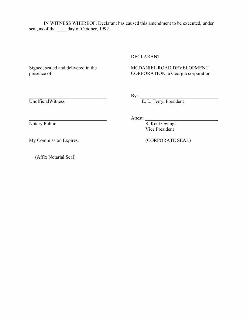
IN WITNESS WHEREOF, Declarant has caused this amendment to be executed, under seal, as of the ____ day of October, 1992. DECLARANT Signed, sealed and delivered in the MCDANIEL ROAD DEVELOPMENT presence of CORPORATION, a Georgia corporation ________________________________ By: ________________________________ UnofficialWitness E. L. Terry, President ________________________________ Attest: ______________________________ Notary Public S. Kent Owings, Vice President My Commission Expires: (CORPORATE SEAL) (Affix Notarial Seal)

EXHIBIT “A”
LEGAL DESCRIPTION OF ANNEXED PROPERTY
Lot 4, Block A All that tract or parcel of land lying and being in Land Lot 119 of the 7th District of Gwinnett Country, Georgia and being more particularly described as follows: To reach the Point of Beginning: commence at the intersection formed by the northwesterly right of way of McDaniel Road (variable right of way) and the southwesterly right of way of Georgia Highway No. 120 (100-foot right of way) and proceed thence southwesterly along the northwesterly right of way of McDaniel Road (variable right of way and 80-foot right of way) the following courses and distances: along the arc of a curve to the right 59.69 feet to a point (said arc having a chord distance of 53.74 feet on a bearing of South 18° 02’ 49” East and a radius of 38.00 feet); thence South 26° 57’ 11” West a distance of 247.08 feet to a point; thence along the arc of a curve to the right 167.70 feet to a point (said arc having a chord distance of 165.48 feet on a bearing of South 43° 07’ 39” West and a radius of 297.02 feet); thence South 59° 18’ 07” West a distance of 520.78 feet to a point; thence along the arc of a curve to the left 74.87 feet to the Point of Beginning (said arc having a chord distance of 14.85 feet on a bearing of South 56° 58’ 28” West and a radius of 921.57 feet); from said Point of Beginning thus established and departing from the northwesterly right of way of McDaniel Road running thence North 55° 55’ 00” West a distance of 566.85 feet to a point; running thence South 60° 10’ 23” East a distance of 40.00 feet to a point; running thence South 60° 09’ 05” West a distance of 274.06 feet to a point; running thence South 29° 50’ 55” East a distance of 150.00 feet to a point on the northwesterly right of way of Gavin Place (50-foot right of way); running thence North 60° 09’ 05” East along the northwesterly right of way of Gavin Place 44.69 feet to a point; running thence South 29° 50’ 55” East and departing from the northwesterly right of way of Gavin Place 199.16 feet to a point; running thence South 59° 35’ 00” West a distance of 98.67 feet to a point on the northeasterly right of way of Daventry Walk (50-foot right of way); running thence South 30° 25’ 00” East along the northeasterly right of way of Daventry Walk 171.19 feet to a point; continuing thence along the northeasterly right of way of Daventry Walk and along the arc of a curve to the left a distance of 23.56 feet to a point on the northwesterly right of way of McDaniel Road (80-foot right of way) (said arc having a chord distance of 21.21 feet on a bearing of South 75° 25’ 00” East and a radius of 15.00 feet); continuing thence along the northwesterly right of way of McDaniel Road the following courses and distances: North 59° 35’ 00” East, 345.00 feet to a point; thence along the arc of a curve to the left a distance of 119.55 feet to a point (said arc having a chord distance of 119.50 feet on a bearing of North 59° 29’ 10” East and a radius of 1,105.81 feet); thence North 53° 23’ 20” East a distance of 116.74 feet to a point; thence along the arc of a curve to the right a distance of approximately 20.24 feet to the Point of Beginning. Said tract or parcel being shown and designated as “Lot 4, Block A” on that certain Final Plat of Phase One Hampton Place prepared by Watts and Browning Engineers, Inc. dated April 15, 1992 and recorded in Plat Book 55, Page 257, Gwinnett County, Georgia records, as revised May 29, 1992, and recorded in Plat Book ___, Page ____, aforesaid records, which Plat is incorporated herein by reference.

TOGETHER WITH: Phase Two All that tract or parcel of land lying and being in Land lot 119 of the 7th District of Gwinnett County, Georgia and being more particularly described as follows: Beginning at the intersection of the northwesterly right of way of McDaniel Road (80-foot right of way) and the northwesterly right of way of Oak Hampton Way (variable right of way) and running thence southwesterly along the northwesterly right of way of Oak Hampton Way along the arc of a curve to the right a distance of 22.96 feet to a point (said arc having a chord distance of 20.78 feet on a bearing of South 37° 29’ 15” West and a radius of 15.00 feet); continuing thence along the northwesterly right of way of Oak Hampton Way (50-foot right of way) South 81° 20’ 00” West a distance of 64.43 feet to a point; continuing thence along the northwesterly right of way of Oak Hampton Way and along the arc of a curve to the left a distance of 20.40 feet to a point on the easterly right of way of Ryan Leigh Ridge (variable right of way) (said arc having a chord distance of 20.40 feet on a bearing of South 78° 44’ 08” West and a radius of 225.00 feet); running thence northwesterly along the easterly right of way of Ryan Leigh Ridge and along the arc of a curve to the right a distance of 21.08 feet to a point (said arc having a chord distance of 19.39 feet on a bearing of North 63° 36’ 20” West and a radius of 15.00 feet); running thence South 66° 28’ 44” West, and departing from the easterly right of way of Ryan Leigh Ridge, a distance of 50.00 feet to a point on the westerly right of way of Ryan Leigh Ridge (50-foot right of way); continuing thence along the westerly right of way of Ryan Leigh Ridge North 23° 20’ 55” West a distance of 30.41 feet to a point; running thence North 83° 38’ 57” West, and departing from the westerly right of way of Ryan Leigh Ridge, a distance of 165.98 feet to a point; running thence North 12° 18’ 08” East a distance of 81.00 feet to a point; running thence North 02° 12’ 58” East a distance of 185.00 feet to a point; running thence South 74° 38’ 55’ West a distance of 214.95 feet to a point on the westerly right of way of Devon Leigh Walk (50-foot right of way); continuing thence along the westerly right of way of Devon Leigh Walk and along the arc of a curve to the left a distance of 60.61 feet to a point (said arc having a chord distance of 60.47 feet on a bearing of North 23° 12’ 30” West and a radius of 261.479 feet) continuing thence along the westerly right of way of Devon Leigh Walk North 29° 50’ 55” West a distance of 91.74 feet to a point on the northwesterly right of way of Gavin Place (50-foot right of way); running thence along the northwesterly right of way of Gavin Place North 60° 09’ 05” East a distance of 58.71 feet to a point; running thence North 29° 50’ 55” West and departing from the northwesterly right of way of Gavin Place, a distance of 150.00 feet to a point; running thence North 60° 09’ 05” East a distance of 800.00 feet to a point; running thence South 29° 50’ 55” East a distance of 150.00 feet to a point on the northwesterly right of way of Gavin Place; running thence North 60° 09’ 05” East along the northwesterly right of way of Gavin Place a distance of 124.69 feet to a point; running thence South 29° 50’ 55” East and departing from the northwesterly right of way of Gavin Place a distance of 199.16 feet to a point; running thence South 59° 35’ 00” West a distance of 98.67 feet to a point on the northeasterly right of way of Daventry Walk (50-foot right of way); running thence South 30° 25’ 00” East along the northeasterly right of way of Daventry Walk a distance of 171.19 feet to a point; running thence southeasterly along the northeasterly right of

EXHIBIT “A”
way of Daventry Walk and along the arc of a curve to the left a distance of 23.56 feet to a point on the northwesterly right of way of McDaniel Road (80-foot right of way) (said arc having a chord distance of 21.21 feet on a bearing of South 75° 25’ 00” East and a radius of 15.00 feet); running thence South 59° 35’ 00” West along the northwesterly right of way of McDaniel Road a distance of 80.00 feet to a point on the southwesterly right of way of Daventry Walk running thence northeasterly along the southwesterly right of way of Daventry Walk and along the arc of a curve to the left a distance of 23.56 feet to a point (said arc having a chord distance of 21.21 feet on a bearing of North 14° 35’ 00” East and a radius of 15.00 feet); continuing thence along the southwesterly right of way of Daventry Walk North 30° 25’ 00” West a distance of 171.98 feet to a point; running thence South 59° 35’ 00” West and departing from the southwesterly right of way of Daventry Walk, a distance of 96.34 feet to a point; running thence South 45° 45’ 05” West a distance of 50.11 feet to a point; running thence South 30° 25’ 00” East a distance of 175.00 feet to a point on the northwesterly right of way of McDaniel Road; running thence southwesterly along the northwesterly right of way of McDaniel Road the following courses and distances: South 59° 35’ 00” West a distance of 43.64 feet to a point; thence along the arc of a curve to the left a distance of 393.10 feet to the Point of Beginning (said arc having a chord distance of 371.76 feet on a bearing of South 26° 36’’ 45” West and a radius of 341.56 feet). Said tract or parcel being the real property shown on that certain Final Plat of Phase Two Hampton Place prepared by Watts and Browning Engineers, Inc. dated June 9, 1992 and recorded in Plat Book ____, Page ____, Gwinnett County, Georgia records, which Plat is incorporated herein by reference. LESS AND EXCEPT all rights of way dedicated to and accepted by Gwinnett County, Georgia.

SECOND AMENDMENT TO DECLARATION OF COVENANTS,
CONDITIONS, EASEMENTS AND RESTRICTIONS FOR HAMPTON PLACE
THIS SECOND AMENDMENT to the Declaration of Covenants, Conditions, Easements and Restrictions for Hampton Place (hereinafter referred to as this “Amendment”) is made as of the ____ day of _______1993, by McDANIEL ROAD DEVELOPMENT CORPORTION, a Georgia corporati9on (hereinafter referred to as the “Declarant”).
W I T N E S S E T H :
WHEREAS, that certain Declaration of Covenants, Conditions, Easements and Restrictions for Hampton Place was filed and recorded on May 8, 1992, in Deed Book 7425, page 73, Gwinnett Country, Georgia records (hereinafter referred to as the “Declaration”) submitting certain real property located in Gwinnett County, Georgia and being more particularly described therein (hereinafter referred to as the “Properties”) to the provisions of said Declaration; and WHEREAS, that certain First Amendment to Declaration of Covenants, Conditions, Easements and Restrictions for Hampton Place, dated as of October 7, 1992, filed for record on October 8, 1992 in Deed Book 7932, page 128, aforesaid records (hereinafter referred to as the “First Amendment”) submitting additional land to the Properties; and WHEREAS, SAID declaration provides that on or before July 1, 1997, additional land within an area more particularly described in the Declaration may be annexed to the Properties unilaterally by Declarant; and WHEREAS, Declarant desires to annex that portion of said additional land more particularly described on EXHIBIT “A” attached hereto and incorporated herein (hereinafter referred to as the “Annexed Property”) to the Properties; NOW, THEREFORE, Declarant hereby declares that from and after the date hereof the Annexed Property shall be held, sold, and conveyed subject to the easements, restrictions, covenants, and conditions set forth in the Declaration, which are for the purpose of protecting and enhancing the value and desirability of the Annexed Property, and which shall run with the title to the land and shall be binding on all parties having or acquiring any right, title or interest in all or any portion of the Annexed Property, their respective successors, successors-in-title, heirs, legal representatives and assigns, and, subject to the limitation provided in the Declaration, shall inure to the benefit of the Declarants, the “Association” and each and every “Owner” , as said terms are defined in the Declaration. From and after the date hereof, the term “Properties”, as defined in Article I, Section 7 of the Declaration, shall include without limitations the Annexed Property, and the term “Plat”, as defined in Article I, Section 6 of the Declaration, shall include without limitation that certain (a) Final Plat of Phase Three, Hampton Place prepared by Watts and Browning, Engineers, dated October 27, 1992 and recorded in Plat Book 57, page 168, Gwinnett County, Georgia Records, re-recorded on February 11, 1993 in Plat Book 58, page 73, aforesaid records, and (b) Final Plat of Phase Four, Hampton Place prepared by Watts and Browning, Engineers, dated December 30, 1992 and recorded in Plat Book 57, page 248, aforesaid records, which plats are incorporated herein and in the Declaration by reference, as the

same may be amended by Declarant from time to time in its sole discretion and recorded in the plat records of Gwinnett County, Georgia, as provided in the Declaration. Declarant hereby certifies that, as of the date hereof, neither the Federal Housing Administration nor the Veterans Administration is required to consent to this Amendment. IN WITNESS WHEREOF, Declarant has caused this Amendment to be executed, under seal, this 18 day of February, 1993. Signed, sealed and delivered in the DECLARANT presence of: MCDANIEL ROAD DEVELOPMENT CORPORATION, a Georgia corporation ________________________________ By: ________________________________ Witness Its: ________________________________ Notary Public (Corporate Seal)
- 2 -

EXHIBIT “A”
Phase Three, Hampton Place Subdivision Plat of Survey prepared by Watts and Browning, Engineers, dated October 27, 1992 and
recorded in Plat Book 57, page 168, Gwinnett County, Georgia records; re-recorded on February 11, 1993 in Plate Book 58, page 73, aforesaid records.
Less and except all rights of way dedicated to and accepted by Gwinnett County,
Georgia. Phase Four, Hampton Place Subdivision Plat of Survey prepared by Watts and Browning, Engineers, date December 30, 1992 and
recorded in Plat Book 57, page 248, aforesaid records. Less and except all rights of way dedicated to and accepted by Gwinnett County,
Georgia.

THIRD AMENDMENT TO DECLARATION OF COVENANTS, CONDITIONS, EASEMENTS AND RESTRICTIONS
FOR HAMPTON PLACE
THIS THIRD AMENDMENT to the Declaration of Covenants, Conditions, Easements and Restrictions for Hampton Place (hereinafter referred to as this “Amendment”) is made as of the ____ day of October, 1993, by MCDANIEL ROAD DEVELOPMENT CORPORATION, a Georgia corporation, and CAMBRIDGE HOMES, INC., a Georgia corporation (hereinafter collectively referred to as “Declarant”).
W I T N E S S E T H :
WHEREAS, that certain Declaration of Covenants, Conditions, Easements and Restrictions for Hampton Place was filed and recorded on May 8, 1992 in Deed Book 7425, page 73, Gwinnett County, Georgia records (hereinafter referred to as the “Declaration”) submitting certain real property located in Gwinnett County, Georgia and being more particularly described therein (hereinafter referred to as the “Properties”) to the provisions of said Declaration; and WHEREAS, that certain First Amendment to Declaration of Covenants, Conditions, Easements and Restrictions for Hampton Place, date as of October 7, 1992, filed for record on October 8, 1992 in Deed Book 7932, page 128, aforesaid records (hereinafter referred to as the “First Amendment”) submitting additional land to the Properties; and WHEREAS, that certain Second Amendment to Declaration of Covenants, Conditions, Easements and Restrictions for Hampton Place, dated as of February 18, 1993, filed for record February 23, 1993 in Deed Book 8427, page 231, aforesaid records (hereinafter referred to as the “First Amendment”) submitting additional land to the Properties; and WHEREAS, said Declaration provides that on or before July 1, 1997, additional land within an area more particularly described in the Declaration may be annexed to the Properties unilaterally by Declarant; and WHEREAS, Declarant desires to annex that portion of said additional land more particularly described on EXHIBIT “A” attached hereto and incorporated herein (hereinafter referred to as the “Annexed Property”) to the Properties; NOW, THEREFORE, Declarant hereby declares that from and after the date hereof the Annexed Property shall be held, sold and conveyed subject to the easements, restrictions, covenants and conditions set forth in the Declaration, which are for the purpose of protecting and enhancing the value and desirability of the Annexed Property, and which shall run with the title to the land and shall be binding on all parties having or acquiring any rights, title or interest in all or any portion of the Annexed Property, their respective successors, successors-in-title, heirs, legal representatives and assigns, and, subject to the limitations provided in the Declaration, shall inure to the benefit of the Declarant, the “Association” and each and every “Owner”, as said
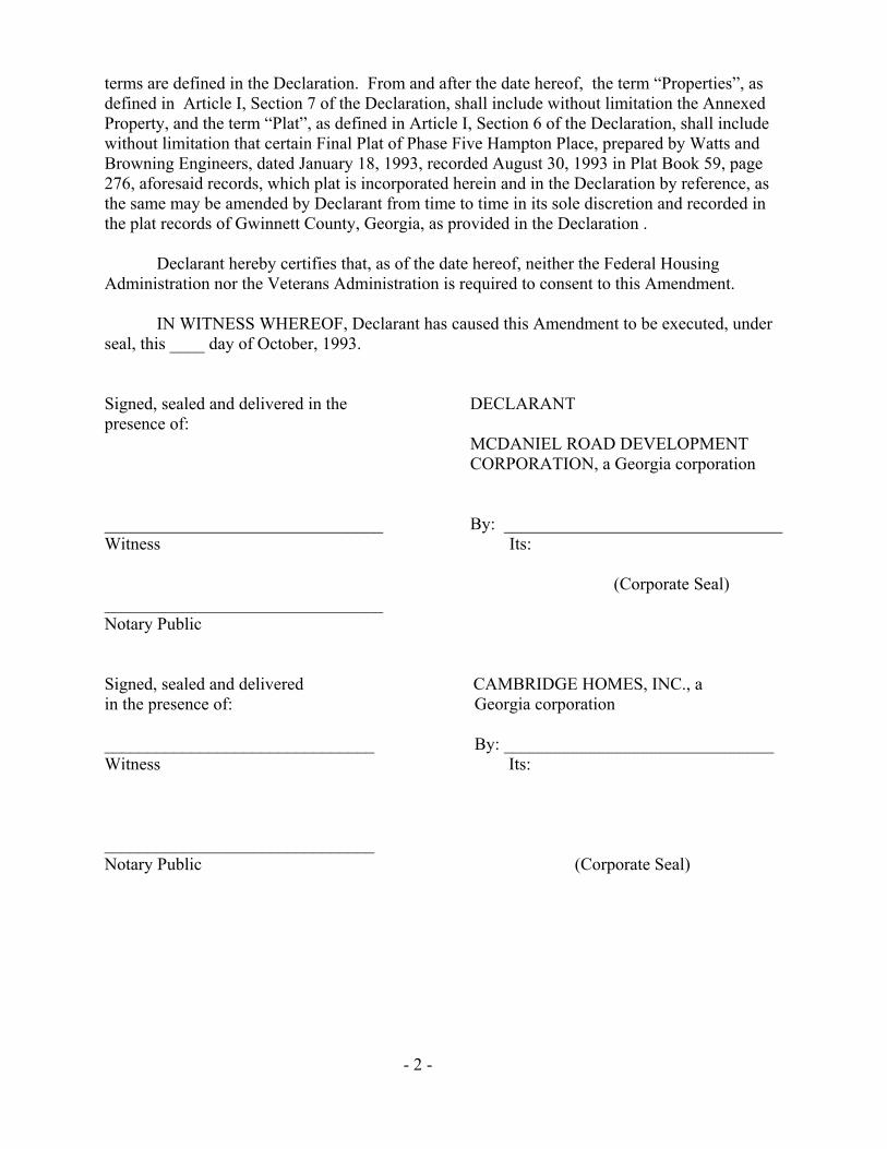
terms are defined in the Declaration. From and after the date hereof, the term “Properties”, as defined in Article I, Section 7 of the Declaration, shall include without limitation the Annexed Property, and the term “Plat”, as defined in Article I, Section 6 of the Declaration, shall include without limitation that certain Final Plat of Phase Five Hampton Place, prepared by Watts and Browning Engineers, dated January 18, 1993, recorded August 30, 1993 in Plat Book 59, page 276, aforesaid records, which plat is incorporated herein and in the Declaration by reference, as the same may be amended by Declarant from time to time in its sole discretion and recorded in the plat records of Gwinnett County, Georgia, as provided in the Declaration . Declarant hereby certifies that, as of the date hereof, neither the Federal Housing Administration nor the Veterans Administration is required to consent to this Amendment. IN WITNESS WHEREOF, Declarant has caused this Amendment to be executed, under seal, this ____ day of October, 1993. Signed, sealed and delivered in the DECLARANT presence of: MCDANIEL ROAD DEVELOPMENT CORPORATION, a Georgia corporation ________________________________ By: ________________________________ Witness Its: (Corporate Seal) ________________________________ Notary Public Signed, sealed and delivered CAMBRIDGE HOMES, INC., a in the presence of: Georgia corporation _______________________________ By: _______________________________ Witness Its: _______________________________ Notary Public (Corporate Seal)
- 2 -

EXHIBIT “A”
Phase Five, Hampton Place Subdivision Plat of Survey prepared by Watts and Browning, Engineers, dated January 18, 1993,
filed for record August 30, 1993 and recorded in Plat Book 59, page 276, Gwinnett County , Georgia Records.
Less and except all rights of way dedicated to and accepted by Gwinnett County,
Georgia.
- 3 -


![storage.googleapis.com€¦ · [katheryne davis] [and heirs and assigns] [john mchale] [and heirs and assigns] [ricki reese] [and heirs and assigns] [nicole phelps] [and heirs and](https://img.dokumen.tips/doc/110x75/5f06dad27e708231d41a1204/katheryne-davis-and-heirs-and-assigns-john-mchale-and-heirs-and-assigns.jpg)