Embed Size (px)
Citation preview

GIS & Spatial Modeling
Class 2: „Spatial Doing“ - A discourse about
analysis and modeling in a spatial context
Geography 4203 / 5203

Updates
• Class homepage at:http://www.colorado.edu/geography/class_homepages/geog_4203
_s08/
• Handouts online (step by step)
• Some PDFs for readings discussions can
already be downloaded
• Reminder for readings topics pick up (next
week: fields vs. objects)
• Statistics and GIS levels
The GIS Levels at Geog …
• GIS 1: Fundamentals of GIS, data structuresand operations
• GIS 2: GIS modeling, raster basedapproaches, concepts and techniques ofmodeling for complex spatial problems
• GIS 3: GIS programming, developing andimplementing new functionality and methodsfor GIS and spatial modeling
• overlap / transition / prerequisites definition
Last Lecture
• You obtained some ideas of what this
course is about and what you can
expect from classes and exercises
• You have seen how broad the range of
topics will be - so we have a lot to do
• You have an impression of the rules,
don’ts and do‘s for this course
Today‘s Outline
• We will look closer at some important terms
such as spatial (data) analysis or spatial
modeling and will talk about different
taxonomies
• We will see some examples to clarify how to
use spatial analysis
• How can we better understand these terms
and what are the central issues of spatial
analysis and spatial modeling?
Learning Objectives
• Conceptually understand important key
terms and considerations
• Understand why many different
classifications and definitions exist and
what the common sense between them is
• Getting a sense for how we can explore
terminology that comes with an ambiguous
flavor of meaning
Introduction
• In GIS 2 we will talk a lot about spatial
modeling and spatial analysis
• … and this is what we do when working
with the GIS toolsets
• Before going into any detail we need to
know how to understand these umbrella
terms

Finding the Beginning…
Let’s try to approach something like anunderstanding of what is …
• … spatial analysis? Or even spatial data analysis?
• … spatial modeling?
• Does it help to define/classify them?
• Or does it make more sense just tounderstand what we are doing?
• Here a first historical example…
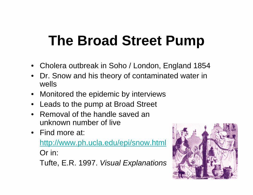
The Broad Street Pump
• Cholera outbreak in Soho / London, England 1854
• Dr. Snow and his theory of contaminated water inwells
• Monitored the epidemic by interviews
• Leads to the pump at Broad Street
• Removal of the handle saved an unknown number of live
• Find more at:
http://www.ph.ucla.edu/epi/snow.html
Or in:
Tufte, E.R. 1997. Visual Explanations

Snow’s Map
• Snow mapped the
monitored cases and could
determine the location of the
well closest to these cases
• This was genius-like!
• Snow as the pioneer of
modern epidemiology which
uses spatial analysis to a
high degree
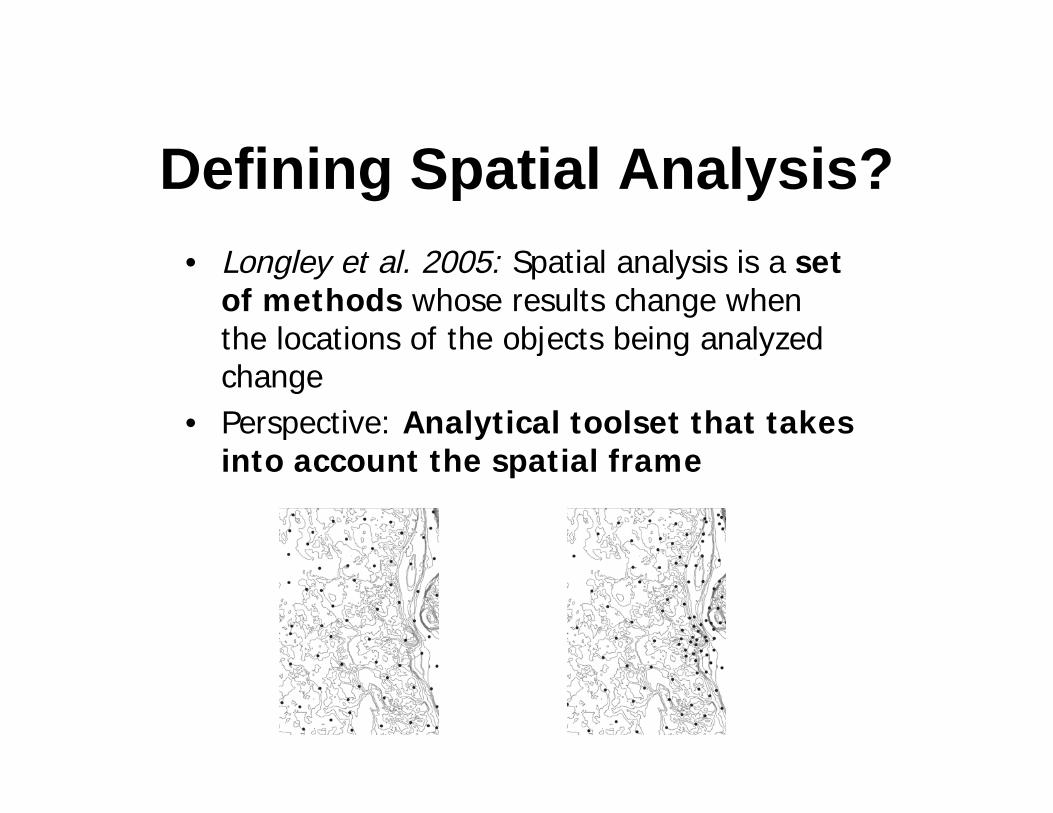
Defining Spatial Analysis?
• Longley et al. 2005: Spatial analysis is a setof methods whose results change whenthe locations of the objects being analyzedchange
• Perspective: Analytical toolset that takesinto account the spatial frame
Defining Spatial Analysis?
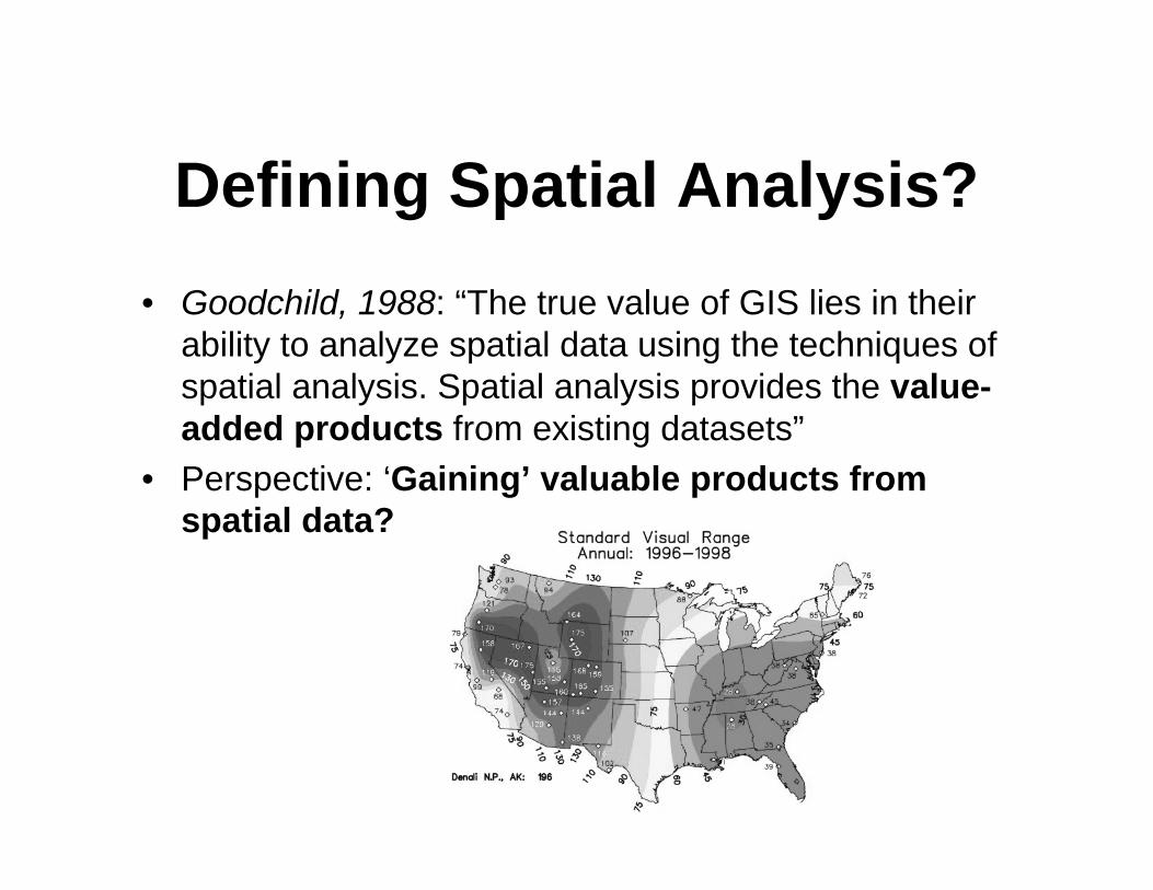
• Goodchild, 1988: “The true value of GIS lies in their
ability to analyze spatial data using the techniques of
spatial analysis. Spatial analysis provides the value-
added products from existing datasets”
• Perspective: ‘Gaining’ valuable products from
spatial data?

Defining Spatial Analysis?
• Goodchild (et al.) 1987/1992: (SDA) is a set of techniques
devised to support a spatial perspective on data. To
distinguish it from other forms of analysis, it might be
defined as a set of techniques whose results are
dependent on the locations of the objects or events being
analyzed, requiring access to both the locations and the
attributes of objects.
• Perspective:Techniques usingLocational and attribute information
Defining Spatial Analysis?
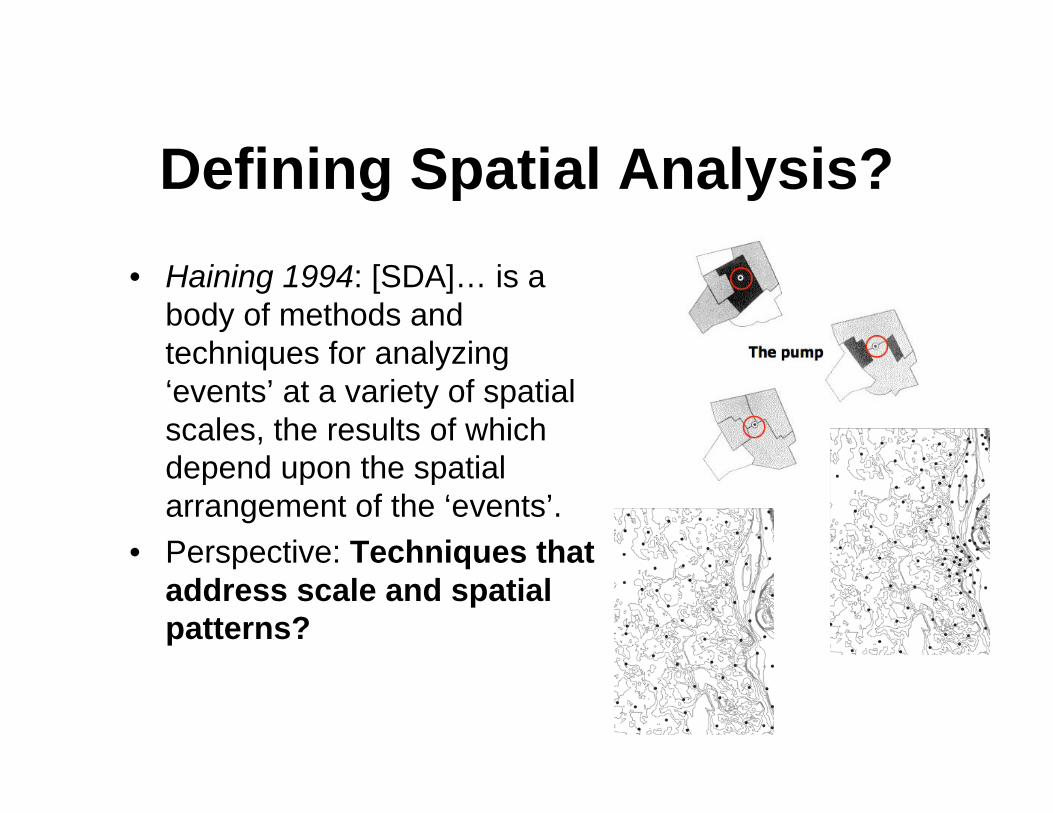
• Haining 1994: [SDA]… is a
body of methods and
techniques for analyzing
‘events’ at a variety of spatial
scales, the results of which
depend upon the spatial
arrangement of the ‘events’.
• Perspective: Techniques that
address scale and spatial
patterns?
Defining Spatial Analysis?
• We stop here! You will find many other definitions indifferent contexts - but how much do they help?
• Altogether we might say: Spatial analysis hassomething to do with deriving information fromdata using the spatial context of the problem andthe data (e.g. their distributions or patterns)
• It is exactly this - space - which makes it different
• Maybe we understand more if we look at sometaxonomies of operators for spatial analysis suchas…

… Based on Classes of
Techniques• Longley et al. 2001:
Tried to classify relevanttechniques of spatialanalysis based onconceptual frameworks
• Perspective: Analyticaltoolset for querying,measuring,transforming, describing,optimizing andhypothesis-testing
… Based on Conceptual
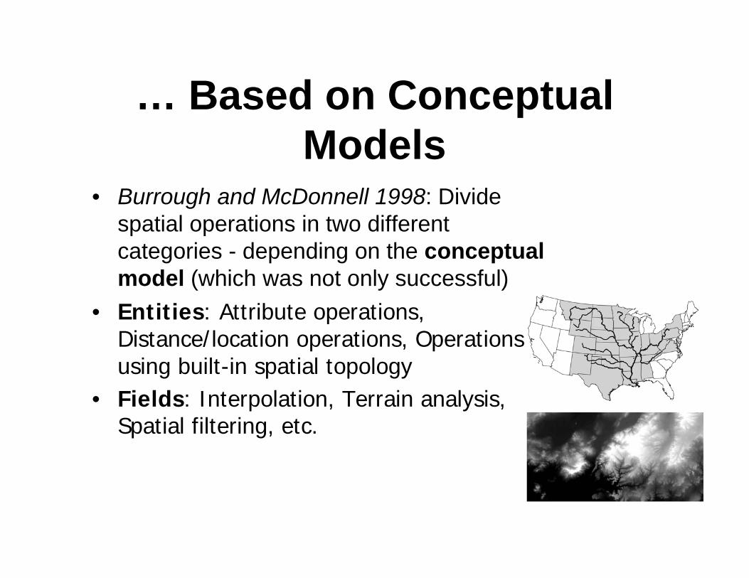
Models• Burrough and McDonnell 1998: Divide
spatial operations in two different
categories - depending on the conceptual
model (which was not only successful)
• Entities: Attribute operations,Distance/location operations, Operationsusing built-in spatial topology
• Fields: Interpolation, Terrain analysis,Spatial filtering, etc.
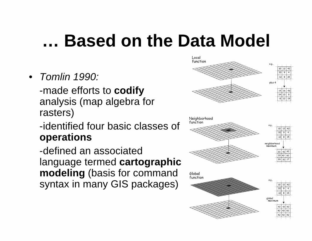
… Based on the Data Model
• Tomlin 1990:
-made efforts to codifyanalysis (map algebra forrasters)
-identified four basic classes ofoperations
-defined an associatedlanguage termed cartographicmodeling (basis for commandsyntax in many GIS packages)
Does it help?
• As you can see there are (as expected) manydifferent approaches to build a taxonomy
• You have seen three of them: one based on categoryof technique, one based on the conceptual modeland one based on the data model used
• What most of them have in common is: They includemost of the (functional) operations in a GIS,somehow
• Let’s look at some examples

Example 1: Exploring &
Describing• Fire scares in forests
• Total portion of burned area, classes
• Mean and median size of patches &std. deviation of patch size
• Shape (compactness) of patches
(circularity: M = 4 *area / perim2)
• Comparing burned with non-burntareas
• Comparison with properties of othergaps/patches (harvested or blow-down)
• Distance to other burnt patches
University of Freiburg
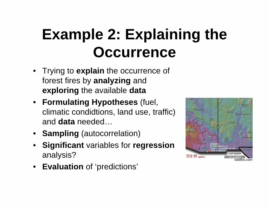
Example 2: Explaining the
Occurrence• Trying to explain the occurrence of
forest fires by analyzing and
exploring the available data
• Formulating Hypotheses (fuel,
climatic condidtions, land use, traffic)
and data needed…
• Sampling (autocorrelation)
• Significant variables for regression
analysis?
• Evaluation of ‘predictions’wildfire.com

Example 3: Criteria-Based
Planning• Suitablity analysis
• Criteria (what means)
• Quantification (how to)
• Overlay
• Function formulation

So maybe it’s rather: How to
use SA?• The three examples gave you an impression in
which contexts SA can be used (and this comesalong with Openshaw and Goodchild & Longley inLongley et al. 2005
• Explore / describe spatial patterns andrelationships (exploratory/descriptive approach)
• Testing hypotheses regarding spatial patternsand relationships (explanatory/confirmatoryapproach)
• Simple analysis for criteria evaluation
So what about Spatial
Modeling …?• ‘Modeling’ per se is one of the most
overloaded terms anywhere
• Reason enough to think about what exactlywe think of by referring to spatial modeling
• Generally, a model is a (simplified)description of reality (static reproduction,conceptual description)
• Modeling can (or should) be considered as aprocess …
Modeling Process and its
ComponentsPrior to carrying out the modeling process it is helpful to find
answers to four questions (DeMers 1,5):
• What is the model to tell us (explaining, predicting
relationships or consequences / evaluating situations for
resource uses,…)? Or simply: Do we understand what the
problem is?
• What type of data do I need?
• How to create a design to put the model together?
• How to apply existing tools, carefully and appropriately to
derive meaningful models?
• Validation and verification as important steps are touched later
What is GIS Modeling?
• GIS Modeling is a PROCESS
• Need of a way to “think spatially”
• How to represent (abstract) our world in a GIS?
• What are the visible or functional patterns
• What are the spatial relationships between representations in
the geographic space?
• What can these relationships tell us and how can we
combine/measure/examine them to derive meaningful
models?
• As always, a structure is helpful!!

What is a Spatial Model
• Spatial models (at some places GIS models)
might describe basic properties and processes
for a set of spatial features (Bolstad 13 - you
have heard about this)
• The aim is to study spatial objects or
phenomena in the real world
• As you can imagine we also find dozens of
definitions and many different classification
schemes - we will look at three of them
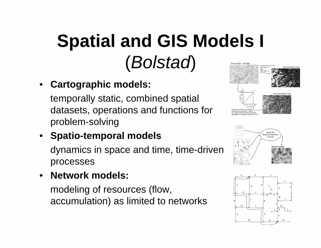
Spatial and GIS Models I
(Bolstad)• Cartographic models:
temporally static, combined spatial
datasets, operations and functions for
problem-solving
• Spatio-temporal models
dynamics in space and time, time-driven
processes
• Network models:
modeling of resources (flow,
accumulation) as limited to networks
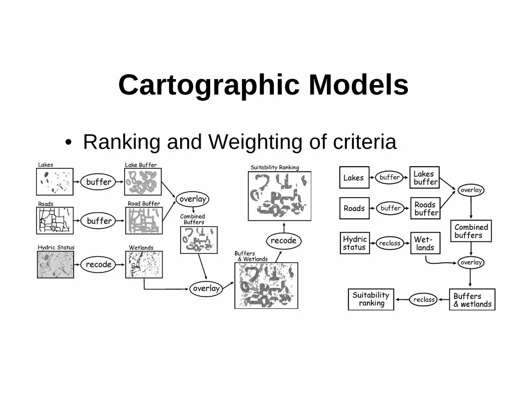
Cartographic Models
• Ranking and Weighting of criteria
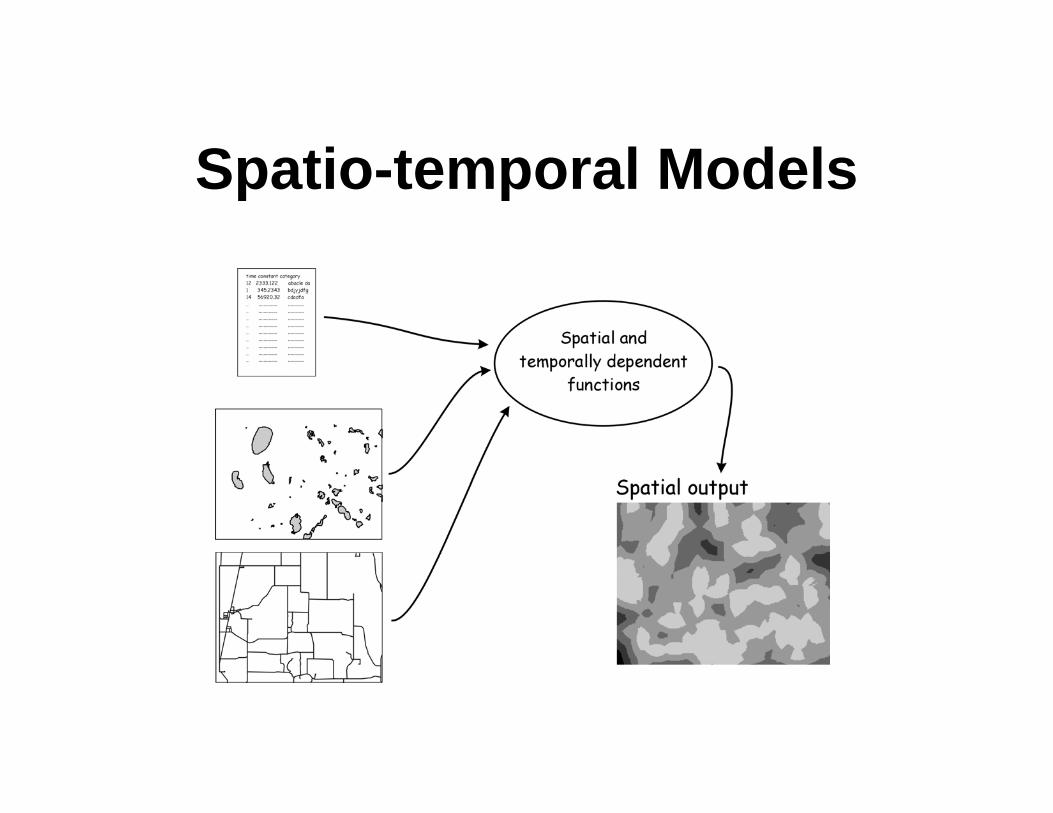
Spatio-temporal Models
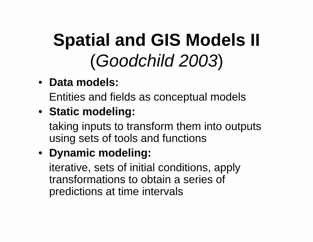
Spatial and GIS Models II
(Goodchild 2003)• Data models:
Entities and fields as conceptual models
• Static modeling:
taking inputs to transform them into outputsusing sets of tools and functions
• Dynamic modeling:
iterative, sets of initial conditions, applytransformations to obtain a series ofpredictions at time intervals
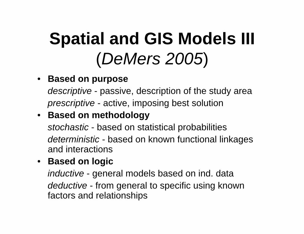
Spatial and GIS Models III
(DeMers 2005)• Based on purpose
descriptive - passive, description of the study area
prescriptive - active, imposing best solution
• Based on methodology
stochastic - based on statistical probabilities
deterministic - based on known functional linkagesand interactions
• Based on logic
inductive - general models based on ind. data
deductive - from general to specific using knownfactors and relationships
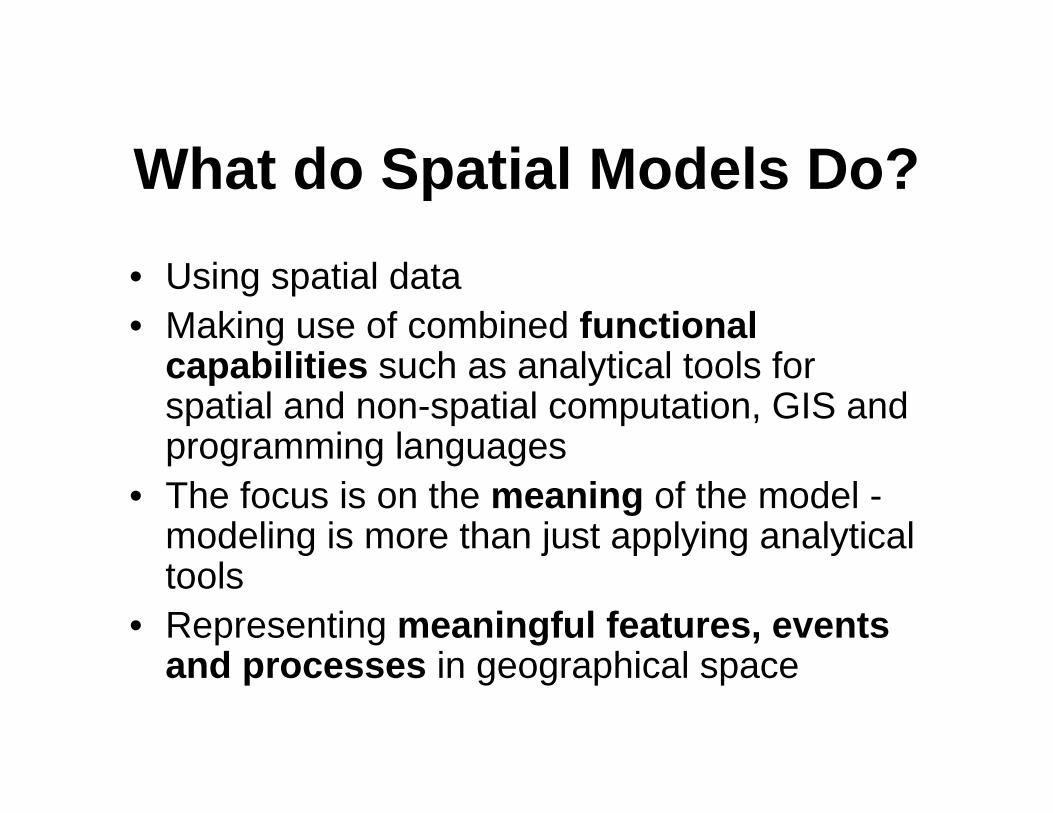
What do Spatial Models Do?
• Using spatial data
• Making use of combined functionalcapabilities such as analytical tools forspatial and non-spatial computation, GIS andprogramming languages
• The focus is on the meaning of the model -modeling is more than just applying analyticaltools
• Representing meaningful features, eventsand processes in geographical space

Summary
• Spatial analysis and spatial modeling are twoimportant terms for GIScience
• We tried to explore what stands behind them bylooking at definitions, taxonomies and examples
• However, an understanding of the methods we use(exploring / explaining) and of the problem we face(modeling) are central
• The aim of spatial modeling is to derive ameaningful representation of events, occurrences orprocesses by making use of the power of spatialanalysis

References
• Longley P.A., M. F. Goodchild, D. J. Maguire and D. W. Rhind. 2005.Geographic Information Systems and Science. Second Edition. John Wiley,Chichester, 2005.
• Goodchild, M.F. 2003. Geographic Information Science and Systems forEnvironmental Management. Annual Review of Environment andResources. Vol. 28: 493-519.
• Burrough, P.A. and McDonnell, R.A. 1998. Principles of GeographicalInformation Systems. London: Oxford.
• Goodchild, M F. 1988. Modeling error in objects and fields. Accuracy ofSpatial Databases Meeting; Montecito, CA; (USA); Dec. 1988. pp. 107-113.1990
• Tomlin, C.D. 1991 Cartographic Modeling. In Maguire, D., Goodchild,M.F., and Rhind, D. (Eds.) Geographic Information Systems: Principlesand Applications. London: Longman: 361 - 374.
• Goodchild, M. F., 1987, Towards an enumeration and classification of GISfunctions. Proceedings, /CIS 87: the Research Agenda, edited by R. T.Aangeenbrug and Y. M. Schiffman (Washington, DC: NASA), 11, 67-77.