Embed Size (px)
Citation preview

GCSE GEOGRAPHY B Sample Assessment Materials 5
© WJEC CBAC Ltd.
GCSE GEOGRAPHY B COMPONENT 1 INVESTIGATING GEOGRAPHICAL ISSUES SAMPLE ASSESSMENT MATERIALS 1 hour 45 minutes
ADDITIONAL MATERIALS In addition to this paper you will require a calculator and a ruler. INSTRUCTIONS TO CANDIDATES Answer all of the questions in this examination paper. Use black ink or black ball-point pen. Write your name, centre number and candidate number in the spaces at the top of this page. Write your answers in the spaces provided in this booklet. If additional space is required you should use the lined pages at the end of this booklet. The question number(s) should be clearly shown. INFORMATION FOR CANDIDATES The number of marks is given in brackets [ ] at the end of each question or part-question. You are reminded that assessment will take into account your ability to spell, punctuate and use grammar and specialist terms accurately in your answer to question 1(c) (iii).
For examiner’s use only SPaG Q.1
32
4
Q.2
32
0
Q.3
32
0
Total Marks
96
4
PMT

GCSE GEOGRAPHY B Sample Assessment Materials 6
© WJEC CBAC Ltd.
Theme 1: Changing Places – Changing Economics
Answer all questions 1. (a) Markets are one example of a geographical feature of many UK towns and
city centres.
Photograph 1.1 Norwich central market
(i) Tick () two other geographical features of central business districts
(CBDs) in the table below. [2]
Tick ()
Large covered shopping centres Large free surface car parks Detached houses with gardens Restaurants, theatres and cinemas
(ii) Many CBDs have pedestrianised areas. Describe the features of
pedestriansed areas. [2]
PMT

GCSE GEOGRAPHY B Sample Assessment Materials 7
© WJEC CBAC Ltd.
(b) The O.S. map extract below shows the location of a proposed retail park on the edge of Whitby.
Map 1.2 O.S. map extract at a scale of 1:25,000
(i) Use map evidence to complete the blank spaces below: [3]
The name of the road at the northern edge of the proposed retail park. ____________________
The direction of the proposed retail park from Whitby West Pier. ____________________
The distance in a direct line from the centre of the proposed retail park to the post office in Ruswarp (grid square 8809). ____________________ kms.
PMT
GCSE GEOGRAPHY B Sample Assessment Materials 8
© WJEC CBAC Ltd.
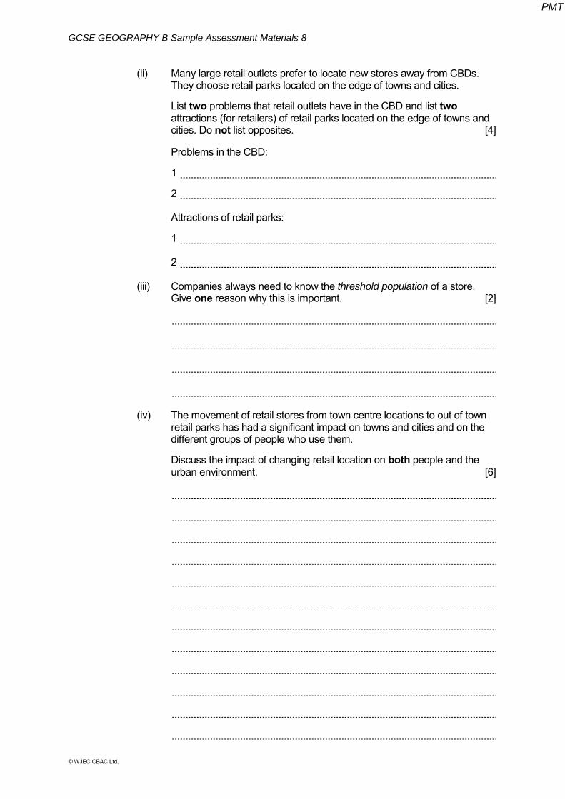
(ii) Many large retail outlets prefer to locate new stores away from CBDs. They choose retail parks located on the edge of towns and cities.
List two problems that retail outlets have in the CBD and list two
attractions (for retailers) of retail parks located on the edge of towns and cities. Do not list opposites. [4]
Problems in the CBD: 1
2 Attractions of retail parks:
1 2 (iii) Companies always need to know the threshold population of a store.
Give one reason why this is important. [2] (iv) The movement of retail stores from town centre locations to out of town
retail parks has had a significant impact on towns and cities and on the different groups of people who use them.
Discuss the impact of changing retail location on both people and the
urban environment. [6]
PMT

GCSE GEOGRAPHY B Sample Assessment Materials 9
© WJEC CBAC Ltd.
(c) Study Map 1.3 below. It shows the location of Jembatan Besi, an informal settlement (or shanty town) in the city of Jakarta. Jakarta is a global city and the capital of Indonesia, a Newly Industrialised Country (NIC). The city is growing at a rapid rate.
Map 1.3 Jakarta
(i) Describe the location of Jembatan Besi within Jakarta. [1]
PMT

GCSE GEOGRAPHY B Sample Assessment Materials 10
© WJEC CBAC Ltd.
Study Figure 1.4 below. These proportional pie charts show information about the changing population of Jembatan Besi from 1975 through to 2015.
Figure 1.4
(ii) Compare the population in 1975 to that in 2015. Use the scale and the key to support your answer. [4]
Scale for the proportional circles
PMT

GCSE GEOGRAPHY B Sample Assessment Materials 11
© WJEC CBAC Ltd.
Study Photograph 1.5 and Table 1.6 below. They provide more information about the
informal settlement of Jembatan Besi.
Photograph 1.5 Typical housing in Jembatan Besi
Table 1.6 Access to services within the informal settlement of Jembatan Besi 1975 2015
% of residents with access to safe drinking water through stand pipes 1 10 % of residents with access to legal electricity supplies 10 50 % of residents with access to the main city sewer network 0 0 % of residents with access to formal city waste collection services 0 30
(iii) Make use of map 1.3, figure 1.4, photograph 1.5 and table 1.6 to decide
whether you agree with the following statement: ‘The challenges faced in the informal settlement of Jembatan Besi are the same as those found in every global city’. Give reasons to support why you agree or disagree with the statement. [8 + 4]
Marks for spelling, punctuation and the accurate use of grammar and
specialist terminology are allocated to this question.
PMT

GCSE GEOGRAPHY B Sample Assessment Materials 12
© WJEC CBAC Ltd.
End of Question 1
PMT

GCSE GEOGRAPHY B Sample Assessment Materials 13
© WJEC CBAC Ltd.
Theme 2: Changing Environments
Answer all questions 2. (a) Study the diagram below which shows the greenhouse effect.
Diagram 2.1
(i) Describe how the greenhouse effect works by adding letters from the
box to label diagram 2.1 above. Two have been done for you. [4]
A
Radiation from the sun passes into the atmosphere.
D
Some of the sun’s radiation is absorbed by the greenhouse gases in the Earth’s atmosphere. This warms the Earth.
B Some of the sun’s radiation is reflected from the Earth’s surface into the atmosphere.
E Some of the sun’s radiation is reflected back into space.
C
Some of the sun’s radiation passes through the Earth’s atmosphere back into space. F
Human activities have increased the amount of greenhouse gases in the Earth’s atmosphere, for example, burning fossil fuels in power stations.
PMT

GCSE GEOGRAPHY B Sample Assessment Materials 14
© WJEC CBAC Ltd.
(ii) Name two greenhouse gases. [2] 1.________________________________ 2.________________________________ (iii) Coal-fired power stations are one source of greenhouse gases. Give
two other human activities which are a source of greenhouse gases. [2]
PMT

GCSE GEOGRAPHY B Sample Assessment Materials 15
© WJEC CBAC Ltd.
(b) Study the graph below.
Describe the changes in average global land surface temperatures since 1850. Use figures from graph 2.2 in your answer. [3]
PMT

GCSE GEOGRAPHY B Sample Assessment Materials 16
© WJEC CBAC Ltd.
(c) Study the map and the table below. The Environment Agency has estimated the impact of a 2 metre rise in sea level across the UK.
Map 2.3 Table 2.4
(i) Describe the pattern of coastal areas at risk from a 2 metre rise in sea level.
Use map 2.3 only in your answer. [2] (ii) Select one appropriate style of graph to represent the data shown in
table 2.4. [1] Tick () one style of graph from the list below.
Tick () One scatter graph showing a line of best fit A series of block graphs, one for each location in table 2.4 A series of pie charts, one for each location in table 2.4
PMT
GCSE GEOGRAPHY B Sample Assessment Materials 17
© WJEC CBAC Ltd.
(iii) Give one reason why the graph style you selected is appropriate to represent the data in table 2.4. [2]
(iv) Give one reason why it is difficult for individuals to reduce the threat of
climate change in the UK. [2]
(v) Explain why government in the UK may wish to reduce the threat of
climate change. [6]
PMT

GCSE GEOGRAPHY B Sample Assessment Materials 18
© WJEC CBAC Ltd.
(d) People have different views on the issue of climate change. Read the comments below and answer the question that follows.
A farmer in Bangladesh
An Indian business executive
A UK 'Green' politician
Make use of these comments to decide whether you agree with the following
statement. "The need to create economic growth in NICs such as India far outweighs any
concerns about climate change." Explain your reasons. [8]
PMT

GCSE GEOGRAPHY B Sample Assessment Materials 19
© WJEC CBAC Ltd.
End of Question 2
PMT
GCSE GEOGRAPHY B Sample Assessment Materials 20
© WJEC CBAC Ltd.
Theme 3: Environmental Challenges
Answer all questions
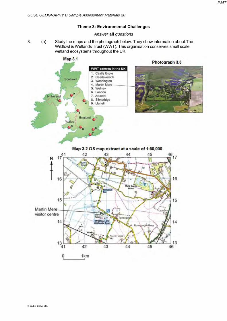
3. (a) Study the maps and the photograph below. They show information about The Wildfowl & Wetlands Trust (WWT). This organisation conserves small scale wetland ecosystems throughout the UK.
PMT

GCSE GEOGRAPHY B Sample Assessment Materials 21
© WJEC CBAC Ltd.
(i) Describe the location of the Martin Mere wetland ecosystem. Use map 3.1 or map 3.2 in your answer. [2] (ii) Complete the table below by giving the correct four figure and six
figure grid references. Use map 3.2. [2]
Grid reference
The four figure grid reference for the village of Rufford.
__ __ __ __
The six figure grid reference for Martin Mere visitor centre.
__ __ __ __ __ __
(iii) Describe the relief of the land shown in map 3.2 and photograph 3.3. [2]
PMT

GCSE GEOGRAPHY B Sample Assessment Materials 22
© WJEC CBAC Ltd.
(b) The world map below shows the location of two major biomes across the world.
Map 3.4
(i) Tick () the correct definition of a biome from the three available in
the table. [1]
Tick () A biome is a large area named after the dominant type of vegetation found at sea level.
A biome is a unique region where different climates can be found from north to south across the globe.
A biome is a global land area that is characterised by the plants, animals and climate in that area.
(ii) Describe the distribution of the Tropical Rainforest biome. Use map 3.4. [2] ................................................................................................................ ................................................................................................................ ................................................................................................................ ................................................................................................................
PMT

GCSE GEOGRAPHY B Sample Assessment Materials 23
© WJEC CBAC Ltd.
(c) The diagram below shows the links which exist in all ecosystems.
Diagram 3.5
(i) Name an ecosystem you have studied. Complete the table below,
giving the names of specific plants or animals found in your chosen ecosystem.
[4] Name of your chosen ecosystem …………………………………. Plants / animals found in the ecosystem you have named
above.
One tertiary consumer
One secondary consumer
One primary consumer
One producer
(ii) Describe three characteristics of the climate for the ecosystem you
have named above. [3]
PMT

GCSE GEOGRAPHY B Sample Assessment Materials 24
© WJEC CBAC Ltd.
(d) Study the diagram below. The line A – B shows a cross-section across three biomes in Africa.
Diagram 3.6
Describe how the changes in the vegetation from A to B in diagram 3.6 are
influenced by climate. [2] (e) (i) Explain why human activities lead to damage of ecosystems. [6]
PMT

GCSE GEOGRAPHY B Sample Assessment Materials 25
© WJEC CBAC Ltd.
(ii) Name one ecosystem which is being managed for a sustainable
future. Predict how successful the management scheme is likely to be in creating a sustainable future for the ecosystem. Justify your reasoning. [8]
Name of ecosystem
PMT

GCSE GEOGRAPHY B Sample Assessment Materials 26
© WJEC CBAC Ltd.
End of question 3
END OF PAPER
PMT