Embed Size (px)
Citation preview

EUROPE

Europe: An Asian Peninsula?
Europe: An Asian Peninsula?

Satellite View of EuropeSatellite View of Europe

IntroductionEurope and Russia occupy part of the huge landmass
called Eurasia. Eurasia is divided into two continents, Europe and Asia. The difference between them is cultural and historical, not geographical.
Europe is the world's second smallest continent. Oceans and seas border Europe to the north, south, and west. Asia borders Europe on the east. The Ural Mountains and the Caucasus Mountains mark the dividing lines between Europe and Asia.
Russia is the world's largest country. It spreads over two continents, Europe and Asia.
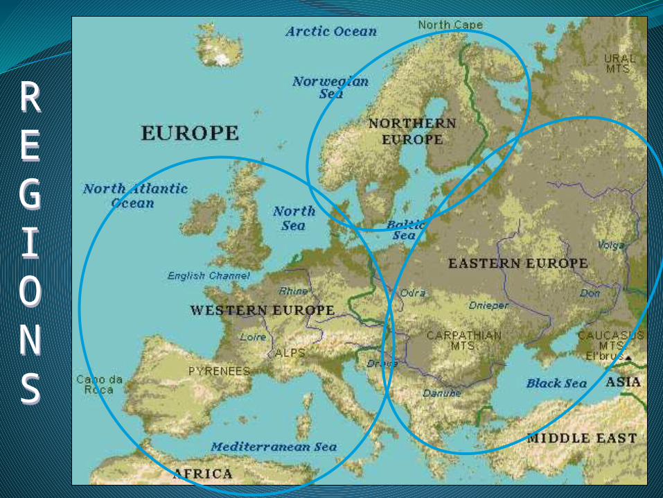
REGIONS
REGIONS

Seas and peninsulas Europe is surrounded by many seas: the
Baltic Sea, the North Sea and the Mediterranean Sea.
Between Europe and Asia: Black Sea and the Caspian Sea (which is actually the largest lake in the world).
In Europe there are many peninsulas: the Scandinavian Peninsula and the Jutland Peninsula in the north, the Balkan Peninsula, the Iberian Peninsula and the Italian Peninsula in the south.
Several big islands are also part of Europe; the biggest are Great Britain, Ireland and Iceland.
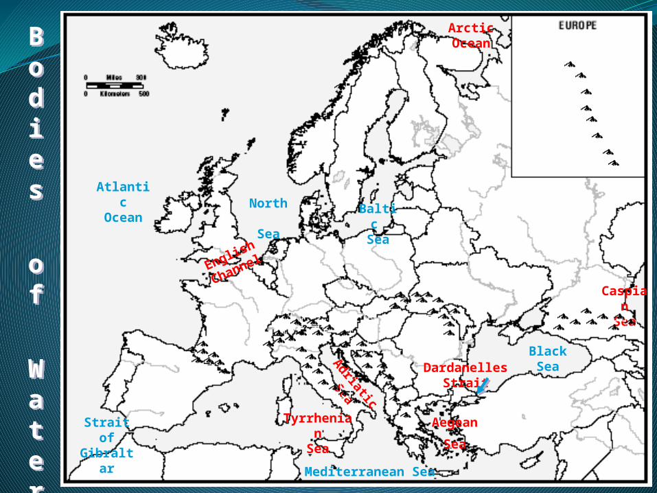
Bodies
of
W
ater
Bodies
of
W
ater
Mediterranean Sea
North
Sea
AtlanticOcean Balti
c Sea
BlackSea
Aegean
Sea
Adriatic
Sea
Tyrrhenian
Sea
Strait of
Gibraltar
DardanellesStrait
ArcticOcean
English
Channel
Caspian
Sea
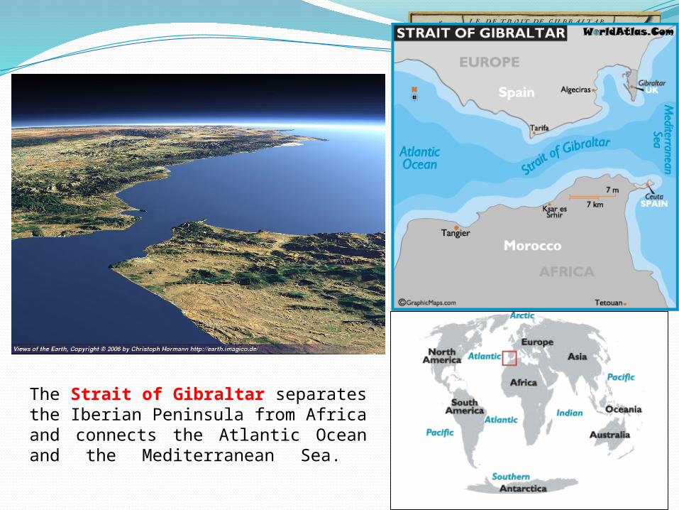
The Strait of Gibraltar separates the Iberian Peninsula from Africa and connects the Atlantic Ocean and the Mediterranean Sea.
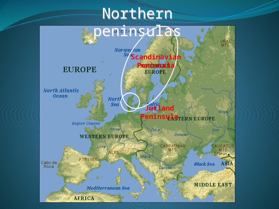
Northern peninsulasNorthern peninsulas
Jutland Peninsula
Scandinavian Peninsula
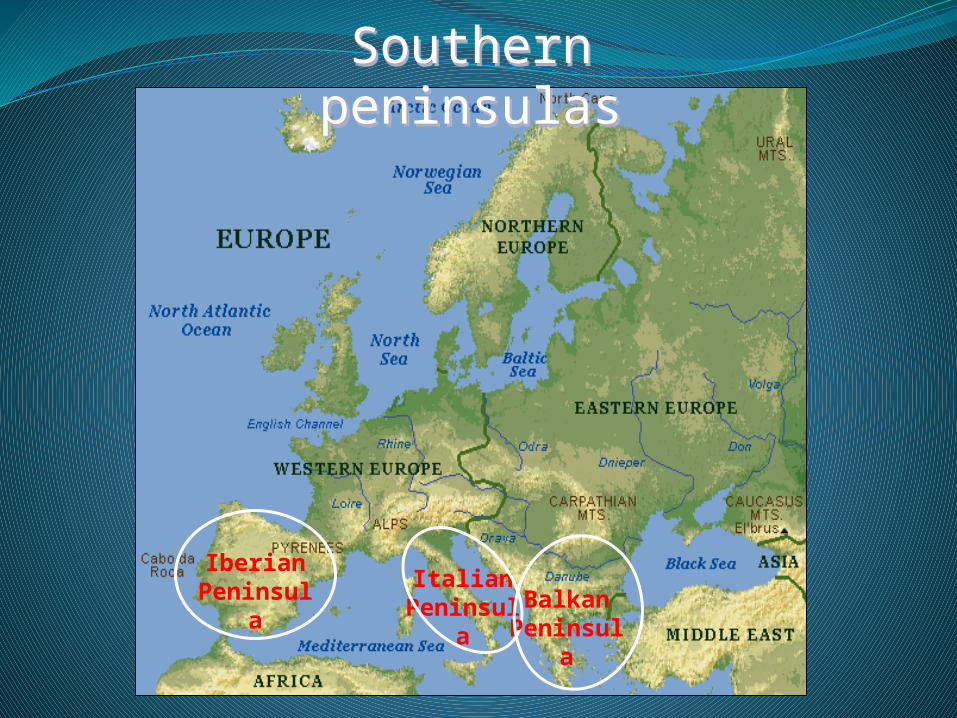
Southern peninsulasSouthern peninsulas
Iberian Peninsul
a
Italian Peninsul
a
Balkan Peninsul
a
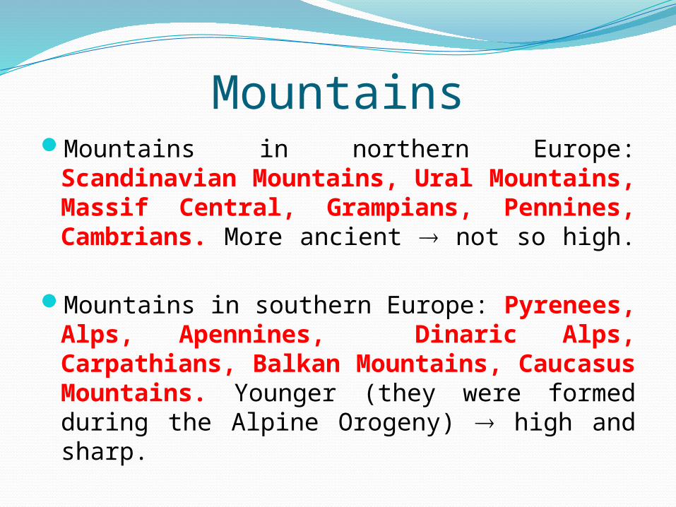
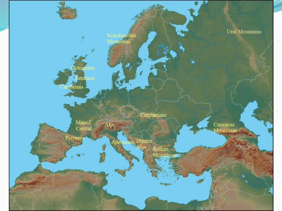
MountainsMountains in northern Europe:
Scandinavian Mountains, Ural Mountains, Massif Central, Grampians, Pennines, Cambrians. More ancient not so high.
Mountains in southern Europe: Pyrenees, Alps, Apennines, Dinaric Alps, Carpathians, Balkan Mountains, Caucasus Mountains. Younger (they were formed during the Alpine Orogeny) high and sharp.
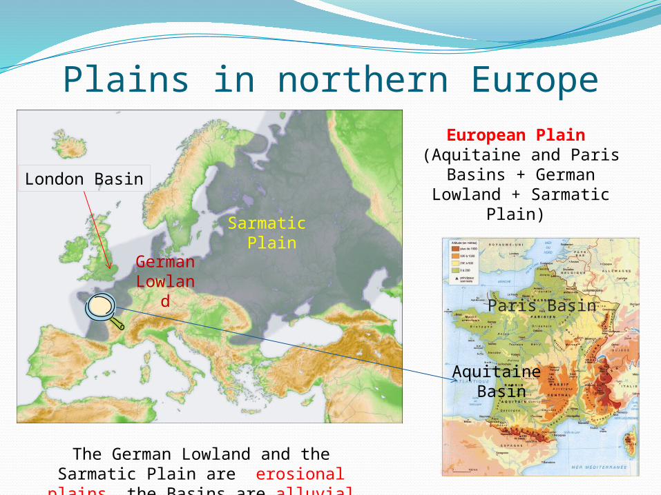
Plains in northern EuropeEuropean Plain
(Aquitaine and Paris Basins + German Lowland
+ Sarmatic Plain)
Sarmatic Plain
German
Lowland
Paris Basin
Aquitaine Basin
The German Lowland and the Sarmatic Plain are erosional plains, the Basins
are alluvial plains.
London Basin

Plains in southern Europe
21 3
1= Padan Plain
2 = Hungarian Plain
3 = Wallachian Plain
They are
alluvial plains

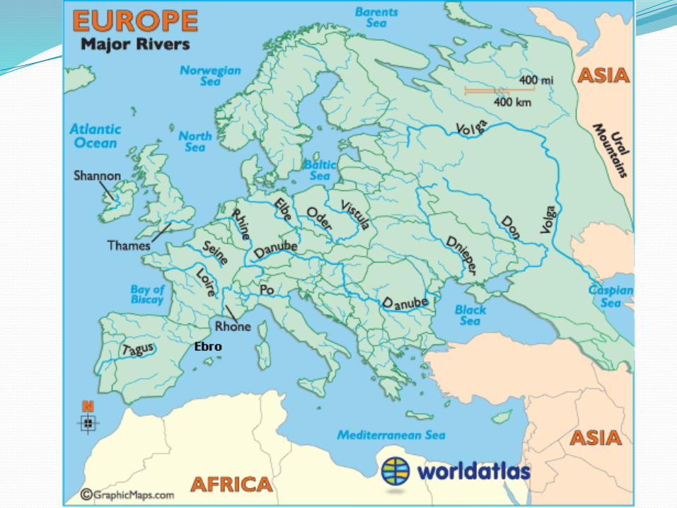
Rivers and lakesLarge rivers:water highwayssources of drinking water power for electricity.
The longest river is the Volga, the second one is the Danube.
The most important river for economic purposes is the Rhine. On its estuary lies Rotterdam, the largest port in Europe.
The largest lakes in Europe are the Ladoga and the Onega, both in Russia. There are many lakes in Finland, Scotland and in the Alps. They are mostly glacial lakes. In Hungary lies Lake Balaton.
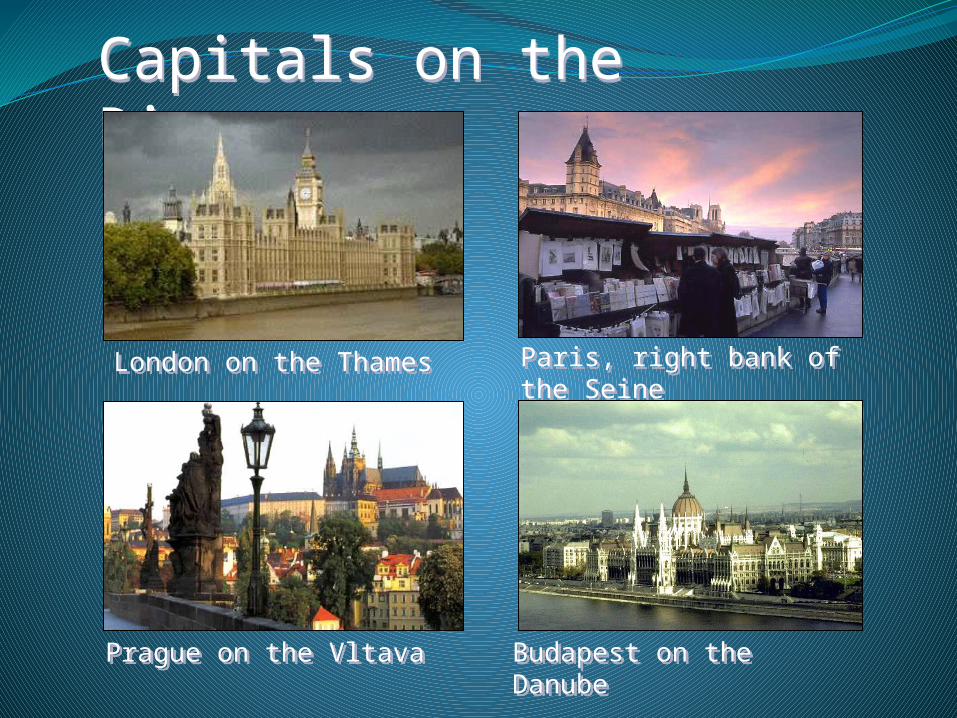
Capitals on the Rivers (1)Capitals on the Rivers (1)
Paris, right bank of the SeineParis, right bank of the Seine
London on the ThamesLondon on the Thames
Prague on the VltavaPrague on the Vltava Budapest on the DanubeBudapest on the Danube

Capitals on the Rivers (2)Capitals on the Rivers (2)
Berlin on the SpreeBerlin on the SpreeMoscow on the Moscow RiverMoscow on the Moscow River
Rome on the TiberRome on the Tiber Vienna on the DanubeVienna on the Danube

The White Sea – Baltic Sea Canal
Lakes in Finland
Lakes in Switzerland
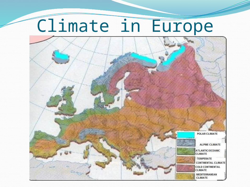
Climate in Europe

Vegetation in Europe