Embed Size (px)
Citation preview

Reducing flood risk from source to seaFirst steps toward an integrated catchment plan for Cumbria
Working with the Cumbria Floods Partnership
Foreword
The floods in Cumbria were truly terrible. They were horrendous in their extent: three complete river systems – the Eden, the Derwent and the Kent –flooded simultaneously.
They were horrendous in their intensity – we now know that the Eden experienced the highest flow levels, recorded on any river in England; following the highest day of rainfall recorded. They were horrendous in their human impact – one and a half thousand homes flooded in Kendal alone; a similar number in Carlisle, and hundreds in Appleby, Keswick and Cockermouth – and, while the media attention was on the larger areas, dozens of outlying villages were suffering terribly. A hundred bridges were damaged some – like Pooley Bridge – which had stood for more than a hundred years were swept away; others – like Eamont Bridge – which had stood for six hundred years were undermined. The slopes of Helvellyn collapsed, spilling rubble into the river, and flooding Glenridding, three times in a week – and on the other side, destroying the A591.
In recognition of these terrible events the Secretary of State appointed me, as Minister for Flooding, to establish and chair this Cumbria Floods Partnership. Our first responsibility as a government was the emergency response to protect lives. We owe a huge thanks to mountain and bay rescue teams, police, military, councils, churches, volunteers, the Environment Agency, and dozens more organisations – and particularly to the communities themselves – for responding so calmly and professionally to something so extreme and unprecedented.
The second stage has been recovery. Collectively the government has spent over £150 million to support recovery in Cumbria, over the last six months. This has extended from emergency funds for households, and businesses, to repairing Cumbrian roads and bridges allowing, among many other projects, Eamont Bridge to be reopened, and Pooley Bridge to be replaced, and the A591 to be rebuilt.
The third stage is now to prepare Cumbria for flooding in the future. I’m pleased that we have been able to provide affordable flood insurance for households across Cumbria through FloodRe. We must also make individual homes more resilient, so we have provided a £5,000 grant for every flooded home, to protect that home better in the future.
I have asked the Environment Agency to appoint a Director for each main river catchment - one for the Eden, one for the Derwent, and one for the Kent and Leven. This document records their initial work to make communities safer for this winter, from repairing damaged flood defences, to building new defences, and establishing new warning areas. But this is just the beginning.
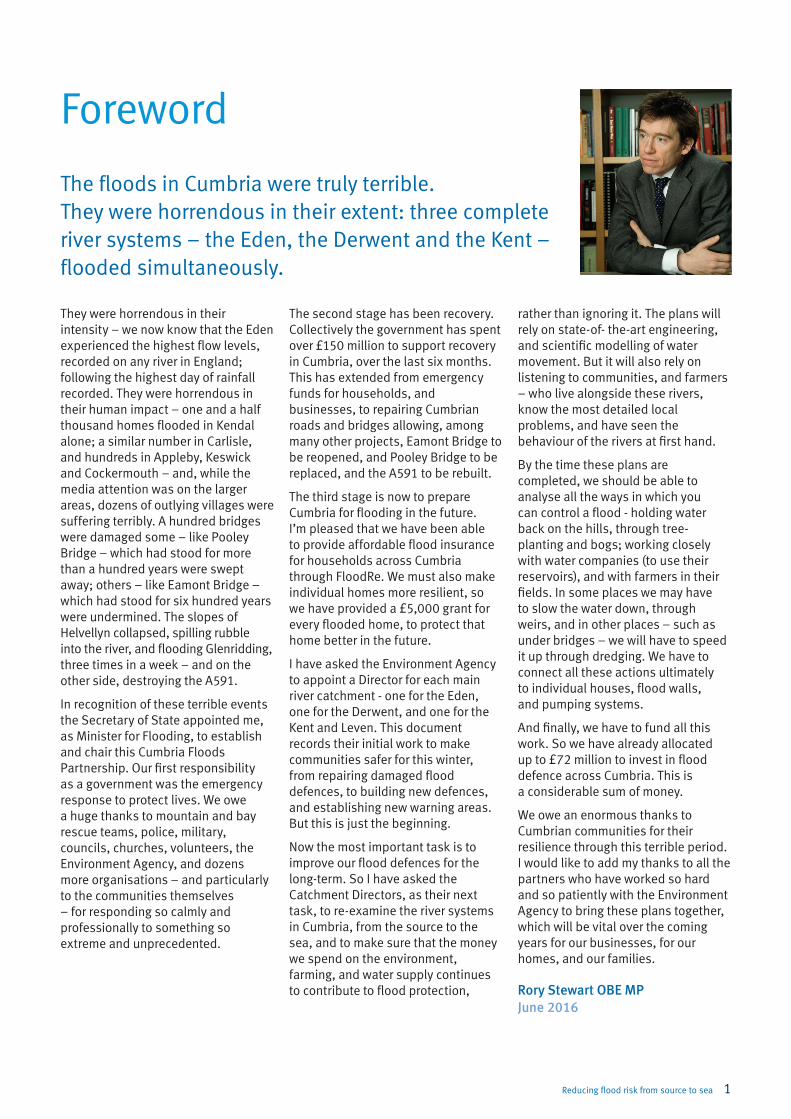
Now the most important task is to improve our flood defences for the long-term. So I have asked the Catchment Directors, as their next task, to re-examine the river systems in Cumbria, from the source to the sea, and to make sure that the money we spend on the environment, farming, and water supply continues to contribute to flood protection, Rory Stewart OBE MP
June 2016
rather than ignoring it. The plans will rely on state-of- the-art engineering, and scientific modelling of water movement. But it will also rely on listening to communities, and farmers – who live alongside these rivers, know the most detailed local problems, and have seen the behaviour of the rivers at first hand.
By the time these plans are completed, we should be able to analyse all the ways in which you can control a flood - holding water back on the hills, through tree-planting and bogs; working closely with water companies (to use their reservoirs), and with farmers in their fields. In some places we may have to slow the water down, through weirs, and in other places – such as under bridges – we will have to speed it up through dredging. We have to connect all these actions ultimately to individual houses, flood walls, and pumping systems.
And finally, we have to fund all this work. So we have already allocated up to £72 million to invest in flood defence across Cumbria. This is a considerable sum of money.
We owe an enormous thanks to Cumbrian communities for their resilience through this terrible period. I would like to add my thanks to all the partners who have worked so hard and so patiently with the Environment Agency to bring these plans together, which will be vital over the coming years for our businesses, for our homes, and our families.
Reducing flood risk from source to sea 1

The Environment Agency and our partners have worked hard, and continue to do so, to repair damaged infrastructure and help ensure Cumbria is better protected and prepared for the coming winter, and for the future.
Since December 2015, we have:
• Secured an additional £58 million, including up to £25 million for Carlisle.
• Inspected over 3,300 raised defences and repaired 75% of the 159 flood defences damaged by Storm Desmond. All will be repaired by autumn 2016.
• Completed new flood protection schemes in Appleby, Keswick and Threlkeld on the Gategill Beck.
• Started the construction of flood protection schemes in Kendal, Ulverston, Braithwaite, Ennerdale Bridge, Keswick, Maryport and Egremont.
• Created 7 new flood warning areas taking the total to 72 areas and providing warnings to over 6,500 properties across Cumbria.
• Improved 91 drains, rebuilt 7 walls, repaired 3 bridges and used 2,500 tonnes of concrete to rebuild and resurface 44,000 square metres of the A591 (Highways England).
By winter 2016, with our partners we will:
• Remove 70,000 tonnes of gravel and debris from local rivers in communities such as Glenridding and Kendal.
• Spend over £1 million to make sure that our existing flood defences are well-maintained and are fit for purpose, including over 50km of walls and embankments across Cumbria.
• Make available national supplies of up to 250 water pumps, 500,000 additional sand bags and additional temporary defences.
• Establish a network for the 48 flood action groups so that they can better help communities to prepare, respond and recover. Create a further 6 new flood warning areas to provide better warning to communities – taking the total to 78 in Cumbria.
• Hold a flood risk modelling competition to kick-start changes to the way we manage and plan for water.
Cumbria better prepared for winter – about this plan
Looking further ahead we will work together to:
• Invest a total of up to £72 million in Cumbria to provide better protection from flooding to at least 4,300 homes by 2021.
• Restore 350 hectares of peatland to hold water upstream for longer at several sites in the headwaters of the Eden, Derwent and Kent and Leven catchments.
• Make changes to the way that United Utilities operates its Thirlmere reservoir to provide flood protection without compromising the security of water supply for its customers.
• Work with 4 small communities to test what integrated flood and land management looks like in practice.
• Implement measures to slow the flow where feasible, including woody debris dams and floodplain storage upstream of Gamblesby, Cumrew and Stockdalewath in the Eden catchment, and channel meandering on the Whit Beck in the Derwent catchment.
• All Local Planning Authorities in Cumbria will update key spatial planning documents in light of learning from Storm Desmond to ensure that new development is safe and resilient by summer 2017.
You can find a comprehensive list of actions online by visiting www.gov.uk and searching for ‘Cumbria Flood Action Plan’. We will also produce a series of Community Action Tables; some are already available on the same web page.
As well as the actions in the 3 catchments most severely impacted by Storm Desmond, the government continues to invest in flood resilience and water management across the whole county. Over £11.6 million of government funding has been allocated to projects over the next 5 years in Ulverston, Dalton-in-Furness, Barrow-in-Furness, Whitehaven, Ennerdale and Egremont to better protect over 1,600 homes.
Flooding is devastating. The 6,300 householders and businesses across Cumbria flooded in December 2015 have spent much of the last 6 months dealing with its effects.
2 Reducing flood risk from source to sea

Cumbria better prepared – timeline of action
December 2015
Storm Desmond.
Wettest calendar month on record.
Record rainfall hits Cumbria resulting in record river levels and devastating flooding.
2016
January
First meeting of the Cumbria Floods Partnership.
Flood defence repairs started.
30,000 tonnes of gravel and debris removed.
February
Catchment Directors appointed.
100% of assets inspected.
9% of flood defence repairs complete.
New flood gates installed in Appleby.
March
An additional £58 million for flood defences announced.
Work on Ulverston flood protection scheme started.
Temporary bridge at Pooley Bridge opened.
April
33% of flood defence repairs complete.
Further 25,000 tonnes of gravel and debris removed.
7 new flood warning areas went live.
Appleby flood defence scheme completed.
Work started on new flood defence wall at Glenridding.
May
A591 repaired and reopened.
Grasmere flood recovery repairs completed.
Keswick flood defence repairs started.
June
Create a network for the 48 flood action groups.
Elliot Park flood protection scheme for Keswick complete.
July
Flood risk management and modelling competition launched.
75% of flood defence repairs complete.
August
United Utilities confirm scope and timing of changes to operation
of Thirlmere reservoir.
Work on Ennerdale Bridge flood protection scheme starts.
September
Further 25,000 tonnes of gravel and debris removed bringing the
total to 70,000 tonnes.
National supplies of more pumps, sand bags and temporary defences available.
October
All flood defence repairs complete and ready for the winter.
Gategill Beck, Threlkheld scheme complete.
November
Publish interactive version of the Cumbria Flood Action Plan.
Confirmation of how up to £25 million on new flood defences in Carlisle
will be spent.
December
Cumbria will be operationally prepared for winter.
January 2017 and beyond
Invest a total of £72 million to better protect at least 4,300 homes by 2021.
Implement ‘slow the flow’ projects across Cumbria.
Take an integrated catchment approach to water management.
Reducing flood risk from source to sea 3
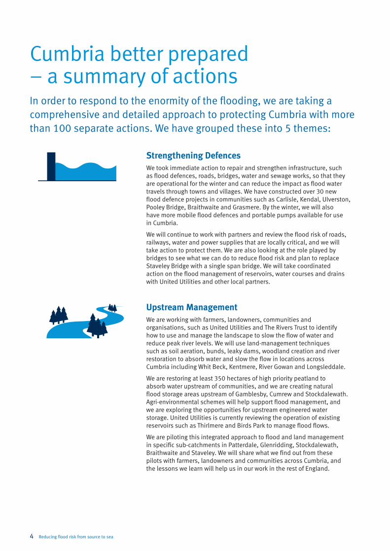
Cumbria better prepared – a summary of actionsIn order to respond to the enormity of the flooding, we are taking a comprehensive and detailed approach to protecting Cumbria with more than 100 separate actions. We have grouped these into 5 themes:
Strengthening DefencesWe took immediate action to repair and strengthen infrastructure, such as flood defences, roads, bridges, water and sewage works, so that they are operational for the winter and can reduce the impact as flood water travels through towns and villages. We have constructed over 30 new flood defence projects in communities such as Carlisle, Kendal, Ulverston, Pooley Bridge, Braithwaite and Grasmere. By the winter, we will also have more mobile flood defences and portable pumps available for use in Cumbria.
We will continue to work with partners and review the flood risk of roads, railways, water and power supplies that are locally critical, and we will take action to protect them. We are also looking at the role played by bridges to see what we can do to reduce flood risk and plan to replace Staveley Bridge with a single span bridge. We will take coordinated action on the flood management of reservoirs, water courses and drains with United Utilities and other local partners.
Upstream ManagementWe are working with farmers, landowners, communities and organisations, such as United Utilities and The Rivers Trust to identify how to use and manage the landscape to slow the flow of water and reduce peak river levels. We will use land-management techniques such as soil aeration, bunds, leaky dams, woodland creation and river restoration to absorb water and slow the flow in locations across Cumbria including Whit Beck, Kentmere, River Gowan and Longsleddale.
We are restoring at least 350 hectares of high priority peatland to absorb water upstream of communities, and we are creating natural flood storage areas upstream of Gamblesby, Cumrew and Stockdalewath. Agri-environmental schemes will help support flood management, and we are exploring the opportunities for upstream engineered water storage. United Utilities is currently reviewing the operation of existing reservoirs such as Thirlmere and Birds Park to manage flood flows.
We are piloting this integrated approach to flood and land management in specific sub-catchments in Patterdale, Glenridding, Stockdalewath, Braithwaite and Staveley. We will share what we find out from these pilots with farmers, landowners and communities across Cumbria, and the lessons we learn will help us in our work in the rest of England.
4 Reducing flood risk from source to sea
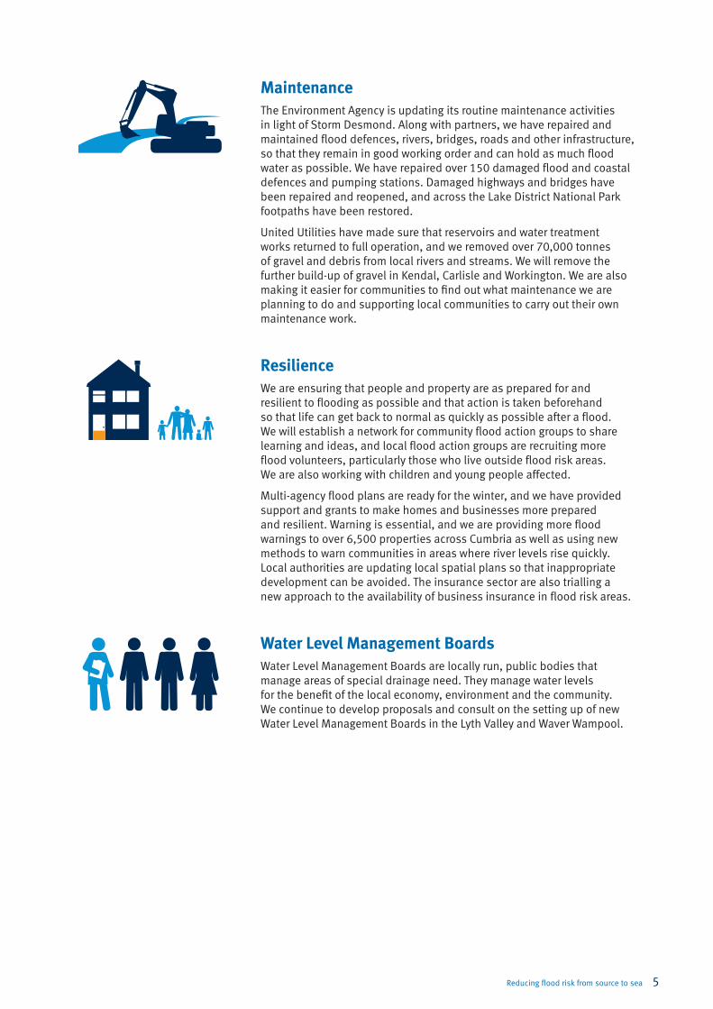
MaintenanceThe Environment Agency is updating its routine maintenance activities in light of Storm Desmond. Along with partners, we have repaired and maintained flood defences, rivers, bridges, roads and other infrastructure, so that they remain in good working order and can hold as much flood water as possible. We have repaired over 150 damaged flood and coastal defences and pumping stations. Damaged highways and bridges have been repaired and reopened, and across the Lake District National Park footpaths have been restored.
United Utilities have made sure that reservoirs and water treatment works returned to full operation, and we removed over 70,000 tonnes of gravel and debris from local rivers and streams. We will remove the further build-up of gravel in Kendal, Carlisle and Workington. We are also making it easier for communities to find out what maintenance we are planning to do and supporting local communities to carry out their own maintenance work.
ResilienceWe are ensuring that people and property are as prepared for and resilient to flooding as possible and that action is taken beforehand so that life can get back to normal as quickly as possible after a flood. We will establish a network for community flood action groups to share learning and ideas, and local flood action groups are recruiting more flood volunteers, particularly those who live outside flood risk areas. We are also working with children and young people affected.
Multi-agency flood plans are ready for the winter, and we have provided support and grants to make homes and businesses more prepared and resilient. Warning is essential, and we are providing more flood warnings to over 6,500 properties across Cumbria as well as using new methods to warn communities in areas where river levels rise quickly. Local authorities are updating local spatial plans so that inappropriate development can be avoided. The insurance sector are also trialling a new approach to the availability of business insurance in flood risk areas.
Water Level Management BoardsWater Level Management Boards are locally run, public bodies that manage areas of special drainage need. They manage water levels for the benefit of the local economy, environment and the community. We continue to develop proposals and consult on the setting up of new Water Level Management Boards in the Lyth Valley and Waver Wampool.
Reducing flood risk from source to sea 5
We have worked with partners to ensure that we spend this money where it can add the most benefit to the preparedness and protection of the communities of Cumbria. This will pave the way for a new approach to protecting homes, businesses, and the local economy against flooding. The evidence from Cumbria County Council’s flood investigation reports will be used to identify where additional investment may be required in the future.
Government and partners have committed:
• A total of up to £72 million of government funding allocated to Cumbria to better protect at least 4,300 homes from flooding by 2021. Up to £58 million of this is new funding agreed since December 2015. This includes:
• £4.7 million of government funding for projects within the Derwent catchment to better protect at least 525 homes in Flimby, Maryport, Braithwaite and Keswick. Projects totalling £1.15 million were completed in March 2016 at Threlkeld and Elliot Park, Keswick.
• £6.5 million of government funding for projects in the Eden catchment to better protect at least 503 homes in Appleby, Eamont Bridge, Wigton, Pooley Bridge, Rickerby Park and Gamblesby.
• Up to £25 million for projects in Carlisle. We will confirm how this will be spent by November 2016.
• £24.3 million of government funding for projects in the Kent and Leven catchments to better protect at least 1,217 homes in Grasmere, Grange-over-Sands and Kendal.
• Over £11.6 million of government funding has also been allocated to projects over the next 5 years in Ulverston, Dalton-in-Furness, Barrow-in-Furness, Whitehaven and Egremont to better protect over 1,600 homes.
• To help Cumbria’s households and businesses recover from the December floods, government has provided a total of over £150 million. This includes:
• £9.7 million of government funding is being invested in 159 recovery projects to be complete by autumn 2016 including repairs to walls, embankments, pumping stations, gauges, removal of large trees and over 70,000 tonnes of gravel and checking the safety of 1,600 bridges.
• £117 million of government funding has been allocated to Cumbria County Council for investment in critical highways and bridges.
• £10 million has been invested in repairing and improving the A591.
• £20.6 million for Cumbria County Council to distribute through its Community and Business Recovery Scheme, as payments to flooded households, businesses and resilience measures in flooded properties.
• £5.5 million for district councils in Cumbria to provide council tax and business rate relief for flooded properties.
• £3 million government investment to repair and improve pathways within the Lake District National Park and £500,000 for paths in Cumbria outside the National Park.
• Cumbria County Council is investing £3.5 million from capital reserves for repairs across the county to ensure that communities remain connected.
• There have been over £10 million in charitable donations to the Cumbria Community Foundation’s flood recovery appeal to support people and families in hardship and vital community organisations. This includes £4.7 million funding from government.
In the immediate aftermath of Storm Desmond and the December 2015 floods, the Secretary of State announced the formation of the Cumbria Floods Partnership, and government agreed to invest more money in flood risk management across Cumbria.
Cumbria better protected and prepared – investment
6 Reducing flood risk from source to sea

Catchment management in Cumbria – long-term visionIn the future, we will increasingly work at a catchment scale to integrate land management, development and resilience in areas at risk, from the tops of the fells down to the coast.
Achieving this will require:
Catchment-level leadership: we have trialled new ways of working with Catchment Directors leading engagement with partners and communities.
Next steps: we will now consider how to evolve these roles to support innovation and coordinate planning not just across water and flood risk, but also forestry, land management, biodiversity and other functions.
A strong evidence base: we have commissioned research to understand the impact of soil condition on run-off and worked with partners to pinpoint locations for measures to slow the flow, such as tree planting.
Next steps: we have launched a hydrological modelling competition for the Eden to generate more sophisticated river modelling and kick-start changes to how we manage and plan for water. The competition will support development of an interactive tool to bring the actions in this plan to life.
Collaborative working: working collaboratively allows us all to understand others’ views, experiences and expertise, and to collate local knowledge. It will help us to make more informed decisions about what is right for Cumbria and to deal with issues such as what integrated land management means in practice, and who has the authority to take decisions.
Next steps: we will work in partnership to co-produce solutions – beginning with the 4 pilot areas – to deliver innovative solutions and understand long-term governance needs.
Use uplands to slow the flow by planting trees, installing woody
dams and restoring peatland.
Operate public water supply reservoirs so that they help to manage flood risk
and provide secure water supplies.
Collaborative working with communities and partners across water and land-management issues to form
and deliver innovative solutions.
Actively manage gravel to ensure it does not increase
flood risk.
Work with farmers and landowners to manage farmland to reduce run-off
and restore meandering rivers.
Protect our villages and towns by building flood defences, maintaining the flow
under bridges and making existing and new buildings safe and resilient.
Reducing flood risk from source to sea 7
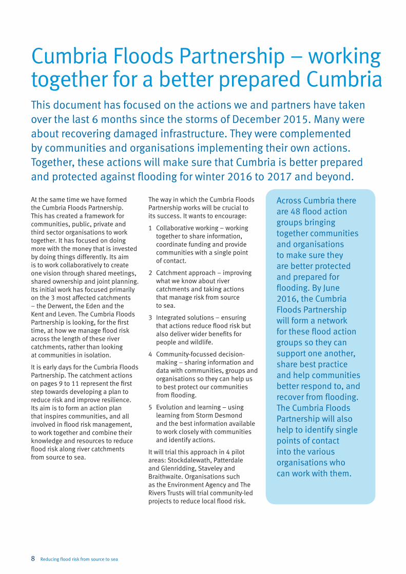
Cumbria Floods Partnership – working together for a better prepared CumbriaThis document has focused on the actions we and partners have taken over the last 6 months since the storms of December 2015. Many were about recovering damaged infrastructure. They were complemented by communities and organisations implementing their own actions. Together, these actions will make sure that Cumbria is better prepared and protected against flooding for winter 2016 to 2017 and beyond.
At the same time we have formed the Cumbria Floods Partnership. This has created a framework for communities, public, private and third sector organisations to work together. It has focused on doing more with the money that is invested by doing things differently. Its aim is to work collaboratively to create one vision through shared meetings, shared ownership and joint planning. Its initial work has focused primarily on the 3 most affected catchments – the Derwent, the Eden and the Kent and Leven. The Cumbria Floods Partnership is looking, for the first time, at how we manage flood risk across the length of these river catchments, rather than looking at communities in isolation.
It is early days for the Cumbria Floods Partnership. The catchment actions on pages 9 to 11 represent the first step towards developing a plan to reduce risk and improve resilience. Its aim is to form an action plan that inspires communities, and all involved in flood risk management, to work together and combine their knowledge and resources to reduce flood risk along river catchments from source to sea.
The way in which the Cumbria Floods Partnership works will be crucial to its success. It wants to encourage:
1 Collaborative working – working together to share information, coordinate funding and provide communities with a single point of contact.
2 Catchment approach – improving what we know about river catchments and taking actions that manage risk from source to sea.
3 Integrated solutions – ensuring that actions reduce flood risk but also deliver wider benefits for people and wildlife.
4 Community-focussed decision-making – sharing information and data with communities, groups and organisations so they can help us to best protect our communities from flooding.
5 Evolution and learning – using learning from Storm Desmond and the best information available to work closely with communities and identify actions.
It will trial this approach in 4 pilot areas: Stockdalewath, Patterdale and Glenridding, Staveley and Braithwaite. Organisations such as the Environment Agency and The Rivers Trusts will trial community-led projects to reduce local flood risk.
Across Cumbria there are 48 flood action groups bringing together communities and organisations to make sure they are better protected and prepared for flooding. By June 2016, the Cumbria Floods Partnership will form a network for these flood action groups so they can support one another, share best practice and help communities better respond to, and recover from flooding. The Cumbria Floods Partnership will also help to identify single points of contact into the various organisations who can work with them.
8 Reducing flood risk from source to sea
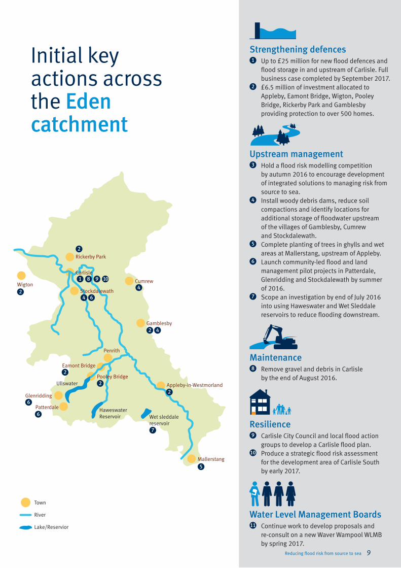
Initial key actions across the Eden catchment
Appleby-in-Westmorland
Mallerstang
Penrith
Pooley Bridge
Carlisle
Rickerby Park
Stockdalewath
Cumrew
Gamblesby
Patterdale
Glenridding
Eamont BridgeMaintenance8 Remove gravel and debris in Carlisle
by the end of August 2016.
Resilience9 Carlisle City Council and local flood action
groups to develop a Carlisle flood plan.10 Produce a strategic flood risk assessment
for the development area of Carlisle South by early 2017.
Water Level Management Boards11 Continue work to develop proposals and
re-consult on a new Waver Wampool WLMB by spring 2017.
Ullswater
Town
River
Lake/Reservior
1
4
4
7
4
2
2
Haweswater Reservoir Wet sleddale
reservoir
Wigton
Upstream management3 Hold a flood risk modelling competition
by autumn 2016 to encourage development of integrated solutions to managing risk from source to sea.
4 Install woody debris dams, reduce soil compactions and identify locations for additional storage of floodwater upstream of the villages of Gamblesby, Cumrew and Stockdalewath.
5 Complete planting of trees in ghylls and wet areas at Mallerstang, upstream of Appleby.
6 Launch community-led flood and land management pilot projects in Patterdale, Glenridding and Stockdalewath by summer of 2016.
7 Scope an investigation by end of July 2016 into using Haweswater and Wet Sleddale reservoirs to reduce flooding downstream.
Strengthening defences1 Up to £25 million for new flood defences and
flood storage in and upstream of Carlisle. Full business case completed by September 2017.
2 £6.5 million of investment allocated to Appleby, Eamont Bridge, Wigton, Pooley Bridge, Rickerby Park and Gamblesby providing protection to over 500 homes.
2
2
2
5
2
6
6
6
8 9 10
Reducing flood risk from source to sea 9
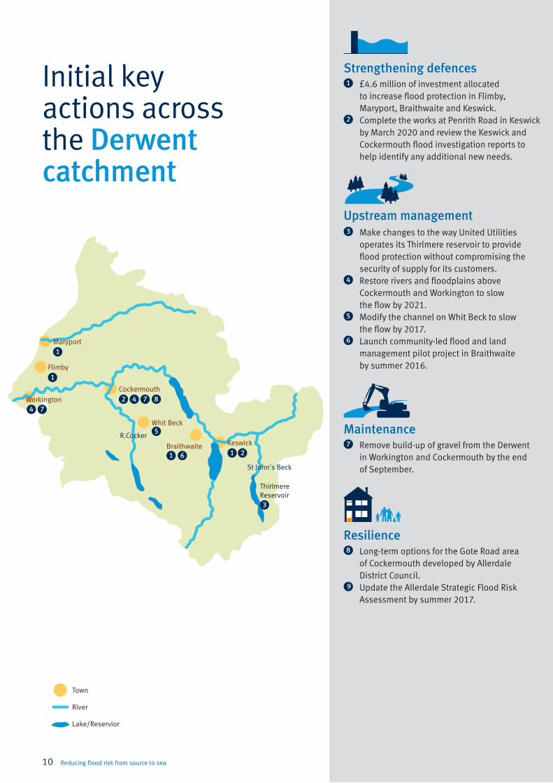
Initial key actions across the Derwent catchment
Town
River
Lake/Reservior
Workington
Maryport
Whit Beck
Flimby
Braithwaite Keswick
Cockermouth
Thirlmere Reservoir
1
1
1 1
3
6
77 8
5
44
2
2
R.Cocker
St John's Beck
Maintenance7 Remove build-up of gravel from the Derwent
in Workington and Cockermouth by the end of September.
Resilience8 Long-term options for the Gote Road area
of Cockermouth developed by Allerdale District Council.
9 Update the Allerdale Strategic Flood Risk Assessment by summer 2017.
Upstream management3 Make changes to the way United Utilities
operates its Thirlmere reservoir to provide flood protection without compromising the security of supply for its customers.
4 Restore rivers and floodplains above Cockermouth and Workington to slow the flow by 2021.
5 Modify the channel on Whit Beck to slow the flow by 2017.
6 Launch community-led flood and land management pilot project in Braithwaite by summer 2016.
Strengthening defences1 £4.6 million of investment allocated
to increase flood protection in Flimby, Maryport, Braithwaite and Keswick.
2 Complete the works at Penrith Road in Keswick by March 2020 and review the Keswick and Cockermouth flood investigation reports to help identify any additional new needs.
10 Reducing flood risk from source to sea

Lake Windermere
Initial key actions across the Kent and Leven catchment
Windermere
Kentmere
Newby Bridge
Lyth Valley
Backbarrow
Ambleside
Grasmere
Coniston
Longsleddale
Kendal
Carrus Green
Staveley
Burneside
1
1
1
4
3 5 7
3
3
9
11
8
8
2 6
Town
River
Lake/Reservior
R.Sprint
R.Mint
R.Gowan
Maintenance7 Remove further gravel in Kendal by
autumn 2016.8 Improve understanding of impact of water
levels in Windermere and the operation of sluices at Newby Bridge by autumn 2016.
Resilience9 Develop the Kendal town centre development
masterplan by November 2016.10 Work with children and young people affected
by flooding to help them cope and build resilience by winter 2017.
Water Level Management Boards11 Continue work to develop proposals and
re-consult on a new Lyth Valley WLMB by spring 2017.
Upstream management4 Develop proposals for river and peat
restoration to slow the flow in the Kentmere, River Gowan, Longsleddale, River Mint and River Sprint catchments by summer 2017.
5 Investigate the use of redundant Birds Park reservoir to reduce flood risk downstream in Kendal by March 2017.
6 Launch community-led flood and land management pilot project in Staveley by summer 2016.
Strengthening defences1 £24.3 million of investment in Kendal,
Burneside, Staveley and Carrus Green.2 Replace bridge at Staveley with a single
span bridge by June 2017.3 Review the effect of bridges on flooding
in Kendal, Ambleside and Backbarrow.
1
4 4
4
4
Reducing flood risk from source to sea 11
This plan is our first response to the December 2015 floods. It sets out the key actions that we have taken and intend to take to prepare for next winter and reduce flood risk across the 3 catchments most affected: the Eden, Derwent, and Kent and Leven.
The Cumbria Flood Action Plan is a living document. We want to continue working with local partners and communities to develop it further, including an interactive version in the autumn. This will also provide an opportunity for an update on progress. We need you, your community and your organisation to help us do this by providing specific, localised information on catchment management and taking actions to make homes, communities and businesses more resilient to flooding.
Here are 3 key things you can do now:
1. Sign up for flood warnings – call Floodline on 0345 988 1188 or log on to www.gov.uk/flood
2. Make your home more resilient to flooding – advice is available via www.gov.uk/flood
3. Share your local knowledge, suggestions and ideas for catchment management with Cumbria Floods Partnership at [email protected]
Next steps – for the plan
12 Reducing flood risk from source to sea

Published by:
Environment Agency
Horizon House
Deanery Road
Bristol BS1 5AH
Email: [email protected]
www.gov.uk/environment-agency
© Environment Agency 2016
All rights reserved. This document may be reproduced
with prior permission of the Environment Agency.
LIT 10471


![Effects of level soil bunds and stone bunds on soil properties and … · 2013. 12. 24. · bunds are adaptation options to mitigate the problems caused by climate change [16]. Since](https://img.dokumen.tips/doc/110x75/60d9de683895e61e3b21a619/effects-of-level-soil-bunds-and-stone-bunds-on-soil-properties-and-2013-12-24.jpg)


