Embed Size (px)
Citation preview

Ž .Catena 42 2001 175–192www.elsevier.comrlocatercatena
Crossing the thresholds: human ecology andhistorical patterns of landscape degradation
Ian A. Simpson a,), Andrew J. Dugmore b, Amanda Thomson a,Orri Vesteinsson c´
a Department of EnÕironmental Science, UniÕersity of Stirling, Stirling, FK9 4LA, UKb Department of Geography, UniÕersity of Edinburgh, Edinburgh, EH8 9XP, UK
c Institute of Archaeology, Iceland, Barugotu 3, 101 ReykjaÕık, Iceland´ ¨ ´
Abstract
In discussions of landscape sensitivity, human activities have generally been regarded asexternal forces contributing to landscape change, with a focus on the impacts of cultivationmethods, fertiliser practices, grazing pressures and atmospheric pollution. However, there has beencomparatively little study undertaken that integrates physical and social systems in a historiccontext to explain the basis of human activity in sensitive landscapes. Where such attempts havebeen made, the manner of common land management has figured prominently, with ‘tragedy ofthe commons’ concepts used to explain land degradation and to provide a foundation for policyresponse. This has also been the case in Southern Iceland and in this paper we assess the extent towhich common land domestic grazing pressures were the primary external force causing soilerosion and land degradation during the period of occupation from ca. 874 AD. We first providefield observation of soil erosion, temporally defined by tephrochronology, to highlight the extentof land degradation during this period. The ‘tragedy of the commons’ explanation of degradationis then assessed by evaluating historic documentary sources, and by environmental reconstructionand modeling of historic grazing pressures. These analyses indicate that regulatory mechanismswere in place to prevent overgrazing from at least the 1200s AD and suggest that there wassufficient biomass to support the numbers of domestic livestock indicated from historic sources.We suggest that failure to remove domestic livestock before the end of the growing season and anabsence of shepherding were more likely to contribute to land degradation than absolute numbers.Lack of appropriate regulation of domestic livestock on common grazing areas can be attributed to
) Corresponding author.
0341-8162r01r$ - see front matter q2001 Elsevier Science B.V. All rights reserved.Ž .PII: S0341-8162 00 00137-5

( )I.A. Simpson et al.rCatena 42 2001 175–192176
limited cultural knowledge of changing and rapidly fluctuating environmental conditions. q 2001Elsevier Science B.V. All rights reserved.
Keywords: Historical ecology; Andisols; Soil erosion; Tephrochronology; Common land; Grazing; Culturalknowledge
1. Introduction
Since the mid 1980s, there has been realisation that explanation of landscape changecannot solely rely on a mechanistic understanding of the inherent sensitivities andresilience of landscapes to externally imposed variations in climate and human activity.Driven largely by issues of land degradation, the social and natural sciences haveincreasingly been attempting a holistic study of landscape change under varyingpolitical, socioeconomic and historical contexts that contrast capitalist with socialist and
Ž .colonial with precolonial settings Blaikie and Brookfield, 1987 . However, humanecological concepts applied to questions of landscape sensitivity have often lackedrigorous assessment and have frequently failed to provide historical depth resulting inill-judged assessments and policy responses.
One enduring aspect to social explanations of landscape change has been the issue ofland tenure and common land in particular. Much of this debate has been stimulated byHarden’s ‘Tragedy of the Commons’ paper in which he utilised the concept of acommunal pasture to illustrate the point that individual self-interest will result in the
Ž .abuse of a commonly held resource leading to land degradation Harden, 1968 . The‘tragedy of the commons’ argument as it applies to livestock and rangeland landscapescan be summarised as follows: a herdsman puts his animals on a pasture that he uses incommon with other herdsmen. Although there are signs that the condition of the pasturewill worsen with additional stocking, it is only rational for each herdsman to add moreanimals to his herd because he gains the full benefits of each additional animal while
Ž .sharing the cost of overgrazing with the other herdsmen. McCay and Acheson, 1987 .ŽHardin went on to conclude that to avoid tragedy land degradation and loss of the
.grazing resource , the commons could be privatised or kept as public property to whichrights to entry and use could be allocated. While this view ignores spatial and temporalvariation in landscape sensitivities, it is one that remains widely accepted as a socialfoundation of land degradation with some according it universal application. Further-more, it has been used as a basis from which environmental resource management policy
Ž .has been attempted in a wide variety of environmental contexts Feeny et al., 1990 .In this paper, we seek to assess the extent to which the ‘tragedy of the commons’
model can be used to explain the historical occurrence of land degradation in landscapeswhere grazing of domestic livestock has been, and continues to be the primary humanactivity. In doing so, more comprehensive explanations of the relationship between soilerosion, land degradation and grazing domestic livestock are derived and new hypothe-ses identified. An ideal place to develop a historical approach to testing the model isIceland, where it has been estimated that at least 40% of top soils have been removed
Žsince the island was first settled in the 9th century AD Fri> riksson, 1972; Thorsteins-

( )I.A. Simpson et al.rCatena 42 2001 175–192 177
.son et al., 1971 . Explanation of this loss in Southern Iceland and other areas of theNorth Atlantic region including Shetland, Faeroe and Greenland, has implicitly beengiven as a classic ‘tragedy of the commons’ situation, a result of domestic livestockgrazing of afrettur, the summer mountain grazing areas. Indeed the denuded areas of´
ŽIceland have been described as ‘ovigenic’ or made by sheep landscapes Buckland and.Dugmore, 1991; Sveinbjarnardottir et al., 1992 , although removal of woodland and´
turves for fuel and as construction materials may also have contributed to landscapedegradation. Following this explanation has, predictably, been classic governmentintervention responses that include reseeding programmes, inducements to farmersencouraging them to remove livestock from mountain and hill pasture areas, and more
Ž .recently, participatory approaches Arnalds, 1998; Arnalds et al., 1987 . Iceland also hasone of the most detailed tephrochronologies in the world, permitting a precise assess-ment of the patterns and timing of land degradation, and which can be temporally relatedto a detailed record of climatic and vegetation change immediately before and during theperiod of human occupation. There are also good documentary sources of land manage-ment practices in the form of sagas and law books which date from the high middle agesŽ .12th–14th centuries as well as comprehensive farm surveys from the early 1700s.
2. Landscape degradation in Southern Iceland
The district around Eyjafjallajokull has been developed as a study area to explore the¨biophysical and social aspects of land degradation because of the range of landscapes
Ž .present and the natural barriers that define the afrettur sg., afrettir pl. areas shared by´ ´Ž .the farmsteads at the foot of the glacier Fig. 1 . The barriers formed by the Myrdalsjokull´ ¨
ice cap and the Markarfljot and Jokulsa rivers effectively constrain rangeland grazing,´ ¨ ´giving a coherent district for the assessment of grazing impacts. The area extends fromthe coastal sandur to the upland glacier margins and includes inland valleys. Soils in thestudy region are dominated by andisols derived from volcanic tephra and aeolian
Žmaterials primarily of volcanic origin Soil Survey Staff, 1998; Shoji et al., 1996; Parfitt.and Clayden, 1991; Johannesson, 1960 . The clay mineralogy of Icelandic andisols is´
generally characterised by abundant allophanes, imogolite and poor crystalline ferri-hydryte, and these soils tend to have high phosphorus retention. Analyses of soil thinsections indicate the silty nature of these soils with low organic carbon contents and low
Žbulk densities, making them highly susceptible to erosion Arnalds et al., 1995; Wada et.al., 1992; Simpson et al., 1999 .
During the Holocene, the study area has been frequently covered by fallout fromnearby volcanic systems, resulting in the formation of at least 78 discrete tephra layerswhich exhibit a range of macroscopic features reflecting major differences in geochemi-cal composition, eruption mechanism, total tephra volumes and principal direction offallout. The timing of eruption or tephra falls can be recorded in historical sourcesŽ . Ž .Thorarinsson, 1967 , correlated to annually laminated ice cores Gronvold et al., 1995´ ¨or dated using radiocarbon measurement on associated organic materials. Thetephrochronology used here is based on the regional framework established by a number
Žof workers Thorarinsson, 1944, 1967, 1975; Einarsson et al., 1980; Haraldsson, 1981;´

( )I.A. Simpson et al.rCatena 42 2001 175–192178
Fig.
1.E
yjaf
jalla
hrep
pur,
Sout
hern
Icel
and.

( )I.A. Simpson et al.rCatena 42 2001 175–192 179
.Larsen, 1981, 1982, 1984, 1996; Dugmore, 1989; Halfli>asson et al., 1992 . Tephrasmay be grouped to define broader culturally and environmentally significant phases andassess change over clearly defined periods of time. Firstly, the stratigraphy below the
Ž .Landnam tephra 871"2 preserves a record of landscapes without human impact.´Secondly, the Landnam tephra combined with either KR920 andror E935 can be used´to assess the initial Norse colonisation and the first generation of settlement. Thirdly, the
Žstratigraphy bounded by KR 920 andror E 935, and the Hekla tephra of 1510 AD H.1510 encompasses the changing conditions of the medieval warm period. Fourthly, H
Ž .1510 and the Hekla tephra of 1947 AD H 1947 bound the sedimentary record of themajor cold phases of the little ice age as defined by glacier advances. Finally, H 1947provides an unambiguous modern stratigraphic marker that effectively coincides withthe onset of post World War II agricultural change and the first national survey of landdegradation using stereographic vertical aerial photography.
Within the study region, over 200 soil profiles correlated using tephrochronologyhave been used to reconstruct patterns of sediment accumulation as an indicator of land
Ž .degradation Dugmore and Buckland, 1991; Dugmore and Simpson, in press . GenerallyŽ .similar rates of accumulation in prehistory prior to ca. 874 AD can be interpreted as a
reflection of regional fallout over stable vegetated areas, although this period includes aclimatic range of similar magnitude to those of the occupation period. Colonisation andsettlement clearly induced accelerated soil erosion which first developed in the upland,ecologically marginal areas, and then spread to the lower, initially less marginal areasŽ .Dugmore and Buckland, 1991 . Rates of denudation have been estimated as high as 20mmryear, although 4 mmryear is a more representative figure. Thin section micromor-phology is currently identifying sediment sources in accumulation areas and suggeststhat local aeolian sediment is the dominant source, but with slope wash and regionalaeolian sediments also making a significant contribution. These observations of sedimentmovement permit general models of landscape change to be constructed that illustratechanges in vegetated areas and the development of eroded areas over time, clearlyindicating that limiting thresholds of landscape change were crossed as a result of
Ž .human activity, setting in progress long-term erosion Fig. 2 . Until now, overgrazing ofcommon land areas by domestic livestock has been perceived as the primary cause ofland degradation in this area. The validity of this view is now assessed through theexamination of historic documentary sources, and by new environmental reconstructionand modeling of grazing pressure over the period that Iceland has been occupied.
3. Documentary sources of common land grazing practices
Early settlers initially appropriated mountain pastures and parts of highland pasturesin Iceland, particularly in the north, remained private property belonging to individualfarmsteads or churches. In the south these pastures evolved towards communal forms ofownership. Common grazing areas were known as afrettir, and can be considered as a´logical outcome in a landscape where biomass production is comparatively low andlarge grazing areas are consequently required, and is consistent with the minimisation of
Ž .costs to the graziers Eggertsson, 1992 . In the south, the only part of Iceland where

( )I.A. Simpson et al.rCatena 42 2001 175–192180
there are large communities of farmsteads without direct access to mountain pastures,they were considered to be the common property of communes at least since the 15th
Ž .century DI VI, pp. 81–82 and almost certainly from considerably earlier times.Ž .Communes or hreppar pl. were the basic administrative unit in Iceland and are known
Fig. 2. A general model of soil erosion and land degradation for Southern Iceland, showing three time periods,Ž . Ž . Ž .a ca. 400 AD, b 920–1510 AD and c 1510–1947 AD.
( )I.A. Simpson et al.rCatena 42 2001 175–192 181
Ž .Fig. 2 continued .
to have been in existence from at least 1097 AD when tithing was introduced. AŽ .hreppur sg. , or commune, was an association of at least 20 farmsteads which could
among other things organise the common grazing resource and co-operated in theŽ .autumn round-up of sheep KHL VII, pp. 17–22 . While the ownership of the afrettir´
by hreppar is not documented until the 15th century, there is much earlier evidence ofcommunal ownership of pastures by two or more farmsteads. This documentaryevidence suggests that there was substantial regulation of afrettir from an early stage.´The earliest evidence comes from the mid-13th century collection of law called Gragas´ ´Ž .Icelandic: ‘Grey Goose’; Finsen, 1853, 1879 , considered to represent legal traditions of
Ž .the Commonwealth period AD 930–1262 . Following union with Norway in 1262, theIcelanders received a new law code, Jonsbok in 1281, subsequently amended in 1294,´ ´
Ž .1305 and 1314 Haldorsson, 1970 . This made only minor changes to the regulations of´Gragas in relation to afrettir and served as the legal framework for common pasture´ ´ ´into the 20th century.
The problem of overgrazing is dealt with as early as Gragas. Any insider in an´ ´afrettur could call for an independent evaluation of the grazing capacity of the pasture.´Assessors were instructed to find the maximum number of sheep that could use thepastures without affecting the average weight of the flock and once the maximumnumber of animals was determined, each user of the afrettur was given a quota on the´basis of the value of his farm. A farmer who exceeded his quota could face a heavy fine
Ž .if brought to court by his co-owners of the afrettur Finsen, 1853, pp. 114–115 .´

( )I.A. Simpson et al.rCatena 42 2001 175–192182
Enforcing property rights depended upon the earmarks of the flocks individual to eachŽ .farmstead Finsen, 1853, 154–55; 1879, 479–80 . Gragas and Jonsbok required the´ ´ ´ ´
farmers to drive their flocks to the afrettur in a given week in June; to overcome the´problem of sheep crossing into another afrettir and home pastures the law books´required that flocks be driven into the middle of the afrettur and not left near the´borders. Before the sheep were taken into the afrettur, it was to be fallow for 2 weeks´but those who owned land bordering on the common land were allowed to use it forgrazing in winter. Sheep were to be rounded up before a specific week in September and
Ž .driven back to the farmstead areas Finsen, 1853, p. 113 . In 1281, when the law code ofŽ .Jonsbok was confirmed by the General Assembly Al2ing , demands were made that´ ´
each district be allowed to set its own conditions on the basis of local circumstances.These demands were met in the Amendments of 1294 and the right to set the dates wasgiven to the overseers of the hreppar. Gragas further established the exclusive rights of´ ´a group of individuals to an afrettur and stated that outsiders require permission from all´
Ž .the owners of an afrettur before they could use it for grazing Finsen, 1853, p. 113 .´The documentary sources thus suggest that there were mechanisms in place to
regulate the afrettir grazing areas in relation to sheep numbers. Furthermore, such´tightly defined regulation which includes defined boundaries and memberships, congru-ent rules, conflict resolution mechanisms and graduated sanctions are characteristic of
Žsuccessful management of common resources in other areas of the world Olstrom,.1990 . It is therefore possible to draw the conclusion from Icelandic documentary
sources that a ‘tragedy of the commons’ on afrettir was an unlikely scenario to the´extent that it would result in land degradation. The pressure of sheep numbers in theseareas was unlikely of itself to have been primarily responsible for soil erosion and landdegradation in Southern Iceland. Such a conclusion can be assessed further through thedevelopment and application of grazing models to historic landscapes, which may beginto demonstrate with more precision the characteristics of grazing regimes that con-tributed to the onset and continuation of land degradation.
4. Landscape reconstruction and modeling of grazing pressure
Landscape reconstructions for the study area have been derived from existing andchronologically well defined paleoenvironmental data for vegetation, together with
Ž .known altitudinal and vegetation relationships Hallsdottir, 1987; Palsson, 1981 , for´ ´Ž . Žclimate Ogilvie, 1984, 1991, 1992 and for known geomorphological change see
.above . Settlement sites were identified through archaeological excavations and fromdocumentary sources. These data were developed as a Geographical Information SystemŽ .GIS-ARC Info database and their integration permitted landscape reconstruction for ca.
Ž .900–1000 AD, ca. 1550 AD and ca. 1750 AD Fig. 3 . The reconstructed landscape forca. 900–1000 AD suggest gradients of vegetation cover with sands adjacent to the coast,marshy grassland in the lower areas of the hreppur, areas of woodland, scrub woodlandbetween 300 and 400 m, broad-leaved grasslands between 400 and 500 m, fine-leaved
Ž .grassland between 500 and 700 m and moss heath 30% cover above 700 m. Areaslacking accessible vegetation cover include cliffs and cinder cone. The earliest settle-

( )I.A. Simpson et al.rCatena 42 2001 175–192 183
Ž . Ž . Ž .Fig. 3. Landscape reconstructions for Eyjafjallahreppur, a ca. 1000 AD, b ca. 1550 AD and c ca. 1750AD.

( )I.A. Simpson et al.rCatena 42 2001 175–192184
ment sites were located on or adjacent the marshy grasslands, reflecting the need forŽ .winter fodder Vesteinsson, 1998 , with secondary settlements more generally evident´
adjacent to woodland areas. Mean July sea temperature was estimated as being 128C.Changes in the landscape by ca. 1550 AD include woodland and scrub woodland loss,together with a reduction in the area of grassland cover as a result of land degradation.Furthermore, changes in the Markarfljot channel meant that pasture on the western side´of the river became less accessible, although it continued to be used. Mean Julytemperature is estimated as being 108C. By 1750 AD, further significant reductions invegetation cover had taken place. Historic domestic livestock numbers for the hreppur
´were obtained from the farm survey of Iceland undertaken by Arni Magnusson and Pall´ ´Ž .Vıdalın between 1703 and 1714 on behalf of the Danish crown Melsta> et al., 1990 .´ ´
This survey recorded all farms, both working and abandoned, and listed rents, numbersand type of livestock and other available resources. Some caution in using this data isrequired as it is possible that farmers may have downplayed livestock numbers so as notto appear too prosperous and thereby have their taxes raised; however, the figures givenare held to be broadly accurate. For the purposes of calculating historic grazingpressures, the estimate of one cow having the grazing requirement of six sheep wasused, giving a sheep-based grazing livestock total of 15,106 for the Eyjafjallahreppur.
This data was then used to empirically estimate biomass production and off-takes bydomestic livestock off-takes based on established relationships between vegetation typeand biomass production. Our first approach to estimate the relationship between biomassproduction and off-take by sheep in afrettur has been to utilise existing published data´
Ž .of average annual yields kgrha, dry matter of plant communities in Iceland andŽ .estimated sheep off-takes Fri> riksson, 1972; Thorsteinsson et al., 1971 . In these
studies, a 40% utilisation rate has been regarded as ‘proper use’ of the pasture and it isassumed that the livestock are on the afrettur from June to September. Calculations´based on these data indicate a decline in available biomass as a result of climatic change
Ž .and erosion over the three time periods under consideration Table 1 . Estimates suggestthat livestock would require 393=104 kg of dry matter for a 4-month summer grazingperiod. For the 1000 AD landscape, modeling suggests that the common grazing areaabove 400 m could have provided this amount. By ca. 1500 AD previously wooded landat lower altitudes would have to be exploited to maintain the historic numbers oflivestock. By ca. 1750, lowland wet grasslands would also have to be used over the
Table 1ŽEstimates of utilised biomass in Eyjafjallahreppur, 1000 AD, 1550 AD and 1750 AD calculations from
.existing data
Available kg dry matter 1000 AD 1550 AD 1750 AD4 4 4Moss heath: )700 m 21=10 10=10 21=104 4 4Grassland: 500–700 m 199=10 49=10 24=104 4 4Grassland: 400–500 m 263=10 131=10 32=10
4 4Ž .Grassland ex scrub 102=10 25=104 4Ž .Grassland ex woodland 320=10 176=10
4Marshy grassland 274=10

( )I.A. Simpson et al.rCatena 42 2001 175–192 185
summer months, putting inevitable pressure on the area harvested for winter hay.Despite this obviously deteriorating situation, the analyses suggest that there wassufficient biomass across the Eyjafjallahreppur as a whole to support the historicalnumbers of livestock. While there was little margin for error, livestock numbers couldhave been maintained with careful timing of the period livestock were kept on commongrazing areas.
A second approach to the assessment of grazing pressure is through application ofgrazing models as a means of providing indicators of grazing pressure. In the absence ofa grazing model specific to Iceland, a grazing model developed for UK uplandenvironments, and which has successfully been applied to the Northern Isles of Orkney
Ž .Fig. 4. Grazing model output for Eyjafjallahreppur 1750 AD landscape, showing a green biomass,Ž . Ž .productivity and b grazing offtake values kg dry matter .
( )I.A. Simpson et al.rCatena 42 2001 175–192186
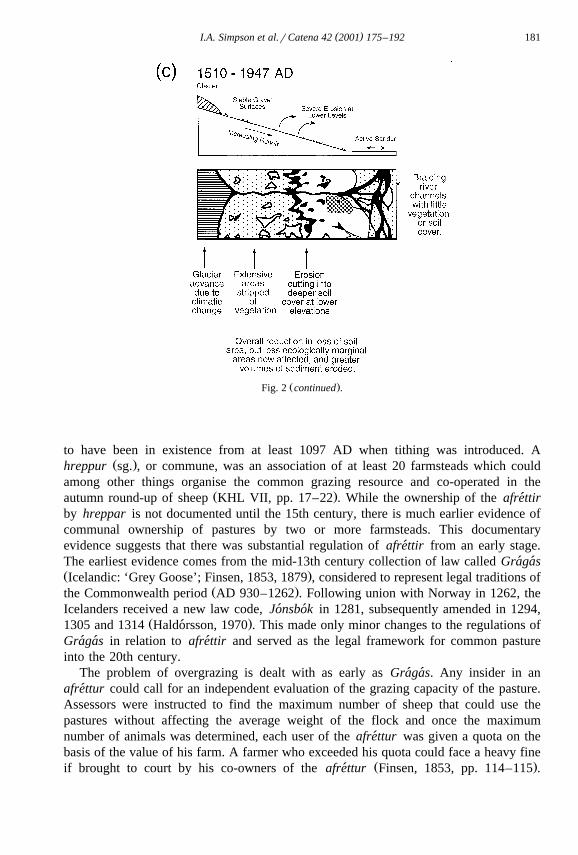
Žand Shetland, was adapted for Icelandic historic landscapes Armstrong et al., 1997a,b;.Simpson et al., 1998 . The adaptation required the use of altitudinal lapse rates, given as
Ž .18Cr150 m Bergthorsson et al., 1987 , as a proxy for latitude variation. Although this´model is only a partial representation of Icelandic conditions, observations from themodel again indicate that there was sufficient biomass provision across the Eyjafjal-lahreppur for the historical numbers of livestock. Green biomass is estimated as 1900kgrharyear dry matter production for upland grasslands in the ca. 900–1000 ADlandscape, with an estimated off-take of only 5.5 kgrharyear dry matter. For the ca.1550 AD and 1750 AD landscapes green biomass is estimated as 1200 kgrharyear drymatter, with estimated off-takes of 10.5 and 17.5 kgrharyear dry matter, respectively.These estimates reflect cooler climatic conditions and increased off-take per ha witherosion reducing the available grazing area. A check of these estimates against the
Ž .available Icelandic data Fri> riksson, 1972; Thorsteinsson et al., 1971 indicates closesimilarities in biomass production and off-take requirements and suggests that modelpredictions are providing meaningful approximations.
Potentially of greater significance are the model-predicted patterns of yearly greenbiomass. For the ca. 900–1000 AD landscape, with comparatively benign climaticconditions, the model suggests that green biomass production in the upland grasslandareas, although declining during the winter period, was available all year round, asimilar situation to modern day Shetland. In contrast, the model suggests that green
Ž .biomass production of the upland grasslands above 400 m during the more severeclimatic conditions of the ca. 1550 AD and ca. 1750 AD landscapes was restricted to a
Ž .growing season between the months of May and August Fig. 4 . Although off-take ofdead biomass by livestock has still to be properly accounted for, these observationsindicate that any pre-May and post-August grazing would have resulted in off-takeexceeding green biomass production. Thus, livestock brought to the afrettur early in the´year, perhaps because of failure to harvest sufficient hay for the winter, is a scenariowhere carrying capacities of afrettur could have been exceeded. Similarly, livestock´kept on the afrettur into the autumn, as indicated by the documentary sources, would´also be a situation where afrettur carrying capacities could have been exceeded, with´the consequent onset of land degradation.
5. Discussion
While grazing of afrettur by domestic livestock, and sheep in particular may remain´a primary cause of the major soil erosion and land degradation in South Iceland, anintegrated historical approach to this issue suggests that a simple ‘tragedy of thecommons’ scenario is an inadequate, and even false, explanation. Documentary sourcesclearly indicate that sheep numbers and management of sheep on the afrettur were´regulated. Rather than common land, a common pool resource with well-definedconceptual management boundaries is a more accurate definition of these areas, andcould have been sufficient to prevent major land degradation problems. Furthermore,landscape reconstruction and grazing modeling suggests that there was sufficient green

( )I.A. Simpson et al.rCatena 42 2001 175–192 187
biomass to support the historical numbers of livestock, even when cooler climaticconditions and land degradation were reducing biomass production. Significantly,despite major land degradation prior to the 19th century, the land was still able tosupport and sustain the major increases in livestock numbers associated with theagricultural improvements of the late 1800s. Over the study area as a whole it wouldappear that there were sufficient biological resources to support stocking levels created.There remains therefore a dilemma in how to explain the relationship between soilerosion and sheep grazing in South Iceland when there is strong evidence for sufficientbiomass to support the numbers of livestock. The issue of soil erosion and its relation tolivestock is clearly of greater subtlety than previously considered.
Based on the grazing modeling approach adopted, we can highlight two possiblereasons for land degradation associated with sheep grazing. The first is a lack ofadequate shepherding of sheep on afrettur. Given that that there was sufficient green´biomass to adequately support the historical numbers of sheep in the study area, it ispossible that a failure to move sheep across the landscape resulted in localisedovergrazing in locations where the vegetation was particularly palatable with subsequent
Ž .land degradation Evans, 1998 . A second reason for land degradation associated withsheep grazing could be the failure to remove livestock from afrettur outwith the´growing season when there was a lack of green biomass. The timing of grazing in theseareas is emerging as a critical factor, and social or environmental pressures to havelivestock on afrettur too early or too late would be likely to contribute to land´degradation as the margin for error became slimmer.
Social explanations as to why there was a lack of adaptation now need to be sought.One emerging critical determinant of human impact on landscapes and in social
Ž .responses to landscape change is the notion of cultural knowledge Crumley, 1994 .Applied to landscape sensitivity, cultural knowledge can be regarded as what is knownby a social group about the dynamics of a landscape, as well as what is known aboutlandscape responses to the activities of that social group. A typology of culturalknowledge has been derived and includes axiomatic knowledge, which provides arationale for actions; directory knowledge, defining how actions are to be undertaken;dictionary knowledge, indicating what areas are appropriate for action; and recipe
Ž .knowledge, indicating whether actions should be undertaken or not Sackmann, 1991 . Itis also recognised that the different types of cultural knowledge can be differentiallyacquired and retained by different subgroups of the social system.
Although Icelandic settlers brought European land management systems, economicŽ .strategies and expectations Amorosi et al., 1997 , the evidence of Gragas and Jonsbok´ ´ ´ ´
suggests that by the Commonwealth period graziers were well aware of land degradationin a new and different environment, and were taking action to address the issue. Astriking feature of the documentary sources however is the lack of any further evolutionof land management strategies for afrettur in subsequent centuries, suggesting stagna-´tion in cultural knowledge of these sensitive landscapes. Such stagnation may beexplained by the onset of short-term but wide fluctuations in climatic conditions,embedded within a long-term decline in temperature, as evidenced by estimated
Ž .equilibrium line altitude data from Solheimajokull Fig. 5; see Fig. 1 for location . While´ ¨this record is influenced by increasing data resolution from 1600 AD onwards, it does

( )I.A. Simpson et al.rCatena 42 2001 175–192188
Ž .Fig. 5. Climatic change indicators ca. 500–2000 AD. a Central Greenland GISP2 EOF, generalised climateŽ . Ž .proxy record; b East Greenland, Nansen Fjord, biostratigraphy climate proxy record; c Solheimajokull,´ ¨
South Iceland, estimated equilibrium line altitude record from 500 AD, a proxy indicator of climatic change.

( )I.A. Simpson et al.rCatena 42 2001 175–192 189
indicate increasing climatic variability in the ‘Little Ice Age’. Such a view is supportedby a similar climatic history evident from the biostratigraphic proxy record of climate
Žchange from Nansen Fjord, East Greenland and the GISP2 Greenland ice core Fig. 5;.Mayewski et al., 1993; O’Brien et al., 1995 . Several years of relatively mild conditions,
for which existing management structures were appropriate, may have meant graziersfailed to perceive environmental change and induced a sense of security. Milderconditions were followed by several years of more severe conditions including harshwinters and cool summers for which grazing management regimes were poorly adaptedand from which graziers may have had difficulty in recovering. Under these uncertaincircumstances, the maintenance of existing land management systems could have beenregarded as the safest option, a position exacerbated by the very high levels of insecureand annually renewed tenancies — 96% of farms in 1695, slowly reversed to 90% bythe start of the 19th century.
6. Conclusions
The detailed analyses of landscape sensitivities carried out by earth scientists andphysical geographers have yet to be matched by equivalent attention to causal humanfactors. In this paper, we have demonstrated that the relationship between land degrada-tion and common land grazing management is more complex than commonly appliedmodels allow. As a general principle we would argue that rigorous assessment ofsometimes simplistic models of human impacts on landscapes is an essential startingpoint. Only then will genuine integration between physical and social scientists begin tobe achieved.
Our integrated historical approach has highlighted the need for assessment ofdocumentary sources, environmental reconstruction and appropriate assessment of vege-tation productivity and utilisation, and in doing so has demonstrated the enhancedunderstanding of landscape sensitivity that adopting this approach can bring. Suchbenefits will not be confined to the fragile landscapes of Iceland. Andosol landscapeswith increasingly well defined tephrochronologies are also found in New Zealand, in
ŽCentral and South America and in Western North America ISSS Working Group RB,.1998 , opening up the possibility of culturally driven landscape sensitivity studies that
examine landscape change associated with the colonisation of already occupied regions.As in Iceland, the challenge in these regions is to provide genuinely interdisciplinarymethods of analyses to achieve a fuller understanding of the human dimensions oflandscape sensitivity.
Acknowledgements
Aspects of this work have been supported by a National Science Foundation GrantŽ .via the North Atlantic Biocultural Organisation , by the National Geographic Society

( )I.A. Simpson et al.rCatena 42 2001 175–192190
Žand by the Leverhulme Trust. We are grateful to Tracy Grieve and Bill Jamieson both.from the University of Stirling for their assistance in developing the GIS data base.
References
Amorosi, T., Buckland, P., Dugmore, A., Ingimundarsson, J.H., McGovern, T.H., 1997. Raiding thelandscape: human impact in the Scandinavian North Atlantic. Human Ecology 25, 491–518.
Armstrong, H.M., Gordon, I.J., Grant, S.A., Hutchings, N.J., Milne, J.A., Sibbald, A.R., 1997a. A model ofthe grazing of hill vegetation by sheep in the UK: Part I. The prediction of vegetation biomass. Journal ofApplied Ecology 34, 166–185.
Armstrong, H.M., Gordon, I.J., Hutchings, N.J., Illius, A.W., Milne, J.A., Sibbald, A.R., 1997b. A model ofthe grazing of hill vegetation by sheep in the UK: II. The prediction of off-take by sheep. Journal ofApplied Ecology 34, 186–207.
´Arnalds, O., 1998. Strategies for soil conservation in Iceland. Advances in GeoEcology 31, 919–925.´Arnalds, O., Aradottir, A.L., Thorsteinsson, I., 1987. The nature and restoration of denuded areas in Iceland.´
Arctic and Alpine Research 19, 518–525.´Arnalds, O., Hallmark, C.T., Wilding, L.P., 1995. Andisols from four different regions of Iceland. Soil Science
Society of America Journal 59, 161–169.Bergthorsson, P., Bjornsson, H., Dyrmundsson, O., Gugmundsson, B., Helgadottir, A., Jonmundsson, J.V.,´ ¨ ´ ´ ´
1987. The effects of climate variations on agriculture in Iceland. In: Parry, M.L., Carter, T.R., Knonijn,Ž .N.T. Eds. , The Impact of Climatic Variations on Agriculture. Assessment in Cool and Temperate
Regions, Kluwer Academic Publishing, London, vol. 1, p. 126, Pre-printed.Blaikie, P., Brookfield, H., 1987. Land Degradation and Society. Methuen, London.Buckland, P.C., Dugmore, A.D., 1991. ‘If this is a refugium, why are my feet so bloody cold?’ The origins of
Ž .the Icelandic biota in the light of recent research. In: Maizels, J.K., Caseldine, C. Eds. , EnvironmentalChange in Iceland: Past and Present. Kluwer Academic Publishing, Dordrecht, pp. 107–125.
Ž .Crumley, C.L. Ed. , Historical Ecology, Cultural Knowledge and Changing Landscape. School of AmericanResearch Press, Santa Fe.
´DI: Diplomatarium Islandicum e>a Islenzkt fornbrefasafn I-XVI, Copenhagen and Reykjavık 1853–1976.´ ´Dugmore, A.D., 1989. Tephrochronological studies of Holocene glacier fluctuations in South Iceland. In:
Ž .Oerlemans, J. Ed. , Glacier Fluctuations and Climate Change. Kluwer Academic Publishing, Dordrecht,pp. 37–55.
Dugmore, A.D., Buckland, P.C., 1991. Tephrochronology and late Holocene soil erosion in South Iceland. In:Ž .Maizels, J.K., Caseldine, C. Eds. , Environmental Change in Iceland: Past and Present. Kluwer Academic
Publishing, Dordrecht, pp. 147–159.Ž .Dugmore, A.J., Simpson, I.A. in press . 1200 years of Icelandic soil erosion reconstructed using
tephrochronology. Earth Surface Processes and Landforms.Eggertsson, T., 1992. Analysing institutional successes and failures: a millennium of common mountain
pastures in Iceland. International Review of Law and Economics 12, 423–437.Einarsson, E.H., 3orarinsson, S., Larsen, G., 1980. The Solheimar tephra and the Katla eruption of ca. 1357.´ ´
Acta Naturalia Islandica 28, 1–24.Evans, R., 1998. The erosional impacts of grazing animals. Progress in Physical Geography 22, 251–268.Finsen, V., 1853. Gragas. Islœndernes Lovbog I Fristatens Tid, vol. 2, Copenhagen.´ ´Finsen, V., 1879. Gragas eftur det Arnamagnœanske Haandskrift Nr. 334 fol., Sta>arholsbok. Copenhagen.´ ´ ´ ´Feeny, D., Berkes, F., McCay, B.J., Acheson, J.M., 1990. The tragedy of the commons: twenty-two years
later. Human Ecology 18, 1–19.Fri>riksson, S., 1972. Grass and grass utilisation in Iceland. Ecology 53, 785–796.
´Gronvold, K., Oskarsson, N., Johnsen, S.J., Clausen, H.B., Hammar, C.U., Bond, G., Bard, E., 1995. Ash¨layers from Iceland in the Greenland GRIP ice core correlated with oceanic and land sediments. Earth andPlanetary Science Letters 135, 149–155.
´Haldorsson, O., 1970. Jonsbok. Odense University Press, Odense.´ ´ ´

( )I.A. Simpson et al.rCatena 42 2001 175–192 191
´Halfli>asson, H., Larsen, G., Olafsson, G., 1992. The recent sedimentation history of Thingavatn, Iceland.Oikos 64, 80–95.
Hallsdottir, M., 1987. Pollen Analytical Studies of Human Influences on Vegetation in Relation to the´Landnam Tephra Layer in Southwest Iceland. Lundqua Thesis 18. Department of Quaternary Geology,´Lund University.
Haraldsson, H., 1981. The Markarfljot sandur area Southern Iceland. Sedimentological, petrological and´stratigraphic studies. Stria 15, 1–60.
Harden, G., 1968. The tragedy of the commons. Science 162, 124–142.Ž .ISSS Working Group RB, 1998. In: Bridges, E.M., Batjes, N.H., Nachtergaele, F.O. Eds. , World Reference
Base for Soil Resources: Atlas. ISRIC-FAO-ISSS-Acco, Leuven.Johannesson, B., 1960. The Soils of Iceland Department of Agriculture Reports, University Research Institute,´
Reykjavık: Series B, No. 13.´KHL: Kulturhistorisk leksikon for nordisk middelalder I-XXII, Reykjavık 1956–1978.´
Ž .Larsen, G., 1981. Tephrochronology by microprobe glass analysis. In: Self, S., Sparks, R.S.J. Eds. , TephraStudies. Reidel, Dordrecht, pp. 95–102.
´Larsen, G., 1982. Tephrochronology of Jokuldalur and the surrounding area. In: 3orarinsdottir, H., Oskarsson,¨ ´ ´´ Ž .O.H., Stein3orsson, S. Eds. , Eldur er i nor>ri. Sogufelag, Reykjavık, pp. 51–66.´ ¨ ´
Larsen, G., 1984. Recent volcanic history of the Vei>ivotn fissure swarm in Southern Iceland — an approach¨to volcanic risk assessment. Journal of Volcanology and Geothermal Research 22, 56–68.
´ ´ Ž .Larsen, G., 1996. Gjoskutimatal og gjoskulog fra tıma norræns landnams a Islandi. In: Grımsdottir, G.A. Ed. ,´ ´ ¨ ´ ´ ´ ´ ´´Um Landnam a Islandi, Ra>stefnurit V. Societas Scientarum Islandica, Reykjavık, pp. 81–106.´ ´ ´ ´
Mayewski, P.A., Meeker, L.D., Morrison, M.C., Twickler, M.S., Whitlow, S.I., Ferland, K.K., Meese, D.A.,Legrand, M.R., Steffensen, J.P., 1993. Greenland ice core signal characteristics: an expanded view ofclimate change. Journal of Geophysical Research 98, 12839–12847.
Ž .McCay, B., Acheson, J., 1987. Human ecology of the commons. In: McCay, B., Acheson, J. Eds. , TheQuestion of the Commons. University of Arizona Press, Tucson.
´Ž . Ž .Melsta>, B., Jonsson, F., 3orolfsson, B. Eds. , 1913–90 . Jar>abok A Magnussonar og Pals Vıdalın 1–11,´ ´ ´ ´ ´ ´ ´ ´Copenhagen. 1913–1943; 12–13 Reykjavık.´
O’Brien, S.R., Mayewski, P.A., Meeker, L.D., Meese, D.A., Twickler, M.S., Whitlow, S.I., 1995. Complexityof Holocene climate as reconstructed from a Greenland ice core. Science 270, 1962–1964.
Ogilvie, A.E.J., 1984. The past climate and sea–ice record from Iceland: Part 1. Data to AD 1780. ClimaticChange 6, 131–152.
Ogilvie, A.E.J., 1991. Climatic changes in Iceland AD c. 865–1598. Acta Archaeologica 61, 233–251.Ogilvie, A.E.J., 1992. Documentary evidence for changes in the climate of Iceland. In: Bradley, R.S., Jones,
Ž .P.D. Eds. , Climate Since AD 1500. Routledge, London, pp. 92–117.Olstrom, E., 1990. Governing the Commons. The Evolution of Institutions for Collective Action. Cambridge
Univ. Press, Cambridge.Palsson, I., 1981. A pollen analytical study on a peat deposit at Lagafell, Southern Iceland. In: Haraldsson, H.´ ´
Ž .Ed. , The Markarfljot Sandur Area, Southern Iceland: Sedimentological, Petrological and Stratigraphical´Studies. Stria 15 pp. 60–64.
Parfitt, R.L., Clayden, B., 1991. Andisols — the development of a new order in soil taxonomy. Geoderma 49,181–198.
Sackmann, S.A., 1991. Cultural Knowledge in Organisations: Exploring the Collective Mind. Sage, London.Shoji, S., Nanzyo, M., Dahlgren, R.A., Quantin, P., 1996. Evaluation and proposed revisions of criteria for
andisols in the world reference base for soil resources. Soil Science 161, 604–615.Simpson, I.A., Kirkpatrick, A.H., Scott, L., Gill, J.P., Hanley, N., MacDonald, A.J., 1998. Application of a
grazing model to predict heather moorland utilisation and implications for nature conservation. Journal ofEnvironmental Management 54, 215–231.
Simpson, I.A., Milek, K.B., Gu>mundsson, G., 1999. A reinterpretation of the great pit at Hofsta>ir, Icelandusing sediment thin section micromorphology. Geoarchaeology 14, 511–530.
Soil Survey Staff, 1998. Keys to Soil Taxonomy. 8th edn. US Department of Agriculture and NaturalResources Conservation Service, Washington, DC.
Sveinbjarnardottir, G., Buckland, P.C., Gerard, A.J., 1992. Landscape change in Eyjafjallasveit, Southern´Iceland. Norsk Geografisk Tidsskrift 36, 75–88.
( )I.A. Simpson et al.rCatena 42 2001 175–192192
Thorarinsson, S., 1944. Tefrokronoliska studier pa Island. Geografiska Annaler 26, 1–217.´ ˚Thorarinsson, S., 1967. The Eruption of Hekla in Historical Times. Eruption of Hekla, 1947–1948, 1–183.´
´ ´Thorarinsson, S., 1975. Katla og annall Kotlugosa. Arbok fer>afelags Islands, 125–149.´ ´ ¨ ´ ´Thorsteinsson, I., Olafsson, van Dyke, G.M., 1971. Range resources of Iceland. Journal of Range Management
24, 86–93.Vesteinsson, O., 1998. Patterns of settlement in Iceland: a study in prehistory. Saga-Book 28, 1–29.´
´Wada, K., Arnalds, O., Kakuto, Y., Wilding, L.P., Hallmark, C.T., 1992. Clay mineralogy of four soils formedin eolian and tephra materials in Iceland. Geoderma 52, 351–365.