Embed Size (px)
Citation preview
CITY OF WEST BEND
BOARD OF PUBLIC WORKS
AGENDA ● DECEMBER 7, 2020 ● 6:25 PM
Council Chambers
1115 S. Main Street, West Bend, WI 53095
City of West Bend Page 1 Updated 12/2/2020 12:17 PM
The following matters may be discussed and possible action taken:
Call to Order
Approval of Minutes
1. Board of Public Works - Regular Meeting - Nov 9, 2020 6:25 PM
Agenda Items for Consideration
2. Relocation Order for 18th Avenue reconstruction (Paradise to Vogt)
3. Award Contract 20-18: Tree Surety
4. Permission to Bid Eisenbahn State Trail Crack and Sealcoat Contract
Adjournment
Persons with disabilities requiring special accommodations for attendance at the meeting should contact the City
Clerk at least (1) business day prior to the meeting.
NOTICE OF COMMON COUNCIL MEETING
Members of the Common Council may attend the above meeting. Pursuant to State ex rel. Badke v. Greendale
Village Board, 173 Wis.2d 553, 494 N. W. 2d 408 (1993) such attendance may be considered a meeting of the
Common Council. This notice is given so that members of the Common Council may attend the meeting without
violating the open meeting law.
CITY OF WEST BEND
BOARD OF PUBLIC WORKS
MINUTES ● NOVEMBER 9, 2020 ● 6:25 PM
Council Chambers
1115 S. Main Street, West Bend, WI 53095
City of West Bend Page 1 Updated 11/10/2020 1:16 PM
Call to Order
The Board of Public Works was called to order at 6:27 p.m. with all members present. Ald.
Butschlick presiding.
Attendee Name Title Status Arrived
John Butschlick Alderman Present
Mark Allen Alderman Present
Brett Bergquist Alderman Present
Randy Koehler Alderman Present
Jed Dolnick Alderman Present
Steve Hoogester Alderman Present
Justice Madl Alderman Present
Meghann Kennedy Alderman Present
Approval of Minutes
1. Board of Public Works - Regular Meeting - Oct 19, 2020 6:25 PM
RESULT: ACCEPTED [UNANIMOUS]
MOVER: Mark Allen, Alderman
SECONDER: Justice Madl, Alderman
AYES: Butschlick, Allen, Bergquist, Koehler, Dolnick, Hoogester, Madl, Kennedy
Agenda Items for Consideration
2. Approval of Long Term Storm Water Management Practices Maintenance Agreement –
Oakbrook Dental
City Engineer Max Marechal requested approval of the Long Term Storm Water
Management Practices Maintenance Agreement with Oakbrook Dental.
RESULT: APPROVED [UNANIMOUS]
MOVER: Mark Allen, Alderman
SECONDER: Steve Hoogester, Alderman
AYES: Butschlick, Allen, Bergquist, Koehler, Dolnick, Hoogester, Madl, Kennedy
Adjournment
The meeting was adjourned at 6:30 p.m.
1
Packet Pg. 2
Min
ute
s A
ccep
tan
ce:
Min
ute
s o
f N
ov
9, 2
020
6:25
PM
(A
pp
rova
l of
Min
ute
s)
Engineering
DATE: November 30, 2020
TO: Board of Public Works
FROM: Max Marechal, City Engineer
SUBJECT: Relocation Order for 18th Avenue reconstruction (Paradise to Vogt)
Could you place an item on the agenda for the December 07, 2020 meetings of the Board of
Public Works and Common Council to consider a recommendation to adopt a Relocation Order
for the 18th Avenue Reconstruction project, from Paradise Drive to Vogt Drive?
The project consists of full reconstruction of 18th Avenue with upgrade from a rural cross-section
to an urban cross-section featuring 11-ft driving lanes, 5-ft bike lanes, curb & gutter, and
sidewalks, as well as improvement to the storm sewer system.
The proposed typical right of way width will be 100 feet. In order to build the project as
intended, the city needs to acquire land from private properties, as well as obtain rights over
other sections of land.
The detailed description of acquisitions needed for the project in your packet includes road right
of way, temporary easements, and conveyance of rights.
We recommend the Board and Council adopt this relocation order, so the City Engineer can date
and sign the plat, and the real estate acquisition process can proceed.
If you have any questions or comments, please call me at (262) 335-5130.
2
Packet Pg. 3
<INSERT MINUTES INFO HERE>
2020-2021 COMMON COUNCIL
Relocation Order for 18th Avenue reconstruction (Paradise to Vogt)
The Common Council of the City of West Bend, Washington County, Wisconsin do
RESOLVE as follows:
1. This Resolution is a Relocation Order in accordance with sec. 32.05(1), Stats. for
the purpose of the public improvement project described within and it is also a
determination of necessity for the project in accordance with sec. 32.07(2), Stats.
2. The City of West Bend has determined that it is necessary and a public purpose to
reconstruct 18th Avenue from Paradise Drive to Vogt Drive as illustrated on the
proposed relocation plat attached as Exhibit 1, which is hereby incorporated and
made a part hereof.
3. The City of West Bend will acquire six (6) fee simple interest for road right of
way from six (6) properties with their tax key numbers listed below, as shown on
the attached Exhibit 1. Said lands to be acquired are further called by legal
description in the attached Exhibit 2 which is hereby incorporated and made a part
hereof.
Tl3-0410210 T13-0400500003 Tl3-0400500
1119-233-0023 1119-233-0022 1119-233-0021
4. The City of West Bend will acquire Temporary Limited Easements from ten (10)
properties with their tax key numbers listed below, as shown in the attached
Exhibit 1. Easement areas are further called by legal description in the attached
Exhibit 2.
Tl3-0410210 1119-233-0008 1119-233-0004
1119-23330201 Tl3-0400500 1119-233-0434
1119-233-0021
1119-232-3001 through 3026 (West Pointe Ridge Condominiums)
1119-232-4001 through 4018 (The Garden Condominiums)
1119-232-2011 through 2102 (West View Villa Condominiums)
5. The City of West Bend will execute Conveyance of Rights over properties as
shown on the attached Exhibit 1 and further detailed by legal description in the
attached Exhibit 2.
6. Pursuant to sec. 62.22(4)(d), Stats., it is declared necessary to condemn the
property and the City Attorney is directed to prosecute condemnation proceedings
therefore.
2
Packet Pg. 4
Passed and Approved the 7th day of December, 2020
Introduced by Ald.
Christophe E. Jenkins, Mayor
Attest: Stephanie Justmann, City Clerk
2
Packet Pg. 5
ACCESS RIGHTS ARACRES ACAHEAD AHALUMINUM ALUMAND OTHERS ET ALBACK BKBLOCK BLKCENTERLINE C/LCERTIFIED SURVEY MAP CSMCONCRETE CONCCOUNTY COCOUNTY TRUNK HIGHWAY CTHDISTANCE DISTCORNER CORDOCUMENT NUMBER DOCEASEMENT EASEEXISTING EXGAS VALVE GVGRID NORTH GNHIGHWAY EASEMENT HEIDENTIFICATION IDLAND CONTRACT LCLEFT LTMONUMENT MONNATIONAL GEODETIC SURVEY NGSNUMBER NO
OUTLOT OLPAGE PPOINT OF TANGENCY PTPROPERTY LINE PLRECORDED AS (100')REEL / IMAGE R/IREFERENCE LINE R/LPERMANENT LIMITED EASEMENT PLEPOINT OF BEGINNING POBPOINT OF CURVATURE PCPOINT OF COMPOUND CURVE PCCPOINT OF INTERSECTION PIREMAINING REMRESTRICTIVE DEVELOPMENT EASEMENT RDERIGHT RTRIGHT OF WAY R/WSECTION SECSEPTIC VENT SEPVSQUARE FEET SFSTATE TRUNK HIGHWAY STHSTATION STATELEPHONE PEDESTAL TPTEMPORARY LIMITED EASEMENT TLETRANSPORTATION PROJECT PLAT TPPUNITED STATES HIGHWAY USHVOLUME V
CONVENTIONAL ABBREVIATIONS
CONVENTIONAL SYMBOLS
W
SECTION LINE
QUARTER LINE
SIXTEENTH LINENEW REFERENCE LINE
NEW R/W LINE
CORPORATE LIMITS
UNDERGROUND FACILITY
FEE ACQUISITION AREA(HATCHING VARIES BY OWNER)
(COMMUNICATIONS, ELECTRIC, ETC)
EXISTING R/W LINE
PROPERTY LINE
T
R
CAUTION
CAUTION
IP
(TYPE)
P.L.
(TYPE)
SIGN
SIGN
BUILDING
TRANSMISSION STRUCTURES
ACCESS CONTROLLED BY ACQUISITION
NO ACCESS (BY STATUTORY AUTHORITY)
ACCESS RESTRICTED(BY PREVIOUS PROJECT OR CONTROL)
BRIDGE
PARCEL NUMBER UTILITY NUMBER25 40
SIXTEENTH CORNER MONUMENT
18
9
23 2416 15
#1-25
N
W
TEMP. LIMITED EASEMENT AREA
LOT, TIE, AND OTHER MINOR LINES
NATIONAL GEODETIC SURVEY MONUMENT
SECTIONCORNER
EASEMENT AREA (HIGHWAY,PERMANENT LIMITED, ORRESTRICTED DEVELOPMENT)
NOTATION FORHIGH VOLTAGETRANSMISSIONLINES
NOTATION FORCOMBUSTABLEFLUIDS
NON-MONUMENTEDR/W POINT
VALVE (GAS,WATER, ETC.)
OFF-PREMISESIGN
FOUND IRON PIN
SIGN
R/W MONUMENT
SLOPE INTERCEPT
PARALLEL OFFSETS
NO ACCESS (NEW HIGHWAY)
BUILDING (TO BE REMOVED)
CURVE DATA ABBREVIATIONS
/DELTA
LONG CHORD LCHLONG CHORD BEARING LCBRADIUS RDEGREE OF CURVE DCENTRAL ANGLELENGTH OF CURVE LTANGENT TDIRECTION AHEAD DADIRECTION BACK DB
R/W PROJECT NUMBER
PLOT NAME : S:\5168040\DWG\27070600\PLAT\TPP100.DWGFILE NAME : 11/4/2020 2:51 PMPLOT DATE : PLOT BY : SCHWEITZER, JEFFREY
CITY OF
DATE:(Signature)
APPROVED FOR THE CITY OF WEST BEND
WEST BEND
2707-06-20
STATE PROJECT NUMBER
2707-06-70
SHEET
NUMBER
TOTAL
SHEETS
PLAT OF RIGHT OF WAY REQUIRED FOR
18TH COUNTY
4.01 5
REVISION DATE
LAYOUT
SCALE0
TOTAL NET LENGTH OF CENTERLINE =
SOUTH 18TH AVENUE
WEST PARADISE DRIVE TO VOGT DRIVE
CAUTION:
THIS PLAT IS FOR ILLUSTRATIVE PURPOSESONLY. DEEDS MUST BE CHECKED TODETERMINE PROPERTY BOUNDARIES.
WASHINGTON
OVERHEAD TRANSMISSION LINES
NON-COMPENSABLE COMPENSABLEW
G
T
OH
E
TV
FO
SAN
SS
CONVENTIONAL UTILITY SYMBOLS
WATERGASTELEPHONE
ELECTRICCABLE TELEVISIONFIBER OPTICSANITARY SEWERSTORM SEWER
UTILITY POLE
TELEPHONE PEDESTAL
B
CABLE TV PEDESTAL
ELECTRIC PEDESTAL
ELECTRIC METER
LIGHT POLE
TRAFFIC SIGNAL
PULL BOX
SANITARY MANHOLE
STORM INLET OR
GAS VALVE
HYDRANT
WATER VALVE
1.023 MILES
0.617 MI.
AVENUESOUTH
POSITIONS SHOWN ON THIS PLAT ARE WISCONSIN COORDINATE REFERENCE SYSTEMCOORDINATES (WISCRS), WASHINGTON COUNTY, NAD83 (2011) IN US SURVEY FEET.VALUES SHOWN ARE GRID COORDINATES, GRID BEARINGS, AND GRID DISTANCES.GRID DISTANCES MAY BE USED AS GROUND DISTANCES.
RIGHT-OF-WAY MONUMENTS ARE TYPE 2 AND ARE PLACED PRIOR TO OR AT THETIME OF LAND TITLE TRANSFER.
RIGHT-OF-WAY BOUNDARIES ARE DEFINED WITH COURSES OF THE PERIMETER OFTHE HIGHWAY LANDS REFERENCED TO THE U.S. PUBLIC LAND SURVEY SYSTEM OROTHER "SURVEYS" OF PUBLIC RECORD.
NOTES:
FOR THE LATEST ACCESS/DRIVEWAY INFORMATION CONTACT THE ENGINEERINGDEPARTMENT OF THE CITY OF WEST BEND.A TEMPORARY LIMITED EASEMENT (TLE) IS A RIGHT FOR CONSTRUCTION PURPOSES,AS DEFINED HEREIN, INCLUDING THE RIGHT TO OPERATE NECESSARY EQUIPMENTTHEREON, THE RIGHT OF INGRESS AND EGRESS, AS LONG AS REQUIRED FOR SUCHPUBLIC PURPOSE, INCLUDING THE RIGHT TO PRESERVE, PROTECT, REMOVE, OR PLANTTHEREON ANY VEGETATION THAT THE HIGHWAY AUTHORITIES MAY DEEM DESIRABLE.ALL (TLEs) ON THE PLAT EXPIRE AT THE COMPLETION OF THE CONSTRUCTION PROJECTFOR WHICH THIS INSTRUMENT IS GIVEN.
44
9/25/2020
11/4/2020
EXHIBIT 1 - Relocation Order for 18th Avenue reconstruction (Paradise to Vogt) - Page 1 of 5 2.a
Packet Pg. 6
Att
ach
men
t: A
gen
da
- 18
th A
ven
ue
(Vo
gt
to P
arad
ise)
- R
elo
cati
on
ord
er R
ES
OL
UT
ION
EX
HIB
IT 1
(18
th A
ven
ue
Rel
oca
tio
n O
rder
(P
arad
ise
to
PLOT SCALE : NO SCALE
18TH AVE
WASHINGTON 2707-06-70
2707-06-209/25/2020
N/A_______________________________________
____________________________________________________
____________________________________________________
____________________________________________________
N/AN/A_____
LAYOUT NAME - 4.02
02
WISDOT/CADDS SHEET 75
GRID FACTOR EHWY:
COUNTY: STATE PROJECT NUMBER:
R/W PROJECT NUMBER:DATEREVISION DATE
0
SCALE, FEET
PS&EPLOT NAME : TPP100.DWGFILE NAME : 11/4/2020 2:46 PMPLOT DATE : PLOT BY : SCHWEITZER, JEFFREY
44
PLAT SHEET 4.
SHEET 11/4/2020
EXHIBIT 1 - Relocation Order for 18th Avenue reconstruction (Paradise to Vogt) - Page 2 of 5 2.a
Packet Pg. 7
Att
ach
men
t: A
gen
da
- 18
th A
ven
ue
(Vo
gt
to P
arad
ise)
- R
elo
cati
on
ord
er R
ES
OL
UT
ION
EX
HIB
IT 1
(18
th A
ven
ue
Rel
oca
tio
n O
rder
(P
arad
ise
to
14
15 20 25 30 35 40 45 46
GN
PLOT SCALE : NO SCALEWISDOT/CADDS SHEET 75
GRID FACTOR EHWY:
COUNTY: STATE PROJECT NUMBER:
R/W PROJECT NUMBER:DATEREVISION DATE
0
SCALE, FEET
PS&EPLOT NAME : TPP100.DWGFILE NAME : 11/4/2020 12:00 PMPLOT DATE : PLOT BY : SCHWEITZER, JEFFREY
44
PLAT SHEET 4.
SHEET N/A_______________________________________
____________________________________________________
____________________________________________________
____________________________________________________
N/AN/A_____
LAYOUT NAME - 4.03
0318TH AVE
WASHINGTON
9/25/2020
2707-06-70
2707-06-20
EXHIBIT 1 - Relocation Order for 18th Avenue reconstruction (Paradise to Vogt) - Page 3 of 5 2.a
Packet Pg. 8
Att
ach
men
t: A
gen
da
- 18
th A
ven
ue
(Vo
gt
to P
arad
ise)
- R
elo
cati
on
ord
er R
ES
OL
UT
ION
EX
HIB
IT 1
(18
th A
ven
ue
Rel
oca
tio
n O
rder
(P
arad
ise
to
14
15 20 25
20' R
ES
ER
VE
D
PLA
TN
IN
G S
TR
IP
LOT 1
CSM 3401
V.20 P.218
DOC.544344
LOT 1
CSM 3607
V.22 P.158
DOC.565053
GU
Y MP
MP
TEL
TV
G
TTTTTTT
IPIP
IPIP
LOT 1
BLOCK 1
VOGT
ESTATES
SOUTH
E
GN
PLOT SCALE : 1 IN:100 FTWISDOT/CADDS SHEET 75
GRID FACTOR EHWY:
COUNTY: STATE PROJECT NUMBER:
R/W PROJECT NUMBER:DATEREVISION DATE
0
SCALE, FEET
PS&EPLOT NAME : TPP100.DWGFILE NAME : 11/4/2020 2:46 PMPLOT DATE : PLOT BY : SCHWEITZER, JEFFREY
44
PLAT SHEET 4.
SHEET _______________________________________
____________________________________________________
____________________________________________________
____________________________________________________
10050_____
LAYOUT NAME - 4.04
0418TH AVE
WASHINGTON
9/25/2020
2707-06-70
2707-06-20
POSITIONS SHOWN ON THIS PLAT ARE WISCONSIN COORDINATE REFERENCE SYSTEMCOORDINATES (WISCRS), WASHINGTON COUNTY, NAD83 (2011) IN US SURVEY FEET.VALUES SHOWN ARE GRID COORDINATES, GRID BEARINGS, AND GRID DISTANCES.GRID DISTANCES MAY BE USED AS GROUND DISTANCES.
RIGHT-OF-WAY MONUMENTS ARE TYPE 2 AND ARE PLACED PRIOR TO OR AT THETIME OF LAND TITLE TRANSFER.
RIGHT-OF-WAY BOUNDARIES ARE DEFINED WITH COURSES OF THE PERIMETER OFTHE HIGHWAY LANDS REFERENCED TO THE U.S. PUBLIC LAND SURVEY SYSTEM OROTHER "SURVEYS" OF PUBLIC RECORD.
NOTES:
FOR THE LATEST ACCESS/DRIVEWAY INFORMATION CONTACT THE ENGINEERINGDEPARTMENT OF THE CITY OF WEST BEND.
11/4/2020
EXHIBIT 1 - Relocation Order for 18th Avenue reconstruction (Paradise to Vogt) - Page 4 of 5 2.a
Packet Pg. 9
Att
ach
men
t: A
gen
da
- 18
th A
ven
ue
(Vo
gt
to P
arad
ise)
- R
elo
cati
on
ord
er R
ES
OL
UT
ION
EX
HIB
IT 1
(18
th A
ven
ue
Rel
oca
tio
n O
rder
(P
arad
ise
to
30 35 40
DID
IE
R E
ST
AT
ES
S
UB
P
LA
T
TV
TTV
G
SS
SSPO
ST
GU
YGU
Y
POST
POST
POST
TTGGG
G
TTTT
GGGG
OHOHOHOHOHOHOH OH
TVTTT
OHOHG
MP
MPM
PM
P
TELTEL
IP
IPIPIP
IP IPIP IP IP
IPIP
IP IP
IP
IP
LOT 34
DIDIER
ESTATES
LOT 3
LOT 2
LOT 1
E
GN
PLOT SCALE : 1 IN:100 FTWISDOT/CADDS SHEET 75
GRID FACTOR EHWY:
COUNTY: STATE PROJECT NUMBER:
R/W PROJECT NUMBER:DATEREVISION DATE
0
SCALE, FEET
PS&EPLOT NAME : TPP100.DWGFILE NAME : 11/4/2020 2:44 PMPLOT DATE : PLOT BY : SCHWEITZER, JEFFREY
44
PLAT SHEET 4.
SHEET _______________________________________
____________________________________________________
____________________________________________________
____________________________________________________
10050_____
LAYOUT NAME - 4.05
0518TH AVE
WASHINGTON
9/25/2020
2707-06-70
2707-06-20
LOT 1
CSM 4182
V.27 P.157
DOC.646445
POSITIONS SHOWN ON THIS PLAT ARE WISCONSIN COORDINATE REFERENCE SYSTEMCOORDINATES (WISCRS), WASHINGTON COUNTY, NAD83 (2011) IN US SURVEY FEET.VALUES SHOWN ARE GRID COORDINATES, GRID BEARINGS, AND GRID DISTANCES.GRID DISTANCES MAY BE USED AS GROUND DISTANCES.
RIGHT-OF-WAY MONUMENTS ARE TYPE 2 AND ARE PLACED PRIOR TO OR AT THETIME OF LAND TITLE TRANSFER.
RIGHT-OF-WAY BOUNDARIES ARE DEFINED WITH COURSES OF THE PERIMETER OFTHE HIGHWAY LANDS REFERENCED TO THE U.S. PUBLIC LAND SURVEY SYSTEM OROTHER "SURVEYS" OF PUBLIC RECORD.
NOTES:
FOR THE LATEST ACCESS/DRIVEWAY INFORMATION CONTACT THE ENGINEERINGDEPARTMENT OF THE CITY OF WEST BEND.
11/4/2020
EXHIBIT 1 - Relocation Order for 18th Avenue reconstruction (Paradise to Vogt) - Page 5 of 5 2.a
Packet Pg. 10
Att
ach
men
t: A
gen
da
- 18
th A
ven
ue
(Vo
gt
to P
arad
ise)
- R
elo
cati
on
ord
er R
ES
OL
UT
ION
EX
HIB
IT 1
(18
th A
ven
ue
Rel
oca
tio
n O
rder
(P
arad
ise
to
LEGAL DESCRIPTION Fee Title in and to the following tract of land in Washington County, State of Wisconsin, described as follows: That part of the Southeast 1/4 of the Southeast 1/4 of Section 22, Town 11 North, Range 19 East, in the City of West Bend, Washington County, described as follows:
Commencing at the Southeast corner of said Southeast 1/4; thence North 00°24’54” West, on and along the east line of said Southeast 1/4, 1329.16 feet; thence South 89°35’06” West, 24.75 feet to a point on the west right of way line of S. 18th Ave and the point of beginning of lands to be described; thence South 00°24’54” East, 691.23 feet; thence North 88°51’36” West, 25.26 feet; thence North 00°24’54” West, 691.23 feet; thence South 88°51’36” East, 25.26 feet to the point of beginning.
This parcel contains 0.401 acres, more or less. Also, a Temporary Limited Easement for the right to construct side slopes, including
for such purpose the right to operate the necessary equipment thereon and the right of
ingress and egress as long as required for such public purpose, including the right to
preserve, protect, remove, or plant thereon any vegetation that the highway authorities
may deem necessary or desirable, in and to the following tract of land in Washington
County, State of Wisconsin, described as follows:
That part of the Southeast 1/4 of the Southeast 1/4 of Section 22, Town 11 North, Range 19 East, in the City of West Bend, Washington County, described as follows:
Commencing at the Southeast corner of said Southeast 1/4; thence North
00°24’54” West, on and along the east line of said Southeast 1/4, 377.92 feet; thence South 89°35’06” West, 50.00 feet to a point on the west right of way line of S. 18th Ave and the point of beginning of lands to be described; thence South 89°35’06” West, 11.00 feet; thence North 00°24’54” West, 131.00 feet; thence North 07°49’17” East, 76.79 feet; thence South 00°24’54” East, 207.00 feet to the point of beginning.
Also, commencing at the Southeast corner of said Southeast 1/4; thence North 00°24’54” West, on and along the east line of said Southeast 1/4, 377.92 feet; thence South 89°35’06” West, 50.00 feet to a point on the west right of way line of S. 18th Ave.; thence North 00°24’54” West, 299.00 feet to the point of beginning of lands to be described; thence South 89°35’06” West 9.00 feet; thence North 00°24’54” West, 14.00 feet; thence South 89°35’06” West. 7.00 feet; thence North 00°24’54” West, 119.00 feet; thence North 07°26’20” East, 117.10 feet; thence South 00°24’54” East, 249.00 to the point of beginning.
EXHIBIT 2 - Relocation Order for 18th Avenue reconstruction (Paradise to Vogt) - Page 1 of 15 2.b
Packet Pg. 11
Att
ach
men
t: A
gen
da
- 18
th A
ven
ue
(Vo
gt
to P
arad
ise)
- R
elo
cati
on
ord
er R
ES
OL
UT
ION
EX
HIB
IT 2
(18
th A
ven
ue
Rel
oca
tio
n O
rder
(P
arad
ise
to
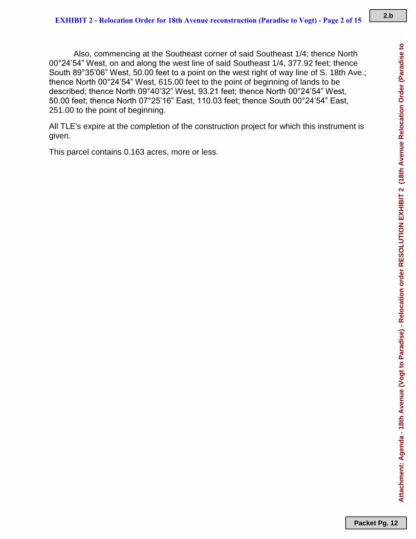
Also, commencing at the Southeast corner of said Southeast 1/4; thence North 00°24’54” West, on and along the west line of said Southeast 1/4, 377.92 feet; thence South 89°35’06” West, 50.00 feet to a point on the west right of way line of S. 18th Ave.; thence North 00°24’54” West, 615.00 feet to the point of beginning of lands to be described; thence North 09°40’32” West, 93.21 feet; thence North 00°24’54” West, 50.00 feet; thence North 07°25’16” East, 110.03 feet; thence South 00°24’54” East, 251.00 to the point of beginning.
All TLE's expire at the completion of the construction project for which this instrument is given.
This parcel contains 0.163 acres, more or less.
EXHIBIT 2 - Relocation Order for 18th Avenue reconstruction (Paradise to Vogt) - Page 2 of 15 2.b
Packet Pg. 12
Att
ach
men
t: A
gen
da
- 18
th A
ven
ue
(Vo
gt
to P
arad
ise)
- R
elo
cati
on
ord
er R
ES
OL
UT
ION
EX
HIB
IT 2
(18
th A
ven
ue
Rel
oca
tio
n O
rder
(P
arad
ise
to
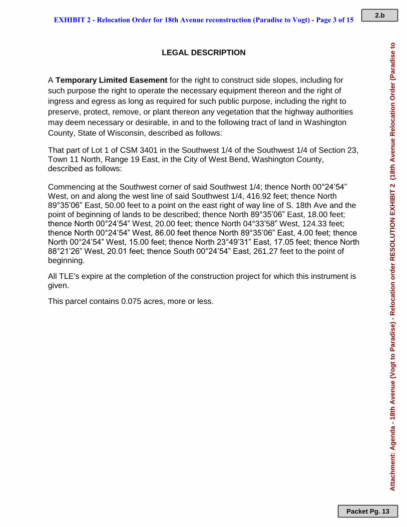
LEGAL DESCRIPTION A Temporary Limited Easement for the right to construct side slopes, including for
such purpose the right to operate the necessary equipment thereon and the right of
ingress and egress as long as required for such public purpose, including the right to
preserve, protect, remove, or plant thereon any vegetation that the highway authorities
may deem necessary or desirable, in and to the following tract of land in Washington
County, State of Wisconsin, described as follows:
That part of Lot 1 of CSM 3401 in the Southwest 1/4 of the Southwest 1/4 of Section 23, Town 11 North, Range 19 East, in the City of West Bend, Washington County, described as follows:
Commencing at the Southwest corner of said Southwest 1/4; thence North 00°24’54” West, on and along the west line of said Southwest 1/4, 416.92 feet; thence North 89°35’06” East, 50.00 feet to a point on the east right of way line of S. 18th Ave and the point of beginning of lands to be described; thence North 89°35’06” East, 18.00 feet; thence North 00°24’54” West, 20.00 feet; thence North 04°33’58” West, 124.33 feet; thence North 00°24’54” West, 86.00 feet thence North 89°35’06” East, 4.00 feet; thence North 00°24’54” West, 15.00 feet; thence North 23°49’31” East, 17.05 feet; thence North 88°21’26” West, 20.01 feet; thence South 00°24’54” East, 261.27 feet to the point of beginning.
All TLE's expire at the completion of the construction project for which this instrument is given.
This parcel contains 0.075 acres, more or less.
EXHIBIT 2 - Relocation Order for 18th Avenue reconstruction (Paradise to Vogt) - Page 3 of 15 2.b
Packet Pg. 13
Att
ach
men
t: A
gen
da
- 18
th A
ven
ue
(Vo
gt
to P
arad
ise)
- R
elo
cati
on
ord
er R
ES
OL
UT
ION
EX
HIB
IT 2
(18
th A
ven
ue
Rel
oca
tio
n O
rder
(P
arad
ise
to
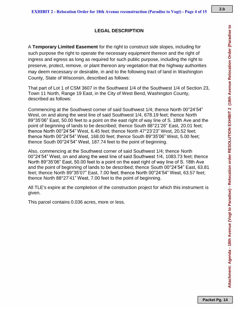
LEGAL DESCRIPTION A Temporary Limited Easement for the right to construct side slopes, including for
such purpose the right to operate the necessary equipment thereon and the right of
ingress and egress as long as required for such public purpose, including the right to
preserve, protect, remove, or plant thereon any vegetation that the highway authorities
may deem necessary or desirable, in and to the following tract of land in Washington
County, State of Wisconsin, described as follows:
That part of Lot 1 of CSM 3607 in the Southwest 1/4 of the Southwest 1/4 of Section 23, Town 11 North, Range 19 East, in the City of West Bend, Washington County, described as follows:
Commencing at the Southwest corner of said Southwest 1/4; thence North 00°24’54” West, on and along the west line of said Southwest 1/4, 678.19 feet; thence North 89°35’06” East, 50.00 feet to a point on the east right of way line of S. 18th Ave and the point of beginning of lands to be described; thence South 88°21’26” East, 20.01 feet; thence North 00°24’54” West, 6.45 feet; thence North 47°23’23” West, 20.52 feet; thence North 00°24’54” West, 168.00 feet; thence South 89°35’06” West, 5.00 feet; thence South 00°24’54” West, 187.74 feet to the point of beginning.
Also, commencing at the Southwest corner of said Southwest 1/4; thence North 00°24’54” West, on and along the west line of said Southwest 1/4, 1083.73 feet; thence North 89°35’06” East, 50.00 feet to a point on the east right of way line of S. 18th Ave and the point of beginning of lands to be described; thence South 00°24’54” East, 63.81 feet; thence North 89°35’07” East, 7.00 feet; thence North 00°24’54” West, 63.57 feet; thence North 88°27’41” West, 7.00 feet to the point of beginning.
All TLE's expire at the completion of the construction project for which this instrument is given.
This parcel contains 0.036 acres, more or less.
EXHIBIT 2 - Relocation Order for 18th Avenue reconstruction (Paradise to Vogt) - Page 4 of 15 2.b
Packet Pg. 14
Att
ach
men
t: A
gen
da
- 18
th A
ven
ue
(Vo
gt
to P
arad
ise)
- R
elo
cati
on
ord
er R
ES
OL
UT
ION
EX
HIB
IT 2
(18
th A
ven
ue
Rel
oca
tio
n O
rder
(P
arad
ise
to
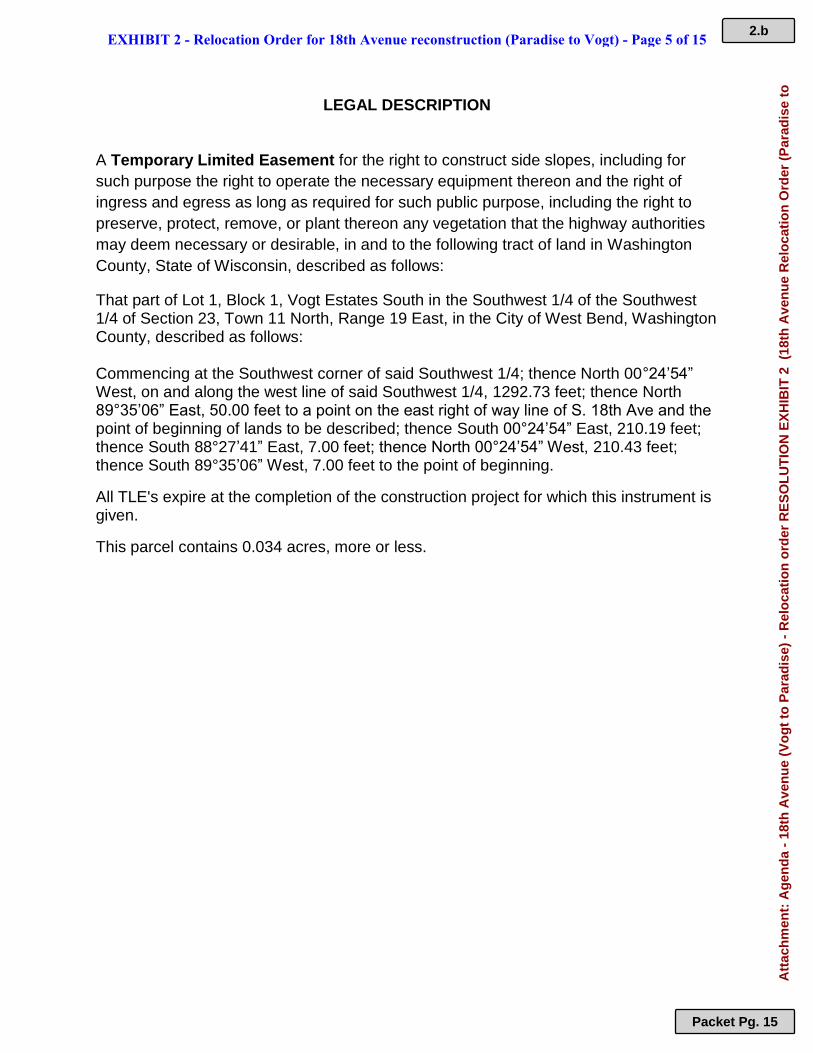
LEGAL DESCRIPTION A Temporary Limited Easement for the right to construct side slopes, including for
such purpose the right to operate the necessary equipment thereon and the right of
ingress and egress as long as required for such public purpose, including the right to
preserve, protect, remove, or plant thereon any vegetation that the highway authorities
may deem necessary or desirable, in and to the following tract of land in Washington
County, State of Wisconsin, described as follows:
That part of Lot 1, Block 1, Vogt Estates South in the Southwest 1/4 of the Southwest 1/4 of Section 23, Town 11 North, Range 19 East, in the City of West Bend, Washington County, described as follows:
Commencing at the Southwest corner of said Southwest 1/4; thence North 00°24’54” West, on and along the west line of said Southwest 1/4, 1292.73 feet; thence North 89°35’06” East, 50.00 feet to a point on the east right of way line of S. 18th Ave and the point of beginning of lands to be described; thence South 00°24’54” East, 210.19 feet; thence South 88°27’41” East, 7.00 feet; thence North 00°24’54” West, 210.43 feet; thence South 89°35’06” West, 7.00 feet to the point of beginning.
All TLE's expire at the completion of the construction project for which this instrument is given.
This parcel contains 0.034 acres, more or less.
EXHIBIT 2 - Relocation Order for 18th Avenue reconstruction (Paradise to Vogt) - Page 5 of 15 2.b
Packet Pg. 15
Att
ach
men
t: A
gen
da
- 18
th A
ven
ue
(Vo
gt
to P
arad
ise)
- R
elo
cati
on
ord
er R
ES
OL
UT
ION
EX
HIB
IT 2
(18
th A
ven
ue
Rel
oca
tio
n O
rder
(P
arad
ise
to
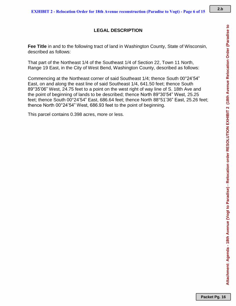
LEGAL DESCRIPTION Fee Title in and to the following tract of land in Washington County, State of Wisconsin,
described as follows: That part of the Northeast 1/4 of the Southeast 1/4 of Section 22, Town 11 North, Range 19 East, in the City of West Bend, Washington County, described as follows:
Commencing at the Northeast corner of said Southeast 1/4; thence South 00°24’54” East, on and along the east line of said Southeast 1/4, 641.50 feet; thence South 89°35’06” West, 24.75 feet to a point on the west right of way line of S. 18th Ave and the point of beginning of lands to be described; thence North 89°30’54” West, 25.25 feet; thence South 00°24’54” East, 686.64 feet; thence North 88°51’36” East, 25.26 feet; thence North 00°24’54” West, 686.93 feet to the point of beginning.
This parcel contains 0.398 acres, more or less.
EXHIBIT 2 - Relocation Order for 18th Avenue reconstruction (Paradise to Vogt) - Page 6 of 15 2.b
Packet Pg. 16
Att
ach
men
t: A
gen
da
- 18
th A
ven
ue
(Vo
gt
to P
arad
ise)
- R
elo
cati
on
ord
er R
ES
OL
UT
ION
EX
HIB
IT 2
(18
th A
ven
ue
Rel
oca
tio
n O
rder
(P
arad
ise
to
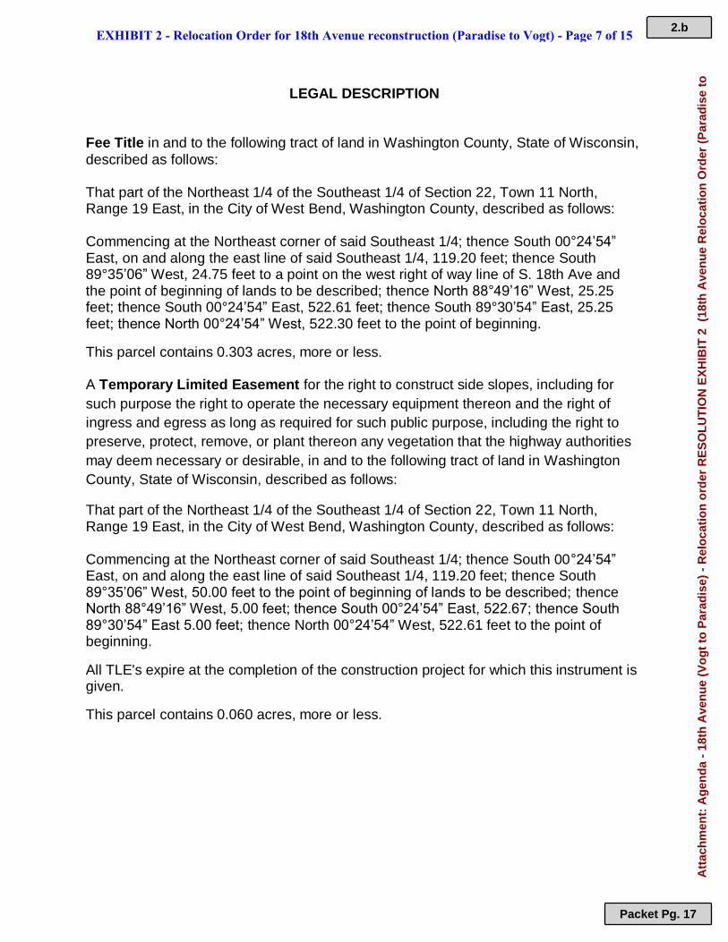
LEGAL DESCRIPTION Fee Title in and to the following tract of land in Washington County, State of Wisconsin,
described as follows: That part of the Northeast 1/4 of the Southeast 1/4 of Section 22, Town 11 North, Range 19 East, in the City of West Bend, Washington County, described as follows:
Commencing at the Northeast corner of said Southeast 1/4; thence South 00°24’54” East, on and along the east line of said Southeast 1/4, 119.20 feet; thence South 89°35’06” West, 24.75 feet to a point on the west right of way line of S. 18th Ave and the point of beginning of lands to be described; thence North 88°49’16” West, 25.25 feet; thence South 00°24’54” East, 522.61 feet; thence South 89°30’54” East, 25.25 feet; thence North 00°24’54” West, 522.30 feet to the point of beginning.
This parcel contains 0.303 acres, more or less. A Temporary Limited Easement for the right to construct side slopes, including for
such purpose the right to operate the necessary equipment thereon and the right of
ingress and egress as long as required for such public purpose, including the right to
preserve, protect, remove, or plant thereon any vegetation that the highway authorities
may deem necessary or desirable, in and to the following tract of land in Washington
County, State of Wisconsin, described as follows:
That part of the Northeast 1/4 of the Southeast 1/4 of Section 22, Town 11 North, Range 19 East, in the City of West Bend, Washington County, described as follows:
Commencing at the Northeast corner of said Southeast 1/4; thence South 00°24’54” East, on and along the east line of said Southeast 1/4, 119.20 feet; thence South 89°35’06” West, 50.00 feet to the point of beginning of lands to be described; thence North 88°49’16” West, 5.00 feet; thence South 00°24’54” East, 522.67; thence South 89°30’54” East 5.00 feet; thence North 00°24’54” West, 522.61 feet to the point of beginning.
All TLE's expire at the completion of the construction project for which this instrument is given.
This parcel contains 0.060 acres, more or less.
EXHIBIT 2 - Relocation Order for 18th Avenue reconstruction (Paradise to Vogt) - Page 7 of 15 2.b
Packet Pg. 17
Att
ach
men
t: A
gen
da
- 18
th A
ven
ue
(Vo
gt
to P
arad
ise)
- R
elo
cati
on
ord
er R
ES
OL
UT
ION
EX
HIB
IT 2
(18
th A
ven
ue
Rel
oca
tio
n O
rder
(P
arad
ise
to
LEGAL DESCRIPTION A Temporary Limited Easement for the right to construct side slopes, including for
such purpose the right to operate the necessary equipment thereon and the right of
ingress and egress as long as required for such public purpose, including the right to
preserve, protect, remove, or plant thereon any vegetation that the highway authorities
may deem necessary or desirable, in and to the following tract of land in Washington
County, State of Wisconsin, described as follows:
That part of Lot 34 of Didier Estates in the Northwest 1/4 of the Southwest 1/4 of Section 23, Town 11 North, Range 19 East, in the City of West Bend, Washington County, described as follows:
Commencing at the Northwest corner of said Southwest 1/4; thence South 00°24’54” East, on and along the west line of said Southwest 1/4, 1325.35 feet; thence North 89°35’06” East, 50.00 feet to a point on the east right of way line of S. 18th Ave and the point of beginning of lands to be described; thence North 05°53’07” East, 45.27 feet; thence North 00°24’54” West, 85.60 feet; thence South 89°35’06” West, 5.00 feet; thence South 00°24’54” East, 130.60 feet to the point of beginning.
All TLE's expire at the completion of the construction project for which this instrument is given.
This parcel contains 0.012 acres, more or less.
EXHIBIT 2 - Relocation Order for 18th Avenue reconstruction (Paradise to Vogt) - Page 8 of 15 2.b
Packet Pg. 18
Att
ach
men
t: A
gen
da
- 18
th A
ven
ue
(Vo
gt
to P
arad
ise)
- R
elo
cati
on
ord
er R
ES
OL
UT
ION
EX
HIB
IT 2
(18
th A
ven
ue
Rel
oca
tio
n O
rder
(P
arad
ise
to
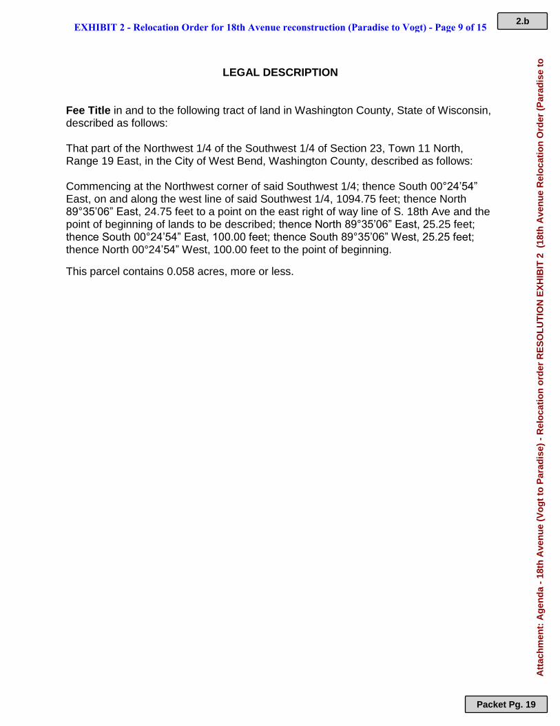
LEGAL DESCRIPTION Fee Title in and to the following tract of land in Washington County, State of Wisconsin, described as follows: That part of the Northwest 1/4 of the Southwest 1/4 of Section 23, Town 11 North, Range 19 East, in the City of West Bend, Washington County, described as follows:
Commencing at the Northwest corner of said Southwest 1/4; thence South 00°24’54” East, on and along the west line of said Southwest 1/4, 1094.75 feet; thence North 89°35’06” East, 24.75 feet to a point on the east right of way line of S. 18th Ave and the point of beginning of lands to be described; thence North 89°35’06” East, 25.25 feet; thence South 00°24’54” East, 100.00 feet; thence South 89°35’06” West, 25.25 feet; thence North 00°24’54” West, 100.00 feet to the point of beginning.
This parcel contains 0.058 acres, more or less.
EXHIBIT 2 - Relocation Order for 18th Avenue reconstruction (Paradise to Vogt) - Page 9 of 15 2.b
Packet Pg. 19
Att
ach
men
t: A
gen
da
- 18
th A
ven
ue
(Vo
gt
to P
arad
ise)
- R
elo
cati
on
ord
er R
ES
OL
UT
ION
EX
HIB
IT 2
(18
th A
ven
ue
Rel
oca
tio
n O
rder
(P
arad
ise
to
LEGAL DESCRIPTION Fee Title in and to the following tract of land in Washington County, State of Wisconsin, described as follows: That part of the Northwest 1/4 of the Southwest 1/4 of Section 23, Town 11 North, Range 19 East, in the City of West Bend, Washington County, described as follows:
Commencing at the Northwest corner of said Southwest 1/4; thence South 00°24’54” East, on and along the west line of said Southwest 1/4, 1094.75 feet; thence North 89°35’06” East, 24.75 feet to a point on the east right of way line of S. 18th Ave and the point of beginning of lands to be described; thence North 89°35’06” East, 25.25 feet; thence North 00°24’54” West, 65.01 feet; thence South 89°35’06” West, 25.25 feet; thence South 00°24’54” East, 65.01 feet to the point of beginning.
This parcel contains 0.038 acres, more or less.
EXHIBIT 2 - Relocation Order for 18th Avenue reconstruction (Paradise to Vogt) - Page 10 of 15 2.b
Packet Pg. 20
Att
ach
men
t: A
gen
da
- 18
th A
ven
ue
(Vo
gt
to P
arad
ise)
- R
elo
cati
on
ord
er R
ES
OL
UT
ION
EX
HIB
IT 2
(18
th A
ven
ue
Rel
oca
tio
n O
rder
(P
arad
ise
to
LEGAL DESCRIPTION Fee Title in and to the following tract of land in Washington County, State of Wisconsin,
described as follows: That part of the Northwest 1/4 of the Southwest 1/4 of Section 23, Town 11 North, Range 19 East, in the City of West Bend, Washington County, described as follows:
Commencing at the Northwest corner of said Southwest 1/4; thence South 00°24’54” East, on and along the west line of said Southwest 1/4, 929.75 feet; thence North 89°35’06” East, 24.75 feet to a point on the east right of way line of S. 18th Ave and the point of beginning of lands to be described; thence North 89°35’06” East, 25.25 feet; thence South 00°24’54” East, 100.00 feet; thence South 89°35’06” West, 25.25 feet; thence North 00°24’54” West, 100.00 feet to the point of beginning.
This parcel contains 0.058 acres, more or less. A Temporary Limited Easement for the right to construct side slopes, including for
such purpose the right to operate the necessary equipment thereon and the right of
ingress and egress as long as required for such public purpose, including the right to
preserve, protect, remove, or plant thereon any vegetation that the highway authorities
may deem necessary or desirable, in and to the following tract of land in Washington
County, State of Wisconsin, described as follows:
That part of the Northwest 1/4 of the Southwest 1/4 of Section 23, Town 11 North, Range 19 East, in the City of West Bend, Washington County, described as follows:
Commencing at the Northwest corner of said Southwest 1/4; thence South 00°24’54” East, on and along the west line of said Southwest 1/4, 929.75 feet; thence North 89°35’06” East, 50.00 feet to the point of beginning of lands to be described; thence South 00°24’54” East, 63.60 feet; thence North 10°07’28” East, 43.74 feet; thence North 00°24’54” West, 20.60 feet; thence South 89°35’06” West, 8.00 feet to the point of beginning.
All TLE's expire at the completion of the construction project for which this instrument is given.
This parcel contains 0.008 acres, more or less.
EXHIBIT 2 - Relocation Order for 18th Avenue reconstruction (Paradise to Vogt) - Page 11 of 15 2.b
Packet Pg. 21
Att
ach
men
t: A
gen
da
- 18
th A
ven
ue
(Vo
gt
to P
arad
ise)
- R
elo
cati
on
ord
er R
ES
OL
UT
ION
EX
HIB
IT 2
(18
th A
ven
ue
Rel
oca
tio
n O
rder
(P
arad
ise
to
LEGAL DESCRIPTION A Temporary Limited Easement for the right to construct side slopes, including for
such purpose the right to operate the necessary equipment thereon and the right of
ingress and egress as long as required for such public purpose, including the right to
preserve, protect, remove, or plant thereon any vegetation that the highway authorities
may deem necessary or desirable, in and to the following tract of land in Washington
County, State of Wisconsin, described as follows:
That part of the Northwest 1/4 of the Southwest 1/4 of Section 23, Town 11 North, Range 19 East, in the City of West Bend, Washington County, described as follows:
Commencing at the Northwest corner of said Southwest 1/4; thence South 00°24’54” East, on and along the west line of said Southwest 1/4, 929.75 feet; thence North 89°35’06” East, 50.00 feet to a point on the east right of way line of S. 18th Ave and the point of beginning of lands to be described; thence North 89°35’06” East, 8.00 feet; thence North 00°24’54” West, 236.84 feet; thence North 89°16’05” West, 8.00 feet; thence South 00°24’54” East, 237.00 feet to the point of beginning.
All TLE's expire at the completion of the construction project for which this instrument is given.
This parcel contains 0.044 acres, more or less.
EXHIBIT 2 - Relocation Order for 18th Avenue reconstruction (Paradise to Vogt) - Page 12 of 15 2.b
Packet Pg. 22
Att
ach
men
t: A
gen
da
- 18
th A
ven
ue
(Vo
gt
to P
arad
ise)
- R
elo
cati
on
ord
er R
ES
OL
UT
ION
EX
HIB
IT 2
(18
th A
ven
ue
Rel
oca
tio
n O
rder
(P
arad
ise
to
LEGAL DESCRIPTION A Temporary Limited Easement for the right to construct side slopes, including for
such purpose the right to operate the necessary equipment thereon and the right of
ingress and egress as long as required for such public purpose, including the right to
preserve, protect, remove, or plant thereon any vegetation that the highway authorities
may deem necessary or desirable, in and to the following tract of land in Washington
County, State of Wisconsin, described as follows:
That part of the Northwest 1/4 of the Southwest 1/4 of Section 23, Town 11 North, Range 19 East, in the City of West Bend, Washington County, described as follows:
Commencing at the Northwest corner of said Southwest 1/4; thence South 00°24’54” East, on and along the west line of said Southwest 1/4, 476.74 feet; thence North 89°35’06” East, 50.00 feet to a point on the east right of way line of S. 18th Ave.; thence South 00°24’54” East 136.61 feet to the point of beginning of lands to be described; thence South 00°24’54” East, 13.39 feet; thence South 89°20’21” East, 9.99 feet; thence North 00°24’54” West, 13.58 feet; thence South 89°35’06” West 9.99 feet to the point of beginning.
Also, commencing at the Northwest corner of said Southwest 1/4; thence South 00°24’54” East, on and along the west line of said Southwest 1/4, 476.74 feet; thence North 89°35’06” East, 50.00 feet to a point on the east right of way line of S. 18th Ave and the point of beginning of lands to be described; thence South 00°24’54” East, 115.61 feet; thence North 89°35’06” East, 13.99 feet; thence North 00°24’54” West, 54.00 feet; thence South 89°35’06” West, 5.00 feet; thence North 00°24’54” West, 59.94 feet; thence North 79°54’54” West, 9.14 feet to the point of beginning.
All TLE's expire at the completion of the construction project for which this instrument is given.
This parcel contains 0.033 acres, more or less.
EXHIBIT 2 - Relocation Order for 18th Avenue reconstruction (Paradise to Vogt) - Page 13 of 15 2.b
Packet Pg. 23
Att
ach
men
t: A
gen
da
- 18
th A
ven
ue
(Vo
gt
to P
arad
ise)
- R
elo
cati
on
ord
er R
ES
OL
UT
ION
EX
HIB
IT 2
(18
th A
ven
ue
Rel
oca
tio
n O
rder
(P
arad
ise
to
LEGAL DESCRIPTION A Temporary Limited Easement for the right to construct side slopes, including for
such purpose the right to operate the necessary equipment thereon and the right of
ingress and egress as long as required for such public purpose, including the right to
preserve, protect, remove, or plant thereon any vegetation that the highway authorities
may deem necessary or desirable, in and to the following tract of land in Washington
County, State of Wisconsin, described as follows:
That part of the Northwest 1/4 of the Southwest 1/4 of Section 23, Town 11 North, Range 19 East, in the City of West Bend, Washington County, described as follows:
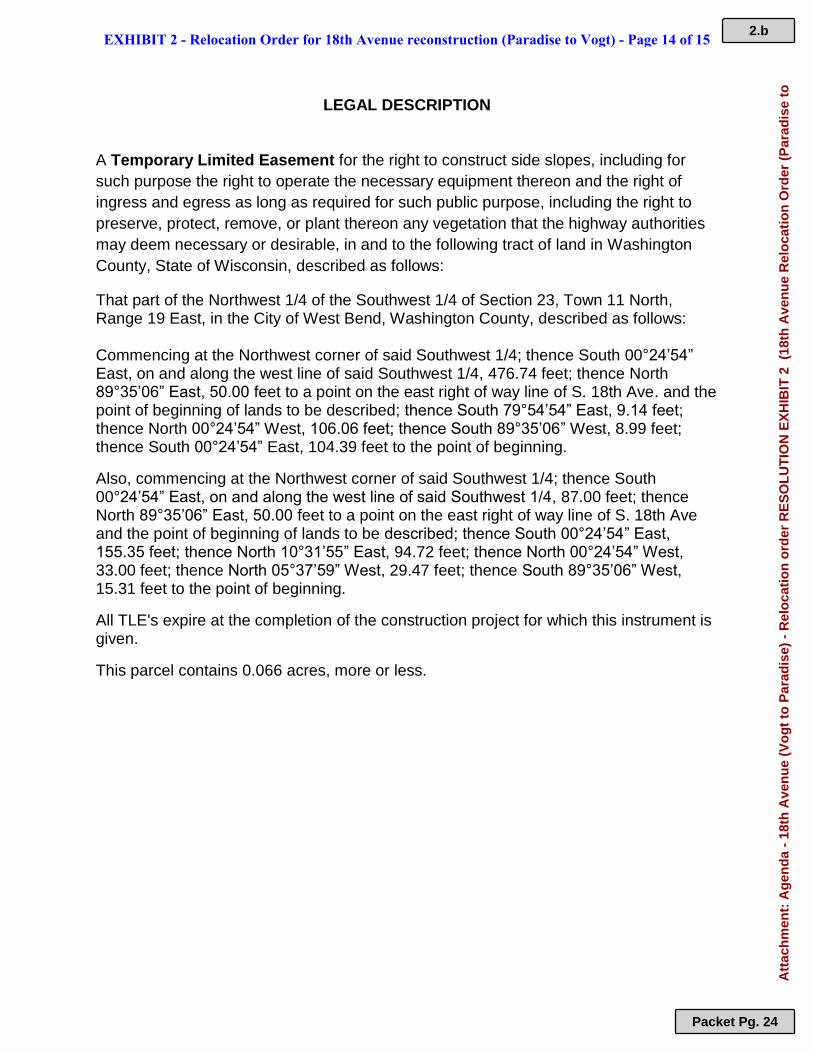
Commencing at the Northwest corner of said Southwest 1/4; thence South 00°24’54” East, on and along the west line of said Southwest 1/4, 476.74 feet; thence North 89°35’06” East, 50.00 feet to a point on the east right of way line of S. 18th Ave. and the point of beginning of lands to be described; thence South 79°54’54” East, 9.14 feet; thence North 00°24’54” West, 106.06 feet; thence South 89°35’06” West, 8.99 feet; thence South 00°24’54” East, 104.39 feet to the point of beginning.
Also, commencing at the Northwest corner of said Southwest 1/4; thence South 00°24’54” East, on and along the west line of said Southwest 1/4, 87.00 feet; thence North 89°35’06” East, 50.00 feet to a point on the east right of way line of S. 18th Ave and the point of beginning of lands to be described; thence South 00°24’54” East, 155.35 feet; thence North 10°31’55” East, 94.72 feet; thence North 00°24’54” West, 33.00 feet; thence North 05°37’59” West, 29.47 feet; thence South 89°35’06” West, 15.31 feet to the point of beginning.
All TLE's expire at the completion of the construction project for which this instrument is given.
This parcel contains 0.066 acres, more or less.
EXHIBIT 2 - Relocation Order for 18th Avenue reconstruction (Paradise to Vogt) - Page 14 of 15 2.b
Packet Pg. 24
Att
ach
men
t: A
gen
da
- 18
th A
ven
ue
(Vo
gt
to P
arad
ise)
- R
elo
cati
on
ord
er R
ES
OL
UT
ION
EX
HIB
IT 2
(18
th A
ven
ue
Rel
oca
tio
n O
rder
(P
arad
ise
to
LEGAL DESCRIPTION A Temporary Limited Easement for the right to construct side slopes, including for
such purpose the right to operate the necessary equipment thereon and the right of
ingress and egress as long as required for such public purpose, including the right to
preserve, protect, remove, or plant thereon any vegetation that the highway authorities
may deem necessary or desirable, in and to the following tract of land in Washington
County, State of Wisconsin, described as follows:
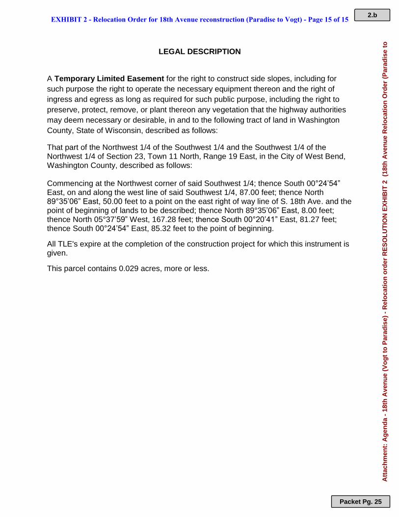
That part of the Northwest 1/4 of the Southwest 1/4 and the Southwest 1/4 of the Northwest 1/4 of Section 23, Town 11 North, Range 19 East, in the City of West Bend, Washington County, described as follows:
Commencing at the Northwest corner of said Southwest 1/4; thence South 00°24’54” East, on and along the west line of said Southwest 1/4, 87.00 feet; thence North 89°35’06” East, 50.00 feet to a point on the east right of way line of S. 18th Ave. and the point of beginning of lands to be described; thence North 89°35’06” East, 8.00 feet; thence North 05°37’59” West, 167.28 feet; thence South 00°20’41” East, 81.27 feet; thence South 00°24’54” East, 85.32 feet to the point of beginning.
All TLE's expire at the completion of the construction project for which this instrument is given.
This parcel contains 0.029 acres, more or less.
EXHIBIT 2 - Relocation Order for 18th Avenue reconstruction (Paradise to Vogt) - Page 15 of 15 2.b
Packet Pg. 25
Att
ach
men
t: A
gen
da
- 18
th A
ven
ue
(Vo
gt
to P
arad
ise)
- R
elo
cati
on
ord
er R
ES
OL
UT
ION
EX
HIB
IT 2
(18
th A
ven
ue
Rel
oca
tio
n O
rder
(P
arad
ise
to
Parks, Recreation &
Forestry
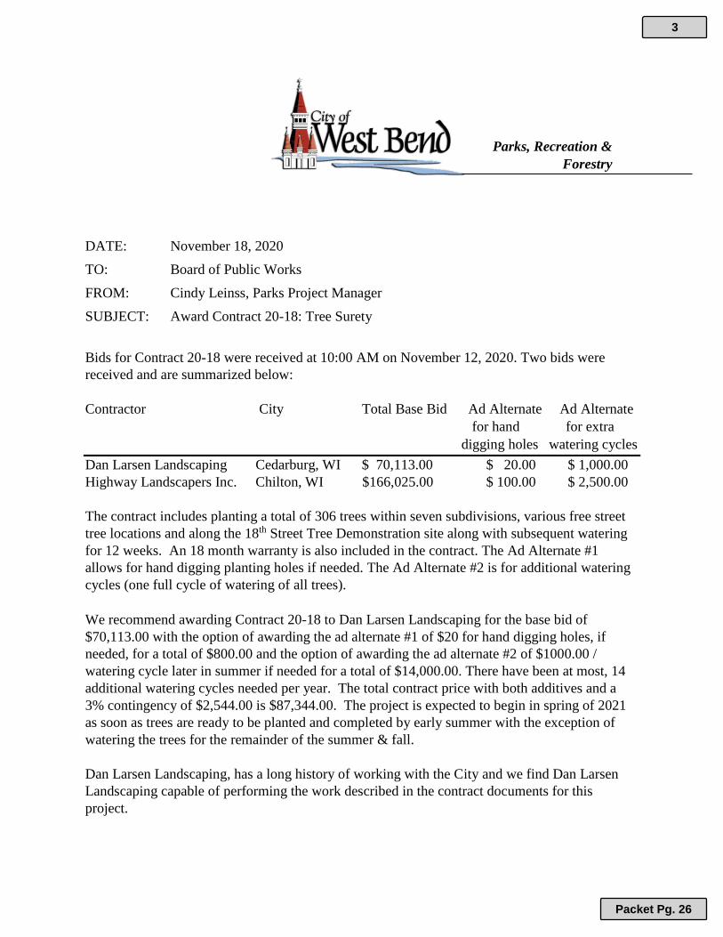
DATE: November 18, 2020
TO: Board of Public Works
FROM: Cindy Leinss, Parks Project Manager
SUBJECT: Award Contract 20-18: Tree Surety
Bids for Contract 20-18 were received at 10:00 AM on November 12, 2020. Two bids were
received and are summarized below:
Contractor City Total Base Bid Ad Alternate Ad Alternate
for hand for extra
digging holes watering cycles
Dan Larsen Landscaping Cedarburg, WI $ 70,113.00 $ 20.00 $ 1,000.00
Highway Landscapers Inc. Chilton, WI $166,025.00 $ 100.00 $ 2,500.00
The contract includes planting a total of 306 trees within seven subdivisions, various free street
tree locations and along the 18th Street Tree Demonstration site along with subsequent watering
for 12 weeks. An 18 month warranty is also included in the contract. The Ad Alternate #1
allows for hand digging planting holes if needed. The Ad Alternate #2 is for additional watering
cycles (one full cycle of watering of all trees).
We recommend awarding Contract 20-18 to Dan Larsen Landscaping for the base bid of
$70,113.00 with the option of awarding the ad alternate #1 of $20 for hand digging holes, if
needed, for a total of $800.00 and the option of awarding the ad alternate #2 of $1000.00 /
watering cycle later in summer if needed for a total of $14,000.00. There have been at most, 14
additional watering cycles needed per year. The total contract price with both additives and a
3% contingency of $2,544.00 is $87,344.00. The project is expected to begin in spring of 2021
as soon as trees are ready to be planted and completed by early summer with the exception of
watering the trees for the remainder of the summer & fall.
Dan Larsen Landscaping, has a long history of working with the City and we find Dan Larsen
Landscaping capable of performing the work described in the contract documents for this
project.
3
Packet Pg. 26
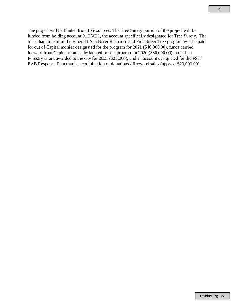
The project will be funded from five sources. The Tree Surety portion of the project will be
funded from holding account 01.26621, the account specifically designated for Tree Surety. The
trees that are part of the Emerald Ash Borer Response and Free Street Tree program will be paid
for out of Capital monies designated for the program for 2021 ($40,000.00), funds carried
forward from Capital monies designated for the program in 2020 ($30,000.00), an Urban
Forestry Grant awarded to the city for 2021 ($25,000), and an account designated for the FST/
EAB Response Plan that is a combination of donations / firewood sales (approx. $29,000.00).
3
Packet Pg. 27
Parks, Recreation &
Forestry
DATE: November 30, 2020
TO: Board of Public Works
FROM: Cindy Leinss, Parks Project Manager
SUBJECT: Permission to Bid Eisenbahn State Trail Crack and Sealcoat Contract
The Parks, Recreation & Forestry Department is requesting permission to advertise for
sealcoating and crack sealing on the Eisenbahn State Trail. This contract will include cleaning,
crack sealing, sealcoating and traffic control. The project will begin with crack sealing
scheduled to be completed in early summer/ late spring of 2021 prior to school letting out in
spring with sealcoating to follow in late summer/ early fall of 2021 after school starts in fall to
avoid impacting trail usage during times the trail experiences highest volumes of traffic.
The contract will be written as a lump sum base bid for the project.
The preliminary estimate for the project is approximately $50,000. The city received a DNR
Stewardship grant of $25,087.55 in November of 2019 to cover approximately half the cost of
the project. The remainder of the project will be paid out of CIP money ($25,000) allocated for
this project in 2019. The project was postponed from bidding out until 2021 due to the heavy
use of the trail during COVID.
4
Packet Pg. 28