Embed Size (px)
Citation preview
Slum Area Mapping
Rajiv Awas Yojna Chas City
1
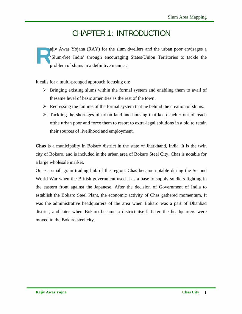
CHAPTER 1: INTRODUCTION
ajiv Awas Yojana (RAY) for the slum dwellers and the urban poor envisages a
‘Slum-free India’ through encouraging States/Union Territories to tackle the
problem of slums in a definitive manner.
It calls for a multi-pronged approach focusing on:
Bringing existing slums within the formal system and enabling them to avail of
thesame level of basic amenities as the rest of the town.
Redressing the failures of the formal system that lie behind the creation of slums.
Tackling the shortages of urban land and housing that keep shelter out of reach
ofthe urban poor and force them to resort to extra-legal solutions in a bid to retain
their sources of livelihood and employment.
Chas is a municipality in Bokaro district in the state of Jharkhand, India. It is the twin
city of Bokaro, and is included in the urban area of Bokaro Steel City. Chas is notable for
a large wholesale market.
Once a small grain trading hub of the region, Chas became notable during the Second
World War when the British government used it as a base to supply soldiers fighting in
the eastern front against the Japanese. After the decision of Government of India to
establish the Bokaro Steel Plant, the economic activity of Chas gathered momentum. It
was the administrative headquarters of the area when Bokaro was a part of Dhanbad
district, and later when Bokaro became a district itself. Later the headquarters were
moved to the Bokaro steel city.
R
Slum Area Mapping
Rajiv Awas Yojna Chas City
2
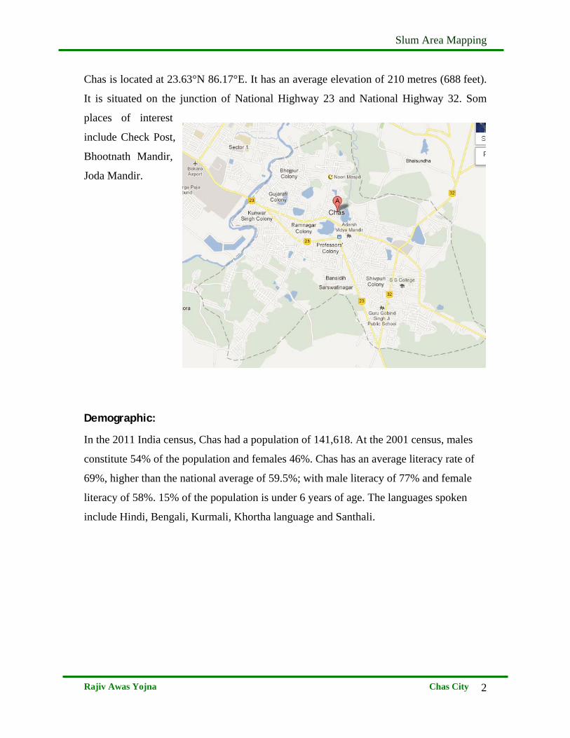
Chas is located at 23.63°N 86.17°E. It has an average elevation of 210 metres (688 feet).
It is situated on the junction of National Highway 23 and National Highway 32. Som
places of interest
include Check Post,
Bhootnath Mandir,
Joda Mandir.
Demographic:
In the 2011 India census, Chas had a population of 141,618. At the 2001 census, males
constitute 54% of the population and females 46%. Chas has an average literacy rate of
69%, higher than the national average of 59.5%; with male literacy of 77% and female
literacy of 58%. 15% of the population is under 6 years of age. The languages spoken
include Hindi, Bengali, Kurmali, Khortha language and Santhali.
Slum Area Mapping
Rajiv Awas Yojna Chas City
3
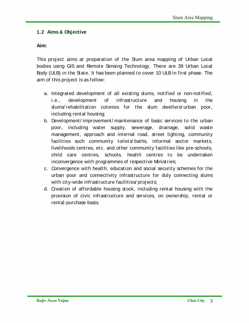
1.2 Aims & Objective Aim: This project aims at preparation of the Slum area mapping of Urban Local bodies using GIS and Remote Sensing Technology. There are 39 Urban Local Body (ULB) in the State. It has been planned to cover 10 ULB in first phase. The aim of this project is as follow:
a. Integrated development of all existing slums, notified or non-notified, i.e., development of infrastructure and housing in the slums/rehabilitation colonies for the slum dwellers/urban poor, including rental housing;
b. Development/improvement/maintenance of basic services to the urban poor, including water supply, sewerage, drainage, solid waste management, approach and internal road, street lighting, community facilities such community toilets/baths, informal sector markets, livelihoods centres, etc. and other community facilities like pre-schools, child care centres, schools, health centres to be undertaken inconvergence with programmes of respective Ministries;
c. Convergence with health, education and social security schemes for the urban poor and connectivity infrastructure for duly connecting slums with city-wide infrastructure facilities/projects;
d. Creation of affordable housing stock, including rental housing with the provision of civic infrastructure and services, on ownership, rental or rental-purchase basis.
Slum Area Mapping
Rajiv Awas Yojna Chas City
4
Objective:
The prime objective of the project is to map the area of the slums using remote
sensing and GIS techniques and software development for web-enabled GIS &
MIS. The details of the objectives can be listed below;
i) Digitization of Base Information of the city & its fringes like Major
Roads & Rail, Administrative Boundary, Major River/Water Body etc.
using the available high resolution satellite data (Cartosat and
Quickbird) for the period of 2005-06
ii) Mapping of Slums areas and pockets
iii) Updating of Slum area by procurement of latest year’s (2010) Cartosat-
II data
iv) Mapping of available vacant land within urban areas and its vicinity
v) Outsourcing of micro level survey in the slum area
vi) Processing of layers like households, Roads, Sewerage, Storm
Drainage, Water line, electricity etc. generated through micro level
Survey and bringing it into GIS platform.
Slum Area Mapping
Rajiv Awas Yojna Chas City
5
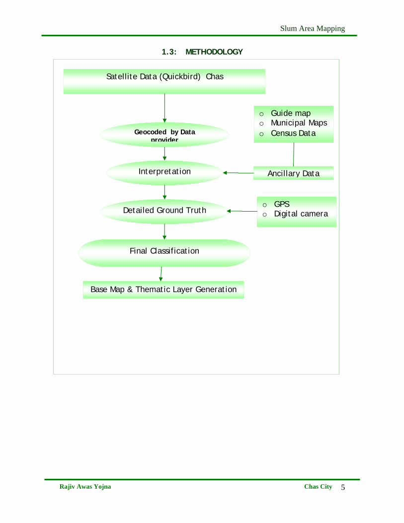
1.3: METHODOLOGY
o Guide map o Municipal Maps o Census Data
Ancillary Data
Final Classification
Satellite Data (Quickbird) Chas
Geocoded by Data provider
Interpretation
Detailed Ground Truth
Base Map & Thematic Layer Generation
o GPS o Digital camera
Slum Area Mapping
Rajiv Awas Yojna Chas City
6
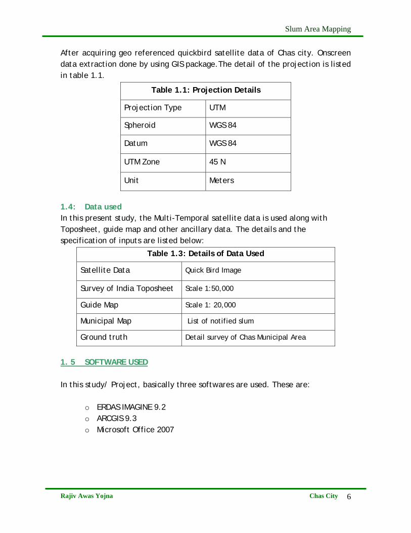
After acquiring geo referenced quickbird satellite data of Chas city. Onscreen data extraction done by using GIS package.The detail of the projection is listed in table 1.1.
Table 1.1: Projection Details
Projection Type UTM
Spheroid WGS 84
Datum WGS 84
UTM Zone 45 N
Unit Meters
1.4: Data used In this present study, the Multi-Temporal satellite data is used along with Toposheet, guide map and other ancillary data. The details and the specification of inputs are listed below:
Table 1.3: Details of Data Used
Satellite Data Quick Bird Image
Survey of India Toposheet Scale 1:50,000
Guide Map Scale 1: 20,000
Municipal Map List of notified slum
Ground truth Detail survey of Chas Municipal Area
1. 5 SOFTWARE USED
In this study/ Project, basically three softwares are used. These are:
o ERDAS IMAGINE 9.2 o ARCGIS 9.3 o Microsoft Office 2007
Slum Area Mapping
Rajiv Awas Yojna Chas City
7
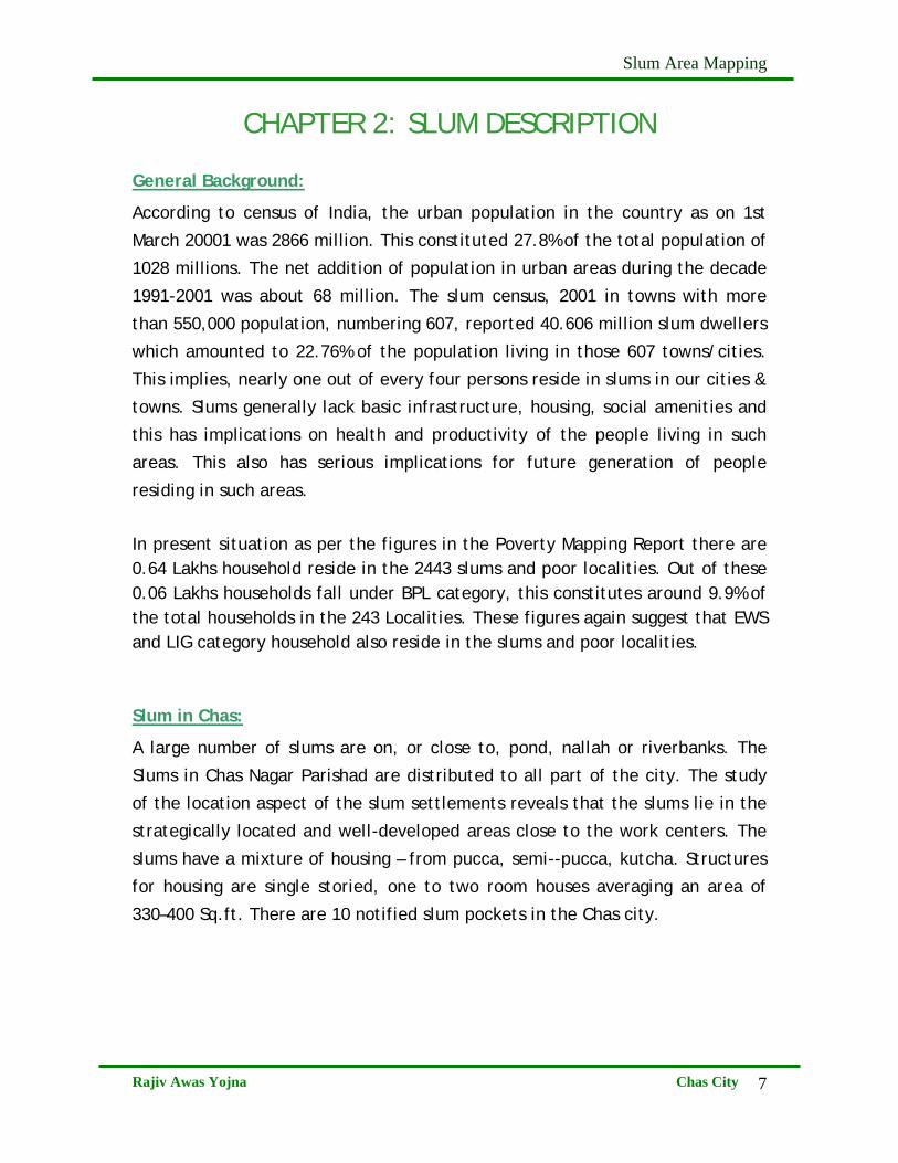
CHAPTER 2: SLUM DESCRIPTION General Background:
According to census of India, the urban population in the country as on 1st
March 20001 was 2866 million. This constituted 27.8% of the total population of
1028 millions. The net addition of population in urban areas during the decade
1991-2001 was about 68 million. The slum census, 2001 in towns with more
than 550,000 population, numbering 607, reported 40.606 million slum dwellers
which amounted to 22.76% of the population living in those 607 towns/cities.
This implies, nearly one out of every four persons reside in slums in our cities &
towns. Slums generally lack basic infrastructure, housing, social amenities and
this has implications on health and productivity of the people living in such
areas. This also has serious implications for future generation of people
residing in such areas.
In present situation as per the figures in the Poverty Mapping Report there are 0.64 Lakhs household reside in the 2443 slums and poor localities. Out of these 0.06 Lakhs households fall under BPL category, this constitutes around 9.9% of the total households in the 243 Localities. These figures again suggest that EWS and LIG category household also reside in the slums and poor localities. Slum in Chas:
A large number of slums are on, or close to, pond, nallah or riverbanks. The
Slums in Chas Nagar Parishad are distributed to all part of the city. The study
of the location aspect of the slum settlements reveals that the slums lie in the
strategically located and well-developed areas close to the work centers. The
slums have a mixture of housing – from pucca, semi--pucca, kutcha. Structures
for housing are single storied, one to two room houses averaging an area of
330–400 Sq.ft. There are 10 notified slum pockets in the Chas city.
Slum Area Mapping
Rajiv Awas Yojna Chas City
8
S.N Slum Name
1 Chira- Chas, Manjhitola
2 Jamgoria, Manjhitola
3 Solagidih, Domtola
4 Purvi Solagidih Domtola
5 Bauri Tola, Jodhadihmore
6 Bauri Tola, Old Chas
7 Bendi Tanr, Haadi Tola
8 Bansidih, Bauri Tola
9 Ambedkarpuri
10 Ispat Colony Source: Chas Nagar Parishad
Table No. 2.1
Fig 2.1 : Location of Slums (Annexure I) Fig 2.2: Landuse of Chas City (Annexure II)
Slum Area Mapping
Rajiv Awas Yojna Chas City
9
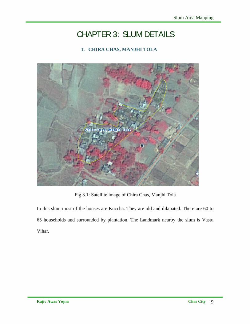
CHAPTER 3: SLUM DETAILS
1. CHIRA CHAS, MANJHI TOLA
Fig 3.1: Satellite image of Chira Chas, Manjhi Tola
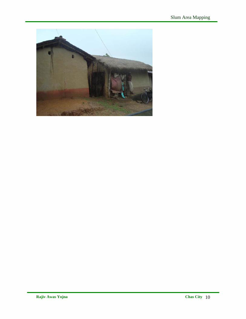
In this slum most of the houses are Kuccha. They are old and dilapated. There are 60 to
65 households and surrounded by plantation. The Landmark nearby the slum is Vastu
Vihar.
Slum Area Mapping
Rajiv Awas Yojna Chas City
10
Slum Area Mapping
Rajiv Awas Yojna Chas City
11
2. JAMGORIA AMNJHI TOLA
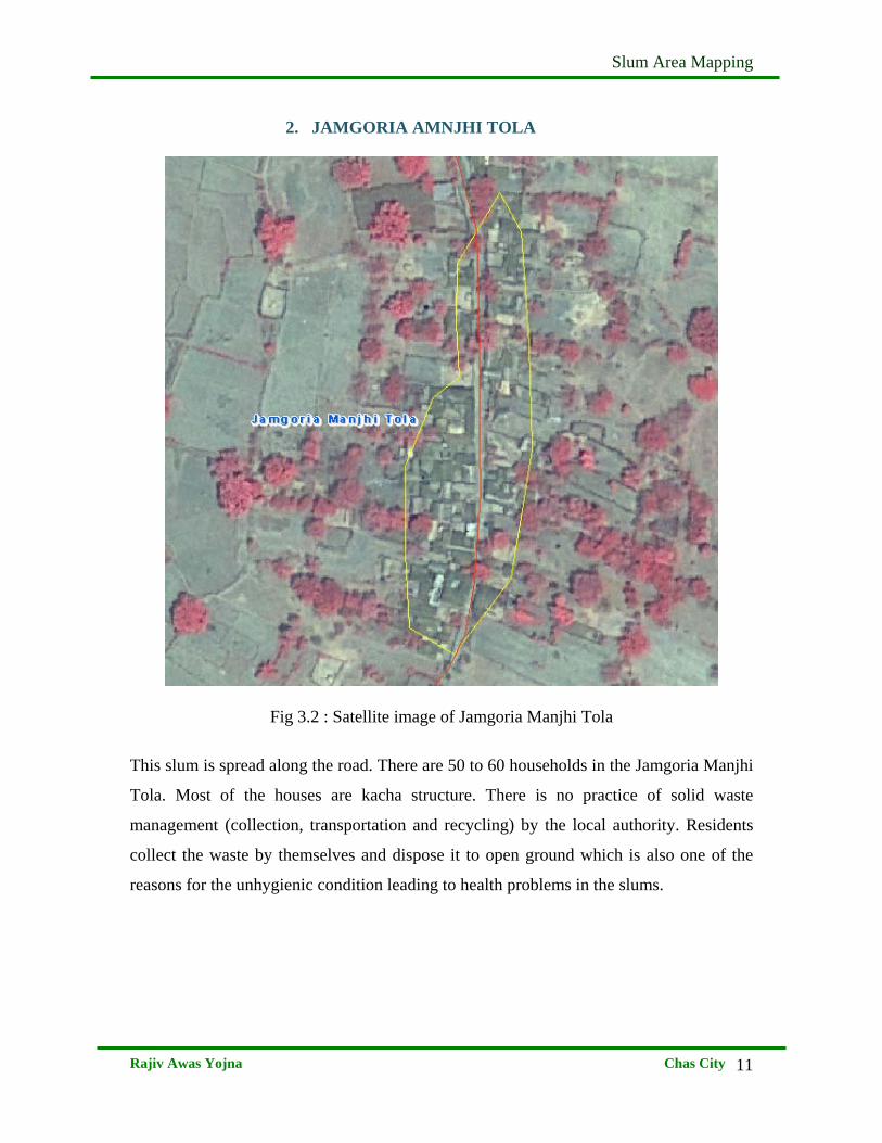
Fig 3.2 : Satellite image of Jamgoria Manjhi Tola
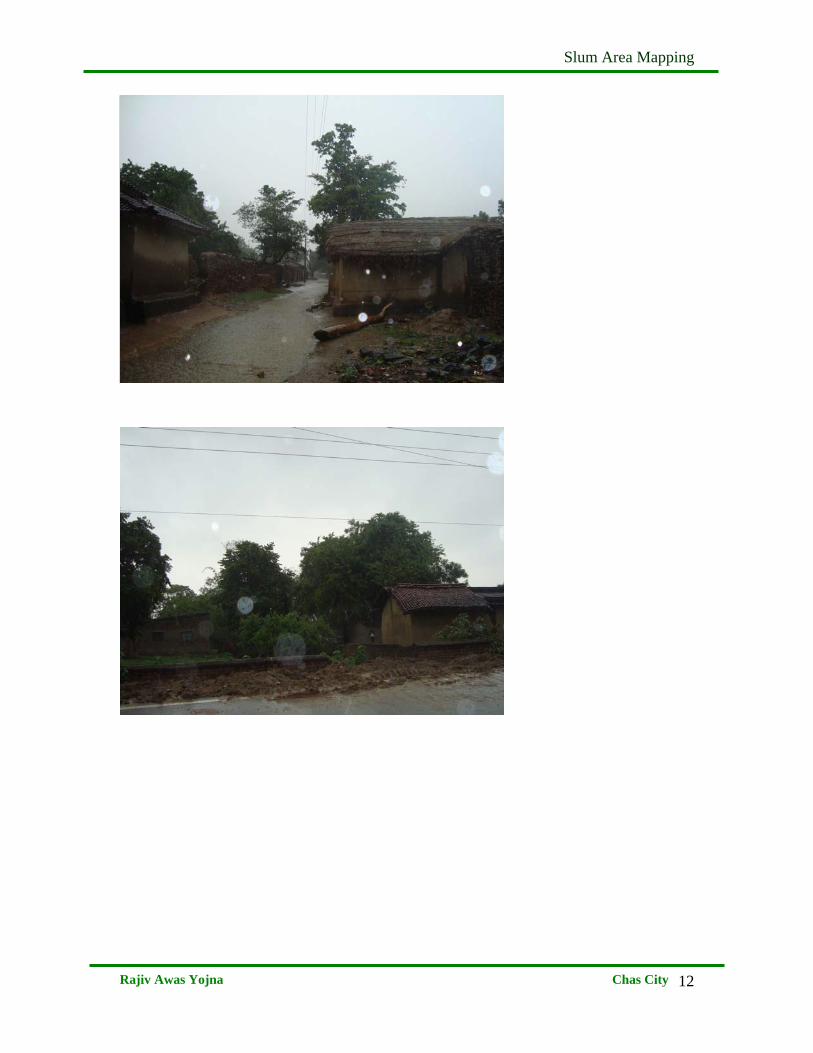
This slum is spread along the road. There are 50 to 60 households in the Jamgoria Manjhi
Tola. Most of the houses are kacha structure. There is no practice of solid waste
management (collection, transportation and recycling) by the local authority. Residents
collect the waste by themselves and dispose it to open ground which is also one of the
reasons for the unhygienic condition leading to health problems in the slums.
Slum Area Mapping
Rajiv Awas Yojna Chas City
12
Slum Area Mapping
Rajiv Awas Yojna Chas City
13
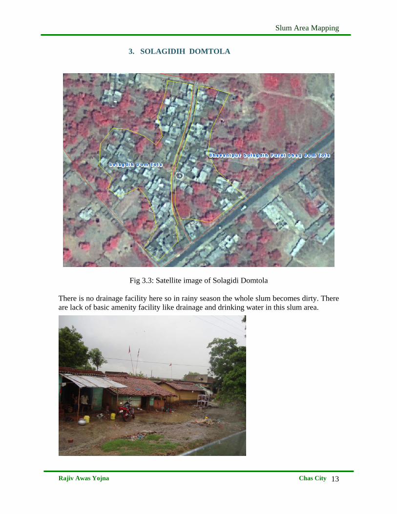
3. SOLAGIDIH DOMTOLA
Fig 3.3: Satellite image of Solagidi Domtola There is no drainage facility here so in rainy season the whole slum becomes dirty. There are lack of basic amenity facility like drainage and drinking water in this slum area.
Slum Area Mapping
Rajiv Awas Yojna Chas City
14
4. PURVI SOLAGDIH DOMTOLA
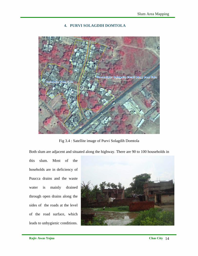
Fig 3.4 : Satellite image of Purvi Solagdih Domtola
Both slum are adjacent and situated along the highway. There are 90 to 100 households in
this slum. Most of the
hoseholds are in deficiency of
Puucca drains and the waste
water is mainly drained
through open drains along the
sides of the roads at the level
of the road surface, which
leads to unhygienic conditions.
Slum Area Mapping
Rajiv Awas Yojna Chas City
15
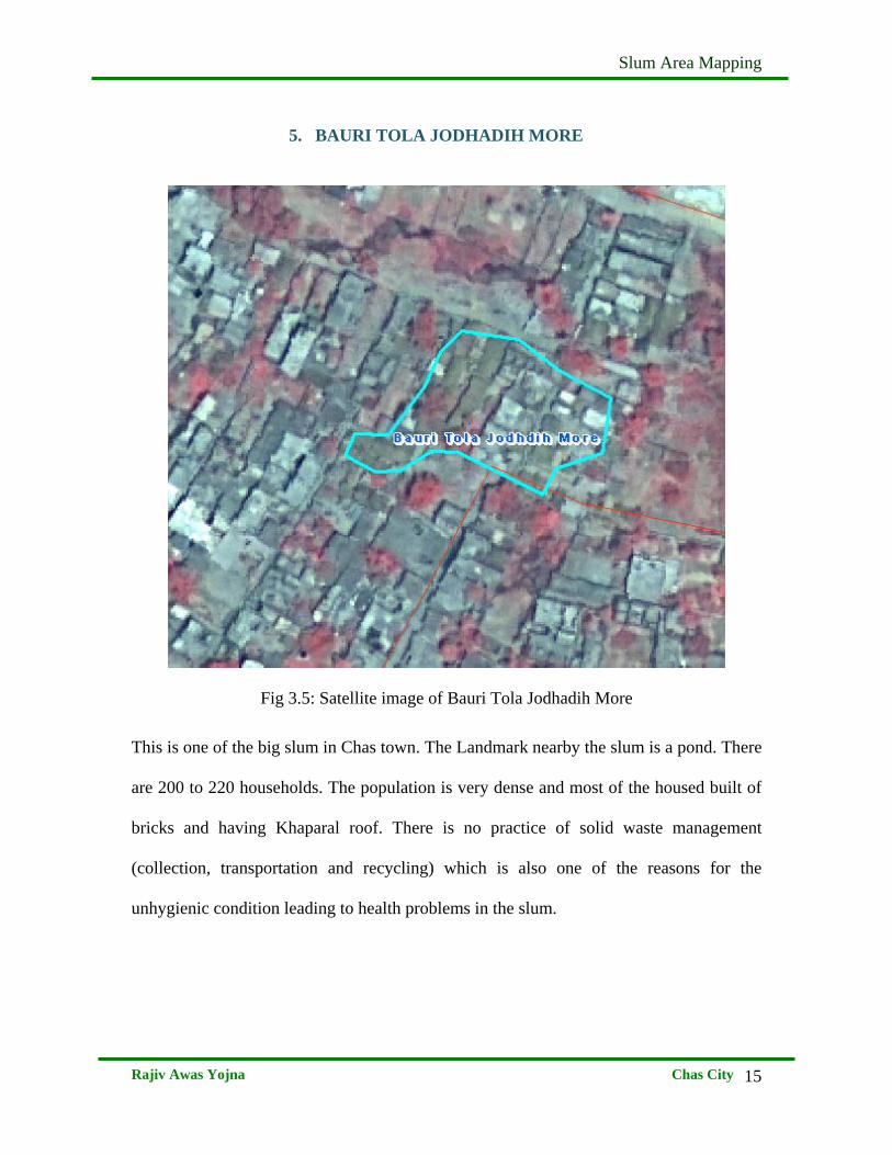
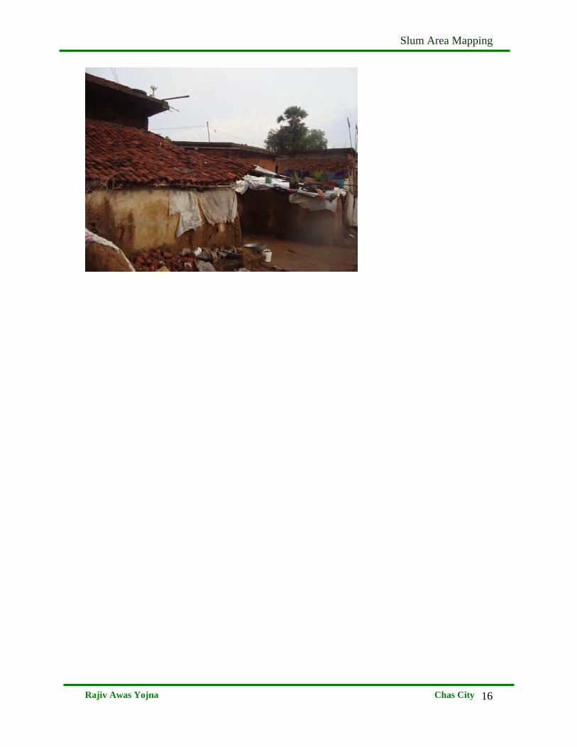
5. BAURI TOLA JODHADIH MORE
Fig 3.5: Satellite image of Bauri Tola Jodhadih More
This is one of the big slum in Chas town. The Landmark nearby the slum is a pond. There
are 200 to 220 households. The population is very dense and most of the housed built of
bricks and having Khaparal roof. There is no practice of solid waste management
(collection, transportation and recycling) which is also one of the reasons for the
unhygienic condition leading to health problems in the slum.
Slum Area Mapping
Rajiv Awas Yojna Chas City
16
Slum Area Mapping
Rajiv Awas Yojna Chas City
17
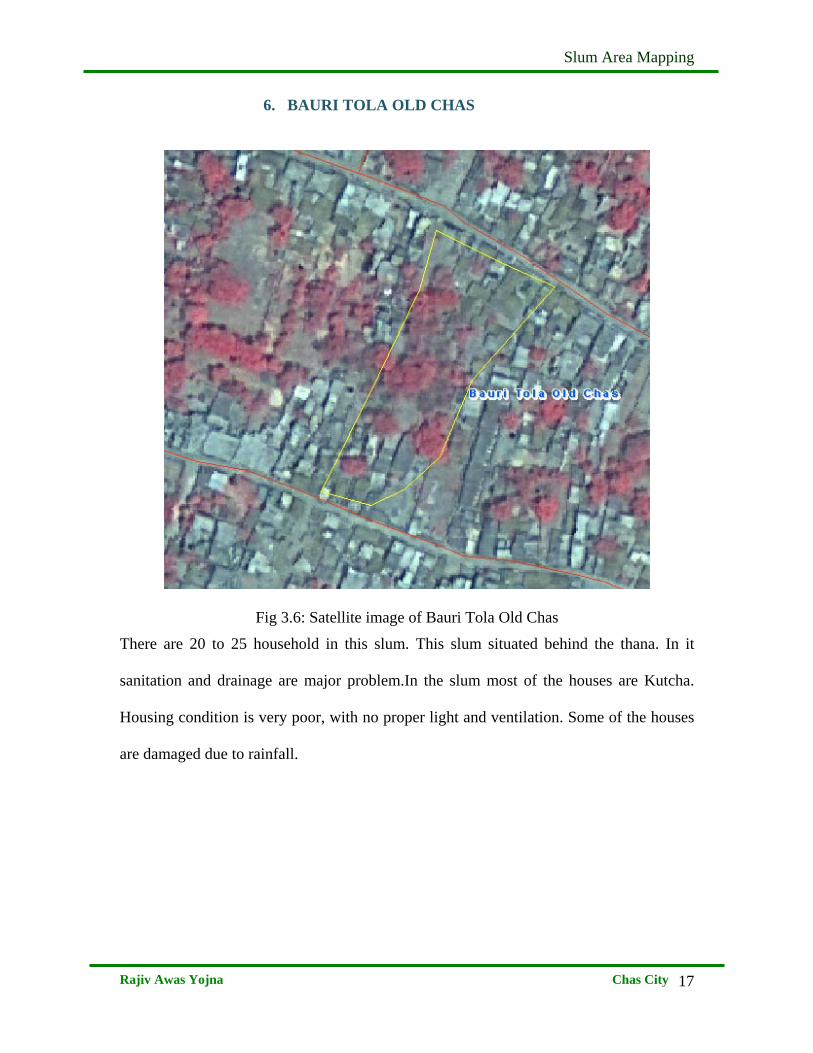
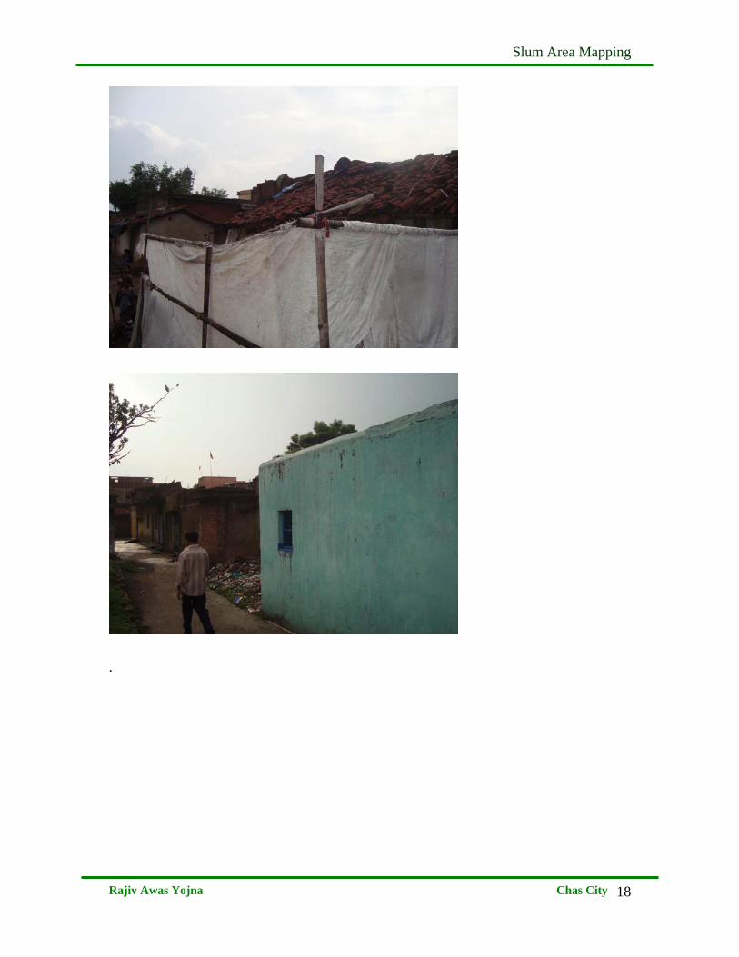
6. BAURI TOLA OLD CHAS
Fig 3.6: Satellite image of Bauri Tola Old Chas
There are 20 to 25 household in this slum. This slum situated behind the thana. In it
sanitation and drainage are major problem.In the slum most of the houses are Kutcha.
Housing condition is very poor, with no proper light and ventilation. Some of the houses
are damaged due to rainfall.
Slum Area Mapping
Rajiv Awas Yojna Chas City
18
.
Slum Area Mapping
Rajiv Awas Yojna Chas City
19
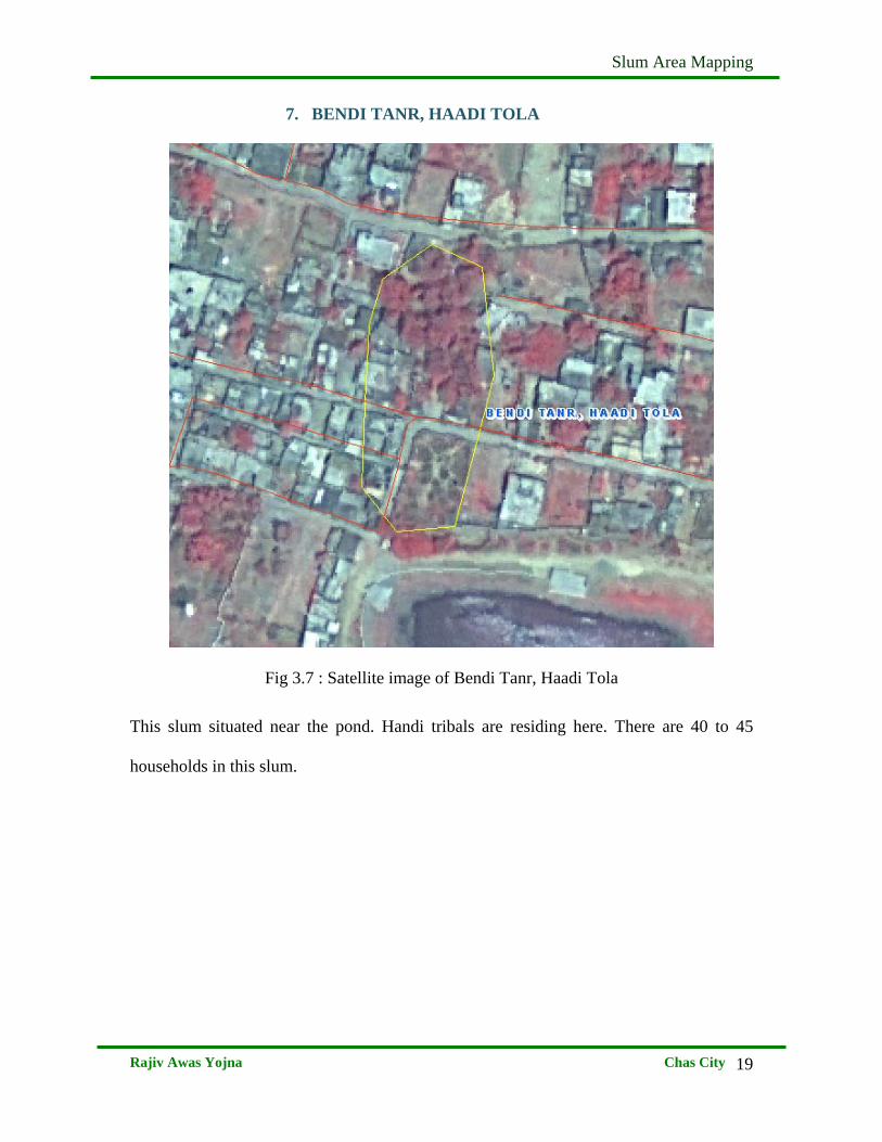
7. BENDI TANR, HAADI TOLA
Fig 3.7 : Satellite image of Bendi Tanr, Haadi Tola
This slum situated near the pond. Handi tribals are residing here. There are 40 to 45
households in this slum.
Slum Area Mapping
Rajiv Awas Yojna Chas City
20
Slum Area Mapping
Rajiv Awas Yojna Chas City
21
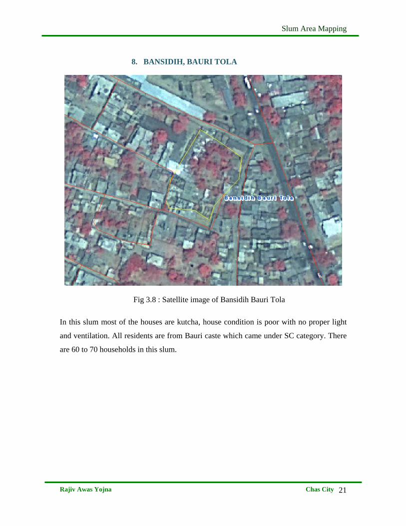
8. BANSIDIH, BAURI TOLA
Fig 3.8 : Satellite image of Bansidih Bauri Tola
In this slum most of the houses are kutcha, house condition is poor with no proper light
and ventilation. All residents are from Bauri caste which came under SC category. There
are 60 to 70 households in this slum.
Slum Area Mapping
Rajiv Awas Yojna Chas City
22
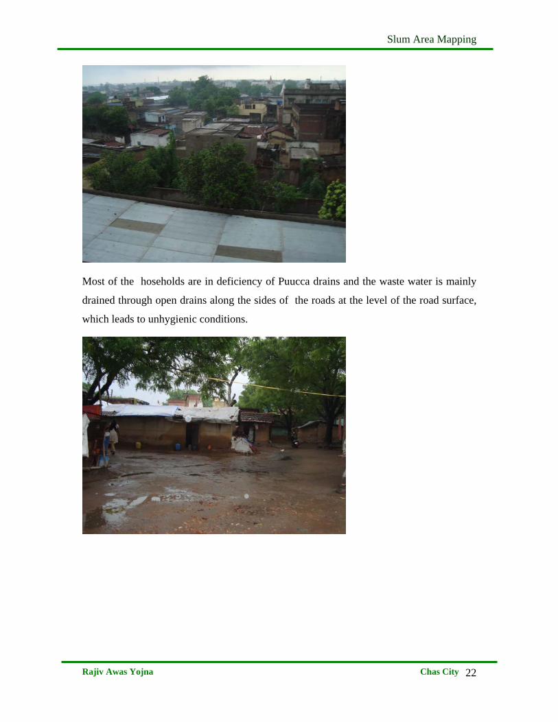
Most of the hoseholds are in deficiency of Puucca drains and the waste water is mainly
drained through open drains along the sides of the roads at the level of the road surface,
which leads to unhygienic conditions.
Slum Area Mapping
Rajiv Awas Yojna Chas City
23
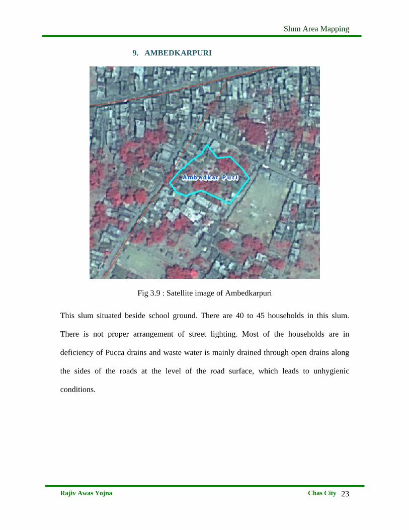
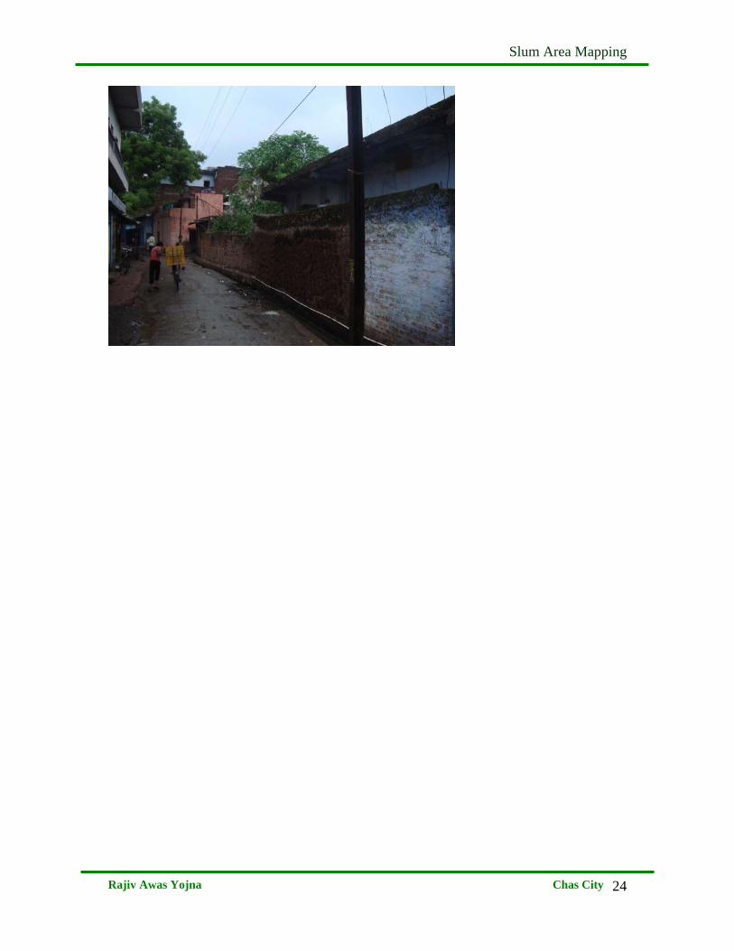
9. AMBEDKARPURI
Fig 3.9 : Satellite image of Ambedkarpuri
This slum situated beside school ground. There are 40 to 45 households in this slum.
There is not proper arrangement of street lighting. Most of the households are in
deficiency of Pucca drains and waste water is mainly drained through open drains along
the sides of the roads at the level of the road surface, which leads to unhygienic
conditions.
Slum Area Mapping
Rajiv Awas Yojna Chas City
24
Slum Area Mapping
Rajiv Awas Yojna Chas City
25
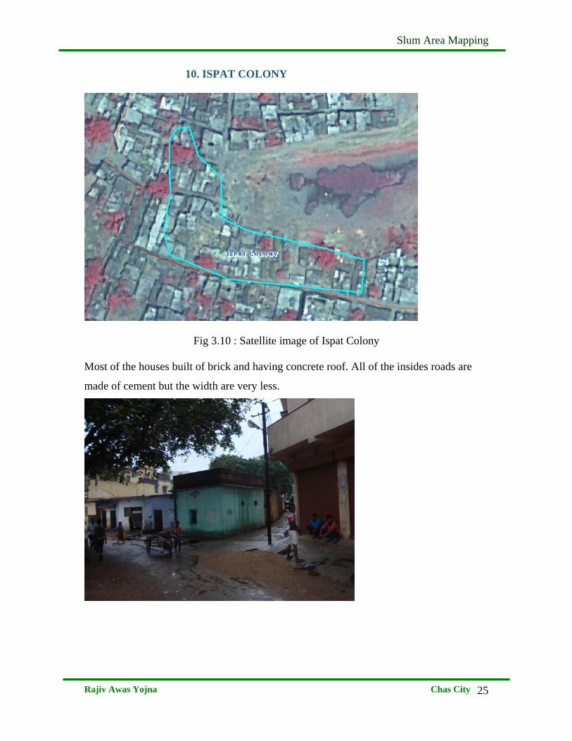
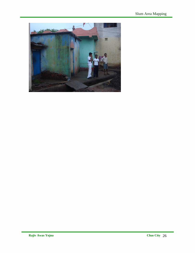
10. ISPAT COLONY
Fig 3.10 : Satellite image of Ispat Colony Most of the houses built of brick and having concrete roof. All of the insides roads are
made of cement but the width are very less.
Slum Area Mapping
Rajiv Awas Yojna Chas City
26