Embed Size (px)
Citation preview

CH1, S2: CH1, S2: The GeographerThe Geographer’’s Toolss Tools
*Eratosthenes- earliest geographer to calculate the circumference on the earth

A. Maps and Globes
1. Globe- 3 dimensional representation of the earth
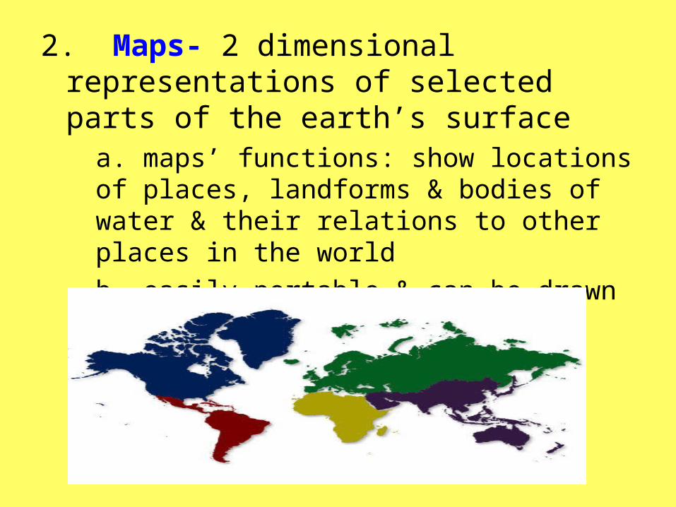
2. Maps- 2 dimensional representations of selected parts of the earth’s surface
a. maps’ functions: show locations of places, landforms & bodies of water & their relations to other places in the world b. easily portable & can be drawn to any scale needed
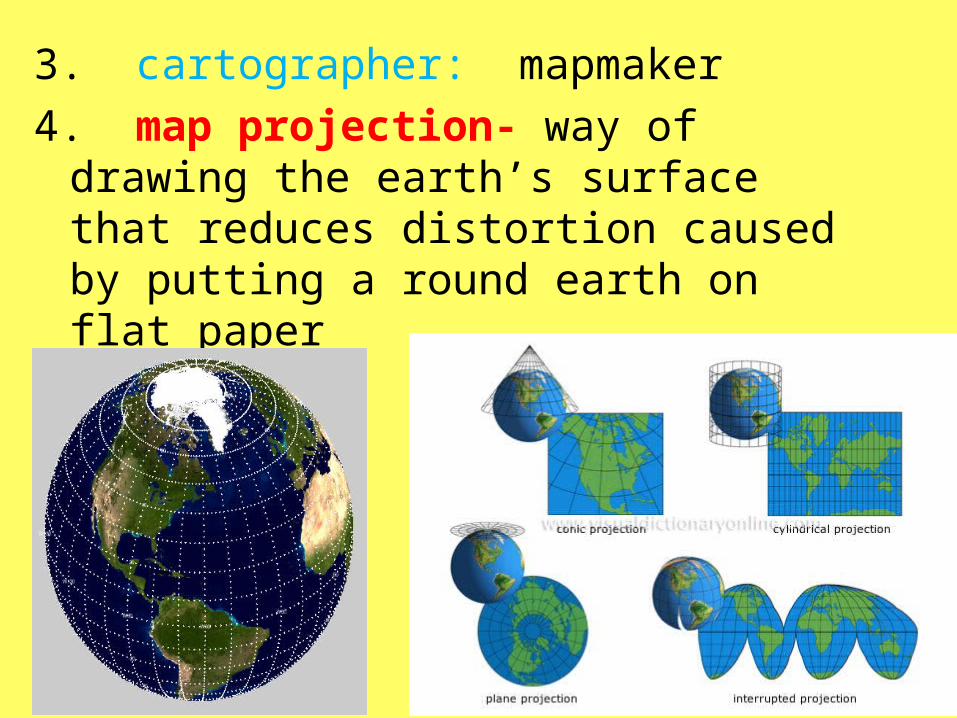
3. cartographer: mapmaker 4. map projection- way of drawing
the earth’s surface that reduces distortion caused by putting a round earth on flat paper
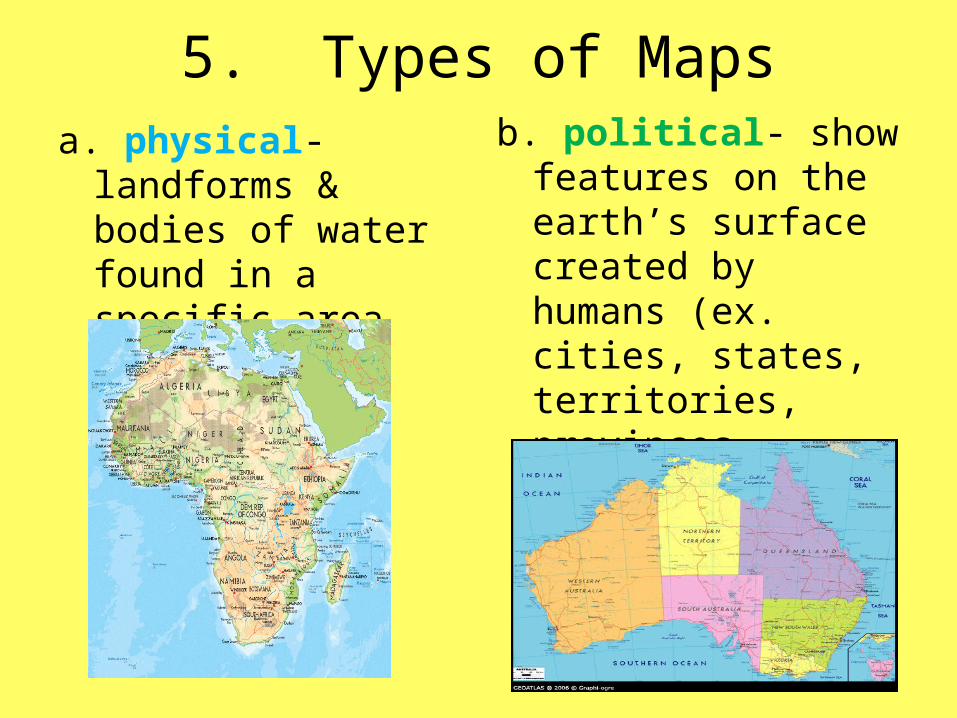
5. Types of Mapsa. physical-
landforms & bodies of water found in a specific area
b. political- show features on the earth’s surface created by humans (ex. cities, states, territories, provinces, countries)

c. Thematic or special purpose maps - focus on specific types of information (ex. climate, vegetation, natural resources, economic activities)
d. flow-line- shows movement of people, goods, ideas, animals, etc.
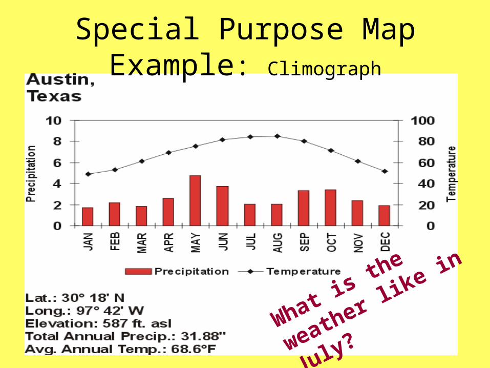
Special Purpose Map Example: Climograph
What is the weather
like in July?

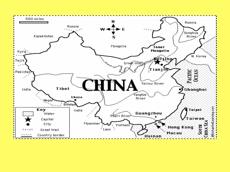
6. Items found on a map:a. title- explains subject of mapb. compass rose- show
direction (north, east, south, and west)
c. labels/words- explains the features on the map
d. legend/key- lists & explains symbols & colors on a map
e. lines of latitude and longitude
f. scale- unit of length on a map & a unit of distance on the earth
g. symbols- cities, natural resources
h. colors

1. Label water in Blue Ink and use Black Ink for everything else on your map.
2. Use a dot for cities.
3. Use a star for capitals.
4. In a political map, alternate shading of the countries so that no one country of the same color borders each other.
LCHS RCaulder


Coloring a Map
Mountain Peak in a solid Brown
Mountain Range outline in Brown
Plains, valleys, peninsulas, forests are colored Green
Deserts are Yellow with black dots
Water is Blue and can only be used for water
LCHS RCaulder

B. Mapmaking
1. Geographers complete a field survey before making a mapa. observes, measure,
& record what they see in an area
b. done by aerial photography or satellites
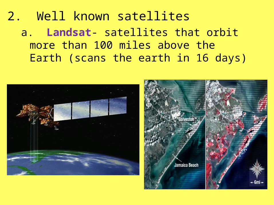
2. Well known satellitesa. Landsat- satellites that orbit more
than 100 miles above the Earth (scans the earth in 16 days)

b. Geostationary Operational Environmental Satellite (GOES) - goes in orbit with the earth’s rotation
– used to help forecast the weather
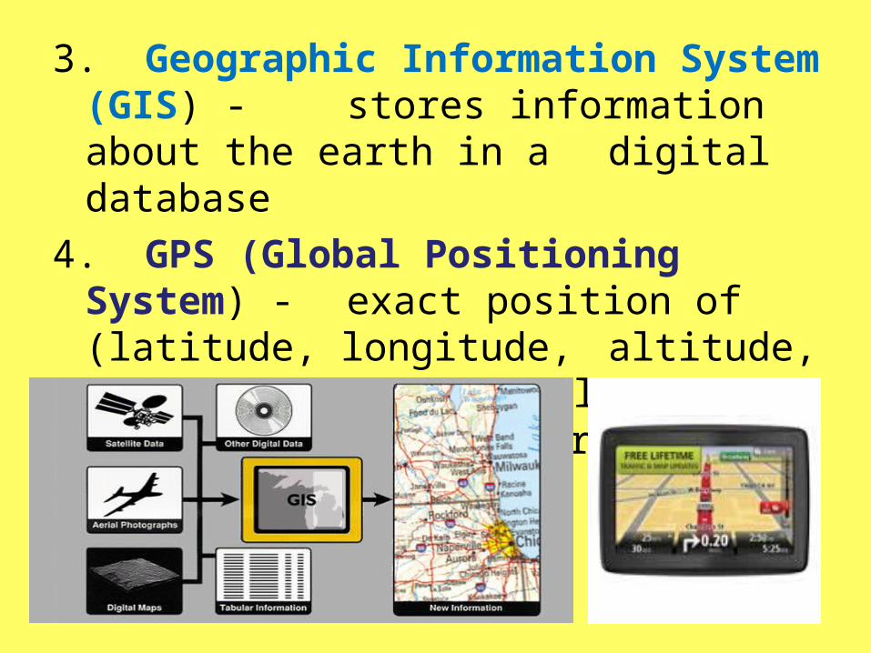
3. Geographic Information System (GIS) - stores information about the earth in a digital database
4. GPS (Global Positioning System) - exact position of (latitude, longitude, altitude, time) a location displayed on a hand held receiver