Embed Size (px)
Citation preview
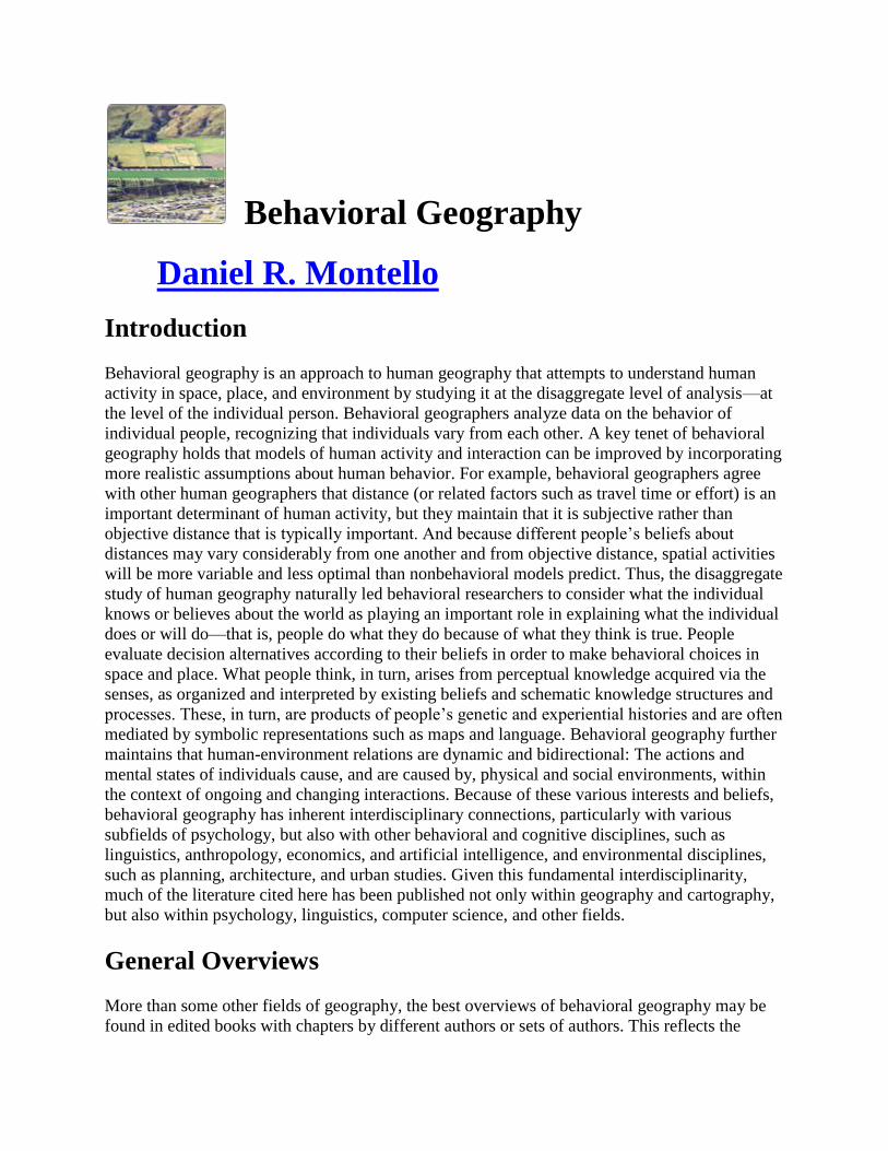
Behavioral Geography
Daniel R. Montello
Introduction
Behavioral geography is an approach to human geography that attempts to understand human
activity in space, place, and environment by studying it at the disaggregate level of analysis—at
the level of the individual person. Behavioral geographers analyze data on the behavior of
individual people, recognizing that individuals vary from each other. A key tenet of behavioral
geography holds that models of human activity and interaction can be improved by incorporating
more realistic assumptions about human behavior. For example, behavioral geographers agree
with other human geographers that distance (or related factors such as travel time or effort) is an
important determinant of human activity, but they maintain that it is subjective rather than
objective distance that is typically important. And because different people’s beliefs about
distances may vary considerably from one another and from objective distance, spatial activities
will be more variable and less optimal than nonbehavioral models predict. Thus, the disaggregate
study of human geography naturally led behavioral researchers to consider what the individual
knows or believes about the world as playing an important role in explaining what the individual
does or will do—that is, people do what they do because of what they think is true. People
evaluate decision alternatives according to their beliefs in order to make behavioral choices in
space and place. What people think, in turn, arises from perceptual knowledge acquired via the
senses, as organized and interpreted by existing beliefs and schematic knowledge structures and
processes. These, in turn, are products of people’s genetic and experiential histories and are often
mediated by symbolic representations such as maps and language. Behavioral geography further
maintains that human-environment relations are dynamic and bidirectional: The actions and
mental states of individuals cause, and are caused by, physical and social environments, within
the context of ongoing and changing interactions. Because of these various interests and beliefs,
behavioral geography has inherent interdisciplinary connections, particularly with various
subfields of psychology, but also with other behavioral and cognitive disciplines, such as
linguistics, anthropology, economics, and artificial intelligence, and environmental disciplines,
such as planning, architecture, and urban studies. Given this fundamental interdisciplinarity,
much of the literature cited here has been published not only within geography and cartography,
but also within psychology, linguistics, computer science, and other fields.
General Overviews
More than some other fields of geography, the best overviews of behavioral geography may be
found in edited books with chapters by different authors or sets of authors. This reflects the

relative newness of the subfield, its extremely multidisciplinary nature, and its wide relevance to
so many disparate problem areas within geography and cartography. At the same time, it has
attracted relatively few scholars (few departments specialize in it, for example). The most
important and informative edited collections include Downs and Stea 1973 and Gärling and
Golledge 1993. There are some valuable books authored by single sets of authors, including
Golledge and Stimson 1997, the most authoritative general book on behavioral geography, with
the most breadth of coverage; it is the much-expanded second edition of an earlier version by
these two authors. Jakle, et al. 1985 is another relevant example. Walmsley and Lewis 1993 is
better suited as a textbook for introductory courses. Finally, some journal articles are useful
overviews of at least important parts of behavioral geography. Evans 1980, published in a
prominent journal of psychology, is perhaps the best example of this.
Downs, Roger M., and David Stea, eds. Image and Environment: Cognitive Mapping and
Spatial Behavior. Chicago: Aldine, 1973.
Save Citation »Export Citation »E-mail Citation »
Edited collection that is not only very important historically to behavioral geography, but
that contains several chapters that are among the most influential sources on their
particular topics. Includes chapters by prominent geographers, psychologists, and others.
Probably no other single reference in all of behavioral geography is more important.
Find this resource:
Evans, Gary W. “Environmental Cognition.” Psychological Bulletin 88.2 (1980): 259–
287.
DOI: 10.1037/0033-2909.88.2.259Save Citation »Export Citation »E-mail Citation »
Article from a top journal of research psychology that overviews a major part of
behavioral geography—environmental cognition—from the multidisciplinary perspective
of environmental psychology, the subfield of psychology most closely parallel to
behavioral geography.
Find this resource:
Gärling, Tommy, and Reginald G. Golledge, eds. Behavior and Environment:
Psychological and Geographical Approaches. Amsterdam: North-Holland, 1993.
Save Citation »Export Citation »E-mail Citation »
Edited collection of great value because it consists of review chapters covering much of
the breadth of behavioral geography, written by top scholars. Uniquely contrasts the
perspectives of geography and psychology on each major topic it covers.
Find this resource:
Golledge, Reginald G., and Robert J. Stimson. Spatial Behavior: A Geographic
Perspective. New York: Guilford, 1997.
Save Citation »Export Citation »E-mail Citation »
Probably the broadest treatment of behavioral geography found in one source. Does one
of the best jobs of connecting the behavioral approach to the general field of human
geography. More appropriate for graduate courses than undergraduate.
Find this resource:
Jakle, John A., Stanley Brunn, and Curtis C. Roseman. Human Spatial Behavior: A
Social Geography. Prospect Heights, IL: Waveland, 1985.
Save Citation »Export Citation »E-mail Citation »
An interesting early overview of scientific human geography that is essentially a balanced
and broad presentation of behavioral concepts and idea. Covers mental, behavioral,
social, and cultural use of space by individuals and groups.
Find this resource:
Walmsley, D. J., and G. J. Lewis. People and Environment: Behavioural Approaches in
Human Geography. 2d ed. New York: Wiley, 1993.
Save Citation »Export Citation »E-mail Citation »
Rare example of something like an adequate undergraduate text in behavioral geography.
Like Golledge and Stimson 1997, it provides a broad coverage that connects the
behavioral approach to the rest of human geography, but more concisely and at a more
basic level.
Find this resource:
Historical Background
Early scholarship that links geography and cartography with psychology and other behavioral
sciences may be found from as early as the turn of the 20th century, and influential literature
appears sporadically throughout that century. Particular research problems within this literature
have included spatial orientation and disorientation, geographic education, map design, human
aspects of urban planning and landscape design, and models of spatial behavior and interaction,
including travel, communication, and economic activity. An important presidential address at the
annual meeting of the Association of American Geographers (AAG), published in Wright 1947,
was an early and widely disseminated call to geographers to study the subjective. In Tolman
1948, a prominent behavioral psychologist argued for the need to understand behavior in rats and
people in relation to mental representations of the world. This would come to greatly influence
geographers and other scholars of space and place. Robinson 1952 laid out the argument to
consider maps as tools for communicating ideas and information to people; as such, Robinson
argued, maps should be studied with the help of the psychological sciences of perception and
cognition. Lynch 1960 made similar arguments for our understanding of the built environments
of cities, as did Saarinen 1966 with respect to the study of human responses to natural hazards.
Many of these strands coalesced during the 1960s, when behavioral geography became
recognized as a distinct approach within human geography, especially with the appearance of
Cox and Golledge 1969. Other central publications in the history of the field of behavioral
geography include Gould and White 1974, with its emphasis on emotional responses to places,
and Tuan 1974, which helped popularize an experiential approach to understanding subjective
geography.
Cox, Kevin R., and Reginald G. Golledge, eds. Behavioral Problems in Geography: A
Symposium. Evanston, IL: Northwestern University, Department of Geography, 1969.
Save Citation »Export Citation »E-mail Citation »
This edited collection can be cited as the origin of the field of behavioral geography, at
least by that name. Based on a landmark meeting of scholars from several disciplines, it
is the earliest overview and introduction to the field.
Find this resource:
Gould, Peter, and Rodney White. Mental maps. Harmondsworth, UK: Penguin, 1974.
DOI: 10.4324/9780203163757Save Citation »Export Citation »E-mail Citation »
This work demonstrated to geographers that emotion can be studied scientifically. Its
name is potentially confusing, as the book focuses on depicting place preferences in the
form of exceptionally engaging isoline maps. It is not much concerned with broader
issues of place cognition implied by the term “mental map,” usually considered a
synonym for cognitive map.
Find this resource:
Lynch, Kevin. The Image of the City. Cambridge, MA: MIT Press, 1960.
Save Citation »Export Citation »E-mail Citation »
From an urban planner. No reference work played a more important formative role in the
systematic study of the mind-environment interrelation. Important for its concepts of
urban “images” (really long-term mental representations) and urban legibility; also
provided appealing visualizations of shared mental representations and introduced the
method of sketch mapping.
Find this resource:
Robinson, Arthur H. The Look of Maps: An Examination of Cartographic Design.
Madison: University of Wisconsin Press, 1952.
Save Citation »Export Citation »E-mail Citation »
Based on the author’s dissertation, this work championed the idea of understanding maps
as tools for human perception and cognition, not just repositories of objective and
consensual geographic knowledge. It paved the way for decades of research on map
psychology and stimulated several nonbehavioral approaches to understanding maps and
mapping from subjective and contextual perspectives.
Find this resource:
Saarinen, Thomas F. Perception of Drought Hazard on the Great Plains. Chicago:
University of Chicago, 1966.
Save Citation »Export Citation »E-mail Citation »
Short book directing researchers to the importance of subjective beliefs in determining
how people respond to potential and actual environmental hazards. Builds on earlier
groundbreaking work by geographers such as Gilbert White, who persuasively made the
case that human activity plays a fundamental role in bringing about so-called natural
hazards.
Find this resource:
Tolman, Edward C. “Cognitive Maps in Rats and Men.” Psychological Review 55
(1948): 189–208.
DOI: 10.1037/h0061626Save Citation »Export Citation »E-mail Citation »
Influential psychological research positing that animal (including human) behavior is
controlled not just by external stimuli but by mental representations of environments,
which Tolman termed cognitive maps. His observations of rats shortcutting in mazes is
still widely taken as key evidence for what is now called survey or configurational
knowledge.
Find this resource:
Tuan, Yi-Fu. Topophilia: A Study of Environmental Perception, Attitudes, and Values.
Englewood Cliffs, NJ: Prentice-Hall, 1974.
Save Citation »Export Citation »E-mail Citation »
Following John K. Wright, David Lowenthal, and others, this is essential writing on the
importance of the experiential, emotional, and contextual in geography. Squarely within
the humanities tradition (particularly humanism and phenomenology), it has been widely
read by scientific and humanities scholars alike. Tuan’s books offer some of the best
belletristic writing in geography.
Find this resource:
Wright, John K. “Terrae Incognitae: The Place of Imagination in Geography.” Annals of
the Association of American Geographers 37 (1947): 1–15.
Save Citation »Export Citation »E-mail Citation »
Perhaps the earliest call from a prominent geographer for the merits of studying the
subjective geographic beliefs of lay people as well as experts, whatever their objective
validity. He called this geosophy. Based on Wright’s 1946 presidential address at the
annual meeting of the AAG.
Find this resource:
Metatheory of Behavioral Geography
The 20th and 21st centuries have been characterized by extensive and repeated discussions about
the nature of geography as an intellectual endeavor. What is its basic problem domain? What are
appropriate geographic concepts and methods? How should geography position itself as a natural
science, social science, or branch of humanities or the arts? What are the political implications of
geography and how should geographers respond to them? Collectively, these concerns may be
referred to as metatheory. Behavioral geography has participated in its share of these
metatheoretical discussions, if not more than its share. As Golledge 1981 discusses, behavioral
geography has typically adopted a scientific approach, which advocates systematic empirical
methods and certain other assumptions such as realism that tend to distinguish it rather sharply
from other seemingly related approaches that also advocate the study of the subjective in human
geography. (Sack 1980 presents a fascinating philosophical discussion of the study of the
subjective in geography.) Critical appraisals of behavioral geography have contrasted scientific
approaches with those derived from the humanities, including philosophy, history, and literature.
Some critics have advocated humanities approaches (e.g., Bunting and Guelke 1979, Tuan 1974)
such as humanism, phenomenology, postmodernism, critical theory, and other specific
approaches. Behavioral geographers have been criticized for treating humans too
individualistically, overlooking the social and cultural context of human activity. Other critiques
have focused on the mentalistic nature of much behavioral geography that seemingly leaves a
person frozen in daydreams or pondering over alternatives. Such mentalism sometimes confuses
cognition with consciousness, lacking nuance in conceptualizing the relationship of mind and
behavior (Bunting and Guelke 1979). Like work in the tradition of the quantitative revolution in
general within human geography, some behavioral work can be characterized as simplistically
and somewhat mindlessly quantitative (e.g., Tuan 1974), too atheoretically empirical, and too
intent on listing values of test statistics and probability levels. In part because of these critiques,
behavioral geography has lost popularity within human geography since the 1980s (Argent and
Walmsley 2009). Conversely, supporters of behavioral geographers have argued for the

plausibility and value of scientifically studying the subjective (see Argent and Walmsley 2009
and Golledge 1981). They have criticized some approaches to human geography for failing to
appreciate rigor, or for misunderstanding the claims of behavioral geography. And they have
questioned the appropriateness of scholars qua scholars mixing their search for understanding
with a politicized advocacy of causes such as social justice.
Argent, N. M., and D. J. Walmsley. “From the Inside Looking Out and the Outside
Looking In: Whatever Happened to ‘Behavioural Geography’?” Geographical Research
47.2 (2009): 192–203.
DOI: 10.1111/j.1745-5871.2009.00571.xSave Citation »Export Citation »E-mail Citation
»
Recent overview of legacy and current status of behavioral geography. Defends its aims
and achievements while observing its decline within mainstream human geography for
some decades. Notes several valuable conceptual and methodological contributions of
behavioral geography that enrich modern geography, even while much behavioral
research has moved to interdisciplinary outlets.
Find this resource:
Bunting, Trudi E., and Leonard Guelke. “Behavioral and Perception Geography: A
Critical Appraisal.” Annals of the Association of American Geographers 69.3 (1979):
448–462.
DOI: 10.1111/j.1467-8306.1979.tb01268.xSave Citation »Export Citation »E-mail
Citation »
Severe and trenchant criticism of behavioral geography. Doubts that perceptual and
cognitive research is of much value in explaining actual human activity. Questions the
validity with which mental states can be measured and quantified, and expounds on the
relatively weak and complex relationship between mind and behavior.
Find this resource:
Golledge, Reginald G. “Misconceptions, Misinterpretations, and Misrepresentations of
Behavioral Approaches in Human Geography.” Environment and Planning A 13.11
(1981): 1325–1344.
DOI: 10.1068/a131325Save Citation »Export Citation »E-mail Citation »
Wide-ranging defense of behavioral approach by its most productive and vocal
proponent. Deals mostly with some of the early criticisms of behavioral geography, such
as its confusion with behaviorism in psychology.
Find this resource:

Sack, Robert David. Conceptions of Space in Social Thought: A Geographic Perspective.
Minneapolis: University of Minnesota Press, 1980.
Save Citation »Export Citation »E-mail Citation »
Philosophical and conceptual overview of the study of the subjective in geography.
Considers both the level of individual minds and that of collective cultural beliefs.
Find this resource:
Tuan, Yi-Fu. “Review of Mental Maps by Peter Gould and Rodney White.” Annals of the
Association of American Geographers 64.4 (1974): 589–591.
Save Citation »Export Citation »E-mail Citation »
Erudite and concise critique of scientific behavioral geography, spurred by criticism of
Gould and White 1974 (cited in Historical Background) on preference mapping.
Expresses doubts about the value of quantitatively measuring human experience,
emotion, and meaning in space and place, from a humanist perspective.
Find this resource:
Spatial Behavior, Activity Spaces, and Time Geography
The original motivation of behavioral geography when it emerged as a distinct approach during
the 1960s was to explain human activity in space and place at the disaggregate level of the
individual person. While this led some behavioral geographers to the study of cognition, others
continued to focus on measuring and analyzing individual spatial behavior and activity. These
include both temporary travel, such as the journey to work, and the relatively permanent mobility
involved in migrating to a new home. Hägerstrand 1970 presents several new and widely
influential concepts to the study of spatial activity, particularly focusing geographers on the
temporal aspects of activity and not just the spatial. Miller 1991 represents some of the best more
modern work on time geography, particularly exploiting the tremendous potential of new
technologies for automated geographic information collection and processing. Kwan 1999
focuses time geography on gender issues in geography; at the same time, the author furthers a
reconciliation of qualitative and quantitative approaches within human geography. Torrens 2012
pushes the envelope to the cutting edge of integrating agent-based computational modeling with
virtual-reality simulation in the context of complex and sophisticated modeling of human
pedestrian activity in built environments.
Hägerstrand, Torsten. “What about People in Regional Science?” Papers in Regional
Science 24.2 (1970): 7–21.
Save Citation »Export Citation »E-mail Citation »

Groundbreaking work introducing space-time budgets and time geography. Discusses
various types of constraints on the locations of spatial activities, dependent on the time
available to travel particular distances, as a function of one’s transportation mode, the
need to collaborate with others, the need to return home at night, and so on.
Find this resource:
Kwan, Mei-Po. “Gender and Individual Access to Urban Opportunities: A Study Using
Space-Time Measures.” Professional Geographer 51.2 (1999): 210–227.
Save Citation »Export Citation »E-mail Citation »
Revises the concept of accessibility in light of space-time constraints, especially as
experienced by women. Data from travel diaries are analyzed in a network-based
geographic information system (GIS). Part of an extended research program combining
time geography, GIS, qualitative methods, and gender issues.
Find this resource:
Miller, Harvey J. “Modelling Accessibility Using Space-Time Prism Concepts within
Geographical Information Systems.” International Journal of Geographical Information
Systems 5.3 (1991): 287–301.
DOI: 10.1080/02693799108927856Save Citation »Export Citation »E-mail Citation »
Takes Hägerstrand’s approach to time geography forward, given the explosion of data
and data-processing available in the last couple of decades, particularly within a GIS
framework.
Find this resource:
Torrens, Paul M. “Moving Agent Pedestrians through Space and Time.” Annals of the
Association of American Geographers 102.1 (2012): 35–66.
DOI: 10.1080/00045608.2011.595658Save Citation »Export Citation »E-mail Citation »
Very recent work demonstrating the potential of advanced agent-based simulation in
human geography. Attempts to show the power of implementing the disaggregate
approach of behavioral geography into a computational model. Argues that such models
work better when based on more realistic formalizations of human locomotion and mind,
as well as surrounding environments.
Find this resource:
Spatial Knowledge and Cognitive (Mental) Maps
Cognition is knowledge and knowing by sentient entities, including humans, nonhuman animals,
and artificially intelligent machines. Cognitive structures and processes include those of
sensation, perception, thinking, learning, memory, attention, imagination, conceptualization,
language, and reasoning and problem solving. Some of these structures and processes are
consciously accessible, potentially available to awareness; others are nonconscious, outside of
awareness. Following the lead of Tolman 1948 (cited under Historical Background), but with
even earlier precedents, behavioral geographers and other researchers in spatial cognition have
studied spatial knowledge of the environment conceptualized as cognitive maps. Kitchin 1994
gives a broad overview of this concept and its applicability to geographical problems. McNamara
1992 presents an excellent overview of work on distortions in spatial knowledge and what they
suggest about the form and processing of spatial knowledge. Lloyd 1994 promotes the
application of prototype theory and neural networks from cognitive science to conceptualizing
and measuring cognitive maps.
Kitchin, Robert M. “Cognitive Maps: What Are They and Why Study Them?” Journal of
Environmental Psychology 14.1 (1994): 1–19.
DOI: 10.1016/S0272-4944(05)80194-XSave Citation »Export Citation »E-mail Citation »
Overviews the concept of cognitive maps and their relationship to a variety of basic and
applied research questions in geography and other disciplines.
Find this resource:
Lloyd, Robert. “Learning Spatial Prototypes.” Annals of the Association of American
Geographers 84.3 (1994): 418–440.
DOI: 10.1111/j.1467-8306.1994.tb01868.xSave Citation »Export Citation »E-mail
Citation »
Follows prominent work in cognitive science by applying neural networks to
understanding geographic spatial knowledge. These are computational models inspired
by the nervous system. They invoke elemental computational units that change by very
simple rules, but can nonetheless simulate complex cognition as emerging from the rich
interconnections among simple units.
Find this resource:
McNamara, Timothy P. “Spatial Representation.” Geoforum 23 (1992): 139–150.
DOI: 10.1016/0016-7185(92)90012-SSave Citation »Export Citation »E-mail Citation »
Concise review by a cognitive psychologist written for a geographic audience. Clearly
describes most of the empirical phenomena to date that demonstrate properties of spatial
beliefs and reasoning by lay people, as inferred by distorted judgments of distance,
direction, and so on.
Find this resource:
Distances, Directions, and Regions
Some of the research on spatial knowledge by behavioral geographers and other behavioral
scientists has concentrated on particular elements of knowledge rather than cognitive maps in
general. Tversky 1981 demonstrates how the mental processing of spatial knowledge at different
scales distorts judgments of directions in certain ways. Golledge 2002 presents an ambitious
theory of “primitives” in all kinds of geographic spatial knowledge. Other references deal in
detail with the regional organization of spatial knowledge. Regions are spatial categories—pieces
of earth surface that capture aspects of similarity among the places within the regions. Cognitive
regions are informal region concepts individuals or groups of people use to organize their
understanding of the earth surface (culturally shared informal regions are known as vernacular
regions). Aitken and Prosser 1990 presents interesting methodological approaches to studying
neighborhoods as cognitive regions at urban scales. Friedman and Brown 2000 is the first in an
ongoing line of studies that investigate the influence of cognitive regions at continental and
national scales, particularly how this regional organization influences spatial judgments such as
latitude and distance. Stevens and Coupe 1978 and Hirtle and Jonides 1985 extend the study of
cognitive regionalization to considering how the hierarchical arrangement of cognitive regions
influences the nature of spatial reasoning.
Aitken, Stuart C., and Rudy Prosser. “Residents’ Spatial Knowledge of Neighborhood
Continuity and Form.” Geographical Analysis 22.4 (1990): 301–325.
DOI: 10.1111/j.1538-4632.1990.tb00213.xSave Citation »Export Citation »E-mail
Citation »
Methodologically innovative empirical study of residents’ beliefs about what constitutes
their neighborhoods, an important example of an informal cognitive region.
Find this resource:
Friedman, Alinda, and Norman R. Brown. “Reasoning about Geography.” Journal of
Experimental Psychology: General 129.2 (2000): 193–219.
DOI: 10.1037/0096-3445.129.2.193Save Citation »Export Citation »E-mail Citation »
Initiates major research program on spatial reasoning with cognitive regions at
continental and national scales, based on estimated latitudes, longitudes, distances, and
more. Shows spatial distortion due to regional reasoning is conceptual and not perceptual,
contra Tversky 1981. The most extensive work on “psychological plate tectonics” (p.
218).
Find this resource:
Golledge, Reginald G. “The Nature of Geographic Knowledge.” Annals of the
Association of American Geographers 92.1 (2002): 1–14.
DOI: 10.1111/1467-8306.00276Save Citation »Export Citation »E-mail Citation »
Based on Golledge’s AAG presidential address, this article presents the theory of
geographic knowledge in expert geographers and lay people. Golledge discusses spatial
thinking in geography in the broadest sense, including thinking about location, distance,
network, hierarchy, region, and more.
Find this resource:
Hirtle, Stephen C., and Jon Jonides. “Evidence of Hierarchies in Cognitive Maps.”
Memory & Cognition 13.3 (1985): 208–217.
DOI: 10.3758/BF03197683Save Citation »Export Citation »E-mail Citation »
Demonstrates regional and hierarchical organization of spatial knowledge on a college
campus. Novel use of landmark recall protocols to determine clusters (regions) of
landmarks, based in part on functional or semantic associations, not just spatial proximity
or regional boundaries. In turn, these clusters influence spatial (distance) judgments about
landmarks.
Find this resource:
Stevens, Albert, and Patty Coupe. “Distortions in Judged Spatial Relations.” Cognitive
Psychology 10 (1978): 422–437.
DOI: 10.1016/0010-0285(78)90006-3Save Citation »Export Citation »E-mail Citation »
Describes four much cited original studies positing hierarchical spatial reasoning as a
basis for certain typical distortions in reasoning. Most famously, lay people often say San
Diego is west of Reno when it is actually east, purportedly because California is
considered to be west of Nevada.
Find this resource:
Tversky, Barbara. “Distortions in Memory for Maps.” Cognitive Psychology 13.3 (1981):
407–433.
DOI: 10.1016/0010-0285(81)90016-5Save Citation »Export Citation »E-mail Citation »
Excellent early empirical demonstrations of distortions in spatial recall for features at
different scales from local environments, and from cartographic maps, both real and
fictional. Phenomena such as alignment in recalling continents and rectilinear distortion
in recalling street directions result from simplifying heuristics in spatial learning and
reasoning.
Find this resource:
Learning Environments Directly
At the environmental scale, such as the scale of home territories (whether rural or urban), people
have traditionally acquired knowledge of the spatial properties of particular places by direct
sensorimotor experience traveling around them. That is, they learn from visually and
proprioceptively apprehending the environment around them while standing, walking, biking,
driving, sailing, and so on. This knowledge varies in its completeness, accuracy, geometric
sophistication, and so on. At a minimum, it may consist of minimally spatial memory traces of
the appearance of distinctive features, or “landmarks.” More spatially, it may consist of linear
sequences of connected features along routes, perhaps with very imprecise quantitative scaling of
distances and directions. At its most sophisticated, people may acquire detailed and metrically
rich understandings of the two-dimensional layout of the environment. Siegel and White 1975
presents a very influential psychological theory of the cognitive changes that occur over time as
one learns a new place, such as a previously unvisited city, a process called spatial microgenesis.
Couclelis, et al. 1987 provides a different theory of spatial microgenesis, more from the
perspective of geography than psychology. Thorndyke and Hayes-Roth 1982 provides a process
model of spatial learning and estimation within a large building that specifically contrasts
directly experienced environments with those learned from cartographic maps. Kuipers 2000
presents the most detailed theoretical framework available for spatial learning and cognitive-map
formation from the perspective of artificial intelligence and robotics. Ishikawa and Montello
2006 empirically investigates theories of directly acquired knowledge, pitting Siegel and White’s
framework (see Siegel and White 1975) against a more continuous and quantitative alternative
theory.
Couclelis, Helen, Reginald G. Golledge, Nathan Gale, and Waldo Tobler. “Exploring the
Anchor-Point Hypothesis of Spatial Cognition.” Journal of Environmental Psychology
7.2 (1987): 99–122.
DOI: 10.1016/S0272-4944(87)80020-8Save Citation »Export Citation »E-mail Citation »
Presents an influential conceptual model of spatial microgenesis, or learning the spatial
properties of unfamiliar environments. Initially, key locations (“anchor points”) such as
one’s home serve as points of organization around which new spatial knowledge is
referenced. Separate regions acquired this way may eventually be mutually organized
over time.
Find this resource:
Ishikawa, Toru, and Daniel R. Montello. “Spatial Knowledge Acquisition from Direct
Experience in the Environment: Individual Differences in the Development of Metric
Knowledge and the Integration of Separately Learned Places.” Cognitive Psychology 52
(2006): 93–129.
DOI: 10.1016/j.cogpsych.2005.08.003Save Citation »Export Citation »E-mail Citation »
Longitudinal study of spatial learning after repeated automobile trips through a novel,
complex neighborhood. The pattern of spatial knowledge acquisition fits neither the
stage-like progression of the “dominant” theory (from Siegel and White 1975) nor the
“alternative” continuous theory well, but instead shows strong differences among
individuals according to their sense-of-direction (see also Individual, Sex, and Cultural
Differences).
Find this resource:
Kuipers, Benjamin. “The Spatial Semantic Hierarchy.” Artificial Intelligence 119 (2000):
191–233.
DOI: 10.1016/S0004-3702(00)00017-5Save Citation »Export Citation »E-mail Citation »
The most nuanced and developed computational theory of spatial learning of
environments in the context of navigation, distinguishing the separate acquisition of
various types of topological and metric knowledge. By an artificial-intelligence
researcher well versed in behavioral science.
Find this resource:
Siegel, Alexander W., and Sheldon H. White. “The Development of Spatial
Representations of Large-Scale Environments.” In Advances in Child Development and
Behavior. Vol. 10. Edited by Hayne W. Reese, 9–55. New York: Academic Press, 1975.
Save Citation »Export Citation »E-mail Citation »
An exceptionally influential conceptual model of spatial microgenesis. Posits three stages
of increasingly sophisticated spatial knowledge structures acquired over time from direct
sensorimotor experience during locomotion: landmark, route, and survey or
configurational knowledge. So widely accepted through the 1990s, it was dubbed the
“dominant” theory (see Ishikawa and Montello 2006).
Find this resource:
Thorndyke, Perry W., and Barbara Hayes-Roth. “Differences in Spatial Knowledge
Acquired from Maps and Navigation.” Cognitive Psychology 14.4 (1982): 560–589.
DOI: 10.1016/0010-0285(82)90019-6Save Citation »Export Citation »E-mail Citation »
Analysis and empirical confirmation of detailed conceptual models of differences in
cognitive structures and processes involved in estimating directions and distances, both
straight-line and route, based on spatial knowledge learned either directly from walking
through a large public building or from studying cartographic map of the building.
Find this resource:
Navigation and Wayfinding
Navigation is coordinated movement of oneself through the environment in order to reach a
destination, according to Golledge 1999. It may be conceptualized as consisting of locomotion
and wayfinding (Montello 2005). Locomotion is the component of navigation coordinated to the
immediate surrounds, allowing people to avoid barriers, walk toward visible beacons, and related
tasks. Wayfinding is the component of navigation coordinated to distant features, out of sensory
access, allowing people to plan routes, orient to nonperceptible destinations, and related tasks.
Both nonconscious information processing, such as feature recognition, and conscious
information processing, such as strategic thinking (discussed in Cornell, et al. 1992), play a role
in navigation. In many situations, navigation is aided by cartographic maps and other
information displays, as discussed in Levine 1982 and Streeter, et al. 1985. (Research focusing
on verbal navigational instructions or “route directions” is cited under Spatial/Geographic
Language.) In many situations, navigation is a social activity, including the involvement of
navigational tools developed over time by cultural accumulation; Hutchins 1995 presents a
fascinating discussion of this phenonemon.
Cornell, Edward H., C. Donald Heth, and Wanda L. Rowat. “Wayfinding by Children
and Adults: Response to Instructions to Use Look-Back and Retrace Strategies.”
Developmental Psychology 28.2 (1992): 328–336.
DOI: 10.1037/0012-1649.28.2.328Save Citation »Export Citation »E-mail Citation »
Demonstrates the effectiveness of explicitly trained strategies, particularly the look-back
strategy, in helping both older children and young adults maintain orientation during a
walk through a college campus. Exemplary empirical research combining empirical
control with ecological realism.
Find this resource:
Golledge, Reginald G., ed. Wayfinding Behavior: Cognitive Mapping and Other Spatial
Processes. Baltimore: Johns Hopkins University Press, 1999.
Save Citation »Export Citation »E-mail Citation »
Authoritative chapters written by geographers, psychologists, biologists, and computer
scientists. Sections cover cognitive maps and wayfinding, perceptual and cognitive
processing of environmental information, wayfinding and cognitive maps in nonhumans,
and the neural and computational bases of wayfinding and cognitive mapping.
Find this resource:
Hutchins, Edwin. Cognition in the Wild. Cambridge, MA: MIT Press, 1995.
Save Citation »Export Citation »E-mail Citation »
Novel and influential analysis of human navigation as a socially and culturally situated
activity. Extensively analyzes both the nontechnological marine navigation system of
traditional Micronesian navigators and the technologically aided marine navigation on
US Navy ships.
Find this resource:
Levine, Marvin. “You-Are-Here Maps: Psychological Considerations.” Environment and
Behavior 14.2 (1982): 221–237.
DOI: 10.1177/0013916584142006Save Citation »Export Citation »E-mail Citation »
Aligned you-are-here maps depict the forward-facing direction of map viewers as up on
the map; other map orientations are misaligned. Empirical studies explore the alignment
effect, the robust phenomenon in which some combination of extra time, error, or
subjective difficulty in wayfinding occurs when most people interpret misaligned you-
are-here maps.
Find this resource:
Montello, Daniel R. “Navigation.” In The Cambridge Handbook of Visuospatial
Thinking. Edited by Priti Shah and Akira Miyake, 257–294. Cambridge, UK: Cambridge
University Press, 2005.
DOI: 10.1017/CBO9780511610448Save Citation »Export Citation »E-mail Citation »
Overviews mental and behavioral terms and concepts of human navigation as everyday
activity of lay people. Distinguishes wayfinding and locomotion as key components of
navigation, whether technologically aided or not. Analyzes processes of orientation and
disorientation. Considers the role of maps and the layout of physical environments.
Find this resource:
Streeter, Lynn A., Diane Vitello, and Susan A. Wonsiewicz. “How to Tell People Where
to Go: Comparing Navigational Aids.” International Journal of Man/Machine Studies 22
(1985): 549–562.
DOI: 10.1016/S0020-7373(85)80017-1Save Citation »Export Citation »E-mail Citation »
Early empirical study in naturalistic setting, comparing maps and verbal directions as
technologies for navigation assistance (see also Human-Computer
Interface/Geovisualization).
Find this resource:
Using and Comprehending Maps and Imagery
As discussed in the Introduction, an interest in cartographic map perception and cognition has
long been part of the field of behavioral geography, specifically part of the research tradition of
cognitive aspects of cartographic communication (details of the communication model for
cartography are laid out in Board 1981). Maps are systems of signs and symbols whose
interpretation depends in part on a person’s prior knowledge and learning experience.
MacEachren 1995 provides a comprehensive review of the concepts and findings of research
concerning the cognition of cartographic displays. Petchenik 1983 provides an important critique
of this approach to cartographic design, although some of Petchenik’s most important points
have become moot with revisions to the traditional communication paradigm (revisions that her
chapter helped to motivate). Hoffman and Markman 2001 looks at cognitive aspects of
interpreting imagery from remote sensing.
Board, Christopher. “Cartographic Communication.” Cartographica 18.2 (1981): 42–78.
DOI: 10.3138/8R07-2125-L843-0767Save Citation »Export Citation »E-mail Citation »
Exposition of the influential communication model in cartography, which argues that
maps work by encoding the cartographer’s intended meaning into map symbols that are
decoded more or less successfully by the map reader to extract the cartographer’s
message.
Find this resource:
Hoffman, Robert R., and Arthur B. Markman, eds. Interpreting Remote Sensing Imagery:
Human Factors. Boca Raton, FL: Lewis, 2001.
DOI: 10.1201/9781420032819Save Citation »Export Citation »E-mail Citation »
Edited collection of research by perceptual, cognitive, and human-factors psychologists
on the interpretation of remotely sensed images from optical and satellite remote sensing.
Find this resource:
MacEachren, Alan M. How Maps Work: Representation, Visualization, and Design. New
York: Guilford, 1995.
Save Citation »Export Citation »E-mail Citation »
Combines comprehensive summary of experimental perceptual and cognitive research on
map design and interpretation with philosophical analyses based on map semiotics.
Shows that the influential communication model in cartography is misleading because it
does not capture the flexible and nondeterministic ways maps actually function
cognitively. This is the best single source on cognitive map research.
Find this resource:
Petchenik, Barbara Bartz. “A Mapmaker’s Perspective on Map Design Research 1950–
1980.” In Graphic Communication and Design in Contemporary Cartography. Edited by
D. R. Fraser Taylor, 37–68. Progress in Contemporary Cartography 2. Chichester, UK:
Wiley, 1983.
Save Citation »Export Citation »E-mail Citation »
Tour-de-force critique of cognitive map-design research from a student and colleague of
Arthur Robinson. Contrasts analytic goals of scientific research with synthetic goals of
mapmakers. Questions the ability of research to accommodate the idiosyncratic nature of
map users, map tasks, map designs. Important in its recognition of the limits of the
communication model in cartographic research.
Find this resource:
Spatial/Geographic Language
Besides maps and other forms of imagery, geographic knowledge is also expressed verbally, in
the form of written and spoken natural languages, such as English or Chinese. Much of this work
examines how spatial, temporal, and thematic knowledge is expressed in different languages,
including Mark, et al. 2011 and Mark 1993 (cited under Geo-ontologies), which inevitably leads
one to confront a variety of long-standing philosophical and scientific questions about the
relationship of language and thought. Most work on language and geography is concerned with
the way spatiality is expressed in language, as seen in Bloom, et al. 1996 and Mark and Frank
1991 (the latter cited under Behavioral and Cognitive Aspects of Geographic Information
Science). Spatiality can be expressed in nearly all grammatical classes, but prepositions in
particular mostly convey spatial information. Researchers are also interested in the precision and
geometric sophistication of spatiality expressed in language, and the context-dependent nature of
many spatial expressions, including deictic expressions such as “here” and “there,” discussed by
Klein 1982, and terms concerning size or distance (“near,” “small”). Spatiality is conveyed in a
variety of linguistic forms, including narratives (such as in stories) and verbal signage (see
Passini 1992, cited under Behavior and Cognition in Built Environments). The most common
application area for the study of language in geography involves verbal route directions,
addressed by Allen 1997 and Denis, et al. 2007.
Allen, Gary L. “From Knowledge to Words to Wayfinding: Issues in the Production and
Comprehension of Route Directions.” In Spatial Information Theory: A Theoretical Basis
for GIS; International Conference COSIT ’97, Laurel Highlands, Pennsylvania, October
15–18, 1997. Edited by Stephen C. Hirtle and Andrew U. Frank, 363–372. Lecture Notes
in Computer Science 1329. Berlin: Springer, 1997.
Save Citation »Export Citation »E-mail Citation »
Illuminating exposition of behavioral, cognitive, and social interactional issues
surrounding one of the most important application areas for the study of language in
geography—producing and comprehending navigational route directions.
Find this resource:
Bloom, Paul, Mary A. Peterson, Lynn Nadel, and Merrill F. Garrett, eds. Language and
Space. Cambridge, MA: MIT Press, 1996.
Save Citation »Export Citation »E-mail Citation »
Large collection of chapters by several top language researchers from linguistics,
psychology, anthropology, and cognitive science. Covers a broad array of topics
concerning language and spatiality at several different scales.
Find this resource:
Denis, Michel, Pierre-Emmanuel Michon, and Ariane Tom. “Assisting Pedestrian
Wayfinding in Urban Settings: Why References to Landmarks Are Crucial in Direction-
Giving.” In Applied Spatial Cognition: From Research to Cognitive Technology. Edited
by Gary L. Allen, 25–51. Mahwah, NJ: Lawrence Erlbaum, 2007.
Save Citation »Export Citation »E-mail Citation »
Nice summary of an extended research program on the psychology of producing and
comprehending route directions, focusing particularly on evidence for the claim that
referring to landmarks when providing route directions is very beneficial, even essential.
Find this resource:
Klein, Wolfgang. “Local Deixis in Route Directions.” In Speech, Place, and Action:
Studies in Deixis and Related Topics. Edited by Robert J. Jarvella and Wolfgang Klein,
161–182. Chichester, UK, and New York: Wiley, 1982.
Save Citation »Export Citation »E-mail Citation »
Organized and thorough exposition of the structure of direction-giving episodes, for both
those giving and those receiving route directions. Analyzes deictic references in route
directions, linguistic expressions requiring some kind of extra-linguistic context for their
interpretation. An example is the spatial context provided by places imagined when
routes are orally described.

Find this resource:
Mark, David M., Andrew G. Turk, Niclas Burenhalt, and David Stea, eds. Landscape in
Language: Transdisciplinary Perspectives. Amsterdam: John Benjamins, 2011.
Save Citation »Export Citation »E-mail Citation »
Chapters by geographers, anthropologists, linguists, and others summarizing research on
how speakers of different languages, especially languages of preindustrial and indigenous
societies, refer to landscape features, including geomorphological, water, and other
features. Emphasizes the variety of linguistic references and their potential relation to
conceptual variation across languages.
Find this resource:
Environmental Attitudes and Decision Making
Behavioral geographers are interested in emotional as well as cognitive and behavioral responses
to environments, including both spatial and thematic properties. Cognition and behavior are
functionally and experientially intertwined with affect and motivation. Our beliefs and
knowledge influence, and are influenced by, what we feel and what we do. When looking at
human-environment relations from a behavioral perspective, emotional responses (affect, mood)
are considered essential. Examples include aesthetic (beauty, preference) and dysphoric (stress,
anxiety) responses to environments and environmental events. A simple analysis identifies two
main structural elements of emotional states: hedonic tone (evaluation) and arousal (activity
level). A third dimension of potency (control) is sometimes included. For example, happiness
and sadness express positive and negative hedonic tone, respectively; anger and sadness express
high and low arousal, respectively; anger and fear express high and low potency, respectively. A
key concept in this area of study is attitude, which is a belief about something coupled with an
affective evaluation of the implication of this belief. For instance, one might have an attitude
about oil (petroleum) involving belief that burning it as fuel contributes to climate change, and a
feeling of worry about this state of affairs. Besides being interesting in and of themselves,
emotions and attitudes about environments are thought to have important implications for
predicting and explaining many important human behaviors and experiences, such as migration
(residential relocation), tourism, shopping, job satisfaction, health, and more.
Environmental Aesthetics and Preference
As discussed in Hartig and Evans 1993 and Kaplan 1992, psychologists and others began to
study aesthetics scientifically in the 1950s, focusing on formal properties of visual stimulus
properties such as complexity, mystery, novelty, and coherence (so-called collative properties);
later, these approaches were applied to environmental scenes. Other approaches focused more on
the content of environmental scenes rather than just formal visual properties, and tended to
interpret the role of content in terms of human biological evolution. That is, it was claimed that
preferences for particular environments have evolved to reflect the functional significance of
environmental properties for tasks such as hunting and gathering, wayfinding, locating mates,
and avoiding predators. These considerations have been applied to explaining patterns of
environmental preference seen universally (across cultures), even when assessed with ratings of
photographs, as discussed by Daniel 1990. Some of these widely observed patterns include
preference for natural over built environments and scenes with water over scenes without it. The
“savannah hypothesis” proposes that tropical savannah landscapes, with trees shaped in
particular ways and distributed among partially open grassy areas, are maximally preferred
across cultural groups, especially by children. Another important theory is Jay Appleton’s
“prospect-refuge theory,” which attributes aesthetic responses to environments as resulting from
the way their layout and form facilitate seeing surrounding areas without oneself being visible.
Savannah landscapes generally have good prospect and refuge, in fact.
Daniel, Terry C. “Measuring the Quality of the Natural Environment.” American
Psychologist 45.5 (1990): 633–637.
DOI: 10.1037/0003-066X.45.5.633Save Citation »Export Citation »E-mail Citation »
Overview of methods for systematically assessing aesthetic and other affective responses
to natural environments. Traditional psychometric approaches (author calls them
“psychophysical”) as well as newer alternatives are reviewed. Makes a strong case for the
importance of measuring aesthetic responses as part of a valid and complete valuation of
natural environments for policymaking.
Find this resource:
Hartig, Terry, and Gary W. Evans. “Psychological Foundations of Nature Experience.” In
Behavior and Environment: Psychological and Geographical Approaches. Edited by
Tommy Gärling and Reginald G. Golledge, 427–457. Amsterdam: North-Holland, 1993.
Save Citation »Export Citation »E-mail Citation »
Excellent review chapter covering basic definitional issues of natural versus built
(cultural) environments, the role of nature in informational and affective responses to
nature, and the potential benefits of nature experiences of various kinds, such as Outward
Bound and viewing landscape paintings from a hospital bed.
Find this resource:
Kaplan, Stephen. “Environmental Preference in a Knowledge-Seeking, Knowledge-Using
Organism.” In The Adapted Mind: Evolutionary Psychology and the Generation of
Culture. Edited by Jerome H. Barkow, Leda Cosmides, and John Tooby, 581–598. New
York: Oxford University Press, 1992.
Save Citation »Export Citation »E-mail Citation »
Another excellent review of environmental preference and aesthetics that focuses on
affective and information-processing approaches in the light of human biological

evolution. Among other issues, Kaplan carefully reviews the informational model of
environmental preference by himself and Rachel Kaplan.
Find this resource:
Behavior and Cognition in Built Environments
Geographers are interested in built (cultural, anthropogenic) as well as natural environments,
whether they be cities, agricultural fields, factories, or college campuses. Modern research even
includes the geography of indoor places in its purview, overlapping with architecture. Cognitive
and behavioral responses to built and natural environments depend partially on the same physical
characteristics of the environment, as presented by Weisman 1981, even though there are some
typical differences between the way people respond in the two classes of environments, as
discussed in Hartig and Evans 1993 (cited under Environmental Aesthetics and Preference).
Physical characteristics of environments include their ambient lighting, the appearance of their
surfaces (textures, colors, surface reflectivity), the spatial structure of their path networks
(considered in Hillier and Hanson 1984), the patterns of occluding structures and consequent
open areas (discussed in Benedikt and Burnham 1985), their temperature and humidity, the
ruggedness and ground support of their terrain, their flora and fauna, and so on. Variables such
as these influence not only aesthetic judgments, but also feelings of privacy, fear, and the ease of
orienting within them, as suggested by Passini 1992.
Benedikt, Michael, and Clarke A. Burnham. “Perceiving Architectural Space: From Optic
Arrays to Isovists.” In Persistence and Change: Proceedings of the First International
Conference on Event Perception. Edited by William H. Warren and Robert E. Shaw,
103–114. Hillsdale, NJ: Lawrence Erlbaum, 1985.
Save Citation »Export Citation »E-mail Citation »
Presents the powerful idea that many cognitive and behavioral responses, in both indoor
and outdoor environments, are influenced by the size and shape of open areas or isovists,
spatial extents available to direct visual access or lines of sight from a given point.
Introduced by planners and architects, this idea is essentially the same as viewshed
analysis in geography.
Find this resource:
Hillier, Bill, and Julienne Hanson. The Social Logic of Space. Cambridge, UK:
Cambridge University Press, 1984.
DOI: 10.1017/CBO9780511597237Save Citation »Export Citation »E-mail Citation »
Introduced the behavioral theory of development of organic (unplanned) urban spaces.
Also proposed the very rich and far-reaching analytic approach known as space syntax
for analyzing topological patterns of paths, hallways, streets, and so on, with implications
for pedestrian behavior, cognitive mapping, public sociality, and much more.

Find this resource:
Passini, Romedi. Wayfinding in Architecture. 2d ed. New York: Van Nostrand Reinhold,
1992.
Save Citation »Export Citation »E-mail Citation »
Architectural analysis of factors of physical environments, particularly built spaces, that
influence wayfinding within the spaces. Especially strong analysis of role of signage.
Applied focus on improving orientation in built spaces.
Find this resource:
Weisman, Jerry. “Evaluating Architectural Legibility: Way-Finding in the Built
Environment.” Environment and Behavior 13.2 (1981): 189–204.
DOI: 10.1177/0013916581132004Save Citation »Export Citation »E-mail Citation »
Influential typology of four physical characteristics of built environments (that largely
apply to natural environments) that are very useful for understanding how physical
characteristics affect behavioral and cognitive responses in those environments,
especially ease of orientation. Factors are differentiation of appearance, visual access,
complexity of layout, and signage systems.
Find this resource:
Environmental Risks and Hazards
People also respond dysphorically to environments and environmental events—they see them as
unattractive or they feel fear, anxiety, or even dread about them. A major component of this is
behavioral and cognitive work on natural, social, and technological hazards. (Geographers have
traditionally referred to hazard or risk “perception” rather than cognition). Much of the
behavioral work has focused on decision-making heuristics, simplified rules-of-thumb for
assessing probabilities in complex situations, as seen in Slovic 1993 and Breakwell 2007. One
important issue has been a comparison of intuitive judgments about the occurrence and
consequences of hazard events with the expert judgments of the formal discipline of risk
assessment, which attempts objectively to identify, characterize, and quantify risk from hazard
events (Slovic 1993, Breakwell 2007). Also important are social implications of hazards,
including the way societal and media responses to the possibility of hazards dampens or
amplifies perceived risks, beyond what an objective assessment would predict (Slovic 1993,
Breakwell 2007). Research on environmental risks and hazards includes not only work on
relatively discrete “events,” but also on potentially hazardous conditions or states, especially
behavioral and cognitive aspects of environmental change, such as pollution, deforestation, and
climate change, represented here by Dunlap, et al. 2000, Nickerson 2003, and Stern 2000.

Breakwell, Glynis M. The Psychology of Risk. Cambridge, UK: Cambridge University
Press, 2007.
DOI: 10.1017/CBO9780511819315Save Citation »Export Citation »E-mail Citation »
Broad and up-to-date overview of behavioral and cognitive study of risk, particularly
related to environmental events and conditions. Covers cognitive, affective, social,
technological, and economic aspects.
Find this resource:
Dunlap, Riley E., Kent D. van Liere, Angela G. Mertig, and Robert Emmet Jones.
“Measuring Endorsement of the New Ecological Paradigm: A Revised NEP Scale.”
Journal of Social Issues 56.3 (2000): 425–442.
DOI: 10.1111/0022-4537.00176Save Citation »Export Citation »E-mail Citation »
Revised version of the most widely used survey instrument for assessing pro- and anti-
environmental attitudes and values. The internally consistent and validated scale consists
of fifteen self-report items, such as “Humans were meant to rule over the rest of nature”
and “The balance of nature is very delicate and easily upset.”
Find this resource:
Nickerson, Raymond S. Psychology and Environmental Change. Mahwah, NJ: Lawrence
Erlbaum, 2003.
Save Citation »Export Citation »E-mail Citation »
Explores attitude assessment, attitude change, and the relationship between attitudes and
behaviors in the context of environmentally relevant behaviors such as resource use,
consumer behavior, support for policy, and voting. Explores the potential for behavioral
research to contribute to ameliorating problems arising from environmental change.
Find this resource:
Slovic, Paul. “Perceptions of Environmental Hazards: Psychological Perspectives.” In
Behavior and Environment: Psychological and Geographical Approaches. Edited by
Tommy Gärling and Reginald G. Golledge, 223–248. Amsterdam: North-Holland, 1993.
Save Citation »Export Citation »E-mail Citation »
Reviews research on psychometric paradigm for understanding hazard perception by lay
people. Extended discussion of social amplification of risk and stigmatization that can
result, presenting author’s research on Yucca Mountain nuclear waste repository site in
Nevada (no longer being considered for this, after millions of dollars and decades of
research).
Find this resource:
Stern, Paul C. “Toward a Coherent Theory of Environmentally Significant Behavior.”
Journal of Social Issues 56.3 (2000): 407–424.
DOI: 10.1111/0022-4537.00175Save Citation »Export Citation »E-mail Citation »
Develops conceptual framework for understanding environmentally significant behaviors
such as consumer choice, resource use, and voting. Focuses on theories involving
attitudes, values, and norms, and includes recommendations for the design of programs to
promote pro-environmental behavior.
Find this resource:
Behavioral and Cognitive Aspects of Geographic
Information Science
Geographic information science (GIScience) is the interdisciplinary study of research issues
surrounding geographic information and the computational systems for storing, processing,
analyzing, and displaying it. Behavioral and cognitive aspects of GIScience concern human
knowledge and knowing involving geographic information and geographic information systems
(GIS). It is practically motivated by the desire to improve the usability, efficiency, equity, and
profitability of geographic information and GIS. Mark and Frank 1991 is one of the earliest
collections of research papers that explicitly identifies itself as being concerned with cognitive
aspects of GIS. Peuquet 2002 provides the broadest overview of research in this area and ties it
to noncognitive aspects of GIScience, such as database issues. Montello and Freundschuh 2005
provides a comprehensive and detailed discussion of cognitive research issues in GIScience,
including a discussion of behavioral methodological approaches for addressing various research
questions. Raubal 2009 presents an up-to-date overview of behavioral issues for GIS, particularly
informed by an engineering sensibility.
Mark, David M., and Andrew U. Frank, eds. Cognitive and Linguistic Aspects of
Geographic Space. Dordrecht, The Netherlands: Kluwer Academic, 1991.
DOI: 10.1007/978-94-011-2606-9Save Citation »Export Citation »E-mail Citation »
Original discussions of cognition, language, and behavior explicitly within the context of
GIS. From a NATO workshop at Las Navas, Spain, the first major meeting on these
topics within the GIS community. Now recognized as a progenitor of the research domain
on cognitive issues in GIScience and the Conference on Spatial Information Theory
(COSIT) series.
Find this resource:
Montello, Daniel R., and Scott M. Freundschuh. “Cognition of Geographic Information.”
In A Research Agenda for Geographic Information Science. Edited by Robert B.
McMaster and E. Lynn Usery, 61–91. Boca Raton, FL: CRC Press, 2005.
Save Citation »Export Citation »E-mail Citation »
Comprehensive overview of theoretical and empirical issues of cognition and behavior
involving GIS in a broad sense. From a strong perspective of basic behavioral and
cognitive science, with pointers to relevant applied issues.
Find this resource:
Peuquet, Donna J. Representations of Space and Time. New York: Guilford, 2002.
Save Citation »Export Citation »E-mail Citation »
The most comprehensive review integrating cognitive, philosophical, computational, and
database issues in GIScience.
Find this resource:
Raubal, Martin. “Cognitive Engineering for Geographic Information Science.”
Geography Compass 3.3 (2009): 1087–1104.
DOI: 10.1111/j.1749-8198.2009.00224.xSave Citation »Export Citation »E-mail Citation
»
Recent overview of cognitive engineering research applied to improving technologies and
tools that incorporate geographic information, especially location-based systems and
services. Cognitive engineering is a human factors (ergonomics) approach emphasizing
analysis of cognitive processes—such as perception, memory, and reasoning—involved
in using systems and technologies.
Find this resource:
Human-Computer Interface/Geovisualization
The section Using and Comprehending Maps and Imagery contains references on the long
tradition of research on map perception and cognition. Within this tradition, a separate and
important strand of research on human-computer interfaces and geographic information
visualization (geovisualization) arose as a major part of the study of behavioral and cognitive
aspects of GIScience. This strand of research represents the application of cognitive research
within GIScience that is most likely to help improve the usability and accessibility of GIS. It is
concerned with the human factors of GIS computer interfaces beyond traditional maps and other
imagery, expanding research efforts to displays that are not just static, two-dimensional,
passively displayed graphical maps, but also including displays that are interactive, dynamic,
multisensory (notwithstanding the term visualization), spatially three-dimensional, and more.
Nyerges, et al. 1995 provides an early treatment of research issues on the human factors of GIS
interfaces. Slocum, et al. 2001 presents overview research questions for cognitive research on
geographic interfaces and geo-visualization. Hirtle 2011 provides a recent summary of these
issues that is particularly well informed by spatial cognition research findings. Other literature
focuses specifically on especially important visualization topics. MacEachren, et al. 2005
addresses questions surrounding the depiction of data quality and other forms of data uncertainty,
including vagueness. Skupin and Fabrikant 2003 reviews technical and behavioral aspects of
information spatializations, spatial displays such as landscapes used to metaphorically represent
the semantic content of large databases of nonspatial content, such as web pages or news stories.
Hirtle, Stephen C. Geographical Design: Spatial Cognition and Geographical
Information Science. San Rafael, CA: Morgan & Claypool, 2011.
Save Citation »Export Citation »E-mail Citation »
Thorough and up-to-date review of research on behavioral and cognitive issues in GIS
design. Best available overview of relevance of spatial cognition for geographic
information technologies, and vice versa.
Find this resource:
MacEachren, Alan M., Anthony Robinson, Susan Hopper, et al. “Visualizing Geospatial
Information Uncertainty: What We Know and What We Need to Know.” Cartography
and Geographic Information Science 32.3 (2005): 139–160.
DOI: 10.1559/1523040054738936Save Citation »Export Citation »E-mail Citation »
State-of-the-art overview of important topic of uncertainty in geographic information,
incorporating issues of error, data quality, conceptual vagueness, temporal vagueness,
and related concepts. Examines uncertainty conceptualization, decision making,
computational representation, and visual representation. Considers user issues and
studies.
Find this resource:
Nyerges, Timothy L., David M. Mark, Robert Laurini, and Max J. Egenhofer, eds.
Cognitive Aspects of Human-Computer Interaction for Geographic Information Systems.
Proceedings of the NATO Advanced Research Workshop on Cognitive Aspects of
Human-Computer Interaction for Geographic Information Systems, Palma de Mallorca,
Spain, 20–25 March 1994. Dordrecht, The Netherlands: Kluwer Academic, 1995.
DOI: 10.1007/978-94-011-0103-5Save Citation »Export Citation »E-mail Citation »
Early comprehensive treatment of research issues in applying cognitive human factors to
GIS design. Issues include spatial cognition, user behavior, user interfaces, cross-cultural
variation, collaborative GIS, and task analysis.
Find this resource:
Skupin, André, and Sara Irina Fabrikant. “Spatialization Methods: A Cartographic
Research Agenda for Non-geographic Information Visualization.” Cartography and
Geographic Information Science 30 (2003): 95–119.
Save Citation »Export Citation »E-mail Citation »
Explores extension of geographic and cartographic principles to creating
spatializations—graphic displays of nonspatial and nongeographic information, such as
the semantic content of large databases within any topical domain. In addition to
technical issues, considers research issues for designing “cognitively plausible” displays.
Find this resource:
Slocum, Terry A., Connie Blok, Bin Jiang, et al. “Cognitive and Usability Issues in
Geovisualization.” Cartography and Geographic Information Science 28 (2001): 61–75.
DOI: 10.1559/152304001782173998Save Citation »Export Citation »E-mail Citation »
Research agenda for cognitive and usability issues in geovisualization, organized into six
major research themes. Assumes that traditional cognitive theory for static two-
dimensional maps may not apply to dynamic, interactive, and immersive three-
dimensional representations.
Find this resource:
Geo-ontologies
Information scientists, including GIScientists, use the term ontology as roughly equivalent to
conceptual system, not as a theory of the ultimate nature of reality, as traditional philosophical
metaphysics used the term. Interest in ontologies stems from recognizing that digital
representations of geographic information, such as in databases, are models of reality, not reality
itself. The study of cognitive geo-ontology further recognizes that human understandings of
features and events in the world constitute cognitive models of reality. Because different
individuals and groups may have different models of reality, researchers speak of “ontologies” in
the plural. Various problems in the study of GIScience involve issues of ontologies, including
interoperability between systems, as discussed in Mark 1993, Agarwal 2005, and Kuhn, et al.
2007. A call to focus on ontological issues within GIScience is presented in Egenhofer and Mark
1995, which characterizes the geographic conceptualizations of lay people as “naive” or
“commonsense” geography. Concepts can be thought of as rules that define category systems.
Much of the research on cognitive geo-ontologies has, in fact, been stimulated by cognitive and

linguistic category theory. Much work in this domain has focused on natural language as an
expression of conceptual systems, as seen in Mark 1993 and Smith and Mark 2003 (see also
Spatial/Geographic Language). Other work has included nonverbal approaches to ontologies,
such as graphical approaches, demonstrated by Klippel 2003.
Agarwal, Pragya. 2005. “Ontological Considerations in GIScience.” International
Journal of Geographical Information Science 19:501–536.
DOI: 10.1080/13658810500032321Save Citation »Export Citation »E-mail Citation »
Overviews theoretical and practical issues of ontology within GIScience. Clear
descriptions of terminology. Considers potential for unified ontology within GIScience.
Find this resource:
Egenhofer, Max J., and David M. Mark. “Naive Geography.” In Spatial Information
Theory: A Theoretical Basis for GIS; International Conference COSIT ’95, Semmering,
Austria, September 21–23, 1995. Edited by Andrew U. Frank and Werner Kuhn, 1–15.
Lecture Notes in Computer Science 988. Berlin: Springer, 1995.
Save Citation »Export Citation »E-mail Citation »
Influential theory of “naive” or commonsense geographic understanding, inspired by
“Naive Physics Manifesto” of Patrick Hayes (in Expert Systems in the Microelectronic
Age, edited by Donald Michie, 242–270; Edinburgh: Edinburgh University Press, 1978),
which called for artificial intelligence to focus on lay thinking instead of expert thinking
about the physical world. Presents fourteen elements of naive geographic thinking,
including that the world is flat.
Find this resource:
Klippel, Alexander. “Wayfinding Choremes.” In Spatial Information Theory:
Foundations of Geographic Information Science; International Conference COSIT 2003,
Ittingen, Switzerland, September 24–28, 2003. Edited by Werner Kuhn, Michael
Worboys, and Sabine Timpf, 301–315. Lecture Notes in Computer Science 2825. Berlin:
Springer, 2003.
Save Citation »Export Citation »E-mail Citation »
Proposes small set of graphical concepts for cartographic depiction of directions,
particularly turns in the context of navigation. Inspired by Roger Brunet’s theory of
geographic spatial primitives (choremes) and by qualitative spatial reasoning in artificial
intelligence. Argues that eight turn concepts adequately capture human cognition and
language in most situations.
Find this resource:
Kuhn, Werner, Martin Raubal, and Peter Gärdenfors, eds. “Cognitive Semantics and
Spatio-temporal Ontologies.” Spatial Cognition and Computation 7.1 (2007): 3–12.
DOI: 10.1080/13875860701337835Save Citation »Export Citation »E-mail Citation »
Introduction to a special issue of this journal focusing on ontology and semantics in the
context of spatio-temporal information. Useful overview essay by editors of the issue.
Find this resource:
Mark, David M. “Toward a Theoretical Framework for Geographic Entity Types.” In
Spatial Information Theory: A Theoretical Basis for GIS; International Conference
COSIT ’03, Marciana Marina, Elba Island, Italy, September 19–22, 1993. Edited by
Andrew U. Frank and Irene Campari, 270–283. Lecture Notes in Computer Science 716.
Berlin: Springer-Verlag, 1993.
Save Citation »Export Citation »E-mail Citation »
One of the earliest discussions of ontological issues for GIScience, particularly for the
prospect of international geographic data standards, from the perspective of cross-
linguistic variation in vocabularies for geographic features. Detailed comparison example
of “lake,” “lagoon,” “pond” in English and “lac,” “lagune,” “etang” in French.
Find this resource:
Smith, Barry, and David M. Mark. “Do Mountains Exist? Towards an Ontology of
Landforms.” Environment and Planning B: Planning and Design 30.3 (2003): 411–427.
DOI: 10.1068/b12821Save Citation »Export Citation »E-mail Citation »
Do mountains exist? It is very difficult to answer such seemingly straightforward
geographic questions, even though mountains clearly play an important role universally
in commonsense thought and language. How high does the protuberance have to be?
What are its boundaries? “Object-based” ontologies such as mountains are essential to
naive understanding, but not for geographic information databases.
Find this resource:
Child Development and Education
People’s geographic knowledge varies as a function of their age, education, and experience. In
other words, geographic knowledge depends on learning and maturation. Infants are born
without specific geographic knowledge, although their nervous system is innately designed to
acquire particular types of information (such as depth and directional relations) when exposed to
the world through sensorimotor experience. As infants and children age, their geographic
knowledge changes, because of changes to the nervous system, new experiences, and
reorganizations of cognitive structures and processes that occur over time independent of specific
experiences. Different theoretical approaches conceptualize development as occurring in
relatively abrupt transitions between qualitatively distinct stages, or in relatively gradual and
continuous transitions. These changes are both general, such as acquiring an understanding of
spatial relations like hierarchical containment, and specific, such as acquiring an understanding
of the layout of a particular neighborhood one has visited.
Spatial Behavior and Cognition in Children
Behavioral geographers are interested in behavior and cognition by children in space and place,
both because adults become what they are in part because of their childhood experiences, and
because children are people in and of themselves, and therefore of interest to human
geographers. The single most influential work in this topical area comes from the Swiss child
psychologist Jean Piaget (Piaget and Inhelder 1967), whose broad theory of cognitive
development in all domains continues to influence geographers, psychologists, and other
behavioral and cognitive scientists, even as alternative theoretical frameworks for understanding
development continue to be proposed. For example, Hart and Moore 1973 and Spencer, et al.
1989 discuss Piaget’s theory and other ideas and empirical results as they apply to the
development of spatial understanding of environments. Newcombe and Huttenlocher 2000
follows in this tradition but contrasts Piagetian work with newer scientific theories and findings.
Hart 1979 focuses more on observations of children’s behavior in space and place, providing a
rich observational study of actual ongoing behavior in naturalistic environments. There has also
been quite a bit of work on children’s understanding—or lack thereof—of cartographic maps.
Blaut, et al. 2003 presents the argument that mapmaking and map interpretation are culturally
universal acts that emerge “naturally” in childhood without specific culturally dependent
training. Liben and Downs 1989 counters this with an argument in the flavor of Piaget’s
approach. Uttal 2000 argues that the Western conception of maps is a product of a cultural
tradition so pervasive that it even shapes people’s way of thinking about space and spatiality in
general.
Blaut, James M., David Stea, Christopher Spencer, and Mark Blades. “Mapping as a
Cultural and Cognitive Universal.” Annals of the Association of American Geographers
93.1 (2003): 165–185.
DOI: 10.1111/1467-8306.93111Save Citation »Export Citation »E-mail Citation »
Summarizes logic and evidence for theoretical claim that mapmaking and map
interpretation are culturally and historically universal human activities, which emerge
“naturally” in childhood without specific cartographic training. Argues against the notion
that map skills emerge gradually over childhood and adulthood, especially in stage-like
progression, contrary to Piagetian claims.
Find this resource:
Hart, Roger. Children’s Experience of Place. New York: Irvington, 1979.
Save Citation »Export Citation »E-mail Citation »
Rich and extensive multi-method study of children’s spatial activity and knowledge,
place emotions, and use of space and place. Combines behavioral observation, self-report
diaries, and parent and child interviews. Combines scientific and humanistic approaches.
Find this resource:
Hart, Roger A., and Gary T. Moore. “The Development of Spatial Cognition: A Review.”
In Image and Environment. Edited by Roger M. Downs and David Stea, 246–288.
Chicago: Aldine, 1973.
Save Citation »Export Citation »E-mail Citation »
Sophisticated review of past theorizing and research on development of children’s spatial
thinking. Especially detailed exposition of hypothesized developmental sequence of
spatial frames of reference, from egocentric to concrete allocentric to abstract allocentric.
Find this resource:
Liben, Lynn S., and Roger M. Downs. “Understanding Maps as Symbols: The
Development of Map Concepts in Children.” In Advances in Child Development and
Behavior. Vol. 22. Edited by Hayne W. Reese, 145–201. San Diego, CA: Academic
Press, 1989.
Save Citation »Export Citation »E-mail Citation »
Detailed theoretical framework explaining the gradual emergence of map interpretation
skills over the life span, which involves acquiring particular cognitive skills at different
ages. This development is characterized by typical misunderstandings about map
symbols. It is consistent with Piaget, not with the “natural” mapping espoused for
decades by James Blaut and colleagues (e.g., Blaut, et al. 2003).
Find this resource:
Newcombe, Nora S., and Janellen Huttenlocher. Making Space: The Development of
Spatial Representation and Reasoning. Cambridge, MA: MIT Press, 2000.
Save Citation »Export Citation »E-mail Citation »
Excellent review of research on the child development of spatial thinking and reasoning
in a variety of contexts, including in environments, with maps, in language, and so on,
and from newborn infants to adolescents. Informed by Piagetian theory but updated with
information-processing, nativist, and nonhuman animal perspectives.
Find this resource:
Piaget, Jean, and Bärbel Inhelder. The Child’s Conception of Space. New York: W. W.
Norton, 1967.
Save Citation »Export Citation »E-mail Citation »
The most influential body of work on spatial cognition and its development in children
(originally published in 1948). Presents famous ideas of stage-like progressions
dependent on interactions with the physical world, systematically changing schematic
knowledge structures, and particular patterns of misunderstandings in spatial reasoning
tasks such as overcoming egocentric perspective, understanding metric geometry, and
using coordinate systems.
Find this resource:
Spencer, Christopher, Mark Blades, and Kim Morsley. The Child in the Physical
Environment: The Development of Spatial Knowledge and Cognition. Chichester, UK,
and New York: Wiley, 1989.
Save Citation »Export Citation »E-mail Citation »
Overview of research on spatial cognition and behavior at environmental scales with
children. Considers both basic and applied issues.
Find this resource:
Uttal, David H. “Seeing the Big Picture: Map Use and the Development of Spatial
Cognition.” Developmental Science 3.3 (2000): 247–264.
DOI: 10.1111/1467-7687.00119Save Citation »Export Citation »E-mail Citation »
Argues against map comprehension as culturally universal or “natural,” contrary to James
Blaut, Barbara Landau, and others. Also opposes Piagetian view that spatial
understanding emerges asocially from interacting with the physical world. Looks at the
role of culturally specific training and experience as critical, and argues that Western
exposure to cartographic products molds a particular way of conceiving of space
generally.
Find this resource:
Geographic Education
An applied reason for the geographer’s interest in geographical thought and behavior, and its
development over the life span, is that it will help in understanding how best to educate children
and adults about spatial and thematic facts, concepts, theories, and methods of geography. An
interest in geographic education is shared by many human and physical geographers, as well as
educators and education researchers. This interest is part of behavioral geography when it
incorporates systematic behavioral-science concepts and methods. Gersmehl and Gersmehl 2006
and Golledge, et al. 2008 elaborate on the claim that effective geographic education depends on a
framework for understanding the basic concepts of geographic thought at various developmental
levels (that is, they provide a developmental analysis of geographic ontologies; see Geo-
ontologies). Vosniadou and Brewer 1992 exemplifies high-quality empirical research on
geographic conceptual change. An important recent publication of the National Research Council
(US), Committee on Support for Thinking Spatially 2006, focuses specifically on spatial
components of geographic knowledge and the possibility that GIS technologies might be useful
tools to promote such spatial understanding.
Committee on Support for Thinking Spatially: The Incorporation of Geographic
Information Science Across the K-12 Curriculum, National Research Council. Learning
to Think Spatially: GIS as a Support System in the K-12 Curriculum. Washington, DC:
National Academies Press, 2006.
Save Citation »Export Citation »E-mail Citation »
A far-reaching examination of the value of explicitly incorporating spatial thinking into
the educational curriculum at all levels, including the role of geographic information
technologies in this effort. Appendix C provides an excellent discussion of individual,
sex, and age-related variations in spatial cognition.
Find this resource:
Gersmehl, Philip J., and Carol A. Gersmehl. “Wanted: A Concise List of Neurologically
Defensible and Assessable Spatial-Thinking Skills.” Research in Geographic Education
8 (2006): 5–38.
Save Citation »Export Citation »E-mail Citation »
A call to base educational curricula on spatial thinking in geography on findings in
cognitive neuroscience and the scientific study of mind-brain relations, especially recent
advances derived from imaging brain activities with functional magnetic resonance
imaging (fMRI).
Find this resource:
Golledge, Reginald G., Merideth Marsh, and Sarah Battersby. “A Conceptual Framework
for Facilitating Geospatial Thinking.” Annals of the Association of American
Geographers 98.2 (2008): 285–308.
DOI: 10.1080/00045600701851093Save Citation »Export Citation »E-mail Citation »
Extensive and empirically based analysis of the basic concepts underlying spatial
thinking in geography, from beginning novice to advanced expert levels.

Find this resource:
Vosniadou, Stella, and William F. Brewer. “Mental Models of the Earth: A Study of
Conceptual Change in Childhood.” Cognitive Psychology 24.4 (1992): 535–585.
DOI: 10.1016/0010-0285(92)90018-WSave Citation »Export Citation »E-mail Citation »
Excellent example of sophisticated research on conceptual systems in childhood relevant
to geographic understanding.
Find this resource:
Individual, Sex, and Cultural Differences
One of the important contributions of the behavioral approach to human geography is its
recognition that people differ in many ways that have implications for mind and behavior in
space and place. Furthermore, behavioral geographers promote the systematic study of these
variations. These variations exist most fundamentally at the level of the individual person, but
they can be aggregated according to many different variables, such as sex, gender, ethnicity,
social class, residential environment, intellectual abilities, educational background, language, and
many more. It is critical, however, to recognize that correlations between aggregation variables
and geographic behaviors (and beliefs and emotions) are, by themselves, ambiguous with respect
to causal explanation. The aggregation variable could cause variations in the behavior, the
behavior could cause variations in the aggregation variable, or another factor or set of factors
could explain variations in behavior. This ambiguity is sometimes signaled by using terms like
“sex-related” or “culture-related” in order to suggest that the explanation for the statistical
pattern is uncertain. Allen, et al. 1996; Hegarty, et al. 2002; and Kozlowski and Bryant 1977
focus on individual differences in spatial abilities at environmental scales. Voyer, et al. 1995
focuses on sex-related differences in spatial abilities on traditional paper-and-pencil tests.
Golledge 1993 discusses the field of disabilities geography. Gladwin 1970 and Levinson 2003
consider cultural variations in thinking and talking about space and place.
Allen, Gary L., Kathleen C. Kirasic, Shannon H. Dobson, Richard G. Long, and Sharon
Beck. “Predicting Environmental Learning from Spatial Abilities: An Indirect Route.”
Intelligence 22.3 (1996): 327–355.
DOI: 10.1016/S0160-2896(96)90026-4Save Citation »Export Citation »E-mail Citation »
Compares individual differences in metric and nonmetric spatial tasks at environmental
scales, as in spatial learning during navigation, to scores on traditional psychometric
(pictorial) spatial tests. Done within the analytic framework of structural equation
modeling, a technique for assessing causal relations with nonmanipulated variables (i.e.,
from nonexperimental studies).
Find this resource:

Gladwin, Thomas. East Is a Big Bird: Navigation and Logic on Puluwat Atoll.
Cambridge, MA: Harvard University Press, 1970.
Save Citation »Export Citation »E-mail Citation »
Fascinating classic in anthropology examining a highly refined expert navigation system
from a preindustrial culture in Micronesia. In addition to richly perceiving environmental
cues, these navigators employ an intriguing “etak” system, dependent on mentally
keeping track of distances traveled over the open ocean by reference to nonvisible or
even imaginary islands.
Find this resource:
Golledge, Reginald G. “Geography and the Disabled: A Survey with Special Reference to
Vision Impaired and Blind Populations.” Transactions of the Institute of British
Geographers 18.1 (1993): 63–85.
DOI: 10.2307/623069Save Citation »Export Citation »E-mail Citation »
Considers the spatial behavior and cognition of populations with disabilities, including
mental retardation, mobility impairments, and, especially, visual impairments. Helps
originate the field of disabilities geography.
Find this resource:
Hegarty, Mary, Anthony E. Richardson, Daniel R. Montello, Kristin Lovelace, and
Ilavanil Subbiah. “Development of a Self-Report Measure of Environmental Spatial
Ability.” Intelligence 30.5 (2002): 425–447.
DOI: 10.1016/S0160-2896(02)00116-2Save Citation »Export Citation »E-mail Citation »
Following up and expanding on Kozlowski and Bryant 1977, these authors developed a
valid and reliable self-report scale known as the “Santa Barbara Sense-of-Direction
Scale.” Sense-of-direction is an environmental spatial ability most strongly related to
survey spatial knowledge ability, such as in creative wayfinding.
Find this resource:
Kozlowski, Lynn T., and Kendall J. Bryant. “Sense of Direction, Spatial Orientation, and
Cognitive Maps.” Journal of Experimental Psychology: Human Perception and
Performance 3.4 (1977): 590–598.
DOI: 10.1037/0096-1523.3.4.590Save Citation »Export Citation »E-mail Citation »
Demonstrates the surprising reliability and predictive validity of a simple self-report of
sense-of-direction (“How good is your sense-of-direction?”) as an efficient measure of

environmental spatial ability, such as that involved in maintaining orientation during
travel.
Find this resource:
Levinson, Stephen C. Space in Language and Cognition: Explorations in Cognitive
Diversity. Cambridge, UK; New York: Cambridge University Press, 2003.
DOI: 10.1017/CBO9780511613609Save Citation »Export Citation »E-mail Citation »
Extensive research program demonstrating cultural variation in spatial language and
thought, particularly with respect to the implications of linguistically referring to
directions with egocentric (relative) or abstract allocentric (absolute) reference systems
(see also Spatial/Geographic Language).
Find this resource:
Voyer, Daniel, Susan Voyer, and M. Philip Bryden. “Magnitude of Sex Differences in
Spatial Abilities: A Meta-analysis and Consideration of Critical Variables.”
Psychological Bulletin 117.2 (1995): 250–270.
DOI: 10.1037/0033-2909.117.2.250Save Citation »Export Citation »E-mail Citation »
Comprehensive review of hundreds of studies on the magnitude, consistency, and
stability of sex-related differences in psychometric spatial abilities. Applies quantitative
technique of meta-analysis to systematically combine statistical results from the studies.
Supports existence of a male advantage in some of these abilities, especially mental
rotation, but not all.
LAST MODIFIED: 02/26/2013
DOI: 10.1093/OBO/9780199874002-0069
Oxford University Press
You are browsing courtesy of: OUP - OBO Editorial Board
Copyright © 2013. All rights reserved.