Embed Size (px)
Citation preview

Assessment of the Restoration Activities on Water Balance and Water Quality at Last
Chance Creek Watershed Using Watershed Environmental Hydrology (WEHY) Model
M.L. Kavvas, Z. Q. Chen, M. Anderson, L. Liang, N. OharaHydrologic Research Laboratory,
Civil and Environmental Engineering, UC Davis
J. Wilcox, L. Mink, T. BenoitFeather River CRM

Feather River Basin
Last Chance Creek watershed(Project area)
Doyle Crossing(outlet of watershed)
Million $ BridgeSacramento
Area = 250.1km2

Pre-restoration condition(May 5, 2002)The deep gully due to instream erosion induces low groundwater level.
Post-restoration condition(July 29, 2004)The deep gully was filled, and a shallow channel was dug nearby.

Slow channel flow
Fast channel flow
More subsurface water storage
Deep gully
Post-restoration
Pre-restoration

ISSUES TO ASSESS FOR RESTORATION ACTIVITIES IN THE LAST CHANCE CREEK WATERSHED
1. How does the restoration affect flood flows?
2. How does the restoration affect flows during the summer months?
3. How does the restoration affect the groundwater storage within the watershed?
4. How does the restoration affect sediment discharge from the watershed to downstream?

Use of a Watershed Model in NPS Studies
Watershed model provides a tool for watershed evaluation
to help
protect and restore source areas for
water supply and flood control
and
to reduce NPS substance releases from these areas.

Model can identify source areas (sediment, nutrients, groundwater recharge, runoff)
Model can evaluate potential restoration activities for effectiveness at any watershed
Model can assess any land use/management scenarios

WEHY (Watershed Environmental Hydrology) Model
is a
physically-based, spatially-distributed
continuous simulation model
of
hydrologic and environmental processes.
It was peer-reviewed and published
(Nov/Dec 2004 issue of Journal of Hydrologic Engineering).

Interception and Evapotranspiration Model
Subsurface Stormflow
Overland flow(Sheet and Rill Flow)
Regional Groundwater
Stream Network Flow
Hillslope Pesticide Transport
In-stream Erosion/Sediment, and Nutrient Transport
In-stream Pesticide Transport
Solar Radiation + Snow Accumulation + Snowmelt
Models
Unsaturated flow and Infiltration Model
Precipitation
Snowfall, Temperature, Wind Speed, Relative Humidity
Rainfall
Pesticide load at any desired location within a watershed
Sediment and Nutrient load at any desired location within a watershed
OUTPUT
I. HYDROLOGIC MODULE
INPUT
Hillslope Processes
Stream and Regional Groundwater Processes
Hillslope Erosion/Sediment, and Nutrient Transport
II. ENVIRONMENTAL MODULE
Parameter values related to Topography, Soil, Land Use Land Cover characteristics
HillslopeSurface/Subsurface/GW
Water Temperature
In-stream Temperature Transport
Water temperature at any desired location within a watershed
Streamflow Hydrograph/profile, GW Table Elev/Hydraulic HeadSoil water content, ET, Inf. rates
at any desired locationwithin a watershed

Develop the GIS (Geographical Information System) for the watershed based upon existing databases and build model parameters
Area of Detail
N
EW
S8 0 8 16 Kilometers
StreamSub watershed
1680 - 17601760 - 18301830 - 19001900 - 19801980 - 20502050 - 21302130 - 22002200 - 22802280 - 2350No Data
Elevation (m)
DoyleCrossing

Stream network at Last Chance Creek watershed

Last Chance Creek
Ferri sCre ek
McCle ll an Ca nyo n
C ot tonw oodC r eekStony
Creek
Wi llo
wCr
e ek
Fit ch Canyon
Bird Creek
LittleS
unnyCr eek
Do oley Cr eek
Jord
a nC
reek
C har le
sCr ee
k
Artray Creek
0 - 55 - 45.64No Data
Stream
N
EW
S
Slope map and delineation of meadow land
Green: flat landYellow: steep land
(%)

Cross section near Doyle Crossing
1650
1660
1670
1680
1690
1700
17100 30 60 90 120
150
180
210
240
270
300
330
360
390
420
450
480
510
540
570
Distanse (m)
Ele
vatio
n (m
)
SurfaceEstimated bedrock
Cross section at outlet of domain E
1650
16601670
16801690
17001710
1720
0 30 60 90 120
150
180
210
240
270
300
330
360
390
420
450
480
510
540
570
Distanse (m)
Ele
vatio
n (m
)
SurfaceEstimated bedrock
Cross section at outlet of domain G
1690
1695
1700
1705
1710
1715
1720
0 20 40 60 80 100
120
140
160
180
200
220
Distanse (m)
Ele
vatio
n (m
)
SurfaceEstimated bedrock
Groundwater Flow Domain

Soil database (USFS soil survey)
1 0 51 0 81 0 91 4 31 5 71 5 81 6 01 6 11 6 41 7 01 7 21 7 41 8 31 8 41 9 11 9 21 9 31 9 92 3 12 3 22 3 32 3 42 3 52 4 32 4 82 4 92 5 02 5 12 5 22 5 32 5 72 5 82 5 92 6 02 6 12 6 72 6 82 7 02 7 12 7 22 7 32 7 52 7 62 7 72 7 82 7 92 9 32 9 43 0 4
Soil map unit

Estimated soil parameters for WEHY model over Last Chance Creek watershed (selected)
0 - 22 - 44 - 66 - 88 - 1111 - 1313 - 1515 - 1717 - 1919 - 21
(cm/hr)
Effective Rooting Depth
Mean Saturated HydraulicConductivity
Mean TotalPorosity
0.2 - 0.30.3 - 0.40.4 - 0.50.5 - 0.60.6 - 0.70.7 - 0.8
(cm3/cm3)
10 - 2020 - 2020 - 3030 - 4040 - 5050 - 60
(in)

Vegetation Map (USFS)
1: Grass & shrub2: Forest
7 0 7 14 Kilometers
N
EW
S
Number of Vegetation Layers
Stream

Precipitation
Interception by vegetation
Through Fall
Infiltration
Direct runoff
Direct Evaporation of Intercepted Water
Sun
Transpiration of Root Zone Water
Root Zone
Bare Soil Evaporation
Unsaturated Zone
Groundwater TableGroundwater Recharge
Infiltration
Snow coverSnowmelt

LAIMYD15
Land CoverMOD12
Statistical Studyof LAI
(Asner et al, 2003)
Statistical Studyof Rooting Depth
(Zeng, 2001)
Seasonally varying LAI for each vegetation type
Local Vegetation Survey by USFS
LAI Plant height, h Rooting Depth, dr
Plant Transpiration Coefficient, Kcb(LAI, h)(FAO, 1998)
Historical Atmospheric Data
NCEP, MM5
ReferenceEvapotranspiration,
ETo
Bare GroundEvaporation
Ground Surface Hydrometeorological
Condition WEHY
Evapotranspiration
Methodology for evapotranspiration with natural vegetation

Estimated monthly LAI based on local vegetation survey and MODIS data
Leaf Area Index0 - 0.50.5 - 11 - 1.51.5 - 1.81.8 - 2.22.2 - 2.72.7 - 3.33.3 - 10

RECONSTRUCTION OF HISTORICAL ATMOSPHERIC DATA
OVER THE WATERSHED AT 9 KM RESOLUTION
BY
DOWNSCALING FROM COARSE RESOLUTION (~280KM)
GLOBAL DATASETS

MM5 Domain Nesting
for
Last Chance Creek
Watershed Model

0100200300400500600700
Oct-82
Apr-83
Oct-83
Apr-84
Oct-84
Apr-85
Oct-85
Apr-86
Oct-86
Apr-87
Oct-87
Apr-88
Oct-88
Apr-89
Oct-89
Apr-90
Oct-90
Apr-91
Oct-91
Apr-92
Oct-92
Apr-93
Date
Prec
ip (m
m)
MM5 Quincy Quincy
010
203040
5060
7080
Oct
-82
Apr
-83
Oct
-83
Apr
-84
Oct
-84
Apr
-85
Oct
-85
Apr
-86
Oct
-86
Apr
-87
Oct
-87
Apr
-88
Oct
-88
Apr
-89
Oct
-89
Apr
-90
Oct
-90
Apr
-91
Oct
-91
Apr
-92
Oct
-92
Apr
-93
Oct
-93
Date
Tem
pera
ture
(deg
F)
MM5 NCDC
Reconstructing distributed atmospheric data for validation and for critical hydrologic periods
Air Temperature
Precipitation
Quincy
Quincy

Snow module to simulate accumulation and melt processes of snow
0.00
0.10
0.20
0.30
0.40
0.50
0.60
0.70
9/30
10/20 11
/911
/2912
/19 1/8 1/28
2/17 3/8 3/28
4/17 5/7 5/27
6/16
Date (2003-04)
Snow
dep
th (m
)
Simulated snow depth at Doyle Xing
Observed snow depth at Doyle Xing

Monitored Data Collected for Model Validation
met
er
1810
1811
1812
1813
1814
1815
Jul-01 Jan-02 Jul-02 Jan-03 Jul-03 Jan-04 Jul-04
RC4-2 RC5-2
579657985800580258045806580858105812
0 100 200 300 400 500 600 700 800distance from left pin (feet)
elev
atio
n (fe
et)
Oct. 29, 2001Oct. 25, 2004
Pre-restoration
Post-restoration
Original channel
Cross-section JF4

Simulated Groundwater TableObserved Groundwater Table
Ground Surface
Local groundwater simulation
domainLocal Groundwater Simulation at Rowland-Charles Reach(Oct 1, 2001 – Sep 30, 2004)

Feather River Basin
Last Chance Creek watershed(Project area)
Doyle Crossing(outlet of watershed)
Million $ BridgeSacramento
Area = 250.1km2

Q peak = 4.2 m3/s Stream Flow at Doyle Cross Bridge
(basin outlet)
Contribution to Stream flow
Simulated Hydrological ConditionsWater Year
10/2003-9/2004

Estimated soil parameters for WEHY model over Last Chance Creek watershed (selected)
0 - 22 - 44 - 66 - 88 - 1111 - 1313 - 1515 - 1717 - 1919 - 21
(cm/hr)
Effective Rooting Depth
Mean Saturated HydraulicConductivity
Mean TotalPorosity
0.2 - 0.30.3 - 0.40.4 - 0.50.5 - 0.60.6 - 0.70.7 - 0.8
(cm3/cm3)
10 - 2020 - 2020 - 3030 - 4040 - 5050 - 60
(in)

Comparison of model simulated and observed runoff at Doyle Crossing for Pre-restoration condition (Oct. 2001 - Sep.2002) and
Post-restoration condition (Oct. 2004 - Sep.2005)
0.0
2.0
4.0
6.0
8.0
10.0
10/1
11/1
12/1 1/1
2/1
3/1
4/1
5/1
6/1
7/1
8/1
9/1
Date (2001-02)
Dai
ly a
vera
ge fl
ow (c
ms)
SimulatedObserved
0.0
2.0
4.0
6.0
8.0
10.0
10/1
11/1
12/1 1/1
2/1
3/1
4/1
5/1
6/1
7/1
8/1
9/1
Date (2004-05)
Dai
ly a
vera
ge fl
ow (c
ms)
SimulatedObserved
Pre-restoration (2001-2002)
Post-restoration (2004-2005)

Comparison of model simulated and observed sediment load at Doyle Crossing for post-restoration condition
(Oct. 2004 - Sep. 2005)
0.0
0.1
0.2
0.3
0.4
0.5
0.6
0.7
10/2
11/1
12/1
12/31 1/3
0 3/1 3/31
4/30
5/30
6/29
Date (2004-05)
Sed
imen
t loa
d (k
g/s)
simulatedobserved
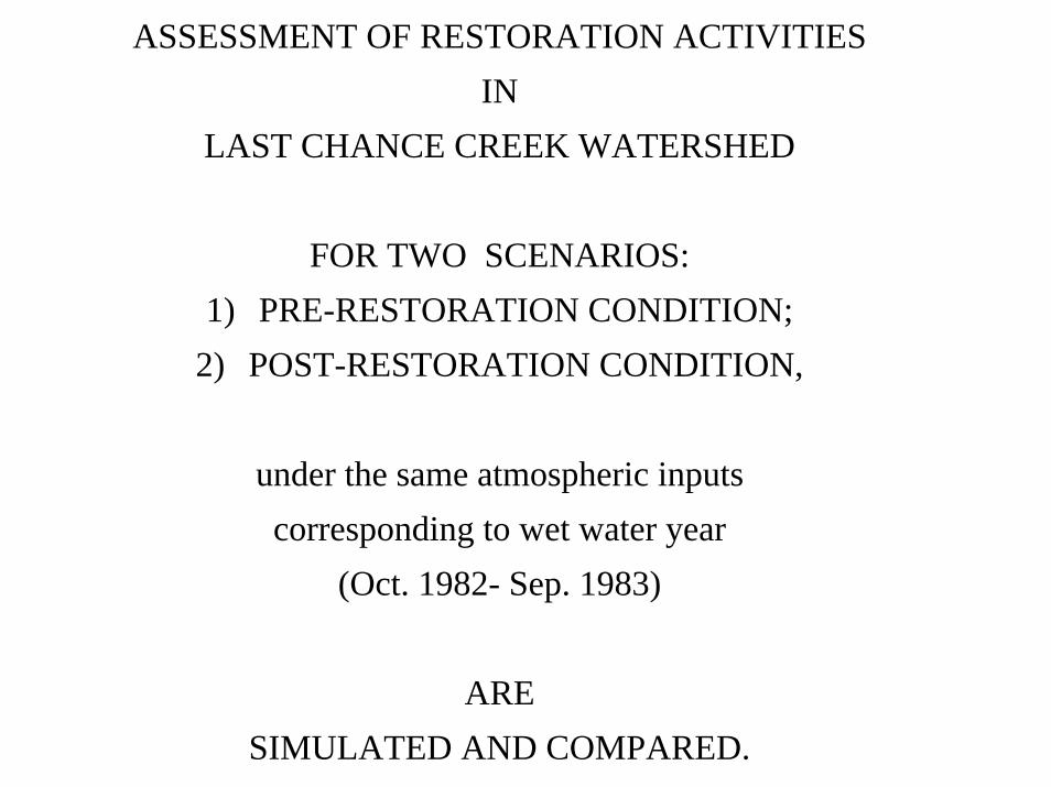
ASSESSMENT OF RESTORATION ACTIVITIES IN
LAST CHANCE CREEK WATERSHED
FOR TWO SCENARIOS:1) PRE-RESTORATION CONDITION;
2) POST-RESTORATION CONDITION,
under the same atmospheric inputs corresponding to wet water year
(Oct. 1982- Sep. 1983)
ARE SIMULATED AND COMPARED.

Annual flow at Pulga, Feather River North Fork1912 - 2001
0
1
2
3
4
5
6
1910 1920 1930 1940 1950 1960 1970 1980 1990 2000
Mill
ions
Year
Ann
ual f
low
(AF)
‘95‘83
‘77
‘92‘88

Comparison of flow discharge at Doyle Crossing between the pre-restoration and post-
restoration conditions (Oct.1982 - Sep.1983)
0.0
10.0
20.0
30.0
40.0
50.0
10/1
10/3
0
11/2
9
12/2
9
1/28
2/27
3/29
4/28
5/28
6/27
7/27
8/26
9/25
Date (1982-83)
disc
harg
e (c
ms)
Pre-restorationPost-restoration

Comparison of monthly flow at Doyle Crossing between pre-restoration and post-restoration
conditions (Oct. 1982 - Sep. 1983)
0
5000
10000
15000
20000
25000
30000
Oct Nov Dec Jan Feb Mar Apr May Jun Jul Aug SepMonth
flow
(acr
e-ft)
Pre-restorationPost-restoration

Assessment of restoration activities:Monthly Flow at the Doyle Crossing (Oct.1982-Sep.1983)
32.7% reduction of flow in March (wet month) may be expected, and85.8% increase of flow in September (dry month) may be expected because of the restoration.

Comparison of monthly mean groundwater storage between the pre-restoration and post-restoration conditions
(Oct.1982 - Sep.1983)
232
233
234
235
236
237
238
239
Oct Nov Dec Jan Feb Mar Apr May Jun Jul Aug Sep
Thou
sand
s
Month (1982-83)
Gro
undw
ater
sto
rage
(ac-
ft)
Pre-restoration Post-restoration

CHANNEL EROSION/DEPOSITION
RILL INTERRILL INTERRILL RILLFLOW AREA FLOW AREA FLOW FLOW
EROSION IN INTERRILL
AREA
EROSION /DEPOSITIONIN RILLS
EROSION IN INTERRILL AREA

Comparison of sediment load at Doyle Crossing between the pre-restoration and post-
restoration conditions (Oct.1982 - Sep.1983 )
0.0
5.0
10.0
15.0
20.0
25.0
30.0
35.0
40.0
10/1
10/3
011
/29
12/2
9
1/28
2/27
3/29
4/28
5/28
6/27
7/27
8/26
9/25
Date (1982-83)
sedi
men
t loa
d (k
g/s)
Pre-restorationPost-restoration

Comparison of monthly sediment load at Doyle Crossing between the pre-restoration and post-restoration conditions
(Oct.1982 - Sep.1983)
0
500
1000
1500
2000
2500
3000
Oct Nov Dec Jan Feb Mar Apr May Jun Jul Aug SepMonth
sedi
men
t loa
d (t/
mon
)
Pre-restorationPost-restoration

Assessment of restoration activities:Monthly Sediment load at the Doyle Crossing (Oct.82-Sep.83)
17.5% reduction of annual sediment discharge may be expected because of the restoration.
Pre-restoration (t)
Post-restoration (t)
absolute diff (t)
relative diff (%)
Oct 0.2 0.2 0.0 -0.59Nov 2.1 2.1 0.0 -2.02Dec 53.7 53.0 -0.7 -1.37Jan 85.6 73.2 -12.4 -14.45Feb 585.3 442.0 -143.3 -24.49Mar 2687.2 2186.4 -500.8 -18.64Apr 489.1 406.2 -82.9 -16.94May 199.5 191.1 -8.4 -4.19Jun 48.9 55.6 6.7 13.62Jul 7.2 11.4 4.3 59.24Aug 11.8 15.3 3.5 29.74Sep 2.7 6.2 3.5 133.46
Annual 4173.3 3442.8 -730.5 -17.50

Conclusions
1. WEHY (Watershed Environmental Hydrology) Model has been applied to the Last Chance Creek Watershed for the Assessment of the Impact of Restoration Activities on the Water Supply/Flood Control/NPS Pollutant Discharge;
2. WEHY Model demonstrated that restoration activities in Last Chance Creek will store more water during wet periods (reducing flood discharge) while increasing base flows during dry periods; groundwater storage in the watershed will increase by the restoration activities;

3. WEHY Model also demonstrated that the undertaken restoration activities will reduce the sediment discharge from Last Chance Creek watershed.
4. WEHY Model can be applied to any watershed in California for the assessment of restoration activities.
Acknowledgement:This study was funded by CALFED Watershed Program.