Embed Size (px)
Citation preview

95
Appendix A Chilko Lake Protected Area Intent and Management Principles
96
Intent and Management Principles (as prescribed by the Chilko Lake Study Team) General Intent This proposed Chilko Lake Protected Area contains important ecological systems, wildlife populations, Aboriginal cultural sites, recreation opportunities, special natural features and outstanding scenery. Of primary management significance to the area is the continued ability to support traditional activities in it while maintaining the integrity of its biodiversity and wilderness values. the roadless, remote character of the area should be linked with traditional activities, and managed within a formal protected area. Management Principles · To manage the area as a protected area according to the intent established by the Chilko Lake
Study Team and as described by the activity matrix. · To protect and manage the natural values and recreation and tourism opportunities of this area in
recognition of their significance to the whole province. Activities and levels of use that are compatible with wilderness setting and protection of ecological values will be permitted.
· To honour current or traditional activities in this area, as indicated in the activity matrix. · To recognize the special spiritual and cultural significance of the Chilko Lake area, particularly
Mount Tatlow (Ts'il?os ), to the Nemiah Valley Indian Band (Xeni Gwet'in), and to work with the Band in developing a management plan for the area.
· To develop a protected area management plan based on the activity matrix. · To involve affected interests directly in the development and implementation of a protected area
management plan through creation of a Local Advisory Group.

97
Appendix B Chilko Lake Protected Area Activity Matrix

98
Chilko Lake Protected Area Activity Matrix (as prescribed by the Chilko Lake Study Team)
Activity List Permitted1 Restricted2 Not
Permitted Explanation/Rational for Restrictions or Special Management Requirements
Aboriginal Uses _ Traditional Aboriginal activities for sustenance, medicinal and spiritual purposes are self-regulated by Nemiah Valley Indian Band (Xeni Gwet'in).
Fish and Wildlife habitat and population enhancement
_ Habitat enhancement should reflect biodiversity conservation objectives.
Fishing _ Subject to existing regulations.
Hunting _ Subject to existing regulations; possible requirement of limited entry areas and guide quotas to be specified in the management plan.
Big game guiding _ Permitted under normal guidelines. See "Hunting" and "Fishing".
Trapping _ Existing trapping activity to continue; governed by normal regulations.
Non-mechanical recreation
_ Restrictions to be specified in the management plan for ecologically or culturally sensitive areas. Climbing restricted on Mt. Tatlow in recognition of Aboriginal spiritual significance. Helicopter access to be specified under management plan.
Primitive camping _ No permanent structures; temporary camps for licensed users.
Non-serviced camping _ Management guidelines to be developed as part of the protected area management plan.
Serviced camping _ Limited in size and number and located at logical entry points to the protected area.
Horseback riding (non-commercial)
_ Under guidelines developed in the protected area management plan, including grazing requirements.
Trail development and use
_ Plan recreational trail development during management planning phase; consider restricted areas for some types of trail use (e.g., mountain bikes, horses, hikers, snowmobiles).
Off road vehicle activity _ Off-road vehicle use may be permitted for licensed activities (e.g., trapline access, access to property by leaseholders). ATV use for hunting should not be permitted. Management plan to address extent to which off-road vehicle use should be permitted.
1 Permitted activities are allowed under normal management guidelines and regulations.
2Restricted activities may be compatible under certain circumstances and stricter-than-normal management guidelines. Most of these restrictions will be defined in the detailed management planning phase for the protected area. Restrictions do not extend to the rights of the Nemiah Valley Indian Band.

99
Cultivation _ Not compatible with protection of natural systems.
Livestock grazing
_ By permit in designated areas only, with minimal competition with wildlife. Grazing of stock by guide outfitters and recreational guides as part of business activities based on available forage and biodiversity conservation objectives. Grazing use priorities to be determined as part of the protected area management plan; pre-existing tenures to be honoured.
Mineral exploration and development
_ Fair and timely compensation negotiated for displaced claims. No future exploration or claim staking. Non-motorized land access permitted to existing claims through the protected area.
Timber harvesting _ Commercial logging activities incompatible with remote roadless backcountry objectives.
Heli-skiing; heli-hiking _ May be permitted in specified areas under management plan, and under special guidelines under license.
Helicopter access
_ Access may be controlled by permit in areas specified by management plan to protect specific features and the experience of other users.
Fixed-wing access _ Overflights and landings may be controlled in specific craft areas (e.g., some small lakes).
Motor boats _ Managed under federal regulations.
Fire management _ Initial attack on all wildfires, unless otherwise specified in fire management plan for the protected area.
Pest management _ While the intent is to control pest infestations, management practices will be reviewed in advance by local management team.
Scientific study _ Non-destructive research.
Recreation Leaseholds _ No further granting of residential or recreational leases. Honour existing tenures; permit transfer to immediate family.
Commercial Development
_ No permanent structures. Trail development for guide outfitters.
Utility corridors _ Not compatible with roadless backcountry and protection of natural systems.
Industrial development _ Not compatible with roadless remote backcountry objectives.

100
Appendix C Declaration of the Nemiah Aboriginal Wilderness Preserve

101
DECLARATION of the NEMIAH ABORIGINAL WILDERNESS PRESERVE Let it be known as of August 23, 1989. We, the Tsilqot'in people of Xeni, known as the Nemiah Valley Indian Band, declare that the lands shown on the map attached, which form part of our traditional territory, are, and shall henceforth be known as: Nemiah Aboriginal Wilderness Preserve. Let it be known that within the Nemiah Aboriginal Wilderness Preserve:
1. There shall be no commercial logging. Only local cutting of trees for our own needs. ie. firewood, housing, fencing, native uses, etc...
2. There shall be no mining or mining explorations. 3. There shall be no commercial road building. 4. All terrain vehicles and skidoos shall only be permitted for trapping purposes. 5. There shall be no flooding or dam construction on Chilko, Taseko, and Tatlayoko Lakes. 6. This is the spiritual and economic homeland of our people. We will continue in perpetuity: a) To have and exercise our traditional rights of hunting, fishing, trapping, gathering and
natural resources. b) To carry on our traditional ranching way of life. c) To practise our traditional native medicine, religion, sacred and spiritual ways. 7. That we are prepared to SHARE our Nemiah Aboriginal Wilderness Preserve with non-natives
in the following ways: a) With our permission visitors may come and view and photograph our beautiful land. b) We will issues permits, subject to our conservation rules, for hunting and fishing within our
Preserve. c) The respectful use of our Preserve by canoeists, hikers, light campers, and other visitors is
encouraged, subject to our system of permits. 8. We are prepared to enforce and defend our Aboriginal rights in any way we are able.

102
Appendix D Ts'il?os Gwa Najegwaghaten Terms of Reference

103
Terms of Reference for
Implementation of the Memorandum of Understanding between
TS’ILHQOT’IN PEOPLE OF XENI and
BC PARKS
OBJECTIVE To develop a working relationship between the Xeni Gwet’in and BC Parks to:
• implement the Memorandum of Understanding which lead to the creation of Ts'il?os Provincial Park;
• coordinate and direct input into the Master Plan for the park; • implement the Master Plan.
BACKGROUND Ts'il?os Provincial Park was dedicated on January 13, 1994 when the Premier of British Columbia, Mike Harcourt, accepted the Chilko Lake Study Team recommendations and announced the creation of the Park. The Chilko Lake Study Team was established in 1991, lead by BC Parks, the Ministry of Energy, Mines and Petroleum Resources and the Xeni Gwet’in to develop land use recommendations over the area know as Chilko Lake Deferred Planning Area. At the same time as the park was announced, a memorandum of understanding (Attachment 1) was signed by the Government of British Columbia and the TŜilhqot’in Xeni. The memorandum provides assurances to the Xeni Gwet’in that their rights and interests shall receive consideration in the planning and management of the area. The relationship between Xeni Gwet’in and BC Parks will be strengthened through the development of a joint vision incorporating both societies’ values in the planning and management of this area. Currently, a master plan for the park is being developed by the Ts'il?os Subcommittee of the Local Advisory Group. The subcommittee includes representatives from BC Parks, the Xeni Gwet’in, tenure holders, and other local residents and interested parties. RELATIONSHIP TO LOCAL ADVISORY GROUP Ts'il?os Gwa Nejegwaghaten (Management Board) discusses issues of particular significance to the Xeni Gwet’in. Issues of larger public concern in the planning and management of the park re discussed with the Local Advisory Group, or subcommittee thereof.

104
Ts'il?os GWA NEJEGWAGHATEN To enable the implementation of the Memorandum of Understanding, a committee of BC Parks and Xeni Gwet’in representatives has been established. This committee is known as Ts'il?os Gwa Nejegwaghaten, which means ‘people working together for Ts'il?os ’. Membership Ts'il?os Gwa Nejegwaghaten consists of BC Parks and Xeni Gwet’in representatives and includes the Chief, Councillors and park liaison person for the Xeni Gwet’in, and the District Manager, the park manager and the planner for BC Parks. Purpose The purpose of Ts'il?os Gwa Nejegwaghaten is to discuss issues of mutual concern. Matters to be addressed will also include, but not be limited to, the following: 1. implementing the specific commitment outlined in Appendix B of the Memorandum of
Understanding, which includes:
• the identification of traditional activities and interests within the park including, but not restricted to, grazing, trapping, hunting, fishing and food gathering;
• the exercise of any identified traditional activities;
• employment opportunities for members of the Xeni Gwet’in within the park.
2. coordinating and directing input into the Master Planning process, through:
• identification of sites of special spiritual-cultural significant to the Xeni Gwet’in, including historic habitation and burial sites and management of these sites;
• development of a master Plan or other appropriate management plans, in consultation with the
Local Advisory Group and the public; 3. implementing the Master Plan which includes:
• review and evaluation of Park Use Permits applications and existing tenures (such as leaseholds, grazing, trapping, guide outfitting). See Attachment 2 for proposed permit referral process:

105
• development of annual management plans (AMPs) setting out the work to be done and how it is to be accomplished, including staffing requirements and budgets pertaining to the planning, operation and management of the park;
• selection and evaluation of staff and consultants (see Attachment 3 for proposed process); • review and evaluation of all research projects, publications, cultural and interpretation
communications. Meetings Ts'il?os Gwa Nejegwaghaten will meet quarterly, or as mutually convenient, in Williams Lake or in a Chilcotin location as decided upon by Ts'il?os Gwa Nejegwaghaten. Meeting Notes Discussions at meetings will be recorded in meeting notes. These are not intended to be a transcript but will summarize general topics discussed, recommendations and justification, tasks to be accomplished prior to next session, assignment of task responsibility and agenda items. Agenda Agenda will be developed from the meeting notes and from items raised by members of the Ts'il?os Gwa Nejegwaghaten. Decision Making Ts'il?os Gwa Nejegwaghaten will strive in a constructive and co-operative manner to achieve a consensus decision of the members. Where there is a dispute, the two parties may agree to obtain the services of a mediator or third party. BC Parks and Xeni Gwet’in (Xeni people will make their own decisions if dispute cannot be solved by a mediator or third party). Review Xeni Gwet’in and BC Parks are committed to work together in a spirit of cooperation, respect and friendship and to develop a long-term working relationship. Either party may suggest changes to improve and or enhance this relationship. Substantive changes to the terms of reference require thirty days written notice, for discussion purposes. If disagreement of changes occurs, dispute resolution will be pursued.

106

107
Attachment 1
See Appendix F

108
Attachment 2
PERMIT REFERRAL SYSTEM
A. Permits approved in the Chilko Lake Study Team Report (approval of existing operations)
1. BC Parks to inform the Xeni Gwet’in of permits to be issued. 2. Park Manager and Park Liaison Person to discuss and develop permit conditions. 3. Ts'il?os Gwa Nejegwaghaten to review and evaluate permits and meet with permittees, as needed. It is recognized by Ts'il?os Gwa Nejegwaghaten that extraordinary meetings may be required to meet with the permittees. B. Permits not covered under the Chilko Lake Study Team Report 1. Park Manager and Park Liaison Person to assess the new application as to compliance with Master
Plan and its appropriateness as an activity in a wilderness park. 2. Park Manager and Park Liaison Person to discuss and develop permit conditions, as needed. 3. Ts'il?os Gwa Nejegwaghaten review and evaluate permit and meet with permittees.

109
Attachment 3
HIRING AND MANAGEMENT OF PARK RANGERS AND CONTRACTORS Representatives of Ts'il?os Gwa Nejegwaghaten will work together to determine the requirements for ranger staff and contractors. A. Ranger Staff (BC Parks employees) In the selection of ranger staff, representatives of Ts'il?os Gwa Nejegwaghaten will:
− recruit potential candidates − short list, interview and select candidates − jointly develop work plan
BC Parks will consult with Xeni chief and Council on employee evaluation and disciplinary issues for Xeni Gwet’in members employed or under contract with BC Parks. B. Contractors Representatives of Ts'il?os Gwa Nejegwaghaten will work together to:
− develop calls for proposals − evaluate proposals and select successful contractor
Ts'il?os Gwa Nejegwaghaten will be kept informed on the performance of the contractor through updates in regular meetings.

110
Appendix E BC Parks System Goals
111
BC Parks System Goals In the Park Act, BC Parks must: · conserve significant and representative natural and cultural resources · provide a wide variety of outdoor recreation opportunities. Conservation Within the conservation mandate, BC Parks has two goals: Goal 1 Protection of Representative Landscapes - To conserve British Columbia's natural diversity
by protecting viable, representative examples of our different landscapes. Goal 2 Protection of Special Features - To protect British Columbia's key natural and cultural
features, including outstanding examples of our wildlife, old-growth forests, waterfalls and cultural artifacts.
Recreation Within the recreation mandate, BC Parks has four goals: Goal 1 Tourism Travel Routes - To provide park attractions and services which enhance tourism
travel routes. Goal 2 Outdoor Recreation Holiday Destinations - To provide park attractions which serve as or
improve key destinations for outdoor recreation holidays. Goal 3 Backcountry - To provide outstanding backcountry recreation opportunities throughout the
province. Some sites may feature adventure tourism, while in other areas the wilderness would remain untouched.
Goal 4 Local Recreation - To ensure access to local outdoor recreation opportunities for all
residents of this province.

112
Appendix F Memorandum of Understanding between Xeni Gwet'in and Government of British Columbia

113
Memorandum of Understanding
Between: The Nemiah Valley Indian Band (TŜilhqot’in People of Xeni) (hereinafter referred to as TŜilhqot’in People of Xeni) and Her Majesty The Queen In Right Of The Province Of British Columbia (hereinafter referred to as “British Columbia”) Whereas British Columbia and the TŜilhqot’in People of Xeni wish to create a Provincial Park (hereinafter referred to as the “Park”) to protect in perpetuity the natural environment of the area known to First Nations people as TŜilhqot’in Ts'il?os Gwenti’in Nen and known to non-natives as Chilko Lake; And Whereas the TŜilhqot’in People of Xeni and British Columbia recognize the wilderness character of the Chilko Lake area; And Whereas the TŜilhqot’in People of Xeni assert that the Chilko Lake area is of spiritual, cultural and economic significance to them; And Whereas the purpose of British Columbia in establishing the Park is to protect in perpetuity the natural environment and resources of the Park for the use and enjoyment of all British Columbians, including those of the TŜilhqot’in People of Xeni; And Whereas the TŜilhqot’in People of Xeni and British Columbia share a common concern to protect the unique characteristics of the Chilko Lake area; It Is Therefore Agreed by the parties to use the following principles to guide development of the cooperative working relationship in the establishment of the Park, namely;

114
1. ESTABLISHMENT OF PARK
1.1 British Columbia shall, subject to the Lieutenant Governor-in-Council providing the appropriate Order-in-Council pursuant to section 5 of the Park Act (1979 R.S.B.C. c.309) establish the area described in Appendix A as Ts'il?os Park.
1.2 The establishment of the Park is without prejudice to any aboriginal rights and title that
the TŜilhqot’in People of Xeni may have. 2. PURPOSE
2.1 The purpose of British Columbia and the TŜilhqot’in People of Xeni in drafting this
memorandum is to be consistent with the recommendations of the Chilko Lake Study Team June 1993 Final Report, in relation to Zone 1 only.
3. MANAGEMENT OF PARK 3.1 Subject to any aboriginal rights that the TŜilhqot’in People of Xeni may have, the
management and administration of the Park shall be done under the auspices and authority of the Park Act and accompanying regulations.
3.2 Subject to conservation, British Columbia will endeavour to manage the resources of the
Park in a manner consistent with the interests of the TŜilhqot’in People of Xeni including those as written in Appendix B of this memorandum.
4. MUTUAL COMMITMENT 4.1 The parties will work together in the spirit of cooperation, respect and friendship, and
welcome the opportunity to do so. 4.2 The parties will work together in the spirit of cooperation, respect and friendship, and
welcome the opportunity to do so. 4.3 In matters pertaining to the Park, British Columbia and the TŜilhqot’in People of Xeni
will address issues of mutual interest in a manner consistent with a government-to-government relationship.
4.4 The parties will work together to address funding issues as they arise. Financing for the
implementation of any specific project or activity stemming from this agreement may be negotiated by the parties. Where appropriate, British Columbia will assist the TŜilhqot’in People of Xeni in securing resources from other parties for specific projects.
In witness whereof the parties hereto have executed this Memorandum of Understanding this 13th day of January 1994.

115

116

117
118

119

120
Appendix G Zoning in BC Parks

121
Intensive Recreation Natural Environment OBJECTIVE To provide for a variety of
readily accessible, facility-oriented outdoor recreation opportunities.
To protect scenic values and to provide for backcountry recreation opportunities in a largely undisturbed natural environment.
USE LEVEL Relatively high density and long
duration types of use. Relatively low use but higher levels in association with nodes of activity or access.
MEANS OF ACCESS All-weather public roads or
other types of access where use levels are high (see "Impacts" below).
Mechanized (power-boats, snowmobiles, all-terrain vehicles), non-mechanized (foot, horse, canoe, bicycle). Aircraft and motorboat access to drop-off and pickup points will be permitted.
LOCATION Contiguous with all-weather
roads and covering immediate areas, modified landscapes or other high-use areas.
Removed from all-weather roads but easily accessible on a day-use basis. Accessible by mechanized means such as boat or plane.
SIZE OF ZONE Small; usually less than 2,000
ha. Can range from small to large.
BOUNDARY DEFINITION Includes areas of high facility
development in concentrated areas.
Boundaries should consider limits of activity/facility areas relative to ecosystem characteristics and features.
RECREATION OPPORTUNITIES
Vehicle camping, picnicking, beach activities, power-boating, canoeing, kayaking, strolling, historic and nature appreciation, fishing, snow play, downhill and cross-country skiing, snowshoeing, specialized activities.
Walk-in/boat-in camping, power-boating, hunting, canoeing, kayaking, backpacking, historic and nature appreciation, fishing, cross-country skiing, snowmobiling, river rafting, horseback riding, heli-skiing, heli-hiking, and specialized activities.

122
Special Feature Wilderness Recreation Wilderness Conservation
To protect and present significant natural or cultural resources, features or processes because of their special character, fragility and heritage values.
To protect a remote, undisturbed natural landscape and to provide backcountry recreation opportunities dependent on a pristine environment where air access may be permitted to designated sites.
To protect a remote, undisturbed natural landscape and to provide unassisted backcountry recreation opportunities dependent on a pristine environment where no motorized activities will be allowed.
Generally low. Very low use, to provide solitary
experiences and a wilderness atmosphere. Use may be controlled to protect the environment.
Very low use, to provide solitary experiences and a wilderness atmosphere. Use may be controlled to protect the environment.
Various; may require special access permit.
Non-mechanized; except may permit low frequency air access to designated sites; foot, canoe (horses may be permitted).
Non-mechanized (no air access); foot, canoe (horses may be permitted).
Determined by location of special resources; may be surrounded by or next to any of the other zones.
Remote; generally not visited on a day-use basis.
Remote; not easily visited on a day-use basis.
Small; usually less than 2000 hectares.
Large; greater than 5,000 ha. Large; greater than 5,000 ha.
Area defined by biophysical characteristics or the nature and extent of cultural resources (adequate to afford protection).
Defined by ecosystem limits and geographic features. Boundaries will encompass areas of visitor interest for specific activities supported by air access. Will be designated under the Park Act.
Defined by ecosystem limits and geographic features. Will be designated under the Park Act.
Sight-seeing, historic and nature appreciation. May be subject to temporary closures or permanently restricted access.
Backpacking, canoeing, kayaking, river rafting, nature and historic appreciation, hunting, fishing, cross-country skiing, snowshoeing, horseback riding, specialized activities (e.g. caving, climbing).
Backpacking, canoeing, kayaking, river rafting, nature and historic appreciation, fishing, cross-country skiing, snowshoeing, horseback riding, specialized activities (e.g. caving, climbing).

123
Intensive Recreation Natural Environment FACILITIES May be intensely developed for
user convenience. Campgrounds, landscaped picnic/play areas, trail, accommodation or interpretive buildings, boat launches; administrative buildings, service campgrounds, gravel pits, disposal sites, wood lots, parking lots, etc.
Moderately developed for user convenience. Trails, walk-in/boat-in campsites, shelters; accommodation buildings may be permitted; facilities for motorized access, e.g. docks, landing strips, fuel storage, etc.
IMPACTS ON NATURAL ENVIRONMENT
Includes natural resource features and phenomena in a primarily natural state but where human presence may be readily visible both through the existence of recreation facilities and of people using the zone. Includes areas of high facility development with significant impact on concentrated areas.
Area where human presence on the land is not normally visible, facility development limited to relatively small areas. Facilities are visually compatible with natural setting.
MANAGEMENT GUIDELINES
Oriented toward maintaining a high quality recreation experience. Intensive management of resource and/or control of visitor activities. Operational facilities designed for efficient operation while remaining unobtrusive to the park visitor.
Oriented to maintaining a natural environment and to providing a high quality recreation experience. Visitor access may be restricted to preserve the recreation experience or to limit impacts. Separation of less compatible recreational activities and transportation modes. Designation of transportation may be necessary to avoid potential conflicts (e.g. horse trails, cycle paths, hiking trails).
EXAMPLES OF ZONING Campground in Rathtrevor
Beach Park; Gibson Pass ski areas in E.C. Manning Park.
Core area in Cathedral Park; North beach in Naikoon Park.

124
Special Feature Wilderness Recreation Wilderness Conservation
Interpretive facilities only, resources are to be protected.
Minimal facility development. Limited development for user convenience and safety, and protection of the environment, e.g. trails, primitive campsites, etc. Some basic facilities at access nodes, e.g. dock, primitive shelter, etc.
None.
None; resources to be maintained unimpaired.
Natural area generally free of evidence of modern human beings. Evidence of human presence is confined to specific facility sites. Facilities are visually compatible with natural setting.
Natural area generally free of evidence of modern human beings.
High level of management protection with ongoing monitoring. Oriented to maintaining resources and, where appropriate, a high quality recreational and interpretive experience. Active or passive management depending on size, location, and nature of the resource. Visitor access may be restricted to preserve the recreation experience and to limit impacts.
Oriented to protecting a pristine environment. Management actions are minimal and not evident. Managed to ensure low visitor use levels. Visitor access may be restricted to protect the natural environment and visitor experience.
Oriented to protecting a pristine environment. Management actions are minimal and not evident. Managed to ensure low visitor use levels. Visitor access may be restricted to protect the natural environment and visitor experience.
Tidepools in Botanical Beach Park; Sunshine Meadows in Mount Assiniboine Park.
Quanchus Mountains Wilderness in Tweedsmuir Park; Wilderness Zone in Spatsizi Park.
Central Valhallas Wilderness in Valhalla Park; Garibaldi Park Nature Conservancy area.

125
Appendix H Management Units

126
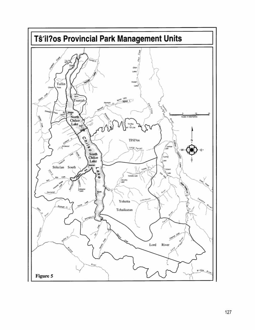
Introduction This section provides a description of the values, states key considerations based on geographic units, known as management units, and characterizes the management actions specific to that management unit. These management units serve to break up the larger zones into more manageable sizes. In defining a management unit, the Subcommittee looked at the values located there and the access to those values. These tables reflect the more detailed discussion that occurred amongst the Subcommittee as they were developing the plan. Some specific management directions were agreed to for certain management units and are recorded in these tables. Ts'il?os Provincial Park is divided into eight units: Tullin, Tsuniah, Ts'il?os; Yohetta/Tchaikazan; Lord River; Stikelan South; South Chilko Lake; North Chilko Lake (Figure 5).
127

128
Ts'il?os Unit Description · includes northern portion of the park south of the Nemiah Valley and
includes Mount Ts'il?os Long Valley. · a small portion zoned Special Feature, around Mount Ts'il?os in
recognition of its cultural and spiritual significance. · remainder of Ts'il?os Unit is zoned Wilderness Recreation, in
recognition of its natural values, remote backcountry recreation opportunities, and wilderness qualities.
· occupies approximately 15% of the park or 34,000 ha.
Ecosystem Descriptors
· contains Biogeoclimatic zones of Alpine Tundra, Engelmann Spruce - Subalpine Fir, Montane Spruce, Interior Douglas Fir.
· Ts'il?os area is a glaciated, rugged mountain ridge of more than 3000 metres with extensive dry alpine plant communities; deeply-incised gullies; alpine tarns.
· Long Valley is a heavily-wooded, high-elevation valley with high-elevation (1,645 metres) wetlands.
· wildlife that occurs here includes: goat, sheep, mule deer, grizzly bear, black bear, moose, wolverine, wolf, marmot, lynx, martin, fisher, cougar, beaver.
· fish species that occur in this unit include Dolly Varden (bull trout). · wetlands, including sedge fens and marshes draining to Chilko and
Taseko Lakes.
Cultural Descriptors · food gathering sites · graveyards · Ts'il?os
Outdoor Recreation Features
Rolling alpine ridges,Ts'il?os , Dolly Lakes, Long Valley.
Access No road in unit, access by routes on foot or on horse; by water in boat. No helicopter landing will be permitted in this unit in respect to the spirituality of the area to the Nemiah.
Key Considerations -Conservation
Dolly Lake; dry alpine plant communities; meadows
Key Considerations -Cultural
Ts'il?os ; traditional use sites; grave sites.
Key Recreation Activities
Hiking, horse riding, guide outfitting, hunting, fishing, skiing, wildlife viewing, photography, nature study.
Other considerations Guide outfitters; grazing tenures; recreation guides.
Conservation Management Prescriptions
· A bear management plan will be developed in collaboration with BC Environment to address potential bear and visitor conflicts.
· Bighorn sheep will be monitored closely to ensure a healthy population.
· Red and blue listed species will be monitored with BC Environment. Species plans for wildlife and fish will be developed where needed to

129
address population levels, habitat and harvest.
· All alpine lakes will be maintained in natural state. Barren lakes will not be stocked.
Cultural Management Prescriptions
· An inventory and assessment of cultural resources will conducted in collaboration with Xeni Gwet'in. Management strategies for identified heritage sites will be developed.
· The climbing of peaks of Ts'il?os is not allowed. Education and interpretation for hikers and climbers is required.
Recreation Management Prescriptions
· Education and information will be provided to park visitors on the significance of Ts'il?os and to respect the Xeni Gwet'in's wishes not to climb the mountain.
· Mountain biking is not allowed in this unit.
· No campgrounds will be developed in this unit, but basic facilities may be provided to protect the environment.
· Trails will be user-maintained. BC Parks will assist in trail maintenance problems.
· Backcountry conditions will be assessed and use monitored to protect the natural values. If impacts increase, Local Advisory Group will be consulted for application of appropriate management options.
· Horse use will be monitored and regulated as necessary to protect the environment. Information on established horse use and travel will be prepared to minimize conflict between users. A forage assessment will be undertaken in frequently used areas.
· Backcountry conditions will be assessed and use monitored to protect natural values. A backcountry management plan will set limits of use using indicators of acceptable impacts.
Other Management Prescriptions
· Commercial helicopter access is not allowed except for emergencies. There are no designated landing sites in consideration of spiritual nature of the area.
· Fixed-wing access has no landing sites identified in this Unit, and therefore, is not allowed.
· Only licensed activities will be permitted to have snowmobile and ATV access. All other activities are prohibited.
· Existing guide outfitters, angle guides and trappers guides will be authorized by park use permit. BC Parks will work with BC Environment for any changes with angle guides and guide outfitters.
· Pre-existing historical backcountry recreation operators will be authorized by park use permit. Optimal number of user-days will be determined before issuing new permits. Quotas may be set for commercial guides and a limit set on public when monitoring shows the carrying capacity is close to being exceeded.
· Existing grazing permits will be managed by the Forest Service. BC Parks will work with the Forest Service to ensure that range

130
management plans are prepared, that livestock grazing is managed and monitored so that grazing and grassland communities are sustainable and damage is minimized. Grazing activity will not be expanded from the June 1991 allotted animal unit months.

131
Yohetta Tchaikazan Unit
Description · includes the central portion of the park east of Chilko Lake and encompasses the Yohetta Valley, Tchaikazan Valley, Mt. Goddard, Spectrum Pass.
· zoned Wilderness Recreation in recognition of its high recreation values in a remote backcountry setting and key conservation values.
· occupies approximately 20% of the park or 45,000 ha.
Ecosystem Descriptors · contains Biogeoclimatic zones of Alpine Tundra, Engelmann Spruce - Subalpine Fir, Montane Spruce, Interior Douglas Fir.
· wildlife that occurs here includes: goat, sheep, grizzly bear, mule deer, wolverine, martin, fisher, cougar, wolf, coyote.
· Tchaikazan - granitic peaks, glaciated valley, large and small glaciers, eroded peaks, broad outwash valley with braided river, fens, long alpine ridges, high passes, moraines.
· Yohetta - lakes and wetlands, east-west valley, mountainous ridges, aspen groves.
Cultural Descriptors · food gathering, hunting and fishing sites · grave sites · trapper's cabin
Outdoor Recreation Features
Tchaikazan Valley, Yohetta Valley, Yohetta Lake, Dorothy Lake, Rainbow Lake, alpine passes, glaciers.
Access Roadless, relatively easy access by routes on foot or on horse from the Lord River Mining Road, from Chilko Lake via the Rainbow Creek trail. This area is also accessed by float plane, or by helicopter.
Key Considerations -Conservation
Wetlands; Harlequin duck nesting habitat; alpine plant communities; sheep population, habitat and migration routes; grizzly population and habitat; mule deer population, habitat and migration routes; falcons; high-elevation grasslands; lamb rearing areas.
Key Considerations -Cultural
Traditional use sites; grave sites.
Key Recreation Activities
Hiking, climbing, horse riding, guide outfitting, hunting, fishing, wildlife viewing, photography, ski touring, snowshoeing.
Other considerations Guide outfitters; grazing tenures; recreation guides; residential leases; trapping; helicopters.
Conservation Management Prescriptions
· A bear management plan will be developed in collaboration with BC Environment to address potential bear and visitor conflicts.
· Bighorn sheep will be monitored closely to ensure a healthy population.
· Red and blue listed species will be monitored with BC Environment. Species plans for wildlife and fish will be developed where needed to address population levels, habitat and harvest.
· All alpine lakes will be maintained in natural state. Barren lakes will
132
not be stocked.
· The park's limited wetlands will be protected to maintain the natural environment and the diverse bird populations.
Cultural Management Prescriptions
· An inventory and assessment of cultural resources will conducted in collaboration with Xeni Gwet'in. Management strategies for identified heritage sites will be developed.
Recreation Management Prescriptions
· The Yohetta and Tchaikazan loop trail and trails to Rainbow Lake and Rainbow cabin will be maintained by BC Parks as primitive trails or routes. The rest of the trails will be user-maintained. BC Parks will assist in trail maintenance problems.
· Mountain biking is permitted in Yohetta as far as the west end of Yohetta Lake (Olson's cabin). Horses and hikers have priority.
· Motor boats are not allowed, given the backcountry setting. Long-term residential leaseholders will be given permit to operate motorboats for transportation only.
· Campgrounds will not be developed in this unit, but basic facilities may be provided to protect the environment.
· Horse use will be monitored and regulated as necessary to protect the environment. Information on established horse use and travel will be prepared to minimize conflict between users. A forage assessment will be undertaken in frequently used areas.
· Backcountry conditions will be assessed and use monitored to protect the natural values. A backcountry management plan will set limits of use using indicators of acceptable impacts. If impacts increase, Local Advisory Group will be consulted for application of appropriate management options.
Other Management Prescriptions
· BC Parks will maintain close contact with the Local Advisory Group in the management of the Taseko Management Zone to ensure the resource development plans address aesthetics, recreation, conservation and wilderness values.
· Helicopter access and heli-assisted hiking may occur on a limited basis, taking into account wildlife and recreation values.
· Existing guide outfitters, angle guides and trappers will be authorized by park use permit. BC Parks will work with BC Environment for any changes with angle guides and guide outfitters.
· Only licensed activities will be permitted snowmobile and ATV access. All other activities are prohibited.
· Pre-existing historical backcountry recreation operators will be authorized by park use permit. Optimal number of user-days will be determined before issuing new permits. Quotas may be set for commercial guides and a limit set on public when monitoring shows the carrying capacity is close to being exceeded.
· Existing recreation and residential leases will be honoured as leases or park use permits. Leases and permits can be transferred to the immediate family. BC Parks will purchase improvements where

133
agreed to by both parties.
· Residential and recreational lease and permit holders can continue to access their cabins through usual means.
· Existing grazing permits will be managed by the Forest Service. BC Parks will work with the Forest Service to ensure that range management plans are prepared, that livestock grazing is managed and monitored so that grazing and grassland communities are sustainable and damage is minimized. Grazing activity will not be expanded from the June 1991 allotted animal unit months.

134
Lord River Unit
Description · is the most remote part of the park in the south east corner. It includes Lord River, various peaks and glaciers.
· zoned Wilderness Recreation, in recognition of its natural values, backcountry recreation opportunities, and wilderness qualities.
· occupies approximately 13% of the park or 31,000 ha.
Ecosystem Descriptors · contains Biogeoclimatic zones of Alpine Tundra, Engelmann Spruce - Subalpine Fir.
· wildlife that occurs here includes: goats, moose, bear, mule deer. · steep-sided glacial valleys, rugged granitic peaks, large glaciers,
moraine flats, slide paths, and large, swift glacial streams.
Cultural Descriptors · hunting areas · gathering sites · possible archeological and grave sites
Outdoor Recreation Features
Lord River, glaciers, mountains.
Access Relatively difficult access; accessible by foot, canoe and helicopter.
Key Considerations -Conservation
Wetlands, alpine areas.
Key Considerations -Cultural
Traditional use sites
Key Recreation Activities
Hiking, horse riding, guide outfitting, hunting, fishing, ski touring.
Other considerations Guide outfitters; recreation guides; helicopters.
Conservation Management Prescriptions
· A bear management plan will be developed in collaboration with BC Environment to address potential bear and visitor conflicts.
· Red and blue listed species will be monitored with BC Environment. Species plans for wildlife and fish will be developed where needed to address population levels, habitat and harvest.
· All alpine lakes will be maintained in natural state. Barren lakes will not be stocked.
· The park's limited wetlands will be protected to maintain the natural environment and the diverse bird populations.
Cultural Management Prescriptions
· An inventory and assessment of cultural resources will conducted in collaboration with Xeni Gwet'in. Management strategies for identified heritage sites will be developed.
Recreation Management Prescriptions
· Small hiking groups are preferred in this unit. Information will be provided to hiking groups regarding the physical and social impacts of large groups in wilderness zones.

135
Description · is the most remote part of the park in the south east corner. It includes Lord River, various peaks and glaciers.
· zoned Wilderness Recreation, in recognition of its natural values, backcountry recreation opportunities, and wilderness qualities.
· occupies approximately 13% of the park or 31,000 ha.
Ecosystem Descriptors · contains Biogeoclimatic zones of Alpine Tundra, Engelmann Spruce - Subalpine Fir.
· wildlife that occurs here includes: goats, moose, bear, mule deer. · steep-sided glacial valleys, rugged granitic peaks, large glaciers,
moraine flats, slide paths, and large, swift glacial streams.
Cultural Descriptors · hunting areas · gathering sites · possible archeological and grave sites
Outdoor Recreation Features
Lord River, glaciers, mountains.
· Trails will be user-maintained. BC Parks will assist in trail maintenance problems.
· Mountain biking is not allowed in this area.
· Backcountry conditions will be assessed and use monitored to protect the natural values. A backcountry management plan will set limits of use using indicators of acceptable impacts. If impacts increase, Local Advisory Group will be consulted for application of appropriate management options.
· Horse use will be monitored and regulated as necessary to protect the environment. Information on established horse use and travel will be prepared to minimize conflict between users. A forage assessment will be undertaken in frequently used areas.
· Motor boats are not allowed for this unit.
Other Management Prescriptions
· Only licensed activities will be permitted snowmobile and ATV access. All other activities are prohibited.
· Helicopter access and heli-assisted hiking may occur on a limited basis, taking into account sensitive wildlife, recreation, and cultural or spiritual areas.
· Existing guide outfitters, angle guides and trappers will be authorized by park use permit. BC Parks will work with BC Environment for any changes with angle guides and guide outfitters.
· Pre-existing historical backcountry recreation operators will be authorized by park use permit. Optimal number of user-days will be determined before issuing new permits . Quotas may be set for commercial guides and a limit set on public when monitoring shows the carrying capacity is close to being exceeded.

136
Stikelan South Unit
Description · includes the southwest corner of the park, the west side of Edmond Creek, Franklyn Arm, the Capital Group.
· zoned Wilderness Recreation, in recognition of its natural values, backcountry recreation opportunities, and wilderness qualities.
· occupies approximately 36% of the park or 85,000 ha.
Ecosystem Descriptors · contains Biogeoclimatic zones of Alpine Tundra, Engelmann Spruce - Subalpine Fir, Montane Spruce, Interior Douglas Fir, coastal Western Hemlock.
· wildlife that occurs here includes: goats, grizzly bear, moose. · extensive glaciation, exposed granitics, high-elevation lakes,
rugged talus slopes, limited alpine meadows, steep subalpine slopes.
Cultural Descriptors · Grease trading trail to Bute Inlet from the end of Franklyn Arm. · hunting areas.
Outdoor Recreation Features
Glaciated peaks, Girdwood and Glasgow Lakes, alpine lakes and meadows.
Access Access by routes on foot or on horse; by boat.
Key Considerations -Conservation
Marmot colonies, salt licks.
Key Considerations -Cultural
Traditional gathering and hunting areas.
Key Recreation Activities
Hiking, horse riding, guide outfitting, hunting, mountaineering.
Other considerations Guide outfitters; recreation guides; residential lease; trapping cabins; helicopters
Conservation Management Prescriptions
· A bear management plan will be developed in collaboration with BC Environment to address potential bear and visitor conflicts.
· Red and blue listed species will be monitored with BC Environment. Species plans for wildlife and fish will be developed where needed to address population levels, habitat and harvest.
· All alpine lakes will be maintained in natural state. Barren lakes will not be stocked.
· The park's limited wetlands will be protected to maintain the natural environment and the diverse bird populations.

137
Cultural Management Prescriptions
· An inventory and assessment of cultural resources will conducted in collaboration with Xeni Gwet'in. Management strategies for identified heritage sites will be developed.
Recreation Management Prescriptions
· Trails will be user-maintained. BC Parks will assist in trail maintenance problems.
· Mountain biking is not allowed in this area.
· Horse use will be monitored and regulated as necessary to protect the environment. Information on established horse use and travel will be prepared to minimize conflict between users. A forage assessment will be undertaken in frequently used areas.
· Backcountry conditions will be assess and use monitored to protect the natural values and the desired maximum level of visitors. A backcountry management plan will set limits of use using indicators of acceptable impacts. If impacts increase, Local Advisory Group will be consulted for application of appropriate management options.
· Sensitive alpine areas, such as Glasgow and Girdwood Lakes, will be assessed and monitored to ensure the ecological integrity of the area.
Other Management Prescriptions
· Only licensed activities will be permitted snowmobile and ATV access. All other activities are prohibited.
· Existing guide outfitters, angle guides and trappers will be authorized by park use permit. BC Parks will work with BC Environment for any changes with angle guides and guide outfitters.
· Pre-existing historical backcountry recreation operators will be authorized by park use permit. Optimal number of user-days will be determined before issuing new permits. Quotas may be set for commercial guides and a limit set on public when monitoring shows the carrying capacity is close to being exceeded.
· Helicopter access and heli-assisted hiking may occur on a limited basis, taking into account sensitive wildlife, recreation, and cultural or spiritual areas.
· Existing recreation and residential leases will be honoured as leases or park use permits. Leases and permits can be transferred to the immediate family. BC Parks will purchase improvements where agreed to by both parties.
· Residential and recreational lease and permit holders can continue to access their cabins through usual means.

138
Tullin Unit
Description · includes the most northwest portion of the park, located west of the north end of Chilko Lake and encompasses the Tullin Mountain Trail.
· zoned primarily Wilderness Recreation, in recognition of its natural values, backcountry recreation opportunities, and wilderness qualities.
· a small portion (surrounding the trail up Tullin Mountain) zoned Natural Environment. This provides a transition from the North Chilko Intensive Recreation Zone to the Tullin Wilderness Recreation Zone.
· occupies approximately 5% of the park or 12,000 ha.
Ecosystem Descriptors · contains Biogeoclimatic zones of Alpine Tundra, Engelmann Spruce - Subalpine Fir, Montane Spruce, Interior Douglas Fir.
· wildlife that occurs here includes: grizzly bear, black bear, mule deer, moose, goats.
Cultural Descriptors · gathering areas · hunting areas
Outdoor Recreation Features
Alpine ridges, Green Lake, viewscapes.
Access Gravel road from Tatla Lake leads into park at North End campsite, access by routes on foot or on horse; by water in boat; and by helicopter.
Key Considerations -Conservation
Alpine areas
Key Considerations -Cultural
Traditional use sites
Key Recreation Activities
Hiking, horse riding, guide outfitting, hunting, fishing,
Other considerations Guide outfitters; grazing tenures; recreation guides; helicopters.
Conservation Management Prescriptions
· A bear management plan will be developed in collaboration with BC Environment to address potential bear and visitor conflicts.
· Red and blue listed species will be monitored with BC Environment. Species plans for wildlife and fish will be developed where needed to address population levels, habitat and harvest.
· All alpine lakes will be maintained in natural state. Barren lakes will not be stocked.
Cultural Management Prescriptions
· An inventory and assessment of cultural resources will conducted in collaboration with Xeni Gwet'in. Management strategies for identified heritage sites will be developed.

139
Recreation Management Prescriptions
· The Tullin Trail will be maintained to a primitive standard; maintenance problems will be addressed. All other trails will be user-maintained. BC Parks will assist in trail maintenance problems.
· Education and informational materials will be developed and distributed to avoid conflicts between bears and people.
· Existing levels of use of paragliding is permitted. This activity will be assessed and monitored and may be restricted if becomes an aviation or safety hazard, or has a negative impact on wildlife (e.g. falcons).
· Mountain biking is allowed on roads. Information on etiquette and behaviour around horses will be prepared.
· Motor boats are not allowed on Green Lake.
· Backcountry conditions will be assess and use monitored to protect the natural values. If impacts increase, Local Advisory Group will be consulted for application of appropriate management options.
· Horse use will be monitored and regulated as necessary to protect the environment. Information on established horse use and travel will be prepared to minimize conflict between users. A forage assessment will be undertaken in frequently used areas.
Other Management Prescriptions
· Only licensed activities will be permitted snowmobile and ATV access. All other activities are prohibited.
· Helicopter access and heli-assisted hiking may occur on a limited basis, taking into account sensitive wildlife, recreation, and cultural or spiritual areas.
· Existing guide outfitters, angle guides and trappers will be authorized by park use permit. BC Parks will work with BC Environment for any changes with angle guides and guide outfitters.
· Pre-existing historical backcountry recreation operators will be authorized by park use permit. Optimal number of user-days will be determined before issuing new permits . Quotas may be set for commercial guides and a limit set on public when monitoring shows the carrying capacity is close to being exceeded.
· Existing grazing permits will be managed by the Forest Service. BC Parks will work with the Forest Service to ensure that range management plans are prepared, that livestock grazing is managed and monitored so that grazing and grassland communities are sustainable and damage is minimized. Grazing activity will not be expanded from the June 1991 allotted animal unit months.
· BC Parks will work with the BC Forest Service, BC Environment and forest companies in the development of forest management guidelines for areas adjacent to the park.

140
Tsuniah Unit
Description · includes the most northeastern part of the park, east of Chilko Lake. · protects viewscape from the North End campsite, and east side of the
lake. · zoned primarily Wilderness Recreation, in recognition of its natural
values, backcountry recreation opportunities, and wilderness qualities. · a small portion (the Tsuniah Lake Road) zoned Natural Environment. · occupies approximately 3% of the park or 7,000 ha.
Ecosystem Descriptors · contains Biogeoclimatic zones of Alpine Tundra, Engelmann Spruce - Subalpine Fir, Montane Spruce, Interior Douglas Fir.
· wildlife that occurs here includes: goats, sheep, mule deer, moose, black bear, grizzly bear.
Cultural Descriptors · campsites · medicinal gathering sites
Outdoor Recreation Features
Alpine ridges, Douglas-fir stands.
Access Rough road bisects the unit, additional access by foot or horse.
Key Considerations -Conservation
Little Lagoon, old-growth forests, alpine areas, sheep range and migratory routes, Tsuniah Creek.
Key Considerations -Cultural
Traditional use sites
Key Recreation Activities
Hiking, horse riding, guide outfitting, hunting.
Other considerations Guide outfitters; grazing tenures; recreation guides; residential leases; trapline.
Conservation Management Prescriptions
· A bear management plan will be developed in collaboration with BC Environment to address potential bear and visitor conflicts.
· Red and blue listed species will be monitored with BC Environment. Species plans for wildlife and fish will be developed where needed to address population levels, habitat and harvest.
· All alpine lakes will be maintained in natural state. Barren lakes will not be stocked.
· Sensitive areas, such as old-growth forests and Little Lagoon, will be assessed and monitored to ensure that use does not impact the ecological integrity of the area.
· Douglas-fir stands require fire management plan.

141
Cultural Management Prescriptions
· An inventory and assessment of cultural resources will conducted in collaboration with Xeni Gwet'in. Management strategies for identified heritage sites will be developed.
Recreation Management Prescriptions
· Trails will be user-maintained. BC Parks will assist in trail maintenance problems.
· Backcountry conditions will be assessed and use monitored to protect the natural values. If impacts increase, Local Advisory Group will be consulted for application of appropriate management options.
· Horse use will be monitored and regulated as necessary to protect the environment. Information on established horse use and travel will be prepared to minimize conflict between users. A forage assessment will be undertaken in frequently used areas.
· Mountain biking is allowed on existing roads.
· No vehicular camping is allowed along Tsuniah Lake Road; day use only. Assess conditions and monitor site degradation and disposal of human wastes; if the impact is noticeable, refer to Local Advisory Group for appropriate management options.
· Day use areas will be monitored for garbage and human wastes disposal. If impacts are noticeable, seek advice from Local Advisory Group on appropriate management options.
Other Management Prescriptions
· Only licensed activities will be permitted snowmobile and ATV access. All other activities are prohibited.
· Existing guide outfitters, angle guides and trappers will be authorized by park use permit. BC Parks will work with BC Environment for any changes with angle guides and guide outfitters.
· Pre-existing historical backcountry recreation operators will be authorized by park use permit. Optimal number of user-days will be determined before issuing new permits . Quotas may be set for commercial guides and a limit set on public when monitoring shows the carrying capacity is close to being exceeded.
· Backcountry conditions will be assessed and use monitored to develop baseline data with which to assess the desired maximum level of visitors. A backcountry management plan will set limits of use using indicators of acceptable impacts.
· Management of Department of Fisheries and Oceans' spawning channel is required to address off-road vehicle activity.

142
· BC Parks will work with the Gwa Najegwaghaten, local residents and Local Advisory Group to establish levels of maintenance to keep the road in a rough but passable condition. If and when an alternative to the Tsuniah Lake Road is developed, investigate opportunities to limit access to the Tsuniah Lake Road. Work with government agencies, such as Ministry of Transportation and Highways and Ministry of Forests, and the Xeni Gwet'in to maintain roads approaching the park in a manner which is consistent with wilderness aspects of the park. New roads should not be considered.
· Helicopter access and heli-assisted hiking may occur on a limited basis, taking into account sensitive wildlife, recreation, and cultural or spiritual areas.
· Existing recreation and residential leases will be honoured as leases or park use permits. Leases and permits can be transferred to the immediate family. BC Parks will purchase improvements where agreed to by both parties.
· Residential and recreational lease and permit holders can continue to access their cabins through usual means.
· Existing grazing permits will be managed by the Forest Service. BC Parks will work with the Forest Service to ensure that range management plans are prepared, that livestock grazing is managed and monitored so that grazing and grassland communities are sustainable and damage is minimized. Grazing activity will not be expanded from the June 1991 allotted animal unit months.
· Work with the BC Forest Service, BC Environment and forest companies in the development of forest management guidelines for areas adjacent to the park.

143
North Chilko Lake Unit Description · includes the lake from the outlet to the Chilko River to just south of the
Nemiah Valley campsite (or Movie Site) and Duff Island. Includes both campsites, the shoreline and the area accessed by water.
· small areas (Big Lagoon and The Point) zoned as Special Features in recognition of conservation values.
· smaller portions in the immediate vicinity of the campsites zoned Intensive Recreation, to provide a camping destination.
· lake zoned Natural Environment in recognition that the use of motor boats for safety reasons may preclude a sense of a wilderness recreation opportunity at times.
· shoreline zoned Wilderness Recreation in recognition of natural and conservation values, backcountry recreation opportunities and wilderness qualities.
· occupies approximately 3% of the park or 7,000 ha.
Ecosystem Descriptors · large high-elevation nutrient-deficient lake · deep and cold with lake stratifying in mid to late summer · rapid flushing rates · tributaries · riparian areas · lagoons · spawning beaches and streams · wildlife that occurs here: grizzly bears, black bears, moose, mule deer. · fish that occur here: bull trout, rainbow trout, kokanee salmon, whitefish,
sockeye salmon.
Cultural Descriptors · food gathering areas · hunting areas · campsites
Outdoor Recreation Features
Chilko Lake, Big Lagoon, Duff Island, mountain scenery.
Access Gravel roads at both North End campsite and Movie site; formal boat launch at the North End campsite and informal launch for small boats at the Movie site.
Key Considerations -Conservation
Big Lagoon; salmon spawning and rearing.
Key Considerations -Cultural
Traditional use sites; camping areas.
Key Recreation Activities
Boating, fishing, kayaking, canoeing, day hiking, destination camping, backcountry staging area.
Other considerations Recreation guides
Conservation Management Prescriptions
· A bear management plan will be developed in collaboration with BC Environment to address potential bear and visitor conflicts.
· Red and blue listed species will be monitored with BC Environment. Species plans for wildlife and fish will be developed where needed to address population levels, habitat and harvest.
· Migratory fish habitat, particularly spawning beaches, will be protected and managed in cooperation with Department of Fisheries and Oceans.
144
· BC Parks will work with BC Environment and the Department of Fisheries and Oceans and operators to monitor and assess impact on fishing pressure to ensure natural fish populations are maintained.
· The fertilization program will be reviewed with Department of Fisheries and Oceans and BC Environment. Any continuation of the program will be discussed with the Xeni Gwet'in and the Local Advisory Group.
· An aquatic resources inventory plan will be developed in conjunction with Department of Fisheries and Oceans and BC Environment to gain a better understanding of resources, impacts of angling and harvesting, and implications for populations outside the park.
Cultural Management Prescriptions
· An inventory and assessment of cultural resources will conducted in collaboration with Xeni Gwet'in. Management strategies for identified heritage sites will be developed, particularly near campsites.
· Heritage impact assessments will be undertaken prior to any development, particularly near the campsites.
· The names of the campgrounds will be changed to reflect the natural and cultural history of the area, in consultation with the Xeni and the Local Advisory Group.
Recreation Management Prescriptions
· Horse use will be monitored and regulated as necessary to protect the environment. Information on established horse use and travel will be prepared to minimize conflict between users. A forage assessment will be undertaken in frequently used areas.
· Mountain biking is allowed on existing roads and designated trails. Assessment and monitoring may be required.
· Campsites and long-term parking will be redeveloped to maintain aesthetics and provide basic facilities; current level of camping and docking will be maintained. Development plan will be reviewed with Gwa Najegwaghaten and the Local Advisory Group.
· Motor-boating is allowed on Chilko Lake, but motor use on Big Lagoon and Little Lagoon is not allowed. On Big Lagoon, guide outfitters will be allowed to use motors to transport supplies. Consider restrictions on horsepower and type of motor to protect wildlife and for public safety.
· Level of use by motor boats will be monitored.
· Boat launching facilities at the North End will be maintained. Boats can be launched at the Movie Site, but facilities will not be developed.
· Houseboats will be monitored and levels of use established according to available campsites and moorage while considering other users such as power boaters, kayakers, and wilderness seekers. BC Parks will work with operator to ensure sewage disposal facilities meet provincial health regulations.
· Monitor visitor attendance and satisfaction to determine future development.
· To avoid bear-people conflicts, undertake preventative measures such as signing, evacuations or closures of the campsite(s) if bears are active in the area.
· Prepare and provide information on fishing regulations at the two campsites, the dangers of Chilko Lake, importance of Big Lagoon (Moose Lagoon) to prevent harassment of wildlife and damage to vegetation, boating etiquette and wilderness ethics, avoid conflicts between bears and people.

145
· Commercial rafting use will continue.
· Personal watercraft (e.g., Jet ski, Seadoo) use will be monitored. If boating regulations change to separate personal watercraft from other boats, BC Parks will pursue eliminating use of personal watercraft from park.
· Informal campsites used by boaters will be assessed and monitored for site degradation, human waste disposal and garbage. If impact is detected, the Local Advisory Group will be consulted for advice on appropriate management options that are consistent with wilderness character. Only minimal facility development will be undertaken when needed.
· No campgrounds will be developed in this unit, but basic facilities may be provided to protect the environment.
· Park facilities will be planned in consultation with the communities of North Chilko and Nemiah Valley so that facilities will be in keeping with the character of the area and blend with the natural setting.
Other Management Prescriptions
· Only licensed activities will be permitted snowmobile and ATV access. All other activities are prohibited.
· Existing guide outfitters, angle guides and trappers guides will be authorized by park use permit. BC Parks will work with BC Environment for any changes with angle guides and guide outfitters.
· Pre-existing historical backcountry recreation operators will be authorized by park use permit. Optimal number of user-days will be determined before issuing new permits . Quotas may be set for commercial guides and a limit set on public when monitoring shows the carrying capacity is close to being exceeded.
· Backcountry conditions will be assessed and use monitored to develop baseline data with which to assess the desired maximum level of visitors. A backcountry management plan will set limits of use using indicators of acceptable impacts.
· Helicopter access and heli-assisted hiking may occur on a limited basis. · Existing grazing permits will be managed by the Forest Service. BC Parks will
work with the Forest Service to ensure that range management plans are prepared, that livestock grazing is managed and monitored so that grazing and grassland communities are sustainable and damage is minimized. Grazing activity will not be expanded from the June 1991 allotted animal unit months.
146
South Chilko Lake Unit
Description · the most southerly extent of the lake. Includes the shoreline and the areas accessed by water.
· lake zoned Natural Environment in recognition of the need to use power boats, given the scale and danger of sudden winds.
· shoreline zoned Wilderness Recreation in recognition of natural and conservation values, backcountry recreation opportunities and wilderness qualities.
· occupies approximately 5% of the park or 12,000 ha.
Ecosystem Descriptors · large high-elevation nutrient-deficient lake · deep and cold with lake stratifying in mid to late summer · rapid flushing rates · tributaries · riparian areas · spawning beaches and streams · wildlife that occurs here: grizzly bears, black bears, moose, mule deer. · fish that occur here: bull trout, rainbow trout, kokanee salmon, sockeye
salmon, whitefish.
Cultural Descriptors · fishing and food gathering areas
Outdoor Recreation Features
Chilko Lake, Norrington Creek, Farrow Creek, Franklyn Arm, Bateman Island, Burnt Island, Capital Group, Edmond Creek, sandy beaches, mountain scenery, public cabin at Rainbow Creek.
Access Gravel roads at both North End campsite and Movie site; formal launching facilities at North End and informal launching for small boats at Movie site.
Key Considerations -Conservation
Salmon spawning beaches
Key Considerations -Cultural
Traditional use sites
Key Recreation Activities
Access to backcountry hiking, backpacking, and mountaineering, boating, fishing, kayaking, canoeing.
Other considerations Recreation guides, access to residential lease.
Conservation Management Prescriptions
· A bear management plan will be developed in collaboration with BC Environment to address potential bear and visitor conflicts.
· Red and blue listed species, such as bull trout, will be monitored with BC Environment. Species plans for wildlife and fish will be developed where needed to address population levels, habitat and harvest.
· Migratory fish habitat, particularly spawning beaches, will be protected and cooperatively managed with Department of Fisheries and Oceans,and BC Environment.
· The fertilization program will be assessed with Department of Fisheries and Oceans and BC Environment. Any continuation of the program will be discussed with the Xeni Gwet'in and the Local Advisory Group.
· An aquatic resources inventory plan will be developed in conjunction with Department of Fisheries and Oceans and BC Environment to gain a

147
better understanding of resources, impacts of angling and harvesting, and implications for populations outside the park.
Cultural Management Prescriptions
· An inventory and assessment of cultural resources will conducted in collaboration with Xeni Gwet'in. Management strategies for identified heritage sites will be developed.
Recreation Management Prescriptions
· Mountain biking is not allowed in this area.
· Trails will be user-maintained. BC Parks will assist in trail maintenance problems.
· Backcountry conditions will be assess and use monitored to protect the natural values. If impacts increase, Local Advisory Group will be consulted for application of appropriate management options.
· Horse use will be monitored and regulated as necessary to protect the environment. Information on established horse use and travel will be prepared to minimize conflict between users. A forage assessment will be undertaken in frequently used areas.
· Guidelines for public use of Rainbow Cabin will be developed.
· Levels of use by motor boats will be monitored.
· Information will be developed for the safety of canoeists and kayakers, boating etiquette and wilderness ethics.
· Houseboats will be monitored and levels of use established according to available campsites and moorage while considering other users such as power boaters, kayakers, and wilderness seekers. BC Parks will work with operators to ensure sewage disposal facilities meet provincial health regulations.
· Angling pressures will be assessed and monitored in conjunction with BC Environment and Department of Fisheries and Oceans to ensure natural fish populations are maintained.
· Personal watercraft (e.g., Jet ski, Seadoo) use will be monitored. If boating regulations change to separate personal watercraft from other boats, BC Parks will pursue eliminating use of personal watercraft from park.
· Informal campsites used by boaters will be assessed and monitored for site degradation, human waste disposal and garbage. If impact is detected, the Local Advisory Group will be consulted for advice on appropriate management options that are consistent with wilderness character. Only minimal facility development will be undertaken when needed.
· No campgrounds will be developed in this unit, but basic facilities may be provided to protect the environment.
· Only licensed activities will be permitted snowmobile and ATV access. All other activities are prohibited.
· Existing guide outfitters, angle guides and trappers will be authorized by park use permit. BC Parks will work with BC Environment for any changes with angle guides and guide outfitters.
· Pre-existing historical backcountry recreation operators will be

148
authorized by park use permit. Optimal number of user-days will be determined before issuing new permits . Quotas may be set for commercial guides and a limit set on public when monitoring shows the carrying capacity is close to being exceeded.
· Existing recreation and residential leases will be honoured as leases or park use permits. Leases and permits can be transferred to the immediate family. BC Parks will purchase improvements where agreed to by both parties.
· Residential and recreational lease and permit holders can continue to
access their cabins through usual means.

149
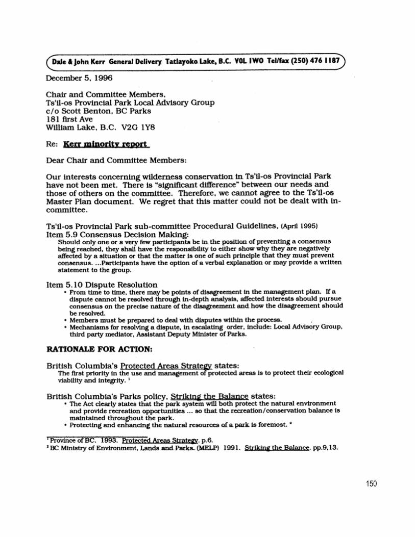
Appendix I Minority Report
150

151

152

153