Embed Size (px)
Citation preview

1
Proposed Revisions 12-8-17. Underlined parts are new, crossed out parts will be removed.
Acceptable Management Practices for Maintaining Water Quality on Logging Jobs in Vermont
SECTION 1: INTRODUCTION
The “Acceptable Management Practices for Maintaining Water Quality on Logging
Jobs in Vermont” (“AMPs”) were first adopted on August 15, 1987 under the
authority of Chapter 47 of Title 10 of the Vermont Statutes Annotated, Water
Pollution Control (10 V.S.A. §1251a and 1259(f)). See Code of Vermont Rules 12
020 010. The initial adopted rule provided that “the AMPs are the proper method
for the control and dispersal of water collecting on logging roads, skid trails and
log landings to minimize erosion and reduce sediment and temperature changes
in streams.”
Act No. 64 of the Acts of 2015 amended 10 V.S.A. §2622 to require the
Commissioner of the Department of Forests, Parks and Recreation to revise by rule
the AMPs. The purpose of the acceptable management practices is to provide
measures for loggers, foresters, and landowners to utilize, before, during, and after
logging operations to comply with the Vermont Water Quality Standards and
minimize the potential for a discharge from logging operations in Vermont in
accordance with 10 V.S.A. §1259.
Pursuant to Section 2-03B.1 of the Vermont Water Quality Standards, there is a
presumption that logging operations that are in compliance with the AMPs are also
in compliance with the Vermont Water Quality Standards. However, any
presumption provided by the Vermont Water Quality Standards shall be negated
when a water quality analysis conducted according to Section 2-01(g) of the
Vermont Water Quality Standards demonstrates that there is a violation of the
Vermont Water Quality Standards.
Additionally, logging operations that are in compliance with the AMPs are exempt
from the discharge permit requirements in accordance with 10 V.S.A. §1259(f), the
stream alteration permit requirements pursuant to 10 V.S.A §1021(f), the
stormwater permit requirements pursuant to 10 V.S.A. §1264(d)(1)(C), and wetland
permit requirements pursuant to 10 V.S.A. §913(a) and Sections 6.01 –
6.05 of the Vermont Wetland Rules. SECTION
2: POLICY AND PURPOSE
The purpose of the AMPs is to provide measures for loggers, foresters, and
landowners to utilize, before, during, and after logging operations to comply with

2
the Vermont Water Quality Standards and minimize the potential for a discharge
from logging operations in Vermont in accordance with 10 V.S.A. §1259.
SECTION 3: AUTHORITY
This rule is adopted pursuant to 10 V.S.A. §2622(a) and (b), 10 V.S.A. §1259(f), 3
V.S.A. §801(b)(11) and 3 V.S.A. §2853(5).
SECTION 4: APPLICABILITY
The AMPs apply to all logging operations on public and private lands in Vermont
regardless of the purpose of the logging. For example, logging may be conducted
for forest management purposes or logging may be conducted for the purpose of
clearing land for some other type of land use, such as commercial, residential or
utility development.
SECTION 5: DEFINITIONS
For the purposes of this Rule, the following terms shall have the specified meaning:
5.1 “Active Channel” means the limits of the streambed scour formed by prevailing stream discharges, measured perpendicular to streamflow. The active channel is narrower than the bankfull width (approximately 75%) and is defined by the break in bank slope and typically extends to the edge of permanent vegetation. 5.2 5.1 Agency” or “ANR” means the Vermont Agency of Natural Resources.
5.3 5.2 “AMP” or “Acceptable Management Practices for Maintaining Water
Quality on Logging Jobs in Vermont” means rules adopted under the authority
of 10 V.S.A. §2622(a) and (b), 10 V.S.A. §1259(f), 3 V.S.A. §801(b)(11) and 3
V.S.A. §2853(5).
5.4 5.3 “Approaches to Stream Crossings” means that length of a truck road or
skid trail associated with stream crossings that traverse through the forest buffer.
5.5 5.4 “At-Grade Ford” means a stream crossing on a truck road or, where no
appropriate alternative exists, a skid trail, that is constructed perpendicular to the
stream channel with approaches being properly stabilized with clean stone fill, and
there is no change in existing stream channel cross-section and bed elevation
except for minor bank grading at the point of the crossing.
5.6 5.5 “Broad-based Dip” means a drainage structure, usually used on truck
roads where grades are less than or equal to 8 percent, that diverts the surface
water runoff into a filter area.

3
5.7 5.6 “Brushed-in Crossing” means a temporary method of crossing
intermittent streams during logging operations when the ground is frozen.
Brushed-in crossings are constructed by placing logs in the bottom of the stream
channel, parallel to the stream channel, and then placing topwood (tree limbs and
branches) over the logs.
5.8 5.7 “Check Dam” means a small barrier constructed in a drainage structure, its
outlet or in a small gully or other watercourse to decrease the water flow velocity,
minimize channel scour and promote deposition of sediment. A check dam creates
a small sediment basin. Check dams may be constructed of hay bales or other
stable and semi-porous material.
5.9 5.8 “Continuous Forest Cover” means maintaining a minimum of 60 to
70 percent crown cover or B-level stocking as recommended in the U.S. Forest
Service silvicultural guides.
5.10 5.9 “Drainage Ditch” means a ditch constructed along a truck road, skid
trail or log landing to collect the surface water runoff and divert it into a filter area.
5.11 5.10 “Drainage Structure” means a device, structure or method that diverts
the surface water runoff from an impervious surface such as a truck road, skid trail
or log landing into a drainage ditch or filter area.
5.12 5.11 “Filter Area” means a vegetated area where surface water runoff is
diverted and dispersed so that sediment and other pollutants are trapped and
retained. A filter area can include or be within a forest buffer.
5.13 5.12 “Forest Buffer” means an area of forested land adjacent to streams
and other waters where forest management practices are modified to protect
water quality. The width of the forest buffer shall be in accordance with Table 4.
5.14 5.13 “Forest Canopy” means a layer or multiple layers of branches and
foliage at the top or crown of a forest’s trees.
5.15 5.14 “Gully Erosion” means a form of soil erosion where gullies of six
inches deep or more are created by surface water runoff.
5.16 5.15 “Hazardous Material” means any material determined by the
Secretary to have an unusually harmful effect on water quality if discharged to the
waters of the state. Hazardous substances associated with logging operations
include but are not limited to petroleum products, solvents and coolants.
5.17 5.16 “Intermittent Stream” means a stream with a well-defined
channel, evidence of sediment transport and which regularly experiences
periodic interruption of surface flow throughout its length.
4
5.18 5.17 “Log Landing” means a place where trees and logs are gathered and
sorted in or near the forest during a logging operation for further processing and
transport to a mill or log yard facility.
5.19 5.18 “Logging Equipment” means equipment, implements, accessories,
and contrivances used directly and principally in the cutting or removal of timber
or other solid wood forest products. Logging equipment also includes equipment
used to construct, maintain or install infrastructure necessary to and associated
with the logging operation.
5.20 5.19 “Logging Slash” means any residual tree material, whole or part,
including leaves, needles, bark, wood and root tissue, that is created as a result of
a logging operation.
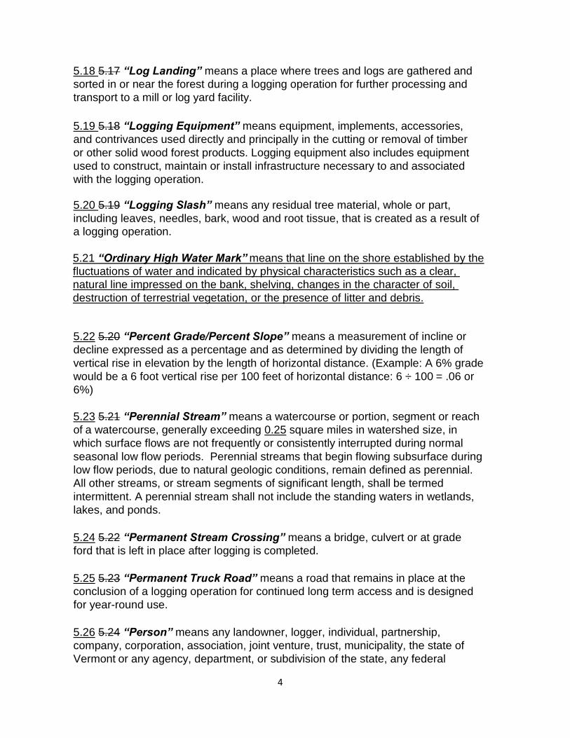
5.21 “Ordinary High Water Mark” means that line on the shore established by the
fluctuations of water and indicated by physical characteristics such as a clear,
natural line impressed on the bank, shelving, changes in the character of soil,
destruction of terrestrial vegetation, or the presence of litter and debris.
5.22 5.20 “Percent Grade/Percent Slope” means a measurement of incline or
decline expressed as a percentage and as determined by dividing the length of
vertical rise in elevation by the length of horizontal distance. (Example: A 6% grade
would be a 6 foot vertical rise per 100 feet of horizontal distance: 6 ÷ 100 = .06 or
6%)
5.23 5.21 “Perennial Stream” means a watercourse or portion, segment or reach
of a watercourse, generally exceeding 0.25 square miles in watershed size, in
which surface flows are not frequently or consistently interrupted during normal
seasonal low flow periods. Perennial streams that begin flowing subsurface during
low flow periods, due to natural geologic conditions, remain defined as perennial.
All other streams, or stream segments of significant length, shall be termed
intermittent. A perennial stream shall not include the standing waters in wetlands,
lakes, and ponds.
5.24 5.22 “Permanent Stream Crossing” means a bridge, culvert or at grade
ford that is left in place after logging is completed.
5.25 5.23 “Permanent Truck Road” means a road that remains in place at the
conclusion of a logging operation for continued long term access and is designed
for year-round use.
5.26 5.24 “Person” means any landowner, logger, individual, partnership,
company, corporation, association, joint venture, trust, municipality, the state of
Vermont or any agency, department, or subdivision of the state, any federal
5
agency, or any other legal or commercial entity.
5.27 5.25 “Pole Ford” means a temporary method of crossing intermittent
or perennial streams using logs placed in and parallel to the stream
channel.
5.28 5.26 “Rut” means a depression in the soils of the forest floor or
depressions in dirt roads or skid trails made from the passage of any vehicles or
logging equipment.
5.29 5.27 “Secretary” means the Secretary of the Agency of Natural
Resources or the Secretary’s authorized representative.
5.30 5.28 “Sediment” means soil that has been eroded from the land surface
and is transported and deposited in streams or waters.
5.31 5.29 “Silt Fence” means a temporary sediment control device used to intercept and filter the surface water runoff to protect water quality in nearby streams and other waters.
5.32 5.30“Skid Trail” means a cleared trail that is used by logging equipment
during a logging operation to transport harvested trees and logs to a log landing.
5.33 5.31 “Stream” means the full length and width, including the bed and banks,
of any watercourse, including rivers, streams, creeks, brooks, and branches, which
experience intermittent or perennial flow. “Stream” does not include ditches or other
constructed channels primarily associated with land drainage or water conveyance
through or around private or public infrastructure.
5.34 5.32 “Stream Channel” means an area that contains continuously or
periodic flowing water that is confined by banks and a streambed.
5.35 5.33 “Streambank” means the portion of a stream channel that restricts
lateral movement of water at normal water levels.
5.36 5.34 “Surface Water Runoff” means precipitation and snowmelt that does
not infiltrate into the soil, including material dissolved or suspended in it.
5.37 5.35 “Temporary Stream Crossing Structure” means a bridge, culvert,
pole ford or brushed-in crossing that is temporarily installed in or over a stream
channel. Temporary stream crossing structures shall be removed after logging is
completed as soon as ground conditions are stable or as specified in AMP 6.5.3, 6.5.4 and 6.6.1.
5.38 5.36 “Temporary Truck Road” means a minimum-standard road designed
6
for short-term use to access a logging operation. Temporary roads must be
closed out at the conclusion of logging.
5.39 5.37 “Top-of-bank” means the location up-slope from the scoured channel
of a stream, or shoreline of other waters, where an abrupt change of slope occurs.
5.40 5.38 “Truck Road” means a road that connects a log landing to a public
road system. A “truck road” may be designed, constructed and maintained to
provide either permanent or temporary access.
5.41 5.39 “Turn-up” means a method of construction of a downhill skid trail that
diverts the surface water runoff from ditches and road or trail surfaces into a filter
area by turning the skid trail up the hill a short distance then turning downhill again.
5.42 5.40 “Waterbar” means a type of drainage structure constructed across the
width of a skid trail or truck road that diverts the surface water runoff from ditches
and road or trail surfaces into a filter area.
5.43 5.41 “Waters” shall include all rivers, streams, creeks, brooks, reservoirs,
ponds, lakes, springs and all bodies of surface waters, artificial or natural, which
are contained within, flow through or border upon the state or any portion thereof.
means any natural body of open water other than a stream that is a water of the
state under 10 V.S.A. Chapter 47.
SECTION 6: ACCEPTABLE MANAGEMENT PRACTICES
6.1 Truck Roads – Practices to be Applied During Logging
6.1.1 Permanent and temporary truck roads shall not exceed 10 percent grade.
Where no reasonable alternative exists, steeper sections exceeding 10 percent
grade are allowed but shall not exceed 300 feet in length and shall be the
minimum number of sections, grades and lengths necessary due to physical
constraints, property boundaries and ground conditions.
6.1.2 Drainage structures on permanent and temporary truck roads shall be
correctly installed to divert the surface water runoff into road ditches or filter
areas. Drainage structures shall be spaced at intervals according to Table 1
where existing soil, rock, and ledge and roadbed conditions allow.
6.1.3 Water entering a permanent or temporary truck road shall be moved under
and away from the road and into a filter area. Culverts used for ditch drainage on
truck roads shall be at least 15 inches in diameter, correctly installed to divert ditch
water into a filter area and spaced according to Table 1 where existing soil, rock,
ledge and road bed conditions allow.

7
6.1.4 Drainage ditches along permanent and temporary truck roads shall not
terminate directly into streams or other waters. On approaches to stream crossings,
ditches shall be turned out into a filter area a minimum of 25 feet away from the top
of bank.
6.2 Truck Roads - Practices to be Applied Immediately After Logging
6.2.1 Waterbars on temporary truck roads shall be correctly installed to divert the
surface water runoff into a filter area and shall be spaced at intervals according to
Table 1 where existing soil, rock, ledge and road bed conditions allow.
6.3 Skid Trails - Practices to be Applied During Logging
6.3.1 Skid trails shall not exceed 20 percent grade. Where no reasonable
alternative exists, steeper sections exceeding 20 percent grade are allowed but
should not exceed 300 feet in length and shall be the minimum number of
sections, grades and lengths necessary due to physical constraints, property
boundaries and ground conditions.
6.3.2 Waterbars and turn-ups shall be correctly installed on skid trails to divert
the surface water runoff into a filter area and shall be spaced at intervals
according to Table 1 where existing soil, rock, ledge and skid trail conditions
allow.
6.4 Skid Trails - Practices to be Applied Immediately After Logging
6.4.1 Ruts on skid trails shall be smoothed where soils, slopes, or depth and
length of rutting, result in a likelihood of gully erosion, erosion or concentrated
flow of surface water. All ruts of any depth shall be smoothed on approaches to
stream crossings on skid trails within the forest buffer.
6.4.2 Waterbars on skid trails shall be correctly installed to divert the surface
water runoff into a filter area and shall be spaced at intervals according to Table 1
where existing soil, rock, ledge and skid trail conditions allow.
6.5 Stream Crossings on Truck Roads and Skid Trails – Practices to be
Applied During Logging
6.5.1 Streams and all waters shall be kept free of logging slash and logging
debris.
6.5.2 Stream crossings shall be made perpendicular to the stream channel
unless rock, ledge or other ground conditions prevent a perpendicular crossing
and no other feasible alternative crossing exists. Stream crossings shall be
located where the stream channel is narrow and well defined, the banks are
stable and approaches are 10 percent grade or less.

8
6.5.3 Temporary sStream crossings on truck roads shall be over a bridge, culvert
or by constructing an at-grade ford. Culvert diameter shall be according to Table
2A, and bridge structure opening shall be according to Table 2B. Temporary
bridges shall span the entire width of the stream channel. On truck roads,
streams may be crossed by using an at-grade ford only where streams have low
banks, stable beds (cobble or ledge) and stable, gradual approaches. Temporary
stream crossing structures on truck roads shall be removed after logging is
completed as soon as ground conditions are stable or within 18 months of
installation, whichever is sooner.
6.5.4 Temporary Stream crossings on skid trails shall be over a bridge, culvert or
pole ford. Brushed-in crossings are allowed but only as temporary crossings on
intermittent streams and only when the ground is frozen. On skid trails, streams
may be crossed by using an at-grade ford only where streambeds and approaches
to streams are cobble or ledge and only if no other alternative exists. Culvert
diameter shall be according to Table 2A, and bridge structure opening shall be
according to Table 2B. Temporary bridges shall span the entire width of the stream
channel. Pole fords are allowed on skid trails where the streambed is gravel,
cobble or ledge. Temporary stream crossings that are brushed-in or that use pole
fords shall be removed after logging is completed as soon as ground conditions
are stable or within 12 months of installation, whichever is sooner. Temporary
culverts or bridges shall be removed after logging is completed as soon as ground
conditions are stable or within 18 months of installation, whichever is sooner.
6.5.5 Permanent stream crossings on perennial streams shall be in compliance
with standards set forth in the Vermont Agency of Natural Resources Stream
Alteration Rule and General Permit. Environmental Protection Rule, Chapter 27,
Subchapter 5.
6.5.6 Logging equipment shall be kept out of stream channels, except as
necessary for the construction, maintenance, use, removal and stabilization of
stream crossing structures or the use of at-grade fords.
6.5.7 On approaches to stream crossings, waterbars, turn-ups or broad-based dips
shall be correctly installed on truck roads and skid trails to divert the surface water
runoff into a filter area. They shall be installed as close to 25 feet away from the
top of bank as existing soil, rock. ledge and ground conditions allow.
6.5.8 Except for the travelled portions of truck roads and skid trails, areas of
exposed soil within 50 feet of the stream channel as measured from the top of
bank shall be seeded and mulched, according to Table 3, immediately after
installing stream crossing structures.
9
6.6 Stream Crossings on Truck Roads and Skid Trails – Practices to be
Applied Immediately After Logging
6.6.1 All temporary structures on truck roads, and temporary bridges and culverts
on skid trails, shall be removed from streams and the channel restored to a stable
condition after logging is completed as soon as ground conditions are stable, or
within 18 months of installation, whichever is sooner. On skid trails, brushed-in
crossings and pole fords shall be removed after logging is completed, as soon as
ground conditions are stable or within 12 months of installation, whichever is
sooner.
6.6.2 After removing temporary stream crossing structures, waterbars shall be
correctly installed as close to 25 feet back from the top of bank as ground
conditions allow to divert the surface water runoff into a filter area. All areas of
exposed soil shall be seeded and mulched a minimum of 50 feet on each side of
the stream crossing. Seed and mulch at application rates according to Table 3
immediately after logging or as soon thereafter as ground conditions allow.
6.7 Forest Buffer
6.7.1 A forest buffer shall be left along streams and other waters in which only
partial cutting can occur such that openings in the forest canopy are minimal and
continuous forest cover is maintained. The width of the buffer shall be in
accordance with Table 4 as measured from the top of bank.
6.7.2 New truck roads, skid trails and log landings shall not be constructed within a
forest buffer, except for the necessary construction of stream crossings, unless
there is no feasible alternative due to existing soil, rock, ledge or other ground
conditions. Truck roads, skid trails and log landings that exist within the forest buffer
prior to the adoption of this rule, in whole or in part, may only be used if the truck
road, skid trail or log landing is stable and the AMPs have been implemented and
the road, trail or landing is unlikely to erode or contribute to discharge of sediment
to state waters.
6.7.3 Logging equipment shall not be driven within a 25-foot wide area along
streams or other waters, as measured from the top of bank except as necessary
for the construction, maintenance, use, removal and stabilization of stream
crossings.
6.8 Petroleum Products and Hazardous Materials
6.8.1 Petroleum products and other hazardous materials shall be stored only
outside of forest buffers and shall be removed immediately upon completion of
logging.

10
6.9 Log Landings - Practices to be Applied During Logging
6.9.1 Log landings shall not be constructed in a forest buffer except where no
feasible alternative exists due to existing soil, rock ledge or other ground
conditions. Log landings that exist within the forest buffer prior to the adoption of
this rule, in whole or in part, may only be used if the log landing is stable and the
AMPs have been implemented and the landing is unlikely to erode or contribute to
discharge of sediment to state waters.
6.9.2 Silt fencing, check dams and drainage structures shall be correctly installed
on log landings to prevent sediment from entering streams and other waters.
6.10 Log Landings - Practices to be Applied Immediately After Logging
6.10.1 Log landings shall be stabilized and drainage structures shall be correctly
installed to prevent sediment from entering streams and other waters.
6.11 Table 1: Distance (Feet) Between Drainage Structures on Truck Roads
and Skid Trails
Road Grade
(Percent
Slope)
Skid Trails
Truck Roads
Permanent Truck Roads
During and After Logging.
Temporary Truck Roads
During Logging.
Temporary
Truck Roads
After
Logging
During
Logging
(Waterbars
& Turn-Ups)
After
Logging
(Waterbars
and Turn-
Ups)
Broad-
Based Dips
Ditch Relief
Culverts
Waterbars
1 500 400 500 450 400
2 300 250 300 300 250
5 200 135 180 200 135
10 140 80 140 140 80
15 130 60 --- 130 60
20 120 45 --- 120 45
25 110 40 --- 65 40
30 100 35 --- 60 35
40 90 30 --- 50 30

11
6.12 Table 2: Minimum Culvert Sizing for Temporary Stream Crossings
Drainage Area
(Acres)
Minimum Size of Opening
Required
For Bridges and Culverts
(Square Feet)
Minimum Culvert
Diameter (Inches)
4*
0.6
(1.0 for drainage of ditches
on truck roads)*
12
(15 for drainage of ditches
on truck roads)*
8 1.0 15
15 1.5 18
20 1.9 18
40 3.2 24
50 3.8 30
80 5.3 36
100 6.3 36
150 8.6 42
200 10.6 48
250 12.6 48
300 14.4 54
350 16.2 60
450 19.5 60
550 22.7 66
640 25.4 72
*AMP 6.1.3 states that “Water entering a permanent or temporary truck road shall be
moved under and away from the road and into a filter area. Culverts used for ditch
drainage on truck roads shall be at least 15 inches in diameter, correctly installed to divert
ditch water into a filter area and spaced according to Table 1 where existing soil, rock,
ledge and road bed conditions allow.”

12
6.12 Table 2A: Minimum Culvert Sizing for Stream Crossings Choose the drainage area closest to your crossing site drainage area
Drainage Area
(Acres)
Minimum Diameter for
Temporary Culverts
<18 mos.
(in inches)
Minimum Diameter for
Permanent Culverts on
Intermittent Streams
>18 mos.
(in inches)
4 12 15
8 15 18
16 18 24
20 18 30
40 24 36
50 30 42
80 36 48
100 36 54
160 42 66
200 48 Streams with drainage areas of 160 acres or greater are likely to be perennial. Adhere to the VDEC
Technical Guidance for Identification of Perennial Streams
320 54
350 60
450 66
640 72
For Drainage Areas greater than 640 acres, a temporary bridge is required. See table 2B
*The minimum size for permanent culverts on intermittent streams shall be according to table 2A, or shall be sized to accommodate the active channel as observed at the crossing site.
AMP 6.5.5 states that “Permanent stream crossings on perennial streams shall be in compliance with standards set forth in the Vermont Agency of Natural Resources Stream Alteration Rule and General Permit. Environmental Protection Rule, Chapter 27, Subchapter 5.

13
6.13 Table 2B: Minimum Bridge Structure Opening for Stream Crossings Choose the drainage area closest to your site drainage area
Drainage Area Acres
Minimum Span Temporary B r i d g e s ( F E E T ) Distance between a b u t m e n t s
*Minimum Height Temporary B r i d g e s
Mimimum Span Permanent Bridges
(Feet) Distance between
abutments
Minimum Height Permanent Bridges
(Feet) From average streambed elevation to low chord of
superstructure
<100 6 OHW
OHW
O
6 2.5
160 7 OHW 7 2.75
200 8 OHW
Streams with drainage areas of 160
acres or greater are likely to be perennial. Adhere to the VDEC
Technical Guidance for Identification of Perennial Stream
640 acres = 1 square mile
** See Below
320 10 OHW
640 13 OHW
960 16 OHW
1,280 18 OHW
1,920 21 OHW
2,560 24 OHW
3,200 27 OHW
3,840 29 OHW
4,480 31 OHW
5,120 33 OHW
5,760 34 OHW
6,400 36 OHW
*Minimum Height- Low chord of superstructure at or above OHW (Ordinary High Water Mark).
**AMP 6.5.3 and 6.5.4 State that “Temporary Bridges shall span the entire width of the
stream channel.” The minimum span for bridges shall be according to table 2B, or shall
span the entire width of the stream channel as observed at the crossing site.

14
6.14 6.13 Table 3: Methods of Seeding and Mulching Truck
Roads, Log Landings, Skid Trails and Stream Crossings
Options Rate of Application Timing of Application
Option 1. Hay or Straw
Mulch with Annual
Ryegrass
60 bales/acre or 1 ½ bales/1,000 square feet
AND
Annual ryegrass at 40 lbs./acre
or 1 lb./1,000 square feet
Anytime
Option 2. Hay or Straw
Mulch with Winter Rye
60 bales/acre or 1 ½ bales/1,000 square feet
AND
Winter rye at 112 lbs./acre
or 2 ½ lbs./1,000 square
feet
Anytime
Option 3. Hay or Straw
Mulch with Soil
Conservation Seed Mix
60 bales/acre or 1 ½ bales/1,000 square feet
AND
Soil Conservation Seed Mix at
42 lbs./acre
or 1 lb./1,000 square feet
Anytime. Best when applied between April
15 – June 15 OR
August 1 – September
15
6.15 6.14 Table 4: Minimum Forest Buffer Widths
Percent Slope of Land Between Skid
Trails, Truck Roads or Log Landings
and Streams or Other Waters
Width from Top of Bank
(Feet Along Surface of Ground
Measured Perpendicular to the Stream
or Other Waters)
0-10 50
11-20 70
21-30 90
31-40* 110
*Add 20 feet for each additional 10 percent slope