Embed Size (px)
Citation preview

CLOVERDALEA history of
32
1829 – 1972 1974 – 2000
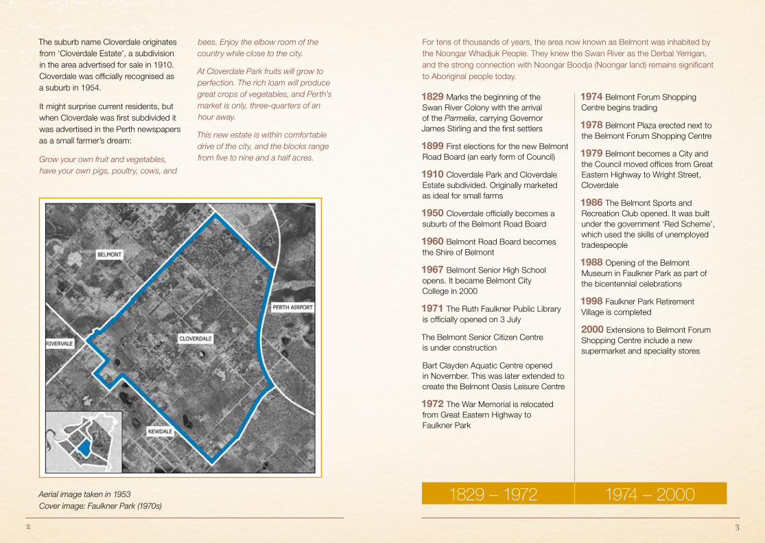
The suburb name Cloverdale originates from ‘Cloverdale Estate’, a subdivision in the area advertised for sale in 1910. Cloverdale was officially recognised as a suburb in 1954.
It might surprise current residents, but when Cloverdale was first subdivided it was advertised in the Perth newspapers as a small farmer’s dream:
Grow your own fruit and vegetables, have your own pigs, poultry, cows, and
bees. Enjoy the elbow room of the country while close to the city.
At Cloverdale Park fruits will grow to perfection. The rich loam will produce great crops of vegetables, and Perth’s market is only, three-quarters of an hour away.
This new estate is within comfortable drive of the city, and the blocks range from five to nine and a half acres.
For tens of thousands of years, the area now known as Belmont was inhabited by the Noongar Whadjuk People. They knew the Swan River as the Derbal Yerrigan, and the strong connection with Noongar Boodja (Noongar land) remains significant to Aboriginal people today.
1829 Marks the beginning of the Swan River Colony with the arrival of the Parmelia, carrying Governor James Stirling and the first settlers
1899 First elections for the new Belmont Road Board (an early form of Council)
1910 Cloverdale Park and Cloverdale Estate subdivided. Originally marketed as ideal for small farms
1950 Cloverdale officially becomes a suburb of the Belmont Road Board
1960 Belmont Road Board becomes the Shire of Belmont
1967 Belmont Senior High School opens. It became Belmont City College in 2000
1971 The Ruth Faulkner Public Library is officially opened on 3 July
The Belmont Senior Citizen Centre is under construction
Bart Clayden Aquatic Centre opened in November. This was later extended to create the Belmont Oasis Leisure Centre
1972 The War Memorial is relocated from Great Eastern Highway to Faulkner Park
1974 Belmont Forum Shopping Centre begins trading
1978 Belmont Plaza erected next to the Belmont Forum Shopping Centre
1979 Belmont becomes a City and the Council moved offices from Great Eastern Highway to Wright Street, Cloverdale
1986 The Belmont Sports and Recreation Club opened. It was built under the government ‘Red Scheme’, which used the skills of unemployed tradespeople
1988 Opening of the Belmont Museum in Faulkner Park as part of the bicentennial celebrations
1998 Faulkner Park Retirement Village is completed
2000 Extensions to Belmont Forum Shopping Centre include a new supermarket and speciality stores
Aerial image taken in 1953 Cover image: Faulkner Park (1970s)
54
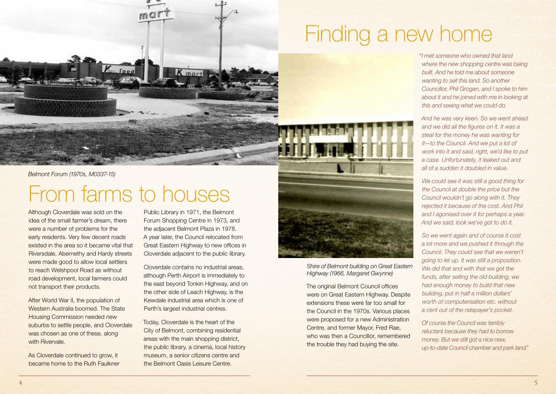
Shire of Belmont building on Great Eastern Highway (1966, Margaret Gwynne)
The original Belmont Council offices were on Great Eastern Highway. Despite extensions these were far too small for the Council in the 1970s. Various places were proposed for a new Administration Centre, and former Mayor, Fred Rae, who was then a Councillor, remembered the trouble they had buying the site.
“I met someone who owned that land where the new shopping centre was being built. And he told me about someone wanting to sell this land. So another Councillor, Phil Grogan, and I spoke to him about it and he joined with me in looking at this and seeing what we could do.
And he was very keen. So we went ahead and we did all the figures on it. It was a steal for the money he was wanting for it—to the Council. And we put a lot of work into it and said, right, we’d like to put a case. Unfortunately, it leaked out and all of a sudden it doubled in value.
We could see it was still a good thing for the Council at double the price but the Council wouldn’t go along with it. They rejected it because of the cost. And Phil and I agonised over it for perhaps a year. And we said, look we’ve got to do it.
So we went again and of course it cost a lot more and we pushed it through the Council. They could see that we weren’t going to let up. It was still a proposition. We did that and with that we got the funds, after selling the old building, we had enough money to build that new building, put in half a million dollars’ worth of computerisation etc. without a cent out of the ratepayer’s pocket.
Of course the Council was terribly reluctant because they had to borrow money. But we still got a nice new, up-to-date Council chamber and park land.”
From farms to houses
Finding a new home
Although Cloverdale was sold on the idea of the small farmer’s dream, there were a number of problems for the early residents. Very few decent roads existed in the area so it became vital that Riversdale, Abernethy and Hardy streets were made good to allow local settlers to reach Welshpool Road as without road development, local farmers could not transport their products.
After World War II, the population of Western Australia boomed. The State Housing Commission needed new suburbs to settle people, and Cloverdale was chosen as one of these, along with Rivervale.
As Cloverdale continued to grow, it became home to the Ruth Faulkner
Public Library in 1971, the Belmont Forum Shopping Centre in 1973, and the adjacent Belmont Plaza in 1978. A year later, the Council relocated from Great Eastern Highway to new offices in Cloverdale adjacent to the public library.
Cloverdale contains no industrial areas, although Perth Airport is immediately to the east beyond Tonkin Highway, and on the other side of Leach Highway, is the Kewdale industrial area which is one of Perth’s largest industrial centres.
Today, Cloverdale is the heart of the City of Belmont, combining residential areas with the main shopping district, the public library, a cinema, local history museum, a senior citizens centre and the Belmont Oasis Leisure Centre.
Belmont Forum (1970s, M0337-15)
76
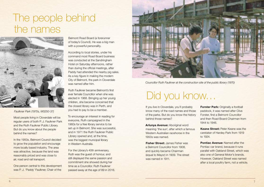
Councillor Ruth Faulkner at the construction site of the public library (1970)
The people behind the names
Did you know… Faulkner Park (1970s, M0250-37)
Most people living in Cloverdale will be regular users of both P. J. Faulkner Park and the Ruth Faulkner Public Library. But do you know about the people behind the names?
In the 1950s, Belmont Council decided to grow the population and encourage more locally based industry. The area was attractive, because the land was reasonably priced and was close to air, road and rail transport.
One person central to this development was P. J. ‘Paddy’ Faulkner, Chair of the
Belmont Road Board (a forerunner of today’s Council). He was a big man with a powerful personality.
According to local stories, under his command most Road Board business was conducted at the Sandringham Hotel on Saturday afternoons, rather than during the official meetings, after Paddy had attended the nearby pig sales. As a key figure in making the modern City of Belmont, the park in Cloverdale was named after him.
Ruth Faulkner became Belmont’s first ever female Councillor when she was elected in 1968. Bringing up her young children, she became concerned that the closest library was in Perth, and you had to pay to be a member.
To encourage an interest in reading for everyone, Ruth campaigned in the 1960s for a free library service to be set up in Belmont. She was successful, and in 1971 the Ruth Faulkner Public Library opened and, at the time, was the biggest municipal library in Western Australia.
For the Library’s 40th anniversary, Ruth was the guest of honour, and still displayed the same passion and commitment she showed during her time as a Councillor. Ruth Faulkner passed away at the age of 89 in 2016.
If you live in Cloverdale, you’ll probably know many of the road names and those of the parks. But do you know the history behind those names?
Arlunya Avenue: Aboriginal word meaning ‘the sun’, after which a famous Western Australian racehorse in the 1950s was named.
Fisher Street: James Fisher was a Belmont Councillor from 1908, and quickly became Chairman (equal to Mayor) in 1909. The street was named in 1911.
Forster Park: Originally a football paddock, it was named after Clive Forster, first a Belmont Councillor and then Road Board Chairman from 1944 to 1946.
Keane Street: Peter Keane was the caretaker of Hardey Park from 1919 to 1924.
Pontiac Avenue: Named after the Pontiac car brand, because it runs parallel with Oakland Street, which was also one of General Motor’s brands. However, Oakland Street was named after a local poultry farm, not a vehicle.
8
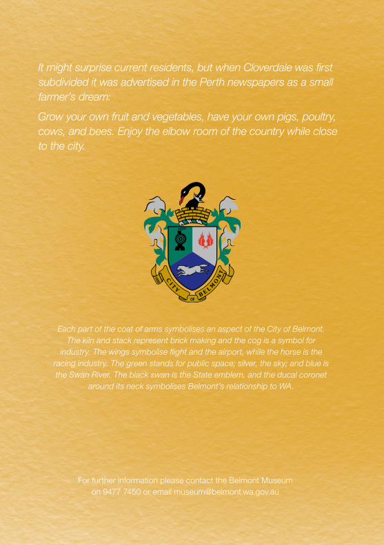
Each part of the coat of arms symbolises an aspect of the City of Belmont. The kiln and stack represent brick making and the cog is a symbol for
industry. The wings symbolise flight and the airport, while the horse is the racing industry. The green stands for public space; silver, the sky; and blue is the Swan River. The black swan is the State emblem, and the ducal coronet
around its neck symbolises Belmont’s relationship to WA.
For further information please contact the Belmont Museum on 9477 7450 or email [email protected]
It might surprise current residents, but when Cloverdale was first subdivided it was advertised in the Perth newspapers as a small farmer’s dream:
Grow your own fruit and vegetables, have your own pigs, poultry, cows, and bees. Enjoy the elbow room of the country while close to the city.