Embed Size (px)
Citation preview
2014 GOES-R/JPSS OCONUS R2O Interchange Meeting (TIM)
Use of Satellite Imagery/Productsat WFO San Juan
July 30, 2014
Gary Votaw
Science and Operations Officer
WFO San Juan, Puerto Rico


Evaluation site for new satellite products tested by SPoRT
MODIS Puerto Rico (longwave)http://weather.msfc.nasa.gov/cgi-bin/sportPublishData.pl?dataset-modispuertorico
In AWIPS:
NESDIS QPE - 1, 3, 6, 12, 24, 72, and 168 hours (one week)
SST Composite and SST Latency
MODIS SST

Comments from Luis Rosa (SJU Sr Met) in Aug. ‘13

Location and intensity issues remain. NESDIS estimated up to ¼ inch and too far north. AMSU showed a max of 4.1 mm/hr (0.16 in.)
Highest actual amount was likely near 4 inches.

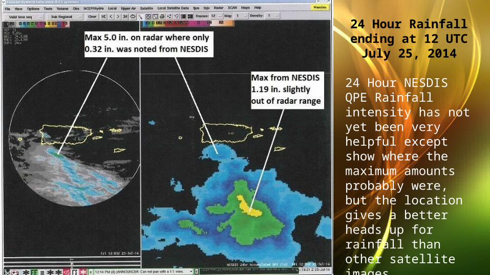
24 Hour Rainfall ending at 12 UTC
July 25, 2014
24 Hour NESDIS QPE Rainfall intensity has not yet been very helpful except show where the maximum amounts probably were, but the location gives a better heads up for rainfall than other satellite images..
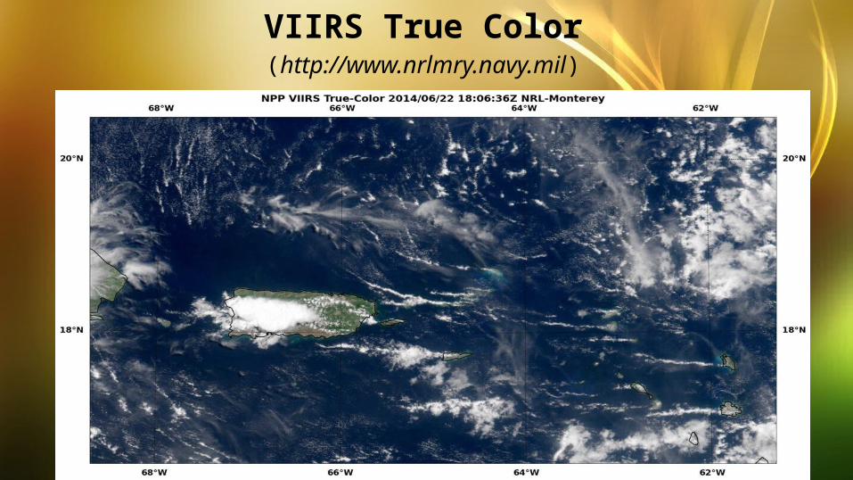
VIIRS True Color(http://www.nrlmry.navy.mil)

VIIRS Low Cloud and Night-Vis-IR (http://www.nrlmry.navy.mil)
Fog/Low Cloud?Fog/Low Cloud?

CIRA Layered Precipitable Water (total) every 3 hours from polar orbiters(http://weather.msfc.nasa.gov/cgi-bin/sportPublishData.pl?dataset=ciralpw)
GOES-R will provide the same layered data for the entire area at least every 15 minutes with fewer mosaic difficulties.

Surface to 850 mb 500 mb to 300 mb
850 mb to 700 mb 700 mb to 500 mb

Recent and expected orbit tracks (out to 7 days)(http://weather.msfc.nasa.gov)
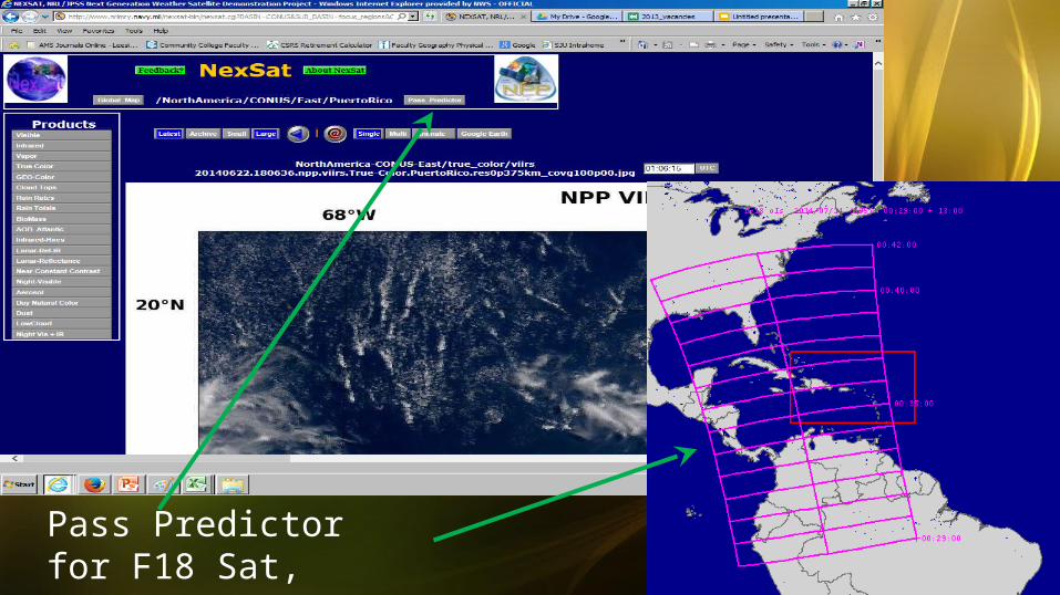
Pass Predictor for F18 Sat,2014/07/14 at 00:35:40
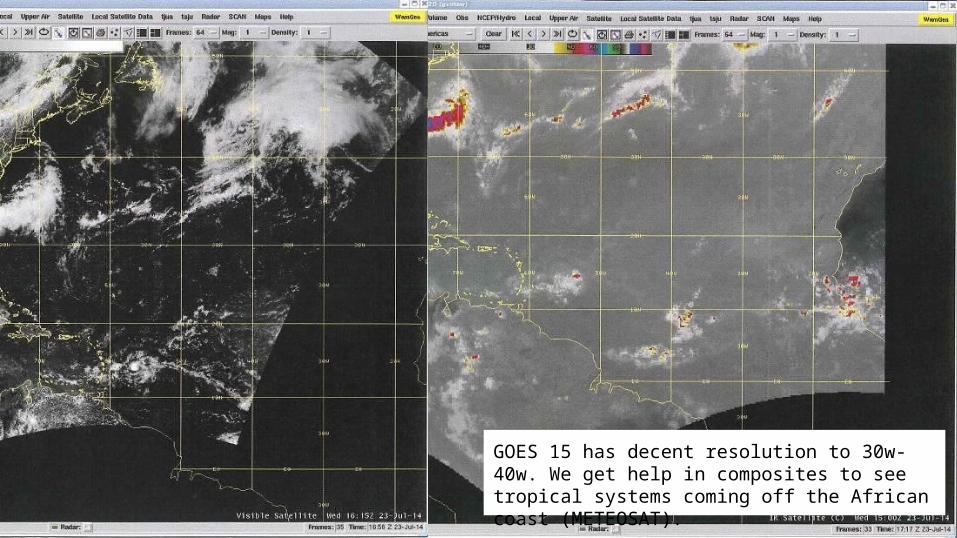
GOES
GOES 15 has decent resolution to 30w-40w. We get help in composites to see tropical systems coming off the African coast (METEOSAT).

MIMIC/TPW product is the most used product not on AWIPS by operational forecasters at WFO San Juan
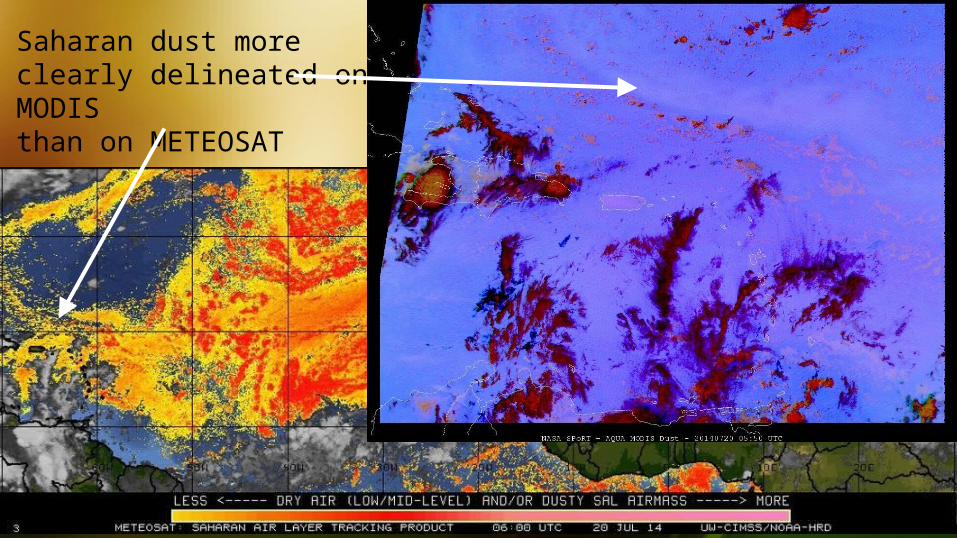
Saharan dust more clearly delineated on MODISthan on METEOSAT


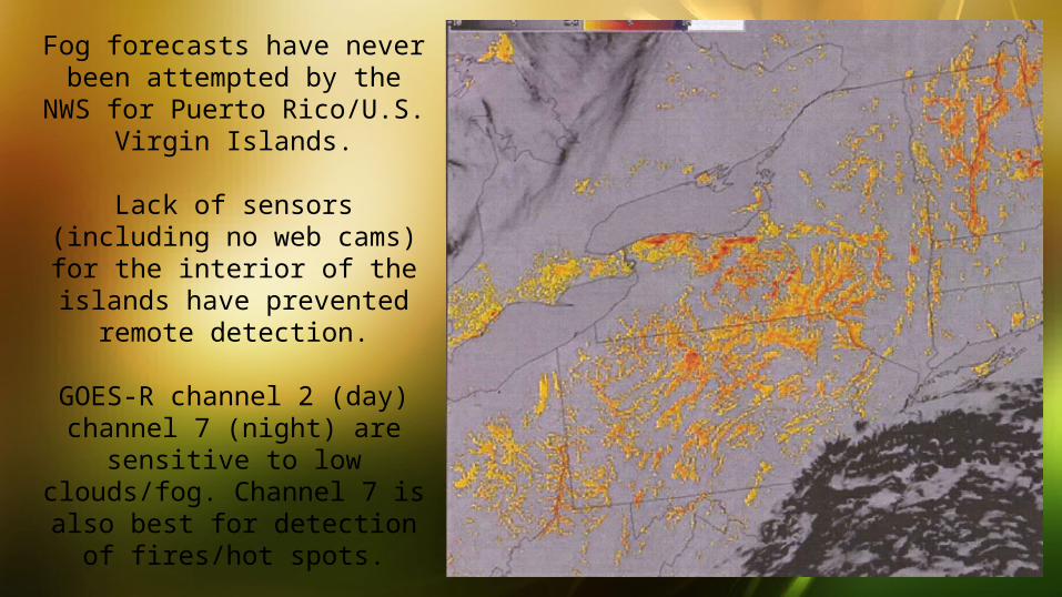
Fog forecasts have never been attempted by the NWS for
Puerto Rico/U.S. Virgin Islands.
Lack of sensors (including no web cams) for the interior of the islands have prevented remote
detection.
GOES-R channel 2 (day) channel 7 (night) are sensitive to
low clouds/fog. Channel 7 is also best for detection of
fires/hot spots.
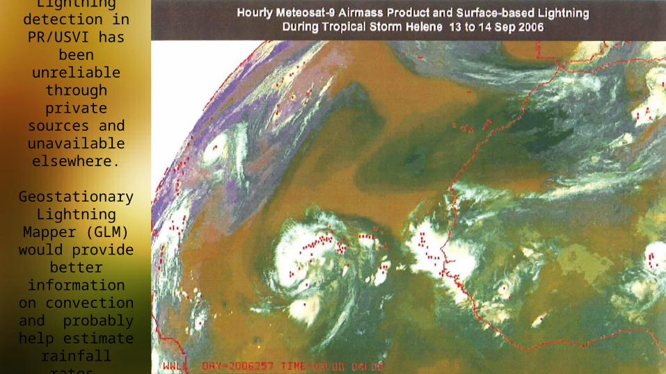
Lightning detection in
PR/USVI has been unreliable through private
sources and unavailable elsewhere.
Geostationary Lightning Mapper
(GLM) would provide better information on
convection and probably help
estimate rainfall rates.

Questions?