Embed Size (px)
Citation preview

BEFORE THE BOARD OF couNm COMMISSIONERS
MARTIN COUNTY, FLORIDA
ORDINANCE i\1"~?-?29R 273
' ?
AN ORDINANCE AMENDING CHAPTER 34, (COMPREHENSIVE PL3.V) IN THE CODE OF LAWS
I AND ORDINANCES OF MARTIN COUNTY, FLORIDA; PROVIDING FOR AMEN'K?FNT TO ARTICLE I
1 (PREAMBLE), ARTICLE I1 (CN??RALL GOALS FOri THE COIQREHENSIVE PLAN), ARTICLE I11
I (INTERGOVERNMENTAL COORDINATION ELEMENT), AND ARTICLE IV (LAND USE ELEMENi;,
OF ORDINANCE NUMBER 189 IN ACCORDANCE WITH ?'HE EVALUATION AND APPRAISAL REPORT '-.
APPROVED BY THE BOARD OF COUNTY COMMISSIONERS ON OCTOBER 29, 1984; PROVIDING
I FOR A ONE UNIT PER ACRE RESIDENTIAL DENSITY CATEGORY IN SECTION 4-2(D);
I PROVIDING FOR DELETION OF THE REQUIREMENT OF A MARKET FEASIBILITY STUDY AND
THE SITE LOCATION/DEVELOPMENT PLANS FOR AMENDMENTS TO THE LAND USE I v W FOR
ADDITIONAL GENERAL COMMERCIAL DESIGNATIONS; PROVIDING FOR INCLUSION OF A NEW
PARAGRAPH IN SECTION 4-2(E) TO INCLUDE POLICIES FOR TRANSIENT COMMERCIAL
SERVICE CENTERS; PROVIDING FOR REPEAL OF CONFLICTING PROVISIONS; SEVERABILITY;
APPLICABILITY; FILING WITH DEPARTMENT OF STATE; FILING WITH DEPARTMENT OF
COMMUNITY AFFAIRS; FILING WITH TREASURE COAST REGIONAL PLANNING COUNCIL;
PENALTIES AND EFFECTIVE DATE.
WHEREAS, this Board is required to adopt a Comprehensive Plan by the Local
Government Comprehensive Planning Act of 1975, as amended, Section 163.3161,
et seq., Florida Statutes; and
' WHEREAS, this Board, pursuant to said act, adopted Ordinance 189
establishing the Martin County Comprehensive Plan; and
WHEREAS, the Comprehensive Plan, Section 1-12, and Florida Statutes +.
163.3187 permit amendments to the Comprehensive Plan and provide for amendment
procedures; and
WHEREAS, the Local Planning Agency of Martin County deliberated the
subject requests for amendment to the Coqrehensive Plan at public hearings
and certified recommendations to the Board of County Commissioners; and

r
I WHERE;AS, the Board of County Commissioners considered all subject
amendments to the Comprehensive Plan in public hearings and adopted amendments '7- ,,
to Articles I through IV in accordance with the requirement of Section 1-12 of
the Martin County Comprehensive Plan and Section 163.3187 of Florida Statutes;
I and
WHEREAS, this Board has considered the coordination and consistency of all
I these amendments to the other elements of the Comprehensive Plan.
NOW THEREFORE BE IT ORDAINED BY THE BOARD OF COUNTY COIVZMISSIONERS OF
MARTIN COUNTY, FLORIDA, THAT THE FOLLOWING AMENDMENT TO ORDINANCE 189 BE
ADOPTED :
PART I. AMENDMENT OF ARTICLES I THROUGH IV. ' L
This ordinance is amending Articles I through IV of the Martin County
Comprehensive Plan, pursuant to authorizations of the Board of County
Commissioners regarding the Comprehensive Plan Evaluation and Appraisal Report
in October of 1984 and as provided by County Commission Resolution #85-1.24
and Local Planning Agency Resolution #LPA-85-4.1, is hereby amended by the
Eighth Supplemnt to the Martin County Comprehensive Plan, Articles I through
IV, adopted as Exhibit A to this Ordinance.
PART 11. CONFLICTING PROVISION.
Special Acts of the Florida Legislature applicable only to unincorporated
areas of Martin County, County ordinances and County resolutions, or parts
thereof, in conflict with this ordinance are hereby superseded by this
ordinance to the extent of such conflict.
PART 111. SEVERABILITY.
If any portion of this ordinance is for any reason held or declared to be
unconstitutional, inoperative or void, such holding shall not affect the
remining portions of this ordinance. If this ordinance or any provisions
thereof shall be held to be inapplicable to any person, property or
circumstances, such holding shall not affect its applicability to any other
person, property or circumstances.
PART IV. APPLICABILITY OF ORDINANCE.
This ordinance shall be applicable throughout the unincorporated area of
Martin County.
. ' PART V. FILING WITH DEPARTMENT OF STATE.
The Clerk be and hereby is directed forthwith to send a certified copy of
this ordinance to the Bureau of Laws, Department of State, The Capitol,
Tallahassee, Florida, 32304.
PART VI. FILING WITH DEPARTMENT OF COMMUNITY AFFAIRS.
The County Attorney shall send a certified copy of this ordinance to the
Department of Comnunity Affairs, 2571 Executive Center Circle, East,
Tallahassee, Florida, 32301.
PART VII. FILING WITH TREASURE COAST REGIONAL PLANNING COUNCIL.
The County Attorney shall send a certified copy of this ordinance to the
Treasure Coast Regional Planning Council, Post Office Drawer 396, Stuart,
Florida, 33495-0396.
PART VIII. EFFECTIVE DATE.
This ordinance shall take effect upon receipt of official acknowledgement
from the Office of Secretary of State that this ordinance has been filed in
that office.
PART IX. PENALTIES.
Violation of this ordinance is a misdemeanor pursuant to Section 125.69,
FLORIDA STATUTES, and is punishable under said section by imprisonment for up
to sixty (60) days, or a fine of up to $500.00 or both such imprisonment and
fine . DULY PASSED AND ADOFED THIS 15TH DAY OF OCrOBER, 1985.
A
m I S E V. ISAACS, CLERK
CORRECTNJ3SS :
CHIEF ASSISTAW COUNTY AITORNEY

Exhibit "A"
Amendments to the Martin County Comprehensive Plan Authorized by Board of County Comission Approval
of the Evaluation and Appraisal Report, County Conmission. Resolution #85-1.24 and
Local Planning Agency Resolution #LPA-85-4.1, as Stipulated in Section 163.3191, Florida Statutes
Approved October 15, 1985
Key : 1) Added Statements 2) [Deleted Statements]
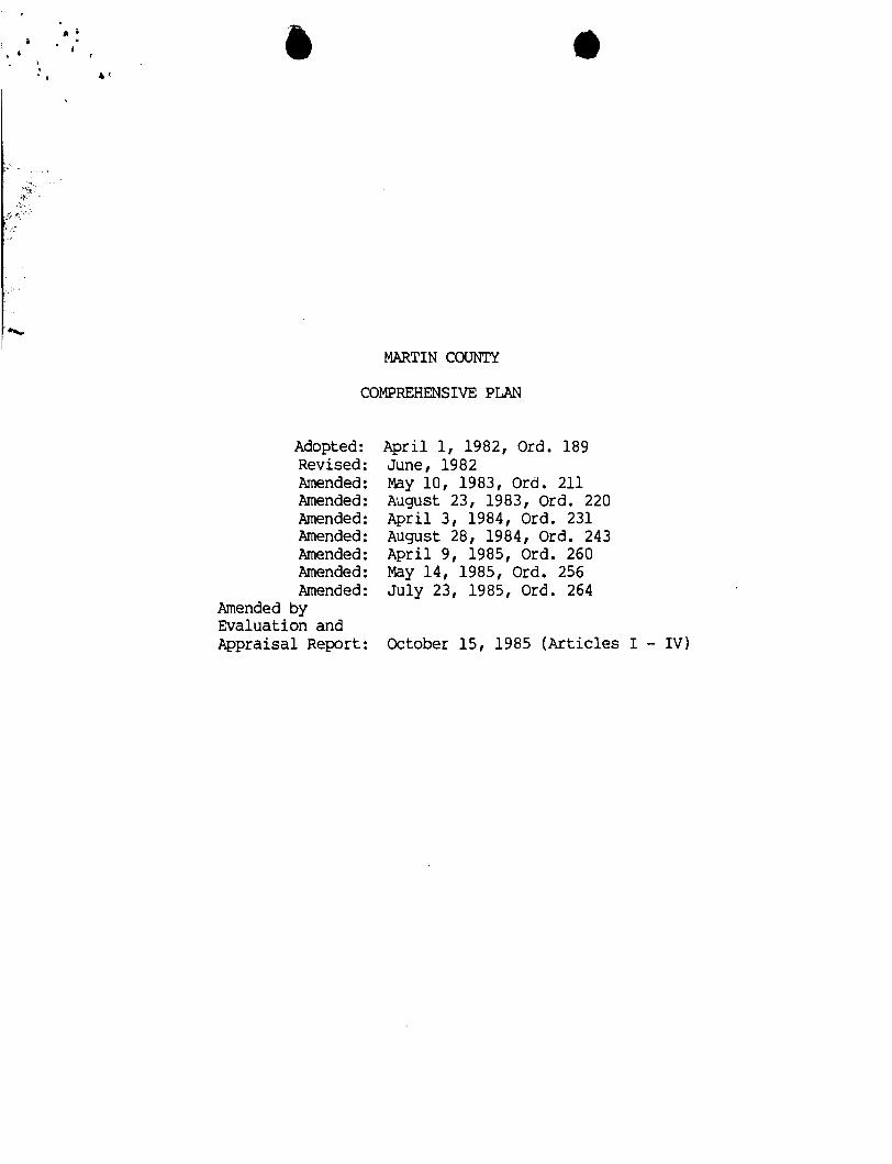
MARTIN COUNTY
COMPREHENSIVE PLAN
Adopted : Revised: Amended : Amended : Amended: Amended : Amended : Amended : Amended :
Amended by Evaluation and Appraisal Report:
April 1, 1982, Ord. 189 June, 1982 May 10, 1983, Ord. 211 August 23, 1983, Ord. 220 April 3, 1984, Ord. 231 August 28, 1984, Ord. 243 April 9, 1985, Ord. 260 May 14, 1985, Ord. 256 July 23, 1985, Ord. 264
October 15, 1985 (Articles I - IV)

Mart in County Camprehensi ve Plan
as adopted' by the - Board o f County Commi'ssioners
on Apr i l 1, 1982
prepared by:
Local P I anni ng Agency
wi th the assistance of:
Sol i n and Assocfa tes , Inc. Lester L. Sol in, Jr :, AICP, President
Vero Beach, F lor ida
Mar t in County Community Oevelopmnt Department Thomas G, Mumford, D i rec to r (resigned)
Joseph Banff, D i rec to r
Aar t in County Lega 1 Department Stephen Fry, County Attorney
(Revised June, 1982)

Board of County C m i ssioners
John W. Holt, Chairman Sherri King , V i ce-Chairman
Maggy Hurchal l a Alex L. Haynes
Thomas J . Higgj ns
Robert H. Oldland, County AdmS n i s t r a to r
Local Planning Agency
Thomas G. Kenny, 111, Chairman Douglas Wulffleff, Vice-Chainnan (resigned)
Char1 es R. Schad, Vi ce-Chai man Clare Durant (resigned)
Val Martin Ronald G . Scanzillo
Joseph J . Celli

Acknowledgements
Citizens Advisory Comni t tee
Alex Haynes Nathani el Reed George Ewing William Wallis Doran Seaquist Erl i ng Speer Ransom Ti1 t o n Mary Dawson Peter Cmings Ernest Godshal k Mark Perry Richard Campbell George Hutchins Hubert Van Dyke James F. Littman 3.0. Lewis I11 Jack Robinson Wi 11 iam Burr Gene Van Curen
John Mu1 1 i ken Loui se Carnaval e Felix Williams Peter Jefferson Dr. David MacMillian Hugh Furman Dr. Wal t e r Stokes James Beat t i e Dennf s Hudson 11 I Ray Roberts Ray Navi tsky Eob Whi t ty Ken Ferrari Timer P w e n Tony Carpentier Col. Jack Obus Herb Coy Alan Connell
Martf n County Soi 1 and Water Conservation District Alan Connell, District Conservationist
Florida Department of Forestry q r
Martin County Health Sewices De~artmen t Dr. Archie McCall l s t e r , MD. .DlreCtOr
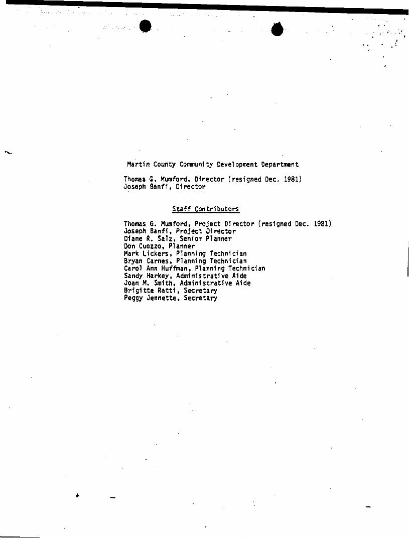
~ a r t i n County Comnuni t y Devel opment Department
Thomas G . Mumford, D i rec to r ( resigned Dec. 1981) Joseph Banf i , Di rec to r
S t a f f Contr ibutors
Thomas 6. Mumford, Pro jec t D i rec to r (resfgned Dec. 1981) Joseph Banf i , Pro jec t Of rec to r Dlane R. Salz, Senior Planner Don Cuozzo, Planner Mark Lf ckers, Planning Technician Bryan Carnes , PI anni ng T echn i c i an Carol Ann Huffman, Planning Technician Sandy Harkey, Admin is t ra t ive Aide Joan M. Smith, Admin is t ra t ive Aide B r i g i t t e Ra t t i , Secretary Peggy Jennette , Secretary

XIi OR3ZXAiiCE ADOISG CHAPT",R 34 (COt.IPPSXE%SIVE PC,%:) TO T!fE CODE O I W!sS AND ORDfNlLVCES O F 14ARiIig COUimT, TLORIDX; ADC)PTIt!C THE .XXlT= COUXTY COXP.XZBEXSIVE PWLY PURSUAST T3 TMZ LOCAL GOVEiW-
~ - . - ~ -. POZTATION ~ A ~ E N T , HOUSING ELE.ZST, PASS, RECRWTZON MD O F ~ SPFcrr ELEHE,W, CONSERVATION A20 COASTAL liiuYkGZbt.ft?T ELEWT, PUBLIC F A C Z L I T I E S : 1JA=9, UASTEkrATLR, DRAIXAGE A:JD SOLID W A S T E - t S , ELECTRIC U T I L I T Y EL&H&XT, -Y S E R V I C f S ELS-IEXT, EGCX!f CONSERVAIIOX E I S W ! T AND FISCAL HAS<AG&MEt:T -LS.: PRO- VIDISC FOR CONFLXCTIXC PROVXSXONS , ~ . W L L I T Y , APPLICABILITY; F I L I N G CJITg TKE D & P A R T X m ,OF STATE1 EFFECTIVE D A Z ; PENALTIES AND CODIFICATION.
WHEREAS, t h i s Board is r.quir.d to adopt a C o m p r s h a n -
rive Plan by the Local I;overn..runt C u m p r o h o n s i v e P l a n . a i n g A c t of
197s. u -dad: and
WHERZAS, chis loard h u d a t o r ~ o d that ~ 5 e C o n p r a -
henrive ~1.4 incorporated by rrference in %%is o r C i ~ s n c e wets
or a c o r C s the L o c a l G c t * o r n t e n t C o m p r e h r r . s i v e Plamzizg A c t ' s
re&ruz8nts; and
. VtfEnfZrS, this a a r d h a s doterrefncd that <?a adoption
of t k i s C o m p r o h a n s i v e P l a n conforr~s ufCa t!!8 fntant md purpose
of %5a Local C o v r r m r r n c C o n t p t e h e n s i v a ?:arming A c t :
NOW mtfftr'a~t a t IT O R D U : ~ ~ ~ aY mr EWAPO or' C~U?I"PY
C&Y:~~Z,SSIONERJ aF rARTIt! COUNTS, W R t O i . , m T :
. A I. .IU)OPTIO# O F ?LA%.
The to l lw ing provisioar be m C oze akhd as
C h a ? = o r 3 1 of tha C o d e of &us and O r d i n a n c e s of :*-tin Corn-:
CHAOlEEI 34 - C O b I P W E k l S N t PLXi .
Stctio:! 34-1: AOOPTION O? ~ - l P = E I 4 S Z M P U S .
T h e t l j r t i n C o r n & C o ~ p r 8 h e n s i v o P l a n , a t a d the
1-c day 01 A o r i l , 1982 as f i 1 . d w i t h the
.%rtin C o u n t y Cozuaunity ~ a v r 1 o ; r ; ~ n t oeporti=nt, is adopted i n
a c c o r C a n c 8 wit!! tho ~0c.l G o v e r n m e n t C o m p r o h o n s ivc ? l ana ing ' A c t
at 1973, as Mandad.
PANT IT. CONFLICTIXG' PROVISXO~:~. 8, 542?~~140CI 0
Spacial octo of the t lor ich L u q f s l a ~ ~ r a op?lLcablc

:J :nfacor?3ratc'd nzcza o t :.lartia Co-&??,', Cous* ora' -..~..cc --- a
.nd county rmsolutions, o r parts t ha~eof . i n conf l ic t w i t h &is
ordfn&.lce u a hareby supersaded by th i s ordinancu to the axtank
of such conflict .
PART 11%: StMRABILITY.
If my portion of t h i s ordinance is for my reason
held o r dac luad t o ba unconstitutional, i a o p ~ r a t i v a or void,
such holdinq sha l l not a f fec t thm remabing portioas of this
orbtnmce. If t h i s otdinrnce o r any provision thuraf r N l
ba hald t o ba i r u p p l i u b l a t o any pmtson, proparty o r cir-
staacas, such holdfnp sha l l not a f fac t i+r appl icabi l i ty t o
ury othr r puson, proparty o r c t r c r r r p r t ~ u s .
PART Nz ~~PLICRBILITY 08 O R D r N A N a .
This ordiaamca sha l l ba applfcible throughout t h m
unincorporated u a a of Hut in County.
PhRT VI PILING WITH DEPARITlEiiT Or STATE.
Ihr Clark ba m d hereby is Jir-d forthwith to rend
8 c u t i i i o d copy 0: this ordfnurca to thm Bureau of Laws, Da?ar:-
m u a t of Stato, T)Ie Capitol, Talloh.ssaa, Florida, 32304.
PART VZt mm DATE.
This otCkrraca sha l l taka .::act upan racafgt o f
o f f i c i a l acknovlCgamnt froln Ma Officm of S e c r a w of SUta
tha t this otdkrraca h u baen f i l d Ln t h a t off ica.
OAR? VfIc m'iU,RTs.
Violation of t h i s ordinance h a drderP.anor pursuant
to S d o n 125.69,.FLORXDA STATUTES, urd is p-hpble under
said scion by imprisanaant for up to sir?xy (601 b y $ , o r a
f ine of up to $100.00, o r both such iPgrfroamant and fine.
PART VIZZ: CCOIiZCATIOH.
Provision8 o f this ordinanem 36.11 be fncorpgrated
i n the County Coda and the uo,d * o t d f a u a n ory be Jun9.d to
wsectionw, wart icla ' or othmr opprogrLata word, and tho auctions
of &!I; ordfnnnco nay be r.n~+atcd. or ralat t8r .d t a ac-4irh

~ u s h fzfcntion; p = o - r i t ~ C , ho:ia:*er, L7r.z ?arts 1: t~ ' . 'fit r h c l i
no: br cadiEicC.
DULY PASSED .;GD AD3pCED THIS IgT CAY 05
APFlIL 19 82

PREFACE
The Mar t in County Board o f County Commissioners designated the Local Planning Agency t o develop a Comorehensive Plan t h a t w i l l , by design:
1. Result i n the most appropriate use o f land, water and o ther resources consistent w i th pub1 i c in te res t ;
2. Prevent overcrowding of land and avoid undue concentration o f populat ion as we l l as urban sprawl, and
3. Preserve, promote, p ro tec t a d improve pub l ic health, safety, convenience and general welfare by assuring . t h a t there w i l l be appropr1a:e services such as water, wastewater, t ransportat ion, schools, parks, recreat ion and o ther needed pub l i c serv Ices and f a c i l i t i e s
- consistent w i t h .growth'.
The Mar t in County L o a l Plannin(r ~ g e n c ~ , on October 1, 1981, a f t e r duly not iced p u b l i c hear in;^, unanimusly reconmended the H a r t i n County Comprehensive Plan f o r adoption by the Board of County Commissioners . On A p r i l 1 , 1982, the Board o f County Comnissioners unanimously adopted the Har t tn County Cornprehens i v e Plan.

COMPREHENSIVE PLAN
TABLE OF CONTENTS
ARTICLE I. PREAT.18LE Section 1-1 Purpose Section 1-2 I n ten t Section 1-3 Legal Status .Section 1-4 Scope Section .I-5 Economic Assumptions and imitations Section 1-6 Consistency o f Elemknts and Po l i c ies Section 1-7 Fiscal Management and Economic Feasi b i 1 i t y Section 1-8 Supportive Data Section 1-9 Continuing Evaluatlon Section 1-10 Publ ic Pa r t i c i pa t i on Section 1-11 Plan Implementation Sect i on 1- 12 Amendment Procedures Section 1- 13 Vested R i ghts Section 1- 14 Authori ty
ARTICLE 11. OVERALL GOALS FOR THE COMPREHENSIVE PLAN Sect i on 2-1 Goal I n ten t Section 2-2 Economic Development and Fiscal Conservancy Section 2-3 Pesident ia l Q u a l i t y Section 2-4 Natural Resource Conservation Section 2-5 Consistency of Elements w i t h Establ ished Goals
ARTICLE I1 1. INTERGOVERNMENTAL COORDINATION ELEMENT - Section 3-1 Purpose o f the Intergovernmental Coordination .
E l ement Section 3-2 Objectives f o r Intergovermnental Coordination Section 3-3 Imp1 ementi ng Po l l c ies f o r Intergovernmental
Coordination
ARTICLE I V . LAND USE ELPENT Section 4-1 Objectives f o r and Use Secti on 4- 2 Land Use Map Section 4-3' Performance Standards Sectlon 4-4 Implementing Program f o r Land Use Management
ARTICLE V. TRANSPORTATION ELDlENf Section 5-1 Gbject i ves for T rans~o r ta t i on Section 5-2 Imp1 ementation f o r the Transpgrtat ion Element Section 5-3 Special Studies o f T ra f f i c C i rcu la t ion
ARTICLE V I . HOUSING ELmENT Sec ti on 6- 1 Object1 ves f o r Housing Section 6-2 Inglementation Po l i c ies f o r ~ . o u s i n ~ Element
I V - 1 I V - 1 1v-8 I V - 17 1v-30
v r - 1 V I - 1 v1-3

TABLE OF CONTENTS (continued) Page
ARTICLE V I I . PARKS, RECREATION AND OPEN SPACE ELEMENT V I I - 1 Section 7-1 Objectives for Parks, Recreation and Open Space V I I - 1 Section 7-2 Inventory and Standards f o r Park Resources V I I -3 Section 7-3 Impl'ementi ng Parks, Recreation and Open
Space Goals and Objectives V I 1-7
ARTICLE V I I I. CONSERVATION AND COASTAL MANAGEMENT ELEMENT - V I I I - 1 Section 8- 1 Objectives fo r Conservation and Coastal
Management V I 11-1 Section 8-2 Implementing Programs f o r Conservation and
Coastal Management V I I I - 4
ARTICLE I X . PUBLIC FACILITIES: WATER, WASTEWATER, DRAINAGE AND SOLID WASTE ELEMENT 1x0 1
Section 9-1 Objectives f o r Management o f Water, Wastewater, Drainage and So l id Vaste Systems 1x01
Section 9-2 Implementing Programs f o r Water, blastewater, Drainage and So l id Waste Element I X - 7
ARTICLE X. ELECTRIC UTILITY ELEMENT X- 1 Section 10-1 Coord inat ionwi th F lo r ida Power a n d b i g h t Co. X- 1 Sect ion 10-2 Relat ionship of the E l e c t r i c U t i l i t y Element
of the State Comprehensive Plan X - 1 Section 10-3 Character and Status of Planned F lo r ida
Power and L igh t Co. E l e c t r i c U t i l i t y Fac i l i t i e s w i t h Mar t in County X - 1
Section 10-4 Objectives f o r the E l e c t r i c U t i l i t y Element X- 1 Section 10-5 Implementation Programs f o r the E l e c t r i c
U t i l i t y Element X-2
ARTICLE X I . URBAN SERVICES ELEMENT: FACILITY SPACE NEEDS, DISASTER PREPAREDNESS, FIRE PROTECTION AND EMERGENCY OPERATION SERVICE, AMBULANCE AND MEDICAL FACILITIES AND SERVICE, PUBLIC SCHOOLS, PUBLIC LIBRARIES X I - 1
Section 11-1 Objectives f o r Urban Service Management Practices X I - 1 Section 11-2 Implementation Po l ic ies f o r the Urban Services
Element XI-3
ARTICLE X I I . ENERGY CONSERVATION ELEMENT X I I - 1 Section 12- 1 Objectives f o r Energy Conservation X I I - 1 Section 12-2 Implementation Po l i c ies f o r Energy Conservation XII-2
ARTiCLE X I I I. FISCAL tWNAGLYENT ELEMENT Section 13-1 Putwose o f the F isca l Manaoement Element Sect ion 13-2 ob jec t ive o f ~ i s c a i ~ a n a g e k n t Element
, Section 13-3 Capital Improvement Pmgram and Budget Section 13-4 Capi t a t Improvement Program and Budget as a
Plan Implementation Device Sect i on 13-5 F isca l Impl icat ions of Proposed Engineered - Master Plans f o r Publ ic F a c i l i t i e s Section 13-6 Imolementi ng the Fiscal Management Study Sect ion 13-7 Program Evaluation Sect ion 13-8 Schedule o f Capital Improvements

AKIIUE 1. PREAMBLE
Section 1-1 Pu se. The Martin County Comprehensive Plan is prepared plrawrt to P ?- orlda Statute, Chapter 163, 'Local Govenrment Comprehensive Planning Act.. The purpose of the Camprehensive Plan is t o use and strengthen Martin County's role in establishing and i~@ementing the cq r ehens ive planning process in order to protect natural and mm-mde resources and to maintain, through orderly growth and developaent, the character and s tab i l i ty of present and future land use and carmunity developnent.
Section 1-2 Intent. The Wrebens ive Plan is intended t o pennit Martin County to: encourage the mst appropriate use of land and water resources, f i sca l resource and other camunity resources; and deal effectively with existing and future prablems that may resul t from the use and developnent of land and water within Martin County. S t is further intended that through the conprehensive planning process Martin County can: preserve, prarrPter protect, and inprove the public health, safety, comfort, good order, appearance, convenience, law enforcement, and general welfare; prevent t h e overcrowding of land and avoid undue concentration of pupilation; f ac i l i t a t e the adequate and ef f ic ient provision of transportration, w a b l e water distribution, wastewater collection and treatment, schools, parks and r ~ r e a t i o n d l f ac i l i t i e s , housing and other required cormatnity services and conserve, develop, use and protect natural resources within Martin County. The Cmprehensive Plan is intended t o encourage and assure axperat ion and coordination in planning and developnent ac t iv i t i e s between and among Martin County, its citizens, property owners, other local governments, regicnal agencies, and s t a t e and federal government.
Section 1-3 Leqal Status. This Plan shal l have legal status as provided for in the Local Gave-t Caprehensive Plannirq Act of 1975, as amended.
Section 1-4 Scape. The scope of the. Caprehensive Plan includes the following elements: 1) I n t e r g o w ~ t a l Coordination; 2) Land Use ; 3 ) Transportation; 4) Housing: 5 1 Recreation and Open Space; 6) Conservation and Coastal Managemnt; 7) Public Faci l i t ies , Wastewater Drainage, Water and Solid Waste System; 8) Electric Uti l i ty Service: 9) Urban Services; 10) Energy Conservation; and 11) F i s c a l Management. The scope of the Gxprehensive Plan may be expanded pursuant t o Florida Statutes, Chapter 163, "local Govemnent bnprehensive Planning A c t of 1975. as exis ts or as hereafter amended.
Section 1-5 Ecommic Assumptions and Limitations. Preparation of the barprehensive Plan is predicated ar the following statement of economic assbqt ions and limitations. This statenent is based cn analysis of past and projected future economic d e v e l m t trends. This analysis also presents a general econanic p e r m i v e of the e a r t h i n g role which M a r t i n County serves in the regiars economy and identifies the major advantages and opportunities characterizing the local econamy.
A. Stabi l i ty of the County's Land Resources. I t is anticipated that no mtjor climatoligical changes or natural catastrophic disasters w i l l impair the County's land resources and advantageous position a s a highly at t ract ive coastal area w l t h abundant water r e m r c e s [excellent transportation linkages to major regiondl centers of Palm Beach, Brcward, and Dade counties t o the South, and the Orlando Metropolitan area t o the North. These linkages wil l be further enhanced by the proposed construction of Interstate 951.

B. County's Areawide Econanic Role. Martin County is anticipated to continue to diversify its economic base with expansion most pronounced in retail trades and services. Growth in the ut i l i t ies industry is anticipated to continue, based on Florida Power and Light Corporation's regional coarnitments within Wartin County. Although of decreasing significance, Martin County's agriculture productivity is anticipated to continue to maintain a prauinent regional role. A s the labor market g r m with the anticipated papilation influx and as [transportation linkages and other camrunity facilities I the ~1~ - sion of cormarnity facilities, such as t r - rtaticn linkages to Sou tzor ida idad the Orlando n e t r o p o l i ~ area =developed p u r s u a n t ~ o ~ c i e s hereinsetforth, industrial - develapnent potential should be enhanced. Therefore, manufacturing should becane an increasingly more significant portion of the e c o d c base. Finally, based on population estimates, the construction industry should maintain or increase its share of the econunic base, though ar@loyment in this Lndusfry should maintain or increase its share of the economic base, though enployraent in this industry w i l l continue to fluctuate with changes i n t h e national economy.
C. Personal Incane. It is anticipated that the level of personal incane w i l l continue to rise in Wartin County and the region, and w i l l continue to exceed the state and national averages. This factor is due to the location, natural amenities and econcuy of the area.
D. Enployment Activities. It is anticipated that the County's employment base w i l l continue to reflect the County's role in the areawide econany d e f W above in Section 1-S(B1. The major eaployment generating activities wi l l continue to be retai l trade and services, manufacturing, local goverrrment, fanning and construction.
E. Water Resources. Potable water resources are viewed as a limited resource over the long range planning period. Therefore, econanic activities w i l l be encouraged which require minimal drain on water resources. The Plan, therefore, stiprilates a long term carmitment ,to improved land and water management plans and practices.
P. Lccal F i s c a l Capacity. Martin County is beset with significant fiscal limitations. The Camprehensive Plan and the planning process are to be used as a policy tool for managing shore and long tern growth pressures and resource conservation needs. P i s ca l Conservancy should be a major M l i c value underlying the continuing development review process to assure that funding for adequate public facil i t ies is assured prior to approval of new developnent. The bunty shall forrmlate and carry out necessary fiscal ma~gemnt policies and pracatices, including impact fees if needed to assure such fiscal conservancy.
G. Coordination of Public and Private Develapnent Decisions. It is anrrcipaced mat Martin Qunty's maagemenc or' land l eve lopnt opticns w i l l continue to include coordination with the private sector in determining the appropriate location, timing, scale and intensi ty of developrent options. E c o d c developnent proposals s h a l l continue 'to be reviewed in term of residential quality, public services, economic capacaity, capatibility with the natural environment, and c q l i a n c e with existing and p r o p s 4 new ordinances designed to carry out these objectives.

H. External Factors. It is anticipated that external factors which a re uncontrollable a t t h e local level w i l l continue t o inpact the County's -. These factors produce uncertainty and their influence is reflected in fluctuations in levels of unexcplayment and incoane. External factors include but are not limited t o the following: national econcmy including cost of living index, gross national product and other economic performance indicatgors; unexpected long o r short tgenu shortages in natural resources; and mhanticipated technological changes which render certain econanic enterprises less competitive o r obsolete. The impact of these external factors w i l l limit the County's ab i l i ty t o achieve desired e c o n d c policies. Barring unforeseen fundamental changes in the econanic system, problems of fluctuating levels of unemploymentt underemployrent, and incane w i l l continue.
Section 1-6 Consistency of Elements and Policies. A l l elements of the Catprehensive Plan shall be consistent and shall be coordinated with policies of &her local governments, the Martin County School Board, the Treasure Coast R e g i o n a l jPlanning Council, the Sotith Florida Water Managanent District, the State and Federal Governments and other public agencies charged with significant land managanent and resource conservation responsibilities. The County m y adopt provisions which are more restr ict ive than these of regional, s t a t e and federal agencies.
Section 1-7 Fiscal Management and Economic Peasibili t y . The Ccanprehensive Plan provides a policy framework for enhanced f i sca l resource mnagement and coordination of f i sca l management strategies with land and m t e r management activities. The Ccnprehensive Plan acknowledges that the County Nst Fmprove its significantly underdesigned transportation, water, wastewater, and drainage systenrs. The plan includes a cactnibnent t o f i sca l impact assessment and possible d e v e l m t of an mct fee ordinance to promte f i sca l .
conservancy. Finally, as detailed planning and engineering f ac i l i t y hqrovement program are available, land management and fiscal inplernentation program w i l l be further refined t o assure maxirrPlm f i sca l conservancy and ecunomlc feasibility. The public f ac i l i t y studies referred t o herein are incorporated in the program for implementing the Camprehensive Plan, and the cost estimates are reflected as part of the capital investment strategy. The
' capital investment strategy shall consist of a five-year plan updated and reviewed annually by the Board of County Comnissianers.
Section 1-8 Supportive Data. RN Cargrehensive Plan is predicted a analysis of past trends, existing characteristics, and future projectims of the County's population, h-ing, land-use, e d c and natural resources. This data shall be maintained as public fnformatiar f i led in the Comrrunity Develapnent Department. Rte data shall be updated cm a continuing basis [as part of a 1 and, subsequent fo evaluation of the Coanprehensive Plan, s h a l l be
ublished a s revised every ~ y e a r s , ex=& as reaired as mrt of *.e - -
Pamendatom process. The inventory =ysis of data suppr t ive of the Carprehensive Plan is included in a separate report entitled: Ccnprehensive plan Data Inventory and Analysis.

Section 1-9 Corltinuing Evaluation. Pursuant t o Florida Statute$, Section 163.3191 of the &cal Government Conprehensive Planning Act , the bmnunity Developnent Deprbtmt shall prepare^ periodic reports on the ~omprerhensih Plan. The reports shal l be reviewed by the Local Planning Agency and submitted t o the Board of County Carmissioners a t least once every [two (2)J f ive (5 1 years. 2 assure that- special studies, as referenced in- tha Ccanprehensive Plan, ate car~leted in a timely manner, mid-term (two and one-half ears 1 s ta tus r emr t s , consisting of an inventory ot register s y n o p s i k z a r form, shall be presented.
A. Cri ter ia for Continuing .Evaluation of Each Conmrehensive Plan Element. The following c r i t e r i a shall be used in evaluating the effectiveness of each element of the w r e h e n s i v e Plan;
Review Imact of Chanqe Indicators on Each Plan Element. Ma jot s h i f t s in the mgnitude, distribution, and/or characteristics of population, housing land use, natural resources, public fac i l i t i es , consumer denvlnd and supply, ~ a ~ i t d and ouuay pressures, shal l serve as Inajor indicators of change fn public needs as d i n e d in the Conprehensive Plan. The policy fmplicatians of major changes i n demand and supply indicators strall be evaluated on a continuing basis. Appropriate public policies and stgrategies shdll be established and/or rfefined as needed fn order t o remain responsive t o evolving problems and issues reflected by such significant s h i f t s in econcmic, social and physical change indicators.
2. Schedule, Budget and Implement P r o g r d Activities. The timely scheduling, programing, budgeting and implementation of ac t iv i t i es identified fn the conpcnent subsections of Section 3-3, 4-4, 5-2(D), and 5-3, 6-2, 7-2, 8-2, 9-2, 10-5, 11-2, 12-2, and 13-7 shall be evidence of the County's effectiveness i n executing a systematic prcgram for inplementing adopted goals, objective&, and policies which cowrise each element of the Cosnprehensiw Plan.
3. Coordinate with Public and Private Sectors. While continually implementing and evaluating the Conprehensive Plan policies and prcgraps, the County shall maintain a system of intergovernmental coordination as w e l l as coordination w i t h varied interests within the private sector concerned with growth management and resource conservation. The effectiveness of this approach shdll be evaluated by the success of coordination and c d c a t i o n processes in resolving growth management and resource conservation problem and issues. The Carnty Achninistrator shall devise and publish orqanized procedures-= plans for the flow of i n f o m t i m , lines of authority and the respowibi l i ty of a l l County Dewrtments, Cannissioners, Ccmmittees and Advisory b o d i e s r Sudh procedures and plans s h a l l be updated pursuant t o Section i-3 of the CsnprekensL*re ?la. -
4. Achieve Effective Resolution of Growth Manaqement and Resource Conservation Problem and Issues. The effectivehess of the ~ r e h e n s i v a l be s h k ~ l r e d by the County's success i n accomplishing the goals, objectives, and programs identified in the Camprehensive Plan. The Camprehensive Plan incorporates a systematic
planning process for identifying evolving growth management and resource conservation problerrrs and issues, generating alternative
, policy solutions, implementing preferred corrective program activity, and creating numerous opportunities for continued comrmnication.
B. Content of Evaluation Reports. The evaluative reports shall be written and shall contain appropriate statements related to:
1. Major Planning and Development Problems. The evaluation report shall identify major planning and develapnent problem, including the
- location and distribution of land uses and related physical, econanic, social, or environmental impacts.
2. Major Shifts in Trends and Conditions. The evaluation report shall describe the condition of each element of the Conprehensive Plan, particularly with regard to evolving trends in population magnitude and distribution, housing, land use, economic base, fiscal ~ ~ ~ g e m e n t , or condition of natural resources.
3. Proqress in Achieving Canctehensive Plan Objectives. The evaluation report shall describe progress in achieving Canprehensive Plan objectives.
4. Unanticipated Problem and Opportunities. The evaluation report shall descreibe the nature and extent of unanticipated and previously . unforeseen problem and opportunities occurring since the Camprehensive Plan adoption or since the latest evaluative report. .
5. Reconmended Amendments. The evaluation report shall present any recarmended amendments to the CanrPrehensive Plan elements, including refonrulated objective policies ah standards. Said amendments shail be processed accordance with procedures established 9 Section 1-12 - of the Camp -- rehensive Plan.
Section 1-10 Public Participation. The Local Planning Agency and the Board of County CaPnnissioners shall continue to provide for public participation in 'the continuing cnnprehensive planning process. During review and evaluation of the Comprehensive Plan or portions thereof the ad hoc Citizens Advisory Comnittee (a) on the Cmprehensive Plan defined problem and issues, provided base data, and prepared a statement concerning basic goals, objectives, and problem addressed through the planning process. The report of the CAC shall be considered as a supportive document to this Plan. The County shall provide for broad dissemination of proposals and alternatives, opportunity foir written carments, public hearings with open discussion as prcvided in Section 1-12 c d c a t i o n s programs, infomation services, and consideration of and response to public cnrmenc.
Section 1-11 Plan Inplemntation-. After the adoption of this Comprehensive Plan, all developments shall be carsistent with the goals, objectives, perfomce standards, policies and programs of this Plan. In addition, this Plan shall be implemented through:
A. Execution of the Board of County Carmissionersl lawful responsibilities including those responsibilitgies delegated by the Board of County Ccmnisaioners by administrative jand quasi judicial boards and carmissions appointed by the Board of County Cbnmissimers.
B. Ekecuticm of lawful administrative resparsibilities of the County Administrator and County Deparjtments' staff pursuant to ordinances (either existing or as may be amendedc or as may be adopted in the futgure), including but not l imi ted to the following ordinances within the Mattin County Code of Laws and Ordinances concerned or partially concerned with growth management and consemtion: .
kMnistration (Chapter 1) ; Airports and Aircraft (Chapter 3 :Beaches, Parks and Recreation (Chapter 5); Building and Housing Regulations (Chapter 6 ) ; Construction Industry L i c e n s i n g Board (Chapter 7 3/4 1 ; Drainage and Irrigation ( m p t e r 9) ; Electrical Regulations (Chapter 11); Environrfmtal Control (Chapter 14 ) ; Fire Prevention and Protection (Chapter I f ) ; Fish and Wildlife (Chapter 16 ) ; C;arbage &'Trash (Chapter 17); Health (Chapter 18) ( ; Junk and Junkyards (Chapter 19 ) : Land Use Generally (Chapter 23 ; PlWing (Chapter 26) ; Public Lands (Chapter 27 1 ; Schools (Chapter 29 ; Streets, Roads, and Bridges (Chapter 30) ; Subdivisions (Chapter 30 1/21 ; Water and Sewers (Chapter 31); and Zoning (Chapter 33)
C. Voluntary wrdinat ion with other local g O w m t S p the Treasure bast Regional Planning Council, t h e South Florida Water MaMgement District, s tate and federal agendcies and other r e l e m t agencies concerned with grOwth management resource consentat ion.
D. Voluntary and cooperative actions with private and public interests intent on fulf i l l ing the purpose and intent of the Ccolprehensive Plan.
For plrposes of this Canprehewive Plan, the term wdevelopnentm shall mean any man-made change to improved or unimproved real estate, including, but not limited to, Wildings or other structures, mining dredging, clearing, fi l l ing, grading, paving, excavatim or dril l ing operations.
Remode l ing , renovatioh, restoration of fnerwed real estate to a fozmer, better condition (as by cleaning, repairing or rebuilding), shall be exerrpt fran the rq i rements of this Plan. Any other proposed man-made change to inproved real estate, shall meet the rwirements of this Plan but only to the extent of such man-made change.
The Code of Laws and Ordfnances of Martin County, as it exists or may hereafter be amended, establishes a legal requirement of obtaining developnent pennits and orders for various develapnr?nt activity and specifies the procedure for review and approval of a l l developnent permits and orders.
Section 1-12 Amendment Procedures.
A. Scope of Eligibility. Any person or organization, including the federal government, the State of Florida, Martin County, any narnicipality in Martin &nty and any of their agencies, authorities and departments my request the initiation of the amendatory process provided belw.

Proof of ownership of the Property subject to the request must be supplied -- -- -- -- & means of an opinion of title from an attorney, licensed to practice in --- ---- the State of Florida, or a title company report. If the apiicant is n x --- -- - -- the owner of record, the applicant is required to report its interest in --- - - - - - the subject property; -
B. Application. Any request for amendments, modification, additions or changes to the Comprehensive Plan shall be submitted to the CormnitY Developnent Department during the period between September 1st and October 31st each year beginning with 1982. Such request shall be made by filing an application form prescribed by the Director of the Comnity Developnent Deparknt. Upon application - for amendment -- to the ~omprehensiie -- plan, the applicant - for change ---- to a Land Use Map must provide for notification of - - surrounding property owners. -- At least [fifty] fifteen days prior -- to the first scheduled public hearing before the Local Planning Agency, the - -- - applicant is to erect a sign or signs on the property adjacent to public ---- -- rights-of-way - and provide notzication as required -- for a Zonin9''istrict Amendment to surrounding property owners -- of the requested amendment -- and the time and fie of the scheduled public hearings. Zonins district amendments ----- processed - in conjunction -- with Plan Amendments -- shall be concurrently considered by the County.
Applications which are deemed by the Cmnity Developnent Department to be unclear or incomplete may be supplemented on or before November 15th. Provided, however, the Martin County Board of County-Comnissioners or the Local Planning Agency may, by resolution, at any time, initiate a request to amend, modify, add to or change the Comprehensive Plan; and unless otherwise provided by resolution or motion, the time period herein provided, as quantified by number of days, shall be applicable to such a request from the date of adoption of the resolution. [Also, a request for an amendment modification, addition or change to the Comprehensive Plan may be initiated by any eligible person at any time during 1982 prior to September 1; and, the time periods herein provided, as quantified by number of days, shall be applicable to such a request.]
C. Procedure upon Application.
1. The Planning Director shall prepare a listing of all applications, including staff applications, received icclu2ing tke nature of the application and the reasons stated for requesting the proposed amendment, modification, addition or change. Such listings shall be submitted to the Local Planning Agency on or before December 1st and be available to the public at the same time.
2. For the purpose of preparing the reconmendation of the Comity Developnent Department, the Director of same shall consult with other

County personnel, any person, organization, including the federal government, the State of Florida, Martin County, any municipality in Martin County or any of their agencies, authorities or departments. The Director of the Camrmnity Developnt Department shall also consider and evaluate any information that may have been presented by the public.
m e Director of the C o m i t y Developnent Department shall submit to the Local Planning Agency on or before the first business day of January the Department's recomnendations on the applications. The recamnendations of-the Department shall refer to each application specifically or as conbined with other similar applications and consider all cments, information and recomnendations received in accordance with subsection 2 above. The recomnendations of the C m n i t y Developnent Depar-tment are not necessarily limited to specific applications but may deal with any aspect of the Comprehensive Plan. The Local Planning Agency shall hold one or more public hearings on the application prior to February 1st. Notice for the first public hearing shall be made in accordance with the requirements of the Local Government Comprehensive Planning Act. No additional public notice shall be required for subsequent public hearings, provided the data and time are announced at a prior hearing.
4. The Local Planning Agency shall certify proposed amendments, mofidications, additions or changes to the Comprehensive Plan, or in the alternative shall certify its reasons for not making recomnendations. Said certification shall be transmitted to the Board of County Comnissioners on or before March 1st.
D. County Comnission Action.
On or before April 15th, the Board of County Comnissioners following one or more public hearings, shall take final action on any application for amendment of the future land use plan element or a portion thereof which involves less than 5% of the total land area of the County. Notice for the public hearing or hearings shall be made in accordance with the requirements of the Local Government Comprehensive Planning Act. No additional public notice shall be required for subsequent public hearings, provided the date and time are announced at a prior hearing.
2. On or before July 15th, the Board of County Comnissioners shall take final action on applications for amendments to the Comprehensive Plan or element or portion thereof, other than for a future land use plan, element or portion thereof involving less than 5% of the total land area of the County. At least two public hearings shall be held on the application. Notice for the public hearings shall be made in accordance with the requirements of the Local Government Comprehensive Planning Act.
3. All amendments, modifications, additions or changes to the Comprehensive Plan shall be, by ordinance, enacted only upon a vote of the majority of the total membership of the County Comnission then in off ice.
E. Consideration of Economic Reports, Appraisals and Other Technical
Information. No econmic reprts or studies, real estate appraisals or reports anuor written reports of- m~hcu-m ..nt.hex e*gerts shall be considered by either the Local Planni-qt.LC- a - -zxd of County Co~ssioners unless filed with the Corrrnunity Development Department Director at least 14 days prior to the first public hearing conducted by the Local Planning Agency. This provision may be waived by a vote of the Board of County Connnissioners upon a demonstration by any interested party that an injustice will occur.
F. Schedule of Fees. All fees charged for filing, processing and evaluating applications requesting amendments to the Comprehensive Plan shall be established by resolution of the Board of County Corrtnissioners as nay be amended from time to time. In approving the resolution, the Board shall consider the costs to the County in processing mnciments to the Comprehensive Plan. Fees will be returned to any applicant who requests an application withdrawal prior to November 15th. No other fees shall be returned to any applicant without express approval by the Board of County Comnissioners.
G. Exenption from Fees. The County School Board, Eartin County, the State of Florida, the United States of America, and all municipalities situated wholly within the boundaries of Martin County shall be exempted from any fee or filing, processing and evaluating an application requesting an amendment to the Comprehensive Plan.
H. Implementation of Amendments. To the extent necessary to implement a proposed amendment, modification, addition or change to the Comprehensive Plan, changes in zoning districts or other changes in the land developnent regulations shall he processed concurrently with the proposed amendment, modification, addition or change to the Comprehensive Plan.
Section 1-13 Vested Rights.
A. Intent. Nothing in this Comprehensive PIan is intended to deny any person the due process of law or to take private property without just compensation.
B. Status of Development Orders Concerned with ~on-Confo&ing Uses or Non-Conforming Lots of Record. Development orders issued pursuant to the provisions of the Martin County Code of Laws and Ordinances regarding non-conforming lots of record and non-conforming uses, as may be amended from time to time, shall not be considered tabe in conflict with this Plan or element or portion hereof and shall be considered to be consistent with this Plan or any element or portion hereof.
C. S t a t u s of Develoment Orders Concerned with Planned Unit Developnents. Develoment orders issued- pursuant to an existing plannea unlt aeveiopnenc agr&nt issued prior to the date of the enac&nt of the comprehensive Plan as may be amended from time to time, shall not be considered to be in conflict with this Plan or elent or portion hereof and shall be considered to be consistent with this Plan or any element or portion hereof.
D. Determinations. If any person is in doubt whether rights have vested for a proposed developnent on property awned by that person, based on the granting of any development order by the County or any of its comnissions, agencies or departments, the property awner m y request a determination

from the Board of County Co~ssioners within (90) days of the adoption of this Comprehensive Plan. Within (901 days of the receipt of such request, unless the property owner agrees to an extension, the Board of County Comissioners shall issue a binding letter of interpretation with respect to the proposed development. Binding letters of interpretation issued by the Board of County Comnissioners shall bind the County and its ccmnnissioners, agencies and departments.
For purposes of this provision. the term vested rights shall be interpreted to include those rights obtained by a property owner who: (1) in good faith; (2) upon some act or omission of the government; ( 3 ) has mde such substpntial change in position or has incurred such extensive obligations and expenses that it would be highly inequitable and unjust to destroy the acquired right. In making its determination the Bard of County Comnissioners shall assess each request for a binding letter opf interpretation on the particular facts relating to that case.
Notwithstanding anything in this provision to the contrary, if Martin County shows that a new peril to the health, safety morals or general welfare of the residents or property in Martin County has arisen subsequent to the approval of any developnent order, the development order may be revoked.
1. Developnent orders issued to cowl; with a final, non-reviewable court order resulting from litigation in which the Board of County Comissioners or any of its corrmissions, agencies or departments was a party, shall not be considered to be in conflict with this plan or element or portion hereof and shall be considered to be consistent with this plan or any element or portion hereof to the extent necessary to conply with the court order.
2. For purposes of this Section, the term 'development order" means the sane as-it is defined in the Local Government Comprehensive Planning Act of 1975, as amended.
3. When a development receives a preliminary developnent order that is consistent with this Plan, then all subsequent developnent orders issued to effectuate that developnent shall not be considered to be in conflict with the density provisions of this Plan or element or portion hereof, and shall be considered to be-consistent with the density provisions of this Plan or element or portion hereof.
4. All existing lawful land-uses that conform with those land-use and zoning regulations existing on the date of adoption of this Plan shall not be considered to be in conflict with this Plan or element or portion hereof and shall be considered to be consistent with this Plan or element or portion hereof.
Section 1-14 Authority. The Board of County Comissioners of Martin County is authorized to adopt and implement this Plan by the Constitution of the State of Florida, the Florida Statutes and Special Acts aned General Acts of Local Application of the Florida Legislature. This authority includes, but is not limited to, Article VIII (Local Government) of the Florida Constitution, Titlg XI (County Organization and Intergovernmental Relations) of the Florida Statutes, Chapters 177 (Land Boundaries), 235 (Educational Facilities); 336 (County Road System) of the Florida Statutes and Special Act (19611, Chapter 61-2466 of the Florida Legislature.
1-10

Section 2-1. Goal Intent. Economic develapnent and fiscal conservancy, residential quality, and natural resource conservation are the major goal considerations influencing county dewelopnent and re.source conservation and shal l direct Martin County's growth management and resource conservation decisions as follows:
a *- Section 2-2 'Economic Develommt and Fiscal Conservancy.
A. Stabilize Econanic Base and Enhance Incane mrtunities. County developrent and resource conservation decisions shall contribute to stabilizing the a-c base of the County and enhance incane opportunities. A selective diversification of the County' s economic base shall be directed toward:
1. Reducing fluctuations in the County's economy.
2. Attracting industry providing relatively high salary and wages, such as the technology activities exenplified llJL centers for hiqher - education, health sciences, electronics, & aerospace, etc.
3. Prcmting improved fiscal capacity.
4. Encouraging clean industry which provides a net contribution to the County camunity facilities and utilities in a Mnner compatible w i t h standards and specifications which shall be adopted by the County.
5. Conserving and protecting the County's natural resources including water supply, water quality, and agricultural lands w i t h high potential for productivity.
6. Protecting the quality and stability of,established as well as future residential areas.
7. Provide for and encourage the establishment of centers for higher education - and traininqin recoqru ' tion of the needs of the County and to - m r e retention development of the human resources.
8. Enhance Access to Goods and Services. A transprtation system shall be provided for local and regional mvements of people and goods. Transportation system h~rovements shall be located, timed, and designed to meet anticipated future needs and shall satisfy standards and specifications as shall be determined by the County and where jappropriate the State ana Feeral Governments. Z,e systz! skal l !x deslgced to:
1. Facilitate access to the County's major employment centers.
2. 'provide jefficient access of regional through traffic to mjir centers of ecananic activity, including tourist at tractions.
3. Provide minimal disruption to established residential areas while facilitating desired levels of residential access. -

C. Promote Fiscal Conservancy. Eslhance t h e County's f i s ca l capacity by promoting selective economic development based on the net contribution t o the County tax base. Develqment and resource conservation decisions shall be directed toward achieving eff ic ient f i s c a l management. Fiscal management shall include qapital inprovanent programning and budgeting. This program sha l l a s s i s t in achieving approrpriate location, timing, and design of public irrprovements with a view taward minimizing long term consumer costs for public inprovements.
1 '.- Section 2-3 Residential Qual i ty .
A. Promote Access t o Safe and Sanitary Housin9. County development and resource conservation decisions sha l l maximize opportunity for access t o decent, safe and sanitary housing conpatible with t h e diverse needs of the local citizenry. w o r t u n i t i e s for safe and sanitary housing should be maximized through pr ivate mrket mechanisms using available housing assistance programs where appropriate.
B. Preserve and Protect Stable Residential Areas. Existing s table residential areas shall be preserved and protected from physical deterioration or encroachment b y inconpat ible development. Whete substandard f a c i l i t i e s exis t , irrprovements should be effectuated in order t o increase p r q e r t y values, enhance t h e local tax base, and inprove the physicdl quality of the environment. Performance standards including q e n space, landscaping and other urban design cmcepts and principals shall be applied in order t o protect and enhance the qual i ty of l iving areas and inprove the aesthetic quali ty of both working and residential areas.
C. Encourage Provision and Maintenance of Accessible C o m i t y Faci l i t ies . Residential quali ty shall be presented and enhanced by continuing inprovements and maintenance of c o m i t y f a c i l i t i e s necessary t o neightorhood residents, including streets, recreation f a c i l i t i e s , public school sites and f a c i l i t i e s , fire protection and emergency services, water and wastewater f a c i l i t i e s and other necessary public f ac i l i t i e s .
Promote Orderly Transition in Land Use. County development decisions sha l l promote orderly t ransi t ion of residential areas anticipated t o undergo changes in use or density. The process of land use transit ion within specif ic areas sha l l be based on corrprehensive analysis of related problems and issues including careful neighborhood analysis. The s t u a shal l consider social, ecmomic, and physical indicators of changing conditions. The County sha l l seek t o coordinate public and private irrprovements i n areas undergoing t ransi t ion in order t o protect against ionconpat ible land use dedvelqment and promote opportunities for redevelqment and revi ta l izat ioin of declining areas.
Section 2-4 Natural Resource Conservation.
A. Achieve Develcpment Conpatible with Natural Resource Conservation. Public and private plans and pol ic ies for land develcpment shall be corrpatible w i t h n a t u r a l e n v i r m n t a l Systems, espec ia l ly specific natural features of praposed dwelqment s i tes . The County s h a l l promote natural environmental programs and review procedures which seek to:
1. Preserve environmentally sensit ive lands such a s wetlands, estuaries, and the beach and dune system:

2. Conserve l i f e sustaining natural remrces;
3. Preserve and protect water supply; water quality, and f i s h and wildl ife;
4. Enhance the appearance and scenic amenities of the County, including natural and rran-mde elements through irrplementation of performance standards for land deve lopmt directed tckmrd t h i s goal.
B. Promte Natural Resource Conservation. The Ccunty sha l l m g e deve l apmt ax with a view toward natural resource conservation. The County shal l monitor
technical advances in systems for delivering necessary public services in order t o conserve mterial resources, maximize cost-benefit effectiveness, and enahance l ife sustaining natural systems. Monitoring programs should be followed up by t e s t s of innovative frrprovement s t r a teg ies when t h e cost-benef it appears highly favorable. These a c t i v i t i e s sha l l be closely coordinated w i t h local govesnments, and regional, s t a t e and federal agencies i n order t o achieve an effect ive pooling of f i s c a l resources and flaw of information.
C. Promte Energy Conservation. County development and resource conservation decisions shall promote use of deomnstrated cost e f f i c ien t energy technology -laying such techniques a s resource recovery and r i s e thrcugh technological and design innovations which reduce t o t a l energy use and demand on natural resources.
These goals provide a basis for formulating objectives, plans, and detailed programs designed t o achieve desired qua.Lity in decisions *acting C m t y develapment and resource conservation.
Section 2-5 Consistency of Elements with'Established Goals. The elements of the Conprehensive Plan shall be responsive t o theabove broad based goals for c o m i t y develcpment and resource consesvat ion.

AKl!IQIE 111. 1- COORDINATION ELEMENT
Section 3-1 P u m s e of t h e Intergovernmental Coordination Element. The
I purpose of the intergovernmental coordination element is t o provide policy for cdordinating the adcpted Corrprehensive Plan with plans and policies of inpacted local governments, but not limited t o adjacent counties, the m t i n County School Board, Treasure Coast Regional Planning Ccuncil, the South Florida Water EhMgement District, agprcpriate s t a t e and federal agencies, [and other public ent i t ies] and those mrtin County Govenwntal departments and bodies and asencies concerned with planning and development issues which ---
a*- transcend pol i t ica l jurisdictional boundaries, including the Soil Conservation District, and the Agricultural Extension Service.
Section 3-2 Cbjectives for Interqovernmental Coordination. The following objectives shall provide a systematic framework for coordinatinq plans, policies, and development and conservation ac t iv i t i e s which produce inpacts that transcend t h e jurisdiction of Martin County. These objectives are intended t o achieve a sp i r i t of coordination and cccperation amng public agencies influencing and/or affected by such problems and issues.
A. Exchange of Information and Technical k t a . The Martin County C o m i t y Develapment ~epartmnt shall ~ E i d e f o r t h e exchanse of infomation includ-ing d o c k t a t ion, maps- and other information- su~por t ive t o Ccunty planning issues which transcend the limits of pol i t ica l jurisdictions. The County shal l mintain effective comunication with inpacted local governments, regional agencies and special d i s t r i c t s , appropriate s t a te and f ederal agencies, and other -acted public agencies. Information shall include, but not be limited to, plans and/or supportive data relating t o issues surrounding land use, transportation, housing, parks and recreation, natural resource conservation, coastal management, water and wastewater system watershed management, solid waste disposal, electric service, urban services, or other planning, development or rescurce conservation act ivi ty with policy inplications that transcend the pol i t ica l jurisdictional boundaries.
B. Policy Caordination and Technical Assistance. The Board of County Co&ssioners or its designate shall provide mechanisms for the coordination of technical problems and issues surramdinq elements of the Corrprehensive Plan. The County shall prornote and participate in the Conprehensive Plan Technical Advisory Comnittee. The County shall coordinate technical a s p e c t s ~ f problem and issues surrounding Conprehensive Plan elements which transcend the pol i t ica l jurisdictional boundaries of the County with m-rs of the Technical Advisory Committee and where necessary outside special is ts representing @acted public agencies. The policy cwrdinatior! role shal l expressly exclude policy enactment, a pwer reserved for the m t y Comnission. The County shall seek t o r e z l v e issues of mutual ccncem throuqh joint action with other inpacted public ent i t ies . The Ccunty shall u t i l i ze such media a s memorandums of understanding or joint resolutions in brder to . forml ize work ef for ts of two or more public en t i t i e s directed tcward resolving planning and development issues of mutual concern.
Section 3-3 Imlementinq Policies for Intergovernmental Coordination. The followinq cantinuinq programs shal l be the basis for carrying out the gaals and o b j s i v e s of i&erg&ernmental coordination element.-

A. Informatian System. The County C o m i t y Develcpment Department shall lraintain and periodically update narrative, s tat is t ical , and graphic data supportive to elements of the Conprehensive Plan and supportive to continuing planning and development act ivi t ies of the Ccunty. This infomatian shall include technical data such as magnitude, dis tr lbution, and character i s t i c s of the pcpulation, pcpulat ion projections, cperating and service standards and specifications, transpprtaticn system characteristics, land use and hcusing data, economic development profiles, and other similar data.
8. Technicdl Assistance, Information and Referral Service. The Ccunty C o m i t y Develcpment Department shall participate with other local governments, including adjacent counties, the Mrt* County Schcol Board, special d is t r ic ts within or adjacent to the County, the Treasure Coast Regional Planning Council, the South Florida Water Wganen t District, and epprcpriate s tate and federal agencies in exchanging technical assistance, technical data and information, and coordination of develcpant and resource conservation policies. The Carrprehensive Plan Technical Advisory Comnittee shall serve as one forum for inplanenting th is program. The Technical Advisory Cornnittee shall provide a primary vehicle for Corprehensive Plan review and for evaluation of evolving technical considerations such a s planning and management practices and techniques; structure and management of information system and dissemination of data; and evolving planning, develqment and resource conservation activies, especially inpacts transcending jurisdiction limits. In addition, the County shall continue a less f o n d but more expeditious ad-hoc exchange of technical assistance, information, and referral services wi th the above referenced public ent i t ies cn technical and policy matters of rr~ttual interest.
C. Coordination of Planning Activities. The on-going canprehensive p h i n g process shall be coordinated with other local governments in and adjacent t o Mrtin County special distri&s within t h e County, the Mrtin County Florida Water Management District, and apprcpriate s tate and federal agencies. The public ent i t ies contacted and the methods and frequency of cantacts shall depend on such factors as: the type of activity or issue under consideration, the geographic local *acts, and the nature of the inpacts, including fnpacts on public services, f iscal inpacts, land affected public entit ies. The m t y shall consider these and other potentially relevant intergovernmental inpacts whenever change or addition t o planning, develcpment and resource conservation policies or activities are prcposed.
Similarly, a l l governmental entit ies shall coordinate their development act ivi t ies which Wct unincorporated areas of Martin Ccunty w i t h apprqriate agencies of Martin Cwnty to assure consistency with the Conprehensive Plan for Martin County and a l l provisions of the Martin County Code of h w s and Ora-ces .

D. $omrehensive Plan Technical Advisory Camnittee. [The County ' s representative to the Conprehensive Plan Technical Advisory Conunittee shall continue to provide leadership and participate in all activities of the comnittee. The County shall encourage the institution of by-laws form8lizkrg the cornnittee' s legal basis, responsibility, mefiber ship; organization, officers and their administrative functions, meetings and other rules and procedures of comnittee cperation] function of the County's Technical Advisory Coxfunittee representatives shall be to continue leadership involvement on cmrdination matters wi th the representatives of other governments. The County shall encourse the institution of smaller - ad hoe sub-comnittees of remonsible staff or appointed officials from the -- -- various qovenvnental entities as are needed to assure cmrdination. The orqanizat ional structure, rules and procedures of comni tt ee werat ions will rest with the committee members. --- Meroranda of Understandinq. The Board of County Codssioners shall [attenpt to within one yeat after adaptIan of the Conprehensive Plan develcrpl continue efforts secure formal agreements wi th the counties of St. Lucie, Okeechobee, and Palm Eeach; the ci t ies of Stuart, Sewalls Point, Ocean Breeze Park, Jupiter Island, Port St. Ucie, and Tquesta for mtual review and c o m t by respective planning staffs on projects that might have mtual iqacts. In addition, the Comnunity Develcrpment Department and the Public Works Department shall consider rules of procedure or memranda of understanding which my bring about rrore effective coordination w i t h t h e Martin County School Board, t h e South Florida Water Hnagment District and the State Department of Environmntal Regulation.
ma Iv. LAND USE IiLmEm
Section 4-1 Objectives for Land Use, Decisions concerned with land use shall be camistent w i t h the following objectives. These objectives a re dir,txted toward at- goals identified in Article 11. A systemtic mitt& evaluation of land use policies and program shall be undertaken by the Caarmnity Developnent Deputxmt e v e q bu (2) years to assure analysis and corrective action. Activities directed toward hrplementinq the land use element are presented i n Section 4-2 o f this Article N.
A. Residential Devela~rment.
Plan and Desiqn for Residential Quality. Sufficient space shal l be provided for residential developtent and required amamity f ac i l i t i e s t o adequately meet the housing needs of the present and expected future m a t i a n of the County. Residential development s h a l l be planned and designed to create and perpetuate stable living areas and protect investments in land and hnd Fmprovements. The Cmorehensj.ve PlanData Inventom and Analysis presents supportive statistical analysis of population, land use and housing.
Protect Residential Areas from Encroachment by Incomatible Develosnent. Existing and future residential areas shal l be protected fran encroachment by comnercial o r industrial developnent or other mn-residential uses which exhibit characteristics different from and incarpatible with residential development. This objective does not preclude necessary camrPrnity f ac i l i t i e s from locating within residential ateas when such activities satisfy established zoning cri teria. Non-residential land uses other than cePrmunity faci l i t ies , houses of worship, and certain not-fot-protit public or quasi public i n s t i t u t i q or clubs shall be expressly excluded from residential areas, except as provided for i n the bnd Development me. No carmercial land uses s W ' be pezznitted in residential areas delineated on the Land Use Map unless such uses are approved by t h e County as a hcane occupation or approved as an incidental comnercial use which is suplprtive to residential units located within a Residential Planned Unit Develapnent pursuant t o Article XXXVT (A) of Chapter 33 of the Martin Counfy Zoning Ordinance. No industrial use may be permitted within any residential areas as denoted on the tand Use Map.
Any non-residential use pr- as part of a Residential Planned Unit Developtent sha l l be designed principally to e r t and shaU be incidental to the residential units contained within the subject Residential Planned Unit Devd-t. No land area used for cambhercial, ir,Zustrialr ct!!et ncr.-cosidential purposes including parking, access ways, open space, or utilities principally supportins the non-residential development shall be used in calculating residential density. The maxima size of the comercial use shdll be determined by a f g m d a [ t o be included in the Land Developnent Code. I as provided i n the Land Developmen - t W e .
The Board of County Comnissionetrs may adjust this fonrmla upon a damnstration by the applicant that a larger canercia1 a l l oca t i on i s a necessa~conve&ence for a larger market area. Such demonstration

by the applicant shall include a market feasibility report which shall analyze: 1) all existing competing comnercial facilities within a six (6) mile radius of the site, including delineation of estimated market areas and projected number of users assigned to each respective primary and secondary market area; 2 ) impacts of the proposed comnercial facility on land resources designated on the Land Use Map for future comnercial developnent and 3) impact of the proposed comnercial .development on the quality and character of existing and anticipated future residential development within the neighborhood, including traffic impacts. The Planning and Zoning Comnission shall recomnend to the Board of County Comnissioners whether the demonstrated need exists for additional comrcial area beyond the maxim allowable gross leasable floor area (as determined by the forthcoming Land Development Code) after reviewing the applicant's plan and supportive market feasibility report. The Board of County Comissioners shall make the final determination as to whether a net beneficial public use is served by the proposal.
3. Promote Orderly Land Use Transitions. Where it is infeasible to separate residential from non-residential land uses, buffering shall be required to promote a smooth land use transition. Buffering may take. ,the form of: 1) physical barriers, such as berms, hedges or other landscape cover; walls or fences aesthetically designed for screening purposes; or, indigenous densely vegetated open space; or 2 ) the development of a transitional use between the incompatible uses (such as low intensity office developnent between general retail comnercial centers aand residential areas).
4. Promote Orderly Transition in Residential Densities. Highest residential densities generally continue to be allocated to sites highly accessible to major urban thoroughfares or urban collector streets and adjacent to existing development with the same or higher density or less rest,rictive zoning districts. Residential densities shall be allocated in a manner compatible with available public services, natural features of land and existing and anticipated future development.
5 . Reinforce and Enhance Appearance of Residential Areas and Provide Amenities. Scenic vistas, especially along the ocean; the intercoastal waterway; St. Lucie River; Loxahatchee River; Indian River, Savannas; and along major transportation corridors shall be enhanced by preservation of open space, by installation and maintenance of landscape and by application of comnunity appearance criteria which reinforces good principles of design.
B. Comnercial Developnent.
1. General Considerations in Locating Comnercial Development. Comnercial developnent shall be comprised of a wide range of business uses. The allocation of land resource shall consider the location and space requirements of comnercial activities and potential fiscal and. environmental impacts on Martin County. The location and distribution of specific types of comnercial activities shall be determined based on the following considerations:

a) Trip generation characteristics, impact on existing and planned transportation facilities and ability to achieve a functional internal circulation and landscaped off -street parking system:
. b) -tion and site requirements based on specific needs of respective ccmmercial activities, their ~ r k e t area, anticipated enplayment generation and floor area requirements:
C) Capatibility with and impact on other surrounding comnercial activities ;
d) Relationship to surrounding land uses and natural systems;
el. Inpacf on existing and planned ccmmity services and utilities.
2. General Pattern of Comercia1 &nd Use. In order to promote efficient flcrw &'traffic along thoroughfares, achieve orderly developrent and minimize adverse h c t on residential quality, cor&rcial developnent shall be concentrated in strategically located areas having location characteristics which best accamnodate specific land area, site, public facilities and market location requirements of respective camnercial uses
Similarly, proliferation of strip ccnrmercial develaprrent shall not be extended. The existence of comnercial areas on one comer of an intersection shall not dictate the devel-t of all corners with the same or similar use; nor does the existence of camrercial developnent on a major thoroughfare dictate that all frontage mst be similarly used.
3. Encourage Improved Desian of the Comnercial Core Areas which Serve as the F o c a l Point of Major Unincorporated C o d t i e s in the County. Cannercia1 developnent decisions shall prcmote the improved design of the central ccmtnercial cure areas within the ccmmities of Jensen Beach, Palm City, Port Salerno, Eiobe Sound and Indiantown, Inprovements in the physical design of these centers shall reinforce and improve their role as a focal point for office and institutional activity, retail trade, and civic and cultural enrichment. Design strategies shall provide for W v a t e themes and approaches to designs that are consistent with the purpose and unique character of these areas. Developnent shall accanodate and encourage pedestrian circulatian while vehicular traffic flow and parking shall be designed to reinforce and improve westtian mobility.
4. Provide Appropriate &ations for Cammercial Office Develoenent. a-iice aeveiopwnt snc~ld qezecell.f ke e ~ m r s q e d to locate on accessible sites near major thoroughfares and may serve as transitional uses separating more intensive cam#rcial uses frm residential development. Office developnent is also encouraged along the outer fringe of core camrercial areas where such develgment opportunities may encourage reinvestment in declining residential areas adjacent td ccmnercial core areas, The Canmercial Officefiesidential (CUR) land
+
use designation as described in Subsection 4-2 (El (1) is designed to carry out the intent of this objective. Performance standards shall require appropriate landscaping and screening to assure compatibility
IV-3

among established residential uses and office developnenk. Where joint office and m l t i p l e family residential uses are proposed and apparent conflict between two or more ordinance provisions exists, the more restrictive provision shall prevail. Office developnent sha l l not be considered s t r i p camrcial as referred t o in Section 4-2 (B) (2).
5. Desiqnate a Variety of General Conmercial Areas t o k c o m d a t e Diverse Comnercial Uses. A variety of general comnercial development designations shal l be provided i n order t o adequately provide for sites that-acconawdate the Mried s i t e and spatial requirements for such ac t iv i t ies as: general r e t a i l sales and services, highway oriented camnercial, and limited trade and warehousing activities. The allocation of carmercial uses shall. recognize that respective cmnercial activities frequently have different s i t e , spatial , and mrket area characteristics and generate significantly different impacts. Similarly, the general comnercial development designations on the Land Use Map, zoning, performance standards, and s i t e plan review requirerents sball assure land area sufficient for acccrmnodating diverse carmercial uses in a manner compatible with the needs of the applicant, adjacent land owners, available public fac i l i t i es , f iscal capacity of the County, and land and water resorces.
6. P r m t e Accessible Marina Areas Setvinq Local and Transient Markets. The Land Use MaP shal l desicmate marine waterfront cannercial areas which shal l acckmdate marina act ivi tes along accessibly located . waterfront sites appropriately situated and designed t o accannodate local and transient needs for watercraft storage and related services. Specific zoning provisions shal l control the intensity of the use. P e r f o m c e standards including use restrictions, landscaping and screening, and nuisance abat-nt standards shall be integrated into a new zoning d i s t r i c t for managing marine waterfront comnercial dewlapnent .
C. Industrial Developnent.
1. General Considerations in Locating Industrial Developnent. Sufficient M shall be allocated to accamrodate industrial develownt. The allocatiar of land resources for industrial developnent shall reflect the location and space requirements of industrial act ivi t ies and potential f i sca l and environment impacts on Martin County. The location and distribution of specific types of industrial act ivi t ies shal l be determined based on the following consideration:
a ) Trip generation characteristics and inpacf on existing and planned transportation system, including dependency on r a i l , a i r , or trucking for distribution of materials and goods;
b) Anticipated enplayment generation, floor area requirements, and market area ;
c) Ability to meet established perfomce standards for preventing or minimizing nuisance impacts, such as emission of air pollutants, glare, noise, or odor:
dl Inpact on established or planned developnent and natural systems: and
e) Inpact on existing and planned public services, utilities, water '
resources, and energy resources.
2. Policies for Allocatinq Industrial Development. The Land Use Map allocates land resources for existing and anticipated future industrial developnent needs. The allocation process provides a high priority to industry's frequent need for strategically located lands accessible to rail facilities, rrra jor arterials or interchanges, labor markets, and requisite urban services.
3. Pursue Selective Industrial Expansion Policy. Martin County shall pursue a strategy of selective expansion of its industrial base consistent w i t h ecanomic assumptions and limitations presented in Section 1-5. The County shall encourage industries that contribute optimally to the County's economy by:
a) Generating high levels of aplayment w i t h higher than average wage and salaries , and relative independence f tom cyclical changes' in CCOnany: -
b) Producing services and/or products which complement the needs and resources of existing 'industry within Martin County;
C) Providing basic industry which is likely to serve as a desirable priming action for attracting additional industry compatible with the County's economic goals and objectives as well as the County' s grwth management and resource conservation policies:
d) Contributing a net revenue to the Martin County government and thus enhancing the fiscal capacity of the County: and
e) Conserving the County's natural resources and public facilities by generating minirrvil adverse impacts on either groundwater or potable water resources, the transportation system, solid waste system or other costly Fmpacts to either natural resources or camrplnity facilities.
4. Frevent !:uisar.ce I T e c f s cf Tr,dus'l?r. The County shall prevent nuisance imacts frequently assocaited with industrial activities by [maintaining 1 inco&ratis perf o m c e standards for managing &&ion of noise, air pollutants, odor, vibration, fire or explosive hazard, and glare into the Land Developnent - Code. Similarly, land shall be allocated to industrial uses in a manner which allcws for separation . and co-location of industrial activities capable of complying with the most restrictive performance standards and exhibiting minimal adverse impacts on surrounding developnent.
D. Urban and Rural Supportive Facilities and Services and Fiscal Capacity.
1. Achieve and Maintain an Efficient System of Urban and Rural Facilities and Services. Martin County shall assure the equitable provision of facilitiesand services required to support urban and rural developnent. Deficiencies in necessary supportive facilities and service for urban and rural development shall be satisfied through equitable fiscal contributions prior to issuing pennits for such develapnent .
2. Manage the Location, Timing, Intensity, and Design of E'uture- Urban and Rural Developnent. Martin County shall closely coordinate the location, timing, intensity and desim of future develomt. Develknt p e s t s shall be issued 6nly after the owner/applicant has provided plans and requisite assurances that all requirements for road improvements, potable water service, wastewater disposal, drainage, recreation areas, schools and protective services shall be satisfied prior to the issuance of a Certificate of Occupancy. Notwithstanding, the bard of County Comnissioners reserves the power to grant a Certificate of 0ccupancy prior to the applicanti s specific performance in cases where equitable contributions are provided in lieu of specific performance.
The Martin County Board of County Comnissioners shall in accordance with =ion 1-9 of the Canprehensive Plan review each element every two years. The evaluation shall include analysis of evolving trends in land development on the outer fringe of urban areas, including but not limited to developnent trends along the rural pottion of S.R. 714 west of the Sunshine State Parkway as well as the proposed Interstate 95 . corridor.
3. Concentrate U m Developnent within Strategically Located Urban Centers. Urban developnent shall be restricted to urban service districts delineated in Figure 30. The Urban Service District includes areas located within the &rmal expansion area of public utilities 'certified and regulated by the Public Service Ccnmission or by Martin County. Urban Devel-nt shall be defined as camrcial or industrial as well as residential developnent exceeding a density of tw ( 2 ) units per acre. The fncal Planning .Agency and the Board of County Comnissioners m y consider a waiver of this requirement if the location and use proposed is demonstrated by the applicant to: 1) generate a net beneficial public purpose; 2) be necessary due to the unique location and supportive service requiranents of the use; 3 ) include all necessary supportive services; 4) provide a net beneficial fiscal contribution to the short and long term fiscal capacity of the County; 5) generate no significant negative impacts to the growth mamgenent & resource conservation policies or' Hartin Caunt'l; 6 ) anfzm to all provisions of the Code of Laws and Ordinances of Martin County. Large industrial areas removed from central urban service districts shall be contained within individual urban service districts. which supply all applicable urban services such as fire, water, sewer, and emergency services.

4. Develapnent Outside t h e Urban Services Distr ict Shall be Restricted t o I#w Intensive Developlnent in order t o Promote Cost-Effective Practices in the Delivery of Public Services. Outside Urban Service Districts davelapment options shall be restricted t o law intensive uses including agriculture, rural ranchettes, residential densities not exceeding two (2) units per acre, and small scale service establishments necessary t o support rural and agricultural uses.
5. Consresate Hcusinq for Agricultural Farm Workers as a Conditional Use Cutside the Urban Services District. Special conditional use permits granted for develapnent of congregate housing for families employed on productive f arms, having a minimrm of f i f t y CSO 1 acres shal l be deemed consistent w i t h t h e above stated paragraph. -vet, the granting of such pennit mst be approved by the Board of County Comnission a f te r review by the Planning and Zoning Coamission. Prior t o t h e granting of such pennit the Board of County bmnissioners shal l find that applicant provides legal assurances that :
a) The congregate housing and the land on which the housing is located shall be under carmon ownership with a contiguous producing farm:
b) The housing shal l be inhabited solely by families who work on t h e fann, and the f ac i l i t i e s shall sat isfy the Southern Building Code and the County's Housing Code.
c) The County Canmission may require renoval of such fac i l t i e s ff after due process such f ac i l i t i e s are found to .be unsafe, unsanitary, or inconsistent w i t h the adopted code, standards and/or regulations of Martin County.
d ) The developnent plan shall sa t is fy all requizements of the Martin County Code of Laws and Ordinances.
6. Provisions of On-Site and Off-Site Improvements. A l l development applications shal l be found to provide necessary on-site improvements & shall provide necessary off-site F r n p r o v d s or equitable contributions in view thereof. SupWrtive fac i l i t ies , services, or other Fmpmvements or equitable &kributions i n l ieu thereof, which are required as part of a deve lop~nt application pursuant t o the Conprehensive Plan or any other requirements of the Martin County Code of Laws and Ordinances, as exists or as may hereinafter be amended, skill be agreed t o by the applicant prior t o the issuance of a developlrent permit. The intent of this objective is that a l l develapnent applications include a satisfactory plan providing for the developnent of required m i t e and off-site improvements, or equitable contribution in l ieu thereof, i n orZer t o sssuze tkt Y?:tC,? Cecrt'~ does not assume unanticipated fiscal l i ab i l i t i e s for supportive f a c i l i t i e s and services which may be expressly attributed t o new develapnent.
E. Aqricultuial Iand Resources.
1. Provide Land and Water MaMsement Policies tha t Encourage Agricultural Productivity on t h e County's Most Productive Fannlands. Martin County s W stronqly urge the preservation of agricultural lands within Martin ~ount< realizinfthat these r w u i c e s are valuable due t o s o i l a t t r ibutes and local clfmatic conditions which render the land especially productive for agriculture and silviculture. The existing Land Use Hap denotes agricultural farmlands within Martin County. The agricultural lands shal l be encouraged t o remain i n productive use through inplanentation of f i sca l incentives addressed in Section 4-1 (El (2) of this Article IV. In addition, land and water management policies, including the Iand Use Magi, strageties for locating and timing public and private improvements, sutdivision controls and other r e l e m t land use controls shall be directed t o preserving t h e agrarian character of the agricultural buds, expecially those outside the Urfsan Service District.
2. Monitor and Evaluate Best Manaqenent Practices and New Innovations Preserving Agricultural Fannlands While Protecting Private Property Rights of t h e Fanner. Martin County shqll continue t o preserve asricultural lands by restricting urban service m i o n t o areas centrally located td urban cores: While attaining- economy and f i s ca l conservancy i n t h e delivery of public services, t h i s policy w i l l provide maxim protection t o the farmer from encroachment by urban uses. I n addition, the special housing policy stated in Section 4-1 (D) (5 1 shalf permit necessary flexFbi li t y in land management policies t o assure adequate on-site housing for large farm owners requiring such fac i l i t i es , due t o their labor requirements and the absence of readily accessible housing i n dispersed areas of the County renoved fran urban cores and centralized services. A s additional issues unfold, the County shall continue t o apply innovate concepts to reconcile the need for agricultural land preservation and t h e need t o protect and preserve the farmers' property rights.
Section 4-2 Land Use Map. The Land U s 4 Map ref lects Martin County policy for managing developnent and resource options and is based on goals, objectives and policies stipulated in the Comprehensive Plan toegether with a ~ l y s i s of population, housing and land resources; consideration of flood plain areas: need t o conserve natural resources, including wetlands, water recharge areas, f i sh and wildlff e , and agricultural lands ; study of capital improvement needs ; and consideration of f i s ca l conservancy in .the delivery of plblic fac i l i t i e s and services. The plan is supported by the Cmprehensive Plan' Data Inventory and Analysis and a substantial number of background studies which are identified in the Bibliagraphy of t he Ccmrehensive Plan Data Inventory and Analysis.
A l l residential densities herein stipulated shal l be residential densities a s defined i n the performance standards of Section 4-3. These densities a re further subject to compliance with a l l performance standards of Section 4-3. The densities denoted on the Comprehensive Kmd Use Maps reflect the maximum gross residential density permitted on the land. The maxinnnn density is not guaranteed by right.

Zoning and s i t e plan review procedures shall be implemented t o assure that specific density assigned t o new development is compatible and consistent w i t h established residential development and densities and provides equitable use of the land.
A. Policies for Allocating Aqricultural Develapnent. The Land Use Map identifies those lands within Martin County which are allocated for agricultural devel-t. This designatioi is intended to protect and preseme areas of agricultural soils fo r agriculturally related uses realizinq t h a t food production is an essential industry. In addition, the
-L
major poition of agrku l tu ra l lands a re f a r ranoved f<hn urban service districts and cannot be converted t o uban use without substantial increases i n cost of providing, maintaining, and operating dispersed supportive services.
The further intent of the agricultural designation is to protect agricultural land fram encroachment by urban or even low density residential developnent. Developmnt impacts the natural envirommt and may cause such potential adverse inpacts as erosion, run-off , sedimentation and flood damage, all of which render the ixqacted land 1- adaptive t o agricultural productivity. In order to avoid ac t iv i t i e s that adve rwy impact agricultural productivity on agricultural lands as designated on the Land Use Map, no developent shal l be permitted which divides landholdings into lots, parcels or other units of l ess than twenty (20) acres.
W i t h i n agriculturally designated lands, agriculture zoning disignations shall provide definitive policy regarding developnent options. All such provisions of agricultural zoning d i s t r i c t s shall be consistent with the w r e h e i v e Plan. Lindted residential and other uses direct ly related and supportive t o agriculture or which would not jeopardize the i n t q r i t y of the' agricultural purpose of the district a re p e d t t e d .
1. Congregate Eousinq for Fannworkers. Residential developnent for housing farnwotkers is provided for as a conditional use pursuant t o Section 4-1 (Dl ( 5 ) of this Article IV. Agricultural zoning shall provide a policy for implementing this provision.
2. Conversion of Land Designated Aqricultural on the Land Use Map. Agriculturally designated land m y be redesignated only by an amendment to the Cou@rehensive Plan. The intent of t h i s section is t o permit such amendment upon a finding by the Board of County Conmissioners that the applicant has demonstrated that:
a ) The proposed developtent shal l not adversely Fnpact hydrology of the area o r in any other manner adversely impact t h e productive capacity of adjacent farmlands not included in the amendment application:
b) The propaed land conversion is a logical and timely extension of a more intense land use desiignation in a nearby area, considering existing and anticipated land use developnent patter&, consistency w i t h goah and objectives of the Comprehensive Plan, availabil i ty of supportive senrices, including improved roads, recreation amenities, adequate scfioof capacity, satisfactory allocations of water and wastewater f ac i l i t i e s and other needed supportive fac i l i t i e s . Such findings shall be based on soil potential Malysis as well as on agricultural s i t e assessment for the proposed land use conversion.
IV-9

B. Policies for Allocatinq Rural Ranchette Developnent. The Land use^ Map ident i f ies those lands within Martin County which are allocated for rural ranchette developnent. These lands are p r - h r i l y located W e s t of the' Sunshine State Parkway, which serves as a major barrier t o transportation and f i sca l ly wmd systems for' the delivery of many urban senrices. This condition is a major rationale supportive t o the growth palicy and developnent pattern established in the Ccanprehensive Plan. The abow mentioned designation is intended t o protect and presenre areas of Martin County which a re generally located between the outer fringe of the agricultural heartland and outer fringe of rural-suburban developnent. These areas are situated in locations renoved from urban services, have developed a t very sparse densities, and maintain their original rural character. A density of one (1) unit per f ive (5) acres shall be permitted w i t h i n the areas designated for rural ranchettes. This plan recognizes the need t o concentrate urban developrent on lands closer t o the urban core colrmunities where urban f a c i l i t i e s may be mre economically providd, maintained and operated. The Plan also recognizes the value of these Lands fo r sllall fanns and open space, and, therefore, assigns reasonable developnant -ions consistent with the existing and anticipated future character of develapaent on the area.
The zoning regulations which shall govern the future development options w i t h i n the areas designated for rural ranchette developnent shal l be consistent with the Canprehensive Plan. Develapnent standards of the Zoning Ordinance sha l l assure that future developnent within the area is ccmpatible with established uses sharing camnon l o t l ines i n order t o provide f o r smooth transit ion in use and densities.
Standards governing agricultural land conversion of Section 4-2 (A) (2) shall also be used as c r i t e r i a in evaluating future plan amen-t requests within areas designated for rural ranchettes.
C. Policies for Allocatinq Rural Developnent. The Land Use Map identifies those lands w i t h i n Martin County which are allocated for rural develqment. This.designation is intended to protect and preserve the value-of rural suburban lands which are located outside the econanical service radius of existing urban service systems including regional potable water distribution and wastewater collection systems; f i r e protection and rescue services; mtjor improved roadway n e t ~ r k s , and, in general, outside of the urban centers in which the County can more e c o d c a l l y provide, maintain and operate a f u l l coslplement of services d d e d by more dense reqidential population centers.
The rural lands shall develop a t a density rrot exceeding one (1) dmllinq unit per two (2) acres. This density allocation recognizes the need t o concenttzts UPA develcpnent on lands closer t o the urban core camunities where urban f a c i l l t i e s and serviczs can be provided i n a manner c-tioie wlth the objectives of f i sca l conservancy. This policy also provides reasonable d e v e l o m t options to landowners whose property is located outside the f tinge of urban developnrtnt in sparsely developed rural o r rural suburban areas. Zoning regulations shall provide standards for these areas which are designed t o pennit developmnt a p a t i b l e wlth the need for preserving the rural character and existing agricultural uses. . 'She=
standards shall reflect the high value placed on open space, the need to preserve wetland areas, the function and value of recharge areas, and the need to minimize changes in the natural hydrolcgy of the area. Standards governing agricultural land conversion of Section 4-2 ( A ) (2) shall also be used as criteria in evaluating future plan amendment requests within areas designated for rural developnent.
.D. policies for Allocating Residential Development. The Land Use Map allocates residential density based on population trends; housing needs; past trends in the character, magnitude, and distribution of residential land consuption patterns; and, pursuant to goals, objectives, and policies of the Comprehensive Plan, including the need to provide and mintain quality residential environments, preserve unique land and water resource and plan for fiscal conservancy.
Residential Estate Densities (RE-1A). Residential estate densities - are rimarily assigned to established stable residential - areas, having a
iensity ---- to one (n -re. - --- These areas are generally -- on The fringe --- of the urban service districts and qenerally are not accessible - -- to a full complement of urban services. The Plan also assigns estate --- -- --- densities to selected -- areas near existing estate developnent -- where the lands so dzignated, share similar characteristics to exist in -- residential estates --- and to areas within -- the urban service dis&ict which require density limitations because of unique problems of urban - -- services. Review of specific densities -- shxl be directed tmard preserving - the stability - and integrity of established residential development - and toward providing equitaEie treatment to lands sharing similar characteristics. Design techniques of landscaping, screeninq and buf ferinq shall be employed to assure &th transition in - -- residential structure types - and &sities. where single famxy structures comprise the dminant structure type withln these areas, new -- - development on undevzpd abutting --- lands shall be required to include compatible sEucture types -- on lands imnediately adjacent to existing single-f amily development. Existing agricultural zoninq within residential estate designated areas shall be considered consistent with --- the residential estate land use classification. - --
. 2. Residential Estate Densities (RE-O.5A). Residential estate densities are.primrily assigned to established stable residential areas, having a density up to two (2) units per acre. These areas are generally on the fringe of the urban service districts and generally are not accessible to a full complement of urban services. The Plan glso assigns estate densities to selected areas near existing estate developnent where the lands so designated, share similar characteristics to existing residential estates and to areas within the urban service district which require density limitations because of unique problems of urban services. Review of specific densities shall be directed toward preserving the stability and integrity of established residential developnent and toward providing equitable treatment to lands sharing similar characteristics. Design techniques of landscaping, screening and buffering shall be employed to assure smooth transition.in residential structure types and densities. where single family structures comprise the dominant structure type within these areas, new developnent on undeveloped abutting lands shall be

required to include compatible structure types on lands imnediately adjacent to existing single-family developnent. Existing agricultural zoning within residential estate designated areas shall be considered consistent with the residential estate land use classification.
3. Low Density Residential Developrent. The low density residential designation is reserved for land accessible to existing urban service centers or located in the imnediate expansion area. Densities permitted in this area shall not exceed five units per acre. Review of specific densities shall be directed toward preserving the stability and integrity of established residential development and toward providing equitable treatment to lands sharing similar characteristics. Design techniques such as landscaping, screening and buffering shall be employed to assure smooth transition in residential structure types and densities. Generally, where single family structures comprise the dominant structure type within these areas, new development on undeveloped abutting lands shall be required to include compatible structure types on the lands imdiately adjacent to existing single family development.
4. Medium Density Residential Developnent. The medium density residential designation is reserved for land within the core of urban service districts and accessible to employment centers. Medium density ranges upward to a maximum of eight ( 8 ) units per acre. Review of specific densities shall be directed toward preserving the stability of established residential areas. Design techniques of landscaping, screening and buffering shall be employed to assure smooth transition in residential structure types and densities. Generally, where single family structures comprise the dominant structure type within these areas, new developnent on undeveloped abutting lands shall be required to include compatible structure types on the lands innnediately adjacent to existing single family development.
High Density Residential Developnent. The high density residential development designation is reserved for land within the core of an urban service district adjacent to a less restrictive land use and on a site serviced by a full complement of urban facilities. High density ranges upward to a mximum of ten (10) units per acre. However, sites shall be approved for a maximum of fifteen (15) units per acre, assuming compliance with all of the following criteria:
a) Site location on a major or minor arterial or major collector street as defined on the Thoroughfare Plan.
b) Site location shares a comnon zoning district boundary with comnercial or industrial district or a high density residential area as reflected on the Land Use Plan.
C) Site location does not share a c o m n zoning district boundary with a single family zoning district.
dl Site is serviced by a full compleknt of urban services including water and wastewater service from a maior public utility as defined - - in the Comprehensive plan Data Inventory and Analysis. -

el Applicant provides significant open space buffer, natural landscape including a landscaped berm where appropriate, plant material and/or an aesthetic wall or fence to effectively shield the residential use from any existing or potential adjacent non-residential use or fran any single family use.
f) Applicant provides assurances that all performance standards shall be met.
Review of specific densities shall be directed toward preserving the stability and integrity of established residential development and toward providing equitable treatment of lands with similar characteristics. Design techniques of landscaping, screening and buffering shall be employed to assure smooth transition in residential structure types and densities. Generally, where single family structures comprise the dominant structure type within these areas, new developnent on undeveloped abutting lands shall be required to include compatible structure types on the lands immediately adjacent to existing single fmily development.
6. Mcbile Home Development. Mobile home residential development shall be permitted on sites appropriately zoned for mobile home developnent. However, all development-applications for mobile home parks and subdivisions for which site plan approval has not been granted, shall be encouraged to develop under provisions of the mobile home planned unit developnent district. The density of the mobile home parks 'or subdivisions shall be permitted up to a maximum of eight (8) units per acre; however, specific site densities must be consistent with the policy, m p and standards of the Comprehensive Plan and Zoning Ordinance. The more restrictive density provision shall rule where any inconsistency may exist. Review of specific densities shall be directed toward preserving the established residential developnent. Replacement of existing mobile homes in existing mobile home plats and sites of record, as,of the effective date of this ordinance, shall be permitted and shall not be deemed inconsistent with the Comprehensive Plan.
Mobile homes shall be reviewed as reasonable development options but the applicant shall provide plans for mobile home development which assure the development contains a significant open space buffer. Natural landscaping, including a landscaped berm where appropriate, plant material, and/or an aesthetic wall or fence to effectively screen the mobile hame developnent fran adjacent residential developnent which exists or m y potentially exist in the future.
The Land Use Map shall reflect existing mobile h . m development sites with approved zoning. All subsequent rezoning for mobile home planned unit developnent shall be permitted without Land Use Map amendments in areas designated on the Land Use Map for residential developnent, providing all performance standards contained in the Comprehensive Plan and other applicable provisions of the Martin County Code of Laws and Ordinances are found by the Board of County Comnissioners to have been satisfied.

Special provision for Hutchinson Island. Contrary to the density allocations provided for on the Land Use Map for Hutchinson Island, any property designated for residential use on Hutchinson Island may be
-
developed as a PUD(r) so long as all provisions of Martin County Ordinance #188 are met.
E. Policies for Allocating Comnercial Development. The Land Use Map identifies the allocation of comnercial land for office comnercial, general comnercial and marine waterfront comnercial activities. The allocation is compatible with goals and objectives identified in the Comprehensive Plan and consistent with supportive research and analysis.
1. Comnercial Off ice/Residential Developoent (COR 1. Comnercial office/residential develoanent is allocated to accessible sites adjacent to major thoroughfares and also can serve as a transitional use separating more intensive general comnercial uses from residential developnent assuming all performance standards and zoning criteria are t . Office and residential developnent is also allocated along the outer fringe of core comercial areas where such developnent opportunities may encourage reinvestment in declining residential areas adjacent to comnercial core areas.
Comnercial development within the comrcial office/residential area shall be restricted to professional and business offices and financial institutions. This land use classification expressly excludes freestanding retail sales and service establishments. However, restaurants and specialty shops (i.e., including small shops with limited inventories requiring relative little floor area) may locate, in this district, within allowed uses, as a condition accessory use. These uses must be approved by the Planning and Zoning Comnission and found incidental and subordinate to the principal use pursuant to zoning regulations restricting the nature and scale of the retail uses. Duly approved offices and shops located within COW designated areas as of the effective date of this ordinance shall be deemed permitted uses within the COR area.
Residential storage facilities may be approved as a conditional use by the Planning and Zoning Comnission in areas designated "COR" or 'Limited Comnercial'. The Zoning Ordinance shall establish criteria for review of such use which may, notwithstanding the above paragraph, be located in a freestanding building. However, the building shall be restricted to structures with small mcdules adaptive exclusively to storage of personal household accessory item of residential clients. Comnercial tenants shall be expressly prohibited. The facility shall be designated in appearance to blend harmoniously with residential structures.
Multiple family residential uses are encouraged to develop within areas designated for office developnent at densities compatible with criteria cited in Section 4-2 and Subsection 4-2 (D) (4) for high density residential developnent not exceeding a density of ten (10) units per acre. Performance standards shall require appropriate landscape and

screening including vegetative berm system where feasible, plant raterial a d o r aesthetic decorative fence or walls to assure campatibility among established residential uses and office developments. Facilities for transient lodging catering to the seasonal resident and generally having kitchen facilities to accmmdate occupants for visiting periods exceeding the general motel trip duration of one to four nights are permitted as a conditional use in this land use classification when approved by the Planning and Zoning Comnission pursuant to criteria to be established in the Zoning Ordinance. Duly approved transient lodging facilities existing as of the effective date of the Camprehensive Plan shall be deemed to be permitted in such area.
Review of specific residential densities shall be directed toward preserving the stability and integrity of established residential development and toward providing equitable treatment of lands with similar characteristics.
Design techniques of landscaping, screening and buffering shall be employed to assure snooth transition in residential structure types and densities. Generally, where single family structures comprise the dominant structure type within these areas, new develjopnent on undeveloped abutting lands shall be required to include compatible structure types on the lands imnediately adjacent to existing single family developnent.
Limited Comnercial Development. Limited comrcial development is allocated to comrcial sites accessible to major thoroughfares near residential neighborhoods. Camnercial uses accomodated within limited comercia1 areas shall have a scale and intensity compatible with adjacent residential neighborhoods. Sites within this designation are intended to accomodate shops with limited inventory or goods as well as transient lodging facilities meeting performance standards of the Comprehensive Plan and the zoning code. This designation is not intended to accomnodate residential development. Duly approved residential uses existing at the effaive date of the Comprehensive Plan shall be deemed permitted uses. In addition such shops cater to the following markets:
a) Neighborhood residential markets within the ininediate vicinity as opposed to county-wide or regional markets;
b) A specialized market with customized market demands, or
c ) A tourist oriented mrket in the imnediate vicinity.
Comnercial.developnent within the limited comrciai district shall h restricted pursuant to the provisions of the Code of Laws and Ordinances . .Areas designated for limited camnercial development are not intended to accamnodate large scale retail sales, service, and trade activities, generally serving a county-wide or regional market. Such stores would usually require a larger floor.area, carry a relatively larger inventory, and require a substantially greater parking area.

General Comnercial Developnent. The general commercial areas are designated on the Land Use Map for purposes for acomnodating general retail sales and services; highway oriented sales and services; comnercial amusement; and trade and warehousing facilities. These areas are principally located in highly accessible areas of the urban service district within areas compatible with the unique location and market requirements of the respective uses. The sites are located on major or minor arterials. The zoning policy allocated to areas within the general comnercial service district stipulates the land allocation for the specific uses defined above. This area is not intended to accmdate businesses, trades, or services which generate any significant amounts of nuisance impacts, including glare, smoke or other air pollutants, noise vibration, major fire hazards, need for extensive outside storage and display, or other impacts associated with more intensive industrial uses. Autanotive sales and services shall be located within the general comnercial land use classification on sites appropriately designated for highway oriented comnercial uses within the Land Development Code.
The areas designated for general comnercial developnent are specifically not adaptive to permanent residential housing and such uses shall be located in other areas designated for residential developnent. On the other hand, transient residential facilities including hotels and mtels, timesharing or fractional fee residential complexes, or other transient quarters should be located in areas designated for cmercial use.
Amendments to the Land Use Map for added general corrunercial designations shall be favorably considered by the Board of County Comnissioners only after a finding that the proposed amendment:
a) Satisfies a county-wide need for additional general comnercial land area [supported by a market feasibility study]; and
[b) Includes a site location and development plan which satisfies performance standards of Section 4-3 and other goals, objectives and policies of the Comprehensive Plan. 1
[cl - b) The site should generally be removed from single family residential development and [must be well] able to be buffered and screened --- pursuant to performance standards requiring appropriate landscaping and screening including vegetative berm system where feasible, plant material and/or aesthetic decorative fence or walls to assure compatibility with less intensive uses existing or anticipated on adjacent sites.
Prior to approval of a development plan, all applicants for development within the general comnercial designated area shall provide assurances that central water shall be provided by a major public utility system, as described in the Comprehensive Plan Data Inventory and Analysis.

If in the future a general commercial service is proposed in a dispersed rural area and the [applicant's market study] applicant adequately demonstrates to the satisfaction of the Board of County Comnissioners that a need for such a service exists for the population within the [identified service] area and that the required water and wastewater services are unavailable, the Board of County Comissioners may permit the use and waive the required urban service based on unique and campelling factors successfully demonstrated by the applicant to the Baard of County Comissioners.
The Zoning Ordinance commercial designations shall be rewritten to provide an effective mechanism for consistently implementing the policies of this subsection. The districts and related provisions shall stipulate a more logical mix of compatible land uses, thereby avoiding the problems occurring when uses with incompatible characteristics locate in close proximity.
4. Marine Waterfront Commercial. The Land Use Map designates mrine waterfront cmrcial areas which shall accomdate marine resort, marina and marine related services along the more highly accessible waterfront sites with the potential to satisfy the unique location, market, and resource needs of marine-related activities. Specific zoning district regulations shall be drafted and adopted to regulate the nature of marine waterfront commercial operations, and to assist in maintaining the stability of adjacent and nearby residential areas through use restrictions, landscaping and screening, and nuisance abatement standards. The regulation shall also guard against environmentally- adverse impacts to biologically active and environmentally sensitive habitats. The Zoning Ordinance shall provide for several marine waterfront commercial districts which accormdate varied, and general waterfront comercial activities including transient residential facilities and other marine resort oriented facilities such as restaurants and shops as approved as a conditional use by the Planning and Zoning Board.
5. Expressway Oriented Transient Comnercial Service Centers. The Land Use - --- Maps -- shall be coordinated -- with the Thoroughfare - Plan Map to recognize the imnediate and unique needs of the throuqh-traffic trazlinq - --- public. -- The areas imdiately adjacent to the interchanqes -- of the limited access facilities as defined in Chapter 334.03, Florida s t a t u t e s 3 ~ r ~ l ~ e h e h o r o u g h f -- are Plan Map are the subject -- of this policy to provide - for Transient bdging - and Service Comercial Centers subject - to compliance -- with the following performance standards.
a) Any application must be submitted processed as a Cormnercial - -- Planned - Unit Developnent, PUD(c).
Any application -- must be compatibile -- with the surrounding land use designation to comply -- with the performance standards - in Section - 4-3 of the ~omprxensive Plan. --

C) A market feasibility analysis, acceptable to Martin County, that - - - demnstrates ---- a need must be submitted to dzument that the uses --- proposed - are warranted & - the travelinq public they - are intended to - serve .
d) Uses permitted within the PUD(c) allowed & this policy are limited - - - - -- - to the followinq: -- 1) Convenience Stores - 2) Gift Shops - - 3) Hotels and Motels, excluding permanent residential units - - 7 4 ) ~estaurantsmudinq drive-ins and fa-vice - --- 5) Vehicular service and maintenance (gas stations) - -
e) Direct access to the property upon which the PUD(c) is proposed - -- -- - must be from a major arterial. ----
f) All the property upon which the PUD(c) is proposed must be within - -- -- 1320 feet of any access ramp to the limEed access facility and --- -- - within 1320 feet of the intersecting arterial. ---- The access point to any property upon which the PUD(c) isproposed - -- shall not be locaEd closer than 660 feet to any access ramp to the --- ---- -- limited access facility unless --- it can be spec ifically proven by g traffic study p6rformed &a - registered Florida engineer -- that a shorter distance would allow for a continuinq function of the road ---- --- s stem and not be detrimental to the health, safety and welfare of Y--- -- - - the public. -

F. Policies for Allocating Industrial Developnent. The Land Use Map allocates land resources for existing and anticipated future industrial development needs. The allocation process provides a.high priority to industry's frequent need for strategically located lands accessible to rail facilities, major arterials or interchanges, labor markets, and requisite urban services.
Industrially designated areas are not generally adaptive to residential use and such uses shall not be located in areas designated for residential development. This provision shall not prohibit residences for night watchman or custodians whose presence on industrial sites is necessary for security plrposes. Such a use m y be permitted as a conditional use through appropriate zoning procedures.
Based on the extensive impacts which industrial development frequently generates, industrial developnent requiring future plan amendment or rezoning shall be encouraged to develop under provisions of a planned unit developnent petition in order to allow maximum flexibility in design to the applicant and to avoid any mjor adverse impacts which m y not be anticipated during a less in-depth plan review.
The Zoning Ordinance shall be amended to include performance standards for regulating the nuisance impacts sometimes associated with intense comercial and industrial development. Salvage yards shall be considered as an industrial use due to the potential intensity and nature of the use, acreage requirements, aesthetic impact, and the heavy truck traffic associated with the use.
G. Policies for Allocating Institutional Development. The Land Use Map allocates an institutional and open space designation to lands accomdating public and semi-public not-for-profit facilities such as schools, government buildings, civic centers, cemetaries, fire and emergency operation center facilities, parks and recreation areas, and extensive open areas comprising major comnitted public and semi-public open spaces.
Section 4-3 Performance Standards. This section contains basic standards applicable to future land use developnent and conservation proposals within .Martin County. Where apparent conflicts exist between provisions of this section and other provisions of the Comprehensive Plan, the more restrictive provision shall govern.
The Code of Laws and Ordinances of Martin County, as it exists or m y hereafter be amended, specifies the procedure for review and approval of all development proposals.
Remodeling, renovation, restoration to improved real estate to a former, better condition (as by cleaning, repairing or building), to enhance existing real estate without increasing the intensity of use shall be exempt from the performance standards of this plan. Any proposed man-made change to improve real estate shall meet the requirements of this plan but only to the extent of such man-made change.
Minor accessory uses (such as a miming pool, fences, screened.enclosures, etc.) and as further defined by the land developnent code shall be exempt from parts E, F, G, H, I, J, and L.

The Code of Laws and Ordinances of Martin County, as it exists for may. hereafter be amended, establishes a legal requirement of obtaining development permits and orders for various developnent activity and specifies the procedure for review and approval of all develapnent pennits and orders.
Upon adoption of a Land Developnent Code containing express provision for the pr-ion thereby of the Technical Standards found in parts D, E, I, J, and R of this Section, in whole or in part, such Technical Standards shall be pre-empted to the extent provided for in the Land Devel-t Code.
A. Density. The following density provisions are herein incorporated as performance standards. Notwikhstanding, the density provisions herein shall not prevent the owner of a lot of.record created prior to the .
adoptim of subdivision regulations of 'Martin County on November 7, 1972, in accordance with the codes and ordinances of Martin County, or the owner of a lot of record created pursuant to thesubvdivision regulations subsequent to November 7, 1972, from constructing one single-f amily unit in accordance with the other provisions of this plan and the Code of Laws and' Ordinances of Martin County.
Gross Density. The permitted densities stipulated in Section 4-2 or the fand Use Map designations shall be gross residential densities and the gross land area of which this density is applied is described as follows:
Those continguous land areas under ccarmon ownership with the following provisions and exceptions:
1. In cases where land abutts the waters of the Atlantic Ocean, St. Lucie River, Indian.River, Loxahatchee Rivert Intracoastal Waterway, Lake Okeechobee, and all tributaries and man-mde canals thereof, the boundary of the land shall be delineated as established by State Statutes (Chapter 177, Part 11, Coastal Mapping or as may be amended).
2. No suhnerged land areas waterward of the boundary above described shall be included under this definition.
3. No land areas proposed to be allocated to non-residential uses shall be included under this definiticm (except for) continquous land areas for:
a) Utilities under comnon ownership and principally supporting the residential use;
b) Recreational facilities for thc primary use of on-site residents;
C) Dedication to the County or other County approved agencies or not-for-profit corporations.
Maximum gross density is defined as r d m u m allowable units divided by gross land areas as herein defined.
In considering deniity allocation fn zoning and site plan approvals, the County shall consi der the following :
1. Projets directly adjacent to lands used or designated for higher intensity use may be given mximmr density.

2. Projects Fmnediately adjacent to lands used or designated for lqwer intensity use should be given lesser density.
B. Wetland Areas. Wetlands are generally defined as forested saltwater areas, forested and mixed forested frestwater areas, and non-forested fresbater areas. The soils listed below shall be used as guides in determining wetland areas.
Type of Wetland Area Associated Soil Types
(1) Forested Saltwater
(2 ) Non-Forested Freshwater
( 3 ) Forested and Mixed Forested Freshwater 13, 22, 38, 40, 51, 58, 60, 62, 69,. 73
Source: Soil Survey of Martin County Area (Florida, Martin County Soil and Wter Conservation District, U.S. Soil Conservation Service, et. al., 1981.
Florida Division of Forestry, 1981.
This data shall be mintained in the C m n i t y Developnent Department.
Wetland Developnent Restrictions. No developnent activity shall be allowed in a wetland area unless:
1. The data from the Soils Potential Study from the Martin Soil and Water Conservation District indicates that the specific soil has characteristics supportive to the proposed develogment; and
2. The area no longer functions as a wetland.
wetlands, when 'competent evidencem indicates that:
i. Daninant vegetation is no longer canprised of wetland types normally found in the specified soil t and
2. The water regime has been permanently altered artificially or naturally in a manner to preclude its associated watershed areas from functioning as wetlands.
3. Applicants for site plan reviey snzil have an opporknip~ to so demonstrate that any wetland designations within the confines of their property no longer function as wetlands as explained above. The Martin County Soil and Water Conservation District or the soil conservationist shall be d e a part of the site plan review process to assist in identifying and delineating wetlands.
Violations. Where evidence indicates that drainage, clearing, or other develapnent has taken place subsequent to the adoption of the Camprehensive Plan, and in violation of these standards, restoration shall be required before arty developnent permits are issued, unless waived by the Board of County Comissioners. IV-19

Waivers. No exceptions or waivers shall be granted to these standards except pursuant to procedure of Section 8-2 (B) (1) only under conditions below described:
1. As outlined in Section 8-2 (B) (1) to provide riparian access;
2 . Where applicant demonstrates that encroachment of the wetlands is necessary for vehicular access and no upland alternative exists. In 'such cases an exemption shall be granted only when appropriate environmental agencies, including the Martin County Soil and Water Conservation District, certify in writing that it is the least damaging alternative and that the applicant has submitted a proposal for mitiga- tion which will minimize damage to the extent technically feasible.
3. When a plan has been approved by the Cornunity Developnent Department for the removal of undesirable exotic vegetation.
4 . On existing parcels of record where there is insufficient adjacent upland property to make any reasonable use of the land, one single family home shall be allowed subject to the requirements of 2 . above.
Density Transfer. All property owners shall have the right to transfer density to the upland area on any site which contains functional wetland properties pursuant to the following stipulations:
1. This develomnent must be submitted for review as either a lamed unit
2 . The following equations shall apply:
a) The gross residential density of the upland-property is equal to or less than two times the gross residential density of the entire parcel, and
b) The residential density of the upland property is less than 15 units per acre, and
c) The total number of units allowed in any development using this transfer formula shall be equal to or less than the maximum allowed on the parcel determined by the density shown on the Land Use Map, and
d) Density transferred equal to or less than 1/2 (wetland acreage x gross density).
3. All performance standards shall apply to all upland development.
4. Net buildable density is defined as the allowable number of residential units (i.e., units which can be acconnnodated on a net buildable residential upland after meeting all performance standards) divided by the net buildable upland area.
5. The net buildable residential upland area as referred to in subparagraph 3, above is defined as the gross land area less all wetlands. Wetlands are defined in Section 4-3 (B).
N - 9 f l

6. Whenever density transfers are proposed, the provisions in Section IV-3 (C) notwithstanding, the net buildable residential area of all plans shall include a minimum of 50% permeable open space. A golf course may account for no more than 60% of the required open space.
C. Open Space Requirements. Open space shall be comprised of permeable open surfaces, excluding principle structures and impermeable surfaces. No parking areas shall be included as open area. All residential development shall preserve a minimum of 50% of the gross land area as open space. Wet- lands and landlocked water bodies may be used in calculating open space as long as a minimum of 40% of the upland property is comprised of open space.
Golf courses should be encouraged to retain and preserve native vegetation over thirty (30) percent of the total upland area of the course due to their characteristically high water and heavy nutrient loads, and may be used in calculating open space as long as 30% of the residential area is comprised of open space. This section shall not apply to construction of a single-family home on a lot of record.
1Jon-residential development shall provide a minimum of - the following, -- or as adopted in the Land Development Code, whichever is areater: - a--
1. Fifty (50) percent open space in any areas designated on the Land Use Map for agricultural uses;
2. Forty (40) percent open space in any areas designated on the Land Use Map for commercial, office residential (COR), or institutional use;
3. Thirty (30) percent open space in any areas designated on the Land Use Map for limited commercial and marine waterfront commercial uses, and
4. menty (20) percent open space in any areas designated on the Land Use Map for general commercial and industrial.
D. Surface Water Management. All development permits shall be reviewed to assure adequate drainage and flood preotection.
Technical Standards. The surface water management criteria of the South Florida Water Management District (S.F.W.M.D., August, 1980, or as may be hereinafter amended) shall be used as a basis for reviewing development of surface water management plans. Surface water management plans shall be submitted by the applicant as part of the site plan review procedure and shall be approved by Martin County,Director of Public Works Department prior to the release of a building permit for any construction including construction incidental to a new or changed use or major expansion. The Director of Public Works may waive the requirement for minor construction including construction incidental to a new or changed use or major expansion. The Director of Public Works may waive the requirement for minor construction projects as shall be defined in departmental operations policy within six (6) months after adoption of this Comprehensive Plan. All publications incorporated in the S.F.W.M.D. criteria by reference and herein cited below are to be used in planning and reviewing surface water management plans :
1. Florida State Road Department, Drainage Manual. 2nd Ed., revised 1978.

2. U.S. Department of Agriculture, Soil Conservation Service, Technical Paper No. 149, A method of Estimatinq Volume and Rate of Runoff in Small Watersheds, 1973.
3. U.S, Department of Agriculture, Soil Conservation Service, Technical Release No. 55, Urban Hydrology for Small Watersheds, 1975.
4. U.S. Department of Agriculture, Soil Conservation Service, Nnr-4, National Engineering Hadbook, Section 4 Hydrolm, 1972.
5. U.S. Department of Agriculture, Soil Conservation Senrice, Rainfall Frequency Atlas of Alabama, Florida, Georgia-and South Carolina for Durations from 30 Minutes to 24 Hours and Return Periods from 1 to 100 Years t 1973-
7. U.S. Weather Bureau, Technical Paper No. 49, lk-to-Ten Day Precipitation for Return Periods of 2 to 100 Years in the Contiguous United States, 1964.
The Martin County Director of Public Works shall coordinate the review process with the S.P.W.M.D. to prevent unnecessary duplication of effort. The County shall, notwithstanding S.P.W.M.D. policy, exercise County review functions an all projects with less than two (2 ) areas of impervious surface (S.P.W.M.D. exec such develapm~t fram District review).
E. Dedication of Lands for Parks and Recreation. All residential developnmt shall provide an equitable dedication of land for plblic park purposes and/or fees in lieu thereof plrsuant to the standards belaw stated. The standards provided herein are stipulated to implement policies within the parks and recreation element. The standards shall apply to all residential applications for subdivision approval or site plan review. No property shall be assessed twice for r e w i v e subdivision plat applications and subsequent site plan applications,
Requirements. As a condition of develop~lent, the developer shall dedicate land to Martin County, pay a fee in lieu thereof, or a canbination thereof, at the optiar of the County, for park and recreational proposed at the time and according to the staxlards and forrmla to follw in this section. No dedication or'payment shdll be required when it can be sham that sufficient park facilities already exist (as determined by Florida Standards referenced in Section 7-2 (B) to met the neecis of the project& area pqu1atlcn.
2. General Standard. The public interest, convenience, health, welfare and safety require that five.(5) acres of property for each one thousand (1,000) persons residing in the County be devoted for park and recreational purposes. To determine park and recreational land to be dedicated within the developments service area range, as prescribed in the recreation land standards for comnvlity and neighborhood parks in the Data Inventory and Analysis, see Technical Standards.

. . .. . ' ; @ . : . . . , % . . . * . .. . . . . I.. C ... .... . _ . .. - . . .. . .
. . . a: . . . .. .> . . . . 9 ' I a .
3. Fees in Lieu of Land Dedication. If it is demonstrated by the applicant to the satisfaction of the Board of County Comnissioners that no park or recreation facility can be located in whole or part within the proposed developnent to serve the Fmnediate and future needs of the residents of the development, or if the proposed'developnent shall consist of fity (50) &elling units or less, the developer may, in lieu of dedicating land, pay a fee equal to the fair market value of the land which would have been required to be dedicated as defined in section 4-3 (El '(6).
4. Use of Money. The m e y collected be paid to Martin County and placed in a reserve account within the special taxing district fund. Monies within the reserve account shall be used and expended solely for the acquisition, inprovement, expansion or implementation of parks and recreational facilities of the County. The monies and accrued interest f r m fees paid for any given development shall be used solely for acquisition of parkland or facilities reasonably related to serving said developnent. The service area ranges given in the standards for park resources (Section 7-2 (B) shall determine the benefits to the property in question.
5. Requirement of Both Land Dedication and Pee, A developer shall both dedicate to Martin County land and pay a fee whenever only a portion of the land calculated by the fonrula for park and recreational use is to be dedicated, in which case that portion shall be dedicated for park and recreational purposes and a fee shall be paid in lieu of dedicating the reminder of the land that wwld otherwise have been required to be dedicated.
6. Determination of Fair Market Valug. Where a fee is required to be paid in lieu of land dedication, the value of the property shall be determined by the value per acre assigned by the Martin County Property Appraiser on the most recent tax roll or the sale price at the most recent sale of the property, whichever is greater.
7. Beach - ct Fee. In addition -- to the above, the County shall consider includsin the ~ a d n Developnnt Code, a Beach Ulpact Fee f o r r developments.
Technical Standards
1. Dedication Fomla. The following farnula shall be used: Average Number of Persons per 1,000 Persons Acreage Requirement Ewelling Unit 5 acres = Per Dwelling Unit
Example for a sing14 family dwelling unit:
2.9 Personsfinit 1,000 Persons = 0.0145 Acresfinit 5 Acres
2. Dedication Table. The following table is derived from the foregoing . and shall be applied to each developnent according to dwelling type:

Average Household Size Acreage Requirement Ihellinq Type Per D w e l l i n g Unit Per Dwelling Unit
ShglePamily/Duplex 2.9 0.0145 Mobile Harm 2.3 0.0115 Multi-Family 2.0 0.01
3. Land Dedication or Fee. The County Cosrmfssion s h a l l determink whether to accept land dedication or require payment of a fee in lieu thereof, af ter consideration of the following:
a ) Topogtaphy, vegetation, hydrology, access and location of land in the developrent available for dedication ;
b) Size m less than five (5 acres [and shape of t h e developnent and land available for dedication;] unless, i n the opinion of the Board of County Ccmaissioners, the subject parcel dedication contams 5 - uniaue or -ial feature n r a k i r q & particularly suitable for . _ public recreation use desoite its smaller size.
1 AMFIability and location of previ-ly acquired park property; and
d) Carrsistency w i t h the Cmprehensive Plan.
Credit for Private Recreational %ace and Facilities. Where p r i k t e recreatiaud &pace and facilities are provided in a proposed devel-t and are to be urivatelv owned Md maintained bv the future a - - - -----
reside& of -me davelopmt, cr&t shaU be given aqakut the requiremnts of larad dedication or payment of fees in lieu thereof, as determined pursuant to subsectian 10, provided that al l of the follcwing standard are met:
a ) The yards, setbacks, and other open areas required by mning and building ordinances and regulations shall not be included in the axputation of private r e c r e a t i d space and faci l i t ies ;
b) Ihe p r i ~ t e ownership and maintenance is adequately provided for by recorded, written agreeznent, conveyance, or restrictions;
C) 2he use of the private r e e r e a t i d space and fac i l i t i es is restricted for park and recreational purposes by recorded covenant which rum with the land in favor of the future imners property and which cmmt be defeated or clfminated without the consent of the County Camnission.
d) h e pr- private recreational qzce a d fzc i l i t fes a:? reasamhly adaptable for use for park and recreational purposes, taking into consideration such factors as size, shape, tapography, vegetation, hydrology, access and location.
e) No.mm than half (14) t h e area dedicated shal l be water bodies. Such water bodies shal l be suitable for recreational use. Environmental preserves whcih have boarc?waLks, nature trails, water access, or other usable r-eational features, may count for up to ten (10) percent of the required W c a t l o n .
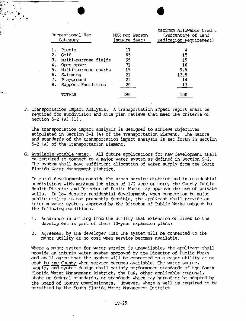
Maximum Allowable Credit Recreational Use NRii per Person (Percentage of Land
Category (square feet) Dedication Requirement)
Picnic Golf Multi-purpose fields Open space Multi-purpose courts Swimming Playground Support Facilities
TOTALS
F. Transportation Impact Analysis. A transportation impact report shall be required for subdivision and site plan reviews that meet the criteria of Section 5-2 ( A ) (1).
The transportation impact analysis is designed to achieve objectives stipulated in Section 5-1 (A) of the Transportation Element. The nature and standards of the transportation impact analysis is set forth in Section 5-2 (A) of the Transportation Element.
G. Available Potable Water. All future applications for new development shall be required to connect to a major water system as defined in Section 9-2. The system shall have sufficient allocation of water supply from the South Florida Water Management District.
In rural developments outside the urban service district and in residential subdivisions with minimum lot sizes of 1/2 acre or more, the County Public Health Director and Director of Public Works may approve the use of private wells. In low density residential developnent, when connection to major public utility is not presently feasible, the applicant shall provide an interim water system, approved by the Director of Public Works subject to the following conditions.
1. Assurance in writing from the utility that extension of lines to the development is part of their 10-year expansion plans;
2. Agreement by the developer that the system will be connected to the major utility at no cost when service becomes available.
Where a major system for water service is unavailable, the applicant shall provide an interim water system approved by the Director of Public Works and shall agree that the system will be connected to a major utility at no cost -- to the County when service becomes available. The water source, supply, and system design shall satisfy performance standards of the South Florida Water Management District, the DER, other applicable regional, state or federal standards, or standards which may hereafter be adopted by the Board of County Commissioners. However, where a well is required to be permitted by the South Florida Water Management District

C t- (SFWMD) the permit granted by the SFWMD shall be filed by the applicant
with the County which may exercise its power to monitor withdrawal rates to assure applicants adhere to established regulations protecting surrounding wellfields. Furthermore, in order to prevent abuse of County water resources, the installation and operation of wells not covered by the South Florida Water Management District regulations shall be subject to County permitting and monitoring regulations using standards which may hereafter be adopted by the Board of County Commissioners.
The intent of this permitting procedure is:
1. To maintain a comprehensive data base concerning water supply and quality;
=*.
2. To discourage unregulated proliferation of private water systems; and
3. To achieve a subsystem design which can be effectively and economically integrated into a central public system certified and regulated by the Public Service Commission or by Martin County at a later point in time and to encourage a compact urban development pattern by managing the location, timing and scale of land development to assure that new development can be efficiently served by public facilities without adversely impacting the County's fiscal capacity.
In addition, the County shall undertake any necessary action to prevent or remedy water supply and water quality problems.
The County nay require analysis of water quality and supply of all . permitted private wells based on evolving problems and issues associated with water resources. The private well owner may be assessed by the County after due public hearings for needed water quality, supply problems, requisite testing, laboratory analysis, and improvements deeded necessary and fiscally equitable.
H. Wastewater Service. All applicants for development within the urban service district shall be required to connect to a major utility as defined in the Data Inventory and ~nalysis. Where a major system for wastewater service is unavailable, the applicant shall provide an interim wastewater system approved by the Director of Public Works and shall agree that the system will be connected to a major utility at no cost when service becomes available.
The intent of this provision is:
1. To discourage unregulated proliferation of private package treatment plants;
2 . To achieve a subsystem design which can be effectively and economically integrated into a major wastewater system at a future point in time which would be certified and regulated by the Public Service Commission or by Martin County; and

3. To encourage a compact urban developnent pattern by managing the locatfan, timing, and scale of 'land development to assure that new dwalcpnent can be efficiently served by prblic facil i t ies without adversely impacting the County's fiscal capacity.
. The system shall be designed to satisfy p e r f o m a t standards of the De-t of Environmental Regulation (DER) , othet applicable regional, state, or federal standards, or standards which shall be hereafter adopted as part of the Land Develqmmt Code. The w r d s ln the Land Developnent Code shall address such issues as demnstration of need, senrice area, system design and specification, required easements, maintenance and operation considerations, screening, security, right of entry provisim, future dedication to a rrrajor public ut i l i ty when deemed appropriate, and notice and procedure.
1. Notwithstanding any other provisions of this Plan, when a septic tank is the only means of individual sewage d m , the f ollcwing standards shal l apply to residential develapnent:
a) Each septic tank shall be located on a lot.
b) Each lot shall have a usable minimum area of anehalf acre per unit when the develap~lent is serviced by a private well.
C) Each lot shall have a usable mhimm area of one-third acre per wit when the development is serviced by a p r i ~ t e wel l .
2. The above subsectian 1 shall not apply to a lot of record (as described in Section 4-3 (A) i n the following instances:
a) Ccnstructicn of a single family dwelling in accordance with the ather applicable provisions of this Plan and the Code of Laws and Ordinances.
b) Constructian of a duplex when the lot of record includes a t least onehalf acre and w i l l be serviced by a major or interim water supply system and i n accordance with the other applicable ptavisicns of this Plan and the Code of Laws and Ordinances.
C) Construction of a duplex when the following criteria is met:
(1 Tha duplex w i l l be serviced by public water.
( 2 ) The duplex is located in a subdivision, or all that portion of a suWivision, which is zoned for duplex use and is .designated for medim density or Mgh density use on the future land use rrrap of the Comprehensive Plan: and which was three-fourth (3/4) developed in duplex use on the effective date of the Canprehensive Plan.
(3) Public sewage treatment service is not available within 1000 feet of the subject duplex lot.
(4) An agreement is executed with the County to connect to a public sewage treabrqit service within one year from the date the service is available to 'the duplex.
(5) The Health Department reviews the rquest and finds that all requi;rements for septic systems are met without any need for State of Florida variance.
( 6 ) The duplex is located in an area where the Health Department has determined that groundwater or surface water contamination or a high failure rate for septic system does not exist.
The intent of this subsection is to permit infilling of duplex units in existing duplex subdivisions where most of the lots are occupied by duplex units.
3. The above subsection 1 shall not apply to remodeling, rebuilding or reconstruction.
4. The above subsection 1 shall not apply to replacement or repair of septic tanks.
5. lbis section shall not be interpreted to deny the use of individual sewage disposal systems other than septic tanks when provided for in the Code of Laws and Ordinances,

. . 6. Develapnent shall not be approved pursuant t o ' t h i s Section unless the
Martin County Health Department has approved the septic tank or other individual wastewater treatment system based on s o i l conditions and a l l
. rules of the Florida Department of Health and Rehabilitative Senrices.
7. For purposes of t h i s section, the term wunitw shall mean one single family dwelling, one-half of a duplex, one-third of a tr iplex and one-fourth of a quadruple..
8. When a major wastewater system is not available, non-residential uses generating less than 2,000 gpd per establishment shal l be allowed t o use septic tanks except when uses are judged by the Health Department t o constitute a high expected fai lure level.
I. Soil Erosion and Sedimentation Control. The Land Developnent Code shall address methods of controlling so i l erosion and sedimentation.
Technical Standards :
In order t o prevent both so i l erosion and sedimentation, a so i l erosion and sedimentation control plan shall be required as a part of an application for site plan review whenever a developnent shal l involve any clearing, grading, transporting, or other form of disturbing land by the mvement of earth, including the mining of minerals, sand and gravel.
All measures necessary t o minimize so i l erosion and t o control sedimentation i n the disturbed land area shal l be implemented. The following protection shall be provided for all d i s tu rkd areas: minimize velocities of water runoff, and retain sedimentation within t h e develapnent s i t e as early as possible following disturbances.
J. Parkinq, Internal Circulation, and Access t o Public or' Private Streets. Driveways and areas for the parking and internal circulation of vehicles shal l be located, designed and controlled so as to provide for safe and convenient circulation within the site and safe and convenient access fran adjoining streets.
Technical Standards :
Parkinq requirements of the Zoning Ordinance shall be applied for calculating required off-street parking. Among factors t o be considered shall be the ntrmber and location of access drives from adjacent streets, the location and width of driveways and access a is les t o parking spaces, the arrangement of parking areas and means of access t o building for f ire-f ightinq apparatus and other emergency vehicles. A l l non-residential developtent and a l l residential development, except for single-family haws, shall be required t o provide adequate off-site parking and f ac i l i t i e s for on-site back-up and turn-around movements.

Parking areas and driveways shall be clearly identified and separated from principal pedestrian routes and recreation areas by curbs, pavement markings, planting aras, fences or similar features designed t o promote p e d k r i a n safety.
K. Appearance and Nuisances. Subdivision and s i t e plan reviews shal l assure that ~Ufsance Fmpacts of sight, sound, and -11 Shdll be minimized. No standards on appearance shall be. enforced unless adopted as part of the Land Developnent Code.
Technical Standards:
1. Screening and Mechanical Equimnt. ~ e c h a n i d equipnent or other u t i l l t y krdmre other than ante- and stacks on roofs shall be
'
hamdous with the building or they shall be lccated and/or screened so as not to 'be visible fran any public way within t h e Fmpacted area, except within industrial d is t r ic ts . Utilities in or adjacent t o residential areas s h a l l be designed in a m e t which minimizes nuisance wets, such as noise and odor, and shall be landscaped and screened in order t o minimize adverse visual inpacts and enhance their general appearance and t o preserve the s tab i l i ty and integrity of adjacent residential areas.
2. Maintenance of Activities within Enclosed Building. A l l businesses, services or manufacturing or processing shall be conducted within canpletely enclosed buildings i n all zoning districts excepting industrial dis t r ic ts . If the Planning and Zoning Comnission determines that a demonstrated necessity exis ts fo r outside storage or display due t o the Frrpracticality and unreasonableness of enclosure requirements, in which gase service, storage, display areas or yard s h a l l be screened t o the greatest reasonable and practical extent..
3. Exterior Lightinq. Exterior l ighting shal l be so arranged as t o shield or deflect the l igh t frm adjoining properties and public streets.
L. Fire Service and Height of Structures. The height of structures is regulated pursuant t o the Martin County Zoning We. In addition t o the zoning- policy, and consistent w i t h the objectives and programs for f i r e service contained in Section 11-1 and 11-2, no application for a structure with habitable floor space over two s tor ies or twenty-five fee t (whichever is lesser) shall be permitted unless the Board of Cdunty Camnission and the applicant has provided assurance of the avai labi l i ty of a f i r e a m p m y equipped t o service the structure together w i t h an available water supply which satisfies fire flow requirements of the Nationdl Fire Prevention Assxiation Code adopted or as may hereinafter be amended.
Section 4-4 Imlementinq Program for Land Use Manaqemnt. The following programs shall be t he basis for carrying out the goals and objectives of the land use elernent.
A. Continuing Land Use Programs. The Martin County Casmunity Developnent Department as an i n twra l part of continuing d e p a w t a l operations shal l cairy out t h e following l a d use related pr&r&:
-
1. Land Use Information System. Maintain and periodically~update the land use information system. through a d t o r i n q program using the nwrt current information and data ma~qement systems. -
[ 2. Land Use Trends. Monitor. and evaluate population and land use trends. I
[3. Review Plans and Policies. Review and amend as necessary existing plans and policies. I
[4. Pfsca l MaMgement. Assist update of f i sca l management policies including capital inprovement program and budget. j
5. Administer Land Use Controls. Assist in administering adopted land use cdntrol ordinances referenced in Section 1-12 of this Plan and other related ordinances which may hereinafter be adopted.
6. Public Assistance. Provide continuing land use information and assistance t o the public.
[7. Interqwernmental Coordination. Assist in coordinating land developnent issues where applicable with other plblic agencies a t all levels-of govenunent pursuant to t h e In t e rgwe~~nen ta l Element of this Plan. I
8. MaMse Current. Developnent Imacts. Review potential impacts of proposed devel-t pusuant to existing ordinances, including, but not lindted to public fac i l i ty inpacts, inpacts on t h e natural environment, and bpact on stable residential mighborhoods.
9. Draft a Tree Protection Ordinance. Thetree protection ordinance shall include a permit procedure for regulating tree rem,val.,The ordinance should be [adopted within eighteen mnths af ter pssage of the Plan. I incorporated An the Land Developnent s.
10. Urban Desiqn and CXmmi ty Amearance. Good principles of urban design sha l l be applied through site plan review procedures i n order to enhance general commie appearance as w e l l as t o preserve and enhance open space and landscape. This program shall ass i s t i n i m p r o w the major natural and mamnade focal points within the County including such existing or potential scenic resources as the Atlantic Ocean, Indian River, St. Lucie River, Loxahatchee River, Intracoastal Waterway, landscaped transportation corridors, civic amplexes, ccmnercial centers, and residential neighborhoods.
11. Selective Recruitment of Industry. Undertake -concerted program with. other economic development interest groups t o develop the County's cconanic base and fiscal capacity @rough selec-ed reczuitnent of clean industry. Selective c r i te r ia s h a l l be conpatible with industrial develapnent o b j e i v e of Section 4-1 (El (3) of this Article.
e. special Lnad Use Studies. In order t o maintain land use policies responsive t o changing conditions, problem and issues, the County shall undertake .special studies t o develop specific local strategies for resolving unanticipated land use problem Md issues on a country-wide , basis or small area basis as needed. Such special studies shall alga be undertaken where necessary in support of v i a l grant programs or plrsuant

I t o specific policies of the.federa1 o r s t a t e government or 'other appropriate agency. The timing of such special studies shal l be predicted on decisions of the Board of County Conmissioners and the Planning and Zoning Conmission or the &cal Planning Agency.
1. Evaluate feas ib i l i ty of public land a c q u i s i t i d s a l e .
2. Design concept plans and developtent plans for public fac i l i t ies .
3. Prepare public landscape plans.
4. Carry out special studies supportive t o ordinance revisions.
5. Draft a t r ee protection ordinance.
6. Coordinate and p.repare grant applications for public improvements.
7. Annually review population estimate of University of Florida and Bureau of Census.
8. Prepare other special studies as directed.
9. Rectify inconsistencies in Casnprehensive Land Use Plan and Maps and Land Developnent Codes, including the Zoning Ordinance and Subdivision Ordinance.
10. Monitor evolving problem and issues related to land use, t r a f f i c circulation, housing, coastal zone management resource conservation, parks and recreation, u t i l i t i e s , water and sewer systems, drainage, capi tal Fmprovements and fiscal inplications. Suggest appropriate short and long term policy for meeting such planning related problem and issues.
11. Carry out Ccmprehensive Plan evaluat M Government
ion pursuant t o requirements of the

FUIRIDA DEPARTMEN O F ~ A T E 1 ' i -
November 1 2 , 1985 2- . . - - -. -. -
Noreen S. Dreyer s - C-1 t -5 - --
Chief A s s i s t a n t County At to rney r- -_ !:9
. c M a r t i n County 50 Kindred S t r e e t S t u a r t , F l o r i d a 33497 - - -
A t t e n t i o n : Honorable Louise V. I s a a c ~ , C le rk o f C i r c u i t Court
Dear Mr. Dreyer :
P u r s u a n t t o t h e p r o v i s i o n s o f S e c t i o n 125.66, F l o r i d a S t a t u t e s , t h i s w i l l acknowledge:
1. R e c e i p t o f your l e t t e r / s of November 7, 1985
and c e r t i f i e d c o p y / i e s of County
Ordinance ( s )
2 , R e c e i p t of Mart in County Ord inance / s
relative t o : ( t273) Ord. prov. f o r one u n i t p e r a c r e i n
( 1 Res. c a t e g o r y i n Sec. 4-Z(D) Amend. Ch. 34 Comp. Plan e t c .
which we have numbe red - 85-23
(b ) which we have numbered -
3 . We have f i l e d this/&ese O r d i n a n c e ( s ) i n t h i s o f f i c e I on November 1 2 . 1985. I
4 . The o r i g i n a l l d u p l i c a t e c o p y / i e s showing t h e f i l i n g d a t e I i s / a r e be ing r e t u r n e d f o r your r e c o r d s . I
C o r d i a l l y ,
(Mrs.) L i z Cloud, Chief Bureau of A d m i n i s t r a t i v e Code
cc: Honorable Louise V . I s a a c s , C l e r k of C i r c u i t Court. l lonorable Thomas J . I-liggins , Chairman, BCC
%&: 655 ~ ~ ~ ~ 2 4 5 0 FlDRIDA-State of the Arts