Embed Size (px)
Citation preview
H A R T L O C A L D E V E L O P M E N T F R A M E W O R KH A R T L O C A L D E V E L O P M E N T F R A M E W O R K
H A R T D I S T R I C T C O U N C I LH A R T D I S T R I C T C O U N C I L2 0 1 02 0 1 0
URBAN CHARACTERISATION AND DENSITY STUDYURBAN CHARACTERISATION AND DENSITY STUDY
H A R T U R B A N C H A R A C T E R I S A T I O N A N D D E N S I T Y S T U D YH A R T U R B A N C H A R A C T E R I S A T I O N A N D D E N S I T Y S T U D Y
H A R T L O C A L D E V E L O P M E N T F R A M E W O R KH A R T L O C A L D E V E L O P M E N T F R A M E W O R KH A R T L O C A L D E V E L O P M E N T F R A M E W O R KH A R T L O C A L D E V E L O P M E N T F R A M E W O R K
THE CONSERVATION STUDIO
1 Querns LaneCirencesterGloucestershireGL7 1RL
T. 01285 642 428F. 01285 642 488E. [email protected]. www.theconservationstudio.co.uk
This document has been written on behalf of by Hart District Council by:This document has been written on behalf of by Hart District Council by:
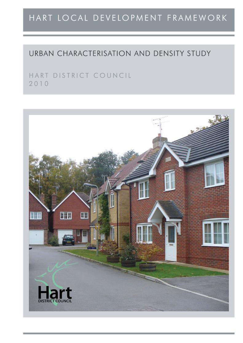
Cover Photograph: Kings Glade in YateleyCover Photograph: Kings Glade in Yateley
H A R T U R B A N C H A R A C T E R I S A T I O N A N D D E N S I T Y S T U D YH A R T U R B A N C H A R A C T E R I S A T I O N A N D D E N S I T Y S T U D Y
H A R T L O C A L D E V E L O P M E N T F R A M E W O R KH A R T L O C A L D E V E L O P M E N T F R A M E W O R K
CONTENTSCONTENTS
1 PURPOSE OF THE STUDY
2 PLANNING POLICY AND LANDSCAPE CONTEXT
3 METHODOLOGY
4 MAPPING
5 OTHER INITIATIVES AND COMMUNITY ENGAGEMENT
6 CONCLUSIONS AND POLICY RECOMMENDATIONS
7 APPENDICES
PAGEPAGE
1
2
5
8
9
10
15

H A R T U R B A N C H A R A C T E R I S A T I O N A N D D E N S I T Y S T U D YH A R T U R B A N C H A R A C T E R I S A T I O N A N D D E N S I T Y S T U D Y1
H A R T L O C A L D E V E L O P M E N T F R A M E W O R KH A R T L O C A L D E V E L O P M E N T F R A M E W O R K
1 PURPOSE OF THE STUDY1 PURPOSE OF THE STUDY
1.1 This Urban Characterisation and Density Study (UCDS) has been prepared by The Conservation Studio on behalf of Hart District Council (HDC). As an evidence base study, the UCDS will be used to inform the Council’s emerging Local Development Framework (which will replace the Adopted Hart District Local Plan (Replacement) 1996-2006).
1.2 The key objectives of the UCDS are to:
• Identify, analyse and describe in a systematic way the form and character of each main settlement and the sub-areas within it.
• Provide a legible analysis of the streets and the spaces within each settlement.
• Note the mixes of uses and activities.
• Analyse the residential density ranges across each settlement.
• Analyse the residential form, character and layout, including representative plot characteristics.
• Map public transport accessibility and key pedestrian corridors.
• Recommend, where appropriate, local design policies and guidance based on the above analysis, taking into account national planning policy.
1.3 The study area covers the six main settlements in Hart District (listed below) as defined by the settlement policy boundaries in the Adopted Hart Local Plan. Conservation Areas within these settlements have been excluded as they are covered by separate HDC Conservation Area Character Appraisals.
• Fleet, including Elvetham Heath, and Church Crookham.
• Odiham.
• Hook.
• Hartley Wintney.
• Blackwater.
• Yateley.
1.4 It should be noted that the UCDS is currently an LDF evidence base study and as such does not necessarily represent the view of Hart District Council.
Fleet Road, Fleet
West Odiham
H A R T U R B A N C H A R A C T E R I S A T I O N A N D D E N S I T Y S T U D YH A R T U R B A N C H A R A C T E R I S A T I O N A N D D E N S I T Y S T U D Y 2
H A R T L O C A L D E V E L O P M E N T F R A M E W O R KH A R T L O C A L D E V E L O P M E N T F R A M E W O R K
2 PLANNING POLICY AND LANDSCAPE CONTEXT2 PLANNING POLICY AND LANDSCAPE CONTEXT
National Planning Policy2.1 The current overarching national planning
guidance PPS1 (Delivering Sustainable Development) states that good design should ensure attractive, usable, durable and adaptable places. It is a key element in achieving sustainable development and sets out the Government’s aims for development, which are to be achieved by:
• Making suitable land available for development in line with economic, social and environmental objectives to improve people’s quality of life.
• Contributing to sustainable economic development.
• Protecting and enhancing the natural and historic environment, the quality and character of the countryside, and existing communities.
• Ensuring high quality development through good and inclusive design, and the efficient use of resources.
• Ensuring that development supports existing communities and contributes to the creation of sustainable, safe and mixed communities with good access to jobs and key services for all members of the community.
2.2 PPS1 states that the key role of good design is achieving sustainable development. Local Planning Authorities (LPA) should plan positively for the achievement of high quality and inclusive design for all development and contribute positively to making places better for people. High quality and inclusive design should create mixed and integrated developments which avoid segregation, have well-planned public spaces and provide people with opportunities for recreation.
2.3 PPS1 outlines that good design should:
• Address the connections between people and places by considering the needs of people to access jobs and key services.
• Be integrated into the existing urban form and natural and built environments.
• Be an integral part of the development process for ensuring successful, safe and inclusive cities, towns and villages.
• Create an environment where everyone can access and benefit from the full range of opportunities available.
• Consider the direct and indirect impacts on the natural environment.
2.4 LPAs should prepare robust policies on design and access, which reflect LDF objectives and an understanding and evaluation of its present defining characteristics. Access and inclusiveness for all is be a key tenet of design and must be reflected in policies.
2.5 In planning for the achievement of high quality and inclusive design, LPAs should have regard to good practice set out in:
• By Design - Urban Design in the Planning System: towards better practice.
• By Design - Better Places to Live.
• Safer Places - the Planning System and Crime Prevention.
• Planning and Access for Disabled People: A Good Practice Guide.
• Manual for Streets.
• Streets for All.
2.6 PPS1 clearly states that whilst it is proper to seek to promote or reinforce local distinctiveness, particularly where this is supported by clear LDF policies or supplementary planning documents, LPAs should not attempt to impose architectural styles or particular tastes and they should not stifle innovation, originality or initiative through unsubstantiated requirements to conform to certain development forms or styles.
2.7 There is also increasing demand for sustainability in construction methods, energy efficiency and accessibility to services including public transport. The supplement to PPS1 (Planning and Climate Change) states that LPAs, developers and other partners in the provision of new development should engage constructively and imaginatively to encourage the delivery of sustainable buildings. Planning policies should support innovation and investment in sustainable buildings and should not deter novel or cutting-edge developments unless there are exceptional reasons for doing so.
H A R T U R B A N C H A R A C T E R I S A T I O N A N D D E N S I T Y S T U D YH A R T U R B A N C H A R A C T E R I S A T I O N A N D D E N S I T Y S T U D Y3
H A R T L O C A L D E V E L O P M E N T F R A M E W O R KH A R T L O C A L D E V E L O P M E N T F R A M E W O R K
2.8 The principles of applying sustainable development and high quality design housing are outlined in Planning Policy Statement 3: Housing (PPS3). PPS3 states that good design should contribute positively to making places better for people and that inappropriate or fails to take opportunities for improving the character and quality of an area, should not be accepted.
2.9 PPS3 outlines that the key issues to address when assessing housing design include whether:
• It is easily accessible and well-connected to public transport and community facilities.
2.10 PPS3 also highlights that LPAs should draw on relevant guidance and standards and promotes the use of appropriate tools and techniques. This could include design codes, urban design guidelines, masterplans, village design statements, site briefs and community participation techniques.
2.11 Additional national guidance on design is also produced by the Commission for Architecture and the Built Environment (CABE). CABE documents of particular interest include:
• Better Neighbourhoods: Making Higher Densities Work.
• Better Places to Work.
• Moving Towards Excellence in Urban Design and Conservation.
• Physical Activity and the Built Environment.
• The Cost of Bad Design.
• The Value of Public Space.
Local Planning Policy2.12 Current planning policies for the Hart district are
those that have been formally saved from the Hart District Local Plan (Replacement), which was adopted in 2002, and from the First Alterations to the local plan. The saved policies have been re-published in a single document and will remain effective until superseded in the Local Development Framework.
2.13 The saved policies start with general principles, such as GEN1 under which development proposals will be permitted subject to a series of safeguards, and GEN4 which promotes improvement of:
• Space is used efficiently, and is safe, access and user-friendly.
• Provides or enables good access to public open space as well as private outdoor space.
• Is well integrated with the neighbouring buildings and the local area more generally in terms of scale, density, layout and access.
• Facilitates the efficient use of resources.
• Takes a design-led approach to the provision of car-parking.
• Creates a high quality public realm and streets that are pedestrian, cycle and vehicle friendly.
• Creates, or enhances, a distinctive character that relates well to the surroundings.
• Addresses biodiversity within residential environments.
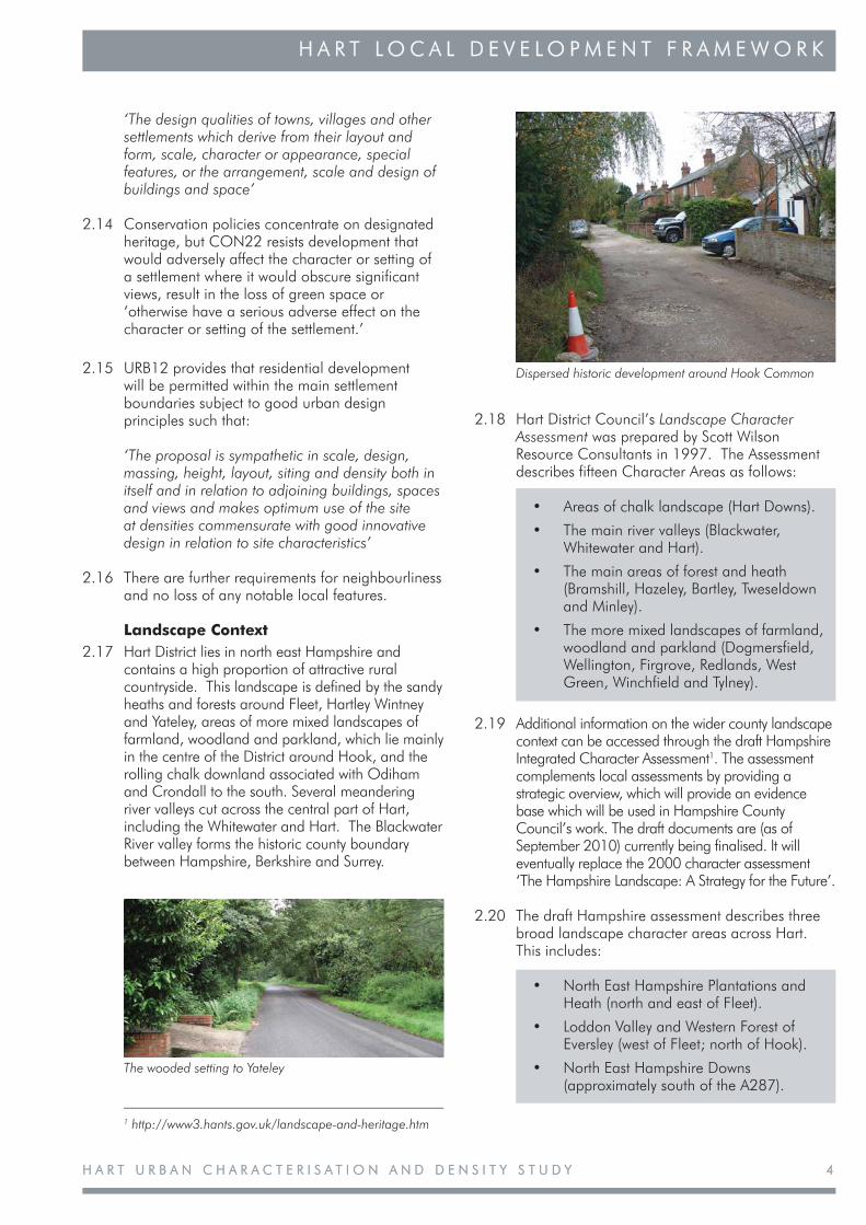
Hook Railway Station
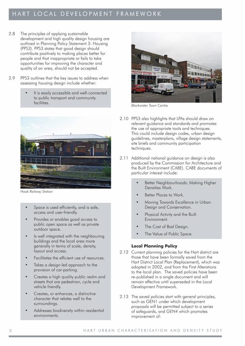
Blackwater Town Centre
H A R T U R B A N C H A R A C T E R I S A T I O N A N D D E N S I T Y S T U D YH A R T U R B A N C H A R A C T E R I S A T I O N A N D D E N S I T Y S T U D Y 4
H A R T L O C A L D E V E L O P M E N T F R A M E W O R KH A R T L O C A L D E V E L O P M E N T F R A M E W O R K
2.18 Hart District Council’s Landscape Character Assessment was prepared by Scott Wilson Resource Consultants in 1997. The Assessment describes fifteen Character Areas as follows:
• Areas of chalk landscape (Hart Downs).
• The main river valleys (Blackwater, Whitewater and Hart).
• The main areas of forest and heath (Bramshill, Hazeley, Bartley, Tweseldown and Minley).
• The more mixed landscapes of farmland, woodland and parkland (Dogmersfield, Wellington, Firgrove, Redlands, West Green, Winchfield and Tylney).
2.19 Additional information on the wider county landscape context can be accessed through the draft Hampshire Integrated Character Assessment1. The assessment complements local assessments by providing a strategic overview, which will provide an evidence base which will be used in Hampshire County Council’s work. The draft documents are (as of September 2010) currently being finalised. It will eventually replace the 2000 character assessment ‘The Hampshire Landscape: A Strategy for the Future’.
2.20 The draft Hampshire assessment describes three broad landscape character areas across Hart. This includes:
• North East Hampshire Plantations and Heath (north and east of Fleet).
• Loddon Valley and Western Forest of Eversley (west of Fleet; north of Hook).
• North East Hampshire Downs (approximately south of the A287).
1 http://www3.hants.gov.uk/landscape-and-heritage.htm
Dispersed historic development around Hook Common
The wooded setting to Yateley
‘The design qualities of towns, villages and other settlements which derive from their layout and form, scale, character or appearance, special features, or the arrangement, scale and design of buildings and space’
2.14 Conservation policies concentrate on designated heritage, but CON22 resists development that would adversely affect the character or setting of a settlement where it would obscure significant views, result in the loss of green space or ‘otherwise have a serious adverse effect on the character or setting of the settlement.’
2.15 URB12 provides that residential development will be permitted within the main settlement boundaries subject to good urban design principles such that:
‘The proposal is sympathetic in scale, design, massing, height, layout, siting and density both in itself and in relation to adjoining buildings, spaces and views and makes optimum use of the site at densities commensurate with good innovative design in relation to site characteristics’
2.16 There are further requirements for neighbourliness and no loss of any notable local features.
Landscape Context2.17 Hart District lies in north east Hampshire and
contains a high proportion of attractive rural countryside. This landscape is defined by the sandy heaths and forests around Fleet, Hartley Wintney and Yateley, areas of more mixed landscapes of farmland, woodland and parkland, which lie mainly in the centre of the District around Hook, and the rolling chalk downland associated with Odiham and Crondall to the south. Several meandering river valleys cut across the central part of Hart, including the Whitewater and Hart. The Blackwater River valley forms the historic county boundary between Hampshire, Berkshire and Surrey.
H A R T U R B A N C H A R A C T E R I S A T I O N A N D D E N S I T Y S T U D YH A R T U R B A N C H A R A C T E R I S A T I O N A N D D E N S I T Y S T U D Y5
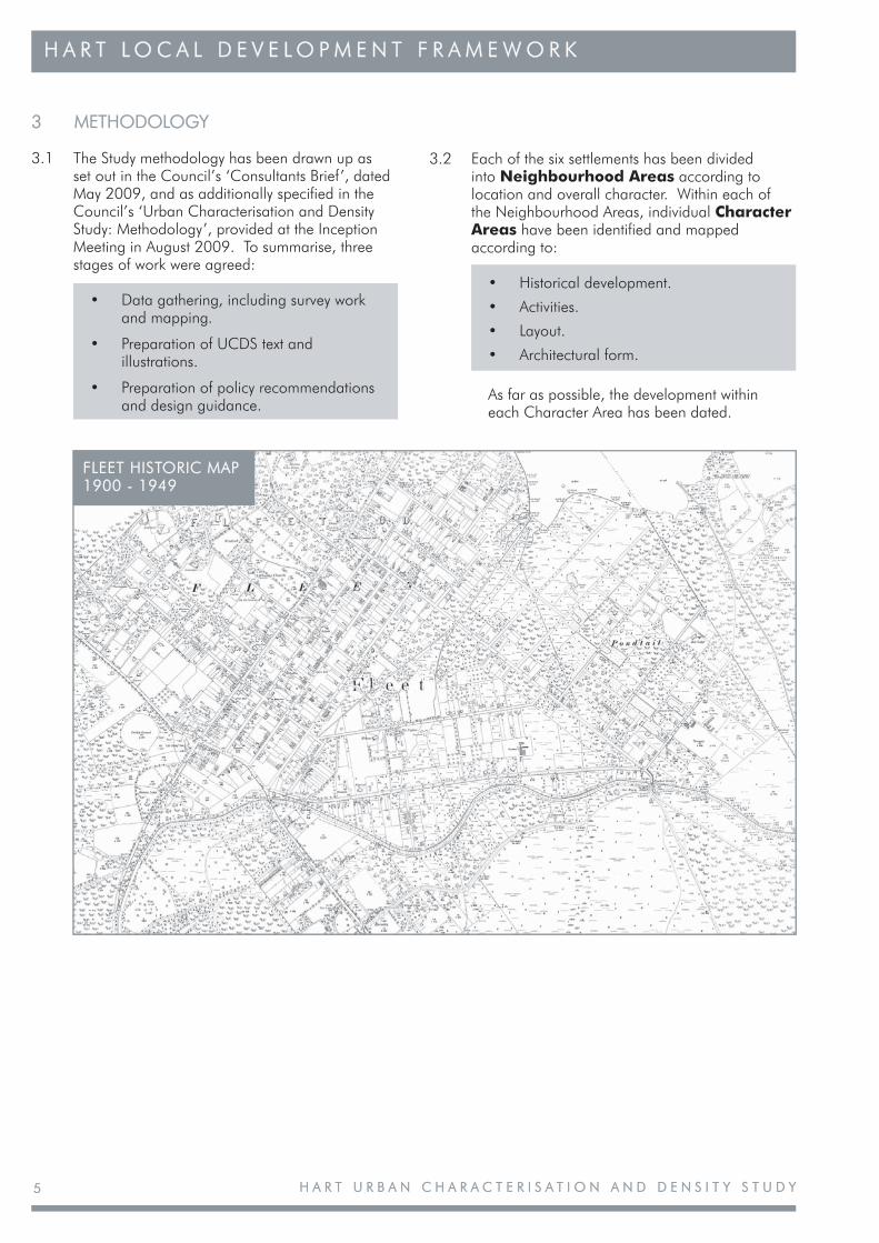
3 METHODOLOGY3 METHODOLOGY
3.1 The Study methodology has been drawn up as set out in the Council’s ‘Consultants Brief’, dated May 2009, and as additionally specified in the Council’s ‘Urban Characterisation and Density Study: Methodology’, provided at the Inception Meeting in August 2009. To summarise, three stages of work were agreed:
• Data gathering, including survey work and mapping.
• Preparation of UCDS text and illustrations.
• Preparation of policy recommendations and design guidance.
H A R T L O C A L D E V E L O P M E N T F R A M E W O R KH A R T L O C A L D E V E L O P M E N T F R A M E W O R K
3.2 Each of the six settlements has been divided into Neighbourhood Areas according to location and overall character. Within each of the Neighbourhood Areas, individual Character Areas have been identified and mapped according to:
• Historical development.
• Activities.
• Layout.
• Architectural form.
As far as possible, the development withineach Character Area has been dated.
FLEET HISTORIC MAP FLEET HISTORIC MAP 1900 - 19491900 - 1949
H A R T U R B A N C H A R A C T E R I S A T I O N A N D D E N S I T Y S T U D YH A R T U R B A N C H A R A C T E R I S A T I O N A N D D E N S I T Y S T U D Y 6
H A R T L O C A L D E V E L O P M E N T F R A M E W O R KH A R T L O C A L D E V E L O P M E N T F R A M E W O R K
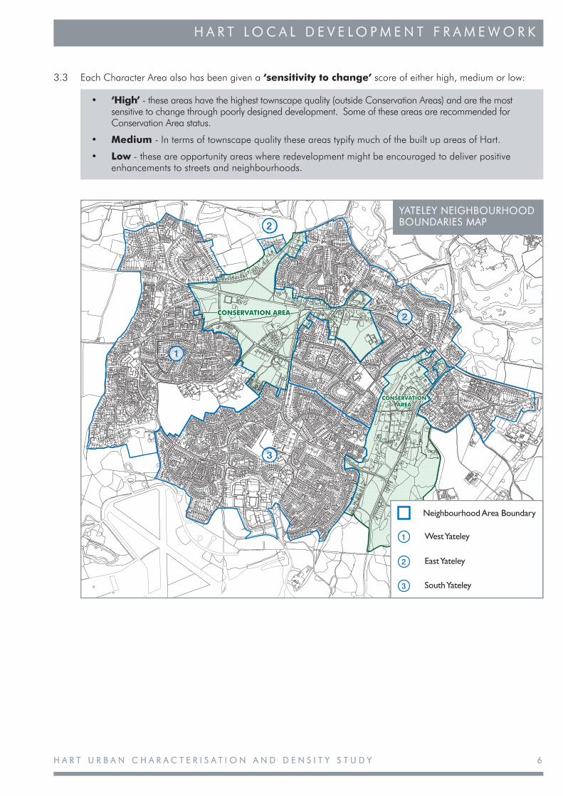
3.3 Each Character Area also has been given a ‘sensitivity to change’ score of either high, medium or low:
• ‘High’ - these areas have the highest townscape quality (outside Conservation Areas) and are the most sensitive to change through poorly designed development. Some of these areas are recommended for Conservation Area status.
• Medium - In terms of townscape quality these areas typify much of the built up areas of Hart.
• Low - these are opportunity areas where redevelopment might be encouraged to deliver positive enhancements to streets and neighbourhoods.
CONSERVATION AREA
CONSERVATION AREA
CONSERVATION AREA
1
2
2
3
Neighbourhood Area Boundary
West Yateley1
East Yateley2
South Yateley3
YATELEY NEIGHBOURHOOD YATELEY NEIGHBOURHOOD BOUNDARIES MAPBOUNDARIES MAP
H A R T U R B A N C H A R A C T E R I S A T I O N A N D D E N S I T Y S T U D YH A R T U R B A N C H A R A C T E R I S A T I O N A N D D E N S I T Y S T U D Y7
H A R T L O C A L D E V E L O P M E N T F R A M E W O R KH A R T L O C A L D E V E L O P M E N T F R A M E W O R K
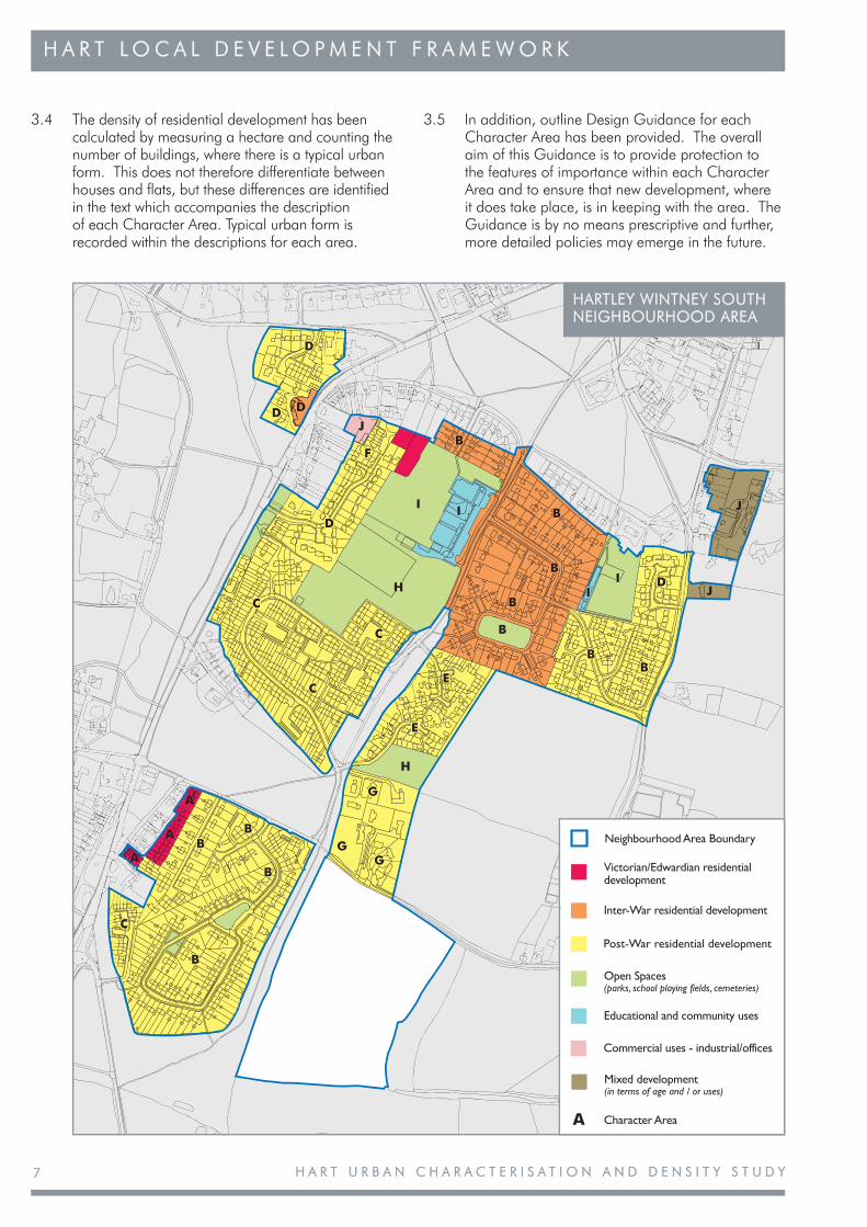
3.4 The density of residential development has been calculated by measuring a hectare and counting the number of buildings, where there is a typical urban form. This does not therefore differentiate between houses and flats, but these differences are identified in the text which accompanies the description of each Character Area. Typical urban form is recorded within the descriptions for each area.
3.5 In addition, outline Design Guidance for each Character Area has been provided. The overall aim of this Guidance is to provide protection to the features of importance within each Character Area and to ensure that new development, where it does take place, is in keeping with the area. The Guidance is by no means prescriptive and further, more detailed policies may emerge in the future.
B
C
A B
B
B G
G
G
H
E
E
C
C
C H
D I
B
B
B
B I
I D J
J
J
B B
B
I
F
D D
D
Neighbourhood Area Boundary
Victorian/Edwardian residential development
Post-War residential development
Inter-War residential development
Open Spaces (parks, school playing fields, cemeteries)
Educational and community uses
Character AreaA
Commercial uses - industrial/offices
Mixed development (in terms of age and / or uses)
HARTLEY WINTNEY SOUTH HARTLEY WINTNEY SOUTH NEIGHBOURHOOD AREANEIGHBOURHOOD AREA
H A R T U R B A N C H A R A C T E R I S A T I O N A N D D E N S I T Y S T U D YH A R T U R B A N C H A R A C T E R I S A T I O N A N D D E N S I T Y S T U D Y 8
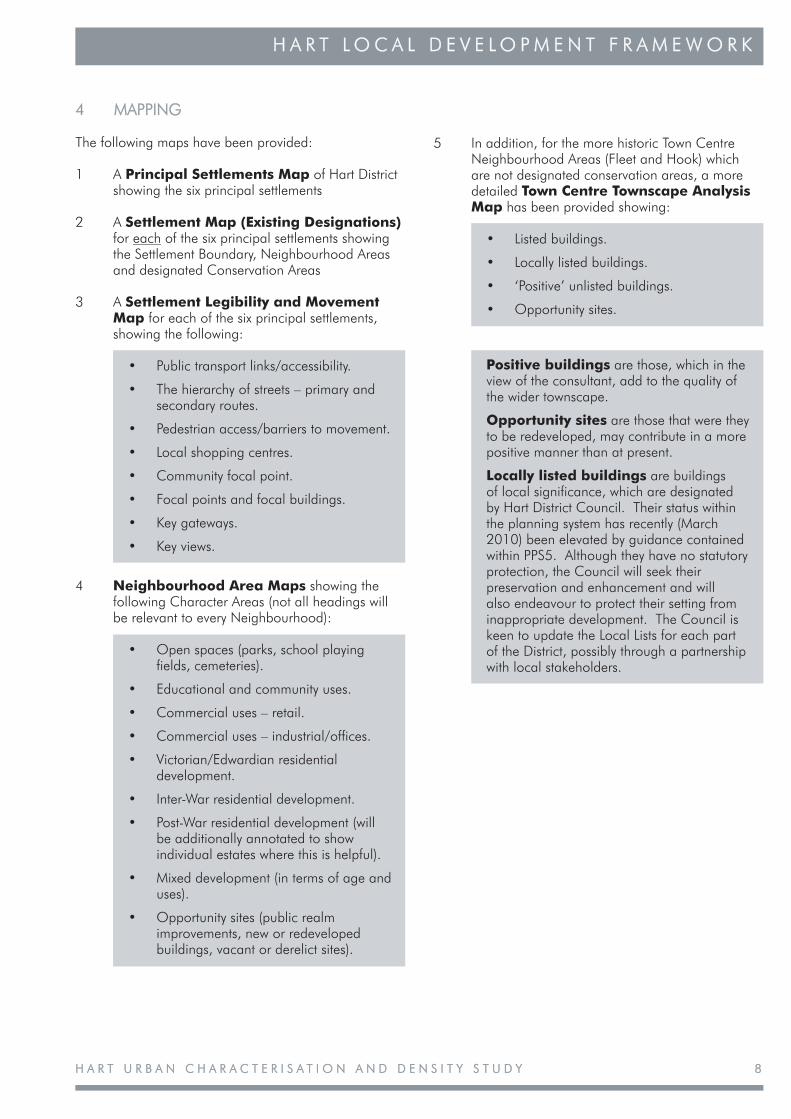
4 MAPPING4 MAPPING
The following maps have been provided:
1 A Principal Settlements Map of Hart District showing the six principal settlements
2 A Settlement Map (Existing Designations) for each of the six principal settlements showing the Settlement Boundary, Neighbourhood Areas and designated Conservation Areas
3 A Settlement Legibility and Movement Map for each of the six principal settlements, showing the following:
• Public transport links/accessibility.
• The hierarchy of streets – primary and secondary routes.
• Pedestrian access/barriers to movement.
• Local shopping centres.
• Community focal point.
• Focal points and focal buildings.
• Key gateways.
• Key views.
4 Neighbourhood Area Maps showing the following Character Areas (not all headings will be relevant to every Neighbourhood):
• Open spaces (parks, school playing fields, cemeteries).
• Educational and community uses.
• Commercial uses – retail.
• Commercial uses – industrial/offices.
• Victorian/Edwardian residential development.
• Inter-War residential development.
• Post-War residential development (will be additionally annotated to show individual estates where this is helpful).
• Mixed development (in terms of age and uses).
• Opportunity sites (public realm improvements, new or redeveloped buildings, vacant or derelict sites).
5 In addition, for the more historic Town Centre Neighbourhood Areas (Fleet and Hook) which are not designated conservation areas, a more detailed Town Centre Townscape Analysis Map has been provided showing:
• Listed buildings.
• Locally listed buildings.
• ‘Positive’ unlisted buildings.
• Opportunity sites.
Positive buildings are those, which in the view of the consultant, add to the quality of the wider townscape.
Opportunity sites are those that were they to be redeveloped, may contribute in a more positive manner than at present.
Locally listed buildings are buildings of local significance, which are designated by Hart District Council. Their status within the planning system has recently (March 2010) been elevated by guidance contained within PPS5. Although they have no statutory protection, the Council will seek their preservation and enhancement and will also endeavour to protect their setting from inappropriate development. The Council is keen to update the Local Lists for each part of the District, possibly through a partnership with local stakeholders.
H A R T L O C A L D E V E L O P M E N T F R A M E W O R KH A R T L O C A L D E V E L O P M E N T F R A M E W O R K

H A R T U R B A N C H A R A C T E R I S A T I O N A N D D E N S I T Y S T U D YH A R T U R B A N C H A R A C T E R I S A T I O N A N D D E N S I T Y S T U D Y9
H A R T L O C A L D E V E L O P M E N T F R A M E W O R KH A R T L O C A L D E V E L O P M E N T F R A M E W O R K
5 COMMUNITY ENGAGEMENT AND CONSULTATION5 COMMUNITY ENGAGEMENT AND CONSULTATION
5.1 The UCDS has been subject to local community engagement and consultation during its production. The first engagement event was a series of three stakeholder workshops, conducted between September and November 2009. The three workshops covered the following settlements, respectively:
• Fleet and Church Crookham (30 September).
• Hartley Wintney, Hook and Odiham (28 October).
• Yateley and Blackwater (19 November).
5.2 The stakeholders invited to the workshops included the following groups and organisations:
• Hart Councillors.
• Parish Councils.
• Shadow Parish Councils.
• Local Civic Societies.
• Housing Association tenants groups.
• Local residents groups.
5.3 The workshops comprised a presentation by The Conservation Studio (the Consultants commissioned by Hart District Council to undertake the UCDS) and a discussion on the emerging draft document at that time. The exercise was viewed by Hart Officers and The Conservation Studio as useful initial feedback which raised a number of specific points and ideas, particularly related to the supporting detail in individual neighbourhood and character area summaries.
5.4 In 2009, Hart District Council also commissioned a separate study on the future of Fleet Town Centre. The intention was to develop a plan for Fleet town centre to encourage investors and attract new business to the town, as well as improve the local environment for residents and visitors. Public involvement in the early stage of the Fleet Vision work was viewed as essential. An initial exhibition for the Vision for Fleet was held in early December 2009 in Fleet town centre. To support this work, a summary of the initial UCDS work on Fleet town centre was provided in the exhibitions’ display panels.
5.5 The draft UCDS was subject to a full public consultation exercise for six weeks, starting on 1 February 2010. Hart received 18 comments on the draft UCDS. The comments received were a mixture of critical and supportive comment on the general methodology and neighbourhood/character area assessments, and those that concentrated on addressing issues in a specific location.
5.6 Although some comments were critical of the methodology which divided settlements into broad neighbourhood and smaller character areas, on reflection it was decided that this was a satisfactory method of framing the study, and that this approach would therefore continue. However, it is acknowledged that these categories are subject to a degree of subjectivity and therefore Hart would not rule out a review of the assessment later in the plan period.
5.7 It should also be noted that Hampshire County Council have also conducted a townscape analysis of the County’s larger settlements, including Fleet and Church Crookham, as part of their landscape character analysis outlined in paragraphs 2.18-2.19. Reflecting guidance from English Heritage and others, this work includes their interpretation of Fleet’s townscape character areas and, notwithstanding any differences in their conclusions, uses a similar methodology of dividing the settlement(s) into bounded character areas based on shared characteristics.
5.8 Where comments have been made on the analysis of specific neighbourhood and/or character areas, where these have been found to be accurate, this has been reflected in the respective settlement appendices.
H A R T U R B A N C H A R A C T E R I S A T I O N A N D D E N S I T Y S T U D YH A R T U R B A N C H A R A C T E R I S A T I O N A N D D E N S I T Y S T U D Y 1010
H A R T L O C A L D E V E L O P M E N T F R A M E W O R KH A R T L O C A L D E V E L O P M E N T F R A M E W O R K
6 CONCLUSIONS AND POLICY RECOMMENDATIONS 6 CONCLUSIONS AND POLICY RECOMMENDATIONS
Conclusions6.1 High quality design is an essential element of
sustainable place-making. By setting challenging standards that reflect the distinctive character of local areas, design policies will help to deliver the spatial objectives of the LDF.
6.2 High quality design relates to buildings and architecture, but also to the spaces between buildings. The quality of the public realm of streets and open spaces, and the relationship of developments to the surrounding area are equally important. Public realm principles are set out in the ‘Manual for Streets’ and in ‘Streets for All’. It is also accepted that good design, layout and spatial relationships can make a positive contribution towards improving community safety.
6.3 It is necessary, therefore, to ensure that all new development has regard to key sustainable design principles that interpret and reflect local character and distinctiveness.
6.4 The UCDS identifies the elements that give distinctiveness to neighbourhoods and character areas. Where these are particularly significant, it is important that this should be recognised by designation. Nationally and locally listed buildings should all survive in a clearly recognisable form, with their historic features and layouts still present. Any local listing should be based on clear published criteria.
6.5 The analysis of neighbourhoods and character areas in the UCDS has defined the elements that make them distinct. These elements include:
• Spatial layout.• Architectural form.• Building materials.• Consistency or diversity of details.• Density.• Land uses.• Streetscape and planting.
6.6 All of these elements are vulnerable to ill-considered changes but the effect may be more marked in some parts than in others. For this reason, the study has also included a measure of sensitivity, as outlined in the methodology.
6.7 In areas of high sensitivity, proposed development should demonstrate that the proposals will enhance the quality of its surroundings and will reflect the prevailing character of the area. Some of these areas are of sufficiently special interest to possibly justify designation as conservation areas, as additions to existing conservation areas or as areas of recognised townscape value.
6.8 The principal areas are:
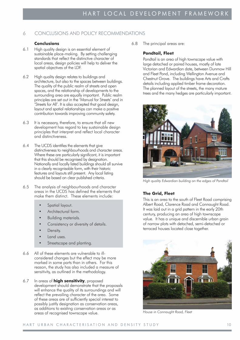
Pondtail, Fleet Pondtail is an area of high townscape value with
large detached or paired houses, mostly of late Victorian and Edwardian date, between Dunmow Hill and Fleet Pond, including Wellington Avenue and Chestnut Grove. The buildings have Arts and Crafts details including applied timber frame decoration. The planned layout of the streets, the many mature trees and the many hedges are particularly important.
High quality Edwardian building on the edges of Pondtail
House in Connaught Road, Fleet
The Grid, Fleet This is an area to the south of Fleet Road comprising
Albert Road, Clarence Road and Connaught Road. It was laid out in a grid pattern in the early 20th century, producing an area of high townscape value. It has a unique and discernible urban grain of narrow plots with detached, semi-detached or terraced houses located close together.
H A R T U R B A N C H A R A C T E R I S A T I O N A N D D E N S I T Y S T U D YH A R T U R B A N C H A R A C T E R I S A T I O N A N D D E N S I T Y S T U D Y1111
H A R T L O C A L D E V E L O P M E N T F R A M E W O R KH A R T L O C A L D E V E L O P M E N T F R A M E W O R K
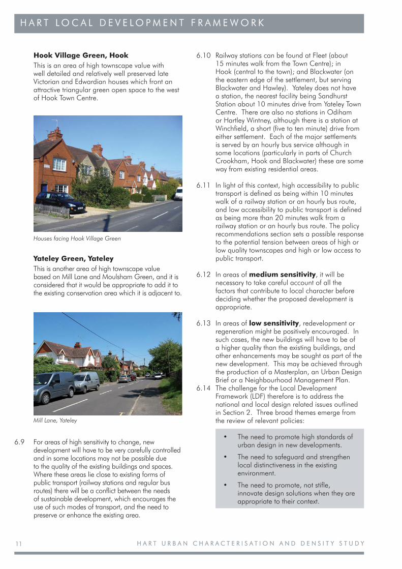
Hook Village Green, Hook This is an area of high townscape value with
well detailed and relatively well preserved late Victorian and Edwardian houses which front an attractive triangular green open space to the west of Hook Town Centre.
6.10 Railway stations can be found at Fleet (about 15 minutes walk from the Town Centre); in Hook (central to the town); and Blackwater (on the eastern edge of the settlement, but serving Blackwater and Hawley). Yateley does not have a station, the nearest facility being Sandhurst Station about 10 minutes drive from Yateley Town Centre. There are also no stations in Odiham or Hartley Wintney, although there is a station at Winchfield, a short (five to ten minute) drive from either settlement. Each of the major settlements is served by an hourly bus service although in some locations (particularly in parts of Church Crookham, Hook and Blackwater) these are some way from existing residential areas.
6.11 In light of this context, high accessibility to public transport is defined as being within 10 minutes walk of a railway station or an hourly bus route, and low accessibility to public transport is defined as being more than 20 minutes walk from a railway station or an hourly bus route. The policy recommendations section sets a possible response to the potential tension between areas of high or low quality townscapes and high or low access to public transport.
6.12 In areas of medium sensitivity, it will be necessary to take careful account of all the factors that contribute to local character before deciding whether the proposed development is appropriate.
6.13 In areas of low sensitivity, redevelopment or regeneration might be positively encouraged. In such cases, the new buildings will have to be of a higher quality than the existing buildings, and other enhancements may be sought as part of the new development. This may be achieved through the production of a Masterplan, an Urban Design Brief or a Neighbourhood Management Plan.
6.14 The challenge for the Local Development Framework (LDF) therefore is to address the national and local design related issues outlined in Section 2. Three broad themes emerge from the review of relevant policies:
• The need to promote high standards of urban design in new developments.
• The need to safeguard and strengthen local distinctiveness in the existing environment.
• The need to promote, not stifle, innovate design solutions when they are appropriate to their context.
Houses facing Hook Village Green
Mill Lane, Yateley
Yateley Green, Yateley This is another area of high townscape value
based on Mill Lane and Moulsham Green, and it is considered that it would be appropriate to add it to the existing conservation area which it is adjacent to.
6.9 For areas of high sensitivity to change, new development will have to be very carefully controlled and in some locations may not be possible due to the quality of the existing buildings and spaces. Where these areas lie close to existing forms of public transport (railway stations and regular bus routes) there will be a conflict between the needs of sustainable development, which encourages the use of such modes of transport, and the need to preserve or enhance the existing area.
H A R T U R B A N C H A R A C T E R I S A T I O N A N D D E N S I T Y S T U D YH A R T U R B A N C H A R A C T E R I S A T I O N A N D D E N S I T Y S T U D Y 1212
H A R T L O C A L D E V E L O P M E N T F R A M E W O R KH A R T L O C A L D E V E L O P M E N T F R A M E W O R K
6.15 The UCDS is a key component of the evidence base for the LDF. It therefore underpins any design based policies in the LDF that seek to address these broad themes. Reflecting national planning guidance, PPS12 (Local Spatial Planning), the UCDS should also be used to help form Hart’s emerging LDF Vision and Objectives.
Policy Recommendations6.16 The purpose of this section is to recommend LDF
policies that secure good design that responds to local distinctiveness. This is in addition to the neighbourhood and character area specific design guidance within the appendices. The saved policies from the Local Plan will continue to apply until they are overtaken by the relevant LDF policies. These policies already cover general issues relating to design (GEN 1&4) as well as a range of specific environmental issues, such as trees (CON 8), setting (CON 22) and signs (URB 24). They also include specific policies for the settlements of Fleet, Yateley, Blackwater and Hook.
6.17 The need for such policy coverage will continue even though the way in which policies are expressed may change. For instance, policies for the historic environment will now have to adopt the language of heritage assets and protecting significance established by the publication of PPS5 (Planning for the Historic Environment).
6.18 Hart District Council currently proposes two LDF Development Plan Documents (DPDs): a Core Strategy, which will outline the strategic direction of future development in Hart, and a Site Allocations and Development Management DPD, which will provide more detailed policy guidance.
6.19 At the strategic level, the LDF Core Strategy should reaffirm the Council’s commitment to development that embraces principles of sustainability, high quality design, local distinctiveness and character. This can be achieved by using an abbreviated form of the existing policy GEN 1, leaving the detail to the Development Management DPD. Thus:
• Development proposals will only be permitted where it can be demonstrated that they follow accepted principles of sustainable urban design and preserve or enhance local character and distinctiveness.
6.20 It will be for the supporting narrative to explain where the ‘accepted principles’ can be found, for instance in ‘By Design’ and the UCDS, and to explain the public and economic benefits of good design.
6.21 Therefore, in order to secure high standards of design, the recommended design policies in the proposed Site Allocations and Development Management DPD will address the more-specific issues as well as place-specific criteria:.
• Have regard for context and character through the use of established principles of scale, height, bulk, mass, materials, detailing, layout, landscaping and density.
• Ensure urban streets and spaces provide a high quality public realm and an attractive, safe and accessible network by implementing the principles of ‘Manual for Streets’ and ‘Streets for All’.
• Ensure that developments are fully accessible to all members of the community.
• Incorporate measures to promote crime prevention and community safety following ‘Secured by Design’ principles.
• Address sustainable design principles for energy efficiency, renewable energy generation, recycling and sustainable construction practices.
6.22 The DPD will establish expectations in terms of design quality and how places can be improved. At the settlement level, Development Management policies should provide a prioritised list of potential future conservation area designation proposals (as outlined in paragraph 6.8).
6.23 At the neighbourhood level, the main policy provision should be to reinforce distinctiveness, with the onus on the applicant to explain the rationale for a proposal. Thus, for all development proposals, applicants will be expected to provide, through Design and Access Statements and other relevant supporting documents:
• An analysis of the factors and details that give distinctiveness to the locality of the application site. The level of detail should be proportionate to the size of the proposal and sufficient to understand its potential impact. As a minimum the Council’s Urban Characterisation and Density Study should have been consulted in addition to an assessment of the site itself.
H A R T U R B A N C H A R A C T E R I S A T I O N A N D D E N S I T Y S T U D YH A R T U R B A N C H A R A C T E R I S A T I O N A N D D E N S I T Y S T U D Y1313
H A R T L O C A L D E V E L O P M E N T F R A M E W O R KH A R T L O C A L D E V E L O P M E N T F R A M E W O R K
• A demonstration of how factors of local distinctiveness and historical character have been taken into account and how any opportunities have been taken for enhancement.
• Where the potential impact would be significant, the use of appropriate expertise may be necessary in order to bring forward proposals for mitigation.
6.24 It will also be necessary to support local distinctiveness outside the LDF process through the designation of heritage assets such as Listing, Local Listing and Conservation Areas and Tree Preservation Orders. The Council has the option of strengthening local distinctiveness though periodic review of designations:
• Supporting recommendations for the listing of buildings at the national level.
• Designating Conservation Areas.
• Extending the local list of buildings of special interest.
• Designating Tree Preservation Orders (TPO).
6.25 It may be prudent to maintain schedules of potential designations. However, as they would relate to implementation rather than the policies themselves, they should remain outside the scope of the LDF.
6.26 With regard to the possible policy tension between areas of high or low quality townscapes and high or low accessibility to public transport, the following policy recommendations are made.
Recommendation 1: Areas of high townscape quality with a high access to public transport
In areas of high sensitivity to change, even where these sites lie close to or adjoining established public transport networks, proposals for new development are unlikely to be supported by the Council unless they conform to local and national policies, are of the highest possible quality, and do not result in the loss of high quality buildings or in the sub-division or loss of gardens, existing plots or valuable open space.
6.27 These areas include:
• Fleet Settlement Area: parts of the Pondtail and Fleet Town Centre Neighbourhood Areas.
• Hook Settlement Area: parts of the North Hook Neighbourhood Area, the majority of the Hook Historic Core Neighbourhood Area, and parts of the West Hook Neighbourhood Area.
• Blackwater Settlement Area: parts of both the Blackwater North Neighbourhood Area and the Blackwater South Neighbourhood Area.
• Yateley: parts of the West, East and South Yateley Neighbourhood Areas.
• Odiham: parts of the East and South, and West Odiham Neighbourhood Areas.
• Hartley Wintney: parts of the North and South Hartley Wintney Neighbourhood Areas.
Recommendation 2: Areas of high quality with a low degree of access to public transport
In areas of high sensitivity to change, with a low degree of access to public transport, proposals for new development are unlikely to receive support from the Council unless the proposed new development is of the highest possible design quality and does not result in any intensification of use, does not require the demolition of a building of high quality, and generally conforms to local and national policies.
6.28 These areas include:
• Fleet and Church Crookham: parts of the Pondtail and West Fleet Neighbourhood Areas.
• Yateley: some parts of the West Yateley Neighbourhood Area.
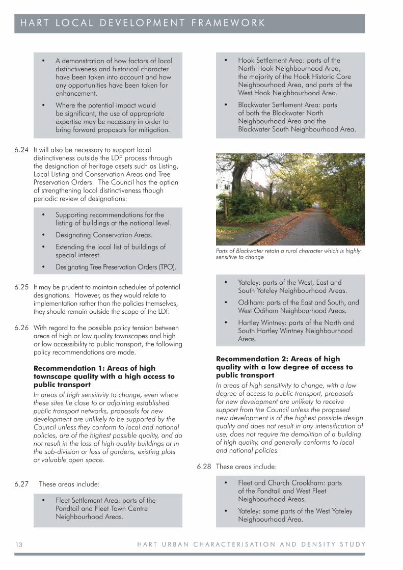
Parts of Blackwater retain a rural character which is highly sensitive to change
H A R T U R B A N C H A R A C T E R I S A T I O N A N D D E N S I T Y S T U D YH A R T U R B A N C H A R A C T E R I S A T I O N A N D D E N S I T Y S T U D Y 1414
H A R T L O C A L D E V E L O P M E N T F R A M E W O R KH A R T L O C A L D E V E L O P M E N T F R A M E W O R K
Recommendation 3: Areas of low quality with a high degree of access to public transport
In areas of low quality, with a high degree of access to public transport, the Council will, subject to the usual constraints provided by local and national planning policies, encourage the redevelopment of buildings or sites.
6.29 These areas include:
• Fleet and Church Crookham: within the Ancells Farm and Fleet Town Centre Neighbourhood Areas.
• Blackwater: within the eastern parts of the North Blackwater and the South Blackwater Neighbourhood Areas.
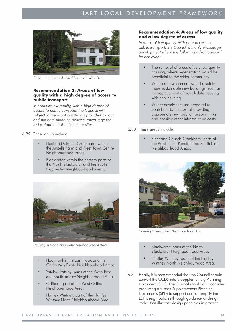
Housing in West Fleet Neighbourhood Area
Housing in North Blackwater Neighbourhood Area
Cohesive and well detailed houses in West Fleet
• Hook: within the East Hook and the Griffin Way Estate Neighbourhood Areas.
• Yateley: Yateley: parts of the West, East and South Yateley Neighbourhood Areas.
• Odiham: part of the West Odiham Neighbourhood Area.
• Hartley Wintney: part of the Hartley Wintney North Neighbourhood Area.
Recommendation 4: Areas of low quality and a low degree of access
In areas of low quality, with poor access to public transport, the Council will only encourage development where the following advantages will be achieved:
• The removal of areas of very low quality housing, where regeneration would be beneficial to the wider community.
• Where redevelopment would result in more sustainable new buildings, such as the replacement of out-of-date housing with eco-housing.
• Where developers are prepared to contribute to the cost of providing appropriate new public transport links and possibly other infrastructure costs.
6.30 These areas include:
• Fleet and Church Crookham: parts of the West Fleet, Pondtail and South Fleet Neighbourhood Areas.
• Blackwater: parts of the North Blackwater Neighbourhood Area.
• Hartley Wintney: parts of the Hartley Wintney North Neighbourhood Area.
6.31 Finally, it is recommended that the Council should convert the UCDS into a Supplementary Planning Document (SPD). The Council should also consider producing a further Supplementary Planning Documents (SPD) to support and/or amplify the LDF design policies through guidance or design codes that illustrate design principles in practice.
H A R T U R B A N C H A R A C T E R I S A T I O N A N D D E N S I T Y S T U D YH A R T U R B A N C H A R A C T E R I S A T I O N A N D D E N S I T Y S T U D Y1515
H A R T L O C A L D E V E L O P M E N T F R A M E W O R KH A R T L O C A L D E V E L O P M E N T F R A M E W O R K
7 APPENDICES7 APPENDICES
Appendix 1: Fleet (including Elvetham Heath) and Church Crookham
1.1 Introduction
Fleet 1.2 Elvetham Heath and Ancells Farm1.3 Fleet Town Centre1.4 Pondtail1.5 South Fleet1.6 West Fleet
Church Crookham 1.7 Church Crookham Estates1.8 Gally Hill Road1.9 Queen Elizabeth II Barracks1.10 Sandy Lane Triangle1.11 Zebon Copse
Appendix 2: Odiham
2.1 Introduction2.2 East and South Odiham 2.3 West Odiham
Appendix 3: Hook
3.1 Introduction3.2 North Hook3.3 East Hook3.4 Hook: Historic Core3.5 Griffon Road Estate3.6 South Hook3.7 West Hook
Appendix 4: Hartley Wintney
4.1 Introduction4.2 Hartley Wintney North4.3 Hartley Wintney South
Appendix 5: Blackwater
5.1 Introduction5.2 Blackwater North including Darby Green and Frogmore 5.3 Blackwater South (including Hawley)
Appendix 6: Yateley
6.1 Introduction6.2 West Yateley6.3 East Yateley6.4 South Yateley


