Embed Size (px)
Citation preview
This publication was produced by Woodlands Community Development Trust as part of our new Nature Recovery project that is helping people to recover from the stress of the Covid-19 pandemic through spending time outdoors in nature. More information about our work and how we are supporting people through the pandemic is available on our website woodlandscommunity.org.uk
Katrina Caldwell has been involved with Woodlands Community Development Trust since 2011. She volunteers at the community cafe and grows fruit and veg in Woodlands garden. She has a passion for wildlife and conservation and is increasingly interested in finding ways to develop creative projects to combine this passion with her professional life in theatre and dance.
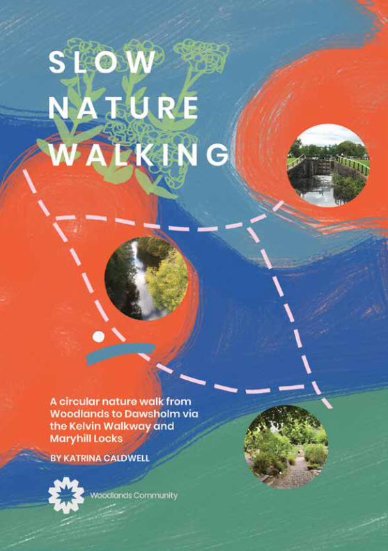
SLOW NATURE WALKINGA circular nature walk from Woodlands to Dawsholm via Kelvin Walkway and Maryhill Locks
Contents
Introduction by Katrina Caldwell page 2-3
Section 1 - Woodlands Community Garden to Kelvinbridge page 4-6Footbridge
Section 2 - Kelvinbridge Footbridge to North Woodside Flint Mill page 7-8
Branch Route 1 - North Woodside Flint Mill to Lacrosse Terrace page 9-11woods/garden
Section 3 - North Woodside Flint Mill to Ha’penny Bridge House page 12-14
Branch Route 2 - Ha’penny Bridge House to the Children’s Wood page 15-16and North Kelvin Meadow
Section 4 - Ha’penny Bridge House to Garrioch Footbridge page 17
Route Map page 18-19
Section 5 - Garrioch Footbridge to Kelvindale Road page 20-21
Section 6 - Kelvindale Road to Kelvin Aqueduct page 22-24
Section 7 - Kelvin Aqueduct to Dawsholm Park page 24-27
Section 8 - Maryhill Locks to Forth and Clyde Canal junction page 27-31 for Falkirk (Stockingfield Junction)
Branch Route 3 - Fourth and Clyde Canal junction for Falkirk page 32-34(Stockingfield Junction) to Lambhill Stables and Possil Marsh
Section 9 - Junction for Falkirk (Stockingfield Junction) page 34-35 to Murano Foot bridge
Section 10 - Murano Footbridge to Kelvin Walkway entrance at page 35 Queen Margaret Road
Section 11 - Return to Woodlands Community Garden and page 36the end of the walk
1
We exist within the natural world, are surrounded by it and rely on it in more ways than we imagine. But often, beyond a fleeting glance to check the weather, we forget to look and really experience it as we live our busy lives and travel from A to B.
In fact, we live our lives so separately from nature that we might even fail to recognise that we are part of it too.
During the Covid 19 pandemic of 2020 I found myself living through the year in a surprising new way. Due to Covid quarantine restrictions I was only able to spend short amounts of time outside exercising for an hour from home and hence had a limited area to explore. I noticed that I was walking more slowly, taking time to look, to listen, to smell and even occasionally to taste the nature I found there. I thought I knew this area well but I realise now that I had only scratched the surface of what is there. My daily walksbecame a real solace, as being isolated from friends and family I found connection with other living creatures and habitats.
I was taking numerous photographs, googling questions that popped into my head and making connections between weather, season, species and habitat.
My fascination grew and this new concentration on the natural world helped me to breathe, accept the situation we were all living under and remind myself of not only the beauty and diversity of nature but the cycle of the seasons, the ever-changing weather and the geography and geology on my doorstep. The act of walking was of course good for my physical health but I found real benefits for my wellbeing and mental health in taking the time to slow down and discover nature, through all my senses, as the days became weeks and eventually months.
Introduction by Katrina CaldwellPlease note that the route is popular with runners, cyclists, dog walkers and families, so be aware of other people around you.
The route is not lit or monitored at night so is not recommended after dark.
The duration of each section of the walk is given for a slow to medium walking pace with time built in to stop. You can of course walk faster or slower.
This circular nature walk is the result of these discoveries and covers a route starting and finishing at Woodlands Community Garden and follows the Kelvin Walkway to the entrance to Dawsholm Park before returning via the Maryhill Canal. There are several additional branch walks to Lacrosse Terrace Wood and Gardens, the Children’s Wood and North Kelvin Meadow, Lambhill Stables and Possil Marsh along the way. Although the route can be done as one walk, it is broken down into generously timed sections with multiple entry points so you can dip in and out as your time and inclination allows. The walk descriptions include my personal reflections and cover many of my recent experiences with nature; from the smell ofearth after rain to whispering grasses in a gentle breeze, dappled light dancing through tall leaf-laden trees to goosander ducklings swimming against the flow of the river.
My intention now is to carry on regularly walking this route and for this connection to keep growing. I hope you are inspired to join me by the Kelvin or on the canal and invite you to make your own nature discoveries along the way.
32
Goos
ander d
ucklings
The walk starts at Woodlands Community Gardens at the east end of West Princes Street in the west end of Glasgow. The Gardens was a derelict gap site for many years until the work of volunteers supported by Woodlands Community Development Trust (WCDT) created this garden as a space where local people can grow their own food. Over the last ten years it has become one part of an award-winning project where both plants and people are nurtured and grow.
The gardeners grow by organic methods, working with and alongside nature rather than just seeing it as something to be tamed or eradicated.
The garden is open at all times and is a lovely space to be in, whatever the season or the weather. It is a treasured green oasis in the city. Take time to have a look around and If you would like to find out more, check out the website. woodlandscommunity.org.uk
Section 1
Duration - 10-15 minutes.Accessibility - Pavements and road crossings. Flat and level.
Woodlands Community Garden to Kelvinbridge Footbridge
Sometimes it is hard to catch our breath, slow down and shed the weight of our lives, but by focusing on nature I find that those things happen anyway. Focusing on taking a few deep breaths before I head off, taking a moment to close my eyes and identify what I can hear, or looking to find the furthest away object helps to draw my attention close, to focus on now, this moment, this detail.
Let’s set off!
Leaving Woodlands Community Garden we turn left and walk down West Princes Street. This is a residential street of sandstone tenements, tarmac roads and concrete pavements. Not where you might expect to find much evidence of nature, but it’s here we just need to look. We can watch the cloud movements in the sky above us, sense the humidity, feel the air on our skin, hear the call of gulls as they swoop through this urban canyon - all this before we have taken a step. As I walk this street I always see, something that I haven’t noticed before. The apple tree at No 233; the beautiful cherry blossom in spring; bees buzzing on lavender; magpies and black-birds staking territory or singing to attract a mate; the scent of roses. Green growth appears in the cracks in the pavements - dandelions, hairy bitter cress, welsh poppies - all providing food for insects.
This spring I was nearly mobbed by an anxious gull whose youngster I realised was fledged but still earthbound and I had inadvertently just got too close. The young bird reminded me of a hunched old man in a grubby raincoat. I quickly crossed the road to allow theparent to relax.
Some of the gardens are cleared and planted with new flowers, plants and vegetables but my eyes are drawn to the golden ragwort and pink thistles attracting butterflies and bees and to theestablished shrubs and trees.
4 5
Tortoiseshell on yellow ragwort
Greenbottle
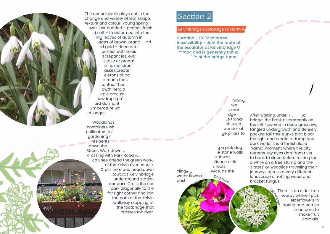
The annual cycle plays out in the change and variety of leaf shape, texture and colour. Young spring leaves just budded - perfect, fresh
and soft - transformed into the dying leaves of autumn in shades of brown, orange, red and gold - dried out and crackled, with holes and discrepancies, evidence of disease or predation. The naked structures of grasses create fragile skeletons of past life as we reach the wintermonths. Then signs of new growth herald spring with
purple crocuses and white snowdrops poking through
hard dormant ground. The temperature warms, the days
get longer.
Woodlands CDT has filled large containers with plants that attract pollinators, introduced bee friendly gardening signs and helped local
residents develop their gardens down the length of West Princess
Street. Walk down the street to the crossing with Park Road where we
can see ahead the green world of the Kelvin river course.
Cross here and head down towards Kelvinbridge underground station
car park. Cross the car park diagonally to the
far right corner and join the path of the Kelvin walkway stopping at
the footbridge that crosses the river.
Before us is Kelvin Bridgecarrying Great Western Road and the hustle and bustle of city life. I often stop here to look at the river. Every time is different. Sometimes it looks benign and lazy with the gravel bed clearly visible, local ducks bobbing along or swimming upstream. On other days when in spate, the muddy waters roar round the corner of the bridge pushing branches and tree trunks towards the Clyde and with such speed and power that I wonder at the strength of the bridge pillars to control its path.
I noticed in late spring a pink dog rose growing from the stone walls on the left hand side. It was growing there in defiance of its vulneable situation, roots clinging to the crevice, as the water flowed past.
Section 2
Duration - 10-12 minutes.Accessibility - Join the route at Great Western Road by the stairs or the escalator at Kelvinbridge Underground Station. The path is tarmac and is generally flat except for a short gentle rise on the north side of the bridge tunnel.
Kelvinbridge Footbridge to North Woodside Flint Mill
After walking under the road bridge, the bank rises steeply on the left, covered in deep green ivy, tangled undergrowth and densely packed tall tree trunks that block the light and create a damp and dark world. It is a threshold, a ‘Narnia’ moment where the city retreats. My eyes dart from river to bank to slope before resting for a while on a tree stump and the ‘slaters’ or woodlice travelling their journeys across a very different landscape of rotting wood and bracket fungus.
There is an elder tree nearby where I pick
elderflowers in spring and berries
in autumn to make fruit
cordials.
6 7
Elderf ower
Dog rose
Just before the river turns the corner, the far bank steepens and the rock formation of the Kelvin Gorge becomes more obvious, particularly in winter when the trees are bare and the vegetation has died back. A skulk of foxes live there and if you are patient and come just after dawn or at duskyou might well see or hear them!
They co-exist quite happily with us humans and have a wide foraging range. I have watched foxes drinking at the Kelvin, creeping through local gardens and thejoyous play fighting of young cubs.
In spring this part of the river has a pungent smell from three-cornered leek and the wild garlic (ramsons) that blankets the bank and woodland. Great for cooking, but make sure you wash them carefully and avoid picking from patches close to the path where the dogs walk!
The Kelvin Gorge is quite dramatic as we turn the corner. Look up and you will see the spire of Kelvin Stevenson Memorial Church. Aswe pass under Belmont Bridge take time to marvel at the mini biosphere on the bridge wall on your left. Lichens, liverworts and ferns thrive in this constantly wetenvironment.
A footbridge crosses the Kelvin at the old flint mill. If you stop here, you might be lucky like I was and spot a noisy little wren, the second-smallest bird in the UK,hopping from branch to leaf litter to branch and bobbing its pert little tail.
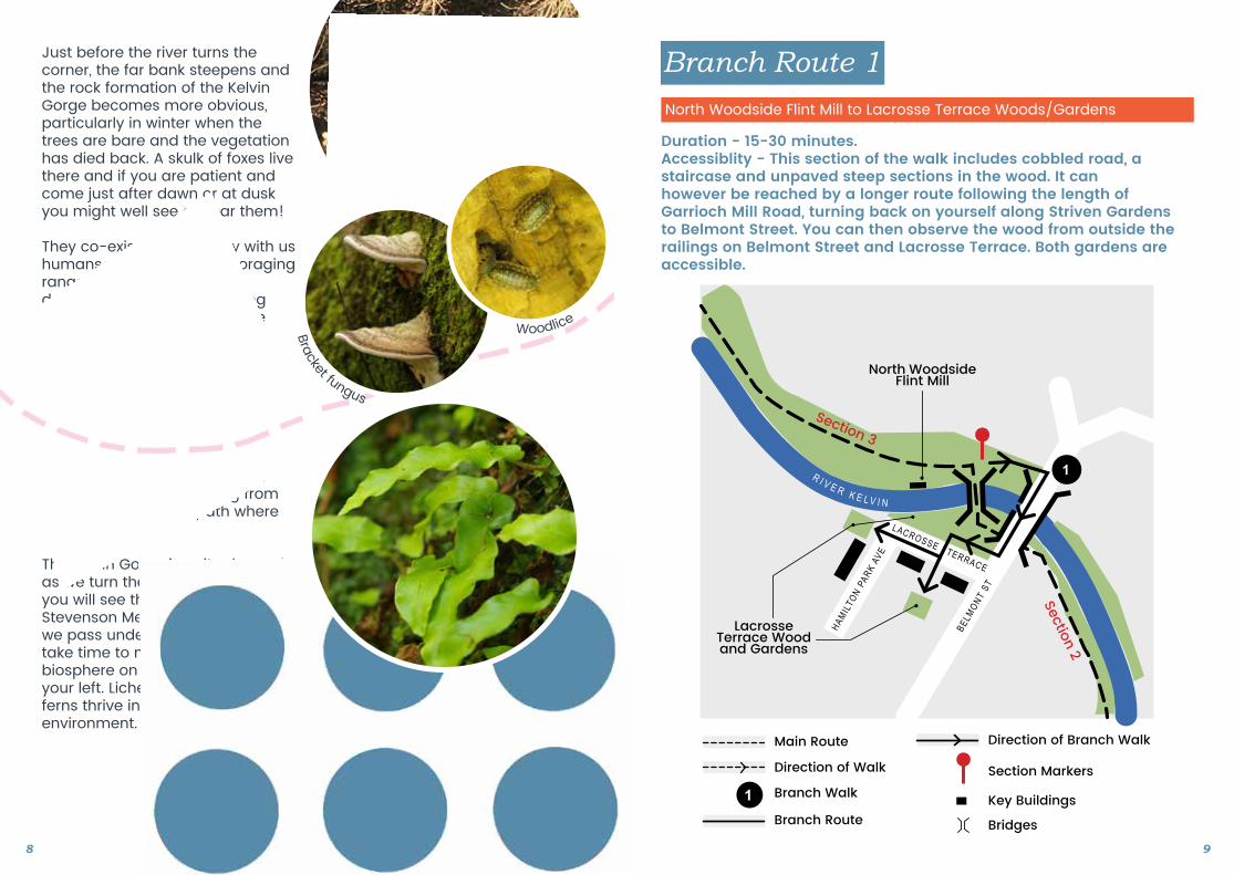
Branch Route 1
Duration - 15-30 minutes.Accessiblity - This section of the walk includes cobbled road, a staircase and unpaved steep sections in the wood. It can however be reached by a longer route following the length of Garrioch Mill Road, turning back on yourself along Striven Gardens to Belmont Street. You can then observe the wood from outside the railings on Belmont Street and Lacrosse Terrace. Both gardens are accessible.
North Woodside Flint Mill to Lacrosse Terrace Woods/Gardens
8 9
Bracket fungus
Woodlice
Lacrosse Terrace Wood and Gardens
North Woodside Flint Mill
BELM
ONT ST
1R I V E R K E L V I N
Section 3
Section 2
Branch Walk
Main Route
MAP KEY
Direction of Walk
Bridges
Direction of Branch Walk
Branch Route
Section Markers
Key Buildings
1
LACROSSE TERRACE
HAMIL
TON P
ARK
AVE
North Kelvin Meadow and
Children’s Wood
Ha’penny Bridge House
2
2
2
B O T A N I CG A R D E N S
KIRKLEE RD
CLOUSTON ST
GARRIOCH RD
ADDI
SON
RDWYNDHAM S
T
R I V E R K E LV I NSection 3
Section 4
Branch Walk
Main Route
MAP KEY
Direction of Walk
Bridges
Direction of Branch Walk
Branch Route
Section Markers
Key Buildings
1
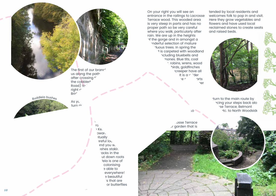
The first of our branch routes takes us along the path on the right after crossing the bridge. Walk up the cobbled street (Garrioch Mill Road) to the stair case on your right and climb it to reach Belmont Bridge on Belmont Street.
As you step onto the pavement, turn right and cross the bridge.
Looking down into the river from either side of the bridge, you
can appreciate the height of the Kelvin Gorge and how narrow the channel is for the Kelvin to forge its way towards the Clyde and eventually the sea. Have a careful look over the edge and you will see Buddleia bushes staking
a claim on cracks in the stonework to put down roots
and thrive! Buddleia is one of the most tenacious colonising plants - seems to be able to grow anywhere and everywhere! Its saving grace is the beautiful purple scented flowers that are an absolute magnet for butterflies and bees.
On your right you will see an entrance in the railings to Lacrosse Terrace wood. This wooded area is very steep in parts and has no proper path so be very careful where you walk, particularly after rain. We are up in the heights of the gorge and in amongst a wonderful selection of mature deciduous trees. In spring the ground is carpeted with woodland flowers including bluebells and wood anemones. Blue tits, coal tits, great tits, robins, wrens, wood pigeons, blackbirds, goldfinches and the odd treecreeper have all been spotted here. It is a wilder landscape than some other parts of the route and feels like a proper wood. If you walk along the top path you will come to a gate that leads across the road to Lacrosse garden - a tiny semi-wild, semi-nurtured place. Sit on the granite bench and just take a moment to close your eyes and listen to the wind in the trees.
At the end of Lacrosse Terrace there is another garden that is
tended by local residents and welcomes folk to pop in and visit. Here they grow vegetables and flowers and have used local reclaimed stones to create seats and raised beds.
Return to the main route by retracing your steps back along Lacrosse Terrace, Belmont Bridge, etc. to North Woodside Flint Mill.
10 11
Buddleia bushes
Section 3
Duration - 10-12 minutes.Accessibility - Flat wide paved pathThe route along the river bank has steps and is less accessible but the river can still be viewed from the main path.
North Woodside Flint Mill to Ha’penny Bridge House
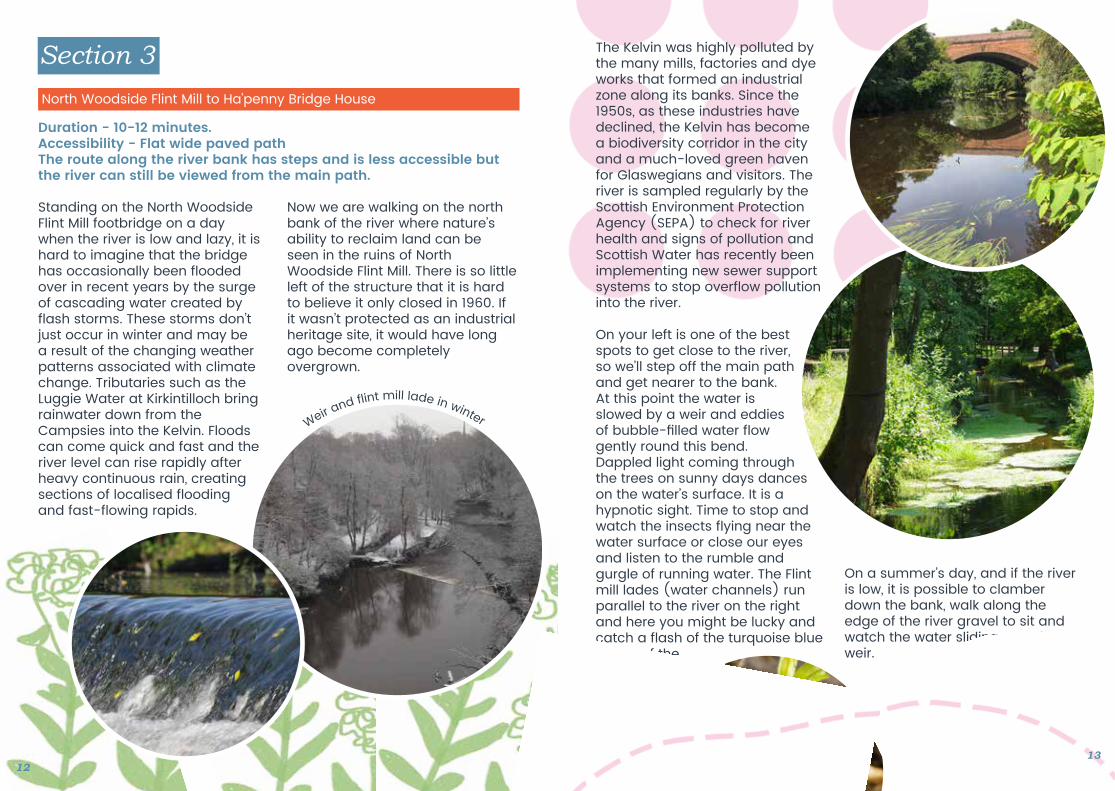
Standing on the North Woodside Flint Mill footbridge on a day when the river is low and lazy, it is hard to imagine that the bridge has occasionally been flooded over in recent years by the surge of cascading water created by flash storms. These storms don’t just occur in winter and may be a result of the changing weather patterns associated with climate change. Tributaries such as the Luggie Water at Kirkintilloch bring rainwater down from the Campsies into the Kelvin. Floods can come quick and fast and the river level can rise rapidly after heavy continuous rain, creating sections of localised flooding and fast-flowing rapids.
Now we are walking on the north bank of the river where nature’s ability to reclaim land can be seen in the ruins of North Woodside Flint Mill. There is so little left of the structure that it is hard to believe it only closed in 1960. If it wasn’t protected as an industrial heritage site, it would have long ago become completely overgrown.
The Kelvin was highly polluted by the many mills, factories and dye works that formed an industrial zone along its banks. Since the 1950s, as these industries have declined, the Kelvin has become a biodiversity corridor in the city and a much-loved green haven for Glaswegians and visitors. The river is sampled regularly by the Scottish Environment Protection Agency (SEPA) to check for river health and signs of pollution and Scottish Water has recently been implementing new sewer support systems to stop overflow pollution into the river.
On your left is one of the best spots to get close to the river, so we’ll step off the main path and get nearer to the bank. At this point the water is slowed by a weir and eddies of bubble-filled water flow gently round this bend. Dappled light coming through the trees on sunny days dances on the water’s surface. It is a hypnotic sight. Time to stop and watch the insects flying near the water surface or close our eyes and listen to the rumble and gurgle of running water. The Flint mill lades (water channels) run parallel to the river on the right and here you might be lucky and catch a flash of the turquoise blue of one of the Kelvin’s elusive kingfishers.
On a summer’s day, and if the river is low, it is possible to clamber down the bank, walk along the edge of the river gravel to sit and watch the water sliding over the weir.
1213
Weir and f int mill lade in winter
This is a favourite fishing spot of one of the Kelvin’s resident grey herons. He can often be seen on the far bank, standing stock-still, eye on the prize!
The presence of kingfishers and grey herons on the Kelvin is a very good sign of clean water as they hunt aquatic insects and fish.
This part of the Kelvin Walkway is a great meeting place for dogs and their owners! Look out for bluebells and naturalised daffodils in spring and beech nuts, rowan berries and sycamore keys in autumn.
At Ha’penny Bridge House you have the choice to detour from the main path and venture from the river to the Children’s Wood and North Kelvin Meadow or carry on the main route.
Leaving the weir, we walk though the tunnel under Queen Margaret Drive Bridge. There is a wonderful echo here - try it out as you go through. The north bank of the Kelvin facing the Botanic Gardens has been in public ownership since 1895 and the recently restored footbridge gives you access to the gardens and all that the hub of Byres Road offers beyond. A couple of hundred metres ahead we can see Ha’penny Bridge House, home of Friends of The River Kelvin or FORK for short. FORK is an environmental Community Interest Company made up of local people who want to conserve and protect the river and the natural habitats that bound it.
Monthly litter clean-ups, river sampling for signs of river invertebrates and citizen science events are some of the activities you could get involved with as a member.
Branch Route 2
Duration 25-45 mins.Accessibility - Pavement, road, red blaze and earth paths. This section is flat apart from the short sloping road taking you to and from the Kelvin Walkway.
Ha’penny Bridge House to the Children’s Wood and North Kelvin Meadow
14 15
North Kelvin Meadow and
Children’s Wood
Ha’penny Bridge House
2
2
2
B O T A N I CG A R D E N S
KIRKLEE RD
CLOUSTON ST
GARRIOCH RD
ADDI
SON
RDWYNDHAM S
T
R I V E R K E LV I NSection 3
Section 4
Branch Walk
Main Route
MAP KEY
Direction of Walk
Bridges
Direction of Branch Walk
Branch Route
Section Markers
Key Buildings
1
Cross the Ha’penny Bridge and follow the road on the right uphill to the junction with Kirklee Road. Turn right across the bridge, stopping for a view of the Kelvin from above. Cross the road on to Clouston Street and walk for about 20 metres until you see the entrance on your left to the Children’s Wood and North Kelvin Meadow. This green space was formed from re-wilded blaze football pitches. Through massive community effort it has been transformed into another haven and nurture space for people and wildlife. Walking in an anti-clockwise direction, take your time to follow the mud paths through the birch trees; walk the stone labyrinth; visit the outdoor nursery; smell the flowers and fruit on soft fruit bushes and young apple trees; pass the raised
vegetable plots; be surprised at the giant bee-dookit in the centre of the meadow and criss-cross the meadow by desire line paths.
You can see the biodiversity of this space in the multitude of different grasses and wild flowers growing in the meadow. If you make a very early morning visit in spring you can enjoy spotting and identifying the many bird species of the dawn chorus.
Return to join the main walk by the same route.
At Ha’penny Bridge House take the path that veers right and goes under Kirklee Bridge arch. The path follows the river on the left. The geology of the gorge forces the path to climb during this section. The extra effort climb is worth it however as you get a chance to view the river from above and you will find yourself looking down through the trees as opposed to up at them. There is a bench half way up if you need to rest. It is good spot for looking at the form of the river and its place in the landscape, with the Botanic Garden’s Arboretum on the opposite bank.
Watch for small birds in the trees and ducks on the river below. I was lucky enough a few years ago to see a flock of waxwings here- flitting through the high branches in search of berries.
Duration - 8-15 mins.Accessibility - Tarmac pavement. Narrow at points. This section climbs steadily as the river bends and then descends down to a wide meander at the footbridge.
Ha’penny Bridge House to Garrioch Footbridge
Section 4
1716
Bullf nch
Oak
leav
es
18 19
Branch Walk
Main Route
MAP KEY
Direction of Walk
Bridges
Direction of Branch Walk
Branch Route
Section Markers
Key Buildings
1
D A W S H O L M P A R K
K E L V I N G R O V E P A R K
B O T A N I C G A R D E N S
M A R Y H I L L P A R K
K E L V I N B R I D G E
S T G E O R G E ’ S C R O S S
H I L L H E A D
K E L V I N H A L L
G R E A T W E S T E R N R O A D
Section 1
R U C H I L L G O L F C O U R S E
R U C H I L L P A R K
C L A Y P I T SN A T U R E
R E S E R V E
MA R Y H I L L R O A D
BA
LMO
RE
RO
AD
MA
RY
HI L L R
OA
D
S T GE O R G E S
G A R S C U B E R O A D
Q U E E N MA R G A R ET
DR
I VE
Section 3
Sect
ion
2
Section 5
Section 6
Section 8
Section 9
Sect
ion
10
Section 11
Murano Footbridge
Woodlands Community Garden
Lacrosse Terrace
Wood and Gardens
North Woodside Flint Mill
Ha’penny BridgeHouse
North Kelvin Meadow and
Children’s Wood
Garrioch Footbridge
Maryhill Locks
StockingfieldJunction
New StockingfieldBridge UNDER CONSTRUCTION COMPLETE 2022
Maryhill Station
LambhillStables
To Falkirk
B Y R E S RO A D
Section 7
1
2
3
3
B I L S L A N D D R I V E
R I V E R K E LV I N
FORTH & CLYDE CANAL
FORTH & CLYDE CA
NAL
N
K E L V I N D A L E R O A D
Section 4
P O S S I LM A R S H
Section 1 - Woodlands Community Garden to Kelvinbridge Footbridge
Section 2 - Kelvinbridge Footbridge to North Woodside Flint Mill
Branch Route 1 - North Woodside Flint Mill to Lacrosse Terrace woods/garden
Section 3 - North Woodside Flint Mill to Ha’penny Bridge House
Branch Route 2 - Ha’penny Bridge House to the Children’s Wood and North Kelvin Meadow
Section 4 - Ha’penny Bridge House to Garrioch Footbridge
Section 5 - Garrioch Footbridge to Kelvindale Road Section 6 - Kelvindale Road to Kelvin Aqueduct Section 7 - Kelvin Aqueduct to Dawsholm Park Section 8 - Maryhill Locks to Forth and Clyde Canal Junction for Falkirk (Stockingfield Junction)
Branch Route 3 - Fourth and Clyde Canal junction for Falkirk (Stockingfield Junction) to Lambhill Stables and Possil Marsh
Section 9 - Junction for Falkirk (Stockingfield Junction) to Murano Foot bridge
Section 10 - Murano Footbridge to Kelvin Walkway entrance at Queen Margaret Road
Section 11 - Return to Woodlands Community Garden and the end of the walk
Branch Walk
Main Route
MAP KEY
Direction of Walk
Bridges
Direction of Branch Walk
Branch Route
Section Markers
Key Buildings
1
D A W S H O L M P A R K
K E L V I N G R O V E P A R K
B O T A N I C G A R D E N S
M A R Y H I L L P A R K
K E L V I N B R I D G E
S T G E O R G E ’ S C R O S S
H I L L H E A D
K E L V I N H A L L
G R E A T W E S T E R N R O A D
Section 1
R U C H I L L G O L F C O U R S E
R U C H I L L P A R K
C L A Y P I T SN A T U R E
R E S E R V E
MA R Y H I L L R O A D
BA
LMO
RE
RO
AD
MA
RY
HI L L R
OA
D
S T GE O R G E S
G A R S C U B E R O A D
Q U E E N MA R G A R ET
DR
I VE
Section 3
Sect
ion
2
Section 5
Section 6
Section 8
Section 9
Sect
ion
10
Section 11
Murano Footbridge
Woodlands Community Garden
Lacrosse Terrace
Wood and Gardens
North Woodside Flint Mill
Ha’penny BridgeHouse
North Kelvin Meadow and
Children’s Wood
Garrioch Footbridge
Maryhill Locks
StockingfieldJunction
New StockingfieldBridge UNDER CONSTRUCTION COMPLETE 2022
Maryhill Station
LambhillStables
To Falkirk
B Y R E S RO A D
Section 7
1
2
3
3
B I L S L A N D D R I V E
R I V E R K E LV I N
FORTH & CLYDE CANAL
FORTH & CLYDE CA
NAL
N
K E L V I N D A L E R O A D
Section 4
P O S S I LM A R S H
As the path descends, the ground opens out to a wide grassy area. Some large trees have been cut down and their trunks left to rot naturally, creating insect and fungi habitats. On your left is Garrioch Footbridge, that leads you into the Botanic Garden Arboretum. It has a wonderful collection of unusual species trees if you fancy a short detour but we will carry on uphill under an old railway bridge.
Keeping the river on our left, the path leads us up to an area called the Garrison with playing fields and tall flats on your right.
Our path skirts the river below and is bordered by numerous plants including dog roses, brambles, himalayan balsam, yellow ragwort and wild raspberries. The ripe wild raspberries are a treat and can be popped straight in the mouth after checking to make sure there are no tiny insects in the fruits. Rasps or brambles warmed by the sun are just delicious.
Looking down towards the river, I love the structure of the trees and how their branches intertwine.
Section 5
Duration 10-20minutesAccessibility - Tarmac path throughout. Gentle gradient at start.
Garrioch Footbridge to Kelvindale Road
Each tree species has a different bark. Some smooth and glossy, others rutted and thickly textured. I like to trace my fingers across the bark to feel its texture and search for lichens and fungi or even the odd height-defying snail.
Further along the path you will notice that sadly there are a couple of ash trees on your right that are succumbing to ash dieback disease. This disease is decimating the ash population across the whole country. You can see how the leaves are dying back from the tips of the branches
The bark on this particular tree had become detached revealing an amazing structure of beetle trails that looks like tattoos on skin.
The path will lead us to the junction with Kelvindale Road. Take care crossing as the road can be busy with fast moving traffic despite the road bump!
Crossing Kelvindale Road we have two options: to carry on along the main path, or explore a slightly wilder route that follows the river fence on a less defined path. This path is on your left and takes you over tree roots and ducking under tree branches before rejoining the main path after about ten minutes walking.
2120
Small tortoiseshell
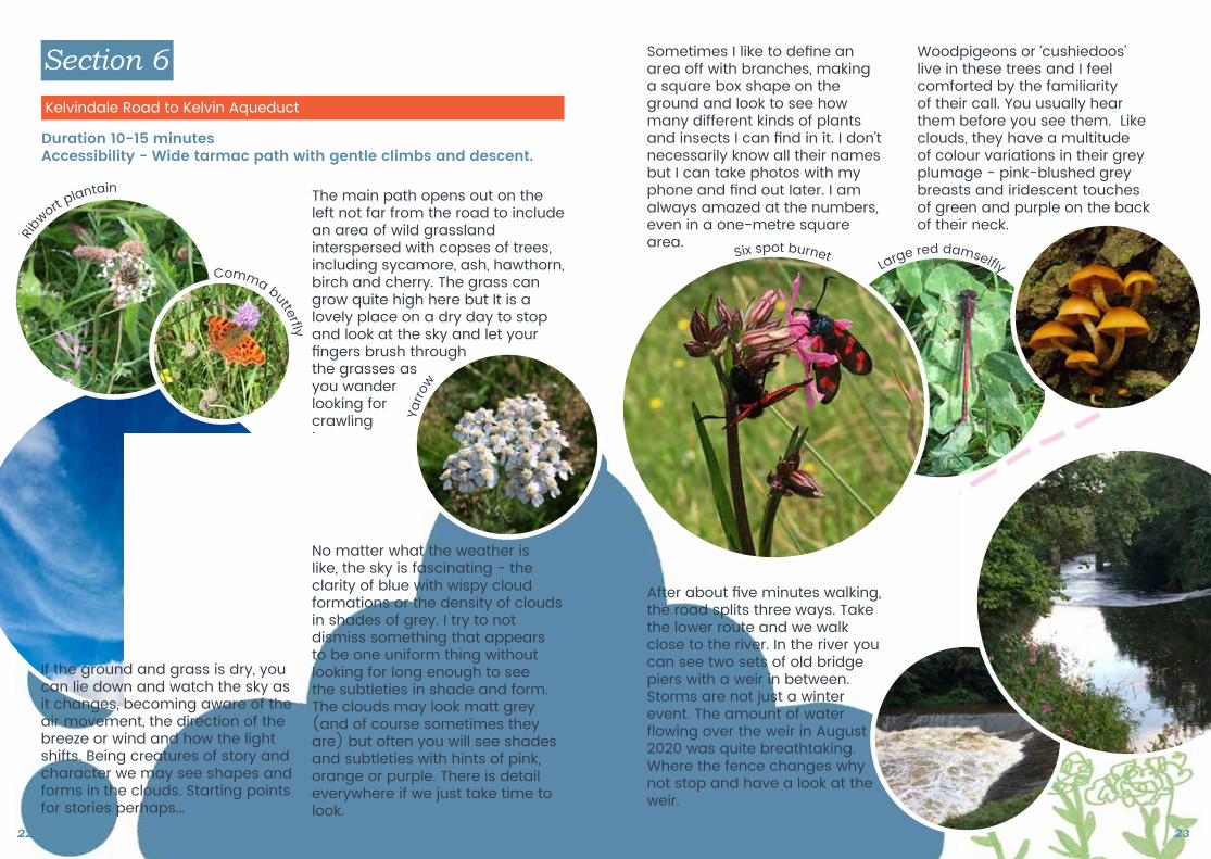
The main path opens out on the left not far from the road to include an area of wild grassland interspersed with copses of trees, including sycamore, ash, hawthorn, birch and cherry. The grass can grow quite high here but It is alovely place on a dry day to stop and look at the sky and let your fingers brush through the grasses as you wander looking for crawling insects, butterflies and day moths in thevegetation.
Section 6
Duration 10-15 minutesAccessibility - Wide tarmac path with gentle climbs and descent.
Kelvindale Road to Kelvin Aqueduct
If the ground and grass is dry, you can lie down and watch the sky as it changes, becoming aware of the air movement, the direction of the breeze or wind and how the light shifts. Being creatures of story and character we may see shapes and forms in the clouds. Starting points for stories perhaps…
No matter what the weather is like, the sky is fascinating - the clarity of blue with wispy cloud formations or the density of clouds in shades of grey. I try to notdismiss something that appears to be one uniform thing without looking for long enough to see the subtleties in shade and form. The clouds may look matt grey (and of course sometimes they are) but often you will see shades and subtleties with hints of pink, orange or purple. There is detail everywhere if we just take time to look.
Sometimes I like to define an area off with branches, making a square box shape on the ground and look to see how many different kinds of plants and insects I can find in it. I don’t necessarily know all their names but I can take photos with my phone and find out later. I am always amazed at the numbers, even in a one-metre square area.
Woodpigeons or ‘cushiedoos’ live in these trees and I feel comforted by the familiarity of their call. You usually hear them before you see them. Like clouds, they have a multitude of colour variations in their grey plumage - pink-blushed grey breasts and iridescent touches of green and purple on the back of their neck.
After about five minutes walking, the road splits three ways. Take the lower route and we walk close to the river. In the river you can see two sets of old bridge piers with a weir in between. Storms are not just a winter event. The amount of water flowing over the weir in August 2020 was quite breathtaking. Where the fence changes why not stop and have a look at the weir.
22 23
Ribw
ort plantain
Comma butterf y
Yarro
w
Large red damself ySix spot burnet
Nature again is reclaiming each abandoned pier with lichens, mosses, liverworts and wild flowers. Cormorants use them as vantage points and for drying their wings in warm sunshine but I have only spotted a heron preening itself in the late afternoon sun.
A sandstone wall, part of the old railway line, runs alongside the path and on the far bank the woods are dense and impenetrable.
Section 7
Duration 10-20 minutesAccessibility - Wide tarmac path - quite narrow at points, gentle gradients.
Kelvindale Aqueduct to the Entrance Dawsholm Park
At the next junction we take the lower of the two paths and before long you will see the four arches of the canal aqueduct. Another echo to explore!
Fungi and lichen cover the lower parts of the stone walls. Coming through the aqueduct arch we take the middle of the three paths. It’s bordered by rosebay willowherb in high summer and is a good place for picking brambles for crumble as summer nears its end.
Our route takes us underneath a road bridge and after turning sharply to follow the river, it opensout once more..
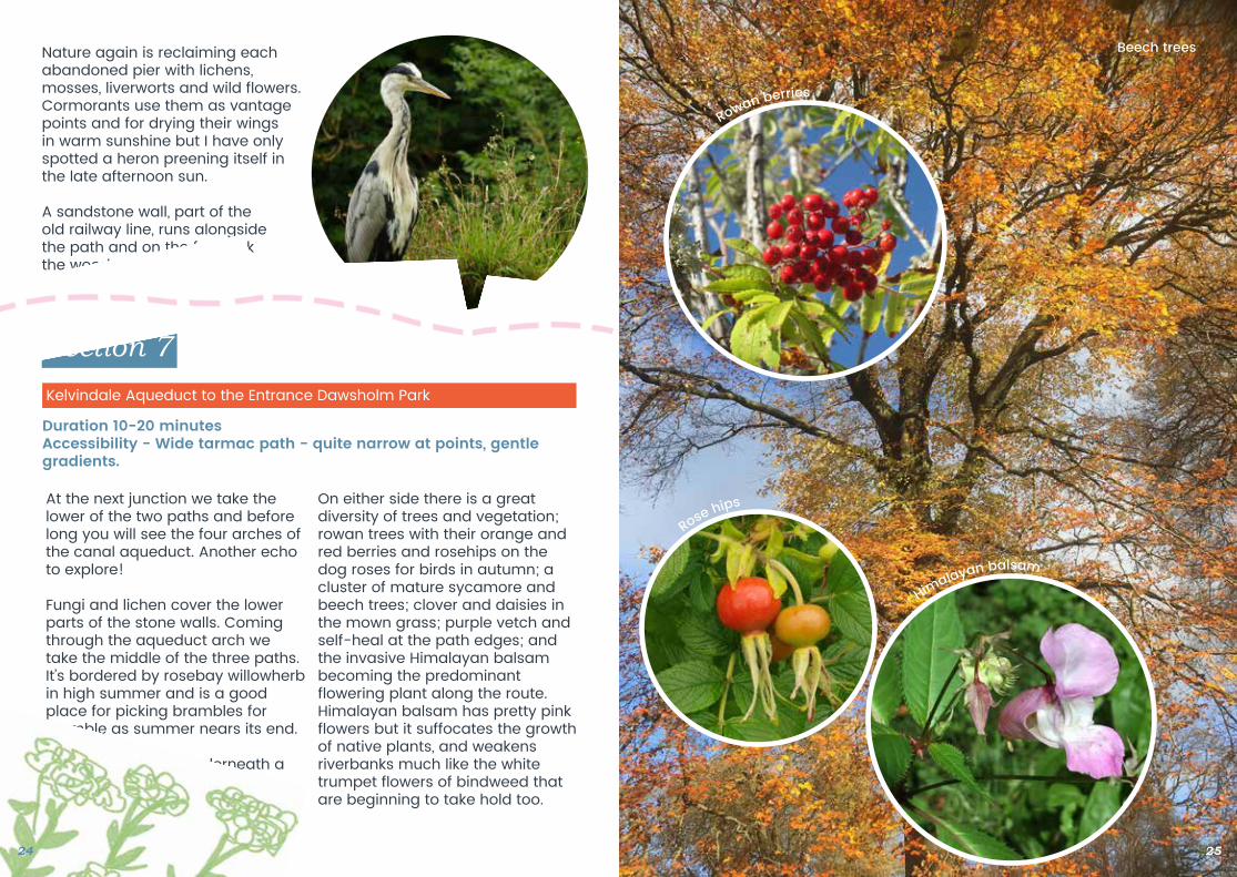
On either side there is a great diversity of trees and vegetation; rowan trees with their orange and red berries and rosehips on the dog roses for birds in autumn; a cluster of mature sycamore and beech trees; clover and daisies in the mown grass; purple vetch and self-heal at the path edges; and the invasive Himalayan balsam becoming the predominant flowering plant along the route. Himalayan balsam has pretty pink flowers but it suffocates the growth of native plants, and weakens riverbanks much like the white trumpet flowers of bindweed that are beginning to take hold too.
24 25
Beech trees
Rowan berries
Rose hips
Himalayan balsam
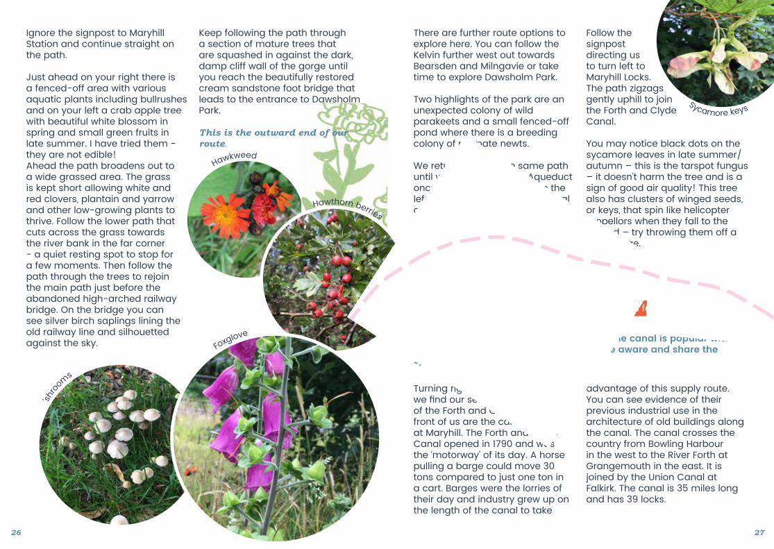
Ignore the signpost to Maryhill Station and continue straight on the path.
Just ahead on your right there is a fenced-off area with various aquatic plants including bullrushes and on your left a crab apple tree with beautiful white blossom in spring and small green fruits in late summer. I have tried them - they are not edible! Ahead the path broadens out to a wide grassed area. The grass is kept short allowing white and red clovers, plantain and yarrow and other low-growing plants to thrive. Follow the lower path that cuts across the grass towards the river bank in the far corner - a quiet resting spot to stop for a few moments. Then follow the path through the trees to rejoin the main path just before the abandoned high-arched railway bridge. On the bridge you can see silver birch saplings lining the old railway line and silhouetted against the sky.
Keep following the path through a section of mature trees that are squashed in against the dark, damp cliff wall of the gorge until you reach the beautifully restored cream sandstone foot bridge that leads to the entrance to Dawsholm Park.
This is the outward end of our route.
There are further route options to explore here. You can follow the Kelvin further west out towards Bearsden and Milngavie or take time to explore Dawsholm Park.
Two highlights of the park are an unexpected colony of wild parakeets and a small fenced-off pond where there is a breeding colony of palmate newts.
We return back by the same path until we reach the Kelvin Aqueduct once more. This time we take the left hand path through the central arch to the next junction just ahead.
Follow the signpost directing us to turn left to Maryhill Locks. The path zigzags gently uphill to join the Forth and Clyde Canal.
You may notice black dots on the sycamore leaves in late summer/autumn – this is the tarspot fungus – it doesn’t harm the tree and is a sign of good air quality! This tree also has clusters of winged seeds, or keys, that spin like helicopter propellors when they fall to the ground – try throwing them off a high bridge.
Section 8
Duration - 20-30 minutesAccessibility - Flat, wide, surfaced path. The canal is popular with other users like cyclists and runners so be aware and share the space considerately.
Maryhill Locks to Forth and Clyde Canal Junction for Falkirk
Turning right at the top of the path, we find our selves on the towpath of the Forth and Clyde Canal. In front of us are the canal locks at Maryhill. The Forth and Clyde Canal opened in 1790 and was the ‘motorway’ of its day. A horse pulling a barge could move 30 tons compared to just one ton in a cart. Barges were the lorries of their day and industry grew up on the length of the canal to take
advantage of this supply route. You can see evidence of their previous industrial use in the architecture of old buildings along the canal. The canal crosses the country from Bowling Harbour in the west to the River Forth at Grangemouth in the east. It is joined by the Union Canal at Falkirk. The canal is 35 miles long and has 39 locks.
2726
Hawkweed
Hawthorn berries
Foxglove
‘shro
oms
Sycamore keys
This section of the route is very straightforward as we are just going to follow the towpath and enjoy the birds, waterfowl and plants we spot along the way. It’s strange to feel like we are walking in the countryside when the busy city artery of Maryhill Road is only about 30 metres away! As we walk we will pass a new housing development with one of the best views in the city, and then as the canal turns north the towpath crosses over Maryhill Road.
I watched their territorial and mating behaviour where they were displaying their two white rump feathers to each other and swimming with their necksstretched out over the surface of the water and their bills submerged. They are not particularly good flyers which is why they comically scoot in a half-running style across water when under threat. The males and females both build an island-like nest on the edge of the water in the reeds and both continue to care for their young until they are fully grown.
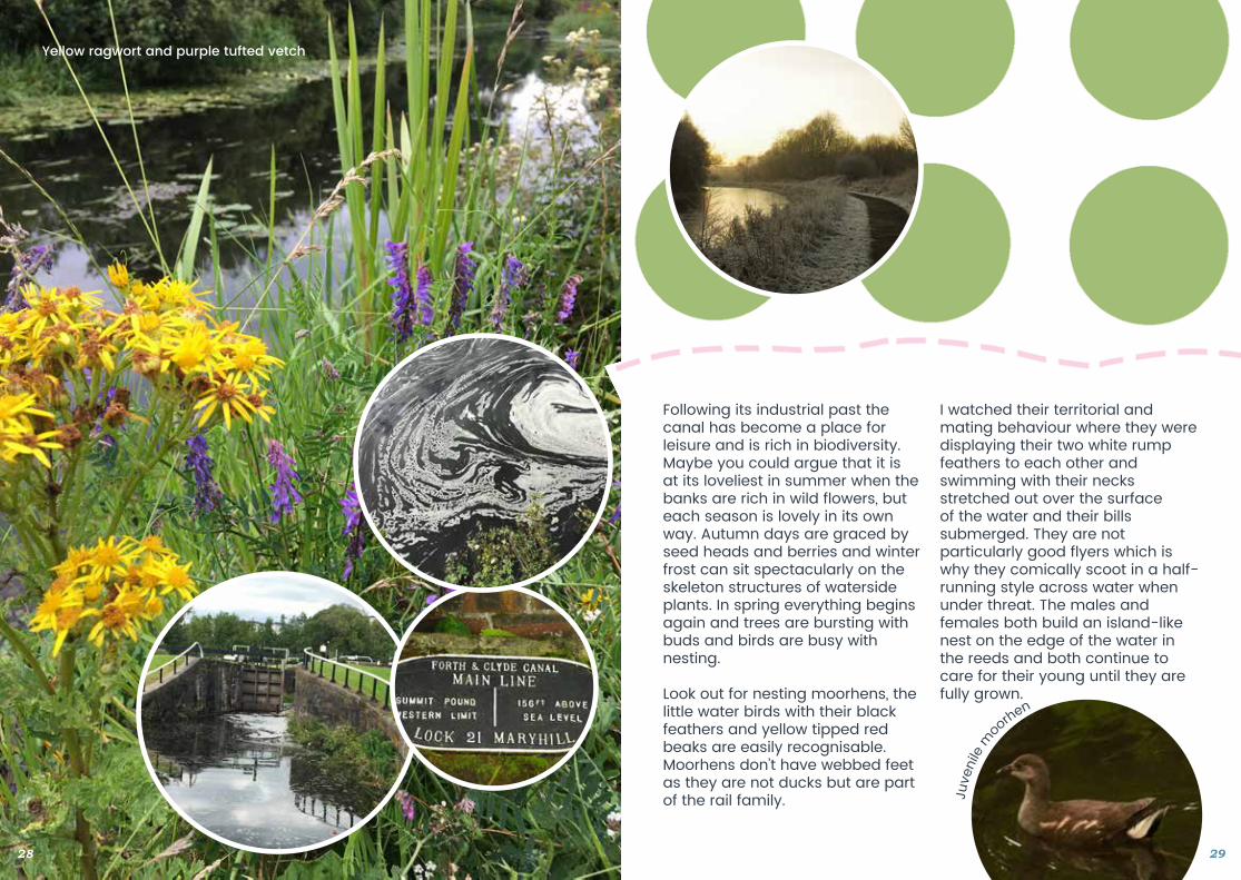
Following its industrial past the canal has become a place for leisure and is rich in biodiversity. Maybe you could argue that it is at its loveliest in summer when the banks are rich in wild flowers, but each season is lovely in its own way. Autumn days are graced by seed heads and berries and winter frost can sit spectacularly on the skeleton structures of waterside plants. In spring everything begins again and trees are bursting with buds and birds are busy with nesting.
Look out for nesting moorhens, the little water birds with their black feathers and yellow tipped red beaks are easily recognisable. Moorhens don’t have webbed feet as they are not ducks but are part of the rail family.
28 29
Yellow ragwort and purple tufted vetch
Juve
nile
moo
rhen
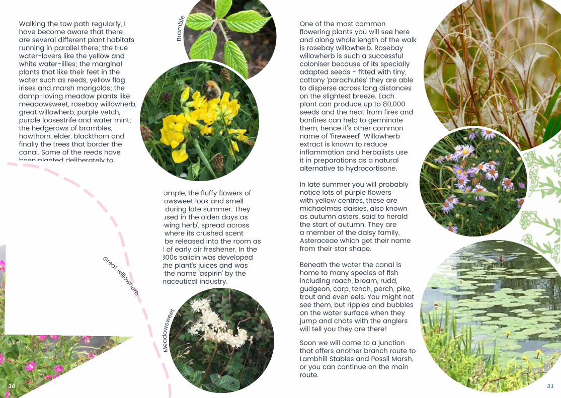
Walking the tow path regularly, I have become aware that there are several different plant habitats running in parallel there; the true water-lovers like the yellow and white water-lilies; the marginal plants that like their feet in thewater such as reeds, yellow flag irises and marsh marigolds; the damp-loving meadow plants like meadowsweet, rosebay willowherb, great willowherb, purple vetch, purple loosestrife and water mint; the hedgerows of brambles, hawthorn, elder, blackthorn and finally the trees that border the canal. Some of the reeds have been planted deliberately to protect the stone walls of the canal from water erosion caused by boats, but most of the vegetation has found its way here by natural means.
Getting to know the flowers and plants of the river and canal banks, I have learned a lot about how they can be used as foods and medicines.
For example, the fluffy flowers of meadowsweet look and smell lovely during late summer. They were used in the olden days as a ‘strewing herb’, spread across floors where its crushed scent could be released into the room as a kind of early air freshener. In the late 1800s salicin was developed from the plant’s juices and was given the name ‘aspirin’ by the pharmaceutical industry.
One of the most common flowering plants you will see here and along whole length of the walk is rosebay willowherb. Rosebay willowherb is such a successful coloniser because of its specially adapted seeds - fitted with tiny, cottony ‘parachutes’ they are able to disperse across long distances on the slightest breeze. Each plant can produce up to 80,000 seeds and the heat from fires and bonfires can help to germinate them, hence it’s other common name of ‘fireweed’. Willowherb extract is known to reduce inflammation and herbalists use it in preparations as a natural alternative to hydrocortisone.
In late summer you will probably notice lots of purple flowers with yellow centres, these are michaelmas daisies, also known as autumn asters, said to herald the start of autumn. They are a member of the daisy family, Asteraceae which get their name from their star shape.
Beneath the water the canal is home to many species of fish including roach, bream, rudd, gudgeon, carp, tench, perch, pike, trout and even eels. You might not see them, but ripples and bubbles on the water surface when they jump and chats with the anglers will tell you they are there!
Soon we will come to a junction that offers another branch route to Lambhill Stables and Possil Marsh, or you can continue on the main route.
30 31
Bram
ble
Mea
dow
swee
t
Great willowherb
Branch Route 3
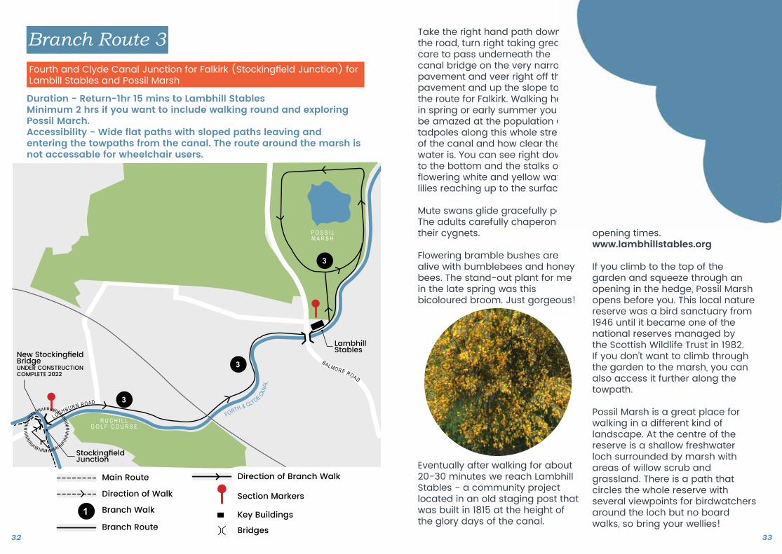
Duration - Return-1hr 15 mins to Lambhill Stables Minimum 2 hrs if you want to include walking round and exploring Possil March.Accessibility - Wide flat paths with sloped paths leaving and entering the towpaths from the canal. The route around the marsh is not accessable for wheelchair users.
Fourth and Clyde Canal Junction for Falkirk (Stockingfield Junction) forLambill Stables and Possil Marsh
Eventually after walking for about 20-30 minutes we reach Lambhill Stables - a community project located in an old staging post that was built in 1815 at the height of the glory days of the canal.
Take the right hand path down to the road, turn right taking great care to pass underneath the canal bridge on the very narrow pavement and veer right off the pavement and up the slope to join the route for Falkirk. Walking here in spring or early summer you will be amazed at the population of tadpoles along this whole stretch of the canal and how clear the water is. You can see right down to the bottom and the stalks of flowering white and yellow water lilies reaching up to the surface.
Mute swans glide gracefully past. The adults carefully chaperoning their cygnets.
Flowering bramble bushes are alive with bumblebees and honey bees. The stand-out plant for me in the late spring was thisbicoloured broom. Just gorgeous!
In 2007 the community hub was created as space for local people to get in touch with nature and have opportunities for training and volunteering. The Hub now runs workshops, has a community garden and a bike repair and hire service. The beautiful productive garden grows kale and leeks, carrots and peas, neeps and tatties (turnips and potatoes), soft fruits and apples that are all cooked up into healthy meals atthe cafe. This is a great place for a picnic and a chance to spot damselflies and dragonflies, pond skaters and water boatmen on the wildlife pond. Check the website for opening times. www.lambhillstables.org
If you climb to the top of the garden and squeeze through an opening in the hedge, Possil Marsh opens before you. This local nature reserve was a bird sanctuary from 1946 until it became one of the national reserves managed by the Scottish Wildlife Trust in 1982. If you don’t want to climb through the garden to the marsh, you can also access it further along the towpath.
Possil Marsh is a great place for walking in a different kind of landscape. At the centre of the reserve is a shallow freshwater loch surrounded by marsh with areas of willow scrub and grassland. There is a path that circles the whole reserve with several viewpoints for birdwatchers around the loch but no board walks, so bring your wellies! 32 33
LambhillStables
3
3
3
FORTH & CLYDE CANAL
P O S S I LM A R S H
R U C H I L L G O L F C O U R S E
BALMORE ROAD
StockingfieldJunction
Branch Walk
Main Route
MAP KEY
Direction of Walk
Bridges
Direction of Branch Walk
Branch Route
Section Markers
Key Buildings
1
New StockingfieldBridge UNDER CONSTRUCTION COMPLETE 2022
LOCHBURN ROAD
North Kelvin Meadow and
Children’s Wood
Ha’penny Bridge House
2
2
2
B O T A N I CG A R D E N S
KIRKLEE RD
CLOUSTON ST
GARRIOCH RD
ADDI
SON
RDWYNDHAM S
T
R I V E R K E LV I NSection 3
Section 4
Branch Walk
Main Route
MAP KEY
Direction of Walk
Bridges
Direction of Branch Walk
Branch Route
Section Markers
Key Buildings
1
Section 9
Duration - 10-20 minutesAccessibility - Wide tarmac towpath throughout.
Junction for Falkirk (Stockingfield Junction) to Murano Footbridge
Whatever the season a walk along the towpath brings nature close enough to touch, smell and taste. The water, the sky the ever- changing weather, reminds me of time passing and to take the moments when I can to find peace, calm and fascination in the natural world.
Soon we reach the striking footbridge that leads from Maryhill Road to Murano Student Village. Here is where we will leave the canal. You can of course carry on out east to take in the new Claypits Nature Reserve on the north bank followed by the headquarters of Scottish Canals at Applecross Street, the arts quarter at the Whisky Bond and The National Theatre Of Scotland Headquarters, Speirs Wharf and finally Pinkston Watersports Centre.
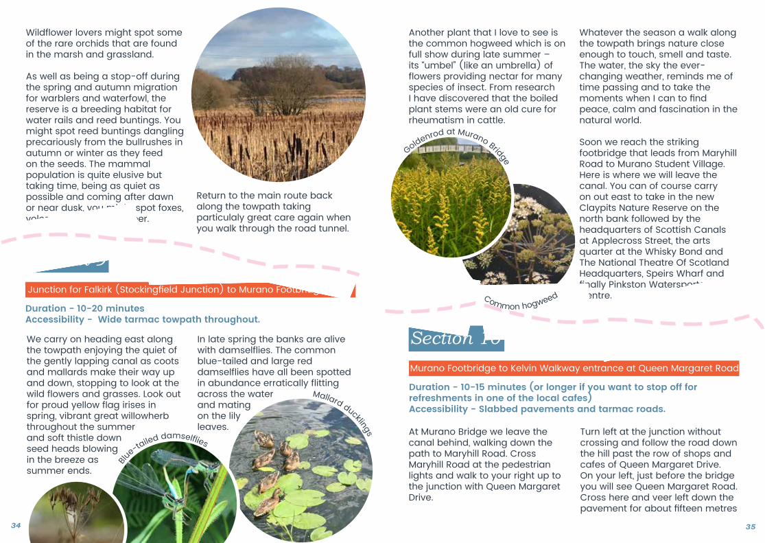
We carry on heading east along the towpath enjoying the quiet of the gently lapping canal as coots and mallards make their way up and down, stopping to look at the wild flowers and grasses. Look out for proud yellow flag irises in spring, vibrant great willowherb throughout the summer and soft thistle down seed heads blowing in the breeze as summer ends.
Another plant that I love to see is the common hogweed which is on full show during late summer – its “umbel” (like an umbrella) of flowers providing nectar for many species of insect. From research I have discovered that the boiled plant stems were an old cure for rheumatism in cattle.
Wildflower lovers might spot some of the rare orchids that are found in the marsh and grassland.
As well as being a stop-off during the spring and autumn migration for warblers and waterfowl, the reserve is a breeding habitat for water rails and reed buntings. You might spot reed buntings dangling precariously from the bullrushes in autumn or winter as they feed on the seeds. The mammal population is quite elusive but taking time, being as quiet as possible and coming after dawn or near dusk, you might spot foxes, voles, rabbits and roe deer.
Return to the main route backalong the towpath taking particulaly great care again when you walk through the road tunnel.
In late spring the banks are alive with damselflies. The common blue-tailed and large red damselflies have all been spotted in abundance erratically flitting across the water and mating on the lily leaves.
Section 10
Duration - 10-15 minutes (or longer if you want to stop off for refreshments in one of the local cafes)Accessibility - Slabbed pavements and tarmac roads.
Murano Footbridge to Kelvin Walkway entrance at Queen Margaret Road
At Murano Bridge we leave the canal behind, walking down the path to Maryhill Road. Cross Maryhill Road at the pedestrian lights and walk to your right up to the junction with Queen Margaret Drive.
Turn left at the junction withoutcrossing and follow the road down the hill past the row of shops and cafes of Queen Margaret Drive. On your left, just before the bridge you will see Queen Margaret Road. Cross here and veer left down the pavement for about fifteen metres
34 35
Blu
e-tailed damself ies
Mallard ducklings
Goldenrod at Murano Bridge
Common hogweed
till you see the entrance to the Kelvin Walkway.
Section 11
Duration - 20-30 minutes Accessibility - Wide tarmac paths and roads, pedestrian crossing at Park Road
Return to Woodlands Community Garden and the end of the walk
Once we are back on the Kelvin Walkway we will turn left and retrace our steps in reverse from the middle of Section 3 back through Section 1 - our starting point back at Woodlands Community Garden.
Don’t stop looking and listening as you never know what you might spot or hear; the melodic song of a robin, a wood mouse scurrying across the path, the scent of moist earth after rain, the sun slowly setting behind you in the west...
Tired feet and happy minds deserve a cuppa or maybe something stronger!
36
I’d love to hear about your experiences. Please do get in touch with any words, photographs or drawings to [email protected]
If your interest in nature has been sparked, here are some organisations that you might be interested in finding out about.
Woodlands Community Development Trust woodlandscommunity.org.uk
Friends of the River Kelvin (FORK) facebook.com/FriendsoftheRiverKelvin
Lambhill Stables Lambhillstables.org
Scottish Wildlife Trust scottishwildlifetrust.org.uk/reserve/possil-marsh
RSPB rspb.org.uk
Butterfly Conservationbutterfly-conservation.org
Plantlife plantlife.org.uk
Bumblebee Conservation Trust bumblebeeconservationtrust.org
Silver birch leaf
Jelly ear fungus

Design and LayoutPhotography
Art WorkMap Design
Nicola McGheeKatrina CaldwellAlan BradfordVicki FleckWoodlands Community Development TrustKatherine CoryNick Cotton


