Embed Size (px)
Citation preview

DEFENSE POW/MIA ACCOUNTING AGENCY
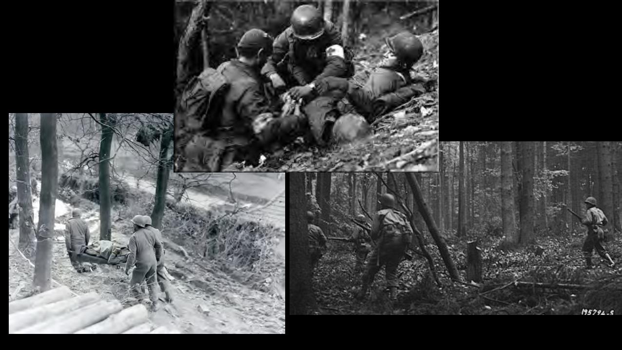
The Hürtgen Forest Project
Fulfilling Our Nation’s Promise
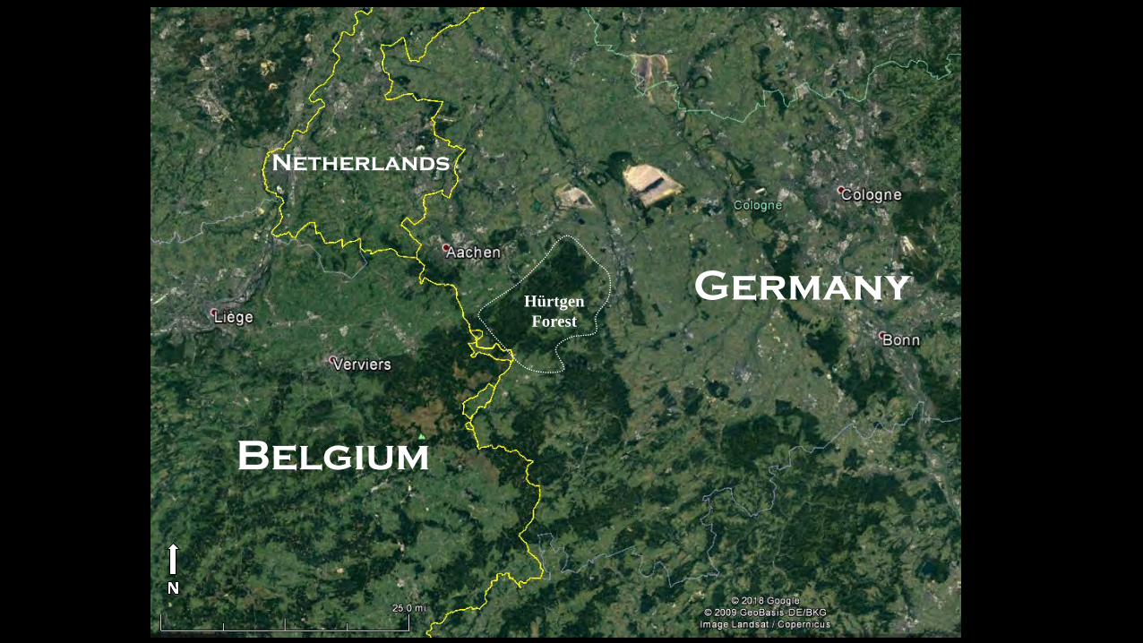
Germany
Netherlands
Belgium
HürtgenForest
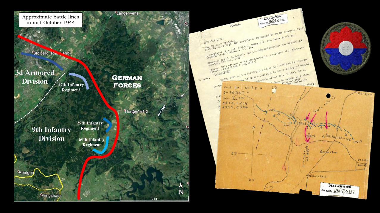
Approximate battle lines in mid-October 1944
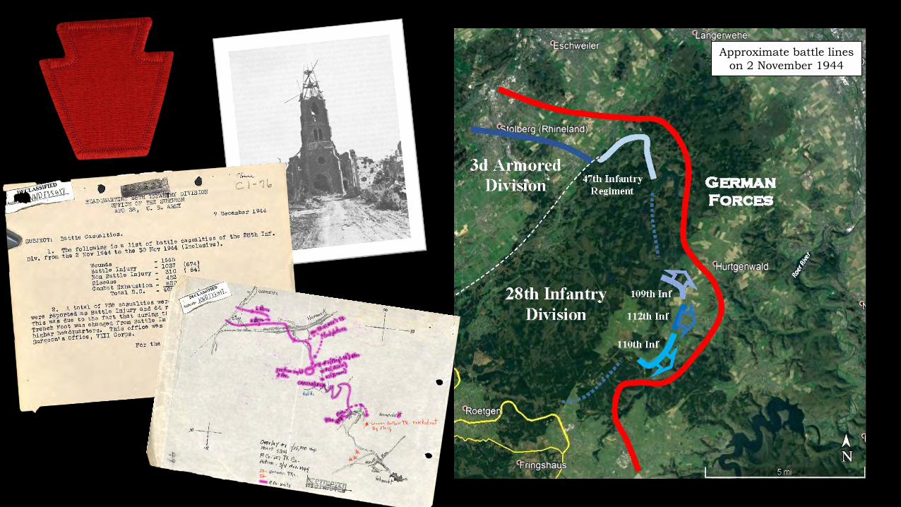
Approximate battle lines on 2 November 1944
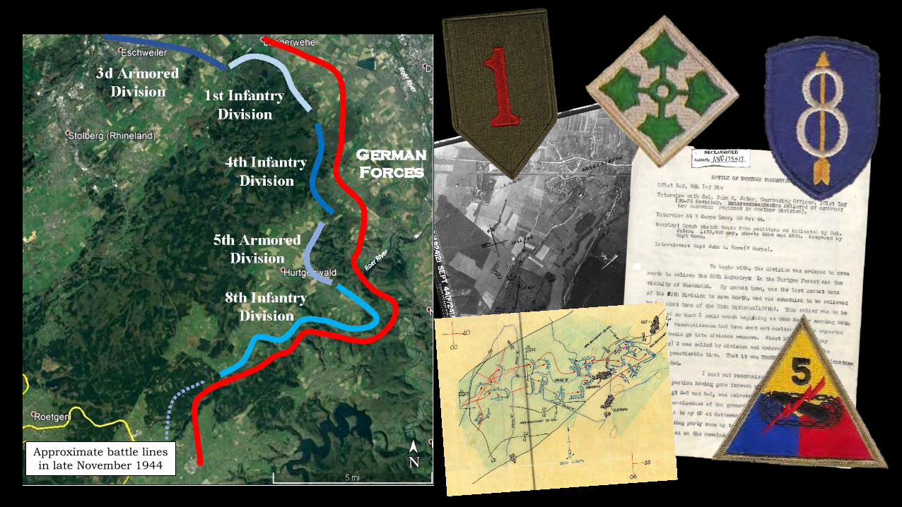
Approximate battle lines in late November 1944
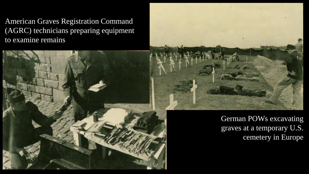
American Graves Registration Command (AGRC) technicians preparing equipment to examine remains
German POWs excavating graves at a temporary U.S.
cemetery in Europe
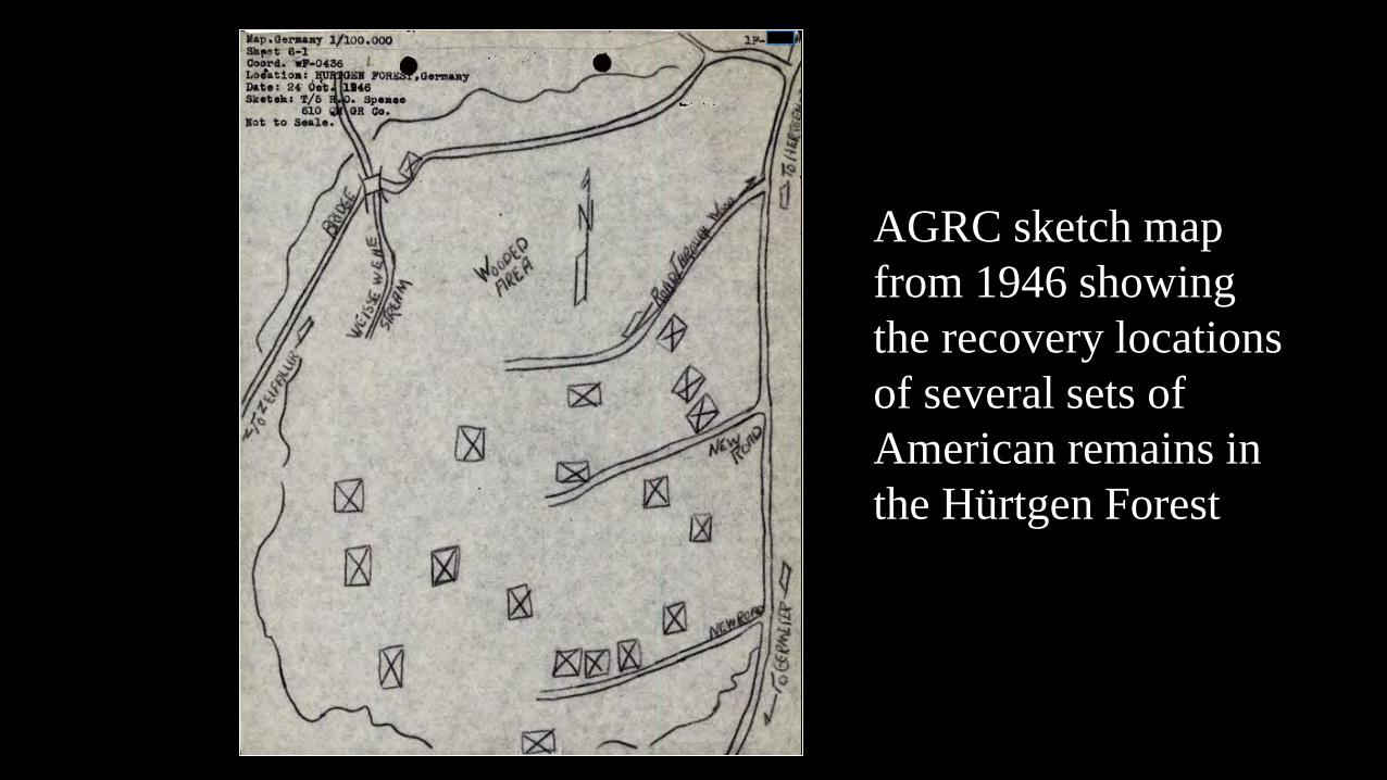
AGRC sketch map from 1946 showing the recovery locations of several sets of American remains in the Hürtgen Forest
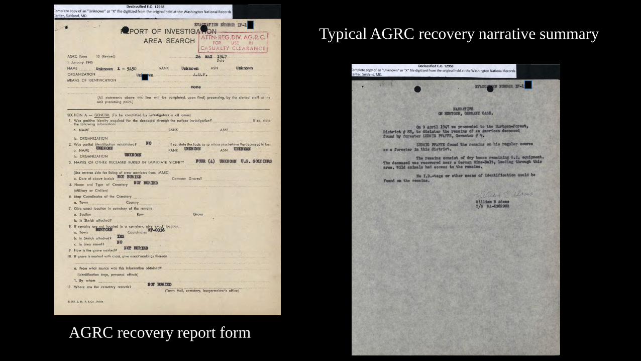
AGRC recovery report form
Typical AGRC recovery narrative summary
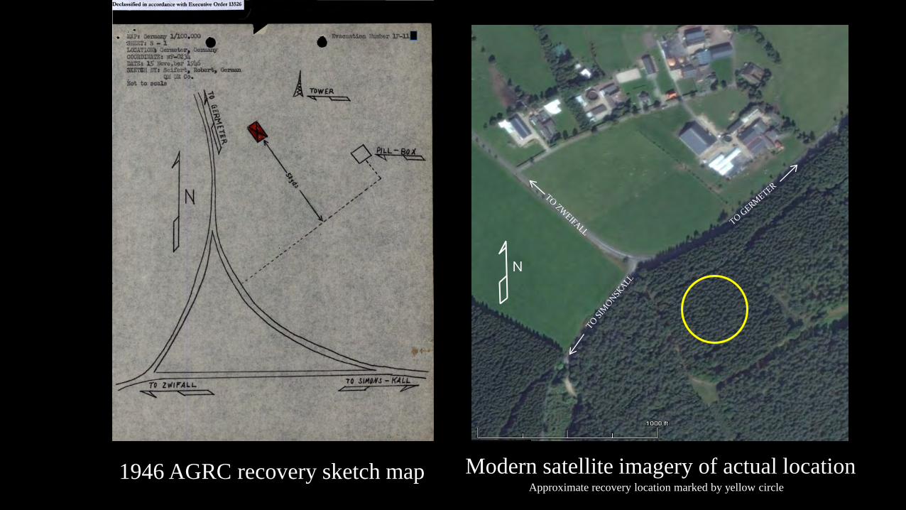
1946 AGRC recovery sketch map
N
Modern satellite imagery of actual locationApproximate recovery location marked by yellow circle
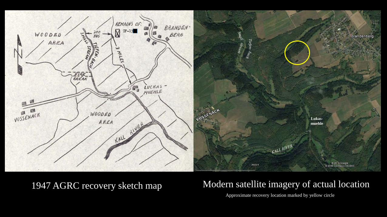
Lukas-muehle
Tiefen-
1947 AGRC recovery sketch map Modern satellite imagery of actual locationApproximate recovery location marked by yellow circle
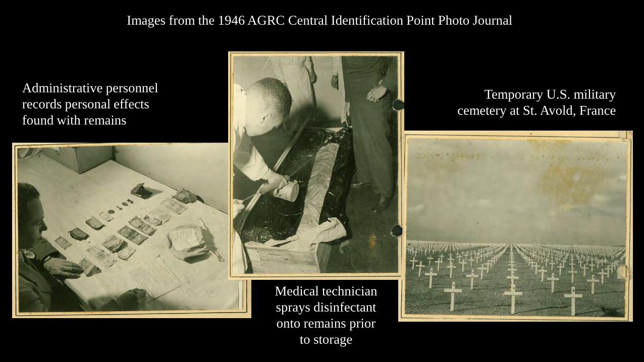
Images from the 1946 AGRC Central Identification Point Photo Journal
Medical technician sprays disinfectant onto remains prior
to storage
Administrative personnel records personal effects found with remains
Temporary U.S. military cemetery at St. Avold, France
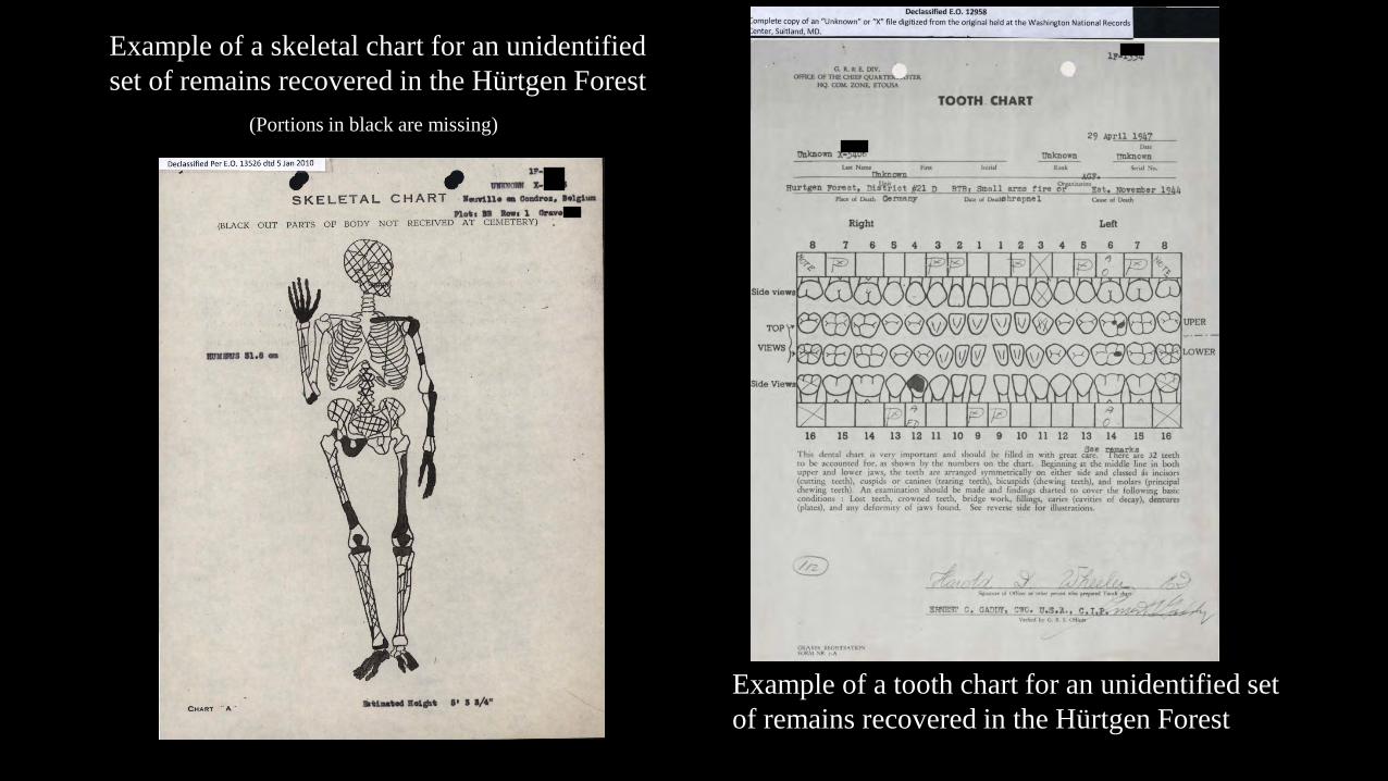
Example of a skeletal chart for an unidentified set of remains recovered in the Hürtgen Forest
Example of a tooth chart for an unidentified set of remains recovered in the Hürtgen Forest
(Portions in black are missing)
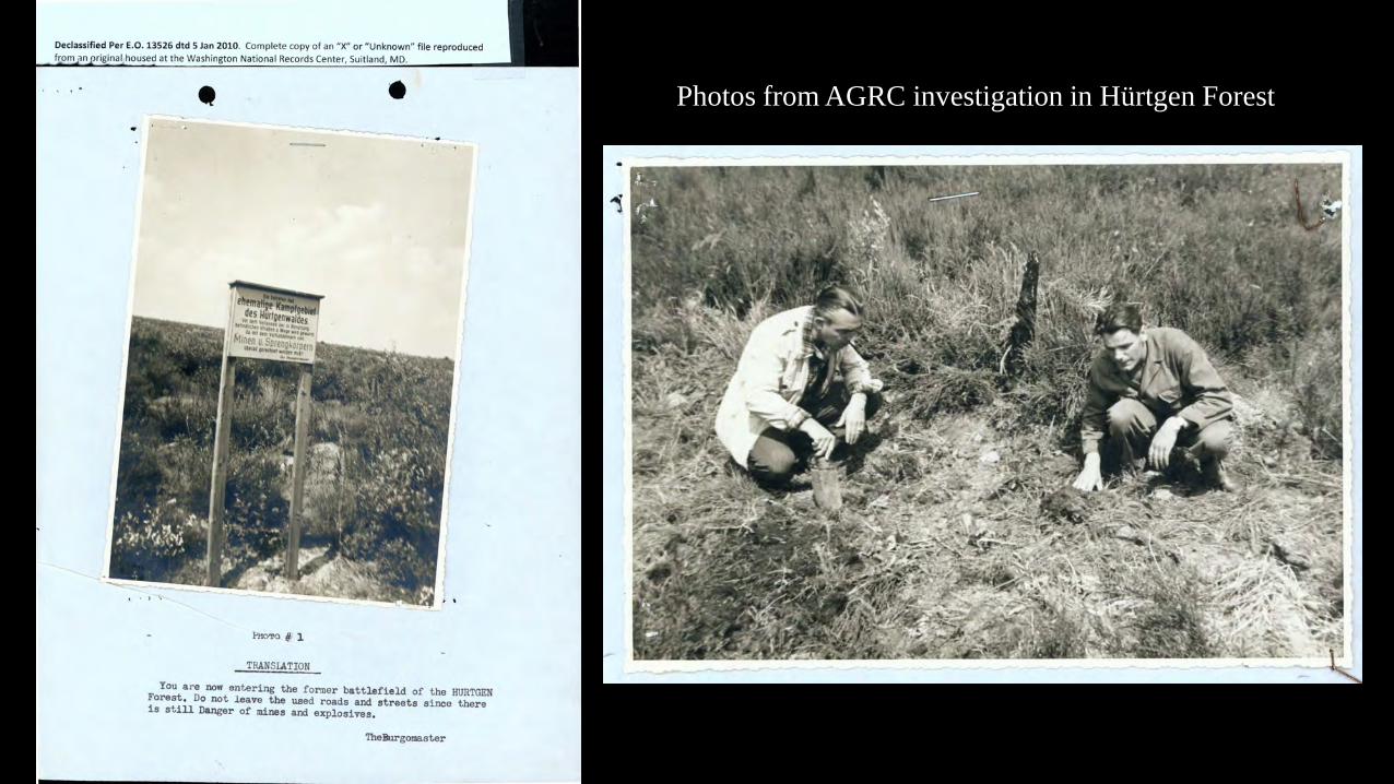
Photos from AGRC investigation in Hürtgen Forest
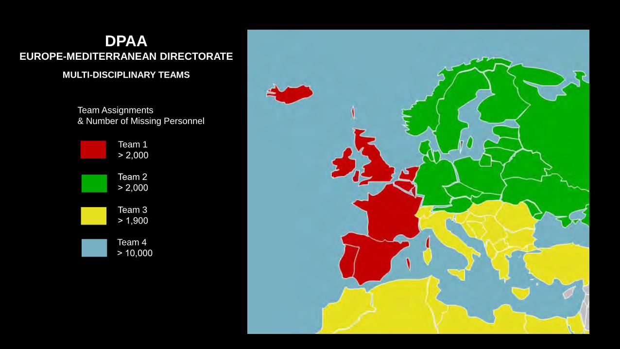
Team Assignments & Number of Missing Personnel
Team 1˃ 2,000
Team 2˃ 2,000
Team 3˃ 1,900
Team 4˃ 10,000
DPAAEUROPE-MEDITERRANEAN DIRECTORATE
MULTI-DISCIPLINARY TEAMS
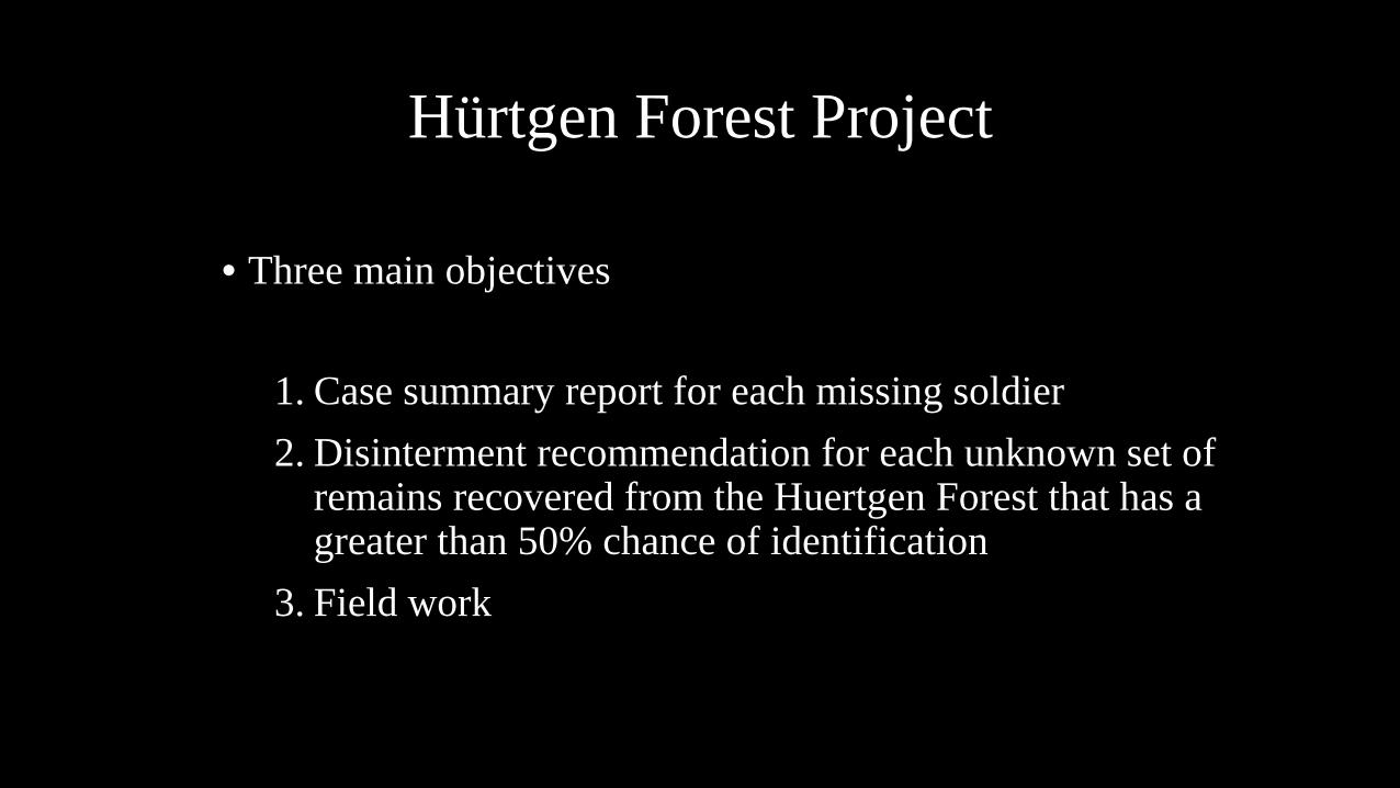
Hürtgen Forest Project
• Three main objectives
1. Case summary report for each missing soldier2. Disinterment recommendation for each unknown set of
remains recovered from the Huertgen Forest that has a greater than 50% chance of identification
3. Field work
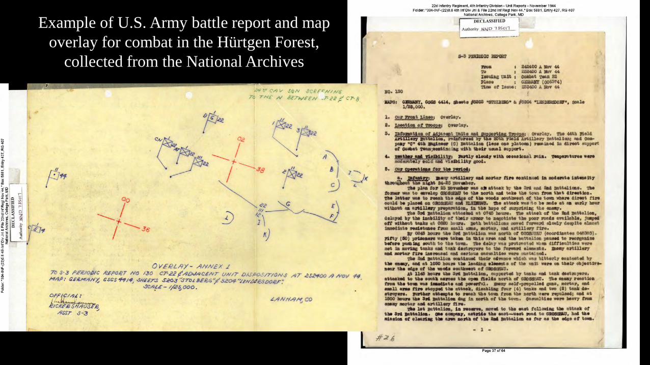
Example of U.S. Army battle report and map overlay for combat in the Hürtgen Forest,
collected from the National Archives
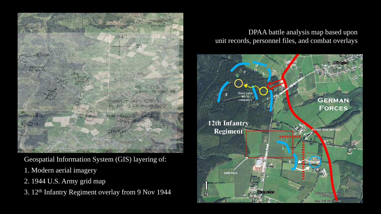
Geospatial Information System (GIS) layering of: 1. Modern aerial imagery2. 1944 U.S. Army grid map3. 12th Infantry Regiment overlay from 9 Nov 1944
DPAA battle analysis map based upon unit records, personnel files, and combat overlays
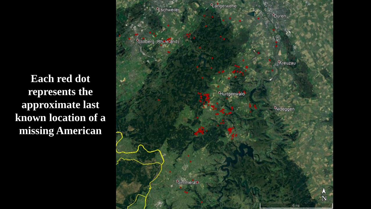
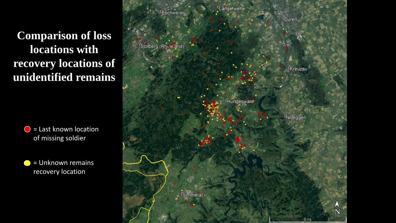
Each red dot represents the
approximate last known location of a missing American
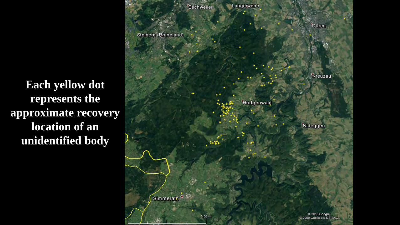
Each yellow dot represents the
approximate recovery location of an
unidentified body

Comparison of loss locations with
recovery locations of unidentified remains
= Last known location of missing soldier
= Unknown remains recovery location
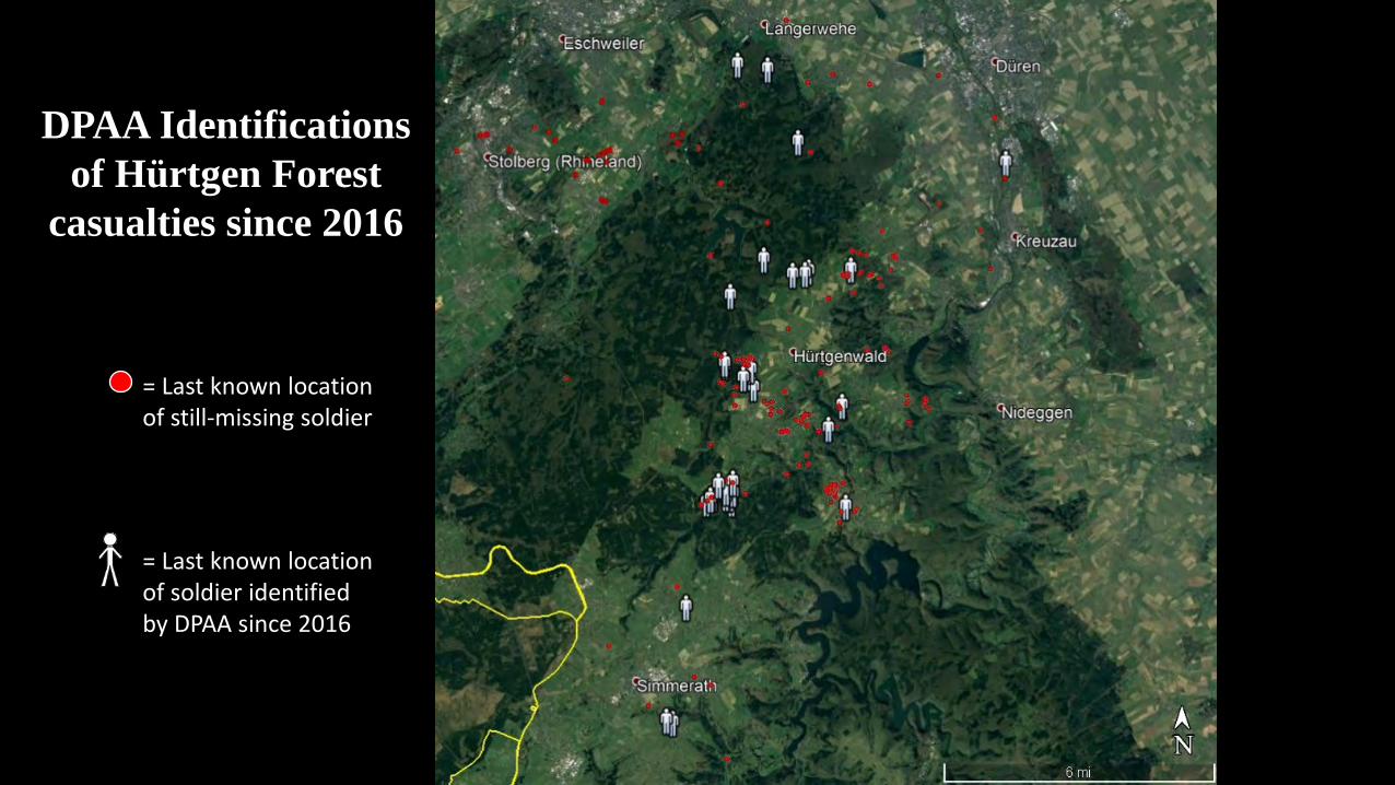
DPAA Identifications of Hürtgen Forest
casualties since 2016
= Last known location of still-missing soldier
= Last known location of soldier identified by DPAA since 2016
Comparison of loss locations with
recovery locations of unidentified remains
= Last known location of missing soldier
= Unknown remains recovery location
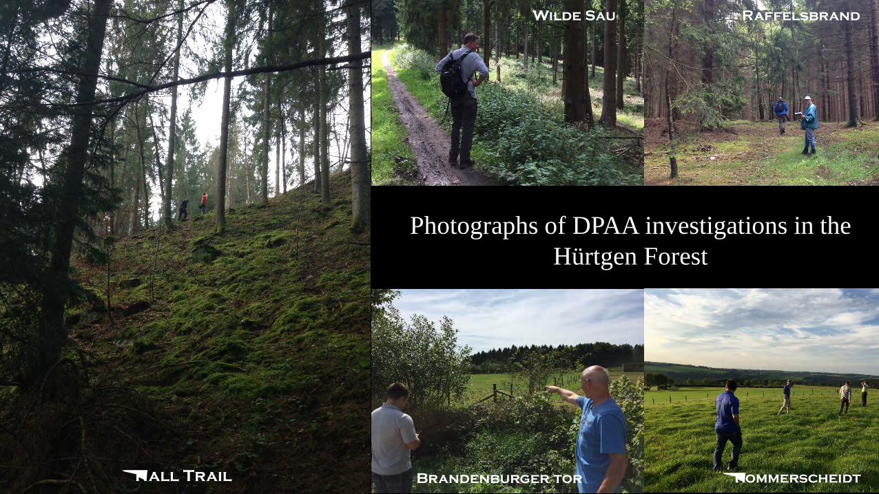
Kall Trail Brandenburger tor Kommerscheidt
Photographs of DPAA investigations in the Hürtgen Forest
Wilde Sau Raffelsbrand
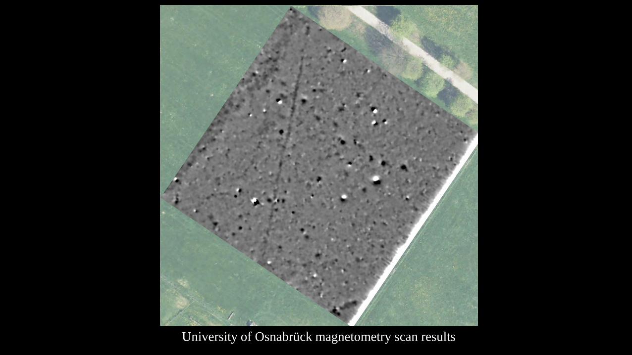
University of Osnabrück magnetometry scan results
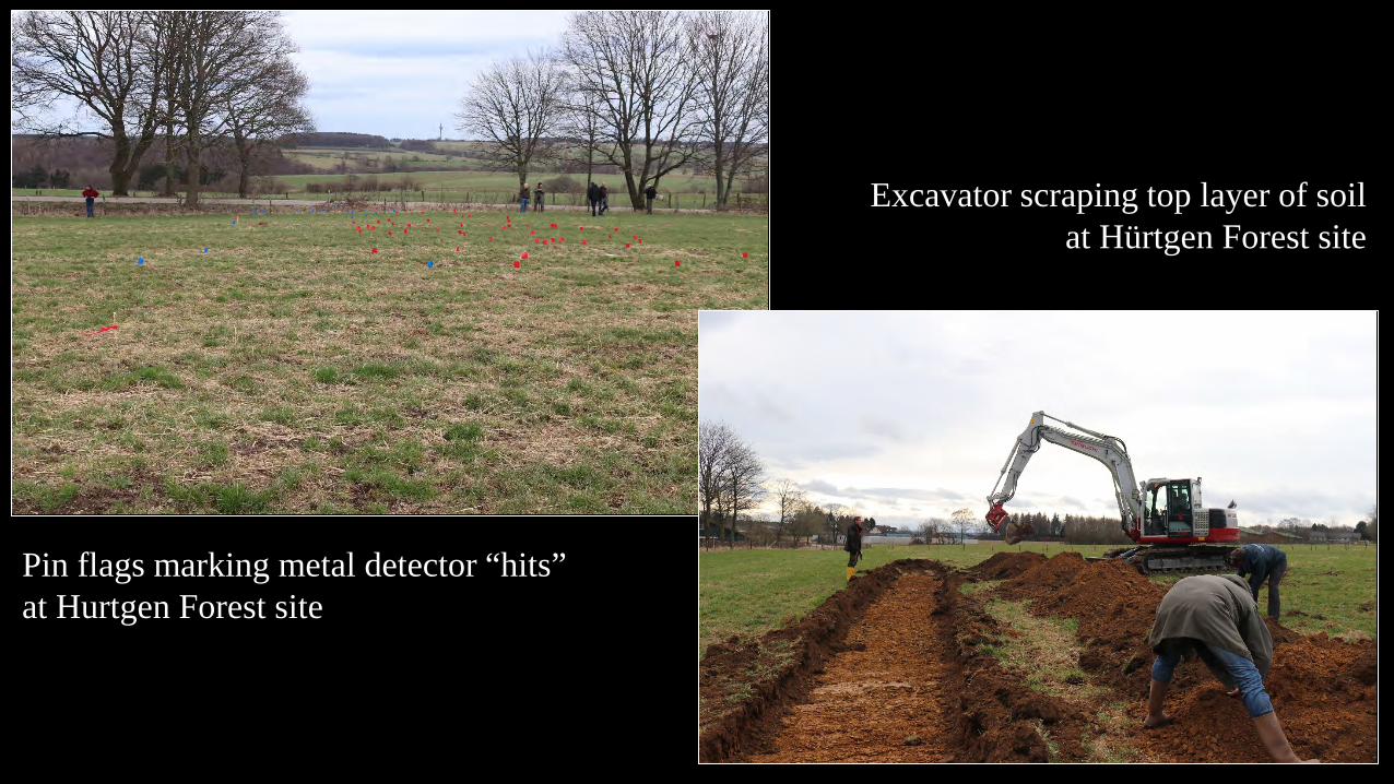
Pin flags marking metal detector “hits” at Hurtgen Forest site
Excavator scraping top layer of soil at Hürtgen Forest site
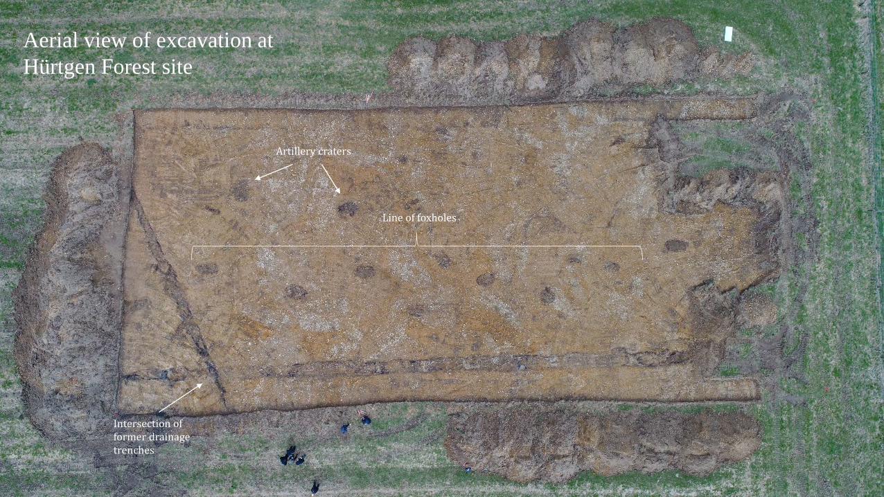
Aerial view of excavation at Hürtgen Forest site
Line of foxholes
Artillery craters
Intersection of former drainage trenches
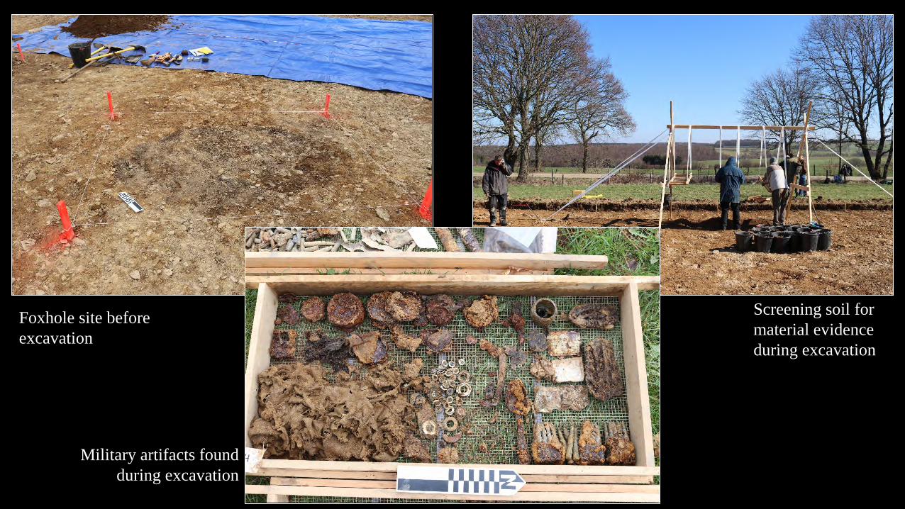
Foxhole site before excavation
Military artifacts found during excavation
Screening soil for material evidence during excavation