Embed Size (px)
Citation preview
1Old Town Neighborhoods Plan
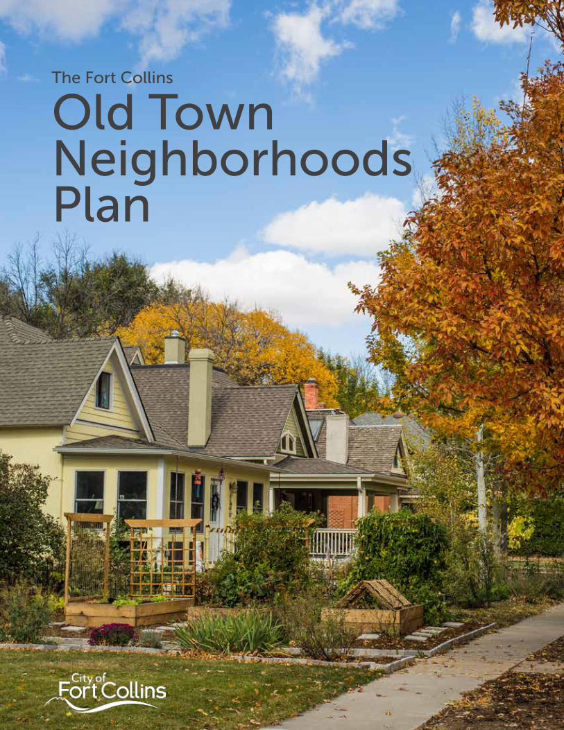
The Fort Collins
Old Town Neighborhoods Plan
2 Old Town Neighborhoods Plan
The Old TownNeighborhoods Plan Adopted | February 21, 2017
For more information, or to share questions or comments, please contact us.
Fort Collins Planning Services:
970.221.6750
fcgov.com/planning
This Plan online:
fcgov.com/otnp
3Old Town Neighborhoods Plan
Acknowledgments
City CouncilWade Troxell, Mayor
Gerry Horak, Mayor Pro Tem, District 6
Bob Overbeck, District 1
Ray Martinez, District 2
Gino Campana, District 3
Kristin Stephens, District 4
Ross Cunniff, District 5
City LeadershipDarin Atteberry, City Manager
Jeff Mihelich, Deputy City Manager
Laurie Kadrich, Director of PDT
Tom Leeson, CDNS Director
Boards and CommissionsAffordable Housing Board
Bicycle Advisory Committee
Landmark Preservation Commission
Planning and Zoning Board
Transportation Board
Consultant TeamMIG
Jeff Winston
Jay Renkens
Cole Gehler
Fox Tuttle Hernandez
Carlos Hernandez
Molly Veldkamp
Brendle Group
Shelby Sommer
Economic & Planning Systems
Andrew Knudtsen
Matt Prosser
Project Management & Staff TeamPete Wray, Project Manager
Emily Allen
Shane Boyle
Spencer Branson
Sue Beck Ferkiss
Sarah Burnett
Delynn Coldiron
Rebecca Everette
Aaron Fodge
Clay Frickey
Cameron Gloss
Aaron Iverson
Tim Kemp
Dean Klinger
Jill Marx
Karen McWilliams
Ryan Mounce
Joe Olson
Meaghan Overton
Amy Resseguie
Paul Sizemore
Martina Wilkinson
Ralph Zentz
4 Old Town Neighborhoods Plan
Neighborhood Stakeholder GroupAl Kulenski
Tami Agne
Roland Baschmann
Margo Carlock
Michele Christensen
Mike Coley
Kelly Deligio
Sheila Dielman
Paulette Dolin
Meg Dunn
Patrick Flynn
Michelle Haefele
Margit Hentschel
Catherine Cole Janonis
Seth Jansen
Kristina Kachur
Chris Kelly
Lisa Kohl
Hugh Mackay
Lisa Moravan
Jack Mullen
Kevin Murray
Doug & Denise Newberry
Jodie Riesenberger
Greg Rittner
Kendra Spanjer
Tamela Wahl
Gayle Wernsman
William Whitley
Zach & Laura Wilson
5Old Town Neighborhoods Plan
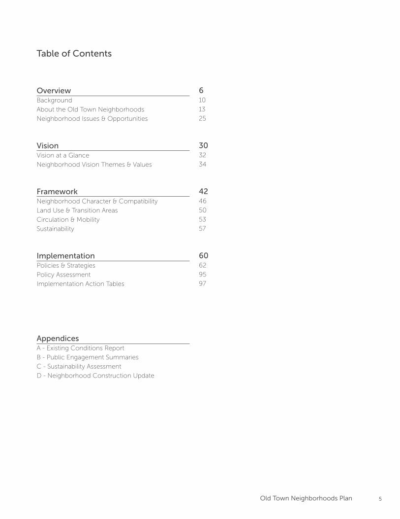
Table of Contents
Overview Background
About the Old Town Neighborhoods
Neighborhood Issues & Opportunities
Vision Vision at a Glance
Neighborhood Vision Themes & Values
Framework Neighborhood Character & Compatibility
Land Use & Transition Areas
Circulation & Mobility
Sustainability
Implementation Policies & Strategies
Policy Assessment
Implementation Action Tables
AppendicesA - Existing Conditions Report
B - Public Engagement Summaries
C - Sustainability Assessment
D - Neighborhood Construction Update
610
13
25
3032
34
4246
50
53
57
6062
95
97
6 Old Town Neighborhoods Plan
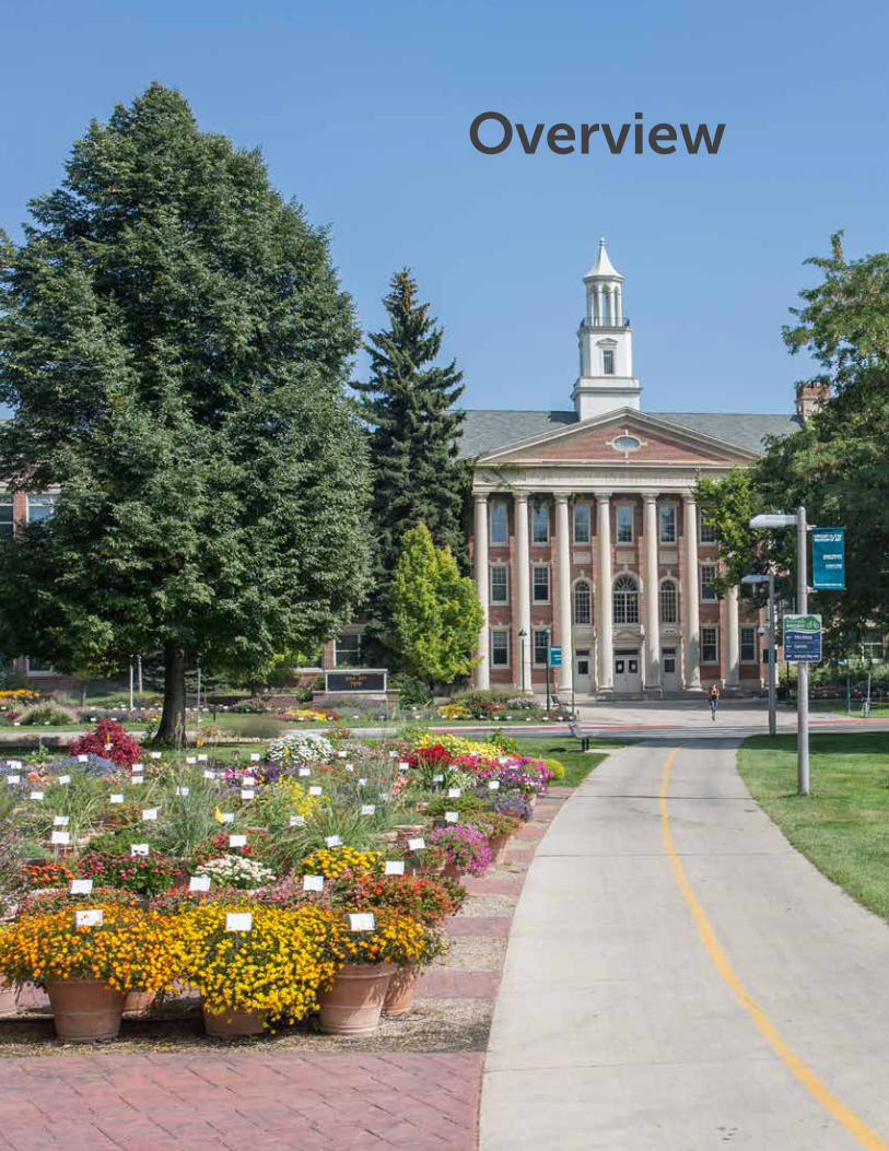
Overview
7Old Town Neighborhoods Plan
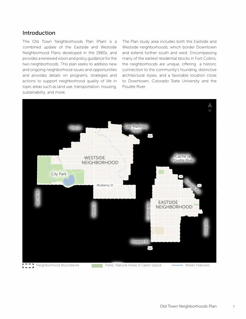
Introduction
The Old Town Neighborhoods Plan (Plan) is a
combined update of the Eastside and Westside
Neighborhood Plans developed in the 1980s, and
provides a renewed vision and policy guidance for the
two neighborhoods. This plan seeks to address new
and ongoing neighborhood issues and opportunities
and provides details on programs, strategies and
actions to support neighborhood quality of life in
topic areas such as land use, transportation, housing,
sustainability, and more.
Gardens onSpring Creek
City Park
Cache la Poudre River
DOWNTOWN
COLORADOSTATE
UNIVERSITY
EASTSIDENEIGHBORHOOD
WESTSIDENEIGHBORHOOD
287
287
14
14
Lee MartinezPark
Mulberry St
Prospect Rd
Vine Dr
Taft
Hill
Rd
Shie
lds
St
Co
lleg
e A
ve
Lem
ay A
ve
Riverside Ave
The Plan study area includes both the Eastside and
Westside neighborhoods, which border Downtown
and extend further south and west. Encompassing
many of the earliest residential blocks in Fort Collins,
the neighborhoods are unique, offering a historic
connection to the community’s founding, distinctive
architectural styles, and a favorable location close
to Downtown, Colorado State University and the
Poudre River.
Neighborhood Boundaries Parks, Natural Areas & Open Space Water Features
N
8 Old Town Neighborhoods Plan
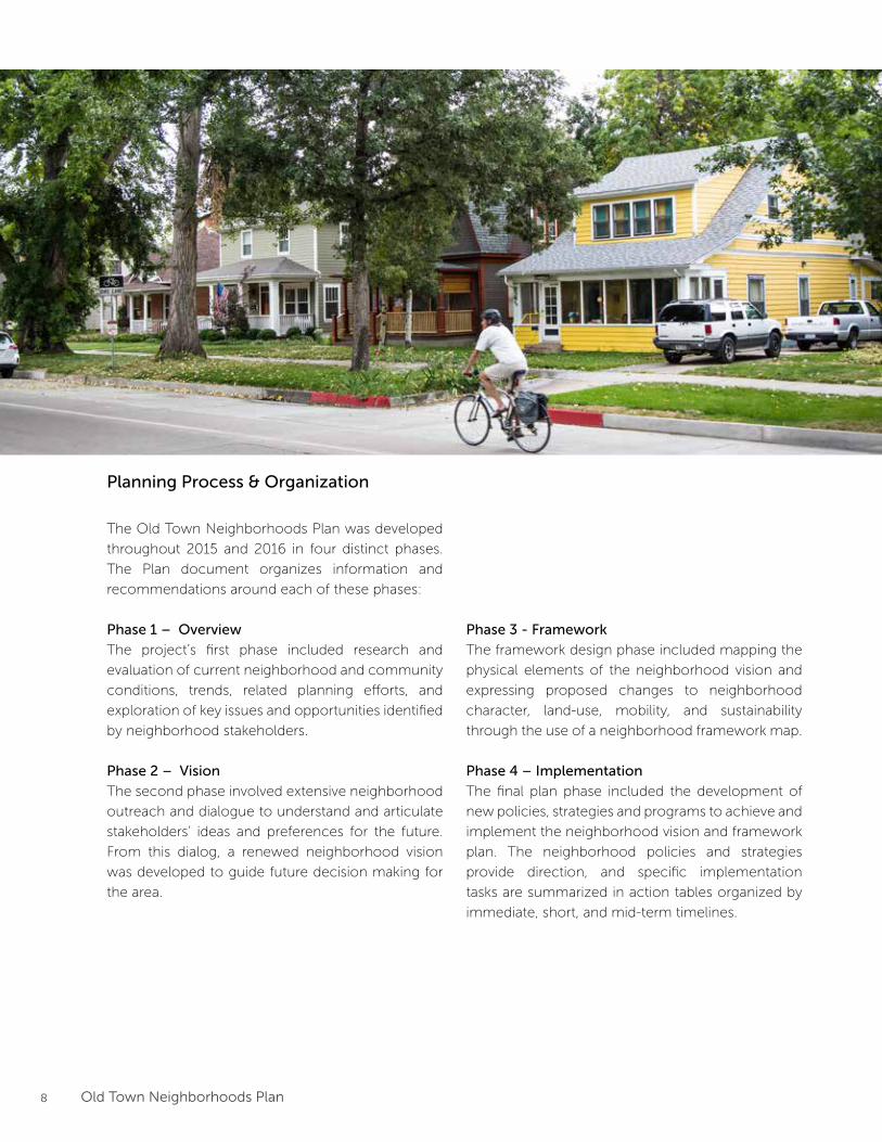
Planning Process & Organization
The Old Town Neighborhoods Plan was developed
throughout 2015 and 2016 in four distinct phases.
The Plan document organizes information and
recommendations around each of these phases:
Phase 1 – Overview
The project’s first phase included research and
evaluation of current neighborhood and community
conditions, trends, related planning efforts, and
exploration of key issues and opportunities identified
by neighborhood stakeholders.
Phase 2 – Vision
The second phase involved extensive neighborhood
outreach and dialogue to understand and articulate
stakeholders’ ideas and preferences for the future.
From this dialog, a renewed neighborhood vision
was developed to guide future decision making for
the area.
Phase 3 - Framework
The framework design phase included mapping the
physical elements of the neighborhood vision and
expressing proposed changes to neighborhood
character, land-use, mobility, and sustainability
through the use of a neighborhood framework map.
Phase 4 – Implementation
The final plan phase included the development of
new policies, strategies and programs to achieve and
implement the neighborhood vision and framework
plan. The neighborhood policies and strategies
provide direction, and specific implementation
tasks are summarized in action tables organized by
immediate, short, and mid-term timelines.
9Old Town Neighborhoods Plan
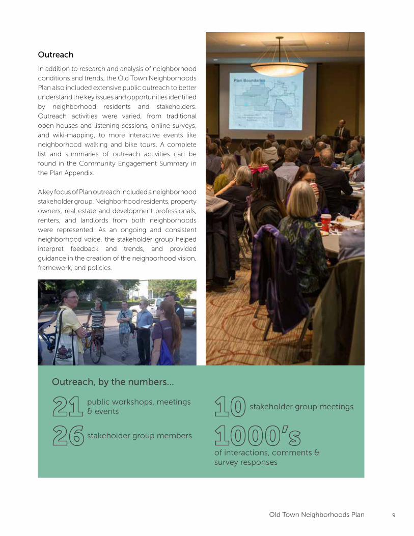
Outreach
In addition to research and analysis of neighborhood
conditions and trends, the Old Town Neighborhoods
Plan also included extensive public outreach to better
understand the key issues and opportunities identified
by neighborhood residents and stakeholders.
Outreach activities were varied, from traditional
open houses and listening sessions, online surveys,
and wiki-mapping, to more interactive events like
neighborhood walking and bike tours. A complete
list and summaries of outreach activities can be
found in the Community Engagement Summary in
the Plan Appendix.
A key focus of Plan outreach included a neighborhood
stakeholder group. Neighborhood residents, property
owners, real estate and development professionals,
renters, and landlords from both neighborhoods
were represented. As an ongoing and consistent
neighborhood voice, the stakeholder group helped
interpret feedback and trends, and provided
guidance in the creation of the neighborhood vision,
framework, and policies.
Outreach, by the numbers...
public workshops, meetings & events
stakeholder group members
stakeholder group meetings
of interactions, comments & survey responses
10 Old Town Neighborhoods Plan
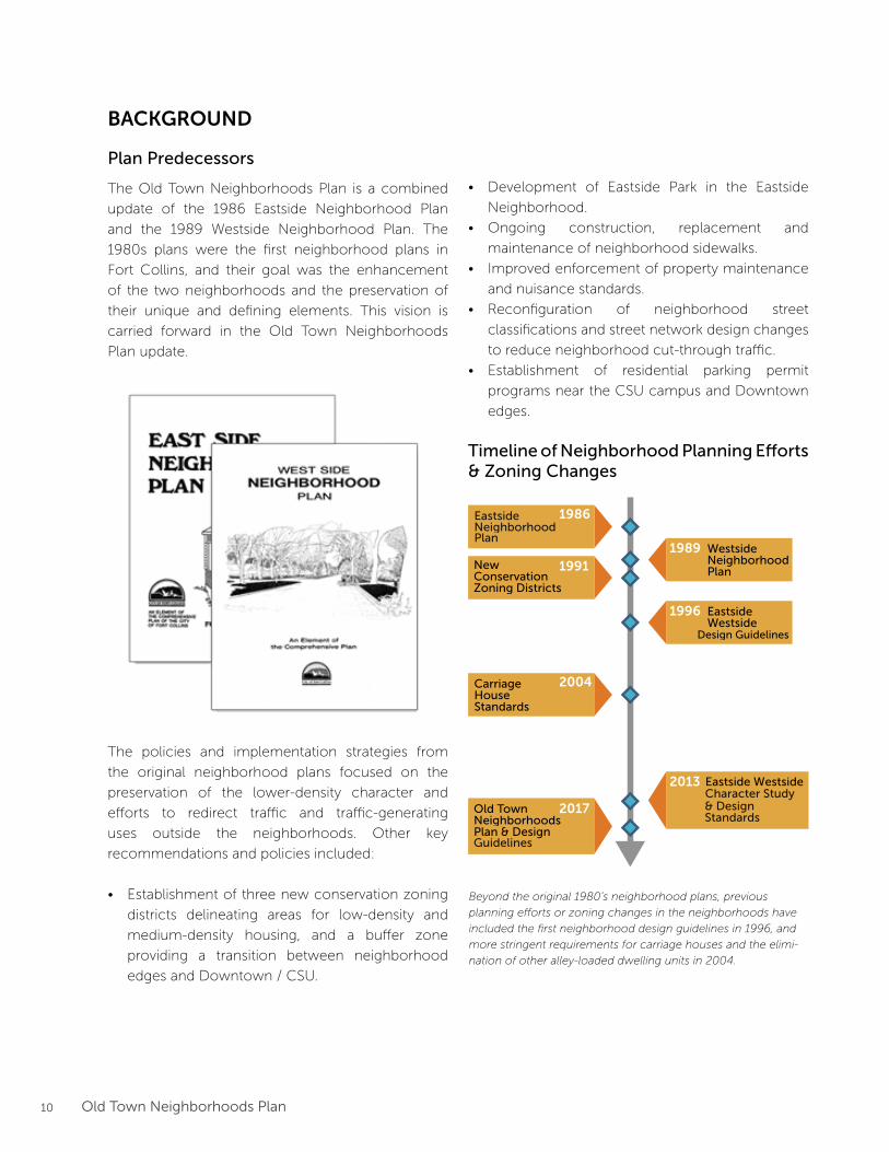
BACKGROUND
Plan Predecessors
The Old Town Neighborhoods Plan is a combined
update of the 1986 Eastside Neighborhood Plan
and the 1989 Westside Neighborhood Plan. The
1980s plans were the first neighborhood plans in
Fort Collins, and their goal was the enhancement
of the two neighborhoods and the preservation of
their unique and defining elements. This vision is
carried forward in the Old Town Neighborhoods
Plan update.
The policies and implementation strategies from
the original neighborhood plans focused on the
preservation of the lower-density character and
efforts to redirect traffic and traffic-generating
uses outside the neighborhoods. Other key
recommendations and policies included:
• Establishment of three new conservation zoning
districts delineating areas for low-density and
medium-density housing, and a buffer zone
providing a transition between neighborhood
edges and Downtown / CSU.
New ConservationZoning Districts
WestsideNeighborhoodPlan
EastsideWestside
Design Guidelines
Carriage HouseStandards
Eastside Westside
Old TownNeighborhoodsPlan & Design
1986
19911989
1996
2004
2013
2017
EastsideNeighborhoodPlan
Guidelines
Character Study& DesignStandards
Timeline of Neighborhood Planning Efforts & Zoning Changes
• Development of Eastside Park in the Eastside
Neighborhood.
• Ongoing construction, replacement and
maintenance of neighborhood sidewalks.
• Improved enforcement of property maintenance
and nuisance standards.
• Reconfiguration of neighborhood street
classifications and street network design changes
to reduce neighborhood cut-through traffic.
• Establishment of residential parking permit
programs near the CSU campus and Downtown
edges.
Beyond the original 1980’s neighborhood plans, previous
planning efforts or zoning changes in the neighborhoods have
included the first neighborhood design guidelines in 1996, and
more stringent requirements for carriage houses and the elimi-
nation of other alley-loaded dwelling units in 2004.
11Old Town Neighborhoods Plan
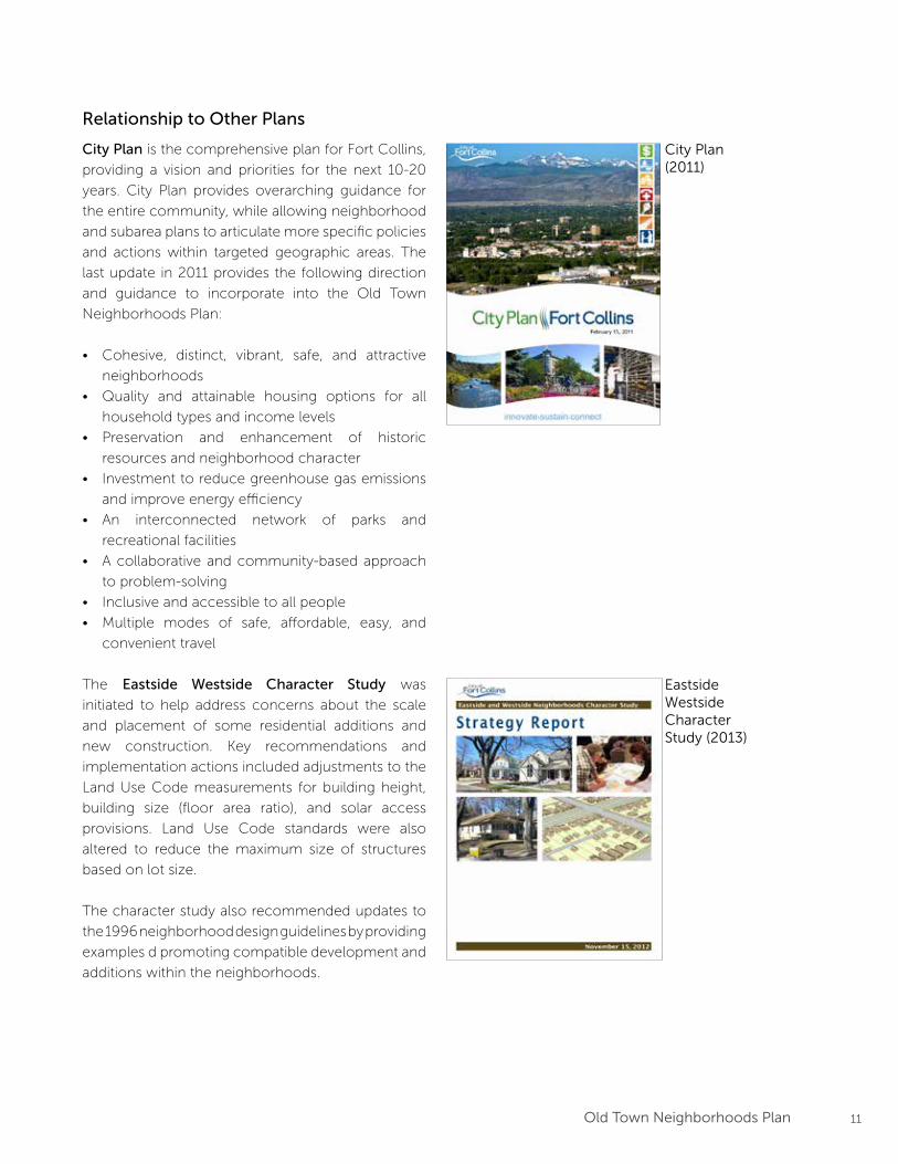
Relationship to Other Plans
City Plan is the comprehensive plan for Fort Collins,
providing a vision and priorities for the next 10-20
years. City Plan provides overarching guidance for
the entire community, while allowing neighborhood
and subarea plans to articulate more specific policies
and actions within targeted geographic areas. The
last update in 2011 provides the following direction
and guidance to incorporate into the Old Town
Neighborhoods Plan:
• Cohesive, distinct, vibrant, safe, and attractive
neighborhoods
• Quality and attainable housing options for all
household types and income levels
• Preservation and enhancement of historic
resources and neighborhood character
• Investment to reduce greenhouse gas emissions
and improve energy efficiency
• An interconnected network of parks and
recreational facilities
• A collaborative and community-based approach
to problem-solving
• Inclusive and accessible to all people
• Multiple modes of safe, affordable, easy, and
convenient travel
The Eastside Westside Character Study was
initiated to help address concerns about the scale
and placement of some residential additions and
new construction. Key recommendations and
implementation actions included adjustments to the
Land Use Code measurements for building height,
building size (floor area ratio), and solar access
provisions. Land Use Code standards were also
altered to reduce the maximum size of structures
based on lot size.
The character study also recommended updates to
the 1996 neighborhood design guidelines by providing
examples d promoting compatible development and
additions within the neighborhoods.
City Plan(2011)
Eastside WestsideCharacterStudy (2013)
12 Old Town Neighborhoods Plan
Bicycle Plan(2014)
Climate ActionPlan (2015)
Downtown Plan (2017)
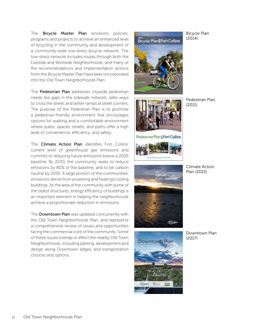
The Bicycle Master Plan envisions policies,
programs and projects to achieve an enhanced level
of bicycling in the community and development of
a community-wide low-stress bicycle network. The
low-stress network includes routes through both the
Eastside and Westside Neighborhoods, and many of
the recommendations and implementation actions
from the Bicycle Master Plan have been incorporated
into the Old Town Neighborhoods Plan.
The Pedestrian Plan addresses citywide pedestrian
needs like gaps in the sidewalk network, safer ways
to cross the street, and better ramps at street corners.
The purpose of the Pedestrian Plan is to promote
a pedestrian-friendly environment that encourages
options for walking and a comfortable environment
where public spaces, streets, and paths offer a high
level of convenience, efficiency, and safety.
The Climate Action Plan identifies Fort Collins’
current level of greenhouse gas emissions and
commits to reducing future emissions below a 2005
baseline. By 2030, the community seeks to reduce
emissions by 80% of the baseline, and to be carbon
neutral by 2050. A large portion of the communities’
emissions derive from powering and heating/cooling
buildings. As the area of the community with some of
the oldest structures, energy efficiency of buildings is
an important element in helping the neighborhoods
achieve a proportionate reduction in emissions.
The Downtown Plan was updated concurrently with
the Old Town Neighborhoods Plan, and represents
a comprehensive review of issues and opportunities
facing the commercial core of the community. Some
of these issues overlap or affect the nearby Old Town
Neighborhoods, including parking, development and
design along Downtown edges, and transportation
choices and options.
Pedestrian Plan(2011)
13Old Town Neighborhoods Plan
About the Old Town Neighborhoods
The Old Town Neighborhoods comprise the Eastside
and Westside Neighborhoods bordering Downtown
to the west, east, and southeast. The neighborhoods
represent some of the earliest residential blocks
in the community and their history of growth and
development are closely tied to founding and initial
growth of the community and Colorado State
University (CSU).
Located on either side of Downtown and CSU, the
neighborhoods feature close proximity to many
other nearby amenities such as City Park, the
Downtown Library, the Poudre River, and numerous
historic landmarks. Short and direct neighborhood
blocks provide easy connections that help facilitate
alternative travel options, and the neighborhoods
contain a large population of transit, pedestrian and
bicycle commuters.
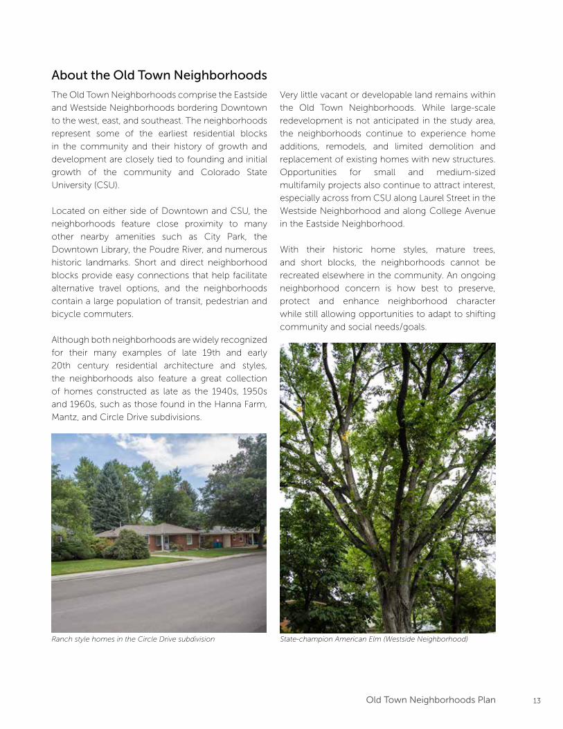
Although both neighborhoods are widely recognized
for their many examples of late 19th and early
20th century residential architecture and styles,
the neighborhoods also feature a great collection
of homes constructed as late as the 1940s, 1950s
and 1960s, such as those found in the Hanna Farm,
Mantz, and Circle Drive subdivisions.
Ranch style homes in the Circle Drive subdivision
Very little vacant or developable land remains within
the Old Town Neighborhoods. While large-scale
redevelopment is not anticipated in the study area,
the neighborhoods continue to experience home
additions, remodels, and limited demolition and
replacement of existing homes with new structures.
Opportunities for small and medium-sized
multifamily projects also continue to attract interest,
especially across from CSU along Laurel Street in the
Westside Neighborhood and along College Avenue
in the Eastside Neighborhood.
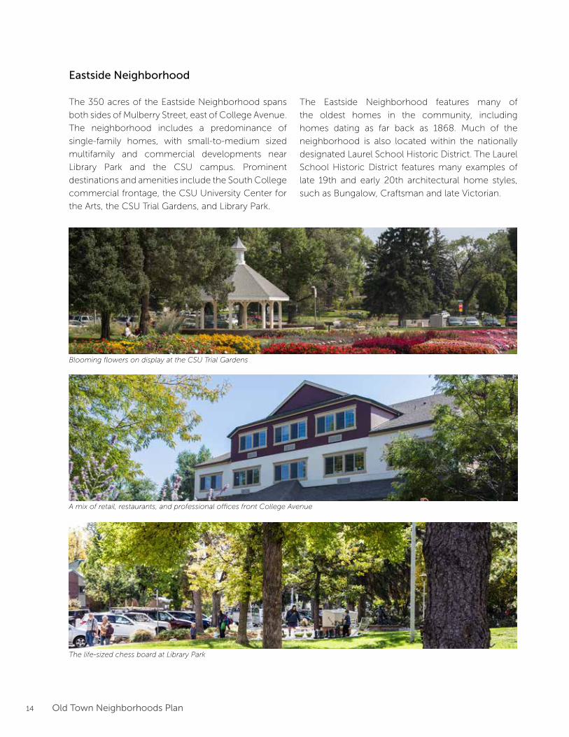
With their historic home styles, mature trees,
and short blocks, the neighborhoods cannot be
recreated elsewhere in the community. An ongoing
neighborhood concern is how best to preserve,
protect and enhance neighborhood character
while still allowing opportunities to adapt to shifting
community and social needs/goals.
State-champion American Elm (Westside Neighborhood)
14 Old Town Neighborhoods Plan
Blooming flowers on display at the CSU Trial Gardens
A mix of retail, restaurants, and professional offices front College Avenue
The life-sized chess board at Library Park
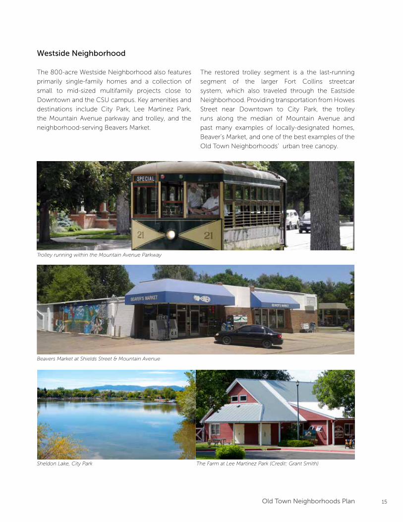
Eastside Neighborhood
The 350 acres of the Eastside Neighborhood spans
both sides of Mulberry Street, east of College Avenue.
The neighborhood includes a predominance of
single-family homes, with small-to-medium sized
multifamily and commercial developments near
Library Park and the CSU campus. Prominent
destinations and amenities include the South College
commercial frontage, the CSU University Center for
the Arts, the CSU Trial Gardens, and Library Park.
The Eastside Neighborhood features many of
the oldest homes in the community, including
homes dating as far back as 1868. Much of the
neighborhood is also located within the nationally
designated Laurel School Historic District. The Laurel
School Historic District features many examples of
late 19th and early 20th architectural home styles,
such as Bungalow, Craftsman and late Victorian.
15Old Town Neighborhoods Plan
Trolley running within the Mountain Avenue Parkway
Beavers Market at Shields Street & Mountain Avenue
Westside Neighborhood
The 800-acre Westside Neighborhood also features
primarily single-family homes and a collection of
small to mid-sized multifamily projects close to
Downtown and the CSU campus. Key amenities and
destinations include City Park, Lee Martinez Park,
the Mountain Avenue parkway and trolley, and the
neighborhood-serving Beavers Market.
The restored trolley segment is a the last-running
segment of the larger Fort Collins streetcar
system, which also traveled through the Eastside
Neighborhood. Providing transportation from Howes
Street near Downtown to City Park, the trolley
runs along the median of Mountain Avenue and
past many examples of locally-designated homes,
Beaver’s Market, and one of the best examples of the
Old Town Neighborhoods’ urban tree canopy.
Sheldon Lake, City Park The Farm at Lee Martinez Park (Credit: Grant Smith)
16 Old Town Neighborhoods Plan
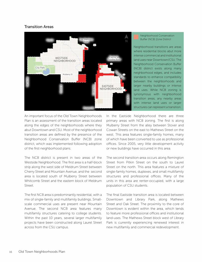
An important focus of the Old Town Neighborhoods
Plan is an assessment of the transition areas located
along the edges of the neighborhoods where they
abut Downtown and CSU. Most of the neighborhood
transition areas are defined by the presence of the
Neighborhood Conservation Buffer (NCB) zone
district, which was implemented following adoption
of the first neighborhood plans.
The NCB district is present in two areas of the
Westside Neighborhood. The first area is a half-block
strip along the west side of Meldrum Street between
Cherry Street and Mountain Avenue, and the second
area is located south of Mulberry Street between
Whitcomb Street and the eastern block of Meldrum
Street.
The first NCB area is predominantly residential, with a
mix of single-family and multifamily buildings. Small-
scale commercial uses are present near Mountain
Avenue. The second NCB area features many
multifamily structures catering to college students.
Within the past 10 years, several larger multifamily
projects have been constructed along Laurel Street
across from the CSU campus.
In the Eastside Neighborhood there are three
primary areas with NCB zoning. The first is along
Mulberry Street from the alley between Stover and
Cowan Streets on the east to Mathews Street on the
west. This area features single-family homes, many
of which have been converted to use as professional
offices. Since 2005, very little development activity
or new buildings have occurred in this area.
The second transition-area occurs along Remington
Street from Pitkin Street on the south to Laurel
Street on the north. This area features a mixture of
single-family homes, duplexes, and small multifamily
structures and professional offices. Many of the
units in this area are renter-occupied, with a large
population of CSU students.
The final Eastside transition area is located between
Downtown and Library Park, along Mathews
Street and Oak Street. The proximity to the core of
Downtown is evident within the area, which tends
to feature more professional offices and institutional
land-uses. The Mathews Street block west of Library
Park is currently experiencing renewed interest in
new multifamily and commercial redevelopment.
Gardens onSpring Creek
City Park
Cache la Poudre River
DOWNTOWN
COLORADOSTATE
UNIVERSITY
EASTSIDENEIGHBORHOOD
WESTSIDENEIGHBORHOOD
287
287
14
14
Lee MartinezPark
Mulberry St
Prospect Rd
Vine Dr
Taft
Hill
Rd
Shie
lds
St
Co
lleg
e A
ve
Lem
ay A
ve
Riverside Ave
Neighborhood transitions are areas
where residential blocks abut more
intense commercial and institutional
land uses near Downtown/CSU. The
Neighborhood Conservation Buffer
(NCB) district exists along many
neighborhood edges, and includes
standards to enhance compatibility
between the neighborhoods and
larger nearby buildings or intense
land uses. While NCB zoning is
synonymous with neighborhood
transition areas, any nearby areas
with intense land uses or larger
structures can represent a transition.
Neighborhood Conservation
Buffer (NCB) Zone District
Transition Areas
N
17Old Town Neighborhoods Plan
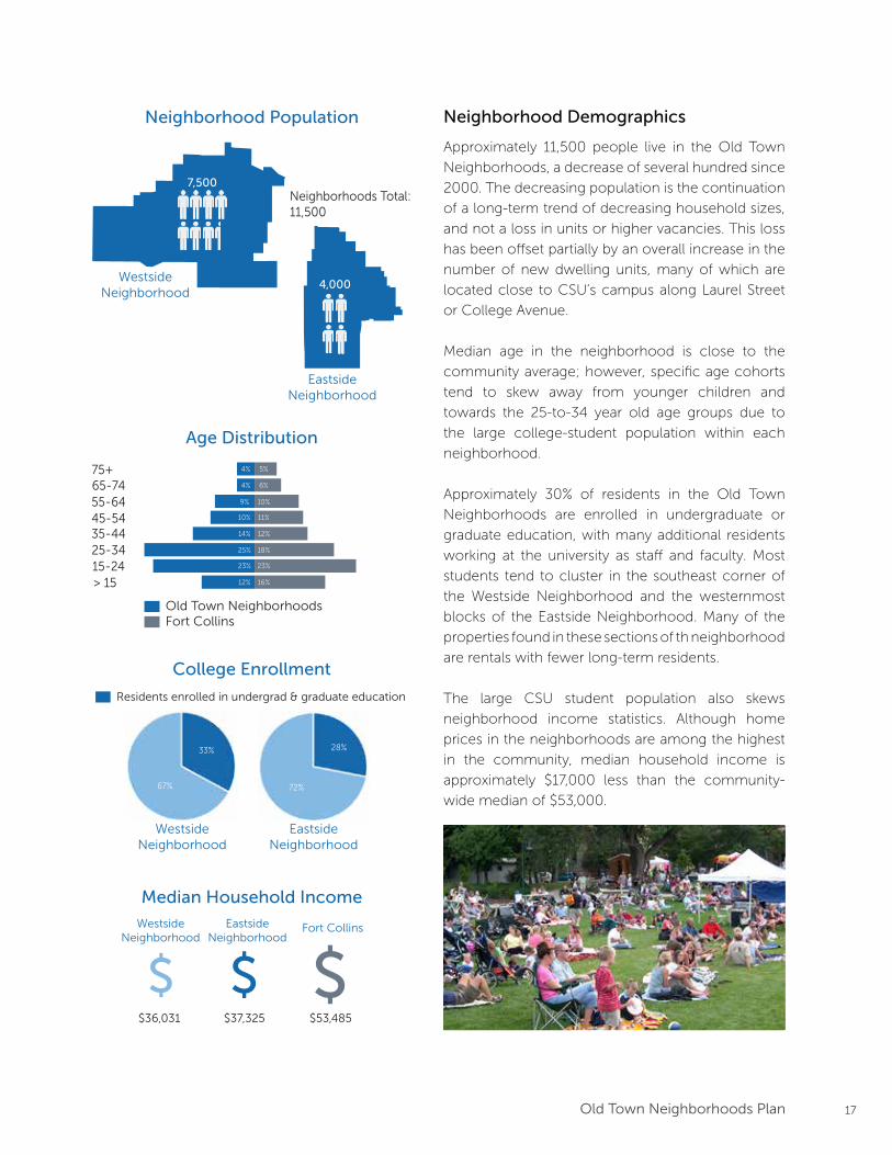
Neighborhood Demographics
Approximately 11,500 people live in the Old Town
Neighborhoods, a decrease of several hundred since
2000. The decreasing population is the continuation
of a long-term trend of decreasing household sizes,
and not a loss in units or higher vacancies. This loss
has been offset partially by an overall increase in the
number of new dwelling units, many of which are
located close to CSU’s campus along Laurel Street
or College Avenue.
Median age in the neighborhood is close to the
community average; however, specific age cohorts
tend to skew away from younger children and
towards the 25-to-34 year old age groups due to
the large college-student population within each
neighborhood.
Approximately 30% of residents in the Old Town
Neighborhoods are enrolled in undergraduate or
graduate education, with many additional residents
working at the university as staff and faculty. Most
students tend to cluster in the southeast corner of
the Westside Neighborhood and the westernmost
blocks of the Eastside Neighborhood. Many of the
properties found in these sections of th neighborhood
are rentals with fewer long-term residents.
The large CSU student population also skews
neighborhood income statistics. Although home
prices in the neighborhoods are among the highest
in the community, median household income is
approximately $17,000 less than the community-
wide median of $53,000.
7,500
4,000
> 1515-2425-3435-4445-5455-6465-7475+
Old Town NeighborhoodsFort Collins
12% 16%
23%
18%
12%
11%
10%
6%
5%
23%
25%
14%
10%
9%
4%
4%
WestsideNeighborhood
EastsideNeighborhood
Neighborhood Population
Neighborhoods Total:11,500
Age Distribution
College Enrollment
33%
67%
28%
72%
WestsideNeighborhood
EastsideNeighborhood
Residents enrolled in undergrad & graduate education
Median Household Income
$$ $Westside
NeighborhoodEastside
NeighborhoodFort Collins
$36,031 $37,325 $53,485

18 Old Town Neighborhoods Plan
Neighborhood Design & Character
The Old Town Neighborhoods feature a diverse mix
of building ages, sizes, and styles. Many residents
identify building style as one of the most defining
features of the neighborhoods. However, other
elements such as gridded streets, narrow rectangular
lots, mature trees, and the presence of alleys also
contribute to the unique neighborhood character.
This combination of elements is unique in Fort Collins
and gives a distinct feeling to the neighborhoods
that is difficult to find or recreate elsewhere in the
community. These design elements are also an
important consideration in discussions involving the
perceived compatibility of additions, remodels and
new construction in the neighborhoods.
Gardens onSpring Creek
City ParkDOWNTOWN
COLORADOSTATE
UNIVERSITY
287
287
14
14
Mulberry St
Prospect Rd
Vine Dr
Taft
Hill
Rd
Shie
lds
St
Co
lleg
e A
ve
Lem
ay A
ve
Riverside Ave
The 2013 Eastside Westside Character Study identified six distinct character areas comprising the NCL and NCM zone districts of the
Old Town Neighborhoods. Character districts were determined based on building age, size and height, as well as lot size, lot coverage
and floor area ratio. Additional information about the neighborhood character districts can be found in the Old Town Neighborhoods
Design Guidelines, available for download on the Old Town Neighborhoods Plan webpage: www.fcgov.com/otnp
Character Areas:
123456
As part of the 2013 Eastside Westside Character Study,
a range of variables were analyzed to understand
patterns of consistency and diversity within the Old
Town Neighborhoods. While the larger study area
exhibits many common elements, variations and
diversity exist in various subareas and at different
block levels.
Using information on building age, building size,
building height, lot size, lot coverage and floor
area ratio, six character areas were identified.
These character areas are a key consideration in
recognizing unique block-by-block differences,
and offer a foundation for the development of new
neighborhood design guidelines.
N
19Old Town Neighborhoods Plan
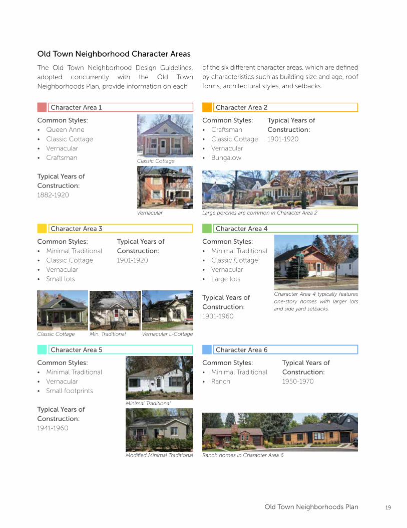
Old Town Neighborhood Character Areas
The Old Town Neighborhood Design Guidelines,
adopted concurrently with the Old Town
Neighborhoods Plan, provide information on each
Character Area 1 Character Area 2
Character Area 3 Character Area 4
Character Area 5 Character Area 6
Common Styles:
• Queen Anne
• Classic Cottage
• Vernacular
• Craftsman
Typical Years of
Construction:
1882-1920
Vernacular
Classic Cottage
Typical Years of
Construction:
1901-1920
Common Styles:
• Craftsman
• Classic Cottage
• Vernacular
• Bungalow
Large porches are common in Character Area 2
Min. Traditional Vernacular L-CottageClassic Cottage
Typical Years of
Construction:
1901-1920
Common Styles:
• Minimal Traditional
• Classic Cottage
• Vernacular
• Small lots
Common Styles:
• Minimal Traditional
• Classic Cottage
• Vernacular
• Large lots
Typical Years of
Construction:
1901-1960
Common Styles:
• Minimal Traditional
• Vernacular
• Small footprints
Typical Years of
Construction:
1941-1960
Modified Minimal Traditional
Minimal Traditional
Typical Years of
Construction:
1950-1970
Common Styles:
• Minimal Traditional
• Ranch
Ranch homes in Character Area 6
Character Area 4 typically features
one-story homes with larger lots
and side yard setbacks.
of the six different character areas, which are defined
by characteristics such as building size and age, roof
forms, architectural styles, and setbacks.
20 Old Town Neighborhoods Plan
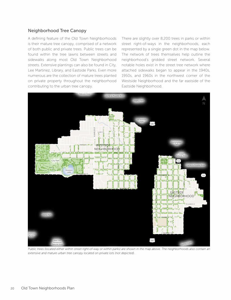
Neighborhood Tree Canopy
A defining feature of the Old Town Neighborhoods
is their mature tree canopy, comprised of a network
of both public and private trees. Public trees can be
found within the tree lawns between streets and
sidewalks along most Old Town Neighborhood
streets. Extensive plantings can also be found in City,
Lee Martinez, Library, and Eastside Parks. Even more
numerous are the collection of mature trees planted
on private property throughout the neighborhood
contributing to the urban tree canopy.
W ELIZABETH ST
W LAKE ST
CO
NST
ITU
TIO
N A
VE
W PLUM ST
S T
AFT
HIL
L R
DN
TA
FT H
ILL
RD
LAPORTE AVE
W VINE DR
CHERRY ST
E MOUNTIAN AVE
RIVERSIDE AVE
BUCKINGHAM ST
E LINCOLN AVE
LIN
DEN
ST
WILLOW
STJEFFERSON ST
WALNUT ST
N H
OW
ES
STS
HO
WE
S ST
S LO
OM
IS A
VE
S C
OLL
EG
E A
VE
N C
OLL
EG
E A
VE
N L
EM
AY
AV
ES
LEM
AY
AV
E
S M
ASO
N S
TN
MA
SON
ST
RE
MIN
GT
ON
ST
STO
VE
R S
T
W LAUREL ST
W LAKE ST
E LAUREL ST
E ELIZABETH ST
E PITKIN ST
E PROSPECT RDW PROSPECT RD
W MOUNTIAN AVE
N S
HIE
LDS
STS
SHIE
LDS
ST
W MULBERRY STE MULBERRY ST
Lee MartinezPark
UdallNatural Area
Gardens onSpring Creek
BuckinghamPark
North Shields PondsNatural Area
City Park
Red Fox Meadows
Natural Area
FairbrookePond
Avery Park
Legacy Park
SheldonLake
Cache la Poudre River
Cache la Poudre River
Spring Creek
Spring Creek
DOWNTOWN
COLORADOSTATE
UNIVERSITY
EASTSIDENEIGHBORHOOD
WESTSIDENEIGHBORHOOD
287
287
14
14
FEMA DesignatedFloodway
FEMA DesignatedHigh-RiskFloodplain
FEMA DesignatedModerate-RiskFloodplain
City DesignatedFloodway
City DesignatedHigh-RiskFloodplain
City DesignatedModerate-RiskFloodplain
0 1000500 2000 FEET
N
Legend
Freight Rail Line
City Boundary
Neighborhood Boundary
FloodplainMap
Parcel
Open Space / Park
Stream / River / Reservoir
N
Public trees (located either within street right-of-way or within parks) are shown in the map above. The neighborhoods also contain an
extensive and mature urban tree canopy located on private lots (not depicted).
There are slightly over 8,200 trees in parks or within
street right-of-ways in the neighborhoods, each
represented by a single green dot in the map below.
The network of trees themselves help outline the
neighborhood’s gridded street network. Several
notable holes exist in the street tree network where
attached sidewalks began to appear in the 1940s,
1950s, and 1960s in the northwest corner of the
Westside Neighborhood and the far eastside of the
Eastside Neighborhood.
21Old Town Neighborhoods Plan
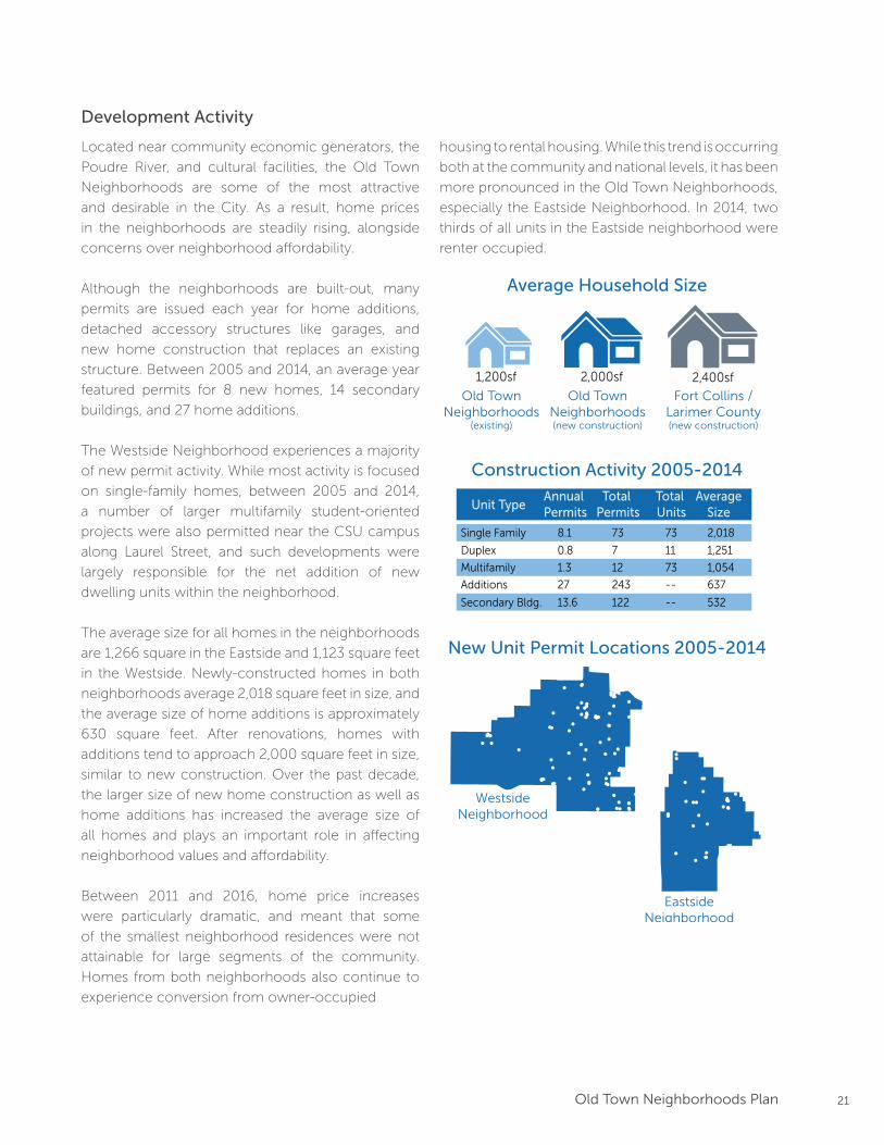
Development Activity
Located near community economic generators, the
Poudre River, and cultural facilities, the Old Town
Neighborhoods are some of the most attractive
and desirable in the City. As a result, home prices
in the neighborhoods are steadily rising, alongside
concerns over neighborhood affordability.
Although the neighborhoods are built-out, many
permits are issued each year for home additions,
detached accessory structures like garages, and
new home construction that replaces an existing
structure. Between 2005 and 2014, an average year
featured permits for 8 new homes, 14 secondary
buildings, and 27 home additions.
The Westside Neighborhood experiences a majority
of new permit activity. While most activity is focused
on single-family homes, between 2005 and 2014,
a number of larger multifamily student-oriented
projects were also permitted near the CSU campus
along Laurel Street, and such developments were
largely responsible for the net addition of new
dwelling units within the neighborhood.
The average size for all homes in the neighborhoods
are 1,266 square in the Eastside and 1,123 square feet
in the Westside. Newly-constructed homes in both
neighborhoods average 2,018 square feet in size, and
the average size of home additions is approximately
630 square feet. After renovations, homes with
additions tend to approach 2,000 square feet in size,
similar to new construction. Over the past decade,
the larger size of new home construction as well as
home additions has increased the average size of
all homes and plays an important role in affecting
neighborhood values and affordability.
Between 2011 and 2016, home price increases
were particularly dramatic, and meant that some
of the smallest neighborhood residences were not
attainable for large segments of the community.
Homes from both neighborhoods also continue to
experience conversion from owner-occupied
Average Household Size
Old TownNeighborhoods
(existing)
Old TownNeighborhoods(new construction)
Fort Collins /Larimer County(new construction)
1,200sf 2,000sf 2,400sf
Construction Activity 2005-2014
Unit TypeAnnual Permits
Total Permits
73
AverageSize
2,018
Duplex 0.8 7 1,251
Multifamily 1.3
Total Units
12
73
11
73 1,054
Additions 27 243 -- 637
13.6 122 -- 532
Single Family 8.1
Secondary Bldg.
New Unit Permit Locations 2005-2014
WestsideNeighborhood
EastsideNeighborhood
!
!
!
!
!
!
!
!!
!
!
!!
!
!
!!!!
!!
!
!
!
!
!
!
!
!
!
!
!
!
!
!
!
!
!
!
!
!
!
!
!
!
!
!
!
!
!
!
!
!
!
!
!
!
!
!
!
!
!
!
!!
!
!
!!
!
!
!
!
!
!
!
!
!!
!
!
!
!
!
!
!
!
!
!
!
!
!
!
!
!
!
!
!
!
!
!
!
!
!
!
!
!
!
!
!
!
housing to rental housing. While this trend is occurring
both at the community and national levels, it has been
more pronounced in the Old Town Neighborhoods,
especially the Eastside Neighborhood. In 2014, two
thirds of all units in the Eastside neighborhood were
renter occupied.
22 Old Town Neighborhoods Plan
Transportation & Mobility
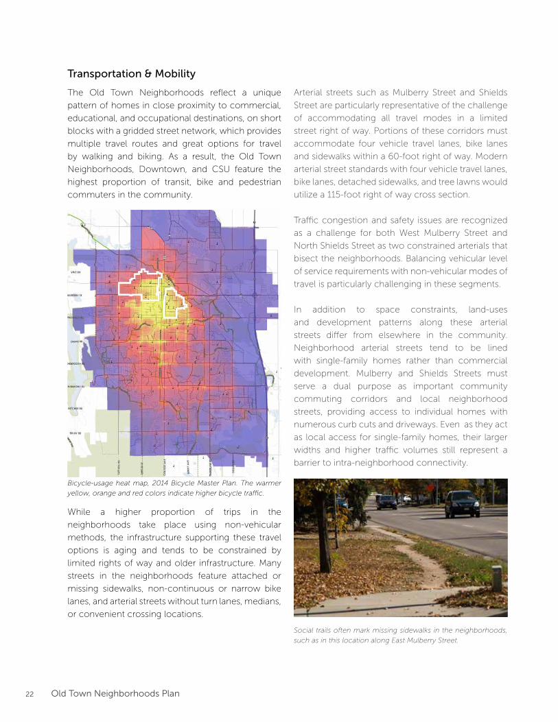
The Old Town Neighborhoods reflect a unique
pattern of homes in close proximity to commercial,
educational, and occupational destinations, on short
blocks with a gridded street network, which provides
multiple travel routes and great options for travel
by walking and biking. As a result, the Old Town
Neighborhoods, Downtown, and CSU feature the
highest proportion of transit, bike and pedestrian
commuters in the community.
Bicycle-usage heat map, 2014 Bicycle Master Plan. The warmer
yellow, orange and red colors indicate higher bicycle traffic.
Social trails often mark missing sidewalks in the neighborhoods,
such as in this location along East Mulberry Street.
While a higher proportion of trips in the
neighborhoods take place using non-vehicular
methods, the infrastructure supporting these travel
options is aging and tends to be constrained by
limited rights of way and older infrastructure. Many
streets in the neighborhoods feature attached or
missing sidewalks, non-continuous or narrow bike
lanes, and arterial streets without turn lanes, medians,
or convenient crossing locations.
Arterial streets such as Mulberry Street and Shields
Street are particularly representative of the challenge
of accommodating all travel modes in a limited
street right of way. Portions of these corridors must
accommodate four vehicle travel lanes, bike lanes
and sidewalks within a 60-foot right of way. Modern
arterial street standards with four vehicle travel lanes,
bike lanes, detached sidewalks, and tree lawns would
utilize a 115-foot right of way cross section.
Traffic congestion and safety issues are recognized
as a challenge for both West Mulberry Street and
North Shields Street as two constrained arterials that
bisect the neighborhoods. Balancing vehicular level
of service requirements with non-vehicular modes of
travel is particularly challenging in these segments.
In addition to space constraints, land-uses
and development patterns along these arterial
streets differ from elsewhere in the community.
Neighborhood arterial streets tend to be lined
with single-family homes rather than commercial
development. Mulberry and Shields Streets must
serve a dual purpose as important community
commuting corridors and local neighborhood
streets, providing access to individual homes with
numerous curb cuts and driveways. Even as they act
as local access for single-family homes, their larger
widths and higher traffic volumes still represent a
barrier to intra-neighborhood connectivity.
23Old Town Neighborhoods Plan
W ELIZABETH ST
W LAKE ST
CO
NST
ITU
TIO
N A
VE
W PLUM ST
S T
AFT
HIL
L R
DN
TA
FT H
ILL
RD
LAPORTE AVE
W VINE DR
CHERRY ST
E MOUNTIAN AVE
RIVERSIDE AVE
BUCKINGHAM ST
E LINCOLN AVE
LIN
DEN
ST
WILLO
W STJEFFERSO
N ST
WALNUT ST
N H
OW
ES S
TS H
OW
ES S
T
S L
OO
MIS
AV
E
S C
OLL
EG
E A
VE
N C
OLL
EG
E A
VE
N L
EM
AY
AV
ES
LE
MA
Y A
VE
S M
ASO
N S
TN
MA
SO
N S
T
RE
MIN
GT
ON
ST
ST
OV
ER
ST
W LAUREL ST
W LAKE ST
E LAUREL ST
E ELIZABETH ST
E PITKIN ST
E PROSPECT RDW PROSPECT RD
W MOUNTIAN AVE
N S
HIE
LDS
ST
S SH
IELD
S ST
W MULBERRY STE MULBERRY ST
Lee MartinezPark
UdallNatural Area
Gardens onSpring Creek
BuckinghamPark
North Shields PondsNatural Area
City Park
Red Fox Meadows
Natural Area
FairbrookePond
Avery Park
Legacy Park
SheldonLake
Cache la Poudre River
Cache la Poudre River
Spring Creek
Spring Creek
DOWNTOWN
COLORADOSTATE
UNIVERSITY
EASTSIDENEIGHBORHOOD
WESTSIDENEIGHBORHOOD
287
287
14
14
FEMA DesignatedFloodway
FEMA DesignatedHigh-RiskFloodplain
FEMA DesignatedModerate-RiskFloodplain
City DesignatedFloodway
City DesignatedHigh-RiskFloodplain
City DesignatedModerate-RiskFloodplain
0 1000500 2000 FEET
N
Legend
Freight Rail Line
City Boundary
Neighborhood Boundary
FloodplainMap
Parcel
Open Space / Park
Stream / River / Reservoir
Floodplain & Neighborhood Infrastructure
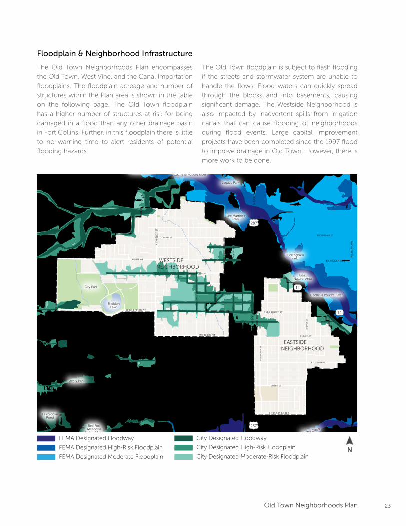
The Old Town Neighborhoods Plan encompasses
the Old Town, West Vine, and the Canal Importation
floodplains. The floodplain acreage and number of
structures within the Plan area is shown in the table
on the following page. The Old Town floodplain
has a higher number of structures at risk for being
damaged in a flood than any other drainage basin
in Fort Collins. Further, in this floodplain there is little
to no warning time to alert residents of potential
flooding hazards.
The Old Town floodplain is subject to flash flooding
if the streets and stormwater system are unable to
handle the flows. Flood waters can quickly spread
through the blocks and into basements, causing
significant damage. The Westside Neighborhood is
also impacted by inadvertent spills from irrigation
canals that can cause flooding of neighborhoods
during flood events. Large capital improvement
projects have been completed since the 1997 flood
to improve drainage in Old Town. However, there is
more work to be done.
N
FEMA Designated Floodway
FEMA Designated High-Risk Floodplain
FEMA Designated Moderate Floodplain
City Designated Floodway
City Designated High-Risk Floodplain
City Designated Moderate-Risk Floodplain
24 Old Town Neighborhoods Plan
Flood Risk in the Old Town Neighborhoods Plan Boundaries
High Risk Floodplain
(Acres of 100-year floodplain)
Structures Greater than 500 sq. ft.
in High Risk Floodplain
Old Town 104 441
Canal Importation
Basin
10 0
West Vine 11 38
The Fort Collins Stormwater Master Plan includes
several major capital stormwater infrastructure
projects within the Old Town Neighborhoods.
When implemented, these improvements will
move structures out of the floodplain and
mitigate potential flood risks. Future storm sewer
improvement projects include Magnolia/Myrtle,
Oak Street, Mulberry/Riverside, LaPorte/Cherry and
Whedbee. In addition to storm sewer improvements,
incorporating low impact development (LID)
practices into development and redevelopment
projects helps reduce the quantity and improve the
quality of stormwater runoff.
Overview of Floodplain Regulations
Life, safety and property protection from
flooding are key goals of the City of Fort Collins
Utilities. Development within the floodplain
must comply with the floodplain regulations in
Chapter 10 of the Fort Collins Municipal Code.
A sample of these regulations are listed below:
• No residential structures in the floodway.
• New structures must be elevated 18-inches
above the 100-year flood elevation.
Non-residential structures or mixed-use
structures with all residential uses on upper
floors may substitute floodproofing for the
elevation requirement.
• Additions must be elevated 12-inches
above the 100-year flood elevation.
• Any structure that is substantially improved
(improvements more than 50% of the value
of the structure) must be brought up to
code including elevation 12-inches above
the 100-year flood elevation.
• Critical facilities are prohibited.
• Any work in the floodway must document
no-rise in the 100-year flood elevations.
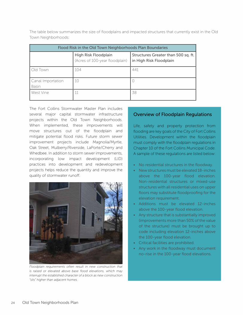
Floodplain requirements often result in new construction that
is raised or elevated above base flood elevations, which may
interrupt the established character of a block as new construction
“sits” higher than adjacent homes.
The table below summarizes the size of floodplains and impacted structures that currently exist in the Old
Town Neighborhoods:
25Old Town Neighborhoods Plan
Neighborhood Issues & Opportunities
During initial outreach activities, stakeholders were
frequently asked to share their opinions about
the most important neighborhood issues and
opportunities. While individual responses varied, the
overall collection of ideas tended to feature several
recurring themes and topics. Frequently mentioned
themes were further refined by the neighborhood
stakeholder group and staff to use as organizational
elements throughout the remainder of plan
document:
Neighborhood Character & Compatibility
Land Use & TransitionAreas
Circulation & Mobility
The defining characteristics of the neighborhood,
such as home size and design, mature landscaping,
and historic resources.
The type and location of neighborhood land uses, as
well as buffer zones near the edges with
Downtown and CSU.
Ease of travel options and safety throughout the
neighborhoods, whether on local or arterial streets.
The social, environmental and economic wellbeing
of the neighborhoods, both now and into the
future.Sustainability
26 Old Town Neighborhoods Plan
Frequently heard issues and opportunities:
• Balancing development and design standards with private property rights
• Developing and promoting information and incentives on compatible development
• Design and size of new construction and home additions
• Recognizing and celebrating historic resources and districts
• Protecting and enhancing the tree canopy
New construction size and style
Although homes in the Old Town Neighborhoods
feature diverse architecture and building sizes,
concerns remain that some new construction looks
or feels incompatible with the existing neighborhood
character. At the same time, many stakeholders
voiced concerns that new design standards would
restrict property rights further, and that opportunity
exists to promote and encourage compatible
development through education and incentives.
Neighborhood Character & Compatibility
“Old Town is a mosaic of home styles each
relevant to the decades in which they were
designed…styles come and go. It’s great to be
able to look through a neighborhood and see
multiple decades represented in design styles.”
- survey respondent
Neighborhood Charm & Historic Resources
The architectural styles, street pattern and tree
canopy are unique features of the neighborhoods
that cannot be recreated. Residents have expressed
that care should be taken to protect and enhance
these neighborhood features, through landmark
designations and the application of design
guidelines and standards. Many also feel there may
be opportunities to identify and celebrate the many
historic properties and districts located within the
neighborhoods to share the history of the area.
Neighborhood Pride
Areas of the neighborhoods continue to see
increases in rental housing, which some believe may
lead to relaxed property maintenance. Neighbors
expressed interest in finding solutions to incentivize
maintenance to keep the neighborhoods beautiful
for all neighbors. The tree canopy in particular
was highlighted as important for monitoring and
maintenance, both by the City and residents alike.
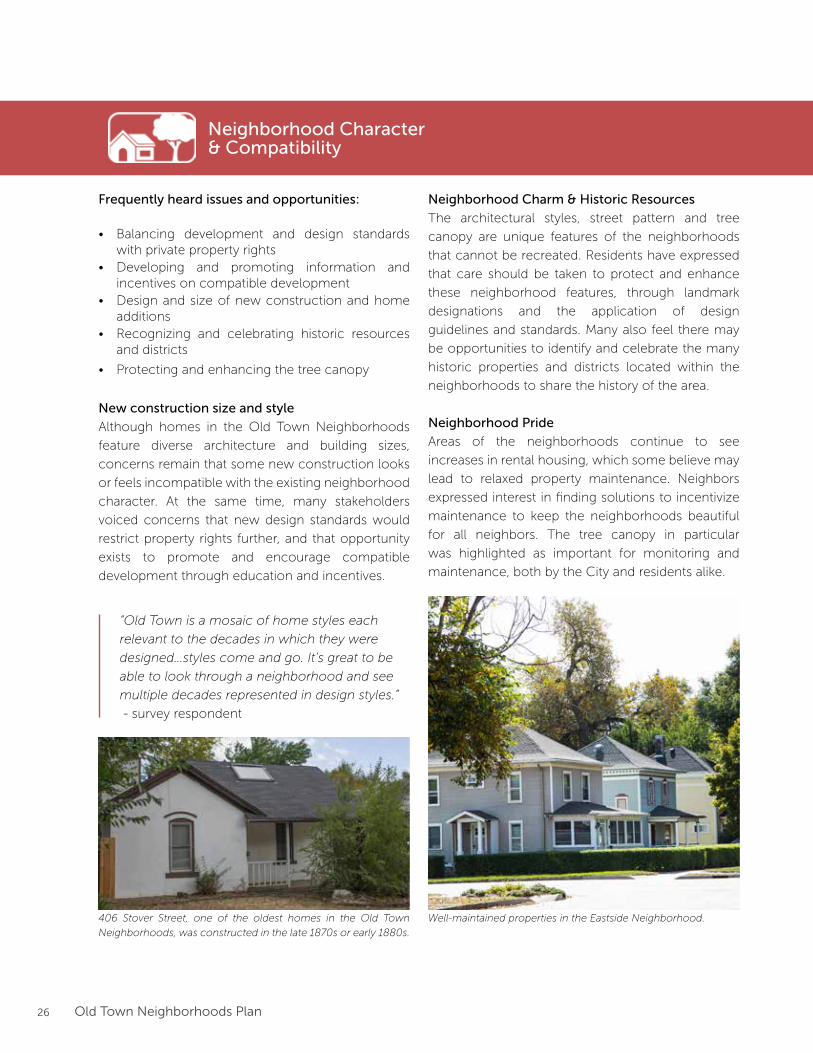
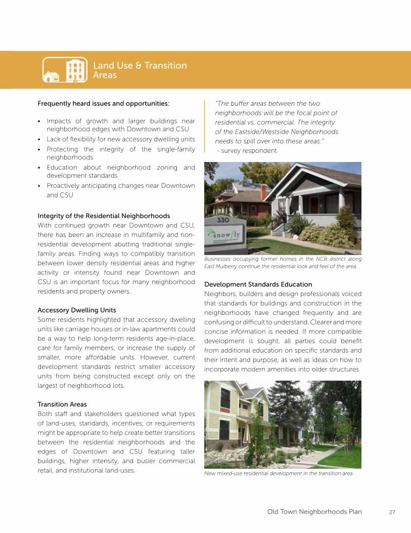
Well-maintained properties in the Eastside Neighborhood. 406 Stover Street, one of the oldest homes in the Old Town
Neighborhoods, was constructed in the late 1870s or early 1880s.
27Old Town Neighborhoods Plan
Land Use & TransitionAreas
Frequently heard issues and opportunities:
• Impacts of growth and larger buildings near neighborhood edges with Downtown and CSU
• Lack of flexibility for new accessory dwelling units
• Protecting the integrity of the single-family neighborhoods
• Education about neighborhood zoning and development standards
• Proactively anticipating changes near Downtown
and CSU
Integrity of the Residential Neighborhoods
With continued growth near Downtown and CSU,
there has been an increase in multifamily and non-
residential development abutting traditional single-
family areas. Finding ways to compatibly transition
between lower density residential areas and higher
activity or intensity found near Downtown and
CSU is an important focus for many neighborhood
residents and property owners.
Accessory Dwelling Units
Some residents highlighted that accessory dwelling
units like carriage houses or in-law apartments could
be a way to help long-term residents age-in-place,
care for family members, or increase the supply of
smaller, more affordable units. However, current
development standards restrict smaller accessory
units from being constructed except only on the
largest of neighborhood lots.
Transition Areas
Both staff and stakeholders questioned what types
of land-uses, standards, incentives, or requirements
might be appropriate to help create better transitions
between the residential neighborhoods and the
edges of Downtown and CSU featuring taller
buildings, higher intensity, and busier commercial
retail, and institutional land-uses.
“The buffer areas between the two
neighborhoods will be the focal point of
residential vs. commercial. The integrity
of the Eastside/Westside Neighborhoods
needs to spill over into these areas.”
- survey respondent
Development Standards Education
Neighbors, builders and design professionals voiced
that standards for buildings and construction in the
neighborhoods have changed frequently and are
confusing or difficult to understand. Clearer and more
concise information is needed. If more compatible
development is sought, all parties could benefit
from additional education on specific standards and
their intent and purpose, as well as ideas on how to
incorporate modern amenities into older structures.
Businesses occupying former homes in the NCB district along
East Mulberry continue the residential look and feel of the area.
New mixed-use residential development in the transition area
28 Old Town Neighborhoods Plan
Circulation & Mobility
Frequently heard issues and opportunities:
• Missing or insufficient bike and pedestrian facilities
on Mulberry and Shields Streets
• Safety and convenience crossing arterial streets
• Spillover parking near Downtown and CSU
• Improving safety and convenience for all travel
modes
• Improved access and connections to nearby
natural areas, trails, and parks
• Congestion
Intra-Neighborhood Travel and Trail Connections
Travel within the neighborhoods functions well for
most modes, but there are still opportunities to
continue filling in missing sidewalk gaps, performing
routine maintenance, and improving connections to
nearby parks and trails (often across arterial streets).
Many residents cited the need for easier connections
to the Spring Creek Trail and Poudre River Trail
(Eastside Neighborhood), as well as sidewalks to Lee
Martinez Park (Westside Neighborhood).
Parking
For many living near Downtown, CSU, or the
library, spillover parking is a frequent and frustrating
occurrence. Many close to these daytime parking
generators are worried about parking conditions
worsening over time, or expanding further into the
neighborhoods, which could be addressed with
additional tweaks or flexibility to the Residential
Parking Permit (RP3) program, and other parking
management efforts.
Mulberry and Shields Streets
Many issues and opportunities identified by residents
specifically focused on travel conditions along the
Mulberry and Shields corridors:
• It feels uncomfortable to walk or bike along many
segments of these streets
• Both streets lack consistent bike lanes and feature
missing or narrow sidewalks
• With no center turn lanes, left-turning vehicles
can create backups and safety issues
• Adding additional crossings or enhancing existing
crossings would improve connectivity
• Congestion and roadway safety
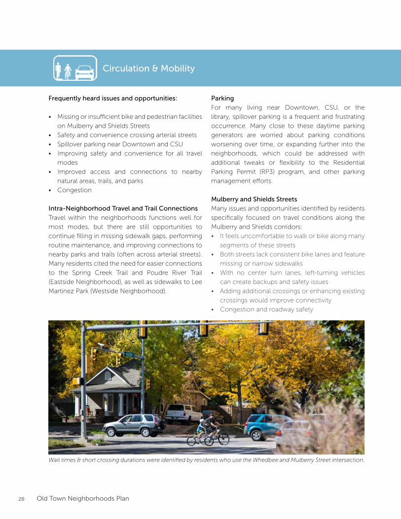
Wait times & short crossing durations were identified by residents who use the Whedbee and Mulberry Street intersection.
29Old Town Neighborhoods Plan
Sustainability
Frequently heard issues and opportunities:
• Decreasing affordability and ability to age-in-place
• Maintaining the diversity of neighborhoods ages,
incomes, family situations, and housing choices
• Aging neighborhood infrastructure and utilities
• Ease of home energy retrofits and energy
generation and compatibility with existing
character
• Impacts of additional development on human
health and well-being (e.g. noise, smoke, privacy)
• Supporting existing neighborhood and Downtown
businesses
Affordability and Diversity
As desirable neighborhoods, rents and home prices
in the Old Town Neighborhoods are rising faster than
the rest of the community. Many are worried rising
prices are slowly leading to a lack of diversity in home
sizes and that the neighborhoods are becoming
more unaffordable for families with children or those
with lower or fixed incomes.
“Old Town has charm that isn’t found in
newer developments. It is interesting, unique
and beautiful with its wide streets and diverse
appearance.”
- open house comment
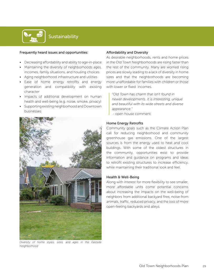
Diversity of home styles, sizes, and ages in the Eastside
Neighborhood
Home Energy Retrofits
Community goals such as the Climate Action Plan
call for reducing neighborhood and community
greenhouse gas emissions. One of the largest
sources is from the energy used to heat and cool
buildings. With some of the oldest structures in
the community, opportunities exist to provide
information and guidance on programs and ideas
to retrofit existing structures to increase efficiency,
while maintaining their traditional look and feel.
Health & Well-Being
Along with interest for more flexibility to see smaller,
more affordable units come potential concerns
about increasing the impacts on the well-being of
neighbors from additional backyard fires, noise from
animals, traffic, reduced privacy, and the loss of more
open-feeling backyards and alleys.
30 Old Town Neighborhoods Plan
Vision
31Old Town Neighborhoods Plan
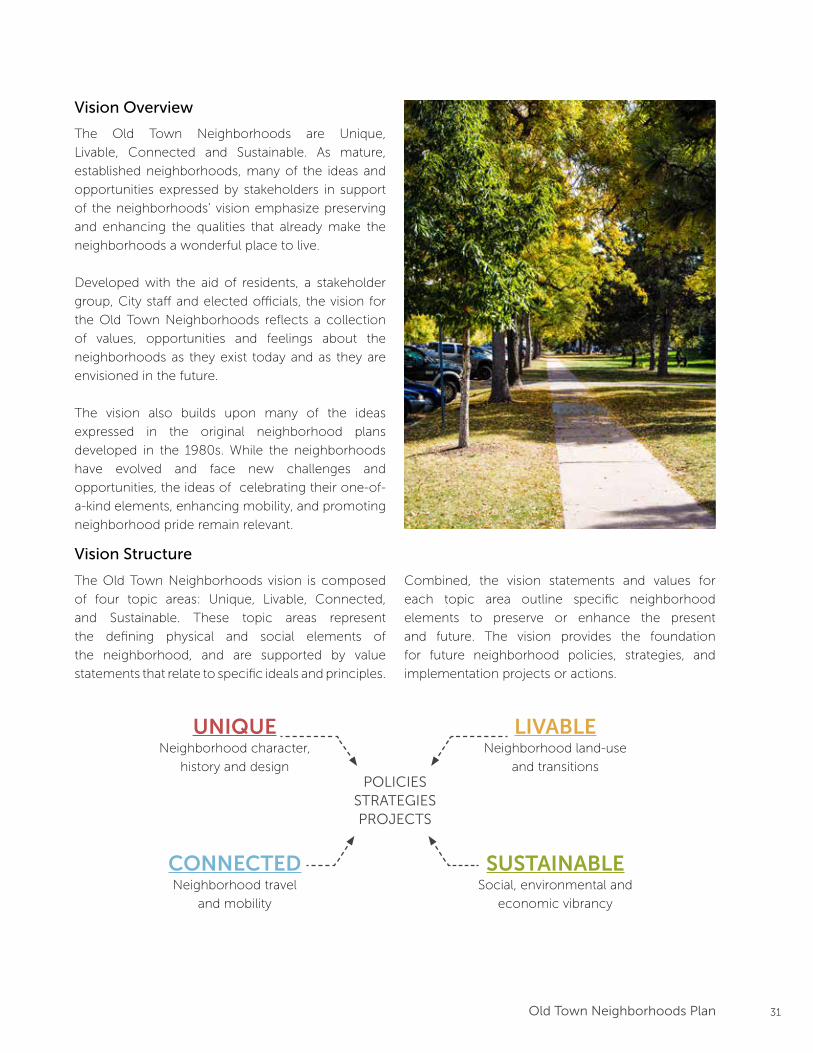
Vision Overview
The Old Town Neighborhoods are Unique,
Livable, Connected and Sustainable. As mature,
established neighborhoods, many of the ideas and
opportunities expressed by stakeholders in support
of the neighborhoods’ vision emphasize preserving
and enhancing the qualities that already make the
neighborhoods a wonderful place to live.
Developed with the aid of residents, a stakeholder
group, City staff and elected officials, the vision for
the Old Town Neighborhoods reflects a collection
of values, opportunities and feelings about the
neighborhoods as they exist today and as they are
envisioned in the future.
The vision also builds upon many of the ideas
expressed in the original neighborhood plans
developed in the 1980s. While the neighborhoods
have evolved and face new challenges and
opportunities, the ideas of celebrating their one-of-
a-kind elements, enhancing mobility, and promoting
neighborhood pride remain relevant.
Vision Structure
The Old Town Neighborhoods vision is composed
of four topic areas: Unique, Livable, Connected,
and Sustainable. These topic areas represent
the defining physical and social elements of
the neighborhood, and are supported by value
statements that relate to specific ideals and principles.
Combined, the vision statements and values for
each topic area outline specific neighborhood
elements to preserve or enhance the present
and future. The vision provides the foundation
for future neighborhood policies, strategies, and
implementation projects or actions.
UNIQUENeighborhood character,
history and design
LIVABLENeighborhood land-use
and transitions
CONNECTEDNeighborhood travel
and mobility
SUSTAINABLESocial, environmental and
economic vibrancy
POLICIESSTRATEGIESPROJECTS
32 Old Town Neighborhoods Plan
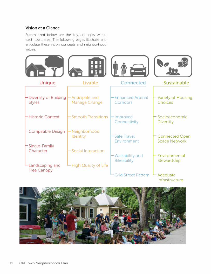
Unique
Diversity of Building Styles
Historic Context
Compatible Design
Single-Family Character
Landscaping and Tree Canopy
Livable
Anticipate and Manage Change
Smooth Transitions
Neighborhood Identity
Social Interaction
High Quality of Life
Connected
Enhanced Arterial Corridors
Improved Connectivity
Safe Travel Environment
Walkability and Bikeability
Grid Street Pattern
Sustainable
Variety of Housing Choices
Socioeconomic Diversity
Connected Open Space Network
Environmental Stewardship
Adequate Infrastructure
Vision at a Glance
Summarized below are the key concepts within
each topic area. The following pages illustrate and
articulate these vision concepts and neighborhood
values.
33Old Town Neighborhoods Plan
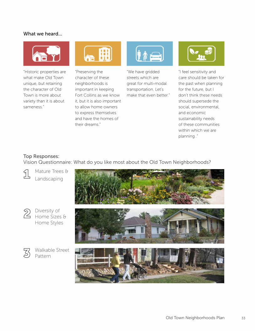
What we heard...
“Historic properties are
what make Old Town
unique, but retaining
the character of Old
Town is more about
variety than it is about
sameness.”
“Preserving the
character of these
neighborhoods is
important in keeping
Fort Collins as we know
it, but it is also important
to allow home owners
to express themselves
and have the homes of
their dreams.”
“We have gridded
streets which are
great for multi-modal
transportation. Let’s
make that even better.”
“I feel sensitivity and
care should be taken for
the past when planning
for the future, but I
don’t think these needs
should supersede the
social, environmental,
and economic
sustainability needs
of these communities
within which we are
planning .”
Top Responses:Vision Questionnaire: What do you like most about the Old Town Neighborhoods?
Mature Trees &
Landscaping
Diversity of Home Sizes & Home Styles
Walkable Street Pattern

34 Old Town Neighborhoods Plan
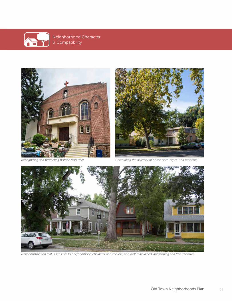
Neighborhood Character & Compatibility
Vision: Celebrating and enhancing the qualities that make the neighborhoods unique and
which foster “Old Town Charm.”
Values:• Recognizing and protecting historic resources
• Celebrating the diversity of home sizes, styles, and residents
• New construction that is sensitive to neighborhood character and context
• Well-maintained landscaping and tree canopies
Diverse home sizes, styles, and unique landscaping
Neighborhood Character & Compatibility
35Old Town Neighborhoods Plan
Neighborhood Character & Compatibility
Recognizing and protecting historic resources Celebrating the diversity of home sizes, styles, and residents
New construction that is sensitive to neighborhood character and context, and well-maintained landscaping and tree canopies
36 Old Town Neighborhoods Plan
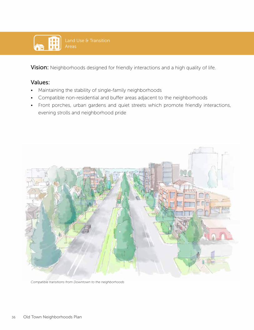
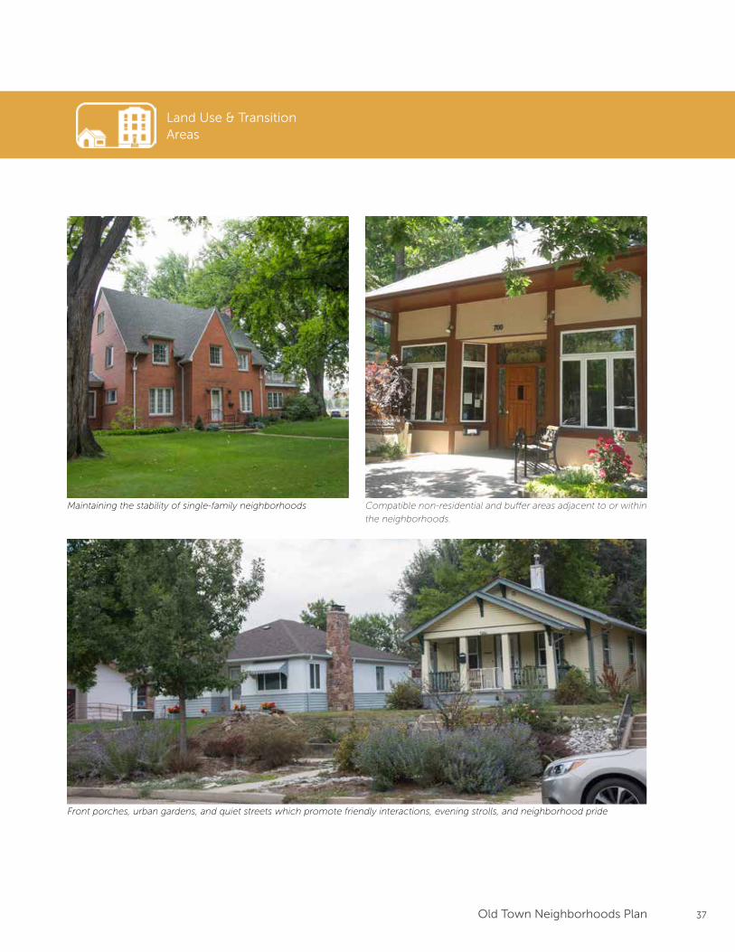
Land Use & TransitionAreas
Vision: Neighborhoods designed for friendly interactions and a high quality of life.
Values:• Maintaining the stability of single-family neighborhoods
• Compatible non-residential and buffer areas adjacent to the neighborhoods
• Front porches, urban gardens and quiet streets which promote friendly interactions,
evening strolls and neighborhood pride
Compatible transitions from Downtown to the neighborhoods
37Old Town Neighborhoods Plan
Land Use & TransitionAreas
Maintaining the stability of single-family neighborhoods Compatible non-residential and buffer areas adjacent to or within
the neighborhoods.
Front porches, urban gardens, and quiet streets which promote friendly interactions, evening strolls, and neighborhood pride
38 Old Town Neighborhoods Plan
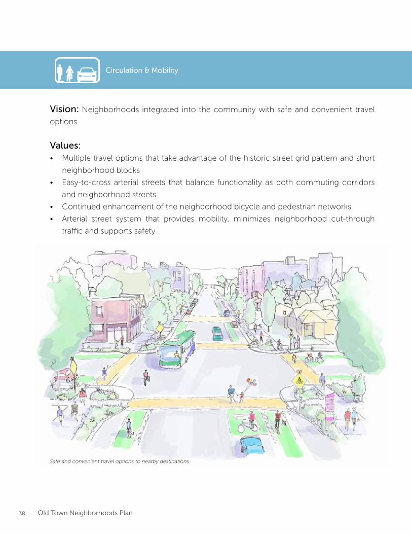
Circulation & Mobility
Vision: Neighborhoods integrated into the community with safe and convenient travel
options.
Values:• Multiple travel options that take advantage of the historic street grid pattern and short
neighborhood blocks
• Easy-to-cross arterial streets that balance functionality as both commuting corridors
and neighborhood streets
• Continued enhancement of the neighborhood bicycle and pedestrian networks
• Arterial street system that provides mobility, minimizes neighborhood cut-through
traffic and supports safety
Safe and convenient travel options to nearby destinations
Circulation & Mobility

39Old Town Neighborhoods Plan
Circulation & Mobility
Multiple travel options that take advantage of the historic street
grid pattern and short neighborhood blocks
Easy-to-cross arterial streets that balance functionality as both
commuting corridors and neighborhood streets
Continued enhancement of the neighborhood bicycle and pe-
destrian networksArterial street system that provides mobility, minimizes neighbor-
hood cut-through traffic and supports safety
40 Old Town Neighborhoods Plan
Sustainability
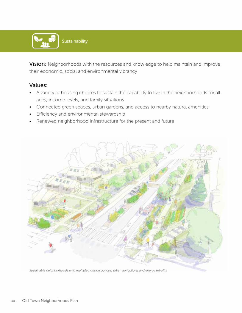
Vision: Neighborhoods with the resources and knowledge to help maintain and improve
their economic, social and environmental vibrancy
Values:• A variety of housing choices to sustain the capability to live in the neighborhoods for all
ages, income levels, and family situations
• Connected green spaces, urban gardens, and access to nearby natural amenities
• Efficiency and environmental stewardship
• Renewed neighborhood infrastructure for the present and future
Sustainable neighborhoods with multiple housing options, urban agriculture, and energy retrofits
Sustainability
41Old Town Neighborhoods Plan
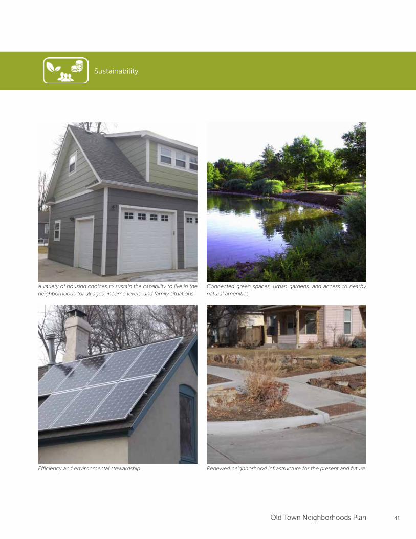
Sustainability
A variety of housing choices to sustain the capability to live in the
neighborhoods for all ages, income levels, and family situations
Connected green spaces, urban gardens, and access to nearby
natural amenities
Efficiency and environmental stewardship Renewed neighborhood infrastructure for the present and future
42 Old Town Neighborhoods Plan
Framework
43Old Town Neighborhoods Plan
PLAN FRAMEWORK
Framework Topic Key Framework Elements Related Vision Theme
Neighborhood Character and Compatibility
1) Design Guidelines
2) Neighborhood Identity Features
3) Development Activity Monitoring
Unique
Land Use and Transitions
1) Areas of Preservation and Enhancement
2) Neighborhood Zoning / Mixed Use Pockets
3) Buffer and Transition Areas
Livable
Transportation and Mobility
1) Neighborhood / Local Streets
2) Mulberry & Shields Street Improvements
3) Parking
Connected
Sustainability
1) Neighborhood Greenways
2) Housing Choices & Affordability
3) Urban Tree Canopy
Sustainable
Overview
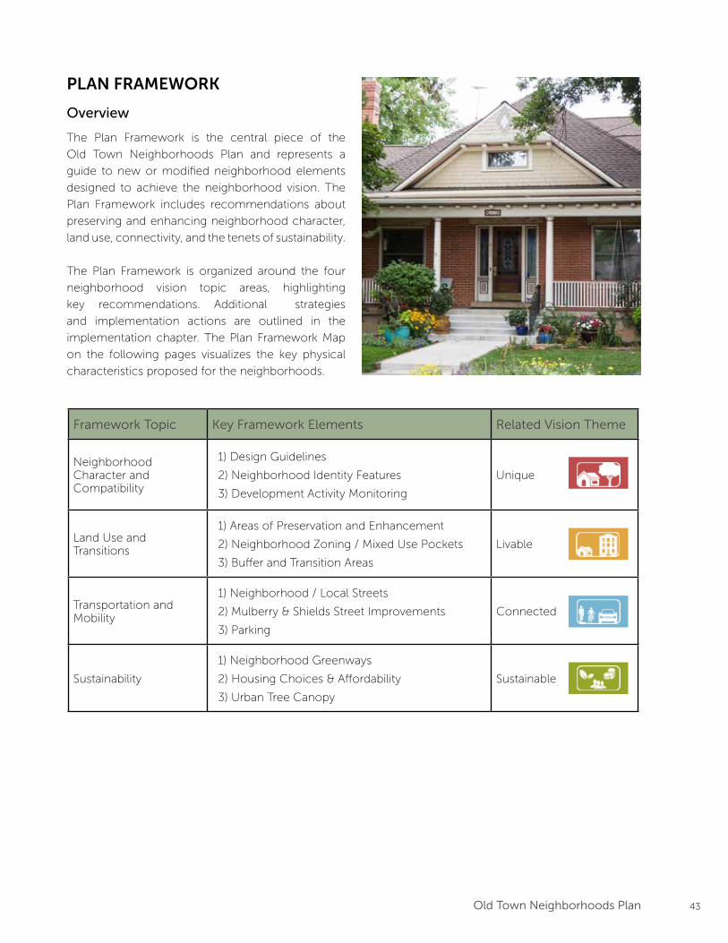
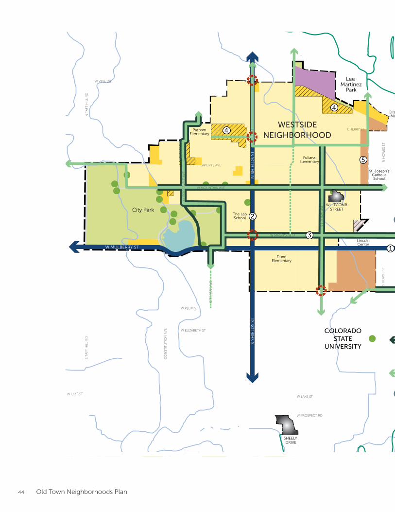
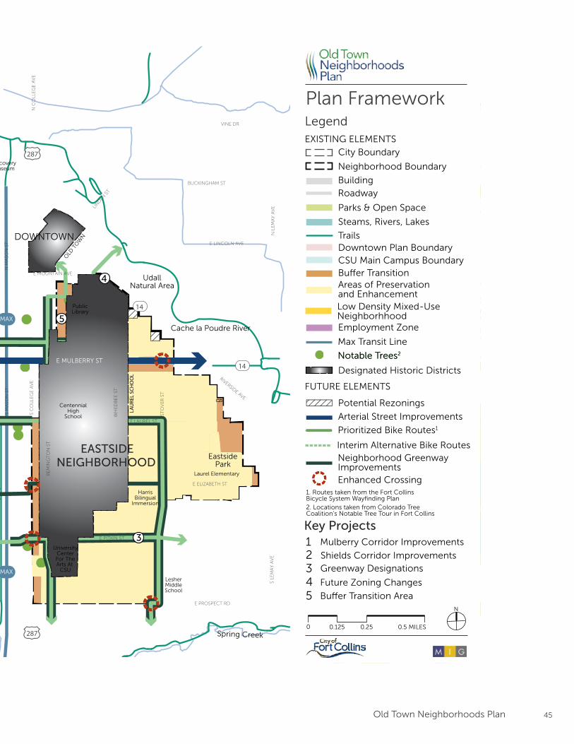
The Plan Framework is the central piece of the
Old Town Neighborhoods Plan and represents a
guide to new or modified neighborhood elements
designed to achieve the neighborhood vision. The
Plan Framework includes recommendations about
preserving and enhancing neighborhood character,
land use, connectivity, and the tenets of sustainability.
The Plan Framework is organized around the four
neighborhood vision topic areas, highlighting
key recommendations. Additional strategies
and implementation actions are outlined in the
implementation chapter. The Plan Framework Map
on the following pages visualizes the key physical
characteristics proposed for the neighborhoods.
44 Old Town Neighborhoods Plan
MAX
MAX
LAU
REL
SCH
OO
L
WHITCOMBSTREET
SHEELY DRIVE
OLD
TO
WN
Prioritized Bike Routes1
Interim Alternative Bike RoutesNeighborhood Greenway ImprovementsEnhanced Crossing
Max Transit Line
0 0.5 MILES 0.25 0.125
N
1. Routes taken from the Fort CollinsBicycle System Wayfinding Plan2. Locations taken from Colorado Tree Coalition’s Notable Tree Tour in Fort Collins
Plan Framework
Areas of Preservationand Enhancement
Arterial Street Improvements
Parks & Open Space
Bu�er Transition
Downtown Plan Boundary CSU Main Campus Boundary
LegendEXISTING ELEMENTS
FUTURE ELEMENTS
Neighborhood Boundary
City Boundary
Trails
RoadwayBuilding
Steams, Rivers, Lakes
Potential Rezonings
Designated Historic Districts
Employment Zone
Notable Trees2Notable Trees2
Greenway Designations
Key Projects
Shields Corridor Improvements
Mulberry Corridor Improvements
Bu�er Transition Area
Future Zoning Changes
12345
Low Density Mixed-Use Neighborhhood
S LO
OM
IS A
VE
N R
OO
SEV
ELT
AV
E
RE
MIN
GT
ON
ST
E LAUREL ST
E PITKIN ST
W MOUNTAIN AVE
W MAGNOLIA ST
WH
ED
BE
E S
T
N S
HIE
LDS
STS
SHIE
LDS
STW MULBERRY ST E MULBERRY ST1
2
3
4
4
4
3
5
5
W ELIZABETH ST
CIT
Y P
AR
K A
VE
W LAKE ST
CO
NST
ITU
TIO
N A
VE
W PLUM ST
S T
AFT
HIL
L R
DN
TA
FT H
ILL
RD
LAPORTE AVE
W VINE DR
E MOUNTAIN AVE
RIVERSIDE AVE
VINE DR
BUCKINGHAM ST
E LINCOLN AVE
LIN
DEN
ST
N H
OW
ES
STS
HO
WE
S ST
S C
OLL
EG
E A
VE
N C
OLL
EG
E A
VE
N L
EM
AY
AV
ES
LEM
AY
AV
E
S M
ASO
N S
TN
MA
SON
ST
STO
VE
R S
T
W LAKE ST
E ELIZABETH ST
E PROSPECT RDW PROSPECT RD
CHERRY ST
Lee Martinez
Park
UdallNatural Area
City Park
Cache la Poudre River
Spring Creek
EastsidePark
DOWNTOWN
COLORADOSTATE
UNIVERSITY
EASTSIDENEIGHBORHOOD
WESTSIDENEIGHBORHOOD
DiscoveryMuseum
UniversityCenterFor TheArts At
CSU
PublicLibrary
LincolnCenter
287
287
14
14
DunnElementary
PutnamElementary
FullanaElementary
CentennialHigh
School
Laurel Elementary
HarrisBilingual
Immersion
LesherMiddleSchool
The LabSchool
St. Joseph’sCatholicSchool
45Old Town Neighborhoods Plan
MAX
MAX
LAU
REL
SCH
OO
L
WHITCOMBSTREET
SHEELY DRIVE
OLD
TO
WN
Prioritized Bike Routes1
Interim Alternative Bike RoutesNeighborhood Greenway ImprovementsEnhanced Crossing
Max Transit Line
0 0.5 MILES 0.25 0.125
N
1. Routes taken from the Fort CollinsBicycle System Wayfinding Plan2. Locations taken from Colorado Tree Coalition’s Notable Tree Tour in Fort Collins
Plan Framework
Areas of Preservationand Enhancement
Arterial Street Improvements
Parks & Open Space
Bu�er Transition
Downtown Plan Boundary CSU Main Campus Boundary
LegendEXISTING ELEMENTS
FUTURE ELEMENTS
Neighborhood Boundary
City Boundary
Trails
RoadwayBuilding
Steams, Rivers, Lakes
Potential Rezonings
Designated Historic Districts
Employment Zone
Notable Trees2Notable Trees2
Greenway Designations
Key Projects
Shields Corridor Improvements
Mulberry Corridor Improvements
Bu�er Transition Area
Future Zoning Changes
12345
Low Density Mixed-Use Neighborhhood
S LO
OM
IS A
VE
N R
OO
SEV
ELT
AV
E
RE
MIN
GT
ON
ST
E LAUREL ST
E PITKIN ST
W MOUNTAIN AVE
W MAGNOLIA ST
WH
ED
BE
E S
T
N S
HIE
LDS
STS
SHIE
LDS
ST
W MULBERRY ST E MULBERRY ST1
2
3
4
4
4
3
5
5
W ELIZABETH ST
CIT
Y P
AR
K A
VE
W LAKE ST
CO
NST
ITU
TIO
N A
VE
W PLUM ST
S T
AFT
HIL
L R
DN
TA
FT H
ILL
RD
LAPORTE AVE
W VINE DR
E MOUNTAIN AVE
RIVERSIDE AVE
VINE DR
BUCKINGHAM ST
E LINCOLN AVE
LIN
DEN
ST
N H
OW
ES
STS
HO
WE
S ST
S C
OLL
EG
E A
VE
N C
OLL
EG
E A
VE
N L
EM
AY
AV
ES
LEM
AY
AV
E
S M
ASO
N S
TN
MA
SON
ST
STO
VE
R S
T
W LAKE ST
E ELIZABETH ST
E PROSPECT RDW PROSPECT RD
CHERRY ST
Lee Martinez
Park
UdallNatural Area
City Park
Cache la Poudre River
Spring Creek
EastsidePark
DOWNTOWN
COLORADOSTATE
UNIVERSITY
EASTSIDENEIGHBORHOOD
WESTSIDENEIGHBORHOOD
DiscoveryMuseum
UniversityCenterFor TheArts At
CSU
PublicLibrary
LincolnCenter
287
287
14
14
DunnElementary
PutnamElementary
FullanaElementary
CentennialHigh
School
Laurel Elementary
HarrisBilingual
Immersion
LesherMiddleSchool
The LabSchool
St. Joseph’sCatholicSchool
46 Old Town Neighborhoods Plan
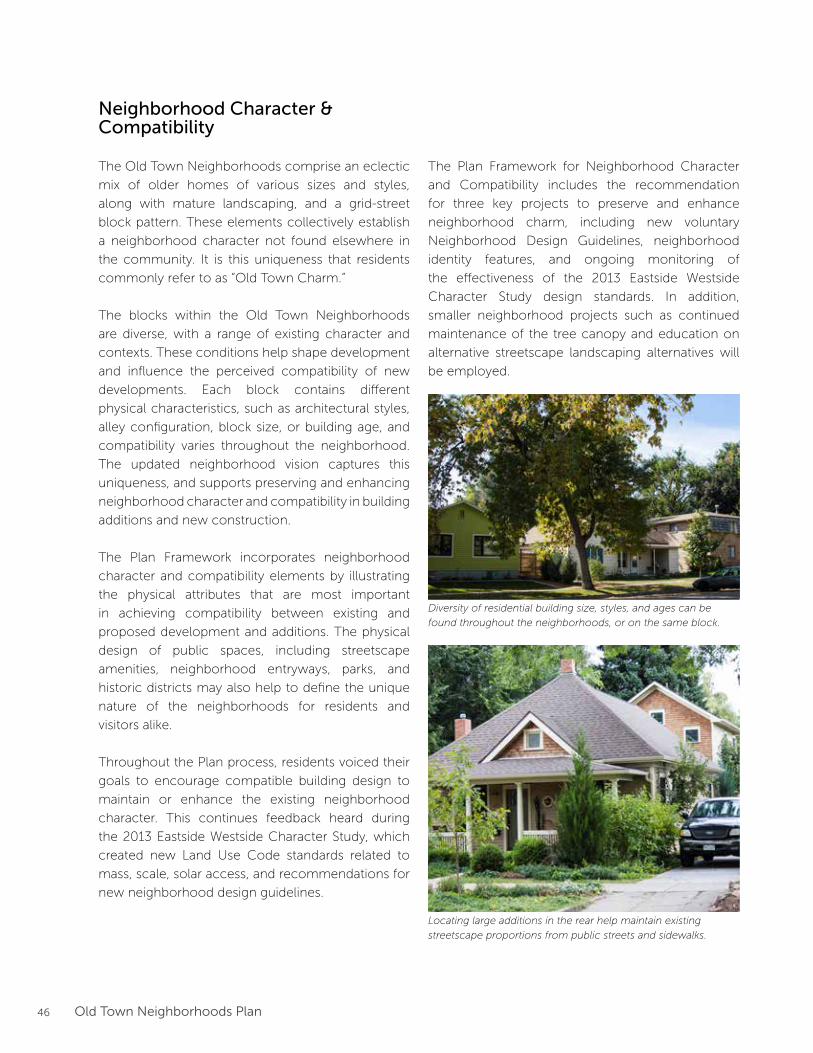
Neighborhood Character & Compatibility
The Old Town Neighborhoods comprise an eclectic
mix of older homes of various sizes and styles,
along with mature landscaping, and a grid-street
block pattern. These elements collectively establish
a neighborhood character not found elsewhere in
the community. It is this uniqueness that residents
commonly refer to as “Old Town Charm.”
The blocks within the Old Town Neighborhoods
are diverse, with a range of existing character and
contexts. These conditions help shape development
and influence the perceived compatibility of new
developments. Each block contains different
physical characteristics, such as architectural styles,
alley configuration, block size, or building age, and
compatibility varies throughout the neighborhood.
The updated neighborhood vision captures this
uniqueness, and supports preserving and enhancing
neighborhood character and compatibility in building
additions and new construction.
The Plan Framework incorporates neighborhood
character and compatibility elements by illustrating
the physical attributes that are most important
in achieving compatibility between existing and
proposed development and additions. The physical
design of public spaces, including streetscape
amenities, neighborhood entryways, parks, and
historic districts may also help to define the unique
nature of the neighborhoods for residents and
visitors alike.
Throughout the Plan process, residents voiced their
goals to encourage compatible building design to
maintain or enhance the existing neighborhood
character. This continues feedback heard during
the 2013 Eastside Westside Character Study, which
created new Land Use Code standards related to
mass, scale, solar access, and recommendations for
new neighborhood design guidelines.
Diversity of residential building size, styles, and ages can be
found throughout the neighborhoods, or on the same block.
Locating large additions in the rear help maintain existing
streetscape proportions from public streets and sidewalks.
The Plan Framework for Neighborhood Character
and Compatibility includes the recommendation
for three key projects to preserve and enhance
neighborhood charm, including new voluntary
Neighborhood Design Guidelines, neighborhood
identity features, and ongoing monitoring of
the effectiveness of the 2013 Eastside Westside
Character Study design standards. In addition,
smaller neighborhood projects such as continued
maintenance of the tree canopy and education on
alternative streetscape landscaping alternatives will
be employed.
47Old Town Neighborhoods Plan
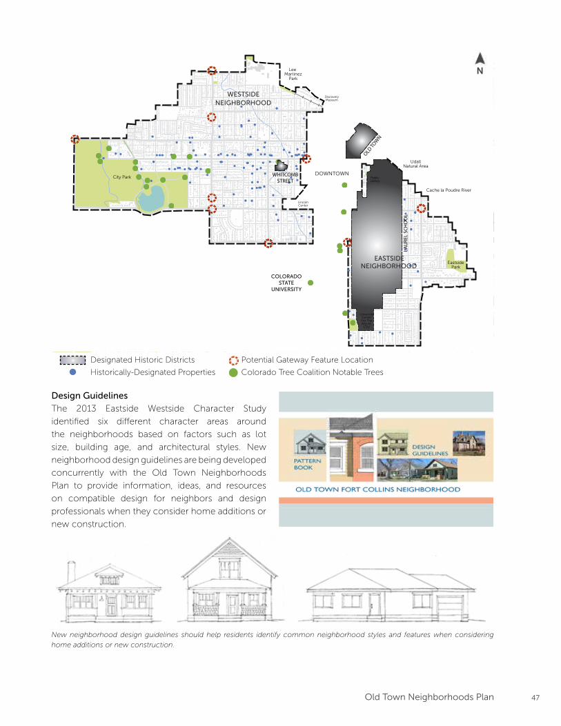
Design Guidelines
The 2013 Eastside Westside Character Study
identified six different character areas around
the neighborhoods based on factors such as lot
size, building age, and architectural styles. New
neighborhood design guidelines are being developed
concurrently with the Old Town Neighborhoods
Plan to provide information, ideas, and resources
on compatible design for neighbors and design
professionals when they consider home additions or
new construction.
New neighborhood design guidelines should help residents identify common neighborhood styles and features when considering
home additions or new construction.
LAU
REL
SCH
OO
L
WHITCOMBSTREET
OLD TO
WN
Lee Martinez
Park
UdallNatural Area
City Park
Cache la Poudre River
Spring Creek
EastsidePark
DOWNTOWN
COLORADOSTATE
UNIVERSITY
EASTSIDENEIGHBORHOOD
WESTSIDENEIGHBORHOOD
DiscoveryMuseum
UniversityCenterFor TheArts At
CSU
PublicLibrary
LincolnCenter
Designated Historic Districts Potential Gateway Feature Location
Historically-Designated Properties Colorado Tree Coalition Notable Trees
N
48 Old Town Neighborhoods Plan
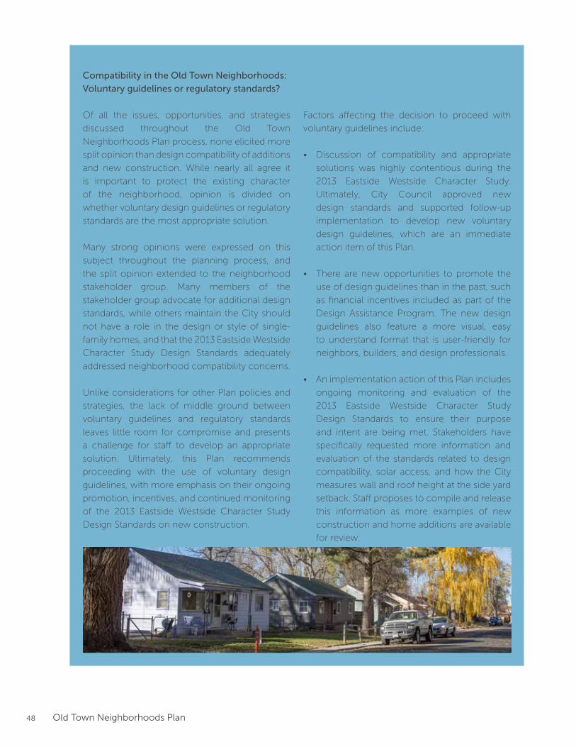
Compatibility in the Old Town Neighborhoods:
Voluntary guidelines or regulatory standards?
Of all the issues, opportunities, and strategies
discussed throughout the Old Town
Neighborhoods Plan process, none elicited more
split opinion than design compatibility of additions
and new construction. While nearly all agree it
is important to protect the existing character
of the neighborhood, opinion is divided on
whether voluntary design guidelines or regulatory
standards are the most appropriate solution.
Many strong opinions were expressed on this
subject throughout the planning process, and
the split opinion extended to the neighborhood
stakeholder group. Many members of the
stakeholder group advocate for additional design
standards, while others maintain the City should
not have a role in the design or style of single-
family homes, and that the 2013 Eastside Westside
Character Study Design Standards adequately
addressed neighborhood compatibility concerns.
Unlike considerations for other Plan policies and
strategies, the lack of middle ground between
voluntary guidelines and regulatory standards
leaves little room for compromise and presents
a challenge for staff to develop an appropriate
solution. Ultimately, this Plan recommends
proceeding with the use of voluntary design
guidelines, with more emphasis on their ongoing
promotion, incentives, and continued monitoring
of the 2013 Eastside Westside Character Study
Design Standards on new construction.
Factors affecting the decision to proceed with
voluntary guidelines include:
• Discussion of compatibility and appropriate
solutions was highly contentious during the
2013 Eastside Westside Character Study.
Ultimately, City Council approved new
design standards and supported follow-up
implementation to develop new voluntary
design guidelines, which are an immediate
action item of this Plan.
• There are new opportunities to promote the
use of design guidelines than in the past, such
as financial incentives included as part of the
Design Assistance Program. The new design
guidelines also feature a more visual, easy
to understand format that is user-friendly for
neighbors, builders, and design professionals.
• An implementation action of this Plan includes
ongoing monitoring and evaluation of the
2013 Eastside Westside Character Study
Design Standards to ensure their purpose
and intent are being met. Stakeholders have
specifically requested more information and
evaluation of the standards related to design
compatibility, solar access, and how the City
measures wall and roof height at the side yard
setback. Staff proposes to compile and release
this information as more examples of new
construction and home additions are available
for review.
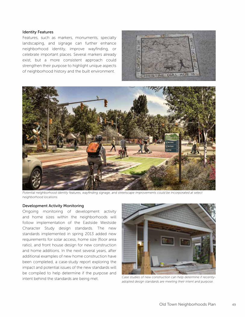
49Old Town Neighborhoods Plan
Identity Features
Features, such as markers, monuments, specialty
landscaping, and signage can further enhance
neighborhood identity, improve wayfinding, or
celebrate important places. Several markers already
exist, but a more consistent approach could
strengthen their purpose to highlight unique aspects
of neighborhood history and the built environment.
Development Activity Monitoring
Ongoing monitoring of development activity
and home sizes within the neighborhoods will
follow implementation of the Eastside Westside
Character Study design standards. The new
standards implemented in spring 2013 added new
requirements for solar access, home size (floor area
ratio), and front house design for new construction
and home additions. In the next several years, after
additional examples of new home construction have
been completed, a case-study report exploring the
impact and potential issues of the new standards will
be compiled to help determine if the purpose and
intent behind the standards are being met.
Potential neighborhood identity features, wayfinding signage, and streetscape improvements could be incorporated at select
neighborhood locations.
Case studies of new construction can help determine if recently-
adopted design standards are meeting their intent and purpose.
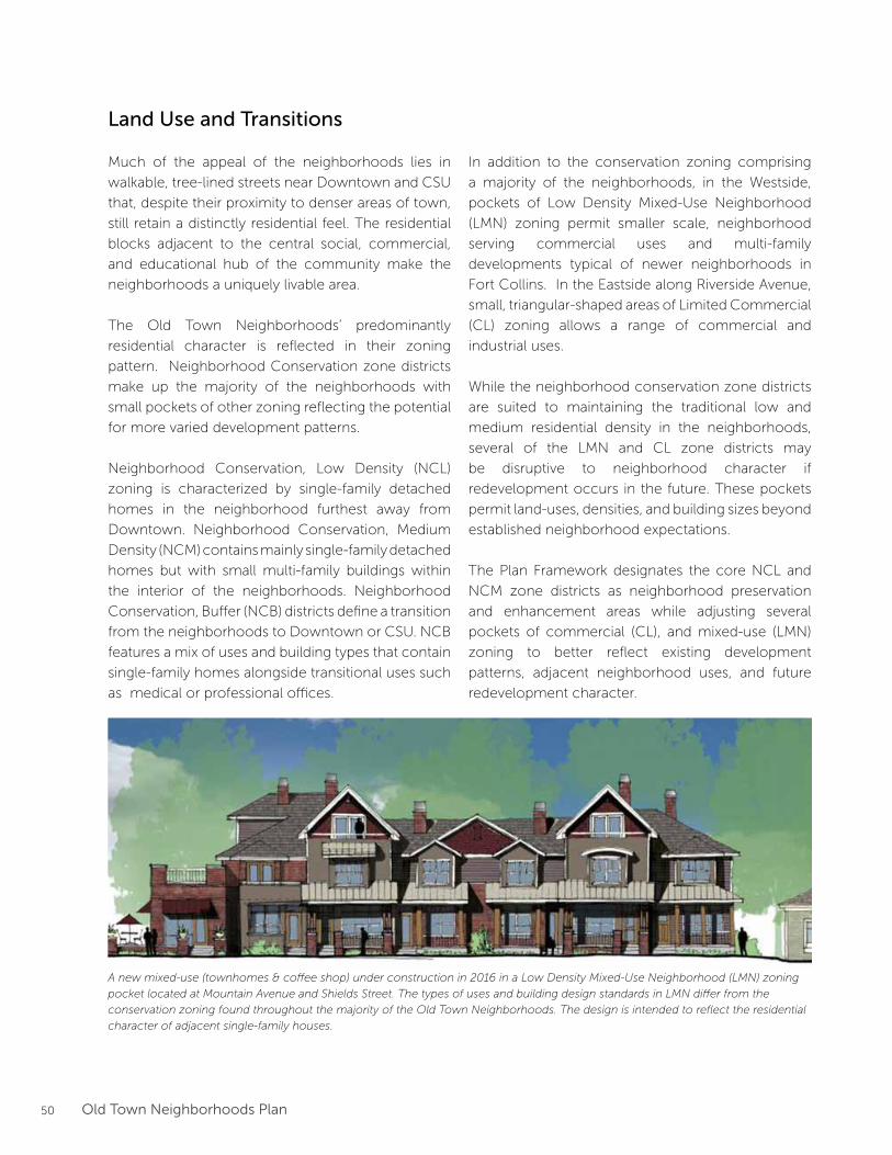
50 Old Town Neighborhoods Plan
Land Use and Transitions
Much of the appeal of the neighborhoods lies in
walkable, tree-lined streets near Downtown and CSU
that, despite their proximity to denser areas of town,
still retain a distinctly residential feel. The residential
blocks adjacent to the central social, commercial,
and educational hub of the community make the
neighborhoods a uniquely livable area.
The Old Town Neighborhoods’ predominantly
residential character is reflected in their zoning
pattern. Neighborhood Conservation zone districts
make up the majority of the neighborhoods with
small pockets of other zoning reflecting the potential
for more varied development patterns.
Neighborhood Conservation, Low Density (NCL)
zoning is characterized by single-family detached
homes in the neighborhood furthest away from
Downtown. Neighborhood Conservation, Medium
Density (NCM) contains mainly single-family detached
homes but with small multi-family buildings within
the interior of the neighborhoods. Neighborhood
Conservation, Buffer (NCB) districts define a transition
from the neighborhoods to Downtown or CSU. NCB
features a mix of uses and building types that contain
single-family homes alongside transitional uses such
as medical or professional offices.
In addition to the conservation zoning comprising
a majority of the neighborhoods, in the Westside,
pockets of Low Density Mixed-Use Neighborhood
(LMN) zoning permit smaller scale, neighborhood
serving commercial uses and multi-family
developments typical of newer neighborhoods in
Fort Collins. In the Eastside along Riverside Avenue,
small, triangular-shaped areas of Limited Commercial
(CL) zoning allows a range of commercial and
industrial uses.
While the neighborhood conservation zone districts
are suited to maintaining the traditional low and
medium residential density in the neighborhoods,
several of the LMN and CL zone districts may
be disruptive to neighborhood character if
redevelopment occurs in the future. These pockets
permit land-uses, densities, and building sizes beyond
established neighborhood expectations.
The Plan Framework designates the core NCL and
NCM zone districts as neighborhood preservation
and enhancement areas while adjusting several
pockets of commercial (CL), and mixed-use (LMN)
zoning to better reflect existing development
patterns, adjacent neighborhood uses, and future
redevelopment character.
A new mixed-use (townhomes & coffee shop) under construction in 2016 in a Low Density Mixed-Use Neighborhood (LMN) zoning
pocket located at Mountain Avenue and Shields Street. The types of uses and building design standards in LMN differ from the
conservation zoning found throughout the majority of the Old Town Neighborhoods. The design is intended to reflect the residential
character of adjacent single-family houses.
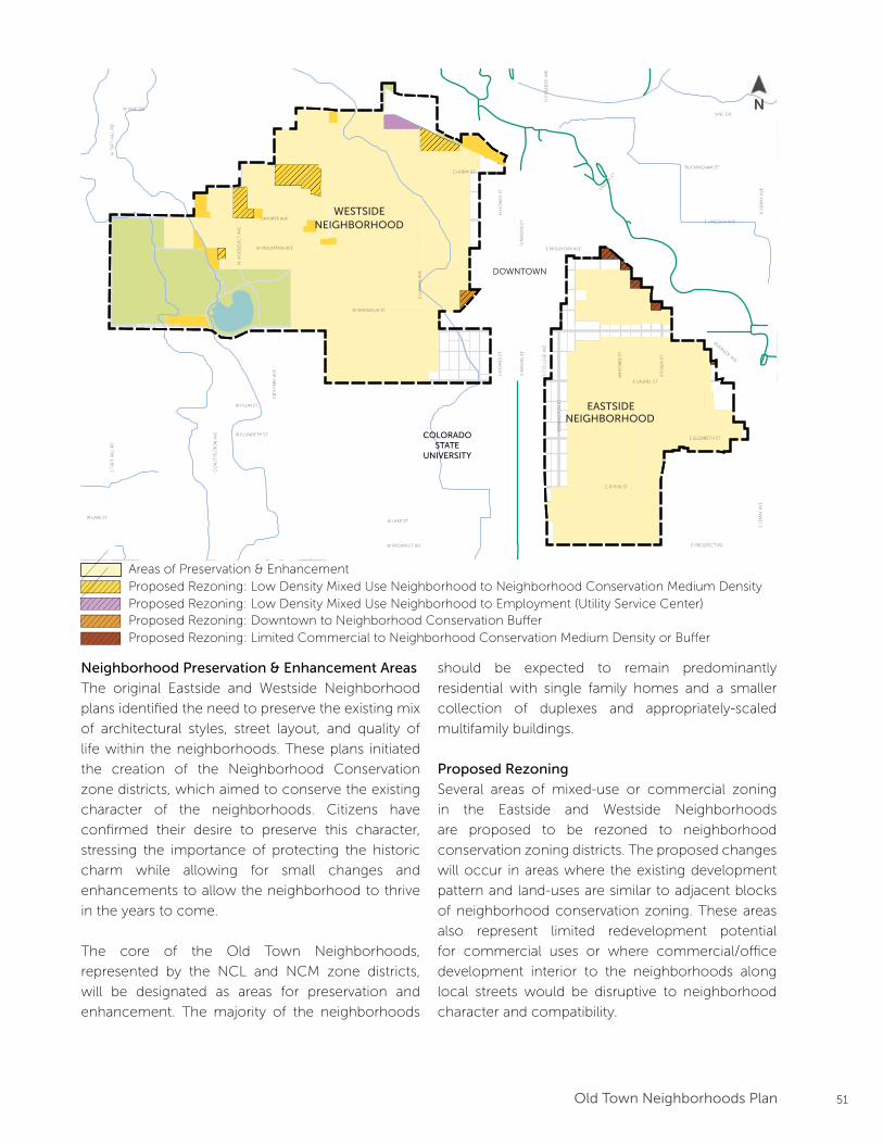
51Old Town Neighborhoods Plan
Prioritized Bike Routes1
Interim Alternative Bike RoutesNeighborhood Greenway ImprovementsEnhanced Crossing
Max Transit Line
0 0.5 MILES 0.25 0.125
N
1. Routes taken from the Fort CollinsBicycle System Wayfinding Plan2. Locations taken from Colorado Tree Coalition’s Notable Tree Tour in Fort Collins
Plan Framework
Areas of Preservationand Enhancement
Arterial Street Improvements
Parks & Open Space
Bu�er Transition
Downtown Plan Boundary CSU Main Campus Boundary
LegendEXISTING ELEMENTS
FUTURE ELEMENTS
Neighborhood Boundary
City Boundary
Trails
RoadwayBuilding
Steams, Rivers, Lakes
Potential Land Use Changes
Historic Districts
Employment Zone
Notable Trees2Notable Trees2
Greenway Designations
Key Projects
Shields Corridor Improvements
Mulberry Corridor Improvements
Bu�er Transition Area
Future Land Use Changes
12345
S LO
OM
IS A
VE
N R
OO
SEV
ELT
AV
E
RE
MIN
GT
ON
ST
E LAUREL ST
E PITKIN ST
W MOUNTAIN AVE
W MAGNOLIA ST
WH
ED
BE
E S
T
N S
HIE
LDS
STS
SHIE
LDS
STW MULBERRY ST E MULBERRY ST
W ELIZABETH ST
CIT
Y P
AR
K A
VE
W LAKE ST
CO
NST
ITU
TIO
N A
VE
W PLUM ST
S T
AFT
HIL
L R
DN
TA
FT H
ILL
RD
LAPORTE AVE
W VINE DR
E MOUNTAIN AVE
RIVERSIDE AVE
VINE DR
BUCKINGHAM ST
E LINCOLN AVE
LIN
DEN
ST
N H
OW
ES
STS
HO
WE
S ST
S C
OLL
EG
E A
VE
N C
OLL
EG
E A
VE
N L
EM
AY
AV
ES
LEM
AY
AV
E
S M
ASO
N S
TN
MA
SON
ST
STO
VE
R S
T
W LAKE ST
E ELIZABETH ST
E PROSPECT RDW PROSPECT RD
CHERRY ST
DOWNTOWN
COLORADOSTATE
UNIVERSITY
EASTSIDENEIGHBORHOOD
WESTSIDENEIGHBORHOOD
Areas of Preservation & EnhancementProposed Rezoning: Low Density Mixed Use Neighborhood to Neighborhood Conservation Medium Density
Proposed Rezoning: Downtown to Neighborhood Conservation Buffer
Neighborhood Preservation & Enhancement Areas
The original Eastside and Westside Neighborhood
plans identified the need to preserve the existing mix
of architectural styles, street layout, and quality of
life within the neighborhoods. These plans initiated
the creation of the Neighborhood Conservation
zone districts, which aimed to conserve the existing
character of the neighborhoods. Citizens have
confirmed their desire to preserve this character,
stressing the importance of protecting the historic
charm while allowing for small changes and
enhancements to allow the neighborhood to thrive
in the years to come.
The core of the Old Town Neighborhoods,
represented by the NCL and NCM zone districts,
will be designated as areas for preservation and
enhancement. The majority of the neighborhoods
should be expected to remain predominantly
residential with single family homes and a smaller
collection of duplexes and appropriately-scaled
multifamily buildings.
Proposed Rezoning
Several areas of mixed-use or commercial zoning
in the Eastside and Westside Neighborhoods
are proposed to be rezoned to neighborhood
conservation zoning districts. The proposed changes
will occur in areas where the existing development
pattern and land-uses are similar to adjacent blocks
of neighborhood conservation zoning. These areas
also represent limited redevelopment potential
for commercial uses or where commercial/office
development interior to the neighborhoods along
local streets would be disruptive to neighborhood
character and compatibility.
Proposed Rezoning: Limited Commercial to Neighborhood Conservation Medium Density or Buffer
N
Proposed Rezoning: Low Density Mixed Use Neighborhood to Employment (Utility Service Center)
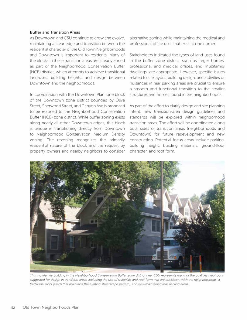
52 Old Town Neighborhoods Plan
Buffer and Transition Areas
As Downtown and CSU continue to grow and evolve,
maintaining a clear edge and transition between the
residential character of the Old Town Neighborhoods
and Downtown is important to residents. Many of
the blocks in these transition areas are already zoned
as part of the Neighborhood Conservation Buffer
(NCB) district, which attempts to achieve transitional
land-uses, building heights, and design between
Downtown and the neighborhoods.
In coordination with the Downtown Plan, one block
of the Downtown zone district bounded by Olive
Street, Sherwood Street, and Canyon Ave is proposed
to be rezoned to the Neighborhood Conservation
Buffer (NCB) zone district. While buffer zoning exists
along nearly all other Downtown edges, this block
is unique in transitioning directly from Downtown
to Neighborhood Conservation Medium Density
zoning. The rezoning recognizes the primarily
residential nature of the block and the request by
property owners and nearby neighbors to consider
alternative zoning while maintaining the medical and
professional office uses that exist at one corner.
Stakeholders indicated the types of land-uses found
in the buffer zone district, such as larger homes,
professional and medical offices, and multifamily
dwellings, are appropriate. However, specific issues
related to site layout, building design, and activities or
nuisances in rear parking areas are crucial to ensure
a smooth and functional transition to the smaller
structures and homes found in the neighborhoods.
As part of the effort to clarify design and site planning
intent, new transition-area design guidelines and
standards will be explored within neighborhood
transition areas. The effort will be coordinated along
both sides of transition areas (neighborhoods and
Downtown) for future redevelopment and new
construction. Potential focus areas include parking,
building height, building materials, ground-floor
character, and roof form.
This multifamily building in the Neighborhood Conservation Buffer zone district near CSU represents many of the qualities neighbors
suggested for design in transition areas, including the use of materials and roof form that are consistent with the neighborhoods, a
traditional front porch that maintains the existing streetscape pattern,, and well-maintained rear parking areas.
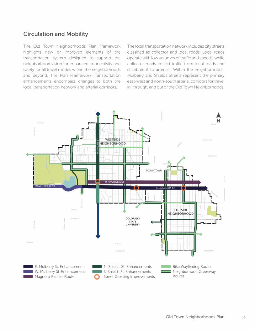
53Old Town Neighborhoods Plan
Circulation and Mobility
The Old Town Neighborhoods Plan Framework
highlights new or improved elements of the
transportation system designed to support the
neighborhood vision for enhanced connectivity and
safety for all travel modes within the neighborhoods
and beyond. The Plan Framework Transportation
enhancements encompass changes to both the
local transportation network and arterial corridors.
The local transportation network includes city streets
classified as collector and local roads. Local roads
operate with low volumes of traffic and speeds, while
collector roads collect traffic from local roads and
distribute it to arterials. Within the neighborhoods,
Mulberry and Shields Streets represent the primary
east-west and north-south arterial corridors for travel
in, through, and out of the Old Town Neighborhoods.
Prioritized Bike Routes1
Interim Alternative Bike RoutesNeighborhood Greenway ImprovementsEnhanced Crossing
Max Transit Line
0 0.5 MILES 0.25 0.125
N
1. Routes taken from the Fort CollinsBicycle System Wayfinding Plan2. Locations taken from Colorado Tree Coalition’s Notable Tree Tour in Fort Collins
Plan Framework
Areas of Preservationand Enhancement
Arterial Street Improvements
Parks & Open Space
Bu�er Transition
Downtown Plan Boundary CSU Main Campus Boundary
LegendEXISTING ELEMENTS
FUTURE ELEMENTS
Neighborhood Boundary
City Boundary
Trails
RoadwayBuilding
Steams, Rivers, Lakes
Potential Land Use Changes
Historic Districts
Employment Zone
Notable Trees2Notable Trees2
Greenway Designations
Key Projects
Shields Corridor Improvements
Mulberry Corridor Improvements
Bu�er Transition Area
Future Land Use Changes
12345
S LO
OM
IS A
VE
N R
OO
SEV
ELT
AV
E
RE
MIN
GT
ON
ST
E LAUREL ST
E PITKIN ST
W MOUNTAIN AVE
W MAGNOLIA STW
HE
DB
EE
ST
N S
HIE
LDS
ST
W MULBERRY ST E MULBERRY ST
Prioritized Bike Routes1
Street Crossing Improvements
Transit Line
0 0.5 MILES 0.25 0.125
N
1. Routes taken from the Fort CollinsBicycle System Way�nding Plan
Transportation and Mobility Framework
Mulberry Street Improvements:
Parks & Open Space
LegendEXISTING ELEMENTS
FUTURE ELEMENTS
Neighborhood Boundary
City Boundary
Trails
RoadwayBuilding
Steams, Rivers, Lakes
M1Auto Lane Reduction (4 to 3)Bu�ered Bike LaneSidewalk Widening
Mulberry Street Improvements:M2Sidewalk ConstructionImproved Street Crossings
Mulberry Street Improvements(Magnolia Parallel Route):
M3
Bu�ered Bike Lanes
Shields Street Improvements:S1Auto Lane Width ReductionSidewalk Widening
Shields Street Improvements:S2Auto Lane Reduction (4 to 3)Bu�ered Bike LanesSidewalk Widening
5
Downtown Plan Boundary CSU Main Campus Boundary
W MAGNOLIA ST
N S
HIE
LDS
ST
W MULBERRY STE MULBERRY ST
W ELIZABETH ST
CIT
Y P
AR
K A
VE
W LAKE ST
CO
NST
ITU
TIO
N A
VE
W PLUM ST
S T
AFT
HIL
L R
DN
TA
FT H
ILL
RD
LAPORTE AVE
W VINE DR
E MOUNTAIN AVE
RIVERSIDE AVE
VINE DR
BUCKINGHAM ST
E LINCOLN AVE
LIN
DEN
ST
N H
OW
ES
STS
HO
WE
S ST
S C
OLL
EG
E A
VE
N C
OLL
EG
E A
VE
N L
EM
AY
AV
ES
LEM
AY
AV
E
S M
ASO
N S
TN
MA
SON
ST
STO
VE
R S
T
W LAKE ST
E ELIZABETH ST
E PROSPECT RDW PROSPECT RD
CHERRY ST
DOWNTOWN
COLORADOSTATE
UNIVERSITY
EASTSIDENEIGHBORHOOD
WESTSIDENEIGHBORHOOD
Bike Wayfinding RoutesNeighborhood Greenway Routes Magnolia Parallel Route
S. Shields St. EnhancementsN. Shields St. Enhancements
W. Mulberry St. EnhancementsE. Mulberry St. Enhancements
Street Crossing Improvements
N
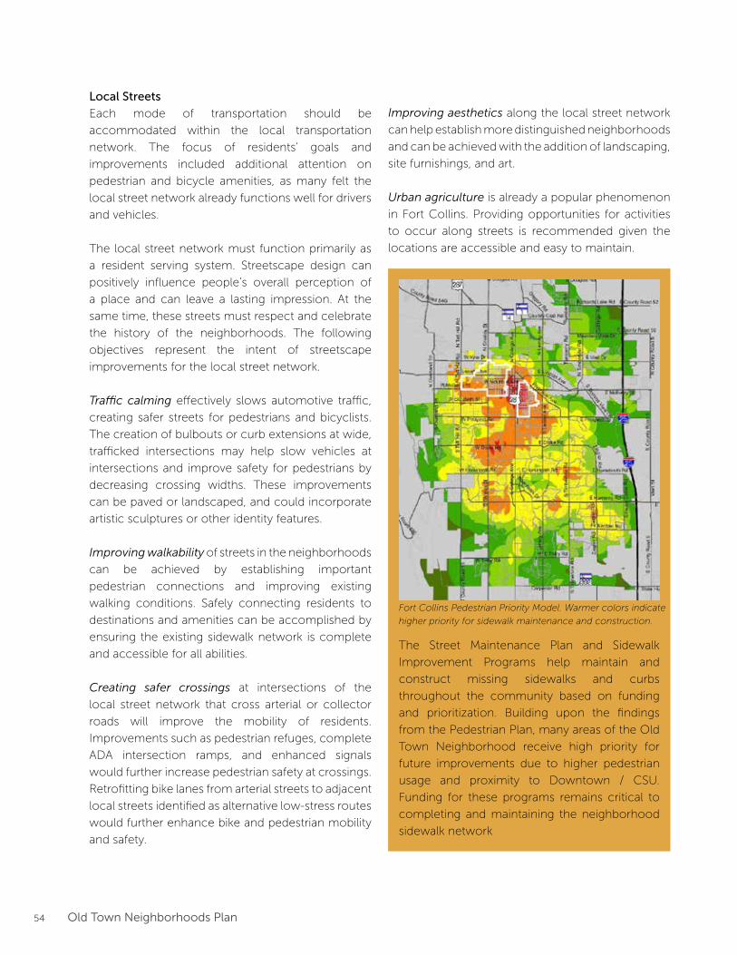
54 Old Town Neighborhoods Plan
Local Streets
Each mode of transportation should be
accommodated within the local transportation
network. The focus of residents’ goals and
improvements included additional attention on
pedestrian and bicycle amenities, as many felt the
local street network already functions well for drivers
and vehicles.
The local street network must function primarily as
a resident serving system. Streetscape design can
positively influence people’s overall perception of
a place and can leave a lasting impression. At the
same time, these streets must respect and celebrate
the history of the neighborhoods. The following
objectives represent the intent of streetscape
improvements for the local street network.
Traffic calming effectively slows automotive traffic,
creating safer streets for pedestrians and bicyclists.
The creation of bulbouts or curb extensions at wide,
trafficked intersections may help slow vehicles at
intersections and improve safety for pedestrians by
decreasing crossing widths. These improvements
can be paved or landscaped, and could incorporate
artistic sculptures or other identity features.
Improving walkability of streets in the neighborhoods
can be achieved by establishing important
pedestrian connections and improving existing
walking conditions. Safely connecting residents to
destinations and amenities can be accomplished by
ensuring the existing sidewalk network is complete
and accessible for all abilities.
Creating safer crossings at intersections of the
local street network that cross arterial or collector
roads will improve the mobility of residents.
Improvements such as pedestrian refuges, complete
ADA intersection ramps, and enhanced signals
would further increase pedestrian safety at crossings.
Retrofitting bike lanes from arterial streets to adjacent
local streets identified as alternative low-stress routes
would further enhance bike and pedestrian mobility
and safety.
Improving aesthetics along the local street network
can help establish more distinguished neighborhoods
and can be achieved with the addition of landscaping,
site furnishings, and art.
Urban agriculture is already a popular phenomenon
in Fort Collins. Providing opportunities for activities
to occur along streets is recommended given the
locations are accessible and easy to maintain.
The Street Maintenance Plan and Sidewalk
Improvement Programs help maintain and
construct missing sidewalks and curbs
throughout the community based on funding
and prioritization. Building upon the findings
from the Pedestrian Plan, many areas of the Old
Town Neighborhood receive high priority for
future improvements due to higher pedestrian
usage and proximity to Downtown / CSU.
Funding for these programs remains critical to
completing and maintaining the neighborhood
sidewalk network
Fort Collins Pedestrian Priority Model. Warmer colors indicate
higher priority for sidewalk maintenance and construction.
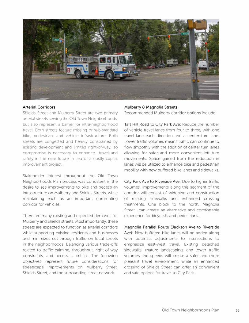
55Old Town Neighborhoods Plan
Arterial Corridors
Shields Street and Mulberry Street are two primary
arterial streets serving the Old Town Neighborhoods,
but also represent a barrier for intra-neighborhood
travel. Both streets feature missing or sub-standard
bike, pedestrian, and vehicle infrastructure. Both
streets are congested and heavily constrained by
existing development and limited right-of-way, so
compromise is necessary to enhance travel and
safety in the near future in lieu of a costly capital
improvement project.
Stakeholder interest throughout the Old Town
Neighborhoods Plan process was consistent in the
desire to see improvements to bike and pedestrian
infrastructure on Mulberry and Shields Streets, while
maintaining each as an important commuting
corridor for vehicles.
There are many existing and expected demands for
Mulberry and Shields streets. Most importantly, these
streets are expected to function as arterial corridors
while supporting existing residents and businesses
and minimizes cut-through traffic on local streets
in the neighborhoods. Balancing various trade-offs
related to traffic calming, throughput, right-of-way
constraints, and access is critical. The following
objectives represent future considerations for
streetscape improvements on Mulberry Street,
Shields Street, and the surrounding street network.
Mulberry & Magnolia Streets
Recommended Mulberry corridor options include:
Taft Hill Road to City Park Ave: Reduce the number
of vehicle travel lanes from four to three, with one
travel lane each direction and a center turn lane.
Lower traffic volumes means traffic can continue to
flow smoothly with the addition of center turn lanes
allowing for safer and more convenient left turn
movements. Space gained from the reduction in
lanes will be utilized to enhance bike and pedestrian
mobility with new buffered bike lanes and sidewalks.
City Park Ave to Riverside Ave: Due to higher traffic
volumes, improvements along this segment of the
corridor will consist of widening and construction
of missing sidewalks and enhanced crossing
treatments. One block to the north, Magnolia
Street can create an alternative and comfortable
experience for bicyclists and pedestrians.
Magnolia Parallel Route (Jackson Ave to Riverside
Ave): New buffered bike lanes will be added along
with potential adjustments to intersections to
emphasize east-west travel. Existing detached
sidewalks, mature landscaping, and lower traffic
volumes and speeds will create a safer and more
pleasant travel environment, while an enhanced
crossing of Shields Street can offer an convenient
and safe options for travel to City Park.
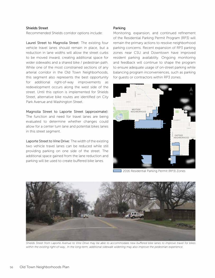
56 Old Town Neighborhoods Plan
Shields Street
Recommended Shields corridor options include:
Laurel Street to Magnolia Street: The existing four
vehicle travel lanes should remain in place, but a
reduction in lane widths will allow the street curbs
to be moved inward, creating additional space for
wider sidewalks and a shared bike / pedestrian path.
While one of the most constrained sections of any
arterial corridor in the Old Town Neighborhoods,
this segment also represents the best opportunity
for additional right-of-way improvements as
redevelopment occurs along the west side of the
street. Until this option is implemented for Shields
Street, alternative bike routes are identified on City
Park Avenue and Washington Street.
Magnolia Street to Laporte Street (approximate):
The function and need for travel lanes are being
evaluated to determine whether changes could
allow for a center turn lane and potential bikes lanes
in this street segment.
Laporte Street to Vine Drive: The width of the existing
two vehicle travel lanes can be reduced while still
providing parking on one side of the street. The
additional space gained from the lane reduction and
parking will be used to create buffered bike lanes.
Parking
Monitoring, expansion, and continued refinement
of the Residential Parking Permit Program (RP3) will
remain the primary actions to resolve neighborhood
parking concerns. Recent expansion of RP3 parking
zones near CSU and Downtown have improved
resident parking availability. Ongoing monitoring
and feedback will continue to shape the program
to ensure adequate usage of on-street parking while
balancing program inconveniences, such as parking
for guests or contractors within RP3 zones.
W ELIZABETH ST
W LAKE ST
CO
NST
ITU
TIO
N A
VE
W PLUM ST
S T
AFT
HIL
L R
DN
TA
FT H
ILL
RD
LAPORTE AVE
W VINE DR
CHERRY ST
E MOUNTIAN AVE
RIVERSIDE AVE
BUCKINGHAM ST
E LINCOLN AVE
LIN
DEN
ST
WILLOW
STJEFFERSON ST
WALNUT ST
N H
OW
ES
STS
HO
WE
S ST
S LO
OM
IS A
VE
S C
OLL
EG
E A
VE
N C
OLL
EG
E A
VE
N L
EM
AY
AV
ES
LEM
AY
AV
E
S M
ASO
N S
TN
MA
SON
ST
RE
MIN
GT
ON
ST
STO
VE
R S
T
W LAUREL ST
W LAKE ST
E LAUREL ST
E ELIZABETH ST
E PITKIN ST
E PROSPECT RDW PROSPECT RD
W MOUNTIAN AVE
N S
HIE
LDS
STS
SHIE
LDS
ST
W MULBERRY STE MULBERRY ST
Lee MartinezPark
UdallNatural Area
Gardens onSpring Creek
BuckinghamPark
North Shields PondsNatural Area
City Park
Red Fox Meadows
Natural Area
FairbrookePond
Avery Park
Legacy Park
SheldonLake
Cache la Poudre River
Cache la Poudre River
Spring Creek
Spring Creek
DOWNTOWN
COLORADOSTATE
UNIVERSITY
EASTSIDENEIGHBORHOOD
WESTSIDENEIGHBORHOOD
287
287
14
14
FEMA DesignatedFloodway
FEMA DesignatedHigh-RiskFloodplain
FEMA DesignatedModerate-RiskFloodplain
City DesignatedFloodway
City DesignatedHigh-RiskFloodplain
City DesignatedModerate-RiskFloodplain
0 1000500 2000 FEET
N
Legend
Freight Rail Line
City Boundary
Neighborhood Boundary
FloodplainMap
Parcel
Open Space / Park
Stream / River / Reservoir
2016 Residential Parking Permit (RP3) Zones
Shields Street from Laporte Avenue to Vine Drive may be able to accommodate new buffered bike lanes to improve travel for bikes
within the existing right-of-way.. In the long-term, additional sidewalk widening may also improve the pedestrian experience.
N
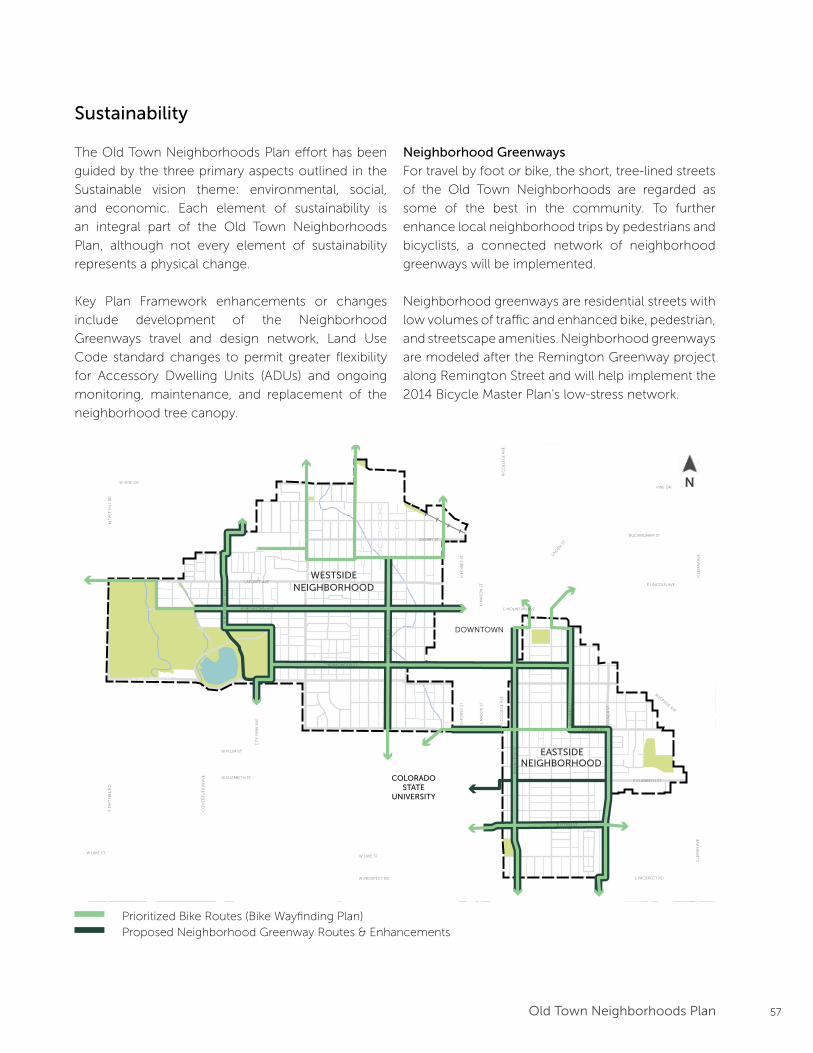
57Old Town Neighborhoods Plan
Prioritized Bike Routes1
Interim Alternative Bike RoutesNeighborhood Greenway ImprovementsEnhanced Crossing
Max Transit Line
0 0.5 MILES 0.25 0.125
N
1. Routes taken from the Fort CollinsBicycle System Wayfinding Plan2. Locations taken from Colorado Tree Coalition’s Notable Tree Tour in Fort Collins
Plan Framework
Areas of Preservationand Enhancement
Arterial Street Improvements
Parks & Open Space
Bu�er Transition
Downtown Plan Boundary CSU Main Campus Boundary
LegendEXISTING ELEMENTS
FUTURE ELEMENTS
Neighborhood Boundary
City Boundary
Trails
RoadwayBuilding
Steams, Rivers, Lakes
Potential Land Use Changes
Historic Districts
Employment Zone
Notable Trees2Notable Trees2
Greenway Designations
Key Projects
Shields Corridor Improvements
Mulberry Corridor Improvements
Bu�er Transition Area
Future Land Use Changes
12345
S LO
OM
IS A
VE
N
RO
OSE
VE
LT A
VE
RE
MIN
GT
ON
ST
E LAUREL ST
E PITKIN ST
W MOUNTAIN AVE
W MAGNOLIA ST
WH
ED
BE
E S
T
N S
HIE
LDS
STS
SHIE
LDS
ST
W MULBERRY ST E MULBERRY ST
W ELIZABETH ST
CIT
Y P
AR
K A
VE
W LAKE ST
CO
NST
ITU
TIO
N A
VE
W PLUM ST
S T
AFT
HIL
L R
DN
TA
FT H
ILL
RD
LAPORTE AVE
W VINE DR
E MOUNTAIN AVE
RIVERSIDE AVE
VINE DR
BUCKINGHAM ST
E LINCOLN AVE
LIN
DEN
ST
N H
OW
ES
STS
HO
WE
S ST
S C
OLL
EG
E A
VE
N C
OLL
EG
E A
VE
N L
EM
AY
AV
ES
LEM
AY
AV
E
S M
ASO
N S
TN
MA
SON
ST
STO
VE
R S
T
W LAKE ST
E ELIZABETH ST
E PROSPECT RDW PROSPECT RD
CHERRY ST
DOWNTOWN
COLORADOSTATE
UNIVERSITY
EASTSIDENEIGHBORHOOD
WESTSIDENEIGHBORHOOD
Prioritized Bike Routes (Bike Wayfinding Plan)Proposed Neighborhood Greenway Routes & Enhancements
Sustainability
The Old Town Neighborhoods Plan effort has been
guided by the three primary aspects outlined in the
Sustainable vision theme: environmental, social,
and economic. Each element of sustainability is
an integral part of the Old Town Neighborhoods
Plan, although not every element of sustainability
represents a physical change.
Key Plan Framework enhancements or changes
include development of the Neighborhood
Greenways travel and design network, Land Use
Code standard changes to permit greater flexibility
for Accessory Dwelling Units (ADUs) and ongoing
monitoring, maintenance, and replacement of the
neighborhood tree canopy.
Neighborhood Greenways
For travel by foot or bike, the short, tree-lined streets
of the Old Town Neighborhoods are regarded as
some of the best in the community. To further
enhance local neighborhood trips by pedestrians and
bicyclists, a connected network of neighborhood
greenways will be implemented.
Neighborhood greenways are residential streets with
low volumes of traffic and enhanced bike, pedestrian,
and streetscape amenities. Neighborhood greenways
are modeled after the Remington Greenway project
along Remington Street and will help implement the
2014 Bicycle Master Plan’s low-stress network.
N
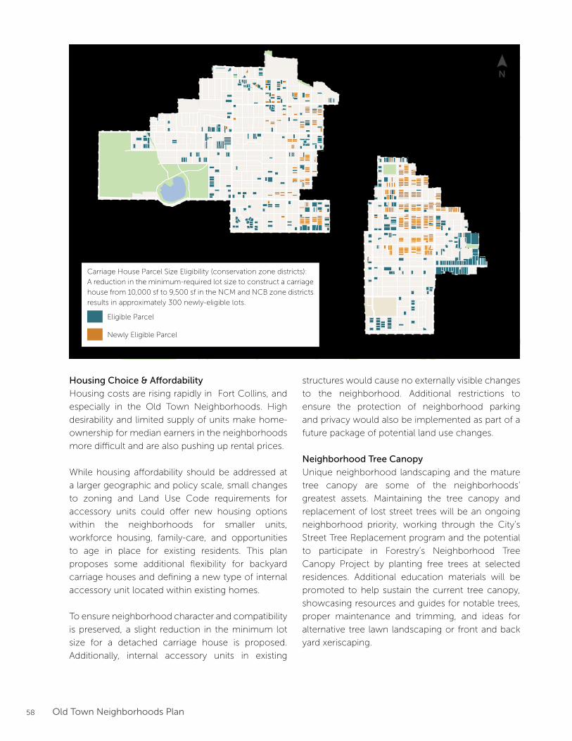
58 Old Town Neighborhoods Plan
Housing Choice & Affordability
Housing costs are rising rapidly in Fort Collins, and
especially in the Old Town Neighborhoods. High
desirability and limited supply of units make home-
ownership for median earners in the neighborhoods
more difficult and are also pushing up rental prices.
While housing affordability should be addressed at
a larger geographic and policy scale, small changes
to zoning and Land Use Code requirements for
accessory units could offer new housing options
within the neighborhoods for smaller units,
workforce housing, family-care, and opportunities
to age in place for existing residents. This plan
proposes some additional flexibility for backyard
carriage houses and defining a new type of internal
accessory unit located within existing homes.
To ensure neighborhood character and compatibility
is preserved, a slight reduction in the minimum lot
size for a detached carriage house is proposed.
Additionally, internal accessory units in existing
structures would cause no externally visible changes
to the neighborhood. Additional restrictions to
ensure the protection of neighborhood parking
and privacy would also be implemented as part of a
future package of potential land use changes.
Neighborhood Tree Canopy
Unique neighborhood landscaping and the mature
tree canopy are some of the neighborhoods’
greatest assets. Maintaining the tree canopy and
replacement of lost street trees will be an ongoing
neighborhood priority, working through the City’s
Street Tree Replacement program and the potential
to participate in Forestry’s Neighborhood Tree
Canopy Project by planting free trees at selected
residences. Additional education materials will be
promoted to help sustain the current tree canopy,
showcasing resources and guides for notable trees,
proper maintenance and trimming, and ideas for
alternative tree lawn landscaping or front and back
yard xeriscaping.
FEMA DesignatedFloodway
FEMA DesignatedHigh-RiskFloodplain
FEMA DesignatedModerate-RiskFloodplain
City DesignatedFloodway
City DesignatedHigh-RiskFloodplain
City DesignatedModerate-RiskFloodplain
0 1000500 2000 FEET
N
Legend
Freight Rail Line
City Boundary
Neighborhood Boundary
FloodplainMap
Parcel
Open Space / Park
Stream / River / Reservoir
Eligible Parcel
Newly Eligible Parcel
Carriage House Parcel Size Eligibility (conservation zone districts):
A reduction in the minimum-required lot size to construct a carriage
house from 10,000 sf to 9,500 sf in the NCM and NCB zone districts
results in approximately 300 newly-eligible lots.
N
59Old Town Neighborhoods Plan
This page intentionally left blank
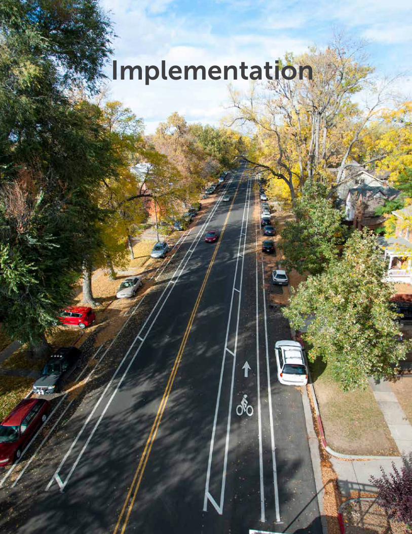
60 Old Town Neighborhoods Plan
Implementation
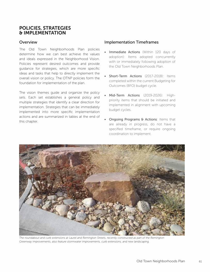
61Old Town Neighborhoods Plan
POLICIES, STRATEGIES & IMPLEMENTATION
Overview
The Old Town Neighborhoods Plan policies
determine how we can best achieve the values
and ideals expressed in the Neighborhood Vision.
Policies represent desired outcomes and provide
guidance for strategies, which are more specific
ideas and tasks that help to directly implement the
overall vision or policy. The OTNP policies form the
foundation for implementation of the plan.
The vision themes guide and organize the policy
sets. Each set establishes a general policy and
multiple strategies that identify a clear direction for
implementation. Strategies that can be immediately
implemented into more specific implementation
actions and are summarized in tables at the end of
this chapter.
Implementation Timeframes
• Immediate Actions (Within 120 days of
adoption): Items adopted concurrently
with or immediately following adoption of
the Old Town Neighborhoods Plan.
• Short-Term Actions (2017-2018): Items
completed within the current Budgeting for
Outcomes (BFO) budget cycle.
• Mid-Term Actions (2019-2026): High-
priority items that should be initiated and
implemented in alignment with upcoming
budget cycles.
• Ongoing Programs & Actions: Items that
are already in progress, do not have a
specified timeframe, or require ongoing
coordination to implement.
The roundabout and curb extensions at Laurel and Remington Streets, recently constructed as part of the Remington
Greenway improvements, also feature stormwater improvements, curb extensions, and new landscaping.
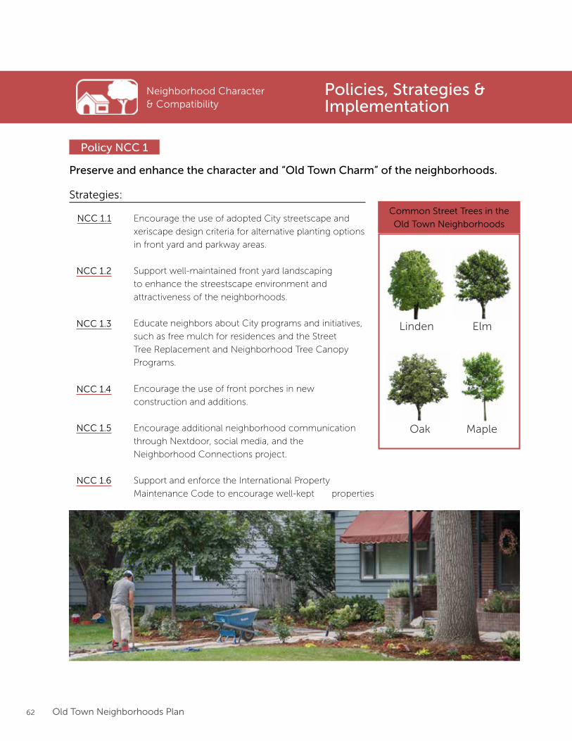
62 Old Town Neighborhoods Plan
Neighborhood Character & Compatibility
Preserve and enhance the character and “Old Town Charm” of the neighborhoods.
Policy NCC 1
Strategies:
Encourage the use of adopted City streetscape and
xeriscape design criteria for alternative planting options
in front yard and parkway areas.
Support well-maintained front yard landscaping
to enhance the streestscape environment and
attractiveness of the neighborhoods.
Educate neighbors about City programs and initiatives,
such as free mulch for residences and the Street
Tree Replacement and Neighborhood Tree Canopy
Programs.
Encourage the use of front porches in new
construction and additions.
Encourage additional neighborhood communication
through Nextdoor, social media, and the
Neighborhood Connections project.
Support and enforce the International Property
Maintenance Code to encourage well-kept
NCC 1.1
NCC 1.2
NCC 1.3
NCC 1.4
NCC 1.5
Common Street Trees in the
Old Town Neighborhoods
Linden
Oak
Elm
Maple
Policies, Strategies & Implementation
properties
NCC 1.6
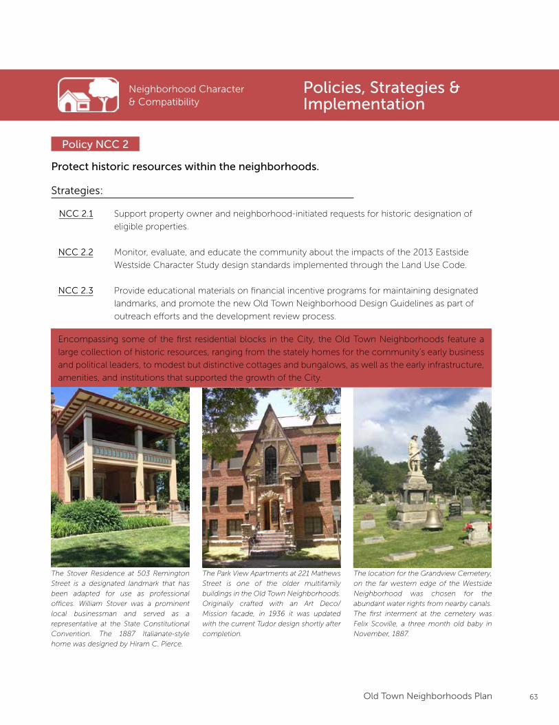
63Old Town Neighborhoods Plan
Protect historic resources within the neighborhoods.
Policy NCC 2
Strategies:
Support property owner and neighborhood-initiated requests for historic designation of
eligible properties.
Monitor, evaluate, and educate the community about the impacts of the 2013 Eastside
Westside Character Study design standards implemented through the Land Use Code.
Provide educational materials on financial incentive programs for maintaining designated
landmarks, and promote the new Old Town Neighborhood Design Guidelines as part of
outreach efforts and the development review process.
NCC 2.1
NCC 2.2
NCC 2.3
Neighborhood Character & Compatibility
Encompassing some of the first residential blocks in the City, the Old Town Neighborhoods feature a
large collection of historic resources, ranging from the stately homes for the community’s early business
and political leaders, to modest but distinctive cottages and bungalows, as well as the early infrastructure,
amenities, and institutions that supported the growth of the City.
The Stover Residence at 503 Remington
Street is a designated landmark that has
been adapted for use as professional
offices. William Stover was a prominent
local businessman and served as a
representative at the State Constitutional
Convention. The 1887 Italianate-style
home was designed by Hiram C. Pierce.
The Park View Apartments at 221 Mathews
Street is one of the older multifamily
buildings in the Old Town Neighborhoods.
Originally crafted with an Art Deco/
Mission facade, in 1936 it was updated
with the current Tudor design shortly after
completion.
The location for the Grandview Cemetery,
on the far western edge of the Westside
Neighborhood was chosen for the
abundant water rights from nearby canals.
The first interment at the cemetery was
Felix Scoville, a three month old baby in
November, 1887.
Policies, Strategies & Implementation
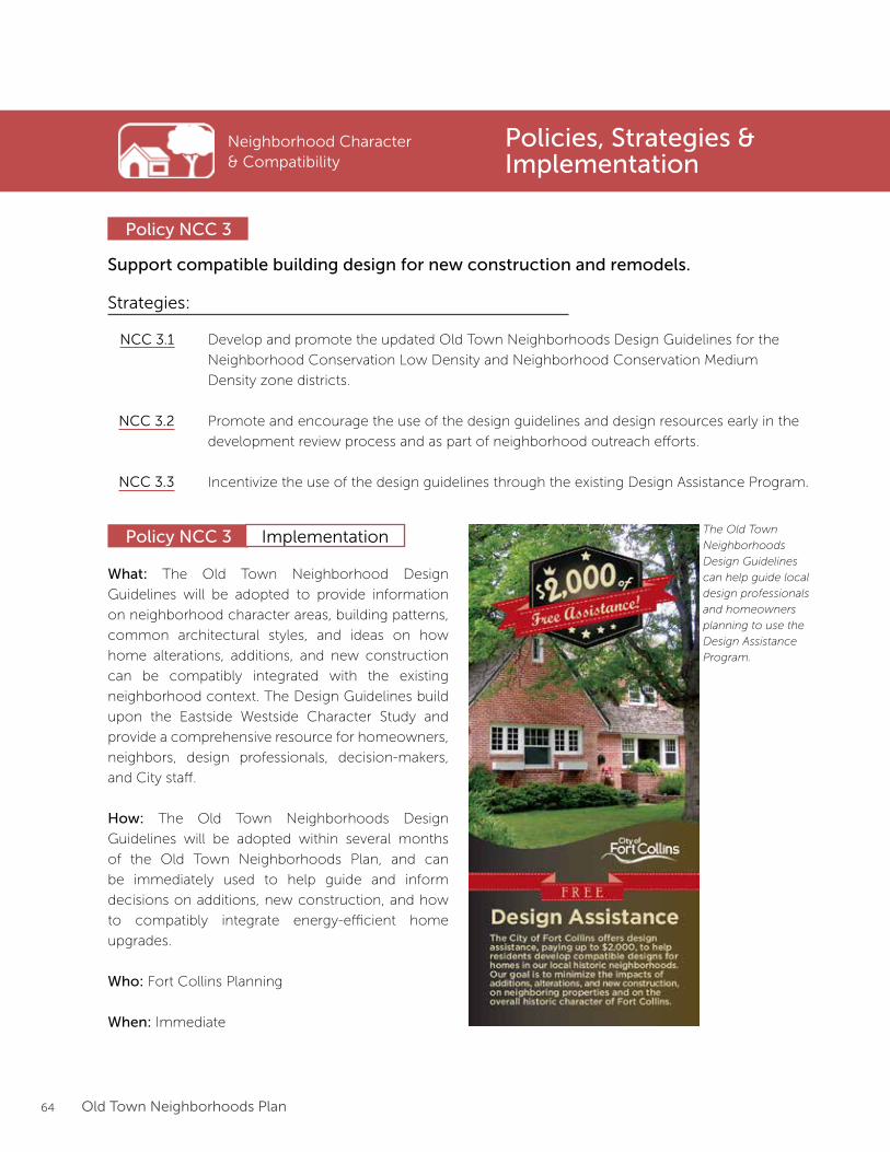
64 Old Town Neighborhoods Plan
Neighborhood Character & Compatibility
Policies, Strategies & Implementation
Support compatible building design for new construction and remodels.
Policy NCC 3
Strategies:
Develop and promote the updated Old Town Neighborhoods Design Guidelines for the
Neighborhood Conservation Low Density and Neighborhood Conservation Medium
Density zone districts.
Promote and encourage the use of the design guidelines and design resources early in the
development review process and as part of neighborhood outreach efforts.
Incentivize the use of the design guidelines through the existing Design Assistance Program.
NCC 3.1
NCC 3.2
NCC 3.3
Policy NCC 3 Implementation
What: The Old Town Neighborhood Design
Guidelines will be adopted to provide information
on neighborhood character areas, building patterns,
common architectural styles, and ideas on how
home alterations, additions, and new construction
can be compatibly integrated with the existing
neighborhood context. The Design Guidelines build
upon the Eastside Westside Character Study and
provide a comprehensive resource for homeowners,
neighbors, design professionals, decision-makers,
and City staff.
How: The Old Town Neighborhoods Design
Guidelines will be adopted within several months
of the Old Town Neighborhoods Plan, and can
be immediately used to help guide and inform
decisions on additions, new construction, and how
to compatibly integrate energy-efficient home
upgrades.
Who: Fort Collins Planning
When: Immediate
The Old Town
Neighborhoods
Design Guidelines
can help guide local
design professionals
and homeowners
planning to use the
Design Assistance
Program.
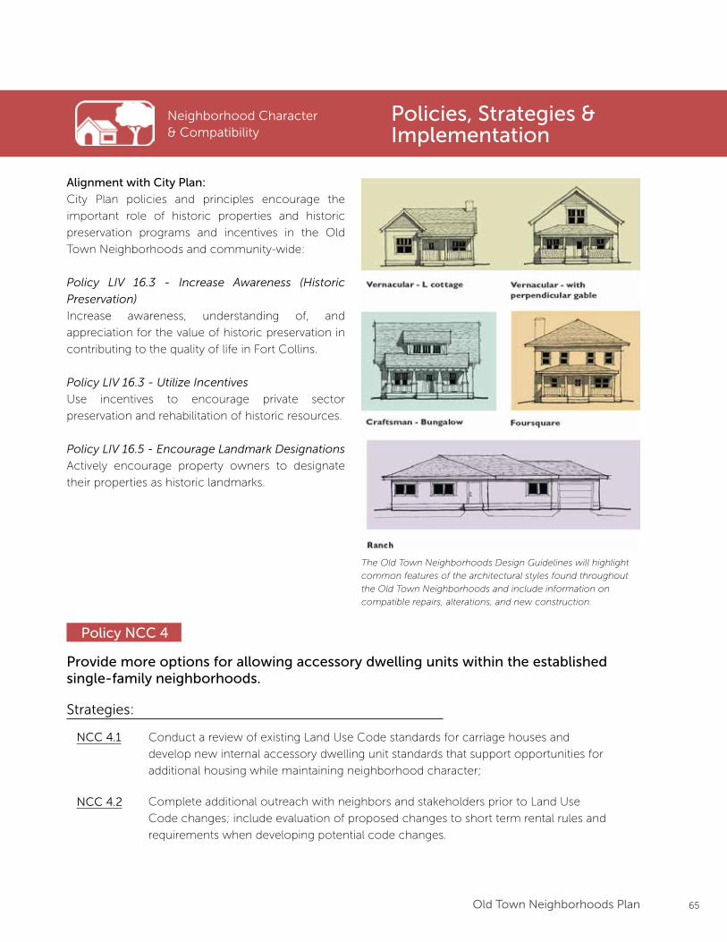
65Old Town Neighborhoods Plan
Policies, Strategies & Implementation
The Old Town Neighborhoods Design Guidelines will highlight
common features of the architectural styles found throughout
the Old Town Neighborhoods and include information on
compatible repairs, alterations, and new construction.
Provide more options for allowing accessory dwelling units within the established single-family neighborhoods.
Policy NCC 4
Strategies:
Conduct a review of existing Land Use Code standards for carriage houses and
develop new internal accessory dwelling unit standards that support opportunities for
additional housing while maintaining neighborhood character;
NCC 4.1
Complete additional outreach with neighbors and stakeholders prior to Land Use
Code changes; include evaluation of proposed changes to short term rental rules and
requirements when developing potential code changes.
NCC 4.2
Alignment with City Plan:
City Plan policies and principles encourage the
important role of historic properties and historic
preservation programs and incentives in the Old
Town Neighborhoods and community-wide:
Policy LIV 16.3 - Increase Awareness (Historic
Preservation)
Increase awareness, understanding of, and
appreciation for the value of historic preservation in
contributing to the quality of life in Fort Collins.
Policy LIV 16.3 - Utilize Incentives
Use incentives to encourage private sector
preservation and rehabilitation of historic resources.
Policy LIV 16.5 - Encourage Landmark Designations
Actively encourage property owners to designate
their properties as historic landmarks.
Neighborhood Character & Compatibility
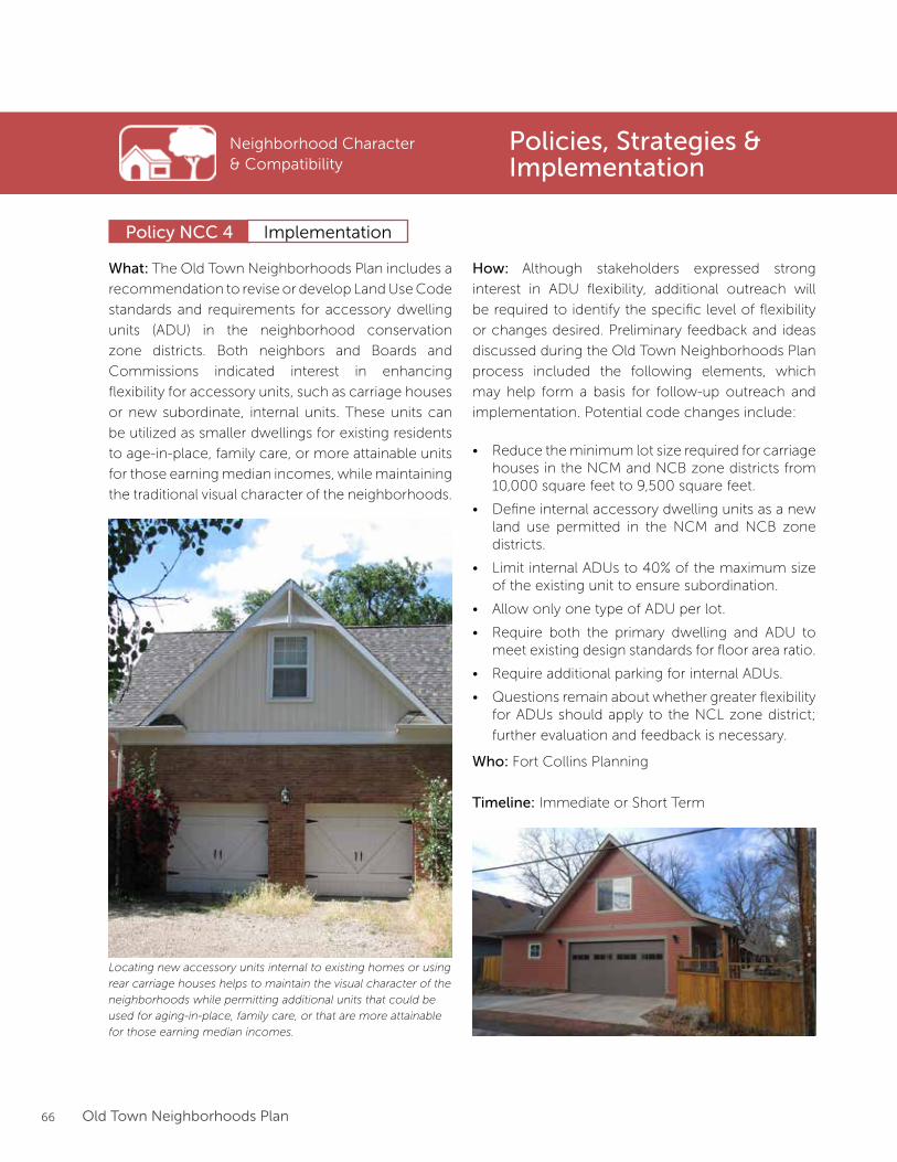
66 Old Town Neighborhoods Plan
What: The Old Town Neighborhoods Plan includes a
recommendation to revise or develop Land Use Code
standards and requirements for accessory dwelling
units (ADU) in the neighborhood conservation
zone districts. Both neighbors and Boards and
Commissions indicated interest in enhancing
flexibility for accessory units, such as carriage houses
or new subordinate, internal units. These units can
be utilized as smaller dwellings for existing residents
to age-in-place, family care, or more attainable units
for those earning median incomes, while maintaining
the traditional visual character of the neighborhoods.
Locating new accessory units internal to existing homes or using
rear carriage houses helps to maintain the visual character of the
neighborhoods while permitting additional units that could be
used for aging-in-place, family care, or that are more attainable
for those earning median incomes.
Policy NCC 4
Neighborhood Character & Compatibility
Policies, Strategies & Implementation
Implementation
How: Although stakeholders expressed strong
interest in ADU flexibility, additional outreach will
be required to identify the specific level of flexibility
or changes desired. Preliminary feedback and ideas
discussed during the Old Town Neighborhoods Plan
process included the following elements, which
may help form a basis for follow-up outreach and
implementation. Potential code changes include:
• Reduce the minimum lot size required for carriage houses in the NCM and NCB zone districts from 10,000 square feet to 9,500 square feet.
• Define internal accessory dwelling units as a new land use permitted in the NCM and NCB zone districts.
• Limit internal ADUs to 40% of the maximum size of the existing unit to ensure subordination.
• Allow only one type of ADU per lot.
• Require both the primary dwelling and ADU to meet existing design standards for floor area ratio.
• Require additional parking for internal ADUs.
• Questions remain about whether greater flexibility for ADUs should apply to the NCL zone district;
further evaluation and feedback is necessary.
Who: Fort Collins Planning
Timeline: Immediate or Short Term
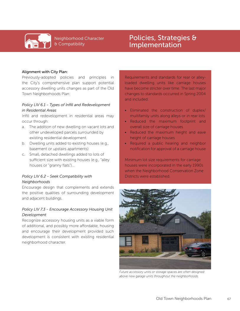
67Old Town Neighborhoods Plan
Alignment with City Plan:
Previously-adopted policies and principles in
the City’s comprehensive plan support potential
accessory dwelling units changes as part of the Old
Town Neighborhoods Plan:
Policy LIV 6.1 - Types of Infill and Redevelopment
in Residential Areas
Infill and redevelopment in residential areas may
occur through:
a. The addition of new dwelling on vacant lots and
other undeveloped parcels surrounded by
existing residential development.
b. Dwelling units added to existing houses (e.g.,
basement or upstairs apartments)
c. Small, detached dwellings added to lots of
sufficient size with existing houses (e.g., “alley
houses or “granny flats”)...
Policy LIV 6.2 - Seek Compatibility with
Neighborhoods
Encourage design that complements and extends
the positive qualities of surrounding development
and adjacent buildings.
Policy LIV 7.3 - Encourage Accessory Housing Unit
Development
Recognize accessory housing units as a viable form
of additional, and possibly more affordable, housing
and encourage their development provided such
development is consistent with existing residential
neighborhood character.
Neighborhood Character & Compatibility
Policies, Strategies & Implementation
Requirements and standards for rear or alley-
loaded dwelling units like carriage houses
have become stricter over time. The last major
changes to standards occurred in Spring 2004
and included:
• Eliminated the construction of duplex/
multifamily units along alleys or in rear lots
• Reduced the maximum footprint and
overall size of carriage houses
• Reduced the maximum height and eave
height of carriage houses
• Required a public hearing and neighbor
notification for approval of a carriage house
Minimum lot size requirements for carriage
houses were incorporated in the early 1990s
when the Neighborhood Conservation Zone
Districts were established.
Future accessory units or storage spaces are often designed
above new garage units throughout the neighborhoods.
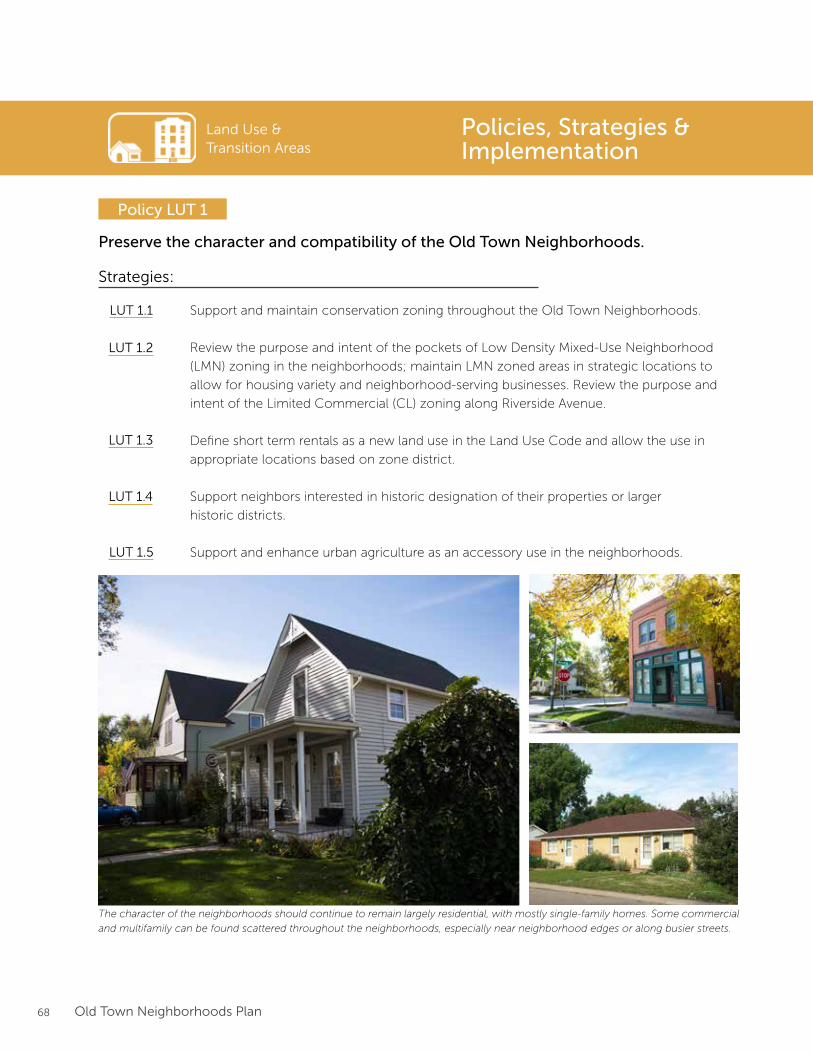
68 Old Town Neighborhoods Plan
Land Use & Transition Areas
Preserve the character and compatibility of the Old Town Neighborhoods.
Policy LUT 1
Strategies:
Support and maintain conservation zoning throughout the Old Town Neighborhoods.
Review the purpose and intent of the pockets of Low Density Mixed-Use Neighborhood
(LMN) zoning in the neighborhoods; maintain LMN zoned areas in strategic locations to
allow for housing variety and neighborhood-serving businesses. Review the purpose and
intent of the Limited Commercial (CL) zoning along Riverside Avenue.
Define short term rentals as a new land use in the Land Use Code and allow the use in
appropriate locations based on zone district.
Support neighbors interested in historic designation of their properties or larger
historic districts.
Support and enhance urban agriculture as an accessory use in the neighborhoods.
LUT 1.1
LUT 1.2
LUT 1.3
LUT 1.4
LUT 1.5
The character of the neighborhoods should continue to remain largely residential, with mostly single-family homes. Some commercial
and multifamily can be found scattered throughout the neighborhoods, especially near neighborhood edges or along busier streets.
Policies, Strategies & Implementation
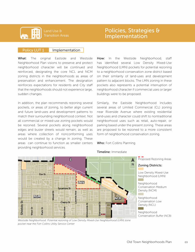
69Old Town Neighborhoods Plan
Land Use & Transition Areas
Policy LUT 1
Policies, Strategies & Implementation
Implementation
What: The original Eastside and Westside
Neighborhood Plan visions to preserve and protect
neighborhood character will be continued and
reinforced, designating the core NCL and NCM
zoning districts in the neighborhoods as areas of
preservation and enhancement. The designation
reinforces expectations for residents and City staff
that the neighborhoods should not experience large,
sudden changes.
In addition, the plan recommends rezoning several
pockets, or areas of zoning, to better align current
and future land-uses and development patterns to
match their surrounding neighborhood context. Not
all commercial or mixed-use zoning pockets would
be rezoned. Several pockets along neighborhood
edges and busier streets would remain, as well as
areas where collection of nonconforming uses
would be created by a change in zoning. These
areas can continue to function as smaller centers
providing neighborhood services.
How: In the Westside Neighborhood, staff
has identified several Low Density Mixed-Use
Neighborhood (LMN) pockets for potential rezoning
to a neighborhood conservation zone district based
on their similarity of land-uses and development
pattern to adjacent blocks. The LMN zoning in these
pockets also represents a potential interruption of
neighborhood character if commercial uses or larger
buildings were to be proposed.
Similarly, the Eastside Neighborhood includes
several areas of Limited Commercial (CL) zoning
near Riverside Avenue where existing residential
land-uses and character could shift to nontraditional
neighborhood uses such as retail, auto-repair, or
parking based under the present zoning. These areas
are proposed to be rezoned to a more consistent
form of neighborhood conservation zoning.
Who: Fort Collins Planning
Timeline: Immediate
E
NCM
LMN
NCB
Sh
ield
s S
t
We
st S
t
Pa
rk S
t
Wo
od
St
Gra
nt
Ave
Lo
om
is A
ve
Wh
itc
om
b S
t
Sh
erw
oo
d S
t
Elm St
Sycamore St
Cherry St
Westside Neighborhood: Potential rezoning of Low Density Mixed-Use Neighborhood (LMN) zone
pocket near the Fort Collins Utility Service Center
Proposed Rezoning Areas
Low Density Mixed-UseNeighborhood (LMN)
Zoning Districts:
Neighborhood Conservation Medium Density (NCM)
Neighborhood Conservation Low Density (NCL)
Neighborhood Conservation Buffer (NCB)
N
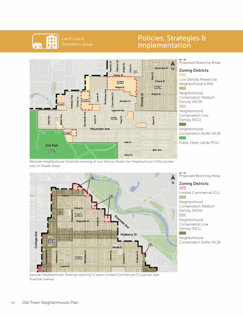
70 Old Town Neighborhoods Plan
Land Use & Transition Areas
Policies, Strategies & Implementation
NCM
NCM
NCB
CL
CL
CL
Riverside Ave
Mulberry St
Oak St
Olive St
Magnolia St
Myrtle St
Laurel St
Re
min
gto
n S
t
Mat
he
ws
St
Pe
ters
on
St
Wh
ed
be
e S
t
Smit
h S
t
Sto
ver
St
En
dic
ott
St
Co
wan
St
Co
lleg
e A
ve
NCM
NCL
RL
POL
LMN
LMN
LMNMountain Ave
City ParkOak St
Olive St
Akin Ave
Laporte Ave
Maple St
Maple St
Cherry St
Sycamore St
Fre
y A
ve
Bry
an A
ve
Fish
bac
k A
ve
Clo
ver
Ln
Ro
ose
velt
Ave
Lyo
ns
StLy
on
s St
McK
inkl
ey
Ave
Pe
arl S
t
Co
lum
bin
e C
t
Mac
k St
We
st S
tFran
klin
St
Ted
mo
n D
r
Rid
dle
Dr
Pe
arl S
t
Juniper Ct
Shie
lds
St
LMN
Cherry St
Westside Neighborhood: Potential rezoning of Low Density Mixed-Use Neighborhood (LMN) pockets
west of Shields Street
Eastside Neighborhood: Potential rezoning of select Limited Commercial (CL) parcels near
Riverside Avenue
Proposed Rezoning Areas
Low Density Mixed-UseNeighborhood (LMN)
Zoning Districts:
Neighborhood Conservation Medium Density (NCM)
Neighborhood Conservation Low Density (NCL)
Neighborhood Conservation Buffer (NCB)
Public Open Lands (POL)
Proposed Rezoning Areas
Limited Commercial (CL)
Zoning Districts:
Neighborhood Conservation Medium Density (NCM)
Neighborhood Conservation Low Density (NCL)
Neighborhood Conservation Buffer (NCB)
N
N
71Old Town Neighborhoods Plan
Land Use & Transition Areas
Improve transitions between the established single-family neighborhoods and Downtown/CSU.
Policy LUT 2
Strategies:
Explore options to create new or expanded Neighborhood Conservation Buffer (NCB)
zoning between Downtown and the neighborhoods.
Develop new design guidelines and standards for neighborhood transition areas and the
Neighborhood Conservation Buffer (NCB) zone district to improve compatibility between
residential blocks and more intense nearby development.
Limit new commercial development within the established residential areas consistent with
neighborhood conservation zoning. Encourage neighborhood-supportive services and
compatible commercial activity along neighborhood edges or within transition areas.
LUT 2.1
LUT 2.2
LUT 2.3
Policies, Strategies & Implementation
Policy LUT 2 Implementation
What: New transition-area design guidelines and
standards will be developed to ensure smoother
transitions between the edges of the neighborhoods
and Downtown/CSU. During outreach efforts, many
stakeholders felt the existing land-use mix in the
transition areas of low to medium density residential,
professional offices, medical clinics, and community
and civic institutions represented an appropriate mix.
Most concerns centered on building design, scale,
and materials, parking, and the relationship of rear
facades and alleys to single-family homes.
Given this set of issues, an important focus for the
new transition-area guidelines and standards should
center on site and building design. Opportunity exists
to explore new guidelines or standards relating to
building mass, bulk, and scale, roof form, building
materials, ground floor character, and more. The new
guidelines and standards could also be specifically
tailored to the individual context between the
neighborhoods and the new Downtown character
areas established as part of the Downtown Plan
update.
How: The new transition-area design guidelines
or standards will be developed as a follow-up
implementation action to both the Downtown and
Old Town Neighborhoods Plan, and feature additional
public outreach, and consultant participation and
expertise.
Responsibility: Fort Collins Planning
Timeline: Short or Medium Term.
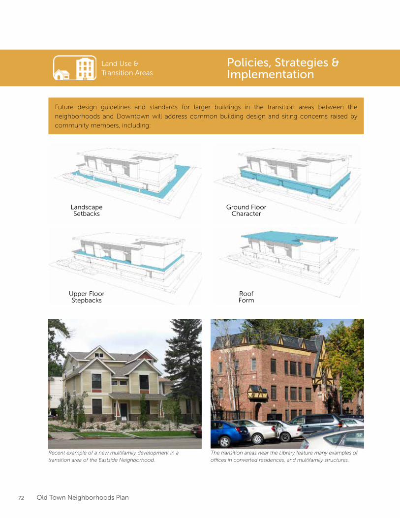
72 Old Town Neighborhoods Plan
Recent example of a new multifamily development in a
transition area of the Eastside Neighborhood.
The transition areas near the Library feature many examples of
offices in converted residences, and multifamily structures.
Land Use & Transition Areas
Policies, Strategies & Implementation
Future design guidelines and standards for larger buildings in the transition areas between the
neighborhoods and Downtown will address common building design and siting concerns raised by
community members, including:
Landscape Setbacks
Ground FloorCharacter
Roof Form
Upper FloorStepbacks
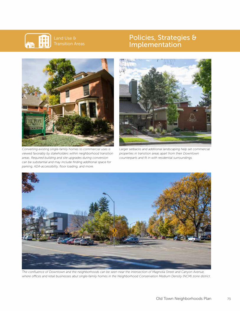
73Old Town Neighborhoods Plan
Converting existing single-family homes to commercial uses is
viewed favorably by stakeholders within neighborhood transition
areas. Required building and site upgrades during conversion
can be substantial and may include finding additional space for
parking, ADA-accessibility, floor loading, and more.
Land Use & Transition Areas
Policies, Strategies & Implementation
Larger setbacks and additional landscaping help set commercial
properties in transition areas apart from their Downtown
counterparts and fit in with residential surroundings.
The confluence of Downtown and the neighborhoods can be seen near the intersection of Magnolia Street and Canyon Avenue,
where offices and retail businesses abut single-family homes in the Neighborhood Conservation Medium Density (NCM) zone district.
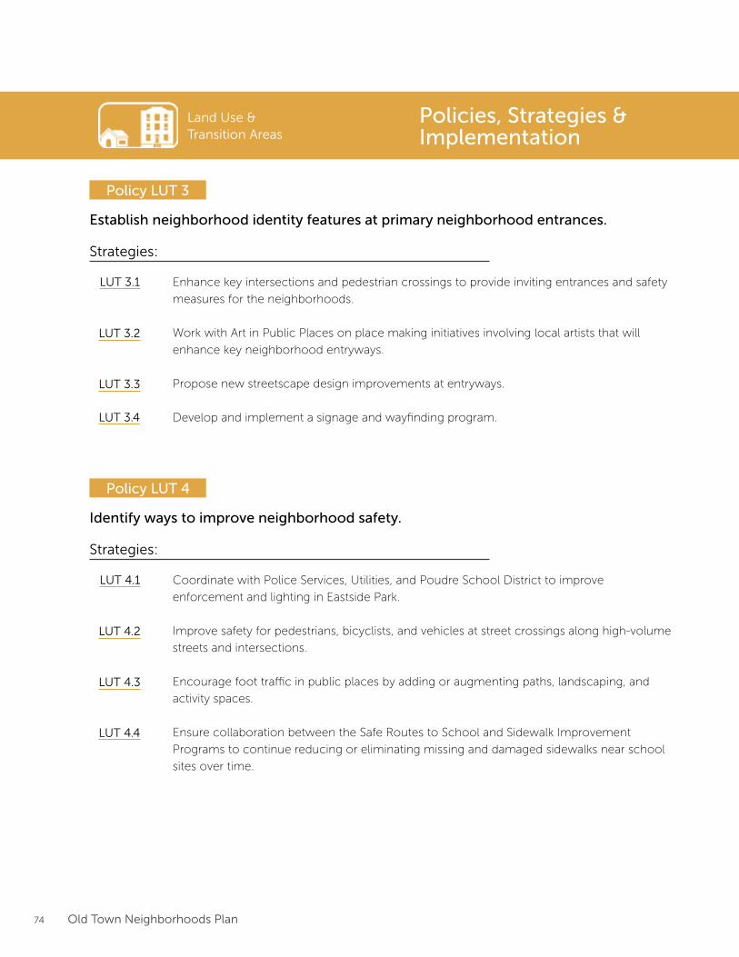
74 Old Town Neighborhoods Plan
Land Use & Transition Areas
Establish neighborhood identity features at primary neighborhood entrances.
Policy LUT 3
Strategies:
Enhance key intersections and pedestrian crossings to provide inviting entrances and safety
measures for the neighborhoods.
Work with Art in Public Places on place making initiatives involving local artists that will
enhance key neighborhood entryways.
Propose new streetscape design improvements at entryways.
Develop and implement a signage and wayfinding program.
LUT 3.1
LUT 3.2
LUT 3.3
LUT 3.4
Identify ways to improve neighborhood safety.
Policy LUT 4
Strategies:
Coordinate with Police Services, Utilities, and Poudre School District to improve
enforcement and lighting in Eastside Park.
Improve safety for pedestrians, bicyclists, and vehicles at street crossings along high-volume
streets and intersections.
Encourage foot traffic in public places by adding or augmenting paths, landscaping, and
activity spaces.
Ensure collaboration between the Safe Routes to School and Sidewalk Improvement
Programs to continue reducing or eliminating missing and damaged sidewalks near school
sites over time.
LUT 4.1
LUT 4.2
LUT 4.3
LUT 4.4
Policies, Strategies & Implementation
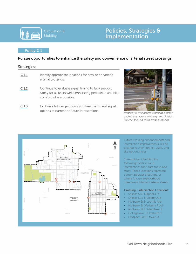
75Old Town Neighborhoods Plan
Circulation & Mobility
Pursue opportunities to enhance the safety and convenience of arterial street crossings.
Policy C 1
Strategies:
Identify appropriate locations for new or enhanced
arterial crossings.
Continue to evaluate signal timing to fully support
safety for all users while enhancing pedestrian and bike
comfort where possible.
Explore a full range of crossing treatments and signal
options at current or future intersections.
C 1.1
C 1.2
C 1.3
Relatively few signalized crossings exist for
pedestrians across Mulberry and Shields
Street in the Old Town Neighborhoods.
Policies, Strategies & Implementation
Future crossing enhancements and intersection improvements will be tailored to their context, users, and site opportunities.
Stakeholders identified the following locations and intersections for future focus and study. These locations represent current popular crossings, or where future neighborhood greenways intersect arterial streets.
Crossing / Intersection Locations:• Shields St & Magnolia St• Shields St & Mulberry Ave• Mulberry St & Loomis Ave• Mulberry St (Mulberry Pool)• Mulberry St & Whedbee St• College Ave & Elizabeth St• Prospect Rd & Stover St
Prioritized Bike Routes1
Interim Alternative Bike RoutesNeighborhood Greenway ImprovementsEnhanced Crossing
Max Transit Line
0 0.5 MILES 0.25 0.125
N
1. Routes taken from the Fort CollinsBicycle System Wayfinding Plan2. Locations taken from Colorado Tree Coalition’s Notable Tree Tour in Fort Collins
Plan Framework
Areas of Preservationand Enhancement
Arterial Street Improvements
Parks & Open Space
Bu�er Transition
Downtown Plan Boundary CSU Main Campus Boundary
LegendEXISTING ELEMENTS
FUTURE ELEMENTS
Neighborhood Boundary
City Boundary
Trails
RoadwayBuilding
Steams, Rivers, Lakes
Potential Land Use Changes
Historic Districts
Employment Zone
Notable Trees2Notable Trees2
Greenway Designations
Key Projects
Shields Corridor Improvements
Mulberry Corridor Improvements
Bu�er Transition Area
Future Land Use Changes
12345
S LO
OM
IS A
VE
N R
OO
SEV
ELT
AV
E
RE
MIN
GT
ON
ST
E LAUREL ST
E PITKIN ST
W MOUNTAIN AVE
W MAGNOLIA ST
WH
ED
BE
E S
T
N S
HIE
LDS
ST
W MULBERRY ST E MULBERRY ST
W ELIZABETH ST
CIT
Y P
AR
K A
VE
W LAKE ST
CO
NST
ITU
TIO
N A
VE
W PLUM ST
S T
AFT
HIL
L R
DN
TA
FT H
ILL
RD
LAPORTE AVE
W VINE DR
E MOUNTAIN AVE
RIVERSIDE AVE
VINE DR
BUCKINGHAM ST
E LINCOLN AVE
LIN
DEN
ST
N H
OW
ES
STS
HO
WE
S ST
S C
OLL
EG
E A
VE
N C
OLL
EG
E A
VE
N L
EM
AY
AV
ES
LEM
AY
AV
E
S M
ASO
N S
TN
MA
SON
ST
STO
VE
R S
T
W LAKE ST
E ELIZABETH ST
E PROSPECT RDW PROSPECT RD
CHERRY ST
DOWNTOWN
COLORADOSTATE
UNIVERSITY
EASTSIDENEIGHBORHOOD
WESTSIDENEIGHBORHOOD
N
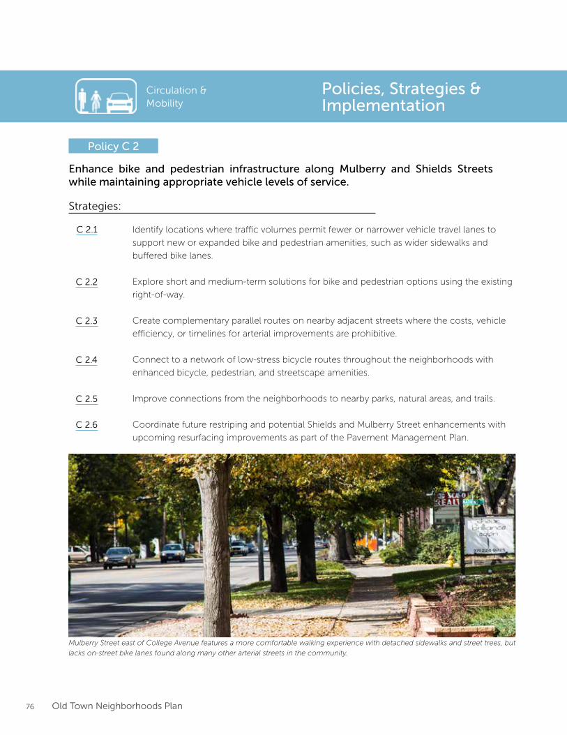
76 Old Town Neighborhoods Plan
Enhance bike and pedestrian infrastructure along Mulberry and Shields Streets while maintaining appropriate vehicle levels of service.
Policy C 2
Strategies:
Identify locations where traffic volumes permit fewer or narrower vehicle travel lanes to
support new or expanded bike and pedestrian amenities, such as wider sidewalks and
buffered bike lanes.
Explore short and medium-term solutions for bike and pedestrian options using the existing
right-of-way.
Create complementary parallel routes on nearby adjacent streets where the costs, vehicle
efficiency, or timelines for arterial improvements are prohibitive.
Connect to a network of low-stress bicycle routes throughout the neighborhoods with
enhanced bicycle, pedestrian, and streetscape amenities.
Improve connections from the neighborhoods to nearby parks, natural areas, and trails.
Coordinate future restriping and potential Shields and Mulberry Street enhancements with
upcoming resurfacing improvements as part of the Pavement Management Plan.
C 2.1
C 2.2
C 2.3
C 2.4
C 2.5
C 2.6
Policies, Strategies & Implementation
Circulation & Mobility
Mulberry Street east of College Avenue features a more comfortable walking experience with detached sidewalks and street trees, but
lacks on-street bike lanes found along many other arterial streets in the community.
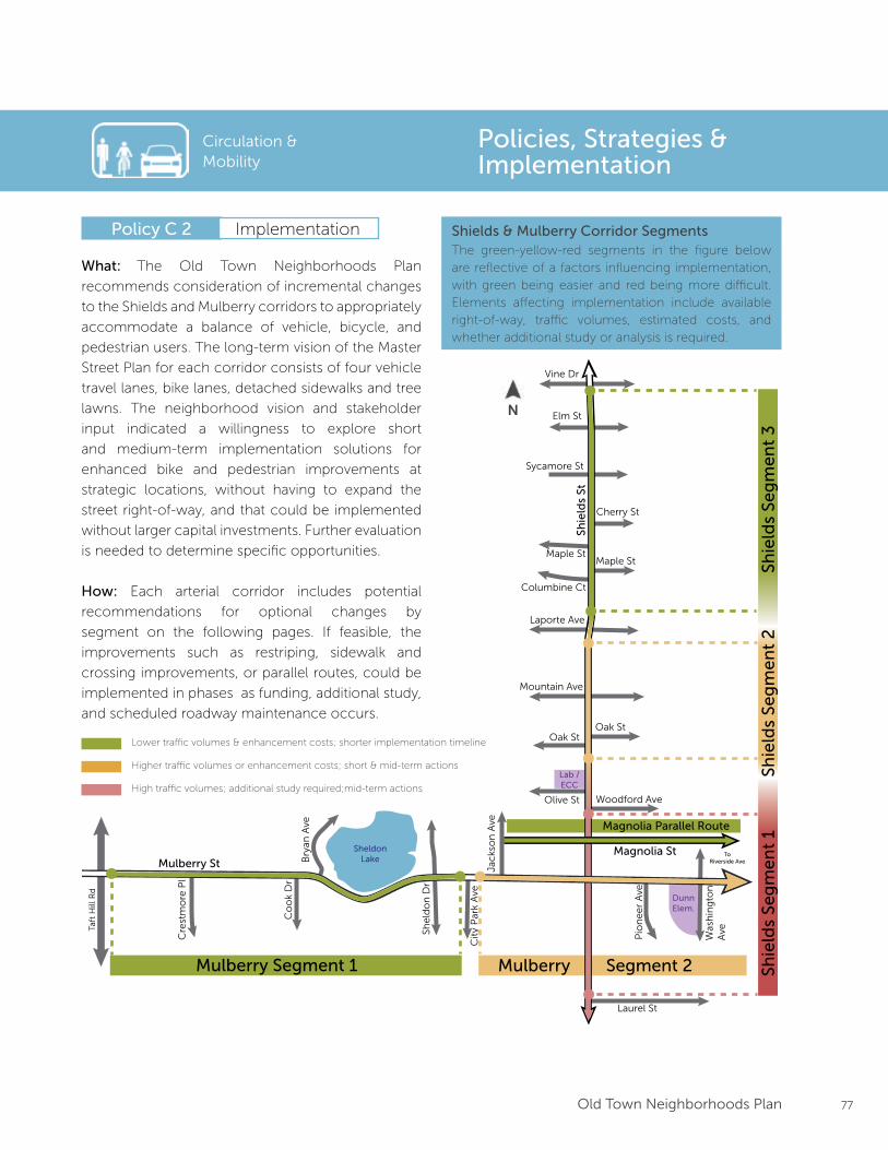
77Old Town Neighborhoods Plan
Mulberry Segment 1 Mulberry Segment 2
Mulberry StMagnolia St
Shie
lds
St
Taft
Hill
Rd
Was
hin
gto
n
AvePio
ne
er
Ave
Jac
kso
n A
ve
She
ldo
n D
r
Bry
an A
ve
Co
ok
Dr
Cre
stm
ore
Pl
Laurel St
Woodford AveOlive St
Oak StOak St
Mountain Ave
Laporte Ave
Columbine Ct
Maple StMaple St
Cherry St
Sycamore St
Elm St
Vine Dr
Magnolia Parallel Route
Shie
lds
Seg
me
nt
1Sh
ield
s Se
gm
en
t 2
Shie
lds
Seg
me
nt
3
Cit
y P
ark
Ave
SheldonLake
To Riverside Ave
DunnElem.
Lab / ECC
Policy C 2
Policies, Strategies & Implementation
Implementation
Circulation & Mobility
What: The Old Town Neighborhoods Plan
recommends consideration of incremental changes
to the Shields and Mulberry corridors to appropriately
accommodate a balance of vehicle, bicycle, and
pedestrian users. The long-term vision of the Master
Street Plan for each corridor consists of four vehicle
travel lanes, bike lanes, detached sidewalks and tree
lawns. The neighborhood vision and stakeholder
input indicated a willingness to explore short
and medium-term implementation solutions for
enhanced bike and pedestrian improvements at
strategic locations, without having to expand the
street right-of-way, and that could be implemented
without larger capital investments. Further evaluation
is needed to determine specific opportunities.
How: Each arterial corridor includes potential
recommendations for optional changes by
segment on the following pages. If feasible, the
improvements such as restriping, sidewalk and
crossing improvements, or parallel routes, could be
implemented in phases as funding, additional study,
and scheduled roadway maintenance occurs.
The green-yellow-red segments in the figure below are reflective of a factors influencing implementation, with green being easier and red being more difficult. Elements affecting implementation include available right-of-way, traffic volumes, estimated costs, and whether additional study or analysis is required.
Shields & Mulberry Corridor Segments
Lower traffic volumes & enhancement costs; shorter implementation timeline
High traffic volumes; additional study required;mid-term actions
Higher traffic volumes or enhancement costs; short & mid-term actions
N
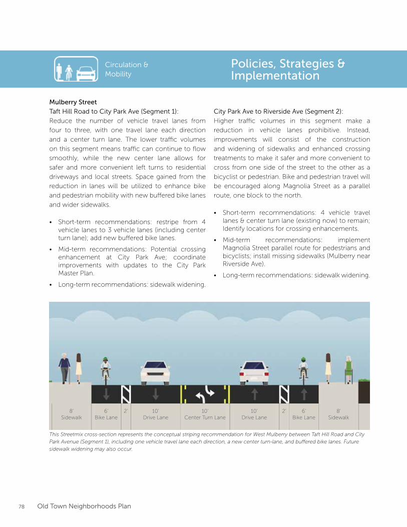
78 Old Town Neighborhoods Plan
Mulberry Street
Taft Hill Road to City Park Ave (Segment 1):
Reduce the number of vehicle travel lanes from
four to three, with one travel lane each direction
and a center turn lane. The lower traffic volumes
on this segment means traffic can continue to flow
smoothly, while the new center lane allows for
safer and more convenient left turns to residential
driveways and local streets. Space gained from the
reduction in lanes will be utilized to enhance bike
and pedestrian mobility with new buffered bike lanes
and wider sidewalks.
• Short-term recommendations: restripe from 4 vehicle lanes to 3 vehicle lanes (including center turn lane); add new buffered bike lanes.
• Mid-term recommendations: Potential crossing enhancement at City Park Ave; coordinate improvements with updates to the City Park Master Plan.
• Long-term recommendations: sidewalk widening.
City Park Ave to Riverside Ave (Segment 2):
Higher traffic volumes in this segment make a
reduction in vehicle lanes prohibitive. Instead,
improvements will consist of the construction
and widening of sidewalks and enhanced crossing
treatments to make it safer and more convenient to
cross from one side of the street to the other as a
bicyclist or pedestrian. Bike and pedestrian travel will
be encouraged along Magnolia Street as a parallel
route, one block to the north.
• Short-term recommendations: 4 vehicle travel lanes & center turn lane (existing now) to remain; Identify locations for crossing enhancements.
• Mid-term recommendations: implement Magnolia Street parallel route for pedestrians and bicyclists; install missing sidewalks (Mulberry near Riverside Ave).
• Long-term recommendations: sidewalk widening.
Policies, Strategies & Implementation
Circulation & Mobility
This Streetmix cross-section represents the conceptual striping recommendation for West Mulberry between Taft Hill Road and City
Park Avenue (Segment 1), including one vehicle travel lane each direction, a new center turn-lane, and buffered bike lanes. Future
sidewalk widening may also occur.
6’Bike Lane
2’8’Sidewalk
10’Drive Lane
10’Center Turn Lane
10’Drive Lane
2’ 6’Bike Lane
8’Sidewalk
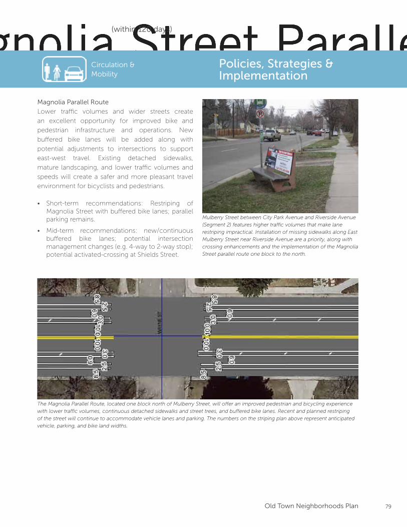
79Old Town Neighborhoods Plan
Magnolia Parallel Route
Lower traffic volumes and wider streets create
an excellent opportunity for improved bike and
pedestrian infrastructure and operations. New
buffered bike lanes will be added along with
potential adjustments to intersections to support
east-west travel. Existing detached sidewalks,
mature landscaping, and lower traffic volumes and
speeds will create a safer and more pleasant travel
environment for bicyclists and pedestrians.
• Short-term recommendations: Restriping of Magnolia Street with buffered bike lanes; parallel parking remains.
• Mid-term recommendations: new/continuous buffered bike lanes; potential intersection management changes (e.g. 4-way to 2-way stop); potential activated-crossing at Shields Street.
Shields St to Washington Ave
Washington Ave to East of Loomis Ave
East of Loomis Ave to Sherwood St
Magnolia Street Parallel Route: Conceptual Striping
The Magnolia Parallel Route, located one block north of Mulberry Street, will offer an improved pedestrian and bicycling experience
with lower traffic volumes, continuous detached sidewalks and street trees, and buffered bike lanes. Recent and planned restriping
of the street will continue to accommodate vehicle lanes and parking. The numbers on the striping plan above represent anticipated
vehicle, parking, and bike land widths.
Mulberry Street between City Park Avenue and Riverside Avenue
(Segment 2) features higher traffic volumes that make lane
restriping impractical. Installation of missing sidewalks along East
Mulberry Street near Riverside Avenue are a priority, along with
crossing enhancements and the implementation of the Magnolia
Street parallel route one block to the north.
Circulation & Mobility
Policies, Strategies & Implementation
(within 120 days)
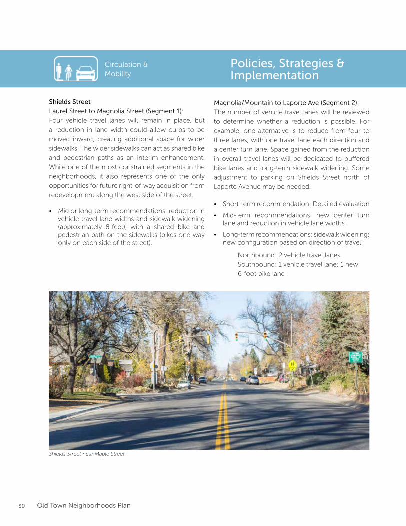
80 Old Town Neighborhoods Plan
Policies, Strategies & Implementation
Circulation & Mobility
Shields Street
Laurel Street to Magnolia Street (Segment 1):
Four vehicle travel lanes will remain in place, but
a reduction in lane width could allow curbs to be
moved inward, creating additional space for wider
sidewalks. The wider sidewalks can act as shared bike
and pedestrian paths as an interim enhancement.
While one of the most constrained segments in the
neighborhoods, it also represents one of the only
opportunities for future right-of-way acquisition from
redevelopment along the west side of the street.
• Mid or long-term recommendations: reduction in vehicle travel lane widths and sidewalk widening (approximately 8-feet), with a shared bike and pedestrian path on the sidewalks (bikes one-way only on each side of the street).
Magnolia/Mountain to Laporte Ave (Segment 2):
The number of vehicle travel lanes will be reviewed
to determine whether a reduction is possible. For
example, one alternative is to reduce from four to
three lanes, with one travel lane each direction and
a center turn lane. Space gained from the reduction
in overall travel lanes will be dedicated to buffered
bike lanes and long-term sidewalk widening. Some
adjustment to parking on Shields Street north of
Laporte Avenue may be needed.
• Short-term recommendation: Detailed evaluation
• Mid-term recommendations: new center turn lane and reduction in vehicle lane widths
• Long-term recommendations: sidewalk widening; new configuration based on direction of travel:
Northbound: 2 vehicle travel lanes
Southbound: 1 vehicle travel lane; 1 new
6-foot bike lane
Shields Street near Maple Street
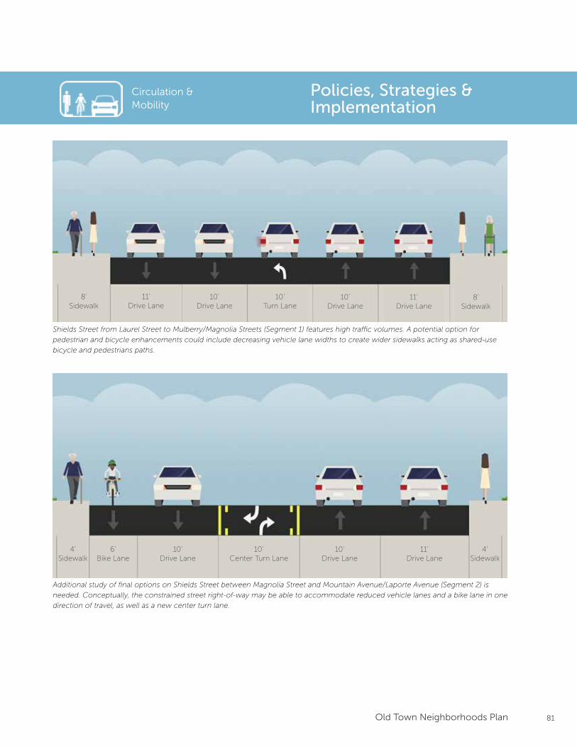
81Old Town Neighborhoods Plan
Circulation & Mobility
Policies, Strategies & Implementation
Shields Street from Laurel Street to Mulberry/Magnolia Streets (Segment 1) features high traffic volumes. A potential option for
pedestrian and bicycle enhancements could include decreasing vehicle lane widths to create wider sidewalks acting as shared-use
bicycle and pedestrians paths.
Additional study of final options on Shields Street between Magnolia Street and Mountain Avenue/Laporte Avenue (Segment 2) is
needed. Conceptually, the constrained street right-of-way may be able to accommodate reduced vehicle lanes and a bike lane in one
direction of travel, as well as a new center turn lane.
11’Drive Lane
10’Drive Lane
10’Turn Lane
10’Drive Lane
11’Drive Lane
8’Sidewalk
8’Sidewalk
4’Sidewalk
6’Bike Lane
10’Drive Lane
10’Center Turn Lane
10’Drive Lane
11’Drive Lane
4’Sidewalk
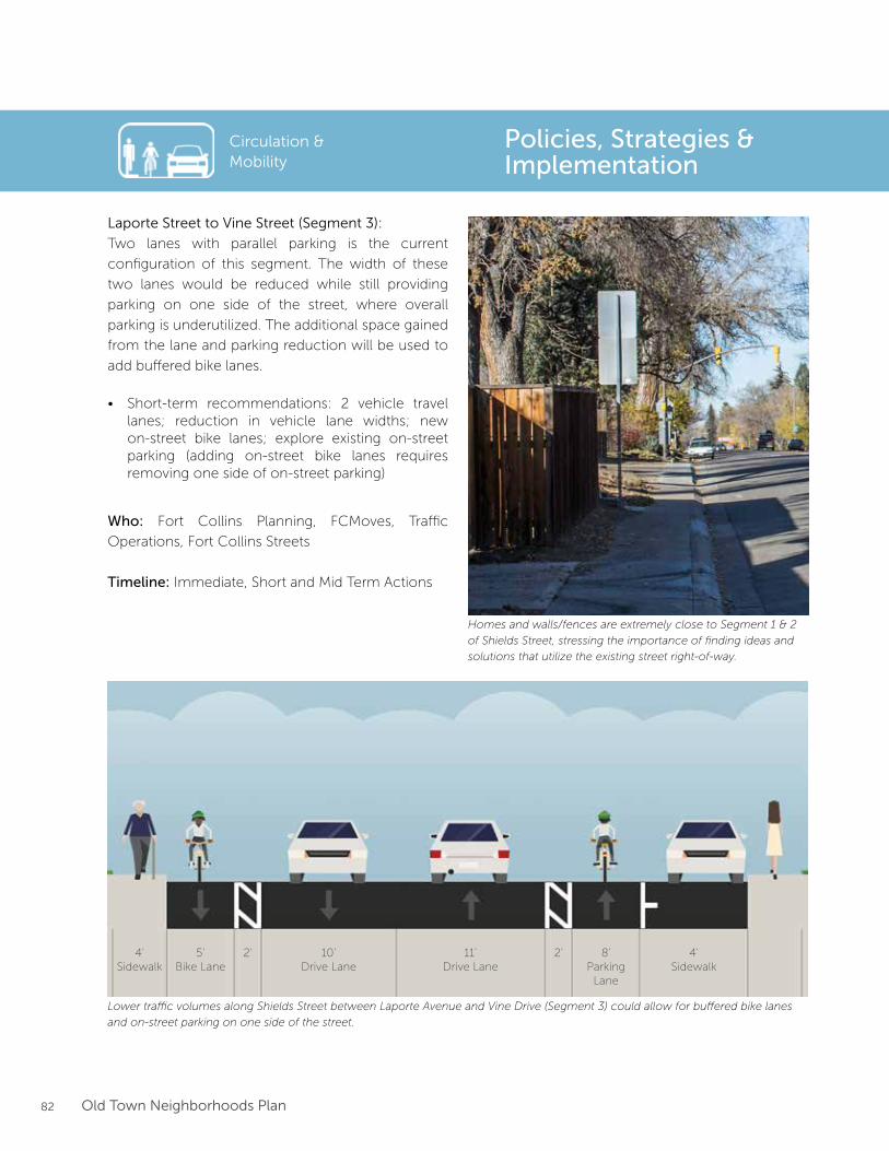
82 Old Town Neighborhoods Plan
Laporte Street to Vine Street (Segment 3):
Two lanes with parallel parking is the current
configuration of this segment. The width of these
two lanes would be reduced while still providing
parking on one side of the street, where overall
parking is underutilized. The additional space gained
from the lane and parking reduction will be used to
add buffered bike lanes.
• Short-term recommendations: 2 vehicle travel lanes; reduction in vehicle lane widths; new on-street bike lanes; explore existing on-street parking (adding on-street bike lanes requires removing one side of on-street parking)
Who: Fort Collins Planning, FCMoves, Traffic
Operations, Fort Collins Streets
Timeline: Immediate, Short and Mid Term Actions
Circulation & Mobility
Policies, Strategies & Implementation
Lower traffic volumes along Shields Street between Laporte Avenue and Vine Drive (Segment 3) could allow for buffered bike lanes
and on-street parking on one side of the street.
Homes and walls/fences are extremely close to Segment 1 & 2
of Shields Street, stressing the importance of finding ideas and
solutions that utilize the existing street right-of-way.
4’Sidewalk
5’Bike Lane
2’ 10’Drive Lane
11’Drive Lane
2’ 8’Parking
Lane
4’Sidewalk
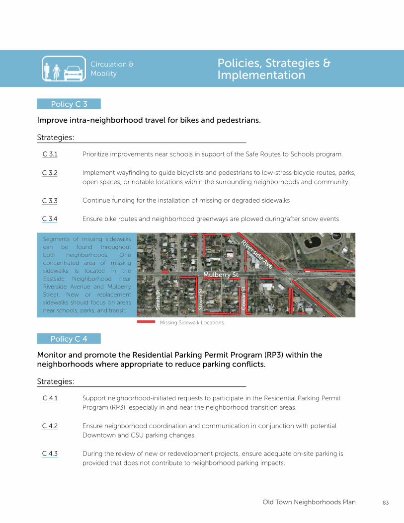
83Old Town Neighborhoods Plan
Circulation & Mobility
Improve intra-neighborhood travel for bikes and pedestrians.
Policy C 3
Strategies:
Prioritize improvements near schools in support of the Safe Routes to Schools program.
Implement wayfinding to guide bicyclists and pedestrians to low-stress bicycle routes, parks,
open spaces, or notable locations within the surrounding neighborhoods and community.
Continue funding for the installation of missing or degraded sidewalks
Ensure bike routes and neighborhood greenways are plowed during/after snow events
C 3.1
C 3.2
C 3.3
Monitor and promote the Residential Parking Permit Program (RP3) within the neighborhoods where appropriate to reduce parking conflicts.
Policy C 4
Strategies:
Support neighborhood-initiated requests to participate in the Residential Parking Permit
Program (RP3), especially in and near the neighborhood transition areas.
Ensure neighborhood coordination and communication in conjunction with potential
Downtown and CSU parking changes.
During the review of new or redevelopment projects, ensure adequate on-site parking is
provided that does not contribute to neighborhood parking impacts.
C 4.1
C 4.2
C 4.3
Policies, Strategies & Implementation
Segments of missing sidewalks can be found throughout both neighborhoods. One concentrated area of missing sidewalks is located in the Eastside Neighborhood near Riverside Avenue and Mulberry Street. New or replacement sidewalks should focus on areas near schools, parks, and transit.
Missing Sidewalk Locations
Mulberry St
Riverside Ave
Co
wan
St
Sto
ver
St
Smit
h S
t
C 3.4
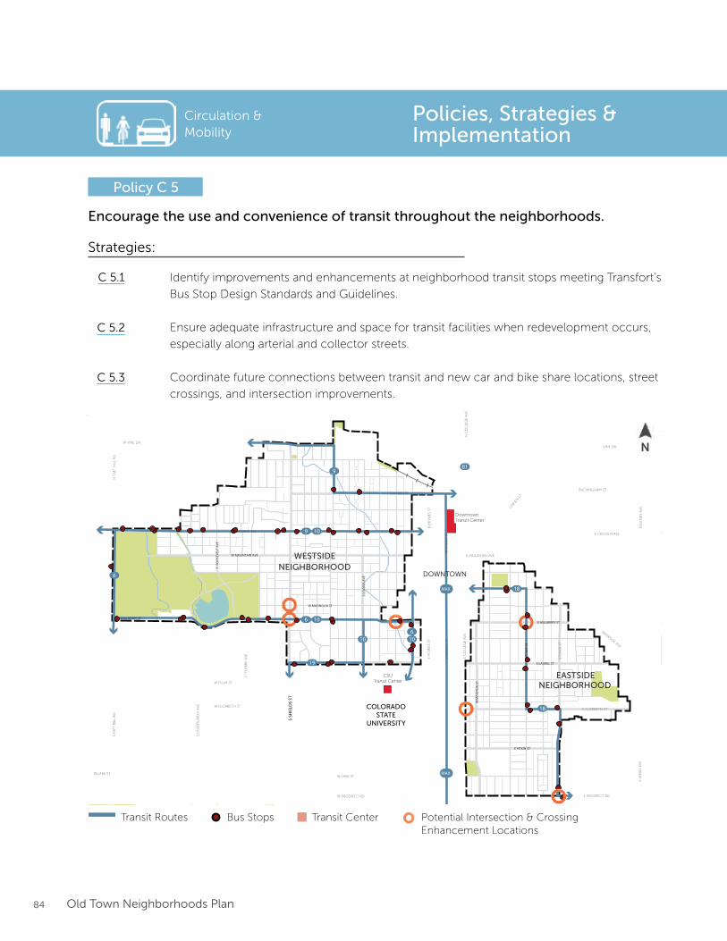
84 Old Town Neighborhoods Plan
Circulation & Mobility
Encourage the use and convenience of transit throughout the neighborhoods.
Policy C 5
Strategies:
Identify improvements and enhancements at neighborhood transit stops meeting Transfort’s
Bus Stop Design Standards and Guidelines.
Ensure adequate infrastructure and space for transit facilities when redevelopment occurs,
especially along arterial and collector streets.
Coordinate future connections between transit and new car and bike share locations, street
crossings, and intersection improvements.
C 5.1
C 5.2
C 5.3
Policies, Strategies & Implementation
19
18
18
18
10
10 10
10
9
9
81
6
6
6
14
MAX
MAX
Street Crossing Improvements
Transit Line
0 0.5 MILES 0.25 0.125
N
Transportation and Mobility Framework
Parks & Open Space
LegendEXISTING ELEMENTS
Neighborhood Boundary
City Boundary
Trails
RoadwayBuilding
Steams, Rivers, Lakes
5
Downtown Plan Boundary CSU Main Campus Boundary
Bus Stops
S LO
OM
IS A
VE
N R
OO
SEVE
LT A
VE
REM
ING
TON
ST
E LAUREL ST
E PITKIN ST
W MOUNTAIN AVE
W MAGNOLIA ST
WH
EDBE
E ST
N S
HIE
LDS
STS
SHIE
LDS
ST
W MULBERRY STE MULBERRY ST
DowntownTransit Center
CSUTransit Center
W ELIZABETH ST
CIT
Y P
AR
K A
VE
W LAKE ST
CO
NST
ITU
TIO
N A
VE
W PLUM ST
S T
AFT
HIL
L R
DN
TA
FT H
ILL
RD
LAPORTE AVE
W VINE DR
E MOUNTAIN AVE
RIVERSIDE AVE
VINE DR
BUCKINGHAM ST
E LINCOLN AVE
LIN
DEN
ST
N H
OW
ES
STS
HO
WE
S ST
S C
OLL
EG
E A
VE
N C
OLL
EG
E A
VE
N L
EM
AY
AV
ES
LEM
AY
AV
E
S M
ASO
N S
TN
MA
SON
ST
STO
VE
R S
T
W LAKE ST
E ELIZABETH ST
E PROSPECT RDW PROSPECT RD
CHERRY ST
DOWNTOWN
COLORADOSTATE
UNIVERSITY
EASTSIDENEIGHBORHOOD
WESTSIDENEIGHBORHOOD
Transit Routes Bus Stops Transit Center Potential Intersection & Crossing Enhancement Locations
N
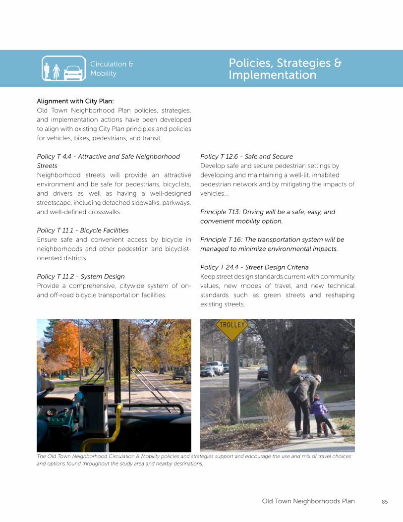
85Old Town Neighborhoods Plan
Circulation & Mobility
Policies, Strategies & Implementation
Alignment with City Plan:
Old Town Neighborhood Plan policies, strategies,
and implementation actions have been developed
to align with existing City Plan principles and policies
for vehicles, bikes, pedestrians, and transit:
Policy T 4.4 - Attractive and Safe Neighborhood
Streets
Neighborhood streets will provide an attractive
environment and be safe for pedestrians, bicyclists,
and drivers as well as having a well-designed
streetscape, including detached sidewalks, parkways,
and well-defined crosswalks.
Policy T 11.1 - Bicycle Facilities
Ensure safe and convenient access by bicycle in
neighborhoods and other pedestrian and bicyclist-
oriented districts
Policy T 11.2 - System Design
Provide a comprehensive, citywide system of on-
and off-road bicycle transportation facilities.
Policy T 12.6 - Safe and Secure
Develop safe and secure pedestrian settings by
developing and maintaining a well-lit, inhabited
pedestrian network and by mitigating the impacts of
vehicles...
Principle T13: Driving will be a safe, easy, and
convenient mobility option.
Principle T 16: The transportation system will be
managed to minimize environmental impacts.
Policy T 24.4 - Street Design Criteria
Keep street design standards current with community
values, new modes of travel, and new technical
standards such as green streets and reshaping
existing streets.
The Old Town Neighborhood Circulation & Mobility policies and strategies support and encourage the use and mix of travel choices
and options found throughout the study area and nearby destinations.
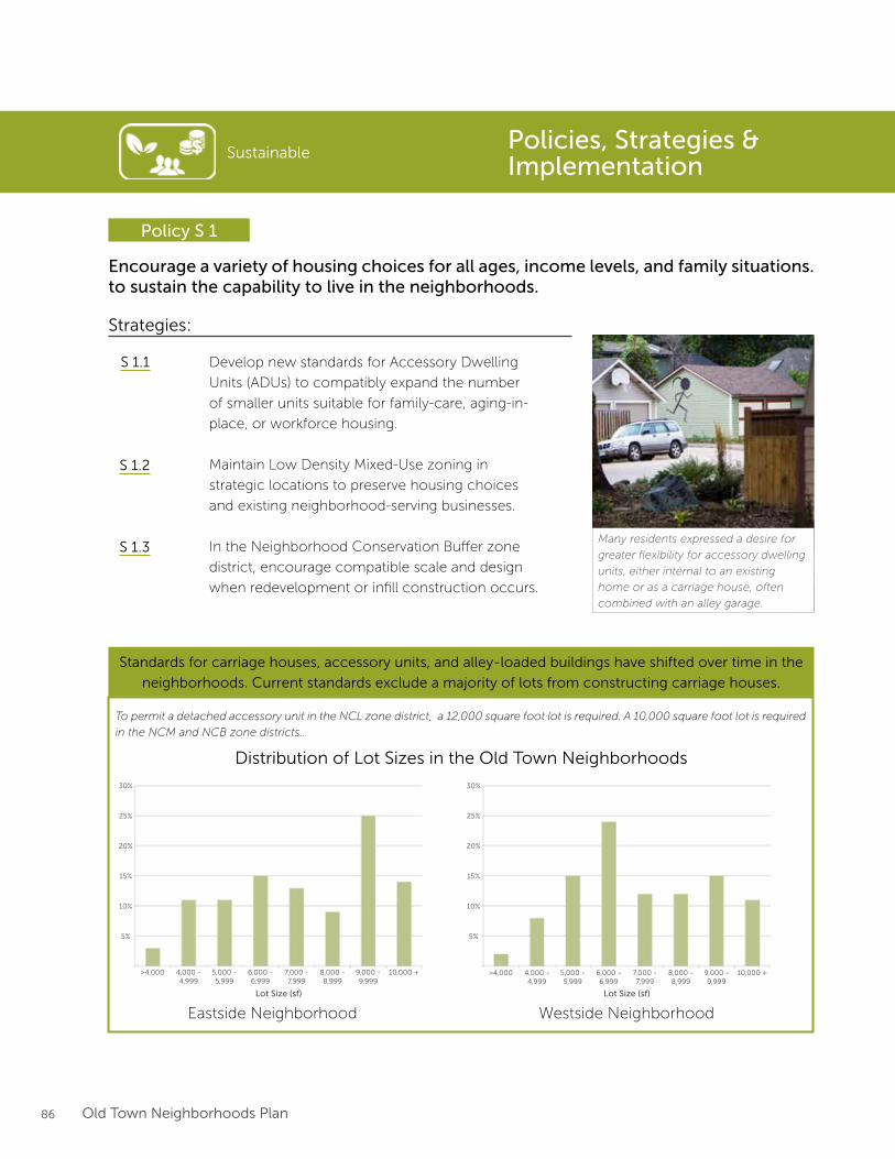
86 Old Town Neighborhoods Plan
Sustainable
Encourage a variety of housing choices for all ages, income levels, and family situations. to sustain the capability to live in the neighborhoods.
Policy S 1
Strategies:
Develop new standards for Accessory Dwelling
Units (ADUs) to compatibly expand the number
of smaller units suitable for family-care, aging-in-
place, or workforce housing.
Maintain Low Density Mixed-Use zoning in
strategic locations to preserve housing choices
and existing neighborhood-serving businesses.
In the Neighborhood Conservation Buffer zone
district, encourage compatible scale and design
when redevelopment or infill construction occurs.
S 1.1
S 1.2
S 1.3Many residents expressed a desire for
greater flexibility for accessory dwelling
units, either internal to an existing
home or as a carriage house, often
combined with an alley garage.
Standards for carriage houses, accessory units, and alley-loaded buildings have shifted over time in the
neighborhoods. Current standards exclude a majority of lots from constructing carriage houses.
>4,000 4,000 -4,999
5,000 -5,999
6,000 -6,999
7,000 -7,999
8,000 -8,999
9,000 -9,999
10,000 +
5%
10%
15%
20%
25%
30%
>4,000 4,000 -4,999
5,000 -5,999
6,000 -6,999
7,000 -7,999
8,000 -8,999
9,000 -9,999
10,000 +
5%
10%
15%
20%
25%
30%
Distribution of Lot Sizes in the Old Town Neighborhoods
Eastside Neighborhood Westside Neighborhood
To permit a detached accessory unit in the NCL zone district, a 12,000 square foot lot is required. A 10,000 square foot lot is required
in the NCM and NCB zone districts..
Policies, Strategies & Implementation
Lot Size (sf) Lot Size (sf)
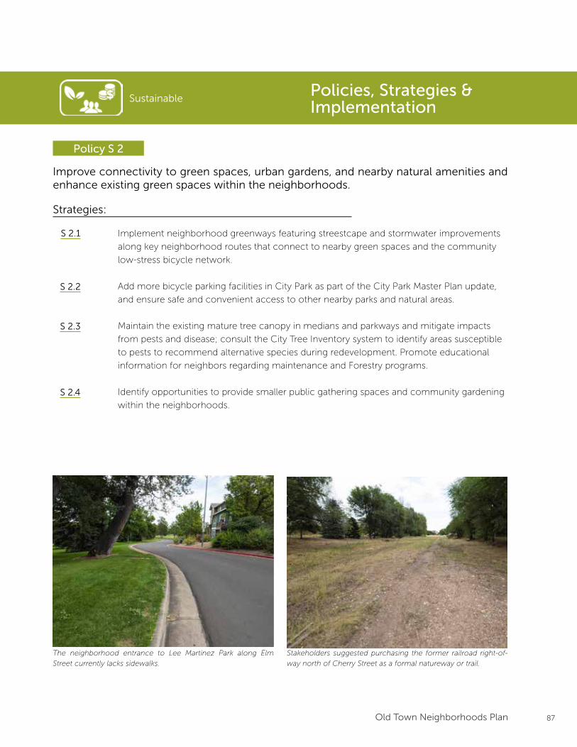
87Old Town Neighborhoods Plan
Sustainable
Improve connectivity to green spaces, urban gardens, and nearby natural amenities and enhance existing green spaces within the neighborhoods.
Policy S 2
Strategies:
Implement neighborhood greenways featuring streestcape and stormwater improvements
along key neighborhood routes that connect to nearby green spaces and the community
low-stress bicycle network.
Add more bicycle parking facilities in City Park as part of the City Park Master Plan update,
and ensure safe and convenient access to other nearby parks and natural areas.
Maintain the existing mature tree canopy in medians and parkways and mitigate impacts
from pests and disease; consult the City Tree Inventory system to identify areas susceptible
to pests to recommend alternative species during redevelopment. Promote educational
information for neighbors regarding maintenance and Forestry programs.
Identify opportunities to provide smaller public gathering spaces and community gardening
within the neighborhoods.
S 2.1
S 2.2
S 2.3
S 2.4
The neighborhood entrance to Lee Martinez Park along Elm
Street currently lacks sidewalks.
Stakeholders suggested purchasing the former railroad right-of-
way north of Cherry Street as a formal natureway or trail.
Policies, Strategies & Implementation
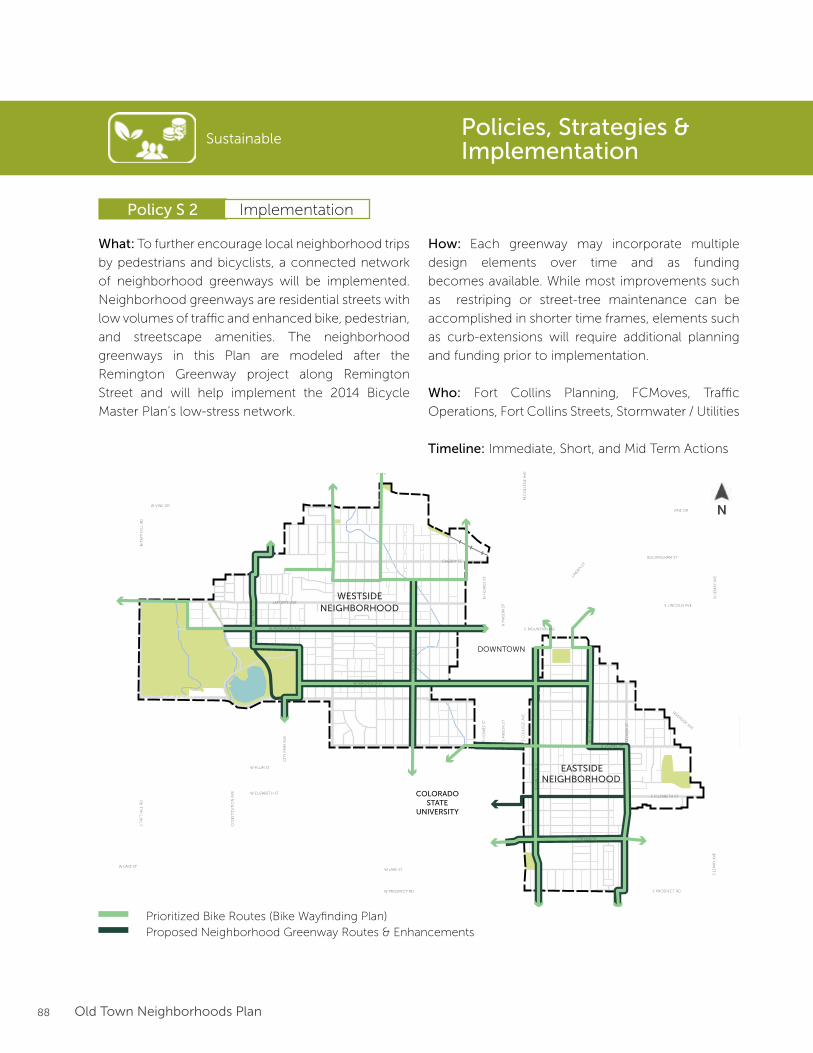
88 Old Town Neighborhoods Plan
What: To further encourage local neighborhood trips
by pedestrians and bicyclists, a connected network
of neighborhood greenways will be implemented.
Neighborhood greenways are residential streets with
low volumes of traffic and enhanced bike, pedestrian,
and streetscape amenities. The neighborhood
greenways in this Plan are modeled after the
Remington Greenway project along Remington
Street and will help implement the 2014 Bicycle
Master Plan’s low-stress network.
Prioritized Bike Routes1
Interim Alternative Bike RoutesNeighborhood Greenway ImprovementsEnhanced Crossing
Max Transit Line
0 0.5 MILES 0.25 0.125
N
1. Routes taken from the Fort CollinsBicycle System Wayfinding Plan2. Locations taken from Colorado Tree Coalition’s Notable Tree Tour in Fort Collins
Plan Framework
Areas of Preservationand Enhancement
Arterial Street Improvements
Parks & Open Space
Bu�er Transition
Downtown Plan Boundary CSU Main Campus Boundary
LegendEXISTING ELEMENTS
FUTURE ELEMENTS
Neighborhood Boundary
City Boundary
Trails
RoadwayBuilding
Steams, Rivers, Lakes
Potential Land Use Changes
Historic Districts
Employment Zone
Notable Trees2Notable Trees2
Greenway Designations
Key Projects
Shields Corridor Improvements
Mulberry Corridor Improvements
Bu�er Transition Area
Future Land Use Changes
12345
S LO
OM
IS A
VE
N
RO
OSE
VE
LT A
VE
RE
MIN
GT
ON
ST
E LAUREL ST
E PITKIN ST
W MOUNTAIN AVE
W MAGNOLIA ST
WH
ED
BE
E S
T
N S
HIE
LDS
STS
SHIE
LDS
ST
W MULBERRY ST E MULBERRY ST
W ELIZABETH ST
CIT
Y P
AR
K A
VE
W LAKE ST
CO
NST
ITU
TIO
N A
VE
W PLUM ST
S T
AFT
HIL
L R
DN
TA
FT H
ILL
RD
LAPORTE AVE
W VINE DR
E MOUNTAIN AVE
RIVERSIDE AVE
VINE DR
BUCKINGHAM ST
E LINCOLN AVE
LIN
DEN
ST
N H
OW
ES
STS
HO
WE
S ST
S C
OLL
EG
E A
VE
N C
OLL
EG
E A
VE
N L
EM
AY
AV
ES
LEM
AY
AV
E
S M
ASO
N S
TN
MA
SON
ST
STO
VE
R S
T
W LAKE ST
E ELIZABETH ST
E PROSPECT RDW PROSPECT RD
CHERRY ST
DOWNTOWN
COLORADOSTATE
UNIVERSITY
EASTSIDENEIGHBORHOOD
WESTSIDENEIGHBORHOOD
Prioritized Bike Routes (Bike Wayfinding Plan)Proposed Neighborhood Greenway Routes & Enhancements
How: Each greenway may incorporate multiple
design elements over time and as funding
becomes available. While most improvements such
as restriping or street-tree maintenance can be
accomplished in shorter time frames, elements such
as curb-extensions will require additional planning
and funding prior to implementation.
Who: Fort Collins Planning, FCMoves, Traffic
Operations, Fort Collins Streets, Stormwater / Utilities
Timeline: Immediate, Short, and Mid Term Actions
Sustainable
Policy S 2
Policies, Strategies & Implementation
Implementation
N
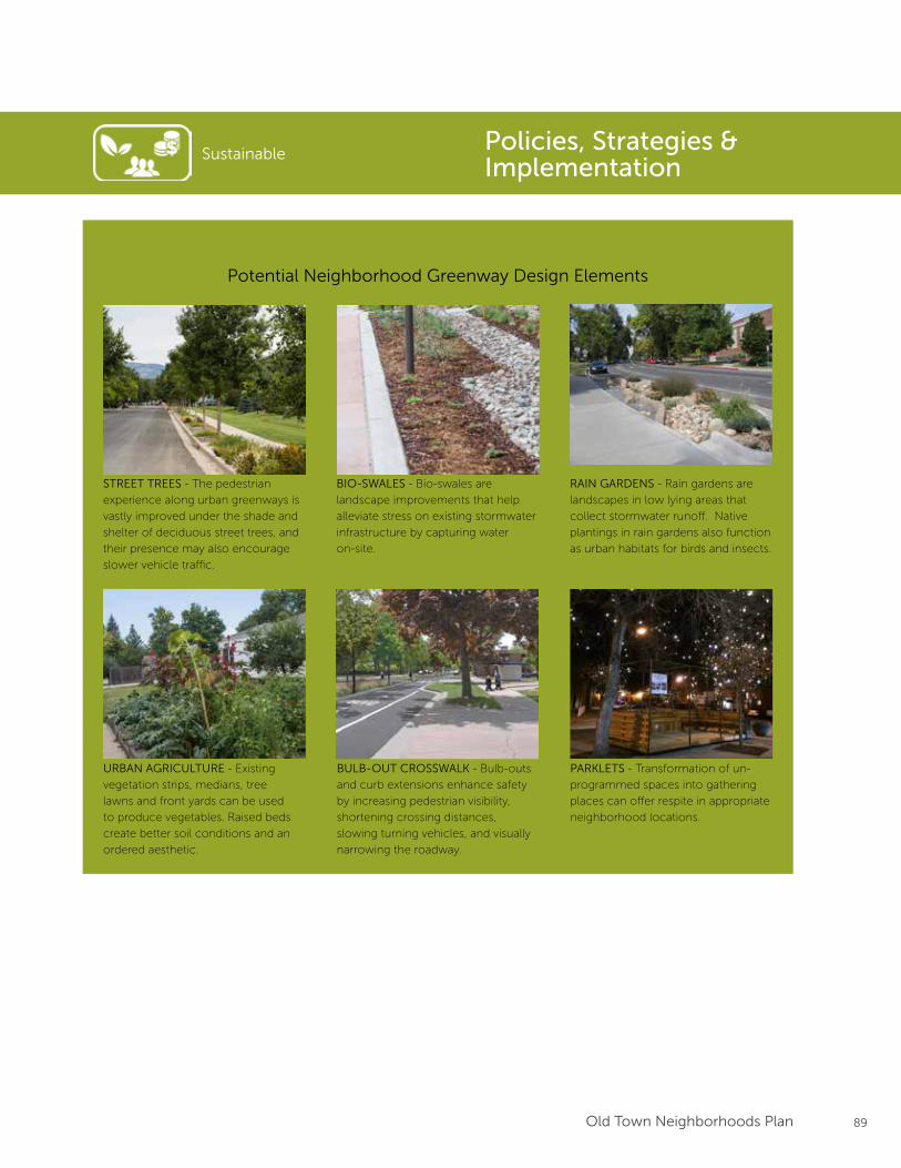
89Old Town Neighborhoods Plan
STREET TREES - The pedestrian
experience along urban greenways is
vastly improved under the shade and
shelter of deciduous street trees, and
their presence may also encourage
slower vehicle traffic.
BIO-SWALES - Bio-swales are
landscape improvements that help
alleviate stress on existing stormwater
infrastructure by capturing water
on-site.
RAIN GARDENS - Rain gardens are
landscapes in low lying areas that
collect stormwater runoff. Native
plantings in rain gardens also function
as urban habitats for birds and insects.
URBAN AGRICULTURE - Existing
vegetation strips, medians, tree
lawns and front yards can be used
to produce vegetables. Raised beds
create better soil conditions and an
ordered aesthetic.
BULB-OUT CROSSWALK - Bulb-outs
and curb extensions enhance safety
by increasing pedestrian visibility,
shortening crossing distances,
slowing turning vehicles, and visually
narrowing the roadway.
PARKLETS - Transformation of un-
programmed spaces into gathering
places can offer respite in appropriate
neighborhood locations.
SustainablePolicies, Strategies & Implementation
Potential Neighborhood Greenway Design Elements
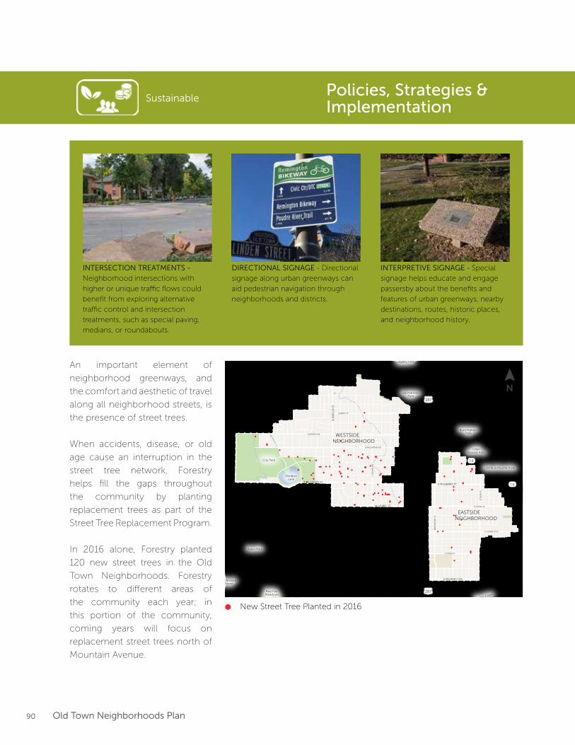
90 Old Town Neighborhoods Plan
SustainablePolicies, Strategies & Implementation
INTERSECTION TREATMENTS -
Neighborhood intersections with
higher or unique traffic flows could
benefit from exploring alternative
traffic control and intersection
treatments, such as special paving,
medians, or roundabouts.
INTERPRETIVE SIGNAGE - Special
signage helps educate and engage
passersby about the benefits and
features of urban greenways, nearby
destinations, routes, historic places,
and neighborhood history.
DIRECTIONAL SIGNAGE - Directional
signage along urban greenways can
aid pedestrian navigation through
neighborhoods and districts.
An important element of
neighborhood greenways, and
the comfort and aesthetic of travel
along all neighborhood streets, is
the presence of street trees.
When accidents, disease, or old
age cause an interruption in the
street tree network, Forestry
helps fill the gaps throughout
the community by planting
replacement trees as part of the
Street Tree Replacement Program.
In 2016 alone, Forestry planted
120 new street trees in the Old
Town Neighborhoods. Forestry
rotates to different areas of
the community each year; in
this portion of the community,
coming years will focus on
replacement street trees north of
Mountain Avenue.
W ELIZABETH ST
W LAKE ST
CO
NST
ITU
TIO
N A
VE
W PLUM ST
S T
AFT
HIL
L R
DN
TA
FT H
ILL
RD
LAPORTE AVE
W VINE DR
CHERRY ST
E MOUNTIAN AVE
RIVERSIDE AVE
BUCKINGHAM ST
E LINCOLN AVE
LIN
DEN
ST
WILLOW
STJEFFERSON ST
WALNUT ST
N H
OW
ES
STS
HO
WE
S ST
S LO
OM
IS A
VE
S C
OLL
EG
E A
VE
N C
OLL
EG
E A
VE
N L
EM
AY
AV
ES
LEM
AY
AV
E
S M
ASO
N S
TN
MA
SON
ST
RE
MIN
GT
ON
ST
STO
VE
R S
T
W LAUREL ST
W LAKE ST
E LAUREL ST
E ELIZABETH ST
E PITKIN ST
E PROSPECT RDW PROSPECT RD
W MOUNTIAN AVE
N S
HIE
LDS
STS
SHIE
LDS
ST
W MULBERRY STE MULBERRY ST
Lee MartinezPark
UdallNatural Area
Gardens onSpring Creek
BuckinghamPark
North Shields PondsNatural Area
City Park
Red Fox Meadows
Natural Area
FairbrookePond
Avery Park
Legacy Park
SheldonLake
Cache la Poudre River
Cache la Poudre River
Spring Creek
Spring Creek
DOWNTOWN
COLORADOSTATE
UNIVERSITY
EASTSIDENEIGHBORHOOD
WESTSIDENEIGHBORHOOD
287
287
14
14
FEMA DesignatedFloodway
FEMA DesignatedHigh-RiskFloodplain
FEMA DesignatedModerate-RiskFloodplain
City DesignatedFloodway
City DesignatedHigh-RiskFloodplain
City DesignatedModerate-RiskFloodplain
0 1000500 2000 FEET
N
Legend
Freight Rail Line
City Boundary
Neighborhood Boundary
FloodplainMap
Parcel
Open Space / Park
Stream / River / Reservoir
N
New Street Tree Planted in 2016
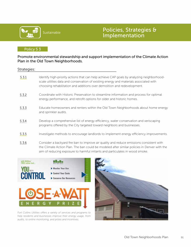
91Old Town Neighborhoods Plan
Sustainable
Promote environmental stewardship and support implementation of the Climate Action Plan in the Old Town Neighborhoods.
Policy S 3
Strategies:
Identify high-priority actions that can help achieve CAP goals by analyzing neighborhood-
scale utilities data and conservation of existing energy and materials associated with
choosing rehabilitation and additions over demolition and redevelopment.
Coordinate with Historic Preservation to streamline information and process for optimal
energy performance, and retrofit options for older and historic homes.
Educate homeowners and renters within the Old Town Neighborhoods about home energy
and sprinkler audits.
Develop a comprehensive list of energy efficiency, water conservation and xeriscaping
programs offered by the City targeted toward neighbors and businesses.
Investigate methods to encourage landlords to implement energy efficiency improvements.
Consider a backyard fire ban to improve air quality and reduce emissions consistent with
the Climate Action Plan. The ban could be modeled after similar policies in Denver with the
aim of reducing exposure to harmful irritants and particulates in wood smoke.
S 3.1
S 3.2
S 3.3
S 3.4
S 3.5
Fort Collins Utilities offers a variety of services and programs to
help residents and businesses improve their energy usage, from
audits, to online monitoring, and prizes and incentives.
Policies, Strategies & Implementation
S 3.6
92 Old Town Neighborhoods Plan
Sustainable
Upgrade critical neighborhood infrastructure to ensure adequate services for both the present and future.
Policy S 4
Strategies:
Continually monitor and assess the capacity of existing infrastructure systems (stormwater,
wastewater, electricity, streets, etc.) to meet current and expected neighborhood needs.
Work with Utilities to identify key upgrades and timelines for implementation.
Coordinate alley maintenance and improvements to mitigate impacts from increased use
from new accessory dwelling units or other redevelopment.
Integrate stormwater retention and filtration measures into roadway, alley and parkway
planting strips as part of long-term neighborhood greenway improvements.
S 4.1
S 4.2
S 4.3
Encourage small-scale, neighborhood supporting businesses where permitted by existing zoning along neighborhood edges and transition areas.
Policy S 5
Strategies:
Maintain Neighborhood Conservation Buffer zoning at neighborhood edges and transition
areas and encourage more focus on development form, parking, and design, rather than
use.
Continue to allow home occupation licenses for home-based businesses where allowed by
the Land Use Code
Support existing, long-standing small businesses in the neighborhoods.
S 5.1
S 5.2
S 5.3
Policies, Strategies & Implementation
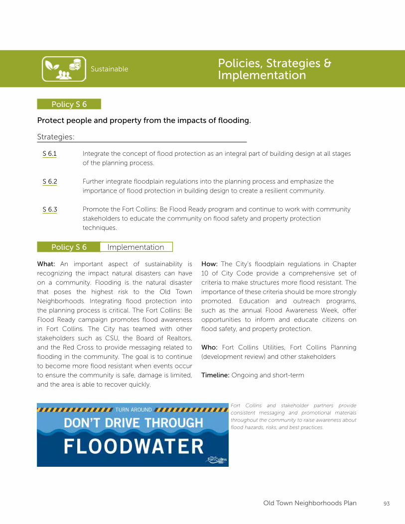
93Old Town Neighborhoods Plan
Sustainable
Policy S 6
Policies, Strategies & Implementation
Protect people and property from the impacts of flooding.
Strategies:
Integrate the concept of flood protection as an integral part of building design at all stages
of the planning process.
Further integrate floodplain regulations into the planning process and emphasize the
importance of flood protection in building design to create a resilient community.
Promote the Fort Collins: Be Flood Ready program and continue to work with community
stakeholders to educate the community on flood safety and property protection
techniques.
S 6.1
S 6.2
S 6.3
What: An important aspect of sustainability is
recognizing the impact natural disasters can have
on a community. Flooding is the natural disaster
that poses the highest risk to the Old Town
Neighborhoods. Integrating flood protection into
the planning process is critical. The Fort Collins: Be
Flood Ready campaign promotes flood awareness
in Fort Collins. The City has teamed with other
stakeholders such as CSU, the Board of Realtors,
and the Red Cross to provide messaging related to
flooding in the community. The goal is to continue
to become more flood resistant when events occur
to ensure the community is safe, damage is limited,
and the area is able to recover quickly.
How: The City’s floodplain regulations in Chapter
10 of City Code provide a comprehensive set of
criteria to make structures more flood resistant. The
importance of these criteria should be more strongly
promoted. Education and outreach programs,
such as the annual Flood Awareness Week, offer
opportunities to inform and educate citizens on
flood safety, and property protection.
Who: Fort Collins Utilities, Fort Collins Planning
(development review) and other stakeholders
Timeline: Ongoing and short-term
Policy S 6 Implementation
Fort Collins and stakeholder partners provide
consistent messaging and promotional materials
throughout the community to raise awareness about
flood hazards, risks, and best practices.
94 Old Town Neighborhoods Plan
Alignment with City Plan:
The following City Plan policies and principles
align with recommendations in the Old Town
Neighborhoods Plan:
ENV 4.1 - Improve Connectivity
Explore opportunities for land conservation
partnerships between Stormwater, Parks and
Recreation, Transportation, and Natural Areas
departments to provide and enhance trail corridors
to connect open lands, to enhance wildlife habitat
and corridors, and to improve bicycle and pedestrian
access to schools, parks, natural areas, rivers,
shopping areas, and neighborhoods.
Policy ENV 4.5 - Support Community Horticulture
Encourage and support the establishment of
community gardens and other horticultural projects
throughout the City to provide food, beautification,
education, and other social benefits...
Policy ENV 5.5 - Provide Information and
Education
Provide information and education to raise
awareness, trains stakeholders, and encourage net
energy use reduction in all new construction.
Policy ENV 18.4 - Manage Floodplain
Require structures and facilities that are unavoidably
located in the floodplain to be designed to be
consistent with the intent of the standards and
criteria of the City of Fort Collins and the National
Flood Insurance Program.
Policy ENV 5.7 - Offer Incentives
Offer a variety of monetary and other incentives to
encourage new construction to substantially exceed
minimum code requirements for energy efficiency
and renewable energy use.
SustainablePolicies, Strategies & Implementation
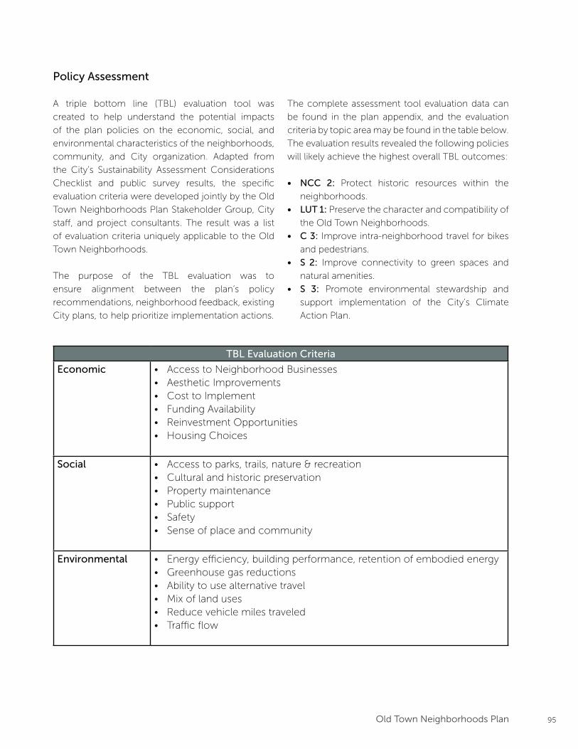
95Old Town Neighborhoods Plan
Policy Assessment
A triple bottom line (TBL) evaluation tool was
created to help understand the potential impacts
of the plan policies on the economic, social, and
environmental characteristics of the neighborhoods,
community, and City organization. Adapted from
the City’s Sustainability Assessment Considerations
Checklist and public survey results, the specific
evaluation criteria were developed jointly by the Old
Town Neighborhoods Plan Stakeholder Group, City
staff, and project consultants. The result was a list
of evaluation criteria uniquely applicable to the Old
Town Neighborhoods.
The purpose of the TBL evaluation was to
ensure alignment between the plan’s policy
recommendations, neighborhood feedback, existing
City plans, to help prioritize implementation actions.
TBL Evaluation Criteria
Economic • Access to Neighborhood Businesses• Aesthetic Improvements• Cost to Implement• Funding Availability• Reinvestment Opportunities• Housing Choices
Social • Access to parks, trails, nature & recreation• Cultural and historic preservation• Property maintenance• Public support• Safety• Sense of place and community
Environmental • Energy efficiency, building performance, retention of embodied energy• Greenhouse gas reductions• Ability to use alternative travel • Mix of land uses• Reduce vehicle miles traveled• Traffic flow
The complete assessment tool evaluation data can
be found in the plan appendix, and the evaluation
criteria by topic area may be found in the table below.
The evaluation results revealed the following policies
will likely achieve the highest overall TBL outcomes:
• NCC 2: Protect historic resources within the
neighborhoods.
• LUT 1: Preserve the character and compatibility of
the Old Town Neighborhoods.
• C 3: Improve intra-neighborhood travel for bikes
and pedestrians.
• S 2: Improve connectivity to green spaces and
natural amenities.
• S 3: Promote environmental stewardship and
support implementation of the City’s Climate
Action Plan.
96 Old Town Neighborhoods Plan
Implementation Actions
A summary of Plan implementation actions, are
summarized on the following pages. The actions are
organized by timeframe for expected completion,
using the following metrics:
• Immediate Actions (Within 120 days of
adoption): Items adopted concurrently with or
immediately following adoption of the Old Town
Neighborhoods Plan.
• Short-Term Actions (2017-2018): Items
completed within the current Budgeting for
Outcomes (BFO) budget cycle.
• Mid-Term Actions (2019-2026): High-priority
items that should be initiated and implemented in
alignment with upcoming budget cycles.
• Ongoing Programs & Actions: Items that are
already in progress, do not have a specified
timeframe, or require ongoing coordination to
implement.
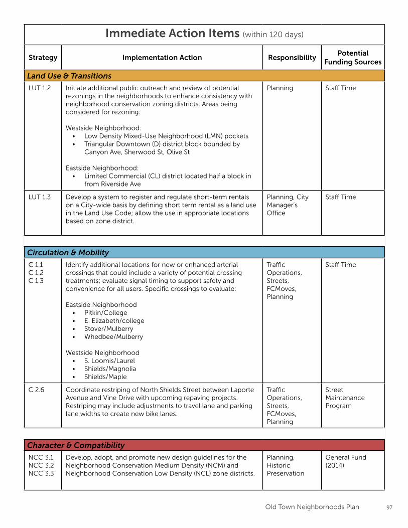
97Old Town Neighborhoods Plan
Immediate Action Items (within 120 days)
Strategy Implementation Action ResponsibilityPotential
Funding Sources
Land Use & Transitions
LUT 1.2 Initiate additional public outreach and review of potential rezonings in the neighborhoods to enhance consistency with neighborhood conservation zoning districts. Areas being considered for rezoning:
Westside Neighborhood:• Low Density Mixed-Use Neighborhood (LMN) pockets• Triangular Downtown (D) district block bounded by
Canyon Ave, Sherwood St, Olive St
Eastside Neighborhood:• Limited Commercial (CL) district located half a block in
from Riverside Ave
Planning Staff Time
LUT 1.3 Develop a system to register and regulate short-term rentals on a City-wide basis by defining short term rental as a land use in the Land Use Code; allow the use in appropriate locations based on zone district.
Planning, City Manager’s Office
Staff Time
Circulation & Mobility
C 1.1C 1.2C 1.3
Identify additional locations for new or enhanced arterial crossings that could include a variety of potential crossing treatments; evaluate signal timing to support safety and convenience for all users. Specific crossings to evaluate:
Eastside Neighborhood• Pitkin/College• E. Elizabeth/college• Stover/Mulberry• Whedbee/Mulberry
Westside Neighborhood• S. Loomis/Laurel• Shields/Magnolia• Shields/Maple
Traffic Operations, Streets, FCMoves, Planning
Staff Time
C 2.6 Coordinate restriping of North Shields Street between Laporte Avenue and Vine Drive with upcoming repaving projects. Restriping may include adjustments to travel lane and parking lane widths to create new bike lanes.
Traffic Operations, Streets, FCMoves, Planning
Street Maintenance Program
Character & Compatibility
NCC 3.1NCC 3.2NCC 3.3
Develop, adopt, and promote new design guidelines for the Neighborhood Conservation Medium Density (NCM) and Neighborhood Conservation Low Density (NCL) zone districts.
Planning, Historic Preservation
General Fund (2014)
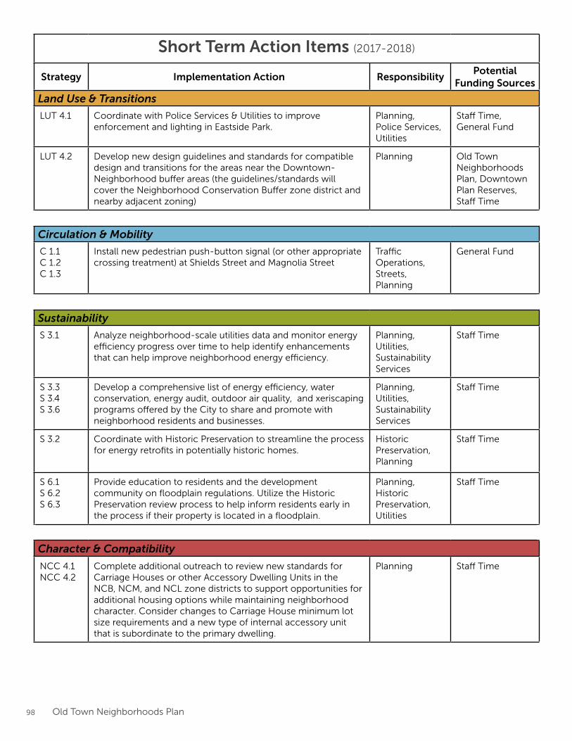
98 Old Town Neighborhoods Plan
Short Term Action Items (2017-2018)
Strategy Implementation Action ResponsibilityPotential
Funding Sources
Land Use & Transitions
LUT 4.1 Coordinate with Police Services & Utilities to improve enforcement and lighting in Eastside Park.
Planning, Police Services, Utilities
Staff Time, General Fund
LUT 4.2 Develop new design guidelines and standards for compatible design and transitions for the areas near the Downtown-Neighborhood buffer areas (the guidelines/standards will cover the Neighborhood Conservation Buffer zone district and nearby adjacent zoning)
Planning Old Town Neighborhoods Plan, Downtown Plan Reserves, Staff Time
Circulation & Mobility
C 1.1C 1.2C 1.3
Install new pedestrian push-button signal (or other appropriate crossing treatment) at Shields Street and Magnolia Street
Traffic Operations, Streets, Planning
General Fund
Sustainability
S 3.1 Analyze neighborhood-scale utilities data and monitor energy efficiency progress over time to help identify enhancements that can help improve neighborhood energy efficiency.
Planning, Utilities, Sustainability Services
Staff Time
S 3.3S 3.4S 3.6
Develop a comprehensive list of energy efficiency, water conservation, energy audit, outdoor air quality, and xeriscaping programs offered by the City to share and promote with neighborhood residents and businesses.
Planning, Utilities, Sustainability Services
Staff Time
S 3.2 Coordinate with Historic Preservation to streamline the process for energy retrofits in potentially historic homes.
Historic Preservation, Planning
Staff Time
S 6.1S 6.2S 6.3
Provide education to residents and the development community on floodplain regulations. Utilize the Historic Preservation review process to help inform residents early in the process if their property is located in a floodplain.
Planning, Historic Preservation, Utilities
Staff Time
Character & Compatibility
NCC 4.1NCC 4.2
Complete additional outreach to review new standards for Carriage Houses or other Accessory Dwelling Units in the NCB, NCM, and NCL zone districts to support opportunities for additional housing options while maintaining neighborhood character. Consider changes to Carriage House minimum lot size requirements and a new type of internal accessory unit that is subordinate to the primary dwelling.
Planning Staff Time
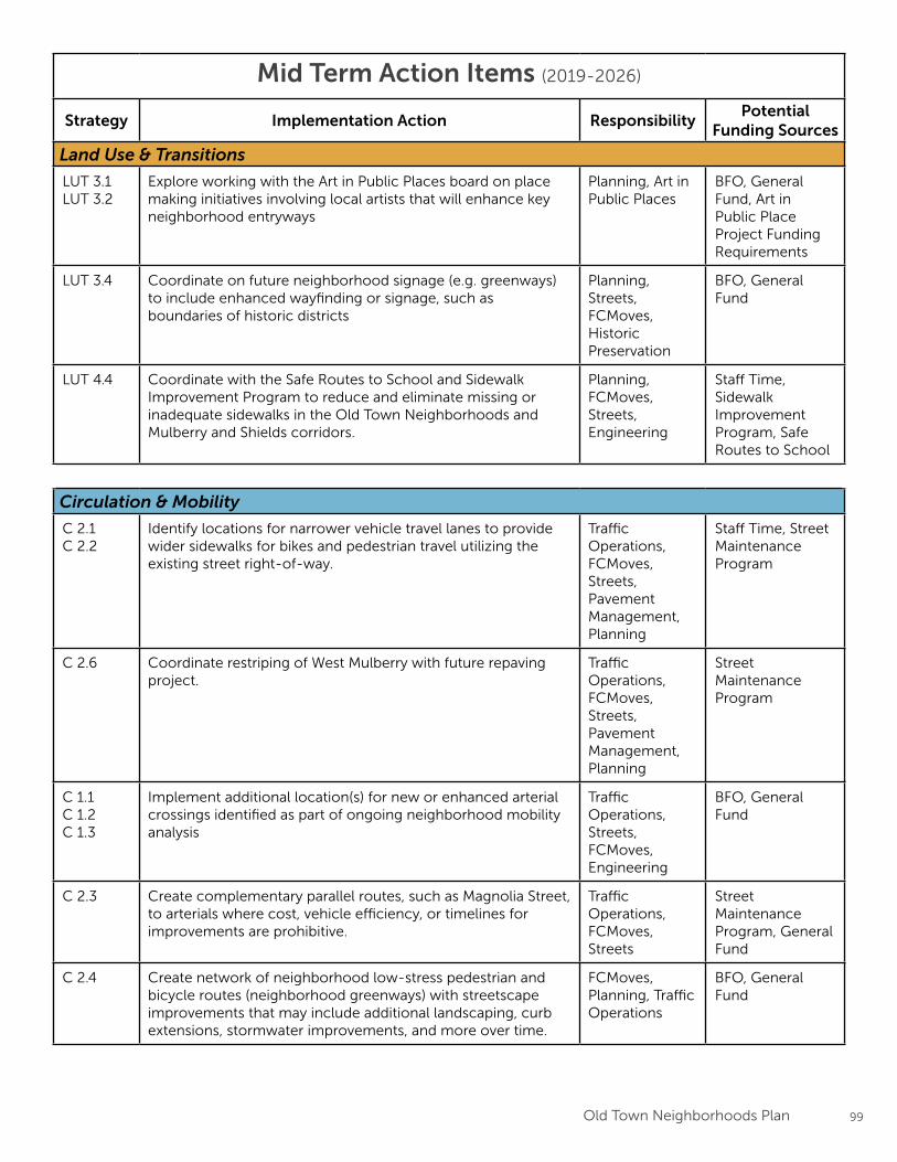
99Old Town Neighborhoods Plan
Mid Term Action Items (2019-2026)
Strategy Implementation Action ResponsibilityPotential
Funding Sources
Land Use & Transitions
LUT 3.1LUT 3.2
Explore working with the Art in Public Places board on place making initiatives involving local artists that will enhance key neighborhood entryways
Planning, Art in Public Places
BFO, General Fund, Art in Public Place Project Funding Requirements
LUT 3.4 Coordinate on future neighborhood signage (e.g. greenways) to include enhanced wayfinding or signage, such as boundaries of historic districts
Planning, Streets, FCMoves, Historic Preservation
BFO, General Fund
LUT 4.4 Coordinate with the Safe Routes to School and Sidewalk Improvement Program to reduce and eliminate missing or inadequate sidewalks in the Old Town Neighborhoods and Mulberry and Shields corridors.
Planning, FCMoves, Streets, Engineering
Staff Time, Sidewalk Improvement Program, Safe Routes to School
Circulation & Mobility
C 2.1C 2.2
Identify locations for narrower vehicle travel lanes to provide wider sidewalks for bikes and pedestrian travel utilizing the existing street right-of-way.
Traffic Operations, FCMoves, Streets, Pavement Management, Planning
Staff Time, Street Maintenance Program
C 2.6 Coordinate restriping of West Mulberry with future repaving project.
Traffic Operations, FCMoves, Streets, Pavement Management, Planning
Street Maintenance Program
C 1.1C 1.2C 1.3
Implement additional location(s) for new or enhanced arterial crossings identified as part of ongoing neighborhood mobility analysis
Traffic Operations, Streets, FCMoves, Engineering
BFO, General Fund
C 2.3 Create complementary parallel routes, such as Magnolia Street, to arterials where cost, vehicle efficiency, or timelines for improvements are prohibitive.
Traffic Operations, FCMoves, Streets
Street Maintenance Program, General Fund
C 2.4 Create network of neighborhood low-stress pedestrian and bicycle routes (neighborhood greenways) with streetscape improvements that may include additional landscaping, curb extensions, stormwater improvements, and more over time.
FCMoves, Planning, Traffic Operations
BFO, General Fund
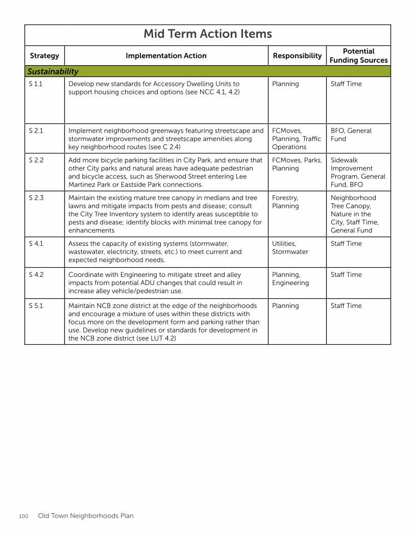
100 Old Town Neighborhoods Plan
Mid Term Action Items
Strategy Implementation Action ResponsibilityPotential
Funding Sources
Sustainability
S 1.1 Develop new standards for Accessory Dwelling Units to support housing choices and options (see NCC 4.1, 4.2)
Planning Staff Time
S 2.1 Implement neighborhood greenways featuring streetscape and stormwater improvements and streetscape amenities along key neighborhood routes (see C 2.4)
FCMoves, Planning, Traffic Operations
BFO, General Fund
S 2.2 Add more bicycle parking facilities in City Park, and ensure that other City parks and natural areas have adequate pedestrian and bicycle access, such as Sherwood Street entering Lee Martinez Park or Eastside Park connections.
FCMoves, Parks, Planning
Sidewalk Improvement Program, General Fund, BFO
S 2.3 Maintain the existing mature tree canopy in medians and tree lawns and mitigate impacts from pests and disease; consult the City Tree Inventory system to identify areas susceptible to pests and disease; identify blocks with minimal tree canopy for enhancements
Forestry, Planning
Neighborhood Tree Canopy, Nature in the City, Staff Time, General Fund
S 4.1 Assess the capacity of existing systems (stormwater, wastewater, electricity, streets, etc.) to meet current and expected neighborhood needs.
Utilities, Stormwater
Staff Time
S 4.2 Coordinate with Engineering to mitigate street and alley impacts from potential ADU changes that could result in increase alley vehicle/pedestrian use.
Planning, Engineering
Staff Time
S 5.1 Maintain NCB zone district at the edge of the neighborhoods and encourage a mixture of uses within these districts with focus more on the development form and parking rather than use. Develop new guidelines or standards for development in the NCB zone district (see LUT 4.2)
Planning Staff Time
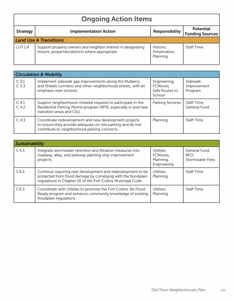
101Old Town Neighborhoods Plan
Ongoing Action Items
Strategy Implementation Action ResponsibilityPotential
Funding Sources
Land Use & Transitions
LUT 1.4 Support property owners and neighbor interest in designating historic properties/districts where appropriate.
Historic Preservation, Planning
Staff Time
Circulation & Mobility
C 3.1C 3.3
Implement sidewalk gap improvements along the Mulberry and Shields corridors and other neighborhood streets, with an emphasis near schools.
Engineering, FCMoves, Safe Routes to School
Sidewalk Improvement Program
C 4.1C 4.2
Support neighborhood-initiated requests to participate in the Residential Parking Permit program (RP3), especially in and near transition areas and CSU.
Parking Services Staff Time, General Fund
C 4.3 Coordinate redevelopment and new development projects to ensure they provide adequate on-site parking and do not contribute to neighborhood parking concerns.
Planning Staff Time
Sustainability
S 4.3 Integrate stormwater retention and filtration measures into roadway, alley, and parkway planting strip improvement projects.
Utilities, FCMoves, Planning, Engineering
General Fund, BFO,Stormwater Fees
S 6.2 Continue requiring new development and redevelopment to be protected from flood damage by complying with the floodplain regulations in Chapter 10 of the Fort Collins Municipal Code.
Utilities, Planning
Staff Time
S 6.3 Coordinate with Utilities to promote the Fort Collins: Be Flood Ready program and enhance community knowledge of existing floodplain regulations.
Utilities, Planning
Staff Time
APPENDIX A
Neighborhoods Existing Conditions Report
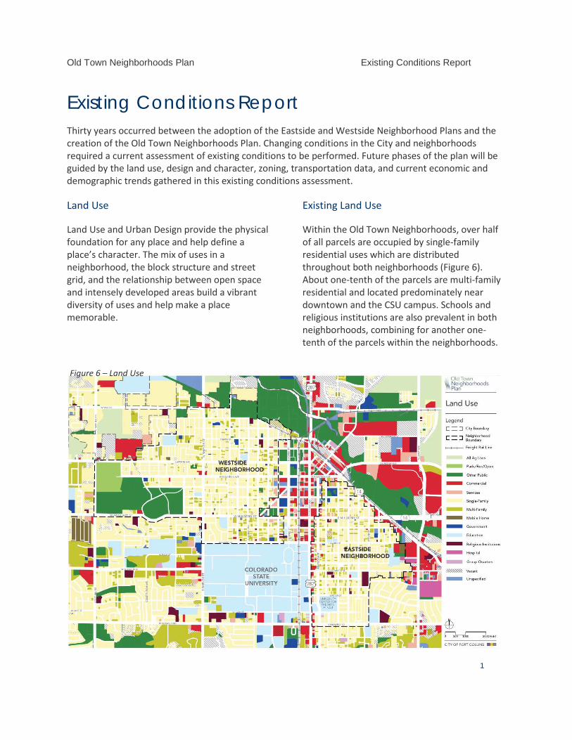
Old Town Neighborhoods Plan Existing Conditions Report
1
Existing Conditions Report Thirty years occurred between the adoption of the Eastside and Westside Neighborhood Plans and the creation of the Old Town Neighborhoods Plan. Changing conditions in the City and neighborhoods required a current assessment of existing conditions to be performed. Future phases of the plan will be guided by the land use, design and character, zoning, transportation data, and current economic and demographic trends gathered in this existing conditions assessment.
Land Use
Land Use and Urban Design provide the physical foundation for any place and help define a place’s character. The mix of uses in a neighborhood, the block structure and street grid, and the relationship between open space and intensely developed areas build a vibrant diversity of uses and help make a place memorable.
Existing Land Use
Within the Old Town Neighborhoods, over half of all parcels are occupied by single-family residential uses which are distributed throughout both neighborhoods (Figure 6). About one-tenth of the parcels are multi-family residential and located predominately near downtown and the CSU campus. Schools and religious institutions are also prevalent in both neighborhoods, combining for another one-tenth of the parcels within the neighborhoods.
Figure 6 – Land Use
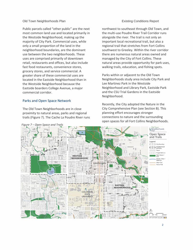
Old Town Neighborhoods Plan Existing Conditions Report
2
Public parcels called “other public” are the next most common land use and located primarily in the Westside Neighborhood, making up the majority of City Park. Commercial uses, while only a small proportion of the land in the neighborhood boundaries, are the dominant use between the two neighborhoods. These uses are comprised primarily of downtown retail, restaurants and offices, but also include fast food restaurants, convenience stores, grocery stores, and service commercial. A greater share of these commercial uses are located in the Eastside Neighborhood than in the Westside Neighborhood because the Eastside boarders College Avenue, a major commercial corridor.
Parks and Open Space Network
The Old Town Neighborhoods are in close proximity to natural areas, parks and regional trails (Figure 7). The Cache La Poudre River runs
northwest to southeast through Old Town, and the multi-use Poudre River Trail Corridor runs alongside the river. The trail is not only an important local recreational trail, but also a regional trail that stretches from Fort Collins southwest to Greeley. Within the river corridor there are numerous natural areas owned and managed by the City of Fort Collins. These natural areas provide opportunity for park uses, walking trails, education, and fishing spots.
Parks within or adjacent to the Old Town Neighborhoods study area include City Park and Lee Martinez Park in the Westside Neighborhood and Library Park, Eastside Park and the CSU Trial Gardens in the Eastside Neighborhood.
Recently, the City adopted the Nature in the City Comprehensive Plan (see Section B). This planning effort encourages stronger connections to nature and the surrounding open spaces for all Fort Collins Neighborhoods.
Figure 7 – Open Space and Trails
Old Town Neighborhoods Plan Existing Conditions Report
3
Neighborhood Design and Character
The Eastside and Westside neighborhoods are two of the oldest residential neighborhoods within Fort Collins. With that comes a wealth of significant historic properties that provide the foundation for each neighborhood’s defining historic neighborhood character. Overall, the Old Town Neighborhoods reflect an eclectic mix of housing age, size, and architectural styles and character.
Such a rich resource of historic and traditional residential properties is cherished by the diverse community that calls these neighborhoods home. Despite a nearly 30 year hiatus from updating the current neighborhood plans, community members have shown strong resolve in participating in various planning efforts over the past five to ten years.
The four-year long planning effort for the Eastside Westside Character Study (2013) provided important information on neighborhood character and compatibility. The first part of the study included a neighborhood profile of community identified features within the single-family neighborhoods. The study developed descriptions of overall development patterns, and explored the concept of six distinct character areas within the neighborhoods to distinguish various nuanced sub-districts. The Character Study identified strategies for implementation ranging from voluntary design guidelines to developing new design standards. Information in this existing conditions assessment is generated in part from the 2013 Character Study and analysis as part of this Plan process.
Study Area Profile
The Eastside and Westside Neighborhoods are diverse, with a range of existing character and contexts. These conditions help shape
development and may influence its perceived compatibility. Understanding neighborhood characteristics, including physical conditions and dynamic aspects such as past and future changes, is important. A range of variables related to development patterns were analyzed in order to gain an understanding of the degree of consistency and the range of diversity that exists. When these variables are considered at a neighborhood-wide level, they yield an understanding of the general characteristics of the neighborhood. Then, when these variables are examined at a finer-grained degree, they suggest a series of smaller character areas, with shared characteristics.
Buildings
Building age: The first major period of construction in the neighborhoods date from the 1890s - 1920s. The portions of the neighborhoods built during this time period include E Myrtle Street, Peterson, Whedbee, Smith and W Mountain Ave close to downtown. Many block faces have a high degree of similarity in building age in these areas.
The second major period of construction occurred between the 1940s and the 1960s. During this time period, the edges of the neighborhoods furthest from downtown developed in a shorter amount of time. This condensed period of construction resulted in less variety in building types in these areas.
Recent construction is sparse and scattered throughout the plan area. Note that between 2001 and 2011, nearly as many new homes were built as in the previous two decades combined in the Westside (1981-2000).
Building remodels: This building remodels information is from construction permit records, and therefore may not capture all alterations that property owners have made. A
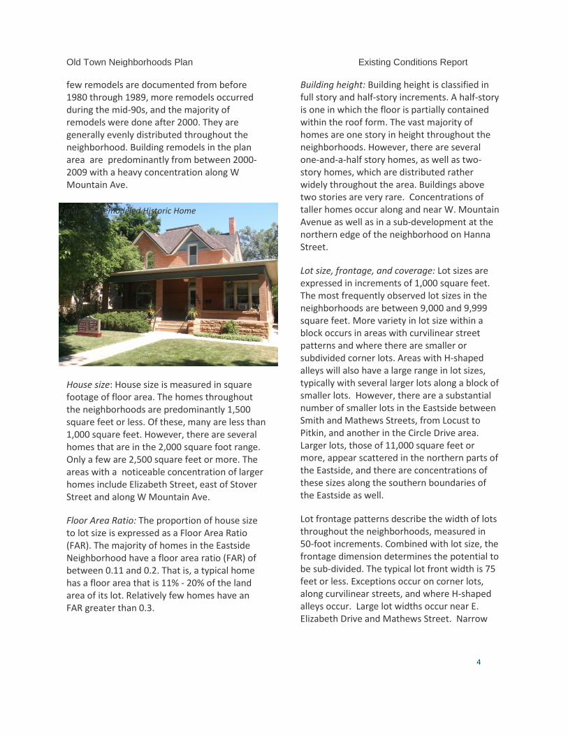
Old Town Neighborhoods Plan Existing Conditions Report
4
few remodels are documented from before 1980 through 1989, more remodels occurred during the mid-90s, and the majority of remodels were done after 2000. They are generally evenly distributed throughout the neighborhood. Building remodels in the plan area are predominantly from between 2000-2009 with a heavy concentration along W Mountain Ave.
House size: House size is measured in square footage of floor area. The homes throughout the neighborhoods are predominantly 1,500 square feet or less. Of these, many are less than 1,000 square feet. However, there are several homes that are in the 2,000 square foot range. Only a few are 2,500 square feet or more. The areas with a noticeable concentration of larger homes include Elizabeth Street, east of Stover Street and along W Mountain Ave.
Floor Area Ratio: The proportion of house size to lot size is expressed as a Floor Area Ratio (FAR). The majority of homes in the Eastside Neighborhood have a floor area ratio (FAR) of between 0.11 and 0.2. That is, a typical home has a floor area that is 11% - 20% of the land area of its lot. Relatively few homes have an FAR greater than 0.3.
Building height: Building height is classified in full story and half-story increments. A half-story is one in which the floor is partially contained within the roof form. The vast majority of homes are one story in height throughout the neighborhoods. However, there are several one-and-a-half story homes, as well as two-story homes, which are distributed rather widely throughout the area. Buildings above two stories are very rare. Concentrations of taller homes occur along and near W. Mountain Avenue as well as in a sub-development at the northern edge of the neighborhood on Hanna Street.
Lot size, frontage, and coverage: Lot sizes are expressed in increments of 1,000 square feet. The most frequently observed lot sizes in the neighborhoods are between 9,000 and 9,999 square feet. More variety in lot size within a block occurs in areas with curvilinear street patterns and where there are smaller or subdivided corner lots. Areas with H-shaped alleys will also have a large range in lot sizes, typically with several larger lots along a block of smaller lots. However, there are a substantial number of smaller lots in the Eastside between Smith and Mathews Streets, from Locust to Pitkin, and another in the Circle Drive area. Larger lots, those of 11,000 square feet or more, appear scattered in the northern parts of the Eastside, and there are concentrations of these sizes along the southern boundaries of the Eastside as well.
Lot frontage patterns describe the width of lots throughout the neighborhoods, measured in 50-foot increments. Combined with lot size, the frontage dimension determines the potential to be sub-divided. The typical lot front width is 75 feet or less. Exceptions occur on corner lots, along curvilinear streets, and where H-shaped alleys occur. Large lot widths occur near E. Elizabeth Drive and Mathews Street. Narrow
Figure 8 – Remodeled Historic Home
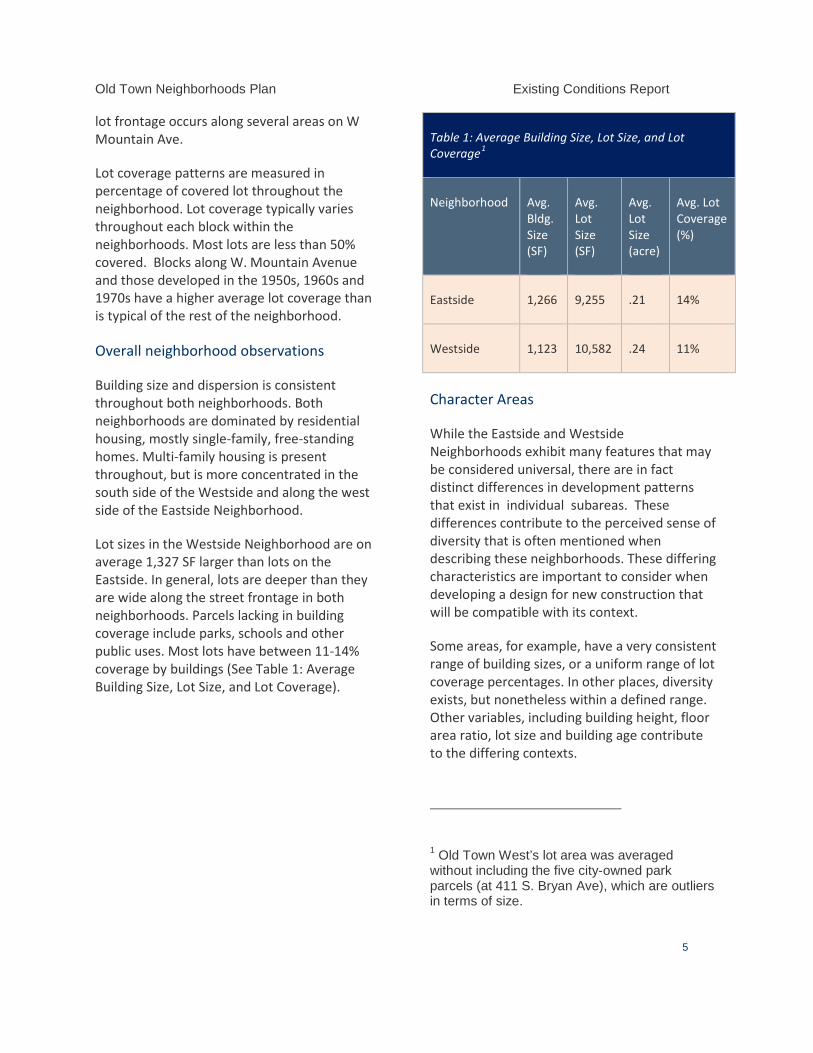
Old Town Neighborhoods Plan Existing Conditions Report
5
lot frontage occurs along several areas on W Mountain Ave.
Lot coverage patterns are measured in percentage of covered lot throughout the neighborhood. Lot coverage typically varies throughout each block within the neighborhoods. Most lots are less than 50% covered. Blocks along W. Mountain Avenue and those developed in the 1950s, 1960s and 1970s have a higher average lot coverage than is typical of the rest of the neighborhood.
Overall neighborhood observations
Building size and dispersion is consistent throughout both neighborhoods. Both neighborhoods are dominated by residential housing, mostly single-family, free-standing homes. Multi-family housing is present throughout, but is more concentrated in the south side of the Westside and along the west side of the Eastside Neighborhood.
Lot sizes in the Westside Neighborhood are on average 1,327 SF larger than lots on the Eastside. In general, lots are deeper than they are wide along the street frontage in both neighborhoods. Parcels lacking in building coverage include parks, schools and other public uses. Most lots have between 11-14% coverage by buildings (See Table 1: Average Building Size, Lot Size, and Lot Coverage).
Table 1: Average Building Size, Lot Size, and Lot Coverage1
Neighborhood Avg. Bldg. Size (SF)
Avg. Lot Size (SF)
Avg. Lot Size (acre)
Avg. Lot Coverage (%)
Eastside 1,266 9,255 .21 14%
Westside 1,123 10,582 .24 11%
Character Areas
While the Eastside and Westside Neighborhoods exhibit many features that may be considered universal, there are in fact distinct differences in development patterns that exist in individual subareas. These differences contribute to the perceived sense of diversity that is often mentioned when describing these neighborhoods. These differing characteristics are important to consider when developing a design for new construction that will be compatible with its context.
Some areas, for example, have a very consistent range of building sizes, or a uniform range of lot coverage percentages. In other places, diversity exists, but nonetheless within a defined range. Other variables, including building height, floor area ratio, lot size and building age contribute to the differing contexts.
1 Old Town West’s lot area was averaged without including the five city-owned park parcels (at 411 S. Bryan Ave), which are outliers in terms of size.
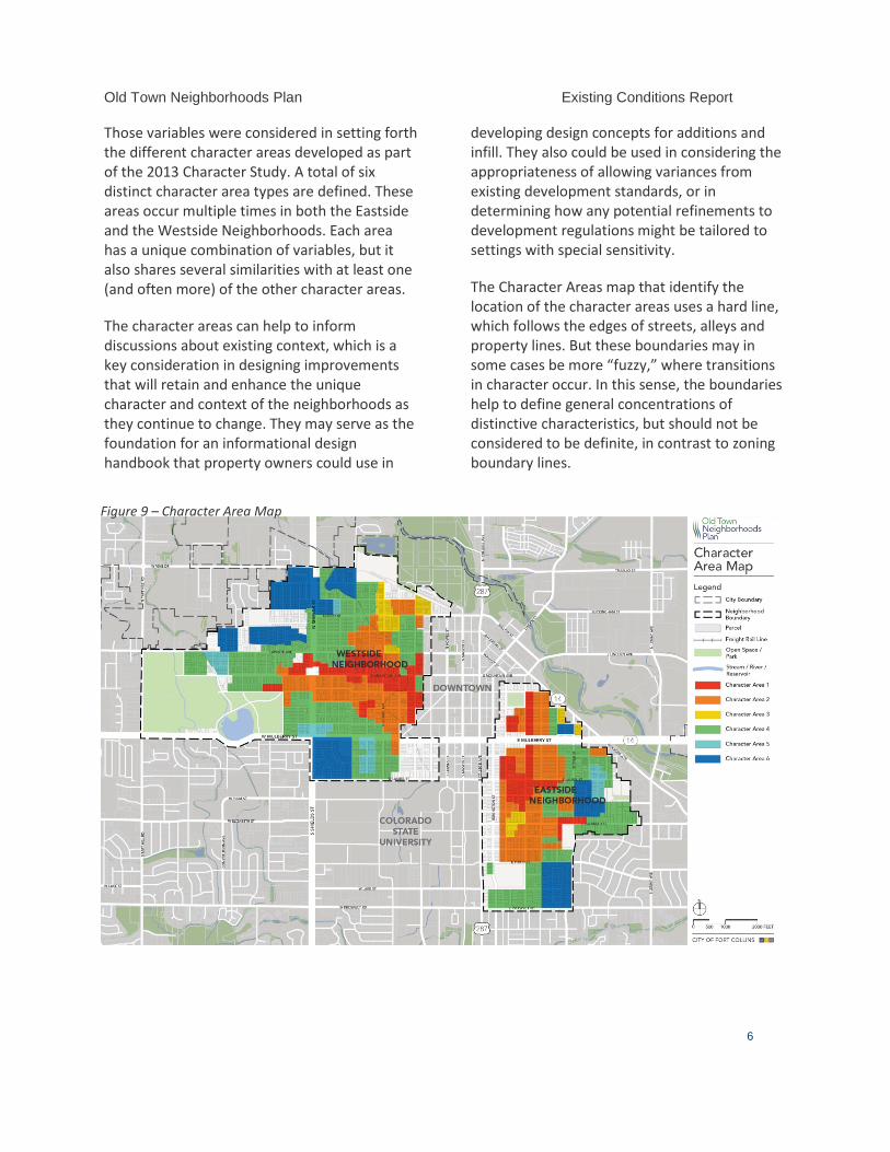
Old Town Neighborhoods Plan Existing Conditions Report
6
Those variables were considered in setting forth the different character areas developed as part of the 2013 Character Study. A total of six distinct character area types are defined. These areas occur multiple times in both the Eastside and the Westside Neighborhoods. Each area has a unique combination of variables, but it also shares several similarities with at least one (and often more) of the other character areas.
The character areas can help to inform discussions about existing context, which is a key consideration in designing improvements that will retain and enhance the unique character and context of the neighborhoods as they continue to change. They may serve as the foundation for an informational design handbook that property owners could use in
developing design concepts for additions and infill. They also could be used in considering the appropriateness of allowing variances from existing development standards, or in determining how any potential refinements to development regulations might be tailored to settings with special sensitivity.
The Character Areas map that identify the location of the character areas uses a hard line, which follows the edges of streets, alleys and property lines. But these boundaries may in some cases be more “fuzzy,” where transitions in character occur. In this sense, the boundaries help to define general concentrations of distinctive characteristics, but should not be considered to be definite, in contrast to zoning boundary lines.
Figure 9 – Character Area Map
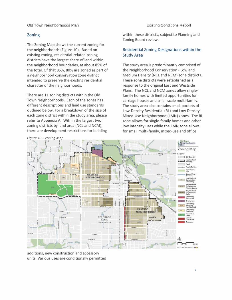
Old Town Neighborhoods Plan Existing Conditions Report
7
Zoning
The Zoning Map shows the current zoning for the neighborhoods (Figure 10). Based on existing zoning, residential-related zoning districts have the largest share of land within the neighborhood boundaries, at about 85% of the total. Of that 85%, 80% are zoned as part of a neighborhood conservation zone district intended to preserve the existing residential character of the neighborhoods.
There are 11 zoning districts within the Old Town Neighborhoods. Each of the zones has different descriptions and land use standards outlined below. For a breakdown of the size of each zone district within the study area, please refer to Appendix A. Within the largest two zoning districts by land area (NCL and NCM), there are development restrictions for building
additions, new construction and accessory units. Various uses are conditionally permitted
within these districts, subject to Planning and Zoning Board review.
Residential Zoning Designations within the Study Area
The study area is predominantly comprised of the Neighborhood Conservation - Low and Medium Density (NCL and NCM) zone districts. These zone districts were established as a response to the original East and Westside Plans. The NCL and NCM zones allow single-family homes with limited opportunities for carriage houses and small scale multi-family. The study area also contains small pockets of Low-Density Residential (RL) and Low Density Mixed-Use Neighborhood (LMN) zones. The RL zone allows for single-family homes and other low intensity uses while the LMN zone allows for small multi-family, mixed-use and office
Figure 10 – Zoning Map
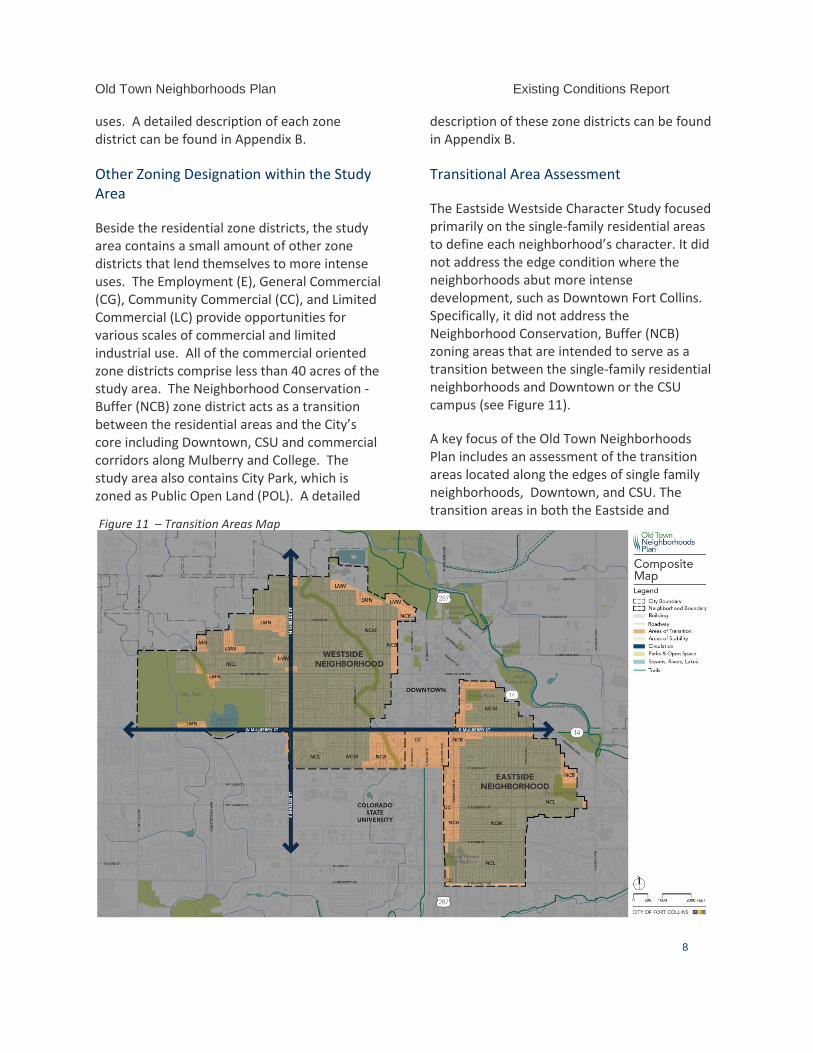
Old Town Neighborhoods Plan Existing Conditions Report
8
uses. A detailed description of each zone district can be found in Appendix B.
Other Zoning Designation within the Study Area
Beside the residential zone districts, the study area contains a small amount of other zone districts that lend themselves to more intense uses. The Employment (E), General Commercial (CG), Community Commercial (CC), and Limited Commercial (LC) provide opportunities for various scales of commercial and limited industrial use. All of the commercial oriented zone districts comprise less than 40 acres of the study area. The Neighborhood Conservation - Buffer (NCB) zone district acts as a transition between the residential areas and the City’s core including Downtown, CSU and commercial corridors along Mulberry and College. The study area also contains City Park, which is zoned as Public Open Land (POL). A detailed
description of these zone districts can be found in Appendix B.
Transitional Area Assessment
The Eastside Westside Character Study focused primarily on the single-family residential areas to define each neighborhood’s character. It did not address the edge condition where the neighborhoods abut more intense development, such as Downtown Fort Collins. Specifically, it did not address the Neighborhood Conservation, Buffer (NCB) zoning areas that are intended to serve as a transition between the single-family residential neighborhoods and Downtown or the CSU campus (see Figure 11).
A key focus of the Old Town Neighborhoods Plan includes an assessment of the transition areas located along the edges of single family neighborhoods, Downtown, and CSU. The transition areas in both the Eastside and
Figure 11 – Transition Areas Map
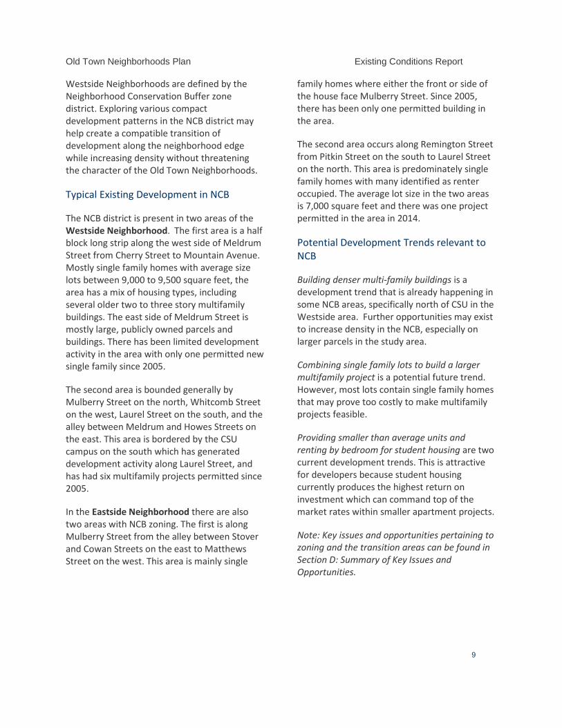
Old Town Neighborhoods Plan Existing Conditions Report
9
Westside Neighborhoods are defined by the Neighborhood Conservation Buffer zone district. Exploring various compact development patterns in the NCB district may help create a compatible transition of development along the neighborhood edge while increasing density without threatening the character of the Old Town Neighborhoods.
Typical Existing Development in NCB
The NCB district is present in two areas of the Westside Neighborhood. The first area is a half block long strip along the west side of Meldrum Street from Cherry Street to Mountain Avenue. Mostly single family homes with average size lots between 9,000 to 9,500 square feet, the area has a mix of housing types, including several older two to three story multifamily buildings. The east side of Meldrum Street is mostly large, publicly owned parcels and buildings. There has been limited development activity in the area with only one permitted new single family since 2005.
The second area is bounded generally by Mulberry Street on the north, Whitcomb Street on the west, Laurel Street on the south, and the alley between Meldrum and Howes Streets on the east. This area is bordered by the CSU campus on the south which has generated development activity along Laurel Street, and has had six multifamily projects permitted since 2005.
In the Eastside Neighborhood there are also two areas with NCB zoning. The first is along Mulberry Street from the alley between Stover and Cowan Streets on the east to Matthews Street on the west. This area is mainly single
family homes where either the front or side of the house face Mulberry Street. Since 2005, there has been only one permitted building in the area.
The second area occurs along Remington Street from Pitkin Street on the south to Laurel Street on the north. This area is predominately single family homes with many identified as renter occupied. The average lot size in the two areas is 7,000 square feet and there was one project permitted in the area in 2014.
Potential Development Trends relevant to NCB
Building denser multi-family buildings is a development trend that is already happening in some NCB areas, specifically north of CSU in the Westside area. Further opportunities may exist to increase density in the NCB, especially on larger parcels in the study area.
Combining single family lots to build a larger multifamily project is a potential future trend. However, most lots contain single family homes that may prove too costly to make multifamily projects feasible.
Providing smaller than average units and renting by bedroom for student housing are two current development trends. This is attractive for developers because student housing currently produces the highest return on investment which can command top of the market rates within smaller apartment projects.
Note: Key issues and opportunities pertaining to zoning and the transition areas can be found in Section D: Summary of Key Issues and Opportunities.
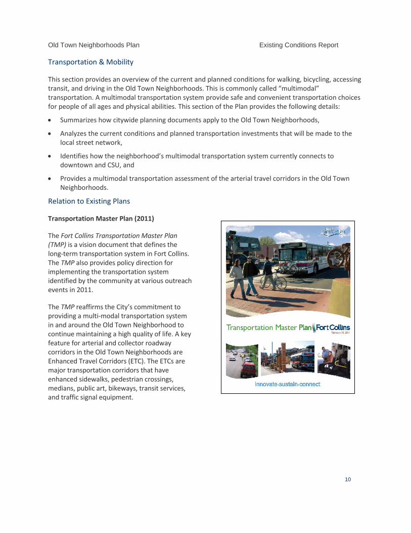
Old Town Neighborhoods Plan Existing Conditions Report
10
Transportation & Mobility
This section provides an overview of the current and planned conditions for walking, bicycling, accessing transit, and driving in the Old Town Neighborhoods. This is commonly called “multimodal” transportation. A multimodal transportation system provide safe and convenient transportation choices for people of all ages and physical abilities. This section of the Plan provides the following details:
• Summarizes how citywide planning documents apply to the Old Town Neighborhoods,
• Analyzes the current conditions and planned transportation investments that will be made to the local street network,
• Identifies how the neighborhood’s multimodal transportation system currently connects to downtown and CSU, and
• Provides a multimodal transportation assessment of the arterial travel corridors in the Old Town Neighborhoods.
Relation to Existing Plans
Transportation Master Plan (2011)
The Fort Collins Transportation Master Plan (TMP) is a vision document that defines the long-term transportation system in Fort Collins. The TMP also provides policy direction for implementing the transportation system identified by the community at various outreach events in 2011.
The TMP reaffirms the City’s commitment to providing a multi-modal transportation system in and around the Old Town Neighborhood to continue maintaining a high quality of life. A key feature for arterial and collector roadway corridors in the Old Town Neighborhoods are Enhanced Travel Corridors (ETC). The ETCs are major transportation corridors that have enhanced sidewalks, pedestrian crossings, medians, public art, bikeways, transit services, and traffic signal equipment.
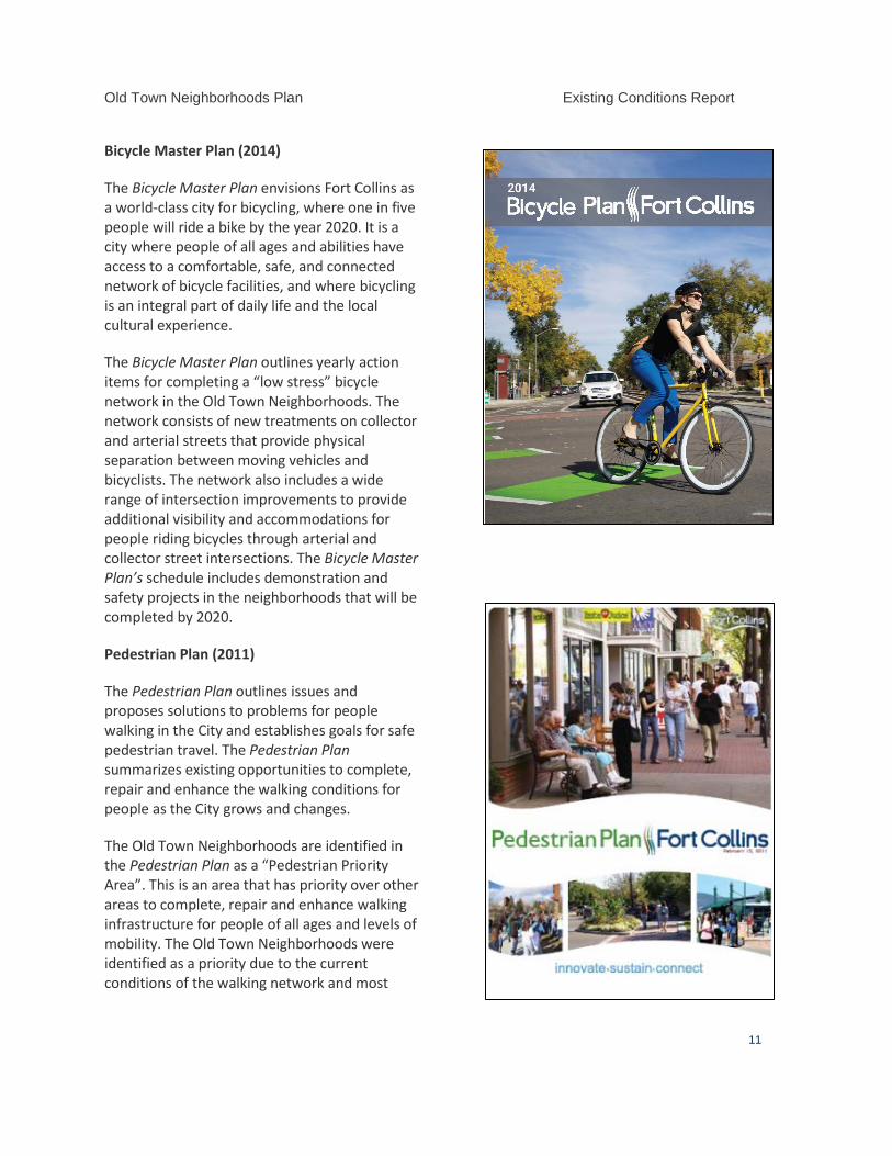
Old Town Neighborhoods Plan Existing Conditions Report
11
Bicycle Master Plan (2014)
The Bicycle Master Plan envisions Fort Collins as a world-class city for bicycling, where one in five people will ride a bike by the year 2020. It is a city where people of all ages and abilities have access to a comfortable, safe, and connected network of bicycle facilities, and where bicycling is an integral part of daily life and the local cultural experience.
The Bicycle Master Plan outlines yearly action items for completing a “low stress” bicycle network in the Old Town Neighborhoods. The network consists of new treatments on collector and arterial streets that provide physical separation between moving vehicles and bicyclists. The network also includes a wide range of intersection improvements to provide additional visibility and accommodations for people riding bicycles through arterial and collector street intersections. The Bicycle Master Plan’s schedule includes demonstration and safety projects in the neighborhoods that will be completed by 2020.
Pedestrian Plan (2011)
The Pedestrian Plan outlines issues and proposes solutions to problems for people walking in the City and establishes goals for safe pedestrian travel. The Pedestrian Plan summarizes existing opportunities to complete, repair and enhance the walking conditions for people as the City grows and changes.
The Old Town Neighborhoods are identified in the Pedestrian Plan as a “Pedestrian Priority Area”. This is an area that has priority over other areas to complete, repair and enhance walking infrastructure for people of all ages and levels of mobility. The Old Town Neighborhoods were identified as a priority due to the current conditions of the walking network and most
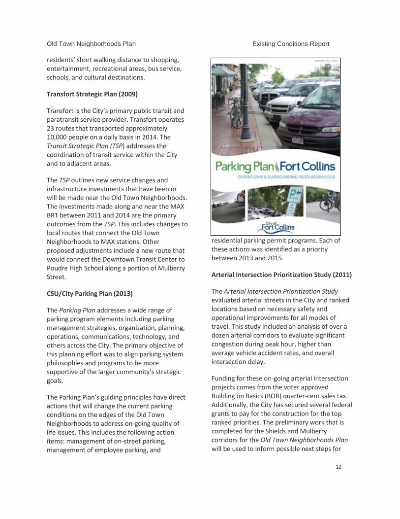
Old Town Neighborhoods Plan Existing Conditions Report
12
residents’ short walking distance to shopping, entertainment, recreational areas, bus service, schools, and cultural destinations.
Transfort Strategic Plan (2009)
Transfort is the City’s primary public transit and paratransit service provider. Transfort operates 23 routes that transported approximately 10,000 people on a daily basis in 2014. The Transit Strategic Plan (TSP) addresses the coordination of transit service within the City and to adjacent areas.
The TSP outlines new service changes and infrastructure investments that have been or will be made near the Old Town Neighborhoods. The investments made along and near the MAX BRT between 2011 and 2014 are the primary outcomes from the TSP. This includes changes to local routes that connect the Old Town Neighborhoods to MAX stations. Other proposed adjustments include a new route that would connect the Downtown Transit Center to Poudre High School along a portion of Mulberry Street.
CSU/City Parking Plan (2013)
The Parking Plan addresses a wide range of parking program elements including parking management strategies, organization, planning, operations, communications, technology, and others across the City. The primary objective of this planning effort was to align parking system philosophies and programs to be more supportive of the larger community’s strategic goals.
The Parking Plan’s guiding principles have direct actions that will change the current parking conditions on the edges of the Old Town Neighborhoods to address on-going quality of life issues. This includes the following action items: management of on-street parking, management of employee parking, and
residential parking permit programs. Each of these actions was identified as a priority between 2013 and 2015.
Arterial Intersection Prioritization Study (2011)
The Arterial Intersection Prioritization Study evaluated arterial streets in the City and ranked locations based on necessary safety and operational improvements for all modes of travel. This study included an analysis of over a dozen arterial corridors to evaluate significant congestion during peak hour, higher than average vehicle accident rates, and overall intersection delay.
Funding for these on-going arterial intersection projects comes from the voter approved Building on Basics (BOB) quarter-cent sales tax. Additionally, the City has secured several federal grants to pay for the construction for the top ranked priorities. The preliminary work that is completed for the Shields and Mulberry corridors for the Old Town Neighborhoods Plan will be used to inform possible next steps for
Old Town Neighborhoods Plan Existing Conditions Report
13
both corridors.
Other Completed and On-going Plans
The City has completed several recent planning efforts near the Old Town Neighborhoods that provide context to the current Old Town Neighborhoods Plan. In addition, there are concurrent planning efforts underway that have similar timelines.
Completed Plans • Lincoln Corridor Plan (Bus trolley extension
to east neighborhoods) • West Central Area Plan (Shields Corridor
“right sizing”) • Bikeshare Master Plan (possible locations in
Old Town Neighborhoods) On-Going Plans and Programs • Downtown Plan (with parking plan update) • Transfort Bus Stop Design Standards • Safe Routes to Schools Plan • Safe Routes to Everywhere • Remington Neighborhood Greenway
Demonstration • Pavement Management Plan
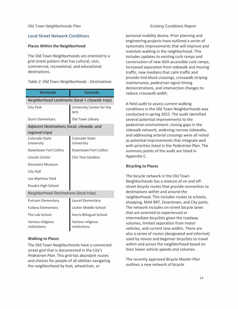
Old Town Neighborhoods Plan Existing Conditions Report
14
Local Street Network Conditions
Places Within the Neighborhood
The Old Town Neighborhoods are oriented to a grid street pattern that has cultural, civic, commercial, recreational, and educational destinations.
Table 2: Old Town Neighborhoods - Destinations
Westside Eastside
Neighborhood Landmarks (local + citywide trips)
City Park University Center for the Arts
Dunn Elementary Old Town Library
Adjacent Destinations (local, citywide, and regional trips) Colorado State University
Colorado State University
Downtown Fort Collins Downtown Fort Collins
Lincoln Center CSU Test Gardens
Discovery Museum
City Hall
Lee Martinez Park
Poudre High School
Neighborhood Destinations (local trips)
Putnam Elementary Laurel Elementary
Fullana Elementary Lesher Middle School
The Lab School Harris Bilingual School
Various religious institutions
Various religious institutions
Walking to Places The Old Town Neighborhoods have a connected street gird that is documented in the City’s Pedestrian Plan. This grid has abundant routes and choices for people of all abilities navigating the neighborhood by foot, wheelchair, or
personal mobility device. Prior planning and engineering projects have outlined a series of systematic improvements that will improve and maintain walking in the neighborhood. This includes updates to existing curb ramps and construction of new ADA accessible curb ramps, increased separation from sidewalk and moving traffic, new medians that calm traffic and provide mid-block crossings, crosswalk striping maintenance, pedestrian signal timing demonstrations, and intersection changes to reduce crosswalk width. A field audit to assess current walking conditions in the Old Town Neighborhoods was conducted in spring 2015. The audit identified several potential improvements to the pedestrian environment: closing gaps in the sidewalk network, widening narrow sidewalks, and addressing arterial crossings were all noted as potential improvements that integrate well with priorities listed in the Pedestrian Plan. The summary points of the audit are listed in Appendix C.
Bicycling to Places
The bicycle network in the Old Town Neighborhoods has a mixture of on and off-street bicycle routes that provide connection to destinations within and around the neighborhood. This includes routes to schools, shopping, MAX BRT, Downtown, and City parks. The network includes on-street bicycle lanes that are oriented to experienced or intermediate bicyclists given the roadway volumes, limited separation from motor vehicles, and current lane widths. There are also a series of routes (designated and informal) used by novice and beginner bicyclists to travel within and across the neighborhood based on their lower vehicle speeds and volumes.
The recently approved Bicycle Master Plan outlines a new network of bicycle
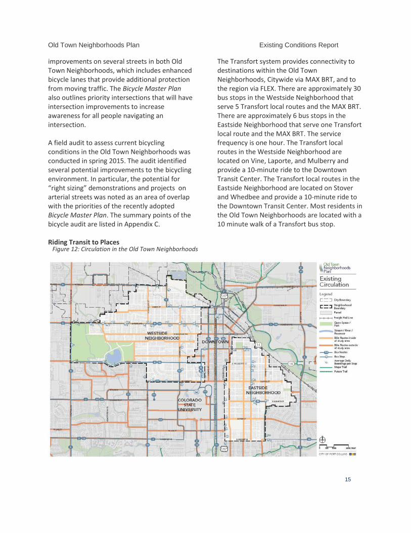
Old Town Neighborhoods Plan Existing Conditions Report
15
improvements on several streets in both Old Town Neighborhoods, which includes enhanced bicycle lanes that provide additional protection from moving traffic. The Bicycle Master Plan also outlines priority intersections that will have intersection improvements to increase awareness for all people navigating an intersection. A field audit to assess current bicycling conditions in the Old Town Neighborhoods was conducted in spring 2015. The audit identified several potential improvements to the bicycling environment. In particular, the potential for “right sizing” demonstrations and projects on arterial streets was noted as an area of overlap with the priorities of the recently adopted Bicycle Master Plan. The summary points of the bicycle audit are listed in Appendix C. Riding Transit to Places
The Transfort system provides connectivity to destinations within the Old Town Neighborhoods, Citywide via MAX BRT, and to the region via FLEX. There are approximately 30 bus stops in the Westside Neighborhood that serve 5 Transfort local routes and the MAX BRT. There are approximately 6 bus stops in the Eastside Neighborhood that serve one Transfort local route and the MAX BRT. The service frequency is one hour. The Transfort local routes in the Westside Neighborhood are located on Vine, Laporte, and Mulberry and provide a 10-minute ride to the Downtown Transit Center. The Transfort local routes in the Eastside Neighborhood are located on Stover and Whedbee and provide a 10-minute ride to the Downtown Transit Center. Most residents in the Old Town Neighborhoods are located with a 10 minute walk of a Transfort bus stop.
Figure 12: Circulation in the Old Town Neighborhoods
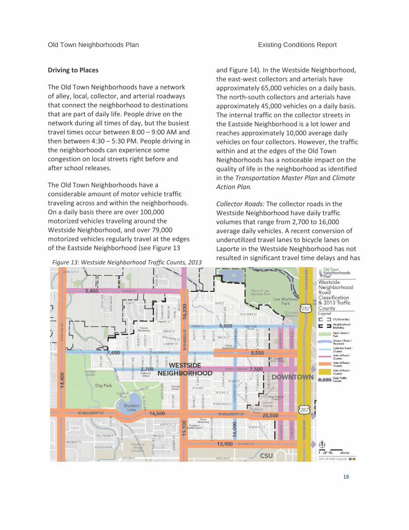
Old Town Neighborhoods Plan Existing Conditions Report
16
Driving to Places
The Old Town Neighborhoods have a network of alley, local, collector, and arterial roadways that connect the neighborhood to destinations that are part of daily life. People drive on the network during all times of day, but the busiest travel times occur between 8:00 – 9:00 AM and then between 4:30 – 5:30 PM. People driving in the neighborhoods can experience some congestion on local streets right before and after school releases.
The Old Town Neighborhoods have a considerable amount of motor vehicle traffic traveling across and within the neighborhoods. On a daily basis there are over 100,000 motorized vehicles traveling around the Westside Neighborhood, and over 79,000 motorized vehicles regularly travel at the edges of the Eastside Neighborhood (see Figure 13
and Figure 14). In the Westside Neighborhood, the east-west collectors and arterials have approximately 65,000 vehicles on a daily basis. The north-south collectors and arterials have approximately 45,000 vehicles on a daily basis. The internal traffic on the collector streets in the Eastside Neighborhood is a lot lower and reaches approximately 10,000 average daily vehicles on four collectors. However, the traffic within and at the edges of the Old Town Neighborhoods has a noticeable impact on the quality of life in the neighborhood as identified in the Transportation Master Plan and Climate Action Plan.
Collector Roads: The collector roads in the Westside Neighborhood have daily traffic volumes that range from 2,700 to 16,000 average daily vehicles. A recent conversion of underutilized travel lanes to bicycle lanes on Laporte in the Westside Neighborhood has not resulted in significant travel time delays and has
Figure 13: Westside Neighborhood Traffic Counts, 2013
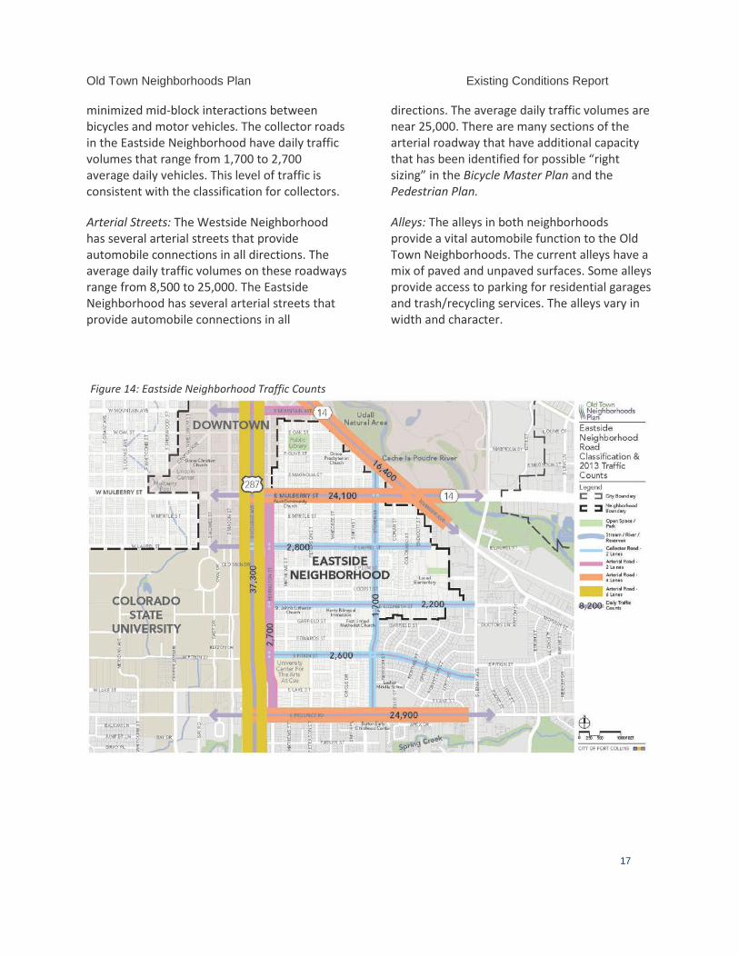
Old Town Neighborhoods Plan Existing Conditions Report
17
minimized mid-block interactions between bicycles and motor vehicles. The collector roads in the Eastside Neighborhood have daily traffic volumes that range from 1,700 to 2,700 average daily vehicles. This level of traffic is consistent with the classification for collectors.
Arterial Streets: The Westside Neighborhood has several arterial streets that provide automobile connections in all directions. The average daily traffic volumes on these roadways range from 8,500 to 25,000. The Eastside Neighborhood has several arterial streets that provide automobile connections in all
directions. The average daily traffic volumes are near 25,000. There are many sections of the arterial roadway that have additional capacity that has been identified for possible “right sizing” in the Bicycle Master Plan and the Pedestrian Plan.
Alleys: The alleys in both neighborhoods provide a vital automobile function to the Old Town Neighborhoods. The current alleys have a mix of paved and unpaved surfaces. Some alleys provide access to parking for residential garages and trash/recycling services. The alleys vary in width and character.
Figure 14: Eastside Neighborhood Traffic Counts
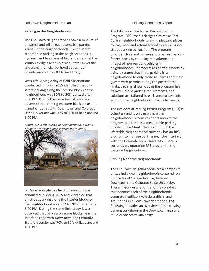
Old Town Neighborhoods Plan Existing Conditions Report
18
Figure 15: In the Westside neighborhood, parking along the interior blocks is usually available.
Parking in the Neighborhoods
The Old Town Neighborhoods have a mixture of on street and off street automobile parking spaces in the neighborhoods. The on-street automobile parking in the neighborhoods is dynamic and has areas of higher demand at the southern edges near Colorado State University and along the neighborhood edges near downtown and the Old Town Library.
Westside: A single day of field observations conducted in spring 2015 identified that on-street parking along the interior blocks of the neighborhood was 30% to 50% utilized after 8:00 PM. During the same field study it was observed that parking on some blocks near the transition zones with Downtown and Colorado State University was 50% to 60% utilized around 1:00 PM.
Eastside: A single day field observation was conducted in spring 2015 and identified that on-street parking along the interior blocks of the neighborhood was 60% to 70% utilized after 8:00 PM. During the same field study it was observed that parking on some blocks near the interface zone with Downtown and Colorado State University was 70% to 80% utilized around 1:00 PM.
The City has a Residential Parking Permit Program (RP3) that is designed to make Fort Collins neighborhoods safe and pleasant places to live, work and attend school by reducing on-street parking congestion. The program provides close and convenient on-street parking for residents by reducing the volume and impact of non-resident vehicles in neighborhoods. It protects residential streets by using a system that limits parking in a neighborhood to only those residents and their guests with permits during the posted time limits. Each neighborhood in the program has its own unique parking requirements, and solutions are tailored to each area to take into account the neighborhoods' particular needs.
The Residential Parking Permit Program (RP3) is voluntary and is only established in neighborhoods where residents request the program and there is a measurable parking problem. The Mantz Neighborhood in the Westside Neighborhood currently has an RP3 program to manage parking near the interface with the Colorado State University. There is currently no operating RP3 program in the Eastside Neighborhood.
Parking Near the Neighborhoods The Old Town Neighborhoods are a composite of two individual neighborhoods centered on both sides of College Avenue, between Downtown and Colorado State University. These major destinations and the corridors that connect each of the neighborhoods generate significant vehicle traffic in and around the Old Town Neighborhoods. The following provides an overview of the existing parking conditions in the Downtown area and at Colorado State University.
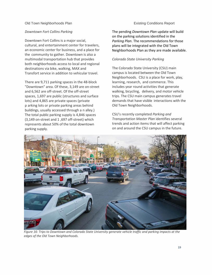
Old Town Neighborhoods Plan Existing Conditions Report
19
Downtown Fort Collins Parking
Downtown Fort Collins is a major social, cultural, and entertainment center for travelers, an economic center for business, and a place for the community to gather. Downtown is also a multimodal transportation hub that provides both neighborhoods access to local and regional destinations via bike, walking, MAX and Transfort service in addition to vehicular travel.
There are 9,711 parking spaces in the 48-block "Downtown" area. Of these, 3,149 are on-street and 6,562 are off-street. Of the off-street spaces, 1,697 are public (structures and surface lots) and 4,865 are private spaces (private p arking lots or private parking areas behind buildings, usually accessed through a n alley.) The total public parking supply is 4,846 spaces (3,149 on-street and 1 ,697 off-street) which represents about 50% of the total downtown parking supply.
The pending Downtown Plan update will build on the parking solutions identified in the Parking Plan. The recommendations for those plans will be integrated with the Old Town Neighborhoods Plan as they are made available.
Colorado State University Parking
The Colorado State University (CSU) main campus is located between the Old Town Neighborhoods. CSU is a place for work, play, learning, research, and commerce. This includes year round activities that generate walking, bicycling, delivery, and motor vehicle trips. The CSU main campus generates travel demands that have visible interactions with the Old Town Neighborhoods.
CSU’s recently completed Parking and Transportation Master Plan identifies several trends and action items that will affect parking on and around the CSU campus in the future.
Figure 16: Trips to Downtown and Colorado State University generate vehicle traffic and parking impacts at the edges of the Old Town Neighborhoods.
Old Town Neighborhoods Plan Existing Conditions Report
20
Arterial Street Corridors Assessment
The arterial streets are major travel corridors that provide access to destinations citywide. Arterial streets in the Old Town Neighborhoods have a wide range of function, purpose, and identity. Many of the arterial streets in the neighborhoods have been identified for improvements that will enhance their attractiveness, provide protected bicycle lanes, reduce crossing distances for people at major intersections, provide new amenities for passenger waiting areas at Transfort stops, and use leading edge technologies to safely manage traffic.
The following section provides a multimodal assessment of the Mulberry and Shields arterial corridors in the Old Town Neighborhoods. Each corridor includes an assessment of safety for all travelers, intersection improvements, walking, bicycling, riding transit, and driving in the corridors. Specifically, this analysis builds on the work that was conducted for the southern part of the Shields corridor in the West Central Area Plan.
College Avenue is another major arterial, 6-lane roadway that connects the Old Town Neighborhoods to destinations Citywide and across the region. Though an assessment of College Avenue is outside the scope of the Old Town Neighborhoods Plan, plans for College Avenue as they impact and relate to the Old Town Neighborhoods will be coordinated throughout the Old Town Neighborhoods Plan process.
Mulberry Street
Mulberry Street is a 4-lane arterial corridor that connects the Old Town Neighborhoods to each other and destinations to the east. The Old Town Neighborhoods area along Mulberry is approximately 2.7 miles long. The Mulberry
corridor is a critical transportation link in the City’s multimodal transportation network. Average daily traffic volumes on Mulberry Street are 25,000 vehicles on the east side of College Avenue and 17,000 on the west side of College Avenue. The predominant land use along Mulberry Street in the Old Town Neighborhoods is single family residential. The corridor has some notable destinations that attract walking, bicycling, transit and driving trips. These destinations include Poudre High School, City Park, Dunn IB World School, and the Lincoln Center and Mulberry Pool.
A summary of the actions and policies that are planned or existing are noted below. Corridor mapping in this section provides additional details.
Walking in the corridor east of College Avenue. The sidewalks in the corridor, east of College Avenue, have separation from moving traffic and directional curb ramps that meet ADA standards. The east side of the corridor has a posted speed limit of 35 MPH. 2 of the 8 intersections along the east side of the corridor have crosswalk treatments. Both of the intersections that have crosswalk treatments are at signalized intersections (Whedbee and Remington). There are sections of sidewalk on the east side of the corridor that do not meet the City’s current standard of 6-foot widths for arterial roadways.
Walking in the corridor west of College Avenue. The sidewalks in the corridor, west of College Avenue have separation from moving traffic and directional curb ramps that meet ADA standards. The sidewalks west of College Avenue have some areas that lack separation from moving traffic. The west side of the corridor has a posted speed limit of 35
Old Town Neighborhoods Plan Existing Conditions Report
21
MPH. Ten of the 20 intersections on the west side of the corridor have crosswalk treatments. Nine of the 10 intersections with crosswalk treatments have a signalized intersection. The crosswalk at South Sherwood Street near the Mulberry Pool does not have a signalized crossing. There are sections of sidewalk on the west side of the corridor that do not meet the City’s current standard of 6-foot widths for arterial roadways.
Future walking in the corridor. A portion of the Mulberry Street corridor is identified as a “Pedestrian Priority Area” in the Pedestrian Plan. This is the section between Meldrum and Taft Hill Road. This designation is due to the hourly Transfort service provided by Routes #6 and #10 in the corridor. The Pedestrian Plan also identifies sidewalk improvements between Shields Street and City Park Avenue due to the high volume of traffic and minimal separation from moving traffic. This project will require adjusted lane widths and reconstruction of the current curb and gutter pans.
Riding bicycles in the corridor. Mulberry Street currently has bicycle lanes from Overland Trail to City Park. West of City Park there are parallel streets that allow people riding bikes to make connections to downtown using West Magnolia Street. The recently adopted Bicycle Master Plan identified new buffered bicycle lanes on Mulberry Street from City Park to Overland Trail on the west side of the City. The buffered bikes lanes will require adjusted lane widths to achieve the buffered bikes lanes within the current curb lines of Mulberry Street (see Mulberry Corridor Analysis).
Riding Transfort in the corridor. Transfort bus service is provided hourly at 7 east bound stops and 5 west bound stops in the corridor between Meldrum and Taft Hill Road. Route #6 provides hourly transit connections to the CSU Transit Center, MAX BRT, and destinations along Taft Hill, Drake, and College Avenue. Route #10 provides hourly transit connections to the Downtown Transit Center, MAX BRT, and destinations along Taft Hill and Laporte Street. An average of 105 people get on and off Transfort bus service along the Mulberry corridor each weekday. The combined average weekday ridership of both routes is 867 passengers.2
Driving in the corridor. The corridor has a
posted speed limit of 35 MPH and has 11 signalized intersections. There are 9 signalized intersections west of College Avenue and 2 east of College Avenue. The width and presence of center turn lanes varies in the corridor. Recent reviews of travel time data for trips between Taft Hill Road and Riverside range from 7 minutes off peak to 9.5 minutes during the peak travel period.
2 Data for Transfort ridership is based on passenger counts from January 19-May 15, 2015. Note that times when CSU is not in session likely result in lower ridership numbers in the Mulberry corridor.
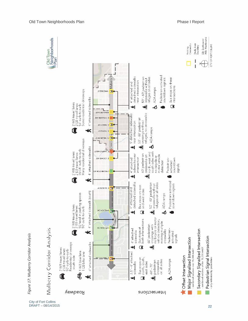
Old Town Neighborhoods Plan Phase I Report
City of Fort Collins DRAFT – 08/14/2015
22
Figu
re 1
7: M
ulbe
rry
Corr
idor
Ana
lysis
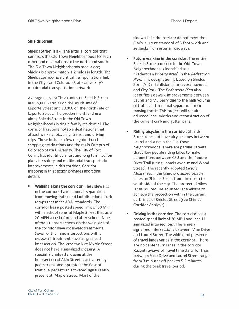
Old Town Neighborhoods Plan Phase I Report
City of Fort Collins DRAFT – 08/14/2015
23
Shields Street
Shields Street is a 4 lane arterial corridor that connects the Old Town Neighborhoods to each other and destinations to the north and south. The Old Town Neighborhoods area along Shields is approximately 1.2 miles in length. The Shields corridor is a critical transportation link in the City’s and Colorado State University’s multimodal transportation network.
Average daily traffic volumes on Shields Street are 15,000 vehicles on the south side of Laporte Street and 10,000 on the north side of Laporte Street. The predominant land use along Shields Street in the Old Town Neighborhoods is single family residential. The corridor has some notable destinations that attract walking, bicycling, transit and driving trips. These include a few neighborhood shopping destinations and the main Campus of Colorado State University. The City of Fort Collins has identified short and long term action plans for safety and multimodal transportation improvements in this corridor. Corridor mapping in this section provides additional details.
Walking along the corridor. The sidewalks in the corridor have minimal separation from moving traffic and lack directional curb ramps that meet ADA standards. The corridor has a posted speed limit of 30 MPH with a school zone at Maple Street that as a 20 MPH zone before and after school. Nine of the 21 intersections on the west side of the corridor have crosswalk treatments. Seven of the nine intersections with a crosswalk treatment have a signalized intersection. The crosswalk at Myrtle Street does not have a signalized crossing. A special signalized crossing at the intersection of Akin Street is activated by pedestrians and optimizes the flow of traffic. A pedestrian activated signal is also present at Maple Street. Most of the
sidewalks in the corridor do not meet the City’s current standard of 6-foot width and setbacks from arterial roadways.
Future walking in the corridor. The entire Shields Street corridor in the Old Town Neighborhoods is identified as a “Pedestrian Priority Area” in the Pedestrian Plan. This designation is based on Shields Street’s ¼ mile distance to several schools and City Park. The Pedestrian Plan also identifies sidewalk improvements between Laurel and Mulberry due to the high volume of traffic and minimal separation from moving traffic. This project will require adjusted lane widths and reconstruction of the current curb and gutter pans.
Riding bicycles in the corridor. Shields Street does not have bicycle lanes between Laurel and Vine in the Old Town Neighborhoods. There are parallel streets that allow people riding bikes to make connections between CSU and the Poudre River Trail (using Loomis Avenue and Wood Street). The recently adopted Bicycle Master Plan identified protected bicycle lanes on Shields Street from the north to south side of the city. The protected bikes lanes will require adjusted lane widths to achieve the protection within the current curb lines of Shields Street (see Shields Corridor Analysis).
Driving in the corridor. The corridor has a posted speed limit of 30 MPH and has 11 signalized intersections. There are 7 signalized intersections between Vine Drive and Laurel Street. The width and presence of travel lanes varies in the corridor. There are no center turn lanes in the corridor. Recent reviews of travel time data for trips between Vine Drive and Laurel Street range from 3 minutes off peak to 5.5 minutes during the peak travel period.
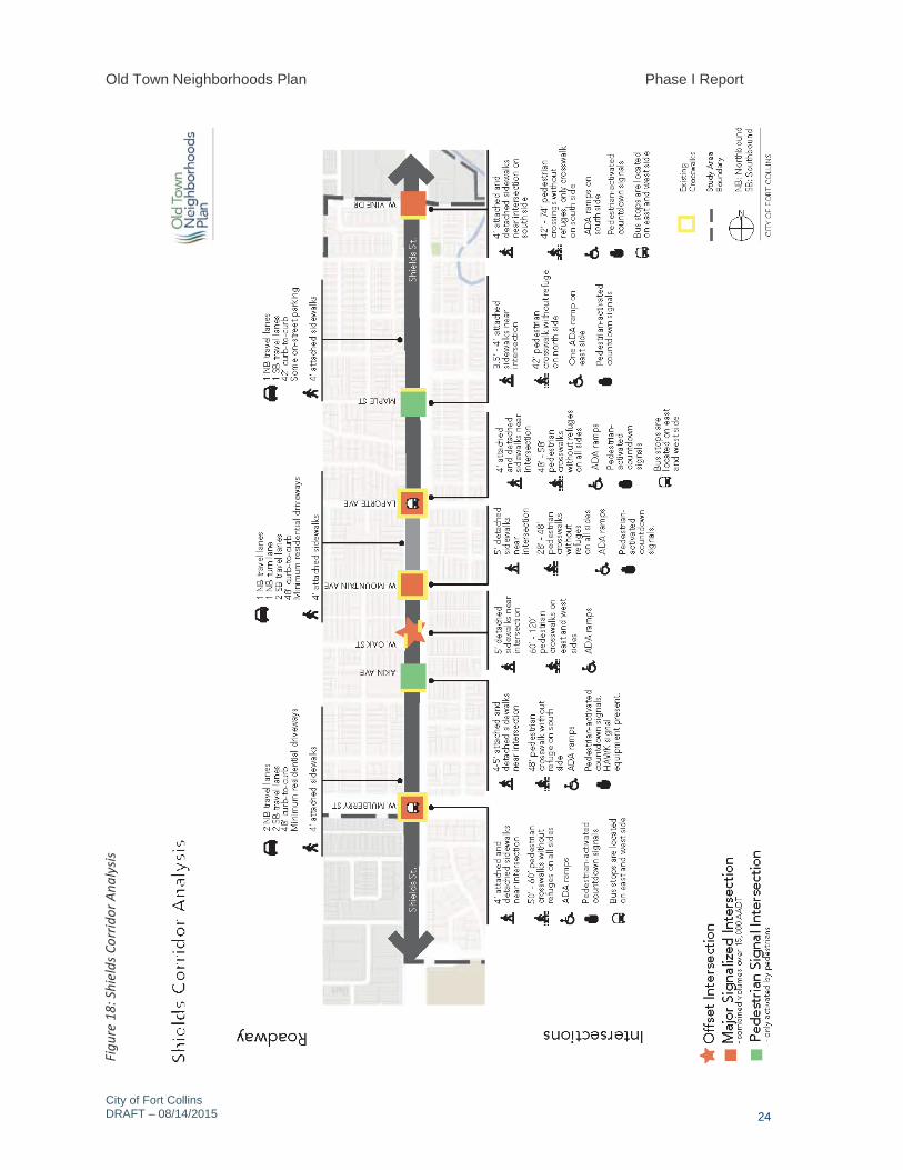
Old Town Neighborhoods Plan Phase I Report
City of Fort Collins DRAFT – 08/14/2015
24
Figu
re 1
8: S
hiel
ds C
orrid
or A
naly
sis
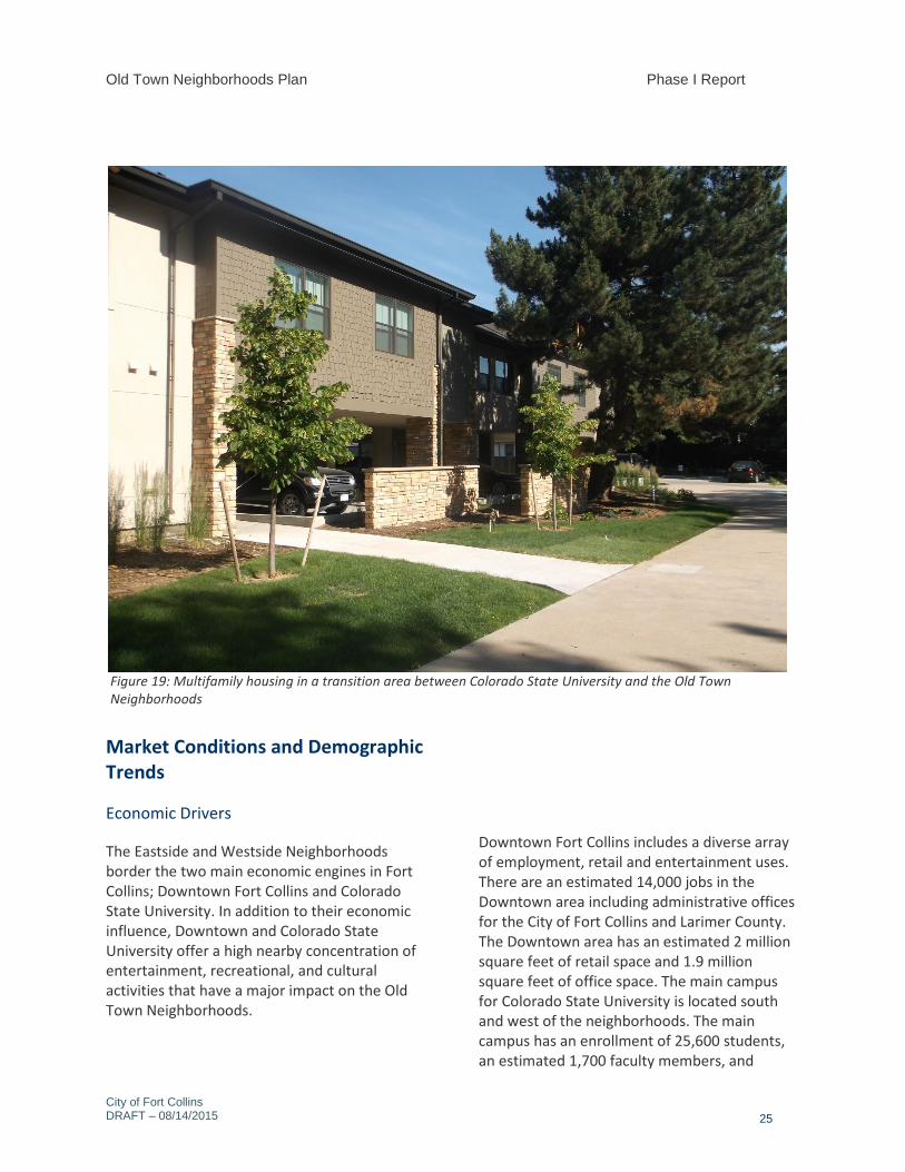
Old Town Neighborhoods Plan Phase I Report
City of Fort Collins DRAFT – 08/14/2015
25
Market Conditions and Demographic Trends
Economic Drivers
The Eastside and Westside Neighborhoods border the two main economic engines in Fort Collins; Downtown Fort Collins and Colorado State University. In addition to their economic influence, Downtown and Colorado State University offer a high nearby concentration of entertainment, recreational, and cultural activities that have a major impact on the Old Town Neighborhoods.
Downtown Fort Collins includes a diverse array of employment, retail and entertainment uses. There are an estimated 14,000 jobs in the Downtown area including administrative offices for the City of Fort Collins and Larimer County. The Downtown area has an estimated 2 million square feet of retail space and 1.9 million square feet of office space. The main campus for Colorado State University is located south and west of the neighborhoods. The main campus has an enrollment of 25,600 students, an estimated 1,700 faculty members, and
Figure 19: Multifamily housing in a transition area between Colorado State University and the Old Town Neighborhoods
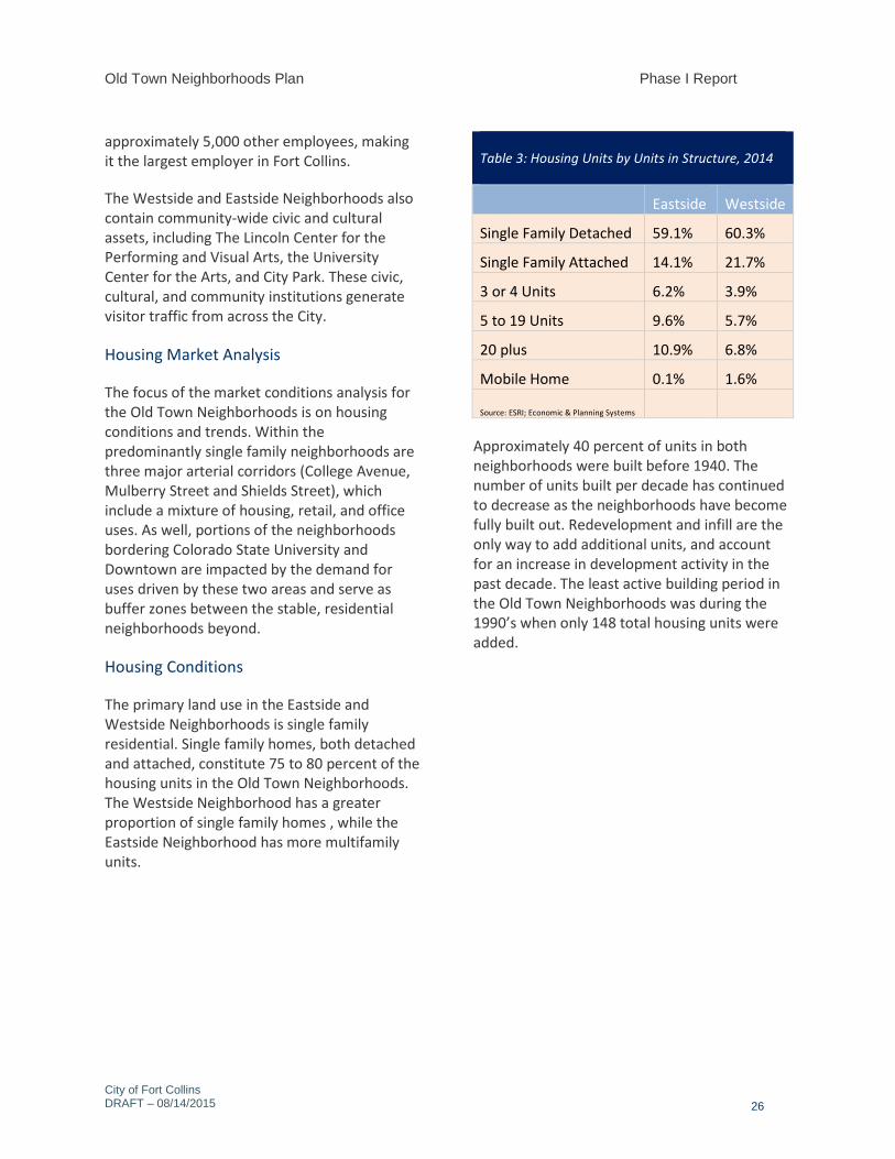
Old Town Neighborhoods Plan Phase I Report
City of Fort Collins DRAFT – 08/14/2015
26
approximately 5,000 other employees, making it the largest employer in Fort Collins.
The Westside and Eastside Neighborhoods also contain community-wide civic and cultural assets, including The Lincoln Center for the Performing and Visual Arts, the University Center for the Arts, and City Park. These civic, cultural, and community institutions generate visitor traffic from across the City.
Housing Market Analysis
The focus of the market conditions analysis for the Old Town Neighborhoods is on housing conditions and trends. Within the predominantly single family neighborhoods are three major arterial corridors (College Avenue, Mulberry Street and Shields Street), which include a mixture of housing, retail, and office uses. As well, portions of the neighborhoods bordering Colorado State University and Downtown are impacted by the demand for uses driven by these two areas and serve as buffer zones between the stable, residential neighborhoods beyond.
Housing Conditions
The primary land use in the Eastside and Westside Neighborhoods is single family residential. Single family homes, both detached and attached, constitute 75 to 80 percent of the housing units in the Old Town Neighborhoods. The Westside Neighborhood has a greater proportion of single family homes , while the Eastside Neighborhood has more multifamily units.
Table 3: Housing Units by Units in Structure, 2014
Eastside Westside
Single Family Detached 59.1% 60.3%
Single Family Attached 14.1% 21.7%
3 or 4 Units 6.2% 3.9%
5 to 19 Units 9.6% 5.7%
20 plus 10.9% 6.8%
Mobile Home 0.1% 1.6%
Source: ESRI; Economic & Planning Systems
Approximately 40 percent of units in both neighborhoods were built before 1940. The number of units built per decade has continued to decrease as the neighborhoods have become fully built out. Redevelopment and infill are the only way to add additional units, and account for an increase in development activity in the past decade. The least active building period in the Old Town Neighborhoods was during the 1990’s when only 148 total housing units were added.
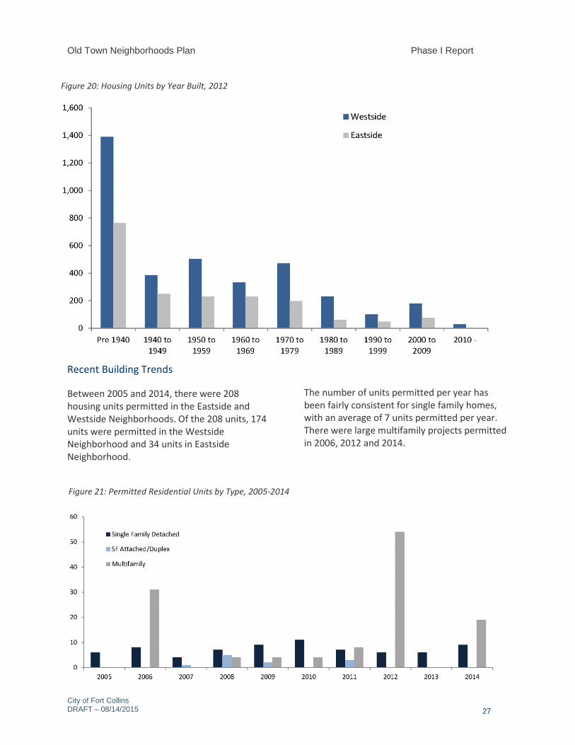
Old Town Neighborhoods Plan Phase I Report
City of Fort Collins DRAFT – 08/14/2015
27
Recent Building Trends
Between 2005 and 2014, there were 208 housing units permitted in the Eastside and Westside Neighborhoods. Of the 208 units, 174 units were permitted in the Westside Neighborhood and 34 units in Eastside Neighborhood.
The number of units permitted per year has been fairly consistent for single family homes, with an average of 7 units permitted per year. There were large multifamily projects permitted in 2006, 2012 and 2014.
Figure 20: Housing Units by Year Built, 2012
Figure 21: Permitted Residential Units by Type, 2005-2014
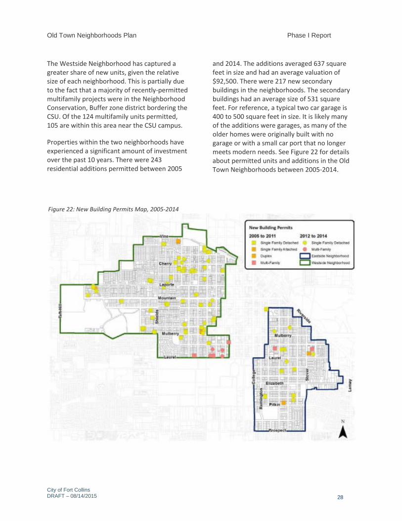
Old Town Neighborhoods Plan Phase I Report
City of Fort Collins DRAFT – 08/14/2015
28
The Westside Neighborhood has captured a greater share of new units, given the relative size of each neighborhood. This is partially due to the fact that a majority of recently-permitted multifamily projects were in the Neighborhood Conservation, Buffer zone district bordering the CSU. Of the 124 multifamily units permitted, 105 are within this area near the CSU campus.
Properties within the two neighborhoods have experienced a significant amount of investment over the past 10 years. There were 243 residential additions permitted between 2005
and 2014. The additions averaged 637 square feet in size and had an average valuation of $92,500. There were 217 new secondary buildings in the neighborhoods. The secondary buildings had an average size of 531 square feet. For reference, a typical two car garage is 400 to 500 square feet in size. It is likely many of the additions were garages, as many of the older homes were originally built with no garage or with a small car port that no longer meets modern needs. See Figure 22 for details about permitted units and additions in the Old Town Neighborhoods between 2005-2014.
Figure 22: New Building Permits Map, 2005-2014
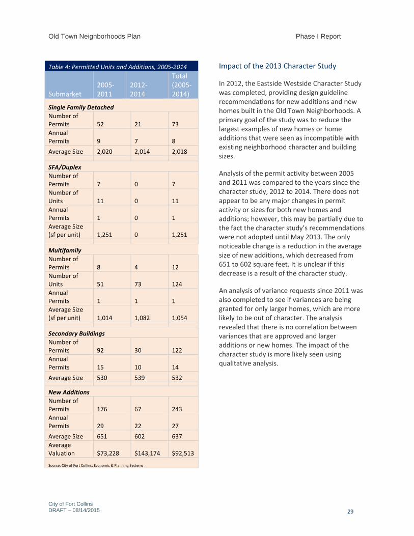
Old Town Neighborhoods Plan Phase I Report
City of Fort Collins DRAFT – 08/14/2015
29
Table 4: Permitted Units and Additions, 2005-2014
Submarket 2005-2011
2012- 2014
Total (2005-2014)
Single Family Detached Number of Permits 52 21 73 Annual Permits 9 7 8 Average Size 2,020 2,014 2,018
SFA/Duplex Number of Permits 7 0 7 Number of Units 11 0 11 Annual Permits 1 0 1 Average Size (sf per unit) 1,251 0 1,251
Multifamily Number of Permits 8 4 12 Number of Units 51 73 124 Annual Permits 1 1 1 Average Size (sf per unit) 1,014 1,082 1,054
Secondary Buildings Number of Permits 92 30 122 Annual Permits 15 10 14 Average Size 530 539 532
New Additions Number of Permits 176 67 243 Annual Permits 29 22 27 Average Size 651 602 637 Average Valuation $73,228 $143,174 $92,513
Source: City of Fort Collins; Economic & Planning Systems
Impact of the 2013 Character Study
In 2012, the Eastside Westside Character Study was completed, providing design guideline recommendations for new additions and new homes built in the Old Town Neighborhoods. A primary goal of the study was to reduce the largest examples of new homes or home additions that were seen as incompatible with existing neighborhood character and building sizes.
Analysis of the permit activity between 2005 and 2011 was compared to the years since the character study, 2012 to 2014. There does not appear to be any major changes in permit activity or sizes for both new homes and additions; however, this may be partially due to the fact the character study’s recommendations were not adopted until May 2013. The only noticeable change is a reduction in the average size of new additions, which decreased from 651 to 602 square feet. It is unclear if this decrease is a result of the character study.
An analysis of variance requests since 2011 was also completed to see if variances are being granted for only larger homes, which are more likely to be out of character. The analysis revealed that there is no correlation between variances that are approved and larger additions or new homes. The impact of the character study is more likely seen using qualitative analysis.
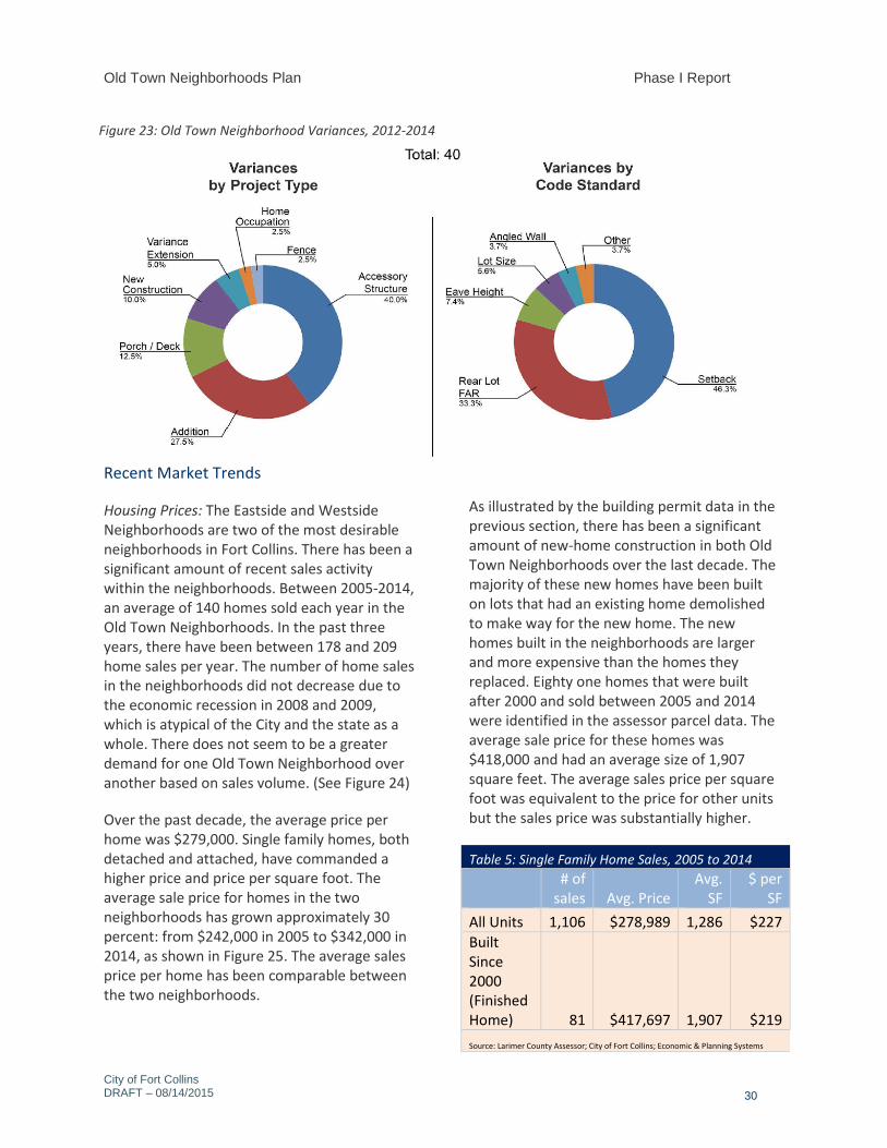
Old Town Neighborhoods Plan Phase I Report
City of Fort Collins DRAFT – 08/14/2015
30
Recent Market Trends
Housing Prices: The Eastside and Westside Neighborhoods are two of the most desirable neighborhoods in Fort Collins. There has been a significant amount of recent sales activity within the neighborhoods. Between 2005-2014, an average of 140 homes sold each year in the Old Town Neighborhoods. In the past three years, there have been between 178 and 209 home sales per year. The number of home sales in the neighborhoods did not decrease due to the economic recession in 2008 and 2009, which is atypical of the City and the state as a whole. There does not seem to be a greater demand for one Old Town Neighborhood over another based on sales volume. (See Figure 24)
Over the past decade, the average price per home was $279,000. Single family homes, both detached and attached, have commanded a higher price and price per square foot. The average sale price for homes in the two neighborhoods has grown approximately 30 percent: from $242,000 in 2005 to $342,000 in 2014, as shown in Figure 25. The average sales price per home has been comparable between the two neighborhoods.
As illustrated by the building permit data in the previous section, there has been a significant amount of new-home construction in both Old Town Neighborhoods over the last decade. The majority of these new homes have been built on lots that had an existing home demolished to make way for the new home. The new homes built in the neighborhoods are larger and more expensive than the homes they replaced. Eighty one homes that were built after 2000 and sold between 2005 and 2014 were identified in the assessor parcel data. The average sale price for these homes was $418,000 and had an average size of 1,907 square feet. The average sales price per square foot was equivalent to the price for other units but the sales price was substantially higher.
Table 5: Single Family Home Sales, 2005 to 2014
# of
sales Avg. Price Avg.
SF $ per
SF All Units 1,106 $278,989 1,286 $227 Built Since 2000 (Finished Home) 81 $417,697 1,907 $219 Source: Larimer County Assessor; City of Fort Collins; Economic & Planning Systems
Figure 23: Old Town Neighborhood Variances, 2012-2014
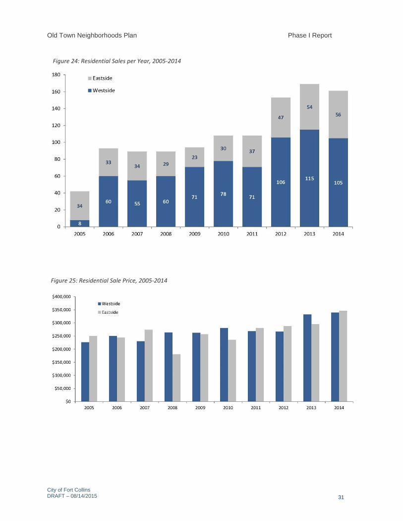
Old Town Neighborhoods Plan Phase I Report
City of Fort Collins DRAFT – 08/14/2015
31
Figure 24: Residential Sales per Year, 2005-2014
Figure 25: Residential Sale Price, 2005-2014
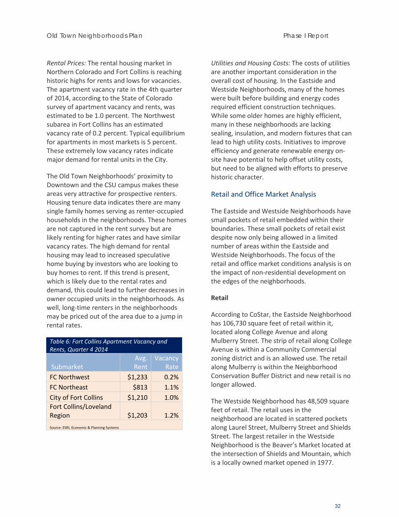
Old Town Neighborhoods Plan Phase I Report
32
Rental Prices: The rental housing market in Northern Colorado and Fort Collins is reaching historic highs for rents and lows for vacancies. The apartment vacancy rate in the 4th quarter of 2014, according to the State of Colorado survey of apartment vacancy and rents, was estimated to be 1.0 percent. The Northwest subarea in Fort Collins has an estimated vacancy rate of 0.2 percent. Typical equilibrium for apartments in most markets is 5 percent. These extremely low vacancy rates indicate major demand for rental units in the City.
The Old Town Neighborhoods’ proximity to Downtown and the CSU campus makes these areas very attractive for prospective renters. Housing tenure data indicates there are many single family homes serving as renter-occupied households in the neighborhoods. These homes are not captured in the rent survey but are likely renting for higher rates and have similar vacancy rates. The high demand for rental housing may lead to increased speculative home buying by investors who are looking to buy homes to rent. If this trend is present, which is likely due to the rental rates and demand, this could lead to further decreases in owner occupied units in the neighborhoods. As well, long-time renters in the neighborhoods may be priced out of the area due to a jump in rental rates.
Table 6: Fort Collins Apartment Vacancy and Rents, Quarter 4 2014
Submarket Avg. Rent
Vacancy Rate
FC Northwest $1,233 0.2% FC Northeast $813 1.1% City of Fort Collins $1,210 1.0% Fort Collins/Loveland Region $1,203 1.2% Source: ESRI; Economic & Planning Systems
Utilities and Housing Costs: The costs of utilities are another important consideration in the overall cost of housing. In the Eastside and Westside Neighborhoods, many of the homes were built before building and energy codes required efficient construction techniques. While some older homes are highly efficient, many in these neighborhoods are lacking sealing, insulation, and modern fixtures that can lead to high utility costs. Initiatives to improve efficiency and generate renewable energy on-site have potential to help offset utility costs, but need to be aligned with efforts to preserve historic character.
Retail and Office Market Analysis
The Eastside and Westside Neighborhoods have small pockets of retail embedded within their boundaries. These small pockets of retail exist despite now only being allowed in a limited number of areas within the Eastside and Westside Neighborhoods. The focus of the retail and office market conditions analysis is on the impact of non-residential development on the edges of the neighborhoods.
Retail
According to CoStar, the Eastside Neighborhood has 106,730 square feet of retail within it, located along College Avenue and along Mulberry Street. The strip of retail along College Avenue is within a Community Commercial zoning district and is an allowed use. The retail along Mulberry is within the Neighborhood Conservation Buffer District and new retail is no longer allowed.
The Westside Neighborhood has 48,509 square feet of retail. The retail uses in the neighborhood are located in scattered pockets along Laurel Street, Mulberry Street and Shields Street. The largest retailer in the Westside Neighborhood is the Beaver’s Market located at the intersection of Shields and Mountain, which is a locally owned market opened in 1977.
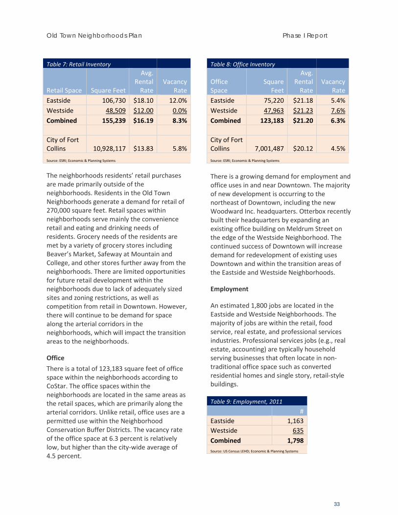
Old Town Neighborhoods Plan Phase I Report
33
Table 7: Retail Inventory
Retail Space Square Feet
Avg. Rental
Rate Vacancy
Rate Eastside 106,730 $18.10 12.0% Westside 48,509 $12.00 0.0% Combined 155,239 $16.19 8.3% City of Fort Collins 10,928,117 $13.83 5.8% Source: ESRI; Economic & Planning Systems
The neighborhoods residents’ retail purchases are made primarily outside of the neighborhoods. Residents in the Old Town Neighborhoods generate a demand for retail of 270,000 square feet. Retail spaces within neighborhoods serve mainly the convenience retail and eating and drinking needs of residents. Grocery needs of the residents are met by a variety of grocery stores including Beaver’s Market, Safeway at Mountain and College, and other stores further away from the neighborhoods. There are limited opportunities for future retail development within the neighborhoods due to lack of adequately sized sites and zoning restrictions, as well as competition from retail in Downtown. However, there will continue to be demand for space along the arterial corridors in the neighborhoods, which will impact the transition areas to the neighborhoods.
Office There is a total of 123,183 square feet of office space within the neighborhoods according to CoStar. The office spaces within the neighborhoods are located in the same areas as the retail spaces, which are primarily along the arterial corridors. Unlike retail, office uses are a permitted use within the Neighborhood Conservation Buffer Districts. The vacancy rate of the office space at 6.3 percent is relatively low, but higher than the city-wide average of 4.5 percent.
Table 8: Office Inventory
Office Space
Square Feet
Avg. Rental
Rate Vacancy
Rate Eastside 75,220 $21.18 5.4% Westside 47,963 $21.23 7.6% Combined 123,183 $21.20 6.3% City of Fort Collins 7,001,487 $20.12 4.5% Source: ESRI; Economic & Planning Systems
There is a growing demand for employment and office uses in and near Downtown. The majority of new development is occurring to the northeast of Downtown, including the new Woodward Inc. headquarters. Otterbox recently built their headquarters by expanding an existing office building on Meldrum Street on the edge of the Westside Neighborhood. The continued success of Downtown will increase demand for redevelopment of existing uses Downtown and within the transition areas of the Eastside and Westside Neighborhoods.
Employment
An estimated 1,800 jobs are located in the Eastside and Westside Neighborhoods. The majority of jobs are within the retail, food service, real estate, and professional services industries. Professional services jobs (e.g., real estate, accounting) are typically household serving businesses that often locate in non-traditional office space such as converted residential homes and single story, retail-style buildings.
Table 9: Employment, 2011 # Eastside 1,163 Westside 635 Combined 1,798 Source: US Census LEHD; Economic & Planning Systems
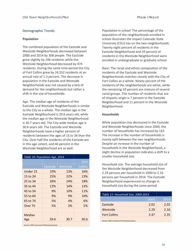
Old Town Neighborhoods Plan Phase I Report
34
Demographic Trends
Population
The combined population of the Eastside and Westside Neighborhoods decreased between 2000 and 2014 by 368 people. The Eastside grew slightly by 106 residents while the Westside Neighborhood decreased by 474 residents. During the same time period the City of Fort Collins grew by 24,552 residents at an annual rate of 1.3 percent. The decrease in population in the Eastside and Westside Neighborhoods was not caused by a lack of demand for the neighborhoods but rather a shift in the size of households.
Age: The median age of residents of the Eastside and Westside Neighborhoods is similar to the City as a whole. The median age in the Eastside Neighborhood is 29.6 years old, while the median age in the Westside Neighborhood is 30.7 years old. The City-wide median age is 30.6 years old. The Eastside and Westside Neighborhoods have a higher percent of residents between the ages of 15 to 34 than the City. Over half the residents of the Eastside are in this age cohort, and 46 percent in the Westside Neighborhood are as well.
Table 10: Population Age, 2014 Fort Eastside Westside Collins Under 15 10% 13% 16% 15 to 24 25% 22% 23% 25 to 34 26% 24% 18% 35 to 44 13% 14% 12% 45 to 54 9% 10% 11% 55 to 64 9% 9% 10% 65 to 74 5% 4% 6% Over 75 5% 3% 5% Median Age 29.6 30.7 30.6 Source: ESRI; Economic & Planning Systems
Population in school: The percentage of the population of the neighborhoods enrolled in school illustrates the impact Colorado State University (CSU) has on the two neighborhoods. Twenty eight percent of residents in the Eastside Neighborhood and 33 percent of residents in the Westside Neighborhood were enrolled in undergraduate or graduate school.
Race: The racial and ethnic composition of the residents of the Eastside and Westside Neighborhoods matches closely with the City of Fort Collins as a whole. Ninety percent of the residents of the neighborhoods are white, while the remaining 10 percent are mixture of several racial groups. The number of residents that are of Hispanic origin is 7 percent in the Eastside Neighborhood and 11 percent in the Westside Neighborhood.
Households
While population has decreased in the Eastside and Westside Neighborhoods since 2000, the number of households has increased by 142. The increase in the number of households is evenly split between the two neighborhoods. Despite an increase in the number of households in the Westside Neighborhood, a slight decline in population indicates a shift to a smaller household size.
Household size: The average household size of the Westside Neighborhood decreased from 2.29 persons per household in 2000 to 2.16 persons per household in 2014. The Eastside Neighborhood experienced no change in household size during the same period.
Table 11: Household Size, 2000-2014
2000 2014 Eastside 2.02 2.02 Westside 2.29 2.16 Fort Collins 2.47 2.35
Source: ESRI; Economic & Planning Systems
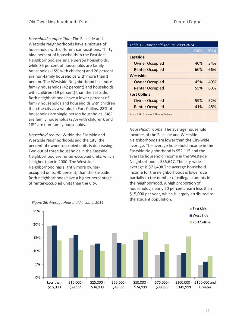
Old Town Neighborhoods Plan Phase I Report
35
Household composition: The Eastside and Westside Neighborhoods have a mixture of households with different compositions. Thirty nine percent of households in the Eastside Neighborhood are single person households, while 35 percent of households are family households (15% with children) and 26 percent are non-family households with more than 1 person. The Westside Neighborhood has more family households (42 percent) and households with children (19 percent) than the Eastside. Both neighborhoods have a lower percent of family households and households with children than the city as a whole. In Fort Collins, 28% of households are single person households, 54% are family households (27% with children), and 18% are non-family households.
Household tenure: Within the Eastside and Westside Neighborhoods and the City, the percent of owner- occupied units is decreasing. Two out of three households in the Eastside Neighborhood are renter-occupied units, which is higher than in 2000. The Westside Neighborhood has slightly more owner-occupied units, 40 percent, than the Eastside. Both neighborhoods have a higher percentage of renter-occupied units than the City.
Table 12: Household Tenure, 2000-2014 2000 2014 Eastside
Owner Occupied 40% 34% Renter Occupied 60% 66%
Westside Owner Occupied 45% 40% Renter Occupied 55% 60%
Fort Collins Owner Occupied 59% 52% Renter Occupied 41% 48%
Source: ESRI; Economic & Planning Systems
Household income: The average household incomes of the Eastside and Westside Neighborhoods are lower than the City-wide average. The average household income in the Eastside Neighborhood is $52,115 and the average household income in the Westside Neighborhood is $55,647. The city-wide average is $71,408.The average household income for the neighborhoods is lower due partially to the number of college students in the neighborhood. A high proportion of households, nearly 20 percent, earn less than $15,000 per year, which is largely attributed to the student population.
Figure 26: Average Household Income, 2014

APPENDIX B
Public Engagement Summaries
Event Date Technical Advisory Committee
10-17-2014
Technical Advisory Committee
2-5-2015
Email Newsletter & Updates
Throughout Planning Process
Neighborhood Postcard Mailing (Listening Sessions)
2-24-2015
Building Review Board Update
2-26-2015
Listening Session 3-1-2015 Chamber of Commerce Local Legislative Affairs Committee Update
3-6-2015
Listening Session 3-9-2015 Issues / Opportunities Online Survey
Spring 2015
Landmark Preservation Commission Update
3-25-2015
City Park Neighborhood Safety Meeting
3-26-2015
Existing Conditions Open House
3-30-2015
Online Wiki-Mapping Spring 2015 Affordable Housing Board Update
4-2-2015
Planning & Zoning Board Update
4-3-2015
Fort Collins Board of Realtors Update
4-14-2015
Technical Advisory Committee
4-16-2015
Planning & Zoning Board Update
5-6-2015
Westside Neighborhood Tour
5-11-2015
Eastside Neighborhood Tour
5-13-2015
Eastside Neighborhood Tour
5-27-2015
Planning, Development, Transportation Open House
5-5-2015
Stakeholder Group Meeting
5-21-2015
Westside Neighborhood Tour
5-30-2015
Business Stakeholder Group Meeting
6-24-2015
Neighborhood Postcard Mailing (Visioning)
6-24-2015
Stakeholder Group Meeting
6-24-2015
City Council Memo 6-30-2015 Planning & Zoning Board Update
6-30-2015
Visioning Workshop 7-8-2015 Visioning Online Survey Summer 2015 Planning & Zoning Board Update
8-7-2015
Transportation Board Update
8-9-2015
Fort Collins Board of Realtors Update
8-11-2015
City Council Work Session
8-11-15
City Park Food Truck Rally
8-25-2015
Planning & Zoning Board Update
9-5-2015
Open Streets Event (Remington St)
9-20-2015
Stakeholder Group Meeting
9-28-2015
Planning & Zoning Board Update
10-2-2015
Neighborhood Postcard Mailing (Transition Workshop)
10-26-2015
Downtown/Old Town Transitions Workshop
11-4-2015
Stakeholder Group Meeting
11-19-2015
Neighborhood Postcard Mailing (Choices Workshop)
12-3-2015
Neighborhood Choices Open House & Workshop
12-9-2015
Planning & Zoning Board Update
12-11-2015
Transportation Board 12-16-2015
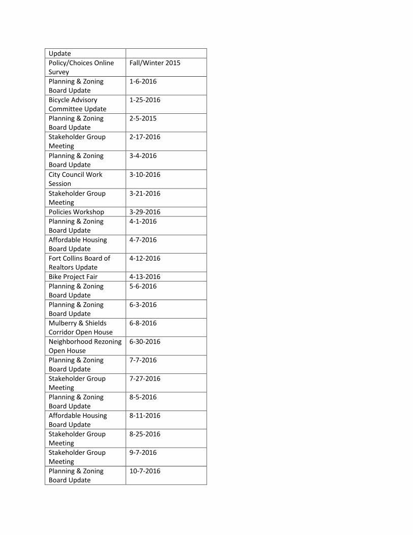
Update Policy/Choices Online Survey
Fall/Winter 2015
Planning & Zoning Board Update
1-6-2016
Bicycle Advisory Committee Update
1-25-2016
Planning & Zoning Board Update
2-5-2015
Stakeholder Group Meeting
2-17-2016
Planning & Zoning Board Update
3-4-2016
City Council Work Session
3-10-2016
Stakeholder Group Meeting
3-21-2016
Policies Workshop 3-29-2016 Planning & Zoning Board Update
4-1-2016
Affordable Housing Board Update
4-7-2016
Fort Collins Board of Realtors Update
4-12-2016
Bike Project Fair 4-13-2016 Planning & Zoning Board Update
5-6-2016
Planning & Zoning Board Update
6-3-2016
Mulberry & Shields Corridor Open House
6-8-2016
Neighborhood Rezoning Open House
6-30-2016
Planning & Zoning Board Update
7-7-2016
Stakeholder Group Meeting
7-27-2016
Planning & Zoning Board Update
8-5-2016
Affordable Housing Board Update
8-11-2016
Stakeholder Group Meeting
8-25-2016
Stakeholder Group Meeting
9-7-2016
Planning & Zoning Board Update
10-7-2016
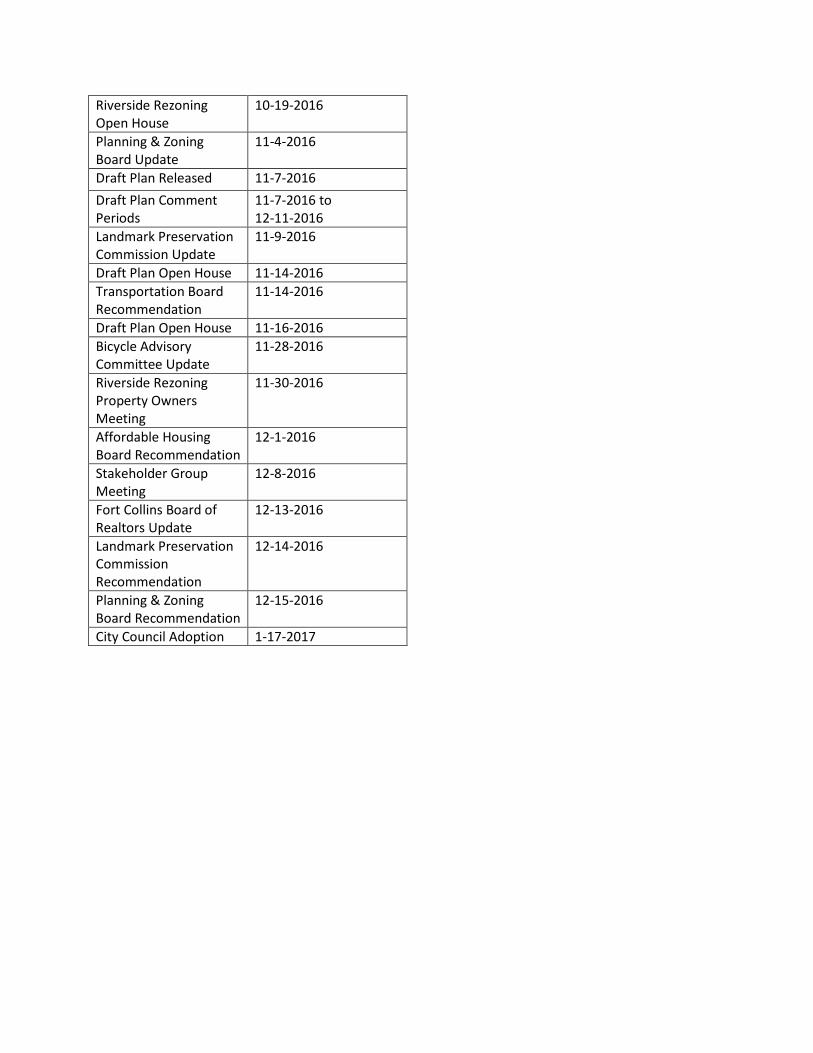
Riverside Rezoning Open House
10-19-2016
Planning & Zoning Board Update
11-4-2016
Draft Plan Released 11-7-2016 Draft Plan Comment Periods
11-7-2016 to 12-11-2016
Landmark Preservation Commission Update
11-9-2016
Draft Plan Open House 11-14-2016 Transportation Board Recommendation
11-14-2016
Draft Plan Open House 11-16-2016 Bicycle Advisory Committee Update
11-28-2016
Riverside Rezoning Property Owners Meeting
11-30-2016
Affordable Housing Board Recommendation
12-1-2016
Stakeholder Group Meeting
12-8-2016
Fort Collins Board of Realtors Update
12-13-2016
Landmark Preservation Commission Recommendation
12-14-2016
Planning & Zoning Board Recommendation
12-15-2016
City Council Adoption 1-17-2017
Planning Services 281 N College Ave – PO Box 580 – Fort Collins, CO 80522 fcgov.com/planningservices/ 970.221.6750
Old Town Neighborhoods Plan (OTNP) Technical Advisory Committee – Meeting #1 Summary October 17, 2014 Meeting Agenda:
1) Project Overview 3) Community Engagement 2) RFPs 4) Next Steps
Project Overview: ONTP will combine and update the vision and framework of both the East Side Neighborhood
Plan (1986) and the West Side Neighborhood Plan (1989) under the umbrella of one subarea planning document.
The plan will coordinate with efforts to create Design Guidelines for the Old Town Neighborhoods and with the update to the Downtown Plan in 2015.
The OTNP study area boundaries have been altered from the original East Side and West Side boundaries by removing the commercial areas along Riverside Avenue and the Community Commercial areas near Laurel and College – these areas will be included in the updated Downtown Plan.
The plan will include an evaluation of the Mulberry Street and Shields Street corridors through the study area.
The plan will be comprised of five phases that will evaluate existing and future conditions, update the neighborhood vision, evaluate corridor options and develop a framework plan, develop policies and strategies, and adopt/implement the plan.
RFPs: Two RFPs will be issued; one for the OTNP and one for the Design Guidelines. There is the
potential for one consultant team to be selected for both RFPs. Will coordinate with Purchasing to issue RFPs in late October and review/select consultants in
November. Staff will take a more direct role in document design and creation in addition to other traditional
responsibilities. Staff will coordinate with consultants for technical expertise, analysis, and mapping/graphics.
Community Engagement: A clear and consistent message will be critical from the beginning. The messaging should
include what the plan is not, a rehashing of the Eastside & Westside Design Standards. Investigate “pre-plan” meetings with vocal, interested stakeholders pinpointing that the design standards will not be revisited as a part of the OTNP.
Outreach will need to be tailored to the larger study area stakeholders, and individualized to Eastside and Westside participants.
As community engagement strategy is formulated, additional consideration of the following issues will need to be addressed:
o Is a stakeholder group appropriate for OTNP, or more focused meetings with specific groups? If a stakeholder group is selected, should two be utilized – one for the Eastside and one for the Westside?
o What is CSU’s role and interaction with the OTNP? o How best can OTNP coordinate with the Downtown Plan, especially when it comes to
the commercial/neighborhood fringe areas? Next Steps: Undertake the following efforts in the near term::
o Review draft RFPs and identify missing elements prior to their issuance. o Provide project overview to the Planning & Zoning Board at their November Work
Session. o Launch initial project website with basic information and an email list for interested
parties to sign-up for more information. o Develop project engagement plan and project charter. o Refine maps to highlight context of the ONTP study are in relation to the Northwest
Subarea Plan and former overlap areas with the Downtown Plan.
Handouts/Attachments Project Overview Flyer Draft RFP (Plan and Design Guidelines Projects)
Planning Services 281 N College Ave – PO Box 580 – Fort Collins, CO 80522 fcgov.com/planningservices/ 970.221.6750
Old Town Neighborhoods Plan (OTNP) Technical Advisory Committee – Meeting #2 Summary February 5, 2015 Meeting Agenda:
1) Work Program/Schedule 3) Sustainability Assessment Framework 2) Community Engagement Plan 4) Issues/Opportunities Brainstorming
Work Program / Schedule: OTNP will include five phases examining:
o P1 – Where are we now (existing conditions) o P2 – Where do we want to go (vision) o P3 – What is our framework (framework and alternatives) o P4 – How are we going to get there (policies, strategies, design solutions) o P5 – What are our priorities (adoption and implementation)
Phase One: Key message and objectives to highlight project goals, planning process, and understand existing conditions and key issues.
Phase One: To include an existing conditions analysis; will utilize some existing data from the 2012 Eastside Westside Character Study
Close interaction and collaboration with the Design Guidelines project. Design Guidelines will piggy-back with OTNP outreach activities.
o Further examine character areas identified during the 2012 Eastside Westside Character Study
o Draft guidelines tentatively available during Phase 2 of OTNP Transportation: Examine multimodal conditions (walk/bike safety audits), ROW measurements,
accident history, complete streets/land use, parking data, etc.
Community Engagement Plan: Collaborative and interactive approach to community and stakeholder engagement No Citizens Advisory Committee; utilize stakeholder groups instead
o Find diverse group to represent a variety of interests and points of view. Still deciding on number of groups to convene.
Focus early engagement on traditional outreach such as listening sessions, open houses and stakeholder meetings and then transition to interactive activities such as “intercepts,” online surveys, block-party/open-streets
Find opportunities to engage/involve Transfort, PSD, CSU, other City departments Plenty of opportunity for shared outreach and collaboration with other projects and community
events: - Downtown Plan - Nature in the City - Climate Action Plan - Residential Parking Permit Program - FoCo Futures Forum - Vine & Shields Roundabout - Remington Greenway - Open Streets/Laurel Demonstration Project
Sustainability Assessment Multi-disciplinary team-based approach to decisions and outcomes To be utilized throughout the OTNP work program and timeline Examine environmental, social, and economic sustainability Preliminary list of issues/opportunities (below) to help inform a more formal sustainability
assessment tool exercise at the next TAC meeting
Issues/Opportunities Brainstorming
- Design Strategies for Compatibility - Energy Use - Neighborhood Nodes/Centers - Arterial Crossings - Multimodal Level of Service - Wayfinding / Neighborhood Identity - Sensitive Addition of Density - Downtown Transition Areas - Household Tenure/Occupancy - Role of Alleys - Demographic Trends - Infrastructure/Utilities - Unauthorized dwelling units - Scrapes and renovations - Nonresidential Land Uses - Required Arterial ROW - Transfort Routes/Service - Preservation Incentives - CSU Integration/Transition - Involving Nature in the City - Floodplain Restrictions - Tree Canopy - Arterial Design (tradeoffs and priorities) - Many more!
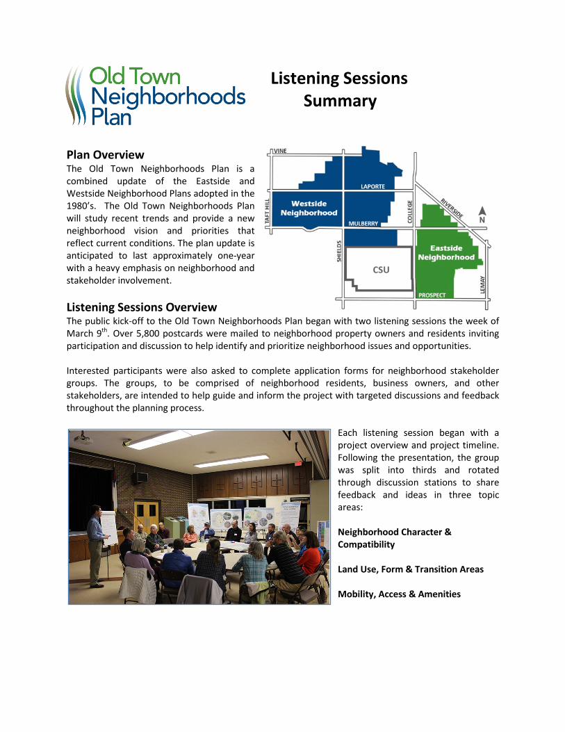
Listening Sessions Summary
Plan Overview The Old Town Neighborhoods Plan is a combined update of the Eastside and Westside Neighborhood Plans adopted in the 1980’s. The Old Town Neighborhoods Plan will study recent trends and provide a new neighborhood vision and priorities that reflect current conditions. The plan update is anticipated to last approximately one-year with a heavy emphasis on neighborhood and stakeholder involvement. Listening Sessions Overview The public kick-off to the Old Town Neighborhoods Plan began with two listening sessions the week of March 9th. Over 5,800 postcards were mailed to neighborhood property owners and residents inviting participation and discussion to help identify and prioritize neighborhood issues and opportunities. Interested participants were also asked to complete application forms for neighborhood stakeholder groups. The groups, to be comprised of neighborhood residents, business owners, and other stakeholders, are intended to help guide and inform the project with targeted discussions and feedback throughout the planning process.
Each listening session began with a project overview and project timeline. Following the presentation, the group was split into thirds and rotated through discussion stations to share feedback and ideas in three topic areas: Neighborhood Character & Compatibility Land Use, Form & Transition Areas Mobility, Access & Amenities
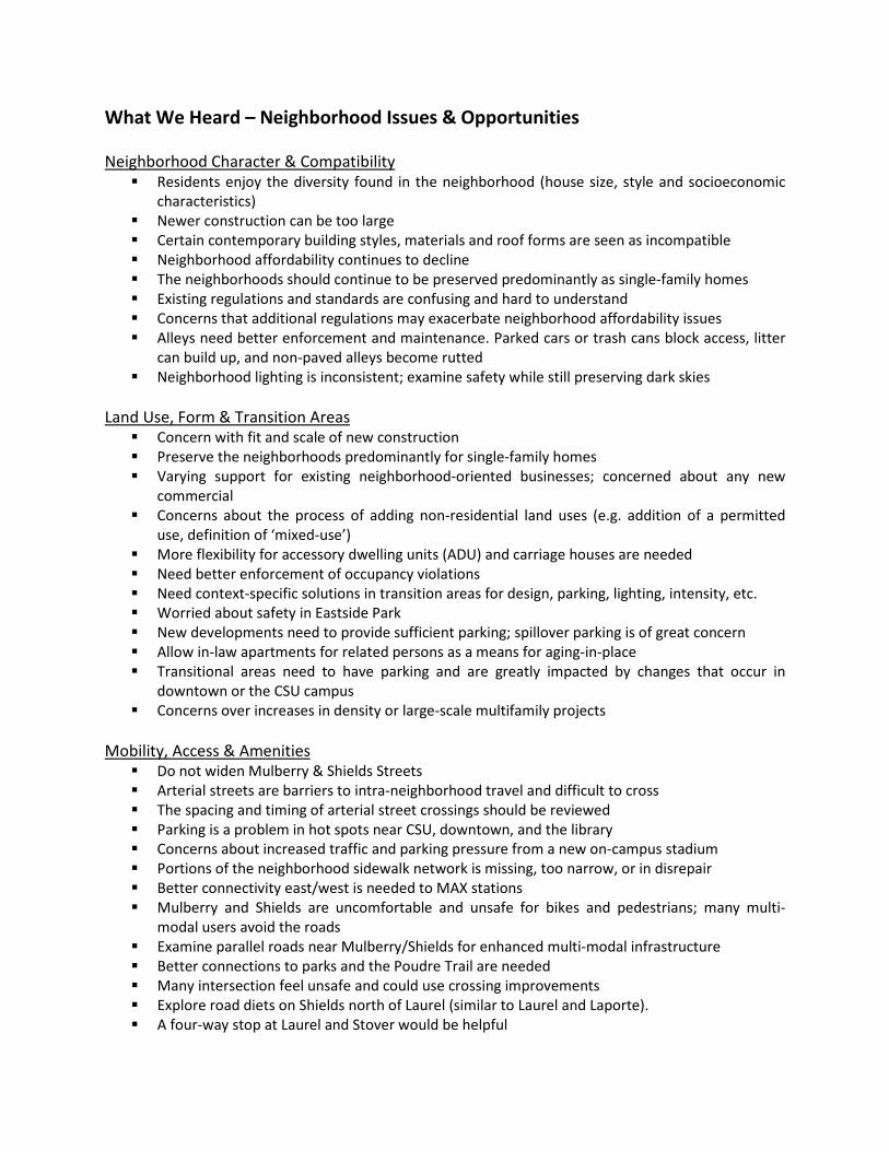
What We Heard – Neighborhood Issues & Opportunities Neighborhood Character & Compatibility Residents enjoy the diversity found in the neighborhood (house size, style and socioeconomic
characteristics) Newer construction can be too large Certain contemporary building styles, materials and roof forms are seen as incompatible Neighborhood affordability continues to decline The neighborhoods should continue to be preserved predominantly as single-family homes Existing regulations and standards are confusing and hard to understand Concerns that additional regulations may exacerbate neighborhood affordability issues Alleys need better enforcement and maintenance. Parked cars or trash cans block access, litter
can build up, and non-paved alleys become rutted Neighborhood lighting is inconsistent; examine safety while still preserving dark skies
Land Use, Form & Transition Areas Concern with fit and scale of new construction Preserve the neighborhoods predominantly for single-family homes Varying support for existing neighborhood-oriented businesses; concerned about any new
commercial Concerns about the process of adding non-residential land uses (e.g. addition of a permitted
use, definition of ‘mixed-use’) More flexibility for accessory dwelling units (ADU) and carriage houses are needed Need better enforcement of occupancy violations Need context-specific solutions in transition areas for design, parking, lighting, intensity, etc. Worried about safety in Eastside Park New developments need to provide sufficient parking; spillover parking is of great concern Allow in-law apartments for related persons as a means for aging-in-place Transitional areas need to have parking and are greatly impacted by changes that occur in
downtown or the CSU campus Concerns over increases in density or large-scale multifamily projects
Mobility, Access & Amenities Do not widen Mulberry & Shields Streets Arterial streets are barriers to intra-neighborhood travel and difficult to cross The spacing and timing of arterial street crossings should be reviewed Parking is a problem in hot spots near CSU, downtown, and the library Concerns about increased traffic and parking pressure from a new on-campus stadium Portions of the neighborhood sidewalk network is missing, too narrow, or in disrepair Better connectivity east/west is needed to MAX stations Mulberry and Shields are uncomfortable and unsafe for bikes and pedestrians; many multi-
modal users avoid the roads Examine parallel roads near Mulberry/Shields for enhanced multi-modal infrastructure Better connections to parks and the Poudre Trail are needed Many intersection feel unsafe and could use crossing improvements Explore road diets on Shields north of Laurel (similar to Laurel and Laporte). A four-way stop at Laurel and Stover would be helpful
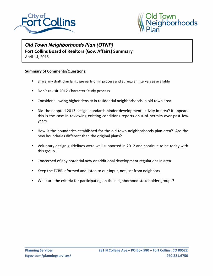
Planning Services 281 N College Ave – PO Box 580 – Fort Collins, CO 80522 fcgov.com/planningservices/ 970.221.6750
Old Town Neighborhoods Plan (OTNP) Fort Collins Board of Realtors (Gov. Affairs) Summary April 14, 2015
Summary of Comments/Questions: Share any draft plan language early on in process and at regular intervals as available
Don’t revisit 2012 Character Study process
Consider allowing higher density in residential neighborhoods in old town area
Did the adopted 2013 design standards hinder development activity in area? It appears
this is the case in reviewing existing conditions reports on # of permits over past few years.
How is the boundaries established for the old town neighborhoods plan area? Are the new boundaries different than the original plans?
Voluntary design guidelines were well supported in 2012 and continue to be today with this group.
Concerned of any potential new or additional development regulations in area.
Keep the FCBR informed and listen to our input, not just from neighbors.
What are the criteria for participating on the neighborhood stakeholder groups?
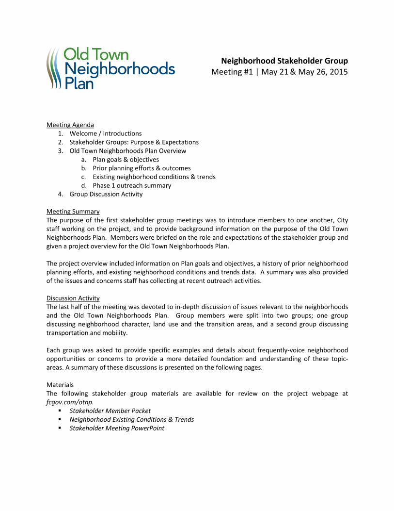
Neighborhood Stakeholder Group
Meeting #1 | May 21 & May 26, 2015 Meeting Agenda
1. Welcome / Introductions 2. Stakeholder Groups: Purpose & Expectations 3. Old Town Neighborhoods Plan Overview
a. Plan goals & objectives b. Prior planning efforts & outcomes c. Existing neighborhood conditions & trends d. Phase 1 outreach summary
4. Group Discussion Activity Meeting Summary The purpose of the first stakeholder group meetings was to introduce members to one another, City staff working on the project, and to provide background information on the purpose of the Old Town Neighborhoods Plan. Members were briefed on the role and expectations of the stakeholder group and given a project overview for the Old Town Neighborhoods Plan. The project overview included information on Plan goals and objectives, a history of prior neighborhood planning efforts, and existing neighborhood conditions and trends data. A summary was also provided of the issues and concerns staff has collecting at recent outreach activities. Discussion Activity The last half of the meeting was devoted to in-depth discussion of issues relevant to the neighborhoods and the Old Town Neighborhoods Plan. Group members were split into two groups; one group discussing neighborhood character, land use and the transition areas, and a second group discussing transportation and mobility. Each group was asked to provide specific examples and details about frequently-voice neighborhood opportunities or concerns to provide a more detailed foundation and understanding of these topic-areas. A summary of these discussions is presented on the following pages. Materials The following stakeholder group materials are available for review on the project webpage at fcgov.com/otnp. Stakeholder Member Packet Neighborhood Existing Conditions & Trends Stakeholder Meeting PowerPoint
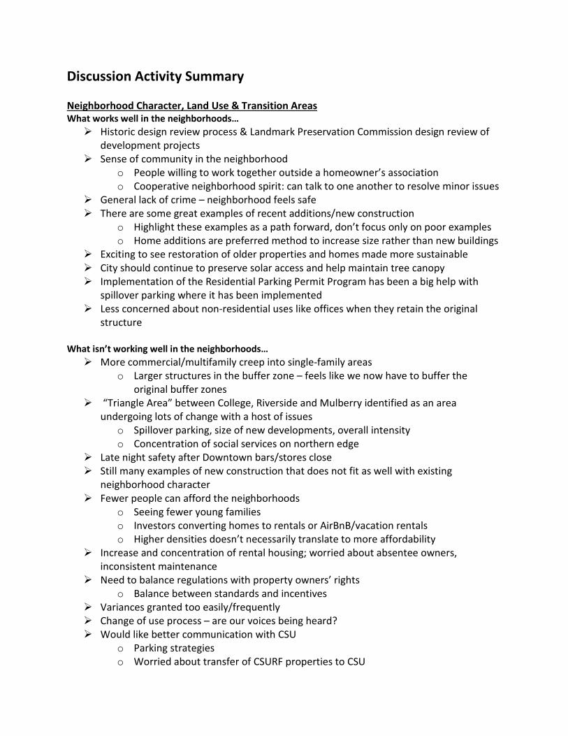
Discussion Activity Summary Neighborhood Character, Land Use & Transition Areas What works well in the neighborhoods… Historic design review process & Landmark Preservation Commission design review of
development projects Sense of community in the neighborhood
o People willing to work together outside a homeowner’s association o Cooperative neighborhood spirit: can talk to one another to resolve minor issues
General lack of crime – neighborhood feels safe There are some great examples of recent additions/new construction
o Highlight these examples as a path forward, don’t focus only on poor examples o Home additions are preferred method to increase size rather than new buildings
Exciting to see restoration of older properties and homes made more sustainable City should continue to preserve solar access and help maintain tree canopy Implementation of the Residential Parking Permit Program has been a big help with
spillover parking where it has been implemented Less concerned about non-residential uses like offices when they retain the original
structure What isn’t working well in the neighborhoods… More commercial/multifamily creep into single-family areas
o Larger structures in the buffer zone – feels like we now have to buffer the original buffer zones
“Triangle Area” between College, Riverside and Mulberry identified as an area undergoing lots of change with a host of issues
o Spillover parking, size of new developments, overall intensity o Concentration of social services on northern edge
Late night safety after Downtown bars/stores close Still many examples of new construction that does not fit as well with existing
neighborhood character Fewer people can afford the neighborhoods
o Seeing fewer young families o Investors converting homes to rentals or AirBnB/vacation rentals o Higher densities doesn’t necessarily translate to more affordability
Increase and concentration of rental housing; worried about absentee owners, inconsistent maintenance
Need to balance regulations with property owners’ rights o Balance between standards and incentives
Variances granted too easily/frequently Change of use process – are our voices being heard? Would like better communication with CSU
o Parking strategies o Worried about transfer of CSURF properties to CSU
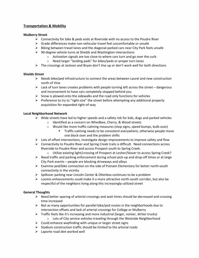
Transportation & Mobility Mulberry Street
Connectivity for bike & peds ends at Riverside with no access to the Poudre River Grade differences make non-vehicular travel feel uncomfortable or unsafe Biking between travel lanes and the diagonal-parked cars near City Park feels unsafe 90-degree vehicle turns at Shields and Washington intersections
o Activation signals are too close to where cars turn and go over the curb o Need larger “landing pads” for bikes/peds or proper turn lanes
The crossings at Jackson and Bryan don’t line up or don’t work well for both directions Shields Street
Needs bike/ped infrastructure to connect the areas between Laurel and new construction north of Vine
Lack of turn lanes creates problems with people turning left across the street – dangerous and inconvenient to have cars completely stopped behind you
Snow is plowed onto the sidewalks and the road only functions for vehicles Preference to try to “right-size” the street before attempting any additional property
acquisition for expanded right-of-way Local Neighborhood Network
Wide streets have led to higher speeds and a safety risk for kids, dogs and parked vehicles o Identified as a concern on Whedbee, Cherry, & Wood streets o Would like more traffic-calming measures (stop signs, speed bumps, bulb-outs)
Traffic-calming needs to be consistent everywhere, otherwise people move one block over and the problem shifts
Lots of offset intersections, investigate design improvements to improve safety and flow Connectivity to Poudre River and Spring Creek trails is difficult. Need connections across
Riverside to Poudre River and across Prospect south to Spring Creek. o Utilize existing light/crossing of Prospect at Lesher/Stover to access Spring Creek?
Need traffic and parking enforcement during school pick-up and drop-off times or at large City Park events – people are blocking driveways and alleys
Examine ped/bike connection on the side of Putnam Elementary for better north-south connectivity in the vicinity
Spillover parking near Lincoln Center & Otterbox continues to be a problem Loomis enhancements could make it a more attractive north-south corridor, but also be
respectful of the neighbors living along this increasingly-utilized street General Thoughts
Need better spacing of arterial crossings and wait times should be decreased and crossing time increased
Not as many opportunities for parallel bike/ped routes in the neighborhoods due to intersection offsets and lack of arterial crossings for College or Mulberry
Traffic feels like it’s increasing and more industrial (larger, noisier, dirtier trucks) o Lots of City service vehicles traveling through the Westside Neighborhood
Could enhance wayfinding with unique or larger street signs Stadium construction traffic should be limited to the arterial roads Laporte road diet worked well
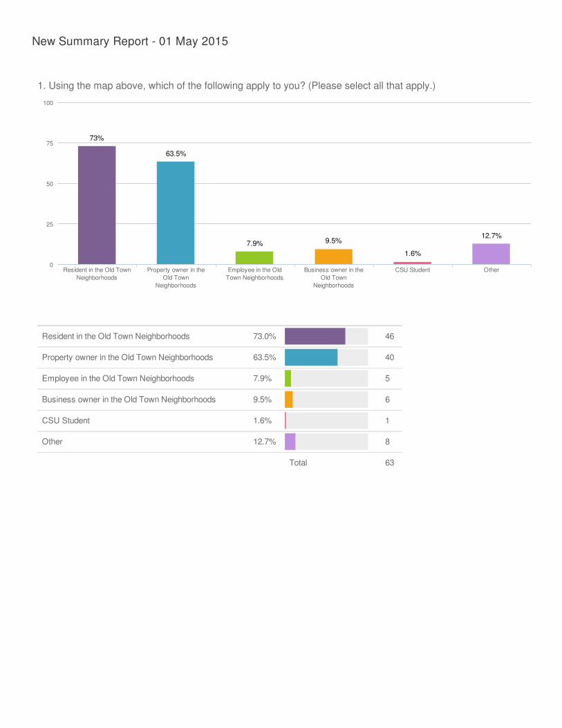
Resident in the Old Town Neighborhoods 73.0% 46
Property owner in the Old Town Neighborhoods 63.5% 40
Employee in the Old Town Neighborhoods 7.9% 5
Business owner in the Old Town Neighborhoods 9.5% 6
CSU Student 1.6% 1
Other 12.7% 8
Total 63
New Summary Report - 01 May 2015
1. Using the map above, which of the following apply to you? (Please select all that apply.)
73%
63.5%
7.9% 9.5%
1.6%
12.7%
Resident in the Old TownNeighborhoods
Property owner in theOld Town
Neighborhoods
Employee in the OldTown Neighborhoods
Business owner in theOld Town
Neighborhoods
CSU Student Other0
100
25
50
75
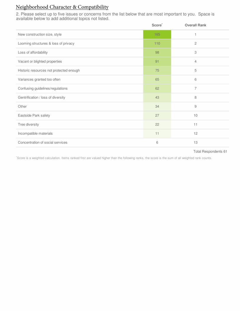
Score Overall Rank
New construction size, style 165 1
Looming structures & loss of privacy 110 2
Loss of affordability 98 3
Vacant or blighted properties 91 4
Historic resources not protected enough 75 5
Variances granted too often 65 6
Confusing guidelines/regulations 62 7
Gentrification / loss of diversity 43 8
Other 34 9
Eastside Park safety 27 10
Tree diversity 22 11
Incompatible materials 11 12
Concentration of social services 6 13
Total Respondents 61
Score is a weighted calculation. Items ranked first are valued higher than the following ranks, the score is the sum of all weighted rank counts.
2. Please select up to five issues or concerns from the list below that are most important to you. Space isavailable below to add additional topics not listed.
*
*
Neighborhood Character & Compatibility
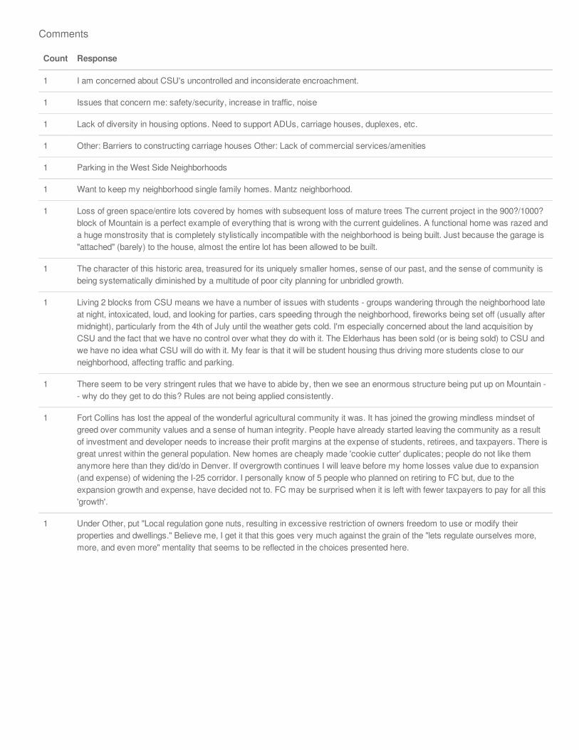
Count Response
1 I am concerned about CSU's uncontrolled and inconsiderate encroachment.
1 Issues that concern me: safety/security, increase in traffic, noise
1 Lack of diversity in housing options. Need to support ADUs, carriage houses, duplexes, etc.
1 Other: Barriers to constructing carriage houses Other: Lack of commercial services/amenities
1 Parking in the West Side Neighborhoods
1 Want to keep my neighborhood single family homes. Mantz neighborhood.
1 Loss of green space/entire lots covered by homes with subsequent loss of mature trees The current project in the 900?/1000?block of Mountain is a perfect example of everything that is wrong with the current guidelines. A functional home was razed anda huge monstrosity that is completely stylistically incompatible with the neighborhood is being built. Just because the garage is"attached" (barely) to the house, almost the entire lot has been allowed to be built.
1 The character of this historic area, treasured for its uniquely smaller homes, sense of our past, and the sense of community isbeing systematically diminished by a multitude of poor city planning for unbridled growth.
1 Living 2 blocks from CSU means we have a number of issues with students - groups wandering through the neighborhood lateat night, intoxicated, loud, and looking for parties, cars speeding through the neighborhood, fireworks being set off (usually aftermidnight), particularly from the 4th of July until the weather gets cold. I'm especially concerned about the land acquisition byCSU and the fact that we have no control over what they do with it. The Elderhaus has been sold (or is being sold) to CSU andwe have no idea what CSU will do with it. My fear is that it will be student housing thus driving more students close to ourneighborhood, affecting traffic and parking.
1 There seem to be very stringent rules that we have to abide by, then we see an enormous structure being put up on Mountain -- why do they get to do this? Rules are not being applied consistently.
1 Fort Collins has lost the appeal of the wonderful agricultural community it was. It has joined the growing mindless mindset ofgreed over community values and a sense of human integrity. People have already started leaving the community as a resultof investment and developer needs to increase their profit margins at the expense of students, retirees, and taxpayers. There isgreat unrest within the general population. New homes are cheaply made 'cookie cutter' duplicates; people do not like themanymore here than they did/do in Denver. If overgrowth continues I will leave before my home losses value due to expansion(and expense) of widening the I-25 corridor. I personally know of 5 people who planned on retiring to FC but, due to theexpansion growth and expense, have decided not to. FC may be surprised when it is left with fewer taxpayers to pay for all this'growth'.
1 Under Other, put "Local regulation gone nuts, resulting in excessive restriction of owners freedom to use or modify theirproperties and dwellings." Believe me, I get it that this goes very much against the grain of the "lets regulate ourselves more,more, and even more" mentality that seems to be reflected in the choices presented here.
Comments
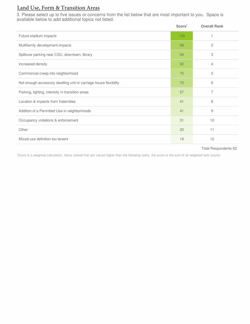
Score Overall Rank
Future stadium impacts 129 1
Multifamily development impacts 99 2
Spillover parking near CSU, downtown, library 94 3
Increased density 92 4
Commercial creep into neighborhood 75 5
Not enough accessory dwelling unit or carriage house flexibility 72 6
Parking, lighting, intensity in transition areas 57 7
Location & impacts from fraternities 41 8
Addition of a Permitted Use in neighborhoods 41 9
Occupancy violations & enforcement 31 10
Other 20 11
Mixed-use definition too lenient 19 12
Total Respondents 62
Score is a weighted calculation. Items ranked first are valued higher than the following ranks, the score is the sum of all weighted rank counts.
3. Please select up to five issues or concerns from the list below that are most important to you. Space isavailable below to add additional topics not listed.
*
*
Land Use, Form & Transition Areas
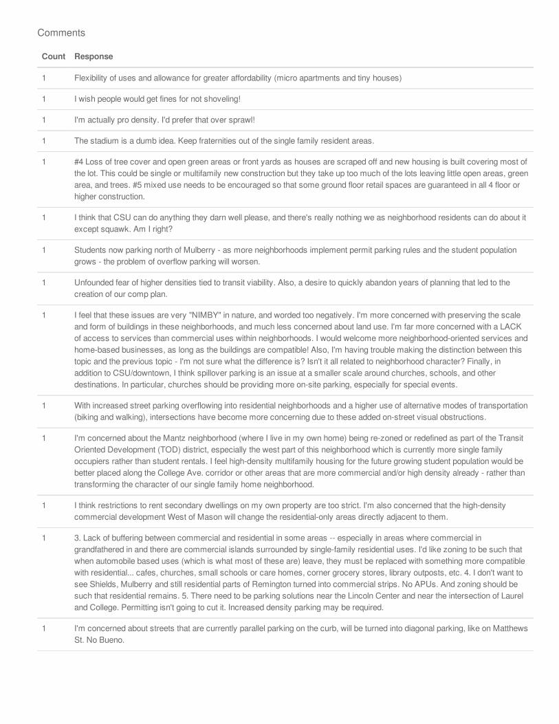
Count Response
1 Flexibility of uses and allowance for greater affordability (micro apartments and tiny houses)
1 I wish people would get fines for not shoveling!
1 I'm actually pro density. I'd prefer that over sprawl!
1 The stadium is a dumb idea. Keep fraternities out of the single family resident areas.
1 #4 Loss of tree cover and open green areas or front yards as houses are scraped off and new housing is built covering most ofthe lot. This could be single or multifamily new construction but they take up too much of the lots leaving little open areas, greenarea, and trees. #5 mixed use needs to be encouraged so that some ground floor retail spaces are guaranteed in all 4 floor orhigher construction.
1 I think that CSU can do anything they darn well please, and there's really nothing we as neighborhood residents can do about itexcept squawk. Am I right?
1 Students now parking north of Mulberry - as more neighborhoods implement permit parking rules and the student populationgrows - the problem of overflow parking will worsen.
1 Unfounded fear of higher densities tied to transit viability. Also, a desire to quickly abandon years of planning that led to thecreation of our comp plan.
1 I feel that these issues are very "NIMBY" in nature, and worded too negatively. I'm more concerned with preserving the scaleand form of buildings in these neighborhoods, and much less concerned about land use. I'm far more concerned with a LACKof access to services than commercial uses within neighborhoods. I would welcome more neighborhood-oriented services andhome-based businesses, as long as the buildings are compatible! Also, I'm having trouble making the distinction between thistopic and the previous topic - I'm not sure what the difference is? Isn't it all related to neighborhood character? Finally, inaddition to CSU/downtown, I think spillover parking is an issue at a smaller scale around churches, schools, and otherdestinations. In particular, churches should be providing more on-site parking, especially for special events.
1 With increased street parking overflowing into residential neighborhoods and a higher use of alternative modes of transportation(biking and walking), intersections have become more concerning due to these added on-street visual obstructions.
1 I'm concerned about the Mantz neighborhood (where I live in my own home) being re-zoned or redefined as part of the TransitOriented Development (TOD) district, especially the west part of this neighborhood which is currently more single familyoccupiers rather than student rentals. I feel high-density multifamily housing for the future growing student population would bebetter placed along the College Ave. corridor or other areas that are more commercial and/or high density already - rather thantransforming the character of our single family home neighborhood.
1 I think restrictions to rent secondary dwellings on my own property are too strict. I'm also concerned that the high-densitycommercial development West of Mason will change the residential-only areas directly adjacent to them.
1 3. Lack of buffering between commercial and residential in some areas -- especially in areas where commercial ingrandfathered in and there are commercial islands surrounded by single-family residential uses. I'd like zoning to be such thatwhen automobile based uses (which is what most of these are) leave, they must be replaced with something more compatiblewith residential... cafes, churches, small schools or care homes, corner grocery stores, library outposts, etc. 4. I don't want tosee Shields, Mulberry and still residential parts of Remington turned into commercial strips. No APUs. And zoning should besuch that residential remains. 5. There need to be parking solutions near the Lincoln Center and near the intersection of Laureland College. Permitting isn't going to cut it. Increased density parking may be required.
1 I'm concerned about streets that are currently parallel parking on the curb, will be turned into diagonal parking, like on MatthewsSt. No Bueno.
Comments

1 Planned high story buildings on College Ave. will have a large negative impact on traffic flow and residential areas. Residentshave complained about the "Summit on College" not being presented to the community prior to, or during, its construction. Iwas not living here at the time but have heard nothing but complaints regarding the city's lack of addressing the community'srequest for information and input. I have personally known several CSU students who lived in some of the 'new studenthousing' apartments. They said the buildings were poorly made; windows let in cold air, could hear students in otherapartments.
Count Response
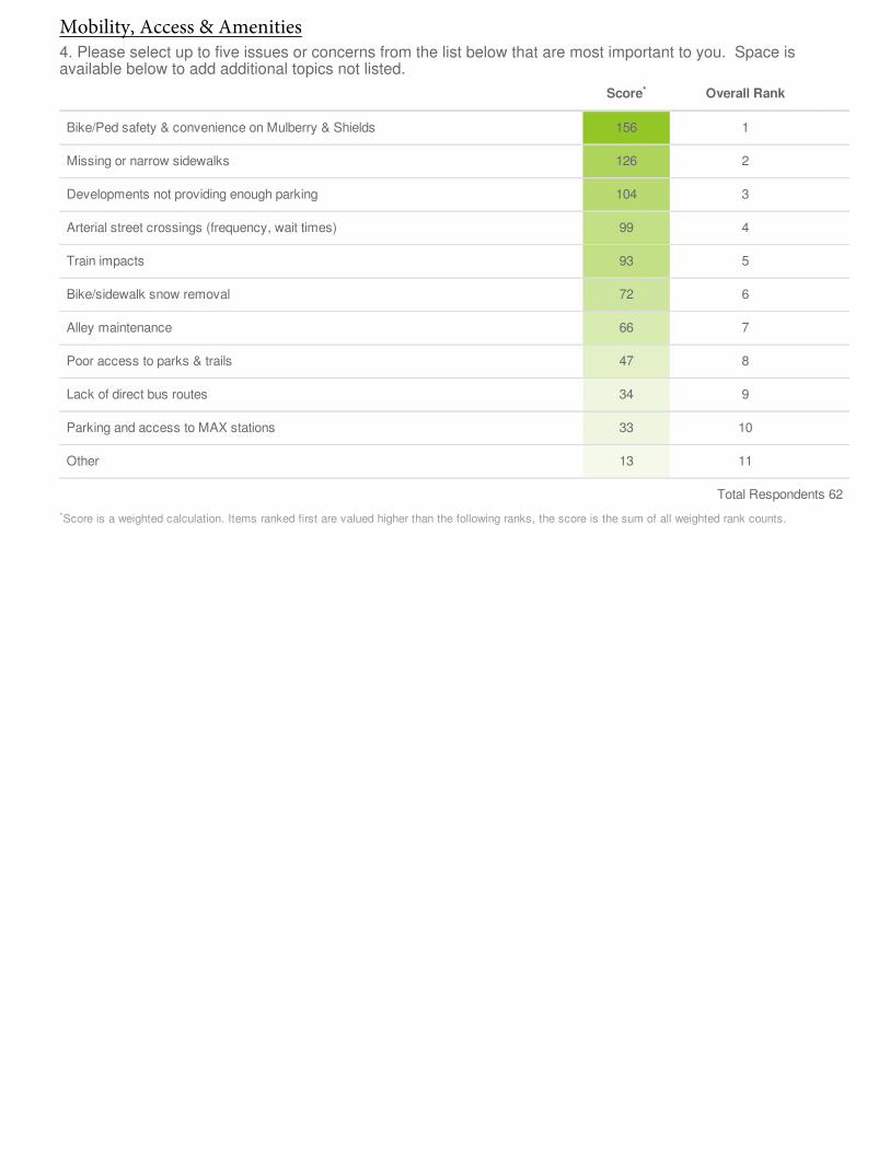
Score Overall Rank
Bike/Ped safety & convenience on Mulberry & Shields 156 1
Missing or narrow sidewalks 126 2
Developments not providing enough parking 104 3
Arterial street crossings (frequency, wait times) 99 4
Train impacts 93 5
Bike/sidewalk snow removal 72 6
Alley maintenance 66 7
Poor access to parks & trails 47 8
Lack of direct bus routes 34 9
Parking and access to MAX stations 33 10
Other 13 11
Total Respondents 62
Score is a weighted calculation. Items ranked first are valued higher than the following ranks, the score is the sum of all weighted rank counts.
4. Please select up to five issues or concerns from the list below that are most important to you. Space isavailable below to add additional topics not listed.
*
*
Mobility, Access & Amenities
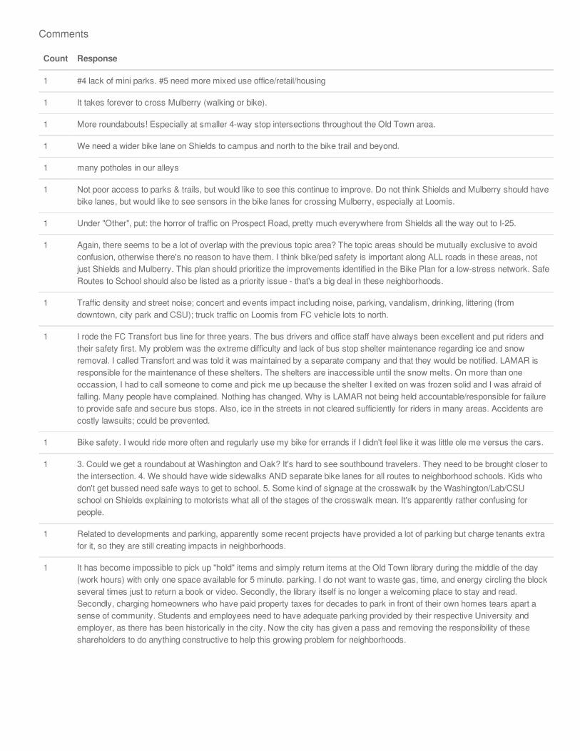
Count Response
1 #4 lack of mini parks. #5 need more mixed use office/retail/housing
1 It takes forever to cross Mulberry (walking or bike).
1 More roundabouts! Especially at smaller 4-way stop intersections throughout the Old Town area.
1 We need a wider bike lane on Shields to campus and north to the bike trail and beyond.
1 many potholes in our alleys
1 Not poor access to parks & trails, but would like to see this continue to improve. Do not think Shields and Mulberry should havebike lanes, but would like to see sensors in the bike lanes for crossing Mulberry, especially at Loomis.
1 Under "Other", put: the horror of traffic on Prospect Road, pretty much everywhere from Shields all the way out to I-25.
1 Again, there seems to be a lot of overlap with the previous topic area? The topic areas should be mutually exclusive to avoidconfusion, otherwise there's no reason to have them. I think bike/ped safety is important along ALL roads in these areas, notjust Shields and Mulberry. This plan should prioritize the improvements identified in the Bike Plan for a low-stress network. SafeRoutes to School should also be listed as a priority issue - that's a big deal in these neighborhoods.
1 Traffic density and street noise; concert and events impact including noise, parking, vandalism, drinking, littering (fromdowntown, city park and CSU); truck traffic on Loomis from FC vehicle lots to north.
1 I rode the FC Transfort bus line for three years. The bus drivers and office staff have always been excellent and put riders andtheir safety first. My problem was the extreme difficulty and lack of bus stop shelter maintenance regarding ice and snowremoval. I called Transfort and was told it was maintained by a separate company and that they would be notified. LAMAR isresponsible for the maintenance of these shelters. The shelters are inaccessible until the snow melts. On more than oneoccassion, I had to call someone to come and pick me up because the shelter I exited on was frozen solid and I was afraid offalling. Many people have complained. Nothing has changed. Why is LAMAR not being held accountable/responsible for failureto provide safe and secure bus stops. Also, ice in the streets in not cleared sufficiently for riders in many areas. Accidents arecostly lawsuits; could be prevented.
1 Bike safety. I would ride more often and regularly use my bike for errands if I didn't feel like it was little ole me versus the cars.
1 3. Could we get a roundabout at Washington and Oak? It's hard to see southbound travelers. They need to be brought closer tothe intersection. 4. We should have wide sidewalks AND separate bike lanes for all routes to neighborhood schools. Kids whodon't get bussed need safe ways to get to school. 5. Some kind of signage at the crosswalk by the Washington/Lab/CSUschool on Shields explaining to motorists what all of the stages of the crosswalk mean. It's apparently rather confusing forpeople.
1 Related to developments and parking, apparently some recent projects have provided a lot of parking but charge tenants extrafor it, so they are still creating impacts in neighborhoods.
1 It has become impossible to pick up "hold" items and simply return items at the Old Town library during the middle of the day(work hours) with only one space available for 5 minute. parking. I do not want to waste gas, time, and energy circling the blockseveral times just to return a book or video. Secondly, the library itself is no longer a welcoming place to stay and read.Secondly, charging homeowners who have paid property taxes for decades to park in front of their own homes tears apart asense of community. Students and employees need to have adequate parking provided by their respective University andemployer, as there has been historically in the city. Now the city has given a pass and removing the responsibility of theseshareholders to do anything constructive to help this growing problem for neighborhoods.
Comments
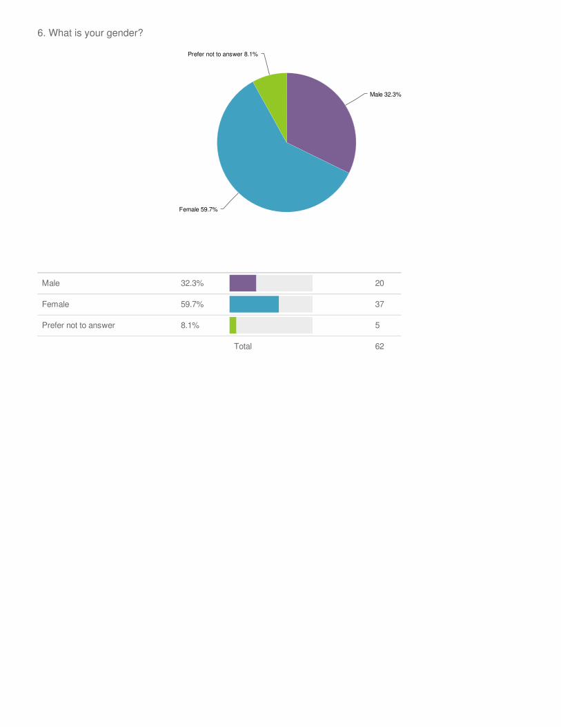
Male 32.3% 20
Female 59.7% 37
Prefer not to answer 8.1% 5
Total 62
6. What is your gender?
Male 32.3%
Female 59.7%
Prefer not to answer 8.1%
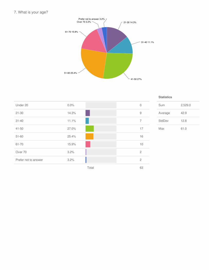
7. What is your age?
21-30 14.3%
31-40 11.1%
41-50 27%
51-60 25.4%
61-70 15.9%
Over 70 3.2%Prefer not to answer 3.2%
Under 20 0.0% 0
21-30 14.3% 9
31-40 11.1% 7
41-50 27.0% 17
51-60 25.4% 16
61-70 15.9% 10
Over 70 3.2% 2
Prefer not to answer 3.2% 2
Total 63
Statistics
Sum 2,529.0
Average 42.9
StdDev 12.8
Max 61.0
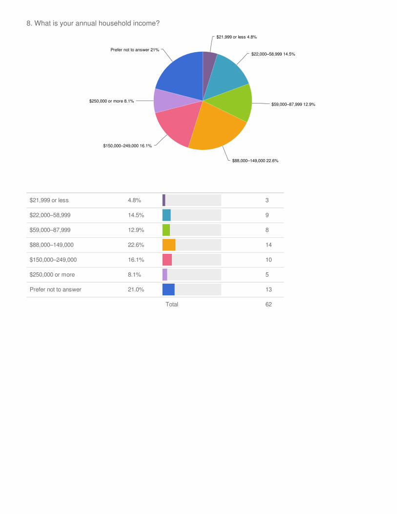
$21,999 or less 4.8% 3
$22,000–58,999 14.5% 9
$59,000–87,999 12.9% 8
$88,000–149,000 22.6% 14
$150,000–249,000 16.1% 10
$250,000 or more 8.1% 5
Prefer not to answer 21.0% 13
Total 62
8. What is your annual household income?
$21,999 or less 4.8%
$22,000–58,999 14.5%
$59,000–87,999 12.9%
$88,000–149,000 22.6%
$150,000–249,000 16.1%
$250,000 or more 8.1%
Prefer not to answer 21%

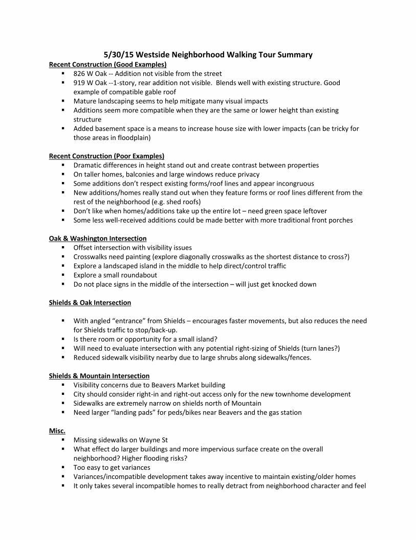
5/30/15 Westside Neighborhood Walking Tour Summary Recent Construction (Good Examples) 826 W Oak -- Addition not visible from the street 919 W Oak --1-story, rear addition not visible. Blends well with existing structure. Good
example of compatible gable roof Mature landscaping seems to help mitigate many visual impacts Additions seem more compatible when they are the same or lower height than existing
structure Added basement space is a means to increase house size with lower impacts (can be tricky for
those areas in floodplain) Recent Construction (Poor Examples) Dramatic differences in height stand out and create contrast between properties On taller homes, balconies and large windows reduce privacy Some additions don’t respect existing forms/roof lines and appear incongruous New additions/homes really stand out when they feature forms or roof lines different from the
rest of the neighborhood (e.g. shed roofs) Don’t like when homes/additions take up the entire lot – need green space leftover Some less well-received additions could be made better with more traditional front porches
Oak & Washington Intersection Offset intersection with visibility issues Crosswalks need painting (explore diagonally crosswalks as the shortest distance to cross?) Explore a landscaped island in the middle to help direct/control traffic Explore a small roundabout Do not place signs in the middle of the intersection – will just get knocked down
Shields & Oak Intersection With angled “entrance” from Shields – encourages faster movements, but also reduces the need
for Shields traffic to stop/back-up. Is there room or opportunity for a small island? Will need to evaluate intersection with any potential right-sizing of Shields (turn lanes?) Reduced sidewalk visibility nearby due to large shrubs along sidewalks/fences.
Shields & Mountain Intersection Visibility concerns due to Beavers Market building City should consider right-in and right-out access only for the new townhome development Sidewalks are extremely narrow on shields north of Mountain Need larger “landing pads” for peds/bikes near Beavers and the gas station
Misc. Missing sidewalks on Wayne St What effect do larger buildings and more impervious surface create on the overall
neighborhood? Higher flooding risks? Too easy to get variances Variances/incompatible development takes away incentive to maintain existing/older homes It only takes several incompatible homes to really detract from neighborhood character and feel
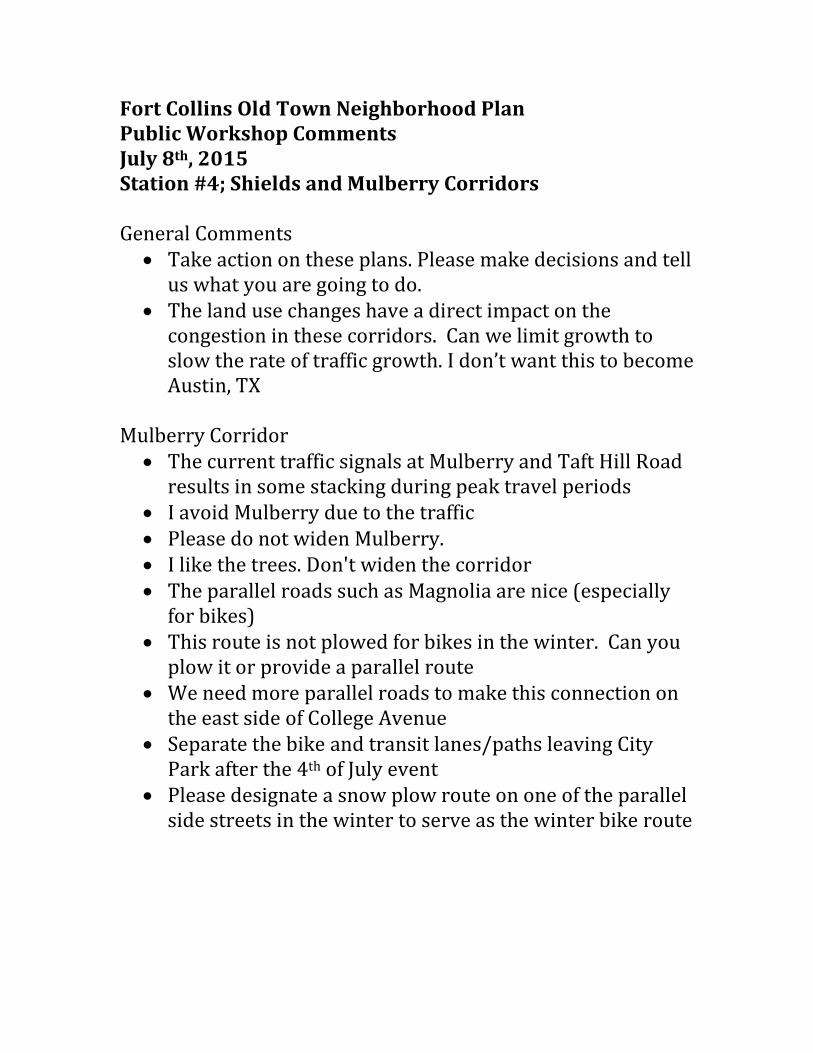
Fort Collins Old Town Neighborhood Plan Public Workshop Comments July 8th, 2015 Station #4; Shields and Mulberry Corridors General Comments
• Take action on these plans. Please make decisions and tell us what you are going to do.
• The land use changes have a direct impact on the congestion in these corridors. Can we limit growth to slow the rate of traffic growth. I don’t want this to become Austin, TX
Mulberry Corridor
• The current traffic signals at Mulberry and Taft Hill Road results in some stacking during peak travel periods
• I avoid Mulberry due to the traffic • Please do not widen Mulberry. • I like the trees. Don't widen the corridor • The parallel roads such as Magnolia are nice (especially
for bikes) • This route is not plowed for bikes in the winter. Can you
plow it or provide a parallel route • We need more parallel roads to make this connection on
the east side of College Avenue • Separate the bike and transit lanes/paths leaving City
Park after the 4th of July event • Please designate a snow plow route on one of the parallel
side streets in the winter to serve as the winter bike route
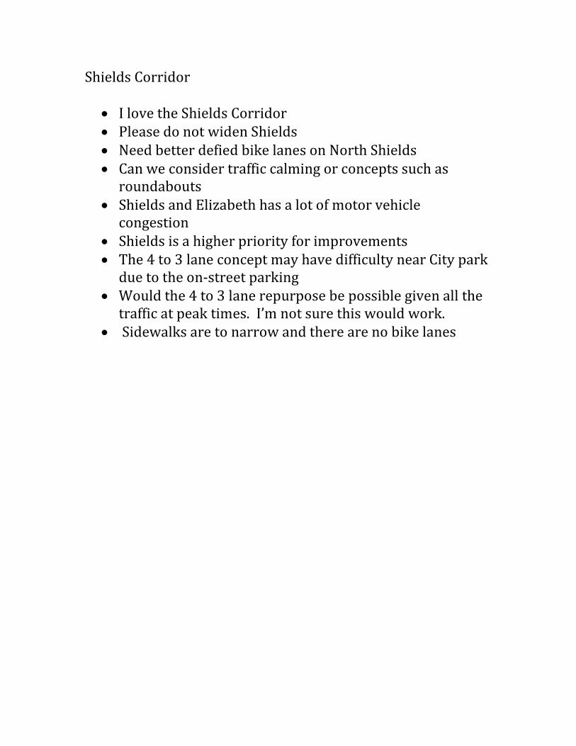
Shields Corridor
• I love the Shields Corridor • Please do not widen Shields • Need better defied bike lanes on North Shields • Can we consider traffic calming or concepts such as
roundabouts • Shields and Elizabeth has a lot of motor vehicle
congestion • Shields is a higher priority for improvements • The 4 to 3 lane concept may have difficulty near City park
due to the on-street parking • Would the 4 to 3 lane repurpose be possible given all the
traffic at peak times. I’m not sure this would work. • Sidewalks are to narrow and there are no bike lanes
OTNP Business Stakeholder Focus Group 215 N. Mason Community Room 10:30am-12:00pm | July 2, 2015
Introductory/Overview Q: Are there other neighborhoods with design guidelines? A: Downtown Old Town, but nothing outside of that. There were design guidelines for these neighborhoods from the 90s, we’re updating those. Advisory, voluntary document designed to better illustrate options. A: This was one of the recommendations from the character study. Q: Diversity in Old Town is greater than anywhere else. Homes are selling for higher prices in part due to variety. Have you taken that into account? A: Absolutely. The document is about looking at the context and the idea of compatibility from that standpoint, not designing in a vacuum. Q: I went to a hearing last year for a beautiful home that was denied because “it had too many eaves.” That’s a huge overstep in my opinion. A: Would love to hear your comments once we get a draft out. Q: Nowhere here do I see anything about how this plan will integrate with City Plan, should be a focus. This should be a stated purpose and goal for this plan. A: Thank you. We have some slides on this coming up, and will definitely consider making this a more explicit goal. Q: Why the division between East and West side, especially with focus on connectivity? A: The division comes from the previous planning – there were two separate plans, this effort will be combining the two. Q: When will you stop dividing the neighborhoods in the current plan and quit using that vocabulary? A: We’re finding similar issues and opportunities, but also unique issues to each area…at this stage we don’t know. Q: Sensitive to the division of East/West side, I think it can be dangerous. Idea of fence going up, and 10 years on DDA board. Other than City meetings where “you guys bring it up,” have never heard residents identify with either East or West side. They say they live in Old Town. A: That’s part of why we’re trying to create a unified planning process. Q: Reword “concerns re: increased density” to “conversations about increasing density” A: Jay changed on the slide.
Q: Isn’t Mulberry an enhanced travel corridor? A: No, we’re looking at West Elizabeth right now. City Plan Redevelopment Areas City Staff: Just want to clarify. City Plan recognizes the established neighborhoods in particular as areas more for stability. If you look at the zoning provisions, it really is recognizing that those are established and there’s not as much opportunity for redevelopment/infill. That’s a topic for discussion when we update City Plan again, especially knowing that our GMA is unlikely to change significantly. All of the other residential zones (outside of Old Town neighborhoods) are more amenable to higher density and redevelopment. Q: That’s my focus on linkages and talking about City Plan. Don’t want it to be myopic only on this area. How does this area relate to and impact other areas? For me, that’s why this is important. Don’t want a smaller vision dictating to City Plan. I’m concerned about the LOSS of population in this area – either it changes or will become a pricey, exclusive area. Q: I just want to put an exclamation point on what the previous person is saying. You said there are easier places to create density than the existing neighborhoods. That scares me, because even if that’s true, it shouldn’t necessarily be a premise for the plan. How can these neighborhoods integrate into higher density? That should be the focus of the conversation instead. Staff: We will be talking about that. Specifically LMN and NCB Consultant: Even in those areas that are “stable” there are still going to be strategies for additional housing units, it’s just a different approach. Consultant: Glad to hear from this group, there’s a real conflict here about melding higher density and concerns about preserving the neighborhoods. We haven’t heard a ton of advocating for higher density yet. Q: (Re multi-use in LMN project recently) – the people against that project lived nowhere near that property. I could bring all my neighbors who will tell you how much they want that project because the gas station is such a nightmare 24/7. Consultant: Please bring people to next Wednesday’s public meeting! We want to hear from different viewpoints. Overview of different zone districts Q: Are these (CC) buildings permitted by right? A: Yes. Q: There are factions that will say they don’t want this, then it’s a matter of whether the City will hold or cave in to a few vocal opponents. Mentions of Perkins project, others that were “really hard” to get through the process. Brinkman project – dedicated developer who wanted to make it happen Q: Confusion about how neighbors weigh in on some of these projects. Mixed use – no threshold of how much is actually commercial. No input until it’s almost too late, no early neighborhood meeting.
A: Tough balancing act, and we need to have discussions on the process in addition to strictly what’s allowed vs. not allowed. Q: What is the purpose of the emerging strategy diagram (map)? A: We’ll build on this. Q: To me, one thing would be a greater “feathering” of some of the higher-intensity areas. These are block-by-block, which causes greater concerns for residents directly abutting a higher-density zone. Needs to be a two-way transition. A: The Downtown Plan is happening right now as well, and that’s an excellent point about how to integrate the two plans, collaborate. Q: We only have 25% of the density we’ll need along corridor to sustain development/strategy for Mason. I hope this is part of the broader conversation. A: What should that look like? Q: First, education that development is not all bad. You can’t have an amenity without the population to support it (transit) – higher density housing, mixed use, retail/restaurant spaces will bring people to use that corridor. Q: It doesn’t seem like anyone’s interested in supporting higher density. Spring Creek Station was knocked down, and instead of the City standing up and saying “this is allowed” the project was “pooh-poohed” and not allowed to go forward. Q: I take MAX a lot for fun – but it’s kind of a bus to nowhere (except Downtown and eventually the Mall). Manufacturing, higher-paying jobs, breweries… Q: We have two incubators growing new companies all the time. What about spaces for companies that are ready to move into someplace downtown where they can grow and expand? There are lots of start-up companies that need a place to work. Overview: Retail, jobs, destinations along the corridor, higher density housing, mixed use along transit corridor Q: If we can’t get this kind of density and mix of uses downtown, we won’t get it anywhere else. It won’t happen in midtown. Concerned about overall approach to development. We need an agreement between historic preservation and development. Maybe City Plan just needs to be changed. Q: If you could go through each of these 6 items and ask, “What problem are we solving?” That’s a huge question we need to answer. City is “solving” problems that aren’t problems. Old Town area is most desirable area in N Colorado. There’s no problem there. Transition areas – we have a problem there. Buffer zones are underutilized. Distinct lack of affordable/attainable housing, need more density. Placemaking doesn’t make sense to me. For the last 100 years, Old Town has been growing without an issue. What are we solving there? Sustainable practices – integrated into everything. We do have an issue with transportation and mobility as well. Shame to waste so much time on a small faction of people who are creating a problem when there’s no problem.
What isn’t working? Q: Areas of stability – concern is really trying to allow the old neighborhoods to evolve. There’s a loud faction that wants to keep everything old, no changes at all. The diversity that everyone talks about can incorporate some modern elements into it. Can we allow garages? Some people are going to want a garage. In those buffer zones, how can we educate people when they purchase homes near buffer zones about “these are allowable uses here.” Part of living in a vibrant neighborhood is being able to walk to things, which comes with more density. Commercial mixed use in pockets (Shields/Mountain) really enhance the neighborhood. How do we allow that vibrancy, but do it in a smart way? A: It might take creative developers to come forward and propose more mixed-use development. Q: How can we get the word out to developers that the City will entertain this? People don’t think it’s a possibility, so they won’t come forward. A: A lot of these LMN pockets are very small also. Q: Hard to balance viability of mixed-use projects with maintaining compatibility. Q: When did most of these zoning items get established? A: 1997 Q: Stay focused on quality of life. The stuff that some of the folks here are talking about is a “fear factor.” People are afraid of change. I remember the trolley – people were carrying signs to try to stop the trolley. It’s the overall quality of life that makes this town what it is. Stay focused on the big picture. No one is ever going to agree. Q: There’s always an opportunity to improve quality of life. What do you think is critical to quality of life? Good job, place to live, clean water, clean air Connectivity Breweries/Distilleries Clean air – more mixed-use projects means more walkability, more biking, more transit use. Showcase other benefits to higher density.
Q: Is there an opportunity to add complementary overlay to create some of that “feathering” I was talking about? I don’t see any political will to start changing NCL or moving boundaries around, even though things have changed a lot since 1991. There need to be some changes made at the planning level. Things need to be based on today’s realities. A: That’s what these conversations are for. If you talk about those lower density districts, there are discussions that need to happen around affordability, restrictions around ADUs and carriage houses…to your point, that all needs to be talked about in this process. A: There have been a number of comments about NCB/CC areas – reassessing boundaries and what happens within them. Q: Elected bodies don’t get to see this conversation. This conversation is very good, but all they see is the people who are in front of them saying “this will ruin my quality of life.” Design Guidelines Q: greater emphasis on the quality of design, less emphasis on repetition of design. LPC is protecting projects that have historical significance but of low quality. New projects have to lower their architectural quality to be “compatible” with older, low-quality projects. Q: LPC needs to be an integral part of these discussions. They’ve evolved over time, but still want to bring them along in the conversation. Q: How to allow the old neighborhoods to evolve and continue to have diversity. Q: Even in the most central areas of East/West side need to learn how to accommodate 3-4 story buildings. I’ve been to places where they can do it. Just wanting everything to look the same isn’t historical, it’s reproduction. There are ways to develop – microapartments in Denver – building up with historic facades…there’s a monetary litmus test to living in these neighborhoods, part of why the diversity is going away. Q: There’s an entitlement in this community re: shadows, views of horsetooth…the biggest issue is height. We did a survey two years ago about allowing higher buildings, 75% opposed it. Q: I tell people to walk or drive from Whitcomb to Taft and look at each and every house and see all the decades and how different the houses all are from each other. People have come back to me and said they understand what I mean – it’s education. Q: I have issues with a design book, even if it’s just “ideas” – the ideas get into someone’s head, then the City won’t allow it to be built because it’s not in the book. Q: There’s a balance. Do we want big square boxes because it’s the cheapest way to build? No. But how can you tell someone they need more articulation? That’s what guidelines are for. Needs to be focused on design, not style.
Q: There’s already a mechanism to deal with parking. There’s no problem there. A: This is important for coordination with Downtown Plan as well, so important to include this. Q: I’d be really disappointed if this is the only business input you get. I want to go talk to Beavers. [general agreement that group wants to continue this conversation] Q: Find ways to outreach to millennials. I don’t know how you get them involved, but it needs to be in a different way than typical community meetings. Q: Talk to UniverCity people, find out how they got a diversity of age groups.
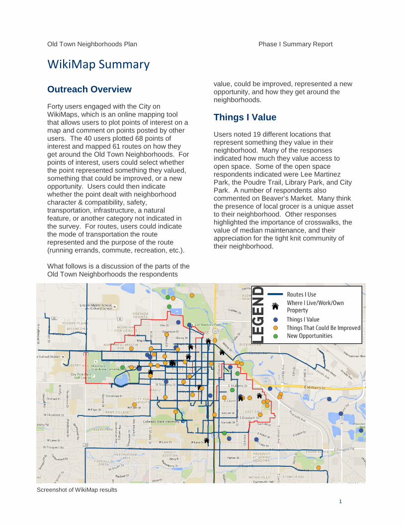
Old Town Neighborhoods Plan Phase I Summary Report
1
WikiMap Summary
Outreach Overview
Forty users engaged with the City on WikiMaps, which is an online mapping tool that allows users to plot points of interest on a map and comment on points posted by other users. The 40 users plotted 68 points of interest and mapped 61 routes on how they get around the Old Town Neighborhoods. For points of interest, users could select whether the point represented something they valued, something that could be improved, or a new opportunity. Users could then indicate whether the point dealt with neighborhood character & compatibility, safety, transportation, infrastructure, a natural feature, or another category not indicated in the survey. For routes, users could indicate the mode of transportation the route represented and the purpose of the route (running errands, commute, recreation, etc.).
What follows is a discussion of the parts of the Old Town Neighborhoods the respondents
value, could be improved, represented a new opportunity, and how they get around the neighborhoods.
Things I Value
Users noted 19 different locations that represent something they value in their neighborhood. Many of the responses indicated how much they value access to open space. Some of the open space respondents indicated were Lee Martinez Park, the Poudre Trail, Library Park, and City Park. A number of respondents also commented on Beaver’s Market. Many think the presence of local grocer is a unique asset to their neighborhood. Other responses highlighted the importance of crosswalks, the value of median maintenance, and their appreciation for the tight knit community of their neighborhood.
Screenshot of WikiMap results
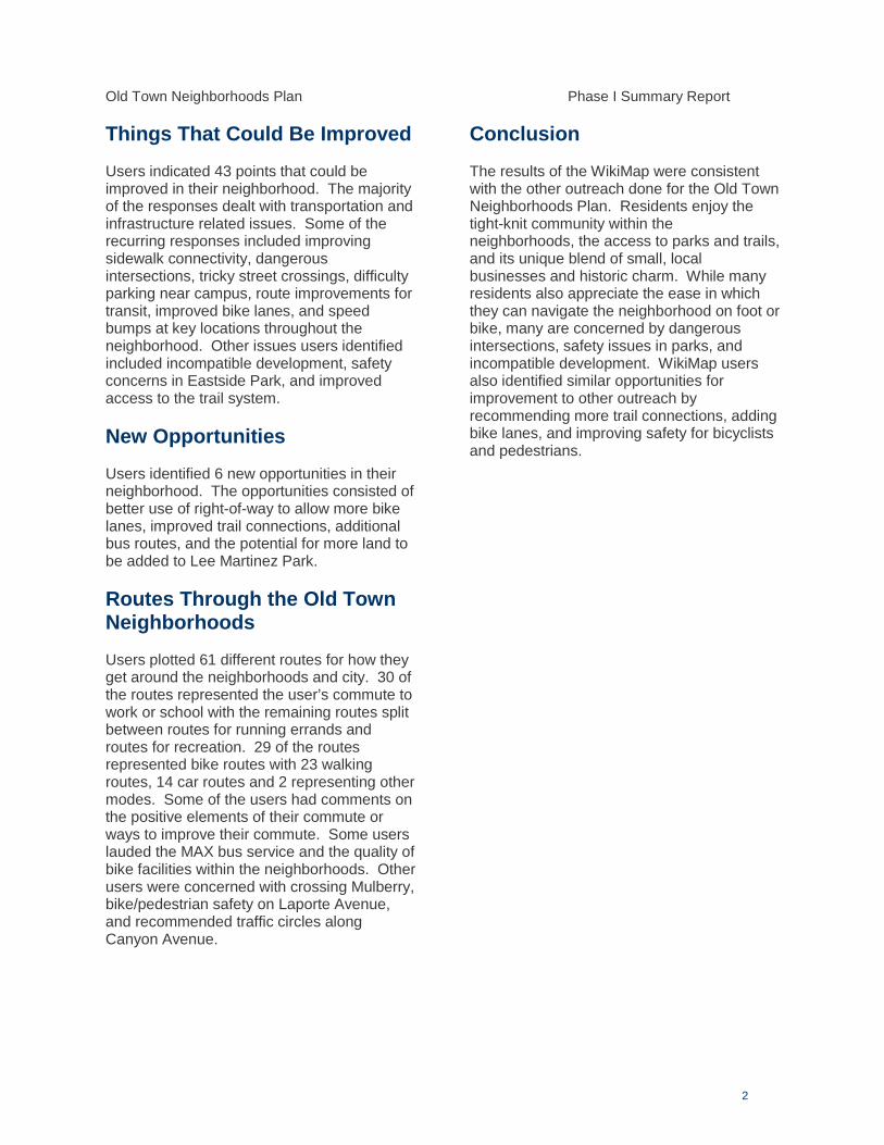
Old Town Neighborhoods Plan Phase I Summary Report
2
Things That Could Be Improved
Users indicated 43 points that could be improved in their neighborhood. The majority of the responses dealt with transportation and infrastructure related issues. Some of the recurring responses included improving sidewalk connectivity, dangerous intersections, tricky street crossings, difficulty parking near campus, route improvements for transit, improved bike lanes, and speed bumps at key locations throughout the neighborhood. Other issues users identified included incompatible development, safety concerns in Eastside Park, and improved access to the trail system.
New Opportunities
Users identified 6 new opportunities in their neighborhood. The opportunities consisted of better use of right-of-way to allow more bike lanes, improved trail connections, additional bus routes, and the potential for more land to be added to Lee Martinez Park.
Routes Through the Old Town Neighborhoods
Users plotted 61 different routes for how they get around the neighborhoods and city. 30 of the routes represented the user’s commute to work or school with the remaining routes split between routes for running errands and routes for recreation. 29 of the routes represented bike routes with 23 walking routes, 14 car routes and 2 representing other modes. Some of the users had comments on the positive elements of their commute or ways to improve their commute. Some users lauded the MAX bus service and the quality of bike facilities within the neighborhoods. Other users were concerned with crossing Mulberry, bike/pedestrian safety on Laporte Avenue, and recommended traffic circles along Canyon Avenue.
Conclusion
The results of the WikiMap were consistent with the other outreach done for the Old Town Neighborhoods Plan. Residents enjoy the tight-knit community within the neighborhoods, the access to parks and trails, and its unique blend of small, local businesses and historic charm. While many residents also appreciate the ease in which they can navigate the neighborhood on foot or bike, many are concerned by dangerous intersections, safety issues in parks, and incompatible development. WikiMap users also identified similar opportunities for improvement to other outreach by recommending more trail connections, adding bike lanes, and improving safety for bicyclists and pedestrians.
Old Town Neighborhoods Plan Stakeholder Group Meeting July 27, 2016
Short Term Rental Update
• Brought draft ordinance ideas to Council on 7/26/16 • Two categories of Short Term Rental
o Primary (owner lives there) o Non-primary (owner does not live there) Council was more concerned about this.
Varying opinions about how to regulate. o Types of current short term rentals in the community: seems to be a fairly even split
between primary and non-primary, but take this information with a grain of salt. Very hard to answer this question.
• Questions about how to bring existing operators into compliance • Questions about concentration limits. Still thinking about this. Some options:
o One per block face o Certain percentage per Census tract
• Next step: 5th work session with Council (late Fall) • Adoption early 2017 • Who would enforce?
o Probably Neighborhood Services. But would require more staff resources than we have right now.
o Likely enforced on a complaint basis
Zoning and Arterial Open House Update
• Open House in late June to property owners and residents in potential rezoning areas. Lots of in-depth conversations, though not very well attended.
o 50/50 support of the idea: Concerns about loss of ability to build larger detached garages and/or ADUs Concerns about loss of overall flexibility Rezoning next to City warehouse building makes less sense to those property
owners • Open House also in late June for property owners and residents along Shields and Mulberry
o There’s been a change to segment 2 on Shields. Traffic Ops still concerned about this area. Might only be room for a bike lane on one side of the street; not sure with current traffic levels if lanes on both sides can work/where the shift should be
o Will need to remove on-street parking on North Shields. Not sure on which side yet. o No changes to previous proposal shown for Mulberry/Magnolia. o Support: most “like” or “sort-of like” the options presented. More concern about Shields
than Mulberry/Magnolia.
o Concerns about reduced lane widths (truck traffic) o Concerns about vehicle speeds/need for traffic calming o Concerns about usefulness of one-way bike lane
• Is there anywhere other than Shields for a parallel route? o Could do Loomis, but it is a few blocks away -- not a great parallel route.
• Has anyone considered making arterials off-limits for bikes? o Came up early in the process, but arterials are important routes to major destinations.
• Are complete streets a goal of the City? o Yes, but funding is always a challenge and right-of-way acquisition is difficult. We often
need to work within the existing right-of-way to make the street as complete as we can. • Is there a way to combine the bike lanes with sidewalks instead of with cars? Take the sidewalk
widening all the way up Shields to make more of a trail-type system o Need to meet more with Traffic Operations to see what our options might be for
Shields. This one is going to be tricky. • We’re thinking about these changes more as short-term to mid-term changes. We heard a lot
about how much people wanted to see better bike/ped infrastructure on these corridors. These changes can help get us part of the way there, and the goal would be additional right-of-way acquisition and complete streets. Those bigger improvements will be expensive and will take time.
Policies/Action Items & Evaluation Criteria
• Went over the policy handout and a handout of the draft implementation action plan. Policies are more general goals, strategies and action items are more specific.
• Council will really be drilling into the Implementation Action Plan. We need your feedback on this – does anything need to be tweaked? Is anything missing?
• Livable o Key action items include the potential rezonings and design guidelines/standards for the
transition areas. o Do you know about cost yet?
In some cases yes, in some cases no. Where we do know cost information we’ll include that in the plan. Otherwise we’ll have to include broader estimates.
• Transportation o Key action items include proposed corridor changes, local street improvements, and
crossing improvements. o No recommendations for changes to parking. We include ongoing support of the RP3
program and will continue to work with the Downtown Plan. • Sustainability
o Wide range of implementation actions here, from supporting CAP in the neighborhoods to neighborhood greenways. Smaller, incremental environmental improvements.
o Is this coordinated with existing design standards in the neighborhoods?
It’s not really related. Nothing is changing with the existing design standards. We don’t have a lot of data from new homes built since those standards were put in place in 2012, so we may want to do an analysis in a few years. We’re not recommending looking at this again in this plan, since the standards were adopted relatively recently.
• Character and Compatibility o Key action items include design guidelines for NCM/NCL, developing new standards for
ADUs, and new design standards for the NCB zone district. • Overall comment for the Implementation Action Plan: Fewer acronyms! Include a glossary to
explain what all these things are! • Evaluation criteria overview
o How much flexibility is there in this tool, how things are defined, and how it’s used? o The way this is presented might confuse Council. They’ll get bogged down in what a
half-filled circle means. o What about the positive impacts of climate action, or preserving the single-family
neighborhoods, etc.? o Economic one is the hardest one. Some of these things are fiscal, not economic. If you
want to do a cost-benefit analysis, it should be a complete one.
“Open Mic”
• Parking o The parking folks came to talk to us about the permitting process with RP3. Almost
everyone loves it. We also talked about how RP3 pushes the parking issues out, to other neighborhoods. The whole problem will be forced on other neighbors instead of the folks causing the problem. We’re trying to get a group together to deal with CSU and OtterBox directly. Ask them to be more proactive in dealing with the problem instead of pushing the problem on to us. Is anyone interested or does anyone have any great ideas?
o TOD is tough. You don’t want apartment complexes building a ton of parking, but we haven’t made a cultural shift yet. Everyone has a car and wants it where they live, and that is a hard thing to manage. Chicken and egg.
o A big part of the issue is the lack of a regional transit system. Getting to Denver, Boulder, Greeley - you still need a car, so you still need somewhere to park it. City could make it attractive, inexpensive, and safe to store your car somewhere instead of parking it where you live.
• Backyard burning/fire – Denver has had an outdoor burning ban multiple years now. Seeing the smoke-free zone downtown has been great. No one has air conditioning, and the air pollution is a concern. Bonfires, wood fires, leaves. If we understand that cigarette smoke is bad for you, why don’t we understand that backyard wood fires are also bad?
o Part of it is an education issue.
o Longmont had a way to recycle yard waste (tree limbs, etc.). Fort Collins should have something like that – will the new recycling center accept yard waste?
o We’ve hit a density threshold – with that many people, you can’t have that many backyard fires. It’s not safe, not healthy, and is an air pollution issue.
• ADUs o If they’re short-term rentals, that’s not helping affordability. It’s also not cheap to build
small. If it’s expensive, the builder then passes the cost along to the renter. Then is it actually more affordable to the renter? Probably not. In my mind, we need to look a different direction for more affordable housing.
o Need to work on the fees discussion. o Allow flexibility, but only if those units are set for affordable housing capped at a certain
amount of rent. o Affordability in general – should we be looking at landlords with more than one
property and treat them differently? Treat owner-occupied ADUs differently from rentals? How can we provide more options for first-time home buyers?
• Homelessness/Transients o This will spill into our neighborhoods, and already is on the Eastside. o Eastside Park – not a lot of stuff going on there, needs more scheduled activity. Parks
and Rec is going to start scheduling soccer and some other activities there. Residents need to use the park more.
Next meeting: August, specifically to discuss policies and action items in-depth.
Recap of this meeting sent out Monday, and a reminder before the next meeting.
Send to group: Rezoning map, corridor poster, evaluation criteria spreadsheet
The third round of Old Town Neighborhoods Plan Stakeholder Group Meetings was held on September 28th & 29th with members from both the Eastside and Westside Stakeholder Groups. The meeting agenda is listed below, with the majority of each meeting devoted to review and discussion of the results from the online visioning survey conducted over the summer. Agenda: Review & discussion of online vision survey results Brainstorming vision ideas & statements Discuss next steps for the Old Town Neighborhoods Plan
Online Vision Survey Discussion The online survey was comprised of three sections including transportation and mobility, land use and transitions, and character and compatibility. A total of 292 respondents completed all three sections, with additional responses recorded for individual sections. The summary below is modeled from the stakeholder group discussions and ideas after reviewing questions from the survey. A copy of results of individual survey questions may be downloaded from the Old Town Neighborhoods Plan webpage. Demographics Reviewing survey responses shows that fewer college-age students (18-24) and renters took the
survey than is representative of the overall demographic characteristics of the neighborhood. o Many students were gone over the summer when the survey took place & have also
been more difficult to engage throughout the Old Town Neighborhoods Plan process. A high number of survey respondents indicated their primary travel method in the
neighborhoods was by bike. Some felt this number felt higher than their experience. The number of responses represents approximately 2.5% of the study area population, and
members cautioned applying the results as fully representative of the neighborhoods. Transportation & Mobility Surprise there were not more transit users – some speculated the lack of service in the core of
the neighborhoods and general ease of getting around with other modes limit transit usage. Parking inconvenience promotes walking & biking from neighborhood residents when traveling
Downtown from the neighborhoods. Parking issues were not included in the survey, but most agree general impacts of spill-over
parking particularly in the fringe areas of the neighborhoods should be addressed. The online survey and group discussion indicated strong support for bike/pedestrian
improvements along the arterial corridors and a potential road diet. Survey comments and a follow-up question also indicated a preference for more focus on parallel routes as a means to improve bike/pedestrian infrastructure along these corridors.
Many also agreed with the number of comments to examine better wayfinding, especially for bikes, as well as better enforcement for vehicles and bikes within the neighborhoods. Many anecdotes and personal experience with infractions.
Stakeholder Group Meeting Summary September 28 & 29, 2015
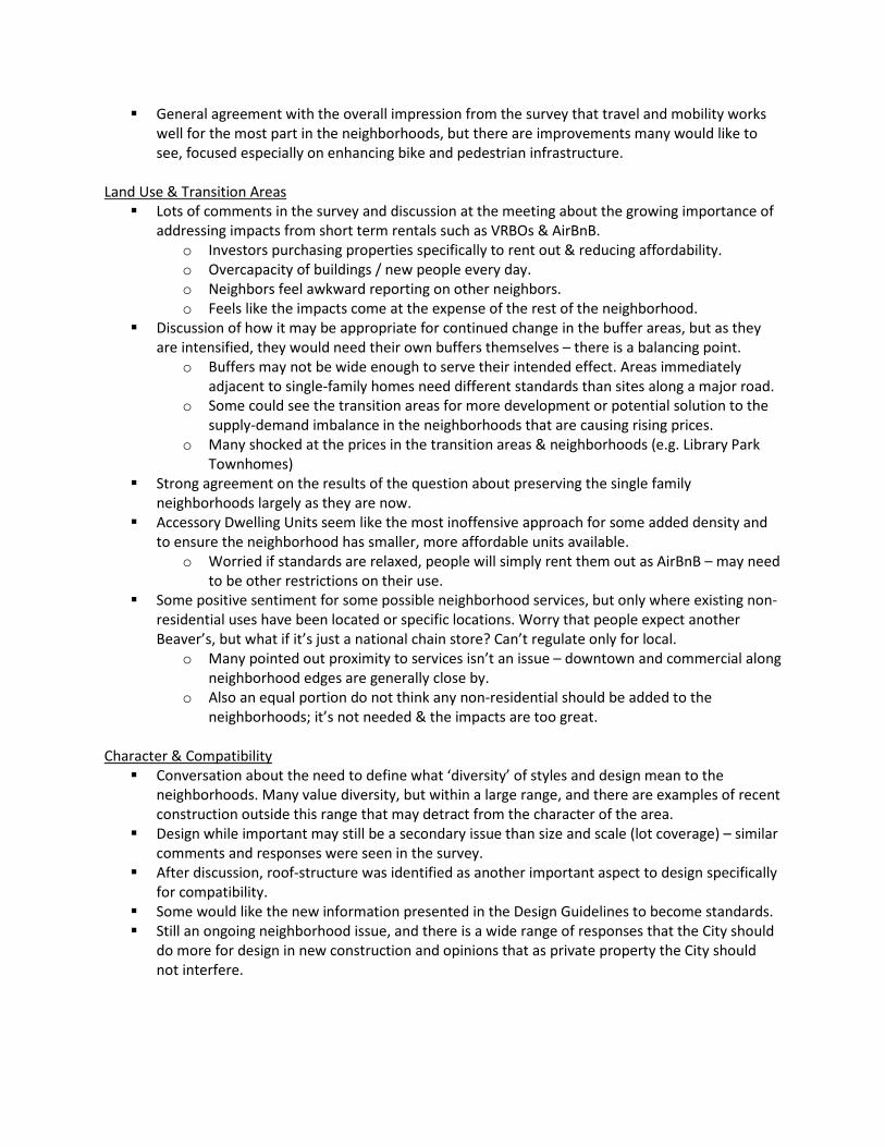
General agreement with the overall impression from the survey that travel and mobility works well for the most part in the neighborhoods, but there are improvements many would like to see, focused especially on enhancing bike and pedestrian infrastructure.
Land Use & Transition Areas Lots of comments in the survey and discussion at the meeting about the growing importance of
addressing impacts from short term rentals such as VRBOs & AirBnB. o Investors purchasing properties specifically to rent out & reducing affordability. o Overcapacity of buildings / new people every day. o Neighbors feel awkward reporting on other neighbors. o Feels like the impacts come at the expense of the rest of the neighborhood.
Discussion of how it may be appropriate for continued change in the buffer areas, but as they are intensified, they would need their own buffers themselves – there is a balancing point.
o Buffers may not be wide enough to serve their intended effect. Areas immediately adjacent to single-family homes need different standards than sites along a major road.
o Some could see the transition areas for more development or potential solution to the supply-demand imbalance in the neighborhoods that are causing rising prices.
o Many shocked at the prices in the transition areas & neighborhoods (e.g. Library Park Townhomes)
Strong agreement on the results of the question about preserving the single family neighborhoods largely as they are now.
Accessory Dwelling Units seem like the most inoffensive approach for some added density and to ensure the neighborhood has smaller, more affordable units available.
o Worried if standards are relaxed, people will simply rent them out as AirBnB – may need to be other restrictions on their use.
Some positive sentiment for some possible neighborhood services, but only where existing non-residential uses have been located or specific locations. Worry that people expect another Beaver’s, but what if it’s just a national chain store? Can’t regulate only for local.
o Many pointed out proximity to services isn’t an issue – downtown and commercial along neighborhood edges are generally close by.
o Also an equal portion do not think any non-residential should be added to the neighborhoods; it’s not needed & the impacts are too great.
Character & Compatibility Conversation about the need to define what ‘diversity’ of styles and design mean to the
neighborhoods. Many value diversity, but within a large range, and there are examples of recent construction outside this range that may detract from the character of the area.
Design while important may still be a secondary issue than size and scale (lot coverage) – similar comments and responses were seen in the survey.
After discussion, roof-structure was identified as another important aspect to design specifically for compatibility.
Some would like the new information presented in the Design Guidelines to become standards. Still an ongoing neighborhood issue, and there is a wide range of responses that the City should
do more for design in new construction and opinions that as private property the City should not interfere.
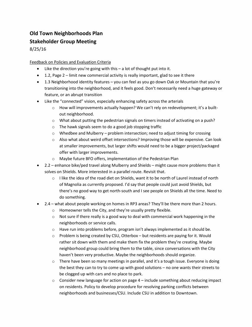
Old Town Neighborhoods Plan Stakeholder Group Meeting 8/25/16 Feedback on Policies and Evaluation Criteria
• Like the direction you’re going with this – a lot of thought put into it. • 1.2, Page 2 – limit new commercial activity is really important, glad to see it there • 1.3 Neighborhood identity features – you can feel as you go down Oak or Mountain that you’re
transitioning into the neighborhood, and it feels good. Don’t necessarily need a huge gateway or feature, or an abrupt transition
• Like the “connected” vision, especially enhancing safety across the arterials o How will improvements actually happen? We can’t rely on redevelopment; it’s a built-
out neighborhood. o What about putting the pedestrian signals on timers instead of activating on a push? o The hawk signals seem to do a good job stopping traffic o Whedbee and Mulberry – problem intersection; need to adjust timing for crossing o Also what about weird offset intersections? Improving those will be expensive. Can look
at smaller improvements, but larger shifts would need to be a bigger project/packaged offer with larger improvements.
o Maybe future BFO offers, implementation of the Pedestrian Plan • 2.2 – enhance bike/ped travel along Mulberry and Shields – might cause more problems than it
solves on Shields. More interested in a parallel route. Revisit that. o I like the idea of the road diet on Shields, want it to be north of Laurel instead of north
of Magnolia as currently proposed. I’d say that people could just avoid Shields, but there’s no good way to get north-south and I see people on Shields all the time. Need to do something.
• 2.4 – what about people working on homes in RP3 areas? They’ll be there more than 2 hours. o Homeowner tells the City, and they’re usually pretty flexible. o Not sure if there really is a good way to deal with commercial work happening in the
neighborhoods or service calls. o Have run into problems before, program isn’t always implemented as it should be. o Problem is being created by CSU, Otterbox – but residents are paying for it. Would
rather sit down with them and make them fix the problem they’re creating. Maybe neighborhood group could bring them to the table, since conversations with the City haven’t been very productive. Maybe the neighborhoods should organize.
o There have been so many meetings in parallel, and it’s a tough issue. Everyone is doing the best they can to try to come up with good solutions – no one wants their streets to be clogged up with cars and no place to park.
o Consider new language for action on page 4 – include something about reducing impact on residents. Policy to develop procedure for resolving parking conflicts between neighborhoods and businesses/CSU. Include CSU in addition to Downtown.
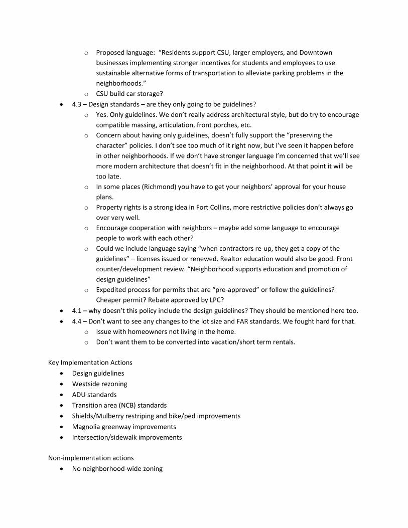
o Proposed language: “Residents support CSU, larger employers, and Downtown businesses implementing stronger incentives for students and employees to use sustainable alternative forms of transportation to alleviate parking problems in the neighborhoods.”
o CSU build car storage? • 4.3 – Design standards – are they only going to be guidelines?
o Yes. Only guidelines. We don’t really address architectural style, but do try to encourage compatible massing, articulation, front porches, etc.
o Concern about having only guidelines, doesn’t fully support the “preserving the character” policies. I don’t see too much of it right now, but I’ve seen it happen before in other neighborhoods. If we don’t have stronger language I’m concerned that we’ll see more modern architecture that doesn’t fit in the neighborhood. At that point it will be too late.
o In some places (Richmond) you have to get your neighbors’ approval for your house plans.
o Property rights is a strong idea in Fort Collins, more restrictive policies don’t always go over very well.
o Encourage cooperation with neighbors – maybe add some language to encourage people to work with each other?
o Could we include language saying “when contractors re-up, they get a copy of the guidelines” – licenses issued or renewed. Realtor education would also be good. Front counter/development review. “Neighborhood supports education and promotion of design guidelines”
o Expedited process for permits that are “pre-approved” or follow the guidelines? Cheaper permit? Rebate approved by LPC?
• 4.1 – why doesn’t this policy include the design guidelines? They should be mentioned here too. • 4.4 – Don’t want to see any changes to the lot size and FAR standards. We fought hard for that.
o Issue with homeowners not living in the home. o Don’t want them to be converted into vacation/short term rentals.
Key Implementation Actions
• Design guidelines • Westside rezoning • ADU standards • Transition area (NCB) standards • Shields/Mulberry restriping and bike/ped improvements • Magnolia greenway improvements • Intersection/sidewalk improvements
Non-implementation actions
• No neighborhood-wide zoning
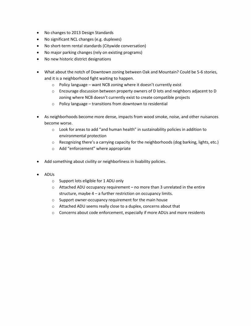
• No changes to 2013 Design Standards • No significant NCL changes (e.g. duplexes) • No short-term rental standards (Citywide conversation) • No major parking changes (rely on existing programs) • No new historic district designations
• What about the notch of Downtown zoning between Oak and Mountain? Could be 5-6 stories,
and it is a neighborhood fight waiting to happen. o Policy language – want NCB zoning where it doesn’t currently exist o Encourage discussion between property owners of D lots and neighbors adjacent to D
zoning where NCB doesn’t currently exist to create compatible projects o Policy language – transitions from downtown to residential
• As neighborhoods become more dense, impacts from wood smoke, noise, and other nuisances
become worse. o Look for areas to add “and human health” in sustainability policies in addition to
environmental protection o Recognizing there’s a carrying capacity for the neighborhoods (dog barking, lights, etc.) o Add “enforcement” where appropriate
• Add something about civility or neighborliness in livability policies.
• ADUs
o Support lots eligible for 1 ADU only o Attached ADU occupancy requirement – no more than 3 unrelated in the entire
structure, maybe 4 – a further restriction on occupancy limits. o Support owner-occupancy requirement for the main house o Attached ADU seems really close to a duplex, concerns about that o Concerns about code enforcement, especially if more ADUs and more residents
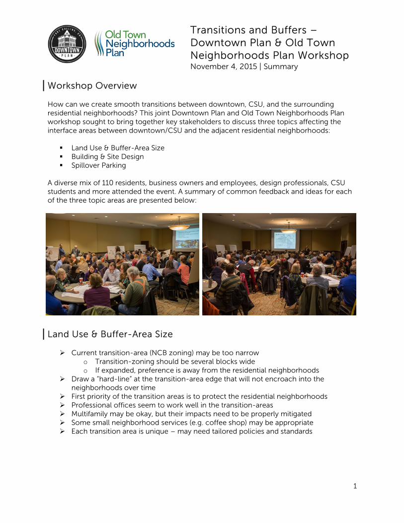
Transitions and Buffers – Downtown Plan & Old Town Neighborhoods Plan Workshop November 4, 2015 | Summary
1
Workshop Overview How can we create smooth transitions between downtown, CSU, and the surrounding residential neighborhoods? This joint Downtown Plan and Old Town Neighborhoods Plan workshop sought to bring together key stakeholders to discuss three topics affecting the interface areas between downtown/CSU and the adjacent residential neighborhoods: Land Use & Buffer-Area Size Building & Site Design Spillover Parking
A diverse mix of 110 residents, business owners and employees, design professionals, CSU students and more attended the event. A summary of common feedback and ideas for each of the three topic areas are presented below:
Land Use & Buffer-Area Size Current transition-area (NCB zoning) may be too narrow
o Transition-zoning should be several blocks wide o If expanded, preference is away from the residential neighborhoods
Draw a “hard-line” at the transition-area edge that will not encroach into the neighborhoods over time
First priority of the transition areas is to protect the residential neighborhoods Professional offices seem to work well in the transition-areas Multifamily may be okay, but their impacts need to be properly mitigated Some small neighborhood services (e.g. coffee shop) may be appropriate Each transition area is unique – may need tailored policies and standards
Transitions and Buffers – Downtown Plan & Old Town Neighborhoods Plan Workshop November 4, 2015 | Summary
2
Building Design
General agreement that approximately 3 stories is an appropriate maximum height in the transition areas
Preferences to utilize converted homes & utilize existing building stock Transition into residential areas most important – taller and more dense development
is more appropriate at the Downtown-facing edges of the transition areas than immediately adjacent to one- and two-story residential areas
Building materials: o High-quality (brick/masonry) o Alley treatments – so neighbors aren’t facing a blank wall and trash enclosures o Materials facing residential neighborhoods should be similar to the adjacent
homes Building design:
o Match or complement residential roof forms o Upper level step-backs o Residential style setbacks close to neighborhoods o Variation in façade, break up mass of larger buildings
Green landscaping and walking space, interactive/natural space, neighbor friendly site design were identified as keys to transitional compatibility
Spillover Parking
Identification of a “ring” of Residential Permit Parking Program (RP3) areas (existing and proposed) around CSU and Downtown – does RP3 push the problem elsewhere?
New developments need to provide adequate parking More diagonal parking to increase capacity; additional striping to increase efficiency Parking garages near the edges of transition zones; also need to incentivize
employees to use garages instead of on-street parking spots There are several different groups with different parking needs: visitors/shoppers,
residents, employees, and students. Solutions to spillover parking need to address all of these groups
Businesses in transition areas should provide bus passes, parking, etc. to prevent spillover parking into residential neighborhoods
Other ideas: o Allow parking in loading zones at peak times o Time-limited parking close to CSU o Demand-reduction strategies (bike/car share, public transit, etc.)
Old Town Neighborhoods Plan Stakeholder Group meeting 11/19/15 Meeting Materials:
- Neighborhood Vision Handout - Transition Workshop Summary - LMN Pockets – Potential Rezone Areas
Neighborhood Vision Vision is organized into themes (unique – livable – connected – sustainable). Graphics will be
developed to accompany each vision theme area (see vision handout). Themes are related to the plan topic areas such as land use, transportation and mobility, and design/compatibility.
Each theme has a vision statement, values that explain the vision, and goals for implementing the vision.
Continue to work on and refine the vision, values, and goal statements. Looking for additional input from the public and stakeholders.
Input/Discussion about the areas of stability/areas of change statement under the livable vision theme:
o Question: When you say “designate areas of stability and areas where change may be more appropriate,” do you mean in LMN zones? Where will that change happen?
o Don’t like that we pick and choose areas of stability. Single family homes should stay that way.
o Not sure what this goal actually means. It’s loose, could mean lots of things. o Option: “Recognize the importance of maintaining the stability of single-family
neighborhoods.” o “Neighborhood stability” to me means home ownership, and not just outside investors
buying homes to rent. o “Stability” doesn’t really do it for me – the words that come up are “quality” and
“sustainable.” o This goal is the reason a lot of us are here. Impacts are exponential when change
happens that is inappropriate (large, bulky, multi-family properties). o “Designating an area” offends me. Can we say that we “anticipate and manage areas
where change is expected?” o Would love to see a way to designate the whole area with some sort of historic
designation or “historic designation lite” that is some sort of award/recognition. Question: Can you explain the “incentives and programs” as related to the Affordable Housing
Strategic Plan? o Could be accessory dwelling units, development incentives, changes to fees, first-time
homebuyer programs, etc. Could include tiny houses. Framework Map Framework map: Examples from other plans to show what a framework map looks like. We’re
working on developing a map for the Old Town Neighborhoods Plan as well. The framework map will shows any potential land-use or zoning changes, transportation network, green-network, etc. Previous plans have included a framework plan, such as the Northside Neighborhoods Plan.
Transitions Workshop Recap Overview of input from the Transitions Workshop Event (see Transitions Workshop Summary for
full details). Themes from the event: o In general, land-uses in the transition areas seem to be working for most people. Some
concern about the largest examples of multifamily projects. Many people especially like to see commercial/offices utilizing converted homes rather than constructing new buildings.
o Many feel the transition area (NCB zone district) may be too small to accomplish intended purpose, but would not want it expanded further into the neighborhoods.
o Maximum building height of 3-stories in the transition area. The transition of height directly adjacent to residential neighborhoods is extremely important.
o Building design, including high quality building materials, and roof forms that match the residential character are high priorities.
o Residential Parking Permit (RP3) program is only helping alleviate existing parking problems; to make sure the problem does not get worse, new projects need to provide adequate amounts of off-street parking for their customers and residents.
o Many can envision the RP3 program will eventually circle around CSU and parts of Downtown. RP3 is effective for helping alleviate parking problems, but does have some inconvenience for residents of the parking zones.
Question: Why is it harder to utilize converted homes instead of build new commercial spaces? o Sprinklers, ADA ramps, reinforced floors, other building code restrictions o Should be some sort of exception for re-using existing homes o Would be nice to make it easier to use the building instead of harder, especially because
this is a strong preference Question: One thing I don’t see in the spillover parking area is incentives for businesses to
provide bus passes and similar tools for their employees. Low Density Mixed-Use Neighborhood (LMN) Pockets Staff has been reviewing the LMN pockets in the Westside Neighborhood based on feedback
and results from the online surveys. Pockets evaluated one their consistency with adjacent zoning/land-uses, location, intent of the
LMN zone district, and if the areas were potentially rezoned, would it create a high-degree of nonconformance.
Potential impacts of rezonings could be nonconformance, which limits expansion opportunities, or may lead to the need for more variances, and less flexibility for land-uses (e.g. can no longer propose offices in a non LMN zone).
See map of potential rezone areas (hatching indicates existing LMN areas that may make sense to rezone).
Will be showing these potential options at the December event to show the neighborhoods and gather feedback and ideas.
December Event – Neighborhood Options December 9th 6-8pm at First United Methodist Church, 1005 Stover St Will be presenting potential options for land-use and transportation
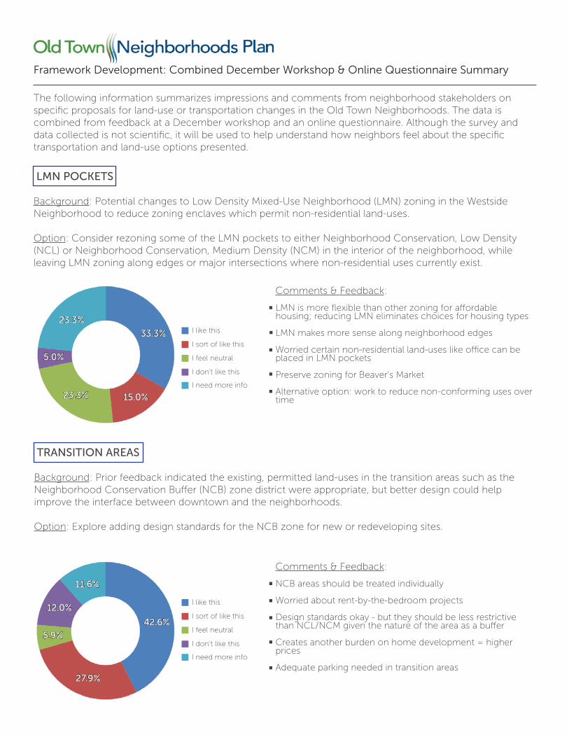
Framework Development: Combined December Workshop & Online Questionnaire Summary
LMN POCKETS
Background: Potential changes to Low Density Mixed-Use Neighborhood (LMN) zoning in the Westside Neighborhood to reduce zoning enclaves which permit non-residential land-uses.
Option: Consider rezoning some of the LMN pockets to either Neighborhood Conservation, Low Density (NCL) or Neighborhood Conservation, Medium Density (NCM) in the interior of the neighborhood, while leaving LMN zoning along edges or major intersections where non-residential uses currently exist.
Comments & Feedback:
LMN is more flexible than other zoning for affordable housing; reducing LMN eliminates choices for housing types
LMN makes more sense along neighborhood edges
Worried certain non-residential land-uses like office can be placed in LMN pockets
Preserve zoning for Beaver’s Market
Alternative option: work to reduce non-conforming uses over time
TRANSITION AREAS
Background: Prior feedback indicated the existing, permitted land-uses in the transition areas such as the Neighborhood Conservation Buffer (NCB) zone district were appropriate, but better design could help improve the interface between downtown and the neighborhoods.
Option: Explore adding design standards for the NCB zone for new or redeveloping sites.
Comments & Feedback:
NCB areas should be treated individually
Worried about rent-by-the-bedroom projects
Design standards okay - but they should be less restrictive than NCL/NCM given the nature of the area as a buffer
Creates another burden on home development = higher prices
Adequate parking needed in transition areas
I like this
I sort of like this
I feel neutral
I don’t like this
I need more info
33.3%
15.0%23.3%
5.0%
23.3%
I like this
I sort of like this
I feel neutral
I don’t like this
I need more info
42.6%
27.9%
5.9%
12.0%
11.6%
The following information summarizes impressions and comments from neighborhood stakeholders on specific proposals for land-use or transportation changes in the Old Town Neighborhoods. The data is combined from feedback at a December workshop and an online questionnaire. Although the survey and data collected is not scientific, it will be used to help understand how neighbors feel about the specific transportation and land-use options presented.
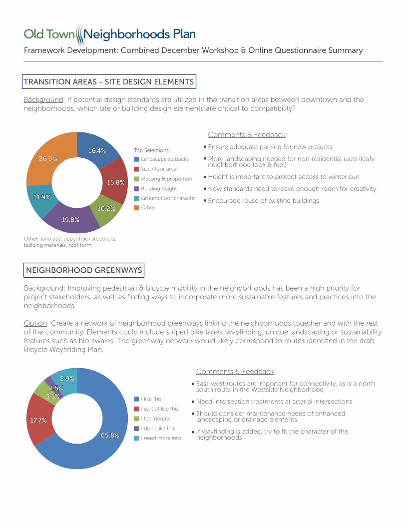
Framework Development: Combined December Workshop & Online Questionnaire Summary
TRANSITION AREAS - SITE DESIGN ELEMENTS
Background: If potential design standards are utilized in the transition areas between downtown and the neighborhoods, which site or building design elements are critical to compatibility?
Comments & Feedback:
Ensure adequate parking for new projects
More landscaping needed for non-residential uses (leafy neighborhood look & feel)
Height is important to protect access to winter sun
New standards need to leave enough room for creativity
Encourage reuse of existing buildings
NEIGHBORHOOD GREENWAYS
Background: Improving pedestrian & bicycle mobility in the neighborhoods has been a high priority for project stakeholders, as well as finding ways to incorporate more sustainable features and practices into the neighborhoods.
Option: Create a network of neighborhood greenways linking the neighborhoods together and with the rest of the community. Elements could include striped bike lanes, wayfinding, unique landscaping or sustainability features such as bio-swales. The greenway network would likely correspond to routes identified in the draft Bicycle Wayfinding Plan.
Comments & Feedback:
East-west routes are important for connectivity, as is a north-south route in the Westside Neighborhood
Need intersection treatments at arterial intersections
Should consider maintenance needs of enhanced landscaping or drainage elements
If wayfinding is added, try to fit the character of the neighborhoods
Other: land use, upper floor stepbacks, building materials, roof form
Top Selections:
Landscape setbacks
Size (floor area)
Massing & proportion
Building height
Ground floor character
Other
16.4%
15.8%
10.2%
19.8%
11.9%
26.0%
I like this
I sort of like this
I feel neutral
I don’t like this
I need more info65.8%
17.7%
5.1%2.5%
8.9%
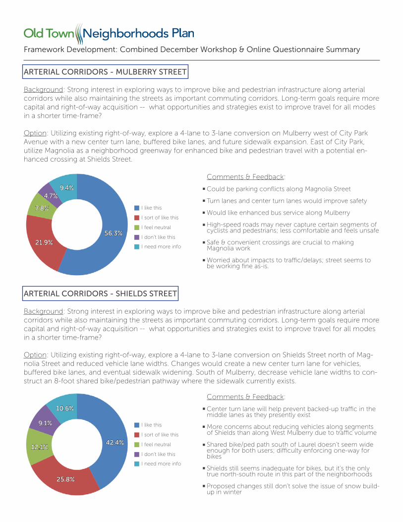
Framework Development: Combined December Workshop & Online Questionnaire Summary
ARTERIAL CORRIDORS - MULBERRY STREET
Background: Strong interest in exploring ways to improve bike and pedestrian infrastructure along arterial corridors while also maintaining the streets as important commuting corridors. Long-term goals require more capital and right-of-way acquisition -- what opportunities and strategies exist to improve travel for all modes in a shorter time-frame?
Option: Utilizing existing right-of-way, explore a 4-lane to 3-lane conversion on Mulberry west of City Park Avenue with a new center turn lane, buffered bike lanes, and future sidewalk expansion. East of City Park, utilize Magnolia as a neighborhood greenway for enhanced bike and pedestrian travel with a potential en-hanced crossing at Shields Street.
I like this
I sort of like this
I feel neutral
I don’t like this
I need more info
Comments & Feedback:
Could be parking conflicts along Magnolia Street
Turn lanes and center turn lanes would improve safety
Would like enhanced bus service along Mulberry
High-speed roads may never capture certain segments of cyclists and pedestrians; less comfortable and feels unsafe
Safe & convenient crossings are crucial to making Magnolia work
Worried about impacts to traffic/delays; street seems to be working fine as-is.
56.3%
21.9%
7.8%
4.7%9.4%
ARTERIAL CORRIDORS - SHIELDS STREET
Background: Strong interest in exploring ways to improve bike and pedestrian infrastructure along arterial corridors while also maintaining the streets as important commuting corridors. Long-term goals require more capital and right-of-way acquisition -- what opportunities and strategies exist to improve travel for all modes in a shorter time-frame?
Option: Utilizing existing right-of-way, explore a 4-lane to 3-lane conversion on Shields Street north of Mag-nolia Street and reduced vehicle lane widths. Changes would create a new center turn lane for vehicles, buffered bike lanes, and eventual sidewalk widening. South of Mulberry, decrease vehicle lane widths to con-struct an 8-foot shared bike/pedestrian pathway where the sidewalk currently exists.
I like this
I sort of like this
I feel neutral
I don’t like this
I need more info
Comments & Feedback:
Center turn lane will help prevent backed-up traffic in the middle lanes as they presently exist
More concerns about reducing vehicles along segments of Shields than along West Mulberry due to traffic volume
Shared bike/ped path south of Laurel doesn’t seem wide enough for both users; difficulty enforcing one-way for bikes
Shields still seems inadequate for bikes, but it’s the only true north-south route in this part of the neighborhoods
Proposed changes still don’t solve the issue of snow build-up in winter
42.4%
25.8%
12.1%
9.1%
10.6%
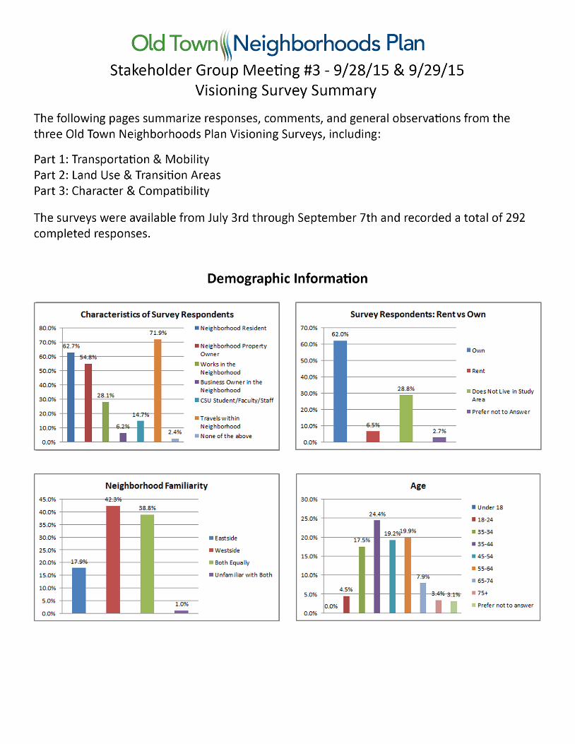
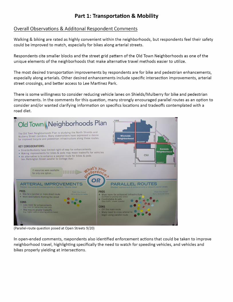
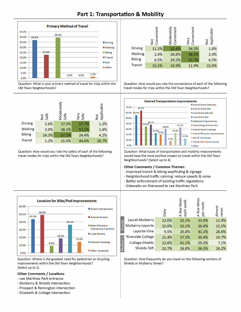
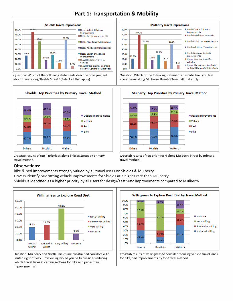
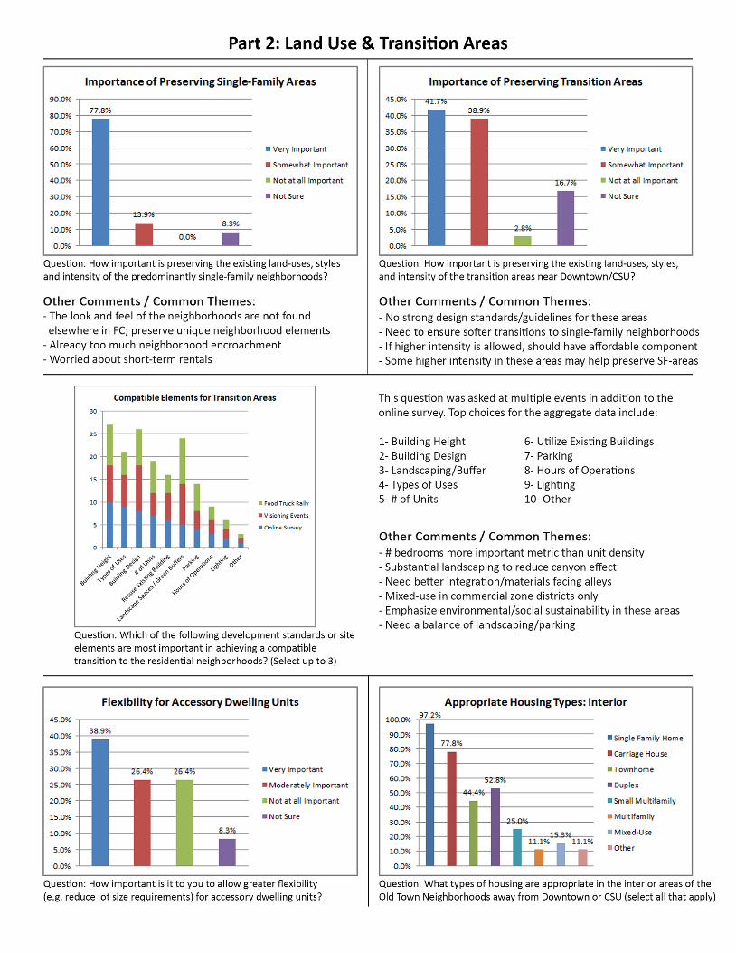
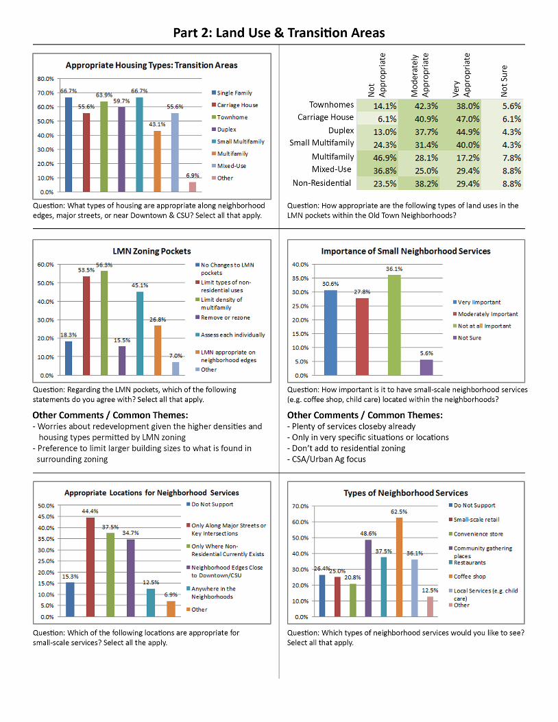
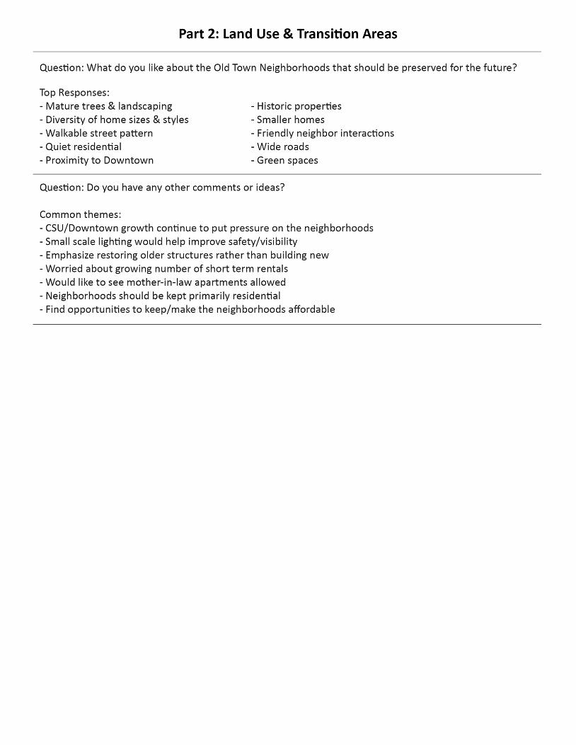
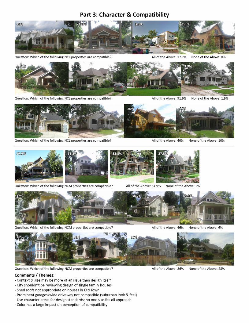
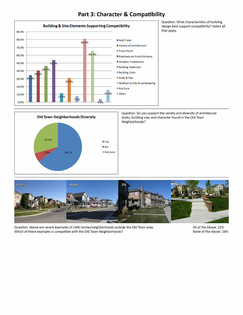
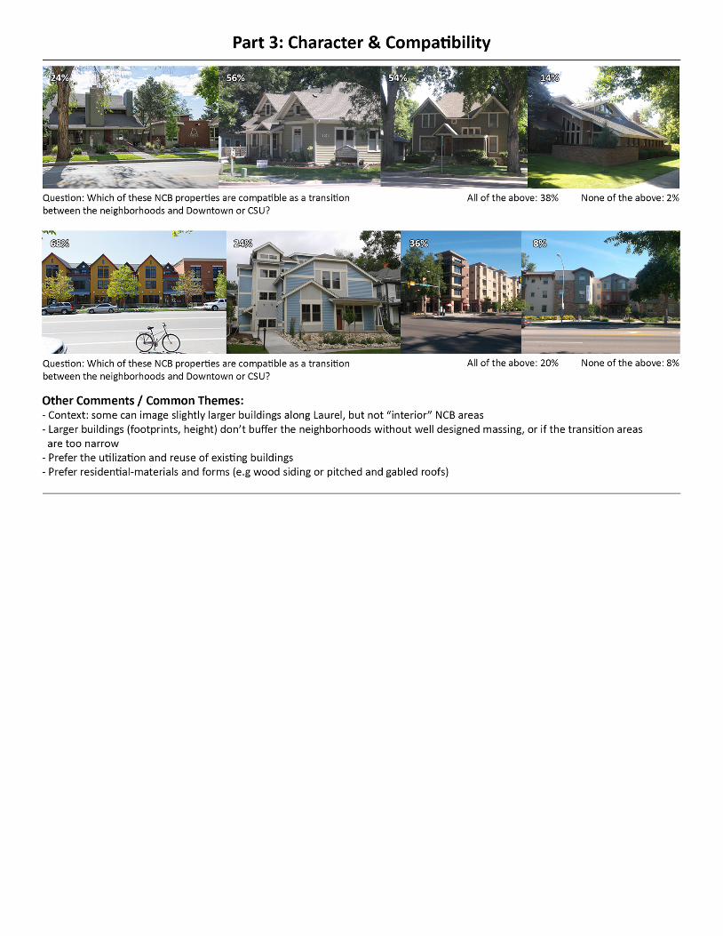
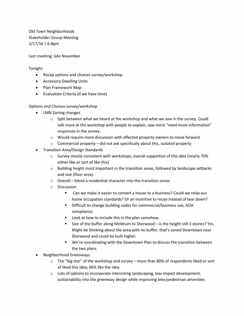
Old Town Neighborhoods Stakeholder Group Meeting 2/17/16 | 6-8pm Last meeting: late November Tonight:
• Recap options and choices survey/workshop • Accessory Dwelling Units • Plan Framework Map • Evaluation Criteria (if we have time)
Options and Choices survey/workshop
• LMN Zoning changes o Split between what we heard at the workshop and what we saw in the survey. Could
talk more at the workshop with people to explain, saw more “need more information” responses in the survey.
o Would require more discussion with affected property owners to move forward o Commercial property – did not ask specifically about this, isolated property
• Transition Area/Design Standards o Survey mostly consistent with workshops, overall supportive of this idea (nearly 70%
either like or sort of like this) o Building height most important in the transition areas, followed by landscape setbacks
and size (floor area) o Overall – blend a residential character into the transition zones o Discussion
Can we make it easier to convert a house to a business? Could we relax our home occupation standards? Or an incentive to reuse instead of tear down?
Difficult to change building codes for commercial/business use, ADA compliance.
Look at how to include this in the plan somehow. Size of the buffer along Meldrum to Sherwood – is the height still 3 stories? Yes.
Might be thinking about the area with no buffer, that’s zoned Downtown near Sherwood and could be built higher.
We’re coordinating with the Downtown Plan to discuss the transition between the two plans.
• Neighborhood Greenways o The “big star” of the workshop and survey – more than 80% of respondents liked or sort
of liked this idea; 66% like the idea o Lots of options to incorporate interesting landscaping, low-impact development,
sustainability into the greenway design while improving bike/pedestrian amenities
o Gateways (shown on framework map) could be lots of things, not sure how this will unfold. Improved crossings (pavement, signage, signals, etc.) Monument signs Wayfinding
o Discussion Idea was to connect East and West through Downtown, may not even need
separate gateways Mulberry and Riverside intersection – more of a community gateway, not just
neighborhood-oriented Same with Shields and Mulberry Was there any discussion of the impact on the East side of Uncommon? Repeatedly hear people saying they want signage for the Laurel School Historic
District…a small addition to existing street signs Would be nice to identify which streets are bikeways with signage Greenways – any changes in parking? I find that to be dicey – some are narrow,
angled parking, etc. There’s more than just designating it. Remington has done a nice job with this.
Want to create more “complete streets” with the greenway idea – parking is part of the discussion, need to make sure we maintain parking while minimizing conflict between cars and bikes and pedestrians
Neighbors generally know that bikes will be around, but people from outside the neighborhoods don’t necessarily know – especially near Downtown. Signs could be almost more for the motorists than the cyclists to help them remember that cyclists are around.
Sometimes it’s the intersections. When the bike lane goes all the way through the intersection, it feels like that’s a bike lane. When it disappears, it’s a different experience being in with cars. More confusion than continuous lanes.
Could Oak Street be more of a thoroughfare for bikes in addition to pedestrians?
Downtown needs to connect the neighborhoods better. Think about how to get people in and out of downtown, but not across.
What about flashing yellow light systems? Like the one on W Elizabeth near King Soopers. I’m thinking about Oak and Shields in particular. City Park, Oak Street, and Downtown.
• Mulberry Corridor options o Lots of interest in improving bike/pedestrian conditions, but still needs to function for
vehicles. There are significant constraints on both Mulberry and Shields. o In general, good support for the option presented (over 70% like or sort of like this) o Discussion
Buffered bike lane – if it’s 35/40 mph, I’ll just skip it. Most non-commuters probably feel the same way. Feels dangerous. Would prefer putting money into secondary routes.
Almost everyone I know who bikes has a way to get where they’re going that’s comfortable for them, usually not on arterials. Side streets, CSU, City Park to avoid busy roads.
Cost of buffered bike lanes not very high, it’s a striping project rather than adding pavement
Long-term is acquiring additional right-of-way to provide more room for sidewalks, cycletracks, etc.
Speed limit reduction? Need to discuss further with traffic operations to see if this option is feasible/makes sense
I know lots of bike commuters who would prefer to have a direct route rather than a bike path/winding route
• Shields corridor o Less support than Mulberry (67% like or sort of like this, but only 42% like this) o Shields is more constrained than Mulberry, so more challenging to come up with good
complete streets options o No good parallel route o Need to talk to property owners along northern portion of Shields to discuss possibility
of parking reduction on one side of the street o Discussion
Dead zone in terms of accessibility/connectivity • Accessory Dwelling Units
o Interest in exploring greater flexibility for ADUs from summer survey (67% important or moderately important)
o Benefits could include more choice/affordability, aging-in-place, preserves neighborhood character, implements City Plan
o Concerns include renters/vacation rentals, privacy, infrastructure needs/alleys, parking o Currently 18.1% of all parcels in East and West Side are eligible o Options:
Reduce lot size to 10,000 sf in NCL; 9500 in NCM NCB – 33.3% of all parcels eligible
Reduce lot size to 9500 sf in NCL; 8,000 in NCM NCB – 62.3% of all parcels eligible
No change to regulations Change requirements other than/in addition to lot size
o Discussion Does the main building affect the size allowed? Indirectly, yes. There are floor area/lot coverage standards. What about lots with no alley access? They’d be putting driveways through their
lot to get a carriage house in there.

There’s no enforcement, and many illegal units. Impact per extra group of people living in these dwellings is exponential. Torn because I appreciate the potential benefits…but there are drawbacks
Like the idea of having someone who owns the lot living in one of the units In theory it sounds good to have the owner there, but doesn’t always work out
that way Our location (near downtown) makes it harder. If this was a discussion for SE
Fort Collins, it wouldn’t be as much of an issue. There are lots of impacts but no one wants to call the police on their neighbors,
especially if the owner isn’t there to see what’s happening Seems reasonable to put in a restriction that ADUs are not intended to be short-
term or vacation rentals The impact really depends. We have a few VRBO’s near us, and they’re great.
The long-term rentals nearby aren’t, they’re terrible. Community education is really important, as is facilitating good communication
between and among neighbor Maybe the police department needs to have a protocol for quality-of-life
complaints rather than a formal citation How many more cars? How many more people? How many more dogs? Need to
know what the impact would be. Has the map data been tied to parking requirements? 3 unrelated – is it per dwelling unit or per lot? Per dwelling unit. Conversation about house size seems to be negative in general (no big houses,
how much house can you build) but now we’re talking about sticking more house in the back of the lot. A disconnect. I think how much of the property is being built on is more of an issue – part of neighborhood feel is related to the amount of open space, solar access, etc.
What I’m feeling in this meeting is more pressure to make it fit and do more with less. Losing the focus on the quality of our neighborhood, need to remember that. Social justice and environmental justice – people are getting pushed out, squeezed out, diminished quality of life.
We’ll be looking this more as we keep working on policies. Need more research and options for next time.
• Framework map o Historically designated properties – want to see all of them on the map/a map o How to decide which ones to show? Need some criteria o Could be a separate map to show detail of all of the properties
• Tentative date for next outreach event: March 29 o Plan for another stakeholder group meeting in mid-march o We’ll send draft evaluation criteria to you before the next meeting for discussion
OTNP Stakeholder Meeting Notes 3/21/2016
Topic: Accessory Dwelling Units (continued from February Meeting)
Are there other thoughts you want to share after our last meeting?
• How does an ADU fit under the floor area ratio limits? Part of the overall limits? o Yes.
• Emphasize parking on the list of concerns.
What about other types of ADUs? (basement, “mother-in-law” apartments)
• Currently not permitted in the NCL district (Land Use Codes does not permit duplexes) • In NCM, lot size required is at least 10,000 sf for an attached ADU • You could have a mother-in-law unit now (without a second kitchen)
o Trigger is the stove/oven to classify as a second, attached dwelling unit • A separate structure is a carriage house • Could address privacy and rear FAR concerns, but does count toward overall FAR requirements • What are your thoughts?
o Parking is still a concern. Could be up to 6 people if two units. Parking requirements for a carriage house are more stringent than for a single
family home (carriage house: 1/bedroom; house: 1 space for lots over 50-ft wide)
o What about paving the backyard issues? Want to keep pervious spaces. No more than 40% of front yard allowed to be paved – but that still means that
people could pave parts of their front yards. Also if off an alley, supposed to be using alley for access.
o Are hotels worried about short term rentals? We haven’t heard this directly, mostly that they want everyone to play by the
same rules (pay lodging taxes, etc.) o Would attached ADUs mean fewer short term rentals? Attached nature could
discourage that. o What was the original idea of creating more flexibility? If you allow any of these to be
vacation rentals, then you’re not achieving the goal that you stated, which was to improve housing choices and affordability. None of these should be vacation rentals. Would strenuously object to any expansion if people were building these to be short term rentals.
o Attached ADUs shouldn’t be allowed in NCL, would require a major change to the zoning o What about a policy for longer-term (like housing swaps) to inform the City/police? o If you have the lot size, you can do this today (in NCM). o
o If you’re going to allow carriage houses, I don’t really see a big difference (vs attached ADU).
o I’d prefer to see in-home units than carriage houses. o This seems to go contrary to the vision of preserving single-family owner-occupied. o If we reduce the lot size, what is the actual impact? If it’s only adding a couple hundred
units over the whole OTNP neighborhood, no big deal. If it’s 1,000, that’s a different thing. Numbers would be helpful, maps are less helpful. Currently: 397 lots eligible If we decrease lot size in NCL to 10,000, NCM and NCB to 9500, 730 lots eligible
o For me, the first option (730 lots) is ok, as long as parking is taken care of. Would prefer in-home/attached ADU, for greater owner responsibility as compared to carriage house.
o We need to think about all of these as rentals. No way to regulate whether that’s vacation rentals or long-term rentals. Not necessarily going to be a family member, etc. Information needed: what happens with the whole short-term rental
conversation? Should we require homeowner occupancy of main house? Could ask City
attorney again. o Attached ADUs should be called duplexes, because that’s what they are.
Ask about duplexes, ask about in-laws, ask about rental units – find out what people are comfortable with
o Original lot requirements were put in because the neighbors didn’t want to see all of the impacts from lots of carriage houses, etc. – traffic and other impacts.
o How do we bridge the need for some of these ADUs (nannies, aging family members, etc.) with the negative impacts of some of what we’ve seen (vacation rentals, two-story rental properties, etc.). How can we provide a little bit of flexibility? Apply for a permit to add a stove??
o What makes a little bit of difference to me is whether the utilities are combined. If you’re renting to someone, but they’re on your utility bill, more likely to take responsibility.
o Making sure that the ADU is truly accessory to the primary structure o I do think we have a workforce housing issue. I wonder how this conversation would be
different if we already had regulations around short term rentals. Short term rentals going to P&Z in April and May to discuss Land Use Code
changes. Separate owner-occupied vs. non owner-occupied. Exploring a concentration limit for NCM and NCL Timeline is roughly July for potential Land Use Code changes
o In situations where you “round up” the number of units that can be built on a lot, could require that additional unit to be workforce housing or affordable, or a particular % of Area Median Income But unlikely to see that until we have more supply.
o Why does lot size matter if the extra unit is in a basement? It seems like it shouldn’t.
Topic: Evaluation Tool & Criteria (sample image below)
• Evaluate potential plan policies/actions, using triple bottom line approach (social, environmental, economic)
o How are you going to rate the scores? What’s the difference between a 3 and a 2? Sometimes it’s a defined number, sometimes it’s more of a “gut” feeling. For “public support” category, we may ask this group and use survey data
o What are the options that will be evaluated? Many of the things we’ve been talking about – Mulberry and Shields changes,
ADUs, zoning changes, etc. o Maybe consider public support from all 3 elements – what does the public think about
this option economically, socially, environmentally? o Think about weighting these categories to the ones that are most relevant
Individual criteria or overall categories (suggestion to weight environmental and social more heavily)
o What are your thoughts about these evaluation criteria? Why is “aesthetic improvements” in economic? Seems like it fits better in social
category. I would add a criteria that just says “property values” – maintain/increase Encouraging continued reinvestment as a criteria Something to look at – how many property owners have multiple properties?
How many first-time homebuyers? How to capture issues related to property taxes, people on fixed incomes?
Include affordability criteria. Most people want property taxes to go up, and we can also agree that we have an affordability issue.
Some of these economic criteria are related to impacts to residents; some are more related to the City…
“Cost competitiveness” – change to “cost to implement” and put next to “funding availability”
What about a criteria for “does it grow the government”? “Development/redevelopment potential or capacity” – how else could we talk
about this? “Level of zoning/code change required” or similar Seems like most of these will need definitions – for me, “housing choices”
means being able to buy a smaller (1,000 sf) home with a yard Add a “housing affordability” criteria Could come up with a net cost, then use each criteria to evaluate people’s
willingness to pay If you really wanted to be thorough, need to place some sort of value on the
non-monetary criteria
Put “bikeability” and “walkability” together; put “multi-modal transportation” under environmental
I would remove “transit” from social. Focus on recreational transportation in social, all other transportation in environmental
Three most important in social are “public support, safety, and sense of place” Add “trails” to “access to parks” Or consider a “recreational” criteria to consolidate Is there a master plan for bike wayfinding? Was Remington the test case for the bike wayfinding system? “Improve wayfinding” could be a criterion “Mix of land uses” – specify LMN and NCB Do we really need to have “protection of night sky”? Might not be as important
as others. Community gardens are also important…maybe incorporate into “tree canopy
cover” Maybe remove “waste reduction/diversion” and “water use” It would be ok to not worry so much about balancing the three categories. The
social category to me is the most important, and most of the environmental criteria are outside of the scope of the plan
What’s missing for me is listing the objectives up front, then knowing what the numbers are actually measuring
What does the total mean? Either take the total away or make it mean something
o Next step: refine the criteria, then actually evaluate our potential options Likely to have group help evaluate or use the tool at the next meeting
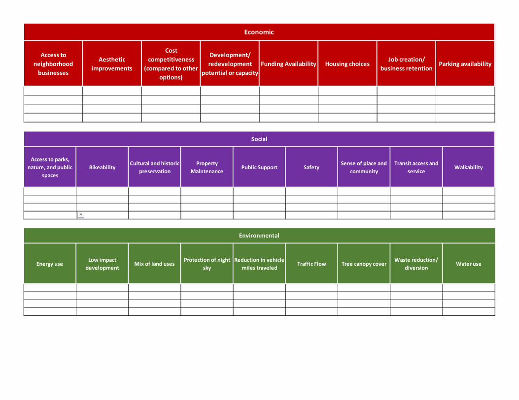
Access to neighborhood
businesses
Aesthetic improvements
Cost competitiveness
(compared to other options)
Development/ redevelopment
potential or capacityFunding Availability Housing choices
Job creation/ business retention
Parking availability
Economic
Access to parks, nature, and public
spacesBikeability
Cultural and historic preservation
Property Maintenance
Public Support SafetySense of place and
communityTransit access and
serviceWalkability
Social
Energy useLow impact
developmentMix of land uses
Protection of night sky
Reduction in vehicle miles traveled
Traffic Flow Tree canopy coverWaste reduction/
diversionWater use
Environmental
Policies & Strategies Workshop Event Recap: The Policy & Strategies Workshop asked participants to consider the effects and tradeoffs related to policies and actions for:
Neighborhood Design Guidelines Land Use and Zoning Accessory Dwelling Units Flexibility
Each topic was introduced with a brief presentation followed by small group discussions among neighbors. Facilitators captured feedback and ideas, and the following summary is presented by topic area below. Information and resources on each session, as well as a list of all public comments can be found on the Resources & Downloads page at the project website, fcgov.com/otnp. ❶ NEIGHBORHOOD DESIGN GUIDELINES Guidelines should be heavily promoted to neighbors, architects, builders, real estate
professionals, and more o Offer classes, free copies of guidelines – make the document visible
Incentivize use of the guidelines: o Financial incentives
Design Assistance Program Consider 1 or 2 year tax breaks/abatement for utilizing guidelines City involvement in enhancements to the public realm (e.g. street trees)
o Process incentives Reduced building permit review times List of architects or builders familiar or certified with the guidelines
Keep guidelines voluntary, but require resubmittal meeting for new permits in the Old Town area to share information about their existence and function
Use Design Guidelines with Landmark Preservation Commission review For the most important elements of character and compatibility, consider making them
regulatory Important or missing topics to include within the guidelines document:
o Benefits of owning and maintaining an older or historic property. Include financial, environmental and social/cultural benefits
o Additional information on height, mass, and scale o Exterior lighting o Energy efficiency & energy retrofits o Parking, carport & garage design
Policies & Strategies Workshop 3.29.16
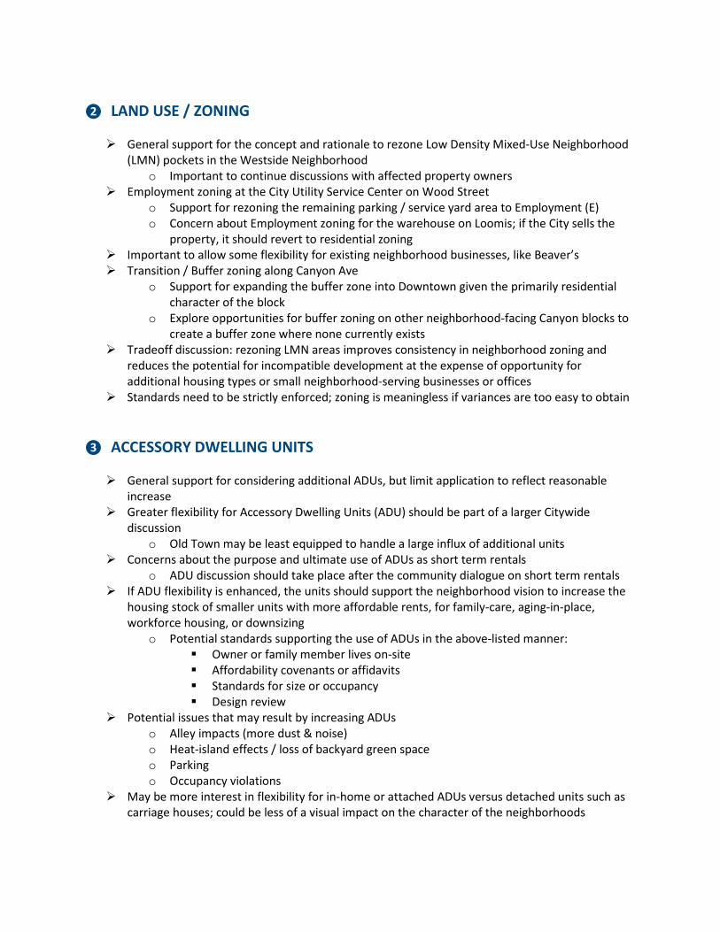
❷ LAND USE / ZONING General support for the concept and rationale to rezone Low Density Mixed-Use Neighborhood
(LMN) pockets in the Westside Neighborhood o Important to continue discussions with affected property owners
Employment zoning at the City Utility Service Center on Wood Street o Support for rezoning the remaining parking / service yard area to Employment (E) o Concern about Employment zoning for the warehouse on Loomis; if the City sells the
property, it should revert to residential zoning Important to allow some flexibility for existing neighborhood businesses, like Beaver’s Transition / Buffer zoning along Canyon Ave
o Support for expanding the buffer zone into Downtown given the primarily residential character of the block
o Explore opportunities for buffer zoning on other neighborhood-facing Canyon blocks to create a buffer zone where none currently exists
Tradeoff discussion: rezoning LMN areas improves consistency in neighborhood zoning and reduces the potential for incompatible development at the expense of opportunity for additional housing types or small neighborhood-serving businesses or offices
Standards need to be strictly enforced; zoning is meaningless if variances are too easy to obtain ❸ ACCESSORY DWELLING UNITS General support for considering additional ADUs, but limit application to reflect reasonable
increase Greater flexibility for Accessory Dwelling Units (ADU) should be part of a larger Citywide
discussion o Old Town may be least equipped to handle a large influx of additional units
Concerns about the purpose and ultimate use of ADUs as short term rentals o ADU discussion should take place after the community dialogue on short term rentals
If ADU flexibility is enhanced, the units should support the neighborhood vision to increase the housing stock of smaller units with more affordable rents, for family-care, aging-in-place, workforce housing, or downsizing
o Potential standards supporting the use of ADUs in the above-listed manner: Owner or family member lives on-site Affordability covenants or affidavits Standards for size or occupancy Design review
Potential issues that may result by increasing ADUs o Alley impacts (more dust & noise) o Heat-island effects / loss of backyard green space o Parking o Occupancy violations
May be more interest in flexibility for in-home or attached ADUs versus detached units such as carriage houses; could be less of a visual impact on the character of the neighborhoods
Old Town Neighborhoods Plan Stakeholder Group Meeting October 3, 2016 Discussion of RP3 Program
• Newest area – Old Town West (Otterbox). Enforcement begins October 3. • All maps are available online – www.fcgov.com/parking/residential-parking-permit/zones.php
Plan Boundary Changes
• Old Town Neighborhood Plan boundary expand to incorporate residential properties along Riverside
• October 19 open house at the Library for residents to learn more about their ideas about rezoning along Riverside
• Some rezoned to NCB (Neighborhood Conservation, Buffer) and some rezoned to NCM (Neighborhood Conservation, Medium Density)
• What about the southwest corner of the triangle south of Mulberry? (Mulberry and Cowan) There’s some retail there, which would become a nonconforming use if rezoned to NCB. Right now proposing keeping it CL as it’s currently zoned. Staff follow up: We will look into this in more detail.
• We’d have policies in the plan referencing both rezonings, then the rezoning would be a short-term implementation action.
• General feedback – the additional rezonings along Riverside seem to make a lot of sense. • Discussion of oldest house – on Eastside, 406 Stover Street. 1870s construction (except the
skylight, obviously). Discussion about general architecture of the house and its landscaping. Are there long term plans to reduce truck traffic along Riverside?
• There are plans to beef up landscaping and the gateway at Mulberry and Riverside • Still plans for a multi-use path on the northeast side of Riverside and potential stormwater
outfall project/underpass to connect to Udall natural area and the Poudre Trail – very long-term plans.
** Burrito Protection Fence Detour, Discussion of Campus West underpass ** Is there anything the City can do about property maintenance issues?
• If weeds more than 6 inches, trash in yard, junk storage, etc. – and neighbors complain – yes. We can’t force a particular standard of property maintenance though, outside of what’s outlined in the Municipal Code.
• What about 203 W. Myrtle? (Corner of Mason and Myrtle) - has been boarded up and abandoned for years.
• Can search CityDocs for citations and enforcement actions • Enforcement is largely complaint-based. Access Fort Collins is one option, calling Code
Enforcement is another. You can make an anonymous complaint, but it is more difficult for follow-up or for the City to get more information.
• Another option for serious/safety issues is the City Neighborhood Enforcement Team (NET) officers with the Police department.
• Additional positions for Code Enforcement are in the next City budget, and look like they have a good chance to be funded.
• People are afraid to call because of possible retaliation. How do we keep people safe and improve the neighborhood? It’s difficult to tell your neighbor what to do. It would be easier if the City had more proactive enforcement instead of having things be complaint-based.
• Letters from Code Enforcement are too apologetic and too “fluffy.” Some letters have been too harsh in the past. Need a better balance. “A Code Enforcement Officer has identified…” Letter s right now identify that a neighbor has complained. Why do we need to say a neighbor has complained? It can be positive. For example, “We appreciate your assistance keeping Fort Collins a safe and attractive place to live…”
• Can we change the way we’re thinking about Code Enforcement complaints from a legal perspective? The City can be the complainant and the neighbor is simply providing a ”tip” or a “request for enforcement.” I’ve been told by the City attorney that someone who’s had a formal complaint enforced has the right to know the name, address, etc. of someone who made a complaint against them.
• Policy: Should we add language encouraging additional funding for Code Enforcement? • Staff follow-up: Invite Delynn or someone else from Neighborhood Services/Code Compliance
to a future meeting. Also think about inviting Jerry Schiager or another representative from the Police.
Discussion about Policy LUT 1.4: Maintain and enhance neighborhood safety
• Draft policy language • Neighborhood groups (via the Neighborhood Connections project) could be a good way to
educate newcomers about accepted neighborhood norms. Opportunities to have conversations with the City in a more formal setting.
• General feedback: feel like this draft language reflects important topics to cover in the plan. First two bullet points are wonderful. The third is tough – what do you do when you identify the carrying capacity of the neighborhood?
• The point of the third bullet – let’s identify real indicators that help us avoid detrimental impacts to human health from adding more people into neighborhoods. If paired with effective education and enforcement, it’s less about carrying capacity and more about acceptable behavior.
• Maybe the question is more what we do at particular points – if we add x number of people, there’s no more parking allowed on the street to maintain vehicle movement…or the sidewalks have to be x feet wide…
• A few other cities are using the idea of “carrying capacity” – will send these links out with the notes.
Discussion about policies for multifamily buildings
• Policy S 3.1 seems to encourage multifamily development. Doesn’t this conflict with our desire to preserve the single-family neighborhoods?
• The multifamily we’ve identified as most appropriate in the NCB zone, while preserving the single-family zones (NCM and NCL) for single-family homes. Trying to balance a lot of competing priorities in this plan – affordability, housing choice, appropriate scale, character, etc.
• Should we change something in the language for that bullet point? Consider “low-impact.” Make sure to highlight that this is the appropriate use. Staff follow-up: Change to “In the NCB zone, encourage….”
Discussion about Policy NCC 4.2
• We had talked about making the permitting process easier if you build a house with the voluntary design guidelines, what happened to that? Staff follow up: Look into this.
• Question about who would review that, what we could do financially? • Need to look at what incentives we could actually include.
Timeline and Outreach
• Plan draft for internal review, late October • Draft for public review, before holidays • Outreach: combined with Downtown Plan. Open houses (one Eastside, one Westside ) and
coffee hours. • Adoption: January 17
Next stakeholder group meeting: November. Will also schedule a separate meeting for Neighborhood Services/Police/Neighborhood Connections.
Limited Commercial (CL) Rezoning – Downtown Plan & Old Town Neighborhoods Plan Neighborhood Meeting October 19, 2016 | Summary
1
Overview On Wednesday, October 19, 2016 from 6:00 p.m. to 8:00 p.m. in the Old Town Library Community Room, 201 Peterson Street, the City of Fort Collins Planning Department held an informational open house to discuss a proposed City-initiated request for rezoning in the Old Town Neighborhoods and Downtown Planning areas. The proposal recommends rezoning 21 select parcels in the Limited Commercial (CL) district to Neighborhood Conservation, Medium Density (NCM) or Neighborhood Conservation Buffer (NCB) zoning.
Limited Commercial Rezoning General support for the zoning changes. Concerns that NCM may be too restrictive for homeowners who want to use their
home as an office or build an in-law-suite. Request that the Neighborhood Conservation Buffer should act as a buffer along the
entire Limited Commercial District. Overall Support of the US 287/SH 14 Access Management Plan and what that would
look like along Riverside Avenue. Concerns that rezoning may have a negative effect on property values.

APPENDIX C
Sustainability Assessment
Memorandum To: Ryan Mounce, Pete Wray, Meaghan Overton, Clay Frickey (City of Fort Collins)
Cole Gehler, Jay Renkens (MIG)
From: Shelby Sommer and Zach Taylor
Date: 1/31/2017
Re: OTNP TBL Evaluation Process Overview and Results
This memorandum summarizes the Sustainability Assessment (SA) and Triple Bottom Line (TBL) evaluation tasks completed for the City of Fort Collins Old Town Neighborhoods Plan effort by Brendle Group.
Sustainability Assessment The initial phase of the project, “Phase 1: Discovery – Where are we now?” focused on exploring current and future conditions. During the project kickoff meetings, the Technical Advisory Committee (TAC) used the Sustainability Assessment Tool (SAT) to identify major sustainability-related topics of relevance to these neighborhoods. This deliberate process helped the multi-disciplinary team identify key issues and opportunities to be considered and addressed by future phases of the project. The documentation of the initial SA process and completed tool is provided in Appendix A.
Triple Bottom Line Evaluation Process During “Phase 2: Where do We want to Go?” and “Phase 3: What is Our Overarching Framework?” the project team explored and defined criteria to evaluate different plan and policy options. The preliminary evaluation criteria were informed and developed based on a review of the Phase 1 SA results, the Sustainability Assessment Considerations Checklist, and public survey results. The evaluation criteria were refined after review by the TAC and Stakeholder Committee and are uniquely applicable to the issues and opportunities in the Old Town Neighborhoods and are summarized below.
Economic Criteria • Access to neighborhood businesses • Aesthetic improvements • Cost to implement • Funding availability • Reinvestment opportunities • Housing choices
Social Criteria • Access to parks, trails, nature & recreational opportunities • Cultural and historic preservation • Property maintenance • Public support • Safety • Sense of place and community
City of Fort Collins Old Town Neighborhood Plan 2
Environmental Criteria • Energy efficiency • Ghg reductions • Ability to use alternative travel (commuting) • Mix of land uses • Reduces vmt • Traffic flow
Next, Brendle Group developed a triple bottom line (TBL) evaluation tool to support the planning team in the evaluation process. During a team work session on June 28, 2016, facilitated by Brendle Group, the City of Fort Collins project team completed the TBL evaluation of the draft policies developed for the Old Town Neighborhoods Plan.
The purpose of the work session was to engage a multi-disciplinary team to evaluate proposed plan policies against TBL criteria in order to inform potential policy refinement, to optimize the sustainability outcomes of the plan, and to inform the identification and prioritization of actions.
With this purpose in mind, the team began by first orienting themselves to the layout and structure of the tool. The team discussed why it was important to evaluate the draft policies instead of action items with the purpose being that the policies are the overarching concepts upon which all action items will be developed, refined, and prioritized.
Next, a short refresher on the tool format was provided including the evaluation rubric, criteria, and how the results are displayed. The planning team worked row by row, evaluating each draft policy against the 18 evaluation criteria. In most cases, the group found consensus quickly on the evaluation scores, but in some instances the group discussed and debated the score, using a group average when there were differing opinions.
During the evaluation process, notes of the discussion were documented in the evaluation tool for future reference to help refine, clarify, or remove/consolidate policies. After the evaluation was complete, the team reviewed and discussed the results.
TBL Evaluation and Observations The completed TBL Evaluation Tool Results page is provided in Appendix B. Detailed notes and comments taken during the evaluation process are embedded within the tool and were distributed with the planning team.
As stated above the purpose of this evaluation was to compare each of the plan’s potential policy items. During the process all but one policy item was fully evaluated, Policy C 2.5 which referred to transit infrastructure around Shields and Mulberry. This policy was removed since no action is proposed in the plan and the group determined that this policy should likely be significantly reworked or removed. The evaluation results revealed that the following policies will likely garner the highest overall TBL outcomes in the Old Town Neighborhoods:
1. NCC 4.2: Protect the historic building resources within the neighborhoods. 2. LUT 1.1: Preserve the stability and character of the Old Town Neighborhoods. 3. C 2.3: Improve intra-neighbor travel for bikes and pedestrians.
City of Fort Collins Old Town Neighborhood Plan 3
4. S 3.3: Promote environmental stewardship and support the implementation of the Climate Action Plan (CAP) in the Old Town Neighborhoods.
5. S 3.2: Improve resident connectivity to green spaces, urban gardens, and nearby natural amenities, and enhance existing green spaces within the neighborhoods.
These top five policies are very much in alignment with City Plan and provide a sound policy basis for the Old Town Neighborhoods Plan.
Taking a step back and looking at the evaluation of all the policies it is clear that more emphasis and higher rankings were given to the social criteria than environmental and economic. Due to this, it was noted that some of the policies should be revised to more directly address environmental or economic outcomes. For example, while it scored well as a whole, draft Policy LUT1.1: Preserve the stability and character of the Old Town Neighborhoods could be refined to address preservation and stability in land use and aesthetics of the area, while also encouraging improvements to enhance energy efficiency and reduce greenhouse gasses.
From an economic perspective it is worth noting that many of the proposed policies are likely costly to implement and/or funding is not readily available or guaranteed. Suggested revisions include adjusting or adding policies to address some lower cost actions and/or actions with guaranteed or alternative funding sources (e.g., partnership efforts with Colorado State University and/or Poudre School District).
Another observation from the results is to link the Old Town Neighborhood Plan with the Downtown Plan policies and actions more directly in order to address the spectrum of TBL issues more directly, such as access to neighborhood businesses, greenhouse gas emissions reductions, and alternative travel modes. An additional overall observation is that all of the policies that were evaluated had an overall positive impact on the community.
Next Steps With the results of the evaluation completed the planning team is now tasked with two items: to refine policies as well as share the results with the community. Next steps include:
1. Adjusting the policies to include revisions discussed during the work session; specifically, around environmental and economic performance.
2. Documenting changes to policies and updating the evaluation of it (as applicable). 3. Significantly reshaping or removing Policy C 2.5 and then evaluating it against TBL criteria. 4. Reviewing each policy’s associated actions with the evaluation process in mind and then
prioritize actions based on available resources, timing, responsibility and other considerations.
5. Determining how to share results with the Stakeholder Committee and seek their feedback (if desired).
6. Documenting the TBL evaluation and SA process in an Appendix or Agenda Item Summary materials for City Council.
7. Developing simple graphics to illustrate TBL outcomes to integrate into the plan document.
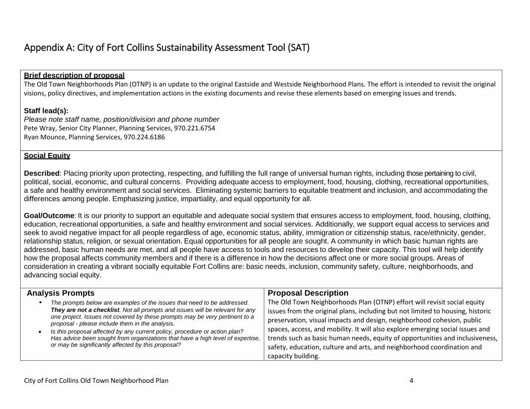
City of Fort Collins Old Town Neighborhood Plan 4
Appendix A: City of Fort Collins Sustainability Assessment Tool (SAT)
Brief description of proposal The Old Town Neighborhoods Plan (OTNP) is an update to the original Eastside and Westside Neighborhood Plans. The effort is intended to revisit the original visions, policy directives, and implementation actions in the existing documents and revise these elements based on emerging issues and trends. Staff lead(s): Please note staff name, position/division and phone number Pete Wray, Senior City Planner, Planning Services, 970.221.6754 Ryan Mounce, Planning Services, 970.224.6186 Social Equity Described: Placing priority upon protecting, respecting, and fulfilling the full range of universal human rights, including those pertaining to civil, political, social, economic, and cultural concerns. Providing adequate access to employment, food, housing, clothing, recreational opportunities, a safe and healthy environment and social services. Eliminating systemic barriers to equitable treatment and inclusion, and accommodating the differences among people. Emphasizing justice, impartiality, and equal opportunity for all. Goal/Outcome: It is our priority to support an equitable and adequate social system that ensures access to employment, food, housing, clothing, education, recreational opportunities, a safe and healthy environment and social services. Additionally, we support equal access to services and seek to avoid negative impact for all people regardless of age, economic status, ability, immigration or citizenship status, race/ethnicity, gender, relationship status, religion, or sexual orientation. Equal opportunities for all people are sought. A community in which basic human rights are addressed, basic human needs are met, and all people have access to tools and resources to develop their capacity. This tool will help identify how the proposal affects community members and if there is a difference in how the decisions affect one or more social groups. Areas of consideration in creating a vibrant socially equitable Fort Collins are: basic needs, inclusion, community safety, culture, neighborhoods, and advancing social equity. Analysis Prompts
• The prompts below are examples of the issues that need to be addressed. They are not a checklist. Not all prompts and issues will be relevant for any one project. Issues not covered by these prompts may be very pertinent to a proposal - please include them in the analysis.
• Is this proposal affected by any current policy, procedure or action plan? Has advice been sought from organizations that have a high level of expertise, or may be significantly affected by this proposal?
Proposal Description The Old Town Neighborhoods Plan (OTNP) effort will revisit social equity issues from the original plans, including but not limited to housing, historic preservation, visual impacts and design, neighborhood cohesion, public spaces, access, and mobility. It will also explore emerging social issues and trends such as basic human needs, equity of opportunities and inclusiveness, safety, education, culture and arts, and neighborhood coordination and capacity building.
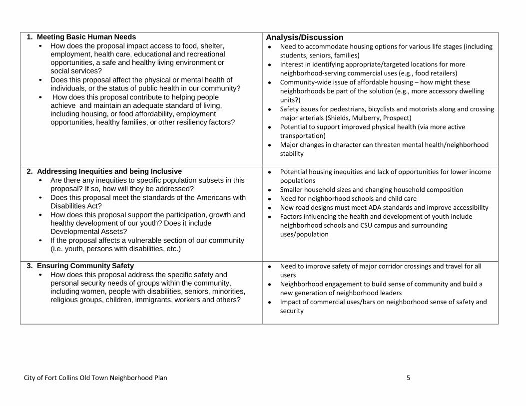
City of Fort Collins Old Town Neighborhood Plan 5
1. Meeting Basic Human Needs • How does the proposal impact access to food, shelter,
employment, health care, educational and recreational opportunities, a safe and healthy living environment or social services?
• Does this proposal affect the physical or mental health of individuals, or the status of public health in our community?
• How does this proposal contribute to helping people achieve and maintain an adequate standard of living, including housing, or food affordability, employment opportunities, healthy families, or other resiliency factors?
Analysis/Discussion • Need to accommodate housing options for various life stages (including
students, seniors, families) • Interest in identifying appropriate/targeted locations for more
neighborhood-serving commercial uses (e.g., food retailers) • Community-wide issue of affordable housing – how might these
neighborhoods be part of the solution (e.g., more accessory dwelling units?)
• Safety issues for pedestrians, bicyclists and motorists along and crossing major arterials (Shields, Mulberry, Prospect)
• Potential to support improved physical health (via more active transportation)
• Major changes in character can threaten mental health/neighborhood stability
2. Addressing Inequities and being Inclusive
• Are there any inequities to specific population subsets in this proposal? If so, how will they be addressed?
• Does this proposal meet the standards of the Americans with Disabilities Act?
• How does this proposal support the participation, growth and healthy development of our youth? Does it include Developmental Assets?
• If the proposal affects a vulnerable section of our community (i.e. youth, persons with disabilities, etc.)
• Potential housing inequities and lack of opportunities for lower income populations
• Smaller household sizes and changing household composition • Need for neighborhood schools and child care • New road designs must meet ADA standards and improve accessibility • Factors influencing the health and development of youth include
neighborhood schools and CSU campus and surrounding uses/population
3. Ensuring Community Safety • How does this proposal address the specific safety and
personal security needs of groups within the community, including women, people with disabilities, seniors, minorities, religious groups, children, immigrants, workers and others?
• Need to improve safety of major corridor crossings and travel for all users
• Neighborhood engagement to build sense of community and build a new generation of neighborhood leaders
• Impact of commercial uses/bars on neighborhood sense of safety and security
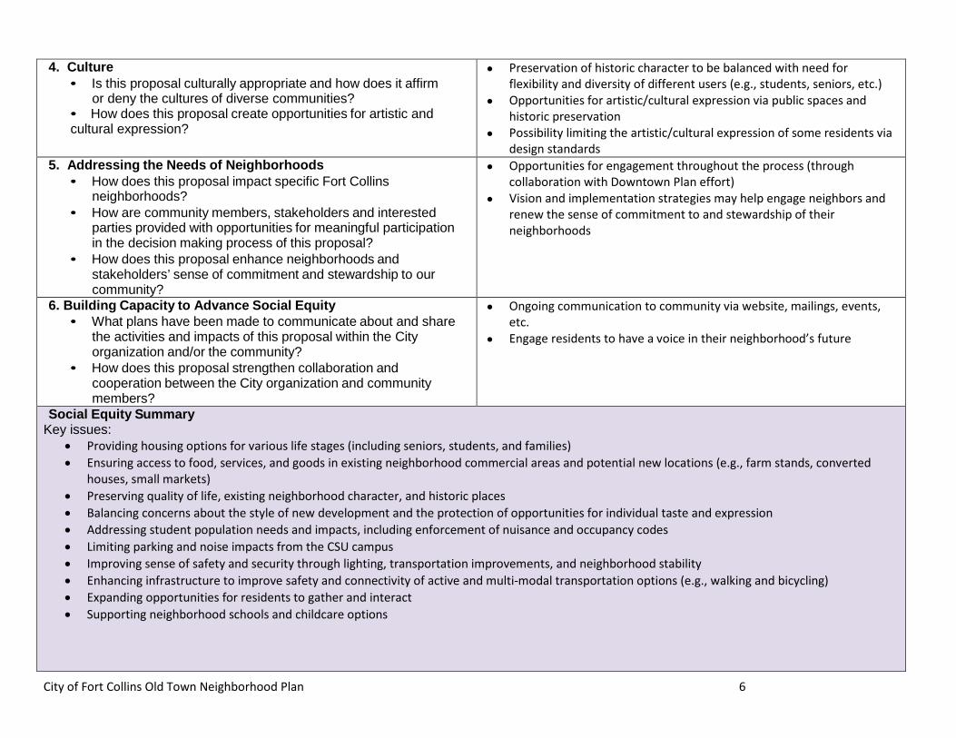
City of Fort Collins Old Town Neighborhood Plan 6
4. Culture • Is this proposal culturally appropriate and how does it affirm
or deny the cultures of diverse communities? • How does this proposal create opportunities for artistic and cultural expression?
• Preservation of historic character to be balanced with need for flexibility and diversity of different users (e.g., students, seniors, etc.)
• Opportunities for artistic/cultural expression via public spaces and historic preservation
• Possibility limiting the artistic/cultural expression of some residents via design standards
5. Addressing the Needs of Neighborhoods • How does this proposal impact specific Fort Collins
neighborhoods? • How are community members, stakeholders and interested
parties provided with opportunities for meaningful participation in the decision making process of this proposal?
• How does this proposal enhance neighborhoods and stakeholders’ sense of commitment and stewardship to our community?
• Opportunities for engagement throughout the process (through collaboration with Downtown Plan effort)
• Vision and implementation strategies may help engage neighbors and renew the sense of commitment to and stewardship of their neighborhoods
6. Building Capacity to Advance Social Equity • What plans have been made to communicate about and share
the activities and impacts of this proposal within the City organization and/or the community?
• How does this proposal strengthen collaboration and cooperation between the City organization and community members?
• Ongoing communication to community via website, mailings, events, etc.
• Engage residents to have a voice in their neighborhood’s future
Social Equity Summary Key issues:
• Providing housing options for various life stages (including seniors, students, and families) • Ensuring access to food, services, and goods in existing neighborhood commercial areas and potential new locations (e.g., farm stands, converted
houses, small markets) • Preserving quality of life, existing neighborhood character, and historic places • Balancing concerns about the style of new development and the protection of opportunities for individual taste and expression • Addressing student population needs and impacts, including enforcement of nuisance and occupancy codes • Limiting parking and noise impacts from the CSU campus • Improving sense of safety and security through lighting, transportation improvements, and neighborhood stability • Enhancing infrastructure to improve safety and connectivity of active and multi-modal transportation options (e.g., walking and bicycling) • Expanding opportunities for residents to gather and interact • Supporting neighborhood schools and childcare options
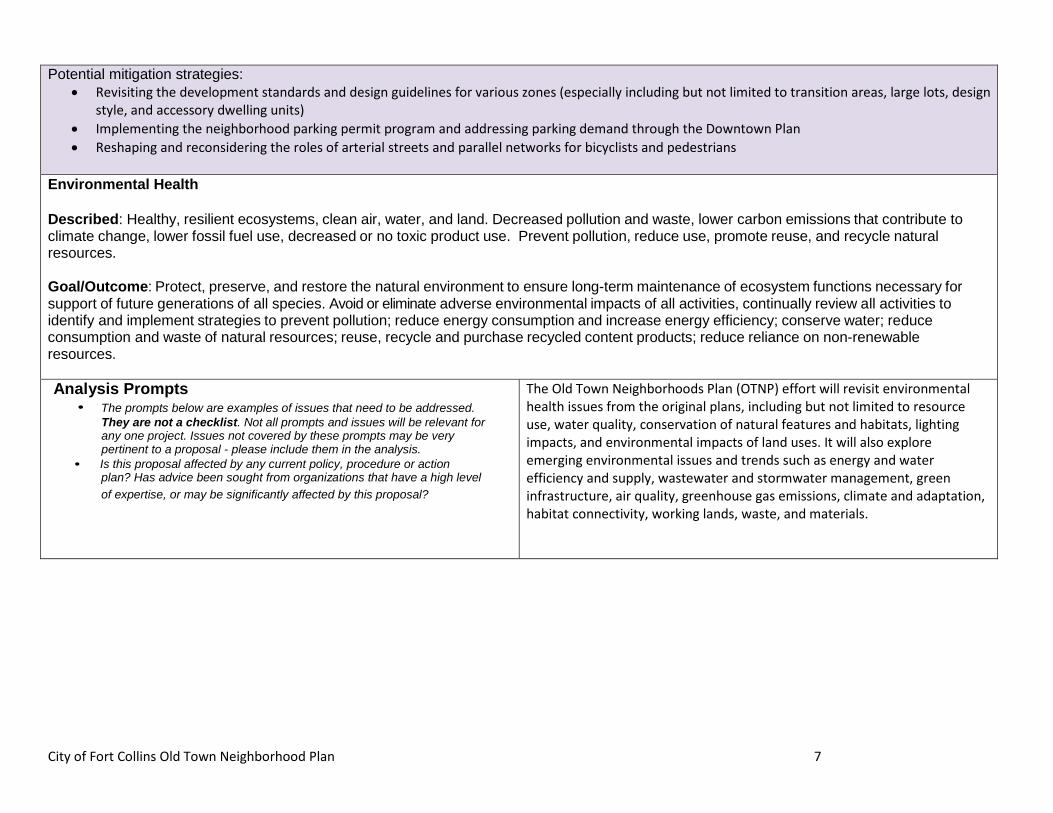
City of Fort Collins Old Town Neighborhood Plan 7
Potential mitigation strategies: • Revisiting the development standards and design guidelines for various zones (especially including but not limited to transition areas, large lots, design
style, and accessory dwelling units) • Implementing the neighborhood parking permit program and addressing parking demand through the Downtown Plan • Reshaping and reconsidering the roles of arterial streets and parallel networks for bicyclists and pedestrians
Environmental Health Described: Healthy, resilient ecosystems, clean air, water, and land. Decreased pollution and waste, lower carbon emissions that contribute to climate change, lower fossil fuel use, decreased or no toxic product use. Prevent pollution, reduce use, promote reuse, and recycle natural resources. Goal/Outcome: Protect, preserve, and restore the natural environment to ensure long-term maintenance of ecosystem functions necessary for support of future generations of all species. Avoid or eliminate adverse environmental impacts of all activities, continually review all activities to identify and implement strategies to prevent pollution; reduce energy consumption and increase energy efficiency; conserve water; reduce consumption and waste of natural resources; reuse, recycle and purchase recycled content products; reduce reliance on non-renewable resources. Analysis Prompts
• The prompts below are examples of issues that need to be addressed. They are not a checklist. Not all prompts and issues will be relevant for any one project. Issues not covered by these prompts may be very pertinent to a proposal - please include them in the analysis.
• Is this proposal affected by any current policy, procedure or action plan? Has advice been sought from organizations that have a high level of expertise, or may be significantly affected by this proposal?
The Old Town Neighborhoods Plan (OTNP) effort will revisit environmental health issues from the original plans, including but not limited to resource use, water quality, conservation of natural features and habitats, lighting impacts, and environmental impacts of land uses. It will also explore emerging environmental issues and trends such as energy and water efficiency and supply, wastewater and stormwater management, green infrastructure, air quality, greenhouse gas emissions, climate and adaptation, habitat connectivity, working lands, waste, and materials.
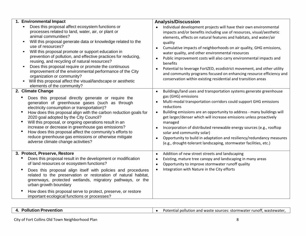
City of Fort Collins Old Town Neighborhood Plan 8
1. Environmental Impact • Does this proposal affect ecosystem functions or
processes related to land, water, air, or plant or animal communities?
• Will this proposal generate data or knowledge related to the use of resources?
• Will this proposal promote or support education in prevention of pollution, and effective practices for reducing, reusing, and recycling of natural resources?
• Does this proposal require or promote the continuous improvement of the environmental performance of the City organization or community?
• Will this proposal affect the visual/landscape or aesthetic elements of the community?
Analysis/Discussion • Individual development projects will have their own environmental
impacts and/or benefits including use of resources, visual/aesthetic elements, effects on natural features and habitats, and water/air quality
• Cumulative impacts of neighborhoods on air quality, GHG emissions, water quality, and other environmental resources
• Public improvement costs will also carry environmental impacts and benefits
• Potential to leverage FortZED, ecodistrict movement, and other utility and community programs focused on enhancing resource efficiency and conservation within existing residential and transition areas
2. Climate Change • Does this proposal directly generate or require the
generation of greenhouse gases (such as through electricity consumption or transportation)?
• How does this proposal align with the carbon reduction goals for 2020 goal adopted by the City Council?
• Will this proposal, or ongoing operations result in an increase or decrease in greenhouse gas emissions?
• How does this proposal affect the community’s efforts to reduce greenhouse gas emissions or otherwise mitigate adverse climate change activities?
• Buildings/land uses and transportation systems generate greenhouse gas (GHG) emissions
• Multi-modal transportation corridors could support GHG emissions reductions
• Building emissions are an opportunity to address - many buildings will get larger/denser which will increase emissions unless proactively managed
• Incorporation of distributed renewable energy sources (e.g., rooftop solar and community solar)
• Opportunity to build in adaptation and resiliency/redundancy measures (e.g., drought-tolerant landscaping, stormwater facilities, etc.)
3. Protect, Preserve, Restore
• Does this proposal result in the development or modification of land resources or ecosystem functions?
• Does this proposal align itself with policies and procedures related to the preservation or restoration of natural habitat, greenways, protected wetlands, migratory pathways, or the urban growth boundary
• How does this proposal serve to protect, preserve, or restore important ecological functions or processes?
• Addition of new street streets and landscaping • Existing, mature tree canopy and landscaping in many areas • Opportunity to improve stormwater runoff quality • Integration with Nature in the City efforts
4. Pollution Prevention • Potential pollution and waste sources: stormwater runoff, wastewater,
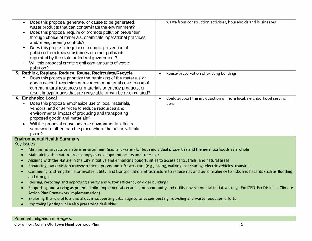
City of Fort Collins Old Town Neighborhood Plan 9
• Does this proposal generate, or cause to be generated, waste products that can contaminate the environment?
• Does this proposal require or promote pollution prevention through choice of materials, chemicals, operational practices and/or engineering controls?
• Does this proposal require or promote prevention of pollution from toxic substances or other pollutants regulated by the state or federal government?
• Will this proposal create significant amounts of waste pollution?
waste from construction activities, households and businesses
5. Rethink, Replace, Reduce, Reuse, Recirculate/Recycle • Does this proposal prioritize the rethinking of the materials or
goods needed, reduction of resource or materials use, reuse of current natural resources or materials or energy products, or result in byproducts that are recyclable or can be re-circulated?
• Reuse/preservation of existing buildings
6. Emphasize Local • Does this proposal emphasize use of local materials,
vendors, and or services to reduce resources and environmental impact of producing and transporting proposed goods and materials?
• Will the proposal cause adverse environmental effects somewhere other than the place where the action will take place?
• Could support the introduction of more local, neighborhood serving uses
Environmental Health Summary Key issues:
• Minimizing impacts on natural environment (e.g., air, water) for both individual properties and the neighborhoods as a whole • Maintaining the mature tree canopy as development occurs and trees age • Aligning with the Nature in the City initiative and enhancing opportunities to access parks, trails, and natural areas • Enhancing low-emission transportation options and infrastructure (e.g., biking, walking, car sharing, electric vehicles, transit) • Continuing to strengthen stormwater, utility, and transportation infrastructure to reduce risk and build resiliency to risks and hazards such as flooding
and drought • Reusing, restoring and improving energy and water efficiency of older buildings • Supporting and serving as potential pilot implementation areas for community and utility environmental initiatives (e.g., FortZED, EcoDistricts, Climate
Action Plan Framework implementation) • Exploring the role of lots and alleys in supporting urban agriculture, composting, recycling and waste reduction efforts • Improving lighting while also preserving dark skies
Potential mitigation strategies:
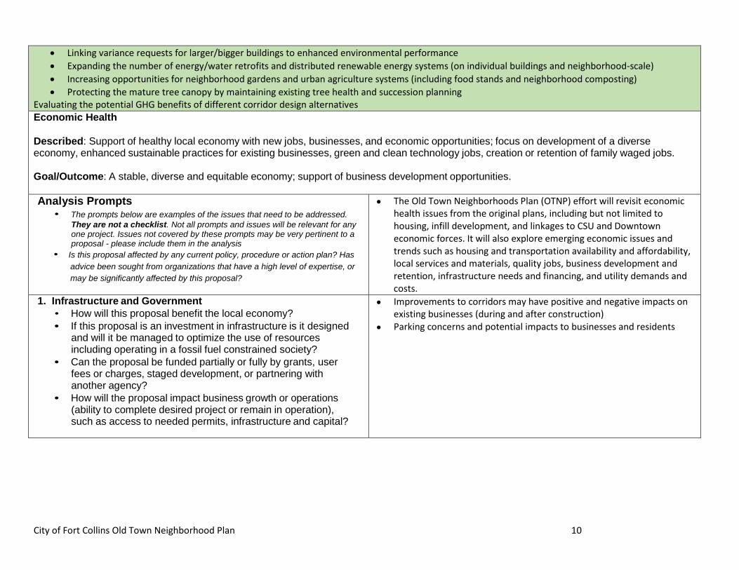
City of Fort Collins Old Town Neighborhood Plan 10
• Linking variance requests for larger/bigger buildings to enhanced environmental performance • Expanding the number of energy/water retrofits and distributed renewable energy systems (on individual buildings and neighborhood-scale) • Increasing opportunities for neighborhood gardens and urban agriculture systems (including food stands and neighborhood composting) • Protecting the mature tree canopy by maintaining existing tree health and succession planning
Evaluating the potential GHG benefits of different corridor design alternatives Economic Health Described: Support of healthy local economy with new jobs, businesses, and economic opportunities; focus on development of a diverse economy, enhanced sustainable practices for existing businesses, green and clean technology jobs, creation or retention of family waged jobs. Goal/Outcome: A stable, diverse and equitable economy; support of business development opportunities. Analysis Prompts
• The prompts below are examples of the issues that need to be addressed. They are not a checklist. Not all prompts and issues will be relevant for any one project. Issues not covered by these prompts may be very pertinent to a proposal - please include them in the analysis
• Is this proposal affected by any current policy, procedure or action plan? Has advice been sought from organizations that have a high level of expertise, or may be significantly affected by this proposal?
• The Old Town Neighborhoods Plan (OTNP) effort will revisit economic health issues from the original plans, including but not limited to housing, infill development, and linkages to CSU and Downtown economic forces. It will also explore emerging economic issues and trends such as housing and transportation availability and affordability, local services and materials, quality jobs, business development and retention, infrastructure needs and financing, and utility demands and costs.
1. Infrastructure and Government • How will this proposal benefit the local economy? • If this proposal is an investment in infrastructure is it designed
and will it be managed to optimize the use of resources including operating in a fossil fuel constrained society?
• Can the proposal be funded partially or fully by grants, user fees or charges, staged development, or partnering with another agency?
• How will the proposal impact business growth or operations (ability to complete desired project or remain in operation), such as access to needed permits, infrastructure and capital?
• Improvements to corridors may have positive and negative impacts on existing businesses (during and after construction)
• Parking concerns and potential impacts to businesses and residents
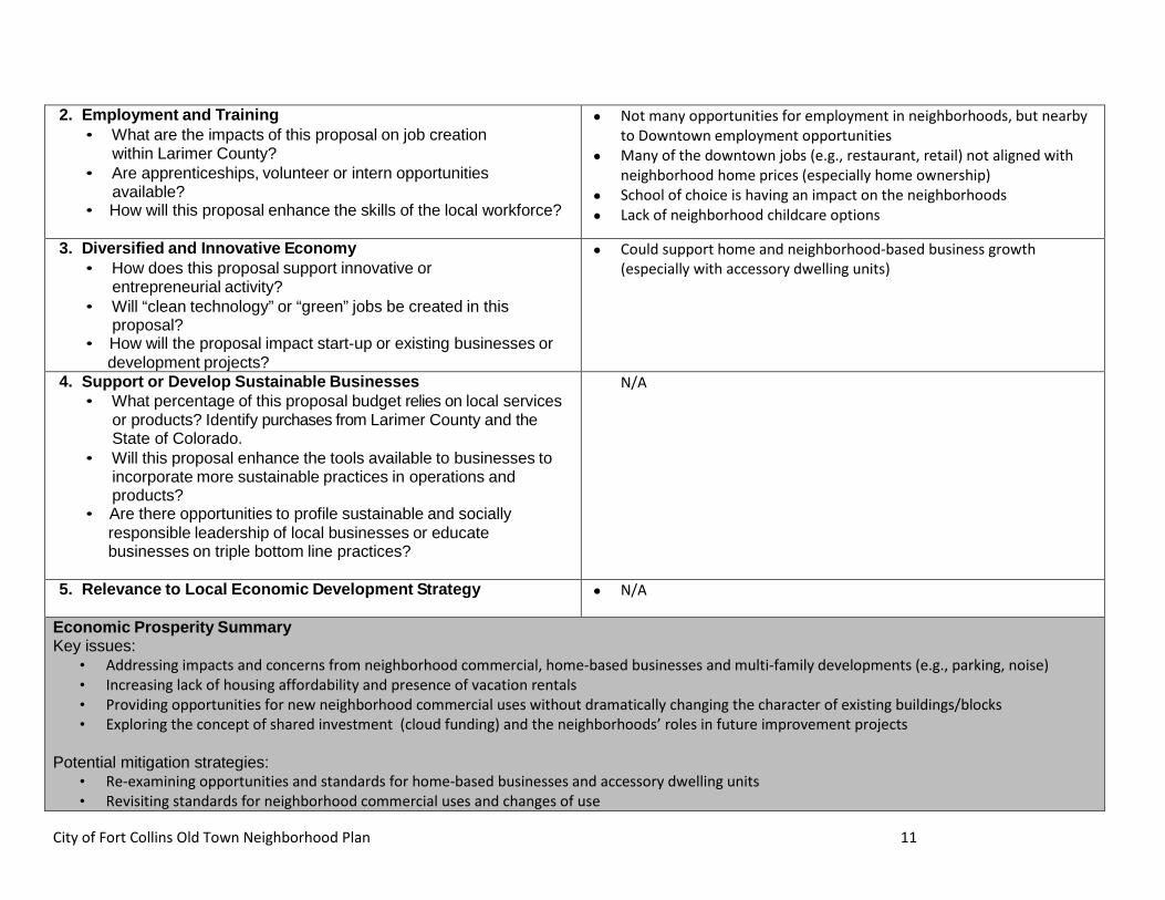
City of Fort Collins Old Town Neighborhood Plan 11
2. Employment and Training • What are the impacts of this proposal on job creation
within Larimer County? • Are apprenticeships, volunteer or intern opportunities
available? • How will this proposal enhance the skills of the local workforce?
• Not many opportunities for employment in neighborhoods, but nearby to Downtown employment opportunities
• Many of the downtown jobs (e.g., restaurant, retail) not aligned with neighborhood home prices (especially home ownership)
• School of choice is having an impact on the neighborhoods • Lack of neighborhood childcare options
3. Diversified and Innovative Economy • How does this proposal support innovative or
entrepreneurial activity? • Will “clean technology” or “green” jobs be created in this
proposal? • How will the proposal impact start-up or existing businesses or development projects?
• Could support home and neighborhood-based business growth (especially with accessory dwelling units)
4. Support or Develop Sustainable Businesses • What percentage of this proposal budget relies on local services
or products? Identify purchases from Larimer County and the State of Colorado.
• Will this proposal enhance the tools available to businesses to incorporate more sustainable practices in operations and products?
• Are there opportunities to profile sustainable and socially responsible leadership of local businesses or educate businesses on triple bottom line practices?
N/A
5. Relevance to Local Economic Development Strategy
• N/A
Economic Prosperity Summary Key issues:
• Addressing impacts and concerns from neighborhood commercial, home-based businesses and multi-family developments (e.g., parking, noise) • Increasing lack of housing affordability and presence of vacation rentals • Providing opportunities for new neighborhood commercial uses without dramatically changing the character of existing buildings/blocks • Exploring the concept of shared investment (cloud funding) and the neighborhoods’ roles in future improvement projects
Potential mitigation strategies:
• Re-examining opportunities and standards for home-based businesses and accessory dwelling units • Revisiting standards for neighborhood commercial uses and changes of use
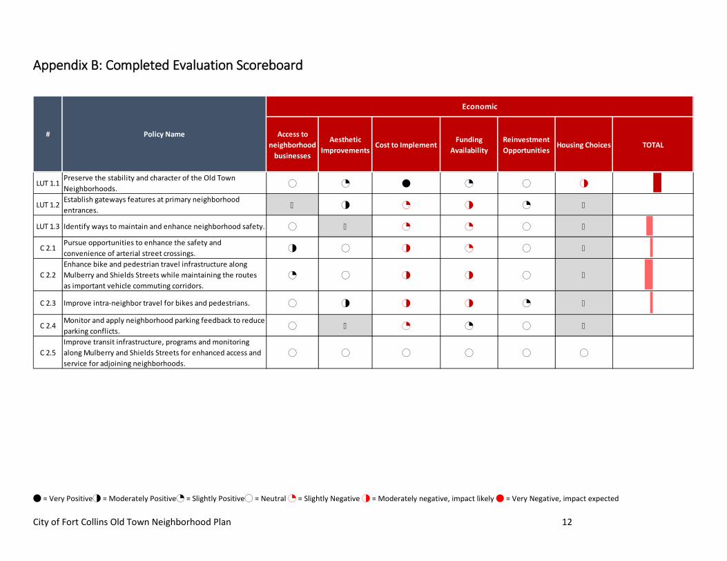
4 = Very Positive2 = Moderately Positive1 = Slightly Positive0 = Neutral 1 = Slightly Negative 2 = Moderately negative, impact likely 4 = Very Negative, impact expected City of Fort Collins Old Town Neighborhood Plan 12
Appendix B: Completed Evaluation Scoreboard
Access to neighborhood
businesses
Aesthetic Improvements
Cost to ImplementFunding
AvailabilityReinvestment Opportunities
Housing Choices TOTAL
LUT 1.1Preserve the stability and character of the Old Town Neighborhoods. 0 1 4 1 0 2
LUT 1.2Establish gateways features at primary neighborhood entrances. X 2 1 2 1 X
LUT 1.3 Identify ways to maintain and enhance neighborhood safety. 0 X 1 1 0 X
C 2.1Pursue opportunities to enhance the safety and convenience of arterial street crossings. 2 0 2 1 0 X
C 2.2Enhance bike and pedestrian travel infrastructure along Mulberry and Shields Streets while maintaining the routes as important vehicle commuting corridors.
1 0 2 2 0 X
C 2.3 Improve intra-neighbor travel for bikes and pedestrians. 0 2 2 2 1 X
C 2.4Monitor and apply neighborhood parking feedback to reduce parking conflicts. 0 X 1 1 0 X
C 2.5Improve transit infrastructure, programs and monitoring along Mulberry and Shields Streets for enhanced access and service for adjoining neighborhoods.
0 0 0 0 0 0
# Policy Name
Economic
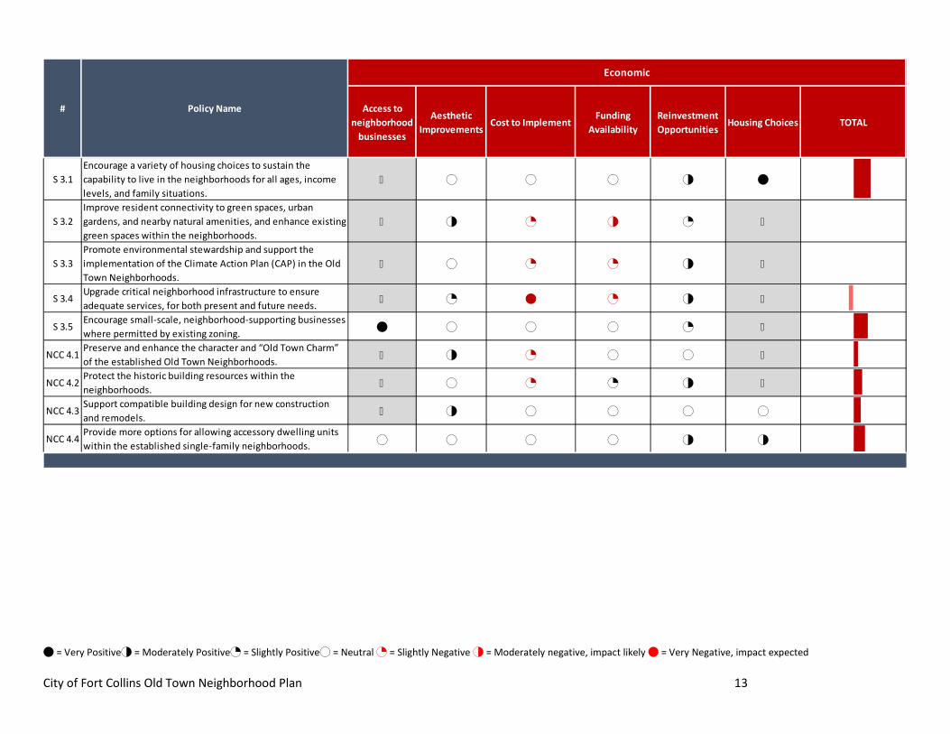
4 = Very Positive2 = Moderately Positive1 = Slightly Positive0 = Neutral 1 = Slightly Negative 2 = Moderately negative, impact likely 4 = Very Negative, impact expected City of Fort Collins Old Town Neighborhood Plan 13
Access to neighborhood
businesses
Aesthetic Improvements
Cost to ImplementFunding
AvailabilityReinvestment Opportunities
Housing Choices TOTAL
S 3.1Encourage a variety of housing choices to sustain the capability to live in the neighborhoods for all ages, income levels, and family situations.
X 0 0 0 2 4
S 3.2Improve resident connectivity to green spaces, urban gardens, and nearby natural amenities, and enhance existing green spaces within the neighborhoods.
X 2 1 2 1 X
S 3.3Promote environmental stewardship and support the implementation of the Climate Action Plan (CAP) in the Old Town Neighborhoods.
X 0 1 1 2 X
S 3.4Upgrade critical neighborhood infrastructure to ensure adequate services, for both present and future needs. X 1 4 1 2 X
S 3.5Encourage small-scale, neighborhood-supporting businesses where permitted by existing zoning. 4 0 0 0 1 X
NCC 4.1Preserve and enhance the character and “Old Town Charm” of the established Old Town Neighborhoods. X 2 1 0 0 X
NCC 4.2Protect the historic building resources within the neighborhoods. X 0 1 1 2 X
NCC 4.3Support compatible building design for new construction and remodels. X 2 0 0 0 0
NCC 4.4Provide more options for allowing accessory dwelling units within the established single-family neighborhoods. 0 0 0 0 2 2
# Policy Name
Economic
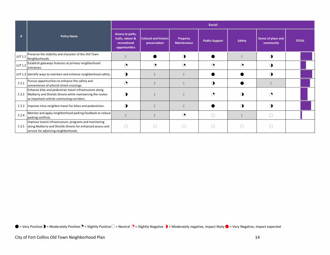
4 = Very Positive2 = Moderately Positive1 = Slightly Positive0 = Neutral 1 = Slightly Negative 2 = Moderately negative, impact likely 4 = Very Negative, impact expected City of Fort Collins Old Town Neighborhood Plan 14
Access to parks, trails, nature &
recreational opportunities
Cultural and historic preservation
Property Maintenance
Public Support SafetySense of place and
communityTOTAL
LUT 1.1Preserve the stability and character of the Old Town Neighborhoods. X 4 2 4 X 2
LUT 1.2Establish gateways features at primary neighborhood entrances. 1 1 1 1 1 2
LUT 1.3 Identify ways to maintain and enhance neighborhood safety. 2 X X 4 4 2
C 2.1Pursue opportunities to enhance the safety and convenience of arterial street crossings. 1 X X 2 4 X
C 2.2Enhance bike and pedestrian travel infrastructure along Mulberry and Shields Streets while maintaining the routes as important vehicle commuting corridors.
2 X X 1 2 1
C 2.3 Improve intra-neighbor travel for bikes and pedestrians. 2 X X 4 2 2
C 2.4Monitor and apply neighborhood parking feedback to reduce parking conflicts. X X 1 0 X 0
C 2.5Improve transit infrastructure, programs and monitoring along Mulberry and Shields Streets for enhanced access and service for adjoining neighborhoods.
0 0 0 0 0 0
# Policy Name
Social
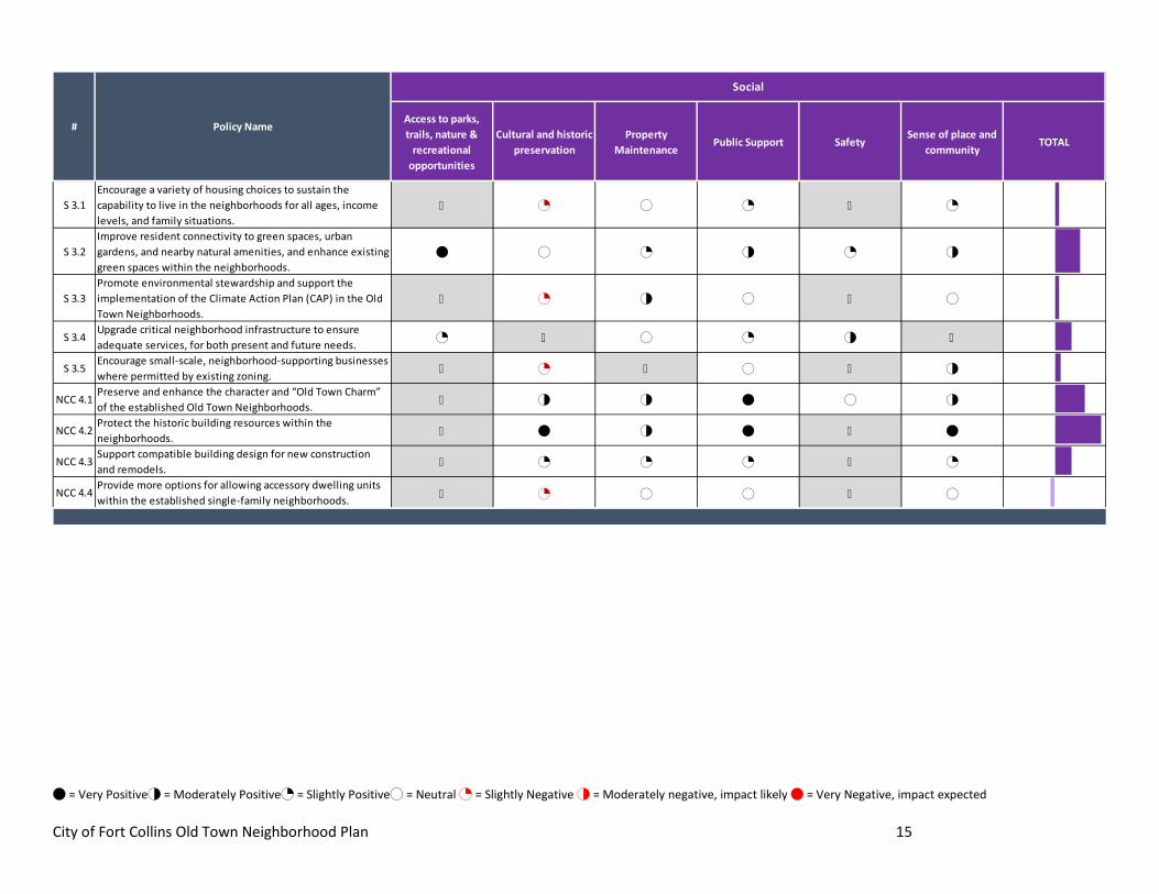
4 = Very Positive2 = Moderately Positive1 = Slightly Positive0 = Neutral 1 = Slightly Negative 2 = Moderately negative, impact likely 4 = Very Negative, impact expected City of Fort Collins Old Town Neighborhood Plan 15
Access to parks, trails, nature &
recreational opportunities
Cultural and historic preservation
Property Maintenance
Public Support SafetySense of place and
communityTOTAL
S 3.1Encourage a variety of housing choices to sustain the capability to live in the neighborhoods for all ages, income levels, and family situations.
X 1 0 1 X 1
S 3.2Improve resident connectivity to green spaces, urban gardens, and nearby natural amenities, and enhance existing green spaces within the neighborhoods.
4 0 1 2 1 2
S 3.3Promote environmental stewardship and support the implementation of the Climate Action Plan (CAP) in the Old Town Neighborhoods.
X 1 2 0 X 0
S 3.4Upgrade critical neighborhood infrastructure to ensure adequate services, for both present and future needs. 1 X 0 1 2 X
S 3.5Encourage small-scale, neighborhood-supporting businesses where permitted by existing zoning. X 1 X 0 X 2
NCC 4.1Preserve and enhance the character and “Old Town Charm” of the established Old Town Neighborhoods. X 2 2 4 0 2
NCC 4.2Protect the historic building resources within the neighborhoods. X 4 2 4 X 4
NCC 4.3Support compatible building design for new construction and remodels. X 1 1 1 X 1
NCC 4.4Provide more options for allowing accessory dwelling units within the established single-family neighborhoods. X 1 0 0 X 0
# Policy Name
Social
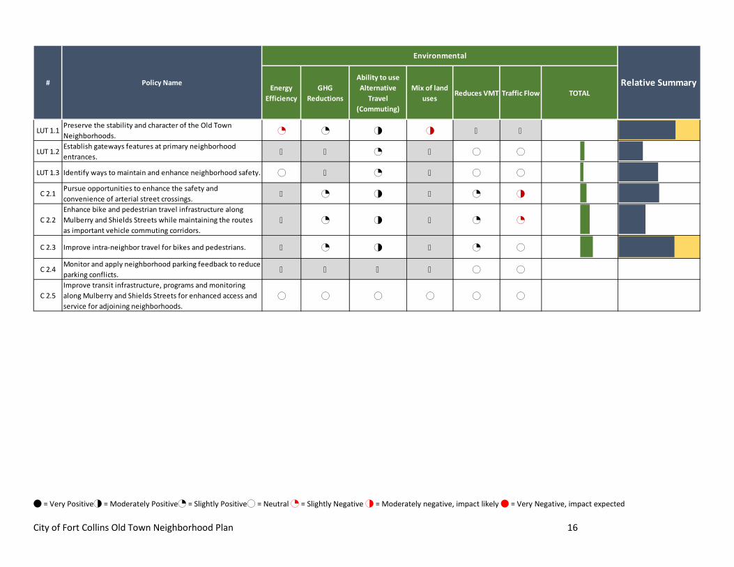
4 = Very Positive2 = Moderately Positive1 = Slightly Positive0 = Neutral 1 = Slightly Negative 2 = Moderately negative, impact likely 4 = Very Negative, impact expected City of Fort Collins Old Town Neighborhood Plan 16
Energy Efficiency
GHG Reductions
Ability to use Alternative
Travel (Commuting)
Mix of land uses
Reduces VMT Traffic Flow TOTAL
LUT 1.1Preserve the stability and character of the Old Town Neighborhoods. 1 1 2 2 X X
LUT 1.2Establish gateways features at primary neighborhood entrances. X X 1 X 0 0
LUT 1.3 Identify ways to maintain and enhance neighborhood safety. 0 X 1 X 0 0
C 2.1Pursue opportunities to enhance the safety and convenience of arterial street crossings. X 1 2 X 1 2
C 2.2Enhance bike and pedestrian travel infrastructure along Mulberry and Shields Streets while maintaining the routes as important vehicle commuting corridors.
X 1 2 X 1 1
C 2.3 Improve intra-neighbor travel for bikes and pedestrians. X 1 2 X 1 0
C 2.4Monitor and apply neighborhood parking feedback to reduce parking conflicts. X X X X 0 0
C 2.5Improve transit infrastructure, programs and monitoring along Mulberry and Shields Streets for enhanced access and service for adjoining neighborhoods.
0 0 0 0 0 0
Relative Summary# Policy Name
Environmental
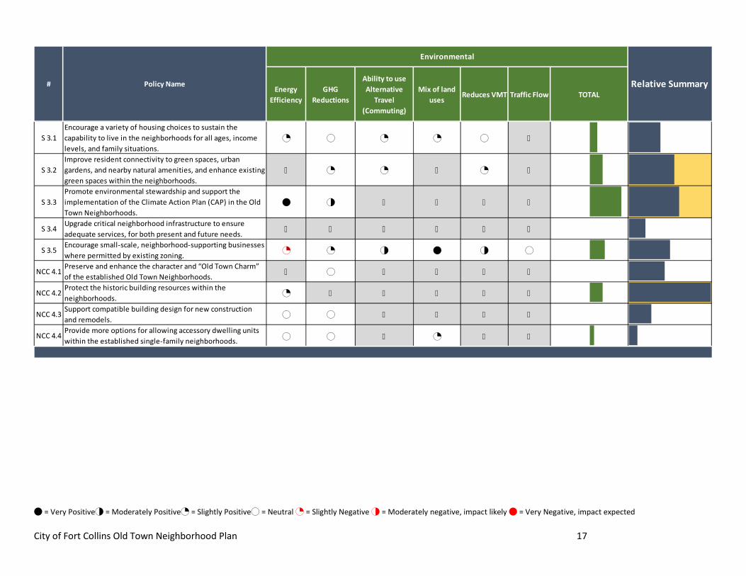
4 = Very Positive2 = Moderately Positive1 = Slightly Positive0 = Neutral 1 = Slightly Negative 2 = Moderately negative, impact likely 4 = Very Negative, impact expected City of Fort Collins Old Town Neighborhood Plan 17
Energy Efficiency
GHG Reductions
Ability to use Alternative
Travel (Commuting)
Mix of land uses
Reduces VMT Traffic Flow TOTAL
S 3.1Encourage a variety of housing choices to sustain the capability to live in the neighborhoods for all ages, income levels, and family situations.
1 0 1 1 0 X
S 3.2Improve resident connectivity to green spaces, urban gardens, and nearby natural amenities, and enhance existing green spaces within the neighborhoods.
X 1 1 X 1 X
S 3.3Promote environmental stewardship and support the implementation of the Climate Action Plan (CAP) in the Old Town Neighborhoods.
4 2 X X X X
S 3.4Upgrade critical neighborhood infrastructure to ensure adequate services, for both present and future needs. X X X X X X
S 3.5Encourage small-scale, neighborhood-supporting businesses where permitted by existing zoning. 1 1 2 4 2 0
NCC 4.1Preserve and enhance the character and “Old Town Charm” of the established Old Town Neighborhoods. X 0 X X X X
NCC 4.2Protect the historic building resources within the neighborhoods. 1 X X X X X
NCC 4.3Support compatible building design for new construction and remodels. 0 0 X X X X
NCC 4.4Provide more options for allowing accessory dwelling units within the established single-family neighborhoods. 0 0 X 1 X X
Relative Summary# Policy Name
Environmental

APPENDIX D
Neighborhood Construction Update
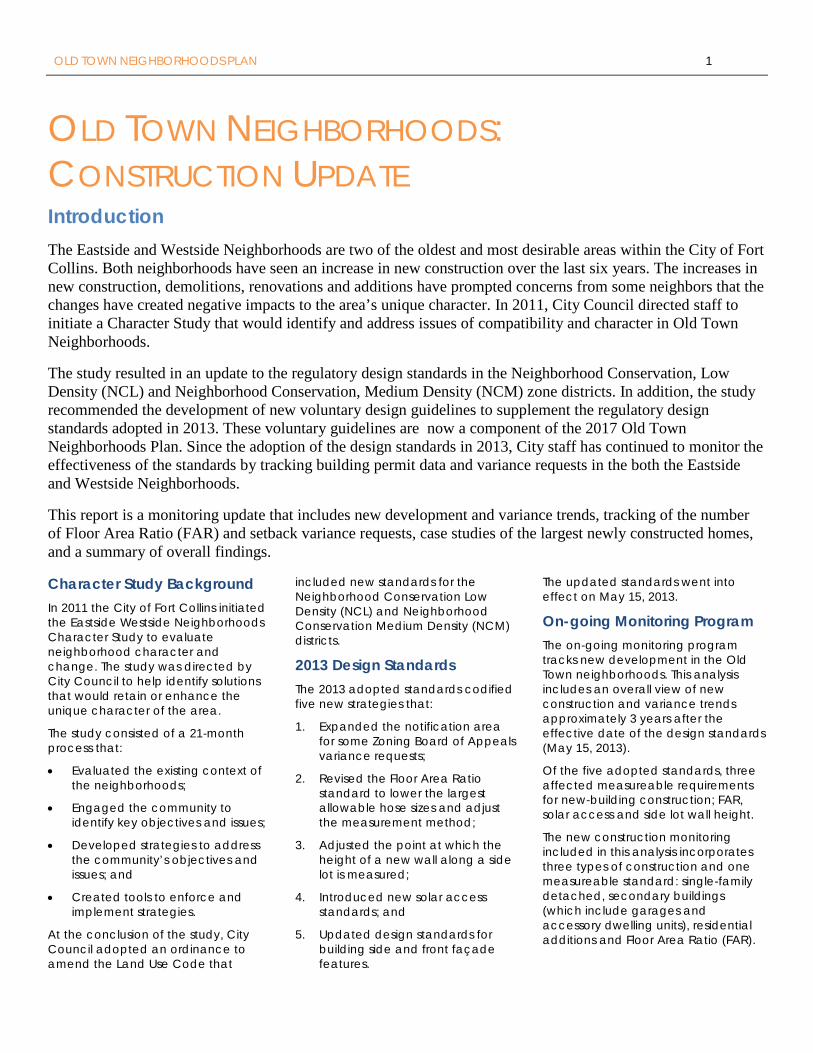
OLD TOWN NEIGHBORHOODS PLAN 1
OLD TOWN NEIGHBORHOODS: CONSTRUCTION UPDATE Introduction The Eastside and Westside Neighborhoods are two of the oldest and most desirable areas within the City of Fort Collins. Both neighborhoods have seen an increase in new construction over the last six years. The increases in new construction, demolitions, renovations and additions have prompted concerns from some neighbors that the changes have created negative impacts to the area’s unique character. In 2011, City Council directed staff to initiate a Character Study that would identify and address issues of compatibility and character in Old Town Neighborhoods.
The study resulted in an update to the regulatory design standards in the Neighborhood Conservation, Low Density (NCL) and Neighborhood Conservation, Medium Density (NCM) zone districts. In addition, the study recommended the development of new voluntary design guidelines to supplement the regulatory design standards adopted in 2013. These voluntary guidelines are now a component of the 2017 Old Town Neighborhoods Plan. Since the adoption of the design standards in 2013, City staff has continued to monitor the effectiveness of the standards by tracking building permit data and variance requests in the both the Eastside and Westside Neighborhoods.
This report is a monitoring update that includes new development and variance trends, tracking of the number of Floor Area Ratio (FAR) and setback variance requests, case studies of the largest newly constructed homes, and a summary of overall findings.
Character Study Background In 2011 the City of Fort Collins initiated the Eastside Westside Neighborhoods Character Study to evaluate neighborhood character and change. The study was directed by City Council to help identify solutions that would retain or enhance the unique character of the area.
The study consisted of a 21-month process that:
• Evaluated the existing context of the neighborhoods;
• Engaged the community to identify key objectives and issues;
• Developed strategies to address the community’s objectives and issues; and
• Created tools to enforce and implement strategies.
At the conclusion of the study, City Council adopted an ordinance to amend the Land Use Code that
included new standards for the Neighborhood Conservation Low Density (NCL) and Neighborhood Conservation Medium Density (NCM) districts.
2013 Design Standards The 2013 adopted standards codified five new strategies that:
1. Expanded the notification area for some Zoning Board of Appeals variance requests;
2. Revised the Floor Area Ratio standard to lower the largest allowable hose sizes and adjust the measurement method;
3. Adjusted the point at which the height of a new wall along a side lot is measured;
4. Introduced new solar access standards; and
5. Updated design standards for building side and front façade features.
The updated standards went into effect on May 15, 2013.
On-going Monitoring Program The on-going monitoring program tracks new development in the Old Town neighborhoods. This analysis includes an overall view of new construction and variance trends approximately 3 years after the effective date of the design standards (May 15, 2013).
Of the five adopted standards, three affected measureable requirements for new-building construction; FAR, solar access and side lot wall height.
The new construction monitoring included in this analysis incorporates three types of construction and one measureable standard: single-family detached, secondary buildings (which include garages and accessory dwelling units), residential additions and Floor Area Ratio (FAR).
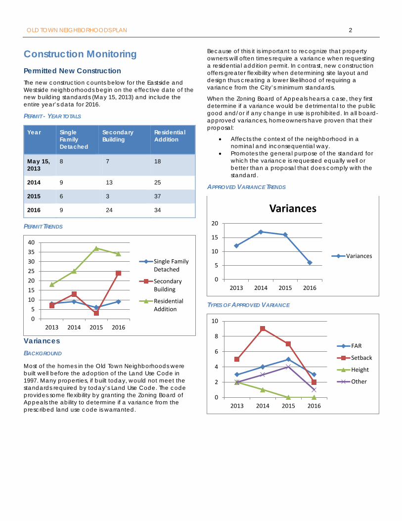
OLD TOWN NEIGHBORHOODS PLAN 2
Construction Monitoring Permitted New Construction The new construction counts below for the Eastside and Westside neighborhoods begin on the effective date of the new building standards (May 15, 2013) and include the entire year’s data for 2016.
PERMIT - YEAR TOTALS
Year Single Family Detached
Secondary Building
Residential Addition
May 15, 2013
8 7 18
2014 9 13 25
2015 6 3 37
2016 9 24 34
PERMIT TRENDS
Variances BACKGROUND
Most of the homes in the Old Town Neighborhoods were built well before the adoption of the Land Use Code in 1997. Many properties, if built today, would not meet the standards required by today’s Land Use Code. The code provides some flexibility by granting the Zoning Board of Appeals the ability to determine if a variance from the prescribed land use code is warranted.
Because of this it is important to recognize that property owners will often times require a variance when requesting a residential addition permit. In contrast, new construction offers greater flexibility when determining site layout and design thus creating a lower likelihood of requiring a variance from the City’s minimum standards.
When the Zoning Board of Appeals hears a case, they first determine if a variance would be detrimental to the public good and/or if any change in use is prohibited. In all board-approved variances, homeowners have proven that their proposal:
• Affects the context of the neighborhood in a nominal and inconsequential way.
• Promotes the general purpose of the standard for which the variance is requested equally well or better than a proposal that does comply with the standard.
APPROVED VARIANCE TRENDS
TYPES OF APPROVED VARIANCE
05
10152025303540
2013 2014 2015 2016
Single FamilyDetached
SecondaryBuilding
ResidentialAddition
0
5
10
15
20
2013 2014 2015 2016
Variances
Variances
0
2
4
6
8
10
2013 2014 2015 2016
FAR
Setback
Height
Other
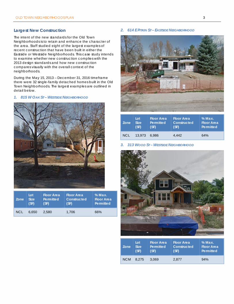
OLD TOWN NEIGHBORHOODS PLAN 3
Largest New Construction The intent of the new standards for the Old Town Neighborhoods is to retain and enhance the character of the area. Staff studied eight of the largest examples of recent construction that have been built in either the Eastside or Westside Neighborhoods. This case study intends to examine whether new construction complies with the 2013 design standards and how new construction compares visually with the overall context of the neighborhoods.
During the May 15, 2013 – December 31, 2016 timeframe there were 32 single-family detached homes built in the Old Town Neighborhoods. The largest examples are outlined in detail below.
1. 815 W OAK ST – WESTSIDE NEIGHBORHOOD
Zone Lot Size (SF)
Floor Area Permitted (SF)
Floor Area Constructed (SF)
% Max. Floor Area Permitted
NCL 6,650 2,580 1,706 66%
2. 614 E PITKIN ST – EASTSIDE NEIGHBORHOOD
Zone Lot Size (SF)
Floor Area Permitted (SF)
Floor Area Constructed (SF)
% Max. Floor Area Permitted
NCL 13,973 6,986 4,442 64%
3. 313 WOOD ST – WESTSIDE NEIGHBORHOOD
Zone Lot Size (SF)
Floor Area Permitted (SF)
Floor Area Constructed (SF)
% Max. Floor Area Permitted
NCM 8,275 3,069 2,877 94%
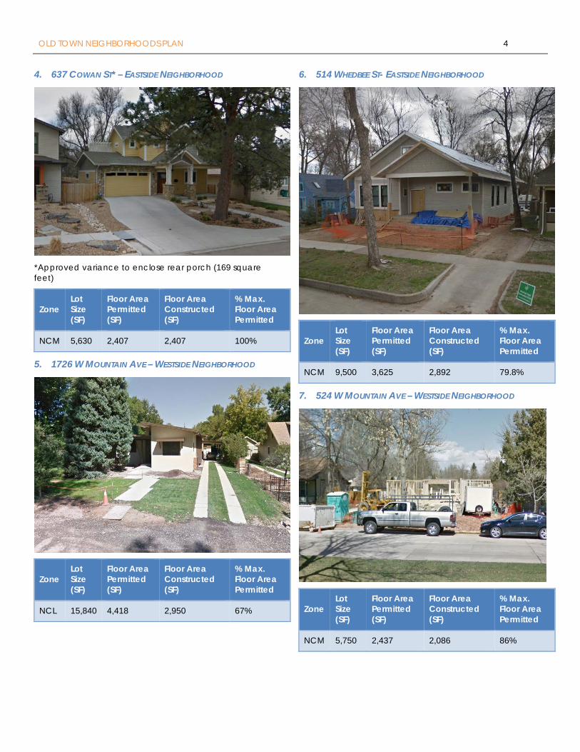
OLD TOWN NEIGHBORHOODS PLAN 4
4. 637 COWAN ST* – EASTSIDE NEIGHBORHOOD
*Approved variance to enclose rear porch (169 square feet)
Zone Lot Size (SF)
Floor Area Permitted (SF)
Floor Area Constructed (SF)
% Max. Floor Area Permitted
NCM 5,630 2,407 2,407 100%
5. 1726 W MOUNTAIN AVE – WESTSIDE NEIGHBORHOOD
Zone Lot Size (SF)
Floor Area Permitted (SF)
Floor Area Constructed (SF)
% Max. Floor Area Permitted
NCL 15,840 4,418 2,950 67%
6. 514 WHEDBEE ST- EASTSIDE NEIGHBORHOOD
Zone Lot Size (SF)
Floor Area Permitted (SF)
Floor Area Constructed (SF)
% Max. Floor Area Permitted
NCM 9,500 3,625 2,892 79.8%
7. 524 W MOUNTAIN AVE – WESTSIDE NEIGHBORHOOD
Zone Lot Size (SF)
Floor Area Permitted (SF)
Floor Area Constructed (SF)
% Max. Floor Area Permitted
NCM 5,750 2,437 2,086 86%
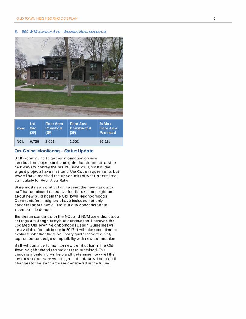
OLD TOWN NEIGHBORHOODS PLAN 5
8. 900 W MOUNTAIN AVE – WESTSIDE NEIGHBORHOOD
Zone Lot Size (SF)
Floor Area Permitted (SF)
Floor Area Constructed (SF)
% Max. Floor Area Permitted
NCL 6,758 2,601 2,562 97.1%
On-Going Monitoring - Status Update Staff is continuing to gather information on new construction projects in the neighborhoods and assess the best ways to portray the results. Since 2013, most of the largest projects have met Land Use Code requirements, but several have reached the upper limits of what is permitted, particularly for Floor Area Ratio.
While most new construction has met the new standards, staff has continued to receive feedback from neighbors about new buildings in the Old Town Neighborhoods. Comments from neighbors have included not only concerns about overall size, but also concerns about incompatible design.
The design standards for the NCL and NCM zone districts do not regulate design or style of construction. However, the updated Old Town Neighborhoods Design Guidelines will be available for public use in 2017. It will take some time to evaluate whether these voluntary guidelines effectively support better design compatibility with new construction.
Staff will continue to monitor new construction in the Old Town Neighborhoods as projects are submitted. This ongoing monitoring will help staff determine how well the design standards are working, and the data will be used if changes to the standards are considered in the future.


